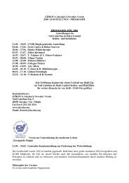
Step by Step - Die Freunde von Gökova-Akyaka
Step by Step - Die Freunde von Gökova-Akyaka
Step by Step - Die Freunde von Gökova-Akyaka

You also want an ePaper? Increase the reach of your titles
YUMPU automatically turns print PDFs into web optimized ePapers that Google loves.
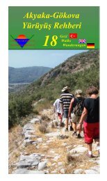
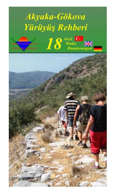
<strong>Akyaka</strong>-Gökova<br />
Yürüyüþ Rehberi<br />
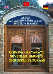
GÖKOVA-AKYAKA’YI<br />
SEVENLER DERNEÐÝ<br />
18<br />
Gezi<br />
Walks<br />
Wanderungen
Yayýmlayan<br />
Gökova-<strong>Akyaka</strong>yý Sevenler Derneði<br />
Nail Çakýrhan Sok. 9 <strong>Akyaka</strong>/ULA<br />
www.akyaka.org<br />
dernek@akyaka.org<br />
Metinler<br />
Mustafa Ateþ, Mehmet Bildirici, Bahar Suseven<br />
Ýngilizce Çeviriler<br />
Hale Ottolini<br />
Almanca Çeviriler<br />
Ýrene Cantez<br />
Redaksiyon<br />
Nurhan Kavuzlu, Jane Patterson, Thomas Schmitz<br />
Harita ve Krokiler<br />
Mustafa Ateþ, Jane Patterson, Thomas Schmitz<br />
Grafikler<br />
Svetlana Ýnaç, Zühra Kýrýmgeri,<br />
Dineke Mühürdaroðlu, Bahar Suseven<br />
Kapak Fotoðrafý<br />
Thomas Schmitz<br />
Yayýn Hazýrlýk<br />
Thomas Schmitz<br />
Baský<br />
Esin Ofset, Muðla<br />
Telefon: 214 1024<br />
Ýlk Baský<br />
Þubat 2005, 5000 adet<br />
ISBN: 975-98483-0-9<br />
Tüm haklarý Gökova-<strong>Akyaka</strong>’yý Sevenler Derneði’ne<br />
aittir
English Part<br />
Illustrations in the English part:<br />
Zühra Kýrýmgeri and Dineke Mühürdaroðlu<br />
For their contribution to this booklet we want to thank:<br />
Aziz Albek, Adnan Anakök, Salih Armutçuoðlu, Kemal Aþýk, Cengiz<br />
Atasoy, Mehmet Bildirici, Ahmet Çalca, Cengiz Çapkýn, Ýrene Cantez,<br />
Hüseyin Ersoy, Selçuk Ýnaç, Svetlana Ýnaç, Nurhan Kavuzlu, Zühra<br />
Kýrýmgeri, Dineke Mühürdaroðlu, Hale Ottolini, Jane Patterson, Eyüp<br />
Þahin, Ali Þahin, Bahar Suseven
Walk with an open mind!<br />
(Some proposals…)<br />
Your holiday can make a real difference to your destination. It can<br />
help protect the natural environment, traditions and culture – the<br />
things that make your visit special.<br />
Using public transport, bicycles and walking are environmentally<br />
friendly alternatives and a great way of meeting local people.<br />
Interact with locals in a culturally appropriate manner (e.g.: do<br />
not go walking in rural areas wearing shorts, bathing costumes etc.).<br />
Ask permission before taking photographs of people or their homes<br />
and don’t be offended if they decline.<br />
Respect the environment and do not cause unnecessary<br />
disturbances.<br />
Do not flush, approach or even try to catch birds or other wildlife,<br />
enjoy the sight from far <strong>by</strong> using binoculars. Leave bird nests<br />
untouched.<br />
Don’t brake twigs, pick flowers or other plants, seashells and<br />
archeological remnants (strictly forbidden and prosecuted!). Leave<br />
them for others to enjoy. Avoid waste <strong>by</strong> taking packing back home,<br />
have your own water bottle with you and do not throw used batteries.<br />
Ensure proper disposal of human waste<br />
Fire is a serious hazard. Be extremely careful with cigarettes and<br />
matches and take your cigarette stubs with you.<br />
If you leave ways or footpaths, be aware that you may walk on<br />
planted fields. Trampling seeds or plants may cause hazards for the<br />
farmers.<br />
Be careful not to pollute cisterns. They are mostly still used and<br />
not swimmingpools.<br />
Thank you...<br />
You can start enjoying your holiday before you go <strong>by</strong> doing some<br />
background reading on the people and places you’ll be visiting. Your<br />
welcome will be warmer if you take an interest.<br />
Try www.akyaka.org for a start!<br />
32
Foreword<br />
What does living in <strong>Akyaka</strong> mean for us It means to see its beauties,<br />
to be aware of nature and to live with it. Besides that we consider it our<br />
duty to work for it and engage ourselves in the protection of it. And we try<br />
to fulfill this task as a human being, a resident of <strong>Akyaka</strong> and as a member<br />
of the association.<br />
We noticed that many people share the same values; they like to walk,<br />
enjoy the nature of the Gökova basin and they see its beauty. They walked<br />
with us; together we set out to discover the area. That is how the idea for<br />
this guidebook developed and we saw that these people do not only want<br />
to walk, but also to work and share their ideas with us and thus, with the<br />
participation of members and non-members alike the book you are holding<br />
became a real team product.<br />
This group has contributed to this book with the dust on their feet, the<br />
ink on their fingers, time spent on computers, compass in their hands and<br />
with walking under all weather, rain or shine.<br />
With this guidebook, we want to let you feel that in the Gökova area<br />
the main merits are not sea and beach or other summer tourism activities,<br />
but other values for those who want to be more active, who want to walk<br />
and benefit directly from nature.<br />
With the hope that we fulfilled this ambition and will be able to realize<br />
future projects in the same warm atmosphere I want to express my sincere<br />
gratitude, respect and affection to all participants.<br />
Bahar Suseven<br />
(Heike Thol-Schmitz)<br />
Chair of the Association<br />
of the Friends of Gökova-<strong>Akyaka</strong><br />
33
Contents<br />
Walk with an open mind! .................................. 32<br />
Foreword ............................................................ 33<br />
To begin with… .................................................. 35<br />
From Idyma to Gökova-<strong>Akyaka</strong> ....................... 36<br />
Birdwatching in the Area .................................. 38<br />
Forest Walk ........................................................ 40<br />
Ýniþdibi ............................................................... 41<br />
Bird Walk ........................................................... 42<br />
Along the Coast.................................................. 43<br />
Turnalý Walk ...................................................... 44<br />
Stork Walk .......................................................... 45<br />
Village Walk ....................................................... 46<br />
Sakar Tepe.......................................................... 47<br />
Çalca Crest ......................................................... 48<br />
Gökçe Waterfall ................................................. 48<br />
Hayýtlý Hill ......................................................... 50<br />
Domuzbelen ....................................................... 51<br />
Haþimbahçesi..................................................... 52<br />
Týrnaklý Walk ..................................................... 53<br />
Papazlýk Valley ................................................... 54<br />
Ýdyma Acropolis ................................................. 55<br />
Antique Road ..................................................... 56<br />
Canyon Trek....................................................... 57<br />
34
To begin with…<br />
Up to now an alternative to beach and sea has never been proposed to<br />
visitors or people living in our area, despite the fact that this region with<br />
its beautiful nature only waits to be discovered. The Gökova basin offers<br />
a home for about 200 bird, 25 mammal and 30 reptile species recorded<br />
up to date. Species like White-breasted Kingfisher, European Otter and<br />
Cormorant are also living here, some of them are globally protected.<br />
Besides that we have woods of endemic Incense Trees (Liquidambar<br />
orientalis) of which world wide only 3000 hectares remain.<br />
In addition we know that the region has been populated for at least<br />
2600 years <strong>by</strong> the Karians and that Alexander the Great and Suleyman<br />
the Magnificent passed through here. How many visitors notice the near<br />
<strong>by</strong> Medieval castle or the rock tombs How many people know about the<br />
‘Týrnaklý’ footpath that once connected the villages of <strong>Akyaka</strong> and<br />
Kuyucak Even locals have forgotten about it. Or the much neglected and<br />
thus heavily damaged but still used ‘Ancient Road’<br />
We, the Association of the Friends of Gökova-<strong>Akyaka</strong>, have prepared<br />
this guidebook to introduce natural and cultural richness to our visitors<br />
and to promote sustainable tourism as a part of the Bio-Gökova Project,<br />
funded <strong>by</strong> the UNDP/GEF Small Grants Programme.<br />
The guidebook contains walks of various difficulty levels. All walks<br />
have been tried out and explained in detail <strong>by</strong> us. The set times are average<br />
walking times from <strong>Akyaka</strong> and back.<br />
Especially for walks with a ‘difficult’ grading, we advise to hire a<br />
guide. For some roads we also suggested to use a bicycle, however, even<br />
these roads sometimes get steep and difficult. They might get particularly<br />
muddy in winter due to rainfalls.<br />
Already existing guidebooks have been generally prepared to introduce<br />
the Muðla Region. We, in contrary have developed this book for our<br />
vicinity as a possible alternative source. This guidebook has been a team<br />
product from the first idea up to its publication.<br />
Any water source mentioned in the book can be dry next year or a<br />
path might get completely unusable. We hope to be able to include these<br />
changes in future editions. Therefore, we would like you, the users of this<br />
guidebook, to forward any criticism and your recommendations to us.<br />
As much as we want you to get<br />
somewhere, as much do we want to<br />
inspire you to take to the road and<br />
walk. We believe that each of you<br />
will discover different wonders<br />
on the same road. We invite you<br />
to be more than a spectator, but<br />
to get to know the life and life<br />
style of the region you are<br />
visiting and to establish an<br />
organic relationship with them.<br />
There are many more roads to walk on...<br />
35
From Idyma to Gökova-<strong>Akyaka</strong><br />
A brief history of the area and its environment<br />
The Karian City of Idyma<br />
In the area, in which today’s <strong>Akyaka</strong> is situated, the city of Idyma was<br />
founded. The settlement of Idyma extended east of today’s <strong>Akyaka</strong> up to<br />
the village of Gökova (3km) and the quarters of Iniþdibi and Yazýlýtaþ up<br />
to the port which was near<strong>by</strong> the forest. The old rock graves show that<br />
Iniþdibi and the Medieval castle in the proximity are very old settlement<br />
areas. It is proven that the castle has been inhibitated from the Antique up<br />
to Medieval times but been abandoned at an unknown date. The Byzantine<br />
castle, also mentioned as Ceneviz castle is well worth a restoration. From<br />
the castle an underground tunnel leads to the south banks of the Kadýn<br />
Azmaðý. The Nekropolis (rock tombs) and the Akropolis are situated on<br />
the mountain-slopes of Gökova.<br />
Idyma was founded as a Karian city. The name is origined from the<br />
Karian language. The area, where Muðla is today, has been the South of<br />
Karia. The Karians were the earliest known settlers of the area. Their<br />
customs and way of life are known but, since no documents have been<br />
found, the Karian language remains unsolved.<br />
In 546 B.C. the Persian army conquered the area under the command<br />
of Harpages. Under Persian rule the customs and the religion remained<br />
unchanged.<br />
Between 484 and 405 B.C. the federation of Delos under the leadership<br />
of Athens took over the administration. Idyma too, was affected <strong>by</strong><br />
that. Idyma is already mentioned in the tax lists of the years 453 - 452<br />
B.C. . These are the earliest document concerning the city of Idyma.<br />
Additionally a leader named Paktyes is reported. It is assumed that the<br />
city has been governed for a long time <strong>by</strong> the family of Paktyes.<br />
The city minted coins: one side showed Iaimion (Idymion), the other<br />
side the head of a young man (Pan). It is a well known fact that the cult of<br />
Pan, the god of the shepards, has been of great importance in the region.<br />
The federation of Delos ended in 405 B.C., Idyma separated already<br />
around 440 B.C. from this federation.<br />
The Spartan rule began. The Spartan general Lysandros destroyed the<br />
city Cedrai (Sedir Island) in 405 B.C.<br />
Idyma under the rule of Halikarnassos (Bodrum)<br />
Between 387 - 334 B.C. the Persians regained the leadership in the<br />
area. King Mausolos of Halikarnassos (377-353 B.C.) maintained good<br />
contacts with the Persians and governed as a free king. He changed the<br />
capital from Milas to Bodrum. Idyma was situated in the east of his<br />
kingdom.<br />
This era ended, when Alexander the Great with his army penetrated<br />
the area. It is known that fortresses in Thera and Callipolis existed at this<br />
time.<br />
36
Idyma in Hellenistic Time<br />
With Alexander the Great the Hellenistic period began in Anatolia<br />
and the Near East. Greek culture and language spread rapidly. The<br />
area had a difficult time from 334 B.C. on until the peace agreement of<br />
Apama was reached in 189 B.C.. A variety of contradictory Hellenic<br />
governments lead to confusion in the region.<br />
Idyma and the Influence of Rhodes<br />
In the 3 rd century B.C. Idyma came under Rhodeian leadership and<br />
was called Rhodeian Peraea (the „Opposite side of Rhodes“). Idyma<br />
liberated itself temporarely from this rule; but has been reconnected in<br />
200 B.C. to Rhodes <strong>by</strong> Nicagoras from Rhodes, together with Pisi (Pisi<br />
Village) and Killandos (Yenice Village) according to a stone inscription<br />
on the island of Karpatos. Under the peace of Apama in 189 B.C. the<br />
city of Idyma fell to Rhodes and remained so until the 1 st century AD.<br />
About 10 stone inscriptions prove this era as very lively and state<br />
that a council, the “Union of Idyma” has been founded.<br />
The Roman Idyma<br />
At the end of the first century A.D. Idyma became a Roman city. In<br />
the year 48 B.C. Julius Caesar travelled the area around Rhodes. The<br />
Egyptian queen Cleopatra passed <strong>by</strong> the coast and visited the city of<br />
Ephesus in the year 41 B.C. The city of Idyma maintained its<br />
significance and reputation in Roman times. The only known written<br />
prove dated of that time, a board written in honour of Imperator<br />
Vespasian (69-79), is unfortunately lost. Excavations in the year 1922<br />
discovered mosaics from Roman time in the castle ruins in Iniþdibi.<br />
In the 3 rd century B.C., when the Roman Empire was weakened<br />
from inside, destroyed <strong>by</strong> strong earthquakes and a devastating plague,<br />
the area fell into oblivion. Idyma and the cities of the environment<br />
were deserted. Paved roads, some remains do still exist; intact cisterns<br />
and channels were left to their fate. In the time of Imperator Diokletian<br />
(284-305 B.C.) Karia became a Roman province.<br />
Life in Byzantine time<br />
For a time the area has been connected to the Menteþe principality,<br />
whose capital was Milas. In the year 1420 A.D. it became part of the<br />
Osman Empire. Muðla became capital of the province and Ula administrative<br />
centre.<br />
The highlight of the Osman era has been the crossing of the area <strong>by</strong><br />
Suleiman the Magnificent and his army in order to conquer Rhodes.<br />
They arrived in the region in July 1522 and returned in 1523. Rhodes<br />
was defeated and attached to the Osman Empire. The occupation of<br />
Rhodes brought temporary welfare to the province, but it would take<br />
until the 1970’s that tourism brought new life and economic welfare<br />
back to the Gökova area.<br />
37<br />
Mehmet Bildirici
Birdwatching in the Area<br />
As in most wetlands the birding year is divided into two very different<br />
parts which are separated <strong>by</strong> the spring and autumn migrations: the summer<br />
half and the winter half. Summer brings a variety of small birds: passerines,<br />
song birds, warblers, shrikes; many of them breeding in Gökova. Winter<br />
gives us the chance to watch bigger wintering birds like herons and egrets,<br />
ducks, geese, sandpiper and plover species and raptors, which are more<br />
commonly seen during the wet season as well. A good variety of migrating<br />
birds use the plain as a resting point during their long journey: Glossy<br />
Ibis, Cattle Egret, Spoonbill, Bee Eater, Roller and some vagrants like<br />
Red-Footed Falcon and Lesser Kestrel can be observed in April/May and<br />
September/October. There is also an old colony of white stork in one of<br />
the Gökova villages. Gökova gives shelter to 192 species of birds and<br />
over 60 breeding species; amongst them rare and protected species like<br />
White-throated Kingfisher and Barn Owls.<br />
In <strong>Akyaka</strong> itself, especially along the river and in the pine forest<br />
between the municipality and the “Forked Tree” where undergrowth is<br />
still prevailing, birdsong is a real feature during breeding time.<br />
Nightingales, Blackbirds, Redstarts, Tit species and Warblers give song<br />
while Middle and Lesser Spotted, Syrian and Green Woodpeckers provide<br />
the percussion. Krüper’s Nuthatch supply the solo parts on your walk<br />
from <strong>Akyaka</strong> to Ýniþdibi (See: Ýniþdibi Walk)At night, coming back from<br />
a fish dinner on the river, look out for Barn, Scops, Tawny and Little<br />
Owls. In winter the forest rings with the twittering of robins and various<br />
warblers, but at that time prevailing birds are the jays.<br />
For a variety of walks (See: Birdwalk) you will follow the river towards<br />
the plain, watch out for garden birds like Black Redstarts, Robins,<br />
Blackcaps, Tits and Buntings on the way. Nearer to the plain you’ll have<br />
the chance to see a variety of Shrikes and Wheatears, Linnets and Siskins.<br />
Raptors like Common and Long-legged Buzzard, Marsh and Hen Harrier,<br />
Sparrow and Goshawks and vagrant eagle and falcon species can be seen<br />
along the walks.<br />
Turning right into the plain, the bushes on the side of the path are<br />
inhabited <strong>by</strong> Black Redstart, Whinchat, Stonechat, Wren, Whitethroat,<br />
Chiffchaff, Blackcap and Spanish Sparrow. On the fields you can watch<br />
Calandra:- Short-toed and Lesser Short-toed, Crested and Wood Lark<br />
together with Isabellina, Northern and Black-eared Wheatear, Collared<br />
and Spotted Flycatcher, Red-backed, Lesser Grey, Woodchat and Masked<br />
Shrikes, Hooded Crows, Starlings, Buntings, Finches and the odd raven.<br />
On the cables you’ll find Rollers, Collared and some Turtle Doves,<br />
Swallows and Red-rumped Swallows, Magpies, Hoopoes, Black-headed<br />
Buntings and Bee Eaters. The sky is filled with Swifts and Alpine Swifts,<br />
Crag Martins and Skylarks.<br />
Walking into the heart of the plain along the ‘Araplar Deresi’ canal,<br />
the bushes and trees are teeming with warblers like Cetti’s, River,<br />
Sardinian, Olivaceous and Willow Warbler, Tit and Bunting species beside<br />
Gold and Greenfinches, Whitethroats and Chaffinches. The canal is<br />
inhabited <strong>by</strong> Coots, Moorhens and Water Rails. A variety of mainly<br />
warblers awaits you in the Tamarisk belt and the reed beds; the prevailing<br />
sound in summer is, of course, the never ceasing chat of the Great Reed<br />
Warbler and the Reed Warbler. Here you have the chance to see vagrants<br />
like Icterine and Grasshopper Warblers, Cirl and Cinereous Buntings. In<br />
winter you will find duck species like Wigeon, Gadwall, Garganey,<br />
Mallard, Pintail, Pochard etc. in the fresh water pools between the reeds<br />
and Tamarisks.<br />
38
Turning back to the main track, the old road cuts through the wetland<br />
and leads to the right towards the Akçapýnar end of the plain. There you<br />
will come to the road fork leading to one of the main birding sites in<br />
winter - the flood plain meadows to the right of the road leading to the<br />
Akçapýnar beach. The undergrowth along the road offers a variation of<br />
species, among them vagrants like Greater Spotted Cuckoo, Rufous Bush<br />
Robin and Fan-tailed Warblers.<br />
In the wet season and during spring migration, provided the meadows<br />
are flooded, bird watching from the road towards the reed beds is a real<br />
pleasure: Bittern and Little Bittern can be seen on the edges of the reeds<br />
and the pools are teeming with waders like Black-tailed Godwit, Ruff,<br />
Plover and Sandpiper Species, Snipe, Curlew, Whimbrel, Red- and<br />
Greenshank. On the sides of the pools you find Little and Great White<br />
Egret, Cattle Egret, Grey, Night and Purple Heron, Spoonbill, Ruddy<br />
Shelduck and Glossy Ibis. If the winter gets really cold a second migration<br />
wave may bring Mute Swans, Shelduck and the odd Dalmatian Pelican.<br />
The non flooded parts of the meadows are teeming with lark, pipit and<br />
wagtail species.<br />
Following the road to the sea your best place to put up your telescope<br />
is the crest of the wave breaker on the left end of the beach. You have a<br />
good view of the ‘Kanlý Azmak’ river, the habitats you have crossed and<br />
the sea with its shallow sand spits, where you can watch Cormorants, the<br />
odd Flamingo, Grebe species, Mediterranean, Little, Black-headed,<br />
Yellow-legged Gulls; Little, Black, Common, White-winged Black and<br />
Caspian Terns. Look out for vagrants like Audouin’s Gull, Yelkouan<br />
Shearwater, Kittiwake, Red-breasted Merganser, Gull-billed and Sandwich<br />
Tern. The fringe of the sea is usually full of small waders like plover<br />
and sandpiper species. In spring this is a good point for scanning the<br />
hillsides for partridge species and quail; you have a good vantage point<br />
from the ‘ Çalca ‘ Hill into the habitats described, too.(See: Çalca Crest)<br />
From this point you have two choices for your return; either you take<br />
the path following the beach back to <strong>Akyaka</strong>, or you turn back towards<br />
the direction you came from, turn right at the road fork and follow the<br />
road heading towards Akçapýnar. There you have the chance of seeing an<br />
old colony of White Stork nesting in the middle of the village (See ‘Stork<br />
Walk’). The White Stork population arrives March/ April, starting their<br />
elaborate nest building activities. They start to breed at end of April. You<br />
have the chance to watch young storks in their nests in May. The fledglings<br />
are taken to the plain for their “training” coming back to roost at nightfall.<br />
They finally leave for their journey south in the middle of August.<br />
If you chose to walk in the forest, you will notice that the woods,<br />
being mainly Red Pine monoculture, do not provide us with the variety of<br />
a multicultural or a primary forest but they still give interesting birding:<br />
Middle and Lesser Spotted, Syrian and Green Woodpecker, Jay, Krüper’s<br />
Nuthatch, Sombre, Coal, Blue and Great Tit, Chaffinch, Wryneck and at<br />
nightfall Barn, Scops, Tawny and Little Owl are worth looking out for.<br />
Where undergrowth prevails or the habitat changes into olive groves or<br />
deciduous trees you will find Nightingale, Blackbird, Redstart, Robin,<br />
Blackcap, Sardinian, Olivaceous, Willow Warbler, Flycatcher species and<br />
Shrikes.<br />
The routes that follow the rivers partially will give you a chance to<br />
watch Moorhen, Coot, Little Grebe, Water Rail, Kingfisher and our famous<br />
White-breasted Kingfisher which does make Gökova a new Important<br />
Bird Area (IBA) of national IBA standard.<br />
Bahar Suseven<br />
39
Legend:<br />
2-3 Duration of walk<br />
Level Easy<br />
Level Medium<br />
Level Difficult<br />
Suitable for Bicycle<br />
Public Transport available<br />
Water available<br />
Interesting for Birders<br />
Arceolocical Site<br />
Beach<br />
Forest Walk<br />
1-2<br />
<strong>Akyaka</strong>-Eski Ýskele-<strong>Akyaka</strong><br />
From the Atatürk Square we walk towards the post office. At the<br />
fountain opposite the post office we turn right, walk across the market<br />
place towards the sports ground. Leaving the sports ground behind us we<br />
walk for 150 m on the left path. Here we cross the small dry river bed and<br />
turn left into the forest.<br />
When we walk on this very distinct path for about 10 minutes, we are<br />
welcomed <strong>by</strong> a beautiful sea view. There is also a fountain on the right.<br />
Going downhill from this low hill the path nearly disappears, but to see<br />
the narrow path in our direction is not very difficult. This path goes on for<br />
250-300 m and takes us downhill to a place with taller pine trees. Here<br />
the path widens again and takes us to the asphalt road at the bottom.<br />
Reaching the road we turn left and come to the Iskele quarter after<br />
300 m. We can either rest <strong>by</strong> the sea or at the fountain <strong>by</strong> the mosque<br />
which is a pleasant place for refreshment.<br />
After resting we turn back to the main road and turn right up the hill.<br />
The distance from here to the Atatürk Square is about 2 km. Going uphill<br />
there is a fountain on the left in front of the graveyard. We pass the<br />
graveyard and the Forestry Camping Ground on our right and come to the<br />
Atatürk Square.<br />
40
Ýniþdibi<br />
1-2<br />
<strong>Akyaka</strong>-Ýniþdibi-<strong>Akyaka</strong><br />
From the Atatürk Square we go uphill towards the main road to Mugla.<br />
After passing the last houses about 300m further on, we turn right onto a<br />
dirt road. 500 m on we have a beautiful view of the valley. This point is<br />
suitable for watching the birds in the plain with a telescope or binoculars.<br />
The bends of the Kadýn River, the wetland and the reed beds can be easily<br />
observed from this point.<br />
From here we go downhill to the lower part of the forest. Here the<br />
road divides in two. If we take the one on the right we go downhill to the<br />
Inisdibi quarter. 200m below the mosque is an ornamental cistern. The<br />
writing on this cistern is believed to be the epitaph of Ümmügülsüm, wife<br />
of Osman Aga from Tavas. Right opposite the cistern, on the other side of<br />
the road and part of the garden wall, the very last stone on the left of the<br />
gate has an antique inscription of unknown origin. The well in the garden<br />
was drilled <strong>by</strong> Italians during World War II, but unfortunately the original<br />
irrigation channels are completely damaged.<br />
If we continue right of the cistern uphill, we come to <strong>Akyaka</strong>’s biggest<br />
and oldest tree surrounded <strong>by</strong> a small cluster of houses. On the chimney<br />
of a near<strong>by</strong> house we can see the last Stork nest of <strong>Akyaka</strong>. If we continue<br />
on the main road towards <strong>Akyaka</strong>, the Kadýn River on our left, we notice<br />
the ruins of a medieval castle on top of the hill on the right. Parts of a<br />
tunnel leading from the top of the castle to the river still remain. About<br />
30m before the boatyard, on the right of the road there is a sun dial carved<br />
out of a big rock, but you’ll have to look hard to spot it!<br />
Right after this place, on the side of the river, we come to the Kadýn<br />
Spring. The famous Turkish seaman Piri Reis is known to have visited<br />
here. This is one of the oldest water sources of <strong>Akyaka</strong>.<br />
Leaving the beautiful scenery of the river and the near<strong>by</strong> restaurants<br />
behind, turning to the left, we come to another tomb about 500 m further<br />
on. This one is located at the bottom of a garden wall. After<br />
another 500 m, where the road forks round a<br />
pine tree in the middle of the road, there is a<br />
chapel ruin in the bushes on the right and<br />
the grave of a person locally called Eren<br />
Dede. This place is still used <strong>by</strong> people<br />
as a ‘wishing tree’. Stripes of cloth tied<br />
on the branches symbolize a wish each.<br />
Tie one as well, maybe your wish will<br />
come true!<br />
If you retrace your steps back<br />
towards the river and turn sharp left<br />
up hill towards <strong>Akyaka</strong> village on<br />
Akasya Sokak you will get back to<br />
the Atatürk Square.<br />
41
Bird Walk<br />
2-3<br />
<strong>Akyaka</strong>-Gökova Plain-<strong>Akyaka</strong>.<br />
From the Atatürk Square we go a little way uphill and turn right at the<br />
roundabout. We walk down past the restaurants along the Kadýn River<br />
and turn right at the transformer opposite the Iniþdibi graveyard. We then<br />
cross the Araplar Creek, which is dry in the summer and has normally so<br />
little water in the winter that it does not hinder walkers. The half-hour<br />
walk on the riverside towards the sea is also an interesting one for<br />
birdwatchers. Among the bushes and in the fields are various species of<br />
birds. Returning to the point where we crossed the Araplar Creek we<br />
continue south into the plain. After ca 1 km we start walking on an old<br />
stone-paved road which was damaged in the 1990’s while laying the water<br />
pipes for <strong>Akyaka</strong>. This road is believed to have been paved for the Ottoman<br />
Sultan Suleyman the Magnificent during his Rhodes campaign.<br />
When we continue south we come to a T-junction. The left road goes<br />
to a small resting place on the Mugla-Marmaris main road. We take the<br />
right one and come to another junction about 300 m further. The road on<br />
the left takes us again to the Mugla –Marmaris main road and crossing it,<br />
to Akçapýnar Village.<br />
We turn right towards the sea. Starting from the point where the fields<br />
stretch down towards the coast, in the Eucalypt Trees on the left and<br />
especially on the wet marshes on the right you can see many waterbirds in<br />
the winter and during the migration season.<br />
Continuing we eventually come to the sea shore. Turning right we<br />
come after 30 m to an running artesian well. We can return to <strong>Akyaka</strong><br />
along the coast. The small creek in between should<br />
not hinder us, if necessary we can cross it with<br />
bare feet. The small bridge that has been<br />
there for years is still not replaced.<br />
Going over the Kadýn River bridge<br />
we come to the fishermen’s<br />
harbour. We pass the big<br />
buildings on the left and<br />
continuing come to the<br />
large road on which<br />
the municipality<br />
building is<br />
situated.<br />
Taking this road<br />
uphill till the end<br />
and turning right<br />
we see the<br />
Atatürk Square<br />
again 250 m<br />
further on.<br />
42
Along the Coast<br />
3-4<br />
<strong>Akyaka</strong>-Hayýtlý-<strong>Akyaka</strong><br />
We start our walk from the Atatürk Square in <strong>Akyaka</strong> and go west past<br />
the Post Office towards the Forestry Camping Ground and from there to<br />
the dock known as the Iskele Dock. In recent history, small vessels<br />
anchored here to load logs and chrome. Passing the mosque and the first<br />
houses we come to a big stone building which was then used as the<br />
Customs’ Office. Behind the first houses, at the foot of the hill on the<br />
right we see a cistern.<br />
We continue our walk going west, in the same direction. We have the<br />
sea on the left and the woods on the right. After about a 30 min walk we<br />
come to Çýnar Beach, one of the most beautiful beaches of the <strong>Akyaka</strong><br />
region. If the weather permits we can have a swim here. The asphalt road<br />
turns into a broad dirt road on the end of the beach. About 2 km later we<br />
arrive at Hayýtlý Wharf. Here big tour boats are pulled ashore for<br />
maintenance. Leaving the wharf to our left we turn right and continue for<br />
about 1 km up the steep road to the Hayýtlý area. Turning to the first path<br />
on our right we can easily see the well below the path. This is a good<br />
place to have a rest. We can drink the cool water from the well which is<br />
consumed <strong>by</strong> locals as well.<br />
From here we get back to the road and continue to the right. There is<br />
a narrow path to the left towards the top of the hill after about 50-60 m. A<br />
10 min. walk on this path brings us to ruins which are believed to be part<br />
of the Idyma culture. They are found on the east side of the hill we have<br />
climbed. From there walking to the south we have a nice view of the sea.<br />
There are two rock tombs on the side overlooking the sea, but they are<br />
very difficult to reach.<br />
Descending the hill we pass the well and turning back to the dirt road<br />
we return to <strong>Akyaka</strong> on the same route we came.<br />
43
Turnalý Walk<br />
3-4<br />
<strong>Akyaka</strong>-Turnalý-<strong>Akyaka</strong><br />
We start our walk at the Atatürk Square going west, pass the post<br />
office towards the Forestry Camping Ground reaching the Dock quarter,<br />
known as ‘Old Dock’ (Eski Iskele). In the recent past small vessels<br />
anchored here to load chrome and wood. The big stone building on the<br />
right after the mosque and the first houses, was then used as the Customs’<br />
Office. a An old cistern is situated behind the first houses, again to the<br />
right.<br />
We continue in the same direction going west. To our right we have<br />
the sea and on the left the forest accompanies us. After about 30 minutes<br />
we reach one of <strong>Akyaka</strong>’s most beautiful beaches, Çinar Beach. If weather<br />
permits we can go for a swim here.<br />
Right after the beach the asphalt road finishes and the dirt road starts.<br />
About 2 km further we reach the Hayýtlý Wharf. Here big tour boats are<br />
pulled ashore for maintenance.<br />
After about 5 km we come to the Kýran quarter. The road on the<br />
right leads quite steeply 8 km up to Kýran Village. Right at the entrance of<br />
the quarter, on the sea are two identical houses. Because of these the<br />
place is also known as ‘Twin Houses’ (Ikiz Evler). Fresh water is one of<br />
the biggest problems here. Passing this small settlement, a short distance<br />
further, we come to a restaurant with a splendid sea view.<br />
This place still preserves some of the village<br />
atmosphere.<br />
After another 4 km along the sea<br />
we reach Turnalý. This village lives<br />
mainly of farming and partly of fishing.<br />
It is a very authentic village yet<br />
untouched <strong>by</strong> tourism. The fountain at<br />
the end of the village in front of the old<br />
school building is the only source of water<br />
on our way. This road continues up to<br />
Ören.<br />
Until here we described the way form<br />
<strong>Akyaka</strong> to Turnalý, a distance of about 14<br />
km.<br />
If we want to continue, we can visit the<br />
remains of an ancient watch tower, probably the<br />
best preserved ancient site in the area, about 3 km after Turnalý.<br />
The site is called Asarcýk. A walk of 5 minutes on the small path<br />
behind the old stone cottage near the road, takes us down to the<br />
secluded bay that we can see from above. The way to Akbük<br />
Village is a total of 23 km from <strong>Akyaka</strong>.<br />
An alternative would be to visit Akbük <strong>by</strong> boat or car and<br />
afterwards walk back to <strong>Akyaka</strong>.<br />
44
Stork Walk<br />
2-3<br />
<strong>Akyaka</strong>-Akçapýnar-<strong>Akyaka</strong><br />
If we do not want to drive, we can cross the plain or follow the Eucalypt<br />
road to reach Akçapýnar. To arrive in the village via the Eucalypt road is<br />
very pleasant. For a detailed description please read “Haþimbahçesi” or<br />
“Bird Walk”.<br />
Therefore we did not feel the necessity to describe this walk as detailed<br />
as the others. All storknests are indicated on the sketch map (updated<br />
2004) and can be easily visited. But we would like to add that the view<br />
from the water reservoir on the east of the village is quite spectacular and<br />
well worth the slight climb.<br />
The White Storks (Ciconia Ciconia), <strong>by</strong> now a symbol of Akçapinar,<br />
are present from April to August. The prevailing thermal winds above the<br />
slope where the old part of the village is located, makes flying off especially<br />
easy for the young Storks. This is apparently why storks chose to nest on<br />
this slope initially.<br />
Storks are probably the luckiest migrating birds of Anatolia. Storks<br />
are hunted in many countries along their migration routes, but they are<br />
called “Pilgrim Birds” in Turkish and welcomed with respect throughout<br />
Anatolia. In contrast to many other birds, they seek out houses, mosques<br />
and electric posts to build their nests. They also take to nesting possibilities<br />
provided <strong>by</strong> people on house roofs.<br />
Still the Stork population in Turkey has been noticeably decreased<br />
since the 1960’s. The number of empty nests in villages raises from year<br />
to year. The most important reason for the reduced number of Storks is<br />
the rapid destruction of their breeding places and the drainage of wetlands<br />
for agriculture use. Another significant cause of the decreasing Stork<br />
population in Turkey is the ever increasing use of pesticides. Developing<br />
technology and electrification of nearly all villages lead to many Stork<br />
casualties. A great number of storks get tangled and die in cables close to<br />
their nests.<br />
Akçapýnar<br />
Water Reservoir<br />
Storknests (2004)<br />
Marmaris<br />
First Aid<br />
Eucalypt Road<br />
45
Village Walk<br />
4-5<br />
<strong>Akyaka</strong>-Akçapýnar-Gökova-<strong>Akyaka</strong><br />
From the Atatürk Square we go uphill for a bit and turn right at the<br />
roundabout. We pass the restaurants along the Kadýn River and turn right<br />
at the transformer opposite of the Iniþdibi graveyard. We cross the Araplar<br />
Creek which is dry in summer and has so little water in the winter that it<br />
does not hinder our passage. Continuing for 1 km into the plain, we reach<br />
remnants of an old paved road which was damaged while laying the water<br />
pipes for <strong>Akyaka</strong> in the 1990’s. This road is believed to have been made<br />
for the Ottoman Sultan Suleyman the Magnificent during his Rhodes<br />
campaign.<br />
When we continue south we come to a T-junction. The left road goes<br />
to a small resting place on the Muðla-Marmaris main road. We take the<br />
right one and come to another junction about 300m further. Taking the<br />
road on the left we cross the Marmaris Main road and, walking along the<br />
Kanlý River, reach Akçapýnar. This village hosts many Storks from April<br />
to August (See “Stork Walk”).<br />
The food places and the teahouse at the square are offering delicious<br />
snacks if we want to rest. We then pass the policlinic on the left and walk<br />
along a nice path between fields and woods, offering interesting details of<br />
village life. After 2500m we reach the Mugla- Antalya main road.<br />
We cross this road and pass the Gökova policlinic. After 1500 m we<br />
get to the centre of Gökova. Here we can find small shops, teahouses and<br />
even a restaurant. Around Gökova you can visit the rock tombs and the<br />
acropolis of the antique Karian settlement (See “Idyma Acropolis”).<br />
We cross the bridge and stay on the road, walking between olive groves<br />
on the right and the river bed on the left. About 300m after the last houses,<br />
we pass through a tunnel. 200m further on the right we see Karian rock<br />
tombs.<br />
After about 1000m we reach a cistern of the Ottoman period with an<br />
old inscription of H.1250. This writing is believed to be the epitaph of<br />
Ümmügülsüm, the wife of Osman Aga from Tavas. Right opposite of the<br />
cistern, on the left bottom of the stone wall is a 115x50x30 cm sized stone<br />
of unknown origin with Hellenistic writing. The well and the connected<br />
irrigation channels in the adjacent garden were made <strong>by</strong> Italians during<br />
World War II, but nowadays they are completely damaged.<br />
Back on the road towards <strong>Akyaka</strong>, the Kadýn River to the left, we can<br />
see a Medieval castle to the right on top of the hill. Parts of a tunnel<br />
leading from the castle down to the river are still intact. About 30m before<br />
reaching the little boatyard, on the right sideof the road is a sundial carved<br />
out of a big rock, but to find it you have to look hard!<br />
Right beyond this place on the river is the Kadýn Spring, which even<br />
the famous Turkish sailor Piri Reis has visited. This is one of the oldest<br />
water sources of <strong>Akyaka</strong>.<br />
46
Leaving the beautiful scenery of the river and the restaurants behind<br />
and keeping always to the left, we come to another tomb about 500m<br />
further. It is situated below a garden wall and we have to descend to it via<br />
a small stairway. After another 500 m, where the road forks round a pine<br />
tree in the middle of the road, there is a chapel ruin in the bushes on the<br />
right and the grave of a person locally called Eren Dede. This place is still<br />
used <strong>by</strong> people as a ‘wishing tree’. Stripes of cloth tied on the branches<br />
symbolize a wish each. Tie one as well, maybe your wish will come true!<br />
Coming back to the road and turn right up the hill, we reach the Atatürk<br />
Square again.<br />
Sakar Tepe<br />
3-4<br />
<strong>Akyaka</strong>-Sakar Pass-Fire Watchtower-<strong>Akyaka</strong><br />
On clear days the Islands of Kos and Rhodes can be seen on this walk<br />
which starts from <strong>Akyaka</strong> <strong>by</strong> public transport. We get off at the “Sakartepe<br />
Geçidi’ sign (the top of the Sakartepe passroad). We cross over the road<br />
and turn into the broad dirt road going uphill. This road is about 3 km<br />
long and climbs from 600m to 900 m. 700m after the turn we come to a<br />
junction. We go straight ahead. The road leads us through typical<br />
mediterranean maquis, shrubs and stunted pine trees, about 1200m further<br />
on we reach another junction. The road on the right goes to Kuyucak<br />
village. We take the left one. Getting to the top, we arrive at the fire<br />
observation station inhabitated during the summer season <strong>by</strong> forestry<br />
workers. This place is one of the most delightful places for a look around.<br />
If you visit <strong>Akyaka</strong> we hihgly recommend coming up here. The paragliding<br />
platform is situated directly west of the station.<br />
Kuyucak village is about 5 km east from here. Descending the mountain<br />
from here to <strong>Akyaka</strong> is possible but very difficult. If you want to do so,<br />
we advise the company of a local guide. The easiest way to get back to<br />
<strong>Akyaka</strong> is the way we came. You can take the <strong>Akyaka</strong> bus/ dolmuþ or any<br />
bus that goes to Marmaris or Köyceðiz, get off at the <strong>Akyaka</strong> junction and<br />
walk back to the village.<br />
47
3-4<br />
Çalca Crest<br />
<strong>Akyaka</strong>-Akçapýnar-Gökçe-<strong>Akyaka</strong><br />
To get to the starting point of our walk we take public transport from<br />
<strong>Akyaka</strong> to Gökçe Village. At the bridge in Gökçe centre we turn right. We<br />
walk along the Ferek canal. After approximately 30min we pass a Eucalypt<br />
wood on the right. There the road divides into three.<br />
The path to the right takes us directly to the Çalca Hill, which has a<br />
beautiful view. The best choice now is to return to the path you came on<br />
and take the middle way at the junction, which will then lead you to the<br />
southern edge of the Kanlý Azmak River. From here you will have to<br />
return again, but the site is worth a visit, because only few people come<br />
here and you will see various habitats and a wide range of birds. This<br />
path is not very well cared for, so it is a good idea to wear trousers. In<br />
former times you could follow the edge of Çalca Hill and reach the<br />
Marmaris road. Nowadays the path is very overgrown and has nearly<br />
disappeared.<br />
Now we follow the road on the left which takes us along the Akçapýnar<br />
River to the fishermens’ landing and from there directly to the shore.<br />
Especially in winter you can watch form here many seagulls and waders.<br />
The wetland on the left usually inhabits plenty of herons etc.<br />
If you are lucky, you will be able to rent a boat at the landing. You can<br />
either make a boat trip on the sea or up the KanliýAzmak River to<br />
Akçapýnar. The historical arched bridge on the river can best be seen like<br />
this. On the way back get off the boat on the <strong>Akyaka</strong> side of the Kanlý<br />
River. From here you can reach <strong>Akyaka</strong> in 30 minutes.<br />
If there is no boat or you want to walk, you can take the dirt road<br />
towards the Marmaris main road. This path is about 2km long and after<br />
30 min. of walking you arrive again at the main road in Gökçe. Cross the<br />
road and take a bus direction Mugla . Get off at the <strong>Akyaka</strong> junction and<br />
enjoy 20 minutes of a short and beautiful walk downhill to the Atatürk<br />
Square.<br />
Gökçe Waterfall<br />
4-5<br />
<strong>Akyaka</strong>-Gökçe-Akçapýnar-<strong>Akyaka</strong><br />
To get to the starting point of our walk we take public transport to Gökçe.<br />
200 m on the left after Gökçe on the Marmaris side is a dirt road. On this<br />
dirt road we soon reach a junction. The steep path on the right takes us to the<br />
top of the valley in 1 km distance. The Amber, Plane, Oleander and Bayleave<br />
Trees and different rock formations along the way make the quite difficult<br />
climb worthwhile.<br />
Where the path ends we can go further up into the valley. If the rocks are<br />
wet they can be quite slippery. In about 5 minutes we get to the main waterfall<br />
where the water cascades from a height of 30m. The altitude here is 120 m.<br />
48
Gökçe<br />
From here we can either descend into the valley, which is a little<br />
difficult, take the path on the other side of the valley or go back the same<br />
way we came. We recommend the valley route to return to the dirt road.<br />
Whichever way we take, when we get down we turn right.<br />
After a short walk on this road we can see the sea at the feet of the<br />
Sakar Hill and below us the village of Gökçe. Straight ahead we come to<br />
a point close to the Domuzbelen junction near the Ferek Creek, from<br />
where the path continues on the other side of the valley. If the creek is<br />
running the only possibility to cross is to wade through. From here we<br />
can continue to Domuzbelen.<br />
If we do not chose to go to Domuzbelen but to turn left, we go downhill<br />
and come to the edge of the valley and cross a small canal where waters<br />
flow even in summer. The water is a good chance for refreshment in the<br />
hot season. We turn left after the football pitch and go further until we see<br />
a big metal pipe crossing the creek. If the creek is dry we can cross here.<br />
After the last houses we go up the path to the road. If the creek is flowing<br />
and we do not want to get wet, we can go further another 500m and take<br />
the bridge. From here we have to walk back to the beginning of the dirt<br />
road.<br />
This road goes on the slopes of the Ferek Creek and comes to a junction<br />
in an olive grove. We turn left and straight ahead at the next junction 1 km<br />
further on. Along the road we can look down into the fields on the right.<br />
Our trek takes us first to the Þirinköy-Akçapýnar junction and then past<br />
the first houses of Þirinköy to the Þirinköy- Akçapýnar asphalt road. After<br />
10 minutes we are back to civilization.<br />
After passing the last houses of Þirinköy on the right, we go across a<br />
small bridge over the Kanlý River. Turning left we follow the river and<br />
reach Akçapýnar Village.<br />
From here we can either walk back to <strong>Akyaka</strong> or go on to the main<br />
road and take a bus in the direction Muðla. Get off at the <strong>Akyaka</strong> junction<br />
and walk downhill for 20 minutes back to Atatürk Square.<br />
49
Hayýtlý Hill<br />
4-5<br />
<strong>Akyaka</strong>-Obrukalan-Hayýtlý-<strong>Akyaka</strong><br />
This trek is approximately 15 km long and partly difficult.<br />
We start our walk from the Atatürk Square, and head westwards to the<br />
Forestry Camping Ground. From there we reach the Iskele quarter,<br />
formerly known as the ‘Old Dock’.<br />
Opposite the mosque on the left at Iskele Square, we take a turn to the<br />
right and go uphill through the Pine forest on a rather rough asphalt road.<br />
Directly in front of us we see two fountains. The first is on the bend<br />
turning to the left and the other is 600 m further on, again on the left. The<br />
area to the left of the second fountain is called Obrukalan. Instead of<br />
turning left into Obrukalan, you can continue on the road, after about 1<br />
km you come to a junction. The road to the right goes to Kuyucak village<br />
but our walk continues on the left hand dirt road. The valley on the left<br />
leads down to the Çýnar area. Our trek descends into the valley through<br />
olive groves on both sides. We pass some small cottages and catch our<br />
first sight of the sea. The altitude here is about 270 m.<br />
Climbing up again, after a sharp bend, we see small village cottages.<br />
Here we are at roughly at the same level (337 m) with the Hayýtlý hill on<br />
the left. It is possible to descend from here, but you have to look out for<br />
the path which is little used these days. As you go downhill in direction<br />
south- west you come to Hayýtlý district. Look out for the three Mastic<br />
trees (Pistacia atlantica) and a well right next to them. With its cool breeze<br />
in the summer months, this place is like a high pasture. The water of the<br />
well is safe to drink and makes it a good place to rest awhile.<br />
After reposing we go uphill direction of the sea and turn right. On the<br />
other side of the hill the sea welcomes us again. Near<strong>by</strong> we can look at<br />
some ruins, probable remains of the Idyma civilization.<br />
We return the same way but instead of turning towards the well, we<br />
continue walking downhill along the valley to the right. After a 1km walk,<br />
we come to a place on the coast known as Hayitli Wharf. If the weather<br />
permits we can have our first swim here. We continue east along the coast<br />
to Çinar Beach, come into the Iskele quarter and finally, after passing the<br />
entrance of the Forestry Camping Ground, to <strong>Akyaka</strong>.<br />
Since it might be difficult to find<br />
water, especially in the<br />
summer, along the 15km<br />
walk, it is advisable<br />
to take water<br />
with you.<br />
50
Domuzbelen<br />
5-6<br />
<strong>Akyaka</strong>-Gökçe-Akçapýnar-<strong>Akyaka</strong><br />
The 14km trek, starting from the main junction in Gökçe and ending<br />
in the village of Akçapinar, is especially impressive from November to<br />
May, when the waters along the Ferek River are running and offer a rich<br />
variety of wild plants. In the summer you need to take plenty of water<br />
with you. This long trek can be also done <strong>by</strong> car, but is not advisable in<br />
winter because of road floods and muddy roads. But it does make a<br />
wonderful cycling tour.<br />
To get to the starting point we drive to Gökçe Village from <strong>Akyaka</strong>. At<br />
the bridge in Gökçe we turn left and walk for 1 km. Where the road ends<br />
we continue on the path to the left uphill for 5 minutes. There we come to<br />
a dirt road. We continue to the right. From this point on the Ferek river<br />
can only be seen occasionally from above, until we come to the deserted<br />
village of Domuzbelen. We walk along the river with the fields to our<br />
right and Pine forest to the left. Olive groves on both sides of the road<br />
indicate a junction to a short cut to Þirinköy and Akçapýnar without<br />
touching Domuzbelen. However staying on the path and turning left on<br />
the Ferek river we start climbing towards Domuzbelen Village. Along<br />
this way another valley joins us and eventually we reach Domuzbelen. At<br />
the entrance of the village, downhill to the right, we can find water except<br />
from May to October. The village has been deserted due to its agricultural<br />
land restrictions and the limitations to animal husbandry brought <strong>by</strong> forestry<br />
laws. The inhabitants left to settle in Þirinköy and Akçapýnar. The village<br />
is 190m above sea level and during our walk we reach an altitude of<br />
220m at its highest point.<br />
Here, the road to the right goes to Çýtlýk. We continue walking on the<br />
left road. From here on we see into fields below on the right<br />
and hills in front of us. Our path brings us first to the<br />
Þirinköy junction, from here we pass the first houses<br />
of Þirinköy on to the Þirinköy-Akçapýnar mainroad.<br />
In 10 minutes we reach civilization. Turning right<br />
after the houses on our right, we can pass over a<br />
bridge. A walk along the Kanlý River on our left<br />
will bring us faster to Akçapýnar Village.<br />
From here we can either walk back to<br />
<strong>Akyaka</strong> or go on to the<br />
main road and take a bus<br />
in the direction of<br />
Muðla, get off at the<br />
<strong>Akyaka</strong> junction and<br />
have a pleasant 20<br />
minute walk<br />
downhill to the<br />
Atatürk Square.<br />
51
Haþimbahçesi<br />
5-6<br />
<strong>Akyaka</strong>-Haþimbahçesi-Gökova-<strong>Akyaka</strong><br />
This approximately 20 km tour is especially well suited for cycling.<br />
You can get impressions of the archaeology and local life of the area.<br />
From the Atatürk Square we go uphill for 20m and turn right at the<br />
roundabout. This road takes us to the Kadýn River. Passing the river<br />
restaurants and commencing slightly downhill for about 600m, we come<br />
to two well preserved rock tombs of the Karian culture. Left of the road at<br />
the tombs is a good place for a short rest.<br />
We proceed through the tunnel and after about 300m we turn right<br />
over the bridge and commence on the “Eucalypt Road” (the former<br />
Marmaris road). We cross the Mugla-Antalya-Marmaris mainroad and<br />
continue on the “Eucalypt Road” on the other side. We have now fields<br />
on the left and at the end of the road we arrive at Akçapýnar.<br />
A former Governor of Muðla initiated planting these trees in 1938.<br />
The people of Akçapýnar planted 2 trees per family. To protect the trees a<br />
guard was appointed, because at that time camel caravans were still passing<br />
on the road and the animals would have damaged the saplings.<br />
Akçapýnar is an ideal place for a rest. There are many places at the<br />
square where you can get a snack. The village is also well known for its<br />
many stork nests (See “Stork Walk”).<br />
After the rest we cross the bridge over the Kanlý River and turn left<br />
into a narrow street. This part of Akçapýnar gives a good sample of local<br />
village life.<br />
After about 1500m we come to a junction. We take the road on the<br />
left. The houses here are the first houses of Þirinköy. After another 200m<br />
we arrive at another junction, where again we take the left road. We stay<br />
on the asphalt road for 2km until we see the second mosque. This is the<br />
Haþimbahçesi quarter.<br />
Right opposite the mosque on the other side of the road is a graveyard,<br />
columns and a lot of carved stones, leftovers of an old church or monastery.<br />
East of the graveyard, below an irrigation pipe and washed out <strong>by</strong> the<br />
water are the remnants of some floor mosaics, believed to have belonged<br />
to a church.They are well worth to look at.<br />
Our walk continues in the same direction towards the Muðla-Antalya<br />
mainroad which we reach 1000m further on. Turning left we get to the<br />
entry of Ataköy Village about 750m further. Here we turn right and reach<br />
soon the village square. We can have a short tea break in one of the<br />
teahouses on the square where we also find some shops.<br />
After the break we continue east. We leave the village and start going<br />
uphill. Soon we see a graveyard on the left. This is the Kýrýkköy quarter.<br />
The ruin in the middle of the cemetery belongs to the oldest mosque of<br />
the Gökova region. Entering the mosque, you see the steps to the elevated<br />
place where the Imam stood during prayers and from where he addressed<br />
the congregation.<br />
52
After about 1km we arrive in the Yazýlýtaþ<br />
quarter of Gökova. We go downhill and turn<br />
right at the junction. In Gökova you can see<br />
rock tombs of the Karian culture and its<br />
acropolis (See “Idyma Acropolis”).<br />
Within 5 min we arrive at the main<br />
square with small shops, teahouses and a<br />
simple restaurant. We cross the bridge<br />
and after 500m from the last houses we<br />
arrive again at the tunnel.<br />
The road between tunnel and<br />
Atatürk Square has already been well<br />
described on the beginning of the tour.<br />
For the historical remains see:<br />
“Iniþdibi Walk”<br />
Týrnaklý Walk<br />
3-4<br />
Týrnaklý-Kuyucak Road-<strong>Akyaka</strong><br />
From the Atatürk Square we walk west as far as the sports ground.<br />
Turning right after the sports ground we walk uphill along the edge of the<br />
forest. Here above the last old house in Zeytin Street we continue uphill<br />
to the right. Almost the entire lower end of the Týrnaklý path is paved with<br />
stones, so it is easy to keep on the right track.<br />
After approximately 5 minutes walk we come to a junction and take<br />
the road to the right.<br />
On the left there are a few old cottages in an olive grove. Passing the<br />
cottages we continue again to the right. A short distance further the path<br />
becomes narrower and makes a sharp turn to the right. Our walk<br />
commences through Pine forest accompanied <strong>by</strong> beautiful sea scenery.<br />
From here the road curves in east-west direction, always heading uphill.<br />
After about two hours walking we have finished the first part of our trek.<br />
We have now reached the broad dirt road to Kuyucak. Approximately<br />
5km further lies the village of Kuyucak.<br />
Here we turn left and go downhill. During the descent we are facing<br />
the sea and we might get an excellent view of the Datça Peninsula. After<br />
about 3 km, we reach the first houses of the Obrukalan quarter. The only<br />
chance to get water on this walk is from the two fountains here following<br />
each other in a few 100m distance. Another 3 km on we reach the asphalt<br />
road to the old dock.<br />
At the mosque in Ýskele we turn left and get back to the Atatürk Square<br />
after another 2 km walk.<br />
53
Papazlýk Valley<br />
4-5<br />
<strong>Akyaka</strong>-Kuyucak Road-<strong>Akyaka</strong><br />
A 5 minute walk uphill from the mosque opposite the Atatürk square,<br />
takes us to the last houses. From here we go north, the creek bed to our<br />
right. To our left is a slope with Pine trees and to the right the beginning<br />
of an Olive grove. A square shaped water collector in the Olive grove is a<br />
good landmark. This spring is one of <strong>Akyaka</strong>’s oldest fresh water sources<br />
and known as Papazlik Water. Being still in use hoses and pipes come<br />
out of it everywhere. The iron pipe going uphill from here shows us our<br />
way.<br />
The path along the iron pipe takes us up on the left side of the valley<br />
and in about 30 minutes we come to an Olive grove surrounded <strong>by</strong> a stone<br />
wall. This nice place deserves a rest to enjoy its beautiful view. Afterwards<br />
we follow the path again.<br />
The water pipe is always somewhere close to us and guides us. A walk<br />
of about 40 minutes among Olive groves, Pine and Sandal trees takes us<br />
to cave like rock facade on our left facing east. In front of the bare rock<br />
we can see some wall remains. This building and the remnants of its apsis<br />
are believed to be of the late Byzantine period.<br />
Our walk now commences into the valley. The path is lost here, but<br />
we continue and come to a ruin of an old building situated on a huge rock.<br />
Since the water pipe is anchored in the steep rocks from now on, we<br />
can not follow it anymore. We cross to the other side of the valley and<br />
climb up west. After a short ascent we find the pipe again. We follow the<br />
pipe and come to a second concrete water collector. This is the actual<br />
beginning of our pipe; from here it continues for a short distance and then<br />
disappears completely out of view into the rocks. The red earth slide and<br />
the open place we are standing on now, can even be seen from <strong>Akyaka</strong>.<br />
At the water reservoir we go west. After a short<br />
distance we find the path again. We follow it for<br />
25 minutes, reach first a larger road and finally<br />
fields. 10 minutes further we are on the<br />
Kuyucak road.<br />
It is possible to return either the same<br />
way or to turn left on the Kuyucak road.<br />
A cistern to the left in the woods 500m<br />
further on is worth a rest. After another<br />
500m we reach the Týrnaklý path<br />
another possibility to return (See<br />
“Týrnaklý Walk“). Following the bends<br />
on the map, it is not difficult to find<br />
the beginning of th path. If we want a<br />
more comfortable but longer way<br />
back, we can return to <strong>Akyaka</strong> on the<br />
same path via Obrukalan and Iskele.<br />
54
Ýdyma Acropolis<br />
3-4<br />
<strong>Akyaka</strong>-Ýdyma Acropolis-Gökova<br />
For this trek we have to start from the village of Gökova, in 5 km<br />
distance from <strong>Akyaka</strong>. We reach Gökova either on foot or with public<br />
transport. 300m after the tunnel the road turns sharp right towards the<br />
Marmaris crossroads, but we go straight onwards to Gökova following<br />
the dry riverbed (which carries water in winter) on the right and Olive<br />
groves on the left.<br />
Acroplis of Ýdyma<br />
Canyon<br />
Yeþilova<br />
<strong>Akyaka</strong><br />
Gökova<br />
Municipality<br />
After the road turns sharp right in Gökova three roads fork out on the<br />
left. Take the right one, approximately 200m further on a road to the<br />
right leads down to a house. From here we can see the lowest rock tomb.<br />
It is possible but quite difficult to reach some of the other tombs, because<br />
the few paths leading are fragmented. But if you really want to try, the<br />
paths are not too difficult to find.<br />
To get to the acropolis, you need to find the footpath. East of the<br />
tombs we turn left towards the mountain slope. Walking through Olive<br />
groves from time to time and climbing over the ridge in front, we come to<br />
a dirt road after about 15 minutes. There is a ruin on the other side of the<br />
road. If we continue uphill the slopes are steep. We turn left into the Olive<br />
grove and start climbing. Immediately to the right we now see the remains<br />
of the outer wall of the acropolis. rom here a short climb takes us to the<br />
acropolis on top of Küçüksakar Hill, dated 4 th century B.C.. The view is<br />
magnificent. The remains of the acropolis can easily be seen. They consist<br />
of a cistern, covered with plants, in the centre and walls made of large,<br />
square stones of the Hellenic period.<br />
Going back downhill from Küçüksakar Hill, take the dirt road. This<br />
road takes us back to the dry river bed. Where the road joins the river, we<br />
see can the cistern on the right. From here we cross the river bed and<br />
come back to Gökova. We return to <strong>Akyaka</strong> <strong>by</strong> the same route we came.<br />
55
Antique Road<br />
3-4<br />
<strong>Akyaka</strong>-Ula-Yeþilova-<strong>Akyaka</strong><br />
This historic road starts right below the graveyard of the Demirtaþ<br />
quarter in Ula, 615m above sea level and ends in a farm yard in nowadays<br />
Yeþilova Village. The best way to get to the starting point is to drive to the<br />
Demirtaþ graveyard. If you want to take the bus from <strong>Akyaka</strong>, get off at<br />
the T-junction to Kale after Kýzýlaðaç and turn into the road from here.<br />
After a walk of approximately 2 hours you will see 6-7 houses on the<br />
slope to the right. The road here looks like a junction, because one road<br />
goes to the left. Turn right and walk for 500m. The graveyard is on top of<br />
the hill.<br />
After getting water from the fountain, go left around the graveyard,<br />
over the slope and enjoy the beautiful scenery of mountains and valleys.<br />
The antique road can not be made out clearly, but a frequently used path<br />
can be easily seen. A 20 minute walk downhill to the left and the path<br />
takes us to the first cistern. The history of the cistern is unknown, but it<br />
contains water throughout the year. Villagers and shepherds still use the<br />
cistern water, so we should be careful not to pollute it. The shade of the<br />
tree next to the cistern is a good place for a rest. We can see a well preserved<br />
part of the antique road just below the cistern.<br />
For approximately 2/3 of the way to the second cistern, the ancient<br />
road can only be seen in small sections. Going downhill the path divides<br />
into two. The road to the left goes to a cottage on the hill, easily seen and<br />
takes us to the upper part of the valley into which we are descending.<br />
From there we take the road to the right and turn right again from the<br />
ridge in front of us. Looking down from here we see the beginning of a<br />
small valley in front of steep rocks and the second cistern. This part takes<br />
20 minutes.<br />
As we go down, we notice on our left, 50m before reaching the cistern,<br />
a sheep pen and a small hut in a tiny valley inhabitated <strong>by</strong> shepherds. In<br />
front of the cistern is another sheep pen with a Mulberry tree and a well<br />
next to it from which we can take water. This is also a good place for a<br />
rest. From here we turn right into a small valley. After the Olive trees in<br />
the dry riverbed we go across to the ridge. Finding the path in the<br />
undergrowth and following it for about 100m, we shall see remnants of<br />
the antique road again. After this easy climb we come to the last part of<br />
the trek. Here the antique road is well preserved and the big farmhouse<br />
(which can not be seen from above) at the bottom of the valley can be<br />
easily seen. Going down to the valley takes 30-40 minutes. The spot we<br />
reach in the valley is known as Mersin Pýnarý. Here we find another cistern<br />
and a historical fountain but there is no water flowing anymore.<br />
This valley and farm is private property and we can get fresh fruit<br />
here. If you started out with a private vehicle you can tell the driver to<br />
pick you up from the farm. To get there you have to go to Yeþilova Village<br />
and turn left at the fountain next to the big Plane tree in the village square.<br />
This road takes you to the farm after 300m. You can see another cistern<br />
right opposite this fountain.<br />
56
Canyon Trek<br />
5-6<br />
<strong>Akyaka</strong>-Çaydere-Kýzýlaðaç-<strong>Akyaka</strong><br />
To get to the starting point for this trek, 8 km away from <strong>Akyaka</strong>, it is<br />
advisable to drive from <strong>Akyaka</strong>. You drive over the bridge at the entrance<br />
of Gökova Town and turn left. Drive along the dry riverbed on the asphalt<br />
road to Yeþilova and after approximately 3 km cross another bridge.<br />
Continue on the road until you see houses on your right with stables in<br />
front of them. Opposite the houses on your left is a path leading into the<br />
forest. Walk along this path for about 5 minutes and coming to a junction,<br />
turn right into the dry riverbed. After about another 10 minutes walking,<br />
you reach the entrance of the canyon.<br />
The canyon is about 5 km long and ends in Kýzýlaðaç Village. At some<br />
places the canyon narrows down to a few metres. The entire sole of the<br />
canyon is strewn with fallen boulders. The walls are generally unstable<br />
so wearing a hard hat might be good advice.<br />
After the first km on the right another river comes down from Ula.<br />
The water cascades down from approximately 50 m, but is not visible<br />
from inside the canyon.<br />
Another 30 minutes walk from here takes us to the most difficult point<br />
of the canyon and to one of its narrowest points. The water falls down<br />
from here about 3 m. It is much easier to pass when it is dry. Especially in<br />
the winter, even if there is no water, the pool underneath can be 1.5 m<br />
deep and makes ascending difficult. Climbing up requires professional<br />
help.<br />
Having passed this point we have another 3.5 km in front of us. But<br />
from here it is not really difficult to reach the end of the valley after a<br />
good climb. At the end of the canyon you can see the waterfall of Kýzýlagaç,<br />
which cascades down a height of 40 m.<br />
The ascend on the left is steep and the underground consists of loose<br />
gravel. Because of the loose ground the walk is difficult and one has to<br />
take great care. After reaching the top of the canyon we turn right to reach<br />
Kýzýlagaç Village. From here it is possible to return <strong>by</strong><br />
public transport to<br />
<strong>Akyaka</strong>.<br />
It is also possible to<br />
start this walk in Kýzýlagaç.<br />
In both cases it is advisable<br />
to have a guide with you.<br />
It is a difficult trek<br />
especially after rain it might be<br />
flooded. If you walk at a good<br />
pace it takes you about 4 hours.<br />
It is impossible to find water in<br />
the summer, so you must take<br />
plenty with you.<br />
57
NOTES<br />
58