2014-12-09 01 BFH_EIS_Final_web
2014-12-09 01 BFH_EIS_Final_web
2014-12-09 01 BFH_EIS_Final_web

You also want an ePaper? Increase the reach of your titles
YUMPU automatically turns print PDFs into web optimized ePapers that Google loves.
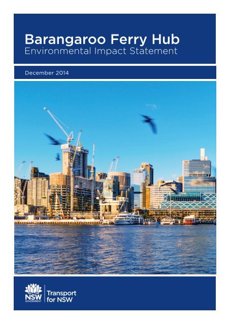
Barangaroo Ferry Hub<br />
Environmental Impact Statement<br />
December <strong>2<strong>01</strong>4</strong>
Barangaroo Ferry Hub<br />
Transport for NSW<br />
Status:<br />
<strong>Final</strong><br />
Version: 6.0<br />
Date of issue: 9 December <strong>2<strong>01</strong>4</strong><br />
Document author:<br />
Document reviewer:<br />
Peter Mangels<br />
Katie Mackenzie<br />
Greg Tallentire<br />
Carolyn McCallig<br />
© TfNSW <strong>2<strong>01</strong>4</strong><br />
Document Information<br />
Client:<br />
Title:<br />
Transport for NSW<br />
Barangaroo Ferry Hub – Environmental Impact Statement<br />
Document No:<br />
Date:<br />
Document History<br />
Version Date of drafting Author Reviewer<br />
1.0 15 September <strong>2<strong>01</strong>4</strong> Peter Mangels<br />
Katie Mackenzie<br />
Greg Tallentire<br />
2.0 28 October <strong>2<strong>01</strong>4</strong> Peter Mangels<br />
Katie Mackenzie<br />
Greg Tallentire<br />
3.0 18 November <strong>2<strong>01</strong>4</strong> Peter Mangels<br />
Katie Mackenzie<br />
Greg Tallentire<br />
4.0 21 November <strong>2<strong>01</strong>4</strong> Peter Mangels<br />
Katie Mackenzie<br />
Greg Tallentire<br />
5.0 28 November <strong>2<strong>01</strong>4</strong> Greg Tallentire<br />
Katie Mackenzie<br />
6.0 9 December <strong>2<strong>01</strong>4</strong> Greg Tallentire<br />
Katie Mackenzie<br />
Carolyn McCallig<br />
Carolyn McCallig<br />
Carolyn McCallig<br />
Carolyn McCallig<br />
Carolyn McCallig<br />
Carolyn McCallig
BARANGAROO FERRY HUB ENVIRONMENTAL IMPACT STATEMENT<br />
Contents<br />
Glossary and abbreviations<br />
Executive summary<br />
The proposal<br />
Key features of the proposal<br />
Overview of construction activities<br />
Need for the proposal<br />
Barangaroo precinct<br />
Predicted growth and demand<br />
Options assessment and decision making process<br />
Strategic assessment<br />
Options assessment<br />
Proposal definition<br />
Planning approval process<br />
Community and stakeholder consultation<br />
The Environmental Impact Statement<br />
Preparation of the <strong>EIS</strong><br />
Key findings of the <strong>EIS</strong><br />
Management of impacts<br />
Environmental risk analysis<br />
Justification and conclusion<br />
How to make a submission on the Barangaroo Ferry Hub proposal<br />
i<br />
v<br />
v<br />
v<br />
vii<br />
vii<br />
vii<br />
viii<br />
viii<br />
ix<br />
ix<br />
x<br />
x<br />
x<br />
x<br />
xi<br />
xi<br />
xxii<br />
xxii<br />
xxii<br />
xxii<br />
1 Introduction 1<br />
1.1<br />
1.2<br />
1.3<br />
1.4<br />
1.5<br />
1.6<br />
Background 1<br />
Location of the proposal 2<br />
Barangaroo precinct 5<br />
Overview of the proposal 7<br />
Purpose and structure of this <strong>EIS</strong> 7<br />
Secretary’s requirements 9<br />
2 Planning and assessment process 16<br />
2.1<br />
2.2<br />
2.3<br />
2.4<br />
2.5<br />
2.6<br />
Assessment and approval process 16<br />
State environmental planning instruments 19<br />
Local environmental planning instruments 26<br />
Additional NSW legislation 26<br />
Commonwealth legislation 30<br />
Additional environmental approvals/permits required 31<br />
3 Need and alternatives 32<br />
3.1<br />
3.2<br />
Strategic context 33<br />
Project need 38<br />
DECEMBER <strong>2<strong>01</strong>4</strong>
BARANGAROO FERRY HUB ENVIRONMENTAL IMPACT STATEMENT<br />
3.3<br />
Options assessment 44<br />
4 Description of the proposal 55<br />
4.1<br />
4.2<br />
4.3<br />
Overview 56<br />
Scope of works 60<br />
Design and justification 76<br />
5 Community and stakeholder consultation 82<br />
5.1<br />
5.2<br />
5.3<br />
5.4<br />
5.5<br />
Consultation strategy and objectives 83<br />
Overview of consultation undertaken to date 85<br />
Stage 1 – <strong>EIS</strong> preparation 86<br />
Stage 2 – <strong>EIS</strong> exhibition consultation 93<br />
Ongoing consultation 97<br />
6 Environmental issues 98<br />
6.1<br />
6.2<br />
6.3<br />
6.4<br />
6.5<br />
6.6<br />
6.7<br />
6.8<br />
6.9<br />
6.10<br />
6.11<br />
6.<strong>12</strong><br />
6.13<br />
6.14<br />
6.15<br />
6.16<br />
6.17<br />
Noise and vibration 99<br />
Traffic and transport 132<br />
Ecology 159<br />
Visual amenity and urban character 168<br />
Built and non-Indigenous Heritage 186<br />
Climate change 192<br />
Air quality 199<br />
Property and land use 203<br />
Water quality and hydrology 207<br />
Indigenous heritage 217<br />
Socio-economic 221<br />
Soils, geology and contamination 225<br />
Ecologically sustainable development 232<br />
Utilities and services 238<br />
Waste and resource use 240<br />
Hazards and risks 243<br />
Cumulative impacts 246<br />
7 Environmental management 253<br />
7.1<br />
7.2<br />
7.3<br />
Environmental management plans 253<br />
Mitigation measures 253<br />
Environmental risk analysis 270<br />
8 Strategic justification and conclusion 285<br />
8.1<br />
8.2<br />
Proposal justification 285<br />
Conclusion 289<br />
References 290<br />
DECEMBER <strong>2<strong>01</strong>4</strong>
BARANGAROO FERRY HUB ENVIRONMENTAL IMPACT STATEMENT<br />
Appendices (Volume 1)<br />
Appendix A Secretary’s environmental assessment requirements and Consideration of<br />
matters of national environmental significance<br />
Appendix B Concept Design Drawings<br />
Appendix C Photomontages<br />
Appendix D Indicative Wayfinding Signage Plan and Design and Indicative Opal Card<br />
Ticketing Facilities and Location<br />
Appendices (Volume 2)<br />
Appendix E<br />
Appendix F<br />
Appendix G<br />
Appendix H<br />
Appendix I<br />
Appendix J<br />
Appendix K<br />
Appendix L<br />
Figures<br />
Technical Paper: Noise and Vibration Impact Assessment<br />
Technical Paper: Traffic and Transport Impact Assessment<br />
Technical Paper: Aquatic Ecology Assessment<br />
Technical Paper: Landscape and Visual Impact Assessment<br />
Technical Paper: Statement of Heritage Impact (non-maritime)<br />
Technical Paper: Statement of Heritage Impact (maritime)<br />
Technical Paper: Climate Change Risk Assessment<br />
Technical Paper: Sustainability Initiatives Register<br />
Figure E–1 Key proposal features<br />
vi<br />
Figure E–2 Barangaroo Ferry Hub options assessment process<br />
ix<br />
Figure 1-1 Regional context 3<br />
Figure 1-2 Proposal location in relation to other nearby major projects 4<br />
Figure 1-3 Proposal location in relation to existing and future landside components 6<br />
Figure 2-1 Approval process under Part 5.1 of the EP&A Act 18<br />
Figure 2-2 Land zoning map around proposal area 22<br />
Figure 3-1 Residential development within the vicinity of Meadowbank and<br />
Sydney Olympic Park Ferry Wharves 42<br />
Figure 3-2 Residential development within the vicinity of Cabarita Ferry Wharf 43<br />
Figure 3-3 Options assessment process 44<br />
Figure 3-4 Summary of strategic assessment 46<br />
Figure 3-5 Alignment options for new wharves 50<br />
Figure 4-1 Key proposal features 58<br />
Figure 4-2 Detailed cross section of proposal 59<br />
Figure 4-3 Indicative construction timeline for the initial two wharves 61<br />
Figure 4-4 Indicative vessel movements 75<br />
Figure 5-1 Ongoing consultation process 84<br />
Figure 5-2 Proposed Notification area 95<br />
Figure 6-1 Noise catchment areas and monitoring locations 107<br />
Figure 6-2 Existing road network 134<br />
Figure 6-3 Public transport network 137<br />
Figure 6-4 Pedestrian network 139<br />
Figure 6-5 Inbound traffic routes to the construction site 143<br />
Figure 6-6 Outbound traffic routes from the construction site 144<br />
Figure 6-7 Walking isochrones from Barangaroo Ferry Hub 151<br />
Figure 6-8 Pedestrian movements around Barangaroo Ferry Hub 152<br />
Figure 6-9 Strategic cycleway network 154<br />
Figure 6-10 Planned bus corridors 156<br />
Figure 6-11 Aquatic ecology study area 161<br />
Figure 6-<strong>12</strong> Key viewpoints 170<br />
DECEMBER <strong>2<strong>01</strong>4</strong>
BARANGAROO FERRY HUB ENVIRONMENTAL IMPACT STATEMENT<br />
Figure 6-13 Character images of the proposed Barangaroo Ferry Hub 177<br />
Figure 6-14 Marine archaeology study area and proposal area 187<br />
Figure 6-15 Barangaroo Ferry Hub and its interaction with the Barangaroo South<br />
water cooling system 211<br />
Figure 6-16 Indigenous heritage sites in vicinity of the proposal area 219<br />
Figure 6-17 Acid sulphate soils risk map 228<br />
Tables<br />
Table E–1 Key impact and benefits of the Barangaroo Ferry Hub proposal<br />
xii<br />
Table 1-1 Secretary’s environmental assessment requirements 9<br />
Table 2-1 Secretary’s environmental assessment requirements relevant to planning and<br />
assessment process 17<br />
Table 2-2 Objectives of the SREP SHC 23<br />
Table 2-3 Objectives of the W1 Maritime Waters zone 24<br />
Table 2-4 Matters for consideration 24<br />
Table 2-5 Additional NSW legislation 27<br />
Table 2-6 Commonwealth legislation applicable to the proposal 30<br />
Table 2-7 Additional environmental approvals/permits required 31<br />
Table 3-1 Secretary’s environmental assessment requirements relevant to strategic context 32<br />
Table 3-2 Barangaroo Ferry Hub proposal’s contribution to meeting NSW 2021 33<br />
Table 3-3 Key actions of the Barangaroo Integrated Transport Plan relevant to the proposal 38<br />
Table 3-4 Previous patronage growth – Sydney Ferries 39<br />
Table 3-5 Barangaroo Ferry Hub maximum passenger capacity (weekends) 40<br />
Table 3-6 Options considered for the proposal 47<br />
Table 3-7 Assessment of options 48<br />
Table 3-8 Options assessment against navigation safety considerations 51<br />
Table 4-1 Secretary’s environmental assessment requirements relevant to the<br />
description of the proposal 55<br />
Table 4-2 Construction staging and key activities 60<br />
Table 4-3 Approximate duration of piling operations for each pile 67<br />
Table 4-4 Electricity requirements for proposal 74<br />
Table 4-5 Design elements of the proposed Barangaroo Ferry Hub 77<br />
Table 5-1 Stakeholders briefed 87<br />
Table 5-2 Key issues raised by stakeholders during preparation of the <strong>EIS</strong> 89<br />
Table 6-1 Determination of noise management levels 99<br />
Table 6-2 Noise management levels for other sensitive receptors 100<br />
Table 6-3 Amenity Criteria – Recommended LAeq noise levels from industrial noise sources 103<br />
Table 6-4 RNP criteria – residential 104<br />
Table 6-5 Airborne light rail noise triggers for residential land use 105<br />
Table 6-6 Airborne rail noise triggers for non-residential land use 105<br />
Table 6-7 Background noise monitoring results 108<br />
Table 6-8 Predicted noise levels at nearest receivers 110<br />
Table 6-9 Summary of indicative out-of-hours works (OOHWs) 118<br />
Table 6-10 Operational and screening criteria for sensitive receivers 119<br />
Table 6-11 Summary of project specific noise criteria (INP) <strong>12</strong>0<br />
Table 6-<strong>12</strong> Sound power level of ferry terminal activities <strong>12</strong>0<br />
Table 6-13 Predicted operational noise levels (INP) <strong>12</strong>2<br />
Table 6-14 Operational and screening criteria for sensitive receivers – alternate <strong>12</strong>5<br />
Table 6-15 Operation predicted noise levels (alternate) <strong>12</strong>6<br />
Table 6-17 Additional vehicle trips generated by the Barangaroo precinct 135<br />
Table 6-18 Peak hour ferry services to Barangaroo 146<br />
Table 6-19 Barangaroo Ferry Hub weekend forecast maximum passenger<br />
capacity (weekends) 147<br />
Table 6-20 Aquatic habitats and ecology identified during survey of study area 162<br />
DECEMBER <strong>2<strong>01</strong>4</strong>
BARANGAROO FERRY HUB ENVIRONMENTAL IMPACT STATEMENT<br />
Table 6-21 Potential impact on aquatic habitats and ecology during construction 165<br />
Table 6-22 Potential impact on aquatic habitats and ecology during operation 166<br />
Table 6-23: Landscape character areas in the vicinity of the project area 171<br />
Table 6-24 Summary of viewpoint assessment during construction phase 173<br />
Table 6-25 Summary of landscape character assessment during construction phase 176<br />
Table 6-26 Summary of viewpoint assessment during operation phase 179<br />
Table 6-27 Summary of landscape character assessment during operational phase 184<br />
Table 6-28 Items of State or local heritage significance in the vicinity of the project area 189<br />
Table 6-29 Shipwrecks known to be within Darling Harbour 190<br />
Table 6-30 Projections of mean sea level rise 194<br />
Table 6-31 Projections of mean sea level rise to 2065 194<br />
Table 6-32 Climate change risk assessment 196<br />
Table 6-33 Darling Harbour water quality monitoring summary (April 20<strong>12</strong> – June <strong>2<strong>01</strong>4</strong>) 2<strong>09</strong><br />
Table 6-34 Tidal plane levels for Sydney Harbour (Australian National Tide Tables, <strong>2<strong>01</strong>4</strong>) 210<br />
Table 6-35 Adherence with principles of ESD 232<br />
Table 6-36 Emission types and probable sources 236<br />
Table 6-37 Nearby projects with the potential of cumulative impact 248<br />
Table 7-1 Proposed mitigation measures 254<br />
Table 7-2 Summary of likelihood criteria used in the environmental risk analysis 271<br />
Table 7-3 Summary of consequence criteria used in the environmental risk analysis 271<br />
Table 7-4 Environmental risk rating matrix 272<br />
Table 7-5 Summary environmental risk categories used in the environmental risk analysis 272<br />
Table 7-6 Results of risk assessment 274<br />
Table 8-1 The proposal’s adherence with and/or response to EP&A Act objectives 287<br />
DECEMBER <strong>2<strong>01</strong>4</strong>
BARANGAROO FERRY HUB ENVIRONMENTAL IMPACT STATEMENT<br />
Glossary and abbreviations<br />
AHD<br />
AHIMS<br />
ASS<br />
Barangaroo Ferry Hub<br />
(or ‘the proposal’)<br />
BDA<br />
BoM<br />
CBD<br />
CEMP<br />
CHL<br />
CIV<br />
construction<br />
compound<br />
construction<br />
work area<br />
Australian Height Datum<br />
Aboriginal Heritage Information Management System<br />
Acid Sulphate Soils<br />
The construction and operation of the Barangaroo Ferry Hub including<br />
the potential demolition of the King Street Wharf wave baffle and<br />
decommissioning of public transport elements from King Street Ferry<br />
Wharf<br />
Barangaroo Delivery Authority<br />
Bureau of Meteorology<br />
Central Business District<br />
construction environmental management plan<br />
Commonwealth Heritage List<br />
capital investment value<br />
A temporary land based construction compound located on the<br />
Barangaroo precinct adjacent to the proposed wharves including<br />
hoarding, relocatable site sheds, amenities, and construction equipment<br />
(e.g. construction materials and tool boxes)<br />
Area in which construction activities would occur for the proposal<br />
including:<br />
• works undertaken at the construction compound<br />
• waterside works within Darling Harbour<br />
• landside works for ancillary facilities<br />
• the King Street Wharf wave baffle demolition area (potential)<br />
• existing King Street Ferry Wharf<br />
This area does not include a construction contractor’s off-site facility.<br />
CSIRO<br />
CTMP<br />
DCP<br />
DECC<br />
DECCW<br />
Commonwealth Scientific and Industrial Research Organisation<br />
construction traffic management plan<br />
development control plan<br />
former Department of Environment and Climate Change (NSW)<br />
former Department of Environment, Climate Change and Water (NSW)<br />
DECEMBER <strong>2<strong>01</strong>4</strong><br />
I
BARANGAROO FERRY HUB ENVIRONMENTAL IMPACT STATEMENT<br />
DDA<br />
Disability Discrimination Act 1992 (Commonwealth)<br />
DSAPT Disability Standards for Accessible Public Transport Act 2002<br />
(Commonwealth)<br />
DP&E<br />
DP&I<br />
DPI<br />
DSI<br />
<strong>EIS</strong><br />
EPA<br />
NSW Department of Planning and Environment<br />
former NSW Department of Planning and Infrastructure<br />
Department of Primary Industries<br />
detailed site investigation (Phase II contamination investigation)<br />
environmental impact statement<br />
Environment Protection Authority<br />
EP&A Act Environmental Planning and Assessment Act 1979<br />
EP&A Regulation Environmental Planning and Assessment Regulation 2000<br />
EPBC Act Environment Protection and Biodiversity Conservation Act 1999<br />
(Commonwealth)<br />
EPI<br />
EPL<br />
Ecologically<br />
sustainable<br />
development (ESD)<br />
environmental planning instrument<br />
environmental protection licence<br />
Development that uses, conserves and enhances the resources of the<br />
community so that ecological processes on which life depends are<br />
maintained, and the total quality of life, now and in the future, can be<br />
increased (refer to Section 6.13)<br />
FM Act Fisheries Management Act 1994<br />
FWPDAC<br />
GHG<br />
Global Sydney<br />
HCF<br />
Foreshore and Waterways Planning and Development Advisory<br />
Committee<br />
Greenhouse gas<br />
is made up of the Sydney CBD, its adjacent precincts and the CBD or<br />
North Sydney<br />
Harbour City Ferries<br />
Heritage Act Heritage Act 1977<br />
ICNG<br />
IPCC<br />
ISCA<br />
Interim Construction Noise Guideline<br />
Intergovernmental Panel on Climate Change<br />
Infrastructure Sustainability Council of Australia<br />
II DECEMBER <strong>2<strong>01</strong>4</strong>
BARANGAROO FERRY HUB ENVIRONMENTAL IMPACT STATEMENT<br />
ISEPP<br />
ISLW<br />
King Street Ferry<br />
Wharf<br />
King Street Wharf<br />
King Street Wharf<br />
wave baffle<br />
LEP<br />
LGA<br />
State Environmental Planning Policy (Infrastructure) 2007 (NSW)<br />
Indian Spring Low Water<br />
Public ferry wharf located at King Street Wharf, also known as King<br />
Street Wharf 3<br />
Mixed use development including commercial premises, pedestrian<br />
promenade and wharves located to the south of the proposed<br />
Barangaroo Ferry Hub<br />
Existing maritime structure located at the northern end of King Street<br />
Wharf originally designed to reduce waves and wash from vessels.<br />
local environmental plan<br />
local government area<br />
LTTMP Long Term Transport Master Plan (NSW, 20<strong>12</strong>)<br />
LoS<br />
MNES<br />
MP SEPP<br />
MD SEPP<br />
NCA<br />
NEPM<br />
NHL<br />
level of service<br />
Matters of national environmental significance<br />
State Environmental Planning Policy (Major Projects) 2005 (NSW)<br />
State Environmental Planning Policy (Major Developments) 2005 (NSW)<br />
noise catchment area<br />
National Environment Protection Measures<br />
National Heritage List<br />
Noxious Weeds Act Noxious Weeds Act 1993<br />
NPW Act National Parks and Wildlife Act 1974<br />
NSW<br />
OEH<br />
Opal card<br />
PAH<br />
PA system<br />
New South Wales<br />
Office of Environment and Heritage (NSW)<br />
A new electronic ticketing system accessed with a smartcard, which is<br />
being introduced across many public transport services in NSW.<br />
Polycyclic Aromatic Hydrocarbons<br />
public address system<br />
Pedestrian promenade public walkway along the foreshore<br />
PID<br />
public information display<br />
DECEMBER <strong>2<strong>01</strong>4</strong><br />
III
BARANGAROO FERRY HUB ENVIRONMENTAL IMPACT STATEMENT<br />
POEO Act Protection of the Environment Operations Act 1997<br />
RAP<br />
RING<br />
RNP<br />
Roads and Maritime<br />
SEARs<br />
SEPP<br />
SEPP 55<br />
SHFA<br />
SHR<br />
SRD SEPP<br />
remediation action plan<br />
Rail Infrastructure Noise Guideline<br />
Road Noise Policy<br />
Roads and Maritime Services<br />
Secretary’s Environmental Assessment Requirements<br />
State environmental planning policy<br />
State Environmental Planning Policy No. 55 – Remediation of Land<br />
(NSW)<br />
Sydney Harbour Foreshore Authority<br />
State Heritage Register<br />
State Environmental Planning Policy (State and Regional Development)<br />
2<strong>01</strong>1 (NSW)<br />
SREP SHC Sydney Regional Environmental Plan (Sydney Harbour Catchment) 2005<br />
(NSW)<br />
SSD<br />
SSI<br />
SSIA<br />
State significant development<br />
State significant infrastructure<br />
State significant infrastructure application<br />
Sydney LEP Sydney Local Environmental Plan 20<strong>12</strong><br />
TfNSW<br />
Transport for NSW<br />
the guidelines TfNSW Sustainable Design Guidelines version 3.0<br />
the proposal<br />
TPH<br />
TPD<br />
see Barangaroo Ferry Hub above<br />
total petroleum hydrocarbon<br />
Transport Projects Division (TfNSW)<br />
TSC Act Threatened Species Conservation Act 1995<br />
IV DECEMBER <strong>2<strong>01</strong>4</strong>
BARANGAROO FERRY HUB ENVIRONMENTAL IMPACT STATEMENT<br />
Executive summary<br />
The proposal<br />
The Barangaroo Ferry Hub proposal comprises the construction and operation of three<br />
new ferry wharves and ancillary landside facilities. The proposal is located immediately<br />
north of King Street Wharf on the harbour side boundary of Barangaroo South (formerly<br />
known as East Darling Harbour) in Sydney’s CBD (refer to Figure E-1).<br />
Initially two wharves would be constructed (subject to planning approval). The third wharf<br />
would be constructed in the future when the demand for ferry services necessitates.<br />
Key features of the proposal<br />
The key infrastructure elements of the Barangaroo Ferry Hub proposal are detailed in<br />
Figure E-1. The proposal includes the following key features:<br />
• Establishment of a construction work area and a temporary construction compound<br />
• Construction of three new ferry wharves (two wharves would be constructed initially<br />
with the third wharf being constructed when demand necessitates) and ancillary<br />
landside facilities<br />
• Potential demolition of the King Street Wharf wave baffle<br />
• Site clean-up and opening of the new wharves<br />
• Operation of three wharves including ferry layover, pump-out facilities and minor<br />
maintenance activities<br />
• Decommissioning and removal of the public transport elements of King Street Ferry<br />
Wharf such as ticket vending machines and signage<br />
• Landside ancillary facilities included as part of the proposal would comprise wayfinding<br />
signage and ticketing including Opal card facilities.<br />
Transport for NSW (TfNSW) is the proponent for the Barangaroo Ferry Hub proposal,<br />
delivering the planning, concept design and construction of the Barangaroo Ferry Hub.<br />
Ownership and maintenance of the ferry hub asset would be the responsibility of<br />
NSW Roads and Maritime Services, while ferry operations would be delivered by<br />
Sydney Ferries.<br />
DECEMBER <strong>2<strong>01</strong>4</strong><br />
V
BARANGAROO FERRY HUB ENVIRONMENTAL IMPACT STATEMENT<br />
Figure E–1 Key proposal features<br />
VI DECEMBER <strong>2<strong>01</strong>4</strong>
BARANGAROO FERRY HUB ENVIRONMENTAL IMPACT STATEMENT<br />
Overview of construction activities<br />
The construction of the first two wharves and the ancillary facilities would take around 14<br />
months. Construction would normally be undertaken during the following recommended<br />
standard hours:<br />
• 7 am to 6 pm Monday to Friday<br />
• 8 am to 1 pm Saturday.<br />
Most construction works would be waterside works. Some work outside of standard hours<br />
are likely to be required for certain waterside activities requiring calm water conditions,<br />
such as piling and intricate lifts from the barge mounted crane.<br />
The majority of construction plant, equipment, materials, and personnel would access the<br />
construction work area via Sydney Harbour, being transported by boat and/or barge from<br />
the construction contractor’s off-site facility. Land access for some sub-contractors and<br />
concrete trucks travelling to and from the construction work area would be via Lime Street.<br />
The majority of the wharf components would be pre-fabricated and would also be<br />
transported to the site from the off-site facility via boat or barge.<br />
Need for the proposal<br />
The Barangaroo Ferry Hub proposal would address the unique transport needs of the<br />
Barangaroo precinct and provide a move forward in ferry transport capability and capacity.<br />
The Barangaroo Ferry Hub proposal is designed to address key transport challenges<br />
facing the Barangaroo precinct and Sydney central business district (CBD), including<br />
predicted growth and increasing demand for public transport options.<br />
Barangaroo precinct<br />
Barangaroo is a 22 hectare site along the Sydney Harbour foreshore, between King Street<br />
Wharf and Walsh Bay. The site is owned by the NSW Government and falls within the City<br />
of Sydney LGA. The precinct is divided into three sections:<br />
• Barangaroo South<br />
• Central Barangaroo<br />
• Barangaroo Point (formerly known as Headland Park).<br />
The Barangaroo precinct is expected to accommodate up to 23,000 office workers,<br />
include a residential community of about 2,500 people and attract up to 33,000 visitors per<br />
day when complete.<br />
The need for the proposal is based on the anticipated demand for transport services to the<br />
precinct. The Barangaroo Ferry Hub proposal addresses a number of the transport<br />
challenges for Barangaroo and the Sydney CBD and would be a significant contribution in<br />
the delivery of an integrated and modern transport system for both Barangaroo and<br />
Sydney CBD.<br />
DECEMBER <strong>2<strong>01</strong>4</strong><br />
VII
BARANGAROO FERRY HUB ENVIRONMENTAL IMPACT STATEMENT<br />
Predicted growth and demand<br />
Growth in employment across Sydney is predicted to include at least an additional<br />
114,000 jobs within Sydney CBD by 2031 (NSW Government, 2<strong>01</strong>3). Based on figures<br />
presented in the NSW Long Term Transport Master Plan (LTTMP) (NSW Government,<br />
20<strong>12</strong>), around 43,500 of these jobs are expected to be provided in the northern part of the<br />
CBD, including at Barangaroo.<br />
The Draft Metropolitan Strategy for Sydney also recognises the importance of Parramatta<br />
as Sydney’s second CBD and major employment area and it is anticipated that<br />
Parramatta will be the fastest growing centre outside Global Sydney over the next 20<br />
years. A high level of residential growth is also expected along the Parramatta River<br />
corridor through urban renewal projects. The Parramatta River route is served by Sydney<br />
Ferries which would use Barangaroo Ferry Hub.<br />
The capacity and complexity of Sydney CBD’s transport system is constraining Sydney’s<br />
ability to function as a liveable, modern and productive city (NSW Government, 20<strong>12</strong>).<br />
Patronage on Sydney ferry services increased from 14.34 million annual journeys in<br />
2<strong>01</strong>0/2<strong>01</strong>1 to 14.94 million annual journeys in 20<strong>12</strong>/2<strong>01</strong>3.<br />
With forecast high employment and residential growth along the Parramatta River<br />
corridor, and constraints associated with the existing road and public transport networks,<br />
the need for additional transport options has been recognised in the LTTMP. A ferry hub<br />
at Barangaroo would enable a high level of connectivity between Global Sydney and<br />
Parramatta as well as relieve existing capacity constraints at both Darling Harbour and<br />
Circular Quay.<br />
Options assessment and decision making process<br />
The development of the Barangaroo Ferry Hub proposal has taken into account relevant<br />
transport plans for NSW and Sydney, issues identified through stakeholder and<br />
community consultation, and the results of the environmental investigations undertaken as<br />
part of the preparation of the Environmental Impact Statement (<strong>EIS</strong>).<br />
The proposal was developed as part of a comprehensive options assessment process,<br />
undertaken in three key stages (refer Figure E-2 below). This process involved developing<br />
and assessing the feasibility of alternative options to deliver the necessary transport<br />
proposal at Barangaroo.<br />
The planning and design process is ongoing and the proposal may be subject to further<br />
refinement as a result of submissions received in response to the public exhibition of this<br />
<strong>EIS</strong> and further consultation during the detailed design phase (should project approval be<br />
granted).<br />
VIII DECEMBER <strong>2<strong>01</strong>4</strong>
BARANGAROO FERRY HUB ENVIRONMENTAL IMPACT STATEMENT<br />
Figure E–2 Barangaroo Ferry Hub options assessment process<br />
Strategic assessment<br />
The strategic assessment of the need for a ferry service at Barangaroo was initiated as<br />
part of the broader Barangaroo Review undertaken by the NSW Government in 2<strong>01</strong>1.The<br />
review resulted in the establishment of the Barangaroo Transport Taskforce and the<br />
findings of this taskforce were presented in the Barangaroo Integrated Transport Plan,<br />
which was released in August 20<strong>12</strong>. This plan considers the short and longer term<br />
transport requirements for Barangaroo within the context of the forecast demand for<br />
transport in the northern CBD. A further three strategic planning documents, Sydney’s<br />
Ferry Future (TfNSW, 2<strong>01</strong>3b), the Sydney City Centre Access Strategy (TfNSW, 2<strong>01</strong>3a)<br />
and the NSW Long Term Transport Master Plan (NSW Government, 20<strong>12</strong>) all addressed<br />
the need for a ferry service at Barangaroo. The key finding from Sydney’s Ferry Future<br />
was for TfNSW to determine operational and customer requirements of the new ferry hub<br />
over the coming years.<br />
Options assessment<br />
Following the strategic assessment of the need for a ferry hub at Barangaroo, TfNSW<br />
undertook an options identification and assessment (stage two). Stage two involved<br />
identifying a long list of potential ferry wharf improvements including the base case or<br />
‘do nothing’ option and the development and operation of a ferry hub at Barangaroo<br />
(the proposal). The key considerations in assessing the long list of options included the<br />
alignment of the strategic assessment (stage one), demand for additional transport arising<br />
from growth in development, employment and housing across Sydney, and customer<br />
experience.<br />
Based on the outcomes of stage one and two, a preferred option was selected for further<br />
refinement.<br />
DECEMBER <strong>2<strong>01</strong>4</strong><br />
IX
BARANGAROO FERRY HUB ENVIRONMENTAL IMPACT STATEMENT<br />
Proposal definition<br />
Following stage 2, the preferred option was further assessed against design and<br />
operational considerations in order to further define the proposal. Key aspects of the<br />
proposal considered were wharf alignment, addressing issues such as manoeuvrability<br />
and navigational safety, and the inclusion of layover and pump-out facilities within the<br />
proposal. The preferred option, as a result of the options assessment process comprised<br />
the construction of three new wharves at Barangaroo and ancillary landside facilities.<br />
Planning approval process<br />
The Barangaroo Ferry Hub proposal is a State significant infrastructure (SSI) project. The<br />
proposal is SSI as defined under the State Environmental Planning Policy (State and<br />
Regional Development) 2<strong>01</strong>1, as it proposes ‘wharf or boating facilities’ with a capital<br />
investment value over $30 million. As SSI under Part 5.1 of the EP&A Act, an <strong>EIS</strong> is<br />
required.<br />
The Secretary’s Environmental Assessment Requirements (SEARs) for the proposal were<br />
issued on 10 November <strong>2<strong>01</strong>4</strong>.<br />
Part 5.1 of the NSW Environmental Planning and Assessment Act 1979 (EP&A Act)<br />
establishes an assessment and approval regime for SSI. Under Part 5.1 of the EP&A Act,<br />
the planning and approvals process includes the following key steps:<br />
• Submission of an SSI application with the accompanying supporting document to the<br />
Secretary of the NSW Department of Planning and Environment (DP&E) under section<br />
115X of the EP&A Act, to seek SEARs for the proposal (Section 115Y)<br />
• Preparation and submission of an <strong>EIS</strong> under Section 115Y(2), addressing the matters<br />
outlined in the SEARs (this document)<br />
• Public exhibition of the <strong>EIS</strong> for a minimum of 30 days<br />
• Assessment of the application by the DP&E and preparation of the Secretary’s<br />
environmental assessment report (Section 115ZA).<br />
Community and stakeholder consultation<br />
Consultation with stakeholders and the community has been undertaken throughout the<br />
development of the proposal. The activities have been selected to provide timely and<br />
proactive communication of information about the proposal to stakeholders and the<br />
community. TfNSW has prepared a stakeholder and community engagement strategy to<br />
guide consultation activities throughout the proposal. Opportunities for further consultation<br />
are also identified to help develop the proposal in line with key planning, design and<br />
construction milestones. Community liaison plans would be prepared to support the goals<br />
and objectives of this strategy during different phases of project delivery.<br />
The Environmental Impact Statement<br />
This <strong>EIS</strong> has been prepared to assess and document the potential environmental impact<br />
of the construction and operation of the Barangaroo Ferry Hub proposal. It also<br />
documents the key features of the proposal, including the likely construction method and<br />
operation. The Barangaroo Ferry Hub would be constructed and operated in accordance<br />
with the mitigation measures proposed in this <strong>EIS</strong>, any submissions report and/or<br />
Secretary’s report with recommendations, and the Minister’s conditions of approval.<br />
X DECEMBER <strong>2<strong>01</strong>4</strong>
BARANGAROO FERRY HUB ENVIRONMENTAL IMPACT STATEMENT<br />
The <strong>EIS</strong> has been prepared in accordance with the SEARs for the proposal (Appendix A),<br />
which incorporate the requirements of Part 3 of Schedule 2 of the Environmental Planning<br />
and Assessment Regulation 2000 (EP&A Regulation) (refer Appendix A).<br />
Preparation of the <strong>EIS</strong><br />
Preparation of the <strong>EIS</strong> involved both community and stakeholder consultation and detailed<br />
specialist assessment of key environmental issues, including surveys, data analysis and<br />
predictive modelling, where appropriate. The <strong>EIS</strong> process included a detailed<br />
environmental risk analysis to scope the level of assessment required, identify the key<br />
risks and confirm those issues that are likely to require the most focus in terms of<br />
management and mitigation.<br />
Key findings of the <strong>EIS</strong><br />
Potential environmental impacts during construction and operation of the Barangaroo<br />
Ferry Hub proposal are summarised at Table E-1.<br />
DECEMBER <strong>2<strong>01</strong>4</strong><br />
XI
BARANGAROO FERRY HUB ENVIRONMENTAL IMPACT STATEMENT<br />
Table E–1 Key impact and benefits of the Barangaroo Ferry Hub proposal<br />
Issue<br />
Noise and<br />
vibration<br />
Impacts during construction – positive (+ve),<br />
negative(-ve) and negligible (neg) impacts<br />
Recommended standard construction hours (-ve): During standard<br />
construction hours potential ‘high impact’ exceedances (up to 26 db)<br />
are predicted for impact piling (scenario 2) at NCA-<strong>01</strong>.<br />
Potential ‘moderate impact’ exceedances are predicted at NCA-<strong>01</strong><br />
(up to 11 dB) during landside construction works (scenario 7) and at<br />
NCA-03 (up to 11 dB) during impact piling (scenario 2).<br />
Potential ‘low impact’ exceedances during standard hours (of<br />
between 1 dB and 9 dB) are predicted at NCA-<strong>01</strong> and NCA-04<br />
during such construction works including pile drilling (scenario 1),<br />
impact piling (scenario 2), pile finishing (scenario 3), intricate lifts<br />
(scenario 4), the potential demolition of the wave baffle (scenario 5)<br />
and pile extraction (scenario 6).<br />
Other receptors (i.e. hotel) and commercial sensitive receivers would<br />
be subject to ‘moderate impacts’, with NML exceedances of up to<br />
13 dB and 17dB respectively during impact piling works.<br />
Outside of recommended standard construction hours (-ve):<br />
Potential ‘high impact’ exceedances are predicted during impact<br />
piling (scenario 2) at NCA-<strong>01</strong> (up to 37 dB) and at NCA-03 (up to<br />
28 dB).<br />
Potential ‘moderate impact’ exceedances are predicted at NCA-<strong>01</strong><br />
during pile driving (up to 19 dB for scenario 1) and intricate lifts (up to<br />
16 dB for scenario 4), at NCA-03 (up to 10 dB) during pile driving, at<br />
NCA-04 (up to 24 dB) during impact drilling and at NCA-05 (up to<br />
14 dB) during impact drilling (scenario 2).<br />
Potential ‘low impact’ exceedances outside of standard hours are<br />
predicted for activities such as intricate lifts and pile drilling (e.g. at<br />
NCA-03 and NCA-04).<br />
Other receptors (i.e. hotel) and commercial sensitive receivers would<br />
be subject to ‘moderate impacts’, with NML exceedances of up to<br />
13 dB and 17dB respectively during impact piling works.<br />
Impacts during operation – positive (+ve), negative(-ve)<br />
and negligible (neg) impacts<br />
Operational noise impacts of the Barangaroo Ferry Hub proposal<br />
(-ve): Operational noise levels associated with the proposal have<br />
been predicted for maximum (21 vessels per hour), off-peak (10<br />
vessels per hour) operations,<br />
Predicted noise levels of vessel movements during peak (scenario 1)<br />
and off peak (scenario 2) periods comply with daytime noise levels<br />
(for both LAeq(1hour) and LAmax).<br />
An exceedance of up to 3 dB during nigh time peak periods has<br />
been predicted at receivers at NCA-<strong>01</strong> and NCA-03. Potential<br />
impacts are likely caused by the proximity of receivers to proposed<br />
routes of ferries entering and leaving Barangaroo Ferry Hub. The<br />
predicted noise levels of night-time off-peak operations show<br />
compliance with night-time noise levels.<br />
An exceedance of up to 11 dB above the sleep disturbance<br />
screening criterion has been predicted for the receivers located at<br />
NCA-<strong>01</strong>, up to 10 dB at NCA-03 and up to 5 dB at NCA-04 for both<br />
scenario 1 and 2. The peak noise events for peak and off-peak ferry<br />
movements are identical due to the use of warning horns, which are<br />
the likely cause of these exceedances.<br />
Predicted noise levels of maintenance works (scenario 3) would<br />
exceed noise levels by 6 dB and 16 dB at NCA-<strong>01</strong> for maintenance<br />
works undertaken in daytime and night-time periods respectively.<br />
Predicted noise levels also indicate an exceedance of up to 2 dB at<br />
NCA-03 during maintenance works undertaken at night-time.<br />
An exceedance of up to 9 dB above the sleep disturbance screening<br />
criterion has been predicted for the residential receivers in NCA-<strong>01</strong>.<br />
The exceedance for Scenario 3 is due to the use of use of high<br />
pressure water cleaning equipment and the close proximity to<br />
receivers.<br />
XII DECEMBER <strong>2<strong>01</strong>4</strong>
BARANGAROO FERRY HUB ENVIRONMENTAL IMPACT STATEMENT<br />
Issue<br />
Impacts during construction – positive (+ve),<br />
negative(-ve) and negligible (neg) impacts<br />
Construction sleep disturbance impacts (-ve): It is predicted that<br />
sleep disturbance is likely to occur with the use of high noise<br />
activities such as impact piling (scenario 3) which would cause<br />
exceedances at residential receivers of up to 35 dB, 26 dB, 22 dB<br />
and <strong>12</strong> dB within NCA-<strong>01</strong>, NCA-03, NCA-04 and NCA-05<br />
respectively.<br />
Lower noise activities such as pile drilling (scenario 1) and intricate<br />
lifts (scenario 4) are predicted to cause exceedances at residential<br />
receivers of up to 17 dB, 8 dB and 4 dB at NCA-<strong>01</strong>, NCA-03 and<br />
NCA-04 respectively.<br />
Impacts during operation – positive (+ve), negative(-ve)<br />
and negligible (neg) impacts<br />
Operational sleep disturbance impacts (-ve): For ferry movements<br />
exceedances of the sleep disturbance screening criteria of up to<br />
11 dB, 10 dB and 5 dB are predicted for scenario 1 and scenario 2<br />
for residences within NCA-<strong>01</strong>, NCA-03 and NCA 04 respectively.<br />
Short-term external noise levels of up to 72 dBA are anticipated at<br />
residences within NCA-<strong>01</strong> for these scenarios during the sounding<br />
of ferry horns.<br />
While the night-time vessel movements would likely decrease in<br />
the night time periods (5 am to 7 am and 10 pm to <strong>12</strong> am midnight),<br />
the maximum noise level due to horn usage is unlikely to decrease.<br />
For maintenance works (scenario 3) exceedances of the sleep<br />
disturbance screening criteria of up to 9 dB are expected at<br />
NCA-<strong>01</strong> only.<br />
DECEMBER <strong>2<strong>01</strong>4</strong><br />
XIII
BARANGAROO FERRY HUB ENVIRONMENTAL IMPACT STATEMENT<br />
Issue<br />
Traffic and<br />
transport<br />
Impacts during construction – positive (+ve),<br />
negative(-ve) and negligible (neg) impacts<br />
Marine construction transport impacts (-ve): The majority of<br />
construction plant, equipment, materials and personnel would<br />
access the construction site via Sydney Harbour generating minor<br />
increases in water traffic. During the construction period some<br />
minor detours may be required however this is unlikely to have a<br />
significant impact to other users of the waterway and access to<br />
other ferry wharves would not be restricted.<br />
A 130 metre wide navigation channel would be maintained<br />
throughout the work wherever possible to minimise disturbance to<br />
other vessel movements.<br />
Due to the proximity of the proposal to King Street Wharf, a<br />
management plan with appropriate measures would be prepared to<br />
manage vessel manoeuvring near King Street Wharf during<br />
construction work.<br />
Construction vehicular impacts (neg): Construction of the proposal<br />
would require a small number of light and heavy vehicles to<br />
transport materials to and from the construction compound located<br />
on the foreshore. The estimated construction vehicle movements<br />
could easily be accommodated by the surrounding road network<br />
with ample capacity, and therefore the proposal would result in<br />
negligible road network impacts.<br />
Pedestrian impacts during construction (neg): Depending on<br />
Barangaroo South construction activities and hoarding locations,<br />
access along the Barangaroo foreshore would be reduced to about<br />
<strong>12</strong> metres in width due to the location of the temporary construction<br />
compound, and therefore the proposal would result in negligible<br />
pedestrian impacts.<br />
Impacts during operation – positive (+ve), negative(-ve)<br />
and negligible (neg) impacts<br />
Navigation and safety impacts (-ve): Darling Harbour is an<br />
extremely busy waterway with a high level of commercial and<br />
recreational vessel traffic and the second highest maritime incident<br />
rate on Sydney Harbour (Roads and Maritime, 20<strong>12</strong>). The proposal<br />
would introduce into the area additional vessel traffic movements<br />
as a result of ferries manoeuvring to and from the wharves.<br />
Ferry operational impacts (+ve): The Barangaroo Ferry Hub would<br />
initially include two operating ferry wharves catering for most vessel<br />
classes. A third wharf would be constructed as demand for services<br />
increases. As a result of the proposal potential operational impacts<br />
of the proposal include greater public ferry patronage and improved<br />
travel time on ferry services.<br />
King Street Wharf (+ve): The proposal transfers all public transport<br />
trips from King Street Ferry Wharf to the Barangaroo Ferry Hub,<br />
thereby releasing capacity at the King Street Ferry Wharf for<br />
private and commercial operations.<br />
Operation vehicular impacts (neg): The Barangaroo Ferry Hub<br />
would not impact on the local road network.<br />
Pedestrian impacts during operation (neg): The proposal would be<br />
well served by a number of existing and future pedestrian<br />
connections (e.g. Wynyard Walk). There would be sufficient<br />
capacity for passengers alighting from the ferry hub to be<br />
accommodated along with other pedestrian traffic.<br />
XIV DECEMBER <strong>2<strong>01</strong>4</strong>
BARANGAROO FERRY HUB ENVIRONMENTAL IMPACT STATEMENT<br />
Issue<br />
Ecology<br />
Impacts during construction – positive (+ve),<br />
negative(-ve) and negligible (neg) impacts<br />
General construction impacts (-ve): Potentially hazardous materials<br />
would be transported to and from the site (via barges on Sydney<br />
Harbour) and used and stored on site during the construction<br />
period. Spills and leaks during transportation could potentially<br />
result in the contamination of waterways and any potential marine<br />
vegetated habitats surrounding the Barangaroo Ferry Hub<br />
proposal.<br />
Manoeuvring of construction vessels (neg): Given the water depths<br />
(between about 9.5 to 11.5 metres ISLW) at the site, there is low<br />
risk of bottom sediment disturbance from construction related<br />
vessel movements.<br />
Water based construction impacts (neg): Disturbed sediments<br />
would be highly localised in the bottom waters during the<br />
construction of the proposal (e.g. pile works) and any mobilisation<br />
of sediments (including the potential for contaminated sediments)<br />
would rapidly re-settle, therefore excessive turbidity it is not<br />
expected as a result of the proposal.<br />
Land based construction impacts (neg): It is not anticipated that the<br />
proposal would impact on any terrestrial flora or fauna during<br />
construction.<br />
Impacts during operation – positive (+ve), negative(-ve)<br />
and negligible (neg) impacts<br />
Water based operational impacts (neg): The removal of the King<br />
Street Wharf wave baffle (if it proceeds) would eliminate shading<br />
impact on the adjacent seawall, which would be recolonised by<br />
algae in the shallow sub-tidal zone and remove hard substratum<br />
habitat. This impact would be balanced by the installation of the<br />
new wharves at Barangaroo which would cause additional shading<br />
but provide new hard substratum habitat.<br />
Manoeuvring of vessels (neg): The overall depth at the site is<br />
between about 9.5 to 11.5 metres ISLW), therefore the risk of<br />
bottom sediment disturbance from ferries manoeuvring in and out<br />
of the berths at the Barangaroo Ferry Hub is considered to be low.<br />
Manoeuvring of vessels (+ve): Propulsion from ferries manoeuvring<br />
in and out of the berths would be unlikely to dislodge attached biota<br />
from the walls or dislodge cryptic fauna. Residual wash currents<br />
would likely provide a beneficial impact in dislodging loose silts that<br />
can accumulate on these habitats in still waters.<br />
Land based operational impacts (neg): There would be no impacts<br />
to terrestrial flora or fauna as a result of the operation of the<br />
Barangaroo Ferry Hub proposal.<br />
DECEMBER <strong>2<strong>01</strong>4</strong><br />
XV
BARANGAROO FERRY HUB ENVIRONMENTAL IMPACT STATEMENT<br />
Issue<br />
Visual amenity<br />
and urban<br />
character<br />
Built and non-<br />
Indigenous<br />
heritage<br />
Climate change<br />
Impacts during construction – positive (+ve),<br />
negative(-ve) and negligible (neg) impacts<br />
Visual amenity impacts during construction (-ve): As a result of the<br />
proposal, on-water construction works would replace the view of<br />
open water and landside works (including a temporary construction<br />
compound) would be visible along the harbour edge about 420<br />
square metres in area.<br />
The proposal would result in visual impacts from views at a<br />
distance, views at close proximity and from higher sensitivity<br />
viewpoints. Impacts would range from negligible to high adverse,<br />
depending on the viewpoint.<br />
Visual impacts would be temporary in nature and would be seen as<br />
part of a range of construction activities on the Barangaroo<br />
Peninsula<br />
Urban character impacts (-ve): During construction on-water<br />
construction works would replace the view of open water. From the<br />
land the construction work area and the temporary construction<br />
compound (of around 420 square metres in area) would be visible<br />
along the harbour foreshore.<br />
Construction impacts (neg): The construction of the Barangaroo<br />
Ferry Hub proposal would not result in any impacts upon any<br />
identified heritage items near the project area.<br />
Construction climate change risks (neg): Construction of the<br />
Barangaroo Ferry Hub proposal would not result in adverse future<br />
climate change risks.<br />
Impacts during operation – positive (+ve), negative(-ve)<br />
and negligible (neg) impacts<br />
Visual amenity impacts during operation (-ve): Views from the<br />
promenade and restaurants at Kings Street Wharf, Barangaroo<br />
South, and the future Wynyard Walk and adjacent footpaths would<br />
be reduced due to the proposal. This would result in a moderate<br />
adverse visual impact. Night time views from Barangaroo South<br />
would result in a noticeable reduction in the amenity of these views,<br />
resulting in a moderate adverse visual impact, however views from<br />
the lower levels of development at Barangaroo South, including<br />
residences, are also expected to be affected by trees that are likely<br />
to be planted between the residences and the water at the<br />
Barangaroo foreshore.<br />
Visual amenity impacts during operation (neg): There would be a<br />
negligible visual impact on views from the north-west, west and<br />
south during the day, while at night, from locations to the northwest,<br />
west and south-west, the proposal would be viewed against a<br />
brightly lit urban environment. In these views there would be no<br />
perceived reduction or improvement in the amenity of these views,<br />
resulting in a negligible visual impact.<br />
Urban character impacts (neg): Operation of the Barangaroo Ferry<br />
Hub proposal would be compatible with the urban character of the<br />
surrounding landscape character areas. The proposal would not<br />
result in a perceived reduction in the quality of the landscape<br />
character of these areas.<br />
Operational impacts (neg): The operation of the Barangaroo Ferry<br />
Hub proposal would not result in any impacts upon any identified<br />
heritage items near the project area.<br />
Operational climate change risks (-ve): Operational climate change<br />
risks (e.g. adverse storm events) would have low to moderate<br />
consequence on the operation of the Barangaroo Ferry Hub<br />
proposal.<br />
XVI DECEMBER <strong>2<strong>01</strong>4</strong>
BARANGAROO FERRY HUB ENVIRONMENTAL IMPACT STATEMENT<br />
Issue<br />
Air quality<br />
Property and land<br />
use<br />
Impacts during construction – positive (+ve),<br />
negative(-ve) and negligible (neg) impacts<br />
Air quality impacts during construction (neg): Construction of the<br />
Barangaroo Ferry Hub proposal would not result in any adverse<br />
impacts associated with dust particles at the site.<br />
Land based construction impacts (-ve): Construction of the<br />
proposal would require the temporary use of land outside of the<br />
permanent proposal footprint. A construction compound about 420<br />
square metres would be established on the foreshore of the<br />
Barangaroo site, reducing public access along the foreshore to a<br />
corridor about <strong>12</strong> metres in width during construction.<br />
Waterside construction impacts (neg): Work situated within the<br />
Darling Harbour waterway would not result in any property impacts<br />
to private land owners.<br />
Impacts during operation – positive (+ve), negative(-ve)<br />
and negligible (neg) impacts<br />
Operational air quality impacts (neg): As a result of the proposal<br />
existing ferry services at King Street Wharf would be relocated to<br />
the Barangaroo Ferry Hub. Moving ferry services, including the<br />
addition of extra ferry services is not considered to cause an impact<br />
to the local air quality due to the already large number of public and<br />
commercial vessels operating in the Darling Harbour area.<br />
Operation of the Barangaroo Ferry Hub proposal (-ve): There<br />
would be a change in land use (both waterside and landside) as a<br />
result of the proposal. The proposal would result in an increase in<br />
the number of ferry services to the area, resulting in a minor impact<br />
within Darling Harbour and would gradually increase over time.<br />
Landside operational impacts may result in some encroachment<br />
into surrounding pedestrian areas from ferry users queuing to<br />
board services during special event times. These impacts would be<br />
temporary and minor in nature.<br />
Operation of the Barangaroo Ferry Hub proposal (+ve): Once the<br />
public transport elements at King Street Ferry Wharf are removed,<br />
additional space allocation would be returned for use by<br />
commercial vessels which would have a positive impact to<br />
commercial operators.<br />
DECEMBER <strong>2<strong>01</strong>4</strong><br />
XVII
BARANGAROO FERRY HUB ENVIRONMENTAL IMPACT STATEMENT<br />
Issue<br />
Water quality and<br />
hydrology<br />
Indigenous<br />
heritage<br />
Impacts during construction – positive (+ve),<br />
negative(-ve) and negligible (neg) impacts<br />
Construction water quality impacts (-ve): Potential impacts on water<br />
quality would include marine sediment disturbance and the<br />
potential for spills and/or leaks from construction plant or<br />
equipment, as well from transporting of waste from the proposal<br />
area.<br />
Drainage and flooding impacts (neg): The construction phase of the<br />
proposal should not result in additional flow velocities or volumes.<br />
Consequently, no impacts on the drainage network or flooding<br />
issues are expected as a result of the proposal.<br />
Tide level, tidal flows, currents and water levels construction<br />
impacts (neg): The proposal does not involve any construction<br />
work that would affect tide levels, tidal flows, currents or water<br />
temperature. The use of barges in the harbour may result in a<br />
localised minor reduction in wave energy in the inshore area. This<br />
impact would be temporary and contained to areas where the<br />
barges are anchored.<br />
Water temperature construction impacts (neg): The construction of<br />
the Barangaroo Ferry Hub is not expected to alter the temperature<br />
of the harbour water in the vicinity of the proposal.<br />
Construction impacts (neg): There are no identified Aboriginal<br />
objects in the proposal area. As such there is no identified risk of<br />
harm to Aboriginal objects during construction of the proposal.<br />
Impacts during operation – positive (+ve), negative(-ve)<br />
and negligible (neg) impacts<br />
Operational water quality impacts (-ve): There is a potential for<br />
accidental spills of chemicals and other hazardous materials into<br />
Pyrmont Bay and Darling Harbour, such as hydraulic fluid and fuel<br />
used in ferries or sewage during pump-out operations as a result of<br />
the operation of the Barangaroo Ferry Hub.<br />
Operational water quality impacts (neg): During operation the<br />
potential for marine sediment disturbance is low, given the depth at<br />
the site is between about 9.5 to 11.5 metres ISLW.<br />
Drainage and flooding impacts (neg): The addition of structures<br />
within the waterway would marginally increase stormwater run-off<br />
within the harbour. However, given the stormwater would enter the<br />
waterway directly from the wharf the proposal should not result in<br />
any change to existing flow velocities or volumes.<br />
Tide level, tidal flows, currents and water levels (neg): A minor<br />
reduction in wave energy in the inshore area during operation of<br />
the wharves is expected as a result of the proposal. The impact<br />
would be relative to the size of the pontoon and the location of the<br />
berthing area further away from the shoreline.<br />
Water temperature operational impacts (neg): The operation of the<br />
proposed Barangaroo Ferry Hub is not expected to alter the<br />
temperature of the harbour water in the vicinity of the proposal.<br />
Maintenance water quality impacts (-ve): Maintenance work<br />
undertaken at the proposed Barangaroo Ferry Hub has the<br />
potential to result in spills and leaks of chemicals and other<br />
hazardous materials into Pyrmont Bay and Darling Harbour.<br />
Cleaning of wharves is typically carried out by use of high pressure<br />
spray without use of chemicals and therefore it is not expected that<br />
this would contribute to run-off of chemicals into the harbour.<br />
Operational impacts (neg): As there are no identified Aboriginal<br />
objects in the proposal area, there is no identified risk of harm to<br />
Aboriginal objects during operation of the proposal.<br />
XVIII DECEMBER <strong>2<strong>01</strong>4</strong>
BARANGAROO FERRY HUB ENVIRONMENTAL IMPACT STATEMENT<br />
Issue<br />
Socio-economic<br />
Soils, geology<br />
and<br />
contamination<br />
Ecologically<br />
sustainable<br />
development<br />
Impacts during construction – positive (+ve),<br />
negative(-ve) and negligible (neg) impacts<br />
Other socio-economic impacts (-ve): Expected impacts as a result<br />
of the proposal include a reduction in visual amenity, noise and<br />
vibration and traffic, access and parking, including a reduction in<br />
pedestrian access along the foreshore.<br />
Construction of the Barangaroo Ferry Hub proposal (+ve): The<br />
local economy at the site would increase due to the incoming<br />
workforce utilising at nearby commercial outlets (such as food and<br />
beverage retailers) throughout the construction works.<br />
Land based construction impacts (neg): Excavation works are not<br />
expected for the installation of wayfinding signage and ticketing<br />
and/or utility connections.<br />
Water based construction impacts (-ve): Sediment contamination,<br />
including the potential presence of acid sulfate soils within the<br />
proposal area presents a potential contaminant source to surface<br />
water and aquatic ecology. Potential impacts are expected to be<br />
localised and of a temporary nature.<br />
Construction impacts (neg):Construction of the proposal would<br />
result in increased greenhouse gas emissions associated with the<br />
materials required to construct the wharves, the transport of<br />
materials to site, and the fuel consumption of construction plant<br />
and equipment, however due to the scale of the construction<br />
works, greenhouse gas emissions are not expected to be<br />
significant.<br />
Impacts during operation – positive (+ve), negative(-ve)<br />
and negligible (neg) impacts<br />
Barangaroo Ferry Hub proposal operational benefits (+ve): As a<br />
result of the proposal those who will live, work or access<br />
Barangaroo and the surrounding area would have greater<br />
accessibility to Barangaroo and connection into the CBD. There<br />
would be no property acquisition required or businesses or<br />
residents relocated as result of the proposal.<br />
Relocation of public transport services at King Street Wharf (-ve):<br />
The relocation of the ferry wharves from King Street Wharf to<br />
Barangaroo may result in minor impacts to businesses which<br />
currently benefit from passing trade from ferry passengers. Existing<br />
wharf infrastructure could be made available for new commercial<br />
opportunities at King Street Wharf.<br />
Operational impacts (-ve): There is the potential for silt and<br />
sediment mobilisation as ferries enter and exit the Barangaroo<br />
Ferry Hub, particularly on structures higher in the water column<br />
more so than the seabed, however, water depths are considered<br />
sufficient to avoid any significant propeller or jet wash mobilisation<br />
of seabed sediments.<br />
Operational impacts (neg): Operation of the proposal would result<br />
in minor additional greenhouse gas emissions associated with the<br />
ongoing electricity requirements for the new ferry wharves and<br />
increase of ferry services overtime, however, given the nature and<br />
scale of the proposal, operational greenhouse gas emissions would<br />
be relatively minor and would not represent a substantial increase<br />
in energy usage.<br />
Operational impacts (+ve): The delivery of the proposed<br />
Barangaroo Ferry Hub with additional ferry services would<br />
encourage public transport use.<br />
DECEMBER <strong>2<strong>01</strong>4</strong><br />
XIX
BARANGAROO FERRY HUB ENVIRONMENTAL IMPACT STATEMENT<br />
Issue<br />
Utilities and<br />
services<br />
Waste and<br />
resources<br />
Impacts during construction – positive (+ve),<br />
negative(-ve) and negligible (neg) impacts<br />
Construction impacts (-ve): Existing and future proposed services<br />
and utilities may be impacted during construction, as a result of<br />
scheduled stoppages during connection works or accidental<br />
damage during construction activities.<br />
Construction impacts (neg): Construction activities (such as<br />
operation of the compound site or use of machinery) are not<br />
expected to place a large demand on existing utility use within the<br />
proposal area. Therefore any impacts to utility operation within the<br />
area during construction are expected to be minor.<br />
Construction waste impacts (neg): The construction of the<br />
Barangaroo Ferry Hub is not expected to generate large volumes<br />
of construction waste. This is due to there being limited demolition<br />
of the proposal area, such as the proposed demolition of the King<br />
Street Wharf wave baffle.<br />
Construction resources impacts (neg): The volume of resources<br />
required during construction of the proposal is not expected to be<br />
significant and all the resources are commonly available therefore<br />
the proposal is unlikely to affect supply and demand.<br />
Impacts during operation – positive (+ve), negative(-ve)<br />
and negligible (neg) impacts<br />
Operational impacts (neg): The operation of the proposal, including<br />
maintenance work carried out at the Barangaroo Ferry Hub would<br />
require the ongoing provision of all services. The proposal would<br />
be designed to operate in an energy efficient manner with minimum<br />
drawdown on local power.<br />
Data and telecommunications connections would also be provided,<br />
with no anticipated impact on those networks.<br />
Operational waste impacts (-ve):Waste generating activities during<br />
the operation of the proposal would include cleaning and<br />
maintenance of the Barangaroo Ferry Hub, including waste<br />
products from the cleaning of wharf facilities and rubbish from<br />
public waste bins. Public toilet facilities on board the Sydney Ferries<br />
fleet operating at the Barangaroo Ferry Hub proposal would need to<br />
be emptied at regular intervals at the Barangaroo Ferry Hub.<br />
Operational resources impacts (neg): The Barangaroo Ferry Hub<br />
would require the use of electricity resources as part of ongoing<br />
routine operations. The Barangaroo Ferry Hub is expected to<br />
require an increase in the use of resources in the local area,<br />
however this demand is expected to be minor and is unlikely to<br />
affect the local supply and/or demand of these resources.<br />
XX DECEMBER <strong>2<strong>01</strong>4</strong>
BARANGAROO FERRY HUB ENVIRONMENTAL IMPACT STATEMENT<br />
Issue<br />
Hazards and risks<br />
Impacts during construction – positive (+ve),<br />
negative(-ve) and negligible (neg) impacts<br />
Construction environmental hazards and risks (-ve): Potentially<br />
hazardous materials would be transported to and from the site via<br />
barges on Sydney Harbour and stored at the temporary<br />
construction compound, as well as on barges. Spills and leaks<br />
within the proposal area and during transportation could potentially<br />
result in the contamination of land based areas and within and/or<br />
outside of the Barangaroo Ferry Hub proposal area.<br />
Construction environmental hazards and risks (neg): It is not<br />
anticipated that land based works would require any excavation,<br />
therefore the probability of encountering acid sulfate soils and/or<br />
contaminated soils/groundwater as a result of landside works is<br />
low.<br />
Construction occupational hazards and risks (-ve): Occupational<br />
health and safety hazards (e.g. trips and slips and falls) would<br />
potentially arise throughout construction, when inadequate<br />
hazard/risk identification, reporting and monitoring systems are not<br />
implemented and/or maintained.<br />
Impacts during operation – positive (+ve), negative(-ve)<br />
and negligible (neg) impacts<br />
Operational environmental hazards and risks (-ve): Potential<br />
environmental hazards as a result of the operation of the<br />
Barangaroo Ferry Hub includes spills and leaks from a ferry or<br />
pump-out waste entering the waters of Darling Harbour.<br />
Operational occupational hazards and risks (-ve): Potential<br />
occupational hazards as a result of the operation of the Barangaroo<br />
Ferry Hub includes passengers or staff falling from the promenade<br />
or vessels in Darling Harbour.<br />
Operational occupational hazards and risks (-ve): Injury to staff and<br />
the public and damage to Barangaroo Ferry Hub infrastructure<br />
caused by an impact from a ferry.<br />
DECEMBER <strong>2<strong>01</strong>4</strong><br />
XXI
BARANGAROO FERRY HUB ENVIRONMENTAL IMPACT STATEMENT<br />
Management of impacts<br />
A comprehensive suite of management and mitigation measures is proposed to be<br />
implemented to reduce the potential adverse impacts of the proposal (refer Chapter 7 of<br />
the <strong>EIS</strong>). These measures would be incorporated into the Construction Environmental<br />
Management Plan (CEMP) to be developed and approved prior to construction, including<br />
any relevant environmental management sub-plans for the proposal and subsequently (if<br />
necessary), into the future operator’s environmental management system.<br />
Environmental risk analysis<br />
Environmental risk analysis is used to identify potentially significant environmental impacts<br />
associated with development proposals. Evaluating a project’s construction and operating<br />
characteristics, and the baseline environmental conditions, helps to derive potential issues<br />
and impact assessment needs. For the Barangaroo Ferry Hub proposal, an environmental<br />
risk analysis was used to define the environmental issues requiring assessment as part of<br />
the <strong>EIS</strong>. It also helped to define mitigation measures for the proposal to assist in<br />
minimising potential risks.<br />
A preliminary environmental risk analysis was undertaken for the purposes of scoping the<br />
<strong>EIS</strong> and the preliminary environmental assessment prepared as part of the Barangaroo<br />
Ferry Hub State significant infrastructure (SSI) application. This analysis was updated with<br />
technical specialist input, once the <strong>EIS</strong> specialist studies had commenced. The analysis<br />
was further revised once the <strong>EIS</strong> studies were mostly completed and mitigation measures<br />
had been partially defined. <strong>Final</strong>ly, a residual risk analysis was completed to identify the<br />
potential residual impacts likely to remain after application of proposed mitigation measures.<br />
Key finding are summarised in Section 7.3<br />
Justification and conclusion<br />
There is strong justification for the Barangaroo Ferry Hub proposal in relation to its need,<br />
its anticipated benefits, and its compliance with the objectives of the EP&A Act and<br />
matters of ecologically sustainable development (refer Chapter 6.13 of the <strong>EIS</strong>).<br />
Provided the measures and commitments specified in the <strong>EIS</strong> are applied and effectively<br />
implemented during the design, construction and operational phases of the project, the<br />
identified potential environmental impacts are considered to be acceptable and<br />
manageable.<br />
How to make a submission on the Barangaroo Ferry Hub proposal<br />
The <strong>EIS</strong> will be placed on public exhibition by the Department of Planning and<br />
Environment (DP&E). During the exhibition period, government agencies, interested<br />
individuals, groups and the community will be invited to make written submissions to the<br />
Department on the Barangaroo Ferry Hub proposal. Further consultation will be<br />
undertaken by TfNSW during the exhibition period to enable the community to comment<br />
on the proposal, and TfNSW to respond to questions about the proposal.<br />
XXII DECEMBER <strong>2<strong>01</strong>4</strong>
BARANGAROO FERRY HUB ENVIRONMENTAL IMPACT STATEMENT<br />
Written submissions should be sent to the DP&E before the end of the exhibition period<br />
and should be addressed to:<br />
Department of Planning and Environment<br />
23-33 Bridge Street<br />
Sydney NSW 2000<br />
(GPO Box 39)<br />
Sydney NSW 20<strong>01</strong><br />
Or online via the Department of Planning and Environment <strong>web</strong>site<br />
Copies of all submissions received by the Secretary will be provided to the proponent, the<br />
Department responsible to the Minister of Planning and Environment and relevant public<br />
agencies. Submissions will also be made available on the DP&E’s <strong>web</strong>site. Submitters<br />
can request that personal details be withheld from publication; however, the content of all<br />
submissions will be publicly available.<br />
DECEMBER <strong>2<strong>01</strong>4</strong> XXIII
BARANGAROO FERRY HUB ENVIRONMENTAL IMPACT STATEMENT<br />
1 Introduction<br />
1.1<br />
Background<br />
In May 2<strong>01</strong>1, the Minister for Planning and Infrastructure commissioned an independent<br />
review of the proposed Barangaroo precinct’s compliance with the planning approval<br />
process (the Barangaroo Review). On 8 August 2<strong>01</strong>1, the New South Wales (NSW)<br />
Government confirmed its commitment to the Barangaroo precinct following the Barangaroo<br />
Review which found that the project was worthwhile and had valid planning consent.<br />
In response to the Barangaroo Review, the NSW Government established a Transport<br />
Taskforce for Barangaroo to develop an integrated transport plan for the development.<br />
The need to provide a ferry hub to support development at Barangaroo was subsequently<br />
identified in the Barangaroo Integrated Transport Plan (TfNSW, 20<strong>12</strong>a) prepared by the<br />
Barangaroo Transport Taskforce, in August 20<strong>12</strong>.<br />
The NSW Long Term Transport Master Plan (LTTMP) (NSW Government, 20<strong>12</strong>),<br />
released in December 20<strong>12</strong> identified both short and medium to longer term actions<br />
related to ferry patronage to support Barangaroo. The medium to longer term option<br />
involved building a new ferry hub at Barangaroo to support commercial development, with<br />
new services from the Lower North Shore, Manly, Parramatta and inner harbour.<br />
In May 2<strong>01</strong>3, Sydney’s Ferry Future (TfNSW, 2<strong>01</strong>3b) was released by the NSW<br />
Government. This document identified that Transport for NSW (TfNSW) would develop a<br />
ferry hub at Barangaroo, although a timeframe for delivery was not specified. Sydney’s<br />
Ferry Future also identified that in the longer term, the facility at Barangaroo would relieve<br />
capacity constraints at Circular Quay by providing space for more terminating services.<br />
In December 2<strong>01</strong>3, the Sydney City Centre Access Strategy (TfNSW, 2<strong>01</strong>3a) reinforced<br />
these actions, and identified the need to connect Barangaroo ferry customers with the<br />
western and central parts of the Central Business District (CBD) via the high quality<br />
pedestrian link, Wynyard Walk (currently under construction). It also identified the need for<br />
new ferry routes to provide more opportunities to access Barangaroo and the mid-town<br />
precinct by public transport.<br />
The construction and operation of the ferry hub identified in the above strategic<br />
documents is the subject of this Environmental Impact Statement (<strong>EIS</strong>). It is referred to as<br />
the proposed Barangaroo Ferry Hub (Barangaroo Ferry Hub or the proposal). The<br />
proposal incorporates waterside components of the Barangaroo Ferry Hub and ancillary<br />
landside facilities such as ticketing including Opal card facilities and wayfinding signage.<br />
Provision for some landside transport related facilities’ (including 300 square metres of<br />
floorspace) has been made in the Barangaroo South approvals Concept Design<br />
Modification 4 (MP06-162 (MOD 4)) and therefore those landside elements do not form<br />
part of the proposal. Section 1.4.1 provides an overview of the proposal.<br />
TfNSW is aiming to commence construction of the Barangaroo Ferry Hub by mid-2<strong>01</strong>5,<br />
and deliver the project in 2<strong>01</strong>6 to provide high quality public transport options for new<br />
residents and building tenants.<br />
DECEMBER <strong>2<strong>01</strong>4</strong> 1
BARANGAROO FERRY HUB ENVIRONMENTAL IMPACT STATEMENT<br />
1.2<br />
Location of the proposal<br />
The proposal is located immediately north of King Street Wharf on the harbour side<br />
boundary of Barangaroo South (formerly known as East Darling Harbour) in Sydney’s<br />
CBD (refer to Figure 1-1). The proposal is situated within the City of Sydney local<br />
government area (LGA). Figure 1-2 shows the proximity of the proposal to other nearby<br />
projects currently under construction.<br />
2 DECEMBER <strong>2<strong>01</strong>4</strong>
BARANGAROO FERRY HUB ENVIRONMENTAL IMPACT STATEMENT<br />
Figure 1-1 Regional context<br />
DECEMBER <strong>2<strong>01</strong>4</strong> 3
BARANGAROO FERRY HUB ENVIRONMENTAL IMPACT STATEMENT<br />
Figure 1-2 Proposal location in relation to other nearby major projects<br />
4 DECEMBER <strong>2<strong>01</strong>4</strong>
BARANGAROO FERRY HUB ENVIRONMENTAL IMPACT STATEMENT<br />
1.3<br />
Barangaroo precinct<br />
Barangaroo, formerly known as East Darling Harbour, is a 22 hectare site along the<br />
Sydney Harbour foreshore, between King Street Wharf and Walsh Bay. The site is owned<br />
by the NSW Government and falls within the City of Sydney LGA.<br />
The Barangaroo precinct was historically used for shipping and stevedoring but the NSW<br />
Government is transforming the space into a public, residential and commercial precinct<br />
over the next decade. Based on the most recent development approval for Barangaroo,<br />
the precinct is expected to accommodate up to 23,000 office workers, include a residential<br />
community of about 2,500 people and attract up to 33,000 visitors per day when complete.<br />
The precinct is divided into three sections:<br />
• Barangaroo South – a major new business, tourism, residential and retail precinct<br />
opening onto a public waterfront promenade. This is the area in which the Barangaroo<br />
Ferry Hub would be located<br />
• Central Barangaroo – a cultural and civic focal point for recreation, relaxation, events,<br />
festivals, entertainment and leisure activities as well as recreational, residential, retail<br />
and commercial facilities<br />
• Barangaroo Point – a six hectare open space precinct designed to complement the<br />
neighbouring headlands of Sydney Harbour.<br />
The Barangaroo Delivery Authority (BDA) is a State Government-owned agency<br />
established to manage and develop Barangaroo on behalf of the NSW Government. Lend<br />
Lease has the development rights for Barangaroo South.<br />
Many of the transport related elements of Barangaroo South have linkages to the<br />
proposal, such as pedestrian connectivity and the extension of Lime Street. The elements<br />
of the proposal that interface with these components are shown in Figure 1-3.<br />
The provision of utilities to service the Barangaroo Ferry Hub would be provided during<br />
works for Barangaroo South Public Domain as further discussed in Section 6.14.<br />
Relevant development approvals and current proposals are discussed at Section 2.1.3.<br />
DECEMBER <strong>2<strong>01</strong>4</strong> 5
BARANGAROO FERRY HUB ENVIRONMENTAL IMPACT STATEMENT<br />
Figure 1-3 Proposal location in relation to existing and future landside components<br />
6 DECEMBER <strong>2<strong>01</strong>4</strong>
BARANGAROO FERRY HUB ENVIRONMENTAL IMPACT STATEMENT<br />
1.4<br />
1.4.1<br />
Overview of the proposal<br />
Key features<br />
The proposal comprises the construction and operation of a ferry hub at Barangaroo (refer<br />
to Chapter 4). The key features of the proposal include:<br />
• Establishment of a construction work area and a temporary construction compound<br />
• Construction of three new ferry wharves (two wharves would be constructed initially<br />
with the third wharf being constructed when demand necessitates) and ancillary<br />
landside facilities<br />
• Potential demolition of the King Street Wharf wave baffle<br />
• Site clean-up and opening of the new wharves<br />
• Operation of three wharves including ferry layover, pump-out facilities and minor<br />
maintenance activities<br />
• Eventual decommissioning and removal of the public transport elements of King Street<br />
Ferry Wharf such as ticket vending machines and signage<br />
• Landside ancillary facilities included as part of the proposal would comprise wayfinding<br />
signage and ticketing including Opal card facilities.<br />
1.4.2<br />
The proponent<br />
TfNSW is the proponent for the Barangaroo Ferry Hub. As the proponent, TfNSW would<br />
deliver the planning, concept design and construction of the Barangaroo Ferry Hub.<br />
It is expected that ownership and maintenance of the ferry hub asset would be the<br />
responsibility of NSW Roads and Maritime Services (Roads and Maritime), while ferry<br />
operations would be delivered by Sydney Ferries (most likely through a contract operator<br />
such as Harbour City Ferries).<br />
1.4.3<br />
1.5<br />
Capital investment value<br />
The proposal is above the threshold capital investment value (CIV) of $30 million which<br />
triggers the need for an <strong>EIS</strong> (refer to Section 2.2.1).<br />
Purpose and structure of this <strong>EIS</strong><br />
This <strong>EIS</strong> has been prepared to document the key features of the proposal, including the<br />
likely construction method and operation, and assess its potential environmental impacts.<br />
The <strong>EIS</strong> has been prepared in accordance with the requirements issued by the Secretary<br />
of the Department of Planning and Environment (DP&E) on 10 November <strong>2<strong>01</strong>4</strong> and the<br />
relevant provisions under Schedule 2 of the Environmental Planning and Assessment<br />
Regulation 2000 (EP&A Regulation).<br />
Volume 1 of this <strong>EIS</strong> comprises the main <strong>EIS</strong> document, the Concept Design drawings<br />
(Appendix A) and Photomontages (Appendix B) and Volume 2 contains the technical<br />
papers on which the <strong>EIS</strong> is based.<br />
DECEMBER <strong>2<strong>01</strong>4</strong> 7
BARANGAROO FERRY HUB ENVIRONMENTAL IMPACT STATEMENT<br />
Volume 1:<br />
• Introduction – provides a broad overview of the proposal, its objectives and the purpose<br />
of the <strong>EIS</strong> (Chapter 1)<br />
• Assessment process – outlines the statutory requirements and explains the steps in the<br />
assessment and approval process (Chapter 2)<br />
• Strategic justification and project need – provides the strategic context, explains the need<br />
for the project and identifies the project objectives (Chapter 3)<br />
• Proposal description (construction and operation) – provides a detailed description of the<br />
proposal, key design features and construction methodologies and staging (Chapter 4)<br />
• Consultation – outlines the consultation activities carried out, issues raised and how<br />
these have been addressed (Chapter 5)<br />
• Assessment of general requirements and key issues – identifies the key environmental<br />
issues, assesses the impact, and proposes environmental management measures<br />
(Chapter 6)<br />
• Summary of environmental management measures – collates all of the environmental<br />
management measures for the project identified through the impact assessment<br />
(Chapter 7)<br />
• Project strategic justification and conclusion – presents the justification for the project,<br />
including consideration of the principles of ecologically sustainable development and the<br />
objectives of the Environmental Planning and Assessment Act 1979 (EP&A Act)<br />
(Chapter 8)<br />
• References<br />
• Appendix A – Secretary’s environmental assessment requirements and Consideration of<br />
Matters of National Environmental Significance checklist<br />
• Appendix B – Concept Design drawings<br />
• Appendix C – Photomontages<br />
• Appendix D – Indicative Wayfinding Signage Plan and Design and Indicative Opal Card<br />
Ticketing Facilities and Location.<br />
Volume 2:<br />
• Appendix E – Technical Paper: Noise and Vibration Impact Assessment<br />
• Appendix F – Technical Paper: Traffic and Transport Impact Assessment<br />
• Appendix G – Technical Paper: Aquatic Ecology Assessment<br />
• Appendix H – Technical Paper: Landscape and Visual Impact Assessment<br />
• Appendix I – Technical Paper: Statement of Heritage Impact (Non-Maritime)<br />
• Appendix J – Technical Paper: Statement of Heritage Impact (Maritime)<br />
• Appendix K – Technical Paper: Climate Change Risk Assessment<br />
• Appendix L – Technical Paper: Sustainability Initiatives Register.<br />
8 DECEMBER <strong>2<strong>01</strong>4</strong>
BARANGAROO FERRY HUB ENVIRONMENTAL IMPACT STATEMENT<br />
1.6<br />
Secretary’s requirements<br />
The Secretary’s environmental assessment requirements (SEARs) for the environmental<br />
assessment of the proposed Barangaroo Ferry Hub were issued on 10 November <strong>2<strong>01</strong>4</strong>,<br />
and a copy is provided in Appendix A. The SEARs reflect the development of the proposal<br />
and this <strong>EIS</strong> which has been prepared to address:<br />
• The concept design for the proposal for the Barangaroo Ferry Hub<br />
• Site construction works and operation of the Barangaroo Ferry Hub.<br />
Table 1-1 provides a summary of the SEARs as they relate to the above two matters, and<br />
identifies where in the <strong>EIS</strong> individual matters are addressed.<br />
Table 1-1 Secretary’s environmental assessment requirements<br />
Key Issue SEARs Where addressed<br />
General<br />
requirements<br />
The Environmental Impact Statement (<strong>EIS</strong>) must<br />
address the Environmental Planning and Assessment<br />
Act 1979 and meet the minimum form and content<br />
requirements in clauses 6 and 7 of Schedule 2 of the<br />
Environmental Planning and Assessment Regulation<br />
2000.<br />
Notwithstanding the key issues specified below, the<br />
<strong>EIS</strong> must include an environmental risk assessment to<br />
identify the potential environmental impacts associated<br />
with the development.<br />
Where relevant, the assessment of the key issues<br />
below, and any other significant issues identified in the<br />
assessment, must include:<br />
• Adequate baseline data;<br />
• Consideration of potential cumulative impacts due to<br />
other development in the vicinity; and<br />
• Measures to avoid, minimise, and if necessary, offset<br />
the predicted impacts, including detailed contingency<br />
plans for managing any significant risks to the<br />
environment.<br />
The <strong>EIS</strong> must be accompanied by a report from a<br />
qualified quantity surveyor providing:<br />
• A detailed calculation of the capital investment value<br />
(as defined in clause 3 of the Environmental Planning<br />
and Assessment Regulation 2000) of the proposal,<br />
including details of all assumptions and components<br />
from which the CIV calculation is derived;<br />
• An estimate of the jobs that will be created by the<br />
development during the construction and operational<br />
phases of the development; and<br />
• Certification that the information provided is accurate<br />
at the date of the preparation.<br />
Chapter 2 and as cross<br />
referenced within this<br />
table.<br />
Section 7.3<br />
Chapter 6<br />
A report from a qualified<br />
quantity surveyor is<br />
provided with this <strong>EIS</strong>.<br />
Section 6.11<br />
DECEMBER <strong>2<strong>01</strong>4</strong> 9
BARANGAROO FERRY HUB ENVIRONMENTAL IMPACT STATEMENT<br />
Key Issue SEARs Where addressed<br />
Environmental<br />
Planning<br />
Instruments, Policies<br />
and Guidelines<br />
Transportation and<br />
Operation<br />
Address the relevant statutory provisions applying to<br />
the site contained in the relevant EPIs, Including:<br />
• State Environmental Planning Policy (State and<br />
Regional Development) 2<strong>01</strong>1;<br />
• State Environmental Planning Policy (Major<br />
Development) 2005;<br />
• State Environmental Planning Policy (Infrastructure)<br />
2007;<br />
• State Environmental Planning Policy No. 55 –<br />
Remediation of Land; and<br />
• Sydney Regional Environmental Plan (Sydney<br />
Harbour Catchment) 2005.<br />
Address the relevant provisions, goals and strategic<br />
objectives in the following:<br />
• NSW 2021;<br />
• Draft Metropolitan Plan for Sydney 2031;<br />
• Draft Sydney Sub-Regional Strategy NSW<br />
• Barangaroo Integrated Transport Plan;<br />
• Sydney City Centre Access Strategy;<br />
• NSW Long-term Transport Master Plan 20<strong>12</strong>; and<br />
• Sydney’s Ferry Future 2<strong>01</strong>3.<br />
An assessment and modelling of the traffic and<br />
transport impacts of the development during<br />
construction and operation including consideration of:<br />
• Estimated ferry arrivals and departures and impacts<br />
on the waterway (weekdays, weekends and public<br />
holidays);<br />
• Access route identification;<br />
• Estimated ferry passenger numbers (weekdays,<br />
weekends, public holiday and per year);<br />
• Hours of operation;<br />
• Estimated vehicle trips, type and frequency<br />
associated with ferry operations and maintenance;<br />
• Vehicle access;<br />
• Car parking and bicycle parking requirements.;<br />
• Truck movements on the foreshore for the delivery of<br />
materials during construction; and<br />
• Cumulative impacts of all projects at Barangaroo.<br />
Impacts on cyclist and pedestrian access and safety,<br />
including consideration of opportunities to integrate<br />
cycling and pedestrian elements with the public<br />
domain.<br />
Chapter 2<br />
Chapter 3<br />
Sections 3.2.2, 6.2 and<br />
6.17 and Appendix F<br />
Section 6.2.2 and<br />
Appendix F<br />
10 DECEMBER <strong>2<strong>01</strong>4</strong>
BARANGAROO FERRY HUB ENVIRONMENTAL IMPACT STATEMENT<br />
Key Issue SEARs Where addressed<br />
Design and<br />
Justification<br />
Public<br />
Access/Domain<br />
Navigation and<br />
Safety<br />
Details on the proposed design of all structures,<br />
including construction plans and drawings and<br />
methods of construction.<br />
The adequacy of wharf design in accordance with any<br />
relevant Australian Standards, industry best practice<br />
policies and guidelines.<br />
Design quality with specific consideration to the<br />
footprint, proposed materials and colours, waterfront<br />
interface (e.g. edge treatments and apron sizing),<br />
reflectivity, infrastructure impacts (e.g. harbour heat<br />
rejection plant), setbacks and tidal and wave action<br />
impacts.<br />
Justification for the development and assessment of<br />
the suitability of the site for the development, in<br />
particular the number of wharves, the size of<br />
occupation of the waterway, ferry lay over, proposed<br />
sewage pump out refuelling and maintenance<br />
activities.<br />
Consideration of landside ancillary facilities and<br />
impacts on the public domain including those<br />
associated with day-to-day operations.<br />
Address queue management and adequacy of<br />
pedestrian circulation space and facilities (e.g. public<br />
toilets, awnings and/or landscaping for shade etc.)<br />
around the wharves.<br />
Address measures available to manage wharves and<br />
ferry capacity and congestion issues during major<br />
events.<br />
Details on the interface between the proposed wharfs,<br />
public domain, and the relationship to and impact upon<br />
the existing public domain.<br />
Identification of proposed open space, public domain<br />
and linkages with and between other public domain<br />
spaces, including the waterfront.<br />
Consideration of existing and future<br />
opportunities/benefits for public access to and along<br />
the foreshore and waterfront, including pedestrian<br />
linkage improvements and the interrelationship with<br />
Wynyard Walk.<br />
A review of existing boating activities in the area and<br />
an assessment of the impacts of the development in<br />
water-based traffic and the existing users of Sydney<br />
Harbour and nearby ferry operations at King Street<br />
Wharf, Sydney Aquarium and Pyrmont Bay.<br />
Consideration of measures to ensure the safety of any<br />
recreational users of Sydney Harbour.<br />
Section 4.2 and<br />
Appendices B, C and D<br />
Section 4.3<br />
Sections 4.2, 4.3, 6.4 and<br />
6.9 and Appendices B, C<br />
and D<br />
Sections 3.2 and 3.3<br />
Section 6.8<br />
Sections 4.2, 6.2 and 6.8<br />
Sections 6.2 and 6.8<br />
Sections 4.3 and 6.8<br />
Sections 6.2 and 6.8 and<br />
Appendix F<br />
Sections 6.2 and 6.8 and<br />
Appendix F<br />
Section 6.2 and<br />
Appendix F<br />
Section 6.2 and<br />
Appendix F<br />
DECEMBER <strong>2<strong>01</strong>4</strong> 11
BARANGAROO FERRY HUB ENVIRONMENTAL IMPACT STATEMENT<br />
Key Issue SEARs Where addressed<br />
Visual impacts<br />
Noise and Vibration<br />
Water Quality and<br />
Contamination<br />
Including an assessment of the visual impacts of the<br />
proposal, particularly on the scenic quality of Sydney<br />
Harbour.<br />
The visual impact assessment should consider (but not<br />
be limited to) the potential impacts on future residential<br />
and retail development currently under construction at<br />
Barangaroo South, as well as impacts of ferry layover,<br />
pump out and maintenance facilities on Sydney<br />
Harbour and the public domain.<br />
A Noise and Vibration Impact Assessment during<br />
construction, operation (loading, unloading and ferry<br />
layover) prepared in accordance with the relevant<br />
Environment Protection Authority guidelines shall be<br />
submitted. This assessment must consider any<br />
potential impacts on adjoining residential receivers.<br />
This assessment shall consider all noise sources<br />
including mechanical plant, public address and other<br />
amplified sound systems (including those installed on<br />
any vessels operating from the terminal) and vessel<br />
maintenance. The assessment should also be<br />
prepared in the context of existing construction<br />
activities at Barangaroo South.<br />
Undertake an assessment of the potential impacts on<br />
water quality of Darling Harbour. Relevant<br />
consideration should be given to the National Water<br />
Quality Management Strategy: Australian Guidelines<br />
for Fresh and Marine Water Quality<br />
(ANZECC/ARMCANZ), the ANZECC Guideline and<br />
Water Quality Objectives in NSW (OEH) and Approved<br />
Methods for the Sampling and Analysis of Water<br />
Pollutants in NSW (OEH).<br />
Assess the potential impact of the wharves and ferry<br />
operations including the approved district cooling<br />
system at Barangaroo South, potential impacts on heat<br />
dissipation outflows from the harbour heat rejection<br />
plant and the potential for short-circuiting of outfall<br />
discharges back to the intake.<br />
Assess the impacts of the proposal in surface and<br />
groundwater quality and hydrology.<br />
The assessment must include details of proposed<br />
erosion and sediment controls (during construction)<br />
and management and mitigation measures for the<br />
containment of pollutant (e.g. fuel and sewage) and<br />
prevention of potential water quality impacts during<br />
construction and operation.<br />
Assess the potential impact of the development in<br />
groundwater flow paths and discharge flows and water<br />
discharge from the harbour heat rejection plant.<br />
Section 6.4 and<br />
Appendix H<br />
Section 6.4 and<br />
Appendix H<br />
Section 6.1 and<br />
Appendix E<br />
Section 6.1 and<br />
Appendix E<br />
Section 6.9<br />
Section 6.9<br />
Section 6.9<br />
Section 6.9<br />
Section 6.9<br />
<strong>12</strong> DECEMBER <strong>2<strong>01</strong>4</strong>
BARANGAROO FERRY HUB ENVIRONMENTAL IMPACT STATEMENT<br />
Key Issue SEARs Where addressed<br />
Water Quality and<br />
Contamination<br />
(continued)<br />
Flora and Fauna<br />
Heritage<br />
Air Quality and<br />
Odour<br />
Waste Management<br />
Sea Level Rise<br />
Identification of any water licensing requirements or<br />
other approvals required under the Water Act 19<strong>12</strong> or<br />
Water Management Act 2000.<br />
Assess the geotechnical and contamination issues<br />
(including Acid Sulfate Soils) associated with the<br />
construction of the development including the<br />
contamination status of the sediments to be disturbed,<br />
the impacts associated with disturbance of sediment,<br />
and the management and mitigation measures to be<br />
employed during marine works.<br />
Section 2.4<br />
Section 6.<strong>12</strong><br />
Include a suitable water quality monitoring program. Section 6.9<br />
As assessment of potential cumulative impacts on<br />
water sources and mitigation measures to manage the<br />
cumulative impacts.<br />
Assessment of potential impacts on any flora and<br />
fauna, including threatened species, populations or<br />
communities (e.g. Psodonia seagrass) or their habitats.<br />
Recommendations of appropriate mitigation measures<br />
during construction and operation, including potential<br />
impacts of shading from fixed structures.<br />
The <strong>EIS</strong> is to include a Heritage Impact Statement<br />
(HIS) which must assess the likely impacts of the<br />
proposal on significance of heritage items in the vicinity<br />
of the site.<br />
The <strong>EIS</strong> should include an assessment of any potential<br />
maritime heritage including shipwrecks, previous<br />
maritime infrastructure, archaeological items and/or<br />
relics (both above and below water and under historical<br />
reclamation areas) that may be impacted by the<br />
proposal, including strategies and procedures to be<br />
followed in the case of an unexpected discovery of<br />
heritage items and/or relics. The maritime heritage<br />
component of the <strong>EIS</strong> should be undertaken by a<br />
suitably qualified maritime archaeologist.<br />
An Air Quality Impact Assessment during construction<br />
and operation prepared in accordance with relevant<br />
Environment Protection Authority guidelines shall be<br />
submitted.<br />
Identify all potential sources of liquid waste and nonliquid<br />
wastes as defined in the EPA’s Waste<br />
Classification Guidelines 2008. The <strong>EIS</strong> should identify<br />
any waste that will be stored, separated or processed<br />
on the site and identify the procedures to be adopted to<br />
minimise, manage, dispose of this waste in accordance<br />
with the relevant standards and guidelines.<br />
The <strong>EIS</strong> must assess the risks associated with sea<br />
level rise on the proposal.<br />
Section 6.17<br />
Section 6.3 and<br />
Appendix G<br />
Section 6.3<br />
Section 6.5 and<br />
Appendices I and J<br />
Section 6.5 and<br />
Appendix J<br />
Section 6.7<br />
Section 6.15<br />
Section 6.6 and<br />
Appendix K<br />
DECEMBER <strong>2<strong>01</strong>4</strong> 13
BARANGAROO FERRY HUB ENVIRONMENTAL IMPACT STATEMENT<br />
Key Issue SEARs Where addressed<br />
Infrastructure<br />
Servicing<br />
Construction Impacts<br />
Staging<br />
Ecologically<br />
Sustainable<br />
Development (ESD)<br />
Detail the existing infrastructure on site and identify<br />
possible impacts on any such infrastructure from the<br />
proposal including the harbour heat rejection plant<br />
outfalls.<br />
Identify and provide for appropriate servicing of the<br />
site.<br />
Detail measures to mitigate the impacts of the proposal<br />
on any infrastructure items, including proposed<br />
relocation.<br />
Detail of water supply, consideration of water sensitive<br />
urban design and water conservation measures.<br />
Detail of appropriate easements to allow access to and<br />
maintenance of infrastructure services for the ferry<br />
terminal that are not on land owned by Roads and<br />
Maritime Services.<br />
Identify measures to ameliorate potential construction<br />
impacts, including to vehicular, pedestrian and<br />
maritime access, noise and vibration, air quality,<br />
erosion and sediment control, water quality and waste<br />
management.<br />
Details regarding the staging of the proposal<br />
development.<br />
Identify how the development will incorporate ESD<br />
principles in the design, construction and ongoing<br />
operation phases of the development.<br />
Identify opportunities to minimise water and energy<br />
use.<br />
Sections 4.3, 6.9 and 6.14<br />
Section 4.2 and<br />
Appendix B<br />
Sections 6.9 and 6.14<br />
Sections 6.9, 6.13 and<br />
6.14<br />
Chapter 4 and Section 6.8<br />
Chapter 6<br />
Section 4.2<br />
Section 6.13<br />
Section 6.13 and<br />
Appendix L<br />
Lighting and Signage The <strong>EIS</strong> shall include consideration of lighting impacts. Section 6.4 and<br />
Appendix H<br />
Consultation<br />
The <strong>EIS</strong> shall include details of all signage proposed<br />
including identification signs, wharf numbering,<br />
wayfinding signage etc.<br />
Undertake an appropriate and justified level of<br />
consultation in accordance with the Departments’<br />
Major Project Community Consultation Guidelines<br />
October 2007.<br />
Chapter 4, Appendices C<br />
and D<br />
Chapter 5<br />
14 DECEMBER <strong>2<strong>01</strong>4</strong>
BARANGAROO FERRY HUB ENVIRONMENTAL IMPACT STATEMENT<br />
Key Issue SEARs Where addressed<br />
Consultation<br />
(continued)<br />
Further consultation<br />
after 2 years<br />
During the preparation of the <strong>EIS</strong>, you must consult<br />
with the relevant local, State or Commonwealth<br />
Government authorities, service providers, community<br />
groups and affected landowners. In particular you must<br />
consult with:<br />
• City of Sydney Council<br />
• Transport for NSW<br />
• Roads and Maritime<br />
• Port Authority of NSW<br />
• Environment Protection Authority<br />
• Office of Environment and Heritage<br />
• Sydney Water Corporation<br />
• Department of Primary Industries<br />
• Barangaroo Delivery Authority<br />
• Lend Lease.<br />
The <strong>EIS</strong> must describe the consultation process and<br />
the issues raised, and identify where the design of the<br />
development has been amended in response to these<br />
issues. Where amendments have not been made to<br />
address an issue, a short explanation should be<br />
provided.<br />
If you do not lodge a development application and <strong>EIS</strong><br />
for the development within 2 years of the issue of these<br />
SEARs, you must consult further with the Secretary in<br />
relation to the preparation of the <strong>EIS</strong>.<br />
Chapter 5<br />
Noted<br />
DECEMBER <strong>2<strong>01</strong>4</strong> 15
BARANGAROO FERRY HUB ENVIRONMENTAL IMPACT STATEMENT<br />
2 Planning and assessment process<br />
2.1<br />
Assessment and approval process<br />
The EP&A Act and the EP&A Regulation provide the framework for development and<br />
environmental assessment in NSW.<br />
The EP&A Act contains a number of different planning approval pathways for the<br />
assessment of development proposals in NSW, including Part 4 (typically private<br />
developments), Part 4.1 (State significant development (SSD)), Part 5 (typically public<br />
infrastructure developments), and Part 5.1 (State significant infrastructure (SSI)). The<br />
approval pathway that applies to a proposed development is determined by relevant<br />
environmental planning instruments (EPIs) such as local environmental plans (LEPs) and<br />
State environmental planning policies (SEPPs).<br />
2.1.1<br />
State significant infrastructure<br />
Section 115U of the EP&A Act provides that a SEPP can declare any development to be<br />
State significant infrastructure (SSI) that is:<br />
(a)<br />
(b)<br />
infrastructure<br />
other development that (for Part 5.1 or within the meaning of Part 5) would be an<br />
activity or which the proponent is also the determining authority and would, in the<br />
opinion of the proponent, require an <strong>EIS</strong> to be obtained under Part 5.<br />
Pursuant to State Environmental Planning Policy (State and Regional Development) 2<strong>01</strong>1<br />
(the SRD SEPP), the proposal qualifies as SSI (see Section 2.2.1 of this report) and the<br />
SEARs were produced on 10 November <strong>2<strong>01</strong>4</strong> (SSI 14_6727).<br />
Table 2-1 lists the SEARs relevant to the planning and assessment process and where<br />
they are addressed in this section.<br />
16 DECEMBER <strong>2<strong>01</strong>4</strong>
BARANGAROO FERRY HUB ENVIRONMENTAL IMPACT STATEMENT<br />
Table 2-1 Secretary’s environmental assessment requirements relevant to planning and<br />
assessment process<br />
Key Issue SEARs Where addressed<br />
General<br />
Requirements<br />
General<br />
requirements<br />
Environmental<br />
Planning<br />
Instruments; Policies<br />
and Guidelines<br />
Water Quality and<br />
Contamination<br />
The Environmental Impact Statement (<strong>EIS</strong>) must address the<br />
Environmental Planning and Assessment Act 1979 and meet<br />
the minimum form and content requirements in clauses 6<br />
and 7 of Schedule 2 of the Environmental Planning and<br />
Assessment Regulation 2000.<br />
The <strong>EIS</strong> must be accompanied by a report from a qualified<br />
quantity surveyor providing:<br />
• A detailed calculation of the capital investment value (as<br />
defined in clause 3 of the Environmental Planning and<br />
Assessment Regulation 2000) of the proposal, including<br />
details of all assumptions and components from which the<br />
CIV calculation is derived;<br />
• An estimate of the jobs that will be created by the<br />
development during the construction and operational<br />
phases of the development; and<br />
• Certification that the information provided is accurate at the<br />
date of the preparation.<br />
Address the relevant statutory provisions applying to the site<br />
contained in the relevant EPIs, Including:<br />
• State Environmental Planning Policy (State and Regional<br />
Development) 2<strong>01</strong>1;<br />
• State Environmental Planning Policy (Major Development)<br />
2005;<br />
• State Environmental Planning Policy (Infrastructure) 2007;<br />
• State Environmental Planning Policy No. 55 – Remediation<br />
of Land; and<br />
• Sydney Regional Environmental Plan (Sydney Harbour<br />
Catchment) 2005.<br />
Identification of any water licensing requirements or other<br />
approvals required under the Water Act 19<strong>12</strong> or Water<br />
Management Act 2000.<br />
Chapter 2 and as<br />
identified in Table<br />
1-1<br />
A report from a<br />
qualified quantity<br />
surveyor is provided<br />
with this <strong>EIS</strong>.<br />
Chapter 2<br />
Section 2.4<br />
2.1.2<br />
Key approval process<br />
Under Part 5.1 of the EP&A Act, the planning and approvals process includes the<br />
following key steps, as identified in Figure 2-1:<br />
• Submission of an SSI application with the accompanying supporting document to the<br />
Secretary of DP&E under Section 115X of the EP&A Act, to seek SEARs for the<br />
proposal (Section 115Y)<br />
• Preparation and submission of an <strong>EIS</strong> under Section 115Y(2), addressing the matters<br />
outlined in the SEARs (this document)<br />
• Public exhibition of the <strong>EIS</strong> for a minimum of 30 days<br />
• Assessment of the application by the DP&E and preparation of the Secretary’s<br />
environmental assessment report (Section 115ZA).<br />
DECEMBER <strong>2<strong>01</strong>4</strong> 17
BARANGAROO FERRY HUB ENVIRONMENTAL IMPACT STATEMENT<br />
Figure 2-1 Approval process under Part 5.1 of the EP&A Act<br />
18 DECEMBER <strong>2<strong>01</strong>4</strong>
BARANGAROO FERRY HUB ENVIRONMENTAL IMPACT STATEMENT<br />
2.1.3<br />
Relationship with the Barangaroo approvals process<br />
A request for the development of Barangaroo was submitted to the Minister for Planning in<br />
February 2006. The proposal included the development of 22 hectares of city foreshore<br />
land between King Street Wharf and Walsh Bay.<br />
On 22 March 2006, the Minister for Planning agreed to consider Barangaroo as a potential<br />
State Significant Site under the State Environmental Planning Policy (Major Projects)<br />
2005 (MP SEPP). The Minister declared Barangaroo a major project and subject to Part<br />
3A of the EP&A Act and authorised the submission of a concept plan for the site.<br />
The original ‘Concept Plan’ (06_162) for Barangaroo was first approved by the Minister for<br />
Planning in February 2007. Since the original approval there have been six amendments<br />
to the Concept Plan. The original Concept Plan noted that the southern part of the site is<br />
convenient to Wynyard rail station and bus interchange as well as the ferry stop at King<br />
Street Wharf (Masson, Wilson and Twiney, 2006).<br />
In February 2<strong>01</strong>0, an amendment to the original Concept Plan was proposed (MP06_<strong>01</strong>62<br />
(MOD 4)) and included a hotel development, additional ground floor space and height<br />
amendments. Changes also included about 300 square metres of transport related office<br />
space, and facilitated the future provision of ferry wharves with an indicative location for<br />
these provided at the southern end of the site. The construction of the wharves and the<br />
provision of associated waterside infrastructure were proposed to be undertaken by<br />
others. These are now the subject of this application.<br />
An SSD application (SSD 13_6303) was submitted to the Department of Planning and<br />
Infrastructure (now DP&E) in November 2<strong>01</strong>3 seeking approval for all public domain<br />
works within Stage 1A of Barangaroo South. One of the key features of the proposed<br />
works is the waterfront promenade which would interface with the Barangaroo Ferry Hub.<br />
It also includes services, including power, water, sewerage and communications, which<br />
would extend to the harbour edge to provide for future connections to the Barangaroo<br />
Ferry Hub (JBA Planning, <strong>2<strong>01</strong>4</strong>). The Proponent has responded to issues raised in<br />
submissions and the responses are being considered by DP&E.<br />
Modification to the Concept Plan (MP06_<strong>01</strong>62 (MOD 8 and MOD 9)) is currently<br />
proposed. The modification to Barangaroo South (MOD 8) includes changes to the form of<br />
the buildings, increases and redistribution of gross floor area, redistribution of uses and<br />
public domain areas across Barangaroo South, and a reduction in the area of Southern<br />
Cove (the cove to the north of the proposal area), while modifications to Barangaroo<br />
Central and Barangaroo Point (MOD 9) includes changes to the form of the buildings,<br />
increases in gross floor area, redistribution of gross floor and land uses across<br />
development blocks, and a redistribution of public domain areas. The Proponent was<br />
issued the Director General’s Requirements for the environmental assessment for these<br />
proposals on 15 April <strong>2<strong>01</strong>4</strong>.<br />
2.2<br />
State environmental planning instruments<br />
A review of SEPPs was undertaken as part of the preparation of this <strong>EIS</strong>. The SEPPs<br />
which have relevance to the proposal are discussed in further detail below.<br />
It should be noted that with the exception of the SRD SEPP, the SEPPs listed below do<br />
not apply to the proposal by reason of Section 115ZF(2). However, the SEARs require<br />
that they be considered as part of this <strong>EIS</strong>.<br />
DECEMBER <strong>2<strong>01</strong>4</strong> 19
BARANGAROO FERRY HUB ENVIRONMENTAL IMPACT STATEMENT<br />
2.2.1<br />
State Environmental Planning Policy (State and Regional<br />
Development) 2<strong>01</strong>1<br />
The SRD SEPP identifies development that is SSI. The parameters for the declaration of<br />
SSI, are:<br />
‘Development is declared, pursuant to Section 115U (2) of the Act, to be State significant<br />
infrastructure for the purposes of the Act if:<br />
the development on the land concerned is, by the operation of a State environmental<br />
planning policy, permissible without development consent under Part 4 of the Act, and<br />
the development is specified in Schedule 3.’<br />
As discussed below, State Environmental Planning Policy (Infrastructure) 2007 (ISEPP) is<br />
also relevant to the proposal. Pursuant to the provisions of ISEPP, the proposal is<br />
permissible without development consent under Part 4 of the EP&A Act.<br />
Clause 2 Schedule 3 of the SRD SEPP includes a definition for ‘Port facilities and wharf or<br />
boating facilities’, being ‘Development for the purpose of port and wharf facilities or<br />
boating facilities (not including marinas) by or on behalf of a public authority that has a<br />
capital investment value (CIV) of more than $30 million’.<br />
As at October <strong>2<strong>01</strong>4</strong>, the CIV for the proposal exceeds this threshold and therefore, the<br />
proposal is SSI and falls under Part 5.1 of the EP&A Act, requiring approval from the<br />
Minister for Planning.<br />
2.2.2<br />
State Environmental Planning Policy (Infrastructure) 2007<br />
ISEPP is the key environmental planning instrument which determines the permissibility of<br />
the proposal.<br />
Clause 68(4) of the ISEPP allows for the development of wharf or boating facilities by or<br />
on behalf of a public authority without consent on any land. However, as the proposal is<br />
declared to be SSI it requires the approval of the Minister for Planning.<br />
Part 2 of the ISEPP contains provisions for public authorities to consult with local councils<br />
and other public authorities prior to the commencement of certain types of development.<br />
Chapter 5 of this report discusses the consultation undertaken with Council and other<br />
public authorities during the development of the proposal.<br />
The proposed southern wharf is located above the Interim Metro Corridor for Sydney Metro<br />
identified in the ISEPP. Clause 88A of the ISEPP requires that a consent authority must:<br />
• Give written notice of an application for consent to major development on land to which<br />
this clause applies to Sydney Metro within 7 days of receiving the application<br />
• Before determining the application, take into account any submissions made by<br />
Sydney Metro within 21 days after giving the notice.<br />
The responsibilities of Sydney Metro (now abolished) have since been vested in TfNSW<br />
under the Transport Administration Act. Therefore any notice required under Clause 88A<br />
of the ISEPP should be given to the Secretary of TfNSW.<br />
A consent authority must not grant consent to major development on land to which Clause<br />
88A applies if the development would have an adverse effect on the viability of the<br />
proposed metro, including by increasing the likely cost of developing the proposed metro.<br />
20 DECEMBER <strong>2<strong>01</strong>4</strong>
BARANGAROO FERRY HUB ENVIRONMENTAL IMPACT STATEMENT<br />
The Interim Metro Corridor has been considered in the design. To ensure that the above<br />
provisions are met, an appropriate design solution would be selected during the detailed<br />
design stage.<br />
2.2.3<br />
State Environmental Planning Policy (Major Developments) 2005<br />
The proposed temporary construction compound and the landside ancillary facilities are<br />
located on land which is subject to State Environmental Planning Policy (Major<br />
Developments) 2005 (MD SEPP). The proposed landside ferry facilities are subject to the<br />
relevant provisions of the MD SEPP which have been considered during the preparation<br />
of this <strong>EIS</strong>.<br />
The proposed landside ferry facilities would be located within the land use zone RE1<br />
Public Recreation of the Barangaroo site as shown in Figure 2-2. The proposed facilities<br />
would support the objectives of this zone particularly by:<br />
• Allowing land to be used in conjunction with the transportation of passengers by water<br />
• Contributing positively to, and not dominating, the primary use of the land for public<br />
open space or recreational purposes.<br />
Development for the purposes of passenger transportation facilities may be carried out<br />
with consent on land within Zone RE1 Public Recreation. There are no other provisions<br />
within the MD SEPP which are relevant to the proposed ancillary landside facilities.<br />
As the proposal is declared to be SSI by the SRD SEPP as discussed in Section 2.2.1,<br />
the aspects of the proposal that are subject to the MD SEPP will be assessed under<br />
Part 5.1 of the EP&A Act as part of this <strong>EIS</strong>.<br />
DECEMBER <strong>2<strong>01</strong>4</strong> 21
BARANGAROO FERRY HUB ENVIRONMENTAL IMPACT STATEMENT<br />
Figure 2-2 Land zoning map around proposal area<br />
22 DECEMBER <strong>2<strong>01</strong>4</strong>
BARANGAROO FERRY HUB ENVIRONMENTAL IMPACT STATEMENT<br />
2.2.4<br />
Sydney Regional Environmental Plan (Sydney Harbour Catchment)<br />
2005<br />
The Sydney Regional Environmental Plan (Sydney Harbour Catchment) 2005 (the SREP<br />
SHC, now a deemed SEPP) applies to all the waterways of Sydney Harbour, the<br />
foreshores and its wider catchment. The SREP SHC aims to protect, enhance and<br />
maintain the catchment, foreshores, waterways and islands of Sydney Harbour. The<br />
SREP SHC also aims to establish a balance between promoting a prosperous working<br />
harbour, maintaining a healthy and sustainable waterway environment and promoting<br />
recreational access to the foreshore and waterways.<br />
Although the Barangaroo Ferry Hub proposal falls within W1 Maritime Waters to which the<br />
SREP SHC applies, it is not considered to impact on any of the strategic foreshore sites<br />
identified within the SREP SHC. Nevertheless, the potential impact on the Sydney<br />
Harbour Catchment is considered below and at Section 6.8.<br />
The objectives of the SREP SHC are considered in Table 2-2 below.<br />
The proposal has been considered in respect of the objectives of the SREP Sydney<br />
Harbour Zone W1 Maritime Waters in Table 2-3.<br />
Table 2-2 Objectives of the SREP SHC<br />
Objective<br />
(a) to ensure that the catchment, foreshores, waterways<br />
and islands of Sydney Harbour are recognised,<br />
protected, enhanced and maintained as an<br />
outstanding natural asset and as a public asset of<br />
national and heritage significance for existing and<br />
future generations<br />
(b) to ensure a healthy sustainable environment on land<br />
and water<br />
(c) to achieve a high quality and ecologically<br />
sustainable urban environment<br />
(d) to ensure a prosperous working harbour and an<br />
effective transport corridor<br />
(e) to encourage a culturally rich and vibrant place for<br />
people<br />
(f) to ensure accessibility to and along Sydney Harbour<br />
and its foreshores<br />
Response<br />
The proposal would ensure that the foreshore<br />
and waterways of Sydney Harbour are protected<br />
as a public asset by considering the<br />
environmental impact of the proposal within this<br />
<strong>EIS</strong> and through the implementation of mitigation<br />
measures as identified in this <strong>EIS</strong> to manage<br />
potential impacts.<br />
The proposal would ensure a healthy sustainable<br />
environment by considering the environmental<br />
impact of the proposal within this <strong>EIS</strong> and through<br />
the implementation of mitigation measures as<br />
identified in this <strong>EIS</strong> to manage potential impacts.<br />
The proposal aims to achieve high quality<br />
ecologically sustainable urban environment as<br />
detailed in Section 6.13.<br />
The proposal would ensure the harbour is used<br />
as an effective transport corridor as detailed in<br />
Section 3.1.4.<br />
The proposal would encourage the use of the<br />
Barangaroo precinct as a new vibrant cultural hub.<br />
The proposal would ensure accessibility to<br />
Darling Harbour and surrounding foreshores.<br />
DECEMBER <strong>2<strong>01</strong>4</strong> 23
BARANGAROO FERRY HUB ENVIRONMENTAL IMPACT STATEMENT<br />
Table 2-3 Objectives of the W1 Maritime Waters zone<br />
Zone W1 Objectives<br />
(a) to give preference to and protect waters required for the<br />
effective and efficient movement of commercial shipping,<br />
public water transport and maritime industrial operations<br />
generally<br />
(b) to allow development only where it is demonstrated that it<br />
is compatible with, and will not adversely affect the<br />
effective and efficient movement of, commercial shipping,<br />
public water transport and maritime industries<br />
(c) to promote equitable use of the waterway, including use<br />
by passive recreation craft<br />
Response<br />
The proposal would give preference to the<br />
effective movement of public water transport.<br />
The proposal would not adversely affect the<br />
effective movement of commercial shipping<br />
or maritime industries as outlined in Chapter<br />
6.<br />
The proposal would not adversely impact the<br />
equitable use of the waterway for passive<br />
recreation craft.<br />
The matters for consideration listed in Part 2, Division 2 of the SREP SHC are addressed<br />
in Table 2-4.<br />
Table 2-4 Matters for consideration<br />
Objective<br />
Clause 21 Biodiversity, ecology<br />
and environment protection<br />
Clause 22 Public access to, and<br />
use of, foreshores and waterways<br />
Clause 23 Maintenance of a<br />
working harbour<br />
Clause 24 Interrelationship of<br />
waterway and foreshore uses<br />
Clause 25 Foreshores and<br />
waterways scenic quality<br />
Clause 26 Maintenance, protection<br />
and enhancement of views<br />
Clause 27 Boat storage facilities<br />
Response<br />
The proposal would not adversely impact on any aspect of biodiversity<br />
and ecology and would ensure environmental protection throughout<br />
the construction and operation of the proposal as detailed in Chapter 4<br />
and 6.3.<br />
The proposal would ensure public access to the foreshore and<br />
waterway surrounding the proposal is maintained as well as providing<br />
access for the use of the harbour.<br />
The proposal would enhance the character and function of Sydney<br />
Harbour as a working harbour for current and future demand. The<br />
proposal would be compatible with adjoining land uses at Barangaroo.<br />
The construction and operation of the proposal aims to provide<br />
equitable use of the waterway including for commercial and<br />
recreational uses. The proposal would not create excessive<br />
congestion of traffic in the waterways or along the foreshore.<br />
The proposal aims to maintain, protect and enhance the unique visual<br />
qualities of Darling Harbour and its foreshore as detailed in Section 6.3.<br />
The proposal would alter the views to Sydney Harbour however urban<br />
design objectives for the project aim to minimise this impact as<br />
detailed in Section 6.3.<br />
The proposal would allow for ferry layover facilities which would<br />
therefore increase the number of public boat storage facilities within<br />
Sydney Harbour.<br />
24 DECEMBER <strong>2<strong>01</strong>4</strong>
BARANGAROO FERRY HUB ENVIRONMENTAL IMPACT STATEMENT<br />
Clause 31 of the SREP SHC requires that the Foreshore and Waterways Planning and<br />
Development Advisory Committee (FWPDAC) be given notice of proposals that fall within<br />
Schedule 2 and that any comments be taken into consideration. Schedule 2 includes<br />
public water transport facilities. Service providers are also required to be notified of the<br />
proposal. Chapter 5 of this report discusses the consultation undertaken during the<br />
development of the proposal.<br />
Clause 59 of the SREP SHC requires the impact of a proposal on the significance of<br />
heritage items to be assessed. There are no items listed within Schedule 4 of SREP SHC<br />
that are within or in the vicinity of the site. This is further discussed in Section 6.5.<br />
Part 6 of SREP SHC relates to wetland protection. The site is not identified as being within<br />
wetland protection areas. Nevertheless, the potential impact of the proposal on these<br />
areas is discussed at Section 6.3.<br />
As the proposal falls within the foreshores and waterways areas under SREP SHC, it has<br />
been considered in the context of the Sydney Harbour Foreshores and Waterways Areas<br />
Development Control Plan 2005 (DCP). It is considered that the proposal is consistent<br />
with the relevant planning principles and requirements of the DCP.<br />
2.2.5<br />
State Environmental Planning Policy No. 55 – Remediation of Land<br />
State Environmental Planning Policy No. 55 – Remediation of Land (SEPP 55) provides a<br />
statewide approach to the remediation of contaminated land for the purpose of minimising<br />
the risk of harm to the health of humans and the environment. In accordance with Clause<br />
7(1) of SEPP 55, a consent authority must not consent to the carrying out of development<br />
on any land unless:<br />
(a)<br />
(b)<br />
(c)<br />
‘it has considered whether the land is contaminated.<br />
if the land is contaminated, it is satisfied that the land is suitable in its contaminated<br />
state (or would be suitable, after remediation) for the purpose for which the<br />
development is proposed to be carried out.<br />
if the land requires remediation to be made suitable for the purpose for which the<br />
development is proposed to be carried out, it is satisfied that the land would be<br />
remediated before the land is used for that purpose.’<br />
The proposal would involve the disturbance of land on the harbour bed as a result of piling<br />
works. Contamination has been identified in the seabed and a phase 2 contamination<br />
assessment has been carried out, as outlined in Section 6.<strong>12</strong>.<br />
The proposed ancillary landside facilities would not involve the disturbance of the land<br />
surface beyond the installation of wayfinding signage and ticketing including Opal card<br />
facilities. Any potential disturbance of soils would be minor and could be managed through<br />
appropriate management measures. This has been further discussed in Section 6.<strong>12</strong>.<br />
DECEMBER <strong>2<strong>01</strong>4</strong> 25
BARANGAROO FERRY HUB ENVIRONMENTAL IMPACT STATEMENT<br />
2.3<br />
2.3.1<br />
Local environmental planning instruments<br />
Sydney Local Environmental Plan 20<strong>12</strong><br />
The majority of the proposal is located adjacent to land which is subject to the Sydney<br />
Local Environmental Plan 20<strong>12</strong> (the Sydney LEP). It is largely located on land that is the<br />
subject of the SREP SHC and to a lesser extent the MD SEPP. These instruments have<br />
been considered in Section 2.2.4 and Section 2.2.3 respectively.<br />
The removal of signage and other relevant public transport elements associated with the<br />
King Street Ferry Wharf would be carried out within zone RE1 Public Recreation of the<br />
Sydney LEP. These works are very minor and would be consistent with all relevant<br />
objectives and provisions of the Sydney LEP.<br />
As the proposal will be assessed under Part 5.1 of the EP&A Act, the permissibility and<br />
consent provisions of the Sydney LEP do not apply.<br />
2.4<br />
Additional NSW legislation<br />
Section 115ZG of the EP&A Act provides that a number of additional approvals, permits<br />
and licences that would otherwise be triggered for development under NSW legislation are<br />
either not required for SSI projects, or cannot be refused and must be substantially<br />
consistent with the Part 5.1 approval:<br />
(1) The following authorisations are not required for approved State significant<br />
infrastructure (and accordingly the provisions of any Act that prohibit an activity<br />
without such an authority do not apply):<br />
(a)<br />
(b)<br />
(c)<br />
(d)<br />
the concurrence under Part 3 of the Coastal Protection Act 1979 of the<br />
Minister administering that Part of that Act,<br />
a permit under Section 2<strong>01</strong>, 205 or 219 of the Fisheries Management Act<br />
1994,<br />
an approval under Part 4, or an excavation permit under Section 139, of the<br />
Heritage Act 1977,<br />
an Aboriginal heritage impact permit under Section 90 of the National Parks<br />
and Wildlife Act 1974,<br />
(e) an authorisation referred to in Section <strong>12</strong> of the Native Vegetation Act 2003<br />
(or under any Act repealed by that Act) to clear native vegetation or State<br />
protected land,<br />
(f) a bush fire safety authority under Section 100B of the Rural Fires Act 1997,<br />
(g)<br />
a water use approval under Section 89, a water management work approval<br />
under Section 90 or an activity approval (other than an aquifer interference<br />
approval) under Section 91 of the Water Management Act 2000.<br />
(2) Division 8 of Part 6 of the Heritage Act 1977 does not apply to prevent or interfere<br />
with the carrying out of approved State significant infrastructure.<br />
(3) The following directions, orders or notices cannot be made or given so as to prevent<br />
or interfere with the carrying out of approved critical State significant infrastructure:<br />
(a)<br />
an interim protection order (within the meaning of the National Parks and<br />
Wildlife Act 1974 or the Threatened Species Conservation Act 1995),<br />
26 DECEMBER <strong>2<strong>01</strong>4</strong>
BARANGAROO FERRY HUB ENVIRONMENTAL IMPACT STATEMENT<br />
(b)<br />
(c)<br />
(d)<br />
an order under Division 1 (Stop work orders) of Part 6A of the National Parks<br />
and Wildlife Act 1974, Division 1 (Stop work orders) of Part 7 of the<br />
Threatened Species Conservation Act 1995 or Division 7 (Stop work orders)<br />
of Part 7A of the Fisheries Management Act 1994,<br />
a remediation direction under Division 3 (Remediation directions) of Part 6A of<br />
the National Parks and Wildlife Act 1974,<br />
an environment protection notice under Chapter 4 of the Protection of the<br />
Environment Operations Act 1997,<br />
(e) an order under Section <strong>12</strong>4 of the Local Government Act 1993.<br />
Section 115ZH of the EP&A Act provides that a number of additional approvals, permits<br />
and licences cannot be refused for SSI projects, and that they must be in substantially<br />
consistent with the Minister for Planning’s approval under Part 5.1 of the EP&A Act. In<br />
accordance with Section 115ZH(1), the approvals legislation that must be applied<br />
consistently comprise:<br />
(a) an aquaculture permit under Section 144 of the Fisheries Management Act 1994,<br />
(b) an approval under Section 15 of the Mine Subsidence Compensation Act 1961,<br />
(c) a mining lease under the Mining Act 1992,<br />
(d) a production lease under the Petroleum (Onshore) Act 1991,<br />
(e)<br />
an environment protection licence under Chapter 3 of the Protection of the<br />
Environment Operations Act 1997 (for any of the purposes referred to in Section 43<br />
of that Act),<br />
(f) a consent under Section 138 of the Roads Act 1993,<br />
(g) a licence under the Pipelines Act 1967.’<br />
These approvals, permits or licences would not be required for this project however;<br />
consultation will be undertaken with the relevant agencies where relevant to the proposal,<br />
as summarised in Table 2-5.<br />
Table 2-5 Additional NSW legislation<br />
Legislation Purpose Application to the proposal<br />
Coastal Protection<br />
Act 1979<br />
Contaminated Land<br />
Management Act<br />
1997<br />
To provide for the protection of the<br />
coastal environment for the benefit of<br />
both present and future generations.<br />
To promote the better management of<br />
contaminated land and establish a<br />
process for investigating and (where<br />
appropriate) remediating land which the<br />
Environment Protection Authority (EPA)<br />
considers to be contaminated<br />
significantly enough to require regulation.<br />
The proposal is not located within the<br />
coastal zone, therefore this Act has not<br />
been considered further.<br />
The proposed activity is expected to be<br />
carried out on contaminated land<br />
(waterside). Refer to Section 6.<strong>12</strong> for<br />
further details.<br />
DECEMBER <strong>2<strong>01</strong>4</strong> 27
BARANGAROO FERRY HUB ENVIRONMENTAL IMPACT STATEMENT<br />
Legislation Purpose Application to the proposal<br />
Crown Lands Act<br />
1989<br />
Fisheries<br />
Management Act<br />
1994<br />
Heritage Act 1977<br />
Marine Pollution Act<br />
1987<br />
(Marine Pollution<br />
Regulations 2006)<br />
National Parks and<br />
Wildlife Act 1974<br />
Native Title (NSW)<br />
Act 1994<br />
Noxious Weeds Act<br />
1993<br />
To provide for the administration and<br />
management of Crown land in NSW.<br />
To conserve key fish habitats including<br />
permanent and semi-permanent<br />
freshwater habitats.<br />
To encourage the conservation of the<br />
heritage of NSW.<br />
To protect the sea and waters from<br />
pollution by oil and other noxious<br />
substances discharged from vessels.<br />
To establish, preserve and manage<br />
national parks, historic sites and other<br />
areas of conservation value and protect<br />
significant fauna, native plants and<br />
Aboriginal objects.<br />
To provide for native title in relation to<br />
land or waters.<br />
To ensure that the Act is complied with<br />
and within their boundaries, the<br />
landholder has an obligation under the<br />
Act to control any declared weed on their<br />
property.<br />
The landside works for the project would<br />
be undertaken on Crown land managed<br />
by BDA. The waterside works for the<br />
project would be undertaken on Crown<br />
land managed by Roads and Maritime.<br />
Land would be managed in accordance<br />
with the objectives of this Act.<br />
The proposal would not significantly<br />
impact key fish habitat as further<br />
discussed in Section 6.3.<br />
The proposal would not directly affect<br />
any heritage listed item including items<br />
listed on the State heritage register<br />
(SHR) or any listed shipwrecks. Heritage<br />
impacts as a result of the proposal have<br />
been detailed in Section 6.5.<br />
The proposal would not significantly<br />
impact the marine environment. Water<br />
quality impacts have been detailed in<br />
Section 6.9.<br />
The proposal would not affect any area<br />
declared as a National Park, historic site,<br />
nature reserve or Aboriginal area nor<br />
would it impact any historic Aboriginal<br />
object or place, threatened species,<br />
population or endangered ecological<br />
community. Impact to ecology and<br />
Aboriginal heritage are discussed further<br />
in Sections 6.3 and 6.10 respectively.<br />
The proposal would not affect land<br />
subject to native title or to which an<br />
Indigenous Land Use Agreement<br />
applies. Therefore this Act has not been<br />
considered further.<br />
The project is not located in an area<br />
subject to noxious weeds and therefore<br />
this Act has not been considered further.<br />
28 DECEMBER <strong>2<strong>01</strong>4</strong>
BARANGAROO FERRY HUB ENVIRONMENTAL IMPACT STATEMENT<br />
Legislation Purpose Application to the proposal<br />
Protection of the<br />
Environment<br />
Operations Act 1997<br />
Rural Fires Act 1997<br />
Threatened Species<br />
Conservation Act<br />
1995<br />
Waste Avoidance<br />
and Resource<br />
Recovery Act 20<strong>01</strong><br />
Water Act 19<strong>12</strong><br />
Water Management<br />
Act 2000<br />
Work Health and<br />
Safety Act 2<strong>01</strong>1<br />
To protect, restore and enhance the<br />
quality of the environment in NSW,<br />
having regard to the need to maintain<br />
ecologically sustainable development. To<br />
reduce the risks to human health and<br />
prevent the degradation of the<br />
environment by the use of mechanisms<br />
that promote pollution prevention and<br />
cleaner production. The reduction to<br />
harmless levels of the discharge of<br />
substances likely to cause harm to the<br />
environment.<br />
The POEO Act requires environment<br />
protection licences (EPLs) be obtained<br />
for the carrying out of ‘scheduled<br />
activities’ or to pollute waters.<br />
To prevent, mitigate and suppress bush<br />
and other fires in local government areas<br />
(or parts of areas) and other parts of the<br />
State constituted as rural fire districts.<br />
To provide a framework for the listing of<br />
threatened species, populations and<br />
ecological communities, and key<br />
threatening processes in NSW, and the<br />
preparation and implementation of<br />
recovery plans and threat abatement<br />
plans.<br />
To provide a legal framework concerning<br />
the minimisation, recycling and reuse of<br />
waste in NSW.<br />
To regulate water extraction for any<br />
temporary or permanent works in areas<br />
not yet defined in a gazetted water<br />
sharing plan under the Water<br />
Management Act 2000.<br />
To provide for the sustainable and<br />
integrated management of the State's<br />
water for the benefit of both present and<br />
future generations.<br />
To secure the health, safety and welfare<br />
of persons at work.<br />
The proposal is not a scheduled<br />
development or a scheduled activity<br />
under Schedule 1 of the Act and<br />
therefore does not require an<br />
environment protection licence (EPL).<br />
The proposal is not located on, or near<br />
bushfire prone land therefore this Act<br />
has not been considered further.<br />
The proposal would not affect any<br />
threatened species or ecological<br />
communities listed under the Act. Refer<br />
to Section 6.3 for further details.<br />
All wastes generated by the proposed<br />
activity would be collected, classified and<br />
removed from site for recycling or<br />
disposal at a licensed waste facility if<br />
required. Given the short term nature of<br />
the construction, only minor quantities of<br />
waste would be produced. Refer to<br />
Section 6.15.<br />
The proposal would not require water<br />
extraction. Therefore this Act has not<br />
been considered further.<br />
Section 38 of the Water Management<br />
(General) Regulation 2<strong>01</strong>1 provides that<br />
TfNSW is exempt from all requirements<br />
under the Act for controlled activities that<br />
it carries out in, on or under waterfront<br />
land.<br />
The proposed activity would be carried<br />
out in accordance with all health and<br />
safety requirements.<br />
DECEMBER <strong>2<strong>01</strong>4</strong> 29
BARANGAROO FERRY HUB ENVIRONMENTAL IMPACT STATEMENT<br />
2.5<br />
Commonwealth legislation<br />
Commonwealth legislation that applies to the proposal is presented in Table 2-6 below.<br />
Table 2-6 Commonwealth legislation applicable to the proposal<br />
Legislation Purpose Application to the proposal<br />
Environment<br />
Protection and<br />
Biodiversity<br />
Conservation Act<br />
1999<br />
Disability<br />
Discrimination Act<br />
1992<br />
Disability Standards<br />
for Accessible Public<br />
Transport 2002<br />
The Environment Protection and Biodiversity<br />
Conservation Act 1999 (EPBC Act) provides for<br />
the protection of certain Matters of National<br />
Environmental Significance (MNES) listed under<br />
the Act, which include:<br />
• World Heritage Areas<br />
• National Heritage Places<br />
• Ramsar wetlands of international importance<br />
• Commonwealth listed threatened species and<br />
ecological communities<br />
• listed migratory species<br />
• Commonwealth marine areas<br />
• Great Barrier Reef Marine Park<br />
• Nuclear actions.<br />
Under the EPBC Act a referral is required to the<br />
Commonwealth Minister for Environment for<br />
proposals that have the potential to significantly<br />
impact on MNES or the environment of any<br />
Commonwealth land.<br />
This Act aims to eliminate as far as possible,<br />
discrimination against persons on the ground of<br />
disability in areas including access to premises<br />
and the provision of facilities, services and land.<br />
Clause 33.1 of this Act requires all new public<br />
transport premises, infrastructure and<br />
conveyances to be compliant with the<br />
requirements of the standard and referenced to<br />
the Australian Standards and Design Rules<br />
therein, unless unjustifiable hardship is incurred<br />
by implementation.<br />
The Sydney Opera House is a<br />
declared World Heritage<br />
property. The proposal is not<br />
located within the buffer zone of<br />
the Sydney Opera House and<br />
therefore is not expected to<br />
impact on this buffer zone.<br />
No impact on Commonwealth<br />
land or any other MNES is<br />
anticipated.<br />
An EPBC Act referral is not<br />
required as part of this proposal<br />
as outlined in Appendix A.<br />
The proposal has been designed<br />
to be independently accessible<br />
and in compliance with the<br />
objectives and requirements of<br />
the Disability Discrimination Act<br />
1992.<br />
The proposal would be designed<br />
to be compliant for no less than<br />
80 per cent of all tides.<br />
There would be times where the<br />
proposal would not comply due<br />
to tidal variance which would<br />
affect the gradient of the<br />
gangway.<br />
30 DECEMBER <strong>2<strong>01</strong>4</strong>
BARANGAROO FERRY HUB ENVIRONMENTAL IMPACT STATEMENT<br />
2.6<br />
Additional environmental approvals/permits required<br />
Following consideration of the full scope of work for the proposal, the applicable<br />
environmental legislation and the expected environmental impact, the following<br />
environmental approvals/permits would be required to commence and carry out the<br />
proposal.<br />
Table 2-7 Additional environmental approvals/permits required<br />
Approval/permit<br />
Harbour Master approval<br />
Roads and Maritime construction<br />
approval<br />
TfNSW Secretary approval<br />
Details<br />
The written approval of the Harbour Master is required for any<br />
proposed works that would disturb the bed of the Special Port Areas<br />
of Botany Bay and Sydney Harbour. In this context, 'Special Port<br />
Areas' means the Port of Sydney and the Port of Botany Bay, and<br />
any managed land adjoining or adjacent to such port.<br />
Written approval from Roads and Maritime would be sought prior to<br />
construction of the proposal.<br />
Piling works within the Interim Metro Corridor would require TfNSW<br />
Secretary approval prior to construction.<br />
DECEMBER <strong>2<strong>01</strong>4</strong> 31
BARANGAROO FERRY HUB ENVIRONMENTAL IMPACT STATEMENT<br />
3 Need and alternatives<br />
The proposal would assist in addressing the public transport needs of the Barangaroo<br />
precinct, together with providing an overall improvement in Sydney’s ferry transport<br />
capability and capacity. Specific benefits that would result from the development include:<br />
• Improved quality of service to customers travelling by ferry to the Sydney CBD<br />
• Reduced capacity constraints on nearby ferry terminals such as Circular Quay<br />
• Allowing for growth in ferry services to respond to the demand caused by the<br />
Barangaroo precinct as well as residential growth along the Parramatta River<br />
(as outlined in Sydney’s Ferry Future, refer to Section 3.1.4)<br />
• Improved transport access to the western and central parts of the CBD, through<br />
linkages with rail and bus services at Wynyard (via Wynyard Walk), and facilitation of<br />
access to other modes such as light rail, walking and cycling<br />
• Improved resilience of ferry services for special events and for maintenance activities.<br />
Table 3-1 lists the Secretary’s environmental assessment requirements relevant to<br />
strategic context and where they are addressed in this section.<br />
Table 3-1 Secretary’s environmental assessment requirements relevant to strategic context<br />
Key Issue SEAR Where Addressed<br />
Environmental<br />
Planning<br />
Instruments;<br />
Policies and<br />
Guidelines<br />
Design and<br />
Justification<br />
Address the relevant provisions, goals and strategic<br />
objectives in the following:<br />
• NSW 2021;<br />
• Draft Metropolitan Plan for Sydney 2031;<br />
• Draft Sydney Sub-Regional Strategy NSW<br />
• Barangaroo Integrated Transport Plan;<br />
• Sydney City Centre Access Strategy;<br />
• NSW Long-term Transport Master Plan 20<strong>12</strong>; and<br />
• Sydney’s Ferry Future 2<strong>01</strong>3.<br />
Justification for the development and assessment of the<br />
suitability of the site for the development, in particular<br />
the number of wharves, the size of occupation of the<br />
waterway, ferry lay over, proposed sewage pump out<br />
refuelling and maintenance activities.<br />
Section 3.1<br />
Sections 3.2 and 3.3<br />
32 DECEMBER <strong>2<strong>01</strong>4</strong>
BARANGAROO FERRY HUB ENVIRONMENTAL IMPACT STATEMENT<br />
3.1<br />
Strategic context<br />
The context of and need for the Barangaroo Ferry Hub proposal in relation to the overall<br />
Barangaroo precinct was outlined in Chapters 1 and 2. The proposal is assessed in this<br />
chapter in the context of key government strategies and policies, including NSW 2021: A<br />
Plan to Make NSW No 1 (NSW 2021) (NSW Government, 2<strong>01</strong>1), the draft Metropolitan<br />
Strategy for Sydney to 2031 (NSW Government, 2<strong>01</strong>3), and the LTTMP (NSW<br />
Government, 20<strong>12</strong>).<br />
The proposal is consistent with Sydney’s Ferry Future (TfNSW, 2<strong>01</strong>3b), the Sydney City<br />
Centre Access Strategy (TfNSW, 2<strong>01</strong>3a) and the more specific Barangaroo Integrated<br />
Transport Plan (TfNSW, 20<strong>12</strong>a). It responds to the overarching strategic aim of growth in<br />
ferry patronage by facilitating convenient access to the western and central parts of the<br />
CBD for ferry passengers, as well as relieving congestion pressure at Circular Quay and<br />
meeting expected future demand for public transport at Barangaroo.<br />
The proposal is specifically assessed against each of these strategies below.<br />
3.1.1<br />
NSW 2021<br />
NSW 2021 is the NSW Government’s strategic business plan, setting priorities for action<br />
and guiding resource allocation over the 10 years from September 2<strong>01</strong>1. It sets out five<br />
strategies including rebuilding the economy, returning quality services, renovating<br />
infrastructure, strengthening our local environment and communities and restoring<br />
government accountability.<br />
The goals, targets and actions in this plan set the NSW Government’s priorities for<br />
funding, guiding decisions and focusing the day to day work of the public sector.<br />
The expected contribution of the proposal to the NSW 2021 plan is outlined in Table 3-2.<br />
Table 3-2 Barangaroo Ferry Hub proposal’s contribution to meeting NSW 2021<br />
NSW 2021 target<br />
Expected achievement of the Barangaroo Ferry Hub proposal<br />
Goal 1: Improve the performance of the NSW economy<br />
• Grow gross state product<br />
(GSP) per capita by an<br />
average 1.5 per cent per<br />
year to 2020<br />
Goal 2: Rebuild State finances<br />
• Improve efficiency and<br />
effectiveness of<br />
expenditure<br />
The proposal would:<br />
• Provide improved transport access solutions for the western and central<br />
parts of the CBD and integrate with Wynyard rail and bus services via<br />
Wynyard Walk, as well as support other modes such as light rail, walking<br />
and cycling<br />
• Support jobs over the life of the proposal<br />
• Provide direct access to Barangaroo which will provide for up to 23,000<br />
office workers.<br />
The main economic benefits would come from improved transport access<br />
solutions for the western and central parts of the CBD and the provision of<br />
direct public transport access to Barangaroo, reducing travel times.<br />
DECEMBER <strong>2<strong>01</strong>4</strong> 33
BARANGAROO FERRY HUB ENVIRONMENTAL IMPACT STATEMENT<br />
NSW 2021 target<br />
Expected achievement of the Barangaroo Ferry Hub proposal<br />
Goal 7: Reduce travel times<br />
• Improve the efficiency of<br />
the road network during<br />
peak times on Sydney’s<br />
road corridors<br />
• Minimise public transport<br />
waiting times for<br />
customers<br />
The proposal would:<br />
• Provide direct ferry access to Barangaroo for passengers which may<br />
otherwise travel to Barangaroo using the road network<br />
• Relieve travel demand for and associated congestion on rail, bus and other<br />
ferry services thereby reducing wait times.<br />
Goal 8: Grow patronage on public transport by making it a more attractive choice<br />
• Consistently meet public<br />
transport reliability targets<br />
• Increase the share of<br />
commuter trips made by<br />
public transport<br />
• The proposal would relieve congestion and capacity constraints at Circular<br />
Quay and support the achievement of the target of 98.5 per cent of ferries<br />
running on time<br />
• The design of the wharf would facilitate efficient movement of ferry<br />
passengers at Barangaroo<br />
• The proposal would relieve travel demand for and associated congestion<br />
from rail, bus and other ferry services, thereby improving reliability of these<br />
modes of transport<br />
• The proposal would increase mode share of public transport by providing<br />
improved transport access solutions for the western and central parts of<br />
the CBD. Ferry services at Barangaroo would integrate with Wynyard rail<br />
and bus services via Wynyard Walk.<br />
Goal 9: Improve customer experience with transport services<br />
• Improve customer<br />
satisfaction with transport<br />
services<br />
• Increase real–time travel<br />
information to customers<br />
• The proposal would provide a high quality public transport service to the<br />
western and central parts of the CBD that would ensure a positive whole of<br />
journey experience, including comfortable and timely travel.<br />
Goal 19: Invest in critical infrastructure<br />
• Increase expenditure on<br />
critical NSW infrastructure<br />
• The Barangaroo Ferry Hub is identified in the LTTMP as an action that<br />
would expand capacity on NSW’s most constrained corridors.<br />
3.1.2<br />
NSW Long Term Transport Master Plan<br />
The LTTMP (NSW Government, 20<strong>12</strong>) is a 20 year plan to improve the transport system<br />
in NSW. It sets the framework for the NSW Government to deliver an integrated, modern<br />
transport system that puts the customer first.<br />
The plan also:<br />
• Identifies the challenges that the transport system (including buses, heavy rail, light rail,<br />
ferry and private vehicles) in NSW needs to address to support the State’s economic<br />
and social performance<br />
• Guides decision-makers to prioritise actions which address the most pressing<br />
challenges<br />
• Identifies a planned and coordinated set of actions (reforms, service improvements and<br />
investments) to address the challenges<br />
34 DECEMBER <strong>2<strong>01</strong>4</strong>
BARANGAROO FERRY HUB ENVIRONMENTAL IMPACT STATEMENT<br />
• Provides a map of future service and infrastructure developments which future<br />
decisions will be required to support, and against which proposed investments can be<br />
evaluated<br />
• Guides the NSW Government’s transport funding priorities, providing the overall<br />
framework for how our transport system develops, whether it is the services that are<br />
delivered or the infrastructure that underpins them.<br />
A key element of the plan is the need to address congestion in the Sydney CBD. The plan<br />
notes that over the next 20 years, trips into the Sydney CBD are forecast to grow by 31<br />
per cent. This represents an additional 56,500 trips, the equivalent of 942 standard buses<br />
(NSW Government, 20<strong>12</strong>). This growth cannot be accommodated on the existing CBD<br />
road network, which would compound congestion and affect economic growth. An<br />
integrated public transport solution is therefore needed to ease congestion in the CBD.<br />
Other challenges identified by the plan include an increased demand for transport<br />
connections to growth precincts within the CBD, such as Barangaroo, and the need to<br />
expand the transport network to meet this demand.<br />
The plan acknowledges the significant forecasted population at Barangaroo and commits<br />
to delivering a new ferry hub to provide direct services to Barangaroo and relieve<br />
congestion and capacity constraints at Circular Quay.<br />
The proposal realises the plan by constructing a new ferry hub at Barangaroo. The<br />
delivery of two wharves by the middle to end of 2<strong>01</strong>6 would assist in meeting the<br />
increased demand for transport connections generated from the initial stages of the<br />
Barangaroo precinct. A third wharf would provide additional ferry services when demand<br />
necessitates.<br />
The Sydney City Centre Access Strategy (TfNSW, 2<strong>01</strong>3) which integrates the various<br />
transport initiatives proposed for the CBD, including the Barangaroo Ferry Hub, is a key<br />
action of the plan and is outlined at Section 3.1.5.<br />
3.1.3<br />
Draft Metropolitan Strategy for Sydney to 2031<br />
The draft Metropolitan Strategy for Sydney to 2031 (NSW Government, 2<strong>01</strong>3) sets the<br />
management framework for Sydney’s growth over the next two decades. The draft<br />
Strategy supports the key goals, targets and actions contained in NSW 2021 and has<br />
been prepared in conjunction with the LTTMP (refer to Section 3.1.2) to fully integrate land<br />
use and infrastructure outcomes.<br />
One of the five key focuses of the strategy is accessibility and connectivity. It aims to<br />
encourage the growth of centres that have access to transport and improve access to<br />
major employment hubs and global gateways.<br />
The proposal supports the strategy by providing a new ferry hub that would:<br />
• Improve transport access to and within the western and central parts of the CBD<br />
• Provide direct access to the Barangaroo precinct, which will be a major employment hub.<br />
Central Subregion<br />
Barangaroo is located within the Central Subregion under the strategy, and this subregion<br />
is identified as Sydney’s global economic driver. The strategy recognises the importance<br />
of Sydney Harbour as an icon that will continue to drive investment in and around the<br />
DECEMBER <strong>2<strong>01</strong>4</strong> 35
BARANGAROO FERRY HUB ENVIRONMENTAL IMPACT STATEMENT<br />
subregion. The vision for Sydney Harbour is to plan to protect and enhance Sydney<br />
Harbour and its environs and improve public access.<br />
It is a metropolitan priority to strengthen transit connections throughout the global<br />
economic corridor, particularly around the CBD, in line with the LTTMP (refer to<br />
Section 3.1.2). The proposal achieves this by introducing a new ferry hub at Barangaroo<br />
which connects with Wynyard train and bus services via Wynyard Walk thereby improving<br />
transport access to and within the western and central parts of the CBD.<br />
3.1.4<br />
Sydney’s Ferry Future<br />
Sydney’s Ferry Future (TfNSW, 2<strong>01</strong>3b) is an integral part of the LTTMP (refer to<br />
Section 3.1.2). It provides a 20 year plan to improve the ferry transport experience for<br />
customers and grow the Sydney Ferries service offering as part of a well-integrated<br />
transport system.<br />
The development of Barangaroo will act as a large generator of extra trips to the western<br />
part of the CBD. Integrated land use and transport planning for Barangaroo is targeting a<br />
very high proportion of trips to be undertaken by public transport. To meet this demand<br />
Sydney’s Ferry Future identifies the need for a new ferry hub at Barangaroo as part of<br />
Stage 3 of a four stage plan. It recognises that the hub would also connect ferry<br />
customers to the western and central parts of the CBD including Wynyard Walk and<br />
Wynyard rail and bus services, and relieve congestion and capacity constraints at the<br />
Circular Quay terminal.<br />
As well as delivering a specific action, the Barangaroo Ferry Hub Proposal would also<br />
help to meet the aims of the plan. In particular it would:<br />
• Relieve capacity constraints on nearby ferry terminals, including Circular Quay<br />
• Improve resilience of ferry services for special events or maintenance activities<br />
• Provide modern ferry wharves that are safe, comfortable, efficient and accessible.<br />
3.1.5<br />
Sydney City Centre Access Strategy<br />
The Sydney City Centre Access Strategy (TfNSW, 2<strong>01</strong>3a) is a 20 year strategy which<br />
provides initiatives designed to reduce congestion, provide for future growth and improve<br />
the customer experience of different transport modes within Sydney’s city centre. It has<br />
been developed in response to the LTTMP (refer to Section 3.1.2) commitments that<br />
relate to improving access within and to Sydney’s city centre.<br />
The strategy considers all transport modes and their key networks and takes on a multimodal<br />
approach to unlocking additional capacity within the Sydney CBD.<br />
Key features of the integrated network include:<br />
• Light rail on George Street between Central and Circular Quay<br />
• Pedestrianisation of George Street between Bathurst Street and Hunter Streets<br />
• Improved pedestrian connections throughout the city centre including Wynyard Walk<br />
• Redesigned bus services with priority routes on Elizabeth/Castlereagh, Park<br />
Street/Druitt Street and Clarence/York Street<br />
• New interchange precincts at Town Hall, Wynyard, Central and Circular Quay Railway<br />
Stations, and also at Martin Place and Museum<br />
36 DECEMBER <strong>2<strong>01</strong>4</strong>
BARANGAROO FERRY HUB ENVIRONMENTAL IMPACT STATEMENT<br />
• An integrated cycleway network<br />
• A new ferry hub at Barangaroo<br />
• A new rapid transit railway line and train stations for the city centre<br />
• New designated traffic routes through and around the city centre.<br />
The Barangaroo Ferry Hub proposal delivers one of the key components of the strategy<br />
while also supporting the overall aims of the strategy by providing a ferry hub which would<br />
improve the range of travel options available to commuters. It also has convenient<br />
pedestrian linkages to Wynyard train and bus services via Wynyard Walk.<br />
3.1.6<br />
Barangaroo Integrated Transport Plan<br />
The Barangaroo Integrated Transport Plan (TfNSW, 20<strong>12</strong>a) was released by TfNSW in<br />
20<strong>12</strong> to consider the transport requirements for Barangaroo in the context of the forecast<br />
demand for transport in the western and central parts of the CBD. A Taskforce, led by<br />
TfNSW, developed the plan. Members of the Taskforce included the Director General of<br />
TfNSW and representatives from the Department of Planning and Infrastructure,<br />
Department of Premier and Cabinet, Infrastructure New South Wales, the BDA, City of<br />
Sydney and Lend Lease.<br />
The plan recommends 28 short and long term actions to:<br />
• Address transport issues by delivering Wynyard Walk; improving bus routes and<br />
services, ferries, and light rail; and undertaking the Wynyard Station upgrade<br />
• Address existing capacity issues in the western and central parts of the CBD relevant<br />
to Barangaroo<br />
• Support the principle of high usage of public transport, walking and cycling to and from<br />
the site, and low usage of private vehicles<br />
• Provide accessibility between Barangaroo and the City Centre and to the other<br />
foreshore attractions located between Circular Quay and Darling Harbour.<br />
These actions focus on two elements:<br />
• Transport connections to enable Barangaroo to achieve all-day accessibility for the<br />
following modes:<br />
– Walking<br />
– Cycling<br />
– Ferries<br />
– Buses<br />
– Light Rail<br />
– Traffic and Taxi Access<br />
– Delivery and Service Vehicles<br />
– Coaches<br />
DECEMBER <strong>2<strong>01</strong>4</strong> 37
BARANGAROO FERRY HUB ENVIRONMENTAL IMPACT STATEMENT<br />
• Network capacity improvements to be applied to the existing transport system to<br />
achieve peak period capacity for the northern CBD with regard to:<br />
– Trains approaching Wynyard Station<br />
– Wynyard Station itself<br />
– Wynyard Bus Interchange.<br />
The plan recognises that Barangaroo is constrained by its topography and that it needs<br />
to achieve significantly higher mode share targets for public transport than presently<br />
experienced across the CBD. The plan provides a 4-8 per cent mode share target for<br />
ferries, however it notes that with new wharves at Barangaroo and more ferry services,<br />
there is the potential for much higher usage while relieving capacity constraints at<br />
Circular Quay.<br />
Key actions specifically relevant to the proposal are considered in Table 3-3.<br />
Table 3-3 Key actions of the Barangaroo Integrated Transport Plan relevant to the proposal<br />
Action<br />
Action <strong>12</strong><br />
Continue existing ferry services in the short term to<br />
King Street Wharf similar to current Parramatta River<br />
and Darling Harbour/Balmain East services: approx.<br />
every 15 minutes in peak and 30 minutes in off-peak<br />
Action 14<br />
Commence detailed planning by early 2<strong>01</strong>3 for a<br />
ferry interchange at Barangaroo. The detailed<br />
planning should include forecasting of the potential<br />
ferry patronage at initial occupancy in 2<strong>01</strong>5.<br />
Expected achievement of the Barangaroo<br />
Ferry Hub Proposal<br />
During construction, ferry services to King Street<br />
Ferry Wharf would be maintained. Once Barangaroo<br />
Ferry Hub is operational, the public transport<br />
elements of the King Street Ferry Wharf would be<br />
decommissioned and services relocated to<br />
Barangaroo Ferry Hub.<br />
This action has been achieved. The Barangaroo<br />
Ferry Hub proposal is the result of this action. King<br />
Street Ferry Wharf would remain operational during<br />
construction to meet the demand generated during<br />
initial occupation of Barangaroo in 2<strong>01</strong>5. In<br />
operation, the proposal would meet increasing<br />
demand as the occupancy of Barangaroo also<br />
increases.<br />
3.2<br />
3.2.1<br />
Project need<br />
Barangaroo precinct<br />
Once fully occupied, it is expected that the Barangaroo precinct will add to the CBD’s<br />
existing congestion and capacity constraints by accommodating up to 23,000 office<br />
workers and 2,500 residents, with public facilities at the site also estimated to attract<br />
around 33,000 visitors per day when complete. The need for the proposal is based on the<br />
consequent expected demand for transport services to the precinct with a focus on<br />
employment and attractions within the walking catchment of the Barangaroo precinct.<br />
The Barangaroo Ferry Hub proposal addresses a number of the transport challenges for<br />
Barangaroo and the Sydney CBD. It would be a significant contributor to the delivery of an<br />
integrated and modern transport system for both Barangaroo and the Sydney CBD by<br />
addressing the congestion and capacity constraints of King Street Ferry Wharf and<br />
Circular Quay in peak periods.<br />
38 DECEMBER <strong>2<strong>01</strong>4</strong>
BARANGAROO FERRY HUB ENVIRONMENTAL IMPACT STATEMENT<br />
3.2.2<br />
Predicted growth and increasing demand<br />
Transport<br />
The capacity and complexity of Sydney CBD’s transport system is constraining Sydney’s<br />
ability to function as a liveable, modern and productive CBD (NSW Government, 20<strong>12</strong>).<br />
Congestion across metropolitan Sydney is estimated to cost up to $5 billion per annum<br />
(TfNSW, 2<strong>01</strong>3). Train and bus services, stations and stops are, at times, operating above<br />
their intended capacity during peak periods. The cost of this is regular overcrowding and<br />
longer commuting times. The existing transport network within the Sydney CBD has<br />
limited capacity and the challenge is to increase the capacity, reliability and quality of<br />
public transport services to the Sydney CBD. The Sydney CBD is a hub of activity with<br />
more than 630,000 trips made to the area each weekday. This is expected to grow to<br />
775,000 trips over the next 20 years, with congestion costs forecast to increase to around<br />
$8 billion per annum (TfNSW, 2<strong>01</strong>3a).<br />
Ferry patronage<br />
Patronage on Sydney ferry services has increased from 14.34 million annual journeys in<br />
20<strong>09</strong>/2<strong>01</strong>0 to 14.94 million annual journeys in 20<strong>12</strong>/2<strong>01</strong>3. Annual journeys are estimated to<br />
grow at up to 8 per cent per year through to 2026.<br />
Table 3-4 Previous patronage growth – Sydney Ferries<br />
Year 2007/8 2008/9 20<strong>09</strong>/10 2<strong>01</strong>0/11 2<strong>01</strong>1/<strong>12</strong> 20<strong>12</strong>/13<br />
Annual patronage<br />
(million)<br />
13.16 13.92 14.34 14.50 14.77 14.94<br />
Patronage for both leisure use and commuter access is currently growing at the King<br />
Street Ferry Wharf and Circular Quay has limited wharf capacity for vessels in peak<br />
periods (TfNSW, 2<strong>01</strong>3a). A ferry patronage survey (<strong>2<strong>01</strong>4</strong>) estimated 650 passengers<br />
boarding and alighting ferry services at King Street Ferry Wharf during the weekday<br />
morning (AM) peak period. The current facilities at King Street Wharf are close to capacity<br />
to accommodate this level of patronage. A ferry hub at Barangaroo would relieve some of<br />
the existing capacity constraints and would facilitate the expected increase in ferry<br />
patronage, as outlined below.<br />
Based on ferry patronage survey results for King Street Ferry Wharf (650) there is<br />
expected to be a substantial growth in demand by 2<strong>01</strong>6 (year of opening) with a projected<br />
patronage level of around 3000 in the weekday morning (AM) peak period. Estimated<br />
increases in ferry patronage from the year of opening (2<strong>01</strong>6) to 2026 show a predicted<br />
growth in patronage to about 5,000 trips during the morning (AM) peak period on<br />
weekdays. This growth is based on strong passenger demand along the Parramatta River<br />
and up to 26,000 jobs within the Barangaroo precinct by full occupation.<br />
The maximum ferry passenger capacity per hour which can be utilised on weekends and<br />
public holidays from the year of opening (2<strong>01</strong>6) is described in Table 3-5. This does not<br />
apply for special events, which could see higher passenger movements for short periods<br />
subject to development of a special events overlay plan.<br />
DECEMBER <strong>2<strong>01</strong>4</strong> 39
BARANGAROO FERRY HUB ENVIRONMENTAL IMPACT STATEMENT<br />
Table 3-5 Barangaroo Ferry Hub maximum passenger capacity (weekends)<br />
Services Capacity Vessels per<br />
hour<br />
Maximum passenger<br />
capacity per hour<br />
Parramatta River Services 230 6 1,380<br />
Darling Harbour Services 400 8 3,200<br />
Total 630 14 4,580<br />
Employment and housing<br />
The predicted growth in employment and housing across Sydney specifically within the<br />
transport corridors to be serviced by ferry services using the proposed Barangaroo Ferry<br />
Hub is outlined below.<br />
Global Sydney<br />
‘Global Sydney’ is considered the most internationally visible area of Sydney and is made<br />
up of the Sydney CBD, its adjacent precincts and the CBD of North Sydney. It is thought<br />
to represent Australia’s most significant concentration of economic, educational, medical,<br />
creative and cultural activity. The draft Metropolitan Strategy for Sydney to 2031 (NSW<br />
Government, 2<strong>01</strong>3) identifies the plan to provide for at least an additional 114,000 jobs<br />
within the Global Sydney area by 2031. Based on figures presented in the LTTMP, around<br />
43,500 of these jobs are expected to be provided in the northern part of the CBD,<br />
including at Barangaroo.<br />
An additional 45,776 new dwellings are forecast to be provided in the City of Sydney LGA<br />
between 2<strong>01</strong>5 and 2036, with about 8000 of these expected to be developed in the next two<br />
years. The CBD and harbour area is expected to have an increase of 6765 new dwellings,<br />
which would include 800 apartments at Barangaroo South (City of Sydney, <strong>2<strong>01</strong>4</strong>).<br />
With this level of predicted future growth comes the demand for infrastructure and<br />
services, including public transport such as ferry services, which is currently at or near<br />
capacity and would require improvements to meet this predicted increase in demand.<br />
Parramatta River Corridor<br />
The Draft Metropolitan Strategy for Sydney 2031 recognises the importance of Parramatta<br />
as Sydney’s second CBD and major employment area. Parramatta currently has the<br />
largest concentration of employment outside of Global Sydney and is anticipated to be the<br />
fastest growing centre outside Global Sydney over the next 20 years. The draft<br />
Metropolitan Strategy for Sydney to 2031 forecasts an additional 21,000 new jobs in the<br />
Parramatta CBD by 2031. The Parramatta Economic Strategy 2<strong>01</strong>1-2<strong>01</strong>6 (Parramatta<br />
City Council, 2<strong>01</strong>1) aligns with the Draft Metropolitan Strategy to intensify employment<br />
within the Parramatta CBD and also identifies Rydalmere and Camellia, both located on<br />
the Parramatta River, as additional strategic centres to be renewed as high volume<br />
employment zones.<br />
There is a high level of residential growth expected along the western portion of the<br />
Parramatta River through urban renewal projects. At Wentworth Point, the number of<br />
dwellings is expected to increase by an average of 371 dwellings per annum to 10,786 in<br />
2036 (Auburn Council, <strong>2<strong>01</strong>4</strong>). This includes the Wentworth Point Urban Activation<br />
Precinct which was rezoned in June <strong>2<strong>01</strong>4</strong> to provide for two new residential<br />
neighbourhoods, with a total of about 2300 apartments expected to be built by 2030<br />
40 DECEMBER <strong>2<strong>01</strong>4</strong>
BARANGAROO FERRY HUB ENVIRONMENTAL IMPACT STATEMENT<br />
(Department of Planning and Environment, <strong>2<strong>01</strong>4</strong>a). Adjacent to this is the Homebush Bay<br />
West DCP site which allows for the development of around 8,349 dwellings and the SOPA<br />
‘Site 115’ which could provide 256 new dwellings by 2020 (Auburn Council, <strong>2<strong>01</strong>4</strong>). These<br />
developments are all proximate to the Sydney Olympic Park ferry wharf, as shown in<br />
Figure 3-1.<br />
The Shepherds Bay area along the Parramatta River at Meadowbank has been rezoned<br />
for conversion into a mixed use, high density residential area (City of Ryde, <strong>2<strong>01</strong>4</strong>). It is<br />
expected that development at Shepherds Bay will cater for about 2,000 new apartments.<br />
The Shepherds Bay area is adjacent to the Meadowbank ferry wharf, as shown in<br />
Figure 3-1.<br />
Across the river, the Rhodes Peninsula is also being redeveloped. The western portion,<br />
known as Rhodes West, has now almost completely been transformed from industrial land<br />
into a new community containing residential and commercial developments. The remaining<br />
development of the Rhodes Station Precinct is expected to contribute an additional 1400<br />
new dwellings to the Rhodes West community. Rhodes East currently comprises low<br />
density residential development. Canada Bay Council is currently looking at rezoning<br />
opportunities to provide for high density residential development within this precinct, with an<br />
additional 3500 new dwellings forecast to be provided in the next 10-15 years.<br />
Breakfast Point has also recently been redeveloped as a master-planned high density<br />
residential area. A modification to the master plan was approved in April <strong>2<strong>01</strong>4</strong> to allow the<br />
provision of an additional 500 new residences, for a total of 1589 dwellings within the<br />
development (Department of Planning and Environment, <strong>2<strong>01</strong>4</strong>b). The Breakfast Point<br />
development is located near the Cabarita ferry wharf, as shown in Figure 3-2. A modification<br />
to the Majors Bay development at Mortlake is also currently being assessed to provide for a<br />
new total of 466 mixed development apartments (an additional 75 apartments) (Department<br />
of Planning and Environment, <strong>2<strong>01</strong>4</strong>c).<br />
Balmain<br />
The former <strong>12</strong>,375 square metre Nutrimetics industrial site at 100 Elliot Street, Balmain<br />
has recently been sold to a developer and plans to develop <strong>12</strong>1 apartments on the site<br />
have been approved (Business Review Weekly, <strong>2<strong>01</strong>4</strong>). The site is near existing Balmain<br />
and Balmain East ferry services.<br />
Better access to the CBD and Parramatta<br />
The need for a high level of connectivity between Global Sydney and Parramatta has<br />
been recognised in the LTTMP. The need to better connect people from their place of<br />
residence to their place of employment has also been a consistent long term goal of the<br />
NSW government. It has been recognised that people who catch a ferry to work generally<br />
live within a 10 minute walk (or 800 metres) catchment area (TfNSW, 2<strong>01</strong>3b). With<br />
forecast high employment and residential growth along the Parramatta River Corridor, and<br />
the high constraints associated with the existing road and public transport networks along<br />
Parramatta and Victoria Roads, additional transport options are needed.<br />
The Parramatta River services currently account for four per cent of AM peak passenger<br />
demand, and by 2026 this proportion is set to rise to 18 per cent of all ferry customers.<br />
Therefore, any improvements to ferry services need to respond to the predicted growth<br />
expected along this corridor.<br />
DECEMBER <strong>2<strong>01</strong>4</strong> 41
BARANGAROO FERRY HUB ENVIRONMENTAL IMPACT STATEMENT<br />
Figure 3-1 Residential development within the vicinity of Meadowbank and Sydney Olympic Park Ferry Wharves<br />
42 DECEMBER <strong>2<strong>01</strong>4</strong>
BARANGAROO FERRY HUB<br />
ENVIRONMENTAL IMPACT STATEMENT<br />
Figure 3-2 Residential development within the vicinity of Cabarita Ferry Wharf<br />
DECEMBER <strong>2<strong>01</strong>4</strong> 43
BARANGAROO FERRY HUB ENVIRONMENTAL IMPACT STATEMENT<br />
3.3<br />
Options assessment<br />
3.3.1<br />
Overview<br />
The options assessment process for the proposal was undertaken in three stages as<br />
shown in Figure 3-3 below. Stage one was a strategic assessment undertaken as part of<br />
the development of the relevant transport plans for NSW and Sydney. Stage two involved<br />
consideration of options to meet the agreed commitments as part of the strategic<br />
assessment and stage three was proposal definition. These stages are outlined in the<br />
subsequent sections.<br />
Figure 3-3 Options assessment process<br />
3.3.2<br />
Strategic assessment<br />
The strategic assessment has been summarised in Figure 3-4.<br />
The strategic assessment of the need for a ferry solution at Barangaroo was initiated as<br />
part of the broader Barangaroo Review undertaken by the NSW Government. The review<br />
resulted in the establishment of the Barangaroo Transport Taskforce (August 2<strong>01</strong>1).<br />
Barangaroo has no comparable project in Australia. This is due to the scale of the project<br />
and its unique combination of urban renewal, property development, creation of cultural<br />
and entertainment areas, mixed use deployment, creation of large scale passive and<br />
active recreational areas in a harbour side CBD location. When completed, more than<br />
23,000 people are expected to work at Barangaroo, 2,500 people will live there, and<br />
another 33,000 people will visit every day. A project of this scale requires innovative<br />
transport solutions.<br />
From the findings of the Barangaroo Transport Taskforce, the Barangaroo Integrated<br />
Transport Plan (TfNSW, 20<strong>12</strong>a) was released in 20<strong>12</strong>. This plan considers the short and<br />
longer term transport requirements for Barangaroo within the context of the forecast<br />
demand for transport in the northern CBD.<br />
44 DECEMBER <strong>2<strong>01</strong>4</strong>
BARANGAROO FERRY HUB ENVIRONMENTAL IMPACT STATEMENT<br />
There is a commitment within the LTTMP to develop a Barangaroo Ferry Plan that will<br />
improve ferry services to the CBD. This commitment is re-enforced within the Sydney’s<br />
Ferry Future (TfNSW, 2<strong>01</strong>3a) document launched in May 2<strong>01</strong>3. The commitment made in<br />
Sydney’s Ferry Future is to develop a new ferry hub at Barangaroo to:<br />
• Serve the new commercial development at this site with plans for a significant<br />
proportion of commuters and visitors to access the site by ferry<br />
• Connect ferry customers to the western and central parts of the CBD – a high quality<br />
pedestrian link, Wynyard Walk, will connect Barangaroo and Wynyard<br />
• Relieve capacity constraints at the Circular Quay ferry terminal.<br />
The key finding from Sydney’s Ferry Future was for TfNSW to determine operational and<br />
customer requirements of the new ferry hub over the coming years.<br />
DECEMBER <strong>2<strong>01</strong>4</strong> 45
BARANGAROO FERRY HUB ENVIRONMENTAL IMPACT STATEMENT<br />
Figure 3-4 Summary of strategic assessment<br />
46 DECEMBER <strong>2<strong>01</strong>4</strong>
BARANGAROO FERRY HUB ENVIRONMENTAL IMPACT STATEMENT<br />
3.3.3<br />
Options identification and assessment<br />
Options identification<br />
Following the strategic assessment of the need for a ferry hub at Barangaroo, TfNSW<br />
undertook an options identification and assessment (stage two). Stage two involved<br />
identifying potential ferry wharf improvements including the base case or ‘do nothing’<br />
option and the development and operation of a ferry hub at Barangaroo (the proposal). A<br />
wide range of options were identified and assessed by TfNSW and a short list of the most<br />
highly ranked options were selected for further detailed analysis.<br />
Options identification<br />
The short-listed options evaluated in detail by TfNSW are outlined in Table 3-6.<br />
Table 3-6 Options considered for the proposal<br />
Option reference<br />
Option A<br />
Option B<br />
Option C<br />
Options description<br />
Option A is the base case as it describes the ‘do nothing’ option where ferry services<br />
continue to operate using the existing King Street Ferry Wharf. It includes the<br />
potential for the Aquarium wharf to be used for any timetable ‘overflow’ (for example<br />
where there are increased services during events).<br />
Option B is a short to medium term measure whereby the existing facilities at King<br />
Street Ferry Wharf would be supplemented by the construction and operation of an<br />
additional ferry wharf at Barangaroo.<br />
This option anticipates that the King Street Ferry Wharf would cater for the<br />
Parramatta River services while the additional wharf at Barangaroo would service the<br />
Darling Harbour route.<br />
Option C (the proposal) involves both short term and long term measures. In the<br />
short term two ferry wharves would be constructed at Barangaroo to address<br />
immediate and forecast demand generated largely as a result of the Barangaroo<br />
precinct. In the long term, and when demand within the targeted transport corridors,<br />
such as Parramatta River necessitates, a third wharf would be constructed and<br />
operated at Barangaroo. This option, in both the short and long term, would also<br />
provide greater flexibility to address capacity constraints at Circular Quay.<br />
Assessment of options<br />
The options to improve the Sydney ferry services outlined above were assessed against<br />
key considerations, including:<br />
• Alignment with the findings of the strategic assessment (Stage one above)<br />
• Effectiveness in servicing the public transport demands arising from the predicted<br />
growth in commercial development, employment and housing across key centres<br />
within Sydney<br />
• Opportunities to provide enhanced customer experience.<br />
The findings of this assessment are summarised in Table 3-7 below.<br />
DECEMBER <strong>2<strong>01</strong>4</strong> 47
BARANGAROO FERRY HUB ENVIRONMENTAL IMPACT STATEMENT<br />
Table 3-7 Assessment of options<br />
Option<br />
A<br />
(base case)<br />
B<br />
C<br />
Assessment<br />
The base case or ‘do nothing’ option fails to respond to the findings of the LTTMP, the<br />
Barangaroo Integrated Transport Plan, and Sydney’s Ferry Future as it would not improve<br />
access to ferry services at the Barangaroo precinct nor would it provide a second CBD<br />
terminal for the Sydney ferry network. The base case option would also not provide the<br />
required network and operator flexibility to respond to the predicted levels of growth in ferry<br />
patronage as a result of the future growth expected in employment and housing along key<br />
transport corridors such as Parramatta.<br />
As a result of the predicted growth in ferry patronage along corridors such as the Parramatta<br />
River, ferry network improvements are required to relieve capacity constraints at Circular<br />
Quay. Option A would not address this requirement.<br />
Furthermore, Option A would not provide any improvements to the customer experience from<br />
the current level of service. Option A would result in longer waiting times at wharves and<br />
increased over crowding during events.<br />
Option B would provide short to medium term improvements to ferry services by adding a<br />
single wharf at Barangaroo. Although this option would provide an additional ferry wharf, it<br />
would not fully address the key findings of the strategic assessment (Stage one) as a single<br />
wharf would not fully service the projected increased demand for ferry services. Patronage for<br />
both leisure use and commuter access is currently growing at the King Street Ferry Wharf and<br />
Circular Quay has limited wharf capacity for vessels in peak periods (TfNSW, 2<strong>01</strong>3a)). A ferry<br />
patronage survey (<strong>2<strong>01</strong>4</strong>) estimated 650 passengers boarding and alighting ferry services at<br />
King Street Ferry Wharf during the weekday morning (AM) peak period. The current facilities at<br />
King Street Wharf are close to capacity to accommodate this level of patronage. A ferry hub at<br />
Barangaroo would relieve some of the existing capacity constraints and would facilitate the<br />
expected increase in ferry patronage, as outlined below.<br />
Based on ferry patronage survey results for King Street Ferry Wharf (650) there is expected to<br />
be a substantial growth in demand by 2<strong>01</strong>6 (year of opening) with a projected patronage of<br />
around 3,000 in the weekday morning (AM) peak period.<br />
This option would also not offer the full integration of the ferry hub with the Wynyard precinct<br />
development, nor would it address the deficiencies of the existing King Street Ferry Wharf,<br />
particularly the lack of suitable disabled access.<br />
While it is unlikely that the increase in capacity provided by Option B would meet the predicted<br />
growth in ferry patronage and demand, it would address some of the service constraints that<br />
have arisen from recent growth and it would offer some improvements to the customer<br />
experience as a result of increased ferry capacity and services. At present King Street Ferry<br />
Wharf is supporting ferry services, however would have future capacity issues for year of<br />
opening 2<strong>01</strong>6, together with the need for ongoing maintenance given the age of the wharf, which<br />
means future reliance on King Street Ferry Wharf for public ferry services is undesirable.<br />
Option C aligns most favourably with the key findings of the strategic assessment, in particular<br />
Sydney’s Ferry Future in which the NSW Government has committed to provide a ferry hub at<br />
Barangaroo, to service the Barangaroo precinct, improve services to central and western parts<br />
of the CBD and relieve capacity constraints at Circular Quay. This option would also enable<br />
Sydney’s ferry services to respond to predicted growth over time (by including future provision<br />
of a third wharf as demand necessitates), while giving operators improved flexibility with regard<br />
to scheduling of ferry services and managing wider network constraints.<br />
Option C would enhance the customer experience by offering new ferry services to and from<br />
Barangaroo (and hence central and western parts of the CBD), a new facility with improved<br />
amenity including greater ticketing convenience, improved wayfinding and accessibility, direct<br />
access via Wynyard Walk to Wynyard station and city buses and the opportunity for integrated<br />
timetabling across these modes (ferries, trains and buses).<br />
48 DECEMBER <strong>2<strong>01</strong>4</strong>
BARANGAROO FERRY HUB ENVIRONMENTAL IMPACT STATEMENT<br />
Based on the assessment above, Option C was selected as the preferred option for further<br />
refinement.<br />
3.3.4<br />
Proposal definition<br />
Option C, the preferred option, was further assessed against design and operational<br />
considerations in order to further define the proposal. Key aspects of the proposal<br />
considered as part of proposal definition were wharf alignment, vessel manoeuvrability<br />
and navigational safety, and the inclusion of berthing, layover and pump-out facilities<br />
within the proposal.<br />
Alignment options<br />
Two potential alignments for the new wharves were considered as shown in Figure 3-5.<br />
• Alignment A – this option provides for the new wharves to be constructed perpendicular<br />
to the sea wall.<br />
• Alignment B – this option provides for the new wharves to be constructed at an angle to<br />
the sea wall at a north-west slanted orientation of between 30 – 40 degrees.<br />
DECEMBER <strong>2<strong>01</strong>4</strong> 49
BARANGAROO FERRY HUB ENVIRONMENTAL IMPACT STATEMENT<br />
Figure 3-5 Alignment options for new wharves<br />
50 DECEMBER <strong>2<strong>01</strong>4</strong>
BARANGAROO FERRY HUB ENVIRONMENTAL IMPACT STATEMENT<br />
Assessment considerations<br />
The above design options were assessed against a set of considerations related to<br />
navigational safety. These included:<br />
• Ease of manoeuvrability and berthing<br />
• Channel width<br />
• Number of berths<br />
• Impact on navigation of other vessels<br />
• Lines of approach.<br />
Assessment of alignment<br />
An assessment of option C in terms of the navigational and safety considerations listed<br />
above is provided in Table 3-8 below. The assessment is based on the findings from a<br />
navigations issues workshop held by TfNSW in June 20<strong>12</strong>. In summary, it was considered<br />
that alignment B would provide for a higher degree of navigational safety in the Darling<br />
Harbour waterway.<br />
Table 3-8 Options assessment against navigation safety considerations<br />
Consideration<br />
Ease of manoeuvrability<br />
and berthing<br />
Channel width<br />
Number of berths<br />
Impact on navigation of<br />
other vessels<br />
Lines of approach<br />
Comments<br />
Wharves perpendicular to the sea wall would require ferries to alter their course to<br />
port through 90 degrees while wharves angled to the north-west provide an<br />
orientation which limits the degree to which the vessel must turn to port (Roads<br />
and Maritime, 20<strong>12</strong>). Therefore, alignment B would reduce the extent of ferry<br />
manoeuvring required on arrival at and departure from the ferry hub.<br />
Channel width is defined by the distance between the eastern most point of<br />
Pyrmont and the western most end of the new Barangaroo wharves. The current<br />
channel width is about 130 metres. The optimum solution for navigational safety is<br />
to maximise the available channel width at all times and maintain the existing<br />
width of 130 metres where possible. The length of the wharves and the angle to<br />
the sea wall would impact on the channel width (Roads and Maritime, 20<strong>12</strong>).<br />
Alignment B would allow for a larger channel width.<br />
The greater the angle of the wharf to the perpendicular, the longer the transition<br />
zone and the more berthing and layover space available (Roads and Maritime,<br />
20<strong>12</strong>). A perpendicular wharf, as in alignment A, would potentially provide more<br />
space for layover berths (depending on the wharf length).<br />
The manoeuvring zones for vessels operating from perpendicular wharves would<br />
require more space within the Darling Harbour channel. Whereas vessels operating<br />
from north-west slanted wharves would only need to access the eastern side of the<br />
channel (Roads and Maritime, 20<strong>12</strong>). Therefore, alignment B would provide for<br />
better coordination of vessel traffic in the Darling Harbour waterway.<br />
Lines of approach concern the direction and angle at which ferries approach and<br />
depart the wharves and the side of the vessel (port or starboard) that makes fast to<br />
the wharf to enable passengers to embark and disembark (Roads and Maritime,<br />
20<strong>12</strong>). Wharves slanted at an angle to the sea wall in a north-westerly direction, as<br />
in alignment B, would enable ferries departing Barangaroo to join the lane of traffic<br />
at a smaller angle than wharves aligned perpendicular to the seawall.<br />
DECEMBER <strong>2<strong>01</strong>4</strong> 51
BARANGAROO FERRY HUB ENVIRONMENTAL IMPACT STATEMENT<br />
Provisions of ancillary operational facilities (berthing, layover and pump-out facilities)<br />
The development and use of a new ferry hub at Barangaroo presents opportunities for the<br />
provision of ancillary facilities such as berthing, layover and vessel waste pump-out<br />
facilities. The existing ferry layover facilities at Circular Quay and Balmain do not have<br />
sufficient capacity to effectively accommodate future fleet numbers and as a result the<br />
option of including these facilities at Barangaroo Ferry Hub was considered. To include<br />
these facilities at Barangaroo would require additional infrastructure such as secure<br />
access and vessel waste pump-out facilities.<br />
Berthing and layover<br />
The Sydney Ferries fleet consists of 31 vessels. Sydney’s Ferry Future plans for<br />
modernisation and expansion of the ferry fleet, which would increase the need for berthing<br />
capacity (including layover capacity).<br />
Based on the proposal to initially construct two wharves at Barangaroo there may be an<br />
opportunity for layover facilities to be provided for up to four vessels per wharf, depending<br />
on timetabling of services. If berths at Barangaroo are offered for layover of vessels, the<br />
following facilities would need to be accommodated within the design of the wharves:<br />
• Potable water<br />
• Power<br />
• Vessel waste pump-out<br />
• Vessel waste bins.<br />
• Fire suppression<br />
Pump-out facilities<br />
Should berths at Barangaroo be used for layover of vessels, waste pump-out facilities<br />
would be required. The additional infrastructure required to support pump-out of vessel<br />
wastes was identified as including:<br />
• Pumps and filters<br />
• Pipes, reels and valves<br />
• Electrical and control facilities<br />
• Additional security such as CCTV.<br />
Assessment of inclusion of ancillary facilities (berthing, layover and waste pump-out)<br />
The main benefit of berthing and layover facilities is to reduce time spent re-positioning<br />
vessels to commence services or to complete services (this is known as ‘dead running’).<br />
Layover facilities in close proximity to services offer customer and operational benefits to<br />
on-time running and vessel availability. From a network and operator perspective, the<br />
current layover capacity (at Circular Quay and Balmain Shipyards) is limited and<br />
additional facilities are required. In consideration of the benefits of providing this facility at<br />
Barangaroo the main advantage would be the close location of the proposed Barangaroo<br />
Ferry Hub to key service routes and to Circular Quay, allowing time and cost efficiencies<br />
to be better realised. On this basis layover facilities at the proposed Barangaroo Ferry<br />
Hub have been included in the scope of the proposal (refer Chapter 4).<br />
All vessels in operation have restroom facilities with waste holding tank capacities of 550<br />
to 1000 litres. Pump-out of waste holding tanks to land based receival facilities is required<br />
daily and this is generally undertaken while vessels are in layover. However, during<br />
periods of heavy passenger demand, pumping out may need to occur while vessels are in<br />
service. If pump-out receival facilities were not provided at the proposed Barangaroo Ferry<br />
Hub, vessels could use the existing pump-out facility at White Bay. However, this would<br />
increase vessel ‘dead running’ with reduced operational efficiencies moving to and from<br />
52 DECEMBER <strong>2<strong>01</strong>4</strong>
BARANGAROO FERRY HUB ENVIRONMENTAL IMPACT STATEMENT<br />
layover facilities to White Bay. In assessing the merits of providing pump-out facilities at<br />
the proposed Barangaroo Ferry Hub, the main advantage would be the reduced ‘dead<br />
running’ of vessels either during service or when out of service. The main disadvantage is<br />
the marginal increase in project cost to include the necessary infrastructure for the pumpout<br />
facilities and potential amenity impacts at Barangaroo. On balance, the network and<br />
operational flexibility offered by including pump-out facilities at the proposed Barangaroo<br />
Ferry Hub outweighed any disadvantages and pump-out facilities have therefore been<br />
included in the scope of the proposal (refer Chapter 4). It is noted that potential<br />
environmental/amenity impacts associated with the proposed pump-out facilities are<br />
assessed at Sections 6.4.3 and 6.9.2.<br />
3.3.5<br />
Preferred option<br />
The preferred option, as a result of the options assessment process described above,<br />
comprises the following:<br />
• Construction and operation of three new ferry wharves at Barangaroo (Option C) –with<br />
two wharves to be constructed initially and the third wharf being constructed when<br />
demand necessitates.<br />
• Construction of the wharves at a north-west slanted orientation (Alignment B)<br />
• Provision of layover and vessel waste pump-out facilities at the Barangaroo Ferry Hub.<br />
Specific design details were evaluated during design development including the<br />
construction methodology for the southern most wharf which straddles the CBD Metro<br />
Tunnel alignment, desired pontoon size, design of roof structures and provision of facilities<br />
such as wayfinding and ticket vending machines.<br />
The proposal is further described in Section 4.1.<br />
Key benefits<br />
The proposal is expected to deliver the following key benefits:<br />
• Accessibility benefits – improvements in access for passengers with a disability as well<br />
as direct access to the Barangaroo precinct and connection to the western and central<br />
parts of the CBD.<br />
• Customer benefits – improved and more reliable journeys for public transport<br />
users, including through the provision of new facilities with better ticketing and<br />
wayfinding signage.<br />
• Operating benefits – improving the resilience of ferry services for special events or<br />
maintenance activities.<br />
These are discussed further in the sections below.<br />
Accessibility benefits<br />
By introducing an accessible transport mode to the area, the Barangaroo Ferry Hub<br />
proposal would serve a significant proportion of commuters and visitors to the Barangaroo<br />
precinct. It would also attract customers from existing modes of travel by providing<br />
improved access to the western and central parts of the CBD, including for passengers<br />
with a disability.<br />
DECEMBER <strong>2<strong>01</strong>4</strong> 53
BARANGAROO FERRY HUB ENVIRONMENTAL IMPACT STATEMENT<br />
The integration of the proposed Barangaroo Ferry Hub would respond directly to customer<br />
needs linking with accessible connections to existing bus and rail transport modes,<br />
including Wynyard Walk, and would create a more efficient operating environment for<br />
public transport users travelling into the Sydney CBD.<br />
Customer benefits<br />
The Barangaroo Ferry Hub proposal would provide a direct and efficient service for<br />
commuters travelling to the Barangaroo precinct and western and central parts of the CBD<br />
from residential areas along the Parramatta River corridor and inner harbour. It would<br />
more than double the capacity of the existing King Street Ferry Wharf and would provide<br />
much better facilities in terms of ticketing facilities, wayfinding signage and access for<br />
disabled passengers.<br />
Operating benefits<br />
The integration of the Barangaroo Ferry Hub proposal with the existing ferry network,<br />
including routes from the Lower North Shore and residential areas along the Parramatta<br />
River would create additional network capacity for existing and future commuters and<br />
visitors travelling into the Sydney CBD, including during special events. Additional<br />
operating benefits associated with the proposal include reduced operating hours for<br />
vessels due to the provision of facilities to enable minor maintenance and vessel waste<br />
disposal to occur at the Hub.<br />
Broader community benefits<br />
The proposal provides new ferry infrastructure that meets the substantial projected growth<br />
in ferry patronage in 2026 (refer Section 3.2.2).<br />
By providing additional efficient public transport options for commuters travelling to<br />
Barangaroo and the Sydney CBD, the proposal would help to reduce the use of private<br />
vehicles which contribute to air and noise pollution.<br />
Similarly the Barangaroo Ferry Hub proposal would also assist in generating health<br />
benefits due to an expected net increase in active transport modes (e.g. walking) between<br />
the Ferry Hub and the western and central parts of the CBD (via Wynyard Walk).<br />
54 DECEMBER <strong>2<strong>01</strong>4</strong>
BARANGAROO FERRY HUB ENVIRONMENTAL IMPACT STATEMENT<br />
4 Description of the proposal<br />
This chapter describes the Barangaroo Ferry Hub proposal and outlines the key activities<br />
expected to occur during the construction phase and operation of the Barangaroo Ferry<br />
Hub. The construction methodology described in the following sections is indicative only<br />
and may change as a result of design development. Detailed construction environmental<br />
management plans (CEMPs) would be prepared by the contractor(s) prior to<br />
commencement to manage potential adverse construction impacts (as discussed in<br />
Chapter 7).<br />
The proposal is illustrated within the architectural drawing package accompanying this<br />
<strong>EIS</strong>. The drawings detail the proposal and its physical interface at the edge of the<br />
Barangaroo foreshore. Beyond this, the Barangaroo precinct, including the adjacent<br />
Barangaroo foreshore and Barangaroo South, is under development and as such, subject<br />
to change. Therefore information such as detail of the buildings, structures and<br />
landscaping proposed at Barangaroo should be sourced from the DP&E.<br />
Table 4-1 lists the Secretary’s environmental assessment requirements relevant to the<br />
description of the proposal and where they are addressed in this section.<br />
Table 4-1 Secretary’s environmental assessment requirements relevant to the description of the<br />
proposal<br />
Key Issue SEAR Where Addressed<br />
Design and<br />
Justification<br />
Design and<br />
Justification<br />
Design and<br />
Justification<br />
Infrastructure and<br />
Servicing<br />
Infrastructure and<br />
Servicing<br />
Details on the proposed design of all structures, including<br />
construction plans and drawings and methods of<br />
construction.<br />
The adequacy of wharf design in accordance with any<br />
relevant Australian Standards, industry best practice policies<br />
and guidelines.<br />
Design quality with specific consideration to the footprint,<br />
proposed materials and colours, waterfront interface (e.g.<br />
edge treatments and apron sizing), reflectivity, infrastructure<br />
impacts (e.g. harbour heat rejection plant), setbacks and tidal<br />
and wave action impacts.<br />
Identify and provide for appropriate servicing of the site.<br />
Detail of appropriate easements to allow access to and<br />
maintenance of infrastructure services for the ferry terminal<br />
that are not on land owned by Roads and Maritime Services.<br />
Section 4.2 and<br />
Appendices B, C and D<br />
Section 4.3<br />
Sections 4.2, 4.36.4 and<br />
6.9 and Appendices B,<br />
C and D<br />
Section 4.2 and<br />
Appendix B<br />
Section 4.2<br />
Staging Details regarding the staging of the proposal development. Section 4.2<br />
Lighting and<br />
Signage<br />
The <strong>EIS</strong> shall include details of all signage proposed<br />
including identification signs, wharf numbering, wayfinding<br />
signage etc.<br />
Section 4.2 and<br />
Appendics C and D<br />
DECEMBER <strong>2<strong>01</strong>4</strong> 55
BARANGAROO FERRY HUB ENVIRONMENTAL IMPACT STATEMENT<br />
4.1<br />
Overview<br />
The proposal, as shown in Figure 4-1 and Figure 4-2, comprises the construction and<br />
operation of a ferry hub and would include:<br />
• Establishment of a construction work area and a temporary construction compound<br />
• Construction of three new ferry wharves (two wharves would be constructed initially<br />
with the third wharf being constructed when demand necessitates) and ancillary<br />
landside facilities<br />
• Potential demolition of the King Street Wharf wave baffle<br />
• Site clean-up and opening of the new wharves<br />
• Operation of three wharves including ferry layover, pump-out facilities and minor<br />
maintenance activities<br />
• Decommissioning and removal of the public transport elements of King Street Ferry<br />
Wharf such as ticket vending machines and signage<br />
• Landside ancillary facilities included as part of the proposal would comprise wayfinding<br />
signage and ticketing including Opal card facilities.<br />
Initially two wharves would be constructed. The third wharf would be constructed in the<br />
future when the demand for ferry services necessitates.<br />
Ancillary landside facilities included as part of the proposal would include wayfinding<br />
signage, ticketing including Opal card facilities and bicycle racks.<br />
Barangaroo approval Concept Design Modification 4 (MP06_162 (MOD 4)) has made<br />
provision for about 300 square metres of transport related office space. This space is to<br />
be delivered by BDA and/or Lend Lease, and therefore does not form part of the proposal.<br />
Telecommunications, electricity, water and sewerage would be available at the foreshore<br />
edge. This would also be constructed by Lend Lease as part of Barangaroo South. The<br />
proposal includes connection into the landside service infrastructure.<br />
It is anticipated that each wharf would be self-supporting and would comprise:<br />
• A prefabricated steel covered pontoon about 38 metres long and 22 metres wide,<br />
which includes:<br />
– two berthing faces on each pontoon<br />
– ancillary facilities on each wharf to provide for passenger safety, comfort and<br />
security and to display ferry service information<br />
– a roof structure which incorporates a glazed rooflight, with a ceiling height of about<br />
3.5 metres above the pontoon surface and 4.5 metres above sea level and an<br />
overall roof height of up to about 6.5 metres above sea level.<br />
• A fixed covered link structure between the gangway and the land (comprising two ramps<br />
and a landing) up to about 30 metres long, between about 13 metres to 37 metres wide.<br />
The link structure would be level with the built quay line (+RL 2.9 metres at northern<br />
wharf and +RL 2.5 metres at southern wharf) and ramps down to around +RL 1.9 metres<br />
for each wharf<br />
56 DECEMBER <strong>2<strong>01</strong>4</strong>
BARANGAROO FERRY HUB ENVIRONMENTAL IMPACT STATEMENT<br />
• A prefabricated aluminium gangway about 15 metres long and 10 metres wide between<br />
the link structure and the pontoon<br />
• Crew access to vessels in layover on both sides of each wharf<br />
• Ticket barriers, wayfinding signage (as indicated at Appendix D), public announcement<br />
system (PA system) and Opal ticketing infrastructure (as indicated at Appendix D)<br />
• About 30 piles per wharf (including steel pontoon restraint piles, steel support piles,<br />
crash barrier piles and fender piles)<br />
• Ferry crash barrier comprising cross beam attached to the crash barrier piles. On the<br />
southern side this would be installed adjacent to the sea wall, on the northern side this<br />
would be in front of the link structure<br />
• Connection of power, telecommunication and data communications and potable water<br />
services (including fire hydrant services)<br />
• A sewage pump-out facility comprising pump, filters, reels, valves, electrical and control<br />
facilities. It is anticipated that the pump-out facilities would be located in an enclosed<br />
space on the link structure and be about 3 metres by 2 metres by 1.5 metres in size<br />
• A small gateline ‘kiosk’ (office) would also be located on the link structure for staff<br />
activities (no ticket sales), as well as a bin storage space.<br />
Design elements including surface treatments and transition features would be designed<br />
to be compatible with Barangaroo South.<br />
DECEMBER <strong>2<strong>01</strong>4</strong> 57
BARANGAROO FERRY HUB ENVIRONMENTAL IMPACT STATEMENT<br />
Figure 4-1 Key proposal features<br />
58 DECEMBER <strong>2<strong>01</strong>4</strong>
BARANGAROO FERRY HUB ENVIRONMENTAL IMPACT STATEMENT<br />
Figure 4-2 Detailed cross section of proposal<br />
DECEMBER <strong>2<strong>01</strong>4</strong> 59
BARANGAROO FERRY HUB ENVIRONMENTAL IMPACT STATEMENT<br />
4.2<br />
4.2.1<br />
Scope of works<br />
The scope of works for the proposal would include construction and operation of the<br />
Barangaroo Ferry Hub and ancillary facilities and activities as described in this section.<br />
Construction<br />
Construction program<br />
It is anticipated that it would take about 14 months to construct the first two wharves,<br />
including the ancillary landside facilities. The construction of the third wharf would take up<br />
to <strong>12</strong> months to construct when demand necessitates.<br />
Staging and key activities<br />
It is anticipated that the main construction activities would be undertaken in five stages, as<br />
shown in Table 4-2 and Figure 4-3. The proposed staging is based on the current<br />
preliminary design and may change once the detailed design methodology is finalised.<br />
Table 4-2 Construction staging and key activities<br />
Stage Works<br />
Key activities<br />
1 Establish construction work area and<br />
temporary construction compound<br />
2 Construct the initial two new ferry<br />
wharves and ancillary landside facilities<br />
3 Demolition of King Street Wharf wave<br />
baffle (potential)<br />
• Installation of silt curtains around the perimeter of the<br />
site within the waterway<br />
• Installation of a temporary construction compound<br />
along the foreshore at the location of the proposed<br />
wharves.<br />
• Installation of piles<br />
• Construction of link structure<br />
• Installation of pontoon, gangway (constructed off-site)<br />
• Construction of ancillary facilities.<br />
• Demolition of the King Street Wharf wave baffle with<br />
all materials taken to an off-site facility by barge.<br />
4 Site clean-up and opening of wharves • Clean-up of the site to its intended state<br />
• Removal of all construction fencing, hoarding, silt<br />
curtain and signage.<br />
5 Decommissioning and removal of public<br />
transport elements of King Street Ferry<br />
Wharf<br />
• Removal of all ferry related infrastructure from King<br />
Street Ferry Wharf.<br />
When demand necessitates, the third ferry wharf would be constructed. This would<br />
involve a repetition of Stages 1, 2 and 4 above.<br />
60 DECEMBER <strong>2<strong>01</strong>4</strong>
BARANGAROO FERRY HUB<br />
ENVIRONMENTAL IMPACT STATEMENT<br />
Figure 4-3 Indicative construction timeline for the initial two wharves<br />
Work methodology<br />
Establishment of a construction work area and temporary construction compound<br />
The construction work area would be established by installing hoarding along the<br />
foreshore at the location of the proposed wharves, erecting construction signage<br />
identifying the work area, and installing silt curtains around the perimeter of the site within<br />
the waterway. Silt curtains would contain any accidental spills, as well as the potential<br />
disturbance of harbour sediments from construction and demolition activities such as<br />
vessels manoeuvring and piling.<br />
It is anticipated that the temporary construction compound within the work area would be<br />
located on the Barangaroo foreshore and adjacent to the location of the Barangaroo Ferry<br />
Hub proposal (refer to Figure 4-1). The temporary construction compound would measure<br />
about six metres wide and 70 metres long (420 square metres in area). Depending on<br />
Barangaroo South construction activities and hoarding locations, access along the<br />
Barangaroo foreshore may be reduced to about <strong>12</strong> metres in width due to the location of the<br />
temporary construction compound. This would provide ample space for pedestrians to pass<br />
through the area. Pedestrian detours are unlikely to be required during the construction of<br />
the proposal as site clean-up would be within the proposal area and the installation of<br />
ancillary landside facilities would be isolated.<br />
DECEMBER <strong>2<strong>01</strong>4</strong> 61
BARANGAROO FERRY HUB ENVIRONMENTAL IMPACT STATEMENT<br />
The establishment of the temporary construction compound would involve the installation<br />
of relocatable site sheds, temporary toilets and bunding to prevent accidental spills<br />
entering the waterway. Construction equipment (e.g. construction materials and tool<br />
boxes) would be stored within the compound. Based on similar projects within Sydney<br />
Harbour, the size of the temporary construction compound would be sufficient for these<br />
items. The indicative location would be within the area shown at Figure 4-1. The final<br />
position and layout would be subject to detailed design.<br />
The majority of construction plant, equipment, materials and personnel would access the<br />
construction work area via Sydney Harbour, including components fabricated off-site<br />
(including pontoons, gangways and roofs), being transported by boat and/or barge from<br />
the construction contractor’s main off-site facilities to the proposal area.<br />
A 130 metre wide navigation channel would be maintained throughout the works wherever<br />
possible to minimise disturbance to vessel movements and safety of vessels travelling to<br />
and from Darling Harbour during construction. There may be instances where some<br />
movement of plant occurs within the navigation channel such as during the positioning of<br />
construction barge(s) and when barge equipment needs to be moored in close proximity to<br />
the work area. Any encroachment into the navigation area would be for short periods of time<br />
and would be managed in accordance with the Harbour Master (Port Authority of NSW)<br />
requirements.<br />
Construction of new ferry wharves and ancillary landside facilities<br />
For each wharf, the majority of the components such as the piles, pontoon and gangway<br />
would be fabricated off-site and transported to the construction site via barges. These<br />
components would generally arrive at the site at the time of installation. In-situ work and<br />
pre-cast components would be required for the link structure.<br />
The piles for each wharf would be installed using a combination of screwing, vibrating and<br />
hammering techniques from a barge using a crane with a piling rig attachment. It is not<br />
anticipated that piling works would happen concurrently. Once the piles are installed and<br />
concrete filled by concrete trucks, precast concrete beams would be installed. Concrete<br />
would then be poured in-situ to form the suspended link structure slab.<br />
Intricate lifting and placement of components of each wharf would be carried out using a<br />
barge mounted crane. This method would be used to install the gangway and pontoon<br />
components. It is anticipated that specific components of work for each wharf may need to<br />
be undertaken out-of-hours (i.e. during the evening and night time periods). Piling and<br />
intricate lifts typically need to be undertaken during calm environmental conditions (e.g.<br />
still water and minimal wind) to enable accurate pile installation. Calm conditions are also<br />
required to provide safe conditions for the construction crew. Out-of-hours activities, if<br />
required, would be expected to take up to two months in total during the early stages of<br />
construction.<br />
Further detail on these activities is provided below:<br />
Installation of piles<br />
About 30 piles (including steel pontoon restraint piles, steel support piles, crash barrier<br />
piles and fender piles) would be installed into bedrock for each wharf. These piles would<br />
be transported by barge to the site from the off-site facility.<br />
62 DECEMBER <strong>2<strong>01</strong>4</strong>
BARANGAROO FERRY HUB<br />
ENVIRONMENTAL IMPACT STATEMENT<br />
Constructing pile foundation systems in bedrock consists of three components:<br />
• Phase 1 Pitching, vibrating and drilling piles into sediment and rock during calm water<br />
conditions<br />
• Phase 2 Hammering piles to refusal during calm water conditions<br />
• Phase 3 Cutting, levelling and plugging of piles with concrete.<br />
As noted above, Phase 1 and Phase 2 require calm water conditions so that the floating<br />
barge used for the piling can remain still for the piles to be installed accurately and to also<br />
provide safe conditions for the construction crew. The waterway is usually calmer during<br />
the night and early morning with wind and wind chop increasing throughout the day.<br />
Accordingly, the conditions required for piling usually occur during the night and early<br />
morning. As such, the proposal may require night works over about two months to<br />
complete the installation of piles. This timeframe provides some allowance for<br />
construction to be programmed to minimise the number of consecutive nights that impact<br />
on the same receptors and unfavourable conditions from weather, seas, swell, wind, and<br />
boat wash.<br />
Phase 1<br />
Each pile would be lifted from the barge and put into place (pitching) using a barge mounted<br />
crane, taking up to three hours. A vibrating hammer attached to the crane would be used to<br />
stabilise the pile within the sediment layer prior to drilling, taking around one hour.<br />
Drilling into sediment and rock would take about three hours per pile plus setup time and<br />
pack up time (with continuous noise from the diesel generator and large electric motors<br />
only occurring during drilling of the pile). A barge mounted crane with a pile drill would<br />
screw the pile into the bedrock to a depth of up to about three metres.<br />
Phase 2<br />
The piles would be hammered to refusal using the barge mounted crane with a piling<br />
hammer attachment and pile helmet fitting. Hammering of piles would take place at least<br />
one day after the drilling of piles. It is anticipated that each pile would be hammered for<br />
about one minute (about 10 hits with the hammer within one minute). For each pile this<br />
activity is likely to occur five times over a period of one hour. There are about 30 piles to<br />
be hammered for each wharf.<br />
Phase 3<br />
About one third of the steel piles would be filled with concrete. Large structural piles would<br />
require concreting and different finishing. Some smaller piles would be cut to level and<br />
have caps installed. The method applied to each pile would be decided during detailed<br />
construction planning.<br />
Construction of pontoon, gangway and ancillary facilities for each wharf<br />
Following the completion of piling activities, the link structure and gangway would be<br />
constructed. Most of the structure (e.g. beams, headstocks, gangway and roofs) would be<br />
pre-fabricated/pre-cast then transported to site from the off-site facility. Temporary<br />
walkways would be installed down each side of the structure. For each wharf, in-situ<br />
works would include concrete pours (involving about 48 concrete trucks per wharf) to<br />
construct the link structure and to fill the piles. Concrete would be transported to site either<br />
by land or the harbour depending on construction planning.<br />
DECEMBER <strong>2<strong>01</strong>4</strong> 63
BARANGAROO FERRY HUB ENVIRONMENTAL IMPACT STATEMENT<br />
Intricate lifting and placement of components of the new wharf such as the gangway and<br />
roofs would be carried out using a barge mounted crane. This activity needs to be<br />
undertaken during calm environmental conditions (i.e. still water and minimal wind).<br />
Intricate lifts and placement can take up to about six hours per gangway and up to about<br />
four days per roof. For lifting and placement to be completed while the environmental<br />
conditions are appropriate, intricate lifting and placement may need to be undertaken<br />
during the night-time/early morning period between about 11 pm and 7 am.<br />
The pontoon structures would be constructed at an off-site facility and floated into place. Prior<br />
to its placement, piles on one side would be completed. Following placement, the remaining<br />
piles would be completed. Each pontoon would be attached to its associated gangway.<br />
Once the structural elements are in place, electrical power and communication lines, and<br />
sewer and water pipes would be installed and connected to the existing services at the<br />
land/water interface which are to be constructed by Lend Lease. Fit out of the Barangaroo<br />
Ferry Hub, including the installation of pump-out, and minor modifications to the wharves<br />
would also occur at this stage of the construction program.<br />
Ancillary landside facilities such as Opal card ticketing facilities and wayfinding signage<br />
(as indicated at Appendix D) and bicycle racks would also be installed at this stage. This<br />
involves installation of ticket machines, customer information facilities and signage.<br />
TfNSW would be aiming to provide for a minimum of 20 bicycle rack spaces (10 Urails)<br />
near the interchange entrance for ferry customers. These may be provided along the<br />
promenade and would be designed and located to integrate with the other street furniture<br />
(trees, rubbish bins and benches) to be developed by Lend Lease. <strong>Final</strong> bicycle rack<br />
numbers, design and location would be subject to discussions with BDA/Lend Lease.<br />
It is expected that the fit out of the Barangaroo Ferry Hub and the installation of the<br />
landside facilities would take up to about two months.<br />
Potential demolition of King Street Wharf wave baffle<br />
The King Street Wharf wave baffle is a Roads and Maritime asset. The potential<br />
demolition of the wave baffle is being discussed with Roads and Maritime. If the<br />
demolition of the wave baffle proceeds, it would make available additional space to enable<br />
full utilisation of the southern berthing face of the southernmost wharf.<br />
The King Street Wharf wave baffle is irregular in shape and about 40 metres long, eight<br />
metres wide at the eastern end and six metres wide at the western end. It is comprised of<br />
a timber deck supported by timber girders, steel wash barrier substructure and about 26<br />
concrete piles, 25 timber fender piles and a single steel pile at the western end of the jetty.<br />
If demolished, the following works would be involved:<br />
• Removal of all timber decking, supporting timber girders, underlying wash barrier steel<br />
substructure using hand tools and barge mounted crane. It expected that this phase of<br />
demolition would take up to about one month.<br />
• Removal of the piles using a vibratory hammer to extract the piles. The hammer would<br />
be placed over the pile using a barge mounted crane. If the pile is unable to be pulled<br />
out, it would be cut level to the harbour bed to remain in situ. Divers would cut the pile<br />
at seabed level using appropriate underwater equipment. It expected that this phase of<br />
demolition would take up to about one month.<br />
• Moving all of the materials to the off-site facility by barge.<br />
64 DECEMBER <strong>2<strong>01</strong>4</strong>
BARANGAROO FERRY HUB<br />
ENVIRONMENTAL IMPACT STATEMENT<br />
The components of the wave baffle would be reused, where possible, or eventually be<br />
removed to a licensed waste management facility for recycling or disposal.<br />
Site clean-up and commissioning of the new wharves<br />
The site would be cleaned up and brought to its intended state. Controls and temporary<br />
structures would be removed in order to open the wharves for operation. A safety<br />
assessment of the structure would be carried out to identify any risks and rectify any<br />
safety hazards resulting from the construction before opening areas to the public.<br />
Following the removal of construction controls and site clean-up the wharves would be<br />
commissioned for operation, which is expected to take about two weeks to complete.<br />
Minor adjustments may occur at this time.<br />
Decommissioning and removal of the public transport elements of King Street<br />
Ferry Wharf<br />
The existing King Street Ferry Wharf services would be relocated to the Barangaroo Ferry<br />
Hub and the public transport elements of King Street Ferry Wharf would be<br />
decommissioned. This would involve the removal of components such as ticket vending<br />
machines and signage no longer required. Where possible, these components would be<br />
reused or eventually transferred to a licensed waste management facility for recycling or<br />
disposal.<br />
Resources and materials<br />
The selection of appropriate materials to the usage and the marine environment would<br />
underpin the design.<br />
The proposal does not require the importation of fill material or disposal of materials from<br />
the seabed as no reclamation or filling is required.<br />
Natural resources for construction include aggregate for use in concrete batching and<br />
sand, aggregate and select material for the production of cement and glass. Manufactured<br />
items, including steel, pre-cast components and pipes and utilities would also be required.<br />
The in situ volume of concrete required for the link is about 140 cubic metres. The in situ<br />
volume of concrete fill required for the piles is about 100 cubic metres.<br />
Materials would be sourced from overseas and local commercial suppliers, using local<br />
suppliers wherever feasible and cost-effective.<br />
Plant and equipment<br />
The equipment to be used would be confirmed during the construction planning process.<br />
Typical plant and equipment likely to be used during construction would include:<br />
• barge<br />
• boat<br />
• chain saw<br />
• compressor<br />
• concrete pump<br />
• concrete truck<br />
DECEMBER <strong>2<strong>01</strong>4</strong> 65
BARANGAROO FERRY HUB ENVIRONMENTAL IMPACT STATEMENT<br />
• crane (35 tonnes, barge mounted) including use of the following attachments:<br />
– pile drill<br />
– pile hammer<br />
– vibratory hammer<br />
• excavator<br />
• generator<br />
• hand tools<br />
• light vehicles<br />
• lighting tower<br />
• small grinder and drill/power hand tools<br />
• water pump (high pressure water).<br />
Construction workforce<br />
It is anticipated that the construction workforce would comprise a maximum of<br />
approximately 15 people on site at any one time. It is expected that there would be about<br />
60 people over the duration of the construction period for the first two wharves.<br />
Working hours<br />
Construction would normally be undertaken during the following recommended standard<br />
hours:<br />
• 7 am to 6 pm Monday to Friday<br />
• 8 am to 1 pm Saturday.<br />
Some work outside of standard hours is likely to be required in order to carry out piling<br />
activities and intricate lifts from the barge mounted crane, due to these construction<br />
activities requiring still water. Activities that have the potential to be undertaken outside of<br />
standard work hours are outlined below.<br />
Intricate lifting activities<br />
It is anticipated that the construction of each wharf would involve two lifts per wharf (for<br />
the gangway and roof) throughout the duration of the construction period.<br />
Intricate lifting and placement of components of each new wharf would be carried out<br />
using a barge mounted crane. This activity needs to be undertaken during calm<br />
environmental conditions (still water and minimal wind), which are typically night time<br />
conditions. Intricate lifts and placement is expected to take up half a day for the gangway<br />
and about four days for the roof for each wharf.<br />
Piling activities<br />
Piling work is expected to take up to about two months to complete. Each pile is expected<br />
to take about eight hours to complete as shown in Table 4-3. Larger piles may take longer<br />
to complete than smaller piles.<br />
66 DECEMBER <strong>2<strong>01</strong>4</strong>
BARANGAROO FERRY HUB<br />
ENVIRONMENTAL IMPACT STATEMENT<br />
Table 4-3 Approximate duration of piling operations for each pile<br />
Activity<br />
Pitching<br />
Vibrating hammer<br />
Drilling<br />
Hammering<br />
Finishing – cutting, levelling, welding<br />
Finishing – concreting<br />
Approximate timeframe (per pile)<br />
3 hours<br />
Around five one minute periods over 1 hour<br />
3 hours<br />
1 hour (hydraulic) or 30 minutes (diesel)<br />
1 hour<br />
1.5 hours<br />
Piling works are highly sporadic. There may be significant noise from the hammering and<br />
drilling of a pile for around 10 minutes or so and then only lower noise activities for 30<br />
minutes or more.<br />
Installation of the piles would require calm environmental conditions (still water and<br />
minimal wind) so that the floating barge used for the piling can remain still for the piles to<br />
be installed accurately. Calm conditions are also required to provide safe conditions for<br />
the construction crew. The waterway is usually calmer early in the morning, with wind and<br />
wind chop increasing throughout the day. Generally finishing works can be done in a<br />
wider range of conditions and would not require out of hours work.<br />
Respite nights<br />
Where out of hours work cannot be feasibly or reasonably avoided there would be at<br />
least two respite nights per scheduled during periods of significant construction noise<br />
(i.e. installation of piles).<br />
Pump-out facilities<br />
A sewage pump-out facility would be provided at each of the new wharves to service the<br />
ferries. Each pump-out facility would comprise a direct pumping system as opposed to a<br />
pump-out collection system. Direct pumping systems are closed systems that do not emit<br />
odours and they are relatively small in size compared to other systems.<br />
The proposed sewage pump-out facility at each wharf would include:<br />
• A pump-out user point with a pump, filters, reels, valves, electrical and control facilities. It<br />
is anticipated that the pump-out facilities would be located in an enclosed space on the<br />
link structure with approximate dimensions of 3 metres by 2 metres by 1.5 metres high<br />
• Hose reels on the pontoon (for connection of vessels)<br />
• Service pipes (water and sewerage) connecting the pump-out user point to the public<br />
utility services which will be provided to the edge of the Barangaroo foreshore by<br />
Lend Lease<br />
• Monitoring and spill prevention devices<br />
• Direct pumping into the recycled water plant within the Barangaroo precinct.<br />
DECEMBER <strong>2<strong>01</strong>4</strong> 67
BARANGAROO FERRY HUB ENVIRONMENTAL IMPACT STATEMENT<br />
Public utility adjustments<br />
Public utilities would be delivered to the edge of the Barangaroo foreshore under the<br />
public domain works for Barangaroo South (Concept Design Modification 4) including:<br />
• Electricity (100 kilo-volt amperes)<br />
• Telecommunications and data communications<br />
• Water<br />
• Sewerage.<br />
Wharf services would connect to these utilities. It is not anticipated that any public utility<br />
adjustments would be required.<br />
Emergency access<br />
Emergency access would be part of access planning during the construction phase, and<br />
would be adapted as the site and surrounding construction area changes to ensure<br />
emergency access routes are available throughout the construction period.<br />
Construction traffic access and vehicle movements<br />
The majority of construction plant, equipment, materials, and personnel would access the<br />
construction work area via Sydney Harbour, being transported by boat and/or barge from<br />
the construction contractor’s off-site facility.<br />
The majority of the wharf components would be pre-fabricated and would also be<br />
transported to the site from the off-site facility via boat or barge.<br />
The proposal would generate minor increases in water traffic during the construction<br />
period. Water-borne construction plant may also be operated and docked within the<br />
proposal area during the construction period. Non-construction related vessels may be<br />
required to take minor detours during this time.<br />
Land access for some sub-contractors and concrete trucks travelling to and from the<br />
construction work area would be via Lime Street. It is anticipated that up to 10<br />
construction vehicles per day would access the site (around one vehicle per hour).<br />
Construction vehicles would utilise existing loading zones located within Lime Street or<br />
surrounding streets. Concrete trucks may park within the temporary construction<br />
compound (if possible) or use pumping equipment if parking more remotely.<br />
From the north and north-west:<br />
• Harbour Bridge – Western Distributor – Bathurst Street – Liverpool Street – Harbour<br />
Street – Shelley Street – Erskine Street – Sussex Street (inbound)<br />
• Hickson Road – Napoleon Street – Kent Street – Western Distributor – Harbour Bridge<br />
(outbound).<br />
This southbound vehicle activity would occur during peak hours as there is no access for<br />
general traffic from the Harbour Bridge to York Street between 6.30 am – 9.30 am<br />
(Monday – Friday).<br />
From the west and south-west:<br />
• Anzac Bridge – Western Distributor – Sussex Street – Hickson Road (inbound)<br />
• Hickson Road – Sussex Street – Western Distributor – Anzac Bridge (outbound).<br />
68 DECEMBER <strong>2<strong>01</strong>4</strong>
BARANGAROO FERRY HUB<br />
ENVIRONMENTAL IMPACT STATEMENT<br />
From the south and east:<br />
• Eastern Distributor – Cross City Tunnel – Western Distributor – Wattle Street –<br />
Western Distributor – Sussex Street – Hickson Road (inbound)<br />
• Sussex Street – Harbour Street – Cross City Tunnel (outbound).<br />
During the construction period, pedestrian access along the Barangaroo foreshore would<br />
be reduced to about <strong>12</strong> metres in width due to the location of the temporary construction<br />
compound. Pedestrian detours may be required at times during site establishment and<br />
site clean-up.<br />
Construction vehicle traffic would be separated from pedestrian and bicycle routes where<br />
possible. Where this is not possible, for example during set up or removal of the<br />
temporary construction compound, traffic movements would be carried out in accordance<br />
with a traffic management plan (TMP).<br />
Traffic and transport impact associated with the proposal are assessed in detail in<br />
Section 6.2.2 of this <strong>EIS</strong>.<br />
4.2.2<br />
Operation<br />
The Barangaroo Ferry Hub would include three operating ferry wharves catering for most<br />
vessel classes (with the exception of the larger Manly Freshwater Ferries). Ferry services<br />
and routes expected to use Barangaroo include services travelling from eastern and lower<br />
North Shore suburbs, suburbs adjacent to the Parramatta River and the Balmain<br />
peninsula. The wharves would operate primarily for ferry services rather than commercial<br />
vessels which would continue to use King Street Wharf and other facilities.<br />
At the year of opening (2<strong>01</strong>6) of the first two wharves, the Barangaroo Ferry Hub is<br />
expected to have patronage of up to 11 vessels per hour during weekday AM peak period<br />
and 14 vessels per hour all day Saturday and Sunday. Patronage throughout is expected<br />
to increase to 15 vessels per hour for the weekday AM peak period by 2026.<br />
Further details on the operation of the proposal are provided below.<br />
Wharf operations<br />
Roads and Maritime would be responsible for the management and maintenance of the<br />
new ferry wharves. Negotiation between TfNSW and Roads and Maritime would confirm<br />
management responsibilities of the Barangaroo Ferry Hub.<br />
Operating hours would typically be between 5 am and <strong>12</strong> am Monday to Friday and<br />
between 7 am and <strong>12</strong> am Saturday, Sunday and public holidays.<br />
The Barangaroo Ferry Hub may be required to operate outside of the hours detailed<br />
above during peak events such as New Years Eve, Vivid and Australia Day. The<br />
timetabling of services at the Barangaroo Ferry Hub may also require adjustment to<br />
accommodate other events that take place in the metropolitan area.<br />
Manoeuvring of vessels<br />
Figure 4-4 provides indicative vessel movements around the ferry wharves and shows the<br />
likely manoeuvring requirements for vessels arriving at and departing from the wharves. A<br />
130 metre wide navigation channel would be maintained where possible during operation<br />
and be restricted to non-ferry related vessels to ensure safe navigation of ferries and other<br />
vessels in transit within the waterway.<br />
DECEMBER <strong>2<strong>01</strong>4</strong> 69
BARANGAROO FERRY HUB ENVIRONMENTAL IMPACT STATEMENT<br />
The navigation and manoeuvring paths of ferries shown within the ferry manoeuvring area<br />
are indicative and would be refined once operation commences.<br />
Currently no permanent navigation markers are proposed (temporary buoys only). The<br />
need for navigation aids is being considered by navigation safety workshops. Should<br />
longer term permanent markers need to be installed this would be subject to separate<br />
approval.<br />
Workforce<br />
Each wharf would typically require two staff on an ordinary shift – one at the gateline, and<br />
one wharf hand.<br />
There is likely to be two shifts per day to cover operational hours, plus an overnight<br />
maintenance shift.<br />
Additional staff would be required during special events as discussed further below.<br />
Layover of vessels<br />
Each wharf would support layover during both operations and overnight.<br />
During extended layover the vessels would run on shore power. It is expected that there<br />
would be up to three vessels moored at each wharf overnight.<br />
Layover during daytime breaks would typically be between 15 and 45 minutes depending<br />
on timetable requirements.<br />
Start up procedure<br />
Vessel start-up procedures are performed by the vessel master, engineers and a general<br />
purpose hand prior to operation of a vessel each day. Start-up procedures would usually<br />
commence from about 5.30 am, though potentially from 4.30 am for certain services, and<br />
normally include checking of fuel, safety equipment, mechanical equipment and the<br />
starting of engines.<br />
Depending on timetabling, layover vessels may need to disembark from the wharf and<br />
travel to another location prior to the wharf operating times outlined above. Vessels are<br />
required to sound the horn three times prior to reversing.<br />
Maintenance of vessels<br />
Minor maintenance of ferries would take place at the Barangaroo Ferry Hub on a daily<br />
basis.<br />
This would be limited to ferries that layover and would include activities such as minor<br />
repairs, pump-out of sewage, cleaning of vessels and updating passenger information<br />
displays. Ferries would only be cleaned with low pressure hoses (fresh water using wharf<br />
water connection) to get the salt off. Noise generated by this activity would be negligible.<br />
There would be no water blasting done on vessels at wharves.<br />
Ferry maintenance at the wharf would only be internal to the vessel (e.g. within<br />
soundproofed engine rooms, or changing light bulbs etc.). No noisy maintenance works<br />
on vessels are anticipated.<br />
This is similar to the maintenance activities that currently occur at Circular Quay.<br />
Major scheduled maintenance would take place at Balmain Shipyard.<br />
70 DECEMBER <strong>2<strong>01</strong>4</strong>
BARANGAROO FERRY HUB<br />
ENVIRONMENTAL IMPACT STATEMENT<br />
Pump-out of sewage from layover vessels would typically occur once per day per layover<br />
vessel. During periods of heavy passenger demand, pumping may need to occur more<br />
frequently.<br />
Maintenance of wharf<br />
Minor maintenance and aesthetic improvements of the wharves such as cleaning and<br />
removal of rubbish, would typically take place every 2-3 days. Other routine maintenance<br />
activities would likely take place during scheduled maintenance cycles on a less frequent<br />
basis.<br />
High pressure cleaners would be used both for regular cleaning and monthly maintenance<br />
jobs as detailed below:<br />
• Cleaning – once every 2-3 nights; higher frequency in windy/rough conditions and<br />
holidays; lower frequency in still conditions and less busy times. It is anticipated that<br />
cleaning would be done overnight when services have stopped.<br />
• Maintenance – once monthly water blasting on ladders. This would usually be done<br />
with a petrol driver water blaster and access by maintenance vessel.<br />
Use of horns<br />
It is a requirement of the Uniform Shipping Laws Code (Australian Maritime Safety<br />
Authority, 1993) (in NSW compliance managed by Roads and Maritime) that ferries use<br />
their horns in certain ways (similar to indicators in a car). At berth it is expected that ferries<br />
would sound the horn three times prior to reversing, and as approaching wharves and<br />
crossing the channel would let out one or two blasts (depending if turning to port or<br />
starboard). This is consistent with the same protocols that are currently followed at King<br />
Street Ferry Wharf.<br />
Interchange with other public transport systems<br />
The proposal would form part of an overall improved public transport network within the<br />
western CBD which includes a planned bus corridor along Hickson Road and Wynyard<br />
Walk (currently under construction) which would connect Wynyard Station (planned to be<br />
upgraded) with Barangaroo and the proposal. The planned bus routes and Wynyard Walk<br />
are the subject of separate approvals.<br />
Passenger weather protection<br />
Weather protection would be provided to passenger circulation and waiting areas where<br />
possible via a combination of roof structures and glazed screens. The ability to achieve<br />
full coverage to all areas would be subject to constraints such as integration with a range<br />
of vessel types and clearance required from roof structures.<br />
Glazed screens would be highest to the south and south-west to improve protection to the<br />
dominant inclement weather directions. Screens to the north east would be lowest to permit<br />
beneficial north east breezes. The use of glazed screens to all sides would maximise<br />
transparency to improve amenity, sightlines to approaching ferries, and passive<br />
surveillance.<br />
Passenger amenity would be improved via inclusion of rooflight glazing, predominately<br />
over circulation paths. Rooflight glazing would be selected to preserve comfort in summer<br />
using an appropriate shading coefficient.<br />
DECEMBER <strong>2<strong>01</strong>4</strong> 71
BARANGAROO FERRY HUB ENVIRONMENTAL IMPACT STATEMENT<br />
Lighting<br />
Lighting to all functional areas would be designed to meet relevant standards. It would be<br />
consistent with precinct lighting in terms of colour theme where possible, while<br />
maintaining compliance with standards.<br />
Public area lighting is likely to be provided within a continuous integrated services slot<br />
recessed into soffit linings.<br />
Light sources would be LED where possible, and fittings and luminaires would be<br />
consistent with established types used in recent wharf developments within Sydney<br />
Harbour, such as the Ferry Wharf Upgrade Program (refer to Section 6.4.3), where<br />
possible.<br />
Ticketing system<br />
About three Opal card ticketing facilities would be installed near the wharves on the public<br />
foreshore promenade as indicated at Appendix D. The final number, design and location<br />
of the Opal card facilities are yet to be developed and would be subject to negotiation with<br />
BDA and Lend Lease. Ticket barriers would be Opal compliant.<br />
Passenger information<br />
‘Plan Your Trip’ information boards would be located on the waterfront promenade near<br />
the wharves as indicated at Appendix D. The final design and location of wayfinding<br />
signage is subject to detailed design and would be subject to negotiation with BDA.<br />
Each pontoon would display ferry service information to provide up-to-date information to<br />
passengers on transport related matters.<br />
PA systems would be provided on each pontoon to provide transport related audio<br />
announcements.<br />
Operation access<br />
Entrance to the wharves would be unrestricted to ferry passengers. Once on the pontoon,<br />
passenger areas and staff only operational areas would be separated by glazed barriers<br />
and/or gates.<br />
The street and pedestrian network for the Barangaroo precinct would create several key<br />
routes for pedestrians to use when complete. The primary routes for customers to access<br />
the Barangaroo Ferry Hub would be from the pedestrian promenade via Wynyard Walk<br />
and Transport Place, Union Walk, City Walk or King Street Wharf.<br />
Maintenance vehicle access would be provided to the wharves from Lime Street, which is<br />
to be extended as part of the Barangaroo precinct, via the waterfront promenade.<br />
Maintenance vehicles would temporarily park within the waterfront promenade during their<br />
activities. Service access arrangements to the Barangaroo Ferry Hub over land not owned<br />
by Roads and Maritime would be subject to negotiation with BDA.<br />
Personnel would generally access the site using public transport. Those personnel using<br />
the transport offices to be located within Barangaroo South would access the site via the<br />
public domain.<br />
Each gangway would be designed to comply with relevant Disability Discrimination Act<br />
1992 (DDA) gradient standards but there would be times when gangway gradients exceed<br />
the standard due to extreme tidal variance (e.g. during spring and king tides). This would<br />
be the case less than 20 per cent of the time.<br />
72 DECEMBER <strong>2<strong>01</strong>4</strong>
BARANGAROO FERRY HUB<br />
ENVIRONMENTAL IMPACT STATEMENT<br />
Emergency access<br />
Emergency access requirements would need to be accommodated at all times. It is likely<br />
that emergency vehicles would access the Barangaroo Ferry Hub using the pedestrian<br />
promenade via Lime Street at its intersection with Transport Place and/or Union Walk.<br />
<strong>Final</strong> arrangement of emergency access and congregation points would be subject to<br />
negotiation with BDA and Fire and Rescue NSW.<br />
Various pieces of emergency equipment such as fire response equipment (including fire<br />
hydrants installed on each wharf) would be required to be kept at the Barangaroo Ferry<br />
Hub. Periodic testing and maintenance of emergency equipment would be required.<br />
Special event management<br />
During special events such as New Years Eve, Vivid and Australia Day, temporary<br />
arrangements would be made to ensure the safety and efficient movement of larger than<br />
normal number of passengers. This may include, but not be limited to, the following:<br />
• Erection of temporary wayfinding signage.<br />
• Erection of temporary marshalling infrastructure such as removable bollards.<br />
• Erection of temporary Opal/ticketing facilities.<br />
• Additional staff (security, ticketing, customer service etc.)<br />
• Fencing along the water’s edge in a special event queuing area to prevent falls into the<br />
harbour, if required in addition to permanent barriers.<br />
• Permanent provision for removable queue management systems.<br />
• Adequate lighting for a special event queuing space.<br />
Additional ferry services (compared to timetable) and/or extended hours of operation.<br />
A special event management plan would be prepared by the operator prior to operations<br />
commencing.<br />
Safety in design<br />
Security and information systems would be integrated into the design of the wharves.<br />
CCTV cameras and emergency help points would be provided.<br />
The need for an after-hours security shutter would be reviewed during detailed design and<br />
could be incorporated into roof and link structures if required.<br />
Design of ground plane elements such as screens and columns would discourage<br />
climbing.<br />
Life-saving apparatus would be housed in conjunction with services pods located on the<br />
wharves.<br />
Ladders would be provided from the water to the pontoon for access from the water.<br />
Electricity requirements<br />
The anticipated power requirements for each wharf are described in Table 4-4 below.<br />
DECEMBER <strong>2<strong>01</strong>4</strong> 73
BARANGAROO FERRY HUB ENVIRONMENTAL IMPACT STATEMENT<br />
Table 4-4 Electricity requirements for proposal<br />
Item Demand per wharf (kW) Total demand (kW)<br />
Pump-out facilities 8 24<br />
Lighting and other ancillary facilities 5 15-20<br />
Total 13 39 – 44<br />
These requirements are approximate and are subject to detailed design.<br />
A 100 kilo-volt amperes supply is to be delivered to the Barangaroo Ferry Hub by Lend Lease as<br />
discussed at Section 4.2.1. This supply would be adequate to service the demand generated by<br />
the wharves.<br />
74 DECEMBER <strong>2<strong>01</strong>4</strong>
BARANGAROO FERRY HUB ENVIRONMENTAL IMPACT STATEMENT<br />
Figure 4-4 Indicative vessel movements<br />
DECEMBER <strong>2<strong>01</strong>4</strong> 75
BARANGAROO FERRY HUB ENVIRONMENTAL IMPACT STATEMENT<br />
4.3<br />
Design and justification<br />
The concept design of the proposed Barangaroo Ferry Hub provides an appropriate<br />
response to the following in terms of scale and expression:<br />
• A new transport gateway to the CBD corresponding with its high-profile location<br />
• A new ferry hub as opposed to a suburban wharf, resulting in a defined urban character<br />
• Architecture that responds to the harbour context, both built and natural, resulting in a<br />
restrained curvilinear expression<br />
• A destination terminal as well as a commuter facility, with an important tourist, Sunday<br />
and event function. The design is to be corresponding with its high profile location.<br />
• View lines to the new facility particularly from above, from the water and from the<br />
Barangaroo precinct<br />
The concept design developed and presented contains a number of key features<br />
including:<br />
• An appropriate response to and building on the design themes of the Wharf Upgrade<br />
Program<br />
• A roof form and a shaping to the promenade structure which aids wayfinding and visual<br />
orientation<br />
• Light and shelter provided via central rooflight, as well as enhancing wayfinding and<br />
sense of entry to each wharf<br />
• Roof form and pontoon screening which responds to prevailing weather conditions<br />
• Roof form which enhances the sense of enclosure to pontoon and transition structures<br />
• Material selection consistent with the Wharf Upgrade Program, as well as for<br />
robustness and low maintenance<br />
• Segregation of alighting pedestrian flow and passengers waiting to board.<br />
• Pontoon size and the overall wharf geometry which responds to predicted passenger<br />
numbers and a number of site and navigational constraints<br />
• A visually transparent ground plane to maximise amenity and security<br />
• A suite of ground plane elements and finishes which are consistent with the Wharf<br />
Upgrade Program<br />
• Minimised on-wharf structures and services in lieu of a remote staff and control facility<br />
• A safe design for construction, operation, maintenance and demolition phases<br />
throughout the project’s lifecycle.<br />
Table 4-5 provides additional design elements of the proposed Barangaroo Ferry Hub.<br />
76 DECEMBER <strong>2<strong>01</strong>4</strong>
BARANGAROO FERRY HUB ENVIRONMENTAL IMPACT STATEMENT<br />
Table 4-5 Design elements of the proposed Barangaroo Ferry Hub<br />
Design element<br />
Footprint<br />
Comment<br />
• The footprint of the proposed Barangaroo Ferry Hub had been determined by a<br />
number of constraints including:<br />
– navigational requirements for Darling Harbour (including maintenance of a<br />
130 metre clear navigation channel)<br />
– minimum berth lengths of 30 metres<br />
– minimum clearance between vessels at adjacent wharves<br />
– existing infrastructure (particularly King Street Wharf to the south)<br />
– foreshore height, requiring a minimum link and gangway length sufficient to<br />
achieve DDA compliant ramp gradients<br />
– sufficient pontoon size to safely accommodate passengers (including<br />
allowance for access/egress sufficient for operational movements and<br />
emergency evacuation)<br />
• The wharf geometry identified in the concept design responds to a number of<br />
site and navigational constraints. A trapezoidal pontoon design has been<br />
selected to maximise useable pontoon area while not encroaching on the Darling<br />
Harbour navigational channel<br />
• The layout of customer facilities and furniture, signage and wayfinding will be<br />
developed in subsequent design phases but has been indicatively shown to<br />
maximise free and logical circulation and wayfinding in conjunction with the<br />
TfNSW wayfinding team.<br />
DECEMBER <strong>2<strong>01</strong>4</strong> 77
BARANGAROO FERRY HUB ENVIRONMENTAL IMPACT STATEMENT<br />
Design element<br />
Materials and colours<br />
Comment<br />
• The selection of materials and finishes will be further refined during the detailed<br />
design process. Finishes will be integral to the material (not applied) wherever<br />
possible. Materials would be selected for continuity with the Wharf Upgrade<br />
Program and compatibility with Barangaroo South<br />
• In developing the design, ‘lessons learnt’ sessions have been held with ferry<br />
operators (Harbour City Ferries) and wharf maintenance staff (Roads and<br />
Maritime Services). Input on wharf construction materials has been sought<br />
through these sessions. Materials would be chosen for robustness and low<br />
maintenance (such as zinc, reconstituted rubber and concrete flooring, stainless<br />
steel and glass)<br />
• The concept design drawings at Appendix B include a finishes legend identifying<br />
key materials anticipated to be used in the construction of the proposed<br />
Barangaroo Ferry Hub including:<br />
– glass reinforced concrete<br />
– glazed screens<br />
– stainless steel<br />
– zinc (standing seam) roofing<br />
– glazed rooflights<br />
– tactiles<br />
– cementitious topping – wood float<br />
– rubber flooring<br />
– timber decking<br />
– fibre cement cladding.<br />
• Glazed screens would provide weather protection while maximising<br />
transparency to improve amenity, sightlines to approaching ferries, and passive<br />
surveillance<br />
• Rooflight glazing would be selected to preserve comfort in summer using an<br />
appropriate shading coefficient<br />
• Reconstituted rubber and concrete flooring would provide a slip resistant and<br />
hard wearing flooring finish<br />
• High grade stainless steel would provide a corrosion resistant material<br />
appropriate for an exposed maritime environment. Stainless steel can also be<br />
electropolished to minimise corrosion and tea staining.<br />
78 DECEMBER <strong>2<strong>01</strong>4</strong>
BARANGAROO FERRY HUB ENVIRONMENTAL IMPACT STATEMENT<br />
Design element<br />
Waterfront interface<br />
(including edge<br />
treatments and apron<br />
sizing)<br />
Reflectivity<br />
Comment<br />
• The major interface of the proposal is the Barangaroo South landside<br />
development. Thus the design aims for consistency with the evolving<br />
Barangaroo South masterplan and foreshore design (wherever possible). The<br />
interface design relationship has been managed through consistent meetings<br />
and presentations to BDA and Lend Lease throughout the concept design<br />
process (see Chapter 5 for additional information). This consultation process<br />
would continue during detailed design<br />
• In considering the link structure design (including the apron size) the following<br />
were key considerations:<br />
– predicted pedestrian demand<br />
– accessibility in accordance with DDA and other requirements<br />
– width of the link structure as it meets the foreshore promenade influences<br />
customer circulation and queueing, particularly during special events<br />
– the need to accommodate ticket gates, pump-out facilities, a staff ‘kiosk’<br />
adjacent to the gateline, queueing space to aid in control of special event<br />
passenger loads, access and egress for maintenance equipment<br />
– compatibility with Barangaroo South design and reducing special event<br />
queueing on Barangaroo South land.<br />
• The concept design drawings at Appendix B identify that the link structure apron<br />
would have edge treatments to match Barangaroo South Stage 1A design<br />
(i.e. waterfront edge treatment with balustrade). The opportunity to use timber<br />
decking on the link structure to match the Barangaroo South foreshore<br />
promenade is being considered.<br />
• Reflectivity will be considered further in detailed design, including in the selection<br />
of materials and finishes. The key component of the design which influences<br />
reflectivity is the roof selection. The zinc material recommended in the concept<br />
design is dull with a matte finish. Over time this material develops an oxide layer,<br />
which would further reduce reflectivity. Selection of glazed materials (including<br />
the rooflight and balustrades) would consider the lustre and surface finish to<br />
manage reflectivity<br />
• As the wharves will operate at night similar principles have been adopted in<br />
relation to lighting. Lighting on and around wharves would be designed not to<br />
reflect or to be shielded from vessel masters’ direct view as much as possible,<br />
while maintaining amenity and safety. Lighting is to comply with Australian<br />
Standards and to be compatible with the Barangaroo South precinct lighting<br />
master plan.<br />
DECEMBER <strong>2<strong>01</strong>4</strong> 79
BARANGAROO FERRY HUB ENVIRONMENTAL IMPACT STATEMENT<br />
Design element<br />
Infrastructure impacts<br />
Setbacks<br />
Tidal and wave action<br />
impact<br />
Comment<br />
• The design of the proposal has considered existing and future infrastructure<br />
(particularly the Barangaroo South development) including utilities, King Street<br />
Wharf (including the King Street Wharf wave baffle) and the Barangaroo South<br />
cooling system (heat rejection).<br />
• No impact on existing utilities is anticipated (there is no landside excavation<br />
proposed). Public utilities would be delivered to the edge of the Barangaroo<br />
foreshore under the public domain works for Barangaroo South (Concept Design<br />
Modification 4).<br />
• The King Street Wharf wave baffle is a Roads and Maritime asset. The<br />
effectiveness of the wave baffle is the subject of a study, and the potential<br />
demolition of the wave baffle is being discussed with Roads and Maritime. The<br />
wharf design has considered options for retention or demolition of the King<br />
Street Wharf wave baffle. No impact on wharves south of the wave baffle are<br />
anticipated.<br />
• The Barangaroo South cooling system includes seven outfall pipes (heat<br />
rejection system) located about two metres below the water surface along the<br />
waterfront within the area of the proposed Barangaroo Ferry Hub. The approved<br />
design of the Heat Rejection System has considered the Barangaroo Ferry Hub<br />
(refer to MP10_0023 (MOD 5)). The proposal’s interface with the heat rejection<br />
system would be further considered during detail design and in collaboration<br />
with BDA and Lend Lease. Further consideration of this issue is provided in<br />
Section 6.9.<br />
• As the Barangaroo Ferry Hub is not a building but transport infrastructure,<br />
setbacks in the standard usage are not relevant. The Barangaroo Ferry Hub has<br />
been designed adjacent to, in order to connect directly to, the Barangaroo South<br />
foreshore.<br />
• In detailed design of the pontoon, tidal and wave action impacts will be further<br />
considered. Particular consideration would be in relation to pontoon design<br />
elements such as depth and internal structure. In additional to the relevant<br />
Australian Standards references identified in Section 6.9, a review of the<br />
following additional references was carried out during concept design:<br />
– ISO2631-1:1997 – Mechanical vibration and shock – Evaluation of human<br />
exposure to whole-body vibration<br />
– Proceedings of the 15th, 16th and 17th International Ship and Offshore<br />
Structures Congresses<br />
– Nordforsk Seakeeping Criteria (1987)<br />
– NSW Maritime – Engineering-guidelines – 2005<br />
• Limits on acceleration will be adopted as the design guidelines during normal<br />
operation of the terminals (considering operational wind, wave and normal<br />
berthing). These limits will guide the detailed design process.<br />
The Barangaroo Ferry Hub design and construction is to be carried out in accordance with<br />
all relevant legislation and the latest edition of applicable Australian Standards (or other<br />
relevant Standards and Codes). In the event that relevant Australian Standards do not<br />
exist, then the most recent ISO, British or DIN Standards would be applied. Key standards<br />
and their applicability to design elements include (but are not limited to):<br />
80 DECEMBER <strong>2<strong>01</strong>4</strong>
BARANGAROO FERRY HUB ENVIRONMENTAL IMPACT STATEMENT<br />
Designation Title Usage<br />
AS 1170 (Parts 1 to 4)<br />
• Minimum design loads on structures<br />
• (SAA Loading Code – Australian Standard)<br />
• General loadings including<br />
walkway live load, wind load<br />
and earthquake load<br />
• Load Combinations<br />
AS 1428 (Parts 1 and 2) • Design for access and mobility • Access requirements for all<br />
areas with disabled access<br />
AS 1554 (Parts 1 to 6)<br />
AS 1657<br />
AS 1664.1<br />
• Structural Steel Welding (Australian<br />
Standard)<br />
• Fixed Platforms, Walkways, Stairways and<br />
Ladders (Australian Standard)<br />
• Aluminium structures Part 1: Limit state<br />
design<br />
• Design of welds<br />
• Access requirements for nonpublic<br />
access areas<br />
• Structural design of aluminium<br />
AS 2159 • Piling—Design and installation • Design of piled foundations<br />
AS 3000 • Wiring Rules (Australian Standard) • All electrical works<br />
AS 3600 • Concrete Structures (Australian Standard) • Design of all concrete and<br />
prestressed concrete<br />
components<br />
AS 3679 • Hot rolled structural steel bars and sections • Reference for requirements of<br />
rolled steel sections<br />
AS 3962 • Guidelines for design of marinas • Design of pontoon and some<br />
access (in conjunction with<br />
other relevant standards)<br />
AS 4041 • Pressure Piping • Design of pressure piping<br />
AS 4100 • Steel Structures (Australian Standard) • Design of all steel<br />
components (including fixings<br />
and fastening chains) except<br />
for piling<br />
AS 4997<br />
ANSI/API RP<br />
2A-LRFD<br />
BS 6349<br />
DSAPT (2002)<br />
PIANC<br />
• Guidelines for the Design of Maritime<br />
Structures<br />
• Recommended Practice for Planning,<br />
Designing and Constructing Fixed Offshore<br />
Platforms – Load and Resistance Factor<br />
Design<br />
• British Standard Code of Practice for<br />
Maritime Structures<br />
• Disability Standards for Accessible Public<br />
Transport 2002<br />
• Guidelines for the Design of Fender<br />
Systems, 2002<br />
• Marine structures design,<br />
where appropriate<br />
• Structural design of piling<br />
• Geotechnical design of pile<br />
foundations<br />
• Mooring loads<br />
• Access and other<br />
requirements for all disabled<br />
access areas<br />
• Berthing energy calculation<br />
for fender design<br />
DECEMBER <strong>2<strong>01</strong>4</strong> 81
BARANGAROO FERRY HUB ENVIRONMENTAL IMPACT STATEMENT<br />
5 Community and stakeholder consultation<br />
This chapter summarises the stakeholder and community consultation undertaken during<br />
preparation and exhibition of this <strong>EIS</strong>. It includes details of consultation methods and a list<br />
of the stakeholders and government agencies consulted.<br />
This chapter also provides an overview of the key issues raised by stakeholders and the<br />
community and where relevant, how these concerns have been addressed through the<br />
design of the proposal and/or through the <strong>EIS</strong> process. Further details of issues raised<br />
and how these have been addressed in the <strong>EIS</strong> are detailed below. The assessment<br />
responds to the relevant SEARs as outlined in the table below.<br />
Key issue SEAR Where addressed<br />
Consultation<br />
Consultation<br />
Further consultation<br />
after 2 years<br />
Undertake an appropriate and justified level of<br />
consultation in accordance with the Departments’<br />
Major Project Community Consultation Guidelines<br />
October 2007.<br />
During the preparation of the <strong>EIS</strong>, you must consult<br />
with the relevant local, State or Commonwealth<br />
Government authorities, service providers,<br />
community groups and affected landowners. In<br />
particular you must consult with:<br />
• City of Sydney Council;<br />
• Transport for NSW;<br />
• Roads and Maritime Services;<br />
• Port Authority of NSW;<br />
• Environment Protection Authority;<br />
• Office of Environment and Heritage;<br />
• Sydney Water Corporation;<br />
• Department of Primary Industries;<br />
• Barangaroo Delivery Authority; and<br />
• Lend Lease.<br />
The <strong>EIS</strong> must describe the consultation process<br />
and the issues raised, and identify where the<br />
design of the development has been amended in<br />
response to these issues. Where amendments<br />
have not been made to address an issue, a short<br />
explanation should be provided.<br />
If you do not lodge a development application and<br />
<strong>EIS</strong> for the development within 2 years of the issue<br />
of these SEARs, you must consult further with the<br />
Secretary in relation to the preparation of the <strong>EIS</strong>.<br />
Chapter 5<br />
Section 5.2<br />
Noted<br />
82 DECEMBER <strong>2<strong>01</strong>4</strong>
BARANGAROO FERRY HUB ENVIRONMENTAL IMPACT STATEMENT<br />
5.1<br />
Consultation strategy and objectives<br />
A Stakeholder and Community Engagement Strategy was developed to guide the<br />
consultation process. The strategy is linked to key planning, design and construction<br />
milestones to ensure timely and proactive communication of important information to<br />
stakeholders, the community and the media. The strategy also identifies opportunities for<br />
further community consultation to help develop the proposal. Community liaison plans<br />
would support the strategy through each phase of project delivery.<br />
The objectives of the stakeholder and community engagement strategy are to:<br />
• Identify and engage a wide range of stakeholders and interested parties<br />
• Increase community and stakeholder understanding of the project, its objectives and<br />
benefits<br />
• Keep people informed about the project phases and ensure that project information is<br />
communicated to the community and stakeholders in an effective and timely manner<br />
• Provide the community and stakeholders with an opportunity to participate in the<br />
development of the project through feedback and input<br />
• Record, review, comment on and record project responses to feedback<br />
• Identify concerns and address them where practical and appropriate<br />
• Ensure that community and stakeholder enquiries regarding the project are managed<br />
and resolved effectively.<br />
These objectives are in line with TfNSW’s Community Engagement Policy and are<br />
supported by TfNSW’s fundamental communications principals, which are to:<br />
• Consult early and often<br />
• Encourage community and other stakeholder participation<br />
• Listen to feedback, investigate suggestions and report back<br />
• Be transparent<br />
• Keep the general and local community and other key stakeholders informed of project<br />
progress<br />
• Engage in a manner that is collaborative, innovative, adaptive and sustainable.<br />
DECEMBER <strong>2<strong>01</strong>4</strong> 83
BARANGAROO FERRY HUB ENVIRONMENTAL IMPACT STATEMENT<br />
Figure 5-1 Ongoing consultation process<br />
84 DECEMBER <strong>2<strong>01</strong>4</strong>
BARANGAROO FERRY HUB ENVIRONMENTAL IMPACT STATEMENT<br />
5.2<br />
5.2.1<br />
5.2.2<br />
Overview of consultation undertaken to date<br />
Consultation approach<br />
Consultation with stakeholders and the community has been undertaken progressively<br />
throughout the development of the proposal and has been supported by public consultation<br />
activities. The consultation approach has been designed to inform key stakeholders about<br />
the proposal and encourage participation to allow the development of the proposal to benefit<br />
from stakeholder knowledge and understanding of specific needs. Consultation activities<br />
would continue as the proposal progresses to detailed design and construction.<br />
Overview of stakeholder and community groups<br />
Community groups and stakeholders who are potentially impacted by, or have an interest<br />
in the proposal were identified. These include members of the community, special interest<br />
groups and organisations, businesses, government agencies and other authorities.<br />
Stakeholders have been categorised under the following headings:<br />
• Elected representatives<br />
• Government agencies and departments<br />
• Property owners and tenants (business and residential)<br />
• Transport operators<br />
• Peak bodies and associations<br />
• Community bodies and associations<br />
• Utility companies and service providers<br />
• Media<br />
• Other.<br />
Stakeholders<br />
Consultation occurred throughout the strategic planning phase of the proposal with a<br />
number of organisations associated with the Barangaroo precinct, including BDA, Lend<br />
Lease, Harbour City Ferries, City of Sydney, NSW Port Authority and Roads and Maritime.<br />
Community<br />
Following the announcement of the Barangaroo Ferry Hub proposal by the NSW Minister<br />
for Transport in May <strong>2<strong>01</strong>4</strong>, community consultation and information activities began in<br />
August <strong>2<strong>01</strong>4</strong>. A briefing was provided to the Barangaroo Community and Business<br />
Construction Liaison Groups. Door knocking of businesses along King Street Wharf was<br />
undertaken in September to provide information about the start of site investigations.<br />
In October <strong>2<strong>01</strong>4</strong>, a Transport Infoline (1800 684 490), project email address<br />
(projects@transport.nsw.gov.au) and project <strong>web</strong>site (www.transport.nsw.gov.au/projects)<br />
were publicised and made available to enable stakeholders and community members to<br />
provide feedback on the proposal and ask questions of the project team.<br />
Community consultation will continue to be undertaken during Stage 2, the public<br />
exhibition of the <strong>EIS</strong>. During this time stakeholders and the community will be encouraged<br />
to make formal submissions on the proposal.<br />
DECEMBER <strong>2<strong>01</strong>4</strong> 85
BARANGAROO FERRY HUB ENVIRONMENTAL IMPACT STATEMENT<br />
5.3<br />
5.3.1<br />
Stage 1 – <strong>EIS</strong> preparation<br />
Stakeholder consultation<br />
Stage 1 stakeholder consultation was undertaken between August <strong>2<strong>01</strong>4</strong> and November<br />
<strong>2<strong>01</strong>4</strong>. The consultation was designed to facilitate stakeholder input into the <strong>EIS</strong>. It<br />
provided an early opportunity to review and provide feedback on the proposal, <strong>EIS</strong> and<br />
the design development process. All feedback received was logged in the Barangaroo<br />
Ferry Hub consultation database to enable the identification of issues that were raised<br />
most frequently. Stage 1 consultation activities for stakeholders are outlined below.<br />
Government agencies consultation<br />
Government agencies and authorities were consulted before and throughout the <strong>EIS</strong><br />
preparation. Many of these agencies were consulted on a one-on-one basis.<br />
As the approval authority for the proposal, DP&E has coordinated input on issues to be<br />
addressed by government agencies and authorities that have an interest in the proposal<br />
through the development of the SEARs for the <strong>EIS</strong>.<br />
Barangaroo community and business construction liaison groups<br />
A briefing was held on 5 August <strong>2<strong>01</strong>4</strong> with Barangaroo Community Construction Liaison<br />
Group representatives. Barangaroo Business Construction Liaison Group representatives<br />
were also provided briefings on 14 August <strong>2<strong>01</strong>4</strong> and 9 October <strong>2<strong>01</strong>4</strong>. A general overview<br />
of the proposal was given, as well as details of the proposed construction methodology<br />
and project interface with other development plans. Attendees at the Business<br />
Construction Liaison Group briefing included representatives of:<br />
• American Express<br />
• Ausdev Realty Pty Ltd<br />
• Brookfield<br />
• EXCEL Building Management<br />
• KPMG<br />
• Langham Hotels<br />
• EXCEL Property Management<br />
• Lend Lease<br />
• Macquarie<br />
• Maritime Trade Towers<br />
• Mirvac<br />
• NBC Universal<br />
• Soneco<br />
• Westpac.<br />
Stakeholder briefings<br />
Comprehensive stakeholder briefings and presentations regarding the proposal were held<br />
between August and November <strong>2<strong>01</strong>4</strong>. Representatives from the Barangaroo Ferry Hub<br />
project team attended the briefings allowing stakeholders to discuss areas of interest to<br />
them, ask detailed questions, and to understand views about the proposal. Comments<br />
were considered as part of the <strong>EIS</strong>. Table 5-1 provides a list of stakeholders briefed since<br />
August <strong>2<strong>01</strong>4</strong>.<br />
86 DECEMBER <strong>2<strong>01</strong>4</strong>
BARANGAROO FERRY HUB ENVIRONMENTAL IMPACT STATEMENT<br />
Table 5-1 Stakeholders briefed<br />
Stakeholder<br />
Barangaroo Ferry Hub Landside and Waterside Working Groups<br />
• TfNSW<br />
• Roads and Maritime<br />
• Harbour City Ferries<br />
• BDA<br />
• Lend Lease<br />
• Department of Primary Industries<br />
Government agencies<br />
• Office of Environment and Heritage<br />
• Sydney Harbour Foreshore Authority<br />
• Port Authority of NSW<br />
• Sydney Water<br />
• Department of Primary Industries<br />
Local Government<br />
• City of Sydney<br />
• Leichhardt Municipal Council<br />
Public Groups<br />
• Committee for Sydney<br />
• Sydney Business Chamber<br />
• Tourism and Transport Forum<br />
Resident groups<br />
• Darling Island Apartments Executive Committee<br />
• Sydney Wharf Apartments Executive Committee<br />
• Millers Point Residents Action Group<br />
• Pyrmont Action Group<br />
Tourism groups<br />
• Australian National Maritime Museum<br />
• Merlin Entertainments (Madame Tussauds Sydney, Sea Life Sydney Aquarium and Wild Life Sydney)<br />
• Sydney Fast Ferries<br />
• Sealink Travel Group<br />
• Sydney Showboats<br />
• Captain Cook Cruises<br />
• Magistic Cruises<br />
• Starship Sydney and The Pontoon<br />
Business<br />
• Brookfield<br />
• KPMG<br />
• Barangaroo Business Construction Liaison Group<br />
DECEMBER <strong>2<strong>01</strong>4</strong> 87
BARANGAROO FERRY HUB ENVIRONMENTAL IMPACT STATEMENT<br />
5.3.2<br />
Community consultation<br />
Barangaroo Ferry Hub contact points<br />
A Project Infoline (1800 684 490) and email address (projects@transport.nsw.gov.au)<br />
were established to enable all stakeholders to provide feedback on the proposal and ask<br />
questions of the project team. These details were included in all written communications<br />
distributed to the community or made available online. Feedback received has been<br />
considered during the preparation of the <strong>EIS</strong>.<br />
The translating and interpreting service phone number (131 450) and symbol were also<br />
provided on Barangaroo Ferry Hub communications to assist community members who<br />
do not speak English.<br />
Proposal <strong>web</strong>site<br />
Information about the proposal was made available on the Transport Projects pages of the<br />
TfNSW <strong>web</strong>site (www.transport.nsw.gov.au/projects). The <strong>web</strong>site was used to provide an<br />
overview of the proposal and details on how to provide feedback on the proposal.<br />
Door knocking<br />
Door knocking of businesses along King Street Wharf, Lime Street and Shelley Street was<br />
conducted on 24 September <strong>2<strong>01</strong>4</strong>. Door knocking was undertaken by community<br />
engagement specialists to canvass businesses potentially impacted by the early work<br />
involving marine geotechnical investigations.<br />
Door knocking was also used to build the Barangaroo Ferry Hub contact database for<br />
future communications.<br />
5.3.3<br />
Summary of issues raised and responses<br />
Community and stakeholder consultation has resulted in the identification of key issues<br />
across a broad range of communities and stakeholders.<br />
The key issues raised by government agencies, authorities and stakeholders and the<br />
community are listed in Table 5-2 with a cross-reference to where they are addressed in<br />
the <strong>EIS</strong>. These issues are in addition to the formal requirements set out in the SEARs.<br />
88 DECEMBER <strong>2<strong>01</strong>4</strong>
BARANGAROO FERRY HUB ENVIRONMENTAL IMPACT STATEMENT<br />
Table 5-2 Key issues raised by stakeholders during preparation of the <strong>EIS</strong><br />
Category Key issue/concern raised Response<br />
Design of the proposed<br />
Barangaroo Ferry Hub<br />
Requirement for layover facilities for the ferry<br />
operators.<br />
Will there be concessions, kiosks or toilets included<br />
in the design of the new wharfs<br />
Design to include protection for the sharp corners of<br />
the wharf structures to avoid damage to vessels as<br />
they are moored at the wharf.<br />
Rationale for building only two wharfs initially and<br />
which two of the three wharfs will be constructed<br />
Future proofing the design of the proposal to<br />
incorporate new vessels of differing lengths.<br />
Lighting design for the proposal.<br />
Integration of the Heat Rejection System with the<br />
proposal.<br />
Emergency services access to the wharves.<br />
Location of ticketing facilities.<br />
The existing ferry layover facilities at Circular Quay and Balmain do not have<br />
sufficient capacity to effectively accommodate future fleet numbers and as a<br />
result the option of including these facilities at Barangaroo Ferry Hub was<br />
considered. Refer to Section 3.3.4.<br />
Toilets and kiosks would not be incorporated within the Barangaroo Ferry<br />
Hub proposal. The approved design for Barangaroo South is being<br />
developed by Lend Lease and will include cafe kiosks, retail kiosks,<br />
pavilions, and public convenience (toilet facilities) (MP06_162 MOD 4).<br />
The detailed design of the wharves is being progressed and would consider<br />
suitability of design in order to avoid damage to vessels.<br />
Two wharves would be constructed initially in response to projected increase<br />
in ferry demand. The third wharf would be constructed at a later date when<br />
demand necessitates.<br />
The concept design has taken into account the specifications for the new<br />
ferry vessels. The concept design drawings are provided in Appendix A.<br />
Lighting to all functional areas would be designed to meet relevant<br />
standards. It would be consistent with precinct lighting in terms of colour<br />
theme where possible, while maintaining compliance with standards.<br />
Details of the approved design of the Heat Rejection System are provided in<br />
MP10_0023 MOD 5 on the Department of Planning and Environment<br />
<strong>web</strong>site.<br />
Emergency services would access the Barangaroo Ferry Hub using the<br />
pedestrian promenade via Lime Street at its intersection with Transport<br />
Place and/or Union Walk. <strong>Final</strong> arrangement of emergency access and<br />
congregation points would be subject to negotiation with BDA and Fire and<br />
Rescue NSW. Refer to Section 4.2.2.<br />
Indicative locations of Opal card ticketing facilities are discussed at Section<br />
4.2.2 and shown at Appendix D.<br />
DECEMBER <strong>2<strong>01</strong>4</strong> 89
BARANGAROO FERRY HUB ENVIRONMENTAL IMPACT STATEMENT<br />
Category Key issue/concern raised Response<br />
Navigation<br />
Construction impacts<br />
Operational impacts<br />
Navigational access and safety during construction<br />
and operation.<br />
Managing the increase in vessel traffic in the<br />
narrow channel.<br />
Length of construction period and cumulative<br />
impacts with current Barangaroo precinct and the<br />
proposed Pyrmont Wharf upgrade.<br />
Exact number of piles and the method of<br />
construction.<br />
Noise effects on residents (Millers Point and<br />
Balmain East) from piling during construction – in<br />
particular out of hours works to be undertaken.<br />
Vibration impacts and the potential effects on<br />
aquatic life in the Sydney Aquarium.<br />
Timeframe for construction of the proposal and<br />
Barangaroo.<br />
Potential light spill impacts from the construction<br />
area for Balmain East residents.<br />
Maintain the navigational channel during<br />
construction.<br />
How will the landside construction compound be<br />
maintained<br />
Operation of the wharves to be consistent with the<br />
current timetable or more vessels per hour.<br />
Hours of operation of the proposed ferry hub.<br />
Will Balmain West wharf be reinstated<br />
Will the Pyrmont Bay wharf be required after the<br />
new Barangaroo Ferry Hub is commissioned<br />
Navigational safety and vessel management requirements arising from the<br />
proposal are discussed in Section 6.2.2.<br />
Cumulative impacts associated with construction activities within the harbour<br />
are discussed in Section 6.17.<br />
Details of piling and the broader construction methodology are provided in<br />
Section 4.2.1.<br />
Potential noise and vibration impacts on surrounding noise sensitive<br />
receivers are detailed at Section 6.1.<br />
Further meetings and investigations would be carried out by TfNSW with the<br />
operators of the Aquarium prior to construction.<br />
The construction program is estimated to be about 14 months. Further<br />
details on construction program and methodology are provided in<br />
Section 4.2.1.<br />
Potential impacts from lighting during construction are discussed at<br />
Section 6.4.<br />
Details on construction methodology are provided in Section 4.2.1.<br />
Operational details including hours of operation are provided at<br />
Section 4.2.1.<br />
No changes are proposed to Balmain West wharf as result of this proposal.<br />
No physical changes are proposed to Pyrmont Bay wharf as a result of this<br />
proposal.<br />
90 DECEMBER <strong>2<strong>01</strong>4</strong>
BARANGAROO FERRY HUB ENVIRONMENTAL IMPACT STATEMENT<br />
Category Key issue/concern raised Response<br />
Integrated transport<br />
Responsibility of maintenance of the wharf.<br />
Future impact on Darling Harbour and King Street<br />
Wharf due to the relocation of the proposed ferry<br />
hub away from these destinations.<br />
Potential for increase in noise due to additional ferry<br />
traffic as a result of the increased capacity of the<br />
proposed ferry hub.<br />
Noise impacts of ferry related maintenance<br />
activities such as pump-outs and cleaning of the<br />
vessels.<br />
Environmental impacts of vessel waste in the<br />
harbour.<br />
Increase in ferry traffic may cause contaminated<br />
sediment to be disturbed along the seabed.<br />
Impacts from the wave environment caused by<br />
vessels, in particular the Parramatta River vessels.<br />
Proposed ferry hub to relieve capacity constraints at<br />
Circular Quay.<br />
How will the proposed ferry hub at Barangaroo<br />
integrate with Wynyard Walk project and the<br />
broader Barangaroo transport strategy<br />
The proposed ferry hub will be operational<br />
potentially <strong>12</strong> months after the first residents of<br />
Barangaroo move in, how will this be managed<br />
Links between pedestrian activity on the<br />
promenade and the proposed ferry hub, during<br />
peak periods such as festivals and public holidays.<br />
Planning for potential pedestrian overflow from the<br />
proposed ferry hub onto the Barangaroo<br />
promenade.<br />
Details of the operation of the proposal and its interface with King Street<br />
Ferry Wharf and Darling Harbour are provided in Section 4.2.2.<br />
The potential noise and vibration impacts associated with the operation of<br />
the proposed Barangaroo Ferry Hub are provided in Section 0.<br />
Consideration of waste and waste management from ferry vessels is<br />
outlined in Section 6.15.<br />
An assessment of potential contamination impacts during construction and<br />
operation of the proposal is provided in Section 6.<strong>12</strong>.<br />
TfNSW would continue to work closely with stakeholders regarding specific<br />
property or asset concerns they may have regarding the operation of the<br />
proposal.<br />
Sydney’s Ferry Future identified that in the longer term, the facility at<br />
Barangaroo would relieve capacity constraints at Circular Quay by providing<br />
space for more terminating services. Refer to Section 3.1.4.<br />
The Barangaroo Ferry Hub is located directly west of Wynyard Walk. It is<br />
within the general locations identified in the Barangaroo Integrated Transport<br />
Plan (20<strong>12</strong>a). Refer to Section 3.1.6.<br />
King Street Ferry Wharf would remain operational throughout the duration of<br />
the construction of the Barangaroo Ferry Hub and available for new<br />
occupants of Barangaroo South. Refer to Section 4.2.1.<br />
Refer to Sections 4.2.2 and 6.2 for management of pedestrian activity during<br />
special events.<br />
DECEMBER <strong>2<strong>01</strong>4</strong> 91
BARANGAROO FERRY HUB ENVIRONMENTAL IMPACT STATEMENT<br />
Category Key issue/concern raised Response<br />
Community and<br />
stakeholder consultation<br />
Use of existing King Street Wharf following the<br />
commissioning of the proposed ferry hub.<br />
Wayfinding requirements and signage use at the<br />
proposed ferry hub.<br />
Period of exhibition of the <strong>EIS</strong> document.<br />
The use of the King Street Ferry Wharf following the decommissioning of<br />
ferry services is currently being considered by TfNSW in consultation with<br />
relevant stakeholder.<br />
Indicative wayfinding signage for the proposal is discussed at Section 4.2.2<br />
and shown at Appendix D.<br />
The public exhibition period will be determined by the DP&E and would be<br />
for a minimum of 30 days.<br />
92 DECEMBER <strong>2<strong>01</strong>4</strong>
BARANGAROO FERRY HUB<br />
ENVIRONMENTAL IMPACT STATEMENT<br />
5.4<br />
5.4.1<br />
Stage 2 – <strong>EIS</strong> exhibition consultation<br />
Public exhibition of the <strong>EIS</strong><br />
Notification of the exhibition of the <strong>EIS</strong> will be advertised and the document will be placed<br />
on public exhibition (both online as well as hardcopies) at various locations for a minimum<br />
period of 30 days as required under Part 5.1 of the EP&A Act<br />
During the exhibition period, government agencies, interest groups and organisations,<br />
stakeholders and the community will be invited to make written submissions. A summary<br />
of the engagement activities and tools that will be used to encourage community and<br />
stakeholder participation during the public exhibition period is outlined below.<br />
<strong>EIS</strong> display locations<br />
During the exhibition period the <strong>EIS</strong> will be available for download from the DP&E <strong>web</strong>site<br />
and hard copies will be available for viewing at the following locations:<br />
• Department of Planning and Environment, Information Centre, 23-33 Bridge Street,<br />
Sydney<br />
• City of Sydney Council, One Stop Shop, Town Hall House, Level 3, 456 Kent Street,<br />
Sydney<br />
• Transport for NSW Transport Projects, Level 5, Tower A Zenith Centre, 821 Pacific<br />
Highway, Chatswood<br />
• Transport Information Centre, Retail 5, 388 George Street, Sydney (cnr King and<br />
George Streets).<br />
Information on the Barangaroo Ferry Hub will also be available through the Project Infoline<br />
on 1800 684 490, email address projects@transport.nsw.gov.au and <strong>web</strong>site<br />
www.transport.nsw.gov.au/projects.<br />
During the exhibition period, any person (including a public authority) may make a written<br />
submission to the Secretary of DP&E. All submissions received will be provided to TfNSW<br />
to be considered in the EP&A Act approval processes.<br />
<strong>EIS</strong> public exhibition promotion<br />
Advertisements will also be placed in key metropolitan newspapers to announce the <strong>EIS</strong><br />
display. The advertisements will provide details of the exhibition including dates, locations,<br />
opening hours and will invite community members to write submissions in response to the<br />
<strong>EIS</strong>. The relevant contact details and closing date for lodging a submission will be<br />
included in the advertisements.<br />
Letterbox drop<br />
Residents and businesses directly affected by the proposed Barangaroo Ferry Hub (refer<br />
Figure 5-2) have been identified and will be targeted in a letterbox drop campaign to<br />
provide comprehensive information on the project.<br />
DECEMBER <strong>2<strong>01</strong>4</strong> 93
BARANGAROO FERRY HUB ENVIRONMENTAL IMPACT STATEMENT<br />
The area targeted by the letterbox drop is as follows:<br />
• Darling Harbour/Pyrmont: The area bounded by the foreshore, Pyrmont/Point Street to<br />
the west and Western Distributor to the south.<br />
• Balmain East: The area bounded by the foreshore, Datchett Street to the west and<br />
Darling Street to the north.<br />
• CBD: The area bounded by the foreshore to Kent Street to the east and King Street to<br />
the south.<br />
94 DECEMBER <strong>2<strong>01</strong>4</strong>
BARANGAROO FERRY HUB<br />
ENVIRONMENTAL IMPACT STATEMENT<br />
Figure 5-2 Proposed Notification area<br />
DECEMBER <strong>2<strong>01</strong>4</strong> 95
BARANGAROO FERRY HUB ENVIRONMENTAL IMPACT STATEMENT<br />
Community information<br />
A community information session will be held during the public exhibition period to provide<br />
opportunities for members of the community and stakeholders to discuss the <strong>EIS</strong> with the<br />
project team and ask questions about the proposal. In addition to the information session<br />
the <strong>EIS</strong> will also be available to view at the Transport Information Centre, Retail 5, 388<br />
George Street, Sydney.<br />
The information session and information centre will provide the community with an<br />
opportunity to learn more about the submissions process. The Transport Information<br />
Centre at Retail 5, 388 George Street, Sydney (cnr King and George Streets) will provide<br />
the opportunity for members of the community and stakeholders to seek information about<br />
the proposal from TFNSW staff.<br />
Information provided at the community information session and information centre will<br />
include a summary of what the Barangaroo Ferry Hub involves, the planning process,<br />
ferry hub design and the key aspects of the <strong>EIS</strong>. Localised letterbox drops will be used to<br />
invite the public to the information session and to visit the Transport Information Centre<br />
A short <strong>EIS</strong> summary document will be produced to summarise the key facts and provide<br />
further information on the Barangaroo Ferry Hub proposal.<br />
The Transport Information Centre is open between 9 am and 5 pm Monday to Friday<br />
(note that the Transport Information Centre will be closed from the 24 December <strong>2<strong>01</strong>4</strong> to<br />
the 5 January <strong>2<strong>01</strong>4</strong>).<br />
Submissions report<br />
Written submissions received by DP&E during the exhibition period will be forwarded to<br />
TfNSW for consideration. After reviewing the submissions, a Response to Submissions<br />
report will be prepared by TfNSW. The report will document all the submissions received<br />
and TfNSW’s response to them. The submissions report will be publicly available on the<br />
TfNSW and the DP&E <strong>web</strong>sites.<br />
Stakeholders and the community will be notified about the completion and availability of<br />
the submissions report through advertisements in suburban and metropolitan press and<br />
the Barangaroo Ferry Hub <strong>web</strong>site. Key stakeholders will also receive notification of the<br />
submissions report via a letter.<br />
Contact points<br />
The Barangaroo Ferry Hub contact points (Infoline 1800 684 490) and email address<br />
(projects@transport.nsw.gov.au) will continue to operate throughout the <strong>EIS</strong> public<br />
exhibition period and beyond. Stakeholders and the community will be encouraged to<br />
contact the project team to discuss the <strong>EIS</strong> and submissions process. These details will<br />
continue to be included in all written communications distributed to the community or<br />
made available online.<br />
96 DECEMBER <strong>2<strong>01</strong>4</strong>
BARANGAROO FERRY HUB<br />
ENVIRONMENTAL IMPACT STATEMENT<br />
5.5<br />
Ongoing consultation<br />
TfNSW is committed to community and stakeholder engagement beyond the planning<br />
stage through detailed design, construction and commissioning of the Barangaroo Ferry<br />
Hub. A construction communications plan would be prepared to ensure:<br />
• Stakeholders and the community have a high level of awareness of all processes and<br />
activities associated with the project<br />
• Accurate information is made available in an effective and timely manner<br />
• A timely response is given to issues and concerns raised by stakeholders and the<br />
community.<br />
TfNSW’s Project Infoline and email address would continue to be available during the<br />
construction phase and targeted communication activities, such as letters, emails and<br />
<strong>web</strong>site updates would continue as the proposal progresses.<br />
Complaints during construction would be managed in accordance with TfNSW’s<br />
Community Engagement Policy. A construction response line (1800 775 465) is available<br />
for all TfNSW projects and is a 24 hour contact point for complaints and urgent enquiries<br />
regarding construction works.<br />
DECEMBER <strong>2<strong>01</strong>4</strong> 97
BARANGAROO FERRY HUB ENVIRONMENTAL IMPACT STATEMENT<br />
6 Environmental issues<br />
This chapter provides a detailed description of the environmental issues associated with<br />
the construction and operation of the proposal. For each issue, the existing environment<br />
is characterised and then an assessment is undertaken as to how the proposal would<br />
impact on the existing environment. This chapter provides a summary of the findings of<br />
this assessment in relation to the proposal and responds to the SEARs as outlined in the<br />
table below.<br />
Secretary’s environmental assessment requirements<br />
Key Issues SEAR Where Addressed<br />
General<br />
requirements<br />
General<br />
requirements<br />
Construction<br />
Impacts<br />
Notwithstanding the key issues specified below, the <strong>EIS</strong> must<br />
include an environmental risk assessment to identify the potential<br />
environmental impacts associated with the development.<br />
Where relevant, the assessment of the key issues below, and any<br />
other significant issues identified in the assessment, must include:<br />
• Adequate baseline data;<br />
• Consideration of potential cumulative impacts due to other<br />
development in the vicinity; and<br />
• Measures to avoid, minimise, and if necessary, offset the<br />
predicted impacts, including detailed contingency plans for<br />
managing any significant risks to the environment.<br />
Identify measures to ameliorate potential construction impacts,<br />
including to vehicular, pedestrian and maritime access, noise and<br />
vibration, air quality, erosion and sediment control, water quality<br />
and waste management.<br />
Chapter 6 and 7<br />
Chapter 6<br />
Chapter 6<br />
98 DECEMBER <strong>2<strong>01</strong>4</strong>
BARANGAROO FERRY HUB<br />
ENVIRONMENTAL IMPACT STATEMENT<br />
6.1<br />
Noise and vibration<br />
This section assesses the potential impact of noise and vibration within the study area as<br />
a result of the proposal. The assessment presented in this section draws on information<br />
from the technical paper, Noise and Vibration Impact Assessment, prepared by SLR for<br />
the <strong>EIS</strong> (Appendix E) and responds to the relevant SEARs as outlined in the table below.<br />
Secretary’s environmental assessment requirements<br />
Key Issues SEAR Where Addressed<br />
Noise and<br />
Vibration<br />
Noise and<br />
Vibration<br />
A Noise and Vibration Impact Assessment during construction,<br />
operation (loading, unloading and ferry layover) prepared in<br />
accordance with the relevant Environment Protection Authority<br />
guidelines shall be submitted. This assessment must consider any<br />
potential impacts on adjoining residential receivers.<br />
This assessment shall consider all noise sources including<br />
mechanical plant, public address and other amplified sound<br />
systems (including those installed on any vessels operating from<br />
the terminal) and vessel maintenance. The assessment should also<br />
be prepared in the context of existing construction activities at<br />
Barangaroo South.<br />
Section 6.1.3 and<br />
Appendix E<br />
Section 6.1.3 and<br />
Appendix E<br />
6.1.1<br />
Assessment methodology<br />
Construction<br />
The NSW EPA Interim Construction Noise Guideline (ICNG) requires proposal specific<br />
Noise Management Levels (NMLs) to be established for noise affected receptors. In the<br />
event construction noise levels are predicted to be above the NMLs, all feasible and<br />
reasonable work practices are to be investigated to minimise noise emissions.<br />
Having investigated all feasible and reasonable work practices, if construction noise levels<br />
are still predicted to exceed the NMLs then the potential noise impacts are to be managed<br />
via site specific construction noise management plans, to be prepared in the detailed<br />
design phase.<br />
The ICNG provides an approach for determining LAeq(15minute) NMLs at residential<br />
receptors surrounding the project site with application of the measured LA90(15minute)<br />
background noise levels, as described in Table 6-1.<br />
Table 6-1 Determination of noise management levels<br />
Time of Day<br />
Standard Hours<br />
Monday to Friday<br />
7 am to 6 pm<br />
Saturday<br />
8 am to 1:00 pm<br />
No work on Sundays<br />
or public holidays<br />
NML<br />
LA eq(15minute)<br />
RBL + 10 dBA<br />
How to apply<br />
The noise affected level represents the point above which there<br />
may be some community reaction to noise.<br />
• Where the predicted or measured LAeq(15minute) is greater than<br />
the noise affected level, the proponent should apply all feasible<br />
and reasonable work practices to meet the noise affected level<br />
• The proponent should also inform all potentially impacted<br />
residents of the nature of works to be carried out, the expected<br />
noise levels and duration, as well as contact details.<br />
DECEMBER <strong>2<strong>01</strong>4</strong> 99
BARANGAROO FERRY HUB ENVIRONMENTAL IMPACT STATEMENT<br />
Time of Day<br />
Outside<br />
recommended<br />
standard hours<br />
NML<br />
LA eq(15minute)<br />
Highly noise<br />
affected<br />
75 dBA<br />
RBL + 5 dBA<br />
How to apply<br />
The highly noise affected level represents the point above which<br />
there may be strong community reaction to noise.<br />
• Where noise is above this level, the relevant authority (consent,<br />
determining or regulatory) may require respite periods by<br />
restructuring the hours that the very noisy activities can occur,<br />
taking into account:<br />
– Times identified by the community when they are less sensitive<br />
to noise (such as before and after school for works near schools<br />
or mid-morning or mid-afternoon for works near residences<br />
– If the community is prepared to accept a longer period of<br />
construction in exchange for restrictions on construction times.<br />
• A strong justification would typically be required for works outside<br />
the recommended standard hours<br />
• The proponent should apply all feasible and reasonable work<br />
practices to meet the noise affected level<br />
• Where all feasible and reasonable practice have been applied<br />
and noise is more than 5 dB above the noise affected level, the<br />
proponent should negotiate with the community<br />
Source: Interim Construction Noise Guideline (DECC, 20<strong>09</strong>)<br />
Note 1: Noise levels apply at the property boundary that is most exposed to construction noise, and at a height of 1.5 m above ground<br />
level. If the property boundary is more than 30 m from the residence, the location for measuring or predicting noise levels is at the most<br />
noise-affected point within 30 m of the residence. Noise levels may be higher at upper floors of the noise affected residence.<br />
Note 2: The RBL is the overall single-figure background noise level measured in each relevant assessment period (during or outside the<br />
recommended standard hours). The term RBL is described in detail in the NSW Industrial Noise Policy.<br />
The proposal specific LAeq(15minute) NMLs for other non-residential noise sensitive<br />
receptors from the ICNG are provided in Table 6-2.<br />
Table 6-2 Noise management levels for other sensitive receptors<br />
Land Use<br />
NML LAeq(15minute)<br />
(Applied when the property is in use)<br />
Active recreation areas<br />
(characterised by sporting activities and activities which<br />
generate their own noise or focus for participants, making<br />
them less sensitive to external noise intrusion)<br />
Passive recreation areas<br />
(characterised by contemplative activities that generate little<br />
noise and where benefits are compromised by external noise<br />
intrusion, e.g. reading, meditation)<br />
Hotels<br />
Commercial and Offices<br />
External noise level 65 dBA2<br />
External noise level 60 dBA2<br />
Internal noise level 35 dBA1<br />
External noise level 70 dBA2<br />
Note 1: Based on recommended internal noise levels from AS2107:2000<br />
Note 2: The external noise levels should be assessed at the most affected occupied point on the premises.<br />
100 DECEMBER <strong>2<strong>01</strong>4</strong>
BARANGAROO FERRY HUB<br />
ENVIRONMENTAL IMPACT STATEMENT<br />
Where construction would be undertaken during the night time period the potential for<br />
sleep disturbance should be assessed. The current approach to identifying potential sleep<br />
disturbance impacts is to set a screening criterion 15 dB above the RBL during the night<br />
time period (10:00 pm to 7:00 am).<br />
The term ‘screening criterion’ indicates a noise level that is intended as a guide to identify<br />
the likelihood of sleep disturbance. It is not a firm criteria to be met, however where the<br />
screening level is met sleep disturbance is not likely. When the screening criterion is not<br />
met, a more detailed analysis is required.<br />
The detailed analysis should assess the maximum noise level or LA1(1minute), the extent<br />
that the maximum noise level exceeds the background noise level and the number of<br />
times any exceedance occurs during the night time period.<br />
The RNP which contains a section on sleep disturbance that includes a summary of<br />
current literature, concludes that:<br />
• Maximum internal noise levels below 50 dBA to 55 dBA are unlikely to cause<br />
awakening reactions<br />
• One or two events per night, with maximum internal noise levels of 65 dBA to 70 dBA,<br />
are not likely to affect health and wellbeing significantly.<br />
Operation<br />
Within NSW, predicted noise from industrial facilities and similar commercial operations is<br />
assessed against specific guidelines for fixed continuous noise sources. Additionally,<br />
guidelines exist for road traffic noise, rail noise and aircraft operations, to enable these<br />
types of developments to be designed for noise compliance. However, there are no<br />
specific guidelines for marine based transport operations.<br />
In the absence of specific guidelines for ferry operations, the following NSW guidelines<br />
have been considered:<br />
• NSW Industrial Noise Policy (INP)<br />
• Road Noise Policy (RNP)<br />
• Rail Infrastructure Noise Guideline (RING).<br />
While none of these guidelines specifically address the nature of ferry operations, that is<br />
the short term duration of berthing and the variability of ferry travel routes, some aspects<br />
of each are relevant and possibly appropriate. Therefore, for the purpose of this <strong>EIS</strong>, two<br />
assessments of operational noise impacts have been undertaken. The first is an<br />
assessment of the proposal against the NSW INP requirements, and the second is an<br />
alternative assessment methodology that draws on relevant aspects of both the RNP and<br />
RING assessment approaches. Both assessments (INP and alternative approach) are<br />
presented below for consideration.<br />
Assessment of proposal in relation to the NSW Industrial Noise Policy (INP)<br />
The NSW EPA’s INP provides criteria for the assessment of noise impacts associated<br />
with industrial activities. It aims to balance the need for industrial activity with the desire<br />
for quiet within the community. The guidance levels are designed to protect at least 90 per<br />
cent of the population living in the vicinity of the industrial noise sources for at least 90 per<br />
cent of the time.<br />
DECEMBER <strong>2<strong>01</strong>4</strong> 1<strong>01</strong>
BARANGAROO FERRY HUB ENVIRONMENTAL IMPACT STATEMENT<br />
The INP’s objectives are:<br />
• To establish noise criteria that would protect the community from excessive noise<br />
• To preserve the amenity for specific land uses<br />
• To use the criteria for deriving project specific land uses<br />
• To promote uniform methods to estimate and measure noise impacts, including a<br />
procedure for evaluating meteorological effects.<br />
Implementation is achieved by ensuring:<br />
• That noise from any single source does not intrude greatly above the prevailing<br />
background noise level in the short term. This is known as the intrusive noise criterion;<br />
and that<br />
• The background noise level does not exceed the level appropriate for the particular<br />
locality and land use. This is known as the amenity criterion 1 .<br />
It should be noted that the INP criteria relate specifically to industrial noise sources and do<br />
not apply to transport corridors (road, rail and air), community noise or construction noise.<br />
However, the INP is often referenced by Councils and local governments as a planning<br />
tool to address potential noise impacts from proposed noise generating facilities which are<br />
generally continuous in nature (e.g. mechanical plant located in commercial premises).<br />
Intrusiveness Criterion<br />
For assessing intrusiveness, the background noise generally needs to be measured. The<br />
intrusiveness criterion essentially means that the equivalent continuous noise level (LAeq)<br />
of the source should not be more than 5 dBA above the existing ambient (background)<br />
LA90 noise level (or RBL), measured during the different periods of the day (daytime,<br />
evening and night time) at the boundary of the nearest sensitive receivers.<br />
It should be noted that the noise criterion for intrusiveness is based on the measurement<br />
of equivalent continuous noise over 15 minutes, (i.e. the LAeq(15minute)) during any time<br />
periods of the day.<br />
Amenity Criterion<br />
The amenity criterion is based on land use and associated activities (and their sensitivity<br />
to noise emission).<br />
The ‘Amenity’ noise goal is influenced by the extent to which existing<br />
industrial/commercial-related noise levels compare to the recommended noise levels for<br />
the type of land use involved (i.e. rural, suburban, urban and urban/industrial<br />
interface).The amenity noise level placed upon emissions of a new facility depends upon<br />
whether existing industrial/commercial-related LAeq(period) noise levels are lower or<br />
higher than the recommended amenity level.<br />
If the existing noise level from industry approaches the amenity level, noise levels from<br />
new industrial noise sources need to be controlled so that the cumulative effect does not<br />
produce total noise levels that would significantly exceed the criterion.<br />
1 The amenity criterion is based on land use and associated activities (and their sensitivity to noise emission). The cumulative effect of<br />
noise from sources (such as industrial) needs to be considered in assessing the impact against the amenity criterion.<br />
102 DECEMBER <strong>2<strong>01</strong>4</strong>
BARANGAROO FERRY HUB<br />
ENVIRONMENTAL IMPACT STATEMENT<br />
Conversely, where the existing noise level from industrial sources is close to the<br />
acceptable noise level, the noise level from any other sources must be controlled to<br />
preserve the amenity of an area.<br />
The INP provides recommended acceptable noise levels for residents located in ‘Rural’,<br />
‘Suburban’, ‘Urban’ and ‘Urban/Industrial’ areas. The recommended acceptable and<br />
maximum levels are reproduced in Table 6-3.<br />
Table 6-3 Amenity Criteria – Recommended LAeq noise levels from industrial noise sources<br />
Type of<br />
Receiver<br />
Indicative Noise<br />
Amenity Area<br />
Time of Day 1,2 Recommended LAeq Noise Level 3<br />
Acceptable<br />
Recommended<br />
Maximum<br />
Residence Rural Day 50 dBA 55 dBA<br />
Evening 45 dBA 50 dBA<br />
Night 40 dBA 45 dBA<br />
Suburban Day 55 dBA 60 dBA<br />
Evening 45 dBA 50 dBA<br />
Night 40 dBA 45 dBA<br />
Urban Day 60 dBA 65 dBA<br />
Evening 50 dBA 55 dBA<br />
Night 45 dBA 50 dBA<br />
Urban/Industrial<br />
Interface – for existing<br />
situations only<br />
Day 65 dBA 70 dBA<br />
Evening 55 dBA 60 dBA<br />
Night 50 dBA 55 dBA<br />
Note 1: For Monday to Saturday, Daytime 0700 hours – 1800 hours; Evening 1800 hours – 2200 hours; Night time 2200 hours – 0700<br />
hours.<br />
Note 2: On Sundays and Public Holidays, Daytime 0800 hours – 1800 hours; Evening 1800 hours – 2200 hours; Night time 2200 hours<br />
– 0800 hours.<br />
Note 3: The LAeq index corresponds to the level of noise equivalent to the energy average of noise levels occurring over a<br />
measurement period.<br />
Port activities (wharves and shipping infrastructure) have been the predominant land use<br />
at Barangaroo (previously known as Darling Harbour East) and the surrounding foreshore<br />
since the mid 1820s. The ongoing use of the wharf and foreshore for marine transport is<br />
not considered a new use, but rather another layer of port activity and therefore the<br />
urban/industrial indicative noise amenity criteria would apply.<br />
However for Balmain East (NCA-05) the urban indicative noise amenity criteria would<br />
apply due to its different landuse characteristics.<br />
Assessment of proposal in relation to RNP and RING<br />
As discussed above, some aspects of both the RNP and RING are relevant to the<br />
operation of the Barangaroo Ferry Hub. Both of these alternative assessment approaches<br />
are presented for consideration.<br />
DECEMBER <strong>2<strong>01</strong>4</strong> 103
BARANGAROO FERRY HUB ENVIRONMENTAL IMPACT STATEMENT<br />
Road Noise Policy (RNP)<br />
The characteristics of ferry terminal operations are considered to share some similarities<br />
with those of the ‘local road – metropolitan category’ described by the RNP as<br />
‘characteristically having low or intermittent traffic flows’.<br />
The RNP assessment criteria for residences adjacent to such projects are summarised in<br />
Table 6-4.<br />
Table 6-4 RNP criteria – residential<br />
Road<br />
Category<br />
Type of Project/Land Use<br />
Assessment Criteria (dBA)<br />
Daytime<br />
(7 am – 10 pm)<br />
Night time<br />
(10 pm – 7 am)<br />
Local Roads<br />
4. Existing residences affected by noise from<br />
new local road corridors<br />
LAeq(1hour) 55<br />
(external)<br />
LAeq(1hour) 50<br />
(external)<br />
It should be noted that the RNP noise criteria for local roads are based on assessment<br />
over a 1 hour period, LAeq(1hour) to take into account the nature of peak hour traffic.<br />
Sleep disturbance (RNP)<br />
RNP guidance for the assessment of sleep disturbance is reproduced as follows:<br />
Triggers for, and effects of sleep disturbance from, exposure to intermittent noise such<br />
as noise from road traffic are still being studied. There appears to be insufficient<br />
evidence to set new indicators for potential sleep disturbance due to road traffic noise.<br />
The NSW Roads and Traffic Authority’s Practice Note 3 (NSW Roads and Traffic<br />
Authority 2008) outlines a protocol for assessing and reporting on maximum noise<br />
levels and the potential for sleep disturbance.<br />
The procedure for assessing the potential for sleep disturbance, detailed within Practice<br />
Note III of the RMS Environmental Noise Management Manual (ENMM), is to perform an<br />
LAFmax – LAeq(1hr) calculation on individual vehicle passby noise measurements. A<br />
maximum noise level event is then defined as a passby for which the night time LAFmax –<br />
LAeq(1hr) difference is greater than 15 dB.<br />
With regard to the reaction to potential sleep disturbance events, the RNP gives the<br />
following guidance:<br />
From the research on sleep disturbance to date it can be concluded that:<br />
• maximum internal noise levels below 50–55 dB(A) are unlikely to awaken people<br />
from sleep<br />
• one or two noise events per night, with maximum internal noise levels of 65–70<br />
dB(A), are not likely to affect health and wellbeing significantly.<br />
It is generally accepted that internal noise levels in a dwelling with the windows open are<br />
10 dB lower than external noise levels. Based on this conservative minimum attenuation<br />
of 10 dB, the first conclusion above suggests that short term external noises of 60 dBA to<br />
65 dBA are unlikely to cause awakening reactions.<br />
104 DECEMBER <strong>2<strong>01</strong>4</strong>
BARANGAROO FERRY HUB<br />
ENVIRONMENTAL IMPACT STATEMENT<br />
The second conclusion suggests that one or two noise events per night with maximum<br />
external noise levels of 75 dBA to 80 dBA are not likely to affect health and wellbeing<br />
significantly.<br />
Rail Infrastructure Noise Guideline (RING)<br />
The RING is used to assess the noise and vibration impacts of new and upgraded rail<br />
infrastructure projects on sensitive receivers such as residential land uses. The noise<br />
trigger levels are separated into the following categories:<br />
• Heavy rail development<br />
• New rail line development<br />
• Redevelopment of existing rail line<br />
• Light rail development<br />
Proposed ferry operations at Barangaroo Ferry Hub are considered to be more like light<br />
rail operations (on the basis of frequency, capacity and activity) than heavy rail which<br />
operates at higher speeds and has a much higher carrying capacity.<br />
The relevant airborne light rail noise trigger levels for residential land uses are presented<br />
in Table 6-5.<br />
Table 6-5 Airborne light rail noise triggers for residential land use<br />
Sensitive Land Use<br />
Noise Trigger Level (dBA)<br />
Residential<br />
Daytime 7:00 am to 10:00 pm<br />
60 LAeq(15hour) and<br />
80 LAmax<br />
Night time 10:00 pm to 7:00 am<br />
50 LAeq(9hour) and<br />
80 LAmax<br />
Note: LAmax refers to the maximum noise level not exceeded for 95 per cent of rail pass-by events and is measured using the ‘fast’<br />
response setting on a sound level meter.<br />
The RING requires noise to be assessed for the proposed year of opening as well as for a future<br />
design year, typically ten years after opening.<br />
The RING noise triggers for non-residential sensitive receptors are applicable when the building or<br />
premise is in use. A summary of trigger levels for non-residential receivers is outlined in Table 6-6.<br />
All noise trigger levels are external levels except where otherwise stated. Sensitive receptors other<br />
than residential are listed in Table 6-6. Commercial receptors are not considered sensitive to<br />
operational airborne noise impacts.<br />
Table 6-6 Airborne rail noise triggers for non-residential land use<br />
Sensitive Land Use<br />
Noise Trigger Level (dBA), when in use<br />
Daytime 7:00 am to 10:00 pm<br />
Night time 10:00 pm to 7:00 am<br />
Open space – passive use<br />
(e.g. parkland, bush reserves)<br />
60 LAeq(15hour) external 65 LAeq(9hour) and<br />
80 LAmax<br />
Note: LAmax refers to the maximum noise level not exceeded for 95 per cent of rail pass-by events and is measured using the ‘fast’<br />
response setting on a sound level meter.<br />
DECEMBER <strong>2<strong>01</strong>4</strong> 105
BARANGAROO FERRY HUB ENVIRONMENTAL IMPACT STATEMENT<br />
It should be noted that the noise trigger levels stipulated in the RING are assessed over<br />
15 hour and 9 hour periods for daytime and night time respectively.<br />
6.1.2<br />
Existing environment<br />
The primary influence on the existing ambient noise environment within the proposal area<br />
includes waterway and road traffic noise, as well as construction works.<br />
To outline the existing noise environment for the proposal and surrounding areas and<br />
determine likely impacts, noise catchment areas (NCAs) were defined (refer to<br />
Figure 6-1). The five NCAs are considered representative of the changing land uses and<br />
ambient noise environments surrounding the proposal. Within each of the five NCAs (refer<br />
to Figure 6-1) noise and vibration sensitive receivers were identified and include<br />
residential, commercial and other (e.g. receivers, including the future hotel located at<br />
Barangaroo and outdoor recreational areas). A full description of each of the NCAs shown<br />
in Figure 6-1 is presented in Appendix E.<br />
Table 6-7 presents results of unattended background monitoring at the three noise<br />
monitoring locations (NM1, NM2 and NM3 (refer to Figure 6-1)) for the assessment. Each<br />
of the monitoring locations was chosen as being representative of each of the NCAs as<br />
follows:<br />
• NM1- representative of receivers within NCA-<strong>01</strong> and NCA 02, including King Street<br />
Wharf and future receivers R8 and R9 at Barangaroo South<br />
• NM2 – representative of receivers within NCA-03 and NCA-04<br />
• NM3 – representative of adjacent receivers within NCA-05.<br />
The rating background level (RBL) monitoring results are presented in the form of noise<br />
levels for the day time, evening and night-time periods as defined in the Interim<br />
Construction Noise Guideline (DECC, 20<strong>09</strong>) and are as follows:<br />
• Day – 7 am to 6 pm (Monday to Saturday) and 8 am to 6 pm (Sunday)<br />
• Evening – 6 pm to 10 pm (Monday to Sunday)<br />
• Night – 10 pm to 7 am (Monday to Saturday) and 10 pm to 8 am (Sunday).<br />
Noise levels recorded at each of the monitoring locations across the five NCAs display a<br />
diurnal trend, with noise levels lower during the night-time compared to the daytime<br />
period. However, the NCA-<strong>01</strong> nearest to the proposal shows a less marked diurnal trend<br />
with evening noise levels increasing by 7 decibels (dB) over daytime noise levels before<br />
decreasing during the night-time period after 10 pm.<br />
The results of attended monitoring confirmed that the logging results are considered<br />
representative of the noise catchment area surrounding the proposal.<br />
106 DECEMBER <strong>2<strong>01</strong>4</strong>
BARANGAROO FERRY HUB<br />
ENVIRONMENTAL IMPACT STATEMENT<br />
Figure 6-1 Noise catchment areas and monitoring locations<br />
DECEMBER <strong>2<strong>01</strong>4</strong> 107
BARANGAROO FERRY HUB ENVIRONMENTAL IMPACT STATEMENT<br />
Table 6-7 Background noise monitoring results<br />
Location<br />
Measured ambient noise level – dBA re 20 µPa<br />
RBL, L A90<br />
L Aeq(period)<br />
Daytime 2<br />
Evening 3<br />
Night-time 3<br />
Daytime 3<br />
Evening 3<br />
Night-time 2<br />
7 am to<br />
6 pm<br />
6 pm to<br />
10 pm<br />
10 pm to<br />
7 am<br />
7 am to<br />
6 pm<br />
6 pm to<br />
10 pm<br />
10 pm to<br />
7 am<br />
NM1 1 52 59 46 61 66 70 (52) 3<br />
NM2 51 46 41 56 52 47<br />
NM3 1 49 49 41 55 56 49<br />
Note 1: Noise monitoring data of NM1 and NM3 were taken from SLR’s database (logger data from 2<strong>01</strong>3)<br />
Note 2: ICNG Governing Periods – Day: 7 am to 6 pm Monday to Saturday and 8 am to 6 pm Sunday; Evening: 6 pm to 10 pm (Monday<br />
to Sunday); Night: 10 pm to 7 am Monday to Saturday and 10 pm to 80 am Sunday<br />
Note 3: Existing ambient noise levels excluding weekend bar operations on ground floor<br />
6.1.3<br />
Potential impacts<br />
Construction<br />
In order to assess the potential noise and vibration impacts during construction, seven<br />
scenarios comprising typical construction works have been developed based on the<br />
proposal. These scenarios and the duration of works are considered to be representative<br />
of the noisiest construction activities and are as follows:<br />
• Scenarios 1 to 3 – installation of piles. Expected duration of works to be about two<br />
months in total<br />
• Scenario 4 – lifting works. Expected duration to be about one month in total<br />
• Scenario 5 and 6 – potential demolition of King Street Wharf wave baffle, including pile<br />
extraction (scenario 6). Expected duration of works to be about two months in total<br />
• Scenario 7 – construction of landside ancillary and ferry facilities. Expected duration of<br />
works to be about two months in total.<br />
Consistent with the requirements of the Interim Construction Noise Guidelines (ICNG)<br />
(DECC, 20<strong>09</strong>), the construction noise impacts are based on a worst case assessment.<br />
For most activities the predicted results in this report are considered to be conservative<br />
and actual construction levels would likely be below these levels.<br />
Construction noise and vibration emissions would be temporary impacts to nearby<br />
sensitive receivers. Potential impacts can vary greatly depending on factors such as the<br />
relative proximity of sensitive receivers, the overall duration of the construction work, the<br />
intensity of the noise and vibration levels, the time construction work is undertaken and<br />
the character of the noise or vibration emissions.<br />
At this stage of the Barangaroo Ferry Hub proposal development, an indicative<br />
construction methodology is available, as detailed in Chapter 4. The construction noise<br />
and vibration assessment therefore focused on potential worst-case impacts based on<br />
assumptions regarding the likely construction techniques and staging (refer Section 8 of<br />
Appendix C for detail around assumptions).<br />
108 DECEMBER <strong>2<strong>01</strong>4</strong>
BARANGAROO FERRY HUB<br />
ENVIRONMENTAL IMPACT STATEMENT<br />
Works would be carried out within both recommended standard hours (scenario 3, 5, 6<br />
and 7) and outside of recommended standard hours (scenarios 1, 2 and 4). Determination<br />
of the noise management level (NML) for construction works is described in Table 6-2.<br />
For assessment purposes, it has been assumed that all construction activities and<br />
scenarios may occur during any time period (i.e. day, evening or night-time) unless<br />
otherwise specified. In order to provide a conservative estimate of the LA1(60second)<br />
noise emission levels, 8 dBA is added to the predicted LAeq(15minute) noise levels.<br />
The predicted noise levels for each work scenario are detailed in Table 6-8.<br />
Due to the nature of the construction works and the close vicinity of sensitive receivers,<br />
some exceedances of the NML are predicted for both standard and out of standard<br />
construction hours. A classification of the potential noise exceedance has been adopted<br />
for use in defining the noise impacts and area s follows:<br />
• Low Impact – 0 dBA to 9 dBA<br />
• Moderate Impact – 10 dBA to 25 dBA<br />
• High Impact – above 25 dBA.<br />
Predicted noise levels at sensitive receivers during construction works indicate NML<br />
exceedances of between 1 dB and 26 dB for works carried out during standard<br />
construction hours and of between 1 dB and 37 dB for works carried out outside of<br />
standard construction hours.<br />
Pile installation is highly sporadic and produces peaks of noise. Impact piling (hammering)<br />
is the noisiest of the proposed activities. This is expected to occur in one minute intervals<br />
(about 10 hits with the hammer within one minute), with five sessions spread over a period<br />
of one hour. Only one pile would be hammered in any one shift. Noise from intricate lifts<br />
and drilling of piles would be at lower levels and occur for longer duration. The<br />
approximate timeframes for pile installation activities are set out at Table 4-3.<br />
DECEMBER <strong>2<strong>01</strong>4</strong> 1<strong>09</strong>
Day<br />
OOH<br />
Day<br />
Evening<br />
OOH<br />
Night<br />
Day<br />
OOH<br />
Day<br />
OOH<br />
Eve<br />
OOH<br />
Night<br />
BARANGAROO FERRY HUB ENVIRONMENTAL IMPACT STATEMENT<br />
Table 6-8 Predicted noise levels at nearest receivers<br />
NCA<br />
Receiver<br />
Type<br />
Noise Level – LA eq(15minute) (dBA)<br />
Worst-case NML Exceedance Worst-case<br />
Predicted 5 Predicted<br />
Noise Level – LA 1(60second) (dBA)<br />
Screening<br />
Crit.<br />
(RBL+15 dBA)<br />
Exceedance<br />
Scenario 1 – Pile Drilling 1<br />
NCA-<strong>01</strong> Residential 5 62-70 62 57 57 51 Up to 5 5-10 5-10 11-19 70-78 61 9-17<br />
Commercial 57-63 70 70 70 70 - - - - 65-71 N/A N/A<br />
Other (Hotel) 7 Up to 51 (26) 35 6 35 6 35 6 35 6 - - - - Up to 59 (34) N/A N/A<br />
NCA-02 Residential Up to 32 62 57 57 51 - - - - Up to 40 61 -<br />
Commercial 57-69 70 70 70 70 - - - - 65-77 N/A N/A<br />
Other (Hotel) 7 Up to 55 (30) 35 6 35 6 35 6 35 6 - - - - Up to 63 (38) N/A N/A<br />
NCA-03 Residential 55-56 61 56 51 46 - - 4-5 9-10 63-64 56 7-8<br />
Commercial 44-51 70 70 70 70 - - - - 52-59 N/A N/A<br />
NCA-04 Residential 48-52 61 56 51 46 - - Up to 1 2-6 56-60 56 Up to 4<br />
Commercial 31-49 70 70 70 70 - - - - 39-57 N/A N/A<br />
Other (Outdoor<br />
Active)<br />
24-52 65 65 65 65 - - - - 32-60 N/A N/A<br />
NCA-05 Residential 41-42 59 54 54 46 - - - - 49-50 56 -<br />
Other (Outdoor<br />
Passive)<br />
38-43 60 60 60 60 - - - - 46-51 N/A N/A<br />
110 DECEMBER <strong>2<strong>01</strong>4</strong>
Day<br />
OOH<br />
Day<br />
Evening<br />
OOH<br />
Night<br />
Day<br />
OOH<br />
Day<br />
OOH<br />
Eve<br />
OOH<br />
Night<br />
BARANGAROO FERRY HUB<br />
ENVIRONMENTAL IMPACT STATEMENT<br />
NCA<br />
Receiver<br />
Type<br />
Noise Level – LA eq(15minute) (dBA)<br />
Worst-case NML Exceedance Worst-case<br />
Predicted 5 Predicted<br />
Noise Level – LA 1(60second) (dBA)<br />
Screening<br />
Crit.<br />
(RBL+15 dBA)<br />
Exceedance<br />
Scenario 2 – Impact Piling 1<br />
NCA-<strong>01</strong> Residential 5 80-88 4 62 57 57 51 18-26 23-31 23-31 29-37 88-96 61 27-35<br />
Commercial 75-81 70 70 70 70 5-11 5-11 5-11 5-11 83-89 N/A N/A<br />
Other (Hotel) 7 Up to 69 (44) 35 6 35 6 35 6 35 6 Up to 9 Up to 9 Up to 9 Up to<br />
9<br />
Up to 77 (52) N/A N/A<br />
NCA-02 Residential Up to 50 62 57 57 51 - - - - Up to 58 61 -<br />
Commercial 75-87 70 70 70 70 5-17 5-17 5-17 5-17 83-95 N/A N/A<br />
Other (Hotel) 7 Up to 73 (48) 35 6 35 6 35 6 35 6 Up to<br />
13<br />
Up to<br />
13<br />
Up to<br />
13<br />
Up to<br />
13<br />
Up to 81 (56) N/A N/A<br />
NCA-03 Residential 73-74 61 56 51 46 <strong>12</strong>-13 17-18 22-23 27-28 81-82 56 25-26<br />
Commercial 62-70 70 70 70 70 - - - - 70-78 N/A N/A<br />
NCA-04 Residential 67-70 61 56 51 46 6-9 11-14 16-19 21-24 75-78 56 19-22<br />
Commercial 49-67 70 70 70 70 - - - - 57-75 N/A N/A<br />
Other (Outdoor<br />
Active)<br />
43-70 65 65 65 65 Up to 5 Up to 5 Up to 5 Up to<br />
5<br />
51-78 N/A N/A<br />
NCA-05 Residential 59-60 59 54 54 46 Up to 1 5-6 5-6 13-14 67-68 56 11-<strong>12</strong><br />
Other (Outdoor<br />
Passive)<br />
57-61 60 60 60 60 Up to 1 Up to 1 Up to 1 Up to<br />
1<br />
65-69 N/A N/A<br />
DECEMBER <strong>2<strong>01</strong>4</strong> 111
Day<br />
OOH<br />
Day<br />
Evening<br />
OOH<br />
Night<br />
Day<br />
OOH<br />
Day<br />
OOH<br />
Eve<br />
OOH<br />
Night<br />
BARANGAROO FERRY HUB ENVIRONMENTAL IMPACT STATEMENT<br />
NCA<br />
Receiver<br />
Type<br />
Noise Level – LA eq(15minute) (dBA)<br />
Worst-case NML Exceedance Worst-case<br />
Predicted 5 Predicted<br />
Noise Level – LA 1(60second) (dBA)<br />
Screening<br />
Crit.<br />
(RBL+15 dBA)<br />
Exceedance<br />
Scenario 3 – Pile Finishing 3<br />
NCA-<strong>01</strong> Residential 5 66-68 62 57 57 51 4-6 N/A 3 N/A 3 N/A 3 N/A 3 N/A 3 N/A 3<br />
Commercial 54-60 70 70 70 70 - N/A 3 N/A 3 N/A 3 N/A 3 N/A 3 N/A 3<br />
Other (Hotel) 7 Up to 48 (23) 35 6 35 6 35 6 35 6 - N/A 3 N/A 3 N/A 3 N/A 3 N/A 3 N/A 3<br />
NCA-02 Residential Up to 29 62 57 57 51 - N/A 3 N/A 3 N/A 3 N/A 3 N/A 3 N/A 3<br />
Commercial 53-66 70 70 70 70 - N/A 3 N/A 3 N/A 3 N/A 3 N/A 3 N/A 3<br />
Other (Hotel) 7 Up to 51 (26) 35 6 35 6 35 6 35 6 - N/A 3 N/A 3 N/A 3 N/A 3 N/A 3 N/A 3<br />
NCA-03 Residential 51-53 61 56 51 46 - N/A 3 N/A 3 N/A 3 N/A 3 N/A 3 N/A 3<br />
Commercial 41-48 70 70 70 70 - N/A 3 N/A 3 N/A 3 N/A 3 N/A 3 N/A 3<br />
NCA-04 Residential 45-48 61 56 51 46 - N/A 3 N/A 3 N/A 3 N/A 3 N/A 3 N/A 3<br />
Commercial 28-45 70 70 70 70 - N/A 3 N/A 3 N/A 3 N/A 3 N/A 3 N/A 3<br />
Other (Outdoor<br />
Active)<br />
21-48 65 65 65 65 - N/A 3 N/A 3 N/A 3 N/A 3 N/A 3 N/A 3<br />
NCA-05 Residential 37-38 59 54 54 46 - N/A 3 N/A 3 N/A 3 N/A 3 N/A 3 N/A 3<br />
Other (Outdoor<br />
Passive)<br />
35-39 60 60 60 60 - N/A 3 N/A 3 N/A 3 N/A 3 N/A 3 N/A 3<br />
1<strong>12</strong> DECEMBER <strong>2<strong>01</strong>4</strong>
Day<br />
OOH<br />
Day<br />
Evening<br />
OOH<br />
Night<br />
Day<br />
OOH<br />
Day<br />
OOH<br />
Eve<br />
OOH<br />
Night<br />
BARANGAROO FERRY HUB<br />
ENVIRONMENTAL IMPACT STATEMENT<br />
NCA<br />
Receiver<br />
Type<br />
Noise Level – LA eq(15minute) (dBA)<br />
Worst-case NML Exceedance Worst-case<br />
Predicted 5 Predicted<br />
Noise Level – LA 1(60second) (dBA)<br />
Screening<br />
Crit.<br />
(RBL+15 dBA)<br />
Exceedance<br />
Scenario 4 – Intricate Lifts 1<br />
NCA-<strong>01</strong> Residential 5 59-67 62 57 57 51 Up to 5 2-10 2-10 8-16 67-75 61 6-14<br />
Commercial 54-63 70 70 70 70 - - - - 62-71 N/A N/A<br />
Other (Hotel) 7 Up to 48 (23) 35 6 35 6 35 6 35 6 - - - - Up to 56 (31) N/A N/A<br />
NCA-02 Residential Up to 29 62 57 57 51 - - - - Up to 37 61 -<br />
Commercial 54-66 70 70 70 70 - - - - 62-74 N/A N/A<br />
Other (Hotel) 7 Up to 52 (27) 35 6 35 6 35 6 35 6 - - - - Up to 60 (35) N/A N/A<br />
NCA-03 Residential 51-53 61 56 51 46 - - Up to 2 5-7 59-61 56 3-5<br />
Commercial 41-48 70 70 70 70 - - - - 49-56 N/A N/A<br />
NCA-04 Residential 45-49 61 56 51 46 - - - Up to<br />
3<br />
53-57 56 Up to 1<br />
Commercial 28-46 70 70 70 70 - - - - 36-54 N/A N/A<br />
Other (Outdoor<br />
Active)<br />
21-48 65 65 65 65 - - - - 29-56 N/A N/A<br />
NCA-05 Residential 38-39 59 54 54 46 - - - - 46-47 56 -<br />
Other (Outdoor<br />
Passive)<br />
35-40 60 60 60 60 - - - - 43-48 N/A N/A<br />
DECEMBER <strong>2<strong>01</strong>4</strong> 113
Day<br />
OOH<br />
Day<br />
Evening<br />
OOH<br />
Night<br />
Day<br />
OOH<br />
Day<br />
OOH<br />
Eve<br />
OOH<br />
Night<br />
BARANGAROO FERRY HUB ENVIRONMENTAL IMPACT STATEMENT<br />
NCA<br />
Receiver<br />
Type<br />
Noise Level – LA eq(15minute) (dBA)<br />
Worst-case NML Exceedance Worst-case<br />
Predicted 5 Predicted<br />
Noise Level – LA 1(60second) (dBA)<br />
Screening<br />
Crit.<br />
(RBL+15 dBA)<br />
Exceedance<br />
Scenario 5 – Demolition of King Street Wharf wave baffle 3<br />
NCA-<strong>01</strong> Residential 5 63-71 62 N/A 3 N/A 3 N/A 3 1-9 N/A 3 N/A 3 N/A 3 N/A 3 N/A 3 N/A 3<br />
Commercial 58-64 70 N/A 3 N/A 3 N/A 3 - N/A 3 N/A 3 N/A 3 N/A 3 N/A 3 N/A 3<br />
Other (Hotel) 7 Up to 52 (27) 35 6 N/A 3 N/A 3 N/A 3 - N/A 3 N/A 3 N/A 3 N/A 3 N/A 3 N/A 3<br />
NCA-02 Residential Up to 33 62 N/A 3 N/A 3 N/A 3 - N/A 3 N/A 3 N/A 3 N/A 3 N/A 3 N/A 3<br />
Commercial 58-70 70 N/A 3 N/A 3 N/A 3 - N/A 3 N/A 3 N/A 3 N/A 3 N/A 3 N/A 3<br />
Other (Hotel) 7 Up to 56 (31) 35 6 N/A 3 N/A 3 N/A 3 - N/A 3 N/A 3 N/A 3 N/A 3 N/A 3 N/A 3<br />
NCA-03 Residential 56-57 61 N/A 3 N/A 3 N/A 3 - N/A 3 N/A 3 N/A 3 N/A 3 N/A 3 N/A 3<br />
Commercial 45-53 70 N/A 3 N/A 3 N/A 3 - N/A 3 N/A 3 N/A 3 N/A 3 N/A 3 N/A 3<br />
NCA-04 Residential 50-53 61 N/A 3 N/A 3 N/A 3 - N/A 3 N/A 3 N/A 3 N/A 3 N/A 3 N/A 3<br />
Commercial 32-50 70 N/A 3 N/A 3 N/A 3 - N/A 3 N/A 3 N/A 3 N/A 3 N/A 3 N/A 3<br />
Other (Outdoor<br />
Active)<br />
26-53 65 N/A 3 N/A 3 N/A 3 - N/A 3 N/A 3 N/A 3 N/A 3 N/A 3 N/A 3<br />
NCA-05 Residential 42-43 59 N/A 3 N/A 3 N/A 3 - N/A 3 N/A 3 N/A 3 N/A 3 N/A 3 N/A 3<br />
Other (Outdoor<br />
Passive)<br />
40-44 60 N/A 3 N/A 3 N/A 3 - N/A 3 N/A 3 N/A 3 N/A 3 N/A 3 N/A 3<br />
114 DECEMBER <strong>2<strong>01</strong>4</strong>
Day<br />
OOH<br />
Day<br />
Evening<br />
OOH<br />
Night<br />
Day<br />
OOH<br />
Day<br />
OOH<br />
Eve<br />
OOH<br />
Night<br />
BARANGAROO FERRY HUB<br />
ENVIRONMENTAL IMPACT STATEMENT<br />
NCA<br />
Receiver<br />
Type<br />
Noise Level – LA eq(15minute) (dBA)<br />
Worst-case NML Exceedance Worst-case<br />
Predicted 5 Predicted<br />
Noise Level – LA 1(60second) (dBA)<br />
Screening<br />
Crit.<br />
(RBL+15 dBA)<br />
Exceedance<br />
Scenario 6 – Pile Extraction 3<br />
NCA-<strong>01</strong> Residential 5 66-73 62 N/A 3 N/A 3 N/A 3 4-9 N/A 3 N/A 3 N/A 3 N/A 3 N/A 3 N/A 3<br />
Commercial 60-67 70 N/A 3 N/A 3 N/A 3 - N/A 3 N/A 3 N/A 3 N/A 3 N/A 3 N/A 3<br />
Other (Hotel) 7 Up to 55 (30) 35 6 N/A 3 N/A 3 N/A 3 - N/A 3 N/A 3 N/A 3 N/A 3 N/A 3 N/A 3<br />
NCA-02 Residential Up to 35 62 N/A 3 N/A 3 N/A 3 - N/A 3 N/A 3 N/A 3 N/A 3 N/A 3 N/A 3<br />
Commercial 60-72 70 N/A 3 N/A 3 N/A 3 Up to 2 N/A 3 N/A 3 N/A 3 N/A 3 N/A 3 N/A 3<br />
Other (Hotel) 7 Up to 58 (33) 35 6 N/A 3 N/A 3 N/A 3 - N/A 3 N/A 3 N/A 3 N/A 3 N/A 3 N/A 3<br />
NCA-03 Residential 58-59 61 N/A 3 N/A 3 N/A 3 - N/A 3 N/A 3 N/A 3 N/A 3 N/A 3 N/A 3<br />
Commercial 47-55 70 N/A 3 N/A 3 N/A 3 - N/A 3 N/A 3 N/A 3 N/A 3 N/A 3 N/A 3<br />
NCA-04 Residential 52-55 61 N/A 3 N/A 3 N/A 3 - N/A 3 N/A 3 N/A 3 N/A 3 N/A 3 N/A 3<br />
Commercial 34-52 70 N/A 3 N/A 3 N/A 3 - N/A 3 N/A 3 N/A 3 N/A 3 N/A 3 N/A 3<br />
Other (Outdoor<br />
Active)<br />
28-55 65 N/A 3 N/A 3 N/A 3 - N/A 3 N/A 3 N/A 3 N/A 3 N/A 3 N/A 3<br />
NCA-05 Residential 44-45 59 N/A 3 N/A 3 N/A 3 - N/A 3 N/A 3 N/A 3 N/A 3 N/A 3 N/A 3<br />
Other (Outdoor<br />
Passive)<br />
42-46 60 N/A 3 N/A 3 N/A 3 - N/A 3 N/A 3 N/A 3 N/A 3 N/A 3 N/A 3<br />
DECEMBER <strong>2<strong>01</strong>4</strong> 115
Day<br />
OOH<br />
Day<br />
Evening<br />
OOH<br />
Night<br />
Day<br />
OOH<br />
Day<br />
OOH<br />
Eve<br />
OOH<br />
Night<br />
BARANGAROO FERRY HUB ENVIRONMENTAL IMPACT STATEMENT<br />
NCA<br />
Receiver<br />
Type<br />
Noise Level – LA eq(15minute) (dBA)<br />
Worst-case NML Exceedance Worst-case<br />
Predicted 5 Predicted<br />
Noise Level – LA 1(60second) (dBA)<br />
Screening<br />
Crit.<br />
(RBL+15 dBA)<br />
Exceedance<br />
Scenario 7 – Landside Construction 3<br />
NCA-<strong>01</strong> Residential 5 70-73 62 N/A 3 N/A 3 N/A 3 8-11 N/A 3 N/A 3 N/A 3 N/A 3 N/A 3 N/A 3<br />
Commercial 2 58-68 70 N/A 3 N/A 3 N/A 3 - N/A 3 N/A 3 N/A 3 N/A 3 N/A 3 N/A 3<br />
Other (Hotel) 7 Up to 52 (27) 35 6 N/A 3 N/A 3 N/A 3 - N/A 3 N/A 3 N/A 3 N/A 3 N/A 3 N/A 3<br />
NCA-02 Residential Up to 32 62 N/A 3 N/A 3 N/A 3 - N/A 3 N/A 3 N/A 3 N/A 3 N/A 3 N/A 3<br />
Commercial 2 57-70 70 N/A 3 N/A 3 N/A 3 - N/A 3 N/A 3 N/A 3 N/A 3 N/A 3 N/A 3<br />
Other (Hotel) 7 Up to 53 (28) 35 6 N/A 3 N/A 3 N/A 3 - N/A 3 N/A 3 N/A 3 N/A 3 N/A 3 N/A 3<br />
NCA-03 Residential 54-55 61 N/A 3 N/A 3 N/A 3 - N/A 3 N/A 3 N/A 3 N/A 3 N/A 3 N/A 3<br />
Commercial 2 45-52 70 N/A 3 N/A 3 N/A 3 - N/A 3 N/A 3 N/A 3 N/A 3 N/A 3 N/A 3<br />
NCA-04 Residential 48-51 61 N/A 3 N/A 3 N/A 3 - N/A 3 N/A 3 N/A 3 N/A 3 N/A 3 N/A 3<br />
Commercial 2 31-48 70 N/A 3 N/A 3 N/A 3 - N/A 3 N/A 3 N/A 3 N/A 3 N/A 3 N/A 3<br />
Other (Outdoor 25-52 65 N/A 3 N/A 3 N/A 3 - N/A 3 N/A 3 N/A 3 N/A 3 N/A 3 N/A 3<br />
Active) 2<br />
NCA-05 Residential 40-41 59 N/A 3 N/A 3 N/A 3 - N/A 3 N/A 3 N/A 3 N/A 3 N/A 3 N/A 3<br />
Other (Outdoor 38-42 60 N/A 3 N/A 3 N/A 3 - N/A 3 N/A 3 N/A 3 N/A 3 N/A 3 N/A 3<br />
Passive) 2<br />
Note 1: Scenario would likely occur outside of standard construction hours<br />
Note 2: Only assessed when in use<br />
Note 3: Scenario would likely occur during standard construction hours<br />
Note 4: Exceedance above 75 dB are predicted at residential receivers located at NCA-<strong>01</strong><br />
Note 5: Residential receivers at NCA-<strong>01</strong> are currently under construction and expected to be<br />
complete late 2<strong>01</strong>5<br />
Note 6: Hotel NML is considered an internal noise level<br />
Note 7: Hotel predicted internal noise levels are shown in brackets for comparison with the NML<br />
(see note 6). The predicted noise levels are based on 6.38 mm laminate glazing, and a window<br />
area of 2m 2 per Hotel suite<br />
Source: Table 29 at Noise Impact Assessment, Appendix<br />
116 DECEMBER <strong>2<strong>01</strong>4</strong>
BARANGAROO FERRY HUB<br />
ENVIRONMENTAL IMPACT STATEMENT<br />
Potential construction noise impacts during standard hours<br />
Potential ‘high impact’ exceedances of up to 26 dB are predicted for impact piling<br />
(scenario 2) at NCA-<strong>01</strong> during standard hours.<br />
Potential ‘moderate impact’ exceedances during standard hours are predicted at sensitive<br />
receivers including:<br />
• NCA-<strong>01</strong> – up to 11 dB exceedances during landside construction (scenario 7)<br />
• NCA-03 – up to 13 dB exceedances during impact piling (scenario 2).<br />
Potential ‘low impact’ exceedances during standard hours of between 1 dB and 9 dB are<br />
predicted at sensitive receivers including:<br />
• NCA-<strong>01</strong> – during pile drilling (scenario 1), pile finishing (scenario 3), intricate lifts<br />
(scenario 4), demolition of the wave baffle (scenario 5) and pile extraction (scenario 6)<br />
• NCA-04 – during impact piling (scenario 2) during standard hours.<br />
Other receptors (i.e. hotel) and commercial sensitive receivers would be subject to<br />
‘moderate impacts’, with NML exceedances of up to 13 dB and 17dB respectively during<br />
impact piling works.<br />
Potential construction noise impacts outside standard construction hours<br />
Potential ‘high impact’ exceedances are predicted during impact piling (scenario 2)<br />
including:<br />
• NCA-<strong>01</strong> – up to 37 dB exceedances during night<br />
• NCA-03 – up to 28 dB exceedances during night.<br />
Potential ‘moderate impact’ exceedances are predicted at sensitive receivers including:<br />
• NCA-<strong>01</strong> – up to 19 dB exceedances during pile drilling (scenario 1) and up to 16 dB<br />
during intricate lifts (scenario 4) at night<br />
• NCA-03 – up to 10 dB exceedances during pile drilling (scenario 1) at night<br />
• NCA-04 – up to 24 dB exceedances during impact piling (scenario 2) at night<br />
• NCA-05 – up to 14 dB exceedances during impact piling (scenario 2) at night.<br />
Potential ‘low impact’ exceedances outside of standard hours are predicted for activities<br />
such as intricate lifts and pile drilling (e.g. at NCA-03 and NCA-04).<br />
Other receptors (i.e. hotel) and commercial sensitive receivers would be subject to<br />
‘moderate impacts’, with NML exceedances of up to 13 dB and 17dB respectively during<br />
impact piling works.<br />
Sleep disturbance during construction<br />
It is predicted that sleep disturbance is likely to occur with the use of high noise activities<br />
such as impact piling (scenario 3) which would cause exceedances at residential<br />
receivers of up to 35 dB, 26 dB, 22 dB and <strong>12</strong> dB within NCA-<strong>01</strong>, NCA-03, NCA-04 and<br />
NCA-05 respectively.<br />
Lower noise activities such as pile drilling (scenario 1) and intricate lifts (scenario 4) are<br />
predicted to cause exceedances at residential receivers of up to 17 dB, 8 dB and 4 dB at<br />
NCA-<strong>01</strong>, NCA-03 and NCA-04 respectively.<br />
DECEMBER <strong>2<strong>01</strong>4</strong> 117
BARANGAROO FERRY HUB ENVIRONMENTAL IMPACT STATEMENT<br />
Table 6-9 provides a summary of the indicative out of hours works that are likely to be<br />
required during the construction period.<br />
Table 6-9 Summary of indicative out-of-hours works (OOHWs)<br />
Activities<br />
Time period<br />
Pile Drilling<br />
Setup for drilling<br />
Drilling of piles<br />
Pack up<br />
<strong>12</strong>:00 am to 1:00 am<br />
1:00 am to 6:00 am<br />
6:00 am to 7:00 am<br />
Pile Hammering<br />
Setup for hammering<br />
Hammering of piles<br />
4:00 am to 5:00 am<br />
5:00 am to 7:00 am<br />
Intricate Lifting<br />
Intricate Lifting and placement<br />
11:00 pm to 7:00 am<br />
The RNP suggests that one or two noise events per night with maximum external noise<br />
levels of 75 dBA to 80 dBA are not likely to affect health and wellbeing significantly. The<br />
only activity predicted to involve external noise levels of more than 75 dBA at a residential<br />
receiver is impact piling. External noise levels of 80 to 88 dBA are anticipated at the<br />
residences within NCA-<strong>01</strong> during impact piling. Impact piling activities are anticipated to<br />
be of a short duration (see Table 4-3 for further information).<br />
It is noted that the ICNG would require the proposal to consider maximum noise levels<br />
where construction works are planned to extend over more than two consecutive nights.<br />
This would be addressed in the Construction Noise and Vibration Management Plan<br />
(CNVMP).<br />
Operation<br />
Operational noise levels associated with the proposal have been predicted for three<br />
scenarios of Barangaroo Ferry Hub as follows:<br />
• Scenario 1 – predicted maximum operations for year 2026:<br />
– 21 vessels per hour (entering and exiting)<br />
– Passengers across three wharves, engaged in conversation<br />
– Three PA systems (one per wharf).<br />
• Scenario 2 – predicted off-peak operations for year 2026:<br />
– 10 vessels per hour (entering and exiting)<br />
– Passengers across three wharves, engaged in conversation<br />
– Three PA systems (one per wharf).<br />
• Scenario 3 – predicted maintenance actives carried out at the Barangaroo Ferry Hub:<br />
– High pressure water cleaning on two wharves concurrently<br />
118 DECEMBER <strong>2<strong>01</strong>4</strong>
BARANGAROO FERRY HUB<br />
ENVIRONMENTAL IMPACT STATEMENT<br />
– Sewage pump-out across two wharves assumed to be occurring concurrently.<br />
The calculation of noise levels during operation of the proposal inevitably depends on the<br />
number of vessel movements, duration of operation at any one time and their location and<br />
orientation relative to sensitive receivers. In practice, the noise levels would vary due to<br />
the fact that vessels would move along their planned routes and would not all be operating<br />
concurrently.<br />
Assessment using INP methodology<br />
Noise design levels for the proposal when applying the NSW Industrial Noise Policy (refer<br />
to Appendix E) are provided in Table 6-10.<br />
Based on operational assessment methodology (refer to Appendix E), noise design levels<br />
are summarised below in Table 6-10.<br />
Table 6-10 Operational and screening criteria for sensitive receivers<br />
Guidelines Time period Assessment Location Descriptor Levels, dBA<br />
Industrial Noise<br />
Policy<br />
(Intrusive)<br />
Industrial Noise<br />
Policy<br />
(Amenity,<br />
Urban/Industrial<br />
Interface)<br />
Industrial Noise<br />
Policy<br />
(Sleep<br />
disturbance)<br />
Daytime 2<br />
7 am to 6 pm<br />
Evening<br />
6 pm to 10 pm<br />
Night-time 2<br />
10 pm to 7 am<br />
Daytime 2<br />
7 am to 6 pm<br />
Evening<br />
6 pm to 10 pm<br />
Night-time 2<br />
10 pm to 7 am<br />
Night-time 2<br />
10 pm to 7 am<br />
At receiver’s boundary LA eq(15minute) Daytime RBL + 5 dB<br />
At receiver’s boundary LA eq(15minute) Evening RBL + 5 dB<br />
At receiver’s boundary LA eq(15minute) Night-time RBL + 5 dB<br />
At receiver’s boundary LA eq(period) 65 dBA to 70 dBA<br />
At receiver’s boundary LA eq(period) 55 dBA to 60 dBA<br />
At receiver’s boundary LA eq(period) 50 dBA to 55 dBA<br />
Outside nearest affected<br />
bedroom<br />
LA max or LA 1<br />
Night-time RBL + 15 dB<br />
Note 1: Assessment time periods are 7 am to 10 pm for daytime and 10pm to 7 am for night-time.<br />
Note 2: Time period shown are applicable to Monday to Saturday only. Sundays and public holidays daytime period is between 8 am to<br />
6pm and night-time period is between 10pm to 8am.<br />
Source: Table 15 at Noise Impact Assessment, Appendix E<br />
Based on the above requirements and the background noise levels established in<br />
Section 6.1.2, a summary of the noise criteria for the surrounding residential receivers of<br />
the proposal is provided below.<br />
DECEMBER <strong>2<strong>01</strong>4</strong> 119
BARANGAROO FERRY HUB ENVIRONMENTAL IMPACT STATEMENT<br />
Table 6-11 Summary of project specific noise criteria (INP)<br />
NCA NM ID Time<br />
Type 1<br />
Receiver<br />
Period<br />
Measured RBL<br />
(LA90) dBA<br />
INP Assessment Criteria<br />
Intrusive Criteria<br />
Amenity Criteria<br />
LAeq (15 minute)<br />
LAeq (period)<br />
NCA<strong>01</strong>-RES NM1 Daytime 52 57 65<br />
Evening 59 2 57 55<br />
Night-time 46 51 50<br />
NCA02-RES NM1 Daytime 52 57 65<br />
Evening 59 2 57 55<br />
Night-time 46 51 50<br />
NCA03-RES NM2 Daytime 51 56 65<br />
Evening 46 51 55<br />
Night-time 41 46 50<br />
NCA04-RES NM2 Daytime 51 56 65<br />
Evening 46 51 55<br />
Night-time 41 46 50<br />
NCA05-RES NM3 Daytime 49 54 60<br />
Evening 49 54 50<br />
Night-time 41 46 45<br />
Note 1: ‘RES’ refers to residential receivers only (i.e. apartments and single dwellings)<br />
Note 2: Where the evening background noise level of evening period is higher than the measured daytime noise level, the lower<br />
measured level of daytime would be used. (INP Application notes of Section 0)<br />
Sound Power Levels (SWLs) derived from measurements taken during the various ferry<br />
activities (Appendix E) are shown in Table 6-<strong>12</strong>. The SWLs are the maximum noise<br />
emission levels of ferries that are expected to occur during each activity.<br />
Table 6-<strong>12</strong> Sound power level of ferry terminal activities<br />
Ferry Terminal Activities SWL, dBA Duty Factor (time operating<br />
per 15 minute period)<br />
Accelerating 98 2 minutes<br />
Reverse Thrust 93 1 minute<br />
Idling 92 5 minutes<br />
Horn 118 5 seconds<br />
PA system 73 5 minutes<br />
Passenger noise – casual vocal effort 60 10 minutes<br />
Water pump (high pressure water) 110 5 minutes<br />
Sewage pump 72 10 minutes<br />
<strong>12</strong>0 DECEMBER <strong>2<strong>01</strong>4</strong>
BARANGAROO FERRY HUB<br />
ENVIRONMENTAL IMPACT STATEMENT<br />
The duty factor represents the likely amount of time that a particular activity would take<br />
during any 15 minute period. This takes account of the fact that in a 15 minute period one<br />
ferry operation may involve, for example, acceleration for 1 minute to the terminal, then<br />
berthing for 30 seconds using reverse thrust, idling for 5 minutes as the passengers<br />
embark the ferry, sounding the horn for 5 seconds before departing the terminal and<br />
accelerating to the next destination for 1 minute. (i.e. all the activities would not be<br />
operating simultaneously at the same wharf).<br />
Operational noise levels have been predicted at the nearest noise sensitive receivers<br />
using the CONCAWE prediction methodology within SoundPLAN noise modelling<br />
software.<br />
Note that in the absence of operating schedules, the peak period scenario has been<br />
derived based on the forecast operation of the terminal as a worst case (during peak<br />
hours with all three wharves in used within a one hour period).<br />
The predicted noise levels for the operation in the peak period scenario are detailed in<br />
Table 6-13 and are compared to the assessment criteria as detailed in Section 2 of this<br />
report (and Appendix E).<br />
DECEMBER <strong>2<strong>01</strong>4</strong> <strong>12</strong>1
LAeq<br />
(15minute)<br />
LAeq<br />
(Day and<br />
Evening)<br />
LAeq<br />
(Night)<br />
Daytime<br />
Evening<br />
Night-time<br />
Daytime<br />
Evening<br />
Night-time<br />
Daytime<br />
Evening<br />
Night-time<br />
Daytime<br />
Evening<br />
Night-time<br />
BARANGAROO FERRY HUB ENVIRONMENTAL IMPACT STATEMENT<br />
Table 6-13 Predicted operational noise levels (INP)<br />
Scenario /<br />
NCA<br />
Worst-case Predicted<br />
Noise Level (dBA)<br />
INP Noise Criteria<br />
Exceedance<br />
Intrusive Criteria Amenity Criteria Intrusive Criteria Amenity Criteria<br />
Sc1 – Peak Period Ferry Movements 2026<br />
NCA<strong>01</strong>-RES 53 53 49-50 57 57 51 65 55 50 - - Up to 2 - - -<br />
NCA02-RES
LAeq<br />
(15minute)<br />
LAeq<br />
(Day and<br />
Evening)<br />
LAeq<br />
(Night)<br />
Daytime<br />
Evening<br />
Night-time<br />
Daytime<br />
Evening<br />
Night-time<br />
Daytime<br />
Evening<br />
Night-time<br />
Daytime<br />
Evening<br />
Night-time<br />
BARANGAROO FERRY HUB<br />
ENVIRONMENTAL IMPACT STATEMENT<br />
Scenario /<br />
NCA<br />
Worst-case Predicted<br />
Noise Level (dBA)<br />
INP Noise Criteria<br />
Exceedance<br />
Intrusive Criteria Amenity Criteria Intrusive Criteria Amenity Criteria<br />
Sc3 – Maintenance Works<br />
NCA<strong>01</strong>-RES 64-66 64-66 61-62 57 57 51 65 55 50 7-9 7-9 13-15 Up to 1 9-11 11-<strong>12</strong><br />
NCA02-RES
BARANGAROO FERRY HUB ENVIRONMENTAL IMPACT STATEMENT<br />
Operational noise levels have been predicted at the nearest receiver locations to the<br />
proposed Barangaroo Ferry Hub. The resultant daytime, evening and night-time<br />
LAeq(15minute) and LAeq(period) noise level predictions are presented in Table 6-13 for<br />
the proposed operational scenarios and are compared with the relevant INP assessment<br />
criteria.<br />
The predicted noise levels of scenario 1 and scenario 2 show compliance with the<br />
nominated daytime, evening and night-time amenity noise criteria.<br />
Exceedances of up to 2 dB and 7 dB in relation to the evening and night-time intrusive<br />
criteria respectively have been predicted for scenario 1 activities.<br />
Exceedances of up to 4 dB in relation to the night-time intrusive criteria have been<br />
predicted for scenario 2 activities.<br />
Exceedances of up to 15 dB and <strong>12</strong> dB in relation to the nominated night-time intrusive<br />
and amenity criteria have been predicted for scenario 3 activities. The exceedances are<br />
likely due to the proposed use of high pressure water cleaning equipment<br />
Assessment using alternative methodologies (RING and RNP)<br />
Noise design levels for the proposal using the alternative RNP and RING assessment<br />
methodologies are provided in Table 6-14 (refer to Appendix E).<br />
<strong>12</strong>4 DECEMBER <strong>2<strong>01</strong>4</strong>
BARANGAROO FERRY HUB<br />
ENVIRONMENTAL IMPACT STATEMENT<br />
Table 6-14 Operational and screening criteria for sensitive receivers – alternate<br />
Guidelines Time period Assessment Location Descriptor Levels, dBA<br />
Rail Infrastructure<br />
Noise Guideline<br />
Daytime 1<br />
Night-time 1<br />
1 metre from nearest<br />
affected facade<br />
1 metre from nearest<br />
affected facade<br />
Road Noise Policy Daytime 1 1 metre from nearest<br />
affected facade<br />
Night-time 1<br />
1 metre from nearest<br />
affected facade<br />
Outside nearest affected<br />
bedroom facade<br />
LA eq(15hour) 60<br />
LA max 80<br />
LA eq(9hour) 50<br />
LA max 80<br />
LA eq(1hour) 55<br />
LA eq(1hour) 50<br />
LA max<br />
75 dBA to 80 dBA<br />
Note 1: Assessment time periods are 7 am to 10 pm for daytime and 10pm to 7 am for night-time.<br />
Note 2: Time period shown are applicable to Monday to Saturday only. Sundays and public holidays daytime period is between 8 am to<br />
6pm and night-time period is between 10pm to 8am.<br />
Source: Table 15 at Noise Impact Assessment, Appendix E<br />
The operational noise objectives which have been adopted are identified in Table 6-15.<br />
Predicted noise levels for operation during peak and off peak periods (scenario 1 and 2)<br />
and maintenance works (scenario 3) are detailed in Table 6-15 and compared to the<br />
screening levels.<br />
DECEMBER <strong>2<strong>01</strong>4</strong> <strong>12</strong>5
BARANGAROO FERRY HUB ENVIRONMENTAL IMPACT STATEMENT<br />
Table 6-15 Operation predicted noise levels (alternate)<br />
NCA<br />
Receiver<br />
Type<br />
Worst-case<br />
predicted noise<br />
level (dBA)<br />
Operational noise objective<br />
Exceedance<br />
Daytime Night-time Daytime Night-time<br />
LA eq<br />
(1hr)<br />
LA max<br />
LA eq<br />
(1hr)<br />
LA max<br />
LA eq<br />
(1hr)<br />
LA max<br />
Sleep<br />
Disturbance<br />
LA max<br />
LA eq(1hr) /<br />
LA max<br />
LA eq(1hr)/ L<br />
A max<br />
Sleep<br />
Disturbance<br />
LA max<br />
Scenario 1 – Peak period ferry movements 2026<br />
NCA-<strong>01</strong> Residential Up to 53 Up to 72 60 80 50 80 61 -/- Up to 3/- Up to 11<br />
Commercial 45-50 67-69 70 N/A 70 N/A N/A -/N/A -/N/A N/A<br />
Other (Hotel) 3 Up to 49<br />
(24)<br />
Up to 63<br />
(38)<br />
35 2 N/A 35 2 N/A N/A -/- -/- N/A<br />
NCA-02 Residential
BARANGAROO FERRY HUB<br />
ENVIRONMENTAL IMPACT<br />
STATEMENT<br />
NCA<br />
Receiver<br />
Type<br />
Worst-case<br />
predicted noise<br />
level (dBA)<br />
Operational noise objective<br />
Exceedance<br />
Daytime Night-time Daytime Night-time<br />
LA eq<br />
(1hr)<br />
LA max<br />
LA eq<br />
(1hr)<br />
LA max<br />
LA eq<br />
(1hr)<br />
LA max<br />
Sleep<br />
Disturbance<br />
LA max<br />
LA eq(1hr) /<br />
LA max<br />
LA eq(1hr)/ L<br />
A max<br />
Sleep<br />
Disturbance<br />
LA max<br />
Scenario 2 – Off-Peak Period Ferry Movements 2026<br />
NCA-<strong>01</strong> Residential Up to 50 Up to 72 60 80 50 80 61 -/- -/- Up to 11<br />
Commercial 42-47 67-69 70 N/A 70 N/A N/A -/N/A -/N/A N/A<br />
Other (Hotel) 3 Up to 46<br />
(21)<br />
Up to 63<br />
(38)<br />
352 N/A 352 N/A N/A -/- -/- N/A<br />
NCA-02 Residential
BARANGAROO FERRY HUB ENVIRONMENTAL IMPACT STATEMENT<br />
NCA<br />
Receiver<br />
Type<br />
Worst-case<br />
predicted noise<br />
level (dBA)<br />
Operational noise objective<br />
Exceedance<br />
Daytime Night-time Daytime Night-time<br />
LA eq<br />
(1hr)<br />
LA max<br />
LA eq<br />
(1hr)<br />
LA max<br />
LA eq<br />
(1hr)<br />
LA max<br />
Sleep<br />
Disturbance<br />
LA max<br />
LA eq(1hr) /<br />
LA max<br />
LA eq(1hr)/ L<br />
A max<br />
Sleep<br />
Disturbance<br />
LA max<br />
Scenario – Maintenance Works<br />
NCA-<strong>01</strong> Residential 64-66 69-70 60 80 50 80 61 4-6/- 14-16/- 8-9<br />
Commercial 56-60 60-63 70 N/A 70 N/A N/A -/N/A -/N/A N/A<br />
Other (Hotel) 3 Up to 49<br />
(24)<br />
Up to 53<br />
(28)<br />
352 N/A 352 N/A N/A -/- -/- N/A<br />
NCA-02 Residential
BARANGAROO FERRY HUB<br />
ENVIRONMENTAL IMPACT STATEMENT<br />
Predicted peak and off peak noise impacts<br />
Predicted noise levels of vessel movements during peak (scenario 1) and off peak<br />
(scenario 2) periods comply with daytime noise levels (for both LAeq(1hour) and LAmax).<br />
An exceedance of up to 11 dB above the sleep disturbance screening criterion has been<br />
predicted for the receivers located at NCA-<strong>01</strong>, up to 10 dB at NCA-03 and up to 5 dB at<br />
NCA-04 for both scenario 1 and 2. The peak noise events for peak and off-peak ferry<br />
movements are identical due to the use of warning horns, which are the likely cause of<br />
these predicted exceedances.<br />
Predicted maintenance noise impacts<br />
Predicted noise levels of maintenance works (scenario 3) would exceed noise levels by up<br />
to 6 dB and 16 dB at NCA-<strong>01</strong> for maintenance works undertaken in daytime and nighttime<br />
periods respectively. Predicted noise levels also indicate an exceedance of up to 2<br />
dB at NCA-03 during maintenance works undertaken at night-time.<br />
An exceedance of up to 9 dB above the sleep disturbance screening criterion has been<br />
predicted for the residential receivers in NCA-<strong>01</strong>.<br />
The exceedances for Scenario 3 are due to the use of use of high pressure water cleaning<br />
equipment and the close proximity of receivers. The use of high pressure cleaning<br />
equipment is expected to only occur for short durations once per month at each wharf.<br />
Sleep disturbance<br />
Exceedances of the sleep disturbance screening criteria of up to 11 dB, 10 dB and 5 dB<br />
(predicted LAmax noise levels of 72 dB, 66 dB and 61 dB) are predicted in scenario 1 and<br />
scenario 2 for residential receivers at NCA-<strong>01</strong>, NCA-03 and NCA 04 respectively. This is<br />
likely due to the use of warning horns.<br />
Exceedances of the sleep disturbance screening criteria of up to 9 dB (predicted LAmax<br />
noise level of 70 dB) are predicted in scenario 3 for residential receivers at NCA-<strong>01</strong>. This<br />
is likely due to the use of high pressure water cleaning equipment.<br />
As discussed in Section 6.1.1, maximum internal noise levels below 50 dBA to 55 dBA are<br />
unlikely to cause sleep arousal. On this basis, the predicted short-term external noise<br />
levels of between 60 dBA to 65 dBA at residential receivers in NCA-02, NCA-04 and NCA-<br />
05 are unlikely to cause awakening reactions. A 1 dB variation in noise level would not be<br />
audible and thus the short-term external noise level predicted at for scenario 1 and<br />
scenario 2 at NCA-03 would be unlikely to cause sleep disturbance to the residential<br />
receivers in this noise catchment.<br />
Maximum noise levels of up to 72 dBA for scenario 1 and scenario 2, and 70 dB for<br />
scenario 3 are predicted at the receivers in NCA-<strong>01</strong>. The RNP suggests that one or two<br />
noise events per night with maximum external noise levels of 75 dBA to 80 dBA are not<br />
likely to affect health and wellbeing significantly. While the night-time vessel movements<br />
would likely decrease in the night-time periods (5:00 am to 7:00 am and 10:00 pm to<br />
<strong>12</strong>:00 am midnight), the maximum noise level due to horn usage is unlikely to decrease.<br />
On this basis, the predicted noise levels show sleep disturbance at receivers in NCA-<strong>01</strong>.<br />
6.1.4<br />
Mitigation measures<br />
The following mitigation measures are recommended to manage noise and vibration<br />
impacts:<br />
DECEMBER <strong>2<strong>01</strong>4</strong> <strong>12</strong>9
BARANGAROO FERRY HUB ENVIRONMENTAL IMPACT STATEMENT<br />
• A Construction Noise and Vibration Management Plan (CNVMP) will be included in the<br />
CEMP to provide the framework and mechanisms for the management and mitigation<br />
of all potential noise and vibration impacts from the construction works.<br />
• A CNVMP will be prepared and all work will be undertaken in accordance with the<br />
TfNSW Construction Noise Strategy (CNS) and Interim Construction Noise Guidelines<br />
where practicable. The CNVMP will as a minimum include:<br />
130 DECEMBER <strong>2<strong>01</strong>4</strong><br />
– Identification of nearby residences and sensitive land uses<br />
– Determination of Noise Management Levels (NMLs) and the prediction of noise<br />
levels<br />
– Details of construction activities and a schedule for construction works<br />
– Description of approved hours of work<br />
– An out of hours works protocol<br />
– Restrictions on the hours of construction for specific works<br />
– Details of work practices and measures that will be implemented to minimise noise<br />
impacts<br />
– Description of the complaints handling process.<br />
• Details of monitoring that is required.<br />
• Construction and demolition activities, including heavy vehicle movements will<br />
generally be restricted to the standard construction hours of:<br />
– Monday to Friday 7:00 am to 6:00 pm<br />
– Saturday 8:00 am to 1:00 pm<br />
– No work on Sundays or public holidays.<br />
• The installation of piles and intricate lifting works will require specific weather<br />
conditions, such as calmer water. Therefore works may be required in the evening or<br />
night-time period, or during the night-time/daytime shoulder period (e.g. 5:00 am to<br />
7:00 am), for safety of workers, businesses, residents and pedestrians.<br />
• All works will be undertaken in accordance with the construction hours detailed above,<br />
except for the following works, as outlined in the TfNSW Construction Noise Strategy<br />
(CNS), which will be permitted outside of these hours:<br />
– Any works which do not cause noise emissions to be more than 5dBA higher than<br />
RBL (background) noise levels at any nearby residential property and/or other noise<br />
sensitive receiver<br />
– The delivery of plant, equipment and materials which is required outside these hours<br />
as requested by police or other authorities for safety reasons and with suitable<br />
notification to the community as agreed by the TfNSW Principal Manager<br />
Environmental Management<br />
– Emergency work to avoid the loss of lives, property and/or to prevent environmental<br />
harm<br />
– Any other work in accordance with TfNSW’s Out-of-Hours Work (OOHW) Procedure<br />
and considered essential to the project.
BARANGAROO FERRY HUB<br />
ENVIRONMENTAL IMPACT STATEMENT<br />
• Where OOHW is proposed which has not been assessed in the <strong>EIS</strong> and CNVMP,<br />
activity and site specific Construction Noise Impact Statements (CNISs) will be<br />
developed to support an OOHW Application. The CNISs will provide a detailed<br />
assessment of potential noise levels and site specific measures to control potential<br />
noise impacts and minimise the potential for disturbance at affected receptors.<br />
• Night works will be programmed to minimise the number of consecutive nights work<br />
impacting the same receptors, as per the TfNSW CNS.<br />
• The proponent and construction contractor(s) will schedule work to provide respite<br />
periods from the noisiest activities, and communicate with the impacted residents by<br />
clearly explaining the duration and noise level of the works, as per the TfNSW CNS.<br />
• Community notification and consultation, including notification regarding noisy works,<br />
will be undertaken in accordance with the TfNSW CNS.<br />
• Specific notifications will be letterbox dropped or hand distributed to nearby<br />
stakeholders and other sensitive receivers no later than seven days ahead of new<br />
construction activities and construction activities that are to be undertaken out-of-hours<br />
or are considered high noise generating. This form of communication is used to support<br />
periodic notifications.<br />
• Consultation will be undertaken with the Barangaroo Integrated Transport Plan<br />
Working Group to co-ordinate management measures for cumulative transport impact<br />
during construction.<br />
• Broadband audible or non-tonal alarms will be used on all construction vehicles and<br />
mobile plant regularly used on site and for any out-of-hours work, as per the TfNSW<br />
CNS.<br />
• The use of portable radios, public address systems or other methods of site<br />
communication that may unnecessarily impact upon nearby sensitive receivers will be<br />
avoided or limited where feasible and practicable.<br />
• Equipment which is used intermittently will be shut down or throttled down to a<br />
minimum when not in use. Plant items such as barge(s), concrete trucks will be turned<br />
off when parked or otherwise not in use.<br />
• Regular compliance checks on the noise emissions of all plant and machinery used for<br />
the proposal will be undertaken to indicate whether noise emissions from plant items<br />
are higher than predicted and whether any silencing equipment on items of plant is<br />
defective.<br />
• Environmental awareness training must be provided, by the contractor, to all field<br />
personnel and subcontractors. Regular reinforcement (such as at toolbox talks) of the<br />
need to minimise noise will be undertaken.<br />
• Noise monitoring at sensitive receivers will be used during construction to assist in<br />
managing high noise OOHW activities and in response to complaints. All noise<br />
monitoring will be carried out by an appropriately trained person in the measurement<br />
and assessment of construction noise and vibration, who is familiar with the<br />
requirements of the relevant standards and procedures.<br />
Refer to Table 7-1 for a complete list of proposed mitigation measures for the proposal.<br />
DECEMBER <strong>2<strong>01</strong>4</strong> 131
BARANGAROO FERRY HUB ENVIRONMENTAL IMPACT STATEMENT<br />
6.2<br />
Traffic and transport<br />
This section assesses the potential impact on traffic and transport within the study area as<br />
a result of the proposal. The assessment presented in this section draws on information<br />
from the technical paper, Traffic and Transport Impact Assessment, prepared by Arup for<br />
the <strong>EIS</strong> (Appendix F) and responds to the relevant SEARs as outlined in the table below.<br />
Secretary’s environmental assessment requirements<br />
Key Issues SEAR Where Addressed<br />
Transportation<br />
and Operation<br />
Transportation<br />
and Operation<br />
Navigation and<br />
Safety<br />
Public<br />
Access/Domain<br />
Public<br />
Access/Domain<br />
An assessment and modelling of the traffic and transport<br />
impacts of the development during construction and<br />
operation including consideration of:<br />
• Estimated ferry arrivals and departures and impacts on the<br />
waterway (weekdays, weekends and public holidays);<br />
• Access route identification;<br />
• Estimated ferry passenger numbers (weekdays,<br />
weekends, public holiday and per year);<br />
• Hours of operation;<br />
• Estimated vehicle trips, type and frequency associated<br />
with ferry operations and maintenance;<br />
• Vehicle access;<br />
• Car parking and bicycle parking requirements.;<br />
• Truck movements on the foreshore for the delivery of<br />
materials during construction; and<br />
• Cumulative impacts of all projects at Barangaroo.<br />
Impacts on cyclist and pedestrian access and safety,<br />
including consideration of opportunities to integrate cycling<br />
and pedestrian elements with the public domain.<br />
A review of existing boating activities in the area and an<br />
assessment of the impacts of the development on<br />
water-based traffic and the existing users of Sydney Harbour<br />
and nearby ferry operations at King Street Wharf, Sydney<br />
Aquarium and Pyrmont Bay.<br />
Address queue management and adequacy of pedestrian<br />
circulation space and facilities (e.g. public toilets, awnings<br />
and/or landscaping for shade etc.) around the wharves.<br />
Address measures available to manage wharves and ferry<br />
capacity and congestion issues during major events.<br />
Sections 3.2, 6.2.2 and<br />
6.17 and Appendix F<br />
Section 6.2.2 and<br />
Appendix F<br />
Section 6.2.2 and<br />
Appendix F<br />
Sections 4.2, 6.2.2 and<br />
6.8 and Appendix F<br />
Sections 6.2.2 and 6.8<br />
and Appendix F<br />
6.2.1<br />
Existing and adjacent development<br />
Waterways<br />
Darling Harbour is one of Sydney’s busiest marine transport hubs. It is currently used by a<br />
variety of small leisure craft, ferries and commercial vessels, currently without restrictions<br />
on access. The waterway to the north and north-west of the proposal area is used by<br />
commercial vessels accessing White Bay and Johnston Bay, as well as ferries and leisure<br />
craft. The outer edge of the Darling Harbour waterway is largely occupied by commercial<br />
vessel berths. Access to these berths is through the entrance to Darling Harbour which is<br />
about 130 metres wide.<br />
132 DECEMBER <strong>2<strong>01</strong>4</strong>
BARANGAROO FERRY HUB<br />
ENVIRONMENTAL IMPACT STATEMENT<br />
The nearest berth to the proposal area is the King Street Wharf 1. This wharf has two<br />
berthing faces (north and south). The northern berth is occupied by Captain Cook Cruises<br />
under a lease arrangement with Roads and Maritime. The King Street Wharf wave baffle<br />
is located on the northern side of the King Street Wharf 1.<br />
Sydney Ferries services, including Darling Harbour and Parramatta River services,<br />
currently operate from King Street Ferry Wharf on weekdays and weekends, with a total<br />
of 86 services per day during weekdays and 91 services per day on Saturdays and<br />
94 services on Sundays. During the weekday morning peak and on the weekends there<br />
are up to eight ferry services per hour using King Street Ferry Wharf, with fewer services<br />
outside of peak periods. There are also many charter cruise companies operating from<br />
Darling Harbour providing scheduled and unscheduled cruises.<br />
Road network<br />
The primary roads currently serving the Barangaroo precinct include Sussex Street,<br />
Hickson Road, Napoleon Street, Lime Street and Shelley Street, as shown in Figure 6-2.<br />
Lime Street is the closest vehicular traffic route to the proposal. Lime Street is a two lane<br />
local road that connects to King Street at the south and Shelley Street to the east. Lime<br />
Street is currently being extended further north to serve both Barangaroo South and<br />
Central Barangaroo.<br />
Hickson Road (between Erskine Street and Lower Fort Street) and Napoleon Street<br />
(between Hickson Road and Kent Street) come under the control of BDA. City of Sydney<br />
Council manages all other roads in the precinct. The nearest State Roads under the<br />
control of Roads and Maritime Services are King Street and the Western Distributor.<br />
DECEMBER <strong>2<strong>01</strong>4</strong> 133
BARANGAROO FERRY HUB ENVIRONMENTAL IMPACT STATEMENT<br />
Figure 6-2 Existing road network<br />
134 DECEMBER <strong>2<strong>01</strong>4</strong>
BARANGAROO FERRY HUB<br />
ENVIRONMENTAL IMPACT STATEMENT<br />
Traffic volumes<br />
The most recent traffic counts were undertaken in the Barangaroo precinct in July 2<strong>01</strong>3<br />
(which is considered sufficient for the purposes of this impact assessment). These counts<br />
indicate Sussex Street (in the vicinity of the proposal) carries more than 1100 vehicles in<br />
both the AM and PM commuter peak hours. During the morning peak hour (8 am to 9 am),<br />
more than 800 vehicles were recorded travelling north on Shelley Street south of<br />
Erskine Street.<br />
Planned development in the vicinity of the proposal includes Barangaroo South, Central<br />
Barangaroo and Barangaroo Point. These developments have high targeted reliance on<br />
public transport with private vehicle movements restricted by the level of car parking<br />
provided. The additional vehicle trips expected to be generated by the Barangaroo<br />
precinct are shown in Table 6-16. These vehicle movements would be focused on<br />
Hickson Road and Napoleon Road for access to basement car parking areas. There<br />
would be minor traffic increases on local roads in the King Street Wharf precinct<br />
associated with local access and taxi circulation.<br />
Table 6-16 Additional vehicle trips generated by the Barangaroo precinct<br />
Development<br />
Vehicles per hour<br />
AM peak hour<br />
PM peak hour<br />
Barangaroo South 450 375<br />
Central Barangaroo 150 200<br />
Barangaroo Point 15 <strong>12</strong>0<br />
Total 615 675<br />
Source: Barangaroo Transport Management and Accessibility Plan (Arup, 2<strong>01</strong>0)<br />
Parking<br />
On-street parking in the precinct is currently limited to time restricted parking, ranging from<br />
five minutes up to 10 hours. There are about 14 loading bays for vehicles on the western<br />
side of Lime Street between 7 am and 6 pm Monday to Friday and 7am to 10 am<br />
Saturday, with four hour parking restrictions in place outside these times. All day car<br />
parking is available in a number of off-street car parking areas in close proximity to the<br />
proposal. The closest public parking is available at 1 Shelley Street and 275 Kent Street.<br />
Limited additional public parking would be provided in Barangaroo South for visitors.<br />
Public transport<br />
The current public transport services in and around the proposal area are shown on<br />
Figure 6-3 and detailed in the following sections.<br />
Ferries<br />
The closest public ferry wharf to the proposal is King Street Ferry Wharf. Based on the<br />
current ferry timetable, Parramatta River (F3) and Darling Harbour (F4) ferry services<br />
operate at King Street Ferry Wharf between 6.30 am and 11.30 pm on weekdays and 8.30<br />
am to 11.30 pm on weekends and public holidays. Up to eight services per hour operate<br />
from this wharf in the peak direction, with fewer services in off-peak periods.<br />
DECEMBER <strong>2<strong>01</strong>4</strong> 135
BARANGAROO FERRY HUB ENVIRONMENTAL IMPACT STATEMENT<br />
Rail<br />
Wynyard Station is the closest railway station to the proposal, located about 400 metres<br />
walking distance from the proposal. Wynyard is served by the T1 – North Shore Northern<br />
and Western line, T2 – Airport Inner West and South line and T3 – Bankstown line,<br />
making the station highly accessible for passengers from most parts of the Sydney<br />
metropolitan area.<br />
Light Rail<br />
The existing light rail route extends from Central Station via Hay Street to Darling Harbour<br />
and then follows the freight rail corridor through Pyrmont, Glebe and Leichhardt to Dulwich<br />
Hill. The planned CSELR project would provide a new light rail line extending from<br />
Circular Quay through George Street to Central Station and to the University of NSW via<br />
Anzac Parade and Alison Road. A stop is proposed on George Street at Wynyard Station<br />
which would connect light rail and the Barangaroo Ferry Hub via Wynyard Walk and<br />
surface footpaths.<br />
Bus<br />
Two bus routes currently directly service the Barangaroo precinct, those being routes 4<strong>12</strong><br />
(King Street Wharf and Campsie via Lewisham) and 413 (King Street Wharf and Campsie<br />
via Dulwich Hill). These services operate at 15 minute frequencies during the morning and<br />
evening peak hours.<br />
A number of bus routes operate along Clarence Street and York Street serving Wynyard<br />
Station. These bus routes largely service the North Shore, Northern Beaches and North-<br />
West Sydney.<br />
The Sydney City Centre Access Strategy (TfNSW, 2<strong>01</strong>3a) proposes new bus services<br />
along Hickson Road to service Barangaroo. Bus stop locations have not yet been<br />
determined.<br />
Taxis<br />
A formal taxi rank is currently provided at the northern end of Shelley Street, with capacity<br />
for up to seven taxis queued at any one time. There is also a secure taxi rank at the<br />
northern end of Lime Street which operates between 10 pm and 4 am on Friday and<br />
Saturday nights. Barangaroo South would supplement these taxi ranks with new ranks<br />
proposed on Hickson Road and Globe Street.<br />
136 DECEMBER <strong>2<strong>01</strong>4</strong>
BARANGAROO FERRY HUB<br />
ENVIRONMENTAL IMPACT STATEMENT<br />
Figure 6-3 Public transport network<br />
DECEMBER <strong>2<strong>01</strong>4</strong> 137
BARANGAROO FERRY HUB ENVIRONMENTAL IMPACT STATEMENT<br />
Pedestrian network<br />
The roads in the vicinity of the proposed Barangaroo Ferry Hub generally provide<br />
controlled pedestrian crossings on all legs of signalised intersections. Figure 6-4 shows<br />
the current pedestrian network in and around the proposal area. Footpaths are provided<br />
on both sides of all streets in the area. A number of physical barriers in the precinct may<br />
deter people from travelling west towards Barangaroo. These include:<br />
• Busy traffic along York Street<br />
• Severance caused by the Bradfield Highway between Argyle Street and Grosvenor<br />
Street<br />
• Hickson Road cliff face<br />
• Steep topography from Wynyard station to Barangaroo<br />
• Western Distributor’s elevated structures.<br />
There is a difference in grade between Wynyard Station and the proposal site. Wynyard<br />
Walk (currently under construction) would improve connectivity for pedestrians by<br />
providing a grade separated link where pedestrians may bypass on-street delays,<br />
travelling between Wynyard and the Barangaroo waterfront in about six minutes.<br />
Currently the foreshore adjacent to Barangaroo is closed to pedestrian movements for<br />
construction of the Barangaroo South buildings and public domain. The foreshore is<br />
planned to reopen in March 2<strong>01</strong>5. The proposal area adjoins the northern edge of the<br />
King Street Wharf promenade. The King Street Wharf promenade is a busy pedestrian<br />
thoroughfare providing access to waterfront properties and the commercial and public<br />
ferry wharves at King Street Wharf. Access to the foreshore and the northern end of the<br />
King Street Wharf promenade is from Lime Street and connections from the south<br />
including Darling Harbour foreshore walk and Pyrmont Bridge.<br />
Once constructed, Barangaroo South will comprise a series of pedestrian connections and<br />
roads. A pedestrian promenade is to be developed along the length of the Barangaroo<br />
foreshore edge – providing a continuous connection from Darling Harbour north to<br />
Barangaroo Point site. As shown in Figure 6-4, two new pedestrian bridges will cross<br />
Sussex Street connecting between Wynyard Walk and Barangaroo. Wynyard Walk Bridge<br />
provides a direct connection from Wynyard Walk to Transport Place. A second bridge<br />
known as City Walk Bridge (delivered as part of the Barangaroo development) would<br />
connect into the heart of Barangaroo South.<br />
138 DECEMBER <strong>2<strong>01</strong>4</strong>
BARANGAROO FERRY HUB<br />
ENVIRONMENTAL IMPACT STATEMENT<br />
Figure 6-4 Pedestrian network<br />
DECEMBER <strong>2<strong>01</strong>4</strong> 139
BARANGAROO FERRY HUB ENVIRONMENTAL IMPACT STATEMENT<br />
Bicycle network<br />
The cycling network surrounding the proposal comprises a number of different routes,<br />
described below.<br />
• Kent Street (bi-directional separated cycleway): Kent Street provides the predominant<br />
north-south cycling route through the CBD. It is largely used by cyclists travelling from<br />
the southern and eastern suburbs through the CBD, linking with the Harbour Bridge<br />
cycleway. Construction of stage two of the cycleway, connecting Druitt Street to<br />
Liverpool Street, is currently underway.<br />
• Sydney Harbour Bridge (bi-directional separated cycleway): The Sydney Harbour<br />
Bridge cycleway provides access for cyclists arriving from the northern suburbs of<br />
Sydney. The cycleway connects with the Kent Street cycleway via a link through<br />
Observatory Hill Park.<br />
• Pyrmont Bridge (shared pathway): The Pyrmont Bridge share pedestrian/cycle path<br />
provides a key link for cyclists arriving from the western suburbs and inner west. The<br />
path continues to the start of the King Street cycleway at the intersection of King Street<br />
and Sussex Street.<br />
• Hickson Road (bicycle shoulder lane): The on-road cycleway along Hickson Road runs<br />
adjacent to the Barangaroo site and provides access to the Rocks and Circular Quay.<br />
The route is largely used by recreational cyclists, with users generally accessing the<br />
cycleway from other routes.<br />
• Darling Harbour/Shelley Street (shared pathway/mixed traffic): A popular route for<br />
cyclists travelling to the north CBD area via the inner west, eastern and southern<br />
suburbs is via the Darling Harbour precinct and through to Shelley Street. This route is<br />
attractive for cyclists as it provides a direct route to the Barangaroo precinct with<br />
minimal interaction with vehicles along trafficable routes.<br />
With an Opal card, cyclists may take their bikes onto the ferry at no additional cost<br />
(previously with paper tickets during peak hours, taking a bicycle on a ferry required an<br />
additional child ticket).<br />
6.2.2<br />
Potential impact<br />
Construction<br />
Construction would normally be undertaken during the following recommended standard<br />
hours:<br />
• 7 am to 6 pm Monday to Friday<br />
• 8 am to 1 pm Saturday.<br />
Some work outside of standard hours is likely to be required in order to carry out piling<br />
activities and intricate lifts from the barge mounted crane, due to the requirement for calm<br />
water conditions during these construction activities.<br />
Maritime transport<br />
The majority of construction plant, equipment, materials and personnel would access the<br />
construction site via Sydney Harbour, travelling by boat and/or barge from the<br />
construction contractor’s off-site facility to the proposal area.<br />
140 DECEMBER <strong>2<strong>01</strong>4</strong>
BARANGAROO FERRY HUB<br />
ENVIRONMENTAL IMPACT STATEMENT<br />
The 130 metre wide navigation channel would be maintained throughout the construction<br />
period wherever possible to minimise disturbance to vessel movements and safety of<br />
vessels travelling to and from Darling Harbour during construction. The proposal would<br />
generate minor increases in water traffic during the construction period.<br />
Water-borne construction plant may also be operated and docked within the proposal area<br />
during the construction period. Some minor detours may be required during this time,<br />
however this is unlikely to have a significant impact to other users of the waterway and<br />
access to other ferry wharves would not be restricted.<br />
Weekends and special event periods (i.e. New Years Eve, Vivid and Australia Day) are<br />
expected to attract the most recreational and unchartered commercial vessel movements.<br />
Due to the proximity of the proposal to King Street Wharves, a management plan with<br />
appropriate measures would be prepared to manage vessel manoeuvring during<br />
construction work.<br />
Vehicular traffic<br />
Construction of the proposal would require a small number of light and heavy vehicles to<br />
transport materials to and from the construction compound located on the foreshore. It is<br />
anticipated that the busiest period for land based vehicle access would be for concrete<br />
pours associated with the link structures after piling has been completed. Up to ten<br />
concrete trucks per day would access the site during concrete pours (about one vehicle<br />
per hour). The expected traffic impact is considered to be minimal in the context of<br />
existing and expected traffic volumes on Lime Street during the construction period.<br />
During the construction period, some occupation at the Barangaroo South commercial<br />
space would have commenced. It is anticipated that traffic would be able to access the<br />
basement car park from Hickson Road with only minimal circulation traffic along Lime<br />
Street. Access to the construction compound may be from Lime Street via a gateway (if<br />
possible). The estimated construction vehicle movements could be easily accommodated<br />
by the surrounding road network with ample capacity, and therefore the proposal would<br />
result in negligible road network impacts.<br />
Construction vehicle routes<br />
The anticipated traffic routes that construction vehicles would use are summarised below<br />
and shown in Figure 6-5 and Figure 6-6. These routes provide access primarily for<br />
concrete trucks from the batching plants. With the majority of activity being associated<br />
with the concrete pours, the impact is considered low and could be easily accommodated<br />
on the surrounding road network.<br />
From the north and north-west:<br />
• Harbour Bridge – Western Distributor – Bathurst Street – Liverpool Street – Harbour<br />
Street – Shelley Street – Erskine Street – Lime Street(inbound).<br />
• Lime Street – Erskine Street – Hickson Road – Napoleon Street – Kent Street –<br />
Western Distributor – Harbour Bridge (outbound).<br />
This southbound vehicle activity would occur during peak hours as there is no access for<br />
general traffic from the Harbour Bridge to York Street between 6.30 am – 9.30 am<br />
(Monday – Friday).<br />
DECEMBER <strong>2<strong>01</strong>4</strong> 141
BARANGAROO FERRY HUB ENVIRONMENTAL IMPACT STATEMENT<br />
From the west:<br />
• Pyrmont Bridge Road – Western Distributor – Sussex Street – Erskine Street – Lime<br />
Street (inbound).<br />
• Lime Street – Erskine Street – Sussex Street – Western Distributor – Pyrmont Bridge<br />
Road (outbound).<br />
142 DECEMBER <strong>2<strong>01</strong>4</strong>
BARANGAROO FERRY HUB<br />
ENVIRONMENTAL IMPACT STATEMENT<br />
Figure 6-5 Inbound traffic routes to the construction site<br />
DECEMBER <strong>2<strong>01</strong>4</strong> 143
BARANGAROO FERRY HUB ENVIRONMENTAL IMPACT STATEMENT<br />
Figure 6-6 Outbound traffic routes from the construction site<br />
144 DECEMBER <strong>2<strong>01</strong>4</strong>
BARANGAROO FERRY HUB<br />
ENVIRONMENTAL IMPACT STATEMENT<br />
Parking<br />
The construction activity is specialised and would be undertaken by a relatively small<br />
team of workers. The construction workers would be encouraged to use public transport<br />
for daily access to the site. This is considered to typical practice for other CBD<br />
construction projects. The constrained parking environment surrounding the site, coupled<br />
with the relatively high cost of all day parking, would ensure that the majority of<br />
construction workers arrive to the site via public transport. A small number would arrive by<br />
boat accompanying equipment and supplies.<br />
A small number of construction related vehicles may need to use existing parking spaces<br />
on Lime Street, where load and size restricts vehicles from using the construction<br />
compound. Potential impacts are expected to be minor, with no changes anticipated to the<br />
existing loading zones and time-restricted parking areas on Lime Street.<br />
Pedestrian<br />
Currently the foreshore adjacent to Barangaroo is closed to allow for construction of the<br />
public domain works. When reopened in March 2<strong>01</strong>5, it would again be used by<br />
pedestrians during day time hours for active and passive recreation. Part of this area<br />
would be occupied for construction activities associated with the proposal, potentially<br />
restricting pedestrian access on the foreshore between the proposal area and Barangaroo<br />
South. With the new foreshore public domain open, there would be more room for<br />
redirection of pedestrians using hoardings and directional signage.<br />
Operational<br />
The proposed Barangaroo Ferry Hub would initially include two operating ferry wharves<br />
catering for most vessel classes. The wharves would operate to service public transport<br />
ferries primarily rather than commercial vessels which would continue to use King Street<br />
Wharf facilities.<br />
This section presents details regarding the expected ferry movements, frequency and<br />
patronage of the Barangaroo Ferry Hub based on the construction of the initial two ferry<br />
wharves.<br />
TfNSW is seeking planning approval for a third ferry wharf at Barangaroo to enable it to<br />
respond to growth or change in demand for ferry services to the CBD and in particular<br />
Barangaroo. This approval would also enable TfNSW flexibility to respond to changes in<br />
the network that might arise from upgrades to the Circular Quay Ferry Terminal.<br />
Ferry movements and frequency<br />
At the year of opening (2<strong>01</strong>6), the proposed Barangaroo Ferry Hub is expected to have<br />
service throughput of up to 11 vessels per hour during weekday peak periods and 14<br />
vessels per hour all day Saturday and Sunday, as shown in Table 6-17. Patronage<br />
throughput is expected to increase, requiring an increase in ferry services of up to 15<br />
vessels per hour during the weekday peak and 14 vessels per hour for weekend services<br />
by 2026. The full vessel throughput as outlined in Table 6-17 is expected to be<br />
accommodated within the two ferry wharves planned to be constructed initially.<br />
Operating hours would be between 5 am and <strong>12</strong> am Monday to Friday and between 7 am<br />
and <strong>12</strong> am Saturday, Sunday and public holidays.<br />
The 2<strong>01</strong>6 AM peak ferry operation plan would increase the number of ferry services at<br />
Barangaroo in the peak one hour from seven to 11 services. However, by 2026 the<br />
DECEMBER <strong>2<strong>01</strong>4</strong> 145
BARANGAROO FERRY HUB ENVIRONMENTAL IMPACT STATEMENT<br />
number of ferries visiting Darling Harbour in the morning peak one hour would further<br />
increase to 15 services per hour.<br />
Predicted 2<strong>01</strong>6 and 2026 services are based on modelling. Current modelling for peak<br />
one hour services at Barangaroo is shown below in Table 6-17. The exact numer of ferry<br />
services would be subject to an operational plan, which would be prepared prior to<br />
commencement of services at Barangaroo Ferry Hub and periodically updated as<br />
necessary.<br />
Table 6-17 Peak hour ferry services to Barangaroo<br />
Services AM Peak 1-hr Weekend Peak 1-hr<br />
Existing 2<strong>01</strong>6 2026 Existing 2<strong>01</strong>6 2026<br />
Parramatta River Services (F3) 5 5 7 5 6 6<br />
Darling Harbour Services (F4) 2 6 8 3 8 8<br />
Totals 7 11 15 8 14 14<br />
In addition to these regular services, there could also be occasions when special event<br />
ferry services or other commercial ferry services would be required to service Barangaroo.<br />
This would increase the number of services during the peak one hour period, particularly<br />
during weekends and public holidays.<br />
It is expected that the two wharves planned to be constructed would cater for special<br />
event ferry services. Commercial ferry services would have the opportunity to use facilities<br />
at King Street Ferry Wharf and at Barangaroo (during periods where spare capacity<br />
exists) under the provisions of TfNSW’s Wharf Access Policy.<br />
In the opening year (2<strong>01</strong>6), the Barangaroo Ferry Hub is expected to have service<br />
throughput of up to 11 vessels per hour during weekday peak periods and 14 vessels per<br />
hour all day Saturday and Sunday. Initially there would be four berths available, two at<br />
each wharf. The periods providing more frequent services are at risk of interruption and<br />
not having a berth immediately available. This includes Saturdays and Sundays and<br />
possibly during events. These are also the periods where recreational and unchartered<br />
commercial vessels are likely to have the most movements, increasing the risk of<br />
congestion in the waterway.<br />
The proposal would transfer all public transport ferry trips from King Street Ferry Wharf to<br />
the proposed Barangaroo Ferry Hub, thereby releasing capacity at the King Street Ferry<br />
Wharf for private and commercial operations.<br />
The proposal would assist in meeting future demand for public transport generated from<br />
the Barangaroo precinct and complement future planned infrastructure improvements in<br />
the vicinity of the site.<br />
Ferry patronage<br />
Forecast ferry patronage at the Barangaroo Ferry Hub was calculated for the 2<strong>01</strong>6<br />
opening year and 2026 forecast year, based on the Sydney Ferries network outlined in<br />
Sydney’s Ferry Future (TfNSW, 2<strong>01</strong>3b). Ferry operation plans for the two forecasted<br />
years (2<strong>01</strong>6 and 2026) have been specified by TfNSW and modelled by the Bureau of<br />
Transport Statistics using the Sydney travel model and the Sydney ferry demand model.<br />
146 DECEMBER <strong>2<strong>01</strong>4</strong>
BARANGAROO FERRY HUB<br />
ENVIRONMENTAL IMPACT STATEMENT<br />
Weekday ferry patronage<br />
Around 3,000 users are expected in the weekday AM peak between 6:00 – 9.30 am in the<br />
opening year of the ferry hub in 2<strong>01</strong>6. A substantial increase from existing ferry patronage<br />
at King Street Ferry Wharf between <strong>2<strong>01</strong>4</strong> and 2<strong>01</strong>6 is expected due to the completion and<br />
occupation of the Barangaroo precinct. The number of passengers alighting during the<br />
weekday AM peak period by 2026 is expected to increase to around 5,000 users.<br />
Based on ferry patronage survey results for King Street Ferry Wharf (650) there is<br />
expected to be a substantial growth in demand by 2<strong>01</strong>6 (year of opening) with a projected<br />
patronage level of around 3000 in the weekday morning (AM) peak period. Estimated<br />
increases in ferry patronage from the year of opening (2<strong>01</strong>6) to 2026 show a predicted<br />
growth in patronage to about 5,000 trips during the morning (AM) peak period on<br />
weekdays. This growth is based on strong passenger demand along the Parramatta River<br />
and up to 26,000 jobs within the Barangaroo precinct by full occupation. It is noted that<br />
whilst the existing King Street Wharf is nearing capacity in terms of the number of vessels<br />
that are able to berth at the facility, there is some existing spare capacity on the ferries<br />
themselves. Once Barangaroo has opened, this spare capacity on the ferries is expected<br />
to be filled together with creating additional demand which would result in the need for<br />
increased services and bigger pontoons to accommodate the resulting loads. The facility<br />
has been designed to fully accommodate the AM peak estimated passenger demand<br />
through 2026.<br />
Weekend, public holidays and special events ferry patronage<br />
The proposed Barangaroo Ferry Hub may be required to operate outside of the operating<br />
hours detailed above during special events such as New Years Eve, Vivid and Australia<br />
Day. The timetabling of services at the proposed Barangaroo Ferry Hub may also require<br />
adjustment to accommodate other events that take place in the Sydney metropolitan area.<br />
Weekend, public holiday and special events patronage is likely to be greater than weekday<br />
commuter peak period patronage as a result of greater use of the Sydney Ferries network<br />
for recreation, leisure activities and events. Patronage is contingent on numerous variables<br />
including weather, type of events and ticketing arrangements (e.g. $2.50 Sundays with<br />
Opal), which are less easily defined than weekday commuter activities. As such the<br />
maximum passenger capacity per hour has been calculated as a representative for<br />
maximum weekend and public holiday patronage.<br />
The maximum ferry passenger capacity passenger per hour that can be accommodated at<br />
the Barangaroo Ferry Hub is limited by the type of vessel and berth availability. The<br />
maximum ferry passenger capacity per hour which can be utilised on weekends and<br />
public holidays from the year of opening (2<strong>01</strong>6) is described in Table 6-18. This does not<br />
apply for special events, which could see higher passenger movements for short periods<br />
subject to development of a special events overlay plan.<br />
Table 6-18 Barangaroo Ferry Hub weekend forecast maximum passenger capacity (weekends)<br />
Services Capacity Vessels per<br />
hour<br />
Maximum passenger<br />
capacity per hour<br />
Parramatta River Services 230 6 1,380<br />
Darling Harbour Services 400 8 3,200<br />
Total 630 14 4,580<br />
DECEMBER <strong>2<strong>01</strong>4</strong> 147
BARANGAROO FERRY HUB ENVIRONMENTAL IMPACT STATEMENT<br />
Special event management<br />
The location and prominence of Barangaroo will mean it is a focal point for significant<br />
pedestrian movements for events within the precinct itself, as well as those around the<br />
wider Sydney CBD. Special events would generate demand greater than normal operating<br />
conditions.<br />
The extent and arrival profile of event demand that uses the Barangaroo Ferry Hub would<br />
be dependent on:<br />
• the mode share for ferries<br />
• day and time of the week<br />
• the type, location, and size of the event.<br />
During special events such as New Years Eve, Vivid and Australia Day, temporary<br />
arrangements would be made to ensure efficiency and safety of larger than normal<br />
number of passengers (refer to Section 4.2.2).<br />
Public domain and access<br />
The spatial requirements for boarding passengers has been determined using the London<br />
Underground’s Station Planning Guidelines, which recommends a minimum area of 320<br />
square metres be provided as a waiting and boarding area (Transport for London, 20<strong>12</strong>).<br />
This spatial provision has been incorporated into the concept design for the proposal<br />
(Aurecon, <strong>2<strong>01</strong>4</strong>b).<br />
The overall wharf geometry, as detailed in the concept design (Aurecon, <strong>2<strong>01</strong>4</strong>b), responds<br />
to a number of site and navigational constraints. The design promotes easy pedestrian<br />
navigation through the use of roof and promenade structures as wayfinding devices, as<br />
well as segregation of alighting pedestrian flow and passengers waiting to board. The roof<br />
form and pontoon screening responds to prevailing weather conditions (shelter from the<br />
south and more open to the north east summer breeze) for pedestrian comfort while<br />
waiting for transport.<br />
TfNSW has been working collaboratively with BDA and Lend Lease regarding landside<br />
ancillary facilities and impacts on public domain including those associated with special<br />
events and day to day operations. Queue management, and adequacy of pedestrian<br />
circulation space and facilities around the wharves would be the subject of ongoing<br />
consultation between TfNSW and relevant stakeholders.<br />
Navigation and safety<br />
In June 20<strong>12</strong>, Roads and Maritime undertook a study to identify and review navigational<br />
issues associated with the potential for a ferry hub at Barangaroo. Other objectives of<br />
the study were to consider the development of the proposal from a navigational safety<br />
perspective and to agree a safe channel width in the harbour to inform early design of the<br />
proposal.<br />
The study concluded the following:<br />
• Darling Harbour is an extremely busy waterway with a high level of commercial and<br />
recreational vessel traffic and the second highest maritime incident rate on Sydney<br />
Harbour. A comprehensive vessel traffic management plan should be developed and<br />
implemented to facilitate the safe navigation of ferries and other vessels using the<br />
waterway.<br />
148 DECEMBER <strong>2<strong>01</strong>4</strong>
BARANGAROO FERRY HUB<br />
ENVIRONMENTAL IMPACT STATEMENT<br />
• The orientation of the wharves would have the greatest impact on the navigable<br />
channel because of associated channel width and navigation issues and therefore<br />
should be given consideration during proposal design development. The design should<br />
maximise the available channel width and seek to maintain the current channel width of<br />
130 metres.<br />
• The lines of approach by ferries to and from the proposed wharves are critical to the<br />
safety of navigation in the Darling Harbour area, and these should be considered<br />
during proposal design development.<br />
• For navigational safety, ferries should berth at the proposed Barangaroo Ferry Hub<br />
stern first to wharves angled in a north west direction to minimise the amount of<br />
deviation from the direction of flow of traffic in the north bound lane of the channel.<br />
Additionally this will enable ferries to depart the wharves head first and join the flow of<br />
traffic at as small an angle as possible, in accordance with international navigation best<br />
practice.<br />
• Wharves should be slanted at a northwest angle (between 30º and 45º from<br />
perpendicular to the Barangaroo seawall) and the wharf configuration should minimise<br />
the projection of the structures into the Darling Harbour channel (analysis to date<br />
indicates the optimum projection is 65 metres).<br />
Subsequent to this study, there is no longer a requirement that all berthing would be stern<br />
first, as such; vessel berthing is being revisited in workshops with TfNSW, the Harbour<br />
Master, Roads and Maritime and other relevant agencies and therefore is yet to be<br />
determined. A vessel traffic management plan, to be developed prior to construction,<br />
would outline the direction of berthing and the specifics of navigational procedures.<br />
The proposed navigational procedures have been designed so that ferries accessing the<br />
wharves are able to manoeuvre and leave at least half of the navigational channel free for<br />
two–way vessel movements. This would minimise impact on other vessels accessing<br />
Darling Harbour.<br />
Berth occupancy is dependent on the duration of the berth window. The berth window is a<br />
function of the ferry approach and departure time and the passenger boarding and<br />
alighting time for each service. The berth window varies for each service depending on<br />
the service patronage.<br />
The duration of approach and departure at the proposed Barangaroo Ferry Hub is<br />
estimated as two minutes each. An average ferry dwell time at each berth of 15 minutes is<br />
estimated, which includes the unloading and loading of passengers. This provides an<br />
estimated average berth window of about 20 minutes, although as mentioned above this<br />
would be variable for each service.<br />
The risk of congestion would also occur where services are not running to schedule.<br />
However, the historical on-time running of Sydney Ferries services means this risk is low.<br />
A vessel traffic management plan, along the lines of that employed in Circular Quay,<br />
would be developed and implemented to minimise the impact of waiting vessels. This<br />
vessel traffic management plan would be supported by a risk assessment of the waterside<br />
operation of the proposal and its interface with marine traffic in Darling Harbour.<br />
Maintenance<br />
Minor maintenance of ferries would be undertaken at the Barangaroo Ferry Hub, similar to<br />
the current maintenance activities that occur at Circular Quay. These would occur during<br />
DECEMBER <strong>2<strong>01</strong>4</strong> 149
BARANGAROO FERRY HUB ENVIRONMENTAL IMPACT STATEMENT<br />
layover and include minor repairs, pump-out of sewage (generally once per day per<br />
layover vessel), cleaning of vessels, and updating passenger information displays. As<br />
these activities would generally only be completed once daily for each vessel while in<br />
layover, they are not expected to have any significant impact on operations.<br />
At times of wharf maintenance, specific site management plans would be implemented to<br />
coordinate the timing and extent of interaction with normal ferry operations and passenger<br />
access and waiting. Works would be staged and timed to minimise impact on ferry<br />
operations.<br />
Cyclist and pedestrian access and safety<br />
Pedestrian movements and access<br />
Public transport nodes, such as train stations, bus stops and ferry wharves usually have a<br />
potential walking catchment of between 400 metres and 800 metres, which corresponds<br />
to five minutes and ten minutes walking time respectively. However, physical barriers such<br />
as topography, lack of crossing facilities and an impermeable road network can reduce<br />
the actual walkability of the area. Walking isochrones maps (lines of equal walking time)<br />
are used as an assessment and presentation tool for public transport catchment analysis.<br />
A walking isochrones analysis was undertaken for the proposal to determine the potential<br />
catchment of the proposed Barangaroo Ferry Hub. The analysis considered the planned<br />
and proposed pedestrian improvement works around Barangaroo and Wynyard, including<br />
Wynyard Walk, City Walk pedestrian bridge and the Barangaroo footpath network. The<br />
resulting isochrones are illustrated in Figure 6-7 below.<br />
The analysis demonstrates the walking catchment for the Barangaroo Ferry Hub extends<br />
to George Street to the east, Darling Harbour to the south and Central Barangaroo to the<br />
north. Covering an area of about 20 hectares, the catchment would serve an employment<br />
population of about 53,000 people in 2<strong>01</strong>6 (Bureau of Transport Statistics, <strong>2<strong>01</strong>4</strong>).<br />
The proposal would be well served by a number of existing and future pedestrian<br />
connections. Following the introduction of Wynyard Walk, pedestrians travelling between<br />
George Street, Wynyard Station and the proposed Barangaroo Ferry Hub would be able to<br />
bypass on-street delays, travelling to the Barangaroo foreshore in about six to eight<br />
minutes. As Wynyard Walk has been designed to accommodate up to 20,000 pedestrians<br />
per hour (bi-directional), there would be sufficient capacity for passengers alighting from the<br />
ferry hub to be accommodated along with other pedestrian traffic accessing Wynyard Walk.<br />
Transport Place, a new pedestrian plaza at the western end of Wynyard Walk, would<br />
provide a safe and accessible connection to the proposed Barangaroo Ferry Hub. The<br />
Barangaroo Pedestrian Precinct Demand Study (Arup, 2<strong>01</strong>3) identified this linkage as the<br />
primary access route for pedestrians travelling to and from the proposed Barangaroo<br />
Ferry Hub.<br />
Figure 6-8 illustrates the key pedestrian movements that are expected to occur in the<br />
vicinity of the proposal.<br />
150 DECEMBER <strong>2<strong>01</strong>4</strong>
BARANGAROO FERRY HUB<br />
ENVIRONMENTAL IMPACT STATEMENT<br />
Figure 6-7 Walking isochrones from Barangaroo Ferry Hub<br />
DECEMBER <strong>2<strong>01</strong>4</strong> 151
BARANGAROO FERRY HUB ENVIRONMENTAL IMPACT STATEMENT<br />
Figure 6-8 Pedestrian movements around Barangaroo Ferry Hub<br />
152 DECEMBER <strong>2<strong>01</strong>4</strong>
BARANGAROO FERRY HUB<br />
ENVIRONMENTAL IMPACT STATEMENT<br />
The key destinations for customers alighting the ferry at Barangaroo are likely to be:<br />
• Commercial office component of Barangaroo South<br />
• Waterfront Promenade restaurants and street activities<br />
• Wynyard Station/Sydney CBD via Transport Place<br />
• King Street Wharf/Darling Harbour via the Foreshore.<br />
A formal pedestrian crossing would be located on the Transport Place alignment for<br />
pedestrians to cross Lime Street between the proposed Barangaroo Ferry Hub and<br />
Transport Place. The expected low traffic volumes on Lime Street associated with local<br />
traffic circulation would create a pedestrian friendly environment.<br />
Cyclists<br />
The Kent Street bi-directional, segregated cycleway would provide the primary access<br />
route for cyclists travelling to/from the proposed Barangaroo Ferry Hub – serving arrivals<br />
from both the north (i.e. Harbour Bridge cycleway) and the south. New cycleways on<br />
Hickson Road and Napoleon Street are planned in the future to serve the commercial and<br />
residential populations of Barangaroo.<br />
Cyclists accessing the proposed Barangaroo Ferry Hub from the Hickson Road and<br />
Napoleon Street cycleways would benefit from the new traffic signals being installed as<br />
part of Barangaroo South at the Hickson Road/Napoleon Street intersection.<br />
Those arriving from the Pyrmont Bridge would either cycle down Sussex Street) or more<br />
likely walk their bike down the set of stairs at King Street and cycle along Lime Street. The<br />
Sydney City Centre Access Strategy identifies a future cycle connection from the Pyrmont<br />
Bridge linking directly with the Barangaroo precinct, as shown in Figure 6-9.<br />
DECEMBER <strong>2<strong>01</strong>4</strong> 153
BARANGAROO FERRY HUB ENVIRONMENTAL IMPACT STATEMENT<br />
Figure 6-9 Strategic cycleway network<br />
154 DECEMBER <strong>2<strong>01</strong>4</strong>
BARANGAROO FERRY HUB<br />
ENVIRONMENTAL IMPACT STATEMENT<br />
The planned closure of the northern section of Shelley Street to form Transport Place will<br />
provide an off-road connection for cyclists between Sussex Street, Shelley Street and the<br />
waterfront. Shared access for cyclists and pedestrians along the waterfront continues from<br />
Darling Harbour around Millers Point connecting with the on-street network at Walsh Bay,<br />
providing access to the ferry hub from both the north and south.<br />
A summary of the wider bicycle network serving the proposed Barangaroo Ferry Hub is<br />
shown in Appendix F. The future cycle network in the precinct would provide ample<br />
capacity to support bicycle movements to and from the proposed Barangaroo Ferry Hub.<br />
Access for cyclists to the proposed Barangaroo Ferry Hub would be improved with the<br />
public domain improvements occurring throughout the Barangaroo precinct and there is<br />
unlikely to be a potential impact from the proposal.<br />
Integration with other transport modes<br />
Rail<br />
Ferry patrons using the proposed Barangaroo Ferry Hub and changing to rail services<br />
would use Wynyard Station, located about 400 metres walking distance from the proposal.<br />
With the opening of Wynyard Walk, access between Wynyard Station and the proposed<br />
Barangaroo Ferry Hub would be enhanced with a direct link eliminating on-street delays.<br />
As discussed above, the expected pedestrian travel time between Wynyard Station and<br />
Barangaroo is about six minutes.<br />
The proposed upgrade of Wynyard Station is planned to be supported by improved<br />
operational reliability through upgraded services and removal of redundant services. The<br />
additional impact, as a result of passenger interchange between the proposed Barangaroo<br />
Ferry Hub and Wynyard Station, on passenger flows around Wynyard Station would be<br />
negligible.<br />
Buses<br />
The Sydney City Centre Access Strategy (TfNSW, 2<strong>01</strong>3a) planned city centre bus<br />
corridors, as shown in Figure 6-10 below, includes Hickson Road/Sussex Street, which<br />
would improve access for users travelling to and from the proposed Barangaroo Ferry<br />
Hub via bus. New bus stops are envisaged on Sussex Street which would provide<br />
convenient access for pedestrians interchanging modes, as well as relieving capacity from<br />
Wynyard bus station.<br />
A shuttle service running between Circular Quay, Walsh Bay, Barangaroo and Darling<br />
Harbour was proposed in the Barangaroo Integrated Transport Plan (TfNSW, 20<strong>12</strong>a) to<br />
address short term connectivity issues with bus and light rail services. If this temporary<br />
service is provided, it would further improve access for bus passengers travelling to and<br />
from the proposed Barangaroo Ferry Hub.<br />
Additional bus services along these identified routes are being considered by TfNSW to<br />
service bus passengers travelling to and from the proposed Barangaroo Ferry Hub.<br />
DECEMBER <strong>2<strong>01</strong>4</strong> 155
BARANGAROO FERRY HUB ENVIRONMENTAL IMPACT STATEMENT<br />
Figure 6-10 Planned bus corridors<br />
156 DECEMBER <strong>2<strong>01</strong>4</strong>
BARANGAROO FERRY HUB<br />
ENVIRONMENTAL IMPACT STATEMENT<br />
Vehicular traffic<br />
Operation of the proposal is not expected to have an impact on vehicular traffic. A small<br />
number of passengers may be dropped off or picked up on roads in the vicinity of the<br />
proposed Barangaroo Ferry Hub, however the vast majority of users are expected to<br />
arrive using the enhanced pedestrian network as previously discussed. No additional road<br />
network enhancements or mitigation measures would be required to manage the impact<br />
of the proposal.<br />
To minimise the impact on the local road network, no on-site parking is proposed to serve<br />
the proposed Barangaroo Ferry Hub. Off-street car parking is available at a number of<br />
nearby sites.<br />
A small number of vehicles may need to access the site from time to time for routine<br />
maintenance activities. This would be easily accommodated by the surrounding road<br />
network. Emergency vehicles would use Lime Street to access the foreshore in the vicinity<br />
of the proposed Barangaroo Ferry Hub.<br />
Taxis<br />
A formal taxi rank is currently provided at the northern end of Shelley Street, with capacity<br />
for up to seven taxis queued at any one time. Located within 100 metres of the proposal,<br />
this would provide convenient connections for passengers interchanging between ferry<br />
and taxi. New taxi ranks are planned for the precinct to service Barangaroo on Sussex<br />
Street and Globe Street North. Some informal taxi drop off and pick up activity may take<br />
place on Lime Street adjacent to the Barangaroo Ferry Hub. The potential impacts to the<br />
road network associated with these traffic movements are considered negligible.<br />
Emergency access<br />
Emergency access requirements would need to be accommodated at all times. It is likely<br />
that emergency vehicles would access the Barangaroo Ferry Hub using the pedestrian<br />
promenade via Lime Street at its intersection with Transport Place and/or Union Walk.<br />
<strong>Final</strong> arrangement of emergency access and congregation points would be subject to<br />
negotiation with BDA and Fire and Rescue NSW.<br />
Various pieces of emergency equipment such as fire response equipment would be<br />
required to be kept at the Barangaroo Ferry Hub. Periodic testing and maintenance of<br />
emergency equipment would be required.<br />
Wayfinding<br />
The proposal would include high-quality integrated wayfinding and customer information<br />
system to help customers to better navigate the NSW public transport network by making<br />
it easier to understand and use, as outlined in Appendix D. This would assist non-regular<br />
customers (such as tourists) using the proposed Barangaroo Ferry Hub.<br />
A Barangaroo precinct wayfinding strategy would be developed by the BDA, and Lend<br />
Lease, TfNSW and other stakeholders will provide input into this strategy to ensure<br />
wayfinding at Barangaroo Ferry Hub is consistent with other wayfinding across the<br />
precinct.<br />
DECEMBER <strong>2<strong>01</strong>4</strong> 157
BARANGAROO FERRY HUB ENVIRONMENTAL IMPACT STATEMENT<br />
6.2.3<br />
Mitigation measures<br />
The following mitigation measures are recommended to manage traffic and transport<br />
impacts:<br />
Construction<br />
• Consultation would be undertaken with the Barangaroo Integrated Transport Plan<br />
Working Group to co-ordinate management measures for cumulative transport impact<br />
during construction<br />
• A Construction Traffic Management Plan would be prepared before the<br />
commencement of work. The plan will include:<br />
– A strategy for ongoing consultation with key stakeholders including Port Authority of<br />
NSW, Roads and Maritime Services and Harbour City Ferries<br />
– Specific mitigation measures to be developed prior to the commencement of work to<br />
minimise impact of the works on the road and maritime networks during construction<br />
– A Traffic Control Plan in accordance with the Roads and Maritime Traffic Control at<br />
Work Sites Manual and Australian Standard 1742.3<br />
– Event management during construction including avoiding events taking place in the<br />
harbour, such as the Sydney International Boat Show.<br />
• Should the temporary closure of any pedestrian routes be required consultation would<br />
be undertaken with key stakeholders (including BDA and Lend Lease)<br />
• Alternative pedestrian routes would be identified and communicated through the<br />
provision of appropriate information and signage at key locations<br />
• The movement of construction barges in the harbour would follow the standard<br />
navigational procedures to limit impact on other vessels.<br />
Operation<br />
• A Vessel Traffic Management Plan would be prepared and implemented prior to<br />
commencement of operations at the Barangaroo Ferry Hub. This would be supported<br />
by a risk assessment for the Darling Harbour waterway which includes the Barangaroo<br />
Ferry Hub proposal.<br />
• A tailored event management plan would be implemented during event periods or<br />
when a dramatic increase in pedestrians is expected, such as New Year’s Eve.<br />
Refer to Table 7-1 for a complete list of proposed mitigation measures for the proposal.<br />
158 DECEMBER <strong>2<strong>01</strong>4</strong>
BARANGAROO FERRY HUB<br />
ENVIRONMENTAL IMPACT STATEMENT<br />
6.3<br />
Ecology<br />
This section assesses the potential impact on aquatic and terrestrial ecology within the<br />
study area as a result of the proposal. The assessment presented in this section draws on<br />
information from the technical paper, Aquatic Ecology Assessment, prepared by Marine<br />
Pollution Research Pty Ltd for the <strong>EIS</strong> (Appendix G) and responds to the relevant SEARs<br />
as outlined in the table below.<br />
Secretary’s environmental assessment requirements<br />
Key Issues SEAR Where Addressed<br />
Flora and fauna<br />
Flora and<br />
Fauna<br />
Assessment of potential impacts on any flora and fauna, including<br />
threatened species, populations or communities (e.g. Psodonia<br />
seagrass) or their habitats.<br />
Recommendations of appropriate mitigation measures during<br />
construction and operation, including potential impacts of shading<br />
from fixed structures.<br />
Section 6.3.2 and<br />
Appendix G<br />
Section 6.3.3 and<br />
Appendix G<br />
6.3.1<br />
Existing environment<br />
Aquatic ecology<br />
The existing marine environment within Darling Harbour and the surrounding area is<br />
typical of an inner city urban environment. The foreshore is generally retained by<br />
sandstone and concrete retaining walls (cassions). According to the Sydney Harbour<br />
Foreshores and Waterways Area DCP maps, the nearest aquatic habitat is an area of<br />
rock platform in Cameron’s Cove about one kilometre north-west of the proposal. SREP<br />
Sydney Harbour maps dated 2005 identify wetlands at a rocky platform site at Balmain<br />
East about 600 metres to the north-west of the site. There are no mangroves or saltmarsh<br />
located within the vicinity of the proposal.<br />
The seafloor adjacent to the Barangaroo foreshore slopes towards the centre of the<br />
waterway to a depth of about 11.3 to 13.4 metres below Indian Spring Low Water (ISLW).<br />
Water depths range between about 9.5 to 11.5 metres above the sea floor depending on<br />
the tide.<br />
An aquatic ecology dive survey at the location of the Barangaroo Ferry Hub was<br />
undertaken on 14 August <strong>2<strong>01</strong>4</strong>. The area surveyed included the seabed and the inshore<br />
concrete and sandstone retaining wall. No threatened or protected aquatic species as<br />
listed under the FM Act, TSC Act or EPBC Act were found at the site, and therefore none<br />
are expected (see Section 2.1 of Appendix G for additional consideration of possible<br />
threatened and protected species) within the vicinity of the proposal area.<br />
An earlier dive on 22 May 2<strong>01</strong>3 was commissioned by Brookfield for a separate project<br />
and included a survey of the seabed, all wetted surfaces associated with the King Street<br />
Wharf wave baffle, the inshore concrete and sandstone retaining wall (refer Figure 6-11).<br />
DECEMBER <strong>2<strong>01</strong>4</strong> 159
BARANGAROO FERRY HUB ENVIRONMENTAL IMPACT STATEMENT<br />
Combined, the surveys identified three main aquatic habitats in the study area as follows:<br />
• The sub-tidal and intertidal wetted surface of the concrete seawall, timber barge boards<br />
and King Street Wharf wave baffle<br />
• The sandstone rock and rocky rubble reef which extends between 5 metres offshore<br />
from the land<br />
• The seabed comprising soft silty-sand which comprises all other areas.<br />
The study area for the proposal is identified in Figure 6-11.<br />
160 DECEMBER <strong>2<strong>01</strong>4</strong>
BARANGAROO FERRY HUB<br />
ENVIRONMENTAL IMPACT STATEMENT<br />
Figure 6-11 Aquatic ecology study area<br />
DECEMBER <strong>2<strong>01</strong>4</strong> 161
BARANGAROO FERRY HUB ENVIRONMENTAL IMPACT STATEMENT<br />
Based on the aquatic ecology survey, the specific species identified in the study area are shown in<br />
Table 6-19.<br />
Table 6-19 Aquatic habitats and ecology identified during survey of study area<br />
Aquatic habitat zones<br />
The sub-tidal and intertidal<br />
wetted surface of the<br />
concrete seawall, timber<br />
barge boards and King Street<br />
Wharf wave baffle<br />
Sandstone rock and rocky<br />
rubble reef<br />
Seabed comprising soft siltysand<br />
Species identified<br />
Concrete seawall and timber barge boards<br />
• Barnacles, Sydney rock oysters, limpets and green microalgae that are<br />
grazed by littorinid snails and periwinkles<br />
• A mix of fringing plus frondose algae and tunicates growing on the lower<br />
shallow sub-tidal portions of the barge boards. These assemblages are<br />
scattered and less diverse on the shallow sub-tidal fringe of the concrete<br />
seawall due to being shaded by a floating silt-curtain associated with the<br />
development of Barangaroo<br />
• Deeper surfaces of the concrete seawall support a matrix of bryozoa and<br />
accumulated silt with various sheet forming sponges, some branching<br />
sponges and colonial ascidians which are notably less than those at King<br />
Street Wharf wave baffle (see below).<br />
King Street Wharf wave baffle<br />
• Limited variety of intertidal animals; encrusting barnacles (Elminius sp.),<br />
green turfed algae and oysters<br />
• Variety of gastropod molluscs; B. nanum, Austrocochlea obtusa, the<br />
Oyster borer, Morula marginalba and several limpet and false limpet<br />
species (Cellana tramoserica and Montfortula sp.)<br />
• Patchy cover of encrusting red coralline algae plus a variety of short<br />
frondose brown algae species including Dictyota dichotoma plus<br />
Sargassum sp<br />
• Shaded shallow sub-tidal habitats support an extended oyster band with<br />
black mussels<br />
• Patchy band of algae including three brown macroalgae species (Ecklonia<br />
radiata, Padina sp., and Sargassum spp.), a number of frondose algae,<br />
some mussels and a variety of sponge, bryozoa and tunicate species.<br />
Shaded areas do not support algae<br />
• A kelp zone with very scattered cover was confined to the piles and part of<br />
one suspended wave baffle that are exposed to sunlight. The kelp zone<br />
was no more than four metres deep<br />
• Diverse fauna of mainly encrusting species such as bryozoa, sponges,<br />
colonial ascidians and tufted bryozoans embedded in a silt matrix<br />
• At around three metres above the seabed, the hard substratum habitats<br />
are covered in silt and support very few attached fauna.<br />
• The rock rubble toe and base of the seawall are covered in a thick veneer<br />
of fine silt that excludes most biota although a few isolated encrusting<br />
orange and yellow sponges were observed. Shell beds near the rock<br />
rubble were also smothered in silt<br />
• A sea-star was observed in the rock rubble.<br />
• Soft substratum benthic fauna (animals that live in the sediments)<br />
comprising mainly ghost and snapping shrimp with sea-pens occurring<br />
further offshore<br />
• No plants were encountered on the seabed<br />
• Several sand anemones were found in inshore sediments.<br />
162 DECEMBER <strong>2<strong>01</strong>4</strong>
BARANGAROO FERRY HUB<br />
ENVIRONMENTAL IMPACT STATEMENT<br />
Aquatic habitat zones<br />
Within water column<br />
Species identified<br />
Several species of fish observed within the water column including senator<br />
wrasse, bat fish, bream, luderick, sea star, cardinal fish, eastern hula fish,<br />
fan belly leatherjackets, pygmy leatherjacket, flounder and sand gobies.<br />
The FM Act and the EPBC Act list a number of shark and other fish species as threatened<br />
species.<br />
Of the listed threatened shark species, the Grey Nurse and Great White Shark could<br />
potentially visit the location of the proposal in pursuit of mobile prey, however, the location<br />
of the proposal does not provide habitat for these shark species. No threatened shark<br />
species were observed during the survey. It was considered that assessments of<br />
significance were not required for these species.<br />
The listed Black Rock Cod (Epinephelus daemelli) has the potential to occur in rocky reef<br />
habitat areas of Johnstons Bay. A targeted search was made for the Black Rock Cod<br />
however none were observed. The Black Rock Cod could potentially occur in rocky reef<br />
habitats at Camerons Cove. However, Black Rock Cod is highly unlikely to occur at the<br />
site as the retaining wall and jetty surfaces do not provide suitable crevice habitat.<br />
Sygnathiformes (seahorses, seadragons, pipefish, pipehorses and seamoths) are<br />
protected, under both the EPBC Act and the FM Act. Of the 31 Sygnathiformes species<br />
known from NSW waters, three (White's seahorse Hippocampus whitei, Coleman's<br />
Seahorse Hippocampus colemani and the Pygmy Pipehorse Idiotropiscis sp.) are<br />
endemic to NSW and White’s seahorse is common in Sydney Harbour. Targeted<br />
searches were carried out for protected Sygnathiformes in the study area. Suitable habitat<br />
was not found to be present as:<br />
• Shallow kelp and fringing algae habitat on the hard substratum surfaces is too sparse<br />
to provide sufficient feeding or shelter habitat.<br />
• The lack of habitat topological complexity for the deeper encrusting assemblages does<br />
not afford any shelter from predatory fish, and the whole locality is isolated from<br />
suitable habitats at Camerons Cove and Balmain East.<br />
No Sygnathiformes were observed during the dive surveys.<br />
Other threatened aquatic species or populations that are known to occur in Sydney<br />
Harbour and may occur in the location of the proposal and its surrounds include various<br />
cetaceans (whales and dolphins), marine mammals (seals and sea lions), marine reptiles<br />
(turtles and sea snakes) and sea birds (ocean birds and waders). Of the species that may<br />
occur in the location of the proposal few would be using the resources to any great extent,<br />
rather they would generally be in the area as transients or opportunistic feeders. None<br />
were observed during the survey. Assessments of significance were not considered<br />
necessary for these species.<br />
Individuals from the threatened population of Little Penguins (Eudyptula minor) at Manly<br />
are known to feed throughout Sydney Harbour and could be expected to visit the site from<br />
time to time. This population is listed as endangered under the TSC Act. The location of<br />
the proposal does not provide nesting or breeding habitat. An assessment of significance<br />
was not considered necessary for the Little Penguin population.<br />
DECEMBER <strong>2<strong>01</strong>4</strong> 163
BARANGAROO FERRY HUB ENVIRONMENTAL IMPACT STATEMENT<br />
Commercial fishing was banned in Sydney Harbour in 2006 due to elevated levels of<br />
dioxins recorded in fish and crustaceans. There are no commercial fishing operations or<br />
aquaculture activities in the vicinity of the proposal.<br />
Terrestrial ecology<br />
No native remnant vegetation or bushland is located within the vicinity of the proposal.<br />
Darling Harbour is a highly urbanised environment and the foreshore has been reclaimed.<br />
There are no trees located within the proposal area.<br />
A search of the Atlas of NSW Wildlife (OEH, <strong>2<strong>01</strong>4</strong>a) on 19 August <strong>2<strong>01</strong>4</strong> found records of<br />
315 threatened fauna species, 162 threatened flora and fungi species, 22 ecological<br />
communities and two endangered populations listed under the TSC Act within a ten<br />
kilometre radius of the proposal area.<br />
These results included microbats which are known to roost in man-made structures,<br />
including stormwater drains, culverts and under bridges in expansion joints or other<br />
crevices.<br />
The proposal area, including the King Street Wharf wave baffle, is unlikely to provide<br />
suitable habitat, roosting or food resources for any other of the listed terrestrial species<br />
identified. An inspection of the underside of the King Street Wharf wave baffle for<br />
threatened microbats was undertaken on 1 May 2<strong>01</strong>3 and nocturnal Anabat surveys were<br />
conducted on 22 and 23 April 2<strong>01</strong>3 (RPS, 2<strong>01</strong>3). During the inspection it was noted that<br />
there was no suitable roosting habitat at the site as potential locations were exposed to<br />
the weather. The Anabat surveys did not detect any microbats within the area of the wave<br />
baffle. No assessments of significance under the TSC Act were considered necessary.<br />
An EPBC Protected Matters Report (Department of Environment (DoE), <strong>2<strong>01</strong>4</strong>) was<br />
sourced on 19 August <strong>2<strong>01</strong>4</strong> for a 10 kilometre radius from the site. The search identified<br />
the potential for the following species to occur within that area:<br />
• three threatened ecological communities<br />
• 72 threatened species<br />
• 69 migratory species<br />
• 95 listed marine species<br />
• 13 whales and other cetaceans.<br />
The location of the proposal is unlikely to provide suitable habitat, roosting or food resources<br />
for any of the listed terrestrial species identified. Some of the listed migratory, marine<br />
species, including whales and other cetaceans could potentially visit the location of the<br />
proposal. However, the location of the proposal does not provide habitat for these species.<br />
As a result no further assessment was considered to be required for these species.<br />
6.3.2<br />
Potential impact<br />
Construction<br />
Aquatic ecology<br />
The potential impacts of the proposal on aquatic ecology are summarised in Table 6-20.<br />
164 DECEMBER <strong>2<strong>01</strong>4</strong>
BARANGAROO FERRY HUB<br />
ENVIRONMENTAL IMPACT STATEMENT<br />
Table 6-20 Potential impact on aquatic habitats and ecology during construction<br />
Construction activity<br />
Potential removal of piles<br />
associated with the King<br />
Street Wharf wave baffle<br />
Installation of piles into<br />
bare seabed sediments<br />
Manoeuvring of<br />
construction vessels<br />
General construction<br />
Potential impact<br />
Disturbed sediments would be highly localised in the bottom waters around the<br />
pile removal and any mobilisation of sediments would rapidly re-settle. A<br />
floating silt curtain would be installed between the inner piles and the shore to<br />
protect remaining seawall and rock toe hard substratum habitats from potential<br />
smothering or excessive turbidity.<br />
There would be a low risk of contaminated sediments being mobilised into the<br />
water column. Rather, it is more likely contaminated sediments would stay<br />
firmly bonded to the fine particulate and organic materials making up the<br />
sediments and rapidly re-settle. Potential impacts from mobilisation of<br />
contaminated sediments are considered further at Section 6.<strong>12</strong>.<br />
The loss of aquatic biota on wetted surfaces is discussed in operational impact<br />
below.<br />
While there would be a loss of benthic fauna in the direct location of the piles,<br />
there would be a net gain in overall aquatic habitat in the project area as a<br />
result of wetted surfaces on the new piles that are available for colonisation by<br />
attached and encrusting biota including marine algae.<br />
Disturbed sediments during the installation of piles would be highly localised in<br />
the bottom waters around the pile location and sediments would rapidly resettle.<br />
It is not expected that this work would impact on any rock toe hard<br />
substratum habitats and any potential impact would be mitigated with the<br />
installation of a floating silt curtain between the inner piles and the seawall.<br />
Impact on sediment benthic communities arising from this work would be<br />
reasonable given the large expanses of this sediment habitat within and<br />
surrounding the proposal.<br />
Similar to the removal of piles, it is not expected that the installation of piles<br />
would mobilise contaminated sediments (see construction impacts in<br />
Table 6-21).<br />
Given the water depths which range between about 9.5 to 11.5 metres above<br />
the sea floor depending on the tide, there is low risk of bottom sediment<br />
disturbance from construction related vessel wash and propeller thrust when<br />
manoeuvring at the site, however contractors would be instructed to not use<br />
excessive thrust as not to disturb the seabed.<br />
As there are no marine vegetated habitats within the area of the proposed new<br />
wharves and the only rock habitat is smothered by silt, there would be no risk<br />
of impact to rocky reef area from the use of anchors, mooring blocks and other<br />
apparatus for undertaking the construction work.<br />
The risks of spillages of liquids and solids from the construction work and use<br />
of vessels can be managed by a combination of normal best-practice<br />
measures to be specified in the project CEMP that would include information<br />
about the threat posed to marine biota (fishing birds, marine mammals and<br />
fish) of ingestion and throttling from discarded garbage and in particular from<br />
plastic wrapping materials and plastic offcuts (such as hosing, jetty fenders,<br />
electrical wiring).<br />
DECEMBER <strong>2<strong>01</strong>4</strong> 165
BARANGAROO FERRY HUB ENVIRONMENTAL IMPACT STATEMENT<br />
Terrestrial ecology<br />
It is not anticipated that the proposal would impact on any terrestrial flora or fauna during<br />
construction.<br />
Operational<br />
Aquatic ecology<br />
The potential impacts of the proposal on aquatic ecology are summarised in Table 6-21.<br />
Table 6-21 Potential impact on aquatic habitats and ecology during operation<br />
Operation activity<br />
Removal of King<br />
Street Wharf wave<br />
baffle<br />
Interaction with<br />
Harbour Heat<br />
Rejection System<br />
Installation of new<br />
wharves<br />
Manoeuvring of<br />
vessels<br />
Potential impact<br />
The removal of the King Street Wharf wave baffle would eliminate shading impact<br />
on the adjacent seawall, which would be recolonised by algae in the shallow sub-tidal<br />
zone.<br />
Removal of the King Street wharf wave baffle piles would remove hard substratum<br />
habitat. This impact would be balanced by the installation of the new wharves as<br />
detailed below.<br />
There are not likely to be any impacts of the thermal water discharge on mapped<br />
protected areas, areas of aquatic vegetation, nor benthic habitats. Some minor<br />
changes in the diversity and abundances of marine fauna may occur around the<br />
discharge. However, any impacts would be highly localised and not expected to be<br />
significant on a larger scale (JBA Planning, 20<strong>12</strong>).<br />
The three proposed fixed gangways would shade portions of the caisson seawall which<br />
could limit or prevent growth of macroalgae on these portions of wall. However, as the<br />
offshore floating silt curtain currently shades most of the seawall there is a low risk of<br />
actual loss of existing macroalgae habitat.<br />
The piles required for the new wharves and ferry crash barrier structures would provide<br />
new hard substratum habitat. Further, there would be a large net increase in the<br />
available wetted surface areas suitable for colonisation by macroalgae and other<br />
encrusting and attached biota arising from the increase in floating pontoon wetted<br />
surfaces.<br />
The net increase in available hard substratum algae and attached biota habitat would<br />
provide increased shelter and feeding habitat for small reef fish and for the larger<br />
pelagic fish that prey on these reef fish.<br />
Overall, the size of the floating pontoons would provide a long term net gain in<br />
available hard-substratum marine vegetation (algae) habitat.<br />
The overall depths within the proposal area (about 9.5 to 11.5 metres above the sea<br />
floor depending on the tide) means that there is low risk of bottom sediment<br />
disturbance from ferry manoeuvring in and out of the berths or transiting the proposed<br />
Barangaroo Ferry Hub.<br />
The ferries would create wash when manoeuvring to the wharves, which may contact<br />
the piles, arrestor systems, pontoon and seawall. For less direct was there would be a<br />
low risk of dislodging attached biota from the walls or dislodging cryptic fauna. In fact,<br />
the residual wash currents would more likely provide a beneficial impact in dislodging<br />
loose silts that can accumulate on these habitats in still waters.<br />
For vessels using the layover berths, the wash is directed at the arrester systems<br />
which would reduce wash reaching the seawalls. Biota colonisation of surfaces would<br />
be adapted to the conditions. For example, biota on the arrester baffles would be<br />
exposed to higher wash action and this may result in an overall more wash resilient<br />
biota colonising these surfaces which is also known to occur at Pyrmont Bay Wharf.<br />
166 DECEMBER <strong>2<strong>01</strong>4</strong>
BARANGAROO FERRY HUB<br />
ENVIRONMENTAL IMPACT STATEMENT<br />
Operation activity<br />
General operation<br />
Potential impact<br />
The risk of spillages of liquids and solids from fuelling, pump-out and maintenance<br />
work can be managed by a combination of normal best-practice measures, to be<br />
detailed in operational policies and procedures, and that would also include information<br />
about the threat posed to marine biota (fishing birds, marine mammals and fish) of<br />
ingestion and throttling from discarded garbage and in particular from plastic wrapping<br />
materials and plastic offcuts (such as hosing, jetty fenders, electrical wiring).<br />
Terrestrial ecology<br />
There would be no impact to terrestrial flora or fauna as a result of the proposal.<br />
6.3.3<br />
Mitigation measures<br />
The following mitigation measures are recommended to manage aquatic ecology impact.<br />
Mitigation measures to address potential water quality impacts at Section 6.9.3 are also<br />
relevant to aquatic ecology.<br />
• The project CEMP will include mitigation measures to avoid impacts to marine ecology.<br />
This will include information about the risk of spills and leaks, as well as the threat<br />
posed to marine biota (fishing birds, marine mammals and fish) of ingestion and<br />
throttling from discarded garbage and in particular from plastic wrapping materials and<br />
plastic off cuts (such as hosing, jetty fenders, electrical wiring)<br />
• Environmental awareness training will be provided, by the contractor, to all field<br />
personnel and subcontractors. Regular reinforcement (such as at toolbox talks)<br />
covering ecology impacts will be undertaken<br />
Refer to Table 7-1 for a complete list of proposed mitigation measures for the proposal.<br />
DECEMBER <strong>2<strong>01</strong>4</strong> 167
BARANGAROO FERRY HUB ENVIRONMENTAL IMPACT STATEMENT<br />
6.4<br />
Visual amenity and urban character<br />
This section assesses the potential impact on visual amenity and landscape character<br />
within the study area as a result of the proposal. The assessment presented in this section<br />
draws on information from the technical paper, Landscape and Visual Impact<br />
Assessment, prepared by Iris Visual Planning and Design for the <strong>EIS</strong> (Appendix H) and<br />
responds to the relevant SEARs as outlined in the table below.<br />
Secretary’s environmental assessment requirements<br />
Key Issues SEAR Where Addressed<br />
Visual Impacts<br />
Visual Impacts<br />
Including an assessment of the visual impacts of the proposal,<br />
particularly on the scenic quality of Sydney Harbour.<br />
The visual impact assessment should consider (but not be<br />
limited to) the potential impacts on future residential and<br />
retail development currently under construction at<br />
Barangaroo South, as well as impacts of ferry layover, pump<br />
out and maintenance facilities on Sydney Harbour and the<br />
public domain.<br />
Section 6.4.2 and<br />
Appendix H<br />
Section 6.4.2 and<br />
Appendix H<br />
Lighting and signage The <strong>EIS</strong> shall include consideration of lighting impacts. Section 6.4.2 and<br />
Appendix H<br />
6.4.1<br />
Assessment methodology<br />
The assessment of visual impact is based on the identification of the level of visual<br />
modification created by the proposal, and the sensitivity of the viewer. Combined, these<br />
characteristics of the view are then considered to assign a level of likely visual impact.<br />
This approach is summarised below and detailed at Appendix H.<br />
The visual impact assessment was undertaken in accordance with the Sydney Harbour<br />
Foreshores and Waterways Area DCP, which offers guidance on methodology for<br />
developments within the Sydney Harbour and its tributaries. The assessment is also<br />
consistent with the Roads and Maritime Guidance note EIA-N04 Guidelines for Landscape<br />
Character and Visual Impact Assessment (2<strong>01</strong>3). The visual impact assessment has been<br />
undertaken on all aspects of the proposal, including the three wharves, ferry layover and<br />
associated landside facilities. It has also been undertaken in the context of the rapid urban<br />
expansion of the Barangaroo precinct.<br />
When assessing impacts on viewpoints and landscape character, the term ‘visual sensitivity’<br />
refers to the nature and duration of views. Locations from which a view would potentially be<br />
seen for a longer duration, where there are higher numbers of potential viewers and where<br />
visual amenity is important to viewers can be regarded as having a higher visual sensitivity.<br />
The range of visual sensitivities is comprised of ‘national’ (highest sensitivity) down to<br />
‘neighbourhood’ (lowest sensitivity), or when considering night time visual impacts these are<br />
E1: Intrinsically dark landscapes (highest sensitivity) to E4: High district brightness areas –<br />
town/city centres with high levels of night time activity (lowest sensitivity).<br />
Visual modification describes the extent of change resulting from the proposal and the<br />
compatibility of these new elements with the surrounding landscape. There are three<br />
levels of visual modification:<br />
• Considerable reduction or improvement in visual amenity<br />
• Noticeable reduction or improvement in visual amenity<br />
168 DECEMBER <strong>2<strong>01</strong>4</strong>
BARANGAROO FERRY HUB<br />
ENVIRONMENTAL IMPACT STATEMENT<br />
• No perceived reduction or improvement in visual amenity.<br />
To determine the level of impact on viewpoints or landscape character the sensitivity of<br />
the viewpoint or the area is considered against the level of visual modification and<br />
assigned an impact level between having a very high beneficial impact to having a very<br />
high adverse impact.<br />
A site inspection of the project area and its surrounds was undertaken during August<br />
<strong>2<strong>01</strong>4</strong>. The following viewpoints were selected as representative of the range of views to<br />
the project area and proposal (See Appendix H):<br />
• Viewpoint 1 – View from Illoura Reserve, Balmain East<br />
• Viewpoint 2 – View from a ferry travelling between Balmain East and King Street<br />
Ferry Wharf<br />
• Viewpoint 3 – View from a ferry approaching the proposal (and Barangaroo South)<br />
• Viewpoint 4 – View from Ballarat Park, Pyrmont<br />
• Viewpoint 5 – View from Pier 10, next to the heritage fleet, Pyrmont<br />
• Viewpoint 6 – View from Pyrmont Bay Ferry Wharf, Pyrmont<br />
• Viewpoint 7 – View from Pyrmont Bridge, Cockle Bay<br />
• Viewpoint 8 – View from restaurants at the King Street Wharf, Darling Harbour.<br />
• Viewpoint 9 – View from footpath adjacent to The Sussex Hotel to Sussex Street<br />
• Viewpoint 10 – View south along the harbour edge, Barangaroo South.<br />
Figure 6-<strong>12</strong> shows the key viewpoints surrounding the proposal area and Table 6-23<br />
summarises the construction impact identified in the viewpoint assessment. The view<br />
points are also shown within the Landscape and Visual Impact Assessment (Appendix H).<br />
DECEMBER <strong>2<strong>01</strong>4</strong> 169
BARANGAROO FERRY HUB ENVIRONMENTAL IMPACT STATEMENT<br />
Figure 6-<strong>12</strong> Key viewpoints<br />
170 DECEMBER <strong>2<strong>01</strong>4</strong>
BARANGAROO FERRY HUB<br />
ENVIRONMENTAL IMPACT STATEMENT<br />
6.4.2<br />
Existing environment<br />
The immediate surrounds of the proposal area is currently in a period of intense change.<br />
The Barangaroo precinct is a major construction zone with Barangaroo Point and<br />
Barangaroo South currently under construction. Central Barangaroo to the north east of<br />
the proposal area will also be developed in the future. The Barangaroo precinct will<br />
eventually become a landmark high-end commercial, residential and recreational precinct<br />
upon completion. The ultimate development form within Barangaroo has been considered<br />
as a baseline for this landscape and visual impact assessment.<br />
The visual catchment of the proposal area is constrained on the landside by large scale<br />
urban development, a tight street pattern, and limited open space. The proposal area is,<br />
however, much more widely seen from the harbour and across the harbour from areas to<br />
the north, west and south.<br />
Key landscape and visual features of this visual catchment include a number of<br />
landmarks, such as:<br />
• The former port control tower at the northern end of Barangaroo, Observatory Hill and<br />
the Sydney Harbour Bridge to the north (potentially to be removed as part of<br />
Barangaroo)<br />
• The National Maritime Museum and Heritage Fleet, the Pyrmont Bridge, and Sydney<br />
Aquarium to the south<br />
• Views to the Sydney Tower nestled in the skyline to the east of Cockle Bay.<br />
The CBD skyline creates a strong visual edge to the east of most views within the area.<br />
The verticality of the CBD skyline creates visual enclosure to easterly views and reduces<br />
the depth of views. At harbour level, a range of edge treatments characterise the harbour<br />
edge in the vicinity of the proposal area, with open water in the north, and becoming more<br />
densely developed in the south.<br />
There are a range of landscape character types around the proposal area, including<br />
three different harbour character areas to the west of the proposal area, and three urban<br />
development areas to the east. The six landscape character areas are described in<br />
Table 6-22.<br />
Table 6-22: Landscape character areas in the vicinity of the project area<br />
Landscape<br />
character area<br />
Balmain East to<br />
Millers Point<br />
Description<br />
The character of the harbour stretching from Balmain East to Millers Point is both<br />
urban and open. Views typically include a large expanse of open water with a<br />
residential or open space harbour edge. This openness sits in contrast to the CBD<br />
skyline which creates a strong vertical element in views and a western boundary to<br />
most views. The Sydney Harbour Bridge is a visual feature, seen in some views.<br />
Sydney’s north shore and glimpses into distant inlets and bays can also be seen in<br />
many north and east facing views. The harbour in this area is relatively wide and<br />
numerous ferries and other vessels, including large cruise ships, frequently use this<br />
stretch of water. East Balmain and Millers Point both have a rocky parkland character,<br />
and a fabric of historic architecture. Views from Balmain have a sense of tranquillity,<br />
created by the contrast of the quiet viewing location and busy city in the view.<br />
DECEMBER <strong>2<strong>01</strong>4</strong> 171
BARANGAROO FERRY HUB ENVIRONMENTAL IMPACT STATEMENT<br />
Landscape<br />
character area<br />
Barangaroo to White<br />
Bay<br />
Darling Harbour to<br />
Cockle Bay<br />
King Street Wharf<br />
Barangaroo South<br />
Central Barangaroo<br />
and Barangaroo<br />
Point<br />
Description<br />
Between Barangaroo in the east, and Johnstons and White Bays in the west, there is<br />
a large expanse of open water and a lower profile built form, with predominantly<br />
three to five storey finger wharves and buildings stepping back from the harbour.<br />
Visual features of this precinct include finger wharves, a cruise ship terminal, open<br />
space and waterfront promenades and residential and commercial uses. There is a<br />
less touristy feel to this precinct, and a sense of calm, with small harbours and bays<br />
providing an undulation to the harbour edge that creates visually enclosed pockets.<br />
The landscape character in the vicinity of Darling Harbour and Cockle Bay is of a<br />
highly urban, visually cluttered harbour. A range of historic and modern vessels are<br />
moored in this part of the harbour. Visual features include the iconic Australian<br />
National Maritime Museum building, lighthouse and moored replica ‘Endeavour’ tallship.<br />
The neck of the harbour is narrow, and can appear visually cluttered as boats<br />
pass in close proximity between moored ships and ferries. At wharf level, numerous<br />
floating restaurants, moored ships and ferries create a built edge to the harbour,<br />
restricting views to the open water of the harbour. To the south the historic Pyrmont<br />
Bridge crosses Cockle Bay, providing elevated views across the harbour, and to the<br />
vertical mass of the CBD skyline.<br />
The King Street Wharf area of east Darling Harbour includes a dense urban form,<br />
stepping up from harbour-side restaurants and foreshore plazas, to the high-rise<br />
towers of the CBD skyline beyond. The CBD buildings are predominantly glass-clad<br />
multi-storey commercial office towers. The Sydney Tower is a visible feature of this<br />
portion of the skyline in some views. Restaurants line the east of the bay, and broad<br />
timber promenades line the harbour edge.<br />
Upon completion, Barangaroo South will appear as a stepped massing of urban built<br />
form from harbour foreshore plazas, to a medium scale, to high rise towers and to a<br />
backdrop of the existing CBD skyline. Lower residential, retail and commercial<br />
buildings will be seen adjacent to the proposal area. In the centre of the Barangaroo<br />
South site, three glass-clad multi-storey commercial office towers will rise above the<br />
surrounding built form. These large scale high rise structures include curved glass<br />
walls, which softens the overall massing of these buildings. There is a consistency<br />
between the materials and character of these high rise towers with the existing CBD<br />
buildings in both scale and mass. These buildings will appear larger, and be more<br />
visually prominent, due to the development’s proximity to the harbour foreshore and<br />
grander scale.<br />
The northern portion of the Barangaroo precinct will comprise two precincts.<br />
Barangaroo Point, in the north, has been designed as a parkland mimicking the<br />
original character of the bushland and rocky headlands of the harbour. An irregular,<br />
stepped sandstone wall will create an edge to the site, which will rise steeply and be<br />
densely planted with native vegetation. Harbour areas next to this park will be<br />
undeveloped and feature an open water edge.<br />
Central Barangaroo will include public and cultural buildings, with commercial<br />
facilities, recreational areas and, urban plazas. This precinct will include some highrise<br />
and medium scale development of similar character to the Barangaroo South<br />
development and CBD skyline adjacent.<br />
There will be a mix of open water and developed harbour edge in this area.<br />
172 DECEMBER <strong>2<strong>01</strong>4</strong>
BARANGAROO FERRY HUB<br />
ENVIRONMENTAL IMPACT STATEMENT<br />
6.4.3<br />
Potential impact<br />
Construction<br />
During construction there would be barge mounted cranes and equipment visible on the<br />
water within the construction site boundary. The on-water construction area would replace<br />
the view of open water.<br />
From the land there would be a construction work area and a temporary construction<br />
compound visible along the Harbour edge about 420 square metres in area.<br />
Table 6-23 Summary of viewpoint assessment during construction phase<br />
Viewpoint number and<br />
location<br />
Visual<br />
sensitivity<br />
Visual modification (Day)<br />
Visual impact<br />
(Day)<br />
Viewpoint 1 – View from<br />
Illoura Reserve, Balmain East<br />
Regional<br />
Due to the distance and urban<br />
context, there would be no reduction<br />
or improvement in visual amenity as<br />
a result of the proposal.<br />
Negligible<br />
Viewpoint 2 – View from a<br />
ferry travelling between<br />
Balmain East and King Street<br />
Ferry Wharf<br />
Regional<br />
The development envelope would<br />
extend towards the viewer at this<br />
location. Due to the overall character<br />
of the construction activity, including<br />
barges and associated cranes, there<br />
would be a noticeable reduction in<br />
visual amenity.<br />
Moderate adverse<br />
Viewpoint 3 – View from a<br />
ferry approaching the proposal<br />
(and Barangaroo South)<br />
Regional<br />
The development envelope would<br />
extend towards the viewer at this<br />
location, comprising a large portion of<br />
the middle ground of this view. Due<br />
to the proximity of the view and the<br />
character of construction activity<br />
including barge mounted cranes,<br />
there would be a noticeable reduction<br />
in visual amenity.<br />
Moderate adverse<br />
Viewpoint 4 – View from<br />
Ballarat Park, Pyrmont<br />
Regional<br />
The development envelope would<br />
extend towards the viewer at this<br />
location, comprising a large portion of<br />
the middle ground of this view. Due<br />
to the proximity of the view and the<br />
character of construction activity<br />
including barge mounted cranes,<br />
there would be a noticeable reduction<br />
in visual amenity.<br />
Negligible<br />
Viewpoint 5 – View from Pier<br />
10, next to the heritage fleet,<br />
Pyrmont<br />
Regional<br />
The development envelope would<br />
extend towards the viewer at this<br />
location, replacing the view of open<br />
water and a uniform uncluttered<br />
harbour edge. Due to the proximity of<br />
the view, there would be a noticeable<br />
reduction in visual amenity.<br />
Moderate adverse<br />
DECEMBER <strong>2<strong>01</strong>4</strong> 173
BARANGAROO FERRY HUB ENVIRONMENTAL IMPACT STATEMENT<br />
Viewpoint number and<br />
location<br />
Visual<br />
sensitivity<br />
Visual modification (Day)<br />
Visual impact<br />
(Day)<br />
Viewpoint 6 – View from<br />
Pyrmont Bay Wharf, Pyrmont<br />
State<br />
The development envelope would<br />
extend towards the viewer at this<br />
location, and would be aligned with<br />
existing wharf facilities at King Street<br />
Wharf. Due to the increased visual<br />
clutter, obstruction of views to open<br />
water and close proximity of the view,<br />
there would be a noticeable reduction<br />
in visual amenity.<br />
High adverse<br />
Viewpoint 7 – View from<br />
Pyrmont Bridge, Cockle Bay<br />
State<br />
The development envelope would<br />
extend towards the viewer at this<br />
location, seen within a context of a<br />
visually cluttered harbour. This<br />
change would not result in a<br />
noticeable reduction or improvement<br />
in visual amenity of this view.<br />
Negligible<br />
Viewpoint 8 – View from<br />
restaurants at the King Street<br />
Wharf, Darling Harbour<br />
Regional<br />
The proposal would extend across<br />
much of the middle ground of this<br />
view. This work would obscure views<br />
to open water of the harbour, and to<br />
the Sydney Harbour National Park<br />
beyond. There is a precedent for<br />
construction activity seen in the<br />
vicinity of the site with a range of<br />
construction projects occurring next<br />
to the site and continuing along the<br />
Barangaroo peninsula. This change<br />
would result in a noticeable reduction<br />
in visual amenity.<br />
Moderate adverse<br />
Viewpoint 9 – View from<br />
footpath adjacent to The<br />
Sussex Hotel to Sussex Street<br />
Regional<br />
During construction there would be a<br />
construction worksite along the<br />
harbour edge and associated<br />
construction equipment located in the<br />
water beyond.<br />
Moderate adverse<br />
Due to the location of the site at the<br />
end of this view, and obstruction of<br />
the harbour, this change would result<br />
in a noticeable reduction in visual<br />
amenity.<br />
Viewpoint 10 – View south<br />
along the harbour edge,<br />
Barangaroo South.<br />
Regional<br />
There is a precedent for construction<br />
activity seen in the vicinity of the site<br />
with a range of construction projects<br />
occurring next to the site.<br />
High adverse<br />
However, this change would result in<br />
a considerable reduction in visual<br />
amenity.<br />
174 DECEMBER <strong>2<strong>01</strong>4</strong>
BARANGAROO FERRY HUB<br />
ENVIRONMENTAL IMPACT STATEMENT<br />
In views at a distance, such as from ferries within the harbour, the Illoura Reserve at<br />
Balmain East and Ballarat Park in Pyrmont, there would be no noticeable reduction or<br />
improvement in visual amenity as a result of the proposal. As a result, there would be a<br />
negligible visual impact from much of the study area during construction.<br />
In views at a closer proximity, such as from ferries within the harbour and Pier 10, there<br />
would be a noticeable reduction in amenity during construction, resulting in a moderate<br />
adverse visual impact.<br />
In views from the Pyrmont Bay Wharf, a higher sensitivity viewpoint with the proposal area<br />
located in the middle ground of the view, the proposal would create a noticeable reduction<br />
in visual amenity during construction, and an overall high adverse visual impact.<br />
Views from Pyrmont Bridge, also a location of higher visual sensitivity, would experience<br />
views to the proposal area, resulting in no noticeable reduction or improvement in visual<br />
amenity.<br />
Directly to the south of the proposal, views from the promenade and restaurants at King<br />
Street Wharf are of regional visual sensitivity. Due to the proximity of the proposal to this<br />
viewing location and the obstruction of views to the open water of the harbour, islands and<br />
north shore, there would be a noticeable reduction in the visual amenity of the proposal<br />
during construction, resulting in a moderate adverse visual impact.<br />
Views from Barangaroo South, including the future waterfront promenade, retail and<br />
residential areas, would be of regional visual sensitivity. Due to the obstruction of views to<br />
the open water of the harbour, and iconic harbour buildings beyond, a change that would<br />
comprise a large extent of the views, there would be a considerable reduction in the visual<br />
amenity of the proposal during construction, resulting in a high adverse visual impact.<br />
In views from the future Wynyard Walk and adjacent footpaths to the east of the proposal<br />
site, views of regional visual sensitivity, there would be a noticeable reduction in the<br />
amenity of the view. This is mainly due to the location of the site at the terminus of views<br />
along Transport Place, which will link Wynyard Walk and the Barangaroo Ferry Hub.<br />
There would be a moderate adverse visual impact on these views during construction.<br />
Although there is a precedent for construction activity seen in the vicinity of the site with a<br />
range of construction projects occurring next to the site and continuing along the<br />
Barangaroo peninsula, the overall construction impact ranges from negligible to high<br />
adverse. These impacts are temporary in nature and would be seen in the context of a<br />
continuum of construction on the Barangaroo peninsula.<br />
Landscape character impact<br />
An assessment of the landscape character impact has been undertaken for each<br />
landscape character area during construction, and is summarised in Table 6-24.<br />
DECEMBER <strong>2<strong>01</strong>4</strong> 175
BARANGAROO FERRY HUB ENVIRONMENTAL IMPACT STATEMENT<br />
Table 6-24 Summary of landscape character assessment during construction phase<br />
Landscape character area<br />
Landscape<br />
sensitivity<br />
Landscape<br />
modification (Day)<br />
Landscape impact<br />
(Day)<br />
Balmain East to Millers Point Regional No reduction or<br />
improvement<br />
Negligible<br />
Barangaroo to White Bay Regional Noticeable reduction Moderate adverse<br />
Darling Harbour to Cockle Bay State No reduction or<br />
improvement<br />
Negligible<br />
King Street Wharf Regional Noticeable reduction Moderate adverse<br />
Barangaroo South Regional Noticeable reduction Moderate adverse<br />
Central Barangaroo and Barangaroo<br />
Point<br />
Regional<br />
No reduction or<br />
improvement<br />
Negligible<br />
The landscape character of the Barangaroo to White Bay and Barangaroo South areas of<br />
the harbour would be directly impacted by construction of the proposal, with a change to<br />
the Barangaroo foreshore and reduction in the area of open water. As a result it is<br />
expected that there would be a noticeable reduction in the quality of the landscape<br />
character of these areas, resulting in a moderate adverse landscape impact.<br />
At Barangaroo South, the landscape character would be directly impacted by the creation<br />
of the Barangaroo Ferry Hub, with a change to the Barangaroo harbour edge to a more<br />
densely developed treatment, and reduction in the area of visible open water from<br />
adjacent promenade and plazas, ground and lower level retail and residential areas. The<br />
character of these water views would be a considerable feature of the character of this<br />
precinct. This proposal has a character that is compatible with the future development<br />
form of this precinct. There would be views over and through the proposal area, however,<br />
some views would be interrupted by the angled alignment of the proposed wharves. This<br />
would locate the proposal on the terminus of views along Transport Place and Union<br />
Walk, increasing the legibility and visual connectivity of the public transport network, and<br />
is therefore considered to be an appropriate character for this densely developed area of<br />
the City.<br />
The landscape character of the King Street Wharf precinct would not be directly impacted<br />
by the proposal. However, where the character is influenced, in a small part, by views to<br />
the harbour in the vicinity of Barangaroo South there would be some impacts experienced.<br />
There would be a temporary reduction in landscape amenity during construction, resulting<br />
in a moderate adverse visual impact. At night the brightly lit environment would limit<br />
visibility to the harbour through the proposed Barangaroo Ferry Hub and is likely to result<br />
in a noticeable reduction in landscape character, resulting in a moderate adverse visual<br />
impact. During the day, impact would be negligible. This is because changes are generally<br />
compatible with the landscape character of the Barangaroo precinct.<br />
During construction the character of the proposal area is compatible with the urban<br />
character of the remaining landscape character areas, with the proposal area becoming<br />
an extension to the densely developed waters and character of these precincts. Therefore<br />
the proposal would not result in a perceived reduction in the quality of the landscape<br />
character of these surrounding areas.<br />
176 DECEMBER <strong>2<strong>01</strong>4</strong>
BARANGAROO FERRY HUB<br />
ENVIRONMENTAL IMPACT STATEMENT<br />
Operation<br />
The proposed Barangaroo Ferry Hub architecture would have a similar character to<br />
recently constructed wharves at Milsons Point, Balmain and Rose Bay. These wharves<br />
are based on a design which has been adapted from the Roads and Maritime Ferry Wharf<br />
Upgrade Program, which aims to create a distinctive theme for public ferry wharves within<br />
Sydney Harbour. These wharves are characterised by a low profile, steel framed structure<br />
with a curved roof, grey panels and glass as show in Figure 6-13.<br />
In addition to the wharf structures, there would be ferries arriving and departing, laying<br />
over, and manoeuvring in the waters in and around the proposed Barangaroo Ferry Hub.<br />
The proposal would be operational during both day and night time hours. At night the<br />
proposal would be brightly lit to accommodate safe public use of the facility. Ferries<br />
approaching the facility and manoeuvring within the harbour would also include lighting.<br />
Figure 6-13 Character images of the proposed Barangaroo Ferry Hub<br />
DECEMBER <strong>2<strong>01</strong>4</strong> 177
BARANGAROO FERRY HUB ENVIRONMENTAL IMPACT STATEMENT<br />
Visual impact<br />
Table 6-25 summarises the operational impact identified in the viewpoint assessment.<br />
There would be a negligible visual impact on views from the north-west, west and south<br />
during the day, due to the highly urban visual backdrop and the compatibility of the<br />
character of the proposal with existing wharves.<br />
During the day, views from the promenade and restaurants at King Street Wharf,<br />
Barangaroo South, and the future Wynyard Walk and adjacent footpaths would be<br />
considerably reduced due to the proposal. This impact is largely due to the reduced<br />
visibility or obstruction of the open water views of the harbour, and in the instance of the<br />
King Street Wharf, the close proximity of the view. This would result in a moderate<br />
adverse visual impact.<br />
At night, from locations to the north-west, west and south-west, the proposal would be<br />
viewed against a brightly lit urban environment. In these views there would be no<br />
perceived reduction or improvement in the amenity of these views, resulting in a negligible<br />
visual impact.<br />
In west facing views, with the harbour beyond, such as from the King Street Wharf area,<br />
the obstruction of views to the open water would be less noticeable at night when the<br />
brightly lit foreground limits the depth of view. Therefore, from this location there would be<br />
negligible visual impact at night.<br />
In views from Barangaroo South, the obstruction of open water views is more prominent at<br />
ground level and the lower levels of future development due to the close proximity of<br />
these views and extent of the view that would be altered. This would result in a noticeable<br />
reduction in the amenity of these views during the day and night, resulting in a moderate<br />
adverse visual impact. Views from above the lower levels of future residences at<br />
Barangaroo South are anticipated to include the roof plane of the Barangaroo Ferry Hub,<br />
associated vessels and open water beyond however it is expected that majority of the<br />
views from these residents would be largely unaffected by the proposal. Views from the<br />
lower levels of development at Barangaroo South, including residences, are also expected<br />
to be affected by trees that are likely to be planted between the residences and the water<br />
at the Barangaroo foreshore.<br />
178 DECEMBER <strong>2<strong>01</strong>4</strong>
BARANGAROO FERRY HUB ENVIRONMENTAL IMPACT STATEMENT<br />
Table 6-25 Summary of viewpoint assessment during operation phase<br />
Viewpoint number<br />
and location<br />
Visual<br />
sensitivity<br />
Day<br />
Night<br />
Visual modification Visual impact Visual modification Visual impact<br />
Viewpoint 1 – View<br />
from Illoura Reserve,<br />
Balmain East<br />
Regional<br />
Three covered wharves would extend<br />
towards the viewer, with the short end of<br />
each wharf seen from this angle,<br />
reducing the visual scale of the<br />
structures and creating a more varied<br />
edge to the harbour in the view. Due to<br />
the highly urban visual context and the<br />
amount of open water visible in the<br />
foreground of this view, the proposal<br />
would be absorbed into the character of<br />
this view, resulting in no perceived<br />
reduction or improvement in visual<br />
amenity.<br />
Negligible<br />
The Barangaroo Ferry Hub would<br />
be brightly lit and operational at<br />
night. As the proposal would be<br />
viewed against the existing brightly<br />
lit urban environment, and there are<br />
already a considerable number of<br />
ferries and other vessels using this<br />
stretch of the Harbour. This change<br />
would not result in a noticeable<br />
reduction or improvement in visual<br />
amenity as a result of the proposal..<br />
Negligible<br />
Viewpoint 2 – View<br />
from a ferry travelling<br />
between Balmain<br />
East and King Street<br />
Ferry Wharf<br />
Regional<br />
Three covered wharves would extend<br />
towards the viewer, with the short end of<br />
each wharf seen from this angle,<br />
reducing the visual scale of the<br />
structures. Due to the highly urban<br />
visual context, and the amount of open<br />
water visible in the foreground of this<br />
view, there would be no perceived<br />
reduction or improvement in visual<br />
amenity as a result of the proposal.<br />
Negligible<br />
The Barangaroo Ferry Hub would<br />
be brightly lit and operational at<br />
night. As the proposal would be<br />
viewed against a brightly lit urban<br />
environment and there are already<br />
a considerable number of ferries<br />
using this stretch of the harbour.<br />
This change would not result in a<br />
noticeable reduction or<br />
improvement in visual amenity as a<br />
result of the proposal.<br />
Negligible<br />
DECEMBER <strong>2<strong>01</strong>4</strong> 179
BARANGAROO FERRY HUB ENVIRONMENTAL IMPACT STATEMENT<br />
Viewpoint number<br />
and location<br />
Visual<br />
sensitivity<br />
Day<br />
Night<br />
Visual modification Visual impact Visual modification Visual impact<br />
Viewpoint 3 – View<br />
from a ferry<br />
approaching the<br />
proposal<br />
Regional<br />
Three covered wharves would extend<br />
towards the viewer, with the short end of<br />
each wharf seen from this angle,<br />
reducing the visual scale of the<br />
structures and creating a more varied<br />
edge to the harbour in this view. Due to<br />
the highly urban visual context, and the<br />
nearby built harbour edge with the<br />
wharves to the south of the proposal<br />
area, and visual compatibility of the<br />
proposal with this area, there would be<br />
no perceived reduction or improvement<br />
in visual amenity as a result of the<br />
proposal.<br />
Negligible<br />
The Barangaroo Ferry Hub would<br />
be brightly lit and operational at<br />
night. As the proposal would be<br />
viewed against a brightly lit urban<br />
environment and there are already<br />
a considerable number of ferries<br />
using this stretch of the harbour.<br />
This change would not result in a<br />
noticeable reduction or<br />
improvement in visual amenity as a<br />
result of the proposal.<br />
Negligible<br />
Viewpoint 4 – View<br />
from Ballarat Park,<br />
Pyrmont<br />
Regional<br />
Three covered wharves would extend<br />
towards the viewer. The wharves and<br />
ferries would obstruct potential views<br />
towards Transport Place and to the<br />
Wynyard Walk, and would extend the<br />
irregular edge to the harbour see at King<br />
Street Wharf. Due to the highly urban<br />
visual context, and the amount of open<br />
water visible in the foreground of this<br />
view, there would be no perceived<br />
reduction or improvement in visual<br />
amenity as a result of the proposal.<br />
Negligible<br />
The Barangaroo Ferry Hub would<br />
be brightly lit and operational at<br />
night. As the proposal would be<br />
viewed against a brightly lit urban<br />
environment and there are already<br />
a considerable number of ferries<br />
using this stretch of the harbour.<br />
This change would not result in a<br />
noticeable reduction or<br />
improvement in visual amenity as a<br />
result of the proposal.<br />
Negligible<br />
180 DECEMBER <strong>2<strong>01</strong>4</strong>
BARANGAROO FERRY HUB ENVIRONMENTAL IMPACT STATEMENT<br />
Viewpoint number<br />
and location<br />
Visual<br />
sensitivity<br />
Day<br />
Night<br />
Visual modification Visual impact Visual modification Visual impact<br />
Viewpoint 5 – View<br />
from Pier 10, next to<br />
the heritage fleet,<br />
Pyrmont<br />
Regional<br />
Three covered wharves would extend<br />
towards the viewer, The wharves and<br />
ferries would obstruct potential views<br />
towards Transport Place and to the<br />
Wynyard Walk, and would extend the<br />
irregular edge to the harbour at King<br />
Street Wharf. Due to the highly urban<br />
visual context, and the amount of open<br />
water visible in the foreground of this<br />
view, there would be no perceived<br />
reduction or improvement in visual<br />
amenity as a result of the proposal.<br />
Negligible<br />
The Barangaroo Ferry Hub would<br />
be brightly lit and operational at<br />
night. As the proposal would be in<br />
character with the existing harbour<br />
edge, as seen from this location,<br />
therefore there would be no<br />
perceived reduction or improvement<br />
in visual amenity as a result of the<br />
proposal.<br />
Negligible<br />
Viewpoint 6 – View<br />
from Pyrmont Bay<br />
Ferry Wharf,<br />
Pyrmont<br />
State<br />
Three covered wharves would extend<br />
towards the viewer. The full length of the<br />
wharves and the ferries would be seen<br />
in this view, extending into the harbour,<br />
further than extending wharves at King<br />
Street Wharf. Due to the highly urban<br />
visual context, and visual compatibility of<br />
the character of the ferry hub with the<br />
existing wharves at King Street, there<br />
would be no perceived reduction or<br />
improvement in visual amenity as a<br />
result of the proposal.<br />
Negligible<br />
The Barangaroo Ferry Hub would<br />
be brightly lit and operational at<br />
night. As the proposal would be in<br />
character with the existing harbour<br />
edge, as seen from this location,<br />
therefore there would be no<br />
perceived reduction or improvement<br />
in visual amenity as a result of the<br />
proposal.<br />
Negligible<br />
DECEMBER <strong>2<strong>01</strong>4</strong> 181
BARANGAROO FERRY HUB ENVIRONMENTAL IMPACT STATEMENT<br />
Viewpoint number<br />
and location<br />
Visual<br />
sensitivity<br />
Day<br />
Night<br />
Visual modification Visual impact Visual modification Visual impact<br />
Viewpoint 7 – View<br />
from Pyrmont Bridge,<br />
Cockle Bay<br />
State<br />
Three covered wharves would extend<br />
towards the viewer. The full length of he<br />
wharves and the ferries would be seen<br />
in this view, extending into the harbour<br />
further than existing wharves at King<br />
Street Wharf. Due to the highly urban<br />
visual context, and visual compatibility of<br />
the character of the Barangaroo Ferry<br />
Hub with the existing wharves at King<br />
Street, there would be no perceived<br />
reduction or improvement in visual<br />
amenity as a result of the proposal.<br />
Negligible<br />
The Barangaroo Ferry Hub would<br />
be brightly lit and operational at<br />
night. As the proposal would be<br />
viewed against a brightly lit urban<br />
environment, and there are already<br />
a considerable number of ferries<br />
using this stretch of the harbour,<br />
there would be no perceived<br />
reduction or improvement in visual<br />
amenity as a result of the proposal.<br />
Negligible<br />
Viewpoint 8 – View<br />
from restaurants at<br />
the King Street<br />
Wharf, Darling<br />
Harbour<br />
Regional<br />
Three covered wharves would extend<br />
towards the viewer, extending the<br />
character of the existing King Street<br />
Wharf area, north along the harbour<br />
edge. As a result, views to the open<br />
water of the harbour, islands, Balmain<br />
peninsula and north shore beyond would<br />
be obscured when seen from this<br />
location. Despite, the highly urban visual<br />
context, and visual compatibility of the<br />
character of the Barangaroo Ferry Hub<br />
with the existing wharves at King Street,<br />
there would be a noticeable reduction in<br />
visual amenity as a result of the<br />
proposal due to the loss of water views<br />
and visual connection to the wider<br />
harbour background.<br />
Moderate<br />
adverse<br />
The Barangaroo Ferry Hub would<br />
be brightly lit and operational at<br />
night and in character with the<br />
surrounding brightly lit urban land<br />
uses. There would be an<br />
obstruction of visible open water<br />
from this location, however, this<br />
would be less noticeable at night<br />
when the brightly lit foreground<br />
limits the depth of view. For this<br />
reason, there would not be a<br />
noticeable reduction in visual<br />
amenity as a result of the proposal<br />
at night.<br />
Negligible<br />
182 DECEMBER <strong>2<strong>01</strong>4</strong>
BARANGAROO FERRY HUB ENVIRONMENTAL IMPACT STATEMENT<br />
Viewpoint number<br />
and location<br />
Visual<br />
sensitivity<br />
Day<br />
Night<br />
Visual modification Visual impact Visual modification Visual impact<br />
Viewpoint 9 – View<br />
from footpath<br />
adjacent to The<br />
Sussex Hotel to<br />
Sussex Street<br />
Regional<br />
A covered wharf would be seen<br />
extending across the background of this<br />
view. The Barangaroo Ferry Hub would<br />
be a visual feature at the end of this<br />
view. Due to the obstruction of the<br />
harbour there would be a noticeable<br />
reduction in visual amenity.<br />
Moderate<br />
adverse<br />
The Barangaroo Ferry Wharf would<br />
be brightly lit and operational at<br />
night. The proposal would be<br />
viewed against the water in this<br />
view, the context is a brightly lit<br />
urban environment and the ferry<br />
hub would be in character with<br />
these surrounding uses. Views to<br />
open water would be obstructed<br />
from this location, however, this<br />
would be less noticeable at night<br />
when the brightly lit foreground<br />
limits the depth of view.<br />
Negligible<br />
Viewpoint 10 – View<br />
south along the<br />
harbour edge,<br />
Barangaroo South.<br />
Regional<br />
Three covered wharves would extend<br />
across the view, obstructing views to the<br />
open water of the harbour and iconic<br />
harbour buildings beyond. Despite, the<br />
highly urban visual context, and visual<br />
compatibility of the character of the<br />
Barangaroo Ferry Hub with the existing<br />
wharves at King Street, there would be a<br />
noticeable reduction in visual amenity as<br />
a result of the proposal.<br />
Moderate<br />
adverse<br />
The Barangaroo Ferry Hub would<br />
be brightly lit and operational at<br />
night. The context is a brightly lit<br />
urban environment and the proposal<br />
would be in character with the<br />
surrounding land uses. However, a<br />
large area of open water would be<br />
obstructed in views from this<br />
location. This would result in a<br />
noticeable reduction in visual<br />
amenity as a result of the proposal<br />
at night.<br />
Moderate<br />
adverse<br />
DECEMBER <strong>2<strong>01</strong>4</strong> 183
BARANGAROO FERRY HUB ENVIRONMENTAL IMPACT STATEMENT<br />
Landscape character impact<br />
An assessment of the landscape character impact has been undertaken for each<br />
landscape character area during operation, and is summarised in Table 6-26.<br />
Table 6-26 Summary of landscape character assessment during operational phase<br />
Landscape<br />
character<br />
area<br />
Landscape<br />
sensitivity<br />
Landscape<br />
modification<br />
Day<br />
Landscape<br />
impact<br />
Landscape<br />
modification<br />
Night<br />
Landscape<br />
impact<br />
Balmain East to<br />
Millers Point<br />
Regional<br />
No reduction or<br />
improvement<br />
Negligible<br />
No reduction or<br />
improvement<br />
Negligible<br />
Barangaroo to<br />
White Bay<br />
Regional<br />
Noticeable<br />
reduction<br />
Moderate<br />
adverse<br />
No reduction or<br />
improvement<br />
Negligible<br />
Darling Harbour<br />
to Cockle Bay<br />
State<br />
No reduction or<br />
improvement<br />
Negligible<br />
No reduction or<br />
improvement<br />
Negligible<br />
King Street<br />
Wharf<br />
Regional<br />
Noticeable<br />
reduction<br />
Moderate<br />
adverse<br />
No reduction or<br />
improvement<br />
Negligible<br />
Barangaroo<br />
South<br />
Regional<br />
No reduction or<br />
improvement<br />
Negligible<br />
No reduction or<br />
improvement<br />
Negligible<br />
Barangaroo<br />
Central and<br />
Barangaroo<br />
Point<br />
Regional<br />
No reduction or<br />
improvement<br />
Negligible<br />
No reduction or<br />
improvement<br />
Negligible<br />
The landscape character of the Barangaroo to White Bay area of the harbour would be<br />
directly impacted by operation of the proposal, with a change to the Barangaroo foreshore<br />
and reduction in the area of open water. There would also be an increase in ferry<br />
movements, and ferry manoeuvring within the narrow stretch of the harbour. As a result it<br />
is expected that there would be a noticeable reduction in the quality of the landscape<br />
character of this area, resulting in a moderate adverse landscape impact.<br />
The landscape character of Barangaroo South would be directly impacted by the<br />
proposal, with a change to the Barangaroo foreshore to a more densely developed<br />
treatment, and reduction in the area of visible open water. This proposal has a character<br />
that is compatible with the future development form of this precinct, however some views<br />
would be interrupted by the angled alignment of the proposed wharves. As a result it is<br />
expected that there would be a noticeable change in landscape character during<br />
operations. This results in a moderate adverse landscape impact.<br />
During operation the character of the proposal is compatible with the urban character of<br />
the remaining landscape character areas, with the proposal becoming an extension to the<br />
densely developed waters and character of these precincts. Therefore the proposal would<br />
not result in a perceived reduction in the quality of the landscape character of these areas.<br />
Overall it is considered that there would be no cumulative impacts in views seen across<br />
the harbour waters, as the Barangaroo Ferry Hub would be largely visually absorbed into<br />
the highly urban background of Barangaroo South and the CBD.<br />
184 DECEMBER <strong>2<strong>01</strong>4</strong>
BARANGAROO FERRY HUB<br />
ENVIRONMENTAL IMPACT STATEMENT<br />
6.4.4<br />
Mitigation measures<br />
Mitigation measures for visual amenity and urban character would ultimately form part of<br />
the CEMP and OEMP for the proposal.<br />
Construction<br />
• Lighting in line with AS/NZ 1158 Set:2<strong>01</strong>0: Lighting for roads and public spaces will be<br />
used to ensure glare and light spill are minimised while meeting safety and amenity<br />
requirements<br />
• Regular maintenance of site hoarding and perimeter site areas will be undertaken,<br />
including the prompt removal of graffiti.<br />
Operation<br />
The following visual amenity design considerations will be investigated during detailed<br />
design:<br />
• The use of glass or similar material to create transparency and reduce the obstruction<br />
of views to the water<br />
• Integrate and minimise the scale of elements such as the pump-out facility, gateline<br />
‘kiosk’, and any pontoon facilities as much as possible to reduce visual obstruction to<br />
water views<br />
• Minimise the use of railings and structures that obstruct views to the water and create<br />
visual clutter<br />
• Integrate elements of the structure to create a unified and coherent character to the<br />
architecture of the Barangaroo Ferry Hub<br />
• Given the visually congested context of the future Barangaroo precinct, the design of<br />
Barangaroo Ferry Hub should create a simple, low scaled ferry hub that maximises<br />
views to the water and which relates to the architectural language of the existing Ferry<br />
Wharf Upgrade Program<br />
• Selection of finishes to be visually compatible with the adjacent Barangaroo South<br />
development.<br />
Refer to Table 7-1 for a complete list of proposed mitigation measures for the proposal.<br />
DECEMBER <strong>2<strong>01</strong>4</strong> 185
BARANGAROO FERRY HUB ENVIRONMENTAL IMPACT STATEMENT<br />
6.5<br />
Built and non-Indigenous Heritage<br />
This section assesses the potential impact on built and non-Indigenous heritage within the<br />
study area as a result of the proposal. The assessment presented in this section draws on<br />
information from the Statement of Heritage Impact (SOHI), prepared by RPS for the <strong>EIS</strong><br />
(Appendix I) and responds to the relevant SEARs as outlined in the table below.<br />
Secretary’s environmental assessment requirements<br />
Key Issue SEAR Where Addressed<br />
Heritage<br />
Heritage<br />
The <strong>EIS</strong> is to include a Heritage Impact Statement (HIS) which must<br />
assess the likely impacts of the proposal on significance of heritage<br />
items in the vicinity of the site.<br />
The <strong>EIS</strong> should include an assessment of any potential maritime<br />
heritage including shipwrecks, previous maritime infrastructure,<br />
archaeological items and/or relics (both above and below water and<br />
under historical reclamation areas) that may be impacted by the<br />
proposal, including strategies and procedures to be followed in the<br />
case of an unexpected discovery of heritage items and/or relics. The<br />
maritime heritage component of the <strong>EIS</strong> should be undertaken by a<br />
suitably qualified maritime archaeologist.<br />
Section 6.5.2 and<br />
Appendix I and<br />
Appendix J<br />
Section 6.5.2 and<br />
Appendix I and<br />
Appendix J<br />
The proposal area and marine archaeology study area considered in the SOHI at<br />
Appendix I is identified in Figure 6-14.<br />
The SOHI was prepared in accordance with The Burra Charter: The Australia ICOMOS<br />
Charter for Places of Cultural Significance (Burra Charter) (Australia ICOMOS, 2<strong>01</strong>3) and<br />
associated Guidelines as well as best practice standards set by the NSW Heritage<br />
Division of OEH. Best practice guidance followed in the SOHI include Assessing Heritage<br />
Significance (Heritage Office, 2002) and Statements of Heritage Impact (Heritage Office<br />
and Department of Urban Affairs and Planning, 2002).<br />
186 DECEMBER <strong>2<strong>01</strong>4</strong>
BARANGAROO FERRY HUB<br />
ENVIRONMENTAL IMPACT STATEMENT<br />
Figure 6-14 Marine archaeology study area and proposal area<br />
DECEMBER <strong>2<strong>01</strong>4</strong> 187
BARANGAROO FERRY HUB ENVIRONMENTAL IMPACT STATEMENT<br />
6.5.1<br />
Existing environment<br />
Historical setting<br />
A literature review of historical sources indicates that the land in the vicinity of the project<br />
area was occupied by Indigenous Australians prior to 1788. After 1788, Europeans<br />
colonised Sydney and development was undertaken, in particular, shipbuilding and<br />
transport wharves were constructed in the area from the early 1800s. The Australian Gas<br />
Light Company constructed their coal gas plant in 1841 in the vicinity of the Barangaroo<br />
precinct (to the north east of the project area).<br />
In 1900 the spread of bubonic plague from the wharves to the city changed the face of the<br />
eastern Darling Harbour waterfront. The land along the eastern waterfront was resumed<br />
and redeveloped, with larger wharves enabling the berthing of larger steamships (Sydney<br />
Harbour Foreshore Authority, 2<strong>01</strong>0).<br />
Part of the development of the eastern Darling Harbour waterfront involved land<br />
reclamation. Reclamation destroyed the natural shore line and buried many of the timber<br />
wharves constructed prior to 1900. Archaeological investigations carried out by Casey &<br />
Lowe in 20<strong>12</strong> uncovered a number of the timber pilings of these wharves, as well as a<br />
large stone sea wall still surviving beneath the fill introduced as part of the land<br />
reclamation (Casey & Lowe, 20<strong>12</strong>).<br />
Later in the twentieth century, further land reclamation was carried out and newer wharves<br />
constructed.<br />
In 1998 the area was the scene of the Australian waterfront dispute, in which Patrick<br />
Corporation sought to restructure their stevedoring operations, resulting in the lockout of<br />
workers. In 2006 Patrick Corporation moved their stevedoring operations from Barangaroo<br />
to Port Botany, thereby ending cargo operations at the wharves at Barangaroo. Since this<br />
time Barangaroo has been used as the World Youth Day site in 2008, where Pope<br />
Benedict XVI conducted a mass, and a temporary overseas passenger terminal during the<br />
construction of the White Bay cruise terminal, which was completed in 2<strong>01</strong>3.<br />
NSW heritage register review<br />
A search of the Australian Heritage Database on 25 June <strong>2<strong>01</strong>4</strong> indicated that there are no<br />
World Heritage Sites or items on the National heritage list or the Commonwealth Heritage<br />
List located within or near the project area.<br />
A search of the State heritage register, NSW Heritage Inventory (s170 Heritage Registers)<br />
and Schedule 5 of the Sydney LEP was completed on 25 June <strong>2<strong>01</strong>4</strong>. There were no items<br />
with State or local heritage significance within the project area. Eleven items with State or<br />
local heritage significance were identified in the vicinity of the proposal area. The details of<br />
these items are provided in Table 6-27.<br />
188 DECEMBER <strong>2<strong>01</strong>4</strong>
BARANGAROO FERRY HUB<br />
ENVIRONMENTAL IMPACT STATEMENT<br />
Table 6-27 Items of State or local heritage significance in the vicinity of the project area<br />
Item Address Register listed Approximate<br />
distance from<br />
project area<br />
Sewage Pumping Station No 13<br />
(SP0<strong>01</strong>3)<br />
Former MWS&B Pumping Station<br />
Sussex Street,<br />
Sydney<br />
s170 heritage registers<br />
Sydney LEP<br />
170 metres east<br />
Grafton Bond Store and<br />
Sandstone Wall<br />
Former Grafton Bond Store,<br />
including interiors<br />
Hickson Road,<br />
Millers Point<br />
State heritage register<br />
s170 heritage registers<br />
Sydney LEP<br />
200 metres east<br />
MSB stores complex<br />
Former MSB Stores, including<br />
interior<br />
2-4 Jenkins Street,<br />
Millers Point<br />
State heritage register<br />
s170 heritage registers<br />
Sydney LEP<br />
200 metres east<br />
Sussex Hotel/Big House Hotel<br />
Former ‘New Hunter River Hotel’,<br />
including interiors<br />
20 Sussex Street,<br />
Sydney<br />
State heritage register<br />
Sydney LEP<br />
200 metres east<br />
Trees and sandstone retaining<br />
walls (adjacent Napoleon Street)<br />
Sussex Street,<br />
Sydney<br />
Sydney LEP<br />
200 metres east<br />
Lane off Gas Lane including<br />
sandstone walls and wrought iron<br />
street light<br />
Jenkins Street,<br />
Sydney<br />
Sydney LEP<br />
230 metres east<br />
Warehouses (former Dalgety’s<br />
Bond Stores)<br />
Munn Street, Millers<br />
Point<br />
s170 heritage registers<br />
490 metres north<br />
Iloura Reserve<br />
Weston Street,<br />
Balmain East<br />
State heritage register<br />
510 metres northwest<br />
Pyrmont Bridge Darling Harbour State heritage register 590 metres southwest<br />
South Steyne (S.S.) Port Jackson State heritage register 600 metres southwest<br />
Goat Island Sydney Harbour State heritage register 1.1 kilometres<br />
north-west<br />
Historic shipwrecks more than 75 years old in enclosed waters within NSW are protected<br />
by Part 3C of the Heritage Act 1977 (Heritage Act).<br />
A search of the NSW maritime heritage online database indicated that there are no known<br />
shipwrecks located within the proposal area. Two items are listed on the opposite shore of<br />
Darling Harbour:<br />
• Australian National Maritime Museum – located approximately 350 metres south-west<br />
of the proposal area<br />
• Sydney Heritage Fleet – various locations on the western shore between 260 metres to<br />
460 metres south-west of the proposal area.<br />
DECEMBER <strong>2<strong>01</strong>4</strong> 189
BARANGAROO FERRY HUB ENVIRONMENTAL IMPACT STATEMENT<br />
Given the separation of these items from the proposal area, neither of these items would<br />
be impacted by the proposal.<br />
Historic shipwrecks that are known to have occurred in Darling Harbour as listed in the<br />
Heritage Act 1977 are identified in Table 6-28. It should also be noted that several other<br />
historic shipwrecks are known to be located in Sydney Harbour however their exact<br />
locations are currently unknown.<br />
Table 6-28 Shipwrecks known to be within Darling Harbour<br />
Ship Where lost When<br />
Omeo Darling Harbour near Bathurst Street 1899<br />
Orphan Girl Darling Harbour 1880<br />
Sterling Darling Harbour near Federal Wharf 1919<br />
William Woolley Darling Harbour 1854<br />
Visual inspection<br />
Land based<br />
A visual inspection of the project area was made on 8 August <strong>2<strong>01</strong>4</strong> by a qualified cultural<br />
heritage consultant.<br />
The proposal area comprises a long wharf running the length of the eastern Darling<br />
Harbour shore line north from the King Street Wharf precinct. It is located on reclaimed<br />
land and retains features from its former use as a cargo wharf. There are no heritage<br />
items adjoining the project area.<br />
There are a number of State heritage items near the project area, none of which are close<br />
enough to be impacted, either tangibly or intangibly, by the proposal. One of the items is<br />
on Sussex Street, with the Barangaroo construction between it and the proposed<br />
Barangaroo Ferry Hub. The remaining items are located at Millers Point or across the<br />
harbour and are of a sufficient distance to not be impacted, either directly or indirectly, by<br />
the proposal.<br />
Water based<br />
To investigate if the proposal would impact on any unknown historic shipwrecks or other<br />
maritime heritage multi-beam sonar data and side-scan data for the proposal area were<br />
reviewed by suitably qualified maritime archaeologist to identify anomalies on the seabed<br />
with potential for heritage significance (ArchaeoMar, <strong>2<strong>01</strong>4</strong>).<br />
On 11 September <strong>2<strong>01</strong>4</strong> dives were carried out by ArchaeoMar to confirm the presence of<br />
the anomalies on the seabed, identify whether the targets were potential heritage items,<br />
and, if heritage items, assess their significance.<br />
The dives confirmed that the anomalies were modern debris, including a discarded silt<br />
curtain, anchor chain, timber piles, chairs, and plastic containers. The remaining<br />
anomalies were either components of modern construction infrastructure such as a used<br />
navigational aid or natural geological features.<br />
No items of historic heritage significance were identified during the visual dive inspection.<br />
190 DECEMBER <strong>2<strong>01</strong>4</strong>
BARANGAROO FERRY HUB<br />
ENVIRONMENTAL IMPACT STATEMENT<br />
Heritage significance<br />
Although the Barangaroo area has been an important waterfront location since the early<br />
nineteenth century and the general location has long been engaged in water transport and<br />
stevedoring operations, the proposal area is not considered to contain any heritage<br />
significance.<br />
The proposal area displays no evidence of heritage significance, and while its setting<br />
within Sydney Harbour is of high scenic value it is not considered to be of aesthetic<br />
heritage significance.<br />
The proposal area is therefore assessed as not having heritage significance.<br />
6.5.2<br />
Potential impact<br />
Construction phase<br />
There are no identified built or non-Indigenous heritage items in the proposal area.<br />
The construction of the proposal would not physically impact upon any identified heritage<br />
items near the proposal area. Therefore it is not considered to impact upon the heritage<br />
significance of any of these heritage items.<br />
Operational phase<br />
Similarly, there will be no operational impacts on heritage.<br />
The new pontoon structure would be lightweight and open in appearance, and the<br />
materials are considered appropriate within the waterside context.<br />
6.5.3<br />
Mitigation measures<br />
• All relevant staff and contractors are to be trained regarding their statutory obligations<br />
and responsibilities under the Heritage Act 1977 and best practice outlined in The<br />
Burra Charter 2<strong>01</strong>3, through the site induction and toolbox talks in the event suspected<br />
historical cultural material is uncovered<br />
• The CEMP for the proposal will include that provisions for unexpected finds. If, during<br />
the course of construction of the proposal, suspected historic cultural heritage material<br />
is uncovered:<br />
– Work will cease in that area immediately and the area will be cordoned off<br />
– TfNSW environment staff and a suitably qualified archaeologist will be contacted.<br />
Should the finds constitute non-Indigenous heritage then the Heritage Division, Office<br />
of Environment & Heritage will be notified.<br />
Refer to Table 7-1 for a complete list of proposed mitigation measures for the proposal.<br />
DECEMBER <strong>2<strong>01</strong>4</strong> 191
BARANGAROO FERRY HUB ENVIRONMENTAL IMPACT STATEMENT<br />
6.6<br />
Climate change<br />
This section assesses the potential impact of climate change within the study area as a<br />
result of the proposal. The assessment presented in this section draws on information<br />
from the technical paper, Climate Change Risk Assessment, prepared by Arup for the <strong>EIS</strong><br />
(Appendix K) and responds to the relevant SEARs as outlined in the table below.<br />
Secretary’s environmental assessment requirements<br />
Key Issue SEAR Where Addressed<br />
Sea Level Rise<br />
The <strong>EIS</strong> must assess the risks associated with sea level rise on<br />
the proposal.<br />
Section 6.6.2<br />
Appendix K<br />
6.6.1<br />
Assessment methodology<br />
This climate change risk assessment has been conducted in accordance with the<br />
following policies, guidelines and reports:<br />
• Australian Standard/New Zealand Standard 5334-2<strong>01</strong>3: Climate Change Adaptation for<br />
Settlements and Infrastructure – A Risk Based Approach.<br />
• The latest Intergovernmental Panel on Climate Change (IPCC) report, the Fifth<br />
Assessment Report, known as AR5 (IPCC, 2<strong>01</strong>3). This report provides a view of the<br />
current state of global scientific knowledge relevant to climate change.<br />
• A Guide to Climate Change Risk Assessment for NSW Local Government (OEH,<br />
2<strong>01</strong>1). As well as providing guidance on conducting risk assessment for a range of<br />
local government assets, this document also provides regional climate change<br />
projections for NSW which are based on the same models used for the IPCC Fourth<br />
Assessment Report (AR4) and the CSIRO Australian Bureau of Meteorology (BoM) in<br />
their 2007 report, Climate Change in Australia.<br />
• The NSW Climate Impact Profile (OEH, 2<strong>01</strong>0). The Profile assess the likely impact of<br />
future climate change to 2050 on five biophysical parameters – biodiversity, soils,<br />
streamflow and run-off, the coastal zone and flooding risk in each region of NSW (as<br />
defined by NSW 2021 (NSW Government, 2<strong>01</strong>1)).<br />
• The Climate Change in Australia-Technical Report produced by the CSIRO in 2007<br />
provides regional projections for Sydney city, using high emissions climate scenarios<br />
A1Fl and B1 for 2070 based on the IPCC AR4.<br />
• The Stage One Coastal Management Reforms announced on 8 September 20<strong>12</strong>. As<br />
part of these reforms, the NSW Government no longer recommends statewide sea<br />
level rise benchmarks for use by local councils. Previously the NSW sea level rise<br />
planning benchmarks were an increase above 1990 mean sea levels of 0.4 metres by<br />
2050 and 0.9 metres by 2100 (no benchmark is provided for 2070, the planning horizon<br />
closest to the project design life). The reforms allow councils to have the flexibility to<br />
consider local conditions when determining local future hazards.<br />
The most recent data released as part of AR5 provides updated global projections for a<br />
range of climate change models and shows that emissions are currently tracking above<br />
the high emission scenarios from AR4 at a global scale. This data has not yet been<br />
applied at a regional scale (i.e. NSW or Sydney) or incorporated into the two sources<br />
detailed above. It is understood that the CSIRO is about to commence a study on the<br />
application of AR5 to Australia and its regions. Until this has occurred, it is considered<br />
192 DECEMBER <strong>2<strong>01</strong>4</strong>
BARANGAROO FERRY HUB<br />
ENVIRONMENTAL IMPACT STATEMENT<br />
appropriate to continue to use regional projections based on AR4, but choosing the higher<br />
emission scenarios where available e.g. A1F1.<br />
The proposal is anticipated to commence operation in 2<strong>01</strong>6. The design life of the various<br />
components of the proposed Barangaroo Ferry Hub is estimated as 50 years. Projections<br />
are generally produced for the years 2050, 2070 or 2100 only. Therefore, projections<br />
centred around 2070 have been used where available.<br />
The proposal would accommodate ferries over a planning horizon to 2066 (assuming a<br />
minimum 50 year design life). Given the coastal location of the proposal, it is expected to<br />
be vulnerable to sea level rise and storm surge events in particular. Therefore projected<br />
changes in climate need to be taken into consideration for the design, construction,<br />
operation and maintenance of the proposal.<br />
This section addresses the potential climate change impact related to proposed<br />
infrastructure and vessel operations only. For further assessment on sustainability and<br />
greenhouse gases for the proposal, refer to Section 6.13.<br />
6.6.2<br />
Existing environment<br />
Sydney’s climate can generally be described as a temperate climate which is<br />
characterised by warm summers and cool winters. The annual maximum mean<br />
temperature is 21.7 degrees Celsius, and the minimum mean temperature is 13.8 degrees<br />
Celsius. Sydney receives an average annual rainfall of <strong>12</strong>11.9 millimetres.<br />
The existing sea wall at Barangaroo varies from 2.1 metres to 2.2 metres Australian<br />
Height Datum (AHD) with the site rising to 2.06 to 3.5 metres AHD at Hickson Road about<br />
200 metres landwards of the seawall.<br />
A sea wall has been approved as part the Barangaroo South Public Domain (Stage 1A)<br />
works. The minimum sea wall crest level adopted for Barangaroo South is 2.5 metres<br />
AHD representing the current DCP requirement with the graduated increase within the<br />
precinct to 3.4 metres AHD to incorporate additional 0.9 metres adopted from the<br />
repealed NSW Sea Level Rise Policy Statement 20<strong>09</strong> and the NSW Coastal Planning<br />
Guideline: Adapting to Sea Level Rise 2<strong>01</strong>0 (DECCW, 20<strong>09</strong>) for up to 2100.<br />
The NSW coastal zone experiences semi-diurnal tides, which consist of two high and two<br />
low tides daily. The larger or ‘spring’ tidal range (around two metres) occurs during full or<br />
new moon when the gravitational pull of the moon and sun are combined. The tidal plane<br />
levels for Sydney Harbour are presented in Appendix K.<br />
A summary of sea level rise policy benchmarks and projections relevant to the proposal<br />
have been provided in Table 6-29.<br />
DECEMBER <strong>2<strong>01</strong>4</strong> 193
BARANGAROO FERRY HUB ENVIRONMENTAL IMPACT STATEMENT<br />
Table 6-29 Projections of mean sea level rise<br />
Sea Level Rise Benchmarks Sea level rise Period<br />
OzCoasts Sea Level Rise Mapping, produced by the Australian<br />
Government (IPCC AR4 high range scenario, allowing for likely AR5<br />
increases)<br />
0.7 m (relative to<br />
1990 levels)<br />
2070<br />
Abandoned NSW Sea Level Rise Policy Statement 0.4 m 2050<br />
AS4997-2005 Guidelines for the Design of Maritime Structures<br />
0.2 m (relative to<br />
1990 levels)<br />
IPCC AR5 Upper Limit RCP8.5 projections 0.30 (0.22 – 0.38 m) 2046-2065<br />
2030<br />
For the purposes of this assessment, the IPCC projections for global mean sea level rise have<br />
been utilised as the benchmark for the design life (2066), as outlined in Table 6-29.The<br />
resulting impact on current sea levels at Barangaroo by 2065 is presented in Table 6-30<br />
Table 6-30 Projections of mean sea level rise to 2065<br />
Extreme water level<br />
m ADH<br />
Current level (No Sea Level Rise) +0.30 m Sea Level Rise<br />
Highest astronomical tide (HAT) 1.175 1.475<br />
Note: Levels would be considered during detailed design<br />
6.6.3<br />
Potential impact<br />
Potential impacts as a result of climate change to the proposed infrastructure or<br />
operations include:<br />
• More rapid deterioration of infrastructure and utilities over time, including a requirement<br />
for more frequent maintenance due to more frequent storms and increase in annual<br />
mean temperature<br />
• Temporary delays or obstruction of ferry berthing due to sea level rise and storm<br />
surges<br />
• Misalignment with ferry berthing and landside infrastructure i.e. the ramp steepness<br />
and connection to the wharf due to leave level rise and storm surges<br />
• Temporary or permanent inundation of ferry wharf fixed infrastructure due to sea level<br />
rise and storm surges. Currently the design allows for 50 centimetres in sea level rise<br />
over 50 year design life of the proposal. This is considered reasonable and prudent<br />
given the uncertainty associated with projects beyond 2070. This would be further<br />
evaluated at detailed design of the proposal, and necessary design measures would be<br />
implemented<br />
• More frequent power cuts due to larger city power consumption during extreme<br />
heatwaves<br />
• More extreme weather conditions reducing patronage on Sydney Harbour Ferries<br />
• Loss or degradation of marine ecological values due to leaks/breakages to utilities<br />
(such as sewerage connection) in extreme weather events.<br />
194 DECEMBER <strong>2<strong>01</strong>4</strong>
BARANGAROO FERRY HUB<br />
ENVIRONMENTAL IMPACT STATEMENT<br />
The climate change risk assessment for the construction and operation of the proposal is<br />
shown in Table 6-31. The initial assessment includes key risks associated with the<br />
proposal and assigns an overall risk rating.<br />
This assessment concludes that risks associated with future climate scenarios are<br />
manageable, by utilising industry standard and proven design and construction techniques<br />
and mitigation measures as outlined below.<br />
DECEMBER <strong>2<strong>01</strong>4</strong> 195
BARANGAROO FERRY HUB ENVIRONMENTAL IMPACT STATEMENT<br />
Table 6-31 Climate change risk assessment<br />
Asset/service Climate variable Potential climate change impact Consequence Likelihood Overall risk<br />
Construction<br />
Various – including sea level rise,<br />
increase in temperatures, increased<br />
rainfall intensity.<br />
As construction is scheduled to occur<br />
in 2<strong>01</strong>5/2<strong>01</strong>6, the impact of climate<br />
change is unlikely to be sufficient to<br />
cause disruption to construction.<br />
Insignificant<br />
Very<br />
unlikely<br />
Low<br />
Ferry wharf structure<br />
including floating<br />
pontoons and<br />
gangways<br />
Storm surge<br />
More frequent storms<br />
Increase in annual mean temperature<br />
and days over 35ºC<br />
More rapid deterioration of<br />
infrastructure and utilities over time and<br />
requirement for frequent maintenance.<br />
Minor Likely Moderate<br />
Increase in annual mean temperature<br />
and days over 35ºC<br />
Movement of joints and structures,<br />
fatigue of structural material.<br />
Minor Likely Moderate<br />
Increase in annual average wind speed<br />
Damage to structure. Perceived safety<br />
risk due to increased movement.<br />
Sea level rise<br />
Temporary or permanent inundation of<br />
ferry wharf fixed infrastructure.<br />
Major<br />
Very<br />
unlikely<br />
Moderate<br />
Disruption of utilities (electricity,<br />
telecoms, water etc.).<br />
Ferry berthing<br />
More frequent storms, increased<br />
rainfall intensity, storm surge<br />
Temporary delays or obstruction of<br />
ferry berthing.<br />
Minor Moderate Low<br />
Sea level rise<br />
Temporary or permanent inundation of<br />
ferry fixed berthing infrastructure.<br />
Major<br />
Very<br />
unlikely<br />
Moderate<br />
Misalignment with ferry berthing and<br />
landside infrastructure – i.e. the ramp<br />
steepness and connection to the wharf.<br />
Moderate Moderate Moderate<br />
Ancillary<br />
infrastructure<br />
Increase in annual mean temperature<br />
and annual number of hot days over<br />
35ºC<br />
More frequent power cuts due to larger<br />
city power consumption.<br />
Passengers seeking shade.<br />
Minor Moderate Low<br />
Disruption to ferry<br />
services<br />
More frequent storm events, increased<br />
rainfall intensity<br />
Temporary decreased access to the<br />
wharf may disrupt ferry berthing and<br />
Minor Moderate Low<br />
196 DECEMBER <strong>2<strong>01</strong>4</strong>
BARANGAROO FERRY HUB ENVIRONMENTAL IMPACT STATEMENT<br />
Asset/service Climate variable Potential climate change impact Consequence Likelihood Overall risk<br />
Various – temperature increase,<br />
increased storm events, increased<br />
rainfall intensity<br />
ability for passengers to<br />
embark/disembark.<br />
Passenger numbers<br />
Various – temperature increase,<br />
increased storm events, increased<br />
rainfall intensity<br />
More extreme weather conditions<br />
reduces patronage on Sydney Harbour<br />
Ferries.<br />
Minor<br />
Very<br />
unlikely<br />
Low<br />
Marine ecological<br />
values<br />
Various – temperature increase,<br />
increased storm events, increased<br />
rainfall intensity<br />
Loss or degradation of marine<br />
ecological values due to<br />
leaks/breakages to utilities (such as<br />
sewerage connection) in extreme<br />
weather events.<br />
Moderate Unlikely Moderate<br />
DECEMBER <strong>2<strong>01</strong>4</strong> 197
BARANGAROO FERRY HUB ENVIRONMENTAL IMPACT STATEMENT<br />
6.6.4<br />
Mitigation measures<br />
A risk assessment analysis identified potential high and medium risks to the physical and<br />
natural assets within the proposal area.<br />
Generally there are four possible approaches in responding to climate change:<br />
• Avoid – avoid locating assets in vulnerable areas<br />
• Adapt – design and/or design standards to operate in predicted climate conditions<br />
• Defend – install defences at or around critical infrastructure<br />
• Retreat – develop and implement plans to relocate from the vulnerable area.<br />
In order to address potential impact and inform further design and operational<br />
considerations, the following mitigation measures would be implemented:<br />
• The design of the fixed link structure, in particular the allowance for sea level rise. The<br />
potential for adaptation or upgrading of the deck at a future date (when there is greater<br />
certainty regarding sea level rises and projections) to cater for potential sea level rise<br />
beyond the design life will be considered.<br />
• Materials selection to minimise accelerated degradation of infrastructure.<br />
• Shading for user comfort in extreme heat.<br />
• Regular inspections of the infrastructure would be undertaken. Should excessive<br />
deterioration be identified, more regular or more substantial maintenance activities may<br />
be required within the design life of the project.<br />
• Inspection of infrastructure after storm events would be undertaken to determine<br />
damage and appropriate maintenance requirements.<br />
The preliminary concept (Aurecon, <strong>2<strong>01</strong>4</strong>b) sufficiently addresses the potential impacts of<br />
climate change presented in the previous sections of this report through the provision of a<br />
fixed deck that allows for sea level rise and the provision of shade for passenger comfort.<br />
Following implementation of the identified mitigation measures in response to the potential<br />
impact identified, risks for the proposal were reassessed and the majority of risks were<br />
reduced from moderate to low, as summarised in Appendix K.<br />
Refer to Table 7-1 for a complete list of proposed mitigation measures for the proposal.<br />
198 DECEMBER <strong>2<strong>01</strong>4</strong>
BARANGAROO FERRY HUB<br />
ENVIRONMENTAL IMPACT STATEMENT<br />
6.7<br />
Air quality<br />
This section assesses the potential impact on air quality within the study area as a result<br />
of the proposal. The assessment presented in this section draws on desktop information<br />
and responds to the relevant SEARs as outlined in the table below.<br />
Secretary’s environmental assessment requirements<br />
Key Issue SEAR Where Addressed<br />
Air Quality and Odour<br />
An Air Quality Impact Assessment during construction and<br />
operation prepared in accordance with relevant<br />
Environment Protection Authority guidelines shall be<br />
submitted.<br />
Section 6.7.3<br />
6.7.1<br />
Assessment methodology<br />
A qualitative assessment of potential impact on air quality during construction and<br />
operation was carried out. It involved:<br />
• Identifying the location of the nearest sensitive receivers<br />
• Characterising the existing air quality environment<br />
• Identifying the location, type and intensity of major construction activities<br />
• Describing the potential local and regional air quality impact during construction and<br />
operation<br />
• Outlining how potential impacts would be managed and mitigated.<br />
6.7.2<br />
Existing environment<br />
The air quality within the proposal area is expected to be typical of the adjoining CBD.<br />
There are likely to be existing airborne particulates associated with the major construction<br />
works being undertaken at the Barangaroo precinct as well as from vehicle use within the<br />
CBD road network and existing ferry and commercial vessel operations.<br />
OEH undertakes air quality monitoring for five key air pollutants: ozone (O 3 ), nitrogen<br />
dioxide (NO 2 ), carbon monoxide (CO), sulphur dioxide (SO 2 ) and particulates less than 10<br />
micrometres in diameter (PM10), as well as providing an hourly and daily regional air<br />
quality index. The broader Sydney Central-East monitoring region provides the closest air<br />
quality monitoring results to the Sydney CBD, with air quality currently monitored from<br />
sites at Chullora, Rozelle, Lindfield, Randwick and Earlwood.<br />
A search of the daily regional air quality index for the Sydney Central-East region for last<br />
year (August 2<strong>01</strong>3 to August <strong>2<strong>01</strong>4</strong>) (OEH, <strong>2<strong>01</strong>4</strong>) showed that the region experienced:<br />
• Very good air quality on 11.2 per cent of days<br />
• Good air quality on 70.8 per cent of days<br />
• Fair air quality on 10.2 per cent of days<br />
• Poor air quality on 4.2 per cent of days<br />
• Very poor air quality on 1.0 per cent of days<br />
• Hazardous air quality on 2.6 per cent of days.<br />
DECEMBER <strong>2<strong>01</strong>4</strong> 199
BARANGAROO FERRY HUB ENVIRONMENTAL IMPACT STATEMENT<br />
Within the last year, at the nearest OEH air quality monitoring station at Rozelle Hospital<br />
about five kilometres west of the proposal, there were no exceedances of the air quality<br />
goals for NO 2 , CO or O 3 . No background monitoring data relating to SO 2 is available,<br />
however it is expected that given the absence of significant nearby sources of SO 2 ,<br />
background concentrations would be negligible. There were three exceedances of the<br />
annual PM10 air quality goal (which is below the five maximum allowable exceedances<br />
per year).<br />
The closest BoM monitoring station is the Observatory Hill monitoring station located<br />
about 700 metres north east of the proposal site. Data from the BoM reports that the<br />
average annual rainfall recorded at Observatory Hill is <strong>12</strong><strong>12</strong> millimetres (BoM, <strong>2<strong>01</strong>4</strong>).<br />
According to the BoM the average annual wind speed ranges between about 10.6<br />
kilometres per hour (at 9 am) to 16.6 kilometres per hour (at 3 pm). Wind direction and<br />
speed varies throughout the day, usually being calmer in the morning. Wind speed and<br />
direction also varies throughout the year (BoM, <strong>2<strong>01</strong>4</strong>).<br />
Currently up to seven vessels per hour berth at the King Street Ferry Wharf during<br />
weekday peak periods and eight vessels per hour on weekends.<br />
Sensitive receivers<br />
Sensitive receivers in the vicinity of the proposal area include:<br />
• Residents and workers in the Barangaroo precinct (new residents are due to begin<br />
occupying the new Barangaroo residential apartments during construction of the<br />
proposal)<br />
• Pedestrians and visitors to Barangaroo and King Street Wharf<br />
• Residential and commercial premises along King Street Wharf<br />
• Pyrmont Bay residences.<br />
6.7.3<br />
Potential impact<br />
Construction<br />
Air quality impact during construction of the works would include temporary impact<br />
associated with dust particles. Anticipated sources of dust and dust-generating activities<br />
include:<br />
• Dust generated from the loading and transfer of material from trucks or barges<br />
• Demolition of King Street Wharf wave baffle (potential).<br />
Dust and particulates pose a potential health risk, particularly for children, the elderly or<br />
people with respiratory issues. Dust and particulates can also affect local amenity and<br />
cause a nuisance for nearby receivers. Minimal landside excavation and no soil<br />
stockpiling is expected as a result of the proposal. As such the dust load generated over a<br />
typical construction day is likely to be small and is not expected to result in reduced local<br />
air quality, provided that adequate management measures are implemented during works<br />
(refer to Section 6.7.4).<br />
Other potential air quality impact include emissions of CO, NO 2 , SO 2 , PM 10 , volatile<br />
organic compounds and polycyclic aromatic hydrocarbons (PAH) compounds associated<br />
with the combustion of diesel fuel and petrol from construction vehicles, vessels, plant and<br />
equipment. Based on the duration of works, the number of emission sources and the<br />
200 DECEMBER <strong>2<strong>01</strong>4</strong>
BARANGAROO FERRY HUB<br />
ENVIRONMENTAL IMPACT STATEMENT<br />
scheduling of machinery (i.e. not all machinery would be operating simultaneously)<br />
potential emissions affecting air quality are expected to be minor and manageable through<br />
the effective implementation of appropriate mitigation measures (refer to Section 6.7.4).<br />
Operational<br />
Air quality impacts during operation would include emissions of CO, NO 2 , SO 2 , PM 10 ,<br />
VOCs and PAH compounds associated with the combustion of diesel fuel due to the<br />
addition of ferry vessels. As a result of the proposal, existing ferry services, which are<br />
diesel fuelled, would be moved about 100 metres north from King Street Ferry Wharf to<br />
the new location at Barangaroo with additional ferry services to be added. Moving the<br />
ferry services is not considered to cause an impact to local air quality due to the already<br />
large number of public and commercial vessels operating in the Darling Harbour area.<br />
Additional ferry services are expected to be added to existing services overtime due to the<br />
demand generated by the Barangaroo precinct (as detailed in Section 6.2.2). As outlined<br />
in Sydney’s Ferry Future (TfNSW, 2<strong>01</strong>3), from 2<strong>01</strong>6 a program of replacing the existing<br />
ferry fleet is anticipated to modernize and grow Sydney Ferries fleet to increase fuel<br />
efficiency and reduce noise levels which would result in increased air quality benefits<br />
across the network.<br />
Increasing ferry services overtime due to increase patronage is expected to have a minor<br />
air quality impact when considered together with the upgrade of the existing ferry fleet as<br />
outlined in Sydney’ Ferry Future (TfNSW, 2<strong>01</strong>3a). The increase in ferry services is unlikely<br />
to have an adverse impact on nearby sensitive receivers (including new Barangaroo<br />
apartments) and regional air quality. Additionally, the provision of increased ferry services<br />
to the new Barangaroo precinct, for commuters and weekend users, would encourage<br />
greater use of public transport.<br />
Odour impact as a result of the pump-out facilities to be used during ferry layovers has<br />
been addressed by providing direct pump-out facilities to the recycled water plant within<br />
the Barangaroo precinct. This pump-out facility is an enclosed system (with no ventilation<br />
outlets) which therefore means the operation of this system would have no odour<br />
emissions. Maintenance of this system may cause minor odour impacts however impacts<br />
would be periodic and would be managed as outlined in Section 6.7.4.<br />
6.7.4<br />
Mitigation measures<br />
The following mitigation measures are recommended to manage air quality impact during<br />
construction:<br />
• Methods for management of emissions will be incorporated into the CEMP and<br />
included in project inductions, training and pre-start talks<br />
• Dust will be visually monitored and where necessary the following measures<br />
implemented:<br />
– Loads on vessels and trucks transporting material to and from the construction work<br />
area will be appropriately covered<br />
– Tailgates of road transport trucks will be securely fixed prior to loading and after<br />
unloading.<br />
DECEMBER <strong>2<strong>01</strong>4</strong> 2<strong>01</strong>
BARANGAROO FERRY HUB ENVIRONMENTAL IMPACT STATEMENT<br />
• Plant and machinery would be regularly checked and maintained in a proper and<br />
efficient condition<br />
• All site vehicles and machinery would be switched off or throttled down to a minimum<br />
when not in use.<br />
The following mitigation measures are recommended to manage air quality impact during<br />
operation:<br />
• Vessel engines will be switched off during overnight layover. The operator will develop<br />
procedures to manage vessel idling at the wharves.<br />
• The detailed design of pump-out facilities would consider air quality impacts, in<br />
particular the need to avoid odour release from the pump out system.<br />
• The operator would develop procedures to manage pump-out facilities at the wharves.<br />
These procedures are to consider the operation and maintenance of the facilities to<br />
ensure no odour impacts.<br />
Refer to Table 7-1 for a complete list of proposed mitigation measures for the proposal.<br />
202 DECEMBER <strong>2<strong>01</strong>4</strong>
BARANGAROO FERRY HUB<br />
ENVIRONMENTAL IMPACT STATEMENT<br />
6.8<br />
Property and land use<br />
This section assesses the potential impact on property and land use within the study area<br />
as a result of the proposal. The assessment presented in this section draws on desktop<br />
information and responds to the relevant SEARs as outlined in the table below.<br />
Secretary’s environmental assessment requirements<br />
Key Issues SEAR Where Addressed<br />
Public Access/Domain<br />
Public Access/Domain<br />
Consideration of landside ancillary facilities and impacts<br />
on the public domain including those associated with dayto-day<br />
operations.<br />
Details on the interface between the proposed wharfs,<br />
public domain, and the relationship to and impact upon<br />
the existing public domain.<br />
Section 6.8.2<br />
Sections 4.3 and<br />
6.8.1<br />
6.8.1<br />
Existing environment<br />
The proposal would be located on the Barangaroo foreshore, within the Darling Harbour<br />
waterway and within the King Street Wharf precinct. Figure 2-2 shows the relevant land<br />
zones which affect the proposal. The proposal is located within the City of Sydney LGA.<br />
The waterside proposal area falls under the provision of the SREP SHC and the majority<br />
of the landside proposal areas fall under the provisions of the MD SEPP, as detailed in<br />
Sections 2.2.3 and 2.2.4.<br />
The majority of the landside proposal features would be located within the Barangaroo<br />
precinct, currently owned by the BDA and being developed by Lend Lease. The<br />
Barangaroo precinct currently under construction will be a mixed use precinct including<br />
commercial, retail, residential, and recreational uses. The Barangaroo Foreshore Walk is<br />
a key pedestrian link which, when it opens (expected March 2<strong>01</strong>5), would complete a<br />
generally uninterrupted 14 kilometre foreshore walk from Woolloomooloo to the Anzac<br />
Bridge. Submissions are currently being assessed from the display of an <strong>EIS</strong> seeking<br />
consent to subdivide the Barangaroo precinct (Lots 3, 5 and 6 in DP 876514) into two<br />
Torrens title lots, namely Lot 100 comprising Barangaroo South (Stages 1A and 1B) and<br />
Lot 1<strong>01</strong> comprising Central Barangaroo and Barangaroo Point (JBA Planning, <strong>2<strong>01</strong>4</strong>).<br />
Further planned development at the Barangaroo precinct is detailed in Section 2.13.<br />
Some landside proposal features such as wayfinding signage would be located within the<br />
King Street Wharf promenade (as detailed in Appendix D) which is owned by SHFA under<br />
the Sydney Harbour Foreshore Authority Act 1998. Development within King Street Wharf<br />
includes a mix of tourism, commercial, residential and maritime land uses. Buildings<br />
surrounding the King Street Wharf promenade are managed by Brookfield.<br />
Some proposal features are located within the King Street Wharf (harbourside) which is<br />
owned by Roads and Maritime. The King Street Wharf wave baffle situated at the northern<br />
end of King Street Wharf is a Roads and Maritime asset which is currently used for<br />
maintenance. Commercial vessels operate out of the majority of the King Street Wharf<br />
berths, with the exception of King Street Ferry Wharf which is currently used for Sydney<br />
Ferries services.<br />
DECEMBER <strong>2<strong>01</strong>4</strong> 203
BARANGAROO FERRY HUB ENVIRONMENTAL IMPACT STATEMENT<br />
6.8.2<br />
Potential impact<br />
Construction<br />
As the proposal would be situated within the Darling Harbour waterway and on land forming<br />
part of the Barangaroo precinct, there would be no property impact to private land owners.<br />
The location of a temporary construction compound about six metres by 70 metres<br />
(420 square metres) for the proposal would be negotiated between TfNSW and BDA and<br />
Lend Lease to be established on the foreshore of the Barangaroo South, along the<br />
Barangaroo Foreshore Walk (see indicative location at Figure 4-1). TfNSW would<br />
negotiate all construction and access arrangements with Lend Lease and the BDA.<br />
Pedestrian access along the Barangaroo foreshore would be reduced to about <strong>12</strong> metres<br />
in width due to the location of the temporary construction compound. This would provide<br />
ample space for pedestrians as well as wheelchair users to pass through the area,<br />
therefore, pedestrian detours are unlikely to be required during the construction of the<br />
proposal.<br />
TfNSW is negotiating with Roads and Maritime regarding the potential demolition of the<br />
wave baffle. If demolished, additional space would be made available to enable the<br />
navigation of ferries at the proposed wharf.<br />
Wayfinding signage, ticketing and Opal facilities would be located on land owned by BDA<br />
(and some wayfinding signage on land owned by SHFA) as such the location of these<br />
elements would be subject to agreements with these agencies. Connections to services to<br />
the proposal site has been agreed to be provided by BDA and Lend Lease as part of<br />
works for Barangaroo South (refer to Section 4.2.1).<br />
Approvals would be sought prior to construction for construction works from Roads and<br />
Maritime and for works within the harbour from Port Authority of NSW.<br />
During construction, emergency access would be provided at all times. Access<br />
arrangements would be agreed with emergency services to ensure emergency access<br />
routes are available throughout the construction period.<br />
Operational<br />
Once operational, the proposal would be owned and maintained by Roads and Maritime.<br />
There would be a change in land use as a result of the proposal from currently<br />
unoccupied waterway to public ferry wharves.<br />
The proposal would include three operating ferry wharves. Two wharves would operate<br />
initially with the third wharf to be constructed in the future when the demand for ferry<br />
services necessitates. The Barangaroo Ferry Hub would cater for most vessel classes<br />
(with exception of the larger Manly Freshwater Ferries). The increase in number of ferry<br />
services would have a minor impact on the navigational capacity within Darling Harbour<br />
and would gradually increase over time.<br />
The operation of the proposed ferry wharves may impact the surrounding areas during<br />
special events, such as New Years Eve, Australia Day and Vivid. Some encroachment<br />
into surrounding pedestrian areas may occur as a result of queuing to board services<br />
during special event times causing a minor impact. Special events arrangements would be<br />
negotiated with BDA, Lend Lease, Roads and Maritime and SHFA to ensure adequate<br />
arrangements are made during operation of the proposal.<br />
204 DECEMBER <strong>2<strong>01</strong>4</strong>
BARANGAROO FERRY HUB<br />
ENVIRONMENTAL IMPACT STATEMENT<br />
Once the public transport elements at King Street Wharf are removed, additional space<br />
allocation would be returned for use by commercial vessels which would have a positive<br />
impact to commercial operators.<br />
Public access and domain<br />
The design of the ferry hub has been undertaken having regard to the Barangaroo South<br />
public domain (Stage 1A) development and TfNSW has been working closely with BDA<br />
and Lend Lease to optimise the interface between the two developments. The majority of<br />
works for the ferry hub are to be undertaken over the water, and therefore there would be<br />
limited impacts on the existing public domain (except during construction as identified in<br />
Sections 4.2.1 and 6.2). With regards to the future public domain, the following facilities as<br />
part of either the Barangaroo South development or the Barangaroo Ferry Hub would be<br />
available to commuters and other users of the area:<br />
• Shade would be provided by:<br />
– Waterfront promenade tree planting proposed as part of Barangaroo South<br />
– Roof structures over the pontoon and gangway of the ferry wharves<br />
– Roof structures over landside ticketing machines to provide shade and rain cover<br />
while purchasing tickets.<br />
• Seating would be provided:<br />
– At various locations throughout the Barangaroo South public domain including along<br />
the waterfront promenade<br />
– In commuter waiting areas located on each pontoon (indicative wharf seating<br />
locations are indicated in concept design drawings at Appendix B).<br />
• Toilet facilities would not be provided at Barangaroo Ferry Hub, however, commuters<br />
would have access to facilities within the ferry vessels and facilities to be provided as<br />
part of Barangaroo South<br />
• Linkages between the proposed Barangaroo Ferry Hub and Transport Place, King<br />
Street Wharf, Globe Square, Barangaroo Point and other public domain areas as<br />
discussed in Section 6.2<br />
TfNSW convenes the Landside Working Group and Barangaroo Business Liaison Group<br />
which would continue to meet regularly through detailed design and delivery of the<br />
proposal to discuss interface issues with BDA and Lend Lease. The public domain<br />
interface is a standing agenda item at the working group meetings, and issues of queue<br />
management and wind conditions among others would be subject to ongoing discussion<br />
between TfNSW, BDA and Lend Lease.<br />
DECEMBER <strong>2<strong>01</strong>4</strong> 205
BARANGAROO FERRY HUB ENVIRONMENTAL IMPACT STATEMENT<br />
Additionally TfNSW has provided formal submissions in relation to the Barangaroo South<br />
public domain modification (SSD 6303). Certain key issues raised in those submissions<br />
include:<br />
• The landscape design of the waterfront and its relationship with the proposed<br />
Barangaroo Ferry Hub, particularly in relation to sight lines<br />
• Wind impacts of the Barangaroo development on pedestrians within the public domain<br />
space, particularly waiting ferry passengers.<br />
6.8.3<br />
Mitigation measures<br />
The following mitigation measures are recommended to manage property and land use<br />
impact:<br />
• Landside works and access during construction and operation would be negotiated<br />
with the BDA, Lend Lease, Roads and Maritime and SHFA.<br />
• Where necessary, easements would be created to protect services and allow Roads<br />
and Maritime Services to maintain them into the future.<br />
• Approvals would be sought prior to construction for construction works from:<br />
– Roads and Maritime<br />
– Port Authority of NSW.<br />
• Emergency access arrangements would be provided throughout construction and<br />
operation, with specific arrangements to be considered in consultation with emergency<br />
services, BDA and Lend Lease.<br />
• Should demolition of the King Street Wharf wave baffle be recommended, the removal<br />
would be subject to negotiation with Roads and Maritime Services.<br />
• A special event management system would be prepared by the operator of the<br />
Barangaroo Ferry Hub prior to operation of the wharves. It would consider queue<br />
management and service provision to be implemented during special events. BDA,<br />
Lend Lease, Roads and Maritime and SHFA would be consulted during preparation of<br />
this management system.<br />
Refer to Table 7-1 for a complete list of proposed mitigation measures for the proposal.<br />
206 DECEMBER <strong>2<strong>01</strong>4</strong>
BARANGAROO FERRY HUB<br />
ENVIRONMENTAL IMPACT STATEMENT<br />
6.9<br />
Water quality and hydrology<br />
This section assesses the potential impact on water quality and hydrology within the study<br />
area as a result of the proposal. The assessment presented in this section draws on<br />
desktop information and responds to the relevant SEARs as outlined in the table below.<br />
Secretary’s environmental assessment requirements<br />
Key Issue SEAR Where Addressed<br />
Water Quality and<br />
Contamination<br />
Water Quality and<br />
Contamination<br />
Water Quality and<br />
Contamination<br />
Water Quality and<br />
Contamination<br />
Water Quality and<br />
Contamination<br />
Water Quality and<br />
Contamination<br />
Undertake an assessment of the potential impacts on water<br />
quality of Darling Harbour. Relevant consideration should be<br />
given to the National Water Quality Management Strategy:<br />
Australian Guidelines for Fresh and Marine Water Quality<br />
(ANZECC/ARMCANZ), the ANZECC Guideline and Water<br />
Quality Objectives in NSW (OEH) and Approved Methods for<br />
the Sampling and Analysis of Water Pollutants in NSW<br />
(OEH).<br />
Assess the potential impact of the wharves and ferry<br />
operations including the approved district cooling system at<br />
Barangaroo South, potential impacts on heat dissipation<br />
outflows from the harbour heat rejection plant and the<br />
potential for short-circuiting of outfall discharges back to the<br />
intake.<br />
Assess the impacts of the proposal in surface and<br />
groundwater quality and hydrology.<br />
The assessment must include details of proposed erosion<br />
and sediment controls (during construction) and management<br />
and mitigation measures for the containment of pollutant (e.g.<br />
fuel and sewage) and prevention of potential water quality<br />
impacts during construction and operation.<br />
Assess the potential impact of the development in<br />
groundwater flow paths and discharge flows and water<br />
discharge from the harbour heat rejection plant.<br />
Section 6.9.2<br />
Section 6.9.2<br />
Section 6.9.2<br />
Section 6.9.2<br />
Section 6.9.2<br />
Include a suitable water quality monitoring program. Section 6.9.3<br />
6.9.1<br />
Existing environment<br />
Darling Harbour catchment<br />
The Barangaroo Ferry Hub proposal is located within the Darling Harbour catchment<br />
which ultimately drains to Sydney Harbour. In general, the catchment area is highly<br />
urbanised, with large areas of hardstand created by roads, footpaths and buildings,<br />
combined with areas of parkland and construction sites. Underground water systems<br />
ultimately discharge into the downstream receiving environment.<br />
Development in the catchment area has resulted in poor water quality at times of low<br />
flushing rate.<br />
DECEMBER <strong>2<strong>01</strong>4</strong> 207
BARANGAROO FERRY HUB ENVIRONMENTAL IMPACT STATEMENT<br />
Groundwater<br />
Groundwater at the proposal flows in an east to west direction and ranges from about 1.5<br />
to three metres below ground level. The water table at the proposal area is directly<br />
influenced by tidal fluctuations (ERM 2007, AECOM 2<strong>01</strong>0), with short-term variations in<br />
groundwater levels previously reported close to the sea wall. Salinity levels are consistent<br />
with levels within Sydney Harbour (Davis 2<strong>01</strong>1).<br />
Groundwater is characterised by three subsurface layers (Davis 2<strong>01</strong>1):<br />
• Fill material (variable material type, density, pore-space and grain size; highly<br />
permeable)<br />
• Estuarine sediments (less permeable; forms a confining layer below the fill material)<br />
• Hawkesbury Sandstone (effectively impermeable with the exception of fissures<br />
and fractures).<br />
A search of NSW Department of Natural Resources records identified 32 groundwater<br />
bores within a four kilometre radius of the proposal area (ERM, 2007). No registered<br />
groundwater bores were identified at the proposal or within Barangaroo.<br />
Geotechnical investigations undertaken by Aurecon in October <strong>2<strong>01</strong>4</strong> confirmed the<br />
presence of Hawkesbury Sandstone from depths as shallow as 0.6 metres below the<br />
seabed to depths of 16.2 metres below the seabed. The sediment thickness above the<br />
sandstone bedrock generally increases seawards from the wharfline and northwards from<br />
the southeast corner of the proposal (Aurecon, <strong>2<strong>01</strong>4</strong>a). The borehole logs characterise<br />
the sandstone bedrock at each sample location as having some degree of fracturing. It is<br />
expected that water would fill these fractures, however this water is anticipated to be<br />
highly saline. It is not likely that water within the sandstone bedrock at the proposal area is<br />
connected to local freshwater groundwater resources.<br />
Water quality<br />
Water quality in Darling Harbour is largely influenced by point source water pollution such<br />
as stormwater drainage outlets and diffuse water pollution such as urban runoff that does<br />
not enter stormwater drains. Darling Harbour is open to Sydney Harbour and in close<br />
proximity to the Tasman Sea and is therefore relatively well flushed.<br />
Gross pollutant traps are used within the City Area sub-catchment however the use of<br />
these traps within the Darling Harbour sub-catchment has not been identified within the<br />
City of Sydney Decentralised Water Master Plan WSUD & Stormwater Infrastructure<br />
Report (GHD, 20<strong>12</strong>).<br />
OEH measures the recreational water quality of Sydney Harbour and surrounding beaches<br />
through the Harbourwatch and Beachwatch programs. Rainfall data is used to predict the<br />
likelihood of bacterial contamination at sample sites. Samples have been taken at various<br />
locations in the harbour, however none in Darling Harbour. The closest monitoring site to<br />
Darling Harbour is Greenwich Baths about three kilometres to the north-west of the site.<br />
According to the Central Sydney State of the Beaches 20<strong>12</strong>-2<strong>01</strong>3 report (Beachwatch,<br />
2<strong>01</strong>3), the water quality at Greenwich Baths over this <strong>12</strong> month period was considered to be<br />
good. The water in Darling Harbour is likely to be of a lower quality than that measured at<br />
Greenwich Baths given its location within a more protected bay, its use as a busy working<br />
harbour, and its collection of runoff from higher densities of development.<br />
208 DECEMBER <strong>2<strong>01</strong>4</strong>
BARANGAROO FERRY HUB<br />
ENVIRONMENTAL IMPACT STATEMENT<br />
The waters of Darling Harbour are used by a variety of vessels for pick up and drop off of<br />
passengers, berthing and maintenance causing ongoing issues for existing water quality<br />
in Darling Harbour. These activities create turbidity from propeller wash and anchoring on<br />
the harbour bed, and have the potential to cause accidental spills.<br />
Lend Lease has been undertaking daily water quality monitoring at Barangaroo South<br />
since April 20<strong>12</strong> in accordance with BDA’s Environmental Protection Licence (EPL).The<br />
monitoring location EPL Point 2 is located to the immediate north of the proposal, while a<br />
‘background’ monitoring location (EPL Point 4) is located to the north-west, in Jones Bay.<br />
Table 6-32 provides a summary of ambient conductivity, pH, temperature and turbidity at<br />
these locations over the period from April 20<strong>12</strong> to June <strong>2<strong>01</strong>4</strong>.<br />
Table 6-32 Darling Harbour water quality monitoring summary (April 20<strong>12</strong> – June <strong>2<strong>01</strong>4</strong>)<br />
Turbidity<br />
(NTU)<br />
Conductivity<br />
(mS/cm)<br />
pH<br />
Temperature<br />
(°C)<br />
Trigger value 1 0.5-10 - 8.0-8.4 -<br />
EPL Point 2 Min 0.0 26.1 7.0 13.6<br />
Max 35.4 58.6 8.6 25.4<br />
Mean 2.9 52.5 8.0 19.9<br />
EPL Point 4<br />
(Background)<br />
Min 0.0 25.8 7.4 13.9<br />
Max 136.2 58.2 8.6 25.3<br />
Mean 3.3 52.5 8.0 20.0<br />
Note 1: Trigger values are for marine ecosystems in South-east Australia (ANZECC Guidelines, 2000).<br />
Existing drainage and flooding<br />
The drainage systems at the proposal area are located in the City of Sydney Council LGA,<br />
while existing stormwater truck mains are Sydney Water assets. Stormwater flows are<br />
discharged into Darling Harbour and Sydney Harbour via an underground pipe system<br />
after being collected from roadside kerb and guttering, the roofs of buildings, and other<br />
hardstand areas. Stormwater also reaches Darling Harbour directly from the surrounding<br />
hardstand areas and structures over the water, such as pontoons and jetties.<br />
Upgrade works are currently proposed to the north of the King Street Wharf wave baffle in<br />
order to upgrade the land-water interface stormwater drainage network and do not form<br />
part of the <strong>EIS</strong>.<br />
In rainfall events where flows exceed the pipe system capacity, surface water runoff is<br />
generally conveyed within the road system as uncontrolled flow. During such rainfall<br />
events, there is the potential for flood conditions resulting from combined flow velocities<br />
and depths.<br />
Due to the topography of the site, flooding would be limited to storm surges or stormwater<br />
inundation associated with a flood event. There are no open channels within the proposal<br />
area to assist with drainage and no flooding issues have been previously identified for the<br />
area of the proposal (GHD, 20<strong>12</strong>).<br />
DECEMBER <strong>2<strong>01</strong>4</strong> 2<strong>09</strong>
BARANGAROO FERRY HUB ENVIRONMENTAL IMPACT STATEMENT<br />
Water levels<br />
Water levels at the site are determined by astronomical tides and storm surges.<br />
Hydrographic surveys indicate the seafloor along the Barangaroo foreshore slopes<br />
towards the centre of the waterway (refer to Section 6.3).<br />
Tides<br />
The NSW coastal zone experiences semi-diurnal tides, which consist of two high and two<br />
low tides daily. The larger or ‘spring’ tidal range (around 2 metres) occurs during full or<br />
new moon when the gravitational pull of the moon and sun are combined. The tidal plane<br />
levels for Sydney Harbour are presented in Table 6-33.<br />
Table 6-33 Tidal plane levels for Sydney Harbour (Australian National Tide Tables, <strong>2<strong>01</strong>4</strong>)<br />
Tidal Levels (m CD1) (m AHD)<br />
Highest Astronomical Tide (HAT) 2.10 1.17<br />
Mean High Water Springs (MHWS) 1.60 0.67<br />
Mean High Water Neaps (MHWN) 1.40 0.47<br />
Mean Water Level (MWL) 1.00 0.07<br />
Mean Low Water Neaps (MLWN) 0.60 -0.33<br />
Mean Low Water Springs (MLWS) 0.40 -0.53<br />
Lowest Astronomical Tide (LAT) 0.00 -0.93<br />
Note 1: Chart Datum (CD) approximates to LAT and is 0.925 metres below Australia Height Datum (AHD).<br />
Currents<br />
Currents within Darling Harbour are most commonly driven by astronomical tides. Due to<br />
the deep and open nature of Port Jackson, tidal currents in Darling Harbour are minor.<br />
The mean spring and neap tides stated above translate to a maximum current of 0.5 knots<br />
or less (0.25 metres per second). Wind shear on the water surface generates the<br />
strongest currents in the location of the proposal.<br />
Waves<br />
The location of the proposal is generally sheltered from the majority of the wind directions,<br />
however the proposal area is exposed to long fetches to the north (about 2.7 kilometres to<br />
major landform at McMahons Point) and north-west (about 950 metres to major landform<br />
at Balmain East). However, it is located within a busy working harbour with a high volume<br />
of traffic. Vessel wash is modified by speed and wash restrictions, although many vessels<br />
such as ferries and government agency vessels are exempt from these. As a<br />
consequence the proposal area is exposed to regular wave action generated from wind<br />
chop and wash from passing vessels. The proposal area is not affected by oceanic swells.<br />
Barangaroo South water cooling system<br />
The centralised cooling system at Barangaroo South (modification to the Concept Plan<br />
(MP 10_0023 MOD 5)) will support the cooling systems of all of the buildings proposed in<br />
the Barangaroo precinct (Lend Lease, 20<strong>12</strong>).The cooling plant will use harbour water to<br />
support the cooling systems. Once the water has passed through the cooling system it<br />
would be returned back into the harbour through seven outfall pipes (heat rejection<br />
system) located about two metres below the water surface along the waterfront within the<br />
area of the proposed Barangaroo Ferry Hub as indicated in Figure 6-15.<br />
210 DECEMBER <strong>2<strong>01</strong>4</strong>
BARANGAROO FERRY HUB<br />
ENVIRONMENTAL IMPACT STATEMENT<br />
Figure 6-15 Barangaroo Ferry Hub and its interaction with the Barangaroo South water cooling<br />
system<br />
DECEMBER <strong>2<strong>01</strong>4</strong> 211
BARANGAROO FERRY HUB ENVIRONMENTAL IMPACT STATEMENT<br />
The heat rejection system includes an intake zone (north of Barangaroo Ferry Hub), a<br />
pumping and cooling system (within the Barangaroo precinct) and a discharge zone<br />
(within the area of the Barangaroo Ferry Hub proposal area). The Section 75W<br />
Modification MP 10_0023 report (JBA Planning, 20<strong>12</strong>) (MOD 5 report) indicates the inlet is<br />
to be constructed within the proposed Southern Cove. The system discharge is designed<br />
for a constant peak annual flow rate of about 2,410 litres per second (total). Once the<br />
harbour water has passed through the cooling system the heat exchange function would<br />
return water at a slightly higher temperature than the ambient harbour water temperature<br />
(about seven degrees celcius above the ambient harbour water temperature). This water<br />
temperature differential would be quickly dissipated (through a number of adjacent pipes<br />
discharging below the water surface into the harbour) within a number of metres of the<br />
discharge point and is in accordance with Australian Standards and ANZECC Guidelines.<br />
When MOD 5 was prepared it was known that there was an intention to build wharves<br />
within the area of the current Barangaroo Ferry Hub proposal. The Barangaroo Integrated<br />
Transport Plan released in August 20<strong>12</strong> had identified the need for a ferry interchange at<br />
Barangaroo, and the BDA and Lend Lease participated in its preparation. Roads and<br />
Maritime Services made a submission on MOD 5 raising the issue of safe navigation of<br />
vessels using the wharves.<br />
The Response to Submissions for MOD 5, dated 26 March 2<strong>01</strong>3, is cited in the Director<br />
General’s Environmental Assessment Report for MOD 5. In relation to the RMS<br />
submission the proponent Lend Lease identified:<br />
“This issue of vessels berthing near the heat exchange outlet has been assessed in the<br />
Thermal Water Marine Ecological Impact Assessment Report prepared by Worley Parsons<br />
and submitted within the application. High jet discharge velocities have been found to be<br />
restricted to within two metres of the discharge pipes and to quickly dissipate within six to<br />
seven metres from the point of discharge.” That report had assumed a 30 metre separation<br />
between the discharge point and berthed vessels, which is not accurate for the current<br />
Barangaroo Ferry Hub proposal. However, it is a requirement of the detailed design of the<br />
Barangaroo Ferry Hub that no layover of vessels would take place within 8 metres of the<br />
sea wall (and therefore the heat rejection discharge points). Section 4.3 of the Worley<br />
Parsons report indicated ‘a temperature reduction to 1°C above ambient was achieved<br />
within 8 metres’.<br />
Some piles may be located within two metres of the sea wall. These piles are not<br />
anticipated to cause any substantial impediment to water movements. Appendix G to the<br />
MOD 5 report, Barangaroo South – District Cooling Plant (DCP), Harbour Heat Rejection<br />
System Thermal Water Marine Ecological Impact Assessment (Worley Parsons, 20<strong>12</strong>),<br />
considers temperature impacts of the Barangaroo South heat rejection system. That<br />
report concludes at Section 4.5 that:<br />
“The modelling undertaken represents a conservative scenario that would not occur under<br />
natural operating conditions as flow rates would generally be lower due to diurnal, weekly<br />
and annual variations and the design peak is unlikely to be attained. As such, key findings<br />
under the most severe operating conditions have been characterised as:<br />
• temperature increases of about two degrees celsius localised to within four metres of<br />
the outfalls for all seasons;<br />
• typical temperature increases of up to 0.6 degrees celsius are predicted under summer<br />
operating conditions in the surrounding environment (within a few hundred metres of<br />
the outfall), with an average of 0.2 degrees celsius;<br />
2<strong>12</strong> DECEMBER <strong>2<strong>01</strong>4</strong>
BARANGAROO FERRY HUB<br />
ENVIRONMENTAL IMPACT STATEMENT<br />
• there is no evidence of significant short-circuiting of the outfall discharges to the<br />
intakes; and<br />
• there is no evidence of sustained build-up of temperature in Darling Harbour.”<br />
The proposal’s interface with the heat rejection system would be considered during the<br />
detail design phase and in collaboration with BDA and Lend Lease. Of consideration<br />
would be the proposal’s effects on the velocity and turbidity of water proximate to the heat<br />
rejection system’s seawater intake and discharge areas and how this would interact with<br />
the safety of the system and the expected heat dissipation.<br />
TfNSW would also work with Roads and Maritime and Lend Lease to understand the<br />
maintenance requirements of the heat rejection system and how this would interface with<br />
the operation of the proposal and maintenance of the ferry hub infrastructure.<br />
6.9.2<br />
Potential impact<br />
Construction<br />
Groundwater impact<br />
Construction of ancillary landside facilities included as part of the proposal would not<br />
involve disturbance of sub surface materials and therefore would not intercept<br />
groundwater along the foreshore area (estimated to between 1.5 metres and three metres<br />
below ground level).<br />
Water quality impact<br />
During construction, the key impacts on water quality would include marine sediment<br />
disturbance and potential for accidental spills of chemicals and other hazardous<br />
construction materials such as hydraulic fluid or fuel used in the construction plant or<br />
equipment and during the transporting of waste from the proposal area during<br />
construction of the wharves.<br />
Mitigation measures would be installed at the construction work area to ensure runoff from<br />
the work site and/or the temporary site compound would not result in discharge of<br />
contaminants to Pyrmont Bay and Darling Harbour, further contributing to poor water<br />
quality in the catchment. Visual inspections would be carried out at the proposal area and<br />
included within the CEMP. Any water quality issues observed in or outside of the proposal<br />
area would be reported to TfNSW and appropriate action would be taken.<br />
Drainage and flooding impact<br />
With appropriate management, construction phase stormwater flows should not result in<br />
additional flow velocities or volumes. Consequently, no impact on the drainage network is<br />
expected.<br />
Given that no stormwater issues or flooding issues have been identified at the site, it is not<br />
expected that there would be any flood hazards associated with the location of the<br />
temporary construction compound.<br />
Tide level, tidal flows currents and water levels<br />
The proposal does not involve any construction work that would affect tide levels, tidal<br />
flows, or currents. The use of floating barges may result in a minor localised reduction in<br />
wave energy in the inshore area. This impact would be temporary and contained in the<br />
area where the barges are anchored.<br />
DECEMBER <strong>2<strong>01</strong>4</strong> 213
BARANGAROO FERRY HUB ENVIRONMENTAL IMPACT STATEMENT<br />
Water temperature<br />
The ongoing operation of the Barangaroo Ferry Hub is not expected to substantially alter<br />
the temperature of the harbour water in the vicinity of the proposal.<br />
The proposal’s interface with the heat rejection system, and in particular how it would<br />
interact with the expected heat dissipation during operation, would be considered during<br />
the detail design phase in consultation with BDA and Lend Lease.<br />
Operational<br />
Water quality impact<br />
During operation there is potential for marine sediment disturbance from manoeuvring of<br />
vessels. However given the current use of the harbour for ferry and commercial vessels,<br />
the proposal is not anticipated to significantly alter the current level of sediment<br />
disturbance in the harbour. There is also potential for accidental spills of chemicals and<br />
other hazardous materials into Pyrmont Bay and Darling Harbour, such as hydraulic fluid<br />
and fuel used in ferries or sewage during pump out operations. Appropriate mitigation<br />
would be implemented to address the risk of accidental spills as identified in Section 6.9.3.<br />
Cleaning of wharves is typically carried out by use of high pressure spray without use of<br />
chemicals and therefore it is not expected that this would contribute to run-off of chemicals<br />
into the harbour.<br />
No groundwater would be impacted during operation of the proposal.<br />
Drainage and flooding impact<br />
The addition of structures within the waterway would marginally increase stormwater runoff<br />
within the harbour. However, given the stormwater would enter the waterway directly<br />
from the wharf the proposal should not result in any change to existing flow velocities or<br />
volumes. Consequently, no impact on the drainage network is expected.<br />
Tide level, tidal flows, currents and water levels<br />
The pontoons would float on top of the water while being held in place by piles. The<br />
floating pontoon would largely move up and down with the water level so would not inhibit<br />
existing water movement patterns. The gangway would be supported by the link structure<br />
and floating pontoon above the water level allowing existing water movement patterns to<br />
continue.<br />
It is expected that there would be a minor reduction in wave energy in the inshore area<br />
during operation of the wharves. The impact would be relative to the size of the pontoon<br />
and the location of the berthing area further away from the shoreline.<br />
Consideration of sea level rise is discussed in Section 6.6.<br />
Water temperature<br />
The ongoing operation of the Barangaroo Ferry Hub is not expected to alter the<br />
temperature of the harbour water in the vicinity of the proposal. This is due to there being<br />
no on-going discharge of water during operation of the proposal to the harbour.<br />
The approved design of the heat rejection system has considered the Barangaroo Ferry<br />
Hub. Refer to MP10_0023 MOD 5.<br />
214 DECEMBER <strong>2<strong>01</strong>4</strong>
BARANGAROO FERRY HUB<br />
ENVIRONMENTAL IMPACT STATEMENT<br />
6.9.3<br />
Mitigation measures<br />
The majority of the mitigation measures identified in Section 6.3.3 to manage aquatic<br />
ecology impacts during construction and operation would also manage impacts on water<br />
quality. The following additional measure would also be implemented to reduce potential<br />
impact on water quality:<br />
• Weather forecasts will be checked regularly during construction and where flooding is<br />
forecast, all equipment and materials would be removed from the construction<br />
compound or appropriately secured where flood levels are expected to rise above<br />
existing surface levels for the area.<br />
• Prior to construction an erosion and sediment control management plan for all land<br />
construction activities will be developed in accordance with Managing Urban Storm<br />
Stormwater: Soils and Construction (The Blue Book) and included in the CEMP. The<br />
plan will require all erosion and sediment controls to be installed prior to any land works<br />
commencing, maintained throughout construction and removed only once all disturbed<br />
areas have been reinstated.<br />
• The establishment of the temporary construction compound will be done in accordance<br />
with The Blue Book and outlined in the CEMP.<br />
• A water monitoring program would be outlined within the CEMP to monitor key water<br />
quality parameters established in consultation with OEH and DP&E<br />
• During construction, there will be no stockpiling of demolition or construction materials<br />
on the seabed.<br />
• If the King Street Wharf wave baffle is agreed to be removed, prior to commencement<br />
of the demolition, the CEMP will include protections for water quality, including:<br />
– Scaffolding or similar protection to prevent solid materials, paint or fragments<br />
entering the water during demolition.<br />
– Silt curtains will be installed between the inner piles and the shore to protect<br />
remaining seawall and rock toe hard substratum habitats from potential smothering<br />
or excessive turbidity. The silt curtains will remain in place for the duration of the<br />
demolition activities.<br />
• Prior to commencement of piling activities of each individual wharf, silt curtains will be<br />
installed between the inner piles and the shore to protect the remaining seawall and<br />
rock toe hard substratum habitats from potential smothering or excessive turbidity. The<br />
silt curtains will remain in place for the duration of the piling activities for that wharf.<br />
• Visual inspections will be carried out at the proposal area and included within the<br />
CEMP. Any water quality issues observed in or outside of the proposal area will be<br />
reported to TfNSW. In the event of a spill the TfNSW Incident Management Procedure<br />
will be followed and appropriate action will be taken.<br />
• Emergency spill kits will be kept on-site and maintained throughout construction work.<br />
The spill kits will be appropriately sized for the volume of substances at the work site<br />
and be specific to the marine environment. A spill kit will be kept on each barge and at<br />
the temporary construction compound site.<br />
• During construction, all staff will be made aware of the location of the spill kits and<br />
trained in their use.<br />
DECEMBER <strong>2<strong>01</strong>4</strong> 215
BARANGAROO FERRY HUB ENVIRONMENTAL IMPACT STATEMENT<br />
• If a spill occurs during construction, the TfNSW Contract Manager and TfNSW<br />
environment staff will be notified as soon as practicable, as outlined in the Incident<br />
Management Procedure.<br />
• Equipment barges (carrying plant, machinery, fuels or chemicals) will be bunded to<br />
contain any accidental chemical spills or leaks.<br />
• Any chemicals or fuels stored at the temporary construction compound will be within<br />
double bunded areas.<br />
• All equipment, materials and wastes transported between an offsite facility, and the<br />
construction work area will be secured to avoid spills during transportation.<br />
• Vehicles, vessels and plant will be properly maintained and regularly inspected for fluid<br />
leaks during construction.<br />
• No vehicle or vessel wash down will occur on-site during construction.<br />
• In an event of a spill during operation, the incident emergency plan will be implemented<br />
in accordance with the Port Corporations response to shipping incidents and<br />
emergencies outlined in the NSW State Waters Marine Oil and Chemical Spill<br />
Contingency Plan (TfNSW, 20<strong>12</strong>b).<br />
• Specific management measures are to be included in an Operation Environmental<br />
Management Plan (OEMP) prepared by the operator of the Barangaroo Ferry Hub, to<br />
minimise the risks of spillages of liquids and solids from pump-out and maintenance<br />
works.<br />
• TfNSW will continue to work closely with stakeholders, in particular BDA and Lend<br />
Lease regarding the interface between the operation of the proposed ferry hub and<br />
approved heat rejection system to be included within the Barangaroo South<br />
development.<br />
• Detailed design of the pump-out system will address the risk of accidental spills, and an<br />
alarm system to identify any accidental spill will be considered.<br />
Refer to Table 7-1 for a complete list of proposed mitigation measures for the proposal.<br />
216 DECEMBER <strong>2<strong>01</strong>4</strong>
BARANGAROO FERRY HUB<br />
ENVIRONMENTAL IMPACT STATEMENT<br />
6.10<br />
Indigenous heritage<br />
This section assesses the potential impact on Indigenous heritage within the study area<br />
as a result of the proposal.<br />
The Due Diligence Code of Practice for the Protection of Aboriginal Objects in New South<br />
Wales (Department of Environment, Climate Change and Water (DECCW), 2<strong>01</strong>0)<br />
provides a framework to assist individuals and organisations to exercise due diligence<br />
when carrying out activities that may harm Aboriginal objects and to determine whether an<br />
Aboriginal Heritage Impact Permit (AHIP) is required.<br />
A due diligence cultural heritage investigation for the proposal was carried out in<br />
accordance with DECCW (2<strong>01</strong>0). This investigation included a desktop review of the<br />
environmental and archaeological contexts of the proposal area and surrounds, a search<br />
of the Aboriginal Heritage Information Management Systems (AHIMS) database<br />
maintained by OEH, and a visual inspection of the landside section of the proposal area<br />
on 8 August <strong>2<strong>01</strong>4</strong>.<br />
A cultural heritage assessment was also prepared by ArchaeoMar in September <strong>2<strong>01</strong>4</strong> to<br />
investigate Indigenous and non-Indigenous heritage potential in the waterside section of<br />
the proposal area. The report included a desktop review of the environmental and<br />
archaeological contexts of the proposal area and surrounds, and a visual inspection of the<br />
harbour floor. This assessment is provided in Appendix I.<br />
The findings from the due diligence cultural heritage investigation and ArchaeoMar’s<br />
cultural heritage assessment are summarised below.<br />
6.10.1<br />
Background<br />
Prior to the European colonisation of Sydney, the landscape was characterised by<br />
sandstone ridges and plateaus cut by streams and rivers forming bays and estuaries that<br />
provided a wide range of resources for the local indigenous people.<br />
The Sydney region was the traditional country of the Cadigal (Gadigal) people of the<br />
Darug language group. Their country extended across the southern shore of Port Jackson<br />
(Sydney Harbour) from South Head to Darling Harbour and to Petersham in the south.<br />
With a subsistence economy based on hunting, fishing and gathering the area would have<br />
had abundant food resources in the sea, wetlands, forests and woodlands which<br />
supported a large Aboriginal population.<br />
Along the east coast of Australia, including the Sydney Basin region, the majority of<br />
Aboriginal sites are found within close proximity to water sources, such as deflation basins<br />
and swamps or close to shore. Women caught fish either from canoes or from the shore<br />
using fishing line made from bark and shellfish hooks, and men fished from the shore<br />
using spears. Shell middens are common around coasts and estuaries.<br />
Indigenous people were observed to use the waters around Sydney Harbour. Captain<br />
John Hunter arrived in 1788 and noted in his journal ‘Canoes 67 – men 94 – women 34 –<br />
children 9’ (Attenbrow, 2<strong>01</strong>0).<br />
Engravings and axe grooves may be present if large flat sandstone slabs occur in the<br />
areas and rock art or cultural deposits may be present where there are rock overhangs in<br />
low cliffs. Bora grounds and stone arrangements are fragile sites, unlikely to have<br />
survived colonisation.<br />
DECEMBER <strong>2<strong>01</strong>4</strong> 217
BARANGAROO FERRY HUB ENVIRONMENTAL IMPACT STATEMENT<br />
The Aboriginal history of Port Jackson is still apparent, with Aboriginal names for many<br />
headlands and other features around the harbour. Since the 1970s there has been a<br />
considerable amount of archaeological research and site recording. Despite extreme<br />
levels of landscape modification, the Port Jackson area still contains numerous<br />
archaeological sites, including middens, artefact scatters, burials, scarred trees, rock<br />
shelters with art and/or cultural deposit, axe grinding grooves and rock engravings.<br />
6.10.2<br />
Existing environment<br />
Plans from 1802 identify that the eastern shore of Darling Harbour, now Barangaroo, had<br />
rocky cliffs with steep gradients and a protected intertidal zone. Together with the number<br />
of creeks meandering through the head of Darling Harbour and the type of vegetation<br />
depicted, it is assumed that this area is predominantly swampland or marsh. This land<br />
type would have been considered fertile hunting ground for the Indigenous populations.<br />
The natural terrain and landform has been highly modified and development has been<br />
extensive within the proposal area throughout European colonisation. Over time the harbour<br />
in this area has been progressively reclaimed and developed for maritime uses. Such<br />
development over the past 190 years has reduced the likelihood of any Aboriginal sites<br />
being present within the proposal area. A search of the AHIMS database was conducted on<br />
3 July <strong>2<strong>01</strong>4</strong> within a one kilometre radius (plus 50 metre buffer) of the proposal area.<br />
Twenty-six Aboriginal sites have been recorded within the search area. There are no<br />
Aboriginal objects or places present within the proposal area. The closest site to the<br />
proposal area is a potential archaeological deposit excavated at the Kent, Erskine,<br />
Napoleon and Sussex Streets site (about 500 metres east of the proposal area).<br />
Other sites in the vicinity include:<br />
• A rock engraving located about 650 metres to the north<br />
• A midden located about 700 metres to the north east<br />
• An artefact scatter about 750 metres to the north<br />
• A rock engraving at Dawes Point about 1.1 kilometres to the north east<br />
These, and Aboriginal sites further afield, are shown on Figure 6-16 below.<br />
Shell middens are common around coasts and estuaries such as Port Jackson. Burials may<br />
be present in middens. Engravings and axe grooves may be present if large flat sandstone<br />
slabs occur in the areas and rock art or cultural deposits may be present where there are<br />
rock overhangs in low cliffs. Bora grounds and stone arrangements are fragile sites, unlikely<br />
to have survived colonisation. The water/land interface at the proposal area has been<br />
severely modified. Middens and artefact scatters may still be present in less disturbed areas<br />
back from the water’s edge but not within the proposal area given its previous disturbance.<br />
There are no large flat sandstone slabs or rock overhangs within the proposal area.<br />
The majority of the proposal (including all waterside works) is over submerged harbour<br />
bed about 70 metres from the natural harbour waterline Landside aspects of the proposal<br />
are located in an area of the harbour which has been progressively reclaimed and<br />
developed for maritime uses. No landside or waterside Aboriginal objects were identified<br />
during visual inspections of the proposal area. As a result, there is no potential for<br />
Aboriginal objects to be identified, and no risk of harm to Aboriginal objects.<br />
A search of the Native Title database on 20 August <strong>2<strong>01</strong>4</strong> shows no Native Title claimants<br />
or holders for this area.<br />
218 DECEMBER <strong>2<strong>01</strong>4</strong>
BARANGAROO FERRY HUB<br />
ENVIRONMENTAL IMPACT STATEMENT<br />
Figure 6-16 Indigenous heritage sites in vicinity of the proposal area<br />
DECEMBER <strong>2<strong>01</strong>4</strong> 219
BARANGAROO FERRY HUB ENVIRONMENTAL IMPACT STATEMENT<br />
6.10.3<br />
Potential impact<br />
The purpose of the due diligence assessment was to identify whether Aboriginal objects<br />
are present, or likely to be present, in the proposal area in order to determine whether the<br />
proposal is likely to harm Aboriginal objects (if present) and to determine whether an AHIP<br />
is required.<br />
Construction<br />
Due to the nature of the works no natural terrain (other than the sea bed) is anticipated to<br />
be disturbed during the works.<br />
There were no identified Aboriginal objects in the proposal area, as such, there would be<br />
no identified risk of harm to Aboriginal objects during construction of the proposal and an<br />
AHIP is not required.<br />
Operational<br />
As there are no identified Aboriginal objects in the proposal area, there is no identified risk<br />
of harm to Aboriginal objects during operation of the proposal and an AHIP is not required.<br />
6.10.4<br />
Mitigation measures<br />
The following measures would be implemented to reduce potential impact on Indigenous<br />
heritage:<br />
• Project staff and contractors would be made aware of their statutory obligations for<br />
heritage under the National Parks and Wildlife Act 1974 through the site induction and<br />
toolbox talks<br />
• The CEMP for the proposal will include provisions for unexpected finds. If, during the<br />
course of construction of the proposal, suspected Indigenous heritage material is<br />
uncovered:<br />
– Work will cease in that area immediately and the area will be cordoned off<br />
– TfNSW environment staff and a suitably qualified archaeologist will be contacted.<br />
Should the finds constitute Indigenous heritage material then the Office of Environment<br />
& Heritage will be notified.<br />
• In the event that skeletal remains are uncovered, works in the immediate area will<br />
cease, the area would be cordoned off and the NSW Police Coroner and TfNSW<br />
environment team would be contacted to determine if the material is of Aboriginal<br />
origin. If determined to be Aboriginal, the OEH Enviroline 131 555 and relevant<br />
Aboriginal stakeholders would be contacted to determine an action plan for the<br />
management of the skeletal remains prior to works re-commencing.<br />
Refer to Table 7-1 for a complete list of proposed mitigation measures for the proposal.<br />
220 DECEMBER <strong>2<strong>01</strong>4</strong>
BARANGAROO FERRY HUB<br />
ENVIRONMENTAL IMPACT STATEMENT<br />
6.11<br />
Socio-economic<br />
This section assesses the potential impact on socio-economics within the study area as a<br />
result of the proposal. The assessment presented in this section draws on desktop<br />
information and responds to the relevant SEARs as outlined in the table below.<br />
Secretary’s environmental assessment requirements<br />
Key Issues SEAR Where Addressed<br />
General requirements<br />
An estimate of the jobs that will be created by the<br />
development during the construction and operational<br />
phases of the development;<br />
Section 6.11.2<br />
6.11.1<br />
Existing environment<br />
The proposal is located within the City of Sydney LGA. Key surrounding land uses include<br />
commercial and public transport facilities, commercial waterfront properties, waterfront<br />
residential properties, office buildings, hotels, residential apartments, public access areas<br />
(such as boardwalks along the foreshore), general open spaces and tourism (refer to<br />
Figure 5-2).<br />
According to the Australian Bureau of Statistics (2<strong>01</strong>1), 56 per cent of the 14,308 dwellers<br />
within the Sydney CBD (Postcode 2000) do not own a vehicle and are therefore often<br />
reliant on public transport. Of the Sydney CBD residents 45.6 per cent walk to work, 27.7<br />
per cent travel to work by public transport and <strong>12</strong>.6 per cent drive to work. By comparison,<br />
for Greater Sydney, 58.4 per cent of the population travel to work by car (either as a driver<br />
or passenger) and 20 per cent of people travel by some form of public transport.<br />
Barangaroo is currently being redeveloped as a mixed use precinct including commercial,<br />
retail, residential, and recreational uses as described in Section 1.3. The Barangaroo<br />
precinct development is expected to substantially increase the volume of people utilising<br />
the Barangaroo precinct when complete. Overall, this will include about 2,500 residents,<br />
and up to 23,000 office workers and 33,000 visitors per day.<br />
Nearby waterfront properties at King Street Wharf include offices located within the<br />
Brookfield, American Express and KPMG buildings on Shelley Street, the King Street<br />
Wharf apartments and Medina Grand apartments on Lime Street, the Ibis hotel on Shelley<br />
Street, and the Sydney Wharf apartments at Pyrmont Bay.<br />
Commercial vessels operate out of the majority of the wharves located at King Street ,<br />
Wharf, and alongside ferry services operated by Harbour City Ferries.<br />
Commercial businesses along King Street Wharf attract locals and tourists and include a<br />
number of restaurants and bars, a bowling alley and tourism information desks.<br />
6.11.2<br />
Potential impact<br />
Construction<br />
Socio-economic impacts expected during construction include:<br />
• Reduction in local amenity due to increased noise and vibration, and reduced visual<br />
amenity (detailed below)<br />
• Temporary loss of open space along the Barangaroo foreshore promenade<br />
• Temporary loss of parking on Lime Street or nearby parking facilities<br />
DECEMBER <strong>2<strong>01</strong>4</strong> 221
BARANGAROO FERRY HUB ENVIRONMENTAL IMPACT STATEMENT<br />
• Temporary impact to water vehicle traffic, including minor detours<br />
• Potential temporary impact to commercial vessel operators at King Street Wharf during<br />
the demolition of the existing King Street Wharf wave baffle<br />
• Construction would have positive impact on the local economy by providing<br />
employment for the local workforce, and likely increased trade for commercial outlets<br />
(such as food and beverage retailers) throughout construction.<br />
Construction workforce<br />
It is anticipated that the construction workforce would comprise a maximum of<br />
approximately 15 people on site at any one time. It is expected that there would be about<br />
60 people over the duration of the construction period for the first two wharves.<br />
The following sections detail specific socio-economic impact relating to noise, visual<br />
amenity and traffic, access and parking.<br />
Noise<br />
The primary influence on the existing ambient noise environment within the proposal area<br />
is waterway and road traffic noise. Construction works currently being carried out at the<br />
Barangaroo precinct also intermittently contributes to the existing noise environment.<br />
There would be a continuation of the existing ambient noise environment during the<br />
construction of the Barangaroo Ferry Hub proposal; however effects may result in a<br />
greater extent, scale or duration of noise impacts to near-by sensitive receivers.<br />
Noise and vibration impacts are further discussed in Section 6.1.<br />
Visual amenity<br />
There would be some adverse impact to the visual amenity of nearby viewpoints due to<br />
the Barangaroo Ferry Hub proposal. The visual impact during construction works would<br />
have a moderately negative impact as on-water construction works would replace the<br />
view of open water and from the land there would be a construction work area and a<br />
temporary construction compound visible along the foreshore about 420 square metres in<br />
area. The visual intrusion of construction works at the site is likely to have a moderate<br />
adverse impact on some nearby landscape character areas as discussed in Section 6.4.<br />
There are certain particularly sensitive viewpoints from the harbour, as this is the ‘gateway<br />
to Pyrmont Bay and Darling Harbour’ for tourists and visitors. In views at close proximity,<br />
such as from ferries within the harbour and Pier 10 next to the heritage fleet at Pyrmont,<br />
there would be a noticeable reduction in amenity during construction, resulting in a<br />
moderate adverse visual impact.<br />
Visual impacts are further discussed in Section 6.4.<br />
Traffic, access and parking<br />
There would be some reduction in pedestrian access and connectivity to the foreshore<br />
during the construction of the proposal, predominantly due to the construction compound<br />
located on the foreshore. There is also likely to be an increase in traffic movements within<br />
connecting streets due to a small number of light and heavy vehicle trips (e.g. concrete<br />
deliveries) to and from the construction compound.<br />
Additional impacts are discussed in Section 6.2.<br />
222 DECEMBER <strong>2<strong>01</strong>4</strong>
BARANGAROO FERRY HUB<br />
ENVIRONMENTAL IMPACT STATEMENT<br />
Operation<br />
The proposal would provide an improved quality of service and additional service capacity<br />
for customers travelling by ferry to the Sydney CBD.<br />
There would be no property acquisition required or businesses or residents relocated as<br />
result of the proposal.<br />
The proposal would support the Sydney ferry network by providing additional weekday<br />
peak hour and weekend services catering for the additional demand expected to be<br />
generated by an increase in visitors to the Barangaroo precinct, as well as<br />
accommodating future growth in ferries transport in accordance with Sydney Ferries<br />
Future (TfNSW, 2<strong>01</strong>3b).<br />
Wayfinding signage would identify and direct people to various Darling Harbour<br />
attractions, as well as connections with other public transport services.<br />
Ferry services to the Barangaroo Ferry Hub may have a positive economic impact for<br />
nearby commercial outlets located in the Barangaroo precinct, however there could be a<br />
minor impact on King Street Wharf businesses who could expect some reduction in<br />
passing trade due to the change in location of the ferry wharves.<br />
The removal of public transport elements from the existing King Street Ferry Wharf would<br />
make available additional wharf infrastructure which may potentially be used for<br />
commercial opportunities. This may provide some offset for the loss of passing trade for<br />
businesses at King Street Wharf.<br />
The following sections detail specific socio-economic impact relating to noise, visual<br />
amenity and traffic, access and parking.<br />
Operational staffing requirements<br />
Each wharf would typically require two staff on an ordinary shift – one at the gateline, and<br />
one wharf hand.<br />
There is likely to be two shifts per day to cover operational hours, plus an overnight<br />
maintenance shift.<br />
Additional staff would be required during special events as discussed further below.<br />
Noise<br />
Due to the change in location and increase in capacity of the ferry wharves there would be a<br />
change in the noise profile within the harbour associated with operation of the proposal.<br />
This would have an impact on surrounding sensitive receivers as detailed in Section 6.1.<br />
Visual amenity<br />
There would be some adverse impact to the visual amenity of nearby viewpoints due to<br />
the Barangaroo Ferry Hub. There would be a permanent visual change with the<br />
installation of permanent structures as a result of the proposal. This would have a minor<br />
impact to the local community and public (including tourists) as a portion of the existing<br />
open views to Daring Harbour would be obstructed by the proposed ferry hub structures.<br />
Views during the daytime at close proximity to the proposal, such as King Street Wharf<br />
and from the Barangaroo precinct, would have a noticeable reduction in visual amenity,<br />
resulting in moderate adverse visual impacts as detailed in Section 6.4. There would be<br />
no noticeable reduction in visual amenity as a result of the proposal at night.<br />
DECEMBER <strong>2<strong>01</strong>4</strong> 223
BARANGAROO FERRY HUB ENVIRONMENTAL IMPACT STATEMENT<br />
Traffic, access and parking<br />
The introduction of ancillary facilities, such as ticketing and Opal card facilities, along the<br />
Barangaroo foreshore promenade has the potential to change pedestrian movements.<br />
Some minor impacts may be experienced by pedestrians as a result of ferry customers<br />
queuing, particularly during special events, as detailed in Section 6.2.<br />
6.11.3<br />
Mitigation measures<br />
Mitigation measures as listed in Table 8-1 would be applied throughout construction to<br />
minimise the impacts considered above, which would assist in managing socio-economic<br />
impact. In addition the following mitigation measures are proposed:<br />
• A community liaison plan will be prepared to support the Stakeholder and Community<br />
Engagement Strategy throughout project delivery.<br />
Refer to Table 7-1 for a complete list of proposed mitigation measures for the proposal.<br />
224 DECEMBER <strong>2<strong>01</strong>4</strong>
BARANGAROO FERRY HUB<br />
ENVIRONMENTAL IMPACT STATEMENT<br />
6.<strong>12</strong><br />
Soils, geology and contamination<br />
This section assesses the potential impact on geology, soils and contamination within the<br />
study area as a result of the proposal. The assessment presented in this section draws on<br />
desktop information and responds to the relevant SEARs as outlined in the table below.<br />
Secretary’s environmental assessment requirements<br />
Key Issue SEAR Where Addressed<br />
Water Quality and<br />
Contamination<br />
Assess the geotechnical and contamination issues (including<br />
Acid Sulfate Soils) associated with the construction of the<br />
development including the contamination status of the<br />
sediments to be disturbed, the impacts associated with<br />
disturbance of sediment, and the management and mitigation<br />
measures to be employed during marine works.<br />
Section 6.<strong>12</strong>.2.<br />
6.<strong>12</strong>.1<br />
Existing environment<br />
The proposal area is underlain by a number of geological and soil landscape units. The<br />
general topography and anticipated geological and soil landscape units, and the<br />
potential occurrence of acid sulfate soils (ASS) at the site are discussed further in the<br />
following sections.<br />
Geology<br />
Waterside<br />
Water levels at the site are determined by astronomical tides and storm surges.<br />
Hydrographic surveys indicate the seafloor along the Barangaroo foreshore slopes<br />
towards the centre of the waterway (refer to Section 6.3).<br />
The 1:100,000 Geological Survey of NSW (Sydney) Sheet 9130 identifies that geology<br />
within the proposal area comprises Hawkesbury Sandstone formation (Coffey, 20<strong>09</strong>a) of<br />
the Middle Triassic. This formation is described as fine to medium grained quartzose<br />
sandstone deposited in 1-3 m thick beds. The formation represents the fluvial process of<br />
deposition in a large braided river system (Coffey, 20<strong>09</strong>a).<br />
Landside<br />
Landside topography is relatively flat, having been cut and filled for its previous use as a<br />
stevedoring facility and ranges between two and three metres above AHD.<br />
According to the 1:100000 Geological Survey of NSW (Sydney) Sheet 9130 (ed 1) 1983<br />
the site is generally underlain by man-made fill and Hawkesbury Sandstone. The<br />
1:100000 Geological Survey of NSW (Sydney) Sheet 9130 (ed 1) 1983 states that manmade<br />
fill may consist of ‘dredged estuarine sand and mud, demolition rubble, industrial<br />
and household waste’. Hawkesbury Sandstone is characterised as ‘medium to coursegrained<br />
quartz sandstone with very minor shale and laminate lenses’.<br />
Soil landscape<br />
Waterside<br />
Marine sediments within the Darling Harbour (including the proposal area) typically<br />
comprise:<br />
• Silt (0 – 0.2 metres below harbour floor)<br />
DECEMBER <strong>2<strong>01</strong>4</strong> 225
BARANGAROO FERRY HUB ENVIRONMENTAL IMPACT STATEMENT<br />
• Silty sand or sandy silt (0.5 – 1.2 metres below harbour floor)<br />
• Silty clay (0.6 – 1.2 metres below harbour floor).<br />
Shelly fragment and evidence of roots and decaying plant material have been identified<br />
within shallow marine floor sediments. Additionally, anthropogenic debris including rocks,<br />
chains, bricks, steel and fencing have been encountered (Worley Parsons, 2<strong>01</strong>0).<br />
Seven borehole sample locations were drilled below ground level (Aurecon, <strong>2<strong>01</strong>4</strong>a). The<br />
boreholes revealed sediment encountered at the proposal area consists of grey to dark grey<br />
silty clay, medium to high plasticity, with gravel or fine medium grained sand (0 – 1 metre<br />
below ground level), through to grey and orange brown, fine to medium grained sandstone,<br />
extremely weathered and fractured. (>6.3 metres below ground level). Sediments in<br />
between these depths are described as grey to grey brown sandy clay, clayey sand or sand<br />
with fine to medium grained sand (1.0 – 2.3 below ground level) and grey to dark brown silty<br />
clay with fine grained sand (2.3 – 6.3 below ground level) (Aurecon, <strong>2<strong>01</strong>4</strong>a).<br />
Landside<br />
The landside area is generally covered in concrete and bitumen hardstand. The<br />
subsurface condition typically comprises:<br />
• Asphalt overlaying medium to coarse grained sandy gravel fill (0 – 0.08 metres below<br />
ground level).<br />
• Fill characterised by clayey sand, sand, clay and ripped sandstone (0.08 – <strong>12</strong>.5 metres<br />
below ground level). The fill material is highly variable and consists predominantly of<br />
granular material including crushed rock, sand and gravel. The deeper fill material<br />
consists of sandstone blocks while the shallow fill consists of concrete blocks, linker,<br />
brick, ash steel, timber and other materials.<br />
• Alluvial sediments characterised by clayey sand, sandy clay, clayey silt and clay<br />
(<strong>12</strong>.5 – 19.5 metres below ground level).<br />
• Residual soils weathered from sandstone bedrock (19.5 – 27 metres below ground level)<br />
• Hawkesbury sandstone (>27 metres below ground level) (Aurecon, <strong>2<strong>01</strong>4</strong>a).<br />
Hydrology<br />
Subsurface service trenches (i.e. for stormwater and sewer drains) and associated high<br />
permeability granular fill material exist within Barangaroo and are potential preferential<br />
pathways for transport of contaminants in groundwater (ERM, 2007). A description of the<br />
existing hydrology within the proposal area is discussed in Section 6.9.<br />
Acid sulfate soils<br />
An acid sulfate soils risk map for the site is provided in Figure 6-17. The map provides an<br />
indication of the presence of acid sulfate soils at specified depths below ground level<br />
(e.g. any works undertaken in a ‘class 1’ area would have the potential to expose acid<br />
sulfate soils).<br />
Potential acid sulfate soils have been identified underlying fill at Barangaroo at depths<br />
ranging from 10.5 and 15.5 metres below ground level (JBA, 2<strong>01</strong>0a), therefore any landside<br />
works within the proposal area would have the potential to expose acid sulfate soils.<br />
There is a high probability that estuarine sediments across the proposal area contain acid<br />
sulfate soils (JBA 2<strong>01</strong>0). However samples collected by Aurecon (October, <strong>2<strong>01</strong>4</strong>a)<br />
226 DECEMBER <strong>2<strong>01</strong>4</strong>
BARANGAROO FERRY HUB<br />
ENVIRONMENTAL IMPACT STATEMENT<br />
showed no waterside sample before oxidation (pH KCl ) measured a laboratory result of less<br />
than 4, indicating that it is unlikely that acid sulfate soils are present in marine sediments.<br />
One sample after oxidation (pHox) however did exhibited a significant drop in pH units<br />
(>1 pH unit) from the measured pH KCl , indicating the presence of potential acid sulfate<br />
soils within the proposal area, including the King Street Wharf wave baffle.<br />
DECEMBER <strong>2<strong>01</strong>4</strong> 227
BARANGAROO FERRY HUB ENVIRONMENTAL IMPACT STATEMENT<br />
Figure 6-17 Acid sulphate soils risk map<br />
228 DECEMBER <strong>2<strong>01</strong>4</strong>
BARANGAROO FERRY HUB<br />
ENVIRONMENTAL IMPACT STATEMENT<br />
Existing contamination<br />
A number of historical studies and environmental site investigations have been<br />
undertaken to assess the extent and nature of contaminants within the Barangaroo<br />
precinct as a whole.<br />
Potential sources of contamination as a result of previous land uses within and adjacent to<br />
the proposal area include:<br />
• Ship berthing and associated commercial activities<br />
• Former gasworks (adjacent to the proposal area), former garages and workshops, and<br />
their subsequent demolition<br />
• Imported fill.<br />
Previous contamination investigations undertaken within and adjacent to Barangaroo and<br />
the proposal area have identified a number of likely contamination issues within the<br />
general area. The findings of these are outlined below:<br />
• Preliminary sediment screening works at East Darling Harbour, Adjacent to Barangaroo<br />
(as outlined in the Barangaroo Concept Plan Amendment (MP06_<strong>01</strong>62 MOD4) –<br />
Marine Ecology, Water Quality and Contaminated Sediment Impact Assessment<br />
(Worley Parsons, 2<strong>01</strong>0).<br />
– A majority of samples exceeded the ANZECC/ARMCANZ (2000) interim sediment<br />
quality guidelines (low) for Polycyclic aromatic hydrocarbons (PAH) and heavy<br />
metals (including arsenic, copper, lead, mercury and zinc)<br />
– Elevated concentrations of total petroleum hydrocarbons (TPH) C 10 – C 36 and<br />
organochlorine (OC) pesticides were also reported<br />
– One sample had elevated concentration of Tributyltin (Aurecon, <strong>2<strong>01</strong>4</strong>a).<br />
The Overarching Remedial Action Plan (RAP) for Barangaroo summarises soil<br />
contaminants with concentrations exceeding the National Environment Protection<br />
(Assessment of Site Contamination) Measure (NEPM) (1999) Health Investigation Levels<br />
(D), (E), (F) or NSW EPA (1994) assessment criteria throughout Barangaroo from<br />
investigations between 2006 and 2<strong>01</strong>0 (Aurecon, <strong>2<strong>01</strong>4</strong>a).<br />
Aurecon conducted Stage 2 Limited Detailed Site Investigation (LDSI) in October, <strong>2<strong>01</strong>4</strong> at<br />
the proposal area to determine the nature and extent of potential contamination resulting<br />
from the site’s historic use. The investigation identified the following:<br />
• Human health risk – concentrations were below the human health assessment criteria<br />
for commercial and industrial land use for all contaminants. Subsequently, all potential<br />
pollutant linkages associated with human receptors are not considered further and no<br />
further investigation was recommended.<br />
• Environmental risk – Benzo(a)pyrene was identified at concentrations exceeding the<br />
environmental risk assessment criteria for commercial/industrial land uses. However,<br />
given the existing condition of the Darling Harbour, potential pollutant linkages<br />
associated with identified contamination were assessed as presenting a low risk to<br />
environmental receptors and no further investigation was recommended.<br />
DECEMBER <strong>2<strong>01</strong>4</strong> 229
BARANGAROO FERRY HUB ENVIRONMENTAL IMPACT STATEMENT<br />
6.<strong>12</strong>.2<br />
Potential impact<br />
Construction<br />
Land based<br />
Land based activities would include the erection of a temporary construction compound<br />
adjacent to the wharf. The indicative location of the compound is on a paved surface to<br />
the east of the proposal and would not require any excavation or land disturbance (see<br />
Figure 4-1).<br />
Installation of wayfinding signage and ticketing (Opal card facilities) would be required to<br />
support the ongoing operation of the Barangaroo Ferry Hub. Utilities connections are<br />
expected to be installed as part of the Barangaroo precinct and installation of these<br />
facilities are not anticipated to require any excavation. Should minor excavation works be<br />
required the impact on soil and contamination and/or groundwater is expected to be<br />
negligible given the depth and small scale of works, therefore the probability of<br />
encountering acid sulfate soils and/or groundwater as a result of landside works is low.<br />
Water based<br />
Most of the proposed construction activity is located within the waterway area below the<br />
mean high water mark. However, the proposal does not involve any dredging, filling or<br />
excavation works above or below the mean high water mark.<br />
Sediment contamination, including the potential presence of acid sulfate soils identified<br />
within the proposal area presents a potential contaminant source to surface water and<br />
aquatic ecology within the proposal area, upon disturbance of the sediments construction<br />
works (e.g. piling activities).<br />
While construction activities would have the potential to disturb sand and sediments<br />
causing an increase in turbidity and/or exposing acid sulfate soils on the harbour bed<br />
during activities, as installation and removal of piles and manoeuvring and anchoring of<br />
barges, these impacts would be localised and of a temporary nature. Proposed mitigation<br />
measures outlined below and in Section 6.3.3 would assist in mitigating potential risks.<br />
Operational<br />
There is some potential for silt and sediment mobilisation as ferries enter and exit the<br />
facility, particularly on structures higher in the water column more so than the seabed.<br />
However, water depths are considered sufficient in this area to avoid any significant<br />
propeller or jet wash mobilisation of seabed sediments during operation of the Barangaroo<br />
Ferry Hub.<br />
6.<strong>12</strong>.3<br />
Mitigation measures<br />
The mitigation measures proposed to manage impact on aquatic ecology (Section 6.3.3)<br />
and water quality (refer to Section 6.9.3) would also manage impact on soils, geology and<br />
contamination. The following additional measures would also be implemented to reduce<br />
potential impact on soils, geology and contamination:<br />
• The CEMP will include a contamination plan outlining the methodology (in accordance<br />
with Waste Management Guidelines) to manage any potential contamination should<br />
small amounts of material be recovered (e.g. during pile removal). This plan would also<br />
include an unexpected finds protocol<br />
230 DECEMBER <strong>2<strong>01</strong>4</strong>
BARANGAROO FERRY HUB<br />
ENVIRONMENTAL IMPACT STATEMENT<br />
• All construction areas (including area used for the temporary construction compound)<br />
will be reinstated to their intended state once construction is complete.<br />
Refer to Table 7-1 for a complete list of proposed mitigation measures for the proposal.<br />
DECEMBER <strong>2<strong>01</strong>4</strong> 231
BARANGAROO FERRY HUB ENVIRONMENTAL IMPACT STATEMENT<br />
6.13<br />
Ecologically sustainable development<br />
This section assesses the potential ecologically sustainable development opportunities as<br />
a result of the proposal. The assessment presented in this section draws on desktop<br />
information and responds to the relevant SEARs as outlined in the table below.<br />
Secretary’s environmental assessment requirements<br />
Key Issue SEAR Where Addressed<br />
Ecologically Sustainable<br />
Development<br />
Identify how the development will incorporate ESD<br />
principles in the design, construction and ongoing<br />
operation phases of the development.<br />
Section 6.13<br />
Ecologically Sustainable<br />
Development<br />
Identify opportunities to minimise water and energy use. Section 6.13<br />
Appendix L<br />
TfNSW is committed to ensuring that its projects are implemented in a manner that is<br />
consistent with the principles of ESD.<br />
Table 6-34 summarises how the four principles of ESD have been addressed through the<br />
proposal design and assessment processes. Further discussion on sustainability<br />
initiatives that have been considered during the development of the proposal is provided<br />
in Section 6.13.1 below.<br />
Table 6-34 Adherence with principles of ESD<br />
ESD Principle<br />
The precautionary<br />
principle<br />
Intergenerational<br />
equity<br />
Adherence<br />
A precautionary approach has been applied throughout the proposal’s<br />
development.<br />
An environmental risk analysis has been completed, with initial analysis during the<br />
proposal’s development and review of risks identified as part of this <strong>EIS</strong>, including<br />
assessment of key issues by technical specialists in these areas.<br />
The options development and assessment, the design development and the <strong>EIS</strong><br />
process (and resulting mitigation measures) reduce the environmental impact of the<br />
proposal. Although some residual environmental impacts were identified these are<br />
not anticipated to result in any threats of serious or irreversible environmental<br />
damage. In areas where there is some uncertainty in relation to potential impact,<br />
detailed mitigation measures and/or strategies have been proposed.<br />
Issues that have potential long-term implications, such as consumption of nonrenewable<br />
resources, waste disposal, greenhouse gas emissions, removal of<br />
vegetation, land use changes and impact on visual amenity, have been considered<br />
in this <strong>EIS</strong> and the impact reduced through design considerations and identification<br />
of various mitigation and management measures.<br />
When the proposal begins operation, it would deliver inter-generational equity by:<br />
• Improving access to Barangaroo and the CBD and supporting continued<br />
population and employment growth in the area<br />
• Delivering improved journeys for public transport users including a reduction in<br />
congestion at Circular Quay.<br />
232 DECEMBER <strong>2<strong>01</strong>4</strong>
BARANGAROO FERRY HUB<br />
ENVIRONMENTAL IMPACT STATEMENT<br />
ESD Principle<br />
Conservation of<br />
biological diversity and<br />
ecological integrity<br />
Improved valuation,<br />
pricing and incentive<br />
mechanisms<br />
Adherence<br />
A specialist ecology assessment was completed as part of this <strong>EIS</strong>, as described in<br />
Section 6.3. No threatened aquatic species were anticipated to be impacted as a<br />
result of the proposal, and a net increase in available habitat for aquatic vegetation<br />
would result from the proposal.<br />
There is no terrestrial vegetation within the study area, and no impact on terrestrial<br />
biodiversity is anticipated.<br />
A range of mitigation measures are proposed to minimise impact on biological<br />
diversity and ecological integrity and ensure ecosystems, species and genetic<br />
diversity are maintained with development of the proposal.<br />
Through the implementation of TfNSW Sustainable Design Guidelines for the<br />
project (as discussed in Section 6.13.1) the cost of implementing sustainability<br />
initiatives has been incentivised.<br />
6.13.1<br />
Sustainability in design<br />
Sustainability targets<br />
TfNSW Transport Projects Division (TPD) has developed a framework of sustainability<br />
objectives (and indicators and targets which sit within these objectives) to enable the<br />
benefits achieved on TfNSW projects to be measured and reported. The TfNSW<br />
Sustainable Design Guidelines v3 is the main avenue for implementing sustainability into<br />
project design. The Guidelines are divided into the following key themes:<br />
• Energy and greenhouse gas<br />
• Climate resilience<br />
• Materials and waste<br />
• Biodiversity and heritage<br />
• Water<br />
• Pollution control<br />
• Community benefit.<br />
The Guidelines currently do not cover maritime assets, therefore the Sydney Ports Green<br />
Port Guidelines have also been included in this sustainability assessment for the proposal.<br />
Applicable initiatives within the Sustainable Design Guidelines v3 and the Sydney Ports<br />
Green Port Guidelines would be further assessed for inclusion in detailed design.<br />
Appendix L provides a list of all sustainability initiatives applicable to the proposal. The<br />
following section outlines some of these initiatives. As per the requirements of the<br />
guidelines all applicable initiatives would be considered further during the detailed design,<br />
construction and operational phases of the proposal.<br />
Energy and Greenhouse gas<br />
The proposal aims to reduce the operational and embodied energy associated with the<br />
construction and operation of the Barangaroo Ferry Hub. Key initiatives include:<br />
• Undertaking a qualitative greenhouse gas (GHG) assessment to identify the Scope 1,<br />
Scope 2 and Scope 3 GHG emissions for the construction phase of the proposal<br />
DECEMBER <strong>2<strong>01</strong>4</strong> 233
BARANGAROO FERRY HUB ENVIRONMENTAL IMPACT STATEMENT<br />
(refer to Section 6.13.2). A quantitative carbon footprint would be undertaken during<br />
detailed design<br />
• Purchasing at least 25 per cent of site based electricity needs from Green Power or<br />
other renewable sources during construction<br />
• Investigating incorporating energy efficient LED lighting throughout the proposal<br />
• Developing a green travel plan for employees to get to site during construction.<br />
Climate resilience<br />
A climate change risk assessment has determined specific issues for the proposal as<br />
outlined in Section 6.6 and Appendix K. As construction is scheduled to occur in<br />
2<strong>01</strong>5/2<strong>01</strong>6, the impacts of climate change (such as sea level rise, increase in<br />
temperatures and increased rainfall intensity) are unlikely to be sufficient to cause<br />
disruption to construction. However some impacts may potentially occur during operation.<br />
The main impacts are summarised here:<br />
• Heatwaves and increased temperatures causing accelerated degradation of materials<br />
due to increased solar radiation as well as more frequent and prolonged blackouts<br />
during more frequent and severe heat waves<br />
• Storm surges causing damage to infrastructure, particularly due to the movement of<br />
joints and structures and subsequent fatigue of structural material<br />
• Storm surges coupled with sea level rise may cause disruption to ferry services or<br />
potentially temporary or permanent inundation of fixed wharf infrastructure.<br />
The projections for changes in climate and the potential risks identified in this technical<br />
paper would be considered by TfNSW and appropriate design responses developed to<br />
mitigate risk.<br />
Materials and Waste<br />
Throughout the design of the proposal recycled materials would be considered to reduce<br />
the use of virgin materials and reduce waste (as discussed in Section 6.15). Key initiatives<br />
requiring further investigation during detailed design include:<br />
• Reducing virgin materials and use of recycled materials through sustainable<br />
procurement<br />
• Using whole of life costing methodology to inform decision making during detailed<br />
design and construction for significant proposal options (such as material selection)<br />
• Diverting at least 95 per cent of construction and demolition waste from landfill<br />
• Optimising the design to minimise material consumption and mass/volume/space use<br />
• Using prefabricated infrastructure components to reduce construction waste material<br />
usage, pollution risks and travel<br />
• Designing for disassembly of new structures to maximise opportunities for recycling<br />
materials. Develop a deconstruction plan supported by disassembly principles.<br />
Biodiversity and heritage<br />
An aquatic ecology impact assessment has been undertaken to identify impact within the<br />
proposal area, as detailed in Section 6.3.<br />
234 DECEMBER <strong>2<strong>01</strong>4</strong>
BARANGAROO FERRY HUB<br />
ENVIRONMENTAL IMPACT STATEMENT<br />
Both non-Indigenous and Indigenous heritage items nearby to the proposal have been<br />
identified and an impact assessment has been undertaken as part of this <strong>EIS</strong>, as detailed<br />
in Sections 6.5 and 6.10 respectively.<br />
Water<br />
The proposal aims to reduce potable water use associated with the construction and<br />
operation of the Barangaroo Ferry Hub. Key initiatives include:<br />
• Managing and recording water usage during construction<br />
• Installing waterless or water efficient fixtures as part of the proposal design<br />
• Implementing waste management processes to protect the water quality of the harbour<br />
and other water bodies during construction and operation.<br />
Pollution Control<br />
The proposal aims to reduce pollution associated with the construction and operation of<br />
the Barangaroo Ferry Hub. Key initiatives include:<br />
• Ensuring the safe handling and storage of hazardous waste onsite during construction<br />
• Noise and vibration impacts associated with construction and operation of the project<br />
have been assessed as part of this <strong>EIS</strong>, as detailed in Section 6.1<br />
• Minimising light spill and glare towards neighbouring properties in accordance with<br />
AS4282 Control of the Obtrusive Effects of Outdoor Lighting.<br />
Community Benefit<br />
The proposal aims to benefit stakeholders and the community through implementing key<br />
initiatives including:<br />
• Engaging with stakeholders and the community during planning of the proposal<br />
• Optimising links between the proposal, community facilities, existing pedestrian routes<br />
and other transport modes<br />
• Implementing a wayfinding strategy around the proposal<br />
• Providing real-time displays of timetabling information<br />
• Reducing graffiti risks by treating surfaces with anti-graffiti coatings.<br />
6.13.2<br />
Greenhouse gas assessment<br />
The sources of greenhouse gas emissions related to the proposal can be categorised as<br />
part of emissions of three scope types, depending on the sources of these emissions.<br />
Section 6.13.2 describes these categories and the probable sources of emissions.<br />
DECEMBER <strong>2<strong>01</strong>4</strong> 235
BARANGAROO FERRY HUB ENVIRONMENTAL IMPACT STATEMENT<br />
Table 6-35 Emission types and probable sources<br />
Emission<br />
Scope<br />
Scope 1<br />
Scope 2<br />
Scope 3<br />
Type of emission<br />
Direct emissions within the boundary of<br />
the proposal operations, such as fuel<br />
combustion and manufacturing<br />
processes, or provision of<br />
supplementary energy such as<br />
generating electricity for onsite usage.<br />
Indirect emissions from consumption of<br />
purchased electricity, steam or heat<br />
purchased for the proposal but produced<br />
by another organisation.<br />
Indirect emissions from all other<br />
emissions that are a consequence of<br />
activities of the project but are not from<br />
sources owned/controlled by the<br />
proposal.<br />
Probable proposal source<br />
Construction phase:<br />
• Fuel combustion emissions from construction<br />
plant and equipment.<br />
Operations phase:<br />
• Maintenance activities.<br />
Construction phase:<br />
• Electricity used to operate site office.<br />
Operations phase:<br />
• Electricity use on ferry wharf, such as for lighting<br />
and timetable displays.<br />
Construction phase:<br />
• Embodied energy of construction materials<br />
• Emissions from transporting such materials to<br />
and from site<br />
• Emissions from the extraction, production,<br />
transmission and distribution of fuel and<br />
electricity used onsite.<br />
Operations phase:<br />
• Embodied energy in maintenance materials.<br />
6.13.3<br />
Potential impact<br />
Construction<br />
Construction of the proposal would result in increased greenhouse gas emissions<br />
associated with the materials required to construct the wharves, the transport of materials<br />
to site, and the fuel consumption of construction plant and equipment.<br />
The volume of greenhouse gas emissions that would be generated during construction<br />
would depend on the quantity of construction materials consumed and the types of<br />
construction plant and equipment used. Due to the scale and temporary nature of the<br />
construction works, greenhouse gas emissions are not expected to be significant.<br />
Sustainability initiatives identified for the proposal would provide opportunities to reduce<br />
greenhouse gas emissions during detailed design and construction including:<br />
• Undertake detailed carbon footprinting (during detailed design)<br />
• Purchase at least 25 per cent of site-based electricity energy needs from Green Power<br />
or renewable sources during construction of the asset<br />
• Ensure that at least 95 per cent of construction and demolition waste generated is<br />
either recycled or reused<br />
• Use prefabricated components to reduce construction waste material usage, pollution<br />
risks and travel (through reduction in waste transport).<br />
236 DECEMBER <strong>2<strong>01</strong>4</strong>
BARANGAROO FERRY HUB<br />
ENVIRONMENTAL IMPACT STATEMENT<br />
Operational<br />
During detailed design, further opportunities to identify sustainability opportunities and<br />
reduce operational risks (such as climate change risks) would be investigated through the<br />
use of the TfNSW Sustainable Design Guidelines v3 and Sydney Ports Green Port<br />
Guidelines (refer to Appendix L).<br />
Operation of the proposal would result in minor additional greenhouse gas emissions<br />
associated with the ongoing electricity requirements for the new ferry wharves. Additional<br />
ferry services being added to the Sydney Ferries network over time to meet the demands<br />
of the Barangaroo precinct would also result in minor increases in operational greenhouse<br />
gas emissions. However, given the nature and scale of the proposal, operational<br />
greenhouse gas emissions would be relatively minor and would not represent a<br />
substantial increase in energy usage. As outlined in Sydney’s Ferry Future<br />
(TfNSW, 2<strong>01</strong>3), from 2<strong>01</strong>6 a program of replacing the existing ferry fleet is anticipated to<br />
modernise and grow Sydney Ferries fleet to increase fuel efficiency which would result in<br />
increased sustainability benefits across the network.<br />
The delivery of the proposed Barangaroo Ferry Hub with additional ferry services would<br />
also encourage public transport use.<br />
6.13.4<br />
Mitigation measures<br />
The following mitigation measures are recommended to manage greenhouse gas impact:<br />
• The applicable initiatives within the TfNSW Sustainable Design Guidelines and Sydney<br />
Ports Green Port Guidelines (refer to Appendix L) will be further considered during<br />
detailed design to identify sustainability opportunities through the design and<br />
construction of the proposal<br />
• An environmental management induction developed for the project would include<br />
measures to promote sustainable work practices by construction personnel.<br />
Refer to Table 7-1 for a complete list of proposed mitigation measures for the proposal.<br />
DECEMBER <strong>2<strong>01</strong>4</strong> 237
BARANGAROO FERRY HUB ENVIRONMENTAL IMPACT STATEMENT<br />
6.14<br />
Utilities and services<br />
This section assesses the potential impact on utilities and services within the study area<br />
as a result of the proposal. The assessment presented in this section draws on desktop<br />
information and responds to the relevant SEARs as outlined in the table below.<br />
Secretary’s environmental assessment requirements<br />
Key Issue SEAR Where Addressed<br />
Infrastructure Servicing<br />
Infrastructure Servicing<br />
Infrastructure Servicing<br />
Detail the existing infrastructure on site and identify<br />
possible impacts on any such infrastructure from the<br />
proposal including the harbour heat rejection plant outfalls.<br />
Detail measures to mitigate the impacts of the proposal on<br />
any infrastructure items, including proposed relocation.<br />
Detail of water supply, consideration of water sensitive<br />
urban design and water conservation measures.<br />
Sections 4.3, 6.9,<br />
6.14.1 and 6.14.2<br />
Sections 6.9, 6.14.2<br />
and 6.14.3<br />
Sections 6.9, 6.13<br />
and 6.14.2<br />
6.14.1<br />
Existing environment<br />
Subsurface utilities located at the King Street Ferry Wharf include connections to power,<br />
water and telecommunications (refer to Section 4.2).<br />
The King Street Wharf wave baffle is not connected to any utilities or services.<br />
Underground utilities at the Barangaroo precinct have a substantial footprint and interface<br />
with existing utilities in the Sydney area. The proposal does not include any works that<br />
would affect these utilities.<br />
There are no known existing utilities within the waterside area of the works (e.g. the wharf<br />
construction area).<br />
Interaction with existing and proposed services and utilities<br />
The Barangaroo South Public Domain Stage 1A development application submitted to<br />
DP&E in May <strong>2<strong>01</strong>4</strong> proposed a network of subsurface utilities including power and water<br />
servicing public infrastructure. Approval is also being sought for the provision of all<br />
services required for the Barangaroo Ferry Hub which would extend to the harbour edge<br />
to provide for future connections to the Barangaroo Ferry Hub (JBA Planning, <strong>2<strong>01</strong>4</strong>).<br />
Therefore, if approved, the Barangaroo South Public Domain development would include<br />
installation of all sub-surface utilities within the proposal area (Cardno, <strong>2<strong>01</strong>4</strong>). The<br />
proposal design has been developed to integrate with these future utilities (including<br />
power, water, sewerage, data and telecommunications) which would be installed to the<br />
harbour edge by Lend Lease for connection to the proposal during construction.<br />
It is not expected that there would be any further impact on utilities infrastructure as a<br />
result of the proposal. However, consultation with utility providers is continuing to inform<br />
the design development (refer consultation process in Chapter 5).<br />
6.14.2<br />
Potential impact<br />
Construction<br />
Public utilities would be delivered to the edge of the Barangaroo foreshore under the<br />
public domain works for Barangaroo South (Concept Design Modification 4) (refer to<br />
Section 4.2). Existing and future proposed) services and utilities may be impacted during<br />
238 DECEMBER <strong>2<strong>01</strong>4</strong>
BARANGAROO FERRY HUB<br />
ENVIRONMENTAL IMPACT STATEMENT<br />
construction, as a result of scheduled stoppages during connection works or accidental<br />
damage during construction activities.<br />
Construction activities (such as operation of the compound site or use of machinery) are<br />
not expected to place a large demand on existing utility use within the proposal area.<br />
Therefore any impacts to utility operation within the area during construction are expected<br />
to be minor.<br />
Operational<br />
The operation of the proposal, including maintenance work carried out at the Barangaroo<br />
Ferry Hub would require the ongoing provision of all services (e.g. power and water<br />
supply to the wharves). The proposal would be designed to operate in an energy efficient<br />
manner with minimum drawdown on local power.<br />
Other operational utilities connections for the proposal include sewerage pipes for<br />
pump-out of sewage from ferries and water supply for cleaning and maintenance of ferries<br />
and the wharves. This is expected to have a minimal impact on available water supply to<br />
the area.<br />
Data and telecommunications connections would also be provided, with no anticipated<br />
impact on those networks.<br />
6.14.3<br />
Mitigation measures<br />
The following measures would be implemented to reduce potential impact on utilities and<br />
services:<br />
• Investigations will be carried out during the detailed design phase to ensure that all<br />
appropriate measures are in place to minimise the potential risks to existing utilities and<br />
services prior to commencement of construction works. These measures would be<br />
outlined in the CEMP.<br />
• Relevant service utility providers or owners will be consulted to verify locations,<br />
potential impact and any protection, relocation or decommissioning work required<br />
• In addition to current investigations into the location of sub-surface utilities in the<br />
vicinity of the proposal area, the construction contractor(s) will be required to confirm<br />
the locations of existing underground utilities and services. This will include a revised<br />
and detailed Dial Before You Dig (DBYD) search<br />
• A services search within land not covered by the DBYD search will be carried out to<br />
identify the location of utility services.<br />
Refer to Table 7-1 for a complete list of proposed mitigation measures for the proposal.<br />
DECEMBER <strong>2<strong>01</strong>4</strong> 239
BARANGAROO FERRY HUB ENVIRONMENTAL IMPACT STATEMENT<br />
6.15<br />
Waste and resource use<br />
This section assesses the potential impact of waste and resource use within the study<br />
area as a result of the proposal. The assessment presented in this section draws on<br />
desktop information and responds to the relevant SEARs as outlined in the table below.<br />
Secretary’s environmental assessment requirements<br />
Key Issue SEAR Where Addressed<br />
Waste Management<br />
Identify all potential sources of liquid waste and non-liquid<br />
wastes as defined in the EPA’s Waste Classification<br />
Guidelines 2008. The <strong>EIS</strong> should identify any waste that will<br />
be stored, separated or processed on the site and identify<br />
the procedures to be adopted to minimise, manage,<br />
dispose of this waste in accordance with the relevant<br />
standards and guidelines.<br />
Sections 6.15.1 and<br />
6.15.2<br />
6.15.1<br />
Potential impact<br />
Construction<br />
Waste<br />
The construction of the Barangaroo Ferry Hub is not expected to generate large volumes<br />
of construction waste. This is due to there being limited demolition works as part of the<br />
proposal area. The extent of expected waste generation is considered to be manageable.<br />
Construction waste streams that could be generated during construction of the new ferry<br />
wharves include:<br />
• Excess building materials (e.g. concrete, steel, timber) and packaging materials<br />
• Waste generated from the maintenance of construction plant and equipment<br />
• Soil, sand and sediment, including the potential for contaminated soil, sand and/or<br />
sediment<br />
• General waste, including food, paper and other waste generated by construction<br />
workers and the construction compound.<br />
These waste streams could have potential impact in terms of:<br />
• Storage and management of waste generated on site<br />
• Disposal of waste generated on-site<br />
• Volumes of waste sent to landfill, including from the inadequate collection, classification<br />
and disposal of waste<br />
• Contamination of soil, surface water and groundwater from inadequate waste handling.<br />
The proposal also includes the potential demolition of the existing King Street Wharf wave<br />
baffle and the decommissioning and removal of the public transport elements of the<br />
existing King Street Ferry Wharf. Both these activities would generate waste that would<br />
require reuse, recycling or disposal.<br />
240 DECEMBER <strong>2<strong>01</strong>4</strong>
BARANGAROO FERRY HUB<br />
ENVIRONMENTAL IMPACT STATEMENT<br />
The proposed King Street Wharf wave baffle would be demolished and taken to the offsite<br />
facility by barge. Waste generated from this demolition would include the removal of:<br />
• timber decking<br />
• supporting timber girders<br />
• underlying wash barrier steel substructure<br />
• piles.<br />
The decommissioning and removal of the public transport elements of the existing King<br />
Street Ferry Wharf would include the removal of ticket machines, ticket barriers and any<br />
signage no longer required.<br />
Resources<br />
Resources required for the construction of the proposal are outlined in Section 4.2.1 of this<br />
report. The volume of resources required is not expected to be significant and all the<br />
resources are commonly available. Therefore the proposal is unlikely to affect supply and<br />
demand.<br />
Energy and water resources would also be required throughout the construction of the<br />
proposal. This would include:<br />
• Electricity supply for the compound site, lighting and use of machinery<br />
• Fuel for construction machinery, plant and equipment and vehicles<br />
• Water for use by the compound site, staff facilities and wash down and clean up of<br />
machinery.<br />
The utilities available in the proposal area are discussed in Section 6.14. The energy and<br />
water resources required for the proposal are not expected to be significant and would be<br />
readily available in the local area. Therefore the proposal is unlikely to effect local supply<br />
and demand.<br />
Operational<br />
Waste<br />
Waste generating activities during the operation of the proposal would include cleaning<br />
and maintenance of the Barangaroo Ferry Hub, including waste products from the<br />
cleaning of the wharf facilities and rubbish from public waste bins.<br />
Public toilet facilities on board the Sydney Ferries fleet operating at the Barangaroo Ferry<br />
Hub proposal would need to be emptied at regular intervals (refer to Section 4.2). A pumpout<br />
facility would be provided at each of the new wharves to service the Sydney Ferries<br />
fleet. The pump-out facilities would provide a connection from the ferries pump-out user<br />
point to the sewerage system connection at the edge of the Barangaroo promenade. The<br />
proposed pump-out-system would be a direct pumping system as described in Section 4.2.<br />
Management of this waste removal process is not a scheduled activity under Schedule 1<br />
of the POEO Act 1997 (refer to Section 2.4) and therefore does not require an EPL.<br />
Ongoing operational waste management for the proposal would be governed by<br />
operational policies and procedures.<br />
DECEMBER <strong>2<strong>01</strong>4</strong> 241
BARANGAROO FERRY HUB ENVIRONMENTAL IMPACT STATEMENT<br />
Resources<br />
Water resources would be required for the ongoing cleaning and maintenance of the ferry<br />
wharves.<br />
The Barangaroo Ferry Hub would require the use of electricity resources as part of<br />
ongoing routine operations (e.g. lighting and ticketing).<br />
These impacts are expected to require an increase in the use of these resources in the<br />
local area. However this demand is expected to be minor and is unlikely to affect the local<br />
supply and demand of these resources.<br />
No fuelling of ferries would occur during operation of the Barangaroo Ferry Hub ferries.<br />
6.15.2<br />
Mitigation measures<br />
The following mitigation measures are recommended to manage potential waste and<br />
resource impact:<br />
• A waste management plan will be prepared as part of the CEMP. Construction waste<br />
would be managed through the waste hierarchy established under the Waste<br />
Avoidance and Recovery Act 20<strong>01</strong>, which comprises the following principles:<br />
– Avoidance of waste: Minimising the amount of waste generated during construction<br />
by avoiding unnecessary resource consumption (e.g. avoiding the use of inefficient<br />
plant and construction equipment, and avoiding materials with excess embodied<br />
energy and excessive packaging)<br />
– Resource recovery: Reusing, reprocessing and recycling waste products generated<br />
during construction to minimise the amount of waste requiring disposal<br />
– Disposal: Where resources cannot be recovered, disposing of them appropriately to<br />
minimise the potential adverse environmental impact.<br />
• The materials removed as part of the demolition of the King Street Wharf wave baffle<br />
and the decommissioning of public transport elements of the King Street Ferry Wharf<br />
will be reused and/or recycled where possible. Ways to reuse or recycle these<br />
materials will be investigated as part of detailed design<br />
• All waste requiring off-site disposal will be classified in accordance with OEH’s (20<strong>09</strong>)<br />
Waste Classification Guidelines prior to disposal<br />
• Environmental management measures to reduce energy usage (and any associated<br />
greenhouse gas emissions) are discussed in Section 6.13.2<br />
• Operational policies and procedures would be prepared by the operator of the<br />
Barangaroo Ferry Hub, which will outline how waste, energy and demand on resources<br />
will be managed during operation.<br />
Refer to Table 7-1 for a complete list of proposed mitigation measures for the proposal.<br />
242 DECEMBER <strong>2<strong>01</strong>4</strong>
BARANGAROO FERRY HUB<br />
ENVIRONMENTAL IMPACT STATEMENT<br />
6.16<br />
6.16.1<br />
6.16.2<br />
Hazards and risks<br />
This section assesses the potential impact of hazards and risks within the study area as a<br />
result of the proposal.<br />
Existing environment<br />
The proposal area is predominantly within the foreshore and water environment of Darling<br />
Harbour and therefore the main risk presented by the proposal is the risk of accidental<br />
spills which could enter the water during construction and operation.<br />
Potential impact<br />
Construction<br />
Hazards and risks associated with the construction phase of the proposal can be<br />
generally categorised into the following:<br />
• Environmental hazards and risks – including discharge of potentially hazardous<br />
materials to the environment<br />
• Occupational health and safety hazards and risks – including any activity or outcome<br />
that may affect the health and/or safety of construction personnel or the community<br />
• Construction hazards and risks – including operation and maintenance of plant and<br />
machinery, and use of materials required for construction.<br />
Further discussion on the above hazards and risks is provided in the following sections.<br />
Environmental hazards and risks<br />
Environmental hazards and risks associated with construction of the proposal include the<br />
transportation, use and storage of hazardous materials on-site, as well as the potential<br />
discovery of acid sulfate soils and/or contaminated soils/groundwater and their<br />
subsequent disposal. It is not anticipated that landside works would require any<br />
excavation, therefore the probability of encountering acid sulfate soils and/or<br />
contaminated soils/groundwater as a result of landside works is low.<br />
During construction, potentially hazardous materials would be stored and used on-site at<br />
the proposed construction compound as shown in Figure 4-4 (refer to Chapter 4), and<br />
potentially on barges and ancillary work areas. The types of potentially hazardous<br />
materials that may be required to be stored on-site during construction of the proposal<br />
would include hydraulic fluid and fuel.<br />
Potentially hazardous materials would be transported to and from the site via barges on<br />
Sydney Harbour. Spills and leaks during transportation could potentially result in the<br />
contamination of waterways outside of the Barangaroo Ferry Hub proposal area.<br />
Occupational health and safety hazards and risks<br />
Occupational health and safety hazards would potentially arise throughout construction,<br />
when inadequate hazard/risk identification, reporting and monitoring systems are not<br />
implemented and/or maintained. Hazards and risks that could occur during the<br />
construction of the Barangaroo Ferry Hub proposal include:<br />
• Construction workers falling from the promenade or vessels in Darling Harbour<br />
potentially resulting in physical injury or drowning<br />
• Undertaking construction works close to publically accessible/highly trafficked areas<br />
DECEMBER <strong>2<strong>01</strong>4</strong> 243
BARANGAROO FERRY HUB ENVIRONMENTAL IMPACT STATEMENT<br />
• Undertaking construction works in the vicinity of existing services and utilities<br />
• The use and storage of hazardous materials<br />
• The use of heavy machinery<br />
• Working on and over water and being exposed to wave and wind impacts.<br />
Construction hazards and risks<br />
The maintenance and refuelling of barges and construction plant would be undertaken at<br />
an appropriately approved and licensed depot prior to accessing the site. However, there<br />
is low potential that the barge may leak hydraulic oil or fuel into the water and cause<br />
localised contamination. Hydrocarbons may condense and become suspended in the<br />
water column or degrade and be released into the atmosphere.<br />
Fuels and chemicals would likely be stored at the temporary construction compound<br />
(located on the Barangaroo foreshore (e.g. petrol for refuelling of generators or oils for<br />
minor maintenance of machinery) during construction. There is potential for leaks and<br />
spills of chemicals, oils and lubricants within this facility.<br />
Operational<br />
Hazards and risks associated with the operation of the Barangaroo Ferry Hub proposal<br />
would primarily include:<br />
• Passengers or staff falling from the promenade or vessels in Darling Harbour<br />
potentially resulting in physical injury or drowning<br />
• Objects falling from the ferries or the wharves into Pyrmont Bay or Darling Harbour,<br />
causing water pollution<br />
• A spill (e.g. hydraulic fluid and/or fuel) from a ferry or pump-out waste entering the<br />
waters of Darling Harbour<br />
• Damage to Barangaroo Ferry Hub infrastructure caused by impact from a ferry<br />
• Natural events (including extreme weather events) and impact of climate change<br />
(changed frequency of natural events).<br />
The above hazards and risks are considered to be manageable during operations through<br />
design (e.g. incorporating adequate safety provisions into the design of wharf<br />
infrastructure), the application of community education programs (e.g. signage identifying<br />
potential safety risks – such as the risk of injury due to falling from the wharf), and<br />
standard Sydney Ferries operational plans and policies consistent with other wharves.<br />
6.16.3<br />
Mitigation measures<br />
The following mitigation measures would be implemented to manage potential hazard and<br />
risks associated with the proposal:<br />
• Site safety protocols, tool box talks, risk assessments and incident management and<br />
emergency procedures would be prepared prior to the commencement of construction<br />
works and implemented as required throughout construction<br />
• Chemicals and potentially hazardous substances would be used and stored according<br />
to regulatory requirements including the Work Health and Safety Act 2<strong>01</strong>1<br />
244 DECEMBER <strong>2<strong>01</strong>4</strong>
BARANGAROO FERRY HUB<br />
ENVIRONMENTAL IMPACT STATEMENT<br />
• Chemical, fuel and oil containers would be stored, transported and managed according<br />
to the Material Safety Data Sheet (MSDS) and manufacturers’ directions<br />
• Activities with the potential to cause environmental, occupational and construction<br />
hazards and risks would be identified in the CEMP. Work practices which minimise<br />
such hazards and risks during work activities would be investigated and applied where<br />
reasonable and feasible to address the following issues:<br />
– chemical spills and leaks<br />
– surface water quality<br />
– disposal of materials.<br />
• Methods for management of hazards and risks would be incorporated into project<br />
inductions, training and pre-start talks<br />
• Sydney Ferries standard operational policies and procedures would be applied to the<br />
ongoing operation of the Barangaroo Ferry Hub, as well as operational policies and<br />
procedures, in order to manage potential hazards and risks associated with spills<br />
(e.g. hydraulic fluid and/or fuel) from a ferry or pump-out waste entering the waters of<br />
Darling Harbour.<br />
Refer to Table 7-1 for a complete list of proposed mitigation measures for the proposal.<br />
DECEMBER <strong>2<strong>01</strong>4</strong> 245
BARANGAROO FERRY HUB ENVIRONMENTAL IMPACT STATEMENT<br />
6.17<br />
Cumulative impacts<br />
This chapter provides an assessment of potential cumulative impacts and benefits<br />
associated with operation and construction of the proposed Barangaroo Ferry Hub and<br />
other major future or current developments within the vicinity of the proposal (refer<br />
Figure 1-2). The assessment also responds to the relevant SEARs as outlined in the<br />
table below.<br />
General requirements and key issues<br />
Key Issue SEAR Where Addressed<br />
General<br />
requirements<br />
Water Quality and<br />
Contamination<br />
Consideration of potential cumulative impacts due to other<br />
development in the vicinity;<br />
As assessment of potential cumulative impacts on water sources<br />
and mitigation measures to manage the cumulative impacts.<br />
Section 6.17<br />
Section 6.17.<br />
The following subsections provide an overview of the types of cumulative impacts that<br />
may occur during the construction and operation of the proposed Barangaroo Ferry Hub<br />
and other major developments. Proposal specific impacts are discussed in Chapter 6.<br />
6.17.1<br />
Purpose and approach<br />
When considered in isolation, the environmental impact and benefits of an individual<br />
project may not be substantial. However, when combined with the effects of other<br />
developments, the resultant cumulative effects may result in a greater extent, scale or<br />
duration of impact. Identifying potential cumulative impact assists in developing<br />
appropriate environmental management measures and provides a basis for coordinated<br />
planning and environmental monitoring.<br />
Proposed developments when considered in combination with the Barangaroo Ferry Hub<br />
proposal may result in cumulative impacts, were identified through:<br />
• Consultation with the Barangaroo Ferry Hub project team<br />
• A search of the Department of Planning’s major projects register on 16 October <strong>2<strong>01</strong>4</strong><br />
• A search of the NSW Planning Assessment Commission’s project register for Sydney<br />
City and Leichardt LGAs on 16 October <strong>2<strong>01</strong>4</strong><br />
• A review of background documents including planning strategies and major facility<br />
master plans<br />
The assessment focused on proposed developments that are:<br />
• In proximity to the Barangaroo Ferry Hub proposal<br />
• Likely to be under construction and/or operation concurrent with the Barangaroo Ferry<br />
Hub proposal<br />
• Large scale and of the type that may have cumulative impacts, when considered in<br />
combination with the Barangaroo Ferry Hub proposal<br />
• Likely to be developed considering their approval status and/or support from relevant<br />
government planning strategies and local environmental plans.<br />
246 DECEMBER <strong>2<strong>01</strong>4</strong>
BARANGAROO FERRY HUB<br />
ENVIRONMENTAL IMPACT STATEMENT<br />
This cumulative assessment does not focus on potential projects that are not subject to an<br />
application for planning approval and/or have no current government commitment or<br />
existing developments.<br />
6.17.2<br />
Potential impact<br />
Table 6-36 below outlines the proposed projects, which when considered in combination<br />
with the proposed Barangaroo Ferry Hub may result in cumulative impacts. Cumulative<br />
impacts are considered for all project phases including design, construction and operation.<br />
DECEMBER <strong>2<strong>01</strong>4</strong> 247
BARANGAROO FERRY HUB ENVIRONMENTAL IMPACT STATEMENT<br />
Table 6-36 Nearby projects with the potential of cumulative impact<br />
Project (proponent) and Description<br />
Status and indicative<br />
timing<br />
Potential cumulative impacts<br />
Barangaroo precinct (BDA and Lend Lease)<br />
The Barangaroo precinct is divided into three<br />
sections:<br />
• Barangaroo South – a major new business,<br />
tourism, residential and retail precinct<br />
opening onto a public waterfront promenade.<br />
This is the area in which the proposed<br />
Barangaroo Ferry Hub would be located<br />
• Central Barangaroo – a cultural and civic<br />
focal point for recreation, relaxation, events,<br />
festivals, entertainment and leisure activities<br />
as well as recreational, residential, retail and<br />
commercial facilities<br />
• Barangaroo Point – a six hectare open space<br />
precinct designed to complement the<br />
neighbouring headlands of Sydney Harbour.<br />
(Refer Sections 1.3 and 2.1.3 of this <strong>EIS</strong> for<br />
further details)<br />
Currently under<br />
construction. Early<br />
occupancy of Barangaroo<br />
South is expected mid/late<br />
2<strong>01</strong>5<br />
Design<br />
• The design of the Barangaroo precinct, particularly Barangaroo South has<br />
taken the proposal into account to ensure design interface issues between<br />
the two projects are identified and discussed. This has been facilitated by<br />
regular meetings between TfNSW, BDA and Lend Lease. This has resulted<br />
in positive cumulative impacts particularly with regard to visual impacts and<br />
integration of landside ancillary facilities.<br />
Construction<br />
• Construction at Barangaroo South would be largely completed (with potential<br />
for some internal fit outs remaining) by mid 2<strong>01</strong>5. Other parts of the<br />
Barangaroo precinct may be in construction when construction of the<br />
proposed Barangaroo Ferry Hub is expected to commence. There is the<br />
potential for overlap between the two construction programs, therefore<br />
resulting in cumulative construction impacts, such as noise, pedestrian<br />
access disruptions, visual impacts and dust. This is considered in<br />
Section 6.17 of this <strong>EIS</strong>. The cumulative impacts of an extended construction<br />
duration over multiple projects being constructed simultaneously and/or in<br />
sequence within the broader precinct may lead to a sense of ‘construction<br />
fatigue’ within the community.<br />
• The overall construction related disruption at the Barangaroo precinct would<br />
be extended particularly impacting pedestrians accessing the Barangaroo<br />
foreshore area. This area is currently closed to pedestrians until March 2<strong>01</strong>5<br />
for works associated with Barangaroo South. A limited area may remain<br />
closed to accommodate early works for the proposal when the remainder of<br />
the foreshore reopens.<br />
• As occupation of Barangaroo South is likely to commence while construction<br />
of the proposed Barangaroo Ferry Hub is in progress the new occupants of<br />
Barangaroo South may be affected by construction impacts (noise, traffic<br />
and transport, dust and amenity impacts) from the proposal. This is<br />
considered in Chapter 6 of this <strong>EIS</strong>.<br />
248 DECEMBER <strong>2<strong>01</strong>4</strong>
BARANGAROO FERRY HUB ENVIRONMENTAL IMPACT STATEMENT<br />
Project (proponent) and Description<br />
Wynyard Walk (TfNSW)<br />
New pedestrian link from Wynyard Station to<br />
the intersection of Kent and Napoleon Streets,<br />
including:<br />
• a new plaza (Napoleon Plaza) over the<br />
entrance<br />
• a new Sussex Street pedestrian bridge at the<br />
western end<br />
• an underground component at the eastern<br />
end<br />
Wynyard Walk is designed to have capacity for<br />
20,000 pedestrians per hour.<br />
Status and indicative<br />
timing<br />
Currently under<br />
construction. Due to be<br />
completed in 2<strong>01</strong>6.<br />
Potential cumulative impacts<br />
Operation<br />
• Once work is complete at the Barangaroo precinct and the proposed<br />
Barangaroo Ferry Hub, there would be a positive cumulative impact in<br />
relation to the provision of ferry services to cater for commuters arriving and<br />
departing from Barangaroo precinct.<br />
Design<br />
• The design of the proposal has taken into account of the Wynyard Walk<br />
project, and in particular in the location of the proposed Barangaroo Ferry<br />
Hub.<br />
Construction<br />
• Construction of Wynyard Walk will be complete in 2<strong>01</strong>6.<br />
• There may be cumulative impacts associated with the overlap of the two<br />
construction programs. Key cumulative impacts would include traffic<br />
disruptions, noise, dust, visual and amenity impacts and socio-economic<br />
impacts particularly for local businesses at Wynyard Walk and King Street<br />
Wharf.<br />
Operation<br />
• In the long term the cumulative impacts of both the Barangaroo Ferry Hub<br />
and Wynyard Walk would be positive. Connectivity between the proposal,<br />
the CBD, Wynyard train station and other transport modes (including buses<br />
and the future light rail) would be improved. A cumulative benefit is<br />
anticipated in terms of visual quality and amenity of the precinct, and socioeconomic<br />
outcomes, a cumulative benefit is anticipated.<br />
DECEMBER <strong>2<strong>01</strong>4</strong> 249
BARANGAROO FERRY HUB ENVIRONMENTAL IMPACT STATEMENT<br />
Project (proponent) and Description<br />
Status and indicative<br />
timing<br />
Potential cumulative impacts<br />
CBD South East Light Rail (CSELR) (TfNSW)<br />
TfNSW will be constructing a new light rail line<br />
extending from Circular Quay through George<br />
Street to Central Station and to the University of<br />
NSW.<br />
The CSELR project would include a stop at<br />
Wynyard on George Street (refer Figure 1-2).<br />
Wynyard Station Upgrade<br />
An upgrade of the station is planned to<br />
transform an ageing station into a new gateway<br />
for Sydney’s financial district and western CBD.<br />
Premium fixtures and finishes, a wider<br />
concourse and ticket gates, and less clutter on<br />
the concourse and platforms will improve<br />
customer experience and make it easier for<br />
customers to move in and around the<br />
station. Passenger services will be maintained<br />
throughout construction and Wynyard Station<br />
will remain open for business during the<br />
upgrade.<br />
Construction on the<br />
project will take place in<br />
stages, with city streets<br />
closed in sections to<br />
minimise disruption to<br />
residents, businesses and<br />
commuters.<br />
Construction is likely to<br />
take between five<br />
and six years to complete.<br />
Early works are planned<br />
to commence shortly on<br />
George Street.<br />
Proposed upgrade is<br />
being assessed under<br />
Part 5 of the EP&A Act.<br />
Design<br />
• The strategic planning for the proposed Barangaroo Ferry Hub (refer<br />
Chapter 3 for further discussion) took into account the potential cumulative<br />
benefit of integration between a ferry hub at Barangaroo and other public<br />
transport modes within the northern CBD area including the CSELR.<br />
Construction<br />
• Major construction is expected to commence after Anzac Day 2<strong>01</strong>5 with the<br />
system open and operational in 2<strong>01</strong>9/2020.<br />
Operation<br />
• The cumulative impact of the Barangaroo Ferry Hub and CSELR would be<br />
positive, with improved public transport connections and socio-economic<br />
factors.<br />
Design<br />
• These projects are being planned and developed in a co-ordinated manner.<br />
• Cumulative benefits for customers of improved services and integration<br />
between transport modes around the northern part of the CBD has been<br />
considered as part of the strategic planning framework for these proposals.<br />
Construction<br />
• Wynyard Station Upgrade is expected to start construction in early 2<strong>01</strong>5 and<br />
finish in 2<strong>01</strong>6, subject to planning approval. Due to the distance from the<br />
proposal negligible cumulative construction impacts are anticipated (e.g.<br />
construction traffic movements).<br />
Operation<br />
• In the long term the cumulative impacts of both the Barangaroo Ferry Hub<br />
and the upgrade of Wynyard Station would be positive, with improved public<br />
transport connections and socio-economic factors.<br />
250 DECEMBER <strong>2<strong>01</strong>4</strong>
BARANGAROO FERRY HUB ENVIRONMENTAL IMPACT STATEMENT<br />
Project (proponent) and Description<br />
Ferry Wharf Upgrade Program<br />
The NSW Government is progressively<br />
upgrading ferry wharves across Sydney<br />
Harbour to improve Sydney’s ferry service for<br />
passengers. The new wharves are part of the<br />
NSW Government’s Transport Access<br />
Program.<br />
Current projects include:<br />
• Balmain East Wharf<br />
• Cremorne Wharf<br />
• McMahons Point Wharf<br />
• Pyrmont Bay Wharf<br />
• Sydney Olympic Wharf<br />
Darling Harbour Live<br />
The international convention centre will be<br />
capable of collectively hosting more than<br />
<strong>12</strong>,000 delegates and holding multiple large<br />
conferences and exhibitions concurrently in<br />
what will be Australia’s largest exhibition space.<br />
Status and indicative<br />
timing<br />
Construction of these<br />
projects is due to<br />
commence in late <strong>2<strong>01</strong>4</strong><br />
and early 2<strong>01</strong>5.<br />
The Pyrmont Bay Wharf<br />
Upgrade, the closest of<br />
the wharf upgrades to the<br />
proposal, is anticipated to<br />
start in late <strong>2<strong>01</strong>4</strong> and take<br />
up to about four months to<br />
complete, weather<br />
permitting.<br />
Opening in December<br />
2<strong>01</strong>6<br />
Potential cumulative impacts<br />
Design<br />
• The <strong>12</strong> wharves to be upgraded as part of the Ferry Wharf Upgrade Program<br />
have been designed to create a distinctive theme for Sydney Harbour. The<br />
design aims to unify and identify the harbour wharves and the ferry<br />
commuter transport system. The design of the proposed Barangaroo Ferry<br />
Hub is consistent with these design principles to ensure the same standard<br />
and quality of appearance, amenity and customer comfort is provided.<br />
Construction<br />
• There is likely to be overlapping construction timetables for the proposal and<br />
some ferry wharf upgrades. Potential disruption to ferry services is being<br />
managed as part of the Sydney Commuter Wharf Upgrade Program. During<br />
the construction of the proposal King Street Ferry Wharf would remain<br />
operational for public ferry services therefore it is not anticipated the<br />
construction at Barangaroo would add any cumulative impacts on ferry<br />
services.<br />
• Works at Pyrmont Bay Wharf would be complete prior to commencement of<br />
construction of the proposal however it is expected that there would be some<br />
cumulative impacts as there is some overlap of receivers.<br />
Operation<br />
• In the long term the Sydney Commuter Wharf Upgrade Program in<br />
combination with the proposed Barangaroo Ferry Hub would provide an<br />
improved customer experience for ferry commuters around Sydney Harbour.<br />
Given the distance to the proposal this project is unlikely to result in a<br />
cumulative impact and therefore has not been considered further.<br />
DECEMBER <strong>2<strong>01</strong>4</strong> 251
BARANGAROO FERRY HUB ENVIRONMENTAL IMPACT STATEMENT<br />
6.17.3<br />
Mitigation measures<br />
The potential cumulative impacts associated with the Barangaroo Ferry Hub proposal and<br />
other major transport and other developments would be further considered as the detailed<br />
design and detailed construction planning are developed. Transport for NSW would<br />
coordinate activities with the proponents of these other major proposals to minimise any<br />
potential cumulative impact.<br />
As a minimum, the following construction management plans would incorporate measures<br />
to manage cumulative construction impact:<br />
• Construction Environmental Management Plan (including measures relevant to<br />
management of the construction compound).<br />
• Construction Traffic Management Plan<br />
• Construction Noise and Vibration Management Plan<br />
Refer to Table 7-1 for a complete list of proposed mitigation measures for the proposal.<br />
252 DECEMBER <strong>2<strong>01</strong>4</strong>
BARANGAROO FERRY HUB ENVIRONMENTAL IMPACT STATEMENT<br />
7 Environmental management<br />
This chapter of the <strong>EIS</strong> identifies how the environmental impact of the proposal would be<br />
managed through environmental management plans and mitigation measures. Section 7.2<br />
lists the proposed mitigation measures for the proposal to minimise the impact of the<br />
proposal identified in Chapter 4 and 6.<br />
This chapter also provides a summary of an environmental risk analysis that was<br />
undertaken for the proposal at Section 7.3.<br />
7.1<br />
Environmental management plans<br />
A CEMP including any relevant environmental management sub-plans for the construction<br />
phase of the proposal would be prepared in accordance with the requirements of the<br />
TfNSW Environmental Management System (EMS). The CEMP would provide a<br />
centralised mechanism through which all potential environmental impact relevant to the<br />
proposal would be managed, and outline a framework of procedures and controls for<br />
managing environmental impact during construction.<br />
The CEMP would incorporate as a minimum all environmental mitigation measures<br />
identified below in Section 7.2, any conditions from licences or approvals required by<br />
legislation, and a process for demonstrating compliance with such mitigation measures<br />
and conditions.<br />
7.2<br />
Mitigation measures<br />
Mitigation measures for the proposal are listed below in Table 7-1. These proposed<br />
measures would minimise the potential adverse impact of the proposal identified in<br />
Chapter 4, should the proposal proceed.<br />
DECEMBER <strong>2<strong>01</strong>4</strong> 253
BARANGAROO FERRY HUB ENVIRONMENTAL IMPACT STATEMENT<br />
Table 7-1 Proposed mitigation measures<br />
Environmental<br />
Issue<br />
ID Environmental management measure Responsibility Timing<br />
General environmental management<br />
General<br />
environmental<br />
management<br />
G1<br />
A Construction Environmental Management Plan (CEMP) will be prepared and<br />
implemented to ensure appropriate environmental management measures are<br />
followed during project delivery. The CEMP will provide a framework for<br />
environmental management during construction and will:<br />
• Outline all environmental management practices and procedures to be<br />
followed during construction and demolition works associated with the project<br />
• Describe all activities to be undertaken on the site during construction of the<br />
project<br />
• Detail how the environmental performance of the construction works will be<br />
monitored<br />
• Detail what corrective actions will be taken to address identified adverse<br />
environmental impacts<br />
• Describe the roles and responsibilities for all relevant employees involved in<br />
the project<br />
• Include relevant sub-plans:<br />
– Construction Noise and Vibration Management Plan<br />
– Construction Traffic Management Plan<br />
– Erosion and Sediment Control Management Plan<br />
– Waste Management Plan<br />
TfNSW<br />
Construction<br />
contractor<br />
Pre-construction<br />
The CEMP will be developed in accordance with Guideline for the Preparation of<br />
Environmental Management Plans (Department of Infrastructure, Planning and<br />
Natural Resources, 2004).<br />
254 DECEMBER <strong>2<strong>01</strong>4</strong>
BARANGAROO FERRY HUB ENVIRONMENTAL IMPACT STATEMENT<br />
Environmental<br />
Issue<br />
ID Environmental management measure Responsibility Timing<br />
Environmental<br />
awareness training<br />
G2<br />
Environmental awareness training will be provided, by the contractor, to all field<br />
personnel and subcontractors. The environmental induction will include:<br />
• Construction noise and vibration management<br />
• Traffic (road and maritime) management<br />
• Marine ecology<br />
• Non-Indigenous heritage<br />
• Air quality<br />
• Indigenous heritage<br />
• Ecologically Sustainable Development<br />
• Hazards and risks<br />
Construction<br />
contractor<br />
Pre-construction<br />
and during<br />
construction as<br />
required<br />
Noise and vibration<br />
Construction Noise<br />
and Vibration<br />
Management Plan<br />
N1<br />
A Construction Noise and Vibration Management Plan (CNVMP) will be included<br />
in the CEMP to provide the framework and mechanisms for the management and<br />
mitigation of all potential noise and vibration impacts from the construction works.<br />
A CNVMP will be prepared and all work will be undertaken in accordance with<br />
the TfNSW Construction Noise Strategy (CNS) and Interim Construction Noise<br />
Guidelines where practicable.<br />
TfNSW<br />
Construction<br />
contractor<br />
Pre-construction<br />
The CNVMP will as a minimum include:<br />
• Identification of nearby residences and sensitive land uses.<br />
• Determination of Noise Management Levels (NMLs) and the prediction of<br />
noise levels.<br />
• Details of construction activities and a schedule for construction works.<br />
• Description of approved hours of work.<br />
• An out of hours works protocol<br />
• Restrictions on the hours of construction for specific works.<br />
• Details of work practices and measures that will be implemented to minimise<br />
noise impacts.<br />
• Description of the complaints handling process.<br />
• Details of monitoring that is required.<br />
DECEMBER <strong>2<strong>01</strong>4</strong> 255
BARANGAROO FERRY HUB ENVIRONMENTAL IMPACT STATEMENT<br />
Environmental<br />
Issue<br />
ID Environmental management measure Responsibility Timing<br />
Construction hours N2 Construction and demolition activities, including heavy vehicle movements will<br />
generally be restricted to the standard construction hours of:<br />
• Monday to Friday 7:00 am to 6:00 pm.<br />
• Saturday 8:00 am to 1:00 pm.<br />
• No work on Sundays or public holidays.<br />
The installation of piles and intricate lifting works will require specific weather<br />
conditions, such as calmer water. Therefore works may be required in the<br />
evening or night-time period, or during the night-time/daytime shoulder period<br />
(e.g. 5:00 am to 7:00 am), for safety of workers, businesses, residents and<br />
pedestrians.<br />
Out of hours work N3 All works will be undertaken in accordance with the construction hours detailed<br />
above, except for the following works, as outlined in the TfNSW Construction<br />
Noise Strategy (CNS), which will be permitted outside of these hours:<br />
• Any works which do not cause noise emissions to be more than 5dBA higher<br />
than RBL (background) noise levels at any nearby residential property and/or<br />
other noise sensitive receiver.<br />
• The delivery of plant, equipment and materials which is required outside these<br />
hours as requested by police or other authorities for safety reasons and with<br />
suitable notification to the community as agreed by the TfNSW Principal<br />
Manager Environmental Management.<br />
• Emergency work to avoid the loss of lives, property and/or to prevent<br />
environmental harm.<br />
• Any other work in accordance with TfNSW’s Out-of-Hours Work (OOHW)<br />
Procedure and considered essential to the project.<br />
Where OOHW is proposed which has not been assessed in the <strong>EIS</strong> and<br />
CNVMP, activity and site specific Construction Noise Impact Statements<br />
(CNISs) will be developed to support an OOHW Application. The CNISs will<br />
provide a detailed assessment of potential noise levels and site specific<br />
measures to control potential noise impacts and minimise the potential for<br />
disturbance at affected receptors.<br />
Night works will be programmed to minimise the number of consecutive nights<br />
work impacting the same receptors, as per the TfNSW CNS.<br />
Construction<br />
contractor<br />
Construction<br />
contractor<br />
Construction<br />
Construction<br />
256 DECEMBER <strong>2<strong>01</strong>4</strong>
BARANGAROO FERRY HUB ENVIRONMENTAL IMPACT STATEMENT<br />
Environmental<br />
Issue<br />
ID Environmental management measure Responsibility Timing<br />
Respite periods N4 The proponent and construction contractor(s) will schedule work to provide<br />
respite periods from the noisiest activities, and communicate with the impacted<br />
residents by clearly explaining the duration and noise level of the works, as per<br />
the TfNSW CNS.<br />
Construction<br />
contractor<br />
Construction<br />
Community<br />
consultation<br />
N5<br />
Community notification and consultation, including notification regarding noisy<br />
works, will be undertaken in accordance with the TfNSW CNS.<br />
TfNSW<br />
Construction<br />
Avoid noisy works N6 • Broadband audible or non-tonal alarms will be used on all construction<br />
vehicles and mobile plant regularly used on site and for any out-of-hours work,<br />
as per the TfNSW CNS.<br />
• The use of portable radios, public address systems or other methods of site<br />
communication that may unnecessarily impact upon nearby sensitive receivers<br />
will be avoided or limited where feasible and practicable.<br />
Construction<br />
contractor<br />
Construction<br />
Switch off noisy<br />
equipment<br />
N7<br />
Equipment which is used intermittently will be shut down or throttled down to a<br />
minimum when not in use. Plant items such as barge(s), concrete trucks will be<br />
turned off when parked or otherwise not in use.<br />
Construction<br />
contractor<br />
Construction<br />
Compliance checks on<br />
equipment<br />
N8<br />
Regular compliance checks on the noise emissions of all plant and machinery<br />
used for the proposal will be undertaken to indicate whether noise emissions<br />
from plant items are higher than predicted and whether any silencing equipment<br />
on items of plant is defective.<br />
Construction<br />
contractor<br />
Construction<br />
Environmental<br />
awareness<br />
N9<br />
• Environmental awareness training will be provided, by the contractor, to all<br />
field personnel and subcontractors.<br />
• Regular reinforcement (such as at toolbox talks) of the need to minimise noise<br />
will be undertaken.<br />
Construction<br />
contractor<br />
Pre-construction<br />
and during<br />
construction as<br />
required<br />
Specific Notifications N10 Specific notifications will be letterbox dropped or hand distributed to nearby<br />
stakeholders and other sensitive receivers no later than seven days ahead of<br />
new construction activities and construction activities that are to be undertaken<br />
out-of-hours or are considered high noise generating. This form of<br />
communication is used to support periodic notifications.<br />
Construction<br />
contractor<br />
TfNSW<br />
Construction<br />
DECEMBER <strong>2<strong>01</strong>4</strong> 257
BARANGAROO FERRY HUB ENVIRONMENTAL IMPACT STATEMENT<br />
Environmental<br />
Issue<br />
ID Environmental management measure Responsibility Timing<br />
Monitoring N11 Noise monitoring at sensitive receivers will be used during construction to assist<br />
in managing high noise OOHW activities and in response to complaints. All<br />
noise monitoring will be carried out by an appropriately trained person in the<br />
measurement and assessment of construction noise and vibration, who is<br />
familiar with the requirements of the relevant standards and procedures.<br />
Traffic and transport<br />
Consultation T1 Consultation will be undertaken with the Barangaroo Integrated Transport Plan<br />
Working Group to co-ordinate management measures for cumulative transport<br />
impact during construction.<br />
Construction<br />
contractor<br />
TfNSW<br />
Construction<br />
Detailed design<br />
Traffic management<br />
plan<br />
T2<br />
A Construction Traffic Management Plan will be prepared before the<br />
commencement of work. The plan will include:<br />
• Ongoing consultation with key stakeholders including Port Authority of NSW,<br />
Roads and Maritime Services and Harbour City Ferries.<br />
• Specific mitigation measures to minimise impact of the works on the road and<br />
maritime networks during construction.<br />
• A Traffic Control Plan in accordance with the Roads and Maritime Traffic<br />
Control at Work Sites Manual and Australian Standard 1742.3.<br />
• Event management during construction including avoiding events taking place<br />
in the harbour, such as the Sydney International Boat Show.<br />
TfNSW<br />
Construction<br />
contractor<br />
Pre-construction<br />
Pedestrian routes T3 • Should the temporary closure of any pedestrian routes be required consultation<br />
will be undertaken with key stakeholders (including BDA and Lend Lease).<br />
• Alternative pedestrian routes will be identified and communicated through the<br />
provision of appropriate information and signage at key locations.<br />
Navigation T4 The movement of construction barges in the harbour will follow the standard<br />
navigational procedures to limit impact on other vessels.<br />
TfNSW<br />
Construction<br />
contractor<br />
Construction<br />
contractor<br />
Pre-construction<br />
Construction<br />
Construction<br />
Operational vessel<br />
management<br />
T5<br />
A Vessel Traffic Management Plan will be prepared and implemented prior to<br />
commencement of operations at the Barangaroo Ferry Hub. This will be<br />
supported by a risk assessment for the Darling Harbour waterway which<br />
includes the Barangaroo Ferry Hub proposal.<br />
Ferry operator<br />
Operation<br />
258 DECEMBER <strong>2<strong>01</strong>4</strong>
BARANGAROO FERRY HUB ENVIRONMENTAL IMPACT STATEMENT<br />
Environmental<br />
Issue<br />
ID Environmental management measure Responsibility Timing<br />
Event management<br />
during operation<br />
T6<br />
A tailored event management plan will be implemented during event periods or<br />
when a dramatic increase in pedestrians is expected, such as New Year’s Eve.<br />
Ferry operator<br />
Operation<br />
Ecology<br />
Marine ecology E1 The project CEMP will include mitigation measures to avoid impacts to marine<br />
ecology. This will include information about the risk of spills and leaks, as well as<br />
the threat posed to marine biota (fishing birds, marine mammals and fish) of<br />
ingestion and throttling from discarded garbage and in particular from plastic<br />
wrapping materials and plastic off cuts (such as hosing, jetty fenders, electrical<br />
wiring).<br />
Construction<br />
contractor<br />
Pre-construction<br />
Environmental<br />
awareness<br />
E2<br />
Environmental awareness training will be provided, by the contractor, to all field<br />
personnel and subcontractors. Regular reinforcement (such as at toolbox talks)<br />
covering ecology impacts will be undertaken.<br />
Construction<br />
contractor<br />
Pre-construction<br />
and during<br />
construction as<br />
required<br />
Spills during<br />
operations<br />
E3<br />
Operational procedures and policies will include mitigation measures to avoid<br />
the risk of spillages of liquids and solids from pump-out and maintenance. This<br />
will be managed by a combination of normal best-practice, and policies and<br />
procedures. Information about the threat posed to marine biota (fishing birds,<br />
marine mammals and fish) of ingestion and throttling from discarded garbage<br />
and in particular from plastic wrapping materials and plastic offcuts (such as<br />
hosing, jetty fenders, electrical wiring) will also be included.<br />
Ferry operator<br />
Operation<br />
DECEMBER <strong>2<strong>01</strong>4</strong> 259
BARANGAROO FERRY HUB ENVIRONMENTAL IMPACT STATEMENT<br />
Environmental<br />
Issue<br />
ID Environmental management measure Responsibility Timing<br />
Visual amenity and urban design<br />
Visual amenity V1 The following visual amenity design considerations will be investigated during<br />
detailed design:<br />
• The use of glass or similar material to create transparency and reduce the<br />
obstruction of views to the water.<br />
• Integrate and minimise the scale of elements such as the pump-out facility,<br />
gateline ‘kiosk’, and any pontoon facilities as much as possible to reduce<br />
visual obstruction to water views.<br />
• Minimise the use of railings and structures that obstruct views to the water and<br />
create visual clutter.<br />
• Integrate elements of the structure to create a unified and coherent character<br />
to the architecture of the Barangaroo Ferry Hub.<br />
• Given the visually congested context of the future Barangaroo precinct, the<br />
design of Barangaroo Ferry Hub should create a simple, low scaled ferry hub<br />
that maximises views to the water and which relates to the architectural<br />
language of the existing Ferry Wharf Upgrade Program.<br />
• Selection of finishes to be visually compatible with the adjacent Barangaroo<br />
South development.<br />
Visual amenity V2 Where feasible, the elements within the construction sites will be located to<br />
minimise visual impact, where feasible and reasonable.<br />
Lighting V3 Lighting in line with AS/NZ 1158 Set:2<strong>01</strong>0: Lighting for roads and public spaces<br />
will be used to ensure glare and light spill are minimised while meeting safety<br />
and amenity requirements.<br />
Construction<br />
hoardings<br />
V4<br />
Hoarding treatments will be designed to support wayfinding, display key<br />
messages, improve the look and feel of the construction site and document<br />
project progress. Regular maintenance of site hoarding and perimeter site areas<br />
will be undertaken, including the prompt removal of graffiti.<br />
TfNSW<br />
Construction<br />
contractor<br />
Construction<br />
contractor<br />
Construction<br />
contractor<br />
Detailed design<br />
Construction<br />
Construction<br />
Construction<br />
260 DECEMBER <strong>2<strong>01</strong>4</strong>
BARANGAROO FERRY HUB ENVIRONMENTAL IMPACT STATEMENT<br />
Environmental<br />
Issue<br />
ID Environmental management measure Responsibility Timing<br />
Built and non-Indigenous heritage<br />
Heritage awareness H1 All relevant staff and contractors will be trained regarding their statutory<br />
obligations and responsibilities under the Heritage Act 1977 and best practice<br />
outlined in The Burra Charter 2<strong>01</strong>3, through the site induction and toolbox talks.<br />
Construction<br />
contractor<br />
Pre-construction<br />
and during<br />
construction as<br />
required<br />
Heritage items<br />
uncovered<br />
H2<br />
The CEMP for the proposal will include that provisions for unexpected finds. If,<br />
during the course of construction of the proposal, suspected historic cultural<br />
heritage material is uncovered:<br />
• Work will cease in that area immediately and the area will be cordoned off.<br />
• TfNSW environment staff and a suitably qualified archaeologist will be<br />
contacted.<br />
Construction<br />
contractor<br />
Construction<br />
Should the finds constitute non-Indigenous heritage then the Heritage Division,<br />
Office of Environment & Heritage will be notified.<br />
Climate change<br />
Design for climate<br />
change<br />
CC1<br />
The following climate change design considerations will be investigated during<br />
detailed design:<br />
• The design of the fixed link structure, in particular the allowance for sea level<br />
rise. The potential for adaptation or upgrading of the deck at a future date<br />
(when there is greater certainty regarding sea level rises and projections) to<br />
cater for potential sea level rise beyond the design life will be considered.<br />
• Materials selection to minimise accelerated degradation of infrastructure.<br />
• Shading for user comfort in extreme heat.<br />
TfNSW<br />
Detailed design<br />
Inspection of<br />
infrastructure<br />
CC2<br />
• Regular inspections of the infrastructure will be undertaken. Should excessive<br />
deterioration be identified, more regular or more substantial maintenance<br />
activities may be required within the design life of the project.<br />
• Inspection of infrastructure after storm events will be undertaken to determine<br />
damage and appropriate maintenance requirements.<br />
Ferry operator<br />
Operation<br />
DECEMBER <strong>2<strong>01</strong>4</strong> 261
BARANGAROO FERRY HUB ENVIRONMENTAL IMPACT STATEMENT<br />
Environmental<br />
Issue<br />
ID Environmental management measure Responsibility Timing<br />
Air quality<br />
Air quality awareness AQ1 Methods for management of emissions will be incorporated into the CEMP and<br />
included in project inductions, training and pre-start talks.<br />
Dust management AQ2 Dust will be visually monitored and where necessary the following measures<br />
implemented:<br />
• Loads on vessels and trucks transporting material to and from the construction<br />
work area will be appropriately covered.<br />
• Tailgates of road transport trucks will be securely fixed prior to loading and<br />
after unloading.<br />
Vehicle emissions AQ3 • Plant and machinery will be regularly checked and maintained in a proper and<br />
efficient condition.<br />
• All site vehicles and machinery will be switched off or throttled down to a<br />
minimum when not in use.<br />
Vessel emissions AQ4 During operation, vessel engines will be switched off during overnight layover.<br />
The operator will develop procedures to manage vessel idling at the wharves.<br />
Pump-out facility AQ5 The detailed design of pump-out facilities will consider air quality impacts, in<br />
particular the need to avoid odour release from the pump out system.<br />
Pump-out facility AQ6 The operator will develop procedures to manage pump-out facilities at the<br />
wharves. These procedures are to consider the operation and maintenance of<br />
the facilities to ensure no odour impacts.<br />
Construction<br />
contractor<br />
Construction<br />
contractor<br />
Construction<br />
contractor<br />
Ferry operator<br />
TfNSW<br />
Ferry operator<br />
Construction<br />
Construction<br />
Construction<br />
Operation<br />
Detailed design<br />
Operation<br />
262 DECEMBER <strong>2<strong>01</strong>4</strong>
BARANGAROO FERRY HUB ENVIRONMENTAL IMPACT STATEMENT<br />
Environmental<br />
Issue<br />
ID Environmental management measure Responsibility Timing<br />
Property and land use<br />
Consultation regarding<br />
property and access<br />
P1<br />
• Landside works and access during construction and operation will be<br />
negotiated with BDA, Lend Lease, Roads and Maritime and SHFA.<br />
• Where necessary, easements will be created to protect services and allow<br />
Roads and Maritime Services to maintain them into the future.<br />
• Approvals will be sought prior to construction for construction works from:<br />
– Roads and Maritime<br />
– Port Authority of NSW.<br />
• Emergency access arrangements will be provided throughout construction and<br />
operation, with specific arrangements to be considered in consultation with<br />
emergency services, BDA and Lend Lease.<br />
• Should demolition of the King Street Wharf wave baffle be recommended, the<br />
removal will be subject to negotiation with Roads and Maritime Services.<br />
TfNSW<br />
Pre-construction<br />
Construction<br />
Special event<br />
management<br />
P2<br />
A special event management system will be prepared by the operator of the<br />
Barangaroo Ferry Hub prior to operation of the wharves. It will consider queue<br />
management and service provision to be implemented during special events.<br />
BDA, Lend Lease, Roads and Maritime and SHFA would be consulted during<br />
preparation of this management system.<br />
Ferry operator<br />
Operation<br />
DECEMBER <strong>2<strong>01</strong>4</strong> 263
BARANGAROO FERRY HUB ENVIRONMENTAL IMPACT STATEMENT<br />
Environmental<br />
Issue<br />
ID Environmental management measure Responsibility Timing<br />
Water quality and hydrology<br />
Drainage and flooding WQ1 • Weather forecasts will be checked regularly during construction and where<br />
flooding is forecast, all equipment and materials would be removed from the<br />
construction compound or appropriately secured where flood levels are<br />
expected to rise above existing surface levels for the area.<br />
Construction<br />
contractor<br />
Construction<br />
Erosion and<br />
sedimentation<br />
WQ2<br />
• Prior to construction an erosion and sediment control management plan for all<br />
land construction activities will be developed in accordance with Managing<br />
Urban Storm Stormwater: Soils and Construction (The Blue Book) and<br />
included in the CEMP. The plan will require all erosion and sediment controls<br />
to be installed prior to any land works commencing, maintained throughout<br />
construction and removed only once all disturbed areas have been reinstated.<br />
• The establishment of the temporary construction compound will be done in<br />
accordance with The Blue Book and outlined in the CEMP.<br />
Construction<br />
contractor<br />
Pre-construction<br />
Construction<br />
Water quality during<br />
construction<br />
WQ3<br />
• A water monitoring program would be outlined within the CEMP to monitor key<br />
water quality parameters established in consultation with OEH and DP&E<br />
Construction<br />
contractor<br />
Pre-construction<br />
Construction<br />
Stockpiling WQ4 During construction, there will be no stockpiling of demolition or construction<br />
materials on the seabed.<br />
Wave baffle removal WQ5 If the King Street Wharf wave baffle is agreed to be removed, prior to<br />
commencement of the demolition, the CEMP will include protections for water<br />
quality, including:<br />
• Scaffolding or similar protection to prevent solid materials, paint or fragments<br />
entering the water during demolition.<br />
• Silt curtains will be installed between the inner piles and the shore to protect<br />
remaining seawall and rock toe hard substratum habitats from potential<br />
smothering or excessive turbidity. The silt curtains will remain in place for the<br />
duration of the demolition activities.<br />
Construction<br />
contractor<br />
Construction<br />
contractor<br />
Construction<br />
Construction<br />
Water quality during<br />
piling<br />
WQ6<br />
Prior to commencement of piling activities of each individual wharf, silt curtains<br />
will be installed between the inner piles and the shore to protect the remaining<br />
seawall and rock toe hard substratum habitats from potential smothering or<br />
excessive turbidity. The silt curtains will remain in place for the duration of the<br />
piling activities for that wharf.<br />
Construction<br />
contractor<br />
Construction<br />
264 DECEMBER <strong>2<strong>01</strong>4</strong>
BARANGAROO FERRY HUB ENVIRONMENTAL IMPACT STATEMENT<br />
Environmental<br />
Issue<br />
ID Environmental management measure Responsibility Timing<br />
Spills during<br />
construction<br />
WQ7<br />
• Visual inspections will be carried out at the proposal area and included within<br />
the CEMP. Any water quality issues observed in or outside of the proposal<br />
area will be reported to TfNSW. In the event of a spill the TfNSW Incident<br />
Management Procedure will be followed and appropriate action will be taken.<br />
• Emergency spill kits will be kept on-site and maintained throughout construction<br />
work. The spill kits will be appropriately sized for the volume of substances at the<br />
work site and be specific to the marine environment. A spill kit will be kept on<br />
each barge and at the temporary construction compound site.<br />
• During construction, all staff will be made aware of the location of the spill kits<br />
and trained in their use.<br />
• If a spill occurs during construction, the TfNSW Contract Manager and TfNSW<br />
environment staff will be notified as soon as practicable, as outlined in the<br />
Incident Management Procedure.<br />
Bunding WQ8 • Equipment barges (carrying plant, machinery, fuels or chemicals) will be<br />
bunded to contain any accidental chemical spills or leaks.<br />
• Any chemicals or fuels stored at the temporary construction compound will be<br />
within double bunded areas.<br />
Construction<br />
vehicles/vessels<br />
Spills during<br />
operations<br />
WQ9<br />
WQ10<br />
• All equipment, materials and wastes transported between an offsite facility,<br />
and the construction work area will be secured to avoid spills during<br />
transportation.<br />
• Vehicles, vessels and plant will be properly maintained and regularly inspected<br />
for fluid leaks during construction.<br />
• No vehicle or vessel wash down will occur on-site during construction.<br />
• In an event of a spill during operation, the incident emergency plan will be<br />
implemented in accordance with the Port Corporations response to shipping<br />
incidents and emergencies outlined in the NSW State Waters Marine Oil and<br />
Chemical Spill Contingency Plan (TfNSW, 20<strong>12</strong>b).<br />
• Specific management measures are to be included in an Operation<br />
Environmental Management Plan (OEMP) prepared by the operator of the<br />
Barangaroo Ferry Hub, to minimise the risks of spillages of liquids and solids<br />
from pump-out and maintenance works.<br />
Construction<br />
contractor<br />
Construction<br />
contractor<br />
Construction<br />
contractor<br />
Operator<br />
Construction<br />
Construction<br />
Construction<br />
Operation<br />
DECEMBER <strong>2<strong>01</strong>4</strong> 265
BARANGAROO FERRY HUB ENVIRONMENTAL IMPACT STATEMENT<br />
Environmental<br />
Issue<br />
ID Environmental management measure Responsibility Timing<br />
Heat rejection system WQ9 TfNSW will continue to work closely with stakeholders, in particular BDA and<br />
Lend Lease regarding the interface between the operation of the proposed ferry<br />
hub and approved heat rejection system to be included within the Barangaroo<br />
South development.<br />
Pump-out system WQ10 Detailed design of the pump-out system will address the risk of accidental spills,<br />
and an alarm system to identify any accidental spill will be considered.<br />
Indigenous heritage<br />
TfNSW<br />
TfNSW<br />
Detailed Design<br />
Detailed Design<br />
Indigenous heritage<br />
awareness<br />
IH1<br />
Project staff and contractors will be trained regarding their statutory obligations<br />
and responsibilities under the National Parks and Wildlife Act 1974 through the<br />
site induction and toolbox talks.<br />
Construction<br />
contractor<br />
Pre-construction<br />
and during<br />
construction as<br />
required<br />
Unexpected finds IH2 The CEMP for the proposal will include provisions for unexpected finds. If, during<br />
the course of construction of the proposal, suspected Indigenous heritage<br />
material is uncovered:<br />
• Work will cease in that area immediately and the area will be cordoned off.<br />
• TfNSW environment staff and a suitably qualified archaeologist will be<br />
contacted.<br />
Should the finds constitute Indigenous heritage material then the Office of<br />
Environment & Heritage will be notified.<br />
Unexpected finds IH3 In the event that skeletal remains are uncovered, then works in the area will<br />
cease immediately, the area will be cordoned off and the TfNSW environment<br />
team and NSW Police Coroner will be contacted to determine if the material is of<br />
Aboriginal origin. If determined to be Aboriginal, the OEH Enviroline 131 555 and<br />
relevant Aboriginal stakeholders will be contacted to determine an action plan for<br />
the management of the skeletal remains prior to works re-commencing.<br />
Socio-economic<br />
Construction<br />
contractor<br />
Construction<br />
contractor<br />
Construction<br />
Construction<br />
Community<br />
engagement during<br />
construction<br />
SE1<br />
A community liaison plan will be prepared to support the Stakeholder and<br />
Community Engagement Strategy throughout project delivery.<br />
TfNSW<br />
Construction<br />
contractor<br />
Pre-construction<br />
Construction<br />
266 DECEMBER <strong>2<strong>01</strong>4</strong>
BARANGAROO FERRY HUB ENVIRONMENTAL IMPACT STATEMENT<br />
Environmental<br />
Issue<br />
ID Environmental management measure Responsibility Timing<br />
Soils, geology and contamination<br />
Contamination<br />
management<br />
SC1<br />
The CEMP will include a contamination plan outlining the methodology (in<br />
accordance with Waste Management Guidelines) to manage any potential<br />
contamination should small amounts of material be recovered (e.g. during pile<br />
removal). This plan would also include an unexpected finds protocol.<br />
TfNSW<br />
Construction<br />
contractor<br />
Pre-construction<br />
Construction<br />
Reinstate construction<br />
area<br />
SC3<br />
All construction areas (including the temporary compound site) will be reinstated<br />
to their intended state once construction is complete.<br />
Construction<br />
contractor<br />
Construction<br />
Ecologically sustainable development<br />
Sustainability<br />
initiatives<br />
SD1<br />
The applicable initiatives within the TfNSW Sustainable Design Guidelines and<br />
Sydney Ports Green Port Guidelines (refer to Appendix L) will be further<br />
considered during detailed design to identify sustainability opportunities through<br />
the design and construction of the proposal.<br />
TfNSW<br />
Construction<br />
contractor<br />
Detailed design<br />
Construction<br />
Environmental<br />
awareness<br />
SD2<br />
The environmental induction developed for the project will include measures to<br />
promote sustainable work practices by construction personnel.<br />
Construction<br />
contractor<br />
Pre-construction<br />
and during<br />
construction as<br />
required<br />
Utilities and services<br />
Utilities and service<br />
investigations<br />
U1<br />
Investigations will be carried out during the detailed design phase to ensure that<br />
all appropriate measures are in place to minimise the potential risks to existing<br />
utilities and services prior to commencement of construction works. These<br />
measures will be outlined in the CEMP.<br />
TfNSW<br />
Detailed design<br />
Consult utility and<br />
service providers<br />
U2<br />
Relevant service utility providers or owners will be consulted to verify locations,<br />
potential impact and any protection, relocation or decommissioning work required.<br />
TfNSW<br />
Detailed design<br />
Dial before you dig U3 In addition to current investigations into the location of sub-surface utilities in the<br />
vicinity of the proposal area, the construction contractor(s) will be required to<br />
confirm the locations of existing underground utilities and services prior to<br />
commencing construction work. This will include a revised and detailed Dial<br />
Before You Dig (DBYD) search.<br />
Construction<br />
contractor<br />
Pre-construction<br />
DECEMBER <strong>2<strong>01</strong>4</strong> 267
BARANGAROO FERRY HUB ENVIRONMENTAL IMPACT STATEMENT<br />
Environmental<br />
Issue<br />
ID Environmental management measure Responsibility Timing<br />
Search for utilities and<br />
services<br />
U4<br />
A services search within land not covered by the DBYD search will be carried<br />
out to identify the location of utility services.<br />
Construction<br />
contractor<br />
Pre-construction<br />
Waste and resource use<br />
Waste management<br />
plan<br />
W1<br />
A waste management plan will be prepared as part of the CEMP. Construction<br />
waste will be managed through the waste hierarchy established under the Waste<br />
Avoidance and Recovery Act 20<strong>01</strong>, which comprises the following principles:<br />
• Avoidance of waste: Minimising the amount of waste generated during<br />
construction by avoiding unnecessary resource consumption (e.g. avoiding the<br />
use of inefficient plant and construction equipment and avoiding materials with<br />
excess embodied energy, waste and excessive packaging)<br />
• Resource recovery: Reusing, reprocessing and recycling waste products<br />
generated during construction to minimise the amount of waste requiring<br />
disposal<br />
• Disposal: Where resources cannot be recovered, disposing of them<br />
appropriately to minimise the potential adverse environmental impact<br />
Construction<br />
contractor<br />
Pre-construction<br />
Reuse/recycle<br />
materials<br />
W2<br />
The materials removed as part of the demolition of the King Street Wharf wave<br />
baffle and the decommissioning of public transport elements of the King Street<br />
Ferry Wharf will be reused and/or recycled where feasible. Ways to reuse or<br />
recycle these materials will be investigated as part of detailed design.<br />
TfNSW<br />
Construction<br />
contractor<br />
Detailed design<br />
Construction<br />
Off-site disposal W3 All waste requiring off-site disposal will be classified in accordance with OEH’s<br />
(20<strong>09</strong>) Waste Classification Guidelines prior to disposal.<br />
Reducing energy use W4 Environmental management measures to reduce energy usage (and any<br />
associated greenhouse gas emissions) are discussed in Section 6.13.2.<br />
Construction<br />
contractor<br />
Construction<br />
contractor<br />
Construction<br />
Construction<br />
Operational<br />
Environmental<br />
Management Plan<br />
W5<br />
Operational policies and procedures will be prepared by the operator of the<br />
Barangaroo Ferry Hub, which will outline how waste, energy and demand on<br />
resources will be managed during operation.<br />
Ferry operator<br />
Operation<br />
268 DECEMBER <strong>2<strong>01</strong>4</strong>
BARANGAROO FERRY HUB ENVIRONMENTAL IMPACT STATEMENT<br />
Environmental<br />
Issue<br />
ID Environmental management measure Responsibility Timing<br />
Hazards and risks<br />
Site safety<br />
management<br />
R1<br />
Site safety protocols, incident management and emergency procedures will be<br />
prepared prior to the commencement of construction works and implemented as<br />
required throughout construction.<br />
Construction<br />
contractor<br />
Pre-construction<br />
Construction<br />
Minimising hazards<br />
and risks<br />
R2<br />
Activities with the potential to cause environmental, occupational and<br />
construction hazards and risks will be identified in the CEMP. Work practices<br />
which minimise such hazards and risks during work activities will be investigated<br />
and applied where reasonable and feasible to address the following issues:<br />
• chemical spills and leaks<br />
• surface water quality<br />
• disposal of materials.<br />
Construction<br />
contractor<br />
Pre-construction<br />
Construction<br />
Hazards and risks<br />
awareness<br />
R3<br />
Methods for management of hazards and risks will be incorporated into project<br />
inductions, training and pre-start talks<br />
Construction<br />
contractor<br />
Pre-construction<br />
and during<br />
construction as<br />
required<br />
Storage of hazardous<br />
goods<br />
R4<br />
• Chemicals and potentially hazardous substances will be used and stored<br />
according to regulatory requirements including the Work Health and Safety<br />
Act 2<strong>01</strong>1<br />
• Chemical, fuel and oil containers will be stored, transported and managed<br />
according to the Material Safety Data Sheet (MSDS) and manufacturers’<br />
directions.<br />
Construction<br />
contractor<br />
Construction<br />
Operational safety<br />
policies<br />
R5<br />
Sydney Ferries standard operational policies and procedures will be applied to<br />
the ongoing operation of the Barangaroo Ferry Hub in order to manage potential<br />
hazards and risks associated with spills (e.g. hydraulic fluid and/or fuel) from a<br />
ferry or pump-out waste entering the waters of Darling Harbour.<br />
Ferry operator<br />
Operations<br />
DECEMBER <strong>2<strong>01</strong>4</strong> 269
BARANGAROO FERRY HUB ENVIRONMENTAL IMPACT STATEMENT<br />
7.3<br />
Environmental risk analysis<br />
An environmental risk analysis was undertaken for the Barangaroo Ferry Hub<br />
proposal during the preparation of the <strong>EIS</strong>. The purpose of the environmental risk<br />
analysis was to:<br />
• Identify potential environmental risks that are likely to be associated with the<br />
construction and operational phases of the Barangaroo Ferry Hub<br />
• Evaluate the likelihood and consequence of each environmental risk without the<br />
implementation of any mitigation measures<br />
• Identify appropriate mitigation measures that could reduce the likelihood and/or<br />
consequence of the identified environmental risk to an acceptable level<br />
• Evaluate the likely effectiveness of the proposed mitigation measures (as<br />
documented in Section 7.2) to adequately manage the identified environmental<br />
risks of the proposal<br />
• Identify the magnitude of environmental risks that would remain following the<br />
implementation of proposed mitigation measures (i.e. the residual environmental<br />
risks).<br />
Secretary’s environmental assessment requirements<br />
Key Issue SEAR Where Addressed<br />
General<br />
requirements<br />
Notwithstanding the key issues specified below, the <strong>EIS</strong><br />
must include an environmental risk assessment to identify<br />
the potential environmental impacts associated with the<br />
development.<br />
Section 7.3.<br />
7.3.1<br />
Environmental risk analysis methodology<br />
Risk identification<br />
A comprehensive list of environmental risks was developed for the proposal, based<br />
on the following:<br />
• A review of the design of the Barangaroo Ferry Hub<br />
• Specialist studies prepared for the proposal as part of this <strong>EIS</strong><br />
• The sensitivity of the receiving environment in which the proposal is located<br />
• The location of known environmental constraints (e.g. sensitive receivers).<br />
The environmental risks that were identified for the proposal are provided in<br />
Table 7-6<br />
Risk analysis and evaluation<br />
The ‘likelihood’ and ‘consequence’ of each environmental risk was assessed and<br />
ranked using the criteria described in Table 7-2 and Table 7-3. These rankings were<br />
then used to rate each environmental risk (as either low, moderate, high or major)<br />
using the matrix presented in Table 7-4.<br />
270 DECEMBER <strong>2<strong>01</strong>4</strong>
BARANGAROO FERRY HUB<br />
ENVIRONMENTAL IMPACT STATEMENT<br />
Likelihood is defined as the ‘chance of something happening’ (AS/NZ ISO<br />
31000:20<strong>09</strong>. Risk management – Principle and guidelines). The selected rankings<br />
for likelihood (e.g. possible, likely to happen etc.) were determined by professional<br />
judgement, previous experience and evidence available from similar projects.<br />
Consequence is defined as ‘the outcome of an event affecting objectives ((AS/NZ<br />
ISO 31000:20<strong>09</strong>. Risk management – Principle and guidelines). Selection of the<br />
‘consequence’ rankings for this assessment were based on the nature of the impact<br />
(e.g. duration, magnitude) and the likely outcomes on the receiving environment<br />
and/or sensitive receptor.<br />
Table 7-2 Summary of likelihood criteria used in the environmental risk analysis<br />
Likelihood<br />
Almost certain (AC)<br />
Likely (L)<br />
Possible (P)<br />
Unlikely (U)<br />
Remote (R)<br />
Description of rating<br />
is expected to almost always occur in similar construction or operation<br />
circumstances<br />
is likely to occur in similar construction or operation circumstances<br />
does not usually occur but could occur<br />
rarely occurs in the course of normal construction or operation circumstances<br />
Is very unlikely to occur, however could occur in exceptional construction or<br />
operation circumstances<br />
Table 7-3 Summary of consequence criteria used in the environmental risk analysis<br />
Consequence<br />
Critical (C)<br />
Major (Maj)<br />
Moderate (Mod)<br />
Minor (Min)<br />
Insignificant (Insg)<br />
Description of rating<br />
An event would have very significant long-term impacts on the environment,<br />
people, and/or infrastructure. The event is likely to involve a major breach of<br />
laws or regulations and require long-term remedial action. Media attention and<br />
regulatory intervention/action is likely to be triggered<br />
An event would result in major but not long-term impacts on the environment,<br />
people, and/or infrastructure. Considerable remedial work is likely to be<br />
required and the event could involve a serious breach of laws or regulations.<br />
Media attention and regulatory intervention/action could result.<br />
An event would result in short lived impacts to the environment, people,<br />
and/or infrastructure. It may involve a minor breach of laws or regulations and<br />
minor remedial action may be required. Media attention or regulatory action is<br />
unlikely but could result.<br />
An event would result in a change from existing conditions within the proposal<br />
area, however this would be minor and within regulatory limits.<br />
Incident reporting would be implemented according to industry standard<br />
policies and procedures<br />
An event would result in no considerable impact on the environment, people<br />
or infrastructure.<br />
Incident reporting may not be required but could be implemented according to<br />
industry standard policies and procedures<br />
DECEMBER <strong>2<strong>01</strong>4</strong> 271
BARANGAROO FERRY HUB ENVIRONMENTAL IMPACT STATEMENT<br />
Table 7-4 Environmental risk rating matrix<br />
An initial environmental risk rating (i.e. low, moderate, high or major) was assigned to each<br />
environmental risk, based on the ‘likelihood’ and ‘consequence’ of that risk occurring (refer to<br />
Table 7-4). The initial risk rating was used to reflect the severity of the impact that is likely to<br />
occur without the implementation of mitigation measures to reduce the impact. The<br />
environmental risk categories assigned to each issue are described in Table 7-5.<br />
Table 7-5 Summary environmental risk categories used in the environmental risk analysis<br />
Risk category<br />
Major (Maj)<br />
High<br />
Moderate (Mod)<br />
Description of rating<br />
Potential impacts would result in irreversible impacts on the environment, people,<br />
and/or infrastructure and would present a significant risk to the proposal.<br />
Potential impacts would need to be specifically addressed during the detailed<br />
design and construction phases of the proposal. Specific mitigation measures<br />
and safeguards would need to be developed to address the risk, in consultation<br />
with relevant stakeholders<br />
Potential impacts would result in long-term impacts on the environment, people<br />
and/or infrastructure outside of the proposal area and long-term remediation may<br />
be required.<br />
Specific mitigation measures and safeguards would need to be developed to<br />
address the risk. Impacts would present a significant risk to the proposal.<br />
Potential impacts would result in temporary and reversible impacts on the<br />
environment, people and/or infrastructure, and remediation may need to be<br />
undertaken. General mitigation measures would be required to be implemented<br />
to reduce the risk of the impact occurring. Impacts would not present a significant<br />
risk to the proposal.<br />
272 DECEMBER <strong>2<strong>01</strong>4</strong>
BARANGAROO FERRY HUB<br />
ENVIRONMENTAL IMPACT STATEMENT<br />
Risk category<br />
Low<br />
Description of rating<br />
Potential impacts would be minor in nature and could be adequately controlled<br />
through the design process and/or application of standard mitigation measures<br />
During the construction and/or operational phases of the project. Impacts would<br />
not present a significant risk to the proposal.<br />
An analysis was then undertaken for all environmental risks to consider what the<br />
potential residual impacts would be for each risk following the application of mitigation<br />
measures. This process included a qualitative analysis of potential mitigation<br />
measures, and their potential effectiveness, to determine the extent to which the<br />
proposed measures would reduce the risk of the potential impact. The conclusions<br />
from the environmental risk analysis process are summarised in Table 7-6.<br />
Environment risk analysis<br />
Table 7-6 provides a comprehensive list of the environmental risks that were<br />
identified for the proposal during the environmental risk analysis. It also documents<br />
the initial risk rating (and associated likelihood and consequence rankings) that was<br />
assigned to each risk (i.e. the severity of the risk without mitigation measures),<br />
mitigation measures that would be implemented to reduce that risk, as well as the<br />
rating of the likely residual impact, following the implementation of adequate<br />
mitigation measures.<br />
DECEMBER <strong>2<strong>01</strong>4</strong> 273
Likelihood<br />
Consequence<br />
Overall risk<br />
Likelihood<br />
Consequence<br />
Overall risk<br />
BARANGAROO FERRY HUB ENVIRONMENTAL IMPACT STATEMENT<br />
Table 7-6 Results of risk assessment<br />
Initial Risk<br />
Rankings<br />
Residual Risk<br />
Rankings<br />
Risk #<br />
Description of Environmental Risk<br />
Mitigation Measure<br />
Noise and Vibration<br />
1.1 Construction noise impacts during standard working hours<br />
exceeding noise level criteria for residential properties (Rating<br />
Background Level + 10dBA).<br />
1.2 Construction noise impacts outside standard daytime working<br />
hours (Saturday 1pm to 6pm, Sunday and Public Holidays)<br />
exceeding noise level criteria for residential properties (Rating<br />
Background Level + 5dBA).<br />
1.3 Construction noise impacts during evening and night-time<br />
exceeding noise level criteria for residential properties (Rating<br />
Background Level + 5dBA).<br />
1.4 Sleep disturbance – maximum noise levels exceeding noise<br />
criteria where construction works are planning for more than two<br />
consecutive nights.<br />
1.5 Construction vibration activities causing ‘cosmetic damage’ (two to<br />
20 metres) or ‘human discomfort’ (greater than 20 metres).<br />
L Mod High N1, N2 L Min Mod<br />
L Mod High N1, N3, L Min Mod<br />
L Mod High N1, N3, L Min Mod<br />
L Mod High N1, N3, N4 L Min Mod<br />
P Mod Mod N1 U Min Low<br />
1.6 Construction vibration activities causing ‘minor structural damage’. U Mod Mod N1 U Min Low<br />
1.7 Operational noise impacts<br />
• Scenario 1 – Year 2026 maximum peak ferry operations<br />
• Scenario 2 – Year 2026 maximum off peak ferry operations<br />
• Scenario 3 – Night time cleaning and maintenance operations<br />
L Mod High N13 L Min Mod<br />
274 DECEMBER <strong>2<strong>01</strong>4</strong>
Likelihood<br />
Consequence<br />
Overall risk<br />
Likelihood<br />
Consequence<br />
Overall risk<br />
BARANGAROO FERRY HUB ENVIRONMENTAL IMPACT STATEMENT<br />
Initial Risk<br />
Rankings<br />
Residual Risk<br />
Rankings<br />
Risk #<br />
Description of Environmental Risk<br />
Mitigation Measure<br />
Traffic and Transport<br />
2.1 Increase in vehicle movements to and from construction site,<br />
including staff accessing the site and light and heavy vehicles<br />
transporting materials.<br />
2.2 Increase water vessel movements to and from the construction<br />
site.<br />
2.3 Detours required for water vessels around water-borne<br />
construction machinery and equipment within the harbour.<br />
2.4 Impacts on water vessel access and movements during weekends<br />
and special/major events during construction (e.g. New Years Eve,<br />
Vivid and Australia Day).<br />
2.5 Impacts on vessel access and movements to and from King Street<br />
Ferry Wharf during construction.<br />
2.6 Impacts on available parking within and surrounding (e.g. Lime<br />
Street) the construction site as a result of vehicles and staff<br />
accessing the site.<br />
2.7 Public access to the foreshore would be restricted during<br />
construction activities.<br />
2.8 Increased operation of vessel movements to and from the new<br />
wharf may impact on vessels accessing Darling Harbour.<br />
L Min Mod T2 L Min Mod<br />
L Min Mod T2, T4 L Min Mod<br />
L Min Mod T2, T4 P Min Mod<br />
L Mod High T2, T4 P Min Mod<br />
L Mod High T2, T4 P Min Mod<br />
L Min Mod T1, T2 U Min Low<br />
L Min Mod T1, T2 L Insg Low<br />
L Min Mod T5 P Min Mod<br />
DECEMBER <strong>2<strong>01</strong>4</strong> 275
Likelihood<br />
Consequence<br />
Overall risk<br />
Likelihood<br />
Consequence<br />
Overall risk<br />
BARANGAROO FERRY HUB ENVIRONMENTAL IMPACT STATEMENT<br />
Initial Risk<br />
Rankings<br />
Residual Risk<br />
Rankings<br />
Risk #<br />
Description of Environmental Risk<br />
Mitigation Measure<br />
2.9 Potential for congestion at the wharves, and in the adjacent<br />
waterways, as a result of extended ferry berthing times at the<br />
wharves during peak events, when ferries are out of schedule or<br />
as a result of impacts from commercial vessels.<br />
2.10 Insufficient passenger waiting facilities/room and pedestrian<br />
access to the wharves and through the adjacent areas during<br />
major events.<br />
2.11 Impacts to traffic (road and water) and pedestrian movements<br />
throughout and around the proposal area as a result of cumulative<br />
construction works with the Barangaroo development.<br />
P Mod Mod T5, T6 P Insg Low<br />
P Mod Mod T6 P Min Mod<br />
P Mod Mod T1, T2, T3, T4 P Min Mod<br />
Ecology<br />
3.1 Sediments disturbed during removal and installation of piles may<br />
impact on aquatic and/or benthic habitats.<br />
3.2 Impacts on aquatic fauna on the seabeds during pile removal and<br />
installation.<br />
3.3 Spillages of liquids or solids during construction may impact<br />
marine biota.<br />
3.4 The removal of the King Street wharf baffle would remove hard<br />
substratum habitat (however new wharf structures would be<br />
installed).<br />
3.5 The proposed fixed gangways would shade portions of the caisson<br />
seawall which could limit or prevent growth of macroalgae.<br />
P Mod Mod E1 P Insg Low<br />
P Min Mod E1 U Min Low<br />
P Mod Mod E1, WQ4 U Mod Mod<br />
AC Min Mod E1 AC Insg Mod<br />
L Min Mod E1 L Insg Low<br />
276 DECEMBER <strong>2<strong>01</strong>4</strong>
Likelihood<br />
Consequence<br />
Overall risk<br />
Likelihood<br />
Consequence<br />
Overall risk<br />
BARANGAROO FERRY HUB ENVIRONMENTAL IMPACT STATEMENT<br />
Initial Risk<br />
Rankings<br />
Residual Risk<br />
Rankings<br />
Risk #<br />
Description of Environmental Risk<br />
Mitigation Measure<br />
3.6 Sediment disturbance as a result of ferry manoeuvring in and out<br />
of the berths.<br />
3.7 Spillages of liquids or solids during operation from ferries, the<br />
pump-out system and during maintenance may impact marine<br />
biota.<br />
P Min Mod E1 U Min Low<br />
P Min Mod E1, WQ7, R6 U Mod Mod<br />
Visual amenity and urban character<br />
4.1 During construction there would be barge mounted cranes and<br />
equipment visible on the water within the construction site<br />
boundary. The on-water construction area would replace the view<br />
of open water.<br />
4.2 During construction there would be a construction work area and a<br />
temporary construction compound visible along the Harbour edge<br />
approximately 420 square metres in area.<br />
4.3 A new ferry wharf structure would be permanently erected and<br />
would be visible both from land and water viewpoints. In particular<br />
views from the promenade and restaurants at Kings Street Wharf<br />
and Barangaroo South would be considerably reduced due to the<br />
proposal. This impact is largely due to the reduced visibility or<br />
obstruction of the open water views of the harbour, and in the<br />
instance of the King Street Wharf, the close proximity of the view.<br />
4.4 Ferries arriving and departing, laying over and manoeuvring in the<br />
waters in and around the proposal would be visible from all<br />
viewpoints.<br />
L Mod High V2 L Min Mod<br />
L Mod High V2, V3, V4 L Min Mod<br />
AC Mod High V1 AC Min Mod<br />
L Min Mod V1 L Insg Low<br />
DECEMBER <strong>2<strong>01</strong>4</strong> 277
Likelihood<br />
Consequence<br />
Overall risk<br />
Likelihood<br />
Consequence<br />
Overall risk<br />
BARANGAROO FERRY HUB ENVIRONMENTAL IMPACT STATEMENT<br />
Initial Risk<br />
Rankings<br />
Residual Risk<br />
Rankings<br />
Risk #<br />
Description of Environmental Risk<br />
Mitigation Measure<br />
4.5 At night the Wharf facilities would be brightly lit to accommodate<br />
safe public use of the facility and ferries using the facilities would<br />
be lit. This would potentially impact the visual amenity of the<br />
proposal area.<br />
4.6 Graffiti of structures would be visually unappealing during both<br />
construction and operation.<br />
L Min Mod V3 L Insg Low<br />
L Min Mod V4 P Insg Low<br />
Built and non-Indigenous Heritage<br />
5.1 Discovery of un-expected finds of heritage significance during<br />
construction activities.<br />
P Mod Mod H1, H2 U Min Low<br />
Climate Change<br />
6.1 Deterioration of infrastructure and utilities over time as a result of<br />
increased storm surges, more frequent storms, wind speeds<br />
and/or increase in temperatures and extreme heat days.<br />
6.2 Sea Level Rise causing temporary or permanent inundation of<br />
ferry wharf fixed infrastructure.<br />
6.3 Disruption to ferry services and impacts on patronage as a result<br />
of extreme weather conditions<br />
L Mod High CC1, CC2 L Min Mod<br />
P Maj High CC1 P Min Mod<br />
P Mod Mod CC1 P Mod Mod<br />
278 DECEMBER <strong>2<strong>01</strong>4</strong>
Likelihood<br />
Consequence<br />
Overall risk<br />
Likelihood<br />
Consequence<br />
Overall risk<br />
BARANGAROO FERRY HUB ENVIRONMENTAL IMPACT STATEMENT<br />
Initial Risk<br />
Rankings<br />
Residual Risk<br />
Rankings<br />
Risk #<br />
Description of Environmental Risk<br />
Mitigation Measure<br />
Air quality<br />
7.1 Dust generation during construction activities (e.g. movement of<br />
material and demolition of King Street Wharf wave baffle).<br />
7.2 Emissions of CO, NO2, SO2, PM10, volatile organic compounds<br />
and polycyclic aromatic hydrocarbons (PAH) compounds<br />
associated with the combustion of diesel fuel and petrol from<br />
construction vehicles, vessels, plant and equipment.<br />
7.3 Increase ferry services (over time) would increase emissions of<br />
CO, NO2, SO2, PM10, volatile organic compounds and polycyclic<br />
aromatic hydrocarbons (PAH) compounds associated with the<br />
combustion of diesel fuel from the operation of ferry’s.<br />
7.4 Odour impact as a result of the pump-out facilities to be used<br />
during ferry layovers has been addressed by providing direct<br />
pump-out facilities to the recycled water plant within the<br />
Barangaroo precinct.<br />
L Min Mod AQ1, AQ2 L Insg Low<br />
L Min Mod AQ3 L Insg Low<br />
L Min Mod AQ4 L Insg Low<br />
P Min Mod AQ5 U Insg Low<br />
Property and land use<br />
8.1 Pedestrian access along the Barangaroo foreshore would be<br />
reduced due to the location of the temporary construction<br />
compound.<br />
8.2 The operation of the ferry services may impact public capacity<br />
during major events, such as queuing to board services.<br />
L Min Mod P1 L Insg Low<br />
P Min Mod P1, P2 P Insg Low<br />
DECEMBER <strong>2<strong>01</strong>4</strong> 279
Likelihood<br />
Consequence<br />
Overall risk<br />
Likelihood<br />
Consequence<br />
Overall risk<br />
BARANGAROO FERRY HUB ENVIRONMENTAL IMPACT STATEMENT<br />
Initial Risk<br />
Rankings<br />
Residual Risk<br />
Rankings<br />
Risk #<br />
Description of Environmental Risk<br />
Mitigation Measure<br />
Water quality and hydrology<br />
9.1 Disturbance of sediments (aquatic) during construction activities<br />
(such as piling) and via movement of vessels on the water.<br />
9.2 Spills of chemicals and other hazardous construction materials<br />
(such as hydraulic fluid or fuels) from the construction site or<br />
during transportation via water.<br />
L Mod High WQ2 P Min Mod<br />
P Mod Mod WQ3, WQ7 U Mod Mod<br />
9.3 Storm surges or flooding impacting the construction site. P Mod Mod WQ1, WQ2 U Min Low<br />
9.4 Marine sediment disturbance as a result of the manoeuvring of<br />
vessels during operation.<br />
9.5 Spills of chemicals and other hazardous materials during operation<br />
of the ferry’s or sewage pump-out.<br />
9.6 Water used in cleaning of the ferries and wharves running off into<br />
the Harbour.<br />
P Min Mod T5 U Min Low<br />
P Mod Mod WQ10, WQ<strong>12</strong>, R6 U Min Low<br />
P Min Mod WQ10 U Min Low<br />
Indigenous Heritage<br />
10.1 Discovery of previously unidentified objects/sites during<br />
construction activities.<br />
U Mod Mod IH1, IH2, IH3 U Min Low<br />
Socio-economic<br />
11.1 Reduction in local amenity due to general construction activities. L Min Mod N1, T2, V2, SE1 L Insg Low<br />
11.2 Loss of open space along the Barangaroo foreshore promenade<br />
during construction.<br />
L Min Mod SE1, T3 L Insg Low<br />
280 DECEMBER <strong>2<strong>01</strong>4</strong>
Likelihood<br />
Consequence<br />
Overall risk<br />
Likelihood<br />
Consequence<br />
Overall risk<br />
BARANGAROO FERRY HUB ENVIRONMENTAL IMPACT STATEMENT<br />
Initial Risk<br />
Rankings<br />
Residual Risk<br />
Rankings<br />
Risk #<br />
Description of Environmental Risk<br />
Mitigation Measure<br />
11.3 Potential business impacts to commercial vessel operators at King<br />
Street Wharf during demolition of the existing King Street Wharf<br />
wave baffle.<br />
P Min Mod SE1, T2 P Min Mod<br />
Soils, geology and contamination<br />
<strong>12</strong>.1 Disturbance of contaminated soils during excavations for utilities<br />
on land.<br />
U Min Low SC1, SC2 U Insg Low<br />
<strong>12</strong>.2 Disturbance of marine sediments during construction activities. L Min Mod SC1, SC2 L Insg Low<br />
<strong>12</strong>.3 Disturbance of marine sediments during operation as a result of<br />
ferries utilising the wharves.<br />
P Min Mod SC1, T5 U Min Low<br />
Ecologically Sustainable Development<br />
13.1 Increased greenhouse gas emissions associated with the<br />
materials required to construct the wharves, the transport of<br />
materials to the site, and the fuel consumption of construction<br />
plant and equipment.<br />
13.2 Increase in greenhouse gas emissions associated with the<br />
ongoing electricity requirements for the new ferry wharves and<br />
additional ferry services operating.<br />
L Min Mod SD1 L Insg Low<br />
L Min Mod SD1 L Insg Low<br />
DECEMBER <strong>2<strong>01</strong>4</strong> 281
Likelihood<br />
Consequence<br />
Overall risk<br />
Likelihood<br />
Consequence<br />
Overall risk<br />
BARANGAROO FERRY HUB ENVIRONMENTAL IMPACT STATEMENT<br />
Initial Risk<br />
Rankings<br />
Residual Risk<br />
Rankings<br />
Risk #<br />
Description of Environmental Risk<br />
Mitigation Measure<br />
Utilities and services<br />
14.1 Services and utilities may be impacted during construction as a<br />
result of scheduled stoppages during connections works or<br />
accidental damage during construction activities.<br />
14.2 Some construction machinery and the compound site will require<br />
the use of some utilities and services (such as water and<br />
electricity).<br />
14.3 The operation of the Barangaroo Ferry Hub would require ongoing<br />
power supply to electrical equipment at the wharves.<br />
14.4 Maintenance of the wharves and the ferries would require the use<br />
of some utilities and services (e.g. water and electricity).<br />
14.5 The use of the pump-out for sewage would require the use/access<br />
to the local sewage system.<br />
P Mod Mod U1, U2, Q3, U4 P Insg Low<br />
L Min Mod SE1, U2 L Insg Low<br />
L Min Mod W5 L Insg Low<br />
L Min Mod W5 L Insg Low<br />
L Min Mod W5 L Insg Low<br />
Waste and resource use<br />
15.1 Generation of waste as a result of construction activities (e.g.<br />
building materials from demolition, excess building and packaging<br />
materials, waste from maintenance of machinery etc).<br />
15.2 Generation of waste from construction staff and compound site<br />
activities (such as food, paper, food and beverage packaging etc).<br />
L Min Mod W1, W2, W3 L Insg Low<br />
L Min Mod W1, W2, W3 L Insg Low<br />
15.3 Shortage of resources required for construction. U Min Low W1 U Min Low<br />
15.4 Generation of waste from cleaning and maintenance of ferries and<br />
the Barangaroo Ferry Hub.<br />
L Min Mod W1, W2, W3 L Insg Low<br />
282 DECEMBER <strong>2<strong>01</strong>4</strong>
Likelihood<br />
Consequence<br />
Overall risk<br />
Likelihood<br />
Consequence<br />
Overall risk<br />
BARANGAROO FERRY HUB ENVIRONMENTAL IMPACT STATEMENT<br />
Initial Risk<br />
Rankings<br />
Residual Risk<br />
Rankings<br />
Risk #<br />
Description of Environmental Risk<br />
Mitigation Measure<br />
15.5 Waste produced from the toilet facilities provided. The pump-out<br />
facilities provided at each wharf would require connection to the<br />
sewage system.<br />
15.6 Resources such as water, electricity and fuel would be required for<br />
the ongoing operation of the ferry service and the wharves.<br />
L Min Mod W1, SE1, U2 L Insg Low<br />
L Min Mod SE1, W5 L Insg Low<br />
Hazards and risks<br />
16.1 Transportation (including via barges on the harbour), use and<br />
storage of hazardous materials on site.<br />
L Mod High R1, R2, R3, R5, R6 P Min Mod<br />
16.2 Maintenance and refuelling of barges and construction plant. L Mod High R1, R2, R3, P Min Mod<br />
16.3 Discovery of previously unidentified contaminated soils. P Min Mod SC1,SC2, R1 U Min Low<br />
16.4 Hazards to construction workers through general construction<br />
activities.<br />
16.5 Safety risks to passengers or staff through the operations of the<br />
ferry wharves.<br />
16.6 Spills from a ferry or the pump-out facilities into Darling Harbour<br />
during operation.<br />
16.7 Damage caused to the ferry wharves infrastructure caused from<br />
ferry impact.<br />
P Maj High R1, R2, R3, R4 U Maj Mod<br />
P Maj High R6 U Maj Mod<br />
P Mod Mod WQ<strong>12</strong>, R6 U Min Low<br />
P Mod Mod R6 P Insg Low<br />
DECEMBER <strong>2<strong>01</strong>4</strong> 283
Likelihood<br />
Consequence<br />
Overall risk<br />
Likelihood<br />
Consequence<br />
Overall risk<br />
BARANGAROO FERRY HUB ENVIRONMENTAL IMPACT STATEMENT<br />
Initial Risk<br />
Rankings<br />
Residual Risk<br />
Rankings<br />
Risk #<br />
Description of Environmental Risk<br />
Mitigation Measure<br />
Cumulative Impacts<br />
17.1 Concurrent construction activities with the adjacent Barangaroo<br />
Development and Wynyard Walk impacting on local activities,<br />
including traffic management, pedestrian and local access and<br />
socio-economic impacts.<br />
17.2 Overlapping of construction timetables for the proposal and ferry<br />
wharf upgrades.<br />
L Mod High SE1 L Min Mod<br />
P Min Mod SE1 U Min Low<br />
284 DECEMBER <strong>2<strong>01</strong>4</strong>
BARANGAROO FERRY HUB ENVIRONMENTAL IMPACT STATEMENT<br />
8 Strategic justification and conclusion<br />
Chapter 8 provides overall justification of the proposal in relation to its performance<br />
relative to the proposal objectives; its anticipated key impacts, benefits and costs; the<br />
objectives of the NSW Environmental Planning and Assessment Act 1979 (EP&A Act); the<br />
principles of ESD; and the public interest.<br />
8.1<br />
8.1.1<br />
Proposal justification<br />
Alignment between the proposal need, objectives and benefits<br />
The need for the Barangaroo Ferry Hub is described in Chapter 3 of this <strong>EIS</strong>. In summary,<br />
the Barangaroo Ferry Hub would to a significant extent address the public transport<br />
challenges of the Barangaroo precinct as well as provide an overall improvement in<br />
Sydney’s ferry transport capability and capacity. In particular, implementation of the<br />
proposal would provide:<br />
• Improved quality of service to customers travelling by ferry to the Sydney CBD<br />
• Reduced capacity constraints on nearby ferry terminals, including Circular Quay and<br />
King Street Ferry Wharf<br />
• Improved transport access to the western and central parts of the CBD, through<br />
linkages with Wynyard rail and bus services (via Wynyard Walk), and facilitation of<br />
access to other modes such as light rail, walking and cycling<br />
• Direct access to the Barangaroo precinct from ferry routes across Sydney<br />
• Improved resilience of ferry services for special events or maintenance activities.<br />
These outcomes are directly related to the objectives of the proposal, as described in<br />
Section 5.1. In turn, the objectives of the proposal are directly linked to its anticipated<br />
social, economic and environmental benefits, which consist of:<br />
• Customer benefits – improved and more reliable journeys for public transport users<br />
• Operating benefits – improvements in transport capacity and the resilience of ferry<br />
services for special events or maintenance activities<br />
• Broader community benefits – through a reduction in environmental and public health<br />
externalities such as air pollution and noise<br />
• Wider economic benefits – through opportunities for urban renewal projects along<br />
existing ferry routes.<br />
8.1.2<br />
Key biophysical, economic and social impacts of the proposal<br />
There would be a number of impacts associated with the construction and operation of the<br />
Barangaroo Ferry Hub. These have been described in detail in the preceding chapters<br />
and include:<br />
• Noise and vibration impacts associated with the construction and operation of the<br />
proposal<br />
DECEMBER <strong>2<strong>01</strong>4</strong> 285
BARANGAROO FERRY HUB ENVIRONMENTAL IMPACT STATEMENT<br />
• Traffic and transport impacts, including disruptions to public space and pedestrian<br />
access on the foreshore between the proposal area and Barangaroo South during<br />
construction<br />
• Potential aquatic habitat impacts including a loss of benthic fauna in direct location of<br />
piles for the proposal however overall there would be a net gain in aquatic habitat due<br />
to additional surfaces available for colonisation by attached and encrusting biota<br />
• Some visual amenity and urban character impacts including reduced views of the<br />
harbour at the site and the reduction of open space along the Barangaroo promenade<br />
during construction of the proposal<br />
• Temporary air quality impacts during construction of the proposal<br />
• Minor impacts on navigation within Darling Harbour due to the increase in the number<br />
of ferry services during operation of the proposal<br />
• Potential water quality impacts as a result of accidental spills of chemicals, fuels and/or<br />
other hazardous materials during construction of the proposal<br />
• Socio-economic impacts, including noise, visual amenity and traffic and parking<br />
impacts during both construction and operation of the proposal<br />
• Soil, geology and contamination impacts, including the disturbance of soil and<br />
sediment during both land and water based construction works<br />
• Greenhouse gas emissions as a result of the construction of the proposal, however the<br />
increase of emissions would depend on the quantity of construction materials<br />
consumed and the types of construction plant and equipment used. Operation of the<br />
proposal would result in minor additional greenhouse gas emissions associated with<br />
the ongoing electricity requirements for the new ferry wharves however the provision of<br />
increased ferry services for commuters and weekend users would encourage greater<br />
use of public transport which may reduce private vehicle use which may result in a<br />
slight reduction overall in greenhouse gas emissions.<br />
Details of the mitigation and management measures proposed to address the identified<br />
impacts are provided in Section 8.<br />
8.1.3<br />
Objectives of the EP&A Act<br />
Table 8-1 identifies the objectives of the EP&A Act and summarises how the Barangaroo<br />
Ferry Hub proposal has responded to and/or meets the relevant objectives.<br />
286 DECEMBER <strong>2<strong>01</strong>4</strong>
BARANGAROO FERRY HUB ENVIRONMENTAL IMPACT STATEMENT<br />
Table 8-1 The proposal’s adherence with and/or response to EP&A Act objectives<br />
Objective<br />
To encourage the proper management, development<br />
and conservation of natural and artificial resources,<br />
including agricultural land, natural areas, forests,<br />
minerals, water, cities, towns, villages for the<br />
purpose of promoting the social and economic<br />
welfare of the community and a better environment<br />
To encourage the promotion and coordination of the<br />
orderly and economic use and development of land<br />
To encourage the protection, provision and coordination<br />
of communication and utility services<br />
To encourage the provision of land for public<br />
purposes<br />
To encourage the provision and co-ordination of<br />
community services and facilities<br />
To encourage the protection of the environment,<br />
including the protection and conservation of native<br />
animals and plants, including threatened species,<br />
populations and ecological communities, and their<br />
habitats<br />
Barangaroo Ferry Hub adherence/response<br />
The Barangaroo Ferry Hub proposal would to a<br />
significant extent address the public transport needs<br />
of the Barangaroo precinct as well as provide an<br />
overall improvement in Sydney’s ferry transport<br />
capability and capacity, as discussed in<br />
Section 8.1.1. No significant impacts on natural<br />
resources are anticipated, as the proposal is located<br />
in an urban waterway. Social, environmental and<br />
economic impacts of the proposal have been<br />
assessed in detail in this <strong>EIS</strong>, and detailed mitigation<br />
and management measures are proposed to reduce<br />
potential impacts to negligible or acceptable levels.<br />
The proposal assists in meeting the aims of a<br />
number of NSW Government strategic planning and<br />
transport policies and plans, and is expected to have<br />
several benefits as described above and in Chapter<br />
3 of this <strong>EIS</strong>. The proposal is also located on<br />
government-owned land which would require<br />
agreements and easements to be established for<br />
services, access arrangement and maintenance.<br />
There is no need for the acquisition of private<br />
property.<br />
The proposal does not require the protection and<br />
relocation of existing utilities, as described in<br />
Section 6.14 of this <strong>EIS</strong>. Consultation with utility<br />
providers and BDA/Lend Lease will be undertaken<br />
as required. Further investigations would be carried<br />
out during the detailed design phase to ensure that<br />
all appropriate measures are in place to minimise the<br />
potential risks to existing utilities and services prior to<br />
commencement of construction works.<br />
The Barangaroo Ferry Hub is proposed for a public<br />
purpose, and would significantly enhance the<br />
capacity and quality of Sydney’s ferry transport<br />
capability and capacity, including routes from the<br />
Lower North Shore, Parramatta and inner harbour.<br />
Impacts of the proposal on community services and<br />
facilities are discussed in Chapter 6 of this <strong>EIS</strong>. The<br />
proposal is also expected to respond directly to<br />
customer needs linking with accessible connections<br />
to existing bus and rail transport modes, including<br />
Wynyard Walk.<br />
The proposal would not result in the loss of habitat<br />
for threaten species (refer to Section 6.3).<br />
DECEMBER <strong>2<strong>01</strong>4</strong> 287
Objective<br />
To encourage ecologically sustainable development<br />
(ESD)<br />
To encourage the provision and maintenance of<br />
affordable housing<br />
To promote the sharing of responsibility for<br />
environmental planning between different levels of<br />
government in the State<br />
To provide increased opportunity for public<br />
involvement and participation in environmental<br />
planning and assessment<br />
Barangaroo Ferry Hub adherence/response<br />
Section 6.13 of this <strong>EIS</strong> provides an outline of the<br />
manner in which sustainability considerations have<br />
been taken into account through the design<br />
development of the proposal and actions to be taken<br />
forward into detailed design and construction<br />
phases. Furthermore, the principles of ESD have<br />
been considered and implemented as part of the<br />
proposal, as described in Section 6.13.<br />
Chapter 8 of this <strong>EIS</strong> identifies that the Barangaroo<br />
Ferry Hub may indirectly contribute to encouraging<br />
the provision and maintenance of affordable housing<br />
by providing improved access to/from areas<br />
identified for housing development as part of the<br />
NSW Government’s Draft Metropolitan Strategy for<br />
Sydney (e.g. residential growth expected along the<br />
Parramatta River through urban renewal projects).<br />
The Barangaroo Ferry Hub proposal development<br />
and assessment has included consultation with key<br />
government stakeholders. Key stakeholders includes<br />
both NSW Government and local government<br />
stakeholders, as described in Chapter 5 of this <strong>EIS</strong><br />
The <strong>EIS</strong> has incorporated feedback from the<br />
community and other key stakeholders on issues of<br />
concern relating to the proposal. Details are<br />
described in Chapter 5 of this <strong>EIS</strong>.<br />
The community will also be encouraged to respond<br />
during exhibition of the <strong>EIS</strong>, and (subject to planning<br />
approval) would continue to be engaged in the<br />
proposal throughout the detailed design and<br />
construction phases<br />
8.1.4<br />
Principles of ESD<br />
ESD is development that promotes ecologically sustainable development through the<br />
conservation and ecologically sustainable use of natural resources. As described in<br />
Section 6.13, the principles of ESD have been an integral consideration for the<br />
Barangaroo Ferry Hub proposal throughout its development. This includes the integration<br />
of the four principles of ESD throughout the proposal design and assessment processes.<br />
Details of how the principles of ESD have been incorporated into the proposal are<br />
provided in Table 6-34.<br />
8.1.5<br />
The public interest<br />
The ‘public interest’ is generally defined as ‘community wellbeing’ or ‘general welfare of<br />
the public’. The Barangaroo Ferry Hub proposal is considered to be in the public interest<br />
in relation to the following aspects:<br />
• The anticipated transport, social and economic benefits for users of the Barangaroo<br />
Ferry Hub, the broader community and the wider economy – as described in<br />
Section 6.11<br />
288 DECEMBER <strong>2<strong>01</strong>4</strong>
BARANGAROO FERRY HUB ENVIRONMENTAL IMPACT STATEMENT<br />
• The adverse implications of not proceeding with the proposal – as described in<br />
Section 3.3<br />
• The fact that the proposal would assist in meeting the aims of a number of NSW<br />
Government strategic planning and transport policies and plans – as described above<br />
and in Chapter 3.<br />
Although the Barangaroo Ferry Hub proposal has the potential for environmental impacts<br />
associated with the construction and operation of the proposal (as described in Chapter 6<br />
of this <strong>EIS</strong>), overall, the benefits of the proposal are considered to outweigh these<br />
impacts. Furthermore, detailed management and mitigation measures are proposed to<br />
ensure the impacts are acceptable or able to be controlled to acceptable levels by<br />
appropriate management.<br />
8.2<br />
Conclusion<br />
This <strong>EIS</strong> has been prepared in accordance with Part 5.1 of the EP&A Act and other<br />
relevant legislation. In particular, it addresses the Secretary of the Department of Planning<br />
and Environment’s environmental assessment requirements. The <strong>EIS</strong> also includes<br />
consideration of issues raised by the community and stakeholders during development of<br />
the proposal and preparation of the <strong>EIS</strong>.<br />
There is strong justification for the Barangaroo proposal, as summarised in Section 8.1<br />
and supported by the objectives of the EP&A Act.<br />
The approach for mitigation and management of the potential adverse impacts of the<br />
proposal is outlined in Chapter 7 of the <strong>EIS</strong>. These measures would be incorporated into<br />
the CEMP and any relevant environmental management sub-plans to be developed prior<br />
to the construction of the proposal and subsequently (as required), into the future<br />
operator’s environmental management system.<br />
Provided the measures and commitments specified in this <strong>EIS</strong> are applied and effectively<br />
implemented during the design, construction and operational phases of the proposal, the<br />
identified potential environmental impacts are considered to be acceptable or able to be<br />
controlled to acceptable levels by appropriate management of construction works and<br />
ferry operations.<br />
DECEMBER <strong>2<strong>01</strong>4</strong> 289
BARANGAROO FERRY HUB ENVIRONMENTAL IMPACT STATEMENT<br />
References<br />
AECOM 2<strong>01</strong>0, Data Gap Analysis – EPA Declaration Area (Parts of Barangaroo Site and Hickson<br />
Road), Millers Point, NSW, Prepared for Lend Lease (Millers Point) Pty Ltd, Sydney, NSW<br />
Arup 2<strong>01</strong>3, Barangaroo Pedestrian Precinct Demand, Sydney, NSW<br />
Arup 2<strong>01</strong>0, Barangaroo Transport Management and Accessibility Plan, Sydney, NSW<br />
Attenbrow, V 2<strong>01</strong>0, Sydney’s Aboriginal Past: Investigating the archaeological and historical<br />
records, UNSW Press, Sydney, NSW<br />
Auburn City Council <strong>2<strong>01</strong>4</strong>, Wentworth Point: Residential development,<br />
http://forecast.id.com.au/auburn/residential-developmentWebID=200, accessed 14 October <strong>2<strong>01</strong>4</strong><br />
Australian and New Zealand Environment and Conservation Council (ANZECC) and Agriculture<br />
and Resource Management Council of Australia and New Zealand (ARMCANZ) 2000, Australian<br />
and New Zealand Guidelines for Fresh and Marine Water Quality, Volume 1: The Guidelines<br />
(Chapters 1-7), October 2000<br />
Aurecon <strong>2<strong>01</strong>4</strong>a, Barangaroo Ferry Hub Stage 2 Limited Detailed Site Investigations, Revision 0.<br />
October <strong>2<strong>01</strong>4</strong><br />
Aurecon <strong>2<strong>01</strong>4</strong>b, Concept Design, September <strong>2<strong>01</strong>4</strong><br />
Australian Bureau of Meteorology (BoM) <strong>2<strong>01</strong>4</strong>a, Climate statistics for Australian locations,<br />
http://www.bom.gov.au/climate/averages/tables/cw_066062.shtml, accessed 4 September <strong>2<strong>01</strong>4</strong><br />
Australian Bureau of Meteorology (BoM) <strong>2<strong>01</strong>4</strong>b, Australian National Tide Tables,<br />
http://www.bom.gov.au/australia/tides/#!/nsw-sydney-fort-denison, accessed 8 September <strong>2<strong>01</strong>4</strong><br />
Australian Bureau of Statistics (ABS) 2<strong>01</strong>1, Data and analysis,<br />
http://www.abs.gov.au/<strong>web</strong>sitedbs/censushome.nsf/home/data, accessed 4 September <strong>2<strong>01</strong>4</strong><br />
Australia ICOMOS, 2<strong>01</strong>3, The Burra Charter: The Australia ICOMOS Charter for Places of Cultural<br />
Significance (Burra Charter)<br />
Australian Maritime Safety Authority, 1993, Uniform Shipping Laws Code<br />
Australian Standard/New Zealand Standard 5334-2<strong>01</strong>3: Climate Change Adaptation for<br />
Settlements and Infrastructure – A Risk Based Approach<br />
Beachwatch 2<strong>01</strong>3. Central Sydney State of the Beaches 20<strong>12</strong>-2<strong>01</strong>3<br />
Bureau of Meteorology <strong>2<strong>01</strong>4</strong>, Sydney (Observatory Hill) long-term averages,<br />
http://www.bom.gov.au/climate/averages/tables/cw_066062.shtml, accessed 14 October <strong>2<strong>01</strong>4</strong><br />
Bureau of Transport Statistics <strong>2<strong>01</strong>4</strong>, Employment forecasts,<br />
http://www.bts.nsw.gov.au/Statistics/Employment-Forecasts, accessed 14 October <strong>2<strong>01</strong>4</strong><br />
Business Review Weekly, <strong>2<strong>01</strong>4</strong>, Roche family sells former Nutrimetics HQ in Balmain for $58m,<br />
http://www.brw.com.au/p/investing/roche_family_sells_former_nutrimetics_thErFZQSaiRHFrJfmnq<br />
V0H, 14 Aug <strong>2<strong>01</strong>4</strong><br />
Cardno <strong>2<strong>01</strong>4</strong>, Barangaroo South: Stage 1a – Internal Works,<br />
https://majorprojects.affinitylive.com/public/6ac98b643964e61c18e3866e2ab74e20/B%20Civil%20<br />
Engineering%20Drawings.pdf<br />
290 DECEMBER <strong>2<strong>01</strong>4</strong>
BARANGAROO FERRY HUB ENVIRONMENTAL IMPACT STATEMENT<br />
Casey & Lowe 20<strong>12</strong>, Archaeological Excavation Barangaroo South: Preliminary Results, Sydney,<br />
NSW<br />
City of Ryde <strong>2<strong>01</strong>4</strong>, Shepherds Bay Meadowbank,<br />
http://www.ryde.nsw.gov.au/Development/Town+Centres/Meadowbank+Employment+Area/Sheph<br />
erds+Bay+Meadowbank+, accessed 14 October <strong>2<strong>01</strong>4</strong><br />
City of Sydney <strong>2<strong>01</strong>4</strong>, City of Sydney: Residential development,<br />
http://forecast.id.com.au/sydney/residential-development, accessed 14 October <strong>2<strong>01</strong>4</strong><br />
Coffey 20<strong>09</strong>, Geotechnical Data Report, Lane Cove West, NSW<br />
Commonwealth Scientific and Industrial Research Organisation (CSIRO), State of the Climate,<br />
http://www.csiro.au/Outcomes/Climate/Understanding/State-of-the-Climate-<strong>2<strong>01</strong>4</strong>.aspx, accessed<br />
on 14 October <strong>2<strong>01</strong>4</strong><br />
Davis, J 2<strong>01</strong>1, <strong>Final</strong> Report for the Barangaroo Remediation Review Panel, Noel Arnold &<br />
Associates Pty Ltd, Sydney, NSW<br />
Department of Environment (DoE) <strong>2<strong>01</strong>4</strong>, Protected Matters Search Tool,<br />
http://www.environment.gov.au/topics/about-us/legislation/environment-protection-and-biodiversityconservation-act-1999/protected,<br />
accessed 19 August <strong>2<strong>01</strong>4</strong><br />
Department of Environment and Climate Change (DECC) 20<strong>09</strong>, Interim Construction Noise<br />
Guideline, July 20<strong>09</strong><br />
Department of Environment and Conservation (DEC) 2004, Soils and Construction: Managing<br />
Urban Stormwater, March 2004<br />
Department of Environment, Climate Change and Water (DECCW) 20<strong>09</strong>, Waste Classification<br />
Guidelines: Part 1: Classifying Waste<br />
Department of Environment, Climate Change and Water (DECCW) 2<strong>01</strong>0, Due Diligence Code of<br />
Practice for the Protection of Aboriginal Objects in New South Wales, September 2<strong>01</strong>0<br />
Department of Environment, Climate Change and Water (DECCW) 2<strong>01</strong>1, NSW Road Noise Policy,<br />
March 2<strong>01</strong>1<br />
Department of Planning & Environment <strong>2<strong>01</strong>4</strong>a, Wentworth Point,<br />
http://www.planning.nsw.gov.au/HousingDelivery/UrbanActivation/WentworthPoint/tabid/618/langu<br />
age/en-US/Default.aspx, accessed 14 October <strong>2<strong>01</strong>4</strong><br />
Department of Planning & Environment <strong>2<strong>01</strong>4</strong>b, Modification of Minister's Approval,<br />
https://majorprojects.affinitylive.com/public/6c1d<strong>09</strong>6188755f866f<strong>12</strong>23b4153bcd41/Breakfast%20P<br />
oint%20Concept%20Plan%20MOD%204_%20Instrument%20of%20Approval.pdf, accessed 14<br />
October <strong>2<strong>01</strong>4</strong><br />
Department of Planning & Environment <strong>2<strong>01</strong>4</strong>c, MP10_<strong>01</strong>54 MOD 1 – Section 75W Modification to<br />
Concept Plan for Residential Development at Majors Bay, Mortlake,<br />
http://majorprojects.planning.nsw.gov.au/index.plaction=view_job&job_id=6336, accessed 14<br />
October <strong>2<strong>01</strong>4</strong><br />
Environmental Protection Agency (EPA) 2000, NSW Industrial Noise Policy, January 2000<br />
Environmental Protection Agency (EPA) 2<strong>01</strong>3, Rail Infrastructure Noise Guideline, May 2<strong>01</strong>3<br />
ERM 2007, Environmental Site Assessment, East Darling Harbour, <strong>Final</strong> Report – Revision 1,<br />
Prepared for Sydney Harbour Foreshore Authority, Sydney, NSW<br />
DECEMBER <strong>2<strong>01</strong>4</strong> 291
BARANGAROO FERRY HUB ENVIRONMENTAL IMPACT STATEMENT<br />
GHD 20<strong>12</strong>, City of Sydney Decentralised Water Master Plan: WSUD & Stormwater Infrastructure<br />
Report,<br />
http://www.cityofsydney.nsw.gov.au/__data/assets/pdf_file/0<strong>01</strong>5/130515/130218_EC_ITEM02_AT<br />
TACHMENTD6.PDF, accessed 26 March 2<strong>01</strong>3<br />
Herbert C. 1983, Sydney 1:100 000 Geological Sheet 9130, 1st edition, Geological Survey of New<br />
South Wales, Sydney<br />
Heritage Office, 2002, Assessing Heritage Significance<br />
Heritage Office and Department of Urban Affairs and Planning, 2002, Statements of Heritage<br />
Impact<br />
Intergovernmental Panel on Climate Change (IPCC 2<strong>01</strong>3) Fifth Assessment Report (known as<br />
AR5), http://www.ipcc.ch/report/ar5/<br />
JBA Planning 2<strong>01</strong>0, Environmental Assessment Report Project Application – Bulk Excavation and<br />
Basement Car parking PA1 (MP10_0023), submitted to Department of Planning on behalf of Lend<br />
Lease, Sydney, NSW<br />
JBA Planning 20<strong>12</strong>, Section 75W Modification MP10_0023 – Mod 5 (Bulk Excavation and<br />
Basement Car Parking – Barangaroo South, Sydney, NSW<br />
JBA Planning <strong>2<strong>01</strong>4</strong>, State Significant Development Environmental Impact Statement: Stage 1A<br />
Public Domain Barangaroo South, May <strong>2<strong>01</strong>4</strong><br />
Leichhardt Council 2<strong>01</strong>0, Leichhardt Residential Development Strategy: Stage 1, August 2<strong>01</strong>0<br />
Lend Lease 20<strong>12</strong>, Media release – Barangaroo South water cooling System could save 100 million<br />
litres of fresh water per year, November 20<strong>12</strong><br />
Masson, Wilson and Twiney 2006, East Darling Harbour – Concept Plan, Chatswood<br />
NSW Department of Environment, Climate Change and Water (DECCW), NSW Sea Level Rise<br />
Policy Statement, 20<strong>09</strong>.<br />
NSW Government 2<strong>01</strong>1, NSW 2021: A Plan to Make NSW Number One, September 2<strong>01</strong>1<br />
NSW Government 20<strong>12</strong>, NSW Long Term Transport Master Plan, December 20<strong>12</strong><br />
NSW Government 2<strong>01</strong>3, Draft Metropolitan Strategy for Sydney to 2031, March 2<strong>01</strong>3<br />
Office of Environment and Heritage (OEH) 2<strong>01</strong>1, A Guide to Climate Change Risk Assessment for<br />
NSW Local Government.<br />
Office of Environment and Heritage (OEH) <strong>2<strong>01</strong>4</strong>a, Atlas search,<br />
http://www.environment.nsw.gov.au/atlaspublicapp/UI_Modules/ATLAS_/AtlasSearch.aspx,<br />
accessed 19 August <strong>2<strong>01</strong>4</strong><br />
Office of Environment and Heritage (OEH) <strong>2<strong>01</strong>4</strong>b, Air quality index (AQI) values – updated hourly,<br />
http://www.environment.nsw.gov.au/aqms/aqi.htm, access 4 September <strong>2<strong>01</strong>4</strong><br />
Office of Environment and Heritage (OEH) <strong>2<strong>01</strong>4</strong>c, State of the Beaches 2<strong>01</strong>3—<strong>2<strong>01</strong>4</strong>: Sydney<br />
Region New South Wales,<br />
http://www.environment.nsw.gov.au/resources/beach/bwar14/SOB<strong>2<strong>01</strong>4</strong>Sydney.pdf, accessed on<br />
10 October <strong>2<strong>01</strong>4</strong><br />
Parramatta City Council 2<strong>01</strong>1, Parramatta Economic Strategy 2<strong>01</strong>1-2<strong>01</strong>6, November 2<strong>01</strong>1<br />
292 DECEMBER <strong>2<strong>01</strong>4</strong>
BARANGAROO FERRY HUB ENVIRONMENTAL IMPACT STATEMENT<br />
Roads and Maritime Services 20<strong>12</strong>, Roads and Maritime Services – Barangaroo Ferry Interchange<br />
– Navigational Issues, September 2<strong>01</strong>0<br />
Roads and Maritime Services 2<strong>01</strong>3, EIA-N04 Guidelines for Landscape Character and Visual<br />
Impact Assessment<br />
RPS 2<strong>01</strong>3, Refurbishment of jetty at King Street Wharf 10: Microbat Assessment, July 2<strong>01</strong>3<br />
Standards Australia, AS 5334:2<strong>01</strong>3 Climate change adaptation for settlements and infrastructure –<br />
A risk based approach, June 2<strong>01</strong>3<br />
Sydney Harbour Foreshore Authority 2<strong>01</strong>0, Telling The Stories of Darling Harbour, Land &<br />
Property Management Authority, Sydney, NSW<br />
Transport for London, 20<strong>12</strong>, London Underground’s Station Planning Guidelines<br />
Transport for NSW (TfNSW) 20<strong>12</strong>a, Barangaroo Integrated Transport Plan, August 20<strong>12</strong><br />
Transport for NSW (TfNSW) 20<strong>12</strong>b, NSW State Waters Marine Oil and Chemical Spill Contingency<br />
Plan, December 20<strong>12</strong><br />
Transport for NSW (TfNSW) 20<strong>12</strong>c, Construction Noise Strategy, April 20<strong>12</strong><br />
Transport for NSW (TfNSW) 2<strong>01</strong>3a, Sydney City Centre Access Strategy, December 2<strong>01</strong>3<br />
Transport for NSW (TfNSW) 2<strong>01</strong>3b, Sydney’s Ferry Future: Modernising Sydney’s Ferries, May<br />
2<strong>01</strong>3<br />
Worley Parsons 2<strong>01</strong>0, Barangaroo Concept Plan Amendment (MP06_<strong>01</strong>62 MOD4) – Marine<br />
Ecology, Water Quality and Contaminated Sediment Impact Assessment, Prepared for Lend<br />
Lease, Sydney, NSW<br />
Worley Parsons 20<strong>12</strong>, Barangaroo South – district cooling plant (DCP), Harbour heat rejection<br />
system, Sydney, NSW<br />
Wynyard Walk, Review of Environmental Factors, Transport for NSW, April 20<strong>12</strong>,<br />
http://www.transport.nsw.gov.au/tags/wynyard-walk, accessed 25 October <strong>2<strong>01</strong>4</strong><br />
DECEMBER <strong>2<strong>01</strong>4</strong> 293