South Bay Relocation Guide - Antevia
South Bay Relocation Guide - Antevia
South Bay Relocation Guide - Antevia

You also want an ePaper? Increase the reach of your titles
YUMPU automatically turns print PDFs into web optimized ePapers that Google loves.
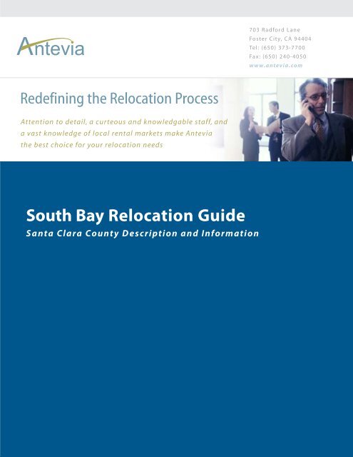
703 Radford Lane<br />
Foster City, CA 94404<br />
Tel: (650) 373-7700<br />
Fax: (650) 240-4050<br />
www.antevia.com<br />
Redefining the <strong>Relocation</strong> Process<br />
Attention to detail, a curteous and knowledgable staff, and<br />
a vast knowledge of local rental markets make <strong>Antevia</strong><br />
the best choice for your relocation needs<br />
<strong>South</strong> <strong>Bay</strong> <strong>Relocation</strong> <strong>Guide</strong><br />
Santa Clara County Description and Information
Santa Clara County, California<br />
County of Santa Clara, California<br />
Flag<br />
Seal<br />
Official website: http://www.sccgov.org/<br />
Location<br />
Santa Clara County is a county located in the San Francisco <strong>Bay</strong> Area of the U.S. state<br />
of California. It is the site of Silicon Valley. As of 2000 it had a population of 1,682,585.<br />
The county seat is San Jose.<br />
History<br />
Santa Clara County was one of the original counties of California, formed in 1850 at the<br />
time of statehood. Part of the county's territory was given to Alameda County in 1853.<br />
The county is named after Mission Santa Clara, which was established in 1777, and<br />
named for Saint Clare of Assisi, Italy. The name "Clare" or "Clara" means "clear" or<br />
"bright."<br />
In 1882, Santa Clara County tried to levy taxes upon property of the <strong>South</strong>ern Pacific<br />
Railroad within county boundaries. The result was the U.S. Supreme Court case of Santa<br />
Clara County v. <strong>South</strong>ern Pacific Railroad, 118 U.S. 394 (1886), in which the Court<br />
established the doctrine of corporate personhood.<br />
Geography<br />
According to the U.S. Census Bureau, the county has a total area of 3,377 km² (1,304<br />
mi²). 3,343 km² (1,291 mi²) of it is land and 34 km² (13 mi²) of it (1.02%) is water.
The San Andreas Fault runs along the Santa Cruz Mountains in the south of the county.<br />
Adjacent Counties<br />
San Benito County, California - south<br />
Santa Cruz County, California - south, southwest<br />
San Mateo County, California - northwest<br />
Alameda County, California - north<br />
Stanislaus County, California - east<br />
Merced County, California - southeast<br />
Demographics<br />
As of the census² of 2000, there were 1,682,585 people, 565,863 households, and<br />
395,538 families residing in the county. The population density was 503/km² (1,304/mi²).<br />
There were 579,329 housing units at an average density of 173/km² (449/mi²). The racial<br />
makeup of the county was 53.83% White, 2.80% Black or African American, 0.67%<br />
Native American, 25.56% Asian, 0.34% Pacific Islander, 12.13% from other races, and<br />
4.66% from two or more races. 23.98% of the population were Hispanic or Latino of any<br />
race.<br />
There were 565,863 households out of which 34.90% had children under the age of 18<br />
living with them, 54.90% were married couples living together, 10.00% had a female<br />
householder with no husband present, and 30.10% were non-families. 21.40% of all<br />
households were made up of individuals and 5.90% had someone living alone who was<br />
65 years of age or older. The average household size was 2.92 and the average family<br />
size was 3.41.<br />
In the county the population was spread out with 24.70% under the age of 18, 9.30%<br />
from 18 to 24, 35.40% from 25 to 44, 21.00% from 45 to 64, and 9.50% who were 65<br />
years of age or older. The median age was 34 years. For every 100 females there were<br />
102.80 males. For every 100 females age 18 and over, there were 101.90 males.<br />
The median income for a household in the county was $74,335, and the median income<br />
for a family was $81,717. Males had a median income of $56,240 versus $40,574 for<br />
females. The per capita income for the county was $32,795. About 4.90% of families and
7.50% of the population were below the poverty line, including 8.40% of those under age<br />
18 and 6.40% of those age 65 or over.<br />
Santa Clara County has the highest median household income of any county in<br />
California.<br />
Politics<br />
Santa Clara County Government Center<br />
Presidential elections results<br />
Year GOP Dems<br />
2004 34.6% 209,094 63.9% 386,100<br />
2000 34.4% 188,750 60.7% 332,490<br />
1996 32.2% 168,291 56.9% 297,639
1992 28.4% 170,870 49.2% 296,265<br />
1988 47.0% 254,442 51.3% 277,810<br />
1984 54.8% 288,638 43.6% 229,865<br />
1980 48.0% 299,048 35.0% 166,995<br />
1976 49.5% 219,188 46.9% 208,023<br />
1972 51.9% 237,334 45.6% 208,506<br />
Transportation<br />
Mass transit<br />
Santa Clara County has consolidated its transportation services into the Santa Clara<br />
Valley Transportation Authority, which operates a rapidly expanding light rail system<br />
and a large system of bus routes. It also manages certain county-funded highway and<br />
expressway projects.<br />
Besides SCVTA, the County is also served by Caltrain commuter rail service.<br />
Freeways and expressways<br />
The county has an extensive freeway system (now nearing completion) and a separate<br />
expressway system. Expressways in California are distinct from freeways; although<br />
access to adjoining properties is eliminated, at-grade intersections are allowed. However,<br />
unlike expressways virtually everywhere else in California, the Santa Clara County<br />
expressways were built, signed, and maintained as county roads; they are not maintained<br />
by Caltrans, although they are patrolled by the California Highway Patrol.<br />
Many journalists and mapmakers from outside California do not understand the important<br />
difference between freeways and expressways, and incorrectly describe or depict Silicon
Valley as criss-crossed by a "web" of freeways when many of the lines on the map are<br />
really expressways.<br />
There is also a large street network dominated by four- and six-lane arterials. Some of the<br />
newer boulevards (primarily in the West Valley) are divided with landscaped medians.<br />
They also often have neat concrete sidewalks, although people are rarely seen using<br />
them.<br />
County roads<br />
Santa Clara County Expressway System<br />
Santa Clara County Route G2 - Lawrence Expressway<br />
Santa Clara County Route G3 - Page Mill Road / Oregon Expressway<br />
Santa Clara County Route G4 - San Tomas Expressway / Montague Expressway<br />
Santa Clara County Route G5 - Foothill Expressway<br />
Santa Clara County Route G6 - Central Expressway<br />
Santa Clara County Route G8 - Almaden Expressway<br />
Santa Clara County Route G10 - Blossom Hill Road<br />
Santa Clara County Route G21 - Capitol Expressway<br />
Ports<br />
The county's main airport is Norman Y. Mineta San José International Airport (SJC).<br />
Moffett Federal Airfield (NUQ), a former Naval Air Station, is used by the Air National<br />
Guard, NASA, and Lockheed Martin, There are also smaller general aviation airports in<br />
Palo Alto (PAO), San Jose (RHV), and San Martin (E16).<br />
The county has no seaports. Like all other <strong>Bay</strong> Area counties, it is dependent upon the<br />
Port of Oakland for transport of ocean cargo.
Cities, towns, and neighborhoods<br />
Incorporated Places<br />
There are 15 incorporated cities and towns in the county:<br />
Campbell<br />
Cupertino<br />
Gilroy<br />
Los Altos<br />
Los Altos Hills<br />
Los Gatos<br />
Milpitas<br />
Monte Sereno<br />
Morgan Hill<br />
Mountain View<br />
Palo Alto<br />
San Jose (incorporating the formerly independent unincorporated communities of Alum<br />
Rock, and Cambrian Park, as well as the formerly independent incorporated cities of<br />
Willow Glen, East San Jose, and Alviso)<br />
Santa Clara<br />
Saratoga<br />
Sunnyvale<br />
Unincorporated communities
Census Designated Places<br />
Buena Vista<br />
Burbank<br />
East Foothills<br />
Fruitdale<br />
Lexington Hills<br />
Loyola also known as Loyola Corners<br />
San Martin<br />
Seven Trees<br />
Stanford<br />
Sunol-Midtown<br />
Other unincorporated locales<br />
Bell Station also known as Bells Station<br />
Chemeketa Park<br />
Casa Loma also known as Loma Chiquita<br />
San Antonio<br />
Sister counties<br />
• Hsinchu County,<br />
Taiwan