Company Profile - AABSyS IT
Company Profile - AABSyS IT
Company Profile - AABSyS IT

You also want an ePaper? Increase the reach of your titles
YUMPU automatically turns print PDFs into web optimized ePapers that Google loves.
<strong>AABSyS</strong> INFORMATION TECHNOLOGY PRIVATE LIM<strong>IT</strong>ED<br />
Plot No.E/54 & E/54/1, Infocity, Chandaka Industrial Estate, Patia, Bhubaneswar Pin-751024<br />
Telephone: India: +91 (674) 662 1007/8 Telefax: +91 (674) 662 1000<br />
Email: info@aabsys.com Website: www.aabsys.com www.bloochip.com<br />
<strong>AABSyS</strong><br />
CAD GIS Software<br />
ISO 9001:2008, ISO 14001:2004
Preferred outsourcing partner for customers around the world<br />
GLOBAL FOOTPRINTS<br />
AUSTRALIA<br />
BELGIUM<br />
CANADA<br />
CAYMAN ISLANDS<br />
CZECH REPUBLIC<br />
GERMANY<br />
INDIA<br />
IRELAND<br />
<strong>IT</strong>ALY<br />
NETHERLANDS<br />
NEW ZEALAND<br />
SOUTH AFRICA<br />
SOUTH EAST ASIA<br />
SW<strong>IT</strong>ZERLAND<br />
UAE<br />
UK<br />
USA<br />
<strong>AABSyS</strong><br />
CAD GIS Software<br />
ISO 9001:2008, ISO 14001:2004
COMPANY <strong>Profile</strong><br />
MANAGEMENT:<br />
Directors with backgrounds in management, engineering, marketing and finance manage the company<br />
professionally. The management has ensured that <strong>AABSyS</strong> is a preferred <strong>IT</strong> & Geospatial outsourcing vendor<br />
for Global Customers.<br />
OFFICE AND TEAM:<br />
<strong>AABSyS</strong>'s state-of-the-art infrastructure is located in Bhubaneswar, Orissa, one of India's prime information<br />
technology centers and offers a professional working environment. Our strength lies in our team of motivated,<br />
well-qualified and experienced professional who are dedicated to efficient and on time delivery of quality<br />
services that meet our customer's highest standards. Our team includes experienced project managers, highly<br />
skilled software developers, CAD/GIS professionals and remote sensing and photogrammetry professionals.<br />
<strong>AABSyS</strong> has its core competencies in the areas of geographic information system (GIS), computer aided<br />
drafting (CAD), computer aided facility management (CAFM), remote sensing, photogrammetry and software<br />
development, such as in GIS based application development with solutions for natural resource management,<br />
urban planning, environment, utility and e - governance.<br />
HIGHLIGHTS:<br />
Established in 1998<br />
ISO 9001:2008 and ISO 14001:2004 Certified Quality Processes<br />
Worldwide customer base<br />
State-of-the-art infrastructure for 300 <strong>IT</strong> professionals<br />
Memberships with leading organizations<br />
IACC: Indo American Chamber of Commerce<br />
NASSCOM: National Association of Software and Services Companies<br />
STPI: Software Technology Parks of India<br />
C<strong>IT</strong>E: Confederation of Information Technology Entrepreneurs, Orissa<br />
2
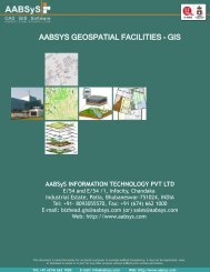
GIS Utilities<br />
<strong>AABSyS</strong> has extensive experience and expertise in data capturing of utility networks such as electrical, water,<br />
gas, sewage & telecom.<br />
Our services include data capturing, network rectification, network maintenance and network adjustment on<br />
leading GIS platforms such as Smallworld and ArcFM. The process includes data capturing as per dimensions,<br />
database creation and linking spatial and non-spatial data. <strong>AABSyS</strong> works directly on customer's GIS systems<br />
through secured and remote access via C<strong>IT</strong>RIX. Large scale digitization of utility networks are also captured<br />
using AutoCAD & Microstation softwares on site.<br />
QUAL<strong>IT</strong>Y ASSURANCE:<br />
<strong>AABSyS</strong>'s online query management system ensures that queries related to projects are directly raised by<br />
operators and published to the customer with pictures and descriptions. This allows the customers to<br />
understand and review “open queries” relating to large-scale projects. Customers give feedback directly on the<br />
Query Management System (QMS). This facilitates large-scale execution of projects at ease.<br />
Our quality procedure involves multiple color plots at different stage of production, manual and on-screen cross<br />
check of electronic files against source documents and utilization of automated quality tools and routines to<br />
ensure 100% quality.<br />
<strong>AABSyS</strong> PROVIDES:<br />
GIS – AM/FM – LIS data capture & database creation (electricity, gas, water, sewage, and telecom network)<br />
Spatial and non-spatial capturing & linking<br />
Graphical representation and attribution<br />
Network rectification<br />
Network adjustment<br />
Operator assisted tracking<br />
Post-vectorizing data cleaning & normalization<br />
Coordinate system conversion<br />
Data assignment & analysis<br />
Database development & programming<br />
PLATFORMS:<br />
Smallworld<br />
ArcFM<br />
ArcFM UT<br />
ArcGIS<br />
AutoCAD<br />
Microststion<br />
Adjust-<strong>IT</strong><br />
More than 50,000 kms of<br />
Utility Network captured<br />
3
GIS Mapping Remote Sensing Photogrammetry<br />
<strong>AABSyS</strong> provides high quality and cost-effective services for GIS Remote Sensing, Photogrammetry and<br />
Mapping.<br />
MAPPING SERVICES include large scale data conversion from hard copies and satellite imageries,<br />
georeferencing, edge-matching, topology creation, merging and map production.<br />
GIS SERVICES include map creation, interpretation & analysis, system design & architecture, data<br />
management & maintenance, etc.<br />
REMOTE SENSING SERVICES<br />
Agriculture crop mapping yield estimation, suitability assessment studies, change detection studies,<br />
crop model development, damage and land degradation assessment studies.<br />
Forest structural assessment, forest management and sustainable livelihood development, species level<br />
classification and bio-diversity mapping, change detection studies, environmental impact assessment<br />
studies.<br />
Mining & Geology site suitability analysis, mineral mapping to identify potential mineral zones, lithological<br />
structural features, geological database creation, map updation for mineral exploration.<br />
Environmental impact assessment<br />
Wireless Telecommunications : <strong>AABSyS</strong> supplies a wide range of high quality and up-to-date high<br />
resolutions spatial datasets upto 2.5m and 5m resolution. Layers available: Clutter, DTM, Vectors &<br />
Building Heights<br />
PHOTOGRAMMETRY SERVICES include aerial triangulation, creating mosaics, edge matching, tile<br />
generation in user defined dimensions, planimetric feature extraction, contour generation, orthophoto<br />
generation, ortho rectification, creation of DEM, DTM and DSM, LIDAR data processing and 3D city modeling<br />
PLATFORMS:<br />
AutoCAD Map<br />
ArcGIS<br />
Miner & Miner ArcFM<br />
Microstation<br />
MapInfo<br />
ERDAD IMAGINE<br />
ILWIS<br />
ERMAPPER<br />
LPS (Leica Photogrammetry Suite)<br />
SSK<br />
4
GIS Survey<br />
<strong>AABSyS</strong> has prepared final site survey plans from onsite surveys using GPS coordinates, survey notes and<br />
hand sketches.<br />
OUR SERVICES INCLUDE:<br />
Site survey plan interpretation<br />
GPS date migration<br />
Field sketches and survey coordinates interpretation<br />
Map preparation based on GPS data<br />
Contour development<br />
Telecom survey plan preparation<br />
Mining map preparation<br />
Digitization<br />
Our quality procedure involves multiple colour plots at different stages of production, manual and on-screen<br />
cross check of electronic files against source document and utilization of automated quality tools and routines<br />
to ensure high quality.<br />
PLATFORMS:<br />
Total Station Survey<br />
DGPS Survey (Trimble)<br />
GPS Survey (Garmin)<br />
5
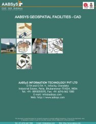
CAFM / CAD 2D & 3D<br />
Architectural, Facility & Engineering Drawings<br />
<strong>AABSyS</strong> provides services for large-scale 2D & 3D CAD drafting, paper to CAD conversion, raster to vector<br />
conversion for architectural & facility management plans, plumbing plans, structural plans and engineering<br />
drawing on leading CAD platform such as AutoCAD & Microstation.<br />
<strong>AABSyS</strong> has knowledge in CAD programs such as ArchiCAD, ADT, Revit and 3D Studio Max. We provide 3D<br />
views, sectional plans and elevation plans based on customer's requirements.<br />
<strong>AABSyS</strong> CAD professionals possess high skills and experience in preparing 3D models, rendering and walk<br />
throughs for residential and commercial buildings. Specific attention is given for grid alignment, capturing<br />
dimensions accurately, drafting of slanting roofs etc.<br />
<strong>AABSyS</strong> works in citrix on AutoCAD, Archibus and CAD Overlay using web based facility management<br />
applications. The typical work includes drafting of floor plans based on paper drawings or rough sketches of<br />
building plans. gathering and preparing building and property information from supplied datasheets or field<br />
sketches, assigning space characteristics and usage information, including employee or occupancy data and<br />
placing workplace assets such as furniture and equipment.<br />
Our quality procedure involves multiple color plots and different stages of production, manual and on-screen<br />
cross check of electronic files against source documents and utilization of automated quality tools and routines.<br />
PLATFORMS:<br />
AutoCAD Map<br />
Microstation<br />
ArchiCAD<br />
Vectorworks<br />
3D Studio Max<br />
ADT<br />
Revit<br />
6
GIS / <strong>IT</strong><br />
Application Development<br />
<strong>AABSyS</strong> specializes in providing user-friendly, reliable and efficient solutions. We have rich expertise in<br />
GIS application development.<br />
OUR GIS SERVICES INCLUDE:<br />
Web based application development<br />
Design, development and maintenance of customer geospatial databases<br />
Database migration on cross platforms<br />
Application migration on cross platforms<br />
Vehicle tracking system<br />
Mobile spatial information system<br />
Development of industry standard spatial information systems<br />
GUI (Graphical User Interface) development<br />
SDI (Spatial Data Infrastructure)<br />
Open source environment<br />
Bloochip is the brand of our <strong>IT</strong> division. Our software solutions include simplifying complex administrative<br />
and management procedures on web based frameworks.<br />
OUR <strong>IT</strong> SERVICES INCLUDE:<br />
Content management system integration<br />
Web portal design and development<br />
Web enabling of legacy systems<br />
Management Information Systems<br />
Custom database design<br />
Desktop application programming<br />
PLATFORMS:<br />
ESRI – ArcGIS, ArcGIS<br />
Server & ArcGIS Engine<br />
Miner & Miner – ArcFM<br />
GE Small World – Small<br />
world Core, SIAS<br />
MapInfo – MapInfo<br />
Professional, MapX,<br />
MapXtreme<br />
Open Source – GeoServer,<br />
MapServer, OpenLayers<br />
LEICA - ERDAS Apollo<br />
PHP<br />
ASP.NET<br />
7
INFRASTRUCTURE Facility<br />
Fully equipped state-of-art <strong>IT</strong> infrastructure located in Bhubaneswar’s Infocity, well connected to<br />
national and international destinations.<br />
HIGHLIGHTS:<br />
Dedicated software development centre spread across 43,000 sq ft for 300 <strong>IT</strong> professionals<br />
State-of-the-art workstations<br />
Central air-conditioning<br />
15 Mbps dedicated high speed internet bandwidth access<br />
24 hour <strong>IT</strong> support<br />
Firewall and network security<br />
Power back-up and generator<br />
Conference rooms<br />
Canteen and relaxation rooms<br />
Private security<br />
Parking<br />
8
LOCATION Bhubaneswar<br />
ADVANTAGE <strong>AABSyS</strong><br />
Bhubaneswar is one of the fastest growing <strong>IT</strong> destinations in eastern India<br />
Proximity to research & education organizations and universities of repute with excellent pool of well-trained university graduates<br />
Beautiful campus, excellent climatic conditions<br />
Well connected to National and International destinations by road, rail and air<br />
Popular tourist destination – Bhubaneswar, a “City of Temples”<br />
Close proximity to excellent beaches, forest, wildlife sanctuaries and nature parks<br />
Golf course inside Infocity campus<br />
Cost effective outsourcing destination<br />
Global market experience<br />
ISO 9001:2008, ISO 14001:2004 Certification<br />
State-of-the-art infrastructure with excellent working environment<br />
Adherence to TAT (Turn Around Time)<br />
Flexible production schedules<br />
Well-trained & skilled professionals with diverse backgrounds and experiences<br />
Short notice capacity expansions<br />
I N D I A<br />
Bhubaneswar<br />
Multi Lingual Support: English, German, French, Hindi, Oriya, Tamil, Malayalam<br />
Assured information security and confidentiality<br />
ONE OBJECTIVE<br />
Make Our Customers Grow<br />
Disclaimer: All trade names, logos, product names and trademarks mentioned belong to the respective owners.<br />
9