3D Building and Road Reconstruction - GeoComputing Laboratory
3D Building and Road Reconstruction - GeoComputing Laboratory
3D Building and Road Reconstruction - GeoComputing Laboratory

Create successful ePaper yourself
Turn your PDF publications into a flip-book with our unique Google optimized e-Paper software.
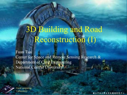
<strong>3D</strong> <strong>Building</strong> <strong>and</strong> <strong>Road</strong><br />
<strong>Reconstruction</strong> (I)<br />
Fuan Tsai<br />
Center for Space <strong>and</strong> Remote Sensing Research &<br />
Department of Civil Engineering<br />
National Central University<br />
<strong>GeoComputing</strong><br />
<strong>Laboratory</strong><br />
國 立 中 央 大 學 太 空 及 遙 測 研 究 中 心
2<br />
Strategy of Modeling<br />
<br />
<br />
<strong>Building</strong>s<br />
By strategies<br />
Data-driven v.s. model-driven<br />
By extracted features<br />
Points, lines, polygons<br />
By degree of automation<br />
<strong>Road</strong>s<br />
Manual; semi-automatic; fully-automatic<br />
strategies<br />
LOD0<br />
Data-driven; fully-automatic<br />
LOD1 <strong>and</strong> higher<br />
Data- <strong>and</strong> model-driven; semi-automatic<br />
國 立 中 央 大 學 太 空 及 遙 測 研 究 中 心 空 間 運 算 實 驗 室<br />
National Central University Center for Space <strong>and</strong> Remote Sensing Research <strong>GeoComputing</strong> <strong>Laboratory</strong>
3<br />
Data-driven <strong>Building</strong> <strong>Reconstruction</strong><br />
Model<br />
deduction<br />
Modeling<br />
Images Edge detection Line tracing<br />
國 立 中 央 大 學 太 空 及 遙 測 研 究 中 心 空 間 運 算 實 驗 室<br />
National Central University Center for Space <strong>and</strong> Remote Sensing Research <strong>GeoComputing</strong> <strong>Laboratory</strong>
4<br />
Model-driven <strong>Building</strong> <strong>Reconstruction</strong><br />
Model<br />
Database<br />
Image<br />
Model-Image matching<br />
國 立 中 央 大 學 太 空 及 遙 測 研 究 中 心 空 間 運 算 實 驗 室<br />
National Central University Center for Space <strong>and</strong> Remote Sensing Research <strong>GeoComputing</strong> <strong>Laboratory</strong>
5<br />
Point Features<br />
(Gruen <strong>and</strong> Wang, 1998)<br />
國 立 中 央 大 學 太 空 及 遙 測 研 究 中 心 空 間 運 算 實 驗 室<br />
National Central University Center for Space <strong>and</strong> Remote Sensing Research <strong>GeoComputing</strong> <strong>Laboratory</strong>
6<br />
Line Features<br />
Initial Bld Models & <strong>3D</strong> line segments<br />
Split<br />
Split<br />
2D Space<br />
Merge<br />
<strong>3D</strong> Space<br />
Shaping<br />
(Rau <strong>and</strong> Chen, 2002)<br />
國 立 中 央 大 學 太 空 及 遙 測 研 究 中 心 空 間 運 算 實 驗 室<br />
National Central University Center for Space <strong>and</strong> Remote Sensing Research <strong>GeoComputing</strong> <strong>Laboratory</strong>
7<br />
Polygon/Polyhedron Features<br />
(Lang <strong>and</strong> Förstner, 1996 ) (Gulch et al, 1998)<br />
(Tseng <strong>and</strong> Wang, 2002 )<br />
國 立 中 央 大 學 太 空 及 遙 測 研 究 中 心 空 間 運 算 實 驗 室<br />
National Central University Center for Space <strong>and</strong> Remote Sensing Research <strong>GeoComputing</strong> <strong>Laboratory</strong>
8<br />
Manual<br />
Human image<br />
interpretation<br />
Degree of Automation<br />
Computerized processing<br />
User-friendly GUI<br />
Interactive processing<br />
QC & QA<br />
Semi-automatic<br />
Semi-automatic image<br />
interpretation<br />
Computerized processing<br />
Fully-automatic<br />
Computerized image<br />
interpretation <strong>and</strong><br />
processing<br />
國 立 中 央 大 學 太 空 及 遙 測 研 究 中 心 空 間 運 算 實 驗 室<br />
National Central University Center for Space <strong>and</strong> Remote Sensing Research <strong>GeoComputing</strong> <strong>Laboratory</strong>
9<br />
Data <strong>and</strong> Techniques<br />
By data sources<br />
Topo. maps, images,<br />
LiDAR<br />
Data fusion<br />
Topo. maps<br />
<strong>Building</strong>s<br />
<strong>Road</strong>s<br />
LiDAR<br />
TLS<br />
Airborne<br />
Images<br />
Close-range<br />
Airborne<br />
Satellite<br />
國 立 中 央 大 學 太 空 及 遙 測 研 究 中 心 空 間 運 算 實 驗 室<br />
National Central University Center for Space <strong>and</strong> Remote Sensing Research <strong>GeoComputing</strong> <strong>Laboratory</strong>
10<br />
Block-based models<br />
Single data source<br />
Airborne images<br />
Topo. maps<br />
Airborne LiDAR<br />
Data fusion<br />
Topo. map+images<br />
Topo map+LiDAR<br />
LiDAR+images<br />
<strong>Building</strong> Modeling<br />
Unconventional methods<br />
Single-view reconstru<br />
ction<br />
Highly detailed<br />
models<br />
國 立 中 央 大 學 太 空 及 遙 測 研 究 中 心 空 間 運 算 實 驗 室<br />
National Central University Center for Space <strong>and</strong> Remote Sensing Research <strong>GeoComputing</strong> <strong>Laboratory</strong>
11<br />
Stereo Aerial Photos<br />
3-D View<br />
Partially visible<br />
Fully visible<br />
國 立 中 央 大 學 太 空 及 遙 測 研 究 中 心 空 間 運 算 實 驗 室<br />
National Central University Center for Space <strong>and</strong> Remote Sensing Research <strong>GeoComputing</strong> <strong>Laboratory</strong>
<strong>Building</strong> Modeling using Aerial Photographs<br />
12<br />
Input data: <strong>3D</strong> structure lines<br />
SPLIT-MERGE-SHAPE (SMS)<br />
SPLIT-MERGE<br />
2D topology reconstruction<br />
For closed objects<br />
<strong>Building</strong>s, lake, farml<strong>and</strong>, etc<br />
SHAPE<br />
Roof Shaping<br />
Level-of-Detail <strong>Building</strong> Modeling<br />
Polyhedral or Prismatic<br />
Polyhedral<br />
Prismatic<br />
國 立 中 央 大 學 太 空 及 遙 測 研 究 中 心 空 間 運 算 實 驗 室<br />
National Central University Center for Space <strong>and</strong> Remote Sensing Research <strong>GeoComputing</strong> <strong>Laboratory</strong>
SMS-<strong>Building</strong> Modeling Procedure<br />
Initial Bld Models & <strong>3D</strong> line segments<br />
Split<br />
Split<br />
2D Space<br />
Merge<br />
<strong>3D</strong> Space<br />
Shaping
14<br />
NCU<br />
Examples<br />
Images <strong>and</strong> lines<br />
Bld. Models<br />
國 立 中 央 大 學 太 空 及 遙 測 研 究 中 心 空 間 運 算 實 驗 室<br />
National Central University Center for Space <strong>and</strong> Remote Sensing Research <strong>GeoComputing</strong> <strong>Laboratory</strong>
15<br />
DBM Examples<br />
國 立 中 央 大 學 太 空 及 遙 測 研 究 中 心 空 間 運 算 實 驗 室<br />
National Central University Center for Space <strong>and</strong> Remote Sensing Research <strong>GeoComputing</strong> <strong>Laboratory</strong>
16<br />
<strong>Building</strong> Modeling using Aerial Images<br />
Hsin-Chu Science Park<br />
By-product of large scale vector maps<br />
<strong>3D</strong> structure lines (include ridge lines)<br />
Real height<br />
Data Provider:CECI<br />
國 立 中 央 大 學 太 空 及 遙 測 研 究 中 心 空 間 運 算 實 驗 室<br />
National Central University Center for Space <strong>and</strong> Remote Sensing Research <strong>GeoComputing</strong> <strong>Laboratory</strong>
17<br />
Bld. Modeling from Topo. Map<br />
<strong>Building</strong> outlines <strong>and</strong> no. of floors (notations)<br />
Polygon Tracing<br />
Export Boundaries<br />
Height Assignment<br />
2<br />
1<br />
<strong>Building</strong> Polylines<br />
<strong>Building</strong> Polygons<br />
4<br />
3<br />
1<br />
2<br />
1<br />
1<br />
Point-in-polygon Examination<br />
1<br />
Topomaps(CAD)<br />
4<br />
3<br />
1<br />
<strong>Building</strong> Polygons with<br />
Stories<br />
<strong>3D</strong> <strong>Building</strong> Models<br />
Export Stories<br />
1<br />
1<br />
Stories<br />
國 立 中 央 大 學 太 空 及 遙 測 研 究 中 心 空 間 運 算 實 驗 室<br />
National Central University Center for Space <strong>and</strong> Remote Sensing Research <strong>GeoComputing</strong> <strong>Laboratory</strong>
18<br />
Example (Taipei City)<br />
LOD0 Bld. Models<br />
2D Outlines<br />
國 立 中 央 大 學 太 空 及 遙 測 研 究 中 心 空 間 運 算 實 驗 室<br />
National Central University Center for Space <strong>and</strong> Remote Sensing Research <strong>GeoComputing</strong> <strong>Laboratory</strong>
<strong>Building</strong> Modeling Using LIDAR<br />
1.Elev. Segmention 2.Regularization<br />
...<br />
...<br />
Digital Surface Model<br />
3.<strong>Reconstruction</strong><br />
1 2<br />
3
20<br />
Airborne LiDAR Data<br />
Point Clouds<br />
國 立 中 央 大 學 太 空 及 遙 測 研 究 中 心 空 間 運 算 實 驗 室<br />
National Central University Center for Space <strong>and</strong> Remote Sensing Research <strong>GeoComputing</strong> <strong>Laboratory</strong>
Ground Based LIDAR<br />
21<br />
© OPTECH<br />
國 立 中 央 大 學 太 空 及 遙 測 研 究 中 心 空 間 運 算 實 驗 室<br />
National Central University Center for Space <strong>and</strong> Remote Sensing Research <strong>GeoComputing</strong> <strong>Laboratory</strong>
LIDAR22<br />
Fusion of Airborne <strong>and</strong><br />
Ground-based LIDAR<br />
© Optech<br />
國 立 中 央 大 學 太 空 及 遙 測 研 究 中 心 空 間 運 算 實 驗 室<br />
National Central University Center for Space <strong>and</strong> Remote Sensing Research <strong>GeoComputing</strong> <strong>Laboratory</strong>
<strong>Building</strong> Modeling using LIDAR<br />
23<br />
Lidar DSM<br />
<strong>Building</strong> Boundaries<br />
Top-View DBM<br />
Aerial photo (Only for comparison)<br />
國 立 中 央 大 學 太 空 及 遙 測 研 究 中 心 空 間 運 算 實 驗 室<br />
National Central University Center for Space <strong>and</strong> Remote Sensing Research <strong>GeoComputing</strong> <strong>Laboratory</strong>
24<br />
Examples<br />
LiDAR Contours<br />
Bld. Models<br />
國 立 中 央 大 學 太 空 及 遙 測 研 究 中 心 空 間 運 算 實 驗 室<br />
National Central University Center for Space <strong>and</strong> Remote Sensing Research <strong>GeoComputing</strong> <strong>Laboratory</strong>
25<br />
Fusion of Aerial Photo <strong>and</strong> Topo Map<br />
國 立 中 央 大 學 太 空 及 遙 測 研 究 中 心 空 間 運 算 實 驗 室<br />
National Central University Center for Space <strong>and</strong> Remote Sensing Research <strong>GeoComputing</strong> <strong>Laboratory</strong>
26<br />
Example<br />
Left Right Left Right<br />
<strong>3D</strong> Lines DBM <strong>3D</strong> Lines DBM<br />
國 立 中 央 大 學 太 空 及 遙 測 研 究 中 心 空 間 運 算 實 驗 室<br />
National Central University Center for Space <strong>and</strong> Remote Sensing Research <strong>GeoComputing</strong> <strong>Laboratory</strong>
27<br />
Roof Structures<br />
Structure lines<br />
Left Right Roof structure<br />
國 立 中 央 大 學 太 空 及 遙 測 研 究 中 心 空 間 運 算 實 驗 室<br />
National Central University Center for Space <strong>and</strong> Remote Sensing Research <strong>GeoComputing</strong> <strong>Laboratory</strong>
28<br />
<strong>Building</strong> Boundaries<br />
<strong>Building</strong> boundaries <strong>and</strong> Structural lines<br />
國 立 中 央 大 學 太 空 及 遙 測 研 究 中 心 空 間 運 算 實 驗 室<br />
National Central University Center for Space <strong>and</strong> Remote Sensing Research <strong>GeoComputing</strong> <strong>Laboratory</strong>
<strong>Building</strong> Modeling using Aerial images<br />
<strong>and</strong> Topographic map<br />
29<br />
with structural lines<br />
Block Model<br />
國 立 中 央 大 學 太 空 及 遙 測 研 究 中 心 空 間 運 算 實 驗 室<br />
National Central University Center for Space <strong>and</strong> Remote Sensing Research <strong>GeoComputing</strong> <strong>Laboratory</strong>
30<br />
Fusion of Topo Map <strong>and</strong> LIDAR<br />
國 立 中 央 大 學 太 空 及 遙 測 研 究 中 心 空 間 運 算 實 驗 室<br />
National Central University Center for Space <strong>and</strong> Remote Sensing Research <strong>GeoComputing</strong> <strong>Laboratory</strong>
31<br />
Example<br />
LIDAR <strong>and</strong> Boundary Lines<br />
DBM<br />
國 立 中 央 大 學 太 空 及 遙 測 研 究 中 心 空 間 運 算 實 驗 室<br />
National Central University Center for Space <strong>and</strong> Remote Sensing Research <strong>GeoComputing</strong> <strong>Laboratory</strong>
32<br />
Example<br />
國 立 中 央 大 學 太 空 及 遙 測 研 究 中 心 空 間 運 算 實 驗 室<br />
National Central University Center for Space <strong>and</strong> Remote Sensing Research <strong>GeoComputing</strong> <strong>Laboratory</strong>
33<br />
Generated DBM<br />
Generated DBM <strong>and</strong> LIDAR points<br />
國 立 中 央 大 學 太 空 及 遙 測 研 究 中 心 空 間 運 算 實 驗 室<br />
National Central University Center for Space <strong>and</strong> Remote Sensing Research <strong>GeoComputing</strong> <strong>Laboratory</strong>
34<br />
Fusion of LIDAR <strong>and</strong> Aerial Photo<br />
+ +<br />
國 立 中 央 大 學 太 空 及 遙 測 研 究 中 心 空 間 運 算 實 驗 室<br />
National Central University Center for Space <strong>and</strong> Remote Sensing Research <strong>GeoComputing</strong> <strong>Laboratory</strong>
35<br />
Image NDVI Textures lidar<br />
國 立 中 央 大 學 太 空 及 遙 測 研 究 中 心 空 間 運 算 實 驗 室<br />
National Central University Center for Space <strong>and</strong> Remote Sensing Research <strong>GeoComputing</strong> <strong>Laboratory</strong>
36<br />
<strong>Building</strong> detection<br />
Segments <strong>Building</strong> regions <strong>Building</strong> regions <strong>and</strong><br />
topographic maps<br />
國 立 中 央 大 學 太 空 及 遙 測 研 究 中 心 空 間 運 算 實 驗 室<br />
National Central University Center for Space <strong>and</strong> Remote Sensing Research <strong>GeoComputing</strong> <strong>Laboratory</strong>
37<br />
Example<br />
Generated <strong>3D</strong> DBM<br />
國 立 中 央 大 學 太 空 及 遙 測 研 究 中 心 空 間 運 算 實 驗 室<br />
National Central University Center for Space <strong>and</strong> Remote Sensing Research <strong>GeoComputing</strong> <strong>Laboratory</strong>
38<br />
Single-View <strong>Reconstruction</strong><br />
國 立 中 央 大 學 太 空 及 遙 測 研 究 中 心 空 間 運 算 實 驗 室<br />
National Central University Center for Space <strong>and</strong> Remote Sensing Research <strong>GeoComputing</strong> <strong>Laboratory</strong>
39<br />
Vanishing Point Metrology<br />
What is a vanishing point<br />
The point (in a perspective image) at<br />
which parallel lines receding from an<br />
observer seem to converge.<br />
國 立 中 央 大 學 太 空 及 遙 測 研 究 中 心 空 間 運 算 實 驗 室<br />
National Central University Center for Space <strong>and</strong> Remote Sensing Research <strong>GeoComputing</strong> <strong>Laboratory</strong>
Linear perspective (1-3 vanishing points):<br />
40<br />
Curvilinear perspective (4 or 5 vanishing points):<br />
(Pietro Perugino)<br />
Jan van Eyck, Arnolfini's Wedding<br />
國 立 中 央 大 學 太 空 及 遙 測 研 究 中 心 空 間 運 算 實 驗 室<br />
National Central University Center for Space <strong>and</strong> Remote Sensing Research <strong>GeoComputing</strong> <strong>Laboratory</strong>
41<br />
(Horry et al., 1997)<br />
國 立 中 央 大 學 太 空 及 遙 測 研 究 中 心 空 間 運 算 實 驗 室<br />
National Central University Center for Space <strong>and</strong> Remote Sensing Research <strong>GeoComputing</strong> <strong>Laboratory</strong>
42<br />
(Leibowitz et al., 1999)<br />
國 立 中 央 大 學 太 空 及 遙 測 研 究 中 心 空 間 運 算 實 驗 室<br />
National Central University Center for Space <strong>and</strong> Remote Sensing Research <strong>GeoComputing</strong> <strong>Laboratory</strong>
43<br />
SVR Procedure<br />
Raw image<br />
Line extraction<br />
Feature points<br />
selection<br />
Vanishing points<br />
calculation<br />
Feature points<br />
calculation<br />
Height equalization<br />
Generate<br />
building model<br />
Vanishing points<br />
refinement<br />
國 立 中 央 大 學 太 空 及 遙 測 研 究 中 心 空 間 運 算 實 驗 室<br />
National Central University Center for Space <strong>and</strong> Remote Sensing Research <strong>GeoComputing</strong> <strong>Laboratory</strong>
44<br />
Automatic Vanishing Point Detection<br />
Vx (-1492.4, -429.9)<br />
Vy (1104.8, -480.0)<br />
Total – 300 points<br />
Vx – 16<br />
Vy – 50<br />
Vz – 20<br />
Vz (248.7, 1699.5)<br />
國 立 中 央 大 學 太 空 及 遙 測 研 究 中 心 空 間 運 算 實 驗 室<br />
National Central University Center for Space <strong>and</strong> Remote Sensing Research <strong>GeoComputing</strong> <strong>Laboratory</strong>
45<br />
Automatic Vanishing Point Detection<br />
K-means Manual LS Proposed<br />
i j i j i j i j<br />
VPx -1563.7 -456.9 -1711.7 -504.7 -1478.4 -415.9 -1492.4 -429.9<br />
VPy 1117.1 -490.5 1078.6 -459.3 1106.83 -478.0 1104.8 -480.0<br />
VPz 259.4 1723.4 256.1 1663.5 246.7 1675.5 248.7 1699.5<br />
RMSE 0. 598 % 0.673 % 0.605% 0.458 %<br />
國 立 中 央 大 學 太 空 及 遙 測 研 究 中 心 空 間 運 算 實 驗 室<br />
National Central University Center for Space <strong>and</strong> Remote Sensing Research <strong>GeoComputing</strong> <strong>Laboratory</strong>
46<br />
(X, Y) Coordinates<br />
Get projected images for two main plans, <strong>and</strong> use reference<br />
height to measure the scale.<br />
國 立 中 央 大 學 太 空 及 遙 測 研 究 中 心 空 間 運 算 實 驗 室<br />
National Central University Center for Space <strong>and</strong> Remote Sensing Research <strong>GeoComputing</strong> <strong>Laboratory</strong>
47<br />
Elevation (Z) Coordinate<br />
Single-View perspective metrology:<br />
P = L ∞<br />
∩Br B<br />
R =VB∩T r P<br />
D=<br />
d V , R ∗d T , B <br />
d V , T ∗d R , B ∗D r<br />
國 立 中 央 大 學 太 空 及 遙 測 研 究 中 心 空 間 運 算 實 驗 室<br />
National Central University Center for Space <strong>and</strong> Remote Sensing Research <strong>GeoComputing</strong> <strong>Laboratory</strong>
48<br />
Height Equalization<br />
To minimize the errors in order to obtain more accurate models.<br />
1. Sort according to height values.<br />
2. Define the threshold of “same-elevation”<br />
3. Starting from the smallest value, calculate the difference with next<br />
value; if the difference is within the threshold, then replace all values<br />
with their average.<br />
4. Continue the procedure until the difference is larger then the<br />
threshold--define it as the next elevation <strong>and</strong> repeat.<br />
國 立 中 央 大 學 太 空 及 遙 測 研 究 中 心 空 間 運 算 實 驗 室<br />
National Central University Center for Space <strong>and</strong> Remote Sensing Research <strong>GeoComputing</strong> <strong>Laboratory</strong>
49<br />
Vanishing Point Fine Tuning<br />
Vanishing point fine-tuning based on height<br />
equalization:<br />
VPy<br />
VPx<br />
國 立 中 央 大 學 太 空 及 遙 測 研 究 中 心 空 間 運 算 實 驗 室<br />
National Central University Center for Space <strong>and</strong> Remote Sensing Research <strong>GeoComputing</strong> <strong>Laboratory</strong>
50<br />
Example<br />
Image size : 647*682 Sobel Canny<br />
國 立 中 央 大 學 太 空 及 遙 測 研 究 中 心 空 間 運 算 實 驗 室<br />
National Central University Center for Space <strong>and</strong> Remote Sensing Research <strong>GeoComputing</strong> <strong>Laboratory</strong>
51<br />
VP y<br />
(-6511 , -3613)<br />
VP x<br />
(16363 , -5175)<br />
VP z<br />
(3325 , 19978)<br />
國 立 中 央 大 學 太 空 及 遙 測 研 究 中 心 空 間 運 算 實 驗 室<br />
National Central University Center for Space <strong>and</strong> Remote Sensing Research <strong>GeoComputing</strong> <strong>Laboratory</strong>
52<br />
26.23<br />
8.01<br />
2.67<br />
Blue: cyber city model<br />
Black: our results<br />
2.88<br />
19.53<br />
2.72<br />
國 立 中 央 大 學 太 空 及 遙 測 研 究 中 心 空 間 運 算 實 驗 室<br />
National Central University Center for Space <strong>and</strong> Remote Sensing Research <strong>GeoComputing</strong> <strong>Laboratory</strong>
53<br />
Example<br />
國 立 中 央 大 學 太 空 及 遙 測 研 究 中 心 空 間 運 算 實 驗 室<br />
National Central University Center for Space <strong>and</strong> Remote Sensing Research <strong>GeoComputing</strong> <strong>Laboratory</strong>
54<br />
Example (2)<br />
VP z<br />
(-111 , -5054)<br />
VP y<br />
(-526 , 453)<br />
VP x<br />
(1370 , 319)<br />
國 立 中 央 大 學 太 空 及 遙 測 研 究 中 心 空 間 運 算 實 驗 室<br />
National Central University Center for Space <strong>and</strong> Remote Sensing Research <strong>GeoComputing</strong> <strong>Laboratory</strong>
55<br />
Blue: field surveyed<br />
Black: our results<br />
8.72<br />
18.25<br />
15.10<br />
1.50<br />
0.65<br />
5.68<br />
9.07<br />
國 立 中 央 大 學 太 空 及 遙 測 研 究 中 心 空 間 運 算 實 驗 室<br />
National Central University Center for Space <strong>and</strong> Remote Sensing Research <strong>GeoComputing</strong> <strong>Laboratory</strong>
56<br />
RMSE:1.81%<br />
Fea. Cal. Ref. Error<br />
Per.<br />
a 19.11 19.4 -1.52%<br />
b 19.11 19.4 -1.52%<br />
a b<br />
d<br />
f<br />
e<br />
g<br />
c 5.34 5.35 -0.13%<br />
d --- 17.4 ---<br />
e 17.13 17.4 -1.55%<br />
c<br />
f 19.98 20.5 -2.52%<br />
g 19.98 20.5 -2.52%<br />
國 立 中 央 大 學 太 空 及 遙 測 研 究 中 心 空 間 運 算 實 驗 室<br />
National Central University Center for Space <strong>and</strong> Remote Sensing Research <strong>GeoComputing</strong> <strong>Laboratory</strong>
國 立 中 央 大 學 太 空 及 遙 測 研 究 中 心 空 間 運 算 實 驗 室<br />
National Central University Center for Space <strong>and</strong> Remote Sensing Research <strong>GeoComputing</strong> <strong>Laboratory</strong><br />
57
58<br />
Example (3)<br />
(Barns by John Ernsting, 2004)<br />
國 立 中 央 大 學 太 空 及 遙 測 研 究 中 心 空 間 運 算 實 驗 室<br />
National Central University Center for Space <strong>and</strong> Remote Sensing Research <strong>GeoComputing</strong> <strong>Laboratory</strong>
59<br />
Reconstructed Model of Example (3)<br />
國 立 中 央 大 學 太 空 及 遙 測 研 究 中 心 空 間 運 算 實 驗 室<br />
National Central University Center for Space <strong>and</strong> Remote Sensing Research <strong>GeoComputing</strong> <strong>Laboratory</strong>
60<br />
Example (4)<br />
(The Vicarage at Nuenen by Vincent Van Gogh, 1885)<br />
國 立 中 央 大 學 太 空 及 遙 測 研 究 中 心 空 間 運 算 實 驗 室<br />
National Central University Center for Space <strong>and</strong> Remote Sensing Research <strong>GeoComputing</strong> <strong>Laboratory</strong>
61<br />
特 徵 點<br />
計 算 值<br />
ab<br />
c d e<br />
f g<br />
h<br />
a 5.12686<br />
b 4.87984<br />
c 7.66114<br />
d 8.00063<br />
e ---<br />
h<br />
f 5.12689<br />
g 5.27483<br />
h 1.77354<br />
Reference height e is 8m<br />
國 立 中 央 大 學 太 空 及 遙 測 研 究 中 心 空 間 運 算 實 驗 室<br />
National Central University Center for Space <strong>and</strong> Remote Sensing Research <strong>GeoComputing</strong> <strong>Laboratory</strong>
62<br />
Reconstructed Model of Example (4)<br />
國 立 中 央 大 學 太 空 及 遙 測 研 究 中 心 空 間 運 算 實 驗 室<br />
National Central University Center for Space <strong>and</strong> Remote Sensing Research <strong>GeoComputing</strong> <strong>Laboratory</strong>
63<br />
TLS <strong>Building</strong> Modeling<br />
Fitting<br />
Registration<br />
Texturing<br />
LOD3 model<br />
國 立 中 央 大 學 太 空 及 遙 測 研 究 中 心 空 間 運 算 實 驗 室<br />
National Central University Center for Space <strong>and</strong> Remote Sensing Research <strong>GeoComputing</strong> <strong>Laboratory</strong>
64<br />
Close-Range Image-Based <strong>Reconstruction</strong><br />
國 立 中 央 大 學 太 空 及 遙 測 研 究 中 心 空 間 運 算 實 驗 室<br />
National Central University Center for Space <strong>and</strong> Remote Sensing Research <strong>GeoComputing</strong> <strong>Laboratory</strong>
65<br />
Image-Based <strong>Reconstruction</strong><br />
國 立 中 央 大 學 太 空 及 遙 測 研 究 中 心 空 間 運 算 實 驗 室<br />
National Central University Center for Space <strong>and</strong> Remote Sensing Research <strong>GeoComputing</strong> <strong>Laboratory</strong>
66<br />
Image-Based <strong>Reconstruction</strong><br />
國 立 中 央 大 學 太 空 及 遙 測 研 究 中 心 空 間 運 算 實 驗 室<br />
National Central University Center for Space <strong>and</strong> Remote Sensing Research <strong>GeoComputing</strong> <strong>Laboratory</strong>
67<br />
Image-Based <strong>Reconstruction</strong><br />
國 立 中 央 大 學 太 空 及 遙 測 研 究 中 心 空 間 運 算 實 驗 室<br />
National Central University Center for Space <strong>and</strong> Remote Sensing Research <strong>GeoComputing</strong> <strong>Laboratory</strong>
68<br />
TLS <strong>and</strong> Close-Range Images<br />
點 雲 套 合<br />
國 立 中 央 大 學 太 空 及 遙 測 研 究 中 心 空 間 運 算 實 驗 室<br />
National Central University Center for Space <strong>and</strong> Remote Sensing Research <strong>GeoComputing</strong> <strong>Laboratory</strong>
69<br />
Strategies for <strong>3D</strong> <strong>Building</strong> Modeling<br />
Item LOD1 LOD2 LOD3<br />
Scope National-wide Urban Area L<strong>and</strong>mark buildings<br />
Compare to<br />
vector maps<br />
1/5000 topo. map 1/1000 topo map 1/200~1/500 topo map<br />
Cost 1. Piggyback on 1/1000<br />
topo mapping tasks → 2.1%<br />
cost increase.<br />
2. Carry out independently<br />
→ 10% of topo mapping<br />
cost.<br />
Strategies 1. Store height/elevation<br />
data during 1/1000 topo<br />
mapping.<br />
2. Using existing<br />
vector/topo maps.<br />
Piggyback on 1/1000<br />
topo mapping tasks →<br />
40% cost increase.<br />
Treated as an extension<br />
of 1/1000 mapping tasks.<br />
High cost (varies by<br />
building complexity.)<br />
Implemented as-needed<br />
<strong>and</strong> for l<strong>and</strong>mark<br />
buildings only.<br />
國 立 中 央 大 學 太 空 及 遙 測 研 究 中 心 空 間 運 算 實 驗 室<br />
National Central University Center for Space <strong>and</strong> Remote Sensing Research <strong>GeoComputing</strong> <strong>Laboratory</strong>
70<br />
Data-Driven <strong>Road</strong> <strong>Reconstruction</strong><br />
Vector Maps<br />
<strong>Road</strong> Networks<br />
Model<br />
<strong>Reconstruction</strong><br />
LiDAR<br />
Ribbon Model<br />
國 立 中 央 大 學 太 空 及 遙 測 研 究 中 心 空 間 運 算 實 驗 室<br />
National Central University Center for Space <strong>and</strong> Remote Sensing Research <strong>GeoComputing</strong> <strong>Laboratory</strong>
71<br />
Automatic <strong>Road</strong> Modeling<br />
Ribbon Models<br />
<strong>Road</strong> Neworking<br />
Modeling<br />
國 立 中 央 大 學 太 空 及 遙 測 研 究 中 心 空 間 運 算 實 驗 室<br />
National Central University Center for Space <strong>and</strong> Remote Sensing Research <strong>GeoComputing</strong> <strong>Laboratory</strong>
72<br />
Original LiDAR data<br />
<strong>3D</strong> <strong>Road</strong> Modeling<br />
CASE II<br />
978<br />
139<br />
113<br />
-140<br />
CASE I<br />
90<br />
CASE III<br />
國 立 中 央 大 學 太 空 及 遙 測 研 究 中 心<br />
61<br />
空 間 運 算 實 驗 室<br />
National Central University Center for Space <strong>and</strong> Remote Sensing Research <strong>GeoComputing</strong> <strong>Laboratory</strong>
73<br />
443<br />
Extracted road points<br />
124<br />
-140<br />
113<br />
90<br />
國 立 中 央 大 學 太 空 及 遙 測 研 究 中 心<br />
61<br />
空 間 運 算 實 驗 室<br />
National Central University Center for Space <strong>and</strong> Remote Sensing Research <strong>GeoComputing</strong> <strong>Laboratory</strong>
74<br />
Examples<br />
國 立 中 央 大 學 太 空 及 遙 測 研 究 中 心 空 間 運 算 實 驗 室<br />
National Central University Center for Space <strong>and</strong> Remote Sensing Research <strong>GeoComputing</strong> <strong>Laboratory</strong>
國 立 中 央 大 學 太 空 及 遙 測 研 究 中 心 空 間 運 算 實 驗 室<br />
National Central University Center for Space <strong>and</strong> Remote Sensing Research <strong>GeoComputing</strong> <strong>Laboratory</strong><br />
75
76<br />
Highly Detailed <strong>Road</strong> Modeling<br />
(OGC CityGML)<br />
國 立 中 央 大 學 太 空 及 遙 測 研 究 中 心 空 間 運 算 實 驗 室<br />
National Central University Center for Space <strong>and</strong> Remote Sensing Research <strong>GeoComputing</strong> <strong>Laboratory</strong>
77<br />
高 精 緻 度 道 路 模 型 重 建<br />
Mobile Images Stop-<strong>and</strong>-Go LiDAR Mobile LiDAR<br />
國 立 中 央 大 學 太 空 及 遙 測 研 究 中 心 空 間 運 算 實 驗 室<br />
National Central University Center for Space <strong>and</strong> Remote Sensing Research <strong>GeoComputing</strong> <strong>Laboratory</strong>
78<br />
Examples<br />
Surface Models<br />
Elevated Models<br />
國 立 中 央 大 學 太 空 及 遙 測 研 究 中 心 空 間 運 算 實 驗 室<br />
National Central University Center for Space <strong>and</strong> Remote Sensing Research <strong>GeoComputing</strong> <strong>Laboratory</strong>
79<br />
Highly Detailed <strong>Road</strong> Modeling<br />
Item Mobile Imaging Static Mobile TLS Mobile TLS<br />
Data acquisition<br />
Continuous snap shots<br />
(e.g., 2 frames/sec.)<br />
Static scanning<br />
(stop-<strong>and</strong>-go)<br />
(e.g.:Scan rate: 120Hz; Pulse<br />
rate: 300kHz)<br />
Continuous scanning<br />
(e.g.: Scan rate: 200Hz; Pulse<br />
rate: 500kHz)<br />
DAR performance high medium high<br />
Limitations Day-time only No puddles or splashes<br />
Cannot operate in nonstoppable<br />
or heavy traffic<br />
areas (e.g., express ways or<br />
highways)<br />
Data pre-processing<br />
Computation of mage<br />
parameters<br />
(triangulation)<br />
Data registration <strong>and</strong><br />
transformation to projective<br />
coordinate systems<br />
No puddles or splashes<br />
Data registration <strong>and</strong><br />
transformation to projective<br />
coordinate systems<br />
Data volume small medium large<br />
Accuracy factor Image resolution Point cloud density Point cloud density<br />
Data processing Conjugate points Point cloud processing Point cloud processing<br />
國 立 中 央 大 學 太 空 及 遙 測 研 究 中 心 空 間 運 算 實 驗 室<br />
National Central University Center for Space <strong>and</strong> Remote Sensing Research <strong>GeoComputing</strong> <strong>Laboratory</strong>