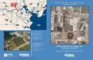
Cedar Crossing Industrial Park - Gisplanning.net
Cedar Crossing Industrial Park - Gisplanning.net
Cedar Crossing Industrial Park - Gisplanning.net

You also want an ePaper? Increase the reach of your titles
YUMPU automatically turns print PDFs into web optimized ePapers that Google loves.
<strong>Cedar</strong> <strong>Crossing</strong> <strong>Industrial</strong> <strong>Park</strong><br />
Presented by:<br />
Cushman & Wakefield of Texas, Inc.<br />
1330 Post Oak Blvd., Suite 2700<br />
Houston, TX. 77056<br />
2010
Houston Area Map<br />
<strong>Cedar</strong> <strong>Crossing</strong>
<strong>Cedar</strong> <strong>Crossing</strong> Location Map – surrounding cities
<strong>Cedar</strong> <strong>Crossing</strong><br />
Location and Characteristics<br />
LOCATION<br />
City:<br />
Baytown, Texas<br />
(adjacent to city limits; within Extra<br />
Territorial Jurisdiction)<br />
County:<br />
Chambers County<br />
Distance to Downtown Houston:<br />
28 miles<br />
CHARACTERISTICS<br />
Size of Development:<br />
15,000 +/- acres<br />
Available Acreage:<br />
11,000 +/- acres<br />
Smallest Tract Available:<br />
1 acre<br />
Largest Tract Available:<br />
1,000 acres or more<br />
Available Buildings:<br />
312,000 SF warehouse distribution
<strong>Cedar</strong> <strong>Crossing</strong><br />
Transportation / Highway<br />
TRANSPORTATION/HIGHWAY<br />
Distance to Nearest Interstate:<br />
7 miles (10 minutes) to I-10 East (Baytown Freeway)<br />
Type of Roadway System Adjacent to Property:<br />
Highways SH-99, FM-1405, and FM-2354<br />
along with County Roads, Fisher Rd., <strong>Cedar</strong> Blvd., East and West Greenwood<br />
Other Major Roadways:<br />
Four-lane SH-225 and SH-146 are 8 miles (10 minutes) south;<br />
eight -lane Fred Hartman Bridge<br />
New Construction – S.H. 99:<br />
Five and one-half miles of Houston’s new Grand <strong>Park</strong>way, a limited<br />
access freeway, except within the park, traverses the Property.<br />
Two interchanges will be on the Property.
<strong>Cedar</strong> <strong>Crossing</strong><br />
Rail<br />
RAIL<br />
Capacity:<br />
Fifty-six miles of rail on Property<br />
Rail Service Providers:<br />
Union Pacific and BNSF<br />
with reciprocal agreements<br />
Rail Car Station:<br />
1,500 Rail Car Storage with on-site operator Transglobal
<strong>Cedar</strong> <strong>Crossing</strong><br />
Air<br />
AIR<br />
Distance to Commercial Passenger and Freight Service:<br />
• 40-miles to Houston Bush Intercontinental Airport;<br />
• 25-miles to Houston Hobby Airport;<br />
• 18-miles to City-owned, general aviation, Ellington Field
<strong>Cedar</strong> <strong>Crossing</strong><br />
Navigable Water<br />
NAVIGABLE WATER<br />
Capacity:<br />
10 – 12 feet deep and 100 feet wide; <strong>Cedar</strong> Bayou Barge on Property<br />
Distance to Houston Ship Channel:<br />
7.5 nautical miles (±1 hour)<br />
Distance to Nearest Barge Terminal:<br />
Three at Property (CCID, TMK-IPSCO and JSW Steel)<br />
Distance to Nearest Deep Water Port:<br />
7.5 nautical miles (±1-hour) to Port of Houston’s Barbours Cut Container Terminal<br />
Distance to Intercoastal Waterways:<br />
26 nautical miles (±4-hours) via Galveston Bay
<strong>Cedar</strong> <strong>Crossing</strong><br />
Topography<br />
TOPOGRAPHY<br />
Topography:<br />
Flat, well-drained<br />
(0-30 foot elevation with majority at 20 feet and greater)<br />
Soil Conditions:<br />
High PI content: 2,000 psf at 2 feet and 4,000 – 5,000 psf at 8 feet;<br />
no bedrock<br />
Soil Boring Information Available:<br />
Yes<br />
Percentage of 11,000 acres Subject to Flooding:<br />
Less than 2% located in 100-year flood plain<br />
Zoning Classification:<br />
No zoning in Baytown ETJ; Planned industrial and business park
<strong>Cedar</strong> <strong>Crossing</strong><br />
Utilities and Service (Electricity)<br />
UTILTIES AND SERVICE (ELECTRICITY)<br />
Distance to 3-Phase Power:<br />
138 KV & 69 KV 3-Phase on Property<br />
Distributor:<br />
Centerpoint, NRG Power Plant (is immediately north of Property)<br />
Distance to Nearest Natural Gas Pipelines:<br />
Three supplier pipelines on Property<br />
Feedstock Pipelines:<br />
Multiple pipelines, chemical feed-stocks and supplies on property
<strong>Cedar</strong> <strong>Crossing</strong><br />
Sewer<br />
SEWER<br />
Distance and Size of Nearest Sanitary Sewer Service:<br />
15” Sewer Main on Property<br />
Capacity:<br />
240,000 GPD Primary Treatment<br />
Service Provider:<br />
Chambers County Improvement District #1 (CCID)<br />
Waste Water Treatment:<br />
U.S. Filter and Chambers County Improvement District #1 (CCID)
<strong>Cedar</strong> <strong>Crossing</strong><br />
Potable Water and <strong>Industrial</strong> Water<br />
POTABLE WATER<br />
Distance and Size of Nearest Main:<br />
12 inch main on Property<br />
Static Pressure & Capacity:<br />
70 PSI and 1,500 GPM<br />
Supplier:<br />
Chambers County Improvement District #1 (CCID)<br />
INDUSTRIAL WATER<br />
Distance and Capacity to <strong>Industrial</strong> Water:<br />
On the Property; 170 million GPD canal; and reservoir;<br />
36 inch line; 5 – 10 million GPD<br />
Supplier:<br />
Coastal Water Authority
<strong>Cedar</strong> <strong>Crossing</strong><br />
Pipelines<br />
CEDAR CROSSING PIPELINES<br />
CRUDE:<br />
Vintage Petroleum 8” Crude/Gas<br />
PRODUCTS: (all in the HL&P easement area)<br />
Seadrift: 10” LPG<br />
Attco: 6” Ethane<br />
Enron: 6” Propane/Butane<br />
Mobil: 6” Propane/Butane<br />
Oxy: 8” Propylene<br />
Oxy: 6” Ethylene<br />
Arco: 6” Ethylene<br />
GAS:<br />
Channel: 30”<br />
Bridge oil/gas: 4”<br />
Channel: 8”<br />
Air Products: 8” Hydrogen<br />
Air Products: 8” Co 2<br />
Air Liquide America Corp: 12” Nitrogen<br />
Air Liquide America Corp: 12” Oxygen<br />
Mid Con Texas Pipeline Corp: 12”
<strong>Cedar</strong> <strong>Crossing</strong> – Barge Dock Aerial<br />
<strong>Cedar</strong> <strong>Crossing</strong> Barge Dock <strong>Cedar</strong>port<br />
view looking southeast<br />
Zone III<br />
View at 6,500’<br />
#301
<strong>Cedar</strong> <strong>Crossing</strong> – Barge Dock Aerial<br />
<strong>Cedar</strong> <strong>Crossing</strong> Barge Dock<br />
view looking south<br />
Zone III<br />
View at 6,500’<br />
#298
Wal-Mart Distribution Center
Home Depot Distribution Center
Exel
<strong>Cedar</strong> <strong>Crossing</strong><br />
PROPERTY DETAILS<br />
1.) Proposed Site Plan<br />
2.) Topography Aerial (2 slides)<br />
3.) Existing Sanitary Sewer Facilities (2 slides)<br />
4.) Existing Water Facilities (2 slides)<br />
5.) Miscellaneous Aerial Photos (7 slides)
<strong>Cedar</strong> <strong>Crossing</strong><br />
Zone III<br />
View at 6,500’<br />
# 195
<strong>Cedar</strong> <strong>Crossing</strong><br />
Zone III<br />
View at 6,500’<br />
# 196
<strong>Cedar</strong> <strong>Crossing</strong><br />
Zone III<br />
View at 6,500’<br />
# 200
<strong>Cedar</strong> <strong>Crossing</strong><br />
Zone III<br />
View at 6,500’<br />
# 201
<strong>Cedar</strong> <strong>Crossing</strong><br />
Zone VI<br />
View at 6,500’<br />
# 241
Contact:<br />
Prepared by:<br />
B. Kelley <strong>Park</strong>er, III, SIOR, Executive Vice President<br />
Kelley.parker@cushwakecom<br />
713-963<br />
963-2896<br />
John F. Littman, SIOR, MAI, Senior Director<br />
John.littman@cushwake.com<br />
713-963<br />
963-2862<br />
Cushman & Wakefield of Texas, Inc.<br />
1330 Post Oak Blvd., Suite 2700<br />
Houston, TX. 77056