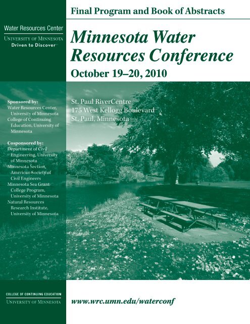
Minnesota Water Resources Conference - Water Resources Center ...
Minnesota Water Resources Conference - Water Resources Center ...
Minnesota Water Resources Conference - Water Resources Center ...

You also want an ePaper? Increase the reach of your titles
YUMPU automatically turns print PDFs into web optimized ePapers that Google loves.
Final Program and Book of Abstracts<br />
<strong>Minnesota</strong> <strong>Water</strong><br />
<strong>Resources</strong> <strong>Conference</strong><br />
October 19–20, 2010<br />
Sponsored by:<br />
<strong>Water</strong> <strong>Resources</strong> <strong>Center</strong>,<br />
University of <strong>Minnesota</strong><br />
College of Continuing<br />
Education, University of<br />
<strong>Minnesota</strong><br />
St. Paul RiverCentre<br />
175 West Kellogg Boulevard<br />
St. Paul, <strong>Minnesota</strong><br />
Cosponsored by:<br />
Department of Civil<br />
Engineering, University<br />
of <strong>Minnesota</strong><br />
<strong>Minnesota</strong> Section,<br />
American Society of<br />
Civil Engineers<br />
<strong>Minnesota</strong> Sea Grant<br />
College Program,<br />
University of <strong>Minnesota</strong><br />
Natural <strong>Resources</strong><br />
Research Institute,<br />
University of <strong>Minnesota</strong><br />
www.wrc.umn.edu/waterconf
<strong>Minnesota</strong> <strong>Water</strong> <strong>Resources</strong> <strong>Conference</strong><br />
October 19-20, 2010<br />
The <strong>Minnesota</strong> <strong>Water</strong> <strong>Resources</strong> <strong>Conference</strong> presents innovative and practical water resource<br />
management techniques and highlights research about <strong>Minnesota</strong>’s water resources. The conference<br />
provides an opportunity to address: 1) lessons learned from the implementation of engineering projects,<br />
2) best practices discovered in the design and application of water resource management techniques,<br />
3) implications of water policy decisions, and 4) research into current and emerging issues. The conference<br />
facilitates interaction among engineers; water resources managers; researchers; and local, state, and federal<br />
agency staff.<br />
Continuing Education<br />
Units (CEUs); Professional<br />
Development Hours (PDHs)<br />
<strong>Conference</strong> attendees will receive<br />
.675 CEUs/PDHs for each day of the<br />
<strong>Minnesota</strong> <strong>Water</strong> <strong>Resources</strong> <strong>Conference</strong>.<br />
Participants who wish to receive full<br />
credit must attend all scheduled hours<br />
of the event.<br />
2
2010 <strong>Water</strong> <strong>Resources</strong> Planning Committee<br />
Bill Arnold<br />
Department of Civil Engineering, University of <strong>Minnesota</strong><br />
John Baker<br />
United States Department of Agriculture/Department of Soil, <strong>Water</strong>, and Climate,<br />
University of <strong>Minnesota</strong><br />
Ann Banitt<br />
U.S. Army Corps of Engineers<br />
John Bilotta<br />
<strong>Minnesota</strong> Sea Grant/University of <strong>Minnesota</strong> Extension<br />
John Blackstone<br />
ASCE MN Chapter Representative<br />
Judy Boudreau<br />
Department of Natural <strong>Resources</strong><br />
Dan Breneman<br />
Natural <strong>Resources</strong> Research Institute, University of <strong>Minnesota</strong>, Duluth<br />
Tina Carstens<br />
Ramsey-Washington Metro <strong>Water</strong>shed District<br />
Heather Dorr<br />
College of Continuing Education, University of <strong>Minnesota</strong><br />
Lisa Goddard<br />
SRF Consulting Group<br />
Lori Graven<br />
College of Continuing Education, University of <strong>Minnesota</strong><br />
Lorin K. Hatch<br />
HDR Engineering, Inc.<br />
Andrea Hendrickson<br />
<strong>Minnesota</strong> Department of Transportation<br />
Karen Jensen<br />
Metropolitan Council<br />
Heather Johnson<br />
<strong>Minnesota</strong> Department of Agriculture<br />
Ron Leaf<br />
Short Elliott Hendrickson, Inc.<br />
Randy Neprash<br />
<strong>Minnesota</strong> Cities/ <strong>Minnesota</strong> Stormwater<br />
Shawn Schottler<br />
St. Croix <strong>Water</strong>shed Research Station<br />
Wayne Sicora<br />
Sicora Engineering<br />
* Faye Sleeper <strong>Water</strong> <strong>Resources</strong> <strong>Center</strong>, University of <strong>Minnesota</strong><br />
Gene Soderbeck<br />
<strong>Minnesota</strong> Pollution Control Agency<br />
* James Stark U.S. Geological Survey<br />
Deborah Swackhamer <strong>Water</strong> <strong>Resources</strong> <strong>Center</strong>, University of <strong>Minnesota</strong><br />
Stew Thornley<br />
<strong>Minnesota</strong> Department of Health<br />
Rick Voigt<br />
Voigt Consultants, LLC<br />
Greg Wilson<br />
Barr Engineering Company<br />
Brad Wozney<br />
Board of Soil and <strong>Water</strong> <strong>Resources</strong><br />
* Committee Co-Chairs<br />
3
Program at a Glance – Tuesday, October 19, 2010<br />
7:00 a.m. Registration and Continental Breakfast<br />
8:00 – 8:10 Welcome, Ballrooms ABEF<br />
Faye Sleeper, <strong>Minnesota</strong> <strong>Water</strong> <strong>Resources</strong> <strong>Center</strong>, University of <strong>Minnesota</strong><br />
8:10 – 8:20 Dave Ford <strong>Water</strong> <strong>Resources</strong> Award<br />
Award Recipient: Nels Nelson, Barr Engineering Company, awarded posthumously<br />
8:20 – 9:30 Effects of Biologically Active Consumer Product Chemicals on Aquatic Ecosystems<br />
Larry B. Barber, geologist, U.S. Geological Survey, Boulder, Colorado<br />
9:30 – 10:00 Break, Ballroom Concourse<br />
10:00 – 11:30 Concurrent Sessions I<br />
A Meeting Rooms 1–3 B Meeting Rooms 4–6 C Ballroom C D Ballroom D<br />
Wastewater<br />
Aquatic Nutrient<br />
Management<br />
Sediment in <strong>Minnesota</strong><br />
Rivers<br />
Best Management Practice –<br />
Porous Pavment<br />
11:30 – 12:15 Lunch, Ballrooms ABEF<br />
12:15 – 1:00 Luncheon Presentation—The Future of Farm Policy<br />
Congressman Collin Peterson, <strong>Minnesota</strong>’s Seventh Congressional District<br />
Moderator: Jim Stark, U.S. Geological Survey<br />
1:15 – 2:45 Concurrent Sessions II<br />
A Meeting Rooms 1–3 B Meeting Rooms 4–6 C Ballroom C D Ballroom D<br />
LiDAR Applications<br />
Lake Nutrients/<br />
Macrophytes<br />
Drainage, Climate, and<br />
Hydrology<br />
Assessing Infiltration – Best<br />
Management Practices<br />
2:45 – 3:15 Break, Ballroom Concourse<br />
3:15 – 4:45 Concurrent Sessions III<br />
A Meeting Rooms 1–3 B Meeting Rooms 4–6 C Ballroom C D Ballroom D<br />
Surface <strong>Water</strong> Management Contaminants in <strong>Water</strong> Sediments and Soil<br />
Stabilization<br />
Best Management Practice –<br />
Infiltration<br />
4:45 – 5:45 Reception and Poster Session, Ballroom Concourse<br />
4
Program at a Glance – Wednesday, October 20, 2010<br />
7:00 a.m. Registration and Continental Breakfast<br />
8:00 – 8:10 Welcome, Ballrooms ABEF<br />
Jim Stark, U.S. Geological Survey<br />
8:10 – 9:30 Valuing Nature: Incorporating Ecosystem Services Into Decision Making<br />
Stephen Polasky, professor, Department of Applied Economics, University of <strong>Minnesota</strong><br />
9:30 – 10:00 Break, Ballroom Concourse<br />
10:00 – 11:30 Concurrent Sessions IV<br />
A Meeting Rooms 1–3 B Meeting Rooms 4–6 C Ballroom C D Ballroom D<br />
Culverts Sustainability Initiatives Monitoring – Ag Groundwater<br />
11:30 – 12:15 p.m. Lunch, Ballrooms ABEF<br />
12:15 – 1:00 p.m. Luncheon Presentation—Delightful Wisdom: Science and Enviornmental Education in <strong>Minnesota</strong><br />
Peggy Knapp, assistant professor, <strong>Center</strong> for Global Environmental Education, Hamline University<br />
Moderator: Faye Sleeper, <strong>Water</strong> <strong>Resources</strong> <strong>Center</strong>, University of <strong>Minnesota</strong><br />
1:15 – 2:45 Concurrent Sessions V<br />
A Meeting Rooms 1–3 B Meeting Rooms 4–6 C Ballroom C D Ballroom D<br />
Sand Creek Surface <strong>Water</strong><br />
Management<br />
Policy – Updates and<br />
Regulations<br />
Agriculture<br />
Groundwater/Surface<br />
<strong>Water</strong> Interaction<br />
2:45 – 3:00 Break, Ballroom Concourse<br />
3:00 – 4:30 Concurrent Sessions VI<br />
A Meeting Rooms 1–3 B Meeting Rooms 4–6 C Ballroom C D Ballroom D<br />
Temperature and Trading<br />
Systems Approaches to<br />
<strong>Water</strong> Resource Policy<br />
Agricultural Drainage<br />
Treatments<br />
Red River Management<br />
4:30 Adjourn<br />
5
Program Schedule – Tuesday, October 19, 2010<br />
8:00 – 8:10 Welcome, Ballrooms ABEF<br />
Faye Sleeper, <strong>Water</strong> <strong>Resources</strong> <strong>Center</strong>, University of <strong>Minnesota</strong><br />
8:10 – 8:20 Dave Ford <strong>Water</strong> <strong>Resources</strong> Award<br />
8:20 – 9:30 Plenary Session: Effects of Biologically Active Consumer Product Chemicals on Aquatic Ecosystems<br />
Larry Barber, geologist, U.S. Geological Survey, Boulder, Colorado<br />
9:30 – 10:00 Break, Ballroom Concourse<br />
10:00 – 11:30 Concurrent Sessions I<br />
TRACK A Meeting Rooms 1–3 TRACK B Meeting Rooms 4–6 TRACK C Ballroom C TRACK D Ballroom D<br />
Wastewater<br />
Moderator: Stew Thornley,<br />
<strong>Minnesota</strong> Department of<br />
Health<br />
Co-Moderator: Nick Haig,<br />
<strong>Water</strong> <strong>Resources</strong> <strong>Center</strong>,<br />
University of <strong>Minnesota</strong><br />
Nutrient Removal from a<br />
Recycle Flow at a Municipal<br />
Wastewater Treatment Plant<br />
Using Algae<br />
Adam Sealock and Bob Polta,<br />
Metropolitan Council<br />
Environmental Services;<br />
Min Min and Roger Ruan,<br />
Department of Bioproducts<br />
and Biosystems Engineering,<br />
University of <strong>Minnesota</strong><br />
The Use of Remote Sensing<br />
in Determining the Source<br />
of Septic System Pollution<br />
Entering Bass Lake Alan<br />
Cibuzar, A.W. Research<br />
Laboratories, Inc.<br />
Challenges of Adding Inflow<br />
and Infiltration Into<br />
Hydraulic Modeling of<br />
Sanitary Sewer Systems<br />
Suresh Hettiarachchi, HDR<br />
Engineering, Inc.<br />
Aquatic Nutrient<br />
Management<br />
Moderator: Lorin Hatch, HDR<br />
Engineering, Inc.<br />
Co-Moderator: Brad Wozney,<br />
Board of <strong>Water</strong> and Soil<br />
<strong>Resources</strong><br />
Improved Approaches for<br />
Developing Excess Nutrient<br />
TMDLs in Shallow Lakes<br />
Joseph Bischoff, Wenck<br />
Associates, Inc.; Bruce Nelson,<br />
Alexandria Lakes Area<br />
Sanitary District; Thomas<br />
Gallagher, HydroQual, Inc.<br />
Nitrate-Nitrogen Reduction in<br />
a Wetland Along the Decorah<br />
Edge, Rochester, <strong>Minnesota</strong><br />
Perry Jones and William<br />
Richardson, U.S.<br />
Geological Survey, Upper<br />
Midwest Environmental<br />
Sciences <strong>Center</strong>; Jeffrey Green,<br />
<strong>Minnesota</strong> Department of<br />
Natural <strong>Resources</strong><br />
Just Break the Drain Tile:<br />
The Sordid Tale of the Swamp<br />
Lake Wetland Restoration<br />
Project<br />
Andrea Moffatt and Jed<br />
Chesnut, WSB & Associates,<br />
Inc.<br />
Sediment in <strong>Minnesota</strong><br />
Rivers<br />
Moderator: Gene Soderbeck,<br />
<strong>Minnesota</strong> Pollution Control<br />
Agency<br />
Co-Moderator: John<br />
Blackstone, ASCE <strong>Minnesota</strong><br />
Chapter Representative<br />
LiDAR Change Detection for<br />
Assessing River Bank Erosion<br />
Andrew Kessler and Satish<br />
Gupta, Department of Soil,<br />
<strong>Water</strong>, and Climate, University<br />
of <strong>Minnesota</strong>; Scott Salsbury,<br />
Blue Earth County; Holly<br />
Dolliver, Plant and Earth<br />
Science, University of<br />
Wisconsin, River Falls<br />
Climate and Channel<br />
Modifications as Probable<br />
Causes for Increased<br />
Sedimentation in Lake Pepin<br />
Satish Gupta, Department<br />
of Soil, <strong>Water</strong>, and Climate,<br />
University of <strong>Minnesota</strong><br />
What Does the Lake Pepin<br />
Sediment Record Really Tell<br />
Us About Soil Erosion?<br />
Daniel Engstrom and<br />
Shawn Schottler, Saint Croix<br />
<strong>Water</strong>shed Research Station;<br />
Dylan Blumentritt,<br />
Department of Geology and<br />
Geophysics, University of<br />
<strong>Minnesota</strong><br />
Best Management<br />
Practice – Porous<br />
Pavement<br />
Moderator: Lisa Goddard, SRF<br />
Consulting Group<br />
Co-Moderator: Wayne Sicora,<br />
Ryan Companies US, Inc.<br />
Managing Stormwater with<br />
Hot Mix Asphalt Pavements<br />
Jill Thomas, <strong>Minnesota</strong><br />
Asphalt Pavement Association<br />
Robbinsdale’s Porous<br />
Asphalt Residential Street to<br />
Reduce Deicing Salt<br />
Ed Matthiesen, Wenck<br />
Associates, Inc.; Richard<br />
McCoy, P.E., City of<br />
Robbinsdale<br />
Pervious Pavement as Public<br />
Infrastructure<br />
Mark Maloney, City of<br />
Shoreview<br />
6
Program Schedule – Tuesday, October 19, 2010 (continued)<br />
11:30 – 12:15 p.m. Lunch, Ballrooms ABEF<br />
12:15 – 1:00 Luncheon Presentation—The Future of Farm Policy<br />
Congressman Collin Peterson, <strong>Minnesota</strong>’s Seventh Congressional District<br />
Moderator: Jim Stark, U.S. Geological Survey<br />
1:15 – 2:45 Concurrent Sessions II<br />
TRACK A Meeting Rooms 1–3 TRACK B Meeting Rooms 4–6 TRACK C Ballroom C TRACK D Ballroom D<br />
LiDAR Applications<br />
Moderator: Les Everett, <strong>Water</strong><br />
<strong>Resources</strong> <strong>Center</strong>, University<br />
of <strong>Minnesota</strong><br />
Co-Moderator: Faye Sleeper,<br />
<strong>Water</strong> <strong>Resources</strong> <strong>Center</strong>,<br />
University of <strong>Minnesota</strong><br />
Identifying Critical Areas<br />
with 3-M LiDAR Elevation<br />
Data<br />
Jake Galzki and David Mulla,<br />
Department of Soil, <strong>Water</strong>,<br />
and Climate, University of<br />
<strong>Minnesota</strong>; Adam Birr,<br />
<strong>Minnesota</strong> Department of<br />
Agriculture<br />
Mapping the Probability of<br />
Wetland Occurrence with<br />
LiDAR<br />
Steve Kloiber, <strong>Minnesota</strong><br />
Department of Natural<br />
<strong>Resources</strong><br />
A Desktop Approach to<br />
Stressor Identification<br />
Zach Herrmann and Josh<br />
Kadrmas, Houston<br />
Engineering, Inc.<br />
Lake Nutrients/<br />
Macrophytes<br />
Moderator: Gene Soderbeck,<br />
<strong>Minnesota</strong> Pollution Control<br />
Agency<br />
Co-Moderator: Rick Voigt,<br />
Voigt Consultants, LLC<br />
Curlyleaf Pondweed<br />
Management Options:<br />
Drawdown Versus Herbicide<br />
Kevin Bigalke, Nine Mile Creek<br />
<strong>Water</strong>shed District; Scott<br />
Sobiech, Bob Obermeyer, and<br />
Meg Rattei, Barr Engineering<br />
Company<br />
Beaver Dam Lake’s<br />
Customized EWM Treatment<br />
Program: A Success Story<br />
Meg Rattei and Aaron Mielke,<br />
Barr Engineering Company;<br />
Kevin Kretsch, Lake<br />
Restoration, Inc.<br />
Results of Golden Lake<br />
Phosphorus Load Reduction<br />
Demonstration Project<br />
Peter Willenbring, WSB &<br />
Associates, Inc.; Doug Thomas,<br />
Rice Creek <strong>Water</strong>shed District<br />
Drainage, Climate,<br />
and Hydrology<br />
Moderator: Greg Wilson, Barr<br />
Engineering Company<br />
Co-Moderator: Heather<br />
Johnson, <strong>Minnesota</strong><br />
Department of Agriculture<br />
Quantification and<br />
Comparison of the Spatial<br />
Extent of Artificial Drainage<br />
in 21 Sub-<strong>Water</strong>sheds of Lake<br />
Pepin<br />
Richard Moore and Shannon<br />
Fisher, <strong>Water</strong> <strong>Resources</strong><br />
<strong>Center</strong>, <strong>Minnesota</strong> State<br />
University, Mankato; Shawn<br />
Schottler, Saint Croix<br />
<strong>Water</strong>shed Research Station<br />
Comparison of Temporal<br />
Trends in Runoff Ratio in 21<br />
Tributaries to Lake Pepin<br />
Shawn Schottler and Jim<br />
Almendinger, Saint Croix<br />
<strong>Water</strong>shed Research Station;<br />
Jason Ulrich, Department of<br />
Bioproducts and Biosystems<br />
Engineering, University of<br />
<strong>Minnesota</strong>; Richard Moore,<br />
<strong>Water</strong> Resource <strong>Center</strong>,<br />
<strong>Minnesota</strong> State University,<br />
Mankato<br />
Sediment Yield and<br />
Turbidity: A Case Study of a<br />
<strong>Minnesota</strong> River Agricultural<br />
<strong>Water</strong>shed<br />
Omid Mohseni, Barr<br />
Engineering Company; Ed<br />
Hohenstein, Brown, Nicollet,<br />
and Cottonwood <strong>Water</strong><br />
Quality Board<br />
Assessing Infiltration –<br />
Best Management<br />
Practices<br />
Moderator: Andrea<br />
Hendrickson, <strong>Minnesota</strong><br />
Department of Transportation<br />
Co-Moderator: Lisa Goddard,<br />
SRF Consulting Group<br />
Rapid Infiltration<br />
Measurements for Assessing<br />
Infiltration of BMPs<br />
Farzana Ahmed, Saint<br />
Anthony Falls Laboratory,<br />
University of <strong>Minnesota</strong>; John<br />
Nieber, Department of<br />
Bioproducts and Biosystems<br />
Engineering, University of<br />
<strong>Minnesota</strong>; John Gulliver,<br />
Department of Civil<br />
Engineering, University of<br />
<strong>Minnesota</strong><br />
Improved Site Investigation<br />
Procedures for Long-Term<br />
Success of Stormwater BMPs<br />
– Lessons Learned<br />
Dave Bauer, Rice Creek<br />
<strong>Water</strong>shed District; Dan<br />
Wheeler, Department of Soil,<br />
<strong>Water</strong>, and Climate, University<br />
of <strong>Minnesota</strong><br />
When Do We Need to<br />
Replace a Bioretention<br />
Practice?<br />
Joel Morgan, Saint Anthony<br />
Falls Laboratory, University of<br />
<strong>Minnesota</strong>; Raymond Hozalski<br />
and John Gulliver, Department<br />
of Civil Engineering,<br />
University of <strong>Minnesota</strong><br />
2:45 – 3:15 Break, Ballroom Concourse<br />
7
Program Schedule – Tuesday, October 19, 2010 (continued)<br />
3:15 – 4:45 Concurrent Sessions III<br />
TRACK A Meeting Rooms 1–3 TRACK B Meeting Rooms 4–6 TRACK C Ballroom C TRACK D Ballroom D<br />
Surface <strong>Water</strong><br />
Management<br />
Moderator: Ron Leaf, Short<br />
Elliott Hendrickson Inc.<br />
Co-Moderator: Ann Banitt,<br />
U.S. Army Corp of Engineers<br />
Dropshaft and Tunnel to<br />
Alleviate Flooding Near the<br />
South Abutment of the 35E<br />
Bridge<br />
Scott Carlstrom, <strong>Minnesota</strong><br />
Department of Transportation;<br />
Joel Toso, Wenck Associates,<br />
Inc.<br />
Browns Valley Flood<br />
Mitigation Project<br />
Brent Johnson, Houston<br />
Engineering, Inc.<br />
Flow Patterns Downstream<br />
of Small-Scale Restoration<br />
Structures: Using Physical<br />
Models for Improving<br />
Structure Design Guidelines<br />
Craig Hill, Saint Anthony Falls<br />
Laboratory, University of<br />
<strong>Minnesota</strong><br />
Contaminants in <strong>Water</strong><br />
Moderator: Shawn Schottler,<br />
Saint Croix <strong>Water</strong>shed<br />
Research Station<br />
Co-Moderator: Heather<br />
Johnson, <strong>Minnesota</strong><br />
Department of Agriculture<br />
Enzyme-Linked<br />
Immunosorbent Assays<br />
(ELISA) Evaluations to<br />
Screen for Atrazine and<br />
Acetocholor Compounds<br />
Heather Johnson, David<br />
Tollefson, and Bill VanRyswyk,<br />
<strong>Minnesota</strong> Department of<br />
Agriculture<br />
On the Horizon:<br />
Characterizing Drinking<br />
<strong>Water</strong> Contaminants of<br />
Emerging Concern<br />
Christopher Greene, Helen<br />
Goeden, Paul Moyer, Michele<br />
Ross, and Julia Dady,<br />
<strong>Minnesota</strong> Department of<br />
Health<br />
Identifying Mineral Sources<br />
of Arsenic Affecting West-<br />
Central <strong>Minnesota</strong> Well-<br />
<strong>Water</strong>: X-Ray Absorption<br />
Spectroscopy Sheds Light on<br />
the Mystery<br />
Sarah Nicholas and Brandy<br />
Toner, Department of Soil,<br />
<strong>Water</strong>, and Climate, University<br />
of <strong>Minnesota</strong>; Mindy Erickson,<br />
U.S. Geological Survey; Alan<br />
Knaeble, <strong>Minnesota</strong><br />
Geological Survey<br />
Sediments and Soil<br />
Stabilization<br />
Moderator: Gene Soderbeck,<br />
<strong>Minnesota</strong> Pollution Control<br />
Agency<br />
Co-Moderator: Greg Wilson,<br />
Barr Engineering Company<br />
Evaluation of a <strong>Water</strong>shed-<br />
Scale Model for BMP<br />
Implementation Within a<br />
Lower <strong>Minnesota</strong> River<br />
Tributary<br />
Adam Freihoefer, Metropolitan<br />
Council<br />
<strong>Minnesota</strong> River Bank and<br />
Bluff Stabilization<br />
Terry Schwalbe, Lower<br />
<strong>Minnesota</strong> River <strong>Water</strong>shed<br />
District; Joel Toso, Wenck<br />
Associates, Inc.; Leslie<br />
Stovring, City of Eden Prairie;<br />
Bill Holman, Stanley Constultants<br />
Stabilization of the North<br />
Shore ‘Mega Slump’<br />
Kevin Biehn and Jay Michels,<br />
Emmons & Olivier <strong>Resources</strong>,<br />
Inc.<br />
Best Management<br />
Practice – Infiltration<br />
Moderator: Randy Neprash,<br />
<strong>Minnesota</strong> Cities Stormwater<br />
Coalition and Bonestroo, Inc.<br />
Co-Moderator: Lisa Goddard,<br />
SRF Consulting Group<br />
Design and Implementation<br />
of a Subsurface Gravel Filter:<br />
Long Lake, <strong>Minnesota</strong><br />
Rebecca Nestingen and Justin<br />
Klabo, Short Elliott<br />
Hendrickson, Inc.<br />
Twin Lakes Parkway:<br />
Transforming Black to Green<br />
Todd Hubmer and Jupe Hale,<br />
WSB & Associates, Inc.; Debra<br />
Bloom, City of Roseville<br />
Innovative Stormwater BMPs<br />
Provide Educational<br />
Opportunity at Century<br />
College, White Bear Lake,<br />
<strong>Minnesota</strong><br />
Jesse Carlson, Bonestroo, Inc.<br />
4:45 – 5:45 Reception and Poster Session, Ballroom Concourse<br />
8
Program Schedule – Wednesday, October 20, 2010<br />
8:00 – 8:10 Welcome, Ballrooms ABEF<br />
Jim Stark, U.S. Geological Survey<br />
8:10 – 9:30 Plenary Session: Valuing Nature: Incorporating Ecosystem Services into Decision Making<br />
Stephen Polasky, professor, Department of Applied Economics, University of <strong>Minnesota</strong><br />
9:30 – 10:00 Break, Ballroom Concourse<br />
10:00 – 11:30 Concurrent Sessions IV<br />
TRACK A Meeting Rooms 1–3 TRACK B Meeting Rooms 4–6 TRACK C Ballroom C TRACK D Ballroom D<br />
Culverts<br />
Moderator: Rick Voigt, Voigt<br />
Consultants, LLC<br />
Co-Moderator: Andrea<br />
Hendrickson, <strong>Minnesota</strong><br />
Department of<br />
Transportation<br />
Culvert Sizing and Road<br />
Retention for Flood<br />
Mitigation, Cumulative<br />
Effects Analysis Using the<br />
GSSHA Model<br />
Greg Eggers, <strong>Minnesota</strong><br />
Department of Natural<br />
<strong>Resources</strong> – Division of<br />
<strong>Water</strong>s<br />
Designing for Fish Passage<br />
in <strong>Minnesota</strong> Culverts<br />
Petra DeWall, <strong>Minnesota</strong><br />
Department of<br />
Transportation<br />
Flow Through Two Crossing<br />
Rectangles: Is It That<br />
Complex? Proposed<br />
Hydraulic Structures for the<br />
Fargo-Moorhead Diversion<br />
Brian LeMon and Miquel<br />
Wong, Barr Engineering<br />
Company; Lee Beauvais and<br />
Stuart Dobberpuhl, Moore<br />
Engineering, Inc.; Michael<br />
Johnson, HDR, Inc.<br />
Sustainability<br />
Initiatives<br />
Moderator: Judy Boudreau,<br />
<strong>Minnesota</strong> Department of<br />
Natural <strong>Resources</strong> – Division<br />
of <strong>Water</strong>s<br />
Co-Moderator: Randy<br />
Neprash, <strong>Minnesota</strong> Cities<br />
Stormwater Coalition and<br />
Bonestroo, Inc.<br />
Planning Far Into the<br />
Future: The <strong>Minnesota</strong><br />
<strong>Water</strong> Sustainability<br />
Framework<br />
Deborah Swackhamer, <strong>Water</strong><br />
<strong>Resources</strong> <strong>Center</strong>, University<br />
of <strong>Minnesota</strong>; Jean Coleman,<br />
CR Planning<br />
The Clean <strong>Water</strong> Fund:<br />
Interagency Leadership and<br />
Coordination<br />
Rebecca Flood, <strong>Minnesota</strong><br />
Pollution Control Agency<br />
An Initiative to Achieve<br />
Healthy <strong>Water</strong>sheds<br />
Throughout <strong>Minnesota</strong><br />
Dave Leuthe and Brian<br />
Stenquist, <strong>Minnesota</strong><br />
Department of Natural<br />
<strong>Resources</strong><br />
Monitoring - Ag<br />
Moderator: John Baker, United<br />
States Department of<br />
Agriculture and Department of<br />
Soil, <strong>Water</strong>, and Climate,<br />
University of <strong>Minnesota</strong><br />
Co-Moderator: Gene Soderbeck,<br />
<strong>Minnesota</strong> Pollution Control<br />
Agency<br />
Where the City Meets the Farm:<br />
A Case Study of Drainage and<br />
<strong>Water</strong> Quality<br />
John Moncrief, Department of<br />
Soil, <strong>Water</strong>, and Climate,<br />
University of <strong>Minnesota</strong>; Kim<br />
Gorans, Gorans Brothers Farm<br />
Runoff Patterns and <strong>Water</strong>-<br />
Quality Characteristics at<br />
Edge-of-Field Sites, Discovery<br />
Farms and Pioneer Farm,<br />
Wisconsin<br />
Dennis Frame, University of<br />
Wisconsin Extension; Todd<br />
Stuntebeck, U.S. Geological<br />
Survey, Wisconsin <strong>Water</strong><br />
Science <strong>Center</strong><br />
A Non-Regulatory Approach to<br />
Monitoring Nutrients in<br />
Agricultural Landscapes<br />
George Rehm, <strong>Minnesota</strong><br />
Agricultural <strong>Water</strong> <strong>Resources</strong><br />
Coalition; Dennis Frame,<br />
Wisconsin Discovery Farms,<br />
University of Wisconsin<br />
Extension<br />
Groundwater<br />
Moderator: Jim Stark, U.S.<br />
Geological Survey<br />
Crude Oil at the Bemidji Site:<br />
27 Years of Research,<br />
Modeling, and<br />
Understanding<br />
Melinda Erickson, Barbara<br />
Bekins, and Geoffrey Delin, U.S.<br />
Geological Survey<br />
Significant <strong>Water</strong> Quality<br />
Trends in Dakota County<br />
Well-Monitoring Network<br />
Kimm Crawford, Crawford<br />
Environmental Services;<br />
Vanessa Demuth and Jill<br />
Trescott, Dakota County<br />
The Importance of Flux in<br />
Sustainably Managing<br />
Groundwater<br />
Tim Cowdery, U.S. Geological<br />
Survey<br />
11:30 – 12:15 p.m. Lunch, Ballrooms ABEF<br />
12:15 – 1:00 Luncheon Presentation—Delightful Wisdom: Science and Environmental Education in <strong>Minnesota</strong><br />
Peggy Knapp, assistant professor, <strong>Center</strong> for Global Environmental Education, Hamline University<br />
Moderator: Faye Sleeper, <strong>Water</strong> <strong>Resources</strong> <strong>Center</strong>, University of <strong>Minnesota</strong><br />
9
Program Schedule – Wednesday, October 20, 2010 (continued)<br />
1:15 – 2:45 Concurrent Sessions V<br />
TRACK A Meeting Rooms 1–3 TRACK B Meeting Rooms 4–6 TRACK C Ballroom C TRACK D Ballroom D<br />
Sand Creek Surface<br />
<strong>Water</strong> Management<br />
Moderator: Gene Soderbeck,<br />
<strong>Minnesota</strong> Pollution Control<br />
Agency<br />
Co-Moderator: Karen Jensen,<br />
Metropolitan Council<br />
Sand Creek <strong>Water</strong>shed<br />
Impaired <strong>Water</strong>s Study:<br />
Technical Findings<br />
Karen Jensen, Metropolitan<br />
Council; Greg Wilson, Barr<br />
Engineering Company<br />
Sand Creek <strong>Water</strong>shed<br />
Impaired <strong>Water</strong>s Study -<br />
Converting Technical<br />
Findings Into Focused<br />
Policies and Programs<br />
Paul Nelson and Melissa<br />
Bokman, Scott County<br />
Community Development;<br />
Lauren Klement, Le Sueur<br />
County Environmental<br />
Services; Jennifer Mocol-<br />
Johnson, Rice County<br />
Planning and Zoning<br />
Sand Creek Impaired <strong>Water</strong>s<br />
Study - Converting from<br />
Random to Strategic Acts of<br />
Conservation<br />
Willie Peters, Scott Soil and<br />
<strong>Water</strong> Conservation District;<br />
Katundra Shears, Natural<br />
Resource Conservation<br />
Service, United States<br />
Department of Agriculture<br />
Policy - Updates and<br />
Regulations<br />
Moderator: John Bilotta,<br />
<strong>Minnesota</strong> Sea Grant,<br />
University of <strong>Minnesota</strong><br />
Extension<br />
Co-Moderator: Brad Wozney,<br />
Board of <strong>Water</strong> and Soil<br />
<strong>Resources</strong><br />
TMDLs – What Have We<br />
Learned So Far – MS4 Cities’<br />
Perspective<br />
Randy Neprash, <strong>Minnesota</strong><br />
Cities Stormwater Coalition,<br />
and Bonestroo, Inc.<br />
Managing a Cost Efficient<br />
<strong>Water</strong> Quality Utility<br />
Ross Bintner and Stephen<br />
Albrecht, City of Prior Lake<br />
Nondegradation Rule<br />
Revision Update<br />
Bill Cole, <strong>Minnesota</strong> Pollution<br />
Control Agency<br />
Agriculture<br />
Moderator: Shawn Schottler,<br />
Saint Croix <strong>Water</strong>shed<br />
Research Station<br />
Co-Moderator: John Baker,<br />
United States Department of<br />
Agriculture and Department<br />
of Soil, <strong>Water</strong>, and Climate,<br />
University of <strong>Minnesota</strong><br />
Alternative Methods for<br />
Monitoring Surface-<strong>Water</strong><br />
Runoff From Agricultural<br />
Fields<br />
Dennis Busch and Philip<br />
Parker, University of<br />
Wisconsin, Platteville<br />
Development of the<br />
Biological Condition<br />
Gradient for <strong>Minnesota</strong> and<br />
Its Use in Setting Statewide<br />
Biological Criteria<br />
Will Bouchard, <strong>Minnesota</strong><br />
Pollution Control Agency<br />
Signs of <strong>Water</strong> Quality<br />
Progress in the <strong>Minnesota</strong><br />
River Basin<br />
Scott Kudelka and Kimberly<br />
Musser, <strong>Water</strong> <strong>Resources</strong><br />
<strong>Center</strong>, <strong>Minnesota</strong> State<br />
University, Mankato<br />
Groundwater/Surface<br />
<strong>Water</strong> Interaction<br />
Moderator: John Blackstone,<br />
ASC <strong>Minnesota</strong> Chapter<br />
Representative<br />
Co-Moderator: Lisa Goddard,<br />
SRF Consulting Group<br />
Estimating the Effect of<br />
Infiltration on Local<br />
Groundwater Levels:<br />
Cleveland-Randolph<br />
Groundwater Study<br />
Forrest Kelley, Capitol Region<br />
<strong>Water</strong>shed District; Dan Sola,<br />
Wenck Associates, Inc.<br />
Lake to Groundwater<br />
Interaction Study in the<br />
Chisago Chain of Lakes<br />
Matthew Redington and Nick<br />
Flemming, HDR Engineering,<br />
Inc.<br />
Redox Perspective on Lake<br />
Restoration<br />
David Austin, Roger Scharf,<br />
Jason Carroll, and Mark Enochs,<br />
CH2M Hill<br />
2:45 – 3:00 Break, Ballroom Concourse<br />
10
Program Schedule – Wednesday, October 20, 2010 (continued)<br />
3:00 – 4:30 Concurrent Sessions VI<br />
TRACK A Meeting Rooms 1–3 TRACK B Meeting Rooms 4–6 TRACK C Ballroom C TRACK D Ballroom D<br />
Temperature and<br />
Trading<br />
Moderator: Karen Jensen,<br />
Metropolitan Council<br />
Co-Moderator: Gene<br />
Soderbeck, <strong>Minnesota</strong><br />
Pollution Control Agency<br />
Vermillion River Market-<br />
Based Temperature Trading<br />
Study - Findings and<br />
Recommendations<br />
Paul Nelson, Scott County<br />
Community Development;<br />
Katherine Carlson, Vermillion<br />
River <strong>Water</strong>shed Joint Powers<br />
Organization; Kim Chapman<br />
and Theresa Nelson, Applied<br />
Ecological Services, Inc.;<br />
Brooke Asleson, <strong>Minnesota</strong><br />
Pollution Control Agency;<br />
William Herb, Saint Anthony<br />
Falls Laboratory, University of<br />
<strong>Minnesota</strong><br />
Impacts of Urban<br />
Development on Flow and<br />
Temperature Regimes in<br />
Miller Creek, Duluth,<br />
<strong>Minnesota</strong><br />
William Herb, Timothy<br />
Erickson, and Heinz Stefan,<br />
Saint Anthony Falls Laboratory,<br />
University of <strong>Minnesota</strong><br />
On the Impossibility of<br />
<strong>Water</strong>-Quality Trading<br />
Jay Coggins and Bin Wang,<br />
Department of Applied<br />
Economics, University of<br />
<strong>Minnesota</strong>; Yoshifumi Konishi,<br />
Department of Economics,<br />
Williams College<br />
Systems Approaches to<br />
<strong>Water</strong> Resource Policy<br />
Moderator: Judy Boudreau,<br />
Department of Natural<br />
<strong>Resources</strong> – Division of<br />
<strong>Water</strong>s<br />
Co-Moderator: Ron Leaf, Short<br />
Elliott Hendrickson, Inc.<br />
The Future of <strong>Water</strong><br />
Resource Decision-Making:<br />
Is Tomorrow Already Here?<br />
Mark Deutschman, Houston<br />
Engineering, Inc.<br />
Meeting Natural and <strong>Water</strong><br />
Resource Management<br />
Objectives Through<br />
<strong>Water</strong>shed-Based Wetland<br />
Permitting: Two Local<br />
Examples<br />
Barbara Walther, U.S. Army<br />
Corps of Engineers; Jason<br />
Naber, Emmons & Oliver<br />
<strong>Resources</strong><br />
Groundwater Sustainability:<br />
Towards a Common<br />
Understanding<br />
Dave Lorenz, U.S. Geological<br />
Survey<br />
Agricultural Drainage<br />
Treatments<br />
Moderator: Heather Johnson,<br />
<strong>Minnesota</strong> Department of<br />
Agriculture<br />
Co-Moderator: John Baker,<br />
United States Department of<br />
Agriculture and Department<br />
of Soil, <strong>Water</strong>, and Climate,<br />
University of <strong>Minnesota</strong><br />
<strong>Water</strong> and Nutrient<br />
Retention Basins for Treating<br />
Drainage from Agricultural<br />
Landscapes<br />
Jeffrey Strock, Southwest<br />
Research and Outreach<br />
<strong>Center</strong>, University of<br />
<strong>Minnesota</strong><br />
Potential to Reduce<br />
Contaminants in Field<br />
Drainage With Anaerobic<br />
Woodchip Bioreactors Under<br />
<strong>Minnesota</strong> Conditions<br />
Andry Ranaivoson, John<br />
Moncrief, and Rodney<br />
Venterea, Department of Soil,<br />
<strong>Water</strong>, and Climate, University<br />
of <strong>Minnesota</strong>; Yogesh Chander,<br />
College of Veterinary<br />
Medicine, University of<br />
<strong>Minnesota</strong>; Mark Dittrich,<br />
<strong>Minnesota</strong> Department of<br />
Agriculture<br />
Conservation Drainage<br />
Priorities: Learning From<br />
Stakeholders<br />
Ann Lewandowski, <strong>Water</strong><br />
<strong>Resources</strong> <strong>Center</strong>, University<br />
of <strong>Minnesota</strong>; Mark Dittrich,<br />
<strong>Minnesota</strong> Department of<br />
Agriculture<br />
Red River Management<br />
Moderator: Jim Stark, U.S.<br />
Geological Survey<br />
Co-Moderator: Ann Banitt,<br />
U.S. Army Corps of Engineers<br />
Red River Basin Immediate<br />
Drought Response Process<br />
Ted Shannon, HDR<br />
Engineering, Inc.<br />
A River Basin Management<br />
Structure for <strong>Minnesota</strong><br />
Morrie Lanning, <strong>Minnesota</strong><br />
House of Representatives<br />
What Level of Flood<br />
Protection is Adequate?<br />
Charles Hathaway, Barr<br />
Engineering Company<br />
Level of Flood Protection,<br />
<strong>Minnesota</strong>’s Perspective<br />
Pat Lynch, <strong>Minnesota</strong> Department<br />
of Natural <strong>Resources</strong> -<br />
Division of <strong>Water</strong>s<br />
4:30 Adjourn
Poster Display<br />
The following posters will be displayed during the breaks and Tuesday reception.<br />
Blue Star Cities Program - Recognition for<br />
Municipal Stormwater Excellence<br />
Carl Almer, Emmons & Olivier <strong>Resources</strong>, Inc.; Trevor<br />
Russell, Friends of the Mississippi River<br />
The Introduction and Usage of Hydra Model in<br />
Investigation of Storm Drain Systems Function<br />
Babak Amirataee and Majid Montaseri, Urmia<br />
University<br />
Twin Cities Metropolitan Area Chloride Project<br />
Brooke Asleson and Barb Peichel, <strong>Minnesota</strong><br />
Pollution Control Agency; Joe Bischoff and Diane<br />
Spector, Wenck Associates, Inc.<br />
The Case for Replacing Hypolimentic Aeration With<br />
Oxygenation in Vadnais and Pleasant Lakes<br />
David Austin, John Borghesi, and Roger Scharf, CH2M<br />
HILL; John F. Blackstone, Saint Paul Regional <strong>Water</strong><br />
Services<br />
Sustainable and Economical <strong>Water</strong> Resource<br />
Management Using Best Engineering and<br />
Administrative Practices with Latest Technologies:<br />
A Success Story and A Case Study<br />
M.Dhanabalan and A. Arun Babu, FICHTNER<br />
Consulting Engineers India, Private Ltd.<br />
Synchronized Storm <strong>Water</strong> Education for<br />
<strong>Minnesota</strong> Communities<br />
John Bilotta and Shane Missaghi, University of<br />
<strong>Minnesota</strong> Extension<br />
Judicial Ditch 47 - Truman’s 55 Year Drainage<br />
Project<br />
Kevin Bittner and Bruce D. Firkins, Bolton & Menk, Inc.<br />
Lessons Learned From Multiple Best Management<br />
Practices Within the Battle Point Park Lakeshore<br />
Restoration Project<br />
Tara Borgerding, Sauk River <strong>Water</strong>shed District<br />
Changes in Stormwater Knowledge, Attitudes, and<br />
Practices<br />
Valerie Brady, Natural <strong>Resources</strong> Research Institute,<br />
University of <strong>Minnesota</strong>; Karlyn Eckman, <strong>Water</strong><br />
<strong>Resources</strong> <strong>Center</strong>, University of <strong>Minnesota</strong>; Jesse<br />
Schomberg, <strong>Minnesota</strong> Sea Grant College Program,<br />
University of <strong>Minnesota</strong><br />
Boat Launch Assessment for <strong>Water</strong> Quality<br />
Tory Christensen, Great River Greening<br />
Synthetic Aperture Radar (SAR) for Wetland<br />
Mapping and Change Detection<br />
Jennifer Corcoran and Joseph Knight, Department of<br />
Forest <strong>Resources</strong>, University of <strong>Minnesota</strong><br />
Make the <strong>Water</strong> Connection: Measuring Success of<br />
Stormwater Education and Outreach Programs<br />
Wayne Cymbaluk, Stearns County Soil and <strong>Water</strong><br />
Conservation District; Shane Lund, City of St. Cloud<br />
Little Falls Emergency Bridge Replacement:<br />
Unexpected Impacts From Ice Flow<br />
Nicole Danielson-Bartelt and Petra DeWall, <strong>Minnesota</strong><br />
Department of Transportation<br />
Linking Ecosystem Processes to Macroinvertebrate<br />
Community Structure in a Restored Stream in the<br />
<strong>Minnesota</strong> River Basin<br />
Christine Dolph, <strong>Water</strong> <strong>Resources</strong> <strong>Center</strong>, University<br />
of <strong>Minnesota</strong>; Joe Magner, Department of Fisheries,<br />
Wildlife, and Conservation Biology, University of<br />
<strong>Minnesota</strong>; Bruce Vondracek, U.S. Geological Survey,<br />
<strong>Minnesota</strong> Fish and Widlife Cooperative Research<br />
Unit, University of <strong>Minnesota</strong><br />
Sustaining and Improving <strong>Minnesota</strong>’s Aquatic<br />
Habitats: DNR’s Fish Habitat Vision<br />
Michael Duval and Peter Jacobson, <strong>Minnesota</strong><br />
Department of Natural <strong>Resources</strong><br />
Human Fecal Contamination on Beaches of<br />
Lake Superior<br />
Jessica Eichmiller and Michael Sadowsky, Department<br />
of Soil, <strong>Water</strong>, and Climate, University of <strong>Minnesota</strong>;<br />
Randall Hicks, Department of Biology, University of<br />
<strong>Minnesota</strong><br />
Implications of <strong>Minnesota</strong>’s <strong>Water</strong> Policy on<br />
<strong>Minnesota</strong>’s Sustainable <strong>Water</strong> Future<br />
Sherry Enzler, Institute on the Environment,<br />
University of <strong>Minnesota</strong>; John Helland, <strong>Minnesota</strong><br />
<strong>Center</strong> For Environmental Advocacy<br />
Stormwater Maintenance Strategies<br />
Andy Erickson and John Gulliver, St. Anthony Falls<br />
Laboratory, University of <strong>Minnesota</strong>; Peter Weiss,<br />
Department of Civil Engineering, Valparaiso<br />
University<br />
Conservation Marketplace of <strong>Minnesota</strong>:<br />
Development and Testing of Ecosystem Services<br />
Markets<br />
Shannon Fisher, <strong>Minnesota</strong> River Board<br />
Evaluation of <strong>Minnesota</strong>’s Septic System<br />
Professional Experience Requirement<br />
Nicholas Haig, <strong>Water</strong> <strong>Resources</strong> <strong>Center</strong>, University of<br />
<strong>Minnesota</strong><br />
Spatial and Temporal Distribution of E. Coli<br />
Populations in the Seven Mile Creek <strong>Water</strong>shed<br />
Matthew Hamilton, University of <strong>Minnesota</strong>;<br />
Ramyavardhanee Chandrasekaran, BioTechnology<br />
Institute, University of <strong>Minnesota</strong>; Scott Matteson,<br />
<strong>Water</strong> <strong>Resources</strong> <strong>Center</strong>, <strong>Minnesota</strong> State University,<br />
Mankato; Michael Sadowsky, Department of Soil,<br />
<strong>Water</strong>, and Climate, University of <strong>Minnesota</strong><br />
How to Get Things Done: The Pelican Lake<br />
Association of St. Anna<br />
Lorin Hatch, HDR Engineering, Inc.<br />
Sulfate and Iron Reduction in St. Louis River Sediment<br />
Nathan Johnson and Brian Beck, University of<br />
<strong>Minnesota</strong>, Duluth<br />
Direct and Indirect Photolysis of Phytoestrogens<br />
Megan Kelly, William Arnold, and Kayla Zielinski,<br />
Department of Civil Engineering, University of<br />
<strong>Minnesota</strong><br />
Relative Influence of Bank Vegetation on Stream<br />
Temperature in Urban and Non-urban <strong>Water</strong>sheds<br />
Jessica Kozarek and W. Cully Hession, Virginia Tech<br />
Identifying Stressors Causing Fish Community<br />
Impairments in the High Island Creek <strong>Water</strong>shed<br />
Jonathan Lore and Shannon Fisher, <strong>Water</strong> <strong>Resources</strong><br />
<strong>Center</strong>, <strong>Minnesota</strong> State University, Mankato<br />
Under the Sidewalk: Stormwater Management in<br />
the Big City<br />
Susan Mason, Short Elliot Hendrickson, Inc.<br />
Local <strong>Water</strong> Resource Managers Need Turnkey-<br />
Ready Computer Software Models for Their Climate<br />
Change Adaptation Decision-Making Process<br />
Shahram Missaghi, University of <strong>Minnesota</strong> Extension<br />
Submersed Aquatic Macrophytes as an Indicator of<br />
Ecosystem Health for the Upper Mississippi River<br />
(Pools 1-11)<br />
Megan Moore, <strong>Minnesota</strong> Department of Natural<br />
<strong>Resources</strong>; Heidi Langrehr, Wisconsin Department of<br />
Natural <strong>Resources</strong><br />
Development of a Real-Time Wireless In-Pipe<br />
Storm <strong>Water</strong> Monitoring Network<br />
Kari Oquist, Mississippi <strong>Water</strong>shed Management<br />
Organization; Chris Ellis, St. Anthony Falls<br />
Laboratory, University of <strong>Minnesota</strong><br />
Creative, Sustainable Solutions – Utilizing<br />
Agricultural Drainage Products in an Urban<br />
Environment<br />
Christopher Otterness and Mark Deutschman,<br />
Houston Engineering, Inc.; Doug Thomas, Rice Creek<br />
<strong>Water</strong>shed District<br />
Spatiotemporal Changes in Macrophyte Diversity<br />
and Nutrient Uptake Along a Phosphorus Gradient<br />
on the Jefferson German Chain of Five Lakes in<br />
Southern <strong>Minnesota</strong><br />
Joe Pallardy and Shannon Fisher, <strong>Water</strong> Resource<br />
<strong>Center</strong>, <strong>Minnesota</strong> State University, Mankato<br />
<strong>Minnesota</strong>’s Triennial <strong>Water</strong> Quality Standards<br />
Rules Revisions (2008-2011)<br />
Angela Preimesberger, Phil Monson, Mark Tomasek,<br />
Gerald Blaha, Will Bouchard, Steven Heiskary, Howard<br />
Markus, and William Wilde, <strong>Minnesota</strong> Pollution<br />
Control Agency<br />
New Mosquito Species Spreads Through Metro-<br />
Area Habitats<br />
Nancy Read and Kirk Johnson, Metro Mosquito Control<br />
District<br />
St. Croix Healthy <strong>Water</strong>s<br />
Todd Rexine, Great River Greening<br />
Particle Scale Studies on the Effects of Fluid and<br />
Bed Variability on Particle Entrainment and<br />
Transport<br />
Kirby Templin, Kimberly Hill and Fernando Porté-Agel,<br />
St. Anthony Falls Laboratory, University of <strong>Minnesota</strong><br />
Preparing for Climate Change on <strong>Minnesota</strong>’s Lake<br />
<strong>Resources</strong> Through Cooperative Long-Term<br />
Monitoring and Assessment<br />
Ray Valley, Peter Jacobson and David Staples,<br />
<strong>Minnesota</strong> Department of Natural <strong>Resources</strong><br />
Selection of Resistant Environmental Bacteria in<br />
Response to Low-Level Exposure to Triclosan<br />
Kristine Wammer, James Byrnes, Aaron Gronseth, Jo Jo<br />
Nemec, and Louis Sigtermans, Department of<br />
Chemistry, University of St. Thomas; Timothy LaPara,<br />
Department of Civil Engineering, University of<br />
<strong>Minnesota</strong><br />
Solving the New London Dam Reconstruction Maze<br />
Using a Labyrinth Weir<br />
Martin Weber and Andrew Judd, Stanley Consultants,<br />
Inc.; Jason Boyle, <strong>Minnesota</strong> Department of Natural<br />
<strong>Resources</strong><br />
Targeting Audiences for Improved Lawn<br />
Management: Can Grouping Households Assist<br />
with Non-point <strong>Water</strong> Pollution Reduction?<br />
Sarah Wein, University of <strong>Minnesota</strong>; Kristen Nelson,<br />
Department of Forest <strong>Resources</strong>, University of<br />
<strong>Minnesota</strong>; Larry Baker, <strong>Water</strong> Resource <strong>Center</strong>,<br />
University of <strong>Minnesota</strong>; Cinzia Fissore, Department<br />
of Soil, <strong>Water</strong>, and Climate, University of <strong>Minnesota</strong>;<br />
Sarah Hobbie, Department of Ecology, Evolution, and<br />
Behavior, University of <strong>Minnesota</strong><br />
Effectiveness of the <strong>Minnesota</strong> Phosphorus Lawn<br />
Fertilizer Law<br />
Christine Wicks, Collie Graddick, Bruce Montgomery,<br />
and Ron Struss, <strong>Minnesota</strong> Department of Agriculture<br />
Ready, Set, Flush! Removing Raw Sewage From<br />
Our <strong>Water</strong><br />
Aaron Wills and Sheila Craig, Cannon River<br />
<strong>Water</strong>shed Partnership<br />
12
<strong>Minnesota</strong> Section, American Society of Civil Engineers (ASCE) Meeting<br />
Tuesday, October 19, 2010<br />
5:30 p.m. Social Hour, 6:30 p.m. Dinner, 7:30 p.m. Program<br />
Location: Degidio’s Restaurant, 425 West 7th Street, St. Paul (located approximately ½ mile west of the St. Paul<br />
River Centre); off-street parking is available.<br />
Cost: $30 members, $35 non-members, $15 students<br />
Register online at www.ascemn.org.<br />
This meeting is open to anyone who is interested. Please RSVP by Tuesday, October 5, 2010<br />
Construction Storm <strong>Water</strong> NPDES Issues and Innovations: A Panel Discussion<br />
Remarks on a Regulator’s Perspective:<br />
Stormwater Compliance and<br />
Enforcement Case Studies<br />
Brian Gove, MPCA Construction<br />
Stormwater Compliance Coordinator<br />
Remarks on a Consultant’s<br />
Perspective: How to Balance the Needs<br />
of the Owner and the Requirements of<br />
the Regulator in Construction Storm<br />
<strong>Water</strong> Management<br />
Andrea Moffat, Senior Environmental<br />
Scientist, WSB & Associates<br />
Remarks on Stormwater Design<br />
Innovations: Understanding <strong>Water</strong><br />
Quality Implications of Concrete<br />
Construction and Chemicals Required<br />
for Construction Activities<br />
Dwayne Stenlund, CPESC, Mn/DOT Turf<br />
and Erosion Control Specialist<br />
Federal, state, county, and local<br />
stormwater permitting programs regulate<br />
site development and post-construction<br />
stormwater runoff control. Storm water<br />
pollution from nonpoint sources is a<br />
challenging water quality problem.<br />
Unlike pollution from industry or sewage<br />
treatment facilities, which is caused by a<br />
discrete number of sources, stormwater<br />
pollution is caused by the daily activities<br />
of people everywhere. Rainwater and<br />
snowmelt run off streets, lawns, farms,<br />
and construction and industrial sites and<br />
pick up fertilizers, dirt, pesticides, oil, and<br />
grease, and many other pollutants on the<br />
way to our rivers and lakes. Stormwater<br />
runoff is the most common cause of<br />
water pollution. Sediment is the number<br />
one pollutant from construction sites.<br />
The October ASCE section meeting is<br />
organized by the ASCE <strong>Minnesota</strong> Section<br />
Technical Committee on Environmental<br />
Engineering and <strong>Water</strong> <strong>Resources</strong>, in<br />
conjunction with the <strong>Minnesota</strong> <strong>Water</strong><br />
<strong>Resources</strong> <strong>Conference</strong>. The presentation<br />
will include technical remarks and a panel<br />
discussion with a question and answer<br />
session on the topic of Construction<br />
Stormwater NPDES Issues and<br />
Innovations. Attendees will receive<br />
1.0 professional development hours.<br />
For questions or additional information, contact Bruce Holdhusen, P.E., Chair EE/WR Technical Committee,<br />
bruce.holdhusen@state.mn.us or 651-366-3760; or John F. Blackstone, P.E., ASCE, jblackstone@comcast.net<br />
or 651 263 4357.<br />
13
The University of <strong>Minnesota</strong> shall provide equal access to and opportunity in its programs, facilities, and employment without regard to race, color,<br />
creed, religion, national origin, gender, age, marital status, disability, public assistance status, veteran status, sexual orientation, gender identity, or<br />
gender expression.<br />
This publication is available in alternative formats upon request. Please call 612-624-3708.<br />
14
<strong>Minnesota</strong><br />
<strong>Water</strong> <strong>Resources</strong> <strong>Conference</strong><br />
October 19–20, 2010<br />
Saint Paul RiverCentre<br />
175 West Kellogg Boulevard<br />
Saint Paul, <strong>Minnesota</strong><br />
Book of Abstracts<br />
Arranged by session in order of presentation<br />
Index of first authors on page 73<br />
<strong>Minnesota</strong> <strong>Water</strong> <strong>Resources</strong> <strong>Conference</strong>, October 19–20, 2010 15
BOOK OF ABSTRACTS<br />
16 <strong>Minnesota</strong> <strong>Water</strong> <strong>Resources</strong> <strong>Conference</strong>, October 19–20, 2010
Plenary Session 1<br />
8:20 a.m. – 9:30 a.m.<br />
BOOK OF ABSTRACTS<br />
Tuesday, October 19<br />
Effects of Biologically Active Consumer Product Chemicals on Aquatic Ecosystems<br />
Larry Barber (lbbarber@usgs.gov), U.S. Geological Survey, Boulder, Colorado<br />
Biographical Information<br />
Larry Barber is a research geochemist with the U.S. Geological Survey in Boulder, Colorado. He received his Ph.D.<br />
and M.S. degrees in geology from the University of Colorado and his B.S. degree in Geology at the University of<br />
Arkansas. For the past twenty years, he has conducted research on the fate of organic and inorganic chemicals<br />
in natural water systems, with a focus on consumer-product derived contaminants in treated wastewater and<br />
the implications for water reuse. His research involves field and laboratory studies that quantitatively integrate<br />
chemistry, biology, hydrology, and geology in evaluating the environmental fate of contaminants.<br />
<strong>Minnesota</strong> <strong>Water</strong> <strong>Resources</strong> <strong>Conference</strong>, October 19–20, 2010 17
BOOK OF ABSTRACTS<br />
Tuesday, October 19<br />
Concurrent Session I<br />
Track A: Wastewater<br />
10:00 a.m. – 11:30 a.m.<br />
Nutrient Removal from a Recycle Flow at a Municipal Wastewater Treatment Plant Using Algae<br />
Adam Sealock (adam.sealock@metc.state.mn.us), and Bob Polta, Metropolitan Council Environmental Services; Min<br />
Min and Roger Ruan, Department of Bioproducts and Biosystems Engineering, University of <strong>Minnesota</strong><br />
In 2007 the Metropolitan Council began collaboration with the University of <strong>Minnesota</strong> to grow algae in wastewater<br />
at the Metro Plant in Saint Paul, MN. The objectives of the collaboration were wastewater treatment for the Council<br />
and algae biomass and oil recovery for the University of <strong>Minnesota</strong>. Early research demonstrated the 1 MGD recycle<br />
flow (centrate) generated from centrifuging primary and secondary sludges was best suited for growing algae. To<br />
evaluate the feasibility of growing algae in centrate a plug-flow bioreactor supplied with light and native algae was<br />
used to conduct two approximately 30 day experiments. Both experiments showed reduction in soluble TKN (65%),<br />
TP (70%), and COD (90%). It appears the algae/bacteria culture grown in centrate would be very effective at reducing a<br />
substantial amount of soluble TKN, TP, and COD loading from the centrate recycle flow if scaled up.<br />
The Use of Remote Sensing in Determining the Source of Septic System Pollution Entering Bass<br />
Lake<br />
Alan Cibuzar (awc@awlab.com), A.W. Research Laboratories, Inc.<br />
The Thirty Lakes <strong>Water</strong>shed District through their annual lake monitoring program observed the quality of Bass Lake<br />
(MN Lake ID #18-402) deteriorating. They retained A.W. Research Laboratories (AWRL) to conduct an investigation<br />
using remote sensing. The use of remote sensing is invaluable for lake management because it summarizes<br />
environmental conditions in a format that is easily understood. A large area can be investigated quickly, often revealing<br />
evidence not visible at ground level. Remediation can then be prioritized based on the findings to minimize the<br />
adverse impacts of the located problems.<br />
Aerial TSI monitoring of Bass Lake revealed that TSI values in certain areas of the lake were far greater than those<br />
observed at the center where the TSI samples were taken. A “Groundwater Intrusion Overflight” was done to<br />
determine where nutrient loads were entering the lake through groundwater sources. Once these areas were located,<br />
winter sampling was done to collect groundwater samples beneath the lake ice and identify the exact points of<br />
intrusion. As a result, specific septic issues were identified and prioritized for remediation.<br />
Challenges of Adding Inflow and Infiltration Into Hydraulic Modeling of Sanitary Sewer Systems<br />
Suresh Hettiarachchi (shettiar@hdrinc.com), HDR Engineering, Inc.<br />
Combined Sewer Overflows (CSO) and Sanitary Sewer Overflows (SSO) have been a continuing problem for most of<br />
the major Cities. Even newer communities with separated sanitary sewers as well as some of the large Cities like the<br />
City of Minneapolis, where older sewers were separated to only carry sanitary flow, do experience overflow due to<br />
excessive amounts of infiltration and inflow (I and I). Hydraulic modeling is extensively used to analyze the sanitary<br />
sewer systems and look at possible approaches to reduce overflows and back-ups in the system. But, adding the I and<br />
I component, which is the most significant flow component, in to these hydraulic models are not straight forward.<br />
This presentation will include three sanitary sewer models of three different communities and look at the various<br />
challenges that were faced, how I and I was and incorporated into the model, and special features of each of the<br />
models.<br />
18 <strong>Minnesota</strong> <strong>Water</strong> <strong>Resources</strong> <strong>Conference</strong>, October 19–20, 2010
Concurrent Session I<br />
Track B: Aquatic Nutrient Management<br />
10:00 a.m. – 11:30 a.m.<br />
BOOK OF ABSTRACTS<br />
Tuesday, October 19<br />
Improved Approaches for Developing Excess Nutrient TMDLs in Shallow Lakes<br />
Joseph Bischoff (jbischoff@wenck.com), Wenck Associates, Inc.; Bruce Nelson, Alexandria Lakes Area Sanitary<br />
District; Thomas Gallagher, HydroQual, Inc.<br />
Shallow lake nutrient standards established by the MPCA are designed to attain a clear-water, aquatic macrophytedominated<br />
state indicative of a healthy biological community. These standards are rooted in the alternative stable<br />
states theory which states that shallow lakes exist in either a turbid, algae-dominated state or a clear, submersed<br />
aquatic vegetation (SAV)-dominated state (Scheffer 1998). The assumption in establishing a TMDL is that a shallow<br />
lake will revert to the clear-water state under those conditions. However, meeting the nutrient TMDL only achieves<br />
conditions acceptable for a clear water state; it does not guarantee that a clear water state will occur.<br />
TMDLs for shallow lakes in <strong>Minnesota</strong> generally use industry standard lake response models such as BATHTUB.<br />
However, the effects of biological conditions in the lakes, such as carp and curly-leaf pondweed, are not explicitly<br />
accounted for in the model. Furthermore, most of these shallow lakes exist in a turbid-water state and lack a robust<br />
SAV community. This requires the modeler to project the water quality of a shallow lake in the clear water state<br />
using data from the turbid water state. Because these models are unable to incorporate the impacts of other lake<br />
management efforts such as whole lake drawdown or carp removal, model results need to be carefully evaluated.<br />
Based on model limitations, implementation of TMDLs for shallow lakes will require an iterative and adaptive<br />
approach including reassessment of the model and endpoints once the lake has been flipped from the turbid water<br />
state to the clear water state. Using Lake Winona (Alexandria, MN) as a case study, the authors will discuss the<br />
challenges of modeling a shallow lake presenting potential solutions and demonstrating where thorough data analysis<br />
can improve modeling results. Ultimately, restoration of Lake Winona will require an adaptive, stepwise management<br />
plan that implements nutrient targets based on the response of other lake management efforts including whole lake<br />
drawdown and carp removal.<br />
Nitrate-Nitrogen Reduction in a Wetland Along the Decorah Edge, Rochester, <strong>Minnesota</strong><br />
Perry Jones (pmjones@usgs.gov), and William Richardson, U.S. Geological Survey, Upper Midwest Environmental<br />
Sciences <strong>Center</strong>; Jeffrey Green, <strong>Minnesota</strong> Department of Natural <strong>Resources</strong><br />
<strong>Water</strong>-quality, soil-denitrification, and tracer-test data were collected in a Decorah Edge wetland to understand<br />
processes associated with nitrate loss in a typical hillslope wetland overlying the Decorah Shale. Decorah Edge<br />
wetlands intercept high-nitrate groundwater and remove most nitrate prior to the groundwater reaching<br />
downgradient aquifers. Patterns of nitrate losses observed in the wetland indicated that strong biogeochemical<br />
activity and nitrate removal was occurring throughout the growing season. Nitrate concentrations typically were<br />
low or undetectable in pore water sampled from wetland monitoring points located more than 15 meters or more<br />
downgradient from the upgradient boundary of the wetland. Dilution and associated nitrate flushing from soils<br />
following large precipitation and snowmelt events resulted in both short-term decreases and increases in nitrate and<br />
dissolved ion concentrations in wetland water. Based on the average carbon-enhanced denitrification potentials, the<br />
entire wetland could denitrify approximately 14.9 kg-N, while ambient denitrification can remove 2.9 kg-N over a 180-<br />
day growing season.<br />
<strong>Minnesota</strong> <strong>Water</strong> <strong>Resources</strong> <strong>Conference</strong>, October 19–20, 2010 19
BOOK OF ABSTRACTS<br />
Tuesday, October 19<br />
Concurrent Session I<br />
10:00 a.m. – 11:30 a.m.<br />
Track B: Aquatic Nutrient Management, continued<br />
Just Break the Drain Tile: The Sordid Tale of the Swamp Lake Wetland Restoration Project<br />
Andrea Moffatt (amoffatt@wsbeng.com), and Jed Chesnut, WSB & Associates<br />
The City of Shakopee and Scott County Highway Department were in need of wetland mitigation credit for two road<br />
projects. Rather than purchase credit, a drained farm field was determined to be an ideal place to complete a wetland<br />
restoration. Photos showed a large, historic wetland footprint; drain tile was evident in the area; and the site was<br />
adjacent to existing wetland. The design included breaking drain tile, grading, and seeding to restore the 21 acre<br />
wetland.<br />
It appeared on the surface that “just breaking the drain tile” would be the answer to restoring the hydrology of the<br />
basin. This seemingly simple task turned out to be challenging. Vegetation problems ensued, followed by drought<br />
conditions. This presentation will provide six years of lessons learned and explore the good, the bad, and the<br />
mysterious in restoring a drained wetland.<br />
20 <strong>Minnesota</strong> <strong>Water</strong> <strong>Resources</strong> <strong>Conference</strong>, October 19–20, 2010
Concurrent Session I<br />
Track C: Sediment in <strong>Minnesota</strong> Rivers<br />
10:00 a.m. – 11:30 a.m.<br />
BOOK OF ABSTRACTS<br />
Tuesday, October 19<br />
LiDAR Change Detection for Assessing River Bank Erosion<br />
Andrew Kessler (kessl127@umn.edu), and Satish Gupta, Department of Soil, <strong>Water</strong>, and Climate, University of<br />
<strong>Minnesota</strong>; Scott Salsbury, Blue Earth County; Holly Dolliver, Plant and Earth Science, University of Wisconsin, River<br />
Falls<br />
Sediment production from the <strong>Minnesota</strong> River and its tributaries has garnered much attention in recent years.<br />
However, there is a lack of research on the quantification of river bank erosion and sediment yields over large scales.<br />
This research conducted a change detection study by differencing two LiDAR scans taken in 2005 and 2009 and<br />
calculated river bank erosion and sediment yield on the Blue Earth, Le Sueur, Watonwan, Maple, Cobb, Little Cobb, and<br />
Perch Creek Rivers in the Blue Earth County. Preliminary results indicate that river banks are the primary contributor<br />
of sediments in the Greater Blue Earth <strong>Water</strong>shed and that the majority of sediments are the result of mass failures<br />
that occur on a small fraction of the landscape.<br />
Climate and Channel Modifications as Probable Causes for Increased Sedimentation in Lake Pepin<br />
Satish Gupta (sgupta@umn.edu), Department of Soil, <strong>Water</strong>, and Climate, University of <strong>Minnesota</strong><br />
History of the St. Paul district of the US Army Corp of Engineers suggests that the mouth of the <strong>Minnesota</strong> River at Fort<br />
Snelling was partially blocked by sand bars in early 1900s resulting in shallow flow. The Corps also constructed a dam<br />
in 1893 at the mouth to raise the water level for boats. Shallow flow either due to the presence of sand bars, a dam,<br />
or dry climate between 1900 and 1940 suggests that some of the earlier sediments did not go past the mouth of the<br />
<strong>Minnesota</strong> River and were likely deposited in the delta between St. Peter and Fort Snelling. Since 1900, the Corps has<br />
dredged or deepened the Lower <strong>Minnesota</strong> River to 4, 5, and 9 ft depths. This suggests that the increased sedimentation<br />
rates in Lake Pepin in the last century may be due to the combined effects of deepening of the Lower <strong>Minnesota</strong> River<br />
and the wet climate since the dust bowl days.<br />
What Does the Lake Pepin Sediment Record Really Tell Us About Soil Erosion?<br />
Daniel Engstrom (dre@smm.org), and Shawn Schottler, Saint Croix <strong>Water</strong>shed Research Station; Dylan Blumentritt,<br />
Department of Geology & Geophysics, University of <strong>Minnesota</strong><br />
Current regulatory efforts to reduce turbidity in impaired reaches of the upper Mississippi River are based on an<br />
assessment of natural background conditions from the geologic record of sediment accumulation in Lake Pepin. This<br />
interpretation of natural background has been recently challenged under the hypothesis that engineering changes to<br />
the lower <strong>Minnesota</strong> River, rather than increases in agricultural-driven erosion, are responsible for an historic ten-fold<br />
rise in Pepin sedimentation. This alternative view presupposes that present-day sediment loads in the <strong>Minnesota</strong> River<br />
and tributaries are natural and that proposed standards for turbidity reduction are misguided. In this presentation we<br />
evaluate the evidence for this re-interpretation and demonstrate, based on analysis of bridge-boring records, sedimentisotope<br />
fingerprinting, sediment-load mass-balance, and historic sediment records from other lakes, that the Pepin<br />
record is primarily one of land-use driven changes in soil erosion.<br />
<strong>Minnesota</strong> <strong>Water</strong> <strong>Resources</strong> <strong>Conference</strong>, October 19–20, 2010 21
BOOK OF ABSTRACTS<br />
Tuesday, October 19<br />
Concurrent Session I<br />
10:00 a.m. – 11:30 a.m.<br />
Track D: Best Management Practice – Porous Pavement<br />
Managing Stormwater with Hot Mix Asphalt Pavements<br />
Jill Thomas (jthomas@mnapa.org), <strong>Minnesota</strong> Asphalt Pavement Association<br />
Managing storm water with porous or dense graded hot-mix asphalt (HMA) pavements is attracting attention because<br />
of the role it can play in sustainable site design and storm water management. This technology is of interest to public<br />
works officials, consultants, engineers, land developers, contractors, environmental engineers, and others with an<br />
interest in minimizing the impact of development on the environment.<br />
The concept is fairly new in <strong>Minnesota</strong>, however this design has been used successfully since the 1970’s. This pavement<br />
structure has been used in various climate conditions and can provide the many benefits including:<br />
■■<br />
■■<br />
■■<br />
■■<br />
■■<br />
■■<br />
storm water runoff control,<br />
groundwater recharge,<br />
reduction of drainage structures needed to comply with storm water regulations,<br />
reduction of right-of-way for extra retention ponds,<br />
reduction of curb and gutter, and<br />
increased skid resistance and safety.<br />
The most common locations for usage include parking lots and low volume roads, and in high activity recreational<br />
areas like basketball and tennis courts or playground lots. A sketch is shown below of a typical section.<br />
The presentation discusses the proper design and application of storm water HMA pavements, successful uses of the<br />
concept, and recent projects in <strong>Minnesota</strong> will be shown. Other considerations to be discussed include pavement<br />
materials, soil characteristics, local topography, water table, frost, climate conditions, and traffic/vehicles/use.<br />
For more information, contact MAPA.<br />
22 <strong>Minnesota</strong> <strong>Water</strong> <strong>Resources</strong> <strong>Conference</strong>, October 19–20, 2010
Concurrent Session I<br />
10:00 a.m. – 11:30 a.m.<br />
Track D: Best Management Practice – Porous Pavement, continued<br />
BOOK OF ABSTRACTS<br />
Tuesday, October 19<br />
Robbinsdale’s Porous Asphalt Residential Street to Reduce Deicing Salt<br />
Ed Matthiesen (ematthiesen@wenck.com), Wenck Associates, Inc.; Richard McCoy, P.E., City of Robbinsdale<br />
The Shingle Creek <strong>Water</strong>shed Management Commission along with the cities of Robbinsdale and Plymouth received<br />
a Federal Section 319 grant to evaluate if a porous asphalt street surface requires less salt to maintain a safe winter<br />
stopping distance. The <strong>Minnesota</strong> Pollution Control Agency is administering the grant.<br />
The Shingle Creek watershed is a 43 square mile basin in northwest Hennepin County extending from Plymouth to<br />
Minneapolis. Shingle Creek is impaired for excess chloride and a Total Maximum Daily Load study showed that a<br />
71% reduction is needed to remove it from the impairment list. 90% of the chloride loading is attributed to road salt<br />
application and this study is an effort to find a physical method to reduce the need to salt streets.<br />
In October 2009 test and control sections were installed at 41st and Abbott and 41st and Zenith in Robbinsdale. The<br />
150ft test section consisted of 4” porous asphalt, 1” choker course 13” of ballast rock. The control was the traditional<br />
Robbinsdale street section comprised of 1 ½ “ wear and 2 ½” asphalt base, 8” aggregate and 12” select granular. Similar<br />
instrumentation was installed in each section consisting of a pressure transducer to record subsurface water levels, a<br />
thermocouple tree to record temperature at eight elevations, an automatic water quality sampler to obtain subsurface<br />
overflows and pole mounted closed circuit cameras to capture photos at set intervals. The nearby Crystal Airport<br />
weather station is used for precipitation and air temperature data. The University of <strong>Minnesota</strong>, St. Paul campus<br />
weather station is used for thermal heating data. Pavement condition is also being monitored by observation to note<br />
loss of material due to aging, freeze-thaw cycles, wheel turning and plowing.<br />
The asphalt specification was prepared with significant assistance from the <strong>Minnesota</strong> Department of Transportation<br />
and the <strong>Minnesota</strong> Asphalt Pavement Association. Two components were watched closely, the addition of cellulose<br />
fiber as an added binder and placement with an air temperature above 50ºF to prevent asphalt drain down.<br />
After one winter of monitoring it appears that the porous section is slightly warmer at 18” below the surface but<br />
the surface gets colder faster compared to the control. It has been observed that once the porous pavement warms<br />
sufficiently to melt snow and ice the melted water doesn’t refreeze at the surface but drops through the pavement. It is<br />
being investigated if this is just from sunlight warming the pavement or if there is a chimney effect allowing warmer air<br />
from below grade to assist in snow and ice melting. The site will also be monitored in winter 2010-11.<br />
The porous test section showed almost no loss of material through one winter even though plow scuff marks are<br />
plainly visible. No salt was applied to the section and no loss of pore space was observed due to clogging by sand from<br />
wheel carry over.<br />
Pervious Pavement as Public Infrastructure<br />
Mark Maloney (mmaloney@shoreviewmn.gov), City of Shoreview<br />
The City recently completed the largest pervious concrete public street project in North American history. The<br />
project is receiving National attention for boldly implementing an innovative and sustainable approach to public<br />
infrastructure. After carefully considering alternatives for reconstructing the infrastructure in a quiet suburban<br />
neighborhood, the City elected to replace the existing streets and eliminate traditional storm drainage infrastructure<br />
with a pervious concrete road. The neighborhood borders a lake in the community where declining water quality<br />
tends had become a concern, and the layout and development of the neighborhood required an innovative approach<br />
to storm water management. The community ultimately opted for an innovative strategy that would offer the<br />
benefits of storm water infiltration in the native sandy soils and the elimination of traditional storm water treatment<br />
infrastructure.<br />
<strong>Minnesota</strong> <strong>Water</strong> <strong>Resources</strong> <strong>Conference</strong>, October 19–20, 2010 23
BOOK OF ABSTRACTS<br />
Tuesday, October 19<br />
Luncheon Presentation<br />
The Future of Farm Policy<br />
12:15 p.m. – 1:00 p.m.<br />
Congressman Collin Peterson, <strong>Minnesota</strong>’s Seventh Congressional District<br />
Biographical Information<br />
Congressman Collin Peterson was first elected to the U.S. House of Representatives from the Seventh Congressional<br />
District of <strong>Minnesota</strong> in 1990. Peterson is Chairman of the House Committee on Agriculture, which has jurisdiction<br />
over a wide range of agriculture and rural development issues, including the Farm Bill, renewable energy, disaster<br />
assistance, nutrition, crop insurance, conservation, rural development, international trade, futures market regulation,<br />
animal and plant health, agricultural research, bioterrorism, and forestry. Peterson guided the successful passage<br />
of the 2008 Farm Bill, which preserved the safety net for farmers while making new investments in food, farm, and<br />
conservation programs.<br />
24 <strong>Minnesota</strong> <strong>Water</strong> <strong>Resources</strong> <strong>Conference</strong>, October 19–20, 2010
Concurrent Session II<br />
Track A: LiDAR Applications<br />
1:15 p.m. – 2:45 p.m.<br />
BOOK OF ABSTRACTS<br />
Tuesday, October 19<br />
Identifying Critical Areas with 3M LiDAR Elevation Data<br />
Jake Galzki (galzk001@umn.edu), and David Mulla, Department of Soil, <strong>Water</strong>, and Climate, University of <strong>Minnesota</strong>;<br />
Adam Birr, <strong>Minnesota</strong> Department of Agriculture<br />
Determining which landscapes are major sources of agricultural pollution within a watershed is complicated by the<br />
mechanisms of transport. Small portions of the landscape contribute disproportionate amounts of contaminants<br />
to nearby waterways. Critical areas are defined here as areas of accumulated overland runoff that are hydrologically<br />
connected to surface waters. Terrain analysis can describe the topographic shape of different landscapes rapidly and<br />
can help identify these critical areas. Once located, these areas can be targeted with best management practices and<br />
their effect on surface water contamination can be minimized. With advancements in light detection and ranging<br />
(LiDAR) technologies, highly accurate DEMs can be created. These datasets will be available statewide in <strong>Minnesota</strong><br />
in 2012. LiDAR data were acquired for two south central <strong>Minnesota</strong> watersheds, and terrain attributes were calculated<br />
with a 3-meter spatial resolution. Terrain attributes used throughout this study include slope, flow accumulation, and<br />
Stream Power Index (SPI). Within a pilot watershed, 80 percent of field verified gully erosional features were identified<br />
with these terrain attributes. With an ever-increasing availability of LiDAR data, terrain analysis may prove very useful<br />
in the future for natural resource management.<br />
Mapping the Probability of Wetland Occurrence with LiDAR<br />
Steve Kloiber (steve.kloiber@state.mn.us), <strong>Minnesota</strong> Department of Natural <strong>Resources</strong><br />
An update of the National Wetland Inventory (NWI) for <strong>Minnesota</strong> presents a unique opportunity to incorporate<br />
new, high resolution datasets such as digital elevation models from light detecting and ranging (lidar) as well as an<br />
opportunity to consider alternative output formats for the wetland inventory. To this end, a pilot study was conducted<br />
to develop a wetland probability map for the Knowles Creek <strong>Water</strong>shed in Rice County, <strong>Minnesota</strong> using terrain<br />
derivatives from lidar and ancillary soils data. A logistic regression model was applied to the data for study area to<br />
create a continuous wetland probability surface. The resulting map was validated against an independent set of<br />
classified data to assess the accuracy of the wetland probability map. The overall model validation accuracy for the<br />
model was 87%. For comparison purpose, a classification tree model was developed using the same dataset and found<br />
to have an overall model validation accuracy of 88%. While both approaches were efficient and accurate, the logistic<br />
model had more intermediate probability values than the classification tree model. Wetland probability maps, such<br />
as this, may provide important information not contained in traditional discrete wetland maps like the original NWI.<br />
A continuous wetland probability map may provide additional insight into the positional uncertainty of wetland<br />
boundaries, improve identification of wetlands at the drier end of the hydrologic regime, assist with identifying<br />
potential wetland restoration opportunities, and aid our understanding of hydrologic connectivity. Therefore, wetland<br />
probability maps may be an important complement to traditional discrete wetland maps.<br />
<strong>Minnesota</strong> <strong>Water</strong> <strong>Resources</strong> <strong>Conference</strong>, October 19–20, 2010 25
BOOK OF ABSTRACTS<br />
Tuesday, October 19<br />
Concurrent Session II<br />
Track A: LiDAR Applications, continued<br />
1:15 p.m. – 2:45 p.m.<br />
A Desktop Approach to Stressor Identification<br />
Zach Herrmann (zherrmann@houstoneng.com), and Josh Kadrmas, Houston Engineering, Inc.<br />
GIS data analysis applications using LIDAR data far exceed what could historically be done with data collected in<br />
30-meter grids or digitized from USGS Quadrangle maps. LiDAR’s incredible advancements in detail and accuracy<br />
allow direct analysis of the acquired data without substantial efforts in field verification. In the Buffalo River<br />
<strong>Water</strong>shed these processes are being applied across the 1,100 square mile watershed to expedite the modeling of<br />
hydraulics and hydrology, evaluate areas to meet flood damage and erosion reduction goals, and identify potential<br />
stressors to water quality impairments in the watershed-wide TMDL study.<br />
Using LiDAR data allows for the delineation of channels and subbasins at a much smaller scale than previously<br />
possible with other digital elevation data. At this scale, ArcHydro can be applied to effectively distinguish areas of<br />
upland depressional storage from areas contributing runoff for a specified rainfall event. By overlaying land use<br />
information, curve number, and sediment delivery ratios can be calculated for each subbasin to determine the<br />
potential sediment load at each point along the channel. Since the LIDAR point data includes both ground and<br />
vegetation, data filters can be applied to rapidly delineate the extent and types of vegetation. The extent of vegetation<br />
along the channel can then be used to evaluate the presence and thickness of existing buffer strips. Continuity of<br />
these buffer strips can be measured by calculating stream power indexes at the pour point for each subbasin along the<br />
channel. This index indicates the potential for gully erosion, which would perforate adjacent buffer strips and negate<br />
their effectiveness at filtering runoff. The ability to automate these processes exponentially increases the size of an<br />
area under analysis and the detail by which it can be evaluated. Where the level of detail in previous evaluations was<br />
limited largely by the accuracy of the data, current evaluations are often limited only by computer processing speed.<br />
26 <strong>Minnesota</strong> <strong>Water</strong> <strong>Resources</strong> <strong>Conference</strong>, October 19–20, 2010
Concurrent Session II<br />
Track B: Lake Nutrients/Macrophytes<br />
1:15 p.m. – 2:45 p.m.<br />
BOOK OF ABSTRACTS<br />
Tuesday, October 19<br />
Curlyleaf Pondweed Management Options: Drawdown Versus Herbicide<br />
Kevin Bigalke (kbigalke@ninemilecreek.org), Nine Mile Creek <strong>Water</strong>shed District; Scott Sobiech, Bob Obermeyer, and<br />
Meg Rattei, Barr Engineering Company<br />
There are several methods to manage curlyleaf pondweed (CLP). The presentation will focus on Nine Mile Creek<br />
<strong>Water</strong>shed District’s recent experience with two of the options: lake level drawdown and herbicide treatment.<br />
Herbicide treatment programs typically span multiple years due to a rich supply of viable turions that annually<br />
replenish CLP. An alternative control method is winter lake drawdown to freeze CLP turions lodged in sediment.<br />
Drawdown of Northwest and Southwest Anderson Lakes attained a quick control of curlyleaf pondweed because<br />
freezing the turions abruptly stopped the lake’s CLP growth cycle while the on-going Southeast Anderson Lake<br />
whole‐lake herbicide treatment requires annual applications until all turions have germinated, thus the control period<br />
is uncertain. The presentation will present details of the treatment alternatives, changes in the plant community<br />
(curlyleaf pondweed and natives), turion monitoring results (both numbers and viability), and changes in water quality.<br />
Beaver Dam Lake’s Customized EWM Treatment Program: A Success Story<br />
Meg Rattei (mrattei@barr.com), and Aaron Mielke, Barr Engineering Company; Kevin Kretsch, Lake Restoration, Inc.<br />
Most herbicide treatment programs use a “one size fits all” approach in which a single treatment approach is used<br />
throughout a lake. This approach fails to consider lake complexities, such as bathymetry, flow, and other factors that<br />
impact treatment effectiveness. In Beaver Dam Lake, a customized herbicide treatment program varied herbicides,<br />
doses, and application methods within the lake to optimize treatment effectiveness. The presentation will describe the<br />
complex treatment program, reductions in EWM resulting from the program, and native plant response to reduced<br />
EWM. The program involved (1) traditional application of granular 2,4-D, (2) split application of granular 2,4-D (3)<br />
liquid 2,4-D, and (4) a combination of liquid endothall and liquid 2,4-D. Application was either spring only or both<br />
spring and fall. Results of GIS analyses of plant survey data will be presented to quantify EWM removal in treated areas<br />
as well as EWM spread to new areas.<br />
Results of Golden Lake Phosphorus Load Reduction Demonstration Project<br />
Peter Willenbring (pwillenbring@wsbeng.com), WSB & Associates, Inc.; Doug Thomas, Rice Creek <strong>Water</strong>shed District<br />
This Presentation outlines the results of a demonstration project that was undertaken as a joint effort between the City<br />
of Circle Pines and the Rice Creek <strong>Water</strong>shed District in 2009. The Objective of the project was to gather information<br />
on the viability of using a flocculation treatment system to treat stormwater. The demonstration project treated<br />
stormwater that is directed to Golden Lake from a 3500 acre watershed within the Rice Creek <strong>Water</strong>shed that is<br />
located in the City of Blaine and Circle Pines.<br />
As part of the demonstration project, a portable flocculation treatment system was installed and operated over a 3<br />
month period in 2009. Sampling and testing of the untreated and treated water was undertaken along with monitoring<br />
of flow rates and other operation parameters. Upon completion of the project, findings were made related to observed<br />
pollutant removal efficiencies and corresponding load reductions, the anticipated long term cost for operation of<br />
flocculation treatment systems, and other operational considerations. This information will be provided during the<br />
presentation.<br />
<strong>Minnesota</strong> <strong>Water</strong> <strong>Resources</strong> <strong>Conference</strong>, October 19–20, 2010 27
BOOK OF ABSTRACTS<br />
Tuesday, October 19<br />
Concurrent Session II<br />
1:15 p.m. – 2:45 p.m.<br />
Track C: Drainage, Climate, and Hydrology<br />
Quantification and Comparison of the Spatial Extent of Artificial Drainage in 21 Sub-<strong>Water</strong>sheds of<br />
Lake Pepin<br />
Richard Moore (richard.moore@mnsu.edu), and Shannon Fisher, <strong>Minnesota</strong> State University, Mankato <strong>Water</strong><br />
<strong>Resources</strong> <strong>Center</strong>; Shawn Schottler, Saint Croix <strong>Water</strong>shed Research Station<br />
Currently, no systematic inventory of the amount or location of artificial drainage in the Lake Pepin basin is available.<br />
Correlating changes in hydrology and sediment loading to the expansion of artificial drainage networks is dependent<br />
on knowing the chronology and extent of installation history as well as land use changes during this time frame. In<br />
one component of this study, we investigate using the information contained in the NRCS SSURGO soils database<br />
in conjunction with the 2001 National Land Cover Dataset (NLCD) and the 2008 NASS Crop Data Layer to estimate<br />
distribution and extent of agricultural drainage across the 21 watersheds in the study. Preliminary analysis suggests<br />
watersheds in south central <strong>Minnesota</strong> have a higher probability of drainage than the northern and western<br />
watersheds. In conjunction with this and other drainage analysis, we are also investigating historical agricultural<br />
patterns using Census of Agriculture data and their relationship over time. A random statistical survey of surface<br />
risers across the 21 watersheds is also being completed. The drainage and land use change analysis is being completed<br />
in conjunction with the comparative assessment of changes in hydrologic parameters by the St. Croix <strong>Water</strong>shed<br />
Research Station.<br />
This study is being conducted by the Science Museum of <strong>Minnesota</strong>-St. Croix <strong>Water</strong>shed Research Station and the<br />
<strong>Water</strong> <strong>Resources</strong> <strong>Center</strong> – <strong>Minnesota</strong> State University – Mankato and is being funded by the Legislative-Citizen<br />
Commission on <strong>Minnesota</strong> <strong>Resources</strong> and the <strong>Minnesota</strong> Pollution Control Agency.<br />
Comparison of Temporal Trends in Runoff Ratio in 21 Tributaries to Lake Pepin<br />
Shawn Schottler (schottler@smm.org), and Jim Almendinger, Saint Croix <strong>Water</strong>shed Research Station; Jason Ulrich,<br />
Department of Bioproducts and Biosystems Engineering, University of <strong>Minnesota</strong>; Richard Moore, <strong>Water</strong> Resource<br />
<strong>Center</strong>, <strong>Minnesota</strong> State University, Mankato<br />
Sediment loading derived from erosion of streambanks and bluffs to Lake Pepin has increased in the past 70 years. One<br />
hypothesis is that tributaries in the Lake Pepin basin have become more erosive. Increasing erosivity of rivers should<br />
be accompanied by changes in hydrology. This study evaluated monthly changes in runoff ratio and precipitation in 21<br />
tributaries to the <strong>Minnesota</strong> and Mississippi rivers over the period 1940 to 2009. Preliminary results from the nonparametric<br />
Kendall tau test show that changes in monthly runoff ratio (total flow normalized to total precipitation)<br />
differed greatly among watersheds. Ten watersheds had significant increases in the three month period May though<br />
July, an additional six increased in either May or June. Five watersheds had no change in runoff ratio. Monthly<br />
precipitation did not show a significant increase over the same period, supporting the conclusion that changes in<br />
rainfall are not driving the observed changes in hydrology. Rivers with the greatest increases in runoff ratio are in<br />
watersheds with intense agricultural use. A comparative analysis of land use to changes to runoff ratio is underway.<br />
28 <strong>Minnesota</strong> <strong>Water</strong> <strong>Resources</strong> <strong>Conference</strong>, October 19–20, 2010
Concurrent Session II<br />
1:15 p.m. – 2:45 p.m.<br />
Track C: Drainage, Climate, and Hydrology, continued<br />
BOOK OF ABSTRACTS<br />
Tuesday, October 19<br />
Sediment Yield and Turbidity: A Case Study of a <strong>Minnesota</strong> River Agricultural <strong>Water</strong>shed<br />
Omid Mohseni (omm@barr.com), Barr Engineering Company; Ed Hohenstein, Brown, Nicollet and Cottonwood <strong>Water</strong><br />
Quality Board<br />
An HSPF model of the Seven Mile Creek watershed near St. Peter, MN was developed to quantify the sediment yield<br />
at the outlet of the creek and to identify a combination of practical and feasible practices to reduce the amount of<br />
sediment load into the <strong>Minnesota</strong> River. The hydrologic model was calibrated and validated against the flow data<br />
measured at four stream gages. Subsequently, erosion processes in the upland areas as well as deposition and erosion<br />
processes in ditches and streams were modeled. The results of the HSPF model showed that the agricultural crop lands<br />
do not directly contribute any significant sediment load into the main stem of the creek. The main sources of sediment<br />
load were the ravines in the wooded area. Bank stabilization of ravines can potentially reduce 65% of the sediment<br />
load but cannot meet the state 10 NTU turbidity standard for designated trout streams. On the other hand, controlling<br />
runoff from 85% of the agricultural crop lands can lower the turbidity and meet the state 10 NTU standard but cannot<br />
reduce the sediment load by more than 10%.<br />
<strong>Minnesota</strong> <strong>Water</strong> <strong>Resources</strong> <strong>Conference</strong>, October 19–20, 2010 29
BOOK OF ABSTRACTS<br />
Tuesday, October 19<br />
Concurrent Session II<br />
1:15 p.m. – 2:45 p.m.<br />
Track D: Assessing Infiltration – Best Management Practices<br />
Rapid Infiltration Measurements for Assessing Infiltration of BMPs<br />
Farzana Ahmed (ahmed262@umn.edu), Saint Anthony Falls Laboratory, University of <strong>Minnesota</strong>; John Nieber,<br />
Department of Bioproduct and Biosystem Engineering, University of <strong>Minnesota</strong>; John Gulliver, Department of Civil<br />
Engineering, University of <strong>Minnesota</strong><br />
Infiltration is an essential process of most stormwater best management practices and measurements of the<br />
infiltration rate applied to a design storm are needed to determine performance, schedule maintenance and meet<br />
regulatory requirements. Infiltration rates, however, have great spatial variation, and infiltration measurement<br />
techniques are relatively slow. The Modified Philip-Dunne (MPD) infiltrometer is a new technique to measure the<br />
saturated hydraulic conductivity (Ksat) of surface soil. It is a fast, simple and inexpensive falling head device; suitable<br />
for infiltration practices because it can be performed relatively quickly to capture the large spatial variability that<br />
occurs with infiltration rates. A user-friendly spreadsheet program and a manual have made the application of<br />
the MPD infiltrometer straight-forward so that the infiltration rate of soil can be obtained quickly. A case study to<br />
determine infiltration during a design storm from measured Ksat values determined from the MPD infiltrometer will<br />
be presented. The MPD infiltrometer has been used in several LID best management practices, such as rain gardens,<br />
infiltration basins and swales. This method, developed for field application, has a simple experimental apparatus,<br />
straight-forward mathematical model and requires a minimal volume of water to perform the test.<br />
Improved Site Investigation Procedures for Long-Term Success of Stormwater BMPs – Lessons<br />
Learned<br />
Dave Bauer (dbauer@ricecreek.org), Rice Creek <strong>Water</strong>shed District; Dan Wheeler, Department of Soil, <strong>Water</strong>, and<br />
Climate, University of <strong>Minnesota</strong><br />
The MPCA’s Stormwater Manual mentions the importance of a good site investigation before deciding on a stormwater<br />
management strategy for any site. The issue is that it lacks clear guidelines on how the assessments should be<br />
completed. According to a 2009 Rice Creek <strong>Water</strong>shed District study, 36% of infiltration BMPs constructed between<br />
2003 and 2007 hydraulically failed, while only 2% of SSTSs (septic systems) hydraulically failed over 20 years (1984-2004)<br />
in a Univ. of <strong>Minnesota</strong> Study completed in Ottertail County, MN (2004). Both of these structures rely on the soil for<br />
acceptance and treatment of water. The primary difference in success may be attributed to the site investigation and<br />
understanding of onsite soil properties. Basics of a site investigation procedure for an onsite wastewater system will<br />
be presented and contrasted with a common site investigation method for stormwater sites, with real-life successes<br />
and failures. This suggests that a more accurate and complete site investigation can increase long-term success of<br />
stormwater infiltration BMPs.<br />
When Do We Need to Replace a Bioretention Practice?<br />
Joel Morgan (morga526@umn.edu), Saint Anthony Falls Laboratory, University of <strong>Minnesota</strong>; Raymond Hozalski and<br />
John Gulliver, Department of Civil Engineering, University of <strong>Minnesota</strong><br />
Bioretention practices, or rain gardens, are an established management strategy for maintaining site hydrology,<br />
increasing aesthetic appeal, and capturing pollutants. Bioretention practices are known to remove oils and greases,<br />
nutrients, and heavy metals from stormwater runoff, but the long-term capacity for heavy metals and nutrients capture<br />
and the media replacement in these practices has not been documented. The effectiveness of bioretention soils at<br />
removing pollutants such as cadmium, copper, zinc, phosphorus, and nitrogen will be presented. Batch studies,<br />
column studies, and field experiments are part of the investigation into capture and capacity of these pollutants by<br />
adsorption to different combinations of soils typically used in rain gardens. The media combinations include: 55%<br />
sand, 35% organic leaf compost, and 10% top soil; 55% sand, 25% organic leaf compost, and 20% top soil; 50% sand and<br />
50% organic leaf compost; and lastly, 100% sand. Guidance will be provided for replacing bioretention media based on<br />
measurements of capacity for pollutant capture by the media. Scheduling the replacement of bioretention media using<br />
these results ensure treatment of stormwater runoff and assist in maintenance planning.<br />
30 <strong>Minnesota</strong> <strong>Water</strong> <strong>Resources</strong> <strong>Conference</strong>, October 19–20, 2010
Concurrent Session III<br />
Track A: Surface <strong>Water</strong> Management<br />
3:15 p.m. – 4:45 p.m.<br />
BOOK OF ABSTRACTS<br />
Tuesday, October 19<br />
Dropshaft and Tunnel to Alleviate Flooding Near the South Abutment of the 35E Bridge<br />
Scott Carlstrom (scott.carlstrom@state.mn.us), <strong>Minnesota</strong> Department of Transportation; Joel Toso, Wenck<br />
Associates<br />
The highway drainage system on the south side of the Trunk Highway 35E Bridge over the Mississippi River was<br />
found to be surcharged during large storm events. Storm water was overflowing the roadway, spilling down the bluff<br />
eroding into the sandstone near the bridge abutment. This paper presents the design elements of alternative solutions<br />
investigated to address the problem and the construction process of the selected alternative. Alternative solutions<br />
included:<br />
■■<br />
■■<br />
■■<br />
■■<br />
An 18-inch shaft with tunnel (jacked pipe was also considered in lieu of tunnel).<br />
Directional bore with HDPE pipe (no tunnel needed, but added consideration for energy dissipation).<br />
A trenched pipe in the sandstone bluff.<br />
4-foot shaft with tunnel.<br />
Part of the design involved a flow-splitting manhole at the upstream end of the project to use the existing 12-inch<br />
diameter dropshaft drainage system for low flows and divert the majority of high flows into the new system.<br />
This paper will highlight innovations required to safely convey a relatively high discharge down a 75-foot drop in the<br />
tight right-of-way of the highway to address the erosion potential of the bridge abutment.<br />
Browns Valley Flood Mitigation Project<br />
Brent Johnson (brent.johnson@houstoneng.com), Houston Engineering, Inc.<br />
Even though Browns Valley is located on the continental divide, the City has a long history of flooding. The 2007 Flood<br />
caused substantial damages to the community prompting the City and the Upper <strong>Minnesota</strong> River <strong>Water</strong>shed District<br />
to establish permanent flood protection.<br />
Planning, engineering and permitting efforts proceeded on a fast track so that construction on the 1st phase of the<br />
project began in May 2009—less than two years after the study began. Phase 1 includes construction of the Little<br />
<strong>Minnesota</strong> River floodway channel and a diversion dam. Phase 2 includes a series of levees and culvert upgrades to<br />
convey floodwaters from the Toelle Coulee through the City.<br />
Although the project was only partially built when the 2010 Flood occurred, flood waters were diverted around<br />
Browns Valley in the floodway channel—keeping the City dry. The presentation will provide an overview of the project<br />
development, design and construction.<br />
<strong>Minnesota</strong> <strong>Water</strong> <strong>Resources</strong> <strong>Conference</strong>, October 19–20, 2010 31
BOOK OF ABSTRACTS<br />
Tuesday, October 19<br />
Concurrent Session III<br />
3:15 p.m. – 4:45 p.m.<br />
Track A: Surface <strong>Water</strong> Management, continued<br />
Flow Patterns Downstream of Small-Scale Stream Restoration Structures: Using Physical Models<br />
for Improving Structure Design Guidelines<br />
Craig Hill (hillx154@umn.edu), Saint Anthony Falls Laboratory, University of <strong>Minnesota</strong><br />
The National Cooperative Highway Research Program (NCHRP) provided funding for research aimed towards<br />
improving quantitative design guidelines for instream flow control structures commonly installed to protect unstable<br />
streambanks, improve aquatic habitat, or prevent undesired lateral migration in rivers. Despite their widespread use,<br />
such quantitative design guidelines do not readily exist. The initial stage of this project focused on a literature review<br />
and survey of 90 practitioners from federal and state agencies and firms to understand the current engineering design<br />
principles and effectiveness of these structures. Later phases of the project focused on small-scale and large-scale<br />
physical modeling, field observations and measurements, and numerical simulations. Here we briefly discuss each<br />
aspect of the project, with the main focus lying on the initial analysis of the small-scale physical modeling efforts.<br />
A series of small-scale physical model tests were completed in St. Anthony Falls Laboratory’s (SAFL) Tilting Bed Flume<br />
measuring three-dimensional flow turbulence downstream of flow control structures (rock vanes, J-hooks, cross<br />
vanes, etc.). The first stage of the project focused on measurements above an immobile bed of 6mm grain roughness.<br />
Stage two examined both flow turbulence and scour development around these structures using a mobile sand bed.<br />
Analysis is ongoing, yet initial results show the varying influence on flow structure downstream of these structures.<br />
The data collected during the suite of indoor small-scale physical modeling tests will supplement data collected in<br />
the SAFL Outdoor StreamLab (OSL) during the 2009 and 2010 summer, as well as data from several field sites located<br />
in <strong>Minnesota</strong>, Virginia, and Illinois. This robust dataset will be used for calibrating a large eddy simulation (LES)<br />
numerical model developed by SAFL’s computational fluid dynamics team for their Virtual StreamLab (VSL) model.<br />
This model can efficiently simulate 3D unsteady turbulent flows in natural streams with complex in-stream structures.<br />
The results from this project will assist in development of much-needed quantitative design guidelines for instream<br />
flow control structures.<br />
32 <strong>Minnesota</strong> <strong>Water</strong> <strong>Resources</strong> <strong>Conference</strong>, October 19–20, 2010
Concurrent Session III<br />
Track B: Contaminants in <strong>Water</strong><br />
3:15 p.m. – 4:45 p.m.<br />
BOOK OF ABSTRACTS<br />
Tuesday, October 19<br />
Enzyme-Linked Immunosorbent Assays (ELISA) Evaluations to Screen for Atrazine and<br />
Acetocholor Compounds<br />
Heather Johnson (heather.johnson@state.mn.us), and David Tollefson, and Bill VanRyswyk, <strong>Minnesota</strong> Department of<br />
Agriculture<br />
In the spring of 2009, the <strong>Minnesota</strong> Department of Agriculture (MDA) completed two studies to evaluate the use of<br />
enzyme-linked immunosorbent assays (ELISA) for the analysis of specific pesticide compounds in both surface and<br />
groundwater samples. Conventional pesticide analysis (GC/MS) is often costly and the ELISA offers a cost effective<br />
means to screen samples for compounds of concern. In spring 2009, 100 wells were selected from a pre-existing<br />
network of volunteer private drinking water wells in southeastern <strong>Minnesota</strong>’s karst region. All wells were sampled<br />
for nitrate-N as well as the ELISA triazine analysis for atrazine related compounds. Results for the triazine screen are<br />
assumed to represent atrazine and its degradates. During May and June of 2009, the MDA utilized an ELISA method<br />
to screen for the presence of acetochlor (a corn herbicide) in surface water samples collected from locations within<br />
the Le Sueur River <strong>Water</strong>shed in south central <strong>Minnesota</strong>. The Le Sueur River is currently classified as “impaired”<br />
for acetochlor due to elevated detections of the compound in 2001 and 2005. Extensive GC/MS confirmation<br />
was conducted to verify detections of acetochlor above established benchmarks. Limitations of this screening<br />
methodology will be shared. Results from both of these studies will be discussed along with MDA’s on-going efforts to<br />
better integrate this cost effective monitoring tool into future assessments.<br />
On the Horizon: Characterizing Drinking <strong>Water</strong> Contaminants of Emerging Concern<br />
Christopher Greene (christopher.greene@state.mn.us), Helen Goeden,Paul Moyer, Michele Ross, and Julia Dady,<br />
<strong>Minnesota</strong> Department of Health<br />
The <strong>Minnesota</strong> Department of Health (MDH) has initiated a new program to characterize exposure and risks for<br />
drinking water contaminants of emerging concern (CEC). Staff are identifying exposure potential and developing<br />
human health-based drinking water guidance for CECs. Candidate chemicals include pharmaceuticals, personal care<br />
products, industrial chemicals, pesticides, and other chemicals for which MDH drinking water guidance is outdated<br />
or nonexistent. The first three CEC chemicals to be assessed are: (1) 1,2,3-trichloropropane, a contaminant in soil<br />
fumigants used in <strong>Minnesota</strong> in years past and newly recognized as significantly more toxic than previously thought;<br />
(2) triclosan, an antibacterial agent commonly detected in treated wastewater in <strong>Minnesota</strong> and an endocrine<br />
disruptor; and (3) degradates of the agricultural herbicide metribuzin, which have been detected in groundwater<br />
in potato-growing regions of <strong>Minnesota</strong>. This new program is funded through the Clean <strong>Water</strong>, Land, and Legacy<br />
Amendment to the <strong>Minnesota</strong> Constitution, approved by voters in 2008.<br />
Identifying Mineral Sources of Arsenic Affecting West-Central <strong>Minnesota</strong> Well-<strong>Water</strong>: X-Ray<br />
Absorption Spectroscopy Sheds Light on the Mystery<br />
Sarah Nicholas (nich0160@umn.edu), and Brandy Toner, Department of Soil, <strong>Water</strong>, and Climate, University of<br />
<strong>Minnesota</strong>; Melinda Erickson, U.S. Geological Survey; Alan Knaeble, <strong>Minnesota</strong> Geological Survey<br />
In <strong>Minnesota</strong>, domestic well water with arsenic concentrations exceeding the U.S. Environmental Protection Agency<br />
Maximum Contaminant Level (10 μgL-1) is predominantly found within the footprint of the Des Moines Lobe glacial<br />
advance. The arsenic concentrations are, however, variable over short distances. Although the exact mineral source<br />
of arsenic remains unknown, a frequent hypothesis is that arsenic-bearing pyrites in Cretaceous-age shale fragments<br />
common to these particular tills release arsenic to groundwater. We examined glacial sediments sampled from<br />
archived rotary-sonic drill cores using X-ray absorption spectroscopy, and we found arsenic present in three distinct<br />
oxidation states: As5+, As3+, and As1- to 2-. The presence of three arsenic species, with varying proportions in the<br />
solids, may explain some of the observed spatial heterogeneity in well-water arsenic concentrations. Reduced arsenic<br />
would tend to be liberated by oxic waters while oxidized forms sorbed to metal oxides would be more labile in a<br />
reduced aquifer.<br />
<strong>Minnesota</strong> <strong>Water</strong> <strong>Resources</strong> <strong>Conference</strong>, October 19–20, 2010 33
BOOK OF ABSTRACTS<br />
Tuesday, October 19<br />
Concurrent Session III<br />
Track C: Sediments and Soil Stabilization<br />
3:15 p.m. – 4:45 p.m.<br />
Evaluation of a <strong>Water</strong>shed-Scale Model for BMP Implementation within a Lower <strong>Minnesota</strong> River<br />
Tributary<br />
Adam Freihoefer (adam.freihoefer@metc.state.mn.us), Metropolitan Council<br />
Total maxium daily loads (TMDLs) are being developed throughout <strong>Minnesota</strong> to allocate pollution control<br />
responsibilities. To effectively meet TMDL targets, both point and nonpoint source pollution control will be necessary.<br />
As a result, the effectiveness of alternative best management practices (BMPs) for nonpoint source pollution must be<br />
understood. Solving nonpoint source pollution problems increasingly relies on simulation tools because of the high<br />
cost and difficulty of monitoring benefits. The process-based Soil and <strong>Water</strong> Assessment Tool (SWAT) model is one tool<br />
being used to evaluate the impact of BMPs such as hydrologic retention, landscape conversion, and erosion control.<br />
In this study, the hydrology and land management within the Sand Creek <strong>Water</strong>shed was simulated and BMP effects<br />
on discharge and sediment yield were evaluated. The results indicate that the SWAT can be used to evaluate many<br />
different BMPs, however, it is important to understand how the model conceptualizes the BMP to properly interpret<br />
the simulation results.<br />
<strong>Minnesota</strong> River Bank and Bluff Stabilization<br />
Terry Schwalbe (terrys@lowermn.com), Lower <strong>Minnesota</strong> River <strong>Water</strong>shed District; Joel Toso, Wench Associates;<br />
Leslie Stovring, Environmental Coordinator for the City of Eden Prairie; Bill Holman, Stanley Constultants<br />
An 60-foot high by 700-foot long bluff failure recently occurred along <strong>Minnesota</strong> River in Eden Prairie causing a<br />
concern for the properties overlooking the river and water quality impacts. This paper presents the results of the<br />
investigations carried out by the Lower <strong>Minnesota</strong> River <strong>Water</strong>shed District and the City of Eden Prairie. The objective<br />
of the investigation was to determine the cause of the failure and provide alternative solutions to address the problem.<br />
Several causes were identified including:<br />
■■<br />
■■<br />
■■<br />
■■<br />
■■<br />
Change in river hydrology (significant change in the duration of the bank-full discharge),<br />
Artesian groundwater at the toe of the slope,<br />
Concentrated surface water discharge,<br />
Recent large flood events, and<br />
Natural meandering of the river.<br />
Historic aerial photography was geo-rectified to map the location of the meander over a period of 70 years to<br />
determine changes in meander movement rate and progression of the bank erosion. LiDAR data enabled the<br />
visualization of active erosion areas and the past meander movement. Movement rates were compared with published<br />
data for similar streams.<br />
Proposed solutions to the problem were focused on maintaining the safety of the properties on the bluff without<br />
moving the problem elsewhere. The geotechnical work included installing inclinometers to monitor whether deepseated<br />
movement is occurring. Alternative solutions include use of rock vanes, bendway weirs, or a riprap blanket.<br />
34 <strong>Minnesota</strong> <strong>Water</strong> <strong>Resources</strong> <strong>Conference</strong>, October 19–20, 2010
Concurrent Session III<br />
3:15 p.m. – 4:45 p.m.<br />
Track C: Sediments and Soil Stabilization, continued<br />
BOOK OF ABSTRACTS<br />
Tuesday, October 19<br />
Stabilization of the North Shore ‘Mega Slump’<br />
Kevin Biehn (kbiehn@eorinc.com), and Jay Michels, Emmons & Olivier <strong>Resources</strong>, Inc.<br />
The beautiful Poplar River is a high gradient, designated trout stream in Northeastern <strong>Minnesota</strong>. The river was<br />
in jeopardy and had been placed on <strong>Minnesota</strong>’s Impaired <strong>Water</strong>s List for both mercury and turbidity. One study<br />
estimated that as much as 65% of the stream turbidity was generated by the infamous “Mega Slump” - a monstrous,<br />
100 foot nearly vertical slope of exposed red clay, located two-miles upstream from the Lake Superior – Poplar River<br />
confluence.<br />
The talk will cover the detailed stream assessment and design particulars of the Mega-Slump stabilization, which<br />
has been in place since the summer of 2008. Construction cost, current stability, change in stream turbidity, agency/<br />
stakeholder process and the applicability of the solution to other North Shore streams will also be covered.<br />
<strong>Minnesota</strong> <strong>Water</strong> <strong>Resources</strong> <strong>Conference</strong>, October 19–20, 2010 35
BOOK OF ABSTRACTS<br />
Tuesday, October 19<br />
Concurrent Session III<br />
3:15 p.m. – 4:45 p.m.<br />
Track D: Best Management Practice – Infiltration<br />
Design and Implementation of a Subsurface Gravel Filter: Long Lake, <strong>Minnesota</strong><br />
Rebecca Nestingen (rnestingen@sehinc.com), and Justin Klabo, Short Elliott Hendrickson, Inc.<br />
The City of Long Lake obtained a LCDA Grant from the Metropolitan Council to be used, in part, to provide additional<br />
water quality treatment to storm water runoff for redevelopment of the downtown area. The City was concerned about<br />
space limitations at individual developments and the deterrence of prospective developers by consuming valuable<br />
space for storm water management. The City was also concerned about using too much of the park space for a regional<br />
BMP. Therefore, alternative “regional” BMPs to effectively meet water quality, volume, and load reduction goals were<br />
explored. The selected subsurface gravel filter met both criteria and was accepted by the watershed district and City<br />
leaders.<br />
Similar to a rain garden, water quality treatment is provided via the processes of filtration through subsurface media<br />
and plant uptake of pollutants. Storm water flows horizontally through the gravel media in treatment cells in contrast<br />
to a rain garden, where flow is primarily vertical and restricted by the permeability of the underlying soil.<br />
The project was constructed in 2009 and will be online, provide the planned treatment, in 2010.<br />
Twin Lakes Parkway: Transforming Black to Green<br />
Todd Hubmer (thubmer@wsbeng.com), and Jupe Hale, WSB & Associates, Inc.; Debra Bloom, City of Roseville<br />
The City of Roseville is redeveloping a large track of former asphalt covered logistic sites at 35W and County Road<br />
C. The site presented many challenges: contaminated soils, downstream flood concerns, fill soils, and a developer<br />
withdrawing from redevelopment participation. The City moved forward to face these challenges and set a goal to<br />
redevelop the site using sustainable land use practices. The City’s vision to construct a Green Parkway was attained<br />
by using innovative Stormwater Management Techniques, including a genuine treatment-train approach to retain<br />
discharge volumes and pollutant loads.<br />
The project routes stormwater runoff from the parkway into landscaped, biofiltration BMPs in the contaminated soil<br />
areas. Filtered stormwater is then directed to an underground cistern and is recycled to irrigate the green spaces of<br />
the Parkway. Excess water not used in irrigation is then directed to an infiltration system located under the roadway.<br />
Storm water on the site has been directed away from flood concern areas and in many cases is routed through all three<br />
treatment BMPs before having an opportunity to leave the site. We will share the project process, design decisions,<br />
field testing results and construction pitfalls experienced with this successful, and multi-facetted project.<br />
Innovative Stormwater BMPs Provide Educational Opportunity at Century College, White Bear<br />
Lake, <strong>Minnesota</strong><br />
Jesse Carlson (jesse.carlson@bonestroo.com), Bonestroo, Inc.<br />
The Century College west campus was in need of increasing its parking capacity. To achieve this they needed to change<br />
the layout and also increase the impervious area of the existing parking lot.<br />
Not only did the College meet the requirements of the Valley Branch <strong>Water</strong>shed District but they went above and<br />
beyond the requirements to provide an educational opportunity by demonstrating a number of innovative Stormwater<br />
BMPs within an educational island at a walkway into the College. The educational island can be viewed by students or<br />
visitors of the College and hopefully one day will become part of classroom curriculum.<br />
The innovative BMPs were designed to treat and infiltrate stormwater at the source rather than by using a typical<br />
stormwater pond. The College used Silva Cells (integrating trees into stormwater management), pervious asphalt,<br />
pervious concrete, pervious pavers, and is the first site in the Country to use Stormtech’s MC-3500 stormwater<br />
chamber for infiltration and flood storage.<br />
36 <strong>Minnesota</strong> <strong>Water</strong> <strong>Resources</strong> <strong>Conference</strong>, October 19–20, 2010
Poster Session<br />
4:45 p.m. – 5:45 p.m.<br />
1. Blue Star Cities Program - Recognition for Municipal Stormwater Excellence<br />
BOOK OF ABSTRACTS<br />
Tuesday, October 19<br />
Carl Almer (calmer@eorinc.com), Emmons & Olivier <strong>Resources</strong>, Inc.; Trevor Russell, Friends of the Mississippi River<br />
The Blue Star Cities Program is a user-friendly web-based assessment developed by FMR in partnership with RWMWD,<br />
MCWD, MWMO and MPCA. The Blue Star Program affords municipal staff with a means to comprehensively review<br />
city efforts to effectively manage stormwater. It was designed to offer municipalities the incentive to exceed minimum<br />
standards and achieve excellence in stormwater management. Development of the program included review similar<br />
national assessments, drafting of questions applicable to MN, design, testing and implementation. MPCA’s Green<br />
Step Program will incorporate the Blue Star assessment and recognition protocol as Green Step’s sole municipal<br />
stormwater management assessment methodology. This presentation will introduce the program, review significant<br />
elements of the assessment including topics such as: water friendly development patterns, impervious cover<br />
management, stormwater standards, green streets for clean water and stormwater pollution prevention. Example city<br />
assessments, lessons learned and benefits realized by participating municipalities will also be discussed.<br />
2. The Introduction and Usage of Hydra Model in Investigation of Storm Drain Systems Function<br />
Babak Amirataee (babak.amirataee@gmail.com), and Majid Montaseri, Urmia University<br />
During the recent decades, by development of cities, destroying natural resources and reduce of plant coverage<br />
in watersheds, the amount of flood and its dangerous have a gross increase. Thus storm drain systems as a flood<br />
discharge system in rural and natural watersheds have considerable importance. According to the disastrous and<br />
sudden floods in most of our country’s watersheds, necessity of study, design and investigation of system’s function<br />
seem to be vital and essential. Meanwhile, the HYDRA model which was developed by FHWA in 1975 has significant<br />
importance as a simulator model of storm drain systems’ function. HYDRA model is one of the sub models of the new<br />
practical software <strong>Water</strong>shed Modeling System, which is being used to the analysis of storm drain systems’ function<br />
and has high capability in simulating storm drain systems’ function and also designing and optimization storm drain<br />
systems in rural or natural watersheds. The purpose of this study is to introduce this model and also the quality of<br />
simulating via HYDRA model by giving a practical and applied example, its function is also offered to engineering,<br />
researches and storm drain designers as a useful and practical model.<br />
3. Twin Cities Metropolitan Area Chloride Project<br />
Brooke Asleson (brooke.asleson@state.mn.us), and Barb Peichel, <strong>Minnesota</strong> Pollution Control Agency; Joe Bischoff<br />
and Diane Spector, Wenck Associates, Inc.<br />
The MPCA recently conducted a feasibility study to gain a better understanding of the magnitude of the chloride<br />
contamination in our Twin Cities Metropolitan Area (TCMA) waters (streams, lakes, wetlands and groundwater). The<br />
study had four main components: analyzed available chloride data, conducted a literature review, conducted a survey<br />
regarding current chloride reduction practices undertaken by road authorities, and created a multi-agency team who<br />
developed preliminary strategies for addressing chloride.<br />
In the next phase of the project, the MPCA will work with the multi-agency team and local stakeholders to develop<br />
a restoration and protection plan which will satisfy TMDL requirements for impaired waters, address waters not yet<br />
listed, and protect waters that are not yet impaired. This plan will also include implementation activities so that we<br />
can reduce road salt and chloride loads in the TCMA as we continue to learn more about the water quality problems<br />
caused by chloride.<br />
<strong>Minnesota</strong> <strong>Water</strong> <strong>Resources</strong> <strong>Conference</strong>, October 19–20, 2010 37
BOOK OF ABSTRACTS<br />
Tuesday, October 19<br />
Poster Session<br />
4:45 p.m. – 5:45 p.m.<br />
4. The Case for Replacing Hypolimentic Aeration with Oxygenation in Vadnais and Pleasant Lakes<br />
David Austin, John Borghesi, and Roger Scharf (Roger.Scharf@ch2m.com), CH2M HILL; John F. Blackstone, Saint<br />
Paul Regional <strong>Water</strong> Services<br />
Saint Paul Regional <strong>Water</strong> Services (SPRWS) treats surface water for potable water distribution to 417,000 residents<br />
in the City of Saint Paul and 13 surrounding communities. Production of finished water to eliminate taste and odor<br />
incidents depends on source water quality. In the mid 1980’s, SPRWS initiated improvements to source water pumped<br />
from the Mississippi to a series of lakes before flowing into the McCarrons Treatment Plant. Hypolimnetic aeration in<br />
Vadnais and Pleasant Lakes (1988-present) improved raw water quality. Maintaining and improving drinking water<br />
quality depends on replacing existing equipment, which is at the end of its operational life.<br />
Advances in limnology and technology have made the present architecture and design obsolete. In-situ sediment<br />
oxygen demand studies (2009) provided sizing for replacement systems. Hypolimnetic oxygenation is the selected<br />
replacement alternative for design in 2010. The presentation will cover technical selection criteria for hypolimnetic<br />
oxygenation and compare it to hypolimnetic aeration.<br />
5. Sustainable and Economical <strong>Water</strong> Resource Management Using Best Engineering and<br />
Administrative Practices with Latest Technologies - A Sucess Story and A Case Study<br />
A. Arun Babu (a_arunbabu@water.fichtner.co.in) and M. Dhanabalan, FICHTNER Consulting Engineers India, Private<br />
Ltd.<br />
Available potable water is finite in almost all of the major cities in India. On contrary, the water demand is increasing<br />
directly due to rapid urbanization, industrialization, changing lifestyle of the end users and also indirectly due to poor<br />
system handling with unskilled labors, policy decision and poor O & M practice of the asset owners. So an integrated<br />
approach of best engineering practice from the very conceptual stage of the project with the due forecast on ease for<br />
practical administration and handling in the future with the use of suitable latest technologies should be adopted<br />
which can collectively coexist in the water supply system without ripping it apart at any circumstances and thereby<br />
make use of the available finite water resource effectively and a more economically sustainable and a dependable one.<br />
FICHTNER Consulting Engineers (FCE) India Private Limited (a German Firm), Chennai Division, recently played the<br />
role of Technical Consultant for successful 24 X 7 <strong>Water</strong> Supply System to Hubli – Dharwad, Belgaum, Gulbarga cities<br />
in Karnataka, India with the population of 16 Lakhs (as per 2001 census) and also as a Detailed Design Consultant for<br />
24 X 7 <strong>Water</strong> Supply System to Coimbatore City Corporation, Tamilnadu, India with the population of 10 Lakhs (as per<br />
2001 census), as a case study, based on the prior expertise.<br />
The present technical paper describes in detail the Formulation of Design basis, Parameters for Population Projections<br />
based on City Development Plan (CDP), State / Interstate Source Reliability analysis, Techniques behind Pipe routing,<br />
Rezoning / Zoning of Distribution System based on reserved site for feasibility analysis. Project Benchmarks like 100<br />
% House Service Connections (HSCs), 100 % Metering, Efficient Cost Recovery, Redressal Mechanism with < 15 % Non<br />
- revenue water are administered using Technical equipments like Electro Mechanical Bulk <strong>Water</strong> Meter with Data<br />
Logger for Flow & Pressure measurement in Service Reservoirs, Pressure Management System (PMS) for Distribution<br />
Network, Pressure / Flow Regulating or Reducing valves, HSCs capable with Walk by Automatic Meter Reading (AMR)<br />
System, HDPE pipes for leak proof joints, Electro Fusion Saddle Piece to avoid leaks & illegal HSCs, Pit less, Flangeless<br />
Sluice Valves with Telescopic Extension for operation within congested cities, Tamper proof double cylindrical Duo<br />
Jet air valves, Leak Detection Units, Customer Meter Testing Bench, 24 X 7 Customer Care <strong>Center</strong> with Billing and<br />
Collection system, Any Time Payment Machine for 24 X 7 payment collection connected with SCADA for Central<br />
Operation & Monitoring.<br />
Financial structuring includes cost for O & M, Institutional Strengthening, Training to staffs, Revised Tariff Structure<br />
for cost recovery benefits, Project funding pattern, Procurement Strategy with the Project Benchmarks, Opex & Capex,<br />
Risk allocation, role of Public Private Partnership (PPP), Cost Benefit Analysis also plays a vital role in successful<br />
implementation and in long term sustainability of the project. The above said engineering and administrative practice<br />
will play a very vital role for a good Sustainable <strong>Water</strong> Resource Management in the water supply sector.<br />
38 <strong>Minnesota</strong> <strong>Water</strong> <strong>Resources</strong> <strong>Conference</strong>, October 19–20, 2010
Poster Session<br />
4:45 p.m. – 5:45 p.m.<br />
6. Synchronized Stormwater Education for <strong>Minnesota</strong> Communities<br />
John Bilotta (jbilotta@umn.edu), and Shane Missaghi, University of <strong>Minnesota</strong> Extension<br />
BOOK OF ABSTRACTS<br />
Tuesday, October 19<br />
Local governments are legally accountable to minimize the environmental impacts of their generated stormwater<br />
runoff and document their efforts. The <strong>Minnesota</strong> Extension Stormwater Education Program (SEP) leads the way<br />
by providing customized and synchronized stormwater education and training to the elected officials and to the<br />
stormwater professionals in <strong>Minnesota</strong> communities accomplished through two programs; Stormwater U and<br />
Northland NEMO. The SEP’s successful framework involves: 1) a complete needs assessment, 2) identifying resources<br />
and capacities that can support the endeavors, 3) building a collaborative team of managers, planners, practitioners,<br />
engineers, researchers, regulators and educators, 4) focusing on researched based content, 5) using innovative and<br />
effective program deliveries combining technology, lectures, field exercises, and peer forums, 6) evaluation and<br />
assessment, and 7) post program support to the participants using innovative technology (websites, videos, and<br />
on-line presentations). As an example, Northland NEMO provides public officials education on issues related to<br />
their local natural resources from a view that can only be seen from a workshop on the water looking back onto the<br />
landscape. They also participate in watershed exercises that are interactive, provide team activity, and are tailored on<br />
stormwater issues and water quality goals that are applicable to their NPDES permits, impaired waters, and TMDL<br />
issues. Stormwater U on the other hand, provides the professionals in these communities a series of trainings focused<br />
on specific technical issues required by those same NPDES municipal stormwater permits. Recent program examples<br />
include the Stormwater Pond Management Series, Bioretention Operation and Maintenance, and Winter Road Salt<br />
Management. Every workshop incorporates technology, lectures, field exercises, and small peer forums with training<br />
materials and presentations available on the web. The presentation will offer the SEP model as a method to achieve<br />
sustainable and effective stormwater training and education programs for communities.<br />
7. Judicial Ditch 47 - Truman’s 55 Year Drainage Project<br />
Kevin Bittner (kevinbi@bolton-menk.com), and Bruce D. Firkins, Bolton & Menk, Inc.<br />
The City of Truman, population 1,175, has suffered from surface and sewer flooding after moderate rainfalls. The outlet<br />
for the City is Judicial Ditch 47, a 95-year old tile system that also drains 5,500 acres of upstream agricultural land.<br />
Evaluations of improvement options began in the mid-1950’s and included detailed studies and a USCOE analysis in<br />
1972, but were never able to overcome funding limitations, inter-jurisdictional politics and outlet concerns. A proposal<br />
for use of an open ditch as an attenuating linear detention basin with outlet control structures was proposed after 1993<br />
flooding and finally implemented after a 2005 storm as a 103E public improvement. The project was constructed in<br />
2009 with funding assistance from PFA/MPCA. History, process and modern design of an urban/rural 103E system are<br />
described.<br />
<strong>Minnesota</strong> <strong>Water</strong> <strong>Resources</strong> <strong>Conference</strong>, October 19–20, 2010 39
BOOK OF ABSTRACTS<br />
Tuesday, October 19<br />
Poster Session<br />
4:45 p.m. – 5:45 p.m.<br />
8. Lessons Learned from Multiple Best Management Practices within the Battle Point Park<br />
Lakeshore Restoration Project<br />
Tara Borgerding (tara@srwdmn.org), Sauk River <strong>Water</strong>shed District<br />
Lakeshore and riparian restoration focuses on restoring land bordering waterways in order to control the negative<br />
impacts of soil erosion and contribution of sediment to water bodies. Restoration of these areas contributes to<br />
increased water quality and also enhances wildlife habitat. Funding for these projects typically comes from federal,<br />
state and/or local agencies. With funding being a limited commodity, there is a need for research aimed at improving<br />
best management practices (BMPs) and creating protocols for how to apply BMPs efficiently in order to increase the<br />
success rate of these valuable projects. The Battle Point Restoration Project restored over 1,100 linear feet and over<br />
25,000 square feet of shoreline to native vegetation on Lake Osakis, located in Todd and Douglas counties in <strong>Minnesota</strong>.<br />
Battle point has seen a dramatic decrease in square footage of shoreline area due to intense erosion from ice and wave<br />
energy. To control natural erosion and enhance the park for wildlife and recreation, seven BMPs were installed May of<br />
2009. Baseline data was collected on native species present, plant densities, overall topography, and abiological and<br />
biological site characteristics. The project was broken up into 10 individual sites, with different BMPs installed on each<br />
individual site. Erosion factors were calculated to determine sediment load to the lake on an average annual basis.<br />
Effectiveness monitoring of the project will be conducted through yearly inspections to track and compare baseline<br />
conditions to subsequent year conditions. Preliminary results one year later show an erosion control improvement<br />
from baseline conditions. This project will be part of an ongoing research database which seeks to gather information<br />
from multiple statewide restorations and track their success over the long term.<br />
9. Changes in Stormwater Knowledge, Attitudes, and Practices<br />
Valerie Brady, Natural <strong>Resources</strong> Research Institute, University of <strong>Minnesota</strong>; Karlyn Eckman (eckma001@umn.<br />
edu), <strong>Water</strong> <strong>Resources</strong> <strong>Center</strong>, University of <strong>Minnesota</strong>; Jesse Schomberg, <strong>Minnesota</strong> Sea Grant College Program,<br />
University of <strong>Minnesota</strong><br />
Prior to initiating a residential stormwater retrofit project in Duluth, MN, the 83 households in the target area were<br />
surveyed regarding their knowledge, attitudes, and practices relating to stormwater. The project includes two control<br />
areas as well as the runoff reduction area, where various stormwater best management practices were installed in<br />
2009. The pre-project survey (response rate: 72%) indicated that most residents understand that stormwater is harmful<br />
to Lake Superior. However, residents had limited knowledge about effects on streams, and generally did not know<br />
where runoff from their property went. Residents also did not know where to get information about reducing runoff,<br />
but were willing to participate in runoff reduction projects. Post-project surveys during summer 2010 will evaluate<br />
changes in knowledge, attitudes, and practices among the property owners engaged in stormwater reduction, as well<br />
as changes among the control property owners, where education was available, but no practices were installed.<br />
40 <strong>Minnesota</strong> <strong>Water</strong> <strong>Resources</strong> <strong>Conference</strong>, October 19–20, 2010
Poster Session<br />
4:45 p.m. – 5:45 p.m.<br />
10. Boat Launch Assessment for <strong>Water</strong> Quality<br />
Tory Christensen (tchristensen@greatrivergreening.org), Great River Greening<br />
BOOK OF ABSTRACTS<br />
Tuesday, October 19<br />
Boat launches are a primary mechanism of phosphorus and sediment delivery throughout <strong>Minnesota</strong> and the greater<br />
Midwest. The original design and installation of these structures frequently failed to consider issues of water quality,<br />
aquatic ecology, or shoreline stability. In partnership with the Washington Conservation District and <strong>Minnesota</strong><br />
Pollution Control Agency, Great River Greening initiated a pilot project in 2008-2009 to conduct assessments of all<br />
public boat launches within the St. Croix <strong>Water</strong>shed of Washington County. Core to this was the development of a<br />
standardized assessment methodology that could be utilized between sites and across the study area. Assessment<br />
results would, in turn, inform retrofit designs and rank launches for retrofit implementation.<br />
In total, 14 boat launches were evaluated to determine the severity of impact on the target resource (water quality)<br />
stemming from inadequate design. Our primary purpose was to assess and identify stresses or threats that directly<br />
or indirectly negatively impact the water quality of the target resource on which each boat launch is located, and<br />
make recommendations on how to ameliorate those threats. Of the 14 sites assessed, two scored poorly (Lily<br />
Lake in Stillwater and Goose Lake in rural Washington County) and were recommended for retrofit design and<br />
implementation beginning in 2009.<br />
With more than 14,000 boat launches in the state on more than 11,000 lakes and hundreds of rivers, the cumulative<br />
impact of these features is significant. This standardized methodology put forth here, provides a mechanism through<br />
which launches across the state and broader region can be assessed, targeting worst offenders for retrofit action. With<br />
launches serving as a funnel through which most citizens enter a given body of water, action coupled with targeted<br />
education could bring home the issue of stormwater management, exotic species control, shoreline stabilization and<br />
other associated threats. In 2010, Great River Greening will be bringing this tool to watersheds across the state.<br />
11. Synthetic Aperture Radar (SAR) for Wetland Mapping and Change Detection<br />
Jennifer Corcoran (murph636@umn.edu), and Joseph Knight, Department of Forest <strong>Resources</strong>, University of<br />
<strong>Minnesota</strong><br />
Traditional wetland mapping methods which depend on optical imagery have a few major disadvantages: they<br />
are typically based on single-date imagery, hinge on cloud-free data acquisition, and often times surface features<br />
are obstructed canopy cover. Radar sensors are unique in that they are insensitive to atmospheric and low light<br />
conditions, and can offer more consistent multi-temporal image acquisition. Radar data has proven useful for a range<br />
of water resource applications, including flood monitoring, estimating soil moisture, and mapping wetlands. The<br />
research presented here will show significant developments in wetland mapping using radar polarimetry, in which the<br />
unique and complex backscattered signal is utilized to extract information about surface conditions. Repeat satellite<br />
passes from key hydrological periods will be utilized to monitor changes in wetland extent and inundation levels. It<br />
is expected that results from this research will deliver tools to aid photo interpreters in the ongoing National Wetland<br />
Inventory update for the state of <strong>Minnesota</strong>.<br />
<strong>Minnesota</strong> <strong>Water</strong> <strong>Resources</strong> <strong>Conference</strong>, October 19–20, 2010 41
BOOK OF ABSTRACTS<br />
Tuesday, October 19<br />
Poster Session<br />
4:45 p.m. – 5:45 p.m.<br />
12. Make the <strong>Water</strong> Connection: Measuring Success of Stormwater Education and Outreach<br />
Programs<br />
Wayne Cymbaluk (wayne.cymbaluk@mn.nacdnet.net), Stearns County Soil & <strong>Water</strong> Conservation District; Shane<br />
Lund, City of St. Cloud<br />
The Central <strong>Minnesota</strong> <strong>Water</strong> Education Alliance (CMWEA) is a coalition of central <strong>Minnesota</strong> Municipal Separate<br />
Storm Sewer Systems (MS4), Wellhead Protection communities and other organizations that provide educational<br />
outreach to promote water quality stewardship. The mission of CMWEA is to develop and implement educational<br />
programs that encourage individuals in Central <strong>Minnesota</strong> to protect water resources by increasing their knowledge<br />
and making simple behavior changes. By working together, the members of CMWEA are able to provide a consistent<br />
water quality educational message in a cost-effective manner.<br />
CMWEA utilizes a professionally developed media campaign with newspaper, radio, and television ads, a website with<br />
a “Top Ten” and a “Clean <strong>Water</strong> Blog”, High School Video Ad Contest, rain barrel sale and provides an informational<br />
booth at popular local events. Campaign success is measured in many ways including web statistics, event attendance,<br />
and media impressions.<br />
13. Little Falls Emergency Bridge Replacement: Unexpected Impacts from Ice Flow<br />
Nicole Danielson-Bartelt (nicole.danielson-bartelt@state.mn.us), and Petra DeWall, <strong>Minnesota</strong> Department of<br />
Transportation<br />
Emergency Management personnel prepped for major flooding in many parts of the state this spring. Significant<br />
flooding/damage was not expected on the Upper Mississippi River. On March 17th, the east approach of Bridge 49020<br />
on Highway 10 over the Mississippi River Back Channel was substantially undermined and the bridge was closed. Ice<br />
flow in the main channel had forced a significant amount of water and ice into the back channel.<br />
The emergency replacement required a conservative, consistent and expedited hydraulic analysis. Hydraulic design<br />
considerations included: existing USACE project along the channel, scour potential and protection, and roadway<br />
drainage.<br />
This event was unique due to ice flow and high energy gradient along the back channel. We measured depths and<br />
velocities at the bridge using new equipment, took pictures and videos, and reviewed previous hydraulic studies to<br />
complete a “forensic” analysis of the embankment failure.<br />
14. Linking Ecosystem Processes to Macroinvertebrate Community Structure in a Restored Stream<br />
in the <strong>Minnesota</strong> River Basin<br />
Christine Dolph (dolph008@umn.edu), <strong>Water</strong> <strong>Resources</strong> <strong>Center</strong>, University of <strong>Minnesota</strong>; Joe Magner, Department<br />
of Fisheries, Wildlife and Conservation Biology, University of <strong>Minnesota</strong>; Bruce Vondracek, U.S. Geological Survey,<br />
<strong>Minnesota</strong> Fish and Widlife Cooperative Research Unit, University of <strong>Minnesota</strong><br />
Although numerous stream restoration projects have been undertaken in the <strong>Minnesota</strong> River basin, their ecological<br />
effects have rarely been systematically evaluated. Over 1-km of channel restoration has occurred near the mouth<br />
of Elm Creek in south-central MN, a tributary to the Blue Earth River. We designed a study to evaluate the effect of<br />
this restoration on the ecosystem structure and function of lower Elm Creek. Specifically, we measure secondary<br />
production, leaf litter decomposition, and accrual of algal biomass within restored and untreated reaches of Elm Creek,<br />
and compare these processes to patterns in macroinvertebrate community structure. We also identify environmental<br />
parameters associated with any of these measures of stream health. Our goal is to provide information about the most<br />
appropriate water quality monitoring tools to gauge stream recovery, as well as estimates for the level of ecological<br />
services sustained by a restored agricultural stream.<br />
42 <strong>Minnesota</strong> <strong>Water</strong> <strong>Resources</strong> <strong>Conference</strong>, October 19–20, 2010
Poster Session<br />
4:45 p.m. – 5:45 p.m.<br />
BOOK OF ABSTRACTS<br />
Tuesday, October 19<br />
15. Sustaining and Improving <strong>Minnesota</strong>’s Aquatic Habitats: DNR’s Fish Habitat Vision<br />
Michael Duval (michael.duval@state.mn.us), and Peter Jacobson, <strong>Minnesota</strong> Department of Natural <strong>Resources</strong><br />
In the face of many pressures on our natural resources, sustaining <strong>Minnesota</strong>’s excellent fishing is not guaranteed<br />
and cannot be taken for granted. While many of our aquatic resources are still of outstanding quality, they are<br />
under increasing ecological stress. Changing land use, human population growth, aquatic invasive species, climate<br />
change, and a widening societal disconnect with healthy, natural systems all threaten aquatic habitats in <strong>Minnesota</strong>.<br />
Maintaining high quality aquatic habitat and healthy ecosystems are essential for sustaining the fisheries that provide<br />
fish that are safe to eat, support a multi-billion dollar angling economy, and contribute to the quality of life we enjoy.<br />
This presentation outlines DNR’s vision for managing aquatic habitat in the state, principles that will guide strategic<br />
implementation, and examples of the vision applied to current fish habitat management challenges in <strong>Minnesota</strong>.<br />
16. Human Fecal Contamination on Beaches of Lake Superior<br />
Jessica Eichmiller (eich0146@umn.edu), and Michael Sadowsky, Department of Soil, <strong>Water</strong>, and Climate, University<br />
of <strong>Minnesota</strong>; Randall Hicks, Department of Biology, University of <strong>Minnesota</strong><br />
We examined the relationship between the abundance of fecal coliform bacteria, Escherichia coli, and human-specific<br />
Bacteroides 16S rRNA genes to determine whether traditional indicators were predictive of contamination by humanderived<br />
fecal waste. A recreational beach on Lake Superior and two beaches within the Lake Superior harbor were<br />
sampled during the summer months in 2007 and 2008. <strong>Water</strong>, sand and sediment samples were taken twice per week.<br />
Neither the abundance of E. coli nor total fecal coliforms predicted presence or amount of human-specific Bacteroides.<br />
Human fecal contamination was absent from lakeside beach samples. Within Duluth-Superior harbor, human-specific<br />
Bacteroides is negligible within sands and sediments, but is consistently found at near detection levels within the<br />
water column. We conclude that high variability and low incidence of human fecal contamination on Lake Superior<br />
beaches may hinder the use of human-specific Bacteroides for the prediction of contamination events.<br />
17. Implications of <strong>Minnesota</strong>’s <strong>Water</strong> Policy on <strong>Minnesota</strong>’s Sustainable <strong>Water</strong> Future<br />
Sherry Enzler (senzler@umn.edu), Institute on the Environment, University of <strong>Minnesota</strong>; John Helland, MInnesota<br />
<strong>Center</strong> For Environmental Advocacy<br />
During the 2009 Legislative Session the <strong>Minnesota</strong> Legislature directed the <strong>Water</strong> Resource <strong>Center</strong> to develop<br />
a Statewide <strong>Water</strong> Sustainability Framework. The development of a sustainable water framework requires<br />
understanding the causal relationships between <strong>Minnesota</strong>’s current water and land use policies and human and<br />
natural systems. Using qualitative research methods we developed a diverse focus work group to review the major<br />
water policy studies and to take testimony on the status of state water policy. This data was synthesized to develop a<br />
list of core issues and themes affecting <strong>Minnesota</strong>’s ability to implement a sustainable water framework. We concluded<br />
that is our failure to develop policies that recognize the complexity of interacting systems is a primary causal factor<br />
in many of the failings of our current state water policies. This failing has direct causal implications for our ability to<br />
develop the resources necessary to build a sustainable water future for <strong>Minnesota</strong>.<br />
<strong>Minnesota</strong> <strong>Water</strong> <strong>Resources</strong> <strong>Conference</strong>, October 19–20, 2010 43
BOOK OF ABSTRACTS<br />
Tuesday, October 19<br />
Poster Session<br />
4:45 p.m. – 5:45 p.m.<br />
18. Stormwater Maintenance Strategies<br />
Andy Erickson (eric0706@umn.edu), and John Gulliver, St. Anthony Falls Laboratory, University of <strong>Minnesota</strong>; Peter<br />
Weiss, Department of Civil Engineering, Valparaiso University<br />
There is increased emphasis on accurately quantifying stormwater treatment practice performance and, to preserve<br />
performance, the maintenance of these practices. Stormwater managers, engineers, and staff need standardized<br />
methods to assess and maintain existing stormwater treatment practices. To meet that need, a NEW online manual<br />
has been developed to help users assess performance and schedule maintenance for stormwater treatment practices,<br />
such as stormwater ponds, bioretention facilities, infiltration basins, swales, and filter strips. The online manual<br />
will also help with permitting and reporting requirements such as total maximum daily loads (TMDLs) and antidegradation<br />
requirements, which are often based on the mass balance of pollutant loads, pollutant removal rates, and/<br />
or numeric water quality goals. This presentation will briefly describe assessment methods; techniques for scheduling<br />
maintenance; and actual maintenance frequency, effort, and cost for several stormwater treatment practices including<br />
infiltration and bio-enhanced practices.<br />
19. Conservation Marketplace of <strong>Minnesota</strong>: Development and Testing of Ecosystem Services<br />
Markets<br />
Shannon Fisher (shannon.fisher@mnsu.edu), <strong>Minnesota</strong> River Board<br />
Conservation Marketplace of <strong>Minnesota</strong> (CMM) is developing an ecosystem services market approach by drawing<br />
expertise from locally-led land managers and using standardized tools to provide a simple, yet scientifically rigorous<br />
method for credit transactions. We will describe the diversity among three pilot watersheds regarding socioeconomic,<br />
political, and geomorphological attributes, and how that diversity has uniquely shaped the organizational framework<br />
for each area. Each watershed’s implementation goals are unique and include markets for surface water quality,<br />
wellhead protection, and native habitat. As pilot trades are conducted to test CMM’s administration and delivery<br />
system, feedback will be incorporated into future program design. In addition, we will address CMM’s experiences and<br />
response to common challenges in ecosystem service markets, such as the use of public funds for credit generation,<br />
stacking of ecosystem service payments, and performance standards. Products of this effort would help facilitate<br />
ecosystem service market development across <strong>Minnesota</strong> and beyond.<br />
20. Evaluation of <strong>Minnesota</strong>’s Septic System Professional Experience Requirement<br />
Nicholas Haig (haigx003@umn.edu), <strong>Water</strong> <strong>Resources</strong> <strong>Center</strong>, University of <strong>Minnesota</strong><br />
A work group has been commissioned by the <strong>Minnesota</strong>’s Subsurface Sewage Treatment System (SSTS) Program<br />
Advisory Committee to determine the viability and success of the required experience component in preparing septic<br />
system professionals in <strong>Minnesota</strong>. The work group’s evaluation plan consisted of three focus groups and the delivery<br />
of a survey tool to a random selection of all SSTS Professionals in <strong>Minnesota</strong> to determine recommendations about the<br />
future of this program. The workgroup found that the current program was not implemented fairly across the industry<br />
and clear guidance for both mentors and apprentices does not exist. The author will discuss recommendations of the<br />
work group and the stakeholder process through which they were unanimously supported.<br />
44 <strong>Minnesota</strong> <strong>Water</strong> <strong>Resources</strong> <strong>Conference</strong>, October 19–20, 2010
Poster Session<br />
4:45 p.m. – 5:45 p.m.<br />
BOOK OF ABSTRACTS<br />
Tuesday, October 19<br />
21. Spatial and Temporal Distribution of E. Coli Populations in the Seven Mile Creek <strong>Water</strong>shed<br />
Matthew Hamilton (hami0192@umn.edu), University of <strong>Minnesota</strong>; Ramyavardhanee Chandrasekaran,<br />
BioTechnology Institute, University of <strong>Minnesota</strong>; Scott Matteson, <strong>Water</strong> <strong>Resources</strong> <strong>Center</strong>, <strong>Minnesota</strong> State<br />
University, Mankato; Michael Sadowsky, Department of Soil, <strong>Water</strong>, and Climate, University of <strong>Minnesota</strong><br />
Contamination of water with feces is a widespread public health problem. <strong>Water</strong> quality monitoring programs<br />
frequently use Escherichia coli as an indicator of fecal pollution, especially in freshwater systems. Several studies<br />
have reported the presence of naturalized E. coli strains that persist and potentially grow in the environment. This<br />
confounds the use of this bacterium as an indicator organism. In this study, we examined the fecal inputs and<br />
spatial and temporal distribution of E. coli in water and sediments of the Seven Mile Creek (SMC), a small man-made<br />
waterway in Nicollet County, MN. Results of this study indicated that E. coli counts varied considerably across sites<br />
and by dates, and were likely affected by seasonal parameters, such as temperature and water flow. Host specific<br />
PCR assays indicated that cattle were the major contributors to the fecal loading of the SMC, although swine and<br />
poultry fecal markers were also sporadically detected. HFERP DNA fingerprint analysis indicated that the E. coli<br />
populations present in the SMC were very diverse, but consisted of both transient and persistent strains. Persistent<br />
strains appeared to be naturalized to the environment, particularly in the sediments. Multivariate analysis of variance<br />
(MANOVA) showed that water and sediment isolates from a given year clustered together suggesting mixing of E. coli<br />
strains in the sediment and water column. E. coli populations, however, shifted from year to year. Isolates obtained<br />
from the different sites during high flow conditions clustered together, while those obtained during low flow periods<br />
clustered into distinct site-specific groups. This suggests that mixing and transport between sites occurred during high<br />
flow conditions. Taken together, results of this study suggest that both newly acquired and naturalized E. coli strains<br />
are present in the SMC and will influence water quality monitoring programs and TMDL determinations.<br />
22. How to Get Things Done: The Pelican Lake Association of St. Anna<br />
Lorin Hatch (Lorin.Hatch@hdrinc.com), HDR Engineering, Inc.<br />
Lake associations in <strong>Minnesota</strong> represent grass root efforts to maintain or improve the quality of their lake. However,<br />
lake associations can face great challenges because they do not have any taxation or regulatory authority. This leaves<br />
them to fund activities through membership dues, fundraisers, and grants. Partnering with local units of government<br />
(e.g. counties) offers an opportunity to tap into larger funding sources. This presentation will show why the Pelican<br />
Lake Association (PLA) of St. Anna (Stearns County) formed in 2003, how their charted their path, how they reached all<br />
of their initial goals in less than five years, and where they are headed now. Highlights will include how the PLA (2009<br />
MN Lake Assn. of the Year) cultivated relationships throughout the watershed, how they have kept membership over<br />
90% of lakeshore owners, and how they have accomplished multiple projects in a very short time.<br />
23. Sulfate and Iron Reduction in St. Louis River Sediment<br />
Nathan Johnson (nwjohnso@d.umn.edu), and Brian Beck, University of <strong>Minnesota</strong> Duluth<br />
The objective of this study is to investigate the role that sediment biological processes play in the transport and<br />
transformation of contaminants in the St. Louis River harbor. Porewater concentrations of redox-active chemicals<br />
were measured in sediment from 3 different Habitat Zones in order to determine the location and extent of iron and<br />
sulfate reduction. Sediment from the different habitat zones differed in organic content and % fines, and differences<br />
were observed in the location and extent of iron and sulfate reduction. These preliminary results suggest that the<br />
existing Habitat Zones may be useful in characterizing spatial differences in the rate of mercury methylation and<br />
transport from sediment in the harbor.<br />
<strong>Minnesota</strong> <strong>Water</strong> <strong>Resources</strong> <strong>Conference</strong>, October 19–20, 2010 45
BOOK OF ABSTRACTS<br />
Tuesday, October 19<br />
Poster Session<br />
4:45 p.m. – 5:45 p.m.<br />
24. Direct and Indirect Photolysis of Phytoestrogens<br />
Megan Kelly (kelly639@umn.edu), William Arnold and Kayla Zielinski, Department of Civil Engineering, University of<br />
<strong>Minnesota</strong><br />
Increasing quantities of endocrine disrupting compounds in the environment are of serious concern. Among these<br />
compounds are phytoestrogens, present at high concentrations in soybean and other legumes, and thus in the<br />
effluents of many plant-processing industries. One possible mode of environmental degradation of phytoestrogens<br />
is photolysis. This work seeks to understand the magnitude and mechanism of photolysis of two phytoestrogens,<br />
genistein and daidzein, in the environment. To determine the photolysis kinetics of genistein and daidzein, solutions<br />
in deionized water or Mississippi River water, at various pH values, were exposed to sunlight for periods of time from<br />
3 hours to 3 days. UV spectra were also obtained as a function of pH. Using the pKa values of the compounds and<br />
UV spectra allowed determination of the UV spectrum and quantum yield of each protonation state of daidzein and<br />
genistein. This allows prediction of the overall quantum yield of each compound at any pH. Additionally, experiments<br />
were conducted to probe the importance of indirect photolysis. Using various sensitizers and quenchers, it was<br />
determined that the most important indirect photolysis processes are reaction with triplet-state natural organic<br />
matter and with hydroxyl radical.<br />
25. Relative Influence of Bank Vegetation on Stream Temperature in Urban and Non-Urban<br />
<strong>Water</strong>sheds<br />
Jessica Kozarek (jkozarek@vt.edu), and W. Cully Hession, Virginia Tech<br />
The influence of urbanization and riparian vegetation on stream temperature was investigated using temperature data<br />
from 27 paired ( forest/nonforest) reaches in Southeastern Pennsylvania located in watersheds spanning an urban land<br />
use gradient (imperviousness ranging from 1% to 66%). Urbanization and the resulting hydrologic changes can result<br />
in changes in stream temperature that adversely affect the in-stream ecosystem. Temperature (± 0.2 o C) was measured<br />
hourly at the downstream end of each paired reach for at least one year. In general, forested reaches had lower<br />
maximum daily temperature, while the diurnal temperature range was significantly greater in nonforested reaches<br />
in the summer and significantly greater in forested reaches in the winter. General trends indicated that riparian<br />
vegetation was less influential on stream temperature as watershed size increased. The influence of urbanization on<br />
stream temperature patterns was investigated by comparing stream temperature patterns between watersheds.<br />
26. Identifying Stressors Causing Fish Community Impairments in the High Island Creek<br />
<strong>Water</strong>shed<br />
Jonathan Lore (jonathan.lore@mnsu.edu), and Shannon Fisher, <strong>Water</strong> <strong>Resources</strong> <strong>Center</strong>, <strong>Minnesota</strong> State University,<br />
Mankato<br />
High Island Creek <strong>Water</strong>shed comprises 62,007 hectares in south-central <strong>Minnesota</strong> and reaches its confluence with<br />
the <strong>Minnesota</strong> River near Henderson. Approximately 85% of High Island Creek’s <strong>Water</strong>shed is used for row crop<br />
agriculture. Historical fish sampling of High Island Creek lead to a 303 (d) listing for fish community impairment in<br />
2004. The main objective of our project was to identify which stressor(s) are causing this impairment. We sampled 23<br />
sites throughout High Island Creek <strong>Water</strong>shed in 2009 and 2010 for fish community assemblage and water and habitat<br />
quality parameters. Additional sites in the adjacent Rush River were sampled in 2010 to provide a comparative analysis<br />
of stream condition without the potential influence of a low-head dam. Stressor analyses are showing that habitat<br />
quality and fish IBI scores are not apparently correlated in this system. Data are suggesting that artificial physical<br />
barriers may be substantively related to fish assemblage distributions.<br />
46 <strong>Minnesota</strong> <strong>Water</strong> <strong>Resources</strong> <strong>Conference</strong>, October 19–20, 2010
Poster Session<br />
4:45 p.m. – 5:45 p.m.<br />
27. Under the Sidewalk, Stormwater Management in the Big City<br />
Susan Mason (smason@sehinc.com), Short Elliot Hendrickson, Inc.<br />
BOOK OF ABSTRACTS<br />
Tuesday, October 19<br />
As part of the City’s new transit-first transportation initiative, the City obtained Urban Partnership Agreement Funding<br />
(UPA) and reconstructed 12 blocks of two downtown streets (Marquette Avenue and 2nd Avenue) to add transit<br />
capacity and efficiency to their system. The project included rebuilding the streets and improvements for pedestrians;<br />
wider sidewalks, trees and bus shelters.<br />
The City of Minneapolis has long had capacity problems with storm water management in the core downtown area.<br />
Maintaining boulevard trees in the harsh urban environment for more than 5 or 10 years has also been challenging. As<br />
part of the 2nd and Marquette Avenue UPA project, the City was able to implement a system that could address both<br />
problems.<br />
The project incorporated the largest installation so far of DeepRoot’s Silva Cell System. The system will provide<br />
maximum soil volume for tree root growth under the sidewalk areas and will store and filter the storm water at<br />
the same time. Pervious pavers were designed as part of the pedestrian area to capture surface water runoff. The<br />
biorention soil mix incorporated within the system’s cell frames provides the void space to store and filter surface<br />
water and at the same time provides necessary water for the trees. Model results indicate that based on a 2 year, 24<br />
hour storm event the percent of runoff reduced is 7%. While this is not a large number, it is significant given the lack of<br />
any other treatment opportunity in the congested and urban downtown area and the sustainable partnership realized<br />
by the benefit to the growth and life of the urban trees.<br />
28. Local <strong>Water</strong> Resource Managers Need Turnkey-Ready Computer Software Models for Their<br />
Climate Change Adaptation Decision Making Process<br />
Shahram Missaghi (miss0035@umn.edu), University of <strong>Minnesota</strong> Extension<br />
Models, a simplification of reality, extend our understanding of our aquatic ecosystems. Climate change adaptability,<br />
in particular, requires accurate and robust models that can be integrated into a decision support system to evaluate<br />
the goals of regulatory requirements (Total Maximum Daily Load) under different climate conditions. To illustrate<br />
this concept, we share our evaluations of the variability of suitable coolwater fish habitat by three dimensional (3D)<br />
and one dimensional (1D) water quality models conducted under two different climate seasons. Results show that<br />
both methods generally agreed well. However, only 3D method was able to capture short term variations of as large<br />
as 20% of the lake volume and lasting up to two weeks. Local water resource managers need accurate, robust, and<br />
turnkey ready ecological models to meet their needs of addressing climate change challenges. Providing and training<br />
of available models to water resource managers must be a high priority.<br />
29. Submersed Aquatic Macrophytes as an Indicator of Ecosystem Health for the Upper Mississippi<br />
River (Pools 1-11)<br />
Megan Moore (megan.moore@state.mn.us), <strong>Minnesota</strong> Department of Natural <strong>Resources</strong>; Heidi Langrehr, Wisconsin<br />
Department of Natural <strong>Resources</strong><br />
Portions of the Upper Mississippi River (UMR) were listed as impaired for aquatic life use by the <strong>Minnesota</strong> Pollution<br />
Control Agency for exceeding turbidity and eutrophication standards. To help regulatory agencies meet Clean <strong>Water</strong><br />
Act requirements, we developed a submersed aquatic macrophyte index for Pools 1-11 of the UMR. Our study was<br />
conducted in the summers of 2006 – 2008 during which we sampled over 2100 points. This is one of the first submersed<br />
aquatic macrophyte indexes created for a large river system. Our method of sampling employed a novel approach<br />
of locating sites in water depths where aquatic plants would most likely grow. A total of 54 attributes were tested<br />
for inclusion in the index, but only four attributes were ultimately selected. Results from our index were able to<br />
distinguish significant effects along a longitudinal gradient, a human disturbance gradient, as well as negative impacts<br />
from locks and dams.<br />
<strong>Minnesota</strong> <strong>Water</strong> <strong>Resources</strong> <strong>Conference</strong>, October 19–20, 2010 47
BOOK OF ABSTRACTS<br />
Tuesday, October 19<br />
Poster Session<br />
4:45 p.m. – 5:45 p.m.<br />
30. Development of a Real-Time Wireless In-Pipe Stormwater Monitoring Network<br />
Kari Oquist (koquist@mwmo.org), Mississippi <strong>Water</strong>shed Management Organization; Chris Ellis, St. Anthony Falls<br />
Laboratory, University of <strong>Minnesota</strong><br />
The Mississippi <strong>Water</strong>shed Management Organization (MWMO) began an in-pipe, continuous stormwater monitoring<br />
program in 2005. Urban stormwater monitoring presents several challenges including: storm event flashiness, large<br />
flows, wide variations of water quality (“first flush”), inaccessibility of pipes during events and large data sets. These<br />
challenges led to equipment failure, suspect data, and staff-intensive system monitoring and maintenance activities.<br />
To improve our stormwater monitoring system performance, the MWMO partnered with St. Anthony Falls Laboratory<br />
(SAFL) at the University of <strong>Minnesota</strong> to design site-specific instrumentation, a real-time wireless monitoring network<br />
and a web accessible and graphically presented database. The resulting wireless network is radio based requiring (near)<br />
“line of sight” connectivity between stations. Details of the design process, challenges encountered and final network<br />
will be presented. The project resulted in a long-term partnership between MWMO and SAFL, with SAFL providing<br />
ongoing system support as well as database maintenance, archiving and remote access.<br />
31. Creative, Sustainable Solutions - Utilizing Agricultural Drainage Products in an Urban<br />
Environment<br />
Christopher Otterness (cotterness@houstoneng.com), and Mark Deutschman, Houston Engineering, Inc.; Doug<br />
Thomas, Rice Creek <strong>Water</strong>shed District<br />
Selecting the right structural materials and drainage structures to provide function and sustainability for your urban<br />
drainage project can require more than a little creativity. The Rice Creek <strong>Water</strong>shed District found this to be true when<br />
they began investigating replacement of the sheet pile structure serving as the outlet to a large wetland complex just<br />
upstream of Long Lake, near the intersection of I-35W and I-694. This steel structure had succumbed to extensive<br />
corrosion in less than 30 years, and a more sustainable solution was required. Vinyl sheet piling, coupled with an<br />
inline stoplog drainage structure typically used in agricultural applications, provided a sustainable solution that was<br />
determined to be the most durable and functional option. Installation of these structures has enabled the Rice Creek<br />
<strong>Water</strong>shed District to begin managing water levels in the upstream wetland for improved water quality and aquatic<br />
habitat.<br />
The presentation will provide an overview of the project development, design and construction.<br />
48 <strong>Minnesota</strong> <strong>Water</strong> <strong>Resources</strong> <strong>Conference</strong>, October 19–20, 2010
Poster Session<br />
4:45 p.m. – 5:45 p.m.<br />
BOOK OF ABSTRACTS<br />
Tuesday, October 19<br />
32. Spatiotemporal Changes in Macrophyte Diversity and Nutrient Uptake Along a Phosphorus<br />
Gradient on the Jefferson German Chain of Five Lakes in Southern <strong>Minnesota</strong><br />
Joe Pallardy (Joseph.Pallardy@mnsu.edu), and Shannon Fisher, <strong>Water</strong> Resource <strong>Center</strong>, <strong>Minnesota</strong> State University,<br />
Mankato<br />
As of 2010, <strong>Minnesota</strong>’s impaired waters list contained 1,774 impairments on 388 rivers and 647 lakes [<strong>Minnesota</strong><br />
Pollution Control Agency (MPCA), 2010)]. Twenty-four percent of those impairments were a result of excess nutrients<br />
that severely limited aquatic recreation (MPCA, 2010).The Jefferson German Chain (JGC) located in southern<br />
<strong>Minnesota</strong> represents one of the water bodies listed under section 303 (d) by the Environmental Protection Agency<br />
(EPA) as being impaired (MPCA 2010b). This chain of five lakes represents a microcosm for studying the multitude<br />
of excess nutrient impairments currently present both within the CRW and the state of <strong>Minnesota</strong>. Numerous lakes<br />
in southern <strong>Minnesota</strong> are dominated by invasive macrophytes, most commonly curly leaf pondweed (Potamogeton<br />
crispus) and to a lesser extent Eurasian watermilfoil (Myriophylum spicatum; pers. comm. Eisterhold MN DNR, 2009).<br />
The natural life cycle of curly leaf pondweed (CLP) most often results in its complete senescence by midsummer<br />
(Bolduan et al, 1994; Quade et al, 1994; Valley et al, 2004). Subsequently, the senescence of CLP can result in the release<br />
of phosphorus that has the potential to cause toxic algal blooms (Bolduan et al, 1994; Quade et al, 1994; Valley et al,<br />
2004).<br />
Often, the primary catalyst behind sustained poor water quality is nutrient loading from within the lake itself<br />
(Sondergaard et al, 2001).Therefore, the purpose of this study will be to plot changes in macrophyte diversity along a TP<br />
concentration gradient present in the sediment. If changes in the composition of a macrophyte community are present<br />
along a TP gradient, a general trend can be determined that predicts the future macrophyte community of a given lake<br />
if nutrient loading continues at its current rate. Furthermore, an existing macrophyte community could potentially<br />
be used as a tool to estimate the total phosphorus concentration present in the sediment, allowing lake managers to<br />
quickly recognize areas of the lake that may be contributing a disproportional amount of nutrients. A biomass estimate<br />
and corresponding average TP analysis of each given plant population will be used to provide an estimation of the TP<br />
concentration present within each plant population. A literature review regarding the TP content and average biomass<br />
of the most dominant species (i.e., curly leaf pondweed) will be used to reveal the potential for TP removal in the JGC<br />
through the use of mechanical harvesting. The TP content of CLP plants collected in this study will then be compared<br />
to values in the literature. Total biomass estimates will then be combined with literature values and sample data<br />
regarding TP content in CLP to provide an estimate of the potential for TP removal through mechanical harvest.<br />
<strong>Minnesota</strong> <strong>Water</strong> <strong>Resources</strong> <strong>Conference</strong>, October 19–20, 2010 49
BOOK OF ABSTRACTS<br />
Tuesday, October 19<br />
Poster Session<br />
4:45 p.m. – 5:45 p.m.<br />
33. <strong>Minnesota</strong>’s Triennial <strong>Water</strong> Quality Standards Rules Revisions (2008-2011)<br />
Angela Preimesberger (angela.preimesberger@state.mn.us), Phil Monson, Mark Tomasek, Gerald Blaha, Will<br />
Bouchard, Steven Heiskary, Howard Markus, and William Wilde, <strong>Minnesota</strong> Pollution Control Agency<br />
The Federal Clean <strong>Water</strong> Act requires that the <strong>Minnesota</strong> Pollution Control Agency (MPCA) revise the state’s <strong>Water</strong><br />
Quality Standards (WQS) every three years. This is accomplished through a public process known as rulemaking,<br />
which is guided by <strong>Minnesota</strong>’s Administrative Procedures Act and the U.S. Environmental Protection Agency. The<br />
current “Triennial” rulemaking process began in 2008 with expected completion in 2011. In this session, the MPCA<br />
will overview planned revisions and additions to WQSs aimed at protecting the beneficial uses of <strong>Minnesota</strong>’s<br />
surface waters. For aquatic life standards, revisions are planned for cadmium, copper, and turbidity, with new WQSs<br />
for nonylphenol ethoxylates, nitrate, and river nutrients. The MPCA is also proposing WQSs to protect human fish<br />
consumers and drinking water sources, and revisions to human health-based methods that better address infant and<br />
children exposure to environmental pollutants. Use classifications are also being considered for revision to meet CWA<br />
goals.<br />
34. New Mosquito Species Spreads Through Metro Area Habitats<br />
Nancy Read (nancread@mmcd.org), and Kirk Johnson, Metro Mosquito Control District<br />
The Japanese Rock Pool mosquito, Aedes japonicus, was introduced into the northeastern US in 1998 and has spread<br />
steadily westward since then, arriving in <strong>Minnesota</strong> in the fall of 2007. Eggs are typically laid in containers, tires, or<br />
structures that will become wet, and hatch when those areas become filled with water from rainfall or other sources.<br />
Because the eggs can remain dormant if not flooded, the species is readily transported with human activity. In the<br />
Minneapolis/St. Paul metropolitan area we have found larvae of this species not only in containers and tires but also<br />
in stormwater control structures such as sumped catchbasins, and in some larger pools and wet areas. Ae. japonicus<br />
is known to be capable of vectoring a number of diseases, but so far has not been definitively implicated as an active<br />
vector in this area. In its native area of Japan, Korea, and western China this species is of concern as a vector of<br />
Japanese encephalitis.<br />
35. St. Croix Healthy <strong>Water</strong>s<br />
Todd Rexine (trexine@greatrivergreening.org), Great River Greening<br />
In partnership with Washington Conservation District (WCD), Chisago Soil and <strong>Water</strong> Conservation District (CSWCD)<br />
and <strong>Minnesota</strong> Pollution Control Agency (MPCA), Great River Greening initiated pilot projects through 2008-2009 to<br />
act as demonstration sites for stormwater Best Management Practices in the St. Croix <strong>Water</strong>shed of Washington and<br />
Chisago Counties.<br />
In total, 18 projects were realized: 7 on private lands, 9 on public lands and 3 Landowner Trainings. Sites were chosen<br />
by impact on stormwater quality, visibility, and recommendation by WCD and CWSCD. Projects ranged in scope<br />
from bioretention basins, shoreline restorations, stream and river bank restoration, trail and undeveloped road BMP’s,<br />
and stormwater retrofit designs. As part of the reporting procedure phosphorus, nitrogen and total suspended solid<br />
removal quantities were calculated for each site by Washington Conservation District.<br />
50 <strong>Minnesota</strong> <strong>Water</strong> <strong>Resources</strong> <strong>Conference</strong>, October 19–20, 2010
Poster Session<br />
4:45 p.m. – 5:45 p.m.<br />
BOOK OF ABSTRACTS<br />
Tuesday, October 19<br />
36. Particle Scale Studies on the Effects of Fluid and Bed Variability on Particle Entrainment and<br />
Transport<br />
Kirby Templin (templ110@umn.edu), Kimberly Hill and Fernando Porté-Agel, St. Anthony Falls Laboratory, University<br />
of <strong>Minnesota</strong><br />
Predicting particle transport in open channel flow is important for river restoration design. Most models used to<br />
predict particle transport are semi-empirically based on averaged fluid velocity or stress. While these models work<br />
reasonably well for relatively simple fluid flow (through experimental channels), under unsteady conditions (e.g., due<br />
to ripples) these models are significantly less successful, particularly in conditions of bedload transport. Recent<br />
experiments suggest that discrepancies between models and physical measurements are due largely to the neglected<br />
effects of fluctuating fluid velocities on particle movement. We measure the average and instantaneous velocities in<br />
3-D to determine how they are correlated with particle transport over a mobile gravel bed. In this way, we determine<br />
which turbulence structures are responsible for the majority of bedload transport. From this, we develop a more<br />
physically representative model for bedload transport that can be used to predict particle transport in natural and<br />
restored rivers.<br />
37. Preparing for Climate Change on <strong>Minnesota</strong>’s Lake <strong>Resources</strong> Through Cooperative Long-Term<br />
Monitoring and Assessment<br />
Ray Valley (ray.valley@state.mn.us), Peter Jacobson and David Staples, <strong>Minnesota</strong> Department of Natural <strong>Resources</strong><br />
Sustaining Lakes in a Changing Environment (SLICE) is a cooperative long-term, statewide lake monitoring program<br />
led by DNR Fisheries with the support of many other partners. The focus of this interdisciplinary effort is to improve<br />
understanding of how major drivers of change such as development, agriculture, climate change, and invasive species<br />
can affect lake habitats and fish populations, and to develop a long-term strategy to collect the necessary information<br />
to detect undesirable changes in <strong>Minnesota</strong> lakes. Changes in the climate is one of many drivers that affect lake<br />
habitats and fish communities, and a monitoring program must evaluate the impacts of climate change within the<br />
context of multiple drivers (e.g., development, agriculture, invasive species). Phase 1 of SLICE (2008-2012) involves<br />
comprehensive assessments of lake ecosystem properties (e.g., lake geomorphology, water chemistry, aquatic plants,<br />
zooplankton, fish) in 24 sentinel lakes across the state. The central focus of Phase 1 is evaluating which indicators<br />
give the greatest “signal:noise” ratio across a gradient of lake productivity and growing season length (two proxies<br />
that simulate possible changes to lakes due to climate change). Other objectives of Phase 1 include an assessment<br />
of how frequently must we monitor various indicators in a range of systems to be able to quickly detect changes (or<br />
evaluate future risks to population viability), and building predictive lake and watershed models. Phase 2 (2012 - ) will<br />
be the major implementation phase of SLICE and will incorporate lessons learned from Phase 1 to shape revisions to<br />
the DNR lake survey program. Adaptation to the inevitable consequences of climate change on lake resources will<br />
require a commitment to long-term monitoring of informative ecosystem indicators and continual evaluation of our<br />
management responses.<br />
<strong>Minnesota</strong> <strong>Water</strong> <strong>Resources</strong> <strong>Conference</strong>, October 19–20, 2010 51
BOOK OF ABSTRACTS<br />
Tuesday, October 19<br />
Poster Session<br />
4:45 p.m. – 5:45 p.m.<br />
38. Selection of Resistant Environmental Bacteria in Response to Low-Level Exposure to Triclosan<br />
Kristine Wammer (khwammer@stthomas.edu), James Byrnes, Aaron Gronseth, Jo Jo Nemec, and Louis Sigtermans,<br />
Department of Chemistry, University of St. Thomas; Timothy LaPara, Department of Civil Engineering, University of<br />
<strong>Minnesota</strong><br />
This study explored the effect of exposure to low levels of triclosan (an antibacterial agent found in many consumer<br />
and personal health-care products) on the selection of resistant bacteria in environmental communities. The first<br />
objective was to determine current resistance levels to triclosan among bacterial communities collected from several<br />
natural water sources that vary in their land use and human impact. Resistance levels did not vary significantly when<br />
bacteria obtained from highly impacted areas were compared with those from more pristine areas, with the exception<br />
of wastewater treatment plant effluent. The second objective was to observe the impact of low concentrations of<br />
triclosan on bacterial communities over time. Bacteria collected from a natural water source were grown with<br />
constant low-level exposure to triclosan in bioreactors known as chemostats and tested periodically for resistance. Our<br />
results indicate that significant resistance increases only occur with exposure to triclosan concentrations well above<br />
those observed to date in natural waters.<br />
39. Solving the New London Dam Reconstruction Maze Using a Labyrinth Weir<br />
Martin Weber (webermartin@stanleygroup.com), and Andrew Judd, Stanley Consultants, Inc.; Jason Boyle,<br />
<strong>Minnesota</strong> Department of Natural <strong>Resources</strong><br />
The <strong>Minnesota</strong> Department of Natural <strong>Resources</strong>’ New London Dam forms over a two thousand acre pool on the<br />
Middle Fork of the Crow River. A partially operable gate system, inadequate discharge capacity, embankment seepage,<br />
frequency of operation, and its location near a populated area made the structure a prime candidate for reconstruction<br />
to bring the dam into compliance with current dam safety standards.<br />
A labyrinth (“zigzag”) weir was chosen for the new outlet structure. This configuration utilized the available limited<br />
space to provide the hydraulic capacity necessary to safely discharge the design flood and will require minimal<br />
operation to maintain historic normal pool levels. The dam will be reconstructed during the summer of 2010.<br />
40. Targeting Audiences for Improved Lawn Management: Can Grouping Households Assist with<br />
Non-Point <strong>Water</strong> Pollution Reduction?<br />
Sarah Wein (panz0023@umn.edu), University of <strong>Minnesota</strong>; Kristen Nelson, Department of Forest <strong>Resources</strong>,<br />
University of <strong>Minnesota</strong>; Larry Baker, <strong>Water</strong> Resource <strong>Center</strong>, University of <strong>Minnesota</strong>; Cinzia Fissore, Department<br />
of Soil, <strong>Water</strong>, and Climate, University of <strong>Minnesota</strong>; Sarah Hobbie, Department of Ecology, Evolution and Behavior,<br />
University of <strong>Minnesota</strong><br />
At a landscape level, individual household choices regarding lawn management vary greatly, affecting water quality<br />
in urban ecosystems. By spatially examining three factors: income, house age and proximity to a lake, we analyzed<br />
whether household groupings think and act in similar ways with respect to lawn management. We obtained data<br />
for this research through the Twin Cities Household Ecosystem Project in Ramsey and Anoka County, <strong>Minnesota</strong>.<br />
Responses to questions pertaining to fertilization, leaf and lawn clipping management, vegetation choice, and lawn<br />
management attitudes were analyzed using GIS and SPSS. Households showed no spatial relationship with respect to<br />
income, while housing age demonstrated important spatial grouping. Household behaviors/attitudes varied with all<br />
three factors. This study highlights possibilities for targeting households based on specific factors, in order to tailor<br />
educational programming and policy to influence lawn management behavior, reduce pollutants leaving household<br />
lawns, and therefore improve water quality.<br />
52 <strong>Minnesota</strong> <strong>Water</strong> <strong>Resources</strong> <strong>Conference</strong>, October 19–20, 2010
Poster Session<br />
4:45 p.m. – 5:45 p.m.<br />
41. Effectiveness of the <strong>Minnesota</strong> Phosphorus Lawn Fertilizer Law<br />
BOOK OF ABSTRACTS<br />
Tuesday, October 19<br />
Christine Wicks (christine.wicks@state.mn.us), Collie Graddick, Bruce Montgomery, and Ron Struss, <strong>Minnesota</strong><br />
Department of Agriculture<br />
The <strong>Minnesota</strong> Department of Agriculture (MDA), in collaboration with our partners, collected and examined<br />
information (2003-06 and 2007-08) to assess the effectiveness of the <strong>Minnesota</strong> Phosphorus Lawn Fertilizer Law (Law)<br />
contained in Chapter 18C of the <strong>Minnesota</strong> State Statutes enacted in 2002. The goal of the review is to identify sales<br />
trends as it relates to non-agricultural phosphorus use contained in lawn fertilizers and prevent enrichment of rivers,<br />
lakes, and wetlands with this nutrient. Trends will offer guidance including additional outreach education, appropriate<br />
amendments, or other efforts. One component of this review is an assessment of non-agricultural phosphorus fertilizer<br />
tonnage reports (sales) throughout <strong>Minnesota</strong>. Sales data was collected and analyzed to compare trends before<br />
and after the Law was in effect. This comprehensive data set will be helpful in understanding phosphorus sources<br />
in relation to water quality grades as they necessitate Total Maximum Daily Loads for surface waters of the state.<br />
Currently, the law’s impact on improving water quality has not been quantified because of the variability of runoff data<br />
and the number of phosphorus runoff sources that need to be accounted for; however, several states and many more<br />
local entities have adopted this legislation in some way.<br />
42. Ready, Set, Flush! Removing Raw Sewage From Our <strong>Water</strong><br />
Aaron Wills (aaron@crwp.net), and Sheila Craig, Cannon River <strong>Water</strong>shed Partnership<br />
Raw or poorly treated sewage entering lakes and streams from straight pipes and non-compliant septic systems<br />
in small communities is a significant water quality problem in <strong>Minnesota</strong>. Since 2003 the twelve counties in SE<br />
<strong>Minnesota</strong> have been implementing, in partnership with the Cannon River <strong>Water</strong>shed Partnership, the Southeast<br />
<strong>Minnesota</strong> Wastewater Initiative (SMWI). SMWI assists small, unsewered communities in upgrading their sewage<br />
treatment through an innovative three-pronged model of facilitator assistance, education, and cost-share funds.<br />
SMWI’s facilitators will share information about their successes using civic engagement to begin and carry forward<br />
a community sewer project; and their strategies for working with various agencies, local governmental units and<br />
the communities themselves to find the technical and financial resources to complete the project. The presentation<br />
will also include a summary of SMWI’s successes, including community projects completed and gallons of untreated<br />
sewage no longer entering Southeast <strong>Minnesota</strong>’s environment.<br />
<strong>Minnesota</strong> <strong>Water</strong> <strong>Resources</strong> <strong>Conference</strong>, October 19–20, 2010 53
BOOK OF ABSTRACTS<br />
54 <strong>Minnesota</strong> <strong>Water</strong> <strong>Resources</strong> <strong>Conference</strong>, October 19–20, 2010
Plenary Session II<br />
8:10 a.m. – 9:30 a.m.<br />
Valuing Nature: Incorporating Ecosystem Services into Decision Making<br />
Stephen Polasky (polasky@umn.edu), Department of Applied Economics, University of <strong>Minnesota</strong><br />
BOOK OF ABSTRACTS<br />
Wednesday, October 20<br />
Human society depends on vital goods and services provided by ecosystems. But human actions threaten to erode<br />
the ability of ecosystems to provide these ecosystem services. In market economies, firms are rewarded for producing<br />
commodities but not for protecting environmental quality necessary for sustained provision of ecosystem services.<br />
Consumers pay market prices that do not necessarily reflect the full costs of their production and consumption.<br />
In particular, water quality impacts typically are not factored into market price signals. Unless society fixes this<br />
imbalance and begins to properly account for the value of nature we are unlikely to see fundamental change necessary<br />
to sustain ecosystem services. Addressing this imbalance requires addressing three tasks:<br />
1. Improved understanding of the likely consequences of human actions on ecosystems and their ultimate impacts<br />
on ecosystem services and biodiversity (“ecological production functions”)<br />
2. Improved understanding of the value of changes in ecosystem services or biodiversity (“valuation”)<br />
3. Design of institutions and policies that provide correct signals of values to producers and consumers (“incentives”)<br />
This talk will provide examples that integrate ecological production functions, valuation and incentives to incorporate<br />
the value of ecosystem services into decision-making using a spatially explicit modeling tool, InVEST (Integrated<br />
Valuation of Ecosystem Services and Tradeoffs). InVEST will be applied using data from <strong>Minnesota</strong> and Oregon to<br />
illustrate the approach. Quantifying ecosystem services in a spatially explicit manner, and analyzing tradeoffs among<br />
them, can help to make more effective, efficient and defensible land use and water use decisions.<br />
Biographical Information<br />
Stephen Polasky received a Ph.D. in Economics from the University of Michigan in 1986. He previously held faculty<br />
positions in the Department of Agricultural and Resource Economics at Oregon State University and the Department<br />
of Economics at Boston College. Dr. Polasky was the senior staff economist for environment and resources for the<br />
President’s Council of Economic Advisers 1998–1999. He was elected into the National Academy of Sciences in 2010.<br />
He was elected as a Fellow of the American Academy of Arts and Sciences in 2009 and a Fellow of the American<br />
Association for the Advancement of Science in 2007.<br />
<strong>Minnesota</strong> <strong>Water</strong> <strong>Resources</strong> <strong>Conference</strong>, October 19–20, 2010 55
BOOK OF ABSTRACTS<br />
Wednesday, October 20<br />
Concurrent Session IV<br />
10:00 a.m. – 11:30 a.m.<br />
Track A: Culverts<br />
Culvert Sizing and Road Retention for Flood Mitigation, Cumulative Effects Analysis Using the<br />
GSSHA Model<br />
Greg Eggers (greg.eggers@state.mn.us), <strong>Minnesota</strong> Department of Natural <strong>Resources</strong> – Division of <strong>Water</strong>s<br />
Due to chronic flooding in the Upper Cedar River <strong>Water</strong>shed (UCRW), representatives of local government units and<br />
organizations have formed an Ad-Hoc Committee to develop a Stormwater Management Plan (SWMP) with a primary<br />
goal of providing flood protection throughout UCRW. The desire is also to reduce the 1 percent flood discharge in<br />
the City of Austin, MN. by 20 percent. Land use in the UCRW is predominantly agriculture and extensive drainage to<br />
remove excess water through the years has left little natural depression storage in the watershed. The Gridded Surface<br />
Subsurface Hydrologic Analysis (GSSHA) model was used to assess the benefits and impacts of culvert sizing in the<br />
Dobbins Creek watershed just east of Austin. GSSHA is a spatially explicit physically based, process driven hydrologic<br />
model that tracks watershed response to precipitation inputs using a high resolution grid and short time scales that<br />
facilitates assessment of water balance and other processes throughout the entire watershed. Culvert sizing offers the<br />
potential to delay runoff at road crossings and reduce downstream flood peaks. However, the downstream benefits<br />
must be weighed against the cost of culvert replacements, required road raises and the impacts on agriculture.<br />
Flood peak reductions, acres flooded and duration of inundation were analyzed throughout watershed for a range of<br />
hypothetical rainfall events. This data will be useful to the Ad-Hoc Committee in the development of the SWMP and in<br />
determining if culvert sizing should be considered as a best management plan (BMP) throughout the UCRW.<br />
Designing for Fish Passage in <strong>Minnesota</strong> Culverts<br />
Petra DeWall (petra.dewall@state.mn.us), <strong>Minnesota</strong> Department of Transportation<br />
Many older MnDOT culverts were designed years ago for hydraulic conveyance, safety and cost without consideration<br />
for fish migration. As these structures age and need rehabilitation or replacement, fish passage becomes a key<br />
consideration in our design.<br />
We are currently investigating how best to design road crossing and retrofit existing structures to be fish friendly.<br />
Research has been completed on the costs of doing alternative culvert installations and another project is underway to<br />
examine structures built several years ago with fish friendly features to see the impact these structures have had on the<br />
surrounding area.<br />
At MnDOT, we are currently exploring alternate culvert designs including burying pipes, creating downstream<br />
obstructions to back water structures and retrofitting boxes with fish friendly baffles. We have had mixed results and<br />
this presentation is to discuss what has and hasn’t worked. Several roadway crossings will be discussed in detail.<br />
Flow Through Two Crossing Rectangles: Is It That Complex? Proposed Hydraulic Structures for the<br />
Fargo Moorhead Diversion<br />
Brian LeMon (blemon@barr.com), and Miquel Wong, Barr Engineering Company; Lee Beauvais, and Stuart<br />
Dobberpuhl, Moore Engineering, Inc.; Michael Johnson, HDR, Inc.<br />
Feasibility level designs are being completed for the civil works required to divert waters from the Red River of the<br />
North and five of its North Dakota tributaries around the cities of Fargo and Moorhead during the occurrence of<br />
floods as large as the 500-yr event. A team of consultants has been collaborating with the Corps of Engineers, local<br />
sponsors and other regional stakeholders to develop technical and economically feasible concepts for the major<br />
hydraulic structures. One of these structures is a combination of an aqueduct conveying part of the Maple River<br />
over the proposed Diversion Channel and a spillway diverting the other part of the Maple River into the Diversion<br />
Channel. The presentation will summarize the evaluation of ice handling, fish passage, and sediment transport design<br />
considerations, and it will include 3D renderings of the structure operation under low and high flow conditions.<br />
General results of 2D hydraulic modeling will be shown for a couple of operating conditions. In addition, potential<br />
construction sequencing schemes will be discussed.<br />
56 <strong>Minnesota</strong> <strong>Water</strong> <strong>Resources</strong> <strong>Conference</strong>, October 19–20, 2010
Concurrent Session IV<br />
Track B: Sustainability Initiatives<br />
10:00 a.m. – 11:30 a.m.<br />
BOOK OF ABSTRACTS<br />
Wednesday, October 20<br />
Planning Far Into the Future: The <strong>Minnesota</strong> <strong>Water</strong> Sustainability Framework<br />
Deborah Swackhamer (dswack@umn.edu), <strong>Water</strong> <strong>Resources</strong> <strong>Center</strong>, University of <strong>Minnesota</strong>; Jean Coleman, CR<br />
Planning<br />
The <strong>Minnesota</strong> Legislature charged the University of <strong>Minnesota</strong>’s <strong>Water</strong> <strong>Resources</strong> <strong>Center</strong> to create a comprehensive,<br />
25-year framework for the sustainable management of <strong>Minnesota</strong>’s water resources. <strong>Water</strong> use is sustainable when the<br />
use does not harm ecosystems, degrade water quality, or compromise the ability of future generations to meet their<br />
own needs. The Framework serves as a roadmap for managing ground water and surface water as one hydrologic<br />
system, for managing drinking water and water for ecosystems and other uses within the same framework, and<br />
makes recommendations for the optimal institutional arrangements for managing our water resources. These<br />
recommendations are being finalized and will be presented to the Legislature in January, 2011. Based on current<br />
scientific understanding, expert opinion, and input from citizens around the state, the Framework will also inform<br />
the priorities and investments of the Clean <strong>Water</strong> Fund created by the Clean <strong>Water</strong>, Land and Legacy Constitutional<br />
Amendment.<br />
The Clean <strong>Water</strong> Fund: Interagency Leadership and Coordination<br />
Rebecca Flood (rebecca.flood@state.mn.us), <strong>Minnesota</strong> Pollution Control Agency<br />
Protecting and restoring <strong>Minnesota</strong>’s waters is a joint effort between partner agencies that coordinate activities under<br />
the Clean <strong>Water</strong> Fund (CWF). Those agencies include: <strong>Minnesota</strong> Pollution Control Agency, <strong>Minnesota</strong> Department<br />
of Natural <strong>Resources</strong>, <strong>Minnesota</strong> Department of Agriculture, <strong>Minnesota</strong> Department of Health, <strong>Minnesota</strong> Board<br />
of <strong>Water</strong> and Soil <strong>Resources</strong>, <strong>Minnesota</strong> Public Facilities Authority and Metropolitan Council. These agencies also<br />
collaborate with the University of <strong>Minnesota</strong>.<br />
The CWF provided $150.8M during the FY2010-2011 biennium. To better administer CWF responsibilities, an<br />
interagency Coordination Team was established for the purposes of:<br />
■■<br />
■■<br />
■■<br />
■■<br />
■■<br />
Coordinating activities to achieve CWF outcomes,<br />
Coordinating and leveraging funding opportunities to achieve CWF purposes,<br />
Enhancing institutional knowledge for future water management activities, and<br />
Providing consistent CWF information for public use, reporting and administrative procedures.<br />
This presentation will focus on how agency leaders are efficiently directing CWF activities to achieve the best<br />
environmental outcome for <strong>Minnesota</strong>’s waters.<br />
<strong>Minnesota</strong> <strong>Water</strong> <strong>Resources</strong> <strong>Conference</strong>, October 19–20, 2010 57
BOOK OF ABSTRACTS<br />
Wednesday, October 20<br />
Concurrent Session IV<br />
Track B: Sustainability Initiatives, continued<br />
10:00 a.m. – 11:30 a.m.<br />
An Initiative to Achieve Healthy <strong>Water</strong>sheds Throughout <strong>Minnesota</strong><br />
Dave Leuthe (dave.leuthe@state.mn.us), and Brian Stenquist, <strong>Minnesota</strong> Department of Natural <strong>Resources</strong><br />
The Department of Natural <strong>Resources</strong> (originally Dept of Conservation) was created to conserve and manage our<br />
natural resources for present and future generations. As threats to our long-term sustainable use of our natural<br />
resources emerged over time, new programs were added to the organization to attempt to address the newest<br />
concern. We operated generally under the principle that “if you properly managed the actions of individuals, we would<br />
ultimately protect the health of the whole”.<br />
As the population of the state and our consumption of natural resources have grown, we, as a society, have created<br />
cumulative changes to the very ecosystems that have provided our quality of life, economic vitality, and public health.<br />
In the face of these challenges, the DNR has recognized that we are not able to accomplish our mission without a<br />
significant shift in our methods and approaches.<br />
The transformation of the agency’s Divisions of Ecological <strong>Resources</strong> and <strong>Water</strong>s is the beginning of our movement<br />
toward more effectively helping people understand the consequences of our individual choices on the health of the<br />
environment that sustains us all. We are in the process of blending individual programs into an integrated system of<br />
management and decision support tools to other agencies, governments, groups and citizens.<br />
This presentation will share our first year’s experiences in our process to frame the goal of healthy watersheds and<br />
transform our agency into a more relevant and interactive partner with others as we together attempt to manage our<br />
natural systems in ways that provide for long-term sustainable health for all <strong>Minnesota</strong>ns.<br />
58 <strong>Minnesota</strong> <strong>Water</strong> <strong>Resources</strong> <strong>Conference</strong>, October 19–20, 2010
Concurrent Session IV<br />
Track C: Monitoring – Ag<br />
10:00 a.m. – 11:30 a.m.<br />
BOOK OF ABSTRACTS<br />
Wednesday, October 20<br />
Where the City Meets the Farm: A Case Study of Drainage and <strong>Water</strong> Quality<br />
John Moncrief (moncr001@umn.edu), Department of Soil, <strong>Water</strong>, and Climate, University of <strong>Minnesota</strong>; Kim Gorans,<br />
Gorans Brothers Farm<br />
The “Where the City Meets the Farm” water quality study is in its third year. The Gorans Brothers Farm has been named<br />
the first Discovery Farm in MN. Large fields are being monitored for crop response and drainage water quality for a<br />
corn-corn-soybean rotation. A ditch that receives most of the storm water runoff from the city of Willmar, MN is also<br />
being monitored as well as the nearby Lake Wakonda which receives drainage water from both sources ( farm and city).<br />
Due to very little surface relief, pumping stations at field edges raise drainage water into the lake. Multiple forms of<br />
phosphorus, nitrogen, sediment, and pathogens are being continuously monitored as well as flow. Over the 2 ½ year<br />
study period (August 2007-December 2009) seven of the eight contaminants were higher in storm water runoff and one<br />
higher from farm fields. The quality of Lake Wakonda has been affected by these contaminants.<br />
Runoff Patterns and <strong>Water</strong>-Quality Characteristics at Edge-of-Field Sites, Discovery Farms and<br />
Pioneer Farm, Wisconsin<br />
Dennis Frame (drframe@wisc.edu), University of Wisconsin Extension; Todd Stuntebeck, U.S. Geological Survey,<br />
Wisconsin <strong>Water</strong> Science <strong>Center</strong><br />
Runoff, sediment, and nutrients were measured in 23 waterways draining small (3-70 acres) agricultural basins on five<br />
privately owned Discovery Farms and the UW – Platteville Pioneer Farm from 2003-2008. Annual runoff volumes and<br />
sediment and nutrient yields were computed for each basin and averaged for each farm and year (26 years of data).<br />
Runoff averaged 2.6 inches/year, nearly equally distributed between frozen and non-frozen ground periods; but all<br />
farms had runoff in March. Suspended sediment yields averaged 670 lb/acre/year, 90% occurring during non-frozen<br />
ground periods. Total phosphorus (TP) yields averaged 2 lb/acre/year, 60% measured in non-frozen ground runoff.<br />
Dissolved P was the principal P during frozen periods. Total nitrogen yields averaged 7 lb/acre/year; with organic<br />
nitrogen as the principal N measured.<br />
Weather, soil condition, and the timing of field activities (notably manure applications) were important factors<br />
affecting runoff volume and water quality. Field activities managed with consideration to critical runoff conditions may<br />
reduce sediment and nutrients in runoff.<br />
A Non-Regulatory Approach to Monitoring Nutrients in Agricultural Landscapes<br />
George Rehm (rehmx001@umn.edu), <strong>Minnesota</strong> Agricultural <strong>Water</strong> <strong>Resources</strong> Coalition; Dennis Frame, Wisconsin<br />
Discovery Farms, University of Wisconsin Extension<br />
The interest in plant essential nutrients in agricultural production systems and their impact on environmental<br />
quality is a topic of high priority. Nutrient movement via surface or tile drainage must be measured and presented<br />
in educational forums to achieve the adoption of management practices that will positively impact water quality.<br />
Suggestions calling for monitoring and regulation have not gained acceptance in the agricultural community. The<br />
“Discovery Farm” concept is built on the measurement of nitrogen and phosphorus in a wide array of production<br />
environments and it offers a reasonable alternative to the regulatory approach. Nutrient movement in surface runoff<br />
or tile drainage is measured with the most advanced monitoring equipment. The data and information generated<br />
through these projects has and will continue to provide a solid scientific and factual basis for highly successful<br />
educational programs. Acceptance of this information has been very positive and changes in nutrient management<br />
practices have evolved from the collective data.<br />
<strong>Minnesota</strong> <strong>Water</strong> <strong>Resources</strong> <strong>Conference</strong>, October 19–20, 2010 59
BOOK OF ABSTRACTS<br />
Wednesday, October 20<br />
Concurrent Session IV<br />
Track D: Groundwater<br />
10:00 a.m. – 11:30 a.m.<br />
Crude Oil at the Bemidji Site: 27 Years of Research, Modeling and Understanding<br />
Melinda Erickson (merickso@usgs.gov), Barbara Bekins, and Geoffrey Delin, U.S. Geological Survey<br />
A long-term, interdisciplinary research project sponsored by the U.G. Geological Survey (USGS) Toxic Substances<br />
Hydrology Program began in 1983 at a crude-oil spill site near Bemidji, <strong>Minnesota</strong>. Research by scientists from the<br />
USGS and academia is directed toward understanding the physical, chemical, and biological processes controlling<br />
the subsurface fate of hydrocarbon contaminants. The goal is to provide information and methods for evaluating the<br />
performance of bioremediation of petroleum hydrocarbon contamination across the nation.<br />
Important results include:<br />
■■<br />
■■<br />
■■<br />
The hydrocarbon plume degrades mainly under anaerobic conditions, and the anaerobic zone expands a few<br />
meters each year.<br />
In the source zone, oil saturations are 10-70%, oil migration is negligible, and degradation is more rapid in an area<br />
of focused recharge.<br />
Soil gas above the source zone was initially high in volatile petroleum hydrocarbons, but now contains mainly<br />
methane and CO2 from biodegradation of the oil.<br />
Significant <strong>Water</strong> Quality Trends in Dakota County Well-Monitoring Network<br />
Kimm Crawford (kcraw@itctel.com), Crawford Environmental Services; Vanessa Demuth and Jill Trescott, Dakota<br />
County<br />
Dakota County initiated a long term well monitoring program in 1999, starting with about 20 + wells each from<br />
the Jordan sandstone and Prairie du Chien dolomite aquifers. In 2004, another 20+ wells representing quaternary<br />
(unconsolidated) aquifers were added. Major water parameters and constituents were analyzed yearly. The network<br />
was also sampled for trace elements, VOC’s, and pesticides. Times series data are now available for as many as 11 years<br />
for most wells and key constituents. Statistical trend analyses of key constituents suggest about two-thirds of wells<br />
have increasing trends for at least one anthropogenic ion—NO3, Cl, & SO4, Na, and/or total milli-equivalents. Many<br />
wells had significant trends for more than one ion. Only 2 of 68 wells exhibited decreasing trends for anthropogenic<br />
ions. Trends are examined in terms of source attribution, magnitude of changes, and groundwater chemistry.<br />
The Importance of Flux in Sustainably Managing Groundwater<br />
Tim Cowdery (cowdery@usgs.gov), U.S. Geological Survey<br />
Fluxes through an aquifer, not simply groundwater levels, are key constraints that must be managed if groundwater<br />
is to be used sustainably, while providing for ecological needs. In finance, it is cash-flow, not account balance, that<br />
determines how much can be spent sustainably. Likewise, in groundwater, it is flux, not water level, that determines<br />
how much can be pumped sustainably. Results from a study at the Glacial Ridge National Wildlife Refuge in<br />
northwestern <strong>Minnesota</strong> illustrate a mass-balance approach to measuring these groundwater fluxes. Changes in<br />
groundwater fluxes at the Glacial Ridge Refuge are the yardstick against which to measure how land-use and climate<br />
changes will affect the hydrology of this area. The same yardstick of flux is needed to evaluate the effects of increasing<br />
groundwater withdrawals on the hydrologic system.<br />
60 <strong>Minnesota</strong> <strong>Water</strong> <strong>Resources</strong> <strong>Conference</strong>, October 19–20, 2010
Luncheon Presentation<br />
12:15 p.m. – 1:00 p.m.<br />
Delightful Wisdom: Science and Environmental Education in <strong>Minnesota</strong><br />
BOOK OF ABSTRACTS<br />
Wednesday, October 20<br />
Peggy Knapp (pknapp@hamline.edu), <strong>Center</strong> for Global Environmental Education, Hamline University<br />
Biographical Information<br />
Peggy Knapp is an assistant professor in Hamline University’s School of Education. She teaches in the Master of<br />
Arts in Education: Natural Science and Environmental Education (NSEE) degree program and offers professional<br />
development for teachers in grades K–12. Knapp works with Hamline University’s nationally acclaimed <strong>Center</strong> for<br />
Global Environmental Education (CGEE), focusing on a systemsbased approach to understanding the interactions<br />
between social and natural systems, and science and environmental education, specific pedagogies. Knapp has written<br />
science and environmental curricula that support CGEE’s award-winning educational media tools, and has presented<br />
at national, state and local conferences. Her scholarly work centers on environmental education leadership, diversity in<br />
environmental education and the integration of science and literacy.<br />
<strong>Minnesota</strong> <strong>Water</strong> <strong>Resources</strong> <strong>Conference</strong>, October 19–20, 2010 61
BOOK OF ABSTRACTS<br />
Wednesday, October 20<br />
Concurrent Session V<br />
1:15 p.m. – 2:45 p.m.<br />
Track A: Sand Creek Surface <strong>Water</strong> Management<br />
Sand Creek <strong>Water</strong>shed Impaired <strong>Water</strong>s Study: Technical Findings<br />
Karen Jensen (karen.jensen@metc.state.mn.us), Metropolitan Council; Greg Wilson, Barr Engineering Company<br />
Sand Creek and some of its tributaries are considered impaired for aquatic life due to turbidity and fish Index of<br />
Biologic Integrity (IBI). This presentation will cover the technical aspects and findings of a three-year diagnostic study<br />
of the watershed including findings of a fluvial geomorphic assessment of the creek and its tributaries, the spatial and<br />
temporal variability of turbidity and suspended solids, the results of the Biological Stressor Identification analysis, and<br />
SWAT model remediative scenario results for suspended solids reduction. Biological Stressor analysis identified habitat<br />
fragmentation from the waterfall in the City of Jordan as the probable cause of low IBI scores on Sand Creek. Sediment<br />
was identified as a possible co-stressor, but additional data will be needed to confirm that. Inadequate baseflow and<br />
lack of habitat were among the identified stressors for the tributaries.<br />
Sand Creek <strong>Water</strong>shed Impaired <strong>Water</strong>s Study - Converting Technical Findings into Focused<br />
Policies and Programs<br />
Paul Nelson (pnelson@co.scott.mn.us), and Melissa Bokman, Scott County Community Development; Lauren<br />
Klement, Le Sueur County Environmental Services; Jennifer Mocol-Johnson, Rice County Planning and Zoning<br />
The Sand Creek Impaired <strong>Water</strong>s Study diagnosed the causes of water quality problems with respect to turbidity,<br />
suspended solids and low fish Index of Biological Integrity scores. This presentation presents how study results were<br />
converted to implementation policies, and incorporated into land use and cost share programs. Of particular interest<br />
is the finding that suspended sediment yields were 5 to 10 times higher in the Sand Creek subwatershed that cuts<br />
through the bluff than in other subwatersheds. This has been identified as a priority implementation area along with<br />
specific areas with cultivated highly erodible soils, and inadequate buffering as identified from GIS analysis of the<br />
landscape and land cover. A fluvial geomorphic assessment also identified over 240 potential projects along Sand<br />
Creek and its tributaries that would help restore more natural fluvial processes. Based on these findings a targeted<br />
approach influencing both local and federal programs has been developed.<br />
Sand Creek Impaired <strong>Water</strong>s Study - Converting from Random to Strategic Acts of Conservation<br />
Willie Peters (wpeters@co.scott.mn.us), Scott Soil and <strong>Water</strong> Conservation District; Katundra Shears, Natural<br />
Resource Conservation Service, United States Department of Agriculture<br />
Findings of the Sand Creek Impaired <strong>Water</strong>s Study were used as they became available to target implementation.<br />
With support from a grant through the McKnight Foundation, one hundred twenty property owners were contacted<br />
where resource concerns and projects had been identified. Property owners were invited to meet face-to-face with<br />
a conservationist to discuss these concerns, as well as other potential conservation opportunities. About 50 (42%)<br />
agreed to meetings. Typically, the Scott Cost Share and Incentive Program helps fund 40 to 50 projects per year. Using<br />
this approach about a third of the 2009 projects resulted from these targeted or “strategic” contacts. The Scott WMO<br />
and SWCD have decided to use this marketing approach as the primary means of promoting conservation. This<br />
presentation will cover local and federal staff perspectives on how the effort worked, what the key elements were, and<br />
how the effort was refined and used in 2010.<br />
62 <strong>Minnesota</strong> <strong>Water</strong> <strong>Resources</strong> <strong>Conference</strong>, October 19–20, 2010
Concurrent Session V<br />
1:15 p.m. – 2:45 p.m.<br />
Track B: Policy – Updates and Regulations<br />
BOOK OF ABSTRACTS<br />
Wednesday, October 20<br />
TMDLs – What Have We Learned So Far – MS4 Cities’ Perspective<br />
Randy Neprash (randy.neprash@bonestroo.com), <strong>Minnesota</strong> Cities Stormwater Coalition and Bonestroo, Inc.<br />
With the funding from the Clean <strong>Water</strong>, Land and Legacy Amendment, we are now moving toward a full-speed TMDL<br />
and Impaired <strong>Water</strong> program in <strong>Minnesota</strong>. The number of TMDLs is growing rapidly and many parties that are<br />
involved in managing water are engaged or affected by them.<br />
As the sole staff person for the <strong>Minnesota</strong> Cities Stormwater Coalition (MCSC), Randy Neprash is in a unique position<br />
to address the cities’ perspective and experience with TMDLs. Instead of participating as a stakeholder in just one or<br />
two TMDLs, he has worked with multiple cities in dealing with questions, formal comments, technical issues, and the<br />
entire stakeholder process. The MCSC is creating a Web-based clearinghouse of TMDL information for its member<br />
cities.<br />
In this presentation, Randy will provide and discuss the lessons that <strong>Minnesota</strong>’s MS4 cities have learned so far in the<br />
TMDL process.<br />
Managing a Cost Efficient <strong>Water</strong> Quality Utility<br />
Ross Bintner (rbintner@cityofpriorlake.com), and Stephen Albrecht, City of Prior Lake<br />
How does a water resources manager ensure that the next public dollar invested in water quality is doing the most<br />
good? This question drives the management of the City of Prior Lake <strong>Water</strong> Quality Utility.<br />
The City of Prior Lake operates and maintains a networked system of storm water conveyance and treatment practices<br />
which make up the City’s <strong>Water</strong> Quality Utility. Over the course of the past 5 years the City’s <strong>Water</strong> Quality Utility<br />
Fund has generated revenue of approximately $1.9 million and expended those funds planning, design, construction,<br />
maintenance and operation the Utility.<br />
By calculating stormwater conveyance and treatment liabilities due to increasing water quality standards, building<br />
a comprehensive asset management and decision making system, and continually reassessing and improving the<br />
average system level of service, the Prior Lake <strong>Water</strong> Quality Utility continues to transform itself from a scattereddo-good<br />
effort to an increasingly efficient, well planned, targeted and sustainable system for stormwater quality<br />
treatment.<br />
This presentation will describe how the City of Prior Lake meet its water quality goals using a variety of innovative<br />
practices such as its “Smart” snow and ice removal program, targeted intensive street sweeping, reconstruction retrofit<br />
process, homeowner rain garden program, urban reforestation program, subwatershed and cost efficiency analysis,<br />
water quality system maintenance and water quality retrofit projects.<br />
<strong>Minnesota</strong> <strong>Water</strong> <strong>Resources</strong> <strong>Conference</strong>, October 19–20, 2010 63
BOOK OF ABSTRACTS<br />
Wednesday, October 20<br />
Concurrent Session V<br />
1:15 p.m. – 2:45 p.m.<br />
Track B: Policy – Updates and Regulations, continued<br />
Nondegradation Rule Revision Update<br />
Bill Cole (william.cole@state.mn.us), <strong>Minnesota</strong> Pollution Control Agency<br />
<strong>Minnesota</strong>’s waters are increasingly being recognized as an important and finite public resource, and one that<br />
requires effective decision-making processes for its protection and use. Federal regulations require states to adopt<br />
antidegradation policies and identify implementation methods to ensure the maintenance and protection of existing<br />
uses and waters identified as outstanding resources. High water quality, that quality which exceeds Clean <strong>Water</strong> Act<br />
101(a) goals, may only be lowered under limited circumstances where it is necessary to accommodate important<br />
economic or social development. The decision to lower high water quality must incorporate intergovernmental<br />
cooperation and public participation.<br />
The last major changes to <strong>Minnesota</strong>’s nondegradation (= antidegradation) rules occurred in 1988. Since that time<br />
there have been many changes to state and federal regulatory structures and to our technical understanding of water<br />
quality protection. Proposed changes to <strong>Minnesota</strong> Pollution Control Agency rules and implementation procedures<br />
governing antidegradation will be discussed.<br />
64 <strong>Minnesota</strong> <strong>Water</strong> <strong>Resources</strong> <strong>Conference</strong>, October 19–20, 2010
Concurrent Session V<br />
Track C: Agriculture<br />
1:15 p.m. – 2:45 p.m.<br />
BOOK OF ABSTRACTS<br />
Wednesday, October 20<br />
Alternative Methods for Monitoring Surface-<strong>Water</strong> Runoff from Agricultural Fields<br />
Dennis Busch (buschd@uwplatt.edu), and Philip Parker, University of Wisconsin, Platteville<br />
One of the challenges in choosing a surface-water monitoring protocol is that the trade-off between accuracy and cost<br />
is not well defined. Therefore, it is difficult to decide what monitoring strategy is most appropriate and cost effective.<br />
For this reason, we are evaluating the following four alternative surface-water monitoring systems:<br />
1. automated time-based composite sampling with real-time remote site operation,<br />
2. automated flow-weight composite sampling,<br />
3. passive siphon sampling with stage recorder, and<br />
4. passive stand-pipe flow splitter sampling.<br />
Evaluations of the alternative sampling protocols will be based on relative error and precision of load and discharge<br />
estimates as well as equipment and operational costs. Results presented will include analysis of 2010 water-year field<br />
runoff events at Pioneer Farm for alternatives 1, 2, and 3 (above) and the results of laboratory investigations of the<br />
passive stand-pipe flow splitter.<br />
Development of the Biological Condition Gradient for <strong>Minnesota</strong> and Its Use in Setting Statewide<br />
Biological Criteria<br />
Will Bouchard (will.bouchard@state.mn.us), <strong>Minnesota</strong> Pollution Control Agency<br />
The Biological Condition Gradient (BCG) was developed for <strong>Minnesota</strong> to describe how biological communities in<br />
streams and rivers change with increasing levels of stress. Communities were characterized along a stressor gradient<br />
for different stream classes using empirical data and the best professional judgment of biologists from the <strong>Minnesota</strong><br />
Pollution Control Agency (MPCA) and <strong>Minnesota</strong> Department of Natural <strong>Resources</strong>. The BCG provides a common<br />
framework to interpret changes in biological condition regardless of region or stream type. This consistency allows<br />
the BCG to be used to determine how biocriteria thresholds relate to each other across the state and thereby prevents<br />
criteria from being under protective in regions where widespread disturbance is present. The BCG will also be integral<br />
to the development of exceptional use goals and modified use goals as part of tiered aquatic life uses (TALU).<br />
Signs of <strong>Water</strong> Quality Progress in the <strong>Minnesota</strong> River Basin<br />
Scott Kudelka (scott.kudelka@mnsu.edu), and Kimberly Musser, <strong>Water</strong> <strong>Resources</strong> <strong>Center</strong>, <strong>Minnesota</strong> State<br />
University, Mankato<br />
How do we measure progress in terms of water quality? One route is take stock of the diverse array of collaborative<br />
activities people are engaged in across the basin to improve water quality. Signs of progress in the <strong>Minnesota</strong> River<br />
Basin can be found all around us; in the significant reduction of phosphorus flowing out of wastewater treatment<br />
plants, the rising level of civic engagement, and the spike of people using the river for recreational purposes.<br />
The <strong>Minnesota</strong> River Progress Report tells the story of the diverse effort across the basin to improve and protect water<br />
quality. The report highlights individual success stories and provides information related to conservation practices,<br />
land-use, and water quality data to provide a fuller understanding of what has been accomplished in the <strong>Minnesota</strong><br />
River Basin over the last twenty-five years. Presenters will provide a watershed-level focus on highlights and major<br />
conclusions included in the report.<br />
<strong>Minnesota</strong> <strong>Water</strong> <strong>Resources</strong> <strong>Conference</strong>, October 19–20, 2010 65
BOOK OF ABSTRACTS<br />
Wednesday, October 20<br />
Concurrent Session V<br />
1:15 p.m. – 2:45 p.m.<br />
Track D: Groundwater/Surface <strong>Water</strong> Interaction<br />
Estimating the Effect of Infiltration on Local Groundwater Levels: Cleveland-Randolph<br />
Groundwater Study<br />
Forrest Kelley (forrest@capitolregionwd.org), Capitol Region <strong>Water</strong>shed District; Dan Sola, Wenck Associates<br />
Numerous property owners near the University of St. Catherine’s in St. Paul routinely experience high groundwater on<br />
their properties. This condition results in reports of constantly running sump pumps, property damage, and public<br />
infrastructure damage.<br />
CRWD rules require developments to control the runoff volume from a 1-inch storm. Most commonly, volume control<br />
practices using infiltration satisfy this requirement. Recent permitted projects in the area prompted the City of St. Paul<br />
to alert CRWD of the groundwater problem and the possibility that additional infiltration in this area could increase<br />
groundwater levels.<br />
CRWD led a study of the Cleveland and Randolph Avenues area in partnership with the City of St. Paul to identify<br />
where groundwater levels are of concern, determine the effect of stormwater infiltration on groundwater, and<br />
recommend management options for future development. The study utilized piezometers, resident surveys, and<br />
computer modeling to define problem areas and make management recommendations.<br />
Lake to Groundwater Interaction Study in the Chisago Chain of Lakes<br />
Matthew Redington (matthew.redington@hdrinc.com), and Nick Flemming, HDR Engineering, Inc.<br />
The Lake to Groundwater Study was completed to quantify net water losses from lakes to groundwater. Information<br />
determined from the study will be incorporated into the upcoming calibration process for the Soil and <strong>Water</strong> Analysis<br />
Tool (SWAT) model that is being developed as part of the Chisago Lakes Total Mass Daily Load (TMDL) water quality<br />
study.<br />
Net lake water losses were measured through surveys performed during the winters of 2007-8 and 2009-10. These<br />
surveys were conducted by boring holes through the lake ice and measuring water elevations with a survey level.<br />
The presence of ice during the study period limited evaporation loss and water inflow into the lakes. The measured<br />
changes in elevation could then be primarily attributed to groundwater interaction. Collection of two years of data<br />
provides insight on variability of interaction from one year to the next depending on precipitation patterns and lake<br />
levels prior to “freeze-up”.<br />
Redox Perspective on Lake Restoration<br />
David Austin (david.austin@ch2m.com), Roger Scharf, Jason Carroll, and Mark Enochs, CH2M Hill<br />
The Riley-Purgatory-Bluff Creek <strong>Water</strong>shed District is conducting hypolimnetic redox management pilot projects to<br />
control internal phosphorus and methyl mercury loading. Phosphorus release from lake sediment is a function of<br />
bacterially driven sulfate reduction, which occurs in anoxic conditions in District lakes at redox values below +100<br />
mV (SHE). 2009 data link mercury methylation to the same threshold. Monitoring in 2010 will investigate functional<br />
dependence of hypolimnetic methyl mercury concentrations on sulfate reduction.<br />
A 2009 pilot project used side-stream oxygenation of a shallow hypolimnion to raise redox values above the sulfate<br />
reduction threshold. A 2010 pilot project will use calcium nitrate injected into a hypolimnion to for the same purpose.<br />
In-situ sediment oxygen demand studies conducted in 2008 and 2009 provide a design basis for oxygen and nitrate<br />
dosing criteria. These projects provide a design basis for delisting of lakes on the 303(d) list via hypolimnetic redox<br />
management.<br />
66 <strong>Minnesota</strong> <strong>Water</strong> <strong>Resources</strong> <strong>Conference</strong>, October 19–20, 2010
Concurrent Session VI<br />
Track A: Temperature and Trading<br />
3:00 p.m. – 4:30 p.m.<br />
BOOK OF ABSTRACTS<br />
Wednesday, October 20<br />
Vermillion River Market-Based Temperature Trading Study - Findings and Recommendations<br />
Paul Nelson (pnelson@co.scott.mn.us), Scott County Community Development; Katherine Carlson, Vermillion River<br />
<strong>Water</strong>shed Joint Powers Organization; Kim Chapman and Theresa Nelson, Applied Ecological Services, Inc.; Brooke<br />
Asleson, <strong>Minnesota</strong> Pollution Control Agency; William Herb, Saint Anthony Falls Laboratory, University of <strong>Minnesota</strong><br />
The Vermillion River is a valuable brown trout fishery in the southern Twin Cities region. In 2006 the Vermillion River<br />
<strong>Water</strong>shed Joint Powers Organization (VRWJPO) received a USEPA Targeted <strong>Water</strong>sheds Grant to evaluate the optimal<br />
regulatory and market framework to preserve stream flow and temperature stability. The goal was to determine<br />
whether a market-based water-quality thermal trading program is a viable and cost-effective way to meet the VRWJPO<br />
standards for temperature and volume. Concurrent with this effort, the <strong>Minnesota</strong> Pollution Control Agency, Saint<br />
Anthony Falls Laboratory, the authors, and others supported and initiated significant development of research<br />
and assessment tools to better understand cold water streams in <strong>Minnesota</strong>. This presentation covers the general,<br />
scientific, economic and regulatory findings, as well as project Steering Committee recommendations, and the final<br />
decision of the VRWJPO with respect to operating a market-based thermal trading program.<br />
Impacts of Urban Development on Flow and Temperature Regimes in Miller Creek, Duluth,<br />
<strong>Minnesota</strong><br />
William Herb (herb0003@umn.edu), Timothy Erickson, and Heinz Stefan, Saint Anthony Falls Laboratory, University<br />
of <strong>Minnesota</strong><br />
Miller Creek is a trout stream which flows through the cities of Hermantown and Duluth, MN and discharges into Lake<br />
Superior. Miller Creek is temperature impaired and was recently put on the list of impaired waters by the <strong>Minnesota</strong><br />
Pollution Control Agency . In support of the TMDL (total maximum daily load) process, a computer modeling study<br />
was performed at the St. Anthony Fall Lab. The study included 1) a model for surface runoff and stream flow, 2) models<br />
for surface runoff volume and temperature, and 3) stream temperature models. The models were used to characterize<br />
atmospheric (non-point source) heat inputs to Miller Creek for current riparian shading conditions, and to estimate<br />
potential reductions in stream temperature for several shading restoration scenarios. Although stormwater inputs to<br />
Miller Creek are substantial, atmospheric heat inputs were found to have a greater impact on stream temperature.<br />
On the Impossibility of <strong>Water</strong>-Quality Trading<br />
Jay Coggins (jcoggins@umn.edu), and Bin Wang, Department of Applied Economics, University of <strong>Minnesota</strong>;<br />
Yoshifumi Konishi, Department of Economics, Williams College<br />
The idea that water-quality trading can play a major role in improving the quality of our nation’s waters has become<br />
popular. In a 2008 report, the U.S. EPA stated that “<strong>Water</strong>-quality trading offers a promising approach to controlling<br />
pollutants from multiple sources that collectively impact water quality conditions.” Yet relatively little market activity<br />
has occurred in the dozens of extant trading programs. We explain how concerns today regarding WQT resemble<br />
those expressed with respect to air trading prior to the 1990 Clean Air Act Amendment. Evidence shows that the<br />
SO2 program has worked well. We draw lessons from that experience to describe conditions that we believe must be<br />
satisfied for a WTQ program to succeed in anything like the way the SO2 program has succeeded. Two key conditions,<br />
we believe, are (1) that the traded credit must be a commodity, with a visible price and conveying a well-defined<br />
right; and (2) that the market must be large in geographical scope and in the number of traders. These conditions are<br />
considered in light of WQT programs in <strong>Minnesota</strong>.<br />
<strong>Minnesota</strong> <strong>Water</strong> <strong>Resources</strong> <strong>Conference</strong>, October 19–20, 2010 67
BOOK OF ABSTRACTS<br />
Wednesday, October 20<br />
Concurrent Session VI<br />
3:00 p.m. – 4:30 p.m.<br />
Track B: Systems Approaches to <strong>Water</strong> Resource Policy<br />
The Future of <strong>Water</strong> Resource Decision-Making: Is Tomorrow Already Here?<br />
Mark Deutschman (mdeutschman@houstoneng.com), Houston Engineering, Inc.<br />
An intimate linkage exists between water and natural resource systems and because of this linkage, managing water<br />
has broad resource management implications. Examples of the linkage between water and resource management<br />
include the need to maintain instream flows for endangered fish species and understanding whether the future water<br />
supply volume is sufficient for the irrigation of crops. Because water and resource management are so closely linked<br />
and intertwined, data and information are critical to reaching informed decisions. The sources and types of data<br />
available for decision making are varied, often poorly organized, located in a variety of physical locations and formats,<br />
of differing types and quality, and rarely available to the general public. Consequently, water resource management<br />
decisions and the implications of those decisions are often poorly understood, characterized by social conflict and only<br />
rarely accepted.<br />
The future of water resource decision-making is the integration of the types, sources, and forms of data and<br />
information, which can be used on a real-time basis for decision-making. Data has been successfully integrated<br />
within several basins for the purposes of real-time decision making. These include the Red River Basin of the North<br />
(<strong>Minnesota</strong>, North Dakota, South Dakota and Canada), the Sun River Basin (Montana) and the Klamath Basin (Oregon<br />
and California). Examples of the integration of static geo-spatial Geographic Information System data, real-time<br />
hydrologic and hydraulic model results, remotely sensed data and real-time environmental monitoring data (e.g.,<br />
streamflow discharge) is the focus of this presentations. Examples will be provided showing how water resource<br />
models are being used on a real-time basis for managing drought and floods, for reaching decisions about managing<br />
endangered species, and deciding whether water supply is sufficient for irrigating crops. Real-life web application<br />
examples will be demonstrated for three basins; i.e., the Red River of the North, the Sun River Basin and the Klamath<br />
Basin.<br />
Meeting Natural and <strong>Water</strong> Resource Management Objectives Through <strong>Water</strong>shed-Based Wetland<br />
Permitting: Two Local Examples<br />
Barbara Walther (barbara.l.walther@usace.army.mil), U.S. Army Corps of Engineers; Jason Naber, Emmons & Oliver<br />
<strong>Resources</strong><br />
Current wetland policies, including the Federal Mitigation Rule and the state Wetland Conservation Act, stress the<br />
importance of a watershed-based approach for a broader water resource benefit. Recently, two watershed-based<br />
initiatives in <strong>Minnesota</strong> have led to the development of the state’s first Special Area Management Plan (SAMP) and a<br />
Corps of Engineers-led <strong>Water</strong>shed-Based Mitigation Pilot Study. Using up-to-date resource information such as land<br />
cover classifications and TMDL studies, a SAMP was completed for the City of Lino Lakes which integrated local, state<br />
and federal wetland permitting programs. Similarly, using extensive available information including a Corps Feasibility<br />
Study and TMDL development, the Sunrise River watershed mitigation pilot study coordinated with local stakeholders<br />
to site wetland mitigation projects within the watershed to provide the greatest water quality and natural resource<br />
benefit. Both projects incorporate current data and policy with local stakeholder input resulting in watershed-based<br />
resource and water quality management.<br />
68 <strong>Minnesota</strong> <strong>Water</strong> <strong>Resources</strong> <strong>Conference</strong>, October 19–20, 2010
Concurrent Session VI<br />
3:00 p.m. – 4:30 p.m.<br />
Track B: Systems Approaches to <strong>Water</strong> Resource Policy, continued<br />
Groundwater Sustainability: Towards a Common Understanding<br />
Dave Lorenz (lorenz@usgs.gov), U.S. Geological Survey<br />
BOOK OF ABSTRACTS<br />
Wednesday, October 20<br />
Groundwater is a vitally important resource. Most <strong>Minnesota</strong>ns get some or all their drinking water from the aquifers<br />
present beneath almost every part of the state. Several agencies, including the Environmental Quality Board, the<br />
Department of Natural <strong>Resources</strong>, the University of <strong>Minnesota</strong>, and the Fresh <strong>Water</strong> Society have recently been actively<br />
planning for groundwater sustainability with respect to human decisions and actions that affect both the quality and<br />
quantity of groundwater flowing through aquifers that support natural ecosystems and provide for human use.<br />
Two workshops on groundwater sustainability were held November 2008 and May 2009. A key element identified<br />
during the workshops is the concept of “one hydrosphere.” The “one hydrosphere” concept shifts thought away from<br />
concentrating solely on groundwater, moving instead toward a systems approach to solving issues of groundwater<br />
sustainability. This presentation will focus on the concepts of “one hydrosphere” and groundwater sustainability.<br />
<strong>Minnesota</strong> <strong>Water</strong> <strong>Resources</strong> <strong>Conference</strong>, October 19–20, 2010 69
BOOK OF ABSTRACTS<br />
Wednesday, October 20<br />
Concurrent Session VI<br />
Track C: Agricultural Drainage Treatments<br />
3:00 p.m. – 4:30 p.m.<br />
<strong>Water</strong> and Nutrient Retention Basins for Treating Drainage from Agricultural Landscapes<br />
Jeffrey Strock (jstrock@umn.edu), Southwest Research and Outreach <strong>Center</strong>, University of <strong>Minnesota</strong><br />
Cropping system intensification and adapting farming practices to provide renewable sources of energy and guarantee<br />
an abundant and safe food supply, mainly through more intensive land use, nutrient management, drainage and<br />
irrigation, can result in increased productivity, but can also result in impaired water quality. The objective of this<br />
project was to measure the effectiveness of three types of constructed water and nutrient retention basins (CWNRB)<br />
designed to achieve water quantity and quality goals. Six CWNRB were designed constructed in fall 2007 at the<br />
University of <strong>Minnesota</strong>, SW ROC, near Lamberton, MN. Each basin was instrumented and monitored for water<br />
quantity and quality parameters. Design details, background soil testing results, and preliminary water quantity and<br />
quality results will be presented. Development and future implementation of practices and technologies, like CWNRB,<br />
may contribute to enhancing water quality and protecting rural communities and agricultural producers from flooding<br />
and droughts.<br />
Potential to Reduce Contaminants in Field Drainage with Anaerobic Woodchip Bioreactors Under<br />
<strong>Minnesota</strong> Conditions<br />
Andry Ranaivoson (rana0001@umn.edu), John Moncrief, and Rodney Venterea, Department of Soil, <strong>Water</strong>, and<br />
Climate, University of <strong>Minnesota</strong>;, Yogesh Chander, College of Veterinary Medicine, University of <strong>Minnesota</strong>; Mark<br />
Dittrich, <strong>Minnesota</strong> Department of Agriculture<br />
Woodchip bioreactor systems are designed to decrease nitrate concentrations from pattern tiled fields. Two<br />
bioreactors were established in SE MN and instrumented to measure their efficacy. Two key water quality issues<br />
emerged: (1) at the Dodge County site, nitrate loss; (2) at the Rice County site, pathogen and nitrate losses after fall a<br />
manure application.<br />
Contaminants such as pathogens, total and soluble phosphorus, and herbicides are also investigated with daily<br />
and weekly sampling schemes. Other harmful intermediate compounds of the denitrification process are being<br />
characterized: (1) nitrites, that impact aquatic life, and (2) nitrous oxide, a greenhouse gaseous compound. The latter<br />
is measured using gas chamber methods.<br />
Two years (2008-2009) of results from the two sites are presented. Nitrate and phosphorus loading reduction was<br />
50% and 54%, respectively. Another key parameter of bioreactor system, hydraulic residence time, was estimated on<br />
average at 30-hour residence time for 50% nitrate reduction.<br />
Conservation Drainage Priorities: Learning from Stakeholders<br />
Ann Lewandowski (alewand@umn.edu), <strong>Water</strong> <strong>Resources</strong> <strong>Center</strong>, University of <strong>Minnesota</strong>; Mark Dittrich, <strong>Minnesota</strong><br />
Department of Agriculture<br />
“Conservation drainage” is a suite of designs, structures, and practices that provide the benefits of artificial drainage<br />
while minimizing negative environmental impacts. This project aimed to design better outreach and research by<br />
learning from people closely involved in implementing conservation drainage. We conducted focus groups with<br />
three stakeholder groups (engineers/agencies, farmers/contractors, and drainage authorities) in three regions<br />
(northwest, west central, and southern <strong>Minnesota</strong>). We asked participants about the feasibility of various approaches<br />
to conservation drainage, and what they understood about impacts of drainage. We learned which approaches are<br />
most acceptable (e.g. buffers, side inlets) and which require more discussion and research before they will be ready<br />
for broad implementation (e.g. culvert sizing for short-term water storage). We learned how concerns varied by<br />
region and by stakeholder group (e.g. with regard to scale of interest and perception of other stakeholders), and make<br />
recommendations for outreach activities that reflect these variations.<br />
70 <strong>Minnesota</strong> <strong>Water</strong> <strong>Resources</strong> <strong>Conference</strong>, October 19–20, 2010
Concurrent Session VI<br />
Track D: Red River Management<br />
3:00 p.m. – 4:30 p.m.<br />
BOOK OF ABSTRACTS<br />
Wednesday, October 20<br />
Red River Basin Immediate Drought Response Process<br />
Ted Shannon (tshannon@hdrinc.com), HDR Engineering, Inc.<br />
The Red River of the North basin includes portions of South Dakota, North Dakota, <strong>Minnesota</strong> and Manitoba. While<br />
recent climate has been above average precipitation and major flooding, the longer history contains extreme droughts.<br />
Studies have concluded that significant water supply shortages may occur during a repeat of the drought of record. The<br />
development of additional regional water supplies may not be possible in the short term.<br />
HDR Engineering developed a water supply model of the U.S. portion of the basin using the RiverWare software, a<br />
rule-based expert system. Estimates of natural flows and projections of current demand conditions for multiple types<br />
of water uses were made for a period of record of 70 years. Model policies included reservoir operations, drought<br />
management, and western and riparian water law and management. A set of seven policy recommendations were<br />
made to the Red River Basin Commission, a multijurisdictional stakeholder group, for further consideration.<br />
A River Basin Management Structure for <strong>Minnesota</strong><br />
Morrie Lanning (rep.morrie.lanning@house.mn), <strong>Minnesota</strong> House of Representatives<br />
<strong>Minnesota</strong>ns place a high value on their water resources. <strong>Water</strong> provides jobs, drives quality of life, supports fish<br />
and wildlife, and is the cornerstone of billions of dollars each year in tourism. Despite the importance of water to the<br />
State of <strong>Minnesota</strong>, <strong>Minnesota</strong> waters face increasing pressure as a result of the demand from industrial, commercial,<br />
agricultural and domestic use, pollution, exotic species, and climate change.<br />
The governance structures overseeing <strong>Minnesota</strong>’s water resources at the federal, state and local levels are all critical to<br />
ensuring that we are implementing successful programs and strategies to protect our waters. The work done at each of<br />
these levels alone will not solve the problems that are facing <strong>Minnesota</strong>’s waters; it requires all levels of government to<br />
work in a coordinated effort to achieve the desired results.<br />
The creation of a River Basin Management Structure for the major river basins in <strong>Minnesota</strong> as proposed in legislation<br />
that I introduced during the 2010 legislative session, would help provide needed coordination. Under this structure,<br />
each basin would create a River Basin Board that would provide a mechanism for the water management entities<br />
within that basin to work in a coordinated manner. This structure would help ensure that the funds invested within a<br />
basin, as well as the work being done by the watershed entities, will achieve the greatest results to protect <strong>Minnesota</strong>’s<br />
waters. Since activities in one part of a basin can have a significant impact on the entire basin, it would be a significant<br />
policy improvement to develop a governance structure that provides all watershed entities with the ability to work in<br />
a coordinated manner, thus ensuring the improvement of water quality as well as the protection of waters throughout<br />
the State.<br />
<strong>Minnesota</strong> <strong>Water</strong> <strong>Resources</strong> <strong>Conference</strong>, October 19–20, 2010 71
BOOK OF ABSTRACTS<br />
Wednesday, October 20<br />
Concurrent Session VI<br />
3:00 p.m. – 4:30 p.m.<br />
Track D: Red River Management, continued<br />
What Level of Flood Protection is Adequate?<br />
Charles Hathaway (chathaway@barr.com), Barr Engineering Company<br />
The normal response would be “enough to get us out of the 100-year floodplain”. But it may be time to reconsider the<br />
use of the “100‐year flood” for planning in flood-prone areas. Floods exceeding the 500-year magnitude are occurring<br />
throughout the country, and in some cases, existing flood control structures have been overtopped. Significant flood<br />
damage has occurred in communities that believed they had “good protection” from floods. For communities in the<br />
Red River of the North basin, there is ongoing work to develop a plan to address recurring flood problems. Because of<br />
the substantial concern that the 100-year flood is not an uncommon occurrence, the plan may recommend that higher<br />
levels of protection should be a high priority.<br />
Level of Flood Protection, <strong>Minnesota</strong>’s Perspective<br />
Pat Lynch (pat.lynch@state.mn.us), <strong>Minnesota</strong> Department of Natural <strong>Resources</strong> - Division of <strong>Water</strong>s<br />
Historically the level of flood protection provided by <strong>Minnesota</strong> sponsored projects has been based on considerations<br />
of risk, benefits and cost. The minimum level of protection selected has typically been against a flood with a 1%<br />
probability of occurrence but in some cases the optimization of benefits and costs provided slightly higher levels of<br />
protection. This discussion will outline past practices in <strong>Minnesota</strong> regarding the selection of the level of protection<br />
and how risk and cost have influenced the decision.<br />
72 <strong>Minnesota</strong> <strong>Water</strong> <strong>Resources</strong> <strong>Conference</strong>, October 19–20, 2010
Index of First Authors<br />
BOOK OF ABSTRACTS<br />
Index of First Authors<br />
Ahmed, Farzana.................................................................................Concurrent Sessions II, Track D<br />
Almer, Carl ...................................................................................................................Poster Session<br />
Amirataee, Babak.........................................................................................................Poster Session<br />
Asleson, Brooke............................................................................................................Poster Session<br />
Austin, David........................................................... Poster Session; Concurrent Sessions V, Track D<br />
Babu, A. Arun ...............................................................................................................Poster Session<br />
Barber, Larry.............................................................................................................Plenary Session I<br />
Bauer, Dave.......................................................................................Concurrent Sessions II, Track D<br />
Biehn, Kevin......................................................................................Concurrent Sessions III, Track C<br />
Bigalke, Kevin.................................................................................... Concurrent Sessions II, Track B<br />
Bilotta, John ................................................................................................................Poster Session<br />
Bintner, Ross...................................................................................... Concurrent Sessions V, Track B<br />
Bischoff, Joseph.................................................................................. Concurrent Sessions I, Track B<br />
Bittner, Kevin................................................................................................................Poster Session<br />
Bouchard, Will....................................................................................Concurrent Sessions V, Track C<br />
Borgerding, Tara............................................................................................................Poster Session<br />
Brady, Valerie................................................................................................................Poster Session<br />
Busch, Dennis....................................................................................Concurrent Sessions V, Track C<br />
Carlson, Jesse .................................................................................Concurrent Sessions III, Track D<br />
Carlstrom, Scott................................................................................ Concurrent Sessions III, Track A<br />
Christensen, Tory .........................................................................................................Poster Session<br />
Cibuzar, Alan....................................................................................... Concurrent Sessions I, Track A<br />
Coggins, Jay..................................................................................... Concurrent Sessions VI, Track A<br />
Cole, Bill.............................................................................................Concurrent Sessions V, Track B<br />
Corcoran, Jennifer .......................................................................................................Poster Session<br />
Cowdery, Tim....................................................................................Concurrent Sessions IV, Track D<br />
Crawford, Kimm................................................................................Concurrent Sessions IV, Track D<br />
Cymbaluk, Wayne ........................................................................................................Poster Session<br />
Danielson-Bartelt, Nicole .............................................................................................Poster Session<br />
Deutschman, Mark............................................................................Concurrent Sessions VI, Track B<br />
DeWall, Petra.................................................................................... Concurrent Sessions IV, Track A<br />
Dolph, Christine ...........................................................................................................Poster Session<br />
Duval, Michael ............................................................................................................Poster Session<br />
Eggers, Greg..................................................................................... Concurrent Sessions IV, Track A<br />
Eichmiller, Jessica .......................................................................................................Poster Session<br />
Engstrom, Daniel.................................................................................Concurrent Sessions I, Track C<br />
Enzler, Sherry ..............................................................................................................Poster Session<br />
Erickson, Melinda..............................................................................Concurrent Sessions IV, Track D<br />
<strong>Minnesota</strong> <strong>Water</strong> <strong>Resources</strong> <strong>Conference</strong>, October 19–20, 2010 73
BOOK OF ABSTRACTS<br />
Index of First Authors<br />
Erickson, Andy .............................................................................................................Poster Session<br />
Fisher, Shannon ...........................................................................................................Poster Session<br />
Flood, Rebecca ................................................................................ Concurrent Sessions IV, Track B<br />
Frame, Dennis...................................................................................Concurrent Sessions IV, Track C<br />
Freihoefer, Adam...............................................................................Concurrent Sessions III, Track C<br />
Galzki, Jake........................................................................................ Concurrent Sessions II, Track A<br />
Greene, Christopher......................................................................... Concurrent Sessions III, Track B<br />
Gupta, Satish......................................................................................Concurrent Sessions I, Track C<br />
Haig, Nicholas ..............................................................................................................Poster Session<br />
Hamilton, Matthew .......................................................................................................Poster Session<br />
Hatch, Lorin ..................................................................................................................Poster Session<br />
Hathaway, Charles............................................................................Concurrent Sessions VI, Track D<br />
Herb, William..................................................................................... Concurrent Sessions VI, Track A<br />
Herrmann, Zack................................................................................. Concurrent Sessions II, Track A<br />
Hettiarachchi, Suresh.......................................................................... Concurrent Sessions I, Track A<br />
Hill, Craig........................................................................................... Concurrent Sessions III, Track A<br />
Hubmer, Todd....................................................................................Concurrent Sessions III, Track D<br />
Jensen, Karen.................................................................................... Concurrent Sessions V, Track A<br />
Jacobson, Wayne..........................................................................................................Poster Session<br />
Johnson, Heather.............................................................................. Concurrent Sessions III, Track B<br />
Johnson, Brent.................................................................................. Concurrent Sessions III, Track A<br />
Jones, Perry........................................................................................ Concurrent Sessions I, Track B<br />
Kelley, Forrest....................................................................................Concurrent Sessions V, Track D<br />
Kelly, Megan ................................................................................................................Poster Session<br />
Kessler, Andrew..................................................................................Concurrent Sessions I, Track C<br />
Kloiber, Steve..................................................................................... Concurrent Sessions II, Track A<br />
Knapp, Peggy.................................................................................................. Wednesday Luncheon<br />
Kozarek, Jessica...........................................................................................................Poster Session<br />
Kudelka, Scott....................................................................................Concurrent Sessions V, Track C<br />
Lanning, Morrie ................................................................................Concurrent Sessions VI, Track D<br />
LeMon, Brian..................................................................................... Concurrent Sessions IV, Track A<br />
Leuthe, Dave..................................................................................... Concurrent Sessions IV, Track B<br />
Lewandowski, Ann............................................................................Concurrent Sessions VI, Track C<br />
Lore, Jonathan ............................................................................................................Poster Session<br />
Lorenz, Dave.....................................................................................Concurrent Sessions VI, Track B<br />
Lynch, Pat....................................................................................... Concurrent Sessions VI, Track D<br />
Maloney, Mark.....................................................................................Concurrent Sessions I, Track D<br />
Mason, Susan ..............................................................................................................Poster Session<br />
Matthiesen, Ed....................................................................................Concurrent Sessions I, Track D<br />
Missaghi, Shahram ......................................................................................................Poster Session<br />
74 <strong>Minnesota</strong> <strong>Water</strong> <strong>Resources</strong> <strong>Conference</strong>, October 19–20, 2010
BOOK OF ABSTRACTS<br />
Index of First Authors<br />
Moffatt, Andrea.................................................................................... Concurrent Sessions I, Track B<br />
Mohseni, Omid...................................................................................Concurrent Sessions II, Track C<br />
Moncrief, John F................................................................................Concurrent Sessions IV, Track C<br />
Moore, Richard...................................................................................Concurrent Sessions II, Track C<br />
Moore, Megan ..............................................................................................................Poster Session<br />
Morgan, Joel......................................................................................Concurrent Sessions II, Track D<br />
Nelson, Paul................................. Concurrent Sessions V, Track A; Concurrent Sessions VI, Track A<br />
Neprash, Randy................................................................................. Concurrent Sessions V, Track B<br />
Nestingen, Rebecca..........................................................................Concurrent Sessions III, Track D<br />
Nicholas, Sarah................................................................................. Concurrent Sessions III, Track B<br />
Oquist, Kari ..................................................................................................................Poster Session<br />
Otterness, Christopher ................................................................................................Poster Session<br />
Pallardy, Joe ...............................................................................................................Poster Session<br />
Peters, Willie...................................................................................... Concurrent Sessions V, Track A<br />
Peterson, Collin.......................................................................................................Tuesday Luncheon<br />
Polasky, Stephen.....................................................................................................Plenary Session II<br />
Preimesberger, Angela .................................................................................................Poster Session<br />
Ranaivoson, Andry............................................................................Concurrent Sessions VI, Track C<br />
Rattei, Meg......................................................................................... Concurrent Sessions II, Track B<br />
Read, Nancy ................................................................................................................Poster Session<br />
Redington, Matthew...........................................................................Concurrent Sessions V, Track D<br />
Rehm, George .................................................................................Concurrent Sessions IV, Track C<br />
Rexine, Todd ................................................................................................................Poster Session<br />
Schottler, Shawn................................................................................Concurrent Sessions II, Track C<br />
Schwalbe, Terry.................................................................................Concurrent Sessions III, Track C<br />
Sealock, Adam ................................................................................... Concurrent Sessions I, Track A<br />
Shannon, Ted....................................................................................Concurrent Sessions VI, Track D<br />
Strock, Jeffrey...................................................................................Concurrent Sessions VI, Track C<br />
Swackhamer, Deborah...................................................................... Concurrent Sessions IV, Track B<br />
Templin, Kirby ..............................................................................................................Poster Session<br />
Thomas, Jill.........................................................................................Concurrent Sessions I, Track D<br />
Valley, Ray ...................................................................................................................Poster Session<br />
Walther, Barbara...............................................................................Concurrent Sessions VI, Track B<br />
Wammer, Kristine .........................................................................................................Poster Session<br />
Weber, Martin ..............................................................................................................Poster Session<br />
Wein, Sarah .................................................................................................................Poster Session<br />
Wicks, Christine ...........................................................................................................Poster Session<br />
Willenbring, Peter .............................................................................. Concurrent Sessions II, Track B<br />
Wills, Aaron ..................................................................................................................Poster Session<br />
<strong>Minnesota</strong> <strong>Water</strong> <strong>Resources</strong> <strong>Conference</strong>, October 19–20, 2010 75