this link - Alfa Romeo Owners Club
this link - Alfa Romeo Owners Club
this link - Alfa Romeo Owners Club

You also want an ePaper? Increase the reach of your titles
YUMPU automatically turns print PDFs into web optimized ePapers that Google loves.
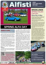
ALFA ROMEO OWNERS CLUB<br />
I said<br />
right!<br />
You said<br />
left !<br />
C O T S W O L D<br />
Well I meant right...!<br />
S E CTI O N<br />
incorporating the<br />
Giulia 105 Register meeting<br />
The scenic drive and quiz<br />
This route is simply an interesting way to get you to Upton House, the venue for <strong>this</strong> years COTSWOLD<br />
ALFA DAY. It is designed as a leisurely drive, not a race. The route uses a combination of B roads and<br />
lots of typically narrow, and often bumpy, Cotswold country lanes.<br />
Included to add a little extra interest are a series of observational questions for you to solve. All the answers<br />
can be found along the route and you don’t even need to get out of the car to find them. Answer them<br />
all correctly and you could win a prize!<br />
The entire route is around 65 miles in length and can be completed in about 2 1 /2hours if done non-stop.<br />
But please take your time. Have a go at the quiz, or stop en route to explore some of the beautiful and<br />
interesting places that the Cotswolds has to offer. But above all enjoy driving your <strong>Alfa</strong>!<br />
The <strong>Alfa</strong> <strong>Romeo</strong> <strong>Owners</strong> <strong>Club</strong> expects all members driving the route to drive sensibly and legally.<br />
Please obey the speed limit at all times. All cars taking part must be road legal.<br />
Information<br />
and questions<br />
The Puesdown Inn is the<br />
highest pub in the Cotswolds<br />
at 824 feet above sea level.<br />
On the night of October 25th<br />
1940 a German bomber<br />
dropped 3 high explosive<br />
bombs and around 100<br />
incendiaries near the<br />
Puesdown Inn. The A40 was<br />
closed for several days as<br />
some of the bombs had<br />
delayed action fuses.<br />
Q UESTION 1<br />
Just after the market square<br />
in North Leach there is a left<br />
turn into a side road that is<br />
named after the village it<br />
leads to. What village is <strong>this</strong>?<br />
___________________<br />
The Lodge at Sherborne was<br />
designed as a grandstand for<br />
Sir John Dutton, a friend of<br />
Oliver Cromwell, for viewing<br />
deer coursing in the extensive<br />
parkland. Recently restored<br />
to its 17th century glory by<br />
the National Trust the Lodge<br />
is open on Sundays.<br />
The route (all distances quoted are approximate)<br />
PUESDOWN to SHIPTON DOWN Approx. 16 miles, on narrow lanes and fast B roads. From<br />
Gloucestershire to Oxfordshire, past an historic hunting lodge, and along the Windrush Valley.<br />
1 Starting from the Puesdown Inn turn right onto the A40.<br />
2 After just 200 metres turn right, sign-posted to Yanworth and Compton Abdale. Stay on<br />
<strong>this</strong> fast road known locally as the ‘Salt Way’ for 2 1 /2 miles.<br />
3 Eventually you will reach a crossroads controlled by traffic lights. On the left is the former<br />
North Leach gaol. Go straight ahead (when the lights are green of course!) sign-posted<br />
to North Leach Town Centre.<br />
4 Follow <strong>this</strong> road through the centre of North Leach.<br />
5 About 1 /4 mile after the town square turn right into Eastington Road. It’s sign-posted to<br />
Eastington and Aldsworth. Follow <strong>this</strong> road up hill.<br />
6 After about 1 mile you come to a staggered crossroads. Go straight on (it’s actually left<br />
and then right).<br />
7 Continue along <strong>this</strong> road. You will shortly see on your left the wall of Lodge Park, part<br />
of the Sherborne Estate. You’ll pass a right turn and eventually come to a sharp lefthand<br />
bend. Now the road drops, crosses the River Leach, and enters Larkethill Woods before<br />
ascending a fairly steep but short hill through the woods.<br />
8 At the top of the hill turn left, sign-posted to Sherborne and Lodge Park.<br />
9 1 /2 mile further on, on the left, you will see the National Trust property, Lodge Park<br />
Grandstand. The route continues along <strong>this</strong> straight road .<br />
10 After another mile you will reach a crossroads with the A40. We go straight on, signposted<br />
to Sherborne and Clapton. Take care <strong>this</strong> is a busy junction.<br />
1
Q UESTION 2<br />
What is the name of the<br />
National Trust car park<br />
mentioned in stage 11?<br />
___________________<br />
Q UESTION 3<br />
Shortly after the National<br />
Trust car park a is farm with<br />
a ‘citrus’ name. What is it?<br />
___________________<br />
In 1839 when a Royal<br />
Commission was<br />
investigating possible building<br />
materials for the new Houses<br />
of Parliament, they were<br />
shown St Peter’s Church in<br />
Windrush to demonstrate<br />
how the local stone aged.<br />
The quarries of Taynton<br />
provided some of the finest<br />
Cotswold Stone. Material<br />
from here was used in the<br />
construction of St Paul’s<br />
Cathedral, Blenheim Palace,<br />
and many of the Oxford<br />
colleges.<br />
Q UESTION 4<br />
At the crossroads with the<br />
A424 which way would you<br />
turn if you were heading for<br />
Burford? Left or right?<br />
___________________<br />
Q UESTION 5<br />
Once on the B4437 the<br />
second turning on the right<br />
leads to which village?<br />
___________________<br />
The woods above Charlbury<br />
are all that is left of the Great<br />
Wychwood Forest that once<br />
stretched from the Cotswolds<br />
to the Thames. Nelson’s<br />
flagship HMS Victory is said<br />
to have been constructed of<br />
Charlbury oaks.<br />
Hidden away on the Eastern<br />
Edge of Wychwood Forest is<br />
Cornbury Park, with it’s huge<br />
Manor House. Until the<br />
building of nearby Blenhiem<br />
Palace, Cornbury was the<br />
largest house in England.<br />
Q UESTION 5<br />
As you enter Chipping Norton<br />
you will see a pub with a<br />
Roman (or is it a Football?)<br />
related name. What is the pub<br />
called (ignore the ‘The’)?<br />
___________________<br />
11 1 /2 mile further on, on the right, is a National Trust Car Park from where you can explore<br />
the Sherborne Estate.<br />
12 Another 1 /2 mile brings you to a crossroads. Turn right sign-posted to Sherborne and<br />
Windrush.<br />
13 Follow <strong>this</strong> road through Sherborne. The water on your left is Sherborne Brook which<br />
flows into the River Windrush.<br />
14 As the road leaves Sherborne it bears sharp right and then curves left. Keep left following<br />
signs to Windrush and The Barringtons.<br />
15 1 1 /2 miles brings you to Windrush. At the village centre, in front of the church, keep left.<br />
16 Follow <strong>this</strong> bumpy road for 1 mile until you come to a t-junction. Turn left following signs<br />
to The Barrington and Rissingtons. The riverside Fox Inn is immediately on your right.<br />
17 The route continues over the River Windrush and into the village of Great Barrington<br />
where you should turn right, in front of the war memorial.<br />
18 Follow the road for 1 1 /2 miles until you come to Taynton. Follow the road through the<br />
village.<br />
19 As you leave the village turn left, sign-posted to Stow and Milton-under-Wychwood.<br />
20 After 1 mile you come to a crossroads with the A424. This is a busy junction so take<br />
care. The route continues straight ahead.<br />
21 1 /4 mile brings you to a t-junction. Turn left sign-posted to Milton-under-Wychwood.<br />
22 After only 50 metres follow the road as it bears right, sign-posted to Charlbury.<br />
23 In just over a mile you’ll come to a crossroads. This is Shipton Down crossroads.<br />
SHIPTON DOWN to CHASTLETON Approx. 18 miles, on fast B roads, along the Evenlode<br />
valley, past a real petrol head’s residence, to a fine Jacobean Manor.<br />
24 Our route goes straight on, onto the B4437, sign-posted to Charlbury. This is a very<br />
good ‘drivers’ road. It’s wide (by Cotswold standards) and fast with plenty of undulating<br />
bends - some of them are deceptive and have adverse cambers, so take care. There<br />
are also quite a few side turnings to watch out for. It’s a run of 7 miles along the Evenlode<br />
Valley to Charlbury. Please remember the speed limit.<br />
25 Charlbury is approached on a long straight section of road. You will cross the railway<br />
on quite a steep bridge. Next comes a mini-roundabout at the entrance to the station,<br />
then there are speed humps as you cross the River Evenlode, and go up the hill to the<br />
t-junction.<br />
26 At the t-junction you must turn left. Right is no entry.<br />
27 Having turned left stay on <strong>this</strong> road. It is the B4026 and is another good ‘drivers’ road.<br />
although not as fast as the previous section - it is narrower and twistier.<br />
28 You will soon come to Spelsbury which is entered via a tight left-hand bend and then a<br />
narrow right-hand bend.<br />
29 After Spelsbury you have a good run of 4 1 /2 miles. Just over a mile from Spelsbury there<br />
is one left-hand bend inparticular that can catch you out, so take care. Now the road<br />
speeds up. 2 1 /2 miles after <strong>this</strong> bend you will pass a certain Mr Clarkson’s house tucked<br />
away on the left behind iron gates.<br />
30 Soon after <strong>this</strong> you will reach a t-junction. This road is the A361. We turn right and enter<br />
Chipping Norton.<br />
31 Follow <strong>this</strong> road until you come to a mini-roundabout. Turn left.<br />
32 You will immediately come to a second mini-roundabout. Turn right into West Street.<br />
33 You now come a t-junction although it doesn’t look like one because right looks like<br />
straight on. But we go left (did that make sense?). Having turned left we are now in New<br />
Street. This is the A44.<br />
2
The Bliss Tweed Mill was built<br />
in 1872 to replace an earlier<br />
building destroyed by fire. It<br />
was designed by George<br />
Woodhouse for William Bliss,<br />
manufacturuer of high quality<br />
Tweed. The Mill closed in<br />
1980 and has now been<br />
converted in to luxury<br />
apartments.<br />
In the 1930’s the American<br />
owner of Cornwell village<br />
commissioned Sir Clough<br />
Williams-Ellis, architect of<br />
Portmeirion, to fully modernise<br />
the village.<br />
Owned and lived in by the<br />
same family for 400 years<br />
Chastleton is one of England’s<br />
finest and most complete<br />
Jacobean Houses. Now<br />
owned by the National Trust<br />
the house is unfortunately<br />
closed on Sundays.<br />
Q UESTION 6<br />
Having turned right in<br />
Chastleton you will eventually<br />
reach the A44 where the<br />
route turns left, sign-posted<br />
to Moreton and where else?<br />
___________________<br />
Little Compton is the most<br />
southerly village in<br />
Warwickshire.<br />
Q UESTION 7<br />
In Little Compton there is a<br />
green sign pointing to the<br />
Bowls <strong>Club</strong> and what else?<br />
___________________<br />
The main feature of the<br />
Rollright Stones is a bronze<br />
age stone circle, about 30<br />
metres in diameter, known as<br />
The King’s Men. About 400<br />
metres to the east are the<br />
remains of a bronze age burial<br />
chamber known as The<br />
Whispering Knights. And on<br />
the opposite side of the road<br />
from The King’s Men stands<br />
the solitary King Stone.<br />
Q UESTION 8<br />
In Long Compton there is a<br />
nice old fashioned looking<br />
garage. What is it called?<br />
___________________<br />
Weston Park was once the<br />
grounds of a fine early 19th<br />
century mansion which was<br />
demolished in the 1920’s.<br />
34 Stay on the A44. After half a mile or so glance to your left and you will see the extraordinary<br />
Bliss Mill. There is a good view of the mill from the layby.<br />
35 Continue along the A44. As you leave Chipping Norton the road descends a steady hill<br />
and about 1 1 /2 miles from Chipping Norton town centre you will find a left turn signposted<br />
to Cornwell. Take <strong>this</strong> turn.<br />
36 Follow <strong>this</strong> road for about a mile until you come to a t-junction at which you need to<br />
turn right, sign-posted to Cornwell. On the right as you enter the village there is a glimpse,<br />
through the wrought iron gates, of the fine manor house and gardens.<br />
37 Continue through the village untill you come to a crossroads. Turn right, signposted<br />
to Chastleton.<br />
38 After 1 /2 mile you will come to another crossroads. This is the A436. Our route goes<br />
straight on. Again it is sign-posted to Chastleton.<br />
39 After just over 1 mile you come to Chastleton with it’s fine Jacobean Manor house on<br />
the right. The house is closed today, but the church should be open.<br />
CHASTLETON to SIBFORD FERRIS Approx. 17 miles, on narrow lanes, along the<br />
Oxfordshire/Warwickshire border, past an ancient stone circle and a stretch of parkland, to<br />
the River Stour.<br />
40 As you leave Chastleton you need to turn right, sign-posted to Little Compton.<br />
The turning is opposite a well hidden phone box.<br />
41 3 /4 of a mile will bring you back to the A44. Turn left.<br />
42 After only 200 metres turn right into Little Compton.<br />
43 Follow the road through the village. As the road leaves the village it climbs up hill. At the<br />
top there is a left-hand bend followed quickly by a sharp right-hand bend. If it is a clear<br />
day there are fine views to the north-east.<br />
44 1 /2 mile after the right-hand bend there is a left turning but the route carries straight on<br />
to the t-junction. You need to turn left here. It is sign-posted to Little Rollright.<br />
45 1 /2 mile further on is the ancient stone circle of the Rollright Stones. The main circle<br />
(known as the King’s Men) is on the right behind the hedge. There is parking in the layby.<br />
Entry to the Stones is just 50p.<br />
46 Another 1 /2 mile brings you to a staggered crossroads with the A3400. Turn left.<br />
47 Follow <strong>this</strong> road for 1 mile to Long Compton. Note the unusual thatched lych gate at<br />
the entrance to the village church.<br />
48 About 300 metres after the church turn right, sign-posted to Whichford and Ascott.<br />
Follow <strong>this</strong> road up hill to a junction.<br />
49 At <strong>this</strong> junction you will find yourself opposite a gatehouse with a white picket fence.<br />
The route goes straight on through the gateway. (The road markings show it as 2nd left.)<br />
Cross the cattle grid. This is Weston Park. Stay on <strong>this</strong> road for about 1 1 /2 miles. You’ll<br />
soon pass over another cattle grid after which there are several pot-holes so take care.<br />
50 Eventually you’ll come to a t-junction opposite a pine tree. Turn right.<br />
51 Just stay on <strong>this</strong> road as it meanders through the villages of Cherington and<br />
Stourton. In Stourton the road bends sharp left and then sharp right.<br />
52 About 1 /2 mile after these bends and just before the road enters Sutton-under-Brailes<br />
there is a right-hand turning sign-posted to Sibford and Hook Norton. Take it.<br />
53 Follow <strong>this</strong> road for about 1 3 /4 miles until you reach a t-junction where you should turn<br />
right, sign-posted to Ascott, Sibford Gower and Hook Norton.<br />
54 Another mile brings you to Traitor’s Ford. This is pretty shallow and should cause you<br />
no problems. It’s the River Stour by the way.<br />
3
Traitor’s Ford. No one seems<br />
to know how <strong>this</strong> crossing of<br />
the River Stour acquired it’s<br />
name. Sorry!<br />
This is ironstone country. Note<br />
how the colour of the<br />
cottages has altered from the<br />
mellow Cotswold hues to a<br />
richer rust coloured shade as<br />
we’ve progessed northwestwards<br />
and the iron<br />
content of the stone has<br />
increased<br />
Q UESTION 9<br />
What is the last cottage on<br />
the right in Sibford Ferris is<br />
called? A clue; it has a capital<br />
city in it’s name.<br />
___________________<br />
The lowland area around<br />
Tysoe is known as the ‘Vale<br />
of the Red Horse’ after the<br />
various hill figures that have<br />
been cut into the red soil of<br />
the hillside above the village.<br />
A red horse is recorded in<br />
1607 but <strong>this</strong> was destroyed<br />
in the 19th century. A smaller<br />
one was cut at the start of<br />
the 20th century but was<br />
never maintained.<br />
Sun Rising Hill. On 12th<br />
September 1903 the newly<br />
formed Midland Automobile<br />
<strong>Club</strong> held a hill climb event<br />
at Sun Rising Hill on the<br />
Banbury to Stratford road. It<br />
was a huge success and the<br />
event was repeated in 1904.<br />
But it was disrupted by<br />
interest from the police and<br />
a disenchanted farmer who<br />
contrived to move wagons<br />
and livestock up and down<br />
the hill throughout the day!<br />
So the <strong>Club</strong> sought another<br />
venue and eventually settled<br />
on a lane on the Shelsley<br />
Walsh estate in<br />
Worcestershire, where it has<br />
remained ever since. The<br />
<strong>Club</strong>s logo depicts an image<br />
of the rising sun reflecting it’s<br />
early days at Sun Rising Hill.<br />
55 Around 1 /2 mile beyond the ford take the left turn next to the woodland.<br />
56 Another mile brings you to a t-junction. Turn left.<br />
57 Follow <strong>this</strong> road down hill. The road curves left and crosses a small bridge. Immediately<br />
after the bridge there is a turning on the right. Take it. It leads up a steep hill and the<br />
road bends to the right.<br />
58 Stay on <strong>this</strong> narrow road for around 1 mile.<br />
59 Eventually you will arrive in Sibford Ferris at a t-junction. You should turn left here, signposted<br />
to Banbury.<br />
SIBFORD FERRIS to UPTON HOUSE Approx. 13 miles, returning to Warwickshire along a<br />
sweeping B road. Down the gentle North Cotswold escarpment into the Vale of the Red Horse<br />
and then up again via a steeper route and a couple of fantastic bends.<br />
60 Continue straight through the village.<br />
61 1 /2 mile beyond the village you come to a crossroads. Turn left. Sign-posted to Shutford.<br />
62 1 /4 mile further on is another crossroads. Turn left again, sign-posted to Brailes and<br />
Shipston-on-Stour. This is the B4035<br />
63 Stay on <strong>this</strong> lovely undulating road for about 3 1 /2 miles.<br />
64 Eventually the road will start to drop. Halfway down the hill is a left turn sign-posted to<br />
Hook Norton, but you need to continue straight on towards Lower Brailes.<br />
65 As you enter Lower Brailes take the turning on the right sign-posted to Winderton.<br />
66 When you reach Winderton turn left. It’s a steep, sharp turn, sign-posted to Brailes and<br />
Shipston<br />
67 After just under 1 mile you come to a t-junction. Turn right, sign-posted to Tysoe and<br />
Compton Wynyates.<br />
68 This is quite a fast road. About 2 miles will bring you to Upper Tysoe. Follow the road<br />
as it bears left into Main Street and continues through Upper and Middle Tysoe.<br />
69 Around 1 /2 mile after Middle Tysoe the road we are on bears sharp left. But our route<br />
turns right, sign-posted to Ratley, Edgehill and Banbury. Although the road markings<br />
show it as a right-turn it is actually straight on.<br />
70 This straight road brings you to a t-junction with the A422. Turn right, sign-posted to<br />
Banbury and Edgehill.<br />
71 This road takes you back up the Cotswold escarpment via Sun Rising Hill and a couple<br />
of wonderful bends.<br />
72 Once you reach the top continue on <strong>this</strong> road which bends left and then right for another<br />
1/2 mile.<br />
73 The entrance to UPTON HOUSE is on your right.<br />
You made it! Well done. Enjoy the rest of the day.<br />
If you have had a go at the quiz turn to page 6 and complete the anagram. That done please<br />
post your completed answer sheet in the box provided beneath the Cotswold Section flag<br />
by 2.30pm. If you’ve got all 10 answers, and the anagram, correct your name will go into a<br />
draw and you could win a prize!<br />
If you’ve had a go at the quiz turn to page 6<br />
4
0<br />
BROADWAY<br />
Puesdown Inn<br />
A40<br />
A429<br />
Fosse Way<br />
Northleach<br />
Gaol<br />
NORTHLEACH<br />
CHIPPING<br />
CAMPDEN<br />
B4077<br />
A44<br />
Key<br />
The route<br />
The quickest route<br />
Places of interest mentioned<br />
in the text<br />
Petrol stations (not all of them<br />
are open on Sundays)<br />
1<br />
2<br />
3<br />
4<br />
6<br />
4 miles<br />
5<br />
A40<br />
7<br />
Lodge<br />
Park<br />
MORETON-IN-MARSH<br />
A429<br />
11<br />
Fosse Way<br />
12<br />
8<br />
A424<br />
STOW-ON-THE-WOLD<br />
River Windrush<br />
River Leach<br />
Sherborne<br />
17<br />
NT<br />
Car Park<br />
9<br />
13<br />
10<br />
14<br />
A424<br />
Windrush<br />
15<br />
B4425<br />
SHIPSTON-ON-STOUR<br />
16<br />
B4035<br />
A429<br />
A44<br />
39<br />
Fosse Way<br />
40<br />
Great<br />
Barrington<br />
The Fox Inn<br />
Little<br />
Barrington<br />
Chastleton<br />
A424<br />
A3400<br />
20<br />
41<br />
A3400<br />
A429<br />
19<br />
Taynton<br />
18<br />
38<br />
37<br />
Shipton-u-<br />
Wychwood<br />
BURFORD<br />
Lower Brailes<br />
Sutton-u-Brailes<br />
Sibford 61<br />
53 54 Ferris<br />
Stourton<br />
Cherington<br />
60<br />
59<br />
50<br />
Weston<br />
52 Traitor’s<br />
51<br />
Park<br />
Ford<br />
49<br />
48<br />
55 56 57 58<br />
Long Compton<br />
Cornwell<br />
A40<br />
B4455<br />
42 43 44<br />
Upper Brailes<br />
A361<br />
B4450<br />
Fosse Way<br />
Little<br />
Compton 35<br />
Chastleton<br />
House<br />
Cornwell<br />
Manor<br />
21 22<br />
36<br />
23<br />
A3400<br />
A44<br />
Bliss Mill<br />
32<br />
Shipton Downs<br />
Crossroads<br />
Lower Tysoe<br />
Middle Tysoe<br />
Winderton<br />
Rollright Stones<br />
River Evenlode<br />
A40<br />
67<br />
34<br />
30<br />
A422<br />
47<br />
A361<br />
24<br />
45<br />
68<br />
65<br />
River Stour<br />
33<br />
46<br />
A3400<br />
CHIPPING NORTON<br />
JC’s House<br />
B4437<br />
69<br />
Spelsbury<br />
25<br />
Wychwood<br />
Forest<br />
River Windrush<br />
WITNEY<br />
Sun<br />
Rising<br />
Hill<br />
Upper Tysoe<br />
Tysoe Windmill<br />
64<br />
31<br />
70<br />
66<br />
63<br />
B4026<br />
Charlbury<br />
Station<br />
B4035<br />
B4022<br />
71 72<br />
A361<br />
A44<br />
29 28<br />
Upton<br />
House<br />
62<br />
27<br />
CHARLBURY<br />
26<br />
73<br />
Just in case you get lost or breakdown here are the phone numbers of the Cotswold Section Committee members who may<br />
be able to help you.<br />
Mark Grimshaw 07770 931759<br />
Matthew Willmott 07740 595793<br />
Richard Morris 07773 257671<br />
Richard Rees 07791 325103<br />
5
Did you answer every question? If you did you’ll have 10 answers. Write those answers<br />
down here;<br />
Answer to question number;<br />
ANSWER FORM<br />
Your name .....................................................................................................................<br />
Your cars details: model ................................................ reg no .................................<br />
1<br />
2<br />
3<br />
4<br />
5<br />
6<br />
7<br />
8<br />
9<br />
10<br />
Now take the first letter of each answer and rearrange them to form a word associated with<br />
<strong>Alfa</strong> <strong>Romeo</strong>. Write the solution to <strong>this</strong> anagram below;<br />
11<br />
You now have 11 answers.<br />
Post your completed answer form in the box beneath the Cotswold Section flag by 2.30pm.<br />
Forms containing 11 correct answers (that is 10 correct answers to the quiz, plus the anagram)<br />
will be entered into a prize draw. One lucky winner will be drawn ‘out of the hat’ and will<br />
receive a prize!<br />
6