Appendix C - Cultural Heritage Impact Assessment - Peabody Energy
Appendix C - Cultural Heritage Impact Assessment - Peabody Energy Appendix C - Cultural Heritage Impact Assessment - Peabody Energy
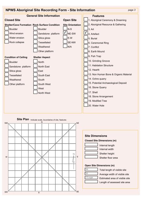
NPWS Aboriginal Site Recording Form - Site Information page 3 General Site Information Closed Site Open Site Shelter/Cave Formation Rock Surface Condition Site Orientation Boulder Boulder N-S Wind erosion Sandstone platform ✔ NE-SW Water erosion Silica gloss E-W Rock collapse Tessellated SE-NW Weathered N/A Other platform ✔ Features 1. Aboriginal Ceremony & Dreaming 2. Aboriginal Resource & Gathering 3. Art 4. Artefact 5. Burial 6. Ceremonial Ring 7. Conflict 8. Earth Mound Condition of Ceiling Boulder Sandstone platform Silica gloss Tessellated Weathered Other platform Shelter Aspect North North East East South East South South West West North West 9. Fish Trap 10. Grinding Groove 11. Habitation Structure 12. Hearth 13. Non Human Bone & Organic Material 14. Ochre quarry 15. Potential Archaeological Deposit 16. Stone Quarry 17. Shell 18. Stone Arrangement 19. Modified Tree 20. Water Hole NW Site Plan Indicate scale, boundaries of site, features N NE Site Dimensions Closed Site Dimensions (m) Internal length Internal width W N E Shelter height Shelter floor area Open Site Dimensions (m) 5m 5m 25sqm Total length of visible site Average width of visible site Estimated area of visible site Length of assessed site area SW S SE
NPWS Aboriginal Site Recording Form - Site Interpretation and Community Statement page 4 Aboriginal Community Interpretation and Management Recommendations Preliminary Site Assessment Site Cultural & Scientific Analysis and Preliminary Management Recommendations Wambo Site 353 (Artefact Scatter C) was located on a south facing slope near a grove of trees. A small pink silcrete flake and two small red mudstone flakes were identified in a erosion scour in an area that had been severely affected by sheet wash and cattle trampling. If proposed or existing mine activities are likely to impact on the Aboriginal archaeological site, then the site should be salvaged (subject to an appropriate permit being in force) and the artefacts or objects relocated to the temporary keeping place under the Wambo Care and Control Permit #3130. This section should only be filled in by the Endorsees Endorsed by: Knowledge Holder Nominated Trustee Native Title Holder Community Consensus Title Surname First Name Initials Organisation Address Phone number Fax Attachments (No.) Comments A4 location map B/W photographs Colour photographs Slides Aerial photographs Site plans, drawings Recording tables Other Feature inserts-No.
- Page 156 and 157: Office Use Only Entered by (I.D.) S
- Page 158 and 159: NPWS Aboriginal Site Recording Form
- Page 160 and 161: NPWS FEATURE RECORDING FORM - ARTEF
- Page 162 and 163: Table: Artefact Attributes ID Artef
- Page 173 and 174: Office Use Only Entered by (I.D.) S
- Page 175 and 176: NPWS Aboriginal Site Recording Form
- Page 177 and 178: NPWS FEATURE RECORDING FORM - ARTEF
- Page 179 and 180: Site Description Wambo Site 348 (AS
- Page 188 and 189: Office Use Only Entered by (I.D.) S
- Page 190 and 191: NPWS Aboriginal Site Recording Form
- Page 192 and 193: NPWS FEATURE RECORDING FORM - ARTEF
- Page 194 and 195: Site Description This artefact scat
- Page 196 and 197: Office Use Only Entered by (I.D.) S
- Page 198 and 199: NPWS Aboriginal Site Recording Form
- Page 200 and 201: NPWS FEATURE RECORDING FORM - ARTEF
- Page 202 and 203: Site Description Wambo Site 352 (Ar
- Page 204 and 205: Office Use Only Entered by (I.D.) S
- Page 208 and 209: NPWS FEATURE RECORDING FORM - ARTEF
- Page 210 and 211: Site Description Wambo Site 353 (Ar
- Page 212 and 213: Office Use Only Entered by (I.D.) S
- Page 214 and 215: NPWS Aboriginal Site Recording Form
- Page 216 and 217: NPWS FEATURE RECORDING FORM - ARTEF
- Page 218 and 219: Site Description This artefact scat
- Page 220 and 221: Office Use Only Entered by (I.D.) S
- Page 222 and 223: NPWS Aboriginal Site Recording Form
- Page 224 and 225: NPWS FEATURE RECORDING FORM - ARTEF
- Page 226 and 227: Site Description This artefact scat
- Page 228 and 229: Office Use Only Entered by (I.D.) S
- Page 230 and 231: NPWS Aboriginal Site Recording Form
- Page 232 and 233: NPWS FEATURE RECORDING FORM - ARTEF
- Page 234 and 235: Site Description This artefact scat
- Page 236 and 237: NPWS Aboriginal Site Recording Form
- Page 238 and 239: NPWS Aboriginal Site Recording Form
- Page 240 and 241: NPWS FEATURE RECORDING TABLE - ARTE
- Page 242: Wambo Site 358 isolated find pink m
- Page 249 and 250: NPWS Aboriginal Site Recording Form
- Page 251 and 252: NPWS Aboriginal Site Recording Form
- Page 253 and 254: NPWS FEATURE RECORDING TABLE - ARTE
- Page 255 and 256: NPWS FEATURE RECORDING TABLE - MODI
NPWS Aboriginal Site Recording Form - Site Information page 3<br />
General Site Information<br />
Closed Site<br />
Open Site<br />
Shelter/Cave Formation Rock Surface Condition Site Orientation<br />
Boulder Boulder N-S<br />
Wind erosion Sandstone platform<br />
✔<br />
NE-SW<br />
Water erosion Silica gloss E-W<br />
Rock collapse Tessellated SE-NW<br />
Weathered<br />
N/A<br />
Other platform<br />
✔<br />
Features<br />
1. Aboriginal Ceremony & Dreaming<br />
2. Aboriginal Resource & Gathering<br />
3. Art<br />
4. Artefact<br />
5. Burial<br />
6. Ceremonial Ring<br />
7. Conflict<br />
8. Earth Mound<br />
Condition of Ceiling<br />
Boulder<br />
Sandstone platform<br />
Silica gloss<br />
Tessellated<br />
Weathered<br />
Other platform<br />
Shelter Aspect<br />
North<br />
North East<br />
East<br />
South East<br />
South<br />
South West<br />
West<br />
North West<br />
9. Fish Trap<br />
10. Grinding Groove<br />
11. Habitation Structure<br />
12. Hearth<br />
13. Non Human Bone & Organic Material<br />
14. Ochre quarry<br />
15. Potential Archaeological Deposit<br />
16. Stone Quarry<br />
17. Shell<br />
18. Stone Arrangement<br />
19. Modified Tree<br />
20. Water Hole<br />
NW<br />
Site Plan Indicate scale, boundaries of site, features<br />
N<br />
NE<br />
Site Dimensions<br />
Closed Site Dimensions (m)<br />
Internal length<br />
Internal width<br />
W<br />
N<br />
E<br />
Shelter height<br />
Shelter floor area<br />
Open Site Dimensions (m)<br />
5m<br />
5m<br />
25sqm<br />
Total length of visible site<br />
Average width of visible site<br />
Estimated area of visible site<br />
Length of assessed site area<br />
SW<br />
S<br />
SE


