Soils of the - Agriculture and Agri-Food Canada
Soils of the - Agriculture and Agri-Food Canada Soils of the - Agriculture and Agri-Food Canada
ALBION SOILS Location and Extent : A Oion soils occur mainly soL . :r . .1 d east of Murree- . ?he vicinities of Haney, 'l on and Webster's Corner with small, scattered areas e sewhere There are _e 280 ha of pure map units rule soil complexes dominated by Albion soils total 2190 ha The complexes are mostly with Scat . Whatco m and Nicholson soils . Topography and Elevation : The topography is slightly depressional to very gently sloping or undulating with slopes between 1 and 5 percent. In complexes with Whatcom or Nicholson soils . Albion soils usuall y occupy the lower topographic landscape positions . The elevational range of Albion soils is mainly between 5 0 and 100m above sea level . Parent Material and Texture : Albion soils have developed from moderately fine to fine-texture d glaciomarine deposits In some locations up to 20 cm of silty . eolian material either overlies or is mixed into th e surface of the glaciomarine sediments Surface textures range from silt loam to silty clay loam while subsurfac e and subsoil textures vary from silty clay loam to cla y Soil Moisture Characteristics : Albion soils are moderately poorly to poorly drained- They are slowly pervious and have high water holding capacity and slow surface runoff They are subject to runoff accumulatio n and seepage from adjacent hinter areas and perched ale- nr icihove the clavev sensoii a re usual du ri ng the wet parts of the year Plate 7 Albion soil profile (Humic Luvic Gleysol). These poorl y drained soils have developed from clayey glaciomarine deposits . They have a prominent clay accumulation layer in the subsoil which in the photo, begins at about 14 in. (35 cm) and extends to about 2. 5 ft . (75 cm). A grayish, leached layer overlies it andstarts at about 6 in (15 cm). Scat soils are somewhatsimilar to Albion soils, however, the surface layer is usually per and darker coloured and the leached 'h ecru n n . ;ation are ovule rle!rrie:i 24
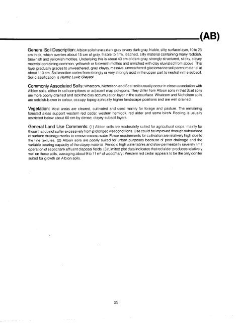
General Soil Description : Albion soils have a dark gray to very dark gray, friable, silty, surface layer, 10 to 2 5 cm thick, which overlies about 15 cm of gray, friable to firm, leached, silty material containing many reddish , brownish and yellowish mottles . Underlying this is about 40 cm of dark gray, strongly structured, sticky, claye y material containing common, yellowish or brownish mottles and enriched with clay eluviated from above . Thi s layer gradually grades to unweathered, gray, clayey, massive, unweathered glaciomarine soil parent material a t about 110 cm . Soil reaction varies from strongly or very strongly acid in the upper part to neutral in the subsoil . Soil classification is Humic Luvic Gleysol . Commonly Associated Soils : Whatcom, Nicholson and Scat soils usually occur in close association wit h Albion soils, either in soil complexes or adjacent map polygons . They differ from Albion soils in that Scat soil s are more poorly drained and lack the clay accumulation layer in the subsurface . Whatcom and Nicholson soil s are reddish-brown in colour, occupy topographically higher landscape positions and are well drained . Vegetation : Most areas are cleared, cultivated and used mainly for forage and pasture . The remainin g forested areas support western red cedar, western hemlock, red alder and some birch . Rooting is usuall y restricted below about 60 cm by dense, clayey subsoil layers . General Land Use Comments : (1) Albion soils are moderately suited for agricultural crops, mainly fo r those that do not suffer excessively from prolonged wet conditions . Use could be improved through subsurfac e or surface drainage works to remove excess water. Power requirements for cultivation are relatively high due t o the fine textures . (2) Albion soils are poorly suited for urban purposes because of poor drainage and th e variable bearing capacity of the clayey material . Periodic high watertables and slow permeability severely limi t operation of septic tank effluent disposal fields . (3) Limited plot data indicates that red alder produces relativel y well on these soils, averaging about 9 to 11 m 3 of wood/ha/yr. Western red cedar appears to be the only conife r suited for growth on Albion soils . (AB) 25
- Page 1 and 2: Soils of the Langley-Vancouver Map
- Page 3 and 4: Province of British Columbi a Minis
- Page 5 and 6: INTRODUCTION The first soil survey
- Page 7 and 8: HOW TO USE THE SOIL MAPS AND REPORT
- Page 9 and 10: INTRODUCTION HOW TO USE THE SOIL MA
- Page 11 and 12: Lulu Soils (LU) Lumbum Soils (LM) L
- Page 13 and 14: LIST OF FIGURES Figure 1 Location a
- Page 15 and 16: LIST OF PLATES (Continued) Plate 30
- Page 17 and 18: LIST OF APPENDICES Appendix A Avera
- Page 19 and 20: Plate i view northward over downtow
- Page 21 and 22: during the growing season (May to S
- Page 23 and 24: Plate 3 Dyke along the Fraser River
- Page 25 and 26: SURFICIAL GEOLOGIC DEPOSITS Several
- Page 27 and 28: ---------------- TABLE 2 The relati
- Page 29 and 30: CHAPTER TWO SOIL CLASSIFICATION AND
- Page 31 and 32: CHAPTER THREE DESCRIPTION OF THE SO
- Page 33 and 34: UPLANDS STREA M Figure 6. A schemat
- Page 35 and 36: Description of the Soils
- Page 37 and 38: n Plate 5 Abbotsford soil profile (
- Page 39: - _ I Plate 6 Landscape typical of
- Page 43 and 44: ANNACIS SOILS (AS) Location and Ext
- Page 45 and 46: ARNOLD SOILS . (AR) Location and Ex
- Page 47 and 48: BATES SOILS (BT) Location and Exten
- Page 49 and 50: BEHARREL SOILS . (BL) Location and
- Page 51 and 52: BERRY SOILS (BR) Location and Exten
- Page 53 and 54: BLANEY SOILS . (BE) Location and Ex
- Page 55 and 56: BONSON SOILS (BN) Location and Exte
- Page 57 and 58: ' - -_) - r or - ' _ ti _ L , -~ s,
- Page 59 and 60: BUCKERFIELD SOILS (BK) Location and
- Page 61 and 62: Plate 13 Buntzen soil profiie -. -H
- Page 63 and 64: CALKINS SOILS (CN) Location and Ext
- Page 65 and 66: CAPILANO SOILS . (CP) Location and
- Page 67 and 68: CASCADE SOILS . (CC) Location and E
- Page 69 and 70: CHEHALIS SOILS (CS) Location and Ex
- Page 71 and 72: Plate 14 Cloverdale soil pro/0e fHu
- Page 73 and 74: COLUMBIA SOILS Location and Extent
- Page 75 and 76: COQUITLAM SOILS . (CO) Location and
- Page 77 and 78: subsurface layers to extremely acid
- Page 79 and 80: DEAS SOILS (DS) Location and Extent
- Page 81 and 82: DELTA SOILS (DT) Location and Exten
- Page 83 and 84: Plate 20 Dennett soil profile (Typi
- Page 85 and 86: DEWDNEY SOILS (DW) Location and Ext
- Page 87 and 88: DURIEU SOILS (DU) Location and Exte
- Page 89 and 90: ELK SOILS (EK) Location and Extent
General Soil Description : Albion soils have a dark gray to very dark gray, friable, silty, surface layer, 10 to 2 5<br />
cm thick, which overlies about 15 cm <strong>of</strong> gray, friable to firm, leached, silty material containing many reddish ,<br />
brownish <strong>and</strong> yellowish mottles . Underlying this is about 40 cm <strong>of</strong> dark gray, strongly structured, sticky, claye y<br />
material containing common, yellowish or brownish mottles <strong>and</strong> enriched with clay eluviated from above . Thi s<br />
layer gradually grades to unwea<strong>the</strong>red, gray, clayey, massive, unwea<strong>the</strong>red glaciomarine soil parent material a t<br />
about 110 cm . Soil reaction varies from strongly or very strongly acid in <strong>the</strong> upper part to neutral in <strong>the</strong> subsoil .<br />
Soil classification is Humic Luvic Gleysol .<br />
Commonly Associated <strong>Soils</strong> : Whatcom, Nicholson <strong>and</strong> Scat soils usually occur in close association wit h<br />
Albion soils, ei<strong>the</strong>r in soil complexes or adjacent map polygons . They differ from Albion soils in that Scat soil s<br />
are more poorly drained <strong>and</strong> lack <strong>the</strong> clay accumulation layer in <strong>the</strong> subsurface . Whatcom <strong>and</strong> Nicholson soil s<br />
are reddish-brown in colour, occupy topographically higher l<strong>and</strong>scape positions <strong>and</strong> are well drained .<br />
Vegetation : Most areas are cleared, cultivated <strong>and</strong> used mainly for forage <strong>and</strong> pasture . The remainin g<br />
forested areas support western red cedar, western hemlock, red alder <strong>and</strong> some birch . Rooting is usuall y<br />
restricted below about 60 cm by dense, clayey subsoil layers .<br />
General L<strong>and</strong> Use Comments : (1) Albion soils are moderately suited for agricultural crops, mainly fo r<br />
those that do not suffer excessively from prolonged wet conditions . Use could be improved through subsurfac e<br />
or surface drainage works to remove excess water. Power requirements for cultivation are relatively high due t o<br />
<strong>the</strong> fine textures . (2) Albion soils are poorly suited for urban purposes because <strong>of</strong> poor drainage <strong>and</strong> th e<br />
variable bearing capacity <strong>of</strong> <strong>the</strong> clayey material . Periodic high watertables <strong>and</strong> slow permeability severely limi t<br />
operation <strong>of</strong> septic tank effluent disposal fields . (3) Limited plot data indicates that red alder produces relativel y<br />
well on <strong>the</strong>se soils, averaging about 9 to 11 m 3 <strong>of</strong> wood/ha/yr. Western red cedar appears to be <strong>the</strong> only conife r<br />
suited for growth on Albion soils .<br />
(AB)<br />
25


