

Marine Natural Values Study - Parks Victoria
Marine Natural Values Study - Parks Victoria
Marine Natural Values Study - Parks Victoria

Create successful ePaper yourself
Turn your PDF publications into a flip-book with our unique Google optimized e-Paper software.
P A R K S V I C T O R I A T E C H N I C A L S E R I E S<br />
NUMBER 1<br />
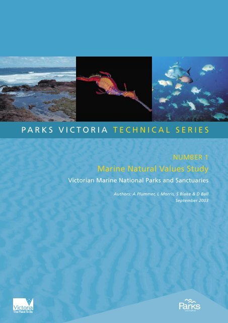
<strong>Marine</strong> <strong>Natural</strong> <strong>Values</strong> <strong>Study</strong><br />
<strong>Victoria</strong>n <strong>Marine</strong> National <strong>Parks</strong> and Sanctuaries<br />
Authors: A Plummer, L Morris, S Blake & D Ball<br />
September 2003
© <strong>Parks</strong> <strong>Victoria</strong><br />
All rights reserved. This document is subject to the Copyright Act 1968, no part of this<br />
publication may be reproduced, stored in a retrieval system, or transmitted in any form, or by<br />
any means, electronic, mechanical, photocopying or otherwise without the prior permission of<br />
the publisher.<br />
First published 2003<br />
Published by <strong>Parks</strong> <strong>Victoria</strong><br />
Level 10, 535 Bourke Street, Melbourne <strong>Victoria</strong> 3000<br />
Opinions expressed by the Authors of this publication are not necessarily those of <strong>Parks</strong><br />
<strong>Victoria</strong>, unless expressly stated. <strong>Parks</strong> <strong>Victoria</strong> and all persons involved in the preparation and<br />
distribution of this publication do not accept any responsibility for the accuracy of any of the<br />
opinions or information contained in the publication.<br />
Authors:<br />
Anthony Plummer – <strong>Marine</strong> Scientist, <strong>Marine</strong> and Freshwater Resources Institute<br />
Liz Morris – Science Officer, <strong>Marine</strong> and Freshwater Resources Institute<br />
Sean Blake – Research Scientist, <strong>Marine</strong> and Freshwater Resources Institute<br />
David Ball – Subprogram Leader Geospatial Systems, <strong>Marine</strong> and Freshwater Resources Institute<br />
National Library of Australia<br />
Cataloguing-in-publication data<br />
Includes bibliography.<br />
ISSN 1448-4935<br />
Citation<br />
Plummer, A, Morris, L, Blake, S and Ball, D (2003). <strong>Marine</strong> <strong>Natural</strong> <strong>Values</strong> <strong>Study</strong>,<br />
<strong>Victoria</strong>n <strong>Marine</strong> National <strong>Parks</strong> and Sanctuaries. <strong>Parks</strong> <strong>Victoria</strong> Technical Series No. 1,<br />
<strong>Parks</strong> <strong>Victoria</strong>, Melbourne.<br />
Printed on environmentally friendly paper
<strong>Parks</strong> <strong>Victoria</strong> Technical Series No. 1<br />
<strong>Marine</strong> <strong>Natural</strong> <strong>Values</strong> <strong>Study</strong><br />
<strong>Victoria</strong>n <strong>Marine</strong> National <strong>Parks</strong> and<br />
Sanctuaries<br />
Anthony Plummer<br />
Liz Morris<br />
Sean Blake<br />
David Ball<br />
<strong>Marine</strong> and Freshwater Resources Institute<br />
September 2003
<strong>Parks</strong> <strong>Victoria</strong> Technical Series No. 1<br />
<strong>Marine</strong> <strong>Natural</strong> <strong>Values</strong> <strong>Study</strong><br />
Executive Summary<br />
The "<strong>Marine</strong> <strong>Natural</strong> <strong>Values</strong> <strong>Study</strong> – <strong>Marine</strong> National <strong>Parks</strong> and Sanctuaries" is an inventory<br />
of accessible knowledge about the natural (environmental) values for all 24 of the newly<br />
declared <strong>Marine</strong> National <strong>Parks</strong> and Sanctuaries in <strong>Victoria</strong>.<br />
The report's authors, from the <strong>Marine</strong> & Freshwater Resources Institute (MAFRI) in<br />
Queenscliff, drew together environmental information from as diverse sources as scientific<br />
papers, Honours theses, published reports and unpublished data collections to compile the<br />
<strong>Natural</strong> <strong>Values</strong> <strong>Study</strong>.<br />
Each park (or in some cases each section of a park, e.g., Port Phillip Heads has six diverse<br />
sections) has it's own chapter. Each chapter has information gathered together into ten<br />
categories:<br />
1. Physical Parameters<br />
Basic physical parameters including size, length of coastline, range of water depth and use<br />
of the adjacent catchment.<br />
2. <strong>Marine</strong> Habitat Classes<br />
Includes descriptions of marine diversity at scales of 1:25 000 to 1:100 000 based on the<br />
interim <strong>Marine</strong> Habitat Classes for the <strong>Victoria</strong>n coastline.<br />
3. <strong>Marine</strong> Ecological Communities<br />
These descriptions provide a qualitative classification at the ecological community level,<br />
giving a broad description of the different assemblages for major habitat types in <strong>Marine</strong><br />
National <strong>Parks</strong> and Sanctuaries.<br />
4. Biological Processes<br />
This section lists any areas known to be important spawning, recruitment or nursery grounds<br />
within a <strong>Marine</strong> National Park or <strong>Marine</strong> Sanctuary and identifies regions known to be<br />
subject to highly productive upwellings.<br />
5. Species Distribution Information<br />
This section details what is known about the geographical distributions of species within or<br />
near to a <strong>Marine</strong> National Park or <strong>Marine</strong> Sanctuary. There are three types of geographical<br />
distributions listed:<br />
I
<strong>Parks</strong> <strong>Victoria</strong> Technical Series No. 1<br />
<strong>Marine</strong> <strong>Natural</strong> <strong>Values</strong> <strong>Study</strong><br />
• Species at, or near their presumed geographic limits and recorded from within a <strong>Marine</strong><br />
National Park or <strong>Marine</strong> Sanctuary.<br />
• Species at, or near their presumed geographic limits and have been recorded within a 5<br />
km radius of a <strong>Marine</strong> National Park or <strong>Marine</strong> Sanctuary on similar habitat.<br />
• Species restricted to a particular <strong>Marine</strong> National Park or <strong>Marine</strong> Sanctuary.<br />
The caution is noted that distribution limits in many cases reflect collection effort and not the<br />
actual limit of distribution for species.<br />
6. Shorebirds<br />
This section lists threatened shorebirds that have been recorded since 1980 in each <strong>Marine</strong><br />
National Park and <strong>Marine</strong> Sanctuary, as well as identifying their national and state<br />
conservation status and including species subject to the international treaties.<br />
7. <strong>Marine</strong> Mammals<br />
Many marine mammals, mostly whales and seals, are seasonal visitors to <strong>Victoria</strong>n waters<br />
and may move through <strong>Marine</strong> National <strong>Parks</strong> or Sanctuaries. Others can be resident. This<br />
section lists the threatened marine mammals sighted in <strong>Victoria</strong>n coastal waters since 1980.<br />
8. Sites of Geological and Geomorphological Significance<br />
There are many sites of geological Geomorphological Significance adjacent to and within<br />
<strong>Marine</strong> National <strong>Parks</strong> or Sanctuaries. This section lists these features.<br />
9. Knowledge gaps<br />
This section summarises the level of information available for the main habitat types in each<br />
<strong>Marine</strong> National Park or <strong>Marine</strong> Sanctuary and notes where there are knowledge gaps.<br />
10. Research<br />
This section contains a list of recent relevant primary research and monitoring programs<br />
uncovered in the review process.<br />
Where there is little specific information on a given topic, it is noted in the chapter on the<br />
park. There is a great deal of information known about the <strong>Victoria</strong>n marine environment at<br />
the broad scale, however at the smaller scales locally there are places in some parts of our<br />
coastline where we have knowledge gaps. This report identifies these and helps <strong>Parks</strong><br />
<strong>Victoria</strong> to plan future research and monitoring.<br />
II
<strong>Parks</strong> <strong>Victoria</strong> Technical Series No. 1<br />
<strong>Marine</strong> <strong>Natural</strong> <strong>Values</strong> <strong>Study</strong><br />
A feedback sheet is included in the report in case readers know of any research or<br />
monitoring that is relevant for a <strong>Marine</strong> National Park or Sanctuary that has been missed by<br />
this report. The feedback sheet will allow <strong>Parks</strong> <strong>Victoria</strong> to update the web-based version of<br />
the report as new information arises.<br />
The report contains an extensive glossary and bibliography. There is also a map of the<br />
known natural values in each park (or section of park). The maps show known marine<br />
habitats and known monitoring/sampling sites as well as known sitings of shorebird and<br />
other fauna in and around each park.<br />
III
<strong>Parks</strong> <strong>Victoria</strong> Technical Series No. 1<br />
<strong>Marine</strong> <strong>Natural</strong> <strong>Values</strong> <strong>Study</strong><br />
Contents<br />
Executive Summary...............................................................................................................I<br />
Index of Figures and Tables ............................................................................................... XI<br />
1.1 Purpose........................................................................................................................... 1<br />
1.2 Report Structure and Content ...................................................................................... 1<br />
1.3 State-Wide Context ........................................................................................................ 1<br />
1.3.1 PHYSICAL CONTEXT..............................................................................................................2<br />
1.3.2. BIOLOGICAL CONTEXT.........................................................................................................3<br />
1.4 <strong>Natural</strong> <strong>Values</strong> ................................................................................................................ 8<br />
1.4.1. PHYSICAL PARAMETERS .....................................................................................................8<br />
1.4.3. MARINE ECOLOGICAL COMMUNITIES..............................................................................12<br />
1.4.4. BIOLOGICAL PROCESSES .................................................................................................12<br />
1.4.5. SPECIES DISTRIBUTION INFORMATION ..........................................................................12<br />
1.4.6. SHOREBIRDS .......................................................................................................................13<br />
1.4.7. MARINE MAMMALS..............................................................................................................14<br />
1.4.8. SITES OF GEOLOGICAL AND GEOMORPHOLOGICAL SIGNIFICANCE .........................15<br />
1.4.9. KNOWLEDGE GAPS ............................................................................................................15<br />
1.4.10. RESEARCH AND MONITORING........................................................................................15<br />
1.5 Information Sources and Databases.......................................................................... 16<br />
1.6 Geospatial Data and Mapping..................................................................................... 17<br />
1.7 Data Formats For Datasets Produced By This Report ............................................. 18<br />
1.8 Data Limitations ........................................................................................................... 18<br />
2.1 Discovery Bay <strong>Marine</strong> National Park.......................................................................... 21<br />
2.1.1 PHYSICAL PARAMETERS ....................................................................................................21<br />
2.1.2 MARINE HABITAT CLASSES................................................................................................22<br />
2.1.3 MARINE ECOLOGICAL COMMUNITIES...............................................................................23<br />
2.1.5 SPECIES DISTRIBUTION INFORMATION ...........................................................................28<br />
2.1.6 SHOREBIRDS ........................................................................................................................29<br />
2.1.7 MARINE MAMMALS...............................................................................................................29<br />
2.1.8 SITES OF GEOLOGICAL AND GEOMORPHOLOGICAL SIGNIFICANCE ..........................31<br />
2.1.9 KNOWLEDGE GAPS .............................................................................................................31<br />
2.1.10 RESEARCH..........................................................................................................................31<br />
2.2 Twelve Apostles <strong>Marine</strong> National Park ...................................................................... 32<br />
2.2.1 PHYSICAL PARAMETERS ....................................................................................................32<br />
2.2.2 MARINE HABITAT CLASSES................................................................................................33<br />
2.2.3 MARINE ECOLOGICAL COMMUNITIES...............................................................................34<br />
2.2.4 BIOLOGICAL PROCESSES ..................................................................................................36<br />
2.2.5 SPECIES DISTRIBUTION INFORMATION ...........................................................................36<br />
2.2.6 SHOREBIRDS ........................................................................................................................36<br />
2.2.7 MARINE MAMMALS...............................................................................................................37<br />
2.2.8 SITES OF GEOLOGICAL AND GEOMORPHOLOGICAL SIGNIFICANCE ..........................38<br />
2.2.9 KNOWLEDGE GAPS .............................................................................................................38<br />
2.2.10 RESEARCH..........................................................................................................................38<br />
2.3 Point Addis <strong>Marine</strong> National Park .............................................................................. 39<br />
2.3.1 PHYSICAL PARAMETERS....................................................................................................39<br />
2.3.2 MARINE HABITAT CLASSES................................................................................................40<br />
2.3.3 MARINE ECOLOGICAL COMMUNITIES...............................................................................41<br />
2.3.4 BIOLOGICAL PROCESSES ..................................................................................................44<br />
2.3.5 SPECIES DISTRIBUTION INFORMATION ...........................................................................45<br />
2.3.6 SHOREBIRDS ........................................................................................................................45<br />
2.3.7 MARINE MAMMALS...............................................................................................................45<br />
2.3.8 SITES OF GEOLOGICAL AND GEOMORPHOLOGICAL SIGNIFICANCE ..........................46<br />
2.3.9 KNOWLEDGE GAPS .............................................................................................................47<br />
2.3.10 RESEARCH..........................................................................................................................47<br />
IV
<strong>Parks</strong> <strong>Victoria</strong> Technical Series No. 1<br />
<strong>Marine</strong> <strong>Natural</strong> <strong>Values</strong> <strong>Study</strong><br />
2.4 Port Phillip Heads <strong>Marine</strong> National Park – Point Lonsdale...................................... 48<br />
2.4.1 PHYSICAL PARAMETER ......................................................................................................48<br />
2.4.2 MARINE HABITAT CLASSES................................................................................................49<br />
2.4.3 MARINE ECOLOGICAL COMMUNITIES...............................................................................50<br />
2.4.4 BIOLOGICAL PROCESSES ..................................................................................................54<br />
2.4.5 SPECIES DISTRIBUTION INFORMATION ...........................................................................54<br />
2.4.6 SHOREBIRDS ........................................................................................................................58<br />
2.4.7 MARINE MAMMALS...............................................................................................................58<br />
2.4.8 SITES OF GEOLOGICAL AND GEOMORPHOLOGICAL SIGNIFICANCE ..........................60<br />
2.4.9 KNOWLEDGE GAPS .............................................................................................................60<br />
2.4.10 RESEARCH..........................................................................................................................60<br />
2.5 Port Phillip Heads <strong>Marine</strong> National Park – Swan Bay............................................... 62<br />
2.5.1 PHYSICAL PARAMETERS ....................................................................................................62<br />
2.5.2 MARINE HABITAT CLASSES................................................................................................63<br />
2.5.3 MARINE ECOLOGICAL COMMUNITIES...............................................................................63<br />
2.5.4 BIOLOGICAL PROCESSES ..................................................................................................66<br />
2.5.5 SPECIES DISTRIBUTION INFORMATION ...........................................................................66<br />
2.5.6 SHOREBIRDS ........................................................................................................................66<br />
2.5.7 MARINE MAMMALS...............................................................................................................66<br />
2.5.8 SITES OF GEOLOGICAL AND GEOMORPHOLOGICAL SIGNIFICANCE ..........................69<br />
2.5.9 KNOWLEDGE GAPS .............................................................................................................69<br />
2.5.10 RESEARCH..........................................................................................................................69<br />
2.6 Port Phillip Heads <strong>Marine</strong> National Park – Popes Eye ............................................. 71<br />
2.6.1 PHYSICAL PARAMETERS ....................................................................................................71<br />
2.6.2 MARINE HABITAT CLASSES................................................................................................72<br />
2.6.3 MARINE ECOLOGICAL COMMUNITIES...............................................................................72<br />
2.6.4 BIOLOGICAL PROCESSES ..................................................................................................73<br />
2.6.5 SPECIES DISTRIBUTION INFORMATION ...........................................................................73<br />
2.6.6 SHOREBIRDS ........................................................................................................................73<br />
2.6.7 MARINE MAMMALS...............................................................................................................73<br />
2.6.8 SITES OF GEOLOGICAL AND GEOMORPHOLOGICAL SIGNIFICANCE ..........................74<br />
2.6.9 KNOWLEDGE GAPS .............................................................................................................75<br />
2.6.10 RESEARCH..........................................................................................................................75<br />
2.7 Port Phillip Heads <strong>Marine</strong> National Park – Mud Islands........................................... 76<br />
2.7.1 PHYSICAL PARAMETERS ....................................................................................................76<br />
2.7.2 MARINE HABITAT CLASSES................................................................................................77<br />
2.7.3 MARINE ECOLOGICAL COMMUNITIES...............................................................................77<br />
2.7.4 BIOLOGICAL PROCESSES ..................................................................................................79<br />
2.7.5 SPECIES DISTRIBUTION INFORMATION ...........................................................................79<br />
2.7.6 SHOREBIRDS ........................................................................................................................79<br />
2.7.7 MARINE MAMMALS...............................................................................................................79<br />
2.7.8 SITES OF GEOLOGICAL AND GEOMORPHOLOGICAL SIGNIFICANCE ..........................82<br />
2.7.9 KNOWLEDGE GAPS .............................................................................................................82<br />
2.7.10 RESEARCH..........................................................................................................................82<br />
2.8 Port Phillip Heads <strong>Marine</strong> National Park – Portsea Hole.......................................... 83<br />
2.8.1 PHYSICAL PARAMETERS ....................................................................................................83<br />
2.8.2 MARINE HABITAT CLASSES................................................................................................84<br />
2.8.3 MARINE ECOLOGICAL COMMUNITIES...............................................................................84<br />
2.8.4 BIOLOGICAL PROCESSES ..................................................................................................85<br />
2.8.5 SPECIES DISTRIBUTION INFORMATION ...........................................................................85<br />
2.8.6 SHOREBIRDS ........................................................................................................................85<br />
2.8.7 MARINE MAMMALS...............................................................................................................85<br />
2.8.8 SITES OF GEOLOGICAL AND GEOMORPHOLOGICAL SIGNIFICANCE ..........................85<br />
2.8.9 KNOWLEDGE GAPS .............................................................................................................86<br />
2.8.10 RESEARCH..........................................................................................................................86<br />
2.9 Port Phillip Heads <strong>Marine</strong> National Park – Point Nepean......................................... 87<br />
2.9.1 PHYSICAL PARAMETERS ....................................................................................................87<br />
V
<strong>Parks</strong> <strong>Victoria</strong> Technical Series No. 1<br />
<strong>Marine</strong> <strong>Natural</strong> <strong>Values</strong> <strong>Study</strong><br />
2.9.2 MARINE HABITAT CLASSES................................................................................................88<br />
2.9.3 MARINE ECOLOGICAL COMMUNITIES...............................................................................89<br />
2.9.4 BIOLOGICAL PROCESSES ..................................................................................................92<br />
2.9.5 SPECIES DISTRIBUTION INFORMATION ...........................................................................92<br />
2.9.6 SHOREBIRDS ........................................................................................................................92<br />
2.9.7 MARINE MAMMALS...............................................................................................................92<br />
2.9.8 SITES OF GEOLOGICAL AND GEOMORPHOLOGICAL SIGNIFICANCE ..........................94<br />
2.9.9 KNOWLEDGE GAPS .............................................................................................................94<br />
2.9.10 RESEARCH..........................................................................................................................95<br />
2.10 Yaringa <strong>Marine</strong> National Park ................................................................................... 96<br />
2.10.1 PHYSICAL PARAMETERS ..................................................................................................96<br />
2.10.2 MARINE HABITAT CLASSES..............................................................................................97<br />
2.10.3 MARINE ECOLOGICAL COMMUNITIES.............................................................................98<br />
2.10.4 BIOLOGICAL PROCESSES ..............................................................................................106<br />
2.10.5 SPECIES DISTRIBUTION INFORMATION .......................................................................106<br />
2.10.6 SHOREBIRDS ....................................................................................................................106<br />
2.10.7 MARINE MAMMALS...........................................................................................................107<br />
2.10.8 SITES OF GEOLOGICAL AND GEOMORPHOLOGICAL SIGNIFICANCE ......................109<br />
2.10.9 KNOWLEDGE GAPS .........................................................................................................109<br />
2.10.10 RESEARCH......................................................................................................................109<br />
2.11 French Island <strong>Marine</strong> National Park ....................................................................... 113<br />
2.11.1 PHYSICAL PARAMETERS ................................................................................................113<br />
2.11.2 MARINE HABITAT CLASSES............................................................................................114<br />
2.11.3 MARINE ECOLOGICAL COMMUNITIES...........................................................................115<br />
2.11.4 BIOLOGICAL PROCESSES ..............................................................................................123<br />
2.11.5 SPECIES DISTRIBUTION INFORMATION .......................................................................123<br />
2.11.6 SHOREBIRDS ....................................................................................................................123<br />
2.11.7 MARINE MAMMALS...........................................................................................................123<br />
2.11.8 SITES OF GEOLOGICAL AND GEOMORPHOLOGICAL SIGNIFICANCE ......................126<br />
2.11.9 KNOWLEDGE GAPS .........................................................................................................126<br />
2.11.10 RESEARCH......................................................................................................................126<br />
2.12 Churchill <strong>Marine</strong> National Park............................................................................... 130<br />
2.12.1 PHYSICAL PARAMETERS ................................................................................................130<br />
2.12.2 MARINE HABITAT CLASSES............................................................................................131<br />
2.12.3 MARINE ECOLOGICAL COMMUNITIES...........................................................................131<br />
2.12.4 BIOLOGICAL PROCESSES ..............................................................................................139<br />
2.12.5 SPECIES DISTRIBUTION INFORMATION .......................................................................139<br />
2.12.6 SHOREBIRDS ....................................................................................................................139<br />
2.12.7 MARINE MAMMALS...........................................................................................................139<br />
2.12.8 SITES OF GEOLOGICAL AND GEOMORPHOLOGICAL SIGNIFICANCE ......................142<br />
2.12.9 KNOWLEDGE GAPS .........................................................................................................142<br />
2.12.10 RESEARCH......................................................................................................................142<br />
2.13 Bunurong <strong>Marine</strong> National Park ............................................................................. 146<br />
2.13.1 PHYSICAL PARAMETERS ................................................................................................146<br />
2.13.2 MARINE HABITAT CLASSES............................................................................................147<br />
2.13.3 MARINE ECOLOGICAL COMMUNITIES...........................................................................148<br />
2.13.4 BIOLOGICAL PROCESSES ..............................................................................................153<br />
2.13.5 SPECIES DISTRIBUTION INFORMATION .......................................................................153<br />
2.13.6 SHOREBIRDS ....................................................................................................................154<br />
2.13.7 MARINE MAMMALS...........................................................................................................155<br />
2.13.8 SITES OF GEOLOGICAL AND GEOMORPHOLOGICAL SIGNIFICANCE ......................157<br />
2.13.9 KNOWLEDGE GAPS .........................................................................................................157<br />
2.13.9 RESEARCH........................................................................................................................157<br />
2.14 Wilsons Promontory <strong>Marine</strong> National Park ........................................................... 158<br />
2.14.1 PHYSICAL PARAMETERS ................................................................................................158<br />
2.14 2 MARINE HABITAT CLASSES............................................................................................159<br />
2.14.3 MARINE ECOLOGICAL COMMUNITIES...........................................................................160<br />
VI
<strong>Parks</strong> <strong>Victoria</strong> Technical Series No. 1<br />
<strong>Marine</strong> <strong>Natural</strong> <strong>Values</strong> <strong>Study</strong><br />
2.14.4 BIOLOGICAL PROCESSES ..............................................................................................168<br />
2.14.5 SPECIES DISTRIBUTION INFORMATION .......................................................................168<br />
2.14.6 SHOREBIRDS ....................................................................................................................170<br />
2.14.7 MARINE MAMMALS...........................................................................................................171<br />
2.14.8 SITES OF GEOLOGICAL AND GEOMORPHOLOGICAL SIGNIFICANCE ......................173<br />
2.14.9 KNOWLEDGE GAPS .........................................................................................................173<br />
2.14.10 RESEARCH......................................................................................................................173<br />
2.15 Corner Inlet............................................................................................................... 175<br />
2.15.1 PHYSICAL PARAMETERS ................................................................................................175<br />
2.15.2 MARINE HABITAT CLASSES............................................................................................176<br />
2.15.3 MARINE ECOLOGICAL COMMUNITIES...........................................................................177<br />
2.15.4 BIOLOGICAL PROCESSES ..............................................................................................187<br />
2.15.5 SPECIES DISTRIBUTION INFORMATION .......................................................................187<br />
2.15.6 SHOREBIRDS ....................................................................................................................187<br />
2.15.7 MARINE MAMMALS...........................................................................................................188<br />
2.15.8 SITES OF GEOLOGICAL AND GEOMORPHOLOGICAL SIGNIFICANCE ......................191<br />
2.15.9 KNOWLEDGE GAPS .........................................................................................................191<br />
2.15.10 RESEARCH......................................................................................................................192<br />
2.16 Ninety Mile Beach <strong>Marine</strong> National Park................................................................ 193<br />
2.16.1 PHYSICAL PARAMETERS ................................................................................................193<br />
2.16.2 MARINE HABITAT CLASSES............................................................................................193<br />
2.16.3 MARINE ECOLOGICAL COMMUNITIES...........................................................................194<br />
2.16.4 BIOLOGICAL PROCESSES ..............................................................................................197<br />
2.16.5 SPECIES DISTRIBUTION INFORMATION .......................................................................197<br />
2.16.6 SHOREBIRDS ....................................................................................................................198<br />
2.16.7 MARINE MAMMALS...........................................................................................................198<br />
2.16.8 SITES OF GEOLOGICAL AND GEOMORPHOLOGICAL SIGNIFICANCE ......................199<br />
2.16.9 KNOWLEDGE GAPS .........................................................................................................199<br />
2.16.10 RESEARCH......................................................................................................................199<br />
2.17 Point Hicks <strong>Marine</strong> National Park........................................................................... 201<br />
2.17.1 PHYSICAL PARAMETERS ................................................................................................201<br />
2.17.2 MARINE HABITAT CLASSES............................................................................................202<br />
2.17.3 MARINE ECOLOGICAL COMMUNITIES...........................................................................203<br />
2.17.4 BIOLOGICAL PROCESSES ..............................................................................................207<br />
2.17.5 SPECIES DISTRIBUTION INFORMATION .......................................................................207<br />
2.17.6 SHOREBIRDS ....................................................................................................................207<br />
2.17.7 MARINE MAMMALS...........................................................................................................207<br />
2.17.8 SITES OF GEOLOGICAL AND GEOMORPHOLOGICAL SIGNIFICANCE ......................208<br />
2.17.9 KNOWLEDGE GAPS .........................................................................................................208<br />
2.17.10 RESEARCH......................................................................................................................209<br />
2.18 Cape Howe <strong>Marine</strong> National Park ........................................................................... 210<br />
2.18.1 PHYSICAL PARAMETERS ................................................................................................210<br />
2.18.2 MARINE HABITAT CLASSES............................................................................................211<br />
2.18.3 MARINE ECOLOGICAL COMMUNITIES...........................................................................212<br />
2.18.4 BIOLOGICAL PROCESSES ..............................................................................................215<br />
2.18.5 SPECIES DISTRIBUTION INFORMATION .......................................................................215<br />
2.18.6 SHOREBIRDS ....................................................................................................................215<br />
2.18.7 MARINE MAMMALS...........................................................................................................215<br />
2.18.8 SITES OF GEOLOGICAL AND GEOMORPHOLOGICAL SIGNIFICANCE ......................217<br />
2.18.9 KNOWLEDGE GAPS .........................................................................................................217<br />
2.18.10 RESEARCH......................................................................................................................218<br />
3.1 Merri <strong>Marine</strong> Sanctuary ............................................................................................. 219<br />
3.1.1 PHYSICAL PARAMETERS ..................................................................................................219<br />
3.1.2 MARINE HABITAT CLASSES..............................................................................................219<br />
3.1.3 MARINE ECOLOGICAL COMMUNITIES.............................................................................220<br />
3.1.4 BIOLOGICAL PROCESSES ................................................................................................222<br />
3.1.5 SPECIES DISTRIBUTION INFORMATION .........................................................................222<br />
VII
<strong>Parks</strong> <strong>Victoria</strong> Technical Series No. 1<br />
<strong>Marine</strong> <strong>Natural</strong> <strong>Values</strong> <strong>Study</strong><br />
3.1.6 SHOREBIRDS ......................................................................................................................222<br />
3.1.7 MARINE MAMMALS.............................................................................................................223<br />
3.1.8 SITES OF GEOLOGICAL AND GEOMORPHOLOGICAL SIGNIFICANCE ........................225<br />
3.1.9 KNOWLEDGE GAPS ...........................................................................................................225<br />
3.1.10 RESEARCH........................................................................................................................225<br />
3.2 The Arches <strong>Marine</strong> Sanctuary .................................................................................. 226<br />
3.2.1 PHYSICAL PARAMETERS ..................................................................................................226<br />
3.2.2 MARINE HABITAT CLASSES..............................................................................................226<br />
3.2.3 MARINE ECOLOGICAL COMMUNITIES.............................................................................227<br />
3.2.4 BIOLOGICAL PROCESSES ................................................................................................228<br />
3.2.5 SPECIES DISTRIBUTION INFORMATION .........................................................................228<br />
3.2.6 SHOREBIRDS ......................................................................................................................229<br />
3.2.7 MARINE MAMMALS.............................................................................................................229<br />
3.2.8 SITES OF GEOLOGICAL AND GEOMORPHOLOGICAL SIGNIFICANCE ........................230<br />
3.2.9 KNOWLEDGE GAPS ...........................................................................................................230<br />
3.2.10 RESEARCH........................................................................................................................230<br />
3.3 Marengo Reefs <strong>Marine</strong> Sanctuary ............................................................................ 231<br />
3.3.1 PHYSICAL PARAMETERS ..................................................................................................231<br />
3.3.2 MARINE HABITAT CLASSES..............................................................................................231<br />
3.3.3 MARINE ECOLOGICAL COMMUNITIES.............................................................................232<br />
3.3.4 BIOLOGICAL PROCESSES ................................................................................................236<br />
3.3.5 SPECIES DISTRIBUTION INFORMATION .........................................................................236<br />
3.3.6 SHOREBIRDS ......................................................................................................................237<br />
3.3.7 MARINE MAMMALS.............................................................................................................237<br />
3.3.8 SITES OF GEOLOGICAL AND GEOMORPHOLOGICAL SIGNIFICANCE ........................239<br />
3.3.9 KNOWLEDGE GAPS ...........................................................................................................239<br />
3.3.10 RESEARCH........................................................................................................................239<br />
3.4 Eagle Rock <strong>Marine</strong> Sanctuary................................................................................... 240<br />
3.4.1 PHYSICAL PARAMETERS ..................................................................................................240<br />
3.4.2 MARINE HABITAT CLASSES..............................................................................................240<br />
3.4.3 MARINE ECOLOGICAL COMMUNITIES.............................................................................241<br />
3.4.4 BIOLOGICAL PROCESSES ................................................................................................243<br />
3.4.5 SPECIES DISTRIBUTION INFORMATION .........................................................................243<br />
3.4.6 SHOREBIRDS ......................................................................................................................243<br />
3.4.7 MARINE MAMMALS.............................................................................................................244<br />
3.4.8 SITES OF GEOLOGICAL AND GEOMORPHOLOGICAL SIGNIFICANCE ........................245<br />
3.4.9 KNOWLEDGE GAPS ...........................................................................................................246<br />
3.4.10 RESEARCH........................................................................................................................246<br />
3.5 Point Danger <strong>Marine</strong> Sanctuary................................................................................ 247<br />
3.5.1 PHYSICAL PARAMETERS ..................................................................................................247<br />
3.5.2 MARINE HABITAT CLASSES..............................................................................................247<br />
3.5.3 MARINE ECOLOGICAL COMMUNITIES.............................................................................248<br />
3.5.4 BIOLOGICAL PROCESSES ................................................................................................251<br />
3.5.5 SPECIES DISTRIBUTION INFORMATION .........................................................................252<br />
3.5.6 SHOREBIRDS ......................................................................................................................252<br />
3.5.7 MARINE MAMMALS.............................................................................................................252<br />
3.5.8 SITES OF GEOLOGICAL AND GEOMORPHOLOGICAL SIGNIFICANCE ........................253<br />
3.5.9 KNOWLEDGE GAPS ...........................................................................................................253<br />
3.5.10 RESEARCH........................................................................................................................253<br />
3.6 Barwon Bluff <strong>Marine</strong> Sanctuary................................................................................ 254<br />
3.6.1 PHYSICAL PARAMETERS ..................................................................................................254<br />
3.6.2 MARINE HABITAT CLASSES..............................................................................................254<br />
3.6.3 MARINE ECOLOGICAL COMMUNITIES.............................................................................255<br />
3.6.4 BIOLOGICAL PROCESSES ................................................................................................257<br />
3.6.5 SPECIES DISTRIBUTION INFORMATION .........................................................................257<br />
3.6.6 SHOREBIRDS ......................................................................................................................257<br />
3.6.7 MARINE MAMMALS.............................................................................................................258<br />
VIII
<strong>Parks</strong> <strong>Victoria</strong> Technical Series No. 1<br />
<strong>Marine</strong> <strong>Natural</strong> <strong>Values</strong> <strong>Study</strong><br />
3.6.8 SITES OF GEOLOGICAL AND GEOMORPHOLOGICAL SIGNIFICANCE ........................259<br />
3.6.9 KNOWLEDGE GAPS ...........................................................................................................260<br />
3.6.10 RESEARCH........................................................................................................................260<br />
3.7 Point Cooke <strong>Marine</strong> Sanctuary ................................................................................. 261<br />
3.7.1 PHYSICAL PARAMETERS ..................................................................................................261<br />
3.7.2 MARINE HABITAT CLASSES..............................................................................................262<br />
3.7.3 MARINE ECOLOGICAL COMMUNITIES.............................................................................263<br />
3.7.4 BIOLOGICAL PROCESSES ................................................................................................265<br />
3.7.5 SPECIES DISTRIBUTION INFORMATION .........................................................................265<br />
3.7.6 SHOREBIRDS ......................................................................................................................266<br />
3.7.7 MARINE MAMMALS.............................................................................................................266<br />
3.7.8 SITES OF GEOLOGICAL AND GEOMORPHOLOGICAL SIGNIFICANCE ........................268<br />
3.7.9 KNOWLEDGE GAPS ...........................................................................................................268<br />
3.7.10 RESEARCH........................................................................................................................268<br />
3.8 Jawbone <strong>Marine</strong> Sanctuary....................................................................................... 269<br />
3.8.1 PHYSICAL PARAMETERS ..................................................................................................269<br />
3.8.2 MARINE HABITAT CLASSES..............................................................................................269<br />
3.8.3 MARINE ECOLOGICAL COMMUNITIES.............................................................................270<br />
3.8.4 BIOLOGICAL PROCESSES ................................................................................................274<br />
3.8.5 SPECIES DISTRIBUTION INFORMATION .........................................................................274<br />
3.8.6 SHOREBIRDS ......................................................................................................................274<br />
3.8.7 MARINE MAMMALS.............................................................................................................274<br />
3.8.8 SITES OF GEOLOGICAL AND GEOMORPHOLOGICAL SIGNIFICANCE ........................276<br />
3.8.9 KNOWLEDGE GAPS ...........................................................................................................276<br />
3.8.10 RESEARCH........................................................................................................................276<br />
3.9 Ricketts Point <strong>Marine</strong> Sanctuary .............................................................................. 277<br />
3.9.1 PHYSICAL PARAMETERS ..................................................................................................277<br />
3.9.2 MARINE HABITAT CLASSES..............................................................................................277<br />
3.9.3 MARINE ECOLOGICAL COMMUNITIES.............................................................................279<br />
3.9.4 BIOLOGICAL PROCESSES ................................................................................................282<br />
3.9.5 SPECIES DISTRIBUTION INFORMATION .........................................................................282<br />
3.9.6 SHOREBIRDS ......................................................................................................................282<br />
3.9.7 MARINE MAMMALS.............................................................................................................283<br />
3.9.8 SITES OF GEOLOGICAL AND GEOMORPHOLOGICAL SIGNIFICANCE ........................285<br />
3.9.9 KNOWLEDGE GAPS ...........................................................................................................285<br />
3.9.10 RESEARCH........................................................................................................................285<br />
3.10 Mushroom Reef <strong>Marine</strong> Sanctuary......................................................................... 286<br />
3.10.1 PHYSICAL PARAMETERS ................................................................................................286<br />
3.10.2 MARINE HABITAT CLASSES............................................................................................286<br />
3.10.3 MARINE ECOLOGICAL COMMUNITIES...........................................................................287<br />
3.10.4 BIOLOGICAL PROCESSES ..............................................................................................289<br />
3.10.5 SPECIES DISTRIBUTION INFORMATION .......................................................................289<br />
3.10.6 SHOREBIRDS ....................................................................................................................291<br />
3.10.7 MARINE MAMMALS...........................................................................................................291<br />
3.10.8 SITES OF GEOLOGICAL AND GEOMORPHOLOGICAL SIGNIFICANCE ......................292<br />
3.10.9 KNOWLEDGE GAPS .........................................................................................................292<br />
3.10.10 RESEARCH......................................................................................................................293<br />
3.11 Beware Reef <strong>Marine</strong> Sanctuary .............................................................................. 294<br />
3.11.1 PHYSICAL PARAMETERS ................................................................................................294<br />
3.11.2 MARINE HABITAT CLASSES............................................................................................294<br />
3.11.3 MARINE ECOLOGICAL COMMUNITIES...........................................................................295<br />
3.11.4 BIOLOGICAL PROCESSES ..............................................................................................299<br />
3.11.5 SPECIES DISTRIBUTION INFORMATION .......................................................................299<br />
3.11.6 SHOREBIRDS ....................................................................................................................299<br />
3.11.7 MARINE MAMMALS...........................................................................................................299<br />
3.11.8 SITES OF GEOLOGICAL AND GEOMORPHOLOGICAL SIGNIFICANCE ......................300<br />
3.11.9 KNOWLEDGE GAPS .........................................................................................................300<br />
IX
<strong>Parks</strong> <strong>Victoria</strong> Technical Series No. 1<br />
<strong>Marine</strong> <strong>Natural</strong> <strong>Values</strong> <strong>Study</strong><br />
3.11.10 RESEARCH......................................................................................................................300<br />
Glossary and Acronyms................................................................................................... 301<br />
References......................................................................................................................... 305<br />
Personal Communications............................................................................................... 326<br />
Appendix 1........................................................................................................................A1.1<br />
MARINE NATIONAL PARK MAPS............................................................................................... A1.1<br />
Appendix 2........................................................................................................................A2.1<br />
MARINE SANCTUARY MAPS ..................................................................................................... A2.1<br />
Appendix 3........................................................................................................................A3.1<br />
CATEGORIES OF RARE OR THREATENED FAUNA IN VICTORIA ......................................... A3.1<br />
Appendix 4........................................................................................................................A4.1<br />
OCEAN AND SHOREBIRDS WITH A THREATENED STATUS OR SUBJECT TO<br />
INTERNATIONAL TREATIES REORDED IN BASS STRAIT (ARI 1999).................................... A4.1<br />
Appendix 5........................................................................................................................A5.1<br />
PRELIMINARY CHECKLIST OF FISHES FROM GABO ISLAND. OCTOBER 2000.................. A5.1<br />
Appendix 6........................................................................................................................A6.1<br />
PRELIMINARY CHECKLIST OF MARINE INVERTEBRATES FROM GABO ISLAND. OCTOBER<br />
2000. ............................................................................................................................................. A6.1<br />
X
<strong>Parks</strong> <strong>Victoria</strong> Technical Series No. 1<br />
<strong>Marine</strong> <strong>Natural</strong> <strong>Values</strong> <strong>Study</strong><br />
Index of Figures and Tables<br />
FIGURES<br />
Figure 1.1. <strong>Marine</strong> National Park and Sanctuary site map. ................................................. 20<br />
TABLES<br />
Table 1.1 Physical parameters descriptive table. .................................................................. 8<br />
Table 1.2 Interim MHC attributes for intertidal areas (Ferns and Hough 2000). .................. 10<br />
Table 1.3 Interim MHCs for sub-tidal reef and sediment substrata across <strong>Victoria</strong> (Ferns and<br />
Hough 2000). ................................................................................................................ 11<br />
Table 1.4 Threatened marine mammal sightings in Bass Strait since 1980 (AVW). See<br />
Appendix 4 for threatened status codes and definitions. .............................................. 15<br />
Table 2.1.1. Physical parameters of the Discovery Bay <strong>Marine</strong> National Park.................... 21<br />
Table 2.1.2. <strong>Marine</strong> Habitat Classes of the Discovery Bay <strong>Marine</strong> National Park (MAFRI<br />
2003)............................................................................................................................. 22<br />
Table 2.1.3. Subtidal invertebrates on basalt reef at Cape Nelson approximately twenty<br />
kilometres east of the Discovery Bay <strong>Marine</strong> National Park (Tsernjavski 1995)........... 26<br />
Table 2.1.4. Biota with distributional limits located at or near the Discovery Bay <strong>Marine</strong><br />
National Park................................................................................................................. 28<br />
Table 2.1.5. Threatened shorebird records from Discovery Bay <strong>Marine</strong> National Park and<br />
surrounds (AVW)........................................................................................................... 29<br />
Table 2.1.6. Threatened marine mammal records from Discovery Bay <strong>Marine</strong> National Park<br />
and surrounds (AVW).................................................................................................... 30<br />
Table 2.1.7. Selection of some animals and plants that may be found in the Discovery Bay<br />
<strong>Marine</strong> National Park..................................................................................................... 30<br />
Table 2.2.1. Physical parameters of the Twelve Apostles <strong>Marine</strong> National Park................. 32<br />
Table 2.2.2. <strong>Marine</strong> Habitat Classes of Twelve Apostles <strong>Marine</strong> National Park. ................. 33<br />
Table 2.2.3. Threatened shorebird records from Twelve Apostles <strong>Marine</strong> National Park and<br />
surrounds (AVW)........................................................................................................... 37<br />
Table 2.2.4. Threatened marine mammal records from Twelve Apostles <strong>Marine</strong> National<br />
Park and surrounds (AVW). .......................................................................................... 37<br />
Table 2.2.5. Selection of some animals and plants that may be found in the Twelve Apostles<br />
<strong>Marine</strong> National Park..................................................................................................... 37<br />
Table 2.3.1. Physical parameters of the Point Addis <strong>Marine</strong> National Park......................... 39<br />
Table 2.3.2. <strong>Marine</strong> Habitat Classes of Point Addis <strong>Marine</strong> National Park. ......................... 40<br />
Table 2.3.3. Threatened shorebird records from Point Addis <strong>Marine</strong> National Park and<br />
surrounds (AVW)........................................................................................................... 45<br />
Table 2.3.4. Threatened marine mammal records from Point Addis <strong>Marine</strong> National Park<br />
and surrounds (AVW).................................................................................................... 46<br />
Table 2.3.5. Selection of some animals and plants that may be found in the Point Addis<br />
<strong>Marine</strong> National Park..................................................................................................... 46<br />
Table 2.4.1. Physical parameters of the Port Phillip Heads <strong>Marine</strong> National Park – Point<br />
Lonsdale........................................................................................................................ 48<br />
Table 2.4.2. <strong>Marine</strong> Habitat Classes for Port Phillip Heads <strong>Marine</strong> National Park – Point<br />
Lonsdale (Bird 1993; Blake and Ball 2001a)................................................................. 49<br />
Table 2.4.3. Algal species considered to be of particular interest by Tolmer (2002). .......... 51<br />
Table 2.4.4 Biota with distributional limits located at or near the Port Phillip Heads <strong>Marine</strong><br />
National Park................................................................................................................. 55<br />
Table 2.4.5. Threatened shorebird records from Port Phillip Heads <strong>Marine</strong> National Park –<br />
Point Lonsdale and surrounds (AVW)........................................................................... 58<br />
XI
<strong>Parks</strong> <strong>Victoria</strong> Technical Series No. 1<br />
<strong>Marine</strong> <strong>Natural</strong> <strong>Values</strong> <strong>Study</strong><br />
Table 2.4.6. Threatened marine mammal records from Port Phillip Heads <strong>Marine</strong> National<br />
Park – Point Lonsdale and surrounds (AVW). .............................................................. 59<br />
Table 2.4.7. Selection of some animals and plants that may be found in the Port Phillip<br />
Heads <strong>Marine</strong> National Park – Point Lonsdale. ............................................................ 59<br />
Table 2.5.1. Physical parameters of the Port Phillip Heads <strong>Marine</strong> National Park – Swan<br />
Bay. ............................................................................................................................... 62<br />
Table 2.5.2. <strong>Marine</strong> Habitat Classes for Port Phillip Heads <strong>Marine</strong> National Park – Swan<br />
Bay (Bird 1993; Blake and Ball 2001a). ........................................................................ 63<br />
Table 2.5.3. Threatened shorebird records from Port Phillip Heads <strong>Marine</strong> National Park –<br />
Swan Bay and surrounds (AVW and listed references). ............................................... 67<br />
Table 2.5.4. Selection of some animals and plants that may be found in the Port Phillip<br />
Heads <strong>Marine</strong> National Park – Swan Bay. .................................................................... 68<br />
Table 2.6.1. Physical parameters of the Port Phillip Heads <strong>Marine</strong> National Park – Popes<br />
Eye. ............................................................................................................................... 71<br />
Table 2.6.2. <strong>Marine</strong> Habitat Classes for Port Phillip Heads <strong>Marine</strong> National Park – Popes<br />
Eye. ............................................................................................................................... 72<br />
Table 2.6.3. Threatened shorebird records from Port Phillip Heads <strong>Marine</strong> National Park –<br />
Popes Eye and surrounds (AVW). ................................................................................ 74<br />
Table 2.6.4. Threatened marine mammal records from Port Phillip Heads <strong>Marine</strong> National<br />
Park – Popes Eye and surrounds (AVW)...................................................................... 74<br />
Table 2.6.5. Selection of some animals and plants that may be found in the Port Phillip<br />
Heads <strong>Marine</strong> National Park - Popes Eye..................................................................... 74<br />
Table 2.7.1. Physical parameters of the Port Phillip Heads <strong>Marine</strong> National Park – Mud<br />
Islands........................................................................................................................... 76<br />
Table 2.7.2. <strong>Marine</strong> Habitat Classes for Port Phillip Heads <strong>Marine</strong> National Park – Mud<br />
Islands........................................................................................................................... 77<br />
Table 2.7.3. Threatened shorebird records from Port Phillip Heads <strong>Marine</strong> National Park –<br />
Mud Islands and surrounds (AVW and listed references)............................................. 80<br />
Table 2.7.4. Threatened marine mammal records from Port Phillip Heads <strong>Marine</strong> National<br />
Park – Mud Islands surrounds (AVW)........................................................................... 81<br />
Table 2.7.5. Selection of some animals and plants that may be found in the Port Phillip<br />
Heads <strong>Marine</strong> National Park - Mud Islands................................................................... 81<br />
Table 2.8.1. Physical parameters of the Port Phillip Heads <strong>Marine</strong> National Park – Portsea<br />
Hole............................................................................................................................... 83<br />
Table 2.8.2. <strong>Marine</strong> Habitat Classes for Port Phillip Heads <strong>Marine</strong> National Park – Portsea<br />
Hole............................................................................................................................... 84<br />
Table 2.9.1. Physical parameters of the Port Phillip Heads <strong>Marine</strong> National Park – Point<br />
Nepean.......................................................................................................................... 87<br />
Table 2.9.2. <strong>Marine</strong> Habitat Classes for Port Phillip Heads <strong>Marine</strong> National Park – Point<br />
Nepean.......................................................................................................................... 88<br />
Table 2.9.3. Threatened shorebird records from Port Phillip Heads <strong>Marine</strong> National Park –<br />
Point Nepean and surrounds (AVW)............................................................................. 93<br />
Table 2.9.4. Threatened marine mammal records from Port Phillip Heads <strong>Marine</strong> National<br />
Park – Point Nepean and surrounds (AVW). ................................................................ 93<br />
Table 2.9.5. Selection of some animals and plants that may be found in the Port Phillip<br />
Heads <strong>Marine</strong> National Park – Point Nepean. .............................................................. 94<br />
Table 2.10.1. Physical parameters for Yaringa <strong>Marine</strong> National Park. ................................ 96<br />
Table 2.10.2. <strong>Marine</strong> Habitat Classes for Yaringa <strong>Marine</strong> National Park (Bird 1993; Blake<br />
and Ball 2001b). ............................................................................................................ 97<br />
Table 2.10.3. Common fish assemblages in Western Port seagrass (adapted from EPA<br />
1996)........................................................................................................................... 102<br />
XII
<strong>Parks</strong> <strong>Victoria</strong> Technical Series No. 1<br />
<strong>Marine</strong> <strong>Natural</strong> <strong>Values</strong> <strong>Study</strong><br />
Table 2.10.4. Common fish assemblages in Western Port unvegetated intertidal mudflat<br />
(adapted from EPA 1996). .......................................................................................... 103<br />
Table 2.10.5. Common fish assemblages in Western Port drainage channels (adapted from<br />
EPA 1996)................................................................................................................... 105<br />
Table 2.10.6. Common mobile pelagic fishes in Western Port (adapted from EPA 1996). 106<br />
Table 2.10.7. Threatened shorebird records from Yaringa <strong>Marine</strong> National Park and<br />
surrounds (AVW and listed references). ..................................................................... 107<br />
Table 2.10.8. Threatened marine mammal records from Yaringa <strong>Marine</strong> National Park<br />
surrounds (AVW)......................................................................................................... 108<br />
Table 2.10.9. Summary of research projects conducted in Western Port <strong>Marine</strong> National<br />
<strong>Parks</strong>........................................................................................................................... 109<br />
Table 2.11.1. Physical parameters for French Island <strong>Marine</strong> National Park...................... 113<br />
Table 2.11.2. <strong>Marine</strong> Habitat Classes for French Island <strong>Marine</strong> National Park (Bird 1993;<br />
Blake and Ball 2001b)................................................................................................. 114<br />
Table 2.11.3. Common fish assemblages in Western Port seagrass (adapted from EPA<br />
1996)........................................................................................................................... 119<br />
Table 2.11.4. Common fish assemblages in Western Port unvegetated intertidal mudflat<br />
(adapted from EPA 1996). .......................................................................................... 120<br />
Table 2.11.5. Common fish assemblages in Western Port drainage channels (adapted from<br />
EPA 1996)................................................................................................................... 122<br />
Table 2.11.6. Common mobile pelagic fishes in Western Port (adapted from EPA 1996). 122<br />
Table 2.11.7. Threatened shorebird records from French Island <strong>Marine</strong> National Park and<br />
surrounds (AVW and listed references). ..................................................................... 124<br />
Table 2.11.8. Selection of some animals and plants that may be found in the French Island<br />
<strong>Marine</strong> National Park................................................................................................... 125<br />
Table 2.11.9. Summary of research projects conducted in Western Port <strong>Marine</strong> National<br />
<strong>Parks</strong>........................................................................................................................... 127<br />
Table 2.12.1. Physical parameters for Churchill <strong>Marine</strong> National Park.............................. 130<br />
Table 2.12.2 <strong>Marine</strong> Habitat Classes for Churchill <strong>Marine</strong> National Park (Bird 1993; Blake<br />
and Ball 2001b). .......................................................................................................... 131<br />
Table 2.12.3. Common fish assemblages in Western Port seagrass (adapted from EPA<br />
1996)........................................................................................................................... 135<br />
Table 2.12.4. Common fish assemblages in Western Port drainage channels (adapted from<br />
EPA 1996)................................................................................................................... 137<br />
Table 2.12.5. Common mobile pelagic fishes in Western Port (adapted from EPA 1996). 138<br />
Table 2.12.6. Threatened shorebird records from Churchill Island <strong>Marine</strong> National Park and<br />
surrounds (AVW and listed references). ..................................................................... 139<br />
Table 2.12.7. Selection of some animals and plants that may be found in the Churchill<br />
<strong>Marine</strong> National Park................................................................................................... 141<br />
Table 2.12.8. Summary of research projects conducted in Western Port <strong>Marine</strong> National<br />
<strong>Parks</strong>........................................................................................................................... 142<br />
Table 2.13.1. Physical parameters for the Bunurong <strong>Marine</strong> National Park. ..................... 146<br />
Table. 2.13.2. <strong>Marine</strong> Habitat Classes for Bunurong <strong>Marine</strong> National Park (Campbell 1989;<br />
Department of Conservation and <strong>Natural</strong> Resources 1992; Ferns and Hough 2002;<br />
Wilson et al. 1983). ..................................................................................................... 147<br />
Table 2.13.3. Biota with distributional limits located at or near the Bunurong <strong>Marine</strong> National<br />
Park............................................................................................................................. 154<br />
Table 2.13.4. Threatened shorebird records from Bunurong <strong>Marine</strong> National Park and<br />
surrounds (AVW)......................................................................................................... 155<br />
Table 2.13.5. Threatened marine mammal records from Bunurong <strong>Marine</strong> National Park and<br />
surrounds (AVW)......................................................................................................... 155<br />
XIII
<strong>Parks</strong> <strong>Victoria</strong> Technical Series No. 1<br />
<strong>Marine</strong> <strong>Natural</strong> <strong>Values</strong> <strong>Study</strong><br />
Table 2.13.6. Selection of some animals and plants that may be found in the Bunurong<br />
<strong>Marine</strong> National Park................................................................................................... 156<br />
Table 2.14.1 Physical parameters for the Wilsons Promontory <strong>Marine</strong> National Park....... 158<br />
Table 2.14.2 <strong>Marine</strong> Habitat Classes for Wilsons Promontory <strong>Marine</strong> National Park........ 159<br />
Table 2.14.3. Biota with distributional limits located at or near the Wilsons Promontory<br />
National Park............................................................................................................... 168<br />
Table 2.14.4. Threatened shorebird records from Wilsons Promontory <strong>Marine</strong> National Park<br />
and surrounds (AVW).................................................................................................. 171<br />
Table 2.14.5. Threatened marine mammal records from Wilsons Promontory <strong>Marine</strong><br />
National Park and surrounds (AVW). .......................................................................... 171<br />
Table 2.14.6. Selection of some animals and plants that may be found in the Wilsons<br />
Promontory <strong>Marine</strong> National Park. .............................................................................. 172<br />
Table 2.15.1. Physical parameters in the Corner Inlet <strong>Marine</strong> National <strong>Parks</strong>................... 175<br />
Table 2.15.2. <strong>Marine</strong> Habitat Classes for Corner Inlet <strong>Marine</strong> National Park (Ball 1998;<br />
Department of <strong>Natural</strong> Resources and Environment 1996; Morgan 1986). ................ 176<br />
Table 2.15.3. Threatened shorebird records from Corner Inlet <strong>Marine</strong> National Park and<br />
surrounds (AVW and listed references). ..................................................................... 188<br />
Table 2.15.4. Threatened marine mammal records from Corner Inlet <strong>Marine</strong> National Park<br />
and surrounds (AVW).................................................................................................. 189<br />
Table 2.15.5. Selection of some animals and plants that may be found in the Corner Inlet<br />
<strong>Marine</strong> National Park................................................................................................... 189<br />
Table 2.16.1. Physical parameters of the Ninety Mile Beach <strong>Marine</strong> National Park.......... 193<br />
Table 2.16.2. <strong>Marine</strong> Habitat Classes for Ninety Mile Beach <strong>Marine</strong> National Park (Bird<br />
1993; Parry et al. 1990)............................................................................................... 194<br />
Table 2.16.3. Abundance of fish species collected in February and June during three trawls<br />
covering 1700-1800 m at between 20 and 48 m depth off Lake Tyers approximately 100<br />
km east of Ninety Mile Beach <strong>Marine</strong> National Park (Bird and Watson 1993).. .......... 197<br />
Table 2.16.4. Threatened shorebird records from Ninety Mile Beach <strong>Marine</strong> National Park<br />
and surrounds (AVW).................................................................................................. 198<br />
Table 2.16.5. Threatened marine mammal records from Ninety Mile Beach <strong>Marine</strong> National<br />
Park and surrounds (AVW). ........................................................................................ 198<br />
Table 2.16.6. Selection of some animals and plants that may be found in the Ninety Mile<br />
Beach <strong>Marine</strong> National Park. ...................................................................................... 198<br />
Table 2.17.1. Physical parameters for Point Hicks <strong>Marine</strong> National Park (Bird 1993; Ferns<br />
and Hough 2000; Kraft 2001)...................................................................................... 201<br />
Table 2.17.2. <strong>Marine</strong> Habitat Classes for Point Hicks <strong>Marine</strong> National Park (Bird 1993;<br />
Ferns and Hough 2000; Kraft 2001)............................................................................ 202<br />
Table 2.17.3. Selection of some animals and plants that may be found in the Point Hicks<br />
<strong>Marine</strong> National Park................................................................................................... 207<br />
Table 2.18.1. Physical parameters for Cape Howe <strong>Marine</strong> National Park (Bird 1993; Ferns<br />
and Hough 2000; Kraft 2001)...................................................................................... 210<br />
Table 2.18.2. <strong>Marine</strong> Habitat Classes for Cape Howe <strong>Marine</strong> National Park (Ferns and<br />
Hough 2000). .............................................................................................................. 211<br />
Table 2.18.3. Threatened shorebird records from Cape Howe <strong>Marine</strong> National Park<br />
surrounds (AVW)......................................................................................................... 216<br />
Table 2.18.4. Threatened marine mammal records from Cape Howe <strong>Marine</strong> National Park<br />
and surrounds (AVW).................................................................................................. 216<br />
Table 2.18.5. Selection of some animals and plants that may be found in the Cape Howe<br />
<strong>Marine</strong> National Park................................................................................................... 216<br />
Table 3.1.1. Physical parameters for the Merri <strong>Marine</strong> Sanctuary..................................... 219<br />
Table 3.1.2. <strong>Marine</strong> Habitat Classes for the Merri <strong>Marine</strong> Sanctuary. ............................... 220<br />
Table 3.1.3. Biota with distributional limits located at or near the Merri <strong>Marine</strong> Sanctuary.222<br />
XIV
<strong>Parks</strong> <strong>Victoria</strong> Technical Series No. 1<br />
<strong>Marine</strong> <strong>Natural</strong> <strong>Values</strong> <strong>Study</strong><br />
Table 3.1.4. Threatened shorebird records from Merri <strong>Marine</strong> Sanctuary and surrounds<br />
(AVW).......................................................................................................................... 223<br />
Table 3.1.5. Threatened marine mammal records from Merri <strong>Marine</strong> Sanctuary and<br />
surrounds (AVW)......................................................................................................... 223<br />
Table 3.1.6. Selection of some animals and plants that may be found in the Merri <strong>Marine</strong><br />
Sanctuary. ................................................................................................................... 224<br />
Table 3.2.1. Physical parameters for the Arches <strong>Marine</strong> Sanctuary.................................. 226<br />
Table 3.2.2. <strong>Marine</strong> Habitat Classes for the Arches <strong>Marine</strong> Sanctuary. ............................ 227<br />
Table 3.2.3. Threatened shorebird records from The Arches <strong>Marine</strong> Sanctuary and<br />
surrounds (AVW)......................................................................................................... 229<br />
Table 3.2.4. Threatened marine mammal records from The Arches <strong>Marine</strong> Sanctuary and<br />
surrounds (AVW)......................................................................................................... 229<br />
Table 3.2.5. Selection of some animals and plants that may be found in the Arches <strong>Marine</strong><br />
Sanctuary. ................................................................................................................... 229<br />
Table 3.3.1. Physical parameters for Marengo <strong>Marine</strong> Sanctuary..................................... 231<br />
Table 3.3.2. <strong>Marine</strong> Habitat Classes for Marengo <strong>Marine</strong> Sanctuary. ............................... 232<br />
Table 3.3.3. Intertidal marine invertebrates of the Marengo <strong>Marine</strong> Sanctuary. ................ 233<br />
Table 3.3.4. List of algae species on a sandstone reef sixteen kilometres east of Marengo<br />
Reef <strong>Marine</strong> Sanctuary between Cape Patton and Grey River (Tsernjavski 1995). ... 235<br />
Table 3.3.5. Biota with distributional limits located at or near the Marengo <strong>Marine</strong> Sanctuary.<br />
.................................................................................................................................... 237<br />
Table 3.3.6. Threatened shorebird records from Marengo Reefs <strong>Marine</strong> Sanctuary and<br />
surrounds (AVW)......................................................................................................... 238<br />
Table 3.3.7. Threatened marine mammal records from Marengo Reefs <strong>Marine</strong> Sanctuary<br />
and surrounds (AVW).................................................................................................. 238<br />
Table 3.3.8. Selection of some animals and plants that may be found in the Marengo Reefs<br />
<strong>Marine</strong> Sanctuary. ....................................................................................................... 238<br />
Table 3.4.1. Physical parameters for Eagle Rock <strong>Marine</strong> Sanctuary................................. 240<br />
Table 3.4.2. <strong>Marine</strong> Habitat Classes for Eagle Rock <strong>Marine</strong> Sanctuary. ........................... 241<br />
Table 3.4.3. Biota with distributional limits located at or near the Eagle Rock <strong>Marine</strong><br />
Sanctuary. Table of biota with distributional limits located at or near the Eagle Rock<br />
<strong>Marine</strong> Sanctuary.. ...................................................................................................... 243<br />
Table 3.4.4. Threatened shorebird records from Eagle Rock <strong>Marine</strong> Sanctuary and<br />
surrounds (AVW)......................................................................................................... 244<br />
Table 3.4.5. Threatened marine mammal records from Eagle Rock <strong>Marine</strong> Sanctuary and<br />
surrounds (AVW)......................................................................................................... 244<br />
Table 3.4.6. Selection of some animals and plants that may be found in the Eagle Rock<br />
<strong>Marine</strong> Sanctuary. ....................................................................................................... 245<br />
Table 3.5.1. Physical parameters for the Point Danger <strong>Marine</strong> Sanctuary. ....................... 247<br />
Table 3.5.2. <strong>Marine</strong> Habitat Classes for the Point Danger <strong>Marine</strong> Sanctuary. .................. 248<br />
Table 3.5.3. <strong>Marine</strong> Algae on the intertidal reef platform at Point Danger, adapted from<br />
(Tsernjavski 1995)....................................................................................................... 249<br />
Table 3.5.4 Intertidal invertebrates in Point Danger <strong>Marine</strong> Sanctuary (Tsernjavski 1995)249<br />
Table 3.5.5. Threatened shorebird records from Point Danger <strong>Marine</strong> Sanctuary and<br />
surrounds (AVW)......................................................................................................... 252<br />
Table 3.5.6. Threatened marine mammal records from Point Danger <strong>Marine</strong> Sanctuary and<br />
surrounds (AVW)......................................................................................................... 252<br />
Table 3.5.7. Selection of some animals and plants that may be found in the Point Danger<br />
<strong>Marine</strong> Sanctuary. ....................................................................................................... 253<br />
Table 3.6.1. Physical parameters for Barwon Bluff <strong>Marine</strong> Sanctuary............................... 254<br />
Table 3.6.2. <strong>Marine</strong> Habitat Classes for Barwon Bluff <strong>Marine</strong> Sanctuary. ......................... 254<br />
XV
<strong>Parks</strong> <strong>Victoria</strong> Technical Series No. 1<br />
<strong>Marine</strong> <strong>Natural</strong> <strong>Values</strong> <strong>Study</strong><br />
Table 3.6.3. Threatened shorebird records from Barwon Bluff <strong>Marine</strong> Sanctuary and<br />
surrounds (AVW)......................................................................................................... 258<br />
Table 3.6.4. Threatened marine mammal records from Barwon Bluff <strong>Marine</strong> Sanctuary and<br />
surrounds (AVW)......................................................................................................... 258<br />
Table 3.6.5. Selection of some animals and plants that may be found in the Barwon Bluff<br />
<strong>Marine</strong> Sanctuary. ....................................................................................................... 259<br />
Table 3.7.1. Physical parameters for Point Cooke <strong>Marine</strong> Sanctuary................................ 261<br />
Table 3.7.2. <strong>Marine</strong> Habitat Classes in the Point Cooke <strong>Marine</strong> Sanctuary. ..................... 262<br />
Table 3.7.3. Biota with distributional limits located at or near the Point Cooke <strong>Marine</strong><br />
Sanctuary.. .................................................................................................................. 266<br />
Table 3.7.4. Threatened shorebird records from Point Cooke <strong>Marine</strong> Sanctuary and<br />
surrounds (AVW)......................................................................................................... 266<br />
Table 3.7.5. Threatened marine mammal records from Point Cooke <strong>Marine</strong> Sanctuary and<br />
surrounds (AVW)......................................................................................................... 267<br />
Table 3.7.6. Selection of some animals and plants that may be found in the Point Cooke<br />
<strong>Marine</strong> Sanctuary. ....................................................................................................... 267<br />
Table 3.8.1. Physical parameters of the Jawbone <strong>Marine</strong> Sanctuary................................ 269<br />
Table 3.8.2. <strong>Marine</strong> Habitat Classes for the Jawbone <strong>Marine</strong> Sanctuary. ......................... 269<br />
Table 3.8.3. Biota with distributional limits located at or near the Jawbone <strong>Marine</strong> Sanctuary.<br />
.................................................................................................................................... 274<br />
Table 3.8.4. Threatened shorebird records from Jawbone <strong>Marine</strong> Sanctuary and surrounds<br />
(AVW).......................................................................................................................... 275<br />
Table 3.8.5. Selection of some animals and plants that may be found in the Jawbone <strong>Marine</strong><br />
Sanctuary. ................................................................................................................... 275<br />
Table 3.9.1. Physical parameters of the Ricketts Point <strong>Marine</strong> Sanctuary. ....................... 277<br />
Table 3.9.2. <strong>Marine</strong> Habitat Classes of the Ricketts Point <strong>Marine</strong> Sanctuary.................... 278<br />
Table 3.9.3. Threatened shorebird records from Ricketts Point <strong>Marine</strong> Sanctuary and<br />
surrounds (AVW)......................................................................................................... 283<br />
Table 3.9.4. Threatened marine mammal records from Ricketts Point <strong>Marine</strong> Sanctuary and<br />
surrounds (AVW)......................................................................................................... 283<br />
Table 3.9.5. Selection of some animals and plants that may be found in the Ricketts Point<br />
<strong>Marine</strong> Sanctuary. ....................................................................................................... 283<br />
Table 3.10.1 Physical parameters of the Mushroom Reef <strong>Marine</strong> Sanctuary.................... 286<br />
Table 3.10.2. <strong>Marine</strong> Habitat Classes of the Mushroom Reef <strong>Marine</strong> Sanctuary. ............. 287<br />
Table 3.10.3. Biota with distributional limits located at or near the Mushroom Reef <strong>Marine</strong><br />
Sanctuary.. .................................................................................................................. 290<br />
Table 3.10.4. Threatened shorebird records from Mushroom Rock <strong>Marine</strong> Sanctuary and<br />
surrounds (AVW)......................................................................................................... 291<br />
Table 3.10.5. Threatened marine mammal records from Mushroom Rock <strong>Marine</strong> Sanctuary<br />
and surrounds (AVW).................................................................................................. 291<br />
Table 3.10.6. Selection of some animals and plants that may be found in the Mushroom<br />
Reef <strong>Marine</strong> Sanctuary. .............................................................................................. 292<br />
Table 3.11.1. Physical parameters of the Beware Reef <strong>Marine</strong> Sanctuary. ...................... 294<br />
Table 3.11.2. <strong>Marine</strong> Habitat Classes of the Beware Reef <strong>Marine</strong> Sanctuary................... 295<br />
Table 3.11.3. Common fish on subtidal reef identified from a recent photographic survey<br />
(Ariens and May 2002)................................................................................................ 297<br />
Table 3.11.4. Numbers of fish species collected in February and June during three trawls<br />
covering 1700-1800 m at between 20 and 48 m depth approximately ten km West of<br />
the Beware Reef <strong>Marine</strong> Sanctuary (Bird and Watson 1993).. ................................... 298<br />
Table 3.11.5. Threatened shorebird records from Beware Reef <strong>Marine</strong> Sanctuary surrounds<br />
(AVW).......................................................................................................................... 299<br />
XVI
<strong>Parks</strong> <strong>Victoria</strong> Technical Series No. 1<br />
<strong>Marine</strong> <strong>Natural</strong> <strong>Values</strong> <strong>Study</strong><br />
Table 3.11.6. Threatened marine mammal records from Beware Reef <strong>Marine</strong> Sanctuary and<br />
surrounds (AVW)......................................................................................................... 299<br />
Table 3.11.7. Selection of some animals and plants that may be found in the Beware Reef<br />
<strong>Marine</strong> Sanctuary. ....................................................................................................... 300<br />
XVII
<strong>Parks</strong> <strong>Victoria</strong> Technical Series No. 1<br />
<strong>Marine</strong> <strong>Natural</strong> <strong>Values</strong> <strong>Study</strong><br />
1.1 Purpose<br />
The primary aim of the <strong>Natural</strong> <strong>Values</strong> <strong>Study</strong> is to identify and describe the natural values<br />
associated with the new <strong>Marine</strong> National <strong>Parks</strong> and <strong>Marine</strong> Sanctuaries. The natural values<br />
of <strong>Victoria</strong>’s <strong>Marine</strong> National <strong>Parks</strong> system incorporate qualities such as diversity and<br />
richness, uniqueness, critical habitats, rare and threatened species and productivity (<strong>Parks</strong><br />
<strong>Victoria</strong> 2002)<br />
The objectives of this report are:<br />
• To identify and describe broadly available natural values information for <strong>Victoria</strong>’s <strong>Marine</strong><br />
National <strong>Parks</strong> system.<br />
• To identify and describe specific natural values information that is available for each<br />
individual <strong>Marine</strong> National Park, including maps of the available spatial data on natural<br />
values.<br />
• To provide a summary of any relevant historic or current research projects related to the<br />
study of these natural values<br />
1.2 Report Structure and Content<br />
This report initially provides a summary of the natural values information in order to place the<br />
<strong>Marine</strong> National <strong>Parks</strong> system into a State-wide context. <strong>Natural</strong> values information is<br />
reviewed and maps detailing natural values are presented for each <strong>Marine</strong> National Park and<br />
<strong>Marine</strong> Sanctuary using a consistent format. Information gaps are also identified for each<br />
<strong>Marine</strong> National Park or <strong>Marine</strong> Sanctuary.<br />
1.3 State-Wide Context<br />
On November 16 th 2002, 13 <strong>Marine</strong> National <strong>Parks</strong> and 11 <strong>Marine</strong> Sanctuaries were gazetted<br />
in <strong>Victoria</strong> (Figure 1). The <strong>Marine</strong> National <strong>Parks</strong> and <strong>Marine</strong> Sanctuaries were established<br />
to provide a representative system of protected marine environments that would reflect the<br />
outstanding natural values that exist within <strong>Victoria</strong>. In order to identify representative sites,<br />
<strong>Victoria</strong>’s coastal environment was divided into ‘bioregions’, an approach that was consistent<br />
with strategies to provide a national representative system of marine protected areas<br />
(IMCRA Technical Group 1998).<br />
1
<strong>Parks</strong> <strong>Victoria</strong> Technical Series No. 1<br />
<strong>Marine</strong> <strong>Natural</strong> <strong>Values</strong> <strong>Study</strong><br />
In <strong>Victoria</strong>, five bioregions have been defined following analysis of existing physical and<br />
biological data. This analysis aimed to identify regions which were internally homogenous<br />
and that differed from adjacent regions (LCC and DCNR 1994). The conceptual model that<br />
underlies the bioregion approach recognises that biophysical processes are influential in<br />
driving patterns of biological diversity and productivity in the coastal and marine<br />
environments (IMCRA Technical Group 1998).<br />
1.3.1 PHYSICAL CONTEXT<br />
Physical processes are important in shaping biological habitats and biodiversity at a range of<br />
scales. At a continental scale an important process is the pattern of currents that will impact<br />
on the coastal environment. In a summary of the more recent relevant literature O'Hara<br />
(2000) describes the Leeuwin Current that arises in the warm Indonesian waters and flows<br />
south along the coast of Western Australia in the summer and then east into the Great<br />
Australian Bight. From there it is replaced by the warm saline Great Australian Bight Current<br />
and then by the weaker Zeehan Current that runs as far east as the western coast of<br />
Tasmania. The East Australian Current flows south from the Coral Sea south along the<br />
coasts of Queensland and New South Wales. A series of warm water eddies can be pushed<br />
further south into eastern Bass Strait.<br />
The main physical processes that were important in defining the bioregions relevant to<br />
<strong>Victoria</strong> are summarised below.<br />
Otway Bioregion<br />
The coastline of the Otway Bioregion is typically high energy with the western region typified<br />
by a high deepwater wave energy, attenuated by a steep offshore-nearshore gradient and<br />
offshore reefs which provide moderate to low energy conditions. Waters are cold temperate<br />
and, in the west of the region, there are localised, regular, cold nutrient-rich coastal<br />
upwellings (IMCRA Technical Group 1998).<br />
Central <strong>Victoria</strong> Bioregion<br />
The Central <strong>Victoria</strong> bioregion is subject to moderate wave energy. The section from Cape<br />
Otway to Point Lonsdale is south east facing and protected from the dominant swell<br />
direction, while the easterly section (Point Lonsdale to Wilsons Promontory) faces south west<br />
and receives some of the south westerly swell. Seawater temperatures are representative of<br />
Bass Strait waters (IMCRA Technical Group 1998).<br />
2
<strong>Parks</strong> <strong>Victoria</strong> Technical Series No. 1<br />
<strong>Marine</strong> <strong>Natural</strong> <strong>Values</strong> <strong>Study</strong><br />
Flinders Bioregion<br />
The Flinders bioregion is characterised by highly variable wave exposure, especially on<br />
Wilsons Promontory where the eastern side is protected from the dominant south-west swell<br />
direction. Tidal velocities and amplitudes also vary greatly due to the constricted eastern<br />
entrance to Bass Strait (IMCRA Technical Group 1998).<br />
Twofold Shelf Bioregion<br />
Water temperatures in this bioregion reflect the influence of warmer waters brought into Bass<br />
Strait by the East Australian Current. Intermittent upwellings occur along parts of the East<br />
Gippsland coast. Wave energy is relatively low, particularly on the broader shelf area in the<br />
Gippsland Basin (IMCRA Technical Group 1998).<br />
<strong>Victoria</strong>n Embayments Bioregion<br />
The <strong>Victoria</strong>n Embayments are characterised by small size and limited fetch. They have<br />
large changes in tidal phase and amplitude relative to the open coast. Large and rapid<br />
changes in tidally induced velocities also occur (IMCRA Technical Group 1998). High<br />
velocity tidal currents are often associated with a large phase shift of incoming tidal waves in<br />
the entrances of the embayments and while there may be additional currents superimposed,<br />
these are negligible compared to the tidal velocities (LCC and DCNR 1994).<br />
1.3.2. BIOLOGICAL CONTEXT<br />
The presence and abundance of different species within an assemblage will be determined<br />
by a combination of physical, chemical and biological processes that take place on a range<br />
of scales. The flora and fauna of the shallow water marine environment of <strong>Victoria</strong> is<br />
considered to be extremely diverse and highly endemic (O'Hara 2000) and this is considered<br />
to be the result of a combination of physical and biological processes that have taken place<br />
on a large temporal and spatial scale. Before Australia and Antarctica split there was an<br />
eastern cool water fauna and a western warm water fauna. The split allowed the western<br />
and eastern faunas to mix and since that time the evolution of endemic species in southern<br />
Australia has been enhanced by invasions of tropical species and a smaller number of<br />
Southern Ocean species arriving by the circumpolar subantarctic currents (O'Hara 2000).<br />
Many species are thought to reach the edge of their geographic range within <strong>Victoria</strong>, with<br />
the Central <strong>Victoria</strong> Bioregion hosting the limit of the eastern or western ranges for a large<br />
number of species (see Tables 2.4.4 and 2.14.3).<br />
The main biological information that was important in defining the bioregions relevant to<br />
<strong>Victoria</strong> are summarised below.<br />
3
<strong>Parks</strong> <strong>Victoria</strong> Technical Series No. 1<br />
<strong>Marine</strong> <strong>Natural</strong> <strong>Values</strong> <strong>Study</strong><br />
Otway Bioregion<br />
The bull kelp Durvillaea potatorum typically dominates the intertidal and sublittoral fringe on<br />
wave-exposed coasts. Rocky subtidal macroalgal communities tend to be dominated by<br />
Macrocystis angustifolia, Phyllospora comosa and other large brown fucoid species. Fish<br />
and plant species-richness is high in the Otway Bioregion (IMCRA Technical Group 1998).<br />
Central <strong>Victoria</strong> Bioregion<br />
<strong>Marine</strong> fauna and flora are typically cool temperate species. Sheltered rock platforms are<br />
usually covered in a mixed algal assemblage, including various green (e.g. Codium,<br />
Caulerpa), brown (Cystophora, Sargassum) and red algal species. This assemblage<br />
continues into the shallow subtidal (5-20 m) on south east facing coasts such as off Point<br />
Lonsdale and the Bunurong. The more exposed coasts tend to be fringed with Durvillaea<br />
with mixed Phyllospora and Ecklonia stands occurring on the subtidal reefs. Small beds of<br />
the seagrass Amphibolis antarctica occur on sandy patches in sheltered locations (IMCRA<br />
Technical Group 1998).<br />
Flinders Bioregion<br />
Fish and plant species richness is typically high in the Flinders Bioregion. Warm temperate<br />
species that are commonly found in New South Wales are also present in low numbers in the<br />
Flinders Bioregion (IMCRA Technical Group 1998).<br />
Twofold Shelf Bioregion<br />
The fauna of this bioregion is generally characterised by distinctive assemblages of reef fish,<br />
echinoderms, gastropods and bivalves. The reefs are typically dominated by warm<br />
temperate species that are common in New South Wales, such as the urchin<br />
Centrostephanus rodgersii that grazes heavily on macroalgae on shallow reefs (IMCRA<br />
Technical Group 1998).<br />
<strong>Victoria</strong>n Embayments Bioregion<br />
The <strong>Victoria</strong>n bays and estuaries contain a diverse range of biotic assemblages depending<br />
on their morphological and hydrological characteristics. Seagrass beds, sandy beaches and<br />
rocky reefs fringe the muddy central region of the marine embayment of Port Phillip Bay.<br />
Western Port and Corner Inlet are large muddy estuaries with extensive mudflats and<br />
seagrass beds. The small narrow estuaries in western <strong>Victoria</strong> have an impoverished<br />
benthic fauna compared to those in the east, which tend to be larger and better wind-mixed<br />
(IMCRA Technical Group 1998).<br />
4
<strong>Parks</strong> <strong>Victoria</strong> Technical Series No. 1<br />
<strong>Marine</strong> <strong>Natural</strong> <strong>Values</strong> <strong>Study</strong><br />
Processes<br />
There are a number of biological and physical processes that interact to have an important<br />
influence on the structure and composition on populations and assemblages. It is beyond<br />
the scope of this report to consider all of these but we have highlighted a number of<br />
processes that are known to be of importance in <strong>Victoria</strong>’s marine environment.<br />
Recruitment<br />
For many marine species, recruitment to a population is dependent on the dispersal of larvae<br />
or propagules and this in turn will be affected by an interaction between factors such as<br />
currents, the pelagic duration, buoyancy and behaviour of the larvae as well as the<br />
availability of a suitable settlement site (LCC and DCNR 1994). For example, certain areas<br />
within Port Phillip Bay are known to be important nursery areas for the commercially targeted<br />
King George whiting (Jenkins et al. 1993a). These areas provide suitable settlement sites for<br />
a species with a long larval duration that disperses many hundreds of kilometres and are<br />
thought to be of particular importance because of the position of the seagrass beds in<br />
relation to the currents (Jenkins et al. 1993a).<br />
Other species such as abalone have a short pelagic larval duration and other biological<br />
processes such as predation or competition for food or space may determine successful<br />
recruitment to the population. For the majority of populations there is little information<br />
regarding whether certain areas act as a ‘source’ or a ‘sink’ for that population and also how<br />
connected populations are across a range of spatial scales.<br />
Productivity<br />
The coastal marine environment of <strong>Victoria</strong> is naturally low in nutrients but in certain areas<br />
there are upwellings of nutrient rich waters that stimulate phytoplankton growth and are<br />
highly productive. Areas within the Otway Bioregion in particular, are known to be important<br />
feeding grounds for whales and the Southern Right Whale and the Blue Whale can be seen<br />
in the west of this bioregion including Discovery Bay <strong>Marine</strong> National Park. Elevated larval<br />
concentrations of a number of fish species have also been recorded from this area and may<br />
have been related to the high primary productivity associated with an upwelling event (Neira<br />
et al. 2000). The main species contributing to these elevated larval abundances were the<br />
pilchard (Sardinops sagax) and to a lesser extent the jack mackerel (Trachurus declivis).<br />
Neira et al. (2000) also found elevated larval fish concentrations and a high species diversity<br />
in the region of Ninety Mile Beach. They attributed this partly to the abundance of the<br />
nearshore rocky reef habitats at Wilsons Promontory, but also to the presence of an inshore<br />
anticyclonic eddy, with the prevailing eastward current and the protruding topography of<br />
5
<strong>Parks</strong> <strong>Victoria</strong> Technical Series No. 1<br />
<strong>Marine</strong> <strong>Natural</strong> <strong>Values</strong> <strong>Study</strong><br />
Wilsons Promontory combining to favour the retention of ichthyoplankton in this area during<br />
summer.<br />
Saltmarsh, mangrove, seagrass and muddy sediments tend to be very productive<br />
environments and these habitats are restricted to the <strong>Victoria</strong>n Embayment Bioregion.<br />
These habitats often have a high amount of organic/detrital matter that supports the growth<br />
and turnover of microalgae, meiofauna and macroinvertebrate fauna, which in turn provide<br />
food for higher trophic levels such as fish and birds.<br />
Seagrass meadows are habitats for both commercial and recreational fish species. The<br />
diversity, biomass and abundance of fish is usually higher in seagrass beds compared with<br />
adjacent unvegetated habitats (Jenkins et al. 1997). Seagrass meadows serve as nursery<br />
areas for juvenile marine fauna by providing food and shelter from predators (Jenkins et al.<br />
1997).<br />
Currents can also be very important in the delivery of food. The entrance to the <strong>Victoria</strong>n<br />
Embayments are characterised by a diverse and abundant sessile invertebrate assemblage,<br />
which is the result of the very high velocity tidal currents delivering planktonic food to these<br />
primarily filter feeding assemblages.<br />
Migration<br />
There are a number of birds, fish and marine mammals that migrate vast distances within a<br />
year. These migratory species can often be considered to use most, if not all, of <strong>Victoria</strong>’s<br />
coastal or nearshore marine areas and may be particularly dependent on certain areas for<br />
feeding, resting or breeding.<br />
Habitats<br />
The physical and biological habitat types that are present in each bioregion are also<br />
determined by a combination of physical, biological and chemical factors. The <strong>Marine</strong> and<br />
Coastal Special Investigation Descriptive Report (LCC 1993) identified eight main habitat<br />
types: intertidal rocky shores, subtidal rocky reefs, seagrass beds, sheltered intertidal flats,<br />
sandy beaches, subtidal soft substrates, mangroves and the pelagic environment. All of<br />
these broad habitat types are well represented within <strong>Victoria</strong>’s <strong>Marine</strong> National Park and<br />
Sanctuary system. Areas with more than five of these broad habitat types present are<br />
considered to have a high diversity of habitats (LCC 1994a).<br />
Each of the different broad habitat types will generally support a different biological<br />
assemblage and so areas with a diversity of broad habitat types are likely to have greater<br />
overall biodiversity. Within each broad habitat type there may also be a variety of<br />
6
<strong>Parks</strong> <strong>Victoria</strong> Technical Series No. 1<br />
<strong>Marine</strong> <strong>Natural</strong> <strong>Values</strong> <strong>Study</strong><br />
microhabitats such as kelps on subtidal rocky reefs which provide extra structural complexity<br />
(e.g. stipe and holdfast) but can also provide shelter, food or a refuge from predation or<br />
competition. Similarly, a range of larger physical structures on a subtidal rocky reef such as<br />
bommies, crevices, ledges, sinkholes etc provide a variety of microhabitats likely to influence<br />
the numbers and types of species present.<br />
<strong>Marine</strong> Flora and Fauna<br />
The marine flora and fauna in each bioregion will consist of assemblages that may be<br />
dominated by the same species. For instance, the bull kelp Durvillaea potatorum may<br />
dominate in the extremely exposed, shallow reef habitats of the Otway Bioregion and<br />
associated species might include the encrusting coralline algae and the molluscs Turbo<br />
undulatus and Haliotis rubra (<strong>Parks</strong> <strong>Victoria</strong> 2002). The types and densities of the species<br />
present (assemblage structure) might also be determined by a variety of physical and<br />
biological factors that are influential on a smaller scale than bioregion, and so assemblage<br />
structure might differ between similar habitats within a bioregion. Both the similarities and<br />
differences between different ecological assemblages are of interest, although at present, the<br />
existing information on smaller scale patterns in assemblage structure is limited.<br />
An important contributing factor to the differences in species composition within and between<br />
bioregions is likely to be the geographical limits of a species’ range as a result of physical,<br />
chemical or biological constraints. Species or assemblages that are unique to an area, such<br />
as the dense population of the highly unusual “living-fossil” animals known as brachiopods<br />
(Magellania australis) which are very rare worldwide, found in the Churchill <strong>Marine</strong> National<br />
Park, are of particular interest. Many other species are endemic to <strong>Victoria</strong> or reach the<br />
edge of their geographical range within <strong>Victoria</strong>.<br />
Rare and Threatened Species<br />
A number of species that occur in the <strong>Marine</strong> National <strong>Parks</strong> and Sanctuaries are listed as<br />
threatened under the Flora and Fauna Guarantee Act 1998 and/or the National and <strong>Victoria</strong>n<br />
lists of threatened species. The majority of these are shorebirds (see Appendix 4), with the<br />
few marine species listed being the larger more mobile species that may pass through the<br />
<strong>Marine</strong> National <strong>Parks</strong> system (e.g the Great White Shark Carcharodon carcharias and Grey<br />
Nurse Shark Carcharias taurus have both been nominated for listing under the FFG).<br />
Species level conservation in marine systems tends to differ from terrestrial systems, as<br />
knowledge of the marine systems is far more limited. This makes it difficult to assign species<br />
as rare or threatened with any confidence as they may be present in areas that are yet to be<br />
surveyed in any detail.<br />
7
<strong>Parks</strong> <strong>Victoria</strong> Technical Series No. 1<br />
<strong>Marine</strong> <strong>Natural</strong> <strong>Values</strong> <strong>Study</strong><br />
1.4 <strong>Natural</strong> <strong>Values</strong><br />
<strong>Natural</strong> values are summarised for each <strong>Marine</strong> National Park and Sanctuary in a consistent<br />
format. In view of the large number of sites that had to be addressed, the report focuses on<br />
physical parameters, habitats and ecological communities. It was beyond the scope of this<br />
project to present exhaustive species lists of all possible taxonomic groups for each <strong>Marine</strong><br />
National Park and <strong>Marine</strong> Sanctuary, but rather the project has focussed on the primary<br />
marine species found across the State and seeks to highlight the differences in species<br />
distributions across the <strong>Marine</strong> National <strong>Parks</strong> system. The project also addresses<br />
significant and notable marine species that have been identified within each <strong>Marine</strong> National<br />
Park or <strong>Marine</strong> Sanctuary.<br />
1.4.1. PHYSICAL PARAMETERS<br />
The physical environment plays an important part in determining the habitats and biological<br />
environments of the <strong>Marine</strong> National <strong>Parks</strong> and <strong>Marine</strong> Sanctuaries. Basic physical<br />
parameters that are influential in each <strong>Marine</strong> National Park or <strong>Marine</strong> Sanctuary are<br />
summarised in a table format for each <strong>Marine</strong> National Park or <strong>Marine</strong> Sanctuary (Table 1.1).<br />
Table 1.1 Physical parameters descriptive table.<br />
Park Name<br />
Conservation status<br />
Park Name<br />
<strong>Marine</strong> National Park or <strong>Marine</strong> Sanctuary<br />
Biophysical Region Region defined by IMCRA Technical Group 1998<br />
Size of Park<br />
Length of coastline<br />
Exposure rating<br />
Wave Energy<br />
Influential currents<br />
Tidal variation – springs<br />
Tidal variation – neaps<br />
Water temp – summer<br />
Water temp – winter<br />
Area in hectares<br />
Coastline length in metres<br />
High/Med/Low<br />
High/Med/Low<br />
Locally significant currents (e.g., tidal channels or The Rip in Port<br />
Phillip Bay)<br />
Spring tides height range in metres<br />
Neap tides height range in metres<br />
Average summer surface temperature (°C)<br />
Average winter surface temperature (°C)<br />
Depth ranges Area (hectares) of depth ranges found in each park (e.g., 0-10 m,<br />
10-20 m etc.)<br />
Discharges<br />
Adjacent catchment<br />
Rivers, creeks and stormwater drains discharging into the park<br />
Nearby land-use<br />
Depth information for each <strong>Marine</strong> National Park was extracted from bathymetry spatial<br />
layers held in MAFRI’s GIS database for Bass Strait, Port Phillip, Western Port and Corner<br />
Inlet. Depth information for the outer coast is based on a 1:250,000 bathymetry layer<br />
8
<strong>Parks</strong> <strong>Victoria</strong> Technical Series No. 1<br />
<strong>Marine</strong> <strong>Natural</strong> <strong>Values</strong> <strong>Study</strong><br />
digitised from charts produced by the Australian Hydrographic Office. Due to the method of<br />
hydrographic surveys utilised in producing these maps, there was only limited information for<br />
depths less than 20 m and the 10 m depth contour was created by MAFRI by interpolating<br />
between the 20 m contour and a 1:250,000 coastline. As a result the depth values for the 0-<br />
20 m depth range are approximations and there was no information available for the intertidal<br />
zone on the outer coast.<br />
The depth charts for the bay and inlets were produced at a smaller scale (1:10,000 –<br />
1:25,000) and provided a greater level of detail for the shallow depths including reasonably<br />
accurate representations of the intertidal zone. As a result the depth ranges for the <strong>Marine</strong><br />
National <strong>Parks</strong> and <strong>Marine</strong> Sanctuaries within the bays are at five metre increments while the<br />
outer coast <strong>Marine</strong> National <strong>Parks</strong> are in ten metre increments.<br />
Tidal ranges for each <strong>Marine</strong> National Park were derived from the <strong>Victoria</strong>n Tide Tables<br />
produced by the VCA from information supplied by The National Tidal Facility – Flinders<br />
University (VCA 2003).<br />
Water temperature ranges for most of the <strong>Marine</strong> National <strong>Parks</strong> were derived from NOAA<br />
sea surface temperature data analysed by O’Hara (2000). In Port Phillip Bay and Western<br />
Port, temperature data was available from the records of the EPA water quality monitoring<br />
programs.<br />
The discharges listed are derived from GIS layers which describe major storm-water outlets,<br />
creeks and rivers on the landward boundary of the <strong>Marine</strong> National <strong>Parks</strong> and <strong>Marine</strong><br />
Sanctuaries. This section does not describe other potential runoff from non-defined sources.<br />
Adjacent catchment is a general description of the predominant nearby land-use, in the<br />
localised area immediately adjacent to the <strong>Marine</strong> National Park or <strong>Marine</strong> Sanctuary.<br />
1.4.2. MARINE HABITAT CLASSES<br />
Ferns and Hough (2000) present a system of interim <strong>Marine</strong> Habitat Classes (MHC) for the<br />
<strong>Victoria</strong>n coast. These habitat classes aim to provide a more detailed description of the<br />
common habitats in an area than the eight main habitat types defined by the LCC (1993) and<br />
so can function as surrogates to describing marine biodiversity at scales of 1:25,000 to<br />
1:100,000 (Ferns and Hough 2000). The habitat classes defined by Ferns and Hough (2000)<br />
include both physical and biological attributes as some large, common species (e.g. kelp or<br />
seagrass) provide habitat for other species. The MHC attributes are mainly qualitative and<br />
represent those features that can be readily observed through aerial and satellite remote<br />
sensing techniques and field surveys using underwater divers, videos and benthic grabs.<br />
9
<strong>Parks</strong> <strong>Victoria</strong> Technical Series No. 1<br />
<strong>Marine</strong> <strong>Natural</strong> <strong>Values</strong> <strong>Study</strong><br />
In order to describe the <strong>Marine</strong> National <strong>Parks</strong> we have adopted the MHC definitions for<br />
intertidal and subtidal environments presented by Ferns and Hough (2000), but for the<br />
purposes of this report the intertidal (Table 1.2) and subtidal habitat attributes (Table 1.3) are<br />
presented in a single descriptive MHC table. We have excluded from this table the<br />
substratum texture attributes for soft sediment (e.g., degree of ripples, ridges etc) as this<br />
level of description is rarely available in the information sources. Reef understorey biota has<br />
also been amalgamated with the dominant reef biota as again, available information<br />
frequently does not differentiate between dominant and understorey categories. Similarly,<br />
the seagrass density category has not been included.<br />
Table 1.2 Interim MHC attributes for intertidal areas (Ferns and Hough 2000).<br />
Description<br />
Intertidal MHC Attributes<br />
Shoreline category<br />
Dune<br />
Beach<br />
Platform<br />
Beach / Platform<br />
Reef<br />
Cliff (steep or<br />
Lagoon<br />
Flat<br />
Artificial seawall<br />
inclined)<br />
Intertidal area/zone Coastal/Backshore<br />
Littoral<br />
Supralittoral<br />
Infralittoral fringe<br />
Substratum type<br />
Bedrock<br />
Bedrock (broken)<br />
Bedrock/rock<br />
Cobble<br />
Boulder/cobble<br />
Sand<br />
Sand/Gravel<br />
Sand/Bedrock<br />
Mud<br />
Mud/Sand<br />
Artificial structure<br />
(ie Concrete/Wood/Metal)<br />
Lithology<br />
Basalt<br />
Sandstone<br />
Limestone<br />
Calcarenite<br />
Granite<br />
Wave Energy/Exposure Low Moderate Moderate – High<br />
Dominant structural biota<br />
Coastal scrub<br />
Coastal heath<br />
Mangrove<br />
Salt marsh<br />
Seagrass<br />
Fleshy algae – mixed Coralline algae<br />
greens<br />
Pyura<br />
Fleshy algae – mixed<br />
Mussels<br />
browns<br />
Barnacles<br />
Durvillaea<br />
Hormosira<br />
Turf algae<br />
10
<strong>Parks</strong> <strong>Victoria</strong> Technical Series No. 1<br />
<strong>Marine</strong> <strong>Natural</strong> <strong>Values</strong> <strong>Study</strong><br />
Table 1.3 Interim MHCs for sub-tidal reef and sediment substrata across <strong>Victoria</strong> (Ferns and Hough<br />
2000).<br />
Description<br />
Sub-tidal MHC Attributes<br />
Substratum type Reef Sediment<br />
Substratum relief<br />
Substratum texture<br />
Substratum<br />
consistency<br />
Low profile (reef) (1m high)<br />
Solid (not broken into fragments)<br />
Broken (boulders/slabs/bommies)<br />
Gutters (gutter-like depressions or<br />
chutes)<br />
Outcrops (reef breaking the surface)<br />
Continuous<br />
Patchy<br />
Lithology Basalt Sandstone<br />
Granite<br />
Dominant reef biota Kelp – Phyllospora dominated<br />
Kelp – Macrocystis dominated<br />
Kelp – Durvillaea dominated<br />
Kelp – Ecklonia dominated<br />
Kelp – Mixed Phyllospora / Ecklonia<br />
Mixed algae – Brown algae<br />
dominated<br />
Mixed algae – other<br />
Reef understorey Encrusting coralline algae<br />
biota<br />
Mixed red algae<br />
Sessile invertebrates<br />
Dominant<br />
biota<br />
sediment Halophila<br />
Posidonia<br />
Amphibolis<br />
Zostera<br />
Heterozostera<br />
Ruppia<br />
Mixed<br />
seagrass/algae<br />
Caulerpa dominated<br />
Flat (sand / mud)<br />
Ripples (sand)<br />
Gently undulating ridges (sand)<br />
Steeply undulating ridges (sand)<br />
Coarse sand (0.5-<br />
1.0 mm)<br />
Medium sand (0.25-<br />
0.5 mm)<br />
Very fine/fine sand<br />
(0.125- 0.25 mm)<br />
Limestone<br />
Calcarenite<br />
Seagrass density Sparse Medium Dense<br />
Muddy Sand<br />
Mud/silt (
<strong>Parks</strong> <strong>Victoria</strong> Technical Series No. 1<br />
<strong>Marine</strong> <strong>Natural</strong> <strong>Values</strong> <strong>Study</strong><br />
level of ground-truthing of this remote-sensing information is variable across the State. The<br />
current layer therefore varies greatly in its accuracy in depicting the extent of reef systems<br />
and depth of habitats represented. Some caution must therefore be applied to the reef area<br />
statements provided in the marine habitat tables as they may be either an over or<br />
underestimate of the actual reef habitat in the <strong>Marine</strong> National Park. By contrast, the bay<br />
and inlet seagrass layers were generated from high resolution aerial photography (1:10,000)<br />
and extensive ground-truthing. However, seagrass displays considerable temporal variation<br />
and the area statements presented in the marine habitat tables may vary greatly between<br />
years and/or seasons.<br />
1.4.3. MARINE ECOLOGICAL COMMUNITIES<br />
A qualitative “community-level” classification approach has been taken in this report to<br />
provide an overview of the larger, more visible and common species at each <strong>Marine</strong> National<br />
Park as an indication of the assemblage characteristics. This provides an output that is<br />
consistent with outcomes of the quantitative analysis presented in the Stage 3 report (Ferns<br />
and Hough 2000). There will inevitably be a certain amount of overlap with the <strong>Marine</strong><br />
Habitat Class section as some of the larger, more visible and common species are also<br />
attributes of the <strong>Marine</strong> Habitat Classes (e.g. kelps). The aim of this section is to provide a<br />
broad description of the different assemblage types associated with each of the main habitat<br />
types defined by the LCC (1993).<br />
1.4.4. BIOLOGICAL PROCESSES<br />
While a suite of interacting processes drives the distributional patterns of marine flora and<br />
fauna, we have opted to focus on a small number of important biological processes in this<br />
section. Areas known to be important spawning, recruitment or nursery grounds within a<br />
<strong>Marine</strong> National Park or <strong>Marine</strong> Sanctuary are identified and regions known to be subject to<br />
highly productive upwellings have also been highlighted.<br />
1.4.5. SPECIES DISTRIBUTION INFORMATION<br />
To supplement the community level approach described above, species level information has<br />
also been incorporated into the report where information was available for particular species<br />
groups (e.g. fish, echinoderms, algae, decapods).<br />
<strong>Victoria</strong> has a high degree of endemism and species that are endemic to <strong>Victoria</strong> or that<br />
have a very restricted distribution have been identified. Many species are thought to reach<br />
the limit of their eastern or western geographical range within <strong>Victoria</strong>, which contributes to<br />
the high biodiversity of <strong>Victoria</strong>’s marine system. Where the information is available, species<br />
12
<strong>Parks</strong> <strong>Victoria</strong> Technical Series No. 1<br />
<strong>Marine</strong> <strong>Natural</strong> <strong>Values</strong> <strong>Study</strong><br />
that reach the limit of their geographical distributions within or near to a <strong>Marine</strong> National Park<br />
or <strong>Marine</strong> Sanctuary have been identified.<br />
In order to be consistent with the scale of information available in one of the primary<br />
databases used for this study (<strong>Marine</strong> Research Group of <strong>Victoria</strong>), the following definitions<br />
were used to identify species at the edge of their geographical distributions:<br />
1. Species that are at, or near (within 20 km) their presumed geographic limits and that<br />
have been recorded from within a <strong>Marine</strong> National Park or <strong>Marine</strong> Sanctuary.<br />
2. Species that are at, or near (within 20 km) their presumed geographic limits and that are<br />
presumed to be present within a <strong>Marine</strong> National Park or <strong>Marine</strong> Sanctuary because they<br />
have been recorded within a 5 km radius on similar habitat.<br />
3. Species that are thought to be restricted to a particular <strong>Marine</strong> National Park or <strong>Marine</strong><br />
Sanctuary (limited number of species only).<br />
A degree of caution should be applied by users of this data. The list of endemics and<br />
restricted species is incomplete. Many faunal and floral groups are not known well enough to<br />
confidently assert that they are endemic to <strong>Victoria</strong>. The data on distribution limits in many<br />
cases reflects collection effort. For example many species are recorded as finishing at<br />
Wilsons Promontory. This may reflect the large number of specimens we have from that<br />
particular locality. An intensive survey of the subtidal reefs off the Ninety Mile Beach would<br />
undoubtedly increase the range of some species formerly thought to finish at Wilsons<br />
Promontory. This is particularly true of many smaller species of algae and invertebrates. For<br />
one group (molluscs), the published distribution information is usually imprecise and at the<br />
scale of ‘State’ (e.g., <strong>Victoria</strong> and Tasmania). Most of these species (approximately 450)<br />
were omitted from the lists as it is unclear exactly where their distribution limits occur.<br />
Data on the known distributions of 1) endemic species and 2) species with restricted<br />
populations within <strong>Victoria</strong> was compiled from O’Hara & Barmby (2000) and O’Hara (2002).<br />
Data for species with distribution limits was initially compiled from published literature of<br />
species ranges. This information was then updated with information from the databases of<br />
the Museum <strong>Victoria</strong>, <strong>Marine</strong> Research Group of <strong>Victoria</strong>, <strong>Marine</strong> Science and Ecology, and<br />
from O'Hara (O'Hara 2001).<br />
1.4.6. SHOREBIRDS<br />
The <strong>Victoria</strong>n coastal environment represents an important habitat for numerous shorebirds.<br />
Amongst the birds likely to be observed in the <strong>Marine</strong> National <strong>Parks</strong> system are vagrants<br />
from the southern ocean as well as regular visitors feeding in Bass Strait. Shorebirds<br />
feeding and roosting on rocky platforms and beaches of the open coast, migratory waders<br />
13
<strong>Parks</strong> <strong>Victoria</strong> Technical Series No. 1<br />
<strong>Marine</strong> <strong>Natural</strong> <strong>Values</strong> <strong>Study</strong><br />
feeding on intertidal flats in bays and inlets and roosting on the shore and mangroves are<br />
also likely to be observed. A list of shore and ocean birds observed in Bass Strait with<br />
threatened status or subject to international treaties is given in Appendix 4.<br />
A list of threatened shorebirds recorded since 1980 is also provided for each <strong>Marine</strong> National<br />
Park and <strong>Marine</strong> Sanctuary. This list is based on analysis undertaken by the Arthur Rylah<br />
Institute for the <strong>Victoria</strong>n Oil Spill Response Atlas (ARI 1999), the <strong>Victoria</strong>n Threatened<br />
Fauna database and the Atlas of <strong>Victoria</strong>n Wildlife. The species tables identify the national<br />
and state conservation status of each species (see Appendix 3) and also includes those<br />
species subject to the international treaties; Japan Australia Migratory Birds Agreement<br />
(JAMBA) and the China Australia Migratory Birds Agreement (CAMBA). As with the marine<br />
species records, the records of shorebirds also the level of sampling effort, and further<br />
shorebird species may be observed in the parks with further observations.<br />
1.4.7. MARINE MAMMALS<br />
Many marine mammals, mostly species of whales and seals, are seasonal visitors to<br />
<strong>Victoria</strong>n waters and may move through areas near to the <strong>Marine</strong> National <strong>Parks</strong> at certain<br />
times of year. Other species may travel fairly large distances as part of their normal<br />
behaviour and so may be seen periodically within or near to <strong>Marine</strong> National <strong>Parks</strong> and<br />
<strong>Marine</strong> Sanctuaries. Table 1.4 lists threatened marine mammals sighted in <strong>Victoria</strong>n coastal<br />
waters since 1980.<br />
The Australian Fur Seal (Arctocephalus pusillus) is a permanent resident of <strong>Victoria</strong>n coastal<br />
waters and large breeding colonies are located at Kanowna Island, Lady Julia Percy Island<br />
and Seal Rocks, Phillip Island. In addition, seals use rocky reef platforms and islands that<br />
are spread along the coast as ‘’haul outs’’ and so have a regular presence in some of the<br />
<strong>Marine</strong> National <strong>Parks</strong> or <strong>Marine</strong> Sanctuaries including Wilsons Promontory, Port Phillip<br />
Heads, Beware Reef and Marengo Reefs.<br />
The most commonly recorded dolphins in <strong>Victoria</strong>n waters are the common dolphin,<br />
Delphinus delphis, and 2 morphological forms of the bottlenose dolphin, the inshore<br />
bottlenose, Tursiops aduncus and the offshore bottlenose, T. truncatus. In eastern Australia<br />
T. aduncus inhabits estuarine and coastal ocean waters to about 30 m, while T. truncatus<br />
has been identified predominantly in deeper waters and to the edge of the continental shelf<br />
(Hale 2002).<br />
Most dolphin research in <strong>Victoria</strong> has centred on the apparently resident population of T.<br />
aduncus in Port Phillip Bay. The population is estimated to consist of approximately 80<br />
individuals, with numbers fluctuating due to transient individuals entering and leaving the<br />
14
<strong>Parks</strong> <strong>Victoria</strong> Technical Series No. 1<br />
<strong>Marine</strong> <strong>Natural</strong> <strong>Values</strong> <strong>Study</strong><br />
bay. The dolphins are rarely sighted in the northern half of Port Phillip Bay, preferring<br />
instead to remain just inside the entrance to the bay along the stretch from Portsea to Rye. It<br />
is thought that the combination of topography, foraging opportunities and food availability is<br />
the reason for the dolphins utilising this area (Hale 2002).<br />
Table 1.4 Threatened marine mammal sightings in Bass Strait since 1980 (AVW). See Appendix 4<br />
for threatened status codes and definitions.<br />
Name Scientific Name FFG Listed National Status<br />
(EPBC)<br />
Australian Fur Seal Arctocephalus pusillus Vul<br />
Southern Elephant Seal Mirounga leonina Vul<br />
Subantarctic Fur Seal Arctocephalus tropicalis Vul<br />
Blue Whale Balaenoptera musculus L End Cen<br />
Humpback Whale Megaptera novaeangliae Vul End<br />
Southern Right Whale Eubalaena australis L End Cen<br />
State Status<br />
(TWV)<br />
1.4.8. SITES OF GEOLOGICAL AND GEOMORPHOLOGICAL<br />
SIGNIFICANCE<br />
The <strong>Victoria</strong>n coast is characterised by a diverse geology and a number of features have<br />
been identified as sites of significance (see Buckley 1993). Minerals and Petroleum <strong>Victoria</strong><br />
maintains a database of the sites and this dataset was displayed with the <strong>Marine</strong> National<br />
Park boundaries in a GIS to identify sites located within or adjacent to the <strong>Marine</strong> National<br />
<strong>Parks</strong>. While some significant features such as shore platforms lie within the <strong>Marine</strong> National<br />
Park boundaries, many of the features are located above the high water mark in the coastal<br />
cliffs, but where these features are adjacent to the <strong>Marine</strong> National Park they have also been<br />
identified within the report.<br />
1.4.9. KNOWLEDGE GAPS<br />
A variety of information sources were used in the compilation of this report, ranging from<br />
quantitative surveys of elements of the marine flora and fauna, to anecdotal reports from<br />
local residents. In this section we have summarised the level of information that was<br />
available for the main habitat types in the <strong>Marine</strong> National Park or <strong>Marine</strong> Sanctuary.<br />
1.4.10. RESEARCH AND MONITORING<br />
Research is considered to be of high value to the <strong>Marine</strong> National Park system (<strong>Parks</strong><br />
<strong>Victoria</strong> 2002) and a list of recent relevant primary research and monitoring programs<br />
uncovered in the review process have been identified. In order to identify as much relevant<br />
published research as possible within the time frame of the project, a search was undertaken<br />
on two databases (Biological Abstracts – Ovid and Current Contents – ISI) that spanned the<br />
15
<strong>Parks</strong> <strong>Victoria</strong> Technical Series No. 1<br />
<strong>Marine</strong> <strong>Natural</strong> <strong>Values</strong> <strong>Study</strong><br />
years 1980 to the present. Search terms included the names of the <strong>Marine</strong> National <strong>Parks</strong><br />
and <strong>Marine</strong> Sanctuaries as well as names of nearby reefs, headlands, islands, spits, artificial<br />
structures and beaches. This search was supplemented by data already uncovered in the<br />
review process and discussions with University staff within <strong>Victoria</strong>. While this search<br />
process was by no means exhaustive (particularly for unpublished literature) it should have<br />
uncovered the majority of research relevant to the <strong>Marine</strong> National <strong>Parks</strong> and <strong>Marine</strong><br />
Sanctuaries. If you know of research or monitoring, published or unpublished, that is relevant<br />
for a <strong>Marine</strong> National Park or Sanctuary and has been missed by this report, please fill it in<br />
on the Feedback Sheet in Appendix 1.<br />
1.5 Information Sources and Databases<br />
A range of information sources were used in the compilation of this report, many of which<br />
resulted from the <strong>Marine</strong>, Coastal and Estuarine Investigation undertaken by the<br />
Environment Conservation Council. Published material (listed in the full bibliography at the<br />
end of the report), included:<br />
• Internal (DNRE, DSE or DPI) technical reports<br />
• <strong>Parks</strong> <strong>Victoria</strong> reports (including management plans for specific areas)<br />
• Consultants reports<br />
• Land Conservation Council reports<br />
• Scientific papers in various journals<br />
• Ph.D, masters and honours theses’<br />
• Recreational guides (diving, fishing etc.)<br />
The above information was supplemented by discussions with people with an intimate<br />
knowledge of the various <strong>Marine</strong> National <strong>Parks</strong> and <strong>Marine</strong> Sanctuaries such as community<br />
group members, divers, park rangers and scientists.<br />
A number of digital datasets were also available that provided quantitative and descriptive<br />
information about habitats and species in and around the <strong>Marine</strong> National <strong>Parks</strong> and <strong>Marine</strong><br />
Sanctuaries. The primary datasets used in this study were as follows:<br />
• DSE, DPI & <strong>Parks</strong> <strong>Victoria</strong> Subtidal <strong>Marine</strong> Monitoring Program (MS Access database<br />
produced by Australian <strong>Marine</strong> Ecology).<br />
• Video, diver and sediment grab sampling sites undertaken for the Environmental<br />
Inventory of <strong>Victoria</strong>’s <strong>Marine</strong> Ecosystems (MS Access database produced by MAFRI).<br />
• MAFRI’s Abalone reef monitoring program (MS Access database).<br />
16
<strong>Parks</strong> <strong>Victoria</strong> Technical Series No. 1<br />
<strong>Marine</strong> <strong>Natural</strong> <strong>Values</strong> <strong>Study</strong><br />
• Museum of <strong>Victoria</strong> marine species databases.<br />
• <strong>Victoria</strong>n <strong>Marine</strong> Research Group database.<br />
• Geospatial data outlined below.<br />
Shorebird information presented in the report was largely derived from analysis undertaken<br />
by the Arthur Rylah Institute for MAFRI as part of the Oil Spill Response Atlas program (ARI<br />
1999) and through an assessment of information in the <strong>Victoria</strong>n Threatened Fauna<br />
database and the Atlas of <strong>Victoria</strong>n Wildlife.<br />
1.6 Geospatial Data and Mapping<br />
This report relied upon existing digital spatial data in a GIS format to assist in determining<br />
habitats and depth information at each <strong>Marine</strong> National Park site. The available spatial<br />
layers included:<br />
• <strong>Marine</strong> National Park and Sanctuary boundary layer (<strong>Parks</strong> <strong>Victoria</strong>).<br />
• <strong>Marine</strong> substrata layer for <strong>Victoria</strong>’s open coast (derived from Landsat imagery and<br />
hydro-acoustic mapping by MAFRI).<br />
• Seagrass habitat layers for bays and inlets (Port Phillip, Western Port and Corner Inlet).<br />
• Shoreline coastal type layer (Oil Spill Response Atlas – MAFRI)<br />
• Shorebird habitats and roosts (Oil Spill Response Atlas and DNRE)<br />
• Threatened Fauna point records (DNRE)<br />
• Atlas of <strong>Victoria</strong>n Wildlife point records (DNRE)<br />
• Bathymetry layers for Bass Strait (1:250,000) and bays and inlets (1:25,000) (MAFRI<br />
database and sourced from VCA and Australian Hydrographic Office databases).<br />
• Sites of Geological and Geomorphological Sites of Significance layer (Minerals and<br />
Petroleum <strong>Victoria</strong>).<br />
A process of intersecting the <strong>Marine</strong> National Park boundaries with the marine substrate,<br />
seagrass habitat and bathymetry layers was undertaken within the GIS to determine areas of<br />
habitats and depth ranges found within each <strong>Marine</strong> National Park and <strong>Marine</strong> Sanctuary. It<br />
is important to note that issues of spatial and temporal scale, data collection methodologies<br />
and variability of the marine and coastal environment place limitations on the precision of the<br />
spatial datasets and this is discussed further in the section on data limitations.<br />
The above spatial layers and the point locations of sampling sites identified in the previous<br />
section were used to produce a marine and coastal habitats and sampling/monitoring site<br />
17
<strong>Parks</strong> <strong>Victoria</strong> Technical Series No. 1<br />
<strong>Marine</strong> <strong>Natural</strong> <strong>Values</strong> <strong>Study</strong><br />
map and a shorebird and other fauna values map for each <strong>Marine</strong> National Park and <strong>Marine</strong><br />
Sanctuary. See Appendix 1 for <strong>Marine</strong> National Park maps and See Appendix 2 <strong>Marine</strong><br />
Sanctuary maps.<br />
1.7 Data Formats For Datasets Produced By This<br />
Report<br />
The report presents summary information in a tabular format for each <strong>Marine</strong> National Park<br />
and <strong>Marine</strong> Sanctuary that describes physical parameters, marine habitat classes, biota with<br />
distributional limits and threatened fauna (shorebirds and marine mammals).<br />
1.8 Data Limitations<br />
There are a number of limitations to these data sources that are relevant to the <strong>Marine</strong><br />
National <strong>Parks</strong> system as a whole and are summarised briefly below.<br />
1. There are very little quantitative data available for all the habitats within the <strong>Marine</strong><br />
National Park system in <strong>Victoria</strong>. The majority of the quantitative survey information<br />
comes from the subtidal rocky reefs initiated as part of the Environmental Inventory of<br />
<strong>Victoria</strong>’s <strong>Marine</strong> Ecosystems Stage 3 (Ferns and Hough 2000). These surveys were<br />
targeted at algae, seagrasses, sessile invertebrates (excluding sponges, ascidians,<br />
cnidarians and other minor phyla such as sipunculids) and larger motile invertebrates<br />
(O'Hara 2000); or algae, larger benthic invertebrates (non-sessile molluscs, echinoderms<br />
and crustaceans) and fish (Edmunds et al. 2000). The target groups and the sampling<br />
strategies used in these surveys do not provide comprehensive species lists. For<br />
example, visual surveys may not provide good estimates of abundance for all fish<br />
species (Willis et al. 2000) and so there will be consistent biases in the majority of the<br />
quantitative information available. There are exceptions to the detail of information<br />
available across the <strong>Marine</strong> National <strong>Parks</strong> system; quantitative data are available for a<br />
range of habitats in Bunurong and Wilsons Promontory, Corner Inlet and Port Phillip<br />
Heads <strong>Marine</strong> National <strong>Parks</strong>, but other areas are less well known.<br />
2. The pelagic environment has been recognised as one of the eight main habitat types in<br />
<strong>Victoria</strong> (LCC 1993) but as there is very little specific information on this environment we<br />
have not addressed this habitat separately in the report.<br />
3. There is a range of material that has been used in collating this report and the sources<br />
vary in their age and hence the degrees to which they reflect the current situation. We do<br />
18
<strong>Parks</strong> <strong>Victoria</strong> Technical Series No. 1<br />
<strong>Marine</strong> <strong>Natural</strong> <strong>Values</strong> <strong>Study</strong><br />
not envisage this to be a major limitation of the report due to the emphasis on common<br />
and visible taxa but the user should be aware of it.<br />
4. Identifying endemic or species with restricted ranges is difficult as in many cases the<br />
distribution limits are likely to reflect sampling effort. An increased and more even<br />
sampling effort across <strong>Victoria</strong> is likely to result in ‘range extensions’ for many species.<br />
5. The spatial habitat data available for the <strong>Marine</strong> National <strong>Parks</strong> and <strong>Marine</strong> Sanctuaries<br />
have been collected at differing scales (e.g., outer coast marine substrates 1:100,000<br />
and bay and inlet seagrass habitats 1:25,000), different time frames and with different<br />
mapping techniques which presents some inconsistencies when this data is merged to<br />
derive habitat area statements. This situation is further complicated by a lack of a<br />
definitive coastline layer and position of the high and low water marks in a GIS format.<br />
As a result, the different spatial layers have inconsistent landward boundaries that create<br />
“slivers” when the polygons from different layers are overlayed.<br />
6. The extent of the intertidal zone (i.e., high and low water marks) is not accurately defined<br />
along the outer coast. Similarly, there is only limited hydrographic survey information for<br />
the shallow depths (
<strong>Marine</strong> National <strong>Parks</strong> and Sanctuaries – <strong>Natural</strong> <strong>Values</strong> <strong>Study</strong><br />
Discovery<br />
Bay MNP<br />
#<br />
PORTLAND<br />
MELBOURNE<br />
Jawbone MS$<br />
Point Cooke MS $<br />
$<br />
Ricketts<br />
Point MS<br />
GEELONG<br />
Barwon<br />
# # Yaringa MNP<br />
#<br />
Bluff #<br />
$<br />
MS# #<br />
Point Danger MS<br />
# #<br />
# French Island MNP<br />
WARRNAMBOOL<br />
$<br />
$<br />
ANGLESEA<br />
Port Phillip<br />
#<br />
Merri MS<br />
Heads MNP<br />
Eagle Rock MS $ Point<br />
$<br />
#<br />
PORT<br />
Addis MNP<br />
Mushroom<br />
CAMPBELL<br />
Churchill WONTHAGGI<br />
$<br />
Reef MS Island MNP<br />
The Arches MS<br />
APOLLO<br />
# BAY<br />
#<br />
Twelve<br />
$<br />
Bunurong MNP<br />
Apostles MNP<br />
Marengo Reefs MS<br />
ORBOST<br />
MALLACOOTA #<br />
Cape Howe MNP<br />
$<br />
LAKES<br />
ENTRANCE<br />
$<br />
Beware Reef MS<br />
#<br />
Point Hicks MNP<br />
$<br />
Yaringa MNP<br />
#<br />
# French Island MNP<br />
# Churchill Island MNP<br />
WONTHAGGI<br />
#<br />
Bunurong MNP<br />
FOSTER<br />
#<br />
#<br />
Corner Inlet MNP<br />
SEASPRAY<br />
#<br />
Ninety Mile Beach MNP<br />
<strong>Marine</strong> <strong>Parks</strong><br />
# <strong>Marine</strong> National <strong>Parks</strong><br />
$ <strong>Marine</strong> Sanctuaries<br />
50 0 50 Kilometers<br />
#<br />
Wilsons Promontory MNP<br />
N<br />
Figure 1.1. <strong>Marine</strong> National Park and Sanctuary site map.<br />
20
<strong>Parks</strong> <strong>Victoria</strong> Technical Series No. 1<br />
<strong>Marine</strong> <strong>Natural</strong> <strong>Values</strong> <strong>Study</strong><br />
2.1 Discovery Bay <strong>Marine</strong> National Park<br />
Discovery Bay <strong>Marine</strong> National Park is the western most park in <strong>Victoria</strong> and is<br />
representative of the Otway Bioregion. The area is characterised by complex calcarenite<br />
formations and contains the largest coastal formation of basalt in western <strong>Victoria</strong> (Bird<br />
1993). The subtidal calcarenite reefs support a rich diversity of sessile invertebrates<br />
including sponges, ascidians, bryozoans and gorgonians. Mobile animals, including blue<br />
whales and great white sharks, are also a transient presence in the <strong>Marine</strong> National Park.<br />
Significant populations of abalone and rock lobster are also present.<br />
2.1.1 PHYSICAL PARAMETERS<br />
The Discovery Bay <strong>Marine</strong> National Park is located about twenty kilometres west of Portland<br />
in the western bioregion region of <strong>Victoria</strong>. The <strong>Marine</strong> National Park extends about two<br />
kilometres along the coastline north of the Blowholes at Cape Duquesne to 1.5 km northwest<br />
of Bridgewater Lakes in Descartes Bay and offshore three nautical miles. Between Cape<br />
Duquesne to Whites Beach, an area extending 500 m seaward from the high water mark is<br />
excluded from the <strong>Marine</strong> National Park. The Discovery Bay Coastal Park runs along the<br />
land adjacent to the <strong>Marine</strong> National Park from Whites Beach to Blacks Beach.<br />
Table 2.1.1. Physical parameters of the Discovery Bay <strong>Marine</strong> National Park.<br />
Park Name<br />
Discovery Bay<br />
Conservation status<br />
<strong>Marine</strong> National Park<br />
Biophysical Region<br />
Otway<br />
Size of Park (ha) 2770<br />
Length of coastline (m) 2280<br />
Exposure rating<br />
High<br />
Wave energy<br />
High<br />
Influential currents<br />
None<br />
Tidal variation - springs (m) 0.8<br />
Tidal variation - neaps (m) 0.4<br />
Water temp - summer (°C) 17<br />
Water temp - winter (°C) 14<br />
0 - 10 m (ha) 110<br />
10 - 20 m (ha) 90<br />
20 - 30 m (ha) 440<br />
30 - 40 m (ha) 390<br />
40 - 50 m (ha) 260<br />
21
<strong>Parks</strong> <strong>Victoria</strong> Technical Series No. 1<br />
<strong>Marine</strong> <strong>Natural</strong> <strong>Values</strong> <strong>Study</strong><br />
50 - 60 m (ha) 660<br />
70 - 80 m (ha) 30<br />
Discharges<br />
Adjacent catchment<br />
None<br />
Coastal Park<br />
2.1.2 MARINE HABITAT CLASSES<br />
Acoustic and video analysis of the Discovery Bay <strong>Marine</strong> National Park found four distinct<br />
subtidal habitat groupings: sand, low-profile calcarenite reef, heavy basalt/calcarenite reef<br />
and heavy calcarenite reef (Roob et al. 1999). Intertidal habitat classes include sandy<br />
beaches and intertidal reef (ECC 2000).<br />
Subtidal calcarenite-capped basalt reefs, which are mostly of low profile with gutters and<br />
sunken pits, extend offshore to a depth of about 35 m and solid basalt reefs occur only close<br />
inshore in the south-east of Discovery Bay (Roob and Currie 1996). Interspersed with the<br />
reefs are large areas of subtidal sand, shell grit, calcarenite rubble and gravel (Roob and<br />
Currie 1996). The sediment consists mostly of fine sand with some coarse to very coarse<br />
sand with a high carbonate content (ECC 2000). The foreshore is characterised by large<br />
cliffs that tower above sandy beach and rock platforms.<br />
Table 2.1.2. <strong>Marine</strong> Habitat Classes of the Discovery Bay <strong>Marine</strong> National Park (MAFRI 2003).<br />
<strong>Marine</strong> Habitat Class<br />
Shoreline category<br />
Substratum relief<br />
Substratum texture<br />
Lithology<br />
Subtidal reef biota<br />
Attributes<br />
Dune<br />
Beach<br />
Platform<br />
Beach / Platform<br />
Cliff<br />
Low profile reef<br />
High profile reef<br />
Broken reef<br />
Gutters<br />
Coarse sand<br />
Fine sand<br />
Shell rubble / grit<br />
Basalt<br />
Calcarenite<br />
Kelp - Phyllospora dominated<br />
Kelp - Durvillaea dominated<br />
22
<strong>Parks</strong> <strong>Victoria</strong> Technical Series No. 1<br />
<strong>Marine</strong> <strong>Natural</strong> <strong>Values</strong> <strong>Study</strong><br />
Kelp - Ecklonia dominated<br />
Subtidal reef understorey biota<br />
Mixed algae - brown dominated<br />
Cystophora<br />
Sessile invertebrates<br />
Intertidal reef biota<br />
Fleshy algae -mixed browns<br />
Durvillaea<br />
Hormosira<br />
Turf algae<br />
Coralline algae<br />
Mussels<br />
Barnacles<br />
Heavy reef Area (ha) 30<br />
Low Profile Reef Area (ha) 880<br />
Total Reef Area (ha) 820<br />
Sediment Area (ha) 1060<br />
Undefined Area (ha) 850<br />
2.1.3 MARINE ECOLOGICAL COMMUNITIES<br />
No quantitative survey of either invertebrates or fish has been undertaken in the Discovery<br />
Bay <strong>Marine</strong> National Park, however some information can be derived from surveys of nearby<br />
areas or incidental reports. The <strong>Marine</strong> Research Group (MRG) completed a limited<br />
checklist of intertidal invertebrates on basalt reefs at nearby Cape Bridgewater and<br />
Bridgewater Bay (Handreck and O'Hara 1994a).<br />
For a general outline of some of the animals and plants that may be found in this <strong>Marine</strong><br />
National Park, refer to Table 2.1.7.<br />
Sandy beach<br />
No records are available of invertebrate, macrophyte or fish fauna associated with sandy<br />
beaches.<br />
Intertidal reef<br />
Only qualitative data are available to describe the invertebrates, flora and fish of the intertidal<br />
reef within the <strong>Marine</strong> National Park.<br />
23
<strong>Parks</strong> <strong>Victoria</strong> Technical Series No. 1<br />
<strong>Marine</strong> <strong>Natural</strong> <strong>Values</strong> <strong>Study</strong><br />
Flora<br />
Neptune’s necklace (Hormosira banksii) is common along the intertidal rock platforms, along<br />
with areas of sea lettuce (Ulva sp.) and encrusting red algae. Towards the lower intertidal<br />
zone, the bull kelp (Durvillaea potatorum), kelp (Macrocystis angustifolium), and green algae<br />
(Codium sp., Caulerpa sp.) are also common (P. Arnold pers. comm.).<br />
Freshwater springs on the cliff face support communities of green algae (P. Arnold pers.<br />
comm.).<br />
Invertebrate fauna<br />
Observations of the upper intertidal zone found that it is dominated by tube worms<br />
(Galeolaria caespitosa) and barnacles (Chthamalus antennatus), with mussels (Xenostrobus<br />
pulex) and top shells (Austrocochlea sp.) common close to the high tide mark. Very high<br />
abundances of the tessellated sea star (Nectria sp.) occur in the <strong>Marine</strong> National Park in the<br />
lower intertidal zone (P. Arnold pers. comm.). Other commonly encountered species include<br />
the elephant snail (Scutus antipodes), cowrie (Cypraea sp.), cone shell (Conus anemone),<br />
urchin (Holopneustes sp.), biscuit star (Tosia australis), anemones (Actinia tenebrosa,<br />
Anthothoe albocincta, Phlyctenactis tuberculosa), hairy stone crab (Lomis hirta), decorator<br />
crab (Notomithrax ursus) and cleft fronted shore crab (Paragrapsus quadridentatus). Also<br />
occasionally sighted are the blue ringed octopus (Hapalochlaena maculosa) and sea tulips<br />
(Pyura gibbosa) near the lower intertidal (P. Arnold pers. comm.).<br />
A study by the MRG of basalt reefs at Cape Bridgewater approximately five kilometres<br />
outside the <strong>Marine</strong> National Park found a moderately rich but distinctive community of<br />
intertidal invertebrates with a diverse range of habitats, orientations and exposures.<br />
Numerous molluscs including gastropods, bivalves, chitons and opisthobranchs were<br />
present, along with sea stars, brittle stars and sea cucumbers. Crustaceans such as<br />
barnacles and crabs and other invertebrates including sea anemones and polychaetes were<br />
also found at Cape Bridgewater and Bridgewater Bay (Handreck and O'Hara 1994a).<br />
Fish<br />
A variety of fish live in intertidal pools and shallow subtidal gutters in the rock platform.<br />
Common species are Tasmanian blenny (Parablennius tasmanianus), cling fish<br />
(Aspasmogaster tasmaniensis), juvenile sea carp (Cheilodactylus sp.) and weedfish<br />
including Johntson’s (Heteroclinus johnstoni), common (Heteroclinus perspicillatus) and<br />
crested (Cristiceps australis) varieties (P. Arnold pers. comm.).<br />
24
<strong>Parks</strong> <strong>Victoria</strong> Technical Series No. 1<br />
<strong>Marine</strong> <strong>Natural</strong> <strong>Values</strong> <strong>Study</strong><br />
Subtidal reef<br />
No quantitative data are available for the subtidal reef areas within the Discovery Bay <strong>Marine</strong><br />
National Park but video surveys provide incidental information on invertebrates, macrophtyes<br />
and fish.<br />
Flora<br />
Qualitative surveys of flora in and around the <strong>Marine</strong> National Park have indicated that<br />
macrophyte cover varied with depth, but was mostly restricted to areas of calcarenite reef<br />
where both red and brown algae were present at sites shallower than 33 m and only red was<br />
present at deeper sites (Roob and Currie 1996). In an area adjacent to the <strong>Marine</strong> National<br />
Park a high-profile, high-energy basalt reef at 8 m depth supported medium algal cover<br />
dominated by Phyllospora comosa, with infrequent specimens of Macrocystis angustifolia<br />
and Durvillaea potatorum (Roob et al. 1999). A sparse understorey of crustose coralline<br />
algae was also present (Roob et al. 1999).<br />
An occasional Ecklonia radiata stipe and patches of red algae were present on a sloping<br />
basalt wall which dropped 2-3 m onto a coarse sand bottom at 18 m depth near the centre of<br />
the <strong>Marine</strong> National Park (Roob and Currie 1996). Rounded boulders less than half a metre<br />
in diameter lay in the sand at the base of the wall and were either bare or lightly covered by<br />
encrusting coralline algae (Roob and Currie 1996). The sand bottom was mostly devoid of<br />
algal growth, although a dredge survey of fine sand at 18 m found Caulerpa sp. (Roob and<br />
Currie 1996).<br />
At a depth of 33 m, foliose red and brown algae were present on a broken high-profile<br />
calcarenite reef, but were more prevalent in patches of gravel rubble composed of<br />
calcarenite and basalt between reef outcrops (Roob and Currie 1996).<br />
By 55 m depth, macroflora was sparse and limited to small clumps of foliose red algae<br />
smaller than 15 cm growing on heavily eroded low profile calcarenite with gutters and sunken<br />
pits (Roob and Currie 1996).<br />
Invertebrate fauna<br />
All offshore calcarenite reefs in the Park have sessile invertebrate communities (Roob and<br />
Currie 1996). A qualitative diver survey of an area of high-profile, high wave-energy basalt<br />
reef in 8 m of water in the Discovery Bay <strong>Marine</strong> National Park found small anemones and<br />
encrusting sponges under ledges and crevices along with a seastar species (possibly<br />
Patiriella calcar) (Roob et al. 1999). Most areas of basaltic reef at 18 m were virtually free of<br />
25
<strong>Parks</strong> <strong>Victoria</strong> Technical Series No. 1<br />
<strong>Marine</strong> <strong>Natural</strong> <strong>Values</strong> <strong>Study</strong><br />
encrusting macrofaunal growths, although occasional sponges were observed (Roob and<br />
Currie 1996).<br />
Dense communities of sessile invertebrates mainly occur between 33 m and 55 m depth<br />
(Roob et al. 1999). Extremely diverse sessile invertebrate communities were present with<br />
many species of sponge (including Clathria sp., Crella sp. and Tethya sp.), ascidian,<br />
bryozoan (including the foliose bryozoan Orthoscuticella sp.) and gorgonians represented<br />
(Roob and Currie 1996).<br />
At a depth of 50 m, an area of low profile calcarenite bommies above fine sand supported a<br />
sparse cover of invertebrates on their upper surface, dominated by bryozoans including the<br />
foliose bryozoan Orthoscuticella sp. (Roob and Currie 1996). Sponges and gorgonians were<br />
also present in smaller numbers, whilst bare-sand patches in between supported no<br />
macrofauna at all (Roob and Currie 1996).<br />
A qualitative survey on basalt reef was conducted on nearby Cape Nelson and is<br />
summarised in Table 2.1.3.<br />
Table 2.1.3. Subtidal invertebrates on basalt reef at Cape Nelson approximately twenty kilometres<br />
east of the Discovery Bay <strong>Marine</strong> National Park (Tsernjavski 1995).<br />
Scientific name<br />
Pentagonaster duebeni<br />
Petricia vernicina<br />
Nectria ocellata<br />
Nectria macrobrachia<br />
Plectaster decanus<br />
Coscinasterias calamaria<br />
Heliocidaris erythrogramma<br />
Comanthus trichoptera<br />
Ophiodissa australis<br />
Sertularia hycrocarpa<br />
Halpteris campanula<br />
Anthothoe albocincta<br />
Corynactis australis<br />
Culicia sp.<br />
Sabellastarte sp.<br />
Filograna implexa<br />
Sycon gelatinosum<br />
Haliclona sp.<br />
Tethya sp.<br />
Common Name<br />
Vermilion sea star<br />
Velvet sea star<br />
Ocellate sea star<br />
Large plated sea star<br />
Mosaic sea star<br />
Eleven armed sea star<br />
Common sea urchin<br />
Common feather star<br />
Hydroid<br />
Sea fern<br />
Delicate feather hydroid<br />
White striped anemone<br />
Jewel anemone<br />
Cup coral<br />
Feather duster worm<br />
Tangled tube worm<br />
Many lobed sponge<br />
Sand sponge<br />
Golf ball sponge<br />
26
<strong>Parks</strong> <strong>Victoria</strong> Technical Series No. 1<br />
<strong>Marine</strong> <strong>Natural</strong> <strong>Values</strong> <strong>Study</strong><br />
Phyllospongia caliciformis<br />
Dendrilla rosea<br />
Clathria sp.<br />
Triphyllozoon sp.<br />
Orthoscuticella ventricosa<br />
Rose sponge<br />
Orange sponge<br />
Lace bryozoan<br />
Soft orange bryozoan<br />
Fish<br />
Limited records of fish are available from within the <strong>Marine</strong> National Park, but a qualitative<br />
diver survey of a high-energy shallow (8 m) subtidal high profile reef found dominant species<br />
to be the saddle wrasse (Notolabrus fucicola). Sea sweep (Scorpis aequipinnis) and<br />
southern sea carp (Aplodactylus arctidens) were also observed (Roob et al. 1999).<br />
Very high abundances of juvenile sea sweep (S. aequipinnis) congregate in shallow subtidal<br />
gutters in the near-shore rock platform during November (P. Arnold pers. comm.). Also<br />
observed in shallow waters in the <strong>Marine</strong> National Park are moonlighters (Tilodon<br />
sexfasciatum), magpie perch (Cheilodactylus nigripes), zebra fish (Girella zebra), yelloweye<br />
mullet (Aldrichetta forsteri) and painted dragonets (Eocallionymus papilio) (P. Arnold pers.<br />
comm.).<br />
Subtidal soft sediment<br />
No quantitative data are available for the subtidal soft sediment areas within the Discovery<br />
Bay <strong>Marine</strong> National Park but video surveys indicate that subtidal soft sediments are very<br />
sparsely covered by invertebrates and macrophytes (Roob and Currie 1996).<br />
Flora<br />
No macroalgae were observed on areas of subtidal soft sediment, although occasional<br />
patches of foliose red algae were present on small patches of low profile reef surrounded by<br />
soft sediment (Roob and Currie 1996).<br />
Invertebrate fauna<br />
Mobile and sessile invertebrates are largely absent from most subtidal soft sediment areas of<br />
the <strong>Marine</strong> National Park.<br />
At a depth of 55 m an area of loosely-packed coarse-sand with troughs containing shell grit<br />
and calcarenite rubble supported occasional bryozoans and sponges anchored to the<br />
sediments (Roob and Currie 1996).<br />
27
<strong>Parks</strong> <strong>Victoria</strong> Technical Series No. 1<br />
<strong>Marine</strong> <strong>Natural</strong> <strong>Values</strong> <strong>Study</strong><br />
Fish<br />
No records of fish are available for the subtidal soft sediment areas of the <strong>Marine</strong> National<br />
Park. A video survey of an area just outside the Park boundary on calcarenite reef which<br />
continues into the Park, found a species of skate, which was possibly the white spotted skate<br />
Raja cerva or the Melbourne skate Raja whitleyi (Roob et al. 1999).<br />
2.1.4 BIOLOGICAL PROCESSES<br />
The Discovery Bay <strong>Marine</strong> National Park is known to be part of an important feeding ground<br />
for whales including the Southern Right Whale and the Blue Whale. Elevated larval<br />
concentrations of a number of fish species have also been recorded from this area and may<br />
have been related to the high primary productivity associated with an upwelling event (Neira<br />
et al. 2000). The main species contributing to these elevated larval abundances were the<br />
pilchard (Sardinops sagax) and to a lesser extent the jack mackerel (Trahurus declivis).<br />
2.1.5 SPECIES DISTRIBUTION INFORMATION<br />
Species of algae and marine invertebrates that are thought to have their distributional limits<br />
at or near the Discovery Bay <strong>Marine</strong> National Park, but not necessarily recorded from directly<br />
within the Park are listed in Table 2.1.4. The distributional limits of the biota listed here may<br />
reflect collection effort in this area rather than actual <strong>Victoria</strong>n distributions. Many areas of<br />
the <strong>Victoria</strong>n coast have never been sampled and therefore biota ranges may be much<br />
greater than those suggested.<br />
Table 2.1.4. Biota with distributional limits located at or near the Discovery Bay <strong>Marine</strong> National Park.<br />
(PW – presumed to be at or near western limit in the <strong>Marine</strong> National Park, PE – presumed to be at or<br />
near eastern limit in the <strong>Marine</strong> National Park, RE – eastern limit recorded in <strong>Marine</strong> National Park).<br />
Phylum Family Species Common name Category<br />
Chlorophyta Palmellaceae Palmoclathrus stipitatus Green algae RE<br />
Crustacea Alpheidae Athanopsis australis Shrimp PW<br />
Echinodermata Asteriidae Smilasterias multipara Seastar PW<br />
Phaeophyta Chordariaceae Chordaria cladosiphon Brown algae PW<br />
Rhodophyta Ceramiaceae Ceramium monacanthum Red algae PE<br />
Rhodophyta Ceramiaceae Ptilocladia vestita Red algae PE<br />
Rhodophyta Gigartinaceae Gigartina densa Red algae PE<br />
Rhodophyta Sarcodiaceae Trematocarpus concinnus Red algae PE<br />
Rhodophyta Liagoraceae Helminthocladia beaugleholei Red algae PE<br />
28
<strong>Parks</strong> <strong>Victoria</strong> Technical Series No. 1<br />
<strong>Marine</strong> <strong>Natural</strong> <strong>Values</strong> <strong>Study</strong><br />
2.1.6 SHOREBIRDS<br />
Relatively few records of threatened bird species sightings are available within the<br />
boundaries of the Discovery Bay <strong>Marine</strong> National Park. However several species have been<br />
recorded in close vicinity to the <strong>Marine</strong> National Park and are listed in Table 2.1.5. Species<br />
generally recorded in Bass Strait are listed in Appendix 4.<br />
Hooded Plovers have been sighted along the Discovery Bay shoreline and they may forage<br />
along the intertidal shoreline between Blacks Beach and Whites Beach. Hooded Plover<br />
nesting sites have been recorded in nearby Bridgewater Bay (M. Weston pers. comm.).<br />
A study by the Australasian Wader Studies Group (Watkins 1993) recorded 560 Sanderling<br />
in the Discovery Bay Coastal Park, a species of international importance. Whether any of<br />
these sightings were in the area defined by the <strong>Marine</strong> National Park is unclear.<br />
Other species to have been recorded within the boundaries of the <strong>Marine</strong> National Park<br />
include the Sub Antarctic Penguin, Erect Crested Penguin and Royal Penguin (P. Arnold<br />
pers. comm.).<br />
2.1.7 MARINE MAMMALS<br />
The only record for threatened marine mammals within the Discovery Bay <strong>Marine</strong> National<br />
Park is a Southern Elephant Seal (AVW). However, as there is a non-breeding haul out site<br />
for up to about 650 Australian Fur Seals at Cape Bridgewater (1997 estimate) then it is likely<br />
that seals will be present in the <strong>Marine</strong> National Park at times. Sightings of Humpback<br />
Whales, Southern Right Whale and Blue Whale are also recorded in the vicinity of the<br />
Discovery Bay <strong>Marine</strong> National Park .<br />
Table 2.1.5. Threatened shorebird records from Discovery Bay <strong>Marine</strong> National Park and surrounds<br />
(AVW).<br />
Common Name Scientific Name FFG National<br />
(EPBC)<br />
State<br />
(TWV)<br />
Treaties<br />
Black-faced Cormorant Phalacrocorax fuscescens Vul 2001<br />
Blue Petrel Halobaena caerulea Vul 1982<br />
Caspian Tern Sterna caspia L Vul CJ 2001<br />
Common Diving-Petrel Pelecanoides urinatrix LR 1980<br />
Crested Tern Sterna bergii LR 1992<br />
Gull-billed Tern Sterna nilotica L End 1980<br />
Hooded Plover Thinornis rubricollis L End 1992<br />
Year<br />
(TWV)<br />
Pacific Gull Larus pacificus LR 1980<br />
29
<strong>Parks</strong> <strong>Victoria</strong> Technical Series No. 1<br />
<strong>Marine</strong> <strong>Natural</strong> <strong>Values</strong> <strong>Study</strong><br />
Table 2.1.6. Threatened marine mammal records from Discovery Bay <strong>Marine</strong> National Park and<br />
surrounds (AVW).<br />
Common Name Scientific Name FFG National<br />
(EPBC)<br />
State<br />
(TWV)<br />
Treaties<br />
Year<br />
TWV<br />
Blue Whale Balaenoptera musculus L End CEn 1999<br />
Humpback Whale Megaptera novaeangliae Vul End 1993<br />
Southern Elephant Seal Mirounga leonina Vul 1997<br />
Southern Right Whale Eubalaena australis L End CEn 1983<br />
Australian Fur Seal Arctocephalus pusillus Vul<br />
Table 2.1.7. Selection of some animals and plants that may be found in the Discovery Bay <strong>Marine</strong><br />
National Park.<br />
The table below is not an exhaustive species list, nor does it identify only common<br />
organisms, but is provided as an outline of some of the biota that may be seen in this park.<br />
Common name<br />
Scientific name<br />
Flora brown algae Phyllospora comosa, Macrocystis angustifolia,<br />
Invertebrates anemones Actinia tenebrosa, Anthothoe albocincta, Phlyctenactis<br />
tube worm<br />
barnacle<br />
mussel<br />
top shell<br />
tessellated sea star<br />
elephant snail<br />
cowrie<br />
cone shell<br />
urchin<br />
biscuit star<br />
hairy stone crab<br />
decorator crab<br />
cleft fronted shore crab<br />
Galeolaria caespitosa<br />
Chthamalus antennatus<br />
Xenostrobus pulex<br />
Austrocochlea sp.<br />
Nectria sp.<br />
Scutus antipodes<br />
Cypraea sp.<br />
Conus anemone<br />
Holopneustes sp.<br />
Tosia australis<br />
Lomis hirta<br />
Notomithrax ursus<br />
Paragrapsus quadridentatus<br />
Fish saddle wrasse Notolabrus fucicola<br />
sea sweep<br />
southern sea carp<br />
moonlighters<br />
magpie perch<br />
zebra fish<br />
yelloweye mullet<br />
painted dragonets<br />
Scorpis aequipinnis<br />
Aplodactylus arctidens<br />
Tilodon sexfasciatum<br />
Cheilodactylus nigripes<br />
Girella zebra<br />
Aldrichetta forsteri<br />
Eocallionymus papilio<br />
30
<strong>Parks</strong> <strong>Victoria</strong> Technical Series No. 1<br />
<strong>Marine</strong> <strong>Natural</strong> <strong>Values</strong> <strong>Study</strong><br />
2.1.8 SITES OF GEOLOGICAL AND GEOMORPHOLOGICAL<br />
SIGNIFICANCE<br />
Sites of geological and/or geomorphological significance within or adjacent to Discovery Bay<br />
<strong>Marine</strong> National Park are listed below (MPV database and Buckley 1993):<br />
• Cape Duquesne, (State significance): Calcarenite cliff with caves and blowholes<br />
overlying basalt.<br />
2.1.9 KNOWLEDGE GAPS<br />
No quantitative data are available for the subtidal or intertidal reefs or soft sediment habitat<br />
classes within the Discovery Bay <strong>Marine</strong> National Park. A combination of video and diver<br />
surveys and anecdotal reports from nearby residents provided information on invertebrates,<br />
macrophtyes and fish in the <strong>Marine</strong> National Park.<br />
2.1.10 RESEARCH<br />
Author Project Notes<br />
(Neira et al..<br />
2000)<br />
(Roob and<br />
Currie 1996)<br />
Spawning and larval recruitment processes of commercially important<br />
species in coastal waters off <strong>Victoria</strong> 1997-1998<br />
<strong>Marine</strong> and Coastal Special Investigation Offshore Survey of Selected<br />
Areas<br />
31
<strong>Parks</strong> <strong>Victoria</strong> Technical Series No. 1<br />
<strong>Marine</strong> <strong>Natural</strong> <strong>Values</strong> <strong>Study</strong><br />
2.2 Twelve Apostles <strong>Marine</strong> National Park<br />
The Twelve Apostles <strong>Marine</strong> National Park is representative of the Otway Bioregion and is<br />
characterised by rugged cliffs and the famous rock stacks that lend their name to the <strong>Marine</strong><br />
National Park. The <strong>Marine</strong> National Park contains calcarenite reef supporting the highest<br />
diversity of intertidal and subtidal invertebrates found on that rock type in <strong>Victoria</strong> (Handreck<br />
and O'Hara 1994a).<br />
2.2.1 PHYSICAL PARAMETERS<br />
The Twelve Apostles <strong>Marine</strong> National Park is located about seven kilometres east of Port<br />
Campbell and extends along approximately 16 kilometres of coastline from east of Broken<br />
Head to Pebble Point to an offshore limit of three nautical miles. Two areas are excluded<br />
from the Park extending 100 m seaward from the high water mark at Gibsons Steps and<br />
between Point Ronald to Rivernook.<br />
Table 2.2.1. Physical parameters of the Twelve Apostles <strong>Marine</strong> National Park.<br />
Park Name<br />
Conservation status<br />
Biophysical Region<br />
Twelve Apostles<br />
<strong>Marine</strong> National Park<br />
Otway<br />
Length of coastline (km) 16.470<br />
Size of Park (ha) 7500<br />
Exposure rating<br />
Wave Energy<br />
Influential currents<br />
High<br />
High<br />
None<br />
Tidal variation – springs (m) 0.90<br />
Tidal variation – neaps (m) 0.30<br />
Water temp – summer (°C) 17.00<br />
Water temp – winter (°C) 13.50<br />
0 - 10 m (ha) 690<br />
10 - 20 m (ha) 660<br />
20 - 30 m (ha) 1290<br />
30 - 40 m (ha) 1410<br />
40 - 50 m (ha) 1670<br />
50 - 60 m (ha) 1820<br />
Discharges<br />
Adjacent catchment<br />
Gellibrand River and Sherbrook River discharges<br />
600 m north of the western boundary<br />
Agricultural<br />
32
<strong>Parks</strong> <strong>Victoria</strong> Technical Series No. 1<br />
<strong>Marine</strong> <strong>Natural</strong> <strong>Values</strong> <strong>Study</strong><br />
2.2.2 MARINE HABITAT CLASSES<br />
The Twelve Apostles <strong>Marine</strong> National Park is a high-energy coastline. Acoustic and video<br />
analysis recognised four distinct habitat classes: low- and high-profile calcarenite reef, highprofile<br />
basalt/calcarenite reef and subtidal soft sediments (Roob et al. 1999). The major<br />
intertidal habitat classes are sandy beaches and intertidal reef (ECC 2000).<br />
The area is famous for large spectacular coastal calcarenite cliffs and stacks. The <strong>Marine</strong><br />
National Park contains a range of coastal orientations and microhabitats on calcarenite,<br />
mudstone and sandstone rock types. Reef habitat types range from rocky platforms with<br />
shallow fissures, gutters or small rounded boulders, to areas of heavy reef containing steeply<br />
sloping ridges with narrow crevasses or wide sand-filled gutters. Subtidal soft sediments<br />
exist away from the coast and consist of predominantly fine sand with some medium or<br />
coarse sand and shell rubble (ECC 2000).<br />
Calcarenite reef extends approximately three kilometres offshore in the western and central<br />
regions of the <strong>Marine</strong> National Park, but less than one kilometre offshore in the eastern<br />
region, with most of the remaining area composed of subtidal soft sediment (Roob and Currie<br />
1996) (Figure A1.2a)<br />
Table 2.2.2. <strong>Marine</strong> Habitat Classes of Twelve Apostles <strong>Marine</strong> National Park.<br />
<strong>Marine</strong> Habitat Class<br />
Shoreline category<br />
Substratum relief<br />
Substratum texture<br />
Lithology<br />
Attributes<br />
Dune<br />
Beach<br />
Platform<br />
Beach / Platform<br />
Cliff<br />
Low profile reef<br />
High profile reef<br />
Solid reef<br />
Broken reef<br />
Gutters<br />
Outcrops<br />
Coarse sand<br />
Medium sand<br />
Fine sand<br />
Shell rubble / grit<br />
Sandstone<br />
Limestone<br />
Calcarenite<br />
33
<strong>Parks</strong> <strong>Victoria</strong> Technical Series No. 1<br />
<strong>Marine</strong> <strong>Natural</strong> <strong>Values</strong> <strong>Study</strong><br />
Subtidal reef biota<br />
Kelp - Ecklonia dominated<br />
Subtidal reef understorey biota<br />
Mixed algae - brown dominated<br />
Cystophora<br />
Acrocarpia<br />
Sessile invertebrates<br />
Caulerpa<br />
Intertidal reef biota<br />
Durvillaea<br />
Turf algae<br />
Coralline algae<br />
Heavy reef Area (ha) 860<br />
Low Profile Reef Area (ha) 200<br />
Total Reef Area (ha) 1060<br />
Sediment Area (ha) 2500<br />
Undefined Area (ha) 3980<br />
2.2.3 MARINE ECOLOGICAL COMMUNITIES<br />
No specific survey of fish has been undertaken in the Twelve Apostles <strong>Marine</strong> National Park,<br />
and only limited data are available on invertebrates and macrophytes. However some<br />
information can be derived from surveys of nearby coastline. The <strong>Marine</strong> Research Group<br />
has conducted surveys of intertidal invertebrates between Childers Cove and Gibsons Steps<br />
which includes the <strong>Marine</strong> National Park area and found the highest species richness index<br />
on calcarenite reefs in <strong>Victoria</strong> (Handreck and O'Hara 1994a).<br />
For a general outline of some of the animals and plants that may be found in this <strong>Marine</strong><br />
National Park, refer to Table 2.2.5.<br />
Sandy beach<br />
No data are available for invertebrate, macrophyte or fish fauna associated with sandy<br />
beaches.<br />
Intertidal reef<br />
Invertebrate fauna<br />
The intertidal zone in the Twelve Apostles <strong>Marine</strong> National Park is very narrow due to the<br />
steep calcarenite cliffs of the area. A study by the MRG of the reefs at Gibsons Steps and<br />
the Twelve Apostles found a medium species richness, which contributed significantly to the<br />
high species richness of the area from Childers Cove to Gibsons Steps (Handreck and<br />
O'Hara 1994a). Numerous molluscs including gastropods, bivalves, chitons and<br />
34
<strong>Parks</strong> <strong>Victoria</strong> Technical Series No. 1<br />
<strong>Marine</strong> <strong>Natural</strong> <strong>Values</strong> <strong>Study</strong><br />
opisthobranchs were present along with echinoderms including sea stars, brittle stars and<br />
sea urchins. Crustaceans such as barnacles and crabs and other invertebrates including<br />
sea anemones and polychaetes were also found with a total of 63 species recorded<br />
altogether (Handreck and O'Hara 1994a).<br />
No data are available on intertidal macrophytes or fish in the <strong>Marine</strong> National Park.<br />
Subtidal reef<br />
No quantitative data are available for the subtidal reef areas within the Twelve Apostles<br />
<strong>Marine</strong> National Park, but video and diver reports provide incidental information on<br />
invertebrates, macrophtyes and fish.<br />
Flora<br />
Extremely diverse red, brown and green algae cover existed at 7 m depth on heavy<br />
calcarenite reef with sharp steeply sloping ridges and narrow crevasses (Roob and Currie<br />
1996). On deeper (22 m) heavy calcarenite reefs with wide sand-filled gutters, the rock<br />
surface was dominated by a moderately dense Ecklonia radiata cover with a diverse<br />
understorey of red algae including Sonderophycus sp. (Roob and Currie 1996).<br />
At several low profile calcarenite reef platforms with reef gutters between 30 m and 39 m,<br />
foliose red algae covered 30% of the available substrate, with much of the remainder<br />
covered by encrusting coralline algae (Roob and Currie 1996). No macrophytes were<br />
observed on deeper reefs.<br />
Up to one kilometre offshore at Moonlight Head to the east of the <strong>Marine</strong> National Park,<br />
dense algal communities dominated by brown macroalgae were common with Ecklonia<br />
radiata as the dominant species with an understorey of small foliose red and brown algae<br />
(Roob et al. 1999).<br />
Invertebrate fauna<br />
At low profile calcarenite reefs at various depths (22 m, 30 m and 39 m), macrofauna were<br />
generally absent with only occasional solitary ascidians or sponges observed (Roob and<br />
Currie 1996). Sessile invertebrate epifauna was less common in waters shallower than 30 m<br />
(Roob et al. 1999) probably due to the greater effect of wave surge and sediment movement<br />
at shallower depths (G. Parry pers. comm.). Low profile calcarenite reefs that had shallow<br />
fissures and some raised spurs at a depth of 56 m were dominated by sessile invertebrates,<br />
with foliose bryozoans (including Orthoscuticella sp.), and many species of sponge the most<br />
conspicuous component (Roob and Currie 1996).<br />
35
<strong>Parks</strong> <strong>Victoria</strong> Technical Series No. 1<br />
<strong>Marine</strong> <strong>Natural</strong> <strong>Values</strong> <strong>Study</strong><br />
At Moonlight Head to the east of the <strong>Marine</strong> National Park, deep offshore reefs were<br />
dominated by sponges along with some stalked (possibly Pyura spinifera) and non-stalked<br />
ascidians, bryozoans (Celleporaria sp), brittle stars and sea whips (Roob et al. 1999).<br />
Fish<br />
Submersible video deployments at Moonlight Head adjacent to the <strong>Marine</strong> National Park<br />
found the blue throated wrasse Notolabrus tetricus on heavy basalt reef with patches of<br />
coarse sand at a depth of 37 m (Roob et al. 1999). It is likely that the fish exists at both<br />
Moonlight Head reefs and in the Twelve Apostles <strong>Marine</strong> National Park.<br />
Subtidal soft sediment<br />
Very little data are available for subtidal soft sediment communities, however observations<br />
made from submersible video deployments in the <strong>Marine</strong> National Park suggest that most<br />
areas are sandy and have no attached macroflora or macrofauna (Roob and Currie 1996).<br />
No data exists relating to fish fauna associated with subtidal in this area.<br />
2.2.4 BIOLOGICAL PROCESSES<br />
Biological processes occurring in the Twelve Apostles <strong>Marine</strong> National Park are unknown.<br />
2.2.5 SPECIES DISTRIBUTION INFORMATION<br />
The brittle star Ophiacantha heterotyla is presumed to be at or near its western distributional<br />
limit in the Twelve Apostles <strong>Marine</strong> National Park. No other species are recorded as having<br />
distributional limits near the area (O’Hara pers. comm.). The distributional limits of the biota<br />
listed here may reflect collection effort in this area rather than actual <strong>Victoria</strong>n distributions.<br />
Many areas of the <strong>Victoria</strong>n coast have never been sampled and therefore biota ranges may<br />
be much greater than those suggested.<br />
2.2.6 SHOREBIRDS<br />
Threatened shorebird species recorded in and around the Twelve Apostles <strong>Marine</strong> National<br />
Park are listed in Table 2.2.3. A Hooded Plover nesting site is located at Clifton Beach and a<br />
Short-tailed Shearwater nesting site located on Muttonbird Island.<br />
Up to 1,000 breeding pairs of Little Penguins are known to nest along the coast between the<br />
Twelve Apostles and London Bridge. They can be seen travelling through and feeding in the<br />
<strong>Marine</strong> National Park .<br />
An area of regionally significant marsh and swamp is present at the Gellibrand River and it is<br />
probable that many of the species recorded here would forage on the intertidal shoreline of<br />
36
<strong>Parks</strong> <strong>Victoria</strong> Technical Series No. 1<br />
<strong>Marine</strong> <strong>Natural</strong> <strong>Values</strong> <strong>Study</strong><br />
the <strong>Marine</strong> National Park . The banks of the estuary mouth are described as being wader<br />
habitat.<br />
2.2.7 MARINE MAMMALS<br />
Sightings of Southern Right Whales in the <strong>Marine</strong> National Park are restricted to an area in<br />
the north west, around Muttonbird Island. Australian Fur Seals have also been observed in<br />
the <strong>Marine</strong> National Park (Park Notes).<br />
Table 2.2.3. Threatened shorebird records from Twelve Apostles <strong>Marine</strong> National Park and surrounds<br />
(AVW).<br />
Common Name Scientific Name FFG National<br />
(EPBC)<br />
State<br />
(TWV)<br />
Treaties<br />
Year<br />
TWV<br />
Blue Petrel Halobaena caerulea Vul 1990<br />
Hooded Plover Thinornis rubricollis L End 1991<br />
Little Egret Egretta garzetta L CEn 1989<br />
Wandering Albatross Diomedea exulans Vul CEn J 1998<br />
Table 2.2.4. Threatened marine mammal records from Twelve Apostles <strong>Marine</strong> National Park and<br />
surrounds (AVW).<br />
Common Name Scientific Name FFG National<br />
(EPBC)<br />
State<br />
(TWV)<br />
Treaties<br />
Year<br />
TWV<br />
Southern Right Whale Eubalaena australis L End CEn 1993<br />
Australian Fur Seal Arctocephalus pusillus Vul<br />
Table 2.2.5. Selection of some animals and plants that may be found in the Twelve Apostles <strong>Marine</strong><br />
National Park.<br />
The table below is not an exhaustive species list, nor does it identify only common<br />
organisms, but is provided as an outline of some of the biota that may be seen in this park.<br />
Common name<br />
Scientific name<br />
Flora kelp Ecklonia radiata<br />
red algae<br />
Sonderophycus sp.<br />
Invertebrates bryozoans Orthoscuticella sp., Celleporaria sp.<br />
Fish blue throated wrasse Notolabrus tetricus<br />
37
<strong>Parks</strong> <strong>Victoria</strong> Technical Series No. 1<br />
<strong>Marine</strong> <strong>Natural</strong> <strong>Values</strong> <strong>Study</strong><br />
2.2.8 SITES OF GEOLOGICAL AND GEOMORPHOLOGICAL<br />
SIGNIFICANCE<br />
Sites of geological and/or geomorphological significance within or adjacent to the Twelve<br />
Apostles <strong>Marine</strong> National Park are listed below (MPV database and Buckley 1993):<br />
• Gibsons Steps, Port Campbell, (Regional/Local Significance): Exposes the gradational<br />
contact between Miocene Gellibrand Marl and the overlying Port Campbell Limestone.<br />
• The Twelve Apostles, (National Significance): Series of high rock stacks in Miocene Port<br />
Campbell Limestone is a spectacular feature of the coastline.<br />
• Pebble Point, Princetown, (Regional/Local Significance): Palaeocene Pebble Point<br />
Formation, Lower Cretaceous Otway Group, Palaeocene-Eocene Pember Mudstone.<br />
• Point Ronald to Point Margaret, Princetown, (Regional/Local Significance): Otway<br />
Group, Tertiary Wangerrip Group, Pebble Point Formation, Pember Mudstone & Dilwyn<br />
Formation.<br />
• Clifton Beach, Princetown, (Regional/Local Significance): Gradational contact between<br />
the Clifton Formation and the overlying Gellibrand Marl is exposed at this site.<br />
• Point Ronald, Princetown, (Regional/Local Significance): Spectacular cliff exposures of<br />
Pleistocene dune limestone. Overlain by parabolic cliff-top dunes.<br />
• Loch Ard Gorge Area, Port Campbell, (State significance): Series of vertical cliffs, with<br />
promontories, narrow gorges and stacks. Two caves. The Blowhole and Broken Head.<br />
• Port Campbell National Park, (National Significance): The Port Campbell National Park<br />
is a narrow strip of coastal land running 60 km from Cape Otway to Peterborough.<br />
Features coastal erosion processes and karst topography.<br />
2.2.9 KNOWLEDGE GAPS<br />
No quantitative data are available for the subtidal or intertidal reefs or soft sediment habitat<br />
classes within the Twelve Apostles <strong>Marine</strong> National Park. A combination of video and diver<br />
surveys and anecdotal reports from nearby residents provided information on invertebrates,<br />
macrophtyes and fish in the <strong>Marine</strong> National Park. Intertidal reefs within the <strong>Marine</strong> National<br />
Park are very poorly known.<br />
2.2.10 RESEARCH<br />
No research was found relating specifically to this <strong>Marine</strong> National Park.<br />
38
<strong>Parks</strong> <strong>Victoria</strong> Technical Series No. 1<br />
<strong>Marine</strong> <strong>Natural</strong> <strong>Values</strong> <strong>Study</strong><br />
2.3 Point Addis <strong>Marine</strong> National Park<br />
The Point Addis <strong>Marine</strong> National Park is representative of the Central <strong>Victoria</strong> Bioregion and<br />
includes sandy beaches, intertidal and subtidal reefs with a variety of profiles and subtidal<br />
soft sediments. The coastline has areas of both high and moderate exposure to wave<br />
energy. Point Addis and Ingoldsby Reef off Anglesea are popular diving and snorkelling<br />
destinations and feature a diverse range of marine invertebrate, fish and macrophyte biota.<br />
Beanland (1985) found 114 species of algae at Ingoldsby Reef and the MRG recorded 75<br />
intertidal invertebrate species from Point Addis (Handreck and O'Hara 1994a).<br />
2.3.1 PHYSICAL PARAMETERS<br />
The Point Addis <strong>Marine</strong> National Park extends along nine kilometres of coastline east of<br />
Anglesea from Elimatta Road to the west of Bells Beach and to three nautical miles offshore.<br />
The Point Addis <strong>Marine</strong> National Park is a medium to high-energy coastline.<br />
Table 2.3.1. Physical parameters of the Point Addis <strong>Marine</strong> National Park.<br />
Park Name<br />
Point Addis<br />
Conservation status<br />
<strong>Marine</strong> National Park<br />
Biophysical Region<br />
Central <strong>Victoria</strong><br />
Size of Park (ha) 4600<br />
Length of coastline (km) 8.967<br />
Exposure rating<br />
High<br />
Wave Energy<br />
High<br />
Influential currents<br />
None<br />
Tidal variation - springs (m) 1.7<br />
Tidal variation - neaps (m) 0.9<br />
Water temp - summer (°C) 17.5<br />
Water temp - winter (°C) 13.5<br />
0 - 10 m (ha) 650<br />
10 - 20 m (ha) 690<br />
20 - 30 m (ha) 800<br />
30 - 40 m (ha) 760<br />
40 - 50 m (ha) 990<br />
50 - 60 m (ha) 650<br />
Discharges<br />
8 intermittent creeks<br />
Adjacent catchment<br />
Agricultural, Urban<br />
39
<strong>Parks</strong> <strong>Victoria</strong> Technical Series No. 1<br />
<strong>Marine</strong> <strong>Natural</strong> <strong>Values</strong> <strong>Study</strong><br />
2.3.2 MARINE HABITAT CLASSES<br />
The major habitat classes are sandy beaches, subtidal soft sand sediments, seagrass,<br />
intertidal reef and subtidal reef. The calcarenite reef areas are complex and either solid low<br />
profile reef or broken reef with rounded cobbles. The reef is surrounded by subtidal soft<br />
sediments which consist of a mixture of fine and medium sand with some coarse sand with<br />
silt, shell and rubble (ECC 2000). Sand, calcarenite cobble and low profile reef are common<br />
to around two kilometres offshore on western edge of the <strong>Marine</strong> National Park, but reefs are<br />
absent on the eastern boundary. Coarse sand and shell rubble are common offshore in<br />
depths greater than 39 m (Roob and Currie 1996; Roob and O'Hara 1996).<br />
Table 2.3.2. <strong>Marine</strong> Habitat Classes of Point Addis <strong>Marine</strong> National Park.<br />
<strong>Marine</strong> Habitat Class<br />
Shoreline category<br />
Substratum relief<br />
Substratum texture<br />
Lithology<br />
Subtidal reef biota<br />
Subtidal reef understorey biota<br />
Subtidal sediment biota<br />
Intertidal reef biota<br />
Attributes<br />
Beach<br />
Platform<br />
Beach / Platform<br />
Cliff<br />
Low profile reef<br />
High profile reef<br />
Broken reef<br />
Outcrops<br />
Coarse sand<br />
Fine sand<br />
Shell rubble / grit<br />
Calcarenite<br />
Kelp - Ecklonia dominated<br />
Mixed algae - brown dominated<br />
Mixed algae - other<br />
Sessile invertebrates<br />
Red algae dominated<br />
Caulerpa<br />
Amphibolis<br />
Durvillaea<br />
Hormosira<br />
Turf algae<br />
Coralline algae<br />
Pyura<br />
Mussels<br />
Barnacles<br />
40
<strong>Parks</strong> <strong>Victoria</strong> Technical Series No. 1<br />
<strong>Marine</strong> <strong>Natural</strong> <strong>Values</strong> <strong>Study</strong><br />
Heavy reef Area (ha) 160<br />
Low Profile Reef Area (ha) 490<br />
Total Reef Area (ha) 650<br />
Sediment Area (ha) 1790<br />
Undefined Area (ha) 2130<br />
2.3.3 MARINE ECOLOGICAL COMMUNITIES<br />
A number of surveys have been conducted in the Point Addis <strong>Marine</strong> National Park, although<br />
none of these focused on the sandy beaches and there is little data available on fish species<br />
present in any of the habitats. The MRG conducted some presence/absence surveys of<br />
intertidal invertebrates at Point Addis (Handreck and O'Hara 1994a), O’Hara (2000) made<br />
some qualitative descriptions of invertebrates and macrophytes and Porter (1997) carried out<br />
qualitative survey of Ingoldsby Reef. Subtidal acoustic and video surveys by Roob et al.<br />
(1996; 1996) recorded macrophytes, invertebrates and classified substratum type. Beanland<br />
(1985) investigated the marine benthic algae at Ingoldsby Reef in the <strong>Marine</strong> National Park.<br />
For a general outline of some of the animals and plants that may be found in this <strong>Marine</strong><br />
National Park, refer to Table 2.3.5.<br />
Sandy beach<br />
No records of invertebrates, macrophytes or fish are available for sandy beaches at Point<br />
Addis <strong>Marine</strong> National Park or any nearby areas.<br />
Intertidal reef<br />
Flora<br />
The intertidal habitat at Ingoldsby Reef was dominated by Hormosira banksii, Laurencia<br />
shepherdi and Neogoniolithon finitum with Cystophora moniliformis, Sargassum sp. Caulerpa<br />
brownii, C. vesiculifera and Plocamium preissianum present in rock pools (Beanland 1985).<br />
Invertebrate fauna<br />
Qualitative surveys by the MRG of Point Addis (Handreck and O'Hara 1994a) and Ingoldsby<br />
Reef by Porter (1997), found an intertidal invertebrate community of moderate species<br />
richness. Numerous molluscs including gastropods, bivalves, chitons, cephalopods and<br />
opisthobranchs were present along with echinoderms including seven species of sea star<br />
and two sea urchins. Crustaceans such as barnacles and crabs and other invertebrates<br />
including three sea anemones and polychaetes were also present at Point Addis (Handreck<br />
and O'Hara 1994a).<br />
41
<strong>Parks</strong> <strong>Victoria</strong> Technical Series No. 1<br />
<strong>Marine</strong> <strong>Natural</strong> <strong>Values</strong> <strong>Study</strong><br />
Fish<br />
No records of intertidal fish are available.<br />
Subtidal reef<br />
Subtidal reef exists throughout most of the <strong>Marine</strong> National Park (Figure A1.3a). Only<br />
Ingoldsby Reef (Figure A1.3a) has been recently surveyed qualitatively and the information<br />
in this section is derived from a survey by Porter (1997), (Beanland 1985) and (Roob and<br />
Currie 1996; Roob and O'Hara 1996).<br />
Ingoldsby Reef lies in about 10 metres of water approximately two kilometres from the<br />
shoreline and is 240 metres long and 40 metres wide and contains both intertidal and<br />
subtidal calcarenite reef.<br />
Flora<br />
Algal composition changes with depth at Point Addis <strong>Marine</strong> National Park. The dominant<br />
macrophyte on the shallow subtidal reef between 11 - 13 m is the kelp (Phyllospora comosa)<br />
with some other brown (Acrocarpia paniculata, Ecklonia radiata and Seirococcus axillaris)<br />
and red algae also present (O'Hara 2000; Porter 1997). By 24 m depth there is a thick<br />
canopy of Ecklonia radiata and at 30 m depth near the centre of the <strong>Marine</strong> National Park,<br />
encrusting coralline algae dominates most upper surfaces, with only occasional Ecklonia<br />
radiata individuals present (Roob and Currie 1996; Roob and O'Hara 1996)<br />
Cystophora moniliformis dominates exposed vertical subtidal reef at Ingoldsby Reef with<br />
Caulerpa flexilis and Ecklonia radiata dominant on sheltered faces (Porter 1997). Smooth<br />
coralline algae was also present on the vertical slopes of Ingoldsby Reef along with three<br />
non-calcified reds (Melanthalia obtusa, Plocamium preissianum and red turf species) (Porter<br />
1997).<br />
Near the edge of the reef adjacent to subtidal sand sediments Amphibolis seagrass beds are<br />
common with associated brown (Sargassum, Cystophora, Zonaria) and green (Caulerpa)<br />
algae (O’Hara 2000).<br />
Invertebrate fauna<br />
Overhangs at Ingoldsby Reef are dominated by ascidians, gorgonians, hydroids and<br />
sponges whilst eroded, low profile reefs support a diverse range of sponges, with some<br />
bryozoans, colonial ascidians, green lipped (Haliotis laevigata) and black lipped abalone<br />
(Haliotis rubra) and rock lobster (Jasus edwardsii) (Porter 1997).<br />
42
<strong>Parks</strong> <strong>Victoria</strong> Technical Series No. 1<br />
<strong>Marine</strong> <strong>Natural</strong> <strong>Values</strong> <strong>Study</strong><br />
Some ascidians (Pyura stolonifera) and solitary sponges (Crella sp.) occur infrequently in a<br />
cobbled subtidal reef near the centre of the <strong>Marine</strong> National Park at a depth of 30 m (Roob<br />
and Currie 1996; Roob and O'Hara 1996).<br />
Fish<br />
Dominant Subtidal reef fish include devil fish (Paraplesiops meleagris), horseshoe<br />
leatherjackets (Meuschenia hippocrepis), yellow-tailed kingfish (Seriola lalandi) and common<br />
sea dragons (Phyllopteryx taeniolatus) (Porter 1997).<br />
Seagrass<br />
No quantitative data are available for the seagrass areas within the Point Addis <strong>Marine</strong><br />
National Park, but diver records provide incidental information on invertebrates, macrophtyes<br />
and fish.<br />
Flora<br />
Seagrass (Amphibolis antarctica) beds are common at the edge of the subtidal reef between<br />
1-2 m and continue to a depth of approximately 6 m. Large brown, green and red algae are<br />
interspersed amongst the seagrass, including 4 m long Cystophora retorta, 2 m long C.<br />
moniliformis, Sargassum paradoxa, S. sonderi, Zonaria spp, Caulerpa flexilis, C.<br />
scalpelliformis and Nizymenia australis. The seagrass also supported more than 10 algal<br />
epiphytes, including Dictyopteris muelleri, Mychodea hamata, other red algae and corallines<br />
(O’Hara 2000).<br />
Invertebrate fauna<br />
Numerous sessile invertebrates live epizootically on the stems and of fronds Amphibolis<br />
antarctica in the <strong>Marine</strong> National Park. Dominant species included large colonies of Amathia<br />
woodsii (bryozoan), Stereotheca elongata, and Amphisbetia minima (hydroids). Additionally,<br />
the bryozoan Electra flagellum, which is obligate on Amphibolis stems, was common, while<br />
Electra pilosa was present on the tips of Cystophora fronds. Sponges and ascidians were<br />
not common (O’Hara 2000).<br />
Motile invertebrates were numerically dominated by epiphytic micro-molluscs including<br />
Musculus nanus, Macrozafra atkinsoni, Pseudamycla dermestoidea, Micromytilus<br />
crenatuliferus, Notomytilus rubra, Stenochiton cymodocealis and Asteracmea stowae. The<br />
last two species are restricted to Amphibolis seagrass. There were four species of sea<br />
spiders (Pycnogonida). Relatively few species of polychaetes, echinoderms or crustaceans<br />
43
<strong>Parks</strong> <strong>Victoria</strong> Technical Series No. 1<br />
<strong>Marine</strong> <strong>Natural</strong> <strong>Values</strong> <strong>Study</strong><br />
were collected. Small decorator (majid) crabs were common amongst the bryozoans<br />
(O’Hara 2000).<br />
Fish<br />
No records of fish assemblages associated with the seagrass at Point Addis were found.<br />
Unvegetated subtidal sediment<br />
Flora<br />
This habitat class is defined by its absence of macrophytes, but occasional stipes of Ecklonia<br />
radiata along with tufts of foliose red algae were present at 30 m depth and all surveyed sites<br />
shallower than this comprised of subtidal reef (Roob and Currie 1996). No algae were<br />
observed deeper than 39 m, although occasional stands of foliose red algae were present on<br />
flat areas of subtidal soft sediment not sculpted by wave action (Roob and Currie 1996).<br />
Invertebrate fauna<br />
Dense clumps of invertebrates covering up to 30% of the substrate were observed at a depth<br />
of 49 m on coarse sand flats. Observed fauna included numerous sponges, bryozoans<br />
(including Orthoscuticella sp.), ascidians and hydroids (Roob and Currie 1996). At sites of<br />
39 m and 30 m depth, sessile invertebrates were sparse with solitary erect sponges<br />
(including Crella sp.), foliose bryozoans and infrequent ascidian clumps (Pyura sp.) observed<br />
(Roob and Currie 1996). Sites shallower than 24 m had few or no attached macrofaunal<br />
species (Roob and Currie 1996).<br />
Fish<br />
Ling (possibly Genypterus tigerinus) were observed at a depth of 49 m on a coarse sand flat<br />
bottom, in a clump of sessile invertebrates composed of sponges, with some hydroid,<br />
ascidians and bryozoans (Roob and Currie 1996). It is likely that these sessile invertebrate<br />
aggregations harbour other species of fish, although none were observed in the limited video<br />
surveys (Roob and Currie 1996).<br />
2.3.4 BIOLOGICAL PROCESSES<br />
Biological processes occurring in the <strong>Marine</strong> National Park are unknown.<br />
44
<strong>Parks</strong> <strong>Victoria</strong> Technical Series No. 1<br />
<strong>Marine</strong> <strong>Natural</strong> <strong>Values</strong> <strong>Study</strong><br />
2.3.5 SPECIES DISTRIBUTION INFORMATION<br />
Scotts weedfish (Heteroclinus sp) is thought to be at or near its western distributional limit<br />
and the brown algae (Asteronema ferruginea) is thought to be at or near its eastern<br />
distributional limit in the Point Addis <strong>Marine</strong> National Park. The distributional limits of the<br />
biota listed here may reflect collection effort in this area rather than actual <strong>Victoria</strong>n<br />
distributions. Many areas of the <strong>Victoria</strong>n coast have never been sampled and therefore<br />
biota ranges may be much greater than those suggested.<br />
2.3.6 SHOREBIRDS<br />
The list of threatened bird species recorded in and around the Point Addis <strong>Marine</strong> National<br />
Park is shown in Table 2.3.3. An area of state significant shorebird habitat is present along<br />
the shore at this <strong>Marine</strong> National Park, running from Anglesea River to Bones Road, Winki<br />
Pop, but is related to terrestrial species.<br />
To the west of the park is the regionally significant Anglesea River estuary. This area<br />
contains remnant salt marsh habitat and is visited irregularly by migratory waders.<br />
2.3.7 MARINE MAMMALS<br />
Southern Right Whales have been recorded within the <strong>Marine</strong> National Park boundaries, with<br />
Blue Whales also being observed outside of the park. Australian Fur Seals occur in the<br />
<strong>Marine</strong> National Park and have been recorded outside the boundaries.<br />
Table 2.3.3. Threatened shorebird records from Point Addis <strong>Marine</strong> National Park and surrounds<br />
(AVW).<br />
Common Name Scientific Name FFG National<br />
(EPBC)<br />
State<br />
(TWV)<br />
Treaties<br />
Year<br />
TWV<br />
Black-faced Cormorant Phalacrocorax fuscescens Vul 1989<br />
Crested Tern Sterna bergii LR 1998<br />
Great Egret Ardea alba L End CJ 1980<br />
Hooded Plover Thinornis rubricollis L End 1986<br />
Intermediate Egret Ardea intermedia L CEn 1980<br />
Little Egret Egretta garzetta L CEn 1980<br />
Pied Cormorant Phalacrocorax varius LR 1980<br />
Sooty Albatross Phoebetria fusca L Vul 1994<br />
White-faced Storm-Petrel Pelagodroma marina Vul 1989<br />
45
<strong>Parks</strong> <strong>Victoria</strong> Technical Series No. 1<br />
<strong>Marine</strong> <strong>Natural</strong> <strong>Values</strong> <strong>Study</strong><br />
Table 2.3.4. Threatened marine mammal records from Point Addis <strong>Marine</strong> National Park and<br />
surrounds (AVW).<br />
Common Name Scientific Name FFG National<br />
(EPBC)<br />
State<br />
(TWV)<br />
Treaties<br />
Year<br />
TWV<br />
Australian Fur Seal Arctocephalus pusillus Vul 1990<br />
Blue Whale Balaenoptera musculus L End CEn 1995<br />
Southern Right Whale Eubalaena australis L End CEn 1982<br />
Table 2.3.5. Selection of some animals and plants that may be found in the Point Addis <strong>Marine</strong><br />
National Park.<br />
The table below is not an exhaustive species list, nor does it identify only common<br />
organisms, but is provided as an outline of some of the biota that may be seen in this park.<br />
Common name<br />
Scientific name<br />
Flora brown algae Phyllospora comosa, Acrocarpia paniculata, Ecklonia radiata,<br />
Seirococcus axillaris, Cystophora moniliformis, Sargassum sp.,<br />
Hormosira banksii<br />
green alga<br />
Caulerpa brownii, C. vesiculifera C. flexilis<br />
red algae Laurencia shepherdi, Neogoniolithon finitum, Plocamium<br />
preissianum, Melanthalia obtusa<br />
seagrass<br />
Amphibolis antarctica<br />
Fish common sea dragons Phyllopteryx taeniolatus<br />
devil fish<br />
horseshoe leatherjackets<br />
yellow-tailed kingfish<br />
Paraplesiops meleagris<br />
Meuschenia hippocrepis<br />
Seriola lalandi<br />
2.3.8 SITES OF GEOLOGICAL AND GEOMORPHOLOGICAL<br />
SIGNIFICANCE<br />
Sites of geological and/or geomorphological significance within or adjacent to Point Addis<br />
<strong>Marine</strong> National Park are listed below (MPV database and Buckley 1993):<br />
• Bells Headland, (Regional/Local Significance): Provides excellent exposure of Jan Juc<br />
formation, overlain by Point Addis Limestone Member, overlain by Puebla Formation.<br />
• Point Addis, (State significance): Type locality for the Point Addis Limestone Member.<br />
Demons Bluff formation, Puebla Formation.<br />
• Demons Bluff to Black Rock, (State significance): The Demons Bluff coastal cliffs are<br />
the type locality of the Anglesea Member of the Demons Bluff Formation. A stretch of<br />
receding cliffs between Black Rock and Demons Bluff formation. To the east is a<br />
46
<strong>Parks</strong> <strong>Victoria</strong> Technical Series No. 1<br />
<strong>Marine</strong> <strong>Natural</strong> <strong>Values</strong> <strong>Study</strong><br />
landslip area backed by an upper cliff with breakaway pinnacles and a promontory of<br />
ferruginous sandstone and conglomerates at Black Rock<br />
• Rocky Point, Torquay, (Regional/Local Significance): Good exposure of Puebla and<br />
Point Addis Limestone.<br />
2.3.9 KNOWLEDGE GAPS<br />
Very little quantitative data are available on the subtidal or intertidal reefs of Point Addis<br />
<strong>Marine</strong> National Park, although some qualitative data are available. Subtidal soft sediment<br />
and sandy beach habitat classes within the Point Addis <strong>Marine</strong> National Park are poorly<br />
known with information in this report derived from a combination of video and diver surveys<br />
and anecdotal reports. Seagrass is comparatively well studied in comparison.<br />
2.3.10 RESEARCH<br />
Author Project Notes<br />
Beanland Studies on the marine benthic algal communities at Ingoldsby Masters Thesis<br />
reef Anglesea, <strong>Victoria</strong><br />
Porter, C.<br />
Ecology and the management of intertidal areas of the Surf<br />
Coast Shire<br />
Deakin and ARC<br />
ongoing project<br />
(Francis ) Mechanisms of sex change in blue throat wrasse Ongoing Honours<br />
project<br />
(Metcalfe ) Effects of fishing mortality on demography of blue throat wrasse Ongoing Honours<br />
project<br />
(O'Hara 2000)<br />
Faunal and floral assemblages associated with rocky reefs along<br />
the <strong>Victoria</strong> coast<br />
(Klemke 1993) Life history variation in the bryozoan Mucropetraliella elleri<br />
(MacGillivray)<br />
PhD thesis<br />
47
<strong>Parks</strong> <strong>Victoria</strong> Technical Series No. 1<br />
<strong>Marine</strong> <strong>Natural</strong> <strong>Values</strong> <strong>Study</strong><br />
2.4 Port Phillip Heads <strong>Marine</strong> National Park – Point<br />
Lonsdale<br />
The Point Lonsdale section of the Port Phillip Heads <strong>Marine</strong> National Park is situated on the<br />
opposite side of The Heads to Point Nepean. The large tidal currents have resulted in the<br />
development of a huge diversity of sessile invertebrates on both sides of The Rip, which<br />
contribute to the spectacular deep water scenery comprising cliffs, caverns, rocky reef walls,<br />
sponge gardens and kelp beds which are considered exceptional by divers.<br />
2.4.1 PHYSICAL PARAMETER<br />
The Point Lonsdale section of the <strong>Marine</strong> National Park is situated at the entrance to The<br />
Heads and is backed by dunes on the Bass Strait side and by the village of Point Lonsdale<br />
on the Port Phillip Bay side of the <strong>Marine</strong> National Park. The strong currents of The Rip<br />
provide a high-energy environment. There are no major freshwater inputs into the Point<br />
Lonsdale <strong>Marine</strong> National Park other than local storm water discharges.<br />
Table 2.4.1. Physical parameters of the Port Phillip Heads <strong>Marine</strong> National Park – Point Lonsdale.<br />
Park Name<br />
Port Phillip Heads - Pt. Lonsdale<br />
Conservation status<br />
<strong>Marine</strong> National Park<br />
Biophysical Region<br />
<strong>Victoria</strong>n Embayments and Central <strong>Victoria</strong><br />
Size of Park (ha) 400<br />
Length of coastline (m) 2823<br />
Exposure rating<br />
High/moderate<br />
Wave Energy<br />
Moderate<br />
Influential currents<br />
The Rip<br />
Tidal variation - springs (m) 1.2<br />
Tidal variation - neaps (m) 0.6<br />
Water temp - summer (°C) 17.5<br />
Water temp - winter (°C) 13.5<br />
Intertidal (ha) 30<br />
0 - 2 m (ha) 50<br />
2 - 5 m (ha) 120<br />
5 - 10 m (ha) 140<br />
10 - 15 m (ha) 20<br />
15 - 20 m (ha) 4<br />
20 - 30 m (ha) 4<br />
30 - 40 m (ha) 10<br />
48
<strong>Parks</strong> <strong>Victoria</strong> Technical Series No. 1<br />
<strong>Marine</strong> <strong>Natural</strong> <strong>Values</strong> <strong>Study</strong><br />
40 - 50 m (ha) 10<br />
50 - 60 m (ha) 10<br />
60 - 70 m (ha) 1<br />
Discharges<br />
None<br />
Adjacent catchment<br />
Urban, Agricultural<br />
2.4.2 MARINE HABITAT CLASSES<br />
There is a wide diversity of different habitat types contained within the Point Lonsdale section<br />
of the Port Phillip Heads <strong>Marine</strong> National Park. These include rocky intertidal platforms with<br />
associated tide pools, subtidal reef with a range of microhabitats such as surge channels,<br />
cliffs, bommies, ledges and holes (Figure 1.4a). Subtidal soft sediment, exposed and semi<br />
exposed sandy beaches and dense areas of Amphibolis seagrass habitat are also present in<br />
the <strong>Marine</strong> National Park. While not within the <strong>Marine</strong> National Park boundaries, sand dunes<br />
back the Bass Strait shoreline of the <strong>Marine</strong> National Park.<br />
Table 2.4.2. <strong>Marine</strong> Habitat Classes for Port Phillip Heads <strong>Marine</strong> National Park – Point Lonsdale<br />
(Bird 1993; Blake and Ball 2001a).<br />
<strong>Marine</strong> Habitat Class<br />
Shoreline category<br />
Substratum relief<br />
Substratum texture<br />
Lithology<br />
Subtidal reef biota<br />
Understorey reef biota<br />
Attributes<br />
Dune<br />
Beach<br />
Platform<br />
Beach / Platform<br />
Cliff<br />
Artificial seawall<br />
Low profile reef<br />
High profile reef<br />
Broken reef<br />
Gutters<br />
Outcrops<br />
Artificial structure - pier<br />
Sandstone<br />
Calcarenite<br />
Kelp - Phyllospora dominated<br />
Kelp - Macrocystis dominated<br />
Kelp - Durvillaea dominated<br />
Kelp - Ecklonia dominated<br />
Kelp - mixed Phyllospora / Ecklonia<br />
Cystophora<br />
49
<strong>Parks</strong> <strong>Victoria</strong> Technical Series No. 1<br />
<strong>Marine</strong> <strong>Natural</strong> <strong>Values</strong> <strong>Study</strong><br />
Subtidal soft sediment biota<br />
Intertidal reef biota<br />
Acrocarpia<br />
Cystophora / Amphibolis<br />
Sessile invertebrates<br />
Red algae dominated<br />
Amphibolis<br />
Zostera<br />
Heterozostera<br />
Seagrass<br />
Durvillaea<br />
Hormosira<br />
Coralline algae<br />
Mussels<br />
Amphibolis Dominant Seagrass Area (ha) 36.9<br />
Amphibolis Dominant Seagrass & Macroalgae<br />
Area (ha)<br />
15.3<br />
Heavy reef Area (ha) 15.6<br />
Macroalgae on Reef Area (ha) 198.6<br />
Total Reef Area (ha) 214.1<br />
Zostera/Heterozostera Dominant Seagrass &<br />
Macroalgae Area (ha)<br />
0.7<br />
Sediment Area (ha) 21.8<br />
Undefined Area (ha) 109.5<br />
2.4.3 MARINE ECOLOGICAL COMMUNITIES<br />
For a general outline of some of the animals and plants that may be found in this <strong>Marine</strong><br />
National Park, refer to Table 2.4.7.<br />
Intertidal rocky reef<br />
Flora<br />
Tolmer (2002) undertook a detailed survey of marine macroalgal diversity on Lighthouse<br />
Reef (the extensive platform on The Rip side of Point Lonsdale) and described four<br />
biologically different zones. This survey recorded a total of 118 species with 53 red algal<br />
species, 48 brown algal species and 16 green algal species – an algal assemblage that was<br />
considered species-rich although there are few such detailed macroalgal surveys available<br />
with which to compare these figures.<br />
The first zone coincided with the upper intertidal and was sparsely vegetated, with wave<br />
splash supporting desiccation resistant algae and lichens. The second zone coincided with<br />
50
<strong>Parks</strong> <strong>Victoria</strong> Technical Series No. 1<br />
<strong>Marine</strong> <strong>Natural</strong> <strong>Values</strong> <strong>Study</strong><br />
the mid intertidal and was dominated by the brown algae Hormosira banksii, Scytosiphon<br />
lomentaria, Notheia anomala, the red algae Corallina officinalis, Capreolia implexa and<br />
Diplocladia patersonis and the green algae Ulva rigida. A third outer reef zone was<br />
dominated by the green sea lettuce Ulva rigida as well as Cladophora dalmatica, the brown<br />
algae, neptune’s necklace (H. banksii) and the red algae Polysiphonia scopulorum, P.<br />
dicepens, P. infestans, Gelidium crinale, Ceramium flaccidum, Laurencia tumida and<br />
Corallina officinalis. An outer reef zone with numerous potholes supported mainly H. banksii,<br />
C. officinalis and Cladophora prolifera.<br />
Tolmer (2002) also examined a large rockpool (a fourth biological zone) which supporting an<br />
overstorey of large brown algae, primarily Ecklonia radiata, Sargassum vestitum and several<br />
Cystophora species. The intermediate understorey was dominated by fleshy or articulated<br />
coralline algae such as Ballia callitricha, Phacelocarpus peperocarpos and Amphiroa anceps<br />
and there was also a basement layer of prostrate reds including Peyssonnelia<br />
novaehollandiae and calcified encrusting Corallinaceae.<br />
The seagrass Amphibolis antarctica occupied the outer reef pools and was host to a number<br />
of macroalgal epiphytes (Tolmer 2002).<br />
The deep undercuts of the Lighthouse Reef are another feature seldom found on <strong>Victoria</strong>’s<br />
open coast. The lowered light intensities of these habitats seem to promote a unique flora in<br />
which algal species typical of deeper waters grow at very shallow depths (Bitans 1999). A<br />
previously unreported species of the genus Palmophyllum (provisionally described as a new<br />
species Palmophyllum incrustans) has been reported from this habitat (Bitans 1999).<br />
Tolmer (2002) also highlighted a number of species recorded from Lighthouse Reef at Point<br />
Lonsdale that she considered to be of particular interest and we have summarised that<br />
information in Table 2.4.3.<br />
Table 2.4.3. Algal species considered to be of particular interest by Tolmer (2002).<br />
Species Name<br />
Asperococcus compressus<br />
Sphacelaria spuria<br />
Scytothamnus australis<br />
Herposiphonia calothrix<br />
Tiffanellia cymodoceae<br />
Reason for interest<br />
Previously recorded at only 2 other locations in Australia, Williamstown<br />
and Flinders<br />
Previously only recorded at type location in Brighton but has not been<br />
recorded there for over 100 years<br />
Widespread in Tasmania but only sporadic occurrence in <strong>Victoria</strong> and<br />
New South Wales<br />
First time collected from <strong>Victoria</strong> – usually found in Western and South<br />
Australia<br />
The Point Lonsdale collection of this species as an epiphyte on<br />
Cladophora prolifera represents a substantial eastward zone extension<br />
and a new host record.<br />
51
<strong>Parks</strong> <strong>Victoria</strong> Technical Series No. 1<br />
<strong>Marine</strong> <strong>Natural</strong> <strong>Values</strong> <strong>Study</strong><br />
Gredgaria maugeana<br />
Griffithsia elegans<br />
Notheia anomala<br />
The Point Lonsdale collection represents a western range extension<br />
and the first record of this species from an intertidal habitat.<br />
Collected from a rockpool at 19 cm depth, while all previous records<br />
have come from 6 – 30 m depth.<br />
This species is virtually an obligate epiphyte on H. banksii but is very<br />
rarely found epiphytic on Xiphonophora chondrophylla as it was in a<br />
rockpool at Point Lonsdale.<br />
Invertebrate fauna<br />
The intertidal reef platforms at Point Lonsdale are considered to have the highest<br />
invertebrate diversity of any calcarenite reef in <strong>Victoria</strong> (Handreck and O'Hara 1994a). The<br />
reef has a similar faunal assemblage to that found at Point Nepean. The upper eulittoral<br />
zone is dominated by littorinid snails, barnacles and the gastropods Cellana tramoserica,<br />
Siphonaria diemenensis and S. zelandica (Porter 1999). The mid eulittoral has a very<br />
dominant mollusc fauna with abundant Bembicium nanum, Siphonaria zelandica, S.<br />
diemenensis, Cellana tramoserica, Patelloida alticostata, Austrocochlea spp. Turbo undulata<br />
and Cominella lineolata (Porter 1999). The low eulittoral zone is primarily dominated by the<br />
gastropods Austrocochlea spp. Turbo undulata and Thais orbita (Porter 1999) .<br />
Fish<br />
No information was found regarding the fish species that use the intertidal at Point Lonsdale.<br />
Subtidal rocky reef<br />
Flora<br />
Surveys conducted on the Bass Strait coastline near Point Lonsdale have recorded<br />
assemblages dominated by Phyllospora comosa, Ecklonia radiata and Cystophora retorta<br />
with Acrocarpia paniculata, Carpoglossum confluens and Cystophora platylobium also<br />
abundant. An understorey of fleshy red algae was also recorded with species including<br />
Pterocladia lucida, Melanthalia obtusata, Plocamium spp. and Phacelocarpus peperocarpos<br />
(Edmunds et al.2000). Within Port Phillip Bay, in Lonsdale Bight, the most visible<br />
macrophytes include the brown algal species Cystophora moniliformis, Cystophora spp.,<br />
Ecklonia radiata, Phyllospora comosa and Sargassum spp. and the green algal species<br />
Caulerpa flexilis, Caulerpa spp. Cladophora sp. Codium fragilis and Ulva spp. (MSE 1997).<br />
An understorey of fleshy and coralline red algae is common but in low abundance although<br />
there is usually a high cover of encrusting coralline algae. Durvillaea is present in the<br />
exposed regions of the shallow sub-littoral zone (Edmunds et al. 2000).<br />
52
<strong>Parks</strong> <strong>Victoria</strong> Technical Series No. 1<br />
<strong>Marine</strong> <strong>Natural</strong> <strong>Values</strong> <strong>Study</strong><br />
The channel between the main rock platform and the outer reef contains a small forest of<br />
giant kelp (Macrocystis angustifolia), a species which is showing signs of decline along the<br />
south east coast of Australia (Porter 1997) (Park Notes).<br />
Invertebrate fauna<br />
There are several reef sites within the Point Lonsdale section of the <strong>Marine</strong> National Park,<br />
such as The Lonsdale Wall, that are considered excellent dive sites and this is, in part,<br />
because of the diverse and colourful sessile invertebrate assemblages. The invertebrates<br />
recorded include a variety of sponges, abundant hydrozoa species, gorgonians, soft corals,<br />
jewel anemones, yellow zooanthids, the stony coral Culicia spp., numerous lace, encrusting<br />
and bushy bryozoan species and compound and colonial ascidians (Porter 1997). Nonsessile<br />
invertebrates are also common and nudibranchs (including Verco’s nudibranch<br />
Tambja verconis which feeds almost exclusively on the bryozoan Bugula dentata) have been<br />
recorded as well as the sea stars Petricia sp., Nectria macrobrachia, N. ocellata, Echinaster<br />
archystatus and Plecaster decanus and the feather stars Comanthus trichoptera (Porter<br />
1997).<br />
Fish<br />
Dominant species for the Point Lonsdale section of the <strong>Marine</strong> National Park are the wrasse<br />
(Notolabrus tetricus, N. fucicola and Pictilabrus laticlavius) the herring cale Odax<br />
cyanomelas, the sea sweep Scorpis aequipinnis, the magpie perch Cheilodactylus nigripes,<br />
the six spined leatherjacket Meuschenia freycineti, the scaly fin Parma victoriae and the sea<br />
carp Aplodactylus arctidens (Edmunds et al. 2000).<br />
The fish assemblage at The Lonsdale Wall site is considered to be very diverse with a total<br />
of 43 species recorded in one study and up to 27 species recorded on a single dive (Porter<br />
1997).<br />
Amphibolis seagrass community<br />
Flora<br />
A recent survey found Amphibolis antarctica to occur in dense patches within the Point<br />
Lonsdale section of the <strong>Marine</strong> National Park, but also found it to be growing on the<br />
sediments amongst areas of broken reef and mixed with species of macroalgae (Blake and<br />
Ball 2001).<br />
53
<strong>Parks</strong> <strong>Victoria</strong> Technical Series No. 1<br />
<strong>Marine</strong> <strong>Natural</strong> <strong>Values</strong> <strong>Study</strong><br />
Invertebrate fauna<br />
There is no data on the invertebrate fauna associated with the Amphibolis seagrass beds in<br />
this area.<br />
Fish<br />
There is no data on the fish communities associated with the Amphibolis seagrass beds in<br />
this area.<br />
Unvegetated subtidal soft sediment<br />
Invertebrate fauna<br />
No information exists relating to the soft sediment invertebrate fauna on the Bass Strait side<br />
of Port Phillip Bay. The nearest available information is from a sample taken at 40 m depth<br />
to the east of Point Nepean (Section 2.9.3). Within Port Phillip Bay the nearest soft sediment<br />
information comes from the 1971 survey where 0.1 m- 2 grab samples were taken east of<br />
Queenscliff. In this survey they found an average of 34 species per sample and 40.6<br />
individuals per sample. The two most common species were a haustoriid amphipod and the<br />
polychaete Lumbrinereis latreilli (MMBW and FWD 1973).<br />
Fish<br />
There is little direct information regarding fish assemblages in the soft sediment<br />
environments of the Point Lonsdale section of the <strong>Marine</strong> National Park. The soft sediment<br />
environs are likely to provide important habitat and feeding areas for several important<br />
commercial and recreational species of fish such as King George whiting, flounder, flathead,<br />
mullet, salmon and snapper.<br />
2.4.4 BIOLOGICAL PROCESSES<br />
Biological processes occurring in the <strong>Marine</strong> National Park are unknown.<br />
2.4.5 SPECIES DISTRIBUTION INFORMATION<br />
Species of algae, fish and invertebrates that are thought to have their distributional limits<br />
located in the Port Phillip Heads <strong>Marine</strong> National Park are listed in Table 2.4.4. The<br />
distributional limits of the biota listed here may reflect collection effort in this area rather than<br />
actual <strong>Victoria</strong>n distributions. Many areas of the <strong>Victoria</strong>n coast have never been sampled<br />
and therefore biota ranges may be much greater than those suggested.<br />
54
<strong>Parks</strong> <strong>Victoria</strong> Technical Series No. 1<br />
<strong>Marine</strong> <strong>Natural</strong> <strong>Values</strong> <strong>Study</strong><br />
Table 2.4.4 Biota with distributional limits located at or near the Port Phillip Heads <strong>Marine</strong> National<br />
Park.<br />
(PW – presumed to be at or near western limit in the <strong>Marine</strong> National Park, PE – presumed to be at or<br />
near eastern limit in the <strong>Marine</strong> National Park, RE – eastern limit recorded in <strong>Marine</strong> National Park,<br />
RW – western limit recorded in <strong>Marine</strong> National Park, PB – the only record in <strong>Victoria</strong>, P – presumed<br />
present).<br />
Phylum Family Species Common name Category<br />
Chlorophyta Caulerpaceae Caulerpa cliftonii Green algae RE<br />
Chlorophyta Udoteaceae Avrainvillea clavatiramea Green algae PE<br />
Chlorophyta Udoteaceae Callipsygma wilsonis Green algae PE<br />
Chlorophyta Codiaceae Codium perriniae Green algae PE<br />
Chlorophyta Bryopsidaceae Bryopsis macraildii Green algae RE<br />
Chordata Berycidae Centroberyx gerrardi Red snapper PE<br />
Chordata Trachichthyidae Optivus sp Violet roughy PW<br />
Chordata Cheilodactylidae Cheilodactylus fuscus Red morwong RW<br />
Chordata Clinidae Heteroclinus mammoratus Short tassel weedfish RN<br />
Chordata Clinidae Heteroclinus nasutus Large nose weedfish RW<br />
Chordata Clinidae Heteroclinus sp Longtail weedfish PW<br />
Chordata Clinidae Heteroclinus sp Milwards weedfish PE<br />
Chordata Gobiidae Nesogobius hinsbyi Orangespotted goby PN<br />
Chordata Gobiidae Nesogobius sp Opalescent sandgoby P<br />
Chordata Gobiidae Nesogobius sp Sicklefin goby PE<br />
Chordata Gobiidae Nesogobius sp Speckled goby PW<br />
Chordata Gobiidae Nesogobius sp Threadfin sandgoby PE<br />
Chordata Labridae Notolabrus parilus Orangespotted wrasse PE<br />
Chordata Leptoscopidae Crapatalus munroi Pink sandfish RN<br />
Chordata Pentacerotidae Parazanclistus hutchinsi Short boarfish PE<br />
Chordata Pentacerotidae Paristiopterus labiosus Giant boarfish PW<br />
Chordata Serranidae Lepidoperca pulchellus Eastern orange roughy PW<br />
Chordata Serranidae Othos dentex Harlequin fish PE<br />
Chordata Tripterygiidae Apopterygion alta Tasselated threefin RN<br />
Crustacea Galatheidae Munida subrugosa RW<br />
Crustacea Rhynchocinetidae Rhynchocinetes kuiteri Shrimp PE<br />
Crustacea Callianassidae Eucalliax tooradin Ghost shrimp RW<br />
Echinodermata Comasteridae Comatulella brachiolata Feather star PE<br />
Echinodermata Brissidae Eupatagus valenciennesii Sea urchin PW<br />
Echinodermata Phyllophoridae Thyone nigra Sea cucumber PE<br />
Mollusca Anabathridae Pisinna nitida <strong>Marine</strong> snail PW<br />
Mollusca Costellariidae Vexillum (Costellaria)<br />
pellucidum<br />
<strong>Marine</strong> snail<br />
PE<br />
55
<strong>Parks</strong> <strong>Victoria</strong> Technical Series No. 1<br />
<strong>Marine</strong> <strong>Natural</strong> <strong>Values</strong> <strong>Study</strong><br />
Mollusca Eatoniellidae Eatoniella victoriae <strong>Marine</strong> snail PW<br />
Mollusca Fissurellidae Diodora lineata <strong>Marine</strong> snail PW<br />
Mollusca Naticidae Natica shorehami <strong>Marine</strong> snail PW<br />
Mollusca Trochidae Fossarina patula <strong>Marine</strong> snail PW<br />
Mollusca Acanthochitonidae Bassethullia glypta Chiton PB<br />
Mollusca Acanthochitonidae Leptoplax wilsoni Chiton PE<br />
Mollusca Ischnochitonidae Ischnochiton contractus Chiton PE<br />
Mollusca Ischnochitonidae Ischnochiton torri Chiton PE<br />
Mollusca Ischnochitonidae Ischnochiton wilsoni Chiton PE<br />
Phaeophyta Chordariaceae Tinocladia australis Brown algae PE<br />
Phaeophyta Elachistaceae Elachista claytoniae Brown algae P<br />
Phaeophyta Dictyotaceae Dilophus robustus Brown algae PE<br />
Phaeophyta Dictyotaceae Homoeostrichus canaliculatus Brown algae PE<br />
Phaeophyta Cystoseiraceae Cystophora cuspidata Brown algae PE<br />
Phaeophyta Cystoseiraceae Cystophora cymodoceae Brown algae PE<br />
Phaeophyta Cystoseiraceae Cystophora racemosa Brown algae RE<br />
Phaeophyta Seirococcaceae Scytothalia dorycarpa Brown algae RE<br />
Phaeophyta Sphacelariaceae Sphacelaria bracteata Brown algae PE<br />
Phaeophyta Sporochnaceae Nereia lophocladia Brown algae P<br />
Phaeophyta Sporochnaceae Sporochnus apodus Brown algae PE<br />
Rhodophyta Ceramiaceae Acrothamniopsis eliseae Red algae RE<br />
Rhodophyta Ceramiaceae Ballia ballioides Red algae PE<br />
Rhodophyta Ceramiaceae Callithamnion caulescens Red algae PE<br />
Rhodophyta Ceramiaceae Callithamnion pinnatum Red algae PE<br />
Rhodophyta Ceramiaceae Ceramium repens Red algae PE<br />
Rhodophyta Ceramiaceae Crouania mucosa Red algae PE<br />
Rhodophyta Ceramiaceae Dasythamniella dasyura Red algae PE<br />
Rhodophyta Ceramiaceae Dasythamniella wollastoniana Red algae PE<br />
Rhodophyta Ceramiaceae Diapse ptilota Red algae PE<br />
Rhodophyta Ceramiaceae Drewiana nitella Red algae PE<br />
Rhodophyta Ceramiaceae Elisiella arbuscula Red algae PE<br />
Rhodophyta Ceramiaceae Elisiella dispar Red algae RE<br />
Rhodophyta Ceramiaceae Griffithsia pulvinata Red algae PE<br />
Rhodophyta Ceramiaceae Gymnothamnion nigresens Red algae PE<br />
Rhodophyta Ceramiaceae Hirsutithallia angustata Red algae PE<br />
Rhodophyta Ceramiaceae Hirsutithallia formosa Red algae PE<br />
Rhodophyta Ceramiaceae Hirsutithallia laricina Red algae PE<br />
Rhodophyta Ceramiaceae Involucrana meredithiana Red algae PE<br />
56
<strong>Parks</strong> <strong>Victoria</strong> Technical Series No. 1<br />
<strong>Marine</strong> <strong>Natural</strong> <strong>Values</strong> <strong>Study</strong><br />
Rhodophyta Ceramiaceae Macrothamnion<br />
acanthophorum<br />
Red algae<br />
Rhodophyta Ceramiaceae Macrothamnion pectenellum Red algae PW<br />
Rhodophyta Ceramiaceae Macrothamnion pellucidum Red algae PE<br />
Rhodophyta Ceramiaceae Macrothamnion secundum Red algae PE<br />
Rhodophyta Ceramiaceae Perichelia glomulifera Red algae PE<br />
Rhodophyta Ceramiaceae Ptilocladia pulchra Red algae RE<br />
Rhodophyta Ceramiaceae Rhodocallis elegans Red algae PE<br />
Rhodophyta Ceramiaceae Shepleya wattsii Red algae RE<br />
Rhodophyta Ceramiaceae Trithamnion eubryanii Red algae RE<br />
Rhodophyta Ceramiaceae Wollastoniella myriophylloides Red algae RE<br />
Rhodophyta Dasyaceae Heterosiphonia Lawrenciana Red algae PE<br />
Rhodophyta Corallinaceae Lithothamnion indicum Red algae PW<br />
Rhodophyta Gelidiaceae Gelidiella mimima Red algae RE<br />
Rhodophyta Acrotylaceae Amphiplexia hymenocladioides Red algae PE<br />
Rhodophyta Areschougiaceae Melanema dumosum Red algae RE<br />
Rhodophyta Cystocloniaceae Erythranaena ceramioides Red algae PE<br />
Rhodophyta Gigartinaceae Gigartina muelleriana Red algae PE<br />
Rhodophyta Gigartinaceae Gigartina pinnata Red algae PE<br />
Rhodophyta Gigartinaceae Gigartina wahliae Red algae PE<br />
Rhodophyta Halymeniaceae Cryptonemia digitata Red algae PE<br />
Rhodophyta Halymeniaceae Cryptonemia nitophylloides Red algae PW<br />
Rhodophyta Halymeniaceae Cryptonemia wilsoni Red algae PW<br />
Rhodophyta Kallymeniaceae Cirrulicarpus nanus Red algae PE<br />
Rhodophyta Kallymeniaceae Hormophora australasica Red algae PE<br />
Rhodophyta Nemastomataceae Adelophycus corneus Red algae RE<br />
Rhodophyta Nizymeniaceae Stenocladia australis Red algae PE<br />
Rhodophyta Nizymeniaceae Stenocladia furcata Red algae PE<br />
Rhodophyta Phacelocarpaceae Phacelocarpus complanatus Red algae PE<br />
Rhodophyta Phyllophoraceae Ahnfeltiopsis fastigiata Red algae RW<br />
Rhodophyta Sarcodiaceae Sarcoidia marginata Red algae PE<br />
Rhodophyta Gracilariaceae Curdiea crassa Red algae RW<br />
Rhodophyta Liagoraceae Liagora codii Red algae PE<br />
Rhodophyta Rhodymeniaceae Erythrymenia minuta Red algae PE<br />
Rhodophyta Rhodymeniaceae Faucheopsis cronata Red algae PE<br />
Rhodophyta Rhodymeniaceae Webervanbossea<br />
splachnoides<br />
Red algae<br />
PE<br />
PE<br />
57
<strong>Parks</strong> <strong>Victoria</strong> Technical Series No. 1<br />
<strong>Marine</strong> <strong>Natural</strong> <strong>Values</strong> <strong>Study</strong><br />
2.4.6 SHOREBIRDS<br />
The rocky shore and reef platforms along the Point Lonsdale coast represent State<br />
significant feeding habitats for many shorebird species. Table 2.4.5 lists threatened<br />
shorebird species recorded within the Point Lonsdale site.<br />
Hooded Plovers nest directly on beaches along the open coast above high water mark or on<br />
adjacent sand dunes. The nesting season is unpredictable but typically occurs from Aug -<br />
April. They lay eggs from Aug - March, with hatching from Sept - March and young are<br />
present from Oct – April (M. Weston pers. comm.).<br />
Little Penguins enter Port Phillip Bay to feed all year round, but mainly from June – Sept and<br />
may be observed in this area.<br />
2.4.7 MARINE MAMMALS<br />
Records from the AVW show sightings of both Australian Fur Seals and Southern Right<br />
Whales along the open coast side of the Point Lonsdale site.<br />
Table 2.4.5. Threatened shorebird records from Port Phillip Heads <strong>Marine</strong> National Park – Point<br />
Lonsdale and surrounds (AVW).<br />
Common Name Scientific Name FFG National<br />
(EPBC)<br />
State<br />
(TWV)<br />
Treaties<br />
Year<br />
TWV<br />
Australasian Gannet Morus serrator Vul 2000<br />
Black-faced Cormorant Phalacrocorax fuscescens Vul 2000<br />
Caspian Tern Sterna caspia L Vul CJ 2000<br />
Crested Tern Sterna bergii LR 2000<br />
Eastern Curlew Numenius madagascariensis LR CJ 2000<br />
Fairy Tern Sterna nereis L Vul 2000<br />
Grey-headed Albatross Thalassarche chrysostoma Vul 1985<br />
Northern Giant-Petrel Macronectes halli Vul End 1986<br />
Pacific Gull Larus pacificus LR 2000<br />
Pied Cormorant Phalacrocorax varius LR 2000<br />
Pomarine Jaeger Stercorarius pomarinus Ins CJ 1984<br />
Shy Albatross Diomedea cauta Vul 2000<br />
Southern Giant-Petrel Macronectes giganteus End End 1985<br />
Wandering Albatross Diomedea exulans Vul CEn J 1984<br />
58
<strong>Parks</strong> <strong>Victoria</strong> Technical Series No. 1<br />
<strong>Marine</strong> <strong>Natural</strong> <strong>Values</strong> <strong>Study</strong><br />
Table 2.4.6. Threatened marine mammal records from Port Phillip Heads <strong>Marine</strong> National Park –<br />
Point Lonsdale and surrounds (AVW).<br />
Common Name Scientific Name FFG National<br />
(EPBC)<br />
State<br />
(TWV)<br />
Treaties<br />
Year<br />
TWV<br />
Australian Fur Seal Arctocephalus pusillus Vul 1991<br />
Southern Right Whale Eubalaena australis L End CEn 1986<br />
Table 2.4.7. Selection of some animals and plants that may be found in the Port Phillip Heads <strong>Marine</strong><br />
National Park – Point Lonsdale.<br />
The table below is not an exhaustive species list, nor does it identify only common<br />
organisms, but is provided as an outline of some of the biota that may be seen in this park.<br />
Common name<br />
Scientific name<br />
Flora brown algae Hormosira banksii, Scytosiphon lomentaria, Notheia<br />
anomala, Ecklonia radiata, Sargassum vestitum,<br />
Phyllospora comosa, Cystophora retorta, Acrocarpia<br />
paniculata, Carpoglossum confluens, Cystophora<br />
platylobium, Cystophora moniliformis, Sargassum spp.<br />
green algae<br />
red algae<br />
Ulva rigida, Caulerpa flexilis, Caulerpa spp. Cladophora<br />
dalmatica, Cladophora prolifera, Codium fragilis,<br />
Cladophora spp. and Ulva spp.<br />
Corallina officinalis, Capreolia implexa and Diplocladia<br />
patersonis, Polysiphonia scopulorum, P. dicepens, P.<br />
infestans, Gelidium crinale, Ceramium flaccidum,<br />
Laurencia tumida<br />
Invertebrates gastropods Austrocochlea spp. Turbo undulata, Thais orbita,<br />
Bembicium nanum, Cominella lineolata.<br />
limpet gastropods<br />
Fish magpie perch Cheilodactylus nigripes<br />
herring cale<br />
scaly fin<br />
sea carp<br />
sea sweep<br />
seagrass<br />
six spined leatherjacket<br />
wrasse<br />
Cellana tramoserica, Siphonaria diemenensis Siphonaria<br />
zelandica, Patelloida alticostata<br />
Odax cyanomelas<br />
Parma victoriae<br />
Aplodactylus arctidens<br />
Scorpis aequipinnis<br />
Amphibolis antarctica<br />
Meuschenia freycineti<br />
Notolabrus tetricus, N. fucicola and Pictilabrus laticlavius<br />
59
<strong>Parks</strong> <strong>Victoria</strong> Technical Series No. 1<br />
<strong>Marine</strong> <strong>Natural</strong> <strong>Values</strong> <strong>Study</strong><br />
2.4.8 SITES OF GEOLOGICAL AND GEOMORPHOLOGICAL<br />
SIGNIFICANCE<br />
Sites of geological and/or geomorphological significance within or adjacent to Port Phillip<br />
Heads <strong>Marine</strong> National Park - Point Lonsdale are listed below (MPV database and Buckley<br />
1993):<br />
• Point Lonsdale Lighthouse - Calcarenite Beds, (Regional/Local Significance): Broad<br />
shore platforms cut in Pleistocene dune calcarenite extend from rugged cliffs exposing<br />
lithified dune structures, calcrete horizons and ancient soils. There are well developed<br />
abrasion ramps and outlying patches of flat platform and the weathering features include<br />
lapies and pitted rock surfaces.<br />
• Point Lonsdale - Calcarenite Complex, (Regional/Local Significance): Pleistocene<br />
calcareous dune sequences.<br />
2.4.9 KNOWLEDGE GAPS<br />
The main knowledge gaps for the Point Lonsdale section of the <strong>Marine</strong> National Park relate<br />
to the soft sediment environments, including the Amphibolis habitat and the use of the<br />
intertidal rocky reef habitat by fish.<br />
2.4.10 RESEARCH<br />
This has been a major collecting site for the Department of Botany, University of Melbourne<br />
for many years. More specific research is detailed in the following table.<br />
Author Project Notes<br />
(Lindsay ) Reef fish recruitment inside and outside of marine parks. Upcoming<br />
honours project<br />
(Scarpaci )<br />
The ecology and behaviour of the bottlenose dolphin Tursiops<br />
truncatus in Port Phillip Bay, <strong>Victoria</strong>, Australia.<br />
Ongoing project<br />
(Francis ) Mechanisms of sex change in blue throat wrasse. Ongoing Honours<br />
thesis<br />
(Metcalfe ) Effects of fishing mortality on demography of blue throat wrasse. Ongoing Honours<br />
thesis<br />
(Tolmer 2002)<br />
(Hale 2002)<br />
(Edmunds et<br />
al.. 2000)<br />
(Scarpaci et<br />
al.. 2000)<br />
Biodiversity survey of macroalgae at Lighthouse Reef, Point<br />
Lonsdale, <strong>Victoria</strong>.<br />
Interactions Between Vessels and Dolphins in Port Phillip Bay.<br />
Final Report, Sept 2002.<br />
<strong>Marine</strong> biogeography of Central <strong>Victoria</strong> and Flinders bioregions<br />
- a preliminary analysis of reef flora and fauna.<br />
The bottlenose dolphin (Tursiops truncatus) in the Southern end<br />
of Port Phillip Bay: behavioural characteristics in spring and<br />
summer.<br />
Honours thesis<br />
Ongoing<br />
monitoring<br />
program<br />
60
<strong>Parks</strong> <strong>Victoria</strong> Technical Series No. 1<br />
<strong>Marine</strong> <strong>Natural</strong> <strong>Values</strong> <strong>Study</strong><br />
(Zuccarello et<br />
al.. 2000)<br />
Molecular phylogeny of Rhodochaete parvula (Bangiophycidae,<br />
Rhodophyta).<br />
(Bitans 1999) A new species of marine green algae from Port Phillip Heads. Honours thesis<br />
(Porter 1999)<br />
Evaluation of the effectiveness of marine protected areas in<br />
temperate waters of Australasia.<br />
PhD thesis<br />
(MSE 1997) Report on Seabed Survey of the Lonsdale Bight. Once off<br />
monitoring data<br />
(Stevens and<br />
West 1997b)<br />
(Gibson 1994)<br />
(Guiry and<br />
Womersley<br />
1992)<br />
Investigation of school and gummy shark nursery areas in south<br />
eastern Australia.<br />
Reproduction in Cladostephus spongiosus in southern Australia<br />
(Spacelariales, Phaeophyceae).<br />
Geliiella minima new species rhodophyta from <strong>Victoria</strong> Australia.<br />
Implications for the generic classifications of the Gelidiaceae.<br />
61
<strong>Parks</strong> <strong>Victoria</strong> Technical Series No. 1<br />
<strong>Marine</strong> <strong>Natural</strong> <strong>Values</strong> <strong>Study</strong><br />
2.5 Port Phillip Heads <strong>Marine</strong> National Park – Swan<br />
Bay<br />
Swan Bay is a shallow embayment characterised by extensive seagrass beds, which<br />
represent an important nursery area for a number of fish species including King George<br />
whiting (Sillaginodes punctata). Swan Bay also features extensive intertidal sand flats that<br />
support significant populations of shorebirds and is recognised as an internationally<br />
significant wetland under the Ramsar convention (Port Phillip Bay Ramsar Site).<br />
2.5.1 PHYSICAL PARAMETERS<br />
Swan Bay is located immediately north of Queenscliff on the south-western shores of Port<br />
Phillip Bay and is a shallow embayment partly separated from Port Phillip Bay by spits and<br />
barrier islands. Water enters Port Phillip Bay through Port Phillip Heads in a narrow area<br />
known as The Rip, where tidal currents are very strong, before entering Swan Bay where<br />
tidal currents are greatly reduced and tidal amplitude is less than 1 metre. The surrounding<br />
catchment is primarily grazing or viticulture with some urban and foreshore reserve areas.<br />
The previously intermittent southern connection between Swan Bay and Port Phillip Bay is<br />
now permanently open and known locally as Queenscliff Creek or the cut.<br />
Table 2.5.1. Physical parameters of the Port Phillip Heads <strong>Marine</strong> National Park – Swan Bay.<br />
Park Name<br />
Port Phillip Heads - Swan Bay<br />
Conservation status<br />
<strong>Marine</strong> National Park<br />
Biophysical Region<br />
<strong>Victoria</strong>n Embayments<br />
Size of Park (ha) 2094<br />
Length of coastline (m) 20954<br />
Exposure rating<br />
Low<br />
Wave Energy<br />
Low<br />
Influential currents<br />
The Rip<br />
Tidal variation – springs (m) 0.8<br />
Tidal variation – neaps (m) 0.2<br />
Water temp – summer (°C) 20.5<br />
Water temp – winter (°C) 11.2<br />
Intertidal (ha) 1219<br />
0 - 2 m (ha) 874<br />
2 - 5 m (ha) 1<br />
Discharges<br />
Yarram Creek and intermittent creeks<br />
Adjacent catchment<br />
Agricultural<br />
62
<strong>Parks</strong> <strong>Victoria</strong> Technical Series No. 1<br />
<strong>Marine</strong> <strong>Natural</strong> <strong>Values</strong> <strong>Study</strong><br />
2.5.2 MARINE HABITAT CLASSES<br />
The Swan Bay section of the Port Phillip Heads <strong>Marine</strong> National Park is a sheltered, soft<br />
sediment environment. The most notable habitats in Swan Bay are the extensive seagrass<br />
beds, sheltered intertidal flats and the subtidal soft substrates. The <strong>Marine</strong> National Park<br />
boundary is fringed by salt marsh and sand dunes are also present on the eastern edge of<br />
Swan Bay.<br />
Table 2.5.2. <strong>Marine</strong> Habitat Classes for Port Phillip Heads <strong>Marine</strong> National Park – Swan Bay (Bird<br />
1993; Blake and Ball 2001a).<br />
<strong>Marine</strong> Habitat Class<br />
Shoreline category<br />
Substratum texture<br />
Lithology<br />
Subtidal soft sediment biota<br />
Dominant intertidal sediment biota<br />
Attributes<br />
Dune<br />
Beach<br />
Fine sand<br />
Muddy sand<br />
Calcarenite<br />
Zostera<br />
Heterozostera<br />
Mixed seagrass/algae<br />
Saltmarsh<br />
Seagrass<br />
Macroalgae Area (ha) 306.6<br />
Zostera/Heterozostera Dominant Seagrass (ha) 386.8<br />
Zostera/Heterozostera Dominant Seagrass &<br />
Macroalgae Area (ha)<br />
1266.5<br />
Sediment Area (ha) 124.6<br />
Salt Marsh Area (ha) 9.2<br />
Land Area (ha) 0.1<br />
2.5.3 MARINE ECOLOGICAL COMMUNITIES<br />
For a general outline of some of the animals and plants that may be found in this <strong>Marine</strong><br />
National Park, refer to Table 2.5.4.<br />
Saltmarsh<br />
Flora<br />
The most recent descriptions of saltmarsh (Department of Conservation and Environment<br />
1991) identify beaded glasswort, Sarcocornia quinqueflora, creeping brookweed, Samolus<br />
repens and Hemichroa pentandra to be common on the shoreline. On the western side of<br />
Swan Bay the saltpans have been described as supporting a Halosarcia halocnemoides<br />
63
<strong>Parks</strong> <strong>Victoria</strong> Technical Series No. 1<br />
<strong>Marine</strong> <strong>Natural</strong> <strong>Values</strong> <strong>Study</strong><br />
(Grey Glasswort) community. This species is thought to be able to withstand prolonged<br />
periods of hyper-salinity.<br />
Invertebrate fauna<br />
An ongoing project at sites in the saltmarsh just outside the <strong>Marine</strong> National Park boundaries<br />
has recorded the shrimp (Macrobrachium sp.), gammaridean amphipods, harpacticoid<br />
copepods, turtellid and trochid gastropods, bivalves, polychaetes, nematodes, marine mites<br />
as well as terrestrial insects and arachnids. A pygmy squid (Idiosepiidae) has also been<br />
recorded during this study (Crinall unpublished FRDC data).<br />
Fish<br />
The same study (Crinall, unpublished FRDC data) has recorded the following taxa from<br />
saltmarsh sites in Swan Bay; the hardyheads (Atherinidae), long-finned goby (Favonigobius<br />
lateralis), yellow-eye mullet (Aldrichetta forsteri), King George whiting (Sillaginodes<br />
punctata), weedfish (Clinidae) and a galaxid.<br />
Seagrass<br />
Flora<br />
The majority of Swan Bay has some seagrass coverage (Blake and Ball 2001a) with small<br />
areas dominated by undefined algae. The southern half of Swan Bay is dominated by<br />
sparse beds of Zostera/Heterozostera with associated filamentous algae. In the most recent<br />
survey (Blake and Ball 2001) the northern half of Swan Bay had a medium to dense cover of<br />
Zostera / Heterozostera with less associated filamentous algae. Halophila australis was also<br />
recorded mixed with Heterozostera tasmanica in deeper water around the Swan Bay jetty<br />
area. The seagrass Lepilaena has also been recorded in Swan Bay (Longmore et al. 2001).<br />
Invertebrate fauna<br />
A study of the infauna associated with intertidal seagrass beds in Swan Bay found that large<br />
numbers of relatively few species dominated the community. Corophiid amphipods plus<br />
Allorchestes compressa, were the dominant crustacea while the polychaete fauna was<br />
dominated by capitellids, the nereid Ceratonereis pseudoerythraeensis and the orbinid<br />
Scoloplos cylindrifer (Denning et al. 1986). A more recent study describing the invertebrate<br />
fauna associated with the seagrass Heterozostera found that the invertebrate communities in<br />
Swan Bay differed to nearby sites in Port Phillip Bay. In Swan Bay gastropod and bivalve<br />
molluscs, tanaids and epibenthic harpacticoids dominated the macrofauna (Bird and Jenkins<br />
1999).<br />
64
<strong>Parks</strong> <strong>Victoria</strong> Technical Series No. 1<br />
<strong>Marine</strong> <strong>Natural</strong> <strong>Values</strong> <strong>Study</strong><br />
Fish<br />
The seagrass assemblages in Swan Bay tend to be dominated by large numbers of the<br />
spotted pipefish, Stigmatopora argus (Jenkins et al. 1993a; Saunders 1997) with other<br />
species of pipefish (Vanacampus phillipi) also well represented. Other dominant species<br />
include the hardyhead (Leptatherina presbyteroides), the bridled leather jacket<br />
(Acanthaluteres spilomelanurus), the spot-shoulder weed fish (Heteroclinus perspicillatus)<br />
and the cobbler (Gymnapistes marmoratus). A number of commercially important species<br />
have also been shown to utilise this habitat as a nursery area and larger individuals of certain<br />
species have been recorded as well. Swan Bay is known to be a particularly important<br />
nursery area for King George whiting (Sillaginodes punctata), but adult rock whiting (Haletta<br />
semifasciata), six spined leather jacket (Meuschenia freycineti), and yellow-eye mullet<br />
(Aldrichetta forsteri) have also been collected in significant numbers in this habitat (Jenkins<br />
et al.1993; Jenkins et al. 1997).<br />
Unvegetated intertidal sediment<br />
Flora<br />
This habitat class is defined by its absence of macrophytes.<br />
Invertebrate fauna<br />
There have been very few surveys of the invertebrate fauna of unvegetated soft sediments in<br />
Swan Bay. The available information has found the intertidal and shallow subtidal<br />
communities to be dominated by oligochaete and polychaete worms (Capitellidae, Syllidae,<br />
Nereidae, Spionidae), bivalve (Montacutidae, Erycinidae) and gastropod (Salinator fragilis,<br />
Potamididae) molluscs and a less dominant amphipod fauna (Morris and Keough In Press;<br />
Parry et al. 2001). Parry et al.(2001) recorded a total of 67 species from their survey in the<br />
shallow subtidal, while Morris and Keough (In Press) recorded a total of 32 species from the<br />
mid-intertidal.<br />
Fish<br />
Fish surveys in Swan Bay found similar species on bare patches interspersed with seagrass<br />
as on seagrass patches (Jenkins et al. 1993; Jenkins et al. 1997). The hardyheads<br />
(Atherinidae) were more abundant in bare patches and juvenile King George whiting<br />
(Sillaginodes punctata) and greenback flounder (Rhombosolea tapirina) were also recorded<br />
in high numbers in bare areas. The banjo ray Trygonorrhina fasciata is also commonly<br />
observed in Swan Bay (Park Notes) and gummy sharks (Mustelus antarcticus), black bream<br />
and rock flathead (Platycephalus laevigatus) are also common (T. Walker pers comm.).<br />
65
<strong>Parks</strong> <strong>Victoria</strong> Technical Series No. 1<br />
<strong>Marine</strong> <strong>Natural</strong> <strong>Values</strong> <strong>Study</strong><br />
2.5.4 BIOLOGICAL PROCESSES<br />
Swan Bay is known to be an important nursery area for a number of different fish species.<br />
The extensive seagrass beds produce greater amounts of detritus than the adjacent coasts<br />
in Port Phillip Bay and this is thought to lead to a more productive environment in Swan Bay.<br />
Larvae of King George whiting (Sillaginodes punctata) have been found to enter Port Phillip<br />
Bay in a late post-larval stage, spawning apparently taking place in Bass Strait at some<br />
distance to the west. Juvenile Flounder (Rhombosolea tapirina) have also been found to<br />
feed and develop in Swan Bay (Jenkins et al. 1993b; Shaw and Jenkins 1992; Thompson<br />
1990). Although larval supply to Swan Bay and adjacent areas in Port Phillip Bay appears to<br />
be similar, greater numbers of post-settlement larvae are recorded in Swan Bay. This has<br />
been attributed to the position of seagrass beds in relation to the currents and so seagrass<br />
beds in Swan Bay are considered critical for S. punctata post-larvae (Jenkins et al.1993).<br />
2.5.5 SPECIES DISTRIBUTION INFORMATION<br />
For distributional limits of algae, invertebrate and fish species in the Port Phillip Heads<br />
<strong>Marine</strong> National Park, refer to Table 2.4.4.<br />
2.5.6 SHOREBIRDS<br />
Swan Bay is an internationally significant shorebird habitat and combined with Mud Islands,<br />
is the second ranked shorebird site in <strong>Victoria</strong> after Corner Inlet (Watkins 1987). Swan Bay<br />
is listed under the Ramsar Convention and is on the Register of the National Estate. Peak<br />
numbers of migratory waders occur in the summer months. Table 2.5.3 lists threatened<br />
shorebird species recorded within the Swan Bay site.<br />
Waders feed throughout Swan Bay's intertidal flats with major feeding areas located along<br />
the northern shore, in Stingaree Bight and between Swan Island and Duck Island. The flats<br />
around the northern shore and Stingaree Bight are of particular importance as feeding<br />
grounds and assembly points for waders on a rising tide, and as major roost sites on neap<br />
tides (numbers feeding reaching 5 - 10,000 birds) (C. Minton pers. comm.). Assembled birds<br />
at the northern shore flats disperse to roost on Mud Islands, Sand Island and the western<br />
shore of Swan Bay (C. Minton, pers. comm.). Major wader high tide roosting sites are<br />
present on Sand Island Spit, Sand Island and around Stingaree Bight. Peak numbers occur<br />
from September/October to March (1 - 4,000 birds). Minor roosts are present along the<br />
western shore of Swan Bay, at Edwards Point, Swan Point and Swan Island.<br />
2.5.7 MARINE MAMMALS<br />
No records of threatened marine mammal sightings for Swan Bay are listed in the AVW and<br />
being relatively shallow, it is unlikely that whales, dolphins or seals would normally enter this<br />
66
<strong>Parks</strong> <strong>Victoria</strong> Technical Series No. 1<br />
<strong>Marine</strong> <strong>Natural</strong> <strong>Values</strong> <strong>Study</strong><br />
area. Dolphins do feed along the Queenscliff coast on squid and other prey, but are not<br />
often seen there (Hale 2002). Southern Right Whales have been observed approximately<br />
600 m outside the Queenscliff cutting entrance to Swan Bay (AVW).<br />
Table 2.5.3. Threatened shorebird records from Port Phillip Heads <strong>Marine</strong> National Park – Swan Bay<br />
and surrounds (AVW and listed references).<br />
Common Name Scientific Name FFG National<br />
(EPBC)<br />
State<br />
(TWV)<br />
Treaties Year TWV /<br />
Reference<br />
Australasian Gannet Morus serrator Vul Emison et al. 1987<br />
Bar-tailed Godwit Limosa lapponica CJ Emison et al. 1987<br />
Black-tailed Godwit Limosa limosa CJ ARI 1999<br />
Broad-billed Sandpiper Limicola falcinellus CJ ARI 1999<br />
Brolga Grus rubicunda L Vul 1998<br />
Caspian Tern Sterna caspia L Vul CJ 1992<br />
Common Greenshank Tringa nebularia CJ Emison et al. 1987<br />
Common Sandpiper Actitis hypoleucos CJ ARI 1999<br />
Common Tern Sterna hirundo CJ Watkins 1993<br />
Crested Tern Sterna bergii LR 2001<br />
Curlew Sandpiper Calidris ferruginea CJ Emison et al. 1987<br />
Eastern Curlew<br />
Numenius<br />
madagascariensis<br />
LR CJ 1989<br />
Fairy Tern Sterna nereis L Vul 1992<br />
Great Egret Ardea alba L End CJ ARI 1999<br />
Great Knot Calidris tenuirostris CJ ARI 1999<br />
Greater Sand Plover Charadrius leschenaultii CJ ARI 1999<br />
Grey Plover Pluvialis squatarola CJ ARI 1999<br />
Grey-tailed Tattler Heteroscelus brevipes CJ ARI 1999<br />
Kelp Gull Larus dominicanus CEn ARI 1999<br />
Latham's Snipe Gallinago hardwickii CJ ARI 1999<br />
Lesser Sand Plover Charadrius mongolus CJ ARI 1999<br />
Lewin's Rail Rallus pectoralis End ARI 1999<br />
Little Egret Egretta garzetta L CEn 1999<br />
Little Tern Sterna albifrons L End Vul CJ 2001<br />
Marsh Sandpiper Tringa stagnatilis CJ ARI 1999<br />
Musk Duck Biziura lobata Vul 1989<br />
Orange-bellied Parrot Neophema chrysogaster L End CEn 1989<br />
Pacific Golden Plover Pluvialis fulva CJ ARI 1999<br />
Pacific Gull Larus pacificus LR 1989<br />
Pectoral Sandpiper Calidris melanotos Ins J ARI 1999<br />
Pied Cormorant Phalacrocorax varius LR 1992<br />
Red Knot Calidris canutus CJ ARI 1999<br />
Red-necked Stint Calidris ruficollis CJ Emison et al. 1987<br />
67
<strong>Parks</strong> <strong>Victoria</strong> Technical Series No. 1<br />
<strong>Marine</strong> <strong>Natural</strong> <strong>Values</strong> <strong>Study</strong><br />
Royal Spoonbill Platalea regia Vul 1992<br />
Ruddy Turnstone Arenaria interpres CJ Emison et al. 1987<br />
Sanderling Calidris alba CJ ARI 1999<br />
Sharp-tailed Sandpiper Calidris acuminata CJ Emison et al. 1987<br />
Terek Sandpiper Xenus cinereus CJ ARI 1999<br />
Whimbrel Numenius phaeopus CJ ARI 1999<br />
White-bellied Sea-Eagle Haliaeetus leucogaster L End C Emison et al. 1987<br />
Table 2.5.4. Selection of some animals and plants that may be found in the Port Phillip Heads <strong>Marine</strong><br />
National Park – Swan Bay.<br />
The table below is not an exhaustive species list, nor does it identify only common<br />
organisms, but is provided as an outline of some of the biota that may be seen in this park.<br />
Common name<br />
Scientific name<br />
Flora seagrass Halophila australis, Heterozostera tasmanica, Lepilaena sp.<br />
Invertebrates nereid Ceratonereis pseudoerythraeensis<br />
oligochaete worm<br />
orbinid<br />
Capitellidae, Syllidae, Nereidae, Spionidae<br />
Scoloplos cylindrifer<br />
Fish adult rock whiting Haletta semifasciata<br />
amphipod<br />
gastropod<br />
polychaete worm<br />
capitellids<br />
banjo ray<br />
bivalves<br />
bridled leather jacket<br />
cobbler<br />
greenback flounder<br />
gummy sharks<br />
hardyhead<br />
King George whiting<br />
long-finned goby<br />
pipefish<br />
rock flathead<br />
six spined leather jacket<br />
spot-shoulder weed fish<br />
spotted pipefish<br />
weedfish<br />
yellow-eye mullet<br />
Allorchestes compressa<br />
Salinator fragilis<br />
Montacutidae, Erycinidae<br />
Capitellidae<br />
Trygonorrhina fasciata<br />
Bivalvia<br />
Acanthaluteres spilomelanurus<br />
Gymnapistes marmoratus<br />
Rhombosolea tapirina<br />
Mustelus antarcticus<br />
Leptatherina presbyteroides<br />
Sillaginodes punctata<br />
Favonigobius lateralis<br />
Vanacampus phillipi<br />
Platycephalus laevigatus<br />
Meuschenia freycineti<br />
Heteroclinus perspicillatus<br />
Stigmatopora argus<br />
Clinidae<br />
Aldrichetta forsteri<br />
68
<strong>Parks</strong> <strong>Victoria</strong> Technical Series No. 1<br />
<strong>Marine</strong> <strong>Natural</strong> <strong>Values</strong> <strong>Study</strong><br />
2.5.8 SITES OF GEOLOGICAL AND GEOMORPHOLOGICAL<br />
SIGNIFICANCE<br />
Sites of geological and/or geomorphological significance within or adjacent to Port Phillip<br />
Heads <strong>Marine</strong> National Park - Swan Bay are listed below (MPV database and Buckley 1993):<br />
• Swan Bay - Tidal flat, (Regional/Local Significance): Low energy, fine grained shell rich<br />
depositional environment.<br />
• Swan Bay - Embayment infill and delta, (Regional/Local Significance): Swan Bay is a<br />
shallow tidal bay bordered by salt marshes & partly isolated from Port Phillip Bay by<br />
sand spits. Prograding sheltered coastline as a result of biogenic materials.<br />
• Swan Bay - Alluvial fans, (Regional/Local Significance): Complex coastal landform<br />
history.<br />
• Edwards Point - Spit complex, (Regional/Local Significance): Compound branching<br />
barrier/spit system.<br />
2.5.9 KNOWLEDGE GAPS<br />
There is a considerable amount of data available for Swan Bay most of which is the result of<br />
research projects undertaken by the <strong>Marine</strong> and Freshwater Resources Institute at the<br />
Queenscliff <strong>Marine</strong> Science Laboratories. Until very recently there was very little information<br />
regarding the saltmarsh habitat and the unvegetated soft sediment habitats. There are also<br />
relatively few studies on the invertebrate fauna of the seagrass habitat in comparison to the<br />
amount of information regarding the fish fauna.<br />
2.5.10 RESEARCH<br />
Author Project Notes<br />
Crinall, S. Assessing the use of saltmarsh habitat by fish and macroinvertebrates<br />
Ongoing<br />
in relation diel cycles and food availability in a honours<br />
temperate marine embayment<br />
project (FRDC<br />
project)<br />
(Morris and<br />
Keough In<br />
Press)<br />
(Longmore et<br />
al.. 2002)<br />
(Blake and Ball<br />
2001a)<br />
(Longmore et<br />
al.. 2001)<br />
(Ma et al. 2001)<br />
(Parry et al..<br />
2001)<br />
Variation in the response of intertidal infaunal invertebrates to<br />
nutrient additions: field manipulations at two sites within Port<br />
Phillip Bay, Australia.<br />
Causes of seagrass loss in Swan Bay and prospects for recovery<br />
<strong>Victoria</strong>n marine habitat database: seagrass mapping of Port<br />
Phillip Bay<br />
Environmental baseline study for the MAFRI narrows site and<br />
Swan Bay environs<br />
Banding on the waders and terns between Australia and China.<br />
Comparison of nearshore benthic communities near the MAFRI<br />
relocation site.<br />
Monitoring<br />
data<br />
Monitoring<br />
program<br />
Monitoring<br />
program<br />
69
<strong>Parks</strong> <strong>Victoria</strong> Technical Series No. 1<br />
<strong>Marine</strong> <strong>Natural</strong> <strong>Values</strong> <strong>Study</strong><br />
(Jenkins et al..<br />
2000)<br />
(Jindra 2000)<br />
(Bird and<br />
Jenkins 1999)<br />
(Jenkins et al..<br />
1997)<br />
(Saunders<br />
1997)<br />
(Stevens and<br />
West 1997b)<br />
(Swadling and<br />
Bayly 1997)<br />
(Hamer and<br />
Jenkins 1996)<br />
(Jenkins and<br />
May 1994)<br />
(Henry 1993)<br />
(Jenkins et al..<br />
1993a)<br />
(Jenkins et al..<br />
1993b)<br />
(Shaw and<br />
Jenkins 1992)<br />
(May and<br />
Jenkins 1992)<br />
(Kerr and<br />
Strothers 1990)<br />
(Thompson<br />
1990)<br />
(Jessop 1988)<br />
(Denning et al..<br />
1986)<br />
Determination of spawning areas and larval advection pathways<br />
for King George whiting in south-eastern Australia using otolith<br />
microstructure and hydrodynamic modelling<br />
Evaluation of 'in-situ' cages for comparing growth rates of juvenile<br />
King George whiting, Sillaginodes punctata in different habitats<br />
Abundance, biomass and estimated production of invertebrate<br />
fauna associated with seagrass, Heterozostera tasmanica, in<br />
Swan Bay and an adjacent area of Port Phillip Bay, <strong>Victoria</strong><br />
Comparison of fish assemblages associated with seagrass and<br />
adjacent unvegetated habitats of Port Phillip Bay and Corner Inlet,<br />
<strong>Victoria</strong>, Australia, with emphasis on commercial species<br />
The influence of water depth and habitat complexity on fish<br />
communities associated with seagrass in Swan Bay, <strong>Victoria</strong><br />
Investigation of school and gummy shark nursery areas in south<br />
eastern Australia<br />
Different zooplankton communities in confluent waters:<br />
Comparisons between three marine bays in <strong>Victoria</strong>, Australia.<br />
Larval supply and short-term recruitment of a temperate demersal<br />
fish, the King George whiting, Sillaginodes punctata Cuvier and<br />
Valenciennes, to an embayment in south-eastern Australia<br />
Variation in settlement and larval duration of King George whiting,<br />
Sillaginodes punctata (Sillaginidae), in Swan Bay, <strong>Victoria</strong>,<br />
Australia<br />
The effect of predation by the girdled goby Nesogobius sp. 1 on<br />
the abundances of its meiofaunal prey<br />
Patterns of utilisation of seagrass (Heterozostera) dominated<br />
habitats as nursery areas by commercially important fish<br />
Spatial variation in food-limited growth of juvenile Greenback<br />
flounder, Rhombosolea tapirina: evidence from otolith daily<br />
increments and otolith scaling<br />
Spatial variation in feeding, prey distribution and food limitation of<br />
juvenile flounder Rhombosolea tapirina Gunther<br />
Patterns of settlement and growth of juvenile flounder<br />
Rhombosolea tapirina determined from otolith microstructure<br />
Seasonal changes in standing crop of Zostera muelleri in southeastern<br />
Australia<br />
Growth rates of juvenile flounder, Rhombosolea tapirina in relation<br />
to food availability and temperature: a comparison between Swan<br />
Bay and nearby sites in Port Phillip Bay<br />
The Ecology of Fish Inhabiting the Inter-Tidal Zone of Swan Bay,<br />
<strong>Victoria</strong>, Australia<br />
Distribution of vascular hydrophytes and description of associated<br />
macrofaunal communities in Swan Bay, <strong>Victoria</strong><br />
Honours thesis<br />
Honours thesis<br />
Honours thesis<br />
PhD thesis<br />
70
<strong>Parks</strong> <strong>Victoria</strong> Technical Series No. 1<br />
<strong>Marine</strong> <strong>Natural</strong> <strong>Values</strong> <strong>Study</strong><br />
2.6 Port Phillip Heads <strong>Marine</strong> National Park – Popes<br />
Eye<br />
Popes Eye is the only site in <strong>Victoria</strong> where fishing has been prohibited for an extended<br />
period. It is also one of the only nesting and roosting site for Australasian Gannets on an<br />
artificial substrate in <strong>Victoria</strong> as well as being a very popular dive and snorkel site. Fish are<br />
very abundant and include wrasse, morwongs, old wives, scaly fin and perch. The seaward<br />
side of the structure supports a colourful array of sessile invertebrates such as sponges,<br />
ascidians, bryozoans, anemones, soft corals and gorgonians.<br />
2.6.1 PHYSICAL PARAMETERS<br />
Popes Eyes is an artificial structure in the shape of a horse shoe (annulus) covering<br />
approximately 3 hectares and rising about 2.5 m above the water surface at low tide. Inside<br />
the annulus the water is shallow (1.5 – 3 m deep) and the annulus provides a sheltered<br />
environment with a sandy bottom, while the outside rock wall slopes down to a depth of 12 m<br />
and experiences strong tidal currents. Popes Eye is situated approximately 5 km from the<br />
entrance to Port Phillip Heads.<br />
Table 2.6.1. Physical parameters of the Port Phillip Heads <strong>Marine</strong> National Park – Popes Eye.<br />
Park Name<br />
Conservation status<br />
Biophysical Region<br />
Size of Park (ha) 4<br />
Length of coastline (m) 290<br />
Exposure rating<br />
Wave Energy<br />
Influential currents<br />
Tidal variation - springs (m) 0.9<br />
Tidal variation – neaps (m) 0.2<br />
Port Phillip Heads - Popes Eye<br />
<strong>Marine</strong> National Park<br />
<strong>Victoria</strong>n Embayments<br />
High/moderate<br />
Moderate<br />
The Rip<br />
Water temp - summer (°C) 18.2<br />
Water temp - winter (°C) 12.5<br />
0 - 2 m (ha) 0.4<br />
2 - 5 m (ha) 1<br />
5 - 10 m (ha) 2<br />
10 - 15 m (ha) 1<br />
Discharges<br />
Adjacent catchment<br />
N/A<br />
N/A<br />
71
<strong>Parks</strong> <strong>Victoria</strong> Technical Series No. 1<br />
<strong>Marine</strong> <strong>Natural</strong> <strong>Values</strong> <strong>Study</strong><br />
2.6.2 MARINE HABITAT CLASSES<br />
Popes Eyes is an artificial structure constructed with bluestone boulders that encompasses a<br />
shallow sandy area. The main habitat classes of interest are the reef community that has<br />
developed on the bluestone boulder structure and the shallow sand area that exists within<br />
the annulus.<br />
Table 2.6.2. <strong>Marine</strong> Habitat Classes for Port Phillip Heads <strong>Marine</strong> National Park – Popes Eye.<br />
<strong>Marine</strong> Habitat Class<br />
Attributes<br />
Shoreline category<br />
Artificial structure – bluestone artificial reef<br />
Substratum relief<br />
High profile reef<br />
Subtidal reef biota<br />
Kelp - Macrocystis dominated<br />
Kelp - Ecklonia dominated<br />
Subtidal reef understorey biota<br />
Sessile invertebrates<br />
Pyura Herdmania momus (Pyuridae)<br />
Intertidal reef biota<br />
Mussels<br />
Barnacles<br />
Turf algae<br />
Fleshy algae - mixed<br />
Undefined Area 4.3<br />
2.6.3 MARINE ECOLOGICAL COMMUNITIES<br />
For a general outline of some of the animals and plants that may be found in this <strong>Marine</strong><br />
National Park, refer to Table 2.6.5.<br />
Subtidal Reef<br />
Flora<br />
A recent survey at Popes Eye describes an Ecklonia radiata dominated community with<br />
occasional patches of the green alga Cladophora rugosa, and some sites dominated by<br />
Macrocystis angustifolia (Edmunds et al. 2000). The understorey generally consists of a<br />
sparse cover of thallose red algae with brown algal species in very low abundance. The<br />
deeper areas are characterised by a mixed algal community and include Codium sp.,<br />
Sargassum sp. and Caulerpa sp. (O'Hara 2000).<br />
Invertebrate fauna<br />
Popes Eye is characterised by high abundances of the feather star Cenolia trichoptera and<br />
the seastars Nectria multispina and Uniophora granifera. Popes Eye has been described as<br />
depauperate in abundances of most mobile macroinvertebrate species relative to the other<br />
72
<strong>Parks</strong> <strong>Victoria</strong> Technical Series No. 1<br />
<strong>Marine</strong> <strong>Natural</strong> <strong>Values</strong> <strong>Study</strong><br />
<strong>Marine</strong> National <strong>Parks</strong>, including the mollusc species Haliotis rubra, Turbo undulatus and the<br />
echinoderms Heliocidaris erythrogramma, and Nectria ocellata (Edmunds et al. 2000). There<br />
is an abundant sessile invertebrate community on the seaward side of the annulus, which is<br />
dominated by filter feeders such as sponges, ascidians, bryozoans, zoanthids and anemones<br />
(Stone 1999).<br />
Fish<br />
The fish assemblage at Popes Eye is considered to be relatively diverse and is numerically<br />
dominated by the southern hulafish, Trachinops caudimaculatus. Other fish usually present<br />
in high abundances include the sea sweep, Scorpis aequipinnis, wrasse (Notolabrus tetricus,<br />
N. fucicola), the six spined leatherjacket Meuschenia freycineti and the scaly fin Parma<br />
victoriae (Edmunds et al.2000).<br />
Unvegetated subtidal sediment<br />
A literature search did not uncover any information describing the soft substrate flora and<br />
fauna in the Popes Eye <strong>Marine</strong> National Park. However, the stargazer (Kathetostoma laeve)<br />
and the goatfish (Mullidae) are thought to inhabit the subtidal soft sediment here (Park<br />
Notes).<br />
2.6.4 BIOLOGICAL PROCESSES<br />
Port Phillip Heads, which is also known as The Rip, experiences very strong tidal currents<br />
that deliver food in the form of planktonic organisms allowing a large variety of filter feeding<br />
sessile invertebrates to flourish.<br />
2.6.5 SPECIES DISTRIBUTION INFORMATION<br />
For distributional limits of algae, invertebrate and fish species in the Port Phillip Heads<br />
<strong>Marine</strong> National Park, refer to Table 2.4.4.<br />
2.6.6 SHOREBIRDS<br />
Popes Eye is of State significance for shorebirds. Popes Eye and nearby Wedge Light are<br />
nesting and roosting sites for Australasian Gannets. Table 2.6.3 lists threatened shorebird<br />
species recorded within and around the site.<br />
2.6.7 MARINE MAMMALS<br />
Whales and seals have been sighted in the waters around Popes Eye and it is known that<br />
Australian Fur Seals haul out onto the rocks at this site on occasion and it is highly likely that<br />
dolphins would also pass by in close proximity to the <strong>Marine</strong> National Park at times.<br />
73
<strong>Parks</strong> <strong>Victoria</strong> Technical Series No. 1<br />
<strong>Marine</strong> <strong>Natural</strong> <strong>Values</strong> <strong>Study</strong><br />
Table 2.6.3. Threatened shorebird records from Port Phillip Heads <strong>Marine</strong> National Park – Popes Eye<br />
and surrounds (AVW).<br />
Common Name Scientific Name FFG National<br />
(EPBC)<br />
State<br />
(TWV)<br />
Treaties<br />
Year<br />
TWV<br />
Australasian Gannet Morus serrator Vul 1986<br />
Black-faced Cormorant Phalacrocorax fuscescens Vul 1999<br />
Cape Gannet Morus capensis CEn 1982<br />
Crested Tern Sterna bergii LR 1999<br />
Table 2.6.4. Threatened marine mammal records from Port Phillip Heads <strong>Marine</strong> National Park –<br />
Popes Eye and surrounds (AVW).<br />
Common Name Scientific Name FFG National<br />
(EPBC)<br />
State<br />
(TWV)<br />
Treaties<br />
Year<br />
TWV<br />
Humpback Whale Megaptera novaeangliae Vul End 2000<br />
Australian Fur Seal Arctocephalus pusillus Vul 1998<br />
Table 2.6.5. Selection of some animals and plants that may be found in the Port Phillip Heads <strong>Marine</strong><br />
National Park - Popes Eye.<br />
The table below is not an exhaustive species list, nor does it identify only common<br />
organisms, but is provided as an outline of some of the biota that may be seen in this park.<br />
Common name<br />
Scientific name<br />
Flora brown algae Sargassum sp., Macrocystis angustifolia, Ecklonia radiata<br />
green algae<br />
Invertebrates crinoid Cenolia trichoptera<br />
mollusc<br />
urchin<br />
seastars<br />
Codium sp., Caulerpa sp., Cladophora rugosa<br />
Haliotis rubra and Turbo undulatus<br />
Heliocidaris erythrogramma<br />
Fish scaly fin Parma victoriae<br />
sea sweep<br />
six spined leatherjacket<br />
southern hulafish<br />
wrasse<br />
Nectria ocellata and Uniophora granifera and Nectria<br />
multispina<br />
Scorpis aequipinnis<br />
Meuschenia freycineti<br />
Trachinops caudimaculatus<br />
Notolabrus tetricus and N. fucicola<br />
2.6.8 SITES OF GEOLOGICAL AND GEOMORPHOLOGICAL<br />
SIGNIFICANCE<br />
There are no known sites of geological or geomorphological significance in the <strong>Marine</strong><br />
National Park<br />
74
<strong>Parks</strong> <strong>Victoria</strong> Technical Series No. 1<br />
<strong>Marine</strong> <strong>Natural</strong> <strong>Values</strong> <strong>Study</strong><br />
2.6.9 KNOWLEDGE GAPS<br />
The primary knowledge gap for Popes Eye relates to the soft sediment environment within<br />
the annulus.<br />
2.6.10 RESEARCH<br />
Author Project Notes<br />
(Lindsay ) Reef fish recruitment inside and outside of marine parks Upcoming<br />
Honours project<br />
(Francis ) Mechanisms of sex change in blue throat wrasse Ongoing<br />
Honours thesis<br />
(Metcalfe ) Effects of fishing mortality on demography of blue throat wrasse Ongoing<br />
Honours project<br />
(Hale 2002)<br />
(Bunce<br />
2001b)<br />
(Bunce<br />
2001a)<br />
(Ewing 2001)<br />
(Bunce 2000)<br />
(Edmunds et<br />
al.. 2000)<br />
(Gibbs et al..<br />
2000)<br />
(Scarpaci et<br />
al.. 2000)<br />
(Norman and<br />
Menkhorst<br />
1995)<br />
(Jones and<br />
Norman 1986)<br />
(Norman and<br />
Jones 1984)<br />
Interactions Between Vessels and Dolphins in Port Phillip Bay.<br />
Final Report, Sept 2002<br />
Prey consumption of Australasian gannets Morus serrator breeding<br />
in Port Phillip Bay, south east Australia and potential overlap with<br />
commercial fisheries<br />
Effects of supplementary feeding and artificial twinning on nestling<br />
growth and survival in Australasian gannets (Morus serrator).<br />
Preliminary investigation of the costs of incubation in the<br />
Australasian Gannet Morus serrator<br />
Population dynamics of Australasian gannets, Morus serrator<br />
breeding in Port Phillip Bay, <strong>Victoria</strong>: competition with fisheries and<br />
the potential use of seabirds in managing marine resources<br />
<strong>Marine</strong> biogeography of Central <strong>Victoria</strong> and Flinders bioregions - a<br />
preliminary analysis of reef flora and fauna.<br />
Reproductive parameters, chick growth and adult 'age' in<br />
Australasian Gannets Morus serrator breeding in Port Phillip Bay,<br />
<strong>Victoria</strong>, in 1994-95.<br />
The bottlenose dolphin (Tursiops truncatus) in the southern end of<br />
Port Phillip Bay: behavioural characteristics in spring and summer<br />
Aspects of the Breeding and Feeding Ecology of the Australasian<br />
Gannet Morus serrator in Port Phillip Bay, <strong>Victoria</strong>, 1988-92.<br />
Feeding selectivity in relation to territory size in herbivorous reef fish<br />
Determinants of territory size in the pomacentrid reef fish Parma<br />
victoriae<br />
Honours thesis<br />
PhD thesis<br />
Ongoing<br />
monitoring<br />
75
<strong>Parks</strong> <strong>Victoria</strong> Technical Series No. 1<br />
<strong>Marine</strong> <strong>Natural</strong> <strong>Values</strong> <strong>Study</strong><br />
2.7 Port Phillip Heads <strong>Marine</strong> National Park – Mud<br />
Islands<br />
Mud Islands are the only known locality in Port Phillip Bay where consolidated dune rock is<br />
exposed above high water mark and they form an unusual feature in <strong>Victoria</strong>. They are part<br />
of the Port Phillip Bay Ramsar site and combined with Swan Bay are the second ranked<br />
shorebird site in <strong>Victoria</strong>. The dense seagrass beds both within and around Mud Islands<br />
provide important habitat and nursery areas for fish species such as King George whiting<br />
(Sillaginodes punctata) and several species of sharks are known to commonly bask in the<br />
shallow waters surrounding Mud Islands.<br />
2.7.1 PHYSICAL PARAMETERS<br />
Mud Islands are an exposed section of the Great Sands, which rise 3.6 m above high spring<br />
tide level and are shaped like an emerged atoll (Bird 1993). The whole area of the Mud<br />
Islands part of the Port Phillip <strong>Marine</strong> National Park is part of the most extensive sandbank in<br />
Port Phillip Bay (the Great White Sands) and is continually changing in shape due to storms<br />
and sand movement (ECC 1998).<br />
Table 2.7.1. Physical parameters of the Port Phillip Heads <strong>Marine</strong> National Park – Mud Islands.<br />
Park Name<br />
Conservation status<br />
Biophysical Region<br />
Size of Park (ha) 572<br />
Length of coastline (m) 9968<br />
Exposure rating<br />
Wave Energy<br />
Influential currents<br />
Port Phillip Heads - Mud Islands<br />
<strong>Marine</strong> National Park<br />
<strong>Victoria</strong>n Embayments<br />
Moderate/low<br />
Low<br />
Tidal variation - springs (m) 0.7<br />
Tidal variation - neaps (m) 0.1<br />
Water temp - summer (°C) 20<br />
The Rip<br />
Water temp - winter (°C) 11.2<br />
Intertidal (ha) 106<br />
0 - 2 m (ha) 422<br />
2 - 5 m (ha) 13<br />
Discharges<br />
Adjacent catchment<br />
N/A<br />
N/A<br />
76
<strong>Parks</strong> <strong>Victoria</strong> Technical Series No. 1<br />
<strong>Marine</strong> <strong>Natural</strong> <strong>Values</strong> <strong>Study</strong><br />
2.7.2 MARINE HABITAT CLASSES<br />
Mud Islands consist of a group of sandy barriers with vegetated dunes that enclose a shallow<br />
lagoon with sandy mud floor and which is bordered by saltmarsh (Bird 1993; ECC 1998).<br />
These soft sediment habitats (sand dunes, saltmarsh, subtidal soft sediments) combined with<br />
the intertidal sand flats and the seagrass community that exists within the lagoon and in the<br />
surrounding areas are the most notable habitats in this part of the <strong>Marine</strong> National Park<br />
(Figure A1.7a).<br />
Table 2.7.2. <strong>Marine</strong> Habitat Classes for Port Phillip Heads <strong>Marine</strong> National Park – Mud Islands.<br />
<strong>Marine</strong> Habitat Class<br />
Shoreline category<br />
Substratum texture<br />
Lithology<br />
Subtidal soft sediment biota<br />
Dominant intertidal sediment biota<br />
Attributes<br />
Dune<br />
Beach<br />
Fine sand<br />
Muddy sand<br />
Calcarenite<br />
Heterozostera<br />
Mixed seagrass/algae<br />
Saltmarsh<br />
Seagrass<br />
Macroalgae Area 306.6<br />
Zostera/Heterozostera Dominant Seagrass 386.8<br />
Zostera/Heterozostera Dominant Seagrass &<br />
Macroalgae Area (ha)<br />
1266.5<br />
Sediment Area (ha) 124.6<br />
Salt Marsh Area (ha) 9.2<br />
Land Area (ha) 0.14<br />
2.7.3 MARINE ECOLOGICAL COMMUNITIES<br />
For a general outline of some of the animals and plants that may be found in this <strong>Marine</strong><br />
National Park, refer to Table 2.7.5.<br />
Saltmarsh<br />
Flora<br />
Vegetation on the low-lying islands consists of saltmarsh and dune shrubland surrounding a<br />
sheltered lagoon. A total of 112 plant species have been recorded from the saltmarsh and<br />
surrounding dune systems. A number of species found in this area (marsh saltbush, ovan<br />
77
<strong>Parks</strong> <strong>Victoria</strong> Technical Series No. 1<br />
<strong>Marine</strong> <strong>Natural</strong> <strong>Values</strong> <strong>Study</strong><br />
sea wrack, yellow sea lavender, coast Hollyhock) are considered rare or threatened in<br />
<strong>Victoria</strong>, (<strong>Parks</strong> <strong>Victoria</strong> 2002).<br />
Invertebrate fauna<br />
No information on the invertebrate fauna of the saltmarsh and surrounding dunes of Mud<br />
Islands was uncovered by the literature search.<br />
Fish<br />
There is no existing data on the fish assemblages of the Mud Island saltmarsh environment<br />
and fish will only be transient visitors during periods of exceptionally high tides.<br />
Seagrass<br />
Flora<br />
Medium to dense beds of Zostera / Heterozostera have been recorded within the lagoon at<br />
Mud Islands and in the Great Sands area around Mud Islands. Patches of sparse Zostera /<br />
Heterozostera mixed with filamentous algae have also been recorded in the area around<br />
Mud Islands (Blake and Ball 2001).<br />
Invertebrate fauna<br />
The seagrass beds at Mud Islands are considered to provide a habitat for numerous<br />
invertebrate species (Park Notes), however no information is available regarding the<br />
invertebrate fauna associated with the Mud Islands seagrass habitat.<br />
Fish<br />
These seagrass beds provide important foraging and nursery areas for fish species such as<br />
King George whiting (Jenkins unpublished data).<br />
Unvegetated sediment<br />
Invertebrate fauna<br />
An abundance of invertebrates including small crustaceans and segmented worms can be<br />
found in the sediments around Mud Islands (Park Notes), although again no formal survey<br />
data was found that related to the invertebrate fauna of the soft sediment environment.<br />
Fish<br />
Flounder are known to thrive in the shallow sandy habitats, which also act as a basking and<br />
pupping area for a number of shark species including the Bronze Whaler (Park Notes).<br />
78
<strong>Parks</strong> <strong>Victoria</strong> Technical Series No. 1<br />
<strong>Marine</strong> <strong>Natural</strong> <strong>Values</strong> <strong>Study</strong><br />
Lagoon<br />
Despite the potential conservation interest of the lagoon environment a literature search has<br />
not revealed any specific information regarding the invertebrate fauna or fish assemblages.<br />
The seagrasses Zostera and Heterozostera are known to be present in the lagoon and so we<br />
would expect invertebrate and fish fauna normally associated with these species of<br />
seagrasses also to be present. Large populations of seabirds use the lagoon and anecdotal<br />
evidence suggests that these birds have created a highly enriched, species-poor<br />
environment.<br />
2.7.4 BIOLOGICAL PROCESSES<br />
Biological processes occurring in the <strong>Marine</strong> National Park are unknown.<br />
2.7.5 SPECIES DISTRIBUTION INFORMATION<br />
For distributional limits of algae, invertebrate and fish species in the Port Phillip Heads<br />
<strong>Marine</strong> National Park, refer to Table 2.4.4.<br />
2.7.6 SHOREBIRDS<br />
Mud Islands is an internationally significant shorebird habitat listed under the Ramsar<br />
convention and, combined with Swan Bay, is the second ranked shorebird site in <strong>Victoria</strong><br />
(Watkins 1987). Peak numbers of migratory waders occur in the summer months. Table<br />
2.7.3 lists threatened shorebird species recorded within the site and its surrounds.<br />
At low tide, the western shore intertidal sand flats represent important wader feeding areas<br />
with feeding occurring to a lesser extent within the lagoon. Mud Islands represents the<br />
largest and most diverse shorebird roosting site in southern Port Phillip (numbers roosting<br />
reaching 2 - 5,000 in summer and 100's in winter). This site is also a significant nesting area,<br />
with breeding species including approximately 450 pairs of pelicans (July - Feb), 1 - 2,000<br />
pairs of Crested Terns (Oct - Jan) and 20 pairs of Caspian Terns (C. Minton pers. comm.).<br />
Little Penguins enter Port Phillip Bay to feed all year round, but mainly from June - Sept.<br />
Small numbers may roost on nearby South Channel Fort and may also come ashore at Mud<br />
Islands.<br />
2.7.7 MARINE MAMMALS<br />
No records of threatened marine mammal sightings are listed in the AVW for Mud Islands,<br />
but Southern Right Whales have been sighted in the surrounding waters and it is likely that<br />
dolphins and seals would also be encountered in the waters surrounding this <strong>Marine</strong> National<br />
Park.<br />
79
<strong>Parks</strong> <strong>Victoria</strong> Technical Series No. 1<br />
<strong>Marine</strong> <strong>Natural</strong> <strong>Values</strong> <strong>Study</strong><br />
Table 2.7.3. Threatened shorebird records from Port Phillip Heads <strong>Marine</strong> National Park – Mud<br />
Islands and surrounds (AVW and listed references).<br />
Common Name Scientific Name FFG National<br />
(EPBC)<br />
State<br />
(TWV)<br />
Treaty Year TWV<br />
Arctic Jaegar Stercorarius parasiticus J ARI 1999<br />
Asian Dowitcher Limnodromus semipalmatus CJ ARI 1999<br />
Australasian Gannet Morus serrator Vul Emison et al.<br />
1987<br />
Australasian Shoveler Anas rhynchotis Vul 1997<br />
Bar-tailed Godwit Limosa lapponica CJ Emison et al.<br />
1987<br />
Black-faced Cormorant Phalacrocorax fuscescens Vul Emison et al.<br />
1987<br />
Black-tailed Godwit Limosa limosa CJ ARI 1999<br />
Brown Quail Coturnix ypsilophora Ins 1987<br />
Cape Barren Goose Cereopsis novaehollandiae Vul 1980<br />
Cape Gannet Morus capensis CEn 1981<br />
Caspian Tern Sterna caspia L Vul CJ Emison et al.<br />
1987<br />
Common Diving-Petrel Pelecanoides urinatrix LR 1988<br />
Common Greenshank Tringa nebularia CJ Emison et al.<br />
1987<br />
Common Tern Sterna hirundo CJ Watkins<br />
1987<br />
Crested Tern Sterna bergii LR 1981<br />
Curlew Sandpiper Calidris ferruginea CJ Emison et al.<br />
1987<br />
Eastern Curlew Numenius madagascariensis LR CJ Emison et al.<br />
1987<br />
Fairy Prion Pachyptila turtur Vul LR ARI 1999<br />
Fairy Tern Sterna nereis L Vul Emison et al.<br />
1987<br />
Great Knot Calidris tenuirostris CJ ARI 1999<br />
Greater Sand Plover Charadrius leschenaultii CJ ARI 1999<br />
Grey Plover Pluvialis squatarola CJ ARI 1999<br />
Grey-tailed Tattler Heteroscelus brevipes CJ ARI 1999<br />
Kelp Gull Larus dominicanus CEn ARI 1999<br />
Lesser Sand Plover Charadrius mongolus CJ ARI 1999<br />
Lewin's Rail Rallus pectoralis End ARI 1999<br />
Little Egret Egretta garzetta L CEn ARI 1999<br />
Little Tern Sterna albifrons L End Vul CJ ARI 1999<br />
Marsh Sandpiper Tringa stagnatilis CJ ARI 1999<br />
80
<strong>Parks</strong> <strong>Victoria</strong> Technical Series No. 1<br />
<strong>Marine</strong> <strong>Natural</strong> <strong>Values</strong> <strong>Study</strong><br />
Musk Duck Biziura lobata Vul Emison et<br />
al.. 1987<br />
Nankeen Night Heron Nycticorax caledonicus Vul 1982<br />
Pacific Golden Plover Pluvialis fulva CJ ARI 1999<br />
Pacific Gull Larus pacificus LR Emison et al.<br />
1987<br />
Pied Cormorant Phalacrocorax varius LR Emison et<br />
al.. 1987<br />
Red Knot Calidris canutus CJ ARI 1999<br />
Red-necked Stint Calidris ruficollis CJ Emison et<br />
al.. 1987<br />
Royal Spoonbill Platalea regia Vul Emison et<br />
al.. 1987<br />
Ruddy Turnstone Arenaria interpres CJ Emison et<br />
al.. 1987<br />
Sharp-tailed Sandpiper Calidris acuminata CJ Emison et<br />
al.. 1987<br />
Short-tailed Shearwater Puffinus tenuirostris J ARI 1999<br />
Shy Albatross Diomedea cauta Vul ARI 1999<br />
Whimbrel Numenius phaeopus CJ ARI 1999<br />
White-bellied Sea-Eagle Haliaeetus leucogaster L End C Emison et<br />
al.. 1987<br />
White-faced Storm-Petrel Pelagodroma marina Vul ARI 1999<br />
Table 2.7.4. Threatened marine mammal records from Port Phillip Heads <strong>Marine</strong> National Park – Mud<br />
Islands surrounds (AVW).<br />
Common Name Scientific Name FFG National<br />
(EPBC)<br />
State<br />
(TWV)<br />
Treaties<br />
Southern Right Whale Eubalaena australis L End CEn 1989<br />
Year TWV<br />
Table 2.7.5. Selection of some animals and plants that may be found in the Port Phillip Heads <strong>Marine</strong><br />
National Park - Mud Islands.<br />
The table below is not an exhaustive species list, nor does it identify only common<br />
organisms, but is provided as an outline of some of the biota that may be seen in this park.<br />
Common name<br />
Scientific name<br />
Flora seagrass Heterozostera tasmanica, Zostera muelleri<br />
Invertebrates crustaceans Crustacea<br />
polychaetes<br />
Polychaeta<br />
Fish King George whiting Sillaginodes punctata<br />
flounder<br />
bronze whaler<br />
Rhombosolea tapirina<br />
Carcharhinus brachyurus<br />
81
<strong>Parks</strong> <strong>Victoria</strong> Technical Series No. 1<br />
<strong>Marine</strong> <strong>Natural</strong> <strong>Values</strong> <strong>Study</strong><br />
2.7.8 SITES OF GEOLOGICAL AND GEOMORPHOLOGICAL<br />
SIGNIFICANCE<br />
Sites of geological and/or geomorphological significance within or adjacent to Port Phillip<br />
Heads <strong>Marine</strong> National Park - Mud Islands are listed below (MPV database and Buckley<br />
1993):<br />
• Port Phillip Bay Entrance and Great Sands, (State significance): Incised entrance with<br />
sandy flood tidal delta on rocky platforms.<br />
• Mud Islands Ridges and Lagoons, (State significance): Mud Islands consist of shelly<br />
sand ridges capped by dunes which enclose a shallow lagoon and salt marshes.<br />
Uncommon type of island development in <strong>Victoria</strong>.<br />
2.7.9 KNOWLEDGE GAPS<br />
There is very little information on any of the habitats within the Mud Islands section of The<br />
Port Phillip Heads National Park, with the exception of the saltmarsh flora.<br />
2.7.10 RESEARCH<br />
Author Project Notes<br />
(Francis ) Mechanisms of sex change in blue throat wrasse Ongoing Honours<br />
project<br />
(Metcalfe )<br />
(Friends of Mud<br />
Islands Inc 2002-03)<br />
(Ma et al. 2001)<br />
(Yugovic 1988)<br />
Effects of fishing mortality on demography of blue throat<br />
wrasse<br />
Terrestrial habitat maintenance and seagrass monitoring<br />
Banding on the waders and terns between Australia and<br />
China.<br />
Vegetation dynamics of a bird-dominated ecosystem: Mud<br />
Islands, Port Phillip Bay, Australia<br />
Ongoing Honours<br />
project<br />
Envirofund<br />
Project No. 37566<br />
PhD Thesis<br />
82
<strong>Parks</strong> <strong>Victoria</strong> Technical Series No. 1<br />
<strong>Marine</strong> <strong>Natural</strong> <strong>Values</strong> <strong>Study</strong><br />
2.8 Port Phillip Heads <strong>Marine</strong> National Park –<br />
Portsea Hole<br />
Portsea Hole is an extremely popular dive site, primarily due to the abundant and diverse<br />
reef-fish present, coupled with the fact that it is a less demanding site for divers than many of<br />
those closer to The Heads. The resident fish assemblage includes species such as wrasse,<br />
blue devils, leatherjackets, barber and butterfly perch, gurnards, goatfish, and jackass<br />
morwongs.<br />
2.8.1 PHYSICAL PARAMETERS<br />
The Portsea Hole is about 500 m from the Portsea Pier and is a remnant of the old Yarra<br />
River valley. The top of the hole is at about 14 m depth and to the north there is a vertical<br />
wall approximately 75 m long which drops to sand at 27 m, then into a sand bowl which<br />
bottoms at approximately 33 m depth.<br />
Table 2.8.1. Physical parameters of the Port Phillip Heads <strong>Marine</strong> National Park – Portsea Hole.<br />
Park Name<br />
Conservation status<br />
Biophysical Region<br />
Size of Park (ha) 10<br />
Length of coastline (m) 0<br />
Exposure rating<br />
Wave Energy<br />
Influential currents<br />
Tidal variation - springs (m) 0.7<br />
Tidal variation - neaps (m) 0.1<br />
Port Phillip Heads - Portsea Hole<br />
<strong>Marine</strong> National Park<br />
<strong>Victoria</strong>n Embayments<br />
Moderate<br />
Moderate<br />
The Rip<br />
Water temp - summer (°C) 18.4<br />
Water temp - winter (°C) 12.5<br />
5 - 10 m (ha) 1<br />
10 - 15 m (ha) 2<br />
15 - 20 m (ha) 4<br />
Undefined (ha) 3<br />
Discharges<br />
Adjacent catchment<br />
N/A<br />
N/A<br />
83
<strong>Parks</strong> <strong>Victoria</strong> Technical Series No. 1<br />
<strong>Marine</strong> <strong>Natural</strong> <strong>Values</strong> <strong>Study</strong><br />
2.8.2 MARINE HABITAT CLASSES<br />
The reef habitat at Portsea Hole comprises of a wall that consists of small overhangs or<br />
ledges that are covered in a prolific growth of sessile invertebrates (Stone 1999). On the top<br />
of the hole there are several rock bommies and the wall drops down to a sandy bottom.<br />
Table 2.8.2. <strong>Marine</strong> Habitat Classes for Port Phillip Heads <strong>Marine</strong> National Park – Portsea Hole.<br />
<strong>Marine</strong> Habitat Class<br />
Attributes<br />
Substratum relief<br />
High profile reef<br />
Substratum texture<br />
Solid reef<br />
Broken reef<br />
Fine sand<br />
Lithology<br />
Basalt<br />
Subtidal reef biota<br />
Sessile invertebrates<br />
Undefined Area (ha) 10<br />
2.8.3 MARINE ECOLOGICAL COMMUNITIES<br />
For a general outline of some of the animals and plants that may be found in this <strong>Marine</strong><br />
National Park, refer to Table 2.8.3.<br />
Flora<br />
No information is available on the flora in Portsea Hole, but the wall itself is dominated by<br />
encrusting and sessile invertebrates rather than algae due to low light penetration at that<br />
depth, which restricts algal growth.<br />
Invertebrate fauna<br />
The ledges at Portsea Hole have been described as hosting a prolific growth of giant finger<br />
sponges, bryozoans, hydroids, zoanthids, ascidians, polychaetes, sea spiders, nudibranchs<br />
and gorgonians (fan corals) (LCC 1995; Lewis 1988).<br />
Fish<br />
The fish assemblage found at Portsea Hole is considered to be particularly diverse, making<br />
this a very popular spot for divers. Commonly seen fish species include the blue devil fish<br />
(Paraplesiops meleagris), leatherjackets (Monacanthidae), barber perch (Caesioperca rasor),<br />
butterfly perch (Caesioperca lepidoptera), gurnards (Triglidae), goat fish (Mullidae) and<br />
jackass morwong (Nemadactylus macropterus). The blue devil fish is particularly abundant<br />
and along with other sites within the Port Phillip Heads <strong>Marine</strong> National Park, Portsea Hole<br />
supports one of the biggest populations of this species in <strong>Victoria</strong>.<br />
84
<strong>Parks</strong> <strong>Victoria</strong> Technical Series No. 1<br />
<strong>Marine</strong> <strong>Natural</strong> <strong>Values</strong> <strong>Study</strong><br />
2.8.4 BIOLOGICAL PROCESSES<br />
Biological processes occurring in the <strong>Marine</strong> National Park are unknown.<br />
2.8.5 SPECIES DISTRIBUTION INFORMATION<br />
For distributional limits of algae, invertebrate and fish species in the Port Phillip Heads<br />
<strong>Marine</strong> National Park, refer to Table 2.4.4.<br />
Table 2.8.3. Selection of some animals and plants that may be found in the Port Phillip Bay <strong>Marine</strong><br />
National Park – Portsea Hole.<br />
The table below is not an exhaustive species list, nor does it identify only common<br />
organisms, but is provided as an outline of some of the biota that may be seen in this park.<br />
Common name<br />
Scientific name<br />
Fish blue devil fish Paraplesiops meleagris<br />
leatherjackets<br />
barber perch<br />
butterfly perch<br />
gurnards<br />
goat fish<br />
Jackass morwong<br />
Monacanthidae<br />
Caesioperca rasor<br />
Caesioperca lepidoptera<br />
Triglidae<br />
Mullidae<br />
Nemadactylus macropterus<br />
2.8.6 SHOREBIRDS<br />
No records of threatened shorebird species are listed in the AVW, but birds likely to be seen<br />
in the area will include feeding diving birds (cormorants, petrels, gulls etc) and Little<br />
Penguins may pass through the site while moving into the bay to feed.<br />
2.8.7 MARINE MAMMALS<br />
No records of threatened marine mammals are listed in the AVW for this site. However,<br />
dolphins are known to spend a large proportion of their time in the Point Nepean/Portsea to<br />
Rye area and as a result would very likely to be observed in the Portsea Hole <strong>Marine</strong><br />
National Park.<br />
2.8.8 SITES OF GEOLOGICAL AND GEOMORPHOLOGICAL<br />
SIGNIFICANCE<br />
There are no known sites of geological or geomorphological significance in the <strong>Marine</strong><br />
National Park.<br />
85
<strong>Parks</strong> <strong>Victoria</strong> Technical Series No. 1<br />
<strong>Marine</strong> <strong>Natural</strong> <strong>Values</strong> <strong>Study</strong><br />
2.8.9 KNOWLEDGE GAPS<br />
Despite the popularity of Portsea hole as a dive site, no quantitative data are available on the<br />
subtidal reefs in this section of the Port Phillip Heads <strong>Marine</strong> National Park. Information in<br />
this report derived from anecdotal reports and interviews.<br />
2.8.10 RESEARCH<br />
Author Project Notes<br />
(Lindsay ) Reef fish recruitment inside and outside of marine parks Upcoming<br />
Honours project<br />
(Francis ) Mechanisms of sex change in blue throat wrasse Ongoing<br />
Honours project<br />
(Metcalfe ) Effects of fishing mortality on demography of blue throat wrasse Ongoing<br />
Honours project<br />
(McShane et<br />
al.. 1988)<br />
(Fletcher and<br />
Day 1983)<br />
Growth and morphometry in abalone Haliotis rubra Leach from<br />
<strong>Victoria</strong> Australia<br />
The distribution of epifauna on Ecklonia radiata and the effects of<br />
disturbance<br />
Outside <strong>Marine</strong><br />
National Park.<br />
Outside <strong>Marine</strong><br />
National Park.<br />
86
<strong>Parks</strong> <strong>Victoria</strong> Technical Series No. 1<br />
<strong>Marine</strong> <strong>Natural</strong> <strong>Values</strong> <strong>Study</strong><br />
2.9 Port Phillip Heads <strong>Marine</strong> National Park – Point<br />
Nepean<br />
The Point Nepean section of the Port Phillip Heads <strong>Marine</strong> National Park supports a wide<br />
variety of habitats backed by rugged cliffs and dunes, including exposed rocky platforms and<br />
beaches, subtidal reefs and Amphibolis seagrass habitat. The combination of different<br />
habitats within the <strong>Marine</strong> National Park boundaries, in turn, supports a rich diversity of flora<br />
and fauna. Australian Fur Seals and Southern Right Whales can also be spotted on the<br />
Bass Strait coast of Point Nepean.<br />
2.9.1 PHYSICAL PARAMETERS<br />
The Point Nepean section of the Port Phillip Heads <strong>Marine</strong> National Park extends seawards<br />
from the Point Nepean section of the Mornington Peninsula National Park. It encompasses<br />
the exposed southerly side of the peninsula on the Bass Strait coast, and extends around<br />
Port Phillip Heads into the more sheltered northerly side of the peninsula within the bay.<br />
There are no significant discharges to the Point Nepean <strong>Marine</strong> National Park.<br />
Table 2.9.1. Physical parameters of the Port Phillip Heads <strong>Marine</strong> National Park – Point Nepean.<br />
Park Name<br />
Conservation status<br />
Biophysical Region<br />
Size of Park (ha) 424<br />
Length of coastline (m) 5941<br />
Exposure rating<br />
Wave Energy<br />
Influential currents<br />
Tidal variation – springs (m) 1.2<br />
Tidal variation – neaps (m) 0.6<br />
Port Phillip Heads - Pt Nepean<br />
<strong>Marine</strong> National Park<br />
<strong>Victoria</strong>n Embayments and Central <strong>Victoria</strong><br />
High/moderate<br />
Moderate<br />
The Rip<br />
Water temp – summer (°C) 17.5<br />
Water temp – winter (°C) 13.5<br />
Intertidal (ha) 27<br />
0 - 2 m (ha) 61<br />
2 - 5 m (ha) 64<br />
5 - 10 m (ha) 54<br />
10 - 15 m (ha) 174<br />
15 - 20 m (ha) 31<br />
20 - 30 m (ha) 13<br />
30 - 40 m (ha) 0.04<br />
87
<strong>Parks</strong> <strong>Victoria</strong> Technical Series No. 1<br />
<strong>Marine</strong> <strong>Natural</strong> <strong>Values</strong> <strong>Study</strong><br />
40 - 50 m (ha) 0.002<br />
Discharges<br />
None<br />
Adjacent catchment<br />
National Park<br />
2.9.2 MARINE HABITAT CLASSES<br />
The Point Nepean section of the Port Phillip Heads <strong>Marine</strong> National Park encompasses a<br />
wide diversity of different habitat types. The most notable habitats are the wide, flat<br />
calcarenite platform reefs, that include rock pools and surge channels and that are<br />
interspersed with sandy beaches on Bass Strait. These calcarenite reefs extend into the<br />
subtidal, but beyond the surf break at depths between 10-12 m, bommie-type reefs<br />
surrounded by sand cover the seafloor. Within Port Phillip Bay there are also intertidal and<br />
subtidal reefs interspersed with sandy beaches. The moderate wave exposure just inside<br />
The Heads provides the one of the few regions in Port Phillip Bay suitable for extensive<br />
growth of the seagrass Amphibolis antarctica. While not within the <strong>Marine</strong> National Park<br />
boundaries, there are extensive dune and rugged cliffs backing the shoreline of Point<br />
Nepean (Figure A1.9a).<br />
Table 2.9.2. <strong>Marine</strong> Habitat Classes for Port Phillip Heads <strong>Marine</strong> National Park – Point Nepean.<br />
<strong>Marine</strong> Habitat Class<br />
Shoreline category<br />
Substratum relief<br />
Substratum texture<br />
Lithology<br />
Subtidal reef biota<br />
Subtidal reef understorey biota<br />
Attributes<br />
Dune<br />
Beach<br />
Platform<br />
Beach / Platform<br />
Cliff<br />
Artificial seawall<br />
Low profile reef<br />
High profile reef<br />
Broken reef<br />
Gutters<br />
Outcrops<br />
Fine sand<br />
Sandstone<br />
Calcarenite<br />
Kelp - Phyllospora dominated<br />
Kelp - Ecklonia dominated<br />
Kelp - mixed Phyllospora / Ecklonia<br />
Cystophora<br />
88
<strong>Parks</strong> <strong>Victoria</strong> Technical Series No. 1<br />
<strong>Marine</strong> <strong>Natural</strong> <strong>Values</strong> <strong>Study</strong><br />
Cystophora / Amphibolis<br />
Sessile invertebrates<br />
Subtidal soft sediment biota<br />
Amphibolis<br />
Intertidal soft sediment biota<br />
Seagrass<br />
Intertidal reef biota<br />
Hormosira<br />
Coralline algae<br />
Mussels<br />
Amphibolis Dominant Seagrass Area (ha) 17.5<br />
Heavy reef Area (ha) 67.6<br />
Macroalgae on Reef Area (ha) 14.6<br />
Total Reef Area (ha) 82.2<br />
Sediment Area (ha) 42.5<br />
Undefined Area (ha) 281.8<br />
2.9.3 MARINE ECOLOGICAL COMMUNITIES<br />
For a general outline of some of the animals and plants that may be found in this <strong>Marine</strong><br />
National Park, refer to Table 2.9.5.<br />
Intertidal Reef<br />
Flora<br />
Hormosira banksii is the dominant alga at the mid tide level, forming mats that cover the<br />
majority of the rock surface. Coralline algae and the green alga Cladophora rugulosa and<br />
unidentified red turf algae have also been noted beneath the Hormosira mats (Povey and<br />
Keough 1991). Lower on the shore an upright branching species of coralline algae is the<br />
dominant alga, forming a turf with other red alga with Cladophora rugulosa again<br />
interspersed between the tufts of coralline alga (Povey and Keough 1991). Rockpools have<br />
been found to support a diverse range of algae from Hormosira and Cystophora<br />
subfarcinata, Halopteris, Codium fragile and Caulerpa to some Ecklonia radiata and<br />
Phyllospora comosa near to the bottom of the pools. The seagrass Amphibolis has also<br />
been recorded on the sandy substrate at the bottom of rockpools and Ecklonia radiata,<br />
Macrocystis angustifolia and foliose red algae are found on boulders at the bottom of some<br />
pools at Point Nepean (O'Hara 2000).<br />
Invertebrate fauna<br />
On the more exposed parts of Cheviot beach (Bass Strait coast) patches of mussel beds<br />
(Xenostrobus pulex, Austromytilus rostratus) occur on the rock surface. A number of other,<br />
89
<strong>Parks</strong> <strong>Victoria</strong> Technical Series No. 1<br />
<strong>Marine</strong> <strong>Natural</strong> <strong>Values</strong> <strong>Study</strong><br />
mainly mobile animals, have also been recorded from this shore, including prosobranch<br />
gastropods (Austrocochlea constricta, A. odontis, Bembicium nanum, Nerita atramentosa,<br />
Turbo undulata, Nodilittorina unifasciata), limpets (Cellana tramoserica, Patelloida alticostata,<br />
P. latistrigata and the pulmonates Siphonaria diemenensis and S. zelandica), predatory or<br />
omniverous species (Lepsiella vinosa, Thais orbita and Cominella lineolata) (Povey and<br />
Keough 1991). Other animals recorded from this shore include the anemones, Actinia<br />
tenebrosa and Oulactis mucosa, the seastar Pateriella calcar, the polychaete Galeolaria<br />
caespitosa and the barnacle Chthamalus antennatus (Povey and Keough 1991).<br />
Fish<br />
Fish have been described as abundant in the rockpools on Cheviot Beach and include<br />
blennies, gobies, juvenile wrasse, leatherjackets and old wives (O’Hara2000).<br />
Subtidal Reef<br />
Flora<br />
Records from the exposed southern subtidal reefs of Point Nepean show Phyllospora<br />
comosa to be the dominant alga, with Ecklonia radiata, Acrocarpia paniculata, Sargassum<br />
spp, Dictyopteris acrostichoides, Caulerpa longifolia, Plocamium angustum, P. dilatatum and<br />
Hymenena spp also present (O’Hara 2000). Within Nepean Bay, on the northerly side of<br />
Point Nepean <strong>Marine</strong> National Park, subtidal reefs are characterised by dense kelp beds<br />
consisting mainly of Phyllospora comosa, but also with some Ecklonia radiata and<br />
Cystophora platylobium. Encrusting corallines are also common as an understorey<br />
(Edmunds et al.. 2000, O’Hara pers. comm.). Low profile reef has been found to support<br />
Caulerpa moniliformis, C. retroflexa, Codium pomoides, C. fragile, Caulerpa brownii, C.<br />
flexilis, Halopteris, the occasional Phyllospora comosa or Ecklonia radiata plant and various<br />
species of red algae (O’Hara2000).<br />
Invertebrate fauna<br />
Data on the invertebrate assemblages from the Point Nepean section of the <strong>Marine</strong> National<br />
Park comes from the inside of the <strong>Marine</strong> National Park, that is, inside The Heads. Common<br />
invertebrates recorded from this area include the feather star Cenolia trichoptera, the<br />
seastars Nectria multispina, Uniophora granifera and Pateriella brevispina, the gastropods<br />
Turbo undulatus, Thais orbita, Haliotis laevigata, and the urchin Heliocidaris erythrogramma<br />
(Edmunds et al.. 2000).<br />
90
<strong>Parks</strong> <strong>Victoria</strong> Technical Series No. 1<br />
<strong>Marine</strong> <strong>Natural</strong> <strong>Values</strong> <strong>Study</strong><br />
Fish<br />
The fish assemblages described from inside The Heads include relatively high abundances<br />
of the herring cale Odax cyanomelas, the horseshoe leatherjacket Meuschenia hippocrepis,<br />
the scaly fin Parma victoriae and the zebra fish Girella zebra (Edmunds et al. 2000). The<br />
western blue devilfish (Paraplesiops meleagris) is also commonly observed within the Port<br />
Phillip Heads <strong>Marine</strong> National Park. The population of blue devilfish at Port Phillip Heads is<br />
thought to be the largest in <strong>Victoria</strong> despite being near to the end of the eastern extent of its<br />
range (Park Notes). Weedy sea dragons (Phyllopteryx taeniolatus) have also been seen in<br />
this area (G. Jenkins pers comm.).<br />
Amphibolis seagrass community<br />
Flora<br />
A recent survey (Blake and Ball 2001a) found that the areas within the Point Nepean <strong>Marine</strong><br />
National Park that were dominated by Amphibolis antarctica were on the northerly side of the<br />
peninsula. There were also occasional patches of Ecklonia radiata and other brown algae<br />
such as Cystophora. Caulerpa is the main understorey with low abundances of other red<br />
algae (Edmunds et al., 2000). In separate observations, the seagrass was described as<br />
supporting little epiphytic algae and larger algae in the area included isolated plants of both<br />
Cystophora and Macrocystis angustifolia (plants up to 3 m high), Ulva, Caulerpa brownii and<br />
C. Scapelliformis (O'Hara 2000).<br />
Invertebrate fauna<br />
There is no data on the invertebrate fauna associated with the Amphibolis seagrass beds in<br />
this area.<br />
Fish<br />
There is no data on the fish communities associated with the Amphibolis seagrass beds in<br />
this area.<br />
Unvegetated subtidal soft sediment<br />
Invertebrate fauna<br />
There is no invertebrate data from unvegetated soft sediment environments within the <strong>Marine</strong><br />
National Park boundaries. However data from a single grab sample (0.1 m-2) taken at 40 m<br />
depth to the east of the <strong>Marine</strong> National Park is available and forms part of a larger survey<br />
covering the entire <strong>Victoria</strong>n Bass Strait coast (Coleman et al. 2002). This sample contained<br />
91
<strong>Parks</strong> <strong>Victoria</strong> Technical Series No. 1<br />
<strong>Marine</strong> <strong>Natural</strong> <strong>Values</strong> <strong>Study</strong><br />
16 different species and 82 individuals. Data from the whole survey suggests that the<br />
shallower depths generally support fewer species. Many of the species found in the survey<br />
were recorded only once and so it is difficult to make generalisations as to whether or not the<br />
particular suite of species found at this nearby site would be the same within the <strong>Marine</strong><br />
National Park boundaries. The nearest existing data from the northern side of Point Nepean<br />
(within Port Phillip Heads) is from the 1971 Port Phillip Bay study where again a 0.1 m 2 grab<br />
sampler was used at a 12 m depth to the east of the <strong>Marine</strong> National Park boundary. At this<br />
site they recorded 26 different species from 108 individuals.<br />
Fish<br />
There is little direct information regarding fish assemblages in the soft sediment<br />
environments of the Point Nepean section of the <strong>Marine</strong> National Park. The soft sediment<br />
environs are likely to provide important habitat and feeding areas for several important<br />
commercial and recreational species of fish such as King George whiting, flounder, flathead,<br />
mullet, salmon and snapper.<br />
2.9.4 BIOLOGICAL PROCESSES<br />
Biological processes occurring in the <strong>Marine</strong> National Park are unknown.<br />
2.9.5 SPECIES DISTRIBUTION INFORMATION<br />
For distributional limits of algae, invertebrate and fish species in the Port Phillip Heads<br />
<strong>Marine</strong> National Park, refer to Table 2.4.4.<br />
2.9.6 SHOREBIRDS<br />
The rocky shore, reef platforms and sandy beaches along the Point Nepean coast represent<br />
State significant feeding habitats for many shorebird species. Hooded Plovers have been<br />
observed nesting directly on beaches along the <strong>Marine</strong> National Park’s open coast above<br />
high water mark or on adjacent sand dunes (M. Weston pers. comm.).<br />
Table 2.9.3 lists threatened shorebird species recorded at Point Nepean.<br />
2.9.7 MARINE MAMMALS<br />
Records from the AVW show sightings of both Australian Fur Seals and Southern Right<br />
Whales along the open coast side of the Point Nepean site.<br />
Bottlenose dolphins have a small population in Port Phillip (about 80) that appears to be<br />
resident in the southern part of the bay and primarily in the area on the inside of the mouth of<br />
the bay (Hale 2002). Dolphins probably spend most of their time close to the entrance in<br />
92
<strong>Parks</strong> <strong>Victoria</strong> Technical Series No. 1<br />
<strong>Marine</strong> <strong>Natural</strong> <strong>Values</strong> <strong>Study</strong><br />
order to exploit feeding opportunities presented by migratory species such as squid, mullet<br />
and barracouta that move through the entrance. They are also likely to feed around<br />
seagrass beds in this area (Hale 2002). Dolphins are often observed feeding, travelling and<br />
socialising in the area close to the shore from Point Nepean to Portsea and further east<br />
towards Capel Sound where the tidal flow is weaker than deeper channels further offshore.<br />
The Port Phillip dolphins are thought to spend a large proportion of their time in this area due<br />
to the favourable topography (deep water with low currents) and foraging and feeding<br />
opportunities (Hale 2002).<br />
Table 2.9.3. Threatened shorebird records from Port Phillip Heads <strong>Marine</strong> National Park – Point<br />
Nepean and surrounds (AVW).<br />
Common Name Scientific Name FFG National<br />
(EPBC)<br />
State<br />
(TWV)<br />
Treaties<br />
Year<br />
TWV<br />
Australasian Gannet Morus serrator Vul 1999<br />
Black-faced Cormorant Phalacrocorax fuscescens Vul 1998<br />
Common Diving-Petrel Pelecanoides urinatrix LR 1985<br />
Crested Tern Sterna bergii LR 1999<br />
Fairy Prion Pachyptila turtur Vul LR 1986<br />
Fairy Tern Sterna nereis L Vul 1986<br />
Hooded Plover Thinornis rubricollis L End 1989<br />
Kelp Gull Larus dominicanus CEn 1998<br />
Pacific Gull Larus pacificus LR 1999<br />
Pied Cormorant Phalacrocorax varius LR 1999<br />
Pomarine Jaeger Stercorarius pomarinus Ins CJ 1989<br />
Royal Spoonbill Platalea regia Vul 1999<br />
Shy Albatross Diomedea cauta Vul 1986<br />
Table 2.9.4. Threatened marine mammal records from Port Phillip Heads <strong>Marine</strong> National Park –<br />
Point Nepean and surrounds (AVW).<br />
Common Name Scientific Name FFG National<br />
(EPBC)<br />
State<br />
(TWV)<br />
Treaties<br />
Year<br />
TWV<br />
Australian Fur Seal Arctocephalus pusillus Vul 1998<br />
Southern Right Whale Eubalaena australis L End CEn 1992<br />
93
<strong>Parks</strong> <strong>Victoria</strong> Technical Series No. 1<br />
<strong>Marine</strong> <strong>Natural</strong> <strong>Values</strong> <strong>Study</strong><br />
Table 2.9.5. Selection of some animals and plants that may be found in the Port Phillip Heads <strong>Marine</strong><br />
National Park – Point Nepean.<br />
The table below is not an exhaustive species list, nor does it identify only common<br />
organisms, but is provided as an outline of some of the biota that may be seen in this park.<br />
Common name<br />
Scientific name<br />
Flora brown algae Hormosira banksii, Scytosiphon lomentaria, Notheia<br />
anomala, Ecklonia radiata, Sargassum vestitum,<br />
Phyllospora comosa, Cystophora retorta, Acrocarpia<br />
paniculata, Carpoglossum confluens, Cystophora<br />
platylobium, Cystophora moniliformis, Sargassum spp.<br />
green algae<br />
Ulva rigida, Caulerpa flexilis, Caulerpa spp. Cladophora<br />
dalmatica, Cladophora prolifera, Codium fragilis,<br />
Cladophora spp. and Ulva spp.<br />
red algae Corallina officinalis, Gelidium crinale, Ceramium<br />
flaccidum, Laurencia tumida<br />
Invertebrates gastropods Austrocochlea spp. Turbo undulata, Thais orbita,<br />
Bembicium nanum, Cominella lineolata.<br />
limpet gastropods<br />
Fish magpie perch Cheilodactylus nigripes<br />
herring cale<br />
scaly fin<br />
sea carp<br />
sea sweep<br />
seagrass<br />
six spined leatherjacket<br />
wrasse<br />
Cellana tramoserica, Siphonaria diemenensis Siphonaria<br />
zelandica, Patelloida alticostata<br />
Odax cyanomelas<br />
Parma victoriae<br />
Aplodactylus arctidens<br />
Scorpis aequipinnis<br />
Amphibolis antarctica<br />
Meuschenia freycineti<br />
Notolabrus tetricus, N. fucicola and Pictilabrus laticlavius<br />
2.9.8 SITES OF GEOLOGICAL AND GEOMORPHOLOGICAL<br />
SIGNIFICANCE<br />
Sites of geological and/or geomorphological significance within or adjacent to Port Phillip<br />
Heads <strong>Marine</strong> National Park - Point Nepean site are listed below (MPV database and<br />
Buckley 1993):<br />
• Observatory Point Cuspate Foreland, (Regional/Local Significance): One of the few<br />
sites in Port Phillip Bay to show sustained sandy accretion.<br />
• Point Nepean Platforms, (State significance): Entrance controlling many of the features<br />
of Port Phillip Bay.<br />
2.9.9 KNOWLEDGE GAPS<br />
There is no quantitative data on the floral communities of the intertidal reef at Point Nepean,<br />
the information contained in this report is taken from the site description of a research study<br />
94
<strong>Parks</strong> <strong>Victoria</strong> Technical Series No. 1<br />
<strong>Marine</strong> <strong>Natural</strong> <strong>Values</strong> <strong>Study</strong><br />
undertaken on the Bass Strait coast (Povey and Keough 1991). No information regarding<br />
the intertidal floral and faunal assemblages within Port Phillip Bay was found. Other<br />
knowledge gaps include information about rockpool fish, the soft sediment environment,<br />
including the Amphibolis habitat. Data for subtidal reefs in this area is taken from inside the<br />
Heads; the invertebrate faunal assemblage on the more exposed Bass Strait is likely to differ<br />
to that observed within Nepean Bay.<br />
2.9.10 RESEARCH<br />
Author Project Notes<br />
(Lindsay ) Reef fish recruitment inside and outside of marine parks Upcoming<br />
Honours project<br />
(Francis ) Mechanisms of sex change in blue throat wrasse Ongoing<br />
Honours project<br />
(Metcalfe ) Effects of fishing mortality on demography of blue throat wrasse Ongoing<br />
Honours project<br />
(Scarpaci )<br />
(Hale 2002)<br />
(Edmunds et<br />
al. 2000)<br />
(Hindell 2000)<br />
(O'Hara 2000)<br />
(Scarpaci et<br />
al. 2000)<br />
(Burton 1999)<br />
(Chipchase<br />
1999)<br />
(Porter 1999)<br />
(Bellgrove<br />
1998)<br />
(Bellgrove et<br />
al. 1997)<br />
(Keough et al.<br />
1997)<br />
(Povey and<br />
Keough 1991)<br />
The ecology and behaviour of the bottlenose dolphin Tursiops<br />
truncatus in Port Phillip Bay, <strong>Victoria</strong>, Australia<br />
Interactions Between Vessels and Dolphins in Port Phillip Bay.<br />
Final Report, Sept 2002<br />
<strong>Marine</strong> biogeography of Central <strong>Victoria</strong> and Flinders bioregions -<br />
a preliminary analysis of reef flora and fauna.<br />
Effects of sewage effluent on the population structure of<br />
Brachidontes rostratus (Mytilidae) on a temperate intertidal rocky<br />
shore<br />
Faunal and floral assemblages associated with rocky reefs along<br />
the <strong>Victoria</strong> coast<br />
The bottlenose dolphin (Tursiops truncatus) in the southern end of<br />
Port Phillip Bay: behavioural characteristics in spring and summer<br />
Competitive interactions between and within the intertidal<br />
gastropod genera Cellana and Siphonaria<br />
Low altitude aerial mapping of Hormosira banksii on intertidal rock<br />
platforms<br />
Evaluation of the effectiveness of marine protected areas in<br />
temperate waters of Australasia<br />
Recruitment of intertidal macroalgae on a wave exposed rocky<br />
coast<br />
The effects of secondarily treated sewage effluent on intertidal<br />
macroalgal recruitment processes<br />
Geographic variation in interactions between size classes of the<br />
limpet Cellana tramoserica<br />
Effects of trampling on plant and animal populations on rocky<br />
shores<br />
Ongoing<br />
project<br />
PhD<br />
Ongoing<br />
monitoring<br />
program –<br />
includes sites at<br />
Point Nepean<br />
Control site at<br />
Point Nepean<br />
PhD thesis<br />
Masters thesis<br />
PhD thesis<br />
PhD thesis<br />
Control site at<br />
Point Nepean<br />
95
<strong>Parks</strong> <strong>Victoria</strong> Technical Series No. 1<br />
<strong>Marine</strong> <strong>Natural</strong> <strong>Values</strong> <strong>Study</strong><br />
2.10 Yaringa <strong>Marine</strong> National Park<br />
Western Port is a large embayment to the east of Port Phillip Bay with extensive areas of<br />
intertidal mudflats and seagrass meadows and a dendritic network of tidal channels. Yaringa<br />
<strong>Marine</strong> National Park is a shallow embayment with large seagrass beds on extensive<br />
intertidal mudflats in the north of Western Port in Watson Inlet. The saltmarsh, mudflat and<br />
seagrass habitats of Yaringa are an important habitat for migratory birds, juvenile fish and<br />
invertebrates (Zann 1997). The mangrove-saltmarsh vegetation communities of Yaringa<br />
<strong>Marine</strong> National Park are internationally important as feeding habitat for wader birds.<br />
2.10.1 PHYSICAL PARAMETERS<br />
Yaringa <strong>Marine</strong> National Park is located about nine kilometres south-west of Tooradin in<br />
Watson Inlet at the northern end of Western Port and is bordered in the east by Quail Island<br />
and in the south by Yaringa Marina (Figure A1.10a). The area is characterised by extensive<br />
intertidal mudflats which are exposed during low tides, revealing a pattern of dendritic<br />
channels which drain into increasingly larger main channels towards the entrance of Western<br />
Port (Marsden and Mallett 1975).<br />
The large western entrance to Western Port and the relatively shallow nature of the bay<br />
result in stronger tidal currents than those found in neighbouring Port Phillip Bay. While tidal<br />
currents are strong, the net current flow is largely confined to the main channel just south of<br />
the Yaringa <strong>Marine</strong> National Park (Hinwood 1979). The surrounding catchment is<br />
predominantly agricultural with some developing urban areas (e.g., Pakenham, Berwick and<br />
Cranbourne) (EPA 1996). The major sources of freshwater input into the Yaringa <strong>Marine</strong><br />
National Park are Langwarrin and Watson Creeks. For a summary of the physical<br />
parameters in Yaringa <strong>Marine</strong> National Park see Table 2.10.1.<br />
Table 2.10.1. Physical parameters for Yaringa <strong>Marine</strong> National Park.<br />
Park Name<br />
Western Port – Yaringa<br />
Conservation status<br />
<strong>Marine</strong> National Park<br />
Biophysical Region<br />
<strong>Victoria</strong>n embayments<br />
Size of Park (ha) 980<br />
Length of coastline (m) 20254<br />
Exposure rating<br />
Low<br />
Wave Energy<br />
Low<br />
Influential currents<br />
Tidal<br />
Tidal variation - springs (m) 2.60<br />
Tidal variation - neaps (m) 0.90<br />
96
<strong>Parks</strong> <strong>Victoria</strong> Technical Series No. 1<br />
<strong>Marine</strong> <strong>Natural</strong> <strong>Values</strong> <strong>Study</strong><br />
Water temp - summer (°C) 20.50<br />
Water temp - winter (°C) 11.50<br />
Intertidal (ha) 930<br />
0 - 2 m (ha) 10<br />
2 - 5 m (ha) 10<br />
5 - 10 m (ha) 1<br />
10 - 15 m (ha)<br />
Discharges<br />
Intermittent creeks<br />
Adjacent catchment<br />
Agricultural<br />
2.10.2 MARINE HABITAT CLASSES<br />
The Yaringa <strong>Marine</strong> National Park is a sheltered, intertidal mudflat environment. The most<br />
notable habitats are the extensive seagrass beds, sheltered intertidal mudflats and the<br />
subtidal soft substrates in the central channel of Watson Inlet. The northern <strong>Marine</strong> National<br />
Park boundary and Quail Island are fringed by salt marsh and mangroves. A small area of<br />
particularly dense seagrass with some algae is present south of Quail Island.<br />
Table 2.10.2. <strong>Marine</strong> Habitat Classes for Yaringa <strong>Marine</strong> National Park (Bird 1993; Blake and Ball<br />
2001b).<br />
<strong>Marine</strong> Habitat Class<br />
Shoreline category<br />
Substratum texture<br />
Subtidal soft sediment biota<br />
Intertidal soft sediment biota<br />
Area Zostera/Heterozostera Dominant<br />
Seagrass (ha)<br />
Attributes<br />
Beach<br />
Artificial structure<br />
Fine sand<br />
Muddy sand<br />
Mud / silt<br />
Heterozostera<br />
Mangrove<br />
Saltmarsh<br />
Seagrass<br />
Mussels<br />
Barnacles<br />
276.7<br />
Sediment Area (ha) 46.9<br />
Mangroves Area (ha) 237.4<br />
Salt Marsh Area (ha) 393.3<br />
97
<strong>Parks</strong> <strong>Victoria</strong> Technical Series No. 1<br />
<strong>Marine</strong> <strong>Natural</strong> <strong>Values</strong> <strong>Study</strong><br />
2.10.3 MARINE ECOLOGICAL COMMUNITIES<br />
For a general outline of some of the animals and plants that may be found in this <strong>Marine</strong><br />
National Park, refer to Table 2.10.10.<br />
Saltmarsh<br />
Saltmarsh habitats exist throughout Western Port and are frequently found in the same<br />
regions as mangroves with saltmarsh growing on the landward edge of the mangroves<br />
(Hamilton 1994).<br />
Flora<br />
The saltmarsh plant community of Watson Inlet and Quail island is of national importance<br />
because it is floristically rich in comparison to other saltmarsh communities such as Corner<br />
Inlet and elsewhere in Australia (Adam 1990) and is relatively undisturbed by industry,<br />
grazing or weeds (Opie et al. 1984). The mangrove-saltmarsh vegetation zone at Watson<br />
Inlet is exceptionally wide and extends up to one kilometre (Bird 1974).<br />
A recent quantitative survey of the Quail Island saltmarsh community revealed that<br />
Sclerostegia arbucula had the highest percentage cover followed by Sarcocornia<br />
quinqueflora and to a lesser extent Suaeda australis (Saintilan and Rogers 2001). Other<br />
species present included Wilsonia backhousei, Selliera radicans, Samolus repens,<br />
Chenopodiaceae sp., Baumea sp., Juncus krausii, and Distichilis distichophylla (Saintilan<br />
and Rogers 2001).<br />
Comparison of historical and current aerial photographs by Saintilan and Rogers (2001)<br />
revealed that saltmarsh was displaced by mangroves in some tidal drainage creeks in the<br />
south-west corner of Quail Island between 1973 and 1999.<br />
Invertebrate fauna<br />
Information about the invertebrates found in saltmarsh habitats in Yaringa <strong>Marine</strong> National<br />
<strong>Parks</strong> was unavailable, but generalisations can be drawn about the likely species<br />
composition from studies of similar habitat elsewhere in Western Port. The fauna associated<br />
with saltmarsh in Western Port is characterised by a number of species of air-breathing<br />
gastropods including Salinator solida, Ophiacardelus ornatus, Marinula meridionalis and<br />
Truncatella scalarina. The littorinid Bembicium melanostomum is found in the lower part of<br />
the saltmarsh zone where it borders on the mangroves (Smith et al. 1975).<br />
98
<strong>Parks</strong> <strong>Victoria</strong> Technical Series No. 1<br />
<strong>Marine</strong> <strong>Natural</strong> <strong>Values</strong> <strong>Study</strong><br />
Fish<br />
No information was available on fish occurring in saltmarsh in the Yaringa <strong>Marine</strong> National<br />
Park, but if they are present, it is only transiently when saltmarsh is covered by exceptionally<br />
high tides.<br />
Mangrove<br />
Flora<br />
The white mangrove (Avicennia marina subsp. australasica) is the only species of mangrove<br />
occurring in <strong>Victoria</strong> where it reaches the southern extent of its distribution. The most<br />
extensive and well developed communities of mangroves in <strong>Victoria</strong> are found in Western<br />
Port where they are considered of State significance (Ross 2000). The mangrove plants<br />
grow as trees and shrubs with some almost 4 m tall on Quail Island in Yaringa <strong>Marine</strong><br />
National Park (Saintilan and Rogers 2001). The mangrove zone occurs inshore of seagrass,<br />
sand and mudflats with all communities generally occurring parallel to the shore, except<br />
where drainage channels or creeks alter the surface (Chamberlain 1979).<br />
All of the Western Port <strong>Marine</strong> National <strong>Parks</strong> include some stands of mangrove trees and<br />
Yaringa <strong>Marine</strong> National Park has the most extensive area of mangroves (Blake and Ball<br />
2001b).<br />
Historically, mangroves were removed from the Yaringa area causing the erosion of<br />
saltmarsh, however more recently mangroves have begun to recover (Bird 1993). Saintilan<br />
and Rogers (2001) found that within the tidal drainage creeks in the south-west corner of<br />
Quail Island mangrove vegetation has extended up into the creeks and displaced saltmarsh<br />
vegetation. They also found that between 1973 and 1999 mangrove vegetation has been<br />
expanding by prograding in a seaward direction in Yaringa <strong>Marine</strong> National Park (Saintilan<br />
and Rogers 2001).<br />
The trunks and pneumatophores of mangrove trees provide the only hard substratum in this<br />
zone and numerous epiphytic filamentous algae including Caloglossa, Catanella nipae and<br />
Bostrychnia form mats on them (Smith et al. 1975).<br />
Invertebrate fauna<br />
No specific information about the invertebrates found in the mangroves of Yaringa <strong>Marine</strong><br />
National Park was available, but generalisations can be drawn about the likely species<br />
composition from studies of similar habitat elsewhere in Western Port.<br />
99
<strong>Parks</strong> <strong>Victoria</strong> Technical Series No. 1<br />
<strong>Marine</strong> <strong>Natural</strong> <strong>Values</strong> <strong>Study</strong><br />
The mangrove trunks and pneumatophores are the only hard substratum in this zone and<br />
species including Bembicium nanum, B. melanostomum, and the barnacle Chamaesipho<br />
columna are commonly found. The mussel Mytilus edulis planulatus may be found attached<br />
to the roots (Smith et al. 1975).<br />
Fish<br />
No specific information was available directly relating to fish in Yaringa mangrove<br />
communities. However, a recent survey of nearby mangrove habitat in Western Port<br />
(Jenkins and Hindell FRDC 2001/036) recorded species including glass goby (Gobiopterus<br />
semivestitus), smooth toadfish (Tetractenos glaber), yellow-eye mullet (Aldrichetta forsteri),<br />
halfbridled goby (Arenigobius frenatus) and the bluespot goby (Pseudogobius olorum).<br />
Seagrass<br />
Flora<br />
Typically, seagrass meadows are found in water depths between intertidal and 2 m, where<br />
sunlight intensity is greatest and therefore seagrass growth is highest (Lloyd 1997). The<br />
most abundant subtidal seagrass in Western Port is Heterozostera tasmanica. In shallow<br />
subtidal soft substrata the green alga Caulerpa cactoides and the brown alga Sargassum sp.<br />
and various species of red algae are commonly present (Ministry for Conservation 1975).<br />
The most recent mapping of Western Port seagrass by Blake and Ball (2001b) found four<br />
species of seagrass in Western Port, although only three species (Halophila ovalis, Zostera<br />
muelleri and Heterozostera tasmanica) were present in the Western Port <strong>Marine</strong> National<br />
<strong>Parks</strong>. Blake and Ball (2001b) found the Zostera/Heterozostera community to be common in<br />
Yaringa <strong>Marine</strong> National Park, and little or no macroalgae present (Blake and Ball 2001b).<br />
Historically, Bulthuis (1981) found that Zostera muelleri dominated the Yaringa <strong>Marine</strong><br />
National Park in Watson Inlet, with Heterozostera tasmanica mainly occurring outside the<br />
Inlet.<br />
The two species Z. muelleri and H. tasmanica, were grouped into the single category of<br />
Zostera/Heterozostera in the study. However, it is possible to make inferences about their<br />
likely distribution based on their ecology. Z. muelleri is generally considered an intertidal<br />
species (Womersley 1984) and would therefore be expected to colonise the large intertidal<br />
mudflats in Western Port. Conversely, H. tasmanica is generally a subtidal species<br />
(Womersley 1984), and could therefore be expected to inhabit the subtidal borders of the<br />
channels. However, this is not always the case. Bulthuis (1981) observed that Z. muelleri<br />
inhabited the higher intertidal slopes and H. tasmanica the flat intertidal banks between<br />
100
<strong>Parks</strong> <strong>Victoria</strong> Technical Series No. 1<br />
<strong>Marine</strong> <strong>Natural</strong> <strong>Values</strong> <strong>Study</strong><br />
channels. In many places the seaward edge of the mudflats is higher than the remainder of<br />
the flats (Marsden and Mallett 1975) creating a large shallow pool in which the desiccation<br />
prone H. tasmanica can survive. Stephens (1995) suggests that dense beds of H. tasmanica<br />
trap enough water on the ebbing tide to avoid desiccation during periods of exposure and<br />
hence inhabit intertidal flats.<br />
Invertebrate fauna<br />
Most studies that relate to the invertebrate fauna of seagrass habitats have been undertaken<br />
outside the Yaringa <strong>Marine</strong> National Park. Presented here are descriptions of invertebrate<br />
assemblages that might generally be expected in Western Port seagrass habitats. Seagrass<br />
habitats in Western Port support greater species richness than adjacent unvegetated<br />
habitats (Edgar et al. 1993), which may be a consequence of the structural heterogeneity of<br />
seagrass providing habitat for epifaunal species which cannot survive on bare substrata<br />
(Edgar 1990).<br />
Considerable research effort has been directed at the invertebrate species of seagrass<br />
communities in Western Port (see EPA 1996, for a review), with some studies providing<br />
considerable detail on trophic interactions and production (e.g., Edgar et al. 1994; Littlejohn<br />
et al. 1974; Watson et al. 1984). Most studies found a gradual change in the infaunal<br />
community structure from the near shore regions to the shallow channels and inlets and the<br />
deep channels (Coleman et al. 1978; Edgar et al. 1994; Littlejohn et al. 1974; Smith et al.<br />
1975).<br />
Prominent infaunal species include the bivalves Anadara trapezia, Katelysia rhytiphora,<br />
Homalina deltoidalis, H. mariae and Laternula tasmania. Common crustaceans are the<br />
ghost shrimp (Callianassidae), the shrimp Alpheus sp. and the tanaid Paratanais (Coleman<br />
et al. 1978; Edgar et al. 1994; Watson et al. 1984). Also common are the foraminiferans<br />
Ammotium cassis and Trochommina sorosa, the polychaete genera Barantolla, Armandia,<br />
Nepthys, Lumbrineris, Platynereis and Pista and the gastropods Salinator fragilis, Nassarius<br />
burchardi and Polinices sordidus (EPA 1996; Smith et al. 1975).<br />
Common epifauna include a large number of grazing molluscs (families Trochidae and<br />
Rissoacea) gammaridean amphipods, the shrimp Macrobrachium sp., the crabs Halicarcinus<br />
sp. and Litocheira bispinosa, and occasional sponges, hydroids and ascidians (Edgar et al.<br />
1994; Littlejohn et al. 1974; Smith et al. 1975).<br />
A food web of the seagrass ecosystem in Western Port was developed by Watson et al.,<br />
(1984).<br />
101
<strong>Parks</strong> <strong>Victoria</strong> Technical Series No. 1<br />
<strong>Marine</strong> <strong>Natural</strong> <strong>Values</strong> <strong>Study</strong><br />
Fish<br />
Surveys of fish in seagrass habitats have not been undertaken from directly within the<br />
Yaringa <strong>Marine</strong> National Park. In Western Port in general, seagrass fish assemblages<br />
consist predominantly of pipefish, gobies, weedfish, leatherjackets (Monacanthidae),<br />
globefish (Diodon nicthemerus), soldierfish (Gymnapistes marmoratus), blue rock whiting<br />
(Haletta semifasciata) and adult rock flathead (Platycephalus laevigatus) (EPA 1996). See<br />
Table 2.10.3 for details.<br />
Table 2.10.3. Common fish assemblages in Western Port seagrass (adapted from EPA 1996).<br />
Family Common name Scientific Name<br />
Moridae Rock cod Pseudophycus bachus<br />
Atherinidae Hardyheads Kestratherina brevirostris<br />
Syngnathidae Pipefish Stigmatopora argus<br />
Stigmatopora nigra<br />
Mitotichths semistriatis<br />
Vanacampus phillipi<br />
Urocampus carinirostris<br />
Scorpaenidae Soldierfish Gymnapistes marmoratus<br />
Platycephalidae Rock flathead (adult) Platycephalus laevigatus<br />
Apogonidae Woods siphon fish Siphaemia cephalotes<br />
Enoplosidae Old wife Enoplosus armatus<br />
Odacidae Blue rock whiting Haletta semifasciata<br />
Clinidae Weedfish Cristiceps australis<br />
Heteroclinus adelaidei<br />
Heteroclinus perpicillatus<br />
Globiidae Gobies Arenigobius frenatus<br />
Gobiopterus semivestitus<br />
Monacanthidae Six spined leatherjacket Meuschenia freycineti<br />
Bridled leatherjacket<br />
Acanthaluteres spilomelanurus<br />
Toothbrush leatherjacket Acanthaluteres vittiger<br />
Pygmy leatherjacket<br />
Brachaluteres jacksonianus<br />
Some notable changes have occurred in the fish fauna in recent years. Fifteen years ago<br />
the wide bodied pipefish (Stigmatopora nigra) was low in abundance and the spotted pipefish<br />
(S. argus) was unrecorded (Howard and Koehn 1985), however, both are now relatively<br />
common (Edgar and Shaw 1995a).<br />
102
<strong>Parks</strong> <strong>Victoria</strong> Technical Series No. 1<br />
<strong>Marine</strong> <strong>Natural</strong> <strong>Values</strong> <strong>Study</strong><br />
Intertidal mudflats<br />
Flora<br />
Most areas of the intertidal flats in the Western Port are dominated by seagrass and no<br />
specific information is available for unvegetated areas in Yaringa <strong>Marine</strong> National Park.<br />
However, generally intertidal mudflats elsewhere support a high biomass of micro-algae<br />
surface film and some fine-branched macroalgae usually dominated by red species (LCC<br />
1994a).<br />
Invertebrate fauna<br />
No specific information about the invertebrates found in the sheltered intertidal mudflats of<br />
the Yaringa <strong>Marine</strong> National Park was available, but generalisations can be drawn about the<br />
likely species composition from studies of similar habitat elsewhere in Western Port. Typical<br />
invertebrate species on sheltered intertidal mudflats in Western Port include a number of<br />
bivalve molluscs including the triangular tellin (Tellina deltoidalis), elongated lantern shell<br />
(Laternula creccina), and mud ark (Anadara trapezia). Several crustaceans occur in large<br />
numbers on, or in, mudflats including the crabs (Mictyris platycheles, Macrophthalmus<br />
latifrons, Heloecius cordiformis) and the ghost shrimp (Callianassa sp.) (LCC 1994a).<br />
Fish<br />
No specific information regarding the fish species found in unvegetated intertidal flats in<br />
Yaringa <strong>Marine</strong> National Park. The fish fauna of the unvegetated intertidal flats elsewhere in<br />
Western Port has recently been sampled and the common species included smooth toadfish<br />
(Tetractenos glaber), yellow-eye mullet (Aldrichetta forsteri), bluespot goby (Pseudogobius<br />
olorum), long fin goby (Favonigobius lateralis) and the glass goby (Gobiopterus semivestitus)<br />
(Jenkins and Hindell FRDC 2001/036).<br />
For a summary of the most common fish species in unvegetated intertidal mudflats refer to<br />
Table 2.10.4.<br />
Table 2.10.4. Common fish assemblages in Western Port unvegetated intertidal mudflat (adapted<br />
from EPA 1996).<br />
Family Common name Scientific Name<br />
Elasmobranchs Sharks and Rays Various (mostly undocumented)<br />
Clupeidae Sand sprat Hyperlophus vittatus<br />
Platycephalidae Rock flathead (juvenile) Platycephalus laevigatus<br />
Sand flathead<br />
Platycephalus bassiensis<br />
Siliginidae King George whiting Sillaginodes punctata<br />
103
<strong>Parks</strong> <strong>Victoria</strong> Technical Series No. 1<br />
<strong>Marine</strong> <strong>Natural</strong> <strong>Values</strong> <strong>Study</strong><br />
Globiidae Gobies Favonigobius lateralis<br />
Favonigobius tamarensis<br />
Arenigobius frenatus<br />
Pseudogobius olorum<br />
Pleuronectidae Greenback flounder Rhombosolea tapirina<br />
Long snouted flounder Ammotretis rostratus<br />
Tatradontidae Smooth toadfish Tetractenos glaber<br />
Unvegetated subtidal soft substrata<br />
No information relating specifically to the Yaringa <strong>Marine</strong> National Park was found for this<br />
habitat class and so we present general information from Western Port. These habitats<br />
occur in the deep main (10-30 m) channels of Western Port where winnowing by currents<br />
cause a coarser sand substrate than on the sheltered intertidal mudflats (Edgar et al. 1994;<br />
Littlejohn et al. 1974; Smith et al. 1975).<br />
Invertebrate fauna<br />
The seapen Virgularia mirabilis which anchors to the substrate by a fleshy stalk is present in<br />
high abundance in deepwater channels in Western Port with densities reaching<br />
approximately 200/m 2 (Edgar et al. 1994). Similarly, the epifaunal brachiopod Magellania<br />
flavescens occurs locally at high densities of up to 250/m 2 mainly around San Remo (Smith<br />
et al. 1975). Other epifaunal species attached to rubble and shells include the gastropod<br />
Sigapatella calyptraeformis, the sea stars Nectria ocellata, Patiriella brevispina and Tosia<br />
magnifica, the urchin Goniocidaris tubaria and the solitary ascidian Pyura stolonifera (Smith<br />
et al. 1975).<br />
The most abundant infaunal taxa of the deep channels are polychaetes and crustaceans, the<br />
bivalve molluscs, Neotrigonia margaritacea, Pronuncula sp. Notocallista diemensis, Bellucina<br />
crassillirata, Venericardia bimaculata, the rock-boring bivalve Pholas australiasiae, and the<br />
carnivorous gastropods Nassarius burchardi, Pterynotus triformis and Amorena undulata<br />
(Smith et al. 1975). The molluscs Neotrigonia margaritacea and Anadara trapezia, and the<br />
brachiopod Magellania flavescens are of particular value because they are restricted in<br />
distribution elsewhere but are abundant within Western Port (Smith et al. 1975).<br />
Fish<br />
No specific data about the fish fauna of channels in Yaringa <strong>Marine</strong> National Park was<br />
available, but common species typically include stingarees (Urolophidae), gurnard perch<br />
(Neosebastes scorpaenoides), sand flathead (Platycephalus bassiensis) and gobies (e.g.,<br />
104
<strong>Parks</strong> <strong>Victoria</strong> Technical Series No. 1<br />
<strong>Marine</strong> <strong>Natural</strong> <strong>Values</strong> <strong>Study</strong><br />
Favonigobius lateralis) (Edgar and Shaw 1995b). Juvenile King George whiting (Sillaginodes<br />
punctata) can sometimes be found in unvegetated areas adjacent to seagrass (Edgar and<br />
Shaw 1995b). Table 2.10.5. provides a summary of common fish assemblages in Western<br />
Port drainage channels.<br />
Table 2.10.5. Common fish assemblages in Western Port drainage channels (adapted from EPA<br />
1996).<br />
Family Common name Scientific Name<br />
Urolophidae Banded stingaree Urolophus cruciatus<br />
Scorpaenidae Gurnard perch Neosebastes scorpaenoides<br />
Platycephalidae Sand flathead Platycephalus bassiensis<br />
Globiidae Goby Favonigobius lateralis<br />
Tatradontidae Smooth toadfish Tetractenos glaber<br />
Pelagic environment<br />
Flora<br />
No specific information about the pelagic flora environment in Yaringa <strong>Marine</strong> National Park<br />
was found. One of the few studies of the pelagic environment in Western Port was carried<br />
out by (Kimmerer and McKinnon 1985)(1985) who found numerous species of<br />
phytoplankton.<br />
Invertebrate fauna<br />
No specific information about the pelagic invertebrate fauna in Yaringa <strong>Marine</strong> National Park<br />
was found. Kimmerer and McKinnon (1985) found the copepod Acartia tranteri dominated<br />
the pelagic invertebrate fauna elsewhere in Western Port. Information about the larger<br />
invertebrates in the pelagic environment is unknown.<br />
Fish<br />
No specific information about the fish in the pelagic environment in Yaringa <strong>Marine</strong> National<br />
Park was found. In general, Western Port supports a group of highly mobile pelagic species<br />
including Australian Salmon (Arripis spp.), yellow-eye mullet, pilchards and anchovies,<br />
barracouta (Thyrsites atun) and various sharks and rays (Edgar and Shaw 1995b; Robertson<br />
1982). See Table 2.10.6 for details.<br />
105
<strong>Parks</strong> <strong>Victoria</strong> Technical Series No. 1<br />
<strong>Marine</strong> <strong>Natural</strong> <strong>Values</strong> <strong>Study</strong><br />
Table 2.10.6. Common mobile pelagic fishes in Western Port (adapted from EPA 1996).<br />
Family Common name Scientific Name<br />
Carcharhinidae School shark Galeorhinus galeus<br />
Gummy shark<br />
Mustelus antarcticus<br />
Callorhynchidae Elephant fish Callorhynchus milii<br />
Rajiforms Rays Various (mostly undocumented)<br />
Clupeidae Sand sprat Hyperlophus vittatus<br />
Pilchard<br />
Sardinops neopilchardus<br />
Engraulidae Australian anchovy Engraulis australis<br />
Hemiramphidae Southern sea garfish Hyporhamphus melanochir<br />
Pomatomidae Tailor Pomatomus saltatrix<br />
Carangidae Silver trevally Pseudocaranx dentex<br />
Jack mackerel<br />
Trachurus declivis<br />
Arripidae Australian salmon Arripis truttacea<br />
Mugilidae Yellow-eyed mullet Aldrichetta forsteri<br />
Gempylidae Barracouta Thyrsites atun<br />
2.10.4 BIOLOGICAL PROCESSES<br />
No information regarding biological processes occurring in the Yaringa <strong>Marine</strong> National Park<br />
was found.<br />
2.10.5 SPECIES DISTRIBUTION INFORMATION<br />
No marine species are known to have their distributional limits near or within the Yaringa<br />
<strong>Marine</strong> National Park.<br />
2.10.6 SHOREBIRDS<br />
The intertidal mudflats of Western Port are listed under the Ramsar convention, with the<br />
intertidal mudflats of the Yaringa <strong>Marine</strong> National Park also being identified as State<br />
significance as a secondary foraging area for the 32 species of migratory waders recorded in<br />
Western Port Bay. The surrounding salt marsh and mangrove are of regional significance for<br />
shorebirds, providing roosting areas for waders, cormorants, herons and egrets.<br />
Table 2.10.7 lists threatened shorebird species sighted in and around the Yaringa <strong>Marine</strong><br />
National Park. Of particular interest is the presence of the Orange-bellied Parrot which may<br />
feed in the adjacent salt marsh. Around 40 further, non-threatened species are recorded in<br />
this <strong>Marine</strong> National Park and its surrounds.<br />
106
<strong>Parks</strong> <strong>Victoria</strong> Technical Series No. 1<br />
<strong>Marine</strong> <strong>Natural</strong> <strong>Values</strong> <strong>Study</strong><br />
Studies focusing on the distribution and abundance of Little Penguins in Western Port have<br />
recorded specimens at the top of the northern arm so it is possible that these birds would<br />
occasionally enter the Yaringa <strong>Marine</strong> National Park (Dann et al. 2001).<br />
2.10.7 MARINE MAMMALS<br />
A record of a Humpback Whale is listed in the AVW at the deeper channel to the south of the<br />
Yaringa <strong>Marine</strong> National Park. Australian Fur Seals have been recorded in the upper<br />
northern arm of Western Port but not over the intertidal flats (Dann et al. 1996) so it would<br />
seem unlikely that they would be present in the <strong>Marine</strong> National Park.<br />
Research into the distribution of Bottlenose Dolphins in Western Port (Dann et al. 1996) did<br />
not record and sightings in the northern parts of the bay or over intertidal areas so it is<br />
unlikely that these animals would be seen in the <strong>Marine</strong> National Park.<br />
Table 2.10.7. Threatened shorebird records from Yaringa <strong>Marine</strong> National Park and surrounds (AVW<br />
and listed references).<br />
Common Name Scientific Name FFG National<br />
(EPBC)<br />
State<br />
(TWV)<br />
Treaties<br />
Year TWV<br />
Australasian Bittern Botaurus poiciloptilus End ARI 1999<br />
Australasian Gannet Morus serrator Vul Emison et al..<br />
1987<br />
Baillon's Crake Porzana pusilla L Vul 1980<br />
Caspian Tern Sterna caspia L Vul CJ 1986<br />
Crested Tern Sterna bergii LR Emison et al..<br />
1987<br />
Great Egret Ardea alba End CJ 1988<br />
Hardhead Aythya australis Vul 1980<br />
Latham's Snipe Gallinago hardwickii CJ ARI 1999<br />
Lewin's Rail Rallus pectoralis End ARI 1999<br />
Musk Duck Biziura lobata Vul Emison et al..<br />
1987<br />
Nankeen Night Heron Nycticorax caledonicus Vul ARI 1999<br />
Pacific Gull Larus pacificus LR 1988<br />
Pied Cormorant Phalacrocorax varius LR 1988<br />
Royal Spoonbill Platalea regia Vul 1992<br />
Turquoise Parrot Neophema pulchella L LR 1982<br />
White-bellied Sea-<br />
Eagle<br />
Haliaeetus leucogaster L End C 1995<br />
107
<strong>Parks</strong> <strong>Victoria</strong> Technical Series No. 1<br />
<strong>Marine</strong> <strong>Natural</strong> <strong>Values</strong> <strong>Study</strong><br />
Table 2.10.8. Threatened marine mammal records from Yaringa <strong>Marine</strong> National Park surrounds<br />
(AVW).<br />
Common Name Scientific Name FFG National<br />
(EPBC)<br />
State<br />
(TWV)<br />
Treaties<br />
Year<br />
TWV<br />
Humpback Whale Megaptera novaeangliae Vul End 1996<br />
Table 2.10.10. Selection of some animals and plants that may be found in the Yaringa <strong>Marine</strong><br />
National Park.<br />
The table below is not an exhaustive species list, nor does it identify only common<br />
organisms, but is provided as an outline of some of the biota that may be seen in this park.<br />
Common name<br />
Scientific name<br />
Flora brown alga Sargassum sp.<br />
green alga<br />
saltmarsh species<br />
Caulerpa cactoides<br />
Sclerostegia arbucula, Sarcocornia quinqueflora, Suaeda<br />
australis<br />
seagrass Heterozostera tasmanica, Halophila ovalis, Zostera<br />
muelleri<br />
white mangrove<br />
Avicennia marina<br />
Invertebrates gastropods Salinator solida, Ophiacardelus ornatus, Marinula<br />
meridionalis, Truncatella scalarina, Nassarius burchardi,<br />
Polinices sordidus Bembicium nanum, B. melanostomum<br />
barnacle<br />
crab<br />
seastars<br />
shrimp<br />
tanaid<br />
solitary ascidian<br />
urchin<br />
brachiopod<br />
ghost shrimp<br />
glass goby<br />
mussel<br />
Chamaesipho columna<br />
Mictyris platycheles<br />
Nectria ocellata, Patiriella brevispina and Tosia magnifica,<br />
Alpheus sp.<br />
Paratanais sp.<br />
Pyura stolonifera<br />
Goniocidaris tubaria<br />
Magellania flavescens<br />
Callianassidae<br />
Gobiopterus semivestitus<br />
Mytilus edulis planulatus<br />
bivalves Anadara trapezia, Katelysia rhytiphora, Homalina<br />
deltoidalis, H. mariae and Laternula tasmania.<br />
littorinid<br />
polychaetes<br />
Bembicium melanostomum<br />
Fish blue rock whiting Haletta semifasciata<br />
bluespot goby<br />
globefish<br />
Barantolla, Armandia, Nepthys, Lumbrineris, Platynereis<br />
and Pista<br />
Pseudogobius olorum<br />
Diodon nicthemerus<br />
108
<strong>Parks</strong> <strong>Victoria</strong> Technical Series No. 1<br />
<strong>Marine</strong> <strong>Natural</strong> <strong>Values</strong> <strong>Study</strong><br />
goby<br />
gurnard perch<br />
halfbridled goby<br />
King George whiting<br />
long fin goby<br />
flatheads<br />
smooth toadfish<br />
soldierfish<br />
stingarees<br />
yellow-eye mullet<br />
Favonigobius lateralis<br />
Neosebastes scorpaenoides<br />
Arenigobius frenatus<br />
Sillaginodes punctata<br />
Favonigobius lateralis<br />
Platycephalus laevigatus, Platycephalus bassiensis<br />
Tetractenos glaber<br />
Gymnapistes marmoratus<br />
Urolophus cruciatus<br />
Aldrichetta forsteri<br />
2.10.8 SITES OF GEOLOGICAL AND GEOMORPHOLOGICAL<br />
SIGNIFICANCE<br />
Sites of geological and/or geomorphological significance within or adjacent to Yaringa <strong>Marine</strong><br />
National Park are listed below (MPV database and Buckley 1993):<br />
• Bungower Point - Multiple Spit, (Regional/Local Significance): Relict multiple recurved<br />
sand spit.<br />
• Watson Inlet and Quail Island, (State significance): Relatively undisturbed mangrove<br />
and salt marsh area.<br />
2.10.9 KNOWLEDGE GAPS<br />
Although Western Port is relatively well studied, few studies have focused on the biota<br />
actually located in the Yaringa <strong>Marine</strong> National Park. Most of the information in this report is<br />
derived from studies of nearby areas, which are assumed to be similar to the protected<br />
areas.<br />
2.10.10 RESEARCH<br />
No research was found relating specifically to the Yaringa <strong>Marine</strong> National Park, but a list of<br />
research pertaining to Western Port in general can be found in Table 2.10.9.<br />
Table 2.10.9. Summary of research projects conducted in Western Port <strong>Marine</strong> National <strong>Parks</strong>.<br />
Author Project Notes<br />
(Campbell and<br />
Miller 2002)<br />
(Blake and Ball<br />
2001b)<br />
(Dann et al.<br />
2001)<br />
Shoot and abundance characteristics of the seagrass<br />
Heterozostera tasmanica in Western Port estuary (south eastern<br />
Australia).<br />
<strong>Victoria</strong>n marine habitat database: seagrass mapping of Western<br />
Port.<br />
The Distribution and Abundance of Little Penguins at Sea in<br />
Western Port, <strong>Victoria</strong><br />
109
<strong>Parks</strong> <strong>Victoria</strong> Technical Series No. 1<br />
<strong>Marine</strong> <strong>Natural</strong> <strong>Values</strong> <strong>Study</strong><br />
(Saintilan and<br />
Rogers 2001)<br />
(Jenkins and<br />
Hindell FRDC<br />
2001/036)<br />
(Dann 2000)<br />
(Jenkins et al.<br />
2000)<br />
(Dann 1999)<br />
(Satumanatpan<br />
and Keough<br />
1999)<br />
(Wright and<br />
Boxshall 1999)<br />
Mangrove and saltmarsh monitoring in Westernport Bay<br />
Assessment of the importance of different nearshore habitats to<br />
commercial and recreational fish in <strong>Victoria</strong><br />
Foraging behaviour and diets of red-necked stints and curlew<br />
sandpipers in south-eastern Australia.<br />
Determination of spawning areas and larval advection pathways for<br />
King George whiting in south-eastern Australia using otolith<br />
microstructure and hydrodynamic modelling<br />
Feeding periods and supratidal feeding of Red-necked Stints and<br />
Curlew Sandpipers in Western Port, <strong>Victoria</strong>.<br />
Effect of barnacles on the survival and growth of temperate<br />
mangrove seedlings.<br />
The influence of small-scale flow and chemical cues on the<br />
settlement of two congeneric barnacle species.<br />
(Boon et al. 1997) Diet of the intertidal callianassid shrimps Biffarius arenosus and<br />
Trypea australiensis (Decapoda: Thalassinidea) in western Port<br />
(southern Australia), determined with multiple stable-isotope<br />
analyses.<br />
(Nateekanjanalar<br />
p 1997)<br />
(Stevens and<br />
West 1997a)<br />
(Swadling and<br />
Bayly 1997)<br />
(Dann et al.<br />
1996)<br />
(Stephens 1995)<br />
(Edgar and Shaw<br />
1995a)<br />
(Edgar and Shaw<br />
1995b)<br />
(Edgar and Shaw<br />
1995c)<br />
(Edgar et al.<br />
1994)<br />
(MSE 1994)<br />
(Dann 1991)<br />
(Kuo et al. 1990)<br />
Ecological studies of barnacles in temperate mangrove forests<br />
Investigation of school and gummy shark nursery areas in south<br />
eastern Australia<br />
Different zooplankton communities in confluent waters:<br />
Comparisons between three marine bays in <strong>Victoria</strong>, Australia.<br />
The Distribution and Abundance of Australian Fur Seals<br />
Arctocephalus pusillus and Bottlenose Dolphins Tursiops truncatus<br />
in Western Port, <strong>Victoria</strong>.<br />
The distribution of seagrass in Western Port, <strong>Victoria</strong>.<br />
The production and trophic ecology of shallow-water fish<br />
assemblages in Southern Australia I. Species richness, sizestructure<br />
and production of fishes in Western Port, <strong>Victoria</strong>.<br />
The production and trophic ecology of shallow-water fish<br />
assemblages in Southern Australia II. Diets of fishes and trophic<br />
relationships between fishes and benthos at Western Port, <strong>Victoria</strong>.<br />
The production and trophic ecology of shallow-water fish<br />
assemblages in Southern Australia III. General relationships<br />
between sediments, seagrasses, invertebrates and fishes.<br />
Comparisons of species richness, size-structure and production of<br />
benthos in vegetated and unvegetated habitats in Western Port,<br />
<strong>Victoria</strong>.<br />
<strong>Marine</strong> ecological monitoring, Western Port, <strong>Victoria</strong>. 1993 Survey.<br />
Feeding behaviour and diet of double banded plovers Charadrius<br />
bicinctus in Western Port, <strong>Victoria</strong>.<br />
The leaf internal morphology and ultrastructure of Zostera muelleri<br />
Irmisch ex Aschers. Zosteraceae. A comparative study of the<br />
intertidal and subtidal forms.<br />
FRDC<br />
2001/036<br />
PhD thesis<br />
FRDC<br />
110
<strong>Parks</strong> <strong>Victoria</strong> Technical Series No. 1<br />
<strong>Marine</strong> <strong>Natural</strong> <strong>Values</strong> <strong>Study</strong><br />
(Kimmerer and<br />
McKinnon 1989)<br />
(Boon and Cain<br />
1988)<br />
(Kimmerer and<br />
A.D. 1987)<br />
(Petch 1986)<br />
(Vollebergh and<br />
Congdon 1986)<br />
(Davey and<br />
Woelkerling<br />
1985)<br />
(Howard and<br />
Koehn 1985)<br />
(Kimmerer and<br />
McKinnon 1985)<br />
(Howard 1984)<br />
(Howard and<br />
Lowe 1984)<br />
(Robertson 1984)<br />
(Van der Valk<br />
and Attiwill 1984)<br />
(Watson et al.<br />
1984)<br />
(Bulthuis et al.<br />
1984)<br />
(Bulthius 1983a)<br />
(Bulthius 1983b)<br />
(Bulthuis and<br />
Woelkerling<br />
1983)<br />
(Bulthius and<br />
Woelkerling<br />
1983)<br />
(Coleman 1982)<br />
(Fabris et al.<br />
1982)<br />
(Lowe 1982)<br />
Zooplankton in a marine bay III. Evidence for influence of vertebrate<br />
predation on distributions of two common copepods<br />
Nitrogen cycling in saltmarsh and mangrove sediments at Western<br />
Port <strong>Victoria</strong>, Australia.<br />
Growth, mortality and secondary production of the copepod Acartia<br />
tranteri in Westernport Bay, Australia.<br />
Selective deposit feeding by Lumbrinereis latreilli (Polychaeta<br />
Lumbrinereidae) with a new method for assessing selectivity by<br />
deposit feeding organisms.<br />
Germination and growth of Ruppia polycarpa and Lepilaena<br />
cylindrocarpa in ephemeral saltmarsh pools in Western Port Bay.<br />
Studies on Australian mangrove algae 3. <strong>Victoria</strong>n community<br />
structure and recolonisation in Western Port Bay.<br />
Population dynamics and feeding ecology of pipefish<br />
(Syngnathidae) associated with eelgrass beds of Western Port,<br />
<strong>Victoria</strong>.<br />
A comparative study of the zooplankton in two adjacent<br />
embayments, Port Phillip and Westernport Bays, Australia.<br />
The trophic ecology of caridean shrimps in an eelgrass community.<br />
Predation by birds as a factor influencing the demography of an<br />
intertidal shrimp.<br />
Trophic interactions between the fish fauna and macrobenthos of<br />
an eelgrass community in Western Port, <strong>Victoria</strong>.<br />
Decomposition of leaf and roof litter of Abicennia marina at Western<br />
Port Bay <strong>Victoria</strong> Australia.<br />
Invertebrate macrobenthos of the seagrass communities in Western<br />
Port, <strong>Victoria</strong>.<br />
Suspended sediments and nutrients in water ebbing from seagrasscovered<br />
and denuded tidal mudflats in a Southern Australian<br />
embayment.<br />
Effects of in-situ light reduction on density and growth of the<br />
seagrass Heterozostera tasmanica in Western Port <strong>Victoria</strong><br />
Australia.<br />
Effects of temperature on the photosynthesis irradiance curve of the<br />
Australian seagrass Heterozostera tasmanica.<br />
Biomass accumulation and shading effects of epiphytes on leaves<br />
of the seagrass Heterozostera tasmanica in <strong>Victoria</strong>, Australia.<br />
Seasonal variation in standing crop density and leaf growth rate of<br />
the seagrass Heterozostera tasmanica in Western Port and Port<br />
Phillip Bay Australia<br />
Population density and biomass of the bivalves Tellina mariae and<br />
Katelysia rhytiphora from a seagrass bed in Western Port <strong>Victoria</strong><br />
Australia.<br />
Uptake of Cadmium by the seagrass Heterozostera tasmanica from<br />
Corio Bay and Western Port, <strong>Victoria</strong>.<br />
Feeding behaviour and diet of royal spoonbills Patealea regia in<br />
111
<strong>Parks</strong> <strong>Victoria</strong> Technical Series No. 1<br />
<strong>Marine</strong> <strong>Natural</strong> <strong>Values</strong> <strong>Study</strong><br />
Westernport Bay <strong>Victoria</strong> Australia.<br />
(Robertson 1982) Population dynamics and feeding ecology of juvenile Australian<br />
Salmon (Arripis trutta) in Western Port, <strong>Victoria</strong>.<br />
(Barnard and<br />
Drummond 1981)<br />
(Bulthuis 1981)<br />
(Bulthuis and<br />
Woelkerling<br />
1981)<br />
(Clough and<br />
Attiwill 1980)<br />
(Hinwood 1979)<br />
(Coleman et al.<br />
1978)<br />
(Smith et al.<br />
1975)<br />
3 Corophoids crustacea amphipoda from Western Port <strong>Victoria</strong><br />
Australia.<br />
The standing crop of submerged macrophytes in Westernport Bay.<br />
Project No. 124 to the Westernport Bay Environmental <strong>Study</strong> (1973-<br />
1974).<br />
Effects of in situ nitrogen and phosphorus enrichment of the<br />
sediments on the seagrass Heterozostera tasmanica (Martens ex<br />
Aschers.) den Hartog in Western Port, <strong>Victoria</strong>, Australia.<br />
Primary productivity of Zostera muelleri in Westernport Bay <strong>Victoria</strong><br />
Australia.<br />
Hydrodynamic and transport models of Western Port, <strong>Victoria</strong>.<br />
A quantitative survey of the main benthos of Western Port, <strong>Victoria</strong>.<br />
The invertebrate fauna of Westernport Bay.<br />
112
<strong>Parks</strong> <strong>Victoria</strong> Technical Series No. 1<br />
<strong>Marine</strong> <strong>Natural</strong> <strong>Values</strong> <strong>Study</strong><br />
2.11 French Island <strong>Marine</strong> National Park<br />
Western Port is a large embayment to the east of Port Phillip Bay with extensive areas of<br />
intertidal mudflats and seagrass meadows and a dendritic network of tidal channels. French<br />
Island <strong>Marine</strong> National Park is located on the northern side of French Island National Park.<br />
The <strong>Marine</strong> National Park includes mangrove and saltmarsh habitats of State significance<br />
and is covered with extensive seagrass beds including some which have remained healthy<br />
while seagrass beds elsewhere in Western Port suffered significant loss. Extensive intertidal<br />
mudflats which support a diverse range of invertebrate and fish species and the well<br />
developed system of tidal channels of varying depths and profiles contribute to a high<br />
diversity of marine habitats (ECC 2000).<br />
2.11.1 PHYSICAL PARAMETERS<br />
French Island is located centrally in the north of Western Port and is approximately ten<br />
kilometres south of Tooradin. The French Island <strong>Marine</strong> National Park runs from Barrallier<br />
Island parallel to the northern coast of the French Island and extends out to the southern<br />
edge of the North Arm and Horseshoe Channel (Figure A1.11a). Major channels in the<br />
<strong>Marine</strong> National Park include Post Office Channel, Chicory Lane Channel and Inside<br />
Channel. There are no major freshwater inputs into the <strong>Marine</strong> National Park and the net<br />
circulation of water through the <strong>Marine</strong> National Park is West to East (Hinwood 1979). For a<br />
summary of the physical parameters in the French Island <strong>Marine</strong> National Park see Table<br />
2.11.1.<br />
Table 2.11.1. Physical parameters for French Island <strong>Marine</strong> National Park.<br />
Park Name<br />
Western Port - French Island<br />
Conservation status<br />
<strong>Marine</strong> National Park<br />
Biophysical Region<br />
<strong>Victoria</strong>n embayments<br />
Size of Park (ha) 2800<br />
Length of coastline (m) 14517<br />
Exposure rating<br />
low<br />
Wave Energy<br />
Low<br />
Influential currents<br />
Tidal<br />
Tidal variation - springs (m) 2.60<br />
Tidal variation - neaps (m) 0.90<br />
Water temp - summer (°C) 20.80<br />
Water temp - winter (°C) 11.30<br />
Intertidal (ha) 2450<br />
0 - 2 m (ha) 180<br />
113
<strong>Parks</strong> <strong>Victoria</strong> Technical Series No. 1<br />
<strong>Marine</strong> <strong>Natural</strong> <strong>Values</strong> <strong>Study</strong><br />
2 - 5 m (ha) 90<br />
5 - 10 m (ha) 90<br />
10 - 15 m (ha) 4<br />
Discharges<br />
Intermittent creeks and drains<br />
Adjacent catchment<br />
Agricultural<br />
2.11.2 MARINE HABITAT CLASSES<br />
French Island <strong>Marine</strong> National Park contains representatives of habitats including seagrass,<br />
mangroves, sandy beaches, subtidal soft sediment and tidal channels. Major areas of<br />
saltmarsh and mangrove fringe are present adjacent to the <strong>Marine</strong> National Park on the<br />
northern shore of French Island.<br />
Table 2.11.2. <strong>Marine</strong> Habitat Classes for French Island <strong>Marine</strong> National Park (Bird 1993; Blake and<br />
Ball 2001b).<br />
<strong>Marine</strong> Habitat Class<br />
Shoreline category<br />
Substratum texture<br />
Subtidal soft sediment biota<br />
Intertidal soft sediment biota<br />
Halophila Dominant Seagrass & Macroalgae Area (ha) 7.4<br />
Attributes<br />
Beach<br />
Medium sand<br />
Fine sand<br />
Muddy sand<br />
Mud / silt<br />
Halophila<br />
Heterozostera<br />
Mixed seagrass/algae<br />
Mixed Zostera/Halophila<br />
Mangrove<br />
Saltmarsh<br />
Seagrass<br />
Mussels<br />
Barnacles<br />
Macroalgae Area (ha) 529.1<br />
Zostera/Heterozostera/Halophila Dominant 4.0<br />
Zostera/Heterozostera Dominant Seagrass (ha) 5.3<br />
Zostera/Heterozostera Dominant Seagrass & 1005.8<br />
Sediment Area (ha) 1193.6<br />
Mangroves Area (ha) 64.1<br />
Salt Marsh Area (ha) 0.3<br />
114
<strong>Parks</strong> <strong>Victoria</strong> Technical Series No. 1<br />
<strong>Marine</strong> <strong>Natural</strong> <strong>Values</strong> <strong>Study</strong><br />
2.11.3 MARINE ECOLOGICAL COMMUNITIES<br />
For a general outline of some of the animals and plants that may be found in this <strong>Marine</strong><br />
National Park, refer to Table 2.11.8.<br />
Saltmarsh<br />
Saltmarsh habitats exist throughout Western Port and are frequently found in the same<br />
regions as mangroves with saltmarsh growing on the landward edge of the mangroves<br />
(Hamilton 1994).<br />
Flora<br />
The recent quantitative survey by Saintilan and Rogers (2001) of the French Island <strong>Marine</strong><br />
National Park saltmarsh community found a different community to that on Quail Island<br />
adjacent to Yaringa <strong>Marine</strong> National Park. Sclerostegia arbucula was the dominant species<br />
in both <strong>Marine</strong> National <strong>Parks</strong>, but Wilsonia backhousei and Samolus repens were less<br />
abundant on Quail Island and Suaeda australis was more abundant. Sarcocornia<br />
quinqueflora was an important species with Selliera radicans, Samolus repens, Distichilis<br />
distichophylla, Triglochin striata, Atriplex paludosa, Disphyma crassifolium, and Rhagodia<br />
candolleana also present (Saintilan and Rogers 2001). Some species found on Quail Island<br />
(Chenopodiaceae sp., Baumea sp., Juncus krausii) were not present on French Island<br />
(Saintilan and Rogers 2001). Analysis of historical photography found that the area covered<br />
by saltmarsh vegetation on French Island decreased slightly between 1973 and 1999<br />
(Saintilan and Rogers 2001).<br />
Invertebrate fauna<br />
Information about the invertebrates found in saltmarsh habitats in French Island <strong>Marine</strong><br />
National Park was unavailable, but generalisations can be drawn about the likely species<br />
composition from studies of similar habitat elsewhere in Western Port. The fauna associated<br />
with saltmarsh in Western Port is characterised by a number of species of air-breathing<br />
gastropods including Salinator solida, Ophiacardelus ornatus, Marinula meridionalis and<br />
Truncatella scalarina. The littorinid Bembicium melanostomum is found in the lower part of<br />
the saltmarsh zone where it borders on the mangroves (Smith et al.. 1975).<br />
Fish<br />
No information was available on fish occurring in saltmarsh in French Island <strong>Marine</strong> National<br />
Park, but if they are present, it is only transiently when saltmarsh is covered by exceptionally<br />
high tides.<br />
115
<strong>Parks</strong> <strong>Victoria</strong> Technical Series No. 1<br />
<strong>Marine</strong> <strong>Natural</strong> <strong>Values</strong> <strong>Study</strong><br />
Mangrove<br />
Flora<br />
The white mangrove (Avicennia marina subsp. australasica) is the only species of mangrove<br />
occurring in <strong>Victoria</strong> where it reaches the southern extent of its distribution. The most<br />
extensive and well developed communities of mangroves in <strong>Victoria</strong> are found in Western<br />
Port where they are considered of State significance (Ross 2000). All of the Western Port<br />
<strong>Marine</strong> National <strong>Parks</strong> including French Island include some stands of mangrove trees<br />
(Blake and Ball 2001b). The mangrove plants grow as trees and shrubs with some almost 4<br />
m tall on French Island (Saintilan and Rogers 2001). The mangrove zone occurs inshore of<br />
seagrass, sand and mudflats with all communities generally occurring parallel to the shore,<br />
except where drainage channels or creeks alter the surface (Chamberlain 1979).<br />
Saintilan and Rogers (2001) found that within the tidal drainage creeks in the French Island<br />
<strong>Marine</strong> National Park, mangrove vegetation has extended up into the creeks and displaced<br />
saltmarsh vegetation. They also found that between 1973 and 1999 mangrove vegetation<br />
has been expanding by prograding in a shoreward direction at French Island (Saintilan and<br />
Rogers 2001).<br />
The trunks and pneumatophores of mangrove trees provide the only hard substratum in this<br />
zone and numerous epiphytic filamentous algae including Caloglossa, Catanella nipae and<br />
Bostrychnia form mats on them (Smith et al. 1975).<br />
Invertebrate fauna<br />
No specific information about the invertebrates found in the mangroves of French Island<br />
<strong>Marine</strong> National Park was available, but generalisations can be drawn about the likely<br />
species composition from studies of similar habitat elsewhere in Western Port.<br />
The mangrove trunks and pneumatophores are the only hard substratum in this zone and<br />
species including Bembicium nanum, B. melanostomum, and the barnacle Chamaesipho<br />
columna are commonly found. The mussel Mytilus edulis planulatus may be found attached<br />
to the roots (Smith et al. 1975).<br />
Fish<br />
No specific information regarding the fish associated with mangrove habitat in French Island<br />
<strong>Marine</strong> National Park was available. A recent survey of mangrove habitat elsewhere in<br />
Western Port (Jenkins and Hindell FRDC 2001/036) recorded species including glass goby<br />
(Gobiopterus semivestitus), smooth toadfish (Tetractenos glaber), yellow-eye mullet<br />
116
<strong>Parks</strong> <strong>Victoria</strong> Technical Series No. 1<br />
<strong>Marine</strong> <strong>Natural</strong> <strong>Values</strong> <strong>Study</strong><br />
(Aldrichetta forsteri), halfbridled goby (Arenigobius frenatus) and the bluespot goby<br />
(Pseudogobius olorum).<br />
Seagrass<br />
Flora<br />
Typically, seagrass meadows are found in water depths between intertidal and 2 m, where<br />
sunlight intensity is greatest and therefore seagrass growth is highest (Lloyd 1997). The<br />
most abundant subtidal seagrass in Western Port is Heterozostera tasmanica. In shallow<br />
subtidal soft substrata the green alga Caulerpa cactoides and the brown alga Sargassum sp.<br />
and various species of red algae are commonly present (Ministry for Conservation 1975).<br />
The most recent mapping of Western Port seagrass by Blake and Ball (2001b) found four<br />
species of seagrass in Western Port, although only three species (Halophila ovalis, Zostera<br />
muelleri and Heterozostera tasmanica) were present in Western Port <strong>Marine</strong> National <strong>Parks</strong>.<br />
In French Island <strong>Marine</strong> National Park Blake and Ball (2001b) found dense<br />
Zostera/Heterozostera beds with macroalgae to the east of Barrallier Island, with medium<br />
Zostera/Heterozostera cover and macroalgae closer to the shore. Interspersed with the<br />
seagrass were patches of macroalgae with no seagrass present and also some areas of<br />
unvegetated intertidal mudflats. To the east of Post Office Channel near the centre of the<br />
<strong>Marine</strong> National Park, patches of sparse Halophila with algae were also recorded (Blake and<br />
Ball 2001b)<br />
The two species Z. muelleri and H. tasmanica, were grouped into the single category of<br />
Zostera/Heterozostera in the study. However, it is possible to make inferences about their<br />
likely distribution based on their ecology. Z. muelleri is generally considered an intertidal<br />
species (Womersley 1984) and would therefore be expected to colonise the large intertidal<br />
mudflats in Western Port. Conversely, H. tasmanica is generally a subtidal species<br />
(Womersley 1984), and could therefore be expected to inhabit the subtidal borders of the<br />
channels. However, this is not always the case. Bulthuis (1981) observed that Z. muelleri<br />
inhabited the higher intertidal slopes and H. tasmanica the flat intertidal banks between<br />
channels. In many places the seaward edge of the mudflats is higher than the remainder of<br />
the flats (Marsden and Mallett 1975) creating a large shallow pool in which the desiccation<br />
prone H. tasmanica can survive. Stephens (1995) suggests that dense beds of H. tasmanica<br />
trap enough water on the ebbing tide to avoid desiccation during periods of exposure and<br />
hence inhabit intertidal flats.<br />
117
<strong>Parks</strong> <strong>Victoria</strong> Technical Series No. 1<br />
<strong>Marine</strong> <strong>Natural</strong> <strong>Values</strong> <strong>Study</strong><br />
Invertebrate fauna<br />
Most studies that relate to the invertebrate fauna of seagrass habitats have been undertaken<br />
outside the French Island <strong>Marine</strong> National Park. Presented here are descriptions of<br />
invertebrate assemblages that might generally be expected in Western Port seagrass<br />
habitats. Seagrass habitats in Western Port support greater species richness than adjacent<br />
unvegetated habitats (Edgar et al. 1993), which may be a consequence of the structural<br />
heterogeneity of seagrass providing habitat for epifaunal species which cannot survive on<br />
bare substrata (Edgar 1990).<br />
Considerable research effort has been directed at the invertebrate species of seagrass<br />
communities in Western Port (see EPA 1996, for a review), with some studies providing<br />
considerable detail on trophic interactions and production (e.g., Edgar et al. 1994; Littlejohn<br />
et al. 1974; Watson et al. 1984). Most studies found a gradual change in the infaunal<br />
community structure from the near shore regions to the shallow channels and inlets and the<br />
deep channels (Coleman et al. 1978; Edgar et al. 1994; Littlejohn et al. 1974; Smith et al.<br />
1975).<br />
Prominent infaunal species include the bivalves Anadara trapezia, Katelysia rhytiphora,<br />
Homalina deltoidalis, H. mariae and Laternula tasmania. Common crustaceans are the<br />
ghost shrimp (Callianassidae), the shrimp Alpheus sp. and the tanaid Paratanais (Coleman<br />
et al. 1978; Edgar et al. 1994; Watson et al. 1984). Also common are the foraminiferans<br />
Ammotium cassis and Trochommina sorosa, the polychaete genera Barantolla, Armandia,<br />
Nepthys, Lumbrineris, Platynereis and Pista and the gastropods Salinator fragilis, Nassarius<br />
burchardi and Polinices sordidus (EPA 1996; Smith et al. 1975).<br />
Common epifauna include a large number of grazing molluscs (families Trochidae and<br />
Rissoacea) gammaridean amphipods, the shrimp Macrobrachium sp., the crabs Halicarcinus<br />
sp. and Litocheira bispinosa, and occasional sponges, hydroids and ascidians (Edgar et al.<br />
1994; Littlejohn et al. 1974; Smith et al. 1975).<br />
A food web of the seagrass ecosystem in Western Port was developed by Watson et al.,<br />
(1984).<br />
Fish<br />
No information regarding fishes associated with seagrass habitats was available for French<br />
Island <strong>Marine</strong> National Park. In Western Port in general, seagrass fish assemblages consist<br />
predominantly of pipefish, gobies, weedfish, leatherjackets (Monacanthidae), globefish<br />
(Diodon nicthemerus), soldierfish (Gymnapistes marmoratus), blue rock whiting (Haletta<br />
118
<strong>Parks</strong> <strong>Victoria</strong> Technical Series No. 1<br />
<strong>Marine</strong> <strong>Natural</strong> <strong>Values</strong> <strong>Study</strong><br />
semifasciata) and adult rock flathead (Platycephalus laevigatus) (EPA 1996). See Table<br />
2.11.3 for a summary of fish found in seagrass habitat in Western Port.<br />
Table 2.11.3. Common fish assemblages in Western Port seagrass (adapted from EPA 1996).<br />
Family Common name Scientific Name<br />
Moridae Rock cod Pseudophycus bachus<br />
Atherinidae Hardyheads Kestratherina brevirostris<br />
Syngnathidae Pipefish Stigmatopora argus<br />
Stigmatopora nigra<br />
Mitotichths semistriatis<br />
Vanacampus phillipi<br />
Urocampus carinirostris<br />
Scorpaenidae Soldierfish Gymnapistes marmoratus<br />
Platycephalidae Rock flathead (adult) Platycephalus laevigatus<br />
Apogonidae Woods siphon fish Siphaemia cephalotes<br />
Enoplosidae Old wife Enoplosus armatus<br />
Odacidae Blue rock whiting Haletta semifasciata<br />
Clinidae Weedfish Cristiceps australis<br />
Heteroclinus adelaidei<br />
Heteroclinus perpicillatus<br />
Globiidae Gobies Arenigobius frenatus<br />
Gobiopterus semivestitus<br />
Monacanthidae Six spined leatherjacket Meuschenia freycineti<br />
Bridled leatherjacket<br />
Acanthaluteres spilomelanurus<br />
Toothbrush leatherjacket Acanthaluteres vittiger<br />
Pygmy leatherjacket<br />
Brachaluteres jacksonianus<br />
Some notable changes have occurred in the fish fauna in recent years. Fifteen years ago<br />
the wide bodied pipefish (Stigmatopora nigra) was low in abundance and the spotted pipefish<br />
(S. argus) was unrecorded (Howard and Koehn 1985), however, both are now relatively<br />
common (Edgar and Shaw 1995a).<br />
Intertidal mudflats<br />
Flora<br />
Most areas of the intertidal flats in the Western Port are dominated by seagrass and no<br />
specific information is available for unvegetated areas in French Island <strong>Marine</strong> National Park.<br />
However, generally intertidal mudflats elsewhere support a high biomass of micro-algae<br />
surface film and some fine macroalgae usually dominated by red species (LCC 1994a).<br />
119
<strong>Parks</strong> <strong>Victoria</strong> Technical Series No. 1<br />
<strong>Marine</strong> <strong>Natural</strong> <strong>Values</strong> <strong>Study</strong><br />
Invertebrate fauna<br />
No specific information about the invertebrates found in the sheltered intertidal mudflats of<br />
the French Island <strong>Marine</strong> National Park was available, but generalisations can be drawn<br />
about the likely species composition from studies of similar habitat elsewhere in Western<br />
Port. Typical invertebrate species on sheltered intertidal mudflats in Western Port include a<br />
number of bivalve molluscs including the triangular tellin (Tellina deltoidalis), elongated<br />
lantern shell (Laternula creccina), and mud ark (Anadara trapezia). Several crustaceans<br />
occur in large numbers on, or in, mudflats including the crabs (Mictyris platycheles,<br />
Macrophthalmus latifrons, Heloecius cordiformis) and the ghost shrimp (Callianassa sp.)<br />
(LCC 1994a).<br />
Fish<br />
No information was available regarding the fish assemblages associated with unvegetated<br />
intertidal flats in the French Island <strong>Marine</strong> National Park. The fish fauna of the unvegetated<br />
intertidal flats elsewhere in Western Port has recently been sampled and the common<br />
species included smooth toadfish (Tetractenos glaber), yellow-eye mullet (Aldrichetta<br />
forsteri), bluespot goby (Pseudogobius olorum), long fin goby (Favonigobius lateralis) and<br />
the glass goby (Gobiopterus semivestitus) (Jenkins and Hindell FRDC 2001/036).<br />
For a summary of the most common fish species in unvegetated intertidal mudflats refer to<br />
Table 2.11.4.<br />
Table 2.11.4. Common fish assemblages in Western Port unvegetated intertidal mudflat (adapted<br />
from EPA 1996).<br />
Family Common name Scientific Name<br />
Elasmobranchs Sharks and Rays Various (mostly undocumented)<br />
Clupeidae Sand sprat Hyperlophus vittatus<br />
Platycephalidae Rock flathead (juvenile) Platycephalus laevigatus<br />
Sand flathead<br />
Platycephalus bassiensis<br />
Siliginidae King George whiting Sillaginodes punctata<br />
Globiidae Gobies Favonigobius lateralis<br />
Favonigobius tamarensis<br />
Arenigobius frenatus<br />
Pseudogobius olorum<br />
Pleuronectidae Greenback flounder Rhombosolea tapirina<br />
Long snouted flounder<br />
Ammotretis rostratus<br />
Tatradontidae Smooth toadfish Tetractenos glaber<br />
120
<strong>Parks</strong> <strong>Victoria</strong> Technical Series No. 1<br />
<strong>Marine</strong> <strong>Natural</strong> <strong>Values</strong> <strong>Study</strong><br />
Unvegetated subtidal soft substrata<br />
Again, there is very little information relating specifically to the French Island <strong>Marine</strong> National<br />
Park and so we present general information from Western Port. These habitats occur in the<br />
deep main (10-30 m) channels of Western Port where winnowing by currents cause a<br />
coarser sand substrate than on the sheltered intertidal mudflats (Edgar et al. 1994; Littlejohn<br />
et al. 1974; Smith et al. 1975).<br />
Invertebrate fauna<br />
No information specifically relating to the French Island <strong>Marine</strong> National Park was available.<br />
Elsewhere in Western Port, the seapen Virgularia mirabilis which anchors to the substrate by<br />
a fleshy stalk is present in high abundance in deepwater channels in Western Port with<br />
densities reaching approximately 200/m 2 (Edgar et al. 1994). Similarly, the epifaunal<br />
brachiopod Magellania flavescens occurs locally at high densities of up to 250/m 2 mainly<br />
around San Remo (Smith et al. 1975). Other epifaunal species attached to rubble and shells<br />
include the gastropod Sigapatella calyptraeformis, the sea stars Nectria ocellata, Patiriella<br />
brevispina and Tosia magnifica, the urchin Goniocidaris tubaria and the solitary ascidian<br />
Pyura stolonifera (Smith et al. 1975).<br />
The most abundant infaunal taxa of the deep channels are polychaetes and crustaceans, the<br />
bivalve molluscs, Neotrigonia margaritacea, Pronuncula sp. Notocallista diemensis, Bellucina<br />
crassillirata, Venericardia bimaculata, the rock-boring bivalve Pholas australiasiae, and the<br />
carnivorous gastropods Nassarius burchardi, Pterynotus triformis and Amorena undulata<br />
(Smith et al. 1975). The molluscs Neotrigonia margaritacea and Anadara trapezia, and the<br />
brachiopod Magellania flavescens are of particular value because they are restricted in<br />
distribution elsewhere but are abundant within Western Port (Smith et al. 1975).<br />
Fish<br />
No information regarding the fish fauna of channels in the French Island <strong>Marine</strong> National<br />
Park was available. In general in Western Port, the fish fauna of channels typically include<br />
stingarees (Urolophidae), gurnard perch (Neosebastes scorpaenoides), sand flathead<br />
(Platycephalus bassiensis) and gobies (e.g., Favonigobius lateralis) (Edgar and Shaw<br />
1995b). Juvenile King George whiting (Sillaginodes punctata) can sometimes be found in<br />
unvegetated areas adjacent to seagrass (Edgar and Shaw 1995b). Table 2.11.5. provides a<br />
summary of common fish assemblages in Western Port drainage channels.<br />
121
<strong>Parks</strong> <strong>Victoria</strong> Technical Series No. 1<br />
<strong>Marine</strong> <strong>Natural</strong> <strong>Values</strong> <strong>Study</strong><br />
Table 2.11.5. Common fish assemblages in Western Port drainage channels (adapted from EPA<br />
1996).<br />
Family Common name Scientific Name<br />
Urolophidae Banded stingaree Urolophus cruciatus<br />
Scorpaenidae Gurnard perch Neosebastes scorpaenoides<br />
Platycephalidae Sand flathead Platycephalus bassiensis<br />
Globiidae Goby Favonigobius lateralis<br />
Tatradontidae Smooth toadfish Tetractenos glaber<br />
Pelagic environment<br />
Flora<br />
No specific information about the pelagic flora environment in French Island <strong>Marine</strong> National<br />
Park was found. One of the few studies of the pelagic environment in Western Port was<br />
carried out by (Kimmerer and McKinnon 1985) who found many species of phytoplankton.<br />
Invertebrate fauna<br />
No specific information about the pelagic invertebrate fauna in French Island <strong>Marine</strong> National<br />
Park was found. Kimmerer and McKinnon (1985) found the copepod Acartia tranteri<br />
dominated the pelagic invertebrate fauna elsewhere in Western Port. Information about the<br />
larger invertebrates in the pelagic environment is unknown.<br />
Fish<br />
No specific information about the fish in the pelagic environment in French Island <strong>Marine</strong><br />
National Park was found. In general, Western Port supports a group of highly mobile pelagic<br />
species including Australian Salmon (Arripis spp.), yellow-eye mullet, pilchards and<br />
anchovies, barracouta (Thyrsites atun) and various sharks and rays (Edgar and Shaw 1995b;<br />
Robertson 1982). See Table 2.11.6 for details of common mobile pelagic fish in Western<br />
Port in general.<br />
Table 2.11.6. Common mobile pelagic fishes in Western Port (adapted from EPA 1996).<br />
Family Common name Scientific Name<br />
Carcharhinidae School shark Galeorhinus galeus<br />
Gummy shark<br />
Mustelus antarcticus<br />
Callorhynchidae Elephant fish Callorhynchus milii<br />
Rajiforms Rays Various (mostly undocumented)<br />
Clupeidae Sand sprat Hyperlophus vittatus<br />
Pilchard<br />
Sardinops neopilchardus<br />
122
<strong>Parks</strong> <strong>Victoria</strong> Technical Series No. 1<br />
<strong>Marine</strong> <strong>Natural</strong> <strong>Values</strong> <strong>Study</strong><br />
Engraulidae Australian anchovy Engraulis australis<br />
Hemiramphidae Southern sea garfish Hyporhamphus melanochir<br />
Pomatomidae Tailor Pomatomus saltatrix<br />
Carangidae Silver trevally Pseudocaranx dentex<br />
Jack mackerel<br />
Trachurus declivis<br />
Arripidae Australian salmon Arripis truttacea<br />
Mugilidae Yellow-eyed mullet Aldrichetta forsteri<br />
Gempylidae Barracouta Thyrsites atun<br />
2.11.4 BIOLOGICAL PROCESSES<br />
No information about biological processes occurring in the French Island <strong>Marine</strong> National<br />
Park was found.<br />
2.11.5 SPECIES DISTRIBUTION INFORMATION<br />
No marine species are known to have their distributional limits near or within the <strong>Marine</strong><br />
National Park.<br />
2.11.6 SHOREBIRDS<br />
The intertidal mudflats of Western Port are listed under the Ramsar sites convention. The<br />
French Island <strong>Marine</strong> National Park boundary contains an area of national significance to the<br />
west (primary feeding area for migratory waders) and an area of State significance to the<br />
east (secondary feeding area).<br />
Table 2.11.7 lists records of threatened shorebird species sighted in and around the French<br />
Island <strong>Marine</strong> National Park. Approximately 60 further, non-threatened species have been<br />
recorded in this <strong>Marine</strong> National Park and its surrounds.<br />
Barrallier Island, in the west of the <strong>Marine</strong> National Park, represents a major high tide<br />
roosting site. A high proportion of unusual sightings has been recorded at this site. It is the<br />
only site in Western Port where the Little Tern is regularly observed. In addition, 1 or 2 pairs<br />
of Little Penguins nest on the island in most years. Other major roosting sites are present<br />
nearby, on French Island.<br />
2.11.7 MARINE MAMMALS<br />
No records of threatened marine mammal sightings in the French Island <strong>Marine</strong> National<br />
Park are listed in the AVW. Research on the distribution of Australian Fur Seals and<br />
Bottlenose Dolphins in Western Port indicate it would be unlikely to find such species in the<br />
123
<strong>Parks</strong> <strong>Victoria</strong> Technical Series No. 1<br />
<strong>Marine</strong> <strong>Natural</strong> <strong>Values</strong> <strong>Study</strong><br />
<strong>Marine</strong> National Park (Dann et al. 1996). The presence of whales in the <strong>Marine</strong> National<br />
Park is also unlikely.<br />
Table 2.11.7. Threatened shorebird records from French Island <strong>Marine</strong> National Park and surrounds<br />
(AVW and listed references).<br />
Common Name Scientific Name FFG National<br />
(EPBC)<br />
State<br />
(TWV)<br />
Treaties Year TWV<br />
Australasian Gannet Morus serrator Vul 1987<br />
Australasian Shoveler Anas rhynchotis Vul 1984<br />
Bar-tailed Godwit Limosa lapponica CJ Emison et<br />
al.. 1987<br />
Black Bittern Ixobrychus flavicollis CEn ARI 1999<br />
Blue-billed Duck Oxyura australis L Vul 1994<br />
Caspian Tern Sterna caspia L Vul CJ 1992<br />
Common Greenshank Tringa nebularia CJ Emison et<br />
al.. 1987<br />
Common Sandpiper Actitis hypoleucos CJ ARI 1999<br />
Crested Tern Sterna bergii LR 1987<br />
Curlew Sandpiper Calidris ferruginea CJ Emison et<br />
al.. 1987<br />
Eastern Curlew<br />
Numenius<br />
madagascariensis<br />
LR CJ 1985<br />
Fairy Tern Sterna nereis L Vul 1989<br />
Great Egret Ardea alba L End CJ 1980<br />
Great Knot Calidris tenuirostris CJ ARI 1999<br />
Grey Plover Pluvialis squatarola CJ ARI 1999<br />
Grey-tailed Tattler Heteroscelus brevipes CJ ARI 1999<br />
Hardhead Aythya australis Vul 1991<br />
Hooded Robin Melanodryas cucullata 1981<br />
Lewin's Rail Rallus pectoralis End ARI 1999<br />
Little Egret Egretta garzetta L CEn ARI 1999<br />
Little Tern Sterna albifrons L End Vul CJ 1992<br />
Musk Duck Biziura lobata Vul Emison et<br />
al.. 1987<br />
Nankeen Night Heron Nycticorax caledonicus Vul ARI 1999<br />
Pacific Golden Plover Pluvialis fulva CJ ARI 1999<br />
Pacific Gull Larus pacificus LR 2000<br />
Pied Cormorant Phalacrocorax varius LR 2000<br />
Red Knot Calidris canutus CJ ARI 1999<br />
Red-necked Stint Calidris ruficollis CJ Emison et<br />
al.. 1987<br />
124
<strong>Parks</strong> <strong>Victoria</strong> Technical Series No. 1<br />
<strong>Marine</strong> <strong>Natural</strong> <strong>Values</strong> <strong>Study</strong><br />
Royal Spoonbill Platalea regia Vul Emison et<br />
al.. 1987<br />
Ruddy Turnstone Arenaria interpres CJ Emison et<br />
al.. 1987<br />
Sharp-tailed Sandpiper Calidris acuminata CJ Emison et<br />
al.. 1987<br />
Short-tailed Shearwater Puffinus tenuirostris J ARI 1999<br />
Terek Sandpiper Xenus cinereus CJ ARI 1999<br />
Whimbrel Numenius phaeopus CJ ARI 1999<br />
Whiskered Tern Chlidonias hybridus LR 1987<br />
White-bellied Sea-Eagle Haliaeetus leucogaster L End C Emison et<br />
al.. 1987<br />
Table 2.11.8. Selection of some animals and plants that may be found in the French Island <strong>Marine</strong><br />
National Park.<br />
The table below is not an exhaustive species list, nor does it identify only common<br />
organisms, but is provided as an outline of some of the biota that may be seen in this park.<br />
Common name<br />
Scientific name<br />
Flora brown alga Sargassum sp.<br />
green alga<br />
saltmarsh species<br />
seagrass<br />
white mangrove<br />
Caulerpa cactoides<br />
Sclerostegia arbucula, Sarcocornia quinqueflora, Suaeda<br />
australis<br />
Heterozostera tasmanica, Halophila ovalis, Zostera muelleri<br />
Avicennia marina<br />
Invertebrates gastropods Salinator solida, Ophiacardelus ornatus, Marinula<br />
meridionalis, Truncatella scalarina, Nassarius burchardi,<br />
Polinices sordidus Bembicium nanum, B. melanostomum<br />
barnacle<br />
crab<br />
seastars<br />
shrimp<br />
tanaid<br />
solitary ascidian<br />
urchin<br />
brachiopod<br />
ghost shrimp<br />
glass goby<br />
mussel<br />
bivalves<br />
Chamaesipho columna<br />
Mictyris platycheles<br />
Nectria ocellata, Patiriella brevispina and Tosia magnifica,<br />
Alpheus sp.<br />
Paratanais sp.<br />
Pyura stolonifera<br />
Goniocidaris tubaria<br />
Magellania flavescens<br />
Callianassidae<br />
Gobiopterus semivestitus<br />
Mytilus edulis planulatus<br />
Anadara trapezia, Katelysia rhytiphora, Homalina deltoidalis,<br />
H. mariae and Laternula tasmania.<br />
125
<strong>Parks</strong> <strong>Victoria</strong> Technical Series No. 1<br />
<strong>Marine</strong> <strong>Natural</strong> <strong>Values</strong> <strong>Study</strong><br />
littorinid<br />
polychaetes<br />
Bembicium melanostomum<br />
Fish blue rock whiting Haletta semifasciata<br />
bluespot goby<br />
globefish<br />
goby<br />
gurnard perch<br />
halfbridled goby<br />
King George whiting<br />
long fin goby<br />
flatheads<br />
smooth toadfish<br />
soldierfish<br />
stingarees<br />
yellow-eye mullet<br />
Barantolla, Armandia, Nepthys, Lumbrineris, Platynereis and<br />
Pista<br />
Pseudogobius olorum<br />
Diodon nicthemerus<br />
Favonigobius lateralis<br />
Neosebastes scorpaenoides<br />
Arenigobius frenatus<br />
Sillaginodes punctata<br />
Favonigobius lateralis<br />
Platycephalus laevigatus, Platycephalus bassiensis<br />
Tetractenos glaber<br />
Gymnapistes marmoratus<br />
Urolophus cruciatus<br />
Aldrichetta forsteri<br />
2.11.8 SITES OF GEOLOGICAL AND GEOMORPHOLOGICAL<br />
SIGNIFICANCE<br />
Sites of geological and/or geomorphological significance within or adjacent to French Island<br />
<strong>Marine</strong> National Park are listed below (MPV database and Buckley 1993):<br />
• North Coast of French Island, (State significance): One of the main mangrove and salt<br />
marsh areas of <strong>Victoria</strong>.<br />
• Barrallier Island, (Regional/Local Significance): Small gravelly island.<br />
• Palmer Point - Sand Ridges, (Regional/Local Significance): Features displaying a relict<br />
geomorphic process.<br />
2.11.9 KNOWLEDGE GAPS<br />
Although Western Port is relatively well studied, few studies have focused on the biota<br />
actually located in the French Island <strong>Marine</strong> National <strong>Parks</strong>. Most of the information in this<br />
report is derived from studies of nearby areas, which are assumed to be similar to the<br />
protected areas.<br />
2.11.10 RESEARCH<br />
No research was found relating specifically to the French Island <strong>Marine</strong> National Park, but a<br />
list of research related to Western Port in general can be found in Table 2.11.9.<br />
126
<strong>Parks</strong> <strong>Victoria</strong> Technical Series No. 1<br />
<strong>Marine</strong> <strong>Natural</strong> <strong>Values</strong> <strong>Study</strong><br />
Table 2.11.9. Summary of research projects conducted in Western Port <strong>Marine</strong> National <strong>Parks</strong>.<br />
Author Project Notes<br />
(Campbell and<br />
Miller 2002)<br />
(Blake and Ball<br />
2001b)<br />
(Dann et al.<br />
2001)<br />
(Saintilan and<br />
Rogers 2001)<br />
(Jenkins and<br />
Hindell FRDC<br />
2001/036)<br />
(Dann 2000)<br />
(Jenkins et al.<br />
2000)<br />
(Dann 1999)<br />
(Satumanatpan<br />
and Keough<br />
1999)<br />
(Wright and<br />
Boxshall 1999)<br />
Shoot and abundance characteristics of the seagrass<br />
Heterozostera tasmanica in Western Port estuary (south eastern<br />
Australia).<br />
<strong>Victoria</strong>n marine habitat database: seagrass mapping of Western<br />
Port.<br />
The Distribution and Abundance of Little Penguins at Sea in<br />
Western Port, <strong>Victoria</strong><br />
Mangrove and saltmarsh monitoring in Westernport Bay<br />
Assessment of the importance of different nearshore habitats to<br />
commercial and recreational fish in <strong>Victoria</strong><br />
Foraging behaviour and diets of red-necked stints and curlew<br />
sandpipers in south-eastern Australia.<br />
Determination of spawning areas and larval advection pathways for<br />
King George whiting in south-eastern Australia using otolith<br />
microstructure and hydrodynamic modelling<br />
Feeding periods and supratidal feeding of Red-necked Stints and<br />
Curlew Sandpipers in Western Port, <strong>Victoria</strong>.<br />
Effect of barnacles on the survival and growth of temperate<br />
mangrove seedlings.<br />
The influence of small-scale flow and chemical cues on the<br />
settlement of two congeneric barnacle species.<br />
(Boon et al. 1997) Diet of the intertidal callianassid shrimps Biffarius arenosus and<br />
Trypea australiensis (Decapoda: Thalassinidea) in western Port<br />
(southern Australia), determined with multiple stable-isotope<br />
analyses.<br />
(Nateekanjanalar<br />
p 1997)<br />
(Stevens and<br />
West 1997a)<br />
(Swadling and<br />
Bayly 1997)<br />
(Dann et al.<br />
1996)<br />
(Stephens 1995)<br />
(Edgar and Shaw<br />
1995a)<br />
(Edgar and Shaw<br />
1995b)<br />
(Edgar and Shaw<br />
1995c)<br />
Ecological studies of barnacles in temperate mangrove forests<br />
Investigation of school and gummy shark nursery areas in south<br />
eastern Australia<br />
Different zooplankton communities in confluent waters:<br />
Comparisons between three marine bays in <strong>Victoria</strong>, Australia.<br />
The Distribution and Abundance of Australian Fur Seals<br />
Arctocephalus pusillus and Bottlenose Dolphins Tursiops truncatus<br />
in Western Port, <strong>Victoria</strong>.<br />
The distribution of seagrass in Western Port, <strong>Victoria</strong>.<br />
The production and trophic ecology of shallow-water fish<br />
assemblages in Southern Australia I. Species richness, sizestructure<br />
and production of fishes in Western Port, <strong>Victoria</strong>.<br />
The production and trophic ecology of shallow-water fish<br />
assemblages in Southern Australia II. Diets of fishes and trophic<br />
relationships between fishes and benthos at Western Port, <strong>Victoria</strong>.<br />
The production and trophic ecology of shallow-water fish<br />
assemblages in Southern Australia III. General relationships<br />
FRDC<br />
2001/036<br />
PhD thesis<br />
FRDC<br />
127
<strong>Parks</strong> <strong>Victoria</strong> Technical Series No. 1<br />
<strong>Marine</strong> <strong>Natural</strong> <strong>Values</strong> <strong>Study</strong><br />
(Edgar et al.<br />
1994)<br />
(MSE 1994)<br />
(Dann 1991)<br />
(Kuo et al. 1990)<br />
(Kimmerer and<br />
McKinnon 1989)<br />
(Boon and Cain<br />
1988)<br />
(Kimmerer and<br />
A.D. 1987)<br />
(Petch 1986)<br />
(Vollebergh and<br />
Congdon 1986)<br />
(Davey and<br />
Woelkerling<br />
1985)<br />
(Howard and<br />
Koehn 1985)<br />
(Kimmerer and<br />
McKinnon 1985)<br />
(Howard 1984)<br />
(Howard and<br />
Lowe 1984)<br />
(Robertson 1984)<br />
(Van der Valk<br />
and Attiwill 1984)<br />
(Watson et al.<br />
1984)<br />
(Bulthuis et al.<br />
1984)<br />
(Bulthius 1983a)<br />
(Bulthius 1983b)<br />
(Bulthuis and<br />
Woelkerling<br />
between sediments, seagrasses, invertebrates and fishes.<br />
Comparisons of species richness, size-structure and production of<br />
benthos in vegetated and unvegetated habitats in Western Port,<br />
<strong>Victoria</strong>.<br />
<strong>Marine</strong> ecological monitoring, Western Port, <strong>Victoria</strong>. 1993 Survey.<br />
Feeding behaviour and diet of double banded plovers Charadrius<br />
bicinctus in Western Port, <strong>Victoria</strong>.<br />
The leaf internal morphology and ultrastructure of Zostera muelleri<br />
Irmisch ex Aschers. Zosteraceae. A comparative study of the<br />
intertidal and subtidal forms.<br />
Zooplankton in a marine bay III. Evidence for influence of vertebrate<br />
predation on distributions of two common copepods<br />
Nitrogen cycling in saltmarsh and mangrove sediments at Western<br />
Port <strong>Victoria</strong>, Australia.<br />
Growth, mortality and secondary production of the copepod Acartia<br />
tranteri in Westernport Bay, Australia.<br />
Selective deposit feeding by Lumbrinereis latreilli (Polychaeta<br />
Lumbrinereidae) with a new method for assessing selectivity by<br />
deposit feeding organisms.<br />
Germination and growth of Ruppia polycarpa and Lepilaena<br />
cylindrocarpa in ephemeral saltmarsh pools in Western Port Bay.<br />
Studies on Australian mangrove algae 3. <strong>Victoria</strong>n community<br />
structure and recolonisation in Western Port Bay.<br />
Population dynamics and feeding ecology of pipefish<br />
(Syngnathidae) associated with eelgrass beds of Western Port,<br />
<strong>Victoria</strong>.<br />
A comparative study of the zooplankton in two adjacent<br />
embayments, Port Phillip and Westernport Bays, Australia.<br />
The trophic ecology of caridean shrimps in an eelgrass community.<br />
Predation by birds as a factor influencing the demography of an<br />
intertidal shrimp.<br />
Trophic interactions between the fish fauna and macrobenthos of<br />
an eelgrass community in Western Port, <strong>Victoria</strong>.<br />
Decomposition of leaf and roof litter of Abicennia marina at Western<br />
Port Bay <strong>Victoria</strong> Australia.<br />
Invertebrate macrobenthos of the seagrass communities in Western<br />
Port, <strong>Victoria</strong>.<br />
Suspended sediments and nutrients in water ebbing from seagrasscovered<br />
and denuded tidal mudflats in a Southern Australian<br />
embayment.<br />
Effects of in-situ light reduction on density and growth of the<br />
seagrass Heterozostera tasmanica in Western Port <strong>Victoria</strong><br />
Australia.<br />
Effects of temperature on the photosynthesis irradiance curve of the<br />
Australian seagrass Heterozostera tasmanica.<br />
Biomass accumulation and shading effects of epiphytes on leaves<br />
of the seagrass Heterozostera tasmanica in <strong>Victoria</strong>, Australia.<br />
128
<strong>Parks</strong> <strong>Victoria</strong> Technical Series No. 1<br />
<strong>Marine</strong> <strong>Natural</strong> <strong>Values</strong> <strong>Study</strong><br />
1983)<br />
(Bulthius and<br />
Woelkerling<br />
1983)<br />
(Coleman 1982)<br />
(Fabris et al.<br />
1982)<br />
(Lowe 1982)<br />
Seasonal variation in standing crop density and leaf growth rate of<br />
the seagrass Heterozostera tasmanica in Western Port and Port<br />
Phillip Bay Australia<br />
Population density and biomass of the bivalves Tellina mariae and<br />
Katelysia rhytiphora from a seagrass bed in Western Port <strong>Victoria</strong><br />
Australia.<br />
Uptake of Cadmium by the seagrass Heterozostera tasmanica from<br />
Corio Bay and Western Port, <strong>Victoria</strong>.<br />
Feeding behaviour and diet of royal spoonbills Patealea regia in<br />
Westernport Bay <strong>Victoria</strong> Australia.<br />
(Robertson 1982) Population dynamics and feeding ecology of juvenile Australian<br />
Salmon (Arripis trutta) in Western Port, <strong>Victoria</strong>.<br />
(Barnard and<br />
Drummond 1981)<br />
(Bulthuis 1981)<br />
(Bulthuis and<br />
Woelkerling<br />
1981)<br />
(Clough and<br />
Attiwill 1980)<br />
(Hinwood 1979)<br />
(Coleman et al.<br />
1978)<br />
(Smith et al.<br />
1975)<br />
3 Corophoids crustacea amphipoda from Western Port <strong>Victoria</strong><br />
Australia.<br />
The standing crop of submerged macrophytes in Westernport Bay.<br />
Project No. 124 to the Westernport Bay Environmental <strong>Study</strong> (1973-<br />
1974).<br />
Effects of in situ nitrogen and phosphorus enrichment of the<br />
sediments on the seagrass Heterozostera tasmanica (Martens ex<br />
Aschers.) den Hartog in Western Port, <strong>Victoria</strong>, Australia.<br />
Primary productivity of Zostera muelleri in Westernport Bay <strong>Victoria</strong><br />
Australia.<br />
Hydrodynamic and transport models of Western Port, <strong>Victoria</strong>.<br />
A quantitative survey of the main benthos of Western Port, <strong>Victoria</strong>.<br />
The invertebrate fauna of Westernport Bay.<br />
129
<strong>Parks</strong> <strong>Victoria</strong> Technical Series No. 1<br />
<strong>Marine</strong> <strong>Natural</strong> <strong>Values</strong> <strong>Study</strong><br />
2.12 Churchill <strong>Marine</strong> National Park<br />
Western Port is a large embayment to the east of Port Phillip Bay with extensive areas of<br />
intertidal mudflats and seagrass meadows and a dendritic network of tidal channels.<br />
Churchill <strong>Marine</strong> National Park is in the south of Western Port on the north-eastern shore of<br />
Phillip Island. Churchill Island <strong>Marine</strong> National supports a variety of habitats including<br />
seagrass beds, mangroves, mudflats and sandy beaches. The mudflats and seagrass<br />
communities of <strong>Marine</strong> National Park support a diverse range of invertebrate and fish<br />
species including a dense population of the highly unusual “living-fossil” animals known as<br />
brachiopods (Magellania flavescens) which are very rare worldwide.<br />
2.12.1 PHYSICAL PARAMETERS<br />
Churchill <strong>Marine</strong> National Park is located south of Rhyll on the north-eastern shore of Phillip<br />
Island. The seaward boundary of the <strong>Marine</strong> National Park extends from Long Point south of<br />
Rhyll to the north point of Churchill Island where it continues along the island’s western shore<br />
to the bridge (Figure A1.12a). There is limited freshwater input into the Churchill <strong>Marine</strong><br />
National Park. Churchill Island is primarily agricultural and adjacent land use on the Phillip<br />
Island and the mainland is primarily urban with some agricultural uses. For a summary of the<br />
physical parameters in Churchill <strong>Marine</strong> National Park see Table 2.12.1.<br />
Table 2.12.1. Physical parameters for Churchill <strong>Marine</strong> National Park.<br />
Park Name<br />
Western Port - Churchill Island<br />
Conservation status<br />
<strong>Marine</strong> National Park<br />
Biophysical Region<br />
<strong>Victoria</strong>n embayments<br />
Size of Park (ha) 670<br />
Length of coastline (m) 11124<br />
Exposure rating<br />
Low<br />
Wave Energy<br />
Low<br />
Influential currents<br />
Tidal<br />
Tidal variation - springs (m) 2.00<br />
Tidal variation - neaps (m) 0.80<br />
Water temp - summer (°C) 20.40<br />
Water temp - winter (°C) 11.70<br />
Intertidal (ha) 550<br />
0 - 2 m (ha) 120<br />
2 - 5 m (ha)<br />
5 - 10 m (ha)<br />
10 - 15 m (ha)<br />
Discharges<br />
Intermittent creeks<br />
Adjacent catchment<br />
Agricultural<br />
130
<strong>Parks</strong> <strong>Victoria</strong> Technical Series No. 1<br />
<strong>Marine</strong> <strong>Natural</strong> <strong>Values</strong> <strong>Study</strong><br />
2.12.2 MARINE HABITAT CLASSES<br />
Churchill <strong>Marine</strong> National Park contains representatives of habitat types including seagrass<br />
beds, mangroves, sheltered intertidal mudflats, sandy beaches, subtidal soft sediments and<br />
rocky intertidal habitats.<br />
Table 2.12.2 <strong>Marine</strong> Habitat Classes for Churchill <strong>Marine</strong> National Park (Bird 1993; Blake and Ball<br />
2001b).<br />
<strong>Marine</strong> Habitat Class<br />
Shoreline category<br />
Substratum texture<br />
Subtidal soft sediment biota<br />
Intertidal soft sediment biota<br />
Attributes<br />
Dune<br />
Macroalgae Area (ha) 0.3<br />
Zostera/Heterozostera Dominant Seagrass<br />
& Macroalgae Area (ha)<br />
Beach<br />
Fine sand<br />
Muddy sand<br />
Mud / silt<br />
Zostera<br />
Mixed seagrass/algae<br />
Mangrove<br />
Saltmarsh<br />
Seagrass<br />
Mussels<br />
Barnacles<br />
446.9<br />
Sediment Area (ha) 202.9<br />
Mangroves Area (ha) 15.1<br />
Salt Marsh Area (ha) 1.7<br />
2.12.3 MARINE ECOLOGICAL COMMUNITIES<br />
For a general outline of some of the animals and plants that may be found in this <strong>Marine</strong><br />
National Park, refer to Table 2.12.7.<br />
Saltmarsh<br />
Saltmarsh habitats exist throughout Western Port and are frequently found in the same<br />
regions as mangroves with saltmarsh growing on the landward edge of the mangroves<br />
(Hamilton 1994). Saltmarsh habitat is present in Churchill <strong>Marine</strong> National Park, but no<br />
surveys are available from directly within the <strong>Marine</strong> National Park.<br />
131
<strong>Parks</strong> <strong>Victoria</strong> Technical Series No. 1<br />
<strong>Marine</strong> <strong>Natural</strong> <strong>Values</strong> <strong>Study</strong><br />
Flora<br />
There is no direct information about the saltmarsh vegetation of Churchill <strong>Marine</strong> National<br />
Park, however a recent quantitative survey from nearby Rhyll may provide some indication of<br />
the species likely to be present. Saintilan and Rogers (2001) found that Rhyll saltmarsh<br />
community was dominated by Sarcocornia quinqueflora, Sclerostegia arbucula and<br />
occasionally Wilsonia backhousei. Also present were Selliera radicans, Samolus repens,<br />
Triglochin striata, Chenopodiaceae sp., Baumea sp., Juncus krausii, and Distichilis<br />
distichophylla (Saintilan and Rogers 2001).<br />
Invertebrate fauna<br />
Information about the invertebrates found in saltmarsh habitats in Churchill <strong>Marine</strong> National<br />
<strong>Parks</strong> was unavailable, but generalisations can be drawn about the likely species<br />
composition from studies of similar habitat elsewhere in Western Port. The fauna associated<br />
with saltmarsh in Western Port is characterised by a number of species of air-breathing<br />
gastropods including Salinator solida, Ophiacardelus ornatus, Marinula meridionalis and<br />
Truncatella scalarina. The littorinid Bembicium melanostomum is found in the lower part of<br />
the saltmarsh zone where it borders on the mangroves (Smith et al. 1975).<br />
Fish<br />
No information was available on fish occurring in saltmarsh in Churchill <strong>Marine</strong> National Park,<br />
but if they are present, it is only transiently when saltmarsh is covered by exceptionally high<br />
tides.<br />
Mangrove<br />
Flora<br />
The white mangrove (Avicennia marina subsp. australasica) is the only species of mangrove<br />
occurring in <strong>Victoria</strong> where it reaches the southern extent of its distribution. The most<br />
extensive and well developed communities of mangroves in <strong>Victoria</strong> are found in Western<br />
Port where they are considered of State significance (Ross 2000). All of the Western Port<br />
<strong>Marine</strong> National <strong>Parks</strong> include some stands of mangrove trees. Significant communities of<br />
mangroves exist on North Point and Swan Corner in Churchill <strong>Marine</strong> National Park (Blake<br />
and Ball 2001b). The mangrove zone occurs inshore of seagrass, sand and mudflats with all<br />
communities generally occurring parallel to the shore, except where drainage channels or<br />
creeks alter the surface (Chamberlain 1979).<br />
132
<strong>Parks</strong> <strong>Victoria</strong> Technical Series No. 1<br />
<strong>Marine</strong> <strong>Natural</strong> <strong>Values</strong> <strong>Study</strong><br />
The trunks and pneumatophores of mangrove trees provide the only hard substratum in this<br />
zone and numerous epiphytic filamentous algae including Caloglossa, Catanella nipae and<br />
Bostrychnia form mats on them (Smith et al. 1975).<br />
Invertebrate fauna<br />
No specific information about the invertebrates found in the mangroves of Churchill <strong>Marine</strong><br />
National Park was available, but generalisations can be drawn about the likely species<br />
composition from studies of similar habitat elsewhere in Western Port.<br />
The mangrove trunks and pneumatophores are the only hard substratum in this zone and<br />
species including Bembicium nanum, B. melanostomum, and the barnacle Chamaesipho<br />
columna are commonly found. The mussel Mytilus edulis planulatus may be found attached<br />
to the roots (Smith et al. 1975).<br />
Fish<br />
No specific information regarding the fish associated with mangrove habitat in Churchill<br />
<strong>Marine</strong> National Park was available. A recent survey of mangrove habitat nearby in Western<br />
Port (Jenkins and Hindell FRDC 2001/036) recorded species including glass goby<br />
(Gobiopterus semivestitus), smooth toadfish (Tetractenos glaber), yellow-eye mullet<br />
(Aldrichetta forsteri), halfbridled goby (Arenigobius frenatus) and the bluespot goby<br />
(Pseudogobius olorum).<br />
Seagrass<br />
Flora<br />
Typically, seagrass meadows are found in water depths between intertidal and 2 m, where<br />
sunlight intensity is greatest and therefore seagrass growth is highest (Lloyd 1997). The<br />
most abundant subtidal seagrass in Western Port is Heterozostera tasmanica. In shallow<br />
subtidal soft substrata the green alga Caulerpa cactoides and the brown alga Sargassum sp.<br />
and various species of red algae are commonly present (Ministry for Conservation 1975).<br />
The most recent mapping of Western Port seagrass by Blake and Ball (2001b) found four<br />
species of seagrass in Western Port, although only three species (Halophila ovalis, Zostera<br />
muelleri and Heterozostera tasmanica) were present in the Western Port <strong>Marine</strong> National<br />
<strong>Parks</strong>. Blake and Ball (2001b) found that the Churchill <strong>Marine</strong> National Park is dominated by<br />
dense Zostera/Heterozostera with algae and areas of unvegetated mudflats found only in the<br />
upper intertidal.<br />
133
<strong>Parks</strong> <strong>Victoria</strong> Technical Series No. 1<br />
<strong>Marine</strong> <strong>Natural</strong> <strong>Values</strong> <strong>Study</strong><br />
The two species Z. muelleri and H. tasmanica, were grouped into the single category of<br />
Zostera/Heterozostera in the study. However, it is possible to make inferences about their<br />
likely distribution based on their ecology. Z. muelleri is generally considered an intertidal<br />
species (Womersley 1984) and would therefore be expected to colonise the large intertidal<br />
mudflats in Western Port. Conversely, H. tasmanica is generally a subtidal species<br />
(Womersley 1984), and could therefore be expected to inhabit the subtidal borders of the<br />
channels. However, this is not always the case. Bulthuis (1981) observed that Z. muelleri<br />
inhabited the higher intertidal slopes and H. tasmanica the flat intertidal banks between<br />
channels. In many places the seaward edge of the mudflats is higher than the remainder of<br />
the flats (Marsden and Mallett 1975) creating a large shallow pool in which the desiccation<br />
prone H. tasmanica can survive. Stephens (1995) suggests that dense beds of H. tasmanica<br />
trap enough water on the ebbing tide to avoid desiccation during periods of exposure and<br />
hence inhabit intertidal flats.<br />
Invertebrate fauna<br />
Most studies that relate to the invertebrate fauna of seagrass habitats have been undertaken<br />
outside the Churchill <strong>Marine</strong> National Park. Presented here are descriptions of invertebrate<br />
assemblages that might generally be expected in Western Port seagrass habitats. Seagrass<br />
habitats in Western Port support greater species richness than adjacent unvegetated<br />
habitats (Edgar et al. 1993), which may be a consequence of the structural heterogeneity of<br />
seagrass providing habitat for epifaunal species which cannot survive on bare substrata<br />
(Edgar 1990).<br />
Considerable research effort has been directed at the invertebrate species of seagrass<br />
communities in Western Port (see EPA 1996, for a review), with some studies providing<br />
considerable detail on trophic interactions and production (e.g., Edgar et al. 1994; Littlejohn<br />
et al. 1974; Watson et al. 1984). Most studies found a gradual change in the infaunal<br />
community structure from the near shore regions to the shallow channels and inlets and the<br />
deep channels (Coleman et al. 1978; Edgar et al. 1994; Littlejohn et al. 1974; Smith et al.<br />
1975).<br />
Prominent infaunal species include the bivalves Anadara trapezia, Katelysia rhytiphora,<br />
Homalina deltoidalis, H. mariae and Laternula tasmania. Common crustaceans are the<br />
ghost shrimp (Callianassidae), the shrimp Alpheus sp. and the tanaid Paratanais (Coleman<br />
et al. 1978; Edgar et al. 1994; Watson et al. 1984). Also common are the foraminiferans<br />
Ammotium cassis and Trochommina sorosa, the polychaete genera Barantolla, Armandia,<br />
Nepthys, Lumbrineris, Platynereis and Pista and the gastropods Salinator fragilis, Nassarius<br />
burchardi and Polinices sordidus (EPA 1996; Smith et al. 1975).<br />
134
<strong>Parks</strong> <strong>Victoria</strong> Technical Series No. 1<br />
<strong>Marine</strong> <strong>Natural</strong> <strong>Values</strong> <strong>Study</strong><br />
Common epifauna include a large number of grazing molluscs (families Trochidae and<br />
Rissoacea) gammaridean amphipods, the shrimp Macrobrachium sp., the crabs Halicarcinus<br />
sp. and Litocheira bispinosa, and occasional sponges, hydroids and ascidians (Edgar et al.<br />
1994; Littlejohn et al. 1974; Smith et al. 1975).<br />
A food web of the seagrass ecosystem in Western Port was developed by Watson et al.<br />
(1984).<br />
Fish<br />
No information regarding fishes associated with seagrass habitats was available for Churchill<br />
<strong>Marine</strong> National Park. In Western Port in general, seagrass fish assemblages consist<br />
predominantly of pipefish, gobies, weedfish, leatherjackets (Monacanthidae), globefish<br />
(Diodon nicthemerus), soldierfish (Gymnapistes marmoratus), blue rock whiting (Haletta<br />
semifasciata) and adult rock flathead (Platycephalus laevigatus) (EPA 1996). See Table<br />
2.12.3 for a summary of fish found in seagrass habitat in Western Port in general.<br />
Table 2.12.3. Common fish assemblages in Western Port seagrass (adapted from EPA 1996).<br />
Family Common name Scientific Name<br />
Moridae Rock cod Pseudophycus bachus<br />
Atherinidae Hardyheads Kestratherina brevirostris<br />
Syngnathidae Pipefish Stigmatopora argus<br />
Stigmatopora nigra<br />
Mitotichths semistriatis<br />
Vanacampus phillipi<br />
Urocampus carinirostris<br />
Scorpaenidae Soldierfish Gymnapistes marmoratus<br />
Platycephalidae Rock flathead (adult) Platycephalus laevigatus<br />
Apogonidae Woods siphon fish Siphaemia cephalotes<br />
Enoplosidae Old wife Enoplosus armatus<br />
Odacidae Blue rock whiting Haletta semifasciata<br />
Clinidae Weedfish Cristiceps australis<br />
Heteroclinus adelaidei<br />
Heteroclinus perpicillatus<br />
Globiidae Gobies Arenigobius frenatus<br />
Gobiopterus semivestitus<br />
Monacanthidae Six spined leatherjacket Meuschenia freycineti<br />
Bridled leatherjacket Acanthaluteres spilomelanurus<br />
Toothbrush leatherjacket Acanthaluteres vittiger<br />
Pygmy leatherjacket Brachaluteres jacksonianus<br />
135
<strong>Parks</strong> <strong>Victoria</strong> Technical Series No. 1<br />
<strong>Marine</strong> <strong>Natural</strong> <strong>Values</strong> <strong>Study</strong><br />
Some notable changes have occurred in the fish fauna in recent years. Fifteen years ago<br />
the wide bodied pipefish (Stigmatopora nigra) was low in abundance and the spotted pipefish<br />
(S. argus) was unrecorded (Howard and Koehn 1985), however, both are now relatively<br />
common (Edgar and Shaw 1995a).<br />
Intertidal mudflats<br />
Flora<br />
Most areas of the intertidal flats in the Western Port are dominated by seagrass and no<br />
specific information is available for unvegetated areas in Churchill <strong>Marine</strong> National Park.<br />
However, generally intertidal mudflats elsewhere support a high biomass of micro-algae<br />
surface film and some fine macroalgae usually dominated by red species (LCC 1994a).<br />
Invertebrate fauna<br />
No specific information about the invertebrates found in the sheltered intertidal mudflats of<br />
Churchill <strong>Marine</strong> National Park was available, but generalisations can be drawn about the<br />
likely species composition from studies of similar habitat elsewhere in Western Port. Typical<br />
invertebrate species on sheltered intertidal mudflats in Western Port include a number of<br />
bivalve molluscs including the triangular tellin (Tellina deltoidalis), elongated lantern shell<br />
(Laternula creccina), and mud ark (Anadara trapezia). Several crustaceans occur in large<br />
numbers on, or in, mudflats including the crabs (Mictyris platycheles, Macrophthalmus<br />
latifrons, Heloecius cordiformis) and the ghost shrimp (Callianassa sp.) (LCC 1994a).<br />
Fish<br />
No information was available regarding the fish assemblages associated with unvegetated<br />
intertidal flats in the Churchill <strong>Marine</strong> National Park. The fish fauna of the unvegetated<br />
intertidal flats within Western Port has recently been sampled and the common species<br />
included smooth toadfish (Tetractenos glaber), yellow-eye mullet (Aldrichetta forsteri),<br />
bluespot goby (Pseudogobius olorum), long fin goby (Favonigobius lateralis) and the glass<br />
goby (Gobiopterus semivestitus) (Jenkins and Hindell FRDC 2001/036). For a summary of<br />
the most common fish species in unvegetated intertidal mudflats refer to Table 2.10.4.<br />
Unvegetated subtidal soft substrata<br />
No information relating specifically to the Churchill <strong>Marine</strong> National Park was found and so<br />
we present general information from Western Port. These habitats occur in the deep main<br />
(10-30 m) channels of Western Port where winnowing by currents cause a coarser sand<br />
136
<strong>Parks</strong> <strong>Victoria</strong> Technical Series No. 1<br />
<strong>Marine</strong> <strong>Natural</strong> <strong>Values</strong> <strong>Study</strong><br />
substrate than on the sheltered intertidal mudflats (Edgar et al. 1994; Littlejohn et al. 1974;<br />
Smith et al. 1975).<br />
Invertebrate fauna<br />
No information specifically relating to the Churchill <strong>Marine</strong> National Park was available.<br />
Elsewhere in Western Port, the seapen Virgularia mirabilis which anchors to the substrate by<br />
a fleshy stalk is present in high abundance in deepwater channels in Western Port with<br />
densities reaching approximately 200/m 2 (Edgar et al. 1994). Similarly, the epifaunal<br />
brachiopod Magellania flavescens occurs locally at high densities of up to 250/m 2 mainly<br />
around San Remo (Smith et al. 1975). Other epifaunal species attached to rubble and shells<br />
include the gastropod Sigapatella calyptraeformis, the sea stars Nectria ocellata, Patiriella<br />
brevispina and Tosia magnifica, the urchin Goniocidaris tubaria and the solitary ascidian<br />
Pyura stolonifera (Smith et al. 1975).<br />
The most abundant infaunal taxa of the deep channels are polychaetes and crustaceans, the<br />
bivalve molluscs, Neotrigonia margaritacea, Pronuncula sp. Notocallista diemensis, Bellucina<br />
crassillirata, Venericardia bimaculata, the rock-boring bivalve Pholas australiasiae, and the<br />
carnivorous gastropods Nassarius burchardi, Pterynotus triformis and Amorena undulata<br />
(Smith et al. 1975). The molluscs Neotrigonia margaritacea and Anadara trapezia, and the<br />
brachiopod Magellania flavescens are of particular value because they are restricted in<br />
distribution elsewhere but are abundant within Western Port (Smith et al. 1975).<br />
Fish<br />
The fish fauna of channels are typically stingarees (Urolophidae), gurnard perch<br />
(Neosebastes scorpaenoides), sand flathead (Platycephalus bassensis) and gobies (e.g.,<br />
Favonigobius lateralis) (Edgar and Shaw 1995b). Juvenile King George whiting (Sillaginodes<br />
punctata) can sometimes be found in unvegetated areas adjacent to seagrass (Edgar and<br />
Shaw 1995b). Table 2.12.4. provides a summary of common fish assemblages in Western<br />
Port drainage channels.<br />
Table 2.12.4. Common fish assemblages in Western Port drainage channels (adapted from EPA<br />
1996).<br />
Family Common name Scientific Name<br />
Urolophidae Banded stingaree Urolophus cruciatus<br />
Scorpaenidae Gurnard perch Neosebastes scorpaenoides<br />
Platycephalidae Sand flathead Platycephalus bassiensis<br />
Globiidae Goby Favonigobius lateralis<br />
Tatradontidae Smooth toadfish Tetractenos glaber<br />
137
<strong>Parks</strong> <strong>Victoria</strong> Technical Series No. 1<br />
<strong>Marine</strong> <strong>Natural</strong> <strong>Values</strong> <strong>Study</strong><br />
Pelagic environment<br />
Flora<br />
No specific information about the pelagic flora environment in Churchill <strong>Marine</strong> National Park<br />
was found. One of the few studies of the pelagic environment in Western Port was carried<br />
out by (Kimmerer and McKinnon 1985)(1985) who found many species of phytoplankton.<br />
Invertebrate fauna<br />
No specific information about the pelagic invertebrate fauna in Churchill <strong>Marine</strong> National Park<br />
was found. Kimmerer and McKinnon (1985) found the copepod Acartia tranteri dominated<br />
the pelagic invertebrate fauna elsewhere in Western Port. Information about the larger<br />
invertebrates in the pelagic environment is unknown.<br />
Fish<br />
No specific information about the fish in the pelagic environment in Churchill <strong>Marine</strong> National<br />
Park was found. In general, Western Port supports a group of highly mobile pelagic species<br />
including Australian Salmon (Arripis spp.), yellow-eye mullet, pilchards and anchovies,<br />
barracouta (Thyrsites atun) and various sharks and rays (Edgar and Shaw 1995b; Robertson<br />
1982). See Table 2.12.5 for details of common mobile pelagic fish in Western Port in<br />
general.<br />
Table 2.12.5. Common mobile pelagic fishes in Western Port (adapted from EPA 1996).<br />
Family Common name Scientific Name<br />
Carcharhinidae School shark Galeorhinus galeus<br />
Gummy shark<br />
Mustelus antarcticus<br />
Callorhynchidae Elephant fish Callorhynchus milii<br />
Rajiforms Rays Various (mostly undocumented)<br />
Clupeidae Sand sprat Hyperlophus vittatus<br />
Pilchard<br />
Sardinops neopilchardus<br />
Engraulidae Australian anchovy Engraulis australis<br />
Hemiramphidae Southern sea garfish Hyporhamphus melanochir<br />
Pomatomidae Tailor Pomatomus saltatrix<br />
Carangidae Silver trevally Pseudocaranx dentex<br />
Jack mackerel<br />
Trachurus declivis<br />
Arripidae Australian salmon Arripis truttacea<br />
Mugilidae Yellow-eyed mullet Aldrichetta forsteri<br />
Gempylidae Barracouta Thyrsites atun<br />
138
<strong>Parks</strong> <strong>Victoria</strong> Technical Series No. 1<br />
<strong>Marine</strong> <strong>Natural</strong> <strong>Values</strong> <strong>Study</strong><br />
2.12.4 BIOLOGICAL PROCESSES<br />
No information regarding the biological processes occurring in the Churchill <strong>Marine</strong> National<br />
Park was found.<br />
2.12.5 SPECIES DISTRIBUTION INFORMATION<br />
No marine species are known to have their distributional limits near or within the Churchill<br />
<strong>Marine</strong> National Park.<br />
2.12.6 SHOREBIRDS<br />
The intertidal mudflats of Western Port are listed under the Ramsar convention. The<br />
Churchill Island <strong>Marine</strong> National Park site also contains an area of national significance<br />
(primary feeding area for migratory waders) and an area of State significance (secondary<br />
feeding area).<br />
Table 2.12.6 lists recorded sightings of threatened shorebird species from in and around the<br />
Churchill Island <strong>Marine</strong> National Park. Approximately 80 further, non-threatened species are<br />
recorded in this <strong>Marine</strong> National Park and its surrounds.<br />
2.12.7 MARINE MAMMALS<br />
No records of threatened marine mammal sightings in the Churchill Island <strong>Marine</strong> National<br />
Park are listed in the AVW. Research on the distribution of Australian Fur Seals and<br />
Bottlenose Dolphins in Western Port indicate it may be possible to see these species in the<br />
<strong>Marine</strong> National Park area (Dann et al. 1996). In particular, dolphins are most commonly<br />
found in the western and eastern arms of the bay usually in the vicinity of the two entrances.<br />
However, as neither dolphins nor seals were recorded in intertidal areas it is possible that<br />
these species would only enter the deeper channels in the <strong>Marine</strong> National Park.<br />
Table 2.12.6. Threatened shorebird records from Churchill Island <strong>Marine</strong> National Park and<br />
surrounds (AVW and listed references).<br />
Common Name Scientific Name FFG National<br />
(EPBC)<br />
State<br />
(TWV)<br />
Treaties Year TWV<br />
Australasian Bittern Botaurus poiciloptilus End 1999<br />
Australasian Gannet Morus serrator Vul 1993<br />
Australasian Shoveler Anas rhynchotis Vul 1981<br />
Bar-tailed Godwit Limosa lapponica CJ Emison et<br />
al.. 1987<br />
Black-faced Cormorant Phalacrocorax fuscescens Vul Emison et<br />
al.. 1987<br />
Blue-billed Duck Oxyura australis L Vul ARI 1999<br />
Cape Barren Goose Cereopsis novaehollandiae Vul 1997<br />
139
<strong>Parks</strong> <strong>Victoria</strong> Technical Series No. 1<br />
<strong>Marine</strong> <strong>Natural</strong> <strong>Values</strong> <strong>Study</strong><br />
Caspian Tern Sterna caspia L Vul CJ 1997<br />
Cattle Egret Ardea ibis CJ ARI 1999<br />
Common Greenshank Tringa nebularia CJ Emison et<br />
al.. 1987<br />
Common Sandpiper Actitis hypoleucos CJ ARI 1999<br />
Crested Tern Sterna bergii LR 2001<br />
Curlew Sandpiper Calidris ferruginea CJ Emison et<br />
al.. 1987<br />
Eastern Curlew<br />
Numenius<br />
madagascariensis<br />
LR CJ 1992<br />
Fairy Tern Sterna nereis L Vul Emison et<br />
al.. 1987<br />
Freckled Duck Stictonetta naevosa L End 1995<br />
Glossy Ibis Plegadis falcinellus Vul C<br />
Great Egret Ardea alba L End CJ 1997<br />
Great Knot Calidris tenuirostris CJ ARI 1999<br />
Greater Sand Plover Charadrius leschenaultii CJ ARI 1999<br />
Grey Plover Pluvialis squatarola CJ ARI 1999<br />
Grey-tailed Tattler Heteroscelus brevipes CJ ARI 1999<br />
Hardhead Aythya australis Vul ARI 1999<br />
Hooded Plover Thinornis rubricollis L Vul End Emison et<br />
al.. 1987<br />
Intermediate Egret Ardea intermedia L CEn 2000<br />
Latham's Snipe Gallinago hardwickii CJ ARI 1999<br />
Lesser Sand Plover Charadrius mongolus CJ ARI 1999<br />
Little Egret Egretta garzetta L CEn ARI 1999<br />
Magpie Goose Anseranas semipalmata End ARI 1999<br />
Marsh Sandpiper Tringa stagnatilis CJ ARI 1999<br />
Musk Duck Biziura lobata Vul 1992<br />
Pacific Golden Plover Pluvialis fulva CJ ARI 1999<br />
Pacific Gull Larus pacificus LR Emison et<br />
al.. 1987<br />
Pied Cormorant Phalacrocorax varius LR 2001<br />
Red Knot Calidris canutus CJ ARI 1999<br />
Red-necked Stint Calidris ruficollis CJ Emison et<br />
al.. 1987<br />
Royal Spoonbill Platalea regia Vul 1990<br />
Ruddy Turnstone Arenaria interpres CJ Emison et<br />
al.. 1987<br />
Sharp-tailed Sandpiper Calidris acuminata CJ Emison et<br />
al.. 1987<br />
140
<strong>Parks</strong> <strong>Victoria</strong> Technical Series No. 1<br />
<strong>Marine</strong> <strong>Natural</strong> <strong>Values</strong> <strong>Study</strong><br />
Short-tailed Shearwater Puffinus tenuirostris J ARI 1999<br />
Terek Sandpiper Xenus cinereus CJ ARI 1999<br />
Whimbrel Numenius phaeopus CJ ARI 1999<br />
White-bellied Sea-Eagle Haliaeetus leucogaster L End C 1999<br />
Table 2.12.7. Selection of some animals and plants that may be found in the Churchill <strong>Marine</strong><br />
National Park.<br />
The table below is not an exhaustive species list, nor does it identify only common<br />
organisms, but is provided as an outline of some of the biota that may be seen in this park.<br />
Common name<br />
Scientific name<br />
Flora brown alga Sargassum sp.<br />
green alga<br />
saltmarsh species<br />
Caulerpa cactoides<br />
Sclerostegia arbucula, Sarcocornia quinqueflora, Suaeda<br />
australis<br />
seagrass Heterozostera tasmanica, Halophila ovalis, Zostera<br />
muelleri<br />
white mangrove<br />
Avicennia marina<br />
Invertebrates gastropods Salinator solida, Ophiacardelus ornatus, Marinula<br />
meridionalis, Truncatella scalarina, Nassarius burchardi,<br />
Polinices sordidus Bembicium nanum, B. melanostomum<br />
barnacle<br />
crab<br />
seastars<br />
shrimp<br />
tanaid<br />
solitary ascidian<br />
urchin<br />
brachiopod<br />
ghost shrimp<br />
glass goby<br />
mussel<br />
Chamaesipho columna<br />
Mictyris platycheles<br />
Nectria ocellata, Patiriella brevispina and Tosia magnifica,<br />
Alpheus sp.<br />
Paratanais sp.<br />
Pyura stolonifera<br />
Goniocidaris tubaria<br />
Magellania flavescens<br />
Callianassidae<br />
Gobiopterus semivestitus<br />
Mytilus edulis planulatus<br />
bivalves Anadara trapezia, Katelysia rhytiphora, Homalina<br />
deltoidalis, H. mariae and Laternula tasmania.<br />
littorinid<br />
polychaetes<br />
Bembicium melanostomum<br />
Fish blue rock whiting Haletta semifasciata<br />
bluespot goby<br />
globefish<br />
goby<br />
Barantolla, Armandia, Nepthys, Lumbrineris, Platynereis<br />
and Pista<br />
Pseudogobius olorum<br />
Diodon nicthemerus<br />
Favonigobius lateralis<br />
141
<strong>Parks</strong> <strong>Victoria</strong> Technical Series No. 1<br />
<strong>Marine</strong> <strong>Natural</strong> <strong>Values</strong> <strong>Study</strong><br />
gurnard perch<br />
halfbridled goby<br />
King George whiting<br />
long fin goby<br />
flatheads<br />
smooth toadfish<br />
soldierfish<br />
stingarees<br />
yellow-eye mullet<br />
Neosebastes scorpaenoides<br />
Arenigobius frenatus<br />
Sillaginodes punctata<br />
Favonigobius lateralis<br />
Platycephalus laevigatus, Platycephalus bassiensis<br />
Tetractenos glaber<br />
Gymnapistes marmoratus<br />
Urolophus cruciatus<br />
Aldrichetta forsteri<br />
2.12.8 SITES OF GEOLOGICAL AND GEOMORPHOLOGICAL<br />
SIGNIFICANCE<br />
Sites of geological and/or geomorphological significance within or adjacent to Churchill Island<br />
<strong>Marine</strong> National Park are listed below (MPV database and Buckley 1993):<br />
• Churchill Island, (Regional/Local Significance): Features indicative of higher sea levels.<br />
• Swan Corner - Cliffs and Bluffs, (Regional/Local Significance): Active and relict marine<br />
cliffs.<br />
• Chambers Point to Long Point - Raised Beach, (State significance): Important<br />
assemblages of emerged coastal forms.<br />
2.12.9 KNOWLEDGE GAPS<br />
Although Western Port is relatively well studied, few studies have focused on the biota<br />
actually located in the Churchill <strong>Marine</strong> National Park. Most of the information in this report is<br />
derived from studies of nearby areas, which are assumed to be similar to the protected<br />
areas.<br />
2.12.10 RESEARCH<br />
No research was found relating specifically to the Churchill <strong>Marine</strong> National Park, but a list of<br />
research related to Western Port in general can be found in Table 2.12.8.<br />
Table 2.12.8. Summary of research projects conducted in Western Port <strong>Marine</strong> National <strong>Parks</strong>.<br />
Author Project Notes<br />
(Campbell and<br />
Miller 2002)<br />
(Blake and Ball<br />
2001b)<br />
(Dann et al..<br />
2001)<br />
Shoot and abundance characteristics of the seagrass Heterozostera<br />
tasmanica in Western Port estuary (south eastern Australia).<br />
<strong>Victoria</strong>n marine habitat database: seagrass mapping of Western Port.<br />
The Distribution and Abundance of Little Penguins at Sea in Western<br />
Port, <strong>Victoria</strong><br />
142
<strong>Parks</strong> <strong>Victoria</strong> Technical Series No. 1<br />
<strong>Marine</strong> <strong>Natural</strong> <strong>Values</strong> <strong>Study</strong><br />
(Saintilan and<br />
Rogers 2001)<br />
(Jenkins and<br />
Hindell FRDC<br />
2001/036)<br />
(Dann 2000)<br />
(Jenkins et al.<br />
2000)<br />
(Dann 1999)<br />
(Satumanatpan<br />
and Keough<br />
1999)<br />
(Wright and<br />
Boxshall 1999)<br />
(Boon et al.<br />
1997)<br />
(Nateekanjanal<br />
arp 1997)<br />
(Stevens and<br />
West 1997a)<br />
(Swadling and<br />
Bayly 1997)<br />
(Dann et al.<br />
1996)<br />
(Stephens<br />
1995)<br />
(Edgar and<br />
Shaw 1995a)<br />
(Edgar and<br />
Shaw 1995b)<br />
(Edgar and<br />
Shaw 1995c)<br />
(Edgar et al.<br />
1994)<br />
(MSE 1994)<br />
(Dann 1991)<br />
(Kuo et al.<br />
1990)<br />
Mangrove and saltmarsh monitoring in Westernport Bay<br />
Assessment of the importance of different nearshore habitats to<br />
commercial and recreational fish in <strong>Victoria</strong><br />
Foraging behaviour and diets of red-necked stints and curlew<br />
sandpipers in south-eastern Australia.<br />
Determination of spawning areas and larval advection pathways for<br />
King George whiting in south-eastern Australia using otolith<br />
microstructure and hydrodynamic modelling<br />
Feeding periods and supratidal feeding of Red-necked Stints and<br />
Curlew Sandpipers in Western Port, <strong>Victoria</strong>.<br />
Effect of barnacles on the survival and growth of temperate mangrove<br />
seedlings.<br />
The influence of small-scale flow and chemical cues on the settlement<br />
of two congeneric barnacle species.<br />
Diet of the intertidal callianassid shrimps Biffarius arenosus and Trypea<br />
australiensis (Decapoda: Thalassinidea) in western Port (southern<br />
Australia), determined with multiple stable-isotope analyses.<br />
Ecological studies of barnacles in temperate mangrove forests<br />
Investigation of school and gummy shark nursery areas in south<br />
eastern Australia<br />
Different zooplankton communities in confluent waters: Comparisons<br />
between three marine bays in <strong>Victoria</strong>, Australia.<br />
The Distribution and Abundance of Australian Fur Seals Arctocephalus<br />
pusillus and Bottlenose Dolphins Tursiops truncatus in Western Port,<br />
<strong>Victoria</strong>.<br />
The distribution of seagrass in Western Port, <strong>Victoria</strong>.<br />
The production and trophic ecology of shallow-water fish assemblages<br />
in Southern Australia I. Species richness, size-structure and production<br />
of fishes in Western Port, <strong>Victoria</strong>.<br />
The production and trophic ecology of shallow-water fish assemblages<br />
in Southern Australia II. Diets of fishes and trophic relationships<br />
between fishes and benthos at Western Port, <strong>Victoria</strong>.<br />
The production and trophic ecology of shallow-water fish assemblages<br />
in Southern Australia III. General relationships between sediments,<br />
seagrasses, invertebrates and fishes.<br />
Comparisons of species richness, size-structure and production of<br />
benthos in vegetated and unvegetated habitats in Western Port,<br />
<strong>Victoria</strong>.<br />
<strong>Marine</strong> ecological monitoring, Western Port, <strong>Victoria</strong>. 1993 Survey.<br />
Feeding behaviour and diet of double banded plovers Charadrius<br />
bicinctus in Western Port, <strong>Victoria</strong>.<br />
The leaf internal morphology and ultrastructure of Zostera muelleri<br />
Irmisch ex Aschers. Zosteraceae. A comparative study of the intertidal<br />
and subtidal forms.<br />
FRDC<br />
2001/036<br />
PhD<br />
thesis<br />
FRDC<br />
143
<strong>Parks</strong> <strong>Victoria</strong> Technical Series No. 1<br />
<strong>Marine</strong> <strong>Natural</strong> <strong>Values</strong> <strong>Study</strong><br />
(Kimmerer and<br />
McKinnon<br />
1989)<br />
(Boon and Cain<br />
1988)<br />
(Kimmerer and<br />
A.D. 1987)<br />
Zooplankton in a marine bay III. Evidence for influence of vertebrate<br />
predation on distributions of two common copepods<br />
Nitrogen cycling in saltmarsh and mangrove sediments at Western Port<br />
<strong>Victoria</strong>, Australia.<br />
Growth, mortality and secondary production of the copepod Acartia<br />
tranteri in Westernport Bay, Australia.<br />
(Petch 1986) Selective deposit feeding by Lumbrinereis latreilli (Polychaeta<br />
Lumbrinereidae) with a new method for assessing selectivity by deposit<br />
feeding organisms.<br />
(Vollebergh and<br />
Congdon 1986)<br />
(Davey and<br />
Woelkerling<br />
1985)<br />
(Howard and<br />
Koehn 1985)<br />
(Kimmerer and<br />
McKinnon<br />
1985)<br />
(Howard 1984)<br />
(Howard and<br />
Lowe 1984)<br />
(Robertson<br />
1984)<br />
(Van der Valk<br />
and Attiwill<br />
1984)<br />
(Watson et al.<br />
1984)<br />
(Bulthuis et al.<br />
1984)<br />
(Bulthius<br />
1983a)<br />
(Bulthius<br />
1983b)<br />
(Bulthuis and<br />
Woelkerling<br />
1983)<br />
(Bulthius and<br />
Woelkerling<br />
1983)<br />
(Coleman 1982)<br />
(Fabris et al.<br />
1982)<br />
Germination and growth of Ruppia polycarpa and Lepilaena<br />
cylindrocarpa in ephemeral saltmarsh pools in Western Port Bay.<br />
Studies on Australian mangrove algae 3. <strong>Victoria</strong>n community structure<br />
and recolonisation in Western Port Bay.<br />
Population dynamics and feeding ecology of pipefish (Syngnathidae)<br />
associated with eelgrass beds of Western Port, <strong>Victoria</strong>.<br />
A comparative study of the zooplankton in two adjacent embayments,<br />
Port Phillip and Westernport Bays, Australia.<br />
The trophic ecology of caridean shrimps in an eelgrass community.<br />
Predation by birds as a factor influencing the demography of an<br />
intertidal shrimp.<br />
Trophic interactions between the fish fauna and macrobenthos of an<br />
eelgrass community in Western Port, <strong>Victoria</strong>.<br />
Decomposition of leaf and roof litter of Abicennia marina at Western<br />
Port Bay <strong>Victoria</strong> Australia.<br />
Invertebrate macrobenthos of the seagrass communities in Western<br />
Port, <strong>Victoria</strong>.<br />
Suspended sediments and nutrients in water ebbing from seagrasscovered<br />
and denuded tidal mudflats in a Southern Australian<br />
embayment.<br />
Effects of in-situ light reduction on density and growth of the seagrass<br />
Heterozostera tasmanica in Western Port <strong>Victoria</strong> Australia.<br />
Effects of temperature on the photosynthesis irradiance curve of the<br />
Australian seagrass Heterozostera tasmanica.<br />
Biomass accumulation and shading effects of epiphytes on leaves of<br />
the seagrass Heterozostera tasmanica in <strong>Victoria</strong>, Australia.<br />
Seasonal variation in standing crop density and leaf growth rate of the<br />
seagrass Heterozostera tasmanica in Western Port and Port Phillip<br />
Bay Australia<br />
Population density and biomass of the bivalves Tellina mariae and<br />
Katelysia rhytiphora from a seagrass bed in Western Port <strong>Victoria</strong><br />
Australia.<br />
Uptake of Cadmium by the seagrass Heterozostera tasmanica from<br />
Corio Bay and Western Port, <strong>Victoria</strong>.<br />
144
<strong>Parks</strong> <strong>Victoria</strong> Technical Series No. 1<br />
<strong>Marine</strong> <strong>Natural</strong> <strong>Values</strong> <strong>Study</strong><br />
(Lowe 1982)<br />
(Robertson<br />
1982)<br />
(Barnard and<br />
Drummond<br />
1981)<br />
(Bulthuis 1981)<br />
(Bulthuis and<br />
Woelkerling<br />
1981)<br />
(Clough and<br />
Attiwill 1980)<br />
(Hinwood 1979)<br />
(Coleman et al.<br />
1978)<br />
(Smith et al.<br />
1975)<br />
Feeding behaviour and diet of royal spoonbills Patealea regia in<br />
Westernport Bay <strong>Victoria</strong> Australia.<br />
Population dynamics and feeding ecology of juvenile Australian<br />
Salmon (Arripis trutta) in Western Port, <strong>Victoria</strong>.<br />
3 Corophoids crustacea amphipoda from Western Port <strong>Victoria</strong><br />
Australia.<br />
The standing crop of submerged macrophytes in Westernport Bay.<br />
Project No. 124 to the Westernport Bay Environmental <strong>Study</strong> (1973-<br />
1974).<br />
Effects of in situ nitrogen and phosphorus enrichment of the sediments<br />
on the seagrass Heterozostera tasmanica (Martens ex Aschers.) den<br />
Hartog in Western Port, <strong>Victoria</strong>, Australia.<br />
Primary productivity of Zostera muelleri in Westernport Bay <strong>Victoria</strong><br />
Australia.<br />
Hydrodynamic and transport models of Western Port, <strong>Victoria</strong>.<br />
A quantitative survey of the main benthos of Western Port, <strong>Victoria</strong>.<br />
The invertebrate fauna of Westernport Bay.<br />
145
<strong>Parks</strong> <strong>Victoria</strong> Technical Series No. 1<br />
<strong>Marine</strong> <strong>Natural</strong> <strong>Values</strong> <strong>Study</strong><br />
2.13 Bunurong <strong>Marine</strong> National Park<br />
The Bunurong <strong>Marine</strong> National Park features extensive intertidal and subtidal reef platforms<br />
with a geology and form that is uncommon elsewhere in <strong>Victoria</strong>. The Bunurong <strong>Marine</strong><br />
National Park is representative of the Flinders Bioregion. The Cretaceous<br />
sandstone/mudstone of the Bunurong <strong>Marine</strong> National Park provides considerable habitat<br />
diversity with numerous microhabitats, which has encouraged high invertebrate and algal<br />
diversity (LCC 1994a). The <strong>Marine</strong> National Park contains a significant proportion of<br />
<strong>Victoria</strong>’s rocky shores invertebrate diversity with many representatives from groups<br />
including brittle stars, sea cucumbers, barnacles, sea anemones and chitons (LCC 1994a).<br />
2.13.1 PHYSICAL PARAMETERS<br />
The Bunurong <strong>Marine</strong> National Park is located about six kilometres south-west of Inverloch in<br />
South Gippsland, and covers about five kilometres of coastline. Cretaceous sandstone,<br />
shale and Quaternary deposits dominated by calcareous sands are the two major lithic<br />
materials occurring in the Bunurong (Bird 1993). Extensive gradually sloping intertidal<br />
platforms and subtidal reefs protect the coast from the very high energy waves occurring in<br />
other Flinders bioregion locations such as Cape Schanck and Cape Liptrap (Bird 1993). The<br />
subtidal platform extends several kilometres from the shore in relatively shallow water mostly<br />
between 6-9 m with a maximum depth of about 15 m. The coast is partially protected from<br />
storm waves by King Island in Bass Strait and experiences only medium wave exposure.<br />
Table 2.13.1. Physical parameters for the Bunurong <strong>Marine</strong> National Park.<br />
Park Name<br />
Bunurong<br />
Conservation status<br />
<strong>Marine</strong> National Park<br />
Biophysical Region<br />
Central <strong>Victoria</strong><br />
Size of Park (ha) 2100<br />
Length of coastline (m) 5720<br />
Exposure rating<br />
High<br />
Wave Energy<br />
High<br />
Influential currents<br />
None<br />
Tidal variation - springs (m) 2.1<br />
Tidal variation - neaps (m) 1.3<br />
Water temp - summer (°C) 17.5<br />
Water temp - winter (°C) 13<br />
0 - 10 m (ha) 190<br />
10 - 20 m (ha) 130<br />
20 - 30 m (ha) 480<br />
146
<strong>Parks</strong> <strong>Victoria</strong> Technical Series No. 1<br />
<strong>Marine</strong> <strong>Natural</strong> <strong>Values</strong> <strong>Study</strong><br />
30 - 40 m (ha) 350<br />
40 - 50 m (ha) 590<br />
50 - 60 m (ha) 330<br />
Discharges<br />
Intermittent creeks<br />
Adjacent catchment<br />
Agricultural<br />
2.13.2 MARINE HABITAT CLASSES<br />
Gradually sloping intertidal and subtidal reefs, sand sediment with shell and cobble and<br />
seagrass communities are the major habitat classes found in the Bunurong <strong>Marine</strong> National<br />
Park (Figure A1.13a). The mixture of high and low profile reef supports numerous<br />
microhabitats, with smaller areas of patchy reef interspersed with sand and shelly sediments<br />
(LCC 1994). The complex topography of the intertidal rock platforms in the Bunurong <strong>Marine</strong><br />
National Park encourages the development of high floral and faunal diversity. A total of 201<br />
algal species, 87 fish species and 258 sub-tidal invertebrate species have been identified<br />
from the Bunurong region (Campbell 1989; Edmunds et al. 2000; Wilson et al. 1983).<br />
Table. 2.13.2. <strong>Marine</strong> Habitat Classes for Bunurong <strong>Marine</strong> National Park (Campbell 1989;<br />
Department of Conservation and <strong>Natural</strong> Resources 1992; Ferns and Hough 2002; Wilson et al.<br />
1983).<br />
<strong>Marine</strong> Habitat Class<br />
Shoreline category<br />
Substratum relief<br />
Substratum texture<br />
Lithology<br />
Subtidal reef biota<br />
Subtidal reef understorey biota<br />
Attributes<br />
Dune<br />
Beach<br />
Platform<br />
Beach / Platform<br />
Cliff<br />
Low profile reef<br />
High profile reef<br />
Solid reef<br />
Broken reef<br />
Gutters<br />
Outcrops<br />
Coarse sand<br />
Medium sand<br />
Shell rubble / grit<br />
Sandstone<br />
Kelp - Ecklonia dominated<br />
Mixed algae - brown dominated<br />
Mixed algae - other<br />
147
<strong>Parks</strong> <strong>Victoria</strong> Technical Series No. 1<br />
<strong>Marine</strong> <strong>Natural</strong> <strong>Values</strong> <strong>Study</strong><br />
Cystophora<br />
Acrocarpia<br />
Seirococcus<br />
Sessile invertebrates<br />
Red algae dominated<br />
Caulerpa<br />
Subtidal soft sediment biota<br />
Amphibolis<br />
Seagrass<br />
Intertidal reef biota<br />
Durvillaea<br />
Hormosira<br />
Coralline algae<br />
Pyura<br />
Mussels<br />
Barnacles<br />
Heavy reef Area (ha) 183<br />
Low Profile Reef Area (ha) 1008<br />
Total Reef Area (ha) 1191<br />
Sediment Area (ha) 849<br />
Undefined Area (ha) 26<br />
2.13.3 MARINE ECOLOGICAL COMMUNITIES<br />
For a general outline of some of the animals and plants that may be found in this <strong>Marine</strong><br />
National Park, refer to Table 2.13.6.<br />
Sandy beaches<br />
Flora<br />
The lack of appropriate substrate for attachment restricts the flora to drift macroalgae and<br />
macroalgal epiphytes.<br />
Invertebrate fauna<br />
Infaunal zonation for most species is unpredictable and temporally variable, but some<br />
generalisations can be made. Dipteran insects are confined to the upper beach zone and<br />
polychaetes are confined to the lower beach zone in the Bunurong <strong>Marine</strong> National Park and<br />
crustacean species span the entire beach (Haynes and Quinn 1995). The most common<br />
infauna species is the dipteran Chaetocoelopa sydneyensis that accounted for 75% of<br />
individuals collected in one survey by Haynes and Quinn (1995). Other common species<br />
148
<strong>Parks</strong> <strong>Victoria</strong> Technical Series No. 1<br />
<strong>Marine</strong> <strong>Natural</strong> <strong>Values</strong> <strong>Study</strong><br />
include the coleopteron Sphargeris physodes, the isopods Pseudolana cocinna and Actaecia<br />
thomsoni, the amphipods Talorchestia cf novaehollandiae and Exoediceroides maculosus,<br />
and the polychaetes Magelona sp. and Scolelepis lamellicincta (Haynes and Quinn 1995).<br />
Fish<br />
Fishes on sandy beaches are usually mobile and often transient. They generally include<br />
mugilids, atherinids and at least one species of arripid, the Australian Salmon Arripis trutta<br />
(Wilson et al. 1983).<br />
Intertidal reef platform<br />
Flora<br />
The upper intertidal areas of the rock platforms, support the green algae Enteromorpha<br />
intestinalis, the red algae Porphyra sp. and blue-green algae such as Rivularia firma<br />
(Campbell 1989). The desiccation tolerant Gelidium pusillum forms dense mats of flattened<br />
tangled growth on the seaward edge of exposed rocks and boulders. Neptune’s necklace<br />
(Hormosira banksii), and the green alga Ulva lactuca dominate the extensive mid-intertidal<br />
communities where they grow in small rock pools and cracks, which also support Cystophora<br />
spp. and articulated and encrusting coralline red algae. Various other genera of brown algae<br />
including Ectocarpus spp., Caulocystis spp. and Padina spp. and the green algae<br />
Chaetomorpha darwinii are also present (Wilson et al. 1983). The lower intertidal platforms<br />
are dominated by brown algae and branching and encrusting coralline red algae. Green<br />
algae species of the genera Codium and Caulerpa have also been recorded as have the<br />
seagrasses Zostera muelleri and Amphibolis antarctica (Wilson et al. 1983).<br />
Invertebrate fauna<br />
Large boulders and cliffs in the spray zone of the Bunurong <strong>Marine</strong> National Park support<br />
few invertebrate species with only the littorinid mollusc Nodilittorina unifasciata, and trochid<br />
Bembicium nanum being common. Below the high water mark in the upper intertidal, the<br />
nestling mussel Brachidontes rostratus and several barnacle species (Chthamalus<br />
antennatus, Chamaesipho columna and Catomerus polymerus) are commonly found (Wilson<br />
et al. 1983; Campbell 1989). The mid-intertidal area invertebrates include the variegated<br />
limpets (Cellana tramoserica, Patelloida alticostata) and top shells (Austrocochlea constricta<br />
and A. odontis). Also present are anemones (Actinia tenebrosa, Cniopus verater, Oulactis<br />
muscosa and Anthothoe albocincta), bristle worms of the genera Eunice and Galeolaria sp.,<br />
the sipunculid worm Phascolosoma annulatum, the gastropods (Turbo undulata, Thais orbita<br />
and Cominella lineolata), pulmonate limpets (Siphonaria diemenensis and S. tasmanica), the<br />
149
<strong>Parks</strong> <strong>Victoria</strong> Technical Series No. 1<br />
<strong>Marine</strong> <strong>Natural</strong> <strong>Values</strong> <strong>Study</strong><br />
little horse mussel Xenostrobus pulex, barnacles (Tetraclitella purpurascens and<br />
Tesseropora rosea), the common sea centipede Euidotea bakeri, shrimps (Alpheus<br />
parasocialis and Palaemon serenus), the red rock crab Plagusia chabrus, the masking crab<br />
Naxia tumida, the hairy stone crab Lomis hirta, sea stars of the genera Patiriella and<br />
Allostichaster, and many other species (Wilson et al. 1983; Campbell 1989).<br />
The lower intertidal contains a wide range of habitats such as under stable boulders, rock<br />
pools on shaded vertical surfaces and in channels open to the sea even at low water.<br />
Notable species found in these habitats are blacklip abalone Haliotis ruber, elephant snails<br />
Scutus antipodes, and crabs (Notomithrax ursus, Lomis hirta). In rock pools the seastars<br />
Patiriella spp., Coscinasterias calamaria, gastropods and smaller crustaceans abound<br />
(Wilson et al. 1983). Other taxa includes the sea anemone Isanemonia australis, marine<br />
flatworms of the genus Thysanozoa, bristle worms of the genera Lepidonotus and<br />
Eupolymnia, chitons of the genera Ischnochiton, Ischnoradsia and Poneroplax, cone shell<br />
Conus anemone, sea slug Onchidella patelloides, blue ring octopus Hapalochlaena<br />
maculosa, giant rock barnacle Austromegabalanus nigrescens, shrimp Alope australis, crab<br />
Notomithrax ursus, urchins (Holopneustes porossimus and Heliocidaris erythrogramma), sea<br />
squirt (Pyura stolonifera) and sea tulip (P. pachydermatina) (Wilson et al. 1983). There is a<br />
considerable diversity of isopods. The chiton fauna mentioned above represents a fraction of<br />
the total chiton diversity as there are at least 24 different species recorded from the area<br />
(Handreck and O’Hara 1994).<br />
Fish<br />
The most common fish species inhabiting large intertidal rock pools are the toadfish<br />
Tetractenos glaber and the small and cryptic Parablennius tasmanianus and Bovichthys<br />
variegatus (Wilson et al. 1983).<br />
Subtidal reef<br />
Flora<br />
This community features a high diversity of red and green algae (Wilson et al. 1983).<br />
Several surveys have concluded that the macrophyte community of Bunurong <strong>Marine</strong><br />
National Park can be described as “Cystophora-Sargassum” dominated (Wilson et al. 1983;<br />
O’Hara 2000). This assemblage is characterised by species including Cystophora<br />
platylobium, C. moniliformis, C. retorta, C. subfarcinata, and Sargassum fallax. A variety of<br />
other fucoid brown species are also present in high abundance including Acrocarpia<br />
paniculata, Seirococcus axillaris, Perithalia cordata and Carpoglossum confluens.<br />
150
<strong>Parks</strong> <strong>Victoria</strong> Technical Series No. 1<br />
<strong>Marine</strong> <strong>Natural</strong> <strong>Values</strong> <strong>Study</strong><br />
Other larger brown species such as Ecklonia radiata and Phyllospora comosa are generally<br />
absent in shallow water, while Macrocystis angustifolia is uncommon. The predominant<br />
green algae are Caulerpa brownii and Caulerpa flexilis, however these species are relatively<br />
low in abundance. Typical understorey cover is dominated by the fleshy red species<br />
Plocamium angustum, Plocamium dilatum, Areschougia spp. and Phacelocarpus<br />
peperocarpos, the small brown species Chlonidophora microphylla and Halopteris sp. and<br />
the corallines Metagoniolithon sp. and Haliptilon roseum (Wilson et al. 1983; O’Hara 2000).<br />
Invertebrate fauna<br />
Epifauna from algae and turf samples from this community have revealed an important<br />
collection of isopod crustaceans including two families (Pseudidotheidae, Plakarthriidae),<br />
which had not been previously recorded from Australia. The Sphaeromatidae was an<br />
especially diverse isopod family, with 20 species recorded from this community (Wilson et al.<br />
1983).<br />
Edmunds et al.(2000) found that larger mobile invertebrates are numerically dominated by<br />
the blacklip abalone (Haliotis ruber), the gastropod Turbo undulatus, the common sea urchin<br />
Heliocidaris erythrogramma and a variety of sea stars, particularly Patiriella brevispina, Tosia<br />
australis, Nectria ocellata and Nepanthia troughtoni. Other commonly encountered species<br />
include the green lip abalone H. laevigata, the dogwhelk Thais orbita, and the feather star<br />
Cenolia trichoptera. The densities of southern rock lobster Jasus edwardsii were very low,<br />
with only one sighted during a recent survey in (Edmunds 2000). However, the substratum<br />
at most of the survey sites had few cracks and crevices suitable for sheltering lobsters.<br />
On some areas of Twin Reefs in the east of the Park, encrusting invertebrate communities<br />
were recorded. These communities were dominated by several species of sponges and<br />
bryozoans, none of which were identified. Only two anemones, Anthothoe albocincta and<br />
Epiactis sp. occurred widely (Wilson et al. 1983).<br />
Fish<br />
The subtidal rock platform provides a variety of protective niches and abundance of food in<br />
the form of plankton, algae and small invertebrates which results in considerable fish<br />
diversity (Department of Conservation and <strong>Natural</strong> Resources 1992). Most of the fish<br />
associated with reef in the Bunurong are found in all marine habitat types, although the<br />
abundance varies between different habitats. The reef fauna is typified by high abundances<br />
of the blue throat wrasse Notolabrus tetricus, and intermediate to low abundances of wrasse<br />
(Pictilabrus laticlavius, N. fucicola), sweep (Scorpis aequipinnis), scaly fin (Parma victoriae),<br />
magpie perch (Cheilodactylus nigripes) and herring cale (Odax cyanomelas) (Edmunds et al.<br />
151
<strong>Parks</strong> <strong>Victoria</strong> Technical Series No. 1<br />
<strong>Marine</strong> <strong>Natural</strong> <strong>Values</strong> <strong>Study</strong><br />
2000). Monacanthids (leatherjackets) such as Acanthaluteres vittiger are not common, but<br />
are sometimes present among the algae. Blue devil fish (Paraplesiops meleagris) are also<br />
present, but only in sponge-bryozoan dominated rocky reefs. Within the <strong>Marine</strong> National<br />
Park, Edmunds et al. (2000) found schools of long-finned pike (Dinolestes lewini) at Shack<br />
Bay and Keough and King (1991) found N. tetricus, P. laticlavius and S. aequipinnis the<br />
dominant species at Shack Bay and Eagles Nest.<br />
The odacid Siphonognathus beddomei occurs in aggregations on reef-flats and slopes, with<br />
the serranoid Caesioperca rasor being apparent in slightly deeper areas, particularly around<br />
rocky outcroppings. The clinid (weedfish) Heteroclinus heptaeolus and the sea dragon<br />
Phyllopteryx taeniolatus can also be seen sheltering among the algae (Wilson et al. 1983).<br />
Also present in lower abundances are the common bullseye Pempheris multiradiatus, the old<br />
wife Enoplosus armatus, Gunn's (velvet) leatherjacket Eubalichthys gunnii, the Tasmanian<br />
blenny Pictiblennius tasmanianus, and the blue rock whiting Haletta semifasciata (Wilson et<br />
al. 1983).<br />
Porter (1997) reports at least 87 species of fish from the Bunurong with around 60-70 of<br />
these being relatively sedentary, with small territories and associated with reefs (Department<br />
of Conservation and <strong>Natural</strong> Resources 1992).<br />
Subtidal soft sediment<br />
Flora<br />
A variety of brown algae dominated the soft-sand substrate of the <strong>Marine</strong> National Park. The<br />
brown algae Cystophora moniliformis is common whilst Seirococcus axillaris, Acrocarpia<br />
paniculata and Cystophora retorta are also abundant (O’Hara 2002).<br />
Invertebrate fauna<br />
No records of infauna in sand sediments are available for the Bunurong <strong>Marine</strong> National<br />
Park. However, a single 0.1 m 2 grab sample of medium subtidal sand sediments at 40 m<br />
depth from approximately ten kilometres west of the <strong>Marine</strong> National Park (offshore of Cape<br />
Patterson) contained high diversity with 66 species from 40 families consisting mainly of<br />
polychaetes, crustaceans and molluscs (Coleman and Gason 2002).<br />
Fish<br />
Numerous pelagic fishes such as gummy shark Mustelus antarcticus, school shark,<br />
Galeorhinus australis, common saw shark, Pristiophorus cirratus, southern saw shark, P.<br />
nudipinnis, angel shark Squatina australis and elephant shark Callorhynchus milii are likely to<br />
152
<strong>Parks</strong> <strong>Victoria</strong> Technical Series No. 1<br />
<strong>Marine</strong> <strong>Natural</strong> <strong>Values</strong> <strong>Study</strong><br />
occur in the Bunurong <strong>Marine</strong> National Park (Wilson et al. 1983). Several species of mullet,<br />
pike, flathead and snapper Chrysophrys auratus, tailor Pomatomus saltator, King George<br />
whiting Sillaginodes punctatus and barracouta Thyrsites atun are also common in the area<br />
(Classon and Wilson 2002).<br />
Amphibolis antarctica seagrass<br />
Flora<br />
Patches of the seagrass Amphibolis antarctica and some Heterozostera tasmanica are found<br />
in sheltered coves on sand substrate, interspersed by algal communities growing on rocky<br />
reefs. Notable patches of Amphibolis antarctica have been recorded to the east of Twin<br />
Reefs and Shack Bay in the Bunurong <strong>Marine</strong> National Park. Amphibolis antarctica are<br />
known to support a diverse flora of algal epiphytes (Ducker et al. 1977).<br />
Invertebrate fauna<br />
Species-rich communities of hydroid and bryozoan epizoans inhabit the seagrass of<br />
Bunurong <strong>Marine</strong> National Park. Numerous species of invertebrates are known to specialise<br />
in living in the long-lived rhizomes of Amphibolis antarctica. Wilson et al.(1983) found the<br />
infaunal and epiphytic assemblages were dominated by the crabs Halicarcinus ovatus and<br />
Pilumnus acer, the shrimp Hippolyte australiensis, various ostracods, the holothurians<br />
Trochodota allani, Cucuvitrum rowei and Pentacta ignava, the ophiuroid Amphipholis<br />
squamata and the mollusc Musculus paulucciae (O’Hara 2000).<br />
Fish<br />
Seagrass and associated sand substrate supports a variety of fish species including goatfish<br />
Upeneichthys vlamingii, silver belly Parequula melbournensis, pipefishes (Stigmatopora<br />
nigra, S. argus, Siphonognathus attenuatus), blue throat wrasse Notolabrus tetricus, goby<br />
Nesogobius spp., weedfishes (Heteroclinus spp., Cristiceps spp.), and leatherjacket<br />
Acanthaluteres vittiger (Wilson et al. 1983).<br />
2.13.4 BIOLOGICAL PROCESSES<br />
Biological processes occurring in the <strong>Marine</strong> National Park are unknown.<br />
2.13.5 SPECIES DISTRIBUTION INFORMATION<br />
Species algae, invertebrates and fish that are thought to have their distributional limits at or<br />
near the Bunurong <strong>Marine</strong> National Park are listed in Table 2.13.3. The distributional limits<br />
of the biota listed here may reflect collection effort in this area rather than actual <strong>Victoria</strong>n<br />
153
<strong>Parks</strong> <strong>Victoria</strong> Technical Series No. 1<br />
<strong>Marine</strong> <strong>Natural</strong> <strong>Values</strong> <strong>Study</strong><br />
distributions. Many areas of the <strong>Victoria</strong>n coast have never been sampled and therefore<br />
biota ranges may be much greater than those suggested.<br />
Table 2.13.3. Biota with distributional limits located at or near the Bunurong <strong>Marine</strong> National Park.<br />
(PW – presumed to be at or near western limit in the <strong>Marine</strong> National Park, PE – presumed to be at or<br />
near eastern limit in the <strong>Marine</strong> National Park, RE – eastern limit recorded in <strong>Marine</strong> National Park).<br />
Phylum Family Species Common name Category<br />
Chlorophyta Udoteaceae Rhipiliopsis peltata Green algae PE<br />
Chlorophyta Derbesiaceae Pedobesia clavaeformis Green algae RE<br />
Crustacea Leucosiidae Phlyixia dentifrons Crab RE<br />
Crustacea Majidae Naxia spinosa Crab PE<br />
Crustacea Majidae Tumulosternum wardi Crab PW<br />
Crustacea Pilumnidae Pilumnus monilifer Crab RE<br />
Echinodermata Oreasteridae Nectria saoria Seastar RE<br />
Echinodermata Chiridotidae Taeniogyrus roebucki Sea Cucumber RE<br />
Echinodermata Cucumariidae Neocnus bimarsupiis Sea Cucumber RE<br />
Echinodermata Cucumariidae Pentocnus bursatus Sea Cucumber RE<br />
Echinodermata Cucumariidae Squamocnus aureoruber Sea Cucumber RE<br />
Echinodermata Ophiacanthidae Ophiacantha shepherdi Brittle star PE<br />
Mollusca Chitonidae Chiton (Rhyssoplax) oruktus Chiton PE<br />
Mollusca Ischnochitonidae Ischnochiton (Haploplax) thomasi Chiton RE<br />
Phaeophyta Sargassaceae Sargassum heteromorphum Brown algae RE<br />
Rhodophyta Ceramiaceae Hirsutithallia mucronata Red algae PE<br />
Rhodophyta Ceramiaceae Wollastoniella mucranata Red algae PE<br />
Rhodophyta Corallinaceae Jania pusilla Red algae RE<br />
Rhodophyta Areschougiaceae Erythroclonium angustatum Red algae RE<br />
Rhodophyta Areschougiaceae Erythroclonium muelleri Red algae RE<br />
Rhodophyta Dicranemataceae Tylotus obtusatus Red algae PE<br />
2.13.6 SHOREBIRDS<br />
The list of threatened shorebird species recorded in and around the Bunurong <strong>Marine</strong><br />
National Park is shown in Table 2.13.4. There are two recognised areas of significance for<br />
Hooded Plovers along the <strong>Marine</strong> National Park shore (M. Weston pers. comm.). Twin<br />
Reefs is a non-breeding site with only occasional sightings and there is a nesting site for this<br />
species at The Oaks.<br />
Other species of shorebird to be recorded at the site include the Sooty Oystercatcher,<br />
Double-banded Plover, Short-tailed Shearwater, Crested Tern, Arctic Jaegar, Ruddy<br />
154
<strong>Parks</strong> <strong>Victoria</strong> Technical Series No. 1<br />
<strong>Marine</strong> <strong>Natural</strong> <strong>Values</strong> <strong>Study</strong><br />
Turnstone and Pomarine Jaeger (Dept. of Cons. and Environment 1992). Little Penguins<br />
have also been recorded in the Park.<br />
2.13.7 MARINE MAMMALS<br />
Australian Fur Seals and Southern Right Whales have been recorded in and around the<br />
boundaries of the Bunurong <strong>Marine</strong> National Park (AVW). Other species recorded have<br />
included the Bottlenose Dolphin, Subantarctic Fur Seal and Leopard Seal (Dept. of Cons.<br />
and Environment 1992).<br />
Table 2.13.4. Threatened shorebird records from Bunurong <strong>Marine</strong> National Park and surrounds<br />
(AVW).<br />
Common Name Scientific Name FFG National<br />
(EPBC)<br />
State<br />
(TWV)<br />
Treaties<br />
Year<br />
TWV<br />
Australasian Gannet Morus serrator Vul 2001<br />
Black-faced Cormorant Phalacrocorax fuscescens Vul 1980<br />
Blue Petrel Halobaena caerulea Vul 1985<br />
Common Diving-Petrel Pelecanoides urinatrix LR 1985<br />
Crested Tern Sterna bergii LR 1998<br />
Great Egret Ardea alba L End CJ 2001<br />
Hooded Plover Thinornis rubricollis L End 1998<br />
Intermediate Egret Ardea intermedia L CEn 2001<br />
Northern Giant-Petrel Macronectes halli Vul End 1980<br />
Pacific Gull Larus pacificus LR 1998<br />
Pied Cormorant Phalacrocorax varius LR 2000<br />
Pomarine Jaeger Stercorarius pomarinus Ins CJ 1980<br />
Shy Albatross Diomedea cauta Vul 1980<br />
Southern Giant-Petrel Macronectes giganteus End End 1980<br />
Wandering Albatross Diomedea exulans Vul CEn J 1980<br />
White-faced Storm-Petrel Pelagodroma marina Vul 1980<br />
Table 2.13.5. Threatened marine mammal records from Bunurong <strong>Marine</strong> National Park and<br />
surrounds (AVW).<br />
Common Name Scientific Name FFG National<br />
(EPBC)<br />
State<br />
(TWV)<br />
Treaties<br />
Year<br />
TWV<br />
Australian Fur Seal Arctocephalus pusillus Vul 1980<br />
Southern Right Whale Eubalaena australis L End CEn 1992<br />
Subantarctic Fur Seal Arctocephalus tropicalis Vul 1991<br />
155
<strong>Parks</strong> <strong>Victoria</strong> Technical Series No. 1<br />
<strong>Marine</strong> <strong>Natural</strong> <strong>Values</strong> <strong>Study</strong><br />
Table 2.13.6. Selection of some animals and plants that may be found in the Bunurong <strong>Marine</strong><br />
National Park.<br />
The table below is not an exhaustive species list, nor does it identify only common<br />
organisms, but is provided as an outline of some of the biota that may be seen in this park.<br />
Common name<br />
Scientific name<br />
Flora intertidal algae Gelidium pusillum, Hormosira banksii, Ulva lactuca<br />
brown algae Cystophora platylobium, C. moniliformis, C. retorta, C.<br />
subfarcinata,, Sargassum fallax, Acrocarpia paniculata,<br />
Seirococcus axillaris, Perithalia cordata, Carpoglossum<br />
confluens.<br />
seagrasses<br />
Zostera muelleri, Amphibolis antarctica<br />
Invertebrates anemones Actinia tenebrosa, Cniopus verater, Oulactis muscosa,<br />
Anthothoe albocincta<br />
ascidians<br />
Pyura stolonifera, P. pachydermatina.<br />
gastropods Turbo undulata, Thais orbita, Cominella lineolata,<br />
Bembicium nanum, Austrocochlea constricta, A. odontis<br />
barnacles Chthamalus antennatus, Chamaesipho columna,<br />
Catomerus polymerus, Tetraclitella purpurascens,<br />
Tesseropora rosea, Austromegabalanus nigrescens<br />
urchins<br />
little horse mussel<br />
littorinid mollusc<br />
nestling mussel<br />
pulmonate limpets<br />
Holopneustes porossimus, Heliocidaris erythrogramma.<br />
Xenostrobus pulex.<br />
Nodilittorina unifasciata<br />
Brachidontes rostratus<br />
Siphonaria diemenensis, S. tasmanica.<br />
sea stars Patiriella spp., Allostichaster spp. Coscinasterias<br />
calamaria.<br />
shrimps<br />
sipunculid worm<br />
limpet gastropods<br />
blacklip abalone<br />
blue ring octopus<br />
bristle worms<br />
common sea centipede<br />
crabs<br />
elephant snails<br />
Alpheus parasocialis, Palaemon serenus, Alope australis<br />
Phascolosoma annulatum<br />
Cellana tramoserica, Patelloida alticostata.<br />
Haliotis ruber.<br />
Hapalochlaena maculosa.<br />
Eunice, Galeolaria sp.<br />
Euidotea bakeri.<br />
Plagusia chabrus, Naxia tumida, Lomis hirta, Notomithrax<br />
ursus.<br />
Scutus antipodes.<br />
Fish flathead several species<br />
King George whiting<br />
barracouta<br />
sharks<br />
Sillaginodes punctatus<br />
Thyrsites atun<br />
Mustelus antarcticus, Pristiophorus cirratus, P. nudipinnis,<br />
Galeorhinus australis Squatina australis, Callorhynchus<br />
milii<br />
156
<strong>Parks</strong> <strong>Victoria</strong> Technical Series No. 1<br />
<strong>Marine</strong> <strong>Natural</strong> <strong>Values</strong> <strong>Study</strong><br />
snapper<br />
tailor<br />
Chrysophrys auratus<br />
Pomatomus saltator<br />
wrasse Notolabrus tetricus, Pictilabrus laticlavius, Scorpis<br />
aequipinnis<br />
2.13.8 SITES OF GEOLOGICAL AND GEOMORPHOLOGICAL<br />
SIGNIFICANCE<br />
Sites of geological and/or geomorphological significance within or adjacent to Bunurong<br />
<strong>Marine</strong> National Park are listed below (MPV database and Buckley 1993):<br />
• Eagles Nest, (National Significance): Rich fossil dinosaur locality. Prominent stack.<br />
One of the earliest & richest Mesozoic vertebrate fossil localities in <strong>Victoria</strong>, lungfish,<br />
dinosaurs & turtle.<br />
2.13.9 KNOWLEDGE GAPS<br />
Most of the Bunurong <strong>Marine</strong> National Park is well studied with several quantitative surveys<br />
covering the <strong>Marine</strong> Habitat Classes found in the protected areas. Fish associated with<br />
sandy beaches in the <strong>Marine</strong> National Park are poorly studied.<br />
2.13.9 RESEARCH<br />
Author Project Notes<br />
(Ferns and<br />
Hough 2002)<br />
(Edmunds et<br />
al. 2000)<br />
(O'Hara 2000)<br />
(Haynes and<br />
Quinn 1995)<br />
(King 1992)<br />
(Keough and<br />
King 1991)<br />
(Campbell<br />
1989)<br />
(Wilson et al.<br />
1983)<br />
High Resolution <strong>Marine</strong> Habitat Mapping of the Bunurong Coast<br />
(<strong>Victoria</strong>) - including the Bunurong <strong>Marine</strong> and Coastal Park<br />
<strong>Marine</strong> biogeography of Central <strong>Victoria</strong> and Flinders bioregions - a<br />
preliminary analysis of reef flora and fauna.<br />
Faunal and floral assemblages associated with rocky reefs along the<br />
<strong>Victoria</strong> coast<br />
Temporal and spatial variation in community structure of a sandy<br />
intertidal beach, Cape Paterson, <strong>Victoria</strong>, Australia<br />
Human activity and its effect on marine intertidal plant and animal<br />
populations: monitoring and management.<br />
Recommendations for monitoring of marine plant and animal<br />
populations in Wilsons Promontory <strong>Marine</strong> National Park and<br />
Bunurong <strong>Marine</strong> Park<br />
Management of the biological communities within the proposed<br />
Bunurong <strong>Marine</strong> Park<br />
<strong>Marine</strong> habitats at Wilsons Promontory and the Bunurong Coast,<br />
<strong>Victoria</strong>: Report on a survey.<br />
MSc. thesis<br />
MSc thesis.<br />
Focus is on<br />
Twin Reefs.<br />
157
<strong>Parks</strong> <strong>Victoria</strong> Technical Series No. 1<br />
<strong>Marine</strong> <strong>Natural</strong> <strong>Values</strong> <strong>Study</strong><br />
2.14 Wilsons Promontory <strong>Marine</strong> National Park<br />
The Wilsons Promontory <strong>Marine</strong> National Park <strong>Marine</strong> National Park features an unusual<br />
combination of habitats and biological communities with distinct biogeographic patterns.<br />
Wilsons Promontory is part of the Flinders Bioregion. The extensive granite formations and<br />
sand marine habitats support abundant and diverse marine animal life with hundreds of fish<br />
species and invertebrates including many sponges, ascidians, sea whips and bryozoans<br />
(LCC 1994a). <strong>Marine</strong> flora is also diverse with many species of algae and seagrass beds<br />
found in sheltered areas of Waterloo and Oberon Bay. The <strong>Marine</strong> National Park surrounds<br />
Kanowna, Anser and Wattle Islands, which are important breeding or nesting sites for<br />
Australian fur-seals, little penguins and several seabirds, and all are a part of the Western<br />
Port National Park.<br />
2.14.1 PHYSICAL PARAMETERS<br />
Wilsons Promontory protrudes into Bass Strait and forms the southernmost point of the south<br />
eastern Australian mainland. Devonian granite mountains reach high above the promontory<br />
and extend below the water line into the <strong>Marine</strong> National Park to emerge as outcrops or<br />
offshore islands (Wallis 1980). The <strong>Marine</strong> National Park lies adjacent to the Wilsons<br />
Promontory National Park. The sandy beaches and dunes of Oberon and Waterloo Bay are<br />
comprised of quaternary sediments with sand in Oberon Bay predominantly calcareous and<br />
sand in Waterloo Bay predominantly siliceous in origin (Wallis 1980).<br />
Table 2.14.1 Physical parameters for the Wilsons Promontory <strong>Marine</strong> National Park.<br />
Park Name<br />
Wilsons Promontory<br />
Conservation status<br />
<strong>Marine</strong> National Park<br />
Biophysical Region<br />
Flinders<br />
Size of Park (ha) 15,550<br />
Length of coastline (m) 44480<br />
Exposure rating<br />
High<br />
Wave Energy<br />
High<br />
Influential currents<br />
None<br />
Tidal variation - springs (m) 1.8<br />
Tidal variation - neaps (m) 1.4<br />
Water temp - summer (°C) 17.5<br />
Water temp - winter (°C) 13<br />
0 - 10 m (ha) 960<br />
10 - 20 m (ha) 640<br />
20 - 30 m (ha) 980<br />
158
<strong>Parks</strong> <strong>Victoria</strong> Technical Series No. 1<br />
<strong>Marine</strong> <strong>Natural</strong> <strong>Values</strong> <strong>Study</strong><br />
30 - 40 m (ha) 1620<br />
40 - 50 m (ha) 4490<br />
50 - 60 m (ha) 2570<br />
70 - 80 m (ha) 2650<br />
Discharges<br />
Adjacent catchment<br />
Growler, Frasers, Roaring Meg, Picnic, Ferr, First<br />
Bridge, Freshwater and numerous intermittent Creeks<br />
Wilsons Promontory National Park<br />
2.14 2 MARINE HABITAT CLASSES<br />
The major marine habitat classes for Wilsons Promontory are intertidal and subtidal reefs,<br />
both vegetated and unvegetated subtidal soft sediment and sandy beaches (Wilson et al.<br />
1983) (Figure A1.14a). Huge granite boulders dominate much of the coastline whilst the<br />
subtidal topography is diverse, ranging from vertical walls, large granite slabs, boulder<br />
slopes, and extensive sand plains that surround the promontory at depths of 30-50 m (Turner<br />
and Norman 1998). The subtidal sand plains extend to at least 20 m depth and are<br />
composed of both coarse and fine calcarenite sediments (Wallis 1980).<br />
Table 2.14.2 <strong>Marine</strong> Habitat Classes for Wilsons Promontory <strong>Marine</strong> National Park.<br />
<strong>Marine</strong> Habitat Class<br />
Shoreline category<br />
Substratum relief<br />
Substratum texture<br />
Lithology<br />
Subtidal reef biota<br />
Subtidal understorey biota<br />
Attributes<br />
Dune<br />
Beach<br />
Platform<br />
Beach / Platform<br />
Cliff<br />
Low profile reef<br />
High profile reef<br />
Broken reef<br />
Coarse sand<br />
Medium sand<br />
Fine sand<br />
Basalt<br />
Granite<br />
Calcarenite<br />
Kelp - Phyllospora dominated<br />
Kelp - Macrocystis dominated<br />
Kelp - Durvillaea dominated<br />
Kelp - Ecklonia dominated<br />
Mixed algae - brown dominated<br />
159
<strong>Parks</strong> <strong>Victoria</strong> Technical Series No. 1<br />
<strong>Marine</strong> <strong>Natural</strong> <strong>Values</strong> <strong>Study</strong><br />
Cystophora<br />
Acrocarpia<br />
Seirococcus<br />
Sessile invertebrates<br />
Red algae dominated<br />
Fleshy algae -mixed greens<br />
Fleshy algae -mixed browns<br />
Subtidal soft sediment biota<br />
Halophila<br />
Amphibolis<br />
Heterozostera<br />
Mixed seagrass/algae<br />
Caulerpa<br />
Seagrass<br />
Intertidal reef biota<br />
Durvillaea<br />
Hormosira<br />
Turf algae<br />
Coralline algae<br />
Pyura<br />
Mussels<br />
Barnacles<br />
Heavy reef Area (ha) 650<br />
Low Profile Reef Area (ha) 140<br />
Total Reef Area (ha) 790<br />
Sediment Area (ha) 12130<br />
Land Area (ha) 130<br />
Undefined Area (ha) 2530<br />
2.14.3 MARINE ECOLOGICAL COMMUNITIES<br />
For a general outline of some of the animals and plants that may be found in this <strong>Marine</strong><br />
National Park, refer to Table 2.14.6.<br />
Sandy beaches<br />
Flora<br />
No macrophytes recorded.<br />
160
<strong>Parks</strong> <strong>Victoria</strong> Technical Series No. 1<br />
<strong>Marine</strong> <strong>Natural</strong> <strong>Values</strong> <strong>Study</strong><br />
Invertebrate fauna<br />
No records of marine invertebrate fauna exist for sandy beaches within the <strong>Marine</strong> National<br />
Park. However, Norman Bay just north of the Park boundary may provide an indication of<br />
the likely fauna of similar areas within the <strong>Marine</strong> National Park. Norman Bay features 200 m<br />
of fine intertidal sand and has impoverished infauna with fewer than 10 macroinvertebrate<br />
species recorded (Wilson et al. 1983). The soldier crab Mictyris longicarpus is the dominant<br />
invertebrate reaching very high densities at mid-tide level. The gastropods Polinices conicus<br />
and P. sordidus are also common. The coarser sand at Squeaky Beach is unlike beaches<br />
within the <strong>Marine</strong> National Park and supports only tenebrionid beetles (Sphargeris<br />
physodes), amphipods and isopods (Wilson et al. 1983). Amphipods are sporadically<br />
abundant in association with macroalgal drift that becomes stranded on the beach.<br />
Fish<br />
No specific data of fish on sandy beaches are available. Fish species likely to be associated<br />
with sandy beaches are the mobile transient species including mugilids, atherinids and<br />
usually arripids including the Australian Salmon Arripis trutta (Wilson et al. 1983).<br />
Intertidal rocky shore<br />
Flora<br />
Littorinid-lichen zone: Two lichens Lichina confinis and the orange Gasparinnia murorum<br />
(which is rare elsewhere in <strong>Victoria</strong>) dominated the region above the high water mark which<br />
is exposed to wind blown spray and water droplets (Bennett and Pope 1960).<br />
Barnacle-mussel zone: Rivularia firma were common in this mid-intertidal zone while<br />
Splachnidium rugosum occurred only in summer when it formed a conspicuous band<br />
(Bennett and Pope 1953)<br />
Cystophora zone: Encrusting calcareous red algae and Cystophora sp. were common in<br />
this region near the low water mark (Bennett and Pope 1953).<br />
Large brown algae zone: The large brown algae Durvillaea potatorum was particularly well<br />
developed at Wilsons Promontory in comparison to other regions of <strong>Victoria</strong> (Wilson et al.<br />
1983). Also dominant in the surge zone exposed only by low spring tides were the browns<br />
Ecklonia radiata and Phyllospora comosa along with coralline red algae (Bennett and Pope<br />
1953).<br />
161
<strong>Parks</strong> <strong>Victoria</strong> Technical Series No. 1<br />
<strong>Marine</strong> <strong>Natural</strong> <strong>Values</strong> <strong>Study</strong><br />
Invertebrate fauna<br />
The intertidal rocky shore at Wilsons Promontory <strong>Marine</strong> National Park was not as diverse as<br />
some other locations in <strong>Victoria</strong>, probably due to the weathering patterns of the granite which<br />
result in less varied and well protected microhabitats for invertebrates (LCC 1994a). The<br />
steep aspect of the large granite boulders at Wilsons Promontory <strong>Marine</strong> National Park mean<br />
that the intertidal zone is often only as wide as the tidal range which limits the substrate<br />
available (Wilson et al. 1983). Four major intertidal zones are recognised on the rocky shore<br />
at Wilsons Promontory (Bennett and Pope 1953).<br />
Littorinid-lichen zone: Situated high above high water mark, this area is exposed to wind<br />
blown spray and water droplets, but never covered by the tide. The dominant species were<br />
two littorinid gastropods; the widespread Nodilittorina unifasciata and N. praetermissa which<br />
were found only on Bass Strait coasts and is dominant in Tasmania (Bennett and Pope<br />
1960).<br />
Barnacle-mussel zone: Dominant invertebrates in this mid-intertidal zone included the<br />
mussel Brachidontes rostratus and the barnacles Chthamalus antennatus, Chamaesipho<br />
columna and Catomerus polymerus. Towards the lower limit of the zone, the large barnacle<br />
Austromegabalanus nigrescens was common. Other common species included the<br />
anemone Actinia tenebrosa, the limpets (Cellana solida, C. tramoserica, Notoacmea alta, N.<br />
mayi, N. petteridi, Patelloida victoriana, P. latistrigata) and the gastropods Thais orbita and<br />
Lepsiella vinosa (Bennett and Pope 1953).<br />
Cystophora zone: Typical invertebrates in this zone near low-water mark included chitons of<br />
the genus Plaxiphora spp. and the ascidian Pyura stolonifera. An assemblage including<br />
limpets, the gastropods Thais orbita and Subninella undulata and the large barnacle<br />
Austromegabalanus nigrescens was recognised where the ascidian P. stolonifera is common<br />
(Bennett and Pope 1953).<br />
Large brown algae zone: This zone is exposed only by low spring tides and is in the surge<br />
zone frequently washed by waves. Characteristic invertebrate fauna included the limpet<br />
Patella peroni and the chiton Plaxiphora sp. (Bennett and Pope 1953).<br />
Fish<br />
The steep rocky intertidal zone at Wilsons Promontory <strong>Marine</strong> National Park supports only<br />
small and cryptic fishes such as Parablennius tasmaniensis and Bovichthys variegatus<br />
(Wilson et al. 1983).<br />
162
<strong>Parks</strong> <strong>Victoria</strong> Technical Series No. 1<br />
<strong>Marine</strong> <strong>Natural</strong> <strong>Values</strong> <strong>Study</strong><br />
Subtidal reef<br />
Flora<br />
Almost all high energy wave exposed rock faces at Wilson Promontory support a<br />
Phyllospora-Ecklonia dominated macroalgae community. Rocky surfaces between 6-9 m<br />
near sand flats support a green alga Caulerpa dominated community at some locations (LCC<br />
1994a). The high water clarity in many locations allows the Phyllospora-Ecklonia algae<br />
dominated community to extend to a depth of up to 20 m, but where light is excluded in<br />
narrow chasms or under boulders, encrusting animal communities replace algal communities<br />
(Wilson et al. 1983).<br />
Diversity and species composition varies with location within the Wilson Promontory <strong>Marine</strong><br />
National Park. Central Waterloo Bay on the east coast in the Wilsons Promontory <strong>Marine</strong><br />
National Park and other areas to the north-east of the <strong>Marine</strong> National Park were identified<br />
as having high macrophyte species diversity and richness (Edmunds et al. 2000). The<br />
macrophyte population in the southern part of Wilsons Promontory <strong>Marine</strong> National Park is of<br />
low diversity, predominantly because a dense canopy is comprised of only one to three<br />
species (Phyllospora comosa, Ecklonia radiata and Seirococcus axillaris) with a sparse<br />
understorey (Edmunds et al. 2000).<br />
The understorey of the Phyllospora-Ecklonia communities is sparse and characterised by low<br />
abundances of Phacelocarpus peperocarpos, Ballia callitricha, Plocamium angustum,<br />
Melanthalia obtusata and Haliptilon roseum. Much of the reef beneath the canopy is covered<br />
by pink encrusting coralline algae (e.g.,, Corallina officinalis, Haliptilon, Metagoniolithon) and<br />
Durvillaea is often also present in the shallow sub-littoral zone (Edmunds et al. 2000). Other<br />
species present include tufting or epiphytic algae including the browns Dictyota dichotoma,<br />
Zonaria, Halopteris and Pachydictyon, the reds Rhodymenia australis, Dasyclonium incisum,<br />
and the green alga Codium australicum (O'Hara 2000)<br />
In Waterloo Bay on the east coast of Wilsons Promontory, the brown alga Phyllospora<br />
comosa is usually dominated the tops of boulders whilst Ecklonia radiata, Acrocarpia<br />
paniculata and Caulerpa sp. were common on the vertical sides of boulders (O'Hara 2000).<br />
Other common brown algae included Cystophora spp., Sargassum and Zonaria whilst<br />
common green algae included Caulerpa (C. brownii, C. flexilis, C. cactoides, C. obscura) and<br />
Codium australicum (O'Hara 2000). The dominant Phyllospora-Ecklonia canopy was often<br />
broken by patches of smaller browns such as Sargassum sonderi, Sargassum fallax,<br />
Acrocarpia paniculata and Perithalia cordata (O'Hara 2000). Red algae included<br />
Jeannerettia, Polysiphonia, Laurencia and various foliose corallines (O'Hara 2000). In<br />
163
<strong>Parks</strong> <strong>Victoria</strong> Technical Series No. 1<br />
<strong>Marine</strong> <strong>Natural</strong> <strong>Values</strong> <strong>Study</strong><br />
deeper water E. radiata tended to become the dominant brown, along with Acrocarpia<br />
paniculata, and Seirococcus axillaris with common reds including Rhodymenia australis,<br />
Rhodophyllis multipatita, Sonderopelta coriacea and Plocamium angustum (O'Hara 2000)<br />
Other understorey species typically included Phacelocarpus peperocarpos, Melanthalia<br />
obtusata, Pterocladia lucida, Callophyllis rangiferinus and Zonaria turneriana (Edmunds et al.<br />
2000).<br />
Invertebrate fauna<br />
Scuba surveys of Wilsons Promontory <strong>Marine</strong> National Park found a higher than average (for<br />
central <strong>Victoria</strong>) abundance of the sea urchin Heliocidaris erythrogramma, abalone Haliotis<br />
rubra, feather star Cenolia trichoptera and most sea stars, including Patiriella brevispina,<br />
Petricia vernicina, Nectria ocellata, Nectria macrobrachia and Plectaster decanus (Edmunds<br />
et al. 2000).<br />
Faunal distribution varied regionally and Nectria macrobrachia was a typical component of<br />
the “south to east community” (Anser Island to Cape Wellington), while Patiriella brevispina<br />
and Petricia vernicina was typical of the “north west community” (Oberon Bay and Sea Eagle<br />
Bay) (Edmunds et al. 2000). Characteristic fauna of both regions included the blacklip<br />
abalone Haliotis rubra, the feather star Cenolia trichoptera, the seastar Nectria ocellata and<br />
the urchin Heliocidaris erythrogramma (Edmunds et al. 2000).<br />
In addition to the motile invertebrates already mentioned, other groups including gastropods,<br />
polychaetes, crustaceans, echinoids, ophiuroids and several conspicuous seastars (including<br />
Tosia australis and Allostichaster polyplax) are well represented (O'Hara 2000). Two<br />
pycnogonid species (Stylopallene dorsospinum and Achelia transfugoides) were found on<br />
subtidal reefs and were new records from <strong>Victoria</strong> (Wilson et al. 1983).<br />
Sessile invertebrate fauna including sponges, solitary ascidians, anemones and bryozoans<br />
are common at sites deeper than 10 m in the Wilsons Promontory <strong>Marine</strong> National Park,<br />
particularly where cracks between boulders reduce light penetration and algal growth (Wilson<br />
et al. 1983). The bryozoan fauna found in the south east coast near the Lighthouse and<br />
Waterloo Bay is composed of large colonies of Canda arachnoides, Amathia plumosa,<br />
Amathia woodsii, Orthoscuticella, Euthyroides episcopalis and Triphyllozoon munitum<br />
attached either to rock, Ecklonia radiata holdfasts or Ecklonia radiata fronds (O'Hara 2000).<br />
A significant population of the large and visually striking, but uncommon, trochid mollusc<br />
Clanculus undatus was observed at Rabbit Island just north of the <strong>Marine</strong> National Park<br />
boundary along with a high abundance of the large mollusc Cabestana spengleri (LCC<br />
1994a).<br />
164
<strong>Parks</strong> <strong>Victoria</strong> Technical Series No. 1<br />
<strong>Marine</strong> <strong>Natural</strong> <strong>Values</strong> <strong>Study</strong><br />
Fish<br />
The fish fauna of Wilsons Promontory is composed primarily of wide-ranging cool temperate<br />
species endemic to Southern Australian, with a much smaller proportion of warmer-water<br />
temperate species towards the southern limits of their range (Turner and Norman 1998).<br />
Wilsons Promontory <strong>Marine</strong> National Park is considered to have relatively high species<br />
richness and high diversity indices along with higher than average abundances for most fish<br />
species compared to other central <strong>Victoria</strong>n areas (Edmunds et al. 2000). In particular,<br />
higher abundances of barber perch Caesioperca rasor, long-finned pike Dinolestes lewini,<br />
silver sweep Scorpis lineolata, old wife Enoplosus armatus and pencil weed whiting<br />
Siphonognathus beddomei are characteristic (Edmunds et al. 2000).<br />
The fish fauna of Wilsons Promontory is clearly divided into a western and eastern<br />
community (Edmunds et al. 2000). There is very little overlap in community structure<br />
between the eastern and western sites, although two western sites on the points bordering<br />
Norman Bay (Pillar Point and Norman Point) appeared to be intermediate in structure<br />
between the two groups (Edmunds et al. 2000).<br />
Dominant species in the western Wilsons Promontory community were Caesioperca rasor,<br />
Notolabrus tetricus, N. fucicola, Dinolestes lewini and Odax cyanomelas (Edmunds et al.<br />
2000). The western community had higher abundances of Dinolestes lewini, Notolabrus<br />
fucicola, Odax cyanomelas and southern hulafish Trachinops caudimaculatus (Edmunds et<br />
al. 2000). Other characteristic species are the toothbrush leatherjacket Acanthaluteres<br />
vittiger, Enoplosus armatus, Cheilodactylus nigripes, Scorpis lineolata, Atypichthys strigatus,<br />
Latridopsis forsteri and Scorpis aequipinnis (Edmunds et al. 2000).<br />
The eastern Wilsons Promontory community is also dominated by Caesioperca rasor,<br />
Notolabrus tetricus, Dinolestes lewini and Odax cyanomelas, but have a higher dominance of<br />
Cheilodactylus nigripes and Scorpis lineolata compared with the western community<br />
(Edmunds et al. 2000). The eastern community also has higher abundances of silver sweep<br />
(Scorpis lineolata), S. aequipinnis, Caesioperca rasor, N. tetricus, Enoplosus armatus and<br />
Mado sweep (Atypichthys strigatus) than the western community (Edmunds et al. 2000).<br />
Other characteristic species for the eastern community were Acanthaluteres vittiger,<br />
Enoplosus armatus, Cheilodactylus nigripes, Scorpis aequipinnis, Trachinops<br />
caudimaculatus, Latridopsis forsteri (Edmunds et al. 2000). More common in sheltered<br />
habitats on the east coast were silver belly (Parequula melbournensis), slender weed whiting<br />
(Siphonognathus attenuatus) and pencil weed whiting (Siphonognathus beddomei) (Turner<br />
and Norman 1998) the last of which occurs in aggregations on reef-flats and slopes (Wilson<br />
et al. 1983).<br />
165
<strong>Parks</strong> <strong>Victoria</strong> Technical Series No. 1<br />
<strong>Marine</strong> <strong>Natural</strong> <strong>Values</strong> <strong>Study</strong><br />
Other investigators found common subtidal reef species to include the smooth toadfish<br />
(Tetractenos glaber) (Turner and Norman 1998) whilst Wilson et al., (1983) found Pictilabrus<br />
laticlavius and Odax acroptilus to be common in Phyllospora-Ecklonia dominated reef. The<br />
weed whiting Siphonognathus tanyourus also occurs in the Phyllospora-Ecklonia dominated<br />
reef (Wilson et al. 1983).<br />
Seagrass<br />
Flora<br />
Three species of seagrasses have been recorded from within the Wilsons Promontory<br />
<strong>Marine</strong> National Park: Halophila ovalis, Amphibolis antarctica and Heterozostera tasmanica<br />
occur in sheltered environments including Waterloo and Oberon Bays (O'Hara 2000; Roob et<br />
al. 1999; Wilson et al. 1983). Cover of H. ovalis is generally sparse and is often replaced by<br />
H. tasmanica in deeper waters (Wilson et al. 1983). Extensive meadows of H. tasmanica<br />
were recorded down to a depth of 21 m on sand substrate in Oberon Bay on the west coast<br />
of Wilsons Promontory (Wilson et al. 1983). Amphibolis antarctica was recorded on flat<br />
coarse sand containing fine shell grit at 8 m depth where it formed approximately 40-50%<br />
substrate coverage along with Halophila australis (Roob et al. 1999). Amphibolis antarctica<br />
has its eastern distributional limit on the east side of Wilsons Promontory (LCC 1994a).<br />
Posidonia australis was recorded just outside the <strong>Marine</strong> National Park in shallow water at<br />
Great Glennie Island and Norman Bay (O'Hara 2000; Wilson et al. 1983).<br />
No records of epiphytes on seagrass exist from within the <strong>Marine</strong> National Park, however<br />
records from nearby sites including Shellback and Rabbit Islands, indicate that H. tasmanica<br />
plants support numerous algal epiphytes. Among those recorded were Lobospira,<br />
Pachydictyon polycladum, Halopteris spp., Mychodea, Craspedocarpus venosus,<br />
Polysiphonia decipiens, Griffithsia teges and numerous smaller corallines and filamentous<br />
red and green algae (O'Hara 2000)<br />
Invertebrate fauna<br />
Many species of the isopod genus Neastacilla and numerous amphipods are associated with<br />
Heterozostera tasmanica (Wilson et al. 1983). Many bryozoan and hydroids are found<br />
epizootically on all seagrass species in Wilsons Promontory <strong>Marine</strong> National Park (Wilson et<br />
al. 1983).<br />
Few detailed records are available from within the <strong>Marine</strong> National Park, but invertebrate<br />
fauna associated with seagrass have been recorded from Rabbit Island and Norman Bay just<br />
beyond the Park boundaries.<br />
166
<strong>Parks</strong> <strong>Victoria</strong> Technical Series No. 1<br />
<strong>Marine</strong> <strong>Natural</strong> <strong>Values</strong> <strong>Study</strong><br />
Sessile invertebrates epizoic on H. tasmanica at Rabbit Island included three hydroid<br />
species, 19 bryozoans, and a few small sponges (O'Hara 2000). Motile invertebrates were<br />
not diverse. Two molluscs were present, Diala suturalis and Thalotia conica, a crab,<br />
caprellid isopods and numerous tube building amphipods (Cerapes), which fix themselves<br />
perpendicular from the seagrass frond (O'Hara 2000). From Norman Bay just to the north of<br />
the <strong>Marine</strong> National Park at Wilsons Promontory, the unusual octocoral Pseudogorgia<br />
godeffroyi was recorded on two occasions at a depth of 13 m in seagrass communities<br />
(Wilson et al. 1983). This species was previously only recorded between 30-64 m deep on<br />
sand bottoms swept by currents (Grasshoff 1982)<br />
Fish<br />
A variety of fish were recorded on seagrass and associated sand substrate including goatfish<br />
Upeneichthys vlamingii, Parequula melbournensis, Stigmatopora nigra, S. argus,<br />
Siphonognathus attenuatus, Notolabrus tetricus, Nesogobius spp., Heteroclinus spp.,<br />
Cristiceps spp. and Acanthaluteres vittiger (Wilson et al.. 1983).<br />
Subtidal soft substrata<br />
Flora<br />
Most shallow subtidal soft substrata is dominated by seagrass to a depth of 20 m, red algae<br />
is the dominant macrophyte between 20 - 50 m and beyond 50 m red algae no longer occurs<br />
(Wilson et al. 1983).<br />
Invertebrate fauna<br />
A survey of infauna from within the Wilsons Promontory <strong>Marine</strong> National Park by Coleman et<br />
al., (2000) found 75 species from 46 families in a single grab sample off the south-west coast<br />
between Glennie Island and Oberon Bay. Faunal composition varies with depth due to<br />
decreasing wave action, decreasing competition with macroalgae and changes in sediment<br />
composition (Wilson et al. 1983). Between 20 m and 50 m shell fragments in coarse sand<br />
provide a stable surface for epizoic bryozoans and sponges which increase in abundance<br />
beyond 50 m with the increasing mud fraction in the sediments (Wilson et al. 1983). Faunal<br />
diversity in subtidal soft substrata on the eastern side of Wilsons Promontory <strong>Marine</strong> National<br />
Park may be reduced due to low structural complexity providing fewer shell particles for<br />
epizoic attachment (Wilson et al. 1983).<br />
167
<strong>Parks</strong> <strong>Victoria</strong> Technical Series No. 1<br />
<strong>Marine</strong> <strong>Natural</strong> <strong>Values</strong> <strong>Study</strong><br />
Fish<br />
The demersal fish fauna of subtidal soft sediment environments at Wilsons Promontory<br />
<strong>Marine</strong> National Park is typical of much of the shallower parts of Bass Strait (Wilson et al.<br />
1983). The most common benthic fish is the sparsely spotted stingaree (Urolophus<br />
paucimaculatus), but other elasmobranches including Tasmanian numbfish (Narcine<br />
tasmaniensis), banded stingaree (Urolophus cruciatus), angel shark (Squatina australis) and<br />
saw shark (Pristiophorus nudipinnis) were also common (Wilson et al. 1983). Boney fishes<br />
including sand flathead (Platycephalus bassiensis), silver trevally (Pseudocaranx dentex),<br />
prickly toadfish (Contusus brevicaudus) and several leatherjackets are common (Wilson et<br />
al. 1983).<br />
2.14.4 BIOLOGICAL PROCESSES<br />
Biological processes occurring in the <strong>Marine</strong> National Park are unknown.<br />
2.14.5 SPECIES DISTRIBUTION INFORMATION<br />
Species of algae, invertebrates and fish that are thought to have their distributional limits at<br />
or near the Wilsons Promontory <strong>Marine</strong> National Park are listed in Table 2.14.3. The<br />
distributional limits of the biota listed here may reflect collection effort in this area rather than<br />
actual <strong>Victoria</strong>n distributions. Many areas of the <strong>Victoria</strong>n coast have never been sampled<br />
and therefore biota ranges may be much greater than those suggested.<br />
Table 2.14.3. Biota with distributional limits located at or near the Wilsons Promontory National Park.<br />
(PW – presumed to be at or near western limit in the <strong>Marine</strong> National Park, PE – presumed to be at or<br />
near eastern limit in the <strong>Marine</strong> National Park, RE – eastern limit recorded in <strong>Marine</strong> National Park,<br />
RW – western limit recorded in <strong>Marine</strong> National Park).<br />
Phylum Family Species Common name Category<br />
Chlorophyta Caulerpaceae Caulerpa remotifolia Green algae RE<br />
Chordata Atherinidae Kestratherina esox Pikehead hardyhead PE<br />
Chordata Scyliorhinidae Asymbolus analis Dark spotted catshark RW<br />
Chordata Antennariidae Echinophryne reynoldsi Sponge anglerfish PE<br />
Chordata Gobiidae Arenigobius frenatus Half bridled goby RW<br />
Chordata Sillaginidae Sillago bassensis Silver whiting PE<br />
Chordata Tripterygiidae Lepidoblennius haplodactylus Jumping joey PW<br />
Chrysophyta Vaucheriaceae Vaucheria glomerata Blue green algae RE<br />
Crustacea Dromiidae Epipedodromia thomsoni Crab PE<br />
Crustacea Hymenosomatidae Trigonoplax longirostris Crab PE<br />
Crustacea Majidae Anacinetops stimpsoni Crab RE<br />
Crustacea Majidae Huenia halei Crab PE<br />
Crustacea Alpheidae Alpheus astrinx Shrimp RE<br />
168
<strong>Parks</strong> <strong>Victoria</strong> Technical Series No. 1<br />
<strong>Marine</strong> <strong>Natural</strong> <strong>Values</strong> <strong>Study</strong><br />
Crustacea Penaeidae Penaeus latisulcatus Prawn PW<br />
Crustacea Callianassidae Eucalliax tooradin Ghost shrimp PE<br />
Crustacea Laomediidae Laomedia healyi Ghost shrimp PW<br />
Echinodermata Phyllophoridae Lipotrapeza ventripes Sea cucumber PE<br />
Mollusca Calyptraeidae Cheilea flindersi <strong>Marine</strong> snail PE<br />
Mollusca Cancellariidae Cancellaria (Nevia) spirata <strong>Marine</strong> snail PE<br />
Mollusca Cancellariidae Cancellaria (Sydaphera) lactea <strong>Marine</strong> snail PE<br />
Mollusca Cancellariidae Cancellaria (Sydaphera)<br />
purpuriformis<br />
<strong>Marine</strong> snail<br />
Mollusca Cerithiopsidae Zaclys angasi <strong>Marine</strong> snail PB<br />
Mollusca Columbellidae Aesopus plurisulcatus <strong>Marine</strong> snail PW<br />
Mollusca Columbellidae Anachis smithi <strong>Marine</strong> snail PW<br />
Mollusca Eatoniellidae Eatoniella victoriae <strong>Marine</strong> snail PE<br />
Mollusca Epitoniidae Epitonium platypleura <strong>Marine</strong> snail PE<br />
Mollusca Olividae Zemira australis <strong>Marine</strong> snail PW<br />
Mollusca Turridae Austrodrillia angasi <strong>Marine</strong> snail PW<br />
Mollusca Vermetidae Serpulorbis hedleyi <strong>Marine</strong> snail PW<br />
Mollusca Lepidopleuridae Leptochiton liratus Chiton PE<br />
Phaeophyta Dictyotaceae Dictyota furcellata Brown algae PE<br />
Phaeophyta Dictyotaceae Dilophus gunnianus Brown algae PE<br />
Phaeophyta Dictyotaceae Distromium multifidum Brown algae PE<br />
Phaeophyta Cystoseiraceae Myriodesma integrofolium Brown algae PE<br />
Phaeophyta Fucaceae Xiphophora gladiata Brown algae PN<br />
Phaeophyta Sargassaceae Sargassum paradoxum Brown algae PE<br />
Phaeophyta Sphacelariaceae Sphacelaria carpoglossi Brown algae PE<br />
Rhodophyta Bangiaceae Porphyra lucasii Red algae PE<br />
Rhodophyta Ceramiaceae Anotrichium elongatum Red algae PE<br />
Rhodophyta Ceramiaceae Anotrichium licmophorum Red algae PE<br />
Rhodophyta Ceramiaceae Antithamnion delicatulum Red algae RE<br />
Rhodophyta Ceramiaceae Ballia marina Red algae PE<br />
Rhodophyta Ceramiaceae Bornetia binderiana Red algae PE<br />
Rhodophyta Ceramiaceae Callithamnion violaceum Red algae PE<br />
Rhodophyta Ceramiaceae Ceramium excellens Red algae PE<br />
Rhodophyta Ceramiaceae Crouania shepleyana Red algae RE<br />
Rhodophyta Ceramiaceae Dasythamniella latissima Red algae RE<br />
Rhodophyta Ceramiaceae Gattya pinnella Red algae PE<br />
Rhodophyta Ceramiaceae Gulsonia annulata Red algae PE<br />
Rhodophyta Ceramiaceae Macrothamnion pectenellum Red algae RE<br />
PE<br />
169
<strong>Parks</strong> <strong>Victoria</strong> Technical Series No. 1<br />
<strong>Marine</strong> <strong>Natural</strong> <strong>Values</strong> <strong>Study</strong><br />
Rhodophyta Ceramiaceae Mazoyerella australis Red algae RE<br />
Rhodophyta Ceramiaceae Medeiothamnion halurus Red algae PE<br />
Rhodophyta Ceramiaceae Medeiothamnion protensum Red algae RE<br />
Rhodophyta Ceramiaceae Shepleya verticillata Red algae PE<br />
Rhodophyta Ceramiaceae Spongoclonium australicum Red algae RE<br />
Rhodophyta Ceramiaceae Spyridia tasmanica Red algae RE<br />
Rhodophyta Dasyaceae Dasya cresens Red algae RE<br />
Rhodophyta Dasyaceae Dasya hookeri Red algae RE<br />
Rhodophyta Dasyaceae Dasya wilsonis Red algae PE<br />
Rhodophyta Corallinaceae Spongites hyperellus Red algae PW<br />
Rhodophyta Areschougiaceae Tikvahiella candida Red algae PE<br />
Rhodophyta Halymeniaceae Cryptonemia undulata Red algae PE<br />
Rhodophyta Hypneaceae Hypnea valentiae Red algae RE<br />
Rhodophyta Kallymeniaceae Austrophyllis alcicornis Red algae PE<br />
Rhodophyta Kallymeniaceae Kallymenia tasmanica Red algae PE<br />
Rhodophyta Lomentariaceae Semnocarpa corynephora Red algae PE<br />
Rhodophyta Rhodymeniaceae Gloiocladia fruticulosa Red algae RE<br />
Rhodophyta Rhodymeniaceae Gloiocladia polycarpa Red algae PE<br />
Rhodophyta Rhodymeniaceae Rhodymeniocolax austrina Red algae RE<br />
2.14.6 SHOREBIRDS<br />
The list of threatened shorebird species recorded in and around the Wilsons Promontory<br />
<strong>Marine</strong> National Park is shown in Table 2.14.4.<br />
There are four recorded Hooded Plover areas in the <strong>Marine</strong> National Park (M. Weston pers.<br />
comm.). Waterloo Bay, Little Waterloo Bay and North Waterloo Bay all have observed<br />
sightings but it is not considered suitable habitat for breeding and so would rarely be used.<br />
At Oberon Bay there is one nesting site for a pair of Hooded Plovers.<br />
There are two breeding colonies of Little Penguins within the boundaries of the Wilsons<br />
Promontory <strong>Marine</strong> National Park, one on Anser Island (400 breeding pairs) and one on<br />
Wattle Island (500 breeding pairs). In addition, there are a further four breeding colonies on<br />
Great Glennie Island, Dannevig Island, Citadel Island and McHugh Island, all of which lie just<br />
west of the <strong>Marine</strong> National Park boundary.<br />
Three of the islands within the <strong>Marine</strong> National Park, Wattle, Kanowna and Anser are of<br />
State significance as shorebird habitat. Species recorded include the Crested Tern, Sooty<br />
Oystercatcher, Silver Gull, Pacific Gull (the only <strong>Victoria</strong>n breeding site for this species),<br />
Short-tailed Shearwater, Fairy Prion and Common Diving-Petrel. Similar species are<br />
170
<strong>Parks</strong> <strong>Victoria</strong> Technical Series No. 1<br />
<strong>Marine</strong> <strong>Natural</strong> <strong>Values</strong> <strong>Study</strong><br />
recorded on Great Glennie, Dannevig, Citadel and McHugh Islands to the west of the <strong>Marine</strong><br />
National Park.<br />
2.14.7 MARINE MAMMALS<br />
Australian Fur Seals and Southern Right Whales have been recorded in and around the<br />
waters of the Wilsons Promontory <strong>Marine</strong> National Park (AVW). A breeding colony of up to<br />
5,500-7,100 Australian Fur Seals is present on Kanowna Island. A 1998 survey recorded<br />
approximately 1,575 pups. The seals inhabit the whole island but are found mainly on the<br />
northern slopes, eastern shores and offshore rocks (including Anderson Islets). Small<br />
numbers of New Zealand Fur Seals have also been observed breeding at this site.<br />
Other marine mammals to have been recorded in and around the Wilsons Promontory<br />
<strong>Marine</strong> National Park include the Humpback Whale, Andrews Beaked Whale, Pilot Whale,<br />
Sperm Whale, Common Dolphin and Bottlenose Dolphin (Dept. of Cons. and Environment<br />
1991).<br />
Table 2.14.4. Threatened shorebird records from Wilsons Promontory <strong>Marine</strong> National Park and<br />
surrounds (AVW).<br />
Common Name Scientific Name FFG National<br />
(EPBC)<br />
State<br />
(TWV)<br />
Treaties<br />
Year<br />
TWV<br />
Australasian Gannet Morus serrator Vul 2001<br />
Black-faced Cormorant Phalacrocorax fuscescens Vul 2001<br />
Caspian Tern Sterna caspia L Vul CJ 2001<br />
Crested Tern Sterna bergii LR 2001<br />
Hooded Plover Thinornis rubricollis L End 1999<br />
Pacific Gull Larus pacificus LR 2001<br />
Pied Cormorant Phalacrocorax varius LR 1998<br />
Shy Albatross Diomedea cauta Vul 1981<br />
Southern Giant-Petrel Macronectes giganteus End End 1981<br />
White-bellied Sea-Eagle Haliaeetus leucogaster L End C 2000<br />
Table 2.14.5. Threatened marine mammal records from Wilsons Promontory <strong>Marine</strong> National Park<br />
and surrounds (AVW).<br />
Common Name Scientific Name FFG National<br />
(EPBC)<br />
State<br />
(TWV)<br />
Treaties<br />
Year<br />
TWV<br />
Southern Right Whale Eubalaena australis L End CEn 1998<br />
Australian Fur Seal Arctocephalus pusillus Vul 1998<br />
171
<strong>Parks</strong> <strong>Victoria</strong> Technical Series No. 1<br />
<strong>Marine</strong> <strong>Natural</strong> <strong>Values</strong> <strong>Study</strong><br />
Table 2.14.6. Selection of some animals and plants that may be found in the Wilsons Promontory<br />
<strong>Marine</strong> National Park.<br />
The table below is not an exhaustive species list, nor does it identify only common<br />
organisms, but is provided as an outline of some of the biota that may be seen in this park.<br />
Common name Scientific name<br />
Flora brown algae Durvillaea potatorum, Ecklonia radiata, Phyllospora<br />
comosa, Seirococcus axillaris, Acrocarpia paniculata<br />
green alga<br />
seagrass<br />
lichens<br />
Caulerpa sp.<br />
Halophila ovalis, Amphibolis antarctica, Heterozostera<br />
tasmanica<br />
Lichina confinis, Gasparinnia murorum<br />
Invertebrates soldier crab Mictyris longicarpus<br />
mussel<br />
Brachidontes rostratus<br />
barnacles Chthamalus antennatus, Chamaesipho columna,<br />
Catomerus polymerus, Austromegabalanus nigrescens<br />
anemone<br />
Actinia tenebrosa<br />
limpet gastropods Cellana solida, C. tramoserica, Notoacmea alta, N. mayi, N.<br />
petterdi, Patelloida victoriana, P. latistrigata, Patella peroni<br />
gastropods Thais orbita, Lepsiella vinosa, Subninella undulata,<br />
Nodilittorina unifasciata, N. praetermissa, Polinices conicus,<br />
P. sordidus<br />
sea stars<br />
chiton<br />
ascidian<br />
sea urchin<br />
abalone<br />
feather star<br />
Patiriella brevispina, Petricia vernicina, Nectria ocellata,<br />
Nectria macrobrachia, Plectaster decanus, Tosia australis,<br />
Allostichaster polyplax<br />
Plaxiphora spp.<br />
Pyura stolonifera.<br />
Heliocidaris erythrogramma<br />
Haliotis rubra<br />
Cenolia trichoptera<br />
Fish Australian Salmon Arripis trutta<br />
barber perch<br />
long-finned pike<br />
silver sweep<br />
old wife<br />
pencil weed whiting<br />
wrasse<br />
herring cale<br />
Caesioperca rasor<br />
Dinolestes lewini<br />
Scorpis lineolata<br />
Enoplosus armatus<br />
Siphonognathus beddomei<br />
Notolabrus tetricus, N. fucicola<br />
Odax cyanomelas<br />
sharks and rays Urolophus paucimaculatus, Narcine tasmaniensis,<br />
Urolophus cruciatus, Squatina australis, Pristiophorus<br />
nudipinnis<br />
sand flathead<br />
silver trevally<br />
Platycephalus bassiensis<br />
Pseudocaranx dentex<br />
172
<strong>Parks</strong> <strong>Victoria</strong> Technical Series No. 1<br />
<strong>Marine</strong> <strong>Natural</strong> <strong>Values</strong> <strong>Study</strong><br />
prickly toadfish<br />
leatherjackets<br />
Contusus brevicaudus<br />
Monacanthidae<br />
2.14.8 SITES OF GEOLOGICAL AND GEOMORPHOLOGICAL<br />
SIGNIFICANCE<br />
Sites of geological and/or geomorphological significance within or adjacent to Wilsons<br />
Promontory <strong>Marine</strong> National Park are listed below (MPV database and Buckley 1993):<br />
• Wilsons Promontory National Park, (National Significance): Wilson's Promontory is a<br />
granitic massif formed by multiple injections, each phase having a distinct texture &<br />
mineral. Numerous geomorphological & geological sites.<br />
• Norman Point, (State significance): Four major sheet intrusions of granite with different<br />
textural & mineralogical characteristics. Example of multiple granite injection within a<br />
batholith.<br />
• Great Glennie Island, (Regional/Local Significance): A 25 m deep sea cave is behind<br />
the beach in a sheltered cove. Gully on NE side results from collapse of the weathered<br />
roof of a sea cave.<br />
• Cleft Island, (State significance): Spectacular sea cave 20 m above sea level with 60 m<br />
high roof.<br />
2.14.9 KNOWLEDGE GAPS<br />
Wilsons Promontory <strong>Marine</strong> National Park has been well studied with several quantitative<br />
surveys focusing on all <strong>Marine</strong> Habitat Classes found in the protected areas, although<br />
several habitats (including intertidal reef and soft sediment) lack recent data. The distribution<br />
of seagrass in the <strong>Marine</strong> National Park has not been recently studied.<br />
2.14.10 RESEARCH<br />
Author Project Notes<br />
(Arnould and<br />
Hindell 2001)<br />
(West et al. 2001)<br />
(Arnould and<br />
Littnan 2000)<br />
(Edmunds et al.<br />
2000)<br />
Dive behaviour, foraging locations, and maternal-attendance<br />
patterns of Australian fur seals (Arctocephalus pusillus doriferus).<br />
Reproductive patterns of Caloglossa species (Delesseriaceae,<br />
Rhodophyta) from Australia and New Zealand: Multiple origins of<br />
asexuality in C. leprieurii. Literature review on apomixis, mixedphase,<br />
bisexuality and sexual compatibility.<br />
Pup production and breeding areas of Australian fur seals<br />
Arctocephalus pusillus doriferus at Kanowna Island and The<br />
Skerries in northeastern Bass Strait.<br />
<strong>Marine</strong> biogeography of Central <strong>Victoria</strong> and Flinders bioregions - a<br />
preliminary analysis of reef flora and fauna.<br />
Ongoing<br />
monitoring<br />
program<br />
173
<strong>Parks</strong> <strong>Victoria</strong> Technical Series No. 1<br />
<strong>Marine</strong> <strong>Natural</strong> <strong>Values</strong> <strong>Study</strong><br />
(O'Hara 2000)<br />
(Turner and<br />
Norman 1998)<br />
(Wilson et al.<br />
1983)<br />
Faunal and floral assemblages associated with rocky reefs along<br />
the <strong>Victoria</strong> coast<br />
Fishes of Wilsons Promontory and Corner Inlet, <strong>Victoria</strong>:<br />
composition and biogeographic affinities<br />
<strong>Marine</strong> habitats at Wilsons Promontory and the Bunurong Coast,<br />
<strong>Victoria</strong>: Report on a survey.<br />
174
<strong>Parks</strong> <strong>Victoria</strong> Technical Series No. 1<br />
<strong>Marine</strong> <strong>Natural</strong> <strong>Values</strong> <strong>Study</strong><br />
2.15 Corner Inlet<br />
Within Corner Inlet the seagrass meadows are of particular value because of their wide<br />
extent and particularly high faunal diversity (LCC 1994a). Corner Inlet <strong>Marine</strong> National Park<br />
contains a representative area of the only extensive Posidonia australis meadows in <strong>Victoria</strong><br />
(Morgan 1986). The nearest example of an extensive P. australis meadow is in South<br />
Australia (LCC 1994a). Invertebrate faunal diversity is considered high with 390 species<br />
recorded (Morgan 1986), which is likely to be an underestimate of actual faunal diversity.<br />
Surveys in other regions where more species were recorded (e.g.,, Coleman et al. 1978;<br />
Poore 1992) involved more sampling sites, longer sampling time scales and larger sampling<br />
devices. Similarly, at least 74 species of fish are present in Corner Inlet (Turner and Norman<br />
1998). The unique species composition of Corner Inlet <strong>Marine</strong> National Park results in part<br />
from overlap of the distributions of warm water species characteristic of the NSW coast and<br />
cool water species found throughout <strong>Victoria</strong>. All of Corner Inlet, including the <strong>Marine</strong><br />
National Park has been declared a Ramsar site.<br />
2.15.1 PHYSICAL PARAMETERS<br />
This 15.5 km 2 <strong>Marine</strong> National Park is located approximately six kilometres from Yanakie and<br />
to the north of Wilsons Promontory. Its boundary follows nearly eleven kilometres of<br />
coastline with habitats including mangroves, mudflats and extensive seagrass meadows.<br />
Corner Inlet is a large submerged plain covered by sand or mud flats, some of which are<br />
exposed at low tide, and others which remain permanently covered. A radiating system of<br />
deeper channels drain and fill the flats from the entrance on the eastern side (Department of<br />
Conservation and <strong>Natural</strong> Resources 1995). Most of the channels are 3-10 m deep<br />
becoming shallower in the northern and western areas of the inlet. Channels near the centre<br />
and entrance of the inlet are deeper, reaching depths of about 40 m, although in the <strong>Marine</strong><br />
National Park the maximum depth is 20 m.<br />
Table 2.15.1. Physical parameters in the Corner Inlet <strong>Marine</strong> National <strong>Parks</strong>.<br />
Park Name<br />
Corner Inlet<br />
Conservation status<br />
<strong>Marine</strong> National Park<br />
Biophysical Region<br />
<strong>Victoria</strong>n embayments<br />
Size of Park (ha) 1550<br />
Length of coastline (m) 10817<br />
Exposure rating<br />
Low<br />
Wave Energy<br />
Low<br />
Influential currents<br />
Tidal currents of Franklin, Bennison and Middle Channels<br />
175
<strong>Parks</strong> <strong>Victoria</strong> Technical Series No. 1<br />
<strong>Marine</strong> <strong>Natural</strong> <strong>Values</strong> <strong>Study</strong><br />
Tidal variation - springs (m) 2.1<br />
Tidal variation - neaps (m) 1.0<br />
Water temp - summer (°C) 20<br />
Water temp - winter (°C) 12<br />
Intertidal (ha) 1225<br />
0 - 2 m (ha) 44<br />
2 - 5 m (ha) 40<br />
5 - 10 m (ha) 60<br />
10 - 15 m (ha) 80<br />
15 - 20 m (ha) 80<br />
20 - 30 m (ha) 30<br />
Discharges<br />
Adjacent catchment<br />
Chinaman Creek discharges into the southern section. Several<br />
intermittent creeks. Albert, Tarra, Franklin and Agnes Rivers drain<br />
into Corner Inlet outside <strong>Marine</strong> National Park.<br />
Agricultural, forestry and urban development<br />
2.15.2 MARINE HABITAT CLASSES<br />
The major <strong>Marine</strong> Habitat Classes in Corner Inlet <strong>Marine</strong> National Park are saltmarsh,<br />
seagrass, unvegetated intertidal flats and subtidal soft sediment. Minor <strong>Marine</strong> Habitat<br />
Classes include small areas of sandy beach and both intertidal and subtidal reef.<br />
Table 2.15.2. <strong>Marine</strong> Habitat Classes for Corner Inlet <strong>Marine</strong> National Park (Ball 1998; Department of<br />
<strong>Natural</strong> Resources and Environment 1996; Morgan 1986).<br />
<strong>Marine</strong> Habitat Class<br />
Shoreline category<br />
Substratum texture<br />
Lithology<br />
Subtidal soft sediment biota<br />
Intertidal soft sediment biota<br />
Attributes<br />
Dune<br />
Beach<br />
Cliff<br />
Fine sand<br />
Muddy sand<br />
Mud / silt<br />
Shell rubble / grit<br />
Granite<br />
Sessile invertebrates<br />
Halophila<br />
Posidonia<br />
Heterozostera<br />
Mixed seagrass/algae<br />
Mixed Posidonia/Halophila<br />
Mangrove<br />
176
<strong>Parks</strong> <strong>Victoria</strong> Technical Series No. 1<br />
<strong>Marine</strong> <strong>Natural</strong> <strong>Values</strong> <strong>Study</strong><br />
Saltmarsh<br />
Seagrass<br />
Mussels<br />
Barnacles<br />
Posidonia Dominant Seagrass Area (ha) 500<br />
Zostera/Heterozostera Dominant Seagrass (ha) 165<br />
Sediment Area (ha) 870<br />
Mangroves Area (ha) 10<br />
Salt Marsh Area (ha) 4<br />
Land Area (ha) 0.3<br />
2.15.3 MARINE ECOLOGICAL COMMUNITIES<br />
Much of the information on invertebrates in this section is derived from reports by (Morgan<br />
1986) and (O'Hara et al. 2002). However, none of the sites sampled by (Morgan 1986) and<br />
only two transects (14 and 16) by O'Hara (2002) were taken from directly within Corner Inlet<br />
<strong>Marine</strong> National Park. Analysis by O'Hara (2002) indicates that all Posidonia australis beds<br />
in the Inlet supported a single floral and faunal community. Both areas surveyed from within<br />
the <strong>Marine</strong> National Park by O'Hara (2002) supported some P. australis and one contained<br />
Heterozostera, Halophila, algae and sessile invertebrates and a variety of substrata. It is<br />
therefore assumed that the general descriptions of species composition provided by (Morgan<br />
1986; O'Hara et al. 2002) are applicable to the Corner Inlet <strong>Marine</strong> National Park.<br />
For a general outline of some of the animals and plants that may be found in this <strong>Marine</strong><br />
National Park, refer to Table 2.15.5.<br />
Saltmarsh<br />
Isolated stands of saltmarsh occur in the southern section of the <strong>Marine</strong> National Park in<br />
Corner Inlet.<br />
Flora<br />
Dominant saltmarsh plants include Sarcocornia quinqueflora, Arthrocnemum arbuscula and<br />
Juncus maritimus (Morgan 1986).<br />
Invertebrate fauna<br />
Saltmarsh is characterised by low faunal diversity and small numbers of individuals. Of<br />
those invertebrates that are present, gastropod molluscs are the most obvious faunal<br />
component, particularly the pulmonates Salinator solida and Ophiacardelus ornatus.<br />
177
<strong>Parks</strong> <strong>Victoria</strong> Technical Series No. 1<br />
<strong>Marine</strong> <strong>Natural</strong> <strong>Values</strong> <strong>Study</strong><br />
Salinator fragilis also occurs on the saltmarsh, but is usually restricted to more downshore<br />
sites, especially in Zostera muelleri beds. Gastropods concentrate near the bases of<br />
saltmarsh plants and Salinator solida frequently burrows into the sediment (Morgan 1986).<br />
The crab Paragrapsus quadridentatus can be quite numerous, particularly in downshore<br />
areas of the saltmarsh, with hole densities of over 20/m² recorded (Morgan 1986).<br />
Smaller crustaceans are uncommon except in localised areas where algal and seagrass<br />
debris retain moisture and provide shelter. Amphipods, particularly Allorchestes compressa<br />
and Limnoporeia kingi, can be locally common in this debris (Morgan 1986). Oligochaetes<br />
and chironomid larvae are common, but polychaetes are very rare (Morgan 1986).<br />
Fish<br />
Saltmarsh is the highest of the intertidal zones and is only covered by water for a short<br />
period. There are no records of fish associated with this habitat.<br />
Mangrove<br />
The white mangrove Avicennia marina is the only species of mangrove present in <strong>Victoria</strong><br />
and is at the southern extent of its range in this state. Mangrove forests are mainly dominant<br />
along the northern shoreline of Corner Inlet, however isolated stands do occur within the<br />
southern section of the <strong>Marine</strong> National Park.<br />
Flora<br />
Algal mats (e.g.,, Bostrychnia, Catanella) are usually associated with pneumatophores and<br />
lower tree stems (Morgan 1986).<br />
Invertebrate fauna<br />
Faunal diversity in the mangrove zone is generally much higher than that of the saltmarsh,<br />
although diversity is lower in the upper intertidal and increases towards the mid-intertidal<br />
level where sediment moisture is higher and epiphytic algal growths are heavier. Extremely<br />
dense populations (exceeding 20,000/m²) of Corophiid amphipods (Corophium and<br />
Paracorophium spp.) are common although spatially heterogeneous (Morgan 1986).<br />
Sphaeromatid isopods such as Sphaeroma quoyana also occur often burrowing into wood<br />
debris in the mangroves. Polychaetes are more common than in saltmarsh though still less<br />
abundant than other intertidal habitats. Other dominant species include Capitella spp. the<br />
syllid Exogene spp., the nereid Neanthes vaalii, the nephtyid Nepthys australiensis.<br />
Oligochaetes, chironomid larvae and sipunculids are also present (Morgan 1986). Crab<br />
holes are often densely distributed with dominant species being Paragrapsus quadridentatus,<br />
178
<strong>Parks</strong> <strong>Victoria</strong> Technical Series No. 1<br />
<strong>Marine</strong> <strong>Natural</strong> <strong>Values</strong> <strong>Study</strong><br />
Heloecius cordiformis, Sesarma erythrodactyla and the exotic European shore crab Carcinus<br />
maenas with Macrophthalmus latifrons also patchily distributed (Morgan 1986).<br />
Molluscs are very common on hard substrate provided by the mangrove. Gastropods<br />
including Bembicium auratum, Austrocochlea constricta are common and Zeacumantus<br />
diemenensis and Velacumantus australis can be common amongst downshore algae.<br />
Nassarius pauperatus and juvenile Salinator solida and S. fragilis occur on the sediment.<br />
Bivalves Legrandina bernardi and Melliteryx helmsi are dominant on downshore sediments.<br />
The barnacle Elminius modestus is densely distributed on pneumatophores and tree stems<br />
and on some gastropod shells (Morgan 1986).<br />
Fish<br />
A recent survey of the fish fauna in mangrove habitat (Jenkins and Hindell FRDC 2001/036)<br />
found the following species to be relatively abundant; sandy sprat (Hyperlophus vittatus),<br />
pike head hardyhead (Kestratherina esox), smooth toadfish (Tetractenos glaber), yellow-eye<br />
mullet (Aldrichetta forsteri), silver fish (Leptatherina presbyteroides), blue spot goby<br />
(Pseudogobius olarum) and greenback flounder (Rhombosolea taprina).<br />
Unvegetated intertidal flats<br />
Sheltered intertidal flats in Corner Inlet <strong>Marine</strong> National Park are dominated by bare mud and<br />
sand and the southern section of the <strong>Marine</strong> National Park contains significant areas of this<br />
habitat. Unvegetated habitats on the intertidal mudflats are often interspersed with seagrass<br />
habitats (Gunthorpe et al. 2000).<br />
Flora<br />
This habitat class is defined by its absence of macrophytes, but bare flats frequently grade<br />
into seagrass beds, particularly Zostera muelleri (Morgan 1986). No other species of algae<br />
are recorded as being present in this habitat class.<br />
Invertebrate fauna<br />
The pulmonate gastropod Salinator fragilis frequently dominates intertidal flats along with<br />
bivalves such as Mysella donaciformis, Macoma (Homalina) deltoidalis and Melliteryx helmsi.<br />
Nucele pusilla and Katelysia scalaria are less abundant (Morgan 1986).<br />
The faunal assemblage in these areas is highly variable and reflects the considerable<br />
variability in sediment size and composition. The polychaete fauna is moderately diverse<br />
and is typically dominated by Barantolla lepte and Heteromastus filiformis. The magelonid<br />
Magelona dakini and cirratulids occur in some sandy sites. Amphipods appear more<br />
179
<strong>Parks</strong> <strong>Victoria</strong> Technical Series No. 1<br />
<strong>Marine</strong> <strong>Natural</strong> <strong>Values</strong> <strong>Study</strong><br />
common in flats with a high proportion of sand with phoxocecephalids and oedicerotids often<br />
being numerous. Molluscs are frequently the dominant fauna of bare flat sites. In sand,<br />
Mysella donaciformis is often common and Salinator fragilis can be numerous adjacent to<br />
Zostera beds. The asteroids Patiriella exigua and P. calcar are also relatively common<br />
(Morgan 1986).<br />
Fish<br />
Samples taken during high tide from nearby the <strong>Marine</strong> National Park in Corner Inlet found<br />
the long-finned goby (Favonigobius lateralis) was a dominant species on unvegetated<br />
habitats, co-dominating with hardyheads (Atherinosoma microstoma and Leptatherina<br />
presbyteroides), with gobies (Arenigobius frenatus and Pseudogobius olorum), and pipe fish<br />
(S. nigra), also important components (Jenkins et al. 1997). Yellow-eye mullet (Aldrichetta<br />
forsteri) feed on algae which may occur in this habitat and King George whiting (Sillaginodes<br />
punctata) feed on callianasids which typically occur in bare areas between seagrass patches<br />
(G. Parry pers. comm.).<br />
Unvegetated intertidal flats were recently sampled as part of an ongoing project in Corner<br />
Inlet (Jenkins and Hindell FRDC 2001/036). In addition to the species mentioned above, the<br />
common species in this habitat included smooth toadfish (Tetractenos glaber), greenback<br />
flounder (Rhombosolea taprina) and sandy sprat (Hyperlophus vittatus).<br />
Sandy beaches<br />
Small areas of sandy beach occur in the northern and southern sections of the Corner Inlet<br />
<strong>Marine</strong> National Park.<br />
Flora<br />
This habitat is defined by the absence of macrophytes.<br />
Invertebrate fauna<br />
Very little data are available from this habitat, but inferences can be drawn from data<br />
collected by (Morgan 1986). The polychaete Nepthys longipes is common in sand sites<br />
along with the amphipod Limnoporeia kingi and the urohaustoriid Urohaustorius metungi.<br />
The molluscan fauna is heavily dominated by the small bivalve Mysella donaciformis with<br />
lesser numbers of Legrandina bernardi. The dominant decapod is the soldier crab Mictyris<br />
platycheles (Morgan 1986).<br />
180
<strong>Parks</strong> <strong>Victoria</strong> Technical Series No. 1<br />
<strong>Marine</strong> <strong>Natural</strong> <strong>Values</strong> <strong>Study</strong><br />
Fish<br />
Fish species that occur in this habitat class have not been recorded, although work by J.<br />
Hindell is currently in progress.<br />
Intertidal reef<br />
Small sections of this habitat type occur near Tin Mine Cove and Freshwater Cove in the<br />
northern section of the Corner Inlet <strong>Marine</strong> National Park and near Bennison Island in the<br />
southern section. Faunal diversity sampled by Morgan et al. (1986) in similar habitats nearby<br />
was high and showed affinities with both mangrove epifauna and nearby Wilsons Promontory<br />
Rocky Shores.<br />
Flora<br />
No macrophytes are recorded from this habitat class.<br />
Invertebrate fauna<br />
Morgan et al., (1986) found invertebrates including molluscs, polychaetes and crustaceans<br />
dominated the intertidal rocky platforms. The dominant fauna includes gastropods (Nerita<br />
atramentosa, Nodilittorina unifasciata, Bembicium nanum, Siphonaria diemenensis,<br />
Austrocochlea constricta) polychaetes (Galeolaria caespitosa), seastars (Pateriella exigua<br />
and P. brevispina) and ascidians (Pyura stolonifera). The barnacles (Chthamalus<br />
antennatus and Elminius modestus) and the anemone Actinia tenebrosa are common on the<br />
rock surface and in crevices and the shrimp Alpheus euphrosyne is often found in rock pools<br />
(Morgan 1986).<br />
Areas of fallen rocks and coarse sand/gravel adjacent to the intertidal bedrock substrate are<br />
dominated by amphipods (including Phoxocephalids, oedicerotids, dexaminids and aorids),<br />
cumaceans (Cyclaspis cottoni, Gynodiastylis sp.2) and polychaetes (Nepthys australiensis,<br />
Lumbrineris latreilli, Barantolla lepte, Magelona dakini and Armandia intermedia). Crabs<br />
(Halicarcinus ovatus, Carcinus maenas) are also common (Morgan 1986).<br />
Fish<br />
No records of fish for this habitat<br />
Subtidal reef<br />
Bennison Island in the southern section of the Corner Inlet <strong>Marine</strong> National Park has a small<br />
section of subtidal reef.<br />
181
<strong>Parks</strong> <strong>Victoria</strong> Technical Series No. 1<br />
<strong>Marine</strong> <strong>Natural</strong> <strong>Values</strong> <strong>Study</strong><br />
Flora<br />
No records describing the composition of subtidal macrophytes were found.<br />
The distribution, composition and ecological importance of benthic macroalgae in Corner<br />
Inlet <strong>Marine</strong> National Park is unknown, though some algae are found dispersed within<br />
seagrass meadows (Gunthorpe et al. 1997). Filamentous algal scums appear at certain<br />
times of the year within the inlet. It is not known whether the occurrence of these scums is a<br />
natural phenomena or appears in response to periodic inputs of nutrients originating from the<br />
catchment (Gunthorpe et al. 1997).<br />
Invertebrate fauna<br />
The ascidian Pyura stolonifera is common on shallow reef along with larger crustaceans<br />
including the crabs including Halicarcinus ovatus and (the exotic) Carcinus maenas and the<br />
shrimp Alpheus euphrosyne are often found in rock pools (Morgan 1986). The seastars<br />
Patiriella exigua and P. brevispina are conspicuous (Morgan 1986).<br />
Fish<br />
Biogenic reef appears to provide important habitat for some juvenile fishes in the inlet<br />
(Hamer, unpublished data). Cunjevoi (Pyura stolonifera), sponges and oysters shells<br />
(Ostrea angasi) provide complex three dimensional structures which are used by fishes<br />
(Gunthorpe et al. 1997). The reliance of fish communities on macroalgae and subtidal reef in<br />
Corner Inlet is unknown (Gunthorpe et al. 1997).<br />
Seagrass<br />
The north section of the Corner Inlet <strong>Marine</strong> National Park is dominated by Posidonia<br />
australis, and contains smaller dense and sparse patches of Heterozostera tasmanica. In<br />
the southern section of the <strong>Marine</strong> National Park P. australis was not observed, with the<br />
majority of the habitat being bare intertidal mud-sand, but there are smaller patches of<br />
Zostera/Heterozostera at various densities (Ball 1998; Roob et al. 1998).<br />
The distribution of seagrass in Corner Inlet may be related partly to effects of water turbidity<br />
reducing light penetration and to the scouring effect of strong currents in the channels<br />
preventing seagrass colonisation at deeper sites (LCC 1994a).<br />
P. australis dominates the seagrass of Corner Inlet and provides one of the few “hard”<br />
substrates available to smaller plants and animals in the expanse of sand and mud. The<br />
rhizomes of the seagrass play a fundamental role in stabilising the fine sediment, keeping the<br />
waters of the Inlet relatively clear (O'Hara et al. 2002). Additionally, as it decomposes,<br />
182
<strong>Parks</strong> <strong>Victoria</strong> Technical Series No. 1<br />
<strong>Marine</strong> <strong>Natural</strong> <strong>Values</strong> <strong>Study</strong><br />
seagrass serves as a food source for both burrowing animals and for those that filter the<br />
water as it streams past (O'Hara et al. 2002).<br />
Flora<br />
Four species of seagrass have been recorded in Corner Inlet <strong>Marine</strong> National Park.<br />
Generally, seagrass is found along the 0-4 m depth contour and also at depths of 6 m at the<br />
base of plunging cliffs (Roob et al. 1998). The restriction of seagrasses to shallow water<br />
could be due to higher turbidity blocking out light to deeper water and also the scouring effect<br />
of currents in channels (Morgan 1986). Heterozostera tasmanica, and Posidonia australis<br />
occur in shallow subtidal waters, while Zostera muelleri occurs on intertidal mud banks.<br />
Halophila australis occurs within the inlet in mixed beds with other seagrass species (Roob et<br />
al. 1998), sparsely around P. australis beds, or across sand patches (O'Hara et al. 2002). P.<br />
australis dominates submerged banks, whilst H. tasmanica is common on the top and around<br />
the base of the banks (O'Hara et al. 2002).<br />
Seagrass composition and distribution is known to fluctuate seasonally (e.g.,O'Hara et al.<br />
2002; Roob et al. 1998). The most recent survey didn’t find Z. muelleri present in the Corner<br />
Inlet <strong>Marine</strong> National <strong>Parks</strong> in either summer or winter (O'Hara et al. 2002). The cover of the<br />
dominant seagrass P. australis in Corner Inlet has also fluctuated considerably historically. P.<br />
australis cover declined significantly (20% to 25%) between 1976 and 1984 which followed a<br />
previous period of decline (Poore 1978).<br />
Algae including some green algal species such as Caulerpa trifaria, Codium fragile (possibly<br />
the exotic Codium fragile subsp. tomentosoides) occur in seagrass beds where they attach to<br />
the seagrass rhizomes or onto other hard substrata (e.g., sponges, ascidians, or empty<br />
shells). During summer (December to February), the tips of seagrass support a heavy load<br />
of epiphytes including filamentous and foliose brown and red algae (O'Hara et al. 2002).<br />
P. australis often supports epiphytic algal communities including brown algae such as<br />
Ectocarpus sp, red algae such as Ceramium sp. and corallines, and greens such<br />
Enteromorpha sp. (Morgan 1986).<br />
Invertebrate fauna<br />
Posidonia australis meadows are the most faunally diverse habitat in Corner Inlet (Morgan<br />
1986). Corner Inlet <strong>Marine</strong> National Park supports a rich and abundant fauna of polychaetes<br />
and amphipods along with less abundant and diverse molluscan population.<br />
Larger common invertebrates include seastars (Patiriella calcar, P. brevispina,<br />
Coscinasterias muricata), urchins (Amblypneustes ovum), crabs (Naxia aurita, Nectocarcinus<br />
183
<strong>Parks</strong> <strong>Victoria</strong> Technical Series No. 1<br />
<strong>Marine</strong> <strong>Natural</strong> <strong>Values</strong> <strong>Study</strong><br />
integrifrons), gastropods (predominantly Thalotia conica and Astralium aureum), ascidians<br />
and various bryozoans and sponges (O'Hara et al. 2002). The rock crab (Nectocarcinus<br />
integrifrons) is important in the community because this crab eats and assimilates seagrass<br />
fronds allowing other animals that prey on this crab, such as fish, access to the nutrients<br />
(Klumpp and Nichols 1983a).<br />
Less commonly seen were other seastars (Tosia australis, T. magnifica, Uniophora granifera,<br />
Luidia australiae, Allostichaster polyplax), brittle stars (Ophiopeza cylindrica, Ophiacantha<br />
alternata, Ophiothrix spongicola), holothurians (Paracaudina sp, Trochodota shepherdi),<br />
gastropods (Phasianella australis, Cacozeliana granaria), urchins (Amblypneustes ovum,<br />
Echinocardium cordatum), the pearl oyster (Electroma georgiana), the doughboy scallop<br />
(Chlamys asperrimus), pycnogonids (Anoplodactylus evansi) and the blue-ringed octopus<br />
(Hapalochlaena maculosa) (O'Hara et al.. 2002).<br />
Anemones, especially Epiactis sp., have been observed attached to stems and roots of the<br />
Zostera muelleri and hydroids (Sertularia sp., Clytia sp., Plumularia setaceoides) and<br />
encrusting bryozoans (Celleporella aporosa, Porella marsupium) often cover a considerable<br />
proportion of the leaves of Heterozostera (Morgan 1986).<br />
The southern pygmy squid (Idiosepius notoides), and the iridescent southern dumpling squid<br />
(Euprymna tasmanica), inhabit the Posidonia australis, beds although they are mainly seen<br />
at night (O'Hara et al. 2002).<br />
Smaller invertebrates such as polychaetes are particularly diverse in uniform Zostera<br />
muelleri beds with Lumbrineris latreilli very common. Capitellids (Barantolla lepte and<br />
Heteromastus filiformis) and spionids (Prionospio aucklandica, Owenia fusiformis and<br />
Magelona dakini) are also present (Morgan 1986).<br />
Crustaceans, including the ostracod Euphilomedes spp., the cumacean Sympodomma<br />
bakeri and the isopods Exosphaeroma spp. and Crabyzos longicaudatus are locally common<br />
especially in Heterozostera. The small crabs Halicarcinus ovatus and Philyra laevis are<br />
common. Amphipods including the talitoid Allorchestes compressa, phoxocephalids and<br />
aorids including Aora sp.1 are dominant in Zostera muelleri beds, while the eusirid<br />
Tethygeneia sp. may be commonest in Heterozostera. Caprellid amphipods appear more<br />
common in Heterozostera, particularly Paracaprella sp.1 and Caprella cf danilevskii (Morgan<br />
1986).<br />
A small boring isopod (Lynseia annae) which depends directly on the locally abundant<br />
Posidonia australis is rare throughout the rest of <strong>Victoria</strong> because of the low abundance of<br />
this seagrass elsewhere (Morgan 1986). Other species such as the small black sea-<br />
184
<strong>Parks</strong> <strong>Victoria</strong> Technical Series No. 1<br />
<strong>Marine</strong> <strong>Natural</strong> <strong>Values</strong> <strong>Study</strong><br />
cucumber (Trochodota shepherdi) and the seagrass brittlestars (Ophiocomina australis and<br />
Amphiura triscantha) are also unusual (O'Hara et al. 2002).<br />
Fish<br />
Seagrass meadows are habitats for both commercial and recreational fish species. The<br />
diversity, biomass and abundance of fish is usually higher in seagrass beds rather than<br />
adjacent unvegetated habitats (Jenkins et al. 1997). Seagrass meadows serve as nursery<br />
areas for juvenile marine fauna providing food and shelter from predators (Jenkins et al.<br />
1997).<br />
A recent survey of fish associated with seagrass in Corner Inlet found fish assemblages<br />
similar to those described for many other seagrass areas in Australia (Jenkins et al. 1997),<br />
although none of the sampling was conducted within the <strong>Marine</strong> National Park. Abundant<br />
fish species in the intertidal Zostera community in Corner Inlet included gobies<br />
(Pseudogobius olorum and Arenigobius frenatus) and pipe fish (Urocampus carinirostris and<br />
Stigmatopora nigra) (Jenkins et al. 1997). Also important were small juveniles of the luderick<br />
(Girella tricuspidata) in December and sandy sprat (Hyperlophus vittatus) in February<br />
(Jenkins et al. 1997). Similarly, on shallow Heterozostera habitat, significant abundances of<br />
blue spot goby (P. olorum) and pipe fish (U. carinirostris) occurred, with the soldierfish<br />
(Gymnapistes marmoratus), the leatherjacket (Acanthaluteres spilomelanurus) and the goby<br />
(Favonigobius lateralis) also important (Jenkins et al. 1997). On deeper Heterozostera<br />
leatherjacket (A. spilomelanurus), pipefish (S. nigra and S. argus), Wood’s siphon fish<br />
(Siphaemia cephalotes) and rock whiting (Neodax balteatus) were dominant (Jenkins et al.<br />
1997).<br />
Various species of fish were observed during diver transects conducted in Corner Inlet<br />
(O'Hara et al. 2002). Smaller fish including weed and rock whiting (Haletta semifasciata,<br />
Neodax balteatus), southern gobbleguts (Vincentia conspersa), marine gobies<br />
(Tasmanogobius gloveri), toadfish (Tetractenos glaber), globefish (Diodon nicthemerus) and<br />
pygmy leatherjacket (Brachaluteres jacksonianus) are present. Larger fish including<br />
sparsely-spotted and cross-backed stingarees (Urolophus paucimaculatus, U. cruciatus),<br />
southern fiddler rays (Trygonorrhina guanerius), rock and sand flatheads (Platycephalus<br />
laevigatus, P. bassensis), and greenback flounders (Rhombosolea tapirina) were also found<br />
(O'Hara et al. 2002). The little scorpion fish (Maxillicosta scabriceps) is at the far east of its<br />
range in Corner Inlet.<br />
Species common in the commercial and recreational catch taken from Corner Inlet include<br />
King George whiting (Sillaginodes punctata), sea garfish (Hyporhamphus melanochir),<br />
185
<strong>Parks</strong> <strong>Victoria</strong> Technical Series No. 1<br />
<strong>Marine</strong> <strong>Natural</strong> <strong>Values</strong> <strong>Study</strong><br />
gummy shark (Mustelus antarcticus), snapper (Pagrus auratus), estuary perch (Macquaria<br />
colonorum) and yank flathead (P. speculator) (Gunthorpe et al. 2000).<br />
Many species are known to depend directly or indirectly on seagrass in Corner Inlet,<br />
although few species consume it directly. Sub-adult garfish (Hyporhamphus melanochir) eat<br />
seagrass (H. tasmanica) during the day and then nocturnally emergent crustaceans at night<br />
(Klumpp and Nichols 1983a). Rock flathead (Leviprora laevigata) juveniles eat rock crab<br />
(Nectocarcinus integrifrons) which assimilate seagrass (P. australis) fronds (Klumpp and<br />
Nichols 1983b).<br />
Unvegetated subtidal sediment<br />
The channel areas in the northern section of the Corner Inlet <strong>Marine</strong> National Park drain<br />
extensive intertidal areas and are subject to strong tidal currents (Roob et al. 1998).<br />
Flora<br />
This habitat is defined by the absence of macrophytes.<br />
Invertebrate fauna<br />
Species diversity in deep channels with shell grit and sand beds is high and in a site sampled<br />
just outside the Corner Inlet <strong>Marine</strong> National Park, species richness was as high as<br />
Posidonia meadows (Morgan 1986).<br />
The deep channels that drain the seagrass beds slope quite steeply at their margins and<br />
sometimes support large numbers of brittle-stars (Amphiura elandiformis and Ophiocentrus<br />
pilosa) that feed on tidal flows (O'Hara et al. 2002). Clumps of sponges and sea squirts<br />
(especially Pyura stolonifera) are sometimes present at the base of channels (6-15 m).<br />
These clumps may support fauna including sponges like the pink spiny Dendrilla rosea,<br />
encrusting ascidians, soft-corals, orange bryozoans, large orange anemones, some red<br />
algae and various hydroids (O'Hara et al. 2002). Mobile invertebrates sheltering on the reefs<br />
include the banded brittle star (Ophionereis schayeri) and sponge brittle-stars (Ophiothrix<br />
spongicola), the brown knobbed sea cucumber (Stichopus mollis), the doughboy scallop<br />
(Chlamys asperrimus), the eleven-armed seastar (Coscinasterias muricata) and the large<br />
biscuit seastar (Tosia magnifica) (O'Hara et al. 2002). Polychaete diversity from sites near<br />
the <strong>Marine</strong> National Park was moderately high with the opheliid (Armandia intermedia),<br />
terebellids (especially Amaeana trilobata) and cirratulids common. Just outside the northern<br />
section of the <strong>Marine</strong> National Park the eunicid (Eunice australis), the polynoid (Harmothoe<br />
praeclara), capitellids (especially Heteromastus filiformis) and syllids were very common<br />
(Morgan 1986).<br />
186
<strong>Parks</strong> <strong>Victoria</strong> Technical Series No. 1<br />
<strong>Marine</strong> <strong>Natural</strong> <strong>Values</strong> <strong>Study</strong><br />
Fish<br />
In areas sampled outside the <strong>Marine</strong> National Park, O'Hara (2002) observed a few larger fish<br />
in bare patches of sand, sparse seagrass, or within the channels, including the sparselyspotted<br />
and cross-backed stingarees (Urolophus paucimaculatus, U. cruciatus), southern<br />
fiddler Rays (Trygonorrhina guanerius), rock and sand flatheads (Platycephalus laevigatus,<br />
P. bassensis), and greenback flounders (Rhombosolea tapirina). Small schools of juvenile<br />
silver trevally (Pseudocaranx dentex) were also common.<br />
2.15.4 BIOLOGICAL PROCESSES<br />
The habitats important to fish species in Corner Inlet are estuarine, pelagic, seagrass,<br />
unvegetated sediment, reef, mangroves and possibly sandy beaches. These habitats<br />
provide food, shelter and spawning areas for fish targeted by fishers in the Inlet. Seagrass<br />
meadows, particularly Posidonia beds are very important to the fish and invertebrate species<br />
in Corner Inlet. Some commercial species are known to use the pelagic environment during<br />
gamete and larval life history stages (Gunthorpe et al. 1997) pp. 23. Estuarine areas also<br />
provide food and shelter for important recreational and commercial fish (Gunthorpe et al.<br />
2000).<br />
High invertebrate diversities were recorded for subtidal Posidonia meadows and channel<br />
sites adjacent to Posidonia meadows with several species common in the seagrass also<br />
occurring in the non-vegetated substrates. Input of detritus from Posidonia beds may<br />
increase the available food supply and/or structural complexity of sediments near the<br />
seagrass, permitting a more diverse benthic infauna (LCC 1994b).<br />
The fauna of any seagrass beds and to a lesser extent, the seagrass itself constitute a major<br />
component in the diets of many fish including commercially exploited species (Morgan 1986)<br />
and are also important as nursery grounds for many juvenile individuals (LCC 1994a).<br />
2.15.5 SPECIES DISTRIBUTION INFORMATION<br />
No marine species that are known to have their distributional limits near or within the <strong>Marine</strong><br />
National Park.<br />
2.15.6 SHOREBIRDS<br />
The Corner Inlet/Nooramunga marine embayment is the highest ranked site in <strong>Victoria</strong> for<br />
internationally significant habitat listed under the Ramsar convention. Threatened shorebird<br />
species recorded within and around the Corner Inlet <strong>Marine</strong> National Park are listed in Table<br />
2.15.3. Both the <strong>Marine</strong> National Park sites enclose intertidal flats that form part of the<br />
internationally significant feeding areas for migratory waders.<br />
187
<strong>Parks</strong> <strong>Victoria</strong> Technical Series No. 1<br />
<strong>Marine</strong> <strong>Natural</strong> <strong>Values</strong> <strong>Study</strong><br />
A high tide duck roost is present on the shore of the southern site, with up to 400 Chestnut<br />
Teal and limited Grey Teal in October to June (I. Norman pers. comm.). Benison and<br />
Granite Islands have breeding colonies of Short-tailed Shearwaters, holding 7,200 and 2,100<br />
birds respectively (1978 estimates Harris & Norman 1981). This species arrives in <strong>Victoria</strong> to<br />
breed in September with egg laying commencing in November. The entire population leaves<br />
in May and is then absent until September.<br />
A major high tide roosting site is present on Twin Mangroves Islands with species recorded<br />
including the White-faced Heron, Chestnut Teal, Black Swan, Pacific Gull and Great<br />
Cormorant. Minor roosts are present at Chinamans Long Beach (South) and Tin Mine Cove<br />
with species recorded including the Sooty Oystercatcher, Eastern Curlew and Masked<br />
Lapwing (Martindale 1982 and C. Minton pers. comm.).<br />
2.15.7 MARINE MAMMALS<br />
There is a single record of a Southern Right Whale near Bennison Island in the AVW. It<br />
seems unlikely that a whale would be over the shallow intertidal flats present in that area so<br />
the sighting may relate to Bennison Channel further to the north. No other recorded<br />
sightings of threatened marine mammals in the Corner Inlet <strong>Marine</strong> National Park are listed<br />
in the AVW.<br />
Table 2.15.3. Threatened shorebird records from Corner Inlet <strong>Marine</strong> National Park and surrounds<br />
(AVW and listed references).<br />
Common Name Scientific Name FFG National<br />
(EPBC)<br />
State<br />
(TWV)<br />
Treaties Year TWV<br />
Australasian Shoveler Anas rhynchotis Vul 1987<br />
Bar-tailed Godwit Limosa lapponica CJ Watkins 1987<br />
Black-faced Cormorant<br />
Cape Barren Goose<br />
Phalacrocorax<br />
fuscescens<br />
Cereopsis<br />
novaehollandiae<br />
Vul<br />
Vul 1980<br />
Caspian Tern Sterna caspia L Vul CJ 1980<br />
Crested Tern Sterna bergii LR 1980<br />
Emison et al..<br />
1987<br />
Common Greenshank Tringa nebularia CJ Watkins 1987<br />
Curlew Sandpiper Calidris ferruginea CJ Watkins 1987<br />
Eastern Curlew<br />
Numenius<br />
madagascariensis<br />
LR CJ Watkins 1987<br />
Fairy Prion Pachyptila turtur Vul LR 1994<br />
Fairy Tern Sterna nereis L Vul 1980<br />
Grey Plover Pluvialis squatarola CJ Watkins 1987<br />
Hooded Plover Thinornis rubricollis L Vul End Watkins 1987<br />
188
<strong>Parks</strong> <strong>Victoria</strong> Technical Series No. 1<br />
<strong>Marine</strong> <strong>Natural</strong> <strong>Values</strong> <strong>Study</strong><br />
Little Egret Egretta garzetta L CEn 1980<br />
Little Tern Sterna albifrons L Vul CJ 1987<br />
Musk Duck Biziura lobata Vul 1991<br />
Orange-bellied Parrot Neophema chrysogaster L End CEn 1987<br />
Pacific Golden Plover Pluvialis fulva CJ Watkins 1987<br />
Pacific Gull Larus pacificus LR Emison et al..<br />
1987<br />
Pied Cormorant Phalacrocorax varius LR Emison et al..<br />
1987<br />
Red Knot Calidris canutus CJ Watkins 1987<br />
Red-necked Stint Calidris ruficollis CJ Watkins 1987<br />
Ruddy Turnstone Arenaria interpres CJ Watkins 1987<br />
Sanderling Calidris alba CJ Watkins 1987<br />
Shy Albatross Diomedea cauta Vul 1991<br />
Short-tailed Shearwater Puffinus tenuirostris J ARI 1999<br />
White-bellied Sea-Eagle Haliaeetus leucogaster L End C Emison et al..<br />
1987<br />
Table 2.15.4. Threatened marine mammal records from Corner Inlet <strong>Marine</strong> National Park and<br />
surrounds (AVW).<br />
Common Name Scientific Name FFG National<br />
(EPBC)<br />
State<br />
(TWV)<br />
Treaties<br />
Southern Right Whale Eubalaena australis L End CEn 1993<br />
Year TWV<br />
Table 2.15.5. Selection of some animals and plants that may be found in the Corner Inlet <strong>Marine</strong><br />
National Park.<br />
The table below is not an exhaustive species list, nor does it identify only common<br />
organisms, but is provided as an outline of some of the biota that may be seen in this park.<br />
Common name<br />
Scientific name<br />
Flora saltmarsh plants Sarcocornia quinqueflora, Arthrocnemum arbuscula<br />
and Juncus maritimus<br />
seagrass Posidonia australis, Heterozostera tasmanica<br />
Halophila australis, Zostera muelleri<br />
white mangrove<br />
green algae<br />
Avicennia marina<br />
Caulerpa trifaria, Codium fragile<br />
Invertebrates amphipods Allorchestes compressa and Limnoporeia kingi<br />
ascidians<br />
barnacle<br />
bivalve<br />
bivalves<br />
Elminius modestus<br />
Mysella donaciformis<br />
Legrandina bernardi and Melliteryx helmsi<br />
189
<strong>Parks</strong> <strong>Victoria</strong> Technical Series No. 1<br />
<strong>Marine</strong> <strong>Natural</strong> <strong>Values</strong> <strong>Study</strong><br />
blue spot goby<br />
corophiid amphipods<br />
syllid<br />
Pseudogobius olarum<br />
Corophium and Paracorophium spp.<br />
Exogene spp<br />
crab Paragrapsus quadridentatus, Naxia aurita,<br />
Nectocarcinus integrifrons, Mictyris platycheles,<br />
Paragrapsus quadridentatus, Heloecius cordiformis,<br />
Sesarma erythrodactyla<br />
nephtyid<br />
nereid<br />
oligochaetes and chironomid<br />
larvae<br />
urchins<br />
polychaete<br />
various bryozoans and<br />
sponges<br />
seastars<br />
gastropods<br />
Nepthys australiensis.<br />
Neanthes vaalii<br />
Amblypneustes ovum<br />
Capitella spp. Nepthys longipes, Lumbrineris latreilli<br />
Patiriella calcar, P. brevispina Coscinasterias<br />
muricata<br />
Thalotia conica and Astralium aureum, Bembicium<br />
auratum, Austrocochlea constricta, Zeacumantus<br />
diemenensis and Velacumantus australis, Salinator<br />
solida and Ophiacardelus ornatus<br />
Fish flatheads Platycephalus laevigatus, P. bassensis, P.<br />
speculator<br />
estuary perch<br />
globefish<br />
gobies<br />
greenback flounder<br />
gummy shark<br />
Macquaria colonorum<br />
Diodon nicthemerus<br />
Arenigobius frenatus and Pseudogobius olorum,<br />
Favonigobius lateralis, Tasmanogobius gloveri<br />
Rhombosolea tapirina<br />
Mustelus antarcticus<br />
hardyheads Atherinosoma microstoma and Leptatherina<br />
presbyteroides<br />
King George whiting<br />
leatherjacket<br />
long-finned goby<br />
luderick<br />
pike-head hardyhead<br />
Sillaginodes punctata<br />
Acanthaluteres spilomelanurus<br />
Favonigobius lateralis<br />
Girella tricuspidata<br />
Kestratherina esox<br />
pipefish Urocampus carinirostris, Stigmatopora nigra, S.<br />
argus<br />
pygmy leatherjacket<br />
sandy sprat<br />
sea garfish<br />
silver fish<br />
smooth toadfish<br />
Brachaluteres jacksonianus<br />
Hyperlophus vittatus<br />
Hyporhamphus melanochir<br />
Leptatherina presbyteroides<br />
Tetractenos glaber<br />
190
<strong>Parks</strong> <strong>Victoria</strong> Technical Series No. 1<br />
<strong>Marine</strong> <strong>Natural</strong> <strong>Values</strong> <strong>Study</strong><br />
snapper<br />
soldierfish<br />
southern gobbleguts<br />
sparsely-spotted and crossbacked<br />
stingarees<br />
toadfish<br />
whiting<br />
Wood’s siphon fish<br />
yellow-eye mullet<br />
Pagrus auratus<br />
Gymnapistes marmoratus<br />
Vincentia conspersa<br />
Urolophus paucimaculatus, U. cruciatus,<br />
Trygonorrhina guanerius<br />
Tetractenos glaber<br />
Haletta semifasciata, Neodax balteatus<br />
Siphaemia cephalotes<br />
Aldrichetta forsteri<br />
2.15.8 SITES OF GEOLOGICAL AND GEOMORPHOLOGICAL<br />
SIGNIFICANCE<br />
Sites of geological and/or geomorphological significance within or adjacent to Corner Inlet<br />
<strong>Marine</strong> National Park are listed below (MPV database and Buckley 1993):<br />
• Chinaman Creek Delta, (Regional/Local Significance): Major deltaic feature indicating<br />
environmental change.<br />
• Barrys Hill - Bennison Point, (Regional/Local Significance): A recent and rapidly<br />
changing coastline.<br />
• Bennison Island & Tidal Flats, (Regional/Local Significance): Weathering feature<br />
unusual on granitic coasts.<br />
• Corner Inlet - tidal drainage features, (Regional/Local Significance): A large shallow<br />
embayment with extensive sand & mud flats exposed at low tide. Movement of mobile<br />
dunes. Tidal drainage topography on the floor of Corner Inlet.<br />
2.15.9 KNOWLEDGE GAPS<br />
Corner Inlet is generally well studied, although much of the data used in this report comes<br />
from sampling sites outside the <strong>Marine</strong> National Park boundaries. Only two transects (14<br />
and 16) by O'Hara (2002) were taken from directly within Corner Inlet <strong>Marine</strong> National Park<br />
and no quantitative data are available for the sandy beaches in the protected area. No data<br />
were available on intertidal reef algae anywhere within Corner Inlet.<br />
191
<strong>Parks</strong> <strong>Victoria</strong> Technical Series No. 1<br />
<strong>Marine</strong> <strong>Natural</strong> <strong>Values</strong> <strong>Study</strong><br />
2.15.10 RESEARCH<br />
Author Project Notes<br />
(O'Hara et al. 2002)<br />
(Jenkins and Hindell<br />
FRDC 2001/036)<br />
(Ball 1998)<br />
(Turner and Norman<br />
1998)<br />
(Jenkins et al. 1997)<br />
(Stevens and West<br />
1997b)<br />
(Conron and Coutin<br />
1995)<br />
(Morgan 1986)<br />
(Klumpp and Nichols<br />
1983b)<br />
Baseline monitoring of Posidonia seagrass beds in Corner<br />
Inlet, <strong>Victoria</strong>.<br />
Assessment of the importance of different nearshore habitats<br />
to commercial and recreational fish in <strong>Victoria</strong>.<br />
Corner Inlet/Nooramunga coastal resource atlas descriptive<br />
report produced for the <strong>Victoria</strong>n (National Plan) <strong>Marine</strong><br />
Pollution Committee.<br />
Fishes of Wilsons Promontory and Corner Inlet, <strong>Victoria</strong>:<br />
composition and biogeographic affinities.<br />
Comparison of fish assemblages associated with seagrass<br />
and adjacent unvegetated habitats of Port Phillip Bay and<br />
Corner Inlet, <strong>Victoria</strong>, Australia, with emphasis on commercial<br />
species.<br />
Investigation of school and gummy shark nursery areas in<br />
south eastern Australia.<br />
A survey of the recreational fishery in Nooramunga and Corner<br />
Inlet. Progress Report<br />
A survey of macrobenthos in the waters of Corner Inlet and the<br />
Nooramunga, Southern <strong>Victoria</strong>, with an assessment of the<br />
extent of Posidonia seagrass.<br />
A study of food chains in seagrass communities. 2. Food of<br />
the rock flathead, Platycephalus laevigatus Cuvier, a major<br />
predator in a Posidonia australis seagrass bed.<br />
FRDC<br />
2001/036<br />
192
<strong>Parks</strong> <strong>Victoria</strong> Technical Series No. 1<br />
<strong>Marine</strong> <strong>Natural</strong> <strong>Values</strong> <strong>Study</strong><br />
2.16 Ninety Mile Beach <strong>Marine</strong> National Park<br />
The Ninety Mile Beach <strong>Marine</strong> National Park is part of the Twofold Shelf Bioregion. Along<br />
Ninety Mile Beach there is a transition to the warm temperate waters of New South Wales as<br />
water temperatures increase and the biota typical of <strong>Victoria</strong>’s coast are replaced by warm<br />
temperate flora and fauna (LCC 1993). A periodic upwelling between Lakes Entrance and<br />
Gabo Island (Parry et al. 1990) results in coastal waters being about 5°C colder than<br />
adjacent surface waters and may contribute to the possibly distinct fauna off East Gippsland<br />
(LCC 1993)<br />
2.16.1 PHYSICAL PARAMETERS<br />
Ninety Mile Beach <strong>Marine</strong> National Park runs adjacent to the McLaughlans Beach Coastal<br />
Reserve<br />
Table 2.16.1. Physical parameters of the Ninety Mile Beach <strong>Marine</strong> National Park.<br />
Park Name<br />
Conservation status<br />
Biophysical Region<br />
Size of Park (ha) 2750<br />
Length of coastline (m) 5065<br />
Exposure rating<br />
Wave Energy<br />
Influential currents<br />
Ninety Mile Beach<br />
<strong>Marine</strong> National Park<br />
Twofold Shelf<br />
high<br />
high<br />
None<br />
Tidal variation - springs (m) 0.9<br />
Tidal variation - neaps (m) 0.6<br />
Water temp – summer (°C) 18<br />
Water temp – winter (°C) 13<br />
0 - 10 m (ha) 1340<br />
10 - 20 m (ha) 1260<br />
20 - 30 m (ha) 50<br />
Discharges<br />
Adjacent catchment<br />
Mason Creek and drain. Merriman Creek discharges 550 metres<br />
along coast to northeast<br />
Agricultural, Urban<br />
2.16.2 MARINE HABITAT CLASSES<br />
The major marine habitat classes in the Ninety Mile Beach <strong>Marine</strong> National Park are sandy<br />
beach, subtidal soft sediment and low profile calcarenite reef (LCC 1993) (Figure A1.16a).<br />
193
<strong>Parks</strong> <strong>Victoria</strong> Technical Series No. 1<br />
<strong>Marine</strong> <strong>Natural</strong> <strong>Values</strong> <strong>Study</strong><br />
Table 2.16.2. <strong>Marine</strong> Habitat Classes for Ninety Mile Beach <strong>Marine</strong> National Park (Bird 1993; Parry et<br />
al. 1990).<br />
<strong>Marine</strong> Habitat Class<br />
Shoreline category<br />
Substratum relief<br />
Substratum texture<br />
Lithology<br />
Dominant subtidal biota<br />
Low Profile Reef Area (ha) 8<br />
Total Reef Area (ha) 8<br />
Attributes<br />
Dune<br />
Beach<br />
Sediment Area (ha) 1780<br />
Undefined Area (ha) 870<br />
Low profile reef<br />
Coarse sand<br />
Medium sand<br />
Shell rubble / grit<br />
Calcarenite<br />
Sessile invertebrates<br />
2.16.3 MARINE ECOLOGICAL COMMUNITIES<br />
For a general outline of some of the animals and plants that may be found in this <strong>Marine</strong><br />
National Park, refer to Table 2.16.6.<br />
Intertidal sandy beach<br />
Invertebrate fauna<br />
High energy beaches of Ninety Mile Beach support few organisms, mainly amphipods and<br />
isopods in the swash zone and the bivalve pipi in the lower intertidal zone. Another bivalve<br />
Paphies angusta, and a number of polychaetes can occur in the sand at the lower edge of<br />
the intertidal zone (LCC 1993).<br />
Organic matter washed up on sandy beaches, primarily drift algae, provides a microhabitat<br />
and food resource for mobile beach organisms including tenebrionid beetles (Sphargeris<br />
physodes), sand hoppers (Talorchestia spp.) and kelp flies, as well as small amphipods and<br />
isopods (LCC 1993).<br />
Detailed surveys have not been undertaken within the <strong>Marine</strong> National Park, but the intertidal<br />
sandy McGaurans Beach (which is approximately five kilometres east of the <strong>Marine</strong> National<br />
Park) was sampled between 1983-1990 and was found to have depauperate invertebrate<br />
infauna (MSE 1989). In 1990, nine species contributed 86% of the total number of<br />
organisms (MSE 1989). Four of these species were isopods of the genera Cirolana,<br />
Scyphax, and Armadilloniscus, the remaining organisms included bivalves, polychaetes,<br />
194
<strong>Parks</strong> <strong>Victoria</strong> Technical Series No. 1<br />
<strong>Marine</strong> <strong>Natural</strong> <strong>Values</strong> <strong>Study</strong><br />
amphipods and insect larvae (LCC 1993). The mean number of organisms per m 2 varied<br />
from 5 to 102 individuals over the 8 year period. The densities of organisms varied greatly<br />
during the sampling period and may have been the result of storms transporting large<br />
volumes of sand offshore, and organic detritus (chiefly algae and sponges) being transported<br />
onto beaches from offshore reefs (LCC 1993).<br />
The most common organisms in the upper half of the intertidal zone are isopods which<br />
tended to congregate around the most recent high tide mark (MSE 1987). Amphipods were<br />
also abundant (MSE 1989). The mean number of organisms at McGaurans beach was 48<br />
(sd. ± 24) (MSE 1988) with a 1341 organisms altogether, although large fluctuations in<br />
intertidal population densities were noted in previous surveys (MSE 1988).<br />
Subtidal reef<br />
Low profile wave swept Tertiary calcarenite reefs exist off Ninety Mile Beach to four<br />
kilometres offshore at between 15-20 m depth (LCC 1993). (Figure A1.16a)<br />
Flora<br />
Macrophytes are not common on subtidal reefs in East Gippsland possibly due to degree of<br />
exposure, the poor light levels and abrasion by moving sand (LCC 1993).<br />
Invertebrate fauna<br />
Subtidal reef biota in East Gippsland is dominated by invertebrates including large sponges<br />
(Lophon laevistylis, Phyllospongia caliciformis, Crella sp., Clathria sp., Raspallia sp.),<br />
ascidians (Polycitor gigantea, Botrylloides magnoecius, Sycozoa cerbriformis, and, very<br />
commonly, the stalked ascidian (Pyura australis), bryozoans (Amathia tortuosa, A. biseriata,<br />
Scuticella sp.), and hydroids (the black feathery Aglaophenia divaricata, the white feathery A.<br />
campanula, the orange Halopteris campanula, and the red H. buskii) (LCC 1993).<br />
Fish<br />
No records of subtidal reef fish are available.<br />
Unvegetated subtidal sediment<br />
Flora<br />
This habitat class is defined by its absence of macrophytes and macrophytes are not<br />
common in East Gippsland, possibly due to degree of exposure and the poor light levels<br />
(LCC 1993).<br />
195
<strong>Parks</strong> <strong>Victoria</strong> Technical Series No. 1<br />
<strong>Marine</strong> <strong>Natural</strong> <strong>Values</strong> <strong>Study</strong><br />
Invertebrate fauna<br />
The recorded diversity of invertebrates within the <strong>Marine</strong> National Park is anticipated to<br />
become higher since other surveys of subtidal invertebrates throughout northern Bass Strait<br />
reveal an extraordinarily high diversity in the region that exceeds that recorded anywhere in<br />
the world (e.g.,., Coleman et al. 1997; Parry et al. 1990)<br />
The mean number of species present between 6.5 and 9.5 m depth, per 0.1 m 2 site, ranged<br />
between 41 and 69 offshore of McGaurans Beach (MSE 1987; MSE 1988). The dominant<br />
species were the bivalves Mysella sp. and Lutraria sp., and the amphipod Urohaustorius sp.<br />
which together accounted for approximately two-thirds of the total population. The mean<br />
number of organisms per site was 2342 (sd. ± 882) (MSE 1987; MSE 1988). Significant<br />
negative correlations with sediment size for Mysella sp. and the amphipod Urohaustorius sp.<br />
(but not Lutraria), suggest that infauna was considerably influenced by the grain size of<br />
sediments (MSE 1988). Also present in the samples were cumaceans, holothurians,<br />
ostracods, polychaetes, amphipods and bivalves (MSE 1988).<br />
Another infaunal data sample available is a single 0.1 m 2 Smith McIntyre grab taken at 40 m<br />
depth approximately 20 km offshore of the Ninety Mile Beach <strong>Marine</strong> National Park. A total<br />
of 85 species from 54 families was recorded from a sample with 305 individual organisms<br />
(Coleman et al. 2002). Analysis of gut contents of fish from trawl samples taken<br />
approximately 100 kilometres east of the <strong>Marine</strong> National Park indicates that numerous<br />
polychaetes, isopods, gastropods, euphasids, ophiuroids, bivalves, amphipods, cumaceans<br />
and cephalopods formed the diet of the fish collected (Bird and Watson 1993). Due to the<br />
nature of gut contents analysis, only a some species were identifiable including the<br />
polychaete Travisia spp., the cumacean Pomacuma australiae, the pagurid Paguristes<br />
brevirostris, and the amphipods Cheiriphotis sp. and Ampelisea sp. nov. (Bird and Watson<br />
1993).<br />
Sand bottom epibenthos further offshore is dominated by the strap-like mauve coloured<br />
alcyonarian (Pseudogorgia goddfroeyi). The large pink seapen (Sarcoptilus grandis) can be<br />
found on coarse sediments along the open coast such as Waratah Bay (LCC 1993).<br />
Fish<br />
No information was available from within the <strong>Marine</strong> National Park, but recreational fishing<br />
guides indicate that Seaspray beach, (which is less than two kilometres east of the <strong>Marine</strong><br />
National Park), is known for populations of salmon, flathead, snapper and tailor which<br />
sometimes may move inshore during the day and gummy shark which may move inshore<br />
196
<strong>Parks</strong> <strong>Victoria</strong> Technical Series No. 1<br />
<strong>Marine</strong> <strong>Natural</strong> <strong>Values</strong> <strong>Study</strong><br />
during the night (Classon and Wilson 2002). Trawl samples from habitat similar to Ninety<br />
Mile Beach off Lake Tyers are summarised in Table 2.16.3.<br />
Table 2.16.3. Abundance of fish species collected in February and June during three trawls covering<br />
1700-1800 m at between 20 and 48 m depth off Lake Tyers approximately 100 kilometres east of<br />
Ninety Mile Beach <strong>Marine</strong> National Park (Bird and Watson 1993). Fish species are arranged in<br />
decreasing average abundance. Survey from offshore of Lake Tyers nearly 100 kilometres away.<br />
Common Name<br />
Jack mackerel juvenile<br />
Silverbelly<br />
Common gurnard perch<br />
Gurnard<br />
Flathead<br />
Spiky globefish<br />
Sparsely spotted stingaree<br />
Red mullet<br />
Swell shark<br />
Morwong<br />
Banded stingaree<br />
Scientific name<br />
Nemadactylus macropterus<br />
Urolophus paucimaculatus<br />
Neosebastes scorpaenoides<br />
Lepidotrigla spp.<br />
Platycephalus spp.<br />
Diodon nicthemerus<br />
Urolophus paucimaculatus<br />
Upenichtys sp.<br />
Cephaloscyllium laticeps<br />
Nemadactylus macropterus<br />
Urolophus cruciatus<br />
2.16.4 BIOLOGICAL PROCESSES<br />
Neira et al. (2000) also found elevated larval fish concentrations and a high species diversity<br />
in the region of Ninety Mile Beach. They attributed this partly to the abundance of the<br />
nearshore rocky reef habitats at Wilsons Promontory, but also to the presence of an inshore<br />
anticyclonic eddy, with the prevailing eastward current and the protruding topography of<br />
Wilsons Promontory combining to favour the retention of ichthyoplankton in this area during<br />
summer.<br />
2.16.5 SPECIES DISTRIBUTION INFORMATION<br />
No marine invertebrates, fish or algae are known to have their distributional limits near or<br />
within the <strong>Marine</strong> National Park.<br />
Reptilian species<br />
There are five marine reptiles that occur as vagrants along our eastern shores: Loggerhead<br />
Turtle (Caretta caretta), Green Turtle (Chelonia mydas), Pacific Ridley (Lepidochelys<br />
olivacea) Leathery Turtle (Dermochelys coriacea), Yellow-bellied sea snake (Pelamis<br />
platurus) (G. Gillespie pers. comm.).<br />
197
<strong>Parks</strong> <strong>Victoria</strong> Technical Series No. 1<br />
<strong>Marine</strong> <strong>Natural</strong> <strong>Values</strong> <strong>Study</strong><br />
2.16.6 SHOREBIRDS<br />
A list of threatened shorebird species recorded in and around the Ninety Mile Beach <strong>Marine</strong><br />
National Park from the AVW is shown in Table 2.16.4.<br />
Within 4 km of the eastern border of the <strong>Marine</strong> National Park lies the start of the Gippsland<br />
Lakes. This area is recognised as a Ramsar area and it is probable that many species of<br />
shorebird that utilise this area may be recorded moving through the <strong>Marine</strong> National Park.<br />
2.16.7 MARINE MAMMALS<br />
The only threatened marine mammals recorded in the AVW for the area around the Ninety<br />
Mile Beach <strong>Marine</strong> National Park are the Southern Elephant Seal and Southern Right Whale.<br />
Table 2.16.4. Threatened shorebird records from Ninety Mile Beach <strong>Marine</strong> National Park and<br />
surrounds (AVW).<br />
Common Name Scientific Name FFG National<br />
(EPBC)<br />
State<br />
(TWV)<br />
Treaties<br />
Year<br />
TWV<br />
Hooded Plover Thinornis rubricollis L End 1981<br />
Little Egret Egretta garzetta L CEn 1980<br />
Little Tern Sterna albifrons L Vul CJ 1981<br />
Royal Spoonbill Platalea regia Vul 1980<br />
Whiskered Tern Chlidonias hybridus LR 1993<br />
Table 2.16.5. Threatened marine mammal records from Ninety Mile Beach <strong>Marine</strong> National Park and<br />
surrounds (AVW).<br />
Common Name Scientific Name FFG National<br />
(EPBC)<br />
State<br />
(TWV)<br />
Treaties<br />
Year<br />
TWV<br />
Southern Elephant Seal Mirounga leonina Vul 1992<br />
Southern Right Whale Eubalaena australis L End CEn 1993<br />
Table 2.16.6. Selection of some animals and plants that may be found in the Ninety Mile Beach<br />
<strong>Marine</strong> National Park.<br />
The table below is not an exhaustive species list, nor does it identify only common<br />
organisms, but is provided as an outline of some of the biota that may be seen in this park.<br />
Common name Scientific name<br />
Invertebrates amphipod Urohaustorius sp.<br />
isopods<br />
bivalve<br />
tenebrionid beetles<br />
sand hoppers<br />
sponges<br />
Cirolana, Scyphax, and Armadilloniscus<br />
Paphies angusta<br />
Sphargeris physodes<br />
Talorchestia spp.<br />
Lophon laevistylis, Phyllospongia caliciformis, Crella sp.,<br />
198
<strong>Parks</strong> <strong>Victoria</strong> Technical Series No. 1<br />
<strong>Marine</strong> <strong>Natural</strong> <strong>Values</strong> <strong>Study</strong><br />
ascidians<br />
stalked ascidian<br />
bryozoans<br />
Clathria sp., Raspallia sp.<br />
Polycitor gigantea, Botrylloides magnoecius, Sycozoa<br />
cerbriformis,<br />
Pyura australis<br />
Amathia tortuosa, A. biseriata, Scuticella sp.<br />
hydroids Aglaophenia divaricata, A. campanula, Halopteris<br />
campanula, H. buskii<br />
bivalves<br />
alcyonarian<br />
pink seapen<br />
Mysella sp., Lutraria sp.<br />
Pseudogorgia goddfroeyi<br />
Sarcoptilus grandis<br />
2.16.8 SITES OF GEOLOGICAL AND GEOMORPHOLOGICAL<br />
SIGNIFICANCE<br />
Sites of geological and/or geomorphological significance within or adjacent to Ninety Mile<br />
Beach <strong>Marine</strong> National Park are listed below (MPV database and Buckley 1993):<br />
• Merriman Creek, Seaspray, (Undefined Significance): At the west end of Lake Reeve<br />
between an inland fossil cliff and the outer barrier, Merriman Creek has built its delta.<br />
• Lake Denison - Barrier and lagoon evolution, (Regional/Local Significance): Lake,<br />
barrier, bluff and lagoon channel evolution.<br />
2.16.9 KNOWLEDGE GAPS<br />
Quantitative surveys for all habitat classes other than soft sediment environments in the<br />
Ninety Mile Beach <strong>Marine</strong> National Park are unavailable. Knowledge of fish on both subtidal<br />
soft sediment and subtidal reef areas in the <strong>Marine</strong> National Park is poor with information in<br />
this report derived from sampling outside the protected area and anecdotal reports.<br />
2.16.10 RESEARCH<br />
Author Project Notes<br />
(Carey 2002) An investigation of hypothesis testing and power analysis in impact<br />
assessment using case studies of marine infauna<br />
(Carey and<br />
Keough 2002)<br />
(Gippsland<br />
Water 2001)<br />
(Gippsland<br />
Water 2001)<br />
(Coleman et<br />
al. 2000)<br />
(Neira et al.<br />
2000)<br />
Compositing and sub-sampling to reduce costs and improve power in<br />
benthic infaunal monitoring programs<br />
AWT Saline Water Outfall Pipeline - Review of Environmental<br />
Performance (Draft- July 2001)<br />
AWT Latrobe Valley Ocean Outfall - Review of Environmental<br />
Performance (Draft- July 2001)<br />
Species diversity within the sediments of <strong>Victoria</strong>'s seashore soft<br />
benthic ecosystem<br />
Spawning and larval recruitment processes of commercially important<br />
species in coastal waters off <strong>Victoria</strong> 1997-1998<br />
199
<strong>Parks</strong> <strong>Victoria</strong> Technical Series No. 1<br />
<strong>Marine</strong> <strong>Natural</strong> <strong>Values</strong> <strong>Study</strong><br />
(Haynes and<br />
Toohey 1998)<br />
(Coleman et<br />
al. 1997)<br />
(Haynes et al.<br />
1997)<br />
(Haynes et al.<br />
1996)<br />
(Haynes et al.<br />
1995c)<br />
(Haynes et al.<br />
1995b)<br />
(Haynes et al.<br />
1995d)<br />
(Haynes et al.<br />
1995a)<br />
(Parry et al.<br />
1990)<br />
The use of transplanted, cultured mussels (Mytilus edulis) to monitor<br />
pollutants along the Ninety Mile Beach, <strong>Victoria</strong>, Australia III. Heavy<br />
metals.<br />
High species richness in the shallow marine waters of south-eastern<br />
Australia<br />
A comparison of the bivalve species Donax deltoides and Mytilus<br />
edulis as monitors of metal exposure from effluent discharges along<br />
the ninety mile beach, <strong>Victoria</strong>, Australia<br />
Long term variability in pollutant concentrations in coastal sediments<br />
from the ninety Mile Beach, BassStrait, Australia.<br />
The use of transplanted cultured mussels (Mytilus edulis) to monitor<br />
pollutants along the Ninety Mile Beach, <strong>Victoria</strong>, Australia: II.<br />
Polychlorinated dibenzo-p-dioxins and dibenzofurans<br />
The use of transplanted cultured mussels (Mytilus edulis) to monitor<br />
pollutants along the Ninety Mile Beach, <strong>Victoria</strong>, Australia.<br />
Temporal and spatial variation in concentrations of trace metals in<br />
coastal sediments from the Ninety Mile Beach, <strong>Victoria</strong>, Australia<br />
Temporal and spatial variation in heavy metal concentrations in the<br />
bivalve Donax deltoides from the ninety mile beach, <strong>Victoria</strong>, Australia<br />
<strong>Marine</strong> resources off east Gippsland, southeastern Australia<br />
(MSE 1989) Biological monitoring of saline waste water outfall pipeline Survey 11,<br />
1989 for Latrobe Valley Water and Sewerage Board by <strong>Marine</strong> Science<br />
and Ecology<br />
(MSE 1988) Biological monitoring of saline waste water outfall pipeline Survey 9,<br />
1987 for Latrobe Valley Water and Sewerage Board by <strong>Marine</strong> Science<br />
and Ecology<br />
(MSE 1987) Biological monitoring of saline waste water outfall pipeline 1982-1986<br />
for Latrobe Valley Water and Sewerage Board by <strong>Marine</strong> Science and<br />
Ecology<br />
200
<strong>Parks</strong> <strong>Victoria</strong> Technical Series No. 1<br />
<strong>Marine</strong> <strong>Natural</strong> <strong>Values</strong> <strong>Study</strong><br />
2.17 Point Hicks <strong>Marine</strong> National Park<br />
The Point Hicks <strong>Marine</strong> National Park is representative of the Twofold Shelf Bioregion and<br />
includes sandy beaches, intertidal and subtidal reefs and subtidal soft sediments. The<br />
granite coastline has areas exposed to moderate to high wave energy and has a high<br />
intertidal and shallow subtidal invertebrate species richness with a particularly diverse and<br />
colourful sessile invertebrate community. A survey of a reef just outside the <strong>Marine</strong> National<br />
Park boundary found more species than anywhere else on the <strong>Victoria</strong>n coastline (O'Hara<br />
2000). The granite cliffs of Point Hicks were also the first point on the Australian coastline<br />
seen from Captain Cook’s ship the Endeavour in 1770.<br />
2.17.1 PHYSICAL PARAMETERS<br />
The Point Hicks <strong>Marine</strong> National Park is located about twenty-five kilometres south of Cann<br />
River and follows approximately eight kilometres of coastline adjacent to the large, relatively<br />
unspoilt Croajingolong National Park and the Point Hicks Lighthouse Reserve. The <strong>Marine</strong><br />
National Park boundary extends from the east of Clinton Rocks around Point Hicks to the<br />
eastern edge of Stab Bay and offshore to three nautical miles (Figure A1.17a).<br />
Table 2.17.1. Physical parameters for Point Hicks <strong>Marine</strong> National Park (Bird 1993; Ferns and Hough<br />
2000; Kraft 2001).<br />
Park Name<br />
Conservation status<br />
Biophysical Region<br />
Size of Park (ha) 4000<br />
Length of coastline (m) 9500<br />
Exposure rating<br />
Wave Energy<br />
Influential currents<br />
Point Hicks<br />
<strong>Marine</strong> National Park<br />
Twofold Shelf<br />
High<br />
High<br />
None<br />
Tidal variation - springs (m) 0.9<br />
Tidal variation - neaps (m) 0.6<br />
Water temp - summer (°C) 19<br />
Water temp - winter (°C) 14<br />
0 - 10 m (ha) 330<br />
10 - 20 m (ha) 340<br />
20 - 30 m (ha) 660<br />
30 - 40 m (ha) 400<br />
40 - 50 m (ha) 280<br />
50 - 60 m (ha) 490<br />
70 - 80 m (ha) 490<br />
201
<strong>Parks</strong> <strong>Victoria</strong> Technical Series No. 1<br />
<strong>Marine</strong> <strong>Natural</strong> <strong>Values</strong> <strong>Study</strong><br />
80 - 90 m (ha) 160<br />
Discharges<br />
None<br />
Adjacent catchment<br />
Croajingalong National Park<br />
2.17.2 MARINE HABITAT CLASSES<br />
The Point Hicks <strong>Marine</strong> National Park is a medium to high-energy coastline with a steep<br />
shoreline of rocky cliffs. The major habitat classes are sandy beaches, subtidal soft sand<br />
sediments, intertidal reef and subtidal reef. The adjacent Croajingolong National Park<br />
contains large sand dunes, tidal inlets, lagoons, interdune lakes, coastal heathland and<br />
swamp systems.<br />
The <strong>Marine</strong> National Park incorporates some significant subtidal reefs including Whaleback<br />
Rock and Satisfaction Reef. Between Whaleback Rock and Point Hicks, subtidal granite<br />
reefs are common with large granite boulders surrounded by clusters of smaller rocks and<br />
stones at about 10 m depth (O'Hara 2000).<br />
Subtidal sediment characteristics vary with depth in the Point Hicks <strong>Marine</strong> National Park<br />
with higher silt fractions being found with increased depth (Roob and Currie 1996). Between<br />
62 m and 83 m depth silty sand and shell rubble are common, whereas at 46 m depth,<br />
coarser sand fractions are more common (Roob and Currie 1996). The <strong>Marine</strong> National Park<br />
includes areas of subtidal soft sediment with a mixture of fine, medium and coarse sand with<br />
some silt, pebbles and shell (ECC 2000). There are no reef structures between 2.5 and 5.5<br />
kilometres offshore from Point Hicks and the seafloor is bare hard-packed sand/silt and shell<br />
rubble (Roob and Currie 1996).<br />
Table 2.17.2. <strong>Marine</strong> Habitat Classes for Point Hicks <strong>Marine</strong> National Park (Bird 1993; Ferns and<br />
Hough 2000; Kraft 2001).<br />
<strong>Marine</strong> Habitat Class<br />
Shoreline category<br />
Substratum relief<br />
Substratum texture<br />
Attributes<br />
Dune<br />
Beach<br />
Platform<br />
Beach / Platform<br />
Cliff<br />
Low profile reef<br />
High profile reef<br />
Solid reef<br />
Broken reef<br />
Coarse sand<br />
Fine sand<br />
202
<strong>Parks</strong> <strong>Victoria</strong> Technical Series No. 1<br />
<strong>Marine</strong> <strong>Natural</strong> <strong>Values</strong> <strong>Study</strong><br />
Shell rubble / grit<br />
Lithology<br />
Basalt<br />
Granite<br />
Calcarenite<br />
Subtidal reef biota<br />
Kelp - Phyllospora dominated<br />
Kelp - Macrocystis dominated<br />
Kelp - Durvillaea dominated<br />
Kelp - Ecklonia dominated<br />
Kelp - mixed Phyllospora / Ecklonia<br />
Subtidal understorey reef biota<br />
Mixed algae - brown dominated<br />
Mixed algae – green<br />
Cystophora<br />
Sessile invertebrates<br />
Red algae dominated<br />
Urchin barrens<br />
Caulerpa<br />
Intertidal reef biota<br />
Durvillaea<br />
Coralline algae<br />
Pyura<br />
Mussels<br />
Barnacles<br />
Heavy reef Area (ha) 40<br />
Total Reef Area (ha) 40<br />
Sediment Area (ha) 1750<br />
Undefined Area (ha) 2010<br />
2.17.3 MARINE ECOLOGICAL COMMUNITIES<br />
For a general outline of some of the animals and plants that may be found in this <strong>Marine</strong><br />
National Park, refer to Table 2.17.3.<br />
Sandy beach<br />
No information on the invertebrate fauna of the sandy beaches within or nearby to the Point<br />
Hicks <strong>Marine</strong> National Park was found during the literature search.<br />
203
<strong>Parks</strong> <strong>Victoria</strong> Technical Series No. 1<br />
<strong>Marine</strong> <strong>Natural</strong> <strong>Values</strong> <strong>Study</strong><br />
Intertidal reef<br />
No data are available on intertidal reefs in the <strong>Marine</strong> National Park.<br />
Intertidal soft sediment<br />
No data area available on intertidal soft sediment or sandy beaches in the <strong>Marine</strong> National<br />
Park.<br />
Unvegetated subtidal sediment<br />
Flora<br />
This habitat class is defined by its absence of macrophytes and a video survey of subtidal<br />
soft sediment areas (Roob and Currie 1996).<br />
Invertebrate fauna<br />
A video survey of subtidal soft sediment areas found no attached macrofaunal in water of 83<br />
m and 62 m depth although in shallower water at a depth of 46 m large numbers of Cerith<br />
molluscs (>30 m/ 2 ) were observed (Roob and Currie 1996).<br />
The nearest infaunal data available consists of a single 0.1 m 2 Smith McIntyre grab sample<br />
taken at 10 m depth to the west of Point Hicks <strong>Marine</strong> National Park. A total of 167<br />
individuals and 13 species were recorded from this sample (Coleman et al. 2002).<br />
Fish<br />
Trawl surveys conducted off Point Hicks on indicate that the dominant fish species on<br />
subtidal soft sediment are school whiting (Sillago flindersi), sparsely spotted stingaree<br />
(Urolophus paucimaculatus), piked dog shark (Squalus megalops), jack mackerel (Trachurus<br />
declivis), round snouted gurnard (Lepidotrigla mulhalli), red rock cod (Scorpaena papillosus)<br />
and cocky gurnard (Lepidotrigla vanessa) (Parry et al. 1990). Other important species<br />
include banded stingaree (Urolophus cruciatus), short finned gurnard, scaber leatherjacket<br />
(Parika scaber) and gurnard perch (Neosebastes scorpaenoides) (Parry et al. 1990).<br />
Nearby inshore areas have been identified in recreational fishing guides as hosting gummy<br />
sharks, salmon and tailor (Classon and Wilson 2002). Newborn pups of gummy sharks<br />
inhabit shallow inshore areas and there is some evidence to suggest that the inshore sandy<br />
areas east of Wilsons Prom may be important feeding areas for gummy shark pups (Stevens<br />
and West 1997b; Walker et al. 2000). The commercial catch data also indicates that the<br />
general area provides suitable habitat for gummy sharks, saw sharks and elephant sharks<br />
(Walker et al. 2001). These shark species are all demersal and so the subtidal soft sediment<br />
204
<strong>Parks</strong> <strong>Victoria</strong> Technical Series No. 1<br />
<strong>Marine</strong> <strong>Natural</strong> <strong>Values</strong> <strong>Study</strong><br />
environment within and adjacent to Point Hicks <strong>Marine</strong> National Park may provide an<br />
important feeding ground for these species.<br />
Subtidal reef<br />
Subtidal reef exists mainly close to the shore in the Point Hicks <strong>Marine</strong> National Park,<br />
although other significant reefs include Whaleback Rock near the eastern <strong>Marine</strong> National<br />
Park boundary and Satisfaction reef near the western <strong>Marine</strong> National Park boundary.<br />
Flora<br />
Halfway between Whaleback Rock and Point Hicks at 10 m depth, the seafloor consists of<br />
large granite boulders where the dominant kelp has been recorded as Ecklonia radiata, with<br />
Phyllospora comosa also present on top of the larger boulders. The Ecklonia radiata had a<br />
thick central stipe to 1.5 m with canopy forming foliage restricted to the apex (O'Hara 2000).<br />
Algae were restricted to smaller epiphytic and epizoic species including Halopteris spp,<br />
Delisea plumosa and Plocamium costatum.<br />
Kraft (2001) has conducted the most detailed survey of algae within the <strong>Marine</strong> National Park<br />
on Satisfaction Reef to the west of Whaleback Rock. Ecklonia radiata was found to dominate<br />
the narrow flats in between boulder crests where it was interspersed by occasional large<br />
individual clumps of the Phyllospora comosa, Carpomitra costata and less often by the<br />
shaggy brown tufts of Halopteris paniculata (Kraft 2001). Both the latter species bore diverse<br />
epiphytes. Other conspicuous but less frequently occurring brown seaweeds were<br />
Sporochnus comosus and Dictyota dichotoma (Kraft 2001). The largest and most striking<br />
red alga around Ecklonia radiata stands was Rhodymenia obtusa. Other large reds present<br />
as isolated stands were Asparagopsis armata, Callophyllis rangiferina, Thamnoclonium<br />
dichotomum, Plocamium dilatatum and Spyridia dasyoides (Kraft 2001). Very common as an<br />
epiphyte of larger brown algae and epizoic on sponges was an undescribed species of<br />
Apoglossum. Other conspicuous epiphytes being Ceramium rubrum and Ceramium pusillum<br />
(Kraft 2001).<br />
Some rarely encountered algae species (Deucalion levringii, Griffithsia elegans, Halicnide<br />
similans, Hemineura frondosa and Rhodymenia leptophylla) found in the <strong>Marine</strong> National<br />
Park were outside their previously known range (Kraft 2001). A specimen of Porphyropsis<br />
minuta was the first <strong>Victoria</strong>n record other than Lawrence Rocks near Portland and<br />
Erythronaema ceramoides has not been recorded in <strong>Victoria</strong> since its original discovery at<br />
Port Phillip Heads in 1880 (Kraft 2001). The first <strong>Victoria</strong>n record of the genus Gelidiella was<br />
an undescribed species and the rare Scageliopsis patens was previously only known from<br />
Adelaide (Kraft 2001).<br />
205
<strong>Parks</strong> <strong>Victoria</strong> Technical Series No. 1<br />
<strong>Marine</strong> <strong>Natural</strong> <strong>Values</strong> <strong>Study</strong><br />
Invertebrate fauna<br />
A survey by O’Hara (2000) found a diverse and colourful assemblage of sessile invertebrates<br />
including sponges, bryozoans, corals, gorgonians, octocorals (Capnella sp.) and ascidians<br />
halfway between Whaleback rock and the Point Hicks at 10 m where the seafloor consists of<br />
large granite boulders (O'Hara 2000). A similar faunal assemblage appears in other areas of<br />
<strong>Marine</strong> National Park such as Satisfaction Reef where similar groups were observed to<br />
dominate (Kraft 2001) although there are some areas of subtidal reef (>5 m 2 ) with only bare<br />
granite and no sessile invertebrates (Roob and Currie 1996). These bare areas may have<br />
been urchin barrens formed by the large purple urchin Centrostephanus rodgersii (O'Hara<br />
2000). Within the holdfasts of Ecklonia radiata, a rich assemblage of bryozoans (47 species)<br />
and hydroids (8 species) was present and between the holdfasts numerous species of<br />
sponge and ascidians were present (O'Hara 2000).<br />
The same survey by O’Hara (2000) also recorded large invertebrates including the seastar,<br />
several ophiuroids, crinoids, gastropods, fan worms and nudibranchs. The motile<br />
invertebrate fauna was species-rich and abundant and included 37 species of polychaetes<br />
from 14 families (O'Hara 2000). The most numerous of these were the nereid (Nereis<br />
maxillodentata), the sabellid worm (Branchiomma sp.), several syllid worms including the<br />
purple syllid (Trypanosyllis sp.) and abundant terebellid worms. Ophiuroids were very<br />
abundant, particularly the suspension feeding Ophiactis resiliens and the sponge associate<br />
Ophiothrix caespitosa. Other echinoderms included several crinoids (Cenolia spp, Antedon<br />
spp), holothurians (Pentacta ignava, Cucuvitrum rowei), the seastar (Nectria sp.) and the<br />
eleven armed seastar (Coscinasterias muricata). The molluscan fauna was species rich and<br />
included Blacklip abalone (Haliotis rubra), 6 species of chiton, 5 trochids, several gastropods<br />
and several species of mussels found under the Phyllospora comosa on top of the boulders.<br />
The NSW species Chiton (Rhyssoplax) jugosus was found here. Hermit crabs (Paguristes)<br />
made use of the numerous large dead gastropod shells. Other abundant invertebrates<br />
included sipunculids, nudibranchs, isopods, amphipods and anemones (O'Hara 2000).<br />
Fish<br />
An abundance of reef fish were observed halfway between whaleback rock and the Point<br />
Hicks at 10 m where the seafloor consists of large granite boulders (O'Hara 2000). Fish<br />
commonly taken by recreational anglers prior to the establishment <strong>Marine</strong> National Park<br />
included salmon (Arripis trutta), barracouta (Thyrsites atun) and sweep (Scorpis aequipinnis)<br />
off rocks on Point Hicks (Classon and Wilson 2002).<br />
206
<strong>Parks</strong> <strong>Victoria</strong> Technical Series No. 1<br />
<strong>Marine</strong> <strong>Natural</strong> <strong>Values</strong> <strong>Study</strong><br />
2.17.4 BIOLOGICAL PROCESSES<br />
Biological processes occurring in the <strong>Marine</strong> National Park are unknown.<br />
2.17.5 SPECIES DISTRIBUTION INFORMATION<br />
No marine invertebrates, fish or algae are known to have their distributional limits near or<br />
within the <strong>Marine</strong> National Park.<br />
Reptilian species<br />
There are five marine reptiles that occur as vagrants along our eastern shores: Loggerhead<br />
Turtle (Caretta caretta), Green Turtle (Chelonia mydas), Pacific Ridley (Lepidochelys<br />
olivacea) Leathery Turtle (Dermochelys coriacea), Yellow-bellied sea snake (Pelamis<br />
platurus) (G. Gillespie pers. comm.).<br />
2.17.6 SHOREBIRDS<br />
The list of threatened shorebird species recorded in and around the Point Hicks <strong>Marine</strong><br />
National Park is shown in Table 2.17.3. Hooded Plover nesting sites have been recorded<br />
along the stretch of coast to the east of the <strong>Marine</strong> National Park, at the mouth of the Mueller<br />
and Thurra Rivers (M. Weston pers. comm.), and it is possible that they may forage along<br />
the <strong>Marine</strong> National Park’s shore.<br />
2.17.7 MARINE MAMMALS<br />
The Australian Fur Seal, Humpback Whale and Southern Right Whale have all been<br />
recorded in and around the boundaries of the Point Hicks <strong>Marine</strong> National Park.<br />
Table 2.17.3. Selection of some animals and plants that may be found in the Point Hicks <strong>Marine</strong><br />
National Park.<br />
The table below is not an exhaustive species list, nor does it identify only common<br />
organisms, but is provided as an outline of some of the biota that may be seen in this park.<br />
Common name<br />
Scientific name<br />
Flora brown algae Ecklonia radiata, with Phyllospora comosa,<br />
Carpomitra costata<br />
Invertebrates octocoral Capnella sp.<br />
urchin<br />
Centrostephanus rodgersii<br />
polychaetes Nereis maxillodentata, Branchiomma sp.,<br />
Trypanosyllis sp. and terebellid species<br />
brittle stars<br />
feather stars<br />
holothurians<br />
Ophiactis resiliens, Ophiothrix caespitosa<br />
Cenolia spp, Antedon spp.<br />
Pentacta ignava, Cucuvitrum rowei<br />
207
<strong>Parks</strong> <strong>Victoria</strong> Technical Series No. 1<br />
<strong>Marine</strong> <strong>Natural</strong> <strong>Values</strong> <strong>Study</strong><br />
seastars<br />
Nectria sp., Coscinasterias muricata<br />
blacklip abalone<br />
Haliotis rubra<br />
hermit crabs<br />
Paguristes sp.<br />
sipunculids<br />
Sipunculacea<br />
isopods<br />
Isopoda<br />
amphipods<br />
Amphipoda<br />
Fish school whiting Sillago flindersi<br />
sparsely spotted stingaree Urolophus paucimaculatus<br />
piked dog shark<br />
Squalus megalops<br />
jack mackerel<br />
Trachurus declivis<br />
round snouted gurnard Lepidotrigla mulhalli<br />
red rock cod<br />
Scorpaena papillosus<br />
cocky gurnard<br />
Lepidotrigla vanessa<br />
banded stingaree<br />
Urolophus cruciatus<br />
short finned gurnard<br />
scaber leatherjacket Parika scaber<br />
gurnard perch<br />
Neosebastes scorpaenoides<br />
salmon<br />
Arripis trutta<br />
barracouta<br />
Thyrsites atun<br />
sweep<br />
Scorpis aequipinnis<br />
2.17.8 SITES OF GEOLOGICAL AND GEOMORPHOLOGICAL<br />
SIGNIFICANCE<br />
Sites of geological and/or geomorphological significance within or adjacent to Point Hicks<br />
<strong>Marine</strong> National Park are listed below (MPV database and Buckley 1993):<br />
• Point Hicks and Thurra River, (State significance): Important dune stratigraphic<br />
sequence.<br />
2.17.9 KNOWLEDGE GAPS<br />
The only quantitative surveys from within the <strong>Marine</strong> National Park are the survey of<br />
Satisfaction Reef by Kraft (2001) which was restricted to one location within the Park. A<br />
survey on invertebrates, algae and fish species was conducted by Australian <strong>Marine</strong> Ecology<br />
for the Abalone Cooperative but was unavailable to us. The survey monitoring sites are<br />
marked on Figure A1.17a. There are no other quantitative data available for any marine<br />
habitat class in the Point Hicks <strong>Marine</strong> National Park. All information in the report is derived<br />
from qualitative surveys or anecdotal reports. Intertidal reef and sandy beach habitat classes<br />
208
<strong>Parks</strong> <strong>Victoria</strong> Technical Series No. 1<br />
<strong>Marine</strong> <strong>Natural</strong> <strong>Values</strong> <strong>Study</strong><br />
are particularly poorly studied. The only quantitative survey associated with the <strong>Marine</strong><br />
National Park is the a grab sample of subtidal soft sediment from outside the protected area.<br />
2.17.10 RESEARCH<br />
Author Project Notes<br />
(Kraft 2001) A Survey of subtidal marine benthic algae from the Point Hicks<br />
Region of East Gippsland<br />
(O'Hara 2000)<br />
(Walker-Smith<br />
1998)<br />
Faunal and floral assemblages associated with rocky reefs along<br />
the <strong>Victoria</strong> coast<br />
A review of Nebaliella (Crustacea: Leptostraca) with the description<br />
of a new species from the continental slope of southeastern<br />
Australia.<br />
209
<strong>Parks</strong> <strong>Victoria</strong> Technical Series No. 1<br />
<strong>Marine</strong> <strong>Natural</strong> <strong>Values</strong> <strong>Study</strong><br />
2.18 Cape Howe <strong>Marine</strong> National Park<br />
Cape Howe <strong>Marine</strong> National Park is located on the far eastern point of the <strong>Victoria</strong>n coastline<br />
adjacent to the Cape Howe Wilderness Area and the Croajingolong National Park. Cape<br />
Howe is representative of the Twofold Shelf Bioregion. Many species are at their most<br />
southerly and easterly limits here and distinctive assemblages of reef fish, echinoderms,<br />
gastropods and bivalves are present (ECC 2000).<br />
The subtidal reefs in the Cape Howe <strong>Marine</strong> National Park are dominated by warm<br />
temperate species that are common in southern NSW, but rare elsewhere in <strong>Victoria</strong>. The<br />
large urchin Centrostephanus rodgersii, which removes macroalgae from shallow reefs<br />
creating a coralline algal encrusted habitat, is uncommon elsewhere in the State (ECC<br />
2000). Migrating Humpback Whales are sometimes sighted off the coast and penguins and<br />
many bird species nest in the nearby rookeries on Gabo Island.<br />
2.18.1 PHYSICAL PARAMETERS<br />
The Cape Howe <strong>Marine</strong> National Park is located fifteen kilometres east of Mallacoota and<br />
runs adjacent to the Cape Howe Wilderness Zone and the Croajingolong National Park east<br />
of Gabo Island Lighthouse Reserve and offshore to three nautical miles. The Iron Prince<br />
headland reef is excluded from the <strong>Marine</strong> National Park. Paleozoic pink granite, purple<br />
sandstone and Quaternary dunes and dune sediments are characteristic of the Cape Howe<br />
region (ECC 2000).<br />
Table 2.18.1. Physical parameters for Cape Howe <strong>Marine</strong> National Park (Bird 1993; Ferns and Hough<br />
2000; Kraft 2001).<br />
Park Name<br />
Conservation status<br />
Biophysical Region<br />
Size of Park (ha) 3890<br />
Length of coastline (m) 4714<br />
Exposure rating<br />
Wave Energy<br />
Influential currents<br />
Cape Howe<br />
<strong>Marine</strong> National Park<br />
Twofold Shelf<br />
High<br />
High<br />
None<br />
Tidal variation – springs (m) 0.9<br />
Tidal variation – neaps (m) 0.6<br />
Water temp - summer (°C) 19<br />
Water temp - winter (°C) 14<br />
0 - 10 m (ha) 320<br />
10 - 20 m (ha) 350<br />
210
<strong>Parks</strong> <strong>Victoria</strong> Technical Series No. 1<br />
<strong>Marine</strong> <strong>Natural</strong> <strong>Values</strong> <strong>Study</strong><br />
20 - 30 m (ha) 310<br />
30 - 40 m (ha) 540<br />
40 - 50 m (ha) 490<br />
50 - 60 m (ha) 210<br />
70 - 80 m (ha) 230<br />
80 - 90 m (ha) 570<br />
90 - 100 m (ha) 830<br />
100 - 110 m (ha) 40<br />
Discharges<br />
Adjacent catchment<br />
Intermittent creeks<br />
Cape Howe Wilderness Zone and Gabo Island<br />
Lighthouse Reserve.<br />
2.18.2 MARINE HABITAT CLASSES<br />
The major <strong>Marine</strong> Habitat Classes in Cape Howe <strong>Marine</strong> National Park are sandy beach,<br />
intertidal and subtidal reef and subtidal soft sediment (LCC 1993). Significant areas of high<br />
profile granite reef with a mixture of flats, bommies and gutters are incorporated into the<br />
<strong>Marine</strong> National Park on either side of Cape Howe (Figure A1.18a).<br />
Low profile sandstone reefs occur between 34-40 m depth out to 2.5 km offshore on both the<br />
western and eastern side of the <strong>Marine</strong> National Park (Roob et al. 1999). Offshore, the<br />
continental shelf is narrow with a steep inshore profile (0-20 m) and a less steep inner- to<br />
mid-shore profile (20-120 m), with the outer-shelf being relatively flat (ECC 2000).<br />
Sediments in the <strong>Marine</strong> National Park are composed of organic material with a median of<br />
64.5% calcium carbonate content and are poorly sorted with median of 92% sand and 8%<br />
gravel (ECC 2000). A sample of sediment at 78 m found very coarse sand whilst a fine sand<br />
was found at 12 m (Roob and Currie 1996).<br />
Table 2.18.2. <strong>Marine</strong> Habitat Classes for Cape Howe <strong>Marine</strong> National Park (Ferns and Hough 2000).<br />
<strong>Marine</strong> Habitat Class<br />
Shoreline category<br />
Substratum relief<br />
Substratum texture<br />
Attributes<br />
Dune<br />
Beach<br />
Platform<br />
Beach / Platform<br />
Low profile reef<br />
High profile reef<br />
Solid reef<br />
Broken reef<br />
Gutters<br />
211
<strong>Parks</strong> <strong>Victoria</strong> Technical Series No. 1<br />
<strong>Marine</strong> <strong>Natural</strong> <strong>Values</strong> <strong>Study</strong><br />
Fine sand<br />
Shell rubble / grit<br />
Lithology<br />
Basalt<br />
Granite<br />
Sandstone<br />
Calcarenite<br />
Subtidal reef biota<br />
Kelp - Phyllospora dominated<br />
Kelp - Macrocystis dominated<br />
Kelp - Durvillaea dominated<br />
Kelp - Ecklonia dominated<br />
Subtidal reef understorey biota<br />
Mixed algae - brown dominated<br />
Mixed algae - other<br />
Cystophora<br />
Sessile invertebrates<br />
Red algae dominated<br />
Urchin barrens<br />
Caulerpa<br />
Intertidal reef biota<br />
Durvillaea<br />
Coralline algae<br />
Pyura<br />
Mussels<br />
Barnacles<br />
Heavy reef Area (ha) 10<br />
Low Profile Reef Area (ha) 140<br />
Total Reef Area (ha) 150<br />
Sediment Area (ha) 1840<br />
Undefined Area (ha) 1900<br />
2.18.3 MARINE ECOLOGICAL COMMUNITIES<br />
For a general outline of some of the animals and plants that may be found in this <strong>Marine</strong><br />
National Park, refer to Table 2.18.5.<br />
Sandy beaches<br />
No records of invertebrates, macrophytes or fish are available for sandy beaches in the Cape<br />
Howe <strong>Marine</strong> National Park.<br />
212
<strong>Parks</strong> <strong>Victoria</strong> Technical Series No. 1<br />
<strong>Marine</strong> <strong>Natural</strong> <strong>Values</strong> <strong>Study</strong><br />
Intertidal rocky shore<br />
Flora<br />
The dominant intertidal algae in the <strong>Marine</strong> National Park are sea lettuce (Ulva australis),<br />
neptune’s necklace (Hormosira banksii) and various coralline red algae (Corallinacea). The<br />
bull kelp (Durvillaea potatorum) occurs on the intertidal fringe and most of the upper intertidal<br />
rocks are unvegetated (J. Rudge pers. comm.).<br />
Invertebrate fauna<br />
The upper intertidal is dominated by barnacles (Tesseropora rosea, Chthamalus antennatus)<br />
and mussels (Xenostrobus pulex) with Sydney rock oyster (Saccostrea glomerata), red bait<br />
crabs (Plagusia chabrus), keyhole limpets (Fissurellidae) and hermit crabs (Paguridae) are<br />
also present in rock pools (John Rudge pers. comm.). In deeper pools, the elephant snail<br />
(Scutus antipodes), abalone (Haliotis rubra and Haliotis coccoradiata), seastars (Patiriella<br />
spp.) and swift-footed crab (Leptograpsus variegatus) are common (J. Rudge pers. comm.).<br />
Fish<br />
Little is known about intertidal fish, although sea mullet (Mugil cephalus) are sometimes<br />
caught in rockpools in Cape Howe <strong>Marine</strong> National Park (J. Rudge pers. comm.).<br />
Subtidal reef<br />
Flora<br />
The shallow water macrophyte community (5-12 m) on the high profile granite reef is<br />
dominated by a dense canopy of Phyllospora comosa which sometimes grows up to 2 m<br />
high (O'Hara 2000) and covers up to half the substrate along with a much smaller component<br />
of Cystophora sp. (Roob and Currie 1996). Encrusting coralline algae grows sparsely<br />
beneath the macroalgae, but forms a dense cover elsewhere excluding all macroalgae,<br />
except for approximately 20% of the substrate which is bare (Roob and Currie 1996).<br />
Other algae species present in shallow water high profile reefs include the brown algae<br />
(Zonaria spp., Halopteris spp., and Cladostephus spongiosus) the greens (Ulva spp.,) and<br />
the red algae Galaxaura maginata, Plocamium angustum, P. leptophyllum and various<br />
corallines (O'Hara 2000). No macroflora was recorded deeper than 34 m where sparse red<br />
algae was found on a low profile sandstone reef (Roob and Currie 1996).<br />
213
<strong>Parks</strong> <strong>Victoria</strong> Technical Series No. 1<br />
<strong>Marine</strong> <strong>Natural</strong> <strong>Values</strong> <strong>Study</strong><br />
Invertebrate fauna<br />
Faunal composition varies with depth and substrate in the Cape Howe <strong>Marine</strong> National Park.<br />
A survey of shallow subtidal (5 m) high-profile granite reef found the dominant sessile<br />
invertebrates to include sponges, bryozoans and several ascidians (including the sea tulip<br />
Pyura gibbosa) many of which supported a diverse epifauna (O'Hara 2000). Motile<br />
invertebrates included large gastropods (including Cabestana spengleri), seastars (including<br />
Patiriella calcar), and several syllid polychaetes, ophiuroids and crabs (O'Hara 2000). At a<br />
deeper (12 m) high profile granite reef site echinoids including Heliocidaris erythrogramma<br />
and Heliocidaris tuberculata were observed along with the red bait crab Plagusia chabrus<br />
and juvenile blacklip abalone Haliotis rubra (Roob and Currie 1996).<br />
Both eastern rock lobster (Jasus verreauxi) and southern rock lobster (Jasus edwardsii) are<br />
present in the <strong>Marine</strong> National Park (J. Rudge pers. comm.).<br />
A diverse assemblage of sessile invertebrates including sponges, hydroids, bryozoans and<br />
gorgonians including the sea-whip Primnoella australasiae were found on low profile subtidal<br />
sandstone reefs in 34 m – 40 m water (Roob and Currie 1996). No epifauna were present on<br />
an area of flat shell and rubble substrate covered by a thin layer of fine silt at 87 m depth<br />
(Roob and Currie 1996).<br />
A checklist of marine invertebrate fauna was prepared for nearby Gabo Island which is just<br />
over one kilometre from the <strong>Marine</strong> National Park and found a high diversity of species<br />
(Appendix 6).<br />
Fish<br />
A checklist of fish was prepared for nearby Gabo Island located just over a kilometre from the<br />
<strong>Marine</strong> National Park boundary and identifies a high diversity of fish (Appendix 5). Many<br />
species of morwong (Cheilodactylus spp.), wrasse (Labridae) and leatherjacket<br />
(Monacanthidae) were observed in addition to Port Jackson (Heterodontus portusjacksoni)<br />
and wobbegong sharks (Orectolobus maculatus).<br />
Subtidal soft substrata<br />
No records of invertebrates, macrophytes or fish are available for subtidal soft substrata in<br />
the Cape Howe <strong>Marine</strong> National Park.<br />
214
<strong>Parks</strong> <strong>Victoria</strong> Technical Series No. 1<br />
<strong>Marine</strong> <strong>Natural</strong> <strong>Values</strong> <strong>Study</strong><br />
2.18.4 BIOLOGICAL PROCESSES<br />
Intermittent upwellings occur along the east Gippsland coast (IMCRA Technical Group 1998)<br />
and upwellings are usually associated with increased nutrients and often an entrainment of<br />
plankton including ichthyoplankton.<br />
2.18.5 SPECIES DISTRIBUTION INFORMATION<br />
No marine invertebrates, fish or algae are known to have their distributional limits near or<br />
within the <strong>Marine</strong> National Park.<br />
Reptilian species<br />
There are five marine reptiles that occur as vagrants along our eastern shores: Loggerhead<br />
Turtle (Caretta caretta), Green Turtle (Chelonia mydas), Pacific Ridley (Lepidochelys<br />
olivacea) Leathery Turtle (Dermochelys coriacea), Yellow-bellied sea snake (Pelamis<br />
platurus) (G. Gillespie pers. comm.).<br />
2.18.6 SHOREBIRDS<br />
Very few threatened, or non-threatened, shorebird sightings are recorded in the AVW within<br />
the Cape Howe <strong>Marine</strong> National Park. However, the surrounding waters and nearby Gabo<br />
Island produced the list of threatened species shown in Table 2.18.3. It is probable that<br />
many of these species would be seen within the boundaries of the <strong>Marine</strong> National Park.<br />
The Hooded Plover has been observed along the shoreline of the <strong>Marine</strong> National Park but it<br />
is not clear whether this was a breeding area or not.<br />
Gabo Island has a large colony of breeding Little Penguins. There are an estimated 35,000<br />
breeding pairs, with nesting occurring from May to January, peak laying from August to<br />
October and moulting occurring from February to March. Little Penguins can be seen<br />
feeding within the boundaries of the <strong>Marine</strong> National Park.<br />
2.18.7 MARINE MAMMALS<br />
Australian Fur Seals have been recorded within and around the Cape Howe <strong>Marine</strong> National<br />
Park. Migrating Humpback Whales, sometimes followed by pods of Killer Whales, have also<br />
been observed passing through the <strong>Marine</strong> National Park area on their migration between<br />
warm tropical waters and cold Antarctic waters.<br />
215
<strong>Parks</strong> <strong>Victoria</strong> Technical Series No. 1<br />
<strong>Marine</strong> <strong>Natural</strong> <strong>Values</strong> <strong>Study</strong><br />
Table 2.18.3. Threatened shorebird records from Cape Howe <strong>Marine</strong> National Park surrounds (AVW).<br />
Common Name Scientific Name FFG National<br />
(EPBC)<br />
State<br />
(TWV)<br />
Treaties<br />
Year<br />
TWV<br />
Australasian Gannet Morus serrator Vul 1998<br />
Black-faced Cormorant Phalacrocorax fuscescens Vul 2000<br />
Buller's Albatross Diomedea bulleri Vul 1998<br />
Caspian Tern Sterna caspia L Vul CJ 1994<br />
Crested Tern Sterna bergii LR 1998<br />
Eastern Curlew Numenius madagascariensis LR CJ 1978<br />
Fairy Prion Pachyptila turtur Vul LR 1993<br />
Hooded Plover Thinornis rubricollis L End 1998<br />
Little Tern Sterna albifrons L Vul CJ 1991<br />
Pacific Gull Larus pacificus LR 1998<br />
Pied Cormorant Phalacrocorax varius LR 1998<br />
Pomarine Jaeger Stercorarius pomarinus Ins CJ 1996<br />
Shy Albatross Diomedea cauta Vul 1991<br />
Wandering Albatross Diomedea exulans Vul CEn J 1996<br />
White-bellied Sea-Eagle Haliaeetus leucogaster L End C 1998<br />
White-faced Storm-<br />
Petrel<br />
Pelagodroma marina Vul 1993<br />
Table 2.18.4. Threatened marine mammal records from Cape Howe <strong>Marine</strong> National Park and<br />
surrounds (AVW).<br />
Common Name Scientific Name FFG National<br />
(EPBC)<br />
State<br />
(TWV)<br />
Treaties<br />
Year<br />
TWV<br />
Australian Fur Seal Arctocephalus pusillus Vul 1991<br />
Humpback Whale Megaptera novaeangliae Vul End 1988<br />
Southern Right Whale Eubalaena australis L End CEn 1993<br />
Table 2.18.5. Selection of some animals and plants that may be found in the Cape Howe <strong>Marine</strong><br />
National Park.<br />
The table below is not an exhaustive species list, nor does it identify only common<br />
organisms, but is provided as an outline of some of the biota that may be seen in this park.<br />
Common name<br />
Scientific name<br />
Flora brown algae Phyllospora comosa, Zonaria spp., Halopteris spp.,<br />
green algae<br />
red algae<br />
coralline red algae<br />
Ulva australis, Ulva spp.,<br />
Galaxaura maginata, Plocamium angustum, P. leptophyllum<br />
Corallinacea<br />
Invertebrates barnacles Tesseropora rosea, Chthamalus antennatus<br />
216
<strong>Parks</strong> <strong>Victoria</strong> Technical Series No. 1<br />
<strong>Marine</strong> <strong>Natural</strong> <strong>Values</strong> <strong>Study</strong><br />
mussels<br />
Sydney rock oyster<br />
red bait crab<br />
keyhole limpets<br />
hermit crabs<br />
elephant snail<br />
abalone<br />
seastars<br />
swift-footed crab<br />
sponges<br />
bryozoans<br />
ascidian<br />
gastropod<br />
seastars<br />
syllid polychaetes<br />
ophiuroids<br />
urchin<br />
red bait crab<br />
blacklip abalone<br />
Xenostrobus pulex<br />
Saccostrea glomerata<br />
Plagusia chabrus<br />
Fissurellidae<br />
Paguridae<br />
Scutus antipodes<br />
Haliotis rubra and Haliotis coccoradiata<br />
Patiriella spp.<br />
Leptograpsus variegatus<br />
Pyura gibbosa<br />
Cabestana spengleri<br />
Patiriella calcar<br />
Heliocidaris erythrogramma and Heliocidaris tuberculata<br />
Plagusia chabrus<br />
Haliotis rubra<br />
2.18.8 SITES OF GEOLOGICAL AND GEOMORPHOLOGICAL<br />
SIGNIFICANCE<br />
Sites of geological and/or geomorphological significance within or adjacent to Cape Howe<br />
<strong>Marine</strong> National Park are listed below (MPV database and Buckley 1993):<br />
• Telegraph Point (National Significance): Large cuspate foreland with active transverse<br />
dune ridges.<br />
• Iron Prince Reef (Cape Howe) (State significance): Active transverse dune ridges and<br />
Merimbula Group outcrop.<br />
2.18.9 KNOWLEDGE GAPS<br />
A quantitative survey on invertebrates, algae and fish species was conducted by Australian<br />
<strong>Marine</strong> Ecology for the Abalone Cooperative but was unavailable to us. The survey<br />
monitoring sites are marked on Figure A1.18a. There are no other quantitative data<br />
available for any marine habitat class in the Cape Howe <strong>Marine</strong> National Park. All<br />
information in the report is derived from qualitative surveys or anecdotal reports. Intertidal<br />
reef and sandy beach habitat classes are particularly poorly studied. There is no information<br />
on the sandy beaches or subtidal soft sediment available for the <strong>Marine</strong> National Park.<br />
217
<strong>Parks</strong> <strong>Victoria</strong> Technical Series No. 1<br />
<strong>Marine</strong> <strong>Natural</strong> <strong>Values</strong> <strong>Study</strong><br />
2.18.10 RESEARCH<br />
Author Project Notes<br />
(O'Hara 2000)<br />
Faunal and floral assemblages associated with rocky reefs along the<br />
<strong>Victoria</strong> coast<br />
218
<strong>Parks</strong> <strong>Victoria</strong> Technical Series No. 1<br />
<strong>Marine</strong> <strong>Natural</strong> <strong>Values</strong> <strong>Study</strong><br />
3.1 Merri <strong>Marine</strong> Sanctuary<br />
The Merri <strong>Marine</strong> Sanctuary includes a large intertidal platform in an area that experiences<br />
significant numbers of visitors. The <strong>Marine</strong> Sanctuary contains two offshore islands and a<br />
diverse range of habitats including unvegetated soft sediments, sand beaches and both<br />
intertidal and subtidal reef.<br />
3.1.1 PHYSICAL PARAMETERS<br />
The Merri <strong>Marine</strong> Sanctuary is approximately two kilometres from the centre of Warrnambool<br />
and surrounds two small offshore Islands (Merri and Middle Island). The most significant<br />
discharge into the <strong>Marine</strong> Sanctuary is the Merri River after which the Sanctuary is named.<br />
Table 3.1.1. Physical parameters for the Merri <strong>Marine</strong> Sanctuary.<br />
Park Name<br />
Merri<br />
Conservation status<br />
<strong>Marine</strong> Sanctuary<br />
Biophysical Region<br />
Otway<br />
Size of Park (ha) 25<br />
Length of coastline (m) 2674<br />
Exposure rating<br />
Moderate<br />
Wave Energy<br />
Low<br />
Influential currents<br />
None<br />
Tidal variation - springs (m) 0.8<br />
Tidal variation - neaps (m) 0<br />
Water temp - summer (°C) 17<br />
Water temp - winter (°C) 13.5<br />
0 - 10 m (ha) 25<br />
Discharges<br />
Merri River<br />
Adjacent catchment<br />
Urban, Agricultural.<br />
3.1.2 MARINE HABITAT CLASSES<br />
The <strong>Marine</strong> Sanctuary encompasses large areas of gradually sloping intertidal reef near the<br />
shore and also significant areas of subtidal soft sediment. Surrounding the offshore islands<br />
are areas of intertidal and subtidal reef with rocky overhangs and gutters with great habitat<br />
diversity (Figure A2.1a). No quantitative survey of either flora or fauna has been undertaken<br />
in the Merri <strong>Marine</strong> Sanctuary, however some information can be derived from surveys of<br />
nearby coastline or incidental reports. The <strong>Marine</strong> Research Group completed a limited<br />
survey of intertidal invertebrates on calcarenite reefs between Pickering and Thunder Points<br />
in the <strong>Marine</strong> Sanctuary (Handreck and O'Hara 1994b).<br />
219
<strong>Parks</strong> <strong>Victoria</strong> Technical Series No. 1<br />
<strong>Marine</strong> <strong>Natural</strong> <strong>Values</strong> <strong>Study</strong><br />
Table 3.1.2. <strong>Marine</strong> Habitat Classes for the Merri <strong>Marine</strong> Sanctuary.<br />
<strong>Marine</strong> Habitat Class<br />
Attributes<br />
Shoreline category<br />
Dune<br />
Beach<br />
Platform<br />
Beach / Platform<br />
Cliff<br />
Substratum relief<br />
High profile reef<br />
Substratum texture<br />
Solid reef<br />
Artificial structure<br />
Nearby breakwater (not in <strong>Marine</strong> National Park)<br />
Lithology<br />
Sandstone<br />
Calcarenite<br />
Subtidal reef biota<br />
Kelp - mixed Phyllospora / Ecklonia<br />
Subtidal reef understorey biota<br />
Sessile invertebrates<br />
Subtidal sediment biota<br />
Amphibolis<br />
Heavy reef Area (ha) 20<br />
Total Reef Area (ha) 20<br />
Undefined Area (ha) 4<br />
3.1.3 MARINE ECOLOGICAL COMMUNITIES<br />
For a general outline of some of the animals and plants that may be found in this <strong>Marine</strong><br />
Sanctuary, refer to Table 3.1.6.<br />
Intertidal reef<br />
No quantitative information on flora or fauna is available for the intertidal reef in the <strong>Marine</strong><br />
Sanctuary.<br />
Flora<br />
There are no quantitative data from Merri <strong>Marine</strong> Sanctuary. Common intertidal<br />
macrophytes include Ulva sp., red coralline algae (Corallinaceae), Caulerpa sp., Phyllospora<br />
comosa and Codium pomoides. neptune’s necklace (Hormosira banksii) is less common<br />
and seagrass (Amphibolis antarctica and Zostera/Heterozostera sp.) is sometimes present in<br />
rockpools. The bull kelp Durvillaea potatorum is present on the fringe of the intertidal reef (T.<br />
Matthews pers. comm.).<br />
220
<strong>Parks</strong> <strong>Victoria</strong> Technical Series No. 1<br />
<strong>Marine</strong> <strong>Natural</strong> <strong>Values</strong> <strong>Study</strong><br />
Invertebrate fauna<br />
Common intertidal marine invertebrates in the <strong>Marine</strong> Sanctuary include gastropods (Thais<br />
orbita, Cominella lineolata, Austrocochlea constricta, Turbo undulatus), limpets (Cellana<br />
tramoserica, Patelloida alticostata, Siphonaria sp., Patelloida latistrigata), sea stars (Patiriella<br />
calcar, Coscinasterias muricata, Allostichaster polyplax), crabs (Cyclograpsus granulosus,<br />
Paragrapsus quadridentatus), anemones (Actinia tenebrosa) (T. Matthews pers comm.).<br />
Also present are the gastropods (Littorina unifasciata, Bembicium nanum, Lepsiella vinosa,<br />
Pleuroploca australasia), sea hare (Aplysia sp.), cone anemone shell (Conus sp.), airbreathing<br />
onchidellid gastropods (Onchidella patelloides), brittle stars (Ophionereis sp.),<br />
chitons, terebellid polychaetes and mussels (Brachidontes rostratus, Xenostrobus pulex) (T.<br />
Matthews pers. comm.).<br />
An MRG survey of the intertidal reefs in the <strong>Marine</strong> Sanctuary found 86 species and the<br />
highest level of species richness in the Warrnambool region on calcarenite reefs. Gastropod<br />
snails were most common and comprised over half of the species found in the area, with<br />
crabs, seastars and anemones also of medium diversity (Handreck and O'Hara 1994b).<br />
Fish<br />
In larger rockpools, fish including sweep (Scorpis aequipinnis), Tasmanian blenny<br />
(Parablennius tasmanianus) and wrasse are sometimes found (T. Matthews pers. comm.)<br />
Subtidal reef<br />
No quantitative information on flora or fauna is available for the reef in the <strong>Marine</strong> Sanctuary.<br />
Flora<br />
The subtidal reef is dominated by the brown kelps Phyllospora comosa and Ecklonia radiata.<br />
Other species present include the green algae Caulerpa sp. and red algae (MCCN 2002).<br />
Invertebrate fauna<br />
Numerous sponges, brittle stars and soft corals are present and also southern rock lobster<br />
(Jasus edwardsii) is occasionally sighted (M. Koopman pers. comm.).<br />
Fish<br />
No quantitative surveys of subtidal fish were found. The dominant fish on the subtidal reefs<br />
in Merri <strong>Marine</strong> Sanctuary are sea sweep (Scorpis aequipinnis) and zebra fish (Girella<br />
zebra). Other species present in significant numbers include marble cod (Aplodactylus<br />
arctidens), wrasse (Notolabrus tetricus, N. fucicola), herring cale (Odax cyanomelas), salmon<br />
221
<strong>Parks</strong> <strong>Victoria</strong> Technical Series No. 1<br />
<strong>Marine</strong> <strong>Natural</strong> <strong>Values</strong> <strong>Study</strong><br />
(Arripis trutta), barracouta (Thyrsites atun), Port Jackson shark (Heterodontus<br />
portusjacksoni), eagle ray, leatherjackets and clinid weedfish (M. Koopman pers. comm.).<br />
Subtidal soft sediment<br />
No quantitative data are available on subtidal soft sediment in the <strong>Marine</strong> Sanctuary,<br />
however common fish include sea mullet (Mugil cephalus) and salmon (Arripis trutta) near<br />
the Merri River mouth (M. Koopman, pers. comm.). Cat shark (Parascyllium sp.), and<br />
draughtboard shark (Cephaloscyllium laticeps) are also present (Park Notes).<br />
3.1.4 BIOLOGICAL PROCESSES<br />
Biological processes occurring within the <strong>Marine</strong> Sanctuary are unknown.<br />
3.1.5 SPECIES DISTRIBUTION INFORMATION<br />
A list of algae species which have their distributional limits at or near the Merri <strong>Marine</strong><br />
Sanctuary is presented in Table 3.1.3. No other algae or invertebrate species have their<br />
distributional limits near the area. The distributional limits of the biota listed here may reflect<br />
collection effort in this area rather than actual <strong>Victoria</strong>n distributions. Many areas of the<br />
<strong>Victoria</strong>n coast have never been sampled and therefore biota ranges may be much greater<br />
than those suggested.<br />
Table 3.1.3. Biota with distributional limits located at or near the Merri <strong>Marine</strong> Sanctuary. (PW –<br />
presumed to be at or near western limit in Sanctuary, PE – presumed to be at or near eastern limit in<br />
Sanctuary).<br />
Phylum Family Species Common name Category<br />
Phaeophyta Dictyotaceae Padina fraseri Brown algae PW<br />
Rhodophyta Ceramiaceae Antithamnion verticale Red algae PE<br />
Rhodophyta Ceramiaceae Pterothamnion squarrulosum Red algae PE<br />
Rhodophyta Ceramiaceae Ptilotia hannafordi Red algae PE<br />
Rhodophyta Corallinaceae Lithophyllum johansenii Red algae PE<br />
Rhodophyta Erythrotrichiaceae Erythrotrichia ligulata Red algae PE<br />
Rhodophyta Halymeniaceae Grateloupia ovata Red algae PE<br />
Rhodophyta Kallymeniaceae Callophyllis cervicornis Red algae PE<br />
3.1.6 SHOREBIRDS<br />
Threatened shorebird species recorded within the boundaries of the Merri <strong>Marine</strong> Sanctuary<br />
and surrounding waters are listed in Table 3.1.4.<br />
Within the <strong>Marine</strong> Sanctuary are two breeding colonies of Little Penguins. Merri Island holds<br />
a population of approximately 10 breeding pairs whilst Middle Island holds approximately 400<br />
222
<strong>Parks</strong> <strong>Victoria</strong> Technical Series No. 1<br />
<strong>Marine</strong> <strong>Natural</strong> <strong>Values</strong> <strong>Study</strong><br />
breeding pairs. These birds are present all year round with nesting occurring from May to<br />
January, peak laying from August to October and moulting occurring from February to March.<br />
They are a protected species under the 1975 Wildlife Act.<br />
A Hooded Plover observation was recorded about 2km away from the <strong>Marine</strong> Sanctuary,<br />
along the coast between Rutledges Cutting and Leveys Point.<br />
3.1.7 MARINE MAMMALS<br />
Approximately 3 km east of the <strong>Marine</strong> Sanctuary lies Logan’s Beach whale <strong>Marine</strong><br />
Sanctuary, representing an important calving site for the southern Right Whale (Critically<br />
endangered, TWV). Calving occurs from May to October with up to 8 adult/calf pairs<br />
regularly recorded. Humpback Whales have also been recorded in the waters offshore from<br />
Merri <strong>Marine</strong> Sanctuary.<br />
Other threatened marine mammals to have been sighted in the surrounding waters include<br />
the Subantarctic Fur Seal and Southern Elephant Seal (AVW).<br />
Table 3.1.4. Threatened shorebird records from Merri <strong>Marine</strong> Sanctuary and surrounds (AVW).<br />
Common Name Scientific Name FFG National<br />
(EPBC)<br />
State<br />
(TWV)<br />
Treaties<br />
Year<br />
TWV<br />
Australasian Gannet Morus serrator Vul 2000<br />
Black-faced Cormorant Phalacrocorax fuscescens Vul 2000<br />
Blue Petrel Halobaena caerulea Vul 1990<br />
Caspian Tern Sterna caspia L Vul CJ 1997<br />
Crested Tern Sterna bergii LR 2000<br />
Great Egret Ardea alba L End CJ 2000<br />
Pacific Gull Larus pacificus LR 1999<br />
Pied Cormorant Phalacrocorax varius LR 1998<br />
Southern Giant-Petrel Macronectes giganteus End End 1987<br />
Table 3.1.5. Threatened marine mammal records from Merri <strong>Marine</strong> Sanctuary and surrounds (AVW).<br />
Common Name Scientific Name FFG National<br />
(EPBC)<br />
State<br />
(TWV)<br />
Treaties Year<br />
TWV<br />
Humpback Whale Megaptera novaeangliae Vul End 1986<br />
Southern Right Whale Eubalaena australis L End CEn 1993<br />
Subantarctic Fur Seal Arctocephalus tropicalis Vul 1997<br />
223
<strong>Parks</strong> <strong>Victoria</strong> Technical Series No. 1<br />
<strong>Marine</strong> <strong>Natural</strong> <strong>Values</strong> <strong>Study</strong><br />
Table 3.1.6. Selection of some animals and plants that may be found in the Merri <strong>Marine</strong> Sanctuary.<br />
The table below is not an exhaustive species list, nor does it identify only common<br />
organisms, but is provided as an outline of some of the biota that may be seen in this park.<br />
Common name<br />
Scientific name<br />
Flora brown algae Phyllospora comosa, Hormosira banksii, Ecklonia radiata<br />
green algae<br />
waratah anemone<br />
red coralline algae<br />
Ulva sp., Caulerpa sp., Codium pomoides,<br />
Actinia tenebrosa<br />
Corallinaceae<br />
Invertebrates gastropods Thais orbita, Cominella lineolata, Austrocochlea constricta,<br />
Turbo undulatus, Littorina unifasciata, Bembicium nanum,<br />
Lepsiella vinosa, Pleuroploca australasia, Onchidella<br />
patelloides<br />
limpet gastropods<br />
sea stars<br />
crabs<br />
sea hare<br />
cone anemone shell<br />
brittle stars<br />
chitons<br />
terebellid<br />
polychaetes<br />
mussels<br />
Cellana tramoserica, Patelloida alticostata, Siphonaria sp.,<br />
Patelloida latistrigata<br />
Patiriella calcar, Coscinasterias muricata, Allostichaster<br />
polyplax<br />
Cyclograpsus granulosus, Paragrapsus quadridentatus<br />
Aplysia sp.<br />
Conus sp.<br />
Ophionereis sp.<br />
Fish sea sweep Scorpis aequipinnis<br />
zebra fish<br />
marble cod<br />
wrasse<br />
herring cale<br />
salmon<br />
barracouta<br />
Port Jackson shark<br />
eagle ray<br />
leatherjackets and<br />
clinid weedfish<br />
sea mullet<br />
salmon<br />
cat shark<br />
draughtboard shark<br />
Brachidontes rostratus, Xenostrobus pulex<br />
Girella zebra<br />
Aplodactylus arctidens<br />
Notolabrus tetricus, N. fucicola<br />
Odax cyanomelas<br />
Arripis trutta<br />
Thyrsites atun<br />
Heterodontus portusjacksoni<br />
Mugil cephalus<br />
Arripis trutta<br />
Parascyllium sp.<br />
Cephaloscyllium laticeps<br />
224
<strong>Parks</strong> <strong>Victoria</strong> Technical Series No. 1<br />
<strong>Marine</strong> <strong>Natural</strong> <strong>Values</strong> <strong>Study</strong><br />
3.1.8 SITES OF GEOLOGICAL AND GEOMORPHOLOGICAL<br />
SIGNIFICANCE<br />
There are no known sites of geological or geomorphological significance in the <strong>Marine</strong><br />
Sanctuary.<br />
3.1.9 KNOWLEDGE GAPS<br />
No quantitative data are available for either subtidal or intertidal reef in the Merri <strong>Marine</strong><br />
Sanctuary and all information presented has been derived from incidental reports or<br />
residents’ local knowledge.<br />
3.1.10 RESEARCH<br />
Author Project Notes<br />
Ovareem, R. Little Penguin project at Merri Reserve Ongoing PhD project<br />
225
<strong>Parks</strong> <strong>Victoria</strong> Technical Series No. 1<br />
<strong>Marine</strong> <strong>Natural</strong> <strong>Values</strong> <strong>Study</strong><br />
3.2 The Arches <strong>Marine</strong> Sanctuary<br />
To the south of Port Campbell, the Arches <strong>Marine</strong> Sanctuary is situated over limestone<br />
seafloor with a series of ledges, deep cracks and vertical sinkholes and then a series of<br />
tunnels, arches and caverns that provide a shaded habitat for a wide diversity of invertebrate<br />
species. This is a popular dive site due to the spectacular physical and biological scenery<br />
provided by this offshore <strong>Marine</strong> Sanctuary.<br />
3.2.1 PHYSICAL PARAMETERS<br />
The Arches <strong>Marine</strong> Sanctuary is situated approximately one kilometre offshore from Port<br />
Campbell and is part of a very exposed section of coast.<br />
Table 3.2.1. Physical parameters for the Arches <strong>Marine</strong> Sanctuary.<br />
Park Name<br />
The Arches<br />
Conservation status<br />
<strong>Marine</strong> Sanctuary<br />
Biophysical Region<br />
Otway<br />
Size of Park (ha) 45<br />
Length of coastline 0<br />
Exposure rating<br />
High<br />
Wave Energy<br />
High<br />
Influential currents<br />
None<br />
Tidal variation - springs (m) 0.9<br />
Tidal variation - neaps (m) 0.3<br />
Water temp - summer (°C) 17<br />
Water temp - winter (°C) 13.5<br />
10 - 20 m (ha) 40<br />
20 - 30 m (ha) 5<br />
Discharges<br />
None<br />
Adjacent catchment<br />
N/A<br />
3.2.2 MARINE HABITAT CLASSES<br />
The <strong>Marine</strong> Habitat Classes in the Arches <strong>Marine</strong> Sanctuary are high and low profile subtidal<br />
reef (Figure A2.2a). The subtidal reef habitat includes spectacular limestone formations such<br />
as canyons, tunnels, arches, caverns, ledges, cracks and vertical sinkholes.<br />
226
<strong>Parks</strong> <strong>Victoria</strong> Technical Series No. 1<br />
<strong>Marine</strong> <strong>Natural</strong> <strong>Values</strong> <strong>Study</strong><br />
Table 3.2.2. <strong>Marine</strong> Habitat Classes for the Arches <strong>Marine</strong> Sanctuary.<br />
<strong>Marine</strong> Habitat Class<br />
Attributes<br />
Substratum relief<br />
Low profile reef<br />
High profile reef<br />
Substratum texture<br />
Solid reef<br />
Broken reef<br />
Gutters<br />
Coarse sand<br />
Medium sand<br />
Fine sand<br />
Shell rubble / grit<br />
Lithology<br />
Calcarenite<br />
Subtidal reef biota<br />
Kelp - mixed Phyllospora / Ecklonia<br />
Subtidal reef understorey biota<br />
Mixed algae - brown dominated<br />
Cystophora<br />
Acrocarpia<br />
Sessile invertebrates<br />
Coralline algae<br />
Low Profile Reef Area (ha) 45<br />
Total Reef Area (ha) 45<br />
3.2.3 MARINE ECOLOGICAL COMMUNITIES<br />
For a general outline of some of the animals and plants that may be found in this <strong>Marine</strong><br />
Sanctuary, refer to Table 3.2.5.<br />
Subtidal reef<br />
No quantitative information on flora or fauna is available for the reef in the <strong>Marine</strong> Sanctuary.<br />
Flora<br />
Incidental observations indicate that the upper surfaces of The Arches are covered in<br />
Ecklonia radiata kelp with an understorey of red algae (O'Hara 2000). Other kelps<br />
(Phyllospora comosa) have also been reported from the shallower areas at this site (J.<br />
Rudge pers comm.) and stands of Macrocystis angustifolia are also present within the<br />
Sanctuary (O'Hara 2000). At a nearby site the algal understorey consisted of foliose reds<br />
(e.g.,. Plocamium spp, Hymenena spp, Ballia callitricha, Nizymenia australis, Phacelocarpus<br />
peperocarpos), coralline algae, the encrusting red Sonderopelta coriacea and tufty brown<br />
algae (Zonaria spp, Halopteris spp) (O'Hara 2000). Also recorded at a nearby site were at<br />
227
<strong>Parks</strong> <strong>Victoria</strong> Technical Series No. 1<br />
<strong>Marine</strong> <strong>Natural</strong> <strong>Values</strong> <strong>Study</strong><br />
least four species of the genus Caulerpa (C. brownii, C. obscura, C. flexilis, C. cactoides)<br />
and both Cystophora moniliformis and Cystophora grevillei (J. Rudge, pers comm.). The<br />
floral assemblage within the <strong>Marine</strong> Sanctuary is likely to be similar.<br />
Invertebrate fauna<br />
The underneath of The Arches and on the sides of the canyons is dominated by a diverse<br />
sessile faunal assemblage usually characteristic of some deeper Bass Strait waters (O'Hara<br />
2000). The large sessile animals observed included sponges, bryozoans, gorgonians and<br />
hydroids. The seastars Petricia vernicina, Formia polypora, Nectria spp, and Plectaster<br />
decanus were common (O'Hara 2000).<br />
Other large invertebrates collected from a nearby site by O’Hara (2000), also considered<br />
typical of rocky habitats along the <strong>Victoria</strong>n coast, include the black lip abalone Haliotis rubra,<br />
the large turbinate gastropod Turbo undulatus and the elephant snail (Scutus antipodes).<br />
Bonnet limpets (Sabia australis) were also found on those large gastropod species. Several<br />
chitons were collected including large specimens of Ischnochiton elongatus. southern rock<br />
lobsters, red bait crabs (Plagusia chabrus) and the white sea urchin Heliocidaris<br />
erythrogramma have also been observed within The Arches <strong>Marine</strong> Sanctuary as well as the<br />
occasional green lip abalone (Haliotis laevigata), the tiger cowrie Cypraea comptoni and the<br />
seastar Pateriella exigua (J. Rudge pers comm.).<br />
Fish<br />
The common fish species that have been reported from this Sanctuary include the sea<br />
sweep (Scorpis aequipinnis), zebra fish (Girella zebra), snapper (Chrysophrys auratus),<br />
marble fish (Aplodactylus arctidens), magpie perch (Cheilodactylus nigripes), Australian<br />
salmon (Arripis truttacea), scaly fin (Parma victoriae) and blue throat wrasse (Notolabrus<br />
tetricus) (J. Rudge pers comm.). The Port Jackson shark (Heterodontus portusjacksoni) is<br />
also commonly seen in the Arches <strong>Marine</strong> Sanctuary (MCCN 2002). Commercial and<br />
recreational fishers outside the Sanctuary also mention short-fin mako (Isurus oxyrinchus)<br />
taking baits (J. Rudge pers comm.).<br />
3.2.4 BIOLOGICAL PROCESSES<br />
Biological processes occurring within the <strong>Marine</strong> Sanctuary are unknown.<br />
3.2.5 SPECIES DISTRIBUTION INFORMATION<br />
No marine invertebrates, fish or algae are known to have their distributional limits near or<br />
within the <strong>Marine</strong> Sanctuary.<br />
228
<strong>Parks</strong> <strong>Victoria</strong> Technical Series No. 1<br />
<strong>Marine</strong> <strong>Natural</strong> <strong>Values</strong> <strong>Study</strong><br />
3.2.6 SHOREBIRDS<br />
There are no recorded sightings of threatened bird species within the Arches <strong>Marine</strong><br />
Sanctuary within the AVW. Species which have been recorded in the vicinity include the<br />
Australasian Gannet, Black-faced Cormorant, Crested Tern and Pied Cormorant and it is<br />
reasonable to assume that these species may also be sighted in the <strong>Marine</strong> Sanctuary<br />
(Table 3.2.3).<br />
3.2.7 MARINE MAMMALS<br />
Australian Fur Seals have been observed in the Arches <strong>Marine</strong> Sanctuary (Park Notes). In<br />
the surrounding waters, species such as the Humpback Whale, Southern Right Whale and<br />
Southern Elephant Seal have all been recorded (AVW). As water depths at this site are<br />
around 20m it is likely that such species may also be observed within the <strong>Marine</strong> Sanctuary<br />
at times.<br />
Table 3.2.3. Threatened shorebird records from The Arches <strong>Marine</strong> Sanctuary and surrounds (AVW).<br />
Common Name Scientific Name FFG National<br />
(EPBC)<br />
State<br />
(TWV)<br />
Treaties<br />
Year<br />
TWV<br />
Australasian Gannet Morus serrator Vul 1995<br />
Black-faced Cormorant Phalacrocorax fuscescens Vul 1997<br />
Crested Tern Sterna bergii LR 1995<br />
Pied Cormorant Phalacrocorax varius LR 1995<br />
Table 3.2.4. Threatened marine mammal records from The Arches <strong>Marine</strong> Sanctuary and surrounds<br />
(AVW).<br />
Common Name Scientific Name FFG National<br />
(EPBC)<br />
State<br />
(TWV)<br />
Treaties<br />
Year<br />
TWV<br />
Humpback Whale Megaptera novaeangliae Vul End 1997<br />
Table 3.2.5. Selection of some animals and plants that may be found in the Arches <strong>Marine</strong> Sanctuary.<br />
The table below is not an exhaustive species list, nor does it identify only common<br />
organisms, but is provided as an outline of some of the biota that may be seen in this park.<br />
Common name<br />
Scientific name<br />
Flora brown algae Ecklonia radiata, Phyllospora comosa, Cystophora<br />
moniliformis and Cystophora grevillei<br />
red algae<br />
green algae<br />
Plocamium spp, Hymenena spp, Ballia callitricha, Nizymenia<br />
australis, Phacelocarpus peperocarpos<br />
Caulerpa brownii, C. obscura, C. flexilis, C. cactoides<br />
Invertebrates seastars Petricia vernicina, Formia polypora, Nectria spp., and<br />
Plectaster decanus<br />
229
<strong>Parks</strong> <strong>Victoria</strong> Technical Series No. 1<br />
<strong>Marine</strong> <strong>Natural</strong> <strong>Values</strong> <strong>Study</strong><br />
black lip abalone Haliotis rubra<br />
gastropod<br />
Turbo undulatus<br />
elephant snail Scutus antipodes<br />
bonnet limpets Sabia australis<br />
chitons<br />
Ischnochiton elongatus<br />
red bait crabs Plagusia chabrus<br />
sea urchin<br />
Heliocidaris erythrogramma<br />
Fish sea sweep Scorpis aequipinnis<br />
zebra fish<br />
Girella zebra<br />
snapper<br />
Chrysophrys auratus<br />
marble fish<br />
Aplodactylus arctidens<br />
magpie perch Cheilodactylus nigripes<br />
Australian salmon Arripis truttacea<br />
scaly fin<br />
Parma victoriae<br />
blue throat wrasse Notolabrus tetricus<br />
Port Jackson shark Heterodontus portusjacksoni<br />
3.2.8 SITES OF GEOLOGICAL AND GEOMORPHOLOGICAL<br />
SIGNIFICANCE<br />
There are no known sites of geological or geomorphological significance in the <strong>Marine</strong><br />
Sanctuary.<br />
3.2.9 KNOWLEDGE GAPS<br />
No quantitative data are available for the subtidal reefs in the Arches <strong>Marine</strong> Sanctuary and<br />
all information in this section has been derived from incidental reports or residents’ local<br />
knowledge. No species are known to be restricted or have their distributional limits at the<br />
Arches <strong>Marine</strong> Sanctuary.<br />
3.2.10 RESEARCH<br />
Author Project Notes<br />
(O'Hara 2000) Faunal and floral assemblages associated with rocky reefs along<br />
the <strong>Victoria</strong> coast<br />
230
<strong>Parks</strong> <strong>Victoria</strong> Technical Series No. 1<br />
<strong>Marine</strong> <strong>Natural</strong> <strong>Values</strong> <strong>Study</strong><br />
3.3 Marengo Reefs <strong>Marine</strong> Sanctuary<br />
The Marengo Reefs support a high diversity of both intertidal and subtidal flora and fauna.<br />
The offshore nature of the <strong>Marine</strong> Sanctuary assists in maintaining the low level of human<br />
impact on the reef although the area is very popular as a snorkelling and diving location.<br />
Australian Fur-Seals occasionally haul out on the exposed section of the reef.<br />
3.3.1 PHYSICAL PARAMETERS<br />
The Marengo <strong>Marine</strong> Sanctuary is located less than two kilometres west of Apollo Bay,<br />
offshore from the small town of Marengo on the Great Ocean Road. Henty and Little Henty<br />
reefs, around which the Sanctuary is based, lie approximately 80 m offshore from Marengo<br />
and are exposed only at low tide when a channel of about 100m separates each island<br />
(Tsernjavski 1995). The reefs are composed of relatively smooth Cretaceous sandstone and<br />
are the only exposed offshore reefs between Cape Schanck and the Schomberg reef near<br />
Peterborough (Smith 1993) in (Tsernjavski 1995).<br />
Table 3.3.1. Physical parameters for Marengo <strong>Marine</strong> Sanctuary.<br />
Park Name<br />
Marengo Reefs<br />
Conservation status<br />
<strong>Marine</strong> Sanctuary<br />
Biophysical Region<br />
Central <strong>Victoria</strong><br />
Size of Park (ha) 12<br />
Length of coastline (m) 0<br />
Exposure rating<br />
High<br />
Wave Energy<br />
High<br />
Influential currents<br />
None<br />
Tidal variation - springs (m) 1.7<br />
Tidal variation - neaps (m) 0.9<br />
Water temp - summer (°C) 17<br />
Water temp - winter (°C) 13.5<br />
0 - 10 m (ha) 6<br />
10 - 20 m (ha) 6<br />
Discharges<br />
None<br />
Adjacent catchment<br />
N/A<br />
3.3.2 MARINE HABITAT CLASSES<br />
The major <strong>Marine</strong> Habitat Classes in the Marengo Reefs <strong>Marine</strong> Sanctuary are intertidal and<br />
subtidal reef and a small area of subtidal soft sediment between the two reefs (Figure A2.3a).<br />
231
<strong>Parks</strong> <strong>Victoria</strong> Technical Series No. 1<br />
<strong>Marine</strong> <strong>Natural</strong> <strong>Values</strong> <strong>Study</strong><br />
Table 3.3.2. <strong>Marine</strong> Habitat Classes for Marengo <strong>Marine</strong> Sanctuary.<br />
<strong>Marine</strong> Habitat Class<br />
Attributes<br />
Shoreline category<br />
Platform<br />
Substratum relief<br />
High profile reef<br />
Substratum texture<br />
Broken reef<br />
Gutters<br />
Medium sand<br />
Fine sand<br />
Lithology<br />
Basalt<br />
Limestone<br />
Subtidal reef biota<br />
Kelp - Phyllospora dominated<br />
Subtidal reef understorey biota<br />
Cystophora<br />
Sessile invertebrates<br />
Caulerpa<br />
Intertidal reef biota<br />
Durvillaea<br />
Coralline algae<br />
Pyura<br />
Mussels<br />
Barnacles<br />
Heavy reef Area (ha) 10<br />
Total Reef Area (ha) 10<br />
Sediment Area (ha) 2<br />
3.3.3 MARINE ECOLOGICAL COMMUNITIES<br />
For a general outline of some of the animals and plants that may be found in this <strong>Marine</strong><br />
Sanctuary, refer to Tables 3.3.2., 3.3.3 and 3.3.8.<br />
Intertidal rocky shore<br />
Flora<br />
Intertidal macrophytes recorded from Marengo Reef <strong>Marine</strong> Sanctuary include Phyllospora<br />
comosa and the Bull kelp Durvillaea potatorum (Tsernjavski 1995).<br />
Invertebrate fauna<br />
Intertidal marine invertebrates were surveyed by the <strong>Marine</strong> Research Group of <strong>Victoria</strong> and<br />
Table 3.3.3. presents a checklist of species that have been recorded from within the<br />
Marengo Reef Sanctuary (adapted from (Tsernjavski 1995))<br />
232
<strong>Parks</strong> <strong>Victoria</strong> Technical Series No. 1<br />
<strong>Marine</strong> <strong>Natural</strong> <strong>Values</strong> <strong>Study</strong><br />
Table 3.3.3. Intertidal marine invertebrates of the Marengo <strong>Marine</strong> Sanctuary.<br />
Common Name<br />
White-stripped anemone<br />
Brittle star<br />
Feather star<br />
Sea cucumber<br />
Sea urchin<br />
Blacklip abalone<br />
Rugose slit limpet<br />
Gastropod<br />
Gastropod<br />
Gastropod<br />
Southern crypt dweller (bivalve)<br />
Bivalve<br />
Bivalve<br />
Bivalve<br />
Golf ball sponge<br />
Bryozoan (Moss animal)<br />
Bryozoan (Moss animal)<br />
Bryozoan (Moss animal)<br />
Bryozoan (Moss animal)<br />
Three pronged “sea spider” crab<br />
Cleft fronted shore crab<br />
Decorator crab<br />
Decorator crab<br />
Spiny porcelain crab<br />
Hairy stone crab<br />
Hermit crab<br />
Stalked barnacle<br />
Acorn barnacle<br />
Acorn barnacle<br />
Acorn barnacle<br />
Acorn barnacle<br />
Biscuit star<br />
Eleven arm sea star<br />
Diminutive sea star<br />
Sea star<br />
Sea star<br />
Scientific Name<br />
Anthothoe albocincta<br />
Ophioplocus bispinosus<br />
Antedon sp<br />
Staurothyone inconspicua<br />
Heliocidaris erythrogramma<br />
Haliotis rubra<br />
Clypidina rugosa<br />
Cantharidus pulcherrimus<br />
Macrozafra fulgida<br />
Pseudamycla dermestoidea<br />
Hiatella australis<br />
Notomytilus ruber<br />
Lissarca rhomboidalis<br />
Musculus paulucciae<br />
Tethya sp.<br />
Paracribricellina cribraria<br />
Claviporella sp<br />
Catenicella elegans<br />
Crisia acropora<br />
Halicarcinus ovatus<br />
Plagusia chabrus<br />
Pilumnus sp<br />
Notomithrax sp<br />
Petrocheles australiensis<br />
Lomis hirta<br />
Pagurixus handrecki<br />
Ibla quadrivalvis<br />
Catomerus polymerus<br />
Chthamalus antennatus<br />
Epopella simplex<br />
Austromegabalanus nigrescens<br />
Tosia australis<br />
Coscinasterias calamaria<br />
Patiriella exigua<br />
Patiriella calcar<br />
Allostichaster polyplax<br />
233
<strong>Parks</strong> <strong>Victoria</strong> Technical Series No. 1<br />
<strong>Marine</strong> <strong>Natural</strong> <strong>Values</strong> <strong>Study</strong><br />
Sea star<br />
Ribbed top shell<br />
Chequered top shell<br />
Wavy clanculus<br />
Plebeian clanculus<br />
Warrener<br />
Golden star<br />
Banded periwinkle<br />
Stripe-mouthed coniwink<br />
Conical horse hoof<br />
Foliaceous bonnet limpet<br />
Ophione hidden bubble shell<br />
Brown cowry<br />
Warted sand whelk<br />
Wine mouthed lepsiella<br />
Dog whelk<br />
Lineated cominella<br />
Tulip shell<br />
Glabrous mitre<br />
Magpie mitre<br />
Anemone cone shell<br />
Wilson’s coral shell<br />
Elongate Ischnochiton<br />
Southern Ischnochiton<br />
Hidden Acanthochiton<br />
White Plaxiphora<br />
Variegated Ischnochiton<br />
Corded heterozona<br />
Van Dieman’s land siphon shell<br />
Corded siphon shell<br />
Sea hare<br />
Ophiactis resiliens<br />
Ophionereis schayeri<br />
Amphiura cf ptena<br />
Ophiothrix caespitosa<br />
Austrocochlea constricta<br />
Austrocochlea odontis<br />
Clanculus undatus (dead)<br />
Clanculus plebejus<br />
Turbo undulatus<br />
Astrea aurea<br />
Littorina unifasciata<br />
Bembicium nanum<br />
Hipponix conicus<br />
Antisabia foliacea<br />
Lamellaria ophione<br />
Cypraea angustata<br />
Cymatiella verrucosa<br />
Lepsiella vinosa<br />
Thais orbita<br />
Cominella lineolata<br />
Pleuroploca australasia (juvenile)<br />
Mitra carbonaria (dead)<br />
Waimatea obscura<br />
Conus anemone<br />
Coralliophila wilsoni<br />
Magilia caperata<br />
Patelloida insignis<br />
Ischnochiton elongatus<br />
Ischnochiton australis<br />
Acanthochitona retrojecta<br />
Plaxiphora albida<br />
Callochiton crocina<br />
Ischnochiton versicolor<br />
Ischnochiton variegatus<br />
Chiton calliozonas<br />
Siphonaria diemenensis<br />
Siphonaria funiculata<br />
Aplysia sp<br />
234
<strong>Parks</strong> <strong>Victoria</strong> Technical Series No. 1<br />
<strong>Marine</strong> <strong>Natural</strong> <strong>Values</strong> <strong>Study</strong><br />
Hairy ark shell<br />
Scaly ark shell<br />
Beaked mussel<br />
Little black horse mussel<br />
Thick ribbed cardiata<br />
Hairy three area mussel<br />
Southern crypt dweller<br />
Scallop<br />
Caldudia affinis<br />
Barbatia pistachia<br />
Acar squamosa<br />
Austromytilus rostratus<br />
Xenostrobus pulex<br />
Cardita crassicosta<br />
Gregariella barbatus<br />
Hiatella australis<br />
Chlamys atkinos<br />
A very rich community of 96 species was identified at one reef in one visit (in Tsernjavski<br />
1995) and 108 species are recorded from the area altogether (Handreck and O'Hara 1994b).<br />
Fish<br />
No data relating to intertidal fish from Marengo Reef <strong>Marine</strong> Sanctuary were found.<br />
Subtidal reef<br />
Flora<br />
The nearest information on subtidal reef flora for the area was from at site 16 km away<br />
(Tsernjavski 1995) and Table 3.3.4. provides a checklist of algal species recorded from this<br />
nearby site.<br />
Table 3.3.4. List of algae species on a sandstone reef sixteen kilometres east of Marengo Reef<br />
<strong>Marine</strong> Sanctuary between Cape Patton and Grey River (Tsernjavski 1995).<br />
Common Name<br />
Phaeophyta (brown algae)<br />
Chlorophyta (green algae)<br />
Rhodophyta (red algae)<br />
Scientific Name<br />
Sargassum sp.<br />
Sargassum globulariea<br />
Zonaria angustata<br />
Zonaria sp.<br />
Halopteris sp.<br />
Cystophora torlosa<br />
Cystophora subfarcinata<br />
Cystophora retorta<br />
Caulerpa longifolia<br />
Haliptilon sp.<br />
Liagora sp.<br />
Plocamium sp.<br />
Cheilosporum saggitatum<br />
235
<strong>Parks</strong> <strong>Victoria</strong> Technical Series No. 1<br />
<strong>Marine</strong> <strong>Natural</strong> <strong>Values</strong> <strong>Study</strong><br />
Corallina officinalis<br />
Laurencia sp<br />
Lobospira sp<br />
Corallina sp.<br />
Jania sp.<br />
Invertebrate fauna<br />
A relatively recent subtidal survey of Little Henty Reef found the most numerically dominant<br />
subtidal invertebrate was the common sea-urchin (Heliocidaris erythrogramma) with green<br />
warreners (Turbo undulatus), sea tulips (Pyura sp.), elephant snails (Scutus antipodes) and<br />
blacklip abalone (Haliotis rubra) also common (Tsernjavski 1995). A single southern rock<br />
lobster (Jasus novaehollandiae) was also found. Interestingly the tulip shell (Pleuroploca<br />
australasia) was more abundant than on other reef areas in the region (Tsernjavski 1995),<br />
Fish<br />
Numerous subtidal reef fish were identified in a recent survey with the most numerically<br />
abundant species being the zebra fish (Girella zebra) (Tsernjavski 1995). Other common<br />
species included globe fish (Diodon nicthemerus), herring cale (Odax cyanomelas), purple<br />
wrasse (Pseudolabrus fucicola), horseshoe leatherjacket (Meuschenia hippocrepis), scaly fin<br />
(Parma victoriae), blue throat wrasse (Pseudolabrus tetricus), magpie morwong<br />
(Cheilodactylus vestitus) and old wife (Enoplosus armatus), (Tsernjavski 1995). The survey<br />
also found smaller numbers of senator wrasse (Pictilabrus laticlavius), bullseye (Pempheris<br />
multiradiata), toothbrush leatherjacket (Penicipelta vittiger), southern sea carp (Aplodactylus<br />
arctidens), sea sweep (Scorpis aequipinnis), bastard trumpeter (Latridopsis forsteri) and<br />
silver sweep (Scorpis lineolatus) (Tsernjavski 1995).<br />
3.3.4 BIOLOGICAL PROCESSES<br />
Biological processes occurring within the <strong>Marine</strong> Sanctuary are unknown.<br />
3.3.5 SPECIES DISTRIBUTION INFORMATION<br />
A list of algae, mollusc and echinoderm species which have their distributional limits at or<br />
near the Marengo <strong>Marine</strong> Sanctuary is presented in Table 3.3.5. The distributional limits of<br />
the biota listed here may reflect collection effort in this area rather than actual <strong>Victoria</strong>n<br />
distributions. Many areas of the <strong>Victoria</strong>n coast have never been sampled and therefore<br />
biota ranges may be much greater than those suggested.<br />
236
<strong>Parks</strong> <strong>Victoria</strong> Technical Series No. 1<br />
<strong>Marine</strong> <strong>Natural</strong> <strong>Values</strong> <strong>Study</strong><br />
Table 3.3.5. Biota with distributional limits located at or near the Marengo <strong>Marine</strong> Sanctuary. (PW –<br />
presumed to be at or near western limit in Sanctuary, PE – presumed to be at or near eastern limit in<br />
Sanctuary, RW – record from in Sanctuary is western limit, RE – record from in Sanctuary is eastern<br />
limit).<br />
Phylum Family Species Common name Category<br />
Echinodermata Cucumariidae Apsolidium densum Sea Cucumber PW<br />
Mollusca Volutidae Notovoluta kreuslerae <strong>Marine</strong> snail PE<br />
Mollusca Acanthochitonidae Acanthochitona retrojectus Chiton PW<br />
Phaeophyta Scytothemnaceae Scytothamnus australis Brown algae RW<br />
Phaeophyta Cystoseiraceae Cystophora torulosa Brown algae PW<br />
Rhodophyta Ceramiaceae Ceramium lenticulare Red algae RE<br />
Rhodophyta Ceramiaceae Trithamnion aculeatum Red algae RE<br />
Rhodophyta Corallinaceae Spongites tunicatus Red algae PW<br />
Rhodophyta Hildenbrandiaceae Hildenbrandia expansa Red algae RW<br />
3.3.6 SHOREBIRDS<br />
Threatened species of shorebirds recorded within the Marengo Reefs <strong>Marine</strong> Sanctuary<br />
have included the Crested Tern, Black-faced cormorant and Pacific Gull (AVW). Other<br />
species have been recorded in the vicinity of the <strong>Marine</strong> Sanctuary and are listed in Table<br />
3.3.6.<br />
Although not directly within the <strong>Marine</strong> Sanctuary, the nearby Hayley Point has been<br />
identified as a nesting site for Hooded Plovers. Also, within a kilometre of the <strong>Marine</strong><br />
Sanctuary is the Mounts Bay nesting and winter flocking site for Hooded Plovers (M. Weston<br />
pers. comm.).<br />
A breeding colony of 20 pairs of Little Penguins is present at the Apollo Bay breakwater and<br />
it is probable that this species would occur in the <strong>Marine</strong> Sanctuary. Along the coast of the<br />
nearby Otway National Park there have also been incidental sightings of the Fiordland<br />
Penguin (Department of Conservation and <strong>Natural</strong> Resources 1994). Other species of birds<br />
to use the breakwater as a minor roost site include the Hooded Plover, Arctic Jaeger,<br />
Australasian Gannet, Crested Tern, Pacific Gull, Sanderling and Shy Albatross.<br />
The nearby Barham River Estuary is a regionally significant salt marsh and estuary system,<br />
providing nesting, roosting and feeding habitat for many species of bird.<br />
3.3.7 MARINE MAMMALS<br />
Species of marine mammals to have been recorded in the close vicinity of the <strong>Marine</strong><br />
Sanctuary include the Australian Fur Seal, Southern Elephant Seal, Subantarctic Fur Seal,<br />
237
<strong>Parks</strong> <strong>Victoria</strong> Technical Series No. 1<br />
<strong>Marine</strong> <strong>Natural</strong> <strong>Values</strong> <strong>Study</strong><br />
Humpback Whale and Southern Right Whale (the Southern Right Whale sightings were just<br />
on the border of the <strong>Marine</strong> Sanctuary) (AVW). Leopard Seal sightings have also been<br />
recorded along the coast of the nearby Otway National Park (DCNR 1994).<br />
A non-breeding haul out site for Australian Fur Seals is present at Hayley Point, with the<br />
seals inhabiting a small group of near shore rocks. Fur seals also use Henty Island (within<br />
the reserve) as a haul out (Park Notes).<br />
Table 3.3.6. Threatened shorebird records from Marengo Reefs <strong>Marine</strong> Sanctuary and surrounds<br />
(AVW).<br />
Common Name Scientific Name FFG National<br />
(EPBC)<br />
State<br />
(TWV)<br />
Treaties<br />
Year<br />
TWV<br />
Australasian Gannet Morus serrator Vul 2000<br />
Black-faced Cormorant Phalacrocorax fuscescens Vul 2000<br />
Crested Tern Sterna bergii LR 1999<br />
Fairy Tern Sterna nereis L Vul 2001<br />
Great Egret Ardea alba L End CJ 1999<br />
Hooded Plover Thinornis rubricollis L End 1991<br />
Pacific Gull Larus pacificus LR 1999<br />
Pied Cormorant Phalacrocorax varius LR 1999<br />
Shy Albatross Diomedea cauta Vul 1983<br />
Table 3.3.7. Threatened marine mammal records from Marengo Reefs <strong>Marine</strong> Sanctuary and<br />
surrounds (AVW).<br />
Common Name Scientific Name FFG National<br />
(EPBC)<br />
State<br />
(TWV)<br />
Treaties<br />
Year<br />
TWV<br />
Australian Fur Seal Arctocephalus pusillus Vul 1995<br />
Humpback Whale Megaptera novaeangliae Vul End 1993<br />
Southern Elephant Seal Mirounga leonina Vul 1994<br />
Southern Right Whale Eubalaena australis L End CEn 1992<br />
Subantarctic Fur Seal Arctocephalus tropicalis Vul 1995<br />
Table 3.3.8. Selection of some animals and plants that may be found in the Marengo Reefs <strong>Marine</strong><br />
Sanctuary.<br />
The table below is not an exhaustive species list, nor does it identify only common<br />
organisms, but is provided as an outline of some of the biota that may be seen in this park.<br />
Common names<br />
Scientific name<br />
Flora brown algae Phyllospora comosa, Durvillaea potatorum<br />
Invertebrates common sea-urchin Heliocidaris erythrogramma<br />
green warreners<br />
Turbo undulatus,<br />
238
<strong>Parks</strong> <strong>Victoria</strong> Technical Series No. 1<br />
<strong>Marine</strong> <strong>Natural</strong> <strong>Values</strong> <strong>Study</strong><br />
sea tulips<br />
Pyura sp.<br />
elephant snails<br />
Scutus antipodes<br />
blacklip abalone<br />
Haliotis rubra<br />
Fish zebra fish Girella zebra<br />
globe fish<br />
Diodon nicthemerus<br />
herring cale<br />
Odax cyanomelas<br />
purple wrasse<br />
Pseudolabrus fucicola<br />
horseshoe leatherjacket Meuschenia hippocrepis<br />
scaly fin<br />
Parma victoriae<br />
blue throat wrasse<br />
Pseudolabrus tetricus<br />
magpie morwong<br />
Cheilodactylus vestitus<br />
old wife<br />
Enoplosus armatus<br />
3.3.8 SITES OF GEOLOGICAL AND GEOMORPHOLOGICAL<br />
SIGNIFICANCE<br />
There are no known sites of geological or geomorphological significance in the <strong>Marine</strong><br />
Sanctuary.<br />
3.3.9 KNOWLEDGE GAPS<br />
Very little quantitative data are available for the Marengo <strong>Marine</strong> Sanctuary and all<br />
information on intertidal and subtidal reef in this section has been derived from qualitative<br />
surveys, incidental reports or residents’ local knowledge. The small areas of subtidal soft<br />
sediment included in the <strong>Marine</strong> Sanctuary are unstudied.<br />
3.3.10 RESEARCH<br />
Author Project Notes<br />
(Porter 1997) Subtidal reef areas in <strong>Victoria</strong>'s central marine biophysical<br />
region: identification, assessment and documentation of<br />
significant sites for nomination to the Register of the National<br />
Estate<br />
Subtidal<br />
invertebrates<br />
macroalgae<br />
(Tsernjavski<br />
1995)<br />
<strong>Marine</strong> and coastal sites of significance in <strong>Victoria</strong>.<br />
Nomination form and guidelines for listing marine and coastal<br />
areas to the National Estate Register<br />
and<br />
Subtidal<br />
invertebrates,<br />
macroalgae and fish<br />
239
<strong>Parks</strong> <strong>Victoria</strong> Technical Series No. 1<br />
<strong>Marine</strong> <strong>Natural</strong> <strong>Values</strong> <strong>Study</strong><br />
3.4 Eagle Rock <strong>Marine</strong> Sanctuary<br />
This Sanctuary consists of extensive intertidal platforms that support a high diversity of<br />
invertebrates, plus a range of other habitats such as rock pools and large bommies that vary<br />
in height and that are honeycombed with ledges and caves. The Sanctuary is named after a<br />
tall volcanic stack that is capped by limestone and is visible from several kilometres away.<br />
This Sanctuary is a popular dive and snorkelling site.<br />
3.4.1 PHYSICAL PARAMETERS<br />
Eagle Rock <strong>Marine</strong> Sanctuary is located less than one kilometre south of Aireys Inlet and<br />
surrounds the large rock stack known as Eagle Rock. The basalt and calcarenite reefs are<br />
highly exposed.<br />
Table 3.4.1. Physical parameters for Eagle Rock <strong>Marine</strong> Sanctuary.<br />
Park Name<br />
Conservation status<br />
Biophysical Region<br />
Size of Park (ha) 17<br />
Length of coastline (m) 709<br />
Exposure rating<br />
Wave Energy<br />
Influential currents<br />
Eagle Rock<br />
<strong>Marine</strong> Sanctuary<br />
Central <strong>Victoria</strong><br />
High<br />
High<br />
None<br />
Tidal variation - springs (m) 1.7<br />
Tidal variation - neaps (m) 0.9<br />
Water temp - summer (°C) 17.5<br />
Water temp - winter (°C) 13.5<br />
0 - 10 m (ha) 17<br />
Discharges<br />
Adjacent catchment<br />
Painkalac Creek discharges 100 metres west of <strong>Marine</strong><br />
National Park<br />
Urban, Agricultural<br />
3.4.2 MARINE HABITAT CLASSES<br />
A number of different habitats are present in the Eagle Rock <strong>Marine</strong> Sanctuary (Figure<br />
A2.4a). The most notable ones are the intertidal and subtidal reefs, and the large boulders<br />
that are present both intertidally and subtidally and that have, in places, scoured potholes<br />
and gulches in the shore platform (Bird 1993). Subtidally the bommies range in size and the<br />
larger ones are honeycombed with ledges and caves (Stone 1999). The reefs are a mixture<br />
of basalt and sandstone and much of the rock is capped with yellow limestone. Rock pools<br />
240
<strong>Parks</strong> <strong>Victoria</strong> Technical Series No. 1<br />
<strong>Marine</strong> <strong>Natural</strong> <strong>Values</strong> <strong>Study</strong><br />
are also common and there is a small area of sandy beach within the <strong>Marine</strong> Sanctuary and<br />
soft sediment habitat is interspersed between the subtidal reef habitat. Steep rocky<br />
limestone cliffs back the Sanctuary.<br />
Table 3.4.2. <strong>Marine</strong> Habitat Classes for Eagle Rock <strong>Marine</strong> Sanctuary.<br />
<strong>Marine</strong> Habitat Class<br />
Attributes<br />
Shoreline category<br />
Platform<br />
Cliff<br />
Substratum relief<br />
High profile reef<br />
Substratum texture<br />
Solid reef<br />
Gutters<br />
Outcrops<br />
Fine sand<br />
Lithology<br />
Basalt<br />
Calcarenite<br />
Subtidal reef biota<br />
Kelp - Phyllospora dominated<br />
Subtidal reef understorey biota<br />
Sessile invertebrates<br />
Intertidal reef biota<br />
Durvillaea<br />
Coralline algae<br />
Heavy reef Area (ha) 15<br />
Total Reef Area (ha) 15<br />
Sediment Area (ha) 2<br />
Undefined Area (ha) 0.0003<br />
3.4.3 MARINE ECOLOGICAL COMMUNITIES<br />
For a general outline of some of the animals and plants that may be found in this <strong>Marine</strong><br />
Sanctuary, refer to Table 3.4.6.<br />
Intertidal Reef<br />
Flora<br />
A survey of the intertidal reef undertaken in 1989 by Braley et al..(1991) found that the floral<br />
assemblage was dominated by Hormosira banksii (neptune’s necklace), Ulva australis (sea<br />
lettuce) and red coralline algae. The ephemeral species Enteromorpha intestinalis and<br />
Scytosiphon lomentaria were the dominant re-colonising algae during the experimental<br />
procedures of this study (Braley et al. 1991).<br />
241
<strong>Parks</strong> <strong>Victoria</strong> Technical Series No. 1<br />
<strong>Marine</strong> <strong>Natural</strong> <strong>Values</strong> <strong>Study</strong><br />
Invertebrate fauna<br />
The most dominant organisms present in a survey undertaken in 1989 (Braley et al..1991)<br />
were the gastropod Bembicium nanum, the pulmonate Siphonaria diemenensis and, another<br />
very common species in <strong>Victoria</strong>, Austrocochlea constricta.<br />
Fish<br />
No information was found on the fish that use the intertidal reef at Eagle Rock <strong>Marine</strong><br />
Sanctuary<br />
Subtidal Reef<br />
Flora<br />
The floral assemblage at Eagle Rock <strong>Marine</strong> Sanctuary is dominated by Phyllospora comosa<br />
although Ecklonia radiata and fleshy red algae are also relatively abundant. The bull kelp<br />
Durvillaea is found in the shallow subtidal zone and other brown algal species are also<br />
present, but in low abundance and the same applies to the erect coralline algae (Roob et al.<br />
2000).<br />
Invertebrate fauna<br />
There is very little information available regarding the invertebrate fauna of the Eagle Rock<br />
<strong>Marine</strong> Sanctuary, however a colourful array of sponges, ascidians, bryozoans, gorgonians<br />
and the starfish (Tosia australis) have been recorded from the Sanctuary (MCCN 2002).<br />
Abalone and rock lobster can also be found on the subtidal reef (ECC 1999).<br />
Fish<br />
Fish species recorded from the Eagle Rock <strong>Marine</strong> Sanctuary (MCCN 2002) include the<br />
scaly fin (Parma victoriae), the magpie perch (Cheilodactylus nigripes). Other common reef<br />
fish are also likely to be seen in this Sanctuary including the blue throat wrasse (Notolabrus<br />
tetricus), the rosy wrasse, and sweep (Scorpis aequipinnis). Snapper (Pagrus auratus) are<br />
also reported to use the reef systems in this area (Classon and Wilson 2002).<br />
Unvegetated Soft Sediments<br />
Invertebrate fauna<br />
The nearest information about the invertebrate fauna of the soft sediment environment<br />
comes from a site at 10 m depth to the west of Eagle Rock. A mean of 158 individuals were<br />
242
<strong>Parks</strong> <strong>Victoria</strong> Technical Series No. 1<br />
<strong>Marine</strong> <strong>Natural</strong> <strong>Values</strong> <strong>Study</strong><br />
recorded from this site and a mean of 16 species were recorded from three replicate grab<br />
samples (Coleman et al. 2002).<br />
Fish<br />
A number of fish species are likely to use the soft sediment environment at the Eagle Rock<br />
<strong>Marine</strong> Sanctuary including the Port Jackson shark (Heterodontus portusjacksoni) and cat<br />
shark (Parascyllium sp.), as well as stingarees, skates and rays, which can often be seen in<br />
aggregations in the sand areas that intersperse the reef (Park Notes). Yellow-eye mullet<br />
(Aldrichetta forsteri), Australian salmon (Arripis trutta) and gummy sharks (Mustelus<br />
antarcticus) may also use the shallow soft sediment areas to feed (Classon and Wilson<br />
2002).<br />
3.4.4 BIOLOGICAL PROCESSES<br />
Biological processes occurring within the <strong>Marine</strong> Sanctuary are unknown.<br />
3.4.5 SPECIES DISTRIBUTION INFORMATION<br />
A list of algae, mollusc and crustacean species which have their distributional limits at or<br />
near the Eagle Rock <strong>Marine</strong> Sanctuary is presented in Table 3.4.3. The distributional limits<br />
of the biota listed here may reflect collection effort in this area rather than actual <strong>Victoria</strong>n<br />
distributions. Many areas of the <strong>Victoria</strong>n coast have never been sampled and therefore<br />
biota ranges may be much greater than those suggested.<br />
Table 3.4.3. Biota with distributional limits located at or near the Eagle Rock <strong>Marine</strong> Sanctuary. Table<br />
of biota with distributional limits located at or near the Eagle Rock <strong>Marine</strong> Sanctuary. (PW – presumed<br />
to be at or near western limit in Sanctuary, PE – presumed to be at or near eastern limit in Sanctuary).<br />
Phylum Family Species Common name Category<br />
Crustacea Hymenosomatidae Amarinus paralacustris Crab PW<br />
Mollusca Olividae Belloliva leucozona <strong>Marine</strong> snail PW<br />
Rhodophyta Ceramiaceae Muellerana wattsii Red algae PE<br />
Rhodophyta Ceramiaceae Psilothallia siliculosa Red algae PE<br />
Rhodophyta Corallinaceae Lesueuria mindeniana Red algae PE<br />
Rhodophyta Phyllophoraceae Ahnfeltiopsis humilis Red algae PE<br />
Rhodophyta Polyidaceae Rhodopeltis australis Red algae PE<br />
3.4.6 SHOREBIRDS<br />
A list of threatened shorebird species recorded around the Eagle Rock <strong>Marine</strong> Sanctuary is<br />
given in Table 3.4.4. Hooded Plovers have been recorded as using this stretch of coast.<br />
243
<strong>Parks</strong> <strong>Victoria</strong> Technical Series No. 1<br />
<strong>Marine</strong> <strong>Natural</strong> <strong>Values</strong> <strong>Study</strong><br />
The stretch of coastline from Split Point to Urquharts Bluff is of national importance as a<br />
wildlife habitat, although it appears to be as a result of its small mammal richness and<br />
presence of Swamp Antechinus and Rufous Bristlebird (Yugovic et al. 1993).<br />
Just to the west of the <strong>Marine</strong> Sanctuary, at Aireys Inlet, lies the regionally significant<br />
Painkalac Creek Estuary. The estuary supports remnant salt marsh, which is rare in the<br />
area, as well as grassland and floodplain habitats. The estuary is significant for its diversity<br />
of water birds and small numbers of migratory waders.<br />
3.4.7 MARINE MAMMALS<br />
Southern Right Whales have been recorded in the waters around Eagle Rock <strong>Marine</strong><br />
Sanctuary. Australian Fur Seals have been observed along the coastline of the Angahook-<br />
Lorne State Park (<strong>Parks</strong> <strong>Victoria</strong> 1998) so it is probable that they may appear in the <strong>Marine</strong><br />
Sanctuary at times.<br />
Table 3.4.4. Threatened shorebird records from Eagle Rock <strong>Marine</strong> Sanctuary and surrounds (AVW).<br />
Common Name Scientific Name FFG National<br />
(EPBC)<br />
State<br />
(TWV)<br />
Treaties<br />
Year<br />
TWV<br />
Australasian Gannet Morus serrator Vul 1999<br />
Caspian Tern Sterna caspia L Vul CJ 2000<br />
Crested Tern Sterna bergii LR 1999<br />
Great Egret Ardea alba L End CJ 2000<br />
Nankeen Night Heron Nycticorax caledonicus Vul 2000<br />
Pacific Gull Larus pacificus LR 1999<br />
Pied Cormorant Phalacrocorax varius LR 2001<br />
Shy Albatross Diomedea cauta Vul 2000<br />
Table 3.4.5. Threatened marine mammal records from Eagle Rock <strong>Marine</strong> Sanctuary and<br />
surrounds (AVW).<br />
Common Name Scientific Name FFG National<br />
(EPBC)<br />
State<br />
(TWV)<br />
Treaties<br />
Year<br />
TWV<br />
Southern Right Whale Eubalaena australis L End CEn 1982<br />
244
<strong>Parks</strong> <strong>Victoria</strong> Technical Series No. 1<br />
<strong>Marine</strong> <strong>Natural</strong> <strong>Values</strong> <strong>Study</strong><br />
Table 3.4.6. Selection of some animals and plants that may be found in the Eagle Rock <strong>Marine</strong><br />
Sanctuary.<br />
The table below is not an exhaustive species list, nor does it identify only common<br />
organisms, but is provided as an outline of some of the biota that may be seen in this park.<br />
Common name<br />
Scientific name<br />
Flora brown algae Hormosira banksii, Scytosiphon lomentaria,<br />
Phyllospora comosa, Ecklonia radiata, Durvillaea<br />
potatorum<br />
green algae<br />
red coralline algae<br />
Ulva australis, Enteromorpha intestinalis<br />
Corallinaceae<br />
Invertebrates gastropod Bembicium nanum, Siphonaria diemenensis,<br />
Austrocochlea constricta<br />
seastar<br />
Tosia australis<br />
Fish scaly fin Parma victoriae<br />
magpie perch<br />
wrasse<br />
sweep<br />
snapper<br />
Port Jackson shark<br />
cat shark<br />
stingarees, skates and rays<br />
yellow-eye mullet<br />
Australian salmon<br />
gummy sharks<br />
Cheilodactylus nigripes<br />
Notolabrus tetricus<br />
Scorpis aequipinnis<br />
Pagrus auratus<br />
Heterodontus portusjacksoni<br />
Parascyllium sp.<br />
Elasmobranchs<br />
Aldrichetta forsteri<br />
Arripis trutta<br />
Mustelus antarcticus<br />
3.4.8 SITES OF GEOLOGICAL AND GEOMORPHOLOGICAL<br />
SIGNIFICANCE<br />
Sites of geological and/or geomorphological significance within or adjacent to Eagle Rock<br />
<strong>Marine</strong> Sanctuary are listed below (MPV database and (Buckley 1993):<br />
• Aireys Inlet, (State significance): Cliffs at Aireys Inlet show a lower Oligocene volcanic<br />
structure consisting of larvals, agglomerates and vesicular basalt with large columnar<br />
join. This is overlain by Upper Oligocene Point Addis Limestone which penetrates joints<br />
in the basalt<br />
• Split Point, (State significance): Oligocene basalt together with pyroclastic and<br />
associated terrigenous sediments of the Angahook Member. Older Oligocene Volcanic<br />
basalt overlain by Point Addis limestone. This sequence can be observed in the cliff<br />
face. Here the basalt is vesicular with large columnar jointing.<br />
245
<strong>Parks</strong> <strong>Victoria</strong> Technical Series No. 1<br />
<strong>Marine</strong> <strong>Natural</strong> <strong>Values</strong> <strong>Study</strong><br />
3.4.9 KNOWLEDGE GAPS<br />
Some data on the intertidal reef flora and fauna exists in the form of site descriptions for an<br />
experimental study (Braley et al. 1991), but information on subtidal reefs and unvegetated<br />
soft sediment in the Eagle Rock <strong>Marine</strong> Sanctuary is derived from incidental reports or<br />
residents’ local knowledge. No quantitative survey of fish, algae or invertebrates has been<br />
conducted in the Sanctuary.<br />
3.4.10 RESEARCH<br />
Author Project Notes<br />
Porter, C. Ecology and the management of intertidal areas of the Surf Deakin and ARC<br />
Coast Shire<br />
ongoing project<br />
(O'Hara 2000)<br />
(Braley et al..<br />
1991)<br />
Faunal and floral assemblages associated with rocky reefs along<br />
the <strong>Victoria</strong> coast<br />
The effect of the grazing gastropod Bembicium nanum on<br />
recolonization of algae on an intertidal rock platform.<br />
246
<strong>Parks</strong> <strong>Victoria</strong> Technical Series No. 1<br />
<strong>Marine</strong> <strong>Natural</strong> <strong>Values</strong> <strong>Study</strong><br />
3.5 Point Danger <strong>Marine</strong> Sanctuary<br />
Point Danger <strong>Marine</strong> Sanctuary separates the front and back surfing beaches at Torquay<br />
and contains a large sandy limestone rock platform. The <strong>Marine</strong> Sanctuary also has a highly<br />
diverse sea slug (opisthobranch) invertebrate fauna, and is likely to contain a high diversity of<br />
many other invertebrate species.<br />
3.5.1 PHYSICAL PARAMETERS<br />
The Point Danger <strong>Marine</strong> Sanctuary is based around a high energy limestone rock platform<br />
below limestone cliffs (Bird 1993).<br />
Table 3.5.1. Physical parameters for the Point Danger <strong>Marine</strong> Sanctuary.<br />
Park Name<br />
Point Danger<br />
Conservation status<br />
<strong>Marine</strong> Sanctuary<br />
Biophysical Region<br />
Central <strong>Victoria</strong><br />
Size of Park (ha) 25<br />
Length of coastline (m) 139<br />
Exposure rating<br />
High<br />
Wave Energy<br />
High<br />
Influential currents<br />
None<br />
Tidal variation – springs (m) 2.1<br />
Tidal variation – neaps (m) 0.7<br />
Water temp – summer (°C) 17.5<br />
Water temp – winter (°C) 13.5<br />
0 - 10 m (ha) 25<br />
Discharges<br />
None<br />
Adjacent catchment<br />
Urban, Agricultural<br />
3.5.2 MARINE HABITAT CLASSES<br />
The major <strong>Marine</strong> Habitat Classes in Point Danger <strong>Marine</strong> Sanctuary are subtidal and<br />
intertidal reef and small areas of subtidal sand sediment, some of which supports seagrass<br />
(Figure A2.5a). The intertidal reef is covered with a network of small boulders, crevices and<br />
pools (Park Notes).<br />
247
<strong>Parks</strong> <strong>Victoria</strong> Technical Series No. 1<br />
<strong>Marine</strong> <strong>Natural</strong> <strong>Values</strong> <strong>Study</strong><br />
Table 3.5.2. <strong>Marine</strong> Habitat Classes for the Point Danger <strong>Marine</strong> Sanctuary.<br />
<strong>Marine</strong> Habitat Class<br />
Attributes<br />
Shoreline category<br />
Beach<br />
Platform<br />
Beach / Platform<br />
Cliff<br />
Substratum relief<br />
High profile reef<br />
Substratum texture<br />
Medium sand<br />
Fine sand<br />
Lithology<br />
Calcarenite<br />
Subtidal reef biota<br />
Kelp - mixed Phyllospora / Ecklonia<br />
Sessile invertebrates<br />
Caulerpa<br />
Subtidal soft sediment biota<br />
Amphibolis<br />
Intertidal reef biota<br />
Fleshy algae - mixed greens<br />
Fleshy algae - mixed browns<br />
Durvillaea<br />
Hormosira<br />
Turf algae<br />
Coralline algae<br />
Pyura<br />
Mussels<br />
Barnacles<br />
Heavy reef Area (ha) 20<br />
Total Reef Area (ha) 20<br />
Sediment Area (ha) 2<br />
Undefined Area (ha) 3<br />
3.5.3 MARINE ECOLOGICAL COMMUNITIES<br />
For a general outline of some of the animals and plants that may be found in this <strong>Marine</strong><br />
Sanctuary, refer to Table 3.5.3, Table 3.5.4 and Table 3.5.7.<br />
Intertidal reef<br />
Flora<br />
Table 3.5.3 outline the various forms of algae found intertidally at the reef at Point Danger<br />
<strong>Marine</strong> Sanctuary. The dominant intertidal algae is neptune’s necklace (Hormosira banksii),<br />
248
<strong>Parks</strong> <strong>Victoria</strong> Technical Series No. 1<br />
<strong>Marine</strong> <strong>Natural</strong> <strong>Values</strong> <strong>Study</strong><br />
whilst blue-green algae (Cyanophyta) Rivularia sp. and the seagrass (Amphibolis antarctica)<br />
are also present (Tsernjavski 1995).<br />
Table 3.5.3. <strong>Marine</strong> Algae on the intertidal reef platform at Point Danger, adapted from (Tsernjavski<br />
1995).<br />
Class<br />
Phaeophyta (Brown Algae)<br />
Chlorophyta (Green Algae)<br />
Rhodophyta (Red Algae)<br />
Scientific Name<br />
Cystophora retorta<br />
Cystophora sp.<br />
Cystophora subfarcinata<br />
Sargassum sp.<br />
Durvillaea sp.<br />
Hormosira banksii<br />
Notheia sp.<br />
Caulocystis uvifera<br />
Zonaria sp.<br />
Codium fragile<br />
Caulerpa brownii<br />
Caulerpa geminata<br />
Ulva sp.<br />
Laurencia sp.<br />
Liagora sp.<br />
Invertebrate fauna<br />
The Point Danger <strong>Marine</strong> Sanctuary contains an unusually high diversity of intertidal<br />
invertebrates for a limestone substrate (Handreck and O'Hara 1994b) and 96 species of<br />
opisthobranchs have been recorded from the area, 20% of which are undescribed (Park<br />
Notes).<br />
Table 3.5.4 Intertidal invertebrates in Point Danger <strong>Marine</strong> Sanctuary (Tsernjavski 1995)<br />
Common Name<br />
Three Pronged “Sea Spider” crab<br />
Smooth Shore crab<br />
Burrowing shore crab<br />
Cleft-fronted shore crab<br />
Decorator crab<br />
Scientific name<br />
Halicarcinus ovatus<br />
Nectocarcinus tuberculosus<br />
Cyclograpsus granulosus<br />
Paragrapsus quadridentatus<br />
Leptograpsodes octodentatus<br />
Plagusia chabrus<br />
Notomithrax ursus<br />
Aplysia parvula<br />
Berthella medietas<br />
249
<strong>Parks</strong> <strong>Victoria</strong> Technical Series No. 1<br />
<strong>Marine</strong> <strong>Natural</strong> <strong>Values</strong> <strong>Study</strong><br />
Van Dieman’s Land siphon shell<br />
Corded siphon shell<br />
Elongate Ischnochiton<br />
Southern Ischnochiton<br />
White Plaxiphora<br />
Yellow Chiton<br />
Blue ringed octopus<br />
Hairy ark shell<br />
Beaked mussel<br />
Little black mussel<br />
Southern Lasaea<br />
Tangled tube worm<br />
Common feather star<br />
Feather star<br />
Biscuit sea star<br />
Eleven armed sea star<br />
Spurilla macleayi<br />
Marinula xanthostoma<br />
Siphonaria diemenensis<br />
Siphonaria tasmanica<br />
Siphonaria funiculata<br />
Onchidella patelloides<br />
Ischnochiton elongatus<br />
Ischnochiton australis<br />
Plaxiphora albida<br />
Callochiton crocina<br />
Hapalochlaena maculosa<br />
Barbatia pistachia<br />
Austromytilus rostratus<br />
Xenostrobus pulex<br />
Lasaea australis<br />
Venerupis carditoides<br />
Galeolaria caespitosa<br />
Comanthus trichoptera<br />
Antedon loveni<br />
Tosia australis<br />
Paranepanthia grandis<br />
Patiriella exigua<br />
Patiriella calcar<br />
Patiriella gunnii<br />
Coscinasterias calamaria<br />
Allostichaster polyplax<br />
Smilasterias irregularis<br />
Amphipholis squamata<br />
Ophiothrix caespitosa<br />
Ophiobrus canaliculata<br />
Ophionereis schayeri<br />
Ophiopbrus bispinosus<br />
Ophiactis resiliens<br />
Fish<br />
No information was found that related to the intertidal fish in Point Danger <strong>Marine</strong> Sanctuary.<br />
250
<strong>Parks</strong> <strong>Victoria</strong> Technical Series No. 1<br />
<strong>Marine</strong> <strong>Natural</strong> <strong>Values</strong> <strong>Study</strong><br />
Subtidal reef<br />
Flora<br />
There are no records for subtidal reef macrophytes, although it is likely that the area would<br />
have similar algae composition to nearby shallow habitat in Point Addis <strong>Marine</strong> National<br />
Park, where the kelp (Phyllospora comosa) dominates with some other brown (Acrocarpia<br />
paniculata, Ecklonia radiata, Cystophora moniliformis and Seirococcus axillaris), green<br />
(Caulerpa flexilis) and red algae (Melanthalia obtusa, Plocamium preissianum and red turf<br />
species) also present (O'Hara 2000) .<br />
Invertebrate fauna<br />
There are no specific records for subtidal marine invertebrates for Point Danger <strong>Marine</strong><br />
Sanctuary, although both black lip abalone (Haliotis rubra) and southern rock lobster (Jasus<br />
edwardsii) are known to be present (J. Giddins, pers comm.).<br />
Fish<br />
The dominant subtidal reef fish is blue throat wrasse (Notolabrus tetricus) and kingfish<br />
(Seriola lalandi), while salmon (Arripis sp.), barracouta (Thyrsites atun) and snapper<br />
(Chrysophrys auratus) are also present (J. Giddins, pers comm.). Eagle rays are known to<br />
occur in deeper subtidal reef (Park Notes).<br />
Seagrass<br />
Flora<br />
The seagrass Amphibolis antarcticus is known to grow on subtidal soft sediment offshore of<br />
the reef in the <strong>Marine</strong> Sanctuary (Park Notes)<br />
Invertebrate fauna<br />
No records of invertebrates associated with seagrass in the <strong>Marine</strong> Sanctuary are available.<br />
Fish<br />
No records of fish associated with seagrass in the <strong>Marine</strong> Sanctuary are available.<br />
3.5.4 BIOLOGICAL PROCESSES<br />
Biological processes occurring within the <strong>Marine</strong> Sanctuary are unknown.<br />
251
<strong>Parks</strong> <strong>Victoria</strong> Technical Series No. 1<br />
<strong>Marine</strong> <strong>Natural</strong> <strong>Values</strong> <strong>Study</strong><br />
3.5.5 SPECIES DISTRIBUTION INFORMATION<br />
The crab Hexapus granuliferus and the cerith gastropod Tubercliopsis septapila are thought<br />
to have their western distributional limit at or near the Point Danger <strong>Marine</strong> Sanctuary<br />
(Macpherson & Gabriel 1962, MoV database). The distributional limits of the biota listed<br />
here may reflect collection effort in this area rather than actual <strong>Victoria</strong>n distributions. Many<br />
areas of the <strong>Victoria</strong>n coast have never been sampled and therefore biota ranges may be<br />
much greater than those suggested.<br />
3.5.6 SHOREBIRDS<br />
A list of threatened shorebird species recorded in and around the Point Danger <strong>Marine</strong><br />
Sanctuary is shown in Table 3.5.5. Hooded Plovers have also been observed along this<br />
stretch of coast.<br />
To the west of the <strong>Marine</strong> Sanctuary is the regionally significant Spring Creek Estuary,<br />
Torquay. The estuary is characterised by degraded riparian vegetation, shallow stream and<br />
mud flats. It provides a feeding habitat for waterbirds and limited numbers of waders.<br />
Threatened species recorded at the estuary include the Dusky Moorhen and Great Egret.<br />
3.5.7 MARINE MAMMALS<br />
<strong>Marine</strong> mammals recorded in the vicinity of the <strong>Marine</strong> Sanctuary are listed in Table 3.5.6.<br />
Table 3.5.5. Threatened shorebird records from Point Danger <strong>Marine</strong> Sanctuary and surrounds<br />
(AVW).<br />
Common Name Scientific Name FFG National<br />
(EPBC)<br />
State<br />
(TWV)<br />
Treaties<br />
Year<br />
TWV<br />
Australasian Gannet Morus serrator Vul 1999<br />
Nankeen Night Heron Nycticorax caledonicus Vul 1999<br />
Pacific Gull Larus pacificus LR 1999<br />
Table 3.5.6. Threatened marine mammal records from Point Danger <strong>Marine</strong> Sanctuary and surrounds<br />
(AVW).<br />
Common Name Scientific Name FFG National<br />
(EPBC)<br />
State<br />
(TWV)<br />
Treaties<br />
Year<br />
TWV<br />
Australian Fur Seal Arctocephalus pusillus Vul 1997<br />
Southern Right Whale Eubalaena australis L End CEn 1985<br />
252
<strong>Parks</strong> <strong>Victoria</strong> Technical Series No. 1<br />
<strong>Marine</strong> <strong>Natural</strong> <strong>Values</strong> <strong>Study</strong><br />
Table 3.5.7. Selection of some animals and plants that may be found in the Point Danger <strong>Marine</strong><br />
Sanctuary.<br />
The table below is not an exhaustive species list, nor does it identify only common<br />
organisms, but is provided as an outline of some of the biota that may be seen in this park.<br />
Common name<br />
Scientific name<br />
Flora brown algae Phyllospora comosa, Acrocarpia paniculata, Ecklonia<br />
radiata, Cystophora moniliformis, Seirococcus axillaris,<br />
Hormosira banksii<br />
red algae<br />
green<br />
seagrass<br />
blue-green algae<br />
Melanthalia obtusa, Plocamium preissianum and red turf<br />
species<br />
Caulerpa flexilis<br />
Amphibolis antarctica<br />
Rivularia sp.<br />
Invertebrates black lip abalone Haliotis rubra<br />
southern rock lobster<br />
Jasus edwardsii<br />
Fish blue throat wrasse Notolabrus tetricus<br />
kingfish<br />
salmon<br />
barracouta<br />
snapper<br />
Seriola lalandi<br />
Arripis sp.<br />
Thyrsites atun<br />
Chrysophrys auratus<br />
3.5.8 SITES OF GEOLOGICAL AND GEOMORPHOLOGICAL<br />
SIGNIFICANCE<br />
There are no known sites of geological or geomorphological significance in the <strong>Marine</strong><br />
Sanctuary.<br />
3.5.9 KNOWLEDGE GAPS<br />
Point Danger <strong>Marine</strong> Sanctuary is very poorly known with no quantitative data available on<br />
any of the <strong>Marine</strong> Ecological Community in the Sanctuary. All information in this section has<br />
been derived from reports on nearby coastline or incidental reports from qualitative sources.<br />
3.5.10 RESEARCH<br />
Author Project Notes<br />
Porter, C.<br />
Ecology and the management of intertidal areas<br />
of the Surf Coast Shire<br />
Deakin and ARC<br />
ongoing project<br />
253
<strong>Parks</strong> <strong>Victoria</strong> Technical Series No. 1<br />
<strong>Marine</strong> <strong>Natural</strong> <strong>Values</strong> <strong>Study</strong><br />
3.6 Barwon Bluff <strong>Marine</strong> Sanctuary<br />
3.6.1 PHYSICAL PARAMETERS<br />
The Barwon Bluff Sanctuary extends southeast off a large rocky headland less than two<br />
kilometres south of the Barwon Heads township. The geology of Barwon Bluff is complex<br />
with the eastern side of the Sanctuary dominated by basalt reef and boulders formed from a<br />
Mt Duneed lava flow (Bird 1993). The western side of the Sanctuary has a large intertidal<br />
sandstone platform that slopes gradually to 10 m depth subtidally. The Barwon River is the<br />
major discharge into the <strong>Marine</strong> Sanctuary.<br />
Table 3.6.1. Physical parameters for Barwon Bluff <strong>Marine</strong> Sanctuary.<br />
Park Name<br />
Barwon Bluff<br />
Conservation status<br />
<strong>Marine</strong> Sanctuary<br />
Biophysical Region<br />
Central <strong>Victoria</strong><br />
Size of Park (ha) 17<br />
Length of coastline (m) 614<br />
Exposure rating<br />
High<br />
Wave Energy<br />
High<br />
Influential currents<br />
None<br />
Tidal variation - springs (m) 2.1<br />
Tidal variation - neaps (m) 0.7<br />
Water temp - summer (°C) 17.5<br />
Water temp - winter (°C) 13.5<br />
0 – 10 m (ha) 17<br />
Discharges<br />
Barwon River mouth is 600 metres from <strong>Marine</strong><br />
Adjacent catchment<br />
Agricultural, Urban<br />
3.6.2 MARINE HABITAT CLASSES<br />
The major <strong>Marine</strong> Habitat Classes in Barwon Bluff <strong>Marine</strong> Sanctuary are subtidal soft<br />
sediment and subtidal and intertidal reef (Figure A2.6a).<br />
Table 3.6.2. <strong>Marine</strong> Habitat Classes for Barwon Bluff <strong>Marine</strong> Sanctuary.<br />
<strong>Marine</strong> Habitat Class<br />
Shoreline category<br />
Substratum relief<br />
Substratum texture<br />
Attributes<br />
Beach<br />
Platform<br />
Beach / Platform<br />
Cliff<br />
Low profile reef<br />
High profile reef<br />
Solid reef<br />
254
<strong>Parks</strong> <strong>Victoria</strong> Technical Series No. 1<br />
<strong>Marine</strong> <strong>Natural</strong> <strong>Values</strong> <strong>Study</strong><br />
Gutters<br />
Outcrops<br />
Medium sand<br />
Fine sand<br />
Shell rubble / grit<br />
Lithology<br />
Sandstone<br />
Basalt<br />
Subtidal reef biota<br />
Kelp - Phyllospora dominated<br />
Kelp - Ecklonia dominated<br />
Kelp - mixed Phyllospora / Ecklonia<br />
Dominant understorey reef biota<br />
Cystophora<br />
Acrocarpia<br />
Sessile invertebrates<br />
Caulerpa<br />
Intertidal reef biota<br />
Fleshy algae -mixed greens<br />
Fleshy algae -mixed browns<br />
Durvillaea<br />
Hormosira<br />
Turf algae<br />
Coralline algae<br />
Pyura<br />
Mussels<br />
Barnacles<br />
Heavy reef Area (ha) 13<br />
Total Reef Area (ha) 13<br />
Undefined Area (ha) 4<br />
3.6.3 MARINE ECOLOGICAL COMMUNITIES<br />
For a general outline of some of the animals and plants that may be found in this <strong>Marine</strong><br />
Sanctuary, refer to Table 3.6.5.<br />
Intertidal reef<br />
Flora<br />
In the mid tide level, the turf red algae (Gelidium pusillum) and neptune’s necklace<br />
(Hormosira banksii) are very common often comprising almost 100% cover of the substratum<br />
in some places. Other algae include some greens such as (Ulva spp.) and occasional<br />
patches of coralline algae in areas not dominated by H. banksii (<strong>Marine</strong> Discovery Centre<br />
2002).<br />
255
<strong>Parks</strong> <strong>Victoria</strong> Technical Series No. 1<br />
<strong>Marine</strong> <strong>Natural</strong> <strong>Values</strong> <strong>Study</strong><br />
Invertebrate fauna<br />
The most common invertebrates at the high tide mark are the periwinkle (Nodilittorina<br />
unifasciata), the mussel (Xenostrobus pulex) and barnacles including (Tetraclitella<br />
purpurascens and Chthamalus antennatus). The striped coniwink (Bembicium nanum) and<br />
the ribbed top shell (Austrocochlea constricta) are also present. Closer to the mid-tide level<br />
the tube worm (Galeolaria caespitosa), the smooth limpet (Cellana tramoserica), striped<br />
limpet (Siphonaria diemenensis) and scaly limpet (Patelloida latistrigata) are also common<br />
with the occasional air breathing gastropod (Onchidella patelloides) also found. In rock pools<br />
which retain some water during low tide, small numbers of anemones including the waratah<br />
anemone (Actinia tenebrosa) and other anemones (including Oulactis spp., Aulactinia<br />
veratra) are found whilst the limpets already mentioned are still common along with the<br />
gastropods, including the chequerboard snail (Cominella lineolata), warrener (Turbo<br />
undulatus) and dog whelk (Cominella lineolata). Two seastars of the genus Patiriella are<br />
common (P. calcar and P. exigua) and shore crabs including Cyclograpsus spp.,<br />
Paragrapsus spp. are often found under rocks and in rock pools towards the low tide mark.<br />
At very low tide a rim of cunjevoi (Pyura stolonifera) are uncovered on the perimeter of the<br />
reef (<strong>Marine</strong> Discovery Centre 2002).<br />
Fish<br />
The most common fish on the Barwon Heads intertidal platform are the Tasmanian blenny<br />
(Parablennius tasmanianus) and the southern crested weedfish (Cristiceps australis) (S.<br />
Swearer pers. comm.)<br />
Subtidal Reef<br />
Flora<br />
The marine algae community in deeper waters is dominated by giant kelp (Macrocystis<br />
angustifolia) forests whilst a fringe of bull kelp (Durvillaea potatorum) exists on the platform<br />
edge on the intertidal mark (Porter 1997). In shallow subtidal reef habitat common kelp<br />
(Ecklonia radiata) is present with other brown algae including Cladophora spp. and with<br />
Cystophora spp. forming a smaller component (R. Watson, pers comm.). Green algae,<br />
including sea lettuce (Ulva sp.) in shallow water and Caulerpa brownii and C. cactoides in<br />
slightly deeper habitat (R. Watson, pers comm.), are common. Red algae species including<br />
Delisea pulchra, Corallina officinalis, Plocamium sp. and encrusting corallines are also<br />
present (R. Watson, pers comm.).<br />
256
<strong>Parks</strong> <strong>Victoria</strong> Technical Series No. 1<br />
<strong>Marine</strong> <strong>Natural</strong> <strong>Values</strong> <strong>Study</strong><br />
Invertebrate fauna<br />
Common molluscan species include the black lip abalone (Haliotis rubra), warrener (Turbo<br />
undulatus), elephant snail (Scutus antipodes) and dogwhelk (Thais orbita) (R. Watson, pers<br />
comm.). The echinoderm fauna is diverse and includes eleven-armed sea stars<br />
(Coscinasterias calamaria), biscuit stars (Tosia australis), Uniophora granifera, Nectria sp.<br />
Patiriella brevispina and Echinaster varicolour (R. Watson, pers comm.). Also present are<br />
sea tulip (Pyura gibbosa) and red bait crab (R. Watson, pers comm.). The area off Barwon<br />
Bluff is also thought to be a brooding area for female rock lobster females (Steve Frlan, in<br />
Porter, 1997).<br />
The eastern tip of the <strong>Marine</strong> Sanctuary supports many filter-feeding invertebrates such as<br />
feather-stars which rely on fast currents to bring food. Sponges are common beneath small<br />
bommies and ledges and opisthobranchs can be found on the reef sides (Park Notes).<br />
Fish<br />
A scuba survey of the subtidal reef fish near the edge of the rock platform found the blue<br />
throat wrasse (Notolabrus tetricus) dominant with (N. fucicola) present, but much less<br />
common (R. Watson, pers comm.). At least three species of leatherjackets are commonly<br />
encountered including (Meuschenia hippocrepis, M. galii and M. freycineti) (R. Watson, pers<br />
comm.). Other species present include scaly fin (Parma victoriae), mado (Atypichthys<br />
strigatus) and sea sweep (Scorpis aequipinnis) and on one occasion a large school of<br />
juvenile zebra fish (Girella zebra) (R. Watson, pers comm.). A scuba survey on the reef off<br />
Barwon Bluff recorded twenty species of fish (Porter 1997). Eagle rays are sometimes<br />
sighted in the deeper sections of the <strong>Marine</strong> Sanctuary (S. Blake pers comm).<br />
3.6.4 BIOLOGICAL PROCESSES<br />
Biological processes occurring within the <strong>Marine</strong> Sanctuary are unknown.<br />
3.6.5 SPECIES DISTRIBUTION INFORMATION<br />
No marine invertebrates, fish or algae are known to have their distributional limits near or<br />
within the <strong>Marine</strong> Sanctuary.<br />
3.6.6 SHOREBIRDS<br />
The list of threatened shorebird species recorded in and around the Barwon Bluff <strong>Marine</strong><br />
Sanctuary is shown in Table 3.6.3. A Hooded Plover nesting site is located less than 300m<br />
to the west of the <strong>Marine</strong> Sanctuary boundary (near the 29W beach emergency sign). The<br />
257
<strong>Parks</strong> <strong>Victoria</strong> Technical Series No. 1<br />
<strong>Marine</strong> <strong>Natural</strong> <strong>Values</strong> <strong>Study</strong><br />
shoreline within the <strong>Marine</strong> Sanctuary is primarily a mix of sand and rock platform so it is<br />
probable these birds may also forage along the shoreline within the <strong>Marine</strong> Sanctuary itself.<br />
In close proximity to the <strong>Marine</strong> Sanctuary is the internationally significant Barwon River<br />
Estuary and Lake Connewarre. This area is also a Ramsar site providing nesting, roosting<br />
and feeding habitat for large numbers of waders and waterbirds (approximately 85 species<br />
recorded).<br />
3.6.7 MARINE MAMMALS<br />
Threatened marine mammals recorded in and around the Barwon Bluff <strong>Marine</strong> Sanctuary are<br />
listed in Table 3.6.4.<br />
Table 3.6.3. Threatened shorebird records from Barwon Bluff <strong>Marine</strong> Sanctuary and surrounds<br />
(AVW).<br />
Common Name Scientific Name FFG National<br />
(EPBC)<br />
State<br />
(TWV)<br />
Treaties<br />
Year<br />
TWV<br />
Australasian Gannet Morus serrator Vul 1999<br />
Blue Petrel Halobaena caerulea Vul 1999<br />
Caspian Tern Sterna caspia L Vul CJ 1998<br />
Common Diving-Petrel Pelecanoides urinatrix LR 2001<br />
Crested Tern Sterna bergii LR 1998<br />
Fairy Prion Pachyptila turtur Vul LR 2001<br />
Great Egret Ardea alba L End CJ 1988<br />
Gull-billed Tern Sterna nilotica L End 1997<br />
Hooded Plover Thinornis rubricollis L End 2000<br />
Pacific Gull Larus pacificus LR 1999<br />
Southern Giant-Petrel Macronectes giganteus End End 1984<br />
Whiskered Tern Chlidonias hybridus LR 1997<br />
White-faced Storm-Petrel Pelagodroma marina Vul 2000<br />
Table 3.6.4. Threatened marine mammal records from Barwon Bluff <strong>Marine</strong> Sanctuary and surrounds<br />
(AVW).<br />
Common Name Scientific Name FFG National<br />
(EPBC)<br />
State<br />
(TWV)<br />
Treaties<br />
Year<br />
TWV<br />
Australian Fur Seal Arctocephalus pusillus Vul 1988<br />
Southern Right Whale Eubalaena australis L End CEn 1989<br />
258
<strong>Parks</strong> <strong>Victoria</strong> Technical Series No. 1<br />
<strong>Marine</strong> <strong>Natural</strong> <strong>Values</strong> <strong>Study</strong><br />
Table 3.6.5. Selection of some animals and plants that may be found in the Barwon Bluff <strong>Marine</strong><br />
Sanctuary.<br />
The table below is not an exhaustive species list, nor does it identify only common<br />
organisms, but is provided as an outline of some of the biota that may be seen in this park.<br />
Common name<br />
Scientific name<br />
Flora brown algae Macrocystis angustifolia, Durvillaea potatorum, Ecklonia<br />
radiata, Cladophora spp., Cystophora spp., Hormosira banksii<br />
green algae<br />
turf red algae<br />
red algae<br />
Ulva spp., Caulerpa brownii, C. cactoides<br />
Gelidium pusillum<br />
Invertebrates mussel Xenostrobus pulex<br />
barnacles<br />
gastropods<br />
tube worm<br />
limpet gastropods<br />
anemones<br />
seastars<br />
crabs<br />
ascidians<br />
black lip abalone<br />
elephant snail<br />
Delisea pulchra, Corallina officinalis, Plocamium sp. and<br />
encrusting corallines<br />
Tetraclitella purpurascens and Chthamalus antennatus.<br />
Bembicium nanum, Austrocochlea constricta, Onchidella<br />
patelloides, Cominella lineolata, Turbo undulatus, Cominella<br />
lineolata, Nodilittorina unifasciata<br />
Galeolaria caespitosa,<br />
Cellana tramoserica, Siphonaria diemenensis, Patelloida<br />
latistrigata<br />
Actinia tenebrosa, Oulactis spp., Aulactinia veratra<br />
Patiriella calcar and P. exigua<br />
Cyclograpsus spp., Paragrapsus spp.<br />
Pyura stolonifera<br />
Haliotis rubra,<br />
Scutus antipodes<br />
seastars Coscinasterias calamaria, Tosia australis, Uniophora<br />
granifera, Nectria sp. Patiriella brevispina and Echinaster<br />
varicolour<br />
Fish wrasse Notolabrus tetricus, N. fucicola<br />
leatherjackets<br />
scaly fin<br />
Meuschenia hippocrepis, M. galii and M. freycineti<br />
Parma victoriae,<br />
3.6.8 SITES OF GEOLOGICAL AND GEOMORPHOLOGICAL<br />
SIGNIFICANCE<br />
Sites of geological and/or geomorphological significance within or adjacent to Barwon Bluff<br />
<strong>Marine</strong> Sanctuary are listed below (MPV database and Buckley 1993):<br />
Barwon Heads (Regional/Local Significance): Calcarenite coastal bluff rising south of Barwon<br />
Heads township. Bluff shows sections in Pleistocene dune calcarenite with interbedded<br />
palaeosols resting upon basalt which outcrops on the shore and forms reefs off the mouth of<br />
the Barwon River<br />
259
<strong>Parks</strong> <strong>Victoria</strong> Technical Series No. 1<br />
<strong>Marine</strong> <strong>Natural</strong> <strong>Values</strong> <strong>Study</strong><br />
3.6.9 KNOWLEDGE GAPS<br />
Very little quantitative data are available for any areas within the Barwon Bluff <strong>Marine</strong><br />
Sanctuary. Student surveys of the intertidal reef and a single survey involving five diver<br />
transects on the subtidal reefs in the Sanctuary are the only information available. No<br />
species are known to be restricted or have their distributional limits at the Barwon Bluff<br />
<strong>Marine</strong> Sanctuary.<br />
3.6.10 RESEARCH<br />
Author Project Notes<br />
(Marshall 2002) In-situ measures of spawning synchrony and fertilisation<br />
success in an intertidal free spawning invertebrate<br />
<strong>Marine</strong> Discovery<br />
Centre Queenscliff<br />
Long history of leading students and members of the public on<br />
rockpool rambles in the area<br />
260
<strong>Parks</strong> <strong>Victoria</strong> Technical Series No. 1<br />
<strong>Marine</strong> <strong>Natural</strong> <strong>Values</strong> <strong>Study</strong><br />
3.7 Point Cooke <strong>Marine</strong> Sanctuary<br />
Point Cooke <strong>Marine</strong> Sanctuary is situated close to Melbourne and incorporates a number of<br />
low basalt reefs that are the remains of lava flow across the plains of northern Port Phillip<br />
Bay. Saltmarsh, dunes and wetlands back on to the <strong>Marine</strong> Sanctuary and, along with the<br />
Point Cook Coastal Park, the Sanctuary forms part of a Ramsar site. The saltmarsh provides<br />
an important feeding ground for the endangered orange-bellied parrot.<br />
3.7.1 PHYSICAL PARAMETERS<br />
The Point Cooke <strong>Marine</strong> Sanctuary is situated approximately twenty kilometres to the west of<br />
Melbourne and is easily accessible. The Point Cooke coastal park backs the <strong>Marine</strong><br />
Sanctuary and there are large areas of wetland within the coastal park. There are no<br />
significant freshwater discharges into the <strong>Marine</strong> Sanctuary, although the Yarra River<br />
discharges into northern Port Phillip Bay at Melbourne and further to the west the Western<br />
Treatment Plant discharges into the bay and there are two rivers (Werribee River and Little<br />
River) also in this area.<br />
Table 3.7.1. Physical parameters for Point Cooke <strong>Marine</strong> Sanctuary.<br />
Park Name<br />
Point Cooke<br />
Conservation status<br />
<strong>Marine</strong> Sanctuary<br />
Biophysical Region<br />
<strong>Victoria</strong>n embayments<br />
Size of Park (ha) 290<br />
Length of coastline (m) 3390<br />
Exposure rating<br />
Low<br />
Wave Energy<br />
Low<br />
Influential currents<br />
None<br />
Tidal variation - springs (m) 0.80<br />
Tidal variation - neaps (m) 0.20<br />
Water temp - summer (°C) 20.40<br />
Water temp - winter (°C) 11.40<br />
Intertidal (ha) 25<br />
0 - 2 m (ha) 95<br />
2 - 5 m (ha) 110<br />
5 - 10 m (ha) 60<br />
Discharges<br />
None<br />
Adjacent catchment<br />
Urban<br />
261
<strong>Parks</strong> <strong>Victoria</strong> Technical Series No. 1<br />
<strong>Marine</strong> <strong>Natural</strong> <strong>Values</strong> <strong>Study</strong><br />
3.7.2 MARINE HABITAT CLASSES<br />
The <strong>Marine</strong> Sanctuary at Point Cooke encompasses a number of habitats including sandy<br />
beaches, subtidal soft sediment, intertidal and subtidal reef, beds of the cunjevoi Pyura<br />
Stolonifera and small patches of seagrass (Figure A2.7a). Some saltmarsh is present within<br />
the Sanctuary boundaries but the majority is protected within the Point Cook Coastal Park<br />
along with the associated wetlands and coastal dunes.<br />
Table 3.7.2. <strong>Marine</strong> Habitat Classes in the Point Cooke <strong>Marine</strong> Sanctuary.<br />
<strong>Marine</strong> Habitat Class<br />
Attributes<br />
Shoreline category<br />
Dune<br />
Beach<br />
Substratum relief<br />
Low profile reef<br />
Substratum texture<br />
Broken reef<br />
Artificial structure<br />
Coarse sand<br />
Fine sand<br />
Lithology<br />
Basalt<br />
Granite<br />
Calcarenite<br />
Subtidal reef biota<br />
Kelp - Durvillaea dominated<br />
Kelp - Ecklonia dominated<br />
Kelp - mixed Phyllospora / Ecklonia<br />
Subtidal reef understorey biota<br />
Mixed algae - brown dominated<br />
Cystophora<br />
Sessile invertebrates<br />
Red algae dominated<br />
Subtidal soft sediment biota<br />
Zostera<br />
Heterozostera<br />
Caulerpa<br />
Intertidal reef biota<br />
Saltmarsh<br />
Seagrass<br />
Durvillaea<br />
Coralline algae<br />
Pyura<br />
Mussels<br />
Low Profile Reef Area (ha) 1<br />
Macroalgae on Reef Area ha) 160<br />
Total Reef Area (ha) 160<br />
262
<strong>Parks</strong> <strong>Victoria</strong> Technical Series No. 1<br />
<strong>Marine</strong> <strong>Natural</strong> <strong>Values</strong> <strong>Study</strong><br />
Macroalgae Area (ha) 20<br />
Pyura & Macroalgae Area (ha) 15<br />
Sediment Area (ha) 90<br />
Salt Marsh Area (ha) 0.5<br />
Undefined Area (ha) 4<br />
3.7.3 MARINE ECOLOGICAL COMMUNITIES<br />
For a general outline of some of the animals and plants that may be found in this <strong>Marine</strong><br />
Sanctuary, refer to Table 3.7.6.<br />
Saltmarsh<br />
Flora<br />
A number of species have been recorded from the saltmarsh at the adjacent Cheetham<br />
Wetlands and are likely to be present within the Point Cooke <strong>Marine</strong> Sanctuary as well as the<br />
Point Cook coastal park. These species include the beaded glasswort Sarcocornia<br />
quinqueflora, the southern sea heath Frankenia pauciflora, the austral seablite Suaeda<br />
australis, the shrubby glasswort Sclerostegia arbuscula and the grey glasswort Halosarcia<br />
halocnemoides (Melbourne <strong>Parks</strong> and Waterways 1996). In a separate study 36 species<br />
were recorded from the Point Cook Coastal Park saltmarsh habitat and a similar species<br />
composition can be expected within the Point Cooke <strong>Marine</strong> Sanctuary (Cantrill and Lunt<br />
1984). These species are the main food plant for the orange-bellied parrot (Melbourne <strong>Parks</strong><br />
and Waterways 1996).<br />
Invertebrate fauna<br />
No information on the invertebrate fauna of the saltmarsh was uncovered by the literature<br />
search<br />
Fish<br />
No information on the fish species that use the saltmarsh habitat at Point Cooke <strong>Marine</strong><br />
Sanctuary was uncovered during the literature search.<br />
Intertidal reef<br />
Flora<br />
The rubbly reef and rock pool flora at Point Cooke is very much dominated by the green sea<br />
lettuce Ulva sp. Enteromorpha sp., filamentous red algal species as well as Corallina sp. and<br />
Gracilaria sp.<br />
263
<strong>Parks</strong> <strong>Victoria</strong> Technical Series No. 1<br />
<strong>Marine</strong> <strong>Natural</strong> <strong>Values</strong> <strong>Study</strong><br />
Invertebrate fauna<br />
The invertebrate fauna of the intertidal reef is dominated by the mussel Mytilus edulis, the<br />
tube worm Galeolaria caespitosa and the grazing snail Austrocochlea spp. Other common<br />
snails include Turbo undulatus and the whelk Lepsiella vinosa. Also reported from Point<br />
Cooke <strong>Marine</strong> Sanctuary intertidal reef are several species of anemone, several species of<br />
crab including spider crabs and hermit crabs, sea urchins, chitons, limpets, amphipods and<br />
isopods (L.Henderson pers. comm.)<br />
Fish<br />
Fish commonly found in the intertidal pools at Point Cooke include the Tasmanian blenny<br />
Parablennius tasmanianus, and the weedfish (Clinidae) (L.Henderson pers. comm.).<br />
Subtidal reef<br />
Flora<br />
Algal species that have been recorded on the subtidal reef at Point Cooke include Ecklonia<br />
radiata, Cystophora sp. and Sargassum sp. (MAFRI unpublished). Other species also<br />
recorded from Point Cooke include Caulerpa spp. Enteromorpha linza, Cystoseira spp. and<br />
during the summer months a thick mat of drift red algae that was mostly Jeannerettia<br />
pedicellata (Officer et al. 2001a).<br />
Invertebrate fauna<br />
Invertebrate species reported from the subtidal reef at Point Cooke include abalone, sea<br />
urchins, sea stars, sponges (such as the golf ball sponge Tethya sp.), octopus species<br />
including the blue-ringed octopus Hapalochlaena maculosa, anemones, bryozoans and sea<br />
squirts (Stone 1999, L. Henderson pers comm.). Abalone are also common on the subtidal<br />
reef areas (Officer et al. 2001a; Officer et al. 2001b).<br />
Fish<br />
Surveys of a nearby reef at Altona (Jenkins et al. 1996) recorded large numbers of hardy<br />
heads (Atherinidae), abundant weed fish (Clinidae, Heteroclinus adelaide, Heteroclinus<br />
perpicillatus) and gobies (Gobiidae). These species are common to reefs in northern Port<br />
Phillip Bay and are likely to be important components of the subtidal reef at the Point Cooke<br />
<strong>Marine</strong> Sanctuary as well. Leatherjackets, snapper and silver trevally are also associated<br />
with reefs in the general area of Point Cooke <strong>Marine</strong> Sanctuary (Classon and Wilson 2002).<br />
264
<strong>Parks</strong> <strong>Victoria</strong> Technical Series No. 1<br />
<strong>Marine</strong> <strong>Natural</strong> <strong>Values</strong> <strong>Study</strong><br />
Unvegetated soft sediments<br />
Invertebrate fauna<br />
A fairly large proportion of the soft sediment habitat supports Pyura (cunjevoi) beds in the<br />
Point Cooke <strong>Marine</strong> Sanctuary. This sea squirt species can anchor to soft sediments by<br />
root-like stolons and can clump together to form beds that then provide a substrate for a<br />
range of algae and other invertebrates to attach to (<strong>Parks</strong> <strong>Victoria</strong> and GHD-MacKnight Pty<br />
Ltd 1997).<br />
Fish<br />
The unvegetated soft sediment provides good habitat for flathead, mullet and King George<br />
whiting and these species can be abundant in the Point Cooke area (Classon and Wilson<br />
2002).<br />
Seagrass<br />
Flora<br />
Heterozostera tasmanica occurs in some areas of the Point Cooke <strong>Marine</strong> Sanctuary (Park<br />
Notes).<br />
Invertebrate fauna<br />
There was no data available on the invertebrate fauna of seagrass areas in the Point Cooke<br />
<strong>Marine</strong> Sanctuary or nearby areas. During summer swarms of jellyfish may occur in the<br />
Sanctuary (Park Notes).<br />
Fish<br />
Seagrass beds in the nearby Altona region are important habitat for juvenile whiting and are<br />
sampled on a monthly basis as part of an ongoing baywide project undertaken by MAFRI.<br />
Small sharks and skates are present in seagrass and surrounding areas (Park Notes).<br />
3.7.4 BIOLOGICAL PROCESSES<br />
Biological processes occurring within the <strong>Marine</strong> Sanctuary are unknown.<br />
3.7.5 SPECIES DISTRIBUTION INFORMATION<br />
A list of crustacean, echinoderm, molluscan and seagrass species which have their<br />
distributional limits at or near the Point Cooke <strong>Marine</strong> Sanctuary is presented in Table 3.7.3.<br />
The distributional limits of the biota listed here may reflect collection effort in this area rather<br />
265
<strong>Parks</strong> <strong>Victoria</strong> Technical Series No. 1<br />
<strong>Marine</strong> <strong>Natural</strong> <strong>Values</strong> <strong>Study</strong><br />
than actual <strong>Victoria</strong>n distributions. Many areas of the <strong>Victoria</strong>n coast have never been<br />
sampled and therefore biota ranges may be much greater than those suggested.<br />
Table 3.7.3. Biota with distributional limits located at or near the Point Cooke <strong>Marine</strong> Sanctuary. (PW<br />
– presumed to be at or near western limit in Sanctuary, PE – presumed to be at or near eastern limit in<br />
Sanctuary).<br />
Phylum Family Species Common name Category<br />
Crustacea Mictyridae Mictyris platycheles Crab PW<br />
Crustacea Alpheidae Athanopsis australis Shrimp PE<br />
Crustacea Axiidae Axiopsis werribee Ghost shrimp PW<br />
Echinodermata Chiridotidae Scoliorhapis sp. MoV 1643 Sea Cucumber PE<br />
Magnoliophyta Zannichelliaceae Lepilaena marina Seagrass PE<br />
Mollusca Acanthochitonidae Acanthochitona gatliffi Chiton PE<br />
3.7.6 SHOREBIRDS<br />
Approximately 50 species of shorebirds have been recorded around the Point Cooke <strong>Marine</strong><br />
Sanctuary (Arthur Rylah Institute 1999). This diversity is due primarily to the proximity of the<br />
Port Phillip Bay (Western Shoreline) Ramsar area which incorporates areas of mudflat,<br />
sandy beach and rocky coastline, as well as adjacent salt marsh, coastal dune vegetation,<br />
open saline lake and reed bed/sedgeland (Schulz et al. 1991). The site is of international<br />
significance as an area for nesting, feeding and roosting and includes the Cheetham<br />
Wetlands.<br />
Table 3.7.4 lists threatened species recorded in this area thought likely to be found along the<br />
shoreline and within the boundaries of the MS itself.<br />
3.7.7 MARINE MAMMALS<br />
A Humpback Whale was sighted to the northeast of the <strong>Marine</strong> Sanctuary in 2001 (AVW).<br />
Dolphins are rarely sighted in the northern half of Port Phillip Bay, preferring instead to<br />
remain just inside the entrance to the bay (Hale 2002).<br />
Table 3.7.4. Threatened shorebird records from Point Cooke <strong>Marine</strong> Sanctuary and surrounds<br />
(AVW).<br />
Common Name Scientific Name FFG National<br />
(EPBC)<br />
State<br />
(TWV)<br />
Treaties<br />
Year<br />
TWV<br />
Caspian Tern Sterna caspia L Vul CJ 1988<br />
Common Diving-Petrel Pelecanoides urinatrix LR 1999<br />
Crested Tern Sterna bergii LR 1990<br />
Fairy Tern Sterna nereis L Vul 1988<br />
Great Egret Ardea alba L End CJ 1988<br />
266
<strong>Parks</strong> <strong>Victoria</strong> Technical Series No. 1<br />
<strong>Marine</strong> <strong>Natural</strong> <strong>Values</strong> <strong>Study</strong><br />
Little Egret Egretta garzetta L CEn 1990<br />
Pacific Gull Larus pacificus LR 1990<br />
Pied Cormorant Phalacrocorax varius LR 1988<br />
Royal Spoonbill Platalea regia Vul 1990<br />
Table 3.7.5. Threatened marine mammal records from Point Cooke <strong>Marine</strong> Sanctuary and surrounds<br />
(AVW).<br />
Common Name Scientific Name FFG National<br />
(EPBC)<br />
State<br />
(TWV)<br />
Treaties<br />
Year<br />
TWV<br />
Humpback Whale Megaptera novaeangliae Vul End 2001<br />
Table 3.7.6. Selection of some animals and plants that may be found in the Point Cooke <strong>Marine</strong><br />
Sanctuary.<br />
The table below is not an exhaustive species list, nor does it identify only common<br />
organisms, but is provided as an outline of some of the biota that may be seen in this park.<br />
Common name<br />
Scientific name<br />
Flora brown algae Ecklonia radiata, Cystophora sp. and Sargassum sp.<br />
green algae<br />
red algae<br />
saltmarsh<br />
Invertebrates mussel Mytilus edulis<br />
tube worm<br />
gastropods<br />
anemones<br />
crabs<br />
sea urchins<br />
chitons<br />
sponges<br />
blue-ringed octopus<br />
Caulerpa spp. Enteromorpha linza, Cystoseira spp., Ulva<br />
Jeannerettia pedicellata, Corallina sp. and Gracilaria sp.<br />
Sarcocornia quinqueflora, Frankenia pauciflora, Suaeda<br />
Galeolaria caespitosa<br />
Austrocochlea spp, Turbo undulatus, Lepsiella vinosa<br />
Tethya sp.<br />
Hapalochlaena maculosa<br />
Fish Tasmanian blenny Parablennius tasmanianus<br />
weedfish<br />
hardy heads<br />
weed fish<br />
gobies<br />
Leatherjackets<br />
snapper<br />
silver trevally<br />
Clinidae<br />
Atherinidae<br />
Clinidae, Heteroclinus adelaide, Heteroclinus perpicillatus<br />
Gobiidae<br />
Monacanthidae<br />
Chrysophrys auratus<br />
Pseudocaranx dentex<br />
267
<strong>Parks</strong> <strong>Victoria</strong> Technical Series No. 1<br />
<strong>Marine</strong> <strong>Natural</strong> <strong>Values</strong> <strong>Study</strong><br />
3.7.8 SITES OF GEOLOGICAL AND GEOMORPHOLOGICAL<br />
SIGNIFICANCE<br />
Sites of geological and/or geomorphological significance within or adjacent to Point Cooke<br />
<strong>Marine</strong> Sanctuary are listed below (MPV database and Buckley 1993):<br />
• Point Cook Parallel Sand Ridges, (Regional/Local Significance): Sand ridges that relate<br />
to sedimentary history of the area.<br />
• Point Cook Relict Spits, (Regional/Local Significance): The point is an outcrop of<br />
Quaternary basalt buried by sand, shell and gravel. Sand ridges that relate to<br />
sedimentary history of the area.<br />
3.7.9 KNOWLEDGE GAPS<br />
No quantitative data are available for any of the <strong>Marine</strong> Ecological Communities in the Point<br />
Cooke <strong>Marine</strong> Sanctuary and all information is derived from incidental reports from other<br />
studies or residents’ local knowledge.<br />
3.7.10 RESEARCH<br />
Author Project Notes<br />
(Lindsay ) Reef fish recruitment inside and outside of marine parks Upcoming<br />
Honours project<br />
(Officer et al.<br />
2001a)<br />
(Officer et al.<br />
2001b)<br />
(Huang et al.<br />
2000)<br />
(Troynikov et<br />
al. 1998)<br />
Movement and re-aggregation of the blacklip abalone, Haliotis rubra<br />
Leach, after fishing<br />
Distance-based abundance estimation for abalone<br />
Analysis of genetic structure of blacklip abalone (Haliotis rubra)<br />
populations using RAPD, minisatellite and microsatellite markers.<br />
Estimation of seasonal growth parameters using a stochastic<br />
Gompertz model for tagging data.<br />
268
<strong>Parks</strong> <strong>Victoria</strong> Technical Series No. 1<br />
<strong>Marine</strong> <strong>Natural</strong> <strong>Values</strong> <strong>Study</strong><br />
3.8 Jawbone <strong>Marine</strong> Sanctuary<br />
The Jawbone area consists of sandy beach flanked by basalt rock outcrops that are the<br />
seaward end of flows of basalt larvae that characterise Melbourne’s western plains. The<br />
<strong>Marine</strong> Sanctuary includes one of the few mangrove stands within Port Phillip Bay as well as<br />
saltmarsh, seagrass beds, reefs and sandy beaches. The basalt platform is a roosting site<br />
for migratory waders.<br />
3.8.1 PHYSICAL PARAMETERS<br />
Table 3.8.1. Physical parameters of the Jawbone <strong>Marine</strong> Sanctuary.<br />
Park Name<br />
Jawbone<br />
Conservation status<br />
<strong>Marine</strong> Sanctuary<br />
Biophysical Region<br />
<strong>Victoria</strong>n embayments<br />
Size of park (ha) 30<br />
Length of coastline (m) 1908<br />
Exposure rating<br />
Low<br />
Wave Energy<br />
Low<br />
Influential currents<br />
None<br />
Tidal variation - springs (m) 0.8<br />
Tidal variation - neaps (m) 0.2<br />
Water temp - summer (°C) 20.4<br />
Water temp - winter (°C) 11.6<br />
Intertidal (ha) 10<br />
Discharges<br />
Rifle Range outfall east drain<br />
Adjacent catchment<br />
Urban<br />
3.8.2 MARINE HABITAT CLASSES<br />
The major <strong>Marine</strong> Habitat Classes in the Jawbone <strong>Marine</strong> Sanctuary are saltmarsh,<br />
mangrove, seagrass and intertidal and subtidal reef and soft sediment (Figure A2.8a).<br />
Table 3.8.2. <strong>Marine</strong> Habitat Classes for the Jawbone <strong>Marine</strong> Sanctuary.<br />
<strong>Marine</strong> Habitat Class<br />
Shoreline category<br />
Substratum relief<br />
Substratum texture<br />
Lithology<br />
Attributes<br />
Beach<br />
Platform<br />
Beach / Platform<br />
Low profile reef<br />
Solid reef<br />
Basalt<br />
269
<strong>Parks</strong> <strong>Victoria</strong> Technical Series No. 1<br />
<strong>Marine</strong> <strong>Natural</strong> <strong>Values</strong> <strong>Study</strong><br />
Granite<br />
Calcarenite<br />
Subtidal reef biota<br />
Kelp - Phyllospora dominated<br />
Kelp - Ecklonia dominated<br />
Kelp - mixed Phyllospora / Ecklonia<br />
Subtidal reef understorey biota<br />
Mixed algae - brown dominated<br />
Cystophora<br />
Sessile invertebrates<br />
Red algae dominated<br />
Subtidal soft sediment biota<br />
Zostera<br />
Heterozostera<br />
Mixed seagrass/algae<br />
Caulerpa<br />
Intertidal soft sediment biota<br />
Mangrove<br />
Saltmarsh<br />
Seagrass<br />
Low Profile Reef Area 10.7<br />
Macroalgae on Reef Area (ha) 5.1<br />
Total Reef Area (ha) 15.8<br />
Zostera/Heterozostera Dominant Seagrass (ha) 1.8<br />
Sediment Area (ha) 6.9<br />
Salt Marsh Area (ha) 0.9<br />
Undefined Area (ha) 4.5<br />
3.8.3 MARINE ECOLOGICAL COMMUNITIES<br />
For a general outline of some of the animals and plants that may be found in this <strong>Marine</strong><br />
Sanctuary, refer to Table 3.8.5.<br />
Saltmarsh<br />
Flora<br />
The higher saltmarsh zone is characterised by the glasswort (Halosarcia pergranulata). This<br />
species is confined to the western shores of Port Phillip Bay, the Bellarine Peninsula and the<br />
Barwon River estuary (Urban Land Authority 1987). The mid to lower saltmarsh zone is<br />
dominated by the beaded glasswort Sarcocornia quinqueflora with Sclerostegia arbuscula<br />
and Suaeda australis also occurring (Urban Land Authority 1987).<br />
270
<strong>Parks</strong> <strong>Victoria</strong> Technical Series No. 1<br />
<strong>Marine</strong> <strong>Natural</strong> <strong>Values</strong> <strong>Study</strong><br />
Invertebrate fauna<br />
No information on the invertebrate fauna of the saltmarsh has been uncovered during the<br />
literature search.<br />
Fish<br />
No information on the fish fauna of the saltmarsh area of the Jawbone <strong>Marine</strong> Sanctuary has<br />
been uncovered by the literature search.<br />
Mangrove<br />
Flora<br />
The Avicennia marina mangrove community at Jawbone <strong>Marine</strong> Sanctuary is very unusual<br />
because it occurs amongst massive basalt boulders rather than on intertidal mudflats which<br />
is unique for <strong>Victoria</strong> and combined with the associated saltmarsh vegetation is considered<br />
significant at the state level (O'Byrne 1989; Urban Land Authority 1987).<br />
Invertebrate fauna<br />
The literature search uncovered no information on the invertebrate fauna of the mangrove<br />
areas.<br />
Fish<br />
The literature search uncovered no information on the fish fauna of the mangrove areas.<br />
Intertidal reef<br />
Flora<br />
Macroalgae are generally absent from the intertidal zone although articulated coralline algae<br />
are dominant in the very low intertidal zone (Sharpe and Keough 1998).<br />
Invertebrate fauna<br />
A survey undertaken by the <strong>Marine</strong> Research Group in 1987 recorded large numbers of<br />
mussels (Mytilus edulis), the turbo (Turbo undulatus) and the limpet (Cellana tramoserica). A<br />
total of 65 species were recorded on a single visit (Urban Land Authority 1987). Other<br />
studies have found the herbivorous gastropods to be the most conspicuous animals, in<br />
particular Cellana tramoserica, Austrocochlea constricta, Bembicium nanum, Nerita<br />
atramentosa, with scattered Siphonaria diemenensis, the scavenger Cominella eburnea and<br />
the predatory snail Lepsiella vinosa (Sharpe and Keough 1998). The tube building<br />
polychaete Galeolaria caespitosa and Turbo undulatus were also found to be common lower<br />
271
<strong>Parks</strong> <strong>Victoria</strong> Technical Series No. 1<br />
<strong>Marine</strong> <strong>Natural</strong> <strong>Values</strong> <strong>Study</strong><br />
on the shore, with the only other common species being the small omnivorous seastar<br />
Pateriella exigua (Sharpe and Keough 1998).<br />
A survey of marine molluscs (excluding chitons and cephalopods) washed up on the<br />
shoreline of the nearby Altona Coastal Park found common shells in addition to those<br />
mentioned including the gastropods B. melanostomum, Austrocochlea odontis, Phasianella<br />
australis, Polinices conicus, P. sordidus, P. aulacoglossa, the limpet Patelloida alticostata<br />
and bivalves Soletellina biradiata, S. donacioides (Schulz 1991).<br />
Fish<br />
No details about the fish fauna of the intertidal reef was uncovered by the literature search.<br />
Subtidal reef<br />
Flora<br />
Surveys of the adjacent Gloucester Reef recorded the following species: the green algae<br />
Ulva australis, Caulerpa spp. the brown algae Sargassum and the red algal species Corallina<br />
officinalis, Gracilaria spp. and Polysiphonia sp. in the very shallow sublittoral zone. The<br />
lower sublittoral zone was characterised by a very high cover of Ecklonia radiata and<br />
Sargassum bracteolosum (O'Brien 1975). A later survey of the same reef (Gloucester Reef)<br />
described three main algal communities (O'Brien 1981). The first of these was characterised<br />
by dominance of Caulerpa spp., Corallina officinalis and Acrosorium uncinatum and was<br />
restricted to the shallower areas of the basalt reef. The second community was dominated<br />
by Ecklonia radiata and Sargassum bracteolosum and the understorey red algae Gelidium<br />
pusillum, Phycodrys australasica and encrusting corallines. The third community described<br />
by O’Brien (1981) occurred in the sandy depressions that occur randomly in the basalt reef<br />
and only Caulerpa remotifolia was dominant throughout the year on this habitat type. Other<br />
species did occur though and they included Acrosorium uncinatum, Bropsis plumosa,<br />
Caulerpa brownii, C. longifolia, Enteromorpha compressa, Sargassum bracteolosum and<br />
Ulva lactuca (O’Brien 1981).<br />
Invertebrate fauna<br />
No quantitative information on the invertebrate fauna of the subtidal reef at The Jawbone<br />
<strong>Marine</strong> Sanctuary was uncovered by the literature search. However, the following species<br />
have been reported as being common in the <strong>Marine</strong> Sanctuary; the black lipped abalone<br />
Haliotis rubra, the urchin Heliocidaris erythrogramma, the warrener Turbo undulatus and the<br />
seastar Uniophora granifera (P. Marshall pers. comm.). Less common is the elephant snail<br />
Scutus antipodes (P. Marshall pers. comm.).<br />
272
<strong>Parks</strong> <strong>Victoria</strong> Technical Series No. 1<br />
<strong>Marine</strong> <strong>Natural</strong> <strong>Values</strong> <strong>Study</strong><br />
Fish<br />
Surveys of a nearby reef at Altona (Jenkins et al. 1996) recorded large numbers of hardy<br />
heads (Atherinidae), abundant weed fish (Clinidae, Heteroclinus adelaide, Heteroclinus<br />
perpicillatus) and gobies (Gobiidae). These species are all common to reefs in northern Port<br />
Phillip Bay and are likely to be important components of the subtidal reef at the Jawbone<br />
<strong>Marine</strong> Sanctuary as well. Casual observations report that the zebra fish Girella zebra is<br />
frequently observed within the <strong>Marine</strong> Sanctuary as are juvenile scaly fins (Parma spp.) (P.<br />
Marshall pers. comm.).<br />
Seagrass<br />
Flora<br />
There are some areas of Heterozostera tasmanica seagrass beds in the Jawbone <strong>Marine</strong><br />
Sanctuary (Park Notes).<br />
Invertebrate fauna<br />
No information was uncovered regarding the invertebrate fauna of the seagrass beds at the<br />
Jawbone <strong>Marine</strong> Sanctuary<br />
Fish<br />
There was no information available describing the fish assemblages associated with the<br />
Jawbone <strong>Marine</strong> Sanctuary seagrass beds.<br />
Unvegetated soft sediment<br />
Invertebrate fauna<br />
Infaunal samples were taken as part of an environmental effects statement in the nearby<br />
Altona Bay in 1986 (Urban Land Authority 1987). The macroinvertebrate fauna was<br />
numerically dominated by the polychaete worm Ceratonereis pseudoerythraeensis, the<br />
bivalves Mysella donaciformis and Galeommatidae and the amphipod Corophium spp.<br />
(Urban Land Authority 1987).<br />
Fish<br />
The <strong>Marine</strong> and Freshwater Resources Institute has undertaken repeated trawl surveys in<br />
Port Phillip Bay on soft sediments, which include a station at 7 m depth off Williamstown.<br />
This is the nearest relevant information that was available on the fish fauna of soft sediments<br />
273
<strong>Parks</strong> <strong>Victoria</strong> Technical Series No. 1<br />
<strong>Marine</strong> <strong>Natural</strong> <strong>Values</strong> <strong>Study</strong><br />
for the Jawbone <strong>Marine</strong> Sanctuary. This site was characterised by abundant stingarees,<br />
globefish, yank flathead, long snouted and greenback flounder (Parry et al. 1995).<br />
3.8.4 BIOLOGICAL PROCESSES<br />
Biological processes occurring within the <strong>Marine</strong> Sanctuary are unknown.<br />
3.8.5 SPECIES DISTRIBUTION INFORMATION<br />
A list of crustacean, fish, algae and seagrass species which have their distributional limits at<br />
or near the Jawbone <strong>Marine</strong> Sanctuary is presented in Table 3.8.3. The distributional limits<br />
of the biota listed here may reflect collection effort in this area rather than actual <strong>Victoria</strong>n<br />
distributions. Many areas of the <strong>Victoria</strong>n coast have never been sampled and therefore<br />
biota ranges may be much greater than those suggested.<br />
Table 3.8.3. Biota with distributional limits located at or near the Jawbone <strong>Marine</strong> Sanctuary. (PW –<br />
presumed to be at or near western limit in Sanctuary, PE – presumed to be at or near eastern limit in<br />
Sanctuary).<br />
Phylum Family Species Common name Category<br />
Chordata Syngnathidae Leptoichthys fistularius Brushtail pipefish PE<br />
Crustacea Penaeidae Penaeus plebejus Prawn PW<br />
Magnoliophyta Zannichelliaceae Lepilaena cylindracarpa Seagrass PE<br />
Rhodophyta Ceramiaceae Bornetia tenuis Red algae PE<br />
Rhodophyta Ceramiaceae Rhipidothamnion secundum Red algae PW<br />
3.8.6 SHOREBIRDS<br />
The Jawbone <strong>Marine</strong> Sanctuary encompasses the eastern end of an area extending from<br />
Altona to Williamstown that is a nationally significant shorebird feeding area. The marine and<br />
intertidal areas are diverse, including habitats such as salt marsh, rocky reef, seagrass beds,<br />
intertidal flats, sandy beaches and mangroves. The region is primarily a feeding area for<br />
birds although some roosting occurs. The threatened species list is shown in Table 3.8.4<br />
and includes the Orange-bellied Parrot. Other threatened species to have been recorded in<br />
the <strong>Marine</strong> Sanctuary include the Little Tern, Fairy Tern and Eastern Curlew (Schulz 1991).<br />
Small numbers of waterbirds roost on the shore platforms of the <strong>Marine</strong> Sanctuary but it is<br />
the shallow offshore waters that provide important feeding areas for species such as<br />
cormorants, grebes and terns.<br />
3.8.7 MARINE MAMMALS<br />
No recorded sightings of threatened marine mammals were found for the Jawbone <strong>Marine</strong><br />
Sanctuary.<br />
274
<strong>Parks</strong> <strong>Victoria</strong> Technical Series No. 1<br />
<strong>Marine</strong> <strong>Natural</strong> <strong>Values</strong> <strong>Study</strong><br />
Table 3.8.4. Threatened shorebird records from Jawbone <strong>Marine</strong> Sanctuary and surrounds (AVW).<br />
Common Name Scientific Name FFG National<br />
(EPBC)<br />
State<br />
(TWV)<br />
Treaties<br />
Year<br />
TWV<br />
Australasian Gannet Morus serrator Vul 1991<br />
Caspian Tern Sterna caspia L Vul CJ 1997<br />
Crested Tern Sterna bergii LR 1991<br />
Fairy Prion Pachyptila turtur Vul LR 2000<br />
Glossy Ibis Plegadis falcinellus Vul C 1987<br />
Great Egret Ardea alba L End CJ 2001<br />
Intermediate Egret Ardea intermedia L CEn 2001<br />
Little Egret Egretta garzetta L CEn 1988<br />
Orange-bellied Parrot Neophema chrysogaster L End CEn 1988<br />
Pacific Gull Larus pacificus LR 1991<br />
Pied Cormorant Phalacrocorax varius LR 1991<br />
Whiskered Tern Chlidonias hybridus LR 2000<br />
Table 3.8.5. Selection of some animals and plants that may be found in the Jawbone <strong>Marine</strong><br />
Sanctuary.<br />
The table below is not an exhaustive species list, nor does it identify only common<br />
organisms, but is provided as an outline of some of the biota that may be seen in this park.<br />
Common name<br />
Scientific name<br />
Flora brown algae Sargassum bracteolosum, Ecklonia radiata<br />
green algae<br />
red algae<br />
saltmarsh<br />
mangrove<br />
seagrass<br />
Ulva spp., Ulva australis, Ulva lactuca, Caulerpa spp.,<br />
Corallina officinalis, Gracilaria spp. and Polysiphonia sp.<br />
Halosarcia pergranulata, Sarcocornia quinqueflora Suaeda<br />
Avicennia marina<br />
Heterozostera tasmanica<br />
Invertebrates polychaete Ceratonereis pseudoerythraeensis, Galeolaria caespitosa<br />
bivalves<br />
amphipod<br />
Mysella donaciformis, Mytilus edulis and Galeommatidae<br />
Corophium spp.<br />
gastropods Turbo undulatus, Cellana tramoserica, Austrocochlea<br />
seastar<br />
black lipped abalone<br />
urchin<br />
Pateriella exigua, Uniophora granifera<br />
Haliotis rubra<br />
Fish hardy heads Atherinidae<br />
weed fish<br />
gobies<br />
zebra fish<br />
juvenile scaly fin<br />
Heliocidaris erythrogramma<br />
Heteroclinus adelaide, Heteroclinus perpicillatus<br />
Gobiidae<br />
Girella zebra<br />
Parma spp.<br />
275
<strong>Parks</strong> <strong>Victoria</strong> Technical Series No. 1<br />
<strong>Marine</strong> <strong>Natural</strong> <strong>Values</strong> <strong>Study</strong><br />
3.8.8 SITES OF GEOLOGICAL AND GEOMORPHOLOGICAL<br />
SIGNIFICANCE<br />
Sites of geological and/or geomorphological significance within or adjacent to Jawbone<br />
<strong>Marine</strong> Sanctuary are listed below (MPV database and Buckley 1993):<br />
Merrett Rifle Range Shore Platform, (Regional/Local Significance): Four features, intertidal<br />
area, shore platform of Quaternary Volcanics, white mangrove, shell deposits. Shore<br />
platform and shell deposits with mangrove.<br />
Altona East Sand Bars, (Regional/Local Significance): The site includes the intertidal and<br />
submarine topography of part of northern Port Phillip Bay. Major sand bars/spit/ridge<br />
system.<br />
3.8.9 KNOWLEDGE GAPS<br />
Despite the proximity of the Jawbone <strong>Marine</strong> Sanctuary to Melbourne there was surprisingly<br />
little information uncovered by the literature search. Descriptions of the intertidal reef<br />
invertebrates are available as site descriptions for experimental research at this site.<br />
Detailed information is available relating to the flora of an adjacent subtidal reef but no<br />
surveys, to our knowledge, have been undertaken on the subtidal reef within the <strong>Marine</strong><br />
Sanctuary. No information was available for intertidal reef fish and all other <strong>Marine</strong><br />
Ecological Communities in the Jawbone <strong>Marine</strong> Sanctuary are unstudied.<br />
3.8.10 RESEARCH<br />
Author Project Notes<br />
(Lindsay ) Reef fish recruitment inside and outside of marine parks Upcoming<br />
Honours project<br />
(Sharpe and<br />
Keough 1998)<br />
(Keough et al.<br />
1997)<br />
(Marshall and<br />
Keough 1994)<br />
(Keough et al.<br />
1993)<br />
(O'Brien 1981)<br />
(O'Brien 1975)<br />
An investigation of the indirect effects of intertidal shellfish<br />
collection<br />
Geographic variation in interactions between size classes of the<br />
limpet Cellana tramoserica<br />
Asymmetry in intraspecific competition in the limpet Cellana<br />
tramoserica (Sowerby).<br />
Correlations between human collecting and intertidal mollusc<br />
populations on rocky shores<br />
The subtidal algal ecology of the Gloucester reserve reef, northern<br />
Port Phillip Bay<br />
Standing crop, community composition and seasonal variations in<br />
two contrasting benthic algal communities of the Hobsons Bay<br />
area<br />
276
<strong>Parks</strong> <strong>Victoria</strong> Technical Series No. 1<br />
<strong>Marine</strong> <strong>Natural</strong> <strong>Values</strong> <strong>Study</strong><br />
3.9 Ricketts Point <strong>Marine</strong> Sanctuary<br />
Ricketts Point <strong>Marine</strong> Sanctuary encompasses a diversity of habitats and an associated<br />
diversity of flora and fauna within a relatively small area. It is an outstanding example of a<br />
sandstone reef habitat that occurs in northern Port Phillip Bay and is also an important site<br />
for migratory and resident bird species. It is easily accessible from Melbourne and is a<br />
popular site for snorkelling, diving and education.<br />
3.9.1 PHYSICAL PARAMETERS<br />
The Ricketts Point <strong>Marine</strong> Sanctuary at Beaumaris in northern Port Phillip Bay is<br />
approximately twenty kilometres from the centre of Melbourne. The Sanctuary includes<br />
nearly three kilometres of coast line and the majority of the Sanctuary is in shallow waters (<<br />
5 m depth).<br />
Table 3.9.1. Physical parameters of the Ricketts Point <strong>Marine</strong> Sanctuary.<br />
Park Name<br />
Ricketts Point<br />
Conservation status<br />
<strong>Marine</strong> Sanctuary<br />
Biophysical Region<br />
<strong>Victoria</strong>n Embayments<br />
Size of park (ha) 115<br />
Length of coastline (m) 2928<br />
Exposure rating<br />
Low<br />
Wave Energy<br />
Low<br />
Influential currents<br />
None<br />
Tidal variation - springs (m) 0.80<br />
Tidal variation - neaps (m) 0.20<br />
Water temp - summer (°C) 20.30<br />
Water temp - winter (°C) 11.60<br />
Intertidal (ha) 20<br />
0 - 2 m (ha) 45<br />
2 - 5 m (ha) 50<br />
5 - 10 m (ha) 0.3<br />
Discharges<br />
6 drains incl. Ebden Park and Nautilus St drains<br />
Adjacent catchment<br />
Urban<br />
3.9.2 MARINE HABITAT CLASSES<br />
Despite the small size of the Ricketts Point Sanctuary there is a considerable diversity of<br />
habitats. The most notable is the extensive intertidal and subtidal sandstone reef that<br />
incorporates a variety of microhabitats (Figure A2.9a). These include rockpools, numerous<br />
277
<strong>Parks</strong> <strong>Victoria</strong> Technical Series No. 1<br />
<strong>Marine</strong> <strong>Natural</strong> <strong>Values</strong> <strong>Study</strong><br />
holes and gullies, boulders and crags. The basic structure of headlands and reefs in<br />
interspersed with sandy beaches and subtidal soft-sediment environments with healthy<br />
intertidal and subtidal seagrass meadows (B. Whiteway pers. comm.). While not within the<br />
Sanctuary boundaries, sand dunes and cliffs back the area in places.<br />
Table 3.9.2. <strong>Marine</strong> Habitat Classes of the Ricketts Point <strong>Marine</strong> Sanctuary.<br />
<strong>Marine</strong> Habitat Class<br />
Attributes<br />
Shoreline category<br />
Dune*<br />
Beach<br />
Platform<br />
Beach / Platform<br />
Cliff<br />
Artificial seawall*<br />
Substratum relief<br />
Low profile reef<br />
Substratum texture<br />
Solid reef<br />
Broken reef<br />
Gutters<br />
Outcrops<br />
Artificial structure<br />
Coarse sand<br />
Medium sand<br />
Lithology<br />
Sandstone<br />
Subtidal reef biota<br />
Kelp - Ecklonia dominated<br />
Cystophora<br />
Sessile invertebrates<br />
Subtidal soft sediment biota<br />
Zostera<br />
Heterozostera<br />
Seagrass<br />
Intertidal reef biota<br />
Hormosira<br />
Coralline algae<br />
Pyura<br />
Mussels<br />
Low Profile Reef Area (ha) 50<br />
Macroalgae on Reef Area (ha) 40<br />
Total Reef Area (ha) 90<br />
Zostera/Heterozostera Dominant 1<br />
Sediment Area (ha) 10<br />
Undefined Area (ha) 15<br />
278
<strong>Parks</strong> <strong>Victoria</strong> Technical Series No. 1<br />
<strong>Marine</strong> <strong>Natural</strong> <strong>Values</strong> <strong>Study</strong><br />
3.9.3 MARINE ECOLOGICAL COMMUNITIES<br />
For a general outline of some of the animals and plants that may be found in this <strong>Marine</strong><br />
Sanctuary, refer to Table 3.9.5.<br />
Intertidal Reef<br />
Flora<br />
The brown alga Hormosira banksii (neptune’s necklace) occurs in dense mats on the lower<br />
intertidal reefs at Ricketts Point, although in other area its cover is patchy (MSE 1999). The<br />
green sea lettuce Ulva spp. also occurs at high densities. Rock pools contain a range of<br />
species including Ulva, Corallina, Chaetomorpha, Ectocarpaceae and Polysiphonia (King et<br />
al..1971 in MSE 1999).<br />
Invertebrate fauna<br />
The intertidal reef habitat between Brighton and Beaumaris was found to be comparatively<br />
diverse by the <strong>Marine</strong> Research Group and of the 138 species recorded from this segment,<br />
the majority were recorded from Ricketts Point (<strong>Parks</strong> <strong>Victoria</strong> and GHD-MacKnight Pty Ltd<br />
1997). A more recent survey found the majority of the animal species on the intertidal reef to<br />
be herbivorous molluscs that graze on algae (MSE 1999). The most abundant molluscs<br />
were the gastropods Austrocochlea constricta and Turbo undulatus, and other common<br />
species included the gastropods Bembicium nanum, Nerita atramentosa, Cominella lineolata,<br />
Lepsiella vinosa the limpets Cellana tramoserica, Patelloida alticostata, Notoacmea flammea<br />
and the mussels Mytilus edulis (MSE 1999). There were a number of other common<br />
organisms on the intertidal reefs at Ricketts Point including the polychaete worm Galeolaria<br />
caespitosa, the anemone Actinia tenebrosa, crabs including the introduced European green<br />
crab Carcinus maenas as well as Cyclograpsus granulosus and Pilumnus serratifrons and<br />
the sea stars Patiriella calcar and Coscinasterias muricata. The dog winkle Thais orbita was<br />
also recorded intertidally but was more common in the shallow subtidal (MSE 1999).<br />
Fish<br />
Observations of the intertidal and shallow subtidal reef fish in Port Phillip Bay undertaken by<br />
Coleman (Coleman 1972) found no fish that were restricted to the intertidal. At Ricketts<br />
Point or the nearby Sandringham Reef the Tasmanian blenny (Parablennius tasmanianus),<br />
the common weedfish (Heteroclinus perpicillatus) and the dragonet (Bovichtus angustifrons)<br />
were all common in rockpools while the shore eel Alabes dorsalis appeared less common,<br />
although as Edgar (2000) points out it can be hard to see because of its small size.<br />
279
<strong>Parks</strong> <strong>Victoria</strong> Technical Series No. 1<br />
<strong>Marine</strong> <strong>Natural</strong> <strong>Values</strong> <strong>Study</strong><br />
Subtidal Reef<br />
Flora<br />
There are no quantitative surveys of the subtidal reef floral assemblage that were uncovered<br />
in the literature searches. The seaweeds that have been recorded from the subtidal reef at<br />
Ricketts Point include the green algae Ulva sp., Codium fragile and Caulerpa sp. the red alga<br />
Corallina officinalis (MSE 1999; Watson and McInnes 1999) in the shallow subtidal areas and<br />
the kelps Ecklonia radiata, and Cystophora sp. have also been recorded (Watson and<br />
McInnes 1999). Further offshore, rock bommies have been described as being covered in<br />
the green alga Caulerpa sp. and the brown alga Sargassum sp. is also present (Park notes).<br />
The introduced species Undaria pinnatifida occupies deeper water towards the seaward<br />
boundary of the Sanctuary and (B. Whiteway pers. comm.).<br />
Invertebrate fauna<br />
No formal surveys of the subtidal reef at Ricketts Point were found. Observations on the reef<br />
however, have reported sponges e.g. Tethya sp. Dendrilla rosea, ascidians (e.g. Clavelina<br />
moluccensis), anemones, mussels, abalone (Haliotis rubra), sea urchins (Heliocidaris<br />
erythrogramma), crabs and seastars (Coscinasterias muricata, Pateriella calcar, Tosia<br />
australis) (MSE 1999, Whiteway pers. comm.). Octopus, including the venomous blue ringed<br />
octopus (Hapalochlaena maculosa), squid and cuttlefish including the giant cuttlefish (Sepia<br />
apama) have also been observed on the reef (Park notes). Two introduced species have<br />
also been observed within the Sanctuary, the fanworm Sabella spallanzani and the North<br />
Pacific seastar Asterias amurensis although only in very small numbers to date (B. Whiteway<br />
pers. comm.). A brief survey in the shallow subtidal of the habitat under boulders revealed<br />
13 species of bryozoans suggesting that there is a diverse bryozoan fauna at Ricketts Point<br />
(MSE 1999).<br />
Fish<br />
Observations of fish species associated with the subtidal reef at Ricketts Point include the<br />
greenback flounder Rhombosolea tapirina, Tasmanian blenny Parablennius tasmanianus<br />
and common weedfish Heteroclinus perpicillatus (Coleman 1972). Other species reported<br />
from the reef include old wives (Enoplosus armatus), toadfish (Aracanidae), leather jackets<br />
(Monacanthidae), porcupine fish (Diodontidae), zebra fish (Girella zebra), blennies<br />
(Blennidae) and seahorses (Hippocampus sp.) (B. Whiteway pers comm.). A number of<br />
commercial species have also been associated with the subtidal reef of Ricketts Point<br />
including King George whiting, snapper and Australian salmon (B. Whiteway pers comm.)<br />
280
<strong>Parks</strong> <strong>Victoria</strong> Technical Series No. 1<br />
<strong>Marine</strong> <strong>Natural</strong> <strong>Values</strong> <strong>Study</strong><br />
Fish surveys from the nearby Black Rock found the hardyheads (Atherinidae), southern<br />
hulafish (Trachinops caudimaculatus), the weedfish (Heteroclinus adelaide and H.<br />
perpicillatus), and little rock whiting (Neodax balteatus) to be abundant (Jenkins et al. 1996).<br />
In this study (Jenkins et al..1996) the only commercial species observed at Black Rock were<br />
grass flathead (Platycephalus laevigatus), red mullet (Upeneichthys vlamingii) and the rough<br />
leatherjacket Scobinichthys granulatus).<br />
Seagrass<br />
Invertebrate fauna<br />
The gastropods Zeacumantus diemenensis, Velacmantus australis and Nassarius sp. have<br />
been recorded from the seagrass patches at Ricketts Point (MSE 1999).<br />
Fish<br />
Seagrass beds often provide nursery areas for a number of species and juvenile King<br />
George whiting and flounder have been recorded from the seagrass at Ricketts Point. Pipe<br />
fish (Syngnathidae) and hardyheads (Atherinidae) are also commonly found in this habitat<br />
(G. Jenkins pers. comm.).<br />
Unvegetated soft sediments<br />
Invertebrate fauna<br />
Dense cunjevoi (Pyura stolonifera) beds are known to exist in the 4 – 8 m depth range on the<br />
northeast coast of Port Phillip Bay (<strong>Parks</strong> <strong>Victoria</strong> and GHD-MacKnight Pty Ltd 1997) and so<br />
are likely to be either in, or immediately adjacent to, the Ricketts Point Sanctuary. The<br />
bivalve Paphies angusta was found to be dominant in the sandy beaches in the vicinity of<br />
Ricketts Point. A number of invertebrate macrofauna was also collected in trawl surveys<br />
from a nearby site at 7 m depth. These species included spider crabs, Balmain bugs, the<br />
smooth skinned and the rough octopus and southern calamari (Parry et al. 1995).<br />
Fish<br />
Data from trawl surveys on unvegetated soft sediment is available from a 7 m depth station<br />
south of Ricketts Point which was considered to have a high diversity of fish fauna (Parry et<br />
al..1995). Common species at this station included the sparsely spotted stingaree the<br />
eastern shovelnose stingaree (Urolophidae), globe fish (Diodon nicthemerus), eagle rays<br />
(Myliobatis australis), banjo rays (Trygonorrhina fasciata), yank flathead (Platycephalus<br />
speculator), red mullet (Upeneichthys vlamingii), long snouted flounder (Ammotretis<br />
rostratus), prickly toadfish (Contusus brevicaudus), Port Jackson shark (Heterodontus<br />
281
<strong>Parks</strong> <strong>Victoria</strong> Technical Series No. 1<br />
<strong>Marine</strong> <strong>Natural</strong> <strong>Values</strong> <strong>Study</strong><br />
portusjacksoni), angel shark (Squatina australis) and rock ling (Genypterus tigerinus). These<br />
species are all likely to occur in the deeper sections of the Ricketts Point Sanctuary as well.<br />
A survey at the nearby Black Rock (Jenkins et al. 1996) recorded low numbers of sand<br />
flathead (Platycephalus bassensis), the long snouted flounder (Ammotretis rostratus), the red<br />
mullet (Upeneichthys vlamingii), toadfish (Tetractenos glaber), gobies (Gobiidae), and skates<br />
(Rajidae) on unvegetated soft sediment.<br />
3.9.4 BIOLOGICAL PROCESSES<br />
Biological processes occurring within the <strong>Marine</strong> Sanctuary are unknown.<br />
3.9.5 SPECIES DISTRIBUTION INFORMATION<br />
A survey of the epiphytic hydroid fauna undertaken during the 1980’s at Ricketts Point<br />
(Watson and McInnes 1999) revealed two species that had not been recorded before in<br />
Australia (Clava sp. and Coryne sp.). Another species, Halecium fragile, had not been<br />
previously recorded from Port Phillip Bay and the record of Dicoryne annulata was the first<br />
since its original description in 1884. Another species found, Halecium sp., may be a<br />
previously undescribed species although more material is needed in order to verify this<br />
(Watson and McInnes 1999). The distributional limits of the biota listed here may reflect<br />
collection effort in this area rather than actual <strong>Victoria</strong>n distributions. Many areas of the<br />
<strong>Victoria</strong>n coast have never been sampled and therefore biota ranges may be much greater<br />
than those suggested.<br />
Distributional limits<br />
The swimming crab Ovalipes catharus and the red algae Bonnemaisonia australis are<br />
thought to have their western distributional limit in the Ricketts Point <strong>Marine</strong> Sanctuary (MoV<br />
database, Womersley 1996).<br />
3.9.6 SHOREBIRDS<br />
A small area within the Ricketts Point <strong>Marine</strong> Sanctuary is recognised as an area of regional<br />
significance for roosting and feeding shorebirds. Threatened species of bird recorded in and<br />
around the <strong>Marine</strong> Sanctuary are shown in Table 13. Other species of bird to have been<br />
recorded include the Masked Lapwing and Silver Gull.<br />
282
<strong>Parks</strong> <strong>Victoria</strong> Technical Series No. 1<br />
<strong>Marine</strong> <strong>Natural</strong> <strong>Values</strong> <strong>Study</strong><br />
3.9.7 MARINE MAMMALS<br />
Mammal species to be recorded in and around the Ricketts Point <strong>Marine</strong> Sanctuary are the<br />
Australian Fur Seal and Humpback Whale (AVW). Dolphins are rarely sighted in the<br />
northern half of Port Phillip Bay, preferring instead to remain just inside the entrance to the<br />
bay (Hale 2002).<br />
Table 3.9.3. Threatened shorebird records from Ricketts Point <strong>Marine</strong> Sanctuary and surrounds<br />
(AVW).<br />
Common Name Scientific Name FFG National<br />
(EPBC)<br />
State<br />
(TWV)<br />
Treaties<br />
Year<br />
TWV<br />
Australasian Gannet Morus serrator Vul 1986<br />
Crested Tern Sterna bergii LR 1999<br />
Eastern Curlew Numenius madagascariensis LR CJ 2001<br />
Glossy Ibis Plegadis falcinellus Vul C 1994<br />
Pacific Gull Larus pacificus LR 1999<br />
Pied Cormorant Phalacrocorax varius LR 1988<br />
Table 3.9.4. Threatened marine mammal records from Ricketts Point <strong>Marine</strong> Sanctuary and<br />
surrounds (AVW).<br />
Common Name Scientific Name FFG National<br />
(EPBC)<br />
State<br />
(TWV)<br />
Treaties<br />
Year<br />
TWV<br />
Australian Fur Seal Arctocephalus pusillus Vul 1994<br />
Humpback Whale Megaptera novaeangliae Vul End 1980<br />
Table 3.9.5. Selection of some animals and plants that may be found in the Ricketts Point <strong>Marine</strong><br />
Sanctuary.<br />
The table below is not an exhaustive species list, nor does it identify only common<br />
organisms, but is provided as an outline of some of the biota that may be seen in this park.<br />
Common name<br />
Scientific name<br />
Flora brown algae Hormosira banksii, Ectocarpaceae, Sargassum sp., Ecklonia<br />
radiata, and Cystophora sp.<br />
green algae<br />
red algae<br />
Ulva spp., Chaetomorpha sp., Codium fragile and Caulerpa<br />
sp.<br />
Corallina officinalis, Polysiphonia sp.<br />
Invertebrates gastropods Austrocochlea constricta, Turbo undulatus, Bembicium<br />
nanum, Nerita atramentosa, Cominella lineolata, Lepsiella<br />
vinosa, Thais orbita<br />
limpet gastropods Cellana tramoserica, Patelloida alticostata, Notoacmea<br />
flammea<br />
mussels<br />
polychaete<br />
Mytilus edulis<br />
Galeolaria caespitosa<br />
283
<strong>Parks</strong> <strong>Victoria</strong> Technical Series No. 1<br />
<strong>Marine</strong> <strong>Natural</strong> <strong>Values</strong> <strong>Study</strong><br />
anemone<br />
sponges<br />
ascidians<br />
sea urchins<br />
abalone<br />
seastars<br />
cunjevoi<br />
blue ringed octopus<br />
giant cuttlefish<br />
crabs<br />
sea stars<br />
Actinia tenebrosa<br />
Tethya sp., Dendrilla rosea<br />
Clavelina moluccensis<br />
Heliocidaris erythrogramma<br />
Haliotis rubra<br />
Coscinasterias muricata, Pateriella calcar, Tosia australis<br />
Pyura stolonifera<br />
Hapalochlaena maculosa<br />
Sepia apama<br />
Cyclograpsus granulosus, Pilumnus serratifrons<br />
Patiriella calcar, Coscinasterias muricata<br />
Fish Tasmanian blenny Parablennius tasmanianus<br />
common weedfish<br />
dragonet<br />
shore eel<br />
greenback flounder<br />
Tasmanian blenny<br />
old wives<br />
leatherjackets<br />
porcupine fish<br />
zebra fish<br />
blennies<br />
seahorses<br />
King George<br />
whiting<br />
snapper<br />
Australian salmon<br />
stingarees<br />
globe fish<br />
yank flathead<br />
red mullet<br />
Port Jackson shark<br />
angel shark<br />
skates<br />
eagle rays<br />
banjo rays<br />
rock ling<br />
sand flathead<br />
long snouted<br />
Heteroclinus perpicillatus<br />
Bovichtus angustifrons<br />
Alabes dorsalis<br />
Rhombosolea tapirina<br />
Parablennius tasmanianus<br />
Enoplosus armatus<br />
Monacanthidae<br />
Diodontidae<br />
Girella zebra<br />
Blennidae<br />
Hippocampus sp.<br />
Sillaginodes punctata<br />
Chrysophrys auratus<br />
Arripis trutta<br />
Urolophidae<br />
Diodon nicthemerus<br />
Platycephalus speculator<br />
Upeneichthys vlamingii<br />
Heterodontus portusjacksoni<br />
Squatina australis<br />
Rajidae<br />
Myliobatis australis<br />
Trygonorrhina fasciata<br />
Genypterus tigerinus.<br />
Platycephalus bassensis<br />
Ammotretis rostratus<br />
284
<strong>Parks</strong> <strong>Victoria</strong> Technical Series No. 1<br />
<strong>Marine</strong> <strong>Natural</strong> <strong>Values</strong> <strong>Study</strong><br />
flounder<br />
red mullet<br />
toadfish<br />
prickly toadfish<br />
gobies<br />
Upeneichthys vlamingii<br />
Tetractenos glaber<br />
Contusus brevicaudus<br />
Gobiidae<br />
3.9.8 SITES OF GEOLOGICAL AND GEOMORPHOLOGICAL<br />
SIGNIFICANCE<br />
Sites of geological and/or geomorphological significance within or adjacent to Ricketts Point<br />
<strong>Marine</strong> Sanctuary are listed below (MPV database and Buckley 1993):<br />
• Ricketts Point (Regional/Local Significance): Structural, palaeontological &<br />
geomorphological significance widest shore platform in area Tertiary Black Rock<br />
sandstone. Displays relationship between rock structure and landforms.<br />
• Table Rock Point (Regional/Local Significance): Tertiary Black Rock Sandstone.<br />
Beaumaris monocline. Undermining of cliffs has produced sea caves. Extensive<br />
development of cliffs in Black Rock Sandstone.<br />
3.9.9 KNOWLEDGE GAPS<br />
There are no quantitative studies on unvegetated soft sediment within the Ricketts Point<br />
<strong>Marine</strong> Sanctuary, all information is derived from nearby areas. The majority of the other<br />
information is also derived from informal surveys or observations by local residents.<br />
3.9.10 RESEARCH<br />
Author Project Notes<br />
(Lindsay ) Reef fish recruitment inside and outside of marine parks Upcoming<br />
Honours project<br />
(Watson and<br />
McInnes 1999)<br />
(Jenkins et al.<br />
1996)<br />
(Parry et al. 1995)<br />
(Coleman 1972)<br />
Hydroids from Ricketts Point and Black Rock, <strong>Victoria</strong><br />
Importance of shallow water, reef-algal habitats as nursery<br />
areas for commercial fish from southeastern Australia<br />
The distribution, abundance and diets of demersal fish in Port<br />
Phillip Bay<br />
Observations on shallow water, rocky reef fishes of Port<br />
Phillip Bay, <strong>Victoria</strong><br />
285
<strong>Parks</strong> <strong>Victoria</strong> Technical Series No. 1<br />
<strong>Marine</strong> <strong>Natural</strong> <strong>Values</strong> <strong>Study</strong><br />
3.10 Mushroom Reef <strong>Marine</strong> Sanctuary<br />
Mushroom Reef <strong>Marine</strong> Sanctuary is situated at the southwest corner of Western Port and<br />
consists of ancient basalt that has been strongly weathered to provide a range of<br />
microhabitats that allow an extremely high diversity of flora and fauna to exist.<br />
3.10.1 PHYSICAL PARAMETERS<br />
Mushroom Reef <strong>Marine</strong> Sanctuary is situated on the western entrance to Western Port less<br />
than one kilometre from Flinders. It is a moderately exposed reef with no major discharges<br />
in the vicinity of the Sanctuary that covers 702m of coastline.<br />
Table 3.10.1 Physical parameters of the Mushroom Reef <strong>Marine</strong> Sanctuary.<br />
Park Name<br />
Mushroom Reef<br />
Conservation status<br />
<strong>Marine</strong> Sanctuary<br />
Biophysical Region<br />
Central <strong>Victoria</strong><br />
Size of Park (ha) 56<br />
Length of coastline (m) 702<br />
Exposure rating<br />
moderate<br />
Wave Energy<br />
high<br />
Tidal variation - springs (m) 2.1<br />
Tidal variation - neaps (m) 0.7<br />
Water temp - summer (°C) 17.5<br />
Water temp - winter (°C) 13<br />
0 - 10 m (ha) 56<br />
Discharges<br />
None<br />
Adjacent catchment<br />
Agricultural/urban<br />
3.10.2 MARINE HABITAT CLASSES<br />
The Mushroom Reef <strong>Marine</strong> Sanctuary is, as its name suggests, predominantly a reef<br />
habitat. The intertidal and subtidal reefs include a number of microhabitats such as rock<br />
pools, overhanging ledges, boulders, bommies and gutters. A cobble strip separates the reef<br />
from the shore. While not within the boundary, the Sanctuary is backed by steep rocky cliffs<br />
and embankments and a sandy beach (Figure A2.10a).<br />
286
<strong>Parks</strong> <strong>Victoria</strong> Technical Series No. 1<br />
<strong>Marine</strong> <strong>Natural</strong> <strong>Values</strong> <strong>Study</strong><br />
Table 3.10.2. <strong>Marine</strong> Habitat Classes of the Mushroom Reef <strong>Marine</strong> Sanctuary.<br />
<strong>Marine</strong> Habitat Class<br />
Attributes<br />
Shoreline category<br />
Dune<br />
Beach<br />
Platform<br />
Beach / Platform<br />
Substratum relief<br />
High profile reef<br />
Substratum texture<br />
Broken reef<br />
Gutters<br />
Lithology<br />
Basalt<br />
Granite<br />
Calcarenite<br />
Subtidal reef biota<br />
Kelp - Phyllospora dominated<br />
Kelp - Macrocystis dominated<br />
Kelp - Durvillaea dominated<br />
Kelp - Ecklonia dominated<br />
Kelp - mixed Phyllospora / Ecklonia<br />
Understorey reef biota<br />
Mixed algae - brown dominated<br />
Mixed algae - green<br />
Cystophora<br />
Sessile invertebrates<br />
Red algae dominated<br />
Intertidal reef biota<br />
Caulerpa<br />
Fleshy algae -mixed greens<br />
Fleshy algae -mixed browns<br />
Durvillaea<br />
Hormosira<br />
Coralline algae<br />
Barnacles<br />
Heavy reef Area (ha) 5<br />
Total Reef Area (ha) 5<br />
Undefined Area (ha) 52<br />
3.10.3 MARINE ECOLOGICAL COMMUNITIES<br />
For a general outline of some of the animals and plants that may be found in this <strong>Marine</strong><br />
Sanctuary, refer to Table 3.10.6.<br />
287
<strong>Parks</strong> <strong>Victoria</strong> Technical Series No. 1<br />
<strong>Marine</strong> <strong>Natural</strong> <strong>Values</strong> <strong>Study</strong><br />
Intertidal Reef<br />
Flora<br />
The most conspicuous algal species on the intertidal reef is the brown neptune’s necklace<br />
(Hormosira banksii), with mats of coralline algae (e.g. Jania sp.) also common. Lower on the<br />
shore several species of the brown alga Cystophora have been reported as well as the green<br />
alga Caulerpa brownii (Synnot and Wescott 1976).<br />
Invertebrate fauna<br />
Synnot and Wescott (1976) described the zonation pattern at Flinders Reef. They<br />
considered the main rock platform separately to the cobble strip and describe the most<br />
common species of the supralittoral fringe as the small blue periwinkle Littorina unifasciata<br />
and a closely related species L. praetermissa was also recorded in that area. Further down<br />
the shore, the barnacles Chthamalus antennatus, Tetraclitella purpurascens and<br />
Chamaesipho columna are common. They described the most conspicuous animals in the<br />
midlittoral zone as the molluscs’ Austrocochlea constricta, Bembicium nanum, Nerita<br />
atramentosa, Lepsiella vinosa, Cellana tramoserica, Siphonaria diemenensis, Patelloida<br />
alticostata and the tubeworm Galeolaria caespitosa. The tubeworm forms encrusting<br />
masses of calcareous tubes that provide many microhabitats for a variety of crabs, worms<br />
and amphipods. Common invertebrate species at the lower section of the shore include the<br />
dogwhelk Thais orbita, the wavy turbo Subninella undulata and the chitons Poneroplax albida<br />
and P. costata.<br />
The cobble strip or rock rubble areas at Mushroom Reef were also considered to be zoned<br />
by Synnot and Wescott (1976) although not as strongly as the main platform. They recorded<br />
several species of grapsid crab (Paragrapsus quadridentatus, Cyclograpsus granulosus, C.<br />
audouini, Brachynotus spinosus and Leptograpsodes octodentatus) as being common in the<br />
mid-littoral area. The introduced green grab Carcinus maenas was also recorded from the<br />
upper mid-littoral area. The green sea star Pateriella exigua and the gastropods Nerita<br />
atramentosa, Austrocochlea constricta and Lepsiella vinosa were also recorded from the<br />
rubble / cobble areas by Synnot and Wescott (1976).<br />
Fish<br />
No information regarding the fish species that use the intertidal reef environment in this<br />
<strong>Marine</strong> Sanctuary was uncovered during the literature search.<br />
288
<strong>Parks</strong> <strong>Victoria</strong> Technical Series No. 1<br />
<strong>Marine</strong> <strong>Natural</strong> <strong>Values</strong> <strong>Study</strong><br />
Subtidal Reef<br />
Flora<br />
Seafloor areas at approximately 2-3 m depth are protected by a shallow reef on the ocean<br />
side and are covered in a diverse carpet of algae and seagrasses. The larger rocks are<br />
covered in kelps, and smaller brown and red algae. The sandy bottom supports large beds<br />
of Amphibolis seagrass and patches of green algae (Caulerpa brownii) (O’Hara pers comm.).<br />
Ecklonia radiata and Phyllospora comosa dominate the subtidal reef. Other abundant brown<br />
algae include Carpoglossum confluens, Seirococcus axillaris and Sargassum sp. Fleshy red<br />
algal species have also been described as abundant (Roob et al. 2000)<br />
Invertebrate fauna<br />
No information about the invertebrate fauna of the subtidal reef at Mushroom Reef <strong>Marine</strong><br />
Sanctuary was uncovered during the literature search however a popular dive site nearby<br />
has been described as supporting ascidians including the sea tulip (Pyura gibbosa),<br />
sponges, soft corals and gorgonian fans (Alcyonacea) (Stone 1999). Separate experimental<br />
research on abalone (Officer et al. 2001a) and the bryozoan Mucropetraliella elleri (Klemke<br />
1993) confirm that these species are also present.<br />
Fish<br />
A large variety of the weed fish (Clinidae) have been reported from this area along with<br />
clingfishes (Gobiesocidae) and Siphonognathus attenuatus the weed whiting (R. Kuiter pers.<br />
comm.). Common species from nearby sites include blue throated wrasse Notolabrus<br />
tetricus, morwongs (Cheilodactylidae), sweep (Scorpididae) and leatherjackets<br />
(Monacanthidae) (Stone 1999).<br />
3.10.4 BIOLOGICAL PROCESSES<br />
Biological processes occurring within the <strong>Marine</strong> Sanctuary are unknown.<br />
3.10.5 SPECIES DISTRIBUTION INFORMATION<br />
Distributional Limits<br />
A list of algae, mollusc and echinoderm and crustacean species which have their<br />
distributional limits at or near the Mushroom Reef <strong>Marine</strong> Sanctuary is presented in Table<br />
3.10.3. The distributional limits of the biota listed here may reflect collection effort in this<br />
area rather than actual <strong>Victoria</strong>n distributions. Many areas of the <strong>Victoria</strong>n coast have never<br />
been sampled and therefore biota ranges may be much greater than those suggested.<br />
289
<strong>Parks</strong> <strong>Victoria</strong> Technical Series No. 1<br />
<strong>Marine</strong> <strong>Natural</strong> <strong>Values</strong> <strong>Study</strong><br />
Table 3.10.3. Biota with distributional limits located at or near the Mushroom Reef <strong>Marine</strong> Sanctuary.<br />
(PW – presumed to be at or near western limit in Sanctuary, PE – presumed to be at or near eastern<br />
limit in Sanctuary, RW – record from in Sanctuary is western limit, RE – record from in Sanctuary is<br />
eastern limit)<br />
Phylum Family Species Common name Category<br />
Crustacea Grapsidae Pachygrapsus transversus Crab PW<br />
Crustacea Majidae Huenia australis Crab PE<br />
Crustacea Majidae Pseudomicippe maccullochi Crab PW<br />
Crustacea Hippolytidae Tozeuma kimberi Shrimp RE<br />
Crustacea Strahlaxiidae Strahlaxius plectrorhynchus PE<br />
Echinodermata Cucumariidae Apsolidium densum Sea Cucumber RE<br />
Echinodermata Cucumariidae Apsolidium handrecki Sea Cucumber PE<br />
Mollusca Anabathridae Pisinna olivacea olivacea <strong>Marine</strong> snail RW<br />
Mollusca Triphoridae Cheirodonta labiata <strong>Marine</strong> snail PW<br />
Mollusca Ischnochitonidae Ischnochiton virgatus Chiton PE<br />
Phaeophyta Dictyotaceae Dictyopteris nigricans Brown algae RE<br />
Rhodophyta Ceramiaceae Ceramium tasmanicum Red algae PE<br />
Rhodophyta Ceramiaceae Heterothamnion episiliquosum Red algae PE<br />
Rhodophyta Ceramiaceae Lamathamnion epicodii Red algae PE<br />
Rhodophyta Ceramiaceae Radiathamnion speleiotis Red algae RE<br />
Rhodophyta Ceramiaceae Spermothamnion pinnatum Red algae PE<br />
Rhodophyta Ceramiaceae Spongoclonium brownianum Red algae RE<br />
Rhodophyta Ceramiaceae Wrangelia abietina Red algae PE<br />
Rhodophyta Ceramiaceae Wrangelia velutina Red algae PE<br />
Rhodophyta Dasyaceae Dasya clavigera Red algae PE<br />
Rhodophyta Corallinaceae Austrolithon intumescens Red algae PE<br />
Rhodophyta Corallinaceae Mesophyllum printzianum Red algae PE<br />
Rhodophyta Corallinaceae Pneophyllum submersiporum Red algae PE<br />
Rhodophyta Areschougiaceae Rhabdonia clavigera Red algae PE<br />
Rhodophyta Cystocloniaceae Craspedocarpus blepharicarpus Red algae PE<br />
Rhodophyta Dumontiaceae Dudresnaya australis Red algae PE<br />
Rhodophyta Halymeniaceae Carpopeltis phyllophora Red algae PE<br />
Rhodophyta Halymeniaceae Zymurgia chondriopsidea Red algae RE<br />
Rhodophyta Kallymeniaceae Kallymenia cribosa Red algae RE<br />
Rhodophyta Kallymeniaceae Polycoelia laciniata Red algae PE<br />
Rhodophyta Mychodeaceae Mychodea gracilaria Red algae PE<br />
Rhodophyta Nemastomataceae Platoma foliosa Red algae PE<br />
Rhodophyta Nemastomataceae Tsengia comosa Red algae PE<br />
Rhodophyta Peyssonneliaceae Peyssonnelia splendens Red algae RE<br />
290
<strong>Parks</strong> <strong>Victoria</strong> Technical Series No. 1<br />
<strong>Marine</strong> <strong>Natural</strong> <strong>Values</strong> <strong>Study</strong><br />
Rhodophyta Hildenbrandiaceae Hildenbrandia expansa Red algae PE<br />
Rhodophyta Lomentariaceae Lomentaria pyramidalis Red algae RE<br />
Rhodophyta Rhodymeniaceae Leptosomia rosea Red algae RE<br />
Rhodophyta Rhodymeniaceae Rhodymenia stenoglossa Red algae PE<br />
3.10.6 SHOREBIRDS<br />
The list of threatened bird species recorded within and around the Mushroom Reef <strong>Marine</strong><br />
Sanctuary is shown in table 3.10.4.<br />
3.10.7 MARINE MAMMALS<br />
Both Australian Fur Seals and Southern Right Whales have been recorded in the waters<br />
around Mushroom Reef <strong>Marine</strong> Sanctuary although it is probably too shallow for whales to<br />
enter the site itself.<br />
Table 3.10.4. Threatened shorebird records from Mushroom Rock <strong>Marine</strong> Sanctuary and surrounds<br />
(AVW).<br />
Common Name Scientific Name FFG National<br />
(EPBC)<br />
State<br />
(TWV)<br />
Treaties<br />
Year<br />
TWV<br />
Australasian Gannet Morus serrator Vul 2001<br />
Black-faced Cormorant Phalacrocorax fuscescens Vul 2001<br />
Crested Tern Sterna bergii LR 2000<br />
Kelp Gull Larus dominicanus CEn 1983<br />
Pacific Gull Larus pacificus LR 2001<br />
Pied Cormorant Phalacrocorax varius LR 1999<br />
Table 3.10.5. Threatened marine mammal records from Mushroom Rock <strong>Marine</strong> Sanctuary and<br />
surrounds (AVW).<br />
Common Name Scientific Name FFG National<br />
(EPBC)<br />
State<br />
(TWV)<br />
Treaties<br />
Year<br />
TWV<br />
Australian Fur Seal Arctocephalus pusillus Vul 1987<br />
Southern Right Whale Eubalaena australis L End CEn 1989<br />
291
<strong>Parks</strong> <strong>Victoria</strong> Technical Series No. 1<br />
<strong>Marine</strong> <strong>Natural</strong> <strong>Values</strong> <strong>Study</strong><br />
Table 3.10.6. Selection of some animals and plants that may be found in the Mushroom Reef <strong>Marine</strong><br />
Sanctuary.<br />
The table below is not an exhaustive species list, nor does it identify only common<br />
organisms, but is provided as an outline of some of the biota that may be seen in this park.<br />
Common name<br />
Scientific name<br />
Flora brown algae Hormosira banksii, Ecklonia radiata and Phyllospora comosa,<br />
Carpoglossum confluens, Seirococcus axillaris and Sargassum<br />
sp.<br />
coralline algae<br />
green alga<br />
seagrass<br />
Jania sp.<br />
Caulerpa brownii<br />
Amphibolis<br />
Invertebrates gastropod Littorina unifasciata, L. praetermissa, Austrocochlea constricta,<br />
Bembicium nanum, Nerita atramentosa, Lepsiella vinosa, Thais<br />
orbita, Subninella undulata<br />
barnacles Chthamalus antennatus, Tetraclitella purpurascens and<br />
Chamaesipho columna<br />
limpet gastropods Cellana tramoserica, Siphonaria diemenensis, Patelloida<br />
alticostata<br />
tubeworm<br />
chitons<br />
Galeolaria caespitosa<br />
Poneroplax albida and P. costata<br />
crab Paragrapsus quadridentatus, Cyclograpsus granulosus, C.<br />
audouini, Brachynotus spinosus and Leptograpsodes<br />
octodentatus<br />
sea star<br />
Pateriella exigua<br />
3.10.8 SITES OF GEOLOGICAL AND GEOMORPHOLOGICAL<br />
SIGNIFICANCE<br />
There are no known sites of geological or geomorphological significance in the <strong>Marine</strong><br />
Sanctuary.<br />
3.10.9 KNOWLEDGE GAPS<br />
No quantitative data are available on fish in both intertidal and subtidal reef in the Mushroom<br />
<strong>Marine</strong> Sanctuary, all information is derived from incidental sightings. The most recent<br />
descriptive information of the intertidal reef was from 1976. No more recent published or<br />
unpublished information was found.<br />
292
<strong>Parks</strong> <strong>Victoria</strong> Technical Series No. 1<br />
<strong>Marine</strong> <strong>Natural</strong> <strong>Values</strong> <strong>Study</strong><br />
3.10.10 RESEARCH<br />
Author Project Notes<br />
(Officer et al.<br />
2001a)<br />
(Klemke 1993)<br />
(Synnot and<br />
Wescott 1976)<br />
Movement and re-aggregation of the blacklip abalone, Haliotis rubra<br />
Leach, after fishing<br />
Life history variation in the bryozoan Mucropetraliella elleri<br />
(MacGillivray)<br />
Zonation at Flinders Reef, Westernport Bay. An introduction to<br />
<strong>Victoria</strong>n intertidal ecology with specific reference to the Flinders<br />
Reef, Westernport Bay<br />
PhD thesis<br />
293
<strong>Parks</strong> <strong>Victoria</strong> Technical Series No. 1<br />
<strong>Marine</strong> <strong>Natural</strong> <strong>Values</strong> <strong>Study</strong><br />
3.11 Beware Reef <strong>Marine</strong> Sanctuary<br />
Beware reef is an isolated reef rising from sand substrate offshore from Cape Conran which<br />
supports a diverse assemblage of invertebrates, algae and fish. Australian Fur Seals<br />
regularly “haul-out” on the reef.<br />
3.11.1 PHYSICAL PARAMETERS<br />
Beware Reef is approximately six kilometres southeast of Cape Conran and approximately<br />
thirty kilometres southeast of Orbost. The Beware Reef complex consists of high profile<br />
permanently exposed reefs rising from subtidal sandy substrate in water between 20 m and<br />
30 m depth. On the west side the reef drops steeply to the seabed, whilst on the<br />
northwestern edge a ridge occurs between 6-8 m. The reef is bisected by numerous subtidal<br />
gutters and three shipwrecks surround the reef.<br />
Table 3.11.1. Physical parameters of the Beware Reef <strong>Marine</strong> Sanctuary.<br />
Park Name<br />
Beware Reef<br />
Conservation status<br />
<strong>Marine</strong> Sanctuary<br />
Biophysical Region<br />
Twofold Shelf<br />
Size of Park (ha) 220<br />
Length of coastline 0<br />
Exposure rating<br />
High<br />
Wave Energy<br />
High<br />
Influential currents<br />
None<br />
Tidal variation - springs (m) 0.9<br />
Tidal variation - neaps (m) 0.6<br />
Water temp - summer (°C) 18.5<br />
Water temp - winter (°C) 13.5<br />
0 - 20 m (ha) 25<br />
20 - 30 m (ha) 115<br />
30 - 40 m (ha) 80<br />
Adjacent catchment<br />
N/A<br />
3.11.2 MARINE HABITAT CLASSES<br />
The major <strong>Marine</strong> Habitat Classes in the Beware Reef <strong>Marine</strong> Sanctuary are subtidal and<br />
intertidal reef and subtidal soft sediment (Figure A2.11a).<br />
294
<strong>Parks</strong> <strong>Victoria</strong> Technical Series No. 1<br />
<strong>Marine</strong> <strong>Natural</strong> <strong>Values</strong> <strong>Study</strong><br />
Table 3.11.2. <strong>Marine</strong> Habitat Classes of the Beware Reef <strong>Marine</strong> Sanctuary.<br />
<strong>Marine</strong> Habitat Class<br />
Attributes<br />
Substratum relief<br />
High profile reef<br />
Substratum texture<br />
Broken reef<br />
Gutters<br />
Outcrops<br />
Coarse sand<br />
Medium sand<br />
Shell rubble / grit<br />
Lithology<br />
Basalt<br />
Granite<br />
Calcarenite<br />
Subtidal reef biota<br />
Kelp - Phyllospora dominated<br />
Kelp - Macrocystis dominated<br />
Kelp - Durvillaea dominated<br />
Kelp - Ecklonia dominated<br />
Subtidal understorey reef biota<br />
Mixed algae - brown dominated<br />
Mixed algae - other<br />
Cystophora<br />
Sessile invertebrates<br />
Red algae dominated<br />
Urchin barrens<br />
Intertidal reef biota<br />
Durvillaea<br />
Coralline algae<br />
Fleshy algae -mixed greens<br />
Fleshy algae -mixed browns<br />
Pyura<br />
Mussels<br />
Barnacles<br />
Sediment Area (ha) 35<br />
Undefined Area (ha) 185<br />
3.11.3 MARINE ECOLOGICAL COMMUNITIES<br />
For a general outline of some of the animals and plants that may be found in this <strong>Marine</strong><br />
Sanctuary, refer to Table 3.11.3 and Table 3.11.7.<br />
295
<strong>Parks</strong> <strong>Victoria</strong> Technical Series No. 1<br />
<strong>Marine</strong> <strong>Natural</strong> <strong>Values</strong> <strong>Study</strong><br />
Intertidal reef<br />
Flora<br />
The dominant intertidal algae in the lower intertidal is the bull kelp Durvillaea potatorum<br />
which grows in thick stands. Coralline algae and fleshy greens and brown algae have also<br />
been observed on the intertidal reef (J. Ariens, pers. comm.).<br />
Invertebrate fauna<br />
The dominant intertidal invertebrate in the lower intertidal is the ascidian Pyura stolonifera (J.<br />
Ariens, pers comm.)<br />
Fish<br />
No information was found that related to intertidal fish from Beware Reef.<br />
Subtidal reef<br />
Flora<br />
Near the surface, in the sublittoral fringe, a layer of Durvillaea potatorum is common, whilst in<br />
shallow water on a ridge of the reef, a thick understorey of red coralline turf algae is cropped<br />
by C. rodgersii. A mixed cover of Phyllospora comosa and Ecklonia radiata and Cystophora<br />
spp is common in water less than ten metres and at deeper sites on the reef (13-20 m) long<br />
stiped Ecklonia dominate.<br />
Invertebrate fauna<br />
An abundant and diverse assemblage of invertebrates is present on Beware Reef. The black<br />
sea-urchin Centrostephanus rodgersii forms small barrens devoid of macroalgae on the<br />
coralline algae-covered shallow surfaces of the reef. The large Maori octopus (Octopus<br />
maorum) is also occasionally sighted at night amongst the Ecklonia radiata stipes and<br />
encrusting sponges infest the E. radiata holdfasts, along with numerous worms and the brittle<br />
stars (Ophiothrix spongicola and O. caespitosa) (O'Hara 2000).<br />
Anemones (including Anthothoe albocincta and Balanophyllia bairdiana), encrusting sponges<br />
and large finger sponges, colonial (Botrylloides sp.) and stalked ascidians are abundant on<br />
deeper vertical faces and in shaded gutters on the reef where limited light penetration<br />
reduces algae cover (O'Hara 2000). Crinoids (Cenolia trichoptera and C. tasmaniae) of<br />
green, orange and white colour morphs are common in cracks, along with the urchin<br />
Heliocidaris erythrogramma, blacklip abalone (Haliotis rubra) and red bait crab (Plagusia<br />
chabrus) (O'Hara 2000). Hydroids, gorgonians (Mopsella sp. and Capnella sp.) and sea-<br />
296
<strong>Parks</strong> <strong>Victoria</strong> Technical Series No. 1<br />
<strong>Marine</strong> <strong>Natural</strong> <strong>Values</strong> <strong>Study</strong><br />
whips (Primnoella australasiae) are common towards the base of the reef and the common<br />
brittle-star (Ophionereis schayeri) and a commensal scale worm (Polynoid sp.) were<br />
observed under loose rocks (O’Hara, 2002). Photographs from a recent survey on Beware<br />
Reef revealed the pink jewel anemone (Corynactis australis) and the nudibranch<br />
(Hypselodoris bennetti) to also be present on the reef (Ariens and May 2002).<br />
Fish<br />
Fish species were identified from a series of photographs taken on Beware Reef and<br />
common species are summarised in Table 3.11.3.<br />
Table 3.11.3. Common fish on subtidal reef identified from a recent photographic survey (Ariens and<br />
May 2002).<br />
Common name<br />
Port Jackson shark<br />
Wobbegong<br />
Wrasse<br />
Long-snouted boarfish<br />
Weedy seadragon<br />
Draughtboard shark<br />
Bullseye<br />
Butterfly perch<br />
Sea sweep<br />
Subtidal soft sediment<br />
Scientific name<br />
Heterodontus portusjacksoni<br />
Orectolobus sp.<br />
Pentaceropsis recurvirostris<br />
Phyllopteryx taeniolatus<br />
Cephaloscyllium laticeps<br />
Pempheris sp.<br />
Caesioperca lepidoptera<br />
Scorpis aequipinnis<br />
Invertebrate fauna<br />
No surveys of invertebrates on the subtidal soft sediments of Beware Reef are available.<br />
However, gut contents analysis of fish from trawl samples nearby indicates that numerous<br />
polychaetes, isopods, gastropods, euphasids, ophiuroids, bivalves, amphipods, cumaceans<br />
and cephalopods formed the diet of the fish collected (Bird and Watson 1993). Due to the<br />
nature of gut contents analysis, only some species were identifiable including the polychaete<br />
Travisia spp., the cumacean Pomacuma australiae, the pagurid Paguristes brevirostris, and<br />
the amphipods Cheiriphotis sp. and Ampelisea sp. nov. amphipod (Bird and Watson 1993).<br />
Fish<br />
A trawl survey was conducted near the Beware Reef <strong>Marine</strong> Sanctuary and the most<br />
common species collected are summarised in Table 3.11.4 which illustrates that the<br />
presence of some species is highly seasonal. Gut contents of the fish were analysed and<br />
297
<strong>Parks</strong> <strong>Victoria</strong> Technical Series No. 1<br />
<strong>Marine</strong> <strong>Natural</strong> <strong>Values</strong> <strong>Study</strong><br />
two additional species were identified; the ophichthid Muraenichthys australis and the<br />
common bullseye Pempheris multiradiatus (Bird and Watson 1993).<br />
Table 3.11.4. Numbers of fish species collected in February and June during three trawls covering<br />
1700-1800 m at between 20 and 48 m depth approximately ten kilometres West of the Beware Reef<br />
<strong>Marine</strong> Sanctuary (Bird and Watson 1993). Fish species are arranged in decreasing average<br />
abundance.<br />
Common name Scientific name Feb June<br />
Sparsely spotted stingaree Urolophus paucimaculatus 16 20<br />
Gurnard Lepidotrigla spp. 16 19<br />
Flathead Platycephalus spp. 21 8<br />
Common gurnard perch Neosebastes scorpaenoides 19 6<br />
Banded stingaree Urolophus cruciatus 12 10<br />
School whiting Sillago bassiensis 5 15<br />
Spiky globefish Diodon nicthemerus 7 10<br />
Swell shark Cephaloscyllium laticeps 8 9<br />
Barred toadfish Contusus richei 6 10<br />
Angel shark Squatina australis 10 6<br />
Long-snouted flounder Ammotretis rostratus 11 5<br />
Morwong Nemadactylus macropterus 10 5<br />
Jack mackerel juvenile Trachaurus declivis 0 15<br />
Spotted cat shark Asymbolus analis 0 14<br />
Nannygai Centroberyx affinis 0 11<br />
Southern saw shark Pristiophorus nudipinnis 0 11<br />
Warehou Seriolella brama 0 11<br />
Red mullet Upenichtys sp. 5 5<br />
Red gurnard Cheliodonichthys kumu 6 4<br />
Tasmanian numbfish Narcine tasmaniensis 8 2<br />
Velvet leatherjacket Parika scaber 8 0<br />
Peacock skate Pavoraja nitida 0 6<br />
Elephant shark Callorhynchus milii 3 3<br />
Silver trevally juvenile Pseudocaranx dentex 6 0<br />
Porcupinefish Allomycterus pilatus 0 5<br />
Silverbelly Paraquula melbournensis 0 5<br />
Snapper juvenile Chrysophrys auratus 5 0<br />
Gummy shark Mustelus antarcticus 0 4<br />
Eagle ray Myliobatis australis 2 2<br />
Robust boxfish Anoplocapros inermis 4 0<br />
Port Jackson shark Heterodontus portusjacksoni 0 2<br />
Barred grubfish Parapercis allporti 0 1<br />
298
<strong>Parks</strong> <strong>Victoria</strong> Technical Series No. 1<br />
<strong>Marine</strong> <strong>Natural</strong> <strong>Values</strong> <strong>Study</strong><br />
3.11.4 BIOLOGICAL PROCESSES<br />
Biological processes occurring within the <strong>Marine</strong> Sanctuary are unknown.<br />
3.11.5 SPECIES DISTRIBUTION INFORMATION<br />
No marine species are known to have their distributional limits within or near the <strong>Marine</strong><br />
Sanctuary.<br />
3.11.6 SHOREBIRDS<br />
No records of threatened species available within the boundaries of the Beware Reef <strong>Marine</strong><br />
Sanctuary. Table 3.11.5 lists threatened species of shorebirds recorded in the surrounding<br />
areas.<br />
3.11.7 MARINE MAMMALS<br />
Both Australian Fur Seals and Humpback Whales have been recorded in the waters close to<br />
the Beware Reef <strong>Marine</strong> Sanctuary. Australian Fur Seals use the exposed areas of the reef<br />
as a haul out site (Park Notes).<br />
Table 3.11.5. Threatened shorebird records from Beware Reef <strong>Marine</strong> Sanctuary surrounds (AVW).<br />
Common Name Scientific Name FFG National<br />
(EPBC)<br />
State<br />
(TWV)<br />
Treaties<br />
Year<br />
TWV<br />
Australasian Gannet Morus serrator Vul 1994<br />
Black-faced Cormorant Phalacrocorax fuscescens Vul 1990<br />
Crested Tern Sterna bergii LR 1986<br />
Fairy Prion Pachyptila turtur Vul LR 1992<br />
Pacific Gull Larus pacificus LR 1986<br />
Pied Cormorant Phalacrocorax varius LR 2000<br />
Shy Albatross Diomedea cauta Vul 1993<br />
Southern Giant-Petrel Macronectes giganteus End End 1992<br />
Wandering Albatross Diomedea exulans Vul CEn J 1986<br />
White-bellied Sea-Eagle Haliaeetus leucogaster L End C 1994<br />
Table 3.11.6. Threatened marine mammal records from Beware Reef <strong>Marine</strong> Sanctuary and<br />
surrounds (AVW).<br />
Common Name Scientific Name FFG National<br />
(EPBC)<br />
State<br />
(TWV)<br />
Treaties<br />
Year<br />
TWV<br />
Australian Fur Seal Arctocephalus pusillus Vul 1990<br />
Humpback Whale Megaptera novaeangliae Vul End 1992<br />
299
<strong>Parks</strong> <strong>Victoria</strong> Technical Series No. 1<br />
<strong>Marine</strong> <strong>Natural</strong> <strong>Values</strong> <strong>Study</strong><br />
Table 3.11.7. Selection of some animals and plants that may be found in the Beware Reef <strong>Marine</strong><br />
Sanctuary.<br />
The table below is not an exhaustive species list, nor does it identify only common<br />
organisms, but is provided as an outline of some of the biota that may be seen in this park.<br />
Common name<br />
Scientific name<br />
Flora brown algae Durvillaea potatorum, Phyllospora comosa, Ecklonia<br />
radiata, Cystophora spp.<br />
red coralline turf algae<br />
Corallinacea<br />
Invertebrates ascidian Pyura stolonifera, Botrylloides sp.<br />
sea-urchin<br />
brittle stars<br />
anemones<br />
large finger sponges<br />
feather stars<br />
blacklip abalone<br />
red bait crab<br />
hydroids<br />
gorgonians<br />
sea-whips<br />
brittle-star<br />
polychaetes<br />
Centrostephanus rodgersii, Heliocidaris erythrogramma<br />
Ophiothrix spongicola and O. caespitosa<br />
Anthothoe albocincta, Balanophyllia bairdiana<br />
Cenolia trichoptera and C. tasmaniae<br />
Haliotis rubra<br />
Plagusia chabrus<br />
Mopsella sp. and Capnella sp.<br />
Primnoella australasiae<br />
Ophionereis schayeri<br />
Polynoid sp.<br />
3.11.8 SITES OF GEOLOGICAL AND GEOMORPHOLOGICAL<br />
SIGNIFICANCE<br />
There are no known sites of geological or geomorphological significance in the <strong>Marine</strong><br />
Sanctuary.<br />
3.11.9 KNOWLEDGE GAPS<br />
No quantitative data are available for any <strong>Marine</strong> Ecological Community of the Beware Reef<br />
<strong>Marine</strong> Sanctuary and all information in this report is derived from incidental reports,<br />
qualitative descriptions and photographic evidence. The intertidal areas of the reef are<br />
particularly poorly known. No species are known to be restricted or have their distributional<br />
limits at the Beware Reef <strong>Marine</strong> Sanctuary.<br />
3.11.10 RESEARCH<br />
Author Project Notes<br />
(O'Hara 2000) Faunal and floral assemblages associated with rocky reefs along<br />
the <strong>Victoria</strong> coast<br />
300
<strong>Parks</strong> <strong>Victoria</strong> Technical Series No. 1<br />
<strong>Marine</strong> <strong>Natural</strong> <strong>Values</strong> <strong>Study</strong><br />
Glossary and Acronyms<br />
algae<br />
AME<br />
anemone<br />
ascidian<br />
AVW<br />
benthic<br />
biodiversity<br />
biogenic<br />
biota<br />
bivalve<br />
brachiopod<br />
brittle star<br />
broken reef<br />
bryozoan<br />
CAMBA<br />
Cen.<br />
cephalopod<br />
cnidarians<br />
community<br />
crustacean<br />
DNRE<br />
echinoderm<br />
elasmobranch<br />
End.<br />
endemic<br />
EPA<br />
EPBC<br />
any chlorophyll containing plant belonging to the subphylum Algae, such as<br />
seaweed of red, brown or green variety. Does not include seagrass.<br />
Australian <strong>Marine</strong> Ecology Pty. Ltd.<br />
predominantly solitary polyps of the class Anthozoa, phylum Cnidaria. Lacks a<br />
skeleton and possesses stinging cells used for feeding or defence.<br />
sessile chordate animals of the class Ascidiacea, may be solitary or colonial and<br />
there is usually a free-swimming larva.<br />
Atlas of <strong>Victoria</strong>n Wildlife, database managed by the Department of Sustainability<br />
and Environment.<br />
the flora and fauna of the bottom of the sea.<br />
the variety of all life forms: the different plants, animals and micro-organisms, the<br />
genes they contain and the ecosystems they form.<br />
materials produced by the actions of living organisms.<br />
collectively, the plants, micro-organisms and animals of a region.<br />
an animal of the class Bivalvia and the phylum Mollusca characterised a shell<br />
composed of two halves joined by a hinge.<br />
an animal of the phylum Brachiopoda with a bivalve mollusc-like external<br />
appearance, having a dorsal and ventral shell.<br />
see “ophiuroid”.<br />
patches of usually low profile (
<strong>Parks</strong> <strong>Victoria</strong> Technical Series No. 1<br />
<strong>Marine</strong> <strong>Natural</strong> <strong>Values</strong> <strong>Study</strong><br />
epibenthic<br />
epifauna<br />
epiflora<br />
epiphyte<br />
epizoic<br />
Ext.<br />
benthic organisms living on (not within) the sea bottom.<br />
an animal or group of animals living on (not within) the sea bottom.<br />
an alga or plant living on (not within) the sea bottom.<br />
an animal or plant growing attached to the surface of another marine plant or alga<br />
rather than the substrate.<br />
an animal or plant growing attached to the surface of another marine animal rather<br />
than the substrate.<br />
Extinct: A taxon is Extinct when there is no reasonable doubt that the last<br />
individual has died.<br />
feather star an animal belonging to the phylum Echinomdermata and the class Crinoidea.<br />
Juveniles are attached to the sea bottom by a stalk with root-like branches; the<br />
mouth side faces upward and tentacles transport food to the mouth. In the adult<br />
stage they break away from the stalk and move about freely. They look like<br />
upturned feather-dusters.<br />
FFG Flora and Fauna Guarantee Act 1988.<br />
flatworm<br />
foraminiferan<br />
gastropod<br />
GIS<br />
gorgonian<br />
habitat<br />
habitat<br />
heavy reef<br />
high energy<br />
coastline<br />
holothurian<br />
hydroid<br />
IMCRA<br />
infauna<br />
Ins.<br />
intertidal<br />
invertebrates<br />
IUCN<br />
JAMBA<br />
any worm of the phylum Platyhelminthes, having bilateral symmetry and a soft,<br />
solid, usually flattened body.<br />
type of protozoan which has a calcareous shell, often large enough to be seen by<br />
the naked eye. There are both bottom-dwelling and planktonic species.<br />
any mollusc of the class Gastropoda, comprising the snails, whelks, slugs, etc.<br />
Geographic Information System.<br />
An animal belonging to the invertebrate phylum Cnidaria including sea-whips and<br />
soft corals.<br />
a geographic area that can provide for the key activities of life.<br />
The place or site where an organism occurs.<br />
continuous unbroken reef, usually protruding from bed-rock, often deeply<br />
dissected and featuring a relatively steeply changing gradient or areas of high<br />
relief. Also called “high profile reef”.<br />
areas of coast subject to the effects of storms and large waves.<br />
any echinoderm of the class Holothuroidea, comprising the sea cucumbers.<br />
an animal of the invertebrate phylum Cnidaria, possessing stinging cells and often<br />
occurring as sessile colonies or polyps.<br />
Interim <strong>Marine</strong> and Coastal Regionalisation for Australia.<br />
animals living in rather than on the sea floor.<br />
Data Deficient: A taxon is Data Deficient when there is inadequate information to<br />
make a direct or indirect assessment of its risk of extinction based on its<br />
distribution or population status. Listing of taxa in this category indicates that<br />
more information is required and acknowledges the possibility that future<br />
investigation will show that a threatened classification is appropriate.<br />
an area between high and low tide subject to daily changes in physical and<br />
biological conditions from tide movement.<br />
animals without an internal skeletal structure or backbone.<br />
World Conservation Union (formerly known as the International Union for the<br />
Conservation of Nature.<br />
Japan Australia Migratory Birds Agreement.<br />
302
<strong>Parks</strong> <strong>Victoria</strong> Technical Series No. 1<br />
<strong>Marine</strong> <strong>Natural</strong> <strong>Values</strong> <strong>Study</strong><br />
kelp<br />
larva<br />
littoral<br />
low profile reef<br />
LR<br />
macroalgae<br />
macrobenthos<br />
large brown seaweed.<br />
a pre-adult developmental stage of many invertebrates which hatches from the<br />
egg or is born live and often leads a different life from that of the adult.<br />
of or pertaining to a shore, especially a seashore. The specific zone of the sea<br />
floor lying between high and low tide.<br />
relatively flat reef (
<strong>Parks</strong> <strong>Victoria</strong> Technical Series No. 1<br />
<strong>Marine</strong> <strong>Natural</strong> <strong>Values</strong> <strong>Study</strong><br />
seagrass<br />
seapen<br />
sessile<br />
sipunculid<br />
species<br />
sponge<br />
spring tides<br />
subtidal<br />
tellin<br />
TWV<br />
urchin<br />
Vul.<br />
flowering plants adapted to a marine existence.<br />
colonial animal belonging to the phylum Cnidaria and the order Pennatulacea, with<br />
an internal body cavity having the shape of a fleshy feather.<br />
attached to the substrate, immobile.<br />
an animal belonging to the sipunculacea suborder of Annelida marine worms, in<br />
which the body is imperfectly, or not at all, externally annulated, and is mostly<br />
without hairs. Sometimes called “peanut worms”.<br />
populations of animals or plants that are to interbreed and produce fertile<br />
offspring.<br />
aquatic animal belonging to the phylum Porifera with pores in the body wall and a<br />
tough elastic skeleton.<br />
tides of increased range which occur twice a month at the time when the moon is<br />
new or full.<br />
below the low-water mark.<br />
animals closely related to members of the genus Tellina of marine bivalve<br />
molluscs having thin, delicate, and often colourful shells.<br />
Threatened Wildlife of <strong>Victoria</strong>.<br />
spherical-shaped animal of the phylum Echinodermata with movable spines<br />
covering the firm, globose shell of the body.<br />
Vulnerable: A Taxon is Vulnerable when it is not Endangered but is facing a high<br />
risk of extinction in the wild in the medium-term future.<br />
304
<strong>Parks</strong> <strong>Victoria</strong> Technical Series No. 1<br />
<strong>Marine</strong> <strong>Natural</strong> <strong>Values</strong> <strong>Study</strong><br />
References<br />
Adam, P. (Ed.) (1990). Saltmarsh ecology. Cambridge University Press, Cambridge.<br />
Ariens, J., and May, R. (2002). East Gippsland Underwater <strong>Natural</strong>ists photographic survey<br />
of Beware Reef. Vol. 2003. Gippsland Coastal Board and Coast Action/Coastcare.<br />
Arnould, J. P. Y., and Hindell, M. A. (2001). Dive behaviour, foraging locations, and maternalattendance<br />
patterns of Australian fur seals (Arctocephalus pusillus doriferus). Canadian<br />
Journal of Zoology 79 (1), 35-48.<br />
Arnould, J. P. Y., and Littnan, C. L. (2000). Pup production and breeding areas of Australian<br />
fur seals Arctocephalus pusillus doriferus at Kanowna Island and The Skerries in<br />
northeastern Bass Strait. Australian Mammalogy 22 (1), 51-55.<br />
Arthur Rylah Institute (1999). <strong>Victoria</strong>n Oil Spill Response Atlas - assessment of shorebird<br />
habitats. Arthur Rylah Institute, <strong>Victoria</strong><br />
Ball, D. (1998). Corner Inlet/Nooramunga coastal resource atlas descriptive report produced<br />
for the <strong>Victoria</strong>n (National Plan) <strong>Marine</strong> Pollution Committee. <strong>Marine</strong> and Freshwater<br />
Resources Institute, Queenscliff.<br />
Barnard, J. L., and Drummond, M. M. (1981). 3 Corophoids crustacea amphipoda from<br />
Western Port <strong>Victoria</strong> Australia. Proceedings of the Royal Society of <strong>Victoria</strong> 93 (1), 31-42.<br />
Beanland, W. R. (1985). Studies on the marine benthic algal communities at Ingoldsby reef<br />
Anglesea, <strong>Victoria</strong>. Master of Science Thesis, La Trobe University, Bundoora. 100 pp.<br />
Bellgrove, A. (1998). Recruitment of intertidal macroalgae on a wave exposed rocky coast.<br />
PhD Thesis, Monash University, Melbourne.<br />
Bellgrove, A., Clayton, M. N., and Quinn, G. P. (1997). The effects of secondarily treated<br />
sewage effluent on intertidal macroalgal recruitment processes. <strong>Marine</strong> and Freshwater<br />
Research 48, 137-146.<br />
Bennett, I., and Pope, E. C. (1953). Intertidal zonation of the exposed rocky shores of<br />
<strong>Victoria</strong>, together with a rearrangement of the biogeographical provinces of temperate<br />
Australian shores. Australian Journal of <strong>Marine</strong> and Freshwater Research 4, 105-158.<br />
Bennett, I., and Pope, E. C. (1960). Intertidal zonation of the exposed rocky shores of<br />
Tasmania and its relationship with the rest of Australia. Australian Journal of <strong>Marine</strong> and<br />
Freshwater Research. 11, 182-221.<br />
305
<strong>Parks</strong> <strong>Victoria</strong> Technical Series No. 1<br />
<strong>Marine</strong> <strong>Natural</strong> <strong>Values</strong> <strong>Study</strong><br />
Bird, E. C. F. (Ed.) (1993). The Coast of <strong>Victoria</strong> - The Shaping of Scenery. Melbourne<br />
University Press, Melbourne.<br />
Bird, F., and Jenkins, G. (1999). Abundance, biomass and estimated production of<br />
invertebrate fauna associated with seagrass, Heterozostera tasmanica, in Swan Bay and an<br />
adjacent area of Port Phillip Bay, <strong>Victoria</strong>. Proceedings of the Royal Society of <strong>Victoria</strong> 111<br />
(1), 1-13.<br />
Bird, F., and Watson, G. (1993). Dietary patterns of marine fishes from East Gippsland,<br />
<strong>Victoria</strong>. Project carried out for <strong>Marine</strong> Science Laboratories, Conservation and <strong>Natural</strong><br />
Resources, Queenscliff by Department of Zoology University of Melbourne, Parkville,<br />
<strong>Victoria</strong>, Melbourne.<br />
Bird, J. F. (1974). Historical geography of Sandstone Island. Report 4.3.3.2. to the<br />
Westernport Bay Environmental <strong>Study</strong> (1973-1974). Ministry for Conservation, <strong>Victoria</strong>.<br />
Bitans, A. (1999). A new species of marine green algae from Port Phillip Heads. Honours<br />
Thesis, University of Melbourne, Melbourne. 72pp pp.<br />
Blake, S., and Ball, D. (2001a). <strong>Victoria</strong>n marine habitat database: seagrass mapping of Port<br />
Phillip Bay. Geospatial Systems Section, <strong>Marine</strong> and Freshwater Resources Institute,<br />
Queenscliff.<br />
Blake, S., and Ball, D. (2001b). <strong>Victoria</strong>n marine habitat database: seagrass mapping of<br />
Western Port. Geospatial Systems Section, <strong>Marine</strong> and Freshwater Resources Institute,<br />
Queenscliff.<br />
Boon, P. I., Bird, F., and Bunn, S. E. (1997). Diet of the intertidal callianassid shrimps<br />
Biffarius arenosus and Trypea australiensis (Decapoda: Thalassinidea) in western Port<br />
(southern Australia), determined with multiple stable-isotope analyses. <strong>Marine</strong> and<br />
Freshwater Research 48 (6), 503-511.<br />
Boon, P. I., and Cain, S. (1988). Nitrogen cycling in saltmarsh and mangrove sediments at<br />
Western Port <strong>Victoria</strong>, Australia. Australian Journal of <strong>Marine</strong> and Freshwater Research 39<br />
(5), 607-624.<br />
Braley, H., Anderson, T. A., and Quinn, G. P. (1991). The effect of the grazing gastropod<br />
Bembicium nanum on recolonization of algae on an intertidal rock platform. Proceedings of<br />
the Royal Society of <strong>Victoria</strong> 103 (1), 13-16.<br />
Buckley, R. W. (1993). Sites of Geological and Geomorphological Significance Along the<br />
<strong>Victoria</strong>n Coast. Geological Survey of <strong>Victoria</strong>.<br />
306
<strong>Parks</strong> <strong>Victoria</strong> Technical Series No. 1<br />
<strong>Marine</strong> <strong>Natural</strong> <strong>Values</strong> <strong>Study</strong><br />
Bulthius, D. A. (1983a). Effects of in-situ light reduction on density and growth of the<br />
seagrass Heterozostera tasmanica in Western Port <strong>Victoria</strong> Australia. Journal of<br />
Experimental <strong>Marine</strong> Biology and Ecology 67 (1), 91-103.<br />
Bulthius, D. A. (1983b). Effects of temperature on the photosynthesis irradiance curve of the<br />
Australian seagrass Heterozostera tasmanica. <strong>Marine</strong> Biology Letters 4 (1), 47-58.<br />
Bulthius, D. A., and Woelkerling, W. J. (1983). Seasonal variation in standing crop density<br />
and leaf growth rate of the seagrass Heterozostera tasmanica in Western Port and Port<br />
Phillip Bay Australia. Aquatic Botany 16 (2), 111-136.<br />
Bulthuis (1981). The standing crop of submerged macrophytes in Westernport Bay. Project<br />
No. 124 to the Westernport Bay Environmental <strong>Study</strong> (1973-1974). Ministry for Conservation,<br />
<strong>Victoria</strong>.<br />
Bulthuis, D. A., Brand, G. W., and Mobley, M., C. (1984). Suspended sediments and<br />
nutrients in water ebbing from seagrass-covered and denuded tidal mudflats in a southern<br />
Australian embayment. Aquatic Botany 20, 257-266.<br />
Bulthuis, D. A., and Woelkerling, W. J. (1981). Effects of in situ nitrogen and phosphorus<br />
enrichment of the sediments on the seagrass Heterozostera tasmanica (Martens ex<br />
Aschers.) den Hartog in Western Port, <strong>Victoria</strong>, Australia. Journal of Experimental <strong>Marine</strong><br />
Biology and Ecology 53, 193-207.<br />
Bulthuis, D. A., and Woelkerling, W. J. (1983). Biomass accumulation and shading effects of<br />
epiphytes on leaves of the seagrass Heterozostera tasmanica in <strong>Victoria</strong>, Australia. Aquatic<br />
Botany 16, 137-148.<br />
Bunce, A. (2000). Population dynamics of Australasian gannets, Morus serrator breeding in<br />
Port Phillip Bay, <strong>Victoria</strong>: competition with fisheries and the potential use of seabirds in<br />
managing marine resources. PhD Thesis, University of Melbourne, Melbourne.<br />
Bunce, A. (2001a). Effects of supplementary feeding and artificial twinning on nestling growth<br />
and survival in Australasian gannets (Morus serrator). Emu 101, 157-162.<br />
Bunce, A. (2001b). Prey consumption of Australasian gannets Morus serrator breeding in<br />
Port Phillip Bay, south east Australia and potential overlap with commercial fisheries. ICES<br />
Journal of <strong>Marine</strong> Science 58, 904-915.<br />
Burton, B. (1999). Competitive Interactions between and within the intertidal gastropod<br />
genera Cellana and Siphonaria. PhD Thesis, University of Melbourne, Melbourne.<br />
307
<strong>Parks</strong> <strong>Victoria</strong> Technical Series No. 1<br />
<strong>Marine</strong> <strong>Natural</strong> <strong>Values</strong> <strong>Study</strong><br />
Campbell, S. J. (1989). Management of the biological communities within the proposed<br />
Bunurong <strong>Marine</strong> Park. MSc Thesis, Monash University, Melbourne. 117 pp.<br />
Campbell, S. J., and Miller, C. J. (2002). Shoot and abundance characteristics of the<br />
seagrass Heterozostera tasmanica in Western Port estuary (south eastern Australia).<br />
Aquatic Botany 73 (1), 33-46.<br />
Carey, J. M. (2002). An investigation of hypothesis testing and power analysis in impact<br />
assessment using case studies of marine infauna. PhD Thesis, University of Melbourne,<br />
Melbourne.<br />
Carey, J. M., and Keough, M. J. K. (2002). Compositing and sub-sampling to reduce costs<br />
and improve power in benthic infaunal monitoring programs. Estuaries 25 (5), 1053-1061.<br />
Chamberlain, J. D. (1979). Landscape conservation at Westernport: environmental effects of<br />
industrial development and the Hastings port industrial planning scheme. Part of Project<br />
WO6: land use guidelines for the Western Port Region. Environmental <strong>Study</strong> Series. Ministry<br />
for Conservation.,<strong>Victoria</strong>.<br />
Chipchase, C. J. (1999). Low altitude aerial mapping of Hormosira banksii on intertidal rock<br />
platforms. Masters Thesis, University of Melbourne, Melbourne.<br />
Classon, B., and Wilson, G. (Eds) (2002). Fishing <strong>Victoria</strong>'s coastline. Australian Fishing<br />
Network, Melbourne.<br />
Clough, B. F., and Attiwill, P. M. (1980). Primary productivity of Zostera muelleri in<br />
Westernport Bay <strong>Victoria</strong> Australia. Aquatic Botany 9 (1), 1-14.<br />
Coleman, N. (1982). Population density and biomass of the bivalves Tellina mariae and<br />
Katelysia rhytiphora from a seagrass bed in Western Port <strong>Victoria</strong> Australia. Journal of the<br />
Malacological Society of Australia 5 (3-4), 141-150.<br />
Coleman, N., Cuff, W., Drummond, M., and Kudenov, J. D. (1978). A quantitative survey of<br />
the main benthos of Western Port, <strong>Victoria</strong>. Australian Journal of <strong>Marine</strong> and Freshwater<br />
Research 29, 445-466.<br />
Coleman, N., Gason, A., Heislers, S., and Moverley, J. (2000). Species diversity within the<br />
sediments of <strong>Victoria</strong>'s seashore soft benthic ecosystem. Environmental inventory of<br />
<strong>Victoria</strong>'s marine ecosystems Stage 4 (Part 2) - Towards the identification of candidate soft<br />
benthic marine protected areas. <strong>Parks</strong>, Flora and Fauna Division, Department of <strong>Natural</strong><br />
Resources and Environment, East Melbourne.<br />
308
<strong>Parks</strong> <strong>Victoria</strong> Technical Series No. 1<br />
<strong>Marine</strong> <strong>Natural</strong> <strong>Values</strong> <strong>Study</strong><br />
Coleman, N., Gason, A., Moverly, J., and Heislers, S. (2002). Depth, sediment type and the<br />
distribution of infauna along the coast of <strong>Victoria</strong>. Environmental inventory of <strong>Victoria</strong>'s<br />
marine ecosystems stage 4: classification of infauna communities associated with soft<br />
sediments. Final Report to <strong>Parks</strong> Flora and Fauna, <strong>Marine</strong> and Freshwater Resources<br />
Institute, Queenscliff.<br />
Coleman, N., Gason, A., and Poore, G. (1997). High species richness in the shallow marine<br />
waters of south-eastern Australia. <strong>Marine</strong> Ecology Progress Series 154, 17-26.<br />
Coleman, R. F. (1972). Observations on shallow water, rocky reef fishes of Port Phillip Bay,<br />
<strong>Victoria</strong>. BSc Hons Thesis, Melbourne. 102 pp.<br />
Conron, S., and Coutin, P. (1995). A survey of the recreational fishery in Nooramunga and<br />
Corner Inlet. Progress Report. <strong>Victoria</strong>n Fisheries Research Institute, Department of<br />
Conservation and <strong>Natural</strong> Resources, Melbourne.<br />
Dann, P. (1991). Feeding behaviour and diet of double banded plovers Charadrius bicinctus<br />
in Western Port, <strong>Victoria</strong>. Emu 91 (3), 179-184.<br />
Dann, P. (1999). Feeding periods and supratidal feeding of Red-necked Stints and Curlew<br />
Sandpipers in Western Port, <strong>Victoria</strong>. Emu 99 (3), 218-222.<br />
Dann, P. (2000). Foraging behaviour and diets of red-necked stints and curlew sandpipers in<br />
south-eastern Australia. Wildlife Research 27 (1), 61-68.<br />
Dann, P., Jessop, R., and Healy, M. (1996). The Distribution and Abundance of Australian<br />
Fur Seals Arctocephalus pusillus and Bottlenose Dolphins Tursiops truncatus in Western<br />
Port, <strong>Victoria</strong>. The <strong>Victoria</strong>n <strong>Natural</strong>ist, Research Reports Vol. 113 (6) 1996, .<br />
Dann, P., Jessop, R., and Healy, M. (2001). The Distribution and Abundance of Little<br />
Penguins at Sea in Western Port, <strong>Victoria</strong>. The <strong>Victoria</strong>n <strong>Natural</strong>ist, Research Reports Vol.<br />
118 (3) 2001, .<br />
Davey, A., and Woelkerling, W. J. (1985). Studies on Australian mangrove algae 3. <strong>Victoria</strong>n<br />
community structure and recolonization in Western Port Bay. Journal of Experimental <strong>Marine</strong><br />
Biology and Ecology 85 (2), 177-190.<br />
Denning, N., Hudson, H., Kerr, E., and Strother, S. (1986). Distribution of vascular<br />
hydrophytes and description of associated macrofaunal communities in Swan Bay, <strong>Victoria</strong>.<br />
Proceedings of the Royal Society of <strong>Victoria</strong> 98 (4), 139-145.<br />
309
<strong>Parks</strong> <strong>Victoria</strong> Technical Series No. 1<br />
<strong>Marine</strong> <strong>Natural</strong> <strong>Values</strong> <strong>Study</strong><br />
Department of Conservation and Environment (1991). Swan Bay marine and wildlife<br />
reserves proposed management plan. Department of Conservation and Environment,<br />
<strong>Victoria</strong>.<br />
Department of Conservation and <strong>Natural</strong> Resources (1992). Bunurong <strong>Marine</strong> & Coastal<br />
Park, Proposed Management Plan. Department of Conservation and <strong>Natural</strong> Resources,<br />
<strong>Victoria</strong>.<br />
Department of Conservation and <strong>Natural</strong> Resources (1994). Otway National Park Draft<br />
Management Plan. National <strong>Parks</strong> Service - South West Area. Department of Conservation<br />
and <strong>Natural</strong> Resources, <strong>Victoria</strong>.<br />
Department of Conservation and <strong>Natural</strong> Resources (1995). Draft Corner Inlet fisheries<br />
management plan. pp. 58 pp. Department of Conservation and <strong>Natural</strong> Resources, <strong>Victoria</strong>.<br />
Department of <strong>Natural</strong> Resources and Environment (1996). Corner Inlet & Nooramunga<br />
<strong>Marine</strong> and Coastal <strong>Parks</strong> Draft Management Plan. National <strong>Parks</strong> Service, Department of<br />
<strong>Natural</strong> Resources and Environment, <strong>Victoria</strong>n Government Publications, <strong>Victoria</strong>.<br />
Ducker, S. C., Foord, N. J., and Knox, R. B. (1977). Biology of Australian seagrasses: the<br />
genus Amphibolis C. Agard (Cymodoceacea). Australian Journal of Botany 25, 67-95.<br />
ECC (1998). ECC <strong>Marine</strong>, Coastal and Estuarine Investigation Interim Report. Environment<br />
Coastal Council, Melbourne.<br />
ECC (1999). <strong>Marine</strong> Coastal and Estuarine Investigation: draft report for public comment. pp.<br />
140. Environment Conservation Council, Melbourne.<br />
ECC (2000). <strong>Marine</strong> Coastal and Estuarine Investigation: final report. pp. 154. Environment<br />
Conservation Council, Melbourne.<br />
Edgar, G. (Ed.) (2000). Australian marine life. The plants and animals of temperate waters.<br />
Reed New Holland, Sydney.<br />
Edgar, G. J. (1990). The use of the size-structure of benthic macrofaunal communities to<br />
estimate faunal biomass and secondary production. Journal of Experimental <strong>Marine</strong> Biology<br />
and Ecology 137, 195-214.<br />
Edgar, G. J., Hammond, L. S., and Watson, G. F. (1993). Consequences for commercial<br />
fisheries of loss of seagrass beds in southern Australia. Final report to FRDC committee on<br />
the project 88/91. Melbourne.<br />
Edgar, G. J., and Shaw, C. (1995a). The production and trophic ecology of shallow-water fish<br />
assemblages in southern Australia I. Species richness, size-structure and production of<br />
310
<strong>Parks</strong> <strong>Victoria</strong> Technical Series No. 1<br />
<strong>Marine</strong> <strong>Natural</strong> <strong>Values</strong> <strong>Study</strong><br />
fishes in Western Port, <strong>Victoria</strong>. Journal of Experimental <strong>Marine</strong> Biology and Ecology 194<br />
(53-81), .<br />
Edgar, G. J., and Shaw, C. (1995b). The production and trophic ecology of shallow-water fish<br />
assemblages in southern Australia II. Diets of fishes and trophic relationships between fishes<br />
and benthos at Western Port, <strong>Victoria</strong>. Journal of Experimental <strong>Marine</strong> Biology and Ecology<br />
194, 83-106.<br />
Edgar, G. J., and Shaw, C. (1995c). The production and trophic ecology of shallow-water fish<br />
assemblages in southern Australia III. General relationships between sediments,<br />
seagrasses, invertebrates and fishes. Journal of Experimental <strong>Marine</strong> Biology and Ecology<br />
194, 107-131.<br />
Edgar, G. J., Shaw, C., Watson, G. F., and Hammond, L. S. (1994). Comparisons of species<br />
richness, size-structure and production of benthos in vegetated and unvegetated habitats in<br />
Western Port, <strong>Victoria</strong>. Journal of Experimental <strong>Marine</strong> Biology and Ecology 176, 201-226.<br />
Edmunds, M., Roob, R., and Ferns, L. W. (2000). <strong>Marine</strong> biogeography of Central <strong>Victoria</strong><br />
and Flinders bioregions - a preliminary analysis of reef flora and fauna. In: Environmental<br />
Inventory of <strong>Victoria</strong>'s <strong>Marine</strong> Ecosystems Stage 3 (Volume 2) - Understanding biodiversity<br />
representatives of <strong>Victoria</strong>'s rocky reefs. (Eds L. W. Ferns and D. Hough). <strong>Parks</strong>, Flora and<br />
Fauna Division, Department of <strong>Natural</strong> Resources., East Melbourne.<br />
EPA (1996). The Western Port marine environment. Environment Protection Authority, State<br />
Government of <strong>Victoria</strong>, Melbourne.<br />
Ewing, A. (2001). Preliminary investigation of the costs of incubation in the Australasian<br />
Gannet Morus serrator. Honours thesis. Thesis, University of Melbourne, Melbourne.<br />
Fabris, G. J., Harris, J. E., and Smith, J. D. (1982). Uptake of Cadmium by the seagrass<br />
Heterozostera tasmanica from Corio Bay and Western Port, <strong>Victoria</strong>. Australian Journal of<br />
<strong>Marine</strong> and Freshwater Research 33, 829-836.<br />
Ferns, L. W., and Hough, D. E. (2000). Environmental Inventory of <strong>Victoria</strong>'s <strong>Marine</strong><br />
Ecosystems Stage 3 (2nd edition) - Understanding biodiversity representativeness of<br />
<strong>Victoria</strong>'s rocky reefs. <strong>Parks</strong>, Flora and Fauna Division, Department of <strong>Natural</strong> Resources<br />
and Environment, East Melbourne.<br />
Ferns, L. W., and Hough, D. E. (2002). High Resolution <strong>Marine</strong> Habitat Mapping of the<br />
Bunurong Coast (<strong>Victoria</strong>) - including the Bunurong <strong>Marine</strong> and Coastal Park. pp. 80pp.<br />
<strong>Parks</strong> Flora and Fauna Division Department of <strong>Natural</strong> resources and Environment, East<br />
Melbourne.<br />
311
<strong>Parks</strong> <strong>Victoria</strong> Technical Series No. 1<br />
<strong>Marine</strong> <strong>Natural</strong> <strong>Values</strong> <strong>Study</strong><br />
Fletcher, W. J., and Day, R. W. (1983). The distribution of epi fauna on Ecklonia radiata and<br />
the effects of disturbance. Journal of Experimental <strong>Marine</strong> Biology and Ecology 71 (3), 205-<br />
220.<br />
Francis, R. (in prep). Mechanisms of sex change in blue throat wrasse. Honours Thesis,<br />
University of Melbourne, Melbourne.<br />
Friends of Mud Islands Inc (2002-03). Terrestrial habitat maintenance and seagrass<br />
monitoring. 'Project ID 37566' Envirofund-Coastcare.<br />
Gibbs, H. M., Norman, F. I., and Ward, S. J. (2000). Reproductive parameters, chick growth<br />
and adult 'age' in Australasian Gannets Morus serrator breeding in Port Phillip Bay, <strong>Victoria</strong>,<br />
in 1994-95. Emu 100 (3), 175-185.<br />
Gibson, M. (1994). Reproduction in Cladostephus spongiosus in southern Australia<br />
(Spacelariales, Phaeophyceae). Phycologia 33 (5), 378-383.<br />
Grasshoff, M. (1982). Pseudogorgian (Order Gastraxonacea). In: <strong>Marine</strong> invertebrates of<br />
southern Australia Part 1. (Eds S. A. Shepherd and I. M. Thomas). pp. 195-197. South<br />
Australian Government Printer, Adelaide.<br />
Guiry, M. D., and Womersley, H. B. S. (1992). Geliiella minima new species rhodophyta from<br />
<strong>Victoria</strong> Australia. Implications for the generic classifications of the Gelidiaceae. British<br />
Phycological Journal 27 (2), 165-176.<br />
Gunthorpe, L., Garnham, J., and Vlassopoulos, A. (1997). Port Phillip Bay fish habitats-<br />
1995. Environmental Report. Fisheries <strong>Victoria</strong>, East Melbourne.<br />
Gunthorpe, L., Hamer, P., and Eds (2000). Corner Inlet fish habitats - 1998. Compiled by the<br />
Fish habitat Assessment Group. pp. 50. <strong>Marine</strong> and Freshwater Resources Institute,<br />
Queenscliff.<br />
Hale, P. (2002). Interactions Between Vessels and Dolphins in Port Phillip Bay. Final Report,<br />
Sept 2002. Ecology Centre and CRC for Sustainable Tourism, University of Queensland,<br />
Gold Coast.<br />
Hamer, P. A., and Jenkins, G. P. (1996). Larval supply and short-term recruitment of a<br />
temperate demersal fish, the King George whiting, Sillaginodes punctata Cuvier and<br />
Valenciennes, to an embayment in south-eastern Australia. Journal of Experimental <strong>Marine</strong><br />
Biology and Ecology 208, 197-214.<br />
312
<strong>Parks</strong> <strong>Victoria</strong> Technical Series No. 1<br />
<strong>Marine</strong> <strong>Natural</strong> <strong>Values</strong> <strong>Study</strong><br />
Hamilton, N. (1994). Environmental Inventory of <strong>Victoria</strong>'s <strong>Marine</strong> Ecosystems - Stage 2: A<br />
Physical Classification of Bass Strait Waters. Report to Land Conservation Council and<br />
Department of Conservation and <strong>Natural</strong> Resources. Melbourne.<br />
Handreck, C. P., and O'Hara, T. D. (1994a). Occurrence of selected species of intertidal and<br />
shallow subtidal invertebrates at <strong>Victoria</strong>n locations. pp. 68. <strong>Marine</strong> Research Group of<br />
<strong>Victoria</strong> Inc. A report to the Land Conservation Council, Melbourne.<br />
Handreck, C. P., and O'Hara, T. D. (1994b). <strong>Victoria</strong>n intertidal and shallow subtidal<br />
invertebrates. <strong>Marine</strong> Research Group, Melbourne.<br />
Haynes, D., Leeder, J., and Rayment, P. (1995a). Temporal and spatial variation in heavy<br />
metal concentrations in the bivalve Donax deltoides from the Ninety Mile Beach, <strong>Victoria</strong>,<br />
Australia. <strong>Marine</strong> Pollution Bulletin 30 (6), 419-424.<br />
Haynes, D., Leeder, J., and Rayment, P. (1997). A comparison of the bivalve species Donax<br />
deltoides and Mytilus edulis as monitors of metal exposure from effluent discharges along<br />
the ninety mile beach, <strong>Victoria</strong>, Australia. <strong>Marine</strong> Pollution Bulletin 34 (5), 326-331.<br />
Haynes, D., Mosse, P., and Levay, G. (1995b). The use of transplanted cultured mussels<br />
(Mytilus edulis) to monitor pollutants along the Ninety Mile Beach, <strong>Victoria</strong>, Australia. <strong>Marine</strong><br />
Pollution Bulletin 30 (7), 463-469.<br />
Haynes, D., Mosse, P., and Oswald, L. (1995c). The use of transplanted cultured mussels<br />
(Mytilus edulis) to monitor pollutants along the Ninety Mile Beach, <strong>Victoria</strong>, Australia: II.<br />
Polychlorinated dibenzo-p-dioxins and dibenzofurans. <strong>Marine</strong> Pollution Bulletin 30 (12), 834-<br />
839.<br />
Haynes, D., and Quinn, G. P. (1995). Temporal and spatial variation in community structure<br />
of a sandy intertidal beach, Cape Paterson, <strong>Victoria</strong>, Australia. <strong>Marine</strong> and Freshwater<br />
research 46, 931-942.<br />
Haynes, D., Rayment, P., and Toohey, D. (1996). Long term variability in pollutant<br />
concentrations in coastal sediments from the ninety Mile Beach, Bass Strait, Australia.<br />
<strong>Marine</strong> Pollution Bulletin 32 (11), 823-827.<br />
Haynes, D., and Toohey, D. (1998). The use of transplanted, cultured mussels (Mytilus<br />
edulis) to monitor pollutants along the Ninety Mile Beach, <strong>Victoria</strong>, Australia III. Heavy<br />
metals. <strong>Marine</strong> Pollution Bulletin. 36 (5), 396-399.<br />
313
<strong>Parks</strong> <strong>Victoria</strong> Technical Series No. 1<br />
<strong>Marine</strong> <strong>Natural</strong> <strong>Values</strong> <strong>Study</strong><br />
Haynes, D., Toohey, D. C., D., and Donovan, M. (1995d). Temporal and spatial variation in<br />
concentrations of trace metals in coastal sediments from the Ninety Mile Beach, <strong>Victoria</strong>,<br />
Australia. <strong>Marine</strong> Pollution Bulletin. 30 (6), 414-418.<br />
Henry, B. A. (1993). The effect of predation by the girdled goby Nesogobius sp. 1 on the<br />
abundances of its meiofaunal prey. Honours Thesis, University of Melbourne, Melbourne.<br />
Hindell, J. S. (2000). Effects of sewage effluent on the population structure of Brachidontes<br />
rostratus (Mytilidae) on a temperate intertidal rocky shore. <strong>Marine</strong> and Freshwater Research<br />
51, 543-551.<br />
Hinwood, J. B. (1979). Hydrodynamic and transport models of Western Port, <strong>Victoria</strong>. <strong>Marine</strong><br />
Geology 30, 117-130.<br />
Howard, R. K. (1984). The trophic ecology of caridean shrimps in an eelgrass community.<br />
Aquatic Botany 18 (1-2), 155-174.<br />
Howard, R. K., and Koehn, J. D. (1985). Population dynamics and feeding ecology of<br />
pipefish (Sygnathidae) associated with eelgrass beds of Western Port, <strong>Victoria</strong>. Australian<br />
Journal of <strong>Marine</strong> and Freshwater Research 36, 361-370.<br />
Howard, R. K., and Lowe, K. W. (1984). Predation by birds as a factor influencing the<br />
demography of an intertidal shrimp. Journal of Experimental <strong>Marine</strong> Biology and Ecology 74<br />
(1), 35-52.<br />
Huang, B. X., Peakall, R., and Hanna, P. J. (2000). Analysis of genetic structure of blacklip<br />
abalone (Haliotis rubra) populations using RAPD, minisatellite and microsatellite markers.<br />
<strong>Marine</strong> Biology 136 (2), 207-216.<br />
IMCRA Technical Group (1998). Interim <strong>Marine</strong> and Coastal Regionalisation for Australia.<br />
An ecosystem-based classification for marine and coastal environments. pp. 104.<br />
Environment Australia, Canberra.<br />
Jenkins, G., Watson, G., and Hammond, L. (1993a). Patterns of utilisation of seagrass<br />
(Heterozostera) dominated habitats as nursery areas by commercially important fish. <strong>Victoria</strong><br />
Institute of <strong>Marine</strong> Sciences, Queenscliff.<br />
Jenkins, G. J., and Hindell, J. (2001) Assesment of the importance of different nearshore<br />
habitats to commercial and recreational fish in <strong>Victoria</strong>. (FRDC 2001/036).<br />
Jenkins, G. P., Black, K. P., and Hamer, P. A. (2000). Determination of spawning areas and<br />
larval advection pathways for King George whiting in south-eastern Australia using otolith<br />
microstructure and hydrodynamic modelling. <strong>Marine</strong> Ecology Progress Series 199, 231-242.<br />
314
<strong>Parks</strong> <strong>Victoria</strong> Technical Series No. 1<br />
<strong>Marine</strong> <strong>Natural</strong> <strong>Values</strong> <strong>Study</strong><br />
Jenkins, G. P., and May, H. M. A. (1994). Variation in settlement and larval duration of King<br />
George whiting, Sillaginodes punctata (Sillaginidae), in Swan Bay, <strong>Victoria</strong>, Australia. Bulletin<br />
of <strong>Marine</strong> Science 54, 281-296.<br />
Jenkins, G. P., May, H. M. A., Wheatley, M. J., and Holloway, M. G. (1997). Comparison of<br />
fish assemblages associated with seagrass and adjacent unvegetated habitats of Port Phillip<br />
Bay and Corner Inlet, <strong>Victoria</strong>, Australia, with emphasis on commercial species. Estuarine,<br />
Coastal and Shelf Science 44, 569-588.<br />
Jenkins, G. P., Shaw, M., and Stewart, B. D. (1993b). Spatial variation in food-limited growth<br />
of juvenile Greenback flounder, Rhombosolea tapirina : evidence from otolith daily<br />
increments and otolith scaling. Canadian Journal of Fisheries and Aquatic Sciences 50,<br />
2558-2567.<br />
Jenkins, G. P., Watson, G. F., Hammond, L. S., Black, K. P., Wheatley, M. J., and Shaw, C.<br />
(1996). Importance of shallow water, reef-algal habitats as nursery areas for commercial fish<br />
from southeastern Australia. pp. 161pp. <strong>Victoria</strong>n Institute of <strong>Marine</strong> Sciences and the<br />
Department of Zoology, University of Melbourne,<br />
Jessop, R. E. (1988). The Ecology of Fish Inhabiting the Inter-Tidal Zone of Swan Bay,<br />
<strong>Victoria</strong>, Australia. PhD Thesis, Deakin University, Geelong.<br />
Jindra, D. (2000). Evaluation of 'in-situ' cages for comparing growth rates of juvenile King<br />
George whiting, Sillaginodes punctata in different habitats. Honours Thesis, University of<br />
Melbourne, Melbourne.<br />
Jones, G. P., and Norman, M. D. (1986). Feeding selectivity in relation to territory size in<br />
herbivorous reef fish. Oecologia 68, 549-556.<br />
Keough, M., Quinn, G., and Bathgate, R. (1997). Geographic variation in interactions<br />
between size classes of the limpet Cellana tramoserica. Journal of Experimental <strong>Marine</strong><br />
Biology and Ecology 215, 19-34.<br />
Keough, M., Quinn, G., and King, A. (1993). Correlations between human collecting and<br />
intertidal mollusc populations on rocky shores. Conservation Biology 7 (2), 278-390.<br />
Keough, M. J., and King, A. (1991). Recommendations for monitoring of marine plant and<br />
animal populations in Wilsons Promontory <strong>Marine</strong> National Park and Bunurong <strong>Marine</strong> Park.<br />
pp. 91. University of Melbourne, Melbourne.<br />
Kerr, E. A., and Strothers, S. (1990). Seasonal changes in standing crop of Zostera muelleri<br />
in south-eastern Australia. Aquatic Botany 38 (4), 369-376.<br />
315
<strong>Parks</strong> <strong>Victoria</strong> Technical Series No. 1<br />
<strong>Marine</strong> <strong>Natural</strong> <strong>Values</strong> <strong>Study</strong><br />
Kimmerer, W. J., and A.D., M. (1987). Growth, mortlaity and secondary production of the<br />
copepod Acartia tranteri in Westernport Bay, Australia. Limnology and Oceanography 32 (1),<br />
14-28.<br />
Kimmerer, W. J., and McKinnon, A. D. (1989). Zooplankton in a marine bay III. Evidence for<br />
influence of vertebrate predation on distributions of two common copepods. <strong>Marine</strong> Ecology<br />
Progress Series 53 (1), 21-35.<br />
Kimmerer, W. J., and McKinnon, D. A. (1985). A comparative study of the zooplankton in two<br />
adjacent embayments, Port Phillip and Westernport Bays, Australia. Estuarine, Coastal and<br />
Shelf Science 21, 145-149.<br />
King, A. (1992). Human activity and its effect on marine intertidal plant and animal<br />
populations: monitoring and management. MSc Thesis, University of Melbourne, Melbourne.<br />
Klemke, J. E. (1993). Life history variation in the bryozoan Mucropetraliella elleri<br />
(MacGillivray). PhD Thesis, University of Melbourne, Melbourne.<br />
Klumpp, D. W., and Nichols, P. D. (1983a). Nutrition of the southern sea garfish<br />
Hyporhamphus melanochir: Gut passage rate and daily consumption of two food types and<br />
assimilation of seagrass components. <strong>Marine</strong> Ecology Progress Series 12 (3), 207-216.<br />
Klumpp, D. W., and Nichols, P. D. (1983b). A study of food chains in seagrass communities.<br />
2. Food of the rock flathead, Platycephalus laevigatus Cuvier, a major predator in a<br />
Posidonia australis seagrass bed. Australian Journal of <strong>Marine</strong> and Freshwater Research 34<br />
(5), 745-754.<br />
Kraft, G. T. (2001). A Survey of subtidal marine benthic algae from the Point Hicks Region of<br />
East Gippsland. School of Botany, University of Melbourne, Melbourne.<br />
Kuo, J., R.W., R., and Lewis, S. V. (1990). The leaf internal morphology and ultrastructure of<br />
Zostera muelleri Irmisch ex Aschers. Zosteraceae. A comparative study of the intertidal and<br />
subtidal forms. Aquatic Botany 36 (3), 217-236.<br />
LCC (1993). <strong>Marine</strong> and Coastal Special Investigation Descriptive Report. pp. 354. Land<br />
Conservation Council, Melbourne.<br />
LCC (1994a). <strong>Marine</strong> and Coastal Special Investigation. Sites with Important Biological and<br />
Ecological <strong>Values</strong>. pp. 60pp. Land Conservation Council, Melbourne.<br />
LCC (1994b). Sites with Important Biological and Ecological <strong>Values</strong>. Land Conservation<br />
Council, Melbourne.<br />
316
<strong>Parks</strong> <strong>Victoria</strong> Technical Series No. 1<br />
<strong>Marine</strong> <strong>Natural</strong> <strong>Values</strong> <strong>Study</strong><br />
LCC (1995). <strong>Marine</strong> and Coastal Special Investigation Proposed Recommendations. pp. 126.<br />
Land Conservation Council, Melbourne.<br />
LCC, and DCNR (1994). Environmental Inventory of <strong>Victoria</strong>'s <strong>Marine</strong> Ecosystems - Stage<br />
One. Biophysical Classification. Final Report. pp. 88pp. <strong>Victoria</strong>n Institute of <strong>Marine</strong><br />
Sciences, Land Conservation Council, Department of Conservation and <strong>Natural</strong> Resources,<br />
Melbourne.<br />
Lewis, I. (Ed.) (1988). Shore Dives of <strong>Victoria</strong>. Ian Lewis, Melbourne.<br />
Lindsay, M. (in prep). Reef fish recruitment inside and outside of marine parks. Honours<br />
Thesis, University of Melbourne, Melbourne.<br />
Littlejohn, M. J., Watson, G. F., and Robertson, A. I. (1974). The ecological role of<br />
macrofauna in eelgrass communities. Project report to the Westernport Bay Environmental<br />
<strong>Study</strong> (1973-1974). Ministry for Conservation., <strong>Victoria</strong>.<br />
Lloyd, D. (1997). Ocean Rescue 2000 - Sea Notes - Seagrass. Environment Australia,<br />
Canberra.<br />
Longmore, A., Fabris, G., Gunthorpe, L., and Parry, G. (2001). Environmental baseline study<br />
for the MAFRI narrows site and Swan Bay environs. <strong>Marine</strong> and Freshwater Resources<br />
Institute, Queenscliff.<br />
Longmore, A. R., Nicholson, G. J., and Abbott, B. (2002). Causes of seagrass loss in Swan<br />
Bay and prospects for recovery. <strong>Marine</strong> and Freshwater Resources Institute, Queenscliff.<br />
Lowe, K. W. (1982). Feeding behaviour and diet of royal spoonbills Patealea regia in<br />
Westernport Bay <strong>Victoria</strong> Australia. Emu 82 (3), 163-168.<br />
Ma, M., Minton, C., Kraaijeveld, K., Jessop, R., and Gosbell, K. (2001). Banding on the<br />
waders and terns between Australia and China. Zoological Research 22 (2), 166-168.<br />
MAFRI (2003). Abalone monitoring ongoing. Vol. 2003. <strong>Marine</strong> and Freshwater Resources<br />
Institute, Queenscliff.<br />
<strong>Marine</strong> Discovery Centre (2002). Intertidal Rocky Shores Interactive Database. Vol. 2003.<br />
<strong>Marine</strong> Discovery Centre, Queenscliff.<br />
Marsden, M. A. H., and Mallett, C. W. (1975). Quaternary evolution, morphology, and<br />
sediment distribution, Westernport Bay, <strong>Victoria</strong>. Proceedings of the Royal Society of <strong>Victoria</strong><br />
87, 107-138.<br />
317
<strong>Parks</strong> <strong>Victoria</strong> Technical Series No. 1<br />
<strong>Marine</strong> <strong>Natural</strong> <strong>Values</strong> <strong>Study</strong><br />
Marshall, D. J. (2002). In situ measures of spawning synchrony and fertilization success in<br />
an intertidal, free-spawning invertebrate. <strong>Marine</strong> Ecology Progress Series 236, 113-119.<br />
Marshall, P. A., and Keough, M. J. (1994). Asymmetry in intraspecific competition in the<br />
limpet Cellana tramoserica (Sowerby). Journal of Experimental <strong>Marine</strong> Biology & Ecology<br />
177 (1), 121-138.<br />
May, H. M. A., and Jenkins, G. P. (1992). Patterns of settlement and growth of juvenile<br />
flounder Rhombosolea tapirina determined from otolith microstructure. <strong>Marine</strong> Ecology -<br />
Progress Series 79, 203-214.<br />
MCCN (2002). Discover <strong>Victoria</strong>'s <strong>Marine</strong> National <strong>Parks</strong> Video. The <strong>Marine</strong> and Coastal<br />
Community Network, Melbourne.<br />
McShane, P. E., Smith, M. G., and Beinssen, K. H. H. (1988). Growth and morphometry in<br />
abalone Haliotis rubra Leach from <strong>Victoria</strong> Australia. Australian Journal of <strong>Marine</strong> and<br />
Freshwater Research 39 (2), 161-166.<br />
Melbourne <strong>Parks</strong> and Waterways (1996). Cheetham wetlands environmental management<br />
plan. pp. 48pp. Melbourne <strong>Parks</strong> and Waterways, Melbourne.<br />
Metcalfe, S. (in prep). Effects of fishing mortality on demography of blue throat wrasse.<br />
Honours Thesis, University of Melbourne, Melbourne.<br />
Ministry for Conservation (1975). Westernport Bay Environmental <strong>Study</strong>, 1973-1974.<br />
Government Printer, Melbourne.<br />
MMBW and FWD (1973). Environmental <strong>Study</strong> of Port Phillip Bay. Report on Phase 1 1968-<br />
1971. Melbourne and Metropolitan Board of Works and Fisheries and Wildlife Department of<br />
<strong>Victoria</strong>, Melbourne.<br />
Morgan, G. J. (1986). A survey of macrobenthos in the waters of Corner Inlet and the<br />
Nooramunga, southern <strong>Victoria</strong>, with an assessment of the extent of Posidonia seagrass. pp.<br />
49. Museum of <strong>Victoria</strong>, Department of Crustacea, Melbourne.<br />
Morris, L., and Keough, M. J. K. (In Press). Variation in the response of intertidal infaunal<br />
invertebrates to nutrient additions: field manipulations at two sites within Port Phillip Bay,<br />
Australia. <strong>Marine</strong> Ecology Progress Series.<br />
MSE (1987). Biological monitoring of saline wastewater outfall pipeline 1982-1986 for<br />
Latrobe Valley Water and Sewerage Board by <strong>Marine</strong> Science and Ecology. <strong>Marine</strong> Science<br />
and Ecology Pty Ltd., Melbourne.<br />
318
<strong>Parks</strong> <strong>Victoria</strong> Technical Series No. 1<br />
<strong>Marine</strong> <strong>Natural</strong> <strong>Values</strong> <strong>Study</strong><br />
MSE (1988). Biological monitoring of saline wastewater outfall pipeline Survey 9, 1987 for<br />
Latrobe Valley Water and Sewerage Board by <strong>Marine</strong> Science and Ecology. <strong>Marine</strong> Science<br />
and Ecology Pty Ltd., Melbourne.<br />
MSE (1989). Biological monitoring of saline wastewater outfall pipeline Survey 11, 1989 for<br />
Latrobe Valley Water and Sewerage Board by <strong>Marine</strong> Science and Ecology. <strong>Marine</strong> Science<br />
and Ecology Pty Ltd., Melbourne<br />
MSE (1994). <strong>Marine</strong> ecological monitoring, Western Port<strong>Victoria</strong>. 1993 Survey. Report for<br />
BHP Steel Sheet and Coil Products Division.<strong>Marine</strong> Science and Ecology Pty Ltd.,<br />
Melbourne.<br />
MSE (1997). Report on Seabed Survey of the Lonsdale Bight. pp. 12pp. <strong>Marine</strong> Science and<br />
Ecology Pty Ltd, Melbourne.<br />
MSE (1999). Ricketts Point <strong>Marine</strong> <strong>Study</strong>. <strong>Marine</strong> Science and Ecology Pty. Ltd., Melbourne.<br />
Nateekanjanalarp, S. (1997). Ecological studies of barnacles in temperate mangrove forests.<br />
PhD Thesis, University of Melbourne, Melbourne.<br />
Neira, F. J., Jenkins, G. P., Longmore, A., and Black, K. (2000). Spawning and larval<br />
recruitment processes of commercially important species in coastal waters off <strong>Victoria</strong> 1997-<br />
1998. pp. 150pp. <strong>Marine</strong> and Freshwater Resources Institute, Queenscliff.<br />
Norman, F. I., and Menkhorst, P. W. (1995). Aspects of the Breeding and Feeding Ecology of<br />
the Australasian Gannet Morus serrator in Port Phillip Bay, <strong>Victoria</strong>, 1988-92. Emu 95 (1),<br />
23-40.<br />
Norman, M. D., and Jones, G. P. (1984). Determinants of territory size in the pomacentrid<br />
reef fish, Parma victoriae. Oecologia 61, 60-69.<br />
O'Brien, C. E. (1975). Standing crop, community composition and seasonal variations in two<br />
contrasting benthic algal communities of the Hobsons Bay area. B.Sc Hons Thesis,<br />
University of Melbourne, Melbourne. 85pp pp.<br />
O'Brien, C. E. (1981). The subtidal algal ecology of the Gloucester reserve reef, Northern<br />
Port Phillip Bay. Master of Science Thesis, University of Melbourne, Melbourne. 204pp pp.<br />
O'Byrne, R. (1989). Proposed Jawbone flora and fauna reserve. Draft Management Plan.<br />
pp. 80pp. Department of Conservation, Forests and Lands, Melbourne.<br />
Officer, R. A., Dixon, C. D., and Gorfine, H. K. (2001a). Movement and re-aggregation of the<br />
blacklip abalone, Haliotis rubra Leach, after fishing. Journal of Shellfish Research 20 (2),<br />
771-779.<br />
319
<strong>Parks</strong> <strong>Victoria</strong> Technical Series No. 1<br />
<strong>Marine</strong> <strong>Natural</strong> <strong>Values</strong> <strong>Study</strong><br />
Officer, R. A., Haddon, M., and Gorfine, H. K. (2001b). Distance-based abundance<br />
estimation for abalone. Journal of Shellfish Research 20 (2), 781-786.<br />
O'Hara, T. (2000). Faunal and floral assemblages associated with rocky reefs along the<br />
<strong>Victoria</strong> coast. Environmental Inventory of <strong>Victoria</strong>'s <strong>Marine</strong> Ecosystems Stage 3 (Volume 2)<br />
- Understanding biodiversity representatives of <strong>Victoria</strong>'s rocky reefs. <strong>Parks</strong>, Flora and Fauna<br />
Division, Department of <strong>Natural</strong> Resources, East Melbourne.<br />
O'Hara, T. (2002). Endemism, rarity and vulnerability of marine species along a temperate<br />
coastline. Invertebrate Systematics 16, 671-684.<br />
O'Hara, T., and Barmby, V. (2000). <strong>Victoria</strong>n <strong>Marine</strong> Species of Conservation Concern:<br />
molluscs, echinoderms and decapod crustaceans. pp. 48pp. <strong>Parks</strong>, Flora and Fauna<br />
Division, Department of <strong>Natural</strong> Resources and Environment, Melbourne.<br />
O'Hara, T., Norman, M., and Staples, D. (2002). Baseline monitoring of Posidonia seagrass<br />
beds in Corner Inlet, <strong>Victoria</strong>. pp. 33pp. Museum of <strong>Victoria</strong>, Melbourne.<br />
O'Hara, T. D. (2001). Patterns of diversity for subtidal reef assemblages of <strong>Victoria</strong>, Australia.<br />
Ph.D. Thesis, University of Melbourne, Melbourne. 194 pp.<br />
Opie, A. M., Gullan, P. K., van Berkel, S. C., and van Rees, H. (1984). Sites of botanical<br />
significance in the Western Port region. Department of Conservation, Forests and Lands.,<br />
<strong>Victoria</strong>.<br />
<strong>Parks</strong> <strong>Victoria</strong> (1998). Angahook-Lorne State Park Draft Management Plan. <strong>Parks</strong> <strong>Victoria</strong>,<br />
Melbourne.<br />
<strong>Parks</strong> <strong>Victoria</strong> (2002). <strong>Victoria</strong>'s System of <strong>Marine</strong> National <strong>Parks</strong> and <strong>Marine</strong> Sanctuaries.<br />
Draft Management Strategy for Public Comment. pp. 59pp. <strong>Parks</strong> <strong>Victoria</strong>, Melbourne.<br />
<strong>Parks</strong> <strong>Victoria</strong>, and GHD-MacKnight Pty Ltd (1997). Port Phillip Bay Coastal <strong>Values</strong><br />
Assessment. <strong>Parks</strong> <strong>Victoria</strong>, Melbourne.<br />
Parry, G., Campbell, S., and Hobday, D. (1990). <strong>Marine</strong> resources off east Gippsland,<br />
southeastern Australia. pp. 166. <strong>Marine</strong> Science Laboratories, Melbourne.<br />
Parry, G. D., Heislers, S., Asplin, M. A., Werner, G. F., and Restall, J. E. (2001). Comparison<br />
of nearshore benthic communities near the MAFRI relocation site. <strong>Marine</strong> and Freshwater<br />
Resources Institute, Queenscliff.<br />
Parry, G. D., Hobday, D. K., Currie, D. R., Officer, R. A., and Gason, A. S. (1995). The<br />
distribution, abundance and diets of demersal fish in Port Phillip Bay. pp. 107. CSIRO,<br />
Queenscliff.<br />
320
<strong>Parks</strong> <strong>Victoria</strong> Technical Series No. 1<br />
<strong>Marine</strong> <strong>Natural</strong> <strong>Values</strong> <strong>Study</strong><br />
Petch, D. A. (1986). Selective deposit feeding by Lumbrinereis latreilli (Polychaeta<br />
Lumbrinereidae) with a new method for assessing selectivity by deposit feeding organisms.<br />
<strong>Marine</strong> Biology 93 (3), 443-448.<br />
Poore, G. C. B. (1978). The decline of Posidonia australis in Corner Inlet. Environmental<br />
Studies Program, Project Report 228. Ministry for Conservation, <strong>Victoria</strong>.<br />
Poore, G. C. B. (1992). Soft-bottom macrobenthos of Port Phillip Bay: a Literature Review.<br />
CSIRO Port Phillip Bay Environmental <strong>Study</strong>, Melbourne.<br />
Porter, C. (1997). Subtidal reef areas in <strong>Victoria</strong>'s central marine biophysical region:<br />
identification, assessment and documentation of significant sites for nomination to the<br />
Register of the National Estate. A Report to the <strong>Victoria</strong>n National <strong>Parks</strong> Association and the<br />
Australian <strong>Marine</strong> Conservation Society, Melbourne.<br />
Porter, C. M. (1999). Evaluation of the effectiveness of marine protected areas in temperate<br />
waters of Australasia. PhD Thesis, Deakin University<br />
Povey, A., and Keough, M. (1991). Effects of trampling on plant and animal populations on<br />
rocky shores. OIKOS 61, 355-368.<br />
Robertson, A. I. (1982). Population dynamics and feeding ecology of juvenile Australian<br />
Salmon (Arripis trutta) in Western Port, <strong>Victoria</strong>. Australian Journal of <strong>Marine</strong> and Freshwater<br />
Research 33, 369-375.<br />
Robertson, A. I. (1984). Trophic interactions between the fish fauna and macrobenthos of an<br />
eelgrass community in Western Port, <strong>Victoria</strong>. Aquatic Botany 18, 135-153.<br />
Roob, R., Blake, S., and Parry, G. (1999). A report for the Environment Conservation<br />
Council, <strong>Marine</strong> and Coastal special investigation. Additional offshore survey of selected<br />
areas. pp. 31. <strong>Marine</strong> and Freshwater Resources Institute, Department of <strong>Natural</strong> Resources<br />
and Environment, Melbourne, Australia.<br />
Roob, R., and Currie, D. (1996). <strong>Marine</strong> and Coastal Special Investigation Offshore Survey of<br />
Selected Areas. <strong>Victoria</strong>n Fisheries Research Institute, Melbourne.<br />
Roob, R., Edmunds, M., and Ball, D. (2000). <strong>Victoria</strong>n Oil Spill Response Atlas. Macroalgal<br />
communities in central <strong>Victoria</strong>. pp. 42pp. Australian <strong>Marine</strong> Ecology, Melbourne.<br />
Roob, R., Morris, P., and Werner, G. (1998). <strong>Victoria</strong>n marine habitat database - seagrass<br />
Corner Inlet and Nooramunga. pp. 61. <strong>Marine</strong> and Freshwater Resource Institute,<br />
Queenscliff.<br />
321
<strong>Parks</strong> <strong>Victoria</strong> Technical Series No. 1<br />
<strong>Marine</strong> <strong>Natural</strong> <strong>Values</strong> <strong>Study</strong><br />
Roob, R., and O'Hara, T. (1996). <strong>Marine</strong> and Coastal Special Investigation. Additional<br />
offshore survey of selected areas. <strong>Marine</strong> and Freshwater Resources Institute, Melbourne.<br />
Ross, R. (2000). Mangroves and salt marshes in Westernport Bay, <strong>Victoria</strong>. <strong>Parks</strong> Flora and<br />
Fauna, Arthur Rylah Institute, Department of <strong>Natural</strong> Resources and Environment, <strong>Victoria</strong>.<br />
Saintilan, D. N., and Rogers, K. (2001). Mangrove and saltmarsh monitoring in Westernport<br />
Bay. Australian Catholic University, Coastal Wetlands Unit, Melbourne.<br />
Satumanatpan, S., and Keough, M. J. (1999). Effect of barnacles on the survival and growth<br />
of temperate mangrove seedlings. <strong>Marine</strong> Ecology Progress Series 18, 189-199.<br />
Saunders, T. (1997). The influence of water depth and habitat complexity on fish<br />
communities associated with seagrass in Swan Bay, <strong>Victoria</strong>. Honours Thesis, University of<br />
Melbourne 68pp pp.<br />
Scarpaci, C. (in prep). The ecology and behaviour of the bottlenose dolphin Tursiops<br />
truncatus in Port Phillip Bay, <strong>Victoria</strong>, Australia. PhD Thesis, Royal Melbourne Institute of<br />
Technology, Melbourne.<br />
Scarpaci, C., Bigger, S. W., Saville, T. A., and Nugegoda, D. (2000). The bottlenose dolphin<br />
(Tursiops truncatus) in the southern end of Port Phillip Bay: behavioural characteristics in<br />
spring and summer. The <strong>Victoria</strong>n <strong>Natural</strong>ist 117 (1), 230-235.<br />
Schulz, M. (1991). Altona coastal park draft management plan. Department of Conservation<br />
and Environment, Western Region Commission, Altona.<br />
Schulz, M., Beardsell, C., and Sandiford, K. (1991). Sites of Faunal Significance in the<br />
Western Wetlands of Melbourne. Department of Conservation and Environment, Wildlife<br />
Branch, Altona.<br />
Sharpe, A., and Keough, M. (1998). An investigation of the indirect effects of intertidal<br />
shellfish collection. Journal of Experimental <strong>Marine</strong> Biology and Ecology 223, 19-38.<br />
Shaw, M., and Jenkins, G. P. (1992). Spatial variation in feeding, prey distribution and food<br />
limitation of juvenile flounder Rhombosolea tapirina Gunther. Journal of Experimental <strong>Marine</strong><br />
Biology and Ecology 165, 1-21.<br />
Smith, B. J., Coleman, N., and Watson, J. E. (1975). The invertebrate fauna of Westernport<br />
Bay. Proceedings of the Royal Society of <strong>Victoria</strong> 87, 149-55.<br />
Stephens, A. (1995). The distribution of seagrass in Western Port, <strong>Victoria</strong>. Environmental<br />
Protection Authority, Melbourne.<br />
322
<strong>Parks</strong> <strong>Victoria</strong> Technical Series No. 1<br />
<strong>Marine</strong> <strong>Natural</strong> <strong>Values</strong> <strong>Study</strong><br />
Stevens, J. D., and West, G. J. (1997a). Investigation of school and gummy shark nursery<br />
areas in south eastern Australia. FRDC Project 93/061, Queenscliff.<br />
Stevens, J. D., and West, G. J. (1997b). Investigation of school and gummy shark nursery<br />
areas in south eastern Australia. (FRDC 1993/061). CSIRO <strong>Marine</strong> research, Hobart.<br />
Stone, P. (Ed.) (1999). Peter Stone's Dive Australia. A handbook for scuba divers. Ocean<br />
Enterprises, <strong>Victoria</strong>.<br />
Swadling, K. E., and Bayly, I. A. E. (1997). Different zooplankton communities in confluent<br />
waters: Comparisons between three marine bays in <strong>Victoria</strong>, Australia. Proceedings of the<br />
Royal Society of <strong>Victoria</strong> 109 (1), 113-118.<br />
Synnot, R. N., and Wescott, G. C. (1976). Zonation at Flinders Reef, Westernport Bay. An<br />
introduction to <strong>Victoria</strong>n intertidal ecology with specific reference to the Flinders Reef,<br />
Westernport Bay. The <strong>Victoria</strong>n <strong>Natural</strong>ist 93, 97-107.<br />
Thompson, M. (1990). Growth rates of juvenile flounder, Rhombosolea tapirina in relation to<br />
food availability and temperature: a comparison between Swan Bay and nearby sites in Port<br />
Phillip Bay. Honours Thesis, University of Melbourne, Melbourne.<br />
Tolmer, T. (2002). Biodiversity survey of macroalgae at Lighthouse Reef, Point Lonsdale,<br />
<strong>Victoria</strong>. Honours Thesis, University of Melbourne, Melbourne. 74pp pp.<br />
Troynikov, V. S., Day, R. W., and Leorke, A. M. (1998). Estimation of seasonal growth<br />
parameters using a stochastic Gompertz model for tagging data. Journal of Shellfish<br />
Research 17 (3), 833-838.<br />
Tsernjavski, N. (1995). <strong>Marine</strong> and coastal sites of significance in <strong>Victoria</strong>. Nomination form<br />
and guidelines for listing marine and coastal areas to the National Estate Register. Report<br />
prepared by the <strong>Victoria</strong>n National <strong>Parks</strong> Association under a grant from the Australian<br />
Heritage Commission, Melbourne.<br />
Turner, M., and Norman, M. (1998). Fishes of Wilsons Promontory and Corner Inlet, <strong>Victoria</strong>:<br />
composition and biogeographic affinities. Memoirs of the Museum of <strong>Victoria</strong> 57 (1), 143-165.<br />
Urban Land Authority (1987). Merrett Rifle Range development Williamstown. Environmental<br />
Effects Statement. Riedel & Byrne consulting engineers Pty. Ltd. Wilson Sayer Core Pty Ltd,<br />
Melbourne.<br />
Van der Valk, A. G., and Attiwill, P. M. (1984). Decomposition of leaf and roof litter of<br />
Abicennia marina at Western Port Bay <strong>Victoria</strong> Australia. Aquatic Botany 18 (3), 205-222.<br />
323
<strong>Parks</strong> <strong>Victoria</strong> Technical Series No. 1<br />
<strong>Marine</strong> <strong>Natural</strong> <strong>Values</strong> <strong>Study</strong><br />
Vollebergh, P. H., and Congdon, R. A. (1986). Germination and growth of Ruppia polycarpa<br />
and Lepilaena cylindrocarpa in ephemeral saltmarsh pools in Western Port Bay. Aquatic<br />
Botany 26 (1), 165-180.<br />
Walker, T. I., Taylor, B. L., and Brown, L. P. (2000). Southern shark tag database project. pp.<br />
82pp. <strong>Marine</strong> and Freshwater Resources Institute, Queenscliff.<br />
Walker, T. I., Taylor, B. L., and Hudson, R. J. (2001). Southern Shark catch and effort 1970-<br />
2000. pp. 45pp. <strong>Marine</strong> and Freshwater Resources Institute, Queenscliff.<br />
Walker-Smith, G. K. (1998). A review of Nebaliella (Crustacea: Leptostraca) with the<br />
description of a new species from the continental slope of southeastern Australia. Memoirs of<br />
the Museum of <strong>Victoria</strong> 57 (1), 39-56.<br />
Wallis, G. L. (1980). Wilsons Promontory: an introduction to its geology. <strong>Victoria</strong>n <strong>Natural</strong>ist<br />
97 (5), 194-199.<br />
Watkins, D. (1993). A National Plan for Shorebird Conservation in Australia. Australasian<br />
Wader Studies Group, Moone Ponds, <strong>Victoria</strong><br />
Watson, G. F., Robertson, A. I., and Littlejohn, M. J. (1984). Invertebrate macrobenthos of<br />
the seagrass communities in Western Port, <strong>Victoria</strong>. Aquatic Botany 18, 175-197.<br />
Watson, J. E., and McInnes, D. E. (1999). Hydroids from Ricketts Point and Black Rock,<br />
<strong>Victoria</strong>. The <strong>Victoria</strong>n <strong>Natural</strong>ist 116 (3), 102-111.<br />
West, J., Zuccarello, G. C., and Kamiya, M. (2001). Reproductive patterns of Caloglossa<br />
species (Delesseriaceae, Rhodophyta) from Australia and New Zealand: Multiple origins of<br />
asexuality in C. leprieurii. Literature review on apomixis, mixed-phase, bisexuality and sexual<br />
compatibility. Phycological Research. 49 (3), 183-200.<br />
Willis, T. J., Millar, R. B., and Babcock, R. C. (2000). Detection of spatial variability in relative<br />
density of fishes: comparison of visual census, angling, and baited underwater video. <strong>Marine</strong><br />
Ecology Progress Series 198, 249-260.<br />
Wilson, R. S., Poore, G., and Gomon, M. F. (1983). <strong>Marine</strong> habitats at Wilsons Promontory<br />
and the Bunurong Coast, <strong>Victoria</strong>: Report on a survey. Fisheries Division, Department of<br />
Conservation and Environment., <strong>Victoria</strong>.<br />
Womersley, H. B. S. (Ed.) (1984). The marine benthic flora of Southern Australia, Part. 1.<br />
Government Printer, South Australia.<br />
324
<strong>Parks</strong> <strong>Victoria</strong> Technical Series No. 1<br />
<strong>Marine</strong> <strong>Natural</strong> <strong>Values</strong> <strong>Study</strong><br />
Wright, J. R., and Boxshall, A. J. (1999). The influence of small-scale flow and chemical cues<br />
on the settlement of two congeneric barnacle species. <strong>Marine</strong> Ecology Progress Series 183,<br />
179-187.<br />
Yugovic, J. (1988). Vegetation dynamics of a bird-dominated ecosystem: Mud Islands, Port<br />
Phillip Bay, Australia. Thesis, Monash University, Melbourne.<br />
Yugovic, J., Jaremovic, C., Costello, C., and Meredith, C. (1993). Land Conservation<br />
Council <strong>Marine</strong> and Coastal Special Investigation. Terrestrial Component of Biological<br />
Resources. Biosis Research Pty. Ltd. 51 Camberwell Road, Hawthorn East, Vic. 3123,<br />
<strong>Victoria</strong>.<br />
Zann, L. P. (1997). Our Sea, Our Future. Major findings of the State of the <strong>Marine</strong><br />
Environment Report for Australia. Ocean. Rescue 2000, Department of Environment, Sport<br />
and Territories, Canberra.<br />
Zuccarello, G., West, J., Bitans, A., and Kraft, G. (2000). Molecular phylogeny of<br />
Rhodochaete parvula (Bangiophycidae, Rhodophyta). Phycologia 39 (1), 75-81.<br />
325
<strong>Parks</strong> <strong>Victoria</strong> Technical Series No. 1<br />
<strong>Marine</strong> <strong>Natural</strong> <strong>Values</strong> <strong>Study</strong><br />
Personal Communications<br />
Ariens, J. Underwater photographer. Geelong.<br />
Arnold, P. Local naturalist. Discovery Bay.<br />
Bellgove, A. Lecturer, Deakin University, Warrnambool.<br />
Blake, S. Research Scientist, <strong>Marine</strong> and Freshwater Resources Institute.<br />
Giddins, J. Fishing Charters. Apollo Bay.<br />
Gillespie, G. Research Scientist. .Arthur Rylah Institute.<br />
Henderson, L. Park Ranger, <strong>Parks</strong> <strong>Victoria</strong>.<br />
Jenkins, G. Research Scientist, <strong>Marine</strong> and Freshwater Resources Institute.<br />
Koopman, M. Research Scientist, <strong>Marine</strong> and Freshwater Resources Institute.<br />
Kuiter, R. Underwater Photographer. Melbourne.<br />
Marshall, P. Manager For Climate Change and Bleaching Issues, Great Barrier Reef <strong>Marine</strong><br />
<strong>Parks</strong> Authority.<br />
Matthews, T. Technician, Deakin University, Warrnambool.<br />
Minton, C. <strong>Victoria</strong>n Wader <strong>Study</strong> Group<br />
O’Hara. T. Museum of <strong>Victoria</strong><br />
Parry, G. Research Scientist, <strong>Marine</strong> and Freshwater Resources Institute.<br />
Rudge, J. Abalone contract diver. Melbourne.<br />
Swearer, S. Lecturer, Department of Zoology, University of Melbourne.<br />
Walker, T. <strong>Marine</strong> And Freshwater Resources Institute<br />
Watson, R. Technical Officer, Queenscliff <strong>Marine</strong> Station.<br />
Weston, M. Scientist.<br />
Whiteway, B. Local naturalist.<br />
326
Feedback sheet for <strong>Natural</strong> <strong>Values</strong> Report<br />
<strong>Victoria</strong>n <strong>Marine</strong> National <strong>Parks</strong> and Sanctuaries<br />
Have we missed anything?<br />
Do you know of any research or monitoring, published or not, that is relevant for a<br />
<strong>Marine</strong> National Park or Sanctuary that may have been missed by this report?<br />
If you do, can you let us know?<br />
Just copy or print off this page and send it by mail, fax or email to:<br />
Mail: Dr Anthony Boxshall<br />
Manager, <strong>Marine</strong> National <strong>Parks</strong> Research Programs<br />
<strong>Parks</strong> <strong>Victoria</strong><br />
Lvl 9, 535 Bourke St<br />
Melbourne 3000<br />
Email: aboxshall@parks.vic.gov.au<br />
Fax: (03) 9619 0990 Use this sheet for Faxing.<br />
To: Anthony Boxshall<br />
<strong>Parks</strong> <strong>Victoria</strong><br />
From: ________________________________________<br />
_____________________________________________<br />
FAX to: 03 9619 0990<br />
Return Fax:<br />
No. Pages<br />
incl. this:<br />
Research or Monitoring Feedback<br />
Type of Research or<br />
Monitoring<br />
Location<br />
(Please include<br />
nearest park)<br />
Who did/does it?<br />
(Please include any<br />
contact details).<br />
When did/does<br />
it happen?<br />
How long?<br />
Other<br />
Comments or<br />
Information<br />
Please use an extra sheet if you need it.
<strong>Parks</strong> <strong>Victoria</strong> is responsible for managing the <strong>Victoria</strong>n protected<br />
area network, which ranges from wilderness areas to metropolitan<br />
parks and includes both marine and terrestrial components.<br />
Our role is to protect the natural and cultural values of the parks<br />
and other assets we manage, while providing a great range of<br />
outdoor opportunities for all <strong>Victoria</strong>ns and visitors.<br />
A broad range of environmental research and monitoring activities<br />
supported by <strong>Parks</strong> <strong>Victoria</strong> provides information to enhance park<br />
management decisions. This Technical Series highlights some of<br />
the environmental research and monitoring activities done within<br />
<strong>Victoria</strong>’s protected area network.<br />
Healthy <strong>Parks</strong> Healthy People<br />
For more information contact the <strong>Parks</strong> <strong>Victoria</strong> Information Centre<br />
on 13 1963, or visit www.parkweb.vic.gov.au
<strong>Natural</strong> <strong>Values</strong> <strong>Study</strong> - <strong>Marine</strong> National <strong>Parks</strong> and Sanctuaries<br />
APPENDIX 1<br />
MARINE NATIONAL PARK MAPS<br />
<strong>Parks</strong> <strong>Victoria</strong> – Page A1. 1
<strong>Natural</strong> <strong>Values</strong> <strong>Study</strong> - <strong>Marine</strong> National <strong>Parks</strong> and Sanctuaries<br />
LEGEND 1: <strong>Marine</strong> and Coastal Habitats and Monitoring Sites<br />
ÊÚ<br />
Ñ<br />
ð<br />
c<br />
r<br />
DNRE/<strong>Parks</strong> <strong>Victoria</strong> <strong>Marine</strong> Monitoring Sites<br />
AME Sampling Sites (data not available for this study)<br />
DNRE Stage 3 <strong>Study</strong> Sampling Sites<br />
DNRE Stage 3 Sediment Sampling Sites<br />
MAFRI Abalone Reef Assessment Sites<br />
$ EPA Fixed Site Monitoring Points<br />
% EPA Beach E. Coli Monitoring Sites<br />
Piers<br />
Roads<br />
<strong>Marine</strong> Protected Areas<br />
<strong>Marine</strong> National <strong>Parks</strong><br />
<strong>Marine</strong> Sanctuaries<br />
Special Management Areas<br />
<strong>Marine</strong> Habitats<br />
Amphibolis Dominant Seagrass<br />
Amphibolis Dominant Seagrass & Macroalgae<br />
Halophila Dominant Seagrass & Macroalgae<br />
Rocky Reef<br />
Macroalgae<br />
Macroalgae on Reef<br />
Posidonia Dominant Seagrass<br />
Pyura & Macroalgae<br />
Sediment<br />
Zostera/Heterozostera & Halophila Dominant Seagrass & Macroalgae<br />
Zostera/Heterozostera Dominant Seagrass<br />
Zostera/Heterozostera Dominant Seagrass & Macroalgae<br />
Undefined<br />
Shore Types<br />
Cobble/Shingle Beach<br />
Intertidal Mud-Sand Flat<br />
Intertidal Shore Platform<br />
Mangroves<br />
Salt Marsh<br />
Sand Beach<br />
Sand Dunes<br />
Steep Shoreline (rocky cliffs/embankments)<br />
Land<br />
Note: Maps are compiled from data layers at various scales and depicted boundaries are for illustrative purposes only.<br />
<strong>Parks</strong> <strong>Victoria</strong> – Page A1. 2
<strong>Natural</strong> <strong>Values</strong> <strong>Study</strong> - <strong>Marine</strong> National <strong>Parks</strong> and Sanctuaries<br />
LEGEND 2: Shorebirds and Other Fauna <strong>Values</strong><br />
"' Shorebird Roosts Depth Contours<br />
(X Threatened Shorebird Sightings (AVW)<br />
Low Water Mark<br />
"P Hooded Plover Nesting Sites<br />
5 m<br />
"J Little Penguin Colonies<br />
10 m<br />
"L Seal Colonies<br />
20 m<br />
"V Threatened <strong>Marine</strong> Mammal Sightings (AVW)<br />
30 m<br />
Ì Sites of Geological Significance<br />
50 m<br />
!+ Boat Ramps<br />
70 m<br />
Ramsar Sites<br />
100 m<br />
Significant Shorebird Habitats<br />
<strong>Marine</strong> Protected Areas<br />
<strong>Marine</strong> National <strong>Parks</strong><br />
<strong>Marine</strong> Sanctuaries<br />
Special Management Areas<br />
Piers and Jetties<br />
Roads<br />
Land<br />
<strong>Parks</strong> <strong>Victoria</strong> – Page A1. 3
<strong>Natural</strong> <strong>Values</strong> <strong>Study</strong> - Discovery Bay <strong>Marine</strong> National Park<br />
ð<br />
ð<br />
ð<br />
ðð<br />
ð<br />
ð<br />
ð<br />
ð<br />
ð<br />
ð<br />
ð<br />
ð<br />
ð<br />
ð<br />
c<br />
ð<br />
Descartes Bay<br />
ð<br />
ð<br />
ð<br />
c<br />
c<br />
ð ð<br />
r<br />
ð<br />
c<br />
ð<br />
ð<br />
r<br />
r<br />
ð<br />
Cape Duquesne<br />
ð<br />
r r<br />
rð<br />
r<br />
r<br />
Cape<br />
Bridgewater<br />
rCape Bridgewater<br />
Special Management Area<br />
c<br />
N<br />
2 0 2 Kilometers<br />
Habitat Types and Monitoring/Sampling Sites<br />
See Map Legend 1<br />
Figure A1.1a: Discovery Bay MNP marine habitats and monitoring/sampling sites.<br />
Significant Shorebird Areas and Fauna Records<br />
See Map Legend 2<br />
"P<br />
(X(X<br />
Bridgewater Lakes<br />
(X<br />
Descartes Bay<br />
"V<br />
(X<br />
(X (X(X<br />
N<br />
(X(X(X<br />
"V "V<br />
2 0 2 Kilometers<br />
Ì Cape Duquesne<br />
Cape<br />
(X(X(X(X(X (X<br />
"V<br />
(X(X(X(X(X(X(X(X(X (X (X(X (X<br />
(X (X<br />
(X(X<br />
"V<br />
Cape Bridgewater<br />
Special Management Area<br />
(X<br />
"L<br />
Bridgewater<br />
"V "V"V<br />
Figure A1.1b: Discovery Bay MNP shorebird and fauna values (see Tables 2.1.5 & 2.1.6 for threatened species lists).<br />
"V<br />
(X(X(X(X(X(X(X(X(X(X(X(X<br />
<strong>Parks</strong> <strong>Victoria</strong> - Page A1.4
<strong>Natural</strong> <strong>Values</strong> <strong>Study</strong> - Twelve Apostles <strong>Marine</strong> National Park<br />
Habitat Types and Monitoring/Sampling Sites<br />
See Map Legend 1<br />
ð<br />
ð<br />
The Twelve Apostles<br />
ð<br />
ð ð ð<br />
ð<br />
ð<br />
ð<br />
ð<br />
c ð<br />
ðð<br />
cc ð<br />
ð<br />
ð<br />
c<br />
Princetown<br />
ðð<br />
ð<br />
2 0 2 Kilometers<br />
N<br />
Figure A1.2a: Twelve Apostles MNP marine habitats and monitoring/sampling sites.<br />
"V "V<br />
Ì<br />
"P<br />
"V"V " V"V " V"V V"V"V<br />
"V Ì (X<br />
"V "V "V"V"V"V"V<br />
"V The Twelve Apostles<br />
"V"V "V " V Ì<br />
"V " V"V<br />
"V<br />
(X<br />
Ì<br />
(X<br />
Ì<br />
(X<br />
"P<br />
"V"V<br />
(X(X<br />
Princetown<br />
(X<br />
"V<br />
Ì<br />
Gelibrand River Estuary<br />
(X<br />
Ì(X<br />
(X (X<br />
(X<br />
Ì<br />
"V"V<br />
Ì<br />
Ì<br />
Ì<br />
Ì<br />
N<br />
2 0 2 Kilometers<br />
Significant Shorebird Areas and Fauna Records<br />
See Map Legend 2<br />
Figure A1.2b: Twelve Apostles MNP shorebird and fauna values (see Tables 2.2.3 & 2.2.4 for threatened species lists).<br />
<strong>Parks</strong> <strong>Victoria</strong> - Page A1.5
<strong>Natural</strong> <strong>Values</strong> <strong>Study</strong> - Point Addis <strong>Marine</strong> National Park<br />
Point Addis<br />
ð<br />
ð<br />
c<br />
c<br />
Anglesea<br />
ð<br />
c<br />
Ingoldsby<br />
Reef<br />
ð<br />
ð<br />
ð<br />
ð<br />
ð<br />
ð<br />
N<br />
2 0 2 Kilometers<br />
Habitat Types and Monitoring/Sampling Sites<br />
See Map Legend 1<br />
Figure A1.3a: Point Addis MNP marine habitats and monitoring/sampling sites.<br />
Ì<br />
Ironbark Basin<br />
(X(X(X(X(X(X<br />
(X (X<br />
(X(X<br />
"V<br />
"V"V<br />
(X(X(X<br />
Ì<br />
Ì<br />
Bones Rd, Winki Pop<br />
to Anglesea River<br />
Shorebird Habitat<br />
"V<br />
(X(X<br />
(X(X<br />
"V<br />
Anglesea River<br />
Estuary<br />
(X(X(X<br />
Anglesea (X(X(X(X<br />
(X<br />
(X(X(X(X(X(X(X<br />
(X(X<br />
(X(X(X(X(X(X(X(X(X(X(X(X(X(X(X (X (X(X(X<br />
(X<br />
Ì<br />
(X (X(X<br />
(X(X<br />
(X<br />
Ì<br />
(X<br />
"V<br />
"V"V"V"V"V"V"V"V"V<br />
(X<br />
(X<br />
"V"V<br />
Ì<br />
(X(X(X<br />
Point Addis<br />
(X<br />
(X<br />
(X<br />
(X(X(X(X(X(X(X(X(X(X<br />
(X<br />
(X(X(X(X(X(X(X(X(X(X(X(X(X(X(X(X(X(X(X(X(X(X(X(X(X(X(X(X(X(X(X(X(X(X(X(X(X(X(X(X(X(X(X(X(X(X(X(X(X(X(X(X(X(X(X(X(X(X(X(X(X(X(X(X(X(X(X(X(X(X(X(X(X(X(X(X(X(X(X(X(X(X(X(X(X(X(X(X(X(X(X(X(X(X(X(X(X(X(X(X(X(X(X(X(X(X(X(X(X(X<br />
Ì<br />
"V<br />
(X(X(X(X<br />
"V"V<br />
Significant Shorebird Areas<br />
and Fauna Records<br />
See Map Legend 2<br />
2 0 2 Kilometers<br />
N<br />
Figure A1.3b: Point Addis MNP shorebird and fauna values (see Tables 2.3.3 & 2.3.4 for threatened species lists).<br />
<strong>Parks</strong> <strong>Victoria</strong> - Page A1.6
<strong>Natural</strong> <strong>Values</strong> <strong>Study</strong> - Port Phillip Heads MNP (Point Lonsdale)<br />
Habitat Types and Monitoring/Sampling Sites<br />
See Map Legend 1<br />
ROAD<br />
ROAD<br />
GILL<br />
ROAD<br />
FELLOWS<br />
LONSDALE<br />
ÊÚ<br />
Point Lonsdale<br />
POINT<br />
ÊÚ<br />
ÊÚ<br />
ÊÚ<br />
ÊÚ<br />
ÊÚ<br />
ÊÚ<br />
N<br />
0.5 0 0.5 1 Kilometers<br />
Figure A1.4a: Port Phillip Heads MNP – Point Lonsdale marine habitats and monitoring/sampling sites.<br />
ROAD<br />
(X(X(X(X<br />
ROAD<br />
Significant Shorebird Areas<br />
and Fauna Records<br />
See Map Legend 2<br />
(X(X(X(X(X(X(X(X<br />
GILL<br />
ROAD<br />
FELLOWS<br />
Point Lonsdale<br />
Ì<br />
LONSDALE<br />
(X(X(X(X(X(X(X(X(X(X(X(X(X(X(X(X(X(X<br />
(X(X(X(X(X(X<br />
POINT<br />
(X(X(X(X(X<br />
(X(X<br />
(X(X(X<br />
(X(X(X<br />
(X(X(X(X(X(X(X(X<br />
(X<br />
"V<br />
" V<br />
(X(X(X(X(X(X<br />
(X(X(X(X(X(X(X(X(X(X(X(X<br />
(X(X(X(X(X(X(X(X(X(X(X(X(X(X(X(X(X(X(X<br />
(X(X<br />
(X(X(X(X(X(X(X(X(X(X(X(X(X(X(X(X(X(X(X(X(X(X(X(X(X(X(X(X(X(X(X(X(X(X(X(X(X(X(X(X(X(X(X<br />
(X(X(X(X<br />
(X(X(X<br />
Ì<br />
(X(X(X<br />
(X(X(X<br />
(X(X(X(X(X(X<br />
(X(X<br />
(X<br />
(X<br />
0.5 0 0.5 1 Kilometers<br />
(X<br />
N<br />
Figure A1.4b: Port Phillip Heads MNP – Point Lonsdale shorebird and fauna values (see Tables 2.4.5 & 2.4.6 for threatened species lists).<br />
<strong>Parks</strong> <strong>Victoria</strong> - Page A1.7
<strong>Natural</strong> <strong>Values</strong> <strong>Study</strong> - Port Phillip Heads MNP (Swan Bay)<br />
Habitat Types and Monitoring/Sampling Sites<br />
See Map Legend 1<br />
Edwards Point<br />
!+<br />
Swan<br />
Island<br />
Queenscliff<br />
Figure A1.5a: Port Phillip Heads MNP - Swan Bay marine habitats and monitoring/sampling sites.<br />
%<br />
!+<br />
1 0 1 Kilometers<br />
N<br />
Significant Shorebird Areas and Fauna Records<br />
See Map Legend 2<br />
(X<br />
(X(X<br />
"'<br />
"'<br />
(X(X(X<br />
"'<br />
(X(X(X(X(X(X(X<br />
(X(X<br />
"' " '<br />
(X<br />
Ì<br />
(X(X(X(X(X(X<br />
(X(X(X(X(X(X(X<br />
"'<br />
(X(X<br />
(X(X(X(X(X(X(X<br />
(X<br />
(X(X(X(X(X<br />
(X(X<br />
(X(X(X(X(X<br />
(X(X(X(X (X(X(X(X(X(X(X(X(X(X(X<br />
(X<br />
Edwards<br />
Ì<br />
Point<br />
(X<br />
(X(X(X(X(X(X(X(X(X(X(X(X(X(X(X<br />
(X(X(X(X<br />
(X(X(X(X(X(X (X(X(X(X(X<br />
(X(X(X(X(X(X(X(X(X(X(X(X(X(X<br />
!+<br />
(X<br />
(X<br />
(X(X(X(X(X(X(X<br />
(X<br />
(X(X(X(X<br />
(X(X(X(X(X<br />
(X(X(X(X(X(X(X(X(X(X(X(X(X(X(X(X(X(X(X(X(X(X(X(X(X(X(X<br />
(X(X (X (X<br />
(X(X(X(X<br />
(X(X(X<br />
(X(X(X(X<br />
(X<br />
(X<br />
(X<br />
(X<br />
"'<br />
Ì<br />
Ì<br />
(X(X(X(X(X<br />
(X(X(X(X(X<br />
(X<br />
(X<br />
Swan Bay<br />
(X(X(X(X(X(X(X<br />
(X(X(X(X(X(X(X<br />
(X(X(X(X(X(X (X(X(X(X(X(X(X(X(X(X(X(X(X(X(X(X(X<br />
(X(X(X(X(X(X(X<br />
(X(X(X(X(X(X(X<br />
(X<br />
(X<br />
(X(X(X(X(X(X(X<br />
(X(X(X(X(X<br />
(X(X(X(X<br />
(X(X(X<br />
Queenscliff<br />
(X(X(X(X(X(X(X(X(X(X(X(X(X(X(X(X(X(X(X(X(X(X(X(X(X(X(X(X(X(X(X(X<br />
(X(X(X(X(X(X(X(X(X(X(X(X<br />
(X(X<br />
(X(X(X(X(X<br />
(X(X(X(X(X(X (X<br />
(X(X (X(X(X(X(X(X(X<br />
(X(X(X(X(X (X(X<br />
(X(X(X(X<br />
(X(X(X(X(X(X(X<br />
(X(X(X(X<br />
!+<br />
(X(X(X(X<br />
(X(X (X<br />
(X(X(X(X<br />
(X<br />
(X(X<br />
Ì<br />
(X(X(X<br />
(X(X(X(X(X (X(X (X(X(X(X(X(X(X(X(X(X(X(X(X(X(X(X(X(X(X(X(X(X(X(X(X<br />
(X(X(X<br />
"'<br />
"'<br />
(X(X(X(X(X(X<br />
Swan<br />
Island<br />
(X<br />
(X (X(X(X(X<br />
(X<br />
(X<br />
(X(X(X(X(X(X(X(X(X(X(X(X(X(X(X(X(X(X<br />
"'<br />
(X(X(X(X(X<br />
"'<br />
"'<br />
"V<br />
"'<br />
"V"V<br />
(X(X(X(X<br />
Ì<br />
(X(X<br />
"'<br />
1 0 1 Kilometers<br />
Figure A1.5b: Port Phillip Heads MNP - Swan Bay shorebird and fauna values (see Table 2.5.3 for threatened species list).<br />
N<br />
<strong>Parks</strong> <strong>Victoria</strong> - Page A1.8
<strong>Natural</strong> <strong>Values</strong> <strong>Study</strong> - Port Phillip Heads MNP (Popes Eye)<br />
NB. due to a lack of available digital GIS data, no habitat map is presented for Popes Eye.<br />
"V"V<br />
Significant Shorebird Areas and Fauna Records<br />
See Map Legend 2<br />
ÊÚ<br />
"'<br />
(X<br />
(X<br />
"'<br />
(X (X (X<br />
Popes Eye<br />
Wedge Light<br />
Popes Eye Bank<br />
(X<br />
(X(X(X<br />
(X<br />
Symonds Channel<br />
(X(X<br />
N<br />
500 0 500 Meters<br />
"V<br />
Figure A1.6b: Port Phillip Heads MNP – Popes Eye shorebird and fauna values (see Tables 2.6.3 & 2.6.4 for threatened species lists).<br />
<strong>Parks</strong> <strong>Victoria</strong> - Page A1.9
<strong>Natural</strong> <strong>Values</strong> <strong>Study</strong> - Port Phillip Heads MNP (Mud Islands)<br />
Symonds Channel<br />
Habitat Types and Monitoring/Sampling Sites<br />
See Map Legend 1<br />
Mud Islands<br />
N<br />
500 0 500 Meters<br />
Figure A1.7a: Port Phillip Heads MNP – Mud Islands marine habitats and monitoring/sampling sites.<br />
Symonds Channel<br />
Significant Shorebird Areas and Fauna Records<br />
See Map Legend 2<br />
(X(X(X(X<br />
(X(X<br />
(X<br />
(X(X(X(X<br />
(X(X(X(X(X(X<br />
(X(X<br />
(X(X(X(X(X(X(X(X(X(X(X(X(X(X(X(X(X(X(X(X(X(X(X(X(X(X(X(X(X(X(X(X(X(X(X(X(X(X(X(X(X(X(X(X(X(X(X(X(X(X(X(X(X(X(X(X(X(X(X(X(X(X(X(X(X(X(X(X(X(X(X(X(X(X(X(X(X(X(X(X(X(X(X(X(X(X(X(X(X(X(X(X(X(X(X(X(X(X(X(X(X(X(X(X(X(X(X(X(X(X(X(X(X(X(X(X(X(X(X(X(X(X(X(X(X(X(X(X(X(X(X(X(X(X(X(X(X(X(X(X(X(X(X(X(X(X(X(X(X(X(X(X(X(X(X(X(X(X(X(X(X(X(X(X(X(X(X(X(X(X(X(X(X(X(X(X(X(X(X(X(X(X(X(X(X(X(X(X(X(X(X(X(X(X(X(X(X(X(X(X(X(X(X(X(X(X(X(X(X(X(X(X(X(X(X(X(X(X(X(X(X(X(X(X(X(X(X(X(X(X(X(X(X(X(X(X(X(X(X(X(X(X(X(X(X(X(X(X(X(X(X(X(X(X(X(X(X(X(X(X(X(X(X(X(X(X(X(X(X(X(X(X(X(X(X(X(X(X(X(X(X(X(X(X(X(X(X(X(X(X(X(X(X(X(X(X(X(X(X(X(X(X(X<br />
Ì<br />
Mud Islands<br />
(X(X(X(X(X(X(X<br />
"'<br />
"V<br />
(X(X(X(X(X(X<br />
(X(X(X(X(X(X(X(X(X(X(X(X(X(X(X(X(X(X(X(X(X(X(X(X(X(X(X(X(X(X(X(X(X(X<br />
Ì<br />
(X(X(X(X(X(X(X(X(X(X(X(X(X(X(X(X(X<br />
(X(X(X(X<br />
N<br />
500 0 500 Meters<br />
(X<br />
"V<br />
Figure A1.7b: Port Phillip Heads MNP – Mud Islands shorebird and fauna values (see Tables 2.7.3 & 2.7.4 for threatened species lists).<br />
<strong>Parks</strong> <strong>Victoria</strong> - Page A1.10
<strong>Natural</strong> <strong>Values</strong> <strong>Study</strong> - Port Phillip Heads MNP (Portsea Hole)<br />
Habitat Types and Monitoring/Sampling Sites<br />
See Map Legend 1<br />
Nepean<br />
Portsea Pier<br />
%<br />
ÊÚ<br />
Portsea<br />
Highway<br />
N<br />
500 0 500 Meters<br />
Figure A1.8a: Port Phillip Heads MNP – Portsea Hole marine habitats and monitoring/sampling sites.<br />
Significant Shorebird Areas and Fauna Records<br />
See Map Legend 2<br />
(X<br />
Nepean<br />
Portsea Pier<br />
Ì<br />
Portsea<br />
Highway<br />
N<br />
500 0 500 Meters<br />
Figure A1.8b: Port Phillip Heads MNP – Portsea Hole shorebird and fauna values (no threatened species lists available).<br />
<strong>Parks</strong> <strong>Victoria</strong> - Page A1.11
<strong>Natural</strong> <strong>Values</strong> <strong>Study</strong> - Port Phillip Heads MNP (Point Nepean)<br />
Habitat Types and Monitoring/Sampling Sites<br />
See Map Legend 1<br />
ÊÚ<br />
ÊÚ<br />
ÊÚ<br />
Point Nepean<br />
ð<br />
ð<br />
ð<br />
r<br />
N<br />
1 0 1 Kilometers<br />
Figure A1.9a: Port Phillip Heads MNP – Point Nepean marine habitats and monitoring/sampling sites.<br />
Significant Shorebird Areas and Fauna Records<br />
See Map Legend 2<br />
"V<br />
Ì<br />
(X(X(X(X(X(X<br />
"V<br />
"V<br />
(X(X(X(X<br />
Ì<br />
"V<br />
Point Nepean<br />
(X(X(X(X(X<br />
(X(X(X(X<br />
"V"V"V<br />
(X(X(X(X(X<br />
"P<br />
(X(X<br />
"P<br />
(X(X<br />
"P<br />
(X(X<br />
1 0 1 Kilometers<br />
N<br />
(X(X<br />
(X(X(X(X(X(X(X(X(X<br />
Figure A1.9b: Port Phillip Heads MNP – Point Nepean shorebird and fauna values (see Tables 2.9.3 & 2.9.4 for threatened species lists).<br />
Ì<br />
<strong>Parks</strong> <strong>Victoria</strong> - Page A1.12
<strong>Natural</strong> <strong>Values</strong> <strong>Study</strong> - Yaringa <strong>Marine</strong> National Park<br />
Habitat Types and Monitoring/Sampling Sites<br />
See Map Legend 1<br />
Pearcedale<br />
Warneet<br />
Quail Island<br />
N<br />
2 0 2 Kilometers<br />
Figure A1.10a: Yaringa MNP marine habitats and monitoring/sampling sites.<br />
$<br />
Significant Shorebird Areas and Fauna Records<br />
See Map Legend 2<br />
Pearcedale<br />
(X<br />
(X(X(X(X(X(X(X(X(X(X(X(X(X(X(X(X(X(X(X(X(X(X(X(X(X<br />
Ì<br />
Watson Inlet<br />
(X(X(X<br />
(X(X(X (X(X<br />
(X(X(X(X(X(X(X(X(X(X(X(X(X(X(X(X(X(X(X(X(X(X(X(X(X(X(X(X(X(X(X(X(X(X(X(X(X(X(X(X(X(X(X(X(X(X(X(X(X(X(X(X(X(X(X(X(X(X(X(X(X(X(X(X(X(X(X(X(X(X(X(X(X(X(X(X(X(X(X(X(X(X(X(X(X(X(X(X(X(X(X(X(X(X(X(X(X(X(X(X(X(X(X(X(X(X(X(X(X(X(X(X(X(X(X(X(X(X(X(X(X(X(X(X(X(X(X(X(X(X(X(X(X(X(X(X(X(X(X(X(X(X(X(X(X(X(X(X(X(X(X(X(X(X(X(X(X(X(X(X(X(X(X(X(X(X(X<br />
(X(X(X<br />
(X<br />
Warneet<br />
Ì<br />
Quail Island<br />
Ì<br />
(X(X(X<br />
Ì<br />
(X(X(X(X (X<br />
(X(X(X(X(X(X(X(X(X(X(X(X(X(X(X(X(X(X(X(X(X(X(X(X(X(X(X(X(X(X(X(X(X(X(X(X(X(X(X(X(X(X(X(X(X(X(X(X(X<br />
(X(X(X(X(X(X(X(X(X(X(X<br />
(X(X(X(X (X(X(X(X<br />
(X (X(X(X(X(X(X(X(X(X(X(X(X(X(X(X(X(X(X(X(X(X(X(X(X(X(X(X(X(X(X(X(X(X(X(X(X(X(X(X(X(X(X(X(X(X(X(X(X(X(X(X(X(X(X(X(X(X(X(X(X(X<br />
"V<br />
(X(X(X<br />
(X(X(X(X(X(X(X(X(X(X(X(X(X(X(X(X(X(X(X(X(X(X(X(X(X(X(X(X(X(X(X(X(X(X(X(X(X(X(X(X(X(X(X(X(X(X(X(X(X(X(X(X(X(X(X(X(X(X(X(X(X(X(X(X(X(X(X(X(X(X(X(X(X(X(X(X(X(X(X(X(X(X(X(X(X(X(X(X(X(X(X(X(X(X(X(X(X(X(X(X(X(X(X(X(X(X(X(X(X(X(X(X(X(X(X(X(X(X(X(X(X(X(X(X(X(X(X(X(X(X(X(X(X(X(X(X(X(X(X(X(X(X(X(X(X<br />
(X(X(X(X(X(X(X<br />
"'<br />
Ì2 0 2 Kilometers<br />
N<br />
Figure A1.10b: Yaringa MNP shorebird and fauna values (see Tables 2.10.3 & 2.10.4 for threatened species lists).<br />
(X(X(X<br />
Ì<br />
(X(X(X(X(X(X<br />
<strong>Parks</strong> <strong>Victoria</strong> - Page A1.13
<strong>Natural</strong> <strong>Values</strong> <strong>Study</strong> - French Island <strong>Marine</strong> National Park<br />
$<br />
Charing Cross<br />
Island<br />
Boulton Channel<br />
The Cut<br />
French Island<br />
N<br />
1 0 1 2 Kilometers<br />
Habitat Types and Monitoring/Sampling Sites<br />
See Map Legend 1<br />
Figure A1.11a: French Island MNP marine habitats and monitoring/sampling sites.<br />
(X(X(X(X(X(X(X(X(X(X(X(X(X(X(X(X(X(X(X(X(X(X(X(X(X(X(X(X(X(X(X(X(X(X(X(X(X<br />
(X(X(X<br />
(X(X(X(X(X(X(X(X(X(X(X(X(X(X(X(X(X(X(X(X(X(X(X(X(X(X(X(X(X(X(X(X(X(X(X(X(X(X(X(X(X(X(X(X(X(X(X(X(X(X(X(X(X(X(X(X(X(X(X(X(X(X(X(X(X(X(X(X(X(X(X(X(X(X(X(X(X(X(X(X(X(X(X(X(X(X(X(X(X(X(X(X(X(X(X(X(X(X(X(X(X(X(X(X(X(X(X(X(X(X(X(X(X(X(X(X(X(X(X(X(X(X(X(X(X(X(X(X(X(X(X(X(X(X(X(X(X(X(X(X(X(X(X(X(X<br />
(X(X(X(X(X(X<br />
(X(X(X(X (X(X(X<br />
"' Ì<br />
(X(X(X(X(X(X(X(X(X(X(X(X(X(X(X(X(X(X(X(X(X(X(X(X(X(X(X(X(X(X(X(X(X(X(X(X(X(X(X(X(X(X(X(X(X(X(X(X(X(X(X(X(X(X(X(X(X(X(X(X(X(X(X(X(X(X(X(X(X(X(X(X(X(X(X(X(X(X(X(X(X(X(X(X(X(X(X(X(X(X(X(X(X(X(X(X(X(X(X(X(X(X(X(X(X(X(X(X(X(X(X(X(X(X(X(X(X(X(X(X(X(X(X(X(X(X(X(X(X(X(X(X(X(X(X(X(X(X(X(X(X(X(X(X(X(X(X(X(X(X(X(X(X(X(X(X(X(X(X(X(X(X(X(X(X(X(X(X(X(X(X(X(X(X(X(X(X(X(X(X(X(X(X(X(X(X(X<br />
Charing Cross<br />
Island<br />
(X(X<br />
Boulton Channel<br />
(X<br />
(X<br />
(X(X(X(X<br />
"'<br />
(X(X<br />
(X(X(X(X<br />
(X(X(X(X(X(X(X(X(X(X(X(X(X(X<br />
(X(X<br />
(X<br />
(X(X(X(X(X<br />
(X(X(X(X(X(X(X(X(X(X(X(X(X(X(X(X(X(X(X(X(X(X(X(X(X(X(X(X(X(X(X(X(X(X(X(X(X(X(X(X(X(X(X(X(X(X<br />
"'<br />
(X(X(X(X<br />
(X(X(X(X(X(X<br />
(X(X(X(X(X(X(X(X(X(X(X(X(X(X(X(X(X(X(X(X(X(X(X(X(X(X(X(X(X(X(X(X(X(X(X(X<br />
Ì<br />
(X(X<br />
(X<br />
(X(X(X(X(X(X<br />
(X(X(X(X(X(X (X<br />
(X(X<br />
(X(X<br />
"'<br />
The Cut<br />
(X<br />
Ì<br />
(X(X<br />
"'<br />
(X(X<br />
(X<br />
(X(X(X(X(X(X(X(X(X(X(X<br />
(X(X(X(X<br />
"'<br />
(X(X<br />
(X(X<br />
(X<br />
(X(X(X(X(X(X(X(X(X(X(X(X(X(X(X(X<br />
(X(X(X(X<br />
(X(X(X(X(X(X(X<br />
French Island<br />
(X<br />
1 0 1 2 Kilometers<br />
N<br />
(X(X<br />
Significant Shorebird Areas and Fauna Records<br />
See Map Legend 2<br />
Figure A1.11b: French Island MNP shorebird and fauna values (see Table 2.11.2 for threatened species list).<br />
(X<br />
<strong>Parks</strong> <strong>Victoria</strong> - Page A1.14
<strong>Natural</strong> <strong>Values</strong> <strong>Study</strong> - Churchill Island <strong>Marine</strong> National Park<br />
Habitat Types and Monitoring/Sampling Sites<br />
See Map Legend 1<br />
Rhyll Special<br />
Management Area<br />
Churchill<br />
Island<br />
1 0 1 Kilometers<br />
Newhaven<br />
N<br />
Figure A1.12a: Churchill Island MNP marine habitats and monitoring/sampling sites.<br />
Significant Shorebird Areas and Fauna Records<br />
See Map Legend 2<br />
(X(X(X<br />
(X<br />
Rhyll Special<br />
Management Area<br />
Ì<br />
(X<br />
(X(X(X<br />
(X<br />
(X (X<br />
(X(X(X(X<br />
(X(X(X(X(X(X(X(X(X(X(X(X(X(X(X(X(X(X(X(X(X(X(X(X(X<br />
(X(X<br />
(X<br />
(X(X<br />
(X (X(X(X(X(X(X(X(X(X(X(X(X(X(X (X (X(X(X(X(X (X (X<br />
(X(X(X(X(X(X(X(X(X(X Ì (X<br />
Island<br />
(X<br />
(X(X(X(X<br />
Churchill<br />
(X(X(X(X(X(X<br />
(X<br />
(X(X(X(X(X(X<br />
(X(X(X(X(X(X(X(X(X(X(X(X<br />
Ì<br />
(X<br />
(X (X<br />
(X(X(X(X(X(X(X(X(X(X(X(X(X(X(X(X(X(X(X(X(X(X(X(X(X(X(X(X(X(X(X(X<br />
(X<br />
N<br />
(X(X(X (X<br />
(X(X(X<br />
(X(X(X (X(X(X(X(X<br />
(X<br />
(X(X(X(X(X(X<br />
(X(X(X(X<br />
(X<br />
(X(X<br />
1 (X(X 0<br />
(X(X(X(X(X(X(X(X(X(X(X(X(X(X(X(X(X(X(X(X(X(X(X(X (X(X(X<br />
1 (X(X Kilometers<br />
(X<br />
(X(X<br />
(X (X(X<br />
Figure A1.12b: Churchill Island MNP shorebird and fauna values (see Table 2.12.2 for threatened species list).<br />
Newhaven<br />
<strong>Parks</strong> <strong>Victoria</strong> - Page A1.15
<strong>Natural</strong> <strong>Values</strong> <strong>Study</strong> - Bunurong <strong>Marine</strong> National Park<br />
ÊÚ<br />
Cape Paterson<br />
ÊÚ<br />
ÊÚ<br />
ð<br />
ð<br />
ð<br />
ð<br />
ð<br />
ð<br />
ð<br />
ð<br />
ð<br />
ÊÚ<br />
ð<br />
ð<br />
ð<br />
ð<br />
ð<br />
ð<br />
ð<br />
ð<br />
ÊÚ<br />
ÊÚ<br />
Eagles Nest<br />
ÊÚ<br />
ÊÚ<br />
ÊÚ<br />
ÊÚ<br />
ðÊÚ<br />
ð<br />
ð<br />
ð<br />
ð<br />
ð<br />
ð<br />
ð<br />
ð<br />
ð<br />
ð<br />
ð<br />
ð<br />
ð<br />
ÊÚ<br />
ð<br />
ð<br />
ð<br />
ð<br />
ÊÚ<br />
ð<br />
ÊÚ<br />
ð<br />
ð<br />
ð<br />
1 0 1 Kilometers<br />
N<br />
Habitat Types and Monitoring/Sampling Sites<br />
See Map Legend 1<br />
Figure A1.13a: Bunurong MNP marine habitats and monitoring/sampling sites.<br />
Cape Paterson<br />
(X<br />
(X(X<br />
"V<br />
(X(X(X<br />
"V"V<br />
(X(X<br />
(X(X(X(X(X(X(X(X(X(X(X(X(X(X(X(X(X(X(X(X(X(X(X(X(X(X(X(X(X(X(X(X(X(X(X(X(X(X(X(X(X(X<br />
(X<br />
"P "P<br />
(X(X(X(X(X(X(X(X(X(X(X(X(X(X(X(X(X(X(X(X(X(X(X(X(X(X(X(X(X(X(X(X(X(X(X(X(X(X(X(X(X(X(X(X(X<br />
(X(X(X(X(X(X<br />
"V"V"V"V"V"V<br />
"V"V<br />
"V"V"V"V "V " V<br />
"V<br />
(X(X(X<br />
"V"V<br />
(X (X<br />
"P<br />
(X(X(X(X(X (X<br />
(X<br />
"V"V<br />
(X(X(X(X(X(X(X(X(X(X(X(X(X(X(X(X(X(X<br />
"P<br />
(X(X<br />
(X(X<br />
Eagles Nest (X(X<br />
(X<br />
Ì<br />
"V"V"V<br />
"V"V<br />
"V"V<br />
(X(X(X(X(X(X(X(X(X(X(X(X(X(X<br />
(X(X(X<br />
(X<br />
"V<br />
(X(X(X(X(X(X(X(X(X(X(X(X(X(X(X(X(X(X(X(X(X(X(X(X(X(X(X<br />
"V"V<br />
N<br />
2 0 2 Kilometers<br />
Significant Shorebird Areas and Fauna Records<br />
See Map Legend 2<br />
Figure A1.13b: Bunurong MNP shorebird and fauna values (see Tables 2.13.4 & 2.13.5 for threatened species lists).<br />
<strong>Parks</strong> <strong>Victoria</strong> - Page A1.16
c<br />
ÊÚ<br />
ðr<br />
<strong>Natural</strong> <strong>Values</strong> <strong>Study</strong> - Wilsons Promontory <strong>Marine</strong> National Park<br />
See Map Legend 1<br />
ÊÚ<br />
Habitat Types and Monitoring/Sampling Sites<br />
ðr<br />
ÊÚ<br />
Norman Island<br />
Great Glennie Island<br />
ÊÚ<br />
rÊÚ<br />
ð<br />
ÊÚ<br />
c<br />
ð<br />
ÊÚ r<br />
Tidal River<br />
rÊÚ<br />
ð<br />
c c<br />
ÊÚ<br />
ÊÚ<br />
rÊÚ<br />
ÊÚ<br />
ÊÚ<br />
c c<br />
ð<br />
Waterloo Bay c<br />
ð ÊÚ<br />
ÊÚ<br />
ð<br />
ð<br />
ÊÚ ÊÚ<br />
ÊÚ<br />
ÊÚ<br />
ÊÚ<br />
ð<br />
ÊÚ ð<br />
ð<br />
ð<br />
ð<br />
ð<br />
Anser Island<br />
ÊÚ<br />
ð rð<br />
ð<br />
Kanowna<br />
ð<br />
Island<br />
ð<br />
ð<br />
ÊÚ<br />
ÊÚ<br />
ÊÚ<br />
ÊÚ<br />
ð ð<br />
ð<br />
ð<br />
ð<br />
ð<br />
ð<br />
N<br />
5 0 5 Kilometers<br />
Figure A1.14a: Wilsons Promontory MNP marine habitats and monitoring/sampling sites.<br />
"J (X(X(X(X(X(X<br />
(X<br />
Norman Island<br />
(X (X(X(X(X(X(X(X(X(X(X(X(X(X(X(X(X(X(X(X(X(X(X(X(X(X(X(X(X(X(X(X(X(X(X(X(X(X(X(X(X(X(X(X<br />
Great Glennie Island<br />
(X<br />
Ì<br />
"J<br />
(X<br />
"V<br />
"P<br />
(X(X(X(X<br />
"V<br />
(X (X<br />
"V<br />
"V<br />
"V<br />
"V<br />
(X(X(X(X (X<br />
(X(X (X<br />
(X<br />
(X<br />
"P<br />
"P<br />
(X (X(X(X<br />
(X(X (X<br />
(X<br />
(X(X(X(X(X(X(X(X<br />
(X(X<br />
Ì"P<br />
Ì<br />
(X (X(X(X<br />
(X (X (X(X(X(X(X(X(X(X(X(X(X(X(X(X(X(X(X(X(X(X(X(X(X(X(X(X(X(X(X(X(X(X(X (X(X(X(X(X(X(X(X(X(X(X (X(X(X (X(X(X(X(X(X(X(X(X(X(X(X(X(X(X (X(X(X(X(X(X(X(X(X(X(X(X(X(X(X(X(X(X(X(X(X(X(X(X(X(X(X(X(X(X(X(X(X(X (X(X(X(X (X(X(X(X(X(X<br />
"P Tidal River<br />
(X<br />
"P<br />
(X (X(X(X(X(X(X (X(X<br />
(X (X(X(X (X(X(X (X(X (X(X(X(X(X<br />
Ì<br />
(X<br />
(X<br />
(X<br />
"P<br />
Significant Shorebird Areas and Fauna Records<br />
See Map Legend 2<br />
"V<br />
(X(X (X(X(X(X(X (X<br />
(X(X(X (X<br />
(X<br />
(X (X<br />
(X(X(X(X(X(X(X(X(X(X(X(X(X(X(X(X(X(X(X(X(X(X(X(X(X(X(X(X(X(X(X(X<br />
"P<br />
(X(X<br />
"P<br />
(X(X<br />
"P Waterloo Bay<br />
(X<br />
"V<br />
(X(X(X<br />
"J<br />
"J<br />
(X(X(X(X<br />
"J<br />
(X<br />
(X<br />
Ì<br />
(X(X<br />
"L"J<br />
(X<br />
"V"V<br />
Anser Island<br />
"J<br />
Kanowna<br />
Island<br />
"V<br />
(X<br />
(X<br />
"J<br />
(X(X(X(X(X(X(X<br />
(X<br />
(X (X<br />
(X (X(X(X(X(X(X(X(X(X(X(X(X(X(X(X(X(X(X(X(X(X(X(X(X(X(X(X(X(X(X(X(X (X(X(X(X(X(X(X(X(X(X(X(X(X(X(X(X(X(X(X(X(X(X(X(X(X(X(X(X(X(X(X(X(X(X(X(X(X(X(X(X(X(X(X(X(X(X(X(X(X(X(X(X(X(X(X(X(X(X(X(X(X(X(X(X(X(X(X<br />
(X(X(X(X(X(X(X(X(X(X(X(X(X(X(X(X(X(X(X(X(X(X(X(X(X(X(X(X(X(X(X(X(X(X(X(X(X(X(X(X(X<br />
(X(X(X(X(X<br />
N<br />
5 0 5 Kilometers<br />
Figure A1.14b: Wilsons Promontory MNP shorebird and fauna values (see Tables 2.14.4 & 2.14.5 for threatened species lists).<br />
<strong>Parks</strong> <strong>Victoria</strong> - Page A1.17
<strong>Natural</strong> <strong>Values</strong> <strong>Study</strong> - Corner Inlet <strong>Marine</strong> National Park<br />
Habitat Types and Monitoring/Sampling Sites<br />
See Map Legend 1<br />
Middle Channel<br />
Bennison Channel<br />
Mt Hunter<br />
Three Mile<br />
Beach<br />
N<br />
2 0 2 Kilometers Chinaman Creek<br />
Figure A1.15a: Corner Inlet MNP marine habitats and monitoring/sampling sites.<br />
Significant Shorebird Areas and Fauna Records<br />
See Map Legend 2<br />
(X<br />
(X(X(X(X(X<br />
Middle Channel<br />
(X(X(X<br />
Bennison Channel<br />
(X (X(X<br />
(X<br />
(X(X(X(X(X<br />
"'<br />
(X<br />
(X<br />
(X(X<br />
Mt Hunter<br />
"P<br />
(X(X(X(X(X(X(X(X(X(X(X(X(X(X(X(X(X(X(X<br />
N<br />
(X(X(X(X(X(X(X(X(X(X(X(X(X(X(X(X<br />
(X<br />
"'<br />
"'<br />
(X(X(X<br />
(X<br />
Ì<br />
"V"V<br />
"U<br />
2 0 2 Kilometers<br />
"U<br />
(X(X(X(X<br />
Ì<br />
"'<br />
Ì<br />
"' "U<br />
Chinaman Creek<br />
(X<br />
"P<br />
Three Mile<br />
Beach<br />
Figure A1.15b: Corner Inlet MNP shorebird and fauna values (see Tables 2.15.3 & 2.15.4 for threatened species lists).<br />
<strong>Parks</strong> <strong>Victoria</strong> - Page A1.18
<strong>Natural</strong> <strong>Values</strong> <strong>Study</strong> - Ninety Mile <strong>Marine</strong> National Park<br />
Seaspray<br />
Ninety Mile Beach<br />
N<br />
1 0 1 Kilometers<br />
Habitat Types and Monitoring/Sampling Sites<br />
See Map Legend 1<br />
Figure A1.16a: Ninety Mile Beach MNP marine habitats and monitoring/sampling sites.<br />
Ì<br />
Seaspray<br />
Significant Shorebird Areas<br />
and Fauna Records<br />
See Map Legend 2<br />
Ì<br />
(X<br />
Ninety Mile Beach<br />
N<br />
2 0 2 Kilometers<br />
Figure A1.16b: Ninety Mile Beach MNP shorebird and fauna values (see Tables 2.16.4 & 2.16.5 for threatened species lists).<br />
<strong>Parks</strong> <strong>Victoria</strong> - Page A1.19
c<br />
c<br />
<strong>Natural</strong> <strong>Values</strong> <strong>Study</strong> - Point Hicks <strong>Marine</strong> National Park<br />
Habitat Types and Monitoring/Sampling Sites<br />
See Map Legend 1<br />
cc<br />
c<br />
Satisfaction<br />
Reef<br />
Ñ<br />
ð<br />
Ñ<br />
r<br />
Point<br />
Hicks<br />
rÑ<br />
r r ð<br />
Ñ<br />
Ñ<br />
ðð<br />
r<br />
c<br />
ðð<br />
Whaleback<br />
Rock<br />
ð<br />
ð<br />
N<br />
2 0 2 Kilometers<br />
ð<br />
Figure A1.17a: Point Hicks MNP marine habitats and monitoring/sampling sites (this maps does not show all reef areas).<br />
"V<br />
Significant Shorebird Areas<br />
and Fauna Records<br />
See Map Legend 2<br />
Ì<br />
(X(X(X<br />
(X(X(X(X(X(X(X<br />
"V<br />
(X(X(X(X(X(X(X<br />
(X(X(X(X(X<br />
(X (X(X(X(X(X(X<br />
(X(X(X(X<br />
"P<br />
"V<br />
Point<br />
Hicks<br />
"V<br />
"V<br />
"V<br />
N<br />
2 0 2 Kilometers<br />
Figure A1.17b: Point Hicks MNP shorebird and fauna values (no threatened species lists available).<br />
<strong>Parks</strong> <strong>Victoria</strong> - Page A1.20
<strong>Natural</strong> <strong>Values</strong> <strong>Study</strong> - Cape Howe <strong>Marine</strong> National Park<br />
c<br />
c<br />
Cape Howe<br />
r ð<br />
Ñr<br />
ð<br />
ðr<br />
ð<br />
Ñ Ñ Ñ<br />
ð<br />
ð<br />
ð<br />
r<br />
ðr<br />
r<br />
Gabo Island Harbour rð<br />
Special Management Area ðr<br />
Ñ<br />
Ñ<br />
ð<br />
Gabo<br />
Island<br />
r<br />
ð<br />
r<br />
cc<br />
2 0 2 Kilometers<br />
N<br />
Habitat Types and Monitoring/Sampling Sites<br />
See Map Legend 1<br />
Figure A1.18a: Cape Howe MNP marine habitats and monitoring/sampling sites.<br />
Ì<br />
Cape Howe<br />
Ì<br />
"V<br />
"V " V<br />
(X(X(X(X(X(X<br />
(X<br />
Ì<br />
(X<br />
Ì<br />
Gabo Island Harbour<br />
Special Management Area<br />
(X(X<br />
(X(X(X(X(X(X(X(X(X(X(X(X(X(X(X(X(X(X(X(X(X(X(X(X(X(X(X(X(X(X(X(X<br />
"V"V"V"V"V "V<br />
Ì<br />
"J<br />
Gabo<br />
Island<br />
(X(X(X(X(X(X(X(X(X(X(X<br />
"V "V<br />
" V " V"V"V"V"V"V"V"V"V (X(X(X(X(X(X(X(X(X<br />
"V "V<br />
"V "V<br />
(X(X(X(X<br />
(X(X (X(X(X (X<br />
(X<br />
N<br />
2 0 2 Kilometers<br />
Significant Shorebird Areas and Fauna Records<br />
See Map Legend 2<br />
Figure A1.18b: Cape Howe MNP shorebird and fauna values (see Tables 2.18.3 & 2.18.4 for threatened species lists).<br />
<strong>Parks</strong> <strong>Victoria</strong> - Page A1.21
<strong>Natural</strong> <strong>Values</strong> <strong>Study</strong> - <strong>Marine</strong> National <strong>Parks</strong> and Sanctuaries<br />
APPENDIX 2<br />
MARINE SANCTUARY MAPS<br />
<strong>Parks</strong> <strong>Victoria</strong> – Page A2. 1
RIVER<br />
RIVER<br />
<strong>Natural</strong> <strong>Values</strong> <strong>Study</strong> - Merri <strong>Marine</strong> Sanctuary<br />
Habitat Types and Monitoring/Sampling Sites<br />
See Map Legend 1<br />
Warrnambool<br />
LADY BAY<br />
MERRI<br />
500 0 500 Meters<br />
N<br />
Figure A2.1a: Merri MS marine habitats and monitoring/sampling sites.<br />
Significant Shorebird Areas<br />
and Fauna Records<br />
See Map Legend 2<br />
(X(X(X<br />
(X(X(X<br />
(X(X(X(X(X(X(X(X(X(X(X(X(X(X(X<br />
(X (X(X(X(X(X(X(X<br />
(X(X<br />
(X(X(X(X(X(X(X<br />
Ì<br />
Warrnambool<br />
(X<br />
(X(X(X(X(X(X(X(X(X(X(X(X(X(X(X(X(X(X(X(X(X(X(X<br />
(X(X(X(X<br />
(X (X(X(X(X<br />
(X(X(X(X(X(X(X(X(X<br />
(X<br />
(X(X<br />
(X(X<br />
(X<br />
(X(X(X<br />
(X(X<br />
LADY BAY<br />
Ì<br />
(X(X(X(X(X(X(X(X(X(X(X(X(X(X(X(X(X(X(X(X(X(X(X(X(X(X(X(X(X(X(X(X(X(X(X(X<br />
(X(X(X(X<br />
MERRI<br />
(X(X(X(X (X(X (X<br />
"J<br />
(X(X(X<br />
"V<br />
"V"V"V"V"V"V"V"V<br />
"J<br />
N<br />
"V<br />
500 0 500 Meters<br />
"V "V"V<br />
Figure A2.1b: Merri MS shorebird and fauna values (see Tables 3.1.4 & 3.1.5 for threatened species lists).<br />
<strong>Parks</strong> <strong>Victoria</strong> - Page A2.2
<strong>Natural</strong> <strong>Values</strong> <strong>Study</strong> - The Arches <strong>Marine</strong> Sanctuary<br />
Campbell<br />
Discovery<br />
Port Campbell<br />
Habitat Types and Monitoring/Sampling Sites<br />
See Map Legend 1<br />
GREAT OCEANROAD<br />
N<br />
500 0 500 Meters<br />
Figure A2.2a: The Arches MS marine habitats and monitoring/sampling sites (NB. this map probably overestimates the total reef area).<br />
(X<br />
Campbell<br />
Discovery<br />
(X(X(X<br />
(X<br />
Port Campbell<br />
(X(X(X<br />
GREAT OCEANROAD<br />
Ì<br />
"V<br />
"V "V"V "V"V"V<br />
"V"V"V"V"V"V"V<br />
"V<br />
N<br />
500 0 500 Meters<br />
Significant Shorebird Areas and Fauna Records<br />
See Map Legend 2<br />
Figure A2.2b: The Arches MS shorebird and fauna values (see Tables 3.2.3 & 3.2.4 for threatened species lists).<br />
<strong>Parks</strong> <strong>Victoria</strong> - A2.3
<strong>Natural</strong> <strong>Values</strong> <strong>Study</strong> - Marengo Reefs <strong>Marine</strong> Sanctuary<br />
AD<br />
BARHAM<br />
THE<br />
R<br />
BACKWATER<br />
Habitat Types and Monitoring/Sampling Sites<br />
See Map Legend 1<br />
NEWCOMBE<br />
TELFORD<br />
STREET<br />
ð<br />
DRIVE<br />
ST<br />
Marengo<br />
r<br />
r<br />
500 0 500 Meters<br />
N<br />
Figure A2.3a: Marengo Reefs MS marine habitats and monitoring/sampling sites.<br />
AD<br />
BARHAM<br />
(X(X(X(X<br />
THE<br />
R<br />
Barham River Estuary<br />
BACKWATER<br />
(X<br />
(X<br />
"V<br />
(X(X(X(X(X(X(X(X<br />
"P<br />
Significant Shorebird Areas and Fauna Records<br />
See Map Legend 2<br />
(X(X<br />
"V<br />
(X(X(X<br />
"V<br />
NEWCOMBE<br />
DRIVE<br />
TELFORD<br />
ST<br />
"V<br />
STREET<br />
(X(X<br />
Marengo<br />
(X(X(X<br />
"P<br />
(X(X<br />
"L<br />
(X(X<br />
"V"V<br />
"V"V"V"V"V"V<br />
"V<br />
(X(X(X<br />
"V"V<br />
(X<br />
"V<br />
"V<br />
"V<br />
(X(X(X(X<br />
N<br />
500 0 500 Meters<br />
Figure A2.3b: Marengo Reefs MS shorebird and fauna values (see Tables 3.3.6 & 3.3.7 for threatened species lists).<br />
<strong>Parks</strong> <strong>Victoria</strong> - Page A2.4
<strong>Natural</strong> <strong>Values</strong> <strong>Study</strong> - Eagle Rock <strong>Marine</strong> Sanctuary<br />
Aireys Inlet<br />
Painkalac Creek<br />
N<br />
500 0 500 Meters<br />
Habitat Types and Monitoring/Sampling Sites<br />
See Map Legend 1<br />
Figure A2.4a: Eagle Rock MS marine habitats and monitoring/sampling sites.<br />
(X(X<br />
(X(X<br />
Aireys Inlet<br />
(X(X(X(X(X(X(X(X(X(X(X(X(X(X(X(X(X(X(X(X(X(X(X(X(X(X(X(X(X(X(X(X(X<br />
(X(X(X(X(X(X(X(X(X(X(X(X(X(X(X(X(X(X(X(X(X(X(X(X(X(X(X(X(X(X(X(X(X(X<br />
(X(X<br />
Urquharts Bluff to Split<br />
Point Shorebird Habitat<br />
(X(X<br />
(X(X(X<br />
(X (X(X(X(X(X<br />
(X(X(X(X<br />
(X<br />
(X (X(X(X(X<br />
(X(X<br />
"V"V<br />
(X(X(X(X(X<br />
Painkalac Creek Estuary<br />
(X<br />
(X(X(X (X<br />
(X<br />
Ì<br />
"V<br />
Ì<br />
(X<br />
(X<br />
"V<br />
"V<br />
N<br />
500 0 500 Meters<br />
Significant Shorebird Areas and Fauna Records<br />
See Map Legend 2<br />
Figure A2.4b: Eagle Rock MS shorebird and fauna values (see Tables 3.4.4 & 3.4.5 for threatened species lists).<br />
<strong>Parks</strong> <strong>Victoria</strong> - Page A2.5
<strong>Natural</strong> <strong>Values</strong> <strong>Study</strong> - Point Danger <strong>Marine</strong> Sanctuary<br />
GEE<br />
FISCHER<br />
Habitat Types and Monitoring/Sampling Sites<br />
See Map Legend 1<br />
ZEALLY BAY<br />
Torquay<br />
ROAD<br />
THE<br />
BELL STREET<br />
Point Danger<br />
N<br />
500 0 500 Meters<br />
Figure A2.5a: Point Danger MS marine habitats and monitoring/sampling sites.<br />
GE<br />
FISCHER<br />
(X(X<br />
Significant Shorebird Areas and Fauna Records<br />
See Map Legend 2<br />
ZEALLY BAY<br />
Torquay<br />
ROAD<br />
Ì<br />
THE<br />
"V<br />
(X<br />
(X<br />
(X(X(X(X(X(X(X(X(X<br />
BELL STREET<br />
"V"V"V<br />
Spring Creek Estuary<br />
Point Danger<br />
(X<br />
(X(X<br />
Ì<br />
N<br />
500 0 500 Meters<br />
Figure A2.5b: Point Danger MS shorebird and fauna values (see Tables 3.5.5 & 3.5.6 for threatened species lists).<br />
<strong>Parks</strong> <strong>Victoria</strong> - Page A2.6
<strong>Natural</strong> <strong>Values</strong> <strong>Study</strong> - Barwon Bluff <strong>Marine</strong> Sanctuary<br />
BARWON<br />
Habitat Types and Monitoring/Sampling Sites<br />
See Map Legend 1<br />
Barwon Heads<br />
N<br />
500 0 500 Meters<br />
Figure A2.6a: Barwon Bluff MS marine habitats and monitoring/sampling sites.<br />
R<br />
BARWON<br />
Barwon Heads<br />
(X (X(X(X(X(X<br />
Barwon River Estuary<br />
(X(X<br />
(X(X(X(X<br />
"P<br />
(X<br />
(X<br />
Ì<br />
(X<br />
(X<br />
"V"V"V"V"V"V<br />
N<br />
500 0 500 Meters<br />
Significant Shorebird Areas and Fauna Records<br />
See Map Legend 2<br />
Figure A2.6b: Barwon Bluff MS shorebird and fauna values (see Tables 3.6.6 & 3.6.4 for threatened species lists).<br />
<strong>Parks</strong> <strong>Victoria</strong> - Page A2.7
<strong>Natural</strong> <strong>Values</strong> <strong>Study</strong> - Point Cooke <strong>Marine</strong> Sanctuary<br />
Habitat Types and Monitoring/Sampling Sites<br />
See Map Legend 1<br />
Point Cook<br />
r<br />
N<br />
1 0 1 Kilometers<br />
Figure A2.7a: Point Cooke MS marine habitats and monitoring/sampling sites.<br />
Altona Region Shorebird Habitat<br />
(X(X(X(X(X(X(X(X(X(X(X<br />
(X(X<br />
Significant Shorebird Areas<br />
(X(X(X(X(X(X(X(X(X(X(X(X(X and Fauna Records<br />
See Map Legend 2<br />
(X(X (X<br />
(X<br />
(X<br />
(X<br />
(X(X(X (X<br />
(X(X(X<br />
(X(X(X(X(X(X(X<br />
(X<br />
Point Cook<br />
Ì<br />
(X(X<br />
(X(X(X(X(X(X(X<br />
(X(X(X(X(X(X(X(X(X<br />
(X(X(X(X(X(X<br />
(X(X(X(X(X(X(X(X(X(X(X (X (X<br />
(X(X<br />
(X(X<br />
(X(X(X<br />
Ì<br />
(X<br />
(X(X(X(X(X(X(X<br />
(X(X<br />
N<br />
1 0 1 Kilometers<br />
Figure A2.7b: Point Cooke MS shorebird and fauna values (see Tables 3.7.4 & 3.7.5 for threatened species lists).<br />
<strong>Parks</strong> <strong>Victoria</strong> - Page A2.8
<strong>Natural</strong> <strong>Values</strong> <strong>Study</strong> - Jawbone <strong>Marine</strong> Sanctuary<br />
Kororoit Creek Rd<br />
Habitat Types and Monitoring/Sampling Sites<br />
See Map Legend 1<br />
Williamstown<br />
Jawbone Flora and<br />
Fauna Reserve<br />
r<br />
500 0 500 Meters<br />
N<br />
Figure A2.8a: Jawbone MS marine habitats and monitoring/sampling sites.<br />
(X(X<br />
Kororoit Creek Rd<br />
(X(X(X(X(X<br />
(X(X<br />
Ì<br />
(X(X(X(X(X(X<br />
(X(X(X(X(X(X(X(X<br />
(X<br />
(X<br />
Altona Region<br />
Shorebird Habitat<br />
Ì<br />
(X(X(X(X<br />
(X(X(X(X(X(X(X(X(X(X(X(X(X(X(X(X(X(X(X(X(X(X(X(X<br />
(X(X(X(X<br />
Williamstown<br />
(X(X(X<br />
Jawbone Flora and<br />
(X(X<br />
Fauna Reserve<br />
(X(X(X(X(X(X(X(X(X(X(X(X<br />
Ì<br />
(X(X<br />
(X(X(X(X(X(X(X(X(X<br />
(X<br />
500 0 500 Meters<br />
N<br />
Significant Shorebird Areas and Fauna Records<br />
See Map Legend 2<br />
Figure A2.8b: Jawbone MS shorebird and fauna values (see Table 3.8.4 for threatened species list).<br />
<strong>Parks</strong> <strong>Victoria</strong> - Page A2.9
Fourth<br />
Street<br />
<strong>Natural</strong> <strong>Values</strong> <strong>Study</strong> - Ricketts Point <strong>Marine</strong> Sanctuary<br />
Habitat Types and Monitoring/Sampling Sites<br />
See Map Legend 1<br />
Beaumaris<br />
Ricketts Point<br />
%<br />
N<br />
500 0 500 Meters<br />
Figure A2.9a: Ricketts Point MS marine habitats and monitoring/sampling sites.<br />
"V<br />
Fourth<br />
Street<br />
Significant Shorebird Areas and Fauna Records<br />
See Map Legend 2<br />
Beaumaris<br />
(X<br />
(X(X(X<br />
(X(X(X<br />
Ì<br />
(X(X(X(X<br />
Ricketts Point<br />
(X(X(X(X<br />
Ì<br />
N<br />
500 0 500 Meters<br />
Figure A2.9b: Ricketts Point MS shorebird and fauna values (see Tables 3.9.3 & 3.9.4 for threatened species lists).<br />
<strong>Parks</strong> <strong>Victoria</strong> - Page A2.10
BASS<br />
STREET<br />
<strong>Natural</strong> <strong>Values</strong> <strong>Study</strong> - Mushroom Reef <strong>Marine</strong> Sanctuary<br />
STREET<br />
ET<br />
Flinders<br />
KING<br />
GOLF<br />
LINKS<br />
Speed humps<br />
along road<br />
ROAD<br />
ð<br />
West Head<br />
r<br />
r<br />
ð<br />
r<br />
r<br />
500 0 500 Meters<br />
N<br />
See Map Legend 1<br />
Figure A2.10a: Mushroom Reef MS marine habitats and monitoring/sampling sites.<br />
Habitat Types and Monitoring/Sampling Sites<br />
BASS<br />
STREET<br />
STREET<br />
Flinders<br />
(X<br />
KING<br />
(X<br />
(X<br />
GOLF<br />
(X(X<br />
LINKS<br />
(X(X<br />
(X(X(X<br />
(X(X(X(X(X(X(X(X(X(X(X(X(X(X<br />
Speed humps<br />
along road<br />
ROAD<br />
(X<br />
(X(X(X(X<br />
Ì<br />
West Head<br />
(X(X<br />
N<br />
500 0 500 Meters<br />
Significant Shorebird Areas and Fauna Records<br />
See Map Legend 2<br />
Figure A2.10b: Mushroom Reef MS shorebird and fauna values (see Tables 3.10.4 & 3.10.5 for threatened species lists).<br />
<strong>Parks</strong> <strong>Victoria</strong> - Page A2.11
<strong>Natural</strong> <strong>Values</strong> <strong>Study</strong> - Beware Reef <strong>Marine</strong> Sanctuary<br />
Habitat Types and Monitoring/Sampling Sites<br />
See Map Legend 1<br />
Yeerung River<br />
Cape Conran<br />
r r<br />
N<br />
2 0 2 Kilometers<br />
Figure A2.11a: Beware Reef MS marine habitats and monitoring/sampling sites.<br />
Significant Shorebird Areas and Fauna Records<br />
See Map Legend 2<br />
Ì<br />
(X<br />
(X (X<br />
(X<br />
(X(X(X<br />
(X<br />
(X(X (X(X(X(X(X<br />
(X(X(X (X<br />
(X<br />
(X(X(X<br />
Cape Conran<br />
(X(X(X (X(X<br />
(X(X(X<br />
(X<br />
(X(X<br />
Ì<br />
Ì<br />
"V<br />
"V<br />
(X(X<br />
Yeerung River<br />
Ì<br />
(X<br />
(X (X(X(X (X(X<br />
"P "P<br />
(X(X (X<br />
(X (X(X(X<br />
(X(X(X(X<br />
(X(X(X (X(X(X(X(X(X (X (X<br />
(X<br />
(X<br />
"V"V<br />
"V<br />
(X(X(X<br />
(X<br />
"V<br />
"V<br />
2 0 2 Kilometers<br />
N<br />
Figure A2.11b: Beware Reef MS shorebird and fauna values (see Tables 3.11.5 & 3.11.6 for threatened species lists).<br />
<strong>Parks</strong> <strong>Victoria</strong> - Page A2.12
<strong>Marine</strong> National <strong>Parks</strong> and Sanctuaries – <strong>Natural</strong> <strong>Values</strong> <strong>Study</strong><br />
APPENDIX 3<br />
Categories of Rare or Threatened fauna in <strong>Victoria</strong><br />
Threatened fauna (shorebirds and marine mammals) species identified in this report have been<br />
characterised according to the following threatened species categories.<br />
National Status: Environment Protection and Biodiversity Conservation Act (EPBC)<br />
The EPBC categories are based on the IUCN Red List categorisation (IUCN 1994). In order to qualify for<br />
a threat category, a taxon must meet one or more assessment criteria, based on features such as<br />
numbers of individuals and populations, previous or projected declines in numbers or habitat, extent of<br />
occurrence, area of occupancy and extreme fluctuations in numbers or habitat. Abbreviated definitions of<br />
the IUCN categories used in the EPBC list are as follows:<br />
End Endangered: A taxon is Endangered when it is facing a very high risk of extinction in the wild in<br />
the near future.<br />
Ext<br />
Extinct: A taxon is Extinct when there is no reasonable doubt that the last individual has died.<br />
Vul Vulnerable: A Taxon is Vulnerable when it is not Endangered but is facing a high risk of<br />
extinction in the wild in the medium-term future.<br />
State Status: Threatened Wildlife of <strong>Victoria</strong> (TWV)<br />
Cen Critically Endangered: A taxon is Critically Endangered when it is facing an extremely high risk<br />
of extinction in the wild in the immediate future.<br />
End Endangered: A taxon is Endangered when it is not Critically Endangered but is facing a very high<br />
risk of extinction in the wild in the near future.<br />
Ext Extinct: A taxon is Extinct in <strong>Victoria</strong> when there is no reasonable doubt that the last individual<br />
has died.<br />
Ins Data Deficient: A taxon is Data Deficient when there is inadequate information to make a direct<br />
or indirect assessment of its risk of extinction based on its distribution or population status. Listing of taxa<br />
in this category indicates that more information is required and acknowledges the possibility that future<br />
investigation will show that a threatened classification is appropriate.<br />
LR Lower Risk - near threatened: A taxon is Lower Risk - near threatened when it has been<br />
evaluated, does not satisfy the criteria for any of the threatened categories, but which is close to<br />
qualifying for Vulnerable. In practice, these species are most likely to move into a threatened category<br />
should current declines continue or catastrophes befall the species.<br />
Page A3.1
<strong>Marine</strong> National <strong>Parks</strong> and Sanctuaries – <strong>Natural</strong> <strong>Values</strong> <strong>Study</strong><br />
Vul Vulnerable: A Taxon is Vulnerable when it is not Critically Endangered or Endangered but is<br />
facing a high risk of extinction in the wild in the medium-term future.<br />
End Endangered: A taxon is Endangered when it is facing a very high risk of extinction in the wild in<br />
the near future.<br />
Ext<br />
Extinct: A taxon is Extinct when there is no reasonable doubt that the last individual has died.<br />
Vul Vulnerable: A Taxon is Vulnerable when it is not Endangered but is facing a high risk of<br />
extinction in the wild in the medium-term future.<br />
R/R<br />
Rare<br />
Ins Data Deficient: A taxon is Data Deficient when there is inadequate information to make a direct<br />
or indirect assessment of its risk of extinction based on its distribution or population status. Listing of taxa<br />
in this category indicates that more information is required and acknowledges the possibility that future<br />
investigation will show that a threatened classification is appropriate.<br />
In practice, these threat categories may include species whose populations are beginning to recover as a<br />
result of remedial action, but whose recovery is insufficient to justify their transfer to another category.<br />
Flora and Fauna Guarantee Act (FFG)<br />
L Listed: A taxon is listed under the Flora and Fauna Guarantee Act 1988).<br />
Treaties<br />
C CAMBA: A taxon is listed under the China Australia Migratory Bird Agreement, a treaty for the<br />
"protection of migratory birds and their environment" between China and the Government of Australia.<br />
J JAMBA: A taxon is listed under the Japan Australia Migratory Bird Agreement, a treaty for the<br />
protection of migratory birds and birds in danger of extinction and their environment" between Japan and<br />
the Government of Australia.<br />
Page A3.2
<strong>Marine</strong> National <strong>Parks</strong> and Sanctuaries – <strong>Natural</strong> <strong>Values</strong> <strong>Study</strong><br />
APPENDIX 4<br />
Ocean and Shorebirds with a threatened status or subject to international treaties recorded in Bass Strait<br />
(ARI 1999)<br />
Common Name Scientific Name National Status State Status Treaties<br />
Arctic Jaeger Stercorarius parasiticus J<br />
Asian Dowitcher Limnodromus semipalmatus CJ<br />
Australasian Gannet Morus serrator Vul<br />
Baird's Sandpiper Calidris bairdii J<br />
Bar-tailed Godwit Limosa lapponica CJ<br />
Black-tailed Godwit Limosa limosa CJ<br />
Blue Petrel Halobaena caerulea Vul<br />
Broad-billed Sandpiper Limicola falcinellus CJ<br />
Brown Booby Sula leucogaster CJ<br />
Cape Gannet Morus capensis CEn<br />
Caspian Tern Sterna caspia Vul CJ<br />
Common Diving-Petrel Pelecanoides urinatrix LR<br />
Common Greenshank Tringa nebularia CJ<br />
Common Noddy Anous stolidus CJ<br />
Common Tern Sterna hirundo CJ<br />
Crested Tern Sterna bergii LR<br />
Curlew Sandpiper Calidris ferruginea CJ<br />
Dunlin Calidris alpina C<br />
Dusky Moorhen Numenius madagascariensis LR CJ<br />
Fairy Prion Pachyptila turtur Vul LR<br />
Fairy Tern Sterna nereis Vul<br />
Flesh-footed Shearwater Puffinus carneipes J<br />
Gould's Petrel Pterodroma leucoptera End<br />
Great Frigatebird Fregata minor CJ<br />
Great Knot Calidris tenuirostris CJ<br />
Greater Sand Plover Charadrius leschenaultii CJ<br />
Grey Phalarope Phalaropus fulicaria CJ<br />
Grey Plover Pluvialis squatarola CJ<br />
Grey-headed Albatross Diomedea chrysostoma Vul<br />
Grey-tailed Tattler Heteroscelus brevipes CJ<br />
Gull-billed Tern Sterna nilotica End<br />
Hooded Plover Thinornis rubricollis Vul End<br />
Kelp Gull Larus dominicanus CEn<br />
Leach's Storm-Petrel Oceanodroma leucorhoa CJ<br />
Lesser Frigatebird Fregata ariel CJ<br />
Lesser Sand Plover Charadrius mongolus CJ<br />
Little Curlew Numenius minutus CJ<br />
Little Ringed Plover Charadrius dubius C<br />
Little Tern Sterna albifrons End Vul CJ<br />
Long-tailed Jaeger Stercorarius longicaudus J<br />
Long-toed Stint Calidris subminuta Ins CJ<br />
Marsh Sandpiper Tringa stagnatilis CJ<br />
Northern Giant-Petrel Macronectes halli End<br />
Oriental Plover Charadrius veredus J<br />
Pacific Golden Plover Pluvialis fulva CJ<br />
Pacific Gull Larus pacificus LR<br />
Page A4.1
<strong>Marine</strong> National <strong>Parks</strong> and Sanctuaries – <strong>Natural</strong> <strong>Values</strong> <strong>Study</strong><br />
Pectoral Sandpiper Calidris melanotos Ins J<br />
Pomarine Jaeger Stercorarius pomarinus Ins CJ<br />
Providence Petrel Pterodroma solandri J<br />
Red Knot Calidris canutus CJ<br />
Red-necked Phalarope Phalaropus lobatus CJ<br />
Red-necked Stint Calidris ruficollis CJ<br />
Royal Albatross Diomedea epomophora Vul<br />
Ruddy Turnstone Arenaria interpres CJ<br />
Ruff Philomachus pugnax CJ<br />
Sanderling Calidris alba CJ<br />
Sharp-tailed Sandpiper Calidris acuminata CJ<br />
Short-tailed Shearwater Puffinus tenuirostris J<br />
Shy Albatross Diomedea cauta Vul<br />
Soft-plumaged Petrel Pterodroma mollis Vul<br />
Sooty Albatross Phoebetria fusca Vul<br />
Sooty Oystercatcher Haematopus fuliginosus<br />
Sooty Shearwater Puffinus griseus CJ<br />
Southern Giant-Petrel Macronectes giganteus End<br />
Streaked Shearwater Calonectris leucomelas CJ<br />
Terek Sandpiper Xenus cinereus CJ<br />
Wandering Albatross Diomedea exulans Vul CEn J<br />
Wedge-tailed Shearwater Puffinus pacificus J<br />
Whimbrel Numenius phaeopus CJ<br />
Whiskered Tern Chlidonias hybridus LR<br />
White-faced Storm-Petrel Pelagodroma marina Vul<br />
White-tailed Tropicbird Phaethon lepturus CJ<br />
White-winged Black Tern Chlidonias leucopterus CJ<br />
Wilson's Storm-Petrel Oceanites oceanicus J<br />
Wood Sandpiper Tringa glareola CJ<br />
Yellow-nosed Albatross Diomedea chlororhynchos<br />
Page A4.2
<strong>Marine</strong> National <strong>Parks</strong> and Sanctuaries – <strong>Natural</strong> <strong>Values</strong> <strong>Study</strong><br />
APPENDIX 5<br />
Preliminary checklist of fishes from Gabo Island. October 2000.<br />
Prepared by Dr Mark Norman and Dustin Marshall Department of Zoology University of Melbourne<br />
(? = tentative identification)<br />
Family Heterodontidae<br />
Heterodontus portusjacksoni<br />
Family Orectolobidae<br />
Orectolobus maculatus<br />
Family Scyliorhinidae<br />
Asymbolus sp.<br />
Cephaloscyllium nascione<br />
Family Myliobatidae<br />
Myliobatis australis<br />
Family Ophichthidae<br />
Ophisurus serpens<br />
Family Moridae<br />
?Pseudophycis bachus<br />
Family Hemiramphidae<br />
Hyporhamphus melanochir<br />
Port Jackson Shark<br />
Wobbegong<br />
Unidentified catshark<br />
Draughtboard Shark<br />
Southern Eagle Ray<br />
Giant Snake Eel<br />
Red Cod<br />
Southern Sea Garfish<br />
Family Scorpaenidae<br />
? Scorpaena papi/losa Red Rock Cod<br />
Family Plesiopidae<br />
Trachinops taeniatus<br />
Family Dinolestidae<br />
Dinolestes lewini<br />
Family Carangidae<br />
Pseudocaranx dentex<br />
Trachurus declivis<br />
Family Mullidae<br />
Upeneichthys lineatus<br />
Family Pempheridae<br />
Pempheris multiradiata<br />
Family Scorpididae<br />
Scorpis aequipinnis<br />
Scorpis lineolata<br />
Family Kyphosidae<br />
Kyphosus sydneyanus<br />
Family Girellidae<br />
Girella elevata<br />
Girella tricuspidata<br />
Girella zebra<br />
Yellow Hulafish<br />
Longtin Pike<br />
White Trevally<br />
Jack Mackeral<br />
Blue-lined Goatfish<br />
Common Bullseye<br />
Sea Sweep<br />
Silver Sweep<br />
Silver Drummer<br />
Black Drummer Luderick<br />
Zebra Fish<br />
Mado<br />
Family Microcanthidae<br />
Atypich thys strigatus<br />
Family Chironemidae<br />
Chironemus marmoratus<br />
Kelpfish<br />
Page A5.1
<strong>Marine</strong> National <strong>Parks</strong> and Sanctuaries – <strong>Natural</strong> <strong>Values</strong> <strong>Study</strong><br />
Family Aplodactylidae<br />
Aplodactylus arctidens<br />
Crinodus lophodon<br />
Family Cheilodactylidae<br />
Cheilodactylus fuscus<br />
Cheilodactylus nigripes<br />
Cheilodactylus spectabilis<br />
Nemadactylus douglasi<br />
Family Latrididae<br />
Latridopsis forsteri<br />
Family Pomacentridae<br />
Parma microlepis<br />
Southern Sea Carp<br />
Rock Cale<br />
Red Morwong<br />
Magpie (Morwong) Perch<br />
Banded Morwong<br />
Blue Morwong<br />
Bastard Trumpeter<br />
White Ear<br />
Family Labridae<br />
Achoerodus viridis<br />
Eastern Blue Groper<br />
Eupetrichthys angustipes<br />
Snakeskin Wrasse<br />
Notolabrus fucicola<br />
Saddled Wrasse<br />
? Notolabrus gymnogenis Crimson Banded Wrasse<br />
Notolabrus tetricus<br />
Bluethroat Wrasse<br />
Ophthalmolepis lineolata<br />
Maori Wrasse<br />
Pictilabrus laticlavius<br />
Senator Wrasse<br />
Family Odacidae<br />
Odax acroptilus<br />
Odax cyanomelas<br />
Family Monacanthidae<br />
Eubalicthys bucephalus<br />
Meuschenia fIavolineata<br />
Meuschenia freycineti<br />
Family Tetraodontidae<br />
Tetractenos hamiltoni<br />
Family Diodontidae<br />
Dicotylichthys punctulatus<br />
Diodon nichthemerus<br />
Rainbow Cale<br />
Herring Gale<br />
Black Reef Leatherjacket<br />
Yellowstriped Leatherjacket<br />
Sixspined Leatherjacket<br />
Common Toadfish<br />
Three-bar Porcupinefish<br />
Globefish<br />
Page A5.2
<strong>Marine</strong> National <strong>Parks</strong> and Sanctuaries – <strong>Natural</strong> <strong>Values</strong> <strong>Study</strong><br />
APPENDIX 6<br />
Preliminary checklist of marine invertebrates from Gabo Island. October 2000.<br />
Prepared by Dustin Marshall and Dr Mark Norman Department of Zoology University of Melbourne<br />
PHYLUM CNIDARIA<br />
Class Scyphozoa<br />
Order Semaeostomae<br />
Cyanea capillata<br />
Class Hydrozoa<br />
Order Hydroida<br />
Aequorea eurhodina<br />
Turritopsis nutricula<br />
Class Anthozoa<br />
Order Actiniaria<br />
Actinia tenebrosa<br />
Anthothoe albocincta<br />
Aulactinia veratra<br />
Oulactis muscosa<br />
Phlyctenactis tuberculosa<br />
Order Corallimorpharia<br />
Corynactis australis<br />
Order Alcyonacea<br />
Erythropodium hicksoni<br />
Lion's Mane Jellyfish<br />
(moderate-size pale blue jellyfish)<br />
(small pink jellyfish)<br />
Waratah Anemone<br />
(green and white striped anemone)<br />
(intertidal green anemone)<br />
Magpie Anemone<br />
Wandering Anemone<br />
Jewel Anemone<br />
(sheet soft coral)<br />
PHYLUM PLATYHELMINTHES<br />
Thysanozoon sp. (rough flatworm)<br />
PHYLUM ANNELIDA<br />
Family Serpulidae<br />
Galealaria caespitasa<br />
PHYLUM ARTHROPODA<br />
SUBPHYLUM CRUSTACEA<br />
Class Cirripedia<br />
Lepas australis<br />
Catomeras polymerus<br />
Tetraclitella purpurascens<br />
Austromegabalanus nigrescens<br />
Class Malacostraca<br />
Order Decapoda<br />
Family Rhynchocinetidae<br />
Rhynchocinetes rugulosus<br />
Family Palinuridae<br />
Jasus verreauxi<br />
Family Portunidae<br />
Ovalipes australiensis<br />
Family Grapsidae<br />
Cyclograpsus sp.<br />
PHYLUM MOLLUSCA<br />
Class Polvplacophora<br />
Rhyssoplax calliozona<br />
Class Gastropoda<br />
Family Haliotidae<br />
Haliotis rubra<br />
Haliotis laevigata<br />
Family Fissurellidae<br />
Scutus antipodes<br />
Sydney Tube Coral<br />
Gooseneck Barnacle<br />
(abundant barnacle)<br />
(ribbed barnacle)<br />
Surf Barnacle<br />
(blue-striped hinge-back shrimp)<br />
Eastern Rock Lobster<br />
Surf Crab<br />
(shore crab)<br />
(chiton)<br />
Blacklip Abalone<br />
Greenlip Abalone<br />
Elephant Snail<br />
Page A6.1
<strong>Marine</strong> National <strong>Parks</strong> and Sanctuaries – <strong>Natural</strong> <strong>Values</strong> <strong>Study</strong><br />
Family Patellidae<br />
Cellana tramoserica<br />
Family Trochidae<br />
Austrocochlea odontis<br />
Family Neritidae<br />
Nerita atramentosa<br />
Family Muricidae<br />
Dicathais orbita<br />
Lepsiella vinosa<br />
Class Bivalvia<br />
Family Mytilidae<br />
Mytilus edulis<br />
Class Cephalopoda<br />
Family Sepiidae<br />
Sepia apama<br />
Family Loliginidae<br />
Sepioteuthis australis<br />
Family Argonautidae<br />
Argonauta argo<br />
Argonauta nodosa<br />
Family Octopodidae<br />
Octopus kaurna<br />
Octopus tetricus<br />
PHYLUM BRYOZOA<br />
Membranipora membranacea<br />
Tryphyllozoon moniliferum<br />
Celloporaria sp.<br />
PHYLUM ECHINODERMATA<br />
Class Asteroidea<br />
Patiriella exigua<br />
Class Echinoidea<br />
Centrostephanus rodgersii<br />
Heliocidaris erythrogramma<br />
PHYLUM CHORDATA<br />
Class Ascidiacea<br />
Pyura gibbosa<br />
Pyura stolonifera<br />
Amphicarpa meridiana<br />
Botrylloides leachi<br />
Clavelina sp.<br />
Herdmania momus<br />
(large limpet)<br />
(checked top shell)<br />
(black nerite)<br />
Dog Winkle or Cartrut Shell<br />
(intertidal whelk)<br />
Blue Mussel<br />
Giant Cuttlefish<br />
Southern Calamari Squid<br />
Greater Argonaut<br />
Knobbed Argonaut<br />
Southern Sand Octopus<br />
Common Sydney Octopus<br />
(kelp bryozoan)<br />
Lace Bryozoan<br />
(purple or orange encrusting bryozoan)<br />
(little green sea star)<br />
(common black sea urchin)<br />
(common pale sea urchin)<br />
Sea Tulip<br />
Cunjevoi<br />
(brown-grey colonial sea squirt)<br />
(brilliant blue and yellow colonial sea squirt)<br />
(transparent small colonial sea squirt with few dark blue spots)<br />
(large subtidal sea squirt)<br />
Page A6.2


