- Page 1 and 2:
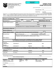
THE CORPORATION OF THE CITY OF VERN
- Page 3 and 4:
PAGE 2 REGULAR OPEN COUNCIL AGENDA
- Page 5 and 6:
PAGE 4 TNSPECTORS (BC) (P. 78) MINI
- Page 7 and 8:
PAGE 6 REGULAR OPEN COUNCIL AGENDA
- Page 9 and 10:
PAGE 8 REGULAR OPEN COUNGIL AGENDA
- Page 11 and 12:
PAGE 10 REGULAR OPEN COUNCIL AGENDA
- Page 13 and 14:
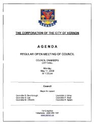
THE CORPORATION OF THE CITY OF VERN
- Page 15 and 16:
PAGE 3 REGULAR OPEN MEETING OF COUN
- Page 17 and 18:
PAGE 5 REGULAR OPEN MEETING OF COUN
- Page 19 and 20:
PAGE 7 REGULAR OPEN MEETING OF COUN
- Page 21 and 22:
PAGE 9 Moved by Councillor Nicol, s
- Page 23 and 24:
PAGE 11 INFORMATION ITEMS: Council
- Page 25 and 26:
PAGE 2 PUBLIC HEARING OF COUNCIL -
- Page 27 and 28:
PAGE 4 NAME PUBLIC HEARING OF COUNC
- Page 29 and 30:
738Ò-os 2009 Year in Review: Verno
- Page 31 and 32:
2009 Year in Review: Vernon Fíre -
- Page 33 and 34:
2009 Year in Review: Vernon Fire -
- Page 35 and 36:
2009 Year ín Review: Vernon Fíre
- Page 37 and 38:
2009 Yeor in Review: Vernon Fire -
- Page 39 and 40:
2009 Year in Review: Vernon Fire -
- Page 41 and 42:
2009 Year in Review: Vernon Fire -
- Page 43 and 44:
2009 Yeor ín Review: Vernon Fire -
- Page 45 and 46:
THE CORPORATION OF THE CITY OF VERN
- Page 47 and 48:
3- included in the application. The
- Page 49 and 50:
-5- APPROVALS DATE COUNCIL AGENDA I
- Page 51 and 52:
the CORPORAÏON of thE CITY Of VERN
- Page 53 and 54:
he CoRP0RATION of the CITY of VERNO
- Page 55 and 56:
30.008m = 127.979' Figure 6 @ à< o
- Page 57 and 58:
Project Details Tarqet Market The d
- Page 59 and 60:
Sustainability Sustainabiltv and re
- Page 61 and 62:
Ì :. I ,ql l- | r-1 x=lm Éi1 I I
- Page 63 and 64:
THE CORPORATION OF THE CITY OF VERN
- Page 65 and 66:
B.C. INTRODUCES CLIMATE ACTION LEGI
- Page 67 and 68:
SILGA - Southern Interior Local Gov
- Page 69 and 70:
THE CORPORATION OF THE CITY OF VERN
- Page 71 and 72:
Finance Division Policy Travel and
- Page 73 and 74:
Finance Division PolicY traveiano r
- Page 75 and 76:
L tir BRITISH CoruMere FEB f i 7iJ'
- Page 77 and 78:
Office of the Minister Ministry of
- Page 79 and 80:
ative that saw us bavel throughout
- Page 81 and 82:
TUESDAY,JANUARY 2Á, 2ßlo I BREAKI
- Page 83 and 84:
Buying a home? Can you tell if it w
- Page 85 and 86:
Mayor Lippert and Councillors Page2
- Page 88 and 89:
200e Bt7 RAILS WITH TRAILS Kelowna
- Page 90:
See also resolutions C1,3, CL4 and
- Page 93 and 94:
ln its response to the 2007 resolut
- Page 95 and 96:
mnintaining transportation infrastr
- Page 97 and 98:
File No.: 620.30.03/810 Ðated:- fe
- Page 99 and 100:
Board) which, as agent for the part
- Page 101 and 102:
The Regional Districts may, from th
- Page 103 and 104:
THE CORPORATION OF THE CITY OF VERN
- Page 105 and 106:
-3- C. Attachments: Figure 1 - Fees
- Page 107 and 108:
Figure 1 FEE SCHEDULE Schedule A At
- Page 109 and 110:
FEE SCHEDULE 2. PLANNING, DEVELOPME
- Page 111 and 112:
THE CORPORATION OF THE CITY OF VERN
- Page 113 and 114:
3- 5. The applicant has also indica
- Page 115 and 116:
-5- DEFINITIONS lnactive Bylaws are
- Page 117 and 118:
Ourfile: 183-285 f=\ /=\ ln 5þL; 5
- Page 119 and 120:
II¡IIIIITT'III-tIIItIII¡I¡ITIITI
- Page 121 and 122:
ft (cI c -¡ o Þ H t\) H the CORPO
- Page 123 and 124:
d Forrrrlng Part of BYlaw 5115 an L
- Page 125 and 126:
iz- I o (o o fl ¡I o Ii lt ï! !l
- Page 127 and 128:
ARCHITECTURAL GUIDES fvlATERIALS '
- Page 129 and 130:
'n (o c-| o J N NDINGROAD CHA.RA.ST
- Page 131 and 132:
üffi ¡frINAL DATION TO COUNCIL SU
- Page 133 and 134:
-3- C. Attachments: b) Road and tra
- Page 135 and 136:
Draft Bella Vista West Nei Figure 1
- Page 137 and 138:
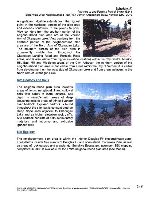
1 .0 Physical Characteristics The B
- Page 139 and 140:
Legend /'- æ lndexContour (20m) ln
- Page 141 and 142:
l. Community facilities, services a
- Page 143 and 144:
3.0 Residential Goals; To provide a
- Page 145 and 146:
3.9 All properties designated Resid
- Page 147 and 148:
5.0 Neighbourhood Amenities - Parks
- Page 149 and 150:
j Does not adversely impact on high
- Page 151 and 152:
6.0 Transportation Goals: lmprove t
- Page 153 and 154:
Draft Betla Vista West Neighbourhoo
- Page 155 and 156:
Supportinq Policies: 7.1 Apply the
- Page 157 and 158:
8.0 Energy Goals: lntegrate the use
- Page 159 and 160:
10.0 Social Planning Goals: Ensure
- Page 161 and 162:
CLD l-R. No. I ctD PRIVATE SAN¡TAR
- Page 163 and 164:
ÜR iGIl\i AL REPORT/RECOMMEN DATIO
- Page 165 and 166:
-3- E. Relevant Historv: N/A F. G.
- Page 167 and 168:
the CoRPORATION of the CITY of VERN
- Page 169 and 170:
THE CORPORATION OF THE CITY OF VERN
- Page 171 and 172:
-3- 3. Figure 3 - 4. Figure 4 - 5.
- Page 173 and 174:
.Tt õ' cō IPPROXIMATE LOGATION OF
- Page 175 and 176:
'1l (cI c ō (., the CORPORAÍION o
- Page 177 and 178:
@ Locfilo¿\l eç PþQøsþ ar=\JeL
- Page 179 and 180:
^ñântoE E¡yfôwñhom.r glb AÞ.
- Page 181 and 182:
THE CORPORATION OF THE CITY OF VERN
- Page 183 and 184:
3- A new public park along the sout
- Page 185 and 186:
à H. Reasons for Bvlaw: N/A l. Res
- Page 187 and 188:
Gontents 1.0 Plan Overview....'....
- Page 189 and 190:
Protection and enhancement of wetla
- Page 191 and 192:
2.2 Goals To achieve this vision, t
- Page 193 and 194:
On October 14,2008, Council adopted
- Page 195 and 196:
developments further west along Oka
- Page 197 and 198:
5.0 Land Use GoncePt The Waterfront
- Page 199 and 200:
5.1 Mixed Use Gore The Mixed Use Co
- Page 201 and 202:
Area B Area B would develop as a mi
- Page 203 and 204:
4 proposals for reduced parking req
- Page 205 and 206:
5.1.2 Area B: Additional Policies 1
- Page 207 and 208:
2. 3. 4 5. 7. 8. Require all develo
- Page 209 and 210:
5.5 Parks and Open Space Two distin
- Page 211 and 212:
5.6 Habitat Protection The Waterfro
- Page 213 and 214:
5.7 Marshall Wetlands The weilands
- Page 215 and 216:
6.0 Transportation Demand Managemen
- Page 217 and 218:
l- /' o F g) t- z TU t- .J' IriK {
- Page 219 and 220:
E2 o É. o z ft o =z o z \ -l u¡\
- Page 221 and 222:
THE CORPORATION OF THE CITY OF VERN
- Page 223 and 224:
3- provisions are difficult and com
- Page 225 and 226:
t -!r- THREE-PLEX, TOURIST HOUSING
- Page 227 and 228:
-7- 8. A review of the Zoning Bylaw
- Page 229 and 230:
-9- Prepared by: Approved for submi
- Page 231 and 232:
Classifying Strata Accommodation Pr
- Page 233 and 234:
-2- planner indicated that even wit
- Page 235 and 236:
-4- breakfast and rooming houses. T
- Page 237 and 238:
PAGE 2 BYLAW NUMBER 5186 3. Zoning
- Page 239 and 240:
THE CORPORATION OF THE CITY OF VERN
- Page 241 and 242:
PAGE 3 BYLAW NUMBER 5234 13.4 GD4:
- Page 243 and 244:
PAGE 5 BYIAW NUMBER 5234 Height mea
- Page 245 and 246:
13.4.6.2 Agricultural PAGE 7 BYLAW
- Page 247 and 248:
PAGE 9 BYLAW NUMBER 5234 13.4.8.5 A
- Page 249 and 250:
fl ru f tEstilrc Gü¡c3s ¡tl trf
- Page 251 and 252:
Residental Parcels Perm¡tted Uses:
- Page 253 and 254:
PARCEL 1, PARCEL SPECIFIC REGULATIO
- Page 255 and 256:
PARCEL 2, PARCEL SPECIFIC REGULATIO
- Page 257 and 258:
PARCEL 3, PARCEL SPECIFIC REGULATIO
- Page 259 and 260:
PARCEL 3, PARCEL SPECIFIC REGULATIO
- Page 261 and 262:
PARCEL 4, PARCEL SPECIFIC REGULATIO
- Page 263 and 264:
PARCEL 5, PARCEL SPECIFIC REGULATIO
- Page 265 and 266:
PARCEL 6, PARCEL SPECIFIC REGULATIO
- Page 267 and 268:
PARCEL 7, PARCEL SPECIFIC REGULATIO
- Page 269 and 270:
PARCEL 8, PARCEL SPECIFIC REGULATIO
- Page 271 and 272:
PARCEL q PARCEL SPECIFIC REGULATION
- Page 273 and 274:
PARCEL 10, PARCEL SPECIFIC REGULATI
- Page 275 and 276:
PARCEL 11, PARCEL SPECIFIC REGULATI
- Page 277 and 278:
PARCEL 1A PARCEL SPECIFIC REGULATIO
- Page 279 and 280:
PARCEL 13, PARCEL SPEC¡FIC REGULAT
- Page 281 and 282:
PARCEL 14, PARCEL SPECIFIC REGULATI
- Page 283 and 284:
PARCEL 15, PARCEL SPECIFIC REGULATI
- Page 285 and 286:
PARCEL 16, PARCEL SPECIFIC REGULATI
- Page 287 and 288:
PARCEL 17, PARCEL SPECIFIC REGULATI
- Page 289 and 290:
PARCEL 18, PARCEL SPECIF¡C REGULAT
- Page 291 and 292:
PARCEL 19, PARCEL SPECIFIC REGULATI
- Page 293 and 294:
PARCEL 20, PARCEL SPECIFIC REGULATI
- Page 295 and 296: PARCEL 21, PARCEL SPECIFIG REGULATI
- Page 297 and 298: PARCEL 22, PARCEL SPECIFIC REGULATI
- Page 299 and 300: PARCEL 23, PARCEL SPECIFIC REGULATI
- Page 301 and 302: PARCEL 23, PARCEL SPECIFIC REGULATI
- Page 303 and 304: PARCEL 24, PARCEL SPECIF¡C REGULAT
- Page 305 and 306: PARCEL 25, PARCEL SPECIFIC REGULAT
- Page 307 and 308: PARCEL 26, PARCEL SPECIFIC REGULATI
- Page 309 and 310: PARCEL 27, PARCEL SPECIFIC REGULATI
- Page 311 and 312: PARCEL 28, PARCEL SPECIFIC REGULATI
- Page 313 and 314: PARCEL 28, PARGEL SPECIFIC REGULATI
- Page 315 and 316: PARCEL 29, PARCEL SPECIFIC REGULATI
- Page 317 and 318: PARCEL 31, PARCEL SPECIFIC REGULATI
- Page 319 and 320: PARCEL 33, PARCEL SPECIFIC REGULATI
- Page 321 and 322: proPosed rev¡sed word¡ng: -2- PAR
- Page 323 and 324: John Friesen 7520 Weeks Road -4- Su
- Page 325 and 326: All children have to go to school a
- Page 327 and 328: February 3, 2010 Dale Keegstra 6225
- Page 329 and 330: My petition is to amend the propose
- Page 331 and 332: While this property is in close pro
- Page 333 and 334: From: Sent: To: Subject: Jim & Lisa
- Page 335 and 336: ----t-\ /l Mayor and Council Ci$ of
- Page 337 and 338: Elementary has the highest number o
- Page 339 and 340: Prov¡de afiernaflve transportation
- Page 341 and 342: THE CORPORATION OF THE CITY OF VERN
- Page 343 and 344: Schedule'A' Attached to and Forming
- Page 345: Schedule'A' Attached to and Forming
- Page 349 and 350: Schedule'A' Attached to and Forming
- Page 351 and 352: Schedule'A' Attached to and Forming
- Page 353 and 354: Schedule'A' Attached to and Forming
- Page 355 and 356: Schedule'A' Attached to and Forming
- Page 357 and 358: Schedule'A' Attached to and Forming
- Page 359 and 360: Schedule'A' Attached to and Forming
- Page 361 and 362: Schedule'A' Attached to and Forming
- Page 363 and 364: Schedule'A' Attached to and Forming
- Page 365 and 366: Schedule'A' Attached to and Forming
- Page 367 and 368: Schedule'A' Attached to and Forming
- Page 369 and 370: Schedule'A' Attached to and Forming
- Page 371 and 372: THE CORPORATION OF THE CITY OF VERN
- Page 373 and 374: PAGE 3 BYLAW NUMBER 5235 Schedule'A
- Page 375 and 376: PAGE 2 BYLAW NUMBER 5239 3. Zoning
- Page 377 and 378: FeVr 22 rPFo üån nfrç*n $ssi¡'
- Page 379 and 380: IEbI1, 2O1O 1:5BPM OKANAOAN NATION
- Page 381 and 382: I'"L1,1 ;,'29 1 ,!, -1t låLY r*9 [
- Page 383 and 384: There are no plans in the near futr
- Page 385 and 386: ENVIRONMENTAL ADVISORY COMMITTEE ME
- Page 387 and 388: ENVIRONMENTAL ADVISORY COMMITTEE ME
- Page 389 and 390: THE CORPORATION OF THE CITY OF VERN
- Page 391 and 392: ECONOMIC DEVELOPMENT ADVISORY COMMI
- Page 393 and 394: AFFORDABLE HOUS¡NG ADVISORY COMMIT
- Page 395 and 396: THE COR CITY OF MINUTES OF THE TRAN
- Page 397 and 398:
TRANSPORTATION DEMAND MANAGEMENT CO
- Page 399 and 400:
TRANSPoRTAT¡oN DEMAND MANAGEMENT C
- Page 401 and 402:
TRANSPORTATION DEMAND MANAGEMENT CO
- Page 403 and 404:
THE CORPORATION OF THE CITY OF VERN
- Page 405 and 406:
THE CORPORATIO OF THE CITY OF VERNO
- Page 407 and 408:
ADVISORY PLANNING BOARD MEETING HEL
- Page 409 and 410:
THE CORPORATION OF THE CITY OF VERN