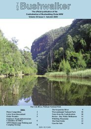
Vol 37 No 3 - Confederation of Bushwalking Clubs
Vol 37 No 3 - Confederation of Bushwalking Clubs
Vol 37 No 3 - Confederation of Bushwalking Clubs

You also want an ePaper? Increase the reach of your titles
YUMPU automatically turns print PDFs into web optimized ePapers that Google loves.
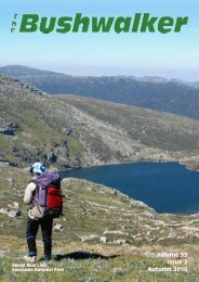
Wouldn’t you like to be here?<br />
From the Western Arthurs to Federation Peak, South West Tasmania.<br />
Photo: Nina Gallo<br />
The sad state <strong>of</strong> the Calna Creek Bridge,<br />
Great <strong>No</strong>rth Walk, June 2013.<br />
Photo: Roger Caffin
T<br />
h<br />
eBushwalker<br />
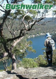
The Official Publication <strong>of</strong> <strong>Bushwalking</strong> NSW Inc<br />
<strong>Vol</strong>ume 38, Issue 3, Winter 2013<br />
ISSN 0313 2684<br />
Editor: Roger Caffin<br />
editor@bushwalking.org.au<br />
Graphic Design & Assembly:<br />
Barry Hanlon<br />
Pro<strong>of</strong>reader: Roy Jamieson<br />
<strong>Confederation</strong> Officers:<br />
President: David Trinder<br />
Administration Officer:<br />
admin@bushwalking.org.au<br />
Website: www.bushwalking.org.au<br />
Address all correspondence to:<br />
PO Box 119, Newtown, NSW 2042<br />
<strong>Bushwalking</strong> NSW Inc represents<br />
approximately 66 <strong>Clubs</strong> with a total<br />
membership <strong>of</strong> about 8,700<br />
bushwalkers.<br />
Formed in 1932, <strong>Bushwalking</strong> NSW<br />
provides a united voice on behalf <strong>of</strong> all<br />
bushwalkers on conservation, access<br />
and other issues.<br />
People interested in joining a<br />
bushwalking club may write to the<br />
<strong>Bushwalking</strong> Administration<br />
admin@bushwalking.org.au<br />
for a list <strong>of</strong> <strong>Clubs</strong>, but a far more<br />
useful on-line list is available at the<br />
<strong>Confederation</strong> website<br />
www.bushwalking.org.au,<br />
broken up into areas. There’s lots <strong>of</strong><br />
other good stuff there too, including<br />
the Australian <strong>Bushwalking</strong> FAQ.<br />
Walk Safely—Walk with a Club<br />
From the editor’s desk. . .<br />
Our apologies to the NPA. They had asked us to feature some articles<br />
in the last issue to go with the back page advertisement, but their<br />
copy reached us two days too late. We have included some <strong>of</strong> it<br />
here instead. In addition, some <strong>of</strong> it was put on our website.<br />
This issue includes part 3 <strong>of</strong> Yuri Bolotin’s article on their <strong>No</strong>rth-South<br />
Traverse <strong>of</strong> Wollemi NP. I know other people have done all sorts <strong>of</strong> N-S<br />
and W-E traverses over the years - for that matter my wife and I have done<br />
several <strong>of</strong> each. But many <strong>of</strong> these other traverses have been done in<br />
stages: ours were done that way. Yuri and friends went right through the<br />
middle <strong>of</strong> the Park in one go. That would be one <strong>of</strong> the hardest walks on<br />
the East Coast <strong>of</strong> Australia in my opinion: 18 days <strong>of</strong> Wollemi scrub.<br />
The front cover shows a walk radically different from Wollemi: it was<br />
taken on the beach <strong>of</strong> the Great South West Walk (GSWW) on the south<br />
coast <strong>of</strong> Victoria. In the ordinary way you do an anti-clockwise loop from<br />
Portland along the Glenelg River to Nelson, then you come back along the<br />
beach to Portland. There are some rather cute campsites in the dunes with<br />
water supplies and lots <strong>of</strong> flotsam and jetsam. It was very different from<br />
Wollemi NP!<br />
Articles for Publication<br />
We are always happy to receive pictures for the Inside Front Cover. If you would like to<br />
see yours published, send them in. In particular, little 640 x 480 photos and, little<br />
photos from cheap phones are just not good enough: they simply do not print well<br />
enough at 300 dpi. We need the full-size originals, straight from the camera and<br />
uncropped and unretouched, so we can set them up for the printing process.<br />
Apart from that, please keep those bushwalking articles rolling in. We need them. If<br />
you are describing a walk somewhere, it would really help if you could give the reader<br />
(who may be from far away) some idea <strong>of</strong> where the walk is. We don’t need GRs, just a<br />
general idea. We need suitable photos for most every article, so please include a few.<br />
Once again, note that little, cropped or shrunk photos will rarely be accepted. If you<br />
want to include a DOC file or a PDF (in addition to the mandatory plain text file and<br />
full-sized photos) to illustrate how the photos fit into the text, please do so as well.<br />
That can only help.<br />
However, photos embedded in DOC or PDF files are not accepted by themselves,<br />
and neither are scans <strong>of</strong> standard photographic prints - with the possible exception <strong>of</strong><br />
historical items where the print is all that exists. Finished DOC and PDF articles are not<br />
suitable by themselves either: we <strong>of</strong>ten have to rearrange the text to fit on the page<br />
with ads or other changes. Plain text plus original photos!<br />
Finally, the opinions expressed by authors may not represent the <strong>of</strong>ficial opinions <strong>of</strong> the<br />
<strong>Confederation</strong> or <strong>of</strong> any Club. The Editor’s opinions are his own, are subject to change<br />
without explanation, and may be pretty biased anyhow.<br />
Roger Caffin<br />
Editor<br />
Index<br />
Wouldn’t you like to be here? 2<br />
From the Editor’s Desk 3<br />
From Tootie Creek to Kurrajong<br />
Heights 4<br />
Control <strong>of</strong> feral animals back in the<br />
hands <strong>of</strong> NPWS 8<br />
Car Accidents 8<br />
A tour <strong>of</strong> the Budawangs 9<br />
Historic Tracks around Mt Hotham 11<br />
Castle Rocks, Munghorn Nature<br />
Reserve 14<br />
Book Review 15<br />
Top Walks in New South Wales<br />
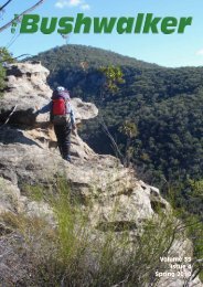
Front Cover: Great South West Walk, Victoria.<br />
Photo: Roger Caffin.<br />
West Keiwa Red Robin, Battery 9. Story on page 11<br />
<strong>Vol</strong>ume 38, Issue 3, Winter 2013<br />
The Bushwalker | 3
Walk Safely—Walk with a Club<br />
Wollemi Full <strong>No</strong>rth to<br />
South Traverse - Part 3<br />
From Tootie<br />
Creek to<br />
Kurrajong<br />
Heights<br />
Yuri Bolotin<br />
Day 18 — September, 2012<br />
(Parts 1 & 2 were in our Summer and Autumn 2013 issues)<br />
Wollemi National Park sign on road<br />
The Traverse, 279 km and 12,627 m <strong>of</strong> ascent, took 18 days in<br />
September 2012. It went from the northernmost point <strong>of</strong> the<br />
Park, about 1 km north <strong>of</strong> Phipps Cutting, to the southernmost<br />
point at Bells Line <strong>of</strong> Road, Kurrajong, whilst always remaining<br />
within the Park boundaries. Nearly 2 years went into the<br />
planning. The walk was in three sections with a food resupply<br />
between each one. Ian Thorpe (who conceived and led the walk),<br />
was joined by Yuri Bolotin and Rodney Nelson on the first two<br />
sections; Ian and Yuri did the third section finishing at Kurrajong<br />
on 20 September.<br />
Michael Keats and Yuri Bolotin are writing a book about this<br />
journey. In the meantime we have published condensed versions <strong>of</strong><br />
three different days on the walk from Yuri’s track diaries. This is<br />
the third instalment, the conclusion <strong>of</strong> the series.<br />
‘This is our last day!’<br />
My first thought <strong>of</strong> the morning<br />
immediately seized all my<br />
attention as soon as I was woken<br />
up at 0535 by loud and melodious bird<br />
calls around our camp. Even though this<br />
was true and we had been striving for this<br />
to happen during the last 18 days, I found<br />
it hard to believe that this incredible<br />
journey is about to end. The trip went too<br />
quickly and it went too slowly, at the<br />
same time.<br />
Somehow, I felt very edgy during the<br />
night, woke up several times and spent<br />
ages lying in my s<strong>of</strong>t and comfortable bed,<br />
listening to the distant murmur <strong>of</strong> Tootie<br />
Creek below us. I was not having any<br />
pr<strong>of</strong>ound or anxious thoughts, just trying<br />
to fall asleep, but couldn’t. This was the<br />
most restless night <strong>of</strong> the Traverse for me,<br />
and I had no idea why. Only now I am<br />
thinking perhaps subconsciously I was too<br />
excited about it being the last day <strong>of</strong> our<br />
grand adventure.<br />
Soon we were having breakfast,<br />
packing the fly, striking the camp – an<br />
ordinary start for an extraordinary day,<br />
one <strong>of</strong> the most memorable days <strong>of</strong> my<br />
life. For the last 7 days, it was Ian and I<br />
only on this third leg <strong>of</strong> our voyage as<br />
Rodney had to leave us at Capertee. At<br />
0650, with our packs light and our spirits<br />
high, we were <strong>of</strong>f on our way to<br />
Kurrajong, to finish the Wollemi Traverse.<br />
We first headed south west on gently<br />
rising ground towards the cliffs and away<br />
from Tootie Creek, with the idea <strong>of</strong><br />
climbing onto the ridge and then<br />
dropping back from it after about a<br />
kilometre. This would avoid a long and<br />
potentially awkward, scrubby and wet<br />
push along a substantial gorge formed by<br />
this major tributary <strong>of</strong> the creek.<br />
From here, we started a long and<br />
gentle sidle to the south, through a very<br />
pretty landscape. To the right <strong>of</strong> us were<br />
low, broken bluffs covered in green moss<br />
and red lichen; to our left the valley<br />
dropped steeply into the rainforest-clad<br />
gorge below. Around us were fields <strong>of</strong><br />
spring flowers, tall grass and<br />
Xanthorhoeas. The scrub under our feet<br />
was manageable, the morning was crisp,<br />
the sun was shining gently, our packs<br />
were light, and we knew we were getting<br />
closer to our destination with our every<br />
step.<br />
Then, suddenly and in a total<br />
dissonance to the idyllic scenery we were<br />
experiencing we came upon an old, totally<br />
rusted car wreck,<br />
deposited in a<br />
very artistic way<br />
along a line <strong>of</strong><br />
four tall, mature<br />
Angophoras.<br />
Upon examining<br />
it we thought it<br />
was a Jeep. The<br />
car was a fair<br />
way down the<br />
slope from the<br />
top <strong>of</strong> the ridge.<br />
The first edition<br />
map shows a<br />
road up on the<br />
ridge, but they<br />
must have done<br />
pretty well<br />
getting the car here, unless it was set in<br />
motion and left to its own devices to crash<br />
at this spot.<br />
We dropped about 50 m in elevation<br />
and continued to contour in the same<br />
southerly direction underneath the cliffs.<br />
Next we came to the first <strong>of</strong> three<br />
stunning baroque caves, all within a<br />
distance <strong>of</strong> about 200 m. To be honest<br />
this took me by complete surprise, as I<br />
had not seen any near our place before.<br />
These caves could rival the best I’ve seen<br />
in the Wollemi. What they lack in size<br />
(they are quite small, about 10 m long by<br />
2 m high), they more than make up for in<br />
their astonishing ornamentation. I called<br />
them<br />
T<br />
Psychedelic Caves.<br />
he walls <strong>of</strong> the first cave are a<br />
psychedelic riot <strong>of</strong> patterns and colour<br />
– yellow, orange, red, white, with dots,<br />
Archeological Jeep<br />
4 | The Bushwalker <strong>Vol</strong>ume 38, Issue 3, Winter 2013
stripes, lines, circles, zigzags, swirls – they<br />
are all there at the same time.<br />
The second cave has much more<br />
settled, restrained colour palette, in s<strong>of</strong>t<br />
grey, white and yellow. On its ceiling is<br />
the centrepiece - a stunning, recessed<br />
ceiling rose or circular niche, decorated<br />
with broad, wavy stripes <strong>of</strong> colour. The<br />
walls are a psychedelic jumble <strong>of</strong> s<strong>of</strong>t<br />
three-dimensional shapes, resembling ice<br />
cream cones, sea shells, swirls <strong>of</strong> milk and<br />
honey.<br />
The third cave, whilst being smaller<br />
and visually less striking than the other<br />
two, has one incredible feature – a<br />
delicate, three-dimensional, paper thin<br />
figure <strong>of</strong> a brown, long necked fantasy<br />
bird, coming out <strong>of</strong> the cave wall at a<br />
straight angle.<br />
We crossed this well-flowing tributary<br />
<strong>of</strong> Tootie Creek and moved up the nose<br />
opposite us. The much drier and vine-free<br />
ridge went up very steeply at first, quickly<br />
gaining 60 m <strong>of</strong> altitude, then flattened a<br />
Icecream cave<br />
bit and climbed steadily from there on to<br />
add another 80 m or so to our elevation.<br />
Soon we picked up an old fire trail (once<br />
again, only shown in the first edition<br />
map). It took us through a pleasant, open<br />
forest <strong>of</strong> Angophoras, Banksias and<br />
Scribbly Gums set amongst the<br />
wildflowers.<br />
At 0852 we left the fire trail, as it<br />
would have taken us outside <strong>of</strong> the<br />
national park to a private property, and<br />
fixed a bearing to the south east, going<br />
down and up a small gully in order to stay<br />
within the park. Fifteen minutes later we<br />
crossed Mountain Lagoon Road - our first<br />
sealed road in 18 days. We were within a<br />
few minutes drive from our place; in fact,<br />
I <strong>of</strong>ten pass this spot when I go out for my<br />
morning run. I must say I had slight<br />
shivers down my spine – we were getting<br />
so Tclose!<br />
here was a ‘Wollemi National Park’<br />
sign beside the road, right where we<br />
crossed it. As I knew, there was not going<br />
to be a sign at the finishing spot in<br />
Kurrajong, we decided to take a few<br />
photos at this spot. It beats me why the<br />
NPWS would not identify the<br />
southernmost point <strong>of</strong> one <strong>of</strong> the most<br />
important national parks in NSW, if not in<br />
<strong>Vol</strong>ume 38, Issue 3, Winter 2013<br />
Australia, by a<br />
roadside sign in<br />
Kurrajong, on Bells<br />
Line <strong>of</strong> Road,<br />
where thousands <strong>of</strong><br />
motorists travel<br />
every day. Before<br />
planning our<br />
Traverse, I had<br />
been through that<br />
spot hundreds <strong>of</strong><br />
times and didn’t<br />
know it was part <strong>of</strong><br />
the AWollemi.<br />
fter the photo<br />
session, we<br />
continued walking<br />
south, parallel to<br />
another private<br />
property on the<br />
southern side <strong>of</strong> the<br />
road. On our way we needed to cross a<br />
fairly deep, double headed gully. As one<br />
might expect it contained some Black<br />
Wattle and a bit <strong>of</strong> Lawyer<br />
Vine, but to our surprise it<br />
also had a number <strong>of</strong> small<br />
waterfalls, cascades, grottoes<br />
and even a delightful cave<br />
with the water running over<br />
it. All this within a few<br />
hundred metres from<br />
Mountain Lagoon Road,<br />
unbeknown to most people<br />
who use it, including, until<br />
now, myself. Having had a<br />
look at the map, this gully is<br />
in fact a major tributary <strong>of</strong><br />
Flat Rock Creek.<br />
Having used <strong>No</strong>rth<br />
Wheeny Gap Trail for a little<br />
while, we started our descent<br />
into Wheeny Creek – the last<br />
major creek to cross on our<br />
Traverse. I must admit, both<br />
Ian and I were a bit<br />
apprehensive about this last<br />
challenge. We were planning to check it<br />
out prior to the Traverse but ran out <strong>of</strong><br />
time, so it was an almost complete<br />
unknown. I don’t know exactly what went<br />
on in Ian’s mind, but I couldn’t help<br />
thinking that if it happens to be a canyon<br />
(which is far from unlikely in this area<br />
and very possible judging by the map),<br />
how silly would it be to have gone<br />
through the whole Wollemi, only to be<br />
seriously delayed by the last creek.<br />
Yesterday evening I had sent an SMS with<br />
our ETA at Kurrajong<br />
to the support team.<br />
We were keen to make<br />
that time and to keep<br />
any delays to the<br />
minimum, even though<br />
we had allowed a good<br />
safety margin.<br />
The descent began<br />
fairly gently at first,<br />
through a series <strong>of</strong><br />
wide, flat ledges<br />
covered with thick<br />
scrub separated by<br />
short rocky bits. We<br />
soon came to the first<br />
significant cliff line but<br />
had no trouble finding<br />
Walk Safely—Walk with a Club<br />
It’s a bird!<br />
a way down. Shortly after the second cliff<br />
line was also negotiated, then the third,<br />
and the fourth, all smaller cliff lines.<br />
The fifth cliff line proved to be the<br />
biggest. We followed the line <strong>of</strong> the spur,<br />
keeping to the left (west) <strong>of</strong> the nose,<br />
until we came to a slot that looked like it<br />
could go. It did, and it dropped us about<br />
20 m very quickly, underneath the cliffs.<br />
The descent then continued through thick<br />
scrub, until we came out on the nose<br />
above the sixth cliff line that fortunately<br />
looked like going either to the left or to<br />
the right. We went on the left and soon<br />
got to another drop – the seventh cliff<br />
line, which we also negotiated on the left<br />
hand side.<br />
Under this last cliff line, we saw a<br />
strange dog shaped pinnacle, about 4 m<br />
tall, standing in front <strong>of</strong> the wall <strong>of</strong> rock<br />
and gazing towards the creek below.<br />
The Lawyer Vine is never too far away<br />
in this area – indeed, it soon came in, and<br />
it was the thickest, juiciest vine we had<br />
come across on this Traverse. Some kind<br />
<strong>of</strong> record! Luckily for our skins, the size <strong>of</strong><br />
thorns doesn’t seem to be related to the<br />
size <strong>of</strong> leaves and branches.<br />
At 1109 we were down at Wheeny<br />
Creek. Once again, we had made it! The<br />
total descent was <strong>of</strong> the order <strong>of</strong> 300 m,<br />
but not really very hard as the cliff line in<br />
our chosen area is broken up into about<br />
seven different ones, all spaced well<br />
apart.<br />
Wheeny Creek at our descent point is<br />
very attractive, going through a number<br />
<strong>of</strong> flat rock platforms, then leaping over<br />
Psychedelic cave<br />
The Bushwalker | 5
Walk Safely—Walk with a Club<br />
The Dog-shaped Pinnacle<br />
big moss covered boulders in a series <strong>of</strong><br />
small waterfalls, before spilling over a<br />
large tranquil pool. We spent a little time<br />
here, relaxing and enjoying it all. The<br />
other side <strong>of</strong> the creek didn’t seem to<br />
present any climbing problems, so with<br />
the last significant challenge behind us we<br />
felt we were now indeed on a home run.<br />
At 1125 we started our ascent out <strong>of</strong><br />
Wheeny Creek. Predictably, the dry south<br />
facing slope was much easier to go<br />
through, even though it was quite steep.<br />
Soon, we reached a rocky ledge<br />
overlooking the creek, as well as both our<br />
descent and ascent routes. A couple <strong>of</strong> big<br />
trees growing right on the edge provided<br />
some shade from the sun that by now had<br />
become very strong. We were now well<br />
ahead <strong>of</strong> schedule because we ended up<br />
not needing to use our contingency plan<br />
for crossing Wheeny Creek gorge. The<br />
thought <strong>of</strong> getting to the end before our<br />
support team and waiting around<br />
alongside Bells Line <strong>of</strong> Road didn’t feel<br />
very appealing: a nice problem to have.<br />
So, we decided to spend a leisurely lunch<br />
time at this spot above Wheeny Creek and<br />
after that do an excursion to the cliffs on<br />
the western side <strong>of</strong> the ridge that looked<br />
interesting on the map. The temperature<br />
at this point was a balmy 21 C.<br />
After our last lunch <strong>of</strong> the Traverse (in<br />
fact, our last meal <strong>of</strong> the Traverse), we<br />
went for a little wander around our<br />
locality. From our rock platform we<br />
followed a gentle slope uphill. The entire<br />
area south <strong>of</strong> us must have been in a<br />
bushfire (or a controlled burn) very<br />
recently, perhaps last year. Most <strong>of</strong> the<br />
old trees had survived, but there was very<br />
little undergrowth. We sidled around to<br />
the south west and looked at the<br />
impressive views towards the junction <strong>of</strong><br />
Wheeny Creek and an unnamed tributary.<br />
In fact, checking the map, we realised that<br />
this was the tributary that goes all the<br />
way to Bells Line <strong>of</strong> Road and that we<br />
would be required to cross almost<br />
immediately before we come out at the<br />
southernmost point <strong>of</strong> the Park. We didn’t<br />
know it then, but that crossing was going<br />
to prove pretty horrible, so I later named<br />
this creek Logjam Creek. Looking into the<br />
valley <strong>of</strong> Wheeny Creek itself it was<br />
interesting to see a clear, almost<br />
horizontal dividing line <strong>of</strong> colour going<br />
along the creek where the dry Sclerophyll<br />
forest changes into rainforest.<br />
Around us we could see how fresh,<br />
green shoots were popping up<br />
everywhere, contrasting with the black<br />
bark <strong>of</strong> the established trees charred by<br />
the fire. There was much to do and enjoy<br />
around us, but somehow both Ian and I<br />
felt very flat and tired at that time, as<br />
though we were at a limit <strong>of</strong> our energy.<br />
Neither <strong>of</strong> us could really explain it, but<br />
this was the case. Even though the terrain<br />
we were walking through was very easy<br />
and we had no backpacks, every step<br />
seemed to be an effort. You do get ups<br />
and downs during a long walk like this,<br />
but I was definitely experiencing the time<br />
<strong>of</strong> my lowest energy <strong>of</strong> the last 18 days.<br />
The strong, shared craving to explore and<br />
experience new things that was driving us<br />
all this time had suddenly evaporated, so<br />
we slowly walked back to our rock and<br />
6 | The Bushwalker <strong>Vol</strong>ume 38, Issue 3, Winter 2013
the shade <strong>of</strong> the trees and just sat there<br />
for some while, even trying to have a little<br />
nap.<br />
It required an extra effort to shoulder<br />
our almost empty packs at 1400 and to<br />
start going southwards and up a gentle<br />
slope on the last round <strong>of</strong> our Odyssey.<br />
Almost immediately, I felt a surge <strong>of</strong><br />
energy and a powerful desire to just go<br />
ahead and finish it. I am sure Ian felt the<br />
same way. The walking was initially easy<br />
because the ridge had been recently<br />
burnt. This was an unexpected bonus for<br />
two reasons. First, we had no<br />
undergrowth to slow us down, and<br />
second, it provided us with another aspect<br />
<strong>of</strong> the Wollemi and the type <strong>of</strong> scenery we<br />
had not yet experienced during this<br />
journey. Far from being depressing as one<br />
might think, I find this landscape <strong>of</strong> old<br />
and new, death and re-birth, very life<br />
affirming.<br />
At 1420, we crossed to our very last<br />
(and our shortest time to be spent on!)<br />
topographical map – Kurrajong. Straight<br />
after, we passed an interesting mushroom<br />
shaped rock formation that reminded me<br />
<strong>of</strong> a miniature Totem Pole. To our south,<br />
in the distance, we had the first glimpse<br />
through the trees <strong>of</strong> the Cut above the<br />
Bells Line <strong>of</strong> Road that would be very<br />
near our final destination. We could even<br />
discern the line <strong>of</strong> metal barriers above<br />
the road. We pushed on.<br />
We were now going through some<br />
areas that were not affected by the fire, or<br />
where perhaps it wasn’t as vigorous.<br />
Then, there was a steep climb, around 80<br />
m, that put us back above the 500 m line.<br />
This was the last significant ascent <strong>of</strong> our<br />
trip. Through the trees, we had good<br />
views towards Mt Tootie, Mt Irvine and<br />
beyond,<br />
A<br />
although the air was a bit hazy.<br />
few minutes later, we came to a<br />
cattle track – the cows from the<br />
nearby property must have been<br />
wandering into the Park in search <strong>of</strong><br />
greener pastures. Next, we passed by an<br />
old fence and what appeared to be a<br />
human track going <strong>of</strong>f into the gully on<br />
our right (west).<br />
We now had about one kilometre to go<br />
and expected to finish in the next half an<br />
hour. But nothing is guaranteed when you<br />
The last ‘little’ creek<br />
walk in the Wollemi! Soon,<br />
we needed to cross a gully,<br />
climb out <strong>of</strong> it and continue<br />
on the tops for a while,<br />
before sidling and coming<br />
down another steep and<br />
overgrown ravine not<br />
affected by the fire. Our<br />
progress slowed<br />
significantly and from being<br />
much ahead <strong>of</strong> the time <strong>of</strong><br />
our appointment with the<br />
support team a few hours<br />
ago, we were now running<br />
increasingly late.<br />
But the slow going <strong>of</strong> the<br />
last hour was nothing<br />
compared to the next bit<br />
which was the crossing <strong>of</strong><br />
that major tributary <strong>of</strong> Wheeny Creek we<br />
had seen from our lookout a few hours<br />
earlier. It must be the southernmost creek<br />
in the Wollemi. There were no cliffs, but<br />
the scrub and the Lawyer Vine were<br />
incredible, both on the descent and the<br />
ascent. I named this unnamed tributary <strong>of</strong><br />
Wheeny Creek, Logjam Creek.<br />
We were doing it really tough indeed.<br />
It was a very fitting finish to our journey.<br />
Wollemi does not yield easily, and it<br />
indeed kept putting obstacles in front <strong>of</strong><br />
us until the last minute!<br />
Our speed was perhaps 10 metres per<br />
minute. We had preset our point <strong>of</strong> exit as<br />
a GPS waypoint at lunchtime, and it now<br />
showed that we were less than 100 m<br />
from it. We were still deep down in<br />
Logjam Creek, with absolutely no views<br />
and no sense <strong>of</strong> how close we must have<br />
been, clambering over a huge pile <strong>of</strong><br />
debris and pushing through the forest <strong>of</strong><br />
Lawyer Vine. The tiredness that<br />
accumulated over the last 3 weeks had<br />
crept in with a vengeance. The time<br />
Walk Safely—Walk with a Club<br />
Finished!<br />
ground to a halt, minutes seemed like<br />
hours. Will there be an end to this? Then,<br />
suddenly, the bush opened up, and we<br />
were on the Bells Line <strong>of</strong> Road, at the<br />
southernmost point <strong>of</strong> the Wollemi<br />
National Park. The time was 1558, GR<br />
78760 W88595.<br />
e turned west and walked downhill<br />
for a short while, when we saw, on<br />
the opposite, left side <strong>of</strong> the road, several<br />
cars and people near them, who started to<br />
run towards us. They were all coming in<br />
our direction, yelling and gesticulating<br />
joyfully. I had visualised this moment, <strong>of</strong><br />
us coming out from the bush, onto the<br />
road in Kurrajong Heights, many times a<br />
day, every day, intensely, for the past 18<br />
days, and even before that when thinking<br />
about the walk. The reality <strong>of</strong> it was now<br />
unrolling in front <strong>of</strong> me, just like I had<br />
seen it in my mind, only it seemed to be<br />
in slow motion…we made it!!!! t<br />
Total trip distance: 278.5 km.<br />
Total trip ascent: 12,727 m.<br />
Wheeny Creek<br />
<strong>Vol</strong>ume 38, Issue 3, Winter 2013<br />
The Bushwalker | 7
Walk Safely—Walk with a Club<br />
Control <strong>of</strong> feral animals<br />
back in the hands <strong>of</strong> NPWS<br />
National Parks Association (NPA)<br />
On 4 July 2013, the NSW Government<br />
announced that a trial <strong>of</strong> the<br />
Supplementary Pest Control Program<br />
would commence in 12 national parks.<br />
After this trial, a report would be<br />
delivered to cabinet and further national<br />
parks on the original list <strong>of</strong> 75 may be<br />
considered for the program.<br />
The details <strong>of</strong> controls and<br />
management reveal that campaign to stop<br />
amateur, recreational hunting in national<br />
parks has been won.<br />
The trial program is fundamentally a<br />
pr<strong>of</strong>essional hunting program and will be<br />
run entirely by the National Parks and<br />
Wildlife Service (NPWS) staff. The<br />
program is back in the hands <strong>of</strong> the<br />
pr<strong>of</strong>essionals who have always managed<br />
pest animals in NSW. NPWS staff may<br />
bring in pr<strong>of</strong>essional volunteers to help<br />
execute its pr<strong>of</strong>essionally planned and<br />
managed programs, and such volunteers<br />
will have to go through the same training<br />
as NPWS staff. E.G: Undertake navigation<br />
training, species identification training,<br />
demonstrate competency etc.<br />
Any pest eradication programs that<br />
NPWS staff utilise pr<strong>of</strong>essional volunteers<br />
for will have one <strong>of</strong> two zones within it.<br />
There were previously three, and the third<br />
to be omitted was the ‘scary zone' that<br />
permitted amateurs to carry out<br />
unsupervised hunting at their own<br />
discretion. The two zones that remain are<br />
Zone A and Zone B.<br />
Zone A:<br />
<strong>Vol</strong>unteers will be part <strong>of</strong> the NPWS team<br />
and working shoulder to shoulder with<br />
experienced NPWS staff.<br />
Zone B:<br />
Experienced and trained volunteers are<br />
supervised by NPWS staff. This will<br />
include induction and daily safety<br />
briefings. Detailed reporting, data<br />
collection and debriefing requirements<br />
will also apply. Site specific shooting<br />
plans with detailed maps will direct<br />
operations, with these being approved by<br />
NPWS regional managers consistent with<br />
regional pest strategies.<br />
The National Park will be closed to the<br />
public when pest eradication programs<br />
are taking place as has always occurred<br />
when NPWS have managed these<br />
programs. A new addition to the rules<br />
around pest animal control is that there<br />
will be no shooting activity by NPWS at<br />
all in any national park during school<br />
holidays. <strong>No</strong> minors will be allowed to<br />
hunt in any national parks despite<br />
lobbying from the Shooters and Fishers<br />
Party.<br />
Unions <strong>of</strong> National Parks and Wildlife<br />
Service feel that the safety concerns they<br />
raised during the inception <strong>of</strong> the<br />
program have been adequately addressed.<br />
The campaign to stop amateur,<br />
recreational hunting in national parks has<br />
very much been won! The groups working<br />
on the campaign have committed to<br />
keeping a watch on the program and are<br />
now calling for:<br />
■ Funds dedicated to the Game Council<br />
to be given to NPWS for strategic,<br />
integrated pr<strong>of</strong>essional pest animal<br />
control programs, including further<br />
research into more humane methods <strong>of</strong><br />
killing pest animals.<br />
■ The management and controls for pest<br />
animal programs in National Parks to<br />
be also applied to our State Forests.<br />
In addition to the announcement around<br />
the Supplementary Pest Control Program,<br />
on 4 July the government also announced<br />
it had disbanded the Game Council <strong>of</strong><br />
NSW. This came after an independent<br />
review <strong>of</strong> the Game Council by Steve<br />
Dunn reported the many incompetencies<br />
<strong>of</strong> the Council and that it promoted poor<br />
governance. t<br />
Justin McKee<br />
Campaigner, Consultant,<br />
Media Spokesperson.<br />
0404 824 020<br />
justin.mckee@ethicalintegration.com<br />
Car Accidents<br />
<strong>Bushwalking</strong> safety should be a topic<br />
close to every bushwalker’s heart. It<br />
does not have to be a complicated subject.<br />
You will have a high level <strong>of</strong> wilderness<br />
safety by following a simple list <strong>of</strong> “DO &<br />
DON’T” on the Bushwalkers Wilderness<br />
Rescue Squad (BWRS) website<br />
www.bwrs.org.au<br />
<strong>Bushwalking</strong> can involve a lot <strong>of</strong> car<br />
travel. Driving home after a long day<br />
bushwalking can present dangers. Many<br />
years ago a well-known bushwalker lost<br />
most <strong>of</strong> a leg in a car accident after a very<br />
late finish to an Easter trip with a long<br />
drive home. <strong>No</strong>w “Stop, Revive, Survive”<br />
can also mean stay put overnight and<br />
drive home in the morning. How useful<br />
will you be at work if you only got two<br />
hours sleep before work!!!<br />
If you are unlucky enough to be the<br />
first to arrive at a car accident you may<br />
Keith Maxwell, BWRS<br />
appreciate your First Aid training and<br />
fully charged mobile phone (to call “triple<br />
zero” (000)) It has happened to BWRS<br />
members on the Jenolan Caves Road!!<br />
First Aid is also a great skill to have for<br />
visitors to remote bush areas. For many<br />
years BWRS has <strong>of</strong>fered First Aid courses<br />
for bushwalkers at a discount rate. Our<br />
Remote Area First Aid (RAFA) course now<br />
includes training on the treatment <strong>of</strong><br />
gunshot wounds.<br />
On SEPTEMBER 7/8 there will be a two<br />
day recertification course in RAFA.<br />
Bushwalkers must have previously<br />
obtained a RAFA Certificate to be eligible<br />
to attend this course.<br />
On OCTOBER 12/13 & 26/27 there will<br />
be a full FOUR day RAFA course over<br />
TWO weekends. You will be required to<br />
camp overnight at the site.<br />
On NOVEMBER 10 there will be a ONE<br />
day “Apply First Aid” course. While this<br />
course will not cover gunshot wounds it is<br />
a great way to learn some basic First Aid<br />
knowledge.<br />
First Aid knowledge can save lives.<br />
RAFA training will give you confidence in<br />
emergencies in areas where medical help<br />
may take hours to arrive. Training in<br />
“Apply First Aid” is intended for areas<br />
where an ambulance and medical aid is<br />
much closer.<br />
Registration for any <strong>of</strong> these First Aid<br />
courses can only be done at the BWRS<br />
website (see above). “Apply First Aid”<br />
requires that you have easy access to a<br />
computer for some required theory pre<br />
learning prior to the course.<br />
Our BWRS First Aid courses must be a<br />
great way to learn First Aid in the<br />
company <strong>of</strong> fellow bushwalkers!<br />
8 | The Bushwalker <strong>Vol</strong>ume 38, Issue 3, Winter 2013
Walk Safely—Walk with a Club<br />
Yvonne Lollback<br />
Springwood <strong>Bushwalking</strong> Club<br />
Climbing The Castle - with the handline.<br />
Photo: Robert Sterry<br />
The weather report promised that<br />
the wet conditions were nearly<br />
over, so three <strong>of</strong> us set <strong>of</strong>f early<br />
Monday morning down the coast. Once<br />
we’d turned <strong>of</strong>f at Milton, the rain started<br />
so we lunched in the picnic shelter below<br />
Pigeon House Mountain. But by the time<br />
we’d finished, the sky was clear.<br />
Bravely we did our planned walk up to<br />
the summit via the fabulous ladders and<br />
stairs they’ve built near the top now. I do<br />
wonder how we used to get there when<br />
we only had two ladders to help us?! The<br />
Castle, our destination the next day, was<br />
still in mist but we were very optimistic by<br />
then. We camped at Long Gully that night<br />
and two more walkers, John and Nick,<br />
joined us Tuesday morning for our three<br />
day pack walk.<br />
Five minutes into the day’s walk, we<br />
were stopped by the raging waters <strong>of</strong> the<br />
Yadboro River. Usually an easy crossing,<br />
the water was well above my knees. So<br />
Barry went back to the car for a long rope<br />
he happened to have and we strung it<br />
from side to side. Stripped down to our<br />
The climb up Pigeon House, now reduced to<br />
tourist level. Photo: Robert Sterry<br />
<strong>Vol</strong>ume 38, Issue 3, Winter 2013<br />
underwear - one down to less - we braved<br />
the cold, swirling waters <strong>of</strong> the mighty<br />
Yadboro and all crossed safely.<br />
Once across, we set <strong>of</strong>f on the long<br />
slog up the ridge. Walking became much<br />
more interesting once we started<br />
following the base <strong>of</strong> the lower set <strong>of</strong> cliffs<br />
below The Castle. This whole area is<br />
unique in that it consists <strong>of</strong> 2 plateaus on<br />
top <strong>of</strong> one another and therefore 2 sets <strong>of</strong><br />
cliffs, with a flat section <strong>of</strong> varying widths,<br />
in between. The cliffs were still dripping<br />
from the recent rain but this made them<br />
more colourful.<br />
At a junction, we had lunch and took<br />
the right hand track to go through ‘The<br />
Tunnel’, a natural cleft in the tail <strong>of</strong> The<br />
Castle leading to the other side where the<br />
summit climb begins. This tunnel isn't<br />
easy with a big pack but everyone helped<br />
everyone else. Once<br />
through, we gratefully left<br />
our packs, and started up.<br />
This climb is not for the<br />
faint-hearted and that's<br />
before you even get to the<br />
section with ropes. Robert<br />
decided one section was<br />
too exposed and took an<br />
‘easier’ route up a crack to<br />
its left. When he became<br />
temporarily stuck between<br />
a tree and a hard place, he<br />
saw the wisdom <strong>of</strong> the<br />
rock climb. I wish I’d had<br />
the camera because it<br />
would have been my<br />
action shot [or rather nonaction<br />
shot] in the club's<br />
next Aphoto comp!<br />
t the top the views are<br />
breathtaking with the<br />
coast, the Clyde River<br />
valley, Byangee Walls,<br />
Pigeon House and the<br />
higher cliffs and pagodas<br />
<strong>of</strong> the Monolith Valley<br />
area - the next day’s<br />
destination. The top is<br />
almost flat and quite easy<br />
walking so we headed to<br />
the southern edge for<br />
more great views. The<br />
valley we’d left that<br />
morning was 800 m below<br />
and seemed too far to do<br />
in one day.<br />
Finally we tore<br />
ourselves away and went<br />
back for our packs and set<br />
up camp at Cooyoyo camp<br />
nearby. The camp site is perched on the<br />
top <strong>of</strong> the lower cliffs below Shrouded<br />
Gods Mountain. Firewood is scarce but<br />
Robert did manage to get a small fire<br />
going and it wasn’t too cold.<br />
Next morning, we set <strong>of</strong>f with day<br />
packs to explore Monolith Valley and<br />
surrounds.<br />
The track up is very scenic and follows<br />
the creek with a chain just where it’s<br />
needed. Two tags on trees did mislead us<br />
into using a very swampy, overgrown<br />
lower track but eventually we reached the<br />
valley at the lower end. Here there’s a<br />
bridge. Leaving the exploration <strong>of</strong> the<br />
valley till later, we headed left to find our<br />
way up Mt Owen armed with a dotted<br />
line on the Coorang map and my dim<br />
memories from a previous walk. After a<br />
while we started descending and I<br />
Elegance in crossing the Yadboro.<br />
Photo: Robert Sterry<br />
The Bushwalker | 9
Walk Safely—Walk with a Club<br />
The Budawangs from the top <strong>of</strong> The Castle. Photo: Robert Sterry<br />
twigged that we weren’t in the slot<br />
between Mt Owen and Mt Cole at all but<br />
heading for the sheer cliffs where the<br />
creek descends to the valley. Robert's GPS<br />
put us straight [what wonderful things<br />
they are to be sure] and soon we found<br />
the right slot and the track heading<br />
straight<br />
A<br />
up the side <strong>of</strong> Mt Owen.<br />
fter a lot <strong>of</strong> scrambling, we sat down<br />
for morning tea at another<br />
indescribable viewing spot looking up into<br />
Monolith Valley and down to the distant<br />
Clyde River valley. The huge pagodas<br />
opposite and the Seven Gods Pinnacles at<br />
the top <strong>of</strong> the valley are different from the<br />
ones in the Gardens <strong>of</strong> Stone in that they<br />
don't have bands <strong>of</strong> ironstone sticking out:<br />
instead they have bands <strong>of</strong> some s<strong>of</strong>t rock<br />
which has eroded inwards every foot or so<br />
giving a scalloped appearance.<br />
Lunch was at the southern-most point<br />
<strong>of</strong> Mt Owen, where we all had to have<br />
photos taken with The Castle in the<br />
background so we could show anyone<br />
who showed even the slightest interest<br />
just how high we’d come. The track out to<br />
there is overgrown, prickly and wet but<br />
very flat.<br />
Then back to ‘The Slot’ again but at the<br />
western end this time, where we<br />
scrambled down to the base <strong>of</strong> Mt Cole.<br />
Here we started walking north along the<br />
base <strong>of</strong> these cliffs past four or more great<br />
sleeping caves, though I’m not sure you're<br />
<strong>of</strong>ficially allowed to use them anymore.<br />
One even has a waterfall nearby.<br />
The Budawangs from the top <strong>of</strong> The Castle. Photo: Robert Sterry<br />
Inside The Green Room. Photo: Robert Sterry<br />
At the northern end, we climbed up<br />
through a magic narrow slot between Mt<br />
Cole and Donjon Mt to the top <strong>of</strong><br />
Monolith Valley with Seven Gods<br />
Pinnacles on the left. Descending into the<br />
valley, the scenery became more and<br />
more beautiful as the sheer, mossy walls<br />
started closing in and it became darker<br />
until the creek level is reached. I’ve been<br />
there twice before but again, I was<br />
awestruck. I’m not sure if this is the Green<br />
Room or the whole lot is but it's all just<br />
fantastic. We didn't linger as long as I’d<br />
have liked as it was getting late but next<br />
time for sure. By the way, does anyone<br />
know why it’s called Monolith Valley?<br />
There are lots <strong>of</strong> fantastic rocks but not<br />
just one monolith.<br />
The arch came next. This I climbed<br />
into with a friendly shove from behind<br />
and soon the men followed for the<br />
compulsory ‘I’ve-been-there’ photos. Once<br />
back at the bridge, we knew we’d<br />
completed our circumnavigation <strong>of</strong> Mt<br />
Cole. The walk back to camp was easier as<br />
we stuck to the high track which is also<br />
very scenic. We remembered to collect<br />
firewood on the way down to the camp<br />
and had a very merry fire going in no<br />
time. We were a great little group with<br />
lots <strong>of</strong> fun and laughter.<br />
Thursday morning we had a quick look<br />
at Cooyoyo creek where there's a huge<br />
overhang suitable to cook in if the<br />
weather is bad. We followed the creek to<br />
where it plunges over the cliff and once<br />
more enjoyed the views with misty clouds<br />
still lingering in the valleys. Then back<br />
down below the cliffs <strong>of</strong> The Castle and<br />
morning tea on the last lookout rock. The<br />
river was at a much more civilized level<br />
and we arrived back at the cars at about 2<br />
pm.<br />
It was truly a memorable walk. I<br />
honestly feel it must rank amongst the<br />
best in the world for variety, grandeur<br />
and beauty and is true wilderness as there<br />
is no other way to reach it but by<br />
walking. t<br />
10 | The Bushwalker <strong>Vol</strong>ume 38, Issue 3, Winter 2013
Walk Safely—Walk with a Club<br />
Historic Tracks<br />
around Mt Hotham<br />
Andrew Swift<br />
Cultural Heritage Officer and Walking Track Manager<br />
Mt Hotham Alpine Resort<br />
Historically the Great Dividing<br />
Range presented many challenges<br />
for the European pathfinders.<br />
The continent’s largest physical barrier<br />
has thrown l<strong>of</strong>ty peaks, thick vegetation,<br />
bushfires and snowstorms at those who<br />
ventured into her realm. For many<br />
decades now the highest peaks and their<br />
approaches have been a bushwalkers’<br />
mecca, yet the further we progress away<br />
from our roots the origins <strong>of</strong> the district's<br />
earliest tracks & trails has become lost.<br />
Situated amidst Alpine National Park,<br />
Mt Hotham has a range <strong>of</strong> historic tracks<br />
and trails which reveal some <strong>of</strong> Victoria’s<br />
earliest European history, yet like many<br />
early routes their history is hidden just<br />
beneath the surface.<br />
Despite squatting runs being taken up<br />
from the mid-1830's in the foothills<br />
throughout the region, the higher ranges<br />
<strong>of</strong> Eastern Victoria were little explored by<br />
Europeans. Rich gold discoveries in early<br />
1852 on both sides <strong>of</strong> the Range at<br />
Beechworth and Omeo attracted a large<br />
Mining in the<br />
Upper Dargo<br />
and industrious population to the district<br />
for the first time in history. Some 8,000<br />
diggers had arrived at Beechworth in<br />
early 1852 and 100 were reported to be<br />
successfully working at Omeo. Further<br />
rich discoveries in the Buckland Valley in<br />
1853 saw 6,000 rush the field. Driven by<br />
potential wealth and the shortest possible<br />
route to obtain it, the first Europeans to<br />
traverse this region were prospecting<br />
parties. The early diggers largely<br />
travelled on foot, carrying their provisions<br />
on their backs or pushing crudely<br />
fashioned wheelbarrows; more organised<br />
party’s trailed pack-horses behind them.<br />
Well beaten tracks were rapidly formed by<br />
these first ‘bushwalkers’.<br />
Mt Feathertop<br />
and the Razorback<br />
D<br />
escribed as ‘Queen <strong>of</strong> the Victorian<br />
Alps’, Mount Feathertop (1922 m) is<br />
the region’s most popular hiking<br />
destination. In 1854, on the heels <strong>of</strong> the<br />
miners, Government Botanist Ferdinand<br />
von Mueller ascended Mt Feathertop.<br />
After von Mueller, the Bright Alpine Club<br />
formalised the destination with a winter<br />
ascent in 1889. The Bon Accord track, an<br />
earlier route up to the Razorback Spur,<br />
was opened by quartz reef miners in the<br />
early 1860's while working a number <strong>of</strong><br />
gold-bearing reefs in the vicinity <strong>of</strong><br />
<strong>Vol</strong>ume 38, Issue 3, Winter 2013<br />
The Bushwalker | 11
Walk Safely—Walk with a Club<br />
Washington Creek. It was also a more<br />
direct route for travellers between<br />
Harrietville and Omeo. Bushwalkers in<br />
the 1920's and 30's passed the ruins <strong>of</strong><br />
abandoned mining camps and stamp<br />
batteries. In 1906 the Bungalow Spur<br />
route was cut, promoting ready walking<br />
access to Mt Feathertop from Harrietville.<br />
Other approaches include the NW Spur<br />
track and the rugged Diamantina Spur,<br />
with the principal route along the<br />
spectacular Razorback Spur. Another<br />
long-overgrown and forgotten route was<br />
the government funded Razorback Mining<br />
track, which once junctioned near the<br />
Twin Knobs. This 4 ft wide track allowed<br />
the carting <strong>of</strong> heavy crushing machinery<br />
for the Razorback group <strong>of</strong> mines which<br />
were discovered in the locality by the<br />
Harrietville Prospecting Association in<br />
1893. For the more adventurous <strong>of</strong>f-track<br />
walker the ruins <strong>of</strong> the 10-stamp battery<br />
and mine camp can still be found.<br />
Machinery Spur,<br />
Mt Loch & the Red Robin<br />
The track out past Mt Loch (1865 m), a<br />
remnant basalt cap, was first formed<br />
by a party led by Isaac Sloane, carting a<br />
heavy stamp battery in 1891 from the<br />
Upper Dargo to the Peterson Brothers<br />
mine on the West Kiewa River. The crew<br />
possibly had a longer smoko break than<br />
normal and perhaps pondered the iconic<br />
view <strong>of</strong> the southern side <strong>of</strong> Mt<br />
Feathertop. Machinery Spur is named for<br />
this feat. 50 years later the locality was<br />
the location <strong>of</strong> one <strong>of</strong> Victoria’s last gold<br />
rushes when local prospector and pioneer<br />
<strong>of</strong> the Hotham Heights ski-field Bill<br />
Spargo discovered the rich Red Robin reef<br />
in 1941. After nearly perishing in the<br />
1939 bushfires Spargo discovered the reef<br />
which had been laid bare by the fires.<br />
The initial two ton crushing gave a<br />
staggering yield <strong>of</strong> 173 ounces <strong>of</strong> gold.<br />
Today the mine is still working, with<br />
lucky walkers able to witness the mine<br />
and stamp battery in action.<br />
Brandy Creek Mine to<br />
the Cobungra River<br />
(7 km return)<br />
Ancient river systems, buried for<br />
millions <strong>of</strong> years beneath the basalt<br />
cap <strong>of</strong> the High Plains, were worked for<br />
gold deposits from the 1860s. The<br />
Brandy Creek mine sluicing operations<br />
washed an entire hillside away, releasing<br />
some 25,000 ounces <strong>of</strong> gold. The<br />
Cobungra Township was once situated<br />
adjacent to the mine, and consisted <strong>of</strong> a<br />
hotel, three stores, a butcher, a baker and<br />
a host <strong>of</strong> miners’ huts and tents. A true<br />
ghost town, all that remains is a scatter <strong>of</strong><br />
broken bottle glass along the track in<br />
vicinity <strong>of</strong> the briefly thriving township.<br />
Razorback Expedition, Battery 1<br />
From the mine the Brandy Creek Fire<br />
Track continues 3 km down to the<br />
Cobungra River, a clear and remote<br />
stream that was once accessed by an<br />
overgrown track known as Dungeys. All<br />
the flats along the stream were once taken<br />
up by mining leases in a rush in 1883,<br />
however the anticipated gold yields never<br />
lived up to expectations. Dungeys Track<br />
extended from Bright to Omeo via the<br />
Cobungra Diggings and the Brandy Creek<br />
mines. It was first chosen by Mounted<br />
Constable Arthur Dungey <strong>of</strong> Harrietville in<br />
1884 as an all-seasons route that avoided<br />
crossing Mt Hotham during winter where<br />
snow blizzards had claimed the lives <strong>of</strong><br />
many travellers. The track soon became<br />
impassable due to fallen timber after<br />
mining activity had waned by the turn <strong>of</strong><br />
Harrietteville, Bungalow Spur workers<br />
Spargo’s Hut. Keith Moody Collection<br />
12 | The Bushwalker <strong>Vol</strong>ume 38, Issue 3, Winter 2013
Walk Safely—Walk with a Club<br />
the Century. It was re-opened briefly for<br />
tourism by the Bright Progress Association<br />
in the 1920's, though again became<br />
impassable after the 1939 bushfires. The<br />
grassy flats along the Cobungra River<br />
have been quiet ever since, save for a few<br />
grazing cattle and the occasional<br />
bushwalker.<br />
Mt Tabletop Walk<br />
(10 km return)<br />
Known also as Square Mountain, this<br />
distinctive flat plateau was used by<br />
early travellers through the region as a<br />
landmark. The Tabletop track was first<br />
opened with gold discoveries on the<br />
Upper Dargo River in the early 1860s.<br />
The track was formed in about 1863<br />
when Mayford, a small mining township,<br />
was established on the Dargo River.<br />
Today the walking track ends on the<br />
plateau, but the original track continued<br />
on to the Square Mount sluicing claim<br />
and camp and thence down the main spur<br />
to Mayford.<br />
The Cobungra Ditch<br />
(12.5 km one way)<br />
One <strong>of</strong> the few interpreted historic<br />
walking tracks in the area, the<br />
Cobungra Ditch follows the course <strong>of</strong> an<br />
abandoned water race which supplied<br />
water for the hydraulic sluicing operations<br />
at the Brandy Creek mines. The ditch was<br />
cut by the Cobungra Gold Mining<br />
Company in 1884 at the cost <strong>of</strong> £11,000,<br />
and employed upwards <strong>of</strong> 120 men in its<br />
construction. The investment in the water<br />
race and the mine saw both Bright and<br />
Omeo shires upgrade the pack-track<br />
between Bright and Omeo into a road<br />
suitable for horse-drawn vehicles. Today<br />
this road is known as the Great Alpine<br />
Road. Interpretation signs along the<br />
course <strong>of</strong> the Ditch describe the history <strong>of</strong><br />
the water race and its construction. The<br />
feature is retained for much <strong>of</strong> it length by<br />
ancient looking dry-stone walls and<br />
passes through snowgum and<br />
mountain ash forests.<br />
should the fire become unbearable.<br />
This hut has been described as the<br />
Mawson’s hut <strong>of</strong> the region with many<br />
<strong>of</strong> Spargo’s items still in the hut,<br />
including his steel framed bed and a<br />
large turned-leg dining table.<br />
To walk along any track and know at<br />
least some <strong>of</strong> the stories that occurred<br />
in places along its length makes for a<br />
far more engaging bushwalking<br />
experience. The Alpine National Park<br />
around Mt Hotham and the Bogong<br />
High Plains has numerous walking<br />
tracks to explore and an even greater<br />
history to discover. For further<br />
information on these tracks, visit<br />
www.mthotham.com.au or<br />
www.parksvic.gov.au<br />
Razorback Mine, Harrietville<br />
Andrew Swift has roamed the remote<br />
corners <strong>of</strong> the mountains <strong>of</strong> Eastern<br />
Victoria for nearly thirty years,<br />
exploring, working and documenting<br />
the forgotten and remote mining history<br />
<strong>of</strong> the region. He has given numerous<br />
presentations, written books and<br />
presented documentaries on this<br />
fascinating history. t<br />
The Huts Walk<br />
(21 km circuit)<br />
This track links three huts. The<br />
principal one is the heritageregistered<br />
Spargo’s Hut. This<br />
corrugated iron and bush pole hut<br />
was built by Bill and Cecil Spargo in<br />
1927-28. Constructed for Bill’s<br />
prospecting and mining activities in<br />
an area known as Golden Point, he<br />
spent many years eking out a living<br />
working shallow alluvial gold<br />
deposits in the locality until his<br />
discovery <strong>of</strong> the Red Robin reef in<br />
1941. During the 1939 bushfires<br />
Bill was holed up in his little cabin<br />
surrounded by vessels filled with<br />
water. As the fire took hold <strong>of</strong> the<br />
building he was able to successfully<br />
douse and extinguish the flames and<br />
save the hut and his own life. He<br />
also had beside him a loaded rifle<br />
ü Comfortable, family friendly, lodge open<br />
all year with resident caretaker.<br />
ü Private bedrooms with 2, 3 or 4 beds and<br />
vanities.<br />
ü Magnificent views <strong>of</strong> Dargo Valley.<br />
ü Individual or group bookings welcome.<br />
ü Self-catering kitchen .<br />
For further information view our website or email: lasc.secretary@leetonlodge.com<br />
For summer bookings contact:<br />
Caretaker: Phone 03 5759 3283; or<br />
email: lasc.caretaker@leetonlodge.com<br />
<strong>Vol</strong>ume 38, Issue 3, Winter 2013<br />
The Bushwalker | 13
Walk Safely—Walk with a Club<br />
Johanna Mitchell, Mudgee <strong>Bushwalking</strong> Club<br />
Our group, Mudgee <strong>Bushwalking</strong> Club Inc & Bike<br />
Riders, have just clocked up 20 years <strong>of</strong><br />
<strong>Bushwalking</strong> as a group. What better way to<br />
celebrate the occasion than to go for a bushwalk? We<br />
believe the walk to Castle Rocks in Munghorn Nature<br />
Reserve may have been the first walk the original<br />
members took so we revisited this walk on the weekend.<br />
Munghorn Gap Nature Reserve is part <strong>of</strong> the Great<br />
Dividing Range and is about 35 km from Mudgee, on<br />
Munghorn 8833-2-S. This is a particularly important<br />
place for the Wiradjuri people, and has 164 recorded<br />
species <strong>of</strong> birds including the endangered regent<br />
honeyeater. The Castle Rock walking track <strong>of</strong>fers an easy<br />
8 km return walk <strong>of</strong> about 1 hour each way. There are<br />
stunning views from the Sandstone ‘pagoda’ rock<br />
formations at the end <strong>of</strong> the track and beyond. The track<br />
is for walkers only. The carpark area has one table with seats and no<br />
toilet facilities.<br />
We were delighted that even due to the long weekend etc we had 26<br />
members for the walk, and two members were over 80 yrs old. [The<br />
author does not record whether the ‘oldies’ led from the front or not! - Ed]<br />
While enjoying the views from the top <strong>of</strong> the ‘Castle Rocks’ the<br />
majority had their lunch while others were content to mind the lower<br />
portion <strong>of</strong> rock and enjoy the flora & fauna down there. t<br />
info@mudgeebushwalking.org.au,<br />
http://www.mudgeebushwalking.org.au<br />
Classic sandstone country<br />
Sandstone formation on the walk<br />
14 | The Bushwalker <strong>Vol</strong>ume 38, Issue 3, Winter 2013
Walk Safely—Walk with a Club<br />
Book Review<br />
Hunting in<br />
National Parks<br />
I<br />
read with interest <strong>Bushwalking</strong> NSW’s<br />
first newsletter and note with concern<br />
the comment by President David Trinder<br />
that ... the best we can do is to force<br />
restrictions on hunting ... If <strong>Bushwalking</strong><br />
NSW accepts this position I am sure it<br />
would be contrary to the views <strong>of</strong> most<br />
members.<br />
Subscribe to “The Bushwalker”<br />
Keep up with all the news and developments<br />
happening in the NSW bushwalking scene for<br />
only $10 per year. This is to cover posting and<br />
handling: the magazine itself is free.<br />
Send your name and address and cheque or<br />
money order to to <strong>Bushwalking</strong> the <strong>Confederation</strong> NSW, PO <strong>of</strong> Box<br />
119, <strong>Bushwalking</strong> Newtown <strong>Clubs</strong> NSW 2042. NSW Inc, Phone: PO 9565 Box 119, 4005.<br />
Newtown Make the cheque NSW 2042. or money The new order phone payable number to<br />
is the 9565 ‘<strong>Confederation</strong> 4005. Make the <strong>of</strong> <strong>Bushwalking</strong> cheque or money <strong>Clubs</strong> order<br />
NSW payable Inc’ as well: to the please <strong>Confederation</strong> do not abbreviate <strong>of</strong> the<br />
<strong>Bushwalking</strong> name! (Yes, the <strong>Clubs</strong> bank NSW account Incstill as well: uses please the old<br />
do name not so abbreviate far. That may the name! change - one day!)<br />
Please indicate which issue you want your subscription<br />
to start with. We don’t want to duplicate<br />
copies you already have.<br />
Mudgee <strong>Bushwalking</strong> Club, 20th Anniversary<br />
L E T T E R T O T H E E D I T O R . . .<br />
There is no place for recreational<br />
hunting in the National Parks <strong>of</strong> NSW<br />
whatsoever. It is a stupid and dangerous<br />
idea. It benefits no one except hunters<br />
(who already have access to State Forests<br />
and private land) leaving bushwalkers<br />
and other park users as the losers.<br />
Recreational hunting will be ineffective<br />
in reducing feral animal numbers below<br />
their breeding rates and may interfere<br />
with current control programmes. Feral<br />
animal control should be left to<br />
pr<strong>of</strong>essional park managers employing<br />
science based programmes <strong>of</strong> proven<br />
effectiveness. The $19 million proposed<br />
by Premier O’Farrell for administration <strong>of</strong><br />
amateur hunting would be better directed<br />
to these programmes.<br />
Recreational hunting in National Parks<br />
poses a very real and unacceptable risk to<br />
park users, particularly bushwalkers<br />
because we are likely to pop up in areas<br />
where we aren’t expected by hunters.<br />
Of all the organisations opposing<br />
hunting in National Parks I would expect<br />
<strong>Bushwalking</strong> NSW to take the strongest<br />
stand due to the very real risk it poses to<br />
our members. Let's have no more talk <strong>of</strong><br />
compromise.<br />
Ian Olsen<br />
Coast and Mountain<br />
Walkers <strong>of</strong> NSW<br />
[To be fair, I think David Trinder was<br />
really expressing some despair, as it was<br />
very unlikely that the State government<br />
would take more notice <strong>of</strong> the <strong>Confederation</strong><br />
than <strong>of</strong> the demands <strong>of</strong> the Shooters and<br />
Fishers Party. In the event it would seem<br />
that the whole thing is, for the moment at<br />
least, becoming moot. The departmental<br />
report was damning. I imagine the Shooters<br />
and Fishers will still be trying, but maybe<br />
Barry has got the message. Ed.]<br />
Top Walks in<br />
New South Wales<br />
Ken Eastwood<br />
ISBN 13 9781741173949 $35<br />
A<br />
small paper-back book <strong>of</strong> 360 pages, in<br />
colour, with a moderately waterpro<strong>of</strong><br />
cover. Too big for a pocket, but it would fit<br />
easily in a day pack.<br />
The book has about 64 walks in it. Most <strong>of</strong><br />
these are day walks, with a few listed as taking<br />
2 - 3 days. I will add that some <strong>of</strong> the 2 day<br />
walks could be covered in one day - we have<br />
done them in that time. So obviously the<br />
difficulties are not great everywhere. The<br />
author claims there are some ‘serious<br />
challenges that will test even hardened<br />
walkers’, but I couldn't see any. On the other<br />
hand, he does say ‘many <strong>of</strong> the routes<br />
described are suitable for families and mixed<br />
age groups’, and that seems a better<br />
description.<br />
The areas covered are Sydney region, Blue<br />
Mountains, South Coast, ACT and Snowy Mts,<br />
<strong>No</strong>rth East and Western NSW. You would need<br />
to do a lot <strong>of</strong> travelling to cover all the walks<br />
listed. Whether it makes sense to try to cover<br />
all <strong>of</strong> NSW in one book is a good question.<br />
Each walk gets a summary <strong>of</strong> key details,<br />
a bit <strong>of</strong> a topo map, and then a fair route<br />
description. The key details include comments<br />
about the trackhead or start, suitable weather<br />
conditions, and the nearest food (and toilets).<br />
Experienced walkers (ie club members) will<br />
have no problems following the route<br />
description, but novices should read the text<br />
carefully.<br />
Each walk has several nice colour photos,<br />
plus drawings or photos <strong>of</strong> relevant animals<br />
or plants. The colour balance in the printing is<br />
uniformly good.<br />
Most <strong>of</strong> the route descriptions are fairly<br />
accurate, although I did find some small<br />
errors. The farmer met at Blue Gum Forest<br />
was not really ‘determined to cut the trees<br />
down’; the route from Blacks Range to the<br />
descent down to Jenolan does not go along<br />
the road as shown (it takes a fire trail from the<br />
camp site below the road); and so on. <strong>No</strong>ne <strong>of</strong><br />
them are really serious.<br />
Roger Caffin<br />
<strong>Vol</strong>ume 38, Issue 3, Winter 2013<br />
The Bushwalker | 15