Stormwater Management - Metropolitan Water Reclamation District ...
Stormwater Management - Metropolitan Water Reclamation District ...
Stormwater Management - Metropolitan Water Reclamation District ...

You also want an ePaper? Increase the reach of your titles
YUMPU automatically turns print PDFs into web optimized ePapers that Google loves.
:<br />
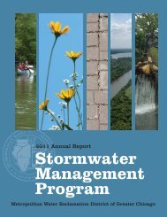
<strong>Stormwater</strong><br />
<strong>Management</strong><br />
For Cook County<br />
A new role for the <strong>Metropolitan</strong> <strong>Water</strong><br />
<strong>Reclamation</strong> <strong>District</strong> of Greater Chicago<br />
Protecting Our <strong>Water</strong> Environment
K A N E C O U N T Y<br />
Buffalo Creek<br />
.<br />
B ra n c h<br />
Lansing Drainage Ditch<br />
I L L I N O I S<br />
I N D I A N A<br />
Cook County <strong>Water</strong>ways and <strong>Water</strong>sheds<br />
L A K E C O U N T Y<br />
M i d d l e Fo r k<br />
D e s P l a i n e<br />
S k o k i e<br />
W. Fo r k o f N<br />
L A K E M I C H I G A N<br />
Poplar<br />
Spring Creek<br />
Creek<br />
P O P L A R<br />
C R<br />
E E K<br />
W A T E<br />
R S H<br />
E<br />
D<br />
West Branch<br />
DuPage River<br />
U P P P P P E R R S A L T<br />
C R R E E E K<br />
W A A T T T E R R S H E D<br />
D U P A G E C O U N T Y<br />
Salt Creek<br />
McDonald Creek<br />
Higgins Creek<br />
Willow Creek<br />
s R i v e r<br />
Wi low-Higgins<br />
Cr ek<br />
B ra n c h<br />
o f<br />
N .<br />
N O R T H H B B<br />
W A<br />
A T T E<br />
E E<br />
No r t h<br />
R<br />
i v e r<br />
B r a n c h<br />
No r t h S h o r e C h a n n e l<br />
E R S H E D<br />
L O W E<br />
B R A N C H<br />
D e s P l a<br />
W E R D E S P L A I N E E S S<br />
W A T E R S S H H E E D D<br />
C H I C A G O<br />
C h i c a g o R i v e r<br />
i n e s R i v e r<br />
A T T<br />
Silver<br />
Creek<br />
Addison<br />
D E E<br />
S H E D<br />
Creek<br />
I l l i n o<br />
Salt Creek<br />
i s a n d<br />
M i c h<br />
C A L S A G C H A N N E L<br />
W A T E R S H E D<br />
W I L L C O U N T Y<br />
Flagg Creek<br />
Spring Creek<br />
Marley<br />
Creek<br />
E S<br />
D e s P l a i n e s R i ver<br />
i g a n C a n a l<br />
Mill<br />
Lucas<br />
Creek<br />
Ditch<br />
C a l u m e t<br />
Tinley Creek<br />
Mi d<br />
S a n i t a r y a n d S h i p C a n a<br />
l ot hi an<br />
M a i n C h a n n e l<br />
Oak Lawn<br />
Stony Creek<br />
S a g C h a n n e<br />
Cre e k<br />
Creek<br />
l<br />
B r a n c h<br />
S o u t h<br />
C h<br />
i c a g o<br />
Little<br />
i v e r<br />
R<br />
Calumet<br />
L i t t l e C a<br />
Calumet Union<br />
Drainage Ditch<br />
L I T T L E C A L R I V E R<br />
W A T E R S H<br />
E D<br />
l<br />
Calumet<br />
Slough<br />
LAKE<br />
CALUMET<br />
l u m e<br />
North<br />
River<br />
t<br />
l u m e t R<br />
C a<br />
R<br />
i v e r<br />
i v e r<br />
Creek<br />
WOLF<br />
LAKE<br />
Grand<br />
Calumet<br />
B u<br />
t t e r fi e<br />
l d<br />
C r e e k<br />
Thorn<br />
Creek<br />
Third Creek<br />
Deer Creek
Roseele<br />
:<br />
Aerial photograph of Dr. Mary Woodland Reservoir, located in Lynwood, after a storm event.<br />
This reservoir provides 351 million gallons of storage and benefits for the communities of<br />
Lynwood and Lansing.<br />
History of the <strong>District</strong><br />
The <strong>Metropolitan</strong> <strong>Water</strong> <strong>Reclamation</strong><br />
<strong>District</strong> of Greater Chicago (<strong>District</strong>) is<br />
the agency charged with keeping sewage<br />
pollution out of Lake Michigan, the region’s<br />
primary drinking water supply, and properly<br />
treating sewage to avoid contamination<br />
of the Chicago, Des Plaines, and Illinois<br />
Rivers. In addition, the <strong>District</strong> has a long<br />
history of providing flood protection to the<br />
citizens of Cook County.<br />
The first major modification of the natural<br />
drainage system in the Chicago <strong>Metropolitan</strong><br />
Area was made by the <strong>District</strong> in the<br />
1890’s. A series of canals were constructed<br />
to reverse the flow of the Chicago River and<br />
carry waste away from Lake Michigan.<br />
The existing canal systems (Sanitary and<br />
Ship Canal, North Shore Channel, and<br />
Calumet-Sag Channel) provide a substantial<br />
volume of flood control storage and<br />
flow capacity.<br />
Flood Control Program<br />
While the <strong>District</strong> did not have a specific<br />
statutory responsibility in the area of flood<br />
control, its involvement and expertise in<br />
the areas of water pollution control and<br />
drainage led it to assume a flood control<br />
leadership role in the <strong>Metropolitan</strong> Area. By<br />
the mid-1960’s, the <strong>District</strong> was involved<br />
in the design and construction of many<br />
flood control storage reservoirs and stream<br />
improvement projects. The first reservoirs<br />
were constructed and put into service in the<br />
early 1970’s. To date 32 reservoirs have been<br />
completed with <strong>District</strong> participation. These<br />
reservoirs provide flood relief to thousands<br />
of people. The <strong>District</strong> has sought Federal,<br />
State, and local participation in its flood<br />
control efforts, and was one of the principal<br />
sponsors of the floodwater management<br />
plans developed by the Natural Resources<br />
Conservation Service. These plans address<br />
flood control on a regional basis, and<br />
most of the reservoirs recommended by<br />
these plans have been completed and<br />
are operating.<br />
Tunnel and Reservoir<br />
Plan (TARP)<br />
The Chicago <strong>Metropolitan</strong> Area has two<br />
different methods for collecting sewage.<br />
Flood problems in areas serviced by these<br />
two systems must be resolved differently.<br />
In most areas, sewage and stormwater are<br />
collected in different sewers. One system of
<strong>Stormwater</strong> <strong>Management</strong><br />
The Melvina Ditch Reservoir after a storm. The reservoir provides flood protection in the Cal-Sag watershed.<br />
sewers collects stormwater, and the other<br />
system of sewers collects sewage. These areas<br />
are commonly called ‘‘separate sewer’’ areas.<br />
Surface flood detention reservoirs, mentioned<br />
previously, are provided in areas with<br />
separate sewer systems. In older communities,<br />
sewage and stormwater are collected<br />
in the same sewer and the areas served are<br />
called ‘‘combined sewer’’ areas. Combined<br />
sewer areas comprise 375 square miles of<br />
the total 883 square mile area under the<br />
jurisdiction of the <strong>District</strong>. Flood and pollution<br />
problems in these areas are handled<br />
by the Tunnel and Reservoir Plan (TARP).<br />
The TARP service area includes the City of<br />
Chicago and 51 suburban municipalities.<br />
TARP consists of two phases. Phase I of the<br />
Plan is primarily a water pollution control<br />
project while Phase II is associated primarily<br />
with urban flood control. Virtually all<br />
excess combined sewage will be captured<br />
by the ultimate tunnel-reservoir system. In<br />
addition, waterway stages (elevations) will<br />
be controlled, reducing overbank flooding,<br />
basement flooding, and bypassing of raw<br />
sewage to Lake Michigan.<br />
<strong>District</strong> Sewer Permit Ordinance<br />
The <strong>District</strong>’s Sewer Permit Ordinance<br />
(Ordinance) was enacted in 1972 and is<br />
applicable to the <strong>District</strong>’s service area. The<br />
Ordinance requires that the post-developed<br />
release rate of stormwater runoff not exceed<br />
the undeveloped conditions runoff rate for a<br />
development located in separate sewer areas.<br />
The ordinance requires developments sized 5<br />
acres or greater and located in separate sewer<br />
areas to provide stormwater detention. The<br />
use of stormwater detention helps to reduce<br />
runoff during heavy storm periods and<br />
promotes comprehensive community-wide<br />
programs for flood control. The stormwater<br />
management legislation of 2004 affords<br />
the <strong>District</strong> the opportunity to update and<br />
expand this ordinance.<br />
Summary of Public Act<br />
93-1049 (Act)<br />
In November of 2004, the State of Illinois<br />
enacted legislation formalizing and expanding<br />
the <strong>District</strong>’s role in flood control<br />
by naming the <strong>District</strong> as the Regional<br />
<strong>Stormwater</strong> <strong>Management</strong> Agency for Cook<br />
County. The <strong>District</strong> will be involved in the<br />
planning, design, construction, operation<br />
and maintenance of flood control facilities<br />
and related stormwater management projects.<br />
The authority granted to the <strong>District</strong><br />
by the Act is applicable to all of Cook<br />
County and is not limited to the <strong>District</strong>’s<br />
corporate boundaries.<br />
The Act calls for the formation of <strong>Water</strong>shed<br />
Planning Councils (WPCs). A WPC has<br />
been formed for each of the six established<br />
watersheds of the Chicago <strong>Metropolitan</strong><br />
Area as listed below:<br />
1. North Branch Chicago River<br />
2. Lower Des Plaines Tributaries<br />
3. Cal-Sag Channel<br />
4. Little Calumet River<br />
5. Poplar Creek<br />
6. Upper Salt Creek<br />
The Act describes specific responsibilities of<br />
the WPCs. The key responsibilities of the<br />
WPCs are as follows:<br />
1. Advise the <strong>District</strong> on the needs and<br />
interests of local governments.<br />
2. Advise the <strong>District</strong> on the development<br />
of the countywide stormwater<br />
management plan with respect to<br />
their specific watersheds.<br />
2
Roseel e<br />
Roseele<br />
C<br />
<strong>Metropolitan</strong> <strong>Water</strong> <strong>Reclamation</strong> <strong>District</strong> of Greater Chicago<br />
3. Recommend rules and regulations to<br />
the <strong>District</strong> governing the provisions<br />
of the countywide stormwater management<br />
ordinance.<br />
The Act calls for the following municipal<br />
conferences to be responsible for coordination<br />
of the WPCs:<br />
1. Northwest Municipal Conference<br />
2. South Suburban Mayors and<br />
Managers Association<br />
3. Southwest Conference of Mayors<br />
4. West Central Municipal Conference<br />
The municipal conferences coordinate the<br />
activities of certain designated WPCs<br />
as follows:<br />
Northwest Municipal Conference<br />
(NWMC)<br />
• Poplar Creek <strong>Water</strong>shed<br />
• Upper Salt Creek <strong>Water</strong>shed<br />
• Lower Des Plaines Tributaries<br />
<strong>Water</strong>shed (in cooperation with WCMC)<br />
• North Branch Chicago River <strong>Water</strong>shed (in<br />
cooperation with WCMC)<br />
West Central Municipal Conference<br />
(WCMC)<br />
• Lower Des Plaines River Tributaries (in<br />
cooperation with NWMC)<br />
• North Branch Chicago River <strong>Water</strong>shed (in<br />
cooperation with NWMC)<br />
Southwest Conference of Mayors (SWCM)<br />
• Cal-Sag Channel <strong>Water</strong>shed<br />
South Suburban Mayors and Managers<br />
Association (SSMMA)<br />
• Little Calumet River <strong>Water</strong>shed<br />
Cook County <strong>Stormwater</strong><br />
<strong>Management</strong> Plan<br />
The Act calls for the <strong>District</strong> to develop<br />
a countywide stormwater management<br />
plan. The Cook County <strong>Stormwater</strong> <strong>Management</strong><br />
Plan (CCSMP) was developed by<br />
the <strong>District</strong> and approved by the <strong>District</strong>’s<br />
Board of Commissioners in 2007. The<br />
CCSMP is a high level organizational plan<br />
and provides the <strong>District</strong>’s vision of how<br />
the countywide stormwater management<br />
program will take shape.<br />
The following information is presented in<br />
the CCSMP:<br />
1. Goals of the Countywide Program<br />
2. Guidelines for Detailed <strong>Water</strong>shed Plans<br />
(DWP)<br />
3. <strong>Water</strong>shed <strong>Management</strong><br />
Ordinance Approach<br />
4. Parameters of the Countywide Program<br />
5. Program Implementation<br />
Goals of the Countywide<br />
Program<br />
The mission of the <strong>District</strong>’s <strong>Stormwater</strong><br />
<strong>Management</strong> Program is to provide<br />
Cook County a program of effective rules,<br />
regulations, and projects that will reduce<br />
the potential for stormwater damage<br />
to life, public health, property, and<br />
the environment.<br />
The program’s goals, as listed below, are<br />
quite extensive and far-reaching:<br />
A) Protect existing and new development<br />
by minimizing the increase of stormwater<br />
runoff volume beyond that experienced<br />
under predevelopment conditions<br />
and by reducing peak stormwater flows.<br />
B) Identify and remedy existing regional<br />
flooding problems to the extent feasible.<br />
C) Establish comprehensive basin plans<br />
within each watershed, which quantify,<br />
plan for and manage stormwater flows<br />
within and among the jurisdictions in<br />
those watersheds.<br />
D) Promote responsible land use practices<br />
in all areas of the watersheds of Cook<br />
County, particularly within floodplains<br />
and floodways.<br />
E) Establish uniform, minimum, countywide<br />
stormwater management regulations<br />
while recognizing and coordinating<br />
with those stormwater programs effectively<br />
operating within Cook County.<br />
F) Require cooperation and consistency<br />
in stormwater management activities<br />
between the government entities having<br />
stormwater jurisdiction, and clearly<br />
define the roles and responsibilities of<br />
each entity.<br />
G) Coordinate with surrounding counties<br />
to ensure minimal negative impacts of<br />
inter-county stormwater runoff flows.<br />
Boundries of the Councils of<br />
Government and <strong>Water</strong>sheds<br />
Poplar Creek<br />
<strong>Water</strong>shed<br />
Creek <strong>Water</strong>shed<br />
Southwest<br />
Conference<br />
of Mayors<br />
Upper Salt<br />
West Central<br />
Municipal<br />
Conference<br />
L o w e r D e s P l aine s W a t e r s h e d<br />
South Suburban<br />
:<br />
Mayors and Managers<br />
Association<br />
North Branch <strong>Water</strong>shed<br />
Cal Sag Channel<br />
<strong>Water</strong>shed<br />
Northwest<br />
Municipal<br />
Conference<br />
Little Cal River<br />
A watershed planning council meeting held<br />
in 2006.<br />
H I<br />
C<br />
A G O<br />
<strong>Water</strong>shed<br />
3
<strong>Stormwater</strong> <strong>Management</strong><br />
Photo: Gary Sullivan, The Wetlands Initiative<br />
Wetlands not only help to mitigate the effects of flooding and improve water quality, but also provide biodiversity and wildlife habitat.<br />
H) Coordinate with watershed councils<br />
to provide for the short and long term<br />
maintenance of natural waterways,<br />
manmade drainageways, and stormwater<br />
management facilities in new and existing<br />
developments.<br />
I) Seek to maximize available revenue<br />
sources in undertaking comprehensive<br />
watershed planning and stormwater<br />
facility construction activities, thereby<br />
leveraging and reducing reliance on the<br />
stormwater funds raised by levy.<br />
J) Protect existing water resources, including<br />
lakes, streams, floodplains, wetlands,<br />
and groundwater, from detrimental and<br />
unnecessary modification so that their<br />
beneficial functions are maintained<br />
and public expenditures and damages<br />
are minimized.<br />
K) Develop and maintain a comprehensive<br />
hydrologic, hydraulic, demographic and<br />
cartographic database using the best<br />
available and most appropriate technology<br />
to manage the stormwater, flood and<br />
water quality data needs of the program.<br />
L) Promote the awareness and understanding<br />
of stormwater management issues<br />
by the practitioner and the layperson<br />
through ongoing public information<br />
and education.<br />
M) Reduce or mitigate the environmentally<br />
detrimental effects of existing and<br />
future runoff in order to improve and<br />
maintain water quality and protect<br />
water related environments.<br />
N) Control sediment and erosion in and<br />
from any source, such as drainageways,<br />
developments, construction sites, and<br />
agricultural areas.<br />
O) Consider water quality and habitat<br />
protection measures in all<br />
stormwater management activities<br />
within Cook County.<br />
P) Preserve and enhance existing aquatic<br />
and riparian environments and encourage<br />
restoration of degraded areas.<br />
Q) Encourage the public to consider<br />
stormwater as a resource rather than<br />
as a nuisance.<br />
R) Manage and operate the program in an<br />
effective and cost-efficient manner.<br />
S) Be in compliance with all applicable<br />
state and federal laws.<br />
Detailed <strong>Water</strong>shed Plans<br />
In addition to the CCSMP, the Act requires<br />
the development of a Detailed <strong>Water</strong>shed<br />
Plan (DWP) for each established watershed<br />
of the Chicago <strong>Metropolitan</strong> Area. Major<br />
topics addressed in a DWP are as follows:<br />
1. Identification of <strong>Stormwater</strong> <strong>Management</strong><br />
Problem Areas<br />
2. Hydrologic and Hydraulic Modeling<br />
3. Identification of Potential Projects to<br />
Address Flooding and <strong>Water</strong><br />
Quality Issues<br />
4. Collection of Data to Analyze<br />
Potential Projects<br />
5. Benefit-to-cost analysis for each<br />
potential project.<br />
The primary objective of the watershed<br />
plans is to determine capital improvement<br />
projects to help alleviate existing stormwater<br />
management problems.<br />
Capital Improvement<br />
Program<br />
A key aspect of the <strong>District</strong>’s countywide<br />
stormwater management program is the<br />
identification and implementation of<br />
capital improvement projects. Flood control<br />
4
Roseele<br />
<strong>Metropolitan</strong> <strong>Water</strong> <strong>Reclamation</strong> <strong>District</strong> of Greater Chicago<br />
:<br />
The Wilke Kirchoff Reservoir is located in Arlington Heights and provides 33 million gallons of stormwater storage. When not providing flood<br />
control benefits, this dual purpose facility can be utilized for recreational purposes.<br />
projects may consist of reservoirs and<br />
levees. <strong>Water</strong> quality projects may consist of<br />
ecosystem improvements, streambank stabilization,<br />
wetland restoration and implementation<br />
of structural and non-structural Best<br />
<strong>Management</strong> Practices (BMPs). The EPA<br />
defines a BMP as a “technique, measure or<br />
structural control that is used for a given set<br />
of conditions to manage the quantity and<br />
improve the quality of stormwater runoff in<br />
the most cost-effective manner.”<br />
As required by Public Act 93-1049, a benefit-to-cost<br />
analysis is performed for each<br />
potential project the <strong>District</strong> may fund. In<br />
addition, the <strong>District</strong> prioritizes all projects<br />
on a countywide basis. The <strong>District</strong>’s Board<br />
of Commissioners has established absolute<br />
minimum requirements to ensure that all<br />
proposed projects meet certain parameters.<br />
Further information on these requirements<br />
can be found at www.mwrd.org by clicking<br />
on <strong>Stormwater</strong> <strong>Management</strong> under<br />
Public Interest.<br />
Many Detailed <strong>Water</strong>shed Plans (DWPs) have been conducted jointly among several<br />
governmental agencies.<br />
5
<strong>Stormwater</strong> <strong>Management</strong><br />
Regulatory Ordinance<br />
Approach<br />
The <strong>District</strong> intends to develop a <strong>Water</strong>shed<br />
<strong>Management</strong> Ordinance (WMO) with an<br />
accompanying Technical Guidance Manual<br />
(TGM) to provide minimum standards for<br />
stormwater management, particularly<br />
concerning new development and redevelopment<br />
projects. The WMO will be<br />
applicable countywide and not limited to<br />
the <strong>District</strong>’s service area. The <strong>District</strong>,<br />
with advice from the WPCs, will consider<br />
providing uniform, countywide regulations<br />
for the following areas:<br />
1. Floodplain <strong>Management</strong><br />
2. <strong>Stormwater</strong> Drainage and Detention<br />
3. Wetland Protection<br />
4. Stream Habitat and Riparian Environment<br />
Protection<br />
5. Soil Erosion and Sediment Control<br />
6. <strong>Water</strong> Quality<br />
In addition, the WMO and the TGM<br />
may provide recommendations and<br />
detailed specifications on BMPs pertinent to<br />
stormwater management.<br />
Maintenance<br />
The <strong>District</strong> inspects 32 flood control<br />
facilities located within Cook County<br />
annually. In addition, the <strong>District</strong> shares<br />
responsibilities for the maintenance of some<br />
of these flood control facilities with communities,<br />
park districts and other agencies.<br />
The <strong>District</strong> also maintains certain reaches<br />
of waterways and streams located in<br />
Cook County.<br />
Stream maintenance primarily focuses on<br />
the removal of debris from waterways and<br />
shorelines. During high flow periods, debris<br />
along shorelines or within the waterway can<br />
be carried downstream and create a blockage<br />
which can result in flooding and erosion.<br />
Debris accumulation also reduces the flow<br />
carrying capacity of the waterway which can<br />
cause flooding.<br />
The bioswale shown demonstrates an example of a Best <strong>Management</strong> Practice (BMP). The<br />
vegetation stabilizes the soil and absorbs runoff, nutrients and possible contaminants.<br />
Diagram Source: Source: A Guide to <strong>Stormwater</strong> Best <strong>Management</strong> Practices,<br />
Chicago’s <strong>Water</strong> Agenda, City of Chicago 2003<br />
Diagram Source: Source: A Guide to <strong>Stormwater</strong> Best <strong>Management</strong> Practices,<br />
Chicago’s <strong>Water</strong> Agenda, City of Chicago 2003<br />
This diagram illustrates the components that make up a drainage bioswale. The bioswale is an<br />
aesthetically pleasing method of controlling stormwater runoff while reducing pollutants as the<br />
water is filtered through the soil and coarse aggregates.<br />
6
<strong>Metropolitan</strong> <strong>Water</strong> <strong>Reclamation</strong> <strong>District</strong> of Greater Chicago<br />
RIPARIAN AND UPLAND ECOSYSTEMS<br />
Grass, brush, conifers<br />
Cottonwoods and other<br />
deciduous trees<br />
Willows, alders, shrubs<br />
Sedges and rushes<br />
S T R E A M<br />
R I PA R I A N A R E A<br />
U P L A N D S<br />
Diagram of riparian and upland ecosystems and what sort of vegetation may be found in each.<br />
The culverts shown are located just upstream of the Margreth Riemer Reservoir in Palatine.<br />
Shown are before and after photographs of maintenance performed by the Palatine Park <strong>District</strong>.<br />
It is important that the debris be removed from waterways to allow for proper conveyance of the<br />
waterway and to prevent blockages which can result in flood damage upstream.<br />
Fallen trees impede the flow of waterways.<br />
<strong>District</strong> personnel remove trees, cut them up into managable pieces<br />
and transport them to a disposal site.<br />
7
<strong>Stormwater</strong> <strong>Management</strong><br />
How You Can Help<br />
<strong>Stormwater</strong> management does not merely<br />
apply to flood control. It can also be used to<br />
improve water quality and conserve potable<br />
water. You can help out by implementing<br />
Best <strong>Management</strong> Practices at your residence.<br />
Example BMPs include rain barrels,<br />
cisterns, green roofs, rain gardens, permeable<br />
paving and natural landscaping. One<br />
simple measure would be to disconnect your<br />
downspouts from the public storm sewer<br />
system. The stormwater could be stored in<br />
rain barrels to be used to water gardens or<br />
directly discharged to rain gardens instead<br />
of flowing into our sewers. Reduction of<br />
stormwater flow into our sewers reduces<br />
the amount of flow discharged into our<br />
waterways and can help to alleviate<br />
flood damages from occurring due to<br />
overbank flooding.<br />
It is illegal to dump paint, oil, or any<br />
hazardous material into a street inlet as these<br />
materials will also pollute the waterway to<br />
which the storm sewer eventually discharges.<br />
Residents living near waterways should take<br />
extra care to remove debris on their property<br />
which could wind up in the waterway.<br />
Yard waste should be properly disposed of<br />
and not dumped into or along the banks<br />
of creeks or streams. Branches, bushes and<br />
other debris cause blockages at culverts and<br />
bridges which can cause flood damages for<br />
you and your neighbors. If you see anyone<br />
dumping garbage or any debris into a<br />
waterway, please call 1-800-332-DUMP.<br />
Debris piled along waterways (left) by residents or business owners can be swept away<br />
during high flow events possibly resulting in blockages (right), which can result in flooding.<br />
Examples of best management practices residents can implement in their own backyards.<br />
8<br />
A Guide to <strong>Stormwater</strong> Best <strong>Management</strong> Practices, Chicago’s <strong>Water</strong> Agenda, City of Chicago 2003
A Guide to <strong>Stormwater</strong> Best <strong>Management</strong> Practices,<br />
Chicago’s <strong>Water</strong> Agenda, City of Chicago 2003<br />
For Further Information<br />
Please visit the <strong>District</strong>’s website at<br />
www.mwrd.org and click on<br />
“<strong>Stormwater</strong> <strong>Management</strong>” or write<br />
to <strong>Stormwater</strong>@mwrd.org if you are<br />
interested in obtaining more information<br />
on the following:<br />
1. Cook County <strong>Stormwater</strong><br />
<strong>Management</strong> Plan<br />
2. Detailed <strong>Water</strong>shed Plans<br />
3. Absolute minimum requirements<br />
for projects to be funded under the<br />
<strong>District</strong>’s program<br />
4. Best <strong>Management</strong> Practices<br />
Rain barrels, another Best <strong>Management</strong> Practice, can be used to temporarily store<br />
stormwater, which can later be used as an efficient way to water lawns,<br />
landscaping and gardens.<br />
Green roofs, like this one shown atop Chicago’s City Hall, capture stormwater that would otherwise drain to sewers and rivers. Green roofs are also<br />
aesthetically pleasing and help cool building interiors in the Summer.<br />
A Guide to <strong>Stormwater</strong> Best <strong>Management</strong> Practices, Chicago’s <strong>Water</strong> Agenda, City of Chicago 2003<br />
3
Board of Commissioners<br />
Terrence J. O’Brien<br />
President<br />
Barbara J. McGowan<br />
Vice President<br />
Cynthia M. Santos<br />
Chairman of Finance<br />
Michael A. Alvarez<br />
Frank Avila<br />
Patricia Horton<br />
Kathleen Therese Meany<br />
Debra Shore<br />
Mariyana T. Spyropoulos<br />
Officers<br />
David st. Pierre<br />
Executive Director<br />
KENNETH A. KITS<br />
Director of Engineering<br />
MANJU P. SHARMA<br />
Director of Maintenance<br />
and Operations<br />
MARY ANN BOYLE<br />
Treasurer<br />
RONALD M. HILL<br />
Acting General Counsel<br />
DENICE KORCAL<br />
Director of Human Resources<br />
THOMAS C. GRANATO<br />
Acting Director of Monitoring<br />
and Research<br />
DARLENE A. LoCASCIO<br />
Director of Procurement and<br />
Materials <strong>Management</strong><br />
KEITH D. SMITH<br />
Director of Information Technology<br />
JACQUELINE TORRES<br />
Clerk/Director of Finance<br />
<strong>Metropolitan</strong> <strong>Water</strong> <strong>Reclamation</strong> <strong>District</strong> of Greater Chicago<br />
100 East Erie Street<br />
Chicago, Illinois 60611-3154<br />
www.mwrd.org<br />
Cover photo: Joe Rakoczy