The State of South Africa's Biodiversity 2012 - Biodiversity GIS - SANBI
The State of South Africa's Biodiversity 2012 - Biodiversity GIS - SANBI
The State of South Africa's Biodiversity 2012 - Biodiversity GIS - SANBI

You also want an ePaper? Increase the reach of your titles
YUMPU automatically turns print PDFs into web optimized ePapers that Google loves.
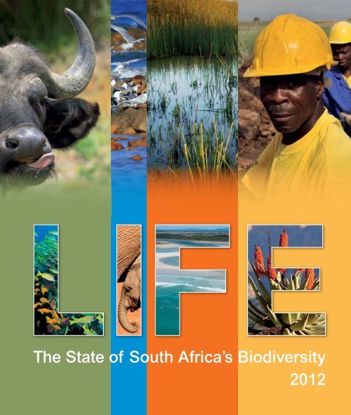
<strong>The</strong> <strong>State</strong> <strong>of</strong> <strong>South</strong> Africa’s <strong>Biodiversity</strong><br />
<strong>2012</strong>
Based on: Driver, A., Sink, K.J., Nel, J.L., Holness,<br />
S.H., Van Niekerk, L., Daniels, F., Jonas, Z., Majiedt,<br />
P.A., Harris, L. & Maze, K. <strong>2012</strong>. National <strong>Biodiversity</strong><br />
Assessment 2011: An assessment <strong>of</strong> <strong>South</strong> Africa’s<br />
biodiversity and ecosystems. Synthesis report.<br />
<strong>South</strong> African National <strong>Biodiversity</strong> Institute & Department <strong>of</strong><br />
Environmental Affairs, Pretoria.<br />
Citation: <strong>South</strong> African National <strong>Biodiversity</strong> Institute. 2013.<br />
Life: the state <strong>of</strong> <strong>South</strong> Africa’s biodiversity <strong>2012</strong>. <strong>South</strong> African<br />
National <strong>Biodiversity</strong> Institute, Pretoria.<br />
ISBN: 978-1-919976-81-5<br />
Printed by: Paarl Media, Paarl, <strong>South</strong> Africa<br />
Text adapted by: Leonie Joubert – www.scorched.co.za<br />
Design by: Ink Design, Cape Town, <strong>South</strong> Africa –<br />
www.inkdesign.co.za<br />
Acknowledgements:<br />
This report summarises the National <strong>Biodiversity</strong> Assessment<br />
2011, which was led by <strong>SANBI</strong> in partnership with a range<br />
<strong>of</strong> organisations, involving wide participation from scientists,<br />
biodiversity management experts and other stakeholders<br />
throughout the country over a three-year period – all in all<br />
more than 200 people from over 30 organisations. In particular,<br />
we would like to acknowledge the contributions <strong>of</strong> the<br />
Department <strong>of</strong> Environmental Affairs (DEA), the Council for<br />
Scientific and Industrial Research (CSIR), <strong>South</strong> African<br />
National Parks (SANParks), WWF <strong>South</strong> Africa (WWF-SA)<br />
and the Water Research Commission (WRC). For a full list <strong>of</strong><br />
acknowledgements, please refer to the National <strong>Biodiversity</strong><br />
Assessment 2011 Synthesis Report (p173-176), available at<br />
http://bgis.sanbi.org.<br />
Photo credits:<br />
Grateful thanks go to the many people and organisations whose<br />
photographs bring life to the pages <strong>of</strong> this report.<br />
On the cover: Peter Chadwick, Ellen Elmendorp, Flower Valley<br />
Conservation Trust, Claire Fulton, Kristal Maze, Liesel Kersh<strong>of</strong>f,<br />
Ge<strong>of</strong>f Spiby, Chris Willis, Mark Wing.<br />
Inside: Wiida Basson, Andre Beetge, Marcus Bergener,<br />
Mark Botha, George Branch, Andrew Brown, Mike Cadman,<br />
CapeNature, Peter Chadwick, Werner Conradie, Flower<br />
Valley Conservation Trust, Claire Fulton, Caroline Gelderblom,<br />
iSimangaliso Wetland Park Authority, Liesel Kersh<strong>of</strong>f, Roxanne<br />
Klein, Don Kotze, Gigi Laidler, David le Maitre, Kevin Murray,<br />
Jeanne Nel, David Rogers, Dirk Roux, Rob Simmons, Kerry<br />
Sink, Kate Snaddon, Ge<strong>of</strong>f Spiby, Louise Stafford, Ernst Swartz,<br />
Lani van Vuuren, Mark Wing, Vivienne Williams, John Yeld.<br />
Paper: Printed on environmentally friendly Triple Green Print Silk<br />
recycled paper<br />
About <strong>SANBI</strong>:<br />
<strong>The</strong> <strong>South</strong> African National <strong>Biodiversity</strong> Institute (<strong>SANBI</strong>) is a<br />
public entity that falls under the Department <strong>of</strong> Environmental<br />
Affairs. Established in 2004 in terms <strong>of</strong> the National<br />
Environmental Management: <strong>Biodiversity</strong> Act (Act 10 <strong>of</strong> 2004),<br />
<strong>SANBI</strong> leads and co-ordinates research, and monitors and<br />
reports on the state <strong>of</strong> <strong>South</strong> Africa’s biodiversity. It makes<br />
information and knowledge available to a wide range <strong>of</strong> users,<br />
provides planning and policy advice, pilots best-practice<br />
management models in partnership with stakeholders, leads<br />
the human capital development strategy <strong>of</strong> the biodiversity<br />
sector, and manages a network <strong>of</strong> National Botanical Gardens<br />
as windows on <strong>South</strong> Africa’s biodiversity for enjoyment<br />
and education. See www.sanbi.org.za for more information.<br />
Copyright: © <strong>South</strong> African National <strong>Biodiversity</strong> Institute 2013<br />
Reproduction <strong>of</strong> this publication for educational or other<br />
non-commercial purposes is authorised without prior written<br />
permission from the copyright holder provided the source is<br />
fully acknowledged. Reproduction <strong>of</strong> this publication for resale<br />
or other commercial purposes is prohibited without prior written<br />
permission <strong>of</strong> the copyright holder.
Land and sea: the diversity <strong>of</strong> life in <strong>South</strong> Africa’s ecosystems is a<br />
kind <strong>of</strong> infrastructure which, just like roads and railway lines,<br />
is critical to the wellbeing <strong>of</strong> the economy,<br />
communities and individual people.<br />
Terrestrial Biomes<br />
Albany Thicket<br />
Desert<br />
Forests<br />
Fynbos<br />
Grassland<br />
Indian Ocean Coastal Belt<br />
Nama-Karoo<br />
Savanna<br />
Succulent Karoo<br />
Marine Ecoregions<br />
<strong>South</strong>ern Benguela<br />
<strong>South</strong>east Atlantic<br />
Agulhas<br />
Natal<br />
<strong>South</strong>west Indian<br />
Delagoa<br />
Without roads, electricity pylons, storm water drains, sewers, rubbish<br />
collection trucks, power stations and the like, our society wouldn’t run<br />
as smoothly as it does. This built infrastructure is all around us. It’s<br />
expensive to build and maintain. But it’s technologically advanced, it<br />
lubricates the economy, and it allows people to live better, healthier lives.<br />
We <strong>of</strong>ten don’t realise, though, that the natural environment is also a<br />
kind <strong>of</strong> ‘infrastructure’. It’s more intricate and sophisticated than the built<br />
environment that we value so highly, and it’s even more critical to our<br />
survival.<br />
This ‘ecological infrastructure’ comes in the form <strong>of</strong> wetlands, mountain<br />
catchments, rivers, coastal dunes, vegetation and the like. <strong>The</strong>se give<br />
us a whole suite <strong>of</strong> services, sometimes called ecosystem services:<br />
fresh water, firewood and fertile soils for agriculture; they regulate water<br />
flows and help to protect us from extreme events associated with climate<br />
change, like floods, droughts and fires.<br />
Ecosystem services, just like municipal services, play an essential role<br />
in supporting social development and economic prosperity.<br />
<strong>The</strong> message <strong>of</strong> this report on the state <strong>of</strong> <strong>South</strong> Africa’s biodiversity<br />
is simple: the country’s vast wealth <strong>of</strong> biodiversity – which includes<br />
all forms <strong>of</strong> life, from genes and species to the ecosystems they live<br />
in – <strong>of</strong>fers us natural solutions that can support development and help<br />
us respond to the pressing problems <strong>of</strong> unemployment, poverty and<br />
climate change.<br />
We need to care for this infrastructure because every <strong>South</strong> African –<br />
rural and urban, rich and poor – needs it in order to live a full, rich,<br />
abundant life.<br />
Life: the <strong>State</strong> <strong>of</strong> <strong>South</strong> Africa’s <strong>Biodiversity</strong> <strong>2012</strong> is a summary <strong>of</strong> the National <strong>Biodiversity</strong> Assessment 2011, which was led by the <strong>South</strong><br />
African National <strong>Biodiversity</strong> Institute (<strong>SANBI</strong>) in partnership with the Department <strong>of</strong> Environmental Affairs, CSIR, <strong>South</strong> African National Parks<br />
and a range <strong>of</strong> other organisations. To read the full National <strong>Biodiversity</strong> Assessment 2011 Synthesis Report and associated technical reports,<br />
please visit http://bgis.sanbi.org.<br />
Note that references have not been included in this report. Readers should consult the National <strong>Biodiversity</strong> Assessment 2011<br />
Synthesis Report for references.
Contents<br />
1 foreword<br />
2–3 INTRODUCTION<br />
4–5 At a glancE<br />
8–13 This land is our land<br />
14–19 Our precious wetlands<br />
20–25 Liquid gold<br />
26–31 Where the river meets the sea<br />
32–37 On the beach and out to sea<br />
38–41 <strong>The</strong> climate complex<br />
42–45 in the face <strong>of</strong> invasion<br />
46–49 Nature’s gems<br />
50–51 smart maps<br />
52–54 filling the gapS
foreword<br />
This publication captures the essence <strong>of</strong> an inheritance<br />
so worthy <strong>of</strong> celebration.<br />
<strong>The</strong> diversity <strong>of</strong> life we find in <strong>South</strong> Africa’s natural<br />
heritage is as rich and wondrous as our many languages,<br />
cultures and people. Our expansive landscapes, and<br />
the species that we find in them, share the same ancient<br />
historic roots as every <strong>South</strong> African.<br />
This beautiful publication captures the essence <strong>of</strong> an<br />
inheritance so worthy <strong>of</strong> celebration. And it <strong>of</strong>fers the<br />
information and inspiration we need in order to make<br />
better decisions about how we use, manage and invest<br />
in our biodiversity, across our land and waters, for the<br />
benefit <strong>of</strong> all <strong>South</strong> Africans.<br />
<strong>The</strong> National <strong>Biodiversity</strong> Assessment, completed in 2011,<br />
was built on world-class science. Life: the <strong>State</strong> <strong>of</strong> <strong>South</strong><br />
Africa’s <strong>Biodiversity</strong> distils the key messages from that<br />
assessment and presents them here in fulfilment <strong>of</strong> our<br />
mandated role to advise the Minister <strong>of</strong> Environment on<br />
the state <strong>of</strong> our biodiversity. This publication is also written<br />
with a wider audience in mind, with the aim <strong>of</strong> igniting a<br />
passion for nature and the environment amongst <strong>South</strong><br />
Africans citizens. We celebrate our abundant biodiversity<br />
as we explore the inherent value <strong>of</strong> this natural wealth,<br />
as well as the fundamental role it plays in supporting our<br />
development goals as a nation.<br />
It is the role <strong>of</strong> the <strong>South</strong> African National <strong>Biodiversity</strong><br />
Institute (<strong>SANBI</strong>), charged by national government<br />
through the <strong>Biodiversity</strong> Act <strong>of</strong> 2004, to monitor the state<br />
<strong>of</strong> our biodiversity, and provide policy advice based on<br />
good science. We can fulfil this role only in collaboration<br />
with many partners. We would like to recognise the skill,<br />
expertise, time and resources <strong>of</strong> the many exceptional<br />
organisations, institutions and people in the research<br />
community, non-governmental organisations and the<br />
private sector, who contributed to the important body <strong>of</strong><br />
work that is captured between the covers <strong>of</strong> this report.<br />
Dr Tanya Abrahamse<br />
Chief Executive Officer<br />
<strong>South</strong> African National <strong>Biodiversity</strong> Institute<br />
foreword<br />
1
Each one <strong>of</strong> us is heir to a precious gift. It comes in the<br />
bubbling curve <strong>of</strong> the sea water along the tide line, the<br />
stirring <strong>of</strong> air around the wings <strong>of</strong> a sandveld copper<br />
butterfly, it’s there in the laughing cough <strong>of</strong> a zebra or the<br />
stoic silhouette <strong>of</strong> the halfmens as it stares out over the<br />
desert.<br />
INTRODUCTION<br />
<strong>The</strong>se heirlooms don’t just give us small moments <strong>of</strong><br />
beauty to enjoy as our playground. Rather, they’re part <strong>of</strong><br />
a broader weave <strong>of</strong> life that gives us the water we drink,<br />
scrubs clean the air we breathe, gives us the soil where<br />
our maize and potatoes and apples grow, or the grassy<br />
hills and valleys where our nation’s cattle and sheep<br />
graze. <strong>The</strong> rivers, wetlands, forests, grassy hills, river<br />
mouths, deserts, ocean currents which curl around our<br />
coastlines – these are all part <strong>of</strong> the intricate systems that<br />
make life possible for us in this country.<br />
Nature, free as the air<br />
we breathe, more precious<br />
than gold.<br />
But because the natural environment and the services<br />
it provides are given to us free, we tend to forget their<br />
immeasurable value.<br />
It’s up to us, therefore, to look after these heirlooms. And<br />
the National <strong>Biodiversity</strong> Assessment (NBA) 2011, which is<br />
summarised in this report, is a tool to help us do just that.<br />
2 introduction
<strong>The</strong> family heirloom<br />
It may help to think <strong>of</strong> this heirloom as being handed the<br />
keys to the family car. <strong>The</strong>re’s a purring engine under the<br />
hood that needs to be cared for to make sure it keeps<br />
ticking over and doesn’t overheat or seize up. If this<br />
carefully engineered piece <strong>of</strong> technology isn’t serviced<br />
and maintained constantly, it could grind to a halt and be<br />
as useless as a pile <strong>of</strong> rusting metal melting under the<br />
corrosive effects <strong>of</strong> the highveld sun.<br />
<strong>The</strong> NBA is an attempt to pop the bonnet on that car so<br />
our ‘mechanics’, the ecologists and other scientists and<br />
experts, can look at the inner workings <strong>of</strong> the engine room<br />
<strong>of</strong> <strong>South</strong> Africa’s natural environment. <strong>The</strong>y can map the<br />
whole engine, listen to the timing, calibrate how well the<br />
cooling system works, see whether the electronics are up<br />
to scratch, and test if the fuel pump is feeding the system.<br />
In such a highly advanced society, we <strong>of</strong>ten live with<br />
the belief that if we break something, we can find a<br />
technological fix for it. But as in the case <strong>of</strong> the car<br />
engine, it’s better to keep the original one well serviced,<br />
than to burn it out and then try to rebuild it by buying in<br />
spare parts.<br />
In many respects, once nature has been ‘burned out’, it<br />
cannot be fixed. <strong>The</strong>re may not be spare parts, or they<br />
may be too expensive or hard to come by. And they may<br />
not work as well as the original.<br />
It’s up to us to make sure it never comes to that.<br />
Our invaluable ecological<br />
infrastructure<br />
All life on Earth, from the genes in the cells <strong>of</strong> each<br />
individual plant or animal, to the species themselves and<br />
the ecosystems in which they live, make up a multiplicity<br />
<strong>of</strong> life that we call biodiversity.<br />
<strong>South</strong> Africa has an extraordinary diversity <strong>of</strong> life and<br />
ecosystems which give us goods and services that we<br />
could not live without. Taking care <strong>of</strong> this inheritance calls<br />
for us to see its value, with careful planning, and time<br />
and money set aside specially for the task. Investing in<br />
our natural capital and our ecological ‘infrastructure’ is<br />
for the public good. It is as important for our wellbeing<br />
as the roads, railways, ports, electricity grid and all the<br />
other examples <strong>of</strong> built infrastructure that we invest in and<br />
maintain so carefully.<br />
Luckily we are given this natural infrastructure free. We<br />
don’t have to allocate chunks <strong>of</strong> the national budget to<br />
build wetlands or engineer grasslands. But we do have<br />
to look after it otherwise the cost to ourselves and our<br />
communities will be immeasurable.<br />
Bringing together world class<br />
science and pioneering research to steer<br />
policy and action<br />
<strong>The</strong> National <strong>Biodiversity</strong> Assessment 2011 brought<br />
together world class science with pioneering mapping<br />
methods to give policymakers, decision makers and<br />
managers a powerful tool as they care for the country’s<br />
natural assets, be they land-based, riverine, wetland,<br />
estuarine, coastal or open ocean.<br />
For the first time the NBA not only mapped these spaces,<br />
but zoomed in closely enough on each <strong>of</strong> these broad<br />
systems, in order to classify and compare smaller, more<br />
distinct ecosystem units within them. It provides a robust<br />
and consistent methodology to allow a comparison <strong>of</strong> the<br />
threat status and protection levels between these different<br />
systems. <strong>The</strong> status <strong>of</strong> a particular ocean habitat type,<br />
for instance, can be compared with that <strong>of</strong> a wetland,<br />
essentially allowing scientists to compare apples with<br />
oranges using robust science.<br />
<strong>The</strong> intention <strong>of</strong> the NBA is to inform policy and prioritise<br />
action, and is central to the <strong>South</strong> African National<br />
<strong>Biodiversity</strong> Institute’s (<strong>SANBI</strong>’s) role <strong>of</strong> monitoring and<br />
reporting on the state <strong>of</strong> the country’s biodiversity. In so<br />
doing, the NBA gives indicators for assessing ecosystem<br />
threat status and protection levels across all environments;<br />
it zooms in on ecosystems that build climate resilience;<br />
it highlights species <strong>of</strong> concern and takes stock <strong>of</strong> the<br />
spread <strong>of</strong> invasive alien species; and it maps priority<br />
biodiversity areas.<br />
introduction<br />
3
4 key highlights
At a glance<br />
1. Dynamite in a small package: wetlands, which make<br />
up only a little over 2% <strong>of</strong> the country’s footprint, give us<br />
irreplaceable services, like purifying water and slowing<br />
down flood waters. But we have already lost many<br />
wetlands; <strong>of</strong> those which remain, nearly half are critically<br />
endangered.<br />
2. Protect our water factories: areas with high natural run<strong>of</strong>f,<br />
such as the Drakensberg Mountains, the Soutpansberg<br />
and the Wolkberg in Limpopo Province, are critical for<br />
gathering and channelling the water which this semi-arid<br />
country depends on. Yet only about a fifth <strong>of</strong> these areas<br />
are formally protected.<br />
3. Treasure the small tributaries: all those smaller rivers<br />
which feed into the country’s main, hard working arteries<br />
like the Orange and the Vaal Rivers, are key to keeping our<br />
water supplies in good health. Fortunately, our tributaries<br />
are generally in better shape than the main rivers they<br />
feed into, and we should keep them this way.<br />
4. St Lucia – a phoenix rising: the Lake St Lucia system<br />
is our most important estuary and a key nursery for fish<br />
on the southeast African coast. For six decades St Lucia<br />
received too little fresh water, due to human interventions<br />
and drought, leaving this flagship estuary in poor condition<br />
and closed to the sea for much <strong>of</strong> the past ten years. Work<br />
has begun on restoring St Lucia back to health, a top<br />
priority for the iSimangaliso Wetland Park Authority, but it<br />
is challenging and will take time. Significantly, in July <strong>2012</strong><br />
the lake received enough fresh water to open to the sea<br />
again.<br />
5. Paving over our coast: nearly a fifth <strong>of</strong> our coastline has<br />
some form <strong>of</strong> development within 100m <strong>of</strong> the shoreline,<br />
which means nature’s buffers against storm surges and<br />
rising seas may have been stripped away and paved over<br />
in parts. This puts people and property at risk in the face<br />
<strong>of</strong> climate change. Our coastal and inshore ecosystems<br />
are more threatened than <strong>of</strong>fshore marine ecosystems.<br />
6. Lost at sea: further out to sea, <strong>of</strong>fshore ecosystems<br />
are the most poorly protected <strong>of</strong> all our ecosystems,<br />
yet these are the lifeblood for healthy and productive<br />
fisheries. Marine protected areas are key to keeping both<br />
the ecosystems and the fisheries safe.<br />
key highlights<br />
5
7. Hand in hand – state meets the private sector:<br />
biodiversity stewardship programmes, where private land<br />
owners enter into an agreement with state conservation<br />
bodies to protect a section <strong>of</strong> their land and biodiversity,<br />
are making headway in terms <strong>of</strong> our national protected<br />
area targets. This is more affordable than when the<br />
state buys land for conservation purposes. With modest<br />
increases in resources, this scheme could make an even<br />
larger contribution.<br />
8. Warning signs: some parts <strong>of</strong> the country have lost<br />
much more natural habitat than others. If Gauteng,<br />
KwaZulu-Natal and North West Province keep losing<br />
natural landscapes at the current rate, for example to<br />
cultivation, mining and urban expansion, these provinces<br />
will have almost no natural habitat left outside protected<br />
areas by 2050. Where natural vegetation is being<br />
converted to other land uses at a high rate, it’s critical to<br />
use maps <strong>of</strong> biodiversity priority areas to guide decisions<br />
about where best to locate development.<br />
9. Planning for an uncertain climate: with the uncertain<br />
and extreme climate we will face in the future, it’s critical<br />
that we keep natural habitats healthy so they can support<br />
functional, stable landscapes in the long term, which<br />
can then better support human activities. Scientists have<br />
drawn up a new national map which identifies areas that<br />
are important for climate change resilience, and which<br />
need to be kept intact.<br />
10. Protecting our natural medicines: <strong>South</strong> Africa has<br />
over 2 000 plant species that are used for medicinal<br />
purposes, about a third <strong>of</strong> which are traded commercially.<br />
But some are threatened. We need to manage these<br />
species better, and monitor how other heavily traded<br />
medicinal plant species are used, so that they don’t<br />
become over-exploited too.<br />
11. A bridgehead against invasion: invasive alien plants<br />
dramatically increased their footprint in <strong>South</strong> Africa in<br />
about a decade, and now we lose about R6.5 billion worth<br />
<strong>of</strong> ecosystem services to them each year. Programmes<br />
like Working for Water give us a chance to create jobs and<br />
reclaim nature’s valuable services.<br />
6 key highlights
on the SIDE<br />
New tools in the biodiversity<br />
toolbox<br />
A ruler is a good way to measure the size <strong>of</strong> a<br />
page, and using degrees centigrade is a way to<br />
quantify temperature. But how do you measure and<br />
compare the health <strong>of</strong> ecosystems as different from<br />
one another as an apple is from an orange, such<br />
as comparing the state <strong>of</strong> a high-altitude Grassland<br />
with that <strong>of</strong> a deep-ocean bed? It’s not easy.<br />
But for the first time our scientists have devised<br />
a set <strong>of</strong> indicators that allow them to do just that.<br />
<strong>The</strong>se have been used throughout this book to<br />
show how threatened and how protected our many<br />
different ecosystems and habitats are.<br />
Ecosystem threat status: This tells us whether an<br />
ecosystem is still intact, or if it’s losing vital aspects<br />
<strong>of</strong> its structure, function or composition, related to<br />
a series <strong>of</strong> thresholds. Ultimately, the functioning<br />
<strong>of</strong> threatened ecosystems is compromised as they<br />
reach certain measurable thresholds.<br />
Ecosystem protection level: This tells us whether<br />
an ecosystem is well represented in protected<br />
areas, based on the proportion <strong>of</strong> the ecosystem<br />
that falls into an area that is formally protected<br />
under national legislation, namely the Protected<br />
Areas Act.<br />
12. Having the right tools for the job: our scientists<br />
have made great strides in mapping and classifying<br />
<strong>South</strong> Africa’s ecosystems. This gives the foundation for<br />
meaningful assessment, planning and monitoring our<br />
ecosystems. For example, now we have the first maps<br />
which identify our marine and coastal habitat types and<br />
wetland ecosystem types.<br />
key highlights<br />
7
‘To the Gumbi people, land means being ourselves. Land<br />
is <strong>of</strong> great importance, more than anything else.’<br />
This land<br />
is our land<br />
It is our blood, it is our flesh,<br />
it is everything.<br />
This is how Lucky Gumbi, member <strong>of</strong> the original Gumbi<br />
Traditional Council in northern Zululand, explained what it<br />
means to his people to have 21 000 hectares <strong>of</strong> bushveld<br />
near the border with Mozambique returned to them after<br />
they were dispossessed <strong>of</strong> it under the apartheid state.<br />
‘You can’t separate it from us. It is our blood, it is our flesh,<br />
it is everything,’ he told the Wildlands Conservation Trust<br />
during an interview in 2011. 1<br />
<strong>The</strong> Gumbis had three priorities for this land, their leader<br />
Inkosi (chief) Zeblon Gumbi explained: first, they needed<br />
a place to settle and build their homesteads; then they<br />
needed land to farm and sustain themselves; and thirdly<br />
they decided to dedicate most <strong>of</strong> the land (16 000 hectares<br />
in all) to conservation. This meant they could generate an<br />
income for the community through ecotourism while being<br />
custodians <strong>of</strong> the environment.<br />
8 terrestrial
Healthy lands, healthy waters: healthy land-based<br />
environments also protect people from natural hazards,<br />
slow down floods and store water to help see us through<br />
times <strong>of</strong> drought. Our life-giving rivers can only be<br />
healthy if the surrounding Grassland, Fynbos or Savanna<br />
ecosystems are in a similar state <strong>of</strong> good repair.<br />
Relax and renew: we use nature as a playground,<br />
something that gives immeasurable pleasure. Tourists,<br />
many <strong>of</strong> whom are drawn to our beaches, natural spaces<br />
and wild animals, brought an estimated R251 billion into<br />
the country’s gross domestic product (GDP) in 2011,<br />
according to the Industrial Development Corporation.<br />
This means that tourism contributes nearly 9% to the GDP,<br />
more or less equivalent to the mining sector.<br />
This is the kind <strong>of</strong> win-win approach to conserving nature<br />
which underpins the philosophy <strong>of</strong> the National <strong>Biodiversity</strong><br />
Assessment (NBA) and the mandate <strong>of</strong> the <strong>South</strong> African<br />
National <strong>Biodiversity</strong> Institute (<strong>SANBI</strong>): to emphasise how<br />
much a healthy natural environment gives us in terms <strong>of</strong><br />
‘free’ goods and services and development potential, and<br />
why we should continue to be good stewards.<br />
Just as <strong>South</strong> Africans need human and manufactured<br />
capital to grow the economy, we are also dependent<br />
on the ‘capital’ in wild spaces and natural landscapes,<br />
and the species that live in them. And our land-based, or<br />
terrestrial, ecosystems are no exception.<br />
<strong>The</strong> wealthy countryside: many rural communities use<br />
Forest, Albany Thicket and Savanna systems for fire wood,<br />
wild fruits, and to make wooden utensils. Others gather<br />
traditional medicines from the natural environment.<br />
A growing industry: game farming and hunting – similar<br />
to that which the Gumbis are now doing – bring in another<br />
R7.7 billion a year and give some 100 000 jobs to people,<br />
and are significantly more labour intensive than livestock<br />
farming. In some instances in the Eastern Cape, switching<br />
from farming to ecotourism has produced 4.5 times as<br />
many full-time jobs, according to a 2006 study.<br />
Living in the landscapes<br />
Where our food grows: agriculture, and by association<br />
the entire nation’s food production, is dependent on a<br />
healthy natural environment. Good soils allow us to grow<br />
crops. <strong>The</strong> natural veld gives us grazing for livestock,<br />
something which was valued at over R8 000 for every<br />
square kilometre annually in 2008. Without the pollination<br />
<strong>of</strong> certain insects, birds and rodents, many crops would<br />
be impossible to grow. In the Western Cape alone, wild<br />
pollinators give a service to the deciduous fruit industry<br />
amounting to between US$49 million (R400 million) and<br />
US$311 million (R2 500 million) every year, according to a<br />
2008 study. Creatures living in wild places also <strong>of</strong>fer pest<br />
control for agriculture.<br />
1 To read more about the Wildlands Conservation Trust,<br />
visit http://www.wildlands.co.za/. <strong>The</strong> original interview can be viewed on<br />
http://www.youtube.com/watch?v=eIpyxCTecr4.<br />
Photo: Mike Cadman<br />
terrestrial<br />
9
‘<br />
We believe that we are born<br />
out <strong>of</strong> land and when we die<br />
we will go back to the land,<br />
said Lucky Gumbi.<br />
’<br />
After the land was returned to the Gumbi people in<br />
northern KwaZulu-Natal, and they were able to build their<br />
settlements and re-establish their farms, work began on<br />
establishing the protected area. Because it had such a high<br />
diversity <strong>of</strong> bushveld life, the provincial conservation body<br />
Ezemvelo KZN Wildlife and the Wildlands Conservation<br />
Trust assisted the community in formally proclaiming<br />
a portion <strong>of</strong> their land as a Nature Reserve through the<br />
province’s biodiversity stewardship programme. <strong>The</strong><br />
establishment <strong>of</strong> the Somkhanda Game Reserve has<br />
seen black rhino introduced to the reserve, tourist lodges<br />
refurbished, game numbers supplemented, water has<br />
been secured and hunting is bringing in revenue. And the<br />
Gumbi people receive an income from these activities.<br />
And yet even though this is an example <strong>of</strong> how land reform<br />
and land restitution can be coupled with conservation to<br />
the potential economic benefit <strong>of</strong> all, the value <strong>of</strong> this<br />
natural place is not something that can be reduced to<br />
mere rands and cents. <strong>The</strong> diversity <strong>of</strong> life found in this<br />
bushveld, and the cultural meaning to the people who have<br />
returned there, cannot be measured in monetary units.<br />
‘We say that when you respect our ancestors, we say<br />
abaphansi meaning those that are underground. So when<br />
you walk on the land we’ve got to respect it,’ said Lucky<br />
Gumbi, the sky turning mauve above the Savanna <strong>of</strong> his<br />
forefathers.<br />
This is why his chief, Inkosi Zeblon Gumbi, believes it’s so<br />
important that the land that was taken from the Gumbis<br />
has been returned to the community.<br />
10 terrestrial
Map A<br />
Critically endangered<br />
Endangered<br />
Vulnerable<br />
Least threatened<br />
Map B<br />
Critically endangered<br />
Endangered<br />
Vulnerable<br />
Least threatened<br />
No natural habitat remaining<br />
Polokwane<br />
Polokwane<br />
Mafikeng<br />
Mbombela<br />
Johannesburg<br />
Mafikeng<br />
Mbombela<br />
Johannesburg<br />
Kimberley<br />
Bloemfontein<br />
Pietermaritzburg<br />
Kimberley<br />
Bloemfontein<br />
Pietermaritzburg<br />
Bisho<br />
Bisho<br />
Cape Town<br />
Cape Town<br />
0 125 250 500 kilometres 0 125 250 500 kilometres<br />
Our threatened land-based ecosystems: Most <strong>of</strong> our threatened ecosystems are found near big cities, productive croplands and coastal areas,<br />
where large amounts <strong>of</strong> natural habitat have been lost. Map A shows the original footprint <strong>of</strong> terrestrial ecosystems. Map B shows what remains<br />
<strong>of</strong> those ecosystems today, with the white areas showing where natural habitat has been irreversibly lost.<br />
Albany Thicket<br />
Desert<br />
Forest<br />
Fynbos<br />
Critically endangered<br />
Endangered<br />
Vulnerable<br />
Least threatened<br />
Grassland<br />
Indian Ocean Coastal Belt<br />
Nama-Karoo<br />
Savanna<br />
Succulent Karoo<br />
0% 10% 20% 30% 40% 50% 60% 70% 80% 90% 100%<br />
Percentage <strong>of</strong> ecosystem types<br />
Counting the cost: This graph shows ecosystem threat status by biome.<br />
Most threatened biomes: Grassland, Fynbos and Indian Ocean Coastal Belt.<br />
<strong>The</strong> great unknown: Scientists are able to map areas where natural vegetation has been irreversibly lost, but it’s less easy to map areas that have<br />
been degraded to varying degrees, so this threat status is probably an underestimate.<br />
terrestrial<br />
11
Putting on the pressure: the many<br />
demands on a changing landscape<br />
Because we need nature’s infrastructure, and since we<br />
tend to damage these resources in the course <strong>of</strong> our<br />
economic activities, we face the challenge <strong>of</strong> making sure<br />
that we use the natural environment in a way that allows<br />
our ecosystems to stay healthy in the long term.<br />
on the SIDE<br />
A biome is a distinct community <strong>of</strong> plants, animals<br />
and other organisms, that is shaped by prevailing<br />
physical conditions such as climate and soil types,<br />
and which becomes the dominant form in an area.<br />
Each biome is made up <strong>of</strong> many vegetation types.<br />
In many ways we have failed to do this until now.<br />
Gone for good: change in land cover is the greatest driver<br />
<strong>of</strong> habitat loss across <strong>South</strong> Africa. Nearly a fifth <strong>of</strong> the land<br />
surface has been lost, mostly due to natural vegetation<br />
being ploughed up for crop farming (like maize, wheat<br />
and sugar cane), and to a lesser extent to mining, forestry<br />
and urban sprawl. <strong>The</strong> greatest losses are around hubs <strong>of</strong><br />
economic activity.<br />
Down but not out: even if an ecosystem isn’t completely<br />
destroyed, we can still undermine how well it functions.<br />
<strong>The</strong>se are some <strong>of</strong> the ways an ecosystem can be<br />
tampered with: if it gets carved up into too many smaller,<br />
fragmented parts; if the natural fire regime is changed, for<br />
instance if fires burn too <strong>of</strong>ten or not <strong>of</strong>ten enough; if the<br />
vegetation is over-grazed; if the soil becomes degraded;<br />
if invasive species move in.<br />
Albany Thicket<br />
Desert<br />
Forest<br />
Fynbos<br />
Grassland<br />
Indian Ocean Coastal Belt<br />
Nama-Karoo<br />
Savanna<br />
Succulent Karoo<br />
Azonal vegetation<br />
Pollution from mining, agriculture, manufacturing and<br />
cities into the water, soil or air can also disrupt ecosystems,<br />
how well they function, or the species living in them.<br />
Sometimes degraded ecosystems can be repaired, but<br />
not always. Dry ecosystems, in areas where there is less<br />
rainfall, generally take longer to recover than wetter ones.<br />
<strong>The</strong> ripple effect: when land-based ecosystems like<br />
Grassland or Thicket are damaged, the effects usually<br />
spill over into wetlands and rivers and may trickle all<br />
the way down to distant estuaries. Protecting terrestrial<br />
landscapes is also about protecting our water resources.<br />
<strong>The</strong> road to 2050: KwaZulu-Natal, Gauteng and the<br />
North West are amongst the provinces that have had<br />
the greatest loss <strong>of</strong> natural habitat. And if the remaining<br />
natural areas continue to be transformed into crops and<br />
forestry or turned over to mining or urban sprawl at the<br />
current rate, there will be little to no natural vegetation left<br />
in these provinces by 2050, outside <strong>of</strong> protected areas.<br />
That’s less than four decades from now.<br />
Cost to the soul: it’s easy to keep measuring the loss <strong>of</strong><br />
habitats and the services they give us purely in scientific<br />
or economic terms. But how does one measure the social<br />
and psychological consequences <strong>of</strong> losing these wild<br />
iconic spaces?<br />
Gauteng might be the engine room <strong>of</strong> the economy, and<br />
account for a third <strong>of</strong> the country’s GDP, but as with all<br />
decisions around how we manage our natural spaces in<br />
future, development here should go together with looking<br />
after the province’s ecological infrastructure.<br />
12 terrestrial
Maps <strong>of</strong> biodiversity priority areas are an invaluable tool<br />
to help guide decision makers to ensure that development<br />
is situated in appropriate places.<br />
Protecting our assets<br />
Nearly a quarter <strong>of</strong> land-based ecosystems are well<br />
protected, but 35% have no protection at all.<br />
Fynbos, Forest, and Desert: the best protected biomes.<br />
Grassland, Thicket, and Nama-Karoo: the least protected<br />
biomes. Grassland is also one <strong>of</strong> <strong>South</strong> Africa’s largest<br />
and most threatened biomes.<br />
Smaller parts <strong>of</strong> the whole: some ecosystems types<br />
within broader biomes are better protected than others,<br />
though. Mountain Fynbos is well protected, but lowland<br />
Fynbos isn’t; lowveld Savanna is well represented in the<br />
Kruger National Park, for instance, but central bushveld<br />
Savanna isn’t found in many protected areas.<br />
<strong>Biodiversity</strong> stewardship programmes: throwing a<br />
protective net around wild and natural landscapes can be<br />
an expensive exercise. That’s why the state wants to get<br />
the private sector involved in conservation. <strong>Biodiversity</strong><br />
stewardship arrangements are now operating in six<br />
provinces, allowing private and communal land owners<br />
to dedicate part or all <strong>of</strong> their property to conservation.<br />
on the SIDE<br />
If you were to take a drive from Port Nolloth on<br />
the west coast to, say, Port Shepstone on the east<br />
coast, you’d see vegetation changing around you<br />
subtly but constantly. What drives this change?<br />
<strong>The</strong> soils, rock formations, how much water flows<br />
through the system, the temperature, the climate:<br />
all <strong>of</strong> these make up the weave <strong>of</strong> a fabric that<br />
forms our different ecosystems and determines<br />
which plants and animals are able to thrive there<br />
or not.<br />
Mapping the country’s vegetation – something our<br />
scientists have done extremely well – is one <strong>of</strong><br />
the best ways <strong>of</strong> visualising the footprint <strong>of</strong> these<br />
ecosystems and knowing which plants, animals,<br />
birds, insects and other organisms live there. <strong>South</strong><br />
Africa has nine distinct biomes: Fynbos; Grassland;<br />
Savanna; Albany Thicket; Forest; Succulent Karoo;<br />
Nama-Karoo; Desert; Indian Ocean Coastal Belt.<br />
Each biome is made up <strong>of</strong> many different vegetation<br />
types. Scientists now have the ability to compare<br />
these sub-types with one another, across different<br />
biomes, in order to understand the levels <strong>of</strong> threat.<br />
This is groundbreaking.<br />
Albany Thicket<br />
Desert<br />
Forest<br />
Fynbos<br />
Not protected<br />
Poorly protected<br />
Moderately protected<br />
Well protected<br />
Grassland<br />
Indian Ocean Coastal Belt<br />
Nama-Karoo<br />
Savanna<br />
Succulent Karoo<br />
0% 10% 20% 30% 40% 50% 60% 70% 80% 90% 100%<br />
Percentage <strong>of</strong> ecosystem types<br />
Caring for the land: This graph shows the levels <strong>of</strong> protection for our land-based ecosystem types, by biome.<br />
terrestrial<br />
13
Our precious<br />
Wetlands<br />
… energy is diffused, water<br />
slows and settles, the damage<br />
it could cause as it hurtles<br />
through water courses<br />
is dampened …<br />
Try this at home: take a damp sponge, place it on a kitchen<br />
countertop, and pour half a cup <strong>of</strong> water onto it. Now,<br />
pour the same amount <strong>of</strong> water directly onto the counter.<br />
See what happens? Bit messy, but it makes the point.<br />
Now imagine that cup <strong>of</strong> water is a summer thunderstorm,<br />
the countertop is a paved road or patch <strong>of</strong> hard, dry<br />
ground, and the sponge is the gentle reed beds along<br />
the tributaries which feed into the river system that gives<br />
fresh water to Gauteng’s important industrial complex.<br />
People here depend on that water arriving in a clean<br />
and regulated way; infrastructure and communities are<br />
vulnerable, should the river burst its banks and flood.<br />
When fast moving water from a rain storm or flood hits<br />
the reeds and other plants in a wetland or vlei, energy<br />
is diffused, water slows and settles, the damage it could<br />
cause as it hurtles through water courses is dampened.<br />
Wetlands catch and hold onto that water, either in the soil<br />
or on the surface, and later trickle-feed it downstream,<br />
keeping our rivers flowing and feeding myriad dams<br />
and water pumps and taps along the way. This is why<br />
wetlands are compared to sponges: they catch water in<br />
the landscape, clean it for us, and bank it away in their<br />
soggy soils to be released slowly during the dry season.<br />
14 wetlands
Wetlands are irreplaceable<br />
Wetlands support agriculture, filter pollution from water,<br />
trickle-feed water into rivers even during the dry season,<br />
slow flooding, combat desertification and help us absorb<br />
the environmental shocks that come with droughts.<br />
Wetlands are also warehouses <strong>of</strong> a diverse range <strong>of</strong> life.<br />
Some <strong>of</strong> these wetland species are used for food, craft<br />
manufacture, medicines, grazing, building material and<br />
fuel, for both subsistence and commercial use.<br />
We can’t rely solely on complex and expensive<br />
engineering solutions to provide drinking water and to<br />
clean waste water. Our natural water infrastructure, in<br />
the form <strong>of</strong> wetlands, streams, rivers, lakes, aquifers and<br />
estuaries, complements and protects our dams, pipelines<br />
and water treatment plants. <strong>The</strong> extreme bouts <strong>of</strong> flooding<br />
and drought we expect to come with climate change<br />
mean our wetlands will become even more critical for<br />
water management.<br />
PLAIN<br />
seep<br />
SLOPE<br />
channelled<br />
valley-bottom wetland<br />
river channel<br />
VALLEY FLOOR<br />
All this from only 2.4% <strong>of</strong> our country’s surface area. So<br />
when wetlands are damaged, the consequences ripple<br />
out across a system that reaches far beyond that little<br />
marsh or vlei.<br />
BENCH<br />
depression<br />
unchannelled<br />
valley-bottom wetland<br />
BENCH<br />
floodplain wetland<br />
flat<br />
depression<br />
Illustration: Wilma Strydom Photo: Mark Wing<br />
No one is an island: Wetlands relate to the landscape around them in different ways. Some are linked directly to the course <strong>of</strong> a river, while others<br />
are found across a broader catchment.<br />
wetlands<br />
15
In praise <strong>of</strong> the vlei<br />
Depending on which definition you choose, the term<br />
‘wetland’ can cover anything from a reed-covered seep<br />
to an entire lake. Wetlands are places in the landscape<br />
where the water table is at or near the surface, or the land<br />
is covered with shallow water for all or part <strong>of</strong> the year.<br />
<strong>The</strong>se conditions create distinctive soils and support<br />
plants adapted to life in saturated soils.<br />
Typically, wetlands are found in a range <strong>of</strong> settings across<br />
the landscape, including on hill slopes, in valley bottoms,<br />
on floodplains, in depressions and on flats. Some are<br />
connected to river networks while others may be isolated<br />
from rivers and groundwater.<br />
Filtering our water clean: the wetlands around the Klip<br />
River in southern Johannesburg have been cleaning the<br />
water released by gold mines there for the past 100 years,<br />
along with more recent industrial and urban pollution. If<br />
wetlands in industrial hubs like this are degraded, not only<br />
do they stop purifying water that gets dumped into them,<br />
but they also release all the trapped pollutants.<br />
Supporting the farmer and local livelihoods: wetland<br />
habitats give people highly productive agricultural land,<br />
grazing, fish, fibre and medicines. <strong>The</strong>y underpin the<br />
health and wellbeing <strong>of</strong> many rural communities. It’s the<br />
poor and vulnerable who benefit from healthy wetlands<br />
most directly, and who suffer most if wetlands are<br />
damaged. This is just one reason there’s a direct link<br />
between the return on environmental investment, and the<br />
welfare and survival <strong>of</strong> the poor.<br />
16 wetlands
A community made richer<br />
In Bushbuckridge, Mpumalanga, the Manalana wetland in<br />
the Sand River catchment is the only source <strong>of</strong> food and<br />
income for about a quarter <strong>of</strong> the surrounding community.<br />
It also acts as a safety net that buffers other households<br />
from slipping further into poverty during times <strong>of</strong> shock<br />
or stress.<br />
<strong>The</strong> wetland was badly eroded, something which threatened<br />
to destroy these benefits. However, since Working for<br />
Wetlands began rehabilitation in 2006, people living in the<br />
area can again use it for food, grazing and construction<br />
materials. <strong>The</strong> value <strong>of</strong> these services, given free by nature,<br />
amounts to about R3 500 per year for about 70% <strong>of</strong> local<br />
households, in an area where half <strong>of</strong> households survive<br />
on an income <strong>of</strong> less than R5 700 per year.<br />
Putting on the squeeze: Wetlands are<br />
our most threatened ecosystems<br />
It’s almost impossible to know precisely how many <strong>of</strong><br />
our wetlands have been lost for good, especially where<br />
cities, dams and mines have paved over or swallowed up<br />
wetlands, but we know it’s considerable.<br />
Of the wetlands that remain today, many <strong>of</strong> them have<br />
been heavily modified because we have dammed,<br />
drained, mined or bulldozed them.<br />
<strong>The</strong> most threatened wetland types are floodplain<br />
wetlands, because they are <strong>of</strong>ten found in highly<br />
productive land where people drain or bulldoze them to<br />
make way for agriculture.<br />
Critically endangered<br />
Endangered<br />
Vulnerable<br />
Least threatened<br />
Point <strong>of</strong> impact: This map shows the threat status <strong>of</strong> wetland ecosystems. <strong>The</strong> greatest pressures on our wetlands are in places where cities,<br />
cultivated farmlands and mining are most widespread.<br />
wetlands<br />
17
Critically<br />
endangered<br />
Percentage <strong>of</strong> wetland<br />
ecosystem types<br />
Endangered<br />
Vulnerable<br />
So far, we’ve <strong>of</strong>ten put other economic pursuits first,<br />
without thinking <strong>of</strong> the benefits <strong>of</strong> keeping wetlands<br />
intact. But we’re already seeing how this kind <strong>of</strong> decisionmaking<br />
can be to our own detriment, leaving us battling<br />
with problems <strong>of</strong> water quality and flood damage, for<br />
example. Every choice we make now, regarding our<br />
threatened wetlands, is a choice we will have to live with<br />
for generations.<br />
In the wetland: wetlands are lost or degraded because <strong>of</strong><br />
cultivation (for instance, for sugar cane or orchards), for<br />
urban development, for mining, to build dams, or because<br />
<strong>of</strong> poor grazing management which causes erosion.<br />
<strong>The</strong> juggling act<br />
Least<br />
threatened<br />
Caution, caution! Nearly half <strong>of</strong> all our wetland ecosystem types<br />
are critically endangered, making wetlands the most threatened <strong>of</strong><br />
all ecosystems in <strong>South</strong> Africa.<br />
It can be difficult deciding how nature should be used:<br />
should a wetland be kept in a pristine state because <strong>of</strong><br />
the benefits we gain from having our water stored and<br />
purified by it, or should we turn it over to agriculture and<br />
try to get food from it? What about jobs and income from<br />
mining? Or a settlement for people to live in?<br />
Around the wetland: what happens in the catchment<br />
area around a wetland can also cause the wetland itself<br />
to become degraded. Disrupting the timing and the way<br />
water flows into the wetland through activities like building<br />
a dam or over-extracting water upstream <strong>of</strong> the wetland<br />
or extracting too much groundwater can cause damage.<br />
Pollution in rivers feeding into a wetland can cause harm.<br />
Similarly overgrazing or poor crop management can lead<br />
to soil being flushed away and deposited in wetlands.<br />
How much is protected?<br />
Our wetlands are severely under-protected. Very few<br />
wetland ecosystem types (just over 10% in all) are<br />
adequately represented within <strong>South</strong> Africa’s formally<br />
protected areas, such as National Parks and Nature<br />
Reserves; meanwhile 70% are unprotected.<br />
<strong>The</strong> most well protected: because <strong>of</strong> the Kruger National<br />
Park and iSimangaliso Wetland Park, wetland ecosystems<br />
in the lowveld region and in northern KwaZulu-Natal are<br />
relatively well protected.<br />
Digging in the dirt: This is a typical open cast coal mine in the<br />
Delmas-Ogies area in Mpumalanga. It highlights the tension between<br />
extracting resources, since wetlands <strong>of</strong>ten occur just above shallow<br />
coal deposits, or leaving them in the ground in order to preserve the<br />
services provided by the wetland that would otherwise be lost once<br />
mining starts.<br />
<strong>The</strong> least protected: floodplain wetlands have the lowest<br />
levels <strong>of</strong> protection, and have the highest proportion <strong>of</strong><br />
critically endangered types within them.<br />
<strong>The</strong> priority now should be the conservation <strong>of</strong> a<br />
representative spread <strong>of</strong> different wetland ecosystem<br />
types, through protecting wetlands themselves. But we<br />
must also take care <strong>of</strong> upstream systems and surrounding<br />
18 wetlands
catchment areas so that the quality, quantity and timing <strong>of</strong><br />
water which wetlands depend on, is secured.<br />
<strong>The</strong> National Water Act, complemented by other laws<br />
such as the Conservation <strong>of</strong> Agricultural Resources<br />
Act and the National Environmental Management Act,<br />
calls for precisely this sort <strong>of</strong> integrated approach to<br />
resource management: protecting the ecological reserve<br />
(the amount <strong>of</strong> water that needs to stay in the natural<br />
environment in order for it to be healthy), classifying water<br />
resources and maintaining our water quality.<br />
But the challenges remain. This is partly because <strong>of</strong> the<br />
shortage <strong>of</strong> capacity to implement and enforce these<br />
legal requirements, and the need for further work to make<br />
sure the right science is available so that the most prudent<br />
choices can be made about the sometimes inevitable<br />
trade-<strong>of</strong>fs between development and loss <strong>of</strong> ecological<br />
infrastructure.<br />
on the SIDE<br />
Our international commitments<br />
<strong>South</strong> Africa is a signatory to the Ramsar<br />
Convention on Wetlands, which means we have to<br />
identify important wetlands which are then added<br />
to Ramsar’s List <strong>of</strong> Wetlands <strong>of</strong> International<br />
Importance. Our obligation under Ramsar is to<br />
promote the wise use <strong>of</strong> all wetlands, create<br />
protected areas for wetlands, and cooperate with<br />
other member states when it comes to managing<br />
wetlands which straddle national borders.<br />
We have 20 Ramsar-listed wetland sites. Eighteen<br />
<strong>of</strong> these are protected under <strong>South</strong> African law, in<br />
most cases as Nature Reserves. <strong>The</strong> remaining<br />
two, Orange River Mouth in the Northern Cape and<br />
Verlorenvlei in the Western Cape, are not formally<br />
protected.<br />
Bouncing back: Wetlands tend to be more resilient than many<br />
other ecosystems, meaning that even if they are in poor condition,<br />
sometimes they can be rehabilitated. For example, this wetland<br />
has been cultivated, but its functioning could be restored, albeit at<br />
considerable effort and expense. However, once wetlands are paved<br />
over with concrete, or drowned under dams, they are irrevocably lost.<br />
Photo: Kate Snaddon<br />
wetlands<br />
19
Water … keeps the<br />
economy ticking over,<br />
it is the lifeblood for our<br />
agriculture and forestry,<br />
it helps power the electricity<br />
grid, and drives industry.<br />
Liquid gold<br />
It’s called the Goldilocks Zone, after the porridge in the<br />
classic fairy tale: not too hot, not too cold, just right. And<br />
it’s why Earth is the only planet we know that has life on it.<br />
Earth travels in a course around the sun that’s just the right<br />
distance to keep an atmosphere in place that supports<br />
liquid water. Any closer to the sun, and our atmosphere<br />
would have cooked away, along with the planet’s water.<br />
Any further away, and the water would be frozen solid.<br />
Without water, life on the planet wouldn’t have happened.<br />
It’s as simple as that.<br />
Earth’s water isn’t spread out evenly like a neatly buttered<br />
slice <strong>of</strong> bread. <strong>South</strong> Africa, for instance, doesn’t have<br />
much fresh water – we are a semi-arid country – meaning<br />
water is our most scarce natural resource. Yet we lean so<br />
heavily on it: it keeps the economy ticking over, it is the<br />
lifeblood for our agriculture and forestry, it helps power<br />
the electricity grid, and drives industry. Each <strong>of</strong> us needs<br />
clean water in our homes so we can live a healthy life.<br />
20 rivers
<strong>The</strong> nature <strong>of</strong> water is to run, meaning it carves out paths<br />
as it goes, creating rivers that become the arteries feeding<br />
this life-giving liquid through land-based habitats. Rivers<br />
store and move our water about. Together with manmade<br />
dams and water transfer schemes, they deliver it to where<br />
we need it in cities and farmlands, allowing us to irrigate<br />
crops, get rid <strong>of</strong> waste and giving us playgrounds.<br />
Rivers: an invaluable infrastructure<br />
We need to remember that if we want to be able to turn<br />
on the taps in our homes, factories, businesses and<br />
on our farms, we need to make sure that our rivers are<br />
healthy right from the very top <strong>of</strong> the system, the mountain<br />
catchments, down to the estuary where the river meets<br />
the ocean.<br />
But we’re putting huge pressure on our rivers – taking<br />
more and more water out <strong>of</strong> them, and dumping greater<br />
amounts <strong>of</strong> pollution into them. Climate change is already<br />
shifting rainfall and evaporation patterns, putting further<br />
stress on these hard working ecosystems.<br />
So we need to reduce how much water we use, and<br />
take good care <strong>of</strong> what we have. One <strong>of</strong> the best ways<br />
to promote water security is to manage and conserve<br />
ecosystems that maintain our water supply and keep it<br />
healthy. That means keeping river ecosystems in a good<br />
state <strong>of</strong> repair.<br />
Healthy rivers also support a wide diversity <strong>of</strong> life, which<br />
helps to process pollutants and clean our water, and<br />
supports the people living in and around them.<br />
Because rivers are long, linear systems which carve<br />
through the landscape, anything that happens in their<br />
catchments, or along their banks, or in the habitats that<br />
feed into them, inevitably impacts on the rivers themselves.<br />
And problems which occur along the length <strong>of</strong> the river<br />
tend to accumulate and reinforce each other as they travel<br />
down the system.<br />
Mountain stream Upper foothill Lower foothill Lowland river<br />
<strong>The</strong> trickle-down effect: One immutable quality <strong>of</strong> water is that it travels downhill. This means that the river system <strong>of</strong>ten bears the brunt <strong>of</strong><br />
environmental problems unfolding along the length <strong>of</strong> the river. So by the time the river reaches lower-lying ground, <strong>of</strong>ten where the most<br />
economic activity happens, the river is already carrying with it the burden <strong>of</strong> the accumulated pressures from over-extraction <strong>of</strong> water, disruption<br />
<strong>of</strong> the environment around the river, invasive alien species, pollution, erosion and damage to river banks that may have happened tens or even<br />
hundreds <strong>of</strong> kilometres higher upstream.<br />
rivers<br />
21
on the SIDE<br />
What is ‘<strong>The</strong> Reserve’?<br />
<strong>The</strong> water needed by a river in order for the whole<br />
system to stay healthy is called the ‘ecological<br />
reserve’ and is protected under the National Water<br />
Act. This means that rivers and their surrounding<br />
environs must be managed in such a way that the<br />
amount and quality <strong>of</strong> water, and the rate at which<br />
it flows through a system, isn’t disrupted to a point<br />
that degrades the sustainability <strong>of</strong> a river.<br />
<strong>The</strong> ‘human needs reserve’ is also protected under<br />
the Act. This refers to the amount <strong>of</strong> water needed<br />
for a person to drink, prepare food and keep<br />
themselves and their homes clean. Many people<br />
who live <strong>of</strong>f the municipal grid are still directly<br />
dependent on rivers in order to meet these daily<br />
water needs.<br />
Together, the ecological reserve and the human<br />
needs reserve are called ‘<strong>The</strong> Reserve’.<br />
Nothing in nature is wasted<br />
Fresh water pouring out from rivers into the ocean is not<br />
wasted. Rather, it plays a vital part in keeping estuaries and<br />
nearby ocean ecosystems healthy. Some fish species, for<br />
instance, spawn their young near estuaries, so that they<br />
can ‘sniff’ out the fresh water flushing out <strong>of</strong> the river and<br />
into the ocean. This important navigational cue leads the<br />
young fish towards the safety <strong>of</strong> the estuary which then<br />
serves as a nursery until the fish are big enough to venture<br />
out into the more dangerous waters <strong>of</strong> the open ocean.<br />
Many <strong>of</strong> these fish species are important for commercial<br />
or subsistence fisheries.<br />
It’s important, then, that we don’t siphon <strong>of</strong>f all the water<br />
from our rivers, leaving nothing to spill out at the mouth.<br />
<strong>The</strong> knock on effects <strong>of</strong> this not only harm ecosystems<br />
and the species living there, but impact on the people<br />
who depend on them, and ultimately our communities<br />
and economy.<br />
22 rivers
Our rivers under pressure<br />
Changing the flow: anything that alters the way water<br />
flows through a river system can have a serious impact on<br />
the health <strong>of</strong> riverine life. Dams ‘impound’ water, changing<br />
water quality and quantity downstream; irrigation extracts<br />
water; dumping waste water into a river increases the<br />
flow; and pumping water from one catchment to another<br />
(inter-basin transfers) changes both the receiving and<br />
the delivering rivers. Large rivers are <strong>of</strong>ten the most<br />
heavily used.<br />
Pollution: pollutants can come from failing sewerage<br />
treatment plants, industrial waste water with harmful<br />
chemicals poured directly into wetlands and rivers,<br />
and agricultural pesticides and fertilisers running <strong>of</strong>f<br />
farmlands. Taking water out <strong>of</strong> a polluted system leads to<br />
even higher concentrations <strong>of</strong> pollutants.<br />
Destruction <strong>of</strong> river banks: bulldozing banks or planting<br />
crops along river edges can cause permanent damage<br />
to a river system and the ecological services it provides.<br />
Natural vegetation along river banks filters water running<br />
into the system from nearby lands, protecting the river from<br />
pollution. Intact river banks also help to prevent erosion.<br />
Invasive alien plants: thirsty invaders drink up an<br />
estimated 7% our total annual run<strong>of</strong>f, which then deprives<br />
rivers, dams and people.<br />
Invasive alien fish: fish introduced for recreational<br />
fishing and aquaculture, like bass and trout, can wipe out<br />
indigenous fish species and other life.<br />
Climate change: rising temperatures and changing<br />
rainfall patterns will impact on how much water makes it<br />
into river systems.<br />
Land management throughout catchments: water<br />
resources must be managed together with land-based<br />
activities that surround them because what happens on<br />
the land throughout catchments impacts on river health.<br />
rivers<br />
23
How threatened are our rivers?<br />
<strong>The</strong> big few: larger rivers such as the Vaal and Olifants<br />
are hard working because they tend to have more dams<br />
built on them, more water pumped from them, and more<br />
pollution dumped into them.<br />
Critically endangered<br />
Endangered<br />
Vulnerable<br />
Least threatened<br />
One in three: only a third <strong>of</strong> our main rivers are in good<br />
ecological condition. This is measured according to<br />
criteria such as flow, altering inundation (we <strong>of</strong>ten channel<br />
rivers to redirect their flow or build barriers to make them<br />
more predictable), water quality, stream bed condition,<br />
and bank condition. Smaller tributaries that flow into main<br />
rivers tend to be in better ecological condition.<br />
Uneven spread: some river systems, like the Berg and<br />
Breede, have extremely high levels <strong>of</strong> threat and need<br />
deliberate restoration efforts. Meanwhile others, such as<br />
the Mvoti and the Umzimkulu on the east coast, have low<br />
levels <strong>of</strong> threat and should be kept this way.<br />
Investing in gold: keeping our rivers healthy, and<br />
rehabilitating damaged rivers, is an excellent investment<br />
in future water security and river services.<br />
Our threatened rivers: Critically endangered and endangered river<br />
ecosystems are found mostly around major cities, in cultivated or<br />
mined landscapes, and in places with a lot <strong>of</strong> economic activity. This is<br />
where water demands are greatest and catchments have lost much <strong>of</strong><br />
their natural habitat. If a river ecosystem is assessed as ‘threatened’,<br />
that doesn’t necessarily mean it’s unsafe for people to use.<br />
Mountain stream<br />
Mountain stream<br />
Upper foothill<br />
Upper foothill<br />
Lower foothill<br />
Lower foothill<br />
Lowland river<br />
0% 20% 40% 60% 80% 100%<br />
Percentage <strong>of</strong> river ecosystem types<br />
Lowland river<br />
0% 20% 40% 60% 80% 100%<br />
Percentage <strong>of</strong> river ecosystem types<br />
Critically endangered<br />
Endangered<br />
Vulnerable<br />
Least threatened<br />
Not protected<br />
Poorly protected<br />
Moderately protected<br />
Well protected<br />
Picking up speed: This graph shows the threat status <strong>of</strong> rivers.<br />
<strong>The</strong> further you travel down the length <strong>of</strong> a river, the greater the<br />
cumulative impacts. Lowland rivers have the largest proportion <strong>of</strong><br />
critically endangered ecosystems because <strong>of</strong> the impact <strong>of</strong> intensive<br />
agriculture, mining and urban pollutants.<br />
Protecting the lifeblood: This graph shows how protected our river<br />
ecosystems are. While higher altitude river systems are best protected,<br />
lowland rivers have lower levels <strong>of</strong> protection.<br />
24 rivers
‘<br />
... rivers downstream<br />
<strong>of</strong> protected areas<br />
tend to be in<br />
better shape ...<br />
’<br />
How much is protected?<br />
Because rivers are long and linear, it’s not <strong>of</strong>ten that an<br />
entire river system will fall inside a protected area such<br />
as a National Park, and even then, a river may carry its<br />
upstream impacts down into the protected area. Rivers<br />
are <strong>of</strong>ten used as convenient boundary lines for protected<br />
areas which begs the question: are such rivers protected<br />
or not? Nevertheless, rivers downstream <strong>of</strong> protected<br />
areas tend to be in better shape than when they entered<br />
the protected area. Of the country’s river ecosystem<br />
types, only 14% are well protected, one third are poorly<br />
protected, and half have no protection at all.<br />
Making protected areas work better<br />
for rivers<br />
Most protected areas were not designed with river<br />
protection in mind. However, these guidelines can help to<br />
ensure that protected areas do a better job <strong>of</strong> taking care<br />
<strong>of</strong> river ecosystems:<br />
■■<br />
■■<br />
■■<br />
■■<br />
■■<br />
Don’t make rivers the boundaries <strong>of</strong> National<br />
Parks or Nature Reserves, make them part <strong>of</strong> the<br />
protected area.<br />
Extend protected areas along greater lengths <strong>of</strong> rivers<br />
that are only partly protected.<br />
Include river catchment areas into protected areas.<br />
Don’t place developments, like chalets or lodges,<br />
on or near priority freshwater ecosystems inside<br />
protected areas.<br />
Push for the last remaining rivers that are undisturbed<br />
from source to sea, so-called ‘free flowing’ rivers, to<br />
be incorporated into protected areas.<br />
500%<br />
High water yield areas<br />
500 km<br />
<strong>The</strong> water factories: Catchments with high natural run<strong>of</strong>f provide several times more run<strong>of</strong>f than the average for their river basin. <strong>The</strong>se priority<br />
catchments are critical to our water security, but aren’t well protected.<br />
rivers<br />
25
Where<br />
the river<br />
meets the sea<br />
… our flagship estuary,<br />
St Lucia, demonstrates why<br />
science-based management<br />
is so important.<br />
Until the 1950s, the mouths <strong>of</strong> the St Lucia Lake and the<br />
mighty uMfolozi River came together in an impressive<br />
junction at the beach on the northern KwaZulu-Natal<br />
coast, and would spill their fresh water out into the ocean.<br />
From time to time, during droughts, the combined estuary<br />
would close, allowing fresh water to flood into the lake,<br />
until normal rainfall patterns returned and the mouth<br />
would re-open.<br />
This was how nature designed the system, and it worked<br />
well. But in the 1950s, in an effort to support agricultural<br />
irrigation upriver and stop sediment building up in the<br />
lake, the two mouths were separated by dumping piles <strong>of</strong><br />
sand and mud between them, creating artificial mounds<br />
which split the two bodies <strong>of</strong> water.<br />
Since then, investments in research have led to a better<br />
understanding <strong>of</strong> how this particular estuary works, and<br />
how certain previous management practices had been<br />
damaging to the health <strong>of</strong> the system, and to species<br />
living and breeding in it. Based on this new scientific<br />
knowledge, 60 years <strong>of</strong> accepted wisdom has recently<br />
been overturned. In July <strong>2012</strong>, the mouths were reunited<br />
once more, leading to a new era <strong>of</strong> science-based<br />
management <strong>of</strong> this flagship estuary.<br />
26 estuaries
<strong>South</strong> Africa’s coastline is about 3 100km long. That’s<br />
roughly the distance <strong>of</strong> driving from Cape Town to<br />
Johannesburg and back again. Dotted along that<br />
coastline is a series <strong>of</strong> estuaries, ecosystems formed<br />
where fresh water from a river meets the sea. If you were<br />
to add up the area covered by each <strong>of</strong> these estuaries,<br />
the total footprint would amount to about the same size as<br />
the Kruger National Park, 90 000 ha.<br />
recent extended closure <strong>of</strong> the Lake St Lucia system<br />
and population decreases in some fish stocks – another<br />
reason that the re-opening <strong>of</strong> the estuary is a significant<br />
achievement.<br />
As the country’s flagship estuary, St Lucia demonstrates<br />
why carefully considered, science-based management<br />
<strong>of</strong> the lake and mouth is so important.<br />
<strong>The</strong> Lake St Lucia system makes up more than half <strong>of</strong> that<br />
estuarine footprint.<br />
Certain fish species spawn out at sea, but their young<br />
then move into estuaries to complete their life cycles. St<br />
Lucia supports many <strong>of</strong> the fish species <strong>of</strong> the <strong>of</strong>fshore<br />
Thukela Bank and Richards Bay area, making it the most<br />
important nursery for young fish on the southeast African<br />
coastline. Scientists are now showing a link between the<br />
‘<br />
… St Lucia, the most<br />
important nursery<br />
for young fish<br />
on the southeast<br />
African coastline …<br />
’<br />
Photo: Andrew Brown<br />
Romping along the south coast: <strong>The</strong> Knysna estuary is a tourist hotspot – it’s estimated that over 840 000 people visit it every year. More than<br />
half <strong>of</strong> these visitors stay overnight, meaning they bring good tourist spend with them. On aesthetic value alone, the Knysna estuary adds an<br />
additional R150 to R200 million to property prices here annually.<br />
estuaries<br />
27
More than just a ‘play school’<br />
for fish<br />
A useful harvest: as a form <strong>of</strong> natural infrastructure,<br />
estuaries are more than just ‘kindergartens’ for young<br />
fish. People use many different kinds <strong>of</strong> raw materials in<br />
estuaries: reeds and sedges for craft work; saltmarshes<br />
for grazing; firewood, timber and poles from mangrove<br />
forests. <strong>The</strong> rural poor are particularly reliant on this sort<br />
<strong>of</strong> ‘free’ service in order to make ends meet. A 2009 study<br />
showed that vegetation collected from the Lake St Lucia<br />
system was valued at nearly R5 million every year.<br />
Buffers against the elements: just as the vegetation<br />
in wetlands helps diffuse the energy <strong>of</strong> floodwaters, so<br />
estuarine vegetation like mangroves, coupled with natural<br />
barriers such as sand berms, buffer against flooding and<br />
storm surges. Estuaries also play a role in treating waste,<br />
particularly near urban centres where municipalities <strong>of</strong>ten<br />
discharge waste water into them.<br />
Places to play: people use estuaries because they are<br />
<strong>of</strong>ten safer than beaches or the open ocean for swimming<br />
and other water sports. Because <strong>of</strong> their natural beauty,<br />
we build coastal settlements on or near estuaries and use<br />
them extensively for our leisure.<br />
<strong>The</strong> shape <strong>of</strong> an estuary<br />
<strong>South</strong> Africa’s estuaries range from cool (or ‘temperate’)<br />
on the west coast, to moderately warm on the south coast,<br />
to ones in the hotter climes <strong>of</strong> the sub-tropical east coast.<br />
Some estuaries are sparsely vegetated, particularly along<br />
the cooler stretches <strong>of</strong> coastline. Many have salt marshes.<br />
Others, like those along the KwaZulu-Natal north coast,<br />
might have mangroves forests.<br />
<strong>The</strong> estuary is far more than just the mouth where fresh<br />
water from the river spills out into the sea. It also consists<br />
<strong>of</strong> the body <strong>of</strong> water where fresh and sea water mix, which<br />
is influenced by the tides, creating a unique habitat for life<br />
in the estuary. And the estuary includes the surrounding<br />
floodplain that can either be wide and flat, or small if the<br />
landscape rises steeply on either side.<br />
28 estuaries
on the SIDE<br />
An estuary, by any other name: Within our 291<br />
estuaries, 46 distinct estuary ecosystem types<br />
have been grouped according to four main factors.<br />
■■<br />
■■<br />
■■<br />
■■<br />
<strong>The</strong> size <strong>of</strong> the estuary.<br />
Whether the mouth stays open to the sea<br />
permanently, or whether it closes from time to<br />
time (three quarters <strong>of</strong> <strong>South</strong> Africa’s estuaries<br />
have temporarily closed mouths).<br />
How fresh or salty the water is, which depends<br />
on the balance between fresh water and sea<br />
water in the estuary.<br />
<strong>The</strong> type <strong>of</strong> fresh water the estuary receives<br />
from its catchment (for example clear water,<br />
muddy water or black water).<br />
Threat alert at the estuary<br />
Estuaries are hard working systems. <strong>The</strong>y’re <strong>of</strong>ten close<br />
to built up economic hubs, and a focal point for all the<br />
environmental stresses happening upstream <strong>of</strong> the mouth.<br />
Size matters – the St Lucia effect: based on the pure<br />
numbers <strong>of</strong> estuaries, just over a third <strong>of</strong> <strong>South</strong> Africa’s<br />
estuary types are critically endangered. But this gives<br />
a falsely reassuring picture. Bigger estuaries tend to<br />
be in poorer shape, and the Lake St Lucia system,<br />
which accounts for half the total estuary area, has<br />
been heavily impacted. Looking at the total combined<br />
footprint <strong>of</strong> estuaries, rather than the number <strong>of</strong> individual<br />
estuaries, nearly 80% <strong>of</strong> our estuarine footprint is critically<br />
endangered.<br />
Happy south and south east: relative to the heavily<br />
impacted estuaries <strong>of</strong> the warm east and cool west<br />
coasts, many <strong>of</strong> the south and south east coast estuaries<br />
are healthy.<br />
Estuaries on the global radar: six <strong>South</strong> African estuaries<br />
are Ramsar-declared wetlands (see p19), and yet only two<br />
<strong>of</strong> these are healthy, Wilderness and Kosi. <strong>The</strong> remainder –<br />
St Lucia, Heuningnes, Orange, and Verlorenvlei – are not<br />
in good condition.<br />
Open on the Orange: the mighty Orange River traces a<br />
course some 2 200km from its birthplace in the mountains<br />
<strong>of</strong> Lesotho, down to where it eventually spills out into the<br />
Atlantic Ocean on <strong>South</strong> Africa’s west coast. At the end <strong>of</strong><br />
this economically important river, the Orange River mouth<br />
is heavily impacted by mining and access roads.<br />
But it’s the damming and extraction <strong>of</strong> water upriver for<br />
irrigation, combined with increased flows in winter as a<br />
result <strong>of</strong> hydro-electric power schemes, that has disrupted<br />
this mouth’s natural opening and closing action. <strong>The</strong> mouth<br />
hasn’t closed in two decades, causing the surrounding<br />
soil to become too salty and the vegetation to die <strong>of</strong>f.<br />
‘<br />
<strong>The</strong> estuary is the body<br />
<strong>of</strong> water where fresh and<br />
sea water mix, which is<br />
influenced by the tides,<br />
creating a unique habitat<br />
for life in the estuary …<br />
’<br />
Photo: Peter Chadwick<br />
estuaries<br />
29
It all flushes down through<br />
the mouth<br />
Estuaries are a focal point for environmental pressures:<br />
every disruption higher up in the river system, be it in the<br />
wider catchment, or in wetlands, or damage to the rivers<br />
and streams themselves, will eventually find its way down<br />
to the estuary. <strong>The</strong>se cumulative pressures make the<br />
management <strong>of</strong> estuaries a priority, but also a challenge.<br />
Changing the catchment: land use change in catchments<br />
feeds into rivers and ultimately impacts on estuarine<br />
health.<br />
Turning <strong>of</strong>f the tap: anything upriver that changes the<br />
fresh water flowing into an estuary adds to the pressure<br />
our estuaries face. Dams, irrigation, thirsty invasive<br />
plants, and forestry upstream take fresh water away from<br />
a system which needs it for supporting fish nurseries,<br />
coastal habitats, marine productivity, and food webs.<br />
Changing the tides: any inappropriate development or<br />
land use near the estuary – be it mining, land reclamation,<br />
building harbours and marinas, channelising or artificially<br />
breaching the mouth – changes the habitat, tidal flow and<br />
flooding behaviour <strong>of</strong> the estuary.<br />
Places in need: <strong>The</strong> Orange River mouth (above), along with<br />
Verlorenvlei (below), are both high priority estuaries needing legally<br />
robust protection.<br />
Photo: Peter Chadwick<br />
Becoming a sand trap: sand and silt get deposited in<br />
estuaries when overgrazing or ploughing farmlands<br />
upstream causes erosion. This is nothing less than a form<br />
<strong>of</strong> pollution for estuarine life.<br />
Throwing in the line: over-fishing and bait extraction (<strong>of</strong><br />
prawns, for instance) can damage nurseries, and reduce<br />
or collapse fish stocks.<br />
Pollution: this comes from fertilisers, herbicides and<br />
pesticides flushed from farmlands by irrigation run<strong>of</strong>f;<br />
waste water treatment works discharged into rivers and<br />
estuaries; heavy metals and oils from industrial effluent,<br />
and stormwater run<strong>of</strong>f; too many nutrients flushing out <strong>of</strong><br />
mariculture operations, or even genetic contamination.<br />
<strong>The</strong>se can all damage estuarine life.<br />
Photo: CapeNature<br />
30 estuaries
Protecting the estuaries<br />
At first glance, <strong>South</strong> Africa’s estuaries seem relatively<br />
well protected – nearly two thirds <strong>of</strong> the total estuarine<br />
area <strong>of</strong> about 90 000ha has some form <strong>of</strong> protection. But<br />
several estuaries, even though they are formally protected,<br />
are actually in poor condition. <strong>The</strong> Lake St Lucia system<br />
is a case in point – it’s legally protected, making up the<br />
majority <strong>of</strong> our protected estuarine footprint, but it has<br />
been heavily impacted. As <strong>South</strong> Africa’s flagship estuary,<br />
intense research has led to new and better management<br />
practices at St Lucia. Lessons from this experience,<br />
showing the power <strong>of</strong> science for informing management,<br />
could benefit other estuaries.<br />
For an estuary to be fully protected, we need to: protect<br />
it from inappropriate development, both on the land side<br />
and the sea side; manage the flow and quality <strong>of</strong> the water<br />
that reaches the estuary; and make the estuary ‘no-take’<br />
(not allowing fishing or other forms <strong>of</strong> harvesting).<br />
‘<br />
… estuaries are <strong>of</strong>ten quite<br />
resilient systems and<br />
many need only partial<br />
protection to stay in<br />
good health.<br />
’<br />
Luckily, estuaries are <strong>of</strong>ten quite resilient systems and<br />
many need only partial protection to stay in good health.<br />
This can include, for example, having some fishing<br />
restrictions (such as no-take zones, closed seasons, and<br />
bag limits or restrictions on fishing gear), managing for<br />
improved fresh water flow, and keeping natural vegetation<br />
intact along the estuary perimeter.<br />
<strong>The</strong> NBA 2011 identified 120 priority estuaries for <strong>South</strong><br />
Africa. Fifty-eight <strong>of</strong> these need full protection, and 62 <strong>of</strong><br />
them require partial protection.<br />
Photo: iSimangaliso Wetland Park Authority<br />
Where to from here? National priority estuaries that are already in protected areas, but are nevertheless degraded, include the Lake St Lucia<br />
system, uMngeni, uMhlanga, Seekoei, Heuningnes, Sand, Witvoëlvlei, and Diep.<br />
If a concerted effort is made to restore these estuaries to a healthier state, it would go a long way towards helping the country realise our goal <strong>of</strong><br />
protecting a representative spread <strong>of</strong> estuaries. We are already on our way towards achieving this goal, since enormous efforts are being put into<br />
the restoration and recovery <strong>of</strong> the Lake St Lucia system. But this shouldn’t allow us to become complacent about other degraded estuaries.<br />
estuaries<br />
31
on the<br />
beach and<br />
out to sea<br />
... many <strong>of</strong> us feel a pr<strong>of</strong>ound<br />
connection with the ocean’s<br />
haunting beauty...<br />
<strong>The</strong> ocean is a mysterious place. For most <strong>of</strong> us, the best<br />
we can hope to see <strong>of</strong> this vast, blue watery expanse is<br />
the view we’ll get when we dive under the waves for a<br />
swim. Even with our most high tech inventions, so much<br />
<strong>of</strong> the ocean remains hidden and unexplored. And yet<br />
many <strong>of</strong> us feel a pr<strong>of</strong>ound connection with the ocean’s<br />
haunting beauty, and take immeasurable pleasure from<br />
its bounty.<br />
Out <strong>of</strong> sight shouldn’t mean out <strong>of</strong> mind, however. <strong>South</strong><br />
Africa’s oceans hold a marvel <strong>of</strong> wealth: from subtropical<br />
corals, to kelp beds, to seamounts, to deep cold-water<br />
corals. From the cold, rich Atlantic to the subtropical<br />
Indian Ocean to the icy <strong>South</strong>ern Ocean, the waters <strong>of</strong>f<br />
our coast are vastly diverse.<br />
While we haven’t been able to inhabit the ocean the way<br />
we have the land, we have still found ways to transform the<br />
seascape dramatically, with the extremely efficient and<br />
sometimes destructive ways we’ve developed to extract<br />
resources from the sea.<br />
32 marine & coastal
Unseen wealth in our ocean depths<br />
Because we can see how hard working our land-based<br />
systems are – in terms <strong>of</strong> giving us agriculture, minerals,<br />
sewage disposal, fuel for fires, or timber for building –<br />
it would be easy to believe that this natural infrastructure<br />
has the greatest value to our economy. But this is not<br />
necessarily so.<br />
<strong>The</strong> value <strong>of</strong> services from ocean ecosystems across the<br />
globe was a staggering US$21 trillion in 1994, according<br />
to the journal Nature, almost double the value provided by<br />
land-based ecosystems at the time.<br />
In <strong>South</strong> Africa, the value <strong>of</strong> our coastal resources is<br />
equivalent to nearly 4% <strong>of</strong> the country’s gross domestic<br />
product (GDP), some R85 billion in 2011, including from<br />
fishing, coastal tourism, and ports and harbours, according<br />
to a recent study.<br />
Safe house for spawning fish: <strong>The</strong> Garden Route’s marine protected<br />
area provides a breeding ground for fish which are valued at around<br />
R33 million per year.<br />
Photo: Peter Chadwick<br />
Photo: John Yeld<br />
Making a haul: <strong>The</strong> shoals <strong>of</strong> fish that tack back and forth in<br />
our coastal waters are immensely valuable. Each year, we haul<br />
R6 billion worth <strong>of</strong> fish out <strong>of</strong> the water – a fresh, healthy source <strong>of</strong><br />
wild food. <strong>The</strong> fishing industry gives 27 000 jobs to people in the<br />
commercial sector, and another 28 000 households are involved in<br />
subsistence fishing.<br />
Beachfront playground: More and more tourists are flocking to our<br />
beaches every year. <strong>The</strong> money they spend drives local economic<br />
growth. <strong>The</strong> beaches around Cape Town have a recreational value <strong>of</strong><br />
between R70 and R86 million per year, according to a 2009 report by<br />
the city. Meanwhile the beaches along the Garden Route attract some<br />
R950 million worth <strong>of</strong> tourist spend annually.<br />
marine & coastal<br />
33
A buffer against a less forgiving<br />
climate<br />
One fifth <strong>of</strong> <strong>South</strong> Africa’s coastline has some form <strong>of</strong><br />
development within 100m <strong>of</strong> the shoreline. Without the<br />
buffering effects <strong>of</strong> dunes, mangroves and marshes,<br />
people and property close to the coast are directly at risk.<br />
<strong>The</strong> more coastal ecosystems are built up and paved over,<br />
the less they are able to help us cope with the sometimes<br />
unpredictable nature <strong>of</strong> the sea, like strong storms which<br />
can damage coastal property.<br />
<strong>The</strong> carbon sponge<br />
Mangroves, salt marshes, sea grass beds and other such<br />
habitats suck carbon out <strong>of</strong> the atmosphere and bank it<br />
away in their soggy roots and stems. <strong>The</strong>y’re so efficient<br />
at it, that intact coastal habitats lock away as much carbon<br />
as Japan’s total greenhouse gas emissions each year<br />
(120 to 329 million tonnes).<br />
Mapping the invisible<br />
So much <strong>of</strong> what happens out at sea is invisible to us, it’s<br />
three dimensional, and it’s in a perpetual state <strong>of</strong> motion.<br />
Defining the system, and tracking what goes on in it, is<br />
complicated.<br />
But our scientists have narrowed down <strong>South</strong> <strong>Africa's</strong><br />
marine ecoregions to six distinct ones, found 500m inland<br />
<strong>of</strong> the tide line to 200 nautical miles out to sea. Within that,<br />
they’ve identified 136 different habitat types, falling within<br />
14 distinct ecosystem groups.<br />
Coastal and inshore<br />
■■<br />
Coastal habitats, from 500m inland, to a<br />
water depth <strong>of</strong> 5m where the wave action no longer<br />
has an impact.<br />
■■<br />
■■<br />
Inshore habitats from a depth <strong>of</strong> 5m to a depth<br />
<strong>of</strong> 30m.<br />
Key features are the substrate (rocky, sandy or muddy,<br />
for instance), and whether it’s sheltered from wave<br />
action or not.<br />
Offshore<br />
■■<br />
■■<br />
<strong>The</strong> sea floor, or benthic environment, from a depth<br />
<strong>of</strong> 30m to 200 nautical miles out to sea; key features<br />
include depth and slope <strong>of</strong> the sea floor, whether it’s<br />
hard or s<strong>of</strong>t, and its geology (for instance sand, mud,<br />
reef or canyon).<br />
<strong>The</strong> water column between the sea surface and the<br />
sea bed is the pelagic zone; key features are the<br />
temperature <strong>of</strong> the water at the surface, the depth <strong>of</strong><br />
the water column, how clear or murky the water is, its<br />
productivity and so on.<br />
500 m<br />
inland<br />
Beach<br />
–5 m<br />
Coast<br />
Inshore<br />
–30 m<br />
Continental Shelf<br />
Offshore<br />
From coast to sea: This diagram illustrates how the marine and coastal habitats are defined.<br />
Shelf<br />
Shelf edge<br />
Deepsea<br />
‘<br />
… we can continue<br />
to benefit<br />
enormously<br />
from the many<br />
ecosystem<br />
services that are<br />
given to us freely<br />
by our marine<br />
and coastal<br />
ecosystems …<br />
’<br />
34 marine & coastal
500m<br />
200m<br />
Port Nolloth<br />
Durban<br />
St Lucia<br />
Saldanha<br />
Cape Town<br />
Port<br />
Elizabeth<br />
East<br />
London<br />
Layer upon layer: This map shows the cumulative pressures in the ocean, which are greatest along the coast and the shelf edge. <strong>The</strong>se are<br />
highly productive and key fishing areas.<br />
Putting on the pressure<br />
On land we tend to only have to deal with one land use<br />
change happening in an area at a time, such as agriculture<br />
or mining or urban expansion. How we use our oceans is<br />
different, in that many ocean uses can be concentrated<br />
in the same place. <strong>The</strong>re could be many overlapping<br />
pressures, such as several types <strong>of</strong> fishing, shipping, and<br />
mining, all in one area.<br />
Toeing the line: fishing is the greatest stress on our marine<br />
ecosystems. This comes mainly from over-harvesting <strong>of</strong><br />
fishing stocks; catching non-target species, or ‘bycatch’,<br />
such as birds, turtles, sharks and other fish species;<br />
and damage to the habitat through the fishing process<br />
(trawling <strong>of</strong> some parts <strong>of</strong> the seabed, for instance, is<br />
about as damaging and irreversible as ploughing up a<br />
grassland). Poaching is another threat to the diversity<br />
<strong>of</strong> marine life, the sustainability <strong>of</strong> resources and the<br />
livelihoods <strong>of</strong> legitimate fishers.<br />
Paving over our coastlines: coastal development is<br />
the greatest pressure on our coastal systems. Healthy<br />
coastal systems protect us from large waves which roll<br />
ashore during extreme storms; their dunes are a key sand<br />
reserve to maintain our beaches; these habitats filter water<br />
and recycle nutrients; and they have huge tourism and<br />
recreational value. Putting up hard surfaces and buildings<br />
along coastlines undermines a system’s ability to provide<br />
these services.<br />
Other key pressures: other serious pressures come from<br />
invasive alien species like the Mediterranean mussel;<br />
mining <strong>of</strong>f the coast for diamonds, oil or gas, or dune<br />
mining for heavy metals and phosphate; shipping, which<br />
can introduce invasive alien species or oil pollution;<br />
agricultural, industrial or municipal pollution from rivers<br />
washing out to sea; and over abstraction from rivers<br />
pinches <strong>of</strong>f fresh water flowing out to sea, with associated<br />
changes in nutrient and sediment deposits.<br />
marine & coastal<br />
35
500m<br />
200m<br />
Port Nolloth<br />
Hondeklipbaai<br />
Durban<br />
St Lucia<br />
Lambert’s Bay<br />
Saldanha<br />
Cape Town<br />
Mossel<br />
Bay<br />
Port<br />
Elizabeth<br />
Port St John<br />
East<br />
London<br />
Critically endangered<br />
Endangered<br />
Vulnerable<br />
Least threatened<br />
Threats to our beaches and seas: This map <strong>of</strong> ecosystem threat status for coastal, inshore and <strong>of</strong>fshore benthic habitat types illustrates how<br />
coastal and inshore habitats tend to be more impacted than <strong>of</strong>fshore areas because they’re easier for us to reach. Since these key threatened<br />
habitats are concentrated in small areas, it means that 70% <strong>of</strong> our total marine and coastal area is not as severely threatened.<br />
Making the good even better<br />
Good news! While these pressures are serious, we can<br />
continue to benefit enormously from the many ecosystem<br />
services that are given to us freely by our marine and<br />
coastal ecosystems. <strong>The</strong>re’s plenty <strong>of</strong> opportunity to<br />
manage, protect and restore most marine and coastal<br />
habitat types.<br />
Large areas <strong>of</strong> the marine and coastal environment are<br />
in good shape, according to the threat status analysis.<br />
Since the coast and inshore areas are more accessible<br />
to us, they’re usually more impacted than <strong>of</strong>fshore areas.<br />
Similarly the cumulative impacts <strong>of</strong> up-stream activities<br />
concentrate themselves in these habitats.<br />
<strong>The</strong> most threatened coastal and inshore habitats tend to<br />
be rocky zones, like reefs and rocky shores, because <strong>of</strong><br />
fishing, invasive species and climate change. KwaZulu-<br />
Natal and the Western Cape tend to have the most coastal<br />
development; while the Namaqualand and south-western<br />
Cape have many threatened habitats.<br />
36 marine & coastal<br />
Further out to sea, the most threatened habitats are in the<br />
<strong>South</strong>ern Benguela and Agulhas ecoregions (especially<br />
the shelf edge, which is highly productive for fishing), and<br />
hard grounds such as reefs and canyons.<br />
An integrated approach to managing the coastal<br />
environment is critical to keeping these spaces healthy:<br />
■■<br />
■■<br />
‘<br />
… the coast and<br />
inshore areas are usually<br />
more impacted than<br />
<strong>of</strong>fshore areas …<br />
’<br />
<strong>The</strong> boundaries <strong>of</strong> coastal protection zones and<br />
coastal public property need to be refined to account<br />
for ecological factors.<br />
Priority coastal ecosystems that should be kept<br />
natural need to be identified, in order to guide<br />
decisions about where best to locate future coastal<br />
development.
How much is protected?<br />
<strong>The</strong> marine protected area (MPA) is the legal mechanism<br />
that best protects ocean and coastal ecosystems and is<br />
key to keeping both the ecosystems and the fisheries safe.<br />
‘No fishing, please!’: providing for ‘no-take zones’ in MPAs<br />
allows for a greater level <strong>of</strong> protection for some areas.<br />
Without this, MPAs can actually become a focal point for<br />
recreational, subsistence or even commercial fishing.<br />
Along the coast: so far, nearly a quarter <strong>of</strong> <strong>South</strong> Africa’s<br />
3 100km <strong>of</strong> coastline (23% in all) falls in a MPA, but only<br />
9% gets ‘no-take’ protection. <strong>The</strong> Namaqua coast is<br />
currently completely unprotected.<br />
Of <strong>South</strong> Africa’s 136 marine and coastal habitat<br />
types, 17% are critically endangered, 47% are<br />
threatened, 7% are endangered and 23% are<br />
vulnerable.<br />
Vulnerable<br />
on the SIDE<br />
Critically<br />
endangered<br />
Two new safe spaces: Still Bay and the Amatole Marine<br />
Protected Areas, both in the Agulhas bioregion, are two<br />
new stretches <strong>of</strong> coastline to get special protection in<br />
recent years.<br />
Lost at sea: ecosystems further out to sea – <strong>of</strong>fshore – are<br />
the most poorly protected <strong>of</strong> all our ecosystems yet these<br />
are the lifeblood <strong>of</strong> healthy and productive fisheries. So<br />
far, only a negligible 1% <strong>of</strong> the <strong>of</strong>fshore environment is<br />
protected, showing the urgent need for MPAs that extend<br />
further out to sea. <strong>The</strong> state is the only entity controlling<br />
access to our oceans, for fishing or mining rights.<br />
Sandy coast<br />
Rocky coast<br />
Mixed shore<br />
Island<br />
Lagoon<br />
Sandy inshore<br />
Rocky inshore<br />
S<strong>of</strong>t and gravel shelf<br />
Rocky shelf<br />
S<strong>of</strong>t and gravel shelf edge<br />
Rocky shelf edge<br />
Deepsea sediment<br />
Seamount<br />
Offshore pelagic<br />
Endangered<br />
Zooming in on the greatest need: scientists can now<br />
pinpoint habitat types that need greater protection. <strong>The</strong>y<br />
have identified ten specific focus areas for <strong>of</strong>fshore<br />
protection that will protect a representative spread <strong>of</strong><br />
marine habitats and contribute to sustainable fisheries.<br />
Not protected<br />
Poorly protected<br />
Moderately protected<br />
Well protected<br />
Threatened<br />
0 2 4 6 8 10 12 14 16 18 20<br />
Number <strong>of</strong> habitat types<br />
Protecting our beaches and seas: This graph shows how protected our marine and coastal ecosystems are. Of all the marine and coastal<br />
ecosystem types, two groups in the <strong>of</strong>fshore environment are completely unprotected, namely deep sea sediments and seamounts. And no<br />
habitat types beyond the shelf edge are well protected.<br />
marine & coastal<br />
37
the climate<br />
complex<br />
Ecosystems that are healthy<br />
can buffer against<br />
environmental shocks ...<br />
Leaving healthy ecosystems to do what they do naturally<br />
might be one <strong>of</strong> the easiest and most cost effective ways<br />
to help <strong>South</strong> Africa cope with climate change.<br />
Ecosystems that are healthy and intact can help buffer<br />
against the kinds <strong>of</strong> environmental shocks that we’ll have<br />
to live with in a warmer world: larger and more frequent<br />
floods, heat waves, droughts, storms, and veld fires.<br />
Healthy vegetation in and around wetlands, for instance,<br />
helps slow and disperse flood waters, reduce soil erosion<br />
and improve water quality. Coastal dunes, kelp beds<br />
and salt water marshes diffuse the impact <strong>of</strong> strong<br />
seas and storm surges, protecting coastal buildings and<br />
infrastructure.<br />
An ecosystem-based approach to preparing for climate<br />
change can pay huge dividends for society and the<br />
economy as a whole.<br />
38 climate change
Map A Current<br />
Map B Best case scenario<br />
Map C Intermediate scenario<br />
Map D Worst case scenario<br />
Today: Map A illustrates the footprint <strong>of</strong> our biomes now. Beyond tomorrow: Climate change will redraw the map <strong>of</strong> <strong>South</strong> Africa: the worst<br />
case scenario (Map D) is that by 2050 the climate ‘envelopes’ which shape our existing biomes will have moved or changed substantially. This is<br />
according to scientists who have worked out computer models which try to paint possible scenarios <strong>of</strong> the future <strong>of</strong> our country in a warming<br />
climate. It’s difficult to predict how ecosystems and species will respond and what kinds <strong>of</strong> communities <strong>of</strong> plants and animals we’ll find in their<br />
place 50 or 100 years from now.<br />
climate change<br />
39
Our changing lands<br />
<strong>The</strong> clusters <strong>of</strong> vegetation and habitat which form our<br />
country’s biomes are moulded into shape by each<br />
region’s unique ‘climate envelope’: the range and pattern<br />
<strong>of</strong> temperatures, the amount <strong>of</strong> rain and how it falls, for<br />
instance.<br />
By 2050, <strong>South</strong> Africa will probably warm by around 1°C<br />
to 2°C along the coast, and by around 2°C to 3°C in the<br />
interior <strong>of</strong> the country. By 2100, this warming could be as<br />
much as an average 3°C to 4°C along the coast, and 6°C<br />
to 7°C in the interior.<br />
<strong>The</strong> west <strong>of</strong> the country will become hotter and drier; the<br />
east, hotter and wetter.<br />
Nama-Karoo: if temperatures rise only moderately, then<br />
large areas might begin to look like what we know today<br />
as arid Savanna; in the worst case scenario, it might<br />
become outright Desert.<br />
Indian Ocean Coastal Belt: best case scenario sees the<br />
warm moist conditions for this biome expanding inland<br />
and south along the coast; but as things tip towards the<br />
worst case scenario, and conditions dry, the climate here<br />
will be more suited to Savanna.<br />
Succulent Karoo: possibly the most stable biome in the<br />
medium term; but significant impacts might be seen<br />
towards the end <strong>of</strong> the century.<br />
Rising temperatures will push the country’s long-term<br />
weather trends into a less predictable and more variable<br />
state, the region will experience more severe and more<br />
frequent extreme weather events such as droughts, floods,<br />
heat waves and storms. Sea-level rise will negatively<br />
impact on the coast and coastal infrastructure.<br />
<strong>The</strong> climate envelopes which shape our biomes will<br />
change, but change will happen too fast for most species<br />
to adapt in time. This will amplify the stress caused by other<br />
pressures on the natural environment, such as invasive<br />
alien species, loss or fragmentation <strong>of</strong> natural habitat,<br />
resource extraction and pollution. Working together, all <strong>of</strong><br />
these pressures will have a serious impact on the healthy<br />
functioning <strong>of</strong> our ecosystems and the species living<br />
in them.<br />
We cannot say for sure how rising temperatures and<br />
changing rainfall patterns will alter our existing biomes,<br />
but using climate models, our scientists can show some<br />
best or worst case scenarios <strong>of</strong> what we might expect in<br />
the coming decades:<br />
Grassland: seems most at risk; models say its climate<br />
envelope might shrink significantly; as things get hotter,<br />
the climate conditions for this biome will remain only at<br />
higher altitudes.<br />
Fynbos: the core south-western Fynbos is most stable,<br />
while the climate in the eastern and northern reaches<br />
<strong>of</strong> Fynbos may resemble that <strong>of</strong> the Succulent Karoo or<br />
Albany Thicket.<br />
Albany Thicket: remains fairly stable; in the worst-case<br />
scenario climate conditions may begin to resemble those<br />
<strong>of</strong> the Nama-Karoo and Savanna.<br />
Desert: likely to expand, particularly into the Nama-Karoo<br />
envelope.<br />
Forest: hard to say; but water shortages and fires could<br />
threaten pockets <strong>of</strong> Forest.<br />
Savanna: the climate envelope will expand to the benefit<br />
<strong>of</strong> specific species, but the overall habitat and groups <strong>of</strong><br />
species may still suffer.<br />
Coping with change, building our<br />
resilience<br />
A ‘resilient’ biome, landscape or ecosystem is one that<br />
can absorb change and re-organise itself in a way that<br />
means it won’t lose character, or how it functions as an<br />
ecological unit.<br />
40 climate change
Scientists have identified areas where biomes are most at<br />
risk due to climate change, and areas where biomes are<br />
more likely to be able to hold out against the pressures <strong>of</strong><br />
climate change and thus remain relatively stable.<br />
Scientists have also identified features in the landscape<br />
that are likely to help build resilience for biodiversity in an<br />
area, which in turn helps to maintain stable landscapes<br />
for people living there:<br />
■■<br />
river corridors and buffers <strong>of</strong> natural vegetation<br />
along rivers,<br />
■■<br />
■■<br />
■■<br />
■■<br />
■■<br />
corridors <strong>of</strong> natural vegetation along the coast,<br />
areas that incorporate temperature, rainfall and<br />
altitude gradients,<br />
areas with a high proportion <strong>of</strong> plant species that are<br />
unique to that place,<br />
south-facing slopes and klo<strong>of</strong>s that can give refuge<br />
for species needing to move away from hotter, more<br />
exposed aspects <strong>of</strong> the surrounding landscapes,<br />
habitats that haven’t been carved up and fragmented<br />
into small islands in a sea <strong>of</strong> urban sprawl or<br />
cultivated lands.<br />
Value for Climate Change Resilience<br />
Lowest<br />
Highest<br />
Places <strong>of</strong> resilience: Decision makers now have a single map which draws together information on nature’s resilience-building scaffolding, which<br />
can then be prioritised for management and conservation purposes. <strong>The</strong>se areas need to be considered in land-use planning, environmental<br />
impact assessments, protected area expansion, and working with industry sectors to minimise their spatial footprint and other impacts.<br />
climate change<br />
41
in the face<br />
<strong>of</strong> invasion<br />
... what makes this unique<br />
problem so dangerous is<br />
that it self-replicates.<br />
<strong>South</strong> Africa has a form <strong>of</strong> environmental decay that drains<br />
away an estimated R6.5 billion worth <strong>of</strong> services that the<br />
ecosystem should provide to the country’s economy each<br />
year. And what makes this unique problem so dangerous<br />
is that it self-replicates. It breeds, and grows, and spreads.<br />
We’re talking about invasive alien species.<br />
Over the past 350 years, many different kinds <strong>of</strong> plants,<br />
animals, and disease organisms have found their way<br />
into <strong>South</strong> Africa from abroad. Some were introduced<br />
intentionally, to beautify gardens, as pets, or for recreation<br />
(trout fishing, for instance). Some were brought in to<br />
modernise agriculture or for aqua- or mariculture. Some<br />
were brought in to bind sand dunes or for timber or bi<strong>of</strong>uels.<br />
Others have slipped into the country unbeknownst to us at<br />
first, stowing away in the ballast water in ships, or clinging<br />
to ship hulls, or hidden away in agricultural products<br />
or freight.<br />
42 invasive alien species
Some <strong>of</strong> these species have found conditions in <strong>South</strong><br />
Africa so comfortable that they have spread out <strong>of</strong> control,<br />
threatening the natural habitats they move into, and the<br />
species living there. <strong>The</strong> social and economic impacts are<br />
clear and measurable: they threaten our water security,<br />
reduce productivity <strong>of</strong> rangelands, increase fire risk,<br />
and can impact on crop agriculture. <strong>The</strong> more modern<br />
transportation allows us to travel around the globe – by<br />
air, road, or ship – the more potential pathways we open<br />
up for new invasive species to find their way to our shores.<br />
Defining the problem<br />
An invasive alien species is a species that:<br />
■■<br />
■■<br />
has been introduced into an area outside <strong>of</strong> its<br />
natural range, by intentional or unintentional human<br />
action, and<br />
once established in the new habitat, has spread in<br />
such a way that it threatens ecosystems, habitats or<br />
species with environmental or economic harm.<br />
At least 660 invasive alien plant species have been<br />
counted in <strong>South</strong> Africa, six types <strong>of</strong> mammal,<br />
and ten birds. At very least, there are six invasive<br />
reptile species, 22 freshwater fish, 26 molluscs,<br />
seven crustaceans, and more than 70 invertebrate<br />
species.<br />
660<br />
plant<br />
species<br />
10<br />
birds<br />
on the SIDE<br />
6<br />
mammals<br />
6<br />
reptiles<br />
22<br />
fresh water fish<br />
26<br />
molluscs<br />
7<br />
crustaceans<br />
more than<br />
70<br />
invertebrate<br />
species<br />
invasive alien species<br />
43
<strong>The</strong> worst <strong>of</strong>fenders<br />
<strong>The</strong> most widely studied group <strong>of</strong> alien invaders are<br />
woody plants, partly because <strong>of</strong> the threat they pose to<br />
our water supplies which makes them a priority concern.<br />
By 2010, these plants had spread over 16% <strong>of</strong> <strong>South</strong><br />
Africa’s land area – some 20 million hectares – which<br />
is dramatically greater than the estimated footprint from<br />
15 years earlier.<br />
<strong>The</strong> big guns <strong>of</strong> the invaders are the Australian wattles,<br />
gums, prickly pears, pines, poplars, weeping willows and<br />
mesquite.<br />
Counting the cost <strong>of</strong> invasions<br />
<strong>The</strong> unquenchable thirst: some <strong>of</strong> the main invaders<br />
threaten our water security. By sucking up large amounts<br />
<strong>of</strong> water, they reduce how much water reaches the rivers,<br />
the impact <strong>of</strong> which ripples through the entire fresh water<br />
system. <strong>South</strong> Africa loses about 7% <strong>of</strong> its run<strong>of</strong>f every<br />
year (over 3 billion cubic meters, equivalent to 18 large<br />
dams) in this way. Left unchecked, we would eventually<br />
lose nearly 60% <strong>of</strong> our run<strong>of</strong>f annually to invaders. <strong>The</strong><br />
Grasslands would be hardest hit, which are home to the<br />
country’s economic engine room.<br />
A bitter taste in the mouth: some invaders out-compete<br />
fodder plants, which reduces farm grazing. Some species<br />
may even kill or poison livestock. If allowed to spread,<br />
these invaders could reduce the carrying capacity for<br />
large grazing animals by more than two thirds.<br />
Blazing away: invasive trees and grasses increase the<br />
amount <strong>of</strong> fuel for fires, making them burn hotter and<br />
faster than fires in indigenous vegetation. This damages<br />
soil, leading to erosion. <strong>The</strong> increased risk to life and<br />
property can push up insurance premiums.<br />
<strong>The</strong> pest problem: many agricultural pests are invasive<br />
species. Controlling them with pesticides increases the<br />
cost <strong>of</strong> agricultural production. Attempts by other countries<br />
to quarantine invaders can limit export opportunities for<br />
<strong>South</strong> African farmers.<br />
44 invasive alien species
<strong>The</strong> ‘bush <strong>of</strong> evil’: before it was cleared in 2005, a councilowned<br />
site in Delft, Cape Town, became a notorious haven<br />
for criminals because <strong>of</strong> dense invasion <strong>of</strong> Port Jackson<br />
trees where many rapes and murders took place.<br />
Making the best <strong>of</strong> a bad situation<br />
In the mid-1990s, a groundbreaking<br />
concept was born: tackle the<br />
country’s rampant and water-greedy<br />
invasive alien plant problem, at the<br />
same time as tackling unemployment.<br />
Since then, the success <strong>of</strong> the<br />
Working for Water programme has<br />
become globally recognised.<br />
It uses labour-intensive methods to clear invasive woody<br />
plants, which means it provides many jobs – over 130 000<br />
person-years <strong>of</strong> employment since the programme<br />
began – and alleviating poverty while making inroads into<br />
reclaiming the scarce water resources these species have<br />
plundered. Productive land and biodiversity have been<br />
restored in places where these plants have been cleared.<br />
If we hadn’t put measures in place to stop the spread <strong>of</strong><br />
these species, the cost to the economy would have been<br />
about six times higher than the current R6.5 billion drain<br />
every year on the economy’s ecosystem services.<br />
At the moment, about R700 million is spent every year by<br />
Working for Water, but this investment in reclaiming our<br />
lost ecosystem services needs a great deal more money<br />
– an average <strong>of</strong> R1.4 billion a year, for the next 25 years.<br />
That amounts to R36 billion in total.<br />
Setting a thief to catch a thief<br />
One way to thwart the spread <strong>of</strong> invader plants is to find<br />
a natural enemy in the species’ home environment that<br />
is host-specific (meaning it’s unlikely to move onto other<br />
species and cause damage), and set it loose amongst<br />
the invading colony here in <strong>South</strong> Africa. For instance, a<br />
plant-feeding insect or a fungus can be used to reduce an<br />
invading community’s seed production or vitality.<br />
Scientists here have a solid track record in the use <strong>of</strong><br />
such biological control methods on invasive alien plants,<br />
an approach which can be more cost effective than<br />
mechanical clearing.<br />
Prevention is better than cure<br />
<strong>The</strong> aim <strong>of</strong> Working for Water’s Early Detection and Rapid<br />
Response programme is to identify potentially invasive<br />
plants that are beginning to establish themselves here,<br />
and get rid <strong>of</strong> them quickly before they become widely<br />
established.<br />
A globally-recognised best practice approach is:<br />
■■<br />
first, prevent new species arriving in the country,<br />
■■<br />
second, if they’re here, eradicate early on,<br />
■■<br />
third, if they’re beyond eradication, at least contain<br />
their spread,<br />
■■<br />
Since the first ‘biocontrol’ agent was introduced<br />
in <strong>South</strong> Africa (the cochineal insect was used<br />
against prickly pears), a total <strong>of</strong>:<br />
106 biocontrol agents<br />
have been released<br />
75 <strong>of</strong><br />
which have<br />
established<br />
themselves on<br />
on the SIDE<br />
48<br />
invasive alien<br />
plants<br />
10 have<br />
been completely<br />
controlled<br />
18 are<br />
substantially<br />
controlled<br />
fourth, if they’re widespread, then try to manage,<br />
restore and protect highly valued ecological assets in<br />
the area <strong>of</strong> the invasion.<br />
invasive alien species<br />
45
Nature’s<br />
gems<br />
...more are being discovered<br />
all the time.<br />
We started this book by thinking <strong>of</strong> the natural<br />
environment as if it were the engine <strong>of</strong> a car which we<br />
must keep serviced and well maintained. But keeping the<br />
metaphorical engine ticking over means making sure that<br />
its constituent parts are in good working order.<br />
At last count, <strong>South</strong> Africa had about 95 000 individual<br />
species, each <strong>of</strong> which contributes to the healthy working<br />
<strong>of</strong> the whole engine <strong>of</strong> life in this country. And more are<br />
being discovered all the time. Some <strong>of</strong> these species are<br />
especially important for ecological, economic or cultural<br />
reasons, which is why they’re highlighted here.<br />
46 species <strong>of</strong> concern
<strong>The</strong> medicine chest<br />
Wild ginger or ‘Natal’ ginger (Siphonochilus aethiopicus)<br />
is a violet flowered plant which, just like the everyday<br />
ginger we use in the kitchen for cooking, grows from a<br />
rhizome root. Unlike its close cousin, though, we don’t<br />
farm this ginger but collect it from the wild. Because <strong>of</strong><br />
the plant’s popularity as a natural remedy for everything<br />
from menstrual cramps or asthma, to preventing horse<br />
sickness in horses, it has been collected so extensively<br />
that it is extinct in KwaZulu-Natal, and is on the brink in<br />
Mpumalanga. Today it is listed as Critically Endangered<br />
according to the Red List <strong>of</strong> <strong>South</strong> African Plants. This is<br />
just one <strong>of</strong> the 2 000-odd different plant species which<br />
<strong>South</strong> Africans use for medicinal reasons, most <strong>of</strong> which<br />
come from our Grasslands, Forests and Savannas.<br />
In 2007, some R2.9 billion changed hands through the<br />
harvesting, trade and manufacture <strong>of</strong> these natural<br />
remedies, as well as through associated industries (such<br />
as consultation with traditional healers). And just like with<br />
wild ginger, the heavy demand for medicinal plants<br />
means some <strong>of</strong> these species are edging perilously close<br />
to extinction.<br />
Nearly 10% <strong>of</strong> all the plant species that are bought and<br />
sold for medicinal purposes are threatened, some 56<br />
species in all. Without urgent action to protect them, our<br />
children will not inherit these precious heirlooms from us.<br />
Ecologists recommend urgent action to prevent the further<br />
loss <strong>of</strong> these valuable threatened species, as well as<br />
research and monitoring <strong>of</strong> all medicinal plants, including<br />
non-threatened species, so that we can ensure they are<br />
harvested sustainably and don’t also find themselves on<br />
the threatened list.<br />
From the sea<br />
<strong>The</strong>re’s a message <strong>of</strong> hope from the deep water hake<br />
fisheries, where fish stocks seem to be recovering slowly<br />
after careful management decisions were made to monitor<br />
fish numbers, reduce quotas and limit the quantity <strong>of</strong> fish<br />
being pulled up from the deep sea.<br />
A bit <strong>of</strong> spice: <strong>The</strong> pepper-bark tree (Warburgia salutaris) is available<br />
in tablet form in many health shops, and is used to treat chest<br />
infections, and other yeast, fungal and bacterial infections. <strong>The</strong><br />
treatment is made from the tree’s bark. This species is classified as<br />
Endangered on the Red List <strong>of</strong> <strong>South</strong> African Plants.<br />
Photo: Vivienne Willaims<br />
We need to strengthen our long tradition <strong>of</strong> managing the<br />
country’s fishing stocks using good science to support<br />
appropriate policy if we’re to continue benefiting from the<br />
630 ocean species which our commercial, subsistence<br />
and recreational fisheries depend on. Of the 40 species<br />
whose stock status has been assessed, 25 are overexploited,<br />
collapsed or threatened.<br />
To arrest this decline, we need to:<br />
Fish within limits: ensure that fishing quotas are drawn<br />
up using accurate scientific information which reflects the<br />
real parameters <strong>of</strong> our fish stocks.<br />
Create safe spaces: protect important spawning, nursery<br />
and foraging areas.<br />
species <strong>of</strong> concern<br />
47
Hone in on the targets: the wasteful catching <strong>of</strong> nontarget<br />
species, by-catch, needs to be reduced.<br />
Consider the whole food chain: management <strong>of</strong> fisheries<br />
needs to allow for the needs <strong>of</strong> competing species and<br />
predators.<br />
Go for the green label: eco-certification is a way to get<br />
the whole food value chain to push for responsible fishing<br />
practices.<br />
the red list<br />
<strong>South</strong> Africa is a world leader in the Red Listing<br />
process which is an internationally recognised<br />
method for assessing the threat status <strong>of</strong> individual<br />
species, based on their likelihood <strong>of</strong> extinction. As<br />
a result <strong>of</strong> pressures such as natural habitat loss<br />
and invasive alien species, the Red Listing process<br />
shows that:<br />
On the Red List<br />
<strong>The</strong> terrible escalation in the rate <strong>of</strong> poaching <strong>of</strong> the<br />
country’s rhinos in recent years puts a spotlight on those<br />
individual species that are edging perilously close to<br />
extinction because <strong>of</strong> the pressure brought to bear on<br />
them for various reasons.<br />
one in five <strong>of</strong> our inland<br />
mammal species is<br />
threatened<br />
one in five<br />
freshwater fish species<br />
is threatened<br />
one in seven<br />
frog species<br />
is threatened<br />
one in<br />
seven bird species<br />
is threatened<br />
Rapid decline: A sudden rush for rhino horn in <strong>South</strong>east Asia since<br />
2008 has sparked an increase in poaching which threatens to reverse<br />
the gains made in conservation efforts <strong>of</strong> this flagship species in<br />
recent decades. Since southern white rhino numbers were at an alltime<br />
low at the end <strong>of</strong> the 1800s, with just 20 to 50 animals left, its<br />
numbers grew to nearly 19 000 in 2010. However, in <strong>2012</strong> alone, over<br />
650 rhinos were killed for their horns.<br />
Photo: Peter Chadwick<br />
one in eight<br />
plant species is<br />
threatened<br />
one in<br />
twelve reptiles<br />
is threatened<br />
one in twelve<br />
butterfly species is<br />
threatened<br />
48 species <strong>of</strong> concern
on the SIDE<br />
Red alert: <strong>The</strong> Red List system <strong>of</strong> the International<br />
Union for Conservation <strong>of</strong> Nature, the IUCN, is a way<br />
<strong>of</strong> measuring the likelihood <strong>of</strong> a species becoming<br />
extinct in the wild, meaning that there are no more<br />
living examples <strong>of</strong> that species in their natural wild<br />
spaces. <strong>South</strong> Africa’s scientific community uses<br />
this listing system.<br />
Threatened species are those facing a high risk <strong>of</strong><br />
extinction in the near future, and are categorised<br />
as:<br />
■■<br />
■■<br />
■■<br />
Critically endangered<br />
Endangered<br />
Vulnerable<br />
Other species <strong>of</strong> concern are categorised as:<br />
■■<br />
Extinct<br />
■■<br />
Extinct in the wild<br />
■■<br />
Near threatened<br />
■■<br />
Data deficient (meaning there is not enough<br />
information to make an assessment)<br />
■■<br />
Rare or Critically rare (these are <strong>South</strong> Africaspecific<br />
categories)<br />
Read more about this at www.sanbi.org.za<br />
(look for ‘threatened species programme’) or on<br />
www.iucnredlist.org.<br />
Eyes and ears on the ground<br />
Citizen scientists play a huge role in helping us track<br />
the status <strong>of</strong> our many species. Nature enthusiasts like<br />
bird watchers and butterfly collectors gather information<br />
on different species which help build atlases <strong>of</strong> species<br />
distribution and virtual museums.<br />
As a country, we need to put money and effort into keeping<br />
species assessments up to date, making the Red Lists<br />
available online, and drawing up a national Red List Index<br />
to follow trends in the conservation status <strong>of</strong> species<br />
over time. Volunteers and amateurs on the ground can<br />
continue to be an important part <strong>of</strong> this process.<br />
Primeval beauty: This is the last known wild specimen <strong>of</strong> the Venda<br />
cycad. Cycads have been around since the dinosaurs, but their<br />
unusual dawn-<strong>of</strong>-time beauty and their rarity has created a collectors’<br />
industry that <strong>of</strong>ten leads to poaching <strong>of</strong> these slow-growing plants.<br />
<strong>South</strong> Africa has an unusually high number <strong>of</strong> cycad species, 38 <strong>of</strong><br />
the world’s 308 species. But two thirds <strong>of</strong> these are threatened with<br />
extinction, while a third are critically endangered, according to the<br />
Red List.<br />
Swimming our rivers: A staggering one in five freshwater fish in <strong>South</strong><br />
Africa is threatened with extinction, making this our most threatened<br />
group <strong>of</strong> animals. Predatory invasive alien fish like trout and bass are<br />
one <strong>of</strong> the main reasons species like this Barrydale redfin is critically<br />
endangered.<br />
See http://redlist.sanbi.org for more information.<br />
Photo: Ernst Swartz<br />
species <strong>of</strong> concern<br />
49
smart maps<br />
An important tool to help<br />
with this sort <strong>of</strong> highlevel<br />
thinking is spatial<br />
biodiversity planning ...<br />
Knowing which habitats are most threatened, or least<br />
protected, can help channel efforts and resources so we<br />
get the biggest bang for our conservation buck, and can<br />
help us make optimal decisions about how to use land<br />
and natural resources. An important tool to help with this<br />
sort <strong>of</strong> high-level thinking is spatial biodiversity planning,<br />
which brings together the best available science to<br />
produce maps <strong>of</strong> priority areas that relate directly to<br />
policy and legislative tools.<br />
Spatial biodiversity planning helps planners identify the<br />
most important areas for conserving a representative spread<br />
<strong>of</strong> ecosystems and species, for maintaining ecological<br />
processes, and for providing ecosystem services.<br />
<strong>The</strong>se priority areas have been clearly mapped and<br />
categorised. For example, critically endangered and<br />
endangered ecosystems, critical biodiversity areas,<br />
ecological support areas, freshwater ecosystem priority<br />
areas, and high water run-<strong>of</strong>f areas.<br />
Coastal and marine ecosystem priority areas are the<br />
missing piece <strong>of</strong> the puzzle, though, and still need to be<br />
identified. Development <strong>of</strong> a national coastal biodiversity<br />
plan is an urgent priority.<br />
50 mapping the priority areas
A call to action, in three parts<br />
This three-way action plan, used together with maps <strong>of</strong><br />
biodiversity priority areas, will help prioritise the <strong>of</strong>ten<br />
limited resources available for managing and conserving<br />
our precious terrestrial and aquatic environments.<br />
Stem the loss: actions must focus on preventing loss and<br />
degradation <strong>of</strong> natural habitat in biodiversity priority areas<br />
that are still healthy, working well and in good ecological<br />
condition.<br />
on the SIDE<br />
Most <strong>of</strong> the maps, spatial data and reports for these<br />
biodiversity priority areas are freely available to the<br />
public, and can be found on <strong>SANBI</strong>’s <strong>Biodiversity</strong><br />
<strong>GIS</strong> website (http://bgis.sanbi.org). <strong>The</strong>se are an<br />
excellent biodiversity information resource to assist<br />
with development planning and decision-making.<br />
Throw the protective net wider: actions must focus on<br />
consolidating and expanding the protected area network.<br />
Existing protected areas must become more effective.<br />
A two-pronged approach can achieve this: expanding<br />
state-owned protected areas; and partnerships between<br />
the state and private or communal landowners whose<br />
land falls within biodiversity priority areas.<br />
Restore the damaged infrastructure: actions must focus on<br />
active interventions required to restore those biodiversity<br />
priority areas that are currently not in good ecological<br />
condition, in order to enhance ecological infrastructure<br />
and support delivery <strong>of</strong> ecosystem services.<br />
Land-based protected areas<br />
Marine protected areas<br />
Critically endangered ecosystems<br />
Endangered ecosystems<br />
River Freshwater Ecosystem Priority Areas (FEPAs)<br />
Wetland Freshwater Ecosystem Priority Areas (FEPAs)<br />
1km Buffer around river & wetland FEPAs<br />
Critical <strong>Biodiversity</strong> Areas (CBA)<br />
Ecological Support Areas (ESA)<br />
Priority estuaries<br />
High water yield areas<br />
Focus areas for land-based<br />
protected area expansion<br />
Focus areas for<br />
<strong>of</strong>fshore protection<br />
Smart planning: <strong>Biodiversity</strong> priority areas are grouped into different categories. <strong>The</strong>se aren’t mutually exclusive and in many cases overlap.<br />
Where categories overlap, it emphasises the significance <strong>of</strong> an area in terms <strong>of</strong> its biodiversity and the need to keep that area in good<br />
ecological condition.<br />
mapping the priority areas<br />
51
52 filling in the knowledge gaps
Filling the gaps<br />
Zooming in on the individual<br />
What’s the difference between a blue wildebeest and a<br />
black wildebeest? Both are from the same family as, say,<br />
the domestic cow, namely the cloven-ho<strong>of</strong>ed, ruminating<br />
‘bovid’. And the two wildebeest are so closely related that<br />
they look almost identical. <strong>The</strong> blue is more common, has<br />
an almost brindled pattern on its neck and shoulders, a<br />
black tail and light ‘beard’. <strong>The</strong> black is extremely rare,<br />
doesn’t have any shoulder markings, has a white tail and<br />
a black ‘beard’.<br />
<strong>The</strong> discipline <strong>of</strong> identifying and classifying species – be<br />
they big mammals, little butterflies or succulent plants in<br />
the Karoo – is known as ‘taxonomy’ and we have a huge<br />
shortage <strong>of</strong> scientists who are trained in this area, and<br />
many gaps in knowledge still to be filled.<br />
‘<br />
We need many more<br />
scientists who are trained<br />
in a number <strong>of</strong> different<br />
disciplines in the natural<br />
sciences, so that the<br />
country can continue<br />
to produce world-class<br />
biodiversity science ...<br />
’<br />
Stepping back to get the big picture<br />
<strong>The</strong> discipline <strong>of</strong> mapping and classifying ecosystems<br />
is essential for monitoring, assessing and managing<br />
biodiversity, and yet this field is even less well-developed<br />
than the arena <strong>of</strong> taxonomy.<br />
Having skills like this within different spheres <strong>of</strong> society – in<br />
government, in non-governmental organisations (NGOs),<br />
and in the academic community – is imperative to us<br />
being able to draw up the kind <strong>of</strong> national assessment<br />
<strong>of</strong> biodiversity, and its various recommendations, that are<br />
presented in this book.<br />
Staying ahead <strong>of</strong> the pack<br />
<strong>South</strong> Africa is a world leader in terms <strong>of</strong> ecosystem<br />
mapping and classification. Our emerging national<br />
ecosystem classification system needs to be formalised<br />
and strengthened.<br />
We need many more scientists who are trained in a<br />
number <strong>of</strong> different disciplines in the natural sciences,<br />
so that the country can continue to produce world-class<br />
biodiversity science, the kind which can inform the wise<br />
management and sustained use <strong>of</strong> our natural world.<br />
Photo: Kerry Sink<br />
filling in the knowledge gaps<br />
53
For example, we need people to who are equipped to<br />
continue the work <strong>of</strong> updating the countrywide data on<br />
the condition <strong>of</strong> our ecosystems, and who can do further<br />
research on the links between biodiversity and human<br />
wellbeing. With these skills in place, we can manage<br />
ecosystems appropriately and plan future developments<br />
in a way that allows us to meet the country’s development<br />
needs without undermining the critical natural<br />
infrastructure that we all depend on.<br />
Jobs for the people: to make the most <strong>of</strong> our biodiversity<br />
assets, we need people. People with skills and<br />
experience. <strong>The</strong> biodiversity sector’s Human Capital<br />
Development Strategy is a way to bridge critical skills<br />
shortages and highlights the tremendous potential that<br />
biodiversity management and conservation <strong>of</strong>fer in terms<br />
<strong>of</strong> contributing to national job creation and development<br />
objectives.<br />
Career opportunities: where better to follow a natural<br />
science career than right here in <strong>South</strong> Africa, a global<br />
powerhouse <strong>of</strong> biodiversity? Career options range from<br />
scouring the oceans floors for clues to life in the deep, to<br />
game ranging in the Savanna; from managing teams <strong>of</strong><br />
people, to developing multi-media communication tools;<br />
from undertaking university-based research to pursuing<br />
biodiversity-based business opportunities. And that’s just<br />
for starters.<br />
<strong>The</strong>re’s work to be done, careers to be built, and a host <strong>of</strong><br />
passionate people to do it with.<br />
54<br />
filling in the knowledge gaps
NOTES
NOTES
<strong>SANBI</strong><br />
<strong>Biodiversity</strong> for Life