Year LVII N. 2 - February 28th, 2013 - Unmig - Ministero dello ...
Year LVII N. 2 - February 28th, 2013 - Unmig - Ministero dello ...
Year LVII N. 2 - February 28th, 2013 - Unmig - Ministero dello ...

Create successful ePaper yourself
Turn your PDF publications into a flip-book with our unique Google optimized e-Paper software.
M I N I S T R Y O F E C O N O M I C D E V E L O P M E N T<br />
ENERGY DEPARTMENT<br />
D IRECT ORAT E - GEN ER AL FOR MINER AL AND EN ER GY RES OUR C ES<br />
<strong>Year</strong> <strong>LVII</strong> - N. 2 <strong>February</strong> 28 th , <strong>2013</strong><br />
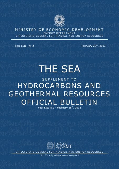
THE SEA<br />
S U P P L E M E N T T O<br />
HYDROCARBONS AND<br />
GEOTHERMAL RESOURCES<br />
OFFICIAL BULLETIN<br />
<strong>Year</strong> <strong>LVII</strong> N.2 - <strong>February</strong> 28 th , <strong>2013</strong><br />
D IRECT ORAT E - GEN ER AL FOR MINER AL AND EN ER GY RES OUR C ES<br />
http://unmig.sviluppoeconomico.gov.it
MINISTRY OF ECONOMIC DEVELOPMENT<br />
ENERGY DEPARTMENT<br />
DIRECTORATE-GENERAL FOR MINERAL AND ENERGY RESOURCES<br />
<strong>Year</strong> <strong>LVII</strong> - N. 2 <strong>February</strong> 28 th , <strong>2013</strong><br />
THE SEA<br />
SUPPLEMENT TO<br />
HYDROCARBONS AND<br />
GEOTHERMAL RESOURCES<br />
OFFICIAL BULLETIN<br />
<strong>Year</strong> <strong>LVII</strong> N.2 - <strong>February</strong> 28 th , <strong>2013</strong><br />
DIRECTORATE-GENERAL FOR MINERAL AND ENERGY RESOURCES<br />
http://unmig.sviluppoeconomico.gov.it
THE SEA - Supplement to Hydrocarbons and Geothermal Resources Official Bulletin - <strong>Year</strong> <strong>LVII</strong> N. 2 - <strong>February</strong> <strong>28th</strong>, <strong>2013</strong><br />
Responsible Direc tor: OMBRET TA COPPI<br />
Drafting: NICOLA SANT OCCHI – ANNA LIGATO – ANTONELLA ORLAND I – MARIA PIA PE LL EGRIN I<br />
Collaborators for this sp ecia l editio n : ILARIA ANTONCECCHI – ANDREE SOLEDAD BONET TI –<br />
LUCA DI DONATANTONI O – RAFFAELLA MASTRELLA – MARIA GIOVANNA MONTALBANO<br />
3
THE SEA - Supplement to Hydrocarbons and Geothermal Resources Official Bulletin - <strong>Year</strong> <strong>LVII</strong> N. 2 - <strong>February</strong> <strong>28th</strong>, <strong>2013</strong><br />
S U MMARY<br />
PREFACE .................................................................................................................. 6<br />
INTRODUCTION ........................................................................................................ 7<br />
THE SEA<br />
TERRITORIAL SEA AND CONTINENTAL SHELF<br />
Internal waters, baselines and Territorial sea ................................................................ 8<br />
Table of baselines and limit of territorial sea ................................................................. 9<br />
Continental shelf ..................................................................................................... 10<br />
Italian continental shelf ............................................................................................ 10<br />
Exclusive Economic Zone(ZEE) .................................................................................. 10<br />
Table of the Italian continental shelf .......................................................................... 11<br />
AGREEMENTS AND CONVENTIONS IN THE MEDITERRANEAN SEA<br />
CROATIA (former Yugoslavia) – Agreements ratified by Presidential Decree No. 830 of<br />
May 22, 1969, and Law No. 73 of March 14, 1977. ................................................. 12<br />
TUNISIA – Agreement ratified by Law No. 347 of June 3, 1978. ................................... 13<br />
GREECE – Agreement ratified by Law No. 290 of March23, 1980. .................................. 14<br />
ALBANIA – Agreement ratified by La, No. 147 of April 12, 1995. ................................... 15<br />
SPAIN – Agreement ratified by Law No. 348 of June 3, 1978. ...................................... 16<br />
FRANCE – Italy-France Convention of November 28,1986........................................... 17<br />
MODUS VIVENDI<br />
MALTA – Modus vivendi dal 29 aprile 1970. ................................................................ 18<br />
OFFSHORE MINING ACTIVITIES<br />
MARINE AREAS OPEN TO EXPLORATION AND EXPLOITATION OF OIL & GAS<br />
Tables of marine zones ............................................................................................ 19<br />
ZONE “A” – Northern and Central Adriatic Sea ............................................................ 20<br />
ZONE “B” – Central and Southern Adriatic Sea ............................................................ 21<br />
ZONE “C” – Southern Tyrrhenian and Ionian Seas, Sicily Channel.................................. 22<br />
ZONE ”D” – Adriatic and Ionian Seas. ........................................................................ 23<br />
ZONE “E” – Ligurian and Tyrrhenian Seas, Sea of Sardinia ........................................... 24<br />
ZONE F – Southern Adriatic and Ionian Seas. ............................................................. 25<br />
ZONA “G” – Tyrrhenian Sea and Sicily Channel. .......................................................... 26<br />
Criteria and standards relating to restrictions on mining activities ................................. 27<br />
HYDROCARBON EXPLORATION AND EXPLOITATION OFFSHORE ACTIVITIES<br />
OVERVIEW OF REGIONAL GEOLOGY<br />
Geological Evolution of the Italian Seas ...................................................................... 28<br />
Geological features .................................................................................................. 31<br />
The most important offshore deposits ........................................................................ 32<br />
The most significant stages of exploration in the italian seas ........................................ 34<br />
MINING LICENSES<br />
Exploration permits ................................................................................................. 35<br />
Exploitation concessions ........................................................................................... 37<br />
Map of active mining licenses at sea .......................................................................... 40<br />
DRILLING ACTIVITIES<br />
Historical Data ........................................................................................................ 41<br />
Drilling Activities at sea in the year 2012.................................................................... 43<br />
VIDEPI Project – Publication of the data related to the hydrocarbon exploration in Italy ... 44<br />
4
THE SEA - Supplement to Hydrocarbons and Geothermal Resources Official Bulletin - <strong>Year</strong> <strong>LVII</strong> N. 2 - <strong>February</strong> <strong>28th</strong>, <strong>2013</strong><br />
PRODUCTION ACTIVITIES<br />
Historical data......................................................................................................... 44<br />
Producing wells ....................................................................................................... 47<br />
Gathering and treatment centers ............................................................................... 49<br />
Offshore Platforms................................................................................................... 51<br />
NATIONAL ENERGY STRATEGY (SEN)<br />
The goals and priorities of action ............................................................................... 55<br />
SAFETY AND ENVIRONMENTAL PROTECTION IN OFFSHORE ACTIVITIES<br />
A global overview .................................................................................................... 57<br />
A continental overview ............................................................................................. 57<br />
A national overview ................................................................................................. 57<br />
“After Macondo”: Proposal For An Offshore Regulation, EUOAG And Adhesion To The<br />
Offshore Protocol ................................................................................................ 58<br />
LEGAL FRAMEWORK<br />
Introduction ........................................................................................................... 59<br />
Agreements with Riparian Countries .......................................................................... 59<br />
Main laws about marinE zones of offshore activities ..................................................... 59<br />
Main procedural laws about mining activities .............................................................. 60<br />
Main regulations on safety and environmental protection ............................................. 60<br />
LIST OF COMPANIES OPERATING IN THE ITALIAN OFFSHORE<br />
Companies with offshore exploration permit licenses ................................................... 63<br />
Companies with offshore exploitation concessions ....................................................... 64<br />
ITALIAN DIVING ENTERPRISES ASSOCIATION (A.I.S.I.)<br />
List of aisi members ................................................................................................ 66<br />
BIBLIOGRAPHY<br />
References ............................................................................................................. 67<br />
5
THE SEA - Supplement to Hydrocarbons and Geothermal Resources Official Bulletin - <strong>Year</strong> <strong>LVII</strong> N. 2 - <strong>February</strong> <strong>28th</strong>, <strong>2013</strong><br />
PREFACE<br />
Since the beginning of the 20 th Century, hydrocarbons became more and more important, firstly for<br />
industrialized countries’ economies and then for all economies worldwide. Thanks to hydrocarbons,<br />
Countries can manage their industries and produce other forms of energy, essential for society well<br />
being. This is the main reason for the deep modifications implemented during the last Century on the<br />
legal framework with reference to hydrocarbons exploitation. These transformations, finally adopted and<br />
formalized with the United Nations Convention on the Law of the Sea (UNCLOS - 1982), brought finally to<br />
the elimination of the dichotomy between definitions of high sea, based on a freedom regime, and of<br />
territorial sea, subjected to the coastal Countries sovereignty, and to the creation of “intermediate”<br />
marine zones characterized by a combination of high and territorial sea regimes. Among these<br />
“intermediate” marine zone, the most important for the hydrocarbons exploitation activities are the<br />
continental shelf and the Economical Exclusive Zone.<br />
Even if the regulatory regime for the exploitation of marine resources, hydrocarbons in particular,<br />
changes based on the zones where resources are located, it has to be noticed that beyond territorial<br />
waters, therefore within the continental shelf and the Economical Exclusive Zone, the sole coastal State<br />
have authority with reference to activities of exploration and production of mineral resources and<br />
hydrocarbons; other activities, instead, are still subjected to the ancient seas freedom regime.The unique<br />
resources which are not under the control of the coastal State are the mineral resources and<br />
hydrocarbons located in deep waters, which are subjected to a new equitable regime defined as<br />
“humanity common heritage”.<br />
At the same time, since hydrocarbons and marine mineral resources are spatially precisely located, it is<br />
very important the resolution of conflicts due to claims of different countries on the same sea or seabed<br />
portions located within territorial seas and economic exclusive zones. However, the regime of marine<br />
delimitation is not homogeneous: while for the territorial seas is applied the rule of median line, for the<br />
continental base and the Exclusive Economic Zone, instead, is applied the principle of "equitable<br />
solution". The contents of this principle has been made explicit by international jurisprudence, which<br />
focused on the idea that a certain proportion must exist between the length of relevant coasts and the<br />
extension of marine areas assigned to a coastal State and took into account several geographical<br />
features.<br />
The extent and the complexity of the international normative framework applicable to off shore<br />
hydrocarbon exploitation underline the importance of this publication “The sea, framework and mining<br />
activities. Supplement to hydrocarbons and geothermal resources official bulletin”, mainly due to its main<br />
purpose of spreading among specialists sector the national and International legal framework in a simple<br />
and synthetic manner, with the aim of facilitating an efficient economic management - for the States and<br />
for the Operators - of marine resources.<br />
Prof. Umberto Leanza<br />
6
•<br />
AOSTA<br />
•<br />
TORINO<br />
Fiume Po<br />
La g o<br />
d 'Orta<br />
La g o<br />
M a g g io re<br />
La g o d i<br />
Lu g a n o<br />
GENOVA<br />
•<br />
•<br />
MILANO<br />
CAGLIARI<br />
•<br />
Lago d i<br />
Co mo<br />
La g o d 'Iseo<br />
Iso la d i Go rg o n a<br />
Iso la d i Ca p ra ia<br />
ARCIPELAGO<br />
TOS CANO<br />
Iso la Pia n o sa<br />
Iso la d i M o n tecristo<br />
La g o d i<br />
Ga rd a<br />
•<br />
TRENTO<br />
Fiume Po<br />
Iso la d 'Elb a<br />
•<br />
FIRENZE<br />
Iso la d el Gig lio<br />
• BOLOGNA<br />
La g o d i<br />
Bo lsen a<br />
Va li d i<br />
Co ma ch io<br />
• VENEZIA<br />
Fiume Po<br />
La g o<br />
Tra simen o<br />
Lago d i<br />
Vico<br />
La g o d i<br />
Bra cia n o<br />
•<br />
PERUGIA<br />
•<br />
ROM A<br />
Isola di<br />
Levanzo<br />
Isola di<br />
Favignana<br />
•<br />
L'AQUILA<br />
•<br />
PALERMO<br />
ANCONA •<br />
TRIESTE •<br />
Iso la<br />
Iso la Zanone<br />
Palmarola<br />
Iso la d i Ponza<br />
NAPOLI<br />
IS OLE PONTINE<br />
•<br />
Iso la d i Ven toten e<br />
Iso la d i Pro cid a<br />
Iso la d 'Isch ia<br />
Iso la d i Ca p ri<br />
Isola Alicudi<br />
•<br />
CAMPOBASSO<br />
ISOLE EOLIE<br />
Isola FilicudiIsola Salina<br />
Isola Lipari<br />
Iso la S tro mb o li<br />
Iso la Pianosa<br />
IS OLE TREMITI<br />
La g o d i Lesin a<br />
La g o d i<br />
Va ra n o<br />
•<br />
POTENZA<br />
Fiume Brad an o<br />
CATANZARO<br />
•<br />
•<br />
BARI<br />
THE SEA - Supplement to Hydrocarbons and Geothermal Resources Official Bulletin - <strong>Year</strong> <strong>LVII</strong> N. 2 - <strong>February</strong> <strong>28th</strong>, <strong>2013</strong><br />
INTRODUCTION<br />
This publication, focused on off-shore hydrocarbons exploration and production, collects all information,<br />
data, criteria and legal frameworks regulating these activities as well as most recent developments and<br />
normative modifications.<br />
Italy, surrounded by about 7.500km of coasts facing the Mediterranean Sea, is naturally located in a<br />
privileged and strategic geographical position, and hydrocarbon found in the marine subsoil are a<br />
valuable resource to be exploited for further economic developments and to achieve a certain energy<br />
security for the Country. As well known, the quantity of hydrocarbons produced offshore in Italy,<br />
represents the 71% of the national gas production and the 8% of oil production, offsetting about the 4%<br />
of national energy consumption. For these reasons, mining activities are the fourth pillar of the National<br />
Energy Strategy, which is currently being adopted.<br />
Hydrocarbon reservoirs – Country non-disposable asset – are studied and developed, based on a sectorial<br />
legal framework, by enterprises with an adequate technical and economical capacity, within mining<br />
concessions located in the Italian Seas areas and available for mining activities. These areas of territorial<br />
waters and continental shelf are defined through Decrees of the Ministry of Economic Development,<br />
based on scientific and geologic knowledge demonstrating their mining importance for the Country and<br />
for sectorial operators.<br />
In order to define the boundaries of its own continental shelf, Italy has signed specific international<br />
agreements with the most part of frontage or neighboring Countries (Slovenia, Croatia, Albania,<br />
Montenegro, Greece, Libya, Malta, Tunisia, Spain, France). In order to complete the opening of marine<br />
areas within the Sicily Channel and into the southern Ionic Sea, only the agreements with Malta and<br />
Libya still remain to be signed. Within international relations activities, in case of reservoirs shared with<br />
frontage Countries, some particular types of collaborations are foreseen: for example with the Croatia is<br />
in force a specific technical agreement, while a technical study group has been recently created in order<br />
to examine the issue in depth with the Republic of Malta.<br />
At an international level, our Country has one of the most strict normative framework and has a<br />
consolidated sectorial experience with reference to safety standards and procedures and to environmental<br />
protection; currently Italy is strongly involved in the definition of the European Directive for the Safety of<br />
Off-shore activities. Moreover, considering its strategic position in the Mediterranean Sea, Italy is<br />
naturally candidate as a mediator for the relationships with extra European Countries adopting the<br />
Barcelona Convention – tool for the international cooperation at a regional level finalized at the<br />
Mediterranean Sea protection.<br />
Considering the strong interests generated by the hydrocarbon exploration and production sector in<br />
terms of economic and industrial development, national security and political issues, safety and<br />
environmental impacts, the “Bollettino del Mare” was developed in order to inform, in a complete but<br />
synthetic manner, all the stakeholders.<br />
A U S T R I A<br />
S L O V E N I A<br />
S V I Z Z E R A<br />
Fiume Piave<br />
C R O A Z I A<br />
Fiume Adig e<br />
ZONA A<br />
B O S N I A -<br />
E R Z E G O V I N A<br />
M O N T E N E G R O<br />
F R A N C I A<br />
M A R E A D R I A T I C O<br />
Fiume Arno<br />
Fiume Teve re<br />
ZONA B<br />
Fiume Teve re<br />
C O R S I C A<br />
ZONA D<br />
A L B A N I A<br />
ZONA E<br />
Fiume Voltur no<br />
Fiume Base nto<br />
M A R E<br />
ZONA F<br />
T I R R E N O<br />
Isola di Ustica<br />
Isola Vulcano<br />
Isola Panarea<br />
M A R E<br />
I O N I O<br />
ZONA E<br />
ZONA G<br />
Isola di Mare timo<br />
ISOLE EGADI<br />
ZONA C<br />
Isola di Pante leria<br />
C A N A L E D I S I C I L I A<br />
T U N I S I A<br />
A L G E R I A<br />
ZONA G<br />
Isola di Linosa<br />
ISOLE PELAGIE<br />
ISOLA<br />
DI<br />
MALTA<br />
ZONA C<br />
Isolo to Lampione<br />
Isola di Lampedusa<br />
ZONA C<br />
7
THE SEA - Supplement to Hydrocarbons and Geothermal Resources Official Bulletin - <strong>Year</strong> <strong>LVII</strong> N. 2 - <strong>February</strong> <strong>28th</strong>, <strong>2013</strong><br />
THE SEA<br />
TERRITORIAL SEA AND CONTINENTAL SHELF<br />
INTERNAL WATERS, BASELINES AND TERRITORIAL SEA<br />
The Law No. 689 of December 2, 1994, provides, in accordance with the principles of the United Nations<br />
Convention on the Law of the Sea of 1982, that the sovereignty of a coastal State extends, beyond its<br />
land territory and internal waters to an adjacent belt of sea described as the territorial sea. The<br />
sovereignty also extends to the air space over the territorial sea as well as to its seabed and subsoil.<br />
A Territorial sea, or territorial waters, is a belt of coastal waters extending at most 12 nautical miles from<br />
the baseline of a coastal state.<br />
The normal baselines overlaps with the coastline as marked on large-scale charts officially recognized by<br />
the coastal State, and, in this case, there are no internal waters.<br />
In localities where the coastline is deeply indented and sunken, or if there is a fringe of islands along the<br />
coast in its immediate vicinity, the method of straight baselines joining appropriate points (generally<br />
promontories) may be employed in drawing the baseline from which the breadth of the territorial sea is<br />
measured.<br />
In this case, the sea area lying within the coast line and the baseline is considered as internal waters.<br />
CANALE DI OTRANTO<br />
GOLFO DI<br />
TARANTO<br />
linee di base<br />
limite acque territoriali<br />
12 mm<br />
24 mm<br />
LIMITE PIATTAFORMA CONTINENTALE ITALIANA<br />
limite zona contigua<br />
MARE<br />
IONIO<br />
Delimitation of the Baselines and internal waters in Taranto Gulf<br />
Pursuant to the Presidential Decree No. 816 of April 26, 1973 , Italy has adopted the straight baseline<br />
system, providing a considerable simplification of the outer limit of the territorial sea and the islands. This<br />
method is based on 21 straight lines drawn along the coasts of the peninsula, and respectively 10 and 7<br />
ones around Sicily and Sardinia. The main provisions of the Decree define the areas bounded by lines<br />
i.e.:<br />
- the Tuscan Archipelago starting from the mouth of the Arno River, near Pisa, joining the islands<br />
of Gorgona, Capraia, Elba, Pianosa, Scoglio d’Africa, Montecristo, Giglio, and Giannutri, and back<br />
to the coast of Civitavecchia;<br />
8
THE SEA - Supplement to Hydrocarbons and Geothermal Resources Official Bulletin - <strong>Year</strong> <strong>LVII</strong> N. 2 - <strong>February</strong> <strong>28th</strong>, <strong>2013</strong><br />
- the Pontine Islands and the Gulf of Naples and Salerno drawing lines connecting Anzio, the<br />
islands of Palmarola, Ponza, Ischia and Capri, and the southern end of the Gulf of Salerno;<br />
- the Gulf of Squillace and, as a historic bay, the Gulf of Taranto;<br />
- the Gulf of Manfredonia and the Tremiti Islands connecting Peschici, the Tremiti islands, Termoli<br />
and Punta Penna located north-east of Vasto;<br />
- the Gulf of Venice from Punta della Maestra to Ponte di Piave.<br />
TABLE OF BASELINES AND LIMIT OF TERRITORIAL SEA<br />
(According to the Presidential Decree No. 816 the April 26, 1973)<br />
TRENTO<br />
•<br />
•<br />
AOSTA<br />
MILANO<br />
•<br />
•<br />
VENEZIA<br />
•<br />
TRIESTE<br />
•<br />
TORINO<br />
•<br />
GENOVA<br />
•<br />
BOLOGNA<br />
•<br />
FIRENZE<br />
•<br />
ANCONA<br />
MAR LIGURE<br />
•<br />
PERUGIA<br />
MARE ADRIATICO<br />
•<br />
L'AQUILA<br />
•<br />
ROMA<br />
•<br />
CAMPOBASSO<br />
MARE<br />
TIRRENO<br />
•<br />
BARI<br />
•<br />
NAPOLI<br />
•<br />
POTENZA<br />
MARE<br />
DI<br />
SARDEGNA<br />
CAGLIARI<br />
•<br />
•<br />
CATANZARO<br />
MARE<br />
IONIO<br />
•<br />
PALERMO<br />
CANALE DI SICILIA<br />
Delimitation of the Baselines and internal waters<br />
9
THE SEA - Supplement to Hydrocarbons and Geothermal Resources Official Bulletin - <strong>Year</strong> <strong>LVII</strong> N. 2 - <strong>February</strong> <strong>28th</strong>, <strong>2013</strong><br />
CONTINENTAL SHELF<br />
The continental shelf of a coastal State, according to the principles of the United Nations Convention on<br />
the Law of the Sea of 1982, comprises the seabed and subsoil of the submarine areas that extend beyond<br />
its territorial sea throughout the natural prolongation of its land territory to the outer edge of the<br />
continental margin, or to a distance of 200 nautical miles from the baselines. The outer limit of the<br />
continental shelf does not exceed a distance of 350 miles from the baselines.<br />
The coastal State exercises over the continental shelf sovereign rights for the purpose of exploring it and<br />
exploiting its natural resources, no one may undertake these activities without the express consent of the<br />
coastal State. Natural resources consists of the mineral and other non-living resources of the seabed and<br />
subsoil.<br />
The delimitation of the continental shelf between States with opposite or adjacent coasts is established by<br />
agreements based on international law.<br />
ITALIAN CONTINENTAL SHELF<br />
The principles adopted by Italy for the regulation of the exploration and exploitation of hydrocarbons<br />
from her continental shelf are established by the Law No. 613 of July 21, 1967. This law fixes the rules<br />
for the release of exploration permits establishing that, in accordance with the provisions of the Fourth<br />
Geneva Convention of 1958, limit of the Italian continental shelf is delimited by the 200-metres isobath,<br />
or beyond that limit, where the depth of the subjacent waters admit the exploitations of natural resources<br />
up to the median line between the opposite coasts of Italy and the neighboring State, unless<br />
delimitations lines are to be agreed with bilateral treaty in the future. The Law No. 689 of December<br />
2,1994, ratifies the execution of the United Nations Convention on the Law of the Sea concluded at<br />
Montego Bay on December 10, 1982.<br />
The definition of the continental shelf, as embodied in Art. 1 of Law No. 613/1967, is replaced by the<br />
provision in Art. 76 of the United Nations Convention on the Law of the Sea of December 10, 1982.<br />
EXCLUSIVE ECONOMIC ZONE(ZEE)<br />
Appears besides opportune to mention the juridical regime related to the Exclusive Economic Zone<br />
("ZEE") since, even though Italy has not ESTABLISHED an own ZEE, said normative will interest the<br />
juridical operators since numerous are the States in the Mediterranean, also adjoining or frontagers of<br />
Italy, that already has their own ZEE.<br />
The Exclusive Economic Zone (ZEE), includes the column of water towering above the bottom of the sea.<br />
It extends beyond the territorial sea over the 200 sea miles from the base lines.<br />
In the ZEE the coastal state enjoys of:<br />
- sovereign rights for the purposes of the exploration, of the exploitation, of the conservation and of the<br />
management of the natural resources, biological and or not biological, that are found in the waters above<br />
the seabed, on the seabed of the sea and in the relative subsoil, both to the goals of other connected<br />
activities with the exploration and of the economic exploitation of the zone, which production of energy<br />
derived by the water, by the sea tides and by the winds.<br />
The ZEE, to become effective, must formally be proclaimed towards the international community. This,<br />
unlike the continental shelf, that constituting a natural submerged prolongation of the land, it belongs<br />
instead ab initio to State and should not be proclaimed.<br />
The delimitation of the ZEE between States with opposite or adjacent coasts shall be effected by<br />
agreement on the basis of international law. (Article 74 - Law no. 689/94).<br />
There is no obligation to match the ZEE and continental shelf, although the normal case is the complete<br />
overlap between the two areas, within the limit of 200 miles from the baselines of the territorial sea, it is<br />
possible that the delimitation of the seabed that belongs to the continental shelf of a State differs from<br />
the above water column in which the state itself has ownership within the ZEE.<br />
In the Mediterranean the Countries that have founded their own ZEE are: Egypt, Cyprus, Lebanon, Syria,<br />
Tunisia and Israel.<br />
10
THE SEA - Supplement to Hydrocarbons and Geothermal Resources Official Bulletin - <strong>Year</strong> <strong>LVII</strong> N. 2 - <strong>February</strong> <strong>28th</strong>, <strong>2013</strong><br />
TABLE OF THE ITALIAN CONTINENTAL SHELF<br />
In accordance with the agreements between Italy and Croatia, Republic of Albania, Greece, France,<br />
Spain, Tunisia.<br />
CROATIA<br />
ALBANIA<br />
GREECE<br />
FRANCE<br />
SPAIN<br />
TUNISIA<br />
Boundary Lines of the Italian Continental shelf<br />
11
THE SEA - Supplement to Hydrocarbons and Geothermal Resources Official Bulletin - <strong>Year</strong> <strong>LVII</strong> N. 2 - <strong>February</strong> <strong>28th</strong>, <strong>2013</strong><br />
AGREEMENTS AND CONVENTIONS IN THE MEDITERRANEAN SEA<br />
CROATIA (FORMER YUGOSLAVIA) –<br />
Agreements ratified by Presidential Decree No. 830 of May 22, 1969, and Law No. 73 of March<br />
14, 1977.<br />
The Agreement between Italian Republic and the Socialist Federal Republic of Yugoslavia of January<br />
8,1968, (ratified by the Decree of the President of the Republic , No. 830 of May 22, 1969 and in force<br />
since 21 January 1970) conforms to the principle of the median line equidistant from the coasts of the<br />
two States, attributing a void or minimum effect, in tracing the delimitations in the case of the<br />
Yugoslavian small islands of Pelagosa, Pomo and S. Andrea. Also, exceptions were made in favour of<br />
Italy, as part of compensation for the two islands of Jabuka and Galiola.<br />
Afterwards, the Law No. 73 of March 14, 1977, ratifying the execution of the Agreement between the<br />
Italian Republic and the Socialist Federal Republic of Yugoslavia, has defined the dividing line between<br />
the Gulf of Venice and Slovenia.<br />
States emerging from the break-up of the Socialist Federal Republic of Yugoslavia have taken over the<br />
international agreements signed with Italy, in accordance with the principles of the General Succession of<br />
Bilateral Agreements. Within the frame of the 1968 Agreement Italy and Croatia signed:<br />
the Technical Agreement in 2005 adopting the use of WGS 84 allowing an accurate determination<br />
<br />
of the delimitation lines of the Italian and Croatian continental shelves which were reviewed.<br />
The Technical Agreement in 2009 guaranteeing the exploitation of the Annamaria Gas Field in the<br />
Adriatic Sea which lies on both sides of the delimitation line between the continental shelves of<br />
the two states.<br />
This settlement was substituted by a new Technical Agreement in 2012 between the Ministry of<br />
Economic Development of the Italian Republic (Directorate General for Energy and Mineral Resources)<br />
and the Ministry of Economy, Labour and Entrepreneurship of the Republic of Croatia (Directorate for<br />
Mining) on the Joint Exploitation of the Annamaria Gas Field in the Adriatic Sea.<br />
Italy – Croatia Boundary Lines<br />
12
THE SEA - Supplement to Hydrocarbons and Geothermal Resources Official Bulletin - <strong>Year</strong> <strong>LVII</strong> N. 2 - <strong>February</strong> <strong>28th</strong>, <strong>2013</strong><br />
TUNISIA –<br />
Agreement ratified by Law No. 347 of June 3, 1978.<br />
The Agreement for the delimitation of the continental shelf between the Italian Republic and the Republic<br />
of Tunisia of 28 August 1971, (ratified by Law of 3 June 1978, No. 347 and entered into force since 16<br />
December 1978), applies to the South Central Mediterranean Sea the method of drawing the median line<br />
equidistant between the opposite coasts of Tunisia and Sicily. It does not give relevance to the “special<br />
circumstances” of the islands of Pantelleria, Lampedusa, Linosa and the isle of Lampione. In this case the<br />
portion of the platform is delimited by arcs of respectively 13 and 12 mile range, which overlap the<br />
territorial waters of those islands with the exception of Pantelleria.<br />
Italy - Tunisia Boundary Lines<br />
13
THE SEA - Supplement to Hydrocarbons and Geothermal Resources Official Bulletin - <strong>Year</strong> <strong>LVII</strong> N. 2 - <strong>February</strong> <strong>28th</strong>, <strong>2013</strong><br />
GREECE –<br />
Agreement ratified by Law No. 290 of March23, 1980.<br />
The Agreement between the Italian Republic and the Hellenic Republic of May 24, 1977, (ratified by Law<br />
of 23 March 1980, No. 290 and in force since July 3, 1980), establishes the delimitation of the continental<br />
shelf taking into consideration Zante, Cefalonia, Leucade, Corfu and the Strofade Islands. The only<br />
exception is the Isle of Fano, whose effect is reduced.<br />
Italy – Greece Boundary Lines<br />
14
THE SEA - Supplement to Hydrocarbons and Geothermal Resources Official Bulletin - <strong>Year</strong> <strong>LVII</strong> N. 2 - <strong>February</strong> <strong>28th</strong>, <strong>2013</strong><br />
ALBANIA –<br />
Agreement ratified by La, No. 147 of April 12, 1995.<br />
The Agreement between the Italian Republic and the Republic of Albania was signed on 18 December of<br />
1995, (ratified by the Law No. 147 of April 12, 1995, and entered into force since <strong>February</strong> 26,<br />
1999).The delimitation of the continental shelf follows the criterion of equidistance from respective<br />
baselines, and it does not take into account the straight lines that join points of their coastal baselines.<br />
The agreement sets that:<br />
- the delimitation ends outside the triple points area of the boundary line of Greece and Federal<br />
Republic of Jugoslavia (delimitation to be agreed by future treaty with States concerned);<br />
- is done except for the legal regime of the waters and the air space above the continental shelf;<br />
- there are defined criteria (proportionality and compensation) for the exploitation of deposits<br />
that may exist straddling the boundary lines;<br />
- the contracting parties take all possible measures to ensure that the explorations and the<br />
exploitations of natural resources do not affect the ecological balance of the sea or<br />
unjustifiably interfere with other legitimate use of it.<br />
Italy- Albania Boundary Lines<br />
15
THE SEA - Supplement to Hydrocarbons and Geothermal Resources Official Bulletin - <strong>Year</strong> <strong>LVII</strong> N. 2 - <strong>February</strong> <strong>28th</strong>, <strong>2013</strong><br />
SPAIN –<br />
Agreement ratified by Law No. 348 of June 3, 1978.<br />
The Agreement between the Italian Republic and the Spanish State signed on <strong>February</strong> 19, 1974,<br />
(ratified by Law No. 348 of June 3, 1978, and entered into force since 16 November, 1978), delimit the<br />
continental shelf boundary between the islands of Sardinia and Minorca according to the criterion of<br />
equidistance. The line, drawn slightly concave, gives greater prominence to the coastline of Sardinia over<br />
the island of Minorca. Objections were raised by France as she claims rights on a portion of the area of<br />
the continental shelf shared by Italy and Spain.<br />
Italy– Spain Boundary Lines<br />
16
THE SEA - Supplement to Hydrocarbons and Geothermal Resources Official Bulletin - <strong>Year</strong> <strong>LVII</strong> N. 2 - <strong>February</strong> <strong>28th</strong>, <strong>2013</strong><br />
FRANCE –<br />
Italy-France Convention of November 28,1986.<br />
In 1986 the Governments of the Italian Republic and the French Republic signed a convention on the<br />
delimitation of the opposite territorial sea in the area of the Mouths of Bonifacio which deals only with a<br />
small portion of the maritime boundaries between the two Countries (France- Italy Convention of<br />
November 28, 1986).<br />
Italy– France Boundary Lines<br />
17
THE SEA - Supplement to Hydrocarbons and Geothermal Resources Official Bulletin - <strong>Year</strong> <strong>LVII</strong> N. 2 - <strong>February</strong> <strong>28th</strong>, <strong>2013</strong><br />
MODUS VIVENDI<br />
MALTA – MODUS VIVENDI DAL 29 APRILE 1970.<br />
An informal modus vivendi is in place between Italy and<br />
Malta, established by Exchange of notes of April 29,<br />
1970, agreeing the provisional and partial delimitation of<br />
seabed within the 200-metres applying the median line<br />
criterion between the northern coast of Malta and<br />
opposite coast of Sicily.<br />
The segment of the Modus vivendi ITALY –MALTA which<br />
does not provisionally overlap with the equidistance line,<br />
is slightly shifted to the north of the Italian coasts, is<br />
defined by the following geographical coordinates:<br />
T U N I S I A<br />
200<br />
200<br />
C A N A L E D I S I C I L I A<br />
1000<br />
1000<br />
1000<br />
200<br />
1000<br />
13°50'<br />
50<br />
I T A L I A<br />
ISOLA<br />
DI<br />
MALTA<br />
50<br />
200<br />
15°10'<br />
200<br />
410<br />
1000<br />
2000<br />
2000<br />
530<br />
2000<br />
1000<br />
330<br />
3000<br />
3620<br />
3000<br />
- vertex A Lat. N 36°27’ - Long. W 14°23’<br />
- vertex B Lat. N 36°02’ - Long. W 15°23’<br />
X<br />
200<br />
179<br />
550<br />
200<br />
Banco Medina<br />
146<br />
510<br />
354<br />
In the dispute between Malta and Libya for the<br />
delimitation of their respective continental shelves<br />
brought before the International Court of Justice, Italy<br />
applied for her interests in two geographical areas: the<br />
first one bounded on the west by the meridian 15 ° 10’ ,<br />
on the south by the parallel 34 ° 30’ , on the east by the<br />
line agreed between Italy and Greece, and the second<br />
one bounded by the polygon shown in the map on the<br />
west of the meridian 13 ° 50'.<br />
G<br />
34°20'<br />
200<br />
13°50'<br />
L I B I A<br />
200<br />
34°30'<br />
15°10'<br />
545<br />
292<br />
1000<br />
1000<br />
Limits of the judgment of the 3/06/85 of the C.I.G.<br />
By judgment of June 3, 1985 the Court, that didn’t recognized to Italy an interest worthy of protection,<br />
has decided that the Agreement between Malta and Libya was to be limited to the area between the<br />
meridians 13 ° 50 'and 15 ° 10', so as not to interfere with third-party interests, including Italy.<br />
During 2012, the General Director of mineral and energy resources, on behalf of the Minister of Economic<br />
Development and in agreement with the Minister for Foreign Affairs, has promoted the resumption of<br />
relations with the Maltese authorities on the issue related to the exploitation of the continental shelf. The<br />
Italian Government is ready to negotiate, within legal and technical frameworks, a preliminary agreement<br />
on the delimitation of the continental shelf and without prejudice to the sovereign rights of both States,<br />
according to the provision of Article 83 of UNCLOS.<br />
A<br />
B<br />
Italy - Malta Boundary Lines<br />
18
La g o<br />
M a g g io re<br />
La g o<br />
d 'Orta<br />
La g o d i<br />
Lu g a n o<br />
La g o d i<br />
Co mo<br />
La g o d 'Iseo<br />
Iso la d i Go rg o n a<br />
Iso la d i Ca p ra ia<br />
ARCIPELAGO<br />
TOS CANO<br />
Iso la Pia n o sa<br />
Iso la d i M o n tecristo<br />
La g o d i<br />
Ga rd a<br />
Iso la d 'Elb a<br />
Iso la d el Gig lio<br />
La g o d i<br />
Bo lsen a<br />
Va lli d i<br />
Co ma cch io<br />
La g o<br />
Tra simen o<br />
La g o d i<br />
Vico<br />
La g o d i<br />
Bra ccia n o<br />
A U S T R I A<br />
Iso la<br />
Iso la Za n o n e<br />
Pa lma ro la<br />
Iso la d i Po n za<br />
PALERM O<br />
IS OLE PONTINE<br />
Iso la d i Ven to ten e<br />
Iso la d 'Isch ia<br />
Iso la d i Pro cid a<br />
Iso la d i Ca p ri<br />
CAM POBASSO<br />
Iso la S tro mb o li<br />
Iso la Pia n o sa<br />
IS OLE TREM ITI<br />
La g o d i Lesin a<br />
La g o d i<br />
Va ra n o<br />
POTENZA<br />
BARI<br />
THE SEA - Supplement to Hydrocarbons and Geothermal Resources Official Bulletin - <strong>Year</strong> <strong>LVII</strong> N. 2 - <strong>February</strong> <strong>28th</strong>, <strong>2013</strong><br />
OFFSHORE MINING ACTIVITIES<br />
MARINE AREAS OPEN TO EXPLORATION AND EXPLOITATION OF OIL & GAS<br />
TABLES OF MARINE ZONES<br />
BOUNDARIES, TABLES, LAWS AND REGULATIONS<br />
Licenses of exploration and exploitation of hydrocarbons in the offshore are granted by the Ministry of<br />
Economic Development in the areas of the continental shelf governed by Italian laws and ministerial<br />
decrees. They are called "marine zones" and named with capital letters.<br />
The Law No. 613/67 has defined five marine zones (from A to E), while two additional sections F and G<br />
have been later opened by ministerial decrees. The total surface of all the areas opened to mining<br />
activities is about the 40% of the Italian continental shelf.<br />
S V I Z Z E R A<br />
S L O V E N I A<br />
•<br />
TRENTO<br />
•<br />
AOSTA<br />
TRIESTE •<br />
Fiume Piave<br />
•<br />
M ILANO<br />
•<br />
VENEZIA<br />
C R O A Z I A<br />
Fiume Po<br />
Fiume Adig e<br />
•<br />
TORINO<br />
Fiume Po<br />
Fiume Po<br />
•<br />
BOLOGNA<br />
ZONA A<br />
GENOVA<br />
•<br />
B O S N I A -<br />
E R Z E G O V I N A<br />
F R A N C I A<br />
Fiume Arno<br />
•<br />
FIRENZE<br />
ANCONA •<br />
M A R E A D R I A T I C O<br />
Fiume Teve re<br />
•<br />
PERUGIA<br />
ZONA B<br />
M O N T E N E G R O<br />
C O R S I C A<br />
Fiume Teve re<br />
•<br />
L'AQUILA<br />
•<br />
ROM A<br />
•<br />
ZONA D<br />
ZONA E<br />
Fiume Voltur no<br />
•<br />
NAPOLI<br />
•<br />
M A R E<br />
•<br />
Fiume Brad an o<br />
Fiume Base nto<br />
A L B A N I A<br />
T I R R E N O<br />
ZONA F<br />
CAGLIARI<br />
•<br />
ZONA E<br />
Isola di Ustica<br />
ISOLE EOLIE<br />
Isola FilicudiIsola SalinaIsola Panarea<br />
Isola Alicudi<br />
Isola Lipari<br />
CATANZARO<br />
•<br />
M A R E<br />
Isola Vulcano<br />
I O N I O<br />
ZONA G<br />
Isola di Marettimo Isola di<br />
Levanzo<br />
Isola di<br />
•<br />
Favignana<br />
ISOLE EGADI<br />
ZONA C<br />
Isola di Pantelleria<br />
C A N A L E D I S I C I L I A<br />
A L G E R I A<br />
T U N I S I A<br />
ZONA C<br />
ZONA G<br />
Isola di Linosa<br />
ISOLE PELAGIE<br />
Isolotto Lampione<br />
Isola di Lampedusa<br />
ISOLA<br />
DI<br />
MALTA<br />
ZONA C<br />
Marine Zones open to mining activities<br />
19
•<br />
•<br />
THE SEA - Supplement to Hydrocarbons and Geothermal Resources Official Bulletin - <strong>Year</strong> <strong>LVII</strong> N. 2 - <strong>February</strong> <strong>28th</strong>, <strong>2013</strong><br />
ZONE “A” – NORTHERN AND CENTRAL ADRIATIC SEA<br />
This zone is located in the Adriatic Sea and extends to the parallel 44°00; it is delimited on the west by<br />
the coastline of the regions of Friuli-Venezia Giulia, Veneto and Emilia Romagna ,and on the east by the<br />
boundary lines between Italy and Slovenia and between Italy and Croatia.<br />
The Law of 9 January 1991, n. 9 “Norme per l’attuazione del nuovo Piano energetico nazionale” –<br />
established the following areas closed entirely to oil and gas exploration and exploitation: Gulf of Venice –<br />
in the belt of the sea extending from the parallel lying on the mouth of Tagliamento River, and the<br />
parallel lying on the mouth of the Po River Goro channel.<br />
The A Zone covers approximately 13.300 sq. km. and represents about the 2% of the Italian continental<br />
shelf.<br />
Local office competent for mining activities: Territorial Office UNMIG in Bologna.<br />
TRIESTE<br />
S L O V E N I A<br />
Fiume Piave<br />
VENEZIA<br />
Fiume Adige<br />
Divieto Legge 9/1991<br />
C R O A Z I A<br />
Fiume Po<br />
Valli di<br />
Comacchio<br />
M A R E<br />
A D R I A T I C O<br />
BOLOGNA<br />
ZONA A<br />
References:<br />
Marine zone “A”<br />
- Legge 21 luglio 1967 n. 613<br />
Ricerca e coltivazione degli idrocarburi liquidi e gassosi nel mare territoriale e nella piattaforma<br />
continentale<br />
- Legge 9 gennaio 1991 n. 9<br />
Norme per l'attuazione del nuovo Piano energetico nazionale<br />
- Comunicato Ministeriale 30 settembre 2005<br />
Correzione tecnica della linea di delimitazione della piattaforma continentale comune italo-croata<br />
- Comunicato Ministeriale 31 maggio 2006<br />
Delimitazione delle zone marine "A", "B" e "F" in seguito alla correzione tecnica della linea di<br />
delimitazione della piattaforma continentale comune tra Italia e Croazia.<br />
- Decreto legge 25 giugno 2008 n. 112<br />
Disposizioni urgenti per lo sviluppo economico, la semplificazione, la competitività, la<br />
stabilizzazione della finanza pubblica e la perequazione tributaria.<br />
M A R E<br />
20
•<br />
•<br />
•<br />
THE SEA - Supplement to Hydrocarbons and Geothermal Resources Official Bulletin - <strong>Year</strong> <strong>LVII</strong> N. 2 - <strong>February</strong> <strong>28th</strong>, <strong>2013</strong><br />
ZONE “B” – CENTRAL AND SOUTHERN ADRIATIC SEA<br />
This zone is located in Central Adriatic Sea and extends from 44°00 to 42°00 parallel. It is delimited on<br />
the west by the coastline of the Regions Marche, Abbruzzo and Molise, and on the east by the boundary<br />
line between Italy and Croatia.<br />
The B Zone covers approximately 23.000 sq. km. and represents about the 2% of the Italian continental<br />
shelf.<br />
Local office competent for mining activities: Territorial Office UNMIG in Roma<br />
C R O A Z I A<br />
ANCONA<br />
Fiume Tevere<br />
M A R E<br />
A D R I A T I C O<br />
PERUGIA<br />
ZONA B<br />
Fiume Tevere<br />
L'AQUILA<br />
Isola Pianosa<br />
ISOLE TREMITI<br />
•<br />
ROMA<br />
Lago di Lesina<br />
Lago di<br />
Varano<br />
References:<br />
Marine zone “B”<br />
CAMPOBASSO<br />
- Legge 21 luglio 1967 n. 613<br />
Ricerca e coltivazione degli idrocarburi liquidi e gassosi nel mare territoriale e nella piattaforma<br />
continentale<br />
- Comunicato Ministeriale 30 settembre 2005<br />
Correzione tecnica della linea di delimitazione della piattaforma continentale comune italo-croata<br />
- Comunicato Ministeriale 31 maggio 2006<br />
Delimitazione delle zone marine "A", "B" e "F" in seguito alla correzione tecnica della linea di<br />
delimitazione della piattaforma continentale comune tra Italia e Croazia.<br />
21
•<br />
THE SEA - Supplement to Hydrocarbons and Geothermal Resources Official Bulletin - <strong>Year</strong> <strong>LVII</strong> N. 2 - <strong>February</strong> <strong>28th</strong>, <strong>2013</strong><br />
ZONE “C” – SOUTHERN TYRRHENIAN AND IONIAN SEAS, SICILY CHANNEL.<br />
It extends to the north into southern Tyrrhenian Sea, between the line of the Sicilian coast and the line of<br />
the 200 m isobath; to the west in the Sicily Channel between Sicilian coast line, the line of the 200 m<br />
isobath and a section of boundary ITALY-TUNISIA; to the south in the Sicily Channel between Sicilian<br />
coast line, the line of the 200 m isobath and the "modus vivendi" ITALY-MALTA; to the east in the<br />
southern Ionian Sea between Sicilian coast line and the line of the 200 m isobath.<br />
The Ministerial Decree of December 27, 2012 has extended this Zone to south east part of the Italian<br />
continental shelf of the Ionian Sea between the 15°10’ meridian (limitation laid down by the Judgment of<br />
June 3, 1985 of the International Court of Justice) and the arch of the parallels and meridians lying within<br />
the ITALY-GREECE boundary line.<br />
The Zone C also includes the seabed adjacent the Island of Lampedusa between the 200-m isobath and<br />
ITALY-TUNISIA delimitation line.<br />
The Law No. 9 of January 9, 1991 bans the offshore activities of exploration and exploitation of<br />
hydrocarbons in the waters around the Egadi Islands.<br />
The Zone C covers approximately 46.390 sq. km. and represents about the 8% of the Italian continental<br />
shelf.<br />
Isola Stromboli<br />
Local competent authority for mining activities: Territorial Office UNMIG in Napoli<br />
Isola Filicudi<br />
Isola Salina<br />
Isola Panarea<br />
Isola Alicudi<br />
Isola Lipari<br />
ISOLE EOLIE<br />
Isola Vulcano<br />
Isola di<br />
Isola di Marettimo<br />
Levanzo<br />
Isola di<br />
ISOLE EGADI<br />
Favignana<br />
PALERMO<br />
M A R E<br />
I O N I O<br />
ZONA C<br />
Isola di Pantelleria<br />
C A N A L E D I S I C I L I A<br />
Isola di Linosa<br />
ISOLE PELAGIE<br />
ISOLA<br />
DI<br />
MALTA<br />
Isolotto Lampione<br />
Isola di Lampedusa<br />
ZONA C<br />
ZONA C<br />
11°00' 12°00' 13°00' 14°00'<br />
15°00'<br />
16°00'<br />
17°00'<br />
Marine zone “C”<br />
References:<br />
- Legge 21 luglio 1967 n. 613<br />
Ricerca e coltivazione degli idrocarburi liquidi e gassosi nel mare territoriale e nella piattaforma<br />
continentale<br />
- Legge 9 gennaio 1991 n. 9<br />
Norme per l'attuazione del nuovo Piano energetico nazionale<br />
- Decreto Ministeriale 27 dicembre 2012<br />
Ampliamento della zona marina “C” aperta alla ricerca e alla coltivazione degli idrocarburi in<br />
mare.<br />
22
THE SEA - Supplement to Hydrocarbons and Geothermal Resources Official Bulletin - <strong>Year</strong> <strong>LVII</strong> N. 2 - <strong>February</strong> <strong>28th</strong>, <strong>2013</strong><br />
ZONE ”D” – ADRIATIC AND IONIAN SEAS.<br />
This zone is located in the Adriatic and Ionian Seas. It is delimited on the west by the coastline of the<br />
Regions Puglia, Basilicata and Calabria until the Strait of Messina, and on the east by the 200-m isobath.<br />
The D Zone covers approximately 18.470 sq. km. and represents about the 2% of the Italian continental<br />
shelf.<br />
Isola Pianosa<br />
Local office competent for mining activities: Territorial Office UNMIG in Napoli.<br />
ISOLE TREMITI<br />
M O N T E N E G R O<br />
Lago di Lesina<br />
Lago di<br />
Varano<br />
•<br />
CAMPOBASSO<br />
M A R E<br />
A D R I A T I C O<br />
•<br />
BARI<br />
ZONA D<br />
Fiume Bradano<br />
POTENZA<br />
•<br />
Isola di Capri<br />
Fiume Basento<br />
M A R E<br />
I O N I O<br />
CATANZARO<br />
•<br />
Isola Stromboli<br />
ISOLE EOLIE<br />
Isola Filicudi<br />
Isola Panarea<br />
Isola Salina<br />
Isola Alicudi<br />
Isola Lipari<br />
Isola Vulcano<br />
References:<br />
Marine zone “D”<br />
- Legge 21 luglio 1967 n. 613<br />
Ricerca e coltivazione degli idrocarburi liquidi e gassosi nel mare territoriale e nella piattaforma<br />
continentale<br />
23
La g o d i<br />
Ga rd a<br />
La g o d i<br />
Bo lsen a<br />
La g o<br />
Tra simen o<br />
La g o d i<br />
Vico<br />
La g o d i<br />
Bra ccia n o<br />
La g o d i Lesin a<br />
La g o d i<br />
Va ra n o<br />
THE SEA - Supplement to Hydrocarbons and Geothermal Resources Official Bulletin - <strong>Year</strong> <strong>LVII</strong> N. 2 - <strong>February</strong> <strong>28th</strong>, <strong>2013</strong><br />
ZONE “E” – LIGURIAN AND TYRRHENIAN SEAS, SEA OF SARDINIA<br />
This zone is located in the Ligurian and Tyrrhenian Seas and the Sea of Sardinia. It is delimited on the<br />
west by the coastline of the Regions Sardinia, Liguria, Toscana, Lazio, Campania, Basilicata, Calabria,<br />
until the Strait of Messina, and on the east by the 200-m isobath. On the North of the Sardinian coasts,<br />
in the marine area of Bocche di Bonifacio, it is delimited by the boundary line between Italy and France.<br />
The Law N° 9 of January 9,1991, “Norme per l’attuazione del nuovo Piano energetico nazionale” –<br />
established the following areas closed entirely to oil and gas exploration and exploitation: Gulfs of Naples<br />
and Salerno. The Zone E covers approximately 39.260 sq. km., and represents about the 7% of the<br />
Italian continental shelf. Local offices competent for mining activities: Territorial Office UNMIG in Bologna,<br />
Roma and Napoli.<br />
•<br />
•<br />
MILANO<br />
VENEZIA<br />
Fiume Po<br />
Fi ume A dige<br />
•<br />
TORINO<br />
Fiume Po<br />
Fi ume P o<br />
C R O A Z I A<br />
Valli di<br />
Comacchio<br />
GENOVA<br />
•<br />
•<br />
BOLOGNA<br />
F R A N C I A<br />
Fiume Arno<br />
•<br />
FIRENZE<br />
ANCONA<br />
•<br />
•<br />
PERUGIA<br />
C O R S I C A<br />
•<br />
L'AQUILA<br />
M A R E A D R I A T I C O<br />
Isola di Gorgona<br />
Fiume Teve re<br />
Isola di Capraia<br />
ARCIPELAGO<br />
TOSCANO<br />
Isola d'Elba<br />
Isola Pianosa<br />
Isola di Montecristo<br />
Isola del Giglio<br />
Fiume Teve re<br />
ISOLE TREMITI<br />
Isola Pianosa<br />
•<br />
ROMA<br />
•<br />
CAMPOBASSO<br />
ZONA E<br />
Fiume Voltur no<br />
BARI<br />
•<br />
Isola<br />
Isola Zanone<br />
Palmarola<br />
Isola di Ponza<br />
ISOLE PONTINE<br />
Isola di Ventotene<br />
NAPOLI<br />
•<br />
Isola di Procida<br />
M A R E<br />
Isola d'Ischia<br />
Isola di Capri<br />
•<br />
POTENZA<br />
Fiume Brad an o<br />
Fiume Base nto<br />
T I R R E N O<br />
CAGLIARI<br />
•<br />
CATANZARO<br />
•<br />
ZONA E<br />
Isola di Ustica<br />
Isola Stromboli<br />
Isola Filicudi<br />
Isola Salina<br />
Isola Panarea<br />
Isola Alicudi<br />
Isola Lipari<br />
ISOLE EOLIE<br />
Isola Vulcano<br />
Isola di Marettimo<br />
ISOLE EGADI<br />
Isola di<br />
Levanzo<br />
Isola di<br />
Favignana<br />
•<br />
PALERMO<br />
References:<br />
ZONA C<br />
Marine zone “E”<br />
- Legge 21 luglio 1967 n. 613<br />
Ricerca e coltivazione degli idrocarburi liquidi e gassosi nel mare territoriale e nella piattaforma<br />
continentale<br />
M A R E<br />
I O N I O<br />
24
THE SEA - Supplement to Hydrocarbons and Geothermal Resources Official Bulletin - <strong>Year</strong> <strong>LVII</strong> N. 2 - <strong>February</strong> <strong>28th</strong>, <strong>2013</strong><br />
ZONE F – SOUTHERN ADRIATIC AND IONIAN SEAS.<br />
This zone is located in the Adriatic Sea and in Ionian Sea up to the Strait of Messina. It is delimited on<br />
the west by the 200-m isobath, and on the east by the boundary line between Italy and Croatia, the<br />
Republic of Albania and France. On the south it is delimited by parallel and meridian arches.<br />
The F Zone was established by Ministerial Decree June 13, 1975. It was open before the formal<br />
agreements with Greece and the Republic of Albania, therefore it had been originally delimited by parallel<br />
and meridian arches inside the median line.<br />
covers approximately 39.260 sq. km., and represents about the 7% of the Italian continental shelf.<br />
Local offices competent for mining activities: Territorial Office UNMIG in Napoli.<br />
Isola Pianosa<br />
ISOLE TREMITI<br />
M O N T E N E G R O<br />
42°00'<br />
M A R E A D R I A T I C O<br />
Lago di<br />
Lago di Lesina<br />
Varano<br />
•<br />
CAMPOBASSO<br />
Fi ume V olturno<br />
•<br />
BARI<br />
41°00'<br />
NAPOLI<br />
•<br />
Fiume Bradano<br />
Isola di Procida<br />
Isola d'Ischia<br />
POTENZA<br />
•<br />
A L B A N I A<br />
Isola di Capri<br />
Divieto<br />
legge 9/1991<br />
Fiume Basento<br />
M A R E<br />
T I R R E N O<br />
ZONA F<br />
39°00'<br />
CATANZARO<br />
•<br />
Isola Stromboli<br />
ISOLE EOLIE<br />
Isola Panarea<br />
Isola Filicudi<br />
Isola Salina<br />
Isola Alicudi<br />
Isola Lipari<br />
Isola Vulcano<br />
M A R E<br />
I O N I O<br />
38°00'<br />
References:<br />
Marine zone “F”<br />
- Decreto Ministeriale 13 giugno 1975<br />
Delimitazione dell’area marina da nominare “zona F” ai fini della ricerca di idrocarburi liquidi e<br />
gassosi<br />
- Decreto Ministeriale 30 ottobre 2008<br />
Ampliamento e riperimetrazione di aree marine aperte alla ricerca e alla coltivazione di<br />
idrocarburi.<br />
25
•<br />
THE SEA - Supplement to Hydrocarbons and Geothermal Resources Official Bulletin - <strong>Year</strong> <strong>LVII</strong> N. 2 - <strong>February</strong> <strong>28th</strong>, <strong>2013</strong><br />
ZONA “G” – TYRRHENIAN SEA AND SICILY CHANNEL.<br />
CAGLIARI<br />
It is divided in two sector: the north sector, which extends into the southern Tyrrhenian Sea and the<br />
Sicily Channel, is delimited to the north by arcs of meridian and parallel, to the southwest by the<br />
boundary line ITALY- TUNISIA and to east by the isobath of 200 m.<br />
The southern sector, which extends into the Sicily Channel, has recently been expanded with DM<br />
29/03/2010 and is delimited to the north by the isobath of 200 m, to the west by the boundary line<br />
ITALY- TUNISIA and to the east by the meridian and parallel arcs inside the median line ITALY-MALTA.<br />
With the law 9 January 1991. 9 “Norme per l’attuazione del nuovo Piano energetico nazionale - has been<br />
prohibited prospection, exploration and production of hydrocarbons in the waters of the Egadi islands.<br />
The “G” area covers approximately 36,220 sq. km accounting for approximately 7% of the Italian<br />
continental shelf.<br />
Local offices competent for mining activities: Territorial Office UNMIG in Napoli.<br />
M A R E T I R R E N O<br />
CA<br />
Isola di Ustica<br />
Isola Stromboli<br />
ISOLE EOLIE<br />
Isola Filicudi<br />
Isola Panarea<br />
Isola Salina<br />
Isola Alicudi<br />
Isola Lipari<br />
Isola Vulcano<br />
ZONA G<br />
Isola di Marettimo<br />
Isola di Levanzo<br />
ISOLE EGADI<br />
Isola di Favignana<br />
PALERMO<br />
M A R<br />
I O N<br />
Isola di Pantelleria<br />
ZONA G<br />
T U N I S I A<br />
C A N A L E D I S I C I L I A<br />
Isola di Linosa<br />
ISOLE PELAGIE<br />
ISOLA<br />
DI<br />
MALTA<br />
Isolotto Lampione<br />
Isola di Lampedusa<br />
Marine zone “G”<br />
References:<br />
- Decreto Ministeriale 26 giugno 1981<br />
Delimitazione di due aree marine nella piattaforma continentale italiana denominate nel<br />
complesso “zona G” ai fini della ricerca e coltivazione di idrocarburi liquidi e gassosi.<br />
- Decreto Ministeriale 30 ottobre 2008<br />
Ampliamento e riperimetrazione di aree marine aperte alla ricerca e alla coltivazione di<br />
idrocarburi.<br />
- Decreto Ministeriale 29 marzo 2010<br />
Aree marine aperte alla ricerca e coltivazione di idrocarburi. Ampliamento della “Zona G”.<br />
26
7°00' 8°00' 9°00' 10°00'<br />
7°00'<br />
•<br />
AOSTA<br />
•<br />
TORINO<br />
GENOVA<br />
•<br />
•<br />
M ILANO<br />
CAGLIARI<br />
•<br />
8°00' 9°00' 10°00' 11°00'<br />
11°00' 12°00' 13°00'<br />
14°00'<br />
•<br />
TRENTO<br />
•<br />
FIRENZE<br />
•<br />
BOLOGNA<br />
•<br />
VENEZIA<br />
•<br />
PERUGIA<br />
•<br />
ROM A<br />
•<br />
L'AQUILA<br />
•<br />
PALERM O<br />
ANCONA<br />
•<br />
TRIESTE •<br />
12°00' 13°00' 14°00'<br />
NAPOLI<br />
•<br />
•<br />
CAM POBASSO<br />
15°00' 16°00' 17°00' 18°00'<br />
19°00'<br />
15°00'<br />
•<br />
POTENZA<br />
16°00'<br />
CATANZARO<br />
•<br />
•<br />
BARI<br />
17°00'<br />
18°00'<br />
19°00'<br />
46°00'<br />
45°00'<br />
44°00'<br />
43°00'<br />
42°00'<br />
41°00'<br />
39°00'<br />
38°00'<br />
37°00'<br />
36°00'<br />
35°00'<br />
THE SEA - Supplement to Hydrocarbons and Geothermal Resources Official Bulletin - <strong>Year</strong> <strong>LVII</strong> N. 2 - <strong>February</strong> <strong>28th</strong>, <strong>2013</strong><br />
CRITERIA AND STANDARDS RELATING TO RESTRICTIONS ON MINING ACTIVITIES<br />
Offshore mineral rights for research permits and exploitation concessions are granted by the Ministry of<br />
Economic Development, in consultation with the Ministry of the Environment, which issue a specific<br />
environmental assessment.<br />
Before the enforcement of specific rules establishing sites declared as off-limits to mineral resource<br />
activities, the Ministry of Environment imposed, by Ministerial Decree 28/07/1994, the prohibition on sea<br />
dumping of materials resulting from the prospection, exploration and production of oil and gas in<br />
sensitive areas, or "in the belt of three nautical miles from the coastline or from the limit of the protected<br />
areas as specified in paragraph 1; for the marine nature reserves that limit will be indicated in the decree<br />
designing the areas, or in other environmental laws;".<br />
As for the offshore activities of prospection, exploration and production of hydrocarbons, the Law N°<br />
9/1991, as provided in Article 4, prohibits such activities in the waters of the Gulf of Naples and Salerno,<br />
the Egadi Islands, and the Gulf of Venice, in the sea area between the parallel lying on the mouth of the<br />
River Tagliamento and the Po River Goro branch.<br />
Subsequently, the Law Decree N°112/2008, (art. 8, paragraph 1), ordered that the prohibition in the<br />
Gulf of Venice is applied until the Council of Ministers, in agreement with the Veneto Region and on a<br />
proposal of the Minister of Environment and Protection of Land and Sea, has verified that non<br />
appreciable risk of subsidence on the coast has occurred.<br />
A new delimitation of interdicted areas to mining<br />
activities was introduced by Legislative Decree N°<br />
128/2010, which has extended the prohibition<br />
for oil and gas research in offshore areas located<br />
within 12 nautical miles from the outer limit of<br />
the marine and coastal protected areas, as well<br />
for liquid hydrocarbons in the marine belt within<br />
5 miles from the baselines of the territorial<br />
waters along the entire length of coastline. This<br />
rule was subsequently modified by the Legislative<br />
Decree N° 121/2011, which provides that, for the<br />
historic bay of the Gulf of Taranto, the prohibition<br />
on liquid hydrocarbons research, is within five<br />
miles from the coastline.<br />
The Decree Law N° 83 of June 22, 2012, -<br />
"Urgent measures for the growth of the Country,"<br />
has further modified the Article 6, Section 17 of<br />
the Environmental Code, establishing the<br />
applicability of the prohibition to application after<br />
June 20, 2010 and laying down the mandatory<br />
environmental impact assessment and the<br />
involvement of local authorities administrating<br />
the territory within twelve miles. Finally, the<br />
activities referred in Article 1, paragraph 82-<br />
sexies of Law n° 239 of August 23, 2004, shall be<br />
authorized, in accordance with the environmental<br />
constraints by the local competent offices of the<br />
National Mining Office for Hydrocarbons and<br />
GeoResouces.<br />
F R A N C I A<br />
S V I Z Z E R A<br />
A L G E R I A<br />
C O R S I C A<br />
T U N I S I A<br />
M A R E<br />
T I R R E N O<br />
A U S T R I A<br />
S L O V E N I A<br />
ISOLA<br />
DI<br />
MALTA<br />
C R O A Z I A B O S N I A -<br />
M A R E A D R I A T I C O<br />
C A N A L E D I S I C I L I A<br />
E R Z E G O V I N A<br />
M A R E<br />
I O N I O<br />
M O N T E N E G R O<br />
A L B A N I A<br />
Map of the interdicted areas to mining activities<br />
27
THE SEA - Supplement to Hydrocarbons and Geothermal Resources Official Bulletin - <strong>Year</strong> <strong>LVII</strong> N. 2 - <strong>February</strong> <strong>28th</strong>, <strong>2013</strong><br />
HYDROCARBON EXPLORATION AND EXPLOITATION OFFSHORE ACTIVITIES<br />
GEOLOGICAL EVOLUTION OF THE ITALIAN SEAS<br />
OVERVIEW OF REGIONAL GEOLOGY<br />
The geologic evolution of the Italian territory and its seas has been particularly complex giving origin<br />
therefore to an articulated and heterogeneous structural setting, although little quiet from the tectonic<br />
point of view. This did not help the formation of large oil fields but has in fact generated only locally<br />
favorable conditions to the formation of some oil provinces of small and medium-size, compared to those<br />
of northern Europe and especially American ones.<br />
During the convergence process between plates, Africa is "inserted” in Europe through a wedge poorly<br />
deformed, named Adria. This wedge extends from the Ionian Sea to the western part of the Po Valley and<br />
is bordered by the Dinaric Alps, the southern Alps and the Apennines. The Adria is a fragment of the<br />
great African plate. The breaking zone is the Malta’s escarpment, a kind of submerged wall through which<br />
the seafloor is lowered to a depth of several hundred meters in the Sicily channel to a depth of about<br />
4,000 meters in the Ionian abyssal plain. By the collision between Europe and Adria and the deformation<br />
of its continental boundaries have originated Alps and Dinarides; other mountain ranges, the Apennines<br />
and the Calabrian arc, have been created along the southwestern edge of the Adriatic promontory during<br />
its collapsing (subduction). The Sicilian northern and inner mountains are originated by the deformation<br />
of the African plate; post-collisional basins, with oceanic lithosphere of new generation (western<br />
Mediterranean and Tyrrhenian sea), were opened near subduction zones of plates (collapse of the<br />
African-Adriatic plate under the Corsica-Sardinia block in the western Mediterranean area, collapse of the<br />
Adriatic plate under the Apennines and Calabrian arc in the Tyrrhenian sea); fragments of continental<br />
lithosphere (Corsica-Sardinia block, which was originally part of the European plate) are rotated and have<br />
been carried away from the original area.<br />
The geological phenomena led to the current<br />
configuration of the central Mediterranean and the<br />
time is measured in millions of years. The "recent<br />
geological history" tells us that around 30 million<br />
years ago began the rotation of the Corsica-Sardinia<br />
block and the opening of the western Mediterranean,<br />
around 8 million years ago began to open the<br />
Tyrrhenian basin behind the Apennines and the<br />
Calabrian arc that gradually advanced towards the<br />
current Po Valley and to the Adriatic and Ionian seas.<br />
Cinematic - structural sketch of the central<br />
mediterranean. Modified by: CNR - Project on<br />
Geodynamics (1990). Structural Model of Italy<br />
1:500.000 and Gravity Map. Quad. Ric. Scient., 3<br />
(114).<br />
28
THE SEA - Supplement to Hydrocarbons and Geothermal Resources Official Bulletin - <strong>Year</strong> <strong>LVII</strong> N. 2 - <strong>February</strong> <strong>28th</strong>, <strong>2013</strong><br />
The distribution of the Italian oil provinces is similar to its geological and structural setting, which<br />
certainly affects the amount of reserves. The proof is the comparison between the structural map of our<br />
country and the main oil fields both on land and at sea: in particular, about 40% of them are located in<br />
areas of chain (among them the famous ones of the southern Apennines and of the central Sicily) and<br />
60% instead in foredeep and foreland areas.<br />
CNR - Neotectonic sketch map of Italy (Mem. Soc. Geol. , 1996)<br />
From the tectonic – structural point of view, Italy can be divided into four main areas:<br />
1. a "back-arc basin" or a little deformed area represented by the Tyrrhenian sea, which tends to<br />
open up towards SE;<br />
2. a '" chain area " from the Apennines to the Alps which continues over Calabria and Sicily;<br />
3. a '"foredeep area" similar to a large basin particularly depressed and geologically little deformed<br />
that we can locate at the front of the chain and is represented by the Adriatic margin, by the<br />
Ionian area and the channel of Sicily;<br />
4. an area of "foreland" which can be defined as an area not yet deformed - in particular the Po<br />
Valley, the Adriatic sea, south of Sicily and eastern Europe and Sicily channel.<br />
29
THE SEA - Supplement to Hydrocarbons and Geothermal Resources Official Bulletin - <strong>Year</strong> <strong>LVII</strong> N. 2 - <strong>February</strong> <strong>28th</strong>, <strong>2013</strong><br />
As a rule, the oil fields of the northern Adriatic and of Po Valley are closed between the Alpine and<br />
Apennine fronts which advance towards one each other; the central - southern Adriatic basin is closed<br />
between the Apennines and Dinarides in the east, the Calabria offshore oil fields, south-east Sicily and<br />
the Sicily channel.<br />
The most important oil provinces of our country are: the Northern Adriatic and the Po Valley (oil and<br />
gas), the Abruzzi basin and the central Adriatic (oil and gas), the Southern Adriatic Sea (oil and gas), the<br />
southern Apennines (oil), Calabria offshore (gas), Iblean offshore and Sicily channel (oil and gas).<br />
The offshore natural gas italian fields contain mainly biogenic gas (due to bacterial activity occurred in<br />
shallow sediments and consists essentially of pure methane) associated with foredeep plio – quaternary<br />
clastic deposits; a less important part contains thermogenic gas (created in very deep sediments, high<br />
temperatures conditions and without bacterial activity) often associated with tertiary chain clastic<br />
deposits or mesozoic carbonates of chain and foreland.<br />
The oil offshore deposits are generally associated with foreland mesozoic carbonate and more rarely with<br />
chain mesozoic carbonate.<br />
Italian oil provinces<br />
Map of licenses for exploration, production and storage of hydrocarbons<br />
30
THE SEA - Supplement to Hydrocarbons and Geothermal Resources Official Bulletin - <strong>Year</strong> <strong>LVII</strong> N. 2 - <strong>February</strong> <strong>28th</strong>, <strong>2013</strong><br />
GEOLOGICAL FEATURES<br />
The Italian marine areas are characterized by a stratigraphic - structural setting highly variable. In<br />
particular, the geological map at a scale 1:250,000 highlights, through the mapping of one or more<br />
significant stratigraphic horizons, the geological general characteristics and the main structural -<br />
stratigraphic characters of our seas.<br />
Adriatic sea<br />
The Adriatic sea is an area of shallow water. Only in the southern area, in front of the coast of Puglia,<br />
reaches great depths (about 1,200 m).<br />
From the geological point of view the Adriatic sea looks very differentiated: the western part is the<br />
Apennines foreland, while the eastern side is the foreland of the Dinaric chain; between these two areas<br />
lies the foreland of the two chains, relatively undeformed. The Bouguer anomalies have a minimum near<br />
the Conero area, in continuity with the foredeep of the Po Valley, and another minimum in the Pescara<br />
area. Another region with negative gravimetric values is located at east, in the area adjacent to the<br />
Albanian coasts. Two maximum are still present in the Gargano and Istria areas.<br />
The western part of the north Adriatic area is occupied by the most recent foredeep, originated at the<br />
front of the Apennines, and migrated at a later time to the east. In this region, the base of the plioquaternary<br />
sequence is folded with a dip towards the Apennines. The relatively undeformed foreland of<br />
the chains surrounding the Adriatic area emerges in Istria and Puglia. These regions are characterized by<br />
modest thickness of the Plio - Quaternary sequence and by vertical tectonics.<br />
The available wells in the Adriatic sea allow us to reconstruct its stratigraphic evolution. Below the plioquaternary<br />
sequence has been highlighted the presence of sequences similar to those Umbria-Marche<br />
and those sudalpine. Their stratigraphy reflects the tectonic evolution of the Adriatic continental margin<br />
from its identification, related to permotriassic rifting and lower jurassic fragmentation, to its involvement<br />
in the Apennines structure. A particular event occurs in the Messinian, when a lowering of relative sea<br />
level and hyper-saline conditions, in the entire Mediterranean, produces subaerial erosion and deposition<br />
of evaporitic sediments resulting in an well identified seismic horizon. Evaporites and other sediments are<br />
deposited during this interval and they are almost uniformly present.<br />
Ionian Sea<br />
The Ionian sea is situated between the Calabrian arc and the Malta escarpment to the west, and the<br />
Apulian ridge to the east. It is a deep basin up to 4,000 m which represents the leavings of an old<br />
oceanic zone or continental crust very thin originated during extensional phases that led to the opening of<br />
the Tethys.<br />
The Ionian sea is currently involved in a process of consumption as a result of subduction phenomena still<br />
active in the central Mediterranean.<br />
The Bouguer anomalies are generally increasing from the margins to the central areas of the basin.<br />
A different region in gravimetric terms is the Taranto gulf, which is characterized by a gravimetric<br />
minimum having NW-SE direction in continuity with the bradanic foredeep.<br />
The Malta escarpment, which forms the western boundary of the basin, has approximately NS direction<br />
and length of about 300 km; its identification dates back to the Lias, during the opening of the Tethys, as<br />
extensional fault that caused the sinking of the ionic block.<br />
In the region of the Taranto gulf, where there are the three elements that characterize the Southern<br />
Apennines or rather the chain, the bradanico-ionic foredeep and foreland, there is also an extensional<br />
tectonics which occurs through faults oriented NW-SE and NE-SW , with a modest throw in the Apulian<br />
platform and a greater throw in the Calabria margin, which are evident in the formation of the graben of<br />
Sybaris.<br />
Sicily cannel<br />
The Sicily channel is a shallow water area situated on the northern edge of the African plate which<br />
represents the foreland of the Apennine-Maghrebian chain. In the central part there are few narrow<br />
depressions characterized by high depth. This area is characterized by a gravimetric maximum oriented<br />
NW-SE. The Bouguer anomalies also show a region, near the southern coast of Sicily, with negative<br />
values as the minimum centered on the foredeep of Caltanissetta.<br />
It shows different geological domains with different setting, including the Gela fold, whose front extends<br />
into the sea and represents the outermost structure belonging to the deformation system of Maghrebids-<br />
Sicily, the Gela foredeep, the plateau of Malta, where it is found a thickness of about 5,000 m of pre-<br />
Pliocene sediments hanging over crystalline rocks of the African basement, the Pantelleria and Linosa rift<br />
and the basins of the Egadi islands, which splits the African foreland and are composed of Plio-Pleistocene<br />
turbiditic sediments with thicknesses ranging from 1,000 at Pantelleria up to 2,500 m in the basins of the<br />
Egadi.<br />
31
THE SEA - Supplement to Hydrocarbons and Geothermal Resources Official Bulletin - <strong>Year</strong> <strong>LVII</strong> N. 2 - <strong>February</strong> <strong>28th</strong>, <strong>2013</strong><br />
Tyrrhenian Sea<br />
The Tyrrhenian is a deep sea; it’s a back-arc basin. It is divided into two areas, north and south, with<br />
different structural and geophysical features.<br />
Southern Tyrrhenian sea<br />
It’s a deep basin (3,620 m maximum depth). In the two basinal deep areas, Vavilov and Marsili<br />
basins, there are positive values of Bouguer anomalies. The evolution of the Tyrrhenian basin is<br />
contemporary with other important volcanic phenomena in addition to the formation of oceanic<br />
crust in the Vavilov and Marsili basins: there is in fact the formation of three volcanic arcs. The<br />
oldest in Sardinia, the most recent in the Aeolian Islands and in the adjacent sea volcanoes and<br />
an presumed intermediate arc in the central Tyrrhenian. There are also volcanoes, the most<br />
important of which are those that make up the submarine relief of Magnaghi of Vavilov and<br />
Marsili.<br />
Northern Tyrrhenian sea<br />
The northern Tyrrhenian sea reaches, to the south, the maximum depth of 2,200 m. The Bouguer<br />
anomaly is slightly positive and gradually increases towards the south. The ridge of Elba, in NS<br />
direction, divides this area into two sectors: the Tuscan margin and the Corsica basin.<br />
Ligurian sea and sea of Sardinia<br />
They are the most eastern part of western Mediterranean and include areas that reach a depth of about<br />
3,000 m. The Bouguer anomalies are strongly positive in the central areas of the basin and decrease<br />
rapidly towards the boundary areas.<br />
THE MOST IMPORTANT OFFSHORE DEPOSITS<br />
The seismic profiles, the gravity anomalies, subsidence and tectonic episodes and the exploration wells<br />
data have been used to study in detail and describe the stratigraphy and evolution of the Italian seas.<br />
The flexural history is of great meaning with respect to the hydrocarbons generation and accumulation:<br />
about 75% of the Italian biogenic gas is related to Pliocene foredeep series, most of the thermogenic gas<br />
is probably issued from Miocene flysch series, and in many oil accumulations the source rock series<br />
entered the maturity window during the flexural subsidence.<br />
With particular regard to the Italian petroleum exploration plays, also in relation to their flexural history<br />
and sedimentary evolution, we can describe the most interesting at sea.<br />
In the outern margin of Calabria is recognized a terrigenous basin, which extends both to the land and<br />
off-shore all along the Ionian coast of Calabria. In particular the LUNA fields, and its satellites, the largest<br />
gas pools outside the Po Valley and the Northern Adriatic, have different producing pools, the most<br />
important of which is by far the thermogenic dry gas ones. Issued from an unknown tertiary source the<br />
gas migrated and then trapped at the top of a thrust fold, sealed by either marls or clays.<br />
In the Sicily channel some oil fields such NILDE , are located along the tectonically inverted innermost<br />
part of the foredeep and the oil is trapped in bioclastic, karstified, limestones of Miocene age. The source<br />
rock is uncertain, possibly Mesozoic.<br />
In the central Adriatic some middle-sized fields (SARAGO MARE, EMILIO, S. GIORGIO MARE, DAVID)<br />
produce oil and gas from upper Cretaceous-Paleocene resedimented, fractured bioclastic limestones<br />
levels, which are intercalated in a dominant pelagic mudstones series. These beds are interpreted to<br />
come from a nearby carbonatic shelf margin that have been subsequently eroded.<br />
In the lower Pliocene began one of the most important orogenic phase which involved in particular<br />
northern and central Apennines generating a new and large foredeep and originated a new set of some<br />
structural and physiographic basins. The most important of these is by far the one that includes such<br />
fields AGOSTINO, PORTO GARIBALDI AND SQUALO CENTRALE. These fields contain biogenic gas<br />
accumulated in some levels of turbiditic sands deformed and folded.<br />
During the Pleistocene an important regional relative sea level fall occurred and were deposited large<br />
amounts of sand and clay in the Quaternary basins. In the northern Adriatic, in the sandy levels, several<br />
biogenic gas pools were found, in anticlines traps; some of these are BARBARA, ADA and BONACCIA.<br />
32
THE SEA - Supplement to Hydrocarbons and Geothermal Resources Official Bulletin - <strong>Year</strong> <strong>LVII</strong> N. 2 - <strong>February</strong> <strong>28th</strong>, <strong>2013</strong><br />
P O RT O<br />
C O RSI N I M .<br />
A N T A RE S P O RT O C O RSI N I M A RE<br />
A .C 2 7 .E A<br />
N A I DE<br />
A .C 3 0 .E A<br />
A .C 4 .A SA .C 2 1 .A G<br />
A RI A N N A<br />
C E RV I A<br />
C E RV I A<br />
A .C 2 8 .E A FA SC I A<br />
M A RE<br />
C E RV I A M A . N E M O N E<br />
A .C 6 .A S<br />
M O RE N A<br />
A .C 5 .A V<br />
A N T O N E LLA<br />
A .C 1 8 .A G<br />
A N N A BE LLA<br />
A .C 3 2 .A G<br />
A N N A M A RI A<br />
A .C 1 1 .A G<br />
RU BI C O N E<br />
A .C 2 4 .E A<br />
A .C 8 .M E<br />
A ZA LE A<br />
A .C 1 7 .A G<br />
GI U LI A<br />
RE GI N A<br />
A N N A LI SA<br />
BA SI L<br />
A .C 1 2 .A G<br />
BRE N DA<br />
DA RI A<br />
BA RBA RA<br />
BA RBA RA T 2<br />
A .C 1 3 .A S<br />
M A R E A D R I A T I C O<br />
A .C 7 .A S<br />
B.C 1 8 .RI<br />
C LA RA<br />
B.C 2 2 .A G<br />
C A LP U RN I A<br />
C LA RA O V E ST<br />
FA N O<br />
B.C 1 4 .A S<br />
C A LI P SO<br />
B.C 1 3 .A S<br />
C LA RA E ST<br />
B.C 2 0 .A S<br />
FA LC O N A RA<br />
•<br />
ANCONA<br />
B.C 1 7 .T O<br />
BO N A C C I A<br />
B.C 1 1 .A S<br />
SA RA GO M A RE<br />
B.C 1 2 .A S<br />
•<br />
PERUGIA<br />
M A RI A A M A RE<br />
Active production facilities in the North Adriatic Sea<br />
P E N N I N A<br />
However, there are some important petroleum systems which, in relation to their formation and<br />
GRO T T A M M A RE<br />
B.C 3 .A S<br />
evolution, are not so affected from phenomena related to strong deformation.<br />
Among them are certainly mentioned VEGA, PREZIOSO and PERLA fields in which<br />
C Athe M I LLA<br />
Inici formation,<br />
consisting essentially of limestone gray-whitish often heavily dolomitized (equivalent to the Syracuse<br />
E LE O N O RA<br />
B.C 1 0 .A S<br />
formation in the iblea area), produces heavy oil and is rich in sulfur and are expected that the rock is<br />
composed of limestones and shales of the Streppenosa formation.<br />
In the northern part of the Apulian platform is localized the large filed of Rospo Mare. In this area the<br />
Apulian platform is constituted by an alternation of dolomite and anhydrite from the late Triassic, thick<br />
Jurassic dolomitic series of inner shelf environment, bioclastic clays and shales of the lower Cretaceous.<br />
Seismic sections and wells data show that this sequence changes facies laterally towards mudstone series<br />
well stratified and typical of deeper water platform and euxinic environment; during the Cretaceous is<br />
certainly occurred an event of emersion of the shelf that was then eroded while the sedimentation<br />
continued in submerged areas. A large topographic high zone was so occupied by heavy immature oil,<br />
rich in sulfur, with a cap rock provided by both the Messinian anhydrites and the Pliocene marls. It is in<br />
general assumed that the source is the oil prone Upper Triassic Burano Formation or Emma limestones.<br />
In the deep AQUILA oil field the stratigraphic sequence is made up mainly of a thick sequence of sands,<br />
clays and marls of pelagic environment aged between Pleistocene and Oligocene, by alternating shales,<br />
mudstones and marls aged between Paleocene and upper Cretaceous, deep water mudstones of Jurassic<br />
age and Lower Jurassic shelf margin packstones grainstones and dolomites. The oil column impregnates a<br />
thickness of approximately 130 meters in fractured pelagic limestones series. The structure is an<br />
anticline, partly flowed during the faulting of the shelf margin.<br />
B.C 7 .LF<br />
SA N GI O RGI O<br />
M A RE C E N T RA LE<br />
V O N GO LA M A RE<br />
JO LE<br />
B.C 2 .LF<br />
B.C 4.AS<br />
SA N GI O RGI O M A RE<br />
FA BRI ZI A<br />
DA V I D<br />
B.C 2 1 .A G<br />
B.C 1 5 .A V<br />
E LE N A<br />
E M I LI O<br />
33
THE SEA - Supplement to Hydrocarbons and Geothermal Resources Official Bulletin - <strong>Year</strong> <strong>LVII</strong> N. 2 - <strong>February</strong> <strong>28th</strong>, <strong>2013</strong><br />
THE MOST SIGNIFICANT STAGES OF EXPLORATION IN THE ITALIAN SEAS<br />
Despite the complexity of geological settings, Italy has begun to take an interest in offshore hydrocarbon<br />
exploration since the 1950, when the research carried out by Agip, expanding to the south of the Po<br />
Valley, came to Ravenna and in 1953, still on land, however, it obtained his first great success with the<br />
discovery of the gas field of the same name.<br />
However, there were already all the conditions so that the rich gas fields discovered in the Po Valley could<br />
continue in Adriatic offshore; in those years were developing technologies for exploration, drilling and<br />
development in offshore.<br />
The reasonable assurance that the Adriatic sea was a rich gas province pushed Agip to make the first<br />
marine seismic survey in Italy in the mid-fifties. At the same time it was made another seismic survey in<br />
Gela offshore area to study and verify the extension in the sea of the oil field discovered on land in 1957.<br />
In 1959 was drilled the well Gela 21, oil bearing, which is recognized as the first offshore well drilled in<br />
western Europe. Followed, immediately after, the Ravenna 1 well in the Adriatic sea.<br />
More and important gas discoveries were made in the Ravenna offshore, in particular Ravenna Mare<br />
south, Cervia Mare, Porto Garibaldi, Porto Corsini and, in the central Adriatic, the S. Stefano Mare field.<br />
In the Calabria offshore, between the late 60’s and early 70’s was discovered the Luna gas field, in the<br />
waters of Crotone.<br />
Also in the central Adriatic in the mid-70’s there was the discovery the Rospo Mare field and in 1982 was<br />
drilled the horizontal well Rospo Mare 6dir.<br />
In the early 90’s was drilled by Agip the first well in waters deeper than 800 meters discovering the<br />
Aquila oil field, offshore the coast of Puglia.<br />
In the marine area C between 1970 and 1980 were discovered the deposits of Nilde, Mila, Perla and<br />
Vega.<br />
In the early months of 2000 took place the discoveries of Panda, Argo and Cassiopea reservoirs.<br />
At present, also due to the opening and extension of some marine areas, are studied very deep water<br />
over 1,000 meters in both the Ionian sea and in the Sicily channel.<br />
34
THE SEA - Supplement to Hydrocarbons and Geothermal Resources Official Bulletin - <strong>Year</strong> <strong>LVII</strong> N. 2 - <strong>February</strong> <strong>28th</strong>, <strong>2013</strong><br />
MINING LICENSES<br />
Over the last years it has been consolidating the trend started in the second half of the 90’s of the<br />
decrising of the number of mining licenses and the total area they occupy. While in the early 90’s were<br />
active over 80 offshore exploration permits on December 31 st 2012 there are 25 exploration permits<br />
active for a total occupied area of 7.252 km 2 .<br />
The number of exploitation concession, instead, remained costant; on December 31 st 2012 there are 67<br />
concessions active for a total occupied area of 8.949 km 2 .<br />
It should be noted that the area of mining licenses is defined according to criteria established by the<br />
current law and regulation and generally it has an extention of few squared kilometers. It constitutes the<br />
esclusive area in which it can operate only the authorized operator and it results much larger than the<br />
effective area occupied by the plants that commonly need just a few acres.<br />
The areas related to mining licenses are therefore not affected by the activities of exploration and<br />
production except small portions, subjected to specific authorizations, in which the plants are made. In<br />
order to make clear the impact of activities compared to the overall area of the licenses, maps of mining<br />
licenses and plants have been developed and published on the website in the section "Cartography"<br />
where, with regional details, there are reported respectively, the licenses held by the permit holders and<br />
dealers and the location of plants in the area.<br />
EXPLORATION PERMITS<br />
YEARS 2001-2012<br />
Number Km 2 Zone A Zone B Zone C Zone D Zone E Zone F Zone G Total<br />
2001 45 19.719 16 11 3 2 0 11 2 45<br />
2002 40 18.818 14 6 3 2 0 11 4 40<br />
2003 34 15.996 13 5 2 0 0 10 4 34<br />
2004 27 11.502 11 4 4 0 1 3 4 27<br />
2005 30 11.726 11 6 3 0 1 2 7 30<br />
2006 29 11.343 10 6 3 0 1 2 7 29<br />
2007 32 14.654 10 5 3 0 1 3 10 32<br />
2008 27 12.825 7 4 3 0 1 3 9 27<br />
2009 24 11.006 7 3 3 0 0 2 9 24<br />
2010 24 11.006 7 3 3 0 0 2 9 24<br />
2011 25 11.689 7 3 3 0 1 2 9 25<br />
2012 25 7.252 8 5 4 2 1 2 3 25<br />
Number of exploration permits divided in year and marine zones<br />
35
THE SEA - Supplement to Hydrocarbons and Geothermal Resources Official Bulletin - <strong>Year</strong> <strong>LVII</strong> N. 2 - <strong>February</strong> <strong>28th</strong>, <strong>2013</strong><br />
50<br />
25.000<br />
45<br />
40<br />
20.000<br />
35<br />
30<br />
25<br />
20<br />
15<br />
10<br />
5<br />
15.000<br />
10.000<br />
5.000<br />
Number<br />
km2<br />
0<br />
2001 2002 2003 2004 2005 2006 2007 2008 2009 2010 2011 2012<br />
0<br />
Number and extension of exploration permits at sea in the last years 2001-2012<br />
50<br />
45<br />
40<br />
35<br />
30<br />
25<br />
20<br />
15<br />
10<br />
Zone G<br />
Zone F<br />
Zone E<br />
Zone D<br />
Zone C<br />
Zone B<br />
Zone A<br />
5<br />
0<br />
2001 2002 2003 2004 2005 2006 2007 2008 2009 2010 2011 2012<br />
Number of exploration permits at sea in the last years 2001-2012 divided in marine zones<br />
36
THE SEA - Supplement to Hydrocarbons and Geothermal Resources Official Bulletin - <strong>Year</strong> <strong>LVII</strong> N. 2 - <strong>February</strong> <strong>28th</strong>, <strong>2013</strong><br />
EXPLOITATION CONCESSIONS<br />
YEARS 2001-2012<br />
Number Km 2 Zone A Zone B Zone C Zone D Zone F Total<br />
2001 69 9.638 36 21 5 5 2 69<br />
2002 69 9.665 36 21 5 5 2 69<br />
2003 69 9.672 36 21 5 5 2 69<br />
2004 69 9.604 36 21 5 5 2 69<br />
2005 66 9.283 36 20 4 4 2 66<br />
2006 67 9.430 37 20 4 3 3 67<br />
2007 66 9.373 37 19 4 3 3 66<br />
2008 66 9.373 37 19 4 3 3 66<br />
2009 65 8.864 37 19 3 3 3 65<br />
2010 65 8.864 37 19 3 3 3 65<br />
2011 66 8.940 38 19 3 3 3 66<br />
2012 67 8.940 38 19 3 4 3 67<br />
Number of exploitation concessions divided in year and marine zone<br />
37
THE SEA - Supplement to Hydrocarbons and Geothermal Resources Official Bulletin - <strong>Year</strong> <strong>LVII</strong> N. 2 - <strong>February</strong> <strong>28th</strong>, <strong>2013</strong><br />
70<br />
9.800<br />
69<br />
9.600<br />
68<br />
9.400<br />
67<br />
66<br />
9.200<br />
9.000<br />
Number<br />
km2<br />
65<br />
8.800<br />
64<br />
8.600<br />
63<br />
2001 2002 2003 2004 2005 2006 2007 2008 2009 2010 2011 2012<br />
8.400<br />
Number and extension of exploitation concession at sea in the last years<br />
80<br />
70<br />
60<br />
50<br />
40<br />
30<br />
Zona F<br />
Zona D<br />
Zona C<br />
Zona B<br />
Zona A<br />
20<br />
10<br />
0<br />
2001 2002 2003 2004 2005 2006 2007 2008 2009 2010 2011 2012<br />
Number of exploitation concessions at sea in the last years 2001-2012 divided in marine zones<br />
38
THE SEA - Supplement to Hydrocarbons and Geothermal Resources Official Bulletin - <strong>Year</strong> <strong>LVII</strong> N. 2 - <strong>February</strong> <strong>28th</strong>, <strong>2013</strong><br />
Into the north Adriatic sea there is an area in which the activities of prospecting, of exploration and of<br />
production of hydrocarbons are prohibited. This area is subject to the establishment of the non-existence<br />
of appreciable risk of subsidence on the coast in accordance with Legislative Decree 25 June 2008, n.<br />
112. The mineral licenses already granted and active at the time of entry into force of Decree Law<br />
112/2008 are currently suspended.<br />
The prohibition of hydrocarbons prospecting, exploration and production will remain applied until the<br />
Council of Ministers, with the agreement of the Veneto region, on the proposal of the Minister of<br />
Environment and Protection of Land and Sea, would definitively find the non-existence of appreciable risk<br />
of subsidence on the coast.<br />
Prohibited area to the mining activities in the North Adriatic Sea<br />
39
THE SEA - Supplement to Hydrocarbons and Geothermal Resources Official Bulletin - <strong>Year</strong> <strong>LVII</strong> N. 2 - <strong>February</strong> <strong>28th</strong>, <strong>2013</strong><br />
MAP OF ACTIVE MINING LICENSES AT SEA<br />
Data as December 31 st , 2012<br />
A U S T R I A<br />
S V I Z Z E R A<br />
S L O V E N I A<br />
•<br />
TRENTO<br />
•<br />
AOSTA<br />
TRIESTE •<br />
C R O A Z I A B O S N I A -<br />
•<br />
M ILANO<br />
• VENEZIA<br />
•<br />
TORINO<br />
GENOVA<br />
•<br />
•<br />
BOLOGNA<br />
F R A N C I A<br />
Iso la d i Go rg o n a<br />
•<br />
FIRENZE<br />
ANCONA<br />
•<br />
E R Z E G O V I N A<br />
Iso la d i Ca p ra ia<br />
•<br />
PERUGIA<br />
Iso la d 'Elb a<br />
M O N T E N E G R O<br />
Iso la d i Pia n o sa<br />
ARCIPELAGO<br />
TOS CANO<br />
M A R E A D R I A T I C O<br />
Iso la d el Gig lio<br />
•<br />
L'AQUILA<br />
C O R S I C A<br />
Iso la d i M o n tecristo<br />
Iso la d i Pia n o sa<br />
IS OLE TREM ITI<br />
Iso la d i Ca p ra ra<br />
Iso la d i S a n Do min o<br />
•<br />
ROM A<br />
•<br />
CAM POBASSO<br />
Iso la d ell'Asin a ra<br />
Iso la d i BuIso d elli la d ella M a d d a len a<br />
Iso la d i Ca p rera<br />
•<br />
BARI<br />
Iso la d i Ta vo la ra<br />
Iso la d i M o la ra<br />
Iso la Iso la Za n o n e<br />
Pa lma ro la<br />
Iso la d i Po n za IS OLE PONTINE<br />
NAPOLI<br />
•<br />
Iso la d i Ven to ten e<br />
Iso la d i Pro cid a<br />
Iso la d 'Isch ia<br />
•<br />
POTENZA<br />
Iso la d i Ca p ri<br />
GOLFO<br />
DI<br />
TARANTO<br />
M A R E<br />
T I R R E N O<br />
GOLFO DI<br />
POLICASTRO<br />
Iso la d i<br />
S . Pietro<br />
Iso la d i<br />
S . An tio co<br />
CAGLIARI<br />
•<br />
Iso la d i S erp en ta ra<br />
CATANZARO<br />
•<br />
Iso la d i Ustica<br />
Iso la d i S tro mb o li<br />
IS OLE EOLIE<br />
Iso la d i Pa n a rea<br />
Iso la d i FilicuIso d ila d i S a lin a<br />
GOLFO DI<br />
SQUILLACE<br />
Iso la d i Alicu d i<br />
Iso la d i Lip a ri<br />
Iso la d i Vu lca n o<br />
IS OLE EGADI<br />
Iso la d i Leva n zo<br />
•<br />
PALERM O<br />
C A N A L E D I S I C I L I A<br />
Iso la d i M a rettimo<br />
Iso la d i<br />
Fa vig n a n a<br />
M A R E<br />
I O N I O<br />
Iso la d i Pa n telleria<br />
A L G E R I A<br />
T U N I S I A<br />
IS OLE<br />
PELAGIE<br />
Iso la d i Lin o sa<br />
ISOLA<br />
DI<br />
MALTA<br />
La mp io n eIso la d i La mp ed u sa<br />
40
THE SEA - Supplement to Hydrocarbons and Geothermal Resources Official Bulletin - <strong>Year</strong> <strong>LVII</strong> N. 2 - <strong>February</strong> <strong>28th</strong>, <strong>2013</strong><br />
DRILLING ACTIVITIES<br />
HISTORICAL DATA<br />
The exploration of new reservoir in the sea has had its greatest period of expansion in the early 90's with<br />
an average of approximately 80 new wells drilled per year of which a large part of was exploratory. From<br />
the second half of the 90’s the number of new drilling at sea has been gradually declined, and in the last<br />
decade there has been a progressive decrease in the research of new deposits.<br />
The activities of the operators is almost exclusively oriented to the optimization and development of<br />
known fields rather than the research of new resources. In particular, from 2008 to 2012, were carried<br />
out on average 15-20 new wells per year, none of which was exploratory. From the point of view of the<br />
findings the last decade was not encouraging with only 11 exploration of successful gas wells and the<br />
only "Ombrina Mare 2 dir" successful oil well.<br />
<strong>Year</strong> Number of well drilled Meters drilled<br />
Exploration Development TOTAL Exploration Development TOTAL<br />
1991 26 54 80 52.094 187.105 239.199<br />
1992 15 73 88 39.718 222.934 262.652<br />
1993 6 21 27 10.123 37.414 47.537<br />
1994 10 46 56 23.467 128.733 152.200<br />
1995 8 10 18 14.793 26.375 41.168<br />
1996 10 27 37 27.550 87.911 115.461<br />
1997 11 10 21 30.266 29.285 59.551<br />
1998 9 17 26 18.794 41.448 60.242<br />
1999 6 12 18 12.374 28.086 40.460<br />
2000 6 19 25 19.065 27.058 46.123<br />
2001 2 15 17 2.325 39.086 41.411<br />
2002 5 7 12 11.200 19.699 30.899<br />
2003 5 21 26 8.658 28.380 37.038<br />
2004 0 22 22 0 41.189 41.189<br />
2005 0 24 24 0 49.399 49.399<br />
2006 3 17 20 9.139 29.714 38.853<br />
2007 1 15 16 3.517 33.027 36.544<br />
2008 3 7 10 6.673 14.330 21.003<br />
2009 0 20 20 0 37.770 37.770<br />
2010 0 17 17 0 23.568 23.568<br />
2011 0 22 22 0 31.621 31.621<br />
2012 0 15 15 0 24.561 24.561<br />
41
THE SEA - Supplement to Hydrocarbons and Geothermal Resources Official Bulletin - <strong>Year</strong> <strong>LVII</strong> N. 2 - <strong>February</strong> <strong>28th</strong>, <strong>2013</strong><br />
100<br />
90<br />
80<br />
70<br />
60<br />
50<br />
40<br />
Development<br />
Exploration<br />
30<br />
20<br />
10<br />
0<br />
1991<br />
1992<br />
1993<br />
1994<br />
1995<br />
1996<br />
1997<br />
1998<br />
1999<br />
2000<br />
2001<br />
2002<br />
2003<br />
2004<br />
2005<br />
2006<br />
2007<br />
2008<br />
2009<br />
2010<br />
2011<br />
2012<br />
Number of wells drilled at sea in the years 1991-2012<br />
300.000<br />
250.000<br />
200.000<br />
150.000<br />
Development<br />
Exploration<br />
100.000<br />
50.000<br />
0<br />
1991<br />
1992<br />
1993<br />
1994<br />
1995<br />
1996<br />
1997<br />
1998<br />
1999<br />
2000<br />
2001<br />
2002<br />
2003<br />
2004<br />
2005<br />
2006<br />
2007<br />
2008<br />
2009<br />
2010<br />
2011<br />
2012<br />
Meters drilled at sea in the years 1991-2012<br />
42
THE SEA - Supplement to Hydrocarbons and Geothermal Resources Official Bulletin - <strong>Year</strong> <strong>LVII</strong> N. 2 - <strong>February</strong> <strong>28th</strong>, <strong>2013</strong><br />
NEW RESOURCES AT SEA IN THE YEARS 2002-2012<br />
<strong>Year</strong> Zone A Zone B Zone G<br />
2002 CALIPSO 003 DIR A<br />
CALIPSO 004 DIR A<br />
DIDONE 002<br />
PANDA 001<br />
2003 ANNAMARIA 002<br />
ARMIDA 001 DIR A<br />
PANDA OVEST 001<br />
2006 BENEDETTA 001 DIR ARGO 001<br />
2008 OMBRINA MARE 002 DIR CASSIOPEA 001 DIR<br />
ARGO 002<br />
DRILLING ACTIVITIES AT SEA IN THE YEAR 2012<br />
During the year 2012 the drilling activities at sea has concerned 15 positions, for a total of 24,561 meters<br />
drilled. Of these four drilling activities are related to development activities and the remaining 11 are<br />
work over of existing wells. During the year it has not been made any new exploratory well.<br />
WELLS DRILLED DURING THE YEAR 2012<br />
Well name aim Meters drilled in<br />
the year<br />
1. ANTONELLA 006 DIR B Development 3.313<br />
2. BARBARA E 044 DIR B Workover 761<br />
3. BARBARA E 053 DIR A Workover 1.401<br />
4. BARBARA E 055 DIR B Workover 1.405<br />
5. BARBARA E 048 DIR B Workover 1.048<br />
6. BARBARA E 051 DIR A Workover 1.270<br />
7. BASIL 006 DIR C Workover 1.205<br />
8. BASIL 009 DIR A Workover 828<br />
9. BRENDA 002 DIR A Workover 1.949<br />
10. BRENDA 006 DIR A Workover 1.387<br />
11. BRENDA 003 DIR A Workover 1.910<br />
12. BRENDA 004 DIR A (*) Workover 893<br />
13. NAOMI 002 DIR A Development 1.862<br />
14. PANDORA 002 DIR Development 2.131<br />
15. PORTO CORSINI MARE OVEST C 026 DIR B Development 3.198<br />
(*) Not already completed at the date of 31/12/2012<br />
Three wells drilled in the year 2011 have been completed during the year 2012<br />
Well name completion aim Result<br />
1. CLARA NORD 007 DIR A 18/01/2012 Workover Gas<br />
2. DARIA 005 DIR A 15/01/2012 Workover Gas<br />
3. LUNA 041 DIR A 08/01/2012 Workover Gas<br />
43
THE SEA - Supplement to Hydrocarbons and Geothermal Resources Official Bulletin - <strong>Year</strong> <strong>LVII</strong> N. 2 - <strong>February</strong> <strong>28th</strong>, <strong>2013</strong><br />
VIDEPI PROJECT –<br />
PUBLICATION OF THE DATA RELATED TO THE HYDROCARBON EXPLORATION IN ITALY<br />
The ViDEPI project aims to make easily accessible<br />
exploration in Italy.<br />
technical documents relating to the hydrocarbon<br />
This documentation is concerning ceased mining licenses, and therefore public, filed since 1957 at the<br />
UNMIG (National Mineral Office for Hydrocarbon and Geothermal Resources) of the Ministry of Economic<br />
Development.<br />
The current legislation establishes that Companies operating in individual mining license must provide to<br />
UNMIG progressive technical reports on its activity in the same licenses including copies of example<br />
documents such as geological maps, structural maps, profiles end of wells, seismic lines, etc..<br />
The same law provides that the documents submitted become public available after one year<br />
termination of the license for which they were produced.<br />
from<br />
In more than half a century has come to be an<br />
important basis of data relating to Italian underground.<br />
Before the implementation of the ViDEPI project, the<br />
entire documentation was available only printed and<br />
difficult to use because classified only according to the<br />
criteria of the mining license in which they had been<br />
acquired and deposited in the UNMIG Offices.<br />
The project, proposed and directed by the Italian<br />
Geological Society, was made possible due to the<br />
Ministry of Economic Development, which provided the<br />
basis of data and by Assomineraria (Association of oil<br />
companies operating in Italy), which has funded it. All<br />
paper documentation retrieved and processed, has been<br />
entrusted to the Library of scientific technological area<br />
of Roma Tre University (BAST), according to the<br />
agreements reached with the Ministry of Economic<br />
Development, where it is available to consultation.<br />
All dataset have been digitalized and published on the website at link: http://www.videpi.com<br />
PRODUCTION ACTIVITIES<br />
HISTORICAL DATA<br />
The National gas production in the year 2012 was of 8.540 Million of Scm of which 6.074 were<br />
produced from offshore reservoir (71%). The oil offshore production is less and in the 2012, compared<br />
with a national production of 5,37 millions of tons, only 0,47 million of tons (9%) were produced at sea.<br />
44
THE SEA - Supplement to Hydrocarbons and Geothermal Resources Official Bulletin - <strong>Year</strong> <strong>LVII</strong> N. 2 - <strong>February</strong> <strong>28th</strong>, <strong>2013</strong><br />
NATURAL GAS PRODUCTION DIVIDED IN ZONES<br />
(Million of Scm) - YEARS 1992-2012<br />
Zone A Zone B Zone Zone Zone Total<br />
C D F<br />
1992 9.899 1.502 15 1.937 103 13.457<br />
1993 10.030 2.479 15 2.069 70 14.663<br />
1994 11.265 2.210 11 2.520 61 16.067<br />
1995 11.720 1.831 11 2.494 48 16.104<br />
1996 11.663 2.056 8 2.396 20 16.144<br />
1997 11.716 1.602 6 2.227 0 15.552<br />
1998 11.965 1.422 6 2.072 72 15.538<br />
1999 10.651 1.641 6 1.905 89 14.292<br />
2000 9.541 1.755 6 1.735 68 13.104<br />
2001 8.434 2.479 4 1.639 55 12.611<br />
2002 7.916 2.513 5 1.587 369 12.390<br />
2003 7.372 2.286 4 1.621 37 11.320<br />
2004 6.878 2.079 5 1.545 32 10.539<br />
2005 6.358 1.738 4 1.428 15 9.543<br />
2006 5.907 1.324 5 1.252 7 8.494<br />
2007 5.163 1.083 4 1.016 0 7.267<br />
2008 4.700 1.234 4 877 0 6.815<br />
2009 3.939 1.084 4 892 0 5.919<br />
2010 4.230 979 5 896 0 6.110<br />
2011 4.055 1.089 5 849 0 5.997<br />
2012 4.086 1.153 4 830 0 6.074<br />
18.000<br />
16.000<br />
14.000<br />
12.000<br />
10.000<br />
8.000<br />
6.000<br />
ZF<br />
ZD<br />
ZC<br />
ZB<br />
ZA<br />
4.000<br />
2.000<br />
0<br />
Gas offshore production divided in zones (millions of tons) – <strong>Year</strong>s 1992-2012<br />
45
THE SEA - Supplement to Hydrocarbons and Geothermal Resources Official Bulletin - <strong>Year</strong> <strong>LVII</strong> N. 2 - <strong>February</strong> <strong>28th</strong>, <strong>2013</strong><br />
OIL PRODUCTION DIVIDED IN ZONES<br />
millions of tons - YEARS 1992-2012<br />
Zone B Zone C Zone F Total<br />
1992 1.026 817 0 1.843<br />
1993 842 670 0 1.511<br />
1994 645 618 0 1.262<br />
1995 557 564 0 1.121<br />
1996 508 529 0 1.037<br />
1997 601 468 0 1.069<br />
1998 554 428 537 1.520<br />
1999 490 402 700 1.592<br />
2000 430 386 542 1.358<br />
2001 396 198 436 1.031<br />
2002 391 341 339 1.071<br />
2003 381 332 288 1.002<br />
2004 367 329 256 952<br />
2005 342 307 119 768<br />
2006 332 309 59 700<br />
2007 467 297 0 764<br />
2008 377 157 0 534<br />
2009 354 172 0 526<br />
2010 321 374 0 695<br />
2011 310 331 0 640<br />
2012 182 287 2 471<br />
2.000<br />
1.800<br />
1.600<br />
1.400<br />
1.200<br />
1.000<br />
800<br />
Zone F<br />
Zone C<br />
Zone B<br />
600<br />
400<br />
200<br />
0<br />
Oil offshore production divided in zones (millions of tons) – <strong>Year</strong>s 1992-2012<br />
46
THE SEA - Supplement to Hydrocarbons and Geothermal Resources Official Bulletin - <strong>Year</strong> <strong>LVII</strong> N. 2 - <strong>February</strong> <strong>28th</strong>, <strong>2013</strong><br />
HYDROCARBON PRODUCTION AND CONSUMPTION RATIO (toe)<br />
Consumption<br />
[toe]<br />
National<br />
Production<br />
[toe]<br />
% of production on<br />
National consumption<br />
Production from<br />
offshore fields<br />
[toe]<br />
% of offshore production on<br />
national<br />
consumption<br />
GAS 63,81 7,00 11,0% 4,98 7,8%<br />
Oil 69,16 5,37 7,8% 0,47 0,7%<br />
Total 132,97 12,37 9,3% 5,45 4,1%<br />
In the absence of 2012 data it is shown the consumption of hydrocarbon of the year 2011<br />
1,000 cubic meters of gas = 0.82 toe (tons of equivalent oil)<br />
PRODUCING WELLS<br />
In the Italian offshore on December 31 st 2012 there were 722 operating wells of which 396 in production<br />
(335 gas producing and 61 oil producing), 312 potentially productive but not delivering, and 14 used for<br />
monitoring and other purposes. The 335 gas producing wells are located in Area A (252) in Area B (55)<br />
and in Area D (28). The production of crude oil is limited to the area B (31 wells) and to the area C (30).<br />
OPERATING WELLS IN THE ITALIAN OFFSHORE ON DECEMBER 31, 2012<br />
Zone A Zone B Zone C Zone D Zone F Zone G Total<br />
Producing 252 86 30 28 0 0 396<br />
Potentially productive 227 63 14 1 3 4 312<br />
Other use 13 1 0 0 0 0 14<br />
Total 492 150 44 29 3 4 722<br />
30<br />
28<br />
86<br />
Zone A<br />
Zone B<br />
Zone C<br />
Zone D<br />
252<br />
Number of offshore producing wells on December 31, 2012 divided in marine zones<br />
47
THE SEA - Supplement to Hydrocarbons and Geothermal Resources Official Bulletin - <strong>Year</strong> <strong>LVII</strong> N. 2 - <strong>February</strong> <strong>28th</strong>, <strong>2013</strong><br />
OFFSHORE PRODUCING WELLS DIVIDED IN MINERAL PRODUCTION AND IN MARINE ZONES<br />
Zone A Zone B Zone C Zone D Total<br />
Natural gas 252 55 0 28 335<br />
Crude Oil 0 31 30 0 61<br />
Total 252 86 30 28 396<br />
300<br />
250<br />
252<br />
200<br />
150<br />
Natural gas<br />
Crude oil<br />
100<br />
50<br />
55<br />
31 30<br />
28<br />
0<br />
Zone A Zone B Zone C Zone D<br />
Producing wells divided in mineral production and marine zones<br />
48
THE SEA - Supplement to Hydrocarbons and Geothermal Resources Official Bulletin - <strong>Year</strong> <strong>LVII</strong> N. 2 - <strong>February</strong> <strong>28th</strong>, <strong>2013</strong><br />
GATHERING AND TREATMENT CENTERS<br />
The production of natural gas from offshore hydrocarbon reservoirs is directed by pipeline to the 10<br />
centers of gathering and treatment as reported in the following schedule.<br />
Center Name Provincia Operator Linked platform Zone n.<br />
linked<br />
wells<br />
1 CASALBORSETT<br />
I<br />
Ravenna Eni 1. AGOSTINO A<br />
2. AGOSTINO A CLUSTER<br />
3. AGOSTINO B<br />
4. AGOSTINO C<br />
5. GARIBALDI A<br />
6. GARIBALDI A CLUSTER<br />
7. GARIBALDI B<br />
8. GARIBALDI C<br />
9. GARIBALDI D<br />
10. NAOMI PANDORA<br />
11. PORTO CORSINI M W A<br />
12. PORTO CORSINI M W B<br />
13. PORTO CORSINI M W C<br />
n.<br />
producing<br />
wells<br />
Zone A 147 63<br />
2 RAVENNA MARE Ravenna Eni 1. AMELIA A<br />
2. AMELIA B<br />
3. AMELIA C<br />
4. AMELIA D<br />
5. ANGELA ANGELINA<br />
6. ANGELA CLUSTER<br />
7. ANTARES<br />
8. ANTARES 1<br />
9. ARMIDA<br />
10. ARMIDA 1<br />
11. DIANA<br />
12. GUENDALINA<br />
13. PORTO CORSINI 80<br />
14. PORTO CORSINI 80 BIS<br />
15. PORTO CORSINI M E C<br />
16. PORTO CORSINI M S 1<br />
17. PORTO CORSINI M S 2<br />
18. TEA<br />
Zone A 130 42<br />
3 RUBICONE Forlì-<br />
Cesena<br />
Eni<br />
1. ANEMONE B<br />
2. ANEMONE CLUSTER<br />
3. ANTONELLA<br />
4. ARIANNA A<br />
5. ARIANNA A CLUSTER<br />
6. AZALEA A CLUSTER<br />
7. AZALEA B<br />
8. CERVIA A<br />
9. CERVIA A CLUSTER<br />
10. CERVIA B<br />
11. CERVIA C<br />
12. MORENA 1<br />
13. NAIDE<br />
Zone A 74 40<br />
4 FANO Pesaro e<br />
Urbino<br />
Eni<br />
1. ANNABELLA<br />
2. ANNALISA<br />
3. ANNAMARIA B<br />
4. BASIL<br />
5. BRENDA<br />
6. DARIA A<br />
7. REGINA<br />
8. REGINA 1<br />
Zone A 53 42<br />
49
THE SEA - Supplement to Hydrocarbons and Geothermal Resources Official Bulletin - <strong>Year</strong> <strong>LVII</strong> N. 2 - <strong>February</strong> <strong>28th</strong>, <strong>2013</strong><br />
Center Name Provincia Operator Linked platform Zone n.<br />
linked<br />
wells<br />
5 FALCONARA Ancona Eni 1. BARBARA A<br />
2. BARBARA B<br />
3. BARBARA C<br />
4. BARBARA D<br />
5. BARBARA E<br />
6. BARBARA F<br />
7. BARBARA G<br />
8. BARBARA H<br />
9. BARBARA NW<br />
10. BONACCIA<br />
11. CALIPSO<br />
12. CALPURNIA<br />
13. CLARA EST<br />
14. CLARA NORD<br />
15. CLARA OVEST<br />
Zone A<br />
Zone B<br />
n.<br />
producing<br />
wells<br />
142 101<br />
6 SAN GIORGIO<br />
MARE<br />
Fermo Edison 1. SAN GIORGIO MARE 3<br />
2. SAN GIORGIO MARE 6<br />
3. VONGOLA MARE 1<br />
Zone B 11 8<br />
7 GROTTAMMARE Ascoli<br />
Piceno<br />
Adriatica<br />
Idrocarburi<br />
1. DAVID<br />
2. DAVID 7<br />
3. ELENA 1<br />
4. EMILIO 3<br />
5. FABRIZIA 1<br />
6. JOLE 1<br />
7. PENNINA<br />
Zone B 16 5<br />
8 PINETO Teramo Adriatica<br />
Idrocarburi<br />
1. CAMILLA 2<br />
2. ELEONORA<br />
3. EMILIO<br />
4. EMMA<br />
5. FRATELLO CLUSTER<br />
6. FRATELLO EST 2<br />
7. FRATELLO NORD<br />
8. GIOVANNA<br />
9. SIMONETTA 1<br />
10. SQUALO<br />
11. VIVIANA 1<br />
Zone B 51 22<br />
9 SANTO<br />
STEFANO MARE<br />
Chieti Edison 1. SANTO STEFANO MARE<br />
101<br />
2. SANTO STEFANO MARE 1-<br />
9<br />
3. SANTO STEFANO MARE 3-<br />
7<br />
4. SANTO STEFANO MARE 4<br />
5. SANTO STEFANO MARE 8<br />
10 CROTONE Crotone Ionica Gas 1. HERA LACINIA 14<br />
2. HERA LACINIA BEAF<br />
3. LUNA 27<br />
4. LUNA 40 SAF<br />
5. LUNA A<br />
6. LUNA B<br />
Zone B 7 1<br />
Zone D<br />
Zone F<br />
30 28<br />
50
THE SEA - Supplement to Hydrocarbons and Geothermal Resources Official Bulletin - <strong>Year</strong> <strong>LVII</strong> N. 2 - <strong>February</strong> <strong>28th</strong>, <strong>2013</strong><br />
The crude oil production from offshore hydrocarbon reservoirs is partly directed by pipeline to 3 centers<br />
of gathering and treatment as reported in the following schedule.<br />
Center Name Provincia Operator Linked platform Zone n.<br />
linked<br />
wells<br />
1 MARIA A MARE Fermo Edison 1. SARAGO MARE<br />
1<br />
2. SARAGO MARE<br />
A<br />
2 OIL GATHERING<br />
CENTER PERLA E<br />
PREZIOSO<br />
3 THE THIRD OIL<br />
CENTER GELA<br />
Caltanissett<br />
a<br />
Caltanissett<br />
a<br />
Eni mediterranea<br />
idrocarburi<br />
Eni mediterranea<br />
idrocarburi<br />
1. PERLA<br />
2. PREZIOSO<br />
n.<br />
producing<br />
wells<br />
Zone B 10 4<br />
Zone C 13 10<br />
1. GELA Zone C 25 16<br />
The remaining production of oil at sea is transported by pipeline to the land and the reservoirs are put<br />
into production using floating units for temporary storage (FSO and FPSO - floating production storage<br />
and offloading). These are system of floating production, storage and offloading tankers consisting of<br />
large capacity which is also hosting the treatment plants. The ship is moored at the bow to keep a<br />
geostationary position. The oil extracted from production platforms or from subsea wells is carried on<br />
through riser to be temporarily stored and then transshipped and transported to land by tankers.<br />
In Italy there are three of these system operating as reported in schedule below.<br />
FPSO Name License Operator Linked platform Zone n.<br />
linked<br />
wells<br />
1 ALBA MARINA B.C 8.LF Edison 1. ROSPO MARE A<br />
2. ROSPO MARE B<br />
3. ROSPO MARE C<br />
n.<br />
producing<br />
wells<br />
Zone B 31 29<br />
2 FIRENZE FPSO F.C 2.AG Eni 1. AQUILA 2<br />
2. AQUILA 3<br />
Zone F 2 0<br />
3 LEONIS C.C 6.EO Edison (r.u. 60%)<br />
Eni (40%)<br />
1. VEGA A Zone C 20 15<br />
OFFSHORE PLATFORMS<br />
In the Italian off-shore 104 production platforms (80 among which producing), 7 underwater well heads<br />
(2 of which producing) and 8 support platforms to production (junction and/or compression) are installed.<br />
The data are related to December 31 st , 2012.<br />
There are also 7 other non-operative structures. Among these, the ADA platform does not work being<br />
located in the area currently off-limits (DL 112/2008). The remaining 6 facilities are not operating as they<br />
are new discoveries made in exploration permits and they are awaiting the transfer of the mining license<br />
to start production.<br />
Active platforms on 31 st December 2012 are reported in the following schedule.<br />
51
THE SEA - Supplement to Hydrocarbons and Geothermal Resources Official Bulletin - <strong>Year</strong> <strong>LVII</strong> N. 2 - <strong>February</strong> <strong>28th</strong>, <strong>2013</strong><br />
EXPLOITATION PLATFORMS<br />
Platform Name<br />
n. producing<br />
wells<br />
Zone Min Type of platform Center<br />
1 AGOSTINO A 4 ZA Gas struttura reticolare 8 gambe CASALBORSETTI<br />
2 AGOSTINO A CLUSTER 2 ZA Gas cluster CASALBORSETTI<br />
3 AGOSTINO B 8 ZA Gas struttura reticolare 8 gambe CASALBORSETTI<br />
4 AGOSTINO C 3 ZA Gas struttura reticolare 8 gambe CASALBORSETTI<br />
5 AMELIA A 2 ZA Gas struttura reticolare 8 gambe RAVENNA MARE<br />
6 AMELIA B 0 ZA Gas struttura reticolare 8 gambe RAVENNA MARE<br />
7 AMELIA C 1 ZA Gas struttura reticolare 4 gambe RAVENNA MARE<br />
8 AMELIA D 4 ZA Gas struttura reticolare 4 gambe RAVENNA MARE<br />
9 ANEMONE B 4 ZA Gas struttura reticolare 4 gambe RUBICONE<br />
10 ANEMONE CLUSTER 3 ZA Gas cluster RUBICONE<br />
11 ANGELA ANGELINA 10 ZA Gas struttura reticolare 8 gambe RAVENNA MARE<br />
12 ANGELA CLUSTER 1 ZA Gas cluster RAVENNA MARE<br />
13 ANNABELLA 5 ZA Gas struttura reticolare 8 gambe FANO<br />
14 ANNALISA 4 ZA Gas struttura reticolare 4 gambe FANO<br />
15 ANNAMARIA B 6 ZA Gas struttura reticolare 4 gambe FANO<br />
16 ANTARES 4 ZA Gas struttura reticolare 6 gambe RAVENNA MARE<br />
17 ANTARES 1 0 ZA Gas monotubolare RAVENNA MARE<br />
18 ANTONELLA 5 ZA Gas struttura reticolare 8 gambe RUBICONE<br />
19 ARIANNA A 6 ZA Gas struttura reticolare 6 gambe RUBICONE<br />
20 ARIANNA A CLUSTER 3 ZA Gas cluster RUBICONE<br />
21 ARMIDA 5 ZA Gas struttura reticolare 6 gambe RAVENNA MARE<br />
22 ARMIDA 1 0 ZA Gas monotubolare RAVENNA MARE<br />
23 AZALEA A CLUSTER 0 ZA Gas cluster RUBICONE<br />
24 AZALEA B 2 ZA Gas struttura reticolare 4 gambe RUBICONE<br />
25 BARBARA A 6 ZA Gas struttura reticolare 4 gambe FALCONARA<br />
26 BARBARA B 1 ZA Gas struttura reticolare 4 gambe FALCONARA<br />
27 BARBARA C 6 ZA Gas struttura reticolare 8 gambe FALCONARA<br />
28 BARBARA D 14 ZA Gas struttura reticolare 8 gambe FALCONARA<br />
29 BARBARA E 12 ZA Gas struttura reticolare 8 gambe FALCONARA<br />
30 BARBARA F 15 ZA Gas struttura reticolare 8 gambe FALCONARA<br />
31 BARBARA G 12 ZA Gas struttura reticolare 8 gambe FALCONARA<br />
32 BARBARA H 5 ZA Gas struttura reticolare 8 gambe FALCONARA<br />
33 BARBARA NW 6 ZA Gas struttura reticolare 4 gambe FALCONARA<br />
34 BASIL 7 ZA Gas struttura reticolare 4 gambe FANO<br />
35 BONACCIA 10 ZB Gas struttura reticolare 4 gambe FALCONARA<br />
36 BRENDA 2 ZA Gas struttura reticolare 4 gambe FANO<br />
37 CALIPSO 2 ZB Gas struttura reticolare 4 gambe FALCONARA<br />
38 CALPURNIA 4 ZB Gas struttura reticolare 4 gambe FALCONARA<br />
39 CERVIA A 3 ZA Gas struttura reticolare 8 gambe RUBICONE<br />
40 CERVIA A CLUSTER 1 ZA Gas cluster RUBICONE<br />
41 CERVIA B 5 ZA Gas struttura reticolare 6 gambe RUBICONE<br />
42 CERVIA C 6 ZA Gas struttura reticolare 8 gambe RUBICONE<br />
43 CLARA EST 3 ZB Gas struttura reticolare 4 gambe FALCONARA<br />
44 CLARA NORD 4 ZB Gas struttura reticolare 4 gambe FALCONARA<br />
45 CLARA OVEST 1 ZB Gas struttura reticolare 8 gambe FALCONARA<br />
46 DARIA A 13 ZA Gas struttura reticolare 4 gambe FANO<br />
47 DAVID 1 ZB Gas monotubolare GROTTAMMARE<br />
48 DAVID 7 2 ZB Gas monotubolare GROTTAMMARE<br />
49 DIANA 0 ZA Gas cluster RAVENNA MARE<br />
50 ELEONORA 0 ZB Gas struttura reticolare 8 gambe PINETO<br />
51 EMILIO 1 ZB Gas struttura reticolare 4 gambe PINETO<br />
52 EMMA 8 ZB Gas struttura reticolare 4 gambe PINETO<br />
53 FABRIZIA 1 0 ZB Gas monotubolare GROTTAMMARE<br />
54 FRATELLO CLUSTER 2 ZB Gas cluster PINETO<br />
55 FRATELLO EST 2 1 ZB Gas monotubolare PINETO<br />
56 FRATELLO NORD 2 ZB Gas bitubolare PINETO<br />
57 GARIBALDI A 6 ZA Gas struttura reticolare 8 gambe CASALBORSETTI<br />
58 GARIBALDI A CLUSTER 1 ZA Gas cluster CASALBORSETTI<br />
59 GARIBALDI B 10 ZA Gas struttura reticolare 8 gambe CASALBORSETTI<br />
60 GARIBALDI C 4 ZA Gas struttura reticolare 8 gambe CASALBORSETTI<br />
52
THE SEA - Supplement to Hydrocarbons and Geothermal Resources Official Bulletin - <strong>Year</strong> <strong>LVII</strong> N. 2 - <strong>February</strong> <strong>28th</strong>, <strong>2013</strong><br />
Platform Name<br />
n. producing<br />
Zone Min Type of platform Center<br />
wells<br />
61 GARIBALDI D 6 ZA Gas struttura reticolare 8 gambe CASALBORSETTI<br />
62 GELA 5 ZC Olio pontile NUOVO CENTRO OLIO<br />
GELA<br />
63 GIOVANNA 4 ZB Gas struttura reticolare 8 gambe PINETO<br />
64 GIULIA 1 0 ZA Gas monotubolare FANO<br />
65 GUENDALINA 2 ZA Gas monotubolare RAVENNA MARE<br />
66 HERA LACINIA 14 1 ZD Gas monotubolare CROTONE<br />
67 HERA LACINIA BEAF 3 ZD Gas struttura reticolare 4 gambe CROTONE<br />
68 JOLE 1 1 ZB Gas monotubolare GROTTAMMARE<br />
69 LUNA A 11 ZD Gas struttura reticolare 8 gambe CROTONE<br />
70 LUNA B 12 ZD Gas struttura reticolare 8 gambe CROTONE<br />
71 MORENA 1 0 ZA Gas monotubolare RUBICONE<br />
72 NAIDE 2 ZA Gas bitubolare RUBICONE<br />
73 NAOMI PANDORA 1 ZA Gas struttura reticolare 4 gambe CASALBORSETTI<br />
74 PENNINA 1 ZB Gas struttura reticolare 8 gambe GROTTAMMARE<br />
75 PERLA 4 ZC Olio struttura reticolare 4 gambe CENTRO RACCOLTA<br />
OLIO PERLA E<br />
PREZIOSO<br />
76 PORTO CORSINI 80 0 ZA Gas struttura reticolare 8 gambe RAVENNA MARE<br />
77 PORTO CORSINI 80 BIS 0 ZA Gas struttura reticolare 8 gambe RAVENNA MARE<br />
78 PORTO CORSINI M E C 7 ZA Gas struttura reticolare 8 gambe RAVENNA MARE<br />
79 PORTO CORSINI M S 1 1 ZA Gas monotubolare RAVENNA MARE<br />
80 PORTO CORSINI M S 2 1 ZA Gas monotubolare RAVENNA MARE<br />
81 PORTO CORSINI M W A 0 ZA Gas struttura reticolare 12 CASALBORSETTI<br />
gambe<br />
82 PORTO CORSINI M W B 0 ZA Gas struttura reticolare 12 CASALBORSETTI<br />
gambe<br />
83 PORTO CORSINI M W C 6 ZA Gas struttura reticolare 8 gambe CASALBORSETTI<br />
84 PREZIOSO 6 ZC Olio struttura reticolare 8 gambe CENTRO RACCOLTA<br />
OLIO PERLA E<br />
PREZIOSO<br />
85 REGINA 5 ZA Gas struttura reticolare 4 gambe FANO<br />
86 REGINA 1 0 ZA Gas monotubolare FANO<br />
87 ROSPO MARE A 9 ZB Olio struttura reticolare 4 gambe ALBA MARINA<br />
88 ROSPO MARE B 12 ZB Olio struttura reticolare 8 gambe ALBA MARINA<br />
89 ROSPO MARE C 8 ZB Olio struttura reticolare 4 gambe ALBA MARINA<br />
90 SAN GIORGIO MARE 3 0 ZB Gas struttura reticolare 4 gambe SAN GIORGIO MARE<br />
91 SAN GIORGIO MARE 6 1 ZB Gas struttura reticolare 4 gambe SAN GIORGIO MARE<br />
92 SANTO STEFANO MARE<br />
101<br />
0 ZB Gas struttura reticolare 4 gambe SANTO STEFANO<br />
MARE<br />
93 SANTO STEFANO MARE<br />
1-9<br />
1 ZB Gas struttura reticolare 5 gambe SANTO STEFANO<br />
MARE<br />
94 SANTO STEFANO MARE<br />
3-7<br />
0 ZB Gas struttura reticolare 4 gambe SANTO STEFANO<br />
MARE<br />
95 SANTO STEFANO MARE 4 0 ZB Gas struttura reticolare 4 gambe SANTO STEFANO<br />
MARE<br />
96 SANTO STEFANO MARE 8 0 ZB Gas monotubolare SANTO STEFANO<br />
MARE<br />
97 SARAGO MARE 1 1 ZB Olio struttura reticolare 4 gambe MARIA MARE<br />
98 SARAGO MARE A 1 ZB Olio struttura reticolare 8 gambe MARIA MARE<br />
99 SIMONETTA 1 1 ZB Gas monotubolare PINETO<br />
100 SQUALO 2 ZB Gas struttura reticolare 4 gambe PINETO<br />
101 TEA 4 ZA Gas struttura reticolare 4 gambe RAVENNA MARE<br />
102 VEGA A 15 ZC Olio struttura reticolare 8 gambe LEONIS<br />
103 VIVIANA 1 0 ZB Gas monotubolare PINETO<br />
104 VONGOLA MARE 1 1 ZB Gas struttura reticolare 4 gambe SAN GIORGIO MARE<br />
53
THE SEA - Supplement to Hydrocarbons and Geothermal Resources Official Bulletin - <strong>Year</strong> <strong>LVII</strong> N. 2 - <strong>February</strong> <strong>28th</strong>, <strong>2013</strong><br />
UNDERWATER WELL HEADS<br />
Nome piattaforma Zona Minerale Tipo di piattaforma Centrale Produttiva<br />
1 AQUILA 2 ZF Olio testa pozzo sottomarina FIRENZE FPSO<br />
2 AQUILA 3 ZF Olio testa pozzo sottomarina FIRENZE FPSO<br />
3 CAMILLA 2 ZB Gas testa pozzo sottomarina PINETO Sì<br />
4 ELENA 1 ZB Gas testa pozzo sottomarina GROTTAMMARE<br />
5 EMILIO 3 ZB Gas testa pozzo sottomarina GROTTAMMARE<br />
6 LUNA 27 ZF Gas testa pozzo sottomarina CROTONE<br />
7 LUNA 40 SAF ZD Gas testa pozzo sottomarina CROTONE Sì<br />
EXPLOITATION SUPPORT PLATFORMS<br />
Nome piattaforma Zona Minerale Tipo di piattaforma Centrale<br />
1 BARBARA T ZA GAS struttura reticolare 4 gambe FALCONARA<br />
2 BARBARA T2 ZA GAS struttura reticolare 4 gambe FALCONARA<br />
3 CERVIA K ZA GAS struttura reticolare 4 gambe RUBICONE<br />
4 DARIA B ZA GAS struttura reticolare 4 gambe FANO<br />
5 GARIBALDI K ZA GAS struttura reticolare 4 gambe CASALBORSETTI<br />
6 GARIBALDI T ZA GAS struttura reticolare 4 gambe CASALBORSETTI<br />
7 PORTO CORSINI M W T ZA GAS struttura reticolare 4 gambe CASALBORSETTI<br />
8<br />
SAN GIORGIO MARE<br />
CENTRALE<br />
ZB GAS struttura reticolare 4 gambe SAN GIORGIO MARE<br />
NON OPERATING PLATFORMS<br />
Nome piattaforma Zona Minerale Tipo di piattaforma Collegamento a centrale<br />
1 ADA ZA Gas monotubolare<br />
2 ARGO 2 ZG Gas testa pozzo sottomarina<br />
3 BENEDETTA 1 ZA Gas monotubolare RUBICONE<br />
4 CASSIOPEA 1 ZG Gas testa pozzo sottomarina<br />
5 OMBRINA MARE 2 ZB Olio monotubolare<br />
6 PANDA 1 ZG Gas testa pozzo sottomarina<br />
7 PANDA W 1 ZG Gas testa pozzo sottomarina<br />
54
THE SEA - Supplement to Hydrocarbons and Geothermal Resources Official Bulletin - <strong>Year</strong> <strong>LVII</strong> N. 2 - <strong>February</strong> <strong>28th</strong>, <strong>2013</strong><br />
NATIONAL ENERGY STRATEGY (SEN)<br />
THE GOALS AND PRIORITIES OF ACTION<br />
Reduce energy costs, achieve and exceed the environmental targets established by the European Union,<br />
continue to improve our security of supply and industrial development in the energy sector: these are the<br />
objectives of the National Energy Strategy document, designed over two decades by last National Energy<br />
Plan.<br />
In the upstream sector, Italy has substantial proven reserves of oil and gas, the largest in Europe after<br />
the nordic countries.<br />
In particular, using the latest data available on 31.12.2011, about 60% of gas reserves are located in<br />
marine areas (specifically in zone A) and right by the sea comes up to 70% of Italian production (zones A<br />
and B).<br />
According to the objectives of the National Energy Strategy, the proposal is to increase output by 2020,<br />
to return essentially to the levels of the 1990s. We expect to produce a further 24 million boe/year<br />
(barrels of oil equivalent) of gas, and 57 of additional oil, increasing their contribution to the total energy<br />
demand from 7% to 14%. This will allow to mobilize investments and create additional employment, with<br />
an annual saving in energy expenditure of about €5 billion.<br />
The achievement of projects related to mining activities, however, require a commitment of the<br />
government to not pursue development in sensitive areas at sea or on land, placing the maximum<br />
attention to environmental issues and meet the highest international standards in terms of safety. All the<br />
efforts of the country should in fact be oriented towards the sustainable development of domestic<br />
hydrocarbons production.<br />
Coherently with these necessities, the new National Energy Strategy focuses on four main goals:<br />
1. significantly reduce the energy cost gap for consumers and businesses, by bringing prices and<br />
costs in line with European levels;<br />
2. achieve and exceed the environmental targets established by the European Union’s 2020 Climate<br />
and Energy Package;<br />
3. continue to improve our security of supply, especially in the gas sector, and reduce dependency<br />
on imports;<br />
4. foster sustainable economic growth by developing the energy sector.<br />
Over the medium-long term, i.e. up to 2020, the main timeframe for the document, in order to attain<br />
these results the strategy has been broken down into seven priorities, each with its specific supporting<br />
measures that have already been set in motion or are currently being defined, including the "sustainable<br />
development of domestic hydrocarbons".<br />
It will be necessary to enact legislation or regulations, to guarantee compliance with the highest<br />
international standards for the safety of mining activities and environmental protection also simplifying<br />
the authorization process, and initiatives to support the industrial sector and encourage the further<br />
development of technological “hubs”.<br />
In particular those of regulatory actions that affect the offshore sector are intended to:<br />
• strengthen the safety measures governing operations, particularly by implementing offshore<br />
safety measures envisaged by the proposed European Regulation;<br />
• bring the procedures for issuing permits into line with European standards, particularly those<br />
envisaged by the European Parliament’s recent proposal, adopting a model for issuing one single<br />
permit for both exploration and production, and setting a deadline to submit an expression of<br />
interest or an opinion;<br />
• develop production, particularly of natural gas – notwithstanding the offshore protection<br />
restrictions in the Environment Code (recently updated by the law decree of 22 June 2012, n. 83<br />
converted with amendments by Law 7 August 2012, n. 134) – while keeping safety margins at<br />
levels equal to or higher than those of other EU countries and maintaining the current security<br />
and environmental and landscape protection constraints.<br />
Offshore activities were heavily influenced by the prohibitions introduced by Legislative Decree 128/2010<br />
(known as the “environmental corrective”) that banned such activities in many areas and really blocked<br />
most offshore R&D work and led to the cancellation of projects worth €3.5 billion.<br />
55
THE SEA - Supplement to Hydrocarbons and Geothermal Resources Official Bulletin - <strong>Year</strong> <strong>LVII</strong> N. 2 - <strong>February</strong> <strong>28th</strong>, <strong>2013</strong><br />
With regard to safety offshore activities and in comparison with the European performance in terms of<br />
blow-out registered, Italy is in a position of absolute excellence, as shown by the statistics, and in fact<br />
between 2000 and 2010, 230 wells were drilled by Italian operators in domestic waters with 0 blow-out<br />
and 817 wells in the world with a single blow-out (Temsah NW), or with an index of 1.22 per 1000 wells.<br />
The European operators instead have attained an index of 1,88 per 1000 wells drilled in offshore areas.<br />
Furthermore, the data collected during the drilling and production activities carried out in Italy, both<br />
onshore and offshore, underline a reduction of accidents respectively of 74% and of 78% in 2011 if<br />
compared with 1995 data. With particular reference to offshore activities is evident that our reservoirs<br />
are widely known and characterized by low temperatures and pressures.<br />
The National Energy Strategy mentions, between the five areas in Italy that offer a high potential for<br />
development, the Northern Adriatic area and the Sicily channel in which we intend to develop new and<br />
more offshore sustainable activities.<br />
56
THE SEA - Supplement to Hydrocarbons and Geothermal Resources Official Bulletin - <strong>Year</strong> <strong>LVII</strong> N. 2 - <strong>February</strong> <strong>28th</strong>, <strong>2013</strong><br />
SAFETY AND ENVIRONMENTAL PROTECTION IN OFFSHORE ACTIVITIES<br />
About the issues related to the health and safety of workers and the environmental preservation and<br />
protection, the Ministry of Economic Development plays a key role, because it technically and<br />
economically evaluates through its central and local bodies projects, releases the related authorizations,<br />
ensures the proper execution of work and the compliance with the workplace safety standards in the<br />
entire field of hydrocarbons prospection, exploration and production, including offshore activities.<br />
A GLOBAL OVERVIEW<br />
The United Nations Environment Programme (UNEP) has been the first world organization to deal with<br />
the marine water protection, launching the Regional Seas Programme (RSP) in 1974. It aims to establish<br />
a common global strategy and a framework for the environmental protection, promoting the sustainable<br />
development and giving, however, an implementation at a “regional” level, following the identification of<br />
18 different macro areas.<br />
The RSPs carry out their functions by an Action Plan (AP). In most cases, the Action Plan is supported by<br />
a strong legal framework through a "regional convention" and associated protocols on the specific issues.<br />
A CONTINENTAL OVERVIEW<br />
EU CONTEXT<br />
Is well-known how the Union's policy has always been aimed to reduce the occurrence of major<br />
accidents related to offshore oil and gas activities and to limit their consequences, thus increasing<br />
protection of the marine environment and coastal economies against pollution as well as limiting<br />
possible interruption to local energy production in the Union and improving the response mechanisms<br />
in case of accident.<br />
As a result, the EU regulatory framework became highly wide, relying on a number of directives of<br />
great importance such as:<br />
- Directive 92/91/EC concerning the minimum requirements for improving the safety and health<br />
protection of workers in the mineral-extracting industries through drilling (Health and Safety<br />
workers Directive);<br />
- Directive 96/61/EC of 24 September 1996 concerning integrated pollution prevention and control;<br />
- Directive 2000/60/EC establishing a framework for EU common action about water policies.<br />
REGIONAL CONTEXT: FOCUS ON THE MEDITERRANEAN SEA<br />
In reference to the mentioned RSP, 16 Mediterranean countries and the European Community adopted<br />
the Mediterranean Action Plan (MAP). The MAP was the first ever plan adopted as a regional program<br />
under the cover of UNEP, reflecting the great attention demonstrated by the countries overlooking the<br />
Mediterranean Sea on the environmental protection.<br />
In particular, we note the Convention for Protection against Pollution in the Mediterranean Sea<br />
(Barcelona Convention) as a legal and operating instrument of the MAP with the coastal Countries of<br />
both sides of the basin, both EU and extra EU, as signatories.<br />
In accordance with the mentioned Barcelona Convention, about the offshore issues and with specific<br />
reference to environmental aspects, we mention the “Protocol for the Protection of the Mediterranean<br />
Sea against pollution resulting from exploration and exploitation of the continental shelf and the<br />
seabed and its subsoil” (Offshore Protocol), entered into force on March 25, 2011.<br />
A NATIONAL OVERVIEW<br />
Italy accurately transposed into its national legislation the EU decisions, adopting so strict and advanced<br />
standards that it has been repeatedly used as a reference at EU level; in particular we refer to:<br />
- President of the Republic Decree 24 May 1979, n. 886 "Integration and adaptation of police<br />
regulations in mines and quarries”;<br />
- Legislative Decree 25 November 1996, n. 624, as transposition of Directive 92/91/EEC;<br />
57
THE SEA - Supplement to Hydrocarbons and Geothermal Resources Official Bulletin - <strong>Year</strong> <strong>LVII</strong> N. 2 - <strong>February</strong> <strong>28th</strong>, <strong>2013</strong><br />
- Legislative Decree 3 April 2006, n. 152 "Environmental Regulations" and subsequent amendments.<br />
Italy is also a signatory to the mentioned Offshore Protocol.<br />
“AFTER MACONDO”:<br />
PROPOSAL FOR AN OFFSHORE REGULATION, EUOAG AND ADHESION TO THE OFFSHORE PROTOCOL<br />
he European Commission reacted to the disaster in the Gulf of Mexico, occurred to the installation well<br />
known as “Macondo” in April 2010, through an in-depht analysis of existing standards adopted<br />
throughout the European Union.<br />
The study resulted in the drafting of the document “Facing the challenge of the safety of offshore oil and<br />
gas activities” (European Commission, 2010), where it is reported that, even though the Union already<br />
has examples of excellence in national regulatory practices related to offshore oil and gas activities, an<br />
upward harmonization of the actual regulatory framework for offshore oil and gas operations could<br />
further improve the safety of offshore activities.<br />
On the basis of these findings, on October 27, 2011, the European Commission adopted the draft<br />
"Proposal for a Regulation of the European Parliament and of the Council on safety of offshore oil and gas<br />
prospection, exploration and production activities" (Offshore Regulation), with the aim to reduce the<br />
occurrence of major accidents related to offshore oil and gas activities and to limit their consequences,<br />
thus increasing the protection of the marine environment.<br />
Currently (<strong>February</strong> <strong>2013</strong>), the text is being examined by the European Parliament, European<br />
Commission and Council of Europe and will almost certainly be adopted during the first half of <strong>2013</strong> in the<br />
form of the Directive. The Directorate General is actively involved in the work by formulating<br />
observations and proposals aimed at increasing the European safety standards. In particular, the Italian<br />
proposal to include in the text tools such as the "black box", already introduced in our system as a result<br />
of technical analysis following the accident in the Gulf of Mexico, has been accepted, and so it will be part<br />
of the safety policy of all Member States.<br />
At the same time, it is recognized that the regular exchange of experience between regulators and<br />
industry and the shared identification of best practices, as well as the improvement of the<br />
implementation measures, are the fundamental aspects of an effective regulatory regime.<br />
In this regard, with European Commission Decision of 19 January 2012, the EU Offshore Authorities<br />
Group (EUOAG) was established and it is composed of experts appointed by the competent authorities of<br />
the Member States for regulatory oversight in the offshore hydrocarbons and related policies.<br />
Italy plays a key role in this group since its establishment, participating with two representatives<br />
appointed by the Ministry of Economic Development and actively participating in working groups because<br />
of its relevant experience in the field of hydrocarbons exploration and production, acquired in over fifty<br />
years of offshore activities.<br />
Moreover, European Union recently adopted the Offshore Protocol with European Commission Decision of<br />
17 December 2012. It has, therefore, positively evaluated the benefic synergy, coming out from a<br />
possible combined action between the coming in force of Offshore Regulation and Offshore Protocol, since<br />
the first is mainly aimed to ensure "the safety of offshore oil and gas", while the second to the "protection<br />
against pollution from offshore activities".<br />
58
THE SEA - Supplement to Hydrocarbons and Geothermal Resources Official Bulletin - <strong>Year</strong> <strong>LVII</strong> N. 2 - <strong>February</strong> <strong>28th</strong>, <strong>2013</strong><br />
LEGAL FRAMEWORK<br />
INTRODUCTION<br />
The Italian offshore activities’ laws concerns offshore area’s definition, permitting and licensing, safety<br />
and environmental protection.<br />
The General Directorate follow the impact of laws modification on offshore activities and licensing<br />
procedure. In accordance with the primary laws, the directorate adapt the ministry decrees about oil and<br />
gas production (Minister Decree, Directorate Decree, circular, bulletin). If is not necessary, the<br />
Directorate enforce the new laws.<br />
MAIN LAW ABOUT CONTINENTAL SHELF<br />
- Legge 8 dicembre 1961, n. 1658 – “Adesione alla Convenzione sul mare territoriale e la zona<br />
contigua e alla Convenzione sull'alto mare, adottate a Ginevra il 29 aprile 1958 e loro esecuzione”<br />
- Legge 21 luglio 1967, n. 613 – “Ricerca e coltivazione degli idrocarburi liquidi e gassosi nel<br />
mare territoriale e nella piattaforma continentale e modificazioni alla L. 11 gennaio 1957, n.6,<br />
sulla ricerca e coltivazione degli idrocarburi liquidi e gassosi”<br />
- Decreto del Presidente della Repubblica 26 aprile 1977, n. 816 – “Norme regolamentari<br />
relative all'applicazione della legge 8 dicembre 1961, n. 1658, con la quale è stata autorizzata<br />
l'adesione alla convenzione sul mare territoriale e la zona contigua, adottata a Ginevra il 29 aprile<br />
1958, ed è stata data esecuzione alla medesima”<br />
- Legge 2 dicembre 1994, n. 689 – “Ratifica ed esecuzione della Convenzione delle Nazioni<br />
Unite sul diritto del mare, con allegati e atto finale, fatta a Montego Bay il 10 dicembre 1982,<br />
nonché dell'accordo di applicazione della parte XI della convenzione stessa, con allegati, fatto a<br />
New York il 29 luglio 1994”<br />
AGREEMENTS WITH RIPARIAN COUNTRIES<br />
- Decreto del Presidente della Repubblica 22 maggio 1969 n. 830 - “Accordo tra la<br />
Repubblica italiana e la Repubblica socialista federativa di Jugoslavia”<br />
- Legge 14 marzo 1977 n. 73 - “Ratifica ed esecuzione del trattato tra la Repubblica italiana e la<br />
Repubblica socialista federativa di Jugoslavia “<br />
- Legge 3 giugno 1978 n. 347 – “Ratifica ed esecuzione dell'accordo tra la Repubblica italiana e<br />
la Repubblica tunisina “<br />
- Legge 23 maggio 1980 n. 290 – “Ratifica ed esecuzione dell'accordo tra la Repubblica italiana<br />
e la Repubblica di Grecia”<br />
- Legge 12 aprile 1995 n. 147 – “Ratifica ed esecuzione dell'accordo tra la Repubblica italiana e<br />
la Repubblica di Albania”<br />
- Legge 3 giugno 1978 n. 348 – “Ratifica ed esecuzione dell'accordo tra l'Italia e la Spagna<br />
relativo alla delimitazione della piattaforma continentale tra i due Paesi, con allegati, firmato a<br />
Madrid il 19 febbraio 1974”<br />
- Convenzione Italo-Francese 28 novembre 1986 – “Convenzione tra il Governo della<br />
Repubblica Italiana e il Governo della Repubblica Francese relativa alla delimitazione delle<br />
frontiere marittime nell'area delle Bocche di Bonifacio”<br />
MAIN LAWS ABOUT MARINE ZONES OF OFFSHORE ACTIVITIES<br />
- Legge 21 luglio 1967, n. 613 – “Ricerca e coltivazione degli idrocarburi liquidi e gassosi nel<br />
mare territoriale e nella piattaforma continentale e modificazioni alla Legge 11 gennaio 1957, n.<br />
6, sulla ricerca e coltivazione degli idrocarburi liquidi e gassosi”<br />
- Decreto Ministeriale 13 giugno 1975 – “Delimitazione dell'area marina da nominare "zona F"<br />
ai fini della ricerca di idrocarburi liquidi e gassosi”<br />
- Decreto Interministeriale 26 giugno 1981 – “Delimitazione di due aree marine della<br />
piattaforma continentale italiana denominate nel complesso "zona G" ai fini della ricerca e<br />
coltivazione di idrocarburi liquidi e gassosi”<br />
- Decreto Ministeriale 30 ottobre 2008 – “Ampliamento e riperimetrazione di aree marine<br />
aperte alla ricerca e alla coltivazione di idrocarburi”<br />
- Decreto Ministeriale 29 marzo 2010 – “Aree marine aperte alla ricerca e alla coltivazione di<br />
idrocarburi. Ampliamento della “Zona G”.<br />
59
THE SEA - Supplement to Hydrocarbons and Geothermal Resources Official Bulletin - <strong>Year</strong> <strong>LVII</strong> N. 2 - <strong>February</strong> <strong>28th</strong>, <strong>2013</strong><br />
- Decreto Ministeriale 27 dicembre 2012 – “Aree marine aperte alla ricerca e alla coltivazione<br />
di idrocarburi. Ampliamento della "Zona C".”<br />
MAIN PROCEDURAL LAWS ABOUT MINING ACTIVITIES<br />
- Legge 21 luglio 1967, n. 613 – “Ricerca e coltivazione degli idrocarburi liquidi e gassosi nel<br />
mare territoriale e nella piattaforma continentale e modificazioni alla Legge 11 gennaio 1957, N.6,<br />
sulla ricerca e coltivazione degli idrocarburi liquidi e gassosi”<br />
- Legge 9 gennaio 1991, n. 9 – “Norme per l'attuazione del nuovo piano energetico nazionale:<br />
aspetti istituzionali, centrali idroelettriche ed elettrodotti, idrocarburi e geotermia, autoproduzioni<br />
e disposizioni fiscali”<br />
- Decreto Legislativo 25 novembre 1996, n. 625 – “Attuazione della direttiva 94/22/CEE<br />
relativa alle condizioni di rilascio e di esercizio delle autorizzazioni alla prospezione, ricerca e<br />
coltivazione di idrocarburi”<br />
- Legge 31 luglio 2002, n. 179 – “Disposizioni in materia ambientale”<br />
- Legge 23 agosto 2004, n. 239 – “Riordino del settore energetico, nonché delega al Governo<br />
per il riassetto delle disposizioni vigenti in materia di energia” - Come modificata ed integrata<br />
dalla Legge 23 luglio 2009, n. 99 e dal Decreto Legge 22 giugno 2012, n. 83 convertito con<br />
modificazioni dalla Legge 7 agosto 2012, n. 134.<br />
- Decreto Legislativo 3 aprile 2006 n. 152 – “Norme in materia ambientale” - Come modificato<br />
ed integrato dal Decreto Legislativo 29 giugno 2010, n. 128, dal Decreto Legislativo 7 luglio 2011,<br />
n. 121, dal Decreto Legge 9 febbraio 2012, n. 5 convertito con modificazioni dalla Legge 4 aprile<br />
2012, n. 35 e dal Decreto Legge 22 giugno 2012, n. 83 convertito con modificazioni dalla Legge 7<br />
agosto 2012, n. 134.<br />
- Circolare Ministeriale del 17/10/2012 - “Modalità di applicazione dell’articolo 1, comma 82-<br />
sexies, della Legge 23 agosto 2004, n.239 introdotto dall’articolo 27, comma 34, della Legge 23<br />
luglio 2009 n.99 e dal comma 1 dell’articolo 35 del Decreto Legge 22 giugno 2012, n. 83<br />
convertito con modificazioni della legge 7 agosto 2012 n. 134“, emessa dalla Direzione, fornisce<br />
direttive in materia di procedure da seguire per il rilascio delle autorizzazioni per la realizzazione<br />
delle attività finalizzate a migliorare le prestazioni degli impianti di coltivazione di idrocarburi,<br />
compresa la perforazione, se effettuate a partire da opere esistenti (Art. 1, comma 82-sexies,<br />
della L. 23 agosto 2004,n. 239) e per le successive verifiche del rispetto dei limiti emissivi e di<br />
produzione già approvati.<br />
- Decreto legge 18 ottobre 2012, n 179, art. 34, comma 19 - “Per la piena attuazione dei<br />
piani e dei programmi relativi allo sviluppo e alla sicurezza dei sistemi energetici di cui al Decreto<br />
Legislativo 1° giugno 2011, n. 93, gli impianti attualmente in funzione di cui all'articolo 46 del<br />
Decreto Legge 1° ottobre 2007, n. 159, convertito, con modificazioni, dalla Legge 29 novembre<br />
2007, n. 222, e di cui agli articoli 6 e 9 della Legge 9 gennaio 1991, n. 9, continuano ad essere<br />
eserciti fino al completamento delle procedure autorizzative in corso previste sulla base<br />
dell'originario titolo abilitativo, la cui scadenza deve intendersi a tal fine automaticamente<br />
prorogata fino all'anzidetto completamento”.<br />
MAIN REGULATIONS ON SAFETY AND ENVIRONMENTAL PROTECTION<br />
- Legge 9 gennaio 1991, n. 9 – “Norme per l’attuazione del nuovo Piano energetico nazionale.”.<br />
Articolo 4. Divieto di prospezione, ricerca e coltivazione.<br />
La prospezione, la ricerca e la coltivazione di idrocarburi è vietata nelle acque del Golfo di Napoli,<br />
del Golfo di Salerno e delle Isole Egadi, fatti salvi i permessi, le autorizzazioni e le concessioni in<br />
atto, nonchè nelle acque del Golfo di Venezia, nel tratto di mare compreso tra il parallelo<br />
passante per la foce del fiume Tagliamento e il parallelo passante per la foce del ramo di Goro del<br />
fiume Po.<br />
- Decreto del <strong>Ministero</strong> dell’Ambiente 28 luglio 1994, art. 1, comma 9 – “Determinazione<br />
delle attività istruttorie per il rilascio dell’autorizzazione allo scarico in mare dei materiali derivanti<br />
da attività di prospezione, ricerca e coltivazione di giacimenti idrocarburi liquidi e gassosi”.<br />
9.Scarico in aree protette e sensibili.<br />
Fermo restando quanto previsto dall’art. 4 della legge 9 gennaio 1991, n. 9, non possono essere<br />
rilasciate nuove autorizzazioni agli scarichi ricadenti nelle aree protette o sensibili così come di<br />
seguito definite. Le aree protette sono:<br />
- aree archeologiche marine di cui alla legge 1° giugno 1939, n. 1089 e all’art. 1 della legge 8<br />
agosto 1985, n. 431;<br />
- zone marine di tutela biologica di cui al decreto del Presidente della Repubblica 2 ottobre<br />
1968, n. 1639, di attuazione della legge 14 luglio 1965, n. 963;<br />
60
THE SEA - Supplement to Hydrocarbons and Geothermal Resources Official Bulletin - <strong>Year</strong> <strong>LVII</strong> N. 2 - <strong>February</strong> <strong>28th</strong>, <strong>2013</strong><br />
- zone marine di ripopolamento di cui all’art. 17 della legge 17 febbraio 1982, n. 41;<br />
- zone marine e costiere elencate all’art. 31 della legge 31 dicembre 1982, n. 979, così come<br />
perimetrale, in via provvisoria, dall’allegato alla circolare n. 2 del 31 gennaio 1987 del<br />
Ministro della marina mercantile nonché quelle istituite ai sensi dell’art. 18 della legge 6<br />
dicembre 1991, n. 394;<br />
- aree protette territoriali costiere (parchi e riserve naturali, nazionali e regionali) individuate o<br />
istituite in forza della legge 6 dicembre 1991, n. 394, ovvero da leggi statali o regionali o<br />
comunque vincolate da altri provvedimenti amministrativi attuativi.<br />
Le aree sensibili sono:<br />
- la fascia delle 3 miglia marine dalla linea di costa o dal limite delle aree protette indicate nel<br />
comma 1; per le riserve naturali marine tale limite sarà quello definitivo indicato nel decreto<br />
istitutivo o da eventuali provvedimenti di salvaguardia;<br />
- praterie di fanerogame marine, ovunque ubicate.<br />
Per le sole aree sensibili eventuali deroghe in caso di giacimenti aventi particolare rilevanza per<br />
l’economia del Paese, potranno essere concesse dal <strong>Ministero</strong> dell’ambiente, sentito il <strong>Ministero</strong><br />
dell’industria, del commercio e dell’artigianato.<br />
- Decreto Legge 25 giugno 2008, n. 112 – “Disposizioni urgenti per lo sviluppo economico, la<br />
semplificazione, la competitività, la stabilizzazione della finanza pubblica e la perequazione<br />
tributaria”. Convertito con modificazioni dalla Legge 6 agosto 2008, n. 133<br />
Articolo 8. Legge obiettivo per lo sfruttamento di giacimenti di idrocarburi<br />
Il divieto di prospezione, ricerca e coltivazione di idrocarburi nelle acque del golfo di Venezia, di<br />
cui all'articolo della legge 9 gennaio 1991, n. 9, come modificata dall'articolo 26 della legge 31<br />
luglio 2002, n. 179, si applica fino a quando il Consiglio dei Ministri, (d'intesa con la regione<br />
Veneto), su proposta del (Ministro dell'ambiente e della tutela) del territorio e del mare, non<br />
abbia definitivamente accertato la non sussistenza di rischi apprezzabili di subsidenza sulle coste,<br />
sulla base di nuovi e aggiornati studi, che dovranno essere presentati dai titolari di permessi di<br />
ricerca e delle concessioni di coltivazione, utilizzando i metodi di valutazione piu' conservativi e<br />
prevedendo l'uso delle migliori tecnologie disponibili per la coltivazione.<br />
- Decreto legislativo 20 giugno 2010, n. 128 – “Modifiche ed integrazioni al d.lgs. 03/04/2006,<br />
n. 152, recante norme in materia ambientale, a norma dell'articolo 12 della legge 18 giugno<br />
2009, n. 69”.<br />
L’articolo 2, comma 3, lett. h) aggiunge il seguente comma 17 all'articolo 6 del Decreto legislativo<br />
3 aprile 2006, n. 152<br />
17. Ai fini di tutela dell'ambiente e dell'ecosistema, all'interno del perimetro delle aree marine e<br />
costiere a qualsiasi titolo protette per scopi di tutela ambientale, in virtù di leggi nazionali,<br />
regionali o in attuazione di atti e convenzioni internazionali sono vietate le attività di ricerca, di<br />
prospezione nonché di coltivazione di idrocarburi liquidi e gassosi in mare, di cui agli articoli 4, 6<br />
e 9 della Legge 9 gennaio 1991, n. 9.<br />
Il divieto e' altresì stabilito nelle zone di mare poste entro dodici miglia marine dal perimetro<br />
esterno delle suddette aree marine e costiere protette, oltre che per i soli idrocarburi liquidi nella<br />
fascia marina compresa entro cinque miglia dalle linee di base delle acque territoriali lungo<br />
l'intero perimetro costiero nazionale.<br />
- Decreto Legislativo 7 luglio 2011, n. 121 – “Attuazione della direttiva 2008/99/CE sulla<br />
tutela penale dell'ambiente, nonché della direttiva 2009/123/CE che modifica la direttiva<br />
2005/35/CE relativa all'inquinamento provocato dalle navi e all'introduzione di sanzioni per<br />
violazioni”.<br />
L'articolo 3, comma 1 introduce le seguenti modifiche al decreto legislativo 3 aprile 2006, n. 152<br />
Al comma 17 dell'articolo 6 del Decreto Legislativo 3 aprile 2006, n. 152, dopo il secondo periodo<br />
è inserito il seguente: «Per la baia storica del Golfo di Taranto di cui all'articolo 1 del Decreto del<br />
Presidente della Repubblica 26 aprile 1977, n. 816, il divieto relativo agli idrocarburi liquidi è<br />
stabilito entro le cinque miglia dalla linea di costa.».<br />
- Decreto del Presidente della Repubblica 27 ottobre 2011, n. 209 – “Regolamento recante<br />
istituzione di Zone di protezione ecologica del Mediterraneo nord-occidentale, del Mar Ligure e del<br />
Mar Tirreno”.<br />
- Decreto-Legge 22 giugno 2012, n. 83, Art. 35, comma 1,– “Misure urgenti per la crescita<br />
del Paese”.<br />
L'articolo 6, comma 17, del decreto legislativo 3 aprile 2006, n. 152, è sostituito dal seguente:<br />
61
THE SEA - Supplement to Hydrocarbons and Geothermal Resources Official Bulletin - <strong>Year</strong> <strong>LVII</strong> N. 2 - <strong>February</strong> <strong>28th</strong>, <strong>2013</strong><br />
"17. Ai fini di tutela dell'ambiente e dell'ecosistema, all'interno del perimetro delle aree marine e<br />
costiere a qualsiasi titolo protette per scopi di tutela ambientale, in virtù di leggi nazionali,<br />
regionali o in attuazione di atti e convenzioni internazionali sono vietate le attività di ricerca, di<br />
prospezione nonché di coltivazione di idrocarburi liquidi e gassosi in mare, di cui agli articoli 4, 6<br />
e 9 della legge 9 gennaio 1991, n. 9. Il divieto è altresì stabilito nelle zone di mare poste entro<br />
dodici miglia dalle linee di costa lungo l'intero perimetro costiero nazionale e dal perimetro<br />
esterno delle suddette aree marine e costiere protette, fatti salvi i procedimenti concessori di cui<br />
agli articoli 4, 6 e 9 della legge n. 9 del 1991 in corso alla data di entrata in vigore del decreto<br />
legislativo 29 giugno 2010 n. 128 ed i procedimenti autorizzatori e concessori conseguenti e<br />
connessi, nonché l'efficacia dei titoli abilitativi già rilasciati alla medesima data, anche ai fini della<br />
esecuzione delle attività di ricerca, sviluppo e coltivazione da autorizzare nell'ambito dei titoli<br />
stessi, delle eventuali relative proroghe e dei procedimenti autorizzatori e concessori conseguenti<br />
e connessi. Le predette attività sono autorizzate previa sottoposizione alla procedura di<br />
valutazione di impatto ambientale di cui agli articoli 21 e seguenti del presente decreto, sentito il<br />
parere degli enti locali posti in un raggio di dodici miglia dalle aree marine e costiere interessate<br />
dalle attività di cui al primo periodo. Dall'entrata in vigore delle disposizioni di cui al presente<br />
comma è abrogato il comma 81 dell'articolo 1 della legge 23 agosto 2004, n. 239. A decorrere<br />
dalla data di entrata in vigore della presente disposizione, i titolari delle concessioni di<br />
coltivazione in mare sono tenuti a corrispondere annualmente l'aliquota di prodotto di cui<br />
all'articolo 19, comma 1 del decreto legislativo 25 novembre 1996, n. 625, elevata dal 7% al<br />
10% per il gas e dal 4% al 7% per l'olio. Il titolare unico o contitolare di ciascuna concessione è<br />
tenuto a versare le somme corrispondenti al valore dell'incremento dell'aliquota ad apposito<br />
capitolo dell'entrata del bilancio <strong>dello</strong> Stato, per essere interamente riassegnate, in parti uguali,<br />
ad appositi capitoli istituiti nello stato di previsione del <strong>Ministero</strong> dell'ambiente e della tutela del<br />
territorio e del mare e del <strong>Ministero</strong> <strong>dello</strong> sviluppo economico, per assicurare il pieno svolgimento<br />
rispettivamente delle azioni di monitoraggio e contrasto dell'inquinamento marino e delle attività<br />
di vigilanza e controllo della sicurezza anche ambientale degli impianti di ricerca e coltivazione in<br />
mare.".<br />
All'articolo 184, al comma 5 bis, del decreto legislativo 3 aprile 2006, n. 152 è aggiunto il<br />
seguente periodo: "con lo stesso decreto interministeriale sono determinati i criteri di<br />
individuazione delle concentrazioni soglia di contaminazione di cui all'Allegato 5 alla parte quarta<br />
del Presente decreto, applicabili ai siti appartenenti al Demanio Militare e alle aree ad uso<br />
esclusivo alle Forze Armate, tenuto conto delle attività effettivamente condotte nei siti stessi o<br />
nelle diverse porzioni di essi.".<br />
- Decreto-Legge n. 1 del 24 gennaio 2012, Art. 16, comma 2 convertito con modificazioni<br />
dalla L. 27 del 24/3/2012 - stabilisce che le attività offshore da effettuarsi con l’impiego di<br />
operatori subacquei (Art. 53 del DPR n.886 del 24/5/1979,), devono essere svolte nel rispetto<br />
delle regole della buona tecnica definite dalla norma UNI 11366 (“Sicurezza e tutela della salute<br />
nelle attività subacquee e iperbariche professionali al servizio dell’industria”). Il rinvio esplicito<br />
alla norma UNI fornisce un puntuale riferimento alla gestione delle attività subacquee che, per la<br />
specificità ambientale che le caratterizza, necessita di norme che possano garantire il<br />
raggiungimento dei più alti livelli di sicurezza per tutti i lavoratori subacquei e la possibilità per le<br />
aziende italiane di concorrere sul mercato internazionale con proprie regole senza dover ricorrere<br />
ad organizzazioni straniere per le omologazioni delle procedure operative aziendali, necessarie<br />
per partecipare alle gare di appalto internazionali. Le aziende italiane che si dedicano ai lavori<br />
subacquei sono oggi più di 1.500, con un fatturato di oltre 700 milioni di euro per il solo settore<br />
degli idrocarburi offshore in acque nazionali e all’estero.<br />
- Decreto-Legge n. 5 del 9 febbraio 2012, Art. 24, convertito con modificazioni dalla legge n.<br />
35 del 4 aprile 2012 – modifica dell’Art. 29-decies del D. Lgs. 152/06 relativo al rispetto delle<br />
condizioni dell’ Autorizzazione Integrata Ambientale (AIA) e stabilisce che “Per gli impianti<br />
localizzati in mare, l'Istituto superiore per la protezione e la ricerca ambientale esegue i controlli<br />
[…], coordinandosi con gli uffici di vigilanza del <strong>Ministero</strong> <strong>dello</strong> sviluppo economico”, ovvero<br />
l’UNMIG che si avvale del Laboratori di analisi della Direzione.<br />
- Circolare Ministeriale del 18/12/2012 contenente le “procedure di prevenzione incendi per le<br />
attività di cui al n. 7 dell’ Allegato I al D.P.R. 151/2011” , cui corrisponde una speculare Circolare<br />
emanata dal <strong>Ministero</strong> dell’Interno (Dipartimento dei Vigili del Fuoco del Soccorso Pubblico e della<br />
Difesa Civile). L’emanazione di tale Circolare si è resa necessaria in quanto il D.P.R. 151/11 ha<br />
incluso nei controlli anche le “centrali di produzione di idrocarburi liquidi e gassosi e di stoccaggio<br />
sotterraneo di gas naturale”, col fine di aggiornare le analoghe Circolari del 1997 che già<br />
regolavano il coordinamento tra procedure di prevenzione incendi e procedimenti autorizzativi per<br />
tali attività di competenza del <strong>Ministero</strong> <strong>dello</strong> Sviluppo Economico, ai sensi del D.P.R. 886/1979<br />
ed del D.Lgs. 624/1996 e s.m.i.<br />
62
THE SEA - Supplement to Hydrocarbons and Geothermal Resources Official Bulletin - <strong>Year</strong> <strong>LVII</strong> N. 2 - <strong>February</strong> <strong>28th</strong>, <strong>2013</strong><br />
LIST OF COMPANIES OPERATING IN THE ITALIAN OFFSHORE<br />
COMPANIES WITH OFFSHORE EXPLORATION PERMIT LICENSES<br />
<br />
<br />
<br />
<br />
<br />
<br />
<br />
<br />
<br />
AUDAX ENERGY S.r.l. - Via Antonio Nibby, 7 - 00161 Roma<br />
o Unico titolare<br />
1. G.R 15.PU<br />
EDISON S.p.A. - Foro Buonaparte, 31 - 20121 Milano<br />
o Contitolare<br />
1. A.R 78.RC<br />
2. G.R 13.AG<br />
3. G.R 14.AG<br />
ENI S.p.A. - Piazzale Enrico Mattei, 1 - 00144 Roma<br />
o Unico titolare<br />
1. A.R 80.AG<br />
2. A.R 87.AG<br />
3. A.R 91.EA<br />
4. A.R 92.EA<br />
5. A.R 93.EA<br />
6. B.R266.AG<br />
o Rappresentante unico<br />
1. A.R 78.RC<br />
2. A.R 81.FR<br />
3. G.R 13.AG<br />
4. G.R 14.AG<br />
MEDOILGAS ITALIA S.p.A. - Via Cornelia, 498 - 00166 Roma<br />
o Unico titolare<br />
1. B.R269.GC<br />
o Contitolare<br />
1. A.R 81.FR<br />
NORTHERN PETROLEUM (UK) Ltd - Viale Trastevere, 249 - 00153 Roma<br />
o Unico titolare<br />
1. C.R146.NP<br />
2. F.R 39.NP<br />
3. F.R 40.NP<br />
PETROCELTIC ITALIA S.r.l. - Via Paola, 24 - 00186 Roma<br />
o Unico titolare<br />
1. B.R270.EL<br />
2. B.R271.EL<br />
o Rappresentante unico<br />
1. B.R268.RG<br />
PO VALLEY OPERATIONS PTY Ltd. - Via Ludovisi, 16 - 00187 Roma<br />
o Unico titolare<br />
1. A.R 94.PY<br />
PUMA PETROLEUM S.r.l. - Via Vittor Pisani, 27 - 20124 Milano<br />
o Unico titolare<br />
1. E.R 54.PU<br />
VEGA OIL S.p.A. - Via Romeo Romei, 27 - 00100 Roma.<br />
o Unico titolare<br />
1. C.R148.VG<br />
o Contitolare<br />
1. B.R268.RG<br />
63
THE SEA - Supplement to Hydrocarbons and Geothermal Resources Official Bulletin - <strong>Year</strong> <strong>LVII</strong> N. 2 - <strong>February</strong> <strong>28th</strong>, <strong>2013</strong><br />
COMPANIES WITH OFFSHORE EXPLOITATION CONCESSIONS<br />
<br />
<br />
<br />
ADRIATICA IDROCARBURI S.p.A. - Via Aterno, 157 - 66020 San Giovanni Teatino (CH)<br />
o Unico titolare<br />
1. B.C 3.AS<br />
2. B.C 4.AS<br />
3. B.C 5.AS<br />
4. B.C 15.AV<br />
o Rappresentante unico<br />
1. B.C 9.AS<br />
2. B.C 10.AS<br />
3. B.C 12.AS<br />
4. B.C 21.AG<br />
EDISON S.p.A. - Foro Buonaparte, 31 - 20121 Milano<br />
o Rappresentante unico<br />
1. B.C 1.LF<br />
2. B.C 2.LF<br />
3. B.C 7.LF<br />
4. B.C 8.LF<br />
5. C.C 6.EO<br />
o Contitolare<br />
1. A.C 8.ME<br />
2. A.C 13.AS<br />
3. A.C 14.AS<br />
4. A.C 15.AX<br />
5. A.C 16.AG<br />
6. A.C 17.AG<br />
7. A.C 21.AG<br />
8. B.C 9.AS<br />
9. B.C 10.AS<br />
10. B.C 11.AS<br />
11. B.C 12.AS<br />
12. B.C 13.AS<br />
13. B.C 14.AS<br />
14. B.C 20.AS<br />
15. B.C 21.AG<br />
ENI S.p.A. - Piazzale Enrico Mattei, 1 - 00144 Roma<br />
o Unico titolare<br />
1. A.C 1.AG<br />
2. A.C 2.AS<br />
3. A.C 3.AS<br />
4. A.C 4.AS<br />
5. A.C 5.AV<br />
6. A.C 6.AS<br />
7. A.C 7.AS<br />
8. A.C 9.AG<br />
9. A.C 10.AG<br />
10. A.C 11.AG<br />
11. A.C 12.AG<br />
12. A.C 18.AG<br />
13. A.C 20.AG<br />
14. A.C 22.EA<br />
15. A.C 23.EA<br />
16. A.C 24.EA<br />
17. A.C 25.EA<br />
18. A.C 26.EA<br />
19. A.C 27.EA<br />
20. A.C 28.EA<br />
21. A.C 29.EA<br />
22. A.C 30.EA<br />
23. A.C 31.EA<br />
24. A.C 32.AG<br />
25. A.C 33.AG<br />
26. A.C 34.AG<br />
27. B.C 17.TO<br />
28. B.C 18.RI<br />
29. B.C 22.AG<br />
30. CERVIA MARE<br />
31. D.C 3.AG<br />
32. F.C 2.AG<br />
33. FASCIA CERVIA MARE<br />
34. PORTO CORSINI MARE<br />
64
THE SEA - Supplement to Hydrocarbons and Geothermal Resources Official Bulletin - <strong>Year</strong> <strong>LVII</strong> N. 2 - <strong>February</strong> <strong>28th</strong>, <strong>2013</strong><br />
<br />
<br />
<br />
<br />
o Rappresentante unico<br />
1. A.C 8.ME<br />
2. A.C 13.AS<br />
3. A.C 14.AS<br />
4. A.C 15.AX<br />
5. A.C 16.AG<br />
6. A.C 17.AG<br />
7. A.C 19.PI<br />
8. A.C 21.AG<br />
9. A.C 35.AG<br />
10. B.C 11.AS<br />
11. B.C 13.AS<br />
12. B.C 14.AS<br />
13. B.C 20.AS<br />
o Contitolare<br />
1. B.C 8.LF<br />
2. C.C 6.EO<br />
ENI MEDITERRANEA IDROCARBURI S.p.A. - Strada Statale 117 bis - Contrada Ponte Olivo Gela (CL)<br />
o Unico titolare<br />
1. C.C 1.AG<br />
2. C.C 3.AG<br />
GAS PLUS ITALIANA S.p.A. - Via Enrico Forlanini, 17 - <strong>2013</strong>4 Milano<br />
o Contitolare<br />
1. B.C 1.LF<br />
2. B.C 2.LF<br />
3. B.C 7.LF<br />
IONICA GAS S.p.A. - Via Aterno 157 - 66020 San Giovanni Teatino (CH)<br />
o Unico titolare<br />
1. D.C 1.AG<br />
2. D.C 2.AG<br />
3. D.C 4.AG<br />
4. F.C 1.AG<br />
MEDOILGAS ITALIA S.p.A. - Via Cornelia, 498 - 00166 Roma<br />
o Contitolare<br />
1. A.C 19.PI<br />
2. A.C 35.AG<br />
65
THE SEA - Supplement to Hydrocarbons and Geothermal Resources Official Bulletin - <strong>Year</strong> <strong>LVII</strong> N. 2 - <strong>February</strong> <strong>28th</strong>, <strong>2013</strong><br />
ITALIAN DIVING ENTERPRISES ASSOCIATION (A.I.S.I.)<br />
LIST OF AISI MEMBERS<br />
<br />
<br />
<br />
<br />
<br />
<br />
<br />
<br />
<br />
<br />
CNS (Cooperativa Nazionale Sommozzatori) c.r.s.l.<br />
Via Passo della Volpe, 110/e 54031 Avenza Carrara (MS) - Italy -<br />
Tel: +39 0585 533.66, +39 0585 858.371<br />
Fax: +39 0585 858.372<br />
Store: +39 0585 502.42 Fax +39 0585 851.903<br />
email:form dal sito http://www.cns-net.com<br />
IMPRESUB DIVING & MARINE CONTRACTOR srl<br />
42, El Medina El Menawara St. - Mohandessin – CAIRO - EGYPT<br />
Tel: +20 2 74 85 105, +20 2 33 56 508, +20 2 33 86 765<br />
Fax: +20 2 33 75 611<br />
e-mail: impresub@impresub.com.eg<br />
IMPRESUB DIVING & MARINE CONTRACTOR (I.D.M.C.) S.r.l.<br />
Loc. Lamar di Gardolo, 97 - 38014 Gardolo - TRENTO - ITALY<br />
Tel: +39 0461 99 33 00<br />
Fax: +39 0461 99 35 06<br />
e-mail: idmc@impresub.it<br />
http://www.impresub.com.eg<br />
MARINE CONSULTING srl<br />
Via Bonvicini, 13 - 48100 Mezzano (RA) Italy<br />
Tel: +39 0544 520.250<br />
Fax: +39 0544 521.601<br />
email: marinec@marinec.com<br />
http://www.marinec.com<br />
RANA DIVING & MARINE CONTRACTOR srl<br />
Via A. Vecchi 7 - 48023 Marina di Ravenna - (RA) Italy<br />
Tel: +39 0544 530742<br />
Fax: +39 0544 531015<br />
e-mail: rana@ranadiving.it<br />
http://www.ranadiving.it<br />
DRAFINSUB srl<br />
Sede legale: Piazza della Vittoria - 16121 Genova (GE) - Italy<br />
Sede operativa: Molo Giano - Ponte Paro di Levante 16128 Genova Porto<br />
Tel: +39 010 261354, +39 010 2463511<br />
Fax +39 010 256142<br />
email: info@drafinsub.it<br />
http://www.drafinsub.it<br />
NAUTILUS VENEZIA srl<br />
Sede legale: Via Brentella - 30175 Venezia - Italy<br />
Sede amministrativa: Via Moranzani 42/b - 30176 Malcontenta (Venezia)<br />
Sede operativa: Via Moranzani 84 - 30176 Malcontenta (Venezia)<br />
Tel:+39 041 698523, Fax:+39 041 5470225, Cell: +39 335 5984083<br />
Tel e fax +39 041 698733, Cell: +39 335 6628377<br />
e-mail: info@nautilusvenezia.it<br />
http://www.nautilusvenezia.it<br />
DEEP SEA TECHNOLOGY S.r.l.<br />
Sede Legale: Via Armando Diaz, 148 - 80055 Portici (NA)<br />
Sede Operativa: Calata Marinella Int. Porto - 80133 Napoli<br />
Tel: +39 081 5535816 Cell: +39 335 5646355<br />
Fax +39 081 5535816<br />
e-mail: info@deepseatechnology.com<br />
http://www.deepseatechnology.com<br />
PALUMBARUS srl<br />
Via Sampolo, 39 - 90143 Palermo<br />
Tel: +39 091 546513<br />
Fax +39 091 6376344<br />
e-mail: info@palumbarus.it<br />
http://www.palumbarus.it<br />
ARENA SUB S.r.l.<br />
Strada Provinciale 47, snc 98164 Torre Faro (ME)<br />
Tel: +39 090 3974060<br />
Fax: +39 090 3974060<br />
e-mail: arenasub@arenasub.com, arenasub@pec.it<br />
http://www.arenasub.com<br />
66
THE SEA - Supplement to Hydrocarbons and Geothermal Resources Official Bulletin - <strong>Year</strong> <strong>LVII</strong> N. 2 - <strong>February</strong> <strong>28th</strong>, <strong>2013</strong><br />
BIBLIOGRAPHY<br />
REFERENCES<br />
Francalanci G.P., Presciuttini P. (2000): “Storia dei trattati e dei negoziati per la delimitazione della<br />
piattaforma continentale e del mare territoriale” – Istituto Idrografico della Marina – Genova<br />
Caffio F. (2007): “Glossario del mare” - Rivista marittima – III Edizione<br />
AA.VV. (1986): “Neotectonic Sketch Map of Italy” – CNR<br />
CNR (1990): “Progetto Finalizzato Geodinamica. Structural Model of Italy 1:500.000 and Gravity Map” –<br />
Quad. Ric. Scient., 3(114), S.E.L.C.A.<br />
Hunt J. M. (1995): “Petroleum Geochemistry and Geology” – W. H. Freeman & Co.<br />
AA.VV (2004): “Geology of Italy”.Volumi Speciali” – Società Geologica Italiana<br />
AA.VV. (2004): “Gli idrocarburi: origine, ricerca e produzione” – Eni’s Way<br />
Bosellini A. (2005): “Storia geologica d'Italia. Gli ultimi 200 milioni di anni” – Zanichelli<br />
AA. VV.: “Carta geologica dei mari italiani - Quaderni del Servizio Geologico d’Italia, serie iii, volume 8 “ -<br />
Presidenza del Consiglio dei Ministri - Dipartimento per i Servizi Tecnici Nazionali del Servizio Geologico<br />
67
THE SEA - Supplement to Hydrocarbons and Geothermal Resources Official Bulletin - <strong>Year</strong> <strong>LVII</strong> N. 2 - <strong>February</strong> <strong>28th</strong>, <strong>2013</strong><br />
68