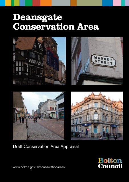
Deansgate Conservation Area - Bolton Metropolitan Borough Council
Deansgate Conservation Area - Bolton Metropolitan Borough Council
Deansgate Conservation Area - Bolton Metropolitan Borough Council

Create successful ePaper yourself
Turn your PDF publications into a flip-book with our unique Google optimized e-Paper software.
<strong>Deansgate</strong><br />
<strong>Conservation</strong> <strong>Area</strong><br />
Draft <strong>Conservation</strong> <strong>Area</strong> Appraisal<br />
www.bolton.gov.uk/conservationareas
CONTENTS<br />
Page<br />
1 Introduction 3<br />
2 Policy Background 3<br />
3 Summary of Special Interest 4<br />
4 Assessing special interest 5<br />
4.1 Location and setting 5<br />
4.2 Historic Development and Archaeology 5<br />
Early <strong>Bolton</strong><br />
<strong>Bolton</strong> and <strong>Deansgate</strong> in the 19 th century<br />
<strong>Deansgate</strong> in the 20 th century<br />
4.3 Open spaces 9<br />
4.4 Views and vistas 10<br />
4.5 Character and appearance 11<br />
4.6 Character areas 13<br />
<strong>Deansgate</strong><br />
The Old Market <strong>Area</strong><br />
4.7 The Qualities of Buildings 14<br />
Listed Building<br />
Unlisted buildings 17<br />
4.8 Building materials and features 19<br />
4.9 Public realm: roads and pavements 20<br />
5 Extent of intrusion and damage 22<br />
5.1 Negative aspects<br />
5.2 Neutral areas<br />
5.3 General condition<br />
5.4 Pressure for change<br />
6 Community involvement 26<br />
7 Suggested <strong>Conservation</strong> <strong>Area</strong> Boundary Changes 27<br />
8 Guidelines for development 28<br />
8.1 New development<br />
8.2 Demolition<br />
8.3 Advertisement control<br />
8.4 Street surfacing and furniture<br />
8.5 Building Materials<br />
8.6 Windows and doors<br />
July 2008 1
8.7 Chimneys and roofs<br />
8.8 Rainwater goods<br />
8.9 Boundary walls, gates and railings<br />
8.10 Shop fronts and advertising<br />
8.11 Minor fixtures and services<br />
8.12 Wheeled bins<br />
8.13 Interpretation<br />
8.14 Archaeology<br />
9.0 References 33<br />
Appendices<br />
1. UDP Policies 34<br />
2. Historic maps 37<br />
3. <strong>Conservation</strong> area appraisal maps 42<br />
July 2008 2
DEANSGATE CONSERVATION AREA APPRAISAL<br />
1.0 Introduction<br />
The purpose of this conservation area appraisal is to reassess the designated<br />
<strong>Deansgate</strong> <strong>Conservation</strong> <strong>Area</strong>, and to evaluate and record its special interest. This<br />
review of the <strong>Deansgate</strong> <strong>Conservation</strong> <strong>Area</strong> was undertaken in 2007 by The<br />
Architectural History Practice, on behalf of <strong>Bolton</strong> <strong>Metropolitan</strong> <strong>Borough</strong> <strong>Council</strong>. The<br />
appraisal complements the guidance in Building <strong>Bolton</strong>, Supplementary Planning<br />
Document published in 2006; the <strong>Deansgate</strong> conservation area is covered under the<br />
Civic Core, St Peter‟s and St Helena sections in this SPD document. The appraisal will<br />
inform planning officers and developers about the conservation area, to assist with<br />
developing initiatives in the area.<br />
AHP is grateful for assistance in preparing this report from Jackie Whelan, Diane<br />
Vaughton (<strong>Bolton</strong> <strong>Council</strong>), Norman Redhead (GMAU) and the Librarians at <strong>Bolton</strong><br />
Archives.<br />
2.0 Policy Background<br />
A conservation area is an “area of special architectural or historic interest, the character<br />
or appearance of which it is desirable to preserve or enhance”, as set out in Section 69<br />
of the 1990 Planning (Listed Buildings and <strong>Conservation</strong> <strong>Area</strong>s) Act 1990. Local<br />
authorities have a duty to designate such areas and to review them, and to use their<br />
planning powers to safeguard and enhance the special qualities of these areas within a<br />
framework of managing change with a positive approach. Designation automatically<br />
entails control over the demolition of unlisted buildings, strengthens controls over minor<br />
development and gives special protection to trees within the area. Policies in the<br />
adopted Unitary Development Plan (UDP) guide the <strong>Council</strong>‟s planning decisions within<br />
<strong>Conservation</strong> <strong>Area</strong>s. In addition, the <strong>Bolton</strong> Town Centre Framework was launched in<br />
2005, covering five different strategy or policy documents, including Building <strong>Bolton</strong><br />
(2006) and the Public Realm Implementation Framework (2007).<br />
The <strong>Deansgate</strong> <strong>Conservation</strong> <strong>Area</strong> was originally included in the Town Centre<br />
<strong>Conservation</strong> <strong>Area</strong>, which was first designated in 1987. This large area was broken<br />
down into three smaller areas – <strong>Deansgate</strong>, Town Hall and St George‟s – in 1996. The<br />
conservation area was last reviewed by <strong>Bolton</strong> <strong>Council</strong> in the late 1990s.<br />
July 2008 3
3.0 Summary of special interest<br />
The <strong>Deansgate</strong> <strong>Conservation</strong> <strong>Area</strong> is situated in the heart of <strong>Bolton</strong> town centre and<br />
include most of the retail core of the historic town. It includes the most properties fronting<br />
<strong>Deansgate</strong>, the town‟s principal shopping street, together with the west side of northern<br />
Bradshawgate and the streets surrounding the mid-Victorian market hall.The<br />
conservation area covers a thriving network of partly pedestrianised streets, intersected<br />
by principal roads carrying vehicles and buses.<br />
The gently curving line of <strong>Deansgate</strong> has not altered since the Middle Ages, although the<br />
street has been widened. The street pattern on the north side of the street was<br />
considerably altered in the mid-nineteenth century for the building of the market hall. All<br />
the principal streets in the conservation area are of a good width and the conservation<br />
area has a surprisingly open character, with a higher density north of <strong>Deansgate</strong>. There<br />
are some surviving traces of dense residential and industrial streets which once<br />
occupied the land between <strong>Deansgate</strong> and the river Croal to the north, but these have<br />
mostly been cleared and await redevelopment. The area contains no open spaces apart<br />
from pedestrianised streets. There are good views along <strong>Deansgate</strong> to the east and<br />
west; the former terminated by St Peter‟s Church, the latter by the spire of St Paul‟s.<br />
There are also long views from <strong>Deansgate</strong> northwards down the slope to the Croal and<br />
across it to Little <strong>Bolton</strong> and St George‟s Church. To the south, towards the Town Hall<br />
conservation area, there are tightly framed views along narrow streets.<br />
The area contains a wide variety of buildings dating from the eighteenth century to the<br />
present day. Although a few properties were originally built as dwellings, almost all are<br />
now in commercial use, and a wide variety of shop fronts and fascia signs dominate<br />
most ground floors. With one or two exceptions, the buildings of the conservation area<br />
are no more than three storeys high, which results in an unusual homogeneity to the<br />
centre of the town. At the same time, there is a wide diversity of materials including<br />
stone, brick and terracotta as well as half-timbering and painted render and brick.<br />
Historic buildings in the area retain a wealth of architectural detail such as windows,<br />
parapets, doorways and roof turrets, which enliven the street scene. Buildings built<br />
before the early 20th century generally have a vertical proportion due to narrow plot<br />
widths and elevations with sash windows, but 20 th century retail premises tend to have<br />
wider frontages with horizontal lines. There are some good examples of the latter, faced<br />
in Portland limestone in a classical style.<br />
There are a few notable modern intrusions into the character of the area, of which the<br />
most conspicuous is the 1980s Market Hall shopping centre at the northern end of the<br />
conservation area. This was built over the river Croal, which is now partly hidden from<br />
the town centre. There are also other smaller new buildings or additions to existing<br />
buildings, such as mansard roof on the Marks & Spencer store on <strong>Deansgate</strong>, with its<br />
prominent mansard roof.<br />
A small area of <strong>Deansgate</strong> conservation area is to be transferred to St George‟s<br />
conservation area, north east of Bridge Street (see map in Appendix 3).<br />
July 2008 4
4.0 Assessing Special Interest:<br />
4.1 Location and setting<br />
The <strong>Deansgate</strong> <strong>Conservation</strong> <strong>Area</strong> includes the western part of <strong>Bolton</strong> town centre,<br />
which lies along a ridge of land originally sloping northwards down to the Croal stream.<br />
The underlying geology is carboniferous sandstone with coal measures, the <strong>Deansgate</strong><br />
area is situated on a terrace of sand and gravel south of the River Croal. The<br />
conservation area is roughly 300 metres above sea level at its highest point. The<br />
northern slope was partly made-up in the mid-nineteenth century to provide the<br />
foundation for the new market building and also to provide direct access between the old<br />
town and the settlement beyond the river known as Little <strong>Bolton</strong>.<br />
<strong>Deansgate</strong> extends westwards almost as far as Marsden Moor, the A676, which is<br />
effectively the boundary of the central area of town; to the east <strong>Deansgate</strong> continues into<br />
Churchgate, the town‟s principal mediaeval street and a separate conservation area. To<br />
the south is the Town Hall conservation area. The northern boundary of the conservation<br />
area extends across the river Croal up to St George‟s Road, one of the principal streets<br />
of Little <strong>Bolton</strong> and itself a conservation area.<br />
4.2 Historic Development and Archaeology<br />
Early <strong>Bolton</strong><br />
Archaeological research in <strong>Bolton</strong> has shown that there were probably prehistoric<br />
settlements in the area, although no evidence of early structures has been found; a<br />
Bronze Age burial was found just a quarter of a mile to the south east of the Church of St<br />
Peter. The only evidence for Roman activity in <strong>Bolton</strong> comes from a fragment of Roman<br />
pottery found during recent archaeological excavations at the site of the former Boar‟s<br />
Head Inn on the north side of Churchgate. Although <strong>Bolton</strong> is not mentioned in<br />
Domesday, a settlement almost certainly existed by then, suggested by the Anglo-Saxon<br />
cross found during the construction of the present St Peter‟s Church. The place-name is<br />
Old English and means a dwelling or hamlet in an enclosure, first recorded in the 12 th<br />
century. The town was known as <strong>Bolton</strong>-le-Moors in the early Medieval period, referring<br />
to its location on the edge of open moorland.<br />
Following the granting of borough status to <strong>Bolton</strong> in 1253, the town‟s burgesses had the<br />
right to build on burgage plots fronting the main streets, <strong>Deansgate</strong> and Churchgate. In<br />
1288, there were 69 of these burgage plots, each long plot had a narrow street frontage.<br />
Excavations and maps show that these plots had a standard width of just over 8 metres,<br />
or multiples thereof. During most of the medieval period <strong>Bolton</strong> was principally a market<br />
town, with its residents dependent on the surrounding farmland. Textiles became<br />
increasingly important to the prosperity of the town, initially woollens and later cotton and<br />
linen; by the 1530s Leland noted that the market “standeth most by cottons and coarse<br />
yarn”, with fuel coming from coal pits as well from turf. In the 17 th century the town was<br />
known for fustian manufacture, a mix of cotton and linen, and this supported a growing<br />
merchant class. Counter-panes and bed-quilts were specialities; <strong>Bolton</strong> was renowned<br />
for the fine quality of its cotton production.<br />
July 2008 5
During the Civil War in the 1640s, <strong>Bolton</strong> supported Parliament against Charles I and the<br />
Earl of Derby, in part due to the town‟s merchant class and non-conformist leanings. In<br />
1643, following his defeat at Preston, the Earl of Derby unsuccessfully attacked the town<br />
but a third attack in 1644 succeeded and <strong>Bolton</strong> was sacked and burned. The Earl of<br />
Derby was subsequently tried in <strong>Bolton</strong>, and beheaded at the Market Cross on<br />
Churchgate in 1651.<br />
<strong>Deansgate</strong> was part of the original settlement of Great <strong>Bolton</strong> and is one of the three<br />
oldest roads in the town centre. It is so called because it was the route to the Dean<br />
Valley and Deane Moor. In the early days of the settlement, the ground fell away steeply<br />
to the north and consisted of meadows, orchards and gardens behind the houses and<br />
business premises fronting <strong>Deansgate</strong>. The River Croal was once a clear, unpolluted<br />
waterway flowing between high banks, and supported a wide range of fish. Although it<br />
was crossed by a series of rickety wooden bridges, for centuries it proved a physical<br />
barrier to the northern expansion of the town, dividing the two townships of Great and<br />
Little <strong>Bolton</strong>.<br />
By the end of the 18 th century, the area north of <strong>Deansgate</strong> bordering the River Croal<br />
was important for textile manufacturing and other trades such as tanning, timber,<br />
bleaching and metal working. The river provided an important source of water both for<br />
power and processing. Outside the conservation area, St Helena Mill is the oldest<br />
surviving textile mill in the town, built c.1780.<br />
As <strong>Bolton</strong> developed into a thriving market and manufacturing centre from the<br />
Seventeenth Century onwards, the town expanded outwards from its principal streets<br />
including <strong>Deansgate</strong>. A series of streets and alleyways were laid out at right angles to<br />
the main thoroughfare, along the lines of the original long narrow burgage plots behind<br />
the street frontage. Those on the northern side of the street were terminated by the River<br />
Croal. Many of these streets and alleys were densely developed with terraces of tiny,<br />
single aspect workers cottages. Today few of these streets remain. One is Chapel Alley<br />
running alongside the Blue Boar, this was named after the adjacent Dukes Alley Chapel<br />
(built in 1754 and demolished in 1968). It led to the Albion Foundry and Velvet Walks,<br />
two rows of cottages enclosing a long narrow yard.<br />
The rapid expansion of the textile industry dominated <strong>Bolton</strong> for over 150 years from the<br />
late 18 th century. Although the importance of <strong>Bolton</strong>‟s market for the trading of textiles<br />
had declined with the shift of the cotton trade to Manchester in the late 18 th century, the<br />
town‟s prosperity grew due to large-scale manufacturing, particularly the spinning of fine<br />
yarn. The town is associated with some key figures in the development of the industry,<br />
notably Samuel Crompton who invented the spinning mule. The town was also important<br />
as the centre of the bleaching and finishing branch of the cotton industry, and also for<br />
engineering. Transport improved with the opening of the Manchester <strong>Bolton</strong> and Bury<br />
Canal, in the early 19 th century, with a terminal at Church Wharf, east of St. Peters<br />
Church. The 1793 map of <strong>Bolton</strong> illustrates the town‟s growth up to the end of the 18 th<br />
century (Fig.1).<br />
Bank Street was formerly known as Windy Bank and was the steepest street in <strong>Bolton</strong><br />
until the creation of a higher river embankment. Knowsley Street was so named because<br />
the Earl of Derby, once a major landowner in the area lived in a mansion at Knowsley.<br />
Corporation Street was named because it was created as a result of the clearance of<br />
courts and alleys by the <strong>Council</strong> to construct the Market Hall in 1855. The name<br />
July 2008 6
Mealhouse Lane recalls a large grain warehouse that once fronted <strong>Deansgate</strong> at its<br />
northern end. Ridgway Gates, between Numbers 80 and 82 <strong>Deansgate</strong> was named<br />
after James Ridgway, a dyer and bleacher. There were gates here at one time to protect<br />
his open bleaching grounds in the vicinity of the present Market Hall.<br />
Fig.1: <strong>Deansgate</strong> from the 1793 map of <strong>Bolton</strong> (<strong>Bolton</strong> Archives).<br />
<strong>Bolton</strong> and <strong>Deansgate</strong> in the 19 th century<br />
In the early 19th Century many of the long narrow burgage plots and alleyways at the<br />
rear of properties facing <strong>Deansgate</strong> were developed to provide courtyard housing for<br />
working people. These are clearly shown on the 1849 OS maps (Appendix 1), and<br />
formed short rows of one-up, one-down cottages, with a single-aspect and often back-to<br />
back, facing narrow lanes or courts. The lack of sanitation and cramped dwellings in<br />
close proximity to industry created poor living conditions.<br />
During the nineteenth century <strong>Deansgate</strong> began to develop into a major shopping,<br />
commercial and social centre. For most of the Century it contained a wide variety of<br />
small local retailers dealing in products such as medicines, paints, dress fabrics,<br />
millinery, clothing, automobiles and tools. The 2-3 storey buildings occupied narrow plots<br />
with cramped rear yards. At one time there were twenty-six public houses and in 1908<br />
The Empire Theatre (later the Hippodrome Theatre) was opened at the western end of<br />
the street. In the mid Nineteenth Century the south bank of the river Croal was lined by<br />
timber yards, a saw mill, cotton and flax mills a foundry and a gas works.<br />
July 2008 7
Fig.2: Prestons corner in the late 19 th<br />
century before the present store was<br />
built (<strong>Bolton</strong> Archives)<br />
The first major redevelopment scheme in the area was carried out by the Town <strong>Council</strong><br />
under the <strong>Bolton</strong> Improvement Act of 1850 when a maze of courts, alleys and slum<br />
properties to the north of <strong>Deansgate</strong> were cleared away to build a new Market Hall. This<br />
was opened in 1855 and an adjacent Fish Market at the Bridge Street end of<br />
Corporation Street was opened ten years later. As a result of this scheme, Corporation<br />
Street was created and Bridge Street and Knowsley Street were widened and extended<br />
to provide wide thoroughfares connecting Great and Little <strong>Bolton</strong>. Bradshawgate and<br />
<strong>Deansgate</strong> were widened and the original frontages were redeveloped in the late<br />
nineteenth and twentieth centuries. In the second half of the nineteenth century a<br />
number of imposing bank buildings were erected in <strong>Deansgate</strong>, marking a further<br />
increase in its status.<br />
Fig.3: <strong>Deansgate</strong> looking east c.1840; 5-7 <strong>Deansgate</strong> is still visible today (from an<br />
engraving in the <strong>Bolton</strong> Archives collection)<br />
July 2008 8
<strong>Deansgate</strong> in the 20 th century<br />
As <strong>Bolton</strong> developed and expanded, the character of <strong>Deansgate</strong> changed, particularly in<br />
the early twentieth century when narrow sites occupied by small groups of businesses<br />
were redeveloped to provide larger banks, offices and department stores. These<br />
included Prestons‟ jewellery shop, opened in 1904, Whitakers Department Store at 79 to<br />
87 <strong>Deansgate</strong> in 1907 and Whitegates in 1909. All three of these long established local<br />
businesses had previously occupied smaller premises in the <strong>Deansgate</strong> area. When<br />
Bradshawgate was widened at the beginning of the twentieth century, the frontage line<br />
on the west side was set back and lined with new buildings, many of them faced in<br />
terracotta and faience which was fashionable at the time.<br />
Fig.4: Prestons‟ jewellery store opened<br />
in 1904, with a colourful terracotta and<br />
faience frontage (compare with Fig.2)<br />
The construction of a large central Post Office at the western end of <strong>Deansgate</strong> began in<br />
1913 on a site formerly occupied by an iron-founders, cottages, shops and two public<br />
houses. National companies followed local firms in constructing new premises with<br />
Woolworths opening in 1912 and extending in 1957, Lloyds Bank opened in 1924 and<br />
Marks and Spencer in 1967. Some of the inter-war buildings are in a characteristic<br />
stripped classical style, often faced in Portland limestone. The Market Place shopping<br />
centre is the largest recent structure to have been built in the town centre.<br />
4.3 Open Spaces<br />
The <strong>Conservation</strong> <strong>Area</strong> is very tightly built up. There are no green spaces although trees<br />
have been planted along a number of roads in recent years to help soften this densely<br />
developed urban environment. The paved and landscaped area to the east of the Market<br />
Hall above Bridge Street, the former Fish Market, is an important open space in this<br />
crowded part of town, with some historic street furniture such as the K6 phone boxes.<br />
From Bridge Street, the closed public lavatories detract from the appearance of this<br />
area.<br />
July 2008 9
Fig.5: The former Fishmarket site, above<br />
Bridge Street on the east side of the old<br />
Market Hall<br />
4.4 Views and vistas<br />
There are clear views of the wider <strong>Bolton</strong> area down Bank Street across the Croal<br />
Valley. The West Pennine Moors can be seen from Bank Street and Bridge Street on a<br />
clear day. Views eastwards along <strong>Deansgate</strong> and Churchgate are terminated by St.<br />
Peter‟s Church particularly the tower which is a major landmark. This was deliberately<br />
designed to be visible from <strong>Deansgate</strong> when the church was rebuilt in 1871. The square<br />
brick tower of St George‟s Church is important in views along Knowsley Street.<br />
Fig.6: View north down Knowsley<br />
Street, towards the tower of St<br />
George‟s Church.<br />
There is a view of the spire of St. Pauls Church looking westwards along <strong>Deansgate</strong> and<br />
a view of the Town Hall frontage looking southwards from Oxford Street, with narrow<br />
views along side streets such as Old Hall Street. The main entrance to the Market Hall<br />
closes the view northwards along Market Street and the ornate frontage of the former<br />
Clarence Street Grammar School closes the view down Knowsley Street; St George‟s<br />
Church is also prominent in views along Knowsley Street. St. Paul‟s, The Town Hall<br />
clock tower and the pedimented market entrance, Prestons and Whitakers Department<br />
Stores and the Market Cross are all important landmarks.<br />
July 2008 10
Fig.7: <strong>Deansgate</strong>, looking east<br />
towards the tower of St Peter‟s<br />
Church (compare with Fig.3)<br />
The gentle curve of <strong>Deansgate</strong> creates a succession of views and the skyline is<br />
punctuated by domes and turrets which are characteristic of many buildings in the<br />
conservation area. These are particularly important on corner plots where they give<br />
emphasis to junctions and provide a sense of orientation.<br />
Fig.8: corner towers, decorated parapets<br />
and pediments on the north side of<br />
<strong>Deansgate</strong><br />
4.5 Character and appearance<br />
<strong>Deansgate</strong> is a long, wide street, reflecting its status as one of <strong>Bolton</strong>‟s principal<br />
thoroughfares. The area has a dense urban grain with buildings built up to plot<br />
boundaries. The central part of <strong>Deansgate</strong> itself is pedestrianised, together with the<br />
streets to north and south between Victoria Square and the old Market Hall, and this<br />
largely retail area is busy with people during the daytime. The eastern and western ends<br />
of <strong>Deansgate</strong> carry considerable vehicular traffic, particularly west of the junction with<br />
Knowlsey Street, which is also a bus route. Back streets and cleared sites to the north of<br />
<strong>Deansgate</strong>, just outside the boundary of the conservation area are currently used as<br />
surface parking, but new development has been agreed.<br />
July 2008 11
Fig.9: the west part of <strong>Deansgate</strong> is a<br />
busy bus route<br />
The architectural character of <strong>Deansgate</strong> alters along its length, with the buildings west<br />
of Oxford Street being generally less imposing than those to the east. Buildings are<br />
faced in local sandstone or Portland limestone, with red brick, sometimes rendered or<br />
with applied timber-framing. Bradshawgate is notable for the concentration of terracotta<br />
and faience-faced buildings, dating from about 1900. Several of the more modern<br />
buildings are faced in synthetic materials.<br />
There is a wide variety of building types and forms in the area. Some of the earlier<br />
buildings date from the early nineteenth-century and were built as houses, although all<br />
now have ground floor shops or pubs; these buildings occupy narrow plots reflecting the<br />
medieval burgage plot boundaries and some can still be seen in the west of the area.<br />
Later buildings tend to have wider frontages, built across two or more plots widths and<br />
are mostly larger purpose-built banks and department stores. The variety of building<br />
types, dates and styles contributes to the visual and historic interest of the main streets<br />
(Figs.7, 8 and 9).<br />
Knowsley Street, a wide straight thoroughfare which was formed in the mid-nineteenth<br />
century as part of the development associated with the new market hall, has a more<br />
homogenous character, despite the modern rebuilding of some premises on the western<br />
side, and the 1990s Market Place shopping centre to the north-east side (Fig.6). Most of<br />
the buildings in <strong>Deansgate</strong> and the other principal streets are two or three storeys high,<br />
which has given this town-centre area its fairly homogenous character. A few singlestorey<br />
infill buildings have eroded this strong pattern, for example on the north side of<br />
<strong>Deansgate</strong>, opposite Whitakers. There are unusually no tall buildings in the conservation<br />
area. The largest building in the conservation area is the Market Place shopping centre<br />
redevelopment, linked to the old market hall at the northern end of Bridge and Knowsley<br />
Streets, which opened in 1993.<br />
In addition to long views along the principal streets (Fig.7), there are visual connections<br />
and pedestrian links to other parts of the town centre. Some of these are on narrow side<br />
streets at right angles to <strong>Deansgate</strong>, for example along Old Hall Street North, where the<br />
trees screen glimpses south to the Town Hall.<br />
July 2008 12
July 2008 13<br />
Fig.10: Old Hall Street, looking south from<br />
<strong>Deansgate</strong> towards the Town Hall
4.6 Character areas<br />
The <strong>Deansgate</strong> conservation area contains two contrasting character areas, <strong>Deansgate</strong><br />
itself and the Old Market Hall <strong>Area</strong>.<br />
a) <strong>Deansgate</strong><br />
<strong>Deansgate</strong> has long been the principal shopping street in <strong>Bolton</strong> and is a wide<br />
gently-curving street lined with nineteenth and twentieth century commercial<br />
buildings. Despite the diversity of architectural treatments, most building<br />
frontages are no more than three storeys high, which results in a fairly unified<br />
scale and appearance to the main streets. Frontages have a generally vertical<br />
emphasis, due to the rhythm of narrow plot widths and formal architectural<br />
elevations with pilasters and other tall windows on upper floors (Figs.8 and 9).<br />
The rich architecture of many buildings includes decorative parapets and corner<br />
turrets (Fig.8). The pedestrianisation of the central portion of the street and of<br />
other streets to the south including Old Hall Street, Market Street, Oxford Street<br />
and Mealhouse Lane, allows <strong>Deansgate</strong> to function rather like a city square.<br />
Fig.11: view south across <strong>Deansgate</strong><br />
towards Whitakers<br />
b) The Old Market Hall <strong>Area</strong><br />
The area around the old Market Hall has a more diffuse character, with some<br />
very large buildings dominating the streets. The 1850s market hall has an<br />
imposing pedimented entrance on Knowsley Street, and a strong presence on<br />
Corporation Street, with historic shop fronts. The classical architectural style of<br />
the market building is echoed in adjacent commercial buildings, many with<br />
Italianate details. The market hall, its external shops and the 1990s New Market<br />
Place are pedestrian magnets; the pedestrianised Corporation Street to the south<br />
of the market hall and the paved and landscaped area to the east of the hall<br />
above Bridge Street together form another pedestrian centre.<br />
July 2008 14
Fig.12: The fine elevations of the old<br />
Market Hall on Corporation Street, with<br />
blinds over the shop fronts, c.1900<br />
(<strong>Bolton</strong> Archives).<br />
4.7 The Qualities of Buildings<br />
Listed Buildings<br />
The most prominent buildings in the area were purpose-built for commercial businesses<br />
such as banks, and the status and confidence of the businesses is expressed in ornate<br />
front elevations with stone carving or terracotta moulded details. Roofs tend to be hidden<br />
behind decorative parapets, and chimneys are also important features. The best<br />
examples of the terracotta frontages are on Bradshawgate. There are nine buildings or<br />
groups of buildings within the <strong>Conservation</strong> <strong>Area</strong> which are Listed as being of Special<br />
Architectural or Historic Interest:<br />
No.28 Bradshawgate. The Flying Flute (former Fleece Hotel).<br />
Originally built in 1907 as a hotel this three storey property is now a public house. It is<br />
constructed of terracotta with pitched slate roofs and has a segmental canopy over the<br />
entrance. There are shallow oriel bow windows to the first and second floors and the<br />
ornate frontage is decorated with cartouches, swags and wreaths.<br />
Yate's Wine Lodge, Bradshawgate.<br />
Constructed in 1906 of terracotta with a pitched slate roof this wine lodge is three<br />
storeys high with a central segmentally pedimented gable flanked by towers with domed<br />
roofs. The ground floor has two outer doorways and four arcaded central round arched<br />
windows. The second floor has a central oriel divided by four columns and flanked by<br />
two pairs of circular windows decorated with swags.<br />
July 2008 15
Fig.13: Bradshawgate in the 1960s (<strong>Bolton</strong><br />
Archives)<br />
24 <strong>Deansgate</strong>, National Westminster Bank.<br />
This bank was built in 1852 in an Italian palazzo style, to designs by George<br />
Woodhouse, and extended in 1907. It is three storeys high faced in fine ashlar stone,<br />
with a brick banking hall to the rear. The first floor is arcaded with Corinthian pilasters<br />
supporting an entablature with a modillion cornice and the round arched windows have<br />
moulded keystones and rosettes in the freize above. There is a balustraded parapet<br />
incorporating urns and a central segmental pediment surmounted by a coat of arms with<br />
flanking figures.<br />
79-81 (odd) <strong>Deansgate</strong>. Whitakers Department Store.<br />
This store designed by the architect George Crowther was opened in November 1907. It<br />
is two storeys high with attics and pitched plain tile roofs. The external timber frame used<br />
timber salvaged from demolished buildings on Bradshawgate. A corner tower with a<br />
conical roof is flanked by two storey bays and paired three storey gables, jettied out to<br />
the second storey.<br />
Group of four K6 telephone kiosks in front of the Post Office, <strong>Deansgate</strong>.<br />
Designed in 1935 by Sir Giles Gilbert Scott this group of four K6 type telephone kiosks<br />
are made of cast iron and have shallow domed roofs.<br />
Royal Bank of Scotland, <strong>Deansgate</strong>.<br />
This prominent bank was built in 1875 to the design of the architects Cunliffe and<br />
Freeman, in a Renaissance style. It is constructed of stone with a slate roof and is three<br />
storeys high with a projecting section to the right surmounted by a tower. There are<br />
arcaded round arched windows to the first floor with polished granite shafts and<br />
balustrading forming a shallow balcony to the corner of Market Street. The main<br />
July 2008 16
entrance is flanked by pairs of polished granite columns. Recent disabled access ramp<br />
to front.<br />
Fig.14: The Royal Bank of Scotland on<br />
the north side of <strong>Deansgate</strong>, listed<br />
grade II<br />
Market Hall and ground floor shops, Knowsley Street.<br />
The Market Hall and integral shops were designed by the architect G.T. Robinson, built<br />
1855. It has an internal cast iron structure designed by W.Fairbairn with ashlar stone<br />
facings. The portico to the main entrance on Knowsley Street has four giant columns<br />
and two square piers supporting the pediment. The central entrance from Bridge Street<br />
has a giant arch with the town's coat of arms above the doorway. The 1894 shop fronts<br />
were added by Bradshaw and Gass, with arcaded windows to the first floor.<br />
Fig.15: The imposing portico of the<br />
old Market Hall on the east side of<br />
Knowsley Street.<br />
July 2008 17
No's 33-45 (odd) Knowsley Street, Victoria Hall and Victoria Buildings.<br />
This Methodist Mission Church and shops were constructed between 1898 and 1900 to<br />
the designs of the <strong>Bolton</strong> Architects Bradshaw and Gass. The buildings are three storeys<br />
high, built of red brick and terracotta with stone dressings and pitched slate roofs. There<br />
is a tower over the main entrance with an octagonal turret surmounted by a domed roof.<br />
This is flanked by bays containing shops. The interior of the hall has a horse shoe<br />
gallery supported by columns.<br />
No.25 Market Street.<br />
A rare example of a former town house in the area, this eighteenth century building is<br />
three storeys high, constructed of red brick with a pitched slate roof. There is a<br />
traditional timber shop front on the ground floor with sixteen pane sliding sash windows<br />
on the upper floors. At one time the property had a mid Victorian shop front and<br />
chemists shop fittings.<br />
Unlisted buildings which make a positive contribution to the character of the<br />
<strong>Conservation</strong> <strong>Area</strong>.<br />
There are many non-Listed Buildings which make an important contribution to the<br />
character of the <strong>Conservation</strong> <strong>Area</strong>. It is not possible within the scope of this document<br />
to describe them all so a selection is given here. Many of the buildings in the principal;<br />
streets are purpose-built commercial structures which date from the second half of the<br />
nineteenth century when the area saw much redevelopment following the building of the<br />
new covered market. Commercial rebuilding continued in the twentieth century as<br />
department stores like Woolworths and Burtons established a high street presence. The<br />
majority of these buildings have good proportions and detailing To the north of<br />
<strong>Deansgate</strong> there are isolated survivals of industrial buildings and modest domestic<br />
structures.<br />
No.2 Bradshawgate, Whewell Buildings.<br />
This prominent property on the corner of Bradshawgate and <strong>Deansgate</strong> dates from the<br />
early Twentieth Century. It is three storeys high with attics and is constructed of<br />
terracotta with pitched slate roofs. The right had corner has a bow and the second floor<br />
windows at either end of the building are recessed behind colonnades and have<br />
segmentally headed pediments above. The ornately carved timber fascia above the<br />
entrance door to Bradshawgate is inscribed "Whewell Buildings" in Art Nouveau lettering<br />
and incorporates floral motifs and a leaded fanlight with turned spindles.<br />
Prestons and Whiteheads Department Stores <strong>Deansgate</strong> (Fig.4).<br />
The building on the corner of <strong>Deansgate</strong> and Bank Street was constructed for Prestons<br />
the jewellers an old established <strong>Bolton</strong> firm in 1908, designed by Thomas Smith and<br />
sons. It was extended in 1913 in a matching style for Whiteheads Department Store.<br />
The three-storey shop is faced in a buff-coloured terracotta with pitched slate roofs. The<br />
frontages to Back Street, <strong>Deansgate</strong> and Crown Street have two storeyed bowed oriel<br />
July 2008 18
windows with mullions and transoms with steep gables above containing Venetian<br />
windows. At the <strong>Deansgate</strong> corner the building has a prominent clock tower with a<br />
domed roof and a time ball. This was originally raised to the top of the guide rods at<br />
9.00am every day and dropped 10 feet at 10.00am to provide a time check.<br />
83-87 <strong>Deansgate</strong>, Whitakers Department Store<br />
Dating from around 1907 this three storey building is constructed of pale buff faience<br />
(glazed terracotta) and contrasts sharply with the adjacent timber framed portion of the<br />
Whitakers premises. The elevation to <strong>Deansgate</strong> has a central pediment incorporating<br />
round headed windows with keystones and a cornice with finials. The three corners of<br />
the street frontages have prominent turrets with corner buttresses and a domed roof<br />
surmounted by ball finials.<br />
Head Post Office, <strong>Deansgate</strong>.<br />
The Head Post Office was opened in 1916 and is a large classical building of three<br />
storeys faced with stone with pitched slate roofs. It has two projecting end bays with the<br />
first and second floor windows recessed between giant columns. There is a central<br />
projecting entrance porch surmounted by a coat of arms. The windows have sliding<br />
sashes with glazing bars.<br />
Fig.16: The Post Office building with<br />
listed K6 telephone kiosks at the west<br />
end of <strong>Deansgate</strong><br />
Entrance to the Shipgates Shopping Centre, Mealhouse Lane.<br />
This building was constructed for the <strong>Bolton</strong> Evening News in c.1900 of brick and stone,<br />
designed by Bradshaw and Gass. It is three storeys high and has a large central<br />
pediment with a dentilled cornice. This incorporates a two storey, round headed, blind,<br />
arch with stone vousoirs and contains a round window flanked by swags. The first floor<br />
windows have round arches and form three arcades. The frontage is decorated with<br />
cartouches and wreaths.<br />
Burtons, Market Street<br />
Early 20 th century store faced in Portland limestone. A typical example of purpose built<br />
retail premises from this period, with altered shop front, but intact upper floors.<br />
July 2008 19
Fig.17: Burtons on Market Street<br />
4.8 Building materials and features<br />
Buildings in the conservation area are built of a wide range of materials, with buffcoloured<br />
sandstone being used for the higher status buildings such as the Church, and<br />
for details, while white Portland stone was used for the facings of several inter-war<br />
commercial properties. Red brick was used for many 19 th century buildings, while other<br />
fired clay materials like terracotta and faience in a variety of colours became popular<br />
around 1900. Pitched roofs are mostly covered in Welsh slate. A number of brick-built<br />
properties have been rendered and painted white, and there are also examples of mock<br />
timber-framing, applied to brick or timber-framed structures.<br />
There are high stone retaining walls topped by traditional cast iron railings down the<br />
west side of Bank Street and adjacent to the Market Hall on Bridge Street where there is<br />
an abrupt change of ground level.<br />
Fig.18: Contrasting materials: red<br />
sandstone and black and white halftimbering<br />
on adjacent buildings on the<br />
south side of <strong>Deansgate</strong>.<br />
Some cast-iron street signs, probably dating from the late 19 th century have survived on<br />
some buildings, for example on the south section of Market Street.<br />
July 2008 20
4.9 Public realm: roads, pavements and street furniture<br />
Carriageways on the principal streets including Bradshawgate, Bridge Street, Knowsley<br />
street and the west end of <strong>Deansgate</strong> itself are surfaced in tarmacadam (Fig.9). The<br />
central pedestrianised section of <strong>Deansgate</strong> has an elaborate formal pattern of brick<br />
setts at the intersection with Market Street, but this does not at all relate to the main part<br />
of the street with its apron of white concrete paving slabs outside Marks and Spencer.<br />
The surfacing of much of <strong>Deansgate</strong> looks shabby, especially compared to the new York<br />
stone paving of Churchgate immediately to the east. The wide variety of materials and<br />
styles used for paving throughout the <strong>Conservation</strong> <strong>Area</strong> creates a very disjointed effect.<br />
Fig.19: historic stone setts and kerbs<br />
on Woods Court, an alley north of<br />
<strong>Deansgate</strong><br />
Several of the smallest streets, like Woods Court on the north side of <strong>Deansgate</strong> still<br />
retain their stone setts and on Corporation Street the setts have recently been restored,<br />
to good effect. Footway surfaces are extremely varied with some poor quality areas of<br />
tarmacadam, concrete paving and red, brown, blue and buff paving (Fig. 23). Natural<br />
stone has been used to relay footways outside the Market Hall on Knowsley Street and<br />
along Corporation Street.<br />
Fig.20: re-laid setts and natural stone<br />
paving on Corporation Street, with castiron<br />
bollards<br />
July 2008 21
The majority of the <strong>Conservation</strong> <strong>Area</strong> has inconspicuous modern wall mounted lighting,<br />
or contemporary globe lighting on plain black columns, as on Corporation Street and<br />
outside Whitakers Store on <strong>Deansgate</strong> and Old Hall Street. There are also examples of<br />
standard street lighting with steel or concrete columns. Traditional-style lighting has<br />
been installed in some locations to good effect, for example on the footway above Bank<br />
Street and on Bridge Street (Fig.4); until the post-war period, this was the pattern<br />
throughout the town.<br />
Fig.21: A traditional street scene;<br />
Victorian lighting and stone paving on<br />
Market Street, mid 20 th century<br />
(<strong>Bolton</strong> Archives)<br />
There is a wide variety of street furniture throughout the <strong>Conservation</strong> <strong>Area</strong>, with little coordination<br />
of styles or materials. This causes visual clutter and in some cases the<br />
positioning and amount of features present an obstacle to pedestrians, particularly to<br />
disabled people. Steel bollards are used to prevent pavement parking; mainly in a fluted<br />
early 20 th century design (Fig.20). Traditional-style guard rails are similarly used in many<br />
locations; particularly on <strong>Deansgate</strong>, Bradshawgate and Market Street (Fig.23). These<br />
items can cause visual clutter and obstacles to disabled people unless sited carefully.<br />
Fig.22: fluted steel bollards are used on<br />
many street corners and footway edges.<br />
Steel and glass bus shelters in a quality contemporary design have been installed at the<br />
eastern end of <strong>Deansgate</strong> and outside the Market Hall on Bridge Street.<br />
July 2008 22
Fig.23: A clutter of bins, guard-rails and<br />
signs, with poor-quality concrete paving<br />
in the northern part of Market Street<br />
(compare with the scene in Fig.21)<br />
Many larger properties have installed ramps to improve disabled access; these are<br />
largely designed in a traditional-style with black-painted railings and stone plinths.<br />
Fig.24: access ramp to a bank on<br />
<strong>Deansgate</strong><br />
A Public Realm Implementation Framework was adopted for <strong>Bolton</strong> town centre by the<br />
<strong>Council</strong> in 2007. This will address many of the issues identified above; by providing<br />
detailed guidance on surfacing, street furniture, lighting and planting, this strategy will<br />
define a benchmark of quality and ensure continuity of character across the town centre.<br />
5.0 Extension of intrusion and damage<br />
5.1 Negative aspects<br />
The principal intrusion into the character and appearance of the <strong>Deansgate</strong> conservation<br />
area is the scale and form of some late 20 th century commercial developments. On<br />
<strong>Deansgate</strong> itself, the Marks & Spencer building has a modern frontage which respects<br />
the general building height, but the tall two-storey mansard roof is conspicuous in views<br />
along the street.<br />
July 2008 23
Fig.25: A view eastwards along<br />
<strong>Deansgate</strong>, showing the dominant scale<br />
of the mansard roof on the Marks &<br />
Spencer building.<br />
At the northern end of the conservation area the 1990s Market Place Shopping Centre is<br />
an important part of the town‟s retail role, but the large building has created impermeable<br />
frontages that relate poorly to surrounding buildings and the historic street pattern.<br />
Fig.26:The east side of Knowsley Street<br />
and the Market Place shopping centre<br />
To the rear of some properties at the east end of the north side of <strong>Deansgate</strong>, just<br />
outside the boundary of the conservation area are small backland areas which are used<br />
for surface parking. This currently results in a bleak setting for this part of the<br />
conservation area, but will be redeveloped for mixed uses as part of The Central Street<br />
development, approved by the <strong>Council</strong> in 2005.<br />
At the western end of <strong>Deansgate</strong> on the south side between no 35 <strong>Deansgate</strong> and the<br />
Hen and Chickens pub is a the site of the former Hippodrome Theatre, more recently a<br />
modern health centre but now a walled car-park which makes an unfortunate gap in the<br />
continuity of frontages on this side of the street. On the north side of the street there are<br />
single-storey infill shops where the scale and quality of design relates poorly to adjacent<br />
buildings.<br />
July 2008 24
Fig.27: low 20 th century infill adjacent<br />
to historic 3-storey buildings on the<br />
north side of <strong>Deansgate</strong><br />
Retail and commercial advertising is intrusive on some street frontages, where strong<br />
colours, modern materials and deep fascias detract from the unity of architectural<br />
elevations.<br />
Fig.28: dominant retail advertising and<br />
fascia treatment on <strong>Deansgate</strong><br />
5.2 Neutral areas<br />
Some late 20 th century infill development has had a neutral impact on the character of<br />
the conservation area. The Market Place shopping development and several threestorey<br />
office buildings on the west side of Knowsley Street are of a scale and form that<br />
does not challenge the historic buildings in this part of the conservation area, although<br />
their overall design quality is modest.<br />
July 2008 25
Fig.29: A neutral modern building next<br />
to the listed Victoria Hall in Knowsley<br />
Street, one of several such buildings<br />
on the west side of the street.<br />
5.3 General condition<br />
The condition of historic buildings within the conservation area is generally good, with<br />
most buildings appearing to be in active use and benefiting from regular maintenance.<br />
The use of some buildings has changed as the pattern of economic activity in the area<br />
has evolved.<br />
Rear yard areas are often hidden from view, but car parking and the management of<br />
waste and wheeled bin storage is increasingly intrusive in side streets and views into<br />
rear yards.<br />
The public realm is in need of repair and enhancement, particularly in heavily used<br />
pedestrian areas; this will be addressed by the Public Realm Implementation<br />
Framework.<br />
5.4 Pressure for change<br />
The proposed development of current gap sites around the edge of the conservation<br />
area, particularly north of <strong>Deansgate</strong> will change the character of the area. Approval has<br />
been granted for the Central Street development, which will result in the loss of some<br />
buildings fronting <strong>Deansgate</strong>, but will bring vitality to the bleak area to the north.<br />
Commercial pressure for increased advertising is becoming visually intrusive in some<br />
areas. The use of temporary advertising such as plastic banners, particularly by bars<br />
and leisure businesses is adding clutter in the streetscene and obscuring attractive<br />
frontages.<br />
Changes to waste management standards are resulting in large wheeled bins which are<br />
hard to conceal unless accessible rear yards are available.<br />
Disabled access standards mean that some businesses will need to alter entrances with<br />
steps on some historic buildings, or make other reasonable alterations. In the public<br />
realm, future enhancement schemes will need to comply with the latest standards and<br />
guidance.<br />
July 2008 26
The 2007 ban on smoking in enclosed public places and workplaces is likely to generate<br />
a demand for smoking shelters and outdoor seating, which will require careful<br />
management to avoid intrusive new structures.<br />
6.0 Community involvement.<br />
A publicity leaflet which included a tear out questionnaire was distributed to businesses<br />
and properties within all the Town Centre <strong>Conservation</strong> <strong>Area</strong>s. In addition two half day<br />
drop in sessions were held at the library foyer in Le Mans Crescent on 22 nd and 23 rd<br />
January 2008 to provide advice and respond to comments. In total approximately 600<br />
leaflets were distributed. A press release raising awareness of the drop in session was<br />
advertised in the <strong>Bolton</strong> Evening News and the <strong>Conservation</strong> <strong>Area</strong> Appraisals were made<br />
available to view online.<br />
Respondents were asked if they agreed on the boundary extensions, whether they<br />
wished to see more areas protected and to score in terms of importance eight key<br />
recommendations set out in the <strong>Conservation</strong> <strong>Area</strong> Management Plan.<br />
The response rate was low but raised no objections to the boundary extensions. The<br />
Civic Trust were one of the respondents and were generally supportive of all the<br />
<strong>Conservation</strong> <strong>Area</strong> boundary extensions. Some concern was raised regarding constraints<br />
that <strong>Conservation</strong> <strong>Area</strong> status afforded and that the extended areas could not be<br />
afforded adequate protection by the Authority given the investment pressure in some of<br />
these areas.<br />
July 2008 27
7. Suggested conservation area boundary changes<br />
No boundary extensions are proposed. A small area to the north-east of Bridge Street is<br />
to be transferred to the St George‟s <strong>Conservation</strong> <strong>Area</strong>, following recommendations<br />
made in the appraisal of the latter area.<br />
July 2008 28
8. Guidelines for development<br />
8.1 New Development.<br />
Building <strong>Bolton</strong> provides guidelines for new development in the town centre. However,<br />
opportunities within the conservation area are limited and are most likely to be presented<br />
by small infill and gap sites, or sites where existing buildings have a negative impact on<br />
the character of the area. New development must reflect the character of existing<br />
buildings with respect to siting, scale, proportions, materials and detailing. Applications<br />
for Outline Planning Permission will not be considered unless supported by a masterplan<br />
and a high level of detail. Applications for full planning permission must include a Design<br />
and Access statement that explains the development‟s affect on the character and<br />
appearance of the conservation area, demonstrating that the scheme will be sensitive to<br />
its context, supported by visual images such as photomontages or perspective drawings.<br />
Good quality contemporary design, related to the historic context and character of the<br />
area will be encouraged.<br />
Key factors to take into account are:<br />
consistent building heights, except where punctuated by corner features;<br />
the varied skyline,<br />
the texture of frontages and the balance of windows/recessed openings to solid<br />
wall;<br />
vertical rhythm and the proportion of elevations;<br />
articulation of building elevations;<br />
tightly-developed plots and buildings providing enclosure to streets.<br />
8.2 Demolition<br />
Consent will not usually be given to demolish buildings which make a positive<br />
contribution to the character of the <strong>Conservation</strong> <strong>Area</strong>, unless it can be demonstrated<br />
that the replacement development will bring over-riding community benefits and be of a<br />
high design quality. The criteria in PPG15 and UDP policy will be referred to.<br />
8.3 Advertisement Control.<br />
The Authority will apply high standards when considering applications for Advertisement<br />
Consent in the <strong>Conservation</strong> <strong>Area</strong>. Certain categories of advertisements are not<br />
permitted in <strong>Conservation</strong> <strong>Area</strong>s and discontinuance action will be taken against existing<br />
signs where they do not conform to the guidelines given in Planning Control Policy Note<br />
No.6 - The Display of Signs and Advertisements.<br />
8.4 Street surfacing and furniture<br />
The Public Realm Implementation Framework, adopted by the <strong>Council</strong> in 2007, provides<br />
guidance on design and standards for public realm enhancement, In addition, an audit of<br />
original stone flags, setts and kerbs in the conservation area should be undertaken, and<br />
significant examples retained and relaid where necessary.<br />
July 2008 29
New paving should be in reclaimed or new stone. Concrete flags incorporating an<br />
appropriate aggregate may be acceptable in some locations. Brick paving or black<br />
tarmac should not be used as these materials are not in keeping with the character of<br />
the area.<br />
Historic street furniture such as cast-iron lamp standards should be retained and<br />
repaired, with appropriate light fittings.<br />
New lighting, bins and bollards, highway signage and seating should be designed to<br />
complement the character of the street. The number of items should be minimized to<br />
reduce visual clutter and obstacles to disabled people. High quality contemporary<br />
designs may be acceptable, as well as more traditional designs.<br />
Fig.30: quality traditional materials used<br />
for new paving near the Market Cross at<br />
the east end of <strong>Deansgate</strong><br />
8.5 Building Materials<br />
.<br />
Alterations should utilise traditional materials to match those used to construct the<br />
building. These include brick, stone, terracotta, slate, stone flags and clay tiles,<br />
reclaimed local stone, new stone or reconstituted stone.<br />
Strap or ribbon pointing should be avoided since this not only harms the appearance of<br />
the building but can damage the stone or brick by preventing the evaporation of water.<br />
External walls should not be painted, rendered or clad in modern materials.<br />
External cleaning should only be carried out to remove corrosive dirt. Cleaning should be<br />
carried out by a specialist firm under close supervision.<br />
Decorative features including plaques, mouldings and date stones should be retained.<br />
8.6 Windows and doors.<br />
Stone window cills, lintels, door surrounds and stone steps should be retained together<br />
with any original windows and doors.<br />
July 2008 30
Any doorways or windows no longer in use should be retained and not blocked up.<br />
Historic joinery should be maintained in good condition and not replaced with modern<br />
imitations.<br />
Owners should be encouraged to use the following styles when replacing windows and<br />
doors:<br />
For eighteenth and early nineteenth century properties, vertical sliding sash<br />
windows with glazing bars and six-panelled doors.<br />
For late nineteenth and early twentieth century properties, vertical sliding sash<br />
windows and four-panelled doors.<br />
Windows and doors should be made of timber and should be painted. Staining is not a<br />
traditional finish for timber and should not be used. U.P.V.C. windows and doors are not<br />
acceptable as they are not in keeping with the character of traditional buildings.<br />
New windows and doors should be recessed to the original depth and should not be<br />
fitted flush with the face of the wall or project from it.<br />
8.7 Chimneys and Roofs.<br />
Chimney stacks should be retained. If rebuilding is necessary this should be in the<br />
same materials used to construct the remainder of the building, this may be brick or<br />
stone with clay pots. Where central heating flues are installed, these should be<br />
contained within the original chimney pot or a traditional replacement.<br />
Roof repairs or replacements should be in natural slate, stone flags or red clay tiles to<br />
match the existing materials. Where ridge tiles need replacing these should be in stone<br />
or clay.<br />
New rooflights may be acceptable but these should be flush fitting and should not be on<br />
prominent roof slopes.<br />
8.8 Rainwater Goods.<br />
Replacement rainwater goods should be in cast iron or moulded aluminium with a black<br />
coating. Plastic rainwater goods are not acceptable.<br />
8.9 Boundary Walls, Gates and Railings<br />
Brick and stone boundary walls, iron railings and gates should be retained and any<br />
repairs carried out using the same materials and methods of workmanship.<br />
8.10 Shop fronts and Advertisements.<br />
Shop fronts are visually important in the street scene, but over-dominant fascias detract<br />
from the architecture of upper floors. The installation of traditional-style painted timber<br />
shop fronts will be encouraged on historic buildings, including the use of stall risers,<br />
pilasters and cornices to frame the shop window. High quality contemporary shop fronts<br />
July 2008 31
will also be encouraged. More guidance is provided in the <strong>Council</strong>‟s Shopfront Design<br />
Guide.<br />
Fig.31: example of a well-designed<br />
contemporary shop-front on the Oxford<br />
Street/<strong>Deansgate</strong> corner<br />
Advertisement consent will not be given for internally illuminated box signs. The use of<br />
external lights and concealed lighting will be encouraged, in conjunction with welldesigned<br />
signage. Temporary plastic signage and banners are not appropriate in the<br />
conservation area. Hand painted fascia signs or hanging signs will also be encouraged.<br />
Security roller shutters are not acceptable on the exterior of frontages; if essential they<br />
should be installed inside shop windows and be of a perforated grille type to allow for a<br />
view of the window display.<br />
8.11 Minor Fixtures and Services.<br />
Standard external fixtures including satellite dishes, meter boxes, burglar alarms, central<br />
heating flues and security cameras should be sited in unobtrusive positions wherever<br />
possible. They should be colour-coated to match the background materials i.e. walls or<br />
roofs. Air-conditioning units should only be located on hidden, rear elevations.<br />
8.12 Wheeled Bins.<br />
The layout of traditional properties can create difficulties for storing bins. Wherever<br />
possible they should be stored out of sight and not left out on the street or footway<br />
where they can create obstacles for people with disabilities. New development should<br />
incorporate well-designed, discreet bin storage.<br />
8.13 Interpretation<br />
Historic <strong>Bolton</strong> is an interesting place for people who work there, as well as visitors.<br />
Well-designed and carefully sited interpretation boards or plaques can enhance people‟s<br />
enjoyment and understanding and raise awareness of good conservation area<br />
management.<br />
July 2008 32
8.14 Archaeology<br />
Where there is the potential for archaeology to be discovered on development sites,<br />
appropriate recording or investigation should take place in advance of development, with<br />
the advice of the Greater Manchester Archaeological Unit.<br />
July 2008 33
References:<br />
<strong>Bolton</strong> Vision, Building <strong>Bolton</strong>, SPD, 2006<br />
<strong>Bolton</strong> <strong>Council</strong>, Public Realm Implementation Framework, 2007<br />
C.Hartwell, M.Hyde and N.Pevsner, The Buildings of England, Lancashire:<br />
Manchester and the South-East, 2004<br />
English Heritage, <strong>Conservation</strong> <strong>Area</strong> Appraisals, 2006<br />
English Heritage, Streets for All, North West, 2005<br />
Gordon Readyhough, <strong>Bolton</strong> Town Centre, a Modern History, 1998<br />
Unpublished documents<br />
<strong>Bolton</strong> <strong>Council</strong>, <strong>Deansgate</strong> <strong>Conservation</strong> <strong>Area</strong>, n.d (c.1999).<br />
Greater Manchester Archaeological Unit, <strong>Bolton</strong>: <strong>Area</strong>s of Archaeological<br />
Interest, 1982<br />
Greater Manchester Archaeological Unit, Greater Manchester Sites and<br />
Monuments Record, University of Manchester<br />
D.Lloyd, Churchgate, <strong>Bolton</strong>: an archaeological and historical study of the<br />
development of an early urban landscape, BA Dissertation, University of<br />
Manchester, 1999<br />
M.Sanderson, CgMS, Historic Environment Report: Central and Bark Streets,<br />
<strong>Bolton</strong>, July 2005<br />
Historic images on the website www.ourtreaures.org.uk<br />
July 2008 34
APPENDIX 1<br />
Unitary Development Plan<br />
<strong>Conservation</strong> <strong>Area</strong>s<br />
<strong>Conservation</strong> <strong>Area</strong>s represent a significant element of <strong>Bolton</strong>'s architectural and<br />
historical heritage. The council will preserve and enhance these areas through the<br />
control of development and through positive schemes of enhancement. Development<br />
which is allowed should contribute positively to the quality of the environment. The<br />
<strong>Council</strong> is empowered to designate further <strong>Conservation</strong> <strong>Area</strong>s and will consider<br />
designating them as appropriate.<br />
D7. The <strong>Council</strong> will permit development proposals that preserve or enhance the<br />
character or appearance of conservation areas. They should:<br />
(i)<br />
(ii)<br />
(iii)<br />
(iv)<br />
be of appropriate height, size, design, materials, roofscape and plot width;<br />
retain materials, features, trees and open spaces that contribute to the<br />
character or appearance of the conservation area;<br />
utilize appropriate materials for highway and footpath surfacing; and<br />
not adversely affect important views into, and across, a conservation area.<br />
The desirability of preserving or enhancing the character or appearance of <strong>Conservation</strong><br />
<strong>Area</strong>s is prescribed by the Planning (Listed Buildings and <strong>Conservation</strong> <strong>Area</strong>s) Act 1990.<br />
<strong>Conservation</strong> <strong>Area</strong>s represent a significant element of <strong>Bolton</strong>'s architectural and<br />
historical heritage and contribute to local distinctiveness. The <strong>Council</strong> will preserve or<br />
enhance these areas through the control of development and through positive schemes<br />
of enhancement. The number and extent of <strong>Conservation</strong> <strong>Area</strong>s in the <strong>Borough</strong> has<br />
been recently reviewed, with a total of 25 <strong>Conservation</strong> <strong>Area</strong>s within the plan area<br />
(Appendix 3). However, it is possible that further <strong>Conservation</strong> <strong>Area</strong>s might be proposed<br />
during the life of the plan or the boundaries of existing <strong>Conservation</strong> <strong>Area</strong>s reviewed.<br />
This policy outlines some of the elements which the <strong>Council</strong> will take into account when<br />
considering applications in <strong>Conservation</strong> <strong>Area</strong>s.<br />
D8. The <strong>Council</strong> will permit development proposals involving the demolition of an<br />
unlisted building or feature within a conservation area that contribute to its character or<br />
appearance provided that the applicant can demonstrate that:<br />
(i)<br />
(ii)<br />
rehabilitation is impractical and there is no viable new use for the building;<br />
and<br />
redevelopment would produce substantial benefits for the community that<br />
would outweigh the loss resulting from demolition; and<br />
July 2008 35
(iii)<br />
detailed proposals for the reuse of the site, including any replacement<br />
building or other structure, have been approved by the <strong>Council</strong> which<br />
incorporates agreements made to ensure that the replacement works will be<br />
carried out within a specified timescale.<br />
<strong>Conservation</strong> area consent procedures for the demolition of most buildings within a<br />
conservation area are dealt with under Section 74 of the Planning (Listed Buildings and<br />
<strong>Conservation</strong> <strong>Area</strong>s) Act 1990. Under the consent procedures, English Heritage must be<br />
notified of all proposals to demolish listed buildings, and allowed access to buildings that<br />
it wishes to record before demolition takes place. For unlisted buildings within a<br />
conservation area, in the case of a demolition proposal the <strong>Council</strong> will in specific<br />
instances condition any consent, requiring recording. There is a general presumption in<br />
favour of retaining buildings and features which make a positive contribution to the<br />
character and appearance of the <strong>Conservation</strong> <strong>Area</strong>. Applicants should refer the<br />
<strong>Conservation</strong> <strong>Area</strong> Character Assessments which identify buildings and features of<br />
particular interest and note.<br />
Demolition of buildings in <strong>Conservation</strong> <strong>Area</strong>s may lead to the creation of „gap sites‟,<br />
which can remain vacant for long periods before redevelopment takes place, damaging<br />
the appearance of the area. It is therefore important that consent should not be given for<br />
demolition unless it is clear that the site will be redeveloped in a way which will preserve<br />
or enhance the character of the area within a reasonable timescale. Before demolition,<br />
the <strong>Council</strong> will require an assessment to establish whether the building contains a<br />
protected species, such as bats (policy N9).<br />
D9. The <strong>Council</strong> will require proposals for new or replacement shopfronts in<br />
<strong>Conservation</strong> <strong>Area</strong>s to:<br />
(i)<br />
(ii)<br />
(iii)<br />
(iv)<br />
(v)<br />
respect the period and style of the building and relate to it as a whole;<br />
be of a high standard of design, and use appropriate materials;<br />
avoid the use of large expanses of undivided glass;<br />
include historically accurate detailing; where the proposal is of traditional<br />
character; and<br />
retain any features of architectural or historic interest.<br />
Shopfronts can play an important part in establishing the unique character of town<br />
centres. The <strong>Council</strong> will endeavour, through control of development and design advice,<br />
to improve the standard of shopfronts in the <strong>Conservation</strong> <strong>Area</strong>s in particular. Where the<br />
building involved is „listed‟, the introduction of a new shopfront or changes to an existing<br />
one will almost always require Listed Building Consent. Because of the historic and<br />
architectural interest of these areas it will be essential that shopfronts should not conflict<br />
with the style or period of the building, weakening its character and its contribution to the<br />
area as a whole. Equally the quality of the design must be high: poorly proportioned<br />
shopfronts, for example, will detract from the visual quality of the area. Large expanses<br />
of undivided glass are a feature of modern shopfronts, and conflict with the historic<br />
character of these areas, as well as reducing the interest of the building in order to let<br />
July 2008 36
the displayed goods predominate. Applicants should refer to Planning Control Policy<br />
Note 4 – Shopfronts.<br />
July 2008 37
APPENDIX 2<br />
Historic Maps<br />
Fig.32: detail from 1824 map of <strong>Bolton</strong> showing the <strong>Deansgate</strong> area (<strong>Bolton</strong> Archives)<br />
July 2008 38
Fig.33: detail from 1849 Ordnance Survey map showing the eastern half of <strong>Deansgate</strong><br />
(<strong>Bolton</strong> Archives)<br />
July 2008 39
Fig.34: detail from 1849 Ordnance Survey map, showing the western part of <strong>Deansgate</strong><br />
south of the Croal Stream (<strong>Bolton</strong> Archives)<br />
July 2008 40
Fig.35: detail from the 1893 Ordnance Survey map of <strong>Bolton</strong>, showing <strong>Deansgate</strong><br />
(<strong>Bolton</strong> Archives)<br />
July 2008 41
Fig.36: detail from 1910 Ordnance Survey map of <strong>Bolton</strong>, showing <strong>Deansgate</strong> with the<br />
new Empire Theatre and the site for the new post office at the west end of the street.<br />
(<strong>Bolton</strong> Archives)<br />
July 2008 42
Fig.36: detail from 1910 Ordnance Survey map of <strong>Bolton</strong>, showing <strong>Deansgate</strong> with the<br />
new Empire Theatre and the site for the new post office at the west end of the street.<br />
(<strong>Bolton</strong> Archives)<br />
July 2008 42
Fig.36: detail from 1910 Ordnance Survey map of <strong>Bolton</strong>, showing <strong>Deansgate</strong> with the<br />
new Empire Theatre and the site for the new post office at the west end of the street.<br />
(<strong>Bolton</strong> Archives)<br />
July 2008 42