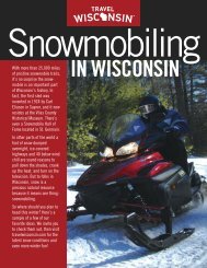
Ride safely - Wisconsin Department of Tourism
Ride safely - Wisconsin Department of Tourism
Ride safely - Wisconsin Department of Tourism

Create successful ePaper yourself
Turn your PDF publications into a flip-book with our unique Google optimized e-Paper software.
2JUST THE FACTS<br />
8 Visit travelwisconsin.com<br />
Valhalla<br />
Area Trails<br />
DISTANCE: 78 miles.<br />
DIFFICULTY: Easy to moderate.<br />
TRAILHEAD LOCATION(S): For the<br />
Valhalla Trail, the trailhead is west <strong>of</strong><br />
Washburn <strong>of</strong>f Cty C and FR 505. To the<br />
south, access is available from FR 435<br />
near Wannebo Road and <strong>of</strong>f Cherryville<br />
Road near Barrens Road. To the west,<br />
access is available in Iron River and <strong>of</strong>f<br />
East Long Lake Road. The Battleaxe<br />
trailhead is near the Battle Axe Road<br />
and Flag Road intersection.<br />
SEASON: Many trails close in the<br />
spring until the ground dries. Call for<br />
trail updates or visit www.travelbayfieldcounty.com.<br />
OTHER TRAILS IN THIS REGION:<br />
Tri-County Corridor, Buckskin Trail, and<br />
Bear Paw Trail.<br />
FEES: Daily parking fees are required at<br />
some U.S. Forest trailheads. The pass<br />
can be purchased on site. Annual passes<br />
also are available.<br />
CAUTION: The speed limit on all<br />
Bayfield County trails is 40 mph. The<br />
county also passed a sound ordinance.<br />
Noise from an ATV cannot exceed 96<br />
decibels. Some routes are available<br />
through cities and towns. Be sure to<br />
follow the posted ATV route.<br />
LEGEND: For a complete listing <strong>of</strong> all<br />
icons, see page 4.<br />
AREA ATTRACTIONS: White Winter<br />
Winery.<br />
FOR MORE INFORMATION:<br />
U.S. Forest Service – Washburn<br />
Ranger District<br />
715/373-2667<br />
Bayfield Chamber <strong>of</strong> Commerce<br />
800/447-4094 or 715/779-3335<br />
www.bayfield.org<br />
Ashland & Bayfield County <strong>Tourism</strong><br />
800/472-6338 or 715/373-6125<br />
www.travelbayfieldcounty.com<br />
Washburn Chamber <strong>of</strong> Commerce<br />
800/253-4495 or 715/373-5017<br />
www.washburnchamber.com<br />
Iron River Chamber <strong>of</strong> Commerce<br />
800/345-0716 or 715/372-8558<br />
www.visitironriver.com<br />
Bayfield County<br />
Jutting out into the largest fresh<br />
water lake in the world, Bayfield<br />
County is a jewel <strong>of</strong> natural resources<br />
and wonderful scenery.<br />
The ATV trails here flow<br />
through county and<br />
national forest lands.<br />
Notably, many trails<br />
glide through the northern<br />
part <strong>of</strong> the<br />
Chequamegon-Nicolet<br />
National Forest.<br />
The Valhalla Area Trails are<br />
a popular destination for ATV enthusiasts.<br />
The Valhalla Trail, also known as the<br />
Valhalla Recreation Area, is positioned 10<br />
miles west <strong>of</strong> the town <strong>of</strong> Washburn,<br />
which sits right on the big lake. With plenty<br />
<strong>of</strong> lodging, services and attractions,<br />
Washburn is accessible via ATV. It also can<br />
<strong>of</strong>fer a relaxing diversion from a day on the<br />
trails. If roughing it is more your style, you<br />
can find campsites at Memorial Park and<br />
Thompson’s West End Park (715/373-6160;<br />
www.city<strong>of</strong>washburn.org) on the shores <strong>of</strong><br />
Lake Superior. Several sites overlook<br />
Chequamegon Bay with picturesque views.<br />
Both parks are operated by the city and<br />
<strong>of</strong>fer a number <strong>of</strong> amenities.<br />
Many trails in this region are numbered<br />
for easy reference. The 15.3-mile<br />
Valhalla Trail system is an easy loop ride<br />
that takes you on Trails 35/31 on the north<br />
and west sides to Trails 13/33 on the south<br />
and east sides. Here you’ll experience plenty<br />
<strong>of</strong> rolling terrain and wooded sections.<br />
You’ll also come across other trails<br />
along this route. The 2.3-mile Washburn<br />
Trail connects Valhalla through an area<br />
called Sun Bowl – an 80-acre glacial pit –<br />
as it exits the forest and onto county ATV<br />
routes.<br />
Within the Valhalla Trail system, the<br />
Ridge Top Trail is a 1.1-mile stretch that’s a<br />
little more difficult due to one <strong>of</strong> the<br />
longest, steepest climbs in the area. But<br />
don’t let that stop you. It climbs the south<br />
side <strong>of</strong> Mount Valhalla where you’re<br />
rewarded with scenic views. The trail loops<br />
back to the Valhalla Trail. Nearby, the<br />
Valhalla Trail Lodge (715/292-7546;<br />
www.valhallatraillodge.com) on the edge