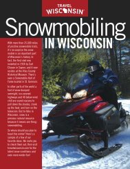
Ride safely - Wisconsin Department of Tourism
Ride safely - Wisconsin Department of Tourism
Ride safely - Wisconsin Department of Tourism

Create successful ePaper yourself
Turn your PDF publications into a flip-book with our unique Google optimized e-Paper software.
oads. If you like camping, Smith Lake<br />
County Park & Campground just west <strong>of</strong><br />
the city has direct access to the trail.<br />
Located on the shores <strong>of</strong> the Flambeau<br />
River, the park <strong>of</strong>fers year-round electric<br />
hookups, flush toilets and showers April<br />
through October, and an ATV loading<br />
ramp.<br />
Park Falls is a district headquarters for<br />
the nearby Chequamegon-Nicolet National<br />
Forest. At the district <strong>of</strong>fice, (1170 4th Ave<br />
S), you can pick up a map showing the forest<br />
roads and trails posted for ATV use.<br />
Heading west on the Tuscobia State<br />
Trail, you’ll encounter varying terrain from<br />
thick forest sections to open expanses that<br />
cross creeks and streams that are tributaries<br />
<strong>of</strong> the Flambeau River. Crossing into<br />
Sawyer County, you’ll hit a spur trail running<br />
south 40 miles into the Flambeau<br />
River State Forest.<br />
Back on the Tuscobia, the next two little<br />
towns are Draper and Loretta where<br />
food and fuel are available. Here, the old<br />
railroad bed on which you ride is ever present<br />
– beneath the sod <strong>of</strong> the trail you can<br />
still see the old railroad ties. The trail cuts<br />
southwest, crossing the Brunet River on its<br />
way to Winter. Stop to check out the river,<br />
known for its musky and trout fishing.<br />
Food, fuel and lodging are available in<br />
Winter (www.winterwi.com). You might<br />
want to check out the original railroad station<br />
downtown to catch a glimpse <strong>of</strong> the<br />
To Dead Horse<br />
ATV Trail<br />
(Pages 14-15)<br />
Loretta<br />
GG<br />
Draper<br />
golden age <strong>of</strong> the railway in northern<br />
<strong>Wisconsin</strong>.<br />
From Winter, the trail runs west to<br />
meet the Chippewa River at Ojibwa. Just<br />
before reaching town, Ojibwa Park<br />
(715/266-5923) <strong>of</strong>fers 350 acres <strong>of</strong> heavily<br />
wooded land with campsites and electric<br />
hookups. For those traveling the Tuscobia’s<br />
entire 62 miles, this marks the halfway<br />
point. In Ojibwa, just south <strong>of</strong> the trail, history<br />
buffs might take note <strong>of</strong> a large white<br />
house. Once a hotel that was built in the<br />
1870s, it is the oldest standing building in<br />
Sawyer County.<br />
From Ojibwa, the trail follows the<br />
Chippewa River to Radisson – a particularly<br />
pretty stretch <strong>of</strong>fering some great views <strong>of</strong><br />
a wild river. From Radisson, the trail parallels<br />
Hwy 27/70 to Couderay where it<br />
breaks southwest diving deep into miles <strong>of</strong><br />
lush, green forest on its way to Birchwood.<br />
This 17-mile section crosses the Blue Hills,<br />
remnants <strong>of</strong> an ancient mountain range<br />
that towered above northern <strong>Wisconsin</strong> a<br />
billion years ago.<br />
Birchwood is the end <strong>of</strong> the ATV line<br />
on the Tuscobia State Trail. (Note: riders<br />
can cross the bridge to the west side <strong>of</strong><br />
the Red Cedar River to connect with trails<br />
headed north.) From here, hikers on the<br />
Ice Age National and State Scenic Trail fill<br />
the last 12 miles <strong>of</strong> the Tuscobia to its<br />
western terminus at Rice Lake.<br />
E<br />
SAWYER CO<br />
PRICE CO<br />
Butternut<br />
Lake<br />
E<br />
River<br />
13<br />
Park<br />
Falls<br />
13<br />
182<br />
W<br />
70<br />
River<br />
M<br />
70<br />
Flambeau<br />
Winter<br />
H<br />
Ojibwa<br />
Brunet<br />
W<br />
0 5 10<br />
15 Miles<br />
River<br />
40<br />
Chippewa<br />
27<br />
<strong>Wisconsin</strong> ATV Guide 17