Ride safely - Wisconsin Department of Tourism
Ride safely - Wisconsin Department of Tourism
Ride safely - Wisconsin Department of Tourism

Create successful ePaper yourself
Turn your PDF publications into a flip-book with our unique Google optimized e-Paper software.
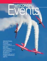
3JUST THE FACTS<br />
Tri-County<br />
Recreational Corridor<br />
Douglas, Bayfield & Ashland Counties<br />
DISTANCE: 62 miles<br />
DIFFICULTY: Easy<br />
TRAILHEAD LOCATION(S): Trail<br />
access and parking is available in<br />
Superior, Iron River, Brule, and Ashland.<br />
Access only in Poplar and Maple.<br />
SEASON: Open year round<br />
OTHER TRAILS IN THIS REGION:<br />
Saunders Grade, Gandy Dancer State<br />
Trail, Valhalla Area Trails, Dead Horse<br />
Run.<br />
CAUTION: Trail is open to other outdoor<br />
enthusiasts. Please use caution<br />
and good trail etiquette to ensure the<br />
enjoyment and safety <strong>of</strong> all trail users.<br />
FEES: None.<br />
AREA ATTRACTIONS: Amnicon Falls<br />
State Park, Brule River State Forest,<br />
South Shore Brewery, Northern Great<br />
Lakes Visitors Center.<br />
LEGEND: For a complete listing <strong>of</strong> all<br />
icons, see page 4.<br />
FOR MORE INFORMATION:<br />
Ashland Area Chamber <strong>of</strong><br />
Commerce<br />
800/284-9484 or 715/682-2500<br />
www.visitashland.com<br />
Bayfield County <strong>Tourism</strong> &<br />
Recreation<br />
800/472-6338 or 715/373-6125<br />
www.travelbayfieldcounty.com<br />
Douglas County Forestry<br />
<strong>Department</strong><br />
715/378-2219<br />
www.douglascountywi.org<br />
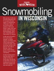
As the name suggests, the Tri-County<br />
Recreational Corridor is a rail trail<br />
across three counties in northern<br />
<strong>Wisconsin</strong> connecting<br />
the port cities <strong>of</strong> Superior<br />
and Ashland.<br />
In the late 1800s,<br />
settlers mined the thick<br />
pine and hardwood<br />
forests along the southern<br />
shore <strong>of</strong> Lake Superior.<br />
The railroad took that timber<br />
to market along with area<br />
farm products. The rail line was, indeed,<br />
the lifeblood <strong>of</strong> frontier commerce.<br />
Today, that same rail bed is the<br />
lifeblood <strong>of</strong> area recreation. In 1987, local<br />
government purchased the right-<strong>of</strong>-way<br />
and converted it to a recreational trail for<br />
all to enjoy. Since then, the 62-mile trail,<br />
which follows Hwy. 2, has been a popular<br />
route for ATV enthusiasts, snowmobilers<br />
and mountain bikers.<br />
On the trail’s western end, Superior<br />
<strong>of</strong>fers a variety <strong>of</strong> historic and scenic<br />
attractions, (see Wild Rivers State Trail,<br />
pages 6-7). Heading east, the trail is lined<br />
with the lush green trees that make up<br />
northern <strong>Wisconsin</strong>. With its hard packed<br />
surface, the Corridor is an easy ride that<br />
allows you to sit back and take in all the<br />
53<br />
Superior<br />
2<br />
Lake Superior<br />
35<br />
Z<br />
53<br />
2<br />
River<br />
13<br />
Amnicon Falls<br />
State Park<br />
P<br />
F<br />
Amnicon<br />
53<br />
Poplar<br />
P<br />
2<br />
F<br />
Amnicon Falls State Park.<br />
RJ & LINDA MILLER<br />
0 2 4 6 Miles<br />
10 Visit travelwisconsin.com