The Norton Site - Ontario Archaeological Society
The Norton Site - Ontario Archaeological Society
The Norton Site - Ontario Archaeological Society

You also want an ePaper? Increase the reach of your titles
YUMPU automatically turns print PDFs into web optimized ePapers that Google loves.
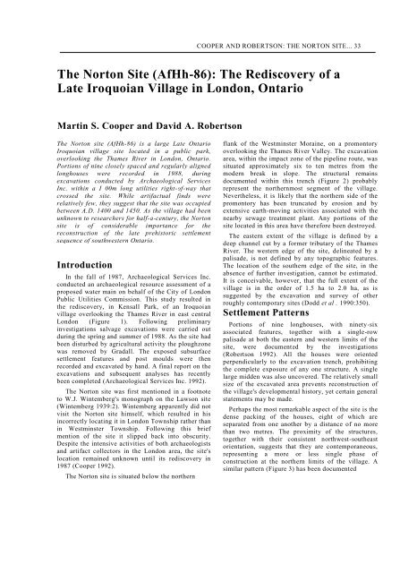
COOPER AND ROBERTSON: THE NORTON SITE... 33<br />
<strong>The</strong> <strong>Norton</strong> <strong>Site</strong> (AfHh-86): <strong>The</strong> Rediscovery of a<br />
Late Iroquoian Village in London, <strong>Ontario</strong><br />
Martin S. Cooper and David A. Robertson<br />
<strong>The</strong> <strong>Norton</strong> site (AfHh-86) is a large Late <strong>Ontario</strong><br />
Iroquoian village site located in a public park,<br />
overlooking the Thames River in London, <strong>Ontario</strong>.<br />
Portions of nine closely spaced and regularly aligned<br />
longhouses were recorded in 1988, during<br />
excavations conducted by <strong>Archaeological</strong> Services<br />
Inc. within a I 00m long utilities right-of-way that<br />
crossed the site. While artifactual finds were<br />
relatively few, they suggest that the site was occupied<br />
between A.D. 1400 and 1450. As the village had been<br />
unknown to researchers for half-a-century, the <strong>Norton</strong><br />
site is of considerable importance for the<br />
reconstruction of the late prehistoric settlement<br />
sequence of southwestern <strong>Ontario</strong>.<br />
Introduction<br />
In the fall of 1987, <strong>Archaeological</strong> Services Inc.<br />
conducted an archaeological resource assessment of a<br />
proposed water main on behalf of the City of London<br />
Public Utilities Commission. This study resulted in<br />
the rediscovery, in Kensall Park, of an Iroquoian<br />
village overlooking the Thames River in east central<br />
London (Figure 1). Following preliminary<br />
investigations salvage excavations were carried out<br />
during the spring and summer of 1988. As the site had<br />
been disturbed by agricultural activity the ploughzone<br />
was removed by Gradall. <strong>The</strong> exposed subsurface<br />
settlement features and post moulds were then<br />
recorded and excavated by hand. A final report on the<br />
excavations and subsequent analyses has recently<br />
been completed (<strong>Archaeological</strong> Services Inc. 1992).<br />
<strong>The</strong> <strong>Norton</strong> site was first mentioned in a footnote<br />
to W.J. Wintemberg's monograph on the Lawson site<br />
(Wintemberg 1939:2). Wintemberg apparently did not<br />
visit the <strong>Norton</strong> site himself, which resulted in his<br />
incorrectly locating it in London Township rather than<br />
in Westminster Township. Following this brief<br />
mention of the site it slipped back into obscurity.<br />
Despite the intensive activities of both archaeologists<br />
and artifact collectors in the London area, the site's<br />
location remained unknown until its rediscovery in<br />
1987 (Cooper 1992).<br />
<strong>The</strong> <strong>Norton</strong> site is situated below the northern<br />
flank of the Westminster Moraine, on a promontory<br />
overlooking the Thames River Valley. <strong>The</strong> excavation<br />
area, within the impact zone of the pipeline route, was<br />
situated approximately six to ten metres from the<br />
modern break in slope. <strong>The</strong> structural remains<br />
documented within this trench (Figure 2) probably<br />
represent the northernmost segment of the village.<br />
Nevertheless, it is likely that the northern side of the<br />
promontory has been truncated by erosion and by<br />
extensive earth-moving activities associated with the<br />
nearby sewage treatment plant. Any portions of the<br />
site located in this area have therefore been destroyed.<br />
<strong>The</strong> eastern extent of the village is defined by a<br />
deep channel cut by a former tributary of the Thames<br />
River. <strong>The</strong> western edge of the site, delineated by a<br />
palisade, is not defined by any topographic features.<br />
<strong>The</strong> location of the southern edge of the site, in the<br />
absence of further investigation, cannot be estimated.<br />
It is conceivable, however, that the full extent of the<br />
village is in the order of 1.5 ha to 2.0 ha, as is<br />
suggested by the excavation and<br />
survey of other<br />
roughly contemporary sites (Dodd et al . 1990:350).<br />
Settlement Patterns<br />
Portions of nine longhouses, with ninety-six<br />
associated features, together with a single-row<br />
palisade at both the eastern and western limits of the<br />
site, were documented by the investigations<br />
(Robertson 1992). All the houses were oriented<br />
perpendicularly to the excavation trench, prohibiting<br />
the complete exposure of any one structure. A single<br />
large midden was also uncovered. <strong>The</strong> relatively small<br />
size of the excavated area prevents reconstruction of<br />
the village's developmental history, yet certain general<br />
statements may be made.<br />
Perhaps the most remarkable aspect of the site is the<br />
dense packing of the houses, eight of which are<br />
separated from one another by a distance of no more<br />
than two metres. <strong>The</strong> proximity of the structures,<br />
together with their consistent northwest-southeast<br />
orientation, suggests that they are contemporaneous,<br />
representing a more or less single phase of<br />
construction at the northern limits of the village. A<br />
similar pattern (Figure 3) has been documented
34 ONTARIO ARCHAEOLOGY NO. 56
COOPER AND ROBERTSON: THE NORTON SITE... 35
36 ONTARIO ARCHAEOLOGY NO. 56
COOPER AND ROBERTSON: THE NORTON SITE... 37<br />
within the northwestern expansion of the nearby and<br />
possibly related Lawson site (Pearce 1980, 1984),<br />
although the <strong>Norton</strong> structures are much more closely<br />
spaced.<br />
A similar pattern of parallel rows may extend over<br />
the entire site, if the inhabitants attempted to make<br />
the most efficient use of the area encircled by the<br />
palisade. It is equally possible, however, that the<br />
excavated longhouses form an individual aligned<br />
cluster of houses within a village in which several<br />
clusters with different orientations are present. Each<br />
cluster may well have represented an individual<br />
corporate group of related lineages, sub-clans or clans<br />
(Warrick 1984:46-48), the distinct identity of which<br />
was, in part, maintained and expressed, within the<br />
wider context of the village, by the distinct<br />
orientation of its residences.<br />
Summary descriptions are provided below for each<br />
of the longhouse segments uncovered during the<br />
excavations, proceeding from east to west across the<br />
site.<br />
House 6 (Figure 4)<br />
A 9m long section of House 6, measuring 6.1 in in<br />
width, was excavated. With the exception of a single<br />
pit (Feature 1), located immediately adjacent to the<br />
west wall, the excavated segment of this structure was<br />
devoid of features. While it is possible that the<br />
exposed portion of House 6 was simply sterile in<br />
comparison to the rest of the house, it may also be<br />
that the structure was only used on a seasonal basis.<br />
Warm weather occupation of the house would not<br />
necessarily have resulted in the formation of hearths<br />
or ash pits since a regular heat source would not have<br />
been required and cooking activities could have taken<br />
place outdoors (Williamson 1983). It is also remotely<br />
possible that House 6 is in fact not a house at all, but<br />
rather two additional palisade rows on the eastern<br />
edge of the village. Nevertheless the distance between<br />
the two rows of posts is consistent with the widths of<br />
the other longhouses, and the position of the few<br />
isolated interior posts is certainly reminiscent of a<br />
longhouse central corridor. Moreover, a comparison<br />
of the House 6 post diameters with those of the<br />
palisades and with those in other house walls<br />
indicates that they are consistent with the latter.<br />
House 1 (Figure 5)<br />
A 10m long section of House 1, which was 6.6m in<br />
width, was exposed to the immediate west of House 6.<br />
<strong>The</strong> excavated segment of this structure contained the<br />
greatest concentration of features of any of the house<br />
sections exposed. A single hearth on the centre line of<br />
the house was apparently the focus of considerable<br />
activity, being associated with<br />
as many as seven ash pits, twenty-two pits and<br />
nineteen isolated posts. No internal partition walls or<br />
bunk lines were documented in House I. However the<br />
peripheral areas of the internal living area were<br />
largely devoid of features, suggesting that the use of<br />
space was relatively organized despite the lack of<br />
structural features that may have constrained<br />
movement or activity. A single line of nine more or<br />
less regularly spaced support posts was recorded along<br />
the centre line of the structure. Wall construction was<br />
characterized by alternating sections of paired posts<br />
and straight lines of posts, interrupted on the west<br />
wall by a probable entrance 0.8m in width.<br />
Immediately outside this entrance, a substantial<br />
midden had accumulated within the 1.5m wide space<br />
separating House I from House 2 to the west. It<br />
appears that, following abandonment of this area of<br />
the site. the mounded midden deposits washed down<br />
between the standing wall posts of Houses 1 and 2,<br />
accounting for the thin spread of organic soil which<br />
extended into the interiors of both structures. Whether<br />
the residents of other households (such as House 2)<br />
also contributed to this midden remains open to<br />
question. Nevertheless the development of a midden<br />
between the two houses, despite the proximity of the<br />
bluff to the north, may reflect a tendency to minimize<br />
the energy required to dispose of household waste. A<br />
similar pattern was documented at the Late Iroquoian<br />
Draper site, between Houses 2 and 17, two of the<br />
longer structures in the village (Finlayson 1985:309).<br />
House 2 (Figure 5)<br />
A 9.5m long section of House 2, measuring 5.8m in<br />
width, was uncovered. <strong>The</strong>re were no hearths in the<br />
central corridor and only fourteen relatively shallow<br />
features: one ash pit and thirteen pits. <strong>The</strong> majority of<br />
these features form two relatively well-defined<br />
activity areas in the western portion of the central<br />
corridor. <strong>The</strong>re were seven relatively large isolated<br />
interior posts in addition to four support posts, the<br />
diameters of which ranged from 15 cm to 38 cm.<br />
A semi-subterranean structure (Feature 119), with<br />
its entrance ramp oriented to the south, was located in<br />
the open area between Houses 2 and 3, utilizing<br />
structural elements of both the west wall of House 2<br />
and the east wall of House 3. Semi-subterranean<br />
structures have been documented throughout the<br />
Northeast and are being recorded with increasing<br />
frequency on early fourteenth to middle sixteenth<br />
century Iroquoian sites in <strong>Ontario</strong> (MacDonald 1992).<br />
<strong>The</strong>y are rectanguloid features with a lobed projection<br />
that together form a keyhole plan. <strong>The</strong> lobe extension<br />
normally contains a ramped entrance which leads<br />
down to the lower floor in the main
38 ONTARIO ARCHAEOLOGY NO. 56<br />
Figure 4. <strong>Norton</strong> site (AfHh-86), East Palisade and House 6
COOPER AND ROBERTSON: THE NORTON SITE... 39
40 ONTARIO ARCHAEOLOGY NO. 56<br />
body of the feature. Post moulds are found around the<br />
edge of the feature beneath the floor level. It is<br />
thought that these posts would have provided a frame<br />
for a structure around which skins or bark could be<br />
placed (MacDonald 1992). <strong>The</strong> most cogent<br />
interpretation of such features is that they were sweat<br />
lodges, serving as foci of men's social and ritual<br />
activities (MacDonald 1988:17-19; 1992:329). <strong>The</strong><br />
<strong>Norton</strong> example is somewhat unusual in that these<br />
structures were generally placed along the bunk lines<br />
of houses or were situated outside and perpendicular<br />
to the longhouse with their ramped entrances<br />
projecting through the house wall (MacDonald<br />
1988:19; 1992:323). In such locations entry to the<br />
structure would have been effectively controlled by<br />
the occupants of the longhouse: to gain access to the<br />
sweat lodge one first had to enter the longhouse itself.<br />
In the present case however the clearest entrance, at<br />
the south end of the structure, was external,<br />
suggesting that the sweat lodge was more freely<br />
accessible. Use of the sweat lodge, then, was not<br />
necessarily limited to members of either associated<br />
household as it does not appear to have been<br />
dependent upon access to either house. Nevertheless a<br />
1.3m wide gap in the west wall of House 2 and a less<br />
well-defined one in the east wall of House 3 could<br />
both have provided convenient access to the southern<br />
entrance ramp of the structure. Furthermore a short<br />
alignment of posts perpendicular to the west wall of<br />
House 2 and adjacent to the sweat lodge, together<br />
with a similar post arrangement and a shallow refuse<br />
filled pit with a skewed profile (Feature 54) in House<br />
3, suggest the former existence of two ramped<br />
entrances through the house walls, both allowing<br />
direct entrance to the structure from the house<br />
interiors. Thus it is possible that particularly close<br />
social and political relationships existed between the<br />
occupants of Houses 2 and 3. After this feature had<br />
served its primary function it was used as a midden,<br />
as is indicated by the large quantities of artifacts<br />
recovered from its fill. This change in use is<br />
consistent with data noted on other sites such as<br />
Myers Road (Ramsden et al., in press).<br />
House 3 (Figure 5)<br />
Twelve features were recorded within the excavated<br />
portion of House 3, which measured 6.1m in width.<br />
<strong>The</strong> central corridor of House 3 was delineated on the<br />
east side by a discontinuous bunk line formed by a six<br />
metre long row of support posts that were placed at<br />
approximately one metre intervals. <strong>The</strong> presence of<br />
three pits (Features 66-68) and several associated<br />
posts immediately adjacent to the west wall indicates<br />
that no bunk line was present on that side, although<br />
three support posts to the<br />
north of the feature cluster may indicate that such a<br />
structural feature extended beyond the northern edge<br />
of excavation. Such variability in bunk line placement<br />
or use was repeated throughout the site. <strong>The</strong> corridor<br />
itself was relatively devoid of features aside from the<br />
three hearths (Features 72, 79 and 81) and an<br />
associated ash pit (Feature 80). Feature 79, together<br />
with an associated cluster of nine posts as well as<br />
Features 80 and 81, were all located along the centre<br />
line of the house. Feature 72, a much smaller hearth,<br />
was located one metre east of the centre line between<br />
the ash pit and the southern end of the line of support<br />
posts. In the absence of evidence for an external<br />
hearth near the semi-subterranean sweat lodge, it is<br />
tempting to suggest that at least one of these hearths<br />
was functionally associated with the sweat lodge. <strong>The</strong><br />
majority of the remaining features in House 3 were<br />
located in the west peripheral area within 1.8m of the<br />
west wall. A cluster of three pits (Features 66-68) was<br />
located directly west of the northern hearth (Feature<br />
80) while two pits (Features 70, 71) lay opposite the<br />
southern hearth (Feature 79) and its associated post<br />
cluster. <strong>The</strong>se latter were mirrored by another pit<br />
(Feature 74) located across the house adjacent to the<br />
east house wall. Feature 54, traversing the east wall<br />
and abutting the sweat lodge may in fact have been a<br />
ramped entrance, as suggested above.<br />
House 4 (Figure 5)<br />
A 9.5m long section of House 4 including its<br />
northern end was exposed.. This structure, measuring<br />
5.8m in width, appears to have been either extended<br />
or contracted or else was appended by a vestibule or<br />
porch that served as a sheltered activity area. <strong>The</strong><br />
exact nature of this structural feature cannot be<br />
determined without further excavation. Two large<br />
gaps in the west wall of the structure are of particular<br />
interest since neither can be attributed to poor soil<br />
conditions. <strong>The</strong> southern example was 2.5m in width<br />
while the northern opening measured at least 2m in<br />
width. <strong>The</strong>se large openings may suggest a summer<br />
occupation. Two relatively small round hearths<br />
(Features 77 and 88) were both located along the<br />
centre line. <strong>The</strong> northernmost of these (Feature 77)<br />
would have been associated with the occupation of<br />
House 4 if the pattern recorded represents an<br />
expansion or contraction of the house. Alternatively it<br />
could relate to tasks carried out in a structurally<br />
complex activity area defined by the extension of the<br />
house walls and by one or possibly two<br />
perpendicularly oriented lines of posts. A single ash<br />
pit (Feature 76) was the only feature associated with<br />
the northern hearth. <strong>The</strong> southern hearth appears to<br />
have provided the focus for a diffuse concentration of<br />
two intersecting ash pits (Features
COOPER AND ROBERTSON: THE NORTON SITE... 41
42 ONTARIO ARCHAEOLOGY NO. 56<br />
83 and 84) and a sterile pit (Feature 87) all located in<br />
the central corridor as well as two additional<br />
intersecting pits (Features 85 and 86) located adjacent<br />
to the east wall.<br />
House 5 (Figure 6)<br />
A 4.0m long portion of the extreme southern end of<br />
House 5 was exposed along with an additional 3.0m<br />
length of its east side wall. <strong>The</strong> maximum width of the<br />
exposed portion of the structure was 5.8m. This figure<br />
may not be representative of the house's width as the<br />
walls apparently taper to rounded corners and a flat<br />
end but it is closely comparable to the figures<br />
obtained from the other structures. A probable<br />
entrance, extending beyond the edge of excavation,<br />
but with a minimum width of 0.9m, was located in the<br />
west wall directly opposite a similar opening in the<br />
east wall of the adjacent House 7. Only five pits<br />
(Features 89-92, 95), all concentrated near the south<br />
end wall, were documented. All were located along<br />
the edges of the central corridor with the exception of<br />
Feature 92 which was placed in the very southeast<br />
corner. A line of ten interior posts set at 0.5m<br />
intervals cut across the southwestern corner of House<br />
5, enclosing an area of approximately 2.5m'. This may<br />
represent a small storage cubicle at the house end.<br />
Alternatively, this alignment, together with the large<br />
support posts and several other smaller posts<br />
concentrated in the area, may represent one or more<br />
episodes of repair to this particular part of the<br />
longhouse.<br />
House 9 (Figure 6)<br />
A curving line of fourteen posts located 1.5m to<br />
the south of House 5 represents the extreme northern<br />
end of House 9, which was laid out with an<br />
orientation consistent with that of the other structures.<br />
House 7 (Figure 6)<br />
An 8.0m long section of House 7, including its<br />
southern end wall, was exposed. <strong>The</strong> orientation of<br />
this 6.5m wide structure deviated slightly from that of<br />
the other houses but probably not sufficiently to<br />
overlap House 5 to the east. <strong>The</strong> walls of the house<br />
tapered slightly to rounded corners and a flat end. Six<br />
features were documented in the house, four of which<br />
were located in its south end. A single large shallow<br />
hearth (Feature 101) was located roughly 2.5m from<br />
the end wall with its long axis oriented<br />
perpendicularly to that of the longhouse. <strong>The</strong><br />
remaining features (Features 100, 102, 106, 108 and<br />
109) were all pits, three of which were sterile. One<br />
was located adjacent to the hearth, one was in the<br />
central corridor, and three were placed at the edges of<br />
the central corridor. A line of interior posts<br />
which ran parallel to the east wall and the southeast<br />
corner may indicate a 1.0m to 1.5m wide bunk line in<br />
this area of the house. A second row of posts which<br />
extended beyond the northern edge of excavation but<br />
was at least 2.5m in length, may have been a partition<br />
wall or screen associated with a probable entrance in<br />
the east wall. As noted above this entrance directly<br />
faces a possible doorway in the west wall of House 5.<br />
House 8 (Figure 6)<br />
An 8.0m long section of House 8, measuring 6.5m in<br />
width, was exposed. This structure, approximately<br />
6.5m from the west palisade at the west end of the<br />
house cluster, was separated from House 5 its nearest<br />
neighbour by approximately 5.0m: over twice the<br />
average distance between the other houses<br />
encountered. Four features were located in the<br />
excavated section of House 8. Three sterile pits<br />
(Features 1 11, 112, 114) formed a loose cluster in the<br />
central corridor. A 1.5m long irregular line of interior<br />
posts may also have been associated with this activity<br />
area. Feature 116, another sterile pit, was placed along<br />
the west periphery of the interior living area.<br />
<strong>The</strong> Palisades (Figures 4 and 6)<br />
<strong>The</strong> aligned houses appear to have been enclosed by<br />
a single row palisade. On the whole somewhat larger<br />
posts were preferred for construction of the palisades<br />
than for the house walls. Nevertheless there was<br />
considerable variation in the size of posts selected and<br />
many would not have been out of place in a house<br />
wall. <strong>The</strong> east palisade was located roughly 5.0m east<br />
of House 6, and positioned near the edge of the creek<br />
channel. <strong>The</strong> west palisade was situated in an area of<br />
relatively flat topography offering little defensive<br />
advantage. Adjacent to a possible entrance in the<br />
palisade a line of small posts, extending southeast,<br />
may represent a fence enclosing a small area adjacent<br />
to the palisade rather than reconstruction or<br />
modification of the palisade itself.<br />
<strong>The</strong> Artifact Assemblage<br />
Despite the scale of the excavations carried out at<br />
the site the recovered artifact assemblage is relatively<br />
small. This places considerable limitations upon intraand<br />
inter-site analyses but several generalizations<br />
remain possible. Table 1 summarizes the recovered<br />
material by artifact class.<br />
Ceramic Vessels<br />
Thirty-eight rim sherds were recovered during the<br />
course of excavations, forming a total of twelve<br />
vessels (Powis et al. 1992). Tables 2 and 3
COOPER AND ROBERTSON: THE NORTON SITE... 43<br />
Table 1 <strong>Norton</strong> site (AfHh-86)artifact frequencies by class<br />
ARTIFACT CLASS<br />
F R E Q U E N C Y<br />
%<br />
Ceramics'<br />
body sherds 153 23.2<br />
neck-shoulder sherds 39 5.9<br />
rim sherds 38 5.8<br />
pipes 5 0.8<br />
juvenile vessel sherds 8 1.2<br />
Lithics<br />
debitage 386 58.5<br />
cores 5 0.8<br />
utilized flakes 15 2.3<br />
bifaces & points 9 1.7<br />
hammer/anvil stones 2 0.3<br />
TOTAL 660 100.5<br />
'excludes 438 unanalyzable sherds<br />
summarize the metric and non-metric attributes of the<br />
rim sherds. Three basic vessel types are apparent<br />
within the assemblage (Table 4). Type 1<br />
(n=10/83.3%) predominates and includes all those<br />
rims with a collar motif consisting of obliques on the<br />
collar (Figure 7:a-e, g and h). Within this basic type<br />
five variations were noted, including: (a) obliques on<br />
the collar with interior and neck decoration; (b)<br />
obliques on the collar with interior decoration only;<br />
(c) obliques on the collar with neck decoration only;<br />
(d) obliques on the collar over a horizontal line with<br />
interior and neck decoration; and (e) obliques on the<br />
collar with no interior or lip decoration. One rim<br />
(Type 2) is characterized by opposed obliques on the<br />
collar and neck decoration (Figure 7:f).<br />
Type 3 (illustrated in Table 4) consists of one rim<br />
sherd decorated with obliques on the collar crossed by<br />
a horizontal, as well as interior and neck decoration. It<br />
must be recognized, however, that the definition of<br />
this type may be somewhat inappropriate, since the<br />
sherd is a complete castellation the decoration of<br />
which may not be representative of the entire vessel.<br />
Overall the attributes which characterize the <strong>Norton</strong><br />
site ceramic assemblage suggest a late Middleport or<br />
early Late Iroquoian occupation (circa A.D. 1400-<br />
1450). Vessels with well-defined collars predominate,<br />
the use of incising was preferred to<br />
stamping as a decorative technique, obliques or<br />
obliques over horizontal decoration are the most<br />
common motifs and there is a complete absence of lip<br />
decoration. <strong>The</strong> presence of interior decoration on<br />
eight of the twelve vessels, a trait which generally<br />
decreases through the Middleport substage (although<br />
the London area appears to be somewhat anomalous<br />
in this regard (Pearce 1984:212-213; Dodd et al.<br />
1990:336), also suggests a late Middleport or early Late<br />
Iroquoian date. Moreover, with respect to traditional<br />
typology (MacNeish 1952), the predominance of<br />
Pound and Black Necked vessels over Middleport<br />
Oblique (and Lawson Incised) together with the<br />
complete absence of <strong>Ontario</strong> Horizontal (Table 5),<br />
implies an early Late Iroquoian date (i.e. post A.D.<br />
1400) for the site (Dodd et al. 1990:337).<br />
Ceramic Pipes<br />
Five ceramic pipes were recovered including two<br />
bowl fragments, one complete bowl, one complete<br />
bowl and elbow section and one complete pipe (Powis<br />
et al . 1992). <strong>The</strong>se comprise one (Figure 8c) or<br />
possibly two trumpet pipes, one conical plain pipe<br />
(Figure 8b), one Iroquois ring (Figure 8d) and one<br />
miniature, possibly juvenile, conical pipe with a ring<br />
motif (Figure 8a).<br />
General trends are now recognized in the<br />
development of a ceramic pipe complex on prehistoric<br />
Iroquoian sites in southern <strong>Ontario</strong>.
44 ONTARIO ARCHAEOLOGY NO. 56<br />
Table 2. <strong>Norton</strong> site (AfHh-86): ceramic vessel summary descriptive statistics<br />
ATTRIBUTE n %<br />
RIM FORM<br />
Collared 8 66.7<br />
Incipient Collared 3 25.0<br />
Collarless 1<br />
8.3<br />
LIP FORM<br />
Flat 12<br />
100<br />
ANGLE OF LIP TO INTERIOR<br />
Right 5 41.7<br />
Obtuse 5 41.7<br />
Acute 2<br />
16.7<br />
RIM ORIENTATION<br />
Vertical 10 83.3<br />
Outflaring 2<br />
16.7<br />
INTERIOR PROFILE<br />
Straight 7 58.3<br />
Concave 3 25.0<br />
Convex 2<br />
16.7<br />
COLLAR BASE SHAPE<br />
Angular 6 50.0<br />
Rounded 5 41.7<br />
N/A 1<br />
8.3<br />
COLLAR TECHNIQUE<br />
Incised 7 58.3<br />
Linear Stamp 1 8.3<br />
Dentate Stamp 1 8.3<br />
Incised over Incised 1 8.3<br />
Incised crossed by Incised 1 8.3<br />
Corded Punctate 1<br />
8.3<br />
NECK MOTIFS<br />
Horizontal 9 75.0<br />
Plain 2 16.7<br />
Horizontal over Oblique 1<br />
8.3<br />
NECK TECHNIQUE<br />
Incised 9 75.0<br />
Plain 2 16.7<br />
Incised over Incised 1<br />
8.3<br />
INTERIOR MOTIFS<br />
Punctate 6 50.0<br />
Plain 4 33.3<br />
Horizontal 1 8.3<br />
Linear Punctate 1<br />
8.3<br />
INTERIOR TECHNIQUES<br />
Punctate 7 58.3<br />
Plain 4 33.3<br />
Linear Punctate 1<br />
LIP MOTIFS<br />
8.3<br />
Plain 12 100
COOPER AND ROBERTSON: THE NORTON SITE... 45<br />
Table 3. <strong>Norton</strong> site (AfHh-86): ceramic vessel summary metrics<br />
COLLAR HEIGHT (n=12)<br />
Range<br />
9.0-40.0 mm<br />
Mean<br />
21.42 mm<br />
Standard Deviation 10.36<br />
Coefficient of Variation 48.4<br />
LIP WIDTH (n=12)<br />
Range<br />
6.0-13.0 mm<br />
Mean<br />
9.58 mm<br />
Standard Deviation 2.84<br />
Coefficient of Variation 29.7<br />
COLLAR BASE WIDTH (n=12)<br />
Range<br />
7.0-16.0 mm<br />
Mean<br />
11.0 mm<br />
Standard Deviation 2.95<br />
Coefficient of Variation 26.86<br />
Middle Iroquoian pipes are characterized by conical<br />
and barrel-shaped bowls, right-angled elbow<br />
junctures, round stem cross-sections and the use of<br />
encircling incised lines as a decorative technique.<br />
Plain bowls are also common and may constitute half<br />
of a Middle Iroquoian pipe sample. <strong>The</strong> trumpet pipe<br />
is generally accepted as a late Middleport to early<br />
Late Iroquoian stage trait (Wright 1966:71; Kapches<br />
1981:208), although Smith (1987) has argued that it<br />
cannot be used as a temporal marker. <strong>The</strong> <strong>Norton</strong><br />
sample is comparable to the nine pipes found at the<br />
Alway site near Komoka which include plain trumpet,<br />
conical plain and Iroquois ring types among the four<br />
types identified (Pearce 1984). <strong>The</strong> Lawson site is<br />
slightly later in the regional sequence and the pipe<br />
assemblage includes human effigy types and a greater<br />
proportion of ring versus trumpet types. It would<br />
appear therefore that the pipe sample from the <strong>Norton</strong><br />
site exhibits the traits of a Late Iroquoian site in<br />
transition from the Late Middleport stage.<br />
Lithics<br />
Slightly over 400 lithic artifacts were recovered,<br />
yet this total includes only nine formal chert tools<br />
(Robertson and Woodley 1992). Five point fragments<br />
were recovered including a diagnostic base, one<br />
lateral fragment and three tips. <strong>The</strong> diagnostic point<br />
base was collected during the surface survey. Made of<br />
Kettle Point chert and broken just above the shoulder,<br />
it is side-notched<br />
with a convex base and exhibits basal grinding. <strong>The</strong><br />
width of the fragment is 14.5mm, and its thickness is<br />
3.8mm. Although the base is more convex than most it<br />
is probably a Nanticoke Notched type point (Fox<br />
1987). <strong>The</strong> lateral edge fragment, recovered from a<br />
House 5 support post, is from a side notched point<br />
manufactured from Onondaga chert. It is broken along<br />
the medial line, and the base is broken beneath the<br />
shoulder although part of the side notch remains. <strong>The</strong><br />
remaining lateral edge is thinned. It measures 6.3mm<br />
in thickness. <strong>The</strong> remaining point fragments are tips.<br />
<strong>The</strong> first of these was recovered from Midden A and<br />
is made of Selkirk chert. It is 20.8mm wide and<br />
4.8mm thick. <strong>The</strong> second point tip was recovered from<br />
the topsoil during test excavations. Made of Onondaga<br />
chert, it measures I4.8mm in width and 3.2mm in<br />
thickness. <strong>The</strong> final point tip was recovered during the<br />
surface collection of the site. It too was made of<br />
Onondaga chert, measuring 13.3mm in width and<br />
4.7mm in thickness. Both Onondaga point tips had<br />
been thermally altered. One complete biface or point<br />
preform of Onondaga chert was recovered from<br />
Midden A. It is 45.1 mm in length, 20.8mm in width<br />
and 4.8mm in thickness. It has a slightly convex base<br />
and excurvate edges that taper toward the tip and is<br />
thinned on all edges. Two small biface fragments were<br />
recovered from Feature 1 in House 6. <strong>The</strong> first of<br />
these is made from Onondaga chert and is probably a<br />
biface preform fragment. <strong>The</strong>re is cortex on one<br />
lateral edge and many fracture scars that
46 ONTARIO ARCHAEOLOGY NO. 56<br />
Table 4. <strong>Norton</strong> site (AfHh-86): ceramic vessel decorative motifs<br />
Table 5. <strong>Norton</strong> site (AfHh-86): ceramic vessel types by major provenance units<br />
CERAMIC TYPE ' H1 H2 H3 H4 F. 119 TOTAL<br />
Pound Necked 1 1 1 3 6<br />
Middleport Oblique 2 2<br />
Black Necked 1 1<br />
Lawson Incised 1 1<br />
Miscellaneous 1 1 2<br />
' Types defined after MacNeish (1952)<br />
hinge at the cortex. <strong>The</strong> other lateral edge has<br />
extensive use-wear suggesting that it was used as a<br />
knife. <strong>The</strong> artifact was thermally altered and is<br />
10.9mm thick. <strong>The</strong> second tool fragment is made of<br />
Onondaga chert and is a combination biface and<br />
graver. Only a few attempts were made to remove<br />
the cortex on one lateral edge. It is crudely thinned<br />
on the slightly convex worked edge. <strong>The</strong>re is a<br />
pointed worked area near the bottom of the blade,<br />
probably the result of its use as a graver. <strong>The</strong> only<br />
other biface in the assemblage, recovered from the<br />
upper level of Midden A, is a very small edge<br />
fragment.<br />
Fifteen utilized flakes were recovered during the<br />
course of excavations (Table 6). Six of these flakes<br />
were derived from Midden A, three were recovered
COOPER AND ROBERTSON: THE NORTON SITE... 47
48 ONTARIO ARCHAEOLOGY NO. 56
Table 6. <strong>Norton</strong> site (AfHh-86): summary statistics for utilized flakes<br />
UTILIZED FLAKES<br />
PROVENANCE MATERIAL TYPE LENGTH<br />
(mm)<br />
WIDTH<br />
(mm)<br />
THICKNESS<br />
(mm)<br />
LOCALE<br />
WORKED<br />
EDGE<br />
LENGTH OF<br />
WORKED EDGE<br />
surface unknown secondary retouch 17.4 22.1 3.8 distal/dorsal straight 15.3<br />
test unit Kettle Point unknown -- -- 5.8 left/ventral<br />
right/ventral<br />
straight<br />
convex<br />
16.9<br />
16.1<br />
test unit unknown secondary retouch 35.9 34.8 7.1 distal/ventral irregular 35.8<br />
test unit burnt shatter 39.0 23.3 13.4 straight 13.5<br />
House 6 Feat.1 burnt secondary retouch 3.4 right/ventral concave 12.3<br />
House 6 Feat.1 Onondaga secondary retouch 3.1 right/dorsal convex 10.3+<br />
House 6 Feat.1 burnt unknown 24.3 4.3 left/dorsal<br />
right/dorsal<br />
straight<br />
convex<br />
12.8+<br />
14.6+<br />
Midden A unknown unknown 5.1 left/dorsal convex 15.9+<br />
Midden A Onondaga secondary retouch 19.6 30.8 4.0 distal/ventral straight 9.6<br />
Midden A Onondaga primary thinning 3.9 left/dorsal straight 16.0<br />
Midden A Onondaga shatter 26.7 24.2 12.3 - straight 19.5<br />
Midden A unknown primary reduction 35.1 25.5 13.5 right/ventral straight 25.4<br />
Midden A unknown secondary retouch 20.2 14.4 3.9 right/dorsal convex 15.8<br />
Feat.119 Onondaga shatter 34.1 18.9 13.9 -- convex 15.2<br />
Feat.119 Onondaga primary reduction 29.6 19.4 10.2 left/dorsal straight 18.5
50 ONTARIO ARCHAEOLOGY NO. 56<br />
Table 7. <strong>Norton</strong> site (AfHh-86): summary statistics for cores<br />
CORES<br />
PROVENANCE MATERIAL TYPE LENGTH<br />
(mm)<br />
WIDTH<br />
(mm)<br />
THICKNESS<br />
(mm)<br />
CORTEX<br />
Midden A Onondaga Bipolar 43.1 28.9 20.9 both ends<br />
Midden A Kettle Point Random 26.8 16.1 11.8 absent<br />
Midden A Onondaga Bipolar 32.7 28.8 21.2 proximal<br />
Feat.119 Onondaga Bipolar 25.9 21.4 13.9 proximal<br />
Feat.119 Kettle Point Random 34.6 23.0 14.9 absent<br />
from Feature 1 in House 6, two were recovered from<br />
the midden deposits of the semi-subterranean sweat<br />
lodge (Feature 119) while the remaining four were<br />
recovered during the surface collection and<br />
preliminary test excavations.<br />
A total of five cores was recovered from the<br />
excavated area of the site (Table 7). Three were<br />
located in Midden A while the remaining two were<br />
recovered from the fill of the semi-subterranean sweat<br />
lodge.<br />
Three hundred and fifty-five (85%) of the 417 lithic<br />
artifacts collected from <strong>Norton</strong> were recovered from<br />
undisturbed subsurface contexts. Approximately 53%<br />
of this sample (n=189) is derived from Midden A and<br />
the midden deposits of Feature 119. Nevertheless the<br />
spatial distribution of the remaining sample, derived<br />
from non-midden features and interior house support<br />
posts (n=165), suggests several areas of relatively<br />
concentrated tool-making or refurbishing activity. A<br />
total of 131 lithic artifacts (36.9% of the sample<br />
derived from subsurface contexts) was found in thirtysix<br />
of the ninety-four non-midden features. <strong>The</strong> mean<br />
density of lithics within these thirty-six features was<br />
thus 3.6 artifacts per feature. A further thirty-eight<br />
artifacts (11% of the sample derived from subsurface<br />
provenances) were recovered from<br />
support posts in Houses 1, 2, 3, 5, and 7.<br />
<strong>The</strong> general distribution of lithic material indicates<br />
several foci of tool manufacture or repair within the<br />
excavated portion of the site. Feature I, in House 6,<br />
contained two biface fragments, three utilized flakes<br />
and twenty-nine pieces of debitage, suggesting that<br />
this area was one of particularly concentrated activity.<br />
Two other areas of activity were centred upon the<br />
hearths in Houses 1 and 2 respectively. <strong>The</strong>se were<br />
however much more diffuse than that of Feature 1<br />
and probably represent more sporadic episodes of<br />
knapping during the entire period of the houses'<br />
occupations. <strong>The</strong> concentration of these activities<br />
around the hearths was paralleled, albeit on a much<br />
smaller scale, by lithic distributions in the other<br />
houses. Such a pattern suggests that tool manufacture<br />
or repair indoors required fires for lighting, and<br />
perhaps also for the treatment of the raw material.<br />
Twenty-eight of the thirty-eight pieces of debitage<br />
recovered from interior house support posts (74%)<br />
were distributed among eight posts along the eastern<br />
and western edges of the central corridor of House 3<br />
to the north of the hearths in an area devoid of other<br />
features. <strong>The</strong> data are insufficient to determine whether<br />
deposition occurred prior to raising the posts,<br />
subsequent to their removal or through being swept<br />
from the central corridor and eventually deposited in<br />
post fills, as
COOPER AND ROBERTSON: THE NORTON SITE... 51
52 ONTARIO ARCHAEOLOGY NO. 56<br />
Table 8. <strong>Norton</strong> site (AfHh-86) faunal remains: species by provenance type<br />
TAXONOMIC COMMON NAME HOUSE MIDDEN A F119 SITE<br />
IDENTIFICATION FEATURES TOTAL<br />
Elliptio sp. cf complanatus eastern elliptio (prob.) - 1 - 1<br />
Lasmigona costata fluted shell 1 - - 1<br />
Strophitus undulatus squaw foot 1 - - 1<br />
Liqumia sp. cf recta black sand shell (prob.) 1 - - 1<br />
Lamposilis sp. cf radiata flat mucket (prob.) - 1 - 1<br />
Ictalurus nebulosus brown bullhead 1 - - 1<br />
Ictalurus sp. cf. natalis yellow bullhead (prob.) 1 - - 1<br />
Ictalurus punctatus channel catfish 1 - - 1<br />
Ictalurus sp. cf. punctatus channel catfish (prob.) 1 - - 1<br />
Ambloplites rupestris rock bass 1 - - 1<br />
Micropterus salmoides smallmouth bass 1 - - 1<br />
Chrysemys picta painted turtle - 1 - 1<br />
Meleagris gallopavo wild turkey 1 1 - 2<br />
Cf. Picoides villosus hairy woodpecker (prob.) 1 - - 1<br />
Sciurus carolinensis grey squirrel 2 - - 2<br />
Tamiasciunis hudsonicus red squirrel 1 - - 1<br />
Marmota monax woodchuck 1 - - 1<br />
Ondatra zibethicus muskrat 2 - - 2<br />
Canis sp. cf. familiaris domestic dog (prob.) 1 - - 1<br />
Ursus americanus black bear - - 1 1<br />
Artiodactyla sp. cf Cervus even toed ungulate - - 1 1<br />
Odocoileus virginianus white-tailed deer 67 28 108 203<br />
Odocoileus virginianus (prob.) white-tailed deer (worked)- 1 - 1<br />
Cervidae sp. cf O. virginianus white-tailed deer (prob.) 1 - - 1<br />
Cervidae sp. antler 2 - 2 4<br />
TOTAL 88 33 112 233<br />
has been noted elsewhere (e.g. Hanley e t a l . in press).<br />
Nevertheless this area too seems to have been the focus<br />
of lithic reduction activity.<br />
Worked Bone and Faunal Remains<br />
A number of worked bone implements were<br />
recovered (Thomas 1992) the most notable of which<br />
was a perforated antler object (Figure 9:0 recovered<br />
from the fill of the semi-subterranean sweat lodge<br />
(Feature 119). It consists of a major distal portion of a<br />
right antler from a four-point white-tailed deer buck.<br />
Heavy grinding was employed to shape the proximal<br />
end and to smooth over the stumps of three branching<br />
tines. Two holes were drilled in the proximal third of<br />
the object perpendicular to the plane of curvature. In<br />
some respects this item resembles a hafted pick, but<br />
there is no obvious haft wear on the antler cortex<br />
associated with the perforations. A number of other<br />
items, including five perforated deer phalanges, a beadlike<br />
object (Figure 9:b) manufactured from the<br />
diastema of a deer mandible, a finely worked bodkin<br />
fragment and four expedient awls or knives (Figure 9:ce)<br />
were also recovered.<br />
Detailed analysis was conducted on a representative<br />
sample of excavated faunal material consisting of 1,097<br />
specimens or approximately 47% of the excavated<br />
material. <strong>The</strong> analyzed remains account for 86% of the<br />
material recovered from house features, 69% of the<br />
total from Midden A, and 25% from Feature 119. This<br />
variation reflects an effort to select enough identifiable<br />
material from each provenance type for adequate<br />
evaluation (Thomas 1992:58-59).<br />
White-tailed deer comprises 90% of elements<br />
identified to species level (Table 8) indicating its<br />
primary economic importance. <strong>The</strong> frequency of deer<br />
and probable deer identifications ranges from 79% in<br />
the house features to 88% in Midden A to 98% in<br />
Feature 119, which appears to have been the location of<br />
considerable processing activity or a disposal area for<br />
waste material from such activity (Thomas 1992:65-<br />
66). <strong>The</strong> remainder of the faunal sample, 10% on a sitewide<br />
basis, is thinly distributed among a wide range of<br />
species none of which accounts for more than 0.9% of<br />
the site total. Given these conditions it may be more<br />
useful to consider the identified species by groups<br />
rather than
COOPER AND ROBERTSON: THE NORTON SITE... 53<br />
Table 9. <strong>Norton</strong> site (AfHh-86) plant remains: absolute numbers of seeds<br />
PLANT REMAINS PROVENANCE TYPE SPECIES CONTRIBUTIONS<br />
ABSOLUTE # SEEDS HOUSEMIDDEN A F119 SUMS% FEATURES<br />
Maize 13 2 1 16 4.42<br />
Sunflower 4 4 1.10<br />
Tobacco 17 9 26 7.18<br />
Black Nightshade 3 6 1.66<br />
Elderberry 2 3 3 5 1.38<br />
Strawberry 4 4 1.10<br />
Bramble 13 2 15 4.14<br />
Chenopod 1 2 7 10 2.76<br />
Knotweed 1 10 11 3.04<br />
Cattail 119 1 120 33.15<br />
Aralia 1 1 0.28<br />
Cleaver 1 1 0.28<br />
Sumac 4 1 1 6 1.66<br />
Ironwood 1 1 0.28<br />
Purslane 2 4 2 8 2.21<br />
Unknown 4 3 1 8 2.21<br />
Unidentifiable 43 74 3 120 33.15<br />
Total 232 102 28 362 100.0<br />
to examine the implications of each species.<br />
Gathered faunal resources may be procured by<br />
hand by elderly people or children and the material<br />
technology required is generally simple. Six<br />
specimens representing as many species fall into this<br />
category. Five freshwater mussel species and one<br />
turtle species were identified, accounting for<br />
approximately 3% of the sample. None of the<br />
gathered species, nor even all mussel species<br />
combined, were present in quantities sufficiently large<br />
to indicate a harvest level of exploitation. Small game<br />
may be hunted with projectile weapons but may also<br />
be taken with deadfall traps, snares, etc. <strong>The</strong>refore<br />
small game may have been taken by men and<br />
women, young and old alike, and was most probably<br />
pursued locally (Steward 1968: 326). Eight<br />
specimens representing five species (wild turkey,<br />
woodchuck, muskrat and grey and red squirrel) fall<br />
into this category accounting for approximately 8% of<br />
the sample. <strong>The</strong> data in the analyzed sample indicate<br />
that none of the small game resource<br />
species was exploited at harvest levels. One<br />
specimen was tentatively identified as the right ulna of<br />
a hairy woodpecker (Picoides villosus). Given that the<br />
behaviour of this species does not make it particularly<br />
vulnerable to human exploitation its meagre nutritive<br />
value would scarcely justify pursuit. It may therefore<br />
have been taken for its attractive black and white<br />
plumage.<br />
Fishing as a subsistence activity can probably be<br />
equated with small game hunting. Six fish specimens<br />
were identified or nearly 3% of the total sample. None<br />
of the five species represented are present in<br />
quantities suggesting harvesting nor are these<br />
species closely associated with spawning run<br />
exploitation. Aquatic resources including fish, mussel,<br />
turtle and muskrat contributed fourteen specimens,<br />
approximately 6% of the total. All could have been<br />
procured locally. Given the site's proximity to the<br />
Thames River, such resources appear to be grossly<br />
under-represented. <strong>The</strong> heavy flotation fraction<br />
however has yet to be fully
54 ONTARIO ARCHAEOLOGY NO. 56<br />
Table 10. <strong>Norton</strong> <strong>Site</strong> (AfHh-86) plant remains: wood charcoal<br />
PLANT REMAINS<br />
PROVENANCE TYPE<br />
HOUSE<br />
WOOD CHARCOAL (g) FEATURES MIDDEN A F119<br />
SPECIES<br />
CONTRIBUTIONS<br />
SUMS %<br />
Maple 31.07 0.32 3.77 35.16 16.71<br />
Beech 7.35 16.5 0.75 24.60 11.69<br />
Ash 114.08 0.92 115.0 54.84<br />
Elm 23.04 0.19 0.87 24.1 11.46<br />
Oak 0.5<br />
0.5 0.20<br />
Ironwood 6.25 6.25 2.97<br />
Conifer 0.06<br />
0.06 0.03<br />
Birch 0.05 0.05 0.02<br />
Unidentified 3.33 0.43 0.61 4.37 2.08<br />
Total 185.68 17.62 6.97 210.27 100.0<br />
analyzed and this has probably skewed the current<br />
reconstruction of the overall subsistence practices of<br />
the village's inhabitants (Waselkov 1984; Stewart<br />
1991).<br />
Floral Remains<br />
Eighteen flotation samples, collected from a variety<br />
of provenances across the site, were analyzed<br />
(Monckton 1992a). While a diverse assortment of<br />
plant taxa are represented, their uniformly low<br />
concentrations prohibit any identification of potential<br />
plant processing areas within the excavated portion of<br />
the site.<br />
Cultigens were represented by maize, sunflower,<br />
tobacco, and possibly bean (Table 9). Fleshy fruits<br />
included black nightshade, elderberry, bramble and<br />
strawberry, indicating that the collection of wild plant<br />
foods in the spring and summer remained an important<br />
subsistence activity. <strong>The</strong>se fruits, including the black<br />
nightshade which is in fact edible when ripe<br />
(Monckton 1992b). could be dried and stored for<br />
consumption throughout the year. Other remains<br />
included chenopod, knotweed, cat-tail, spikenard,<br />
cleaver, sumac, ironwood and purslane. <strong>The</strong> majority<br />
of these species are opportunistic weeds that are<br />
indicative of a disturbed environment such as would<br />
have existed in, and around, the settlement.<br />
Wood charcoal from the site (Table 10) was<br />
dominated by maple, followed by beach and elm. This<br />
is indicative of a mixed maple-beech forest. <strong>The</strong><br />
presence of ash, birch, ironwood and pine is<br />
suggestive of a young or successional forest,<br />
reinforcing the conclusion suggested by the<br />
occurrence of the seed remains of opportunistic<br />
weeds.<br />
<strong>The</strong> Late Iroquoian Occupation of<br />
the London Area: Implications of<br />
the <strong>Norton</strong> <strong>Site</strong><br />
<strong>The</strong> <strong>Norton</strong> site is one of numerous Iroquoian<br />
villages in the London area (Figure 10). <strong>The</strong> best<br />
known of these sites is Lawson (AgHh-l) situated on<br />
Medway Creek approximately eight kilometres to the<br />
north of <strong>Norton</strong>. It was investigated by W.J.<br />
Wintemberg during the early 1920s (Wintemberg<br />
1939) and more recently by the Museum of Indian<br />
Archaeology (Pearce 1980; 1984; Smith and Borland<br />
1983). <strong>The</strong> site occupies an area of approximately two<br />
hectares and is surrounded by steep ravine bluffs on<br />
three sides. Twelve complete and partially excavated<br />
longhouses have been excavated to date as well as an<br />
elaborate multi-rowed palisade involving the<br />
construction of earthworks. <strong>Archaeological</strong> survey in<br />
the general vicinity of the Lawson site has resulted in<br />
the identification of as many as fourteen associated<br />
special purpose sites. Pearce (1984) believes that the<br />
Lawson site was the latest village in a regional<br />
continuum that began on Oxbow Creek during<br />
Middleport times (being represented by the Alway,<br />
Edwards and Drumholm villages) and from there<br />
proceeded towards the east, being represented by the<br />
poorly known Dolway Place villages (Orchard, Tennis<br />
Lawn and McKenzie). <strong>The</strong> movement continued east<br />
along the Thames towards Lawson which was<br />
occupied during the early sixteenth century (Pearce<br />
1984). <strong>The</strong> <strong>Norton</strong> site is situated halfway along the<br />
Thames drainage between
COOPER AND ROBERTSON: THE NORTON SITE... 55<br />
the Dolway villages and the Lawson site and<br />
therefore could represent an intermediate but<br />
relatively late village occupation within this<br />
sequence.<br />
Alternatively, the <strong>Norton</strong> site may relate to a<br />
community occupying the Dingman Creek watershed<br />
to the south. This group is represented by three poorly<br />
known but , possibly sequential villages. Thomas<br />
Powerline (Keron 1986) and Pincombe lie<br />
approximately eight kilometres south of <strong>Norton</strong> on a<br />
tributary of Dingman Creek, while Brian (Timmins<br />
1990) lies approximately seven kilometres to the east.<br />
None of these sites has been investigated in detail<br />
although three cabins sites associated with Pincombe<br />
have been salvage excavated (Pearce and Catsburg<br />
1985).<br />
Outside of the London area Late Iroquoian<br />
communities have been identified on Talbot Creek<br />
(Wintemberg 1936; Jury 1941), Catfish Creek<br />
(Poulton 1980) and to the north of Lake Whittaker<br />
(Pearce 1984). <strong>The</strong> Talbot Creek community is<br />
represented by the Southwold and Clearville villages.<br />
Southwold has been extensively excavated<br />
(Wintemberg 1936; Smith 1977). It is surrounded by<br />
an earthwork and has evidence of at least ten<br />
longhouse structures. Clearville was partially<br />
excavated by Wilfrid Jury in the 1930s (Jury 1941).<br />
<strong>The</strong> Catfish Creek community is represented by the<br />
Pound site, which was excavated by Phileo Nash<br />
during the 1930s, and is of significance for its<br />
prominence in several early models of Iroquoian<br />
development (McNeish 1952; Wright 1966). In 1989,<br />
<strong>Archaeological</strong> Services Inc. conducted salvage<br />
excavations of an undisturbed hillside midden at the<br />
Finch site, a Late Iroquoian special purpose site<br />
within the Catfish Creek community. Finch produced,<br />
in addition to Late <strong>Ontario</strong> Iroquoian ceramics,<br />
examples of Western Basin ceramics and a unique<br />
human or bear effigy pipe (Williamson 1990).<br />
<strong>The</strong>re has been some disagreement over the<br />
sequential ordering of sites between the various<br />
communities. Such dating schemes have primarily<br />
been based on ceramic seriation. McNeish (1952)<br />
produced the first relative chronological ordering of<br />
sites. He placed the Pound site in the early part of the<br />
sequence followed by Southwold and then Lawson.<br />
Emerson (1954) included the Clearville site in his<br />
development sequence, identifying it as the earliest<br />
post-Middleport site, followed by Pound and then<br />
Lawson. Wright (1966) included the Southwold and<br />
Lawson sites within the Neutral-Erie Branch of the<br />
Late <strong>Ontario</strong> Iroquoian period. He placed Pound in<br />
the Middle <strong>Ontario</strong> Iroquoian<br />
period, assigning a corresponding date of A.D. 1400.<br />
This was followed by Southwold and then Lawson<br />
which were dated to A.D. 1500 and A.D. 1550,<br />
respectively.<br />
More recently two radiocarbon dates have been<br />
processed for the Lawson site. A date of A.D. 1490 ±<br />
75 yrs cal. (M-1552) was obtained from a sample of<br />
corn while a charred palisade post yielded a date of<br />
A.D. 1690 ± 130 yrs cal. (S-2267) (Pearce<br />
1984:160). <strong>The</strong>se dates along with various other lines<br />
of evidence have led Pearce to propose a regional<br />
sequence that began circa A.D. 1280 at the Edwards<br />
<strong>Site</strong> and moved progressively eastward, including the<br />
Drumholm and Alway sites on the Oxbow Creek, the<br />
three Dolway Place villages of Orchard, Tennis Lawn<br />
and McKenzie and culminating in the Lawson site.<br />
In terms of community patterning the Lawson site<br />
is surrounded by a large number of hamlets and<br />
agricultural cabin sites. A similar pattern has been<br />
identified with the Pincombe village where at least<br />
two hamlets or cabin sites have been identified. No<br />
small sites have yet been recorded that may be<br />
conclusively associated with <strong>Norton</strong>. <strong>The</strong> lack of<br />
these site types may be due to the greater degree of<br />
urban development around <strong>Norton</strong>. It is possible<br />
however that several small Iroquoian components<br />
may be related to <strong>Norton</strong>. <strong>The</strong> Sifton site situated<br />
approximately one and a half kilometres northeast of<br />
<strong>Norton</strong> has recently been excavated. It has been<br />
interpreted as a series of camps associated with the<br />
Sifton Bog (R. Pearce, pers. comm.). Three other<br />
poorly known Iroquoian components are situated in<br />
the three lots immediately east of the <strong>Norton</strong> site.<br />
<strong>The</strong>se sites like <strong>Norton</strong> were alluded to by<br />
Wintemberg in his Lawson site monograph. It is not<br />
known whether these sites are small camps, villages<br />
or both.<br />
At some point during the mid-sixteenth century it<br />
appears that the Iroquoian groups residing in<br />
southwestern <strong>Ontario</strong> vacated the region. <strong>The</strong> reasons<br />
for this apparent abandonment could relate to several<br />
factors the most likely of which was conflict. It is<br />
known that during the seventeenth century Iroquoian<br />
groups in <strong>Ontario</strong> were engaged in intertribal warfare,<br />
the Neutral with the Algonkian-speaking Fire Nation<br />
of the western basin of Lake Erie (Lennox and<br />
Fitzgerald 1990), and the Huron with the League<br />
Iroquois of New York State (Heidenreich 1990). That<br />
such conflicts may extend back to the prehistoric<br />
period is indicated by the elaborate defensive<br />
systems at sites such as Lawson, Southwold,<br />
Harrietsville, and Clearville (Pearce 1984) and<br />
reported at the turn of the century for
56 ONTARIO ARCHAEOLOGY NO. 56
COOPER AND ROBERTSON: THE NORTON SITE... 57<br />
several other sites (Pearce 1992), by the presence of<br />
large quantities of scattered human remains at<br />
Lawson and Southwold (Cooper 1985) and by the<br />
apparent shift in settlement location away from major<br />
navigable waterways, such as the Thames, to more<br />
insular locations on secondary watercourses.<br />
In southwest <strong>Ontario</strong>, interaction with groups living<br />
around the western basin of Lake Erie is suggested by<br />
the presence of Younge and Sandusky Tradition<br />
ceramics on most Late Iroquoian villages. <strong>The</strong><br />
presence of this material has generally been<br />
interpreted as the result of conflict (Stothers 1981;<br />
Lennox 1981; Fitzgerald 1982), the notion being that<br />
captive women would be brought back to the village<br />
where they would continue to make their own<br />
ethnically distinct ceramics. On the other hand it<br />
might be argued that adopted captives would have<br />
preferred to conform to local ceramic conventions and<br />
that foreign ceramics are more likely to be indicative<br />
of exchange rather than conflict between groups.<br />
Clearly, our understanding of material culture,<br />
relying as it does on the assumption that certain<br />
ceramic attributes necessarily reflect ethnic identity,<br />
no longer does justice to the complexity of the sociopolitical<br />
and economic relationships and transactions<br />
that must have existed during the Late Woodland<br />
period. <strong>The</strong> possible role of <strong>Ontario</strong> Iroquoian<br />
populations within large scale interaction networks<br />
and the effects of their participation in these systems<br />
are currently emerging as topics of some debate (e.g.<br />
Dincauze and Hastenstab 1989; Jamieson 1992;<br />
Williamson and Robertson 1992). <strong>The</strong> archaeological<br />
record of the later prehistoric period in the London<br />
region (lying as it does at an Algonkian-Iroquoian<br />
"cultural frontier" in southwestern <strong>Ontario</strong> [Murphy<br />
and Ferris 1990]), may have an important role to play<br />
in resolving these issues.<br />
On present evidence from the <strong>Norton</strong> site the major<br />
cultural changes which began to become apparent in<br />
southwestern <strong>Ontario</strong> by the early 1500s do not<br />
appear to have been well developed a century earlier.<br />
<strong>The</strong> elaborate defensive system of palisades and<br />
earthworks found at Lawson is absent at <strong>Norton</strong> and<br />
in contrast to Lawson the <strong>Norton</strong> village was located<br />
on a primary river. In addition although<br />
osteoarchaeological data from <strong>Norton</strong> is limited<br />
compared to that recovered over the past century from<br />
Lawson no scattered human bone was recovered.<br />
Other sixteenth century earthwork sites in<br />
southwestern <strong>Ontario</strong> such as Brian, Southwold and<br />
Clearville are like Lawson somewhat more difficult of<br />
access and contain large quantities of scattered human<br />
bone.<br />
Other evidence of interaction at Lawson such as the<br />
presence of Western Basin tradition ceramics are also<br />
absent from <strong>Norton</strong>. However the small ceramic<br />
sample from <strong>Norton</strong> precludes any conclusive<br />
statements regarding temporal trends in the degree or<br />
nature of interaction with the late prehistoric Central<br />
Algonkians.<br />
Summary and Conclusions<br />
<strong>The</strong> investigations carried out at the <strong>Norton</strong> site<br />
have provided a brief glimpse of a sizeable<br />
transitional late Middleport-early Late Iroquoian<br />
village on the Thames River. Unfortunately both the<br />
limited extent of the excavations, which prevented the<br />
complete delineation of any one house structure, and<br />
the relatively small quantity of material remains<br />
recovered prevents any definite conclusions regarding<br />
the developmental history of the village and hinders<br />
resolution of the site's exact place within the sequence<br />
of village development in the region. Nevertheless<br />
sufficient data have been recovered to permit a<br />
number of general statements.<br />
<strong>The</strong> limited ceramic evidence indicates a date of<br />
roughly A.D. 1400-1450 and, in general, the site<br />
appears to conform to the patterns documented on<br />
other similarly dated villages in southwestern <strong>Ontario</strong><br />
(Dodd e t a l . 1990; Lennox and Fitzgerald 1990).<br />
While the lengths of the longhouses remain unknown<br />
their parallel arrangement (attributable either to<br />
spatial requirements, dynamics of the social<br />
relationships between households or a combination of<br />
these factors) is typical of village sites from the<br />
Middle Iroquoian period onward.<br />
Likewise the evidence of the palisades and the<br />
location of the village itself suggest that the occupants<br />
of the <strong>Norton</strong> site had relatively little concern for the<br />
defence of their dwellings especially in comparison<br />
with later sites such as Pound, Lawson, Harrietsville,<br />
or Southwold. This too is consistent with the finds<br />
from other broadly contemporaneous sites (Dodd e t<br />
a l . 1990:351; Lennox and Fitzgerald 1990:440-441).<br />
<strong>The</strong> floral and faunal remains recovered would seem<br />
to indicate a subsistence economy typical of the<br />
period being based upon the cultivation of<br />
domesticated species, in particular maize, sunflower,<br />
and tobacco, as well as on the collection of wild plant<br />
foods in the spring and summer. <strong>The</strong> overwhelming<br />
predominance of deer in the analyzed faunal sample is<br />
somewhat unusual, however its exact significance<br />
remains difficult to assess in the absence of a more<br />
complete analysis of the assemblage which should<br />
focus particularly on the
58 ONTARIO ARCHAEOLOGY NO. 56<br />
heavy fraction of the flotation samples.<br />
<strong>The</strong> investigations carried out at the <strong>Norton</strong> site<br />
underscore the need for the complete excavation of<br />
villages of this time period in order to provide a large<br />
body of artifactual and settlement pattern data for<br />
further study. <strong>The</strong> limited excavations inhibit any<br />
reconstruction of the sequence of village movement<br />
within the region. On present evidence it is possible<br />
that <strong>Norton</strong> is part of an easterly progression of<br />
villages along the Thames River between the Oxbow<br />
and Medway creeks, originating at Alway, through to<br />
Edwards, Drumholm, Orchard, Tennis Lawn,<br />
McKenzie, and culminating with Lawson. It is equally<br />
possible, however, that the site is associated with the<br />
Dingman Creek cluster of villages, represented by the<br />
Thomas Powerline, Pincombe, Pond Mills, Brian and<br />
Laidlaw sites, which themselves have been subjected<br />
to only limited investigation.<br />
Detailed intra- and intersite comparisons of the<br />
cultural assemblages of the many sites in the London<br />
region are essential to the reconstruction of the<br />
subtleties of the social, economic and political<br />
developments of this period that appear through time<br />
to have led to an increasing level of village insularity<br />
and desire for security, prior to the ultimate Iroquoian<br />
abandonment of the region in the mid-sixteenth<br />
century. <strong>The</strong> <strong>Norton</strong> site may have a significant role to<br />
play in this process. Mitigative work at the site has<br />
demonstrated that despite the apparent disturbances<br />
associated with an urban setting, there is significant<br />
potential for the recovery of intact archaeological<br />
deposits. In recognition of the site's importance, it has<br />
recently been designated under the <strong>Ontario</strong> Heritage<br />
Act (P. Timmins, pers. comm.). Despite the protection<br />
that such a measure is intended to provide, the site's<br />
location in a residential park will require continued<br />
monitoring. Further salvage excavation may also be<br />
necessary, due to site upgrading and servicing, to<br />
ensure that the valuable insights, that <strong>Norton</strong> may<br />
offer to those seeking an increased understanding of<br />
the prehistory of the London region, are not<br />
irrevocably destroyed.<br />
Acknowledgements<br />
Numerous individuals made this project possible.<br />
Logistical support for the project was provided by Dr.<br />
Derek Coleman of Gore and Storrie Limited, Mr. John<br />
Braam of the City of London Public Utilities<br />
Commission, and Mr. Gary Tansley of Philips<br />
Planning and Engineering Limited, while Dr. Robert J.<br />
Pearce of the London Museum of Archaeology<br />
provided information on various aspects of Iroquoian<br />
settlement in the London<br />
region.<br />
All data analysis was conducted by ASI staff in<br />
both Toronto and London. Our thanks go to Ms. Eva<br />
MacDonald, Mr. Terry Powis and Mr. Phil Woodley<br />
for undertaking their studies of the recovered ceramic<br />
and lithic material; to Dr. Stephen Monckton and Mr.<br />
Stephen Cox Thomas for their respective analyses of<br />
the floral and faunal remains. <strong>The</strong>y will all, no doubt,<br />
recognize their contributions. Mr. Andrew Allan and<br />
Ms. Monicke Thibeault are to be thanked for the<br />
preparation of the graphics. Dr. Ronald Williamson<br />
acted as overall project director. He also provided<br />
numerous helpful comments on earlier drafts of this<br />
paper, as did Dr. Shaun Austin of ASI and the editor<br />
and reviewers of <strong>Ontario</strong> Archaeology.<br />
References Cited<br />
<strong>Archaeological</strong> Services Inc.<br />
1992 Report on the Salvage Excavation of<br />
the <strong>Norton</strong> <strong>Site</strong> (AfHh-86). Report<br />
on file, Ministry of Culture and<br />
Communications, Toronto.<br />
Cooper, M.S.<br />
1985 An Analysis of Scattered Human<br />
Bone from <strong>Ontario</strong> Iroquoian <strong>Site</strong>s.<br />
Report on file with the <strong>Ontario</strong><br />
Heritage Foundation, Toronto.<br />
1992 Introduction. In <strong>Archaeological</strong><br />
Services Inc., Report on the Salvage<br />
Excavation of the <strong>Norton</strong> <strong>Site</strong><br />
(AfHh-86), pp. 1-10. Report on file,<br />
Ministry of Culture and<br />
Communications, Toronto.<br />
Dincauze, D.F. and R.J. Hastenstab<br />
1989 E x p l a i n i n g the Ir o q u o i s :<br />
Tribalization on a Prehistoric<br />
Periphery. In T.C. Champion (ed.),<br />
Centre and Periphery: Comparative<br />
Studies in Archaeology, pp. 67-87.<br />
London: Unwin Hyman.<br />
Dodd, C.F., D.R. Poulton, P.A. Lennox, D.G. Smith<br />
and G.A. Warrick<br />
1990 <strong>The</strong> Middle <strong>Ontario</strong> Iroquoian<br />
Stage. In C.J. Ellis & N. Ferris (eds),<br />
<strong>The</strong> Archaeology of Southern<br />
<strong>Ontario</strong> to A.D. 1650, pp.321-360.<br />
Occasional Publications of the<br />
L o n d o n C h a p t e r , O n t a ri o<br />
<strong>Archaeological</strong> <strong>Society</strong>, No. 5.
COOPER AND ROBERTSON: THE NORTON SITE... 59<br />
Emerson, J.N.<br />
1954 <strong>The</strong> Archaeology of the <strong>Ontario</strong><br />
Iroquois. Unpublished PhD<br />
Dissertation, Department of<br />
Anthropology, University of<br />
Chicago.<br />
Finlayson, W.D.<br />
1985 <strong>The</strong> 1975 and 1978 Rescue<br />
Excavations at the Draper <strong>Site</strong>:<br />
Introduction and Settlement<br />
Patterns. National Museum of Man<br />
Mercury Series No. 130.<br />
Fitzgerald, W.R.<br />
1982 Lest the Beaver Run Loose: <strong>The</strong><br />
Early 17th Century Christianson<br />
<strong>Site</strong> and Trends in Historic Neutral<br />
Archaeology. National Museum of<br />
Man Mercury Series No. 1 1 1.<br />
Fox, W.A.<br />
1987 Nanticoke Notched Points. Kewa<br />
87-5:22.<br />
Hanley, A.G., S.C. Thomas and R.F. Williamson<br />
in press Lithic An alysis. In R.F.<br />
Williamson (ed.), <strong>The</strong> Myers Road<br />
<strong>Site</strong> (AiHb-13): A Prehistoric<br />
Iroquoian Village, Cambridge,<br />
<strong>Ontario</strong>. Occasional Publication of<br />
the London Chapter, <strong>Ontario</strong><br />
<strong>Archaeological</strong> <strong>Society</strong>, No. 7. In<br />
press.<br />
Heidenreich, C.E.<br />
1990 History of the St. Lawrence-Great<br />
Lakes Area to A.D. 1650. In C.J.<br />
Ellis & N. Ferris (eds), <strong>The</strong><br />
Archaeology of Southern <strong>Ontario</strong><br />
to A.D 1650, pp.475-492.<br />
Occasional Publication of the<br />
London Chap ter, On tario<br />
<strong>Archaeological</strong> <strong>Society</strong>, No. 5.<br />
Jamieson, S.<br />
1992 Regional Interaction and <strong>Ontario</strong><br />
Iroquois Evolution. Canadian<br />
Journal of Archaeology 16:70-88.<br />
Jury, W.<br />
1941 Clearville Prehistoric Village <strong>Site</strong>,<br />
Oxford Township, Kent County,<br />
<strong>Ontario</strong>. Museum of Indian<br />
Archaeology Bulletin 2.<br />
Kapches, M.<br />
1981 <strong>The</strong> Middleport Pattern in <strong>Ontario</strong><br />
Iroquoian Prehistory. Unpublished<br />
PhD Dissertation, Department of<br />
Anthropology, University of<br />
Toronto.<br />
Keron, J.<br />
1986 <strong>The</strong> Iroquoian Occupation of<br />
Southeast Middlesex County,<br />
<strong>Ontario</strong>. Unpublished Honours<br />
B.A. Essay, Department of<br />
Anthropology, University of<br />
Waterloo.<br />
Lennox, P.A.<br />
1981 <strong>The</strong> Hamilton <strong>Site</strong>: A Late Historic<br />
Neutral Town. National Museum of<br />
Man Mercury Series, No. 103:211-<br />
403.<br />
Lennox, P.A. and W.R. Fitzgerald<br />
1990 <strong>The</strong> Culture History and<br />
Archaeology of the Neutral<br />
Iroquoians. In C.J. Ellis & N. Ferris<br />
(eds), <strong>The</strong> Archaeology of Southern<br />
<strong>Ontario</strong> to A.D. 1650, pp. 405-456.<br />
Occasional Publications of the<br />
London Chapter, <strong>Ontario</strong><br />
<strong>Archaeological</strong> <strong>Society</strong>, No. 5.<br />
MacDonald, R.<br />
1988 <strong>Ontario</strong> Iroquoian Sweat Lodges.<br />
<strong>Ontario</strong> Archaeology 48:17-26.<br />
1992 O n t a r i o I r o q u o i a n Semisubterranean<br />
Sweat Lodges. In AS.<br />
Goldsmith, S. Garvie, D. Selin and<br />
J. Smith (eds), Ancient Images,<br />
Ancient Thought: <strong>The</strong> Archaeology<br />
of Ideology, pp. 323-330.<br />
Proceedings of the 23rd Annual<br />
Chacmool Conference. Calgary:<br />
U n i v e r s i t y of C a l g a r y<br />
Anthropological Association.<br />
McNeish, R.S.<br />
1952 <strong>Ontario</strong> Iroquois Pottery Types.<br />
National Museum of Canada,<br />
Bulletin 124.<br />
Monckton, S.G.<br />
1992a Floral Analysis. In <strong>Archaeological</strong><br />
Services Inc., Report on the<br />
Salvage Excavation of the <strong>Norton</strong><br />
<strong>Site</strong> (AfHh-86), pp. 53-57. Report<br />
on file, Ministry of Culture and<br />
Communications, Toronto.<br />
1992b Huron Paleoethnobotany. <strong>Ontario</strong><br />
A r c h a e o l o g i c a l R e p o r t s , No.<br />
1. Toronto: <strong>Ontario</strong> Heritage<br />
Foundation.
60 ONTARIO ARCHAEOLOGY NO. 56<br />
Murphy, C. and N. Ferris<br />
1990 <strong>The</strong> Late Woodland Western Basin<br />
Tradition of Southwestern <strong>Ontario</strong>.<br />
In C.J. Ellis & N. Ferris (eds), <strong>The</strong><br />
Archaeology of Southern <strong>Ontario</strong> to<br />
A. D. 1650, pp. 189-278.<br />
Occasional Publications of the<br />
London Chapter, On tari o<br />
<strong>Archaeological</strong> <strong>Society</strong>, No. 5.<br />
Pearce, R.J.<br />
1980 Report on the 1980 Field Season at<br />
the Lawson <strong>Site</strong> (AgHh-1). Report<br />
submitted to the <strong>Ontario</strong> Ministry<br />
of Culture and Recreation.<br />
1984 Mapping Middleport: A Case<br />
Study in Societal Archaeology.<br />
Unpublished PhD. Dissertation,<br />
Department of Anthropology,<br />
McGill University.<br />
1992 Comments on Fitzgerald's (1992)<br />
Article Regarding Neutral<br />
Iroquoian Transformation, A.D.<br />
1450-1650. Kewa 92-8:2-14.<br />
Pearce, R.J. and J. Catsburg<br />
1985 Report on the Salvage Excavations<br />
at Pincombe 2, Pincombe 5, and<br />
Pincombe 6. Museum of Indian<br />
Archaeology Research Report No. 16<br />
Poulton, D.<br />
1980 A Preliminary Report on the 1980<br />
<strong>Archaeological</strong> Survey of the<br />
Catfish Creek Drainage, East Elgin<br />
County, <strong>Ontario</strong>. Museum of Indian<br />
Archaeology Research Report No.<br />
11.<br />
Powis, T.G., E.M. MacDonald and D.A. Robertson<br />
1992 C e r a m i c A n a l y s i s . In<br />
<strong>Archaeological</strong> Services Inc.,<br />
Report on the Salvage Excavation<br />
of the <strong>Norton</strong> <strong>Site</strong> (AfHh-86), pp.<br />
30-43. Report on file, Ministry of<br />
Culture and Communications,<br />
Toronto.<br />
Ramsden, C.N., R.F. Williamson, R.I. MacDonald<br />
and C. Short<br />
in press Settlement Patterns. In R.F.<br />
Williamson (ed.), <strong>The</strong> Myers Road <strong>Site</strong><br />
(AiHb-13): A Prehistoric Iroquoian<br />
Village, Cambridge,<br />
<strong>Ontario</strong>. Occasional Publication of<br />
the London Chapter, <strong>Ontario</strong><br />
<strong>Archaeological</strong> <strong>Society</strong>, No 7. In<br />
press.<br />
Robertson, D.A.<br />
1992 S e t t l e m e n t P a t t e r n s . In<br />
<strong>Archaeological</strong> Services Inc.,<br />
Report on the Salvage Excavation<br />
of the <strong>Norton</strong> <strong>Site</strong> (AfHh-86), pp.<br />
11-29. Report on file, Ministry of<br />
Culture and Communications,<br />
Toronto.<br />
Robertson D.A and P.J. Woodley<br />
1992 Lithic Analysis. In <strong>Archaeological</strong><br />
Services Inc., Report on the<br />
Salvage Excavation of the <strong>Norton</strong><br />
<strong>Site</strong> (AfHh-86), pp. 44-52. Report<br />
on file, Ministry of Culture and<br />
Communications, Toronto.<br />
Smith, D.G.<br />
1977 <strong>The</strong> <strong>Archaeological</strong> Investigations<br />
of the Southwold Earthworks,<br />
1935 and 1976. Parks Canada<br />
Manuscript Report, Number 314.<br />
1987 <strong>Archaeological</strong> Systemics and the<br />
Analysis of Iroquoian Ceramics: A<br />
Case Study from the Crawford Lake<br />
area, <strong>Ontario</strong>. Unpublished PhD.<br />
Dissertation, Department of<br />
Anthropology, McGill University.<br />
Smith, D.G. and M.D. Borland<br />
1983 <strong>The</strong> 1981 and 1982 <strong>Archaeological</strong><br />
Investigations of the Lawson<br />
Prehistoric Indian Village <strong>Site</strong> and<br />
t h e M u s e u m of I n d i a n<br />
A r c h a e o l o g y ' s Educati onal<br />
Program. Report submitted to the<br />
Heritage Branch, <strong>Ontario</strong> Ministry<br />
of Citizenship and Culture.<br />
Steward, Julian H.<br />
1968 Causal Factors and Processes in the<br />
Evolution of Pre-farming Societies.<br />
In R.B. Lee and I. DeVore (eds),<br />
Man the Hunter, pp. 321-334.<br />
Chicago: Aldine.<br />
Stewart. Frances L.<br />
1991 Floating for Fauna: Some<br />
Methodological Considerations<br />
Using the Keffer <strong>Site</strong> (AkGv-14<br />
Midden 57 Faunal Sample.<br />
Canadian .Journal of Archaeology<br />
15:97-116.<br />
Stothers, D.<br />
1981 Indian Hills (33-WO-4): A<br />
Protohistoric Assistaeronon Village<br />
in the Naumee River Valley of<br />
Northwestern Ohio.<br />
Archaeology 36:47-56.<br />
<strong>Ontario</strong>
COOPER AND ROBERTSON: THE NORTON SITE... 61<br />
Timmins, P.<br />
1990 Southdale: A Multi-Component<br />
Historic and Prehistoric <strong>Site</strong> in<br />
London, <strong>Ontario</strong>. Museum of<br />
Indian Archaeology Research<br />
Report Number 20.<br />
Thomas, Stephen Cox<br />
1992 Faunal and Worked Bone Analysis.<br />
In <strong>Archaeological</strong> Services Inc.,<br />
Report on the Salvage Excavation<br />
of the <strong>Norton</strong> <strong>Site</strong> (AfHh-86), pp.<br />
58-77. Report on file, Ministry of<br />
Culture and Communications,<br />
Toronto.<br />
Warrick, G.<br />
1984 Reconstructing <strong>Ontario</strong> Iroquoian<br />
Village Organisation. National<br />
Museum of Man Mercury Series<br />
Number 124.<br />
Waselkov, Gregory A.<br />
1984 Small Faunal Remains from the<br />
McIntyre <strong>Site</strong>. In R.B. Johnson<br />
(ed.), <strong>The</strong> McIntyre <strong>Site</strong>:<br />
Archaeology, Subsistence and<br />
Environment, pp. 135-158.<br />
National Museum of Man Mercury<br />
Series Number 126.<br />
Williamson, Ronald F.<br />
1983 <strong>The</strong> Robin Hood <strong>Site</strong>: A Study of<br />
Functional Variability in Late<br />
Iroquoian Settlement Patterns.<br />
<strong>Ontario</strong> <strong>Archaeological</strong> <strong>Society</strong><br />
M o n o g r a p h s in O n t a r i o<br />
Archaeology No. 1.<br />
1990 <strong>Archaeological</strong> Services Inc.:<br />
<strong>Archaeological</strong> Assessments in the<br />
Province of <strong>Ontario</strong>. Annual<br />
<strong>Archaeological</strong> Report, <strong>Ontario</strong>. Vol.<br />
1 (New Series):72-76.<br />
Williamson R.F. and D.A. Robertson<br />
1992 Iroquoian Regional Interaction: Peer<br />
Polities at the Periphery. Paper<br />
presented at the Canadian<br />
<strong>Archaeological</strong> Association, 25th<br />
Annual Meeting, London, <strong>Ontario</strong>.<br />
Wintemberg, W.J.<br />
1936 Preliminary Report on the<br />
Exploration of the Southwold<br />
Earthworks, Elgin County.<br />
National Museum of Canada<br />
Manuscript 195.<br />
1939 Lawson Prehistoric Village <strong>Site</strong>,<br />
Middlesex County, <strong>Ontario</strong>. National<br />
Museum of Canada Bulletin 94.<br />
Wright, J.V.<br />
1966 <strong>The</strong> <strong>Ontario</strong> Iroquois Tradition.<br />
National Museum of Canada<br />
Bulletin 210.
62 ONTARIO ARCHAEOLOGY NO. 56<br />
Figure Captions<br />
Figure I Location of the <strong>Norton</strong> site (AfHh-86) in the City of London, <strong>Ontario</strong> (After Timmins<br />
1990). 34<br />
Figure 2 <strong>Norton</strong> site (AfHh-86), plan. 35<br />
Figure 3 Lawson site (AgHh-l), plan (from Pearce 1984). 36<br />
Figure 4 <strong>Norton</strong> site (AfHh-86), East Palisade and House 6. 38<br />
Figure 5 <strong>Norton</strong> site (AfHh-86), Houses 1, 2, 3 and 4. 39<br />
Figure 6 <strong>Norton</strong> site (AfHh-86), West Palisade and Houses 5, 7, 8, and 9. 41<br />
Figure 7<br />
Figure 8<br />
Figure 9<br />
Sample of vessel types from the <strong>Norton</strong> site (AfHh-86). Type I vessels (a-e, g and h), and<br />
Type 2 vessel (f). 47<br />
Ceramic pipes from the <strong>Norton</strong> site (AfHh-86). Miniature conical pipe (a), conical plain<br />
(b), trumpet (c), Iroquois ring (d). 48<br />
Sample of worked bone artifacts from the <strong>Norton</strong> site (AfHh-86). Perforated deer phalanges<br />
(a), bead-like object (b), expedient awls or knives (c-e), and perforated antler<br />
object (f). 51<br />
Figure 10 Selected Iroquoian sites in the Thames River drainage (adapted from Pearce 1984;<br />
Timmins 1990). 56<br />
Table Captions<br />
Table 1 <strong>Norton</strong> site (AfHh-86): artifact frequencies by class. 43<br />
Table 2 <strong>Norton</strong> site (AfHh-86): ceramic vessel summary descriptive statistics. 44<br />
Table 3 <strong>Norton</strong> site (AfHh-86): ceramic vessel summary metrics. 45<br />
Table 4 <strong>Norton</strong> site (AfHh-86): ceramic vessel decorative motifs. 46<br />
Table 5 <strong>Norton</strong> site (AfHh-86): ceramics vessel types by major provenance units. 46<br />
Table 6 <strong>Norton</strong> site (AfHh-86): summary statistics for utilized flakes. 49<br />
Table 7 <strong>Norton</strong> site (Aft-lb-86): summary statistics for cores. 50<br />
Table 8 <strong>Norton</strong> site (AfHh-86) faunal remains: species by provenance type. 52<br />
Table 9 <strong>Norton</strong> site (AfHh-86) plant remains: absolute numbers of seeds. 53<br />
Table 10 <strong>Norton</strong> site (AfHh-86) plant remains: wood charcoal. 54<br />
Page<br />
Martin S. Cooper and David A. Robertson<br />
<strong>Archaeological</strong> Services Inc.<br />
662 Bathurst St.<br />
Toronto, <strong>Ontario</strong><br />
M5S 2R3