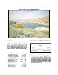
BIRCH CREEK RESERVOIR #2 - Division of Water Quality
BIRCH CREEK RESERVOIR #2 - Division of Water Quality
BIRCH CREEK RESERVOIR #2 - Division of Water Quality

Create successful ePaper yourself
Turn your PDF publications into a flip-book with our unique Google optimized e-Paper software.
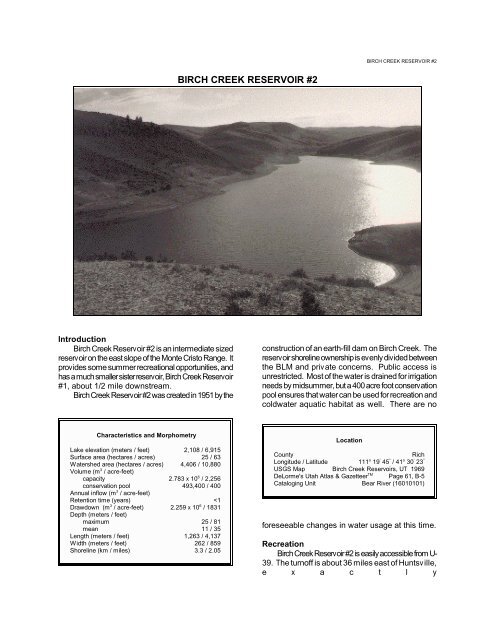
<strong>BIRCH</strong> <strong>CREEK</strong> <strong>RESERVOIR</strong> <strong>#2</strong><br />
<strong>BIRCH</strong> <strong>CREEK</strong> <strong>RESERVOIR</strong> <strong>#2</strong><br />
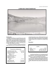
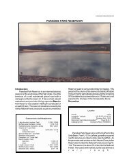
Introduction<br />
Birch Creek Reservoir <strong>#2</strong> is an intermediate sized<br />
reservoir on the east slope <strong>of</strong> the Monte Cristo Range. It<br />
provides some summer recreational opportunities, and<br />
has a much smaller sister reservoir, Birch Creek Reservoir<br />
#1, about 1/2 mile downstream.<br />
Birch Creek Reservoir <strong>#2</strong> was created in 1951 by the<br />
construction <strong>of</strong> an earth-fill dam on Birch Creek. The<br />
reservoir shoreline ownership is evenly divided between<br />
the BLM and private concerns. Public access is<br />
unrestricted. Most <strong>of</strong> the water is drained for irrigation<br />
needs by midsummer, but a 400 acre foot conservation<br />
pool ensures that water can be used for recreation and<br />
coldwater aquatic habitat as well. There are no<br />
Characteristics and Morphometry<br />
Lake elevation (meters / feet) 2,108 / 6,915<br />
Surface area (hectares / acres) 25 / 63<br />
<strong>Water</strong>shed area (hectares / acres) 4,406 / 10,880<br />
Volume (m 3 / acre-feet)<br />
capacity 2.783 x 10 6 / 2,256<br />
conservation pool 493,400 / 400<br />
Annual inflow (m 3 / acre-feet)<br />
Retention time (years)
LAKE REPORTS
two miles west <strong>of</strong> the Woodruff Creek Reservoirs turn<strong>of</strong>f,<br />
and 8 miles west <strong>of</strong> Woodruff. Turn north and follow the<br />
gravel road to the northwest up Birch Creek about one<br />
mile to the reservoirs. Reservoir <strong>#2</strong> is upstream from<br />
reservoir #1. The turn<strong>of</strong>f is poorly marked, but with a good<br />
map the road is not difficult to find.<br />
Fishing is the primary recreational use <strong>of</strong> the<br />
reservoir. There is a picnic area with primitive toilets<br />
between the two reservoirs, and it is possible, but not<br />
easy, to get a boat on reservoir <strong>#2</strong>. By midsummer the<br />
reservoir is drained down to the conservation pool (about<br />
25 feet deep) exposing 35 vertical feet <strong>of</strong> muddy banks.<br />
Monte Cristo Campground, a USFS facility, is about<br />
13 miles west <strong>of</strong> the Birch Creek turn<strong>of</strong>f on U-39. It is<br />
open from June through September, and has 53 tent sites,<br />
picnic areas, and primitive toilets. Fees are charged for<br />
campground use.<br />
<strong>Water</strong>shed Description<br />
The Little Bear River is eroding the west slopes <strong>of</strong> the<br />
Monte Cristo Range at a rate relatively faster than Birch<br />
Creek erodes the east slopes. Both sides <strong>of</strong> the ridge are<br />
dissected by deep canyons, but the canyons to the west<br />
are much deeper, indicating that their headwaters are<br />
slowly capturing drainage from the east side <strong>of</strong> the ridge.<br />
Birch Creek drains the east slopes, and the reservoir is<br />
built about halfway from the headwaters to where Birch<br />
Creek (after joining Woodruff Creek) joins the Bear River<br />
in the town <strong>of</strong> Woodruff. Slopes surrounding the reservoir<br />
are quite steep (60%). The reservoir is an impoundment<br />
<strong>of</strong> the narrow, "V" shaped canyon with sage-grass<br />
vegetation.<br />
The watershed high point, Eccles Peak, is 2,768 m<br />
(9,062 ft) above sea level, thereby developing a complex<br />
slope <strong>of</strong> 6.1% to the reservoir. The average stream<br />
gradient <strong>of</strong> Little Brush Creek is 2.8% (147 feet per mile)<br />
The inflow and outflow is Birch Creek.<br />
The watershed is made up <strong>of</strong> mountains and<br />
terraces. The soil is derived from the Wasatch Formation,<br />
the limestone bedrock that underlies much <strong>of</strong> the<br />
watershed. The soil associations that compose the<br />
watershed are listed in Appendix III.<br />
The vegetation communities consist <strong>of</strong> sage-grass,<br />
spruce-fir and aspen. The watershed receives 41 - 102<br />
cm (16 - 40 inches) <strong>of</strong> precipitation annually. The frostfree<br />
season around the reservoir is 80 - 120 days per<br />
year.<br />
Land use in the watershed is 100% multiple use and<br />
native grazing. Minor recreational use takes place.<br />
Limnological Assessment<br />
The water quality <strong>of</strong> Birch Creek Reservoir <strong>#2</strong> is to be<br />
good. It considered to be hard with a hardness<br />
concentration range <strong>of</strong> 166-183 mg/L (CaCO3). The only<br />
Limnological Data<br />
<strong>BIRCH</strong> <strong>CREEK</strong> <strong>RESERVOIR</strong> <strong>#2</strong><br />
parameters monitored exceeding State standards for<br />
defined beneficial uses <strong>of</strong> the reservoir is phosphorus.<br />
Data sampled from STORET site: 590713<br />
Surface Data 1981 1989* 1991<br />
Trophic Status M H M<br />
Chlorophyll TSI - 75.16 51.06<br />
Secchi Depth TSI - - 44.17<br />
Phosphorous TSI 47.34 66.59 46.97<br />
Average TSI 47.34 70.88 47.40<br />
Chlorophyll a (ug/L) - 93.9 8.05<br />
Transparency (m) - - 3.0<br />
Total Phosphorous (ug/L) 20 76 20<br />
pH 8.5 8.70 8.50<br />
Total Susp. Solids (mg/L) 5.0 -
LAKE REPORTS<br />
D o C pH DO<br />
Cond<br />
0 19.7 8.5 7.5 332<br />
1 19.2 8.5 7.5 331<br />
2 19.1 8.5 7.5 331<br />
3 19.1 8.5 7.5 332<br />
4 19.1 8.5 7.6 332<br />
5 19.1 8.5 7.6 332<br />
6 18.6 8.4 6.0 339<br />
7 18.4 8.3 5.1 343<br />
8 18.1 8.1 3.0 350<br />
9 17.9 7.9 1.3 358<br />
10 17.7 7.8 1.2 362<br />
11 17.4 7.8 1.1 371<br />
12 16.7 7.6 1.1 386<br />
along the reservoir shoreline.<br />
There are no point sources <strong>of</strong> pollution in the<br />
watershed.<br />
Beneficial Use Classification<br />
The state beneficial use classifications include:<br />
boating and similar recreation (excluding swimming) (2B),<br />
cold water game fish and organisms in their food chain<br />
(3A) and agricultural uses (4).<br />
Temp<br />
DO<br />
Information<br />
a significant loss <strong>of</strong> dissolved oxygen downward in the<br />
water column. The dissolved oxygen concentration falls<br />
below the standard for a cold water fishery (6.5 mg/L) at 6<br />
meters. Below 8 the concentration <strong>of</strong> dissolved oxygen<br />
approaches an anoxic state. According to DWR stocking<br />
records Birch Creek Reservoir <strong>#2</strong> has been stocked with<br />
30,000 fingerling rainbow trout (Oncorhynchus<br />
mykiss) annually. In addition some cutthroat trout<br />
(Oncorhynchus clarki) are present in the reservoir.<br />
Emergent macrophytes are very limited in the reservoir.<br />
The reservoir has not been chemically treated by the<br />
DWR, so populations <strong>of</strong> native fishes could still be present<br />
in the reservoir<br />
Phytoplankton in the euphotic zone include the<br />
following taxa (in order <strong>of</strong> dominance)<br />
Management Agencies<br />
Bear River Association <strong>of</strong> Governments 752-7242<br />
<strong>Division</strong> <strong>of</strong> Wildlife Resources 538-4700<br />
<strong>Division</strong> <strong>of</strong> <strong>Water</strong> <strong>Quality</strong> 538-6146<br />
Bureau <strong>of</strong> Land Management 539-4001<br />
Bear River Resource Area 977-4300<br />
Recreation<br />
Bridgerland Travel Region (Logan) 657-5353<br />
Garden City Chamber <strong>of</strong> Commerce 946-2901<br />
Reservoir Administrators<br />
Wes Tingey 793-4229<br />
Woodruff Reservoir and Irrigation Company<br />
PO Box 520, Woodruff, UT 84086<br />
Species<br />
Cell Volume% Density<br />
(mm 3 /liter) By Volume<br />
Aphanizomenon flos-aquae 11. 092<br />
80.46<br />
Sphaerocystis schroeteri2.641 19.16<br />
Oocystis borgei 0.022 0.16<br />
Wislouchiella planktonica 0. 020<br />
0.15<br />
Pennate diatoms 0.010 0.07<br />
Total 13.785<br />
Shannon-Weaver [H'] 0.52<br />
Species Evenness 0.32<br />
Species Richness 0.17<br />
As observed, the reservoir is predominately populated by<br />
blue-green algae indicative <strong>of</strong> eutrophic conditions.<br />
Pollution Assessment<br />
Nonpoint pollution sources include the following:<br />
Sedimentation and nutrient loading from grazing, and litter,<br />
human waste and chemicals from recreation.<br />
Grazing takes place throughout the watershed and
<strong>BIRCH</strong> <strong>CREEK</strong> <strong>RESERVOIR</strong> <strong>#2</strong>