

Santa Clara River Trail Final Master Plan - Development Services ...
Santa Clara River Trail Final Master Plan - Development Services ...
Santa Clara River Trail Final Master Plan - Development Services ...

You also want an ePaper? Increase the reach of your titles
YUMPU automatically turns print PDFs into web optimized ePapers that Google loves.
<strong>Santa</strong> <strong>Clara</strong> <strong>River</strong> <strong>Trail</strong> <strong>Plan</strong><br />
Chapter 1: Existing Conditions<br />
Introduction<br />
Background<br />
The <strong>Santa</strong> <strong>Clara</strong> <strong>River</strong> is an ecologically rich, valuable<br />
and beautiful ecosystem. It is one of the last remaining<br />
naturalized river systems in Southern California and<br />
home to several threatened and endangered species.<br />
The project site sits nestled between emerald green<br />
farmland to the west, the <strong>Santa</strong> <strong>Clara</strong> <strong>River</strong> to the<br />
north and the City of Oxnard to the south and east.<br />
The near perfect weather of the area enables the<br />
citizens of Oxnard to enjoy outdoor recreation yearround.<br />
In 1991, the Ventura County Watershed Protection<br />
District (VCWPD) and the California State Coastal<br />
Conservancy (CCC) initiated a management plan for<br />
the <strong>Santa</strong> <strong>Clara</strong> <strong>River</strong> and its resources. In addition to<br />
the preservation of the river’s physical, biological, and<br />
economic resources, the management plan promoted the enhancement of recreational, education and<br />
public access opportunities.<br />
In response to the <strong>Santa</strong> <strong>Clara</strong> <strong>River</strong> Enhancement & Management <strong>Plan</strong>, the city is pursuing the<br />
opportunity for a multi-use trail system along the stream bank protection (SBP) and levee system on the<br />
southern bank of the <strong>Santa</strong> <strong>Clara</strong> <strong>River</strong>. The <strong>Santa</strong> <strong>Clara</strong> <strong>River</strong> <strong>Trail</strong> (SCRT) <strong>Master</strong> <strong>Plan</strong> project study<br />
area encompasses the southern bank of the <strong>Santa</strong> <strong>Clara</strong> <strong>River</strong> from Central Avenue in the northeast down<br />
to N. Victoria Avenue in the southwest as well as connections to W. Gonzales Road, currently a bicycle<br />
route to the Pacific Ocean.<br />
The <strong>Master</strong> <strong>Plan</strong> Process<br />
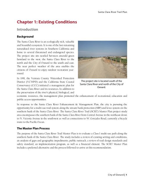
The project site is located south of the<br />
<strong>Santa</strong> <strong>Clara</strong> <strong>River</strong> and north of the City of<br />
Oxnard.<br />
The purpose of the <strong>Santa</strong> <strong>Clara</strong> <strong>River</strong> <strong>Trail</strong> <strong>Master</strong> <strong>Plan</strong> is to evaluate a Class I multi-use path along the<br />
southern bank of the <strong>Santa</strong> <strong>Clara</strong> <strong>River</strong>. The study includes a review of existing setting and conditions,<br />
an analysis of gaps and geographic impediments, public outreach, a review of trail design standards and<br />
safety standard, an implementation program, as well as a financial element. The SCRT <strong>Master</strong> <strong>Plan</strong><br />
includes a preferred alternative and the process followed to arrive at this recommendation.<br />
City of Oxnard | 1


