

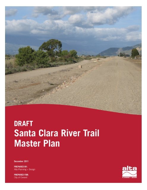
Santa Clara River Trail Final Master Plan - Development Services ...
Santa Clara River Trail Final Master Plan - Development Services ...
Santa Clara River Trail Final Master Plan - Development Services ...

You also want an ePaper? Increase the reach of your titles
YUMPU automatically turns print PDFs into web optimized ePapers that Google loves.
Project Partners<br />
City of Oxnard<br />
Matthew Wineger<br />
Michael Henderson<br />
Ashley Golden, Project Manager<br />
Rhea Voll<br />
Earnel Bihis<br />
Sue Martin<br />
Paul Wendt<br />
Cynthia Daniels<br />
Robert Hearne<br />
Cliff Waer, Senior Officer<br />
Alta <strong>Plan</strong>ning + Design<br />
George Hudson, Principal<br />
Mary Stewart, Project Manager<br />
Emily Duchon, Designer<br />
Birge Engineering<br />
Gary Bradshaw, Project Manager<br />
AMEC<br />
Daniel Gira, Project Manager<br />
Ventura County Watershed Protection District<br />
Gerard Kapuscik<br />
Joseph Lampar<br />
Ventura Regional Sanitation District<br />
Chi Herman<br />
Ventura County Transportation Commission<br />
Steve DeGeorge<br />
U.S. Fish and Wildlife<br />
Jenny Marek<br />
California Department of Fish and Game<br />
Daniel Blankenship<br />
California Department of Transportation<br />
David Lewis<br />
Michael Klima<br />
Channel Islands Bicycle Club<br />
Neal Abramson<br />
<strong>River</strong> Ridge Golf Course<br />
Otto Kanny<br />
State Coastal Conservancy<br />
Peter Brand<br />
Rio School District<br />
Rob Corley<br />
The Nature Conservancy<br />
Catherine McCalvin<br />
Ventura Coastkeeper<br />
Jason Weiner<br />
Friends of the <strong>Santa</strong> <strong>Clara</strong> <strong>River</strong><br />
Richard Sweet
Table of Contents<br />
Chapter 1: Existing Conditions ..........................................................................................................................................................1<br />
Introduction ............................................................................................................................................................................................1<br />
Goals and Objectives .........................................................................................................................................................................2<br />
Site Setting ............................................................................................................................................................................................. 4<br />
Segment Analysis............................................................................................................................................................................... 12<br />
Relevant Projects and <strong>Plan</strong>s ....................................................................................................................................................... 25<br />
Important Agencies/Partners .................................................................................................................................................... 28<br />
Opportunities and Constraints ................................................................................................................................................ 29<br />
Chapter 2: Summary of Gap Analysis, Geographic Impediments and Alternatives Analysis .................... 37<br />
Gap Analysis ....................................................................................................................................................................................... 37<br />
Geographic Impediments ............................................................................................................................................................40<br />
Alignment Alternatives ..................................................................................................................................................................41<br />
Preferred Alignment .......................................................................................................................................................................46<br />
Chapter 3: Summary of Project Public Involvement .......................................................................................................... 55<br />
Project Partners ................................................................................................................................................................................. 55<br />
Stakeholder and Technical Advisory Committees ........................................................................................................ 56<br />
Chapter 4: Entitlement Process and Policy Review........................................................................................................... 57<br />
Potentially Required Permits .................................................................................................................................................... 57<br />
Permit Triggers/Extra Info .......................................................................................................................................................... 60<br />
Chapter 5: Benefit Cost Analysis .................................................................................................................................................. 65<br />
Chapter 6: Summary of Design Guidelines, Maintenance Schedules and Best Practices .............................. 71<br />
Design Guidelines ............................................................................................................................................................................. 71<br />
<strong>Trail</strong> Design Features ..................................................................................................................................................................... 78<br />
Safety and Maintenance Recommendations..................................................................................................................... 88<br />
Project Implementation <strong>Plan</strong> ..................................................................................................................................................... 95<br />
Funding Sources ............................................................................................................................................................................. 106<br />
Appendix A: City of Oxnard <strong>Santa</strong> <strong>Clara</strong> <strong>River</strong> <strong>Trail</strong> <strong>Master</strong> <strong>Plan</strong> -<br />
Field Review Report Letter.................................................................................................................See separate document<br />
Appendix B: Public Involvement Meeting Notes ...................................................................See separate document
<strong>Santa</strong> <strong>Clara</strong> <strong>River</strong> <strong>Trail</strong> <strong>Plan</strong><br />
Chapter 1: Existing Conditions<br />
Introduction<br />
Background<br />
The <strong>Santa</strong> <strong>Clara</strong> <strong>River</strong> is an ecologically rich, valuable<br />
and beautiful ecosystem. It is one of the last remaining<br />
naturalized river systems in Southern California and<br />
home to several threatened and endangered species.<br />
The project site sits nestled between emerald green<br />
farmland to the west, the <strong>Santa</strong> <strong>Clara</strong> <strong>River</strong> to the<br />
north and the City of Oxnard to the south and east.<br />
The near perfect weather of the area enables the<br />
citizens of Oxnard to enjoy outdoor recreation yearround.<br />
In 1991, the Ventura County Watershed Protection<br />
District (VCWPD) and the California State Coastal<br />
Conservancy (CCC) initiated a management plan for<br />
the <strong>Santa</strong> <strong>Clara</strong> <strong>River</strong> and its resources. In addition to<br />
the preservation of the river’s physical, biological, and<br />
economic resources, the management plan promoted the enhancement of recreational, education and<br />
public access opportunities.<br />
In response to the <strong>Santa</strong> <strong>Clara</strong> <strong>River</strong> Enhancement & Management <strong>Plan</strong>, the city is pursuing the<br />
opportunity for a multi-use trail system along the stream bank protection (SBP) and levee system on the<br />
southern bank of the <strong>Santa</strong> <strong>Clara</strong> <strong>River</strong>. The <strong>Santa</strong> <strong>Clara</strong> <strong>River</strong> <strong>Trail</strong> (SCRT) <strong>Master</strong> <strong>Plan</strong> project study<br />
area encompasses the southern bank of the <strong>Santa</strong> <strong>Clara</strong> <strong>River</strong> from Central Avenue in the northeast down<br />
to N. Victoria Avenue in the southwest as well as connections to W. Gonzales Road, currently a bicycle<br />
route to the Pacific Ocean.<br />
The <strong>Master</strong> <strong>Plan</strong> Process<br />
The project site is located south of the<br />
<strong>Santa</strong> <strong>Clara</strong> <strong>River</strong> and north of the City of<br />
Oxnard.<br />
The purpose of the <strong>Santa</strong> <strong>Clara</strong> <strong>River</strong> <strong>Trail</strong> <strong>Master</strong> <strong>Plan</strong> is to evaluate a Class I multi-use path along the<br />
southern bank of the <strong>Santa</strong> <strong>Clara</strong> <strong>River</strong>. The study includes a review of existing setting and conditions,<br />
an analysis of gaps and geographic impediments, public outreach, a review of trail design standards and<br />
safety standard, an implementation program, as well as a financial element. The SCRT <strong>Master</strong> <strong>Plan</strong><br />
includes a preferred alternative and the process followed to arrive at this recommendation.<br />
City of Oxnard | 1
Chapter 1: Existing Conditions<br />
Goals and Objectives<br />
A vision for increasing public access along the <strong>Santa</strong> <strong>Clara</strong> <strong>River</strong> has been supported by a number of<br />
agencies and non-profit groups for many years including: The California State Coastal Conservancy,<br />
Ventura County Watershed Protection District, and The Nature Conservancy. Building upon this<br />
regional vision, the following goals and objectives for the SCRT were developed with input from the City<br />
of Oxnard, the SCRT Steering Committee, and the SCRT Technical Advisory Committee.<br />
1. Create a safe and attractive trail fully accessible to a wide variety of nonmotorized<br />
activities for recreation and transportation.<br />
Coordinate with regional efforts to<br />
increase opportunities for recreation and<br />
transportation along the <strong>Santa</strong> <strong>Clara</strong><br />
<strong>River</strong> Corridor.<br />
<br />
<br />
Build a trail that meets the Americans for<br />
Disabilities Act (ADA) Guidelines which<br />
will accommodate a diverse group of<br />
users of all ages including pedestrians,<br />
and bicyclists.<br />
Incorporate trail amenities to enhance<br />
the experience of the trail user such as: Scenic views along the <strong>Santa</strong> <strong>Clara</strong> <strong>River</strong><br />
seating, interpretive elements, gateways,<br />
lighting, way-finding information, trail rules and regulations signage, and recycling/trash<br />
receptacles.<br />
2. Provide connectivity to existing or planned trails, schools, parks, and other<br />
key destinations<br />
Establish strong access points to the<br />
SCRT.<br />
<br />
<br />
<br />
<br />
Establish strong access to the Pacific<br />
Ocean.<br />
Coordinate with City of Oxnard Bicycle<br />
and Pedestrian Facilities <strong>Master</strong> <strong>Plan</strong> to<br />
ensure strong non-motorized<br />
connections.<br />
Connect to existing and planned regional<br />
non-motorized trails.<br />
Existing path in <strong>River</strong>Park Community<br />
Consider opportunities for future trail<br />
connections to the surrounding unincorporated areas.<br />
2 | Alta <strong>Plan</strong>ning + Design
<strong>Santa</strong> <strong>Clara</strong> <strong>River</strong> <strong>Trail</strong> <strong>Plan</strong><br />
3. Develop trail design and development standards that are easy to maintain<br />
and access by maintenance, security, and<br />
emergency vehicles and minimize<br />
impacts to the environment.<br />
Establish design standards applicable for<br />
regional expansion of the <strong>Santa</strong> <strong>Clara</strong> <strong>River</strong> <strong>Trail</strong>.<br />
<br />
<br />
Minimize safety hazards for all user groups.<br />
Utilize low impact development strategies and<br />
innovative storm water management to improve<br />
run-off water quality into the <strong>Santa</strong> <strong>Clara</strong> <strong>River</strong>.<br />
Levee road looking east toward Hwy 118<br />
4. Provide an enriching trail user experience through the incorporation of<br />
educational interpretation opportunities along the trail.<br />
Interpret the <strong>Santa</strong> <strong>Clara</strong> <strong>River</strong> Floodplain and ecological function of the watershed.<br />
<br />
<br />
Highlight the local context including history of the land uses along the trail.<br />
Seek educational opportunities through student engagement and stewardship.<br />
5. <strong>Trail</strong> design, construction and long-term use should respect adjacent<br />
properties and ecosystems<br />
<br />
Utilize appropriate measures so that the adjacent residential communities, commercial areas,<br />
golf course and landfill properties are not negatively affected by trail.<br />
<br />
Minimize impacts of trail users to the <strong>Santa</strong> <strong>Clara</strong> <strong>River</strong> habitat and wildlife.<br />
6. Respect the functional role of the <strong>Santa</strong><br />
<strong>Clara</strong> <strong>River</strong><br />
Synchronize trail construction with Ventura<br />
County Watershed Protection District (VCWPD)<br />
levee and SBP improvements.<br />
<br />
<br />
Coordinate with VCWPD for ongoing operating<br />
and maintenance requirements for any trail<br />
segments on top of the levee.<br />
Minimize impacts to the capacity of the <strong>Santa</strong><br />
<strong>Clara</strong> <strong>River</strong> floodway.<br />
Groins serve as additional bank<br />
protection along the levee south of the<br />
U.S. 101 Freeway<br />
City of Oxnard | 3
Chapter 1: Existing Conditions<br />
Site Setting<br />
Regional Site Context<br />
The <strong>Santa</strong> <strong>Clara</strong> <strong>River</strong> is an exceptional natural resource in California. It is the largest river system<br />
remaining in Southern California with a natural river bottom. Although the river has areas with flood<br />
control measures such as levees and stream bank protection (SBP), the river has not been channelized by<br />
concrete. The 116 mile long river originates in the San Gabriel Mountains in north Los Angeles County<br />
and flows west into Ventura County and out into the Pacific Ocean. The river is recognized as<br />
supporting important scenic resources as well as a diverse range of sensitive biological resources,<br />
including sensitive habitats and endangered species (City of Oxnard 2004).<br />
4 | Alta <strong>Plan</strong>ning + Design<br />
Regional Setting and Vicinity Map
<strong>Santa</strong> <strong>Clara</strong> <strong>River</strong> <strong>Trail</strong> <strong>Plan</strong><br />
Existing Physical Setting<br />
The project site extends for 4.87 miles along the south bank of the <strong>Santa</strong> <strong>Clara</strong> <strong>River</strong> and includes a<br />
southern spur connection south to W. Gonzales Road for a bikeway connection to the Pacific Ocean. For<br />
most of this distance, the project limits are generally confined to the top of existing flood control<br />
structures (SBP areas and levees). These flood control structures vary in height from approximately 10-15<br />
feet above the bed of the <strong>Santa</strong> <strong>Clara</strong> <strong>River</strong> in the western third of the project to 15-20 feet above the bed<br />
in the majority of the eastern segment between Highway 101 and Central Avenue. These levee segments<br />
are topped by a flood control access road of generally 25-40 feet in width. This road is paved in some<br />
areas and is dirt or gravel in others. However, in the central 2,000 foot segment of the project west of<br />
Highway 101, no levee currently exists and the project site encompasses a mix of low upland bank areas<br />
and river bed.<br />
Resource Areas<br />
AESTHETICS<br />
The proposed project is adjacent to the<br />
<strong>Santa</strong> <strong>Clara</strong> <strong>River</strong>, a recognized valuable<br />
scenic resource adjacent to the northern<br />
boundary of the City of Oxnard. With a<br />
width that generally varies from 1,500 to<br />
2,500 feet in the project vicinity, the<br />
riverbed provides a wide open corridor that<br />
facilitates sweeping views of the Oxnard<br />
Plain, with South Mountain and the Topa<br />
Topa Mountains to the east. The river’s<br />
wide channel supports large areas of natural<br />
undeveloped open space, which contrasts<br />
with urban uses in the City of Oxnard to the<br />
south and the City of Ventura to the north.<br />
Views to the north from the project site are dominated by the riverbed, with low-lying agricultural fields,<br />
low-density rural structures, and sand/gravel industrial facilities beyond. The large stands of native trees<br />
and shrubs enhance the natural aesthetic qualities of this open space and make the river a recognized<br />
regional scenic asset (City of Oxnard 2004).<br />
AGRICULTURAL RESOURCES<br />
Locations along the project offer panoramic views of<br />
the <strong>Santa</strong> <strong>Clara</strong> <strong>River</strong> valley with a backdrop of<br />
mountain peaks.<br />
The project site is located within the Oxnard Plain, a major agricultural production region known for its<br />
prime soils and favorable growing climate. Significant agricultural uses exist along the <strong>Santa</strong> <strong>Clara</strong> <strong>River</strong><br />
in the general project vicinity, with the area producing a significant portion of the State of California’s<br />
strawberry crop every year. Other major agriculture products in the region include sugar beets and lima<br />
beans. Within the City of Oxnard <strong>Plan</strong>ning Area, 22,782 acres of land are under agricultural production.<br />
Water for agriculture is drawn largely from the Oxnard Plain Basin aquifer (City of Oxnard 2004).<br />
City of Oxnard | 5
Chapter 1: Existing Conditions<br />
The proposed project is located on an existing flood control maintenance road, where no agricultural<br />
activities occur. No existing agricultural operations or prime soils are located within or border the<br />
project area; the nearest significant agricultural operations are located across the river to the north and<br />
west of N. Victoria Avenue (City of Oxnard 2004).<br />
BIOLOGICAL RESOURCES<br />
The project site borders the <strong>Santa</strong> <strong>Clara</strong> <strong>River</strong> for approximately 3.87 miles. The river is a wide perennial<br />
drainage that supports important native plant communities and hosts a variety of wildlife, including<br />
some special status species. The City of Oxnard’s 2030 General <strong>Plan</strong>, Open Space/ Conservation Element<br />
identifies riparian habitat throughout this reach<br />
of the <strong>Santa</strong> <strong>Clara</strong> <strong>River</strong> that borders the project<br />
site. However, this habitat varies significantly,<br />
with areas west of Highway 101 characterized by<br />
large stands of mature native trees and more<br />
perennial flows and areas to the east by more<br />
seasonal flows characterized by few mature trees<br />
and large areas of open sandy channel. During the<br />
summer months, flow is frequently limited to the<br />
low-flow channel; however winter rains can<br />
bring flash flows with high scour potential.<br />
These factors exert a strong influence on the<br />
types of plant communities found in the area.<br />
<strong>Plan</strong>t communities in the vicinity of the project<br />
tend to be dominated by southern<br />
cottonwood/ willow riparian forest, southern<br />
The <strong>Santa</strong> <strong>Clara</strong> <strong>River</strong> and associated riparian<br />
and scrub vegetation provide valuable habitat<br />
to sensitive species including the least Bell’s<br />
vireo.<br />
riparian scrub and emergent wetlands west of<br />
Highway 101. To the east, open wash, coastal sage scrub, scattered southern cottonwood/ willo w riparian<br />
forest and southern riparian scrub are the dominant plant communities.<br />
The southern cottonwood/willow riparian forest that occurs adjacent to the eastern end of the project<br />
site is of high value for wildlife species, particularly nesting birds. This plant community is dominated by<br />
Fremont cottonwood (Populus fremontii), and arroyo willow (Salix lasiolepis). The most common plant<br />
community adjacent to the project site is southern riparian scrub, which is characterized by dense shrubs<br />
and willows within the riverbed. This community is often transitional between uplands, and open wash<br />
and is dominated by Arroyo willow; however, significant amounts of sandbar willow (Salix hidsiana) and<br />
mulefat (Baccharis glutinosa) are also present.<br />
This dense growth of native riparian trees, shrubs and associated vegetation provide habitat for a variety<br />
of birds and small animals. The southern riparian scrub and open channel habitats adjacent to the project<br />
site are known to support the southern California steelhead trout (Oncorhyn chus mykiss), a federally<br />
endangered species. In addition, the Federal and California endangered least Bell’s vireo (Vireo bellii<br />
pusillus), and California endangered western yellow-billed cuckoo (Coccyzus americanus accidentalis) have<br />
been recorded in the project vicinity near the Highway 101 bridge (California Department of Fish and<br />
Game 2009). Further, special status species such as the silvery legless lizard (Anniella pulchra Gray),<br />
6 | Alta <strong>Plan</strong>ning + Design
<strong>Santa</strong> <strong>Clara</strong> <strong>River</strong> <strong>Trail</strong> <strong>Plan</strong><br />
Townsend’s big-eared bat (Corynorhinus townsendii), and coast horned lizard (Phrynosoma coronatum) are<br />
also known to occur in the vicinity. Additional species of concern that could occur due to the presence of<br />
potentially suitable habitat and range include the southwestern willow flycatcher (Empidonax traillii<br />
extimus), arroyo toad (Bufo californicus), and California red-legged frog (Rana aurora draytonii). However,<br />
these species have not been recorded in the project vicinity. The density of plant growth in combination<br />
with the linear quality of the river make the riverbed an important wildlife corridor for larger species as<br />
well, including coyotes and deer.<br />
Approximately 2 miles downstream (west) of the project site, the river supports a large area of riparian<br />
habitat upstream of the river’s estuary. This estuary has been noted to be a major stopover for migratory<br />
and/or breeding species of shorebirds and waterfowl, including the endangered California least tern<br />
(Sterna antillarum browni) (City of Oxnard 2004). The estuary is also known to support the tidewater goby<br />
(Eucyclogobius newberryi) and western snowy plover (Charadrius alexandrinus nivosus). The Ventura marsh<br />
milk-vetch (Astragalus pycnostachyus var. lanosissimus), an endangered species, has also been identified in<br />
this area.<br />
Although quality riparian habitat exists along significant portions of the riverbed, disturbance along the<br />
edges of the floodplain and upland areas can be substantial. <strong>Trail</strong>s are found throughout the riverbed,<br />
which are apparently used by off-road vehicles as well as foot traffic. These trails appear to be mostly<br />
limited to the edges of the floodplain, as there is little evidence of such use within the riverbed adjacent<br />
to the project site. Further, exotic (i.e., invasive) vegetation has degraded native habitats in some areas,<br />
particularly giant reed (Arundo donax) and salt cedar (Tamarix spp.), although no exotic species dominate<br />
habitats in the immediate project vicinity (Caltrans 2001).<br />
GEOLOGY AND SOILS<br />
The proposed project is located near the center of the Oxnard Plain, a broad alluvial basin that is filled<br />
with sediments, sands, and gravels deposited by the <strong>Santa</strong> <strong>Clara</strong> <strong>River</strong>. These sand and gravel deposits<br />
are generally characterized as being rich in minerals but unsuitable for agriculture. These alluvial soils are<br />
prone to compaction and liquefaction, and the potential for liquefaction is increased by the high<br />
groundwater level found in the region. Compaction of alluvial soils caused by seismic events has the<br />
potential to affect the project area, with a potential settlement of 1-2 feet projected for the region (City of<br />
Oxnard 2004).<br />
The project vicinity is located within a seismically active region subject to the effects of moderate to large<br />
earthquake events along major faults (City of Oxnard 2004). No active faults have been mapped across<br />
the study area. Several active and potentially active regional faults that may affect the area include the<br />
San Andreas Fault, the Simi-<strong>Santa</strong> Rosa fault system, the Oakridge fault system, the <strong>Santa</strong> Monica-<br />
Anacapa and Malibu fault zones and the Ventura-Pitas Point faults, all within 60 miles from the<br />
proposed project area. A complete description of area geologic resources can be found in the City of<br />
Oxnard 2030 General <strong>Plan</strong>, Open Space/ Conservation Element.<br />
HAZARDS AND HAZARDOUS MATERIALS<br />
There is potential for hazards and hazardous materials to exist within the project area. Natural hazards<br />
are described in Geology and Soils above and Hydrology and Water Quality below. Previous uses of hazardous<br />
City of Oxnard | 7
Chapter 1: Existing Conditions<br />
materials in the general project vicinity are known to have resulted in soil and groundwater<br />
contamination. Although pesticides and herbicides used for agricultural operations can pose a hazard to<br />
humans and native biological communities, the County of Ventura Agriculture Commissioner's Office<br />
records show the only remaining residue is DDT and breakdown products. A search of Ventura County<br />
files and the GeoTracker database identified four Underground Storage Tank (LUST) cleanup sites and<br />
‘other’ cleanup sites near the project area (SWRCB 2009). None exist within the project area.<br />
The <strong>River</strong> Ridge Golf Course was constructed on top of the former <strong>Santa</strong> <strong>Clara</strong> landfill. The landfill was<br />
lined and accepted only Class III (non-hazardous) waste during its operation, and was closed according<br />
to closure requirements of the Ventura County Environmental Health Division and California Regional<br />
Water Quality Control Board (City of Oxnard 2008). Hazardous materials are routinely transported on<br />
Highway 101 and the railroad, presenting the possibility of an accident in the vicinity of the project area.<br />
Of the trucks that enter Ventura County on Highway 101, the California Highway Patrol estimates that<br />
52 percent carry hazardous materials and an additional 22 percent carry hazardous wastes (City of<br />
Oxnard 2004). Although the probability of a railroad hazardous materials incident is lower, the severity<br />
is potentially greater because of the greater potential quantities involved as well as the potential for<br />
chemicals and explosive substances to be mixed together.<br />
HYDROLOGY AND WATER QUALITY<br />
The <strong>Santa</strong> <strong>Clara</strong> <strong>River</strong> is the predominant surface<br />
water hydrologic feature in the region, with a<br />
watershed drainage area of 1,634 square miles and<br />
generally produces an intermittent flow regime, which<br />
reflects the area’s predominant wet winter/ dry<br />
summer pattern. Flows can increase rapidly in<br />
response to high intensity winter rainfall events. This<br />
can result in flooding along the river, which has<br />
required municipalities such as the VCWPD and the<br />
City of Oxnard to construct a system of levees. This<br />
flow regime also significantly shapes the vegetative<br />
communities of the <strong>Santa</strong> <strong>Clara</strong> <strong>River</strong>.<br />
The <strong>Santa</strong> <strong>Clara</strong> <strong>River</strong> channel is a wide,<br />
sandy wash through much of the year;<br />
however wet season flows can flood the<br />
channel.<br />
The water flow in the project area reaches its high flo w<br />
period during the local wet season which occurs December through April. Natural flow in the river is<br />
affected by groundwater withdrawals, diversions, municipal uses, and groundwater recharge. Flow is<br />
also regulated by operational conditions at upstream reservoirs, including Lake Piru, Pyramid Lake, and<br />
Castaic Reservoir.<br />
The Federal Emergency Management Agency (FEMA) identifies much of the City of Oxnard to the south<br />
of the project site, as well as the agriculture and recreation areas to the north as being subject to a 1%<br />
annual chance flood event (formerly referred to as 100-year flood event) associated with the river.<br />
Flooding associated with the river has historically posed a significant hazard to communities along its<br />
banks, including the City of Oxnard and the project vicinity. However, as noted above, with the<br />
exception of the project site’s middle segment from N. Ventura Road to the Highway 101 Bridge, the<br />
8 | Alta <strong>Plan</strong>ning + Design
<strong>Santa</strong> <strong>Clara</strong> <strong>River</strong> <strong>Trail</strong> <strong>Plan</strong><br />
much of the project site is located on elevated flood control structures generally protected from most<br />
flood flows (City of Oxnard 2008).<br />
The Oxnard Plain Basin, the largest underground water source in the region, has approximately<br />
7,800,000 acre-feet of storage and is mostly confined (covered by an impermeable clay layer). The<br />
confined nature of the basin means that in most areas of the basin rain water or surface water cannot<br />
penetrate the surface of the ground to replenish or recharge the basin. The Oxnard Aquifer, which is a<br />
part of the Oxnard Plain Basin, is currently being overdrafted at a rate of about 12,400 acre-feet per year,<br />
and the overdraft has resulted in more than 22 square miles of the aquifer being intruded upon by<br />
seawater. In the areas of salt water intrusion, the water is no longer suitable for domestic consumption or<br />
agriculture. In addition to salt water intrusion, primary water quality concerns within the Oxnard<br />
<strong>Plan</strong>ning Area also include increasing mineralization and chemical degradation of groundwater. Runoff<br />
from agricultural uses degrades surface and groundwater quality via increased mineral concentrations,<br />
nitrates, and high levels of total dissolved solids (TDS). Additional threats to surface and groundwater<br />
quality include runoff from urban and industrial uses, improperly abandoned water wells and<br />
underground storage tanks. The potential for groundwater contamination is higher in recharge areas<br />
where the clay cap is absent. As of 2006, contaminants that significantly exceed threshold values within<br />
the Oxnard Plain Basin include TDS, nitrate, iron, manganese, chloride and sulfate (Metropolitan Water<br />
District of Southern California 2007).<br />
LAND USE AND PLANNING<br />
The proposed project is within the City of Oxnard and the County of Ventura on land zoned as open<br />
space. The project area is located entirely outside of the Coastal Zone. The <strong>Santa</strong> <strong>Clara</strong> <strong>River</strong> falls within<br />
the jurisdiction of the VCWPD, which operates and maintains the levee and flood control maintenance<br />
road. The VCWPD also implements the Flood Plain Management Ordinance 3841 on behalf of the<br />
County of Ventura to ensure compliance with the National Flood Insurance Program. This includes<br />
permit review for structures built in the floodplain and evaluation of site plans for developments that<br />
include identified floodplains. Additional agencies that may have interest in and permitting authority<br />
over this site include the U.S. Army Corps of Engineers, Ventura Regional Sanitation District, California<br />
Integrated Waste Management Board, Ventura County Local Enforcement Agency, Ventura Regional<br />
Sanitation District, Regional Water Quality Protection Board, U.S. Fish and Wildlife Service, Caltrans,<br />
and the California Department of Fish and Game. The river<br />
is not designated as a Wild and Scenic <strong>River</strong> by the United<br />
States Forestry Service, National Park Service, United<br />
States Fish and Wildlife or Bureau of Land Management.<br />
In the City of Oxnard adjacent land uses to the project<br />
include recreation; low density, low-medium density, and<br />
high density residential; regional commercial, and a school<br />
(City of Oxnard 2009). The City’s General <strong>Plan</strong> recognizes<br />
the importance of bicycle and pedestrian facilities and<br />
identifies the need for their additional development<br />
throughout the City of Oxnard and the surrounding<br />
communities within Ventura County. In response, the City<br />
The proximity of trains and roads, the<br />
primary noise generators in the vicinity<br />
of the project, can degrade sensitive<br />
habitats and recreation.<br />
City of Oxnard | 9
Chapter 1: Existing Conditions<br />
developed a Bicycle and Pedestrian Facilities <strong>Master</strong> <strong>Plan</strong> in 2002, which conceptualized and outlined<br />
the implementation of a system of paths throughout the City and surrounding communities. This <strong>Plan</strong> is<br />
currently in the process of being updated, with completion scheduled for 2010.<br />
NOISE<br />
Dominant noise sources on and near the proposed project site are primarily vehicular traffic traveling<br />
along the local roadway system, Highway 101, and the railroad. The primary land uses in the project’s<br />
vicinity include a large open space, agricultural, recreational (golf), and residential uses, which generally<br />
generate low levels of noise.<br />
Sensitive noise receptors within the project include common and rare wildlife, such as certain threatened<br />
and endangered species (see Biological Resources). This is especially true during avian breeding seasons<br />
which typically fall between March and September. Recreational users including walkers, bikers, and<br />
bird watchers, as well as residents adjacent to the project area, are also considered sensitive receptors for<br />
potential noise impacts.<br />
PUBLIC SERVICES<br />
Due to the nature of the proposed project, few public services would be required throughout the life of<br />
the project; however the City of Oxnard would provide basic services, such as maintenance, fire, and<br />
police protection, as necessary. Fire protection and emergency medical services would be provided by the<br />
Oxnard Fire Department, which has 7 fire stations and a staff of approximately 90. The Oxnard Police<br />
Department provides police protection in the project area. The nearest station is located at 181 W.<br />
Gonzales Road, approximately 1.2 miles from the project site. The project vicinity is presently included in<br />
routine patrol routes.<br />
RECREATION<br />
The proposed project site currently provides undeveloped<br />
recreational opportunities for walking, biking, and nature<br />
viewing. The project location is maintained as a flood<br />
control maintenance road, however due to infrequent<br />
traffic, it has become a popular route for passive uses. The<br />
site’s proximity to residential areas and the scenic views it<br />
provides make it an accessible and aesthetically pleasing<br />
area for urban recreation. According to the City of<br />
Oxnard’s 2030 General <strong>Plan</strong>, there are approximately 881.7<br />
acres of parks and special purpose facilities maintained by<br />
the City of Oxnard. The proposed project is located near a<br />
The project area currently supports<br />
passive recreational use, including<br />
excellent bird and wildlife viewing<br />
opportunities.<br />
variety of recreational facilities including the <strong>River</strong> Ridge Golf Course (over 450 acres), Southbank Park,<br />
and Sierra Linda Park. However, these areas provide urban park recreational opportunities and are not<br />
integrated into the natural and scenic qualities of the region.<br />
Most of the current recreational users of the project site are likely to be residents of nearby<br />
neighborhoods, given the site’s proximity to large residential areas. The project area is also accessed from<br />
10 | Alta <strong>Plan</strong>ning + Design
<strong>Santa</strong> <strong>Clara</strong> <strong>River</strong> <strong>Trail</strong> <strong>Plan</strong><br />
N. Victoria Avenue, N. Ventura Road, and Central Avenue though no designated parking areas currently<br />
exist.<br />
TRANSPORTATION/TRAFFIC<br />
The project will have designated parking for vehicle access off of N. Ventura Road. The project is located<br />
near N. Victoria Avenue, N. Ventura Road, Albion Drive, and Central Avenue (currently VCWPD access<br />
only), and runs perpendicular to Highway 101. The estimated average daily traffic (ADT) is 133,000 for<br />
the Highway 101 overcrossing in the vicinity of the project site. The ADT for N. Ventura Road is 18,000 at<br />
the project site, just north of the <strong>River</strong> Ridge Golf Course. The ADT at N. Victoria Avenue, where the<br />
project would terminate, is estimated to be 33,000 (City of Oxnard 2005). The project area does not<br />
intersect or border any other roadways.<br />
References<br />
California Department of Fish and Game. 2009. California National Diversity Database. Accessed 4<br />
September, 2009.<br />
Caltrans. 2001. State Route 101 Improvement and Bridge Replacement Project, Ventura County,<br />
California: <strong>Final</strong> EIR/EIS. May.<br />
City of Oxnard. 2004. 2020 General <strong>Plan</strong>. November 1990. Updated July 2004.<br />
City of Oxnard. 2008. Casden <strong>Development</strong> Projects: <strong>Final</strong> EIR: SCH #2007071087. August.<br />
City of Oxnard. 2009. 2030 General <strong>Plan</strong>. February 2009.California Natural Diversity Database 2009.<br />
City of Oxnard, 2005, Current 24 Hour Two-Way Traffic Counts in 1000's Exhibit<br />
Metropolitan Water District of Southern California. 2007. Groundwater Basin Reports, Ventura County<br />
Basins. Available at:<br />
http:// www.m wdh2o.com/m wdh2o/pages/yourwater/supply/groundwater/PDFs/NorthwestMetropolita<br />
nBasins/VenturaCountyBasins.pdf<br />
City of Oxnard | 11
Chapter 1: Existing Conditions<br />
Segment Analysis<br />
<strong>Santa</strong> <strong>Clara</strong> <strong>River</strong> <strong>Trail</strong> Segments<br />
Segment 1: The western segment of the project site extends approximately 1.5 miles east from N. Victoria<br />
Avenue to approximately 2,000 feet west of Highway 101 at a flood control access gate off of N. Ventura<br />
Road.<br />
Segment 2: The middle segment extends from the flood control access gate at the junction of Southbank<br />
Road with N. Ventura Road to the east side of Highway 101.<br />
Segment 3: The eastern segment extends east of Highway 101 for almost 2 miles to Central Avenue.<br />
Segment 4: Segment four parallels N. Victoria Avenue from the levee to W. Gonzales Road<br />
Segment 5: The <strong>River</strong> Ridge Golf Course (golf course) segment follows an asphalt Ventura Regional<br />
Sanitation District (VRSD) access road that goes south and east ultimately connecting to N. Patterson<br />
Road at the intersection of Patterson and Vineyard Ave (this Segment was not chosen for the final<br />
alignment).<br />
12 | Alta <strong>Plan</strong>ning + Design
<strong>Santa</strong> <strong>Clara</strong> <strong>River</strong> <strong>Trail</strong> <strong>Plan</strong><br />
Segment 1: North Victoria Avenue to North Ventura Road<br />
Key Map- Segment 1: N. Victoria Avenue to N. Ventura Road<br />
LAND USE<br />
The golf course, a public golf course owned by the City of Oxnard runs nearly the entire length of<br />
the segment.<br />
<br />
<br />
The golf course was constructed on two closed<br />
landfills; the <strong>Santa</strong> <strong>Clara</strong> Landfill owned by the<br />
City of Oxnard and the Coastal Landfill owned<br />
by the VRSD and leased by the City of Oxnard.<br />
A methane recovery pipeline runs above<br />
ground along the stream bank protection<br />
(SBP) on golf course property.<br />
Stray golf balls from the golf course<br />
occasionally encroach upon the project area<br />
along specific segments.<br />
<strong>River</strong> Ridge Golf Course<br />
City of Oxnard | 13
Chapter 1: Existing Conditions<br />
<br />
<br />
<br />
The cogeneration facility located adjacent to the project site has been converted into a<br />
maintenance building for the golf course. Maintenance staff will need vehicular access from N.<br />
Victoria Avenue along the proposed segment from 5:30-6:30 am and from 1:00-3:00 pm daily.<br />
Vineyard-Ventura residential development is a new 35 acre project proposed to be adjacent to<br />
the flood control levee on the northwest corner of W. Vineyard Avenue and N. Ventura Road.<br />
The <strong>Santa</strong> <strong>Clara</strong> riverbed is home to several homeless encampments. The area around N. Victoria<br />
Avenue is a popular spot for the homeless because the road bridge provides a connection<br />
between the Cities of Oxnard and Ventura.<br />
SBP/LEVEE CONDITIONS<br />
The western segment of the project site extends approximately 1.5 miles east from N. Victoria<br />
Avenue along a flood control levee and access road known as Southbank Road.<br />
<br />
<br />
<br />
This existing levee and access road terminates approximately 2,000 feet west of Highway 101 at a<br />
flood control access gate off of N. Ventura Road.<br />
A Ventura County Watershed Protection District (VCWPD) SBP facility is adjacent to the <strong>River</strong><br />
Ridge Golf Course.<br />
Adjacent to the Vineyard-Ventura residential development property there is a VCWPD levee<br />
with groins for added flood protection.<br />
The width of the SBP facility ranges between 25’ and 40’.<br />
<br />
<br />
<br />
<br />
A methane gas recovery pipeline runs above ground along the SBP facility on golf course<br />
property.<br />
The SBP facility is bisected by a methane gas recovery pipeline which runs down the middle of<br />
the facility.<br />
Four protruding methane gas extraction wells<br />
are located at regular intervals along the gas<br />
line.<br />
Clearance of approximately 20’ from the top of<br />
the SBP facility to the underside of the Victoria<br />
Avenue Bridge.<br />
CIRCULATION<br />
A VCWPD gated access ramp leads to the levee<br />
at N. Ventura Road and to the north-bound<br />
side of N. Victoria Avenue as well.<br />
Segment 1 views are dominated by riparian<br />
habitat.<br />
<br />
Connection points to the trail within the segment are limited.<br />
14 | Alta <strong>Plan</strong>ning + Design
<strong>Santa</strong> <strong>Clara</strong> <strong>River</strong> <strong>Trail</strong> <strong>Plan</strong><br />
<br />
<br />
A current access road within the future Vineyard-Ventura residential development services a<br />
maintenance yard and nursery for the golf course.<br />
Two informal access points to the golf course exist.<br />
AESTHETICS<br />
This segment has a more naturalized and enclosed feel characterized by rural views of native<br />
habitats and the open lands of the golf course.<br />
<br />
<br />
<br />
<br />
<br />
<br />
The western section of the project site is bordered by mature riparian habitat to the north and by<br />
undeveloped lands of the golf course to the south.<br />
The river supports dense stands of riparian forest, including mature southern cottonwood and<br />
willow trees, often adjacent to the toe of the existing levee and thus in relatively close proximity<br />
to the proposed project limits providing areas of shade.<br />
Mature vegetation in the river bottom restricts views across river along the western segment.<br />
To the south, the golf course slopes up as it is built on a former land fill.<br />
The area under the Victoria Avenue Bridge is very dark. Holes in the fencing and information<br />
from Oxnard Police indicate frequent trespassing by young adults.<br />
There is a significant amount of graffiti under the Victoria Avenue Bridge.<br />
City of Oxnard | 15
Chapter 1: Existing Conditions<br />
Segment 2: North Ventura Road to Highway 101<br />
Key Map- Segment 2: North Ventura Road to Highway 101<br />
LAND USE<br />
A large commercial area, The Esplanade is<br />
located at Oxnard Boulevard and the Highway<br />
101.<br />
<br />
<br />
<br />
The Village Specific <strong>Plan</strong> outlines a vision for a<br />
future Transportation Oriented <strong>Development</strong><br />
at the former Wagon Wheel site.<br />
Rio Del Norte Elementary School is located in<br />
the South Bank Neighborhood.<br />
N. Ventura Road looking east toward U.S.<br />
The South Bank Neighborhood is a singlefamily<br />
residential neighborhood south of N.<br />
101 Freeway<br />
Ventura Road. There is a city park and elementary school in the middle of the neighborhood.<br />
16 | Alta <strong>Plan</strong>ning + Design
<strong>Santa</strong> <strong>Clara</strong> <strong>River</strong> <strong>Trail</strong> <strong>Plan</strong><br />
LEVEE CONDITIONS<br />
There is a gap in the levee from Highway 101 southwest approximately 3,000 feet.<br />
<br />
<br />
N. Ventura Road is protected by rip-rap bank protection along part of this segment.<br />
A levee protects the Highway 101 Bridge.<br />
Clearance of approximately 5’-2” from the top of the levee to the underside of the Highway 101<br />
Bridge.<br />
<br />
Clearance of approximately 10’ from the top of the existing grade to the underside of the railroad<br />
bridge.<br />
CIRCULATION<br />
A Class I bike path exists along the El Rio<br />
Drain from Violet Way in the South Bank<br />
Neighborhood to 650’ west along N. Ventura<br />
Road.<br />
<br />
A pedestrian bridge at Highway 101 provides<br />
access to the south side of N. Ventura Road.<br />
There is currently no access from the<br />
pedestrian bridge to the north side of N.<br />
Ventura Road.<br />
<br />
N. Ventura Road is an 80’ wide four lane road<br />
with a raised median.<br />
View Looking North from the Pedestrian<br />
Bridge at Highway 101 towards the<br />
Proposed <strong>Santa</strong> <strong>Clara</strong> <strong>River</strong> <strong>Trail</strong><br />
AESTHETICS<br />
The central segment of the project is more urban in nature and is characterized by the Highway<br />
101 and the railroad crossings, as well as a high speed segment of N. Ventura Road immediately<br />
south of the project site.<br />
<br />
<br />
<br />
The major urban improvements are a notable contrast to the undeveloped character of the site<br />
found further to the west.<br />
The open and undeveloped character of the river bed provides significant visual relief from these<br />
surrounding urban uses, and large groves of native trees are also present along this segment.<br />
The Highway 101 underpass is newly constructed with a pleasing public art element depicting<br />
salmon swimming upstream.<br />
City of Oxnard | 17
Chapter 1: Existing Conditions<br />
Segment 3: Highway 101 to Central Avenue<br />
Key Map- Segment 3: Highway 101 to Central Avenue<br />
LAND USE<br />
Medium density residential uses, commercial<br />
buildings, a park and vacant undeveloped land<br />
of the <strong>River</strong>Park development are south of the<br />
levee.<br />
<br />
<br />
<strong>River</strong>Park is a mixed use development at the<br />
eastern end of the trail segment. The <strong>River</strong>Park<br />
development has single and multi-family<br />
residential units, open space, schools and<br />
commercial areas.<br />
<strong>River</strong>Park Community<br />
The eastern boundary of the study area is<br />
adjacent to the Hanson Aggregate Property, a<br />
former sand and gravel mine. The site will be developed as part of the <strong>River</strong>Park community<br />
including a trail system throughout the development and around the reclaimed mine pits.<br />
18 | Alta <strong>Plan</strong>ning + Design
<strong>Santa</strong> <strong>Clara</strong> <strong>River</strong> <strong>Trail</strong> <strong>Plan</strong><br />
<br />
<br />
<br />
Existing mining pits have exposed groundwater and will be reclaimed as open space under the<br />
<strong>River</strong>Park Specific <strong>Plan</strong>.<br />
The project site terminates adjacent to the north-south trending Central Avenue.<br />
Schools: Rio Del Mar Elementary School and Rio Vista Elementary Schools are located within<br />
the <strong>River</strong>Park development.<br />
LEVEE CONDITIONS<br />
This segment is located along the top of a VCWPD flood control levee.<br />
<br />
<br />
<br />
The width of the top of the levee ranges from 32’ to 44’ wide and is composed of graded dirt and<br />
gravel fill.<br />
Areas with access ramps extend out as wide as 60’ (i.e. ramp adjacent to Windrow Park in<br />
<strong>River</strong>Park).<br />
There are areas of erosion along the south side of the levee, adjacent to the <strong>River</strong>Park<br />
neighborhood.<br />
CIRCULATION<br />
The multiple crossroads and adjacent neighborhoods in this segment allow for several possible<br />
connections along the trail.<br />
<br />
<strong>River</strong>Park proposes to build a walking and biking trail loop around the reclaimed mining pits.<br />
AESTHETICS<br />
To the north, the open, generally sandy bed of<br />
the river provides views across the river to<br />
undeveloped agricultural land and residential<br />
and commercial uses in the City of Ventura.<br />
<br />
<br />
<br />
<br />
The levee moves away from N. Ventura Road<br />
in this area providing greater separation from<br />
traffic and noise.<br />
To the south are views across the <strong>River</strong>Park<br />
community, including large commercial Levee north of Highway 101 with <strong>River</strong>Park<br />
structures, medium-density residential<br />
development in Background<br />
neighborhoods and older industrial facilities<br />
associated with gravel/sand mining at the project’s eastern end.<br />
The levee is set back from the river bed and is clear of vegetation.<br />
The river channel is predominantly a wide sandy wash, with limited riparian and upland<br />
vegetation creating a sunny corridor with little to no shade.<br />
City of Oxnard | 19
Chapter 1: Existing Conditions<br />
<br />
<br />
<br />
Existing fencing types along the south (developed) side range from simple steel pipe, chain link,<br />
vinyl coated chain link to wrought iron picket fence.<br />
Fencing separates the levee from stored industrial equipment, warehouses, smaller structures,<br />
and ruderal open lots along the eastern area of the segment.<br />
There is graffiti on nearly every vertical concrete surface including; the railroad bridge, retaining<br />
walls, drains structures and concrete blocks.<br />
20 | Alta <strong>Plan</strong>ning + Design
<strong>Santa</strong> <strong>Clara</strong> <strong>River</strong> <strong>Trail</strong> <strong>Plan</strong><br />
Segment 4: North Victoria Avenue to West Gonzales Road<br />
Key Map- Segment 4: North Victoria Avenue to West Gonzales Road<br />
LAND USE<br />
The western side of N. Victoria Avenue is<br />
boarded by farmland and a land fill.<br />
<strong>River</strong> Ridge Golf Course and a housing<br />
development boarder the eastern side of N.<br />
Victoria Avenue.<br />
<br />
<br />
Stray golf balls from the <strong>River</strong> Ridge Golf Course<br />
encroach upon the project area along specific<br />
segments.<br />
Nearby schools: Thurgood Marshall Elementary<br />
School is located within ¾ mile of N. Victoria<br />
Avenue and Oxnard High School is located<br />
within ½ mile.<br />
Looking north at narrow bicycle and<br />
pedestrian facilities on the east side of<br />
N. Victoria Avenue, a highly traveled and<br />
high-speed roadway.<br />
City of Oxnard | 21
Chapter 1: Existing Conditions<br />
LEVEE CONDITIONS<br />
No levee exists in this segment.<br />
CIRCULATION<br />
Dirt access ramps slope down to the SBP road south of the bridge on both sides of N. Victoria<br />
Avenue.<br />
<br />
<br />
<br />
A dirt shoulder and/or farm road runs the<br />
length of the west side of N. Victoria Avenue.<br />
A drainage ditch lies on the west side of the<br />
farm road.<br />
A paved sidewalk 7’-10’ wide and directly<br />
adjacent to the east side of N. Victoria Avenue<br />
is marked as a bicycle route and serves as the<br />
current connection to bike lanes on W.<br />
Gonzales Road. Field observations reported<br />
most pedestrians choose to walk on a shaded<br />
and unpaved area east of the paved sidewalk<br />
buffered from the traffic on N. Victoria<br />
Avenue.<br />
Looking north on N. Victoria Avenue, an<br />
unpaved path east of the paved sidewalk is<br />
popular location for pedestrians to walk.<br />
<br />
North of the housing development, a paved road provide access to a City of Oxnard sewer lift<br />
station. The sewer access road has gated access to N. Victoria Avenue approximately 500’ south<br />
of the <strong>Santa</strong> <strong>Clara</strong> <strong>River</strong>.<br />
A drainage channel on the east side of the sewer road enters a culvert and drains under N.<br />
Victoria Road.<br />
AESTHETICS<br />
In most instances the existing sidewalk is directly adjacent to N. Victoria Avenue with little or<br />
no buffer creating an unsafe feeling for pedestrians and bicyclists.<br />
<br />
<br />
The houses and golf course on the east side are a notable contrast to the undeveloped character of<br />
the farmland and landfill on the west.<br />
This area has few tall buildings creating distant views to the mountains, farmland and golf<br />
course.<br />
22 | Alta <strong>Plan</strong>ning + Design
<strong>Santa</strong> <strong>Clara</strong> <strong>River</strong> <strong>Trail</strong> <strong>Plan</strong><br />
Segment 5: <strong>River</strong> Ridge VRSD Access Road to North Patterson Road*<br />
Key Map- Segment 5: <strong>River</strong> Ridge VRSD Access Road to North Patterson Road<br />
* Segment 5 was not chosen for the alignment of the SCRT<br />
LAND USE<br />
The northern portion of Segment 5 traverses through <strong>River</strong> Ridge Golf Course, a public golf<br />
course owned by the City of Oxnard.<br />
<br />
<br />
<br />
<br />
This area of the golf course was constructed on the Coastal Landfill owned by the Ventura<br />
Regional Sanitation District and leased by the City of Oxnard.<br />
Stray golf balls from the <strong>River</strong> Ridge Golf Course encroach upon the project area along many<br />
segments.<br />
A private commercial property is located at the corner of Vineyard Avenue and N. Patterson<br />
Road.<br />
At Vineyard Ave, the segment transitions to an existing multi-use path adjacent to two singlefamily<br />
neighborhoods, Northwest Neighborhood and Windsor North <strong>River</strong> Ridge<br />
Neighborhood.<br />
City of Oxnard | 23
Chapter 1: Existing Conditions<br />
Thurgood Marshall Elementary School is located adjacent to the existing multi-use path on N.<br />
Patterson Road and Oxnard High School is located on the south side of W. Gonzales Road<br />
between N. Victoria Avenue and N. Patterson Road.<br />
LEVEE CONDITIONS<br />
No levee exists in this segment.<br />
CIRCULATION<br />
A landfill maintenance road owned by<br />
Ventura Regional Sanitation District (VRSD)<br />
bisects <strong>River</strong> Ridge Golf Course from the<br />
project site at N. Victoria Avenue to the<br />
corner of W. Vineyard Avenue and N.<br />
Patterson Road.<br />
<br />
<br />
A drainage channel parallels the landfill<br />
maintenance road on the west and south<br />
sides.<br />
The existing Class I Multi-use Path along the<br />
west side of N. Patterson Road connects from<br />
a gate at the VRSD access road to the north<br />
side of W. Gonzales Road.<br />
Multi-use path and bike lane along west<br />
side of N. Patterson Road.<br />
AESTHETICS<br />
The segment along the VRSD maintenance<br />
road has an enclosed and natural feel<br />
providing a unique experience traveling<br />
between the backsides of the golf course<br />
greens.<br />
<br />
The tree lined multi-use path is neatly<br />
landscaped and well maintained. Views of the<br />
Windsor North <strong>River</strong> Ridge Neighborhood<br />
are buffered by a landscaped center median on<br />
N. Patterson Road and mature trees and<br />
fencing along the neighborhood.<br />
Sloping golf course views along Segment 5.<br />
24 | Alta <strong>Plan</strong>ning + Design
<strong>Santa</strong> <strong>Clara</strong> <strong>River</strong> <strong>Trail</strong> <strong>Plan</strong><br />
Relevant Projects and <strong>Plan</strong>s<br />
It is important for the SCRT <strong>Master</strong> <strong>Plan</strong> to build upon existing project and planning efforts affecting the<br />
short-term construction and long-term sustainability and vitality of the SCRT. Relevant plans include<br />
regional <strong>Santa</strong> <strong>Clara</strong> <strong>River</strong> conservation planning efforts, neighboring city and county bicycle plans, flood<br />
protection studies as well as several City of Oxnard specific plans.<br />
<strong>Santa</strong> <strong>Clara</strong> <strong>River</strong> Regional <strong>Plan</strong>s<br />
<strong>Santa</strong> <strong>Clara</strong> <strong>River</strong> Enhancement and Management <strong>Plan</strong><br />
The <strong>Santa</strong> <strong>Clara</strong> <strong>River</strong> Enhancement and Management <strong>Plan</strong> (SCREMP) began in 1991. It is directed by a<br />
Steering Committee of federal, state, and local public agencies, owners of property along the river<br />
corridor and local conservation organizations. In 1999 the Steering Committee approved a set of<br />
management recommendations to provide guidance for the preservation, enhancement, and<br />
sustainability of the physical, biological, and economic resources that occur within the <strong>Santa</strong> <strong>Clara</strong><br />
<strong>River</strong>’s main stem.<br />
The SCREMP recognizes that the south side of the river features extensive levees, SBP, groins, and access<br />
roads necessary for flood control maintenance. These areas in Oxnard are not currently designed for<br />
pedestrian use. Collaboration with VCWPD and Los Angeles County Department of Public Works –<br />
Watershed Management Division (LACDPW-WMD) will be required. <strong>River</strong>wide Recommendation 3<br />
from SCREMP states "Encourage local jurisdictions to develop Joint Agreements with VCWPD and<br />
LACDPW-WMD to allow joint use of flood control maintenance roads with hiking and biking<br />
opportunities, particularly on existing flood control levees on the south side of the river in the cities of<br />
Oxnard and Ventura." The SCRT <strong>Master</strong> <strong>Plan</strong> effort is in direct alignment with the recommendations of<br />
SCREMP.<br />
<strong>Santa</strong> <strong>Clara</strong> <strong>River</strong> Parkway<br />
In 2000, the California Coastal Conservancy (CCC) established the <strong>Santa</strong> <strong>Clara</strong> <strong>River</strong> Parkway Project.<br />
The vision of the <strong>Santa</strong> <strong>Clara</strong> <strong>River</strong> Parkway is the acquisition and restoration of a 25 mile-long corridor<br />
from the mouth of the <strong>Santa</strong> <strong>Clara</strong> <strong>River</strong> to the Sespe Creek confluence. The project has three goals: to<br />
restore hydrologic and geomorphic processes that create and maintain habitat for endangered and<br />
threatened species, to provide enhanced flood protection for adjacent private land and public facilities,<br />
and to facilitate public access and environmental education, including the creation of a continuous public<br />
trail system along the length of the Parkway.<br />
<strong>Plan</strong>ning and acquisition for the Parkway has begun. The <strong>Santa</strong> <strong>Clara</strong> <strong>River</strong> Parkway Floodplain<br />
Restoration Feasibility Study has been completed to assist the CCC with restoration and management<br />
strategies for 2,400 acres of acquired property within the lower <strong>Santa</strong> <strong>Clara</strong> <strong>River</strong> corridor. The CCC is<br />
in support of the City of Oxnard’s efforts to construct a trail along the <strong>Santa</strong> <strong>Clara</strong> <strong>River</strong>.<br />
City of Oxnard | 25
Chapter 1: Existing Conditions<br />
Neighboring City and County Bike <strong>Plan</strong>s<br />
San Buenaventura General Bikeway <strong>Plan</strong> (2004)<br />
The City of San Buenaventura, also known as Ventura, is located along the coast directly north of<br />
Oxnard. Ventura’s bikeway network provides existing on-road connections to Oxnard along Harbor<br />
Boulevard and N. Victoria Avenue as well as a separated path along the east side of the Victoria Avenue<br />
Bridge. The Ventura Bike <strong>Plan</strong> proposes to construct a trail along the north bank of the <strong>Santa</strong> <strong>Clara</strong> <strong>River</strong><br />
with an alignment connecting to Harbor Boulevard bike lanes, the Omer Rains Bike <strong>Trail</strong> at Surfer’s<br />
Point, the Ventura <strong>River</strong> <strong>Trail</strong> and the Ojai Valley <strong>Trail</strong>.<br />
Ventura Countywide Bicycle <strong>Master</strong> <strong>Plan</strong> (2007)<br />
The Ventura Countywide Bicycle <strong>Master</strong> <strong>Plan</strong> outlines a plan for regional bicycling connections, some of<br />
which are located in Oxnard. One of the higher priority projects it recommends includes bike lanes on N.<br />
Victoria Avenue from W. Gonzales Road to Fifth Street. The access from N. Victoria Avenue to W.<br />
Gonzales Road was identified as an important connection to the project in the early planning stages for<br />
the SCRT.<br />
Flood Protection Projects<br />
Ventura County Watershed Protection District Levee Design Study<br />
VCWPD is conducting a Gap Closure Study along the segment of the levee west of the Highway 101 to<br />
the Bailard landfill. The gap in the levee west of the Highway 101 Bridge leaves adjacent land uses with a<br />
high risk of flooding during times of high flow. The intent of the 30% design study is to select the best<br />
design alternative to close the gap and develop preliminary design documents. VCWPD estimates<br />
construction to rebuild the levee gap will be within 5-6 years.<br />
Strong collaboration with the VCWPD presents an opportunity to leverage funding for trail construction<br />
from federal, state and local agencies. Construction of the SCRT west of the Highway 101 should<br />
coordinate with potential construction activities associated with future levee improvements.<br />
Specific <strong>Plan</strong>s<br />
<strong>River</strong>Park Specific <strong>Plan</strong><br />
<strong>River</strong>Park is a 702 acre mixed-use community designed to be a pedestrian-oriented community with a<br />
complete range of facilities for living, learning, working, entertainment and recreation. <strong>River</strong>Park is<br />
located adjacent to the eastern end of the SCRT project site. The <strong>River</strong>Park Specific <strong>Plan</strong> establishes four<br />
main land uses for the project site including 129.9 acres of commercial areas, 256.6 acres of residential<br />
neighborhoods (2,805 single-family and multi-family dwelling units), 274.2 acres of open space, and 3.9<br />
acres public facilities including an elementary and middle school. The development is broken into two<br />
phases. ‘Area A’ is the southern portion of the site and is largely developed. The northern 432 acres of the<br />
site, ‘Area B’ consists of a former sand and gravel mine, active ready-mix concrete facility plants, and<br />
26 | Alta <strong>Plan</strong>ning + Design
<strong>Santa</strong> <strong>Clara</strong> <strong>River</strong> <strong>Trail</strong> <strong>Plan</strong><br />
former mining pits. <strong>River</strong>Park Area B includes residential communities with parks, schools and<br />
stormwater storage/recharge basins.<br />
A trail system throughout the development and around the reclaimed mine pits is planned. The trail<br />
system has been planned to support pedestrian travel throughout the community. Existing paths in ‘Area<br />
A’ are 8.5 feet wide. Future trail construction around the reclaimed mine pits should be built to Caltrans<br />
Class I standards and meet the standards of the Caltrans Highway Design Manual to provide safe<br />
bicycling facilities and smooth transition for SCRT riders.<br />
The Village Specific <strong>Plan</strong><br />
The Village Specific <strong>Plan</strong> is a 63-acre transit-oriented development in the Wagon Wheel area west of the<br />
Highway 101 and south of N. Ventura Road. The Wagon Wheel site is located within the City’s Historic<br />
Enhancement and Revitalization (HERO) area and is currently a mix of industrial and commercial<br />
facilities and a mobile home park. The goal of the Village Specific <strong>Plan</strong> is to build a mix of residential,<br />
neighborhood serving commercial, recreational and transit-oriented development. A transit hub is<br />
proposed in the southwest corner of the site which may serve as a stop on the Metrolink line as well as a<br />
rapid bus transit (BRT) line to downtown Oxnard.<br />
The plan seeks to be pedestrian oriented and proposes several non-motorized facilities. These include;<br />
Class I bicycle path along the northern portions of the site along N. Ventura Road and Oxnard Boulevard,<br />
Class II and III bicycle facilities along the development’s new “Main Street”, and traffic calming along all<br />
internal roadways. The SCRT plan will need to provide safe connections to the Village Class I paths<br />
across N. Ventura Road.<br />
Vineyard-Ventura Residential <strong>Development</strong><br />
In 2009 the City of Oxnard approved a residential development on 35 acres at W. Vineyard Avenue and<br />
N. Ventura Road. The development will include single family, two and three story townhomes. If<br />
development moves forward the project would be directly adjacent to the SCRT east of <strong>River</strong> Ridge Golf<br />
Course.<br />
Transportation Projects<br />
North Ventura Road<br />
As part of the work associated with the new reclaimed water main going in under N. Ventura Road, the<br />
City of Oxnard will be redesigning N. Ventura Road to accommodate three travel lanes in each direction,<br />
where possible. The City has placed a priority on incorporating Class I multi-use paths and/or Class II<br />
bike lanes on each side of N. Ventura Road into the redesign. Construction began June 7, 2010.<br />
N. Victoria Avenue Signal at Gum Tree Lane<br />
The City of Oxnard designed a new signal with crosswalks on N. Victoria Avenue at Gum Tree Lane.<br />
Construction of the traffic signal was completed in 2011.<br />
City of Oxnard | 27
Chapter 1: Existing Conditions<br />
Important Agencies/Partners<br />
Technical Advisory Committee<br />
The Technical Advisory Committee (TAC) was created to gather technical input from Federal, State,<br />
regional and local agencies with direct knowledge of the trail corridor. The active TAC members<br />
included:<br />
<br />
City of Oxnard<br />
<br />
<br />
<br />
<br />
<br />
<br />
<br />
<br />
Caltrans<br />
Friends of the <strong>Santa</strong> <strong>Clara</strong> <strong>River</strong><br />
Rio School District<br />
State Coastal Conservancy<br />
The Nature Conservancy<br />
U.S. Fish and Wildlife<br />
California Department of Fish and Game<br />
Ventura Coastkeeper<br />
Stakeholders<br />
The City and consultant team identified key project stakeholders early in the planning process in order<br />
involved them directly in development of the trail alignment and design features. The stakeholders<br />
include property owners within the project area, neighboring property owners and managers, and other<br />
special interest groups with direct social or economic ties to the project area. The active project<br />
stakeholders included:<br />
<br />
Channel Islands Bike Club<br />
<br />
<br />
<br />
<br />
<br />
<br />
<br />
<br />
<br />
<br />
City of Oxnard Engineering<br />
City of Oxnard General <strong>Services</strong><br />
City of Oxnard <strong>Plan</strong>ning Department<br />
City of Oxnard Police Department<br />
City of Oxnard Transportation <strong>Plan</strong>ning<br />
Oxnard Village Investments, LLC (The Village)<br />
Plaza <strong>Development</strong> Partners<br />
<strong>River</strong>Park Legacy<br />
<strong>River</strong> Ridge Golf Course<br />
Ventura County Transportation Commission<br />
28 | Alta <strong>Plan</strong>ning + Design
<strong>Santa</strong> <strong>Clara</strong> <strong>River</strong> <strong>Trail</strong> <strong>Plan</strong><br />
<br />
<br />
Ventura County Watershed Protection District (VCWPD)<br />
Ventura Regional Sanitation District (VRSD)<br />
Opportunities and Constraints<br />
Using Geographic Information System (GIS) data provided by the City of Oxnard, aerial photos, field<br />
notes and photographs from field inventory, and a review of existing plans and documents, an<br />
opportunities and constraints map was developed for the SCRT. Key opportunities and constraints by<br />
segment were identified as follows:<br />
Segment 1: North Victoria Avenue to North Ventura Road<br />
Opportunities<br />
The existing N. Victoria Avenue undercrossing has the vertical clearance to allow for a safe grade<br />
separated crossing.<br />
<br />
<br />
<br />
<br />
<br />
The Stream Bank Protection (SBP) road is amply wide (25’-48’) and provides opportunities for a<br />
dual-direction multi-use path.<br />
Connection to the Northwest Community Neighborhood via the existing multi-use path on the<br />
east side of N. Victoria Avenue.<br />
Connection to the future Vineyard-Ventura residential development via proposed bicycle and<br />
pedestrians facilities.<br />
There are mature trees to provide shade.<br />
City leases the <strong>River</strong> Ridge Golf Course (golf course) which includes portions of the SBP access<br />
road along the segment.<br />
Constraints<br />
Siting the proposed trail within VRSD property on the south side of the SBP will trigger<br />
involvement of landfill regulators.<br />
<br />
<br />
<br />
<br />
<br />
<br />
Need strong collaboration and approval of VCWPD and VRSD to use any of their rights-of-way.<br />
The methane gas extraction wells cannot be relocated and limit the width of the trail section.<br />
There is concern that the methane gas extraction wells may become a target for vandalism.<br />
Potential conflicts with golf course, VRSD and VCWPD vehicles.<br />
Connection points to the trail within this segment are limited.<br />
The secluded nature of this segment will require special safety considerations per CPTED (Crime<br />
Prevention Through Environmental Design) guidelines.<br />
City of Oxnard | 29
Chapter 1: Existing Conditions<br />
Segment 2: North Ventura Road to Highway 101<br />
Opportunities<br />
N. Ventura Road right-of-way provides ample width (approximately 80’) to provide bike lanes<br />
and/or multi-use paths.<br />
<br />
<br />
<br />
Connections to the South Bank Neighborhood via the existing Class I bike paths on El Rio Drain<br />
and N. Ventura Road.<br />
Proposed on-road bicycle connections from Downtown Oxnard will connect through the South<br />
Bank Neighborhood via bike lanes on H Street or bicycle routes on C Street and Lantana Street<br />
to Kentia Street.<br />
Connection to regional transit and Esplanade Shopping Center via proposed bicycle and<br />
pedestrian facilities within the Village development.<br />
Constraints<br />
Constrained undercrossing at Highway 101. Clearance does not allow trail to pass under bridge<br />
on top of levee.<br />
<br />
<br />
<br />
<br />
<br />
<br />
<strong>Trail</strong> construction will need to follow any necessary levee improvements.<br />
There is minimal clearance (approximately 10’) under the Union Pacific Railroad (UPRR) Bridge<br />
for a trail. If the levee is rebuilt west of the Highway 101 the clearance under the UPRR Bridge<br />
will be too constrained for a trail.<br />
Need a crossing along N. Ventura Road to connect to the Southbank Neighborhood and the<br />
existing pedestrian ramp on Highway 101 Bridge.<br />
Automobile traffic speeds are high (50 mph posted) for an on-road/non-separated bike lane.<br />
There are few mature trees to provide shade and traffic calming.<br />
There are flood plain limitations on the river side crossings under existing bridges.<br />
Segment 3: Highway 101 to Central Avenue<br />
Opportunities<br />
Great open views to surrounding mountains.<br />
<br />
<br />
<br />
<br />
The levee is amply wide (16’-60’) for a trail.<br />
Connections to existing and proposed bicycle facilities in the <strong>River</strong>Park Neighborhood.<br />
Connection to the existing Windrow Park and restroom facilities.<br />
Connection to proposed trails around the reclaimed gravel pits.<br />
30 | Alta <strong>Plan</strong>ning + Design
<strong>Santa</strong> <strong>Clara</strong> <strong>River</strong> <strong>Trail</strong> <strong>Plan</strong><br />
Constraint<br />
<strong>Trail</strong> construction will need to follow any necessary levee improvements.<br />
<br />
There are very few existing trees to provide shade along this segment of the trail.<br />
Segment 4: North Victoria Avenue to West Gonzales Road<br />
Opportunities<br />
VRSD access ramps allow for ADA compliant access to the levee from both north-bound and<br />
south-bound N. Victoria Avenue.<br />
<br />
<br />
City owned access road adjacent to the drainage ditch could facilitate an off-road alignment onehalf<br />
mile from W. Gonzales Road.<br />
Potentially wide right-of-way along N. Victoria Avenue may allow for a setback of existing<br />
substandard (7’-10’ wide with no shoulders) multi-use path.<br />
Constraints<br />
Some existing mature Eucalyptus may need to be removed to accommodate the trail.<br />
<br />
<br />
Automobile traffic speeds are high (55 mph posted) for an on-road/non-separated bike lane.<br />
Constrained shoulders: large vehicles were observed straying over the lane line into the shoulder.<br />
Segment 5: <strong>River</strong> Ridge VRSD Access Road to North Patterson Road<br />
Opportunities<br />
Connecting through the golf course to an existing Class I path on the west side of N. Patterson<br />
Road would provide a pleasant and off-road connection to bike lanes on W. Gonzales Road. The<br />
existing path adjacent to N. Patterson Road continues south to W. Gonzales Road, extending<br />
the complete off-road connection to adjacent neighborhoods.<br />
<br />
<br />
<br />
<br />
The asphalt VRSD access road has sufficient width (11’ - 12’) for a trail.<br />
Potential for connections to proposed on-road bicycle facilities through the Windsor North<br />
<strong>River</strong> Ridge and Cabrillo neighborhoods.<br />
N. Patterson Road also has an 8’ wide striped bike lane heading south.<br />
The City of Oxnard has an existing lease agreement with VRSD for the <strong>River</strong> Ridge Golf Course<br />
Property.<br />
Constraints<br />
Potential conflicts with golf course and VRSD vehicles.<br />
<br />
Safety hazard from golf balls exist in many areas throughout the golf course.<br />
City of Oxnard | 31
Chapter 1: Existing Conditions<br />
<br />
<br />
<br />
<br />
Siting a trail within the Coastal Landfill property will trigger involvement of landfill<br />
regulators/VRSD.<br />
Need strong collaboration and approval of VRSD to use any of their right-of-way.<br />
Collaboration with the private commercial property is encouraged for successful trail<br />
implementation.<br />
The secluded nature through the golf course will require special safety considerations per<br />
CPTED (Crime Prevention Through Environmental Design) guidelines.<br />
32 | Alta <strong>Plan</strong>ning + Design
<strong>Santa</strong> <strong>Clara</strong> <strong>River</strong> <strong>Trail</strong> <strong>Plan</strong><br />
City of Oxnard | 33
Chapter 1: Existing Conditions<br />
34 | Alta <strong>Plan</strong>ning + Design
<strong>Santa</strong> <strong>Clara</strong> <strong>River</strong> <strong>Trail</strong> <strong>Plan</strong><br />
City of Oxnard | 35
Chapter 1: Existing Conditions<br />
36 | Alta <strong>Plan</strong>ning + Design
<strong>Santa</strong> <strong>Clara</strong> <strong>River</strong> <strong>Trail</strong> <strong>Plan</strong><br />
Chapter 2: Summary of Gap Analysis, Geographic<br />
Impediments and Alternatives Analysis<br />
Gap Analysis<br />
This section discusses the identification of gaps on the <strong>Santa</strong> <strong>Clara</strong> <strong>River</strong> <strong>Trail</strong> within the City of Oxnard.<br />
The text first defines common trail gaps. Various gap closure measures used throughout the United<br />
States and other countries are listed, that could be applied in Oxnard. The text concludes with a<br />
procedure for identifying <strong>Santa</strong> <strong>Clara</strong> <strong>River</strong> <strong>Trail</strong> gaps.<br />
Defining <strong>Trail</strong> Gaps<br />
<strong>Trail</strong> gaps exist in various forms, ranging from short “missing links” on a specific street or path corridor,<br />
to larger geographic areas with few or no facilities at all. Determining specifically what constitutes a<br />
“gap” requires setting parameters for the walkway and bikeway networks and determining which<br />
activity centers require direct links to the networks. For example, the desired bikeway network may be a<br />
grid with approximately two-mile spacing in developed areas—a network density of approximately one<br />
mile of bikeway per square mile. Under this scenario, areas where parallel bikeways are more than two<br />
miles apart would be identified as gaps. Likewise, if it is determined that all transit stations should be<br />
directly served by the walkway network, any missing walkways within a half-mile of a transit station<br />
would constitute a gap. Gaps can then be organized based on length and other characteristics. Gaps can<br />
be classified into five main categories:<br />
<br />
Spot gaps: Spot gaps refer to point-specific locations lacking dedicated facilities or other<br />
treatments to accommodate safe and comfortable pedestrian or bicycle travel. Spot gaps<br />
primarily include intersections and other areas with potential conflicts with motor vehicles.<br />
Examples include bike lanes on a major street “dropping” to make way for right turn lanes at<br />
intersection, or a lack of intersection crossing treatments for pedestrians on a route or sidewalk<br />
as they approach a major street.<br />
<br />
<br />
<br />
Connection gaps: Connection gaps are missing segments (¼ mile long or less) on a clearly<br />
defined and otherwise well-connected walkway or bikeway. Major barriers standing between<br />
destinations and clearly defined routes also represent connection gaps. Examples include bike<br />
lanes on a major street “dropping” for several blocks to make way for on-street parking; a<br />
discontinuous sidewalk along a street; or a freeway standing between a major pedestrian or<br />
bicycle route and a school.<br />
Lineal gaps: Similar to connection gaps, lineal gaps are ½- to one-mile long missing link<br />
segments on a clearly defined and otherwise well-connected walkway or bikeway.<br />
Corridor gaps: On clearly defined and otherwise well-connected bikeways, corridor gaps are<br />
missing links longer than one mile. These gaps will sometimes encompass an entire street<br />
corridor where bicycle facilities are desired but do not currently exist (does not apply for<br />
wa lkwa y gaps).<br />
City of Oxnard | 37
Chapter 2: Gap Analysis, Geographic Impediments and Alternatives Analysis<br />
<br />
System gaps: Larger geographic areas (e.g., a neighborhood or business district) where few or no<br />
bikeways exist would be identified as system gaps. System gaps exist in areas where a minimum<br />
of two intersecting bikeways would be required to achieve the target network density (does not<br />
apply for walkway gaps).<br />
Gaps typically exist where physical or other constraints impede walkway or bikeway network<br />
development. Typical constraints include narrow bridges on existing roadways, severe cross-slopes, and<br />
potential environmental damage associated with wider pavement widths. Traffic mobility standards,<br />
economic development strategies, and other policy decisions may also lead to gaps in a network. For<br />
instance, a community’s strong desire for on-street parking or increased vehicle capacity may hinder<br />
efforts to install continuous bike lanes along a major street.<br />
Figure 1 presents a theoretical diagram illustrating the five gap types described above.<br />
Gap Closure Measures<br />
Figure 1. Diagram of Gap Types<br />
Numerous approaches exist for addressing walkway and bikeway system gaps. The following sections<br />
discuss various gap closure measures, ranging from minor treatments (e.g., signage) to larger-scale<br />
applications (e.g., new off-street path corridors). The measures generally fall into three categories:<br />
<br />
On-street pedestrian gap closure measures<br />
<br />
<br />
On-street bicycle gap closure measures<br />
Off-street gap closure measures<br />
38 | Alta <strong>Plan</strong>ning + Design
<strong>Santa</strong> <strong>Clara</strong> <strong>River</strong> <strong>Trail</strong> <strong>Plan</strong><br />
The three categories merely reflect the typical location of gap closure measures (e.g., off-street measures<br />
utilize non-roadway corridors to complete system gaps) and the users of the facility (pedestrians or<br />
bicyclists). In some scenarios, the on- and off-street measures can be used interchangeably to complete<br />
system gaps where necessary. For instance, on-street gap closure measures (e.g., intersection treatments)<br />
may be necessary to complete an off-street path that crosses several major streets with difficult crossings.<br />
Off-Street Gap Closure Measures<br />
The sections below describe shared use path gap closure measures emphasizing off-street treatments.<br />
The measures largely focus on completing off-street walkway/bikeway gaps (e.g., discontinuous path<br />
segments), and are most appropriate for addressing connection, lineal, corridor and system gaps on the<br />
off-street network. It should be noted however that some measures could effectively address some onstreet<br />
walkway or bikeway gaps, especially connection gaps near on-street bikeways (e.g., a<br />
bicycle/pedestrian bridge crossing a freeway to connect an on-street bikeway with a nearby school).<br />
Off-street gap closure methods can include:<br />
<br />
Rails-to-<strong>Trail</strong>s utilize abandoned railroad corridors<br />
to complete shared use path system gaps. Rail<br />
corridors offer several advantages, including<br />
relatively direct routes between major destinations,<br />
and generally flat terrain.<br />
<br />
<br />
Rails-with-<strong>Trail</strong>s typically consist of paths adjacent<br />
to active railroads. Offering the same benefits as<br />
rail-to-trail projects, these projects often have<br />
additional constraints, including a need for space<br />
preservation, limited right-of-way width,<br />
inadequate setbacks, concerns about trespassing,<br />
and numerous mid-block crossings. (Figure 2)<br />
Utility and Waterway Corridor <strong>Trail</strong>s typically<br />
include power line and sewer corridors, as well as<br />
canals, drainage ditches, rivers, and beaches.<br />
These corridors offer excellent transportation and<br />
recreation opportunities for walkers and cyclists<br />
of all ages and skills.<br />
Figure 2. Rail-with-trail along Metro<br />
Orange Line, Los Angeles, CA<br />
Bicycle/pedestrian overcrossings and<br />
undercrossings provide critical non-motorized<br />
system links by joining areas separated by any<br />
number of barriers. Overcrossings and<br />
undercrossings address real or perceived safety<br />
issues by providing users a formalized means for<br />
traversing “problem areas” such as deep canyons,<br />
waterways or major transportation corridors.<br />
Figure 3. Accessways provide connections<br />
through cul-de-sac neighborhoods<br />
City of Oxnard | 39
Chapter 2: Gap Analysis, Geographic Impediments and Alternatives Analysis<br />
<br />
Accessways provide short connections from trails to important destinations such as schools,<br />
parks, transit centers and mixed-use centers (Figure 3).<br />
Geographic Impediments<br />
This section discusses the geographic impediments affecting the <strong>Santa</strong> <strong>Clara</strong> <strong>River</strong> <strong>Trail</strong>. As the project<br />
title suggests, the <strong>Santa</strong> <strong>Clara</strong> <strong>River</strong> <strong>Trail</strong> is intended to be a trail adjacent to the <strong>Santa</strong> <strong>Clara</strong> <strong>River</strong>. For<br />
this reach of the SCRT adjacent to/within the City of Oxnard, the <strong>Santa</strong> <strong>Clara</strong> <strong>River</strong> Enhancement and<br />
Management <strong>Plan</strong> (SCREMP) suggested joint use facilities located on the top of the network of existing<br />
levees and stream bank protection on the south side of the <strong>Santa</strong> <strong>Clara</strong> <strong>River</strong>. Larger regional goals<br />
include connecting a network of trails along the <strong>Santa</strong> <strong>Clara</strong> <strong>River</strong> from the San Gabriel Mountains to the<br />
Pacific Ocean.<br />
This project evaluates the trail segments within/adjacent to the City of Oxnard and provides a feasible<br />
connection to the Pacific Ocean. There are primarily two major gaps in this project, the gap between the<br />
Pacific Ocean and the north-western city limits of Oxnard (N. Victoria Ave.) and the gap in the levee<br />
system south-west of the UPRR Bridge along N. Ventura Road.<br />
The property between the Pacific Ocean and the first potential segment of the SCRT is located outside<br />
the City of Oxnard, privately owned, and is not currently for sale. This important connection is over a<br />
mile in length and therefore considered a corridor gap in the SCRT project. Until the property owner is<br />
ready to consider selling/leasing the right-of-way needed for the trail an alternate route will be evaluated.<br />
The levee system adjacent to the <strong>Santa</strong> <strong>Clara</strong> <strong>River</strong> is an important asset to the overall trail system<br />
because it allows for trail development with minimal disturbance to the river and the associated riparian<br />
habitat. The gap in the levee affects the entire segment along N. Ventura Road and is therefore considered<br />
a lineal gap. This area is being evaluated by the Ventura County Watershed Protection District<br />
(VCWPD) as part of the SCR-3 Levee System Public Safety Project. The VCWPD in conjunction with<br />
the City of Oxnard will be determining the final design of this segment, and staff for both agencies are<br />
well aware of the trail project and working to incorporate the trail design guidelines into the levee<br />
improvements.<br />
The following map shows the primary gaps for the <strong>Santa</strong> <strong>Clara</strong> <strong>River</strong> <strong>Trail</strong>.<br />
40 | Alta <strong>Plan</strong>ning + Design
<strong>Santa</strong> <strong>Clara</strong> <strong>River</strong> <strong>Trail</strong> <strong>Plan</strong><br />
Alignment Alternatives<br />
Alternatives Analysis<br />
Goals<br />
In order to set the context for the alignment alternatives discussion, it is helpful to review the goals of the<br />
<strong>Santa</strong> <strong>Clara</strong> <strong>River</strong> <strong>Trail</strong> (SCRT). Goals that pertain to trail design, development, operation and<br />
maintenance include:<br />
<br />
Create a safe and attractive trail fully accessible to a wide variety of non-motorized activities for<br />
recreation and transportation.<br />
<br />
<br />
<br />
<br />
<br />
Provide connectivity to existing or planned trails, schools, parks, and other key destinations.<br />
Develop trail design and development standards that are easy to maintain and access by<br />
maintenance, security, and emergency vehicles, and minimize impacts to the environment.<br />
Provide an enriching trail user experience through the incorporation of educational<br />
interpretation opportunities along the trail.<br />
Respect adjacent properties and ecosystems.<br />
Respect the functional role of the <strong>Santa</strong> <strong>Clara</strong> <strong>River</strong>.<br />
City of Oxnard | 41
Chapter 2: Gap Analysis, Geographic Impediments and Alternatives Analysis<br />
Potential Alignments<br />
In most cases, there was only one alignment option that was both adjacent to the <strong>Santa</strong> <strong>Clara</strong> <strong>River</strong> and<br />
atop existing levees and stream bank protection. Field visits, coupled with the alignments suggestions by<br />
the SCRT Steering and Technical Advisory Committees, resulted in the following potential alignments:<br />
Segment 1 Alignment: The proposed alignment follows the existing Ventura Regional Sanitation<br />
District (VRSD)/Ventura County Watershed Protection District (VCWPD) access road atop the stream<br />
bank protection along the northern border of the <strong>River</strong> Ridge Golf Course. This is the westernmost<br />
segment which extends from N. Victoria Avenue to approximately 2,000 feet west of Highway 101 at a<br />
VCWPD access gate off of N. Ventura Road. This alignment includes a trail head/gateway at N. Ventura<br />
Road.<br />
Segment 2 Alignment: This alignment extends from the VCWPD access gate at N. Ventura Road to the<br />
east side of Highway 101. This segment is part of the SCR-3 Levee System Public Safety Project currently<br />
being evaluated by the VCWPD. In order to coordinate interagency efforts and minimize costs, the trail<br />
in this segment will be built after or in conjunction with the SCR-3 project. The alternatives were<br />
evaluated with the understanding that the design of the trail would ultimately be determined by the<br />
design of the flood protection structures. Potential alignments include:<br />
Alternative 1 – Alternative 1 is a 12’ wide trail with two 2’ shoulders adjacent to the north side of<br />
N. Ventura Road. At the railroad undercrossing the trail would narrow to approximately 10’<br />
wide. It is expected that the trail will require some grading and fill on the bank above the<br />
riverbed.<br />
Alternative 2 – Alternative 2 is class II bike lanes added to the north and south sides of N<br />
Ventura Road. This alternative would not provide a separated facility appropriate for all users,<br />
however it is already included in the City’s transportation plan and the bike lanes were installed<br />
during the course of this study.<br />
Segment 3 Alignment: This alignment is on top of the levee and is 12’ wide trail with two 2’ shoulders.<br />
This alignment extends east of Highway 101 for almost 2 miles to Central Avenue and includes a trail<br />
head/gateway at Windrow Park. At the northern terminus of the trail, bike lanes should be provided<br />
down Central Avenue to connect to N. Vineyard Avenue and existing bike lanes that continue down to<br />
Rio Mesa High School.<br />
Segment 4 Alignment: This alignment effectively provides a spur connection from the SCRT to the<br />
Pacific Ocean via the proposed bike route on W. Gonzales Road. It also provides a much needed bicycle<br />
and pedestrian connection to the surrounding neighborhoods along N. Victoria Avenue. This alignmentis<br />
a 12’ wide trail with two 2’ shoulders on the east side of N. Victoria Avenue from the levee to W.<br />
Gonzales Road. The trail is adjacent to the fences, trees and walls of the adjacent properties and will<br />
require the removal of some of the existing Eucalyptus trees.<br />
Segment 5 Alignment: This alignment also provides a spur connection from the SCRT to the Pacific<br />
Ocean via the proposed multi-use path on Patterson Road and bike lane and proposed bike route on W.<br />
Gonzales Road. This alignment is a 12’ wide trail with two 2’ shoulders through the golf course along the<br />
maintenance road that would ultimately connect to N. Patterson Road at the intersection of Patterson<br />
42 | Alta <strong>Plan</strong>ning + Design
<strong>Santa</strong> <strong>Clara</strong> <strong>River</strong> <strong>Trail</strong> <strong>Plan</strong><br />
and Vineyard Ave. This alignment would require some form of overhead protection from flying golf balls<br />
in several key areas.<br />
Alignment Evaluation Criteria<br />
In order to develop a preferred alignment, an evaluation matrix was constructed to inform the strengths<br />
and weaknesses of each potential alignment, as well as highlight the alignments most likely to result in a<br />
successful trail route. The evaluation criteria include:<br />
Safety and Security<br />
Conform to state and federal standards and guidelines.<br />
<br />
<br />
Reflects input from the VRSD, VCWPD, <strong>River</strong> Ridge Golf Course and the City of Oxnard Police<br />
Department, planners and engineers.<br />
Reflects traffic crash data.<br />
Access and Connectivity<br />
Provides access to trail users of all abilities.<br />
<br />
<br />
<br />
<br />
Provides direct and convenient access to other trails or bikeways, schools, parks, commercial or<br />
employment areas and neighborhoods.<br />
Provides access to multiple types of users, i.e., recreational and commuter users.<br />
Separation of trail from vehicular traffic.<br />
Line of sight and “eyes on the route” that exist along a given alignment (this refers to the visual<br />
proximity and access to and from occupied homes, businesses, and other people near the route).<br />
Maintenance<br />
Minimizes future maintenance needs and operational costs.<br />
Education<br />
Provides context and opportunity for placement of an educational component (e.g., interpretive<br />
signage at various points) into trail design.<br />
Environmental Sensitivity<br />
Avoids or minimizes any negative impacts to the natural environment.<br />
Partners<br />
Minimizes negative impacts to property owners and adjacent properties.<br />
Cost/Implementation Opportunities<br />
Needs major investments for trail construction and improvements.<br />
<br />
<br />
Needs major investments in land, right-of-way or easement acquisition.<br />
Costs of construction, right-of-way acquisition and design services for trails can be leveraged<br />
into other planned developments or public projects.<br />
City of Oxnard | 43
Chapter 2: Gap Analysis, Geographic Impediments and Alternatives Analysis<br />
Scoring<br />
In the evaluation matrix, a score was assigned to segments 2, 4 and 5 to reflect how well each alternative<br />
met the criterion. Segment 2 had two alternative options (trail and bike lanes). The higher the score, the<br />
better suited the alignment to meet the multiple goals of the trail. The two alignments with no<br />
alternatives become the proposed alignments for those segments.<br />
The Cost category had additional weight applied, as cost is a major factor in the feasibility of planning,<br />
constructing and maintaining trails. The Safety category also received additional weight primarily<br />
because of the goal to provide a multi-use path for users of all abilities. The matrix on the following page<br />
shows the alignments that were evaluated.<br />
44 | Alta <strong>Plan</strong>ning + Design
<strong>Santa</strong> <strong>Clara</strong> <strong>River</strong> <strong>Trail</strong> <strong>Plan</strong><br />
City of Oxnard | 45
Chapter 2: Gap Analysis, Geographic Impediments and Alternatives Analysis<br />
Preferred Alignment<br />
The four alternatives were measured against the evaluation criteria; each has its advantages and<br />
disadvantages. Based on this analysis, Segment 2 Alternative 1 and Segment 4 are the recommended<br />
alternatives primarily because these segments provide the safest route for trail users of all ages/abilities<br />
and in regards to the trail along N. Ventura Road, the trail provides a stronger connection to the <strong>Santa</strong><br />
<strong>Clara</strong> <strong>River</strong>.<br />
The preferred trail alignment will be primary located on the south side of the river from N. Victoria<br />
Avenue to the Central Avenue. The trail will be designed to highlight the importance of the <strong>Santa</strong> <strong>Clara</strong><br />
<strong>River</strong> and the larger watershed area, with key interpretive sites representing the river hydrology, riparian<br />
habitat and recycling/sustainability as well as the history of various sites along the river. The <strong>Santa</strong> <strong>Clara</strong><br />
<strong>River</strong> <strong>Trail</strong> will serve transportation and recreation purposes, and helps create a connection for the<br />
community to an important natural resource. The SCRT alignment and the Victoria spur are described in<br />
the following sections as follows:<br />
Segment 1 improvements include (Victoria Ave to N. Ventura Rd):<br />
Provide wayfinding signage at trail access locations on east and west sides of N. Victoria Avenue<br />
near ramps down to trail to direct community to the SCRT.<br />
<br />
<br />
<br />
<br />
<br />
<br />
<br />
<br />
<br />
<br />
<br />
Provide interpretive signage at trailhead; possible subjects could include <strong>Santa</strong> <strong>Clara</strong> <strong>River</strong><br />
hydrology, riparian habitat, recycling, re-use of a closed landfill, and methane gas collection (at<br />
N. Ventura Rd too)<br />
Provide regulatory signage to prohibit illegitimate uses and warn trail users of maintenance<br />
vehicle traffic.<br />
Provide protective enclosures for existing utilities within the trail corridor.<br />
Remove or paint over graffiti.<br />
Provide police call boxes.<br />
Provide surveillance cameras under bridge.<br />
Remove and/or replace dilapidated fencing that meets the needs of the golf course and VRSD<br />
operations.<br />
Provide chain link fencing with small openings at ground level and gates at access roads along<br />
the north side of the golf course to curb unwanted behavior, allow passive surveillance, protect<br />
habitat and allow for protected/endangered species migration.<br />
Remove abandoned structures within the river corridor.<br />
Remove litter and invasive vegetation.<br />
Provide a highly visible gateway connection/trailhead to the <strong>Santa</strong> <strong>Clara</strong> <strong>River</strong> <strong>Trail</strong> for<br />
pedestrians and cyclists coming from N. Ventura Road.<br />
46 | Alta <strong>Plan</strong>ning + Design
<strong>Santa</strong> <strong>Clara</strong> <strong>River</strong> <strong>Trail</strong> <strong>Plan</strong><br />
Segment 2 improvements include (N. Ventura Rd to east of 101 Bridge):<br />
Remove and/or replace dilapidated fencing.<br />
<br />
<br />
Provide interpretive signage; possible subjects could include <strong>Santa</strong> <strong>Clara</strong> <strong>River</strong> hydrology,<br />
riparian habitat, and history of the Union Pacific Railroad, Ventura Freeway and the Wagon<br />
Wheel areas.<br />
Provide regulatory signage to prohibit illegitimate uses.<br />
Provide highly visible and convenient connections to the pedestrian bridge at the U.S. 101<br />
Freeway and to the Class I bike path that runs along the south side of N. Ventura Road and<br />
continues south adjacent to the El Rio Drain.<br />
Provide wayfinding signage at trail access locations at Stone Creek Drive on the east side of N.<br />
Ventura Road and at the future “Main” Street of the Village development to direct the<br />
community to the SCRT. Improve roadway crossings in these areas, incorporating safety<br />
measures such as instant-on pedestrian and cyclist activated signals and highly visible ladder<br />
style crosswalks.<br />
<br />
<br />
<br />
Remove abandoned structures within the river corridor.<br />
Remove litter and invasive vegetation.<br />
Where width allows, provide additional trees along the north side of North Ventura Road.<br />
Segment 3 improvements include (101 Bridge to Central Ave.):<br />
<br />
Provide highly visible gateway connections to the <strong>Santa</strong> <strong>Clara</strong> <strong>River</strong> <strong>Trail</strong> for pedestrians and<br />
cyclists at Windrow Park.<br />
<br />
<br />
<br />
<br />
<br />
<br />
<br />
Provide wayfinding signage to the trail from Xanadu Way, Central Avenue and N. Vineyard<br />
Avenue.<br />
Remove or paint over graffiti.<br />
Remove and/or replace dilapidated fencing.<br />
Provide fencing in key areas to curb unwanted behavior and allow passive surveillance.<br />
Provide interpretive signage at Windrow Park Gateway; possible subjects could include <strong>Santa</strong><br />
<strong>Clara</strong> <strong>River</strong> hydrology, riparian habitat and history of the quarry.<br />
Provide regulatory signage to prohibit illegitimate uses.<br />
Remove litter and invasive vegetation.<br />
City of Oxnard | 47
Chapter 2: Gap Analysis, Geographic Impediments and Alternatives Analysis<br />
Segment 4 improvements include (Victoria Ave: SCR to W. Gonzales Rd):<br />
<br />
Provide a highly visible gateway connection to the <strong>Santa</strong> <strong>Clara</strong> <strong>River</strong> <strong>Trail</strong> for pedestrians and<br />
cyclists coming from N. Victoria Avenue and W. Gonzales Road.<br />
<br />
<br />
<br />
<br />
Remove or paint over graffiti.<br />
Provide regulatory signage to prohibit illegitimate uses.<br />
Remove litter and invasive vegetation.<br />
Prune branches up and/or remove Eucalyptus trees.<br />
48 | Alta <strong>Plan</strong>ning + Design
<strong>Santa</strong> <strong>Clara</strong> <strong>River</strong> <strong>Trail</strong> <strong>Plan</strong><br />
City of Oxnard | 49
Chapter 2: Gap Analysis, Geographic Impediments and Alternatives Analysis<br />
50 | Alta <strong>Plan</strong>ning + Design
<strong>Santa</strong> <strong>Clara</strong> <strong>River</strong> <strong>Trail</strong> <strong>Plan</strong><br />
City of Oxnard | 51
Chapter 2: Gap Analysis, Geographic Impediments and Alternatives Analysis<br />
52 | Alta <strong>Plan</strong>ning + Design
<strong>Santa</strong> <strong>Clara</strong> <strong>River</strong> <strong>Trail</strong> <strong>Plan</strong><br />
City of Oxnard | 53
<strong>Santa</strong> <strong>Clara</strong> <strong>River</strong> <strong>Trail</strong> <strong>Plan</strong><br />
Chapter 3: Summary of Project Public Involvement<br />
The <strong>Santa</strong> <strong>Clara</strong> <strong>River</strong> <strong>Trail</strong> concept has been in the minds and hearts of citizens and trail providers in<br />
the community for many years. Local and regional trail advocates care deeply about the success of this<br />
project. The master planning work benefited greatly from the knowledge and expertise provided by a<br />
large number of project partners and stakeholders.<br />
Project Partners<br />
During the planning process the City of Oxnard worked with many active project partners (see Table 1).<br />
Table 1: Project Partners<br />
<strong>Santa</strong> <strong>Clara</strong> <strong>River</strong> <strong>Trail</strong> Project Partners<br />
City of Oxnard Departments &<br />
Agencies<br />
<strong>Development</strong> <strong>Services</strong>: <strong>Plan</strong>ning Division, Transportation Division, &<br />
Engineering Division.<br />
Public Works<br />
General <strong>Services</strong><br />
City Manager’s office<br />
Police<br />
<strong>River</strong> Ridge Golf Course<br />
Regional Agencies<br />
Districts<br />
State<br />
Federal<br />
Community-Based Organizations<br />
Private Entities<br />
Ventura Watershed Protection District<br />
Ventura Regional Sanitation District<br />
Ventura County Transportation Commission<br />
Rio Elementary School District<br />
California Fish & Game<br />
State Coastal Conservancy<br />
California Department of Transportation (Caltrans)<br />
U.S. Fish & Wildlife<br />
The Nature Conservancy<br />
Ventura Coastkeeper<br />
Friends of the <strong>Santa</strong> <strong>Clara</strong> <strong>River</strong><br />
Channel Islands Bike Club<br />
Plaza <strong>Development</strong> Partners<br />
Oxnard Village Investments<br />
<strong>River</strong>Park Legacy<br />
One-on-one interviews were held with several residents and business owners along the trail corridor and<br />
other groups who had a vested interest in the project. Similar meetings were held as needed with project<br />
stakeholders. These meetings were very helpful in addressing the concerns of the stakeholders and<br />
building mutual trust and respect between the parties.<br />
City of Oxnard | 55
Chapter 3: Project Public Involvement<br />
Stakeholder and Technical Advisory Committees<br />
Stakeholder and Technical Advisory Committees met during the master planning process to provide<br />
ongoing input and guidance to the consultant team. Committee members represented public and private<br />
organizations. They volunteered their time and expertise at meetings, public open houses and many other<br />
planning-related activities. The committee provided substantial input on the goals, objectives and<br />
policies of the plan, existing conditions analysis and project prioritization, and assisted in gathering<br />
broader public input.<br />
The <strong>Santa</strong> <strong>Clara</strong> <strong>River</strong> <strong>Trail</strong> Technical Advisory Committee was comprised of 12 individuals representing<br />
a school district, state and federal agencies and community-based organizations. The Technical Advisory<br />
Committee provided technical advice regarding community needs and specific agency requirements<br />
regarding permitting and trail design. Members included representatives from Rio Elementary School<br />
District, Friends of the <strong>Santa</strong> <strong>Clara</strong> <strong>River</strong>, California Fish & Game, U.S. Fish & Wildlife, State Coastal<br />
Conservancy, The Nature Conservancy, Caltrans and Ventura Coastkeeper.<br />
A 17-person <strong>Santa</strong> <strong>Clara</strong> <strong>River</strong> <strong>Trail</strong> Stakeholder Committee was comprised of representatives from a<br />
local bicycling advocacy organization, regional agencies, private entities, and City departments and<br />
agencies who have a stake in the project. Members included representatives from the City of Oxnard,<br />
Ventura County Watershed Protection District, Ventura Regional Sanitation District, <strong>River</strong> Ridge Golf<br />
Course, Oxnard Police Department, Channel Islands Bike Club, and business owners along the right-ofwa<br />
y.<br />
Meeting the needs and concerns of these committees and future trail users were primary objectives of the<br />
following public involvement activities:<br />
<br />
Meetings of the <strong>Santa</strong> <strong>Clara</strong> <strong>River</strong> <strong>Trail</strong> Stakeholder and Technical Advisory Committees to<br />
review and advise the consultant team on important project information.<br />
<br />
<br />
<br />
<br />
<br />
Project mailings to the Neighborhood Council Chairs of the neighborhoods adjacent to the<br />
project boundary..<br />
Project information and public meeting announcements on the City’s website.<br />
Site visits to meet with State and Federal Agencies and property owners along the public rightof-way.<br />
Presentations were conducted at a public workshop and a Transportation Policy Committee<br />
meeting to provide project information for public review and comment.<br />
Prior to adoption the <strong>Master</strong> <strong>Plan</strong> will be reviewed and approved by the planning commission<br />
and city council.<br />
Please see the appendices for public in volvement information and meeting minutes.<br />
56 | Alta <strong>Plan</strong>ning + Design
<strong>Santa</strong> <strong>Clara</strong> <strong>River</strong> <strong>Trail</strong> <strong>Plan</strong><br />
Chapter 4: Entitlement Process and Policy Review<br />
Potentially Required Permits<br />
<strong>Trail</strong> design and development will require certain land use approvals and permits. These are listed in<br />
Table 2 below:<br />
Table 2: Permit Agencies and Processes<br />
Agency Contact Permit Process/Timeline/Fee<br />
U.S. Army Corps of<br />
Engineers<br />
Ventura Field<br />
Office<br />
(805) 585-2140<br />
District Office<br />
(213) 452-3333<br />
404 Permit:<br />
Nationwide<br />
Permit<br />
Application submittal prior to<br />
construction after completion of<br />
RWQCB 401 Certification. Receipt of a<br />
RWQCB 401 Certification (see below) is<br />
required before NWP/IP issuance for<br />
most projects. Allow 3 to 4 months to<br />
process. No fee for most projects.<br />
Federal<br />
U.S. Fish and Wildlife<br />
Service<br />
Jenny Marek<br />
(805) 644-1766<br />
ext. 325<br />
Jenny_Marek@f<br />
ws.gov<br />
2493 Portola<br />
Road, Suite B<br />
Ventura CA<br />
93003<br />
www.fws.gov/v<br />
entura/<br />
Unknown, likely<br />
informal<br />
consultation. Due<br />
to known presence<br />
of T+E species,<br />
consultation with<br />
USFWS or NMFS<br />
should occur as<br />
soon as possible to<br />
ensure avoidance<br />
of Section 7<br />
Consultation<br />
Consultation should occur as early as<br />
possible to identify potential impacts<br />
to species and allow for project<br />
modifications as necessary. CEQA<br />
analysis should be submitted for<br />
review and confirmation of less than<br />
significant impacts to T+E species. If a<br />
Section 7 Consultation were to be<br />
required, it must be processed in a<br />
maximum of 135 days. Section 7 and<br />
10 processes are very complex and<br />
involve multiple steps and costs.<br />
National Marine<br />
Fisheries Service<br />
Southwest<br />
Regional Office<br />
(562) 980-4020<br />
http://swr.nmfs.<br />
noaa.gov/<br />
Similar to above,<br />
however<br />
consultation only<br />
pertains to<br />
steelhead trout.<br />
Construction<br />
should occur<br />
outside of Dec. 1<br />
and June 15 to<br />
limit potential<br />
impacts and<br />
permitting<br />
requirements.<br />
See above.<br />
City of Oxnard | 57
Chapter 4: Entitlement Process and Policy Review<br />
California Department<br />
of Fish and Game<br />
Helen Birss<br />
(Jeff and Rick)<br />
South Coast<br />
Region 5<br />
(805) 569-6863<br />
805.448.3432<br />
4949 Viewridge<br />
Avenue San<br />
Diego CA 92123<br />
www.dfg.ca.gov<br />
/hcpb/ceqacesa<br />
/cesa/cesa.shtm<br />
l<br />
Streambed<br />
Alteration<br />
Agreement<br />
CEQA compliance is required before a<br />
permit will be issued. A biological<br />
review, including estimates of impacts<br />
to CDFG waters of the state, may be<br />
required, along with completion of the<br />
CDFG application forms and<br />
supporting documentation. SAAs<br />
typically take 3 to 4 months to process<br />
if CEQA compliance is complete. Upon<br />
receipt of your draft SAA, you have 30<br />
days to review it and notify CDFG if<br />
you disagree with any measures. An<br />
application fee is typically required.<br />
Section 2801<br />
Incidental Take<br />
Permit<br />
Consultation and initiation of permit is<br />
required if biological survey finds<br />
presence of CSC species. If a CDFG<br />
Streambed Alteration Agreement is<br />
required for a project, then CSC<br />
species protection is often handled as<br />
part of that process. Permitting can<br />
take 6 to 8 months.<br />
State<br />
Los Angeles Regional<br />
Water Quality Control<br />
Board<br />
320 W. Fourth<br />
Street, Suite 200<br />
Los Angeles, CA<br />
90013<br />
Phone:(213)<br />
576-6600<br />
WDR Issues-<br />
Enrique Casas;<br />
213 629-2299<br />
RWQCB 401<br />
Certification<br />
A biological review, including<br />
estimates of impacts to waters of the<br />
U.S., adjacent wetlands and receiving<br />
waters, may be required to complete<br />
the permit application. Permit process<br />
typically takes 3 to 4 months. An<br />
application fee is typically required. In<br />
addition, Waste Discharge<br />
Requirements (WDR) also apply.<br />
State Water Resources<br />
Control Board<br />
State Water<br />
Resources<br />
Control Board<br />
P.O. Box 100<br />
Sacramento, CA<br />
95812-0100<br />
(916) 341-5536<br />
www.swrcb.ca.g<br />
ov/stormwtr/<br />
construction.ht<br />
ml<br />
Construction<br />
General Permit<br />
and Stormwater<br />
Pollution<br />
Prevention <strong>Plan</strong><br />
(SWPPP)<br />
Prepare SWPPP and NOI 1 month<br />
before construction. Submit NOI and<br />
required documentation 2 weeks<br />
before construction to receive a Waste<br />
Discharger Identification (WDID)<br />
number. The permit is considered valid<br />
upon receipt of complete NOI. No fee.<br />
Caltrans (District 7)<br />
100 S. Main<br />
Street, Los<br />
Angeles, CA<br />
90012<br />
(213)897-3656<br />
Encroachment<br />
Permit<br />
Caltrans reviews all requests from<br />
utility companies, developers,<br />
volunteers, nonprofit organizations,<br />
etc., desiring to conduct various<br />
activities within the right of way.<br />
58 | Alta <strong>Plan</strong>ning + Design
<strong>Santa</strong> <strong>Clara</strong> <strong>River</strong> <strong>Trail</strong> <strong>Plan</strong><br />
California Department<br />
of Resource Recovery<br />
and Recycling<br />
Scott walker-<br />
916 341-6319<br />
Landfill issues<br />
May review portions of bike path<br />
overlying landfills<br />
VC Watershed<br />
Protection District<br />
800 South<br />
Victoria Avenue,<br />
Ventura, CA<br />
93009-1610.<br />
(805) 662-6882<br />
Encroachment<br />
Permit<br />
Prior to construction, contact the<br />
VCWPD to initiate permit process.<br />
Permitting typically takes about1<br />
month. Trust Deposit of $2,000.00<br />
towards <strong>Plan</strong> Review, Investigation, and<br />
Inspection fee is required. <strong>Final</strong> fees are<br />
for actual costs. After completion of<br />
plan checking, construction, or<br />
inspection, a refund will be processed<br />
or additional fees required.<br />
Watercourse<br />
Permit<br />
Prior to construction, contact the<br />
VCWPD to initiate permit process.<br />
Permitting typically takes about1<br />
month.<br />
Ventura County<br />
<strong>Plan</strong>ning Division<br />
(805) 654-2488<br />
www.ventura.or<br />
g/planning/<br />
permits/permits<br />
.htm<br />
Potential Land Use<br />
Permit required.<br />
Many of the projects within streams<br />
and wetlands do not require a VCPD<br />
Land Use Permit. Contact the VCPD to<br />
determine if your project requires a<br />
permit.<br />
Local<br />
Oxnard:<br />
<strong>Plan</strong>ning &<br />
Environmental<br />
<strong>Services</strong><br />
(805) 385-7858<br />
Permitting can take 6 to 8 months for<br />
small projects with limited<br />
environmental effects<br />
Protected Tree<br />
Permit<br />
Contact the VCPD to initiate the permit<br />
process. Trimming or removal of<br />
protected trees can require not only a<br />
permit but also tree replacement or<br />
other mitigation. Completion of a tree<br />
survey by a qualified arborist or<br />
biologist is also typically required.<br />
Ministerial permits may be issued in 1<br />
day. Discretionary permits take a<br />
minimum of 3 months.<br />
Ventura County Public<br />
Works Agency<br />
Unincorporated<br />
VC County (805)<br />
654-2030<br />
Oxnard: Public<br />
Works<br />
Department<br />
(805) 385-7821<br />
VCPWA Grading<br />
Permit<br />
(Discretionary)<br />
Submit application prior to<br />
construction. The VCPWA would<br />
utilize the grading permit process to<br />
review the proposed grading and<br />
drainage plan. Discretionary permits<br />
require CEQA compliance, which can<br />
take 6 to 8 months or longer. About 1<br />
month for ministerial permits.<br />
City of Oxnard | 59
Chapter 4: Entitlement Process and Policy Review<br />
VCPWA Building<br />
Permit<br />
Submit application prior to<br />
construction. VCPWA would utilize the<br />
building permit process to review the<br />
landscaping, habitat restoration and<br />
irrigation plans.<br />
Ventura County<br />
Resource<br />
Management Agency,<br />
Environmental Health<br />
Division<br />
Richard Hauge<br />
(805) 654-3524<br />
Landfill Issues<br />
May review portions of bike path<br />
overlying landfills<br />
Ventura Regional<br />
Sanitation District<br />
1001 Partridge<br />
Drive, Suite 150,<br />
Ventura, CA<br />
93003-0704<br />
Chi Hermann<br />
(805) 658-4614<br />
Amendment to the<br />
Closure/Postclosure<br />
<strong>Plan</strong> for<br />
<strong>Santa</strong> <strong>Clara</strong> Landfill<br />
Contact the VRSD to initiate the<br />
amendment process. Process may<br />
require 6 or more months and require<br />
coordination with California<br />
Department of Resource Recycling and<br />
Recovery, Ventura County and the<br />
RWQCB.<br />
Permit Triggers/Extra Info<br />
USACE<br />
A USACE 404 Permit is triggered by moving (discharging) or placing materials—such as dirt, rock,<br />
geotextiles, concrete or culverts—into or within USACE jurisdictional areas (areas within the “ordinary<br />
high water mark” and adjacent wetlands). This type of activity is also referred to as a “discharge of<br />
dredged or fill material.” A Nationwide Permit (NWP) standard categories are numbered, and include<br />
projects such as road crossings, bank stabilization, repairs to existing structures, flood control<br />
maintenance and wetland restoration for wildlife habitat. There are approximately 40 types of NWPs.<br />
NWPs generally authorize up to 0.5 acre of permanent impacts within USACE jurisdiction. If the impact<br />
exceeds 0.5 acre of USACE jurisdiction, an Individual Permit (IP) is required.<br />
www.spl.usace.army.mil/regulatory/lad.htm<br />
The USACE “Application for Department of the Army Permit” is used and can be found at<br />
http:// www.spl.usace.army.mil/regulatory/eng4345.pdf<br />
USFWS<br />
The presence of federally protected plant or animal species most likely will already have been revealed in<br />
a biological survey as part of CEQA compliance. When species are found, coordinate with USFWS or<br />
NMFS as soon as possible to redesign your project to minimize impacts on the species and avoid Section<br />
7 Consultation.<br />
NMFS<br />
The main triggers for a NMFS formal Section 7 Consultation for a project where steelhead trout are<br />
present include:<br />
Working in or near a stream channel between Dec. 1 and June 15<br />
60 | Alta <strong>Plan</strong>ning + Design
<strong>Santa</strong> <strong>Clara</strong> <strong>River</strong> <strong>Trail</strong> <strong>Plan</strong><br />
<br />
<br />
<br />
Diverting water in a stream channel<br />
Catching and relocating steelhead<br />
Grouting rip-rap<br />
CDFG<br />
Streambed Alteration Agreement: If your project includes alteration of the bed, banks or channel of a<br />
stream, or the adjacent riparian vegetation, then you may need a Streambed Alteration Agreement from<br />
the California Department of Fish and Game (CDFG). The California Fish and Game Code, Sections<br />
1600-1616, regulates activities that would alter the flow, bed, banks, channel or associated riparian areas<br />
of a river, stream or lake—all considered “waters of the state.” The law requires any person, state or local<br />
governmental agency or public utility to notify CDFG before beginning an activity that will substantially<br />
modify a river, stream or lake.<br />
Two forms are required in the SAA application packet:<br />
“Notification of Lake or Streambed Alteration” form (FG 2023)<br />
“Project Questionnaire” form (FG 2024)<br />
These forms are available at www.dfg.ca.gov/1600/notification_pkg.html<br />
Section 2081 Incidental Take Permit. The California Department of Fish and Game (CDFG) will<br />
require a Section 2081 Incidental Take Permit if a project has the potential to negatively affect stateprotected<br />
plant or animal species or their habitats, either directly or indirectly. Protected species include<br />
those “listed” by the state as endangered or threatened. Besides listed species, there are other categories<br />
of species protection, including “fully protected” and California Species of Special Concern (CSC).<br />
Adverse impacts to species that have the “fully protected” designation are prohibited.<br />
RWQCB<br />
A RWQCB 401 Certification is triggered whenever a USACE 404 Permit is required, or whenever<br />
an activity could cause a discharge of dredged or fill material into waters of the U.S. or wetlands.<br />
In California, the state and regional water boards are responsible for certification of activities<br />
subject to USACE Section 404 Permits. The RWQCB “Section 401 Water Quality Certification<br />
Application Form” is used and is located with directions at<br />
www.waterboards.ca.gov/losangeles/html/meetings/401wqc.html.<br />
The RWQCB Solid Waste Division also manages Waste Discharge Requirements for these landfills.<br />
SWRCB<br />
Construction General Permit: The State Water Resources Control Board (SWRCB) administers a<br />
statewide general permit, called a Construction General Permit, to cover a variety of construction<br />
activities that could result in wastewater discharges. <strong>Development</strong> and implementation of a Storm Water<br />
Pollution Prevention <strong>Plan</strong> (SWPPP) is required as part of the permit.<br />
City of Oxnard | 61
Chapter 4: Entitlement Process and Policy Review<br />
If your project disturbs more than an acre of land, you may need a Construction General Permit<br />
(sometimes called a Section 402 Permit) and associated SWPPP from the SWRCB.<br />
VCWPD<br />
Ventura County Wa tershed Protection District Encroachment Permit. While some activities require<br />
an “encroachment” permit due to work being done within the District’s real estate holdings, other<br />
allowed activities call for a “watercourse” permit where development or activity will affect the floodplain<br />
adjacent to a jurisdictional channel.<br />
Permit required if any of the following apply:<br />
<br />
Impair, divert, impede, or alter the characteristics of the flow of water running in a watercourse;<br />
<br />
<br />
<br />
<br />
<br />
<br />
<br />
Deposit any material of any kind in a watercourse so as to obstruct it, or to impair, divert,<br />
impede, or alter the characteristics of flow of water therein;<br />
Alter the surface of land by construction, excavation, embankment, or otherwise, so as to alter<br />
the capacity of a watercourse or the characteristics of the flow of water therein;<br />
Construct, alter, or remove any flood control, storm water drainage, or water conservation<br />
facility, structure or channel of or in a watercourse;<br />
Construct or place any structure in, upon, or across a watercourse;<br />
<strong>Plan</strong>t any vegetation (other than grasses or annual crops) within a watercourse or plant any<br />
vegetation on the banks thereof which impairs, impedes, diverts, or alters the characteristics of<br />
flow of water in such a watercourse;<br />
Commit any act on or in any easement dedicated, granted, or reserved for flood control, storm<br />
water drainage, or water conservation purposes that will impair the use of such easement for<br />
such purposes; or<br />
Interfere with, impair with the use of, or cause damage to any flood control, storm water<br />
drainage, or water conservation facility, structure or right of way in a watercourse.<br />
Permit info:<br />
http://portal.countyofventura.org/portal/page/portal/PUBLIC_WORKS/Watershed_Protection_District/<br />
About_Us/VCWPD_Divisions/<strong>Plan</strong>ning_and_Regulatory/Permits<br />
VCPD<br />
The Ventura County <strong>Plan</strong>ning Division (VCPD) issues Land Use Permits when a project involves a<br />
regulated land use in unincorporated Ventura County. Consultant with the <strong>Plan</strong>ning Division indicated<br />
that a land use permit would not be necessary, however if during future phases of this project it is<br />
determined that a Land Use Permit is required, then the VCPD will usually be the lead agency under<br />
CEQA.<br />
A VCPD Protected Tree Permit is triggered when a project involves pruning, trimming, removal or<br />
disturbance:<br />
62 | Alta <strong>Plan</strong>ning + Design
<strong>Santa</strong> <strong>Clara</strong> <strong>River</strong> <strong>Trail</strong> <strong>Plan</strong><br />
<br />
<br />
Within the drip line (canopy perimeter) of protected trees<br />
That exceeds the allowed minimums of trunk or branch circumference as well as other measures<br />
Protected Trees<br />
o<br />
o<br />
o<br />
o<br />
o<br />
o<br />
o<br />
o<br />
o<br />
o<br />
o<br />
o<br />
o<br />
o<br />
o<br />
Heritage Tree All species<br />
Alder (Alnus) All species<br />
Ash (Fraxinus) All species<br />
Bay (Umbellularia californica) This species only<br />
Cottonwood (Populus) All species<br />
Elderberry (Sambucus) All species<br />
Big Cone Douglas Fir (Pseudotsuga macrocarpa) This species only<br />
White Fir (Abies concolor) This species only<br />
Juniper (Juniperus californica) This species only<br />
Maple (Acer macrophyllum) This species only<br />
Oak (Quercus) All species<br />
Pine (Pinus) All species<br />
Sycamore (Platanus) All species<br />
Walnut (Juglans) All species<br />
Historical Tree Any species<br />
VCPWA<br />
Ventura County Public Works Agency Grading Permit: If your project involves moving earth around—<br />
especially in or near a stream or wetland—you will need to get a VCPWA Grading Permit. The Public<br />
Works Agency would utilize a grading permit process to review the proposed grading and drainage plan,<br />
including review and recommendation of specific runoff control measures and Best Management<br />
Practices. Always discuss your project with VCPWA staff to confirm Grading Permit requirements.<br />
Common triggers include:<br />
<br />
Excavation greater than 2 feet in depth<br />
Excavations that cut a slope greater than 5 feet in height and steeper than 1.5 feet horizontal to 1<br />
foot vertical (1.5:1 or 67 percent)<br />
<br />
<br />
Fill that is greater than 1 foot in depth and is on slopes that are greater than 5:1, or 20 percent<br />
Fill that is greater than 3 feet in depth and exceeds 50 cubic yards/lot<br />
City of Oxnard | 63
Chapter 4: Entitlement Process and Policy Review<br />
Ventura County Public Works Agency Building Permit: The Public Works Agency would utilize a<br />
building permit process to review the landscaping, habitat restoration and irrigation plans.<br />
VRSD<br />
Ventura Regional Sanitation District and the City of Oxnard manage post closure operations for the<br />
Coastal Landfill (owed by VRSD) and the <strong>Santa</strong> <strong>Clara</strong> Landfill (owned by the City of Oxnard). Segment 1<br />
of the proposed bike path along the levy road north of the <strong>River</strong> Ridge Golf Course overlies the <strong>Santa</strong><br />
<strong>Clara</strong> Landfill and appears to be within the Landfill property boundary line. An amendment to the<br />
existing Closure/Post-Closure <strong>Plan</strong> for <strong>Santa</strong> <strong>Clara</strong> landfill would be required for development overlying<br />
the historic landfill. The City may undertake these amendments on its own or retain the VRSD to provide<br />
this service. The California Department of Resource Recycling and Recovery and the Ventura County<br />
Resource Management Agency, Environmental Health Division, acting as the Local Enforcement Agency<br />
along with the Los Angeles Regional Water Quality Control Board (see above) have jurisdiction over this<br />
landfill as well and coordination with these agencies may be required.<br />
64 | Alta <strong>Plan</strong>ning + Design
<strong>Santa</strong> <strong>Clara</strong> <strong>River</strong> <strong>Trail</strong> <strong>Plan</strong><br />
Chapter 5: Benefit Cost Analysis<br />
A benefit-cost analysis provides an analysis of the merits of the <strong>Santa</strong> <strong>Clara</strong> <strong>River</strong> <strong>Trail</strong> project to the City<br />
of Oxnard and the regional transportation network. The cost-benefit analysis tool used in this analysis<br />
was developed by the National Academy of Sciences Transportation Research Board, National Cooperative<br />
Highway Research Program Report 552: Guidelines for Analysis of Investments in Bicycle Facilities (NCHRP Report<br />
552) (2006). This tool was applied by the East Bay Regional Park District for a TIGER II grant<br />
application for which the agency was awarded approximately $10 million 1 and is the standard benefitcost<br />
analysis methodology for bicycle facilities.<br />
This analysis places monetary value on benefits to existing cyclists, whose current levels of cycling will<br />
be increased; potential cyclists whose probability for riding will increase; and society at large, as a result<br />
of decreased driving. The model considers the following categories of benefits:<br />
<br />
<br />
<br />
<br />
Mobility benefits<br />
Health benefits<br />
Recreation benefits<br />
Reduced auto use benefits<br />
Methodology<br />
Estimated numbers of existing and new bicyclists are based on the 2005-2009 American Community<br />
Survey population estimates and GIS mapping. While the methodology used by the NCHRP Report 552<br />
considers only the benefits for bicycle commuters and adult cyclists, the benefits for pedestrians are also<br />
substantial and are likely a sizeable fraction of the benefits calculated for cyclists.<br />
The total annual benefits are determined by summing the mobility, health, recreation, and reduced auto<br />
use benefits anticipated to result from implementation of the pathway. The monetary values of each<br />
benefit category were based on NCHRP Report 552 and summarized in Table 3.<br />
Table 3. Benefits Considered in the Analysis<br />
Benefit Description Who Benefits Value<br />
Mobility<br />
Individual preferences for<br />
different cycling environments<br />
Existing and new cyclists<br />
$4.08/trip, with two trips per day,<br />
five days/ week and 50 weeks/ year<br />
Health<br />
Annual per capita cost savings<br />
from physical activity<br />
New cyclists $128<br />
Recreation “Typical” 40 minute cycling day New adult cyclists,<br />
excluding new bicycle<br />
commuters<br />
$10/day times 365 days<br />
Auto use<br />
Average 6-mile round-trip<br />
commute distance<br />
Commuter and other<br />
utilitarian cyclists<br />
$0.13/per mile<br />
1 http://www.ebparks.org/news/09102010a<br />
City of Oxnard | 65
Chapter 5: Benefit Cost Analysis<br />
The benefit-cost ratio weighs the anticipated annual benefits of the pathway against the estimated<br />
construction and maintenance costs for the pathway. The estimated construction cost for this project is<br />
$7.1 million. For benefit-cost analyses, construction costs incurred from 2011 to 2015 and annual<br />
maintenance and operating costs over 30 years are adjusted to net present value (NPV). Annual benefits<br />
(2011 dollars) were calculated based on high estimates, best estimates and low estimates for the number<br />
of bicycle commuters that would use the <strong>Santa</strong> <strong>Clara</strong> <strong>River</strong> <strong>Trail</strong>, following the NCHRP Report 552<br />
methodology for both 5 percent and 2.5 percent discount rates.<br />
Existing Count Data<br />
This analysis is informed by count data on trails in areas with similar climate and number of rideable<br />
days per year. This analysis assumes that walking and bicycling use on the <strong>Santa</strong> <strong>Clara</strong> <strong>River</strong> <strong>Trail</strong> will be<br />
similar to that of the Ballona Creek Path, which is a river path connecting to the beach at Marina del Ray,<br />
a popular recreation destination. The Los Angeles <strong>River</strong> Path is a regional trail system similar to the<br />
eventual nature of the <strong>Santa</strong> <strong>Clara</strong> <strong>River</strong> <strong>Trail</strong>.<br />
Count data are available from the Los Angeles County Bicycle Coalition’s 2009 Bicycle and Pedestrian<br />
Count and from counts conducted as part of the Culver City Bicycle and Pedestrian <strong>Master</strong> <strong>Plan</strong> (Draft<br />
2010). Counts are shown in Table 4.<br />
Table 4. Comparison of Pedestrian and Bicycle Counts on Similar <strong>Trail</strong>s<br />
Morning Peak Afternoon Peak Weekend Midday<br />
Location<br />
Ped Bike Ratio Ped Bike Ratio Ped Bike Ratio<br />
L.A. Bike Count<br />
Orange Line multi-use path<br />
Reseda & Orange Line 1244 104 12.0 N/A N/A N/A N/A N/A N/A<br />
Woodman & Orange Line 195 83 2.3 133 49 2.7 68 77 0.9<br />
LA <strong>River</strong> at Baum Bridge 48 110 0.4 46 164 0.3 11 95 0.1<br />
Ballona Creek N/A N/A N/A 181 353 0.5 421 1251 0.3<br />
Culver City Bicycle & Pedestrian <strong>Plan</strong><br />
Ballona Creel at Overland 34 63 0.5 31 94 0.3 81 285 0.3<br />
Ballona Creek Duquesne 36 51 0.7 N/A N/A N/A 7 107 0.1<br />
One of the purposes of this data is to determine the typical ratio of pedestrian to bicyclists, as the<br />
NCHRP Report 552 methodology considers only the increase in bicyclists on the trail. Assuming that the<br />
ratio of pedestrians to bicyclists will remain constant provides an estimate of future pedestrian use of the<br />
trail. Table 4 shows a significantly different ratio of pedestrians to bicyclists on the Orange Line multiuse<br />
path on other, non-transit-corridor trails. The ratios from the L.A. <strong>River</strong> <strong>Trail</strong> at Baum Bridge and<br />
along Ballona Creek are similar (ranging from 0.03 to 0.01). The average of those is used in this analysis.<br />
66 | Alta <strong>Plan</strong>ning + Design
<strong>Santa</strong> <strong>Clara</strong> <strong>River</strong> <strong>Trail</strong> <strong>Plan</strong><br />
Projected Existing and New Bicyclists and Pedestrians<br />
Table 5 shows the estimated number of commuting and adult cyclists within 1 mile of the proposed trail<br />
under existing conditions and Table 6 shows the estimated number of new cyclists resulting from the<br />
pathway within that same area. Under existing conditions, the “best estimate” projection of bicycle<br />
commuters and daily adult cyclists is 93 cyclists. With the pathway, the “best estimate” for bicycle<br />
commuters and daily adult cyclists is 286 cyclists, an increase of 2.08 times above current levels. Using<br />
the methodology identified above, a “best estimate” of the number of new pedestrians attributed to the<br />
pathway is 64 pedestrians.<br />
Table 5: Daily Bicycle Commuters and Daily Adult Cyclists Under Existing Conditions<br />
Category<br />
Assumption<br />
Population within approximately one mile (1,600<br />
meters) of the pathway alignment 1<br />
34,447<br />
Percentage of Commuters 46.79%<br />
Percentage of Adults 76.32%<br />
Category High Estimate Best Estimate Low Estimate<br />
Bicycle Commuters 2 108 93 78<br />
Daily Adult Cycling Percentages 3 2.62% 1.09% 0.48%<br />
Daily Adult Cyclists 4 686 286 126<br />
Notes:<br />
1<br />
Population based on the 2005-2009 American Community Survey population estimates by Census tract.<br />
2<br />
Calculated as the product of population and the commuting cyclist's percentage of population.<br />
3<br />
Calculated using the equations on Page 38 of the NCHRP Report 552:<br />
High estimate is 0.6% plus 3 times the high estimate bicycle commute percentage.<br />
Best estimate is 0.4% plus 1.2 times the best estimate bicycle commute percentage.<br />
Low Estimate is the low estimate bicycle commute rate.<br />
4<br />
Daily Adult Cyclists are calculated as the product of the population, percentage of adults and daily adult<br />
cycling percentages.<br />
City of Oxnard | 67
Chapter 5: Benefit Cost Analysis<br />
Table 6: New Daily Bicycle Commuters, Daily Adult Cyclists, and Daily Pedestrians Attributed to<br />
the Pathway<br />
Category High Estimate Best Estimate Low Estimate<br />
New Bicycle Commuters within 1 mile 1 93 80 67<br />
New Daily Adult Cyclists within 1 mile 1 1,324 318 49<br />
Pedestrians within 1 mile 2 265 64 10<br />
Notes:<br />
1<br />
Per Page 39 of the NCHRP Report 522, the numbers of new bicycle commuters and new daily adult cyclists are<br />
estimated to be 1.93, 1.11 and 0.39 times the current values for distances of 400 meters, 800 meters, and 1,600<br />
meters from the pathway, respectively. The sum is presented here. These values are in addition to the existing<br />
bicycle commuters.<br />
2<br />
Counts on similar trails indicate pedestrians are 20% of bicycle use.<br />
Findings<br />
The last row in Table 7 shows the total annual benefits for both bicyclists and pedestrians. The “best<br />
estimate” annual benefits are more than $1.8 million. This estimate represents the sum of the estimated<br />
mobility, health, recreational, and reduced auto use benefits.<br />
Table 7: Benefit-Cost Analysis; Total Annual Benefits for Pedestrian and Bicyclists<br />
Category High Estimate Best Estimate Low Estimate<br />
Mobility Benefits: Bicycle Only $411,337 $352,928 $294,519<br />
Health Benefits: Bicycle Only $181,414 $50,921 $28,444<br />
Recreation Benefits: Bicycle Only $4,832,772 $1,160,015 $179,647<br />
Reduced Auto Use Benefits: Bicycle Only $18,184 $15,601 $13,019<br />
Total Annual Benefit: Bicycle Only $5,443,706 $1,579,465 $515,629<br />
Total Annual Benefits: Bicycle and Pedestrian<br />
Assumes a ratio of 0.02 pedestrians as<br />
bicyclists.<br />
$6,532,447 $1,895,358 $618,755<br />
In calculating the benefit-cost ratio of a project in which benefits and costs are expected to be<br />
distributed over several years, it is important to consider the change in value of money over time. This is<br />
commonly done by calculating the net present value (NPV) of a project over the lifetime of that project. If<br />
the NPV is positive, then a project will produce benefits over its lifetime. If the NPV is negative, then a<br />
project will cost more than the benefits it produces over its lifetime.<br />
The NPV is calculated as the sum of the present values (PVs) of the benefits and costs for each year of the<br />
project. To calculate the PV for a given year, one sums the benefits and costs for that year and discounts it<br />
68 | Alta <strong>Plan</strong>ning + Design
<strong>Santa</strong> <strong>Clara</strong> <strong>River</strong> <strong>Trail</strong> <strong>Plan</strong><br />
back to the first year of the project using a discount rate. The discount rate can be defined a variety of<br />
ways. For this benefit-cost analysis, it is defined as the opportunity cost of the initial investment, or the<br />
interest rate that the capital needed for the project could return if invested in an alternative venture. 2<br />
This benefit-cost analysis also uses a low and a high discount rate to account for the uncertainty in the<br />
actual discount rate. A lower discount rate makes it more likely that a project will see a positive net<br />
benefit.<br />
Table 8 shows the NPV benefit-cost results over the 30-year lifetime of the pathway. The benefit-cost<br />
ratio is determined by dividing the estimated benefits of the pathway in dollars by the estimated costs in<br />
dollars. A benefit-cost ratio higher than one means the project has more benefits than costs over its<br />
lifetime. A benefit-cost ratio of one means benefits and costs are equal. A benefit-cost ratio less than one<br />
means the project costs outweigh the benefits.<br />
For the 5 percent and 2.5 percent real discount rates, the best estimate benefit-cost ratios are 7.77 and<br />
10.62, respectively. Thus, the environmental, economic, public health, and social benefits the community<br />
would experience as a result of the pathway exceed the cost of the pathway by three to four times. The<br />
“low” estimates are extremely conservative and greatly underestimate the actual benefits. In this case the<br />
benefit-cost ratios for the 5 percent and 2.5 percent discount rates are 2.54 and 3.47, respectively. Under<br />
this scenario, the cost of constructing and maintaining the pathway would be very close to the benefits.<br />
Using the “high” estimates, the benefit-cost ratios for the 5 percent and 2.5 percent discount rates are<br />
26.77 and 36.62, respectively.<br />
Table 8: Net Present Value Benefit-Cost Results<br />
Benefit-Cost Analysis<br />
Net Present Value of<br />
Benefits<br />
Net Present Value of<br />
Construction and<br />
Maintenance Costs<br />
Benefits with 5% discount rate<br />
High Estimate $185,559,894 $6,932,211 26.77<br />
Best Estimate $53,839,319 $6,932,211 7.77<br />
Low Estimate $17,576,281 $6,932,211 2.54<br />
Benefits with 2.5% discount rate<br />
High Estimate $274,760,363 $7,503,761 36.62<br />
Best Estimate $79,720,410 $7,503,761 10.62<br />
Low Estimate $26,025,372 $7,503,761 3.47<br />
Benefit-Cost Ratio<br />
The project costs shown in Table 8 include the NPV of annual maintenance and operating costs, as<br />
required for benefit-cost analysis. Total project costs are higher for the 2.5 percent discount rate case<br />
2 To give an example of discounting, given a discount rate of 7 percent, $5,000 in be nefits rece ived ten years from now has the same value as $2,542 in<br />
benefits received now. In other words, if one was to invest $2,542 now with interest rates at 7 percent, in ten years, that money would be worth $5,000.<br />
City of Oxnard | 69
Chapter 5: Benefit Cost Analysis<br />
than for the 5 percent discount case because the lower discount rate results in less discounting of<br />
construction costs and annual maintenance costs in later years.<br />
The above benefit-cost results are based on conservative, lower-bound type data inputs and assumptions<br />
and there are additional categories of benefits which have not been considered in the above analysis<br />
because of the difficulty in quantifying them. Additional benefits include increased economic vitality of<br />
communities, increased property values, improved quality of life, and more social equity. The actual<br />
benefit-cost ratios are likely substantially higher than those shown above in Table 8 because:<br />
<br />
The census data on bicycle commuters probably substantially underestimate the actual<br />
percentages of bicycle commuters. In Oxnard, a substantial number of bicycle commuters<br />
commute to Metro Link or Gold Coast Transit stations. These bicycle commuters are probably<br />
counted under “transit” rather than “bicycle.”<br />
<br />
Because of Oxnard’s very dry temperate climate, with relatively few rainy days, cycling is a yearround<br />
activity and the percentages of adult cyclists are likely underestimated by the NCHRP’s<br />
national estimates, which include many areas with severe winters and/or many more rainy days.<br />
70 | Alta <strong>Plan</strong>ning + Design
<strong>Santa</strong> <strong>Clara</strong> <strong>River</strong> <strong>Trail</strong> <strong>Plan</strong><br />
Chapter 6: Summary of Design Guidelines,<br />
Maintenance Schedules and Best Practices<br />
Design Guidelines<br />
This section presents recommended design guidelines for the <strong>Santa</strong> <strong>Clara</strong> <strong>River</strong> <strong>Trail</strong>. Guidelines have<br />
been established for the typical trail cross section, surfacing options, access controls, trail amenities and<br />
signs. <strong>Trail</strong> design guidelines refer to the characteristics of a trail to provide varying levels of access, user<br />
experience, maintenance requirements, and costs. In order to select the appropriate trail guidelines, a<br />
number of factors should be considered. These include:<br />
<br />
<br />
<br />
<br />
<br />
<br />
Corridor location and environmentally sensitive areas<br />
Anticipated trail traffic volumes and seasonal demands<br />
<strong>Trail</strong> user types<br />
Drainage needs<br />
Maintenance needs<br />
Maintenance costs and schedules<br />
Additionally, a trail theme creates a cohesive and memorable trail, while establishing a distinctive<br />
identity or “sense of place.” A unifying theme serves to inform subsequent design elements from site<br />
furnishings to interpretive information. A trail specific logo may also be developed to compliment the<br />
name.<br />
Multi-Use Path Cross Section<br />
Horizontal and Vertical Clearances<br />
The recommended width for the SCRT is a 12’ paved trail with 2’ graded earth shoulders as shown in<br />
Figure 4. This cross section meets the minimum City of Oxnard Class I Multi-use path design standard.<br />
An 8’ vertical clearance free from vegetation is required by the Ventura County Watershed Protection<br />
District along areas of levee and flood protection.<br />
Recommended designs are based on the City’s existing standards and the pending Bicycle and Pedestrian<br />
Facilities <strong>Master</strong> <strong>Plan</strong> (<strong>Plan</strong>ning and Zoning Permit No. 09-700-1) for design and construction, the<br />
California Department of Transportation (Caltrans) Highway Design Manual, Chapter 1000 Bikeway <strong>Plan</strong>ning and<br />
Design, and the City of Oxnard Bicycle and Pedestrian <strong>Master</strong> <strong>Plan</strong>.<br />
City of Oxnard | 71
Chapter 6: Design Guidelines, Maintenance Schedules and Best Practices<br />
Figure 4. Typical SCRT Cross Section<br />
Surfacing Options<br />
There are many options related to trail surfacing. This choice determines the types of users who can enjoy<br />
the trail, as well as construction cost, maintenance cost, and other factors. Standard surfacing materials<br />
for a paved path are concrete or asphalt. Permeable options are also available to minimize drainage issues<br />
in sensitive areas. Cost estimates per linear foot of each surface option are provided in the following<br />
section, while the final section of the memorandum discusses trade-offs and factors that affect surface<br />
material choice.<br />
Concrete<br />
The use of concrete surfacing for paths has proven to<br />
be the most suitable for long-term use (Figure 5).<br />
Using modern construction practices, concrete<br />
provides a smooth ride with low maintenance costs<br />
that is suitable for all users. Runners may prefer to<br />
use the softer surface along the sides of the trail.<br />
Concrete paths cost more to build than asphalt paths,<br />
yet they do not become brittle, cracked and rough<br />
with age, or deformed by roots and weeds as with<br />
asphalt. They last approximately 30 years, and must<br />
be periodically inspected for uplift and settlement,<br />
and repaired as needed. Figure 6 shows a typical<br />
section of a concrete trail.<br />
Figure 5. Concrete <strong>Trail</strong> Surface<br />
72 | Alta <strong>Plan</strong>ning + Design
<strong>Santa</strong> <strong>Clara</strong> <strong>River</strong> <strong>Trail</strong> <strong>Plan</strong><br />
Figure 6. Concrete <strong>Trail</strong> Cross-Section 3<br />
Use of Recycled Concrete Aggregate (RCA)<br />
RCA is granular material manufactured by removing, crushing, and processing hydraulic-cement<br />
concrete pavement for reuse with a hydraulic cementing medium to produce fresh paving concrete.<br />
Except for removing steel, impurities, and contaminates, this process is identical to the process used to<br />
produce aggregate from virgin stone materials. Adding RCA to concrete pavement may reduce costs,<br />
depending on availability of RCA vs. virgin stone materials. 4<br />
Fly Ash<br />
Fly ash is a fine, glass-like powder recovered from gases created by coal-fired electric power generation.<br />
U.S. power plants produce millions of tons of fly ash annually, which is usually dumped in landfills. Fly<br />
ash is an inexpensive replacement for Portland cement used in concrete, while it improves strength,<br />
segregation, and ease of pumping of the concrete. The techniques for working with this type of concrete<br />
are standard for the industry and will not impact the budget of a job.<br />
Use of Pervious Concrete<br />
Pervious concrete allows rain to seep through the surface and percolate into the soil reducing run-off.<br />
The water is never trapped as it is on normal concrete paving. The use of pervious pavement systems<br />
attenuates the peak discharge of storm water into drainage systems. Pervious concrete lasts for<br />
approximately 15 years and requires a sweep and pressure wash four times per year to maintain<br />
percolation.<br />
3 Note: The “c le ar” shoulde rs shown on the cross-section should be kept emp ty of buildings or fences; however, low-lying vege tation or bioswale plantings<br />
are encouraged in these areas. Depth of subbase should be determined by a soil analysis.<br />
4 Additional information available at: http://www.fhwa.dot.gov/pavement/t5 04037.cfm<br />
City of Oxnard | 73
Chapter 6: Design Guidelines, Maintenance Schedules and Best Practices<br />
Asphalt<br />
Asphalt is the most common surface treatment for multi-use paths. The material composition and<br />
construction methods used can significantly affect the longevity of the pathway. Thicker asphalt sections<br />
and a well-prepared subgrade will reduce deformation over time and reduce long-term maintenance<br />
costs. Asphalt is suitable for a wide variety of trail users and is less jarring on people’s joints than<br />
concrete. Figure 7 shows a typical section of an asphalt trail.<br />
Figure 7. Asphalt <strong>Trail</strong> Cross-Section<br />
The edges of asphalt often crumble over time, and the material is prone to cracking, doming, heaving, and<br />
settling. To improve the lifespan of the trail, provide an adequate pavement structural section to support<br />
the maintenance vehicles that will be using the trail.<br />
Based on observations and analysis of similar existing asphalt paths, the pavement surfacing will need an<br />
overlay or extensive replacement and renovation every 15 to 20 years. However, this extensive<br />
replacement could be mitigated and the expense reduced with preventative maintenance measures such<br />
as chip-sealing every five to eight years. Chip seal is not recommended for use near the river due to the<br />
potential for excess oil to be washed off the surface. Deteriorated sections are easier to remove and<br />
replace than concrete.<br />
Use of Recycled Materials in Asphalt 5<br />
Asphalt typically used for a paved trail can be composed of recycled materials that otherwise would end<br />
up in a landfill in-lieu of new base material. This reuse of materials reduces hauling-related energy<br />
consumption and construction waste management. These materials include:<br />
<br />
<br />
Glassphalt: A mixture of traditional asphalt and recycled glass. The glass is used to replace some<br />
of the sand that would otherwise be found in asphalt. Glassphalt can be installed using the same<br />
equipment and procedures as conventional asphalt.<br />
Reclaimed Asphalt Pavement (RAP): RAP can be used as an aggregate in the hot recycling of<br />
asphalt paving mixtures. RAP is routinely accepted in asphalt paving mixtures as an aggregate<br />
substitute and as a portion of the binder in nearly all 50 states. Substitution rates of 10 to 50<br />
percent or more, depending on state specifications, are normally introduced in pavements, and<br />
5 Bondurant, Julie and Thompson, Laura. (2009). <strong>Trail</strong> <strong>Plan</strong>ning in California Communities.<br />
74 | Alta <strong>Plan</strong>ning + Design
<strong>Santa</strong> <strong>Clara</strong> <strong>River</strong> <strong>Trail</strong> <strong>Plan</strong><br />
<br />
recently developed technology has even made it possible to recycle 90 to 100 percent RAP in hot<br />
mix. http:// www.fh wa.dot.gov/pavement/recycling/rap/index.cfm<br />
Rubberized Asphalt Concrete (RAC): Also known as asphalt rubber hot mix, uses crumb rubber<br />
from scrap tires. Below is a list of the benefits of rubberized asphalt according to the Rubberized<br />
Asphalt Concrete Technology Center,6 RAC:<br />
1. Can save as much as $22,000 per mile of trail (or one lane of roadway) over conventional<br />
asphalt when resurfacing with a two-inch-thick layer<br />
2. Is highly skid-resistant, quieter, and resists shoving and rutting when a gap-graded mix is<br />
used<br />
3. Provides excellent, long-lasting color contrast for striping and marking<br />
4. Resists reflective cracking<br />
5. Uses approximately 2,000 waste tires per trail mile (or one lane of roadway) for a two-inch<br />
resurfacing project<br />
Use of Pervious Asphalt<br />
Similar in appearance to traditional asphalt, pervious asphalt allows rain to seep through the surface,<br />
reducing run-off. <strong>Trail</strong>s that are along bodies of water or that may have flooding problems should<br />
consider using this surface. Regions that receive a lot of rain, and a small amount of snow in the winter<br />
are good places for pervious-surface asphalt. It is less successful in regions that receive a lot of snow and<br />
ice during the winter months as the asphalt tends to crack, similar to normal pavement.<br />
Figure 8. Asphalt <strong>Trail</strong> Surface<br />
Figure 9. Permeable Asphalt <strong>Trail</strong> Surface<br />
Path Surfacing Options Analysis<br />
The surfacing material of a path contributes to the overall feel of the trail and can affect which users can<br />
comfortably utilize the trail. Whether or not a trail is paved can encourage or deter neighborhood<br />
support for the trail, if they consider a paved trail to be an invitation for outsiders to pass through their<br />
community, or if they have safety or aesthetic concerns about an unpaved trail. The selection of trail<br />
6 Source: www.rubbe rizedasphaILorgJindex.hlm<br />
City of Oxnard | 75
Chapter 6: Design Guidelines, Maintenance Schedules and Best Practices<br />
surface treatments should take into consideration that some patterns and joints may cause vibrations<br />
that are uncomfortable for wheelchair users. It is also desirable that the surface be stable, firm and slip<br />
resistant.<br />
In arriving at a recommended trail surface, several key criteria should be considered, including:<br />
<br />
Initial Capital Cost – <strong>Trail</strong> surface costs vary dramatically and dollars to build trails are scarce.<br />
Construction costs include excavation, subbase preparation, aggregate base placement, and<br />
application of the selected trail surface.<br />
<br />
<br />
<br />
<br />
<br />
<br />
Maintenance and Long Term Durability – The anticipated life of a trail surface can vary from a<br />
single year (bark surface in a moist climate) to 25+ years (concrete). In addition, each trail<br />
surface has varying maintenance needs that will require regular to sporadic inspections and<br />
follow-up depending on the material selected. Some surface repairs can be made with volunteer<br />
effort such as on a bark surface trail, while other such as a concrete surface will require skilled<br />
craftsmen to perform the repair.<br />
Life Cycle Cost – An economic life cycle cost analysis evaluates the costs over time for the<br />
surface alternatives. Asphalt pavement was shown to have the lowest life cycle cost over<br />
concrete, permeable concrete and permeable asphalt.<br />
Existing Soil and Environmental Conditions – Soil conditions are predetermined and play a<br />
critical role in surfacing selection. In addition, when considering the use of a permeable concrete<br />
or asphalt surface, the success rate of these surfaces is directly correlated to the permeability of<br />
the soil and climatic conditions. The lower the permeability and moisture, the greater risk of<br />
failure.<br />
Anticipated Use/Functionality – Who are the anticipated users of the trail? Will the trail<br />
surface need to accommodate equestrians, wheelchairs, maintenance vehicles, bicycles, etc.? Does<br />
the trail provide critical access to a popular destination for many users or is it a local access route<br />
to a community park? Multiple use trails attempt to meet the needs of all anticipated trail users.<br />
This may not be feasible with a single trail surface. Considering the shoulder area as a usable<br />
surface, it is possible to provide enough width to accommodate use by those preferring a softer<br />
material. Each surface also has varying degrees of roughness and therefore accommodates varying<br />
users. In-line skates, for example, cannot be used on a chip seal surface or most permeable<br />
concrete surfaces due to the coarseness of the finished surface.<br />
Funding Source – The funding source for the trail may dictate the trail surface characteristics. If<br />
the trail has federal funds and is being administered through Caltrans, funding agency will need<br />
to review and approve the selected trail surface.<br />
Aesthetics – Each trail surface has varying aesthetic characteristics that should fit with the<br />
overall design concept desired for the project and for the neighborhood in which the trail is<br />
located.<br />
Table 9 provides an analysis of path surfacing options. The ranking of each surface option is as follows:<br />
76 | Alta <strong>Plan</strong>ning + Design
<strong>Santa</strong> <strong>Clara</strong> <strong>River</strong> <strong>Trail</strong> <strong>Plan</strong><br />
Table 9. Alternatives Analysis for <strong>Trail</strong> Surface Options<br />
p - Option does not meet criteria<br />
t - Option has neutral or moderate positive impact to criteria<br />
x - Best solution to satisfy criteria<br />
Alternative<br />
Safety<br />
User Experience<br />
Cost<br />
Maintenance<br />
Life Cycle Cost<br />
Improves Drainage<br />
Durability<br />
Texture<br />
Year-Round Use<br />
ADA Accessible<br />
Concrete x t t x x p x t x x<br />
Permeable Concrete x t p t t x t t x x<br />
Asphalt x x t t t p t t x x<br />
Permeable Asphalt x t p p t x t t x x<br />
City of Oxnard | 77
Chapter 6: Design Guidelines, Maintenance Schedules and Best Practices<br />
<strong>Trail</strong> Design Features<br />
In addition to trail surface material, there are many other design elements that range from essential to the<br />
development of the trail, to amenities that benefit trail users and minimize trail impacts. This section<br />
addresses those features.<br />
Access Control<br />
Bollards<br />
Bollards are an effective way of keeping motor vehicle traffic off of trails (Figure 10). They are relatively<br />
inexpensive and should be installed to be removed or should be flexible to allow passage of maintenance<br />
or emergency vehicles. Solid bollards that are secured to the base with a lock should use combination<br />
locks only. A single bollard located in the center of a trail entrance can be enough to keep cars out while<br />
multiple closely spaced bollards or bollards with a chain in between may be used to separate a path from<br />
a parallel roadway.<br />
Minimize the use of bollards to avoid creating obstacles for bicyclists. Bollards, particularly solid<br />
bollards, have caused serious injury to bicyclists. Instead, design the path entry and use signage to alert<br />
drivers that motor vehicles are prohibited. Bollards also are used to slow down cyclists approaching a<br />
street crossing.<br />
Flexible bollards and posts are designed to give way on impact and can be used instead of steel or solid<br />
posts (see Figure 11). These bollards are typically made of plastic that is bolted to the roadway and bend<br />
and return to their original position when hit. They are intended to deter access, but allow vehicles<br />
through in an emergency.<br />
Bollards typically are installed using one of two<br />
methods:<br />
1) The bollard is set into concrete footing in the<br />
ground (see Figure 11).<br />
2) The bollard is attached to the surface by<br />
mechanical means (bolting the bollards or<br />
using epoxy glue and bolts (see Figure 12).<br />
Figure 10. Bollards are used at road crossings<br />
to keep motor vehicle traffic off trails.<br />
78 | Alta <strong>Plan</strong>ning + Design
<strong>Santa</strong> <strong>Clara</strong> <strong>River</strong> <strong>Trail</strong> <strong>Plan</strong><br />
Source: Lighthouse Bollards Source: Andian Sales<br />
Source: Reliance Foundry Co. Ltd<br />
Figure 11. Flexible Bollards<br />
Figure 12. Removable Bollards<br />
Where removable bollards are used, the top of the mount point should be flush with the path’s surface so<br />
as not to create a hazard. At the time of this publication, flexible bollards that do not leave an anchored<br />
mounting device on the path or roadway surface when removed are not commercially available.<br />
All posts shall be permanently reflectorized for nighttime visibility and painted a bright color for<br />
improved daytime visibility. Figure 13 shows a recommended pavement striping pattern to reduce the<br />
risk of user collisions with the bollard.<br />
Figure 13. Bollard Striping<br />
When more than one post is used, an odd number of posts at 5-foot spacing is desirable. Wider spacing<br />
can allow entry by adult tricycles, wheelchair users and bicycles with trailers.<br />
Fencing & Access Gates<br />
Fencing can serve multiple purposes along trail facilities, including access control, channeling of trail<br />
users, and elimination of liability concerns. The fencing should allow for good natural surveillance and<br />
not obstruct the ability to visually monitor the activities taking place on the trail.<br />
Access gates should be designed to allow maintenance vehicle and emergency access when appropriate;<br />
click-to-enter or combination locks are acceptable options.<br />
City of Oxnard | 79
Chapter 6: Design Guidelines, Maintenance Schedules and Best Practices<br />
Several types of fencing and gates will be important along the <strong>Santa</strong> <strong>Clara</strong> <strong>River</strong> <strong>Trail</strong>. Black powdercoated<br />
chain link fencing is effective in keeping path users within the trail right-of-way and is low cost<br />
and low maintenance solution. The powder coat finish helps the fence blend into the landscape and<br />
provides a more attractive appearance. Aluminum picket fence is often used as vandal-resistant fence<br />
because it is difficult to cut and scale. Picket fences allow good visual access to the trail and should be<br />
used in areas where it is important to keep “eyes on the trail” is important. Decorative fencing can add<br />
visual interest to a trail and could be used at gateway entrances or adjacent to neighborhoods. Secure<br />
access gates are needed at access points to adjacent<br />
private properties and in areas deemed necessary by the<br />
Ventura Regional Sanitation District and <strong>River</strong> Ridge<br />
Golf Course operation.<br />
Protection for Sumps and Gas Monitoring Stations<br />
Sumps and methane monitoring stations are located at<br />
regular intervals along the stream bank protection<br />
behind the golf course. Encasing the stations in a secure<br />
enclosure provides protection for them. A tan color is<br />
recommended to blend with the colors of the levee.<br />
Context Sensitive Design Elements<br />
The colors, forms and materials used in the various site<br />
amenities recommended in this plan reflect several<br />
Figure 14. Enclosure for sump or gas<br />
monitoring well<br />
specific elements of the region, including: the unique landscape of the naturalized <strong>Santa</strong> <strong>Clara</strong> <strong>River</strong><br />
system, the mountains in the distance and the connection to the Pacific Ocean.<br />
The use of angles and colors that blend with the surroundings and elements such as stone and steel<br />
reflect the natural character of the ocean, river and mountain formations throughout the <strong>Santa</strong> <strong>Clara</strong><br />
<strong>River</strong> <strong>Trail</strong> corridor. This architectural theme should be carried throughout the trail corridor as a way to<br />
tie the trail together from one unique end to the other.<br />
The following list illustrates the key elements that will make the <strong>Santa</strong> <strong>Clara</strong> <strong>River</strong> <strong>Trail</strong> an integral part<br />
of the Oxnard community:<br />
80 | Alta <strong>Plan</strong>ning + Design
<strong>Santa</strong> <strong>Clara</strong> <strong>River</strong> <strong>Trail</strong> <strong>Plan</strong><br />
Gateways<br />
Entry Features<br />
Gateways are the main entrance points that welcome users to the <strong>Santa</strong> <strong>Clara</strong> <strong>River</strong> <strong>Trail</strong>. Entry features<br />
such as a gateway arch or sign wall help to establish the trail as a unique and memorable place. The entry<br />
features shown in Figure 15 are made out of corten steel. The steel is treated to rust, then the process is<br />
stopped and a wax or oil finish is applied, making the surface very difficult to deface and easy to repair<br />
(simply sand and let rust naturally).<br />
Figure 15. Corten steel gateway options are appropriate for the natural environment and are<br />
difficult to vandalize.<br />
City of Oxnard | 81
Chapter 6: Design Guidelines, Maintenance Schedules and Best Practices<br />
Figure 16. Ventura <strong>Trail</strong>head<br />
Figure 17. Windrow Park <strong>Trail</strong>head<br />
82 | Alta <strong>Plan</strong>ning + Design
<strong>Santa</strong> <strong>Clara</strong> <strong>River</strong> <strong>Trail</strong> <strong>Plan</strong><br />
Lighting<br />
Lighting improves the safety of the trail or path user by increasing visibility<br />
during non-daylight hours. Lighting fixtures should be installed at the gateway<br />
entrances near benches, bicycle racks, and roadway and trail crossings.<br />
Depending on the location, average maintained horizontal illumination levels<br />
of 5 lux to 22 lux (.5 to 2 foot candle) should be considered American<br />
Association of State Highway and Transportation Officials (AASHTO). Where<br />
special security problems exist, higher illumination levels may be considered.<br />
Light standards (poles) should be installed to meet the recommended<br />
horizontal and vertical clearances from trail users. In addition to full height<br />
light standards, bollards also provide an effective mounting location for<br />
pathway lighting. Their low height and frequent locations reduce light<br />
pollution by keeping the illumination source close to the trail surface. There<br />
are many types of lighting bollards available. Solar powered bollards lit by<br />
LEDs can last about 20 times longer than incandescent bulbs and provide<br />
pathway lighting for over 100,000 hours. Watt stopper or similar technology is<br />
another option for reducing energy consumption from lighting.<br />
Figure 18. Light post with<br />
vandal resistant luminary.<br />
Site Furnishings<br />
Litter Receptacles and Pet Waste Bag Dispensers<br />
Trash receptacles and dog waste clean-up bag dispensers with<br />
biodegradable bags help keep the trail clean, although the ability to follow<br />
up with removal is critical. To minimize enticing varmints along the trail<br />
corridor, the <strong>Santa</strong> <strong>Clara</strong> <strong>River</strong> <strong>Trail</strong> could adopt a “leave only footprints”<br />
policy along the trail corridor. Litter receptacles are recommended only at<br />
gateways and staging areas. A wildlife proof lid is required for litter<br />
receptacles.<br />
Figure 19. Trash Receptacle<br />
must have a wildlife proof lid<br />
Benches<br />
Providing benches at key rest areas and viewpoints supports use of the<br />
trail by people of all ages, and provides an opportunity for memorial<br />
donations or service projects. A metal slatted bench with a middle seat<br />
divider is recommended for durability and to minimize large surface areas<br />
for graffiti.<br />
Figure 20. Bench<br />
City of Oxnard | 83
Chapter 6: Design Guidelines, Maintenance Schedules and Best Practices<br />
Bicycle Parking<br />
In some locations along the trail system, it may be appropriate to provide<br />
bicycle parking. Bicycle racks permit the locking of the bicycle frame and<br />
at least one wheel to the rack and support the bicycle in a stable position<br />
without damage to wheels, frame or components. Racks should be placed<br />
outside of the clear right-of-way, particularly at trailheads or trail start- or<br />
end-points.<br />
Figure 21. Bicycle Rack<br />
Drinking Fountains<br />
Drinking Fountains provide water for people (and pets), particularly<br />
at trailheads and other desirable destinations.<br />
Figure 22. Drinking Fountain<br />
84 | Alta <strong>Plan</strong>ning + Design
<strong>Santa</strong> <strong>Clara</strong> <strong>River</strong> <strong>Trail</strong> <strong>Plan</strong><br />
Signing<br />
Signs along the <strong>Santa</strong> <strong>Clara</strong> <strong>River</strong> <strong>Trail</strong> system can indicate to pedestrians and bicyclists their direction of<br />
travel, location of destinations, etiquette of how to use the trail, and regulatory and warning information.<br />
Guide and information signs indicate information for route selection, for locating off-road facilities, or for<br />
identifying geographical features or points of interest.<br />
Signing style and imagery should be consistent throughout the trail to provide the trail user with a sense<br />
of continuity, orientation, and safety. Signs can impart a unique theme so path users know which path<br />
they are following and where it goes. The theme can be conveyed in a variety of ways: engraved stone,<br />
medallions, bollards, and mile markers. However, the trail should not be over signed; where possible,<br />
incorporate signage into trailside vertical elements such as bollards.<br />
Table 10: Sign Type and Location<br />
Type of Sign Sign Type Location/Frequency<br />
Mileage markers Inlaid Medallion Every ¼ mile, starting from the Pacific Ocean, and to nearest<br />
roadway<br />
Directional signs Blade Where the trail crosses major roadways<br />
<strong>Trail</strong> Etiquette signs Blade At gateways<br />
Interpretive signs Wayside kiosk At gateways<br />
Regulatory and warning signs Blade According the CA MUTCD guidelines<br />
Wayfinding signs ID sign w/blade In neighborhoods and major roadways, within ¼ - ½ mile of trail<br />
access points<br />
Mileage Markers<br />
Mileage markers provide wayfinding information and act as a reference for maintenance crews or police<br />
officers, who track activity on the trail. Mileage call-outs should be placed at quarter-mile increments<br />
and typically begin at a trailhead or at the city line. The <strong>Santa</strong> <strong>Clara</strong> <strong>River</strong> <strong>Trail</strong> is unique in that it will be<br />
a 25 mile-long regional trail connecting the mouth of the <strong>Santa</strong> <strong>Clara</strong> <strong>River</strong> at the Pacific Ocean to the<br />
Sespe Creek confluence. Even though this plan does not include the direct connection to the ocean, it is<br />
recommended that the Pacific Ocean is used as the starting place for measuring the mileage and that<br />
markers are used from N. Victoria Avenue to Central Avenue.<br />
Some communities recommend not installing the mile marker sign until all of the gaps are completed. 7<br />
However, it is preferable to mark the trail continuously and infill appropriate markers when the gaps are<br />
closed.<br />
7 Jord an Rive r <strong>Trail</strong>, UT. http ://www.recreation.slco.org/p lanning/PDFdocs/5_<strong>Trail</strong>_Standards.pdf<br />
City of Oxnard | 85
Chapter 6: Design Guidelines, Maintenance Schedules and Best Practices<br />
Figure 23. Inlaid bronze medallion.<br />
Figure 24.<br />
Mojave <strong>River</strong>walk mile markings stamped in concrete with<br />
cast iron trail medallion inset.<br />
Directional Signs<br />
Directional signs are used on the trail and provide orientation to the trail user and emphasize trail<br />
continuity. At a minimum, street names should be called out at all trail intersections with roadways.<br />
Directional signage should identify key destinations along the trail route and include schools, parks,<br />
municipal centres, trails, and other points of interest.<br />
Wayfinding Signs<br />
Wayfinding signs are used in nearby neighbourhoods and roadways to<br />
provide guidance to the community trying to access the trail. At a<br />
minimum, wayfinding signs should be placed ¼ - ½ mile from nearest<br />
trail access points. Wayfinding signs should identify access points by<br />
landmark or nearest intersection.<br />
<strong>Trail</strong> Etiquette Signs<br />
Establishing goals and policies sets a common framework for<br />
understanding trail rules and regulations. Rights and responsibilities of<br />
trail usage should be stated at gateways. Once rules and regulations are<br />
established, the trail managing agency has a means of enforcement.<br />
Local ordinances may be adopted to help enforce trail policies. Penalties<br />
such as fines or community service may be imposed in response to noncompliance.<br />
Interpretive Signs<br />
Figure 25. Etiquette sign from<br />
the Fanno Creek <strong>Trail</strong>.<br />
Interpretive signage provides enrichment to the trail user experience, focuses attention on the unique<br />
attributes of the local community, and provides educational opportunities. Educating trail users can help<br />
foster trail stewardship by providing a venue to explain the “why” behind some trail rules. For example,<br />
providing information about the fragile riparian habitat and species it supports helps trail users<br />
understand why they should stay on the trail and out of the riverbed.<br />
Interpretive signs should only be located at key locations near gateway entrances and high use areas. The<br />
<strong>Santa</strong> <strong>Clara</strong> <strong>River</strong> corridor is ripe with opportunities for ecological, cultural and historical interpretation.<br />
86 | Alta <strong>Plan</strong>ning + Design
<strong>Santa</strong> <strong>Clara</strong> <strong>River</strong> <strong>Trail</strong> <strong>Plan</strong><br />
Educational opportunities like interpretive signage are also goals of the SCREMP. Possible subjects for<br />
interpretation include the following:<br />
Segment 1: <strong>Santa</strong> <strong>Clara</strong> <strong>River</strong> hydrology, riparian habitat and related species, bird migration<br />
along the <strong>Santa</strong> <strong>Clara</strong> <strong>River</strong> corridor, re-use of a closed landfill, and methane gas collection.<br />
Segment 2: History of flood control along the <strong>Santa</strong> <strong>Clara</strong> <strong>River</strong>, history of the Union Pacific<br />
Railroad, Ventura Freeway and the Wagon Wheel areas.<br />
Segment 3: <strong>Santa</strong> <strong>Clara</strong> <strong>River</strong> watershed and hydrology, history of the quarry, and history of<br />
the Tataviam Native Americans.<br />
Segment 4: <strong>Santa</strong> <strong>Clara</strong> <strong>River</strong> hydrology and history and future of fish in the river<br />
Regulatory and Warning Signing<br />
Regulatory signs indicate to trail and road users the traffic regulations<br />
which apply at a specific time or place. Warning signs indicate in<br />
advance conditions on or adjacent to a road or trail that will normally<br />
require caution and may require a reduction in vehicle speed.<br />
The Manual on Uniform Traffic Control Devices (MUTCD) requires yield<br />
lines and “Yield Here to Pedestrians” signs at all uncontrolled crossings<br />
of a multi-lane roadway. The MUTCD includes a trail crossing sign),<br />
which may be used where both bicyclists and pedestrians might be<br />
crossing the roadway, such as at an intersection with a shared-use path.<br />
Intersection Warning (MUTCD W2-1 through W2-5) signs may be<br />
used on a roadway, street, or shared-use path in advance of an<br />
intersection to indicate the presence of an intersection and the<br />
possibility of turning or entering traffic. A trail-sized stop sign<br />
(MUTCD R1-1) should be placed on a pathway about 5 feet before the<br />
intersection.<br />
Figure 26. Required signing at<br />
all uncontrolled trail crossings<br />
of multi-lane roadways.<br />
Maintenance vehicles for the Watershed Protection District, the golf course and the land fills will also<br />
utilize the trail for access and maintenance. Signs will be required warning trail users that maintenances<br />
vehicle traffic is likely.<br />
City of Oxnard | 87
Chapter 6: Design Guidelines, Maintenance Schedules and Best Practices<br />
Safety and Maintenance Recommendations<br />
<strong>Trail</strong> Safety<br />
<strong>Trail</strong> safety is a major concern of both trail users and those whose property is adjacent to the trail.<br />
Creating a safe trail environment goes beyond design and law enforcement, and should involve the entire<br />
community. The most effective and most visible deterrent to illegal activity on the <strong>Santa</strong> <strong>Clara</strong> <strong>River</strong> <strong>Trail</strong><br />
will be the presence of legitimate trail users. Getting as many “eyes on the corridor” as possible is a key<br />
deterrent to undesirable activity in the <strong>Santa</strong> <strong>Clara</strong> <strong>River</strong> corridor. There are several components to<br />
accomplishing this, as outlined below:<br />
Provide Good Access to the <strong>Trail</strong><br />
Access ranges from providing conveniently located trailheads along the trail, to encouraging the<br />
construction of sidewalks to accommodate access from private developments adjacent to the trail. Access<br />
points should be inviting and signed so as to welcome the public onto the trail.<br />
Good Visibility from Adjacent Neighbors<br />
Neighbors adjacent to the trail can potentially provide 24-hour surveillance of the trail and can become<br />
an ally to the City’s police department. Though some screening and setback of the trail may be needed for<br />
privacy of adjacent neighbors, complete blocking of the trail from neighborhood view should be<br />
discouraged. This eliminates the potential of neighbors’ “eyes on the trail,” and could result in a “tunnel<br />
effect” for trail users.<br />
Police Call Box<br />
Police call boxes should be provided in the longer segments of the trail that have few public access<br />
points. The call boxes should be solar powered to minimize energy consumption.<br />
Surveillance Cameras/ CCTV Conduit<br />
CCTV conduit should be installed in sensitive areas. This would allow the option of installing<br />
surveillance cameras if/when problems arise.<br />
High Level of Maintenance<br />
A well maintained trail sends a message that the community cares about the public space. This message<br />
alone will discourage undesirable activity along the trail.<br />
Programmed Events<br />
Community events along the <strong>Santa</strong> <strong>Clara</strong> <strong>River</strong> <strong>Trail</strong> will help increase public awareness and thereby<br />
attract more people to use the trail. Various civic organizations can help organize public events along the<br />
trail which will increase support for the trail. Events might include a day-long trail clean-up or a series of<br />
short interpretive walks led by long-time residents or a naturalist.<br />
88 | Alta <strong>Plan</strong>ning + Design
<strong>Santa</strong> <strong>Clara</strong> <strong>River</strong> <strong>Trail</strong> <strong>Plan</strong><br />
Community Projects<br />
The support generated by the <strong>Santa</strong> <strong>Clara</strong> <strong>River</strong> <strong>Trail</strong> could be further capitalized by involving neighbors<br />
and friends of the trail in a community project. Ideas for community projects include volunteer planting<br />
events, art projects, and interpretive research projects. These community projects are the strongest<br />
means of creating a sense of ownership along the trail, and are perhaps the strongest single deterrent to<br />
undesirable activity along the trail.<br />
Adopt-a-<strong>Trail</strong> Program<br />
Nearby businesses, community institutions, and residential neighbors often see the benefit of their<br />
involvement in the trail development and maintenance. Businesses and developers may view the trail as<br />
an integral piece of their site planning and be willing to take on some level of responsibility for the trail.<br />
Creation of an adopt-a-trail program should be explored to capitalize on this opportunity and foster civic<br />
pride.<br />
Design Elements that Improve <strong>Trail</strong> Safety<br />
Below are common trail safety concerns and ways in which thoughtful design treatments can prevent<br />
safety problems along the <strong>Santa</strong> <strong>Clara</strong> <strong>River</strong> <strong>Trail</strong>:<br />
Litter and Dumping<br />
<br />
<br />
<br />
<br />
<br />
<br />
<br />
Post trail rules encouraging “pack it in, pack it out” etiquette.<br />
Place garbage receptacles at trailheads.<br />
Provide good visual access to the trail.<br />
Manage vegetation within the right-of-way to allow good visual surveillance of the trail from<br />
adjacent properties and from roadway/trail intersections.<br />
Encourage local residents to report incidents as soon as they occur.<br />
Remove illegal dumping as soon as possible.<br />
Encourage use of yard debris recycling service.<br />
Trespassing<br />
<br />
<br />
Clearly distinguish public trail right-of-way from private property through the use of low<br />
vegetative buffers and good fencing.<br />
Post trail rules that encourage respect for private property.<br />
Crime<br />
<br />
<br />
<br />
Manage vegetation so that corridor can be visually surveyed from adjacent streets and residences.<br />
Select shrubs that grow below three feet in height and trees with canopies that begin to branch<br />
out greater than six feet in height.<br />
Place lights strategically and as necessary.<br />
City of Oxnard | 89
Chapter 6: Design Guidelines, Maintenance Schedules and Best Practices<br />
<br />
<br />
<br />
<br />
<br />
Place benches and other trail amenities at locations with good visual surveillance and high<br />
activity.<br />
Provide mileage markers at quarter-mile increments and clear directional signage for orientation.<br />
Create a “<strong>Trail</strong> Watch Program” involving local residents.<br />
Provide proactive law enforcement.<br />
Design the trail so that police vehicles can access the entire corridor.<br />
Intersection Safety<br />
<br />
<br />
<br />
Require all trail users to stop at public roadway intersections through posting of stop signs.<br />
Provide crosswalk striping and trail crossing warning signs for vehicle drivers. Put <strong>Santa</strong> <strong>Clara</strong><br />
<strong>River</strong> <strong>Trail</strong> logo on warning signs.<br />
Manage vegetation at intersections to allow visual access at crossings.<br />
Vandalism<br />
<br />
<br />
<br />
<br />
<br />
<br />
<br />
Select benches, bollards, signage, and other site amenities that are durable, low maintenance, and<br />
vandal resistant.<br />
Remove or replace vandalized items in rapid manner.<br />
Keep a photo record of all vandalism and turn over to local law enforcement.<br />
Encourage local residents to report vandalism.<br />
Create a “<strong>Trail</strong> Watch Program” and maintain good surveillance of the corridor.<br />
Involve neighbors in trail projects to build a sense of ownership.<br />
Place amenities (benches, etc.) in well used and highly visible areas.<br />
<strong>Trail</strong> Watch Program<br />
A trail watch program would provide an opportunity for local residents to become actively involved in<br />
crime prevention along the trail. Similar to Neighborhood Watch programs, residents are brought<br />
together to get to know their neighbors, and are educated on how to recognize and report suspicious<br />
activity.<br />
Safety Inspections<br />
Regular inspection of the trail and associated amenities is a key factor to trail safety. Periodic visual<br />
inspections should be conducted by City of Oxnard personnel. These inspections can help identify and<br />
correct problems before they become an issue. A fallen tree or limb, for example, can be readily removed<br />
from the trail or coned off to divert trail users away from the hazard until such time as maintenance<br />
crews can remove the hazard. A written record of inspections is recommended. This will help create a<br />
database of information that can assist the city in several ways. Written records can reveal safety trends<br />
and use patterns that can assist the city with prioritizing maintenance dollars. Written records also can<br />
90 | Alta <strong>Plan</strong>ning + Design
<strong>Santa</strong> <strong>Clara</strong> <strong>River</strong> <strong>Trail</strong> <strong>Plan</strong><br />
help protect the city from potential liability, providing documentation of diligent maintenance practices<br />
targeted towards protection of the public. A typical inspection record should include:<br />
<br />
<br />
<br />
Inspection reports noting any hazards that have been found along the trail, along with remedial<br />
action. This should note basic items such as debris found on the trail, wash outs, or other trail<br />
obstructions.<br />
Monthly inspections of the entire trail should be conducted. These inspections should document<br />
the condition of the trail, and notes should be made of any potential hazards on the trail (cracks,<br />
erosion, overhead vegetation, etc.). Corrective actions should be integrated into the next 30-day<br />
work plan.<br />
Quarterly visual and operational inspections should be made of all of the trail amenities such as<br />
benches, signage, drinking fountains, bike racks, etc. Recommended corrective actions should be<br />
made and be integrated into a three-month maintenance work plan. The city should set up a<br />
resident response system so that problems with the trail can be systematically recorded if<br />
maintenance crews are unable to visit the trail daily.<br />
<strong>Trail</strong> Closure<br />
The <strong>Santa</strong> <strong>Clara</strong> <strong>River</strong> <strong>Trail</strong> should be closed if any heavy equipment is expected to use the trail during<br />
flooding events, or when any maintenance or construction activities are occurring that could be injurious<br />
to the general public. The Cities of Oxnard and Ventura and the County of Ventura should take<br />
appropriate measures to notify the public of closure of the trail and arrange detours where appropriate.<br />
Corridor Maintenance<br />
A high level of trail maintenance is critical to the overall success and safety of the <strong>Santa</strong> <strong>Clara</strong> <strong>River</strong> <strong>Trail</strong>.<br />
It includes such activities as pavement stabilization, landscape maintenance, facility upkeep, sign<br />
replacement, fencing, shoulder plant trimming, litter removal, painting, and pest control. However, the<br />
effects of a good maintenance program are not limited to the physical and biological features of the trail:<br />
<br />
<br />
<br />
<br />
<br />
A high standard of maintenance is an effective way of helping advertise and promote the trail as a<br />
regional and state recreational resource;<br />
The psychological effects of good maintenance can be an effective deterrent to vandalism, litter,<br />
and encroachments;<br />
Good maintenance is necessary to preserve positive public relations between the adjacent land<br />
owners and government;<br />
Good maintenance can help make enforcement of regulations on the trail more efficient. Local<br />
clubs and interest groups will take pride in “their” trail and will be more apt to assist in<br />
protection of the Corridor.<br />
A proactive maintenance policy will help improve safety along the trail.<br />
A successful maintenance program requires continuity and, often, a high level of citizen involvement.<br />
Regular, routine maintenance on a year-round basis will not only improve trail safety, but will also<br />
City of Oxnard | 91
Chapter 6: Design Guidelines, Maintenance Schedules and Best Practices<br />
prolong the life of the trail. Maintenance activities required for safe trail operations should always receive<br />
top priority. The following should be part of the maintenance checklist:<br />
Vegetation<br />
In general, visibility between plantings at trailside should be maintained so as to avoid creating the<br />
feeling of an enclosed space.<br />
This will also give trail users good, clear views of their surroundings, which enhances the aesthetic<br />
experience of trail users. Understory vegetation along the trail corridor shall not be allowed to grow<br />
higher than 36 inches. Tree species selection and placement should be made to minimize vegetative litter<br />
on the trail and root uplifting of pavement. Tree branching should be pruned up to a minimum of six feet.<br />
Surfacing<br />
Concrete is the recommended surface material for the <strong>Santa</strong> <strong>Clara</strong> <strong>River</strong> <strong>Trail</strong>. Concrete was chosen for<br />
its low-maintenance characteristics and its ability to weather annual flood events. When properly cared<br />
for, concrete will last indefinitely.<br />
The trail surface should be kept free of debris, especially broken glass and other sharp objects, loose<br />
gravel, leaves, and stray branches. <strong>Trail</strong> surfaces should be swept periodically.<br />
Pest and Vegetation Management<br />
Some basic measures should be taken to protect the trail investment. This includes a bi-annual shoulder<br />
plant trimming along both sides of the trail to prevent invasion of plants into the pavement area.<br />
Recommended time of year for shoulder plant trimming is in fall and in spring.<br />
All run-off will lead to the <strong>Santa</strong> <strong>Clara</strong> <strong>River</strong> and ultimately the Pacific Ocean. Use of chemical sprays for<br />
vegetation control should be avoided. Wherever possible, vegetation control should be accomplished by<br />
mechanical means or hand labor. Use of chemical sprays should be limited to use only on those plants<br />
that are harmful to the public such as poison oak. Effort should be made to eradicate invasive species<br />
found along <strong>Santa</strong> <strong>Clara</strong> <strong>River</strong>. Volunteer removal via hand labor is recommended.<br />
Vertical clearance along the trail should be periodically checked and any overhanging branches over the<br />
trail should be pruned to a minimum vertical clearance of 10 feet.<br />
Litter and Illegal Dumping<br />
Staff or volunteer efforts should remove litter along the trail. Litter receptacles should be placed at access<br />
points such as trailheads. Litter should be picked up once a week and after any special events held on the<br />
trail.<br />
Alternatively, the trail corridor could be signed “pack it in, pack it out.” This technique has been met<br />
with mixed results, but if maintenance funds are not available to meet trash removal needs, it is best to<br />
remove trash receptacles.<br />
Illegal dumping should be controlled by vehicle barriers, regulatory signage, and fines as much as<br />
possible. When it does occur, it must be removed as soon as possible in order to prevent further<br />
dumping. Neighborhood volunteers, friends groups, alternative community service crews, and inmate<br />
labor should be used in addition to maintenance staff.<br />
92 | Alta <strong>Plan</strong>ning + Design
<strong>Santa</strong> <strong>Clara</strong> <strong>River</strong> <strong>Trail</strong> <strong>Plan</strong><br />
Signage<br />
Signage will be replaced along the trail on an as-needed basis. A monthly check on the status of signage<br />
should be performed with follow-up as necessary.<br />
Flooding<br />
Portions of the trail are subject to flooding due to its location in the 100-year floodplain. Debris<br />
accumulated on the trail surface should be removed after each recession of water. In addition, debris<br />
should be periodically removed from the waterway under bridge structures.<br />
Maintenance recommendations and schedule<br />
Table 11: Maintenance recommendations for the <strong>Santa</strong> <strong>Clara</strong> <strong>River</strong> <strong>Trail</strong><br />
Item<br />
Inspections<br />
Sign replacement / repair<br />
Site furnishings; replace damaged components<br />
Pavement marking replacement<br />
<strong>Plan</strong>ted tree, shrub trimming / fertilization<br />
Pavement joint repair<br />
Pavement sweeping<br />
Shoulder plant trimming (weeds, trees, branches)<br />
Trash disposal<br />
Graffiti removal<br />
Litter pick up<br />
Fencing repair<br />
Pruning to maintain vertical clearance<br />
Remove fallen trees<br />
Weed control<br />
Maintain emergency telephones<br />
Irrigate / water introduced plants<br />
Major damage response (fallen trees, washouts, flooding)<br />
Anticipated Frequency<br />
Quarterly<br />
1-3 years<br />
As needed<br />
3-7 years<br />
5 months - 1 year<br />
8-12 years<br />
Monthly<br />
Bi-annual - Fall / Spring<br />
As needed, once a week<br />
Immediately, As reported<br />
Weekly during high use; twice monthly during low use<br />
As needed<br />
1-4 years<br />
As needed<br />
Late Spring / mid-Summer<br />
1 year<br />
As needed, twice a week<br />
As needed<br />
City of Oxnard | 93
Chapter 6: Design Guidelines, Maintenance Schedules and Best Practices<br />
Typical maintenance vehicles for the trail will be light pick-up trucks and occasionally heavy dump<br />
trucks, semi trucks and tractors. A mechanical sweeper is recommended to keep the trail clear of loose<br />
gravel and other debris. Care should be taken when operating heavier equipment on the trail to warn<br />
trail users and to avoid breaking the edge of the trail surface.<br />
Maintenance Costs<br />
The total estimated annual maintenance for the <strong>Santa</strong> <strong>Clara</strong> <strong>River</strong> <strong>Trail</strong> is approximately $36,500, based<br />
on the estimated length of just under 5 miles. This maintenance cost is based on an industry standard of<br />
$7,500 per mile of concrete bike path annually, based on similar trails in the state.<br />
Maintenance costs cover labor, supplies, and amortized equipment costs for weekly trash removal,<br />
monthly sweeping. Repair patrols include cleaning and patching (if necessary) the concrete trail, repairs<br />
to crossings, trash removal, landscaping, underbrush and weed abatement (performed once in the late<br />
spring and again in mid-summer). These costs can be greatly reduced if volunteer crews are used or a<br />
local organization assumes some of the responsibilities.<br />
94 | Alta <strong>Plan</strong>ning + Design
<strong>Santa</strong> <strong>Clara</strong> <strong>River</strong> <strong>Trail</strong> <strong>Plan</strong><br />
Chapter 7: Summary of Project Implementation <strong>Plan</strong><br />
Project Implementation <strong>Plan</strong><br />
Phasing<br />
The primary purpose for a trail phasing plan is to ensure a logical sequence of implementation that<br />
provides a high degree of success as each phase is built, thereby building momentum for each future<br />
phase of the project. Success is directly correlated with a substantial level of use, strong public and<br />
political support, and proven effective management of the trail as each phase is implemented.<br />
Grant amounts are unknown, but grants for other multi-use trail projects similar to the <strong>Santa</strong> <strong>Clara</strong> <strong>River</strong><br />
<strong>Trail</strong> (SCRT) in California have typically been in the $1 million to $3 million range. Phasing<br />
recommendations target levels of funding within this range.<br />
Success of the first built phase is critical to securing future funding. The first phase must be well received<br />
by the public and become a model for all other future phases.<br />
Figure 2 is the Phasing Diagram that illustrates the trail segments to be completed by phase and a brief<br />
description of each follows:<br />
City of Oxnard | 95
Chapter 7: Project Implementation <strong>Plan</strong><br />
Phase 1: 1 – 5 years<br />
Figure 27. Phasing Diagram<br />
Phase 1 represents approximately 2 miles of trail atop the levee from the east end of Highway 101 to<br />
Central Avenue (Segment 3). Phase 1 provides the most connectivity for alternative transportation and<br />
directly links schools, parks, and residential neighborhoods with future shopping and transit. Phase 1<br />
also sets the tone for future phases and highlights the community connection to the <strong>Santa</strong> <strong>Clara</strong> <strong>River</strong>, an<br />
important natural resource.<br />
Phase 2: 1 – 5 years<br />
Phase 2 is the 1.25 mile spur trail segment that runs along the east side of N. Victoria Avenue from the<br />
levee to W. Gonzales Road, where a proposed bike lane could provide a connection to the Pacific Ocean<br />
(Segment 4). Ideally, Phase 2 would occur simultaneously with Phase 3, but as it is in an underserved<br />
neighborhood with poor pedestrian facilities, construction is desirable any time after Phase 1, depending<br />
on availability of funding.<br />
Phase 3: 5-10 years<br />
Phase 3 is the approximately 1.25 mile trail segment follows the existing maintenance road on top of the<br />
stream bank protection from N. Victoria Avenue to the Ventura County Watershed Protection District<br />
96 | Alta <strong>Plan</strong>ning + Design
<strong>Santa</strong> <strong>Clara</strong> <strong>River</strong> <strong>Trail</strong> <strong>Plan</strong><br />
(VCWPD) gates at N. Ventura Road approximately 2,000 feet west of Highway 101 (Segment 1). Phase 3<br />
is the most isolated and should be built simultaneously with Phases 1, 2 or 4 or when they are complete<br />
to provide natural surveillance on the trail and minimize vandalism.<br />
Phase 4: Pending SCR-3 Levee System Public Safety Project<br />
Phase 4 is the approximately .5 mile trail segment from the VCWPD access gate at N. Ventura Road to<br />
the east side of Highway 101 (Segment 2). Phase 4 could occur simultaneously with the VCWPD SCR-3<br />
Levee System Public Safety project or at any time thereafter, depending on availability of funding. Special<br />
attention will need to be paid to rerouting trail users during construction of the levee and trail projects to<br />
ensure their safe passage between SCRT segments 1 and 3.<br />
Cost Estimates<br />
The construction costs for the <strong>Santa</strong> <strong>Clara</strong> <strong>River</strong> <strong>Trail</strong> will depend on a number of factors, most<br />
specifically, the final alignment and design of the trail segments. Preliminary estimates for construction<br />
are based on unit costs and estimates needed for grading and paving a 12-foot-wide concrete trail and the<br />
recommended trail amenities. The total estimated cost for the preferred alignment of the <strong>Santa</strong> <strong>Clara</strong><br />
<strong>River</strong> <strong>Trail</strong> is just over $7.1 million in 2011 dollars.<br />
The costs for <strong>Santa</strong> <strong>Clara</strong> <strong>River</strong> <strong>Trail</strong> (see Tables 13 through 16) do not include the potential landfill post<br />
closure amendment, or easement or property acquisition costs for trail development.<br />
Table 12: Concept Estimates Total<br />
Concept Estimate <strong>Santa</strong> <strong>Clara</strong> <strong>River</strong> <strong>Trail</strong> Segment 1 $ 2,692,970.00<br />
Concept Estimate <strong>Santa</strong> <strong>Clara</strong> <strong>River</strong> <strong>Trail</strong> Segment 2 $ 903,714.00<br />
Concept Estimate <strong>Santa</strong> <strong>Clara</strong> <strong>River</strong> <strong>Trail</strong> Segment 3 $ 1,920,870.00<br />
Concept Estimate <strong>Santa</strong> <strong>Clara</strong> <strong>River</strong> <strong>Trail</strong> Segment 4 $ 1,610,105.00<br />
TOTAL $ 7,127,659.00<br />
City of Oxnard | 97
Chapter 7: Project Implementation <strong>Plan</strong><br />
Table 13: Concept Estimate, Segment 1<br />
Concept Estimate <strong>Santa</strong> <strong>Clara</strong> <strong>River</strong> <strong>Trail</strong> Segment 1<br />
From Approximately 1/4 mile Westerly of Victoria Avenue Easterly to Junction with North Ventura<br />
Road<br />
Concrete Pavement Over Aggregate Base<br />
Bid<br />
Item<br />
Description<br />
Estimated<br />
Quantity Unit Unit Cost Extended Cost<br />
1 Mobilization and Site Requirements 1 LS $ 70,000.00<br />
2 Implement SWPP/WQMP 1 LS $ 14,000.00<br />
3 Dust Control 1 LS $ 7,000.00<br />
4 Erosion Control - MS4 permit 1 LS $ 14,000.00<br />
5 Clearing and Grubbing 3.9 Acre $500.00 $ 1,950.00<br />
6 Tree Removal 0 LS $ -<br />
7 Tree Trimming 0 LS $ -<br />
8 Protect Gas Monitoring Wells/Adjust<br />
Risers and Valves to Finish Grade<br />
1 LS $5,000.00 $ 5,000.00<br />
9 Rough Grading - Include Surveying 126000 SF $0.65 $ 81,900.00<br />
10 Subgrade Preparation 126000 SF $0.30 $ 37,800.00<br />
11<br />
12<br />
Construct Portland Cement Concrete<br />
Pavement Over Aggregate Base<br />
Decorative Concrete Pavers (N. Ventura<br />
Road Gateway)<br />
126000 SF $8.25 $ 1,039,500.00<br />
1 LS $35,000.00<br />
$ 35,000.00<br />
13 Fine Grade Shoulder 42000 SF $0.50 $ 21,000.00<br />
14 Construct 2' Wide Concrete Traffic Barrier 1 LS $17,000.00 $ 17,000.00<br />
15 Construct Curb and Gutter 450 LF $25.00 $ 11,250.00<br />
16<br />
Provide and Install Mile Marker/<strong>Trail</strong><br />
Medallions<br />
6<br />
EA $300.00 $ 1,800.00<br />
17 Pavement Markings and Striping 1 LS $15,400.00 $ 15,400.00<br />
18 Provide and Install Bollards 4 EA $1,500.00 $ 6,000.00<br />
19 Construct Bench Slab 4 EA $500.00 $ 2,000.00<br />
20 Construct 4-foot Split-Rail Fence 0 LF $15.00 $ -<br />
21 Construct 6-foot High Chain Link Fence 9500 LF $35.00 $ 332,500.00<br />
22<br />
Construct 4-foot High Ornamental Metal<br />
Fence<br />
0<br />
LF $65.00 $ -<br />
23 Construct Double Drive Gate 8 EA $6,200.00 $ 49,600.00<br />
24 Tree Replacement/<strong>Plan</strong>ting 0 LS $5,000.00 $ -<br />
98 | Alta <strong>Plan</strong>ning + Design
<strong>Santa</strong> <strong>Clara</strong> <strong>River</strong> <strong>Trail</strong> <strong>Plan</strong><br />
25<br />
Miscellaneous Minor Drainage Structures<br />
(field inlets, culvert Headwall, etc)<br />
1 LS $25,000.00 $ 25,000.00<br />
26 Slough Walls/Low Retaining walls 0 LF $75.00 $ -<br />
27<br />
Channel Crossing - Pedestrian/Bicycle<br />
Bridge<br />
0 LS $0.00<br />
$ -<br />
28 Provide and Install Benches 4 EA $2,500.00 $ 10,000.00<br />
29 Landscape and Irrigation Improvements 1 LS $10,000.00 $ 10,000.00<br />
30 Provide and Install Directional, Etiquette,<br />
Regulatory and Warning Signs 9 EA $250.00 $ 2,250.00<br />
31 Provide and Install Wayfinding Signs 4 EA $750.00 $ 3,000.00<br />
32 Provide and Install Interpretive Signs 2 EA $5,000.00 $ 10,000.00<br />
33 Construct Entry Monument Structure 1 LS $25,000.00 $ 25,000.00<br />
34 Provide and Install Trash Receptacles 2 EA $1,800.00 $ 3,600.00<br />
35 Provide and Install Lighting 2 EA $5,000.00 $ 10,000.00<br />
36 Provide and Install Bike Racks 4 EA $1,500.00 $ 6,000.00<br />
37 Provide and Install Drinking Fountain 1 EA $5,000.00 $ 5,000.00<br />
38 Provide and Install Conduit for<br />
Surveillance Cameras<br />
39 Provide and Install Camera and Video<br />
Surveillance System<br />
1700 LF $25.00<br />
1 EA $2,500.00<br />
$ 42,500.00<br />
$ 2,500.00<br />
40 Provide and Install Police Call Box 1 EA $6,000.00 $ 6,000.00<br />
Sub-Total = $ 1,923,550.00<br />
20% Design, Engineering, Environmental and Permitting = $ 384,710.00<br />
20% Contingency = $ 384,710.00<br />
$ 2,692,970.00<br />
City of Oxnard | 99
Chapter 7: Project Implementation <strong>Plan</strong><br />
Table 14: Concept Estimate, Segment 2<br />
Concept Estimate <strong>Santa</strong> <strong>Clara</strong> <strong>River</strong> <strong>Trail</strong> Segment 2<br />
From Easterly End of Segment 1 Junction with Ventura Road Easterly to Approximately 750 Feet East of<br />
Highway 101<br />
Concrete Pavement Over Aggregate Base<br />
Bid<br />
Item<br />
Description<br />
Estimated<br />
Quantity Unit Unit Cost Extended Cost<br />
1 Mobilization and Site Requirements 1 LS $26,000.00 $ 26,000.00<br />
2 Implement SWPP/WQMP 1 LS $5,200.00 $ 5,200.00<br />
3 Dust Control 1 LS $2,600.00 $ 2,600.00<br />
4 Erosion Control - MS4 permit 1 LS $5,000.00 $ 5,000.00<br />
5 Clearing and Grubbing 1.5 Acre $500.00 $ 750.00<br />
6 Tree Removal 0 LS $ -<br />
7 Tree Trimming 1 LS $15,000.00 $ 15,000.00<br />
8 Protect Gas Monitoring Wells/Adjust<br />
Risers and Valves to Finish Grade<br />
0 LS $0.00 $ -<br />
9 Rough Grading - Include Surveying 46800 SF $0.65 $ 30,420.00<br />
10 Subgrade Preparation 46800 SF $0.30 $ 14,040.00<br />
11<br />
Construct Portland Cement Concrete<br />
Pavement Over Aggregate Base<br />
46800 SF $8.25 $ 386,100.00<br />
12 Decorative Concrete Pavers 0 LS $0.00 $ -<br />
13 Fine Grade Shoulder 12800 SF $0.50 $ 6,400.00<br />
14 Construct 2' Wide Concrete Traffic Barrier 0 LS $0.00 $ -<br />
15 Construct Curb and Gutter 2700 LF $25.00 $ 67,500.00<br />
16<br />
Provide and Install Mile Marker/<strong>Trail</strong><br />
Medallions<br />
3<br />
EA $300.00 $ 900.00<br />
17 Pavement Markings and Striping 1 LS $6,000.00 $ 6,000.00<br />
18 Provide and Install Bollards 4 EA $1,500.00 $ 6,000.00<br />
19 Construct Bench Slab 0 EA $500.00 $ -<br />
20 Construct 4-foot Split-Rail Fence 0 LF $15.00 $ -<br />
21 Construct 6-foot High Chain Link Fence 0 LF $35.00 $ -<br />
22<br />
Construct 4-foot High Ornamental Metal<br />
Fence<br />
550<br />
LF $65.00 $ 35,750.00<br />
23 Construct Double Drive Gate 0 EA $6,200.00 $ -<br />
24 Tree Replacement/<strong>Plan</strong>ting 0 LS $5,000.00 $ -<br />
100 | Alta <strong>Plan</strong>ning + Design
<strong>Santa</strong> <strong>Clara</strong> <strong>River</strong> <strong>Trail</strong> <strong>Plan</strong><br />
25<br />
Miscellaneous Minor Drainage Structures<br />
(field inlets, culvert Headwall, etc)<br />
1 LS $10,000.00 $ 10,000.00<br />
26 Slough Walls/Low Retaining walls 0 LF $75.00 $ -<br />
27<br />
Channel Crossing - Pedestrian/Bicycle<br />
Bridge<br />
0 LS $0.00<br />
$ -<br />
28 Provide and Install Benches 0 EA $2,500.00 $ -<br />
29 Landscape and Irrigation Improvements 1 LS $20,000.00 $ 20,000.00<br />
30 Provide and Install Directional, Etiquette,<br />
Regulatory and Warning Signs 8 EA $250.00 $ 2,000.00<br />
31 Provide and Install Wayfinding Signs 3 EA $750.00 $ 2,250.00<br />
32 Provide and Install Interpretive Signs 0 EA $5,000.00 $ -<br />
33 Construct Entry Monument Structure 0 EA $0.00 $ -<br />
34 Provide and Install Trash Receptacles 2 EA $1,800.00 $ 3,600.00<br />
35 Provide and Install Lighting 0 EA $5,000.00 $ -<br />
36 Provide and Install Bike Racks 0 EA $1,500.00 $ -<br />
37 Provide and Install Drinking Fountain 0 EA $5,000.00 $ -<br />
38 Provide and Install Conduit for<br />
Surveillance Cameras<br />
39 Provide and Install Camera and Video<br />
Surveillance System<br />
0 LF $25.00<br />
0 EA $2,500.00<br />
$ -<br />
$ -<br />
40 Provide and Install Police Call Box 0 EA $6,000.00 $ -<br />
Sub-Total = $ 645,510.00<br />
20% Design, Engineering, Environmental and Permitting = $ 129,102.00<br />
20% Contingency = $ 129,102.00<br />
$ 903,714.00<br />
City of Oxnard | 101
Chapter 7: Project Implementation <strong>Plan</strong><br />
Table 15: Concept Estimate, Segment 3<br />
Concept Estimate <strong>Santa</strong> <strong>Clara</strong> <strong>River</strong> <strong>Trail</strong> Segment 3<br />
From End of Segment 2 750-feet Easterly of Highway 100 Running Easterly Along the <strong>Santa</strong> <strong>Clara</strong> <strong>River</strong><br />
Levee Road Approximately 2-miles to Central Avenue<br />
Concrete Pavement Over Aggregate Base<br />
Bid<br />
Item<br />
Description<br />
Estimated<br />
Quantity Unit Unit Cost Extended Cost<br />
1 Mobilization and Site Requirements 1 LS $60,000.00 $ 60,000.00<br />
2 Implement SWPP/WQMP 1 LS $12,000.00 $ 12,000.00<br />
3 Dust Control 1 LS $6,000.00 $ 6,000.00<br />
4 Erosion Control - MS4 permit 1 LS $13,000.00 $ 13,000.00<br />
5 Clearing and Grubbing 3.9 Acre $500.00 $ 1,950.00<br />
6 Tree Removal 0 LS $0.00 $ -<br />
7 Tree Trimming 0 LS $0.00 $ -<br />
8 Protect Gas Monitoring Wells/Adjust<br />
Risers and Valves to Finish Grade<br />
0 LS $0.00 $ -<br />
9 Rough Grading - Include Surveying 127000 SF $0.65 $ 82,550.00<br />
10 Subgrade Preparation 127000 SF $0.30 $ 38,100.00<br />
11 Construct Portland Cement Concrete<br />
Pavement Over Aggregate Base<br />
127000 SF $8.25 $ 1,047,750.00<br />
12<br />
Decorative Concrete Pavers (Windrow<br />
Park Gateway)<br />
1 LS $10,000.00<br />
$ 10,000.00<br />
13 Fine Grade Shoulder 42400 SF $0.50 $ 21,200.00<br />
14<br />
Construct 2' Wide Concrete Traffic<br />
Barrier<br />
0 LS $0.00<br />
$ -<br />
15 Construct Curb and Gutter 0 LF $25.00 $ -<br />
16<br />
Provide and Install Mile Marker/<strong>Trail</strong><br />
Medallions<br />
8<br />
EA $300.00 $ 2,400.00<br />
17 Pavement Markings and Striping 1 LS $16,000.00 $ 16,000.00<br />
18 Provide and Install Bollards 4 EA $1,500.00 $ 6,000.00<br />
19 Construct Bench Slab 4 EA $500.00 $ 2,000.00<br />
20 Construct 4-foot Split-Rail Fence 0 LF $15.00 $ -<br />
21 Construct 6-foot High Chain Link Fence 0 LF $35.00 $ -<br />
22<br />
Construct 4-foot High Ornamental Metal<br />
Fence<br />
0<br />
LF $65.00 $ -<br />
23 Construct Double Drive Gate 0 EA $6,200.00 $ -<br />
102 | Alta <strong>Plan</strong>ning + Design
<strong>Santa</strong> <strong>Clara</strong> <strong>River</strong> <strong>Trail</strong> <strong>Plan</strong><br />
24 Tree Replacement/<strong>Plan</strong>ting 0 LF $5,000.00 $ -<br />
25<br />
Miscellaneous Minor Drainage<br />
Structures (field inlets, culvert Headwall,<br />
etc)<br />
1 LS $10,000.00 $ 10,000.00<br />
26 Slough Walls/Low Retaining walls 0 LF $75.00 $ -<br />
27<br />
Channel Crossing - Pedestrian/Bicycle<br />
Bridge -<br />
1 LS $0.00<br />
$ -<br />
28 Provide and Install Benches 4 EA $2,500.00 $ 10,000.00<br />
29 Landscape and Irrigation Improvements 0 LS $0.00 $ -<br />
30 Provide and Install Directional, Etiquette,<br />
Regulatory and Warning Signs 8 EA $250.00 $ 2,000.00<br />
31 Provide and Install Wayfinding Signs 7 EA $750.00 $ 5,250.00<br />
32 Provide and Install Interpretive Signs 2 EA $5,000.00 $ 10,000.00<br />
33 Construct Entry Monument Structure 0 LS $0.00 $ -<br />
34 Provide and Install Trash Receptacles 2 EA $1,800.00 $ 3,600.00<br />
35 Provide and Install Lighting 0 EA $5,000.00 $ -<br />
36 Provide and Install Bike Racks 4 EA $1,500.00 $ 6,000.00<br />
37 Provide and Install Drinking Fountain 0 EA $5,000.00 $ -<br />
38 Provide and Install Conduit for<br />
Surveillance Cameras<br />
39 Provide and Install Camera and Video<br />
Surveillance System<br />
150 LF $25.00<br />
1 EA $2,500.00<br />
$ 3,750.00<br />
$ 2,500.00<br />
40 Provide and Install Police Call Box 0 EA $6,000.00 $ -<br />
Sub-Total = $ 1,372,050.00<br />
20% Design, Engineering, Environmental and Permitting = $ 274,410.00<br />
20% Contingency = $ 274,410.00<br />
$ 1,920,870.00<br />
City of Oxnard | 103
Chapter 7: Project Implementation <strong>Plan</strong><br />
Table 16: Concept Estimate, Segment 4<br />
Concept Estimate <strong>Santa</strong> <strong>Clara</strong> <strong>River</strong> <strong>Trail</strong> Segment 4<br />
Along Victoria Avenue from Gonzales Road to <strong>Santa</strong> <strong>Clara</strong> <strong>River</strong><br />
Concrete Pavement Over Aggregate Base<br />
Bid<br />
Item<br />
Description<br />
Estimated<br />
Quantity Unit Unit Cost Extended Cost<br />
1 Mobilization and Site Requirements 1 LS $51,000.00 $ 51,000.00<br />
2 Implement SWPP/WQMP 1 LS $10,000.00 $ 10,000.00<br />
3 Dust Control 1 LS $5,000.00 $ 5,000.00<br />
4 Erosion Control - MS4 permit 1 LS $10,000.00 $ 10,000.00<br />
5 Clearing and Grubbing 2 Acre $500.00 $ 1,000.00<br />
6 Tree Removal 1 LS $75,000.00 $ 75,000.00<br />
7 Tree Trimming 1 LS $30,000.00 $ 30,000.00<br />
8 Protect Gas Monitoring Wells/Adjust Risers<br />
and Valves to Finish Grade<br />
0 LS $0.00 $ -<br />
9 Rough Grading - Include Surveying 66000 SF $0.65 $ 42,900.00<br />
10 Subgrade Preparation 66000 SF $0.30 $ 19,800.00<br />
11<br />
Construct Portland Cement Concrete<br />
Pavement Over Aggregate Base<br />
66000 SF $8.25 $ 544,500.00<br />
12 Decorative Concrete Pavers 0 LS $0.00 $ -<br />
13 Fine Grade Shoulder 22000 SF $0.50 $ 11,000.00<br />
14 Construct 2' Wide Concrete Traffic Barrier 1 LS $91,000.00 $ 91,000.00<br />
15 Construct Curb and Gutter 0 LF $25.00 $ -<br />
16<br />
Provide and Install Mile Marker/<strong>Trail</strong><br />
Medallions<br />
0<br />
EA $300.00 $ -<br />
17 Pavement Markings and Striping 1 LS $8,300.00 $ 8,300.00<br />
18 Provide and Install Bollards 8 EA $1,500.00 $ 12,000.00<br />
19 Construct Bench Slab 0 EA $500.00 $ -<br />
20 Construct 4-foot Split-Rail Fence 2665 LF $15.00 $ 39,975.00<br />
21<br />
22<br />
Construct 6-foot High Chain Link Fence<br />
(Split face rail)<br />
Construct 4-foot High Ornamental Metal<br />
Fence<br />
0<br />
0<br />
LF $35.00 $ -<br />
LF $65.00 $ -<br />
23 Construct Double Drive Gate 0 EA $6,200.00 $ -<br />
24 Tree Replacement/<strong>Plan</strong>ting 1 LS $10,000.00 $ 10,000.00<br />
104 | Alta <strong>Plan</strong>ning + Design
<strong>Santa</strong> <strong>Clara</strong> <strong>River</strong> <strong>Trail</strong> <strong>Plan</strong><br />
25<br />
Miscellaneous Minor Drainage Structures<br />
(field inlets, culvert Headwall, etc)<br />
1 LS $20,000.00 $ 20,000.00<br />
26 Slough Walls/Low Retaining walls 1000 LF $100.00 $ 100,000.00<br />
27<br />
Channel Crossing - Pedestrian/Bicycle<br />
Bridge - Grade transition<br />
1 LS $50,000.00 $ 50,000.00<br />
28 Provide and Install Benches 0 EA $2,500.00 $ -<br />
29 Landscape and Irrigation Improvements 1 LS $2,500.00 $ 2,500.00<br />
30 Provide and Install Directional, Etiquette,<br />
Regulatory and Warning Signs 4 EA $250.00 $ 1,000.00<br />
31 Provide and Install Wayfinding Signs 2 EA $750.00 $ 1,500.00<br />
32 Provide and Install Interpretive Signs 0 EA $5,000.00 $ -<br />
33 Construct Entry Monument Structure 1 LS $10,000.00 $ 10,000.00<br />
34 Provide and Install Trash Receptacles 2 EA $1,800.00 $ 3,600.00<br />
35 Provide and Install Lighting 0 EA $5,000.00 $ -<br />
36 Provide and Install Bike Racks 0 EA $1,500.00 $ -<br />
37 Provide and Install Drinking Fountain 0 EA $5,000.00 $ -<br />
38 Provide and Install Conduit for Surveillance<br />
Cameras<br />
39 Provide and Install Camera and Video<br />
Surveillance System<br />
0 LF $25.00<br />
0 EA $2,500.00<br />
$ -<br />
$ -<br />
40 Provide and Install Police Call Box 0 EA $6,000.00 $ -<br />
Sub-Total = $ 1,150,075.00<br />
20% Design, Engineering, Environmental and Permitting = $ 230,015.00<br />
20% Contingency = $ 230,015.00<br />
$ 1,610,105.00<br />
City of Oxnard | 105
Chapter 7: Project Implementation <strong>Plan</strong><br />
Funding Sources<br />
Multi-use paths are generally funded through a combination of local, state and federal sources. Many<br />
funding programs require a minimum local match (e.g., 80% federal funds, 20% local). In some instances<br />
communities have successfully leveraged grant money from private foundations or state programs as a<br />
match for other funding sources. In-kind technical support is also available from federal and state<br />
agencies, such as the National Park Service <strong>River</strong>s, <strong>Trail</strong>s, and Conservation Assistance. The following<br />
list is an overview of the major funding programs. Staff should refer to current guidelines provided by the<br />
granting agency when pursuing any funding opportunity.<br />
Federal Funding Sources<br />
The primary federal source of surface transportation funding, including bicycle facilities, is SAFETEA-<br />
LU, the Safe, Accountable, Flexible, Efficient Transportation Equity Act: A Legacy for Users.<br />
Administration of SAFETEA-LU funding occurs through the State (Caltrans and the State Resources<br />
Agency) and through regional planning agencies. Most, but not all, of these funding programs focus on<br />
utilitarian transportation versus recreation, with an emphasis on reducing auto trips and providing<br />
intermodal connections. Most SAFETEA-LU programs require a local match of 10 percent. Specific<br />
funding programs under SAFETEA-LU that could be applicable for SCRT include, but are not limited to:<br />
Congestion Mitigation and Air Quality (CMAQ), Recreational <strong>Trail</strong>s Program, Safe Routes to School<br />
Program (SRTS), Transportation, the Community and System Preservation Program (TCSP), and the<br />
Transportation Enhancements (TE) Program. These and other Federally-funded programs are described<br />
below.<br />
To be eligible for Federal transportation funds, States are required to develop a State Transportation<br />
Improvement Program (STIP) and update it at least every four years. A STIP is a multi-year capital<br />
improvement program of transportation projects that coordinates transportation-related capital<br />
improvements planned by metropolitan planning organizations and the state.<br />
To be included in the STIP, projects must be identified either in the Interregional Transportation<br />
Improvement <strong>Plan</strong> (ITIP), which is prepared by Caltrans, or in the Regional Transportation<br />
Improvement <strong>Plan</strong> (RTIP). Bicycle projects are eligible for inclusion. Caltrans updates the STIP every<br />
two years and the City should apply to Ventura County Transportation Commission (VCTC) to have the<br />
SCRT included in the ITIP or RTIP and then the STIP.<br />
Congestion Mitigation and Air Quality (CMAQ)<br />
The Congestion Mitigation and Air Quality (CMAQ) funds are allocated by the Ventura County<br />
Transportation Commission (VCTC) for transportation projects that aim to reduce transportation<br />
related emissions and that are likely to contribute to the attainment of a national ambient air quality<br />
standard, and congestion mitigation. Grants are awarded on a competitive basis. These funds are<br />
available for pedestrian and bicycle paths and other projects that serve to reduce congestion and improve<br />
air quality. The funds can be used either for construction of bicycle transportation facilities and<br />
pedestrian walkways or for non-construction projects related to safe bicycle and pedestrian use (maps,<br />
brochures, etc.). The projects must be tied to a plan adopted by the State of California and VCTC.<br />
106 | Alta <strong>Plan</strong>ning + Design
<strong>Santa</strong> <strong>Clara</strong> <strong>River</strong> <strong>Trail</strong> <strong>Plan</strong><br />
Recreational <strong>Trail</strong>s Program<br />
The Recreational <strong>Trail</strong>s Program funds development and maintenance of recreational trails and trailrelated<br />
facilities for both non-motorized and motorized recreational trail uses. These funds are available<br />
for paved or unpaved trails, and can be used for the purchase and lease of trail construction and<br />
maintenance equipment, acquisition or easements of property, State administrative costs related to this<br />
program, and operation of educational programs to promote safety and environmental protection related<br />
to trails.<br />
Land & Water Conservation Fund (LWCF)<br />
The LWCF program provides matching grants to State and local governments for the acquisition and<br />
development of public outdoor recreation areas and facilities. The program aims to create and maintain a<br />
nationwide legacy of high quality recreation areas and facilities, and to stimulate non-federal investments<br />
in the protection and maintenance of recreation resources. Run through the National Park Service, the<br />
fund is administered by the California Department of Parks and Recreation and has been reauthorized<br />
until 2015.<br />
Safe Routes to School Infrastructure Projects<br />
Safe Routes to School (SRTS) aims to encourage children in grades Kindergarten through Eighth (K-8)<br />
to walk and bike to school. Eligible projects include trails, crossings, side walks, and other connections,<br />
and must be within two miles of a school. Caltrans administers funding for Safe Routes to School<br />
projects through two separate programs: the state-legislated Program (SR2S) and the federally-legislated<br />
Program (SRTS). The SRTS Program is funded in cycles; Cycle 2 provided $46 million for FY 08/09 and<br />
09/10, while the Cycle 3 made $42 million available and applications were due July 2011.<br />
Infrastructure projects are engineering projects or capital improvements that improve safety and the<br />
ability of students to walk and bicycle to school. They typically involve the planning, design, and<br />
construction of facilities within a two-mile radius of a grade school or middle school. The maximum<br />
funding cap for an infrastructure project is $1 million. California Department of Transportation<br />
(Caltrans) does not set minimum caps. The project cost estimate may include eligible direct and indirect<br />
costs. Direct costs include the cost of construction and materials. Indirect costs may include salaried<br />
employees or staff time allotted to the project.<br />
Infrastructure projects should directly support increased safety and convenience for K-8 children to walk<br />
and bicycle to school, including children with disabilities. Eligible project for SCRT include:<br />
<br />
Bicycle projects such as new multi-use trail paths.<br />
<br />
<br />
Pedestrian improvements projects such as new pedestrian over and under crossings,<br />
roundabouts, bulb-outs, speed bumps, raised intersections, median refuges, narrowed traffic<br />
lanes, lane reductions, full or half-street closures, and other speed reduction techniques.<br />
Traffic control devices such as new or upgraded traffic signals, crosswalks, pavement markings,<br />
traffic signs, traffic stripes, in-roadway crosswalk lights, flashing beacons, bicycle-sensitive<br />
signal actuation devices, pedestrian countdown signals, vehicle speed feedback signs, and<br />
pedestrian activated upgrades.<br />
City of Oxnard | 107
Chapter 7: Project Implementation <strong>Plan</strong><br />
Transportation, Community, and System Preservation Program (TCSP)<br />
Implementation grants under the TCSP Program provide financial resources to States, metropolitan<br />
planning organizations, local governments and tribal governments to enact activities that address<br />
transportation efficiency, while meeting community preservation and environmental goals. Policy and<br />
program examples include spending policies that direct funds to high-growth regions; urban growth<br />
boundaries to guide metropolitan expansion; and “green corridor” programs that provide access to<br />
highway corridors in areas targeted for efficient and compact development.<br />
Transportation Enhancements (TE)<br />
Potential Transportation Enhancement projects are approved by the VCTC and submitted to the<br />
California Transportation Commission (CTC) for inclusion in the State Transportation Improvement<br />
Program (STIP). This program is funded by a set-aside of Surface Transportation Program (STP) funds.<br />
Ten percent of STP funds are designated for Transportation Enhancement Activities (TEAs), which<br />
include “provision of facilities for pedestrians and bicycles, provision of safety and educational activities<br />
for pedestrians and bicyclists,” and the “preservation of abandoned railway corridors (including the<br />
conversion and use thereof for pedestrian and bicycle trails.” (23 USC Section 190 (a) (35)). The<br />
reauthorization of the Federal transportation bill will determine funding availability for 2012 and later.<br />
TE funding can be used to build projects that enhance bicycle and pedestrian safety, and to build bicycle<br />
and pedestrian facilities. Facility development can include both development of new facilities as well as<br />
modifications of existing facilities. Bicycle facilities must be transportation-oriented (not solely for<br />
recreational purposes), can be located within or outside of the highway rights-of-way and could include<br />
riding or walking surfaces and related amenities. Eligible projects under the safety category include nonconstruction<br />
safety-related activities, such as safety and educational activities. Projects must be<br />
accessible to the general public or targeted to a broad segment of the general public.<br />
Potential Federal Sources<br />
Partnership for Sustainable Communities<br />
Though not a formal agency, the Partnership for Sustainable Communities is a joint project of the US<br />
Environmental Protection Agency (EPA), the Department of Housing and Urban <strong>Development</strong> (HUD),<br />
and the US Department of Transportation (USDOT). One goal of the project is to expand transportation<br />
options that improve air quality and public health, which has already resulted in several new grant<br />
opportunities, including Transportation Investment Generating Economic Recovery (TIGER I, TIGER<br />
II) grants. Oxnard should track Partnership communications and be prepared to respond proactively to<br />
announcements of new grant programs.<br />
108 | Alta <strong>Plan</strong>ning + Design
<strong>Santa</strong> <strong>Clara</strong> <strong>River</strong> <strong>Trail</strong> <strong>Plan</strong><br />
State of California Funding Sources<br />
This section discusses potential funding sources from State agencies and organizations.<br />
Bicycle Transportation Account-State<br />
The State of California Bicycle Transportation Account (BTA) is an annual statewide discretionary<br />
program that funds bicycle projects through the Caltrans Bicycle Facilities Unit. Available as grants to<br />
local jurisdictions, the program emphasizes projects that benefit bicycling for commuting purposes. Out<br />
of $7.2 million available statewide, the maximum amount available for individual projects is $1.2 million.<br />
The local match is a minimum of 10% of the total project cost.<br />
BTA projects intend to improve safety and convenience for bicycle commuters. For the SCRT this can<br />
include:<br />
<br />
<br />
<br />
<br />
New bikeways serving major transportation corridors<br />
New bikeways removing travel barriers to potential bicycle commuters<br />
Installation of traffic control devices to improve the safety and efficiency of bicycle travel<br />
Improvement and maintenance of bikeways<br />
Eligible project activities include:<br />
Project planning<br />
Preliminary engineering<br />
<strong>Final</strong> design<br />
Right-of-way acquisition<br />
Construction and/or rehabilitation<br />
Environmental Enhancement and Mitigation Program (EEMP)<br />
EEMP funds support projects that offset environmental impacts of modified or new public<br />
transportation facilities. These projects can include highway landscaping and urban forestry projects,<br />
roadside recreation projects, and projects to acquire or enhance resource lands. EEMP grant funding<br />
could support funding for enhancements along the SCRT such as restoration and tree planting along<br />
Victoria Avenue.<br />
California Coastal Conservancy<br />
To achieve its goals, the Coastal Conservancy may award grants to public agencies and nonprofit<br />
organizations that qualify under Section 501(c)(3) of the United States Internal Revenue Code and<br />
whose purposes are consistent with Division 21 of the California Public Resources Code (commencing<br />
with section 31000). The Coastal Conservancy funds projects that improve public access to and along the<br />
coast, natural resource protection and restoration in the coastal zone or affecting coastal areas,<br />
restoration of coastal urban waterfronts, protection of coastal agricultural land, and resolution of land<br />
use conflicts. 8 The Coastal Conservancy has shown strong support for the <strong>Santa</strong> <strong>Clara</strong> <strong>River</strong> Parkway, in<br />
which the SCRT is a key segment.<br />
8 http://scc.ca.gov/category/grants/<br />
City of Oxnard | 109
Chapter 7: Project Implementation <strong>Plan</strong><br />
State Safe Routes to School Program (SR2S)<br />
California Safe Routes to School Program expires December 21, 2012, requires a 10 percent local match, is<br />
eligible to cities and counties, and targets children in grades K-12. The fund is primarily for construction,<br />
but applicants may use up to 10 percent of the program funds for education, encouragement, enforcement<br />
and evaluation activities. Cycle 9 provided $24.25 million for FY 10/11.<br />
Regional and Local Funding Sources<br />
This section discusses potential funding sources from local agencies and organizations.<br />
Municipal Bonds<br />
Municipalities have access to the commercial financial markets via bonds. Use of this funding mechanism<br />
is dependent upon strong community support in order to pass the required bond referendum. This is<br />
frequently used to obtain the required local matching funds.<br />
Adopt-A-<strong>Trail</strong> Programs<br />
These programs are often administered by a local trail commission or non-profit and are used to fund<br />
new construction, renovation, trail brochures, informational kiosks and other amenities. These programs<br />
can also be extended to include sponsorship of trail segments for maintenance needs.<br />
Design Arts Program<br />
The National Endowment for the Arts provides grants to states and local agencies, individuals and<br />
nonprofit organizations for projects that incorporate urban design, historic preservation, planning,<br />
architecture, landscape architecture and other community improvement activities, including greenway<br />
development. Grants to organizations and agencies must be matched by a 50% local contribution.<br />
Agencies can receive up to $50,000.<br />
Donations and In-Kind Matches<br />
Other potential funding sources include donations of cash from private foundations and philanthropic<br />
organizations. Donations of property or construction materials and labor can be another valuable source<br />
of funding. The value of these resources is magnified when they are used as a local match for the Federal<br />
funding programs described above. The Federal Highway Administration (FHWA) has in the past<br />
approved “innovative financing plans” that include donation or in-kind labor performed by the trail<br />
proponent or community organization. It should be noted that the approval of an innovative financing<br />
plan is done on a case-by-case basis by FHWA, in light of community circumstances, and is not<br />
guaranteed.<br />
TDA Article 3 (SB 821)<br />
Transportation <strong>Development</strong> Act (TDA) Article III funds are a percentage of the state sales tax given<br />
annually to local jurisdictions for bicycle and pedestrian projects. Funds may be used for engineering<br />
expenses leading to construction, right-of-way acquisition, construction and reconstruction, retrofitting<br />
110 | Alta <strong>Plan</strong>ning + Design
<strong>Santa</strong> <strong>Clara</strong> <strong>River</strong> <strong>Trail</strong> <strong>Plan</strong><br />
existing facilities, route improvements, and bicycle support facilities. A jurisdiction may apply for<br />
funding to develop or update bicycle plans not more than once every five years.<br />
Air Pollution Buy Down Fees<br />
Another potential local source of funding is air pollution buy down fees, typically tied to trip generation<br />
rates and traffic impacts produced by a proposed project. As an alternative to paying impact fees, a<br />
developer may reduce the number of trips (and hence impacts and cost) by paying for on- and off-site<br />
bikeway improvements that will encourage residents to bicycle rather than drive.<br />
The City may assess impact fees for new development if a developer does not install improvements that<br />
reduce air pollution. The fees are assessed because the City requires transportation demand management<br />
(TDM) for new development. The impact fees are placed in the city’s air pollution buy down fund, which<br />
is the City’s off-site TDM fund recommended by the Air Quality Assessment Guidelines from the Ventura<br />
County Air Pollution Control District. The collected impact fees are allocated by the city council for<br />
projects to reduce single-occupancy vehicle trips and air pollution. Eligible projects include bicycle and<br />
pedestrian planning, bicycle lane striping, sidewalks, bike and pedestrian path acquisition and<br />
construction, and bicycle signage. Funds should not to be used for traffic improvements that do not<br />
principally benefit pedestrians, transit riders, and bicyclists. The Guidelines recommend the fees be spent<br />
or committed to a mitigation project within five years of receipt. Establishing a clear nexus or connection<br />
between the impact fee and the project’s impacts is critical in avoiding a potential lawsuit.<br />
Mello-Roos Community Facilities Act<br />
The Mello-Roos Community Facilities Act was created to compensate for the loss of funds created by the<br />
passing of Proposition 13. When financing for public services or improvements is needed, a Mello-Roos<br />
Community Facilities District (CFD) can be established to fund such necessities through a special tax on<br />
property owners in the area. Bicycle paths and bicycle lanes can be funded as part of a local assessment or<br />
benefit district. Defining the boundaries of the benefit district may be difficult unless the facility is part<br />
of a larger parks and recreation or public infrastructure program with broad community benefits and<br />
support.<br />
City of Oxnard | 111


