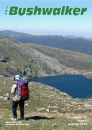
Volume 37 No 2 Autumn 2012 - Confederation of Bushwalking Clubs
Volume 37 No 2 Autumn 2012 - Confederation of Bushwalking Clubs
Volume 37 No 2 Autumn 2012 - Confederation of Bushwalking Clubs

Create successful ePaper yourself
Turn your PDF publications into a flip-book with our unique Google optimized e-Paper software.
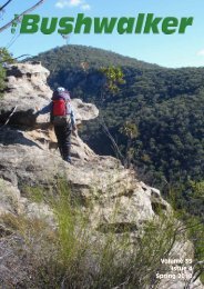
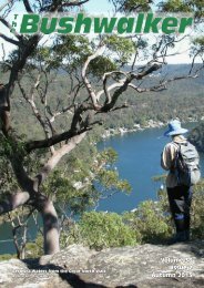
Taffys Lookout,<br />
Ku-ring-gai Chase National Park<br />
<strong>Volume</strong> <strong>37</strong><br />
Issue 2<br />
<strong>Autumn</strong> <strong>2012</strong>
Wouldn’t you like to be here?<br />
Fay’s horizon walk. Warrambungles.<br />
Photo: Ian Smith<br />
John Evan’s party on Mt Yarara,<br />
ACT/NSW border. Photo: John Evans
T<br />
h<br />
eBushwalker<br />
The Official Publication <strong>of</strong> the<br />
<strong>Confederation</strong> <strong>of</strong> <strong>Bushwalking</strong> <strong>Clubs</strong> NSW<br />
<strong>Volume</strong> <strong>37</strong>, Issue 2, <strong>Autumn</strong> <strong>2012</strong><br />
ISSN 0313 2684<br />
Editor: Roger Caffin<br />
editor@bushwalking.org.au<br />
Graphic Design & Assembly:<br />
Barry Hanlon<br />
Pro<strong>of</strong>reader:<br />
Roy Jamieson<br />
<strong>Confederation</strong> Officers:<br />
President: Dodie Green<br />
Administration Officer:<br />
admin@bushwalking.org.au<br />
Website: www.bushwalking.org.au<br />
Address all correspondence to:<br />
PO Box 119, Newtown, NSW 2042<br />
The <strong>Confederation</strong> <strong>of</strong> <strong>Bushwalking</strong><br />
<strong>Clubs</strong> NSW Inc represents<br />
approximately 66 <strong>Clubs</strong> with a total<br />
membership <strong>of</strong> about 8,700<br />
bushwalkers.<br />
Formed in 1932, the <strong>Confederation</strong><br />
provides a united voice on behalf <strong>of</strong> all<br />
bushwalkers on conservation, access<br />
and other issues.<br />
People interested in joining a bushwalking<br />
club may write to the<br />
<strong>Confederation</strong> Administration<br />
admin@bushwalking.org.au<br />
for a list <strong>of</strong> <strong>Clubs</strong>, but a far more<br />
useful on-line list is available at the<br />
<strong>Confederation</strong> website<br />
www.bushwalking.org.au,<br />
broken up into areas. There’s lots <strong>of</strong><br />
other good stuff there too, including<br />
the bushwalking FAQ.<br />
From the<br />
editor’s desk. . .<br />
Walk Safely—Walk with a Club<br />
Looking back over the last few issues, it seemed that we hadn’t<br />
had much in the way <strong>of</strong> classic Hawkesbury sandstone country<br />
for a while. So in this issue the front cover features a very nice<br />
spot near Cowan: Taffys Lookout, looking north out over Porto Bay.<br />
There’s an un<strong>of</strong>ficial track out along the ridge to here: it’s a nice little<br />
walk. From here we dropped down into the valley to the west and<br />
climbed up onto the next spur. It looks simple, but like anything in this<br />
area ‘some effort is required’.<br />
I will add that the COWAN 2nd Ed 1985 topo map I still use for this<br />
area has the lookout in the wrong place: they show it half-way along<br />
the ridge instead <strong>of</strong> at the northern end. There’s an old survey peg in<br />
the rock at the northern end too.<br />
Anyhow, looking at the terrain around Sydney, it struck me that people<br />
in Sydney are extremely lucky. How many cities have opportunities like<br />
this at their back door?<br />
I had better explain the photo <strong>of</strong> Mt Yarara, on the ACT/NSW border.<br />
John Evans had been walking the border, looking for all the markers.<br />
He sent me a close-up <strong>of</strong> part <strong>of</strong> the old metal trig flag which they<br />
found lying on the ground here. On it was my name in pencil and the<br />
date 28-May-1961. Was this me, he wanted to know. Yes, it was, and I<br />
can sort-<strong>of</strong> remember being there. Pencil lasted that long? Blimey!<br />
Graffiti that old has got to be national heritage stuff ...<br />
Articles for Publication<br />
I would like to thank the people who have sent in articles for publication recently in<br />
response to my plea. But I got some good news on Xmas Eve. As I wrote last time -<br />
when we came back from Europe I found that my network had taken a lightning hit<br />
through the local grid, and the main disk drive had been damaged. It wasn’t even<br />
spinning. My Maxtor NAS backup unit had really weird s<strong>of</strong>tware which simply deleted<br />
the backup folder when I tried to access it from another computer. Thanks Maxtor!<br />
(Never again!) But some Data Recovery folk managed to get most things back - for<br />
Xmas Eve!<br />
So if you have sent me stuff before August and it hasn’t been published, please<br />
consider sending it again anyhow.<br />
Anyhow, please keep those articles rolling in. We need them. Plain text please, and<br />
original unedited photos direct from the camera. If you want to include a DOC file or a<br />
PDF (in addition to the plain text) to illustrate the sort <strong>of</strong> layout you have in mind,<br />
please do so as well.<br />
Please note that opinions expressed by authors may not represent the <strong>of</strong>ficial<br />
opinions <strong>of</strong> the <strong>Confederation</strong> or any Club. The Editor’s opinions are his own, if he can<br />
find them.<br />
Roger Caffin<br />
Editor<br />
Subscribe to The Bushwalker<br />
Keep up with all the news and developments<br />
happening in the NSW bushwalking scene for<br />
only $10 per year. This is to cover posting and<br />
handling: the magazine itself is free.<br />
Send your name and address and cheque or<br />
money order to the <strong>Confederation</strong> <strong>of</strong> <strong>Bushwalking</strong><br />
<strong>Clubs</strong> NSW Inc, PO Box 119, Newtown<br />
NSW 2042. The new phone number is<br />
9565 4005. Make the cheque or money order<br />
payable to the <strong>Confederation</strong> <strong>of</strong> <strong>Bushwalking</strong><br />
<strong>Clubs</strong> NSW Inc as well: please do not abbreviate<br />
the name!<br />
Please indicate which issue you want your subscription<br />
to start with. We don’t want to duplicate<br />
copies you already have.<br />
Front Cover: Taffys Lookout, Kuringai Chase<br />
National Park. Photo: Roger Caffin.<br />
Index<br />
Wouldn’t you like to be here? 2<br />
From the Editor’s Desk 3<br />
The Clarence Arch and other Backyard Treasures 4<br />
Nav Shield <strong>2012</strong> - How can I be there? 5<br />
Australian Alpine Walking Track in Winter 6<br />
Ordinary? I don’t do ordinary 8<br />
Growing up in Sydney 10<br />
Sierra Hiking 12<br />
Round Mountain Circuit 14<br />
<strong>Volume</strong> <strong>37</strong>, Issue 2, <strong>Autumn</strong> <strong>2012</strong><br />
The Bushwalker | 3
Walk Safely—Walk with a Club<br />
The party on<br />
the Clarence<br />
Arch<br />
Michael Keats<br />
The Bush Club<br />
The Clarence Arch<br />
and other backyard<br />
treasures<br />
It was a fine, warm day with<br />
increasing cloud; about midday<br />
several rolls <strong>of</strong> thunder were heard in<br />
the vicinity, the humidity was most<br />
oppressive when the intermittent light<br />
breeze dropped, and the temperature<br />
ranged from 18 to 22. The highlight <strong>of</strong> the<br />
day would be our first destination, the<br />
Clarence Arch.<br />
At 0818, GR 415 918 we set <strong>of</strong>f down<br />
a well made and maintained dirt road.<br />
This road is one <strong>of</strong> dozens that have been<br />
pushed through to provide maintenance<br />
access for the State Rail 11 kV power line.<br />
We moved on for several hundred metres<br />
when Steve said that we needed to be<br />
lower. After clambering down a distance,<br />
a mighty cliff was encountered, so we<br />
retraced back to the access road. We then<br />
walked north to a track junction, and<br />
headed down another similar road in a<br />
SW direction to its terminus at a power<br />
pole. This decision was also wrong, as<br />
Steve saw the Clarence Arch to the south<br />
and about 100 m away on the far side <strong>of</strong> a<br />
steep ravine.<br />
Before heading <strong>of</strong>f for the arch, we<br />
took stock <strong>of</strong> our position and noted that<br />
there were great views <strong>of</strong> the upper<br />
reaches <strong>of</strong> Reedy Creek that would only<br />
get better as we moved around the<br />
headwaters. Also Emanuel and I both<br />
thought we had seen another arch <strong>of</strong>f to<br />
the west about 100 m back up the road,<br />
so before heading <strong>of</strong>f to find Clarence<br />
Arch this was<br />
investigated. It<br />
proved not to be<br />
an arch but a<br />
leap over that<br />
looked like an<br />
arch from a<br />
distance.<br />
Getting to<br />
Clarence Arch<br />
from our<br />
position at the<br />
power pole<br />
involved a descent into a ravine and then<br />
a corresponding climb up the other side.<br />
The understorey was dense and the rock<br />
faces wet and slippery. It is the old story:<br />
you have to work to earn a good<br />
experience. We arrived at the Clarence<br />
Arch at 0906. To set the scene, Steve<br />
pulled out <strong>of</strong> his pack a copy <strong>of</strong> an old<br />
photograph, circa 1905, <strong>of</strong> a group <strong>of</strong> a<br />
dozen or more hatted and suited railway<br />
workers sitting and standing on the<br />
Clarence Arch. It was a great photo and<br />
one we intended to replicate. What was<br />
even more interesting was that the photo<br />
showed below the arch several tents that<br />
were presumably worker accommodation<br />
during the construction <strong>of</strong> the line and the<br />
building <strong>of</strong> the tunnels.<br />
In the hundred plus years that have<br />
passed, there have been a few changes, a<br />
huge tree to the west has died and<br />
collapsed without trace. Where the tents<br />
were pitched is now a forest <strong>of</strong> Black<br />
Wattle (Callicoma serrata), and on the<br />
east side <strong>of</strong> the arch, multi stemmed<br />
Brigalow type trees have grown up and<br />
obscured a large part <strong>of</strong> the dramatic view<br />
<strong>of</strong> the arch when viewed from up the hill.<br />
Given all those changes we still<br />
managed a whole series <strong>of</strong> excellent<br />
photos showing the full extent <strong>of</strong> this<br />
amazing natural arch. For the statistically<br />
inclined, the arch is about 15 m high, 14<br />
m long and about 1.5 m wide. It is easy to<br />
walk on and <strong>of</strong>f at the northern end, but<br />
the southern end involves a pagoda climb.<br />
The south end also is undercut with a<br />
very pleasant ochre coloured, curved semi<br />
cave. Taking photos with this feature<br />
included are very nice indeed.<br />
At 0945, we climbed down into the<br />
creek system below, noted the total<br />
obliteration <strong>of</strong> the former campsite, and<br />
then pressed on wanting to reach the<br />
railway line near the entrance to Tunnel<br />
<strong>No</strong>.7. At GR 413 912, we came across a<br />
small section <strong>of</strong> excavated ground and a<br />
rock wall that appeared to be part <strong>of</strong> an<br />
abandoned road. We pushed on down the<br />
creek system, encountering several hand<br />
cut steps in the sandstone on our way to<br />
view the western entrance <strong>of</strong> Tunnel<br />
<strong>No</strong>.7. It was unclear as to why such effort<br />
would be made in such a remote place. It<br />
could well be related to an access route<br />
for tunnel construction works.<br />
After viewing the drop between our<br />
position and the railway line, it was<br />
quickly determined that we were not<br />
going to make it down to the railway line<br />
at that point, so we threaded our way<br />
back up the creek system to the track<br />
terminus at the power pole. After a quick<br />
drink stop we then headed west seeking a<br />
way across the north–south valley and<br />
ridge system, and hence down to the<br />
railway line that we needed to cross. At<br />
1057, we came across a drystone wall<br />
designed to provide a level area within an<br />
overhang. Again, questions arise as to<br />
why someone would expend so much<br />
effort in such a remote place. Hard to tell<br />
but it appeared to be a similar age to<br />
other stonework. Perhaps it was built by a<br />
railway<br />
A<br />
worker who wanted to be alone.<br />
t 1148, we started a short walk up<br />
the bed <strong>of</strong> the former incline railway.<br />
This incline stretches for just over 100m<br />
(map distance) in an east west alignment<br />
at a very steep gradient. The incline<br />
railway was built to bring in the several<br />
million bricks and other building<br />
materials required for lining the tunnels.<br />
Engineers quarters during construction<br />
The Dreadnought bricklayer<br />
4 | The Bushwalker <strong>Volume</strong> <strong>37</strong>, Issue 2, <strong>Autumn</strong> <strong>2012</strong>
Pagoda Land<br />
Steve produced a copy <strong>of</strong> a picture <strong>of</strong> the<br />
incline railway when it was operational.<br />
This helped us to understand the rock<br />
retaining walls and the occasional rail line<br />
that we walked over as we climbed all the<br />
way to the top.<br />
As well as the image <strong>of</strong> the actual<br />
incline railway, Steve had a picture <strong>of</strong> a<br />
device called a Dreadnought. This<br />
contraption was a form <strong>of</strong> mobile scaffold<br />
that enabled the bricklayers to work<br />
simultaneously at several levels as they<br />
created the arched brick structure that<br />
would become the tunnel lining. The<br />
device was very large, bulky and capable<br />
<strong>of</strong> being moved along as the work<br />
progressed. Given the number <strong>of</strong> tunnels<br />
(10 in all) the quantities <strong>of</strong> all materials<br />
required would have put a huge strain on<br />
resources.<br />
At 1310, we resumed our adventure,<br />
walking back up the service road to the<br />
Mount Clarence turn<strong>of</strong>f and then turning<br />
slightly east <strong>of</strong> north down the modern<br />
service road to tunnels <strong>No</strong>.8 and <strong>No</strong>.9. As<br />
we walked down there was a lively<br />
discussion about Wilf Hilder’s<br />
grandfather, who completed an oil<br />
painting <strong>of</strong> three <strong>of</strong> the tunnels, possibly<br />
<strong>No</strong>.s 7-9, either when under construction<br />
or soon after they were completed. The<br />
painting shows a completely denuded and<br />
raw landscape. I know Wilf tried on<br />
several occasions, without success, to try<br />
to locate the spot where his grandfather<br />
could have sat to execute the painting.<br />
As we moved along the railway line,<br />
Steve invited us to look up to the north at<br />
an unusual sight. Perhaps 80 m above us<br />
was an overhang under a pagoda that had<br />
been ‘made safe’ by the installation <strong>of</strong><br />
eight brick pillars. Irresistibly, it reminded<br />
me <strong>of</strong> the Porch <strong>of</strong> the Caryatids(1) annex<br />
<strong>of</strong> the Parthenon on the Acropolis in<br />
Greece! Heeding the advice from Steve,<br />
we checked the railway lights and having<br />
determined it was safe to cross did so<br />
smartly. We then had to walk up a<br />
parapet sandwiched between a railway<br />
line cutting and a steep flowing drain. It is<br />
a right <strong>of</strong> way used regularly by railway<br />
maintenance staff, but it is a bit hairy,<br />
particularly the section with no railing.<br />
This right <strong>of</strong> way becomes a crude track<br />
that joins yet another access road for the<br />
railway power line. During this climb, the<br />
sun poked through the cloud and the<br />
humidity soared. We sweated buckets.<br />
The access road we had joined at this<br />
point runs parallel to the Bells Line <strong>of</strong><br />
Road but below it so it is not seen. To<br />
reach the Porch <strong>of</strong> the Caryatids, as<br />
interpreted by State Rail engineers, we<br />
<strong>Volume</strong> <strong>37</strong>, Issue 2, <strong>Autumn</strong> <strong>2012</strong><br />
needed to cross yet another tributary <strong>of</strong><br />
Reedy Creek. At GR 407 922, an inviting<br />
ridge to the east was followed. We were<br />
all rather surprised to come across a very<br />
rundown and seemingly abandoned tiny<br />
dwelling, complete with skirting rubbish<br />
that reeked <strong>of</strong> poverty and decay. We<br />
hurried on although there was little<br />
reason to do so.<br />
Almost inevitably, we came across<br />
another power line service road. This road<br />
quickly took us south towards our<br />
objective, the Porch <strong>of</strong> the Caryatids.<br />
Predictably the road finished at a power<br />
pole. We then did a bush bash for about<br />
50 m to reach the Porch <strong>of</strong> the Caryatids.<br />
Forget the classical references, this is<br />
an amazing and surprising piece <strong>of</strong><br />
engineering that has to have been a<br />
retr<strong>of</strong>it demanded by modern OH&S<br />
requirements, to prevent the possible<br />
collapse <strong>of</strong> the pagoda down onto the<br />
railway line. If the overhang had been<br />
considered an issue in 1905, or earlier, a<br />
stick <strong>of</strong> gelignite would have solved the<br />
problem. As it is, at great expense eight<br />
substantial brick columns have been built<br />
to stabilise a natural structure that really<br />
needs no stabilising. The bringing in <strong>of</strong><br />
men and materials to build these columns<br />
must have been a major exercise. We took<br />
many photos, including a series looking<br />
down<br />
E<br />
onto the railway line.<br />
nergetic Brian then suggested we<br />
should go and explore the series <strong>of</strong><br />
pagodas that cover the crest <strong>of</strong> the ridge<br />
to the south. This was one <strong>of</strong> the<br />
highlights <strong>of</strong> the walk. From a height <strong>of</strong><br />
1072 m, there are views down the valley<br />
<strong>of</strong> the western arm <strong>of</strong> Reedy Creek all the<br />
way to Mount York. To make for a<br />
delightful situation, the sun kept<br />
disappearing and then reappearing out <strong>of</strong><br />
the clouds, illuminating successive ridges,<br />
and at times the whole catchment <strong>of</strong> the<br />
River Lett. t<br />
1 Caryatids are female figures serving as<br />
supports. The most likely derivation <strong>of</strong> their<br />
name is from the young women <strong>of</strong> Sparta<br />
who danced every year in honour <strong>of</strong> Artemis<br />
Karyatis (‘Artemis <strong>of</strong> the Walnut Tree’)<br />
Porch <strong>of</strong> the Caryatids<br />
Walk Safely—Walk with a Club<br />
NavShield <strong>2012</strong><br />
How can<br />
I be<br />
there?<br />
You have decided to be part <strong>of</strong> that<br />
great bush navigation training<br />
event for the emergency services<br />
“NavShield” but you are unsure <strong>of</strong><br />
how to enter. You know that<br />
NavShield is a great way to practice<br />
bush navigation in a friendly<br />
atmosphere and great location. You<br />
want to improve your navigation skills<br />
as you want to be a better bushwalker<br />
and not just a follower <strong>of</strong> others<br />
through the bush.<br />
Remember FOUR things.<br />
ONE, team registration is via the<br />
website “www.bwrs.org.au” Look for<br />
the NavShield link. You will find all<br />
the information you need about<br />
NavShield <strong>2012</strong> at this website from<br />
Event Rules to catering menu etc. As<br />
in all bushwalks you must go as a<br />
group. You will need a team <strong>of</strong> 2 - 4<br />
bushies for the ONE DAY event OR a<br />
team <strong>of</strong> 4 - 6 bushies for the TWO<br />
DAY (overnight) event.<br />
TWO, it takes floods (as in 2005) to<br />
defer NavShield from the first full<br />
weekend in July each year. Thus, in<br />
<strong>2012</strong> NavShield will be held on July<br />
7th / 8th.<br />
THREE, late entries incur penalties.<br />
NavShield is a large event and<br />
demanding <strong>of</strong> BWRS resources. Don’t<br />
run the risk <strong>of</strong> a penalty. Please give<br />
BWRS time to process your team entry<br />
by planning to register and pay before<br />
the second last Friday <strong>of</strong> June (June<br />
22nd).<br />
FOUR, don’t ask where NavShield<br />
will be held. The location will be<br />
revealed one week before NavShield.<br />
Bushwalkers Wilderness Rescue Squad<br />
(BWRS - the search and rescue section<br />
<strong>of</strong> <strong>Confederation</strong>) needs time to set<br />
the course without conferring any<br />
advantage to local teams. NavShield<br />
will be held within three to four hours<br />
(maximum) driving from Sydney.<br />
BWRS tries to make NavShield a<br />
friendly event with the course set in<br />
great bushwalking country. It is a<br />
highlight for many emergency services<br />
personnel who return year after year<br />
to NavShield. Check points are<br />
deliberately set so that all levels <strong>of</strong><br />
bush navigator, from beginner to<br />
experienced, will get good navigation<br />
practice.<br />
Remember to register your club<br />
team for NavShield via<br />
www.bwrs.org.au; lock in July 7th /<br />
8th as the NavShield date; register &<br />
pay on time then look forward to a<br />
unique navigation challenge,<br />
NavShield. BWRS would love to see<br />
you and your club at NavShield <strong>2012</strong>.<br />
Keith Maxwell,<br />
BWRS President.<br />
The Bushwalker | 5
Walk Safely—Walk with a Club<br />
Australian Alpine<br />
Walking Track,<br />
in Winter<br />
Bob Manks, with notes by Roger Caffin<br />
The party with some gear before the trip<br />
A training ski trip being led by Bob Manks<br />
I(Roger) have been asked a number<br />
<strong>of</strong> times whether anyone has ever<br />
done the AAWT in winter, in the<br />
snow. I have only been able to find<br />
evidence <strong>of</strong> one party ever doing the<br />
whole track, in 1981, and even then that<br />
trip did not go north <strong>of</strong> Mt Kosciusko. By<br />
way <strong>of</strong> explanation, at the time the AAWT<br />
did not go past the Tom Groggin Station.<br />
A pity, as the next section to at least<br />
Kiandra is arguably the best bit <strong>of</strong> the<br />
whole track.<br />
The party consisted <strong>of</strong> five lads from<br />
the Bendigo College <strong>of</strong> Advanced<br />
Education, and predictably they were<br />
doing an outdoors leadership course. The<br />
party consisted <strong>of</strong> Jack Langedyk, Bob<br />
Manks, Mark Skinner, Andrew Lewis and<br />
Tom Daniel. I was able to contact Bob<br />
Manks and got some information from<br />
him: mainly PDF copies <strong>of</strong> old newspaper<br />
cuttings. Sadly, actual original photos<br />
Descending from Mt McDonald<br />
were not to be found. I have tried to<br />
reproduce some <strong>of</strong> the very grainy<br />
newspaper photos anyhow. To add some<br />
other views <strong>of</strong> the country they traversed I<br />
have also included a few colour photos<br />
from an autumn traverse <strong>of</strong> the AAWT my<br />
wife and I did in 1999. I will quote mainly<br />
from an article written by Bob Manks<br />
shortly after the trip. I am not sure about<br />
the source, but it may have been “Ski<br />
Tour 1981”. It was typed,<br />
not printed. There are a<br />
few interpolations in<br />
square brackets: they are<br />
my explanations.<br />
n Saturday the<br />
“O<br />
15th <strong>of</strong> August,<br />
1981 four fellow<br />
students and myself from<br />
the Bendigo College <strong>of</strong><br />
Advanced Education<br />
headed <strong>of</strong>f from Walhalla<br />
on an expedition that<br />
helped confirm to us that<br />
although not great in<br />
height or grandeur<br />
compared to European or<br />
Asian standards,<br />
Victorian mountains can<br />
be just as dangerous,<br />
terrifyingly beautiful and<br />
challenging as possibly<br />
many <strong>of</strong> the major<br />
ranges around the world. it may be too<br />
easy to underestimate the potential<br />
dangers these mountains can <strong>of</strong>fer.<br />
This expedition could be said to be the<br />
culmination <strong>of</strong> two years work. It took<br />
into account planning and preparation,<br />
safety and skills. All were tested along the<br />
route.”<br />
In fact, travelling<br />
through the<br />
Victorian mountains<br />
in winter is made<br />
more difficult by<br />
the relatively low<br />
altitudes<br />
encountered. When<br />
you get above<br />
3,000 m the snow is<br />
usually good, but<br />
down in the<br />
Victorian mountain<br />
ash forests you get<br />
s<strong>of</strong>t wet snow and it<br />
can be just plain hard work! Adding to the<br />
hassles <strong>of</strong> the s<strong>of</strong>t snow were their packs:<br />
typically starting at over 30 kg per person.<br />
Some synthetic clothing was used, but<br />
they also used wool and padded jackets,<br />
eschewing only cotton. So much <strong>of</strong> their<br />
gear was rather heavy by today’s<br />
standards. They used food drops as well,<br />
allowing for over 50 days.<br />
“We left Walhalla in conditions that<br />
The Crosscut Saw, autumn 1999<br />
were good. This soon deteriorated over<br />
the next three days, strong winds and<br />
blizzards made the Baw Baw Plateau<br />
more <strong>of</strong> a task than we had expected.<br />
Finding fresh snow down to 1000 m,<br />
lower than we had thought it would be,<br />
made snow shoeing difficult. The next<br />
four days were also poor. On the night <strong>of</strong><br />
Friday the 21st August, we were hit by<br />
heavy snow which continued all the next<br />
day making the descent down Champion<br />
Spur To Black River difficult. However,<br />
not as hard as the river crossing made on<br />
a large greasy log which had to be<br />
straddled.”<br />
I have walked down that spur in fine<br />
weather in <strong>Autumn</strong>, and that was hard<br />
work. It’s very steep! Maniacal bulldozer<br />
drivers, and straight into the river.<br />
e reached Mt Skene on 22nd<br />
“WAugust and were disappointed<br />
not to have skis, but possibly not as<br />
disappointed as we were not to find a hut<br />
6 | The Bushwalker <strong>Volume</strong> <strong>37</strong>, Issue 2, <strong>Autumn</strong> <strong>2012</strong>
Walk Safely—Walk with a Club<br />
we were expecting. Mt Skene <strong>of</strong>fers<br />
beautiful clear tracks for skiing, gentle<br />
and steep slopes and good views. An area<br />
I would definitely visit again in winter,<br />
this Atime with skis.<br />
part from poor weather everything<br />
had gone reasonably well so far. We<br />
reached Mt McDonald on 25th August. It<br />
provided excellent views all round with<br />
Mt Buller and The Bluff fighting for<br />
dominance over each other. Fine weather<br />
provided unexpected problems - mainly<br />
slushy snow making snow-shoeing<br />
difficult. Seven kilometres in six hours is<br />
not exactly fast. We reached Mt Howitt on<br />
the 27th August in white-out conditions.<br />
A strong blizzard was experienced all this<br />
day making the crossing <strong>of</strong> the Crosscut<br />
Saw difficult. After three attempts to start,<br />
we finally made it but not without<br />
incident. We had just unroped when I<br />
slipped down an icy slope 100 feet below.<br />
I stopped having fallen 30 feet [in] freefall<br />
on the way. That’s life, thank God. Mt<br />
Speculation, Mt Despair and The Razor all<br />
had a couple <strong>of</strong> good tests for us but<br />
nothing instep crampons couldn’t fix.”<br />
The colour photo <strong>of</strong> the Crosscut Saw<br />
illustrates the problem nicely. You can<br />
slide a long way down on either side: the<br />
side to the right is actually known as The<br />
Terrible Hollow. This would have to be<br />
one <strong>of</strong> the most exposed traverses in<br />
Australia.<br />
“We reached Hotham fairly worn out<br />
but possibly not as much as Jack’s feet.<br />
They were numb, infected and changing<br />
colour regularly. They had been wet for<br />
about 15 days continually. Because we<br />
had nordic ski boots the tops were s<strong>of</strong>t.<br />
The snow shoes were designed to pull up<br />
on the boot. Instead our feet were being<br />
used. Jack’s feet were a mess, so much so<br />
that he was given medical advice to not<br />
go on.”<br />
In another article it was suggested that<br />
Jack had suffered some frostbite <strong>of</strong> the<br />
toes due to a broken binding on the snow<br />
shoes. This had meant he was tightening<br />
the straps a lot to compensate, and this<br />
had restricted the blood flow. Mind you,<br />
the design <strong>of</strong> their snow shoes was very<br />
old anyhow.<br />
his was real injustice for him as<br />
“Tthe following 14 days were good. I<br />
only put my Japaras [jacket or<br />
overtrousers] on once. We picked up our<br />
skis at Hotham and had a delightful ski<br />
across to Falls Creek where we had our<br />
food drop. We then skied to Big River and<br />
then up to Cleve Cole Memorial Hut. A<br />
really beautiful trip. The weather was so<br />
good a nightime assault on skis to Bogong<br />
was carried out by myself and another<br />
nordic skier found staying in Cleve Cole.<br />
This trip to Bogong is still one <strong>of</strong> my<br />
major highlights <strong>of</strong> the whole Alpine<br />
Track.<br />
After Bogong, the scenery was not<br />
good until Mt Gibbo was reached. At Mt<br />
Gibbo the whole Kosciusko range opened<br />
up before our eyes - a magnificent sight.<br />
We then descended to the rich farming<br />
land <strong>of</strong> Tom Groggin - the end <strong>of</strong> the<br />
actual Alpine track [in those days]. A<br />
relief to reach it but not the place to end<br />
such a long trip. Mak and myself wanted<br />
<strong>Volume</strong> <strong>37</strong>, Issue 2, <strong>Autumn</strong> <strong>2012</strong><br />
Kosciusko so we<br />
hitched up the<br />
road to Thredbo<br />
Alpine Ski Village<br />
and caught the<br />
Crackenback<br />
Chairlift. It was<br />
windy on Mt<br />
Kosciusko but<br />
well worth<br />
reaching as it<br />
provides excellent<br />
views. It is also<br />
the gateway to all<br />
those NSW ski<br />
fields just waiting<br />
to be devoured. It<br />
won’t be long<br />
before our skis<br />
will be heading<br />
north again.<br />
However, 33 days<br />
in a row with only one shower is quite<br />
enough for one season. NSW will still be<br />
there next year as will Mt Skene and the<br />
High Plains. I think a nice trip down by<br />
the sea is in order for me, the Otways are<br />
nice at this time <strong>of</strong> the year.”<br />
A note appended to the article by one<br />
Tom Kneen (an acquaintance <strong>of</strong> mine<br />
from our Melbourne University<br />
Mountaineering Club days) pointed out<br />
that 1981 had near-record levels <strong>of</strong> snow,<br />
and that this usually meant that there was<br />
a lot <strong>of</strong> bad weather. We move on to<br />
another article published in ‘Adventure<br />
Sports’.<br />
“As we travelled over the Baw Baw<br />
Plateau, over Mt Erica, Mt Talbot and Mt<br />
St Phillack, the winds became stronger<br />
and stronger. So strong, in fact, that<br />
despite our relatively sheltered campsite,<br />
the two Jansport traildomes [tents] we<br />
were using were blown flat during the<br />
night.”<br />
The Jansport Traildome was a very,<br />
very early version <strong>of</strong> a geodesic tent,<br />
albeit rather like a pop-up tent. I could<br />
not find a picture <strong>of</strong> it on the web, but I<br />
note that several other companies (eg<br />
Kelty) market a tent with the same name.<br />
The Viking, autumn 1999<br />
The Barry Ranges, autumn 1999<br />
Jansport dropped out <strong>of</strong> the tent market<br />
in 2010.<br />
fter camping in a large saddle<br />
“A between Mt Buggery and Mt<br />
Speculation, we headed <strong>of</strong>f early only to<br />
find the going tough as vertical walls <strong>of</strong><br />
snow and ice blocked our way. After<br />
trudging up Mt Speculation, we began the<br />
slow trip down the other side, to be<br />
confronted with another trek up Mt<br />
Despair and the The Razor. The place<br />
names echoed our feelings and the<br />
monotony and exertion <strong>of</strong> climbing up<br />
and then down like yoyos was wearing,<br />
physically and mentally.”<br />
They also noted that the Barry Range,<br />
notorious in summer for being very dry,<br />
was “just low enough to miss out on<br />
snow”. They had water problems there as<br />
well. These days there are some<br />
strategically-placed water tanks for<br />
walkers, but you need to know where<br />
they are as they are hidden. In the colour<br />
photo <strong>of</strong> our Barry Range campsite the<br />
water tank is just out <strong>of</strong> sight to the left.<br />
We got there early, and had a washing<br />
day.<br />
If anyone else has done the AAWT in<br />
winter, I would love to hear about it. t<br />
The Bushwalker | 7
Walk Safely—Walk with a Club<br />
Ian Smith - Grey <strong>No</strong>mad in a Camper van<br />
Three Sisters<br />
It was a nothing sort <strong>of</strong> day. I found it<br />
hard to get motivated and only<br />
managed to travel up a few<br />
kilometres from where I’d slept in<br />
Springwood. I got to the Conservation<br />
Hut, stuffed around and then went to<br />
sleep for 1 ½ hours before deciding to<br />
have lunch.<br />
It was near the end <strong>of</strong> that, as I was<br />
finishing my Tasmanian story for the<br />
magazine, that I thought how ordinary<br />
the day had been. <strong>No</strong>thing had<br />
happened, hadn’t done anything exciting,<br />
it was so un-Ian like. Around then the<br />
light dimmed, noticeably. I glanced<br />
outside, saw clouds first and then couldn’t<br />
help but notice the number <strong>of</strong> cars in the<br />
car park. The first lot <strong>of</strong> thunder rolled in<br />
and the lighting followed soon after.<br />
Someone was going to be in trouble I<br />
thought. The radio blared out a “weather<br />
event” warning (we used to call them<br />
storms) and said it might be extreme.<br />
It hailed not once but three times, each<br />
about five minutes apart. Because you’re<br />
closer to the clouds up here the lightning<br />
and cracking thunder was scary; one <strong>of</strong><br />
the top ten worst storms I’ve ever been in.<br />
I watched ice bouncing <strong>of</strong>f the cars next<br />
door; somewhere nearby they were<br />
apparently as large as ping pong balls but<br />
Leura Cascades<br />
here on the edge <strong>of</strong> the cliff we only had<br />
small hail.<br />
A couple <strong>of</strong> hours later it finally eased<br />
up and I contemplated moving. I decided<br />
Leura Cascades would be the go and went<br />
to exit the car park. However, I couldn’t<br />
help but notice the police rescue vehicle<br />
coming down the road towards the other<br />
two that had arrived earlier. It didn’t look<br />
good from where I viewed it so I went to<br />
find out what had happened.<br />
I asked one <strong>of</strong> the police what the<br />
problem was and apparently there were<br />
walkers trapped in the valley by the flood<br />
waters - a fact that didn’t surprise me. I<br />
noticed a couple on the verandah <strong>of</strong> the<br />
hut and started a conversation. It turns<br />
out they were from Holland and they’d<br />
been caught for two hours between<br />
waterfalls and felt lucky to escape. They’d<br />
been drenched.<br />
They’d also been in New Zealand for<br />
the previous month bushwalking but, like<br />
me, they found it scenically beautiful but<br />
boring compared to Australia because<br />
their forests are so sterile. They’d also<br />
spent some time in Costa Rica and raved<br />
about the walking over there; they said<br />
the wildlife was fantastic; monkeys and<br />
other animals everywhere.<br />
It seemed to be clearing a little so I<br />
decided to go to Leura<br />
and ended up at<br />
Gordon Falls. I walked<br />
the 200 metres and 50<br />
or so steps and was<br />
rewarded with a view<br />
I’d never seen before;<br />
not one but two falls<br />
though I suspect the<br />
second<br />
T<br />
was ephemeral.<br />
here was a sign<br />
pointing to Leura<br />
Cascades so I headed<br />
<strong>of</strong>f: couldn’t be far I<br />
thought as fresh<br />
thunder rumbled.<br />
Splish-splash along the<br />
track, over tree roots,<br />
slipping on mud and<br />
brushing past wet ferns<br />
I trudged. Eventually I<br />
came to a turn <strong>of</strong>f for<br />
Bridal Veil Falls and chose that option.<br />
Wow, what a waterfall: I’d never seen<br />
this Bridal Veil version before (there’s<br />
another one over at Grose Valley) and<br />
today water gushed over the semi-circular<br />
rock formation in a spectacular display.<br />
On I walked, coming across another four<br />
lookouts I’d never seen before, including<br />
Elysian with its unusual rock shapes.<br />
There’s something quite magical about<br />
drifting mountain mist wafting and sliding<br />
its way across the forest ro<strong>of</strong> between<br />
sheer sandstone cliffs. It vanishes and<br />
reappears and constantly adjusts its shape<br />
in a mesmerising display.<br />
More thunder rumbled, the occasional<br />
drop splattered on my shirt but I plunged<br />
on, sure that Leura and safety couldn’t be<br />
too far away. An hour passed and still<br />
signs pointed onwards; light, what there<br />
was <strong>of</strong> it, started to fade.<br />
Then I came across a Spaniard; he was<br />
slightly hysterical and obviously in a<br />
hurry; he pointed back and said he’d just<br />
seen a dingo and hurried <strong>of</strong>f. I retorted<br />
that they wouldn’t hurt you but checked<br />
Gordon Falls<br />
8 | The Bushwalker <strong>Volume</strong> <strong>37</strong>, Issue 2, <strong>Autumn</strong> <strong>2012</strong>
Walk Safely—Walk with a Club<br />
Bridal Veil Falls Leura<br />
that my tripod was fully extended,<br />
imagining yet another use for it other<br />
than the snake prodding I’d done in<br />
Tasmania.<br />
The bird life was prolific but every<br />
time I went to shoot one there was<br />
something not right with the camera; it<br />
didn’t stop me trying. I had been almost<br />
within arm’s length <strong>of</strong> a lyre bird; had<br />
yellow-tailed black cockatoos only ten<br />
metres away and wrens almost at my feet<br />
and stuffed it all up.<br />
Then I finally got to the cascades after<br />
well over an hour. My reward was a rush<br />
<strong>of</strong> water such as I’d never seen here<br />
before. Usually there’s a delicate flow<br />
that provides background music to the<br />
sounds <strong>of</strong> the forest. Today it roared<br />
through the sandstone canyon and pushed<br />
aside the adjacent ferns in its haste to<br />
reach the valley floor.<br />
I went a bit berserk with the camera<br />
then had to walk back, this time along the<br />
road where I hoped I might get a lift but<br />
all I did was have a brief conversation<br />
with a kiwi who was running by and she<br />
ran here regularly but didn’t<br />
actually know where it was<br />
she<br />
I<br />
ran.<br />
wondered where all the<br />
Australians were. The first<br />
person I’d seen the previous<br />
afternoon was from Chile and<br />
she loved the Australian bush<br />
and said it was so much better<br />
than in Chile because we had<br />
maps and signs, something<br />
they apparently don’t have.<br />
She also said you couldn’t go<br />
down the trail at Springwood<br />
we both wanted to because<br />
water had closed it. Then<br />
today I hadn’t spoken to one<br />
local, only the English couple<br />
I’d seen at Gordon Falls had a dialect I<br />
was comfortable with.<br />
Finally, I made the motorhome after<br />
walking down the road and went over to<br />
some other people in camper vans.<br />
Naturally enough, they were from<br />
Switzerland.<br />
So I went and switched on the radio<br />
and learnt that the Katoomba Aquatic<br />
Centre ro<strong>of</strong> had collapsed under the<br />
weight <strong>of</strong> ice. The only real water I’d<br />
been soaked in was sweat and I couldn’t<br />
help think what an exciting day it had<br />
been! t<br />
Yellow tailed black cockatoo<br />
<strong>Volume</strong> <strong>37</strong>, Issue 2, <strong>Autumn</strong> <strong>2012</strong><br />
The Bushwalker | 9
Walk Safely—Walk with a Club<br />
Growing up<br />
in Sydney<br />
Michael Smith<br />
“If you remember the 1960’s, you weren’t<br />
really there”. Fortunately I kept a diary <strong>of</strong><br />
my bushwalking back then. Thus I recall<br />
walk number 29, five days <strong>of</strong> bushy magnificence in<br />
the Blue Mountains.<br />
I was one <strong>of</strong> the rock climbers from all over<br />
Sydney who would gather in Katoomba, pool<br />
resources <strong>of</strong> ropes, slings and carabiners, and<br />
disperse to the cliff faces <strong>of</strong> Narrow Neck, the Three<br />
Sisters and Mount Victoria. By today’s standards, we<br />
were lucky to have survived. Leaders claimed a<br />
three strand, laid, nylon rope while the rest made do<br />
with a manilla rope. Helmets were unknown,<br />
Volleys were king. It was 1966, I still had two years<br />
<strong>of</strong> school to go. With four others, on a frosty Blue<br />
Mountains Saturday, I climbed ‘one hundred foot<br />
slab’ (Piton Gambit start). Then we moved on to<br />
ascend the first <strong>of</strong> the Three Sisters. For me, rock<br />
climbing was hugely character- building. I was<br />
constantly challenged, threatened. It was <strong>of</strong>ten<br />
necessary to drag from my body, prodigious physical<br />
feats to extricate myself. I learned to trust my life to<br />
another, and reciprocate by devoting my fullest<br />
attention to their welfare. I came out <strong>of</strong> it bristling.<br />
That night Rick Jamieson drove myself and Jim<br />
Gaffy to Kanangra Walls, saw us safely into the cave,<br />
ate a jelly sandwich and left. Jelly crystals were also<br />
a staple for my fellow walker Jim. A popular<br />
refresher was to be had by emptying the packet into<br />
a pot-sized rainwater rock pool, the lot to be sucked<br />
up with a length <strong>of</strong> plastic tubing carried for the<br />
purpose. On awakening next morning we<br />
investigated a cough and found two blokes and four<br />
girl bushwalkers in our cave, curled up against the<br />
freezing August crisp. They had with them a<br />
portable stereo record player. This was the famous<br />
dancing cave.<br />
Then it was <strong>of</strong>f to the Coxs River, over High and<br />
Mighty, Stormbreaker, Rip, Rack, Roar, Rumble,<br />
Cloudmaker and the baffling Dex Creek. Myles<br />
Dunphy’s Gangarang map was our guide through<br />
these Mountains. I was impressed with the detail<br />
and sheer practicality <strong>of</strong> the map. I would later<br />
become a surveyor, navigator, and go on to draw<br />
bushwalking maps for others to follow.<br />
My bony sixteen-year-old body was pretty spent<br />
by the time we made Konangaroo Clearing. It is the<br />
lot <strong>of</strong> a school boy to make do with the equipment<br />
his mother chose to buy him. Think cotton school<br />
football jersey and a sleeping bag filled with ‘cotton<br />
wadding’. Up went the borrowed japara tent among<br />
the wombats, cattle and horses. Next morning, on<br />
our frosty river flat, we discovered two chaps who<br />
were doing the same walk. We swapped contact<br />
details and for years afterwards they joined me on<br />
other walks and canoe trips.<br />
Even then the Coxs River was too polluted to<br />
drink. We followed the water upstream, crossing it<br />
shoeless many times, marvelling at the big trout<br />
swaying in the current. By dark a horse trail led us<br />
Top: Rock climbing in the 60s.<br />
Centre: Across Kanangra Tops<br />
Bottom: Ah yes, the map<br />
10 | The Bushwalker<br />
<strong>Volume</strong> <strong>37</strong>, Issue 2, <strong>Autumn</strong> <strong>2012</strong>
Walk Safely—Walk with a Club<br />
to Carlons Farm, home also to the dogs Baldie and<br />
Tess who we knew from previous walks. Next<br />
morning our stroll through the Megalong Valley<br />
was shortened when a couple <strong>of</strong> charming matrons<br />
gave the four <strong>of</strong> us a lift to Blackheath Station.<br />
We still had two days to spare and the 4 <strong>of</strong> us<br />
spontaneously decided to charge down to Bluegum<br />
Forest for the night. The scenery was superb all the<br />
way from Govetts Leap. Wild horses were still living<br />
in the forest and we scattered a few. Luxury, dinner<br />
was eaten in daylight for the first time that trip,<br />
under the blue gums. Our fourth night was spent in<br />
the rain, wet patches getting bigger on our sleeping<br />
bags. Last breakfast, in the tent, don’t touch the<br />
ro<strong>of</strong> or it will start a leak, a slushy world <strong>of</strong> fog and<br />
rain outside. Pack up, don the cape groundsheet<br />
and dash outside to drop the sodden tent. We<br />
recrossed muddy rapids, now much deeper. Bridal<br />
Veil Falls was a roaring fury <strong>of</strong> mist and spume. The<br />
trip ended in the waiting room <strong>of</strong> Blackheath<br />
Railway Station where we waited 3 hours in front<br />
<strong>of</strong> the coal fire for something to clatter down the<br />
permanent way. By the end <strong>of</strong> the sixties Americans<br />
had walked on the moon and I stopped writing up<br />
my walks at number 50. t<br />
[I still remember the 60s, and I (think I) was there.<br />
Cable-laid nylon rope to BS3104, Japara tents,<br />
'cotton' wadding, and all- Ed]<br />
Log book at Cloudmaker<br />
The Tongariiro Crossiing<br />
Hike the world’s best walk with a<br />
small group & local guide.<br />
Fly Sydney – Rotorua direct.<br />
Free transfer to our cozy alpine lodge<br />
for 3 days <strong>of</strong> unforgettable walks!<br />
SSeeee oouurr rraannggee o<strong>of</strong> f muullltti ii- -ddaayy HHiiikki iinngg AAddvveennttuurreess oonn tthhee <strong>No</strong>orrtthh IIssl llaanndd’ ’ss bbeesst t trraacckkss.. t GGrreeaatt GGrroouupp DDeeaalllss!!<br />
Tongariro Alpine Crossing<br />
Lake Waikaremoana Great Walk<br />
Coromandel Peninsula<br />
www.WalkingLegends.co.nz<br />
E: info@walkinglegends.co.nz<br />
P: +64 7 308 0292<br />
<strong>Volume</strong> <strong>37</strong>, Issue 2, <strong>Autumn</strong> <strong>2012</strong> The Bushwalker | 11
Walk Safely—Walk with a Club<br />
Andrew McRae,<br />
All Nations <strong>Bushwalking</strong><br />
Iceberg Lake<br />
As part <strong>of</strong> my job in recent years,<br />
I’ve regularly travelled to<br />
California. When people think <strong>of</strong><br />
California, images are usually conjured up<br />
<strong>of</strong> hippies, movie stars, clogged freeways,<br />
LA gangs, and stoned surfers. Whilst there<br />
likely is all this and more, California is<br />
also a state <strong>of</strong> great natural beauty and<br />
highly accessible wilderness areas. Most<br />
<strong>of</strong> these are in the significant mountain<br />
ranges that extend from the central north<br />
<strong>of</strong> the state down through the eastern side<br />
along the Nevada border. The ranges,<br />
collectively known as The Sierra Nevada,<br />
take in some <strong>of</strong> the most visited and<br />
scenic parks not only in the continental<br />
USA, but the entire world.<br />
My trips to California invariably<br />
include some visit to the Sierras - in<br />
winter time, when I snowboard in the ski<br />
resorts around Lake Tahoe, or in warmer<br />
times, when I have undertaken hikes<br />
throughout many parts <strong>of</strong> the Sierras,<br />
ranging from Trinity Alps in the north to<br />
Mineral Springs in the south near Mt<br />
Whitney.<br />
The Pacific Crest Trail (PCT) is a long<br />
distance trail that runs along the Sierras<br />
and the Cascade Range (and further<br />
north). The PCT also encompasses the<br />
Large Bear<br />
famous John Muir Trail, named after the<br />
founder <strong>of</strong> one <strong>of</strong> the first<br />
environmentally-aware outdoor clubs<br />
(The Sierra Club). The John Muir Trail<br />
starts at Yosemite Valley, and extends<br />
southward for 340 km to Mt Whitney.<br />
Many smaller trails traverse and interlink<br />
with the PCT and the John Muir Trail. A<br />
number <strong>of</strong> popular National Parks are<br />
contained within the Sierras, as well as<br />
National Monuments and a significant<br />
number <strong>of</strong> Wilderness Areas. One <strong>of</strong> the<br />
very attractive aspects to the Sierras is<br />
their accessibility. From the Bay Area<br />
(part <strong>of</strong> the greater San Francisco area), it<br />
only takes 3 hours driving to reach the<br />
edge <strong>of</strong> the Sierras, so it is very easy to<br />
escape for a overnight hike on a weekend.<br />
It is clear that glacial action was the<br />
primary force that shaped these<br />
mountains; they are many deep carved<br />
valleys, U-shaped hanging valleys, glacial<br />
cols etc. The rock is mostly white hard<br />
granite, easy to walk on, but definitely<br />
harsher on the footware than we are used<br />
to here in Australia with our s<strong>of</strong>ter<br />
sandstone. The Sierras experience a<br />
significant winter snowpack, so in the<br />
spring and summer there are many rivers<br />
that are swollen with snow-melt, and<br />
early in the hiking season great waterfalls<br />
can be seen. The Sierras is also home to<br />
many lakes, small and large, which are<br />
refilled each year by the melting snow.<br />
Climatically, California has clearly defined<br />
seasons, with winter bringing snow and<br />
rain, and summer being almost<br />
completely dry (though summer<br />
thunderstorms can occur in the peaks <strong>of</strong><br />
the mountains). The almost complete<br />
absence <strong>of</strong> rain in the warm summer<br />
means hiking is a very popular pastime. In<br />
fact, I have rarely if ever carried any wetweather<br />
gear on my hikes there. The<br />
abundance <strong>of</strong> snow-melt also means that<br />
water is never far away, though filtering is<br />
necessary because <strong>of</strong> the wildlife. The<br />
altitude <strong>of</strong> the Sierras is also something<br />
one has to be aware <strong>of</strong>, with some high<br />
passes topping 4000 m (13,000 feet).<br />
Once above the tree line the white granite<br />
can reflect the warm sun, so walkers have<br />
be mindful <strong>of</strong> not having a combination <strong>of</strong><br />
heat and altitude (and jetlag!) causing<br />
dehydration<br />
W<br />
or other issues.<br />
ildlife is also common in these<br />
parts, though not as much as one<br />
would think. Most people think<br />
immediately <strong>of</strong> bears (much as visitors to<br />
Australia focus on sharks and venomous<br />
Cathedral Peak<br />
12 | The Bushwalker <strong>Volume</strong> <strong>37</strong>, Issue 2, <strong>Autumn</strong> <strong>2012</strong>
Walk Safely—Walk with a Club<br />
Mist Falls<br />
Aspens in autumn<br />
crawlies), but California is fortunate to<br />
only have Black and Brown Bears - there<br />
are no Grizzly Bears. Californian bears are<br />
best thought <strong>of</strong> as 200 kg possums, which<br />
really just want to raid your gear for food.<br />
Hikers are required to store any food or<br />
consumables such as toothpaste in Bear<br />
Canisters, strong plastic containers that<br />
are bear-pro<strong>of</strong>. At night these containers<br />
are stored away from the campsite so<br />
bears are not attracted to tents. Backcountry<br />
campsites may also have bear<br />
lockers, large metal containers where<br />
campers can store their food. I have seen<br />
far fewer bears than I expected to.<br />
Other wildlife is commonly seen, such<br />
as chipmunks, squirrels, deer (white-tail),<br />
and more rarely marmot and coyotes. I<br />
have only seen rattlesnakes twice, and<br />
they at least are polite enough (unlike the<br />
Australian snakes) to clearly signal their<br />
presence audibly, so there are rarely any<br />
issues with them. I would dearly love to<br />
see a Mountain Lion in the wild, but these<br />
<strong>Volume</strong> <strong>37</strong>, Issue 2, <strong>Autumn</strong> <strong>2012</strong><br />
The Bushwalker | 13
Walk Safely—Walk with a Club<br />
Round<br />
Mountain<br />
Circuit<br />
Paul Ellis,<br />
Shoalhaven Bushwalkers,<br />
Canberra Bushwalkers<br />
Iwas up at 6.00 am to meet some<br />
members <strong>of</strong> the Canberra<br />
<strong>Bushwalking</strong> Club at the intersection<br />
<strong>of</strong> Nerriga Road and Endrick Road. These<br />
were all <strong>of</strong>f-track walkers who regularly<br />
walked in excess <strong>of</strong> 20 km and scaled<br />
ascents <strong>of</strong> more than 500 metres on a<br />
typical walk so I knew I was in for a rough<br />
day. Most <strong>of</strong> these walkers were also aged<br />
in their late 60s to mid 70s and were as fit<br />
as mallee bulls.<br />
Recent rainfall had swollen the nearby<br />
Endrick River, altering the itinerary. A<br />
scrub bash to the western cliff edge <strong>of</strong><br />
Round Mountain and try to find a way to<br />
the top, down the eastern side to the fire<br />
trail, check out the Endrick River and<br />
return to the cars via Stone Cottage (once<br />
known as Michael Dowling’s Hut). From<br />
the locked gate on Meangora Road we set<br />
<strong>of</strong>f down the nearby Alum Fire Trail for<br />
about 200 m before we headed <strong>of</strong>f in a<br />
south-westerly direction through the thick<br />
bush.<br />
Most <strong>of</strong> the trees were scribbly gums<br />
but it was the lower growing ti tree<br />
(Melaleuca) that caused the going to be<br />
rough. The ground was wet and soggy<br />
from the recent rain. There were minor<br />
(normally dry) rivulets to cross, which we<br />
managed easily. The 1880s water race<br />
was pointed out: built for the gold fields<br />
but not used as they failed to build the<br />
dam on nearby Sallee Creek for the water<br />
supply. It's over 20 km long and on the<br />
600 m contour, one <strong>of</strong> many in the area.<br />
Ascending a small ridge the country<br />
opened up and the going was much<br />
easier. It was nice and quiet here, save for<br />
the breeze in the tree tops, the call <strong>of</strong><br />
nearby Kookaburras and the chatter <strong>of</strong> my<br />
walking companions. At the top <strong>of</strong> a short<br />
rise (GR 394062) our leader stopped<br />
suddenly, confusion on his face. When I<br />
caught up I realised why: a sheer drop to<br />
‘Running Creek’ below. The area was one<br />
large deep gorge; to the east we could see<br />
the cliff tops <strong>of</strong> our destination, Round<br />
Mountain.<br />
I removed my thermal top while they<br />
cogitated.<br />
We followed the cliff line to the east,<br />
to find a way down about 300 metres<br />
away. A steep gully that we negotiated<br />
carefully but with little difficulty to the<br />
raging torrent that was Running Creek.<br />
This is normally a little trickle, but now<br />
was quite loud. We found a suitable<br />
crossing spot with some large rocks and<br />
safely crossed with the aid <strong>of</strong> sticks,<br />
trekking poles and the helping hand <strong>of</strong><br />
Max. We scrambled up the other side <strong>of</strong><br />
the gorge onto the rocky scrub-covered<br />
plateau<br />
M<br />
for a drink break.<br />
oving <strong>of</strong>f we seemed to head <strong>of</strong>f in<br />
the wrong direction, away from<br />
Round Mountain, but we were in fact<br />
avoiding more scrambling. Our route took<br />
us in a kind <strong>of</strong> arc where we crossed more<br />
<strong>of</strong> the water race, sections <strong>of</strong> it still filled<br />
with rain water. We also saw many<br />
wombat burrows flooded out. The<br />
vegetation on this side resembled more<br />
the heathland found on Little Forest<br />
creatures are evidently quite shy, and<br />
normally keep well away from hikers.<br />
Several areas I have hiked in are<br />
especially memorable. Trinity Alps in the<br />
<strong>No</strong>rth part <strong>of</strong> the state is a relatively<br />
unvisited area, but abounds in alpine<br />
lakes; most <strong>of</strong> these lakes are shallow and<br />
warm in summer, so are great for<br />
swimming. In other parts <strong>of</strong> the<br />
mountains the lakes are <strong>of</strong>ten colder,<br />
which makes for a refreshing but<br />
sometimes brisk dip.<br />
Desolation Wilderness is an area west<br />
<strong>of</strong> Lake Tahoe that I have hiked several<br />
times, and it has great lakes and<br />
mountains with easy access. The north<br />
section <strong>of</strong> the Sierras has lower altitude,<br />
making the passes easier to cross. The<br />
Pacific<br />
T<br />
Crest Trail traverses this area.<br />
he Eastern (Nevada) side <strong>of</strong> the<br />
Sierras is known for its aspens, which<br />
in late autumn turn a wonderful gold<br />
colour; in a breeze, the leaves will shake<br />
slightly, giving the impression <strong>of</strong> the<br />
leaves shimmering in the sun - hence they<br />
are also known as Trembling Aspens.<br />
Further south, the John Muir Trail<br />
passes through the Kings Canyon and<br />
Sequoia National parks, home to the<br />
Giant Redwoods. These parks receive a<br />
large number <strong>of</strong> visitors, but hikers can<br />
easily walk up the valleys into the<br />
backcountry areas where the Trail crosses<br />
several High Passes. The Rae Lakes loop is<br />
one such walk, a 4 day circuit (that I did<br />
in 3 days) that takes in rugged back<br />
country valleys with extensive lakes above<br />
the tree line, with some High Passes<br />
thrown in.<br />
Around Yosemite Valley there are<br />
many trails, some <strong>of</strong> which take you up<br />
into the high country around Cathedral<br />
Peak and Tuolumne Meadows, great for<br />
getting away from the day crowds in the<br />
most popular National Park in the world.<br />
So the Sierras give an almost perfect<br />
combination for hikers - seasonally<br />
predictable good weather, lots <strong>of</strong> water,<br />
fabulous views, great mountains, easy<br />
access, and a large range <strong>of</strong> tracks to<br />
avoid overcrowding. I can highly<br />
recommend it for any walker! t<br />
Looking down the valley<br />
14 | The Bushwalker <strong>Volume</strong> <strong>37</strong>, Issue 2, <strong>Autumn</strong> <strong>2012</strong>
Plateau and the trees were more Sassafras<br />
and Turpentine than the scribbly gums.<br />
We seemed to be following a negotiable<br />
route across this plateau and soon we<br />
found ourselves standing on an earthen<br />
ridge (GR 399061) that just did not look<br />
natural. Long and thin and about 2 metres<br />
high, it resembled a defensive barrier<br />
around an English castle. It was obviously<br />
built around the same time as the water<br />
race, Ubut nobody knew why.<br />
p hill through light forest, the ground<br />
cover and fallen timber doing its best<br />
to trip us over, to open forest. We<br />
stopped for a 10 minute morning tea<br />
break at a clearing (GR 401054). We<br />
were still a fair distance from Round<br />
Mountain. We soon noticed house-sized<br />
rocks to our left - obviously chunks <strong>of</strong> the<br />
Round Mountain cliffs. One large moss<br />
covered rock resembled a house: a square<br />
shape with a peaked ro<strong>of</strong>. The scrub got<br />
thicker as we ascended: a constant battle<br />
though thick ferns that sometimes hid<br />
fallen logs that bashed the shins if you<br />
were careless.<br />
We finally reached the foot <strong>of</strong> the cliffs<br />
on Round Mountain’s western flank (GR<br />
409038) and followed them looking for a<br />
possible route to the top. We made our<br />
way south through fern-covered<br />
overhangs and past cascades <strong>of</strong> water.<br />
The towering cliffs had were impressive in<br />
hues <strong>of</strong> ochre, red and grey. Some <strong>of</strong> the<br />
overhangs were excellent camping caves<br />
and had fireplaces <strong>of</strong> loose stones. One<br />
had a cascade <strong>of</strong> water falling to a large<br />
pool. We came across another cave where<br />
the ro<strong>of</strong> had collapsed very recently.<br />
Rainwater had seeped in and weakened a<br />
fault in the rock until it all failed.<br />
Before we realised it we were standing<br />
at the southern end <strong>of</strong> Round Mountain<br />
(GR 412035). There had been no route to<br />
the top unless we become mountain<br />
climbers. We decided to go to the eastern<br />
side and use the track there. We<br />
descended the ridge to Round Mountain<br />
Fire Trail and went northwards for several<br />
hundred metres. The fire trail was more<br />
like a creek than a track.<br />
After about 1 km we came to a small<br />
cairn on the side <strong>of</strong> the trail (GR 416045),<br />
marking the now non-existent track up to<br />
the top <strong>of</strong> Round Mountain. We took a<br />
‘negotiable route’<br />
steeply uphill on<br />
the north side <strong>of</strong> a<br />
deep gully. The<br />
ascent was tiring<br />
and since I hadn’t<br />
done much<br />
bushwalking<br />
recently I found<br />
myself huffing and<br />
puffing and falling<br />
behind. Thankfully<br />
the others patiently<br />
waited for me to<br />
catch up.<br />
We battled thick<br />
melaleuca after<br />
passing a recently<br />
used rock overhang<br />
and finally stepped<br />
out onto some open<br />
rock shelves and<br />
ascended to an<br />
open rock platform<br />
on Round<br />
Mountain’s north east side. We found<br />
another stone cairn where we stopped for<br />
a 25 minute lunch break at 12:50 pm (GR<br />
410044). The views from here were quite<br />
splendid. To the east, massive cliff lines<br />
and Quiltys Mountain; to the north,<br />
Sassafras Plateau; to the west, the plains<br />
towards Tarago and wind farms. It was<br />
quite cold up here despite the sun. I put<br />
on my new down parka while I enjoyed<br />
cheese and salami tortillas.<br />
After lunch we went for an<br />
unsuccessful exploratory across the top <strong>of</strong><br />
the mountain, hoping to get views to the<br />
south, but the high heath was near<br />
impossible to break through. We did find<br />
the <strong>of</strong>ficial top <strong>of</strong> the mountain with the<br />
remains <strong>of</strong> an old cairn (GR 412041). We<br />
also found a stone arrangement like at the<br />
Bora Ground atop Quiltys Mountain. It<br />
resembled a fish but was deemed a fake<br />
as Bit was not there several years ago.<br />
ack to the fire trail and head north.<br />
Time did not let us walk down to the<br />
Endrick River. Instead, we cut away from<br />
the main trail (GR 416052) and bashed<br />
our way west to link up with our inwards<br />
route. The country here was relatively flat<br />
and the forest open, but with much fallen<br />
timber. We trudged on and on, and when<br />
we stopped for a<br />
drink my GPS said<br />
we weren’t far from<br />
where we’d had our<br />
morning tea break. A<br />
quick stroll through<br />
some thick<br />
countryside suddenly<br />
found us standing on<br />
the earth work we<br />
had found this<br />
morning (GR<br />
399061). We stopped<br />
for afternoon tea and<br />
I found I had less<br />
than a mouthful <strong>of</strong><br />
water left in my<br />
3 litre hydration bag.<br />
I hoped we would be<br />
crossing Running<br />
Creek again and<br />
soon.<br />
Walk Safely—Walk with a Club<br />
We followed a track a way, possibly an<br />
animal pad, but with some orange plastic<br />
markers on the trees. Then we turned<br />
away from the markers (worry!) and<br />
started scrub bashing again gently<br />
downhill towards Running Creek, albeit<br />
not to the same place we crossed this<br />
morning. We suddenly came out onto an<br />
open fire trail<br />
(GR 397071) just above where<br />
Running Creek joins the Endrick River.<br />
Most <strong>of</strong> my companions were concerned<br />
about how deep the water was, but all I<br />
could think about was topping up my<br />
water bag. The water was not deep,<br />
coming<br />
I<br />
up to my boot laces.<br />
didn’t know that Michael Dowling’s<br />
hut (now Stone House B&B) was only<br />
about 800 metres behind me: maybe next<br />
time. It had been a long day and I was<br />
certainly getting tired, but happy to have<br />
got a decent strenuous walk in for a<br />
change. Finally, at 4.35 pm a familiar blue<br />
gate with some familiar vehicles<br />
appeared. Fresh clothes, remove boots <strong>of</strong>f<br />
to the nearby Nerriga Pub for a refreshing<br />
lemonade. t<br />
<strong>Volume</strong> <strong>37</strong>, Issue 2, <strong>Autumn</strong> <strong>2012</strong> The Bushwalker | 15