

A Cultural Resources Overview. - Southern Oregon Digital Archives ...
A Cultural Resources Overview. - Southern Oregon Digital Archives ...
A Cultural Resources Overview. - Southern Oregon Digital Archives ...

You also want an ePaper? Increase the reach of your titles
YUMPU automatically turns print PDFs into web optimized ePapers that Google loves.
DOCUMENT<br />
I 53.22/4:<br />
J 33x/c.2<br />
L/<br />
PrehistoryV anLd History<br />
of the Jackson-Klamath Planning Unit:<br />
A <strong>Cultural</strong> <strong>Resources</strong> <strong>Overview</strong>.<br />
I<br />
, 'r<br />
i<br />
i<br />
, , - I<br />
I-- I--- I'' ,I<br />
I .1 1<br />
A<br />
Julia A.. Follansbee<br />
Nancor L. Pollock<br />
wvith<br />
Mal, A. Daen-wald<br />
Robert K. Stitton<br />
William Orr
CULTURAL RESOURCES OVERVIEW<br />
OF THE<br />
JACKSON-KLAMATH PLANNING UNIT<br />
Project Director<br />
Julia A. Follansbee<br />
1978
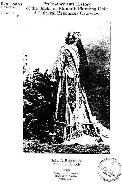
To Jenny, one of the last Rogue River Indians, who<br />
worked as a domestic servant during her last years in Jackson<br />
County. She made her burial robe, which weighed fifty pounds,<br />
many years before her death (cover photo)<br />
To Tabitha Brown, a single woman, who at the age of 66<br />
came west on the Applegate Trail in 1846. Later, she was one<br />
of the principal founders of Pacific University.<br />
To Ann Haseltine Hill Russell, pioneer, sculptor, and<br />
marble quarry owner. She carved an 1853 Indian battle history<br />
on a seven-foot block of granite. It is in the Hill Cemetery<br />
near Ashland, marking the grave of Isham Keith.<br />
To Anna E. Dowell Bannon, an attorney in Jacksonville<br />
and Portland in the late nineteenth century.<br />
To Regina Dorland Robinson, talented Jacksonville<br />
painter, whose short career met a tragic end just as she began<br />
to receive national recognition.<br />
To these and all other women--Black, Indian, Oriental,<br />
and white--whose history is unrecorded, this work is dedicated.
ACKNOWLEDOEMENTS<br />
Lyman Deich<br />
Shannon Applegate and Bandon Historical Society<br />
Richard Engemann, Ida Clearwater, and <strong>Southern</strong> <strong>Oregon</strong> Historical<br />
Society, Jacksonville Museum<br />
Devere and Helen Helfrich<br />
Jeffrey LaLande<br />
George Burrell<br />
Cover photo courtesy of <strong>Southern</strong> <strong>Oregon</strong> Historical Society,<br />
Jacksonville, <strong>Oregon</strong>
CONTENTS<br />
Chapter 1<br />
INTRODUCTION TO THE OVERVIEW<br />
Project Location 1<br />
Purpose of the <strong>Overview</strong> 1<br />
<strong>Cultural</strong> Resource Investigation and<br />
Research Background 3<br />
Environmental Background 8<br />
Notes 20<br />
Chapter 2<br />
SHASTA ETHNOGRAPHY<br />
Introduction 21<br />
Shasta Territory 21<br />
Origin of the Name "Shasta" 23<br />
Shasta Language 24<br />
Food Items and Food Processing 24<br />
Trade 25<br />
Material Culture Items 25<br />
Dwellings and Settlements 27<br />
Social Organization 30<br />
Conflicts and Feuds 31<br />
Property 31<br />
Marriage 31<br />
Mythology and Shamans 32<br />
Conflicts with other Indian Groups 32<br />
European Contact 33<br />
<strong>Cultural</strong> Position of the Shasta 33<br />
Notes 35<br />
Chapter 3<br />
TAKELMA ETHNOGRAPHY<br />
Introduction 39<br />
Takelma Territory 40<br />
The Upland and Lowland Takelma Relationship 41<br />
Takelman Language 41<br />
Subsistence 41<br />
Material Culture Items 43<br />
Settlements and Dwellings 44<br />
Trade 45<br />
Social Organization 46<br />
Marriage 46<br />
Myths and Shamans 47<br />
White Contact 48<br />
<strong>Cultural</strong> Position of the Takelma 49<br />
Notes 51
Chapter 4<br />
KLAMATH ETHNOGRAPHY<br />
Introduction 55<br />
Klamath Territory 56<br />
Origin of the Name "Klamath" 56<br />
Klamath Language 57<br />
Subsistence 57<br />
Techniques of Food Procurement 58<br />
Trade 60<br />
Material Culture Items 61<br />
Settlements and Dwellings 64<br />
Social Organization 66<br />
Property 67<br />
Marriage 68<br />
Shamanism 68<br />
Death 69<br />
Puberty Ceremony 70<br />
Other Ceremonies 70<br />
Warfare 70<br />
European Contact 70<br />
<strong>Cultural</strong> Position 71<br />
Notes 73<br />
Chapter 5<br />
MOLALLA AND ATHABASKANS<br />
Introduction 77<br />
The Molalla 77<br />
The Applegate Athabaskans 79<br />
Notes 81<br />
Chapter 6<br />
ARCHAEOLOGY OF THE PLANNING UNIT<br />
Introduction 83<br />
The Gold Hill Burial 83<br />
Emigrant Dam Reservoir Excavations 87<br />
Applegate Dam Reservoir 89<br />
Lost Creek and Elk Creek Dam Reservoir 90<br />
Klamath River Archaeological Research<br />
Big Bend 95<br />
Salt Caves 96<br />
Iron Gate 98<br />
Klamath Basin Archaeology 99<br />
Recent Archaeological Work in the<br />
Planning Unit 104<br />
Notes 107<br />
Chapter 7<br />
EARLY CLAIMS TO THE PACIFIC NORTHWEST<br />
Introduction 113<br />
Spain 113<br />
England 114
United States - 114<br />
Russia 114<br />
Land and Border Settlements 115<br />
Notes 119<br />
Chapter 8<br />
EARLY EXPLORATIONS TO THE 1840'S<br />
British Expeditions 121<br />
American Explorations 125<br />
Notes 133<br />
Chapter 9<br />
OVERLAND MIGRATIONS<br />
Introduction 137<br />
The Applegate Trail 137<br />
Trailblazing the Applegate Cutoff 139<br />
The First Westward Emigration Over<br />
the Trail: 1846 142<br />
The Applegate Trail in Southwestern<br />
<strong>Oregon</strong>: 1846 143<br />
Subsequent Travel on the Applegate Trail 156<br />
The Applegate Trail Today 161<br />
Notes 163<br />
Chapter 10<br />
DEVELOPMENT OF JACKSON AND KLAMATH COUNTIES<br />
1840-1920<br />
The Fur Trade 167<br />
Mining Frontier and Mineral Development 168<br />
Farming Frontier Settlement and Development 174<br />
Cattle and Sheep Frontier and Development 177<br />
Transportation Routes: Early Roads<br />
and Railroads 179<br />
Railroads 183<br />
Short Line and Logging Railroads 185<br />
Lumbering Development 187<br />
Notes 191<br />
Chapter 11 THE ROGUE RIVER INDIAN WARS 1851-1856<br />
Introduction 197<br />
Early Skirmishes 198<br />
The Last Rogue Indian War, 1855-1856 199<br />
Notes 207
HISTORIC CHRONOLOGY 297<br />
CULTURAL RESOURCE RESEARCH AND INVESTIGATION<br />
PROJECT SUMMARY 307<br />
COLLECTIONS 339
1. Introduction to the <strong>Overview</strong><br />
PROJECT LOCATION<br />
The <strong>Oregon</strong> area encompassed in this <strong>Overview</strong> is the<br />
Jackson-Klamath Planning Unit of the Bureau of Land Management.<br />
This Unit includes all of Jackson County, part of<br />
western Klamath County, and very small portions of southern<br />
Douglas County and eastern Josephine County. A general<br />
township and range location of the Unit is Township 32 to<br />
41 South, Range 5 West to 7 East. The Unit includes Bureau<br />
of Land Management, U.S. Forest Service, O&C lands, U.S.<br />
Public Domain land (administered by the Bureau of Land<br />
Management), and state, county, and private land. The cities<br />
of Medford and Ashland are within the Unit boundaries (Figure<br />
1).<br />
PURPOSE OF THE OVERVIEW<br />
The purpose of this <strong>Overview</strong> and Data Compilation is<br />
to provide the Medford District Office of the Bureau of Land<br />
Management with a Class I <strong>Cultural</strong> <strong>Resources</strong> Inventory. The<br />
Bureau of Land Management is required by federal legislation<br />
(Executive Order 11593,. the National Environmental Policy<br />
Act of 1969, the amended National Historic Preservation Act of<br />
1966, and the Antiquities Act of 1906) to identify, evaluate,<br />
and protect prehistoric and historic cultural resources on land<br />
it administers. The Bureau must insure that actions it initiates<br />
or authorizes on federal and non-federal land do not<br />
harm these cultural resources, which are defined as those<br />
fragile and non-renewable evidences of human activity, occupation,<br />
and endeavor as reflected in districts, sites, structures,<br />
artifacts, objects, ruins, works of art, architecture,<br />
and natural features that were of importance in human events.<br />
This <strong>Overview</strong> and Compilation will provide the Bureau of Land<br />
Management with the background data it needs for Environmental<br />
Analysis Records, Environmental Impact Statements, Unit Resource<br />
Analysis, Management Framework Plans, and other projects within<br />
the Planning Unit. The <strong>Overview</strong> provides a review and synthesis<br />
of the existing cultural resource information, while the<br />
Existing Site Data Compilation is an identification of all<br />
known cultural resource sites in the Unit, compiled through a<br />
search of formal site records for the area. The Existing Site<br />
Data Compilation has been submitted in separate documents.
2<br />
-~ Methods<br />
Three methods were used to collect the information<br />
required for this <strong>Overview</strong> and Compilation: 1) a search of<br />
the literature in the number of state and local libraries and<br />
institutions and an examination of the existing formal cultural<br />
resource site records; 2) interviews and correspondence<br />
with the Medford District Office of the Bureau of Land Management,<br />
the Rogue River National Forest, the State Historic Preservation<br />
Office, the <strong>Oregon</strong> State Museum of Anthropology, the<br />
Klamath County Museum, the <strong>Southern</strong> <strong>Oregon</strong> Historical Society<br />
(Jackson County Museum), the <strong>Oregon</strong> Historical Society in<br />
Portland, the Bandon Historical Society Museum, the Lowie<br />
Museum at Berkeley, California, the Field Museum in Chicago,<br />
Illinois, and a number of individuals knowledgeable about the<br />
area; and 3) field research in Klamath Falls, Medford, Ashland,<br />
Jacksonville, and Yreka, California, which included a visual<br />
reconnaissance of the Planning Unit from I-5, State Highways<br />
62, 66, 227, 238, and 140, and Dead Indian Road and an examination<br />
of local library and museum archives and collections.<br />
Notes from literature searches and interviews were<br />
taken with Norelco 0095 recorders and transcribed into five<br />
notebooks. There were over 240 hours of dictation and approximately<br />
2,000 pages of notes. The research was extremely<br />
thorough, using mostly primary sources.<br />
Problems<br />
No major problems were encountered during the research,<br />
interviews, or report preparation for the <strong>Overview</strong>. Minor<br />
problems that occurred are discussed in the sections where<br />
they are relevant. There was an overwhelming amount of<br />
available historical literature, so that in the time framework<br />
specified, not everything could be examined. For example,<br />
there are so many personal diaries of early Jackson<br />
and Klamath County pioneers in the <strong>Oregon</strong> Historical Society<br />
Library in Portland that several weeks could be spent cataloging<br />
them. Because the scope of the <strong>Overview</strong> is general,<br />
these specific accounts are more relevant to detailed historical<br />
research, and they were used only in a few instances.<br />
Personnel<br />
The six people who worked on this project are Julia A.<br />
Follansbee, M.A., archaeologist, contract administrator and<br />
editor; Nancy L. Pollock, M.A., historian; Robert K. Sutton,<br />
M.A., historian; William Orr, Ph.D., geologist; Mary Duenwald,<br />
B.A. (journalism), secretary/editor; and Robin Casey, graphics.<br />
All were employed by the cultural resources consulting firm of<br />
Julia A. Follansbee, Eugene, <strong>Oregon</strong>.
Follansbee researched and wrote Chapters 2, 3, 4, 5, 6,<br />
10, and 11, and prepared the site maps aind archaeology section<br />
of the Existing Site Data Compilation. She and Pollock both<br />
wrote Chapters 1, 15, and 16.<br />
Pollock researched and wrote Chapters 9, 12, 13,<br />
and prepared the historical section and maps of the Existing<br />
Site Data Compilation and the historic chronology.<br />
Sutton researched and wrote Chapters 7, 8, and 14, and<br />
Orr researched and wrote the environmental background in<br />
Chapter 1. Casey prepared the maps in the <strong>Overview</strong> text.<br />
Duenwald transcribed all the notes, typed the draft and final<br />
report, and edited the entire <strong>Overview</strong>.<br />
The contract was awarded on September 16, 1977, and<br />
completed on June 16, 1978. The first five months were spent<br />
collecting data, and report preparation took the final four<br />
months. Two weeks were spent in the field, including trips<br />
to the Planning Unit for research and reconnaissance, and to<br />
Portland for library and collections research at Portland<br />
State University and at the <strong>Oregon</strong> Historical Society Museum<br />
and Library.<br />
CULTURAL RESOURCE INVESTIGATION AND RESEARCH BACKGROUND<br />
Archaeology:<br />
Summary of Past and Current Work and Problems<br />
Archaeological investigations in the Planning Unit are<br />
comprehensively discussed in Chapter 6; the purpose of this<br />
section is to discuss the context in which that work has<br />
occurred. To date none of the investigations has resulted<br />
from any type of research design, where data is collected<br />
after some testable theories have been formulated. Instead,<br />
professional archaeological work in this area has been in<br />
response to salvage needs before alteration of the site locations<br />
took place. Most of the work was prior to construction<br />
of dams on watersheds within Jackson County, like the Lost<br />
Creek and Applegate Creek projects.<br />
The reports from these salvage investigations have<br />
descriptions of site contents, simple comparisons of artifact<br />
types between sites, and attempts to develop a prehistoric<br />
chronology for the area. Reasons for changes in artifact<br />
types within or between sites have not been addressed, other<br />
than ascribing them to changes in style over time. The most<br />
difficult and challenging archaeological work which is most<br />
likely to reveal a great deal about prehistoric life in the<br />
Planning Unit lies ahead.
-14<br />
-<br />
-<br />
m<br />
r.<br />
x<br />
l-<br />
0<br />
W O4<br />
L<br />
rT<br />
v0<br />
-<br />
F<br />
to<br />
eA<br />
C., m Iw 0_<br />
f<br />
1* A<br />
_ .. _ w<br />
,I- Ot<br />
mr<br />
A' f<br />
0w<br />
a - Pr I -<br />
I4<br />
.4 - .' -<br />
V<br />
-<br />
a .t 51<br />
I<br />
Ls<br />
an<br />
I<br />
)<br />
ma<br />
'S.<br />
E-4<br />
aa up<br />
r s r<br />
v)<br />
rl ~ ~ e ng<br />
C 20<br />
ac W z<br />
_q '. c<br />
'A<br />
M .'<br />
F.~*I<br />
e1 ;<br />
cIC<br />
F<br />
4Lr '<br />
. .<br />
Lir<br />
___<br />
II<br />
=I,<br />
+<br />
I i 'j<br />
ixi<br />
-<br />
I. . -; -<br />
7-/<br />
_0 dl<br />
ZLl ool<br />
N f<br />
9or<br />
A )~<br />
27.-L<br />
4<br />
T-4 I I - - - . .- I i i<br />
v<br />
.01<br />
C<br />
All 41L<br />
* I<br />
- -p.<br />
or<br />
S<br />
.I<br />
A<br />
* . 3 I 4<br />
j. J U<br />
-- 4<br />
ar<br />
3:<br />
H|<br />
cL<br />
'k<br />
! 0 .<br />
N- If<br />
I -<br />
rog~<br />
- - _<br />
]ml"K mr<br />
_J 0<br />
i i -l---)<br />
. L<br />
-'<br />
I<br />
-CI<br />
. C I<br />
Or'- CA<br />
0<br />
v4 -f<br />
. A.<br />
IMGZ4<br />
1<br />
s- -l<br />
0C<br />
j line-v<br />
iNgo<br />
I '<br />
Q<br />
5<br />
_
5<br />
Current archaeological work in the Unit is largely<br />
involved with contract archaeology, where sites are located,<br />
evaluated, and if necessary, excavated prior to alteration<br />
by a federally funded or federally authorized project.<br />
Usually only very small areas of the Unit are involved at<br />
any one time with this type of reconnaissance archaeology.<br />
Seldom, if ever, is there a specified research orientation<br />
in the preliminary stages of contract work, but sites discovered<br />
that are of National Register merit are usually<br />
assumed to contain data that can be used in research. The<br />
ongoing archaeological work in the Applegate Dam Reservoir and<br />
the analysis of the Salt Caves material will both provide information<br />
that may lead to the formulation of more sophisticated<br />
research in southwest <strong>Oregon</strong>. The Salt Caves analysis<br />
is the only dissertation that has been done within the Unit<br />
to date.<br />
-_<br />
In the Appendix there is a brief summary of each project<br />
which has contributed to the knowledge about the archaeological<br />
resources of the area.<br />
Most of the problems in working with archaeological<br />
resources in the Unit is that they are difficult to evaluate<br />
in terms of National Register criteria, because so little is<br />
known about the area despite the amount of work that has been<br />
done. This means that each site, regardless of its size or<br />
antiquity, is at this point capable of yielding information<br />
important to prehistory, which is the single criterion of<br />
nominating a site to the National Register (36 CFR 800.10<br />
(4)). It cannot be assumed that even surface sites can be<br />
ignored: some in the Planning Unit are very large and can<br />
provide useful information on methods of tool manufacture,<br />
selection of lithic material for tools, activity areas, and<br />
possibly trade. Other sites may contain carbon samples for<br />
dating, which are badly needed because so little is known<br />
about the chronology of the area. The Gold Hill site has been<br />
used as a basis for a relative chronology, but it was excavated<br />
in the 1930's using methods that are no longer acceptable.<br />
Further, the temporal phases developed by Davis for the Lost<br />
and Elk Creek sites are based only on relative dating, and it<br />
is not known if these phases occur in other areas of the<br />
Planning Unit. There has been no in-depth work on ecological<br />
adaptations, cultural relationships, or culture change. It<br />
is not known when the area was first inhabited. Until this<br />
<strong>Overview</strong>, there was no synthesis to provide a data base for the<br />
area. Further, the sites, which are non-renewable resources,<br />
are rapidly being depleted by vandalism and current development<br />
of both federal and non-federal land. It is obvious that careful<br />
management of this resource will be necessary if the prehistory<br />
of this part of <strong>Oregon</strong> is ever to be understood.
6<br />
History:<br />
Summary of Past and Current Work-and Problems'<br />
From an examination of the past and present historical<br />
research and investigations outlined in the "<strong>Cultural</strong> Resource<br />
Research and Investigation Project Summaries" (Attachment 2,<br />
Appendix) it is clear that most of the field work that has<br />
been done in the area comprising the Jackson-Klamath Planning<br />
Unit has been oriented towards quantifying cultural resources.<br />
Historic site inventories have been compiled by Alfred<br />
Segsworth for the WPA Historical Records Survey during the<br />
1930's and more recently by Marion Ross for the Historic<br />
American Buildings Survey (HABS); Stephen Dow Beckham for the<br />
Statewide Inventory of Historic Sites and Buildings; Lyman<br />
Deich for the BLM Historical Antiquities Site Inventory, and<br />
Jeffrey LaLande for the Forest Service <strong>Cultural</strong> <strong>Resources</strong><br />
Inventory. Each of the inventories is an invaluable research<br />
tool, although none of them is a complete survey of the historic<br />
sites and buildings of the area. While Beckham's work<br />
is the most comprehensive inventory to date, the survey mainly<br />
covers the settled areas where large concentrations of known<br />
historic buildings are located. The HABS inventory is oriented<br />
towards architecturally significant sites, and is therefore not<br />
pertinent to the types of historic sites on BLM land. Historic<br />
sites on rural or public lands have not yet been sufficiently<br />
identified. The <strong>Cultural</strong> <strong>Resources</strong> Inventories begun by the<br />
BLM and Forest Service are a step in that direction.<br />
Present Research Orientations and Problems<br />
Very little historical investigation with a specific<br />
research orientation has been done in the field. Most of the<br />
work involved locating historical sites with little or no<br />
follow-up evaluation of historical significance or National<br />
Register potential. An exception to this is the work of<br />
Jeffrey LaLande for the Rogue River National Forest. LaLande<br />
has conducted a number of comprehensive investigations of<br />
historic mining sites in which he has surveyed and evaluated<br />
the sites based on specific criteria of eligibility to the<br />
National Register of Historic Places. In at least one case<br />
he has developed an historical interpretive program to enhance<br />
the cultural resource.<br />
As opposed to prehistoric archaeology, historic archaeology<br />
in the Jackson-Klamath Planning Unit has the advantage<br />
of a large body of primary written source material which can<br />
be used to verify and/or complement investigation in the field.<br />
Orienting historical research towards a synthesis of field<br />
investigations and study of recorded primary source material<br />
has been lacking in most of the work done. Devere and Helen<br />
Helfrich, however, have successfully combined field investigation<br />
with research of historical literature in their lifelong<br />
work on the Applegate Trail.
7<br />
Vast numbers of books and articles have been written<br />
on the history of southwestern <strong>Oregon</strong>. Much of the later<br />
written histories tend to be repetitive, based on the same<br />
few journals and 19th century histories. In many cases the<br />
secondary works are anecdotal, rather than based on a specific<br />
research design. In some cases, the same inaccurate information<br />
has been repeated without question. The literature search<br />
conducted by Pollock for this <strong>Overview</strong> revealed innumerable<br />
primary sources which are virtually untapped. The diaries,<br />
journals, and letters written by emigrants and early settlers<br />
in Jackson and Klamath Counties, now in collections at the<br />
<strong>Oregon</strong> Historical Society, the University of <strong>Oregon</strong> Library<br />
Manuscript Collection, and the <strong>Southern</strong> <strong>Oregon</strong> Historical<br />
Society at the Jackson County Museum are of particular interest.<br />
Using primary data, a few historians are beginning to<br />
challenge established assumptions about the motivations behind<br />
historical events and about the significance of women and<br />
ethnic minority groups to the cultural development of southwestern<br />
<strong>Oregon</strong>. Kay Atwood's Minorities of Jackson County,<br />
<strong>Oregon</strong>, written for the Jackson County Intermediate Education<br />
District, and Stephen Dow Beckham's two works, Requiem for a<br />
People: The Rogue Indians and the Frontiersmen and The<br />
Indians of Western <strong>Oregon</strong>: This Land War Theirs, are major<br />
contributions in this direction.
8<br />
ENVIRONMENTAL BACKGROUND<br />
Seven environmental factors that are important in<br />
understanding past and present human use of the Planning Unit<br />
are considered here. They are the physiography, geology, soil,<br />
climate, water supply, vegetation, and mineral and energy<br />
sources.<br />
Unfortunately, no studies could be found dealing with<br />
climatic change in southwest <strong>Oregon</strong>--how much the area was<br />
influenced, if at all, by post-Ice Age climatic fluctuations<br />
is unknown. So little archaeology has been done in the area<br />
that inferences regarding human adaptation to environmental<br />
change are premature. However, there is one environmental<br />
factor that has been constantly important in the Planning Unit<br />
from prehistoric times to the present: water. Archaeological<br />
sites are almost always found near it, and it was certainly<br />
important historically as various ways to use it were developed.<br />
Of all the environmental factors, then, it has been the major<br />
determinant of locations of human settlement and use of other<br />
resources in the Unit.<br />
Physiography and Geology<br />
Four physiographic provinces divide the area from west<br />
to east: the Klamath Mountains, the Western Cascades, the<br />
High Cascades, and the Basin and Range (Figure 2). Much of<br />
the western and southwestern portion of the Planning Unit is<br />
in the Klamath Mountains. This rugged area of steep slopes<br />
and narrow gorges contains some of the oldest rocks in <strong>Oregon</strong>.<br />
The Klamath Mountains are severely faulted and deformed; their<br />
steep slopes contain scrub vegetation. They contain both volcanic<br />
and sedimentary rock, which has been altered in some<br />
cases to marble, schist, and phyllite.1 Erosion has exposed<br />
a large variety of rock types and valuable minerals in these<br />
mountains. The highest peak in the Klamath Mountains is<br />
Mt. Ashland, 7,530 feet above sea level.<br />
The Western Cascades in the northern and central area<br />
are also mountainous but not as rugged as the Klamaths. They<br />
contain ancient volcanic and sedimentary rocks that postdate<br />
the Klamath Mountains but predate the High Cascades with its<br />
well-known volcanic peaks. A long geologic history of fluvial<br />
erosion has given the Western Cascades a distinct topography.<br />
Its older rocks meet younger flows in the vicinity of Prospect<br />
on the Rogue River, and its thick Eocene flows and breccias<br />
are found near Dead Indian Creek and Green Springs Highway.<br />
Another Western Cascade outcrop can be seen in the north half<br />
of the Medford Quadrangle. 2<br />
The High Cascades lie immediately to the east of the<br />
Western Cascades in a narrow north-south strip. The area is<br />
dominated by a north-south line of volcanoes with a particularly<br />
violent eruptive history. Only a few thousand years
_ | _ _ .- - -- -I R | z F n F I ,, 4 _ _ I - ---<br />
I<br />
n5W<br />
GA(ICE -I<br />
-- 7V<br />
QU.<br />
SE 0-<br />
RA 4W<br />
._ _ _ _<br />
GtENDAI<br />
'l IL A.<br />
z<br />
i0<br />
9<br />
l<br />
,A<br />
r !3<br />
r_<br />
._1<br />
I _ _ -<br />
WIMER -<br />
.IIII<br />
* UMiQiA<br />
I 1<br />
h kTI 1.<br />
_ _s ) - -,I FEs<br />
I<br />
IL-a-t"<br />
I1 "m<br />
%A,,T<br />
A til(,<br />
-1 __*__<br />
T: ~ , 8tl _ NRIVERI<br />
ADE $I<br />
\ s ~I ll ;" X0<br />
tr I'<br />
cfl~ P- - :2 ROGUE<br />
LI<br />
-<br />
w-at g ut of. "o F. -iii<br />
IL k .11<br />
V it lI4~~~.A~inuw~~omrVF-~~<br />
L"I<br />
9 :iA rj E<br />
.| mllirwy L<br />
loodul<br />
I u U<br />
.01 0<br />
7?- I Il~Ft~j I<br />
A MrA wno IH<br />
-< irn\itj~j.. JACK60Ht F<br />
C, N IS. ,% , -A<br />
PA A.<br />
R A . M L L T I _ _ _ I<br />
I<br />
ROGUl<br />
\ss- l - i<br />
l<br />
I-<br />
IN<br />
Ns<br />
N<br />
.<br />
l<br />
. ._<br />
-0/<br />
V--<br />
T 31S<br />
1.32 S<br />
T 339.<br />
r 34S<br />
T 3S S.<br />
H __' ' 5 A W w ~~.<br />
pv~~~~~sA<br />
LDE;S^"rr~~~~~&A.#<br />
Fig. 2<br />
PHYS IOGRAPH IC<br />
PROVINCES<br />
R 71 E.M<br />
ASrap^ & Raft E<br />
Ir38S<br />
f--lli -<br />
StAMv9<br />
_W"\a~lL | __ llt R,|yfR lA. ><br />
iiL<br />
VAlII<br />
,I I<br />
l<br />
!MND<br />
Asoll %HA<br />
A--<br />
K(AMAT-<br />
1 39s<br />
I<br />
-II<br />
I .,MRAMF<br />
It A. I<br />
b<br />
o Al.<br />
a__OG<br />
I - --- a s"N 11--IN- I k<br />
1<br />
#~_ __ ~ V _:<br />
I<br />
a<br />
VI A<br />
k<br />
_IDnl v<br />
_<br />
__<br />
am |<br />
_|.VeQUJ<br />
I<br />
1 40S<br />
10 iE 1IVER NAMII I<br />
I<br />
0-D<br />
9:11111 -,<br />
It>ER NA 11 _ L<br />
M II i -j I--- - - - IC - ----- -- W M . - 7 * -*' f -~f<br />
Iran"[ IT"<br />
a-a noon- _<br />
IT419S<br />
~~~~<br />
am~ - - * /IUi<br />
V -y________<br />
L - .M<br />
. . I . J I - -<br />
CALIF.<br />
JACKSON-KILAMATIl PLANNING AREA<br />
*- C' N'.l *tly ... ,.wnIm 1977 _1 m. n.1 romol Ssnk.<br />
- - . TIM..<br />
M a.* .M* I... al tloond.rf yDiM N o t co i .. s n<br />
I<br />
T 38S<br />
I 37 9
have elapsed since the last major eruptions, and geothermal<br />
heat from the area may well be a future major energy source<br />
for <strong>Oregon</strong> and northern California. Glacial erosion has<br />
stripped large quantities of material from the flanks of the<br />
range, but the volcanic configuration of the peaks is still<br />
clearly visible.<br />
To the extreme east a small portion of the Planning<br />
Unit cuts into the Basin and Range Province, which is characterized<br />
by large-scale block faulting and dry playa lakes,<br />
internal drainage, and minimal vegetation.<br />
Soils<br />
Soil is the byproduct of complex processes involving<br />
rock, vegetation, climate, and weathering. Very generally,<br />
soils can be classified based on the amount of rainfall where<br />
they are located. With moderate rainfall dry or xeric soils<br />
develop, and these predominate in the Planning Unit. Higher<br />
elevations in the Unit have moderately acid xeric soils<br />
characteristic of a pronounced summer dry period. At the<br />
lower elevations in the major valley systems xeric soils occur<br />
which are moderately silty and strongly leached in places.<br />
In a comprehensive report of soils from this area some<br />
fifty separate varieties of soils are enumerated. 3 Of particular<br />
interest to the archaeological aspects of this study<br />
are soil series that occur near water courses, are welldrained,<br />
and only slightly sloped. These are prime factors<br />
in prehistoric settlement locations in southwest <strong>Oregon</strong>. For<br />
example, sites have been found on the Laurelhurst series,<br />
which is composed of thick, claey, reddish-brown soils from<br />
areas of less than thirty-five inches annual precipitation.<br />
They develop on areas from nearly level river terraces to<br />
sloping foothills. In view of their characteristic topography,<br />
such soils are frequently associated with archaeological sites.<br />
Climate<br />
Varying physiography and the proximity of the ocean<br />
tend to diversify the climate of the Jackson County area so<br />
that four different regions are found (Figure 3). The<br />
Coastal Range Climatic Province extends into the study area<br />
in two lobes to the west and northwest. Climate in these two
, . .<br />
a<br />
I.W<br />
a<br />
a<br />
K.<br />
.1<br />
In<br />
Ci<br />
u]<br />
_ _, n1 1<br />
z<br />
H<br />
&A<br />
LK @ a<br />
,<br />
- , - , ,<br />
* P4<br />
e<br />
'I<br />
I I<br />
U H w 'I<br />
' J1<br />
a<br />
_<br />
. U<br />
.1Z4 H<br />
E-4<br />
(A _<br />
GM _<br />
_ I-<br />
4<br />
-01;X<br />
_I -. I; . ~<br />
r~i -<br />
.1 ='<br />
on<br />
ooe i.<br />
4<br />
-CC .<br />
1 r r , _ _<br />
n<br />
- ! I i - I-<br />
s<br />
L~ I<br />
M<br />
K<br />
I<br />
I<br />
-<br />
LU<br />
I!,<br />
i<br />
Ca.' .. -<br />
E<br />
I<br />
--- l .<br />
t<br />
Il<br />
OA<br />
In<br />
- L I a -- iz_<br />
I<br />
- -- -l<br />
-~~<br />
I l E Be<br />
Ci<br />
to<br />
ta<br />
AS<br />
)<br />
e en (A v M<br />
PZj<br />
If<br />
A I,<br />
_t<br />
"P<br />
S<br />
PI_ _ )<br />
_-- _ 3-_ - x<br />
r ^<br />
£~~~~<br />
Ir-N,<br />
E-i ;-<br />
t E--<br />
NY!~;<br />
NA1<br />
%C = J r /<br />
-4<br />
wry 4 ;<br />
c I u ^<br />
l<br />
I M<br />
Iuz<br />
N<br />
.<br />
i;z orm<br />
.-If<br />
KI.a<br />
i-<br />
Z ;<br />
nc,s<br />
aI,<<br />
= 7 D<br />
< I<br />
0<br />
n-<br />
-<br />
i<br />
L ML<br />
oyr<br />
UM<br />
is.<br />
a4<br />
i~ *. l t a -<br />
I I -<br />
I<br />
0<br />
lk<br />
<br />
I II,<br />
z ,<br />
m I Q °<br />
L~~~~~0<br />
I<br />
i<br />
c<br />
I c<br />
Ic<br />
4<br />
C.<br />
0.C<br />
I<br />
5_<br />
h"I<br />
K-.;<br />
z _<br />
C<br />
.- I<br />
_ _ _
12<br />
areas is similar to that on the <strong>Oregon</strong> coast--despite higher<br />
elevations the air masses of the coastal range are not much<br />
cooler. Rainfall over this Province averages over 1,000 mm<br />
per year.<br />
The Southwestern Valleys Climatic Province is sheltered<br />
from the ocean and is subsequently colder in winter, warmer in<br />
summer, and drier year round than areas to the north and west.<br />
Precipitation of the Southwestern Valleys may be only a quarter<br />
of that of the Coastal Range, and the annual temperature range<br />
(high and low) increases substantially to the southwest portion<br />
of the area. Ashland, Medford, and Grants Pass are in this<br />
Province.<br />
The Cascades Climatic Region is characterized by low<br />
winter temperatures and precipitation (much of it snowfall)<br />
in the range of 1,000 to 1,500 mm per year. Finally the High<br />
Plateau Climatic Region in the southeast portion of the study<br />
area is mostly shielded from moist oceanic air masses. Subsequently,<br />
precipitation in this area is approximately 200-<br />
500 mm per year. The range in temperature (high and low) is<br />
even more dramatic than for the Southwestern Valley Climatic<br />
Region.<br />
Water Supply<br />
Maps depicting water supply in surplus and deficit<br />
categories express the hydrology of the Planning Unit particularly<br />
well (Figures 4 and 5). Water surplus (the total<br />
surface and subsurface runoff) diminishes from a high of 750<br />
mm per year in the northeast portion of the study area to less<br />
than 500 mm per year in the southwest. Water deficit figures<br />
are expressed as the relative water need during dry periods.<br />
Deficit fugures for most of the eastern portion of the study<br />
area are less than 125 mm per year due to the snowfall in the<br />
Cascades. The higher deficit figures of 125-250 mm per year<br />
in the west-central portion (Southwest Valleys) and southeast<br />
portion of the study area (High Plateau) are expressions of<br />
the low rainfall of 500 mm per year for both areas.<br />
Vegetation<br />
Vegetation is a function of climate, so that the natural<br />
vegetation provinces largely correspond to climatic regions<br />
(Figure 6). Most of the study area lies in a mixed Needleleaf/Broadleaf<br />
Forest Zone. The Zone reflects a diverse range<br />
of soils and fire history. Toward the southern end of the area<br />
the Zone is characterized by broadleaf evergreen, tanoak, canyon<br />
liveoak, and madrone mixed with Douglas Fir. Toward the<br />
north, conifers including white fir and sugarpine are more<br />
common. Bordering the study area to the east the Pacific
4-4<br />
4-4<br />
0<br />
-4 (a<br />
fa<br />
4-4 aT<br />
:<br />
. 4 J<br />
a<br />
~a<br />
3:<br />
-C<br />
2<br />
ei<br />
*.<br />
:i<br />
0E0 C-<br />
#4<br />
w<br />
E o<br />
c<br />
z
(Irrigation "need" during dry spell)<br />
- - CA I IF.<br />
JACKSON-KLAMAiII<br />
PLANNING AREA<br />
- -- - Ci- ...ly InuiiInhy 1977 N_0onel ro..., So-vim<br />
- - - . flaImnl Un seal l I niclawy _ _ Natlonal Aao-Un Lands fLUA<br />
Mane' Ust Boundawy Of C tends Adminemearad b 1 Forest Service<br />
lsnnmig Are. Baotndery<br />
SCALE<br />
MPLES1 5 0 10 20
- R5W<br />
GAtMCE<br />
12UGIA-<br />
i-<br />
*-'<br />
.OSltIrNIl1<br />
a<br />
R 4W<br />
_<br />
__<br />
_t _<br />
0 PW<br />
I i -- U U~A i<br />
R2F -<br />
t) `<br />
'.X3,<br />
IJ<br />
0 GtENDAt I<br />
I<br />
: _<br />
.-,-<br />
'I Il-A.<br />
A~F.<br />
tRS<br />
,,1 T 32 S<br />
iZ<br />
a S<br />
I _.<br />
_1_r __ , - . . - . t T a T<br />
.,<br />
__ r _<br />
elU r FIS<br />
8r2<br />
WIMER<br />
fl.-A.<br />
I--.<br />
av "<br />
aP<br />
. RAF<br />
l W....-. A/i~~~~WDIco I>S t"I. 1:W<br />
I<br />
A<br />
wlla&~~~~~~~~~~~~~~~~~~~~~~~<br />
I<br />
I1<br />
I<br />
I I I<br />
T 339 S t<br />
T 34 S<br />
Fig. 6<br />
NATURAL VEGETATION MAP<br />
OyixMixed needleleaf &<br />
broadleaf forests<br />
111 I lIl<br />
LIII.. ..<br />
I<br />
I<br />
. AR S<br />
_-_' l ., .,<br />
35'<br />
_ Rha<br />
RENuwt I lunu - t | a C ;l vs .<br />
tll<br />
Il<br />
I<br />
GDAl<br />
JACSON<br />
R I<br />
J-x<br />
Rogue-Umpqua forest shrub<br />
Pacific Silver Fir<br />
Grand Fir zone<br />
Ponderosa Pine<br />
AlE.<br />
1 36S<br />
I 319<br />
PIANISS<br />
A A.<br />
nA.<br />
wsl s *u<br />
"I3<br />
1 R ROGUE<br />
I I<br />
lIVEN<br />
-«uc<br />
rl<br />
IAtitr"<br />
/<br />
. . .<br />
. . . . .... ... ... ..<br />
- -- - . . .<br />
... ...<br />
....... .. j4w..<br />
I . .I ~ . . . . I*_ .<br />
-J77!<br />
NATl4rlAL fWE!<br />
ASI<br />
.. . ..<br />
.. ..,...<br />
. fJ -,<br />
......<br />
.'.L'.'.'.' .'.<br />
. .'t. . .<br />
Tr -r u *x-w-r.~r' ** .~a~r'-' ] i we----- -------<br />
rA<br />
n<br />
-X...<br />
...<br />
1 30 S<br />
.I.<br />
I<br />
Ipa _waq-R*7<br />
............. ................. .<br />
tur-s-,n Iwl*. . ;-;-; . .......<br />
......<br />
-.<br />
___-<br />
l<br />
LAMATI<br />
F.75;<br />
.......<br />
.1:<br />
-- -- - -._ ..<br />
CAt jF._<br />
JACKSON-KLAMATH PLANNING AREA<br />
(iA-bl.ty R-WIMY 19777 S_ vjm<br />
Pnalfusol th.nday<br />
H__ N8mlo,.I1 n-<br />
M.6Iwo<br />
Lut B*..d&r i nOlydI<br />
t..d. NIN<br />
P_-.<br />
11111 _
16<br />
Silver Fir and Grand Fir Zones reflect the hiaher elevations<br />
and drier climate of the Cascades. The Ponderosa Pine Zone<br />
to the southeast is a drought resistant flora reflecting the<br />
low precipitation characteristic of the high plateau. In the<br />
Bear Creek Valley a specialized Rogue-Umpqua forest shrub<br />
flora covers most of the lower elevations in the valley. This<br />
flora is a drought tolerant type ranging from <strong>Oregon</strong> white oak<br />
to California black oak, and the acorns were an important<br />
source of food to the Indians. Some cedar, Douglas fir, and<br />
ponderosa pine are found in the wetter portions of the Zone.<br />
Many of the drier areas are sites of old and new burns and<br />
are easily recognized by chaparral, buckbrush, and whiteleaved<br />
manzanita.<br />
Mineral and Energy <strong>Resources</strong><br />
Because of their complexity and different origins it<br />
is difficult to even briefly summarize mineral resources for<br />
the Planning Unit. In broad terms it is possible to characterize<br />
the western half of the study area as the mineral province<br />
due to the underlying geology of the Klamath Mountains.<br />
During the historic period these minerals were of major importance<br />
to the settlement and economy of southwest <strong>Oregon</strong>.<br />
The Western Cascades and High Cascades to the east<br />
contain resources reflecting their volcanic history: geothermal<br />
heat, carbon dioxide springs, and pumice deposits.<br />
In the western mineral area many of the deposits such as<br />
cobalt, silica, and iron are known from only a few specific<br />
locations. Other minerals such as gold, silver, and mercury<br />
occur over very broad areas, and they are difficult to map<br />
as finite distributions (Figure 7).<br />
Energy resources for the Planning Unit excluding<br />
potential hydroelectric power are restricted to the central<br />
and eastern portions. Geothermal resources are being successfully<br />
tapped just to the east of the Unit in Klamath Falls.<br />
The high geothermal potential of the Klamath Basin extends<br />
for a considerable distance north of Klamath Falls. Immediately<br />
to the west of this mapped geothermal area lies a larger<br />
province also in a north-south linear configuration in<br />
which geothermal prospecting is very promising. This latter<br />
area underlies the High Cascades Physiographic Province and<br />
takes in a large portion of the study area in the vicinities<br />
of Pinehurst and Butte Falls.<br />
Fossil Fuel<br />
Cutting almost through the center of the Jackson-<br />
Klamath Planning Unit is a seam of coal associated with the<br />
western Cascade sediments of Eocene Age (Figure 8). This
.<br />
*-. .. , .<br />
- K<br />
K<br />
_K<br />
"S5W<br />
I.<br />
, '.<br />
(1<br />
ll^"c P<br />
n4VV<br />
R-ax A R IM j<br />
H i_ t~(W NAL, a<br />
1 FOREST~f 4<br />
I<br />
\j .-<br />
--Al<br />
-ffUE<br />
lRAE<br />
1-323<br />
Cr,<br />
USPEC]<br />
- I: A 1--XI -IS<br />
NATIONAI<br />
z __ m_ s rral I-_*Lo<br />
;V==---<br />
I<br />
___<br />
S ww. ri<br />
_ I<br />
R.-A.A<br />
_ __<br />
'I<br />
T 333S<br />
FST<br />
ittriat<br />
. - ]n - El<br />
1'W -J<br />
I- ON<br />
*WE I<br />
1w!<br />
lk T 34S<br />
'0. % 4t<br />
r<br />
ois- 9 &r-- t'1 - I I- ---.----- -....--.-........- I<br />
I<br />
N<br />
1<br />
P<br />
a-<br />
11-E) I~i<br />
1 35<br />
AS<br />
I.<br />
5<br />
I.<br />
ItK. Ia E.<br />
W \<br />
_ N\ rt\t \\C-\ I - ... umswl tor-- t'tMi 11<br />
. "5E.<br />
I<br />
II><br />
CK.<br />
- - - -.- _<br />
N1\<br />
NIX. Mlil1 AHIFU LN E<br />
RIVER<br />
'T31<br />
aiEft<br />
vaIIE aI<br />
K<br />
Nom - i~LitA<br />
Al N<br />
FonsET<br />
Fig. 7<br />
MINERALS<br />
Gold & Silver<br />
zone of many<br />
deposits<br />
Copper, Lead .& Zinc<br />
* Clay localities for<br />
brick & tile<br />
4.<br />
A.?t I.<br />
fOOLUl<br />
"74<br />
1c 4,<br />
(r.it<br />
U<br />
5<br />
V., H t<br />
L,<br />
IN<br />
- _ t -h1fir<br />
-~z<br />
f-I<br />
;A;ait<br />
N -r -<br />
.1<br />
F .I<br />
A Ws T1.9<br />
II<br />
k.& \ _<br />
. . - I<br />
'..<br />
X LAMATBI<br />
I.<br />
Nfl<br />
cv '9<br />
t<br />
ft A.<br />
Alit<br />
I I<br />
'XI-<br />
U<br />
, _t \ \ \ \ * A\ \ \ 112i~-J%~ 4 X"4.I . *-mrnugm<br />
I \_ ffi \ x<br />
"r- INF<br />
, | 7<br />
IRJASt<br />
-f I om<br />
4<br />
(l<br />
in<br />
-f11- :f<br />
to"Hit<br />
N1 i'- ~Q - y<br />
1<br />
%V<br />
Hi x \ 8 he \ \ \ . --<br />
CAI I'F.<br />
JACKSON-KKLAMATH PLANNING AREA<br />
- -- C...nIy lun.litn'y 1977 _ a lo re.es saivca<br />
- - . f*l'..t.*kl t I'N .. dery National Land. Vaoe,ce AIM<br />
Mash1 Umit Boundary OLC tLnds AdnatInatenid by Ferl Service<br />
Planning Aear Boundary SCALE<br />
\ i<br />
'-44,<br />
_ A IIIV<br />
rX"fe<br />
1 365<br />
1371<br />
1 36 S<br />
1 395<br />
1 40S<br />
1 41 5<br />
l
_ _ _ _ _= _<br />
A 11W<br />
RAIW<br />
GILtNDAt<br />
)'<br />
GAlICE<br />
1?QUWlAS&<br />
-5. -1n-.co<br />
ItA<br />
0 0L<br />
_ ,<br />
L' -'<br />
r<br />
L~~W. A~~<br />
7<br />
UMi uN<br />
R. IF. RX I<br />
- ;- . |-. n e_<br />
I J<br />
T-.j<br />
'-I--_<br />
i p<br />
_e _ . . -__. . ] _<br />
It<br />
Bls I<br />
T5<br />
fl-A.<br />
_-<br />
jeer cdk. I<br />
A',<br />
r ;27- -1-,- . I . -<br />
_ _ _ _ _-__ _ _ 31<br />
t(<br />
_ ---- -=<br />
----<br />
= ===~~~~~1<br />
-- i-I<br />
~~ -1- "%, I-,Z- _ U . - --<br />
9WIM(" - f<br />
I-0<br />
I<br />
I A t m m ws i nurr----- N<br />
-A4 G<br />
6010<br />
's-,r0<br />
14dI<br />
) PASS I I<br />
I I<br />
I1<br />
1 3 t<br />
*335<br />
.-_- --- - - -a<br />
. _<br />
1 34S<br />
Fig. 8<br />
-ENERGY-<br />
COAL & GEOTHERMAL RESOURCES<br />
:::::::- -i<br />
F'\\XI...I.1<br />
II<br />
a ac<br />
1 E no - ~ rn jI v n:lti "°E .--<br />
- i 7-~I<br />
.1<br />
Coal<br />
Localized geothermal areas<br />
Generalized geothermal<br />
areas foi r prospecting<br />
R7V<br />
L 1<br />
Al7E<br />
IF 36S<br />
I 3159<br />
1130S~~~~~~~<br />
C .I I A N ! S P P I E JIt<br />
PASS<br />
It<br />
A.~~~~~~~I<br />
1 305<br />
I.?<br />
/ w<br />
IIHOGUE UvIn NAII<br />
CO ~a % pN-11<br />
4^,-*#<br />
ph.<br />
#%AL ftE<br />
ASIs<br />
t* Aff<br />
PT<br />
I--T %- -- -7_f7i;::;i-<br />
-- I - N A & j<br />
; A _ = 7_L \ s N ,<br />
-'I& I<br />
9_ - -_7-. . -.I iop"',<br />
I I _ _ _ _ _ _ _ a z i - ~ a x = )… I -. ~<br />
, w 1_. .. -. ,<br />
I-ll<br />
2i<br />
__7_<br />
D _ _<br />
_ D<br />
. P_ * ==J_ ==J I " iIII<br />
~~~~~~ - os-<br />
'''- N, _ _Y a1-67 pn~o<br />
I I1 A CAI IF<br />
I - P 1 <br />
JACKSON-KLAMvIAT14 PLANNING AREA<br />
:-A*u-... . nwh'..n rv 1977 -_ Nel-onel re., Soemv<br />
*-* t ..... lf'Io-IIsl WDrunde.. __ Nollonal nae.,. Lends DLM<br />
Mas_ t _ nit Boundry OLC tlnds Admninsleed by rotesi Service<br />
Plannilng Aves Boundary SCALE<br />
1P<br />
T 395<br />
f 409<br />
T141 S<br />
MILEES tO 6 0 IL)
1.9<br />
coal field known as the Rogue River Field is one of the three<br />
most important in the state and can be followed for about 100<br />
miles. Because of its local clay and sulfur content, the seam<br />
has never been mined on a large scale. At points near its<br />
northern limit in the vicinity of Evans Creek the coal deposit<br />
is up to eight feet thick.<br />
Hydroelectric Power<br />
In several areas of Jackson County the Rogue River and<br />
its tributaries have been harnessed for hydroelectric power.<br />
Power for the small communities of Trail, Butte Falls, and<br />
McLeod is supplied by several small power stations on the<br />
Rogue. Hydroelectric power for Ashland and other southern<br />
Jackson County communities is supplied by the drainage systems<br />
of the southern Rogue watershed. Large power stations are<br />
located on the Rogue between Medford and Grants Pass in the<br />
vicinity of Gold Hill and Gold Ray. In addition to these<br />
developed sites it has been estimated by the State Director<br />
of Geology and Mineral Industries that there are roughly<br />
fifteen other good sites in the Unit for hydroelectric power.<br />
Most of these sites lie on the upper Rogue Valley toward the<br />
northeastern portion of Jackson County, but three are on the<br />
Applegate River just north of the <strong>Oregon</strong>/California border.
20<br />
ENDNOTES<br />
1 Ewart M. Baldwin, Geology off <strong>Oregon</strong>, revised edition<br />
(1976) , p. 71.<br />
2 Ibid., p. 60.<br />
3 LeRoy A. deMoulin, J.A. Pomerening, and B.R. Thomas,<br />
Soil Inventory of the Mediford District, <strong>Oregon</strong> State Office,<br />
Bureau of Land Management (1975).
2. Shasta Ethnography<br />
INTRODUCTION<br />
Most of what is known about the customs of the Shasta<br />
Indians before European contact comes from the work of anthropologist<br />
Roland B. Dixon. He spent four field seasons (1900-<br />
1904) with the Shasta on their native land in California and<br />
on the Siletz Reservation in <strong>Oregon</strong>. Following his research,<br />
Dixon wrote a description of their culture, language and myths. 1<br />
In 1946, Catherine Holt published a supplement to Dixon's<br />
work from her month's research in 1937 with Sargent Sambo, one<br />
of Dixon's informants. 2 In 1924, the photographer-ethnographer<br />
Edward S. Curtis published an excellent sketch of the Shasta<br />
based on his studies and those of Dixon. 3 Other literature on<br />
the Shasta is taken largely from these ethnographies.<br />
Early historical information on the Shasta comes from the<br />
journals of Peter Skene Ogden, a Hudson's Bay Company trapper; 5<br />
from George Gibbs, an ethnologist with the Pacific Railroad surveys<br />
in 1853-1855;6 from Lt. Emmons of the 1841 Wilkes Expedition; 1<br />
and from Dr. Livingston Farrand, who collected southwestern <strong>Oregon</strong><br />
Indian myths in 1900.8<br />
SHASTA TERRITORY<br />
The Shasta Indians occupied almost all of Siskiyou County,<br />
California, which--except Scott and Shasta Valleys--is an extremely<br />
mountainous, rugged land. Their settlements were located<br />
in the river valleys, especially along the Klamath River, where<br />
there were concentrations of the resources they depended upon:<br />
acorns, fish, game, and native fruits and vegetables.<br />
Their Indian neighbors were the Sacramento Valley Wintun<br />
to the south, the Pit River Achomawi-Atsugewi tribes to the east,<br />
the lower Klamath River Karok and Yurok and the Trinity River<br />
Hupa to the west, and the <strong>Oregon</strong> Takelma, Klamath, Modoc, and<br />
various Athabaskan-speaking groups to the north.<br />
Shasta Territory in <strong>Oregon</strong><br />
The Shasta northern boundary claimed portions of Klamath<br />
and Jackson Counties, but ethnographers disagree on whether
22<br />
their territory embraced oi'ly the Jenny Creek drainage, or<br />
whether it also included Bear Creek Valley near Jacksonville<br />
and Table Rock. Dixon, whose Shasta informants claimed that<br />
valley, describes their territory.<br />
Beginning at Mount Shasta, the boundary ran<br />
nearly due north, over Goose Nest Mountain to the<br />
Klamath River, reaching the river a little above<br />
the mouth of Jenny Creek. From this point on the<br />
river, the rather vague line seems to have swung<br />
to the east a little, so as to include within<br />
Shasta territory all the headwaters of Jenny<br />
Creek, and then to have followed roughly along<br />
the divide to Mount Pitt [Mt. McLoughlin]. Here<br />
the line turns westward to the Rogue River at the<br />
mouth of Little Butte Creek, and thence along<br />
Rogue River to Table Rock at the mouth of Stewart<br />
River, or, as it is also known, Bear Creek. From<br />
this point, the line ran apparently southward,<br />
along the divide between the western tributaries<br />
of Stewart River and the eastern tributaries of<br />
Applegate Creek, swung around the head of the<br />
latter, and curved sharply west, following the<br />
crest of the Siskiyous to the vicinity of Thompson<br />
Creek, where the boundary touched the Klamath<br />
again at the village of Ussini. Southward from<br />
here, the divide between the western tributaries<br />
of Scott River and the eastern tributaries of the<br />
Klamath and Salmon Rivers seems to have been the<br />
line dividing the Shasta from the Karok and from<br />
the two small fragments of the Shastan stock--the<br />
Konomi'hu and the New River Shasta. From the extreme<br />
southwestern corner of Siskiyou County the<br />
boundary ran east to Mount Shasta again, following<br />
approximately the divide between the Trinity and<br />
Sacramento Rivers on the south and the Scott and<br />
Shasta Rivers on the north. 9<br />
However, Dixon is uncertain of his informants' knowledge<br />
of the <strong>Oregon</strong> boundaries--he notes that the same territory was<br />
ceded by <strong>Oregon</strong>'s Rogue Indians in the Treaty of 1853. His<br />
Shasta informants told him that they had driven the Rogues from<br />
this area about 100 years earlier and that it was theirs when<br />
the Europeans arrived. These informants also gave Dixon place<br />
names for geographical features in the Medford Valley, which<br />
could support the claim that the land once belonged to them.10<br />
Dixon concluded that the Shasta and Takelma vigorously disputed<br />
the ownership of the land. Historical sources note that these<br />
groups ranged in one another's territories frequently, and<br />
there was a great deal of intermarriage. Under these conditions,<br />
land ownership cannot easily be assigned to either group.
23<br />
Twenty years after Dixon wrote that the Shasta may have<br />
been near Table Rock and Jacksonville, the ethnographer Leslie<br />
Spier stated that his Klamath informants' enemies, the<br />
Walumskni, lived in the Table Rock region. Spier was not familiar<br />
with this tribe and tried to identify them. He found<br />
very little explicit information about the inhabitants of this<br />
region in the early literature, but his Klamath informants<br />
placed the Shasta on Jenny Creek--they were certain that the<br />
Shasta were not in the Bear Creek Valley, because the Walumskni<br />
lived there and on the Rogue River near Table Rock. 1 1 Spier<br />
concluded that the Walumskni were the Upland Takelma, or<br />
Latgawq, based on information from another ethnographer, Edward<br />
Sapir. 12<br />
Joel Berreman, who mapped the distribution of all the<br />
Indian tribes in <strong>Oregon</strong> in 1937, placed the Takelma in the Bear<br />
Creek Valley, based on 1) Takelma informants' explicit claims<br />
to the Bear Creek Valley; 2) the fact that the Bear Creek<br />
Valley is far from the main Shasta territory; and 3) the<br />
Klamath reported trading and occasional warfare with the<br />
Walumskni, which would be unlikely if the <strong>Oregon</strong> Shasta were<br />
situated between the Takelma and Klamath. 1 3<br />
Conclusion<br />
It is likely that both the Takelma and the Shasta<br />
claimed the Bear Creek Valley in the 1800's because there was<br />
a great deal of interaction between them: intermarriage,<br />
trading, and fighting. How long this situation prevailed before<br />
the coming of the whites is a matter of conjecture. Historical<br />
sources detailing the Rogue Rvier Wars seem to place<br />
most of the Takelma villages north of the Rogue River, around<br />
Table Rock. There were also Shasta bands living in the northern<br />
Siskiyou foothills and in the Applegate River area. Therefore,<br />
both groups may have claimed the valley because it was<br />
visible from their camps, and because both used it. Overlapping<br />
boundaries certainly seem appropriate in this situation.<br />
ORIGIN OF THE NAME "SHASTA"<br />
The Shasta have been referred to as the "Sastise," the<br />
"Saste," the "Shastika," and the "Shasty." The origin of this<br />
name is uncertain--some suggest that it was originally a chief's<br />
name or else the-name of a prominent man who lived in Yreka<br />
during the Gold Rush. 1 4 Another concludes that it is derived<br />
from the Klamath's name for their southwestern neighbors. 1 5<br />
The Shasta called themselves Ka'hosadi, a colective term that<br />
could be applied to any of the Shasta groups.<br />
There were apparently five or more groups among the<br />
Shasta who spoke different dialects of the same language and
24<br />
lived in different geographic areas within Shasta territory.<br />
Curtis lists the names of some of these divisions, calling<br />
the Bear Creek Valley group the Ikarakatsuhis and the Klamath<br />
River group extending into <strong>Oregon</strong> (Jenny Creek) the Kikatsik. 1 7<br />
To simplify these divisions, the ethnographic literature often<br />
refers to four major divisions: the <strong>Oregon</strong> Shasta, the Klamath<br />
River Shasta, the Scott Valley Shasta, and the Shasta Valley<br />
group, but it should be remembered in using these divisions<br />
that there is no simple correlation with the Shasta's own division<br />
of their people.<br />
SHASTA LANGUAGE<br />
On older ethnological maps, the Shasta language is shown<br />
as Sastean, and it was thought to be unrelated to the language<br />
spoken by the Pit River tribes, called Palaihnihan. However,<br />
in the late 1800's, the linguist-ethnographer Albert Gatschet<br />
suggested that the two were related. In 1905, while gathering<br />
linguistic data for the American Museum of Natural History's<br />
Huntington Expedition, Dixon demonstrated the relationship and<br />
labeled the new language group Shasta-Achomawi. He later<br />
changed this designation to Shastan. 1 8<br />
Shasta is often classified as part of the Hokan language<br />
division, which includes some other California tribes and two<br />
in Mexico. However, one linguist claims that there is scanty<br />
data (and some of it 1oorly gathered) to support such an entity<br />
as a Hokan division. 1 If this is the case, it is presently<br />
not clear what affinities Shasta may share with other Indian<br />
languages.<br />
FOOD ITEMS AND FOOD PROCESSING<br />
The environment of the Shasta Indians was mountainous,<br />
wooded and well-watered. Plentiful supplies of fish, game, wild<br />
vegetable foods and acorns from various oak species were available.<br />
Salmon from the Klamath River and acorns were the major<br />
food items. Roots and bulbs (including camas and ipos), berries,<br />
pine nuts and bark, game animals, fresh-water mussels, and ducks<br />
and geese were also eaten.<br />
Food processing techniques included acorn leaching, 2 0<br />
smoking and drying salmon and rubbing the dried meat into a<br />
powder, drying deer and bear meat or cooking it by boiling or<br />
roasting, and pulverizing deer bones for soup. Salt was obtained<br />
by all the Shasta divisions from two large deposits near<br />
Horse Creek and in the Shasta Valley, according to Holt's informant,<br />
but Dixon says it was obtained from lower Klamath<br />
River tribes. 2 1
25<br />
- Several techniques are described for fishing and hunting.<br />
Salmon were caught by driving them into nets and weirs as they<br />
came upstream along the Klamath River to spawn. There were also<br />
three rock salmon dams along the river in Shasta territory,<br />
but none of them were in <strong>Oregon</strong>. 2 2 Apparently the <strong>Oregon</strong> Shasta<br />
had a different technique for salmon fishing than their downriver<br />
kin: while a row of men held spears, women on rafts drove<br />
the fish toward them. 2 3 Deer were hunted with hidden nooses or<br />
with bows and arrows, using dogs to scent the prey. Sometimes<br />
a hill was set on fire, with a space left open for the deer to<br />
rush out and be killed.<br />
TRADE<br />
Although the Shasta rarely made long journeys, there<br />
was trade with neighboring tribes. Buckskin, flint blades,<br />
and pine nuts were traded with the lower Klamath River tribes<br />
for acorns, basketry, canoes, shell ornaments, and dentalia<br />
(a shell used widely as currency among coastal tribes and<br />
their interior neighbors). From the Wintun they acquired<br />
mostly acorns and a few clamshell disk beads, giving obsidian,<br />
buckskin, and dentalia in return. The <strong>Oregon</strong> Shasta traded<br />
native vegetable bulbs. There was much trading with the<br />
Takelma for dentalia, hats, and other items in exchange for<br />
acorns and acorn paste. 2 4 There was apparently little trade<br />
with the Klamath and Modoc. 2 5<br />
MATERIAL CULTURE ITEMS<br />
Stone Objects<br />
Objects made of stone (steatite, basalt, and obsidian)<br />
included dishes, mauls, knives, arrowpoints, scrapers, arrow<br />
shaft straighteners, and pestles and pipe tips of fine-grained<br />
stone. The Shasta made no mortars--they regarded them as<br />
powerful spirits or objects of powerful spirits, having the<br />
ability to move about on their own or change their shape, and<br />
they were avoided at all times. Small pestles and stone pipes<br />
were also avoided. While mortars are found in Shasta territory,<br />
the superstition surrounding them may indicate that they were<br />
not made by the ethnographic Shasta or their recent ancestors,<br />
although there are no migration myths indicating a move into<br />
northern California from elsewhere. Many northern and central<br />
California tribes shared superstitions about mortars, but they<br />
were particularly pronounced among the Shasta.
26<br />
Shell, Bone, and Wood<br />
Shell, bone, and wood implements included beads, dentalia,<br />
clamshells, and abalone; bone flaking tools for flintknapping,<br />
deer ulna scrapers, deer skull spoons, and elkhorn<br />
wedges for splitting logs, as well as awls, salmon gigs, and<br />
a number of other bone artifacts; and wooden spoons, mush<br />
paddles, three-holed flutes, fire drills, and pipes. Canoes<br />
were made of sugar pine logs, cedar, or yellow pine, although<br />
the Shasta rarely made canoes because of the swiftness of the<br />
Klamath River in their territory. 2 6 Other wooden implements<br />
were yew paddles, tongs for lifting heated stones, salmon<br />
spears, arrow shafts (used with or without foreshafts) of<br />
manzanita or syringa, and yew wood bows with sinew backing<br />
covered with salmon skin. The Wilkes Expedition witnessed<br />
the Shasta Indians' amazing dexterity with these bows--one<br />
man remarked that he would rather be hit by a musket ball<br />
than by a Shasta arrow. Lt. Emmons saw an archer strike<br />
a button sixty yards away three out of five times. The<br />
Wilkes Expedition traded for Shasta bows and arrows, and<br />
described the bows as three feet long and flat, and about<br />
two inches wide. The arrows were thirty inches long, made<br />
of either fine-grained wood or reed, and feathered from five<br />
to eight inches. The arrow points were barbed, "beautifully<br />
wrought from obsidian: the head is inverted in a grooved<br />
piece from three to five inches long, and is attached to the<br />
shaft by a socket; this, when it penetrates, is left in the<br />
wound when the shaft is withdrawn; a very shallow blood channel<br />
is sometimes cut in the shaft. 2 7 The bow was held horizontally<br />
for shooting. Quivers were made of raccoon, deer,<br />
or wildcat skins.<br />
Stick armor made of round hard wood rods fastened together<br />
with cordage was used in warfare. Wood was also used<br />
to fashion some of the Shasta game devices.<br />
Basketry<br />
Shasta basketry was not as noteworthy as that of the<br />
central and northwest California tribes. During the late<br />
1800's and early 1900's, the Shasta apparently gave up basket<br />
making altogether, obtaining what they needed from the lower<br />
Klamath River tribes. Curtis says that Shasta baskets were<br />
most like those of the lower Klamath River; perhaps the specimens<br />
he saw were actually trade items. 2 8<br />
In addition to basketry, the Shasta had tule mats,<br />
mattresses, hopper mortars (a basketry device set over a rock<br />
for food processing), and balsa rafts. Hemp was used to make<br />
cordage for nets and ropes for deer snares.
27<br />
In comparison with central California Indians, the<br />
featherwork of the Shasta was simple--it was probably not<br />
incorporated in their basketry. Feathers were most often made<br />
into bands that were worn on the head, wrists or shoulders.<br />
Wrist bands and shoulder bands were made of yellowhammer<br />
feathers, while bluejay feathers were used in the headbands<br />
prepared for girls' puberty ceremonies.<br />
DWELLINGS AND SETTLEMENTS<br />
There were five basic types of Shasta dwellings: winter<br />
earth lodges, summer brush huts, communal houses, sweathouses,<br />
and menstrual lodges.<br />
The Earth Lodge<br />
The earth lodge, called umma, was built in the early<br />
summer when bark was peeling from trees, which were cut with<br />
an elkhorn wedge. A rectangular or slightly oval excavation<br />
was made for the lodge, and dirt was sifted onto the floor<br />
from an old basket, then wetted and trampled until the floor<br />
was hard. 2 9 Eight posts supported the roof and walls--one at<br />
each of four corners, and two between the corner posts on each<br />
of the short sides of the dwelling. Cedar bark covered the<br />
excavated walls, and the peaked roof was made of split cedar<br />
or sugar pine boards. The entrance was through the side, and<br />
the roof often extended over it to form a porch. The firepit<br />
was rock-rimmed in the center of the lodge.<br />
The Summer Shelter<br />
The earth lodges were abandoned in the summer by all<br />
except a few old people, and brush shelters were constructed<br />
and shared by several families. Cooking was done in a fire in<br />
the center of this shelter.<br />
There is some conflict about the type and location of<br />
the summer brush shelter--Dixon states that it was roofless and<br />
built in the mountains, while Holt claims that the shelters had<br />
pole-and-brush roofs and were built near the winter earth lodges<br />
in the shade near streams:<br />
The winter house was near by, [i.e., near the sunnier<br />
shelter] a little higher up, and could be resorted<br />
to in case of heavy showers. They moved into these<br />
brush shelters in the spring.... During the acorn<br />
season, they lived in single-family bark houses<br />
higher up on the hills. These houses were shaped<br />
like the umma [winter earth lodge] but were not so<br />
high and had no excavation. Still later in the fall,
28<br />
when far in the Siskiyous for the fall hunt, they<br />
camped in the open.30<br />
It is likely that both Dixon and Holt are correct--there<br />
were probably different kinds of summer houses in different<br />
places, depending on the subsistence activity being pursued.<br />
The Communal House<br />
In addition to the dwellings of the Shasta, there was<br />
another substantial structure called the okwa'umma. Dixon<br />
says it was a men's lounge, a sweathouse, and a sleeping place,<br />
but Holt states it had a different function:<br />
... according to Sargeant, [it] was not a sweathouse,<br />
but the place for general assemblies of the<br />
whole group, men, women, and children, for dances<br />
(such as the winter ceremonial of the shaman or<br />
merely for entertainment), gambling, etc.<br />
She describes its appearance:<br />
It was similar in construction to the umma, but<br />
larger and with a deeper excavation, being about<br />
19 or 20 go 26 or 27 feet wide and from about 30<br />
to 40 feet long with a depth of about 6½ feet.<br />
Instead of the double ridgepole of the umma with<br />
the pair of supporting posts at the end, there was<br />
a single ridgepole with a heavy supporting post at<br />
each end and one in the middle, slightly nearer<br />
the door than the exact center, the fireplace being<br />
on the farther side of this central post. Like the<br />
umma, the floor was of packed earth. Corner posts<br />
supporting the side poles for the roof were proportionally<br />
higher than in the umma, so that the roof<br />
was almost flat, and both the roof and sides were<br />
earth covered. Side walls were never cedar bark,<br />
as in the umma frequently, but always split boards<br />
set on pine needles with a thick layer of pine<br />
needles between the boards and the dirt piled<br />
against them. Pine needles also intervened between<br />
the roof and its dirt covering. The door was like<br />
that of the umma, except for a passage leading to<br />
it dug through the dirt against the wall. Thus,<br />
unlike the umma, earth was apparently heaped against<br />
the end as well as the side walls. When this passage<br />
was not in use, boards were laid over it. A<br />
tule mat closed the door, as in the umma. 3 1<br />
The okwa'umma was usually built in the center of a Shasta<br />
village. It may have also been used as a curing center--Curtis<br />
notes that when people were sick the shamans were requested to
29<br />
find the cause, which they did by holding a dance in the largest<br />
house in the village. 3 2 There may have been only two or three<br />
okwa'ummas, since they were built only in the largest villages.<br />
They were owned by the village headman, and passed to male<br />
relatives.<br />
The Male Sweathouse<br />
This structure, called the wu'kwu, was a smaller version<br />
of the okwa'umma, but it had a flat, board roof covered with<br />
pine needles and a layer of earth. The entry was cut in an end<br />
wall, with a ladder providing access to the floor. Firewood<br />
was stacked under the ladder; the door was closed by means of<br />
a sliding board. Unlike the dwelling houses of the Shasta, it<br />
had a board floor, and the firepit was near a wall, not centrally<br />
located. Men used this structure as a sweathouse and a<br />
sleeping place--it was always built close to a stream. Only<br />
villages of several families had a wu'kwu, and men from neighboring<br />
villages came to use it.<br />
The Family Sweathouse<br />
Built of willow poles and covered with pine bark slabs<br />
and skins, the small semi-circular sweathouse was owned and<br />
used by individual families. The opening usually faced east.<br />
Water was thrown on hot rocks to produce steam. Thus, the<br />
Shasta had both a dry sauna (in the wu'kwu, high temperatures<br />
for sweating were produced by an open fire) and a wet sauna,<br />
where sweating was induced by steam.<br />
The Menstrual Lodges<br />
Menstrual lodges for the women, called wapsahuuma, were<br />
built by the women on the west side of the village. They were<br />
a small replica of the earth lodge (standing only about five<br />
feet high) and accommodated two or three people at a time.<br />
They had doubled pine bark slab walls and a packed dirt floor.<br />
The wapsahuuma was also used for childbirth, with an older<br />
woman relative helping the mother. After the birth of the<br />
child, the mother and father stayed together in the wapsahuuma<br />
for a time.<br />
Village Locations<br />
Most of the Shasta villages were along the Klamath River.<br />
Favored village locations were near the confluences of smaller<br />
streams with the river. The earth lodges were built in rows<br />
facing the river. Usually two closely related families shared<br />
a lodge, with no more than two or three families in one village.
30<br />
There were some other villages located on higher ground<br />
near large springs and stands of oak. The houses here were excavated<br />
deeper and had heavier timbers. These villages had no<br />
men's sweatlodges or communal houses. 3 3<br />
Summary<br />
To briefly summarize, five types of house structures<br />
were found in sizeable Shasta villages: 1) the umma, or winter<br />
earth lodge, built in rows facing the river; 2) the summer<br />
brush shelter, built near the umma, or wherever the seasonal<br />
gathering and hunting rounds took the Shasta; 3) the okwa'umma,<br />
or communal house, usually built near the village center;<br />
4) the wu'kwu, or men's sweathouse, with board floors and<br />
flat dirt-covered roofs, found close to streams; 5) the family<br />
sweathouses of bent willow poles with skin and bark slab covers;<br />
and 6) the wapsahuuma, or menstrual and birth lodge found on<br />
the west side of villages--a small version of the winter earth<br />
lodge. The Shasta villages were mostly along the Klamath River<br />
with favored locations near its confluence with smaller streams,<br />
but some were on higher hills near large springs. During the<br />
summer months, people dispersed from these villages to gather<br />
acorns and hunt in the Siskiyous, living in brush shelters or<br />
in the open as they followed the seasonal round of food gathering.<br />
SOCIAL ORGANIZATION<br />
The social and political organization of the Shasta was<br />
typical of most other western interior Indian groups in that<br />
the family and the village were the basic units. Beyond this,<br />
the villages were grouped into four divisions: the Klamath,<br />
Scott, Shasta and <strong>Oregon</strong>, each headed by a person selected on<br />
the basis of wealth and influence. Men most often held this<br />
position, but women were very important in political affairs--<br />
the wealthiest woman, usually the chief's wife, was the authority<br />
for the women of the division. If the chief were absent and<br />
trouble arose, she kept peace until his return. Further, if<br />
the chief was very young (the position was often hereditary),<br />
his female relatives would occasionally act for him. At one<br />
time there was a Shasta woman at Ikiruk (Jacksonville) who became<br />
chief "...by reason of her eloquence and her ability to<br />
prevent." 3 4 The duties of the chief included acting as mediator<br />
in feuds, settling disputes, and paying fines assessed against<br />
the division. There was no formal council to assist the chief.<br />
According to Dixon and Holt's informant, Sargeant Sambo,<br />
the chiefs of the four divisions were fairly equal in authority,<br />
but if there was big trouble, the <strong>Oregon</strong> one was sent for. 3 5
31<br />
CONFLICTS<br />
The typical conflict was a raid, and the ethnographers<br />
do not say what usually provoked it or who was the target.<br />
Blood feuds were common among the Shasta and may often have<br />
caused raiding between villages or groups. Other Indian groups,<br />
like the Rogue River groups or the Modoc, may also have been<br />
the victims. In any case, the chiefs did not participate in<br />
raids, but they decided the terms of peace. War dances were<br />
held before raids.<br />
PROPERTY<br />
Private property consisted of hunting grounds, fishing<br />
places and fish weirs, and in some cases, oak trees near one's<br />
residence. The first three were owned by wealthy families but<br />
used by others with their permission. Slaves were owned in<br />
some cases, but this practice was not highly regarded among the<br />
Shasta.36<br />
MARRIAGE<br />
The marriage customs of the Shasta were significant<br />
as a means of adding to a family's wealth. The most important<br />
feature of the marriage system was the bride price, or the<br />
amount paid by the groom's family to a woman's family for<br />
her hand in marriage. This price (the average price consisted<br />
of fifteen to twenty long dentalia shells, twenty to thirty<br />
woodpecker scalps, a dozen strings of beads, and one or two<br />
deerskins) not only added to the wealth of the woman's family,<br />
but it was used to set a value upon each of the children<br />
resulting from the union. The more that was paid for a bride,<br />
the more her children were worth. The value of the children<br />
was realized when the daughters married, or when sons or<br />
daughters were injured or murdered during feuds. The guilty<br />
party in a feud had to pay fines to the victim's family commensurate<br />
with his or her worth.<br />
Children were engaged while very young, particularly<br />
the wealthy, and partners were usually chosen from other village<br />
The bride was purchased from her family by the father of the<br />
groom, and at puberty she was brought to the boy's family.<br />
There were periodic exchanges of property (usually items of<br />
clothing) between the boy's and girl's family after marriage.<br />
If the family was wealthy, more than one wife could be obtained.
32<br />
Because a girl was marriageable at puberty, and marriage<br />
brought her family more goods, public ceremonies were held at<br />
her first menses. This ceremony was the largest public ceremony<br />
of the Shasta, lasting ten days. Friends and relatives<br />
of the family were invited for dances held each night. During<br />
the day the girl remained in the menstrual lodge, but at night<br />
she participated in the dancing. During this ceremony she was<br />
subjected to a number of taboos, including wearing a bluejay<br />
visor--a custom that was widespread in neighboring <strong>Oregon</strong> and<br />
California tribes. The puberty dance was so popular that it<br />
was often done simply for entertainment, with some young girl<br />
playing the part of the menstruant.<br />
Other public ceremonial dances were the war dance, the<br />
shaman's dance, and the spring "big head" dance, which lasted<br />
two days and involved wearing large headdresses made of eagle<br />
feathers.<br />
MYTHOLOGY -AND SHAMANS<br />
The Shasta did not have a religion as we know it. Instead,<br />
their beliefs centered around animal myths and shamanistic practices.<br />
No central human figure or figures were regarded as the<br />
source of life and overall authority. The main mythological<br />
figure was Coyote, who was viewed as a trickster having the ability<br />
to transform into other creatures. Shasta myths consist of<br />
short anecdotes describing Coyote and other mythological animals<br />
and their dealings with each other and with humans. The emphasis<br />
on animal mythology is typical of many central California and<br />
<strong>Oregon</strong> and Washington tribes.<br />
Shamans--either men or women--were the main supernatural<br />
and medicinal figures in Shasta villages. They received their<br />
power in dreams from spirits and could go into trances, during<br />
which blood would gush from their mouths. Evil shamans were<br />
believed to cause illness, which was cured by sucking some foreign<br />
object such as a stick or stone from the body. Shamans<br />
were paid for this service but had to refund the payment if the<br />
illness persisted.<br />
CONFLICTS WITH OTHER INDIAN GROUPS<br />
The enemies of the Shasta were the Modoc, the Takelma,<br />
and sometimes the Wintun, although they also traded and intermarried<br />
with the latter two groups. The Modoc Indians were the<br />
arch-enemies--they raided the Shasta for slaves every summer,<br />
trading Shasta slaves with the Paiutes of eastern <strong>Oregon</strong> for<br />
horses. The enmity between the two groups was such that even<br />
after the founding of Yreka, California, the Modoc would come<br />
there to trade, but they would kill or capture Shasta as well. 3 7
33<br />
EUROPEAN CONTACT<br />
Fur traders of the early 1800's coming down the Klamath<br />
River were probably the first Europeans to make contact with<br />
the Shasta. According to Edward Curtis, an old man living near<br />
Yreka remembered that the first whites seen by his band in the<br />
vicinity of Ashland were carrying flintlocks. 8 Peter Skene<br />
Ogden's trapping party was among the Shasta in 1826 during the<br />
Hudson Bay Company Snake country expeditions.<br />
Lt. Emmons of the Wilkes Expedition visited the Shasta<br />
in 1841, but his account is unfortunately brief. He described<br />
the Shasta as "...a fine looking race, being much better proportioned<br />
than those more to the northward, and their features<br />
more regular." 3 9 It is not clear from his account whether he<br />
found Takelmans or Shastas in the Rogue River Valley--he says<br />
only that he camped on the Tootootutnas River (later known as<br />
the Rogue) and that he was among the Klamet Indians, "better<br />
known as the Rogues or Rascals, which name they have obtained<br />
from the hunters, from the many acts of villainry they have<br />
practiced." 4 0 He wrote about specific encounters with the<br />
Shasta in the Klamath River Valley and southward. He noted<br />
that some of the Shasta were afflicted with a leprosy-like<br />
disease that had wasted one of them away to a skeleton appearance.41<br />
The whites did not heavily invade Shasta territory until<br />
the Gold Rush of the 1850's. Shastas were involved in the<br />
Rogue River Wars of 1853, and in 1855 and 1856 they went north<br />
across the Siskiyous to assist the Indians along the Rogue. 4 2<br />
In 1907, Dixon estimated that as a result of wars, disease, and<br />
famine, there were only forty Shasta left on the Siletz, Grande<br />
Ronde, and Yakima Reservations, and in their tribal territory.<br />
He estimated their number in the early 1800's at 2,000. By the<br />
time Curtis came through the Klamath River country in 1924, he<br />
found practically no full-blooded Shasta left.<br />
CULTURAL<br />
POSITION OF THE SHASTA<br />
Shasta ethnographers Dixon and Holt and anthropologist<br />
Alfred Kroeber agree that Shasta culture shares similar elements<br />
with Indian tribes in central California, northwest California<br />
and southwest <strong>Oregon</strong>, but they disagree on which of the three<br />
areas Shasta culture aligns with most closely.<br />
Dixon felt that the Shasta were northern migrants, bringing<br />
with them elements of <strong>Oregon</strong> culture, but Kroeber says that<br />
because they were Hokan-speakers, they can be viewed only as the<br />
northernmost outpost of that widely distributed language group.<br />
He places them with the Karok, Yurok and Hupa of northwest California.<br />
Unlike Kroeber, Catherine Holt ties the Shasta most<br />
closely with central California, stating that the only reason
34<br />
they shared cultural similarities with the Karok, Yurok and Hupa<br />
was because these tribes had a greater wealth of material items,<br />
which were impressive to, and therefore copied by, the Shasta.<br />
While discussions of these kinds of cultural connections are<br />
perplexing and may seem unimportant, they are relevant to archaeological<br />
work that may shed new light on the prehistory of<br />
the Indian groups of California and <strong>Oregon</strong>r such as movements<br />
of groups and the way contact between tribes changed their<br />
cultures.
35<br />
I<br />
SHASTA ENDNOTES<br />
lRoland B. Dixon, "The Shasta-Achomawi: A New Linguistic<br />
Stock with Four New Dialects," American Anthropologist, VII<br />
(1905a), 213-18; "The Mythology of the Shasta-Achomawi,"<br />
American Anthropologist, VII N.S. (1905b), 607-612; "The Shasta,<br />
Bulletin of the American Museum of Natural History, XVII, part<br />
V (1907), 381-498; and "Shasta Myths," Journal of American<br />
Folklore, XXIII (1910), 8-37.<br />
2 Catherine Holt, "Shasta Ethnography," Anthropological<br />
Records, III, no. 4 (1946).<br />
3 Edward Curtis, "The Shasta," The North American<br />
Indians, XIII (1924), 105-26.<br />
4 A.L. Kroeber, "Handbook of the Indians of California,"<br />
Bureau of American Ethnology Bulletin No. 78 (1925); J.V.<br />
Berreman, "Tribal Distribution in <strong>Oregon</strong>," Memoirs of the<br />
American Anthropological Association, No. 47 (1937), pp. 4-67;<br />
and J.R. Swanton, "The Indian Tribes of North America," Bureau<br />
of American Ethnology Bulletin No. 145 (1952).<br />
5 Peter Skene Ogden, Snake Country Journal 1826-27, ed.<br />
by K.G. Davies (London, 1961).<br />
6 George Gibbs, "Observations on Some of the Indian<br />
Dialects of Northern California," History of the Indian Tribes<br />
of the United States, III, ed. by Henry R. Schoolcraft for the<br />
Bureau of Indian Affairs (1853).<br />
7 Charles Wilkes, United States Exploring Expedition, V<br />
(1845), 238-41. This was the first scientific expedition to<br />
be outfitted by the U.S. government for purposes of exploration<br />
and colonization of the West Coast.<br />
8 Leo J. Frachtenberg, "Shasta and Athabaskan Myths<br />
from <strong>Oregon</strong>," Journal of American Folklore, XXVIII (1915),<br />
207-42. The myths were collected by Dr. Livingston Farrand<br />
in 1900 on the Siletz Reservation in northwest <strong>Oregon</strong>. His<br />
collection consists of fifteen Shasta, five Joshua and two<br />
Tutu'tuni traditions. The material was turned over to<br />
Frachtenberg by Franz Boas.<br />
9 Dixon, "The Shasta," p. 386.<br />
1 0 Edward Sapir, "Notes on the Takelma Indians of Southwestern<br />
<strong>Oregon</strong>," American Anthropologist, IX (1907), 253.
36<br />
llLeslie Spier, "Tribal Distribution in Southwest <strong>Oregon</strong>,"<br />
<strong>Oregon</strong> Historical Society Quarterly, XXVIII, No. 4 (1927b), 359-<br />
60.<br />
1 2 Ibid., pp. 362-63.<br />
1 3 Berreman, "Tribal Distributions," pp. 26-27.<br />
1 4 Curtis, "The Shasta," p. 106.<br />
1 5 C.H. Merriam, "Origin of the Name Shasta," Washington<br />
Academy of Science Journal, XVI (1926), 522-25.<br />
1 6 Holt, "Shasta Ethnography," p. 344.<br />
1 7 Curtis, "The Shasta," p. 106.<br />
1 8 Dixon, "The Shasta," p. 385.<br />
1 9 See Hoijer in The North American Indian, ed. by Owen,<br />
Deetz and Fisher (1967), p. 85.<br />
2 0 For a detailed description of this process, see Dixon,<br />
"The Shasta," p. 425. Implements used in processing acorns were<br />
a basketry sifting tray, a mush paddle for stirring acorn soup,<br />
a milling basket, and brushes for getting meal off the sifting<br />
tray.<br />
2 1 Holt, "Shasta Ethnography," p. 309.<br />
2 2 Dixon, "The Shasta," p. 428.<br />
2 3 Ibid., p. 430.<br />
2 4 Edward Sapir, "Takelma Notes," pp. 264-65; Curtis,<br />
"The Shasta," p. 426.<br />
2 5 Holt, "Shasta Ethnography," p. 312.<br />
2 6 Dixon, "The Shasta," p. 396; Curtis, "The Shasta," p. 114.<br />
2 7 Emmons in Wilkes, U.S. Exploring Expedition, p. 239.<br />
2 8 Curtis, "The Shasta," p. 115. He notes that the hazel<br />
and willow rods were most often used for the warp, and pine<br />
and willow roots constituted the weft.<br />
2 9 Holt, "Shasta Ethnography," pp. 305-6. Holt said the<br />
dwelling was about twenty-two feet long and slightly less wide.<br />
It was excavated to a depth of about three feet.<br />
3 0 Holt, "Shasta Ethnography," pp. 307-8.<br />
3 1 Ibid., pp. 305-6.
37<br />
3 2 Curtis, "The Shasta," p. 124. Holt suggested that the<br />
okwalumma is analogous to the dance house of the central California<br />
tribes, and that its structural form was borrowed from<br />
the lower Klamath River Karok and Yurok. She hypothesized that<br />
it was an integral part of Shasta culture, while the male<br />
sweathouse was an element borrowed from the lower Klamath River<br />
groups. All the Shasta divisions had a communal house, but the<br />
male sweathouse was only found among the Shasta of the Klamath<br />
River, the lower Scott River, and the lower Shasta Valley<br />
("Shasta Ethnography," p. 307).<br />
3 3 Holt, "Shasta Ethnography," p. 308.<br />
3 4 Curtis, "The Shasta," p. 116.<br />
3 5 Holt, "Shasta Ethnography," p. 316.<br />
3 6 Curtis, "The Shasta," p. 452.<br />
(1959).<br />
3 7 Ibid., p. 107; Keith Murray, The Modocs and Their War<br />
3 8 Ibid., p. 107. One of the earliest references to the<br />
Shasta is found in an article by Gairdner in the Journal of<br />
the Royal Geographical Society, XI, 256, entitled "Notes on<br />
the Indian Tribes on the Upper and Lower Columbia." Gairdner<br />
obtained his list of tribes in this area from the French trapper<br />
Michel la Framboise.<br />
3 9 Emmons in Wilkes, U.S. Exploring Expedition, p. 239.<br />
4 0 Ibid., p. 232.<br />
4 1 Ibid., p. 240.<br />
4 2 H.H. Bancroft, History of <strong>Oregon</strong>, Volume II; see also<br />
Report on Indian Hostilities in <strong>Oregon</strong> and Washington, 34th<br />
Congress, 1st session, House Executive Document, XI, No. 93.
--<br />
3. Takelma Ethnography<br />
INTRODUCTION<br />
It is unfortunate that so little is known about the<br />
Takelma Indians because their territory comprised a major<br />
portion of the Klamath-Jackson Planning Unit at the time of<br />
European contact. By the time ethnographers were working on<br />
southwestern <strong>Oregon</strong> tribes, no Takelma were found in their<br />
native territory because: 1) the Takelma inhabited country<br />
that was greatly desirable to white settlers for its mining<br />
and agricultural potential, and 2) the Takelma were extremely<br />
hostile to European encroachment on their land, which resulted<br />
in the Rogue River Wars of 1851-1856. At the conclusion of<br />
these Indian and white clashes, the Takelma and other Rogue<br />
River Indians were removed to reservations far to the north<br />
of their homeland. 1 By 1884, the Takelma living on reservations<br />
numbered no more than thirty. 2 Their culture was rapidly<br />
subsumed, and when J.O. Dorsey went to the Siletz Reservation<br />
for the Bureau of Ethnology in 1884 to obtain linguistic and<br />
ethnographic information, the Indians were attending a boarding<br />
school, living in houses, and bereft of native dress. About<br />
twenty tribes--mostly Athabaskan--are represented in the notes<br />
Dorsey obtained, so the Takelma are only briefly discussed.<br />
He was unable to get much information on the native social<br />
organization of any of these tribes. 3<br />
Edward Sapir is responsible for most of the information<br />
about the Takelma. He spent the summer of 1906 on the Siletz<br />
Reservation working on their language and culture. By that<br />
time the Takelma were almost extinct, and his informant,<br />
Frances Johnson, communicated in broken English, Chinook jargon,<br />
and Athabaskan. Ms. Johnson was one of three or four<br />
women who recalled their native tongue and at least part of<br />
the Takelma culture. From his work with her, Sapir published<br />
a short ethnography, 4 a description of Takelma ideas on the<br />
supernatural, 5 a list of Takelma place names, a translation<br />
of some of their myths and legends, 6 and a Takelma grammar. 7<br />
Another major contributor was Philip Drucker, who spent<br />
the summer of 1933 with the Athabaskan people of northern<br />
California and the summer of 1934 with the Indians of the<br />
Siletz Reservation in <strong>Oregon</strong>. 8 The purpose of his work was to<br />
gather data on the Athabaskan groups, but he also spent time<br />
with Molly Orton, an Upland Takelma Indian who recalled some of<br />
that culture. 9 Drucker's short but well-done appendix on the<br />
Upland Takelma has descriptions of their subsistence, material
40<br />
culture items, and social customs. Because the Upland Takelma<br />
inhabited the major portion of the planning unit, Drucker's<br />
descriptions are more pertinent to this <strong>Overview</strong> than those of<br />
Sapir.<br />
TAKELMA TERRITORY<br />
Tribal boundaries of the Takelma are inferred from two<br />
sources: 1) a list of villages, some with references to known<br />
geographic locations, obtained by both Dorsey and Sapir, and<br />
2) the boundaries of neighboring tribes.<br />
There were two groups of Takelma Indians, separated<br />
dialectically and geographically. They were the Dagelma<br />
("those who live along the river"), or Lowland Takelma of the<br />
middle Rogue River, and the Latgawa ("those living in the<br />
mountains"), or Upland Takelma, occupying the Upper Rogue River<br />
and Bear Creek Valley. 1 0<br />
The Lowland Takelma inhabited the Rogue River Valley<br />
from somewhere near its confluence with the Illinois River on<br />
the west to the upper courses of Cow Creek, an Umpqua River<br />
tributary, on the north and east. To the south their land<br />
extended approximately to the California boundary.11 Their<br />
eastern boundary, then, must have been in the vicinity of the<br />
present Jackson-Josephine County line, encompassing portions<br />
of the Illinois and Applegate River headwaters.<br />
The Upland Takelma claimed most of the land that now<br />
comprises the planning unit, from the Bear Creek Valley and<br />
Table Rock east to the Cascade crest. To the north their<br />
territory extended to the upper reaches of the Rogue River,<br />
which in historic times was inhabited by the southern Molalla.<br />
This northern boundary may have been near the town of Prospect<br />
after the Molalla intruded into the area in the 1700's, but<br />
some think they may have occupied the entire Rogue River headwaters<br />
to Diamond Lake before this Molalla incursion took<br />
place.12<br />
To the west of the Takelma on the lower Rogue River<br />
and on the <strong>Oregon</strong> Coast were Athabaskan-speaking tribes:<br />
Chasta Costa, Tututni, Chetco, and Tolowa. To the south were<br />
the Shasta and the Karok. To the north were the Upper Umpqua<br />
and the <strong>Southern</strong> Molalla, and the Klamath and Modoc land was<br />
to the east.<br />
Within Takelma territory were two enclaves of Athabaskan<br />
speakers, the Galice Creek and Applegate River groups. On one<br />
map the territory of the Applegate River Athabaskans extends<br />
less than ten miles into the southwestern portion of the planning<br />
unit, 1 3 but on another it encompasses southeast Jackson County.l<br />
These groups are generally thought to be later arrivals in southwest<br />
<strong>Oregon</strong> and northwest California.
41<br />
THE UPLAND AND LOWLAND TAKELMA RELATIONSHIP<br />
Although the Upland and Lowland groups spoke mutually<br />
intelligible dialects of the Takelman language, interactions<br />
between them were not altogether friendly. The Upland Takelma<br />
of present Jackson County periodically raided the Lowland<br />
Takelma for food, valuables, and slaves, which they sold to<br />
their eastern neighbors, the Klamath. They were referred to<br />
by both the Klamath and the Lowland Takelma as "enemy," and<br />
there are Klamath accounts of skirmishes with them. 1 l<br />
There were apparently cultural, as well as geographic<br />
and dialectic, differences between the two Takelman groups.<br />
Sapir's informant told him that the Uplanders were considered<br />
culturally inferior to the Lowlanders--they used log rafts<br />
instead of canoes, and ate foods which disgusted the Lowland<br />
Takelma, such as ant's eggs and crows. 1 6 Nevertheless, the<br />
two intermarried frequently.17<br />
-TAKELMAN<br />
LANGUAGE<br />
The classification of the Takelma Indian language is<br />
problematical. It has recently been grouped with six other<br />
<strong>Oregon</strong> languages (Alsea-Coos-Siuslaw, Chinook, Kalapuya,<br />
Klamath-Modoc, Molale-Cayuse, and Sahaptin) as part of the<br />
Penutian family. 1 8 This grouping resulted from a comparison<br />
of Takelma with Kalapuya and Chinook, and with the California<br />
Penutian family. 1 9 However, Rigsby's study of the "Plateau<br />
Penutian" languages of Washington and <strong>Oregon</strong> (viz., Nez Perce,<br />
Sahaptin, Cayuse, Molalla, and Klamath) concluded that the<br />
existence of a "Plateau Penutian" group cannot be demonstrated<br />
because the similarities of the languages may be due to<br />
borrowing rather than to common origin. The Penutian classification<br />
of Takelma and other southwest <strong>Oregon</strong> languages may<br />
be unjustified for the same reason. If this is the case,<br />
Takelman may be a language isolate. Without further linguistic<br />
research, however, any conclusions regarding this issue<br />
are certainly tenuous.<br />
SUBSISTENCE<br />
Upland Takelma<br />
The Upland Takelma hunted and gathered, relying less on<br />
fish than their downriver kin. During low water near Table Rock,<br />
however, they fished for salmon, which the women split and<br />
dried, or pulverized for later consumption. Acorns, pine nuts,<br />
grass seeds, and camas were the prime vegetable foods. Insects<br />
such as caterpillars, yellowjacket larvae, and grasshoppers were<br />
eaten, and snails were also part of the diet.
42<br />
Deer were hunted with snares and stalked with deerhead<br />
disguises, or they were driven by men and dogs. Some<br />
were caught in deep winter snow. Molly Orton said that pits<br />
were not used. Rabbits and, possibly, deer were driven into<br />
fences with snares in openings. 2 0<br />
Lowland Takelma<br />
Additional information on Takelma subsistence comes from<br />
Sapir, whose informant was a Lowland Takelma. Therefore, some<br />
of the following statements may apply only to that group.<br />
Of the various species collected, the black acorn was<br />
most frequently used. The women gathered and prepared acorns<br />
in early spring, shelling and mashing them with long stone<br />
implements--probably pestles. Hopper mortars were used during<br />
this process to prevent loss of the meal, which was sifted in<br />
shallow, circular baskets and placed on clean sand. Boiling<br />
water was poured over the meal to leach the acid. Then the<br />
dough was boiled to produce mush in a basket of split roots<br />
and hazel shoots.<br />
Hardwood sticks with sharpened ends and handles of deer<br />
antler were used to dig camas. It was cooked in a pit with<br />
alder bushes and bark for two days.<br />
Manzanita berries were pounded into flour and mixed with<br />
sugar pine nuts. The mixture was eaten with a squirrel tail<br />
fastened with sinew to a six-inch stick. The Indians ate<br />
madrone and pine nuts and a number of seeds, including sunflower<br />
and tarweed, which were parched and ground.<br />
Both Upland and Lowland Takelma groups cultivated<br />
tobacco on land cleared by burning. It was the only plant<br />
cultivated by the Takelma and other southwestern <strong>Oregon</strong> and<br />
northern California tribes.<br />
The most important animal foods were salmon and trout<br />
species, craw fish, and freshwater mussels. Fish lines were<br />
made of grass, and hooks were two pieces of bone fastened with<br />
sinew. Fish were also netted, then clubbed or speared. They<br />
were roasted on split hazel sticks stuck in the ground. Roasted<br />
salmon were stored for the winter.<br />
Deer were driven toward rope fences with the assistance<br />
of shoulder blade bone rattles, dogs, and sometimes fire. Once<br />
inside, the deer were clubbed. These fences (sometimes as many<br />
as 150) were set up near salt licks and creeks.<br />
Salt obtained at Leaf Creek 21 was used in cooking and<br />
boiling meat. Dried salmon was not salted. 2 2
43<br />
MATERIAL CULTURE ITEMS<br />
Stone Objects<br />
Some Upland Takelma stone objects included ring-topped<br />
pestles, slabs with basketry mortars attached for pounding<br />
mauls, and arrow points. 2 3 Some pipes were made of stone.24<br />
Their use was rather limited according to the informants.<br />
Bone Tools<br />
Deer-hoof rattles, scratching sticks, two-pronged harpoons,<br />
and elkhorn wedges are the only bone tools of the Upland<br />
Takelma specifically mentioned. 2 Pressure flakers<br />
(used in making arrow points), fire drill tips, needles, elkhorn<br />
spoons, and digging stick handles are mentioned for the<br />
Lowland Takelma.<br />
Wood Tools<br />
Drucker noted the Takelma use of concave, tubular wood<br />
pipes, ladders made of poles with cross-pieces fastened to them,<br />
and looped stick food stirrers. Spoons, stirrers, bows, fire<br />
hearths, and hardwood needles are included in Sapir's description<br />
of Takelma implements. The bows were fashioned from one<br />
piece of wood and polished.<br />
Skins<br />
The Upland Takelma made aprons, leggings, skirts,<br />
moccasins, caps, sleeves and mittens, robes, and snowshoes of<br />
the skins of various animals. 2 6 Sapir mentions only that the<br />
bowstring was made of skin.<br />
Basketry<br />
Many Takelma implements were made of basketry materials.<br />
Molly Orton told Drucker that spruce roots and tules were the<br />
principle basketry materials. Cradles, seed baskets, storage<br />
baskets, cooking and eating utensils, burden baskets, winnowing<br />
and parching trays, hopper mortars, and hats were some of the<br />
items she mentioned. Sapir notes the same basic items from<br />
Frances Johnson, who said that the warp was of hazel or willow<br />
and that the only dyes used were red and black. 2 7
44<br />
War Implements<br />
Bows and arrows were the principle weapons, and the<br />
bow was held horizontally. Arrowheads were poisoned with<br />
rattlesnake venom. Armor was made of elkhides covering sticks<br />
of wood, without sleeves and reaching to the hips.<br />
Ornamentation<br />
Takelma women tatooed their chins and arms; the men<br />
were tatooed on the left arm between the shoulder and elbow<br />
for the purpose of measuring strings of dentalia, the shell<br />
currency. Tatooing was done with charcoal-tipped needles.<br />
Both the Upland and Lowland groups put strings of shells in<br />
their pierced noses and ears. Black, red, and white paint<br />
was used on the face. Porcupine quills and feathers from<br />
red-headed woodpeckers, eagles, and yellow hammers were also<br />
used as ornamentation.<br />
SETTLEMENTS AND DWELLINGS<br />
House Types<br />
Five structures were noted for the Lowland Takelma:<br />
the semi-subterranean winter dwelling, the bark structures of<br />
poor people, the men's sweathouse, the women's sweathouse, and<br />
the summer brush shelters. Upland Takelma structures are only<br />
briefly described by Drucker--those mentioned are the winter<br />
dwelling, the men's sweathouse, and the rude summer shelter.<br />
The rectangular Lowland Takelma winter dwelling was<br />
excavated to about one-and-a-half to two feet and had a<br />
smooth-stamped floor. There were four corner posts with conecting<br />
crossbeams. The walls were split sugar pine boards<br />
placed vertically between the cross beams to the floor. Above<br />
the crossbeams was a ridgepost supported by two forked posts.<br />
The rectangular door, made of several pieces of lumber, was<br />
above the surface of the ground and had a dirt ramp for access.<br />
Inside a ladder stretched from the door to the center of the<br />
lodge, where the fire was located. 2 8 It is interesting to note<br />
that Molly Orton's description of the Upland Takelma house is<br />
different, because Drucker stated that the houses were crudely<br />
constructed, and that both the lodge and the men's sweathouse<br />
sometimes had earth-covered roofs.2 9 It is not clear whether<br />
this was a difference between the Upland and Lowland groups<br />
before white contact, or whether the crudeness of the Upland<br />
Takelma dwelling was due to culture stress from European intrusions.
45<br />
The men's sweathouse is described as rectangular, semisubterranean,<br />
and earth-covered. The door was on one side and<br />
a hole for bringing in heated rocks was on the other. These<br />
sweathouses were owned by wealthier men, and poor people who<br />
worked for them tended the fires. There was usually only one<br />
in a village. About six men could fit in it.<br />
The women's sweathouse was a small stick structure<br />
covered with blankets for two or three people. There is no<br />
mention of a menstrual or childbirth lodge or of a community<br />
structure like the okwa'umma of the Shasta to the south.<br />
Poor people did not live in timbered lodges. Instead,<br />
their house walls were made of pine bark. 3 0 The only description<br />
of the summer brush hut is that it was crudely constructed<br />
of boughs. 3 1<br />
Villages<br />
Both Dorsey and Sapir obtained lists of at least some<br />
of the Takelma villages. Dorsey's seventeen names are Athabaskan,<br />
not Takelman, place names. Sapir obtained eleven<br />
village names in the Takelma language, however. There is<br />
probably some duplication of villages between these two lists.<br />
Dorsey said that the reason his informant gave Athabaskan names<br />
for Takelman villages was due to an Athabaskan invasion, after<br />
which the conquerors gave their names to the Takelma villages. 3 2<br />
Sapir said it is more likely that Athabaskan place names were<br />
adopted because of the Takelman's use of this language on the<br />
Siletz Reservation.33<br />
Only three of these villages were probably within the<br />
planning unit boundaries: Hatil, east of Table Rock; Gelyalk,<br />
below Table Rock; and Latgau, beyond Table Rock. The village<br />
Didalam was on the present location of Grants Pass, just outside<br />
the planning unit. Sapir speculates that another village,<br />
Ditani, translated as "rock above," may mean Table Rock, since<br />
the names of the villages come mostly from some natural geographic<br />
feature near them. Applegate Creek was called Sbink<br />
or "beaver place." 3 4<br />
TRADE<br />
The Takelma had never heard of the Coos or the Kalapuya;<br />
their trade relations were with neighboring tribes only. 3 5 It<br />
has been mentioned already that the Upland Takelma traded Lowland<br />
Takelma slaves to the Klamath. Many items were traded with<br />
the Shasta, despite unfriendly relations at times. These included<br />
dentalia, which were obtained from the north by the<br />
Takelma 3 6 in exchange for acorns and acorn paste. Because Shasta<br />
and Takelma frequently intermarried, their clothing was similar. 3 7
46<br />
The white grass basketry hats worn by the Takelma women were<br />
trade items from the Shasta. Basketry items were obtained<br />
from the Karok of Happy Camp, California. 38 No information<br />
could be found regarding trade with Athabaskan speakers on<br />
the lower Rogue River and on Galice and Applegate Creeks.<br />
SOCIAL ORGANIZATION<br />
The Takelma social organization was extremely simple.<br />
The basic units were the family and the village, and each<br />
village was independent of the others. Apparently there were<br />
no groups of villages with a single head person, as among the<br />
Shasta. Rather, each village had several head people whose<br />
positions were based on wealth. Anyone who was wealthy could<br />
be a leader of sorts, so it can be inferred that wealthy people<br />
controlled villages. 3 9 If these people had any specific<br />
duties, they are not described in the ethnographies, nor is it<br />
mentioned whether the Takelma kept slaves.<br />
MARRIAGE<br />
The Takelma purchased women for marriage like the Shasta.<br />
Marriage arrangements were made when the bride and groom were<br />
very young. When the marriage took place the couple's families<br />
exchanged goods, and the family of the bride continued to receive<br />
gifts from their new son-in-law for a time after the<br />
marriage. After the birth of a couple's first child, a deerskin<br />
sack filled with "Indian money" (probably dentalia) was<br />
given to the woman's father as payment for the child. 4 0 The<br />
social status of the children depended on the purchase- price,<br />
or "bride price," of their mother.-<br />
The Takelma could not marry within their own family, and<br />
marriage between cousins, a common event among many North<br />
American Indian tribes, was forbidden. If a husband died, his<br />
brother married his widow. Customarily, marriage partners<br />
were selected outside the village, and even outside the Takelma<br />
group. Marriage with the Shasta and Galice Creek Athabaskans<br />
was not uncommon. Polygamy is noted among the Upland Takelma. 4 1<br />
Because a Takelma woman was a source of wealth to her<br />
family, she was carefully guarded. At puberty, a menstrual<br />
dance was held in her honor, and with it, a feast to which<br />
neighbors and relatives were invited. This ceremony lasted<br />
five days, and the girl observed taboos. Her bangs were cut<br />
off, she could not look at the sky (she wore a cap to-prevent<br />
her from doing so), her cheeks were painted with three black<br />
stripes and one red stripe, and to prevent bad dreams, which<br />
were believed to come true, she slept with her head in a funnelshaped<br />
basket. 4 2
47<br />
Drticker's description of this ceremony among the<br />
Upland Takelma is concise:<br />
There was a dance to celebrate a girl's first<br />
menses. Men and women formed a circle around a<br />
fire outdoors. The girl seems to have been inside<br />
the circle, covered with robes. At some time in<br />
the proceedings, she danced herself, while the rest<br />
of the people watched. She danced back and forth,<br />
facing the east. She wore a visor of blue-jay<br />
feathers, and used a deer-hoof rattle. A scratching<br />
stick of bone was fastened to her wrist. She was<br />
permitted to sleep but little; "she might dream<br />
something bad, and poison the people." Just before<br />
dawn she bathed, and was allowed a few hours sleep,<br />
with a basket hopper over her head. Afterward, she<br />
carried wood for the dance fire of that night. For<br />
the five days of the rite, she was given only dried<br />
food, and not much of that. The ritual was repeated<br />
for each of her first five periods. Thereafter an<br />
old woman painted the girl's face, cut her hair in<br />
bangs across her forehead, and recited a formula<br />
over her. For this the old woman was given the<br />
clothes, etc., which the girl had used. 4 3<br />
Like the Shasta, the Takelma had a system for acquiring<br />
wealth from payments made for injuries incurred during feuds.<br />
Payments were determined by a person's worth, which was reckoned<br />
by the purchase price paid for his or her mother. A go-between<br />
acted for the parties involved. Drucker's Upland Takelma informant<br />
mentions a display of wealth similar to the lower Klamath<br />
River tribes at the First Salmon Ceremony. 4 4<br />
MYTHS AND SHAMANS<br />
The Takelma Indians believed in no supreme creator, but<br />
rather that powerful spirits controlled people's lives and certain<br />
natural phenomena. These spirits were identified with<br />
plants and animals. A number of charms and special prayers were<br />
used to gain the favor of the spirits and as protection from<br />
evil spirits.<br />
The shamans were thought to be extremely powerful, evil<br />
persons, who gained their power from guardian spirits. They<br />
were best shunned, although they apparently practiced curing<br />
by sucking foreign objects from the afflicted people's bodies.<br />
The Takelma believed that evil people and powerful shamans<br />
caused disease. Many animals, like hummingbirds, were also<br />
thought to be evil.
48<br />
Shamans were hostile to another Takelman class of magic<br />
practitioners, the dreamers, or somloholaxas , who were thought<br />
to be omnipotent, capable of influencing powerful spirits, and<br />
able to cure disease (but not by extracting objects from the<br />
body). Their powerful spirits were chickenhawk, sparrowhawk,<br />
Acorn Woman, and nearby mountain spirits, one of whom resided<br />
in the mountains near Jacksonville. 4 5 Thus, geographic locations<br />
within Takelma territory were imbued with mythological<br />
and magical significance.<br />
The Takelma had a few ceremonies, including the menstrual<br />
dance, some shamanistic rites, and celebrations of the first<br />
salmon catch and harvest of acorns. War dances were also performed.<br />
Unfortunately, Sapir was able to collect very little<br />
information from his Takelma informant because women were prohibited<br />
from participating in several ceremonies.<br />
After death the ghost of a person was thought to live in<br />
a special land down the river on the opposite shore. People<br />
were buried in the ground with acorns in deerskin blankets with<br />
strings of dentalia. Baskets and other trinkets were strewn<br />
over the grave. If someone died away from home, the flesh was<br />
burned off the body, and the bones were brought home for regular<br />
funeral rites. As a sign of mourning, widows cut their<br />
hair and smeared themselves with pitch. Whistling sounds at<br />
night were attributed to ghosts.4<br />
WHITE CONTACT<br />
Trappers Peter Skene Ogden and Michel LaFramboise were<br />
the first explorers to mention the Indians along the Rogue<br />
River. Because the distinctions among the Rogue Indian groups<br />
were not well-known at the time and because different names were<br />
given by different groups, it is difficult to say with certainty<br />
which Indian group they encountered in any particular location.<br />
It is unclear whether Ogden was among the Shasta or the Takelma,<br />
but he was told that what one recent author has interpreted to<br />
be the Applegate River was full of beaver. 4 8 It is notable<br />
that the Takelma had a special name for this river: Sbink, which<br />
means "Place of the Beavers."49 Ogden called whomever he was<br />
among the "Sastise" because he had just come from Klamath country,<br />
and this was their term, or so he thought, for all the<br />
groups living west of them. His Klamath guide apparently did<br />
not inform him otherwise.<br />
In June, 1846, Lindsey Applegate crossed the area between<br />
the Rogue River and Emigrant Creek and saw no hostile Indians<br />
or settlements. 5 0<br />
The Gold Rush of the 1850's in this part of <strong>Oregon</strong><br />
brought open hostilities between whites and various Rogue<br />
River and other Indian groups, resulting in the removal of<br />
these groups from their native lands to the Siletz Reservation.<br />
This will be discussed in Chapters 11 and 12.
49<br />
CULTURAL POSITION OF THE TAKELMA<br />
The Takelma were closely allied culturally with their<br />
southern neighbors, the Shasta. Both had characteristics<br />
resembling the lower Klamath River tribes in that they depended<br />
a great deal on river resources, had displays of wealth, and<br />
defined notions of social status based on wealth. They are<br />
most often allied with the people in the Northwest California<br />
Culture Area as are their western neighbors, the Athabaskanspeaking<br />
tribes of southwest <strong>Oregon</strong>.
51<br />
TAKELMA ENDNOTES<br />
lHoward McKinley Corning, Dictionary of <strong>Oregon</strong> History<br />
(Portland, 1956), p. 211<br />
2 J.W. Powell, Seventh Annual Report of the Bureau of<br />
Ethnology, p. 121.<br />
3 J.O. Dorsey, "Indians of the Siletz Reservation, <strong>Oregon</strong>"<br />
American Anthropologist, IT O.S. (1889), 55-61. Dorsey<br />
classifies the Indian languages on the Siletz Reservation as<br />
follows: 1) Athabaskan--Applegate Creek, Galice Creek, Chasta<br />
Costa, Upper Coquille, Chetco, Mikonotunne, Tutu Joshua, Euchre<br />
Creek, Sixes Creek, Naltunne Tunne, Smith River (California),<br />
and Upper Umpqua; 2)-Yakonan--Yaquina, Alsea, Siuslaw, and<br />
Kiutc or Lower Umpqua; 3) Kusan--Lower Coquille; 4) Takilman--<br />
Takelma or Upper Rogue River; 5) Shastian--Shasta; 6) Sahaptian--<br />
Klikitat. Further information comes from J.O. Dorsey, "The<br />
Gentile System of the Siletz Tribes," Journal of American<br />
Folklore, III (1890), 227-37.<br />
4 Edward Sapir, "Notes on the Takelma Indians of Southwestern<br />
<strong>Oregon</strong>," American Anthropologist, IX (1907a), 251-75.<br />
5 Edward Sapir, "Religious Ideas of the Takelma Indians<br />
of Southwestern <strong>Oregon</strong>," Journal of American Folklore, XX<br />
(1907b), 33-49.<br />
6 Edward Sapir, "Takelma Texts," Anthropological Publications,<br />
IT, no. 1 (1909). This "dictionary" gives Takelma place names<br />
for natural features such as Mt. McLoughlin and Mt. Ashland.<br />
7 Edward Sapir, "Takelma Grammar" in "Central and North<br />
American Languages," Encyclopedia Britannica, 14th ed., V<br />
(1929), 138-41.<br />
8 Philip Drucker, "The Tolowa and Their Southwest <strong>Oregon</strong><br />
Kin," Publications in American Archaeology and Ethnology, XXXVI<br />
(1936). The appendix in this article includes a brief description<br />
of the Upland Takelma of the Upper Rogue area. It is the<br />
only direct ethnographic account of this group.<br />
9 Molly Orton told Drucker that she was related to Frances<br />
Johnson, Sapir's Lowland Takelma informant.<br />
1 0 The conflicting claims of the Shasta and the Upland<br />
Takelma to the Bear Creek Valley are discussed in detail in<br />
chapter 2.
52<br />
' 1 Sapir, "Takelma Notes," p. 252.<br />
1 2 Joel Berreman, "Tribal Distribution in <strong>Oregon</strong>,"<br />
Memoirs of the American Anthropological Association, no. 47<br />
(1937), p. 27.<br />
1 3 Claude Schaeffer, map entitled "Indian Tribes and<br />
Languages of the Old <strong>Oregon</strong> Country," <strong>Oregon</strong> Historical Society<br />
Portland, <strong>Oregon</strong>, 1959.<br />
1 4 William Loy, Atlas of <strong>Oregon</strong> (1976), p. 7.<br />
1 5 Leslie Spier, "Tribal Distribution in Southwest<br />
<strong>Oregon</strong>," <strong>Oregon</strong> Historical Society Quarterly, XXVIII, no. 4,<br />
(1927b), 362.<br />
1 6 Sapir, "Takelma Notes," p. 252.<br />
1 7 Drucker, "The Tolowa," p. 294.<br />
1 8 Spencer and'Jennings, The Native Americans (New York,<br />
1965), p. 108.<br />
1 9 Leo Frachtenberg, "Comparative Studies in Takelman,<br />
Kalapuyan, and Chinookan Lexicography," International Journal<br />
of American Linguistics, I (1918), 175-82; Sapir, "Takelma<br />
Grammar."<br />
2 0 Drucker, "The Tolowa," p. 294.<br />
2 1 Leaf Creek has also been referred to as the western<br />
boundary of the Takelma. At present, no one has been able to<br />
identify this creek Berreman (1937, p. 28) said, "I am unable<br />
to identify this stream. It must be Howard Creek or in that<br />
neighborhood, as Dorsey says it is the next below Galice Creek<br />
on the south side of the river."<br />
2 2 Sapir, "Takelma Notes," pp. 257-61.<br />
2 3 Drucker, "The Tolowa," pp. 294-95.<br />
2 4 Sapir, "Takelma Notes, p. 259.<br />
2 5 Drucker, "The Tolowa," pp. 294-95.<br />
2 6 Drucker, "The Tolowa," pp. 294-95. In his journal entry<br />
of February 10, 1827, Peter Skene Ogden noted that the Indians<br />
he saw, who were probably in eastern Josephine County, were<br />
wearing beaver skins, minus the hair, and that they had beaver<br />
skin arrow quivers and caps.<br />
2 7 Sapir, "Takelma Notes," p. 261.
5 3<br />
2 8 Sapir, "Takelma Notes," p. 262.<br />
2 9 Drucker, "The Tolowa," p. 294.<br />
3 0 Sapir, "Takelma Notes," pp. 262-63.<br />
3 1 Drucker, "The Tolowa," p. ~94.<br />
3 2 Dorsey, "The Gentile System," p. 235.<br />
3 3 Sapir, "Takelmna Notes," P. 254.<br />
3 4 0n page 255 of his "Takelma Notes," Sapir makes reference<br />
to the notes of H.H. Sinclair. He does not explain what<br />
this means; perhaps it was dictation from another Takelma informant.<br />
If so, it is not clear whether Sapir or Dorsey or<br />
someone else obtained these notes.<br />
3 5 Sapir, "Takelma Notes," p. 253.<br />
3 6 Ibid., p. 26-5.<br />
3 7 Ibid., p. 264.<br />
3 8 Drucker, "The Tolowa," p. 295.<br />
3 9 Sapir, "Takelma Notes," p. 267.<br />
4 0 Ibid., p. 275.<br />
4 lDrucker, "The Tolowa," p. 295.<br />
4 2 Sapir, "Takelma Notes," pp. 273-74.<br />
4 3 Drucker, "The Tolowa," pp. 295-96.<br />
4 4 Ibid., p. 296.<br />
4 - 5 Sapir, "Takelma Notes," p. 45.<br />
4 6 Sapir, "Takelma Religious Ideas," p. 33.<br />
47Ib__., 48.<br />
4 8 Richard Dillon,~ Siskiyou Trail: The Hudson's Bay Fur<br />
Company Route to California (1975) .<br />
4 9 Sapir, "Takelma Notes," p. 256.<br />
5 0 spier, "Tribal Distribution," p. 359.
4. Klamath Ethnography<br />
INTRODUCTION<br />
Perhaps it is unfortunate that the Jackson-Klamath<br />
Planning Unit encompasses only a small portion of Klamath<br />
territory, for the literature on this tribe is more detailed,<br />
varied, and certainly more voluminous than that for any other<br />
Indian group in the Unit. This section on the Klamath contains<br />
information comparable to the sections on the Takelma<br />
and Shasta, but it is based on much more information.<br />
Albert S. Gatschet was the first ethnographer to visit<br />
Klamath country (in the autumn of 1877) and describe its culture<br />
and language.l In 1896, botanist Frederick B. Coville<br />
inventoried the plants used by the Klamath and studied their<br />
method of processing the seeds of the yellow water lily for<br />
food. 2 In 1900, George A. Dorsey spent a week among the<br />
Klamath gathering ethnological specimens for the Field Museum<br />
of Natural History in Chicago and later published an article<br />
on the games played by the Klamath Indians. 3 In 1907, S.A.<br />
Barrett came from the University of California to collect<br />
ethnological specimens for the present Lowie Museum at<br />
Berkeley. Barrett subsequently published an extensive description<br />
of the material culture of the Klamath Indians. 4<br />
Edward Curtis photographed Klamath Indians in the early 1900's<br />
and collected information on their culture and language as<br />
well. 5<br />
A number of researchers have done linguistic field work<br />
among the Klamath. They include Gatschet, Jaime de Angulo and<br />
L.S. Freeland, 6 and M.A.R. Barker, who published Klamath texts,<br />
a Klamath grammar, and a Klamath dictionary. 7 The earliest<br />
linguistic work among the Klamath was done by Horatio Hale, the<br />
linguist for the U.S. Exploring Expedition under Commander<br />
Charles Wilkes. 8<br />
There are also a number of early historical accounts of<br />
the Klamath. Lt. Henry L. Abbot, a member of the Pacific Railroad<br />
Survey, was among the Klamath for nineteen days in August<br />
of 1855, and he described their houses, burials, and the Indians<br />
themselves. 9 The very earliest account of contact with the<br />
Klamath comes from Peter Skene Ogden's journals, which date from<br />
the winter of 1826-1827.10 John C. Fremont, who was in the area<br />
for the U.S. Topographical Corps after obtaining federal aid for<br />
a western railroad survey, also described his observations of<br />
the Klamath. 1 1
56<br />
Undoubtedly the best known source of information abou<br />
the Klamath culture is Klamath Ethnography by Leslie Spier.l<br />
-- This 300-page document is based on two months' field work<br />
among the Klamath during 1925 and 1926. Spier interviewed<br />
four elderly Klamath informants, of whom three were about<br />
seventy years old. Since these early writings many anthropol<br />
ogists and other social scientists have studied the Klamath<br />
Indians. B.K. Swartz, Jr., of the Klamath County Museum has.<br />
prepared an extensive annotated bibliography of Klamath resource<br />
materials that includes everything published up to th<br />
early 1960's.<br />
KLAMATH TERRITORY<br />
The Klamath Indians relied on the lakes, marshes, and<br />
rivers in their territory for primary food resources. There-.<br />
fore, their main settlements were found on Klamath Lake,<br />
Klamath Marsh, and on the Sprague and Williamson Rivers. The<br />
settlements were permanent winter villages--summer camps were<br />
dispersed over a wider area.<br />
The boundaries of Klamath territory were the Cascade<br />
watershed to the west, including the northwest side of Mt.<br />
McLoughlin and the southwest side of Crater Lake as far south<br />
as the Spencer Creek-Keno vicinity; 1 3 the north bank of the<br />
Lost River about a mile south of the buttes at Olene to the<br />
south; as far as the headwaters of the Deschutes River to the<br />
north; and, finally, as far as Silver, Summer, Goose and Abertg<br />
Lakes near the modern community of Lakeview, <strong>Oregon</strong>, to the<br />
east. The eastern and northern boundaries were somewhat indefinite.<br />
This territory included Sycan River, Sycan Marsh,<br />
and Yamsay Mountain, where the Klamath spent time in the summers.<br />
Their easternmost settlement was west of Gearhart<br />
Mountain. The Klamath also probably visited Chewaucan Marsh.<br />
Indian groups surrounding the Klamath included the<br />
Molalla to the northwest, the Upland Takelma to the west, the<br />
Shasta to the southwest, the Modoc (a group related closely to<br />
the Klamath) to the south, the northern Paiute to the east,<br />
and Sahaptian groups to the north and northeast.<br />
ORIGIN OF THE NAME<br />
"KLAMATH"<br />
The Klamath did not call themselves by this term, and<br />
its origin is obscure. Peter Skene Ogden first used it in<br />
1826 and spelled it "Clammitte," but his journal records show<br />
that he used this designation before he was among the Klamath.<br />
He apparently heard this term from Indians north of the Klamath<br />
Albert Gatschet suggested that it was derived from a Yurok desi<br />
nation, but Kroeber suggests it was derived from the Kalapuya<br />
term for the Klamaths, Athlameth. Prehistorically, the Klamath
57<br />
were probably designated by as many terms as they had neighbors<br />
or other groups who had heard of them. The Klamath's<br />
own name for themselves is Maklaks. These Indians later referred<br />
to themselves as Klamath, pronouncing it kla'met, which<br />
is the way it appeared in the accounts of early travelers.<br />
KLAMATH<br />
LANGUAGE<br />
Horatio Hale, linguist on the Wilkes Expedition of 1841,<br />
collected information on the Klamath language along with the<br />
languages of other Indian groups visited by the expedition.<br />
He linked the Modoc and the Klamath languages together under<br />
the designation "Lutuami." Later Gatschet's two-volume work<br />
on the Klamath, which included a dictionary, a grammar, and<br />
texts, noted resemblances among Klamath and languages to the<br />
north. Then in the early 1900's, W.E. Myers, linguist for<br />
Edward S. Curtis, collected information on Klamath language<br />
and also suggested resemblances to languages north of the<br />
Klamath Basin and up into the Columbia River region. In 1929,<br />
Edward Sapir grouped Klamath and Modoc with a number of these<br />
northern languages, designating them "Plateau-Penutian. "14<br />
Still later, linguist Haruo Aoki observed lexical resemblances<br />
between northern Sahaptian and Nez Perce languages and the<br />
Klamath languages.15<br />
Together with the Sahaptian and Cayuse languages of the<br />
Columbia Plateau area and the Chinook, Kalapuya, Alsea-Coos-<br />
Siuslaw, and Takelma, the Klamath-Modoc languages are grouped<br />
into the Great Penutian language division, which includes some<br />
of the California languages of the Sacramento-San Joaquin Ri6ver<br />
Valleys, as was proposed by Sapir in 1929. However, the<br />
Plateau-Penutian grouping has recently been criticized because<br />
most of the resemblances noted are due to borrowing among the<br />
tribes rather than to a common ancestor language. 1 " It this<br />
is true, the Klamath-Modoc linguistic relationsips remain obscure.<br />
SUBSISTENCE<br />
As previously stated, the Klamath were most dependent<br />
on water resources for their food supply, but they were more<br />
dependent upon rivers and marshes than they were on lakes.<br />
Their primary food was fish, mostly salmon, which migrated up<br />
the Klamath River to spawn in the headwaters of its tributaries.<br />
The Klamaths also relied heavily on the seeds of the yellow<br />
water lily, called wokas, which was gathered in late summer<br />
and processed into a variety of forms. 1 7 They ate various<br />
other vegetable foods, but these were not nearly as important<br />
as wokas to their food economy. Some of these other foods,<br />
which have been described in detail by Coville, were lichens,<br />
pine nuts, various marsh grasses, camas, the bark of several
58<br />
different kinds of trees, chinquapin nuts, hazelnuts, lambs'<br />
quarters, current berries, gooseberries, native strawberries,<br />
buck brush roots, chokecherries, wild red plums, ipos roots,<br />
manzanita berries, huckleberries, native mint and elderberries. 1 8<br />
A number of other plants were used for medicinal purposes.<br />
Large and small game hunting, which was a main pursuit<br />
of their kinfolk the Modoc to the south, was much less important<br />
to the Klamath. The divergence in subsistence practices<br />
of these two closely related tribes was the result of different<br />
environments.<br />
The seasonal journeys of the Klamath Indians through<br />
their territory were mostly directed by the availability of<br />
food resources. In the winter they lived in winter settlements<br />
and subsisted on stores of vegetable foods gathered during the<br />
summer months and whatever fish could be caught in the lakes<br />
and streams. Often toward the end of the winter there were<br />
food shortages and famine. Early in the spring, the Klamath<br />
would strip the bark layers from the yellow pine to reach the<br />
underlying cambium, which was eaten. In April or May, people<br />
left the winter villages to gather the edible plants ripening<br />
in the marshes and prairies, and they joined the Modoc on Lost<br />
River to catch the first salmon runs. From mid-August until<br />
late September the Klamath women harvested wokas at Klamath<br />
Marsh. At this time some of the men hunted in the eastern<br />
portion of their territory for deer, antelope, and other game.<br />
Late summer-ripening berries, seeds, and nuts were also gathered<br />
at the end of the wokas season. The Indians journeyed to<br />
Huckleberry Mountain (about fifteen miles southwest of Crater<br />
Lake) to obtain this fruit. In late September, many people<br />
returned to winter earth lodges to repair them for coming<br />
months, usually completing this task by December.<br />
TECHNIQUES OF FOOD PROCUREMENT<br />
Fishing<br />
According to Spier's informants, fish could be caught<br />
year-around on the Williamson River, but in many other streams<br />
they ran only in the spring. Therefore, most of the settlements<br />
were on the Williamson River. The height of the fish<br />
run was in March and April, and other kinds of fish followed<br />
throughout the summer. Seven kinds of fish ran in the spring,<br />
and larger varieties came in the fall. 1 9<br />
The Klamath caught fish in a number of ways. They built<br />
dams along the river in order to net fish more easily, since<br />
netting was the most common way of catching fish. They used<br />
several different kinds of dip and gill nets, including a<br />
large, triangular dip net that was fastened to the front of
59<br />
canoes. Both men and women made nets. Fish traps, not often<br />
used, were cylindrical baskets of willow branches hauled up<br />
when fish were seen in them. They also used fish spears, which<br />
usually had two prongs with detachable barbless bone points.<br />
These spears were used in the rivers and for ice fishing.<br />
Another kind of spear, made of a number of hardwood prongs<br />
bound together, was used for spearing slow-moving bottom fish.<br />
The Klamath rarely fished with hook and line.<br />
Wokas Gathering<br />
Women harvested wokas mostly on Klamath Marsh, using<br />
a special canoe and long forked pole to move about. Wokas<br />
seeds in various stages of maturity were gathered in the canoe<br />
and returned to the shore where they were processed into many<br />
different kinds of food. A good day's harvest consisted of<br />
four to six bushels of hard pods. One of the favorite foods<br />
made from wokas was cooked in large pits about one-and-a-half<br />
to two feet in depth and diameter. 2 0<br />
Klamath women harvested various roots with digging<br />
sticks. Fremont noted that large patches of ground were dug<br />
up by women. 2 1<br />
Hunting<br />
The Klamath hunted in the Cascade Mountains to the west<br />
and in the deserts to the east of their territory, but there<br />
were also many large game animals in the heart of their territory,<br />
including elk, deer and antelope. South of Klamath Falls,<br />
near the present wildlife refuge, deer and Pacific migratory<br />
fowl were abundant. Spier prepared a list of thirty-one animals<br />
and wildfowl that the Klamath were accustomed to eating. 2 2<br />
Large game was hunted with a bow--the Klamath did not<br />
use snares for either large game or waterfowl. Only occasionally<br />
did they use deadfall traps. Unlike the Shasta and Takelma<br />
Indians, the Klamath did not drive deer or other large game into<br />
enclosures, nor did they use nets for catching various large and<br />
small game. They did, however, drive deer into a different kind<br />
of enclosure--the marshes, where women waiting in canoes shot<br />
or clubbed them to death. No disguises were used to conceal<br />
deer hunters. Dogs were used in hunting, but they did not<br />
track or drive game, and it is not clear from the ethnographies<br />
exactly how they were used.<br />
Deadfall traps were made of logs and had devices that<br />
trapped the animals inside. They were used in the Cascades for<br />
small fur-bearing animals and coyotes. 2 3
60<br />
Three methods were used to hunt waterfowl: they were<br />
shot, hunted at night with a light, or caught in nets. The<br />
arrows used to get waterfowl had light cane foreshafts, each<br />
with a ring of pitch serving as a barb, or a barb carved from<br />
the shaft itself. Large nets were used in marshes for waterfowl;<br />
they were set underwater to catch the birds when they<br />
dove.<br />
To catch birds at night, fires were built in the front<br />
of canoes, and large triangular fishing nets caught the birds<br />
as they flew towards the light. They were then clubbed to<br />
death. Other times diving birds were speared with the manypointed<br />
fish prongs described earlier, or sometimes nets were<br />
attached to shafts--the shafts were thrown at flocks of birds<br />
on the ground, spreading the nets over the prey. Sharpened<br />
rods were attached to the nets to hold them in the ground.<br />
Meat was prepared in various ways. Some of it was<br />
boiled, probably by placing hot stones in a basket as was<br />
done in wokas preparation. Some kinds of meat were pit<br />
roasted, and grizzly-bear paws were baked in ashes before they<br />
were skinned. Salt was apparently unknown to the Klamath<br />
before the whites came to their territory.<br />
Insects were not a regular part of the diet, but the<br />
women gathered moth chrysalids and pit-roasted them in layers<br />
of grass.<br />
TRADE<br />
The Klamath, unlike the Shasta and the Takelma,- were<br />
part of a large trading network at The Dalles, <strong>Oregon</strong>, where<br />
a number of the Plateau and western Plains tribes met regularly<br />
to obtain trade items from other groups. Consequently, the<br />
Klamath were beginning to show a number of Plains and Plateau<br />
characteristics that were not present among other tribes of<br />
southwest <strong>Oregon</strong>. The Klamath traded slaves, captured from<br />
northeastern California tribes, especially the Pit River<br />
groups. 2 4 The Klamath exchange of goods at The Dalles is<br />
described:<br />
Slaves, Pit River bows and beads, and lily seed<br />
were taken there to exchange for horses, blankets,<br />
buffalo skins, parfleches, beads (probably dentalium<br />
shells), dried salmon, and lamprey eels.<br />
Occasionally, they stayed the winter on the<br />
Columbia, sometimes for a number of years.<br />
... the Klamath set the exchange price of two<br />
slave children taken to The Dalles at five horses,<br />
several buffalo skins, and some beads. 2 5
61<br />
Spier and Sapir observed that the Klamath probably traded<br />
mostly with the Chinook-speaking Wasco and the central <strong>Oregon</strong><br />
Sahaptian-speaking groups, commonly known as the Warm Springs<br />
Indians.26<br />
Although the Walumskni, or Upland Takelma, were bitter<br />
enemies of the Klamath, it has been noted that the Klamath obtained<br />
Lowland Takelma slaves from them. 2 7 The Klamath also<br />
raided the northern Paiute and Shasta for slaves, but not as<br />
frequently or systematically as they invaded the Pit River<br />
tribes for this purpose. 2 8<br />
The Klamath also traded with the Molalla to the northwest<br />
of Klamath territory. Trading encounters between these two<br />
groups took place on the headwaters of the Rogue River west of<br />
Crater Lake. They traded beads and water lily seeds for buckskins.<br />
Curtis also noted the Klamath and Molalla trade in<br />
which wokas was exchanged for Molalla elkhorn spoons. 2 9<br />
Although Dixon stated that Shasta and Klamath trade was slight,<br />
there was trade with the Shovel and Jenny Creek groups for<br />
Shasta beads. For these, the Shasta were given skins and skin<br />
blankets. 3 0<br />
Because they were closely related, there was much interchange<br />
between the Klamath and the Modoc. Some items manufactured<br />
by the Pit River Indians were obtained by the Klamath<br />
from the Modoc. The Klamath and Modoc frequently intermarried.<br />
MATERIAL CULTURE ITEMS<br />
Introduction<br />
The ethnographic descriptionls of Klamath material culture<br />
are much more comprehensive than those of other southwest <strong>Oregon</strong><br />
groups. The articles contain many illustrations of the items<br />
described, and several museum collections of Klamath artifacts<br />
have been located during the research for this <strong>Overview</strong>. The<br />
different types of artifacts are briefly listed below, and unless<br />
otherwise noted, this section is derived primarily from<br />
Barrett's article (1910) on the material culture of the Klamath<br />
Lake and Modoc Indians of northeastern California and southern<br />
<strong>Oregon</strong>.<br />
Stone Implements<br />
The two-horned muller, used in grinding wokas seeds with<br />
a flat, thin metate base, is the most distinctive stone artifact<br />
of the Klamath, and it is largely unique to them. The two<br />
horns of this implement were grasped by the Klamath women to<br />
pull the muller back and forth over wokas seeds. Small mortars
62<br />
and pestles were sometimes used for grinding seeds, but their<br />
use was most common among older people who had lost their<br />
teeth. Another common stone implement was the maul, which had<br />
a very conical form. 31 The maul was used in driving elkhorn<br />
and mountain mahogany wedges into trees to split them. A<br />
single-grooved, flat-bottomed arrow straightener was made of<br />
stone, as were net sinkers, knives, and large pestles, which<br />
were cylindrical or slender cones with rounded bases and<br />
sometimes with nobs at the top. Also, some spear points and<br />
arrowheads were made of stone, and the Indians often used ones<br />
they found lying on the ground in their territory. Several<br />
different types of angular stone pipes were made (the Klamath<br />
cultivated tobacco by planting seeds under burnt logs).32<br />
The Klamath had three types of stone sculpture.<br />
The shamans used the first of these, anthropomorphic figures<br />
called henwas. The Indians believed that henwas were either<br />
male or female and that they had the power to move about independently.<br />
Henwas are now quite rare; the Lowie Museum at the<br />
University of California at Berkeley has some, but there is<br />
also an excellent display in the Klamath County Museum in<br />
Klamath Falls, <strong>Oregon</strong>.<br />
The second kind of sculpture was free-standing figures,<br />
some of which were animals, and others unidentifiable but given<br />
names like "windrock." Finally, there were decorated utilitarian<br />
items such as manos, metates, mortars and bowls, mauls, and<br />
heating stones with symbolic decorations. 3 3<br />
Wood<br />
Probably the most notable wooden implements used by the<br />
Klamath were their dugout canoes, made of fir logs hollowed<br />
out by burning. They were about thirty feet long and twentysix<br />
inches wide. Cedar paddles were used to propel the canoes,<br />
or, in the case of wokas gathering, a long pole with a forked<br />
end was pushed against the roots of the marsh plants. Spears,<br />
and sometimes points, were also made of wood. Mountain mahogany<br />
wedges were used to split trees.<br />
Drums were made of juniper, with deerskin heads, and<br />
flutes were made of grapevine. The lower end of a cedar canoe \<br />
paddle was used as a hearth for fire-making.<br />
Bone and Shell<br />
According to the literature, the only shell used by the<br />
Klamath was dentalia. This shell currency was believed by the<br />
Karok of the lower Klamath River to grow in the mud of the<br />
Klamath marshes, 3 4 but the Klamath used it for ornamentation<br />
rather than for money.
63<br />
Bone artifacts incfuded elkhorn wedges, awls, harpoon<br />
points, fish hooks, and adzes, which were blades of elkhorn<br />
lashed to wooden handles and used in making canoes and cutting<br />
firewood. Elkhorn spoons were obtained from the Molalla. An<br />
implement made from a deer rib was used to peel bark from pine<br />
trees.<br />
Basketry<br />
The basketry of the Klamath was twined and of two types:<br />
soft basketry and rigid basketry, the former being more prevalent.<br />
Basketry materials included the leaves of the cattail<br />
tule and the skin of the circular tule. The Klamath twisted<br />
tule fibers, which were then incorporated into the soft basketry.<br />
Many baskets have designs made with dyed grasses and<br />
dyed porcupine quills.<br />
Unsplit tule was used in coarser baskets, which were<br />
mostly larger conical burden baskets and large straight-walled<br />
storage baskets for holding berries and fish. Tule was also<br />
used for mats, caps, quivers, moccasins and leggings, blankets,<br />
snowshoes, and some rafts. One of the Klamath's most characteristic<br />
baskets was a flat, triangular platter made of tule<br />
and used for serving food. There were tule sacks for transporting<br />
and storing wokas. Burden baskets were made of willow<br />
and other sticks and used specifically for gathering wild plums.<br />
Another basket with a handle was used as a sieve and sifter.<br />
War Implements<br />
The bow and arrow and a short javelin were the principle-<br />
Klamath weapons. The war bow was similar to thaf found in<br />
northwestern California--it had a sinew back and sharply upcurved<br />
ends. 3 5 The arrows had light wood or cane shafts with<br />
hardwood foreshafts and large obsidian points. Javelin shafts<br />
were made of heavy wood with large obsidian points from two to<br />
six inches long. The Klamath also had armor made of small rods<br />
of pine wood bound together with hemp and sisal. The armor was<br />
decorated with red and yellow cords and red-painted buckskin. 3 6<br />
Bows were made of yew wood. Arrow shafts were made of<br />
cane or straight shoots of service berry or rose, with shafts<br />
of hardwood, preferably mountain mahagony.<br />
Ornamentation<br />
The Klamath applied black, red, and yellow pigment to<br />
their faces for ornamentation, particularly during dances.<br />
They painted stripes or streaks over their bodies with white<br />
clay. Charcoal was used in tatooing, although the practice
64<br />
became less frequent in ethnographic times. Klamath men were<br />
tatooed with single black lines running from the middle of<br />
their lower lips to their chins. Women had four perpendicular<br />
lines on their chins. The Klamaths also practiced frontal headflattening.<br />
Like the Takelma, the Klamath pierced their noses and<br />
ears and inserted dentalia. Dentalia and stone bead necklaces,<br />
as well as decorative elements on clothing, were used for<br />
ornamentation.<br />
SETTLEMENTS AND DWELLINGS<br />
Settlements and Other Features of Klamath Territory<br />
Spier prepared maps of the locations of cremation piles,<br />
mourner sweatlodges, and village sites of the Klamath Indians<br />
based on information from Klamath, other sources, and personal<br />
observation. None of these major features occurs within the<br />
eastern Planning Unit boundaries. However, it is reported that<br />
the Shasta and the Klamath jointly occupied a fishing site upstream<br />
from Jenny Creek. 3 7 It is likely that the southeast<br />
boundary of the Planning Unit was a hunting grounds for the<br />
Klamath and possibly the Modoc. It may also have been an<br />
area where trading took place--there are a number of sites in<br />
this area, and several are quite extensive.<br />
House Types<br />
Six types of structures were found among the Klamath:<br />
1) the winter lodges, 2) the summer houses, 3) the poor<br />
people's houses, 4) the cooking lodges, 5) sweatlodges, and<br />
6) the mourners' sweatlodges. These are briefly described<br />
below.<br />
Winter Dwellings<br />
Building houses was a major occupation of the Klamath.<br />
They frequently tore down their earth lodges in the spring and<br />
rebuilt them in the fall. The manufacture of tule mats, which<br />
covered all the lodges, was a major facet of house preparation.<br />
The Klamath celebrated the completion of winter houses with<br />
feasts.<br />
The Klamath house was circular and had a conical roof.<br />
Considerable variation in the sizes of the various kinds of<br />
houses was observed--the largest winter dwellings could accommodate<br />
several families, and the largest pit Spier saw was<br />
thirty-five feet in diameter. The largest houses always belonged<br />
to shamans because the shamanistic performances were<br />
held in them.
65<br />
The houses were excavated to about two feet, but the<br />
largest ones were waist-deep. Pits were excavated with digging<br />
sticks, and the dirt removed was thrown around the edges of the<br />
pit. Four central posts in the pit formed the main frame of<br />
the house. Other poles connected these corner posts, which<br />
were then covered with mats dirt, and grass. Access was<br />
through a hole in the roof.58<br />
The access hole in the roof was covered with mats at<br />
night. Houses faced southeast because of the prevailing winds<br />
from the west. There were steps to the hole in the roof made<br />
of tree trunks set in the roof to form rungs, and the ladder<br />
to the interior was made of poles with the rungs tied on.<br />
The fireplace was in the center between the four center<br />
posts and under the entrance. No pits or surrounding stones<br />
were used to contain the fire.<br />
The Summer House<br />
The summer house differed from the winter dwelling in<br />
only two respects: there was no excavation, and the roof was<br />
covered with mats instead of dirt. These houses were smaller<br />
in diameter than the winter dwellings, and they had no ladders<br />
because the entrances were on ground level. 3 9<br />
The Cook House<br />
The cooking house was dome-shaped with a series of parallel<br />
arches formed by willow poles lashed together to create a frame.<br />
Mats covered the structure, and spaces were left at the top fora<br />
smoke hole and a doorway. Cooking was done in this structure<br />
by the women of the household, which could include more than one<br />
family. They carried food to the earth lodges from this unit.<br />
Sometimes poor people used these cooking houses for<br />
winter dwellings, apparently after they had been abandoned by<br />
the original owners.<br />
Sweatlodges<br />
There were two kinds of sweatlodges: the summer lodge,<br />
which was larger, and the winter lodge. 4 0 These were domeshaped<br />
and mat-covered and had willow frames. Green grass<br />
was placed between the mats to prevent steam loss. The small<br />
entrance was covered by a mat. Stones were heated outside and<br />
rolled into the lodge through a special hollow. These lodges<br />
were shared by men and women.
66<br />
The Mourners' Sweatlodge<br />
These special-function sweatlodges were usually very<br />
similar to the winter sweatlodges, but one that was pointed<br />
out to Spier was quite different. It was apparently not being<br />
used, and all that remained was a U-shaped wall of stones,<br />
which at one time had a gable roof covered with dirt. There<br />
were no menstrual lodges for women, except those living with<br />
shamans. These women constructed small, dome-shaped lodges<br />
near the dwellings.<br />
SOCIAL ORGANIZATION<br />
The Klamath were divided into four, and possibly five,<br />
groups. Each group occupied a specific location and was politically<br />
independent. The groups frequently feuded with each<br />
other, but in times of danger from outsiders they united to<br />
protect themselves. Feuds between them were, however, carried<br />
on much the same as raids against non-Klamath--slaves were<br />
taken and property was destroyed or confiscated.<br />
Various settlements within these divisions constituted<br />
the towns, which for the most part consisted of related individuals.<br />
No linguistic differences were observed among the<br />
divisions by either Gatschet or Spier.<br />
The divisions were:<br />
1) The Aukckni, the Klamath proper. Their territory<br />
included Klamath Marsh and the middle Williamson River. The<br />
Sprague River people may have also been included.<br />
2) The Kowa'cdikni. The people of this division<br />
lived in a village on Agency Lake. Apparently, they were very<br />
closely related to Aukckni.<br />
River.<br />
3) The Du'kwakni, on the delta of the Williamson<br />
4) The Gu'mbotkni of Pelican Bay and the marsh north<br />
of it. They were closely related to the Dukwakni.<br />
5) The Iu'lalonkni, who lived along Klamath Falls<br />
and the eastern shore of Klamath Lake.<br />
Spier gives an idea of the size of these divisions:<br />
the Aukckni had about thirty settlements, about half the total<br />
number of Klamath Indians. The Iu'lalonkni had about thirteen<br />
settlements; the Gu'mbotkni had seven, the Du'kwakni five, and<br />
the Kowa'cdikni one.<br />
The A'ukckni were regarded as the most powerful of the<br />
subdivisions. Klamath myths state that they were created by<br />
the culture hero, Kemu'kumps, before the others. 4 1
67<br />
Importance of Shamans<br />
Spier pointed out that in pre-reservation days, shamans<br />
were considered much more important than chiefs. The presence<br />
of a head, or a chief, may have been accentuated in response<br />
to increasing contact with the Europeans, and their importance<br />
may also have coincided with the concept of chieftainship among<br />
the Columbia River tribes, with whom Klamath contact was increasing<br />
due to trade. Both Gatschet and Spier had difficulty<br />
obtaining the names of chiefs and their functions, although<br />
the names of shamans could be easily recalled.<br />
Not all the divisions had chiefs; the three that Spier<br />
knew of were Aukckni men. The divisions were so separated<br />
politically that there was no supreme chief. Chieftainships<br />
were obtained by those who were wealthy and articulate, and<br />
by those who had backgrounds in war and spirit experiences.<br />
Some hereditary influence may have been important as well. It<br />
should be noted that the term for wealthy person and chief were<br />
the same: Lo'ki. Wealth was partly measured by number of<br />
slaves, and some chiefs had a number of wives. 4 2<br />
Spier noted that the Klamath had no conception of<br />
class stratification, even though there were wealth differences<br />
among them and slaves were present.<br />
Division of Labor<br />
One of Sapir's informants described the division of<br />
domestic activities: "Women fetch wood and gather food. Old<br />
men as well as women grind and pound seeds. Men lie about all<br />
the time, working but once in a while. They hunt, fish, and,<br />
in the winter, build houses." 4 3 Both men and women fished<br />
and hunted, but root-harvesting and seed-gathering were women's<br />
work, as well as the preparation of food and probably the<br />
storing and drying of it. Thus, the women took part in all<br />
food-getting activities, and their work was continuous, while<br />
that of the men was less so.<br />
Women and men also built houses and made canoes. The<br />
women prepared skins and made baskets and hats. Women also<br />
fashioned the mortars, metates, and other similar stone tools.<br />
Both men and women manufactured nets, while ropes and cords<br />
were made only by women. The women obviously had a heavier<br />
workload.<br />
PROPERTY<br />
The Klamath Indians owned personal property, but they<br />
recognized no private ownership of fishing places, dams, berry<br />
or seed patches, or hunting territory.
68<br />
MARRIAGE<br />
Klamath marriage differed from that of the Takelma and<br />
the Shasta. Among the latter a marriage payment determined<br />
the social and financial status of the family, but among the<br />
Klamath the marriage payment was merely a social obligation,<br />
and it consisted of an exchange of gifts between the families<br />
of the bride and groom. The bride was free to leave the husband<br />
at will since she was not regarded as property. The term<br />
"bride purchase" was not applicable to the Klamath marriage<br />
situation. In fact, Spier observed that the groom's family<br />
usually profited more from the exchange of gifts at marriage<br />
than did the bride's family. Failure to give gifts constituted<br />
a social stigma.<br />
Relatives could not marry, and village exogamy was practiced<br />
when no available mate could be found in a village due to<br />
blood relationships.4 4 Girls usually married within a year after<br />
reaching puberty. Sometimes engagements were arranged by<br />
an exchange of gifts while the couple was younger. Gifts<br />
exchanged between the families varied with their wealth, but<br />
those customarily exchanged were horses, blankets, beads, food,<br />
skins, and slaves. After the marriage, the couple usually<br />
lived with the family of the groom, but they returned to the<br />
mother's family for the birth of the first child. Wealthy men<br />
had more than one wife, but it was considered adulterous for<br />
women to have more than one husband. If a man died, his brother<br />
could marry his wife, but it was not obligatory.<br />
SHAMANISM<br />
The shamans and their practices were the most significant<br />
element in Klamath religion. Spier stated:<br />
Klamath religion centers so largely in shamanism<br />
that it may be permissible to describe the whole<br />
in terms of shamanistic practices, the spirits<br />
with which they are concerned, and the acquisition<br />
of supernatural powers. There is little<br />
ceremonialism apart from the shaman's performances.<br />
There is a rite for girls at puberty, a dance in<br />
preparation for war and another in celebration of<br />
captured scalps, some formal feasting at marriage,<br />
and of recent date the Ghost Dance of 1870.45<br />
Spier further stated that the religion was only weakly<br />
developed; people sought power from a number of spirits, mainly<br />
animals, but also from natural forces. These spirit's had no<br />
sort of ordered relationship to one another. A belief in a<br />
land for the departed was separated from the spirits and their<br />
functions.
69<br />
All the Klamath sought power from spirits, particularly<br />
at certain times like death or puberty. Before attempting to<br />
obtain this power, one was purified by sweating.<br />
People acquired spirit power by fasting in lonely<br />
spots in the mountains, or by piling up rocks and diving beneath<br />
pools of water. Once spirit power was obtained, the<br />
recipient had to use the power in some form.<br />
A number of places in Klamath territory were believed<br />
to be imbued with spirit power. Some of these were in the<br />
Cascade Mountains, 4 6 where dwarves were thought to live.<br />
Aside from places inhabited by spirits, there were myths pertaining<br />
to practically every geographic location within Klamath<br />
territory.<br />
Shamans could be either men or women, but most of them<br />
were men. Women were believed to be able to cure more readily<br />
than men, although their ability at physical events was believed<br />
less pronounced than men's. The abilities of shamans<br />
were not specialized. They acquired power from many spirits<br />
and were always trying to get more power. They gave winter<br />
performances in which they were possessed and thought to be<br />
imbued with certain powers as the vehicles of certain spirits.<br />
During part of their performances, the shamans fell to the<br />
ground with blood gushing from their mouths. The performances<br />
took place within the shaman's earth lodge, which, as previously<br />
observed, was always the largest in the village. The shamans<br />
were believed to be able to manipulate conditions and see<br />
into the future, control weather, make fish run, and protect<br />
the community against evil spirits. 4 7 The Klamath also believed<br />
they could control the weather. Illness was believed<br />
to be caused by an intrusive object, and the shamans performed<br />
a cure by sucking this element from the body.<br />
The closest the Klamath came to belief in a supreme<br />
being was their belief in the culture hero, Kemu'kumps. They<br />
believed that this person, called "Old Man Ancient," created<br />
the land, the features, the animals, and the Indians and gave<br />
them their territories, with the assistance of a pocket gopher.<br />
He also built the fish dams.<br />
DEATH<br />
At death, the Klamath were cremated. Each settlement<br />
had its own cremation pile, many of which were large and still<br />
observable when Spier was doing field work. One of these was<br />
twelve feet high in 1877, according to Gatschet. 4 8 Many were<br />
vandalized by the whites.<br />
Bodies were wrapped in tule mats and cremated five days<br />
after death on the ashheap of previous cremations. The property<br />
of the dead person was placed on the body as it was cremated.
70<br />
After the cremation, mourners sweated for five days in special<br />
mourners' sweatlodges, or spo'kliks.<br />
PUBERTY CEREMONY<br />
Unlike the Shasta and Takelma, only the daughters of<br />
the wealthy Klamath had puberty ceremonies. These dances were<br />
held five nights for each of the girl's first four periods.<br />
During the dance, the girl faced the east while trotting forward<br />
and backward with two people supporting her. She danced<br />
all night in this fashion. There were special songs sung by<br />
people who knew them--these singers were in great demand and<br />
were paid for their services. They were accompanied by rattles.<br />
Three tabus were observed by the girl during this time:<br />
she could not eat fish or meat, only lily seeds or roots. She<br />
had to use a scratching stick rather than touch her face or<br />
head with her hands. Every morning she ran toward the sunrise,<br />
and during the day she slept in the bushes or in a nearby domeshaped<br />
mat lodge. Pitch and charcoal were smeared on her face,<br />
and her hair was fixed a special way. At the end of this ceremony,<br />
the girl purified herself by swimming.<br />
OTHER CEREMONIES<br />
The Klamath also had war dances and a "first sucker"<br />
ceremony south of Braymill, <strong>Oregon</strong>. In a cave above this location<br />
was the home of the culture hero, Kemu'kumps.<br />
WARFARE<br />
The Klamath aptitude for war and raiding undoubtedly<br />
came from contact with tribes to the north and east along the<br />
Columbia Plateau, which stimulated their need for trade items.<br />
They were periodically at war with the Shasta, the Upland<br />
Takelma, and the northern Paiute to the east, and their motive<br />
was to gain these trade items, particularly slaves. The Kalapuya<br />
of the Willamette Valley were adversaries as well, and<br />
horses were stolen from the Warm Springs Indians. The Klamath<br />
themselves were raided for slaves by some of the Sahaptian<br />
speakers, the Cayuse and the Shasta. 4 9 The Pit River Indians,<br />
particularly the Achomawi, bore the brunt of Klamath raids.<br />
EUROPEAN CONTACT<br />
Probably the first white incursion in Klamath territory<br />
came no earlier than 1826, when Finan McDonald of the Northwest<br />
Fur Company trapped in the Klamath Basin with Thomas McKay.
71<br />
McDonald and others of his party left no written accounts of<br />
their travels in Klamath country, but their journey there was<br />
recorded by Peter Skene Ogden, who came in 1826-1827 from the<br />
Deschutes River country. Around 1835 some French-Canadians<br />
were in the area, but they left no record besides trade goods<br />
given to the Klamath.<br />
The second historically documented expedition in Klamath<br />
territory was made by General John C. Fremont in 1843, sixteen<br />
years after Peter Skene Ogden. The Klamath were not treated<br />
kindly by Fremont; the first thing he did upon seeing a Klamath<br />
settlement was fire a Howitzer into the air as a warning. The<br />
expeditions of Ogden, McDonald, Fremont, and the South Road<br />
Party led by Lindsey Applegate are more fully chronicled in the<br />
history section of this report.<br />
CULTURAL POSITION<br />
The cultural position of the Klamath is different from<br />
the other tribes in the Planning Unit because they were influenced<br />
to a great extent by their contacts with the Columbia<br />
River tribes in late prehistoric times. For this reason they<br />
are more often linked with the Plateau area than with<br />
northwest California culture. There is some speculation,<br />
however, that before this contact with northern tribes began,<br />
Klamath culture was more similar to northwest California than<br />
it was to the Plateau. However, their dependence on the rivers<br />
of the region linked them closely with the Plateau. In his<br />
ethnography, Spier prepared a list of culture traits and contrasted<br />
the Klamath with other areas. He concluded that the<br />
Klamath resembled the Plateau areas to the north much more<br />
than other areas, although there were some northern California<br />
features.50
73<br />
KLAMATH ENDNOTES<br />
lAlbert S. Gatschet, Contributions to North American<br />
Ethnology, Vol. II, No. 1: The Klamath Indians of <strong>Southern</strong><br />
<strong>Oregon</strong> (1890); "Method of Recording Indian Languages,"<br />
Ethnology Bureau, I (1879-1880); "Linguistic and General<br />
Researches Among the Klamath Indians," First Annual Report of<br />
the Bureau of Ethnology (1879-1880), pp. xix-xxii.<br />
2 Frederick B. Coville, "Notes on the Plants Used by<br />
the Klamath Indians of <strong>Oregon</strong>," U.S. National Herbarium<br />
Contributions, V (1897), pp. 87-108; "Wokas, a Primitive<br />
Food of the Klamath Indians," Annual Report of the Smithsonian<br />
Institution (1902), pp. 727-39.<br />
3 George A. Dorsey, "Certain Gambling Games of the<br />
Klamath Indians," American Anthropologist, III N.S. (1901),<br />
pp. 14-27.<br />
4 S.A. Barrett, "The Material Culture of the Klamath<br />
Lake and Modoc Indians of Northeastern California and <strong>Southern</strong><br />
<strong>Oregon</strong>," University of California Publications in Anthropology<br />
and Ethnology, V, No. 4 (1910), pp. 239-92.<br />
5 Edward Curtis, "The Klamath," The North American Indian<br />
(1924), pp. 161-82.<br />
6 Jaime de Angulo and L.S. Freeland, "The Lutuami Language,"<br />
Societe des Americanistas, XXIII, Part 1 (Paris, 1931),<br />
pp. 1-45. These authors spent two weeks in 1926 with an informant<br />
at Beatty, <strong>Oregon</strong>. They maintained that Gatschet<br />
(1890) complicated the Lutuami grammar.<br />
7 M.A.R. Barker, "Klamath Texts," University of California<br />
Publications in Linguistics, XXX (1963a); "Klamath Dictionary,"<br />
University of California Publications in Linguistics,<br />
XXXI (1963b); "Klamath Grammar," University of California<br />
Publications in Linguistics, XXXII (1964).<br />
8 Horatio Hale, "Ethnology and Philology," United States<br />
Exploring Expedition During the Years 1838, 1840, 1841, 1842<br />
(Philadelphia, 1846).<br />
9 Henry L. Abbott, "Report of Lt. Henry L. Abbott upon<br />
Exploration for a Railroad Route from the Sacramento Valley<br />
to the Columbia River," Reports of Exploration and Surveys to<br />
Ascertain the Most Practicable and Economical Route for a<br />
Railroad from the Missippi River to the Pacific Ocean, VI,<br />
Part 1 (1857), pp. 1-134.
74<br />
1 0 K.G. Davies, ed., Peter Skene Ogden's Snake Country<br />
Journal 1826-1827 (London, 1961).<br />
1 1John C. Fremont, Report of the Exploring Expedition to<br />
the Rocky Mountains in the Year 1842, and to <strong>Oregon</strong> and Northern<br />
California in the Years 1843-44 (Washington, 1845);<br />
Memoirs of My Life, I (1887).<br />
1 2 Leslie Spier, University of California Publications<br />
in American Archaeology and Ethnology, Vol. XXX: Klamath<br />
Ethnography (1930).<br />
1 3 9"The Klamath have no settlements on the river, but<br />
fish, hunt, and gather roots at such points as Keno, Spencer<br />
Creek, and at another place five or six miles upstream from<br />
Doris." Spier, Klamath Ethnography, p. 9.<br />
1 4 Edward Sapir, "Central and North American Languages,"<br />
Encyclopedia Brittanica, 14th ed., No. 5 (1929), pp. 138-41.<br />
1 5 Haruo Aoki, "On Klamath Sahaptian Linguistic Affiliations,"<br />
International Journal of American Linguistics, XXIX<br />
(1963b), pp. 107-12.<br />
1 6 Bruce Rigsby, Linguistic Relations in the <strong>Southern</strong><br />
Plateau, Ph.D. Dissertation, Department of Anthropology,<br />
University of <strong>Oregon</strong> (1965).<br />
1 7 Coville, "Wokas."<br />
1 8 Coville, "Klamath Plants."<br />
1 9 For a more detailed description, see Spier, Klamath<br />
Ethnography, pp. 147-48.<br />
2 0 Coville, "Wokas." These pits may be visible<br />
archaeologically.<br />
2 1 Fremont cited in Spier, Klamath Ethnography, p. 163.<br />
2 2 Spier, Klamath Ethnography, pp. 156-57.<br />
2 3 Ibid., p. 159.<br />
2 4 Ibid., p. 40. Spier said, "Most slaves (loks) are<br />
from Pit River (Achomawi and Atsugewi); others are northern<br />
Paiute and Shasta, with a few Upland Takelma from the Rogue<br />
River drainage. A few of these Takelma are known to have<br />
been made captives on a raid into Klamath territory."<br />
2 5 Leslie Spier and Edward Sapir, University of Washington<br />
Publications in Anthropology, Vol. III: Wishram Ethnography,<br />
pp. 224, 227.
75<br />
2 6 The boundaries and names of the central <strong>Oregon</strong><br />
Sahaptian speakers are difficult to assess because of the<br />
Snake River Indians' pre-contact incursions into the area.<br />
2 7 Leslie Spier, "Tribal Distribution in Southwest<br />
<strong>Oregon</strong>," <strong>Oregon</strong> Historical Society Quarterly, XXVIII, No. 4<br />
(1927b), p. 363.<br />
2 8 Spier and Sapir, Wishram Ethnography.<br />
2 9 Curtis, "The Klamath," p. 237.<br />
3 0 Spier, Klamath Ethnography, p. 41. Spier also notes<br />
that the Shasta and Klamath jointly occupied a fishing site,<br />
called Lik'elmi.<br />
3 1 Ibid., p. 201. Spier contradicts Barrett's information<br />
on the maul--he says that stone mauls were not used.<br />
32C.H. Merriam, "The New River Indians, "Tlo-hom-tah-hoi, '<br />
American Anthropologist, XXXII, No. 2 (1930), p. 289. A display<br />
in the Klamath County Museum shows the four kinds of<br />
tobacco that were used by the Klamath. A number of pipes are<br />
also exhibited in this display.<br />
3 3 For a description of stone sculpture among the Klamath,<br />
see Roy L. Carlson, "Klamath Henwas and Other Stone Sculpture,"<br />
American Anthropologist, LXI (1959), pp. 88-96.<br />
3 4 J.P. Harrington, "Tobacco Among the Karuk Indians of<br />
California," Bureau of American Ethnology Bulletin 94 (1932),<br />
pp. 3-4. In the Klamath County Museum there is a display on<br />
primitive trade. There are abalone shells in this case, which -<br />
were found near Merrill, <strong>Oregon</strong>, in the Klamath Basin.<br />
3 5 There is a bow with upcurved ends in the Jackson County<br />
Museum. This bow has been decorated in geometric designs with<br />
black and red paint.<br />
3 6 Walter Hough, "Primitive American Armor," U.S. National<br />
Museum Reports, V (1895), p. 640.<br />
3 7 spier, Klamath Ethnography, p. 41.<br />
3 8 There are several illustrations of the floor plan and<br />
frame of the structure in Spier, Klamath Ethnography, pp. 199<br />
and 201, as well as a very detailed explanation of the structure<br />
on pp. 199-200.<br />
3 9 The floors of both the winter earth lodge and the<br />
summer lodge were covered with mats.<br />
4 0 The winter sweatlodge is illustrated in figure 20 of<br />
Spier, Klamath Ethnography, p. 205.
76<br />
41 Ibid., p. 23.<br />
4 2 Apparently, the most important quality for becoming<br />
a chief was leadership in war (Ibid., p. 38).<br />
4 3 Ibid., p. 144.<br />
4 4 Ibid., p. 44. Spier's description of village exogamy<br />
and the prohibition of marriage between kin is inconsistent.<br />
He states, "No relative of any degree may be married" but<br />
that "there is no village exogamy despite the relationship<br />
of most co-villagers." I have interpreted this to mean that<br />
when one could not find a mate within a village, because<br />
everyone was related, a mate was selected from another area.<br />
45Ibid., p. 93.<br />
Unit.<br />
4 6 None of them could be definitely placed in the Planning<br />
4 7 spier, Klamath Ethnography, p. 118.<br />
4 8 Gatschet, The Klamath, p. 86.<br />
4 9 spier, Klamath Ethnography, p. 25.<br />
50 Ibid., pp. 227-29, 232.
5. The Molalla and Athabaskans<br />
INTRODUCTION<br />
The Molalla and Athabaskans came into the land encompassed<br />
by the Planning Unit relatively late. It is generally<br />
believed that the Athabaskan entry into the western U.S. from<br />
the north occurred around 1500 A.D., but it is not known<br />
exactly when these people came to <strong>Oregon</strong> or when two small<br />
enclaves of Athabaskan-speakers--the Galice and Applegate<br />
groups--moved into the areas they occupied in historic times.<br />
Only the Applegate River group was in the Planning Unit<br />
(along the Applegate River in the southwestern corner). The<br />
Molalla inhabited the ridges of the northeastern Planning Unit<br />
in the headwaters of the Rogue River drainage in historic<br />
times. Very little is known of either the Applegate or the<br />
Molalla; ethnographic studies took place when both were on<br />
reservations and very little is known about their pre-reservation<br />
life.<br />
THE MOLALLA<br />
wrote:<br />
In 1853, the Indian agent for <strong>Oregon</strong>, Joel Palmer,<br />
While on my late expedition, I came to the<br />
knowledge of the existence of a tribe of Indians<br />
inhabiting tbe country on the upper waters of the<br />
north and south forks of the Umpqua and the headwaters<br />
of the Rogue River, called the wild Molallas.<br />
The name so nearly resembles that of the Molallas<br />
of the Wilamette that they have been confounded<br />
with that tribe; but the information I have obtained<br />
satisfies me that they are a distinct tribe speaking<br />
an entirely different language and having no connections<br />
whatever with them. They have had but little<br />
intercourse with the whites, being located in a<br />
mountainous region off the line of travel from<br />
<strong>Oregon</strong> to California. They roam sometimes as far<br />
east and southeast as the headwaters of the<br />
Deschutes and the Klamath Lake. 1<br />
It is generally believed that the Molalla, who in historic<br />
times were found in two groups in the Cascades--one in<br />
the north Cascades near Mt. Hood and the other in the south<br />
Cascades west of the Klamath Lake area--were late inhabitants
78<br />
of those areas. The Molalla and a number of other Sahaptianspeaking<br />
groups were apparently pushed from their southern<br />
Columbia River homelands in <strong>Oregon</strong> westward toward the Cascades<br />
by hostile Shoshonean (Snake) tribes who had acquired<br />
horses and guns.2 After the Molallas reached the Cascades,<br />
they separated into the northern and southern bands by further<br />
pressure from the Snake Indians. 3 What had been their<br />
territory in the Deschutes and Warm Springs country of central<br />
<strong>Oregon</strong> was then occupied by other Sahaptian bands who were<br />
also pushed by the Snake encroachment out of their former<br />
lands. The movements of tribes caused by this Shoshonean push<br />
was between 1740, when the northern Shoshonean tribes first<br />
acquired horses, and about 1820, when they succeeded in driving<br />
many east and central <strong>Oregon</strong> tribes from their territory. 4<br />
When they came down the Columbia River in 1805 and 1806, Lewis<br />
and Clark noted that the south bank of the river was uninhabited<br />
above Hood River. Later the Snake settled these areas<br />
along the Columbia. Joel Berreman said:<br />
Thus, at the height of their westward invasion<br />
the Snake and Bannock [both Shoshonean-speaking<br />
groups] seemed to have occupied the whole of eastern<br />
<strong>Oregon</strong> with the exception of the lands of the<br />
Nez Perce to the northeast, the Klamath to the<br />
southwest, and the Paiute in the southeastern part<br />
of the state. 5<br />
Berreman also noted that sometime early in the 19th<br />
century the Snake seem to have retreated, so that several of<br />
the Sahaptian tribes were returning to their previous territory.<br />
But by this time European contact was beginning and the<br />
final distribution of the tribes was quite different from what<br />
it was before 1750 when the raids began. The names and former<br />
tribal boundaries of various Sahaptian-speaking groups were<br />
obscured by their movements because of the Shoshone raids.<br />
Further, the Molalla occupation of the Planning Unit was very<br />
short--probably not more than sixty years before European<br />
contact in the area began.<br />
Accordingly, most of the information about the Molalla<br />
in the Planning Unit comes from the Klamath, who seemed to have<br />
had the most contact with them. The Klamath called them<br />
Tcoka'nkni, "those of the service berry patch." According to<br />
the Klamath, their winter village was Bu'kstubu'ks, which was<br />
a little below Prospect, <strong>Oregon</strong>. 6 Like the other Sahaptianspeaking<br />
tribes to the north in the Deschutes region, the<br />
Klamath were friendly with the Molalla and traded with them<br />
regularly. The two tribes met on the headwaters of the Rogue<br />
River west of Crater Lake, and the Klamath traded wokas seeds<br />
and beads for their buckskins and elkhorn spoons. According<br />
to Spier's Klamath informants, the Molalla also flattened<br />
their foreheads (while the Klamath and Molalla practiced head<br />
deformation, apparently the Upland Takelma did not).
79<br />
There is evidence that the Molalla had to depend<br />
heavily on hunting game for subsistence in their new territory.<br />
For example, buckskin was a trade item, and Klamath informants<br />
mentioned that the Molalla used snare for deer. 7 Their bows<br />
were made of yew wood, and Molalla women used curved dentalia<br />
for ornamentation. 8 Other than this information, little is<br />
known about the Molalla adaptation to life in the Cascades.<br />
The exact territorial limits of the southern Molalla<br />
are not determined, but they occupied the headwaters of the<br />
Rogue and Upper Umpqua Rivers. They may have extended as far<br />
into the Planning Unit as Trail Creek, extending eastward to<br />
the boundary of Klamath territory. 9 In 1841, Horatio Hale<br />
mapped the Molalla territory from Mt. Hood to the Klamath<br />
country. 1 0 J.W. Powell showed the same distribution in his<br />
Indian Linguistic Families of America North of Mexico. 1 1 The<br />
date the northern and southern Molalla groups became separated<br />
is unknown, and the mechanics of this separation are only<br />
speculative. It is presently believed that the Molalla<br />
occupied the greater part of the Deschutes River region and<br />
the eastern mountain slopes of the Cascades prior to 1750,<br />
and that the separation took place due to Snake invasions<br />
after that time.<br />
THE APPLEGATE ATHABASKANS<br />
Less is known about the Applegate Athabaskans than is<br />
known about the Molalla. There is a description of their<br />
close relatives, the Galice Creek Athabaskans, in Drucker's<br />
study of the Athabaskan speakers of southwestern <strong>Oregon</strong>. 1 2<br />
This description may also apply to the Applegate Athabaskans.<br />
The Galice and Applegate Athabaskans were entirely<br />
surrounded by Takelman speakers. Because the extent of the<br />
Applegate territory is unknown, how far they extended into<br />
the Planning Unit, if they did at all, is unknown. Drucker<br />
stated that these groups were never very large and that they<br />
became, through contact and intermarriage, almost wholly<br />
Takelman. It should be noted that Drucker obtained information<br />
on the Galice Creek Athabaskans from H.G. Barnett, who<br />
worked directly with them while gathering information for his<br />
culture element distribution study. 1 3 Barnett's cultural<br />
element list includes the double foreshafted salmon harpoon,<br />
fish poisoning, a long narrow plunge net like those of north<br />
central California, and the deer head disguise. Small game<br />
hunting was prevalent. Pine nuts and grass seeds were also<br />
important. It is apparent that the adaptation of these Athabaskans<br />
to their environment was similar to that of the<br />
Takelma in that they relied on hunting, fishing, and gathering.
80<br />
Drucker stated that informants' descriptions of house<br />
types for the Galice and coastal Athabaskan groups differed:<br />
one had the house identical with those of the coastal groups;<br />
the other had a structure with a two-pitch, bark-slab roof<br />
over a rectangular pit. Walls were not plank-lined but were<br />
covered with tule mats. Sweathouses were small structures<br />
with gabled roofs over unplanked pits and heated by direct<br />
fires. Material culture items were similar to those of the<br />
Athabaskan speakers of the lower Rogue River.<br />
Almost no information could be obtained regarding<br />
Athabaskan social organization. Wives were purchased from<br />
outside the village, and the head of the village was the<br />
wealthiest person. Shamans derived power from dreams, and<br />
curing procedures were similar to those practiced by the<br />
Takelman shamans. There was another category of "priests"<br />
who were believed to be more powerful than the shamans.<br />
Ceremonies among the Athabaskans included a public<br />
ritual for a girl at puberty, during which she was placed in<br />
the middle of a circle and covered with robes (similar to the<br />
Takelma). Deer hoof rattles were used during the dance, which<br />
was repeated during five of her first periods. There was also<br />
a wealth display ceremony and a first salmon ceremony. The<br />
only element unrelated to the Takelma culture was their belief<br />
that wolves, regarded as friends and allies of people, could<br />
take revenge if one of their kind was killed by stealing a<br />
child from a village or killing the guilty human. If a child<br />
was taken by the wolves, it would become a member of their<br />
pack.<br />
In summary, the Galice and Applegate Athabaskan culture<br />
was scarcely distinguishable from that of the Takelmans. They<br />
are classified with the Shasta and other north-central California<br />
people. 1 4
81<br />
APPLEGATE AND MOLALLA ENDNOTES<br />
lAnnual Report of the Superintendent of Indian Affairs<br />
for <strong>Oregon</strong> Territory for 1853, cited in Quarterly of the<br />
<strong>Oregon</strong> Historical Society, XXIII (1922), p. 34.<br />
2 James H. Teit, "The Middle Columbia Salish," University<br />
of Washington Publications in Anthropology, II, No. 4 (1928).<br />
3 J.V. Berreman, "Tribal Distribution in <strong>Oregon</strong>," American<br />
Anthropological Association Memoirs, XLVII (1937), p. 59.<br />
4 Leslie Spier and Edward Sapir, University of Washington<br />
Publications in Anthropology, Vol. III, No. 3: Wishram<br />
Ethnography (1930), p. 60.<br />
5 Berreman, "Tribal Distribution," p. 60.<br />
6 Leslie Spier, University of California Publications in<br />
American Archaeology and Ethnology, Vol. XXX: Klamath Ethnography<br />
(1930), p. 4.<br />
7Ibid., p. 158.<br />
8Ibid., p. 194, 214-15.<br />
9 Berreman, "Tribal Distribution, p. 64.<br />
1 0 Horatio Hale, "Ethnology and Philology," U.S. Exploring<br />
Expedition, Vol. VI (1846), p. 214.<br />
1 1 7th Annual Report of the Bureau of Ethnology (1889),<br />
pp. 1-148.<br />
1 2 Philip Drucker, "The Tolowa and Their Southwest <strong>Oregon</strong><br />
Kin," University of California Publications in American<br />
Archaeology and Ethnology (1937), p. 238.<br />
1 3 Homer G. Barnett, "Culture Element Distributions: VII,"<br />
California University Publications in Anthropological Records,<br />
I, No. 3 (1939), pp. 155-203.<br />
1 4 Drucker, "The Tolowa," pp. 283-84.
--<br />
6. Archaeology of the Planning Unit<br />
INTRODUCTION<br />
The purpose of this section is to present a summary of<br />
the archaeological investigation accomplished in and near the<br />
Jackson-Klamath Planning Unit. To date there have been excavations<br />
and testing in six widely dispersed areas within the<br />
Unit, so there is a fairly good comparative base. The distribution<br />
of excavated sites is shown on the map on the next page.<br />
Four additional sites have been excavated near the Planning<br />
Unit boundaries in the Klamath Basin and in the city of Grants<br />
Pass, <strong>Oregon</strong>. There has been at least one amateur excavation,<br />
the Cove Creek Site, which is being analyzed at <strong>Southern</strong> <strong>Oregon</strong><br />
State's Anthropology Department. At least a dozen surveys have<br />
been done for cultural resources on federally funded projects<br />
as required by recent legislation. There are also, unfortunately,<br />
a number of sites that have been and are being destroyed<br />
by vandals.<br />
This section describes the sites and areas that have<br />
been excavated and surveyed. It is often stated that this<br />
area of <strong>Oregon</strong> is one of the least well-known archaeologically,<br />
but it is clear that there is presently a sufficient data base<br />
for synthesis and formulation of research directives for this<br />
portion of <strong>Oregon</strong>.<br />
THE GOLD HILL BURIAL<br />
The earliest professional excavation in the Planning<br />
Unit took place at the Gold Hill burial site near the present<br />
community of Gold Hill, <strong>Oregon</strong>, during four months in 1930;<br />
in May, 1931; and in 1932. Two articles about this excavation<br />
were published by Luther Cressman, director of the project.1<br />
Although the burials at the Gold Hill site were in a<br />
mound, it was not of human origin, but rather the result of<br />
Rogue River deposition. The mound was located on the highest<br />
of three terraces on the south bank of the Rogue River--the<br />
top of the mound was about fifty feet above the present river<br />
level. 2 The surface area of the mound was over forty square<br />
yards, and excavations reached a depth of seven feet.<br />
No depressions were visible on the mound's surface,<br />
but there were other indications of human use: fire-cracked<br />
stone, ash lenses, animal bones, and artifact fragments,
_ u ,<br />
_H 5W<br />
GAt ICE<br />
A A<br />
1<br />
11 _ - I- -<br />
, t I NDAt j _1<br />
IA. B<br />
.A^J Mp<br />
_w -_<br />
.F1n1z 2<br />
,- , - Z<br />
U'.M I<br />
UM<br />
< W<br />
NI k 7) NA I.<br />
nwnr<br />
I_<br />
R.1 E. R2F a IF *R.<br />
-Ur<br />
j1<br />
II]' Root EI 315<br />
I-<br />
RIVER<br />
ttsweljl~~~~~~ L_ _X . 1 - A *..-- 1 -- 1-1 ov"PS1. I<br />
c I D Bu r FAII R.-. IFT 33S<br />
___r -I t -, _X I<br />
z iS CAM<br />
g~~~~ e . 1<br />
$~ _l<br />
-1 I - .<br />
WIM(R<br />
r<br />
-<br />
%'A^r<br />
Lu bRaWl<br />
111k<br />
T 32S<br />
r 345<br />
I -<br />
IT 35 S<br />
RSE<br />
.<br />
* 'EAGI<br />
nuwrz . *on W- -- -I<br />
P, Oi<br />
LVL<br />
III1L(<br />
ROGUI<br />
FIGURE 9<br />
Location of Archaeological<br />
Excavations in the<br />
Planning Unit<br />
A<br />
R.RE.<br />
VM~E 6J<br />
A -<br />
R~s E R1. E<br />
,..N<br />
T 38S<br />
I ' JAC~~~~imirI PIT<br />
-IA<br />
I~~~~~~~~~~~~~~~~~~N<br />
GCIIANJS l 2 AI* ] Lt<br />
given~<br />
PASS -ltm.AFA ' L7 '<br />
0 A, ~ ~ XtM ~~~%4W A.l,<br />
AS III<br />
I<br />
'-<br />
KtAMATH<br />
`(A -a-1.11.<br />
. . -<br />
- V flOGUE 1IVER NATH4L i<br />
Mlt<br />
-1 . 1% A--- IVI"_ MIMMIR<br />
Ir I<br />
r<br />
D<br />
'# '""'3 0f<br />
II .6. 0<br />
. .4 ..... 4 ... ; . , Y,4. I- . I- I 7=~r~f `<br />
14. F. g j<br />
- _f/ -<br />
.OfI I<br />
I I -I .&.______________ i<br />
CALIFI<br />
It A.<br />
JACKSON-KLAMAIi PLANNING AREA<br />
,*.. n.. In 1977 - _ Ntilonnl fe.084 So vle<br />
Nalt ...<br />
at lk%.II d.'y I Notional neHruc tLnd* IlM<br />
Maslse this Boundary O&C tends Adminislterd by Forest Se,'Ike<br />
' Planni g AdA Boundsry SCAIE<br />
F% IIn 6 6 D_<br />
L<br />
Are<br />
UMI<br />
1 3S<br />
1 30 S<br />
1 39S<br />
1 40S<br />
T 41 S
85<br />
concentrated in certain areas of the mound. Three of theseareas<br />
were thought to be used for tool manufacturing. Cressman<br />
inferred that the widespread deposits on the mound's surface<br />
indicated a long, continuous occupation by a fairly large number<br />
of people, or a heavily used temporary site. 3 There were<br />
a number of interesting finds in the Gold Hill site, including<br />
a distinctive lanceolate projectile point later called the<br />
"Gold Hill point," but it is most widely known as a burial<br />
site.<br />
Although no soil stratification was evident in the<br />
mound, occupation areas on the mound's surface appeared to<br />
overlap with earlier burials. These near-surface burials further<br />
appeared to overlap with even earlier occupation levels.<br />
A total of thirty-two burials were found at varying depths. 4<br />
The skeletons were mostly adult and were badly disintegrated--<br />
only the skulls remained intact. In each case the burials<br />
appeared to have been flexed--that is, the people were buried<br />
on their sides with their knees drawn up. There appeared to<br />
be no pattern as to placement of bodies in the mound. 5<br />
The most striking characteristic of the skulls recovered<br />
was the amount of dental pathology. The teeth were extremely<br />
worn, and there was evidence that abscesses were prevalent.<br />
In some cases the teeth were worn to the roots. This<br />
kind of wear is usually indicative of a diet heavily dependent<br />
on vegetable foods, where particles of grit are eaten with the<br />
food to the extent that the teeth are worn down. The grit<br />
usually comes from processing the food with stone tools, such<br />
as manos, metates, mortars and pestles.<br />
Stone Implements<br />
Fifteen pestles in various stages of completion were<br />
found during the Gold Hill excavations. A portion of a mortar<br />
was uncovered, but there were no complete metates, although<br />
some fragments were found that could have been parts of metates.<br />
There were other stones that had been hollowed out from grinding,<br />
but they were not mortars. One of the pestles was eighteen<br />
inches long with a diameter of four inches; it was made of<br />
basalt and weighed ten pounds. 6<br />
A total of thirteen obsidian blades was found. Six<br />
of these were black obsidian, seven were red, and one was made<br />
of slate--some were approximately twelve inches long with constricted<br />
centers. Arrowhead fragments and small, curved points<br />
were recovered from the deposit. Cressman noted that the point<br />
styles changed from the deepest to the surface deposits from a<br />
simple oval form to one with a tang and no barbs, to a point<br />
with barbs. This indicates a chronological sequence of projectile<br />
point styles in the site. One of the points was
86<br />
serrated and had a long, projecting barb--Cressman also observed<br />
this type in private collections at the time. 7 The<br />
points were made from a variety of materials including chert,<br />
chalcedony, red jasper, opal, and black obsidian. Four<br />
skeletons had pairs of obsidian blades nearby, which may have<br />
been grave goods, along with shells and seeds. The large<br />
blades were found only in the deepest burials.<br />
Shell<br />
A large number of fresh-water mussel shells were found<br />
at Gold Hill. There were several hundred olivella shells and<br />
some abalone, which had been cut. Some of these shells were<br />
found in one of the burials. They were apparently used for<br />
ornamentation (one bone ornament was decorated with incised<br />
lines forming triangles). No dentalia were found, indicating<br />
that these shells were not trade items at the time the site<br />
was occupied.<br />
Seeds<br />
Digger pine seeds with holes drilled in them for<br />
stringing were found in the same burial as the shells. Some<br />
were carbonized, which preserved them more than other seeds.<br />
Cressman said that the particular pine species represented<br />
by the seeds have never been found on the north slope of the<br />
Siskiyous. 8 The presence of coastal shells, such as abalone,<br />
and these pine seeds indicates prehistoric trade to the south<br />
similar to that reported ethnographically.<br />
Pipes<br />
There were seven stone pipes associated with one burial<br />
found by the landowner. The pipes are between 206 and 465 mm<br />
long, 26 to 35 mm wide, and are made of serpentine and green<br />
stone schist.<br />
Gold Hill <strong>Cultural</strong> Relationships<br />
Very little was known about the archaeology of southern<br />
<strong>Oregon</strong> and northern California at the time of the Gold Hill<br />
excavation, but Cressman pointed out that there appeared to<br />
be more similarity with Californian archaeological sites than<br />
with west central <strong>Oregon</strong> sites, where most of the archaeological<br />
work in <strong>Oregon</strong> had been done at the time. 9 Cressman concluded<br />
that the Gold Hill culture was similar to that found<br />
in northwest California. 10
87<br />
EMIGRANT DAM RESERVOIR EXCAVATIONS<br />
In August of 1958, the area to be impacted by a proposed<br />
enlargement of Emigrant Dam Reservoir was surveyed for archaeological<br />
sites by Thomas Newman of the University of <strong>Oregon</strong>.<br />
Few sites were found--Newman suggested that if any existed,<br />
they were probably destroyed by the reservoir construction. 1<br />
The sites found were near the upper limits of the proposed<br />
reservoir level, near small water courses. One of the sites<br />
discovered, 35 JA 1, was tested extensively.1 2 In October,<br />
testing continued at 35 JA 1 and began at 35 JA 2, which proved<br />
to be only a surface site.<br />
Newman noted that the archaeological remains in the<br />
Emigrant Dam Reservoir area were not numerous or impressive<br />
He probably meant that they were small and without much artifactual<br />
material. Informants mentioned several camps that<br />
were used by the Indians in historic times--35 JA 2 was one<br />
of these.<br />
35 JA 1 and 35 JA 2<br />
35 JA 1 was a large site at the base of a cliff. Occupational<br />
debris was found for sixty meters along the base of<br />
the cliff and as far as fifteen meters from its base. The main<br />
activity areas appeared to be concentrated at either end of the<br />
occupation area. Newman inferred that it was a campsite, used<br />
seasonally by bands of hunters or gatherers.<br />
Although vandals destroyed portions of the site, most<br />
of it was well-preserved. There were numerous flakes and a<br />
few manos on the surface, but there was no evidence of house<br />
pits. The archaeological deposits did contain evidence of<br />
fires: there were extensive lenses of ash, charcoal, and<br />
burned soil. Seven test pits were dug at 35 JA 1 to an average<br />
depth of 1.5 meters, until non-artifact-bearing soil was<br />
encountered. No stratification of either soil or cultural<br />
material could be detected.<br />
Only a few milling stones, flakes, and a trade bead were<br />
found at 35 JA 2. The owner of the land on which 35 JA 2 was<br />
situated had recovered a few milling stones, two pestles, an<br />
apparent stone bowl fragment, and mortar fragments from the<br />
site during plowing. When this site was tested, very few<br />
artifacts were recovered from below the ground surface.<br />
Artifacts<br />
Newman noted two interesting features during excavations<br />
at 35 JA 1 and 2. First, a variety of point types was found.<br />
This was surprising in a site for which a brief occupation was
8 8<br />
inferred. Newman pointed out that this kind of variety is<br />
usually found only at sites with long occupational histories<br />
or cultural influences from several sources. In this case<br />
Newman felt that there must have been influences from several<br />
sources since there was no indication of a long occupation.<br />
Second, he remarked that the large number of milling stones<br />
found pointed to "seed and nut crops" as a substantial part<br />
of the diet.<br />
The projectile points found--all an inch or less long--<br />
included three corner-notched points, three base-notched<br />
points with short tangs and barbs, three side-notched points,<br />
and one triangular point without notches. The projectile<br />
points were made mostly of chalcedony, but some were obsidian<br />
and quartzite.<br />
Two different kinds of blades were recovered from the<br />
Emigrant Dam site. One type had flaking over its entire surface,<br />
and the other had flaking only on one side. None of the<br />
blades was over two-and-a-half inches long.<br />
Other artifacts recovered included sixteen scrapers,<br />
apparently made from waste flakes; three gravers or punches,<br />
two scrapers, and twenty-five manos with indications of wear<br />
on at least one side. Manos were made from basalt or quartzite<br />
and their average size was about five inches long. Four<br />
metates were found, all broken except one, and there were a<br />
number of cobbles with battered ends. At 35 JA 2, a spherical<br />
blue glass trade bead was found, suggesting a relatively<br />
recent occupation of the site.<br />
Two fragments of a human skull and three unidentifiable<br />
fragments of shell were also found (although abalone and fresh--<br />
water mussel were suggested), as well as deteriorated animal<br />
bones that were difficult to identify. It was assumed that<br />
the bones were deer, with the exception of part of a turtle<br />
and a mustelid.<br />
Conclusions<br />
Newman concluded that the artifacts at the Emigrant Dam<br />
Reservoir sites point to cultural connections between the<br />
Klamath Basin area and the coast. It is clear from the large<br />
number of milling stones present at 35 JA 1 and 35 JA 2 that<br />
the subsistence patterns followed by the inhabitants were not<br />
much different from those described for the ethnographic<br />
Takelma and Shasta.
89<br />
APPLEGATE DAM RESERVOIR<br />
Introduction<br />
In the spring of 1977, archaeologists from <strong>Oregon</strong> State<br />
University conducted a survey and testing within the proposed<br />
Applegate Dam Reservoir area. The area was first surveyed by<br />
David Cole of the Museum of Natural History, University of<br />
<strong>Oregon</strong>, and he wrote a very brief report in 1966 stating that<br />
no archaeological resources were observed in the area.1 - In<br />
1976 however, archaeologists from the Rogue River National<br />
Forest and Dr. Joseph Hopkins III of <strong>Southern</strong> <strong>Oregon</strong> State<br />
College surveyed thirty-seven potential recreation sites for<br />
cultural resources. A number of archaeological and historical<br />
sites were found as a result of this survey, and in 1977 the<br />
Corps of Engineers contracted with <strong>Oregon</strong> State University to<br />
re-survey and make recommendations for any cultural resources<br />
found within the Applegate Reservoir project area. 1 4<br />
Graduate assistants examined "habitable" land in the<br />
project area:<br />
Habitable was defined as "all alluvial terraces,<br />
fans, and all remaining topography with an incline<br />
of less than 45 degrees. The base (first vertical<br />
100 feet) of steeper talus slopes and hillsides<br />
adjacent to habitable land was surveyed for burials<br />
or features such as hunting blinds. An occasional<br />
transect was made of steep, rocky slopes, but no<br />
attempt was made to systematically search these<br />
areas. Cliff faces were viewed with the aid of<br />
binoculars to locate potential rock shelters or<br />
caves. No such features were observed.15<br />
Test excavations were performed at sixteen of the<br />
archaeological sites. Some of these had been extensively disturbed<br />
by the time the survey was undertaken, but five sites<br />
were significant enough to be nominated to the National Register<br />
of Historic Places: 35 JA 42, 35 JA 47, 35 JA 49, 35 JA<br />
52, and 35 JA 63.<br />
Sites observed by the OSU team varied from probable<br />
winter village settlements to small campsites. House pits<br />
were observed at 35 JA 42 in a single row paralleling the<br />
river. These depressions were circular with diameters ranging<br />
from three to four meters and average depths of forty centimeters.<br />
It is interesting that much of the lithic debris was<br />
obsidian because in sites to the east near the Lost Creek and<br />
Elk Creek Dam Reservoirs and in the Bear Creek Valley itself,<br />
chert is more common. The artifact types, on the other hand,<br />
resemble those found in other areas of the upper Rogue country--<br />
several Gold Hill projectile points were recovered. A total of<br />
170 prehistoric artifacts were recovered during the initial survey,<br />
and at the time this <strong>Overview</strong> was prepared, excavation<br />
work was underway in the reservoir area.
90<br />
LOST CREEK AND ELK CREEK DAM RESERVOIR<br />
From October, 1966, to August, 1967, salvage archaeology<br />
was undertaken in the Lost Creek and Elk Creek Dam Reservoirs<br />
in the northeastern corner of the Jackson-Klamath Planning<br />
Unit. The archaeologic work was done by Wilbur A. Davis of<br />
the Department of Anthropology at <strong>Oregon</strong> State University for<br />
the National Park Service. Three reports were written in conjunction<br />
with this project. 1 6 Some of the sites were first<br />
recorded by David Cole of the University of <strong>Oregon</strong>'s Museum of<br />
Natural History during preliminary survey work.Y7<br />
Altogether nineteen sites were located during the surveys.<br />
1 8 Of these four were excavated, nine were tested, and<br />
six others were observed. This extensive work made possible<br />
the first attempt to define prehistoric cultural sequences in<br />
this portion of southwestern <strong>Oregon</strong>, by observing different<br />
artifact types in different levels of the sites, and by comparing<br />
them with artifacts from levels of the Gold Hill site. 1 9<br />
Archaeology of the Lost Creek Dam Reservoir<br />
When Mt. Mazama erupted around 6600 B.P., creating<br />
Crater Lake, large amounts of 2umice were deposited on the<br />
western slope of the mountain.2 0 The pumice reached depths<br />
of up to seven meters on the river terraces along Lost Creek.<br />
River action has since cut this pumice terrace back to the<br />
slope of the valley, and a post-Mazama terrace has been deposited.<br />
This recent terrace, containing soils of the<br />
Newberg series, was occupied by prehistoric people of the<br />
upper Rogue drainage. A higher terrace, also containing<br />
sites (35 JA 8 and 35 JA 13), consisted of soils of the<br />
Laurelhurst series. 35 JA 12 was found on yet another type<br />
of soil, called the Fantail series, which is an upland soil<br />
of northern Lost Creek.<br />
Davis noted that the area was probably most important<br />
for its fish resources: salmon, steelhead, and rainbow and<br />
cutthroat trout. The reservoir area is also rich in native<br />
plant foods, birds, and large and small game. With this lucrative<br />
food resource base, the area was favorable for human<br />
use.<br />
During the 1968 season, archaeological excavations were<br />
conducted at four sites: 35 JA 5, 35 JA 8, 35 JA 12, and 35<br />
JA 13. The recovery of artifacts from these sites allowed inferences<br />
about the prehistory of the upper Rogue River: two<br />
phases were defined, 2 1 and cultural relationships with other<br />
areas were observed.
9 1<br />
T2BI.2 I<br />
Artifact Distribution, Elk Creek and Lost Creek Sites<br />
JAICA JAIOB JA5 JA8 JA12 JA13 Survey,<br />
Projectile points<br />
Gold Hill<br />
Gunther Barbed<br />
Lingo<br />
Triangular nonstemmed<br />
Corner-Notched<br />
Desert Side-notched<br />
Shouldered<br />
Fragments<br />
Knives<br />
'*icrc-tool<br />
Bif ace<br />
Vein chalcedony<br />
Blade blanks<br />
Fragments<br />
Scrapers<br />
Side<br />
Snub-nose<br />
Keeled end<br />
Flake<br />
Concave<br />
Denticul.ate edge<br />
Scraper/Graver<br />
Graving Tools and Burins<br />
Drills<br />
Cores<br />
WJaste cores<br />
Flaked fragments<br />
Choppers<br />
Harrmerstone s<br />
Pyramidal pestle<br />
Ile ta tes<br />
Ma no<br />
Polished stone disk<br />
Stone botwl fragment<br />
:mcPper mortar<br />
Engraved store cobble<br />
3 9<br />
9 3 6 14 2<br />
1 1 5<br />
1 2<br />
I 14 1 1 2.<br />
2.<br />
1<br />
2<br />
LI<br />
3<br />
I<br />
9<br />
1<br />
14<br />
I<br />
3<br />
11 1<br />
2 3<br />
2<br />
I<br />
10<br />
214<br />
10<br />
7<br />
14<br />
1<br />
I<br />
I<br />
11<br />
10<br />
3<br />
10<br />
214<br />
2<br />
3<br />
3I<br />
3<br />
314<br />
I<br />
3 4 2. 1<br />
2 3<br />
2 2 1<br />
2<br />
3<br />
1 3<br />
14<br />
14<br />
1 1<br />
1 L<br />
1<br />
1 1<br />
214 10<br />
14<br />
2 6<br />
8 7<br />
2<br />
7<br />
I<br />
14<br />
5<br />
14 6 14<br />
5<br />
2.-<br />
2<br />
I<br />
2 1<br />
5 1<br />
2<br />
I<br />
I
922<br />
The earlier phase containing material similar to the<br />
earliest occupation of the Gold Hill site is called the<br />
Terrace Phase, and it is defined by the occupation of stream<br />
terraces and the presence of the leaf-shaped Gold Hill projectile<br />
point, 2 2 stone bowl mortars, snub-nosed scrapers,<br />
keeled scrapers, and expanded base drills. Other traits possibly<br />
belonging to this phase are cylindrical pestles, shell<br />
ornaments, pine nut beads, ceremonial obsidian blades, and<br />
flexed-left-side burials.<br />
The later Upland Phase is defined by an occupation of<br />
upland localities and the presence of Gunther-barbed and Lingo<br />
projectile points, metates and manos, hopper mortars, specialized<br />
graving tools, and shallow, oval house pits. Tubular<br />
stone pipes may also belong to this phase. Many of the traits<br />
of the Upland Phase are shared with other northwestern California-southwestern<br />
<strong>Oregon</strong> sites dating from the past 1,000<br />
years.<br />
House pits were excavated at 35 JA 8 and 35 JA 12.23<br />
The floor plans of these house pits were oval, not rectangular<br />
like the planked houses built by the ethnographic Takelma.<br />
These oval floor plans and some of the lithic materials closely<br />
resemble those found at the Iron Gate site on the Klamath<br />
River in California.<br />
Elk Creek Sites<br />
The Elk Creek area was examined for sites after test<br />
excavations were completed in the Lost Creek area. Archaeologists<br />
noted only two sites: 35 JA 10 and 35 JA 11. The artifacts<br />
found in these sites were similar to those found at Lost<br />
Creek, indicating that the Terrace and Upland Phases were present<br />
along Elk, Creek as well. 2 4 Davis observed that Elk Creek<br />
was probably more important as a means of reaching Upland<br />
hunting and gathering grounds and for fishing than it was for<br />
camping or habitation. The Elk Creek Valley is much steeper<br />
and narrower than the Lost Creek Valley, making it less suitable<br />
for habitation. The Elk Creek Valley is a major route<br />
to the highlands dividing the South Umpqua and Rogue River<br />
Watersheds.25<br />
Neither 35 JA 10 nor 35 JA 11 could be excavated extensively,<br />
due to their agricultural use at the time, but three<br />
test pits were excavated in an area designated "A" in 35 JA 10.<br />
Nine square meters were excavated altogether, and the culturebearing<br />
deposits were fifty to sixty-five centimeters deep.<br />
These pits all contained similar artifacts, indicating a single<br />
component. 2 6 The artifacts included Gunther-barbed points,<br />
plano-convex side scrapers, a variety of graving tools, large<br />
flake choppers, manos and metates, and bifacially flaked points<br />
that were tentatively classified as knives. There were no
93<br />
specialized scraping tools like those found in some of the<br />
sites along Lost Creek, but side scrapers were present which<br />
were rare at Lost Creek. Area "A" of 35 JA 10 was placed<br />
chronologically in the later Upland Phase. Area "B" of the<br />
site had traits similar to those found in the lower levels of<br />
Cressman's Gold Hill site, and it was placed in the Terrace<br />
Phase.<br />
To briefly summarize, 35 JA 10a on Elk Creek and 35<br />
JA 8, JA 12, and JA 13 of Lost Creek were assigned to the<br />
Upland Phase, based on the similarity of cultural material<br />
between them and the later deposits at Gold Hill. Elk Creek's<br />
35 JA 10b and 35 JA 5 on Lost Creek appear related to the<br />
lower deposits at the Gold Hill site, and they are assigned<br />
to the earlier Terrace Phase. The material in these sites,<br />
including the oval-shaped house pits, resembles that recovered<br />
from the Klamath River Canyon Iron Gate site. 2 7 Stone<br />
artifacts were made mostly from red or yellow jasper and<br />
veined chalcedony; obsidian was not so commonly found, and it<br />
was used primarily for projectile points. Gunther-barbed<br />
points were most numerous, followed by the leaf-shaped Gold<br />
Hill points and very small, late points, called "Lingo<br />
points," which are all corner-notched, triangular-shaped, and<br />
deeply serrated. These points are found from the upper<br />
Willamette Valley to the central Klamath River country. They<br />
are dated at 95 B.C. in the Willamette Valley. 2 8 The Guntherbarbed<br />
point is a widespread late variety found in many northern<br />
California and <strong>Oregon</strong> sites. 2 9<br />
All the sites in these reservoir areas, except 35 JA<br />
10a, were found on benches and knolls at elevations at least<br />
thirty meters above the river.<br />
Lost Creek Archaeology, 1972<br />
In 1972, seven additional sites were excavated in the<br />
Lost Creek area as a result of land acquisition by the Corps<br />
of engineers for the Lost Creek Dam Reservoir. These sites<br />
were designated 35 JA 15 through 35 JA 24. Six of the sites<br />
were adjacent to one another on the middle terrace above the<br />
confluence of Lost Creek with the Rogue River. Unfortunately,<br />
by the time professional excavation took place these sites<br />
were mostly destroyed by vandals. Nevertheless, excavations<br />
at the seven sites allowed an inference of four chronological<br />
divisions, called phases, based on different kinds of cultural<br />
material. They are:<br />
Phase 4:<br />
Terminal phase defined by the association<br />
of hopper mortars and Gunther-barbed<br />
points. Earlier projectile point and<br />
tool forms persisted. The phase had<br />
probably been established by 1400 A.D.
94<br />
Phase 3:<br />
Phase 2:<br />
Phase 1:<br />
This phase is defined by the association<br />
of mortars and pestles, micropoints, many<br />
triangular-stemmed points, and scraping<br />
and incising tool complexes. It is<br />
thought to have begun during the first<br />
millenium B.C.<br />
This phase is defined by the appearance<br />
of a side-notched point style. Keeled<br />
end scrapers, and milling stones. No<br />
age estimate is given.<br />
Initial occupation defined by Gold Hill<br />
type points, possibly by transitional<br />
notched points, and by a rather generalized<br />
small tool kit. The phase might<br />
have begun in the fourth millenium B.C. 3 0<br />
It is unfortunately not stated how these phases relate<br />
temporally to the Upland and Terrace Phases. In any case,<br />
Davis infers that these sites were apparently inhabited seasonally<br />
from the earliest to latest phases and that they were<br />
probably used as fishing camps. After comparing projectile<br />
point types, he suggested that initial occupation in this<br />
area of the Rogue River may have begun in 4000 B.C. and possibly<br />
terminated in the historic period. He further pointed<br />
out that the lithic industry revolved around a technique for<br />
producing tools called "chunk and sort." In this method,<br />
nodules of stone were smashed, and then the usable flakes<br />
were selected. The stone material most used was locally<br />
available chert.<br />
Based on comparisons of tool complexes, Davis inferred<br />
"early and persistent affiliations with northern cultures west<br />
of the Cascade Range. Northwestern California cultural influences<br />
were late. Obsidian indicated trade to the east, probably<br />
with Klamath cultures." 3 J<br />
Davis felt that the volcanic ash that blanketed the<br />
region after Mt. Mazama erupted caused major, widespread cultural<br />
adaptation. 3 2 He noted that the side-notched points at<br />
one of the older sites (35 JA 6) resembled points from the<br />
Columbia Plateau and the Klamath Basin. These point styles<br />
are commonly thought to be associated with post-Mazama cultures.<br />
3 3 Thus, the point styles that occur in the Rogue River<br />
drainage and other areas of <strong>Oregon</strong> to the east and northeast<br />
may indicate new adaptations resulting from this cataclysmic<br />
event including movements by people from the Plateau and<br />
northern Great Basin into the Rogue River area. 3 4
95<br />
KLAMATH RIVER-ARCHAEOLOGICAL RESEARCH<br />
Introduction<br />
To date, archaeological work has been done in three<br />
areas along the upper Klamath River: Big Bend, 3 5 Salt Cave, 3 6<br />
and Iron Gate three miles south of the <strong>Oregon</strong> border. 3 7 The<br />
University of <strong>Oregon</strong> began archaeological research in 1958<br />
in areas to be affected by the construction of power house<br />
and dam facilities. These studies were financed by the California-<strong>Oregon</strong><br />
Power Company (Copco). Field work began along<br />
the Big Bend of the Klamath River in Klamath County. In 1960,<br />
the Iron Gate project began in northern California. From 1961<br />
until 1963, efforts were concentrated at the Salt Caves sites<br />
in western Klamath County. Six interim and final reports<br />
were written as a result of this research.<br />
Big Bend. Archaeology<br />
Initial surveys of the archaeological potential near<br />
Big Bend were done in the spring of 1958. In the summer, excavations<br />
were conducted at the sites discovered and additional<br />
tests were made. Although seven sites were discovered, only<br />
three were considered significant enought to have number designations:<br />
35 KL 13, 14, and 15. Most of the information about<br />
this area came from the rock shelter, 35 KL 13, which had large<br />
concentrations of artifacts and some faunal remains. It also<br />
contained pottery fragments--the first to be found in southern<br />
<strong>Oregon</strong>.<br />
Thirty projectile points were found at 35 KL 13--the<br />
variety in styles was similar to that observed at Emigrant<br />
Dam, Lost Creek, and in the Klamath Basin to the east. Most<br />
of the Big Bend projectile points were quite small--none were<br />
more than about one-and-a-half inches long. Twenty-three of<br />
the points were made from obsidian, and the rest were of gray<br />
or tan chalcedony. Obsidian is locally available in this area;<br />
it is found in water-worn pebble and cobble form in stream beds<br />
and dry washes. Most of the points recovered were extremely<br />
well-made.<br />
In addition to projectile points, 35 KL 13's tool inventory<br />
included blades, scrapers, modified flakes, and basalt<br />
metates and manos. Six large basalt metates were recovered.<br />
Only one bone artifact was recovered.<br />
The most interesting discovery at 35 KL 13 was three<br />
fragments of very crudely made pottery. The largest fragment<br />
was about two inches wide and two inches long. The clay<br />
appeared to be local, the temper was sand or crushed rock<br />
granules, and the pottery was soft enough to indicate a low<br />
firing temperature. There was no sign of coiling: rather,<br />
the pottery was made by the lump modeling process, with<br />
shaping done by a scraper or paddle and anvil. There was no<br />
sign of surface decoration.
96<br />
Conclusions<br />
Based on the discovery of ceramics, the site was dated<br />
no earlier than 1000 A.D., and the most reasonably inferred<br />
date was 1500-1700 A.D. The projectile point styles suggested<br />
a late occupation of the site; several of the types at Big<br />
Bend resembled those found by Cressman at Kawumkan Springs in<br />
the Klamath Basin. 3 8 Close relationships with the Klamath area<br />
were inferred, and 35 KL 13 was considered a Klamath site, although<br />
some of the artifacts suggested contact with the Rogue<br />
River area.39<br />
Although few faunal remains were found, there were some<br />
turtle, cervidae, rodents, and carnivore. Fresh water mussel<br />
shells and fruit pits were also found. A varied economic base<br />
was suggested for this site, including hunting and gathering,<br />
but fishing was not mentioned. It was also suggested that the<br />
site was only briefly occupied each time it was used.<br />
SALT CAVE SITES<br />
Introduction<br />
A preliminary archaeological survey of the Salt Caves<br />
Dam Reservoir area was conducted in 1961, and twelve sites<br />
were located. With few exceptions, the Salt Caves sites contained<br />
house pits and concentrations of cultural material indicating<br />
villages. Three field seasons in this area were devoted<br />
to excavating portions of these sites. The Salt Caves<br />
material is presently being analyzed by Joanne M. Mack for a<br />
doctoral dissertation at the University of <strong>Oregon</strong>, and the<br />
results of her work were unavailable for this <strong>Overview</strong>.<br />
Nevertheless, something about the sites can be learned from<br />
reports that have been prepared.<br />
Preliminary Reports<br />
The sites were in the Klamath River canyon, which lies<br />
800 feet below the surrounding land. Most of the sites were<br />
located on river terraces. Pine, juniper, and black and white<br />
oak are common the the canyon, and cedar and fir grow there as<br />
well. Wild game and birds are abundant.<br />
The number of depressions in each site differed, but<br />
they were generally circular and from two to six meters in<br />
diameter, with varying depths to over one meter. Several<br />
midden areas and a rock shelter (Salt Cave) were also found. 4 0<br />
Three of the twelve sites (35 KL 21, 35 KL 18, and 35 KL 16)<br />
were extensively excavated, and three were tested (35 KL 17,<br />
35 KL 22, and 35 KL 24).
97<br />
The settlement patterns observed at the Salt Caves Dam-<br />
Reservoir area resemble closely those described for the ethnographic<br />
Shasta, even though the archaeologists concluded that<br />
the sites were a phase of Klamath culture. The sites were on<br />
river terraces, for example, and several were near tributary<br />
streams. Further, the house pits appear to be set up in rows<br />
roughly paralleling the river front. At 35 KL 18 there was<br />
evidence of three rows of house pits." Some characteristics<br />
of the three house pits that had been excavated by the end of<br />
the 1962 season were: 1) oval-shapes in plane view and saucershapes<br />
in profile; 2) central fire pits; 3) cache:pits present<br />
near the outer rim; 4) rings of stones surrounding the<br />
outer rims of the houses; 5) super-structures of wood made almost<br />
exclusively from cedar; 6) entrances through openings at<br />
the top; 7) partial benches along the rims; 8) timbers re-used<br />
in construction of new houses; and 9) one house pit had a lining<br />
of cobbles, which indicated either individual variation or<br />
a time difference. 4 2<br />
A hunting economy was inferred for these sites, even<br />
though the Klamath River is nearby. Like the sites at Big<br />
Bend, nothing indicative of a fishing economy was found.<br />
Vegetable and seed products were suggested as food due to the<br />
presence of grinding tools. Obsidian was the most common material<br />
used for making stone tools, followed by chert. Two<br />
different stone tool making techniques that suggested contact<br />
with both the Rogue and Great Basin areas were represented:<br />
1) use of prepared flakes, and 2) chunk and sort. The first<br />
method was more common in the Great Basin, while the second<br />
was widespread in Rogue country. Chunk and sort was used only<br />
with obsidian. 4 3 Chunk and sort is a newer technique, but the<br />
tools appeared less finely made than those from the flake preparation<br />
technique. Contact with California as well as with<br />
the Rogue and Great Basin areas is indicated by the presence<br />
of Gunther-barbed points.<br />
By the end of the 1962 field season, it was inferred<br />
that occupation of the Salt Cave sites dated from at<br />
least 4000 B.C., when there was a great deal of influence from<br />
the Great Basin. There was also evidence that after early<br />
times the culture became more localized, but there appeared<br />
to be later contact again with the Great Basin and the Columbia<br />
Plateau. There were similarities to the Klamath region in<br />
house types, but the fishing economy was apparently much less<br />
developed than that of the Klamath. Instead, the emphasis<br />
appears to have been on hunting and gathering.44<br />
Extensive excavations were carried out at 35 KL 16<br />
during the final field season. This site had nineteen probable<br />
house pit depressions spaced in two rows. The depth of the<br />
depressions varied to over a meter. One of the houses that<br />
was excavated showed at least three successive occupation 45<br />
levels. A carbon date obtained from this house was 1420 A.D.
_- 98<br />
Two hundred and forty-six pottery sherds were found at the<br />
site, as well as a fired clay spindle whorl-like object and<br />
some small fired clay objects that might have been fragments<br />
of figurines. This pottery was tempered with sand, which<br />
probably occurred naturally in the clay. The method of manufacture<br />
seemed to be lump modeling, like that at Big Bend's<br />
35 KL 13. Most of the sherds were undecorated, although there<br />
may have been fingernail incising. It appears that at least<br />
some of the fragments were parts of bowls.<br />
Apparently, the Salt Cave sites were not continuously<br />
occupied--there appears to be a gap of 800 or 900 years after<br />
the earliest occupation until the area was re-occupied at about<br />
680 A.D. The small and delicately worked points that later<br />
came into vogue at the Salt Cave sites are comparable to those<br />
found in the Rogue River Valley, by Klamath Lake, and south<br />
into California around 1400-1500 A.D. 4 6<br />
IRON GATE VILLAGE SITES<br />
Three village sites were found along the Klamath River<br />
in northern California by the University of <strong>Oregon</strong> crew. One<br />
of them, Iron Gate 2, was excavated, analyzed, and extensively<br />
reported. 4 7 Iron Gate was near the mouth of Jenny Creek,<br />
whose watershed marked the northeastern extent of the ethnographic<br />
Shasta territory. Because the report is readily available,<br />
the results of Iron Gate excavations are only briefly<br />
described here.<br />
Seven hundred and eighty-five artifacts and details of<br />
eleven house floors were recovered. The Iron Gate houses were<br />
different from the historic period rectangular house. They<br />
were apparently conical, bark-covered structures resembling<br />
historic Indian houses found farther south in California. Most<br />
of them had centrally located fire pits, and only one floor had<br />
a cache pit. There were clusters of rocks on the floors and in<br />
the centers of the house pits that could not be explained. One<br />
of the house pits had a clay floor, and benches were present.<br />
The houses were described as follows:<br />
A conical framework of poles was erected over a<br />
circular pit, five to six meters in diameter, and<br />
twenty to thirty centimeters deep. Large slabs<br />
of bark and perhaps planks or large splinters of<br />
wood were laid over the framework. Dirt was<br />
banked up against the sides of the house, and<br />
rocks may have been set on the walls to hold the<br />
bark in place. Vertical posts may have been used<br />
occasionally to support the framework. No information<br />
about the entry to the house was recovered.
99<br />
House pits were reused, but when a new house<br />
was constructed over an abandoned pit, the debris<br />
and accumulated fill from the previous occupation<br />
were not removed. 4 8<br />
Stone tools were the most common artifacts recovered.<br />
They were made mostly from obsidian, but jasper and chalcedony<br />
were also used. The workmanship was mediocre--the chunk and<br />
sort technique was apparently used. A great deal of similarity<br />
in projectile points was noted between the Iron Gate site<br />
and Kawumkan Springs midden on the Klamath Reservation. There<br />
is also a good deal of correspondence with points from other<br />
sites in northern California and in the Trinity Reservoir area.<br />
Some bone artifacts (including beads) and pottery was also<br />
found.<br />
The Iron Gate site was similar to the Salt Cave and Big<br />
Bend sites in that projectile points were very common, and<br />
fishing implements were lacking. Leonhardy suggested that<br />
since most of the fishing in ethnographic times was done with<br />
nets, these were not preserved in the site. The projectile<br />
points and the presence of grinding tools, including hopper<br />
mortars, indicated a hunting and gathering complex similar to<br />
that at Salt Caves. There were no trade goods at Iron Gate,<br />
which indicated it was abandoned before contact times. This<br />
site is not mentioned in any of the Shasta ethnographies, but<br />
a site was located by Holt just west of Jenny Creek, which was<br />
200 meters downstream from the Iron Gate site. 49<br />
Unfortunately, Leonhardy could not demonstrate a connection<br />
between Iron Gate and historic Shasta sites due to the<br />
fundamental difference in house types, even though Iron Gate<br />
was in historic Shasta territory. Leonhardy suggested that<br />
there are two possibilities for interpreting the Iron Gate<br />
site: either it was occupied by a group that moved to the<br />
south in historic times, such as the Pit River tribes, or else<br />
the Iron Gate culture was antecedent to the Shasta, who, shortly<br />
before contact times, adopted a rectangular house to replace<br />
the circular house. Neither hypothesis has been tested to date.<br />
KLAMATH BASIN ARCHAEOLOGY<br />
Introduction<br />
There has been only one major archaeological excavation<br />
in ethnographic Klamath territory. The work was done by a<br />
University of <strong>Oregon</strong> crew under the direction of Luther<br />
Cressman in the early 1950's. Excavations took place in three<br />
areas: 1) Medicine Rock Cave, which was thought by the Klamath<br />
to be the home of their culture hero, Kemu'kumps; 2) Kawumkan<br />
Springs midden, which contained house pits, and 3) some house
100<br />
pits along the lower Williamson River, the Sprague River east<br />
of Chiloquin, and one at the confluence of the Sprague and<br />
Williamson Rivers. The purpose of Cressman's work was to investigate<br />
the relationship of ethnographic Klamath culture<br />
and prehistoric remains. Work began with historically occupied<br />
house pits, and the cultural material found in them was<br />
compared to material found in pits of greater antiquity. Although<br />
none of the excavated sites are near the Planning Unit<br />
boundary, it is necessary to discuss them because some of the<br />
archaeological sites in the Planning Unit may be attributable<br />
to the Klamath.<br />
Medicine Rock Cave<br />
Little archaeological material was found in Medicine<br />
Rock Cave; only forty-four classifiable artifacts were found.<br />
The top level of the cave included glass trade beads. Waterlaid<br />
Mt. Mazama pumice was also found in the cave. The date<br />
of this eruption is known to be 6453 B.P. ±253. Therefore,<br />
any material below this pumice would indicate that the cave<br />
was occupied earlier than 6500 years ago. Because cultural<br />
material was found below this pumice, it is apparent that the<br />
Klamath Basin was occupied before this time, perhaps by people<br />
who were contemporary with the hunter-gatherers of the<br />
northern Great Basin to the east. One of the artifacts below<br />
the pumice was an atlatl point made from fine-grained basalt.<br />
This point was unusual because Great Basin points of this<br />
type are made from obisdian. Several bone artifacts were also<br />
found in the cave, as well as fish bones and mussel shells,<br />
almost to the exclusion of mammal bones. Due to the paucity<br />
of cultural material in Medicine Rock Cave, Cressman inferred<br />
that its occupation was not continuous. Historically, the<br />
Klamath Indians regarded this spot as sacred and avoided it,<br />
but in post-reservation days it was used as a camping spot by<br />
whites and Indians. 5 0<br />
House Types Inferred from the Archaeological Record<br />
Based on excavations and measurements of house pits on<br />
the Kawumkan Springs midden and the Sprague and Williamson<br />
Rivers, a description of the prehistoric house types was made.<br />
Many of the house pits along the Williamson River where the<br />
Klamath had their winter village settlements had already been<br />
destroyed by vandals by the time of Cressman's research. Few<br />
remain.<br />
The floor plans of the houses tended to be round, but<br />
there were different sizes. There were large house pits with<br />
diameters of about six to seven meters, and smaller house pits<br />
between three and four meters wide. At first it was thought<br />
that the smaller pits were the remains of the ethnographically
101<br />
reported cooking houses, but no evidence of ash lenses or fire<br />
pits could be found. There were other pits that were much<br />
larger, with diameters of eighteen meters and depths of more<br />
than three meters. These house pits had fire pits and floors.<br />
It is not known whether these were shamans' houses or some kind<br />
of communal houses.<br />
No remains of post holes were found in the house pits,<br />
although ethnographically there were four post holes arranged<br />
in a rectangle to support the roof. There was, however, an<br />
unexpected feature in the house pits: benches that encircled<br />
the entire pit, like those at Iron Gate. The floor was saucershaped<br />
rather than flat, and in at least one house the floor<br />
appeared to have been covered by bark.<br />
There were some unusual house types, but they were not<br />
well-described in Cressman's report. He stated that these<br />
houses were probably chronologically separate from the other<br />
houses and that they were apparently cook houses, because<br />
grinding tools were found in them, as well as ash lenses.<br />
Some had stone platforms, and under these were found skeletal<br />
remains. A bone point found in one of the skeletons was<br />
thought to be about 7000-7500 years old. 5 1<br />
No pattern was seen in the distribution of the house<br />
pits like the rows found at the Salt Caves sites on the Klamath<br />
River. The house pits were usually on terraces above the river<br />
and close to springs or tributaries where the river would not<br />
freeze in the winter. Cressman summed up his impressions of<br />
the houses by stating that they showed a distnnctive variation<br />
in detail from the houses described in ethnographic sources.<br />
He further stated that there is a long sequence where little<br />
variation in house pit types occurs, except for the earliest<br />
house types, which had the stone platforms.<br />
Artifacts<br />
Most of the artifacts were recovered from the Kawumkan<br />
Springs midden. It is unfortunate that this site was excavated<br />
in much larger vertical units than are presently acceptable.<br />
As a consequence, some of Cressman's chronological interpretations<br />
are viewed with skepticism.<br />
A total of 374 projectile points were found. These were<br />
classified into twenty-five separate categories for comparison<br />
with Great Basin points. Further, the distribution of these<br />
types throughout the midden was charted for analytic purposes.<br />
Cressman observed that the Klamath specimens exhibited poorer<br />
workmanship than those from the Great Basin. He also observed<br />
that there was a rise in smaller point types near the top of<br />
the midden, indicating a definite change in preference for certain<br />
types over time. One particular type of point accounted
102<br />
for over half the total number of points. This point type is<br />
not widespread in other areas of <strong>Oregon</strong> or California, but it<br />
is found on the Deschutes River in post-Mazama deposits and<br />
at the Five-Mile Rapids site on the Columbia River. Only<br />
six knives were found in the entire midden--a situation similar<br />
to that at the Iron Gate site. In comparison with sites<br />
in the Great Basin, this proportion is exceedingly small, and<br />
Cressman inferred that big game hunting was relatively unimportant.<br />
The largest category of stone tools found in the midden<br />
was scrapers--there were more than 2,000. Other stone tools<br />
included manos, metates, mortars, and pestles. Manos and<br />
metates occurred frequently and, strangely, mortars and pestles<br />
were usually broken. An unusual feature of the metate was the<br />
use of a huge rock as a grinding base--two people were required<br />
to lift them. There were also many composite grinding tools,<br />
such as stones battered on one end and ground on the other.<br />
One of these composite tools, which appeared to be a pestle<br />
and a hammer stone, weighed twenty pounds. A number of smaller<br />
shaped stones were found, which were called "hot rocks." An<br />
informant told Cressman they were used to heat beds or in<br />
cooking. There was also a large number of choppers, mauls, and<br />
bone and antler artifacts, although by far the most common artifact<br />
in the inventory was made from stone. In terms of material<br />
used, there was a proportion of 10 per cent basalt to 88<br />
per cent obsidian. 5 2 These artifacts show little variation<br />
through time, although the projectile points are smaller in<br />
later deposits. Cressman associated their appearance with the<br />
bow and arrow and with his theory of a population movement out<br />
of the northern Great Basin during the Altithermal (5000-2500<br />
B.C.) when the water sources were supposed to be drying.<br />
Chronology<br />
Cressman developed a chronology for the Klamath Basin<br />
based on the division of the Kawumkan Springs midden into four<br />
arbitrary levels, which are dated by the types of projectile<br />
points found with them. He related the chronology to the<br />
supposed climatic changes occurring in the western United<br />
States at the time, based on the Antevs hypothesis. 53<br />
Cressman said the midden began about 9000 years ago. The four<br />
levels are dated as follows:<br />
Level Four: 9000-7500 years ago<br />
Level Three: 7500-3500 years ago<br />
Level Two: 3500-2500 years ago<br />
Level One: 2500 years ago to 250 A.D.<br />
The house pits in the midden at Kawumkan Springs were<br />
dated at A.D. 700, on the basis of carbon 14 dates. 54
103<br />
Food Economy<br />
From the kinds of artifacts recovered in the four<br />
levels, Cressman inferred the food habits that were followed<br />
by the prehistoric inhabitants of the Klamath Basin. In<br />
levels three and four of the midden, there was an emphasis<br />
on small game animals and seeds and roots. In levels one and<br />
two, fish also played a major role in the diet. Birds increased<br />
in these levels, while rodents decreased. There is no<br />
indication that large game animals were ever a major part of<br />
the diet. Mussel shells were found throughout the four levels.<br />
There was no evidence of specialized wokas tools in this<br />
midden. 5 5<br />
The Klamath Ecological Adaptation<br />
Cressman noted that compared to several profound changes<br />
in ecological adaptations that apparently took place from 9000<br />
B.C. to historic times in the northern Great Basin, there is<br />
evidence of a stable subsistence economy in the Klamath Basin.<br />
There was an increasing dependence on the resources of the<br />
rivers and marshes by the prehistoric occupants of the Klamath<br />
Basin over time. There is a great deal of artifactual similarity<br />
to the Columbia River region in this respect, which<br />
might indicate an early migration of Columbia River peoples<br />
down the Deschutes River into the Klamath Basin.56<br />
Cressman also attempted to assess the cultural and<br />
ecological relationships of the Klamath Basin with the Great<br />
Basin. He noted that there is a great deal of similarity in<br />
artifact types, but that the Great Basin had a well-developed<br />
knife and scraper industry for large game hunting. Except<br />
scrapers, this complex is almost absent in the Klamath Basin,<br />
indicating a different economy. And while early grinding<br />
tools are similar, the development of a specialized twohorned<br />
mano for processing wokas further differentiated the<br />
Klamath Basin from the Great Basin. Basketry-making techniques<br />
were also different.<br />
Cressman said that the reason for the distinctive<br />
appearance of Klamath material culture items is the gradual<br />
adaptation to a localized ecological situation. Further, he<br />
said there was little contact with Basin influences during<br />
the period from 5000 to 2500 B.C. because people migrated<br />
from the area due to difficult climatic conditions.5 7 When<br />
this climatic regime ended, however, he theorized that there<br />
was a new influx of people into the Great Basin, and that they<br />
pushed into the Klamath area as well. At the same time, the<br />
Klamath were in contact with their neighbors on the north and<br />
south. Therefore, Cressman concluded that while in the earliest<br />
times the inhabitants of the Klamath Basin were similar to<br />
their neighbors in the Great Basin, they gradually adapted to
104<br />
distinctive features of their environment. Their later contact>swere<br />
largely with the people along the Columbia River<br />
and southwestward into northern California along the Klamath<br />
River.58<br />
RECENT ARCHAEOLOGICAL WORK IN THE PLANNING UNIT<br />
Introduction<br />
There has been increasing professional archaeological<br />
activity in <strong>Oregon</strong> as a result of recent federal legislation.<br />
A number of these surveys and subsequent test excavations<br />
have taken place within the boundaries of the Planning Unit.<br />
This work, combined with earlier excavations and research, is<br />
rapidly yielding a much greater data base with which to interpret<br />
the prehistory of the area. The most recent discoveries<br />
are detailed below.<br />
The Saltsgaver Site (35JA15)<br />
Because no formal report has ever been written on this<br />
interesting site, the information included here comes from<br />
old newspaper clippings and from personal communication with<br />
Dr. LeRoy Johnson, Jr., formerly of the University of <strong>Oregon</strong><br />
Museum of Natural History, who examined this site in 1968.<br />
His notes and the artifacts are presently at the University<br />
of <strong>Oregon</strong>.<br />
The Saltsgaver site consists of at least 100 clay-lined<br />
pits varying from four feet to sixteen inches deep. The pits<br />
were found while ditch-digging near Central Point, <strong>Oregon</strong>.<br />
Johnson said that the pits were used for cooking. Some carbon<br />
recovered from one of them was dated at 3360 years B.C.<br />
±160. Johnson said:<br />
Apparently these were cooking pits, probably used<br />
to cook or leach acorns. The clay walls of the pit<br />
show clear signs of rather intense heat, but<br />
apparently fires were not built in the pits.<br />
Rather large chunks of basalt were heated in the<br />
nearby open fire. The hot rocks were then dumped<br />
in the pits to provide the necessary heat. Many<br />
historic Indian groups prepared food by heating<br />
rocks and using them much like this for cooking the<br />
food.59<br />
Johnson suggested that this site was a late autumn campsite<br />
used mainly by women to cook vegetable foods. Johnson<br />
pointed out that the full range of stone tools and other artifacts<br />
normally found at an Indian village were not present at<br />
the Saltsgaver site, but projectile points were found.
.<br />
pits<br />
105<br />
were lined with clay except at the bottom,<br />
large chunks of basalt, some of them as big as a<br />
ameter. These basalt rocks showed definite signs<br />
. Both basalt and clay are found on the Saltsgaver<br />
Medford Forest Nursery Site<br />
ently, the U.S. Forest Service acquired some land<br />
rd for a tree nursery. The nursery site was sur-<br />
3.S. Forest Service archaeologists, and an archaeo-<br />
Lte was found on the property. Although no house<br />
one features were observed, there was a thin scatter<br />
near the creek running through the nursery. Further<br />
revealed grinding tools, cores, waste flakes, and<br />
f firecracked rocks. A local collector told the<br />
ists that the site had been known for a number of<br />
that it had been substantially surface collected.<br />
is material is on display in the Crater Rock Museum<br />
a Point, <strong>Oregon</strong>. The display includes jasper proints<br />
and scrapers, pestles, bowls, and hopper mortars.<br />
three possible site areas were found during the inf<br />
the nursery. One of them may be an extension of<br />
Site found earlier by a crew from <strong>Oregon</strong> State Univer-<br />
.ng a survey of a proposed sewer line. 60<br />
archaeologists concluded that the material recovthese<br />
areas points to a seasonal occupation. A Gold<br />
was found, indicating an early use. They stated<br />
:at a number of sites are known for this vicinity, so<br />
tbably heavily used in prehistoric times. At the<br />
te, however, the depth of the cultural deposits was<br />
And they have consequently been disturbed by agriculvity.<br />
Jacksonville Sewer Survey/<br />
1976, <strong>Oregon</strong> State University did an archaeological<br />
sance along the proposed sewer route for the city of<br />
Ale. A large site, 35 JA 38, was found not far<br />
ihe Medford Forest Nursery. No testing was done,<br />
on the surface evidence, it was recommended that the<br />
be rerouted.<br />
McGregor Park Staging Area (35 JA 37)<br />
t1976, Dr. Joseph Hopkins III of <strong>Southern</strong> <strong>Oregon</strong><br />
Liege did a survey<br />
I~~~~~~<br />
of the McGregor Park Staging Area<br />
trtland District of the Corps of Engineers. The area
106<br />
was near the confluence of a stream with the Rogue River.<br />
Dr. Hopkins surveyed and tested this site and found that it<br />
was a stratified site possibly dating from the Gold Hill horizon.<br />
One hundred and thirty-six lithic artifacts were recovered<br />
during the testing, mostly jasper and basalt. Only<br />
seven identifiable tools were found, including blades, the<br />
tip of a boring tools, and a knife. Earlier, Dr. John L.<br />
Fagan, the U.S. Army Corps archaeologist, found the base of<br />
a leaf-shaped projectile point or blade that resembled an<br />
earlier Cascade point found west of the Cascades. This point<br />
type has been assigned a date of 6000 B.C. or earlier.<br />
Hopkins noted that the technique for producing stone<br />
tools at this site was the chunk and sort method. 6 1<br />
Grants Pass Excavations<br />
In 1976, archaeologists from <strong>Oregon</strong> State University<br />
located eight sites near Grants Pass, <strong>Oregon</strong>, in an area to<br />
be impacted by sewer facilities construction. Two house pits<br />
were excavated on a terrace near the Rogue River. Two components<br />
were identified, and projectile point types from these<br />
components indicated that the house pits were not more than<br />
500-1000 years old. The final report had not been prepared<br />
at the time of this study.<br />
Summary<br />
Several other surveys have been done in the Planning<br />
Unit. The finds are not discussed here because of the preliminary<br />
nature of the work, but most authors point to a resemblance<br />
between material discovered in them and previously<br />
recovered artifacts from the area.
107<br />
ARCHAEOLOGY ENDNOTES<br />
lLuther Cressman, "Aboriginal Burials in Southwest<br />
<strong>Oregon</strong>," American Anthropologist, XXXV, No. 1 (1933), 116-130;<br />
"Contributions to the Archaeology of <strong>Oregon</strong>, Final Report on<br />
the Gold Hill Burial Site," University of <strong>Oregon</strong> Studies in<br />
Anthropology, I, Bulletin 1.<br />
2 Dr. W.D. Smith of the Geology Department of the<br />
University of <strong>Oregon</strong>, a consultant on the project, dated the<br />
mound deposit to the Pleistocene, or the Ice Age. However,<br />
a recent flooding may be responsible for deposition near the<br />
top of the mound.<br />
3 Cressman, "Contributions," p. 7.<br />
4 The burials were found at three different depths:<br />
1) from 4.5 to 6.5 feet; 2) from 3.2 to 4.5 feet; and 3) from<br />
the surface to about 3.25 feet deep. The lowest occupation<br />
level was below 5 feet; the next occurred between 3.5 to 5<br />
feet; and the third, from the surface to about 3.5 feet. The<br />
different artifact types in these levels have been used to<br />
define a relative chronology for this site and others in the<br />
Planning Unit. These levels must be viewed with skepticism<br />
due to excavating methods, however.<br />
stated:<br />
5 In "Aboriginal Burials in Southwest <strong>Oregon</strong>," Cressman<br />
The bodies were buried with the arms folded<br />
across the chest, the knees flexed and pulled<br />
up as near to the chest as possible, and the<br />
feet pressed back against the pelvis. The<br />
bodies all lay on the left side, head to the<br />
south and facing the west. Four of the bodies<br />
had buried with them obsidian blades in pairs,<br />
three of them having a red and a black one in<br />
the pair. These were at approximately the<br />
seven-foot level. The other at the four-foot<br />
level had the two smaller black knives with it.<br />
One blade, a red one, was broken into two<br />
pieces, but this was undoubtedly accidental,<br />
as none of the others was damaged. (p. 126-27)<br />
During the 1932 excavations, however, in which<br />
more burials were discovered, this pattern of<br />
body placement was not apparent, so that<br />
Cressman revised his original observation<br />
("Contributions," p. 10).
108<br />
6 Cressman, "Contributions," p. 13.<br />
7 This point is probably the Gunther-barbed point--a<br />
style common to northern California and parts of <strong>Oregon</strong>,<br />
which is usually an indicator of a late horizon (i.e., it<br />
is a relatively recent point type).<br />
8 Cressman, "Aboriginal Burials," pp. 122-23.<br />
9 See Cressman's Archaeological Researches in the<br />
Northern Great Basin, Carnegie Institution of Washington,<br />
Publication 538 (1942).<br />
1 0 Cressman told the author that the Gold Hill burial<br />
material should be re-analyzed if possible, because the<br />
methods used at the time were not sufficient by present<br />
standards.<br />
llThomas M. Newman, Final Report on Archaeological<br />
Salvage, Emigrant Dam Reservoir, Rogue River Project, <strong>Oregon</strong>,<br />
contract between the University of <strong>Oregon</strong> and the National<br />
Park Service (1959).<br />
1 2 Although the Gold Hill site was also in Jackson<br />
County, apparently no site form was ever filled out for it,<br />
so the Emigrant Dam site was given the first number designation<br />
in the county.<br />
1 3 David L. Cole, Report on Investigations of Archaeological<br />
Sites in the Reservoir Areas of Sucker Creek Dam,<br />
Applegate Dam, Elk Creek Dam, Lost Creek Dam, Willow Creek<br />
Dam, and Collier State Park, Museum of Natural History,<br />
University of <strong>Oregon</strong> (1965); Archaeological Survey of the<br />
Applegate River Dam Reservoir, Lost Creek Dam Reservoir, and<br />
Elk Creek Dam Reservoir, Part I: "Report on the Archaeological<br />
Survey in the Reservoir Area of the Applegate River<br />
Dam and Lost Creek Dam" (1966).<br />
1 4 David Brauner and William Honey, A Re-evaluation of<br />
<strong>Cultural</strong> <strong>Resources</strong> Within the Applegate Lake Project Area,<br />
Jackson County, <strong>Oregon</strong> (1977). None of the sites are on BLM<br />
land. No site forms were available from the State Museum;<br />
the work is ongoing.<br />
1 5 Brauner and Honey, p. 36.<br />
1 6 Wilbur A. Davis, Salvage Archaeology of the Elk<br />
Creek Dam Reservoir--Final Report, USDI purchase order no.<br />
940-568 between the National Park Service and <strong>Oregon</strong> State<br />
University (1969); Salvage Archaeology of the Lost Creek<br />
Dam Reservoir--Final Report, USDI purchase order no. 940-<br />
569 between the National Park Service and <strong>Oregon</strong> State<br />
University (1968); Lost Creek Archaeology, 1972--Final Report.
109<br />
This last article includes surveys on land where permission<br />
to survey was previously denied, until the Corps of Engineers<br />
got the land. Ten additional sites were found as a result--<br />
35 JA 15 through 35 JA 24.<br />
1 7 Cole, Report on Investigations and Archaeological<br />
Survey.<br />
1 8 Most of these sites are presently under the Lost<br />
Creek Reservoir.<br />
1 9 To facilitate discussion of artifacts recovered from<br />
the sites in the reservoir areas, a table is included from<br />
Davis's 1969 Elk Creek report; this table does not include<br />
the artifacts recovered from ten sites surveyed later in the<br />
Lost Creek Dam Reservoir. No comparable table is available<br />
for artifacts from these more recently surveyed sites.<br />
20 Howell Williams, -he Geology of Crater Lake National<br />
Park, <strong>Oregon</strong>, Carnegie Institution of Washington Publication<br />
540 (1942).<br />
2 1 A phase is usually defined as a period of time during<br />
the life of a particular culture in a specified area. It is<br />
usually characterized by certain kinds of artifacts (see<br />
Willey and Phillips, Method and Theory in American Archaeology<br />
(Chicago, 1958), p. 22).<br />
2 2 Davis is the first to name this distinctive point<br />
type the "Gold Hill" style, after the type that was also<br />
found at the Gold Hill site. The point is described as:<br />
"Small, averaging less than 30 mm in length, and 15 mm in<br />
width, with rounded base, lenticular cross section, and<br />
collateral flaking. The greatest width faces near the center<br />
of the point." (Lost Creek Archaeology (1968), p. 19)<br />
23It should be noted that house pits, known locally as<br />
"tepee rings," are present throughout the Jackson-Klamath<br />
Planning Unit; they have been observed by both professionals<br />
and amateurs.<br />
2 4 Davis, Elk Creek Dam Reservoir Report, p. 1.<br />
2 5 Davis, Lost Creek Archaeology (1968), p. 3.<br />
2 6 The term "component" as it is usually used in archaeology,<br />
indicates a site or part of a site which was occupied<br />
over a limited period of time, as inferred from similarity in<br />
artifact types.<br />
2 7 Frank Leonhardy, The Archaeology of a Late Prehistoric<br />
Village in Northwestern California, Bulletin 4 of the Museum<br />
of Natural History, University of <strong>Oregon</strong> (1967).
110<br />
2 8 Linda Cordell, The Lingo Site, A Calapuya Midden,<br />
Masters Thesis, Department of Anthropology, University of<br />
<strong>Oregon</strong> (1967).<br />
2 9 Gunther-barbed points were first described and named<br />
in 1958 by Adam E. Treganza in Salvage Archaeology in the<br />
Trinity Reservoir Area, Northern California, University of<br />
California Archaeology Survey Report No. 43.<br />
3 0 Davis, Lost Creek Archaeology (1972), p. 5.<br />
3lIbid., p. 52.<br />
3 2 Ibid., p. 53.<br />
3 3 Robert Butler, "Contributions to the Prehistory of<br />
the Columbia Plateau," Occasional Papers of the Idaho State<br />
College Museum, No. 9 (1962), p. 79.<br />
3 4 Follansbee did a computer analysis of projectile<br />
point collections from the southern Columbia Plateau, the<br />
northern Great Basin, and the Klamath Basin--it was apparent<br />
from this study that from 7000 to 5000 B.P.a number of<br />
projectile point types were shared in the three areas.<br />
Before this time the point styles were different.<br />
3 5 Thomas M. Newman and L.S. Cressman, Final Report on<br />
Archaeological Salvage Program in the Big Bend Project of<br />
Copco on the Klamath River, <strong>Oregon</strong>, University of <strong>Oregon</strong><br />
~~~(1959)<br />
3 6 L.S. Cressman and J. Wells, Salt Caves Dam Reservoir,<br />
Interim Report on Archaeological Project: 1961 Field Season,<br />
University of <strong>Oregon</strong> Report to Pacific Power and Light Company<br />
(1962); L.S. Cressman and M.D. Olien, Salt Caves Dam Reservoir<br />
Interim Report (1962); and A.D. Anderson and D.L. Cole,<br />
Excavations at Site SC-1 (1964).<br />
3 7 L.S. Cressman and F. Leonhardy, Final Report: Iron<br />
Gate Reservoir, University of <strong>Oregon</strong> Department of Anthropology,<br />
Report to Copco (1961); and F. Leonhardy, The Archaeology of a<br />
Late Prehistoric Village in Northwestern California, Museum of<br />
Natural History Bulletin No. 4 (University of <strong>Oregon</strong>, 1967).<br />
3 8 L.S. Cressman, Transactions of the American Philosophical<br />
Society, Vol. XLVI: Klamath Prehistory, Part 4 (1956).<br />
3 9 Newman and Cressman, Big Bend, p. 13.<br />
4 0 This prehistoric Salt Cave may also be an historic<br />
site--according to an article in the Jackson County Museum<br />
from the Sacramento Bee of January 13, 1965, there was a<br />
standoff in Salt Cave between some Shasta Indians and some<br />
whites. The Shasta holed up in the cave and were attacked<br />
from across the river with metal scraps fired from a cannon.
ill<br />
4 1 Cressman and Wells,- Salt Caves Dam, p. 8.<br />
4 2 Cressman and Olien, Salt Caves Dam, pp. 14-15.<br />
4 3 Ibid., p. 23.<br />
4 4 Ibid., p. 31.<br />
4 5 Anderson and Cole, Excavations, pp. 9-10.<br />
4 6 Ibid.1 p. 22.<br />
4 7 Leonhardy, Late Prehistoric Village.<br />
4 8 Ibid., pp. 12-13.<br />
4 9 Catherine Holt, "Shasta Ethnography," Anthropological<br />
Records, III, No. 4 (1946), map 1.<br />
100 percent.<br />
50 Cressman, Klamath Prehistory, p. 402.<br />
5 1 Ibid., p. 444.<br />
5 2 It is not clear why these percentages do not total<br />
5 3 Ernst Antevs, "Climatic Changes and Pre-White Man,"<br />
University of Utah Bulletin, XXXVIII, No. 20, pp. 168-91.<br />
5 4 Cressman, Klamath Prehistory, pp. 463-64.<br />
5 5 Ibid., pp. 447-48.<br />
5 6 Ibid., p. 455.<br />
5 7 For a different interpretation, see John L. Fagan,<br />
Altithermal Occupation of Spring Sites in the Northern Great<br />
Basin, Ph.D. Dissertation, Department of Anthropology, University<br />
of <strong>Oregon</strong> (1973).<br />
5 8 Cressman, Klamath Prehistory, pp. 467-70.<br />
5 9 Eva Hamilton, article in the Sunday Medford Mail-<br />
Tribune, April 7, 1968.<br />
6 0 David R. Brauner, Archaeological Reconnaissance of the<br />
Proposed Sewage Treatment Facilities: City of Jacksonville,<br />
Jackson County, <strong>Oregon</strong> (1976).<br />
6 1 Joseph W. Hopkins III, An Archaeological Assessment of<br />
the McGregor Park Staging Area (35JA37), 1976.
7. Early Claims to the Pacific Northwest<br />
INTRODUCTION<br />
In the early nineteenth century, four international<br />
powers sought control of the Pacific Northwest: Spain, Russia,<br />
Great Britain, and the United States. By 1819 Spain relinquished<br />
all claims to the Pacific Northwest, and the Russians<br />
followed in 1824 by agreeing to stay in Alaska. Great Britain<br />
and the United States jointly occupied the area until 1846,<br />
when the present boundary was established at the forty-ninth<br />
parallel. Fortunately, the boundaries were established diplomatically<br />
with few disputes between the powers.<br />
EARLY CLAIMS TO THE PACIFIC NORTHWEST<br />
Spain<br />
Among the items Columbus brought back to Spain from the<br />
New World were a few small treasures of gold and some low-grade<br />
pearls. This was enough to stir the interest of European fortune<br />
seekers, who soon set out for this land of untold wealth<br />
and riches. In this atmosphere, the legend of the wealthy<br />
kingdoms of Quivira and the Seven Cities of Cibola somewhere<br />
in Western America began.<br />
Explorers came overland and by sea to find these mythical<br />
cities. Vasco Nunez de Balboa was the first to reach the<br />
Pacific Ocean by way of Cape Horn in 1513. Seven years later,<br />
Ferdinand Magellan and Juan del Cano revealed the gigantic<br />
size of this newly discovered ocean. With the discovery of<br />
this ocean came another legend of a mythical Northwest Passage,<br />
connecting the Atlantic to the Pacific Ocean. In an attempt<br />
to find this passage, Spain sent Juan Rodriguez Cabrillo north<br />
from Mexico in 1542. Cabrillo died during the journey, but<br />
his lieutenant Bartolome Ferrelo reached the 42nd parallel.<br />
In 1602-1603, Spain sent Sebastian Vizcaino and Martin de<br />
Aguilar again in search of the passage, and they reached 430<br />
north latitude. Over 150 years elapsed before Spain again<br />
sent explorers up the Pacific Coast. In 1774, Juan Perez<br />
reached 550 30' and encountered the Haida Indians. The following<br />
year Bruno de Heceta and Juan Francisco Bodega Y Quadra<br />
reached 580 30', claiming all the land for imperial Spain.
114<br />
England<br />
England be3g1an her activities in the Pacific Northwest<br />
with the pirate raids of Sir Francis Drake in 1578-1579.<br />
Although it is uncertain whether Drake reached the <strong>Oregon</strong><br />
Coast, his importflnce to English land claims was insignificant.<br />
In 1777, :,lptain James Cook sailed up the Northwest<br />
Coast to 700 44' attempting to find the Northwest Passage.<br />
Although he did not find it, Cook's journey to the coast<br />
showed that seal and sea otter pelts could be purchased<br />
inexpensively and sold in China for huge profits. 1 With<br />
this discovery, Enqland began to show new interest in the<br />
Pacific NorthweEt-<br />
Great Britain's claim to the north Pacific Cost was<br />
strengthened by the voyages of Captain George Vancouver in<br />
1792 1794 vancru/er carefully charted most of the coastline,<br />
but of special gi,4nificance to <strong>Oregon</strong> was Lt. William R.<br />
Broughton's voy'J' up the Columbia River to the Willamette<br />
River in his ship the Chatham, on which he claimed possession<br />
of the area for Hnland. The overland expedition of Alexander<br />
MacKenzie from Hudson's Bay across Canada to the Bella<br />
Coola River on th'r Pacific Ocean in 1793 gave En land an<br />
even stronger --,,,)thtld in the Pacific Northwest. By 1800a<br />
Great Britain's Laim to the Pacific Northwest appeared B<br />
undisputed.<br />
United States<br />
Americans came to the Northwest later than Great<br />
Britain or Spain. u.S. Captain Robert Gray was the first<br />
white man to discover the Columbia River by sailing his ship<br />
the Columbia into the mouth of the river on May 12, 1792.<br />
Although Gray did not claim the river for the United States,<br />
his discovery wan impressive. Yankee sailors followed up<br />
the discovery by trading for furs on the north Pacific Coast<br />
until the early L830s. The Lewis and Clark Expedition of<br />
1805-1806 improvedI the American claim to the Pacific Northwest,<br />
but more il(portant, as historian William H. Goetzmann<br />
suggested, Lewi-3 ind Clark altered America's view of the<br />
West and showed that it was accessible as well as desirable. 4<br />
John Jacob Astor's American Fur Company fort constructed at<br />
Astoria in 1811 was financially unsuccessful, but it demonstrated<br />
American's intention of permanently settling the area.<br />
Russia<br />
Russia established a claim to the north Pacific Coast<br />
early in the eighteenth century. Peter the Great instructed<br />
Vitus Bering, Martin Spanberg, and Alexei Chirikov to search<br />
for an ice-free p assage through the Arctic Ocean to China<br />
and India in 1725. Bering made the most significant contributions<br />
in 1728 when he found that North American and Asia<br />
were separated by only a narrow strait in the north. In<br />
1732, his brief Survey of the north Pacific Coast determined
115<br />
that the area was rich in sea otter furs. Russian traders<br />
followed this discovery by starting a profitable trade in<br />
Alaskan furs.<br />
Russia showed intentions of spreading her influences<br />
farther south from Alaska in 1806 when Baron Nikolai Rezanov,<br />
an organizer of the Russian American Company (a fur company),<br />
urged his government to establish a colony at the mouth of<br />
the Columbia River. 5 By 1812 Russia established Fort Ross<br />
in northern California with the consent of the Spanish. In<br />
the same year, Russia established a grading post in the<br />
Hawaiian Islands.<br />
LAND AND BORDER SETTLEMENTS<br />
Although Spain was the first country to make claims<br />
to the Pacific Northwest, little was done to permanently<br />
settle the area. When English merchants began trading on<br />
the north Pacific Coast, Spanish authorities insisted that<br />
the British pay for the privilege. In May 1789, Don<br />
Estehan Jose Marinez seized two British trading ships<br />
at Nootka Sound on Vancouver Island and took the vessels<br />
and crew to Mexico as prisoners. The British merchant John<br />
Meares demanded payment for loss of trade, and the incident<br />
nearly caused war between England and Spain. The Nootka<br />
Convention of 1792-1793 settled the differences and averted<br />
war, but Spain was forced to acquiese to English demands,<br />
and by 1795, Spain no longer claimed any land on the north<br />
Pacific Coast. 6<br />
Spain was permanently removed as a power in the Northwest<br />
with the Adams-Oniz Treatly of 1819. Although this treaty<br />
was aimed primarily at the acquisition of Florida, it also<br />
established a permanent line between Spanish and American<br />
possessions. The boundary between Spain and the United<br />
States west of the Rocky Mountains was settled at 420.<br />
Russia did not follow up Baron Rezanov's idea to<br />
build a settlement on the mouth of the Columbia River, but<br />
the settlement at Fort Ross remained active. The Russians<br />
probably did not intend to expand to the area between Alaska<br />
and Fort Ross, but some of their actions caused the British<br />
and the Americans to fear that they would. The biggest<br />
cause for concern was a ukase issued by Tsar Alexander in<br />
1821 excluding all trade on the northern coast from the<br />
Bering Strait to the 51st parallel and one-hundred Italian<br />
miles from the shore. The American Monroe Doctrine of<br />
1823, which stated that the United States would not allow<br />
European countries to further colonize the Western Hemisphere<br />
and that Americans would not become involved in<br />
European affairs, was partly aimed at Russian interests in<br />
the Pacific Northwest. One year later the United States and<br />
Russian agreed that the latter's southern boundary in Alaska
116<br />
_-<br />
would be 540 40', but that both countries could have free<br />
trade and navigation between 490 and Alaska. With Russia<br />
and Spain relinquishing their claims to the Pacific Northwest<br />
the only powers still in contention were United States<br />
and Great Britain.<br />
Great Britain proved the most aggressive of the two<br />
countries in the early 1800s. In 1824 the Hudson's Bay<br />
Company was established at Fort Vancouver with Dr. John<br />
McLoughlin as Chief Factor. The Company spread throughout<br />
the Pacific Northwest with strategically placed trading<br />
posts and annual trading expeditions.7 The British believed<br />
that their great fur company would assure their claims<br />
to the Pacific Northwest.<br />
Americans were slower to develop their interests in<br />
the area, but when settlers began pouring into Oreogn, they<br />
demonstrated that the American claim was substantial. In<br />
1834 Jason Lee and his nephew Daniel Lee came to <strong>Oregon</strong> as<br />
missionaries, establishing their stations at The Dalles and<br />
in the Willamette Valley. rwo years later, Marcus and<br />
Narcissa Whitman and Henry and Eliza Spaulding traveled<br />
across the Rocky Mountains to establish missions near<br />
present-day Walla Walla, Washington, and Lewiston, Idaho.<br />
The missionary efforts of the Whitmans, Spauldings, and Lees<br />
were not overly successful, but their pioneering efforts<br />
paid off in other ways. Their letters to the states, along<br />
with the publicity of earlier travellers and explorers,<br />
encouraged settlers to come to the Northwest.<br />
The political and diplomatic process that finally<br />
determined possession of land in the <strong>Oregon</strong> Country was long<br />
and tedious. Great Britain and the United States recognized<br />
early that the area's resources were valuable and that each<br />
wanted some of the land, but they also realized that each<br />
country's claim was negotiable. In 1818, commissioners from<br />
both countries met to settle the boundary issue. They agreed<br />
to jointly occupy the area for ten years without the prejudice<br />
of either nation's claims or interference with other nations.<br />
Again in 1827 both powers attempted to reach a boundary settlement.<br />
The problems were more clearly defined by this time,<br />
but still no final agreement was reached. There was little<br />
argument that England would eventually settle the area north<br />
of the 49th parallel and that the United States would possess<br />
the area south of the Columbia River--the difficulty lay in<br />
determining who would possess the triangular area between<br />
the Columbia River, the Pacific Ocean, and the 49th parallel.<br />
Since this issue could not be settled, both countries agreed<br />
to continue the 1818 agreement indefinitely, but either party<br />
could terminate the agreement with a one-year notice.<br />
By the 1840's, events were taking place so fast that a<br />
settlement became mandatory. The number of American settlers<br />
in <strong>Oregon</strong> increased dramatically in this period; in 1843 alone,
117<br />
eight hundred to nine hundred Americans crossed the <strong>Oregon</strong><br />
Trail to settle in the Willamette Valley. 8 The Hudson's Bay<br />
Company had trapped out nearly all the fur-bearing animals<br />
in the region below 490, and their attempt at agriculture,<br />
the Puget Sound Agricultural Company, was a failure. Also,<br />
by this time the <strong>Oregon</strong> question entered the American political<br />
spectrum.<br />
When James K. Polk was elected President in 1844, one<br />
plank of the Democratic Party platform was the "re-occupation"<br />
of <strong>Oregon</strong> all the way to 540 40'. Although Party rhetoric<br />
called for Alaska as the northern boundary, Polk was realistically<br />
willing to settle for 490 as the border. Another important<br />
plank in the Party platform was the annexation of<br />
Texas. There was little question that Texas would either be<br />
admitted as a slave state or divided into several slave<br />
states, a move that was bitterly opposed by the Northeast<br />
and the Midwest. By adding the Pacific Northwest as an issue<br />
in the campaign, the Democrats gambled to gain the support<br />
of the anti-slavery northerners. The northeastern merchants<br />
were eager to have west coast shipping ports to carry on a<br />
trade with the Orient. Puget Sound was a desirable port for<br />
these interests. The Midwestern farmers wanted the lush<br />
farmland of the Willamette Valley, and they traditionally<br />
harbored strong anti-British feelings. The campaign slogan<br />
of "54-40 or fight" was therefore appealing to this group.<br />
At the same time, Great Britain was having problems of her<br />
own--famine in Ireland and war in India. In other words, both<br />
sides were ready for a settlement.<br />
Final settlement: came fairly quickly, with both sides<br />
accepting the 49th parallel as the boundary. The only difficulty<br />
lay in deciding whether to extend this border through<br />
Vancouver Island. This problem was settled by allowing the<br />
island to remain as a British possession. The Hudson's Bay<br />
Company maintained all its property in American territory,<br />
and the Columbia River was left open for navigation. Fortunately,<br />
a settlement was reached without resorting to war. Both<br />
Great Britain and the United States received ports on Puget<br />
Sound, American farmers gained the Willamette Valley, and the<br />
boundary of 490 was extended to the Pacific Ocean. 9
119<br />
ENDNOTES<br />
1 J.C. Beaglehole, ed., The Journals of Captain James<br />
Cook on His Voyage of Discovery, III (1955-1967), 714.<br />
2 George Vancouver, A Voyage of Discovery to the North<br />
Pacific Ocean and Around the World, I (1798), 210, 259.<br />
3 W. Kaye Lamb, ed., The Journals and Letters of Sir<br />
Alexander MacKenzie (1970).<br />
4 William H. Goetzmann, Exploration and Empire: The<br />
Explorer and the Scientist in the Winning of the American<br />
West (1966) , p. 8.<br />
5 Dorothy 0. Johansen and Charles M. Gates, Empire of<br />
the Columbia, 2nd ed. (1967), p. 113.<br />
6Ibid., pp. 39-43.<br />
7 John S. Galbraith, The Hudson's Bay Company as Imperial<br />
Factor 1821-1869 (1957).<br />
8 Gordon B. Dodds, <strong>Oregon</strong>, A History (1977), p. 92.<br />
9A number of historical sources deal with the politics<br />
and diplomacy relating to the <strong>Oregon</strong> question. Among the more<br />
important are: Frederick Merk, The <strong>Oregon</strong> Question (1967);<br />
Merk, Manifest Destiny and Mission in American History (1963);<br />
Bernard De Voto, The Year of Decision, 1846 (1942); Norman A.<br />
Graebner, Empire on the Pacific (1955); and, the most recent<br />
and perhaps the most impressive volume, David M. Pletcher,<br />
The Diplomacy of Annexation: Texas, <strong>Oregon</strong> and the Mexican<br />
War (1973).
8. Early Explorations to the 1840's<br />
Explorations into the interior of the Pacific Northwest<br />
began with the voyage of Lt. William Broughton in his<br />
ship the H.M.S. Chatham as part of Captain George Vancouver's<br />
expedition of 1792. Broughton sailed up the Columbia River<br />
to a point just east of its confluence with the Willamette<br />
River, demonstrating that the Columbia was navigable.<br />
Meriwether Lewis and William Clark penetrated the Northwest<br />
interior from the east in their famous expedition of 1805-<br />
1806. Neither of these excursions were significant for their<br />
immediate benefits, but both showed that the interior was<br />
accessible and that the natural resources were desirable.<br />
These exploring parties established Great Britain and the<br />
United States as the primary powers seeking control over the<br />
area.<br />
In 1811, John Jacob Astor of the American Fur Company<br />
established Fort Astoria, the first permanent settlement in<br />
the Northwest, near the mouth of the Columbia River. This<br />
undertaking was wracked with disasters, including the explosion<br />
and sinking of the company ship Tonquin near Vancouver<br />
Island and frightful experiences on overland expeditions, but<br />
the Astor adventure was successful, for the area was rich in<br />
furs. In 1813, during the War of 1812, the British North West<br />
Company purchased Fort Astoria, thus beginning British control<br />
of the Northwest's fur industry for nearly half a century.<br />
The North West Company did little to take advantage of<br />
their new territory. Much of the company's time and effort<br />
was spent feuding with the rival Hudson's Bay Company east of<br />
the Canadian Rocky Mountains, but in 1821 the two companies<br />
merged, and a new era began in the Pacific Northwest.<br />
BRITISH EXPEDITIONS<br />
Explorations of the Hudson's Bay Company<br />
The Hudson's Bay Company immediately began an aggressive<br />
program to trap furs in the Pacific Northwest. Dr. John<br />
McLoughlin was appointed Chief Factor for the Columbia Department<br />
of Hudson's Bay Company, which extended from Russian<br />
Alaska in the north to Spanish California in the south, and<br />
from the Rockies to the Pacific Ocean. McLoughlin was an imposing<br />
figure, and his leadership contributed to the highly<br />
successful operation of the Columbia Department.
122<br />
Although McLoughlin was in charge of his departmet.,<br />
George Simpson of the Northern Department conceived of a:_<br />
implemented many of the company's programs. One such prczr3._<br />
was the Snake Country expeditions. The purpose of the exs-p~<br />
itions was twofold: 1) to collect beaver furs, and 2) tz -ge<br />
the Snake River drainage a "fur desert" to discourage Aerie':1<br />
trappers from venturing west of the Rocky Mountains. The<br />
latter plan was a departure in policy for the company. r-<br />
ditionally, Hudson's Bay Company left enough fur-bearinmals<br />
in a region to repopulate.<br />
Simpson chose Peter Skene Ogden to lead the Snake .-<br />
brigades. Ogden was a former North West Company man (as *.s<br />
McLoughlin) who had been involved in the bitter feud between<br />
the two companies, but in the merger he became a dedicate-f<br />
Hudson's Bay Company employee. Simpson recognized Ogden's<br />
leadership qualities and potential for physical endurance-<br />
Ogden spent six years (1824-1831) exploring and trapping in<br />
all the areas where the Hudson's Bay Company anticipated<br />
possible American competition. In the process he discove~rmuch<br />
of Nevada and Utah, including the Humboldt River, se5zZ--*-l<br />
of Idaho and northern California, and in the last journey<br />
Gulf of California. 1 He was also the first white man to<br />
document his exploration of south-central <strong>Oregon</strong>. 2<br />
Hudson's Bay Brigade to Southwest <strong>Oregon</strong><br />
Ogden's party explored and trapped in the Klamath<br />
region in December on the third Snake Country Expedition<br />
1826. Finan McDonald and Thomas McKay of Hudson's Bay ha_<br />
trapped in the Klamath Basin earlier that year, but found<br />
few beaver. The purpose of a second Klamath excursion was<br />
find a large river reported to be in the vicinity, to exzZrthe<br />
unknown country south of the Umpqua, and to trap shou-.<br />
major new rivers be discovered.<br />
Ogden's expedition went east along the Columbia R±--<br />
turned south at the Deschutes River, and proceeded into -<br />
<strong>Oregon</strong>, trapping along the Crooked River and traveling<br />
Malheur and Harney Lakes. He eventually worked his way was<br />
to Klamath Lake in late November, 1826. His journey in c_----<br />
<strong>Oregon</strong> was filled with the hardship of starvation and att-a:--<br />
by Snake Indians.<br />
At "Clammitte" Lake, as he called it, Ogden found<br />
number of Indian villages. His description of one of the<br />
villages provides probably the first white man's descrip-:Zof<br />
Klamath dwellings. "It (the village)," he wrote, "was<br />
composed of twenty tents buili on the water, surrounded CY<br />
water approachable only by canoes, the tents built of lark<br />
logs shaped like block houses, Ye foundation stone or g-a`<br />
made solid by piles sunk six feem deep." 3 The trappers -
123<br />
impressed by the strength and ingenuity of the Klamaths, but<br />
Ogden feared that "two years of intimacy with the whites will<br />
make them like all other Indian villains."4<br />
After spending approximately two months in the area<br />
around Klamath'Lake, the trappers ventured into California to<br />
a point south of Tule Lake. On their journey they could see<br />
Mt. Shasta, or as Ogden called it in his journal--"Mt.<br />
Shastise."<br />
Part of Ogden's party went down the Klamath River toward<br />
the northern California coast under Francois Payette. They<br />
observed that many aspects of native life along the river<br />
closely resembled the Chinook villages on the Columbia River:<br />
the "villages (were) built in the manner as the Indians of<br />
the coast with ceador (sic) plank sufficiently large to contain<br />
from twenty to thirty families.. .and they have large fine<br />
canoes resembling the Chinook and various trading articles<br />
such as knives, axes and tea kettles." 5<br />
From the Klamath River, Ogden and the rest of the<br />
brigade crossed the Siskiyou Mountains and followed the<br />
Applegate River into the Rogue River Valley of <strong>Oregon</strong>. Ogden<br />
thought the Rogue River was actually a tributary of the Klamath<br />
River and was surprised to find that the Indians of the area<br />
were more like the Umpqua to the north. The beaver in the<br />
Rogue and its tributaries were not numerous and the Hudson's<br />
Bay Company men spent little time exploring and trapping the<br />
area. Unfortunately, Ogden's observations of the Rogue Valley<br />
were not as incisive as those for the Klamath Basin. At one<br />
point he mentioned that the party had twenty days of constant<br />
rain and snow, and that all of their possessions were soaked.<br />
As they began to head east it is understandable that Ogden<br />
would not be as enthusiastic as he had been earlier. 6<br />
From the Rogue Valley, Ogden headed south and east<br />
until he again reached the Klamath River on April 19, 1827.<br />
The weather was warmer and drier and the first run of salmon<br />
provided a welcome change in diet. With the change in environs,<br />
Ogden reflected on the winter: "the severity of the winter<br />
time lost our want of knowledge of the country," but on a<br />
brighter note he mentioned that he had "every reason to be<br />
well satisfied with our returns which now amount to 2,230<br />
beaver and otter." 7 From the Klamath, Ogden crossed northern<br />
California until he reached Goose Lake, then went north and east<br />
to Harney and Malheur Lakes.<br />
Unfortunately, Ogden's expedition into the Klamath and<br />
Rogue River areas provided little in the way of specific geographical<br />
data, but the journey did provide the first written<br />
account of the area with some valuable information. The<br />
Klamath, but not the Rogue, Indians and their dwellings were<br />
discussed at some length; the flora and fauna received
124<br />
attention, but more important, future explorers would have<br />
some familiarity with the area.<br />
Other Early Explorations<br />
After Ogden's visit to south-central <strong>Oregon</strong>, other<br />
Hudson's Bay Company expeditions traveled and trapped in this<br />
area, some venturing well into northern California. Among<br />
them were several who entered the Planning Unit, including<br />
the French trapper Michel Laframboise. Laframboise who was<br />
in charge of Hudson's Bay trapping in southwest <strong>Oregon</strong> after<br />
Ogden, was guiding the Hudson's Bay trading expedition of<br />
Alexander McLeod in the Umpqua Region at the same time Ogden<br />
was on the Applegate, 8 although his entry at this time into<br />
the Planning Unit is uncertain. In 1833, Laframboise came<br />
north from trapping in California, going through the Rogue<br />
Valley to the Willamette. 9 He probably was in the Planning<br />
Unit many more times.<br />
Another trapping expedition was that of John Work,<br />
including sixty-three men, women, and children, and several<br />
Indians. They had journeyed through eastern <strong>Oregon</strong> to the<br />
Sacramento River in 1832-1833, returning to Fort Vancouver<br />
in the summer of 1833. In the Rogue Valley, they camped at<br />
Bear Creek on Setember 16, 1833, and met with friendly<br />
Shasta Indians.<br />
Most of the Work expedition members were ill at the<br />
time they were crossing the Rogue Valley. This, coupled<br />
with bad weather and troubles with Indians after September<br />
16, made their journey through the Planning Unit a difficult<br />
one. Not until October 3 did they leave the Rogue country.' 1<br />
One of the more significant ventures into the area<br />
was the effort to bring California cattle into the Northwest.<br />
In 1837, Ewing Young purchased about 730 head of cattle in<br />
California to bring north. Several years earlier Young had<br />
brought 150 mules and horses ove-- Siskiyou Pass into the<br />
Willamette Valley, and he knew .1at the plan was feasible.<br />
With about $3,000 collected ' om various investors, Young<br />
reached California in Februa a, 1837. He and the cattle<br />
started north in August. He crossed the Siskiyous through the<br />
same pass as present Interstate 5 in September, went through<br />
the Rogue country (where he skirmished with the Indians at<br />
the mouth of Foots Creek), and reached the Willamette Valley<br />
in October with 630 head of cattle. 1 2 The famous Texas<br />
cattle drives several years later became much more celebrated<br />
in western history, but Ewing Young's cattle drive of 1837<br />
was certainly a remarkable achievement.<br />
An 1845 expedition headed to California through the<br />
Planning Unit was lead by James Clyman, with thirty-five men,<br />
three children, and one woman. Clyman's diary describes
125<br />
Table Rock as "a place of safety in seasons of danger" for<br />
the Indians. The Clyman party traveled along Bear Creek and<br />
climbed the Siskiyous. 1 3<br />
AMERICAN EXPLORATIONS<br />
Jedediah Smith (1828)<br />
Jedediah Smith and his fur trading expedition into<br />
<strong>Oregon</strong> are discussed here not so much for the information<br />
gained about southwest <strong>Oregon</strong>, but more to show relationships<br />
between American and British fur trappers and the demonstration<br />
by Smith that the coastal route was an inefficient means of<br />
travel from north to south.<br />
Smith was a partner in the American fur company of<br />
Smith, Jackson, and Sublette. In 1826, Smith and his band<br />
of fur trappers headed across the southwest into Mexican<br />
California. He trapped in California with his men, and<br />
in spring- 1827 he left most of his party in California and<br />
traveled with his one-year trapping of furs to the annual<br />
rendezvous in Bear Valley, Utah. He returned to California<br />
in 1827, losing ten men in an attack by Mojave Indians on the<br />
Colorado River. There were difficulties with the Mexican<br />
authorities, causing Smith to spend some time in a Mexican<br />
jail, but in early 1828, he was able to outfit his party and<br />
head north.<br />
Smith went north up the Sacramento River to somewhere<br />
near its headwaters, then west probably along the Trinity River<br />
to the coast. The party slowly worked its way along the coast,<br />
reaching <strong>Oregon</strong> sometime in late June. Smith crossed both the<br />
Rogue and Coquille Rivers. During the Rogue crossing they lost<br />
twenty-three horses either by drowning or from Indian attacks.<br />
Finally on July 14, Smith reached the Umpqua River where he<br />
discovered that the Willamette River was not far north, and<br />
neither was Fort Vancouver, his destination. On the way,<br />
however, he was attacked by Kelawatset Indians, and all but<br />
four men were killed. Smith and two other men had been on a<br />
hunting expedition, and one other man escaped into the woods.<br />
Miraculously, all of the men reached Fort Vancouver within two<br />
days of each other in August. 1 4<br />
When the survivors reached Fort Vancouver, not only<br />
were they welcomed by Dr. John McLoughlin, but the chief<br />
factor sent a brigade of Hudson's Bay Company men to reprimand<br />
the Indians and recover as much of the American's property<br />
as possible. McLoughlin was friendly to Smith for<br />
several reasons. The Hudson's Bay Company fur trading business<br />
depended on cooperation with the Indians. The company<br />
could not afford to have Indians such as the Kelawatsets unfriendly<br />
to fur trappers, so a reprimand from the company<br />
showed official displeasure. More important, however,<br />
McLoughlin and Sir George Simpson, who was inspecting Fort<br />
Vancouver at the time, believed that Smith's misfortune
126<br />
could be of great benefit to their company and the British<br />
Empire. As Simpson stated in his journal:<br />
The flattering reports which reached St. Louis<br />
of the Wilhamot (sic) Country, as a field for<br />
Agricultural speculation, had induced many<br />
people in the States to direct their attention<br />
to that quarter; but he [Smith] has on his<br />
present journey, discovered difficulties which<br />
never occurred to their minds, which are likely<br />
to deter his Country-men from attempting that<br />
enterprise.15<br />
Simpson mistakenly believed that Smith was an uncouth mountain<br />
man who would not recognize that the Pacific Northwest<br />
was suitable for agricultural settlements and would report<br />
this to his American compatriots. He greatly underestimated<br />
Smith.<br />
Jedediah Smith observed, on his way back to the East,<br />
that the route to <strong>Oregon</strong> was possible to travel with wagons,<br />
milk cows and families, and he reported his findings directly<br />
to Secretary of War John H. Eaton in 1830. The route by way<br />
of South Pass provided access for wagons all the way to the<br />
Celilo Falls of the Columbia River. This report was enthusiastically<br />
received by Eaton and President Andrew Jackson, and<br />
gained national prominence, published as Senate Document 39<br />
of the second session of the 21st Congress of the United<br />
States. 1 6 Smith was important to the Pacific Northwest for<br />
encouraging immigration over the <strong>Oregon</strong> Trail several years<br />
later, but indirectly his travels in <strong>Oregon</strong> were significant<br />
to southwest <strong>Oregon</strong>. Smith's journey along the California and<br />
<strong>Oregon</strong> coast demonstrated to other travelers that the Siskiyou<br />
Pass was a much more desirable route.<br />
The Charles Wilkes Expedition (1841)<br />
During the 1830's, European countries were engaging in<br />
impressive scientific explorations all over the world. Charles<br />
Darwin conducted his famous explorations on board the British<br />
ship Beagle from 1831-1836, and France made some impressive<br />
discoveries. Not to be outdone, President Andrew Jackson was<br />
anxious to have Americans involved in important scientific<br />
expeditions as well. Planning for the United States Exploring<br />
Expedition began during Jackson's last year in office (1836),<br />
and was conceived of as a comprehensive survey with land and<br />
maritime explorations of the whole Pacific.<br />
U.S. Navy Lieutenant Charles Wilkes was chosen to lead<br />
the expedition, and he departed with six naval vessels in 1838.<br />
The party spent several years exploring the islands of the<br />
South Pacific, and they ventured into the Antarctic regions
127<br />
believing they had found a great southern continent, but this<br />
later proved to be a huge ice field.1 7 On May 1, 1841, the<br />
expedition entered the Straits of Juan de Fuca and began the<br />
summer's work in the Pacific Northwest. During the summer,<br />
Puget Sound was charted more thoroughly than had previously<br />
been accomplished, and Wilkes made an overland journey from<br />
present-day Tacoma south to the Cowlitz River, then down to<br />
the Columbia River. From Fort Vancouver, Wilkes sent an<br />
overland party under the leadership of Lieutenant George F.<br />
Emmons to California, while the leader rejoined his naval<br />
vessels.<br />
Emmons' party consisted of forty-one people, including<br />
navy men, scientists, Hudson's Bay Company employees and<br />
their wives, and four American Willamette Valley settlers.<br />
The group left Jason Lee's Willamette mission on September 9,<br />
1841, heading south along the Willamette River. By this<br />
time, the Hudson's Bay Company had made several expeditions<br />
along the route and the Siskiyou Trail was a well-beaten path.<br />
Within a couple of weeks, Emmons and his men reached the<br />
Umpqua River and the Hudson's Bay Company trading post, Fort<br />
Umpqua. Emmons was warned by the fort factor, Jean Baptiste<br />
Gagnier, not to proceed any farther because of threatened<br />
Indian attacks. The lieutenant heeded the warning, but continued<br />
on the journey.<br />
When the party crossed the mountains into the Rogue<br />
River Valley, they traveled on a route very close to the<br />
present Interstate 5. They headed south until they hit the<br />
"Tootootnas" (Rogue) River near Grants Pass, then traveled<br />
east along the river to present-day White City, where they<br />
again headed south over Siskiyou Pass. It was along the<br />
Rogue River where Emmons and his men had difficulty with the<br />
Indians, and from the journal of Midshipman George<br />
Colvocoresses, it appears that the Hudson's Bay Company had<br />
their major problems with Indians in this region.<br />
Colvocoresses wrote:<br />
On the 27th [of September], we reached one of<br />
those places where it was said the Indians never<br />
failed to make their attacks. We had one man in<br />
the party [Guardapii, Hudson's Bay Company employee]<br />
who had been twice assaulted at the same<br />
place. It was a steep rocky spot, close by the<br />
river Tootootnas. As we passed on, many alarmed<br />
Indians were observed on the opposite side of<br />
the stream, and, occasionally, were heard to<br />
utter yells, which were absolutely infernal, but<br />
they did not attempt to oppose our progress. We<br />
were fully prepared for them, and, it was this,<br />
no doubt, which prevented their making an assault.<br />
Even the wives of the hunters were armed on the<br />
occasion.18
128<br />
The party made it over the Siskiyou Mountains and into<br />
California without incident, and rejoined Wilkes and the main<br />
party at San Francisco.1 9<br />
The violent nature of the Indians in the Rogue River<br />
vicinity encouraged the Hudson's Bay Company men and Emmons<br />
to refer to them as "Rogues." Eventually this became the<br />
accepted name for the tribe and the river running through<br />
their region.<br />
In 1849, shortly after gold was discovered in California,<br />
Wilkes wrote a short book describing his observations<br />
in <strong>Oregon</strong> and California. He discussed the geography of the<br />
area, including the areas rich in agricultural potential and<br />
mineral deposits (gold), and he mentioned the Indians, rivers<br />
and harbors of both California and the Pacific Northwest, and<br />
important routes of communications between these areas. With<br />
the settlements in <strong>Oregon</strong> and California, Wilkes considered<br />
an effective system of communication to be absolutely mandatory.<br />
As Wilkes was writing his book, talk was becoming serious<br />
about constructing a transcontinental railroad. The<br />
explorer became an early promoter for four railroads across<br />
the continent, one across Mexico and one across Panama- 2 0 To<br />
reach the Pacific Northwest, he recommended a route from Lake<br />
Michigan to the lower waters of the Columbia with a connecting<br />
line to Puget Sound. Not only would this provide a link between<br />
the continental east and west, but it would provide a<br />
convenient connection to China--for as he said: "no country<br />
is so well situated to communicate with all parts of the<br />
Pacific Ocean as <strong>Oregon</strong>." 2 1<br />
Wilkes' idea of communication between <strong>Oregon</strong> and California<br />
were less ambitious. Recognizing the difficult terrain<br />
in southern <strong>Oregon</strong> and northern California, he recommended that<br />
the government take the responsibility for constructing a wagon<br />
road either on the west or east side of the Cascade Mountains.<br />
He also mentioned that sea travel between the two areas was<br />
much more efficient both in time of travel and cost.22<br />
The John C. Fremont Expeditions: 1843, 1846<br />
Of all the explorations into the American West, none<br />
are as famous and romantic as those of John C. Fremont. The<br />
notable historian Allan Nevins has summed up this explorer's<br />
importance in the title of his two-volume book, Fremont, The<br />
West's Greatest Adventurer. Literally dozens of books, articles,<br />
movies, and television programs have presented the exploits<br />
of Fremont and Kit Carson. It is appropriate to deal<br />
with the famous expeditions here, although Fremont was not in<br />
the Planning Unit boundaries.
129<br />
The 1843 Expedition<br />
Fremont's first expedition into <strong>Oregon</strong> was encouraged<br />
by his father-in-law Thomas Hart Benton, who was also a<br />
powerful U.S. Senator from Missouri, and Lewis F. Linn, the<br />
other Missouri Senator. Both men were early advocates of<br />
expansion into the Pacific Northwest, and both were anxious<br />
to do whatever was necessary to encourage <strong>Oregon</strong> migrations<br />
(appropriately two <strong>Oregon</strong> counties are named for these men).<br />
Fremont's duty was to furnish scientific information, including<br />
carefully prepared maps, to dispel the belief that the<br />
<strong>Oregon</strong> journey was extremely difficult, and to show the Pacific<br />
Northwest as a desirable place to live. Another part of<br />
Fremont's exploration, although not widely known, was to<br />
survey Mexican possessions in California.23<br />
With thirty-nine men, several experienced trappers--<br />
including Kit Carson, who joined the party in Colorado--and<br />
the finest arms and equipment available, the party left<br />
Kansas City, Missouri in May, 1843. They passed numerous<br />
wagon trains along the way, spent several days exploring the<br />
area around the Great Salt Lake, and reached Fort Hall on the<br />
Snake River in the middle of September. A month later,<br />
Fremont reached the Columbia River, and on November 5 the<br />
party reached The Dalles. Fremont and several men made a<br />
quick trip to Fort Vancouver and back, and the expedition<br />
headed south along the last ridge of the Cascade Mountains<br />
where no explorer had previously been. 2 4<br />
As Fremont traveled, he kept a meticulous journal,<br />
logging the events and observations of each day. From the<br />
journal it is fairly easy to determine where Fremont and his<br />
party were. They followed the Deschutes (or, as they called<br />
it, Fall) River through the lava beds to its headwaters, then<br />
south to Klamath Marsh. The Pathfinder had heard that the<br />
Klamath Indians around the lake were hostile, so he stated in<br />
his journal, "seeing smokes rising from the middle of the<br />
lake (or marsh) and along the opposite shores, I directed the<br />
howitzer to be fired.... The smokes in the lake and on the<br />
shores immediately disappeared." 2 5 The party visited the<br />
Klamath Indians several days later, and Fremont described them<br />
as being peaceful in appearance. He also observed their<br />
dwellings: "they are large round huts, perhaps twenty feet<br />
in diameter, with rounded tops, on which was the door by<br />
which they descended into the interior. Within, they were<br />
supported by posts and beams." The Indians survived primarily<br />
on fish and some marsh plants, and they made closely<br />
weaved baskets, hats, mats, and shoes out of marsh grass. 2 6<br />
Fremont at several points in his journal mentioned that he<br />
was not anxious to meet the same fate of Jedediah Smith at<br />
the hands of the Indians in southern <strong>Oregon</strong>.
130<br />
From Klamath Marsh, the explorers headed directly east<br />
through a heavy pack of snow for about thirty miles to Winter<br />
Ridge and Summer Lake--named while the party was standing on<br />
a ridge in heavy snow looking down into the sunny valley and<br />
lake below. 2 7 After continuing east another forty miles,<br />
Fremont headed south into Nevada, then across the Sierra<br />
Nevadas into California.<br />
This first exploration into south-central <strong>Oregon</strong> did<br />
not have direct impact on the present Jackson-Klamath Planning<br />
Unit, but it was indirectly important, because one of the<br />
purposes of this expedition was to carefully map the route of<br />
the <strong>Oregon</strong> Trail. To prepare the maps, the expedition included<br />
the German topographer Charles Preuss. The maps of the <strong>Oregon</strong><br />
Trail were drawn and published in 1846 in seven sections on a<br />
scale of ten miles to the inch and 250 miles on each map.<br />
There were 10,000 copies printed, and each sold for five to<br />
ten cents. Included was information on the weather, grass,<br />
terrain, Indians, and wildlife, 2lus descriptive comments<br />
taken from Fremont's narrative. 2 1 Many of the immigrants<br />
coming to <strong>Oregon</strong> during the next decade relied on Fremont's<br />
maps.<br />
The 1846 Expedition<br />
Shortly after Fremont arrived on the east coast, he<br />
began planning another expedition into the same area. U.S.<br />
relations with Mexico were unstable over the issue of the<br />
annexation of Texas, and pro-expansionists such as Thomas<br />
Hart Benton were anxious for the United States to be prepared<br />
in the case of a war. Years later, Fremont remarked in his<br />
Memoirs that "in arranging this expedition, the eventualities<br />
of war were taken into consideration." 2 9 Although this never<br />
appeared in any official documents, it appears that Fremont's<br />
"scientific" explorers could be easily transformed into a<br />
company of hard-fighting troops for the American Californians<br />
to rally around.<br />
Fremont departed in the summer of 1845 and headed<br />
toward the Great Salt Lake. During the trip, Fremont spent<br />
time at the lake making numerous observations. He then headed<br />
across the Great Basin to the Humboldt River, through Carson's<br />
Sink, and over the Sierra Nevadas into California, where he<br />
reached Sutter's Fort in December, 1845. Fremont's stay in<br />
California for a little over a year was one of the most controversial<br />
periods in his career. Numerous books and articles by<br />
historians have either praised or condemned his activities<br />
during that time. 3 0 It is not necessary to discuss Fremont's<br />
activities or the various historical interpretations here, but<br />
the most important event was that the Mexican military<br />
commander, General Jose Castro, ordered Fremont to leave<br />
California immediately in March, 1846.31 Fremont at first intended<br />
to defy Castro, and prepared his men for battle by
131<br />
building a stockade and raising the American flag. He soon<br />
changed his mind, however, and in a couple of days the expedition<br />
headed toward <strong>Oregon</strong>.<br />
In his travels north, Fremont intended to at least<br />
reach the point in Klamath Marsh where he had turned east<br />
several years before. Along the way the expedition visited<br />
the German emigrant Peter Lassen, and then they proceded<br />
north to the Klamath River and Upper Klamath Lake. Upon<br />
reaching the lake, Fremont noted:<br />
This is a great fishing station for the Indians,<br />
and we met here the first we had seen since<br />
leaving the lower valley. They have fixed<br />
habitations around the shores of the lake, particularly<br />
at the outlet and inlet up to the<br />
swamp meadow, where we met the Tlamaths in the<br />
winter of 143-44.32<br />
Fremont headed north along the east bank of Klamath<br />
Lake, carefully noting the vegetation, the wildlife and the<br />
tributary streams.<br />
At a point somewhere near the mouth of the Williamson<br />
River, however, Fremont received a letter stating that war<br />
with Mexico seemed likely. Fremont was ordered to return to<br />
California to ascertain the situation.<br />
Before the party left Klamath Lake they had difficulties<br />
with the Indians. The night before they intended to<br />
leave the Klamath country was only the second 3time on the<br />
journey when Fremont failed to post a guard. During the<br />
night a band of Klamath Indians attacked the camp and killed<br />
three members of the party and injured another. In the<br />
process, the Klamath chief was also killed. The attack<br />
lasted most of the night, and in the morning Fremont noticed<br />
that the arrows were "all headed with a lancet-like piece of<br />
iron or steel--probably obtained from the Hudson's Bay<br />
Company's traders on the Umpqua--and were poisoned for about<br />
six inches." 3 4 Before the party departed for California,<br />
Fremont wreaked vengeance on the Klamath village, killing<br />
fourteen or fifteen braves and destroying the rush huts and<br />
salmon-drying racks.35<br />
A valuable contribution of Fremont's second expedition<br />
to <strong>Oregon</strong> was the production of a large map in 1848. The map<br />
showed Fremont's travels from both expeditions, and included<br />
other maps and charts from earlier explorations. Very little<br />
scientific or cartographic information was shown for the<br />
Jackson-Klamath Planning area. Peter Skene Ogden's notion<br />
from twenty years earlier that the Klamath and Rogue Rivers<br />
eventually joined was reproduced on Fremont's map.
133<br />
ENDNOTES<br />
lDorothy 0. Johansen and Charles M. Gates, Empire of<br />
the Columbia: A History of the Pacific Northwest (1967),<br />
pp. 123-24.<br />
2 Some authors have suggested that members of the North<br />
West Company, especially Alexander Ross, possibly ventured<br />
into south-central <strong>Oregon</strong>. The historical evidence that anyone<br />
before the Hudson's Bay Company visited the area is<br />
sketchy at best, but more important, no records survive to<br />
explain what anyone found.<br />
3 Peter Skene Ogden, Snake Country Journal, 1826-27,<br />
ed. by K.G. Davies (1961), p. 33.<br />
4Ibid., p. 35.<br />
5 Ogden, Snake Journal, p. 81.<br />
6Ibid., pp. 98-107.<br />
7 Ibid., p. 109.<br />
8 Richard Dillon, Siskiyou Trail: The Hudson's Bay<br />
Fur Company Route to California, chapter 3: "Blanks and<br />
Prizes," chapter 5: "Terra Incognita."<br />
9 Stephen Dow Beckham, Requiem for a People: The Rogue<br />
Indians and the Frontiersmen (1971), p. 31.<br />
1 0 Alice Bay Maloney, ed., "Fur Brigade to the Bonaventura:<br />
John Work's California Expedition of 1832-33 for the Hudson's<br />
Bay Company," California Historical Society Quarterly, XXII,<br />
No. 4 (1943), 330-31, cited in Beckham, Requiem, pp. 30-32.<br />
llIbid.<br />
1 2 Dillon, Siskiyou Trail, pp. 241-56.<br />
1 3 James Clyman, Frontiersman: The Adventures of a<br />
Trapper and Covered-Wagon Emigrant as told in His Own Reminiscences<br />
and Diaries, pp. 161-62, cited in Beckham, Requiem,<br />
pp. 38-39.<br />
1 4 Dale L. Morgan, Jedediah Smith and the Opening of the<br />
west (1953), pp. 256-69.
134<br />
1 5 Quoted in Johansen, Empire of the Columbia, pp. 139-40.<br />
1 6 The entire text of the letter as it appeared in the<br />
Senate Document is quoted in Morgan, Jedediah Smith, pp. 343-48.<br />
1 7 Edmond S. Meany, ed., "The Diary of Wilkes in the<br />
Northwest," The Washington Historical Quarterly (January, 1925),<br />
pp. 49-51.<br />
1 8 George Colvocoresses, Four Years in a Government<br />
Exploring Expedition (1852), p. 291.<br />
19An excellent account of the overland journey of Emmons<br />
and his men is presented in Dillon, Siskiyou Trail, pp. 265-<br />
318. Apparently, Dillon used the original journals of Emmons<br />
and Medshipman Henry Eld, located in Yale University Library.<br />
George Colvorcoresses also devoted a chpated in his published<br />
account of this journey.<br />
2 0 Charles Wilkes, Western America, Including California<br />
and <strong>Oregon</strong> (1849), p. 108.<br />
2 1 Ibid., pp. 111-12.<br />
2 2 Ibid., pp. 115-16.<br />
2 3 Allan Nevins, Fremont, The West's Greatest Adventurer,<br />
2 vols. (1928), I, 138.<br />
2 4 Ibid., pp. 138-61.<br />
2 5 John C. Fremont, The Expeditions of John Charles<br />
Fremont, ed. by Donald Jackson and Mary Lee Spence, 2 vols.<br />
(1970), I, 586.<br />
2 6 Ibid., I, 587.<br />
27Ibid., I, 592.<br />
2 8 Volume 3 of the Jackson and Spence work is a compilation<br />
of the important Fremont maps, including the seven <strong>Oregon</strong> Trail<br />
maps. There is also a commentary prepared by Donald Jackson.<br />
2 9 Cited in Nevins, Fremont, I, 235.<br />
3 0 Nevins discusses many of the interpretations on Fremont<br />
during the California stay in Fremont, I, 250-51.<br />
3 1 Ibid., pp. 259-62.<br />
3 2 Fremont, Expeditions, II, 103.<br />
3 3 Fremont, Expeditions, II, 111.
*8T-9T1 dd 'PFqIsc<br />
* ETT *d ' * TqIVE<br />
SE1
9. Overland Migrations<br />
INTRODUCTION<br />
The routes used by fur trappers and traders during the<br />
1830's were widened and improved to accommodate pack trains<br />
and wagons. By 1833 as many as 250 British and Americans had<br />
crossed the <strong>Oregon</strong>-California land route, or Siskiyou Trail.1<br />
This was a north-south route through the Willamette Valley<br />
between the Coast and Cascade Ranges, swinging east through<br />
the Rogue Valley, then over the Siskiyou summit, south along<br />
the Klamath River into California and leading into the Sacramento<br />
River Valley. Before 1846 the non-indigenous people who<br />
traveled through the southern <strong>Oregon</strong> section of the Siskiyou<br />
Trail were mainly fur trappers, explorers, and livestock<br />
drivers.<br />
Overland migrations to the Willamette Valley had begun<br />
as early as 1840 from the northeast over the <strong>Oregon</strong> Trail<br />
through The Dalles and the Columbia River. 2 After the "Great<br />
Migration of 1843" a substantial population of pioneer families<br />
was settling the fertile bottomland of the Willamette<br />
from <strong>Oregon</strong> City to as far south as Eugene. The Rogue River<br />
Valley was not yet considered a place to settle but rather a<br />
rugged passage to desirable agricultural land to the north or<br />
to much needed resources such as cattle, available in<br />
California to the south.<br />
In 1846 American settlers began to traverse the Rogue<br />
Valley enroute to agricultural lands along the Willamette.<br />
Although their destinations were still the settlements in<br />
Eugene and farther north, those farming pioneers who entered<br />
the Willamette Valley from the south along the Applegate Trail<br />
led the way for permanent settlement of southwestern <strong>Oregon</strong>.<br />
They eventually transformed the Rogue, Applegate, and Bear<br />
Creek Valleys into a patchwork of orchards, fields, and timber<br />
lands.<br />
The Applegate Trail<br />
Fortunately, there is a great deal of primary material<br />
in the form of diaries, letters, and newspaper articles regarding<br />
the opening of and subsequent emigrations over the<br />
Applegate Trail. It is, in fact, the wealth of information<br />
from various sources that has led to confusion. There are<br />
inconsistencies in dating as well as differing perceptions of<br />
people's experiences along the trail. The Applegate brothers,<br />
Jesse and Lindsay, left accounts of the initial pathfinding.
138<br />
Jesse Applegate wrote a series of articles for the <strong>Oregon</strong><br />
spectator which were published between January and April of<br />
1847. Lindsay Applegate wrote an account, presumably from a<br />
diary, thirty years later which was printed in the Portland<br />
West Shore between June and September of 1877.4 In addition<br />
to these records, both brothers wrote letters to their families<br />
and friends at various times during and after the journey<br />
which contain specific information about the trail and their<br />
motives for undertaking this venture. The diaries of Lester<br />
Hulin and Virgil Pringle are invaluable for understanding the<br />
day by day experiences of pioneers on the trail. 5 There are<br />
numerous recollections of journeys on the Applegate Trail<br />
written years later, some from journals kept on the trail.<br />
The information in this section is taken from Devere and Helen<br />
Helfrich's The Applegate Trail, parts I and II, and from Dale<br />
Morgan's Overland in 1846. In both works, the authors have<br />
successfully synthesized primary sources and resolved many<br />
discrepancies, while allowing the pioneers to speak for themselves.<br />
A number of factors stimulated Jesse and Lindsay<br />
Applegate, Levi Scott, and a dozen other residents of the<br />
Willamette Valley to leave their homes in June of 1846 to<br />
open a southern alternative to the established trail from<br />
Fort Hall.<br />
First, it appeared at the time that war with Great<br />
Britain over the location of the boundary between Canada and<br />
the United States was a definite possibility. Great Britain<br />
controlled, by means of Hudson's-Bay Company posts at-Fort<br />
Vancouver, Fort Nez Perce, and Fort Hall, the only road into<br />
or out of the <strong>Oregon</strong> country to move supplies and troops. In<br />
the event of war the settlers in the territory south of the<br />
Columbia needed a way to leave the country through the south<br />
to avoid both the Hudson's Bay Company's forts and Indian tribes<br />
under British influence to the north.<br />
A second reason a new trail was needed was that the<br />
section of the <strong>Oregon</strong> Trail down the Snake and Columbia Rivers<br />
to The Dalles, where the wagon road ended, was tremendously<br />
difficult, and there was little water or grazing land for<br />
livestock most of the way. 7 Jesse Applegate wrote of the 1843<br />
migration:<br />
"When we consider the scarcity of grass and water<br />
along most of the route, the dangerous crossings<br />
of Snake River, and the making of the road for so<br />
great a distance, over wide plains of sage and sand,<br />
and almost impassable mountains, that they arrived<br />
on the Columbia at all, is a proof of energy and<br />
perserverance not often equalled by those who have<br />
followed them." 8
139<br />
From The Dalles, only crude Indian trails crossed the<br />
Cascades over which wagons could not be transported. Wagons<br />
had to be taken apart and floated down the river at The Dalles<br />
or abandoned. The dangerous trip on rafts from this point<br />
resulted in the loss of property and many lives. 9 In 1843<br />
both Lindsay and Jesse Applegate lost ten-year-old sons who<br />
drowned in whirlpools crossing The Dalles. According to Jesse<br />
Applegate, "...though so near the end of their journey, they<br />
experienced by far, more losses, hardship and sufferings in<br />
descending from The Dalles to the Willamette, than in all the<br />
rest of the journey together....."l1<br />
Third, the established <strong>Oregon</strong> Trail had been laid out<br />
by the mountain fur traders to reach the American Fur Company's<br />
Astoria and the various posts of the Hudson's Bay<br />
Company. 1 1 The trail served the needs of the fur trade and<br />
was adaptable to the methods of transportation used in it,<br />
but it was intolerably difficult for covered wagons, as every<br />
annual emigration had discovered. The Hudson's Bay Company<br />
had a stake in continued use of the northern route because<br />
they had a line of forts there that profited by commerce with<br />
trail-weary emigrants. Lindsay mentioned that this may have<br />
been why the Hudson's Bay Company discouraged the Applegate<br />
party from opening a southern emigrant route. The need for a<br />
better road was so strong, however, that a number of alternative<br />
cutoffs to the main route, including the ill-fated Meeks<br />
Cutoff, had already been attempted, but with little or no<br />
success. 1 2 In the summer of 1845, Elijah White led a party<br />
along a former Hudson's Bay Company route, leaving the main<br />
trail in the Malheur (Powder) River Valley and crossing the<br />
Cascades at a pass near Mt. Jefferson. After a month exploring<br />
the Santiam River area of the Cascades, the party gave up and<br />
returned. 1 3 Because Dr. White failed, the 1845 emigration<br />
again had to enter the Willamette Valley through The Dalles.<br />
That year's extreme hardship aroused much sympathy. In addition<br />
to the two road companies chartered by zhe legislature,<br />
a large amount of sup ort was raised by subscription for individual<br />
enterprises.T4 On December 17, 1845, the <strong>Oregon</strong><br />
Legislature authorized Samuel K. Barlow to build a road over<br />
the densely forested shoulder of Mt. Hood. The Barlow Toll<br />
Road proved passable but not totally satisfactory because<br />
there was no feed for grazing animals and most of the route<br />
was covered with deep mud or snow.15<br />
Trailblazing the Applegate Cutoff in 1846<br />
Motivated by personal tragedy and by the needs of the<br />
larger community of settlers, Jesse and Lindsay Applegate<br />
organized a company to find a southern pass through the<br />
Cascade Mountains. 6
140<br />
-_ There were several reasons why the Applegate party knew<br />
where to find trails other than the existing <strong>Oregon</strong>-California<br />
Trail over the Siskiyous to the Klamath River:<br />
1) Apparently Lindsay Applegate had gathered<br />
information from old pioneers. 1 7 In addition,<br />
one of the Applegate party members, Black Harris,<br />
had been a mountain man and may have had some<br />
first-hand knowledge.18<br />
2) The Applegates obtained all the information<br />
they could from the Hudson's Bay Company employees. 1 9<br />
3) Jesse Applegate possessed a map drawn by Peter<br />
Skene Ogden, which was apparently quite accurate<br />
for the territories over which Ogden had traveled. 2 0<br />
4) Jesse Applegate had consulted "Mitchell's Map"<br />
and learned that the 42nd parallel ran from a point<br />
just south of the head of the Rogue River Valley<br />
(near the summit of the Siskiyou Mountains) through<br />
a point on Bear River near present Cokeville,<br />
Wyoming. The Applegate party hoped to find a route<br />
that would connect the headwaters of the Humboldt<br />
with Bear River in order to cut out the long north<br />
loop to Fort Hall. Their plan was to meet the<br />
Humboldt as near the 42nd parallel as possible and<br />
follow the California emigrant road (the Truckee<br />
route) as far east as practical. They originally<br />
intended to intercept the 1846 emigrants on the<br />
<strong>Oregon</strong> Trail at this point on Bear River at the<br />
42nd parallel. 2 1 Apparently, Jesse Applegate had<br />
recently read one of Fremont's reports of 1843-1844<br />
explorations through <strong>Oregon</strong> and Nevada. Although<br />
he knew that Fremont crossed the 42nd parallel on<br />
December 27, 1843, he thought he crossed the Sierra<br />
Nevada Mountains and imagined them to be a continuation<br />
of the mountains of northeastern <strong>Oregon</strong>, when<br />
in fact they were the Warner Range. 2 2<br />
5) Jesse Applegate, a professional engineer, owned<br />
a Burt's solar compass, although it is not clear<br />
whether he had it with him. 2 3<br />
6) A French-Canadian and half-breed party they met<br />
during trailblazing directed them east to a crossing<br />
via Green Springs Summit, rather than following the<br />
old trail south over the Siskiyous. The Green<br />
Springs passage was the first new section of the<br />
trail that the Applegate party opened for wagon<br />
travel.<br />
The following is a summary of the opening of the Applegate<br />
Cutoff from the Willamette Valley to the Humboldt River. 2 4<br />
On June 22, 1846, the party of fifteen left<br />
Lacreole, near present Dallas, <strong>Oregon</strong>, and traveled southeast
141<br />
along the base of the Calapuya Mountains past Spencer's Butte.<br />
They followed an Indian foot trail across a prairie at the<br />
base of the main Calapuya Range and entered the mountains,<br />
reaching and crossing the north Umpqua River. They traveled<br />
up the south branch of the Umpqua River to where the old<br />
Siskiyou Trail crossed the Umpqua Mountains opposite the<br />
historic Umpqua Canyon. On June 29 they reached Grave Creek.<br />
Just before coming to the Rogue, they entered a prairie of<br />
several hundred acres, which extended almost to the bank of<br />
the river. Lindsay Applegate knew that this crossing was a<br />
favorite place for Indian attacks. They noticed many Indians<br />
along the banks where the trail crossed the river. There was<br />
no attack, however. Lindsay later learned that the Indians<br />
had followed a party of about eighty people who had left the<br />
French settlement in the Willamette Valley several weeks<br />
ahead of the Applegate party. They apparently met the French<br />
party near Emigrant Creek where the Applegate company camped<br />
near the foot of the Siskiyous. The Applegate road went east<br />
through the Green Springs passage. They traveled along the<br />
north bank of Emigrant Creek and began to ascend the mountains<br />
eastward through the hills around Keene Creek. On July 2 they<br />
camped in a little valley now called Round Prairie. After<br />
several days of exploring to find an open route from the Rogue<br />
River to the Klamath country, on July 5 they traveled north<br />
again and finally found a pass near a valley now known as Long<br />
Prairie. On July 6 they crossed the summit of the Cascade<br />
ridge. They could see the Klamath River as they descended.<br />
They followed the river up to its departure from Lower Klamath<br />
Lake and came to a crossing, which they passed over safely--<br />
despite Modoc signal fires in all directions, there was no<br />
problem with the Indians. 2 5 They camped at Hot Creek and continued<br />
along the shore of Lower Klamath Lake, moving to the<br />
east shore, crossing a ridge east of Lower Klamath Lake, and<br />
coming to Tule Lake. There were several fruitless searches to<br />
find a pass through the mountains encircling Tule Lake Basin<br />
to the east. They traveled up the west side of Tule Lake and<br />
came to Lost River, which was very deep and forced them to<br />
turn north up the river. An Indian showed them the Stone<br />
Bridge crossing on Lost River, an immense rock spanning the<br />
river. The Stone Bridge was an important crossing mentioned<br />
often by later travelers. They went through hilly juniper<br />
country between Langell Valley and Clear Lake before reaching<br />
the basin of Goose Lake. There was a long mountain range to<br />
the east, and on July 11 they moved up the ridge towards<br />
Fandango Pass and entered Surprise Valley, where there was a<br />
spring that was a major stopping place for emigrants along the<br />
route for many years afterward. 6<br />
East of Surprise Valley they crossed a desert plain and<br />
eventually came to Mud Lake. The new trail passed Black Rock<br />
and then went through Rabbit Hole Springs. After days of<br />
searching for the Humboldt River (then called Ogden's River)<br />
they finally reached it on July 20. Because the Applegate<br />
party had taken a very circuitous route to the Humboldt, they
142<br />
went back west again to find a more direct route from Black<br />
Rock suitable for a wagon road. They also wanted to find a<br />
place where there was pure water. They followed a dry channel<br />
stream about fifteen miles, found a pure water stream, and<br />
eventually reached the Rabbit Hole Springs (the place where<br />
they had gone too far south to the river). Their road was now<br />
complete because the source of the Humboldt was near Fort Hall,<br />
the major stopping place at the fork of the California and<br />
<strong>Oregon</strong> Trails.<br />
The First Westward Emigration Over the Trail: 1846<br />
Once the fifteen trailblazers reached the Humboldt River,<br />
five of the party, led by Jesse Applegate, traveled ahead to<br />
find the road near the head of the Humboldt to Bear River. They<br />
hoped to arrive at the junction of the <strong>Oregon</strong> and California<br />
Trails on the Raft River, about fifty miles south of Fort Hall,<br />
before the <strong>Oregon</strong>-bound emigration passed that point. The plan<br />
was for the rest of the party to move along more slowly,<br />
working on the road to make improvements and eventually to meet<br />
Jesse A3legate's group at Hot Spring or Thousand Springs<br />
Valley.<br />
As many as eighty wagons to <strong>Oregon</strong> had already passed<br />
the intersection of the California and <strong>Oregon</strong> Trails before<br />
Jesse Applegate could reach it. He managed to recruit a number<br />
of trains, including some previously bound for California, to<br />
take the newly opened cutoff through southern <strong>Oregon</strong>. David<br />
Goff, who was with Jesse Applegate in the lead party, later<br />
wrote that Applegate arrived at the junction of the trails on<br />
August 6, and Harrison Linville's company of fifteen wagons,<br />
the first to use the new Applegate Cutoff, arrived there on<br />
the 7th, five days and one hundred miles behind the emigrants<br />
on the <strong>Oregon</strong> Trail. 2 8<br />
The Linville train was probably followed by the Medders<br />
Vanderpool train of fourteen wagons, originally headed down the<br />
Snake River for California, but pursuaded by Goff and Black<br />
Harris to turn directly south on Goose Creek (near present<br />
Burley, Idaho), where Goff and Harris intercepted them. It<br />
appears that the Vanderpool train then took a new route to<br />
hit the California Trail near the junction of Birch and Goose<br />
Creeks, to avoid doubling back two days on their trail to<br />
return to the junction of the <strong>Oregon</strong> and California Trails by<br />
the Raft River. If so, they are the only emigrant train known<br />
to have used this route.<br />
Jesse Applegate, heading east on the old trail that<br />
emigrants took west from Fort Hall, met Virgil K. Pringle somewhere<br />
above American Falls on Snake River on August 8. Pringle<br />
was a member of a twenty-one-wagon train and the only day-to-day<br />
diarist known to travel the Applegate Trail in 1846 and record the<br />
entire overland trip from the Missouri River to the Willamette.
143<br />
On the same day, Jesse Applegate met Jesse Quinn Thornton<br />
eight miles south of Fort Hall. Thornton's diary, published<br />
in 1849 as <strong>Oregon</strong> and California, is only a day-to-day record<br />
until August 21 in Thousand Springs Valley. The later sections<br />
about the trip through the Klamath country and Rogue<br />
River Valley were written from memory and are sometimes<br />
unclear. Two California-bound emigrants, William E. Taylor<br />
of the Larkin Stanley train and Nicholas Carriger of the train<br />
that entered the California Trail on August 8th, kept diaries<br />
that have been invaluable to historians for reconstructing the<br />
first part of the journey, before the Applegate Trail split<br />
off from the main California Trail.<br />
In late August the first west-bound travelers on the<br />
Applegate Trail--the original road-hunting party and about five<br />
volunteers--left the rendezvous site at Thousand Springs Valley<br />
to return to <strong>Oregon</strong>, which they judged to be about eight or<br />
nine hundred miles distant. 2 9 They were followed at intervals<br />
by about 90 to 100 wagons, or 450 to 500 persons. According<br />
to Joel Palmer, the total California and <strong>Oregon</strong> emigration<br />
for 1846 was 541 wagons or 2,500 to 2,700 people. 3 0 The<br />
<strong>Oregon</strong>-bound emigration was 1,100 to 1,200 people, of whom<br />
about 450 to 500 came by the Applegate Trail. Between Raft<br />
River and the Applegate Trail cutoff, about 1,000 Californiabound<br />
emigrants intermingled with the 450 to 500 emigrants<br />
headed for Willamette settlements on the newly opened route.<br />
The exact place where the Applegate Trail branched from<br />
the parent California Trail has been a subject of contention<br />
among historians. The Helfrich's based their location of the<br />
spot on the accurate and detailed maps of T.H. Jefferson, an<br />
1846 California emigrant (one of the lead Hastings cutoff<br />
travelers), who reached the Applegate Trail turnoff two weeks<br />
after the route was opened and several days behind the last<br />
wagons to turn into it. 3 1 In 1846 the Applegate Trail left<br />
the California Trail at the upper end of Lassen's Meadow, now<br />
covered by the Rye Patch Reservoir on the Humboldt River in<br />
Nevada.<br />
The Applegate Trail in Southwestern <strong>Oregon</strong>: 1846<br />
The Applegate Trail crossed into <strong>Oregon</strong> from California<br />
just west of the corner of Modoc and Shasta Counties where they<br />
join Klamath County. Then, keeping just inside <strong>Oregon</strong>, it<br />
arrived at Lost River about one mile north of Hatfield, California.<br />
Virgil Pringle's diary mentions crossing the Sacramento<br />
River at the Stone Bridge. 3 2 The trail dipped back into<br />
California southwest around Lower Klamath Lake before returning<br />
north into Worden, <strong>Oregon</strong>.
144<br />
The trail crossed the California-<strong>Oregon</strong> state line<br />
through a low gap 2,080 feet east of the center of present<br />
Highway 97 at the state line. 3 3 It followed around Miller<br />
Lake to what later became the John F. Miller ranch and then<br />
the Downing Ranch. The 1846 trail turned northeast from<br />
Miller Lake Junction, passing through what is now Worden, and<br />
pursued a course roughly along the present Keno-Worden paved<br />
road, but probably closer to the Klamath River (Figure 10).<br />
Pringle's diary indicates that they camped at Teeter's Landing<br />
on the present Calmes Ranch, which is south of Keno. The 1846<br />
party forded the Klamath River about a mile below Keno, just<br />
above the present Pacific Power & Light Recreation Area.<br />
This site is now under the Keno Dam Reservoir. From Keno to<br />
Grant's Pass the Applegate Trail lies within the Planning Unit.<br />
The trail then turned almost due west for about five<br />
miles to Spencer Creek, which was earlier known as Wet Ass<br />
and Clear Creek. This section, later improved, became a portion<br />
of the old <strong>Southern</strong> <strong>Oregon</strong> Wagon Road in 1868 between<br />
the Rogue River Valley and the Klamath Basin. 3 4<br />
West of the Klamath River (Figure 11), the Applegate<br />
Trail remained in about the same location between 1846 and<br />
1868 when it was replaced by the <strong>Southern</strong> <strong>Oregon</strong> Wagon Road.<br />
According to Pringle, in 1846 they crossed the Cascades at<br />
Hayden Mountain and the next day reached somewhere near the<br />
former Parker Stage Station on the <strong>Southern</strong> <strong>Oregon</strong> Wagon<br />
Road. In siting the trail across the Cascades, the Helfrich's<br />
found that the 1846 and 1847 branches rejoined in the old<br />
Anderson Ranch meadow, where Grubb Spring Creek enters the<br />
Klamath River near the Big Bend. Except for a few short<br />
stretches, they found that the trail had become almost nonexistent<br />
from that point west to the summit of Green Springs<br />
Mountain. Logging operations in the Hayden, Parker, and Green<br />
Springs Mountains have almost completely destroyed the trail.<br />
Logging railroad spurs and truck roads were often built over<br />
the old ruts. Log dragging has also obliterated sections of<br />
the original trail, as have the old roads of early homesteaders<br />
and timber claimers. In addition, a few fires have contributed<br />
to its destruction. The current growth of young timber and<br />
underbrush makes the few remaining traces almost impossible<br />
to track.<br />
Based on old Government Land Office (GLO) Survey Maps,<br />
many weeks of retracing on foot and by car, and the writings<br />
of Pringle, Hulin, and Stearns,35 the Helfrich's have pinpointed<br />
that portion of the trail from the Klamath to the Rogue Valley.<br />
The Applegate Trail went up the south side of Grubb Spring<br />
Creek to Grubb Spring Reservoir, the original Grubb Spring site.<br />
Turning southwest and crossing under what is now a high fill<br />
on the old Weyerhaeuser Railroad Bed No. 100 approximately one<br />
and a half miles south of present Grubb Springs, the trail<br />
climbed to the first bench of Hayden Mountain. It followed the<br />
same general route as the later <strong>Southern</strong> <strong>Oregon</strong> Wagon Road, now<br />
approximated by the SS fire road--except the old trail went<br />
straight up where the SS road zig-zags up the last pitch of<br />
Hayden Mountain.
.<br />
w*;/<br />
-<br />
2 -<br />
I<br />
. - -<br />
l I . -1-<br />
-- . - I t<br />
or-<br />
I ,<br />
L - - -<br />
I<br />
_ _ _ _ _ _<br />
i4: , -II. w I -<br />
, . - 7-<br />
- -~~~~.O<br />
--<br />
0<br />
,--I<br />
a)<br />
4<br />
z<br />
C)<br />
.1-4<br />
rZ4<br />
. C I<br />
~~- -- /-------.--- ' '<br />
- CD . , N 11 ,; ~~~~~~~tof_<br />
?<br />
_<br />
_, ,<br />
, . _<br />
I<br />
.}<br />
O=<br />
I I<br />
. .
- r cv0<br />
_<br />
/ B _ g Z J ;_ Rae x / I / go ,- / _ \ -<br />
m ,,:_--' ''I '' 'I _ ^ An,<br />
Jo 1, ,.-;/'°S . I./ -, ::<br />
[ Ad____+ t-<br />
.. 2<br />
r . l . \ s Z - * m N S - it -H - --<br />
: . -3 . : A ok e<br />
t) 1 n - . ... -- , St - .<br />
,, _ _ Ant_ _ _ _ _ _ _ F _ A_ . _<br />
< 1 eS 4 \ Nu / / X,,
147<br />
The trail went paCt Cold Spring (Figure 12), location<br />
of the Puckett timber claim and station. 3 6 It stayed north of<br />
the <strong>Southern</strong> <strong>Oregon</strong> Wagon Road through a saddle on the southern<br />
slope of Grouse Hill, and turned northwest to reach the upper<br />
drainage of Sheepy Creek, a tributary of Johnson Creek, called<br />
Beaver Dam Creek by the emigrants. Past Puckett Glade, site<br />
of the old Puckett homestead on Sheepy Creek which is crossed<br />
by Weyerhaeuser logging spur no. 36, the trail continued down<br />
Sheepy and Johnson Creeks for the next two and a half miles<br />
(Figure 13), closely approximating spur no. 41-1, although<br />
detouring to cross over rocky ridges.<br />
Near Moon Prairie Road crossing at Johnson Creek,<br />
the trail followed the old Moon Prairie Road (spur no. 47).<br />
The trail led west over the present Fredenburg Spring Road<br />
(spur no. 42 and present Moon Prairie Road, in a shallow<br />
swale about one and a half miles north of Highway 66). It<br />
then curved northwest to a forty-five degree drop into Jenny<br />
Creek Canyon, known as the "Jenny Creek Wagon Slide." Stearns<br />
described approaching the slide:<br />
...the road suddenly seemed to drop down over its<br />
summit nearly perpendicularly into the dark depths<br />
below, the wagons were all stopped and the drivers<br />
instructed to unhitch all but the wheel oxen; they<br />
then cut down small trees and hitched them to the<br />
hind axle of each wagon, and after chaining the<br />
hind wheels, plunged into the darkness below. 3 7<br />
Down in the canyon, the actual ford across Jenny Creek was<br />
fairly easy.<br />
The trail continued over the southern slope of Little<br />
Chinquapin Mountain northwest of Jenny Creek to Beaver Creek,<br />
and then to Round Prairie, about a quarter mile farther. This<br />
was a favorite emigrant campsite with plentiful water, grass,<br />
and wood. According to David Thompson's 1858 GLO survey, the<br />
emigrant trail ran southwest from Round Prairie to meet present<br />
State Highway 66 at Lincoln, and from there followed approximately<br />
the highway to Tubb Spring (Figure 14), passing just<br />
south of the Lincoln Ranger Station. The trail again joined<br />
the present Highway 66 where the concrete-covered canal leading<br />
to the Keene Creek diversion dam now crosses the highway and<br />
follows it for the next three-fourths mile. According to the<br />
GLO survey, the trail hit the Keene Creek Canyon west of the<br />
Hyatt Lake and Highway 66 junction at about the same place the<br />
present power line descends into the canyon. The Keene Creek<br />
Wagon Slide has been completely obliterated by logging operations,<br />
the power line right of way, and canal construction.<br />
As indicated by Stearns, "...the Keene Creek [Wagon Slide was]<br />
not quite so long [as the Jenny Creek Slide] but steeper as<br />
the teamsters used to say, 'It hung over a little!'" 3 8 From<br />
the bottom of the canyon, the trail ran upstream about one-fourth
7<br />
___ 4h _! f~~t~~itf tt_0 I;5:}~~~~z
coo<br />
o<br />
it';t:~~~~~~~~~~c<br />
to=''<br />
_ ,#<br />
- k<br />
S * v<br />
;~~~~~~~~~~~~~~~~~~~~~~~~~~~~~~~~~~~~4<br />
1/,~~~~~~~~C sI n ~t=u1SbX,<br />
\<br />
lo:<br />
~~~~~~~~~<br />
.. . . r 4 a g I ~ ; -<br />
, oF S _ X ~~~~~~~-- Z t<br />
O-r CW __<br />
-, 4 5_ 4" N N ' _ 1 __ 1** r tt r-~ '*<br />
X. i: -- - -= = fE ,,
:<br />
tx x -- .1 + s -- - n i >_ er U \- ts<br />
< > ; \ 2 * N ; J J-,'<br />
-,v'',-''"'""'''i _ i<br />
w_ N f r iL ; X , j -- Ow S<br />
,- , 8 t ,, s \ E v b<br />
-<br />
.<br />
\- ,. t_ v R ^ t<br />
_<br />
- ', v\ AtW.t<br />
> - - 5 r .fA ;-o<br />
-.. x~~a<br />
- 2= \t<br />
Y L < w -1Mwa-;c-o<br />
ow 4 t s -g t<br />
{/ / ss<br />
; -. ' Sa'sl u ' ' = m _<br />
, , . ,, =An. . - ft c<br />
-r.,, - t ,0..X: aX<br />
w^4 *-_ tg 5¢a -j i ,7.o ss<br />
-z _ E _ _ t < s _ /<br />
. -'
151<br />
mile to a spot near the Keene Creek diversion dam where it<br />
turned directly west and climbed to the summit of Green Springs<br />
Mountain. According to the 1858 GLO survey, this may have been<br />
about 250 yards south of the present summit crossing, but no<br />
traces have been found so far. 3 9 The emigrant trail turned<br />
southwest about fifty yards down the highway on the western<br />
slopes of Green Springs Mountain. It can now easily be<br />
walked for a half mile until it meets the old <strong>Southern</strong> <strong>Oregon</strong><br />
Wagon Road and present county road below the old Summit Ranch<br />
Stage Station. The emigrant trail was below the present road<br />
which follows the original stage road to School House Ranch.<br />
From there the Applegate Trail followed the stage road to the<br />
old Tyler ranch and Tyler Creek. After crossing Emigrant<br />
Creek to the west bank, the trail followed downstream, recrossed<br />
the creek just above its junction with Highway 66,<br />
reached the mouth of Sampson Creek (Figure 15), and again<br />
crossed Emigrant Creek before climbing to Songer Gap. The<br />
trail probably dropped down from Songer Gap to Hill Creek<br />
near Old Klamath Junction, under present Emigrant Reservoir<br />
waters.<br />
As indicated by the GLO survey of Ives and Hyde for<br />
1854, the Applegate Trail led north on the east side of Neill<br />
Creek to near the southeast corner of Oak Knoll Golf Course,<br />
then crossed Neill Creek to the west and followed what is now<br />
East Main Street to cross Ashland Creek near the intersection<br />
of B and Water Streets. The trail passed south of Jackson Hot<br />
Springs, crossing Bear Creek (then called Stewart's Creek) to<br />
the north side to avoid the rock ledge and immediately recrossing.<br />
From there the Applegate Trail generally coincides with<br />
old Highway 99 through Talent (Figure 16), Phoenix, and<br />
Medford (on Riverside Avenue) (Figure 17) to near the junction<br />
of present I-5 and Crater Lake Highway 62. The route continued<br />
northwest approximately to the junction of Table Rock Road and<br />
Mirriman, where it turned west, passing near the present Howard<br />
School and the junction of Beall Road and U.S. 99. From there<br />
the original trail probably led west to Willow Springs (Fig. 18). The<br />
1854 GLO survey, however, shows the existing trail or road<br />
going west and somewhat south of Beall Road. This divergence<br />
from the original 1846 trail may have been due to two land<br />
claims of early settlers. Another likely reason is that in<br />
pre-Gold Rush years the emigrant trains always passed through<br />
that area during the fall when the streams were dry or very<br />
low. With the discovery of gold at Jacksonville, however,<br />
traffic moved over the area throughout the year, and the route<br />
had to be switched to higher and drier ground. It later became<br />
the "Old Stage Road" linking Gold Hill with Jacksonville. The<br />
trail coincided with the "Old Stage Road" that runs between<br />
Jacksonville and Gold Hill from the west end of Taylor Road<br />
north to I-5 on the south bank of the Rogue River opposite Gold<br />
Hill (Figure 19).
A<br />
3S3&f 1.1 VA A4)<br />
-44<br />
zz<br />
-4<br />
Ln<br />
IL<br />
la<br />
eIp<br />
Bob,,,,<br />
.I p<br />
Ln<br />
Lr,<br />
1Z<br />
Z z ,<br />
-:Zz=<br />
Y---F z
DEPARTNIL. . I OF TH E INTERIOR<br />
GEOLOGICAL SURVEY ,5q . bn ., rfCEX 146d.,. I 3 3 M,.<br />
35 II<br />
122 4-5 .7 tk~/ it I<br />
1<br />
E I Z 9<br />
aRi 23 1<br />
4 2 .>..4.'1-:_ i,4o, t<br />
s ']'' ' ' - j,32-,' (t I ,, ,<br />
l 43) 6 ~ 9fr1 / X~<br />
a~~~~~~~ 51u-8!;- 2 .><br />
w \/ - , ,j;; 5 1; \ _2<br />
\Y '1_#'So~~49<br />
8- / '{ 17 ,l}Ut ->r<br />
.,'1t.Y<br />
' 1 1f)'~~~~~~~<br />
' VfIVf<br />
:<br />
lf I f's # 2F7 } plulxuX
_~~~~~~~~~~~~~~....... b,<br />
.-- C; m 1 -- _ X s h _~C<br />
- ,^ ^ A Z - 4 g m !~~~~~~~~~~~~~~~~~~~~~~~~~~~~-<br />
___, _________- . , iaz~~~~~~~w R ,<br />
T<br />
0<br />
1,6<br />
1 22<br />
, 1~~~~~~~~~~~~~1<br />
Z<br />
u<br />
C<br />
M<br />
__<br />
Z->-<br />
~ ' t' N fl<br />
~N<br />
, \ 5 C
- -------------<br />
-4 04 0<br />
L<br />
3.1<br />
C',<br />
4<br />
rX4<br />
C4<br />
A.<br />
-.Z<br />
'y<br />
9.,seo7<br />
to<br />
_.Z<br />
L<br />
-w<br />
W<br />
2 Ln<br />
3:<br />
!Kate<br />
17-<br />
it<br />
co<br />
Z<br />
LLI 04<br />
IN<br />
U-)<br />
Lr) .7F<br />
IT<br />
Lo<br />
L<br />
9.L,)<br />
;,5- . J.. IT<br />
N<br />
403<br />
Ln<br />
> in<br />
U Os-<br />
U-) V- I ..j<br />
cn<br />
Ln<br />
4 Ln<br />
n<br />
00<br />
-IN<br />
,KL<br />
.-It3<br />
Cq<br />
co<br />
It<br />
------<br />
10<br />
L<br />
f<br />
if<br />
;7=2:<br />
40<br />
cr)<br />
OO,<br />
Ln
156<br />
As the wagon trains made their way down the Rogue River<br />
from Gold Hill, one of their campsites appears to have been in<br />
the Foots Creek area. It was here that Medders Vanderpool<br />
lost a herd of about fifty sheep to Rogue River Indians, probably<br />
in Foots Creek Canyon, and where Virgil K. Pringle likewise<br />
lost a cow. According to Levi Scott, the place where the<br />
emigrants forded the Rogue was "deep and rough," and there were<br />
few places for safe passage even at its lowest stage. 4 0 From<br />
Gold Hill to Rock Point, I-5 and Lampman Road have obliterated<br />
all remains of the original Applegate Trail. From Rock Point<br />
to the part of Grants Pass (Fruitdale) south of the Rogue<br />
River, old Highway 99 closely approximates the original trail. 4 1<br />
Beyond Grants Pass the 1846 Applegate Trail followed a route<br />
much the same as present I-5 and at times Highway 99 northward<br />
into the Willamette settlements. 4 2<br />
It appears that Jesse Applegate did not make clear to<br />
the emigrants he recruited at Fort Hall that they would have<br />
to do road construction along the southern route. The road<br />
from the Rogue to the Umpqua Valley was particularly tortuous,<br />
especially through the Canyon Creek area, where major clearing<br />
work was needed. Applegate had to leave the parties straggling<br />
from Canyon Creek to go for a relief party from the Willamette<br />
Valley. Many bitter travelers, including J. Quinn Thornton,<br />
claimed that Applegate had deliberately abandoned the travelers,<br />
fleeing from angry pioneers to save his life. Other evidence<br />
supports Applegate's reputation as an ethical and honest person,<br />
whose enthusiasm for the new road may have colored his descriptions.<br />
He sent pack trains with food for the starving emigrants<br />
and livestock to carry their possessions. Without this aid from<br />
the Willamette Valley the parties may have perished. As recorded<br />
by young Narcissa Cornwall, a number of families wintered<br />
on the Umpqua, built crude shelters or small log cabins, and<br />
competed with the Indians for game. The majority pushed on,<br />
reaching the Willamette settlements. Jesse Applegate, however,<br />
suffered abuse for the rest of his life from some survivors of<br />
the 1846 emigration, particularly J. Quinn Thornton.<br />
Subsequent Travel on the Applegate Trail<br />
As negative as the experiences of 1846 were for some<br />
emigrants, they did not discourage other travelers from using<br />
the new southern route. Levi Scott's 1847 trip east with twenty<br />
men and his return to the Willamette Valley leading forty-five<br />
wagons were much easier than the 1846 trip. The trail was in<br />
good shape by then, and the only real problems were Indian conflicts<br />
along Humboldt River and at Tule Lake. The positive experiences<br />
of 1347 overcame the unfavorable publicity of 1846.<br />
For the most part, the 1847 trail followed the 1846 route. The<br />
1847 route diverged from the earlier trail at Miller Lake. Levi<br />
Scott led 184 emigrants through Bear Valley to bypass the Keno<br />
route and save several miles (Figures 10 and 11). (Bear Valley,<br />
which served as a campsite for many years, is located west<br />
of Keno). Once out of this valley, the trail dropped down a
__<br />
z ______<br />
______<br />
-a W-~~~~1<br />
.J<br />
V .<br />
'<br />
49<br />
2UI<br />
it<br />
19 "I 46<br />
'Ir<br />
Vo. /"")4 81 -721<br />
69<br />
50<br />
J<br />
12WJ<br />
,-I f t<br />
22 23<br />
In<br />
24 19.<br />
.. ........<br />
27<br />
CAA Ndl.<br />
552 ....... 26<br />
k-W.<br />
?,"<br />
t'l<br />
-- -I<br />
1, _. 0 -- -:<br />
. . ....<br />
53 ' .-... M, 25 3<br />
2 54 _5 "i:-' 'A<br />
'ij.<br />
-t-M<br />
,e -1<br />
A t - W<br />
: A,<br />
-u . .- ................. !s<br />
4 _ ]rS _*,(*_ _ _ _ z ._ _<br />
g 1.n'..<br />
" 4 .s<br />
i "}3-S cot r | .j.<br />
---- W-'--W"-----'!"'<br />
- ? 13 *,<br />
i<br />
l .<br />
s3s _ $,<br />
'\3<br />
6 4 k"t,<br />
W1110 TV<br />
4 am I<br />
59 ------<br />
36 3 1<br />
Sevell p,,ks 57<br />
3 5<br />
61 58<br />
UPro,<br />
Ib<br />
4<br />
'25il<br />
D<br />
IJ 329 | 33 1t- tI I<br />
.37 5 .7<br />
51..<br />
IT, 4<br />
N<br />
'4-7<br />
2 A<br />
CA<br />
4 46J<br />
3 4 if<br />
13M 12b<br />
4<br />
an<br />
55<br />
6<br />
I<br />
It 'Ce i I t ra<br />
NiJIL56<br />
'MEDF91,L)<br />
! 4or f.t . '<br />
(9<br />
T,<br />
? 4<br />
M rM<br />
i<br />
'7<br />
I Pi, C,<br />
7<br />
'300<br />
UNI ibl ,<br />
Dt1 >iot1' @'X 'ff -66<br />
FIS<br />
17<br />
!qN,<br />
43<br />
44-<br />
10.<br />
66<br />
6 5 64<br />
lb<br />
6<br />
Nl<br />
1"s 9 38'<br />
Figure 1 8<br />
4'<br />
1 4<br />
60<br />
l_g;<br />
T<br />
I J7 5<br />
o<br />
42' 68<br />
Z<br />
6 It'.<br />
4 0<br />
ko-<br />
A<br />
A<br />
u..4.s f IR l ,.^uI llu 12, 1<br />
*; 20 6 3| R<br />
24<br />
40<br />
70<br />
JI .........<br />
q:<br />
j,;.'lv-^.X<br />
..... ;,, 4 >' .; l C, I<br />
V<br />
4<br />
,Miller<br />
39 4 1 6 7<br />
.. ....<br />
12- t<br />
1:! t;- '!t'l!-l"- I l 9<br />
0<br />
26<br />
title<br />
Z 9,1 7 4<br />
7 6:i<br />
4 4c
I'~~~~~~~~~~~~~~~aC<br />
he~~~~~~~~~~<br />
He 0 V - iCH$>t g - d<br />
Of<br />
fu+ESWSC
-- ~~~~~~~~~~~~~~~~~Aj z<br />
Al~~E<br />
All~~~~~~~~~~~~~~~~~~7<br />
S w sr. _=- 6 1 0>;s- - -
159<br />
draw on the north slope of Chase Mountain past what later<br />
became the old Chase Stage Station on the Yreka-Linkville<br />
Wagon Road, and forded the Klamath River just below the big<br />
eddy where the river turns sharply south. This site is less<br />
than one-half mile above the present State Highway 66 bridge<br />
at the old McCollum Sawmill site, now covered by the Pacific<br />
Power & Light Reservoir. Although it is not clear where the<br />
1846 trail crossed the Rogue River, Lester Hulin recorded<br />
that his train of 1847 emigrants forded the Rogue approximately<br />
one mile east of Grants Pass. 4 3<br />
The Whitman massacre in Walla Walla panicked the<br />
Pacific Northwest, and in 1847 <strong>Oregon</strong> Governor Abernathy<br />
asked Jesse Applegate to lead a party to California to seek<br />
help against the Indians. Applegate declined leadership<br />
but accompanied Levi Scott and a party of sixteen as far as<br />
the Siskiyou Mountains, where deep snow forced them to turn<br />
back.<br />
Only one emigrant train is known to have made the trip<br />
all the way to <strong>Oregon</strong> in 1848 over the Applegate cutoff. This<br />
wagon train traveled with a company of twenty armed men, escorting<br />
the newly appointed Indian subagent for southern<br />
<strong>Oregon</strong>, Felix Scott. In May, 1848, Isaac Pettijohn's saddle<br />
and packhorse party took the Applegate Trail east on their<br />
return to the states. After the discovery of gold in California,<br />
about 2,000 people left <strong>Oregon</strong> for the mines. Pack<br />
trains used the old Siskiyou Trail at first, but in September<br />
of 1848 150 men with 46 wagons, led by Peter H. Burnett and<br />
guided by Thomas McKay, backtracked the Applegate Trail from<br />
<strong>Oregon</strong> City to Tule Lake and turned south to find Lassen Trail,<br />
which was newly opened into the Sacramento Valley. 4 4 A wagon<br />
train from Puget Sound in Washington caught up with this party<br />
via the Applegate Trail in the Sacramento Valley.<br />
There is no record of any emigrant trains traveling<br />
the Applegate Trail to <strong>Oregon</strong> in 1849; that was the year for<br />
travel to California. Numerous wagons and packers used the<br />
combined Applegate-Lassen route to California. It has been<br />
estimated that 21,000 people, mostly men, swarmed over the<br />
central routes to the gold fields of California in 1849. By<br />
the end of 1849, however, the Gold Rush expanded into northwestern<br />
California, and the Applegate Trail became a two-way<br />
route between <strong>Oregon</strong> and California, over which hundreds and<br />
later thousands of people traveled. One party with wagons<br />
traveled from the Willamette Valley over the Applegate Trail<br />
carrying supplies and cattle for Colonel Loring's company of<br />
mounted riflemen from Missouri, which was headed west for the<br />
<strong>Oregon</strong> country. 4 5
160<br />
1850 has even less evidence of migration to <strong>Oregon</strong> by<br />
the Applegate Trail--all movement was toward California. The<br />
gold camps moved farther and farther north to the Trinity,<br />
Salmon, and Klamath Rivers, however, and by March, 1851, gold<br />
was discovered at Yreka. The shortest route to Yreka was the<br />
Applegate Trail. The northward expansion created a need for<br />
provisions which at first were supplied by pack trains from the<br />
Willamette Valley. After the founding of Scottsburg, a new<br />
pack trail was constructed in 1851 up the Umpqua River to<br />
intersect the <strong>Oregon</strong>-California (Applegate) Trail, transforming<br />
Scottsburg into the main port of entry for all freight to the<br />
far northern California mines. In December of 1851, gold was<br />
discovered in the Rogue River Valiey at Rich Gulch, resulting<br />
in the founding of Jacksonville,4 and drawing large numbers<br />
of people along the Applegate Trail. From 1851 on, the trail<br />
ceased to be principally a one-way emigrant route, and became<br />
a two-way road for pack trains from Portland and Scottsburg<br />
destined for the Rogue Valley and northern California. There<br />
is record of only one emigrant train, the Hills-Riddle train<br />
of twelve wagons, entering <strong>Oregon</strong> on the Applegate Trail in<br />
1851.<br />
In late spring of 1852, Major Phil Kearny, assisted by<br />
Jesse Applegate and Levi Scott, traveled south along the<br />
Applegate Trail in an attempt to establish a new route from<br />
Canyonville to Table Rock in the Rogue Valley to bypass the<br />
difficult Canyon Creek route. They found no better route than<br />
the one opened in 1846. Interstate 5 presently follows the<br />
same route.<br />
In 1852 many emigrants arrived in the Rogue River Valley<br />
from both north and south via the Applegate Trail. Instead of<br />
traveling north to the Umpqua and Willamette Valleys, the<br />
emigrants settled the rich mining districts and fertile farmlands<br />
of the Rogue Valley. Altogether 159 wagons, 400 men,<br />
120 women, 170 children, 2,600 cattle, 1,300 sheep, 140 horses,<br />
and 40 mules entered the Rogue Valley over the Applegate Trail. 4 7<br />
The road underwent changes in 1852 and 1853. In 1852<br />
the road bent west to pass through Jacksonville, the trading<br />
center, instead of following Bear Creek to the Medford-Central<br />
Point vicinity. A new cutoff was established before the fall<br />
of 1853. Its northern end branched from the Applegate Trail<br />
near Hugo to pass north of Grants Pass much the same as does<br />
present I-5, crossing the Rogue River three miles west of the<br />
mouth of Evans Creek.<br />
Because of the Treaty of Table Rock of September 9, 1853,<br />
the 1854 emigration arrived in the Rogue Valley without Indian<br />
interference. The old <strong>Oregon</strong> Trail to the north, however, was<br />
still plagued by Indian conflicts. In 1855 the Rogue River<br />
Valley was again involved in Indian war, which lasted until 1856.<br />
This war and the lack of new mining discoveries in the region
161<br />
probably discouraged travel along the Applegate Trail. The<br />
only train recorded in 1855 was led by Captain Rufus Ingalls,<br />
his company, and seventeen wagons. It came from the Humboldt<br />
River to Fort Lane. Little is known of travel on the trail<br />
in 1856-1858.<br />
In 1859 Lt. Alexander Piper and his soldiers from Fort<br />
Jones entered the Klamath country searching for stolen stock.<br />
They camped for several days on the north side of the Klamath<br />
River one mile below present Keno at a place known in early<br />
pioneer days as "the cabins," which was very near the original<br />
emigrant ford of 1846. During 1860 Lt. Lorenzo Loraine and<br />
his Company L, 3rd Artillery, established a post called Camp<br />
Day on Spencer Creek west of Keno for protection of emigrants.<br />
No specific information concerning emigrations over the<br />
Applegate Trail is recorded for 1860-1862. In 1861, Lindsay<br />
Applegate and forty-two volunteers rescued a wagon train that<br />
was having difficulty with the Modoc at Bloody Point in the<br />
Klamath Basin.<br />
By 1863 the Applegate Trail was fading as a major route<br />
of transportation. When gold was discovered in northeastern<br />
<strong>Oregon</strong>, southwestern Idaho, Montana, and north-central Nevada,<br />
Californians took the new Chico-to-Boise Trail, and <strong>Oregon</strong>ians<br />
apparently set off straight across country rather than follow<br />
the emigrant trails. Other new trails and roads began to<br />
replace the Applegate, except sections used by pack trains<br />
between Yreka, Ashland, Jacksonville, and the Klamath Basin.<br />
In 1867 Linkville (Klamath Falls) was established, and settlers<br />
used the Applegate Trail to reach the new town until 1869. In<br />
1868 the Jackson County commissioners authorized a survey for<br />
a road from Jacksonville to Linkville, and within a few years<br />
the <strong>Southern</strong> <strong>Oregon</strong> Wagon Road was constructed, almost entirely<br />
replacing the Applegate Trail from Bloody Point to the Rogue<br />
River Valley.<br />
The Applegate Trail Today<br />
The remaining traces of the Applegate Trail are rapidly<br />
disappearing. This trail has much historical significance not<br />
only as an important route of emigration into the Willamette<br />
Valley settlements but also as forerunner to settlement of<br />
southern <strong>Oregon</strong> and northern California. After 1851, most<br />
Applegate Trail emigrants settled either in the Rogue and<br />
Umpqua Valleys of southwestern <strong>Oregon</strong> or in the Scott and<br />
Shasta Valleys of northern California. After 1869 new demands<br />
of the developing state of <strong>Oregon</strong> and its settlements gave rise<br />
to changing patterns of transportation. Very few of the new<br />
routes coincided with the Applegate Trail (only stretches of<br />
I-5 and Highway 66 in <strong>Oregon</strong>). The rest of the route was rarely<br />
used for transportation except for occasional cattle drives<br />
or movement of military operations. Very little of the trail<br />
has been left untouched, however, due to time and heavy human
162<br />
disturbance. From Grants Pass to Keno, traces of the trail<br />
remain in a few areas, particularly the Jenny Creek Slide, and<br />
efforts should be made to mark and preserve these remains.<br />
Several organizations in Nevada, California, and <strong>Oregon</strong><br />
have been working to mark the entire Applegate Trail. 4 8 The<br />
Jackson County Historical Society has marked trail sites in<br />
Jackson County since 1976. The Klamath County Historical<br />
Society placed ten markers along the Applegate Trail between<br />
Keno, <strong>Oregon</strong>, and Jenny Creek on August 17, 1974.49 The Jenny<br />
Creek marker will be placed in June, 1978. According to the<br />
Helfrich's, the <strong>Oregon</strong> Council of American Pioneer Trails<br />
Association placed a number of Applegate Trail markers during<br />
the 1940's, starting in the Willamette Valley and reaching as<br />
far south as Emigrant Creek at the western base of Green<br />
Springs Mountain. There a certain group objected to the name<br />
"Applegate Trail," preferring to call it "<strong>Southern</strong> Route to<br />
<strong>Oregon</strong>," and the project died. The marker on Emigrant Creek<br />
has disappeared. When completed, the active groups will have<br />
placed 150 markers, one every six miles, to commemorate the<br />
Applegate Trail.
163<br />
ENDNOTES<br />
lStephen Dow Beckham, Reauiem for a People:<br />
Indians and the Frontiersmen (1971), p. 32.<br />
The Rogue<br />
2 Dale Morgan, ed., Overland in 1846: Diaries and Letters<br />
of the California-<strong>Oregon</strong> Trail, 2 vols. (1963), p. 69.<br />
3 See Chapter 10.<br />
4 Morgan, Overland, pp. 66-88; <strong>Oregon</strong> Historical<br />
Quarterly, XXII (March, 1921), pp. 12-45 for Lindsay Applegate's<br />
Journal, also in Maude A. Rucker, The <strong>Oregon</strong> Trail and Some of<br />
Its Blazers (1930), pp. 248-88.<br />
5 The diaries are both printed in Morgan, Overland, and<br />
in Devere and Helen Helfrich, Klamath Echoes (1971 and 1976),<br />
Nos. 9 and 14. Hulin's original in Lane County Museum, Eugene;<br />
and also on microfilm in the University of <strong>Oregon</strong> Library,<br />
<strong>Oregon</strong> Collection.<br />
p. 375.<br />
6 Bernard DeVoto, The Year of Decision: 1846 (1943),<br />
7 For comprehensive resourcebook on the <strong>Oregon</strong> section<br />
of the <strong>Oregon</strong> Trail, see Stephen Dow Beckham, The <strong>Oregon</strong> Trail<br />
in <strong>Oregon</strong> (1974). Additional source: Haines, Historical Sites<br />
Along <strong>Oregon</strong> Trail (1973).<br />
8 Jesse Applegate, <strong>Oregon</strong> Spectator (January 21, 1847),<br />
noted in Morgan, Overland, p. 69.<br />
9 Helfrich, "The Applegate Trail," Part I, Klamath<br />
Echoes, No. 9, Introduction.<br />
1 0 <strong>Oregon</strong> Spectator (January 21, 1847), quoted in Morgan,<br />
Overland, p. 70.<br />
1 lDeVoto, Year of Decision, p. 372.<br />
1 2 See Roland K. Clark and Lowell Tiller, Terrible Trail:<br />
The Meek Cutoff, 1845 (1966).<br />
1 3 Morgan, Overland, pp. 70-71, Applegate article.<br />
p. 71.<br />
1 4 According to Jesse Applegate, in Morgan, Overland,<br />
1 5 Morgan, Overland, pp. 71-72.
164<br />
1 6 There are discrepancies in the dating of the trailblazing<br />
journey between Jesse and Lindsay Applegate. For this<br />
<strong>Overview</strong>, the date is based on Helfrich data, Part I, Klamath<br />
Echoes, p. 3, re: Jesse's letter dated Fort Hall, August 9,<br />
1846.<br />
1 7 Lindsay Applegate, "Notes and Reminiscences of Laying<br />
Out and Establishing the Old Emigrant Road into <strong>Southern</strong> <strong>Oregon</strong><br />
in the Year 1846," Quarterly of the <strong>Oregon</strong> Historical Society,<br />
XXII, No. 1 (1921), 12-45. Includes biographical sketches of<br />
the fifteen company members.<br />
1 8 According to Francis D. Haines, The Applegate Trail:<br />
<strong>Southern</strong> Emigrant Route 1846 (1976), Harris spoke Shoshone,<br />
what Lindsay calls "Snake" language.<br />
1 9 Helfrich, Part I, Klamath Echoes, p. 2.<br />
2 0 Ibid. and Morgan, Overland, n.p.<br />
2 1 This is where the southern border of <strong>Oregon</strong> and Idaho<br />
hits the western border of Wyoming.<br />
2 2 Helfrich, Part I, Klamath Echoes, p. 2.<br />
2 3 Ibid.<br />
2 4 According to Lindsay Applegate, "Notes and Reminiscences,"<br />
pp. 12-45, unless other wise noted.<br />
2 5 Lindsay later learned that this was the point where<br />
Col. Fremont had been only a few days before on his way northward<br />
when he was overtaken by Lt. Gillespie of the U.S. Army<br />
dispatching Fremont to return to lower California where the<br />
Mexican War had begun and Fremont was needed.<br />
2 6 Had camped on Lassen Creek before entering this path;<br />
named for Peter Lassen who led a small party of immigrants<br />
across the plains in 1848, following the Applegate Route from<br />
the Humboldt through this pass, then down Pit River to the<br />
Sacramento.<br />
2 7 August 9, the rest of the Applegate party waiting on<br />
the Humboldt River met up with the Col. Russell company of<br />
horsemen from the United States, among whom were Edwin Bryant,<br />
an important journalist, who in 1848, published his "What I<br />
Saw in California." The parties met opposite the mouth of<br />
Secret Creek. The Russell party headed for California down<br />
that creek via the Great Salt Desert of Utah. Bryant writes<br />
of this particular meeting with the Applegate party. The<br />
author points out that this is one of the trail's most noteworthy<br />
oddities recorded. The two parties from so widely<br />
separated areas met in the desert, hundreds of miles and many
165<br />
weary days from any settlement in either direction, and had<br />
only a matter of "ten minutes to spare from missing each other."<br />
Lindsay Applegate makes no mention in his journal of this<br />
meeting or of other meetings along the way. Bryant's recordings<br />
again prove Applegate's dates to be wrong in many cases,<br />
sometimes by five days.<br />
2 8 David Goff, <strong>Oregon</strong> Spectator (April 3, 1847) in<br />
Helfrich, Part 1, Klamath Echoes, p. 4.<br />
45.<br />
2 9 Lindsay Applegate, "Notes and Reminiscences," pp. 12-<br />
3 0 Helfrich, Part 1, Klamath Echoes, pp. 5-6.<br />
3 1 5ee map inserts in Morgan, Overland; Helfrich, Part 1,<br />
Klamath Echoes, pp. 17-20.<br />
3 2 See map, Helfrich, Part 1, Klamath Echoes, p. 82.<br />
On pages 85-87, Helfrich's deal with accounts of crossing the<br />
Stone Bridge, starting with the earliest one by Peter Skene<br />
Ogden in 1826-1827 and Indian skirmishes relating to it. In<br />
1847, Lester Hulin in his diary also described crossing the<br />
Stone Bridge, and called the river the Lost River rather than<br />
the Sacramento. This is the first known use of the name Lost<br />
River.<br />
3 3 Helfrich, Part 1, Klamath Echoes, p. 89.<br />
3 4 See Existing Site Data Compilation<br />
3 5 Aside from Pringle in 1846 and Hulin in 1847, only<br />
Orson A. Stearns who crossed the plains in 1853 has written<br />
reminiscences regarding the Applegate Trail from the Klamath<br />
River westward to the Rogue Valley, written in 1909 and 1919.<br />
In Helfrich, Part 1, Klamath Echoes, p. 96.<br />
3 6 The <strong>Southern</strong> <strong>Oregon</strong> Wagon Road can still be traveled<br />
here, but the old emigrant trail has been lost, although the<br />
GLO survey shows it one-fourth to one-half mile farther north.<br />
Helfrich, Part 1, Klamath Echoes, p. 97.<br />
3 7 Helfrich, Part 1, Klamath Echoes, p. 96. Incredibly,<br />
in 1848, wagons were pulled up the 200-yard long slide by<br />
"gold-rushers" headed for California from <strong>Oregon</strong>, and again<br />
from 1867-1869 by settlers going east to the Klamath Basin.<br />
381909 reminiscences in Helfrich, Part 1, Klamath Echoes,<br />
p. 103.<br />
3 9 Helfrich, Part 1, Klamath Echoes, p. 103, re: Peter<br />
Applegate survey done later, and present disagreements.
166<br />
4 0 Helfrich, Part 2, Klamath Echoes, p. 25.<br />
4 1 There are a number of historically significant sites<br />
west of Rock Point along the trail towards Grants Pass. Foots<br />
Creek was an emigrant campsite and site of Indian conflict.<br />
Old Fort Birdseve Wayside Park was the site where settlers<br />
congregated during the Indian War of 1855 (See Existing Site<br />
Data Compilation). The Coyote Evans Wayside Park just east<br />
of the bridge across Rogue River to the town of Rogue River<br />
marks the site where an early-day saddle and pack-horse ford<br />
was located. See Helfrich, Part 2, Klamath Echoes, p. 35.<br />
4 2 For in-depth discussion, see Helfrich, Part 2,<br />
Klamath Echoes, chapters 6-10.<br />
4 3 Helfrich, Part 2, Klamath Echoes, p. 35. About one<br />
mile below the mouth of Evans Creek a ferry was in operation<br />
at least as early as 1855; the Joel Perkins Ferry operated<br />
one mile east of Grants Pass.<br />
4 4 Helfrich, Part 1, Klamath Echoes, p. 9.<br />
4 5 Ibid., ?. 11<br />
4 6 See Chapter 10.<br />
4 7 Helfrich, Part 2, Kiamath Echoes, p. 14.<br />
4 8 Ibid., p. v.<br />
4 9 Devere and Helen Helfrich have been involved with<br />
marking the trail for many years. George Burrell, of Medford,<br />
has also worked actively, mapping and marking the trail in<br />
southern <strong>Oregon</strong>. June 6-18, 1976, the Applegate Bicentennial<br />
Wagon Trail followed the trail from Keno to Jacksonville to<br />
commemorate the 130th anniversary of the opening of the route.
10. Development of Jackson and Klamath Counties 1840- 1920<br />
THE FUR TRADE<br />
From the late 1820's through the early 1840's,<br />
European and American interaction with the Upper Rogue River<br />
Valley was in terms of a network of trails through the area,<br />
connecting the settlements of the Willamette Valley with<br />
California. These trails had evolved from Indian pathways<br />
into the routes used by fur trappers. The search for furs<br />
in the <strong>Oregon</strong> country led trappers southward and inland as<br />
coastal otter and beaver were depleted. As early as 1818,<br />
Alexander Ross had explored the upper Umpqua area. A fur<br />
trapper named Thomas McKay ventured south by land around 1820<br />
but was prevented from entering southern <strong>Oregon</strong> by Indians<br />
living along the Umpqua. 1 In 1826, upon hearing Alexander<br />
McLeod's report of abundant beaver along the southern <strong>Oregon</strong><br />
coast, Hudson's Bay Company factor John McLoughlin sent a<br />
brigade of fur trappers, accompanied by the British botanist<br />
David Douglas, to the Umpqua River region. 2 The first explorers<br />
to enter the Rogue country in search of furs were Peter<br />
Skene Ogden and his Hudson's Bay Company brigade. In 1826,<br />
Ogden and his fur trappers worked the Snake River country and<br />
reached Klamath Lake in December. Ogden's men covered the<br />
area as far south as Mt. Shasta and the Klamath River. During<br />
March of 1827 Ogden and company crossed the Siskiyous and<br />
camped on the Rogue River. Ogden and part of the company<br />
remained in the Rogue Valley until April 7, when they returned<br />
to Klamath Lake. 3 Both the Laframboise and Work fur trapping<br />
expeditions passed through the Rogue River Valley in 1833 on<br />
their return from trading and trapping in northern California. 4<br />
Conflicts with the Rogue River Indians continually impeded<br />
travel through the area and permanent settlement was not even<br />
considered.<br />
Apparently the beaver were not numerous enough in the<br />
Rogue and Klamath areas for the kind of prolonged fur trapping<br />
that would necessitate building a permanent structure. Several<br />
different sites on the Umpqua became fur trading centers.<br />
Fort McKay near the mouth of Calapuya Creek was the earliest. 5<br />
Fort Umpqua was established in 1836 opposite the mouth of Elk<br />
Creek and present-day Elkton. There were no permanent settlements<br />
in what is now the Jackson-Klamath Planning Unit. The<br />
fur trade was responsible for drawing European and American<br />
attention to the Rogue River Valley and the Klamath Basin, but<br />
its effects were too transient to stimulate permanent settlement.<br />
The lure of gold and rich farmland would ultimately<br />
result in the region's development.
168<br />
MINING FRONTIER AND MINERAL DEVELOPMENT<br />
The most significant stimulus for settlement and<br />
development of the area comprising the Jackson-Klamath<br />
Planning Unit was the Gold Rush. The development of northern<br />
California and southwestern <strong>Oregon</strong> followed a pattern different<br />
from that of the Willamette Valley, where pioneer farmers<br />
and settlers followed the first fur hunters. The miners not<br />
only preceded the pioneer farmers but stimulated the farmers'<br />
settlement around the mining regions as well as the growth of<br />
towns.6<br />
In the Rogue River Valley, the mining camps were the<br />
cohesive force in the settlement process. Merchants, packers,<br />
and stagecoach lines quickly brought their services to each<br />
new camp to supply miners' needs. Wagon roads constructed to<br />
link mining camps with markets later became major travel and<br />
transportation routes. Towns grew at strategically located<br />
points in the camp centers or on transportation routes.<br />
The unique western social order emerged through the<br />
development of law in the mining camps and left enduring<br />
results. Many laws concerning water rights, grazing privileges,<br />
and land tenure developed out of early self-government<br />
in the mining camps of California and <strong>Oregon</strong>.7<br />
Mining depended on winter rains and was therefore<br />
compatible with the spring-to-fall cycle of farming in the<br />
fertile regions of the Rogue River Valley. This unique climatic<br />
and geographic situation resulted in farmer-miners and<br />
their families permanently settling the otherwise unstable<br />
mining districts. The rich agricultural land and the ready<br />
market from increased population also attracted many emigrant<br />
families traveling on the Applegate Trail. Many emigrants<br />
chose Donation Land Claims in the Bear Creek Valley and began<br />
to supply the miners with food. Thus, mining activity in<br />
southwestern <strong>Oregon</strong> directly stimulated the development of<br />
towns, populations, road networks, agriculture, and a legal<br />
and social order.<br />
Early Placer Mining<br />
By 1850 the California Gold Rush had reached as far<br />
north as the camps around Yreka. It became more economical<br />
to haul food and supplies by pack train from the Willamette<br />
Valley across the Siskiyous into northern California than to<br />
depend on supplies from the coastal ports. Travel through the<br />
Rogue River Valley increased as both packers and would-be<br />
miners from the Willamette settlements joined the race for<br />
riches. In the winter of 1851-1852, gold was discovered in<br />
<strong>Oregon</strong> at Rich Gulch by two packers, James Cluggage and James<br />
Poole. 8 Within two months a thousand men were there.
169<br />
Claims were staked out and every man went to work<br />
to dig out the gold. No time was spent in building<br />
cabins; a man would throw his saddle blanket over<br />
a manzanita bush and put his bed under it. Some<br />
built shelters of bark and brush while others put<br />
up tents. Fortunes were being taken out that winter,<br />
and many who had families in the east and<br />
elsewhere went back in the spring and brought them<br />
to Rogue River Valley.... Until 1853 there were but<br />
four white women in Jacksonville. 9<br />
In a short time the shallow surface gold deposits of the<br />
Jacksonville site were panned out. The site, known briefly<br />
as Table Rock City, became available for building a town as<br />
miners moved out to the gulches and hillsides of the surrounding<br />
area. Appler and Kenney set up the first supply store in<br />
February, 1852. In March the first log cabin was built by<br />
W.W. Fowler. Jacksonville was on its way to becoming a permanent<br />
settlement, and Jackson County became <strong>Oregon</strong>'s most<br />
populous county.<br />
In the same year as the Rich Gulch strike, gold was<br />
discovered at Althouse Creek and Waldo (Sailor's Diggings) on<br />
the Illinois River. By May, 1852, many miners had spread out<br />
to prospect the hills and streams and mine the bars on the<br />
Rogue. The following early mining districts are of historical<br />
significance and are located on or near Bureau of Land Management<br />
land in the Planning Unit.<br />
The Applegate District in Jackson County was organized<br />
in 1853 on that river about ten miles south of Jacksonville.10<br />
Placer deposits found in bars along the Applegate were worked<br />
by means of water supplied by a four-mile ditch owned by<br />
Kasper Kubli. During the same year the discovery of coarse<br />
placer gold in Foots Creek resulted in the organization of the<br />
Foots Creek District. The Sterling Creek District was organized<br />
in 1854.11 In 1856, the Evans Creek and Pleasant Creek<br />
Districts were organized. Around 1856, the Buncom District<br />
was organized near the mouth of the Little Applegate River,<br />
where three ditches provided the water supply. In 1858,<br />
Forty-nine Diggings was organized about three miles northwest<br />
of present Ashland, where water was obtained from Wagner and<br />
Anderson Creeks.12<br />
The earliest gold mining was mostly limited to smallscale<br />
placer operations. Panning, the simplest form of gold<br />
extraction, paid well in rich areas. A somewhat more advanced<br />
form was the "rocker," a box-like device mounted on<br />
rockers with one open end. Two men could work the rocker,<br />
handling from three to five cubic yards of earth or gravel in<br />
ten hours. 1 3 This method was very wasteful, however, especially<br />
when the gold was fine. The amount lost is indicated<br />
by the fact that Chinese miners were able to rework abandoned<br />
claims three or four times, each time earning wages of about<br />
two dollars per day. 1 4
170<br />
The most efficient mining method was sluicing, using<br />
a wooden trough or, in some cases, a ditch on bedrock.<br />
Sluices, usually ten to twelve feet long, were often placed<br />
end to end for a distance of one hundred to three hundred<br />
feet, with a drop of six or seven inches to each box. 1 5<br />
Riffles were placed at intervals to catch the gold. The<br />
tailings from these operations were moved away and dumped in<br />
order not to interfere with other mining operations. Remains<br />
of tailings are still in evidence at some sites. The miners<br />
found it profitable to organize small companies to construct<br />
the ditches for the considerable water supply needed, and to<br />
work the sluices.<br />
Many early placer mining sites have undoubtedly been<br />
destroyed by high-pressure streams of water in later hydraulic<br />
operations. Additionally, flood damage has probably impacted<br />
many early sites that were close to or in stream beds<br />
and riverbanks. Depression era mining, farming activity, and<br />
grazing have taken their toll as well. The historical significance<br />
of the early mining period makes it essential that<br />
areas with potential sites be surveyed and that steps be<br />
taken to preserve those that might remain.<br />
Hydraulic Mining<br />
Almost all placer deposits on the tributaries of the<br />
Rogue and Applegate systems were worked by hydraulic methods<br />
at one time or another. After the most accessible gravel<br />
deposits had been mined out, placer miners set to work on<br />
bench deposits and other gravels. Water for these operations<br />
was carried many miles in ditches following land contours.<br />
When situated high enough over the deposit, the water could<br />
be brought down in pipelines and released in powerful, highpressure<br />
streams through large nozzles, called giants, under<br />
mechanical control. 1 6 Blasting water tore gravel banks down<br />
and pushed the loosened gravel through the sluice boxes,<br />
where gold gathered behind the riffles. Mercury was often<br />
used to extract the gold.<br />
The hydraulic method was used in southern <strong>Oregon</strong> more<br />
or less continuously from as early as 1856, although its<br />
major use was in the 1870's. 1 7 Large amounts of capital were<br />
required to construct hydraulic operations, which relied on<br />
many laborers, both Caucasian and Oriental. A second immigration<br />
of Chinese laborers to the Rogue River Valley began 13<br />
in about 1875, primarily for work on hydraulic excavations.<br />
Two of the most important hydraulic mining ditches in the<br />
Planning Unit area were the China Ditch and the Sterling<br />
Ditch. Chinese laborers were involved with both of these<br />
operations.
171<br />
The China Ditch was part of an extensive hydraulic<br />
system owned by the Chinese businessman Gin Lin near the<br />
mouth of the Little Applegate River. The fifteen- to twentymile<br />
China Ditch was constructed from the Applegate River<br />
around the mountain, at an elevation of several hundred or<br />
more feet to get the pressure necessary to operate two very<br />
large hydraulic giants. The gravel deposit that Gin Lin<br />
mined was thirty or thirty-five feet deep, and many of the<br />
boulders removed were very large, requiring large sluice<br />
boxes. 1 9 Evidence of this mine and the China Ditch are<br />
still visible.<br />
The Sterling Creek mining district has a long history<br />
which precedes the hydraulic phase, beginning with Jim<br />
Sterling's discovery of gold in 1854.21 Virtually overnight<br />
the creek was staked from source to mouth. The town of<br />
Sterlingville sprang up shortly after the strike as numerous<br />
businesses were created to supply the miners. Lack of water<br />
continually plagued the gold-rich area, and dreams of a ditch<br />
were discussed. As early as 1856 a group of miners had a<br />
route surveyed for a water ditch from the west fork of the<br />
Applegate to the Sterling Deposits. The proposed length and<br />
the complicated construction necessary made the ditch impossible<br />
for that group to build. In 1863 the <strong>Southern</strong> <strong>Oregon</strong><br />
Water Ditch and Mining Company brought in a sawmill to provide<br />
lumber for the considerable flume work necessary to build<br />
the ditch, 2 3 but the project apparently went no further.<br />
Placer mining on Sterling Creek was declining in 1867<br />
when the district underwent reorganization. The few remaining<br />
white miners showed their intention to stay by pushing the<br />
Chinese miners out. The first large-scale amalgamation of<br />
holdings by Tod and William Cameron and Lyman Chappell was a<br />
move toward the establishment of an organization that would<br />
be financially capable of solving the water problem. In 1876<br />
the firm of Cameron and Hayden hired J.S. Howard to survey a<br />
high ditch line for their mine. The proposed route required<br />
a twenty-three mile ditch. 2 4 In 1877 they sold their mine to<br />
a Portland company incorporated as the Sterling Mining Company<br />
that immediately began letting contracts on the proposed<br />
ditch. By mid-November, 1877, the project was completed and<br />
"for the first time in the twenty-three year history of the<br />
diggings, the mine had an ample quantity of water and a dependable<br />
source." 2 5 The company installed two hydraulics<br />
that operated with a head of 761 feet, stripping the ground<br />
at the rate of 800 cubic yards per day. The Sterling was<br />
one of the largest hydraulic mines and continued with varying<br />
rates of success for many years. The high-pressure sprays<br />
worked four miles of Sterling Creek's seven-mile length,<br />
leaving a permanent imprint on the landscape. Total production<br />
was valued at $3,000,000 by 1916.N
172<br />
Lode Mining<br />
As the high-grade stream gravels gave out, some miners<br />
began to search for the lodes or veins that were the sources<br />
of gold in the placer deposits. 2 7 Hard-rock mining, as it<br />
was called, involved much labor, time, and money for excavations,<br />
including cuts, tunnels, and shafts. Jackson County<br />
"pocket hunters" became skilled in finding traces that might<br />
lead to pockets of gold. Most finds were small--worth a few<br />
hundred or perhaps a thousand dollars--but for those days<br />
their value was high. A few large, rich pockets were discovered.<br />
One of the most famous was the Gold Hill Pocket,<br />
discovered in 1857 by Emigrant Graham and partners near the<br />
top of a hill two miles northeast of Gold Hill in the southwest<br />
quarter of the northeast quarter of Section 14, Township<br />
36 south, Range 3 west. "The outcropping rock was so full of<br />
gold that it could scarcely be broken by sledging." 2 8 This<br />
pocket was supposed to have produced at least $700,000 of<br />
which $400,000 was taken out in 1360.29<br />
Numerous gold lodes were found over the years in<br />
southwestern <strong>Oregon</strong>. The following are some of those that<br />
were located on or near what is now Bureau of Land Management<br />
land: Sylvanite Mine (Section 2, Township 36 south, Range 3<br />
west),30 Revenue Pocket (Section 11, Township 37 south, Range<br />
3 west), 3 1 and Johnson and Bowden Pockets (Section 25, Township<br />
37 south, Range 3 west). 3 2<br />
Twentieth Century Mining<br />
In 1886 the most important placer mines in the Applegate<br />
Valley belonged to the Sterling Mining Company, the Gin<br />
Lin Company, and I.T. Layton. 3 3 In the early 1890's, the lode<br />
mines became more successful. In the first decade of the 20th<br />
century, the most productive lode mines in Jackson County were<br />
the Opp (Section 36, Township 37 south, Range 3 west), <strong>Oregon</strong><br />
Belle, the Pacific American Gold Mining Company, the Bill Nye<br />
(Section 4, Township 37 south, Range 3 west), Millionaire<br />
mines near Gold Hill, and the Little Wonder Mine of the<br />
Enterprise Mining Company. 3 4 Other active gold mines from<br />
this period located on or near Bureau of Land Management land<br />
include the Braden Mine (south half of Section 27, Township<br />
36 south, Range 3 west), Tinpan (southwest quarter, Section<br />
31, Township 36 south, Range 3 west), and Maid of the Mist<br />
(Section 4, Township 39 south, Range 4 west).<br />
Both placer and lode mining continued into the 1920's.<br />
By the late twenties, large-scale mining had virtually ceased.<br />
But during the Depression, small gold mining activities were<br />
revived. For many residents of Jackson County, the employment<br />
outlook was dim, and placer mining was a chance for survival.
173<br />
Families took picks, shovels, and pans into the hills where<br />
there was still enough gold for subsistence in the<br />
depths of the Depression. During the 1930's farmers mined<br />
their own land or leased mineral rights to gold miners on a<br />
royalty basis. 3 5<br />
In Jacksonville, people began sinking shafts in<br />
their backyards and drifting under the town. Old<br />
shafts were re-opened and new ones made. Banks<br />
dusted off their gold scales and small stores<br />
throughout Jackson County installed scales and<br />
sold groceries for gold dust. 3 6<br />
The Jackson County Court, subsidized by the federal government,<br />
started a mining school to teach people to be selfsufficient<br />
and ease the demand for relief funds. 3 7 A local<br />
survey had apparently shown that nearly 1,000 people were<br />
already at work panning gold with no experience or knowledge<br />
of the techniques, and that they were consequently losing<br />
money. The school assisted several hundred miners in locating<br />
claims and improving their mining operations. In 1933,<br />
six of the ninety-seven people who completed the formal<br />
course of instruction were women. 3 8 The school did not<br />
continue past 1933. Late in 1933, the Sterling Mining<br />
Company became involved in the New Deal program and permitted<br />
miners to work company ground, except areas being worked by<br />
the company, for no charge. That year around 100 men and<br />
women were mining on the Sterling Creek Company's deeded<br />
ground. The increase in the price of gold in 1934 brought<br />
a gold rush revival, and stores were re-opened in old camps<br />
like Sterlingville. Many mid-19th century sites were reworked,<br />
and old mining cabins were rebuilt. Depression mining<br />
in areas such as the Applegate Drainage obliterated or<br />
drastically altered many early mining sites. World War II<br />
brought new employment and federal regulations to southwestern<br />
<strong>Oregon</strong>'s mining districts, and most gold mining<br />
virtually ceased.<br />
Other Mineral Development<br />
After 1900 other minerals attracted interest. Copper,<br />
chromite, cinnabar, and antimony deposits were developed.<br />
For a short time coal was mined. Granite and limestone<br />
became important industries. Both Jackson and Klamath Counties<br />
exploited their extensive mineral water resources.<br />
Before white contact, Indians had used the more than thirteen<br />
known mineral springs in the Ashland area. Wagner Soda<br />
Springs became popular with early pioneers. 3 9 In the 1920's<br />
mineral spring health resorts flourished briefly, and Ashland<br />
Lithia Spring Water was particularly well-known. 4 0 None of<br />
these other minerals proved as sustaining as gold mining for<br />
southwestern <strong>Oregon</strong>, however.
174<br />
FARMING FRONTIER SETTLEMENT AND DEVELOPMENT<br />
Southwestern <strong>Oregon</strong> dates its settlement from the<br />
discovery of gold in late 1851. A number of miners saw agriculture<br />
as a more predictable and stable livelihood in the<br />
valleys of the Rogue River tributaries. These farmer-miners<br />
acquired Donation Land Claims that they worked from spring to<br />
fall, and they mined during the rainy winter season. During<br />
the 1850's a growing proportion of Applegate Trail emigrants<br />
passing through the Rogue River Valley on their way to the<br />
Willamette Valley chose to settle in the southwestern part<br />
of the state instead. The 1850 Donation Land Law encouraged<br />
settlement in <strong>Oregon</strong> by granting a half-section of land to<br />
every white man and Indian half-breed who was a citizen of<br />
the United and a resident of the territory by December 1,<br />
1850.41 Married women were also granted half-sections.<br />
Therefore, in <strong>Oregon</strong> a married couple could claim 640 free<br />
acres (claims were half this size from 1850-1855), whereas<br />
public land in the rest of the U.S. was selling in 160-acre<br />
tracts. Because the Willamette Valley was already mostly<br />
settled, the rich lands of the Rogue River Valley were particularly<br />
attractive. The Indian wars of the mid-1850's<br />
brought a large force of volunteers from the Willamette Valley,<br />
many of whom decided to stay. Once the fear of Indian conflicts<br />
no longer deterred them, more and more pioneers began<br />
to farm the valleys. When <strong>Oregon</strong> became a state in 1859,<br />
Jackson was the wealthiest and most populous county.<br />
During the 1860's the discovery of gold in Idaho and<br />
eastern <strong>Oregon</strong> resulted in the virtual desertion of Jackson<br />
County by the miners and the loss of local demand for products.<br />
This decade became the era of Jackson County's transition<br />
from a mining frontier to an agricultural community.<br />
The pioneer farmers had first produced small amounts on<br />
their Donation Land Claims for subsistence, and then began<br />
to produce for markets to supply the miners. By 1870 a variety<br />
of agricultural items raised for export became the new<br />
basis of Jackson County economics.<br />
While land on the east side of the Cascades offered<br />
valuable potential for grain production as well as livestock,<br />
there was no economically feasible means of transportation.<br />
Wagon roads had been constructed in Jackson County to serve<br />
the gold rush, but there was still no stimulus for development<br />
in Klamath County. The Swampland Act of 1870 brought<br />
attention to the rich pasture grounds of Klamath County. The<br />
flurry of settlement in that area and the increased military<br />
service at Fort Klamath created more markets for Rogue River<br />
Valley farmers. The situation was described in the Portland<br />
<strong>Oregon</strong>ian on August 8, 1868, as follows:
175<br />
For the products of agriculture, there is a fair<br />
market in Jackson County--quite as good, in fact,<br />
as in any part of <strong>Oregon</strong>. The supply required by<br />
the mines is a considerable item. For some time<br />
past, the government demand for flour and grain<br />
at Fort Klamath has called for no small portion<br />
of the products of this valley. Flour is also<br />
sent from here into northern California. Some of<br />
the best improved farms in <strong>Oregon</strong> lie in Jackson<br />
County, and their owners are doing fully as well<br />
as any farmers in the Willamette Valley. 4 2<br />
Grain and Fruit Production<br />
The earliest farmers in the Rogue River Valley saw how<br />
well suited the land and climate were for growing grains.<br />
Wheat was an extremely high yield crop. Oats, corn, rye, and<br />
barley were also productive crops. During the 1860's there<br />
were eight large flouring mills in the valley. Flour was<br />
transported out of the valley by pack animals and freight<br />
wagons. 4 3<br />
Almost every pioneer farmer in the valley planted<br />
orchards, many of which were very large. Hard fruits such as<br />
apples and pears were extremely well-suited to the cool climate<br />
of the hills and mountainsides. Subtropical fruits,<br />
grapes, and berries grew abundantly in the lowland valleys.<br />
According to Alice Applegate Sargent, the first apples raised<br />
in the valley were Gloria Mundis, grown on the Skinner place<br />
on Bear Creek in the 1860's. She recalled that the apples<br />
were sold to a wealthy miner from Gold Hill for $2.50 each. 44<br />
The international lure of gold in southwestern <strong>Oregon</strong> brought<br />
many Europeans, some of whom settled and ventured in fruit<br />
crops, introducing new varieties for cultivation. The photographer<br />
Peter Britt was well-known for his interest in horticulture<br />
and his extensive vineyards and orchards. Apples,<br />
pears, plums, and peaches were the principal crops from the<br />
beginning of fruit production. In addition, nectarines, figs,<br />
almonds, apricots, and all kinds of berries had some success.<br />
For a time, varieties of grapes were introduced with the hope<br />
of competing with California vineyards in wine and champagne<br />
production.<br />
The high-production agricultural lands do not generally<br />
coincide with Bureau of Land Management lands, which are mainly<br />
timber and borderline arable. Therefore, there are few, if<br />
any, historically significant sites from the farming frontier<br />
of the third quarter of the nineteenth century in the Planning<br />
Unit.
176<br />
Homesteading<br />
From about 1890 to shortly before 1920, there were<br />
attempts to homestead on marginal lands. By then the Rogue<br />
River Valley and the Klamath Basin were well settled. The<br />
surrounding mountainous areas containing large timber stands<br />
became the targets of a new public land rush. 4 5 Many of<br />
these sites are now in Bureau of Land Management ownership<br />
and are of particular interest as cultural resources. The<br />
Homestead Act and other public land laws were used to gain<br />
ownership of property. In many cases the homesteaders<br />
wanted timber to sell to large lumber companies. There were<br />
some areas, particularly around Keno and along stream bottomlands,<br />
where the ground was level and received enough moisture<br />
to grow crops, but had previously been considered too small<br />
or too remote to be farmed on a large scale. In these areas<br />
people made sincere efforts at subsistence homesteading. The<br />
Homestead Law required a minimum length of residence on the<br />
land and the construction of a dwelling. For these reasons<br />
homestead sites usually have remains of a variety of structures,<br />
including cabins and sheds made of logs, shake-andpole<br />
construction, or board-and-batten. 4 6 Cleared garden<br />
plots, small orchards, and remains of wagon roads may be<br />
visible at homestead sites.<br />
A number of homestead applications were rejected,<br />
usually because the land in question had sufficient timber for<br />
designation as timber land not suitable for agriculture.<br />
These homestead lands were turned over to the National Forest<br />
and some were later traded to the Bureau of Land Management. 4 '<br />
There are Homestead entry files for these sites that contain<br />
maps and indicate the types of dwellings that were constructed<br />
and the degree of agricultural activity performed. In some<br />
cases, photographs were taken at the time of application.<br />
Most of the photographs from the early teens of the century<br />
were taken by the claims examiner J.E. Gribble. Some of<br />
these files contain personal background on the claimants, as<br />
well as legal documents, and in some cases lengthy series of<br />
appeals. From a sampling of applications it is evident that<br />
a significant proportion of Homestead applicants were women.<br />
The Homestead entry files are a valuable resource for examining<br />
late nineteenth and early twentieth century homesteading<br />
on Bureau of Land Management lands. They can be used not<br />
only in future field surveys to inventory the number and<br />
quality of sites as cultural resources, but also to document<br />
the extent, historical significance, and impact of homesteading<br />
on Bureau of Land Management forest lands.
177<br />
CATTLE AND SHEEP FRONTIER AND DEVELOPMENT<br />
During the mid-1830's new settlement along the fertile<br />
river bottoms of the Willamette Valley brought an increased<br />
need for cattle and other livestock, which were readily accessible<br />
only in Mexican California. In the summer of 1834,<br />
Ewing Young, Hall J. Kelley, and fourteen men drove about 100<br />
horses and mules from Monterey and San Jose to <strong>Oregon</strong>. During<br />
that trip they murdered several Indians, including two young<br />
warriors on the Rogue River, before arriving safely on the<br />
Willamette. In that same year John Turner and fourteen<br />
Willamette Valley settlers went to California to purchase<br />
cattle. After a conflict with Indians at the base of the<br />
Siskiyou Mountains, Turner and survivors turned back. A<br />
second effort by Turner and seven men the following year was<br />
also thwarted by Indian hostilities. 4 8<br />
In 1937 Lieutenant William A. Slacum came to <strong>Oregon</strong><br />
under orders from President Jackson. Slacum was aware of the<br />
need for more horses and cattle in <strong>Oregon</strong> to support the<br />
American settlement. The Hudson's Bay Company owned most of<br />
the livestock consisting of about 500 horses and the same<br />
number of cattle. Slacum offered American settlers free<br />
passage aboard his ship the Loriot if they would go to California,<br />
purchase cattle, and drive them north to the Willamette<br />
settlements. 4 9 The Willamette Cattle Company, a party<br />
of ten men led by Ewing Young, accepted the 8ffer. On February<br />
10, 1837, Young sailed to California.5 He had some<br />
difficulty with Mexican officials over permission to take the<br />
cattle out of the country, but he was able to purchase about<br />
730 head of cattle. The Young party of fifteen cattle drovers<br />
headed toward the Willamette Valley, and on September 18,<br />
1837, they battled Rogue River Indians at Rocky Point, near<br />
Gold Hill. In October they reached the Willamette Valley with<br />
630 cattle, after incurring heavy losses along the way. The<br />
successful drive meant that Americans were no longer dependent<br />
upon the Hudson's Bay Company for cattle. In addition, it was<br />
a clear indication that overland livestock drives were commercially<br />
feasible. In 1848 John Saxton and six men attempted<br />
to drive 100 head of horses from <strong>Oregon</strong> to California. Sixtyfive<br />
of the herd were killed or stolen during Indian conflicts<br />
before reaching the Klamath River. 5 1<br />
Therefore, when the california Gold Rush of the<br />
'fifties came, raising the price of beef to<br />
unheard-of heights, there already was known a<br />
very practical method of marketing cattle in a<br />
country where railroads were still a future<br />
dream. By then, one observes, cattle were being<br />
driven not only north from Los Angeles, but south<br />
from <strong>Oregon</strong> as well. 5 2
178<br />
Livestock Grazing and Development<br />
The swelling population of miners in the Rogue River<br />
Valley after the discovery of gold in 1851 created a high<br />
demand for meat. Stock-raising became extremely important<br />
to the local economy as farmers diversified and began raising<br />
livestock. Swine were raised in large numbers in the Rogue<br />
Valley especially during the 1850's. "The big hog drives<br />
(from the Rogue and Illinois River Valleys] to Happy Camp in<br />
the fall usually was an exciting time as every available man<br />
was out helping with the butchering." 5 3<br />
During the 1860's a number of ranchers on the Applegate<br />
and Rogue Rivers drove cattle into the high elevation meadows.<br />
Some of these areas are now partially owned by the Bureau of<br />
Land Management. Robert and Wilbur Cameron, whose ranch was<br />
in Cameron Meadows on the Applegate, had summer pastures on<br />
the Butte and Middle Fork drainages. 5 4 Prior to 1870, Rogue<br />
Valley ranchers were unable to supply all the meat required<br />
by gold miners, so supply wagons from the Willamette Valley<br />
and Crescent City converged on Jackson County. By the 1870's,<br />
however, Rogue Valley farmers produced enough bacon, lard,<br />
butter, cheese, and hides for export to Fort Klamath, Lake<br />
County, and northern California. 5<br />
During the mid-1850's people began to exploit the<br />
excellent range lands on the east side of the Cascades in<br />
Klamath County. At that time some Ashland farmers began<br />
grazing large herds of cattle in the vicinity of presentday<br />
Keno. Judge F. Adams was the first man to drive a herd<br />
of cattle into Klamath County. In the winter of 1856 he<br />
grazed 2,000 head of cattle where Keno now stands. 5 6<br />
Judge Adams stated that the winter was quite mild;<br />
the wild rye so high and plentiful that stock<br />
came out in the spring fat and ready for market.<br />
He sold 1,100 cattle at $80 a head at Yreka and<br />
the northern California mining towns. 5 7<br />
Wendolen Nus grazed stock on the Klamath River midway between<br />
Keno and Klamath Falls during the winter of 1858-1859.58<br />
Also in 1859, a detachment of soldiers from Fort Jones under<br />
Lieutenant Piper camped in Klamath County in the vicinity<br />
of Nus and his stock. The detachment's camp was on the<br />
north side of Klamath River, just below the present site of<br />
Keno, at the place known in the early days as "the cabins." 5 9<br />
The soldiers were looking for stock that was supposed to have<br />
been stolen by Indians, but none was found in the area. Nus<br />
later became the first settler of the county in 1866-1867,<br />
bringing another herd of cattle and settling on the west side<br />
of Klamath Lake about three miles north of Klamath Falls.<br />
Thousands of head of Rogue Valley cattle were driven over the<br />
Cascades during the 1860's and 1870's headed toward eastern
179<br />
<strong>Oregon</strong> and the developing cattle empire. 6 0 Sheep raising<br />
became important in the late nineteenth century. They were<br />
also pastured with cattle in the high mountain meadows of the<br />
Cascades. Severe overgrazing in some areas of the upper<br />
Rogue Valley often resulted. Woolen mills established in<br />
Ashland were successful until the drop in wool prices during<br />
the 1930's.<br />
Thus livestock raising was very profitable in both<br />
the Rogue River Valley and the Klamath Basin area. By 1889,<br />
Klamath County ranchers were exporting cattle to Portland and<br />
San Francisco for beef and dairy purposes. 6 1 Klamath grazing<br />
lands were notable for raising sheep, horses, and mules.<br />
Jackson County ranked second only to Lane County for production<br />
of swine in 1889.62 By this date the number of sheep in<br />
Jackson County rivaled the flocks east of the Cascades.<br />
TRANSPORTATION ROUTES: EARLY ROADS AND RAILROADS<br />
Early Transportation Routes<br />
The earliest transportation routes in southwestern<br />
<strong>Oregon</strong> were the innumerable trails that were used by the<br />
Indian tribes of the region for centuries. Hudson's Bay<br />
Company fur hunters used the network of Indian paths because<br />
they were consistently the most viable routes through the<br />
rugged landscape. An Indian trail over the Siskiyou Mountains<br />
eventually became the <strong>Oregon</strong>-California or Siskiyou Trail.<br />
Peter Skene Ogden used the trail in 1827 and established the<br />
route for the Hudson's Bay Company fur traders and trappers.<br />
In the next two decades the route was traveled by pioneer<br />
settlers, traders, missionaries, livestock drivers, and military<br />
exploring expeditions. 6 3 The Applegate Trail, opened<br />
in 1846 byf a party led by Jesse and Lindsay Applegate, made<br />
it possible for emigrants from the eastern United States to<br />
travel to the Willamette Valley on a southern route over the<br />
Siskiyous, through the Rogue River Valley and the Umpqua<br />
Valley.64<br />
When gold was discovered in California in 1848, a<br />
flood of miners from the Willamette settlements traveled on<br />
the Siskiyou Trail. The northern California discoveries<br />
around Yreka a few years later and the subsequent gold strike<br />
at Jacksonville in late 1851 created the need for a route for<br />
supplies and communications (see map, Figure 20). At first<br />
the main supply route was by sea to Crescent City and then by<br />
pack train via Yreka over the Siskiyous to Jacksonville.<br />
Scottsburg, on the Umpqua River, became the preferred outfitting<br />
point for pack trains to southern <strong>Oregon</strong> and northern<br />
California in the 1850's. The pack trails were established<br />
by widening original Indian trails and setting up temporary<br />
ferry crossings on the rivers. 6 5 Requests for federal aid
i<br />
i<br />
'-C'Fort<br />
la in aih<br />
--. , -
181<br />
to improve southwestern <strong>Oregon</strong> transportation routes had been<br />
sent to Congress since the first legislature of the <strong>Oregon</strong><br />
Territory. In 1852-1853, a $20,000 federal appropriation was<br />
approved for a military wagon road from Myrtle Creek to Camp<br />
Stewart on Stewart Creek (Bear Creek). One-fourth of the<br />
appropriation was spent on the Alvord-Applegate survey in the<br />
fall of 1853. The primary purpose, to find a passage avoiding<br />
the Umpqua Canyon, was not achieved. The original route taken<br />
by the 1846 Applegate party could not be improved. The 33rd<br />
Congress appropriated an additional $20,000 to extend the<br />
first road from Myrtle Creek to Scottsburg, making it suitable<br />
for wagon transport of government supplies to Forts Lane and<br />
Jones. Due to congressional delays, funds were not available<br />
to complete the road until 1858.6N<br />
In August, 1851, William G. T'Vault attempted to open<br />
a road from the coast at Port Orford to the <strong>Oregon</strong>-California<br />
Trail. There were some who hoped that Port Orford would become<br />
an important supply port if a connecting road were built.<br />
T'Vault and his party followed the Rogue River to Big Bend,<br />
where they were forced north by Indians all the way to the<br />
mouth of the Coquille. 6 7 In 1852 T'Vault was still hoping to<br />
build a connecting road to Port Orford, but his correspondence<br />
indicates that he miscalculated the distance between Grave<br />
Creek on the Rogue and the Coquille River. 6 8 Finally in 1855<br />
a surveying party led by Lieutenant August V. Kautz reached<br />
the <strong>Oregon</strong>-California Trail after a thirteen-day journey from<br />
Port Orford. 6 9<br />
One of the first endeavors of the newly organized<br />
Jackson County Court in 1853 was to establish roads. The<br />
first road went east from Jacksonville, and it connected<br />
with the government trail leading into California. 7 0 The<br />
next road was built from Jacksonville to Willow Springs,<br />
where there was a mining camp in 1853.71 Pack trains were<br />
used exclusively during the early 1850's to carry freight to<br />
the mining camps. By September 30, 1857, the Cold Springs<br />
Pack Trail from Crescent City was replaced by a pioneer wagon<br />
road, over which most of the freight of the Rogue River Valley<br />
was hauled. 7 2 Stages soon began tri-weekly runs between<br />
Crescent City and Jacksonville.<br />
On January 14, 1858, the <strong>Oregon</strong> Territorial Legislature<br />
established the Siskiyou Mountain Wagon Road Company and gave<br />
a twenty-year franchise to Michael Thomas and Associates for<br />
a toll road from southern <strong>Oregon</strong> into California. The following<br />
year Lindsay Applegate purchased the franchise, and he<br />
opened the toll road on August 29, 1859. Traveling south,<br />
the first stage station on the Siskiyou Mountain Wagon Road<br />
was Barron's Mountain House, about ten miles southeast of<br />
Ashland, run by Major Hugh Barron and James and Ann Haseltine<br />
Hill Russell. 7 3 The toll house that Lindsay Applegate built<br />
in 1861 was about half way up the mountains from Barron's.<br />
In her recollections, Lindsay's daughter Alice Applegate<br />
Sargent described the various freight that traveled over the<br />
toll road when she was there: huge freight wagons drawn by<br />
six and eight yoke of oxen; bell teams of six span of horses<br />
drawing wagons; long trains of fifty, sixty, and eighty pack
182<br />
mules in single file; the twice daily red and yellow stage<br />
coach pulled by six horses. 7 4<br />
Gold was discovered in the John Day country in 1862,<br />
and a small company of men cut a road out of Jacksonville up<br />
the Rogue River to Union Creek for passage to the John Day<br />
mines..5<br />
The creation of the Klamath Indian Reservation led to<br />
the establishment of Fort Klamath in 1863. In order to bring<br />
supplies to the fort from Jacksonville, the Jacksonville-to-<br />
Fort Klamath Military Wagon Road was routed by Col. Charles<br />
Drew and constructed in 1863 by the men commanded by Capt.<br />
William Kelly, <strong>Oregon</strong> Volunteers, U.S. Army. 7 6 This road is<br />
significant because it was the first road across the Cascades<br />
connecting the Rogue River Valley with the upper Klamath<br />
Basin. 7 7 It apparently followed a well-traveled Indian trail.<br />
In 1865 the military discontinued use of the road, which<br />
proved almost impassable for wagon travel, after constructing<br />
a more northerly route, the Union Creek Trail. The latter<br />
road was more passable in winter snows and became Old Crater<br />
Lake Road. 7 8 The original road remained in use by local<br />
ranchers, agricultural settlers, and travelers on horseback<br />
until 1909.'9 The Ashland-Fort Klamath Wagon Road, or Dead<br />
Indian Highway, was constructed in 1869 or 1870 from Ashland<br />
via Lake of the Woods to Fort Klamath. The road, built by<br />
O.C. Applegate, connected with the Jacksonville-to-Fort<br />
Klamath Military Wagon Road at Fourmile Creek. 8 0<br />
In 1868 O.A. Stearns, a pioneer who settled between<br />
present Keno and Klamath Falls, circulated a petition among<br />
the settlers of Jackson County to survey a wagon route between<br />
the Rogue River Valley and the Klamath country. 8 1 The old<br />
emigrant road first opened by the Applegate party in 1846<br />
was still in use, but it was essentially impassable from west<br />
to east, except by pack animals, because of four wagon-slides<br />
over the Cascades at Jenny Creek, Keene Creek, Green Springs<br />
Summit, and at Strychnine Hill on Tyler Creek. It had been<br />
meant for travel from east to west only. In 1868 the county<br />
agreed to the survey and appointed W.F. Songer, O.T. Brown,<br />
and Samuel Colver as viewers, and J.S. Howard as surveyor.<br />
In 1872, the state legislature appropriated $25,000 for survey<br />
and construction of the <strong>Southern</strong> <strong>Oregon</strong> Wagon Road. When<br />
it was complete in 1873, the trail closely approximated that<br />
portion of the Applegate Trail (and present State Highway 66),<br />
although the two roads criss-crossed each other a number of<br />
times. The <strong>Southern</strong> <strong>Oregon</strong> Wagon Road, also known as the<br />
Green Springs Route, has remained in continuous use since the<br />
opening of the trail in 1846.<br />
During the 1860's, the Ball Mountain Road was built 8<br />
for pack train travel between Yreka and the Klamath country. 8 2<br />
Pack trains also followed a route via Killibrew's on the north<br />
side of Klamath River to Keno. Early settlers, including<br />
George Nurse and Robert Whittle in the Keno area, used this
183<br />
route to obtain supplies after 1865.83 The first wagon road<br />
from Yreka to Keno and Linkville (Klamath Falls) was built<br />
around 1873 along an old Indian trail. During the 1880's,<br />
the road was rebuilt by Chase, and in 1889, Emmitt rebuilt<br />
the grade in its present location, about 200 yards below the<br />
1873 route. 8 4 The wagon road was called Topsy Grade by at<br />
least 1891.85 Topsy Grade was an important freight road<br />
connecting with the railroad at Montague, California, from<br />
1884 until 1909 when the railroad reached Klamath Falls.<br />
Even after rail service was developed, Topsy Grade remained<br />
the only all-weather road into the Klamath Basin through the<br />
1920's. There are significant nineteenth and early twentieth<br />
century structures extant along the road. Much of the original<br />
road remains, making Topsy Grade one of the rare historic<br />
wagon and early automobile roads still in existence.<br />
In 1911, the Pacific Highway Association kindled<br />
interest in a paved Pacific highway through <strong>Oregon</strong>. In 1917<br />
and 1919, the State Legislature appropriated funds to supplement<br />
county funds in a program of localized point-to-point<br />
construction. Existing wagon roads were abandoned in many<br />
areas, and a through-route was relocated. On October 26,<br />
1923, a completion celebration was held at Olympia, Washington.<br />
The Pacific Highway (now Interstate 5) traversed three<br />
countries: the United States, Canada, and Mexico, and was<br />
at the time the longest paved highway in the world.<br />
RAILROADS<br />
The <strong>Oregon</strong> and California Railroad<br />
During the 1850's the dream of a railroad across the<br />
United States was attracting attention in <strong>Oregon</strong>. As early<br />
as 1855 a government survey crew under First Lt. Robert S.<br />
Williamson and Lt. Henry L. Abbot was surveying in <strong>Oregon</strong><br />
for the <strong>Oregon</strong>-California portion of the Pacific Railroad. 8 6<br />
Williamson's party passed through the Klamath country, while<br />
Abbot led a group west of the Cascades in Josephine and<br />
Jackson Counties.<br />
The California surveying engineer Simon G. Elliott initiated<br />
a California-<strong>Oregon</strong> railroad. He gained the support<br />
of about seventy people, and on October 7, 1863, the first<br />
railroad of the Pacific Northwest, the California and Columbia<br />
Railroad, was incorporated at the Jacksonville County Courthouse.<br />
8 7 Elliott soon broke from the original group and<br />
formed the California and <strong>Oregon</strong> Railroad Company. Both companies<br />
made surveys in 1863-1864. In <strong>Oregon</strong>, the routes went<br />
through the Bear Creek Valley to Jacksonville, then followed<br />
the Rogue, the Umpqua, and the Willamette Rivers to Portland.
184<br />
Following the Railroad Land Grant Act of Congress, passed on<br />
July 25, 1866, the <strong>Oregon</strong> Central Railroad's two factions,<br />
east side and west side, engaged in political and financial<br />
battles until Ben Holladay's company, the <strong>Oregon</strong> and California<br />
Railroad, took over the west side project in 1870 and absorbed<br />
the east side company. 8 8 By 1871 the rails reached from<br />
Portland to Eugene. The California and <strong>Oregon</strong> Railroad was<br />
building from Sacramento toward the north at the same time.<br />
In 1872, after the O&C line reached Roseburg from the<br />
north, Holladay's financial troubles halted construction. By<br />
the first of September, 1872, stages were connecting with the<br />
railroad on daily runs between Roseburg and Redding, California.<br />
Henry Villard took over management in 1876, but because construction<br />
did not resume south of Roseburg until December,<br />
1881, the California-<strong>Oregon</strong> Stage continued to make connecting<br />
runs for almost ten years. The railroad kept inching southward<br />
until April 19, 1884, when it reached Ashland. The<br />
California and <strong>Oregon</strong> stages then ran between Ashland and<br />
Redding. More than three years passed before it connected<br />
with the California line coming from the south; the <strong>Southern</strong><br />
Pacific took over in 1887 to complete the line, and the last<br />
spike ceremony was held at Ashland on December 17, 1887.<br />
The arrival of the transcontinental railroad in southwestern<br />
<strong>Oregon</strong> had a number of far-reaching effects. First,<br />
the railroad bypassed Jacksonville, marking the decline of<br />
that town and the birth of Medford as the economic center of<br />
Jackson County. 8 9 Ashland housed the railroad car center and<br />
continued to be prominent. Second, the railroad caused dramatic<br />
changes in agricultural patterns as single products such<br />
as fruit were cultivated in great quantities for export to<br />
competitive markets. Diversified farming became uneconomical,<br />
and many small farms died out from the competition as items<br />
were shipped i. from other markets by rail. On the other<br />
hand, as the next section illustrates, the timber resources<br />
of the upper Rogue and Klamath areas developed into an enormous<br />
lumber industry due to the railroad.<br />
Third, the railroad signified the end of a long era of<br />
isolation in southwestern <strong>Oregon</strong>. The <strong>Oregon</strong>ian described<br />
the importance of the railroad for the Rogue River Valley in<br />
February of 1884:<br />
Since first settlement it has been the home of a<br />
prosperous and stable community; but owing to<br />
isolation, progress has been slow. Its genial<br />
climate, fruitful soil and great resources have<br />
not attracted the attention they deserve, because<br />
there has been no means of transportation, and<br />
it has even been a serious task to travel into<br />
that district or out of it. All this disadvantage<br />
the railroad has now overcome or removed, and this
185<br />
very important part of the state will now be<br />
drawn into closer relations with other parts<br />
of it. 9 0<br />
SHORT LINE AND LOGGING RAILROADS<br />
Jackson County<br />
After the O&C Railroad bypassed Jacksonville, astonished<br />
community members began to consider the possibility of<br />
building a short line from Medford through Jacksonville with<br />
the idea of eventually extending to the Pacific Coast, and<br />
possibly to the east as well. On January 17, 1890, the<br />
Medford and Jacksonville Railway Company was incorporated to<br />
build a railway from Medford to Jacksonville and two miles<br />
beyond. 9 1 The road was completed by Honeyman, DeHart and<br />
Company of Portland (the Rogue River Valley Railway Company).<br />
The same firm, incorporated as the Rogue River Valley Railway<br />
and Improvement Company, proposed an extension to Eagle Point<br />
via Central Point from 1891 to 1904, but the plan never materialized.<br />
In 1904 the W.F. Barnum family of Medford bought the<br />
existing line and ran it as a family business. As more and<br />
more businesses moved to Medford, and because Jacksonville had<br />
no exports, the closed future of Jacksonville became apparent.<br />
At one point the city of Medford owned the road (1919-1930),<br />
and apparently for a time in 1919 the Bullis Logging Company<br />
operated the line with a street car called the <strong>Southern</strong> <strong>Oregon</strong><br />
Traction Company.92<br />
The Pacific and Eastern Railroad was incorporated in<br />
1891. The Medford and Crater Lake Railroad, formed in 1904,<br />
completed twelve miles of the line to Eagle Point during the<br />
period from 1906-1909. The Butte Falls and Western Railroad<br />
was incorporated in 1910. With the backing of James J. Hill,<br />
the Pacific and Eastern edged out the other two railroads and<br />
began construction to Butte Falls, with plans for connections<br />
with Salt Lake City. 9 3 Many Sikhs apparently worked on the<br />
railroad construction. Spectacular trestles, built to bridge<br />
the many canyons, were hoisted into placed by a steam crane.<br />
Eight of the trestles, numbering from twelve to twenty-two,<br />
are still evident. 9 4 On November 15, 1910, the first train<br />
reached Butte Falls, and in 1911 the first tourist excursion<br />
rolled in. The road to Willow Creek Summit was surveyed, and<br />
the track was laid in 1910. Construction to Fort Klamath and<br />
Klamath Falls was never completed due to the recession of<br />
1910 and World War I. The $2,000,000 railroad was sold to a<br />
lumber company for $270,000, and the trains began to haul<br />
pine and fir logs to the sawmill at Medford. 9 5 It was called<br />
the Medford Logging Railroad, and the line grew from thirtyone<br />
to sixty-five miles, reaching toward Crater Lake. The<br />
railroad traveled through Camp 4, which is on Bureau of Land<br />
Management land, and switched at Medco Pond. 9 6 Until the<br />
spring of 1959, Medford Corporation operated the last allsteam<br />
logging railroad in the West.
186<br />
Klamath County<br />
The railroad arrived later in Klamath County, where<br />
its history is intertwined with that of the lumber industry.<br />
The earliest rails in the area were tracks laid by the Sugar<br />
Pine Lumber Company to Pokegama in 1891. The Klamath Lake<br />
Railroad entered the county in 1903, completed to Pokegama.<br />
Although its chief function was to haul logs, it also carried<br />
passengers and other freight. Weyerhaeuser acquired the railroad<br />
along with a large amount of timber in 1905 and planned<br />
to extend the road to Klamath Falls using the Sugar Pine<br />
Lumber Company's right-of-way. Because the <strong>Southern</strong> Pacific<br />
Company decided to build into Klamath Falls in 1906, the<br />
Klamath Lake Railroad Company abandoned plans for further<br />
construction.<br />
The first <strong>Southern</strong> Pacific Railroad engine entered<br />
Klamath Falls via Keno in May of 1909. The Klamath Falls<br />
Municipal Railway, later known as the Strahorn Railroad,<br />
was begun in 1917. The tracks ran from Klamath Falls to<br />
Sprague River and Bly. A spur line went to Weyerhaeuser's<br />
Camp 6. Later known as the <strong>Oregon</strong>, California and Eastern,<br />
the line was taken over in 1927 by the <strong>Southern</strong> Pacific.<br />
<strong>Southern</strong> Pacific and Great Northern now manage the OC&E,<br />
alternating every five years. The Great Northern track<br />
reached Klamath Falls in 1928, closely approximating the<br />
route surveyed by Williamson and Abbott in 1855. Unlike the<br />
other major railways, the Great Northern received no federal<br />
land grants.<br />
There were a number of other logging railroads in<br />
Jackson and Klamath Counties besides the Medford Logging<br />
Railroad and the Rogue River Valley Railway. These included<br />
the Butte Falls Logging Company (1913-1918); the Gold Hill<br />
Logging and Railway Company, six miles long (1910-1919); the<br />
Nine Logging Company, Klamath Falls, eight miles long (1917-<br />
1926); the <strong>Oregon</strong>, California and Eastern Railroad, Klamath<br />
Falls, eighty-two miles long (1919-present, acquired by<br />
<strong>Southern</strong> Pacific and Great Northern in 1928); the Municipal<br />
Railroad, Klamath Falls, twenty miles long (1917-1919); the<br />
Pelican Bay Logging Company, Algoma, forty-four miles long<br />
(1911-1934); the Pine Logging Company, Klamath Falls, one<br />
mile long (1931-1933); the Pokegama Railroad and Logging<br />
Company (Keno RR&L Co.), Keno (1910); the McCormick Sawmill,<br />
Keno (1910); the Pokegama Sugar Pine Logging Company,<br />
Pokegama (1892-1902); the Presley and Hackett, Gold Hill, one<br />
mile (1918-1919' ; the Shaw-Bertram Logging Company, Klamath<br />
Falls, twenty-nine miles long (1920-1936); and the E.C.<br />
Steiger, Gold Hi-11, two miles long (1912).97
187<br />
LUMBERING DEVELOPMENT<br />
When the railroad came to southern <strong>Oregon</strong>, local timber<br />
suddenly had world markets. Logs could be carried from forest<br />
to mill on company logging railroad lines. Milled lumber<br />
could move by rail to major cities, where it was switched to<br />
transcontinental lines that carried it to ports for shipping<br />
worldwide. Many small mills began to spring up, particularly<br />
in western Klamath County. The introduction of steam-powered<br />
equipment in logging operations further accelerated the development<br />
of a large-scale timber industry in southern <strong>Oregon</strong>.<br />
The majority of timber on the eastern slopes of the Cascades<br />
is pine, and Ponderosa and sugar pine are the major production<br />
trees. On the western slopes of the Cascade range are Douglas<br />
fir and hemlock. 9 8<br />
Klamath County<br />
The first sawmill in Klamath County was a steam-driven<br />
circular mill erected by the U.S. Army in 1863 opposite the<br />
site of old Fort Klamath. 9 9 One section of the Treaty of<br />
1864, which established the Klamath Indian Reservation, provided<br />
a sawmill for Indian use for a period of twenty years.<br />
The mill was used to furnish lumber for the Indians and to<br />
build structures connected with the fort.<br />
The earliest privately owned sawmills were crudely<br />
constructed wood and iron sash mills powered by waterwheels.<br />
In the Keno district, the "overshot" type of waterwheel was<br />
used because there was sufficient water. 1 0 0 The sash mill required<br />
only one person to operate the entire mill, cutting 500<br />
to 1,500 board feet per day. The first privately owned sawmill<br />
in the Klamath area was built in 1869 by Naylor and Hockenouse<br />
on Spencer Creek in the Keno district. 1 01 Daniel Gordon,<br />
also known as "Grandpap," built the second private sawmill in<br />
the county in 1874 on the south side of the Klamath River<br />
about one mile west of Keno. The mill changed hands several<br />
times and was finally purchased in 1888 by R.E. Dusenberry.<br />
Dusenberry went into a partnership with Herbert Cooper and<br />
moved the circular mill from Cooper's site on the north side<br />
of the river to Dusenberrv's site on the south. In 1892<br />
Thomas McCormick gained ownership of the mill and ran it until<br />
1909.102 In 1895, John Connolly built a sash mill about<br />
one mile downriver from the present highway crossing west of<br />
Keno. Connolly and his partner Henry Snowgoose operated it<br />
until 1903. Elfonz Kinney operated the mill until 1907.<br />
The Keno area was a center for logging as well as<br />
lumber milling. In the early years of the 20th century, both<br />
the Ackley Brothers' and the Moore Brothers' mills had logging<br />
camps near Keno but maintained their mills in Klamath Falls. l3
188<br />
In 1903, Ray Potter built a small sawmill at Pokegama<br />
and shipped the lumber out of the county. The mill operated<br />
until 1906. The Algoma Lumber Company built a large mill at<br />
Pokegama in 1910. This mill ran three seasons and closed in<br />
1912. In 1913, the Algoma Lumber Company, owned by the Faye<br />
Fruit Company and E.J. Grant, moved their operations from<br />
Pokegama and built a mill at what became Algoma.<br />
The California Fruit Canners Association built the<br />
first box factory in Klamath County in 1908. It was located<br />
at Shippington next to the Long Lake Lumber Company mill<br />
until 1912. The box factory shipped the first boxes in wagons<br />
to Pokegama, where they were carried on the Klamath Lake<br />
Railroad to the California market.<br />
Jackson County<br />
Small sawmills produced lumber for local building from<br />
the early days of settlement in Jackson County. In 1852, Abel<br />
Helman built a water-powered sawmill on the banks of Ashland<br />
Creek, which flows into Bear Creek. He was apparently aware<br />
that the gold disc very would bring in many settlers who<br />
would need lumber.> 0 4 The town then known as Ashland Mills<br />
developed around Helman's sawmill and a nearby flour mill.<br />
As in Klamath County, the commercial value of the great<br />
stands of virgin timber surrounding the Rogue and Bear Creek<br />
Valleys was not fully realized until the advent of the railroad<br />
in the late 19th century. The Neil Creek sawmill, southwest<br />
of Ashland, probably produced the first Jackson County<br />
lumber exported by rail to California in 1897.105<br />
Butte Falls was an important center for logging activities<br />
in Jackson County. The Medford Logging Railroad had<br />
sixty-five miles of track from Medford through Butte Falls<br />
and Willow Creek and beyond toward Crater Lake. 1 0 6 The<br />
railway, operated by Medford Corporation during its years as<br />
a logging railroad, passed through Camp 4 on Bureau of Land<br />
Management land and switched at Medco Pond. There were<br />
logging activities on Willow Creek at Prospect.<br />
From the first three decades of the century, the largest<br />
logging and milling operations in the area of the Jackson-<br />
Klamath Planning Unit have been those of the Weyerhaeuser<br />
Timber Company. In the decade before 1914, the company was<br />
mainly involved in the acquisition of timber lands. By June,<br />
1914, Weyerhaeuser owned almost 400,000 acres in <strong>Oregon</strong>. 1 0 7<br />
The most impressive addition to the company's empire was<br />
265,000 acres in the Klamath Lake area. From 1903-1906,<br />
George S. Long negotiated for Weyerhaeuser, buying out numerous<br />
small companies, including the Pelton-Reid Sugarpine Co.,<br />
the William R. Thorsen Co., and the Pokegama Sugarpine Company.
189<br />
Weyerhaeuser was indirectly involved in the litigation concerning<br />
the 1866 congressional land grant to the <strong>Oregon</strong> and<br />
California Railroad through its acquisition of the Pokegama<br />
Sugarpine Lumber Company, which had a contract for the purchase<br />
of lands from the railroad company. 1 0 8 Weyerhaeuser<br />
built a railroad west into Jackson County and for a number<br />
of years obtained all their logs from their own timber<br />
holdings in eastern Jackson and western Klamath Counties. 1 0 9<br />
Summary<br />
Beginning in the late 19th century, logging and lumber<br />
milling have been the major sources of revenue in Klamath<br />
County. In the Rogue River and Bear Creek Valleys, the<br />
lumber industry became almost as important as fruit production<br />
by the late 1920's. 1 1 0 To date the inventoried historic<br />
sites pertaining to lumbering development on Bureau of Land<br />
Management land are limited to the Keno and Dixie-Pokegama<br />
districts of Klamath County.' 1 1 Field surveys are needed for<br />
the other areas of the Planning Unit where logging camps,<br />
sawmills, and logging railroads were in operation and may<br />
still be evident.
1 3 Christian August Spreen, A History of Placer Gold Mining<br />
in <strong>Oregon</strong>, 1850-1870, University of <strong>Oregon</strong> M.A. thesis (1939),<br />
Chapter V, n.p.<br />
191<br />
ENDNOTES<br />
1E.E. Rich, ed., The Letters of John McLoughlin from<br />
Fort Vancouver to the Governor and Committee, 2nd Series<br />
(1839-1844), p. 144, cited in Stephen Dow Beckham, Requiem<br />
for a People: The Rogue Indians and the Frontiersmen (1971),<br />
pp. 24-25.<br />
2 Beckham, Requiem, pp. 25-27.<br />
3Ibid., p. 27.<br />
4Ibid., pp. 30-31.<br />
5Ibid., ?. 30, n. 16.<br />
6 Rodman W. Paul, Mining Frontiers of the Far West,<br />
1848-1880 (1963). Paul takes issue with Frederick Jackson<br />
Turner's classic essay, "The Significance of the Frontier in<br />
American History."<br />
7 Charles Howard Shinn, Mining Camps: A Study in<br />
American Frontier Government (1885, reprint 1948).<br />
8 There has always been controversy over the first gold<br />
strike in <strong>Oregon</strong>. Some writers credit James Skinner and Wilson<br />
with finding the claim and telling Cluggage and Poole, which<br />
is why it was originally called Jim-town for the four James.<br />
9 Alice Applegate Sargent, "A Sketch of the Rogue River<br />
Valley and <strong>Southern</strong> <strong>Oregon</strong> History," <strong>Oregon</strong> Historical Quarterly,<br />
XXII (1921), pp. 1-11. The four women were Mrs. McCully, Evans,<br />
Lawless, and Gore.<br />
1 0 A.N. Winchell, "Petrology and Mineral <strong>Resources</strong> of<br />
Jackson and Josephine Counties, <strong>Oregon</strong>," The Mineral <strong>Resources</strong><br />
of <strong>Oregon</strong>, I, No. 5 (August, 1914), p. 24; see Existing Site<br />
Data Compilation, SHPO form, BLM/private.<br />
1 See Existing Site Data Compilation and section below.<br />
12Information on the establishment of mining districts<br />
from Winchell, "Petrology," p. 24. As only Sterling Creek and<br />
the Applegate District have been inventoried, mining site surveys<br />
and further research are recommended.
192<br />
mining.<br />
1 4 Spreen, Placer Mining, note 6, chapter V, n.p.<br />
1 5 Ibid., chapter V, n.p.<br />
1 6 Ibid., and Winchell, "Petrology," pp. 24-25.<br />
1 7 Winchell, "Petrology," p. 25.<br />
1 8 See Chapter 13 for a discussion of Chinese and<br />
1 9 Reminiscence by Fletcher Linn, Jackson County Museum<br />
Vertical Biographies file under Gin Lin.<br />
2 0 Jeffrey M. LaLande, "Outlook: The Forest's Past,<br />
Rogue River National Forest," Studies in <strong>Cultural</strong> Resource<br />
Management, No. 1 (1977), pp. 18-19 and photograph, figure 2.<br />
2 1 Francis D. Haines, Jr., and Vern S. Smith, Gold on<br />
Sterling Creek: A Century of Placer Mining (1964), pp. 22-23.<br />
2 2 Haines, Gold on Sterling Creek, p. 29.<br />
2 3 Ibid., p. 39.<br />
2 4 Ibid., p. 47.<br />
2 5 Ibid., p. 51.<br />
2 6 <strong>Oregon</strong> Department of Geology (1943), p. 190, in F.W.<br />
Libbey, "Lest We Forget," The Ore Bin, XXXVIII, No. 12 (1976).<br />
2 7 Winchell, "Petrology," p. 25.<br />
2 8 Libbey, "Lest We Forget," p. 19.<br />
2 9 Ibid., p. 19, and Winchell, "Petrology," p. 25.<br />
3 0 Libbey, "Lest We Forget," p. 190.<br />
3 1 Ibid., p. 191.<br />
3 2 Ibid., p. 192. For data on the Corporal G. Mine<br />
(Section 19, Township 35 south, Range 3 west) and the Lucky<br />
Bart Group (Sections 29-30, Township 35 south, Range 3 west)<br />
in the Gold Hill area, see Howard C. Brooks and Len Ramp, Gold<br />
and Silver in <strong>Oregon</strong>, State of <strong>Oregon</strong> Department of Geology<br />
and Mineral Industries Bulletin No. 61 (1968), pp. 235-66.<br />
This bulletin includes information on most of the mines in the<br />
Planning Unit.<br />
3 3 Winchell, "Petrology," p. 26. The Layton gold mine is<br />
located in Section 20, Township 38 south, Range 4 west.<br />
3 4 Ibid., p. 27.<br />
3 5 Haines,-Gold on Sterling Creek, p. 94.
193<br />
3 6 Ibid.<br />
37Ibid.<br />
38Ibid., p. 95.<br />
3 9 Marjorie O'Harra, The Ashland Story (1971), n.p. Site<br />
may be near or on BLM land.<br />
4 0 Winchell, "Petrology," pp. 82-107.<br />
4 1 Carroll E. Brown, History of Rogue River National<br />
Forest (1960) , p. 4.<br />
42Cited in Brown, History, pp. 3-4.<br />
4 3 Sargeant, "Sketch of the Rogue Valley," p. 8.<br />
4 4 Ibid.<br />
4 5 LaLande, "Outlook," p. 33.<br />
4 6 Ibid.<br />
4 7 For a discussion of Rogue River National Forest<br />
homesteads and management recommendations, see LaLande, "Outlook,"<br />
pp. 33-36.<br />
4 8 Beckham, Requiem, p. 34.<br />
49 0scar . Winther, The Old <strong>Oregon</strong> Country: A History<br />
of Frontier Trade, Transportation and Travel (1950), pp. 136-<br />
37.<br />
5 0 Beckham, Requiem, p. 34.<br />
5 1 Ibid, p. 41.<br />
5 2 Winther, Old <strong>Oregon</strong>, p. 138; Robert G. Cleland, The<br />
Cattle on a Thousand Hills (1941), chapter 6.<br />
5 3 Siskiyou County Historical Society (1967), p. 67;<br />
Grants Pass Daily Courier (April 12, 1960), p. 15, quoted in<br />
LaLande, "<strong>Cultural</strong> Resource <strong>Overview</strong>," North Siskiyou Planning<br />
Unit (1976), p. 22.<br />
5 4 Walling (1884), p. 502, cited in LaLande, "North<br />
Siskiyou," p. 22.<br />
5 5 Winther, Old <strong>Oregon</strong>, p. 138.<br />
5 6 History of Central <strong>Oregon</strong> (1905), pp. 931, 938-40, 981-<br />
82, printed in Helfrich, Klamath Echoes, No. 7 (1969), p. 47.
194<br />
5 7 Ibid., pp. 931, 938-40, 981-82.<br />
5 8 Ibid.<br />
5 9 Ibid.<br />
6 0 J. Orin Oliphant, On the Cattle Ranges of the <strong>Oregon</strong><br />
Country (1968), cited in LaLande, "Outlook," p. 27.<br />
6 1 <strong>Southern</strong> <strong>Oregon</strong> State Board of Agriculture, "The<br />
<strong>Resources</strong> of <strong>Southern</strong> <strong>Oregon</strong>: Statistical Information<br />
Relative to the Counties of Lake, Klamath, Jackson, Josephine,<br />
Douglas, Coos, and Curry," appendix to the Annual Report of<br />
1889 to the Governor (1890), p. 41.<br />
6 2 Ibid., p. 19.<br />
6 3 See chapter 8 of this <strong>Overview</strong>.<br />
6 4 See Chapter 9.<br />
6 5 Brown, Rogue River, p. 1.<br />
6 6 Devere and Helen Helfrich, "Applegate Trail II,"<br />
Klamath Echoes, No. 14 (1976), pp. 13-14.<br />
6 7 Beckham, Requiem, pp. 59-63.<br />
6 8 Ibid., pp. 75-76<br />
6 9 Ibid., pp. 157-58.<br />
7 3Chandler B. Watson, "Roads of Jackson County," Historical<br />
Special Collections, <strong>Southern</strong> <strong>Oregon</strong> State College (1924),<br />
p. 1. The road extended from Jacksonville to what is now I-5<br />
on a site between Medford and Phoenix. This is probably the<br />
old stage road.<br />
7 lIbid., p. 1<br />
7 2 Helfrich, "Stagecoach to Linkville," Klamath Echoes,<br />
No. 11 (1973), pp. 15-17.<br />
7 3 Barron's Station is on State Historic Preservation<br />
Office inventory form. See also, SHPO form for James and<br />
Ann H.H. Russel house, Ashland, for data on the Russells.<br />
7 4 Sargent, "Sketch of the Rogue Valley," p. 9.<br />
7 5 Watson, "Roads," p. 2.<br />
7 6 Helfrich, "Stagecoach," p. 10.<br />
7 7 See Existing Site Data Compilation for information and<br />
alternate names of the route.
195<br />
7 8 Also called Annie Creek; present State Highway 62.<br />
Helfrich, "Stagecoach," p. 12.<br />
7 9 See Existing Site Data Compilation. The BLM and<br />
Forest Service are cooperating to nominate the road to the<br />
National Register.<br />
8 0 See Existing Site Data Compilation and Helfrich,<br />
"Stagecoach," p. 17.<br />
8 1 Helfrich, "Stagecoach," pp. 15-17 for a reprint of<br />
description by Stearns in 1909.<br />
8 2 Ibid., p. 15<br />
8 3 Ibid., p. 14.<br />
8 4 Interview with Devere Helfrich by Lyman Deich, November<br />
9, 1976; see Existing Site Data Compilation.<br />
8 5 Ibid.<br />
River, p. 9.<br />
8 6 Beckham, Requiem, p. 159.<br />
8 7 Winther, Old <strong>Oregon</strong>, pp. 294-95.<br />
8 8 See Chapter 14, <strong>Overview</strong>, on O&C lands. Brown, Rogue<br />
8 9 For a discussion of the ramifications of the railroad<br />
for Jacksonville, see Francis D. Haines, Jr., Jacksonville:<br />
Biography of a Gold Camp (1967).<br />
Rli r,/ p . 10.<br />
90<strong>Oregon</strong>ian (February, 1884), reprinted in Brown, Rogue<br />
9 1 Haines, Jacksonville, chapter 8.<br />
9 2 Brown, Rogue River, p. 11.<br />
9 3 Mark E. Lawrence, "The Great Pacific and Eastern<br />
Railroad," n.d., n.p.<br />
Table 1.<br />
9 4 Ibid.<br />
9 5 Ibid.<br />
9 6 This is clearly marked on BLM ownership map.<br />
9 7 K.A. Adams, Logging Railroads of the West (1961),<br />
9 8 0n the ponderosa pine see Heald, "Cascade Holiday Inn,"<br />
in Peattie, ed., The Cascades, p. 107; "Trees," USDA Yearbook,<br />
pp. 800-802.
19 6<br />
9 9 W.E. Lamrmn, Lumbering in Klamath, pamphlet (October,<br />
1941).<br />
1 0 0 1bid.<br />
l 0 lFor detailed write-up, see The Timberman (July, 1928).<br />
1 0 2 Lamm, Lumbering; section reprinted in Helfrich, Klamath<br />
Echoes, No. 7, p. 67.<br />
1 0 3 Helfrich, Klamath Echoes, No. 7, p. 67.<br />
1 0 4 0'Harra, Ashland, n.p.<br />
2 - 0 5 Marjorie O'Harra, "From the Desk of Marjorie O'Harra,"<br />
Medfford Mail-Tribune, 2 vols. (1964-1974) , cited in Jeffrey<br />
LaLande, "Outlook," p. 41. This site is in the Rogue River<br />
National Forest.<br />
1 0 6 Originally Pacific and Eastern Railroad. Previously<br />
discussed in section railroads.<br />
1 0 7 Ralph W. Hidy, Frank E. Hill, and Allan Nevins,<br />
Timber and Men: The Weyerhaeuser Story (1963) , n.p.<br />
1 0 8 Ibid. See Chapter 14, Federal Government in the West.<br />
1 0 9 Lammn, Lumbering.<br />
1 1 0 LaLande, "Outlook," p. 42.<br />
ill<br />
see Existing Site Data Compilation.
11. The Rogue River Indian Wars 1851-1856<br />
INTRODUCTION<br />
The Rogue River Wars of 1851-1856 were some of the<br />
most devastating Indian battles in <strong>Oregon</strong> history. Although<br />
there had been skirmishes with Indians from time to time since<br />
the first white explorers came into southwest <strong>Oregon</strong>, the<br />
conflict began in earnest in 1851, spreading all across<br />
southwest <strong>Oregon</strong>, from Klamath country to the coast, and<br />
encompassing the Planning Unit. The wars involved the<br />
Klamath, the Modoc, the Shasta, the Deschutes, the Upland<br />
and Lowland Takelma, the Umpquas, and the coastal Athabaskanspeaking<br />
tribes.<br />
Most of the histories of the Rogue River Wars are<br />
written from the white perspective. For that reason the<br />
authors often attempt to justify the actions of settlers<br />
in southwest <strong>Oregon</strong>, without considering the devastating<br />
effects of white encroachment on Indian lands. The ultimate<br />
cause for the Rogue River Wars was the mutual desire of<br />
Indians and whites for land and resources in southwest <strong>Oregon</strong>.<br />
The factions fighting for the land had conflicting and<br />
often mutually exclusive ways of exploiting the environment.<br />
Land clearing, farming, mining, and stock raising were at<br />
odds with the native hunting and gathering customs. Land<br />
clearing and farming resulted in the loss of native grass<br />
seeds, camas, and acorns, which the Indians relied on for<br />
subsistence. Deer and elk were hunted by both Indians and<br />
whites, and the supply of large game animals was rapidly<br />
depleted. Mining debris interfered with annual fish runs,<br />
which the Indians depended on. Because the adaptational<br />
activities of the whites and the Indians could not both be<br />
sustained by the land each sought to dominate, it is no wonder<br />
that the Rogue River Wars occurred.<br />
The Rogue River Wars took place all over southwest<br />
<strong>Oregon</strong>, but this chapter will mostly point out those confrontations<br />
that occurred in the Planning Unit boundaries.<br />
The discussion is chronological, from the time of the earliest<br />
skirmishes until 1856 when the Indians were finally removed<br />
from southwest <strong>Oregon</strong>. Those encounters that took place on<br />
land now under the jurisdiction of the Bureau of Land Management<br />
are noted.
198<br />
EARLY SKIRMISHES<br />
Many of the earliest hostile encounters with the<br />
Indians of southwest <strong>Oregon</strong> occurred on the coast and on the<br />
lower reaches of the major southwest <strong>Oregon</strong> rivers. The<br />
first skirmish with the Indians in or near the Planning Unit<br />
boundaries occurred on September 20, 1833, when the Indians<br />
ambushed the Work expedition, the second large overland party<br />
journeying from California to <strong>Oregon</strong> across the Siskiyous.<br />
This trapping party of ninety-four men, women, and children<br />
was attacked as they neared the Rogue River from Bear Creek.<br />
The fever-ridden expedition had only fifteen healthy men, but<br />
the Indians left, and by the 3rd of October, the party made<br />
its way out of the Rogue watershed and reached their destination<br />
of Fort Vancouver in late October. 1<br />
In the summer of 1834, two Indians who visited the<br />
camp of the Young-Kelley party, which was taking horses and<br />
mules north from California to help colonize <strong>Oregon</strong>, were<br />
killed on an island in the Rogue River. The Young-Kelley<br />
party killed the two Indians because they feared that word<br />
would spread that they were ill with malaria and unable to<br />
withstand an Indian attack. 2<br />
Another skirmish in 1834 occurred at the base of the<br />
Siskiyou Mountains as a party of settlers made their way to<br />
California to buy cattle. Ten people in this expedition were<br />
killed by the Indians. The survivors, led by John Turner,<br />
escaped north to the Willamette Valley. 3 In the spring of<br />
1835, Turner was involved in another skirmish with the Indians<br />
of southwest <strong>Oregon</strong>. With seven other men, he left California<br />
to follow a trail to the Columbia River, but nothing was heard<br />
of the party until August when one of the survivors, Dr.<br />
William Bailey, came into Fort Vancouver after a fifteen-day<br />
journey from the Rogue Valley. A few days later, other survivors,<br />
among them Turner, arrived on the Columbia. They<br />
had been ambushed by the Indians in southern <strong>Oregon</strong>, and half<br />
their party was killed. 4<br />
The Ewing Young cattle driving expedition was also<br />
attacked by the Rogues on September 18, 1837. The ambush<br />
occurred near Rocky Point at the head of the Bear Creek Valley,<br />
but the cattle drivers were able to repulse the attackers.<br />
Rocky Point, or Rock Point, was a well-used Indian ambush site--<br />
it is about two miles west of Gold Hill near the intersection<br />
of Sections 17, 18, 19, and 20, Township 36 south, Range 3 west.<br />
It is not on Bureau of Land Management land.<br />
By 1846, when the Applegates began opening the <strong>Southern</strong><br />
<strong>Oregon</strong> Trail, the Indians contested almost every intrusion of<br />
whites in their territory. In his notes on trailblazing the<br />
<strong>Southern</strong> <strong>Oregon</strong> Wagon Road, Lindsay Applegate noted that the<br />
Indians followed his party continually and that they saw signs
19 9<br />
of clashes between the Indians and other travelers.5 Later, l<br />
as immigrants traveled more along the southern <strong>Oregon</strong> route,<br />
the fear of Indian attacks grew, and sentiment against them<br />
mounted. Further, the Indians not only attacked parties of<br />
white settlers, they also took supplies and horses and cattle<br />
from the travelers.<br />
1850 THROUGH 1856<br />
In 1850, <strong>Oregon</strong> Territorial Governor Joseph Lane<br />
initiated the first government action toward the Rogue River<br />
Indians. Shortly before, a party of California miners was<br />
attacked near Rocky Point and robbed of their gold dust.<br />
When the miners reached the Willamette Valley, they complained<br />
vociferously to Lane. In June, Lane led fifteen whites and ten<br />
Klicitat Indians with their chief Quatley to the Rogue Valley,<br />
hoping to obtain the stolen gold and initiate a treaty with<br />
the Indians. When he reached the Rogue Valley, Lane camped<br />
on the south bank of the Rogue River and sent word that he<br />
wished to speak with the Indians. After some delay, two<br />
chiefs and a party of seventy-five warriors arrived at Lane's<br />
camp. Shortly after they began to talk, a second party of<br />
warriors came armed with bows and arrows. Lane invited them<br />
to join the meeting, but instructed Quatley to take the head<br />
chief of the Rogues hostage should trouble break out. This<br />
occurred as soon as Lane's speech was finished. Headman "Jo"_<br />
apparently ordered his people to attack. "Jo" was seized by<br />
Quatley, however, who held a knife at his throat. "Jo" then<br />
ordered his warriors to lay down their arms. Lane, continuing<br />
to hold "Jo" hostage, ordered the Indians to return in two<br />
days.<br />
During the time "Jo" was held hostage, Lane endeavored<br />
to make him understand the benefits of the treaty, promising<br />
him and his people gifts and the benefit of an Indian agent.<br />
Two days later, the rest of the Indians returned, bringing<br />
with them goods stolen from the miners, but without the gold,<br />
which had been dumped into the river because the Indians were<br />
unaware of its value. The Indians agreed to the treaty on the<br />
advise of "Jo," and to prevent the loss of Indian rights under<br />
the treaty, each member of the tribe was given a paper signed<br />
by Lane with a warning for anyone who would attempt to violate<br />
those rights. 6<br />
Despite this treaty, the Indians became more alarmed<br />
as parties of miners tramped up the rivers and streams of<br />
their territory in search of gold. In May, 1851, the Rogues<br />
attacked three members of a pack train on Bear Creek south<br />
of the Rogue River. Two of the packers escaped, but the third,<br />
David Dilley, was killed near the present-day community of<br />
Phoenix, just south of Medford. 7 In retaliation, the miners<br />
shot two Indians and seized four others as hostages.
200<br />
In June of 1851, there were several skirmishes just<br />
west of the Planning Unit, south of Grants Pass. On June<br />
2nd or 3rd, the Rogues ambushed a mining party under Dr.<br />
James McBride on Bear Creek. There were 200 Indians and 31<br />
whites, but the Indians left at the end of a four-hour battle<br />
after confiscating $1,600 worth of gold dust and property. 8<br />
Attacks such as these greatly alarmed the white newcomers<br />
to southern <strong>Oregon</strong>. Joseph Lane volunteered to return<br />
to the Rogue country and negotiate a new peace, but at the<br />
same time a detachment of U.S. troops under Major Phillip<br />
Kearny was journeying south to find a new route that would<br />
avoid the Umpqua Canyon. Kearny was proceeding over the<br />
Umpqua and Rogue River divides toward Trail when he was informed<br />
of the outbreaks in the Rogue Valley, and that the<br />
Indians were massing near Table Rock. Kearny proceeded into<br />
the Rogue Valley with twenty-eight men, and on the 17th of<br />
June, 1851, he reached the Rogue River five miles below Table<br />
Rock. At this point he divided his troops into two forces,<br />
sending one on the south side of Table Rock under Captain<br />
Walker, and the other on the north side under Captain James<br />
Stuart. The latter party came upon the Indians quite prepared<br />
for an attack, and Stuart was mortally wounded in the<br />
battle. He was buried near Phoenix. 9 Bear Creek was originally<br />
named for Stuart, but it was misspelled "Stewart."<br />
After this encounter, Major Kearny sent to Yreka for<br />
enforcements, and Joseph Lane, with volunteers from the north,<br />
hastened to the Rogue Valley. Lane and Kearny joined forces<br />
on June 23, 1851. Lane estimated that about fifty Indians<br />
had been wounded or killed during encounters with his or<br />
Kearny's forces. 1 0 Kearny had about thirty Indian hostages<br />
whom Lane olaced in the custody of John Gaines, the governor<br />
of <strong>Oregon</strong>, and who came south to assist in the battles. On<br />
July 7, 1851, Governor Gaines again negotiated a peace with<br />
the Rogue River Indians, and for a time the Rogue Valley was<br />
quieter. 11<br />
In September, however, the Indians attacked some<br />
miners along the Rogue River. Superintendent of Indian Affairs<br />
Anson Dart sent the new southern <strong>Oregon</strong> agent, A.A. Skinner,<br />
to bring gifts to the Indians near Umpqua Canyon and in the<br />
Rogue Valley. 1 2<br />
The next notable controversy between the Indians and<br />
the whites was over the ownership of land near the presentday<br />
community of Gold Hill. Sam, one of the head chiefs in the<br />
Rogue River Valley, claimed that Dr. George Ambrose had<br />
settled on land where Sam maintained his winter residence.<br />
Further, Sam was angered because he could not arrange a betrothal<br />
between his infant son and Dr. Ambrose's infant daughter.1<br />
3 On July 15, 1852, there was a meeting of the Indians<br />
and whites at the Ambrose place. The Rogues told the whites
201<br />
they were upset that miners were killing Indians in the<br />
Klamath Basin country and that they foresaw the same fate for<br />
themselves. The Rogues insisted they would resist, and the<br />
whites returned to Jacksonville with the story that Indian<br />
hostilities were imminent. A company of about eighty volunteers<br />
organized under John K. Lamerick in Jacksonville and<br />
marched to the Ambrose place. Fearing violence would erupt,<br />
Indian Agent Skinner convinced the volunteers to take no<br />
action until he met with the Indians. On July 17, the Indians<br />
and Skinner met near a gravel bar on the Rogue River south of<br />
Table Rock. Unfortunately, some volunteers from Yreka under<br />
Elisha Steele arrived at the scene, believing that the Rogue<br />
Indians were the cause of some murders near the Scott River<br />
in California. Earlier, Steele and his volunteers went into<br />
an Indian village on Bear Creek and took a prisoner, the son<br />
of a headman named Sullix.1 4 Upon arriving at the Rogue River,<br />
Steele demanded the Indians he thought responsible for the<br />
murders in California. Agent Skinner, fearing for the<br />
successful resolution of his negotiations, refused to turn<br />
over any Indians to Steele. A skirmish between Steele's<br />
volunteers and the Indians ensued, with Lamerick's forces<br />
assisting Steele. On July 18, Lamerick's men attacked a<br />
village at the mouth of Evans Creek. Most of the Indians<br />
scattered into the mountains, but the next day some of Sam's<br />
band were found hiding near Table Rock. On July 20, Agent<br />
Skinner negotiated a peace settlement. One of its terms was<br />
that the Rogue Indians have nothing to do with the Shastas,<br />
in order to prevent attacks on California miners.<br />
Some Jackson County residents also participated in<br />
Indian incidents outside the Rogue Valley. On September 13,<br />
1852, a party of twenty-two Rogue River settlers under John<br />
Ross joined forces with volunteers from Yreka under Ben Wright<br />
to patrol the Applegate Trail near Tule Lake, where the Modocs<br />
killed a number of immigrants near Bloody Point. After two<br />
months of patrolling, they returned to the Rogue Valley. 1 5<br />
Although some Grave Creek Indians were killed by miners<br />
on the mouth of Applegate Creek in the summer of 1853, the<br />
preceding winter had been harsh, and there were few conflicts<br />
with the Indians. In August of 1853, however, troubles began<br />
anew in the Rogue Valley. The Indians were blamed for a<br />
number of petty thefts and killings of travelers, miners, and<br />
settlers. On August 3, the mutilated body of a man named<br />
Edwards was found near Phoenix on Bear Creek. The next day,<br />
a miner named Noland was murdered at his cabin on Jackson<br />
Creek. On the morning of August 5, Thomas Wills was attacked<br />
by Indians at the edge of Jacksonville. He died from his<br />
wounds on August 17. In retaliation for these deaths, the<br />
miners captured two Shasta Indians and hanged them, as well as<br />
a nine-year-old Indian boy who was living with some miners on<br />
Butte Creek. The same day a party of volunteers under Isaac<br />
Hill killed six Indians a few miles from Ashland. Ten days<br />
later, the Indians murdered two men and wounded others at an<br />
immigrant camp near Ashland.
202<br />
In addition to the volunteers who attempted to deal with<br />
the Indians, a contingent of ten men arrived from Fort Jones,<br />
California, under the command of Lt. Bradford R. Alden, and<br />
made their headquarters at Camp Stuart. While they were preparing<br />
this camp, the Rogues attacked five men at Willow<br />
Springs and killed two.19<br />
There was more conflict with the Indians near the<br />
Applegate River. Some miners there volunteered to route the<br />
Indians, and on August 10, they attacked some Indians near the<br />
mouth of Sterling Creek, a tributary of the Little Applegate.<br />
On August 12, the miners were ambushed by Indians on Williams<br />
Creek.17<br />
Meanwhile, in the valley, the volunteers under Lt.<br />
Alden attacked the Indians between Table Rock and the mouth<br />
of Evans Creek. Three companies of volunteers rode ahead to<br />
find Indian camps, and discovered them on Evans Creek. Two<br />
companies returned to Camp Stuart for reinforcements. On<br />
the night of August 17, 1853, the Rogues ambushed the volunteers<br />
who remained behind in a meadow near the creek. The<br />
warriors under Headman "Sam" had practically overcome the<br />
volunteers by the time reinforcements arrived. Before<br />
retreating, however, the Indians escaped with guns, ammunition,<br />
and blankets loaded on horses and mules. Six men were killed<br />
in this encounter. 1 8 That same day, the Rogues killed at<br />
least six people in various places in the valley.<br />
News of the outbreak traveled quickly through <strong>Oregon</strong>,<br />
and soon Joseph Lane was on his way to the Rogue country<br />
again. On August 21, he arrived at Camp Stuart where Lt.<br />
Alden's volunteers were placed under his command. Two<br />
battalions formed: one under John Ross, which proceeded down<br />
the Rogue and turned up Evans Creek into the mountains, and<br />
the other led by Alden and Lane, which went up the Rogue near<br />
Table Rock. The two battalions reunited in the wooded country<br />
north of Table Rock. 1 9 The Indians became increasingly difficult<br />
to follow because of the smoke from fires they set in the<br />
hills to hinder their pursuers. The battalions returned to<br />
Evans Creek following the Indian trail and finally found the<br />
Indians at a place now known as Battle Mountain, where they<br />
had erected log fortifications. This important battle site<br />
is within the Planning Unit on Bureau of Land Management land,<br />
in the southeast quarter of Section 1, Township 33 south,<br />
Range 4 west. There is a large bull pine on Battle Mountain<br />
with a large notch in it which is thought by some to mark the<br />
burial site of three men killed by the Indians. The notch<br />
mark was located in 1957.20 One of those who died was<br />
Pleasant Armstrong, a man for whom Pleasant Valley and Creek<br />
were named. Pleasant Creek flows through Bureau of Land<br />
Management land north and northwest of Battle Mountain, and<br />
there is Bureau of Land Management land in Pleasant Valley<br />
about three miles north of Wimer.
20 3<br />
The whites finally won this battle after sustaininz<br />
many dead. The wounded included Lt. Alden and General Lan._<br />
Lane nevertheless went forward to talk with "Jo," "Jim,"<br />
"Sam," the headmen who desired peace. They agreed to come<br />
Table Rock for treaty talks. Meanwhile the soldiers burie:<br />
their dead on Battle Mountain.<br />
Several days before the treaty talks began, volunte_-<br />
and Indians prepared for the negotiations at Camp Alden new<br />
Table Rock, which later became Fort Lane, in the southeast<br />
quarter of Section 19, Township 36 south, Range 2 west. _ e<br />
is Bureau of Land Management land on the western side of<br />
section.<br />
On September 10, 1853, the treaty talks were conc:_fwith<br />
"Jo," "Sam," and "Jim," headmen of the Rogues. They<br />
agreed to give up titles to Indian land, live on a reserv-a:Z.!<br />
and give up their guns for blankets and clothing. They a'e<br />
to be paid for their land by the whites, but dama e cla4is<br />
for the war were to be deducted from the payment.<br />
The reservation established for the Indians at the -e<br />
of this treaty went as far west as Evans Creek, extendin--<br />
to upper Table Rock and south to the Rogue River. A nu7.-2_ -2<br />
sections presently owned by the Bureau of Land Management -;_-e<br />
included in this Table Rock Reservation. The reservatic-n. a<br />
short-lived, as was Fort Lane, the military post establish`<br />
for the reservation, and for the continuing Indian encounters<br />
west in the Illinois Valley and south in the Siskiyous. *-ut<br />
100 men were on duty at Fort Lane. 2 2<br />
Only half the Rogues, numbering about 290, accepted tle<br />
conditions of the treaty and lived on -the reservation. De<br />
rest held out, including those of Tipsey's band, who were the<br />
most warlike of the Rogues.<br />
While the Treaty of 1853 quelled the Indian-white hoStilities<br />
in the interior Rogue Valley, clashes continued West<br />
into the Illinois River Valley country and on the coast. If<br />
January, 1854, an altercation with some Shasta Indians tock<br />
place in the southeast portion of the Planning Unit, at Salt<br />
Cave on the Klamath River. Some fifty men, women, and Children<br />
had taken refuge there as they were pursued by a military<br />
detachment from Fort Jones. This detachment brought a Howitzer<br />
and fired scraps of metal into the cave until the Indians1<br />
surrendered. Salt Cave was excavated by archaeologists from<br />
the University of <strong>Oregon</strong> in the 1960's, and scraps of metal<br />
were found on and near the cave surface. 2 3<br />
In the winter months of 1853-1854, an epidemic struck<br />
the Table Rock Reservation. Many Rogues were allowed to leave<br />
in an attempt to save them from the disease, which may have<br />
been a type of flu. Additional problems were caused by the
204<br />
warlike headman Tipsey, whose band vowed vengeance against<br />
the white settlers and the Indians who signed the Treaty of<br />
1853. In April, 1854, members of his band murdered Tyee Jim,<br />
an Indian, and a miner named Edward Phillips.<br />
During the hot, dry summer months, grasshoppers<br />
destroyed much of the native vegetation and the settlers'<br />
crops. These hard times brought new fears of Indian attacks,<br />
especially for immigrants coming through Modoc country on the<br />
Applegate Trail. Volunteers from the Rogue Valley went east<br />
to help patrol the trail and destroy Indian villages. Indian<br />
Agent Joel Palmer noted the effects of that summer on the<br />
Indians of the Table Rock Reservation:<br />
I found the Indians of the Rogue River Valley<br />
excited and unsettled. The hostilities of last<br />
summer had prevented the storing of the usual<br />
quantities of food; the occupation of their best<br />
rootgrounds by the whites greatly abridged that<br />
resource; their scanty supplies and the unusual<br />
severity of the winter<br />
death had<br />
had<br />
swept away nearly<br />
induced<br />
one-fifth<br />
disease,<br />
of those<br />
and<br />
residing on the reserve. Consternation and dismay<br />
prevailed; many had fled, and others were<br />
preparing to fly to the mountains for security. 2 4<br />
The Last Rogue Indian War, 1855-1856<br />
In the spring and summer of 1855, there were clashes<br />
with Indians in areas outside the Planning Unit in northern<br />
California in the Siskiyous and along the Klamath River.<br />
Unfortunately, some Rogue Indians who had passes from the<br />
reservation were seen in northern California and were associated<br />
with the killing of twelve miners along the Klamath,<br />
Scott, and Shasta Rivers. In August, volunteers from northern<br />
California came to Fort Lane and demanded custody of those<br />
Indians--it was denied. Subsequently, a meeting was held at<br />
some miners' cabins on Sterling Creek in the Applegate country<br />
to decide the next move against the Indians. To further the<br />
Rogue Indian troubles, Tipsey's band was active in the Grants<br />
Pass area, and in the Siskiyous the tensions of a dry summer<br />
added to the growing unease in the Rogue Valley.<br />
The War of 1855 began when a company of volunteers<br />
from Jacksonville, under James Lupton, massacred the people<br />
in an Indian village at the mouth of Butte Creek. This senseless<br />
slaughter brought reprisals on families of isolated<br />
settlers living between Table Rock and Vannoy's Ferry in<br />
Grants Pass. The Indians worked their way down the Rogue<br />
River and its tributaries, leaving a trail of murdered whites<br />
in their wake. Except for some forays into the Rogue River<br />
Valley, the War of 1855 was mostly confined to the Coast<br />
Range Mountains west of the Planning Unit, at such places as
205<br />
Hungry Hill and Whiskey Creek. One exception was another<br />
massacre on Butte Creek on December 24, 1855, when volunteers<br />
again murdered people living in villages near the mouth of<br />
Butte Creek. 2 5 In January, 1856, there were skirmishes between<br />
the whites and the Indians in the Applegate country,<br />
where Indians were living in abandoned cabins.<br />
It was becoming clear by this time that the Rogue<br />
River Wars would end only when the Indians were completely<br />
removed from their native homeland, and Indian Agent Palmer<br />
worked fast and hard to meet this goal. In January, 1856,<br />
Palmer began to move Umpqua, Calapuya, and Molalla Indians<br />
to the Grande Ronde Reservation on the Yamhill River in the<br />
Willamette Valley. Shortly afterward, 400 Indians from the<br />
Table Rock Reservation marched north to join them, leaving<br />
forever the land of their ancestors. 2 6
207<br />
ENDNOTES<br />
lAlice Bay Maloney, ed., "Fur Brigade to the Bonaventura:<br />
John Work's California Expedition of 1832-33 for the<br />
Hudson's Bay Company," California Historical Society Quarterly,<br />
XXII, No. 3 (1943), No. 4; XXIII, No. 1 (1944), No. 2,<br />
cited in Stephen Dow Beckham, Requiem for a People: The<br />
Rogue Indians and the Frontiersmen (1971), pp. 30-32.<br />
2 Beckham, Requiem, pp. 32-33.<br />
3 George M. Colvocoresses, Four Years in a Government<br />
Exploring Expedition, pp. 276-77, cited in Beckham, Requiem,<br />
p. 53.<br />
4 Beckham, Requiem, pp. 33-34.<br />
5 Lindsay Applegate, "Notes and Reminiscences of Laying<br />
Out and Establishing the Old Emigrant Road into <strong>Southern</strong><br />
<strong>Oregon</strong> in the Year 1846," <strong>Oregon</strong> Historical Quarterly, XXII,<br />
No. 1 (1921), pp. 16-20.<br />
6 Francis Fuller Victor, Indian Wars of the Rogue River,<br />
ed. by Dorothy Sutton and Jack Sutton (1969), pp. 1-6; Beckham,<br />
Requiem, p. 49.<br />
7 Sutton, Indian Wars, p. 13; Beckham, Requiem, p. 49.<br />
8 Sutton, Indian Wars, p. 14; Beckham, Requiem, p. 50.<br />
9 Sutton, Indian Wars, pp. 17-20. There is some controversy<br />
about whether Stuart was buried at Phoenix or Central<br />
Point, but diaries of his comrades, George B. McClellan and<br />
J.A. Cardwell, indicate the Phoenix Site.<br />
1 0 Beckham, Requiem, p. 52.<br />
1 lDuring Lane's and Kearny's skirmishes with the Indians,<br />
the Indians built a log barricade at Table Rock. On the 25th,<br />
the Indians abandoned this barricade, and went down the Rogue<br />
and up Sardine Creek, where they were overtaken by Kearny's<br />
forces. Some of the action may have taken place on BLM land,<br />
since there are parcels of it both east and west of this<br />
creek. See Sutton, Indian Wars, pp. 24-25.<br />
1 2 Beckham, Requiem, pp. 67-68.
208<br />
1 3 Sutton, Indian Wars, p. 52.<br />
1 4 At this time there were several head chiefs of the<br />
Shasta-Rogue River Indians. "Sam" and "Jo" were head chiefs<br />
in the Rogue River Valley, and "Tipso" and "Sullix" were two<br />
headmen living on the northern base of the Siskiyous.<br />
1 5 Beckham, Requiem, p. 80; Sutton, Indian Wars, pp. 59-64.<br />
1 6 Beckham, Requiem, p. 117; Sutton, Indian Wars, p. 81.<br />
Sutton noted that the body of one of the murdered men was<br />
horribly mutilated.<br />
1 7 Beckham, Requiem, p. 118.<br />
1 8 Ibid., pp. 118-19; Sutton, Indian Wars, pp. 83-85.<br />
1 9 Beckham, Requiem, p. 119; Sutton, Indian Wars, p. 86.<br />
These battalions may have passed over what is presently BLM<br />
land, although the BLM sections are rather scattered in the<br />
area.<br />
notch mark.<br />
pp. 89-98.<br />
2 0 See Sutton, Indian Wars, p. 89, for a picture of this<br />
2 lBeckham, Requiem, pp. 122-23; Sutton, Indian Wars,<br />
2 2 Beckham, Requiem, p. 127.<br />
2 3 Ibid., p. 140; Sutton, Indian Wars, pp. 109-11 (see<br />
Sacramento Bee (January 13, 1965) news clipping in the<br />
Shasta Indian file at the Jackson County Museum, Jacksonville.<br />
Includes pictures of the cave).<br />
2 4 Cited from Beckham, Requiem, p. 144.<br />
2 5 Beckham, Requiem, p. 164.<br />
2 6 Life on the reservation is discussed in Section II.<br />
Not all the Indians left southern <strong>Oregon</strong>--a few women were<br />
permitted to remain, and some escaped the reservations and<br />
returned. See Sutton, Indian Wars, p. 289.
12. Impacts on Indian Culture<br />
INTRODUCTION<br />
There were many changes in the native way of life<br />
resulting from European contact. Two studies of this culture<br />
change among the Klamath have been prepared in recent years. 1<br />
Less detailed information is available on Takelma culture<br />
change because of their eventual extinction and lack of knowledge<br />
about their pre-reservation life.<br />
The Takelma reacted with much more hostility to white<br />
settlement on their land than did the Klamath. This hostility,<br />
which led to their participation in the Rogue River Wars of<br />
1851-56, prompted their removal to far-away reservations. The<br />
Klamath, on the other hand, feared the hostile Snake Indians,<br />
and they requested a treaty with the whites, hoping for protection<br />
and European goods. 2 The whites were anxious to comply<br />
with this request, and the Klamath Reservation was established<br />
in 1864 within former tribal boundaries. Therefore,<br />
the impact of reservation life on the Klamath was not nearly<br />
so devastating as it was for the Takelma, who had to adapt to<br />
a land they had never seen.<br />
THE MOVEMENT<br />
OF THE MOLALLA<br />
The earliest indication of imminent change for the<br />
Indian groups in the Planning Unit was the arrival of the<br />
Molalla in the northeastern portion of the Unit on the upper<br />
Rogue River drainage sometime after 1750. The Molalla were<br />
refugees from the Deschutes and Warm Springs country--they<br />
were pushed westward by the raiding Snake Indians, a<br />
Shoshonean-speaking tribe.<br />
The Snakes were raiding eastern <strong>Oregon</strong> as the direct<br />
result of a European introduction, the horse. 3 Horses were<br />
brought to North America by the Spanish, who settled in the<br />
Southwest in the 1600's. By the 1700's, due to Indian trade<br />
networks, horses had arrived in sufficient numbers in the<br />
northern Plains to produce a culture change well known in<br />
western history--the Plains Indian. These Indians began a<br />
concerted effort to expand their territory, and as a result,<br />
their culture traits spread far beyond the Plains.
210<br />
THE KLAMATH: IMPACT OF CONTACT TO 1864<br />
The Klamath participated in the Indian trading network<br />
at The Dalles, <strong>Oregon</strong>. This exposed them to not only the<br />
Columbia Plateau Indian groups, but also to the Plains Indians<br />
who were taking part in the trade. Prior to 1835, the Klamath<br />
did not journey to The Dalles themselves, but traded through<br />
intermediaries.4<br />
In 1826, shortly before the Klamath began trading<br />
directly at The Dalles, the first white trappers led by Finan<br />
McDonald came into Klamath territory. In 1826-1827, Peter<br />
Skene Ogden passed through Klamath territory during his Snake<br />
Country Expeditions. Although Ogden traded with the Klamath<br />
for dogs and food, his diary does not mention specifically the<br />
items he gave them. However, the trade items taken along on<br />
the Snake Country Expeditions are known:<br />
... awls, scalpers and common English butcher knives,<br />
blue and green glass necklace beads, blankets, blue<br />
and red baize, brass rings and wire, fishing lines,<br />
Fort Vancouver-made axes, hawks' bells, bastard<br />
files, highland garters, combs, east Indian print<br />
cotton, cordoruy, flannel, scissors, looking glasses,<br />
buttons and European cloth jackets--the latter<br />
slightly damaged goods. Ogden even had some gunpowder,<br />
lead and two old second-hand muskets for<br />
the most demanding barterers ... like McLoughlin, he<br />
was chary about giving guns to Indians, even the<br />
cranky old trade muskets... .He knew that the hostile<br />
tribes had too many arms already, taken from<br />
murdered whites and Iroquois, looted from caches,<br />
and purchased from unscrupulous traders. 5<br />
Ogden observed at this time that the Klamath had only<br />
one horse and no firearms.<br />
In 1835, some French Canadian trappers were in Klamath<br />
country at the mouth of the Williamson River. In exchange for<br />
domesticated Klamath dogs, they gave buttons and perforated<br />
metal discs. At the same time there were whites moving north<br />
on the west side of Klamath Lake, but they had no contact with<br />
the Klamath. The Klamath saw their horses, axes, and food,<br />
and after the whites broke camp, the Indians discovered some<br />
flour left behind and smeared it on their faces. 6<br />
By 1840, several Klamath individuals owned a large number<br />
of horses, which probably stimulated trade, warfare, and<br />
the concept of wealth. The Klamath had also begun to adopt<br />
the Plains style of dress and to use Plains items like parfleches<br />
and buffalo skins. 7
211<br />
The introduction of horses and the Plains-Plateau<br />
wealth concept caused changes in the Klamath socio-political<br />
structure. Before contact, shamans exerted tremendous influence<br />
in Klamath communities, but the accumulation of wealth--<br />
mainly horses and slaves--and the need for political authority<br />
in the face of growing pressure from hostile tribes and whites<br />
led to the designation of a wealthy non-shaman, Lalakes, as<br />
head of the Klamath. 8 Nonetheless, there was still a great<br />
deal of autonomy among the Klamath triblets, which did not<br />
disappear until long after the establishment of the Klamath<br />
Reservation.<br />
CHANGES AFTER THE TREATY OF 1864<br />
Economic Change<br />
one of the priorities of the American government after<br />
the establishment of the Klamath Reservation in 1864 was the<br />
introduction of agriculture to replace the native hunting and<br />
gathering subsistence. Unfortunately, the Klamath attempts<br />
at agriculture were disasterous--vegetable crops failed, and<br />
severe frosts forced them to subsist on native foods. Klamath<br />
Chief Allen David claimed that they did not have sufficient<br />
tools, money, or instruction from the whites to raise crops.<br />
Because hay crops were successful on the Klamath Reservation,<br />
it was decided in 1870 that they should try cattle<br />
raising. Two hundred and thirty-five cattle were distributed<br />
to them between 1878 and 1881, but a severe winter in 1880<br />
killed about 75 per cent of the cattle. 9<br />
About 665,185 acres of the Klamath Reservation were<br />
forest lands. These contained the largest stand of ponderosa<br />
pine on any Indian Reservation in the United States. Around<br />
the turn of the century, large-scale logging operations began<br />
on the Reservation, and income from timber was an important<br />
source of revenue. By 1920, the total annual cut was<br />
120,000,000 board feet. For this timber the Klamath received<br />
per capita payments, which amounted to approximately $800 per<br />
person each year between 1939 and 1 9 5 4 .1<br />
The Treaty of 1864 authorized the U.S. government to<br />
assign 120 acres to each head of household, with restrictions<br />
from levy, sale, or forfeiture until the government decided<br />
the Klamath would benefit from the removal of these restrictions.<br />
Under the General Allotment Act of 1887, tribal lands<br />
were assigned to individual tribal members, with the titles<br />
held in trust by the government. 1 This led to conflicts<br />
among the Indians because division into privately owned plots<br />
was not an aboriginal custom.12
212<br />
2 2~~~~~<br />
I<br />
The Klamath also constructed fences and roads in exchange<br />
for rations of beef and flour. At the boarding school<br />
established in 1875, they received training in farming, blacksmithing,<br />
and carpentry. A general store was established early<br />
in the history of the Reservation, so the Klamath had to learn<br />
to handle money and the foreign concepts of debt and credit.<br />
Material Culture Change<br />
The Klamath abandoned many items of aboriginal life<br />
necessary for hunting and gathering activities as they adapted<br />
to agriculture, cattle raising, and lumbering. In 1870, they<br />
were asked to build houses like those of the whites instead of<br />
their earth lodges--a change that was resisted at first because<br />
the earth lodges were warmer. 1 3 By 1877, European dress was<br />
prevalent among the Klamath (this transition took place earlier<br />
among the men than among the women, because government rations<br />
of clothes consisted mostly of soldiers' clothing).<br />
Socio-political Change<br />
Because many Indian customs were directly opposed to<br />
the moral standards of the white settlers, the government<br />
issued directives to abolish them. These customs included<br />
polygamous marriage, cremation of the dead, and payment of<br />
the bride price in marriage. Liasons between Indian women and<br />
white men were also forbidden.<br />
The headmen played an important role in adopting white<br />
customs. They were given responsibilities that put them in<br />
positions of authority on the reservation. Lalakes was<br />
elected head of the tribe, and under his leadership a rigorous<br />
system of government was established, with the civil and criminal<br />
authority (including a prison system) vested in him. The<br />
chiefs were elected, but they had to answer to Indian agents,<br />
so their ability to speak English became an important criterion.<br />
The chief also controlled marriages--payments for brides were<br />
given to him, rather than to the woman's family. The rise of<br />
the chief did much to undermine the authority of the extended<br />
family, which was also eroded because nuclear families lived<br />
by themselves in the new American houses.14<br />
Shamans and Religion<br />
While the shamans were losing their power to wealthy<br />
individuals after trading began at The Dalles, they were still<br />
an important element in Klamath society--more important than<br />
the Indian agents realized. Because the Klamath believed<br />
shamans had supernatural power, they were not anxious to dispose<br />
of them for fear of retaliation. When many Indians became<br />
sick after the reservation was established, they did not trust<br />
the white doctors and preferred the attention of the shamans.<br />
They would not take medicine internally because they feared<br />
attempts to poison them by white doctors. 15
213<br />
An Indian revivalistic movement, the Ghost Dance, came<br />
into vogue on the Klamath Reservation in 1871. Ghost Dance<br />
practitioners believed that if they danced in a prescribed<br />
fashion, the dead would return, along with the animals, fish,<br />
and food that had been a part of aboriginal subsistence. This<br />
dance was done in the open until four large dance lodges were<br />
built. 1 6 Leslie Spier stated that the chiefs encouraged the<br />
Ghost Dance to check the rival power of shamans. However,<br />
another anthropologist, Hiroto Zakoji, stated that two Modoc<br />
shamans became Ghost Dance leaders. Further, although the<br />
Ghost Dance ended in 1873 with the end of the Modoc War, it<br />
continued as a secret ritual for a number of years, and<br />
shamanism persisted with it. Both the Ghost Dance and<br />
shamanism declined, however, as fewer Indians continued to<br />
participate, as treatment by white doctors became more acceptable,<br />
and as shamans themselves began to believe their power<br />
was slipping away.l 7<br />
As early as 1838, missionaries were entrenched at The<br />
Dalles. It is therefore likely that the Klamath's first exposure<br />
to Christianity occurred there. 1 8 In 1878, a Methodist<br />
Church was built on the reservation, and services were<br />
conducted in Klamath. Its preacher condemned the aboriginal<br />
Klamath beliefs, so the church on the reservation had a political<br />
as well as a religious significance.<br />
To conclude, the reservation forced changes in the<br />
aboriginal religious and mythological views, and spelled an<br />
end for shamans as well. These changes took a number of years<br />
to accomplish, however, as did most changes in the Klamath way<br />
of life after European contact.<br />
THE TAKELMA<br />
Very little is known about the changes in Takelma culture<br />
after the whites came into their territory and before they were<br />
removed to the reservation. Thev undoubtedly received trade<br />
items from the trappers who came into their region in the<br />
1820's, and they may also have obtained European trade goods<br />
from the tribes around them: the Umpqua to the north, the<br />
Athabaskans downriver to the west, and the Shasta to the south.<br />
Ogden noted no horses or firearms among the Takelma. Early on,<br />
however, the Takelma and other Indians in the Rogue country<br />
demonstrated hostility to white intrusions, and much of it was<br />
due to the rape of Indian women by white males. Additionally,<br />
the Indians were angry with white intrusions because of the<br />
introduction of diseases (small pox and malarial and also<br />
because the trappers refused to give them guns.-6 On September<br />
20, 1833, the Indians attacked a trapping party under John<br />
Turner of the Hudson Bay Company when it reached the Rogue<br />
River after traveling north through the Bear Creek Valley. 2 0
214<br />
-By 1833 as many as 250 people had traveled the <strong>Oregon</strong>-<br />
California land route through the Rogue country. 2 1 The<br />
Indians often asked travelers through their territory for<br />
guns, asserting that they were friendly, but their requests<br />
were seldom met. 2 2<br />
One result of the cattle drives over the California-<br />
<strong>Oregon</strong> land route was that some cattle strayed off and became<br />
wild. Lt. Emmons of the Wilkes Expedition noted, as he proceded<br />
south from the Umpqua River, that the Indians had put<br />
up pens to trap these wild cattle. 2 3 Emmons also noted that<br />
one Indian wore a Hudson Bay shirt and another a conical<br />
American hat, and there were horse hoof prints that were not<br />
from his party. He suspected that the horse had been stolen<br />
by the Indians. 2 4<br />
This early contact and its impact upon the Rogue<br />
Indians is mostly described in short travelers' accounts<br />
rather than in academic analyses. The descriptions note the<br />
clothing, horses, and tools the Rogues were able to obtain<br />
from whites. The changes that might have taken place in<br />
their social organization or religion as a result of this<br />
contact are unknown.<br />
In 1846, the whites' first heavy use of the Rogue<br />
country began with the arrival of the Applegate families, Levi<br />
Scott, and a number of other Willamette Valley people. Their<br />
plan for southwest <strong>Oregon</strong> was to open a southern wagon route.<br />
The opening of the Applegate Cutoff from the Rogue Valley to<br />
the Klamath Basin brought a number of travelers in wagon<br />
trains through the Rogue Valley. Later, settlers came to<br />
southwest <strong>Oregon</strong>. Their hogs ate the acorns, and their cattle<br />
destroyed the camas--both staple foods for the Takelma. After<br />
mining began, salmon could not survive in the debris-choked<br />
streams. It is no wonder the Takelma were hostile--their basic<br />
foods were disappearing because of whIte activities.<br />
The continued attacks on trappers, immigrants, settlers,<br />
and miners in the Rogue country brought white wrath on these<br />
Indians. Not only were there Indian attacks, but goods and<br />
horses were being stolen. The continued hostilities between<br />
whites and Indians led to the Rogue River Wars of 1851-1856,<br />
which were discussed in chapter 11. The rest of this chapter<br />
will consider the changes the Takelma underwent on the reservation.<br />
Culture Change on the Reservation<br />
The Indians who survived the Rogue River Wars were<br />
ordered out of southern <strong>Oregon</strong> in 1856 by Indian Superintendent<br />
Joel Palmer. The military was ordered to bring these Indians<br />
to the Grande Ronde Reservation on the south Yamhill River.
215<br />
Other Takelma were placed on the headwaters of thae Siletz<br />
River in the Coast Mountains. In 1855, President Pierce<br />
ordered the formation of the Siletz Reservation, whose boundaries<br />
ran from Netarts Bay to the Siltcoos River, reaching<br />
inland to the Coast Range summit. In 1857, President Buchanon<br />
established the Grande Ronde Reservation, although Superintendent<br />
Palmer had already established Indians on property he had<br />
purchased there from white settlers.<br />
The changes for the Takelma came from two sources:<br />
1) their sharing the reservation with other Indian tribes, and<br />
2) the government policies toward reservation Indians. Living<br />
with other Indians probably caused the adoption of foreign<br />
Indian and American customs and the loss of others, although<br />
the specifics of this change are unknown. 2 5 There were also<br />
changes in language as the Indians communicated with one<br />
another. Because the Athabaskan speakers were the largest<br />
reservation group, many of their words were adopted by the<br />
other Indians. English was learned as well.<br />
Material Culture Change<br />
When the Rogue River people went to the reservation,<br />
they had to leave behind many personal possessions. Without<br />
their tools, they could not build new homes. Their guns were<br />
taken away. Furthermore, unless their tribes had ratified the<br />
treaties, they were not eligible for either food or clothing.<br />
And if they had ratified the treaties, the Indians had to<br />
purchase these supplies by the sale of their homeland to the<br />
government.<br />
Economic Change<br />
The Indian agents on the Siletz and Grande Ronde<br />
Reservations had a special fund for distributing food and<br />
clothing to the Indians, but the main thrust of government<br />
policy was to teach the Indians how to farm. Two years of<br />
attempted farming produced disastrous results, however. The<br />
soil at Grande Ronde was unsuitable for many crops, and ferns<br />
overran the gardens on the Siletz. An attempt to operate a<br />
grist mill on the Grande Ronde Reservation also failed. The<br />
Indians were given tools to farm with, but most of them were<br />
damaged and could not be used. The Indians could not hunt,<br />
because of the lack of guns, and they could not find enough<br />
material to make snares. In 1858 the Indian agent at Siletz<br />
observed that in a year almost a third of the Indians had died,<br />
and many were ill.
216<br />
Education<br />
Schools were established early on the reservations,<br />
but students were often sick, and few teachers stayed for any<br />
length of time. Reading and writing English was emphasized<br />
at first. Later, the education program focused on teaching<br />
the boys to be blacksmiths and carpenters, while the girls<br />
learned cooking, sewing, and cleaning. One of the ways of<br />
implementing culture change among the Indians was to separate<br />
families by sending children to far-away boarding schools,<br />
such as the Indian Manual Labor Training Center in Forest<br />
Grove, <strong>Oregon</strong>, or the Chemawa Training School in Salem. At<br />
these schools the students were issued uniforms and their<br />
hair was cut. 2 6<br />
FEDERAL LEGISLATION AND THE INDIANS<br />
A number of federal laws have had an impact on <strong>Oregon</strong><br />
Indians, and the results have been mostly negative.<br />
The Organic Act of 1848 created the <strong>Oregon</strong> Territory<br />
and confirmed the Indians as rightful owners of their land<br />
within it. In 1850 however, Congress passed the Donation<br />
Land Act, which resulted in the nationwide loss of Indian<br />
lands to white settlers. More than 7,600 settlers took advantage<br />
of this act, and 90 per cent of the land they took had<br />
not been secured by treaty (most treaties attempted to limit<br />
the reservation boundaries of the Indians).27 After reservations<br />
were established, various laws like the Donation Act<br />
were passed, resulting in parcels of Indian land going to<br />
non-Indians.<br />
The Allotment Act of 1887 authorized the Secretary of<br />
the Interior to purchase land from tribes not needed by its<br />
members and to open land for public sale. This act and<br />
subsequent similar policies resulted in the loss of 90,000,000<br />
acres of Indian land between 1887 and 1934, when the allotment<br />
policy ended. 2 8 Under the Allotment Act, Indians were allowed<br />
U.S. citizenship, but state governments could refuse to grant<br />
state citizenship. The idea behind citizenship was to encourage<br />
the Indians to give up their customs and to assimilate.<br />
This did not occur, however, and the result of the Allotment<br />
Act was simply loss of Indian lands.<br />
Until 1930, the Indians were under the jurisdiction of<br />
the Bureau of Indian Affairs. This agency tried to teach the<br />
Indians American ways without regard for native identity. The<br />
Bureau drew much criticism, and anthropologist John Collier<br />
was appointed Commissioner of Indian Affairs. In 1934, under<br />
his guidance, the Indian Reorganization Act, which gave the<br />
Indians self-governmetn, was passed. Under this program the<br />
Indians were able to advance in health care, education, and
217<br />
land conservation. Nonetheless, after fifteen years the<br />
Indians began to agitate to end their special status within<br />
the United States. They also objected strenuously to the<br />
Bureau of Indian Affairs--they felt the Bureau had grown far<br />
too large and should be terminated. The philosophy that arose<br />
from their actions was that of "termination," which allowed<br />
federal control of Indians to end.<br />
In the early 1950's, the Bureau of Indian Affairs<br />
accepted termination and began plans to implement it. In<br />
1953, the passage of House Concurrent Resolution 108 meant<br />
Congressional approval for this policy and Congressional<br />
intent for Indians to be subject to the same laws as other<br />
citizens. In the same year, Public Law 280 was passed by<br />
Congress, which ended federal, but not state, jurisdiction<br />
over Indian land. As a result, the Indians became legally<br />
answerable to state and local governments, rather than to<br />
tribal governments or federal agencies.<br />
Congress passed two laws, Public Law 587 and Public<br />
Law 588, in 1954 to terminate the Klamath Tribe and the <strong>Oregon</strong><br />
Indian Tribe under the Grande Ronde-Siletz Agency. Under<br />
these laws, each tribe had to inventory its members in order<br />
to establish property rights for tribal assets.<br />
The Indians did not all agree on termination. Some<br />
believed that it would result in the cutoff of federal aid<br />
and treaty rights; but others favored an end to tribal status,<br />
thinking they would gain full citizenship with the end of<br />
federal control.<br />
After the termination policies were effected, the<br />
Klamath and Siletz Indians lost federal educational services,<br />
health care, and other beneficial programs. Much more Indian<br />
land was lost as individual tribal members sold their land<br />
for cash payments, although some individuals retained property<br />
titles. Many Indians electing for cash payments rapidly lost<br />
their money through misuse and cheating on the part of local<br />
businessmen. The last land remaining in the Klamath Reservation<br />
was sold in 1973. The government also sold the Siletz<br />
Reservation, except for the tribal cemetery, which was given<br />
to the town of Siletz by the Bureau of Land Management.<br />
Thus ends the story of the impact of European settlement<br />
on the native inhabitants of <strong>Oregon</strong>. There are no Shasta<br />
or Takelma left, and the Klamath, many residing near their<br />
former reservation and native land, still struggle to adapt<br />
to the two worlds they inherited.
219<br />
INDIAN HISTORY ENDNOTES<br />
lTheodore Stern, The Klamath People (1966); Hiroto<br />
Zakoji, Klamath Culture Change, M.A. Thesis, Department of<br />
Anthropology, University of <strong>Oregon</strong> (1953).<br />
2 Zakoji, Klamath, pp. 45-46.<br />
3 joel V. Berreman, "Tribal Distribution in <strong>Oregon</strong>,"<br />
Memoirs of the American Anthropological Association, No. 47<br />
(1937), pp. 55-64.<br />
4 Zakoji, Klamath, p. 33.<br />
5 Richard Dillon, Siskiyou Trail: The Hudson Bay Fur<br />
Company Route to California (1975), p. 44.<br />
6 Zakoji, Klamath, p. 32.<br />
7 Leslie Spier, University of California Publications<br />
in Anthropology and Ethnology, Vol. XXX: Klamath Ethnography<br />
(1930), p. 43.<br />
8 Zakoji, Klamath, p. 23. See also Spier, Klamath<br />
Ethnography, p. 35, and Stern, The Klamath People, pp. 75-<br />
94. Stern's discussion of political change is concerned<br />
mostly with post-1864.<br />
9 Zakoji, Klamath, pp. 56-57.<br />
1 0 <strong>Oregon</strong> Termination: A Study of the Process and<br />
Effects of the Federal Government's Policy of Termination<br />
on the Lives of the <strong>Oregon</strong> Indians, Task Force No. 10, The<br />
American Indian Policy Review Commission (Eugene, 1976),<br />
p. 15.<br />
1 1 <strong>Oregon</strong> Termination, pp. 14-15. Without government<br />
permission, Indians could not sell the land.<br />
1 2 Zakoji, Klamath, p. 55.<br />
13Ibid., pp. 57-58.<br />
1 4 Ibid., pp. 77-82.<br />
1 5 Ibid., pp. 63-64.<br />
1 6 Leslie Spier, "The Ghost Dance of 1870 Among the Klamath<br />
of <strong>Oregon</strong>," University of Washington Publications in Anthropology,<br />
II, No. 2 (1927), pp. 39-56.
220<br />
17Spier, "Ghost Dance," p. 51; Zakoji, Klamath, pp. 69-<br />
70; and Stern, The Klamath People, pp. 111-21.<br />
1 8 H.H. Bancroft, History of the Pacific States, I (1888),<br />
p. 164.<br />
-1 9 Dillon, Siskiyou Trail, p. 296. There are reports of<br />
Indians attempting to trade women for guns.<br />
2 0 Alice B. Maloney, "Fur Brigade to the Bonaventura,"<br />
California Historical Society Quarterly, XXIII, No. 2 (1944),<br />
pp. 139-40.<br />
2 1 Stephen D. Beckham, Requiem for a People: The Rogue<br />
Indians and the Frontiersmen (1971), p. 32.<br />
2 2 Dillon, Siskiyou Trail, pp. 303-4.<br />
2 3 Ibid., p. 305.<br />
2 4 Ibid., p. 314.<br />
2 5 0ne custom that emerged on the reservations was a<br />
celebration on the 4th of July, which combined American and<br />
Indian events, such as a picnic and a feather dance.<br />
2 6 The material for these sections comes from a recently<br />
published book which describes some of the changes reservation<br />
life imposed on the Indians of southwest <strong>Oregon</strong>: Stephen D.<br />
Beckham, The Indians of Western <strong>Oregon</strong>--This Land Was Theirs<br />
(1977), Chapter 10, "The Reservation Years," Some information<br />
also came from the <strong>Oregon</strong> Termination study of 1976.<br />
2 7 0regon Termination, p. 17.<br />
2 8 Ibid., p. 4.<br />
2 9 0regon Termination and Beckham, Indians of Western <strong>Oregon</strong>
13. Non-Western and Minority Groups<br />
This chapter deals with non-western peoples and minority<br />
groups that were significant to the early history of the<br />
Planning Unit. Included are Chinese, Hawaiians, Blacks, and<br />
Jews. The majority of early settlers in the Rogue River Valley<br />
were white Christian males who came for gold in the 1850's.<br />
American miners discriminated against foreigners of non-caucasian<br />
races. Thus, in addition to the Indians, the Chinese,<br />
Hawaiians, and Blacks were targets of racial prejudice.<br />
While the Jews are not technically non-western, they<br />
were not part of the mainstream of miners who came up from<br />
California, or farmers who traveled west on wagon trains over<br />
the <strong>Oregon</strong> and Applegate Trails. Their role in the early<br />
history of the Jacksonville area is significant and unique.<br />
Women were a minority. The ratio of men to women<br />
during the mining era was about twelve to one, and at times<br />
it was as high as twenty-four to one. Like the racial minorities,<br />
women were denied suffrage and participation in the<br />
judicial process. The important contributions of women to the<br />
early settlement and civilizing of the southern <strong>Oregon</strong> area<br />
have been largely ignored and clearly merit attention. Although<br />
a detailed narrative of the historical role of women<br />
is not within the scope of the project (because they cannot<br />
be included in the categories of "non-western" or "indigenous"<br />
as specified in the contract), some consideration of women in<br />
the history of the Planning Unit is incorporated into the<br />
<strong>Overview</strong> when possible.<br />
THE CHINESE<br />
Early Contact Between China and the Northwest<br />
In 1784 the American ship Empress of China carried the<br />
new nation's flag to China and was soon followed by other<br />
American ships. In 1786, five American vessels entered Canton<br />
harbor. That same year a U.S. consul to China was created,<br />
but it was placed in Macao according the Chinese restrictions.<br />
By 1807 thirty-six American ships from east coast ports participated<br />
in the China trade. 1 Ambitious American traders in<br />
search of seal skins to trade with the Chinese expanded their<br />
hunting territory from the South Seas to the Pacific Northwest.<br />
It has been suggested that the Americans' eventual possession
222<br />
of <strong>Oregon</strong> and Washington was due to the keen desire of the<br />
Chinese aristocracy for furs and the American ambition to<br />
maintain that market. 2<br />
The first Chinese to arrive on the Northwest Coast<br />
were fifty Chinese carpenters, coopers, armorers, and craftsmen<br />
who came to Nootka Sound on two ships under John Meares in<br />
1788.3 They built a two-story fort at Nootka Sound and launched<br />
the schooner North West America, the first sailing vessel built<br />
on the Northwest Coast. Three Chinese were among the crew of<br />
the schooner on its first voyage to the Queen Charlotte Islands.<br />
In 1789, two additional ships owned by Meares recruited twentynine<br />
Chinese to settle at Nootka Sound. The Spanish captured<br />
these settlers and sent them to labor in San Blas, Mexico,<br />
before releasing them in 1790.<br />
Captain Metcalf, an American, carried forty-five<br />
Chinese to the Northwest Coast in 1789.4 In 1794, the American<br />
ship Jefferson picked up some Chinese at Nootka. 5 The Hudson's<br />
Bay Company's log at Fort Nisqually recorded two Chinese held<br />
prisoner by Indians and also stated that the Chinese came from<br />
Fort Vancouver in 1834. In 1838, the brig Bolivar sailed into<br />
San Francisco Bay carrying a Chinese cabin boy. 6 Three<br />
Chinese, two men and a woman, arrived on the ship Eagle with<br />
Charles V. Gillespie on February 2, 1848.7<br />
The opening of ports after the Opium War of 1840 with<br />
England forced the isolationist Chinese into greater contact<br />
with the outside world. By about 1845, many Chinese were<br />
employed in the well-established China shipping lines between<br />
Canton and Macao and San Francisco and the West Coast. Word<br />
of the vast expanses of unoccupied land in <strong>Oregon</strong>, and in<br />
1849, news of the California Gold Rush, were sent back to the<br />
mainland.<br />
Emigration of Chinese Labor<br />
There were a number of causes for Chinese emigration<br />
during the second half of the nineteenth century. Conditions<br />
in China had become severe. The land was overpopulated, and<br />
economic deterioration encouraged peasants to leave home. The<br />
unskilled laborer, weighed down by heavy taxation from the landowning<br />
aristocracy, was hard-pressed to make a living. The<br />
political turmoil in China, both civil and foreign, resulted<br />
in even more oppressive treatment of the peasants. There were<br />
major rebellions in the first half of the century, culminating<br />
in the T'ai-p'ing Rebellion of 1851-1864. The Opium Wars with<br />
England resulted in western commercial dominance in China and<br />
facilitated large imports of trade goods from western nations.<br />
0- Western trade caused additional hardship for peasants as it<br />
',undermined the self-sufficient agricultural economy of China<br />
s and ruined native handicraft industries. 8
223<br />
At the same time, large-scale development was takingplace<br />
in the colonies of the European powers and in the frontier<br />
areas of the United States that required large quantities<br />
of cheap labor. The U.S. Constitution banned the African<br />
slave trade after 1820. The British Act of Emancipation of<br />
1833 freed black slaves, but left mine owners and colonial<br />
planters in Cuba and Peru without a source of cheap labor.<br />
The use of contract laborers began in the late 1830's, and<br />
Chinese laborers were imported to the Western Hemisphere in<br />
the late 1840's. The contract labor system, or "Coolie"<br />
trade, was often a modified form of slave trade. Local recruiters<br />
(crimps) received seven to ten dollars per head and<br />
often used deceit or force to obtain signatures on contracts.<br />
Inhumane treatment was frequent and the mortality rate high.<br />
During the early 1850's, Chinese contract labor was<br />
introduced to California, but the practice was evidently discontinued<br />
by the mid-1850's in favor of the credit-ticket<br />
system after efforts to legalize contract labor in California<br />
failed. Anti-slavery sentiment was a major obstacle to the<br />
establishment of the contract labor system. Under the creditticket<br />
system, passage money was advanced to the emigrant, who<br />
was expected to repay the debt from his earnings in America.<br />
A small number emigrated to California and <strong>Oregon</strong> independently<br />
by mortgaging farm lands or borrowing money from friends or<br />
relatives. Most Chinese laborers and miners came from Canton<br />
or Kwang-tung. Most laborers enlisted under the patronage of<br />
one of six Chinese companies in San Francisco that acted as<br />
employment agencies and bankers and collected a certain percentage<br />
of the laborer's wages. They provided unskilled<br />
labor for employers, first in the mining regions and later<br />
in railroad construction and canneries. In return they were 9<br />
bound to return the laborers' bones to China for proper burial.<br />
Chinese Miners in Southwestern <strong>Oregon</strong><br />
Chinese miners arrived in the mining regions of southwestern<br />
<strong>Oregon</strong> soon after the 1851-1852 gold discoveries in<br />
the Rogue River Valley. Mine owners in Jackson and Josephine<br />
Counties contracted with "bosses" for a supply of cheap labor<br />
to work the gold fields. The steamer Columbia made regularly<br />
scheduled stops at Port Orford in 1851. The vessel's steerage<br />
could carry more than 200 Chinese laborers. Some independent<br />
Chinese miners arrived to work on their own, usually working<br />
placers that the white miners abandoned in the race for richer<br />
lodes. Through painstaking, industrious labor, these Chinese<br />
yielded large quantities of gold from the abandoned mines.<br />
There are no statistics for the number of Chinese in<br />
Jackson County during the 1850's, although it is known that<br />
in 1857 there were 1,000 to 1,200 of them working in Josephine<br />
County. 1 0 Considering that Jacksonville was the commercial
224<br />
-and overland transportation center and that there was a continual<br />
migration of white miners from the northern California<br />
mines to the Rogue Valley mines, it is probably that at least<br />
as many Chinese were in Jackson County.<br />
Their hard work, their vastly different lifestyle, and<br />
their numbers threatened the Caucasian miners from the beginning.<br />
The Chinese lived spartan lives, saving their earnings<br />
or sending them back to China. Local businesses felt the<br />
Chinese miners were investing enough of their money in the<br />
local economy. In the mid-1850's, Jackson and Josephine<br />
Counties charged the Chinese engaged in trade a fifty-dollar<br />
monthly fee. 1 Chinese miners were taxed two dollars per<br />
month in 1857, and the levy was doubled in 1858. The <strong>Oregon</strong><br />
Constitution, ratified in 1857, denied Chinese, Blacks, and<br />
mulattoes the right of suffrage. 1 2 It also stated that<br />
Chinese who were not residents of the state at the time of<br />
the adoption of the state constitution were forbidden to own<br />
real estate or mining claims, or to work any mining claims.13<br />
When the Rogue Valley mines became less productive,<br />
and miners eagerly moved to newly discovered finds in the<br />
1860's, they were anxious to sell their claims to Chinese<br />
companies or individuals. Either constitutional law was<br />
ignored, or there were far more Chinese in the county before<br />
1857 than the records indicate. Jackson County records show<br />
numerous conveyances of mining claims from whites to Chinese<br />
during the 1860's and 1870's. Certain areas were known as<br />
"China Diggings" and were worked almost exclusively by Chinese.<br />
The Chinese in Jackson County numbered 300 in 1863, 634 in<br />
1870, 323 in 1880, and 224 in 1890. In 1870, one person in<br />
eight was Chinese.1 4 The anti-Chinese agitation that developed<br />
in California in 1865 caused the Chinese to more to <strong>Oregon</strong><br />
mines. Their reception was hardly warmer in <strong>Oregon</strong> by the<br />
mid-1860's, however, The <strong>Oregon</strong>ian of May 4, 1866, remarked<br />
that "the moon-eyed pests are coming by every steamer, 200<br />
arrived this week."<br />
Individual mining districts feeling the influx of<br />
Chinese mining activities in the 1860's passed repressive<br />
laws. The law in the Jackass Creek (Forest Creek) and Poorman's<br />
Creek districts in 1876 stated:<br />
No Mongolian or alien who has not declared his<br />
intention to become a citizen of the United<br />
States shall ever hold or work any mining claim<br />
in this district. 1 6<br />
Humbug Creek passed a similar law forbidding Chinese from<br />
purchasing or holding claims on the creek.1 The 1860 mining<br />
laws of Jacksonville are full of restrictive acts against the<br />
Chinese owning or working claims.1 8 Apparently, the Jackson<br />
Creek area was being entirely mined by Chinese in 1864.
225<br />
In 1862 the <strong>Oregon</strong> Legislature enacted a poll tax.<br />
Section I stated:<br />
That each and every negro, chinaman, kanaka, and<br />
mulatto residing within the limits of this state,<br />
shall pay an annual poll-tax of five dollars for<br />
the use of the county in which such negro, chinaman,<br />
kanaka, or mulatto may reside. 1 9<br />
The law further stated that if they could not pay the tax,<br />
they should be required to do road work in exchange. 2 0 In<br />
1864, all former state laws relating to the Chinese were<br />
repealed, and a new act was passed banning all those not born<br />
in the United States from mining, unless they paid four<br />
dollars per quarter. 2 1 Their property would be seized if they<br />
failed to pay this tax. All employers were liable to a tax<br />
for employing Chinese. Bancroft stated that:<br />
In 1861 Jackson and Josephine Counties reaped an<br />
income of ten thousand dollars from Chinese taxation,<br />
that no Chinese could bring a suit against<br />
a white, that all Chinese evidence was banned in<br />
the courts, and that any Chinese caught brawling<br />
was fined fifty dollars. 2 2<br />
As suggested above, the fact that there were so many<br />
Chinese miners during the 1860's in spite of state and local<br />
laws supports the theory of a large influx of Chinese into<br />
the state before the Constitution was adopted, or else the<br />
more probable theory that, when expedient for white miners,<br />
the laws were ignored. 2 3 The tremendous sums collected by<br />
Jackson and Josephine Counties indicate that some of the<br />
larger Chinese mining companies had businesses lucrative<br />
enough to afford the taxes. In any case, those mining claims<br />
abandoned by the whites were easily available to Chinese<br />
during the 1860's. In 1870, of 3,965 miners in <strong>Oregon</strong>, 2,428<br />
or 61.2 per cent were Chinese. 2 4<br />
Gin Lin<br />
Some Chinese companies that bought out white mining<br />
claims were Tan and Company, Wong and Company, Lo and Company,<br />
and Lin and Company. Of these, the most numerous and wellknown<br />
holding were those of Gin Lin. Gin Lin was in Jackson<br />
County as early as 1864 when he bought property from John A.<br />
Wilson including the Wilson ranch at Bunkum, the field up the<br />
gulch known as the "Horse Pasture," all of Wilson's mining<br />
claims at Bunkum with all the flumes and sluices and tools,<br />
and Wilson's ditch, except for one sluice head belonging to<br />
Phillips. 2 5 He had an extensive hydraulic operation near the<br />
mouth of the Little Applegate River on property purchased from<br />
Cameron Brothers near Union Town. To get the desired water
226<br />
pressure necessary to operate two6very large hydraulic giants,<br />
Gin Lin constructed a canal known as China Ditch from the<br />
Applegate River around the mountain about fifteen or twenty<br />
miles, bringing water in at an elevation of several hundred<br />
or more feet. The gravel deposit he mined was thirty or<br />
thirty-five feet deep, and many of the boulders to be removed<br />
were very large, requiring large sluice boxes. 2 6 Evidence of<br />
this mine and the China Ditch are still visible. 2 7<br />
In 1881, Gin Lin purhcased a claim on upper Palmer<br />
Creek that may have been the site of the present-day "Chinese<br />
Walls." Gin Lin purchased another large hydraulic mine on<br />
Galice Creek. When he died in China in 1897, Gin Lin owned<br />
196 acres of land on Pleasant Creek, Palmer Creek and elsewhere,<br />
although he had never been a citizen of the United<br />
States. Gin Lin employed mostly Chinese, of whom four or<br />
five hundred lived in Jacksonville's Chinatown on California<br />
Street.<br />
Other Occupations<br />
As the mines gave out the Chinese laborers began working<br />
in other occupations. Many were employed by canneries in the<br />
growing fishing industry of the Northwest Coast. Others moved<br />
to California and became involved in agriculture. Some Chinese<br />
became very successful rice producers in California's agricultural<br />
valleys. Those Chinese who remained in Jackson County<br />
mostly became employed as domestic servants or cooks. A number<br />
of Chinese ran laundries in Jacksonville and Ashland. When<br />
railroad construction began, some of the early Chinese emigrants<br />
helped build the new lines.<br />
The Chinese and the Railroads<br />
Railroad construction in <strong>Oregon</strong> took place between 1868<br />
and 1888.28 Labor on the western railroad lines was almost<br />
entirely performed by Chinese. In his memoirs, Henry Villard<br />
remarked that the railroads would not have been built without<br />
Chinese labor and that 15,000 of a total of 25,000 railroad<br />
workers were Chinese. 2 9 Most Chinese railroad workers were<br />
imported from China in the 1870's and early 1880's. More were<br />
brought to <strong>Oregon</strong> for railroad construction than had migrated<br />
during the mining era. The Chinese population in <strong>Oregon</strong> grew<br />
from 3,330 in 1870 to 9,510 in 1880 and a total of 9,540 in<br />
the 1890 census. In Jackson County, however, the Chinese<br />
population peaked in 1870.<br />
The <strong>Oregon</strong> Central Railroad, later called the <strong>Oregon</strong><br />
and California, began construction between 1868 and 1870.30<br />
Many Chinese who worked on the <strong>Oregon</strong> and California in Jackson<br />
County had already spent years of hard labor on the east-west<br />
Central Pacific Railroad and remained in the West to work on
227<br />
the O&C-from Portland to Sacramento. Others were sent to<br />
southwestern <strong>Oregon</strong> by the <strong>Southern</strong> Pacific after it took<br />
over the O&C Railroad to complete the Sacramento to Portland<br />
section and join it to the already constructed <strong>Southern</strong> Pacific<br />
line. The O&C line inched down from Portland and up from<br />
Sacramento as thousands of Chinese shovelled and blasted<br />
through rock to make the road bed and lay the rails. The<br />
dangers and hardships of railroad building were great, and<br />
it was commonly remarked that under each tie lay the body<br />
of a Chinese laborer.<br />
Many Chinese worked on railroad construction and serviced<br />
trains and road beds in Ashland, the railroad center at<br />
the time. They lived in what is now the railroad district on<br />
A Street near the railroad tracks. For many years their<br />
"boss" was Wah Chung, who provided contract labor to the<br />
<strong>Southern</strong> Pacific for construction and maintenance of railroad<br />
lines. Wah Chung, also a prominent merchant and restauranteur,<br />
lived with his wife and daughter on A Street in Ashland. In<br />
an interview with Kay Atwood, Henry Enders recalled:<br />
All the Chinese over here were laborers, setting<br />
the railroad ties. They'd keep a road crew all<br />
the time... .These Chinamen worked from the<br />
California line to Roseburg. They kept up all the<br />
lines and Wah Chung, he hired and fired all of<br />
them.31<br />
Chinese Exclusion<br />
The anti-Chinese agitation that had begun in California<br />
spread to <strong>Oregon</strong> in the 1870's. The Chinese industriousness<br />
and high standards of workmanship, combined with their willingness<br />
to work for low wages and the highly successful enterprises<br />
of Chinese companies, caused resentment and suspicion.<br />
Chinese clothing and living habits aroused fear and racial<br />
prejudice. While the Caucasian laborers lived on beef, beans,<br />
and potatoes, the Chinese fare included rice, salted cabbage,<br />
dried seaweed, sweet rice crackers, dried oysters, abalone,<br />
and tea, ordered from San Francisco through local merchants. 3 2<br />
Politicians and anti-Chinese lobbyists used the cultural<br />
differences to influence voters.<br />
When railroad construction in the West was nearly<br />
completed and the need for Chinese labor declined, anti-<br />
Chinese forces easily passed an Exclusion Act. The Exclusion<br />
Act of May 6, 1882, suspended immigration of Chinese laborers<br />
for ten years. 3 3 All illegal entrants were to be deported.<br />
Laborers who were already residents as of November 17, 1880,<br />
were exempted, but all Chinese were forbidden to become<br />
naturalized citizens. The Chinese Exclusion Act was the<br />
first U.S. law to restrict immigration of an entire ethnic<br />
group. In response to the national anti-Chinese movement,
228<br />
the United States rescinded its traditional free-and nonrestrictive<br />
policy towards immigration. Following this act,<br />
a wave of violence mounted against the Chinese remaining in<br />
the Northwest and California. Faced with such strong anti-<br />
Chinese sentiment, the few Chinese still residing in rural<br />
areas such as Jackson County left for Chinatowns in San<br />
Francisco and other major West Coast cities, where they<br />
could withdraw into segregated but supportive environments.<br />
THE HAWAIIAN ISLANDERS<br />
In the preceding section several state and local laws<br />
were cited which discriminated against Kanakas, mulattoes, and<br />
Blacks, as well as the Chinese. The people known as Kanakas<br />
by the miners were from the Hawaiian Islands (called the<br />
Sandwich Islands in the mid-19th century). The islands were<br />
a way-station on the route around Cape Horn to San Francisco<br />
and Portland. It was there that Captain Cook was slain by<br />
islanders in 1779, an incident that probably contributed to<br />
their persecution in this country. 3 4 The Hawaiians had been<br />
missionized on the Sandwich Islands and were Christians when<br />
they came to the mining camps of southwestern <strong>Oregon</strong>. 3 5 They<br />
expected to be readily adopted into life on the West Coast.<br />
Instead, their non-caucasian features and lifestyle led to<br />
discrimination against them just as it did with the Chinese.<br />
The first Hawaiians who came to the Northwest were<br />
fur traders. The largest influx of Islanders was during the<br />
Gold Rush. A colony of Hawaiians found their way to Jacksonville<br />
and Jackson Creek mines in the late 1850's and early<br />
1860's. The mines were then predominantly worked by white<br />
Americans and Europeans, but there were also Mexicans, Blacks,<br />
and Chinese. There were a number of settlements known as<br />
"Kanaka Flats" and "Kanaka Gulches" in the mining districts<br />
around Jacksonville. Several "Kanaka Gulches" in the Sterling<br />
Creek mining district were listed in the 1860 census. By the<br />
1870 census, all the Hawaiians had apparently left Sterling<br />
Creek.37<br />
The Hawaiians worked in small groups without elaborate<br />
mining equipment. Hawaiian women also mined. The men and<br />
women used big wooden bowls for panning similar to those used<br />
by the Mexicans and Spaniards. 3 8 It is unclear to what extent<br />
the discriminatory laws affected "Kanaka" miners or how long<br />
they remained in Jackson County. This is an area that requires<br />
further primary research not possible at this time.
THE BLACKS<br />
Blacks in the <strong>Oregon</strong> Territory<br />
The earliest Blacks in <strong>Oregon</strong> were probably crew members<br />
of Spanish, English and American ships that came to <strong>Oregon</strong> and<br />
the Northwest Coast between 1787 and 1842.39 Marcus Lopez, personal<br />
servant to Captain Gray on his first expedition in 1787-<br />
1788, was the first Black recorded in <strong>Oregon</strong>. 4 0 There was a<br />
Black man named "York" in the employ of Captain Clark on Lewis<br />
and Clark's expedition of 1804-1806.41 In Memoirs of My Life,<br />
John C. Fremont mentioned Jacob Dodson, a Black who came in<br />
1843 on Fremont's second expedition, which passed through the<br />
northern section of Klamath County. 4 2<br />
George Washington Bush, a free mulatto, came from Pennsylvania<br />
to <strong>Oregon</strong> in 1844 and farmed in the Willamette Valley.<br />
In 1845 the Provisional Government of the <strong>Oregon</strong> Territory prohibited<br />
free Blacks and mulattoes from residing in the region,<br />
but the provisional laws' jurisdiction was confined to the<br />
district south of the Columbia. Bush and his family therefore<br />
moved to the region north of the Columbia River and later in<br />
1845 settled on a 640-acre donation land claim. A special act<br />
of Congress in 1855 enabled Bush to keep the land. He had<br />
become well-known and financed wagon trains from Missouri to<br />
the <strong>Oregon</strong> country. He was one of the richest men in <strong>Oregon</strong><br />
Territory prior to 1859.43<br />
The Slavery Issue<br />
A burning legal and political question during the early<br />
days of <strong>Oregon</strong> Territorial history was whether slaves could<br />
come into the <strong>Oregon</strong> Territory. A large part of <strong>Oregon</strong>'s<br />
population came from the border states of Kentucky, Tennessee,<br />
and Missouri, and these people eigher brought slaves with them<br />
or were sympathetic to the South. A few whites from those<br />
states migrated to <strong>Oregon</strong> because of their strong beliefs that<br />
slavery was wrong. Jesse Applegate wrote in several letters<br />
that a major impetus for the Applegate families' migration<br />
from Missouri was their opposition to slavery. Jesse, Lindsay,<br />
and Charles kept no slaves in Missouri and were financially<br />
unable to compete with the lower-priced agricultural products<br />
of farmers who used slave labor. The ethical conflict over<br />
slavery was so strong that it caused a permanent family rift<br />
between Jesse, Charles and Lindsay, who were against slavery,<br />
and their brothers Lisbon and John Milton, who were proslavery.<br />
4 4 In a letter written to his brother Lisbon in<br />
Missouri in 1846, Jesse discussed the situation for Blacks.<br />
He said Black slaves were compelled to come to the Territory<br />
by their masters and were then "whipped in geometrical progression<br />
until they ran away or died." 4 5
230<br />
A major test of the legality of slavery in the <strong>Oregon</strong><br />
Territory occurred in 1852. Robin Holmes, a slave of<br />
Nathanial Ford, who migrated with his family and several<br />
slaves from Missouri in 1844, appeared before Territorial<br />
Supreme Court Justice Orville C. Pratt at the Polk County<br />
Courthouse and applied for a writ of habeus corpus, stating<br />
that Ford was unlawfully holding his children and family as<br />
slaves. After more than a year of hearings by four different<br />
judges, Judge George H. Williams ruled in June, 1853, that<br />
slavery was outlawed in <strong>Oregon</strong> Territory, and that the<br />
children should be returned to Robin Holmes. 4 6 According<br />
to one of Ford's descendants, Ford had requested that Holmes<br />
bring the suit as a legal test of slavery. 4 7 The Holmes and<br />
Ford families remained close in the years after the decision.<br />
There were several instances of whites bringing slaves<br />
or servants with them to southwestern <strong>Oregon</strong> from "the<br />
States." Dr. Brooks, listed in the 1857 and 1860 Jacksonville<br />
census records, brought four Black slaves with him<br />
across the plains from Virginia. He had promised them their<br />
freedom if they helped him for a year. He kept the bargain<br />
and Charlie, one of the Blacks, became a well-respected and<br />
successful barber. 4 8<br />
In 1852, Jackson Berry arrived in the <strong>Oregon</strong> Territory<br />
as a slave of H.A. Overbeck. On April 1, 1857, Overbeck<br />
agree4 to free Jackson Berry on October 15, 1862. This<br />
contract, on record in the Jackson County Courthouse, was to<br />
grant Berry his freedom ten years after entering <strong>Oregon</strong><br />
Territory.49 Jackson Berry made a land claim entry listed<br />
as Section 10, Township 38, Range 2 west, 112 acres, on<br />
December 8, 1866.50 In 1872, Berry made the final payment<br />
on his land and received title to it. He was listed as a<br />
farmer on the 1870 and 1880 censuses.<br />
Lou Southworth, a slave from Kentucky, was taken to<br />
Missouri and then to <strong>Oregon</strong> in 1851. He dug gold in the<br />
Jacksonville and Yreka mines to buy his freedom and then<br />
settled in <strong>Oregon</strong>. 5 1<br />
There are Blacks listed in Jackson County census records<br />
or other sources from as early as 1851, but their status as<br />
slaves or free Blacks is often unclear. While some slaves<br />
were freed by their masters before or after reaching <strong>Oregon</strong>,<br />
others fled from the South to the <strong>Oregon</strong> Territory, hoping<br />
to make it on their own in the booming mining towns. Andrew<br />
Jason and Isaac McBride, both listed in the 1860 Jackson<br />
County census as forty years old, became miners. 5 2 Other<br />
Blacks became woodcutters, bootblacks, barbers, and domestic<br />
servants. Richard Conway, thirty years old in the 1860<br />
Jackson County census, was a laborer who married an Indian<br />
woman. Both Daniel Jones and Samuel Vose were barbers in<br />
Jackson County during the 1860's. Vose worked as a barber
231<br />
and bootblack in the Elite Barber Shopin Jacksonville. In<br />
1872, when he was sixty years old, he was granted a house and<br />
land by the Trustees of Jacksonville. In 1879, Vose traded<br />
his house and land to Jeanne DeReboam Holt in exchange for<br />
permanent care and residence in her hotel. 5 3 Anna Dowell<br />
mentioned the "negro," Isaac, working in the garden of their<br />
Jacksonville home in a letter to her husband B.F. Dowell on<br />
April 9, 1867. This might have been Isaac Cowan, who was in<br />
Jackson County by about 1854 and died of smallpox in 1869.54<br />
According to Buena Cobb Stone, John Matthews, a mulatto and<br />
a pioneer frontiersman, helped Captain Franklin B. Sprague<br />
of Company I, <strong>Oregon</strong> Volunteer Infantry, build a road from<br />
Fort Klamath to Union Creek on the Rogue River in the summer<br />
of 1865.55<br />
Very little is known about the number or position of<br />
Black women in southwestern <strong>Oregon</strong>. The Peter Brit collection<br />
includes a photograph of an apparently well-to-do woman named<br />
Emily Butler Blockwell. 5 6 She married Charles Blockwell, a<br />
barber, on November 20, 1870. Perhaps it was he who came to<br />
<strong>Oregon</strong> with Dr. Brooks.<br />
The Slavery Question in Jackson County<br />
From 1856-1860 Jackson County became vitally concerned<br />
with slavery. As a result of the Kansas-Nebraska Act, citizens<br />
of the Territory could decide on the slavery question<br />
before becoming a state. Since the settlers had decided to<br />
seek statehood, they now faced the decision. Several of<br />
Jackson County's leaders favored slavery and continually<br />
agitated for it. They found enthusiastic support from many<br />
transplanted southerners in Jackson County who were labeled<br />
"The Noisy Slavocrats of Jackson County." 5 7 In June, 1857,<br />
Jackson County joined the rest of the Territory in approving<br />
statehood and sent four democrats to the constitutional<br />
convention. The slavery debate intensified, and William<br />
T'Vault and other Jackson County pro-slavery delegates<br />
initiated several moves to support slavery and exclude "free<br />
negroes" from <strong>Oregon</strong>. 5 8 Jackson County voters endorsed a free<br />
state in the election by a margin of fifteen votes. Of 837<br />
Jackson County voters, however, only 46 thought free Blacks<br />
should be allowed into <strong>Oregon</strong>. <strong>Oregon</strong> as a whole supported a<br />
free state by a much larger margin, and also voted against<br />
admission of free Blacks, but not by the overwhelming majority<br />
that occurred in Jackson County.<br />
When the Constitution of <strong>Oregon</strong> was completed in 1859,<br />
Article I, Section 35, read:<br />
No free negro or mulatto, not residing in this<br />
state at the time of this constitution, shall<br />
come, reside or be within this state, or hold<br />
any real estate, or make any contracts, or
232<br />
maintain any suit therein; and the legislative<br />
assembly shall provide by penal laws for the<br />
removal by public officers of all such negroes<br />
and mulattos, and for their effectual exclusion<br />
from the state, and for the punishment of persons<br />
who shall bring them into the state, or employ<br />
or harbor them. 5 9<br />
Article II, Section 6, read:<br />
No negro, chinaman or mulatto shall have the<br />
right of suffrage.60<br />
These laws prevented Black settlement in <strong>Oregon</strong>. Besides the<br />
few Blacks already in the county before 1859, almost none<br />
came for the rest of the century. Seven Blacks were buried<br />
in the Jacksonville cemetery "colored" section between 1882<br />
and 1909. Not until November 2, 1926, was the exclusion<br />
article repealed by election. The suffrage article was<br />
repealed by a fairly small margin cm June 28, 1927. Thus,<br />
more than fifty years after the Unit..ed States freed Blacks,<br />
<strong>Oregon</strong> still had these laws.<br />
In 1850, the census recorded forty-two Blacks in Jackson<br />
County. The next recorded count cf Blacks was forty-one in<br />
1910, out of a county population c- 25,756. By 1930, the<br />
Black population had dropped to eighteen, and it was down to<br />
twelve in 1950, while the total cc-=ty population rose to<br />
58,510. In 1970 there were fifty--ce Blacks in Jackson County.<br />
Ku Klux Klan in South-ws-tern <strong>Oregon</strong><br />
The Ku Klux Klan took a fir= hold in the Jackson-Klamath<br />
area in the 1920's. <strong>Southern</strong> Klam 1eader Luther I. Powell<br />
visited Portland and Medford in Ga ry, 1921, and by that<br />
fall there were several thousand -^- ers within the entire<br />
state. During the next year, the r2.an worked all over <strong>Oregon</strong><br />
lecturing on its beliefs and doct-r_ es, and involving its<br />
members in state and local goverr--=ts. Terrorism became<br />
frequent as the Klan gained in inf->.ence. 6 1<br />
After Powell's visit to Med-f=d in 1921, several Medford<br />
citizens became core members of t-_ Ku Klux Klan. There was<br />
also Klan support in Ashland, whena there was at least one<br />
parade of white hooded Klansmen i- -z-he early 1920's.62 Klan<br />
violence and terrorism were partiz-_arly strong in Jackson<br />
County, although there were very __-f Blacks in that part of<br />
the state. On three separate occa-==ons hooded night riders<br />
took individuals out and strung t- _ to a tree threatening<br />
and partially hanging them until -- _y agreed to demands or<br />
became unconscious. Two of the t-ee victims were local<br />
residents. Each man was coerced -- zo a car, which was joined
233<br />
by a number of other cars, and driven to remote places including<br />
Table Rock and the foot of the Siskiyous. The county<br />
jailor apparently condoned, and maybe even participated in,<br />
these "necktie parties."<br />
The community was torn by a bitter recall election over<br />
Sheriff Terrill, who, after being very lax about investigating<br />
and reporting the Klan violence, had finally offended the<br />
local Klan organization "by stating that he believed law<br />
enforcement should be in the hands of elected authorities."63<br />
Terrill narrowly won the recall vote, but the Klan was still<br />
very powerful in Jackson County.<br />
Some newspaper editors, including the editor of the<br />
Salem Capitol Journal and Robert Ruhl and George Putnam of the<br />
Medford Mail-Tribune, courageously opposed the Ku Klux Klan<br />
and tried to expose the suppressed incidents of violence.<br />
<strong>Oregon</strong> Governor Olcott fought the Klan's attempts to<br />
take over political control of the state. When in July of<br />
1922 no action had been taken against the accused Klansmen in<br />
Jackson County, the governor sent Assistant Attorney General<br />
L.A. Liljequist and a team of state and federal agents to<br />
investigate the incidences. But the Attorney General failed<br />
to get a conviction in Medford, and the terrorist acts went<br />
unpunished.<br />
In November, 1922, the Klan-endorsed candidate Walter<br />
Pierce defeated Olcott by 34,000 votes. The Klan controlled<br />
half the members of the State Senate and a large number of<br />
seats in the House. Two Klan candidates for Jackson County<br />
Commissioner won. This was the high point of Klan control<br />
in <strong>Oregon</strong>.<br />
The Klan lost power for a number of political reasons.<br />
Membership dropped quickly all over the state, as well as in<br />
Jackson County. The damage caused by acts of violence and<br />
hate-mongering, however, would take many years to repair.<br />
THE JEWS<br />
Jewish Immigration to Southwestern <strong>Oregon</strong><br />
Like the Chinese, the Jews came to the United States<br />
in order to escape social and economic oppression in their<br />
homelands. The Jews, however, were escaping religious<br />
persecution. In The Jews of Jacksonville, Robert Levinson<br />
outlined two circumstances in 1848, occurring 8,000 miles<br />
apart, which became joint causes of Jewish settlement in<br />
Jacksonville:
234<br />
1) The liberal revolutions of central Europe had failed<br />
and were followed by harsh political reactions involving renewed<br />
prejudice against the Jews. The younger generation of<br />
central European Jews had attained some semblance of civil<br />
rights and professional education and were less willing to<br />
give them up than were their parents who never knew freedom.<br />
Thus, the younger Jews began to emigrate to the U.S. where<br />
they believed they could have freedom for religious beliefs<br />
and economic betterment.<br />
2) As the first Jews arrived on the east coast, news<br />
of the great gold discovery in California reached them.<br />
These recent immigrants, mainly from Germany, traveled to<br />
California overland or by ship to begin new lives as gold<br />
miners or as merchants catering to the needs of the miners. 6 4<br />
The major Jewish settlement on the West Coast was in<br />
San Francisco, but there were enough Jews in mining settlements<br />
for establishment of a number of temporary "mining<br />
congregations" in such remote places as Nevada City, Placerville,<br />
and Indian Diggings. 6 5 When gold was discovered in<br />
southern <strong>Oregon</strong>, many Jews went north. The growth of permanent<br />
agricultural settlements in the area around Jacksonville<br />
was as important an attraction to Jewish merchants as<br />
the gold camps. What were probably the first Jewish religious<br />
services in the <strong>Oregon</strong> Territory were held upstairs<br />
in the old McCully building, later the Oddfellows Hall, in<br />
Jacksonville during the 1850's.<br />
Jewish Businesses in Jackson County<br />
Although there are scattered references to Jewish<br />
miners and prospectors, few Jews came to dig gold themselves.<br />
The Althouse mining camp of 1853 included Jews and gentiles. 6 6<br />
Samuel Sachs, who lived in Jacksonville in the mid-1860's, was<br />
the only Jew in the community known to be primarily interested<br />
in mining. In January and February, 1866, he staked five<br />
claims in Jackson County, while Joseph Jacobs, Morris Baum,<br />
and Isaac Sachs staked one claim each, and Max Muller staked<br />
two claims. 6 7<br />
Most of the Jews in Jackson County conducted general store<br />
businesses as dry goods dealers, grocers, and suppliers of<br />
mining equipment. A few were clerks and bookkeepers for the<br />
merchants, although the Federal Census recorded all the adult<br />
Jewish males as dry goods merchants. 6 8 In 1852, the Census<br />
listed seven male Jews in Jackson County. The first longlived<br />
Jewish business was probably that of J.A. Brunner and<br />
Brother. Business was so prosperous that early in 1855 they<br />
commissioned the erection of the second brick building in<br />
the <strong>Oregon</strong> Territory for their store. The building was used<br />
as a fort fot the women and children of the area during the<br />
Rogue Indian War that same year because its iron doors and
235<br />
brick walls made it the most defensible. On September 20,<br />
_.1855, S. Ettlinger and two Jewish businessmen received a<br />
license to operate a saloon in the Althouse mining precinct.<br />
If Ettlinger was Jewish, he was the only Jew to participate<br />
actively in the Rogue Indian War. In 1853, he was dispatched<br />
with letters to the governor of <strong>Oregon</strong> soliciting aid for the<br />
war. He was later involved in negotiating an early treaty<br />
with the Rogue Indians.<br />
The Jewish merchants of Jacksonville dominated the<br />
business community of southern <strong>Oregon</strong>, especially in dry<br />
goods. Six of the nine merchants were Jews. 6 9 Lipman C.<br />
Coleman, married to Adeline Mensor, sister of Morris, clerked<br />
in Mensor's "New York Store" in Jacksonville from 1866 to<br />
1870. He was also a grain dealer and at one time owned<br />
2,000 acres in the Rogue River Valley. 7 0 The Sachs Brothers<br />
Store, established in 1861, was a branch of a world-wide<br />
family enterprise that included stores in New York and San<br />
Francisco. Sachs brought the first stock of women's apparel<br />
to the community. Isadore and Simon Caro, two Jewish merchants,<br />
moved from Jacksonville to Ashland in 1869 or 1870 to<br />
become the first merchants in that city. 7 1 Simon Caro<br />
learned Chinese in order to conduct business with the many<br />
Chinese miners in Jackson County. Most Jewish businesses<br />
were or became family partnerships, and these merchants<br />
became very wealthy.<br />
The Jews in the Community<br />
The fate of Jews in southwestern <strong>Oregon</strong> was quite<br />
different from that of the Chinese or Blacks. Despite their<br />
religious identity, they were apparently accepted by the<br />
majority. Religious differences might have been less threatening<br />
to the white miners than racial differences, but they<br />
were probably accepted more because their presence benefited<br />
the community financially. In 1883, for example, seven Jewish<br />
merchants paid $60,000 in county taxes. 7 2 More than twothirds<br />
of the Jewish immigrants had become citizens of the<br />
United States by 1870, whereas the Chinese and Blacks were<br />
excluded from such rights. The Jews' new patriotic feelings<br />
and appreciation for acceptance spurred their generous contributions<br />
for improving Jacksonville, including remodeling<br />
the Methodist Church.<br />
While there is no recorded prejudice, certain practices<br />
inadvertently discriminated against Jews. The <strong>Oregon</strong><br />
Territory enforced a territorial Blue Law in 1855 that prevented<br />
businesses from opening on Sunday. Since no Jewish<br />
merchant would conduct business on Saturday, the Jewish<br />
Sabbath, they lost two days of trade. Several Jewish merchants<br />
were charged with violating the law.
236<br />
Jewish social and religious ties-with San Francisco<br />
generally remained strong. In many cases the wives and<br />
children of Jewish merchants continued to live in the Bay<br />
area. Weddings and funerals were usually held in San<br />
Francisco, although some Jews were buried in the Jewish<br />
section of the Jacksonville Cemetery. Very little is known<br />
about the personal lives of the Jews in Jackson County, especially<br />
those of the few Jewish women. Jewish men became<br />
actively involved in community affairs and politics, however.<br />
They ran for and served in public offices freely and sat as<br />
jurors in the circuit court. They were members of the Masons,<br />
Redmen, and Warren Lodges. Possibly some Jews, in becoming<br />
U.S. citizens, lost their identification with the Jewish<br />
religion and became completely assimilated with the white<br />
Christian community. Jewish children were educated at the<br />
Catholic Academy. A number of Jewish men married out of the<br />
faith, including Max Muller, who married Louisa Hesse in a<br />
civil ceremony.73 Muller was the most politically active<br />
Jew in both city and county politics. He was City Trustee<br />
and President in 1863, and City Treasurer in 1864, 1867, and<br />
1868. He became County Treasurer on the Republican ticket in<br />
1868; County Clerk in 1890, 1892, and 1894; and County<br />
Treasurer again in 1900. He was Jacksonville Postmaster for<br />
eighteen years beginning in 1870.<br />
End of an Era<br />
After close to forty years of prosperity, most Jews<br />
left southwestern <strong>Oregon</strong> in 1887 because of the coming of<br />
the <strong>Southern</strong> Pacific Railroad. The railroad affected the<br />
entire structure of the merchant economy and signalled the<br />
decline of Jacksonville. The Jews left because profits were<br />
no longer available. Merchants with large stocks of goods on<br />
hand, at prices including expensive shipping costs by stage<br />
or steamer, feared that their inventory would remain unsold<br />
when goods arrived more cheaply by rail. They failed to see<br />
the potential advantages of the railroad and did not join the<br />
non-Jewish merchants who moved to the new railroad centers in<br />
Medford and Ashland. A few merged with other merchants in<br />
order to compete with new businesses, but the majority returned<br />
to San Francisco or other large cities.<br />
Unlike the Chinese or the Blacks, the Jews found the<br />
freedom and economic opportunity in southwestern <strong>Oregon</strong> that<br />
they had hoped for when they left their homelands. Their<br />
own ability to adapt, born of centuries of anti-semetic persecution,<br />
and the fact that they were ultimately white<br />
Europeans, made it possible for them to be relatively easily<br />
accepted. It is significant that the Chinese proved they<br />
were equally adept at successful business ventures and yet<br />
could not shake racial prejudice and exclusion. In the face<br />
of the extreme lines of racial separatism they saw around<br />
them, it seems that the Jews, out of necessity, had to sacrifice<br />
their cultural identity in order to blur the lines of<br />
religious differences.
237<br />
_.<br />
ENDNOTES<br />
lViola Noon Currier, The Chinese Web in <strong>Oregon</strong> History,<br />
University of <strong>Oregon</strong> Masters Thesis (1928), pp. 1-17.<br />
2Ibid.<br />
3H. Mark Lai and Philip P. Choy, Outlines: History<br />
of the Chinese in America, Chinese-American Studies Planning<br />
Group (1973), p. 25 for all of the information on Meares.<br />
4Ibid.<br />
5Ibid.<br />
6 1bid., p. 26.<br />
7 san Francisco Chronicle (July 8, 1878), cited in Lai<br />
and Choy, Outlines, p. 26.<br />
8 Lai and Choy, Outlines, p. 35.<br />
9 Currier, The Chinese Web, p. 19.<br />
1 0 Ibid., pp. 24-25.<br />
1 1 Lai and Choy, Outlines, p. 51.<br />
1 2 Currier, The Chinese Web, p. 25.<br />
1 3 Ibid.<br />
1 4 Wallace D. Farnham, Religion as an Influence in Life<br />
and Thought: Jackson County <strong>Oregon</strong> 1860-1950 (1956), dissertation,<br />
as cited in Kay Atwood, "The Chinese," Minorities of<br />
Early Jackson County, <strong>Oregon</strong> (1976), p. 7.<br />
1 5 Currier, The Chinese Web, p. 28.<br />
1 6 Kay Atwood, "The Chinese," p. 7.<br />
1 7 The Mining Laws of Humbug Creek, II, p. 112, article<br />
8, cited in Atwood, "The Chinese," p. 7.<br />
1 8 <strong>Oregon</strong> Historical Quarterly, No. 23, p. 140, cited in<br />
Currier, The Chinese Web, p. 26.<br />
1 9 Atwood, "The Chinese," p. 7.
238<br />
2 0 Currier, The Chinese Web, p. 26.<br />
2 1 Ibid.<br />
2 2 Bancroft, History of <strong>Oregon</strong>, II, p. 741, cited in<br />
Currier, The Chinese Web, p. 27.<br />
2 3 Currier, The Chinese Web, p. 27.<br />
2 4 Lai and Choy, Outlines, p. 53.<br />
2 5 Atwood, "The Chinese," p. 20.<br />
2 6 Reminiscence by Fletcher Linn in biographies file,<br />
Jackson County Museum vertical file under Gin Lin.<br />
2 7 Jeffrey M. LaLande, Outlook: The Forest's Past,<br />
Rogue River National Forest, pp. 18-19 and photograph, figure<br />
2.<br />
2 8 For an overview of the development of railroad see<br />
Chapter 12 of the <strong>Overview</strong>.<br />
2 9 Henry Villard, Memoirs, II, p. 302, cited in Currier,<br />
The Chinese Web, p. 31.<br />
3 0 Currier, The Chinese Web, p. 31.<br />
3 1 Kay Atwood, Jackson County Conversations (1976), p. 82.<br />
3 2 George Kraus, High Road to Promontory (1969), p. 114,<br />
cited in Atwood, "The Chinese," p. 13.<br />
3 3 Lai and Choy, Outlines, p. 88, for all points regarding<br />
the Exclusion Act.<br />
3 4 A.G. Walling, History of <strong>Southern</strong> <strong>Oregon</strong>, Comprising<br />
Jackson, Josephine, Douglas, Curry and Coos Counties (1884),<br />
p. 60.<br />
3 5 W.W. Fidler, "Kanaka Flat," Bonville's Western Monthly<br />
(March, 1909).<br />
3 6 Francis D. Haines, Jr., and Vern S. Smith, Gold on<br />
Sterling Creek: A Century of Placer Mining (1964), p. 36.<br />
3 7 Ibid.<br />
3 8 Fidler, "Kanaka Flat," n.p.<br />
3 9 Lenwood G. Davis, "Sources for History of Blacks in<br />
<strong>Oregon</strong>," <strong>Oregon</strong> Historical Quarterly, LXXIII, No. 3 (1972),<br />
p. 198.
239<br />
40Ibid., p. 19-9.<br />
4 1 Ibid.<br />
42Ibid., p. 204.<br />
4 3 Howard McKinley Corning, ed., Dictionary of <strong>Oregon</strong><br />
History, p. 174.<br />
44Shannon Applegate, notes.<br />
4 5 Maude Applegate Rucker, "Previously unpublished letters<br />
of Jesse Applegate to his brother Judge Lisbon Applegate," The<br />
<strong>Oregon</strong> Trail and Some of Its Blazers (1930), p. 232.<br />
4 6 Davis, "Sources," pp. 201-2. Includes extensive<br />
bibliography on Holmes-Ford families.<br />
4 7 Pauline Burch, "Pioneer Nathaniel Ford and the Negro<br />
Family," <strong>Oregon</strong> Historical Quarterly manuscript in Davis,<br />
"Sources," p. 201.<br />
4 8 Davis, "Sources," p. 204.<br />
4 9 Kay Atwood, "The Blacks," Minorities of Early Jackson<br />
County, <strong>Oregon</strong> (1976), p. 8, photos I and J.<br />
5 0 There is a possibility that Berry's homestead was on<br />
what is now Bureau of Land Management-managed land. Further<br />
checking is recommended.<br />
5 1 Atwood, "The Blacks," p. 10.<br />
5 2 Ibid.<br />
5 3 Ibid.<br />
5 4 Ibid.<br />
5 5 Buena Cobb Stone, Fort Klamath: Frontier Fort in<br />
<strong>Oregon</strong>, 1863-1890 (1964).<br />
5 6 Jackson County Museum. Information from Ida Clearwater.<br />
5 7 T.W. Davenport, "The Slavery Question in <strong>Oregon</strong>,"<br />
<strong>Oregon</strong> Historical Quarterly, IX, No. 1 and 2 (1908), p. 235.<br />
5 8 William M. Kirtley, Partisan Politics in Jackson<br />
County, <strong>Oregon</strong>, 1852-1868, University of <strong>Oregon</strong> Masters Thesis<br />
(1973), chapter 2.<br />
5 9 Atwood, "The Blacks," p. 3.<br />
6 0 Ibid.
240<br />
6 1 All of the information on the Ku Klux Klan is from<br />
Atwood, "The Blacks," pp. 11-15.<br />
6 2 Ibid., photo L.<br />
6 3 Ibid., p. 13.<br />
6 4 Robert Edward Levinson, The Jews of Jacksonville,<br />
<strong>Oregon</strong>, University of <strong>Oregon</strong> Masters Thesis (1962), pp. i-ii.<br />
6 5 Ibid., p. ii.<br />
6 6 Medford Mail-Tribune (April 30, 1900), p. 1, cited in<br />
Levinson, Jews of Jacksonville, p. 3.<br />
6 7 Jackson County <strong>Archives</strong>, Mining Record, 1864-1866,<br />
University of <strong>Oregon</strong> Library, Eugene.<br />
6 8 Levinson, Jews of Jacksonville, p. 6.<br />
6 9 See Levinson, Jews of Jacksonville, for extensive data<br />
on individual Jews and their families.<br />
7 0 Ibid., p. 8; see also Kay Atwood, "The Jews,"<br />
Minorities of Early Jackson County, <strong>Oregon</strong> (1976), photos.<br />
7 1 Levinson, Jews of Jacksonville, p. 10.<br />
7 2 Ibid., p. 25, cited in Atwood, "The Jews," p. 9.<br />
15.<br />
7 3 Levinson, The Jews of Jacksonville, p. 33 and note
14. Federal Government and the Railroads<br />
INTRODUCTION<br />
Of the federal government activities in the Jackson-<br />
Klamath Planning Area, by far the most significant is the<br />
<strong>Oregon</strong> and California Railroad Land, and this chapter is<br />
devoted entirely to it. Many points presented here will<br />
probably be amplified in a major study being prepared for<br />
the Bureau of Land Management. 1<br />
BACKGROUND OF THE OREGON AND CALIFORNIA RAILROAD LAND<br />
As the first transcontinental railroad was constructed<br />
from Omaha, Nebraska, to Sacramento, California, much interest<br />
developed on the West Coast for more efficient transportation<br />
between <strong>Oregon</strong> and California. In 1866, <strong>Oregon</strong><br />
businessmen organized the <strong>Oregon</strong> Central Railroad Company to<br />
construct a line from Portland to meet the railroad starting<br />
north from Sacramento. In the same year Congress granted<br />
3,700,000 acres of land from the public domain to help construct<br />
the railroad. Ben Holladay, a famous figure in the<br />
history of early <strong>Oregon</strong> transportation, purchased the reorganized<br />
<strong>Oregon</strong> and California Railroad Company in 1868, and<br />
within one year twenty miles of track were completed. By<br />
1872 the railroad stretched from Portland to Roseburg, 200<br />
miles to the south, but at that point constructed ended.<br />
German bondholders eased Holladay out of his railroad interests<br />
within two years and turned over management to Henry<br />
Villard. The Panic of 1873 froze nearly all capital for<br />
railroad construction. Engineering for the section between<br />
Roseburg and northern California was another problem. When<br />
the grant expired on July 1, 1880, the road was unfinished,<br />
but after another change in ownership, the company was merged<br />
with the <strong>Southern</strong> Pacific, and the route was completed in<br />
1887.2<br />
Besides leadership and financial difficulties, the<br />
railroad builders encountered serious public relations problems<br />
in dealing with the citizens of <strong>Oregon</strong>. Railroads were<br />
constructed with government land grants to encourage settlement<br />
along the line. A specific clause in the grant to the<br />
<strong>Oregon</strong> and California Railroad stated that land should "be<br />
sold to actual settlers only, in quantities not greater than<br />
one quarter section (160 acres) to one purchaser, and for a<br />
price not exceeding $2.50 per acre." 3 During the construction<br />
of the railroad, the company did little to encourage
242<br />
settlement on their lands. Between 1874 and 1881, the <strong>Oregon</strong><br />
and California Company made a concerted effort to sell lands<br />
to settlers for $1.25 per acre, but railroad construction did<br />
not keep up with land sales. In 1884, settlers and businessmen<br />
in <strong>Oregon</strong> started a statewide movement to secure the forfeiture<br />
of <strong>Oregon</strong> and California lands. One year later Congress<br />
reclaimed 810,880 acres from a planned subsidiary route<br />
between Forest Grove and Astoria that had not been constructed.<br />
The General Land Office immediately opened the reclaimed land<br />
to settlement and for a time <strong>Oregon</strong>ians were pacified. 4<br />
The company paid little heed to the concerns of the<br />
citizens, mostly ignoring the homestead clause of the land<br />
grant. A government report of 1908 showed that of the<br />
3,700,000 acres granted to the railroad, only 813,000 acres<br />
were sold, and of this land more than half was sold in 2,000-<br />
acre units for an average of five dollars an acre (twice the<br />
amount stipulated in the grant). Many large land parcels<br />
were sold to timber companies for between five to forty<br />
dollars an acre, and approximately 363,000 acres passed into<br />
the hands of thirty-eight large timber companies. One purchaser,<br />
for example, bought 45,000 acres at ten dollars an<br />
acre. In 1903, Edward H. Harriman, new owner of the railroad,<br />
stopped all sales of timber land. He allowed the sale of agricultural<br />
land but refused to sell timber land holding this<br />
acreage for the future rise in stumpage values.~<br />
Harriman's action stirred latent railroad opposition<br />
in <strong>Oregon</strong>. In 1904, an article appeared in the Portland<br />
Morning <strong>Oregon</strong>ian discussing a local citizen's discovery of<br />
a "homestead clause" in the government charter to the Coos<br />
Bay Wagon Road Company. This 100,000-acre grant was made in<br />
1869 to build a military road from Roseburg to Coos Bay, and<br />
it included a homestead clause identical to the <strong>Oregon</strong> and<br />
California Railroad grant ($2.50 an acre for 160 acres).<br />
With the discovery of this clause, attention soon shifted to<br />
the railroad grant and the alleged abuses of land privileges.<br />
The protest came from citizens who detested railroads on<br />
general principle and from timber companies who wanted prime<br />
forest land for the deflated price of $2.50 per acre.<br />
By 1907, the public outcry encouraged the <strong>Oregon</strong><br />
Legislature to send a memorandum to Congress, urging that<br />
body to find a solution to the <strong>Oregon</strong> and California homestead<br />
clause violation. This started a lengthy, involved<br />
process that finally ended in 1916 with the revestment of<br />
2,891,000 acres to federal ownership. The action started<br />
with a joint resolution from Congress in 1908, directing the<br />
U.S. Attorney-General to enforce compliance of the homestead<br />
clause and recover the granted land for the government. In<br />
1915, after numerous court cases, the issue finally reached<br />
the Supreme Court, where the final determination was turned<br />
back to Congress.
243<br />
Congress was nominally involved in the long court proceedings<br />
and had taken several initiatives on its own. In<br />
1910, the Senate passed a resolution to prod the Justice<br />
Department to continue its legal suits, and in 1912 bona fide<br />
purchasers of about 400,000 acres of timber land within the<br />
<strong>Oregon</strong> and California grant were allowed to receive new<br />
patents on their properties for $2.50 an acre. Disposition<br />
of the remaining acreage was much more involved, however.<br />
The value of the timber alone was estimated between<br />
$30,000,000 and $50,000,000, and the citizens of <strong>Oregon</strong>, the<br />
railroad, bona fide settlers and land holders, and the U.S.<br />
Treasury were all interested parties. The Chamberlain-Ferris<br />
Act was a compromise among all these groups. The 2,891,000<br />
acres reverted to federal ownership, with the railroad receiving<br />
compensation of $2.50 per acre. Jurisdiction of the<br />
land was given to the Department of the Interior, partly to<br />
appease lumbermen who felt that the Department of Agriculture<br />
(Forest Service) was too constrictive about cutting in the<br />
national forest lands. The Secretary of the Interior was to<br />
designate the lands as powersite, timber, or agricultural<br />
land, and he was further authorized to sell timber as rapidly<br />
as possible under competitive bidding. Agricultural land was<br />
opened to homestead entry at $2.50 per acre. 6<br />
The solution was notably lacking in conservation measures,<br />
but it seemed to satisfy nearly all of the parties.<br />
The act also established the <strong>Oregon</strong> and California Land Grant<br />
Fund to receive income from timber sales and homestead fees<br />
and to disburse any necessary expenditures. Almost $4,000,000<br />
was paid to the railroad for the revested land and $1,600,000<br />
was advanced to land grant counties in <strong>Oregon</strong> for back taxes<br />
from 1913-1915.<br />
FEDERAL MANAGEMENT OF THE OREGON<br />
AND CALIFORNIA LANDS AND PRESENT STATUTES<br />
A number of problems developed when the land was revested<br />
to federal ownership. The Department of the Interior<br />
was inexperienced in managing timber land and determining<br />
which lands were best suited for timber, agricultural, or<br />
power uses. Nearly all of the land designated for homesteading<br />
was unsuitable for agriculture and soon reverted to<br />
federal ownership. Income from timber sales did not begin to<br />
pay for expenditures, and the federal government neglected to<br />
pay any money to the land grant counties from 1916 to 1926.7<br />
<strong>Oregon</strong>ians again complained bitterly and demanded compensation<br />
for the land that had paid taxes under the railroad's control.<br />
The Stanfield Act of 1926 was passed in response to these<br />
demands, giving the land grant counties payments equal to<br />
taxes that would have accrued between 1916 and 1926 if the<br />
lands had remained in private ownership. The amount paid to<br />
the counties was $7,000,000 in 1926 and $6,000,000 between<br />
1927 and 1937, which, added to the 1916 payments to railroads
244<br />
and counties, totalled nearly $19,000,000. Because the<br />
receipts from timber and land sales were $8,000,000, the<br />
deficit was nearly $11,000,000.8 Since the <strong>Oregon</strong> and<br />
California Fund was designed to not only pay its own way,<br />
but also add revenue to the General Fund, federal managers<br />
had a difficult time by 1937.<br />
In that year civic leaders, government administrators,<br />
and other professional foresters combined their forces to<br />
secure enactment of the O&C Sustained Yield Act. By this act,<br />
the lands remained under federal control, the timber was<br />
managed on a sustained yield basis, and a new formula was<br />
devised to dispose of dividends from timber sales. The formula<br />
directed 50 per cent of the revenue to the counties, with<br />
an additional 25 per cent applied to unpaid tax claims.<br />
After the deficit was paid the counties received a straight<br />
75 per cent. 9 Land grant counties were somewhat apprehensive<br />
about the agreement because of deflated timber prices in the<br />
1930's, but by the early 1950's they realized their agreement<br />
was a bonanza.<br />
To more effectively manage the <strong>Oregon</strong> and California<br />
and other Department of Interior-leased lands, the Bureau of<br />
Land Management was created in 1946. In <strong>Oregon</strong> this new<br />
agency emphasized management of timber on a sustained yield<br />
basis, which meant the annual cut was about the same as the<br />
annual timber-growing capacity, and a new emphasis on income<br />
production was stressed. By 1952, the entire indebtedness<br />
of $16,000,000 was paid, and the eighteen land grant counties<br />
were receiving 75 per cent of the gross receipts, but the<br />
counties agreed to reinvest 25 per cent of their receipts into<br />
road building, reforestation, and other improvements on the<br />
federal lands. 1 0<br />
The <strong>Oregon</strong> and California lands within the Jackson-<br />
Klamath Planning Unit are extremely important. When the railroad<br />
grant was made in 1866, this area was sparsely populated,<br />
and the railroad received a high concentration of land--especially<br />
within Jackson County. Much of this area remained<br />
under railroad control until the land was finally revested in<br />
1916. Because of the large percentage of land involved,<br />
Jackson County was among the more vocal counties in the disputes.<br />
In 1974, about 460,000 acres of <strong>Oregon</strong> and California<br />
land were within Jackson County, bringing an annual income of<br />
$9,000,000 or 51 per cent of the entire county budget. In<br />
Klamath County about 51,000 acres are <strong>Oregon</strong> and California<br />
lands, bringing $1,350 000 in annual revenue or 14 per cent<br />
ldof the county budget.lb<br />
To give an idea of the amount of money currently involved<br />
in <strong>Oregon</strong> and California revenues, timber sales for the<br />
land in fiscal year 1973-1974 were $119,000,000, of which<br />
$58,000,000 went to the eighteen land grant counties. A<br />
breakdown of land and revenue of <strong>Oregon</strong> and California land<br />
per county is shown in a chart taken from the Atlas of <strong>Oregon</strong>:
24 5<br />
0 & C REVENUES BY COUNTIES<br />
County<br />
O&C<br />
Lands<br />
1 96 5<br />
(ha)<br />
Fiscal<br />
Year<br />
1973- 7 4 a<br />
As % of<br />
County<br />
Revenuesb<br />
As 9% of<br />
Property<br />
Tax<br />
Levi esb<br />
Douglas<br />
Jackson<br />
Lane<br />
Josephine<br />
Coos<br />
Clackamas<br />
Curry<br />
Benton<br />
Linn<br />
Klamath<br />
Polk<br />
Col1u~mb ia<br />
Marion<br />
Multnomah<br />
Yamhill<br />
Washington<br />
Tillamook<br />
Lincolin<br />
2 85, 84 0<br />
176 , 037<br />
151, 43 9<br />
14 8 ,3 58<br />
4 9 ,37 2<br />
37 . 15 3<br />
3 7, 841<br />
21, 24 4<br />
3 4 , 8 70<br />
27 ,23 7<br />
1 7 ,080<br />
4, 484<br />
8 ,38 2<br />
1, 719<br />
16 ,7 77<br />
4 ,7 33<br />
11, 15 7<br />
3 ,7 31<br />
14, 4 76, 232<br />
9, 055 , 39 1<br />
8 , 824,4 3 3<br />
6 ,98 0 ,9 53<br />
3 ,4 09 ,5 72<br />
3 ,2 07 ,3 09<br />
2, 109 ,311<br />
1 ,6 23, 881<br />
1 ,5 2 5 ,639<br />
1, 35 2 ,271<br />
1, 24 8 ,250<br />
1, 19 0 ,461<br />
84 3 ,724<br />
6 29 ,9 04<br />
4 16 , 083<br />
364,0 7 3<br />
3 23, 620<br />
208 , 04 2<br />
50 . 5<br />
5 0. 7<br />
23 . 0<br />
4 4 .6<br />
4 0. 8<br />
1 7 .5<br />
31. 8<br />
35 .0<br />
1 3 .6<br />
14 .4<br />
27 .7<br />
3 2 .1<br />
5 .9<br />
0 .8<br />
8 .8<br />
3. 1<br />
5 .5<br />
3 .7<br />
51. 2<br />
28 .2<br />
9 .9<br />
6 9 .8<br />
15 . 7<br />
4 .1<br />
4 6 .5<br />
8 .7<br />
4 .9<br />
1 0 .1<br />
9 .8<br />
9 .7<br />
1 .6<br />
0 .3<br />
3 .0<br />
0 .5<br />
5 .3<br />
1. 9<br />
TOTAL 1, 03 7 ,454 57,789,348 2 0 .3 7 .9<br />
aRevenues are distributed among the 18 counties in<br />
proportion to their respective shares of O&C acreage in 1915.<br />
bO&C revenues are often compared to "total county<br />
revenues," but such county revenues include only property<br />
tax receipts destined for the support of county government,<br />
and not those earmarked for other purposes. As the table<br />
shows, a large part of the money available for county services,<br />
thus narrowly defined, comes from O&C revenues.
247<br />
ENDNOTES<br />
lThis major historical study on the <strong>Oregon</strong> and California<br />
lands is currently being prepared by Dr. Elmo Richardson<br />
for the Bureau of Land Management and will no doubt fill in<br />
some of the gaps in the historical record.<br />
2 David Maldwyn Ellis, "The <strong>Oregon</strong> and California<br />
Railroad Land Grant, 1866-1945," Pacific Northwest Quarterly<br />
(October, 1948), pp. 253-59.<br />
3Ibid., p. 253.<br />
4Ibid., pp. 258-59.<br />
5Ibid., pp. 260-62.<br />
6 William G. Loy, Atlas of <strong>Oregon</strong> (1976), p. 11.<br />
7 Russell E. Getty, "O&C Lands Offer Increased Timber<br />
Sales," Western Conservation Journal (July-August, 1960), p.<br />
63.<br />
8 Ellis, "<strong>Oregon</strong> and California Grant," p. 275.<br />
9Loy, Atlas of <strong>Oregon</strong>, p. 11.<br />
1 0 Ibid.; Getty, "O&C Lands," pp. 64-65.<br />
1 1 Loy, Atlas of <strong>Oregon</strong>, p. 11.
15. Synthesis<br />
INTRODUCTION<br />
It is clear from the preceding chapters that there<br />
has been long and varied human use of the Jackson-Klamath<br />
Planning Unit. Although only about 130 years have elapsed<br />
since white settlement of the area began, vast changes have<br />
occurred in settlement patterns, land use and tenure, and in<br />
cultural systems. <strong>Resources</strong> ignored by the aboriginal inhabitants<br />
were exploited by white settlers, and in many cases<br />
resources that were absolute necessities to the Indian culture<br />
were not recognized, and even destroyed, by the new arrivals.<br />
Other resources were used by both cultures, but in different<br />
ways.<br />
It is not known when the first people arrived in southwest<br />
<strong>Oregon</strong>. Fluted projectile points, found in the Planning<br />
Unit and to the north in the Roseburg District of the Bureau<br />
of Land Management, have a wide distribution in North America,<br />
and they are usually dated between 10,000 and 5,000 B.C., 2 but<br />
there are no firm dates for these points in <strong>Oregon</strong>. Fluted<br />
points have often been associated with a big game hunting<br />
economy because they have been found in kill sites. A possible<br />
Cascade point has been found near Medford; 3 these points are<br />
usually found just below or just above deposits of Mazama ash,<br />
and they are dated from about 7000-4500 B.C. 4 Cascade points<br />
are found in archaeological sites thought to be representative<br />
of generalized hunting, fishing, and gathering economies. 5<br />
The Gold Hill projectile point has been found in various<br />
locations in the Planning Unit. Its style and its occurrence<br />
in deeper levels of sites indicate that it is relatively early,<br />
but no firm date has been established.<br />
Tentative Prehistory to the 1800's<br />
So little archaeological research has been accomplished<br />
in the Planning Unit to date that it is not possible to<br />
describe the chronology, the cultural relationships, or the<br />
environmental adaptations in detail. It is not known how long<br />
the ethnographic inhabitants (mainly the Upland Takelma) were<br />
in the area. Nonetheless, a few preliminary observations can<br />
be made about the prehistory of this portion of southwest<br />
<strong>Oregon</strong>.
250<br />
First, the fluted poi-nts indicate that the area may<br />
have been inhabited at quite early times, perhaps as early<br />
as 10,000 B.C. Occupation of the northern Great Basin in<br />
<strong>Oregon</strong> began at this time and even earlier. 6 Further, these<br />
points were found in different ecological settings. One was<br />
found in an open meadow near Green Springs summit at an elevation<br />
of approximately 4,600 feet. The other was found in<br />
a riverbank site at an elevation of about 450 feet in a<br />
modern-day oak-savanna zone. Neither was associated with a<br />
kill site, although mammoth remains were discovered by a<br />
miner on Sterling Creek in the late 1950's. 7<br />
Because no firm chronology based on dated projectile<br />
point styles is available for southwest <strong>Oregon</strong> and because<br />
no in-depth comparisons of point types from other areas with<br />
better developed chronologies (the Great Basin, for example)<br />
have been done, only a few tentative suggestions regarding<br />
temporal and cultural relationships have been made for the<br />
Planning Unit from about 7000 B.C. to 1400 A.D., when late<br />
manifestations like the Gunther-barbed point and pottery<br />
probably appeared. The presence of Gunther-barbed points and<br />
small, serrated (Lingo) points in the Lost Creek area show late<br />
affinities with both northwest California and the Willamette<br />
Valley. Corner- and side-notched points (particularly the<br />
Desert side-notched style) are at least tentatively attributed<br />
to the recent intrusive Molalla, emigrants from east of<br />
the Cascades where these styles are commonly found.8 The<br />
Gunther-barbed points and associated hopper mortars have been<br />
assigned to the final phase of prehistoric occupation on Lost<br />
Creek.9<br />
The earliest projectile point at Lost Creek was the<br />
Gold Hill type; it has been compared with other points belonging<br />
to the western Cascades Seaf-shaped point tradition,<br />
dated from about 7000-4500 B.C. 1 The Gold Hill point was<br />
followed by a side-notched point similar to Cressman's type<br />
7A at Kawumkan Springs in the Klamath Basin. The size of<br />
these points diminished in upper levels of the Lost Creek<br />
sites, although they retained the same shape. They have been<br />
compared to the Cold Springs side-notched point from the<br />
middle Columbia River and to the Bitteroot side-notched point<br />
from Idaho, which date very generally around 5000 B.C.<br />
Milling stones were associated with these points at Lost<br />
Creek. 1<br />
Extremely small points ("micropoints," or Lingo)<br />
followed the side-notched variety, associated with pestles<br />
and bowl-like mortars. This artifact assemblage might date<br />
from 1000 B.C. 1 2 Lingo points are common in the Willamette<br />
Valley.<br />
At Lost Creek there were a number of burins, gravers,<br />
and end scrapers. Archaeologist W.A. David thought they were<br />
of major importance to the Lost Creek inhabitants. He stated
251<br />
that-fishing was probably important to subsistence, although<br />
it could not be directly inferred.<br />
Archaeological sites containing housepit depressions<br />
are widespread throughout the Planning Unit. A large majority<br />
are located on stream terraces. Very few have been professionally<br />
excavated, and hundreds have been vandalized. Those<br />
that have been excavated show oval floor plans unlike the<br />
rectangular structures of the ethnographic groups. The artifacts<br />
are varied. At most sites grinding tools, indicating<br />
a seed, root, and vegetable diet, are present. Stylistically,<br />
the projectile points vary considerably in some sites.<br />
Chunk-and-sort is the prevalent manufacturing method<br />
for stone tools, but it is restricted to obsidian in some sites<br />
along the Klamath River, while prepared flakes were made from<br />
other materials. The latter technique is common in the Great<br />
Basin. Along Lost Creek, however, chunk-and-sort was used with<br />
cherts instead of obsidian, which was not available locally. 1 3<br />
There are also surface sites with no depressions containing<br />
lithic debris throughout the Unit. These are particularly<br />
evident in the east towards the Klamath Basin. Some<br />
are extremely large. These sites are very important--they<br />
occur above the Klamath River village sites along tributary<br />
streams and springs. Not only will they be valuable in<br />
learning how the Indians exploited different areas, but they<br />
occur near the boundaries of several different ethnographic<br />
groups (Shasta, Takelma, and Klamath) and may help to clarify<br />
cultural relationships and contact in the area. They may<br />
have functioned as exchange centers when various groups were<br />
traveling to the mountains in the summer.<br />
An unusual archaeological find in the Planning Unit<br />
was the recovery of crude pottery and figurines. They were<br />
discovered north of Table Rock and in two sites along the<br />
Klamath River: 35KL13 and35KL16. 1 4<br />
One very specialized site, the Saltsgaver Site (35JA15),<br />
has a concentration of clay-lined pits, which may have been<br />
used for food processing. This site has been radiocarbon dated<br />
at 3360 B.C., and it is surrounded by a number of other Bear<br />
Creek Valley floor sites. None has been thoroughly analyzed.<br />
Most archaeologists agree that the more recent sites<br />
(from 1400 A.D. to historic times) show affinities with sites<br />
in northwest California, while artifacts in earlier sites in<br />
the Lost Creek and Elk Creek drainages are more like those of<br />
the Umpqua drainages and the southern Willamette Valley. Some<br />
quantitative studies of artifacts from western <strong>Oregon</strong> and<br />
northwest California would be helpful in exploring these<br />
resemblances further and could pose interesting problems for<br />
future analyses.
252<br />
Generally, research into the prehistOry of southwest<br />
<strong>Oregon</strong> is only beginning, and archaeological sites are rapidly<br />
disappearing. Careful planning and effective management are<br />
the only ways to preserve this non-renewable resource and make<br />
possible a better description of the area's prehistory.<br />
Indians of the Planning Unit<br />
The Upland Takelma, Shasta, Applegate Athabaskans,<br />
Molalla, and Klamath Indians all claimed territory in the<br />
Planning Unit boundaries in the early 1800's, when white incursion<br />
into southwest <strong>Oregon</strong> began. Except for the Klamath,<br />
little is known of these groups because they rapidly became<br />
extinct from disease, wars, intermarriage with whites, famine,<br />
and life on the reservations.<br />
Although it is not known how long any of them were<br />
in the Unit (except for the Klamath, who apparently have been<br />
in the Basin for several thousand years at least), they exploited<br />
the available fish, animal, and plant resources in<br />
ways that were probably not too different from those of the<br />
inhabitants of the archaeological sites, where the presence<br />
of grinding tools indicates a subsistence partially based on<br />
wild roots, seeds, and vegetables. There are ethnographic<br />
accounts of these groups' dependence on fish, game, and wild<br />
plants, and in some cases their methods of procuring them.<br />
There are also museum collections of their tools, clothes, and<br />
basketry. All the ethnographic information is useful for<br />
comparison with material recovered from the area's archaeological<br />
sites.<br />
The Indians' settlement patterns and land use were<br />
closely related to their subsistence economy, which was a<br />
major pursuit. The Klamath and undoubtedly the other Indians<br />
moved seasonally through their territories, harvesting the<br />
mature plant food resources that were found at different<br />
elevations, hunting in the mountains in the summer and fishing<br />
when salmon runs occurred. Because the amount and kinds of<br />
available foods changed during the year, however, storage for<br />
the winter was imperative. The Klamath processed wokas and<br />
other plants, and dried fish for this purpose. Nonetheless,<br />
their food supply usually ran short in the spring.<br />
Settlements tended to be seasonal, except in prime<br />
locations where staple resources were available most of the<br />
year. The winter settlements were almost without exception<br />
along major water courses where game and fish were most easily<br />
procured. These villages were usually somewhat dispersed to<br />
maximize fishing, hunting, and gathering opportunities. The<br />
more available resources and the more the summer surplus, the<br />
closer villages could be.
2533<br />
Although the ethnographic Indian groups had generally<br />
similar subsistence economies, their environments provided<br />
different foods that allowed for specializations in one culture<br />
not apparent in the others. The acorns of southwestern<br />
<strong>Oregon</strong> Indians and the wokas of the Klamath are examples.<br />
The most drastic change came when white settlers<br />
brought new resources--domesticated plants and animals--to the<br />
Planning Unit. The introduction of these factors brought<br />
totally different patterns of land use and settlement. The<br />
cattle, horses, and sheep competed with the Indians for many<br />
of the same foods, and oak stands were cleared for planting<br />
crops. Mining interfered with the fish runs, and both whites<br />
and Indians competed for game.<br />
It was simply a matter of time before one group overcame<br />
the other, putting in effect a whole new cultural system<br />
in the Planning Unit.<br />
HISTORY<br />
The comparatively short period of American settlement<br />
on the land that had been the home of ancient cultures in<br />
southwestern <strong>Oregon</strong> is marked by distinct phases of land use<br />
and tenure. The search for furs brought the first Europeans<br />
and Americans to the Rogue Valley and Klamath Basin. In 1827<br />
Peter Skene Ogden and his Hudson's Bay Company brigade were<br />
the first trappers to enter the Rogue River Valley. Other<br />
fur trapping expeditions passed through the Rogue Valley and<br />
Klamath Basin during the 1830's, but the beaver were not<br />
numerous enough for prolonged trapping and trading or building<br />
of permanent structures. Ogden and others left journals and<br />
maps documenting the routes they took over the existing network<br />
of Indian trails.<br />
From 1830 to 1850 the <strong>Oregon</strong>-California land route over<br />
the Siskiyous was traveled by pioneer settlers, traders,<br />
missionaries, livestock drivers, and military exploring expeditions.<br />
The Applegate Trail, opened in 1846, made it<br />
possible for emigrants from the eastern United States to<br />
travel to the Willamette Valley on a southern route through<br />
the Rogue River and Umpqua Valleys. The Applegate party<br />
opened the Green Springs passage over the Cascades to wagon<br />
travel, and a few sections of the road between Emigrant Creek<br />
and Keno, including the Jenny Creek Wagon Slide, still remain.<br />
In the Rogue River Valley, the discovery of gold in December,<br />
1851, directly stimulated the development of towns, roads,<br />
communications, and a legal and social order. Gold mining<br />
brought Blacks, Chinese, Hawaiians, and Jews to the area, hand<br />
in hand with racial prejudice and exclusion.
254<br />
The pattern of land use in southwestern <strong>Oregon</strong> is --<br />
strikingly different from the earlier settlement of the<br />
Willamette Valley, where pioneer farmers and settlers followed<br />
the first fur traders. The rich agricultural land and the<br />
ready market of miners attracted emigrant families who began<br />
to settle in southwestern <strong>Oregon</strong> rather than continue north to<br />
the Willamette Valley. The compatibility of mining, which<br />
depended on winter rains, with the seasonal cycle of farming,<br />
led to a unique situation where two occupations were practiced<br />
during the year. The farmer-miners and their families brought<br />
permanent settlement to the otherwise unstable mining districts.<br />
Women, who were outnumbered by twelve-to-one and<br />
denied suffrage and economic power, had a significant role<br />
in the cultural and social development of the area.<br />
Small-scale placer operations were the earliest phase<br />
of gold mining. Some early mining districts of historical<br />
significance on or near Bureau of Land Management land in the<br />
Planning Unit include the Applegate District, the Sterling<br />
Creek District, the Foots Creek District, the Buncom District,<br />
the Evans Creek District, the Pleasant Creek District, and<br />
Forty-nine Diggings.<br />
Almost all placer deposits on the tributaries of the<br />
Rogue and Applegate systems were worked by hydraulic methods<br />
at one time or another, mainly during the 1870's. Two of<br />
the most important hydraulic mining ditches within the Planning<br />
Unit area were the China Ditch, owned by the Chinese businessman<br />
Gin Lin, and the Sterling Creek Ditch. Chinese and<br />
Hawaiian laborers were involved with both of these mining<br />
operations. Numerous gold lodes were found in the Planning<br />
Unit area including the Gold Hill Pocket, discovered in 1857.<br />
The secondary effects of mining--tailings, miles of ditches<br />
carved along land contours, erosion of stream banks and river<br />
beds by blasting water, and hard rock cuts--have left a permanent<br />
imprint on the landscape.<br />
From 1860-1870, southwestern <strong>Oregon</strong> was changing from<br />
a mining frontier to an agricultural community. Most miners<br />
left for other gold fields. The loss of local demand for<br />
products necessitated raising agricultural items for export.<br />
This new economic basis changed land use patterns as small<br />
farms producing diverse crops transformed into single-crop<br />
farms and orchards. New varieties of fruit were introduced<br />
for commercial cultivation. Although high production agricultural<br />
lands are generally privately owned, there were late<br />
nineteenth century homestead attempts on marginally arable<br />
lands under Bureau of Land Management jurisdiction. A variety<br />
of structures, traces of wagon roads, cleared garden plots,<br />
small orchards, and other remains of human land use and settlement<br />
are in some cases still visible on homestead sites.
255<br />
Along with plant cultivation, livestock raising became<br />
increasingly profitable in both the Rogue Valley and the<br />
Klamath Basin area. During the 1860's and later, many ranchers<br />
drove cattle and sheep to the high elevation meadows of the<br />
Cascades in areas now partially under Bureau of Land Management<br />
jurisdiction.<br />
Many pack trails and wagon roads were built because of<br />
the need for supplies and communication routes between mining<br />
camps and main supply points during the 1850's. The beginning<br />
of agricultural exports created a demand for roads out of the<br />
Rogue Valley to new markets. In 1863, the Jacksonville-to-<br />
Fort Klamath Military Wagon Road was constructed across the<br />
Cascades to connect the Rogue River Valley with the upper<br />
Klamath Basin for the first time. Several years later the<br />
Dead Indian Highway joined Ashland with the Jacksonville-to-<br />
Fort Klamath Military Wagon Road at Fourmile Creek. In 1868<br />
the <strong>Southern</strong> <strong>Oregon</strong> Wagon Road was begun to replace the<br />
Applegate Trail over the Gkeen Springs passage, and has remained<br />
in continuous use. Topsy Grade, an important freight<br />
road connecting Klamath Falls and Keno with Yreka was first<br />
built in 1873 and rebuilt in 1889. Much of the original road<br />
remains, making Topsy Grade one of the rare historic wagon and<br />
early automobile roads still in existence. The completion of<br />
the paved Pacific Highway (now Interstate 5) in 1923 caused<br />
abandonment of many of the older wagon roads.<br />
The arrival of the transcontinental railroad in southwestern<br />
<strong>Oregon</strong> in 1887 had far reaching effects. The urban<br />
economic center of Jackson County switched to Medford from<br />
Jacksonville, which rapidly declined. Agricultural land use<br />
patterns changed drastically as single products such as fruit<br />
were cultivated in great quantities for export to competitive<br />
markets. The railroad signified the end of a long era of<br />
isolation in southwestern <strong>Oregon</strong>.<br />
Due to the railroad, the timber resources of the upper<br />
Rogue and Klamath areas were developed into an enormous lumber<br />
industry. Short line logging railroads were constructed to<br />
haul logs from forest to mill to connections with major railroads<br />
that carried the milled lumber to national markets or<br />
shipping ports for worldwide distribution. In 1910 the<br />
Pacific and Eastern Railroad constructed a line to Butte<br />
Falls that later became the Medford Logging Railroad. A<br />
number of spectacular trestles built to bridge the many canyons<br />
are still evident. Some of these, as well as sections<br />
of track, are on Bureau of Land Management land. The earliest<br />
rails in Klamath County were laid by the Sugar Pine Lumber<br />
Company to Pokegama in 1891. The introduction of steampowered<br />
logging and milling equipment further accelerated the<br />
development of a large-scale timber industry in southern<br />
<strong>Oregon</strong>. Butte Falls, Keno, and Dixie-Pokegama were important<br />
centers for logging activities. Beginning in the late nineteenth<br />
century, logging and lumber milling have been the
256<br />
major sources of revenue in Klamath County. In the Rogue<br />
River and Bear Creek Valleys, the lumber industry became<br />
almost as important as fruit production by the late 1920's.<br />
There are numerous cultural resources relating to logging and<br />
railroading in the Planning Unit that would add significant<br />
data to the growing areas of engineering history and industrial<br />
archaeology.<br />
In the nineteenth century, settlers transformed the<br />
landscape of the Rogue, Applegate, and Bear Creek Valleys<br />
into a patchwork of orchards, fields, and timber lands. In<br />
the mid-twentieth century there have again been major shifts<br />
in land use and settlement patterns, particularly in the Bear<br />
Creek Valley. Many lands that were Donation Land Claim farms<br />
during the early pioneer settlement period, and later large<br />
commercial orchards and grain fields, are being broken up and<br />
developed into residences to meet the housing demands of the<br />
fast-growing population. The timber and agricultural industries,<br />
still the economic base of southwestern <strong>Oregon</strong>, have<br />
undergone technological changes and employ large numbers of<br />
people.<br />
Urbanization and denser populations appear to be<br />
affecting social patterns. Some minority groups who left in<br />
the late nineteenth century because of persecution, exclusion,<br />
removal, or economic reasons, including Blacks, American<br />
Indians, and Jews, are beginning to move to the area.<br />
Gold mining has never revived except for subsistence<br />
mining during the Depression. In recent years consciousness<br />
of the significance and economic potential of the cultural<br />
resources that grew out of the Gold Rush have created a<br />
successful tourist industry. Jacksonville's historic district<br />
was designated a Registered National Historic Landmark in<br />
1966. Snowy Butte Flour Mill at Eagle Point, the David N.<br />
Birdseye house near Rogue River, and the John Orth house in<br />
Jacksonville have been named to the National Register of<br />
Historic Places. The Jacksonville-to-Fort Klamath Military<br />
Wagon Road has been submitted for nomination to the National<br />
Register. Ashland's world-renowned Shakespeare Festival and<br />
the Peter Britt Music and Arts Festival on the site of the<br />
old Peter Britt Gardens in Jacksonville have become annual<br />
cultural events. Environmental resources such as recreational<br />
and wilderness areas on public lands and waterways are<br />
attracting nationwide interest, and efforts are being made<br />
to interpret cultural resources in some of these areas in<br />
both an historical and an environmental context.
25 7<br />
ENDNOTES<br />
lCurrent Archaeological Happenings in <strong>Oregon</strong>, ed.<br />
Julia Follansbee, II, No. 1 (January, 1977), 4.<br />
2 William T. Sanders and Joseph Marins, New World<br />
Prehistory: Archaeology of the American Indian (1970), p. 27.<br />
The fluted point phases are: Clovis, 10,000-9,000 B.C.;<br />
Folsom, 9000-7000 B.C.; and Plano, 7000-5000 B.C.<br />
3 Joseph W. Hopkins III, An Archaeological Assessment<br />
of the McGregor Park Staging Area (35JA37) (June, 1976), p. 8.<br />
4 David G. Rice, "Basin-Plateau <strong>Cultural</strong> Relations in<br />
Light of Finds from Marines Rockshelter in the Lower Snake<br />
River Region of the <strong>Southern</strong> Columbia Plateau," Northwest<br />
Anthropological Research Notes (1970), p. 87; L.S. Cressman,<br />
Prehistory of the Far West: Homes of Vanished Peoples (1977),<br />
p. 133.<br />
5 Cressman, Prehistory, p. 133.<br />
6 Ibid., p. 73.<br />
7 Francis D. Haines, Jr., and Vern Smith, Gold on<br />
Sterling Creek: A Century of Placer Mining (1964), pp. 101-<br />
102. One of the tusks was over six feet long.<br />
8 W.A. Davis, Lost Creek Archaeology (1968), pp. 18-22.<br />
iii.<br />
9 W.A. Davis, Lost Creek Archaeology: 1972 (1974), p.<br />
1 0 Ibid., p. 48.<br />
llibid_ , pp. 48-51.<br />
Ibid., p. 52.<br />
1 3 Ibid., pp. 45-46. ,<br />
1 4 For a description of figurines, see Lyman Deich,<br />
"Aboriginal Clay Figurines from the Rogue River Area," (1977),<br />
MS. In a personal communication, Joanne Mack stated that this<br />
distribution might indicate that the Upland Takelma once inhabited<br />
some Klamath River sites.
16. <strong>Cultural</strong> Resource Management<br />
ARCHAEOLOGY:<br />
PRESENT RESEARCH DIRECTIONS<br />
Present research directions in archaeology and management<br />
decisions for protection and enhancement of archaeological<br />
sites on federal land must go hand in hand in order to<br />
substantially benefit the study of southwest <strong>Oregon</strong> prehistory.<br />
Therefore, it is important to define three current archaeological<br />
research goals that can be applied to the Jackson-Klamath<br />
Planning Unit:<br />
1) The definition of culture areas based on the<br />
occurrence of similar culture traits in similar<br />
quantities in a number of archaeological sites.<br />
These areas define the boundaries of prehistoric<br />
Indian cultures.<br />
2) The description of cultural sequences through<br />
time in one or more archaeological sites with a<br />
long occupation history. Changes in artifact<br />
types and in other culture traits are used to<br />
define the sequences.<br />
3) The study of the past interaction of humans and<br />
their physical environment.l<br />
Although these goals are combined in most archaeological<br />
efforts, their separation here clarifies the various issues<br />
that need to be addressed in southwest <strong>Oregon</strong> in general and<br />
in the Planning Unit in particular. The more that is known<br />
about these three factors, the better the prehistory of the<br />
area is understood, and the easier the task of evaluating<br />
archaeological sites in management decisions becomes.<br />
The less that is known about these factors, however, the<br />
more difficult it is to deal with sites from the Bureau of Land<br />
Management's multi-land use perspective, because every site is<br />
potentially important and will have a high priority in relation<br />
to other land uses. This is the case in the Jackson-Klamath<br />
Planning Unit--at this point every site is likely to yield<br />
information important in prehistory, the single criterion for<br />
eligibility to the National Register. 2 As more is known about<br />
the area's prehistory, the easier it will become to rate sites<br />
on their National Register merit, and to vary management<br />
decisions based on these ratings.
260<br />
Another reason for assigning high priority to archaeological<br />
sites is that they are a non-renewable resource--once<br />
altered or destroyed, they are irreplaceable. The potential<br />
for information that is lost can never be measured.<br />
Gaps in the Planning Unit Data Base:<br />
Needed Management Action<br />
The following items are needed in the Jackson-Klamath<br />
Planning Unit in order to meet the three research goals:<br />
1) A large inventory of archaeological sites. In the<br />
Existing Site Data Compilation, the companion document to this<br />
<strong>Overview</strong>, only 100 sites were mapped using available sources.<br />
Of these, only thirty-nine are on Bureau of Land Management<br />
land, and one is on U.S. Public Domain land, which is administered<br />
by the Bureau of Land Management. Given the size of the<br />
Planning Unit, the amount of Bureau of Land Management-administered<br />
land within it, the fact that only very small parts of<br />
the area have been professionally surveyed, and private collectors'<br />
knowledge of many more sites, these numbers are not impressive.<br />
2) In conjunction with the need for a large site inventory,<br />
various types of sites in diverse ecological zones are<br />
necessary to interpret human use of the area and to distinguish<br />
cultural sequences through time. It is also very useful<br />
to have an idea of the number and density of each type of site.<br />
3) Extensive documentation of known and discovered<br />
sites, through formal records and published reports.<br />
4) Protection of archaeological sites from vandalism.<br />
5) Nomination of sites to the National Register.<br />
RECOMMENDATIONS<br />
FOR MANAGEMENT ACTIONS<br />
In response to these needs the following management<br />
recommendations are proposed.<br />
1) An expanded inventory of archaeological sites, as<br />
required by Executive Order 11593, Section l(a).<br />
Recommendation<br />
This <strong>Overview</strong> and the Existing Site Data Compilation<br />
list all sites in the Planning Unit formally recorded as of<br />
January, 1978, thus providing a base for future inventory.<br />
The Medford District archaeologist should decide, based on
261<br />
the locations of known sites, where to concentrate inventorying<br />
efforts in addition to areas where impact is likely from<br />
Bureau-authorized action. Several criteria can be used to<br />
determine where to begin--for example, areas where sites are<br />
endangered by vandalism, sections in U.S.G.S. quadrangles<br />
where few or no sites are recorded, or areas where sites are<br />
recorded that have not been completely surveyed. Efforts<br />
should be made to include diverse ecological zones.<br />
Only people with documented, extensive training in<br />
recognizing archaeological sites, sampling, note-taking,<br />
photography, and cartography should perform the inventories.<br />
They should not retrieve artifacts, test, evaluate sites, or<br />
excavate, and in most cases they should work under the field<br />
supervision of an experienced professional. There are a number<br />
of people who have completed archaeological field schools<br />
in other states and in <strong>Oregon</strong> colleges and universities;<br />
efforts to recruit them should be made in order to avoid<br />
lengthy training sessions and maximize field time.<br />
A major goal of this inventory effort using sampling<br />
techniques is to enable Bureau of Land Management personnel<br />
to predict areas where sites are likely to occur on their<br />
land.<br />
2) Location and definition of different types of<br />
archaeological sites.<br />
Recommendation<br />
In conjunction with the inventory efforts recommended<br />
above, special attention should be given to the location and<br />
definition of different types of sites. In response to the<br />
need for a more concise definition of the site types already<br />
recorded for the Planning Unit, the Existing Site Data Compilation<br />
proposes these definitions:<br />
1) surface lithic scatters: Lithic (stone) debris<br />
or artifacts (flakes, projectile points, scrapers,<br />
milling stones) or both are visible on the surface<br />
of the ground.<br />
2) subsurface deposits: lithic debris, artifacts,<br />
dark soil, fire-broken rock, and/or bone fragments<br />
are found below the ground's surface. The deposits<br />
are detected by stream bank erosion, rodent<br />
activity, or subsurface testing. These deposits<br />
are often referred to as "midden."<br />
3) depressions: circular or oval-shaped pits on<br />
the surface of the ground that may be approximately<br />
five feet to twenty-five feet in width and of
26 2<br />
varying depth. They may be encircled with stone<br />
or have stones within the interior of the depression.<br />
These depressions, often called "housepits," usually<br />
indicate that some type of structure was present,<br />
although much smaller ones may indicate storage pits<br />
or chaches, or cooking pits.<br />
4) burials: human bones, which may be found in a<br />
variety of locations, including rockshelters, rock<br />
outcrops, stream banks, and subsurface deposits.<br />
5) petroglyphs: various designs on rock made by<br />
carving or rubbing depressions into the rock.<br />
6) rock formations: (a) a single pile of rocks,<br />
like a cairn; (b) rocks piled into certain shapes,<br />
in order to enclose or partially enclose an area;<br />
(c) rock mounds, usually larger than single rock<br />
piles.<br />
Each recorded archaeological site in the Planning Unit<br />
has been reclassified according to these definitions in the<br />
Site Summary Table, 3 and all future sites should be similarly<br />
defined.<br />
In order to achieve a greater understanding of past<br />
human use of the Planning Unit, a classification of the<br />
locations of archaeological sites in the Planning Unit should<br />
be developed. Such factors as elevation, soil type, ground<br />
slope,vegetation, and availability of water should be considered<br />
in this classification. Then comparisons of site types<br />
vis a vis site locations can be made for purposes of inferring<br />
human use, predicting locations where sites can be expected,<br />
and predicting which types of sites are likely to be present<br />
in a given location. An effort of this nature will assist<br />
considerably in the definition of future research goals and<br />
investigation needs.<br />
3) Extensive documentation of known and recorded sites,<br />
through formal records and published reports.<br />
Recommendation<br />
Because there is no standardized system for documenting<br />
archaeological sites in the Planning Unit, many recorded sites<br />
on Bureau of Land Management land need additional documentation.<br />
That is, some have not been recorded on <strong>Oregon</strong> Archaeological<br />
Site Survey forms, but only on Bureau of Land Management forms;<br />
some recorders have not responded to each category when filling<br />
out the forms; and some forms need to be updated in light of<br />
work that has been accomplished. On many forms the locations<br />
are too general--it is extremely important to pinpoint site
263<br />
locations at least to the nearest quarter section. Therefore,<br />
a great deal of time must be spent locating reference points<br />
(such as corner section markers or bench marks) in relation to<br />
the site.<br />
In addition to filling out <strong>Oregon</strong> Archaeological Survey<br />
site forms, detailed field notes should be taken at each site.<br />
Pocket recorders are useful for making many observations in a<br />
short time, and typed, transcribed notes can be filed with<br />
site forms and photographs in an organized site data compilation.<br />
The Rogue River National Forest in Medford has published<br />
some excellent reports on testing done to evaluate sites in<br />
project areas. 4 The Bureau of Land Management could use these<br />
as examples when performing similar evaluations.<br />
It is strongly recommended that <strong>Oregon</strong> Archaeological<br />
Site forms and numbers be used (rather than the Bureau of Land<br />
Management forms) to systematize archaeological record-keeping<br />
in <strong>Oregon</strong>. Site forms should be filed with the State Museum<br />
of Anthropology as soon as possible.<br />
The master maps included in the Existing Site Data<br />
Compilation showing archaeological site locations in the<br />
Planning Unit should be kept up to date.<br />
Much of the work discussed here should be done by an<br />
archaeologist with a graduate degree employed by the Bureau<br />
of Land Management, or by contract with an agency specializing<br />
in cultural resource management. Updated documentation of<br />
recorded sites should be done as soon as possible.<br />
4) Protection of archaeological sites from vandalism.<br />
Recommendation<br />
Hundreds of people in <strong>Oregon</strong> collect Indian artifacts<br />
as a hobby, which is lucrative because the artifacts can be<br />
sold; 5 there are many easily accessible sites on federal<br />
property; and the sites are not patrolled. Offenders are<br />
usually not prosecuted under the Antiquities Act of 1906 and<br />
other relevant legislation on destruction of federal property.<br />
Therefore, this non-renewable resource has been and is being<br />
destroyed throughout the Planning Unit. These vandalized<br />
sites are shown on the maps in the Existing Site Data Compilation.<br />
Large portions of sites are eradicated for analytic<br />
purposes because distributions of artifacts critical to inferring<br />
culture sequences and activity areas have been altered.
264<br />
Therefore, it is imperative-that a system for surveillance<br />
and monitoring of sites on Bureau of Land Management<br />
land be initiated as soon as possible at the highest level of<br />
management. Methods for concealing sites, such as planting<br />
thick shrubbery, should be discussed.<br />
5) Nomination of sites or districts to the National<br />
Register.<br />
Recommendation<br />
Areas or sites on Bureau of Land Management land that<br />
have been previously studied and have added substantially to<br />
the area's prehistory should be nominated to the National<br />
Register. Additionally, other sites should be tested to<br />
determine depth and density of cultural material. Because<br />
sites containing many artifacts and evidence of long<br />
occupational histories yield much prehistoric data, they almost<br />
always merit nomination to the Register. Surrounding<br />
smaller surface sites may be included in the nomination as<br />
well.<br />
Future implementation of these five recommendations<br />
would enable the Bureau of Land Management to substantially<br />
comply with the directives of Executive Order 11593, Sections<br />
2 (a)(b)(c) and (d).<br />
Bureau of Land Management's<br />
Present Practices and Recommendations<br />
Executive Order 11593, Section 2(b) forbids the destruction<br />
or substantial alteration of archaeological sites<br />
on federal land that qualify for nomination to the National<br />
Register. Because so little is known of the area's prehistory<br />
at present, every site is a potential nominee and must be so<br />
treated. For this reason, the Bureau of Land Management, other<br />
federal agencies, and private enterprises using federal funds<br />
must survey project areas, locate sites, and recommend mitigation<br />
measures if sites are likely to be impacted. Examples of<br />
Bureau of Land Management projects are timber sales, road<br />
building, and development of recreation sites. Of these,<br />
timber cutting impacts the greatest area and therefore the<br />
most archaeological sites.<br />
Presently, Bureau of Land Management timber cruisers<br />
initially survey timber sales for archaeological sites, after<br />
a several-day training course in recognizing cultural material.<br />
This practice is questionable for two reasons: 1) much more<br />
training is necessary to acquaint surveyors with sampling<br />
techniques, note-taking, and other facets of archaeological<br />
survey, and 2) 36 CFR 66, Appendix C states the minimal professional<br />
qualifications for those performing archaeological<br />
surveys are:
265<br />
The minimum professional qualifications in<br />
archeology are (a) a graduate degree in archeology,<br />
anthropology, or closely related field,<br />
or equivalent training accepted for accreditation<br />
purposes by the Society of Professional Archaeologists,<br />
(b) demonstrated ability to carry research<br />
to completion, usually evidenced by timely completion<br />
of theses, research reports, or similar<br />
documents, and (c) at least 16 months of professional<br />
experience and/or specialized training<br />
in archeological field, laboratory, or library<br />
research, administration, or management, including<br />
at least 4 months experience in archeological<br />
field research and at least one year of experience<br />
and/or specialized training in the kind of activity<br />
the individual proposes to practice. 7<br />
Although the Medford District archaeologist inspects<br />
timber sales where timber cruisers find sites, and in some<br />
cases sales where no sites were reported, this practice is<br />
not in the best interests of federal stewardship of these<br />
non-renewable resources. Further, the forms filled out as a<br />
result of this practice do not meet the guidelines and directives<br />
of either 36 CFR Part 800 (particularly 36 CFR 800.4(d) and<br />
(3)), or 36 CFR Part 66, Appendix B (particularly Section I),<br />
because adequate documentation is not provided (even when no<br />
sites are found, it is necessary to present detailed documentation<br />
of the methods used). It is recommended that the<br />
Medford District Office either employ qualified personnel for<br />
archaeological reconnaissance surveys, or else hire professional<br />
consultants to perform surveys. If the first alternative<br />
is chosen, care should be taken that the directives<br />
in 36 CFR Part 800 and 36 CFR Part 66 are specifically addressed.<br />
If consultants are hired, the District Archaeologist should<br />
carefully evaluate their work on the basis of these regulations.<br />
Conclusions:<br />
Directions and Options<br />
There are several directions or options the Medford<br />
District can use to enhance its present management of archaeological<br />
sites in the Jackson-Klamath Planning Unit. These<br />
are: (1) defining the significance of archaeological sites;<br />
(2) studying the effect of projects on archaeological sites;<br />
and (3) funding or otherwise encouraging research of past<br />
human use of the area.<br />
Archaeological sites can have significance for the<br />
local community, particularly in terms of education. They<br />
are also significant to the scientific community as research<br />
material, and they are significant to the Bureau of Land<br />
Management in terms of management decisions. Their significance<br />
to each concern may often coincide.
26 6<br />
The more information a site is thought to contain, the<br />
more significance it usually has for the scientific community,<br />
and its potential for National Register nomination increases.<br />
In this respect it also becomes more significant for management<br />
purposes and for public education.<br />
The Medford District Office has developed a significance<br />
scale for archaeological sites which incorporates these<br />
three concerns:<br />
S-1 These sites either have yielded or can be<br />
expected to yield important information on<br />
prehistory or history or have a clear potential<br />
for interpretive development. They need<br />
not be of national significance but should be<br />
important to understanding the history or prehistory<br />
of the local area. If the S-1 designation<br />
is applied, National Register nomination<br />
is mandatory and management responsibilities<br />
include active protection.<br />
S-2 These sites appear to be of somewhat lesser<br />
importance on the basis of present information.<br />
They are potentially eligible for National<br />
Register nomination. The sites may be very<br />
extensive but of no great age, or great age<br />
but not extensive. Many old mining towns or<br />
some larger Indian sites may fall into this<br />
category. If an S-2 site is to be impacted,<br />
management responsibility would require that<br />
sufficient study be undertaken to determine its<br />
National Register eligibility.<br />
S-3 These sites are individually of little importance<br />
to understanding the history or prehistory<br />
of the area, although a number of them taken<br />
together may be important. Examples would be<br />
small flake scatters and small isolated cabins.<br />
Management responsibility requires that these<br />
sites be salvaged (i.e., studied and thoroughly<br />
recorded) when faced with impact. For example,<br />
a log cabin of some antiquity but no important<br />
historical associations has become an occupancy<br />
trespass problem. It may be torn down if it is<br />
photographed and thoroughly recorded.<br />
S-4 This designation is applied to sites which have<br />
been completely destroyed in the field. Consequently,<br />
Bureau of Land Management responsibility<br />
involves recording the site and placing a marker. 7
267<br />
This scale will be particularly useful to site significance<br />
when more is known about the area's prehistory. Presently,<br />
it should be applied with caution.<br />
In order to facilitate multiple land use plans, it<br />
would be extremely useful to known how archaeological sites<br />
are affected by different ground disturbing activities, such<br />
as road building, timber cutting, and recreation. Studies of<br />
a few locations containing archaeological sites both before<br />
and after project implementation could help assess the changes<br />
that occur for future planning purposes. For example, it has<br />
been recommended to the Willamette Forest that<br />
Selected sites.. .should be carefully mapped, and<br />
monitored over a typical season of use. Signs<br />
that would both interpret the sites and explain<br />
the necessity for protecting them should be installed<br />
at some locations, while others should<br />
be left unsigned. In this way, the relative<br />
effect of attempted public education about cultural<br />
resource values, versus attempted concealment<br />
of cultural resource sites, could be evaluated,<br />
and could provide a basis for further management<br />
decisions.8<br />
Finally, the Medford District could profit by funding<br />
archaeological research, including excavation, on land it<br />
administers. Although it is expensive, excavation of a<br />
National Register site could be cheaper than long-term mandatory<br />
protection. Excavation is also required when destruction<br />
is unavoidable from federally initiated or authorized projects.<br />
Other research efforts to help the District determine site<br />
significance, write human-use narratives, evaluate the National<br />
Register potential of sites, and develop long-range planning<br />
programs are effective management tools.
268<br />
HISTORY:<br />
RESEARCH DIRECTIONS<br />
Presently, historic preservation goals are in flux.<br />
In the past, preservation effort has been directed at saving<br />
particular buildings. The chief criteria were connection with<br />
an established historic event or person, antiquity, and<br />
quality of structure. 9 In southwestern <strong>Oregon</strong>, and particularly<br />
in the Planning Unit, these criteria are inadequate.<br />
There are no historic sites more than 140 years old, and<br />
many sites are less than 100 years old. Most sites are significant<br />
for their association with particular phases of<br />
economic and social development rather than for specific<br />
events or persons. Sites are often alterations of the environment<br />
(for example, roads and mining districts) rather<br />
than individual structures. In light of these factors, historical<br />
research must anticipate the future importance of<br />
cultural resources and document the evidence in an environmental<br />
context. 1 0 A scientific research orientation is a<br />
recent development, and new disciplines including industrial<br />
archaeology, engineering history, landscape history, and<br />
environmental history have begun to change accepted priorities<br />
regarding historic resources.<br />
Another goal that pertains specifically to the historic<br />
resources in the Jackson-Klamath Planning Unit is<br />
determining the relationship of specific sites to distinct<br />
phases of the area's development. Environmental history<br />
should be considered when historic resources are evaluated<br />
and interpreted. Historic resources should be integrated<br />
with other resources to develop land planning policies from<br />
a multi-land use perspective.<br />
Requirements for Historic <strong>Cultural</strong> Resource Data Base<br />
The following items are necessary in order to obtain<br />
comprehensive data on historic resources:<br />
1) A complete inventory of historic sites.<br />
2) A site inventory relating to engineering and industrail<br />
development for the Historic American Engineering Record.<br />
3) Nomination of sites or districts to the National<br />
Regis ter.<br />
4) Extensive documentation of inventoried sites in<br />
formal records and published reports, combining written
269<br />
historical material with sn-the-ground inspection.<br />
5) Interpretive programs for specific historic sites<br />
in the Planning Unit should be developed in an environmental<br />
context.<br />
6) Protection of historic sites from vandalism.<br />
RECOMMENDATIONS FOR MANAGEMENT ACTIONS<br />
1) A comprehensive inventory of historic sites, as<br />
required by Executive Order 11593, Section 2 (a).<br />
Recommendation<br />
To date only eighteen historic sites have been recorded<br />
for the Planning Unit. The <strong>Overview</strong> narrative and Existing<br />
Site Data Compilation provide a basle for future inventory. In<br />
addition, the study of written materials, including Donation<br />
Land Claim maps, Homestead claim files, genealogies, diaries,<br />
journals, and newspapers, is useful to determine the location<br />
and type of historic sites. In some cases the original ownership<br />
can be learned. Systematic inventory should not be<br />
limited to areas impacted by Bureau-authorized action. Areas<br />
developed early in local history (for example, the earliest<br />
mining phase, first water-driven sawmill) should be surveyed<br />
first so that protection of these sites can be initiated as<br />
soon as possible.<br />
State of <strong>Oregon</strong> Inventory of Historic Sites and Buildings<br />
forms should be filed with the State Historic Preservation<br />
Office in addition to (or instead of) Bureau of Land Management<br />
forms in order to maintain a statewide record of historic sites.<br />
Only people with extensive historical training should<br />
perform these inventories. Further field work, including<br />
excavation and site evaluation, should be done by a professional<br />
with graduate training in the history of land use and<br />
development, industrial archaeology, environmental history,<br />
and/or engineering and architectural history.<br />
2) The inventory of sites relating to engineering and<br />
early industrial development for the Historic American<br />
Engineering Record.<br />
Recommendation<br />
In the Jackson-Klamath Planning Unit a large number of<br />
historic sites relate to distinct phases of industrial and<br />
engineering development. Sites pertaining to gold mining (the<br />
foundation of southwestern <strong>Oregon</strong>'s historical development)
270<br />
and to the timber industry (the present economic base) are<br />
particularly important. The pack trails, wagon roads, and<br />
railroads constructed in response to the area's growth<br />
directly affected environmental history (for example, railroads<br />
made large-scale logging possible). There are notable<br />
examples of civil engineering, including bridges, hydraulic<br />
mining ditches, tunnels, wagon roads, railroad trestles, and<br />
logging railroads.<br />
Historians and other professionals have begun to<br />
recognize the importance of our early industrial age and<br />
have developed the discipline of industrial archaeology to<br />
record it. The American Society of Civil Engineers' Committee<br />
on History and Heritage, in cooperation with the National Park<br />
Service and the Library of Congress, has organized the<br />
Historic American Engineering Record (HAER) to facilitate<br />
recording technological development in America. No HAER<br />
inventories have been done in <strong>Oregon</strong> to date. The historic<br />
sites in the Jackson-Klamath Planning Unit represent noteworthy<br />
aspects of industrial and engineering history in the<br />
Northwest and require thorough HAER recording, using measured<br />
drawings, photographs, and written documents. The sites may<br />
achieve national recognition if they are properly documented.<br />
The HAER cooperates with other agencies to nominate appropriate<br />
sites to the National Register.<br />
3) Nomination of sites or districts to the National<br />
Register.<br />
Recommendation<br />
Historic sites or districts on Bureau of Land Management<br />
land should continue to be evaluated for their potential<br />
listing on the National Register. Certain sites such as<br />
wagon roads or mining districts comprise large areas under<br />
various ownership, and joint efforts should be made to nominate<br />
all sections or areas retaining the original historic<br />
integrity.<br />
4) Systematic documentation of sites.<br />
Recommendation<br />
In contrast to archaeology, the study of historic<br />
resources benefits from large quantitites of both primary and<br />
secondary written materials. These materials should be used<br />
to help assess and document site significance and to develop<br />
a historic site management program. In addition, personal<br />
interviews can be extremely useful where documents may be<br />
lacking, or to supplement research. Evaluation and documentation<br />
of historic sites should be based on field studies,<br />
research of written historic material, and personal interviews.
271<br />
5) Development oL interpretive programs for specific<br />
historic sites.<br />
Recommendation<br />
An interpretive program should be developed for<br />
specific historic sites containing important historical information.<br />
These sites need not be National Register material.<br />
They may be of either local or national significance.<br />
Public access and education should be major goals of interpretive<br />
projects. Sites near existing recreation areas are<br />
well-suited to public education.<br />
6) Protection of historic sites from vandalism.<br />
Recommendation<br />
A system for surveillance of historic sites is<br />
recommended. These sites are usually accessible and are<br />
therefore easy prey for vandals.<br />
Conclusions:<br />
Directions and Options<br />
The management of historic sites in the Jackson-Klamath<br />
Planning Unit can be furthered by funding historical research<br />
and by studying the effects of Bureau-authorized actions on<br />
these resources. Additionally, the site significance scale<br />
developed by the Medford District Office needs to be amended<br />
for historical sites, and the District should hire a specialist<br />
in historical resources.<br />
Site Significance<br />
The S-1 designation is appropriate for historic sites.<br />
The S-2 designation, however, should be reevaluated in light<br />
of current historic preservation goals. Great age need not<br />
be a criterion for historic resources if significance in other<br />
terms, such as the development of engineering or industrial<br />
technology, is applicable.<br />
The S-3 designation is adequate, but the long-range<br />
significance of a number of sites should be stressed. These<br />
sites should be considered in terms of their total environment.<br />
For example, the Sterling Creek Mining District not only<br />
includes remains of the ditch, settlements of whites, Chinese,<br />
and Hawaiians, the town of Sterlingville, and individual<br />
mining operations, but also the creek itself as a natural<br />
historic resource. The District should be considered a cultural<br />
resource in an environmental context. Another example<br />
is a high-elevation homestead on the forest's edge. It is
272<br />
significant not only structurally, but also in terms of human<br />
use--the adaptation of marginal land for subsistence farming.<br />
Thus, evidence of clearing, road construction, vegetation<br />
and orchards, and siting of the homestead should be evaluated<br />
in an environmental context. For this type of site, a<br />
recording of only the structure would be inadequate.<br />
The S-4 designation is adequate. In addition to<br />
recording the site, however, some recording of the environmental<br />
context of the destroyed site would be extremely valuable.<br />
The Medford District Office should hire a specialist<br />
in historical resources on a full-time or consulting basis.<br />
The specialist should have graduate training in several of<br />
the following areas: history of land use and development<br />
(landscape history), environmental history, industrial<br />
archaeology, engineering history, historic preservation, and<br />
architectural history. At universities in <strong>Oregon</strong> and other<br />
states there are graduate programs in landscape history,<br />
environmental history, and architectural history, which integrate<br />
some or all of the closely related fields mentioned<br />
above and produce qualified professionals. Local historians<br />
familiar with places, events, people, and lifestyles in the<br />
Jackson-Klamath Planning Unit should be consulted in conjunction<br />
with a trained professional.<br />
In southwestern <strong>Oregon</strong> it is fortunate that history<br />
is recent and that is has an important demonstrable connection<br />
with the present. The sense of local continuity in the<br />
Jackson-Klamath Planning Unit gives a tangible historical<br />
context to the present environment.
273<br />
ENDNOTES<br />
lAdapted from C.M. Aikens, Evaluating the Significance<br />
of Archaeological Sites for Purposes of <strong>Cultural</strong> Resource<br />
Management, paper presented to the <strong>Oregon</strong> Academy of Sciences,<br />
Eugene, <strong>Oregon</strong> (February 28, 1977).<br />
236 CFR 800.10 (4). See Federal Register, XL, No. 24,<br />
Part II (February 4, 1975), p. 5248.<br />
3 See Existing Site Data Compilation for this table.<br />
4 For example, Jeff LaLande, An Inventory and Evaluation<br />
Report for the Brokaw Archaeological Site, 35JA , Jackson<br />
County, <strong>Oregon</strong>, C.R. Job RR-114, Rogue River National Forest<br />
(1977).<br />
(1972).<br />
Follansbee.<br />
5 See Marvin and Helen Davis, Relics of the Red Man<br />
6 Federal Register, XLI, No. 6 (January 9, 1976), p. 5382.<br />
7 These descriptions have been slightly modified by<br />
8 Rick Minor and Audrey Frances Pecor, <strong>Cultural</strong> Resource<br />
<strong>Overview</strong> of the Willamette National Forest, Western <strong>Oregon</strong>,<br />
University of <strong>Oregon</strong> Anthropological Papers, No. 12 (1977).<br />
9 National Trust for Historic Preservation, Tony P.<br />
Wrenn and Elizabeth D. Mulloy, America's Forgotten Architecture<br />
(1976), pp. 20-23.<br />
1 0 Kevin Lynch, what Time Is This Place? (1972), p. 49.
SELECTED BIBLIOGRAPHY
277<br />
ARCHAEOLOGY<br />
Akens, C. Melvin. "Evaluating the Significance of Archaeological<br />
Sites for Purposes of <strong>Cultural</strong> Resource Management."<br />
MS for presentation at the annual meeting of<br />
the <strong>Oregon</strong> Academy of Sciences, February 28, 1977,<br />
Department of Anthropology, University of <strong>Oregon</strong>, Eugene.<br />
Anderson, Adrian D. and D.L. Cole "Excavations at Site SC-i"<br />
Salt Caves Dam Reservoir Archaeological Project - 1963:<br />
Interim Report to Pacific Power & Light (Copco Division).<br />
Museum of Natural History, University of <strong>Oregon</strong>, Eugene,<br />
<strong>Oregon</strong>, December 8, 1964.<br />
Brauner, David. Archaeological Reconnaissance of the Proposed<br />
Sewage Treatment Facilities: City of Jacksonville,<br />
Jackson County, <strong>Oregon</strong>. Department of Anthropology,<br />
<strong>Oregon</strong> State University, Corvallis, <strong>Oregon</strong>. 1976.<br />
Brauner, David and William Honey. A Reevaluation of <strong>Cultural</strong><br />
<strong>Resources</strong> Within the Applegate Lake Project Area,<br />
Jackson County, <strong>Oregon</strong>. Report prepared for the U.S.<br />
Army Corps of Engineers, Portland District. Contract<br />
no. DACW 57-77-C-0073. Department of Anthropology,<br />
<strong>Oregon</strong> State University, Corvallis. October, 1977.<br />
Brauner, David, William Honey, Terry Zontek, and Lorraine<br />
Williams. <strong>Cultural</strong> Resource Survey of the Proposed<br />
Sewage Collection and Treatment Facilities: Redwood<br />
Sanitary Sewer Service District, Josephine County,<br />
<strong>Oregon</strong>. Department of Anthropology, <strong>Oregon</strong> State<br />
University, Corvallis. October, 1976.<br />
Cole, David L. Report on Investigations of Archaeological<br />
Sites in the Reservoir Areas of Sucker Creek Dam,<br />
Applegate Dam, Elk Creek Dam, Lost Creek Dam, Willow<br />
Creek Dam, and Collier State Park. Museum of Natural<br />
History, University of <strong>Oregon</strong>. 1965<br />
Archaeological Survey of the Applegate River Dam<br />
Reservoir, Lost Creek Dam Reservoir, and Elk Creek Dam<br />
Reservoir, Part 1: "Report on the Archaeological<br />
Survey in the Reservoir Area of the Applegate River<br />
Dam and Lost Creek Dam." 1966.<br />
Cordell, Linda. The Lingo Site, A Calapuya Midden. M.A.<br />
Thesis, Department of Anthropology, University of <strong>Oregon</strong>,<br />
Eugene, <strong>Oregon</strong>. 1967.<br />
Cressman, Luther S. Contributions to the Archaeology of <strong>Oregon</strong>:<br />
Final Report on the Gold Hill Burial Site. Vol. 1,<br />
Bulletin 1, of University of <strong>Oregon</strong> Studies in Anthropology.<br />
Department of Anthropology, University of <strong>Oregon</strong>,<br />
Eugene, <strong>Oregon</strong>. 1933.
278<br />
"Aboriginal Burials in Southwest <strong>Oregon</strong>." American<br />
Anthropologist, Vol. 35, No. 1, pp. 116-130. 1933.<br />
Petroglyphs of <strong>Oregon</strong>. No. 1 of University of <strong>Oregon</strong><br />
Monographs, Studies in Anthropology. Department of<br />
Anthropology, University of <strong>Oregon</strong>, Eugene, <strong>Oregon</strong>.<br />
1937.<br />
Results of Recent Archaeological Research in the<br />
Northern Great Basin Regions of South-Central <strong>Oregon</strong>.<br />
Vol. 86, No. 2, of Recent A4vances in American Archaeology,<br />
Proceedings of the American Philosophical Society, pp.<br />
236-46. 1943.<br />
Archaeological Researches in the Northern Great Basin.<br />
Publication 538, Carnegie Institution of Washington.<br />
1942.<br />
Klamath Prehistory. Transactions of the American<br />
Philosophical Society 46, Part 4. 1956.<br />
Prehistory of the Far West: Homes of Vanished Peoples.<br />
University of Utah Press, Salt Lake City, Utah. 1977.<br />
Cressman, Luther S. and F.C. Leonhardy. "Final Report: Iron<br />
Gate Reservoir." Report to Copco. Department of<br />
Anthropology, University of <strong>Oregon</strong>, Eugene, <strong>Oregon</strong>.<br />
1961.<br />
Cressman, Luther S. and Michael D. Olien. "Salt Caves Dam<br />
Reservoir Interim Report." 1962. Available on a<br />
restricted basis at the State Museum of Anthropology<br />
in Eugene, <strong>Oregon</strong>.<br />
Cressman, Luther S. and John Wells. "Salt Caves Dam<br />
Reservoir." Interim Report on Archaeological Project<br />
1961 Field Season. 1961. Available on a restricted<br />
basis at the State Museum of Anthropology in Eugene,<br />
<strong>Oregon</strong>.<br />
Davis, Wilbur A. Archaeology of the Lost Creek Dam Reservoir.<br />
<strong>Oregon</strong> State University Report to the National Park<br />
Service, Corvallis, <strong>Oregon</strong>. 1968.<br />
Salvage Archaeology of the Elk Creek Dam Reservoir.<br />
<strong>Oregon</strong> State University Report to the National Park<br />
Service, Corvallis, <strong>Oregon</strong>. 1969.<br />
Lost Creek Archaeology, 1972. <strong>Oregon</strong> State University<br />
Report to the National Park Service, Corvallis, <strong>Oregon</strong>.<br />
1974.
279<br />
Deich, Lyman. "Aboriginal Clay Figurines from the Rogue<br />
River Area." A presentation to the <strong>Oregon</strong> Academy<br />
of Science, Annual Meeting, University of <strong>Oregon</strong>,<br />
Eugene, <strong>Oregon</strong>. February 26, 1977.<br />
Fagan, John L. Altithermal Occupation of Spring Sites in the<br />
Northern Great Basin. Ph.D. dissertation, Department<br />
of Anthropology, University of <strong>Oregon</strong>, Eugene, <strong>Oregon</strong>.<br />
1973.<br />
Follansbee, Julia A. "Projectile Point Similarities in the<br />
<strong>Southern</strong> Columbia Plateau, the Northern Great Basin,<br />
and the Klamath Basin." MS, Department of Anthropology,<br />
University of <strong>Oregon</strong>, Eugene, <strong>Oregon</strong>. 1974.<br />
Report of Survey of the Pacific Power & Light Company<br />
500 KV Transmission Line from Malin, <strong>Oregon</strong>, to<br />
Medford, <strong>Oregon</strong>, for Non-Renewable <strong>Resources</strong>. 1975.<br />
Grayson, Donald K. The Avian and Mammalian Remains from<br />
Nightfire Island. Ph.D. dissertation, Department<br />
of Anthropology, University of <strong>Oregon</strong>, Eugene, <strong>Oregon</strong>.<br />
1973.<br />
Hopkins, Joseph W. III. An Archaeological Assessment of the<br />
McGregor Park Staging Area (35JA37). <strong>Southern</strong> <strong>Oregon</strong><br />
State College, Ashland, <strong>Oregon</strong>. 1976.<br />
A <strong>Cultural</strong> <strong>Resources</strong> Survey of the Kenneth Denman<br />
Wildlife Area. <strong>Southern</strong> <strong>Oregon</strong> State College, Ashland,<br />
<strong>Oregon</strong>. 1977.<br />
LaLande, Jeffrey M. An Inventory and Evaluation Report for<br />
the Brokaw Archaeological Site, 33 JA _, Jackson<br />
County, <strong>Oregon</strong>. C.R. Job RR-114, Rogue River National<br />
Forest, Medford, <strong>Oregon</strong>. 1977.<br />
Leonhardy, Frank. The Archaeology of a Late Prehistoric<br />
Village in Northwestern California. Bulletin 4 of<br />
the Museum of Natural History, University of <strong>Oregon</strong>,<br />
Eugene, <strong>Oregon</strong>. 1967.<br />
Marchiando, Patricia J. A Technological and Statistical<br />
Analysis of Upper Umpqua River Artifacts. M.A. Thesis,<br />
Department of Anthropology, University of <strong>Oregon</strong>, Eugene,<br />
<strong>Oregon</strong>. 1965.<br />
Minor, Rick and Audrey Frances Pecor. <strong>Cultural</strong> Resource<br />
<strong>Overview</strong> of the Willamette National Forest, Western<br />
<strong>Oregon</strong>. No. 12 of the University of <strong>Oregon</strong> Anthropological<br />
Papers. Eugene, <strong>Oregon</strong>. 1977.
280<br />
Newman, Thomas M. Final Report on Archaeological Salvage,<br />
Emigrant Dam Reservoir, Rogue River Project, <strong>Oregon</strong>.<br />
Contract between the University of <strong>Oregon</strong> and the<br />
National Park Service. Eugene, <strong>Oregon</strong>. 1959.<br />
Available on restricted basis at the State Museum of<br />
Anthropology, Eugene, <strong>Oregon</strong>.<br />
Newman, Thomas M. and Luther S. Cressman. Final Report on<br />
Archaeological Salvage Program in the Big Bend Project<br />
of COPCO on the Klamath River, <strong>Oregon</strong>. 1959.<br />
Available on restricted basis at the State Museum of<br />
Anthropology, Eugene, <strong>Oregon</strong>.<br />
Pettigrew, Richard M. and David L. Cole. Archaeological<br />
Survey of the Proposed Head Road-Airport Road Section,<br />
Biddle Road, FAS 15-107, Jackson County, <strong>Oregon</strong>.<br />
Museum of Natural History, University of <strong>Oregon</strong>, Eugene,<br />
<strong>Oregon</strong>. 1976.<br />
Rice, David G. "Basin-Plateau <strong>Cultural</strong> Relations in Light<br />
of Finds from Marmes Rockshelter in the Lower Snake<br />
River Region of the <strong>Southern</strong> Columbia Plateau."<br />
Northwest Anthropological Research Notes. 1970.<br />
Sanders, William T. and Joseph Marino. New World Prehistory:<br />
Archaeology of the American Indian. Englewood Cliffs,<br />
New Jersey. 1970.<br />
Stubbs, Ron D. "Archaeological and <strong>Cultural</strong> Resource Assessment<br />
of Proposed Sewer Improvement Project at Gold<br />
Hill, <strong>Oregon</strong>." Southwestern <strong>Oregon</strong> Community College,<br />
Coos Bay, <strong>Oregon</strong>. 1976.<br />
"Archeological Assessment of Proposed Sewer Improvement<br />
Project at Shady Cove, <strong>Oregon</strong>." Southwestern <strong>Oregon</strong><br />
Community College, Coos Bay, <strong>Oregon</strong>. 1976.<br />
Treganza, Adam E. Salvage Archaeology in the Trinity<br />
Reservoir Area, Northern California. University of<br />
California Archaeology Survey Report No. 43. 1958.<br />
Willey, Gordon R. and Philip Phillips. Method and Theory in<br />
American Archaeology. University of Chicago Press.<br />
1958.
281<br />
ETHNOGRAPHY<br />
Barrett, S.A. "The Material Culture of the Klamath Lake and<br />
Modoc Indians of Northeastern California and <strong>Southern</strong><br />
<strong>Oregon</strong>." University of California Publications in<br />
Anthropology and Ethnology, Vol. V, No. 4. 1910.<br />
Berreman, Joel V. "Tribal Distribution in <strong>Oregon</strong>." Memoirs<br />
of the American Anthropological Association, No. 47.<br />
American Anthropological Association. 1937.<br />
Coville, Frederick B. "Notes on the Plants Used by the<br />
Klamath Indians of <strong>Oregon</strong>." U.S. National Herbarium<br />
Contributions, Vol. V. 1897.<br />
"Wokas, a Primitive Food of the Klamath Indians."<br />
Annual Report of the Smithsonian Institution. 1902.<br />
Curtis, Edward S. The North American Indian. Rare Books<br />
Collection in the University of <strong>Oregon</strong> Library, <strong>Oregon</strong><br />
Collections. 1924.<br />
Dixon, Roland B. The Shasta. Vol. XVII, Part V of the<br />
Bulletin of the American Museum of Natural History,<br />
pp. 381-498. The Huntington California Expedition,<br />
New York. 1907.<br />
Dorsey, George A.<br />
Indians."<br />
1901.<br />
"Certain Gambling Games of the Klamath<br />
American Anthropologist, Vol. III N.S.<br />
Dorsey, J.O. "Indians of the Siletz Reservation, <strong>Oregon</strong>."<br />
American Anthropologist, Vol. II, O.S. 1889.<br />
"The Gentile System of the Siletz Tribes."<br />
of American Folklore, Vol. III. 1890.<br />
Journal<br />
Drucker, Philip. "The Tolowa and Their Southwest <strong>Oregon</strong> Kin."<br />
Publications in American Archaeology and Ethnology,<br />
Vol. XXXVI. 1936.<br />
Frachtenberg, Leo J. "Shasta and Athabaskan Myths from<br />
<strong>Oregon</strong>." Journal of American Folklore, Vol. XXVIII.<br />
1915.<br />
"Comparative Studies in Takelman, Kalapuyan, and<br />
Chinookan Lexicography." International Journal of<br />
American Linguistics, Vol. I. 1918.<br />
Gatschett, Albert S. The Klamath Indians of <strong>Southern</strong> <strong>Oregon</strong>.<br />
Vol. II, No. 1 of Contributions to North American<br />
Ethnology. 1890.
282<br />
Holt, Catherine. "Shasta Ethnography." Anthropological<br />
Records, Vol. III, No. 4. 1946.<br />
Ogden Peter Skene. Peter Skene Ogden's Snake Country<br />
Journal, 1826-27. Ed. by K.G. Davies. London,<br />
Hudson's Bay Record Society. 1961<br />
Rigsby, Bruce. Linguistic Relations in the <strong>Southern</strong> Plateau.<br />
Ph.D. Dissertation, Department of Anthropology,<br />
University of <strong>Oregon</strong>, Eugene, <strong>Oregon</strong>. 1965.<br />
Sapir, Edward. "Notes on the Takelma Indians of Southwestern<br />
<strong>Oregon</strong>." American Anthropologist, Vol. IX. 1907a.<br />
"Religious Ideas of the Takelma Indians of Southwestern<br />
<strong>Oregon</strong>," Journal of American Folklore: Vol. XX. 1907b.<br />
"Takelma Texts."<br />
No. 1. 1909.<br />
Anthropological Publications, Vol. II,<br />
"Takelma Grammar" in "Central and North American<br />
Languages." Encyclopedia Britannica, 14th ed., Vol.<br />
V. 1929.<br />
Spier, Leslie. "Tribal Distribution in Southwest <strong>Oregon</strong>."<br />
<strong>Oregon</strong> Historical Society Quarterly, Vol. XXVIII, No.<br />
4. 1927b.<br />
Klamath Ethnography. Vol. 30 of the University of<br />
California Publications in American Archaeology and<br />
Ethnology. 1930.<br />
Stern, Theodore. The Klamath Tribe: A People and Their<br />
Reservation. University of Washington Press, Seattle.<br />
1966.<br />
Zakoji, Hiroto. Klamath Culture Change. M.A. Thesis for the<br />
Department of Anthropology, University of <strong>Oregon</strong>, Eugene,<br />
<strong>Oregon</strong>. 1953.
283<br />
HISTORY<br />
Applegate, Jesse. "A Day with the Cow Column in 1843."<br />
<strong>Oregon</strong> Historical Quarterly. 1900.<br />
Recollections of My Boyhood. Roseburg, <strong>Oregon</strong>,<br />
Review Publishing Company. 1914.<br />
Applegate, Lindsay. "Notes and Reminiscences of Laying Out<br />
and Establishing the Old Emigrant Road into <strong>Southern</strong><br />
<strong>Oregon</strong> in the Year 1846." Quarterly of the <strong>Oregon</strong><br />
Historical Society, Vol. 22, No. 1, pp. 12-45.<br />
March, 1921.<br />
Alphabetical Index.<br />
1870.<br />
U.S. Census, Jackson County, <strong>Oregon</strong>,<br />
Atwood, Kay. Jackson County Conversations. Medford,<br />
Gandee Printing Center. 1975.<br />
Minorities of Early Jackson County, <strong>Oregon</strong>.<br />
Gandee Printing Center. 1976.<br />
Medford,<br />
Baldwin, S.L. Must the Chinese Go? New York. 1890.<br />
Bancroft, Hubert H. History of the Northwest Coast, 2 vols.<br />
San Francisco, The History Company. 1884.<br />
History of <strong>Oregon</strong>, 2 vols., 1886-1888.<br />
The History Company. 1888.<br />
San Francisco,<br />
"Life of Bernard Goldsmith." Chronicles of the Builders<br />
of the Commonwealth, Vol. 7, chapter 7. San<br />
Francisco, The History Company. 1892.<br />
Barth, Gunther. Bitter Strength: A History of the Chinese<br />
in the United States, 1850-1870. Cambridge, Mass.,<br />
Harvard University Press. 1964.<br />
Beaglehole, J.C., ed. The Journals of Captain James Cook on<br />
His Voyage of Discovery, 4 vols. Cambridge, England.<br />
1955-1967.<br />
Beckham, Stephen Dow. Requiem for a People: The Rogue<br />
Indians and the Frontiersmen. Norman, Oklahoma,<br />
University of Oklahoma Press. 1971<br />
The Indians of Western <strong>Oregon</strong>: This Land Was Theirs.<br />
Ill. by Christina Romano. Coos Bay, <strong>Oregon</strong>, Arago<br />
Books. 1977.<br />
Belknap, George N. <strong>Oregon</strong> Imprints, 1845-1870. Eugene,<br />
<strong>Oregon</strong>, University of <strong>Oregon</strong> Books. 1968.
Benjamin, Israel Joseph II. Three Years in America, 1859-<br />
1862, 2 vols. Trans. by Charles Reznikoff.<br />
Philadelphia, Jewish Publication Society of America.<br />
1956.<br />
Brooks, Howard C. and Len Ramp. Gold and Silver in <strong>Oregon</strong>.<br />
State of <strong>Oregon</strong>, Department of Geology and Mineral<br />
Industries Bulletin No. 61. 1968.<br />
Brown, Carroll E. History of Rogue River National Forest.<br />
Medford, Klocker Printing. 1960.<br />
Brownell, Jean B. Negroes in <strong>Oregon</strong> Before the Civil War.<br />
Unpublished manuscript, <strong>Oregon</strong> Historical Society.<br />
1962.<br />
Buchanan, Iva. "Lumbering and:Ltgging in Territorial Days."<br />
Pacific Northwest Quarterly. 1936.<br />
Buchanan, R.A., ed. Conference on Industrial Archaeology.<br />
Bath, 1967. The Theory and Practice of Industrial<br />
Archaeology. Bath, Bath University Press. 1968.<br />
Burch, Albert. !evelopment of Metal Mining in <strong>Oregon</strong>.<br />
<strong>Oregon</strong> Historical Quarterly, Vol. 43. June, 1941.<br />
Carey, Charles H. A General History of <strong>Oregon</strong> Prior to 1861.<br />
Portland. 1936.<br />
Chase, Don A. and Marjorie Neill Helms. Pack Saddles and<br />
Rolling Wheels: The Story of Travel and Transportation<br />
in <strong>Southern</strong> <strong>Oregon</strong> and Northern California. Crescent<br />
City, 1959.<br />
Clark, S.A. "The <strong>Oregon</strong> Central Railroad." <strong>Oregon</strong> Historical<br />
Quarterly. 1906.<br />
Pioneer Days of <strong>Oregon</strong> History, 2 vols.<br />
J.K. Gill. 1905.<br />
Portland,<br />
Cleland, Robert G. The Cattle on a Thousand Hills. San<br />
Marino, California. 1941.<br />
Cline, Gloria G. Peter Skene Ogden and the Hudson's Bay<br />
Company. Norman, University of Oklahoma Press. 1974.<br />
Clyman, James. James Clyman, Frontiersman: The Adventures<br />
of a Trapper and Covered-Wagon Emigrant as Told in His<br />
Own Reminiscences and Diaries. Ed. by Charles L. Camp.<br />
Portland, <strong>Oregon</strong>, Champoeg Press. 1960.<br />
Colvocoresses, George M. Four Years in a Government Exploring<br />
Expedition. New York, Cornish, Lamport & Co. 1852.
285<br />
Conan, Edwin and Helen Gibbs. Time, Tide and Timber. Stanford<br />
University, Palo Alto, California. 1949.<br />
Coolidge, Mary Roberts. Chinese Immigration. New York, Henry<br />
Holt and Company. 1909. (Reprinted by Ch'eng-Wen<br />
Publishing, Taipei, Taiwan, n.d.)<br />
Corning, Howard M., ed. Dictionary of <strong>Oregon</strong> History.<br />
Portland, Binfords & Mort. 1951.<br />
Cox, Thomas R. Mills and Markets: A History of the Pacific<br />
Coast Lumber Industry to 1900. Seattle, University of<br />
Washington Press. 1974.<br />
Croake, P. The Famous Rogue River Valley, its Topography,<br />
Climate, <strong>Resources</strong> Productions, Horticultural,<br />
Agricultural and Mineral Wealth and Development.<br />
Illus, map. Portland, Glass & Prudhomme. 1891.<br />
Currier, Viola Noon. The Chinese Web in <strong>Oregon</strong> History.<br />
University of <strong>Oregon</strong> M.A. Thesis. 1928.<br />
Davenport, T.W. "The Slavery Question in <strong>Oregon</strong>." <strong>Oregon</strong><br />
Historical Quarterly. 1908.<br />
Davidson, Gabriel. Our Jewish Farmers and the Story of the<br />
Jewish Agricultural Society. New York, L.B. Fischer.<br />
1943.<br />
Davis, Hester A. "The Crisis in American Archaeology."<br />
Science, 175, No. 4019. January 21, 1972.<br />
Davis, Lenwood G. "Sources for History of Blacks in <strong>Oregon</strong>."<br />
<strong>Oregon</strong> Historical Quarterly, Vol. 73, No. 3, pp. 196-<br />
211. 1972.<br />
DeVoto, Bernard. The Year of Decision: 1846. Boston,<br />
Little, Brown & Company. 1943.<br />
Dillon, Richard. Siskiyou Trail: The Hudson's Bay Fur<br />
Company Route to California. Ed. by A.B. Guthrie, Jr.<br />
The American Trails Series. 1975.<br />
Dodds, Gordon B. <strong>Oregon</strong>, A History. New York. 1977.<br />
Dowell, Benjamin Franklin. "Letters from 0. Jacobs to (B.F.)<br />
Dowell" <strong>Oregon</strong> Historical Society Manuscript.<br />
October 23, 1867.<br />
Duncan, James. Minority Without a Champion: Kanakas on the<br />
Pacific Coast, 1788-1850. <strong>Oregon</strong> Historical Society,<br />
Portland. 1972.
286<br />
Duncan, Legrande J.C. "Settlement in <strong>Southern</strong> <strong>Oregon</strong>."<br />
MS., Bancroft Library, University of California,<br />
Berkeley, California.<br />
Duniway, Abigail Scott. Path Breaking: An Autobiographical<br />
History of the Equal Suffrage Movement in Pacific<br />
Coast States. Portland, James Kerns & Abbot. 1914.<br />
(Reprint: New York, Schocken Books. 1971)<br />
Dunn, Mary Hill. Undaunted Pioneers, Ever Moving Onward,<br />
Westward, and Homeward. Eugene, <strong>Oregon</strong>, Valley<br />
Printing Company. 1929.<br />
Edwards, Phillip. Diary of the Great Cattle Drive in 1837.<br />
San Francisco. 1932.<br />
Ellis, David M. "The <strong>Oregon</strong> and California Railroad Land<br />
Grant, 1866-1945. Pacific Northwest Quarterly.<br />
1948.<br />
Farnham, Wallace D. Religion As An Influence in Life and<br />
Thought: Jackson County, <strong>Oregon</strong>, 1860-1950. Ph.D.<br />
dissertation, University of <strong>Oregon</strong>, Eugene, <strong>Oregon</strong>.<br />
1956.<br />
"The Development of an <strong>Oregon</strong> County, 1852-90: Mines,<br />
Farms, and a Railroad." Pacific Historical Review,<br />
Vol. XXV, p. 29-45. February, 1956.<br />
Federal Writers' Project of the Works Progress Administration.<br />
The <strong>Oregon</strong> Trail, The Missouri River to the Pacific<br />
Ocean. New, York, Hastins House. 1939.<br />
Fidler, W.W. "Kanaka Flat." Bonville's Western Monthly.<br />
March, 1909.<br />
Galbraith, John S. The Hudson's Bay Company as an Imperial<br />
Factor, 1812-1869. Berkeley, University of California<br />
Press. 1957.<br />
Ganoe, John T. "The History of the <strong>Oregon</strong> and California<br />
Railroad." <strong>Oregon</strong> Historical Quarterly. 1924.<br />
Gaston, Joseph. The Centennial History of <strong>Oregon</strong>, 1811-1912.<br />
Chicago, S.J. Clarke, 1912.<br />
Genealogical Forum. Alphabetical Index to U.S. Census of<br />
Jackson County, <strong>Oregon</strong>, 1870. Portland.<br />
Genealogical Material in <strong>Oregon</strong> Donation Land Claims,<br />
Abstracted from Applications, 4 vols. and index.<br />
Portland. 1957-1967.
287<br />
Ghent, W.J. The Road to Ore'yon, A Chronicle of the Great<br />
Emigrant Trail. New York, Longman's, Green & Company.<br />
1929.<br />
Gilmore, Jessie Lee. A History of the Rogue River Valley,<br />
Pioneer Period, 1850-1862. Unpublished Ph.D. dissertation,<br />
University of California. 1952.<br />
Glanz, Rudolf. The Jews of California from the Discovery of<br />
Gold Until 1880. New York, The Walden Press, Inc.<br />
1960.<br />
Goetzmann, William H. Exploration and Empire: The Explorer<br />
and the Scientist in the Winning of the American West.<br />
New York. 1966.<br />
Good, Rachel Applegate. History of Klamath County. Klamath<br />
Falls, <strong>Oregon</strong>. 1941.<br />
Greeley, William B. Forests and Men. New York. 1951.<br />
Haines, Francis D., Jr., and Vern S. Smith. Gold on Sterling<br />
Creek: A Century of Placer Mining.<br />
Printing Center. 1964.<br />
Medford, Gandee<br />
Jacksonville: Biography of a Gold Camp. Medford,<br />
Gandee Printing Center. 1967.<br />
The Applegate Trail: <strong>Southern</strong> Emigrant Route 1846.<br />
Applegate Bicentennial Wagon Trail Trek. 1976.<br />
Hanly, J.F. A Day in the Siskiyous. Indianapolis: The Art<br />
Press. 1916.<br />
Hastings, Lansford Warren. The Emigrants' Guide to <strong>Oregon</strong><br />
and California. Reproduced in facsimile form original<br />
edition of 1845. Princeton, N.J., Princeton University<br />
Press. 1932.<br />
Helfrich, Devere and Helen. "Applegate Trail II." Klamath<br />
Echoes, no. 14, Klamath County Historical Society.<br />
1976.<br />
"Stagecoach to Linkville." Klamath Echoes, No. 11,<br />
Klamath County Historical Society. 1973.<br />
"The Applegate Trail," Parts I and II. Klamath<br />
Echoes, Nos. 9 and 14, Klamath County Historical<br />
Society. 1971 and 1976.<br />
Hidy, Ralph W., Frank E. Hill and Allan Nevins. Timber and<br />
Men: The Weyerhaeuser Story. New York, Macmillan<br />
Co. 1963.
Lai, H. Mark and Philip P. Choy. Outlines: History of the<br />
Chinese in America. San Francisco, Chinese-American<br />
288<br />
Hill, D.G. The Negro in <strong>Oregon</strong>, A Survey. M.A. Thesis,<br />
University of <strong>Oregon</strong>, 1932.<br />
Historic American Buildings Survey. <strong>Oregon</strong>. Vol. 3, Jackson<br />
County. Washington, D.C., U.S. Government Printing<br />
Office. 1934-1937. The volumes consist of measured<br />
drawings. (University of <strong>Oregon</strong> Architecture Library)<br />
Catalogue of Completed Records, December 15, 1933, to<br />
July 15, 1934. Supplements: 1938, 1951, and since<br />
1941.<br />
Folder in University of <strong>Oregon</strong> Library, Documents<br />
Division. 1963.<br />
District 39. Records, 1934-1938. 1 box. Administrative<br />
files of Jamieson Parker, Portland, <strong>Oregon</strong>,<br />
architect; includes Jackson County. (University of<br />
<strong>Oregon</strong> Special Collection, Bx 149)<br />
Specifications ofr Measurement and Recording of<br />
Historic American Buildings and Structural Remains.<br />
Washington, D.C.: U.S. Government Printing Office,<br />
1951.<br />
Hudson, Kenneth. Industrial Archaeology. London,<br />
University Paperbacks. 1965.<br />
Hulin, Lester. Day Book or Journal of Lester Hulin on the<br />
<strong>Oregon</strong> Trail and Applegate Route, 1847. Reprinted<br />
by Lane County Pioneer Historical Society. 1959.<br />
(Original in Lane County Museum)<br />
Jackson, Donald and Mary Lee Spence, ed. The Expeditions of<br />
John Charles Fremont, 2 vols. 1970.<br />
Jensen, Vernon. Lumber and Labor. New York. 1945.<br />
Johannsen, Robert W. Frontier Politics and the Sectional<br />
Conflict: The Pacific Northwest on the Eve of the<br />
Civil War. University of Washington Press, Seattle.<br />
1955.<br />
Johansen, Dorothy and Charles M. Gates. Empire of the<br />
Columbia, 2nd ed. New York. 1967.<br />
Kirtley, William M. Partisan Politics in Jackson County,<br />
<strong>Oregon</strong>, 1852-1868. M.A. Thesis, University of <strong>Oregon</strong>,<br />
Eugene, <strong>Oregon</strong>. 1973.<br />
Klamath County, <strong>Oregon</strong>, Chamber of Commerce. An Empire<br />
Awakening. Klamath Falls, <strong>Oregon</strong>. 192-.<br />
Kraus, George. High Road to Promontory. Palo Alto, American<br />
West Publishing Company. 1969.
289<br />
LaLande, Jeffrey M. "Outlook: The Forest's Past, RogueRiver<br />
National Forest." Studies in <strong>Cultural</strong> Resource Management,<br />
No. 1. Medford, <strong>Oregon</strong>. 1977.<br />
Lamb, W. Kaye, ed. The Journals and Letters of Sir Alexander<br />
MacKenzie. Cambridge, England. 1970.<br />
Lamm, W.E. Lumbering in Klamath. Pamphlet. October, 1941.<br />
Lavender, David. Land of Giants: Drive to the Pacific<br />
Northwest, 1750-1950. Garden City, New York, Doubleday<br />
& Company. 1958. (excellent bibliography)<br />
Levinson, Robert Edward. The Jews of Jacksonville, <strong>Oregon</strong>.<br />
M.A. thesis, University of <strong>Oregon</strong>, Eugene, <strong>Oregon</strong>.<br />
1962.<br />
Libbey, F.W. "Lest We Forget." The Ore Bin, Vol. 38, No. 12.<br />
1971.<br />
Lillard, Richard G. The Great Forest. New York. 1947.<br />
Lockley, Fred. "Some Documentary Records of Slavery in<br />
<strong>Oregon</strong>." <strong>Oregon</strong> Historical Quarterly, Vol. 17.<br />
June, 1916.<br />
Loy, William G. Atlas of <strong>Oregon</strong>. Eugene, University of<br />
<strong>Oregon</strong>. 1976.<br />
Lucia, Ellis. The Saga of Ben Holliday: Giant of the Old<br />
West. 1959.<br />
Lynch, Kevin. What Time Is This Place? Cambridge, Mass.,<br />
MIT Press. 1972.<br />
Maloney, Alice Bay. "Camp Sites of Jedediah Smith on the<br />
<strong>Oregon</strong> Coast." <strong>Oregon</strong> Historical Quarterly, Vol.<br />
XLI, No. 3. 1940.<br />
ed., "Fur Brigade to the Bonaventura: John Work's<br />
California Expedition of 1832-33 for the Hudson's<br />
Bay Company," California Historical Society Quarterly,<br />
Vol. XXII, No. 3. 1943, 193-222; No. 4, 323-48; Vol.<br />
XXIII, No. 1, 1944, 19-40; No. 2, 123-46.<br />
"John Work of the Hudson's Bay Company: Leader of<br />
the California Brigade of 1832-33," California<br />
Historical Society Quarterly, Vol XXII, No. 2 (1943),<br />
97-109.<br />
Marcus, Jacob Rader. Memoirs of Early American Jews, 1775-1865.<br />
3 vols. Philadelphia, Jewish Publication Society of<br />
America. 1955.<br />
McArthur, Lewis A. <strong>Oregon</strong> Geographic Names, 4th edition.<br />
<strong>Oregon</strong> Historical Society. 1974.<br />
Meacham, Walter E. Applegate Trail.<br />
Abbot. ca. 1947.<br />
Portland, Kerns &
290<br />
Meany, Edmond S., ed. "The Diary of Wilkes in the Northwest."<br />
The Washington Historical Quarterly. January, 1925.<br />
Merk, Frederick. Fur Trade and Empire, revised edition.<br />
Cambridge, Mass., Belknap Press of Harvard University.<br />
1968.<br />
Miller, Stuart Creighton. The Unwelcome Immigrant--The<br />
American Image of the Chinese, 1785-1882. Berkeley,<br />
University of California Press. 1969.<br />
Mills, Randall V. Railroads Down the Valleys: Some Short<br />
Lines of the <strong>Oregon</strong> Country. Palo Alto, Pacific<br />
Books. 1947.<br />
"A History of Transportation in the Pacific Northwest."<br />
<strong>Oregon</strong> Historical Quarterly. 1946.<br />
Morgan, Dale L.<br />
1953.<br />
Jedediah Smith and the Opening of the West.<br />
ed. Overland in 1846: Diaries and Letters of the<br />
California-<strong>Oregon</strong> Trail. Georgetown, California,<br />
The Talisman Press. 1963.<br />
Morgan, J.T. The Chinese Question... Arguments Against<br />
Exclusion Answered and Arguments in Favor of Exclusion<br />
Presented. Portland, Multnomah Printing. 1901.<br />
Nevins, Allan. Fremont, The West's Greatest Adventurer,<br />
2 vols. 1928.<br />
Newmark, Harris. Sixty Years in <strong>Southern</strong> California, 1853-<br />
1913. Boston, Houghton Mifflin Company. 1930.<br />
Ogden, Peter Skene. Snake Country Journal, 1826-27. Ed.<br />
by K.G. Davies. London, Hudson's Bay Record Society.<br />
1961.<br />
O'Harra, Marjorie. "From the Desk of Marjorie O'Harra."<br />
Medford Mail Tribune, 1964-1974, 2 vols.<br />
The Ashland Story. Ashland, Louis Osborne. 1971.<br />
Oliphant, J. Orin. On the Cattle Ranges of the <strong>Oregon</strong> Country.<br />
Seattle: University of Washington. 1968.<br />
<strong>Oregon</strong> Board of Immigration. Jackson County, <strong>Oregon</strong>: Being<br />
a Description of its Geography, Topography, Climate,<br />
Soil and <strong>Resources</strong>...with a...view of Industrial and<br />
Business Opportunities. Ashland, <strong>Oregon</strong>, Tidings<br />
Printing. 1885.
291<br />
<strong>Oregon</strong> Termination: A Study of the Process and Effects of<br />
the Federal Government's Policy of Termination on the<br />
Lives of the <strong>Oregon</strong> Indians, Task Force No. 10, The<br />
American Indian Policy Review Commission. Eugene.<br />
1976.<br />
Paul, Rodman Wilson. Mining Frontiers of the Far West, 1848-<br />
1880. New York, Holt, Rinehart and Winston. 1963.<br />
Portrait and Biographical Records of Western <strong>Oregon</strong>, Containing<br />
Original Sketches of Many Well-known Citizens of<br />
the Past. Chicago, Chapman. 1904.<br />
Preston, Ralph N., comp. Historical Maps of <strong>Oregon</strong>: Overland<br />
Stage Route, Old Military Roads, Indian Battle Grounds,<br />
...Old Gold Mines. Treasure Chest Maps, Corvallis,<br />
<strong>Oregon</strong>. ca. 1970.<br />
Rich, E.E., ed. The Letters of John McLoughlin from Fort<br />
Vancouver to the Governor and Committee. Second<br />
Series, 1839-1844. Toronto. 1941-1944.<br />
Rix, Michael. Industrial Archaeology. London, Historical<br />
Association. 1967.<br />
Robinson, Willard B. Northwest Architecture, 1843-1893.<br />
Houston, Texas, M.A. thesis. 1960.<br />
Rucker, Maude Applegate. The Applegate Trail and Some of Its<br />
Blazers. New York, Walter Neale. 1930.<br />
Sargent, Alice Applegate. "A Sketch of the Rogue River<br />
Valley and <strong>Southern</strong> <strong>Oregon</strong> History." <strong>Oregon</strong> Historical<br />
Quarterly, Vol. 22, No. 1. March, 1921.<br />
Schneider, Frank M. The Black Laws of <strong>Oregon</strong>. M.A. thesis,<br />
University of Santa Clara. 1970.<br />
Scott, Harvey M. History of the <strong>Oregon</strong> Country, 6 vols.<br />
Compiled by Leslie M. Scott. New York, Riverside<br />
Press. 1924.<br />
Scott, Leslie M. "The Pioneer Stimulus of Gold." <strong>Oregon</strong><br />
Historical Quarterly, Vol. 18. September, 1917.<br />
Shinn, Charles Howard. Mining Camps: A Study in American<br />
Frontier Government. New York, Scribners, 1885.<br />
Reprint, New York, Knopf. 1948.<br />
<strong>Southern</strong> <strong>Oregon</strong> State Board of Agriculture. The <strong>Resources</strong><br />
of <strong>Southern</strong> <strong>Oregon</strong>. Statistical Information Relative<br />
to the Counties of Lake, Klamath, Jackson, Josephine,<br />
Douglas, Coos, and Curry, being an Appendix to the<br />
Annual Report of 1889 to the Governor. Salem, <strong>Oregon</strong>.<br />
1890.
292<br />
Spier, Leslie. University of California Publications in<br />
American Archaeology and Ethnology, Vol. 30: Klamath<br />
Ethnography. 1930.<br />
"The Ghost Dance of 1870 Among the Klamath of <strong>Oregon</strong>."<br />
University of Washington Publications in Anthropology,<br />
Vol. II, No. 2. 1927.<br />
Spreen, Christian August. A History of Placer Gold Mining<br />
in <strong>Oregon</strong>, 1850-1870. M.A. thesis, Univeristy of<br />
<strong>Oregon</strong>, Eugene, <strong>Oregon</strong>. 1939.<br />
Starr, M.B. The Coming Struggle: or what the people on the<br />
Pacific Coast think of the Coolie Invasion. San<br />
Francisco, Book & Job. 1873.<br />
State Board of Agriculture. The <strong>Resources</strong> of the State of<br />
<strong>Oregon</strong>: A Book of Statistical Information Treating<br />
upon <strong>Oregon</strong> as a Whole and by Counties; It Being An<br />
Appendix to the Annual Report for 1887 to the Governor.<br />
Salem, <strong>Oregon</strong>. 1888.<br />
Stern, Theodore. The Klamath Tribe: A People and Their<br />
Reservation. University of Washington Press. 1966.<br />
Stone, Buena Cobb. Ninety Years of Klamath Schools 1870-1960.<br />
Klamath Falls, <strong>Oregon</strong>. 1960.<br />
Sutton, Martin J. The Mythical State of Jefferson: A Pictorial<br />
History of Early Northern California and<br />
<strong>Southern</strong> <strong>Oregon</strong>. Grants Pass, Josephine County<br />
Historical Society. 1965.<br />
Sung, Betty Lee. Mountain of Gold: The Story of the Chinese<br />
in America. New York, Macmillan. 1967.<br />
U.S. Census Office. U.S. Census of Jackson County, 1869.<br />
U.S. Army. Southwest <strong>Oregon</strong>, an area survey, 1967. Portland,<br />
364th CA Area "B" Headquarter. 1967.<br />
Vancouver, George. A Voyage of Discovery to the North Pacific<br />
Ocean and Around the World. Vol. 1, London. 1798.<br />
Vaughan, Thomas, comp., and Virginia G. Ferriday, assoc. ed.,<br />
Space, Style, and Structure, Building in Northwest<br />
America. Portland, <strong>Oregon</strong> Historical Society. 1974.<br />
Victor, Frances Fuller. Indian Wars of the Rogue River.<br />
Ed. by Dorothy Sutton and Jack Sutton. Josephine<br />
County Historical Society. 1969.
293<br />
Villard, Henry. Memoirs, 2 vols. Boston. 1904.<br />
Villard, Oswald G., ed. The Early History of Transportation<br />
in <strong>Oregon</strong>. Eugene, <strong>Oregon</strong>. 1944.<br />
Vogel, Robert M. A Report of the Mohawk-Hudson Area Survey:<br />
A Selective Recording of the Industrial Archaeology of<br />
the Mohawk and Hudon River Valleys. Conducted by the<br />
Historic American Engineering Record. Washington, D.C.:<br />
Smithsonian Studies in History and Technology, No. 26.<br />
1973.<br />
Walling, A.G. History of <strong>Southern</strong> <strong>Oregon</strong>, Comprising<br />
Jackson, Josephine, Douglas, Curry and Coos Counties.<br />
Portland, Walling. 1884.<br />
Watson, Chandler B. "Roads of Jackson County," Historical<br />
Special Collections of <strong>Southern</strong> <strong>Oregon</strong> State College.<br />
1924.<br />
Wilkes, Charles. Narrative of the United States Exploring<br />
Expedition. London, Ingram, Cooke and Co. 1852.<br />
Winchell, A.N. "Petrology and Mineral <strong>Resources</strong> of Jackson<br />
and Josephine Counties, <strong>Oregon</strong>." The Mineral<br />
<strong>Resources</strong> of <strong>Oregon</strong>, Vol. 1, No. 5. August, 1914.<br />
Winther, Oscar 0. The Old <strong>Oregon</strong> Country: A History of<br />
Frontier Trade, Transportation, and Travel. Stanford<br />
University Press. 1950.<br />
"The Place of Transportation in the Early History of<br />
the Pacific Northwest." Pacific Historical Review,<br />
XI, December, 1942.<br />
"Pack Animals for Transportation in the Pacific<br />
Northwest." Pacific Northwest Quarterly, Vol. 34.<br />
April, 1943.<br />
"Development of Transportation in <strong>Oregon</strong>: 1843-49."<br />
<strong>Oregon</strong> Historical Quarterly. December, 1939.<br />
Zakoji, Hiroto. Klamath Culture Change. M.A. thesis for<br />
the Department of Anthropology, University of <strong>Oregon</strong>,<br />
Eugene, <strong>Oregon</strong>. 1953.
294<br />
OTHER RESEARCH LITERATURE<br />
Periodicals<br />
Historic Preservation, published quarterly by National Trust<br />
for Historic Preservation.<br />
Industrial Archaeology. (Some issues: Journal of Industrial<br />
Archaeology)<br />
Journal of American History.<br />
Journal of American Society for Environmental History.<br />
Klamath Echoes, Klamath County Historical Society, Klamath<br />
Falls, <strong>Oregon</strong>.<br />
Landscape Planning. An International Journal on Landscape<br />
Ecology, Reclamation and Conservation, Outdoor<br />
Recreation and Land-Use Management. Published<br />
quarterly.<br />
The Northwest Architect. Vol. 1-November, 1909--ceased<br />
publication February, 1911. Portland, <strong>Oregon</strong>.<br />
<strong>Oregon</strong> Historical Quarterly. Portland. Well-indexed.<br />
<strong>Oregon</strong> Native Sons.<br />
Overland Monthly.<br />
Pacific Historical Review.<br />
Pacific Northwest Quarterly. Seattle: University of Washington.<br />
Well-indexed.<br />
Preservation News. Published monthly by the National Trust<br />
for Historic Preservation.<br />
Technology and Preservation: Magazine for Analysis,<br />
Preservation, Restoration, Protection, Documentation.<br />
Published quarterly by Technology Organization, Boston,<br />
Massachusetts.<br />
Washington Historical<br />
Washington.<br />
Quarterly. Seattle, University of<br />
Local Newspapers<br />
Ashland, <strong>Oregon</strong>:<br />
Tidings<br />
Valley Record
295<br />
Jacksonville, <strong>Oregon</strong>:<br />
Democratic Times<br />
Jacksonville Miner (later the <strong>Oregon</strong><br />
Miner)<br />
Post<br />
<strong>Southern</strong> <strong>Oregon</strong> Gazette<br />
Table Rock Sentinel (later the<br />
<strong>Oregon</strong> Sentinel)<br />
Klamath Basin:<br />
Medford, <strong>Oregon</strong>:<br />
Talent, <strong>Oregon</strong>:<br />
Progress<br />
Klamath Chronical<br />
Klamath County Courier<br />
Klamath County Star<br />
Medford Mail-Tribune<br />
Medford Sun<br />
Talent News<br />
Yreka, California:<br />
Mountain Herald<br />
Semi-Weekly Journal<br />
Semi-Weekly Union<br />
Bibliographies<br />
A Bibliography of Pacific Northwest History.<br />
Society. 1958 and supplements.<br />
<strong>Oregon</strong> Historical<br />
Winther, Oscar 0. A Classified Bibliography of the Periodical<br />
Literature of the Trans-Mississippi West, 1811-1957.<br />
1958.<br />
Winther, Oscar 0. and Richard A. Van Orman. A Classified<br />
Bibliography of the Periodical Literature of the<br />
Trans-Mississippi West, 1811-1957: A Supplement.<br />
1959-1967.
HISTORIC CHRONOLOGY
298<br />
HISTORIC CHRONOLOGY<br />
EVENTS IN OREGON INFLUENCING THE PLANNING UNIT<br />
1792: Second voyage of Captain Robert Gray, this time between<br />
the Umpqua River and Coos Bay for otter trade.<br />
1792: Captain George Vancouver reaches Cape Blanco by ship<br />
for fur trade.<br />
1817: British vessel Columbia at Cape Blanco. Peter Corney,<br />
diarist, is aboard.<br />
1818: Alexander Ross explores upper Umpqua area.<br />
1820: Thomas McKay, fur trapper, travels south by land to<br />
Umpqua region; battles Indians and withdraws.<br />
1826: Hudson's Bay Company factor John McLoughlin sends<br />
fur trapping brigade to Umpqua River region.<br />
1826: Finan McDonald leads first white trappers to enter<br />
Klamath Indian territory.<br />
1826- Peter Skene Ogden and his Hudson's Bay Company brigade<br />
1827: work Snake River country to Klamath Lake, passing through<br />
Klamath Indian Territory.<br />
1827: Ogden and company of men and women are first to enter<br />
Rogue country; camp on Rogue River, March-April.<br />
1828: Jedediah Smith expedition reaches Rogue country from<br />
south; reaches south side of Chetco River and eventually<br />
Rogue River near coast.<br />
1833: Michel Laframboise and John Work fur trapping expeditions,<br />
including women, pass through Rogue River<br />
Valley on return journeys from California. September<br />
20: conflict between Rogue River Indians and Work<br />
expedition, the second large overland party journeying<br />
from California to <strong>Oregon</strong> over Siskiyous; first Indiansettler<br />
skirmish in Planning Unit area.<br />
1834: Ewing Young, Hall J. Kelley, and fourteen people drive<br />
about 100 horses and mules from California to <strong>Oregon</strong>;<br />
murder several Indians, including two young warriors on<br />
the Rogue River.<br />
1834: John Turner joins fourteen settlers from Willamette<br />
settlements to go to California to purchase cattle;<br />
attack by Indians at base of Siskiyous and return to<br />
Willamette Valley.
299<br />
1835: John Turner guides seven men trying to follow trail<br />
from the Sacramento to the Columbia; conflict with<br />
Indians.<br />
1836: Fort Umpqua established opposite mouth of Elk Creek<br />
and present-day Elkton.<br />
1837: Ewing Young and party drive about 730 head of cattle<br />
from California to the Willamette Valley, arriving there<br />
in October after heavy losses along the way.<br />
1837: Jason Lee, Methodist missionary, decides to investigate<br />
Umpqua River region for establishing mission among<br />
Indians.<br />
1840: Lee arrives at Fort Umpqua with Dr. Elijah White,<br />
Rev. Hines and Indian guide.<br />
1841: Lt. Charles Wilkes, commander of U.S. South Seas<br />
Survey and Exploring Expedition, orders detachment<br />
under George F. Emmons to explore land route between<br />
the Columbia River and San Francisco Bay. Party of<br />
thirty-nine included women.<br />
1843: Joel P. Walker, whose family had journeyed to California<br />
with Emmons expedition, returns to <strong>Oregon</strong> driving 1,200<br />
cattle, 200 horses and 600 sheep.<br />
1845: James Clyman leads party of thirty-five men, one woman,<br />
and three children, reaching Rogue River on June 20.<br />
1846: <strong>Southern</strong> emigrant route into <strong>Oregon</strong> opened by a party<br />
led by Jesse and Lindsay Applegate; later named the<br />
Applegate Trail. In August, 90-100 wagons take new<br />
route to the Willamette Valley.<br />
1847: Levi Scott leads twenty men over Applegate Trail;<br />
returns in fall guiding twenty-five wagons over Trail<br />
from Fort Hall.<br />
1848: John Saxton and party attempt to drive 100 horses from<br />
<strong>Oregon</strong> to California.<br />
1848: James W. Marshall discovers gold at Sutter's Mill on<br />
the American River in California.<br />
1850: Passage of Donation Land Act by U.S. Congress.<br />
1850: <strong>Oregon</strong> Territorial Governor Joseph Lane initiates first<br />
government action toward Rogue River Indians.<br />
1850: Forty-two Blacks listed in Jackson County census.<br />
ca. 1850:<br />
Chinese contract labor introduced to California.<br />
1851: In August, William G. T'Vault attempts to open road<br />
from Port Orford to <strong>Oregon</strong>-California Trail.<br />
1851: Discovery of gold at Rich Gulch, site of Jacksonville,<br />
by James Cluggage and James Poole in December.
300<br />
Beginning of <strong>Oregon</strong> Gold Rush.<br />
1851- Chinese miners arrive in southwestern <strong>Oregon</strong> mining<br />
1852: regions. Steamer Col umbia makes regularly scheduled<br />
stops at Port Orford carrying more than 200 Chinese<br />
laborers at a time.<br />
1851- Rogue River Indian Wars, participated in by Takelma,<br />
1856: Klamath, Modoc, Shasta, Deschutes, coastal Athabaskanspeaking<br />
tribes and Umpquas, and American settlers and<br />
the U.S. Army.<br />
1852: Abel Helman builds water-powered sawmill on banks of<br />
Ashland Creek.<br />
1852: Seven male Jews listed in Jackson County census.<br />
1853: Newly organized Jackson County Court begins to establish<br />
county roads.<br />
1853: Alvord-Applegate survey made for Myrtle Creek to Camp<br />
Stewart Military Wagon Road over part of Applegate<br />
Trail.<br />
1853: September 10, treaty talks at Camp Alden near Table<br />
Rock established short-lived Table Rock Indian Reservation.<br />
1853: Judge George H. Williams rules that slavery is outlawed<br />
in <strong>Oregon</strong> Territory.<br />
1855: Lt. August V. Kautz opens route from Port Orford to<br />
<strong>Oregon</strong>-California Trail.<br />
1855: U.S. government survey crew under First Lt. Robert S.<br />
Williamson and Lt. Henry L. Abbott in <strong>Oregon</strong> making<br />
<strong>Oregon</strong>-California reconnaissance for Pacific Railroad<br />
surveys, pass through Klamath and Jackson Counties.<br />
1855: Jackson and Josephine Counties tax Chinese engaged in<br />
any kind of trading $50 per month.<br />
1855: J.A. Brunner and Brother, who started first long-lived<br />
business operated by Jews, erect second brick building<br />
in <strong>Oregon</strong> Territory for their store; Brunner building<br />
is used as fort during Rogue Indian War of 1855.<br />
1855: Establishment of the Siletz Reservation.<br />
1855- Last Rogue Indian skirmishes.<br />
1856:<br />
1856: Judge F. Adams grazes 2,000 head of cattle at Keno;<br />
first livestock drive from Jackson County to Klamath<br />
County.<br />
1856: Indian Agent Palmer begins removal of all Rogue River
301<br />
Indians from their native homeland to the Grande Ronde<br />
Reservation on the Yamhill River.<br />
1857: Establishment of Grande Ronde Reservation.<br />
1857: 1,000-1,200 Chinese miners working in Josephine County.<br />
1857: <strong>Oregon</strong> Constitution ratified, denying right of suffrage<br />
to Chinese, Blacks, and mullattoes.<br />
1857: Chinese miners taxed two dollars per month; tax<br />
doubled in 1858.<br />
1857: September 30, Cold Springs Pack Trail from Crescent<br />
City replaced by wagon road from Crescent City to<br />
Jacksonville; stages begin tri-weekly runs.<br />
1858: Siskiyou Mountain Wagon Road Company established.<br />
1858- Wendolen Nus grazes stock between Keno and Klamath<br />
1859: Falls.<br />
1859: <strong>Oregon</strong> becomes a state.<br />
1859: <strong>Oregon</strong> Constitution, Article I, Sec. 35, denies free Blacks<br />
or mulattoes admission to <strong>Oregon</strong> (repealed in 1926).<br />
1860: Census lists several "Kanaka Gulches" and "Kanaka Flats"<br />
in Jacksonville area mining districts.<br />
1860s: Repressive laws passed in individual mining districts<br />
against the Chinese.<br />
1860- Agriculture replaces mining as economic base of Jackson<br />
1870: County.<br />
1861: Sachs Brothers Store established, branch of worldwide<br />
Jewish family enterprise.<br />
1862: H.A. Overbeck grants freedom to his slave, Jackson<br />
Berry, who becomes farmer on his own land claim in 1866.<br />
1862: <strong>Oregon</strong> Legislature passes poll tax against Blacks,<br />
Chinese, Kanakas (Hawaiians), and mulattoes of $5 a year.<br />
1863: First sawmill in Klamath County erected by U.S. Army.<br />
1863: Jacksonville-to-Fort Klamath Military Wagon Road routed<br />
by Col. Charles Drew and constructed under Captain<br />
William Kelly of U.S.-Army.<br />
1863: October 7, the California and Columbia Railroad, first<br />
railroad of the Pacific Northwest, is incorporated<br />
at the Jackson County Courthouse.<br />
1864: New <strong>Oregon</strong> legislative act raises poll tax on Blacks,<br />
Chinese, Kanakas, and mulattoes to $4 per quarter.
302<br />
1864: Treaty establishes Klamath Indian Reservation within<br />
former Klamath tribal boundary.<br />
1865: Union Creek Trail replaces Jacksonville-to-Fort Klamath<br />
Military Wagon Road for military use.<br />
ca. 1865:<br />
Ball Mountain Road opens for pack train travel between<br />
Yreka and Klamath country.<br />
1866: <strong>Oregon</strong> Central Railroad Company forms to construct<br />
line from Portland to meet railroad starting north<br />
from Sacramento. Congress grants 3,700,000 acres of<br />
land from public domain to help construct railroad.<br />
1866- Wendolen Nus becomes first settler of Klamath County.<br />
1867:<br />
1868: Ben Holladay purchases reorganized O&C Railroad Co.<br />
1868: Max Muller, a Jew, elected Jackson County Treasurer.<br />
1868- Survey and construction of <strong>Southern</strong> <strong>Oregon</strong> Wagon Road<br />
1873: or Green Springs Route.<br />
1869: First privately owned sawmill in Klamath area built<br />
by Naylor and Hockenouse on Spencer Creek in Keno<br />
district.<br />
1869- O.C. Applegate constructs Ashland-Fort Klamath Wagon<br />
1870: Road or Dead Indian Highway.<br />
1870: More than two-thirds of Jewish immigrants to Jackson<br />
County have become U.S. citizens.<br />
1870: One person in eight in Jackson County, or a total of<br />
634, are Chinese.<br />
1870: Swampland Act brings attention to rich pasture lands<br />
of Klamath County.<br />
1870s: Anti-Chinese agitation spreads to <strong>Oregon</strong>.<br />
1872: Railroad from Portland to Roseburg; Chinese labor<br />
used in railroad construction.<br />
1873: First wagon road from Yreka to Keno and Klamath Falls.<br />
1882: Exclusion Act of May 6 passes, suspending immigration<br />
of Chinese laborers for ten years, excluding all<br />
Chinese from U.S. citizenship.<br />
1882- Seven Blacks buried in Jacksonville cemetery "colored"<br />
1909: section.<br />
1884: Yreka to Keno and Klamath Falls road rebuilt and called<br />
Topsy Grade (by 1891).
303<br />
1884: Railroad reaches Ashland from the north on April 19.<br />
1887: <strong>Southern</strong> Pacific completes railroad. Last spike<br />
ceremony held at Ashland on December 17.<br />
1887: Most Jewish merchants leave southwestern <strong>Oregon</strong> because<br />
of completion of railroad.<br />
1887: General Allotment Act results in loss of 90 million<br />
acres of Indian land between 1887 and 1934.<br />
1888: B.F. Dowell and daughter Anna argue Indian Depredation<br />
Claim for heirs of George W. and Mary A. Harris regarding<br />
1855 attack by Rogue Indians on Harrises.<br />
1890: Medford and Jacksonville Railway Co. incorporated to<br />
lay track from Medford to Jacksonville.<br />
1890: Max Muller elected County Clerk; again in 1892 and 1894.<br />
1890- Homesteading attempts on marginal public lands; new<br />
1920: land rush.<br />
1891: Earliest rails in Klamath Co. laid by Sugar Pine<br />
Lumber Co. to Pokegama.<br />
1891: Pacific and Eastern Railroad incorporated and backed<br />
by James J. Hill.<br />
1895: Ann Haseltine Hill Russell, pioneer marble carver and<br />
sculptor since 1865, took over husband's marble business<br />
in Ashland. She had previously cut and sculpted a<br />
history of the 1853 Indian Uprising on a seven-foot<br />
block of granite, placed over Isham Keith's grave in<br />
Hill Cemetery by Emigrant Lake.<br />
1898: Two southern <strong>Oregon</strong> women, Rebecca E. Hockersmith<br />
Fountain of Klamath County, and Margaret Chavner Thompson<br />
of Jackson County, representing their counties'<br />
committees to the State Equal Suffrage Association, sign<br />
open letter to legislative assembly of State of <strong>Oregon</strong><br />
and the press.<br />
1900: Max Muller elected County Treasurer.<br />
ca. 1900:<br />
Ackley Brothers and Moore Brothers mills establish logging<br />
camps near Keno.<br />
1903: Klamath Lake Railroad enters county to Pokegama.<br />
1908: Mrs. O.C. Applegate, Klamath County, and Hattie S. Day,<br />
Jackson County, vice-presidents of <strong>Oregon</strong> State Equal<br />
Suffrage Association, sign open letter supporting<br />
initiative for Woman Suffrage on 1908 state ballot.<br />
1909: First <strong>Southern</strong> Pacific Railroad to Klamath Falls via<br />
Keno.
304<br />
1910: Algoma Lumber Company operates large mill at Polegama<br />
until 1912.<br />
1910: First train of Pacific and Eastern Railroad line reaches<br />
Butte Falls November 15.<br />
1912: Woman suffrage passes in <strong>Oregon</strong>.<br />
1912: Reorganization of O&C lands; 2,891,000 acres reverts to<br />
federal ownership under jurisdiction of Department of<br />
the Interior.<br />
1915: Marion Towne, of Jackson County, was the first woman<br />
elected to State House of Representatives.<br />
1917: Klamath Falls Municipal Railway, or Strahorn Railroad,<br />
begins construction; later became <strong>Oregon</strong>, California,<br />
and Eastern Railroad.<br />
1917: Death of Regina Dorland Robinson, Jacksonville artist;<br />
she had studied and exhibited in Philadelphia, New York,<br />
San Francisco, and Portland.<br />
ca. 1920:<br />
Pacific and Eastern Railroad sold to Medford Corporation<br />
and sixty-five miles operated as logging railroad.<br />
1921: Luther I. Powell, Klu Klux Klan leader from south,<br />
visits Medford and Portland. By that fall, several<br />
thousand Klan members in state.<br />
ca. 1922:<br />
Klu Klux Klan parade of white hooded Klansmen in downtown<br />
Ashland "necktie parties" and acts of violence by<br />
Klan members against Blacks and sympathizers in Jackson<br />
County.<br />
1923: Completion of hard-surface Pacific Highway through<br />
<strong>Oregon</strong> and West Coast on October 26.<br />
1926: Black Exclusion Article in <strong>Oregon</strong> Constitution repealed<br />
by narrow election.<br />
1927: <strong>Oregon</strong>, California and Eastern Railroad taken over by<br />
<strong>Southern</strong> Pacific.<br />
1928: Great Northern Railroad reaches Klamath Falls.<br />
1928: Repeal of Article in <strong>Oregon</strong> Constitution, which had<br />
denied suffrage for Blacks, mulattoes, and Chinese, on<br />
June 28.<br />
1930s: New small-scale "gold rush" in Jackson County during<br />
Depression Era.<br />
1934: Indian Reorganization Act under John Collier's guidance.
305<br />
1937: <strong>Oregon</strong> and California (Railroad lands) Sustained Yield<br />
Act passes.<br />
1950: Jackson County census lists twelve Blacks.<br />
1953: House Concurrent Resolution 108--Congressional approval<br />
of termination of Bureau of Indian Affairs.<br />
1953: Public Law 280 passes by Congress ending federal, but<br />
not state, jurisdiction over Indian land.<br />
1954: Public Laws 587 and 588 passed by Congress, terminating<br />
Klamath Tribe and <strong>Oregon</strong> Indian Tribe under Grande Ronde-<br />
Siletz Agency.<br />
1959: Medford Corporation ceases operation of the last allsteam<br />
logging railroad in the West.<br />
1970: Fifty-one Blacks listed in Jackson County Census.<br />
1973: Last land remaining in Klamath Reservation sold.<br />
Government also sells Siletz Reservation.
CULTURAL RESOURCE RESEARCH AND INVESTIGATION PROJECT SUMMARY
308<br />
ARCHAEOLOGY<br />
COVE CREEK ROCK SHELTER<br />
Principal Investigator:<br />
an amateur--Eugene Brown<br />
Sponsoring Institution: Ashland High School (?)<br />
Dates of Field Work: 1966-1970<br />
Location of Field Work:<br />
Purpose of Field Work:<br />
Cove Creek, Jackson County, <strong>Oregon</strong><br />
Apparently, to conduct a dig with<br />
high school students.<br />
Field Procedures and Techniques:<br />
All items catalogued have<br />
horizontal coordinates given<br />
in feet and inches. Some<br />
have vertical coordinates.<br />
Others are merely assigned<br />
to a level from I to IV.<br />
Notes do not give the depths<br />
of the levels. Almost half<br />
the rockshelter interior was<br />
excavated, but not all the<br />
excavation done reached bedrock.<br />
Profiles of the floor<br />
were made prior to excavation.<br />
Project Results:<br />
The artifacts are currently being analyzed<br />
by Joseph Hopkins of the Department of Anthropology,<br />
<strong>Southern</strong> <strong>Oregon</strong> State College.<br />
Evaluation of Project:<br />
Not enough is known to evaluate this<br />
site; no reports of the amateur excavation<br />
were available.<br />
Records:<br />
Reference:<br />
Notes and photographs were taken by the amateurs.<br />
They are probably in Hopkin's possession. There<br />
are additional notes, drawings of projectile point<br />
styles, and a list of vegetation around the Cove<br />
Creek site in the Existing Site Data Compilation.<br />
This was prepared by Lyman Deich, who visited the<br />
site with Mr. Brown.<br />
Lyman Deich<br />
SODA CREEK SITE<br />
Principal Investigator:<br />
Jeff LaLande
309<br />
Sponsoring Institution:<br />
unknown<br />
Dates of Field Work: 1974 (?)<br />
Location of Field Work:<br />
Purpose of Field Work:<br />
Soda Creek, Jackson County<br />
unknown<br />
Field Procedures and Techniques:<br />
unknown<br />
Project Results:<br />
Based on the artifacts recovered at this<br />
site, LaLande inferred that it was used<br />
as a regular seasonal camp for small groups.<br />
Evaluation of Project:<br />
The project is difficult to evaluate<br />
from the LaLande report, although the<br />
report is well-done.<br />
Records:<br />
It is not known what kind of records were kept or<br />
where they are. LaLande should be contacted. There<br />
are some additional notes on this site by Lyman<br />
Deich in the Site Data Compilation.<br />
Bibliographic Reference: LaLande, 1974<br />
BROKAW SITE, C.R. JOB RR-144, ROGUE RIVER NATIONAL FOREST<br />
Principal Investigator:<br />
Sponsoring Institution:<br />
Jeff LaLande<br />
Rogue River National Forest<br />
Dates of Field Work: 1977<br />
Location of Field Work:<br />
Purpose of Field Work:<br />
Ashland Ranger District, Jackson<br />
County<br />
archaeological reconnaissance before<br />
proposed ground disturbing activities<br />
Field Procedures and Techniques:<br />
Walk-over survey and systematic<br />
testing.<br />
Project Results:<br />
Two definite concentrations of cultural<br />
material were found. The artifacts and<br />
features of the sites are described in the<br />
report. No grinding tools were found.<br />
<strong>Cultural</strong> material extended to 47 centimeters<br />
below surface in one test pit. Three test<br />
pits were excavated.<br />
Evaluation of Project:<br />
Good report on survey and testing.<br />
Further excavation and analysis need<br />
to be done.
310<br />
Records:<br />
Presumably the notes and artifacts are in the<br />
possession of the Rogue River National Forest,<br />
Medford, <strong>Oregon</strong>.<br />
Bibliographic Reference: LaLande, 1977<br />
SURVEY OF THE KENNETH DENMAN WILDLIFE AREA<br />
Principal Investigator:<br />
Sponsoring Institution:<br />
Joseph Hopkins III<br />
<strong>Southern</strong> <strong>Oregon</strong> State College<br />
Dates of Field Work: 1977 (?)<br />
Location of Field Work:<br />
Purpose of Field Work:<br />
Kenneth Denman Wildlife Area, Central<br />
Point, <strong>Oregon</strong><br />
To assess possible impact on archaeological<br />
sites from ground disturbing<br />
activities planned for the area.<br />
Field Procedures and Techniques:<br />
Ground survey; apparently<br />
no testing.<br />
Project Results:<br />
Probably heavy prehistoric occupation occurred<br />
in this area. Many areas contained artifacts,<br />
but there was not testing or analysis.<br />
Evaluation of Project:<br />
It is apparent that work needs to be<br />
done, preferably before construction<br />
takes place.<br />
Records:<br />
Department of Anthropology/Sociology, <strong>Southern</strong> <strong>Oregon</strong><br />
State College, Ashland, <strong>Oregon</strong><br />
Bibliographic Reference: Hopkins, 1977<br />
ARCHAEOLOGICAL RECONNAISSANCE OF A PROPOSED<br />
500 KV TRANSMISSION LINE<br />
Principal Investigator:<br />
Julia Follansbee<br />
Sponsoring Institution: None. The work was done under contract<br />
with Pacific Power and Light<br />
Dates of Field Work: summer, 1975<br />
Location of Field Work:<br />
along proposed transmission line<br />
between Malin and Medford, <strong>Oregon</strong>
311<br />
Field Procedures and Techniques:<br />
Purpose of Field Work: To locate and evaluate archaeological<br />
- sites along the proposed transmission<br />
line route and make recommendations for<br />
mitigating measures of anywhere endangered<br />
by construction of the line.-<br />
The BLM was the lead government<br />
agency in this project, and<br />
their methods were followed.<br />
These methods called for a<br />
surface reconnaissance of<br />
areas highly likely to contain<br />
archaeological sites. Choice<br />
of those areas was left to the<br />
principal investigator. She<br />
chose to investigate areas<br />
near water sources. Additionally,<br />
an eight-mile section of<br />
diverse terrain was surveyed<br />
to test the hypothesis that<br />
sites would be likely only<br />
near water sources. This<br />
proved to be the case along<br />
the transmission line route.<br />
Project Results:<br />
Seven archaeological sites were located<br />
along the transmission line route.<br />
Evaluation of Project:<br />
Because only certain areas along the<br />
transmission line route were surveyed,<br />
there may be more sites. It was<br />
recommended in the final report that<br />
the entire line be surveyed, because<br />
it was not always possible to tell<br />
where prehistoric water sources may<br />
have been from recently made U.S.G.S.<br />
maps.<br />
Records:<br />
Photographs, notes, and tapes from the project are<br />
in the posses sion of Julia Follansbee, 1953 Columbia,<br />
Eugene, Oregcin.<br />
Bibliographic Reference: Follansbee, 1975<br />
ARCHAEOLOGICAL SURVEY FO SHADY COVE, OREGON<br />
Principal Investigator:<br />
Sponsoring Institution:<br />
Ron D. Stubbs<br />
Southwestern <strong>Oregon</strong> Community College<br />
Dates of Field Work: 1976<br />
Location of Field Work:<br />
Shady Cove, <strong>Oregon</strong>
312<br />
Purpose of Field Work:<br />
Archaeological reconnaissance before<br />
construction of sewerage facilities.<br />
Field Procedures and Techniques:<br />
A ground survey of the<br />
project area, interviews<br />
with local residents.<br />
Project Results:<br />
Stubbs discusses a great number of sites<br />
found in and near the Shady Cove vicinity.<br />
He describes where the sites are found in<br />
relation to different property owners in<br />
Shady Cove. He states the area was extensively<br />
used by the Upland Takelma for many<br />
centuries and that subsurface sites might<br />
be encountered during pipeline installation.<br />
Evaluation of Project:<br />
Unfortunately, Mr. Stubbs conducted no<br />
subsurface testing to determine the<br />
location of possible archaeological<br />
sites before construction began. He<br />
leaves the finding of the archaeologic<br />
sites up to the construction crews,<br />
stating that a professional should be<br />
called in if they discover anything.<br />
Generally, this is not a good idea.<br />
Records:<br />
Contact Ron Stubbs, Southwestern <strong>Oregon</strong> Community<br />
College, Coos Bay, <strong>Oregon</strong>.<br />
Bibliographic Reference:<br />
1976b<br />
GOLD HILL SEWER PROJECT<br />
Principal Investigator:<br />
Sponsoring Institution:<br />
Ron Stubbs<br />
Southwestern <strong>Oregon</strong> Community College<br />
Dates of Field Work: 1976 (?)<br />
Location of Field Work:<br />
Purpose of Field Work:<br />
Gold Hill, <strong>Oregon</strong><br />
Archaeological reconnaissance before<br />
construction of proposed sewerage<br />
facilities for Gold Hill.<br />
Field Procedures and Techniques:<br />
Not mentioned in the report.<br />
Project Results:<br />
Stubbs mentions a number of sites discovered<br />
previously around Gold Hill, but says he<br />
encountered none during the survey.<br />
Evaluation of Project:<br />
Difficult because the report is not<br />
specific enough on a number of details.<br />
Records:<br />
Contact Ron Stubbs, Southwestern <strong>Oregon</strong> Community<br />
College, Coos Bay, <strong>Oregon</strong>
313<br />
Bibliographic Reference:--Stubbs, 1976<br />
HEAD ROAD-AIRPORT ROAD SECTION OF BIDDLE ROAD, MEDFORD<br />
Principal Investigator:<br />
Sponsoring Institution:<br />
Richard Pettigrew<br />
Museum of Natural History, University<br />
of <strong>Oregon</strong>, under contract with the<br />
Highway Division of the <strong>Oregon</strong> State<br />
Department of Transportation<br />
Dates of Field Work: 1976<br />
Location of Field Work:<br />
Purpose of Field Work:<br />
Medford, <strong>Oregon</strong><br />
to find archaeological sites that<br />
might be disturbed by construction of<br />
new highway<br />
Field Procedures and Techniques:<br />
a surface reconnaissance<br />
along the proposed project<br />
area<br />
Project Results:<br />
No archaeological sites were discovered.<br />
Evaluation of Project:<br />
none<br />
Records:<br />
at the <strong>Oregon</strong> State Museum of Anthropology, Eugene,<br />
<strong>Oregon</strong><br />
Bibliographic Reference: Pettigrew and Cole, 1976<br />
GRANTS PASS EXCAVATIONS<br />
Principal Investigator:<br />
Sponsoring Institution:<br />
David Brauner<br />
<strong>Oregon</strong> State University, under contract<br />
with CH 2 M Hill<br />
Dates of Field Work: 1976<br />
Location of Field Work:<br />
Purpose of Field Work:<br />
Grants Pass, <strong>Oregon</strong><br />
archaeological reconnaissance and<br />
salvage of archaeological sites to be<br />
impacted by construction of sewerage<br />
facilities<br />
Field Procedures and Techniques:<br />
These are unknown; a report<br />
was not yet published at the<br />
time this <strong>Overview</strong> was written.
314<br />
Project Results:<br />
Two house pits were excavated on a terrace<br />
near the Rogue River. Two components were<br />
identified, and projectile point types from<br />
these components indicated that the house<br />
pits were not more than 500-1000 years old.<br />
Evaluation of Project:<br />
The analysis is not yet complete<br />
Records:<br />
Artifacts and field notes are at the Department of<br />
Anthropology, <strong>Oregon</strong> State University, Corvallis.<br />
Bibliographic Reference: Brauner, et. al, 1976<br />
THE McGREGOR PARK STAGING AREA PROJECT<br />
Principal Investigator:<br />
Sponsoring Institution:<br />
Joseph Hopkins III<br />
<strong>Southern</strong> <strong>Oregon</strong> State College, under<br />
contract with the U.S. Army Corps of<br />
Engineers, Portland District<br />
Dates of Field Work: spring of 1976 (?)<br />
Location of Field Work:<br />
Purpose of Field Work:<br />
north of Medford<br />
archaeological reconnaissance before<br />
development of a staging area as part<br />
of the Lost Creek Dam project<br />
Field Procedures and Techniques:<br />
Surface survey and testing<br />
of sites that were located.<br />
The test pits were 2x2 meters;<br />
the vertical components are<br />
not known.<br />
Project Results:<br />
Testing of a site revealed that there was a<br />
stratified prehistoric site, possibly dating<br />
from the Gold Hill horizon. This site was<br />
recommended for nomination to the National<br />
Register. The base of a Cascade point may<br />
have been found at this site; these points<br />
may date to 6000 B.C. or earlier.<br />
Evaluation of Project:<br />
Hopkins is the first to refer to a<br />
Gold Hill horizon, stating it was the<br />
earliest phase identified in the Lost<br />
Creek investigations.<br />
Records:<br />
The artifacts from this site are probably still being<br />
analyzed at the Department of Anthropology at <strong>Southern</strong><br />
<strong>Oregon</strong> State College.<br />
Bibliographic Reference: Hopkins, 1976
315<br />
JACKSONVILLE SEWER SURVEY<br />
Principal Investigator:<br />
Sponsoring Institution:<br />
David Brauner<br />
<strong>Oregon</strong> State University<br />
Dates of Field Work: August, 1976<br />
Location of Field Work:<br />
Purpose of Field Work:<br />
Jacksonville, <strong>Oregon</strong><br />
archaeological reconnaissance of a<br />
proposed sewage treatment facilities<br />
for the city of Jacksonville.<br />
Field Procedures and Techniques:<br />
Reconnaissance of the<br />
proposed project areas.<br />
Project Results:<br />
A major archaeological site was discovered<br />
during the survey; it is not known if this<br />
site was tested.<br />
Evaluation of Project:<br />
None.<br />
Records:<br />
Contact David Brauner, Department of Anthropology,<br />
<strong>Oregon</strong> State University.<br />
Bibliographic Reference: Brauner, 1976<br />
MEDFORD FOREST NURSERY SITE<br />
Principal Investigator:<br />
Sponsoring Institution:<br />
Jeff LaLande<br />
Rogue River National Forest<br />
Dates of Field Work: 1976 (?)<br />
Location of Field Work:<br />
Purpose of Field Work:<br />
near Central Point, <strong>Oregon</strong><br />
Locate and salvage archaeologic sites<br />
on Forest Service land.<br />
Field Procedures and Techniques:<br />
Testing of the discovered<br />
sites to determine their<br />
horizontal and vertical extent.<br />
Full-scale excavation was not<br />
done.<br />
Project Results:<br />
LaLande inferred a seasonal occupation of this<br />
site, and a Gold Hill point was found, indicating<br />
an early use. However, the site depth<br />
was shallow, and much had been disturbed by<br />
agricultural activity.<br />
Evaluation of Project:<br />
This site may be an extension of other<br />
sites discovered during a sewer survey<br />
of the area. If these other sites are
316<br />
excavated, they may aid in interpreting<br />
this site.<br />
Records:<br />
Field notes and artifacts may be in the possession<br />
of the Rogue River National Forest, Medford. A<br />
report was also written, but no bibliographic<br />
reference is available.<br />
Bibliographic Reference:<br />
unknown<br />
THE SALTSGAVER SITE (35JA15)<br />
Principal Investigator:<br />
Sponsoring Institution:<br />
LeRoy Johnson, Jr.<br />
Museum of Natural History, University<br />
of <strong>Oregon</strong><br />
Dates of Field Work: 1968<br />
Location of Field Work:<br />
Purpose of Field Work:<br />
near Central Point, <strong>Oregon</strong><br />
To investigate some clay-lined pits<br />
uncovered by a landowner.<br />
Field Procedures and Techniques:<br />
unknown<br />
Project Results:<br />
The description of the clay-lined pits and<br />
the inference that they were cooking pits,<br />
probably used to leach or cook acorns. It<br />
was inferred that the site was a late autumn<br />
campsite used by women. A carbon date of<br />
3360 B.C. ±60 was obtained from one of the<br />
pits.<br />
Evaluation of Project:<br />
No formal report has ever been written<br />
on this site--what is known comes from<br />
personal communication with Johnson and<br />
a newspaper article. It would be desirable<br />
to have this site analyzed and<br />
reported more fully, or to discover<br />
another similar site that could be<br />
reported.<br />
Records:<br />
Notes and a project map are in the State Museum of<br />
Anthropology (LeRoy Johnson, Jr., personal<br />
communication)<br />
Bibliographic Reference:<br />
Medford Mail-Tribune article found<br />
in the Jackson County Museum Library<br />
files under "Archaeology."
317<br />
KLAMATH BASIN ARCHAEOLOGY<br />
Principal Investigator:<br />
Sponsoring Institution:<br />
Luther S. Cressman<br />
University of <strong>Oregon</strong><br />
Dates of Field Work:<br />
several field seasons in the early 1950's<br />
Location of Field Work:<br />
Purpose of Field Work:<br />
1) Medicine Rock Cave, 2) Kawumkan<br />
Springs midden, and 3) some house<br />
pits along the Williamson and Sprague<br />
Rivers (all these locations are far<br />
east of the Planning Unit).<br />
To investigate the relationship of<br />
ethnographic Klamath culture and<br />
prehistoric archaeological remains.<br />
Field Procedures and Techniques:<br />
Work on the house pits was<br />
primarily aimed at determining<br />
the type of structures and any<br />
changes that took place in<br />
style of houses over time.<br />
Vertical control was in<br />
forty-centimeter units--much<br />
larger than is presently<br />
acceptable.<br />
Project Results:<br />
Cressman was able to describe the development<br />
of Klamath culture as the subsistence economy<br />
went from general hunting and gathering to a<br />
localized fishing and wokas economy. He<br />
inferred a relative chronology for the Klamath<br />
area and inferred relationships with other<br />
culture areas over time, including the<br />
Columbia Plateau and the Great Basin.<br />
Evaluation of Project:<br />
Because the controls used in excavating<br />
the Klamath Basin sites are not presently<br />
acceptable, it is difficult to judge<br />
whether many of the inferences made by<br />
Cressman are valid. However, the<br />
Klamath Basin project did provide an<br />
idea of the kind of archaeological<br />
remains to be expected there and how<br />
these remains differ from other nearby<br />
areas.<br />
Records:<br />
Recovered artifacts and field notes are in the State<br />
Museum of Anthropology.<br />
Bibliographic Reference: Cressman, 1956
318<br />
IRON GATE ARCHAEOLOGICAL PROJECT<br />
Principal Investigator:<br />
Sponsoring Institution:<br />
Luther S. Cressman<br />
University of <strong>Oregon</strong><br />
Dates of Field Work: June and September of 1960<br />
Location of Field Work:<br />
Purpose of Field Work:<br />
on the Klamath River, three miles<br />
south of the <strong>Oregon</strong> border<br />
salvage work for COPCO<br />
Field Procedures and Techniques:<br />
Grids of two-meter squares<br />
were laid out in the house<br />
floors, and excavation was<br />
limited to one square at a<br />
time. Excavation was begun<br />
in the center of the house<br />
pit to find the top floor,<br />
and each floor was followed<br />
to the outside of the pit.<br />
Project Results:<br />
One village site, Iron Gate 2, was extensively<br />
excavated. Seven hundred and eighty-five<br />
artifacts and details of eleven house floors<br />
were recovered. A connection with the ethnographic<br />
Shasta could not be demonstrated.<br />
Evaluation of Project:<br />
The Iron Gate report is extremely<br />
detailed and professional. It is one<br />
of the most usable reports for further<br />
research on the area.<br />
Records: Because the University of <strong>Oregon</strong> conducted the Iron<br />
Gate excavations, the recovered artifacts and field<br />
notes may be at the <strong>Oregon</strong> State Museum of Anthropology.<br />
However, because the artifacts were recovered in<br />
California, they may have been sent to a California<br />
institution.<br />
Bibliographic Reference: Cressman and Leonhardy, 1961;<br />
Leonhardy, 1967<br />
SALT CAVES SITE<br />
Principal Investigators: Dr. L.S. Cressman (1961, 1962);<br />
thereafter, David L. Cole<br />
Sponsoring Institution:<br />
Museum of Natural History, University<br />
of <strong>Oregon</strong>, under contract with COPCO<br />
Dates of Field Work: 1961-1963
319<br />
General Location of Field Work: Township 41 south, Range 6<br />
east, Willamette Meridian.<br />
Surveyor Mountain Quadrangle,<br />
U.S.G.S.<br />
Purpose of Field Work:<br />
Location and salvage of archaeological<br />
sites to be inundated by the proposed<br />
Salt Cave Dam.<br />
Field Procedures and Techniques:<br />
House pits were a major feature<br />
that were excavated during the<br />
Salt Caves archaeological project.<br />
The techniques used in<br />
excavating these house pits<br />
are not well described in the<br />
preliminary reports.<br />
Project Results:<br />
A hunting economy was inferred for the sites,<br />
because no evidence of fishing could be found.<br />
"Chunk and sort" was described as the predominate<br />
method of stone tool manufacture.<br />
It was inferred that many of the sites had<br />
been occupied from at least 4000 B.C., and<br />
contacts were hypothesized with the Great<br />
Basin and the Columbia Plateau. A carbon<br />
date of 1420 A.D. was obtained at 35 KL 16.<br />
Two hundred and forty-six pottery sherds and<br />
a fired clay object were found at this site.<br />
The Salt Caves sites may not have been continuously<br />
occupied--there is a gap of 800-900<br />
years after the earliest occupation until<br />
the sites were re-occupied at approximately<br />
860 A.D. Later point styles are comparable<br />
to those found in the Rogue River Vally, by<br />
Klamath Lake, and south into California<br />
around 1400-1500 A.D.<br />
Evaluation of Project:<br />
Joanne M. Mack is presently doing a<br />
doctoral dissertation on the Salt Cave<br />
collections. Her dissertation will<br />
probably contain an evaluation of the<br />
preliminary work done at Salt Caves.<br />
Records:<br />
The field notes and collections have been in Ms.<br />
Mack's possession. They will be returned to the<br />
State Museum shortly.<br />
Bibliographic References:<br />
Cressman and Wells, 1962; Cressman<br />
and Olien, 1962; Anderson and Cole,<br />
1964. None of these reports are<br />
readily available; they are at the<br />
State Museum.
320<br />
BIG BEND ARCHAEOLOGICAL PROJECT<br />
Principal Investigator: Luther S. Cressman (Thomas M.<br />
Newman, field supervisor)<br />
Sponsoring Institution:<br />
University of <strong>Oregon</strong>, financed by<br />
the California-<strong>Oregon</strong> Power Company<br />
(COPCO)<br />
Dates of Field Work:<br />
To locate and salvage archaeological<br />
sites to be adversely impacted by the<br />
construction of powerhouse and dam<br />
familities by COPCO.<br />
Field Procedures and Techniques: Systematic sampling (?)<br />
during excavation of sites.<br />
Enough of the sites were<br />
left so that future work<br />
could be done. The excavation<br />
procedure and controls are unknown<br />
from the report.<br />
Project Results:<br />
Three sites were given numbered designations:<br />
35 KL 13, 14, and 15. Most of the information<br />
came from 35 KL 13, a rockshelter, which had<br />
large concentrations of artifacts and some<br />
faunal remains. It also contained some<br />
pottery fragments. A variety of projectile<br />
point styles was observed. A number of<br />
other flaked tools and grinding tools were<br />
present. Based on the ceramics, the site<br />
was dated between 1500 and 1700 A.D. Close<br />
relationships were inferred with the Klamath<br />
area. A varied economic base for the<br />
inhabitants was suggested.<br />
Evaluation of Project:<br />
none<br />
Records:<br />
Field notes and collections are at the <strong>Oregon</strong> State<br />
Museum of Anthropology, Eugene, <strong>Oregon</strong><br />
Bibliographic Reference: Newman and Cressman, 1959. See also<br />
Anderson and Cole, 1964. These<br />
reports are not readily available;<br />
they are kept at the State Museum.<br />
ELK CREEK SURVEY AND EXCAVATION<br />
Principal Investigator:<br />
Sponsoring Institution:<br />
Wilbur A. Davis<br />
Department of Anthropology, <strong>Oregon</strong><br />
State University, under contract<br />
with the National Park Service
321<br />
Dates of Field Work: October, 1966, to August, 1967<br />
General Location<br />
of Field Work:<br />
Elk Creek, above the Lost<br />
Creek Dam Reservoir<br />
Purpose of Field<br />
Work:<br />
To locate and excavate archaeological<br />
sites. The Elk Creek Dam has not yet<br />
been built.<br />
Field Procedures<br />
and Techniques:<br />
Same as Lost Creek archaeological<br />
project.<br />
Project Results:<br />
Two sites were located: 35 JA 10 and 35 JA<br />
11. Neither could be extensively excavated.<br />
Nine square meters were excavated altogether.<br />
Vertical controls are unknown from the<br />
report. The Terrace and Upland Phases were<br />
thought to be present on Elk Creek, as well<br />
as Lost Creek. However, the Elk Creek<br />
Valley is less habitable than the Lost<br />
Creek Valley, which may account for the<br />
smaller number of sites found there. Davis<br />
suggested that Elk Creek Valley was used<br />
as a means of reaching the Umpqua Valley to<br />
the north.<br />
Evaluation of Project:<br />
Due to the agricultural use of the<br />
land at the time the survey was done,<br />
excavations could not be done to the<br />
extent desired by the principal investigator.<br />
It is not known if these<br />
sites still exist; it may be possible<br />
that further excavation work can be<br />
done here.<br />
Records:<br />
It is not known if the Elk Creek artifacts have been<br />
turned over to the official state repository, the<br />
<strong>Oregon</strong> State Museum of Anthropology at the University<br />
of <strong>Oregon</strong> in Eugene. If not, they are stored at the<br />
Department of Anthropology, <strong>Oregon</strong> State University,<br />
Corvallis.<br />
Bibliographic Reference: Davis, 1969<br />
LOST CREEK DAM RESERVOIR<br />
Principal Investigator:<br />
Sponsoring Institution:<br />
W.A. Davis<br />
<strong>Oregon</strong> State University, under contract<br />
with the National Park Service<br />
Dates of Field Work:<br />
October, 1966, to August, 1967; summer<br />
of 1972
322<br />
General Location of Field Work:<br />
Lost Creek Dam Reservoir area<br />
Purpose of Field Work:<br />
To salvage archaeological sites in<br />
danger of destruction by construction<br />
of the Lost Creek Dam.<br />
Field Procedures and Techniques:<br />
Location and testing of<br />
archaeological sites. The<br />
survey of the pool limits<br />
included all portions of the<br />
reservoir accessible to foot<br />
travel. The horizontal and<br />
vertical controls used in<br />
testing sites are not stated<br />
in the report.<br />
Project Results:<br />
The definition of two sequential occupation<br />
phases--the earlier Terrace Phase and the<br />
later Upland Phase. During the 1968 season<br />
four sites were excavated: 35 JA 5, 35 JA 8,<br />
35 JA 12, and 35 JA 13. During the 1972<br />
season seven additional sites were excavated:<br />
35 JA 15 through 35 JA 24. These sites had<br />
been heavily vandalized. Four phases were<br />
defined on the basis of the 1972 work, and<br />
relative dates are assigned to them. These<br />
were not tied into the Terrace and Upland<br />
Phases defined earlier.<br />
Evaluation of Project:<br />
Davis based part of his chronology on<br />
comparisons with the Gold Hill site.<br />
This comparison may not be warranted,<br />
due to the excavation procedures used<br />
at Gold Hill. Additional work may be<br />
necessary in the Planning Unit to confirm<br />
the chronological sequence Davis<br />
assigns to the Terrace and Upland<br />
Phases.<br />
Records:<br />
It is now known if the artifacts recovered during<br />
testing and excavation of the Lost Creek site have<br />
been turned over to the <strong>Oregon</strong> State Museum of Anthropology,<br />
the official state repository for collections.<br />
If not, the artifacts are in the storage<br />
facilities of the Department of Anthropology, <strong>Oregon</strong><br />
State University, Corvallis, <strong>Oregon</strong>.<br />
Bibliographic References: Davis, 1968, 1974<br />
APPLEGATE DAM RESERVOIR SURVEY AND EXCAVATIONS<br />
Principal Investigator:<br />
David Brauner and William Honey
323<br />
SponsoringJlnstitution:<br />
<strong>Oregon</strong> State University, under<br />
contract with the U.S. Army Corps of<br />
Engineers, Portland District<br />
Dates of Field Work: spring of 1977, spring and summer of 1978<br />
General Location of Field Work: Copper, <strong>Oregon</strong>. Area to be<br />
impacted by construction of<br />
Applegate Dam and recreation<br />
facilities.<br />
Purpose of Field Work:<br />
To locate, evaluate and salvage<br />
archaeological sites to be adversely<br />
impacted by Applegate Dam construction.<br />
Field Procedures and Techniques:<br />
Survey of all habitable<br />
areas of the proposed project.<br />
Test excavations were done at<br />
sixteen located sites.<br />
Excavation is in progress on<br />
a number of these sites at<br />
present, and the techniques<br />
are unknown.<br />
Project Results:<br />
Preliminary testing showed that five sites<br />
were significant enough to be nominated to<br />
the National Register. The results of<br />
excavation of these sites are as yet unknown.<br />
Evaluation of Project:<br />
Not possible at this time.<br />
Records:<br />
Artifacts recovered in testing are presently at the<br />
Department of Anthropology, <strong>Oregon</strong> State University,<br />
Corvallis, <strong>Oregon</strong>.<br />
Bibliographic Reference:<br />
Brauner and Honey, 1977; Hopkins,<br />
Joseph, et. al., 1976; and Cole, 1966<br />
EMIGRANT DAM RESERVOIR EXCAVATIONS<br />
Principal Investigator: Luther S. Cressman (Thomas M.<br />
Newman, field supervisor)<br />
Sponsoring Institution:<br />
University of <strong>Oregon</strong>, under contract<br />
with the National Park Service<br />
Dates of Field Work: August, 1958; October, 1958<br />
Location of Field Work:<br />
Purpose of Field Work:<br />
Emigrant Dam Reservoir, southeast<br />
of Ashland, <strong>Oregon</strong><br />
to salvage archaeological sites near<br />
Emigrant Dam
324<br />
Field Procedures and Techniques:<br />
Intensive survey and testing<br />
and excavation of located<br />
sites. Test pits were dug<br />
in one or two square meter<br />
units; test trenches were<br />
one meter wide. These were<br />
excavated in unknown vertical<br />
units until sterile soil was<br />
reached.<br />
Project Results:<br />
Artifacts from 35 JA 1 and 35 JA 2 were<br />
described, which added to the knowledge of<br />
the artifact inventory in Jackson County.<br />
The large number of milling stones found<br />
allowed an inference of a diet largely<br />
composed of seed and nut crops. A variety<br />
of projectile point types was also recovered.<br />
<strong>Cultural</strong> relationships were suggested with<br />
both the Coast and the Klamath Basin; it was<br />
suggested that the culture represented at<br />
35 JA 1 and 35 JA 2 was transitional between<br />
these two areas.<br />
Evaluation of Project:<br />
This was a low-level salvage operation<br />
at a time when little was known about<br />
the archaeology of southwest <strong>Oregon</strong>.<br />
The report is not particularly useful,<br />
except for the descriptions of artifact<br />
types. Unfortunately, these are not<br />
illustrated.<br />
Records:<br />
Artifacts and notes from this project are in the<br />
<strong>Oregon</strong> State Museum of Anthropology.<br />
Bibliographic Reference: Newman, 1959. This report is not<br />
readily available; it is kept at<br />
the State Museum.<br />
GOLD HILL EXCAVATIONS<br />
Principal Investigator:<br />
Sponsoring Institution:<br />
Luther S. Cressman<br />
University of <strong>Oregon</strong><br />
Dates of Field Work: 1930 (4 months); May, 1931; 1932<br />
Location of Field Work:<br />
Purpose of Field Work:<br />
Gold Hill, <strong>Oregon</strong><br />
excavation of a mound containing artifacts<br />
on private property. The landowner<br />
notified Cressman about this site.
325<br />
Field Procedures and,-Techniques:<br />
The ground was opened by<br />
plowing; when a burial was<br />
encountered, the archaeologist<br />
used hand tools and brushes to<br />
remove it. It is not stated<br />
in the published reports what<br />
excavation techniques were<br />
used, but Luther Cressman<br />
told Follansbee that they<br />
were not at all acceptable<br />
by modern standards.<br />
Project Results:<br />
A number of burials and artifacts were<br />
recovered during excavation, allowing the<br />
first prehistoric interpretation to be made<br />
for the area. For the first time, artifacts<br />
were described, as well as pathological<br />
conditions of the teeth and skulls. Cressman<br />
decided that the Gold Hill site showed more<br />
similarity to California sites than to<br />
eastern <strong>Oregon</strong> sites or sites north of the<br />
Umpqua Divide. Shells, seeds, and bones<br />
were recovered, as well as stone artifacts.<br />
Evaluation of Project:<br />
This project was valuable in that a<br />
wide range of items was found in the<br />
site, giving an idea of the kind of<br />
sites that might be expected in southwest<br />
<strong>Oregon</strong>. However, the excavation<br />
procedures lacked standards which would<br />
allow the kind of inferences that can<br />
be made with the excavation techniques<br />
used presently. Chronologies which<br />
have been based on artifact styles<br />
found in levels of the Gold Hill site<br />
should be verified at other sites.<br />
Records:<br />
The artifacts, burial remains, and notes are at the<br />
<strong>Oregon</strong> State Museum of Anthropology at the University<br />
of <strong>Oregon</strong>.<br />
Bibliographic Reference:<br />
Cressman, 1933 a and b
326<br />
HISTORY<br />
SURVEY OF STATE AND LOCAL HISTORICAL RECORDS<br />
OREGON HISTORICAL RECORDS SURVEY--JACKSON COUNTY, KLAMATH COUNTY<br />
Principal Investigators:<br />
Sponsoring Institution:<br />
Thomas Heap, Alfred Segsworth<br />
Works Progress Administration<br />
Dates of Field Work: 1936-1942<br />
Location of Field Work:<br />
Purpose of Field Work:<br />
Jackson and Klamath Counties, <strong>Oregon</strong><br />
To inventory and compile data on local<br />
cultural resources<br />
Field Procedures and Techniques:<br />
The investigators conducted<br />
research involving a documents<br />
search, locating numerous<br />
items of local historical significance,<br />
and personal interviews.<br />
Information was<br />
gathered using the following<br />
forms: the Individual<br />
Manuscript Form (WPA form<br />
l9HR), the Individual Record<br />
Form (18HR), the Miscellaneous<br />
Items Form (SWPA PD-W<br />
Form 22), the Newspaper Form<br />
(14 HR), the Unbound Record<br />
Form (13HR), the Maps and<br />
Photographs Form (15HR), the<br />
Paintings and Statuary Form<br />
(16HR), the Manuscript<br />
Collection Form (17HR),<br />
Historical Celebrations and<br />
Associations Form (SWPA PD-W<br />
Form 27), the Volumes Form.<br />
Project Results:<br />
A large body of data was inventoried on the<br />
forms, and subsequently indexed. A six-page<br />
index of the names and subjects of personal<br />
interviews in Jackson County was compiled.<br />
Evaluation of Project:<br />
The Jackson County survey was very<br />
thoroughly conducted, and a wealth of<br />
information has been made accessible.<br />
The Klamath County survey was very<br />
brief and is much less complete.<br />
Records:<br />
Historical Records Survey, <strong>Oregon</strong>, for Jackson and<br />
Klamath Counties are in the Manuscript Collection<br />
of the University of <strong>Oregon</strong> Library, <strong>Oregon</strong> Collection,<br />
Eugene, <strong>Oregon</strong>. Index to Historical Records Survey<br />
is filed with the Manuscript Collection.
,-<br />
~<br />
Bibliographic Reference:<br />
327<br />
47ZLBx/66, <strong>Oregon</strong> Collection<br />
Manuscripts, University of <strong>Oregon</strong><br />
SURVEY OF STATE AND LOCAL HISTORICAL RECORDS: 1936-37<br />
OREGON HISTORICAL RECORDS SURVEY, HISTORIC BUILDINGS<br />
Principal Investigator:<br />
Sponsoring Institution:<br />
Alfred Segsworth<br />
Works Progress Administration<br />
Dates of Field Work: 1936-1937<br />
Location of Field Work:<br />
Purpose of Field Work:<br />
Jackson County, <strong>Oregon</strong><br />
To compile an inventory of existing<br />
historical structures<br />
Field Procedures and Techniques:<br />
Segsworth did a field survey<br />
and interviews using the<br />
Historic Buildings Form,<br />
which lists physical location,<br />
architectural description,<br />
and materials used (including<br />
hand preparation) as well as<br />
historical data. When<br />
possible, photographs were<br />
taken.<br />
Project Results:<br />
There are Historic Building Forms for<br />
approximately 40 buildings in Jackson<br />
County. In addition, a large number of<br />
Maps and Photographs Forms, Individual<br />
Record Forms (i.e., personal recollections),<br />
Paintings and Statuary Forms, and Miscellaneous<br />
Forms are included with the Historic<br />
Building Forms.<br />
Evaluation of Project:<br />
The WPA survey forms are an excellent<br />
resource. The fact that a number of<br />
original settlers or their children<br />
were still alive in the 1930's provided<br />
invaluable first-hand information<br />
that otherwise would have been lost.<br />
Many of the buildings surveyed have<br />
since been destroyed, so that the forms<br />
and photographs are in many cases the<br />
only record.<br />
Records:<br />
The Historical Records Survey, <strong>Oregon</strong> Historic<br />
Buildings Forms are in the Manuscript Collection of<br />
the University of <strong>Oregon</strong> Library, <strong>Oregon</strong> Collection,<br />
Eugene.<br />
Bibliographic Reference:<br />
472/Bx/66, <strong>Oregon</strong> Collection<br />
Manuscripts
328<br />
GENERAL AND SPECIFIC RESEARCH ON THE APPLEGATE TRAIL<br />
Principal Investigators:<br />
Sponsoring Institution:<br />
Devere and Helen Helfrich<br />
The Helfrich's have worked both<br />
independently and with Trails West,<br />
Inc., Reno, Nevada; the Klamath<br />
County Historical Society; and<br />
Jackson County Historical Society.<br />
Dates of Field Work:<br />
The Helfrich's have done field work on<br />
the Applegate Trail from at least 1951<br />
to the present.<br />
General Location of Field Work:<br />
Linear site from Fort Hall<br />
in Idaho through Nevada and<br />
northern California, into<br />
<strong>Oregon</strong>. In <strong>Oregon</strong> the field<br />
work took place in Klamath,<br />
Jackson, Douglas, Lane,<br />
Josephine, Benton and Polk<br />
Counties.<br />
Purpose of Field Work:<br />
To determine the actual location and<br />
condition of the routes taken by<br />
emigrant wagon trains over the Applegate<br />
Trail from 1846 on.<br />
Field Procedures and Techniques:<br />
On-the-ground survey in<br />
conjunction with studying<br />
early maps and primary historical<br />
sources (such as<br />
diaries of emigrants who<br />
described the route). Both<br />
Helfrich's took numerous<br />
photographs recording Trail<br />
sites.<br />
Project Results:<br />
In all, the Helfrich's, the cooperating state<br />
and county historical societies, and Trails<br />
West hope to place 150 markers, one every<br />
six miles, commemorating the Applegate Trail.<br />
Through their field work, the Helfrich's<br />
have been able to clarify the location of a<br />
number of previously unidentified portions<br />
of the original trail and the point where<br />
the trail left the California Trail.<br />
Evaluation of Project:<br />
Devere and Helen Helfrich have combined<br />
rigorous field work with high quality<br />
historical research. Their two publications<br />
in Klamath Echoes, Nos. 9 and<br />
14, are an outstanding contribution,<br />
pointing out the historical significance<br />
and urgent need for preservation of the<br />
few remaining portions of the Applegate<br />
Trail.
329<br />
Bibliographic Reference: Devere and Helen He-1-frich, "The<br />
Applegate Trail, I & II," Klamath<br />
Echoes (Klamath Falls, <strong>Oregon</strong>:<br />
Klamath County Historical Society,<br />
1971 and 1976), nos. 9 and 14.<br />
ANTIQUITIES SITE INVENTORY -<br />
HISTORICAL<br />
Principal Investigator:<br />
Sponsoring Institution:<br />
Lyman Deich<br />
Medford Office, Bureau of Land<br />
Management, Department of the Interior<br />
Dates of Field Work:<br />
1975 to present<br />
General Location of Field Work:<br />
Jackson-Klamath Planning Unit,<br />
BLM-administered land<br />
Purpose of Field Work:<br />
To locate and evaluate historical<br />
sites for future planning to mitigate<br />
potential impact on those with historical<br />
significance.<br />
Field Procedures and Techniques:<br />
Ground surveys, photographs<br />
of sites, and personal<br />
interviews.<br />
Project Results:<br />
Approximately eighteen historic sites<br />
have been inventoried to date.<br />
Evaluation of Project:<br />
Follow-up historical research and<br />
clearer criteria for dating and<br />
determination of significance would<br />
make these forms much more useful.<br />
Records:<br />
Site forms are in the files of the Bureau of Land<br />
Management, Medford Office. See Lyman Deich,<br />
archaeologist.<br />
TOPSY ROAD SITE INVENTORY<br />
Principal Investigator:<br />
Sponsoring Institution:<br />
Lyman Deich<br />
Medford Office, Bureau of Land Management<br />
Dates of Field Work: August-November, 1976<br />
Location of Field Work: Township 40 and 41 south, Range 6<br />
east, Willamette Meridian<br />
Purpose of Field Work:<br />
Reconnaissance survey of Topsy Road<br />
to determine its significance as<br />
historic resource.
330<br />
Field Procedures and Techniques:<br />
Physical assessment of portions<br />
of the remaining road,<br />
historic structures associated<br />
with the road, personal interviews<br />
with knowledgeable individuals,<br />
and document search.<br />
Project Results:<br />
Through interviews a high level of local<br />
interest in the site as an historic resource<br />
became apparent. It was found that the<br />
alignment and general appearance of the road<br />
has not been altered since 1891. Several<br />
pre-1900 structures were found along the route.<br />
Deich determined that the site is highly<br />
significant as an historical cultural resource.<br />
Evaluation of Project:<br />
Topsy Road will be nominated to the<br />
National Register by the Medford<br />
District Office.<br />
Records:<br />
Site form, records and notes on file at Medford<br />
Office, Bureau of Land Management. See Lyman<br />
Deich, archaeologist.<br />
STATEWIDE INVENTORY OF HISTORIC SITES AND BUILDINGS:<br />
JACKSON COUNTY AND KLAMATH COUNTY<br />
Principal Investigator:<br />
Sponsoring Institution:<br />
Stephen Dow Beckham<br />
<strong>Oregon</strong> State Historic Preservation<br />
Office, Parks and Recreation Branch,<br />
Department of Transportation<br />
Dates of Field Work: 1976<br />
Location of Field Work:<br />
Purpose of Field Work:<br />
Jackson County and Klamath County,<br />
<strong>Oregon</strong><br />
To revise and expand the listings of<br />
historic sites and buildings for the<br />
purposes of site protection and development<br />
of comprehensive planning in areas<br />
with historic properties.<br />
Field Procedures and Techniques:<br />
Beckham surveyed the major<br />
settled areas in Jackson and<br />
Klamath Counties and recorded<br />
physical descriptions of<br />
historic sites, homes, and<br />
commercial buildings. He<br />
consulted historic literature<br />
and gave descriptions<br />
of the original or historic<br />
owners of the sites.
331<br />
Project Results:<br />
Over 100 Jackson and Klamath County historic<br />
sites and buildings were added to the<br />
Statewide Inventory.<br />
Evaluation of Project:<br />
This is an invaluable resource for<br />
preliminary information and physical<br />
descriptions of historic sites and<br />
buildings in Jackson and Klamath Counties.<br />
So far the inventoried sites<br />
are mainly in settled towns and<br />
villages (e.g., Jacksonville, Ashland<br />
and Klamath Falls), and there is<br />
little data on historic sites on public<br />
lands or in rural areas.<br />
Records:<br />
The site forms for Jackson and Klamath Counties are<br />
available from the <strong>Oregon</strong> State Historic Preservation<br />
Office, Parks and Recreation Branch, Department of<br />
Transportation, Salem, <strong>Oregon</strong>.<br />
Bibliographic Reference:<br />
There are numerous bibliographic<br />
references recorded on the individual<br />
site forms.<br />
HABS -<br />
HISTORIC AMERICAN BUILDINGS SURVEY<br />
JACKSON COUNTY, OREGON<br />
Principal Investigators:<br />
Sponsoring Institution:<br />
Marion Ross (1971), Mrs. Dwight<br />
L. Houghton (1963), and Jamieson<br />
Parker (1934)<br />
National Park Service in cooperation<br />
with American Institute of Architects<br />
and the Library of Congress<br />
Dates of Field Work: 1934, 1963, 1971<br />
Location of Field Work:<br />
Pupose of Field Work:<br />
Jackson County, <strong>Oregon</strong><br />
To assemble a national collection of<br />
detailed records of historically and<br />
architecturally significant buildings.<br />
Field Procedures and Techniques:<br />
Survey of historically and<br />
architecturally significant<br />
buildings, including photographs<br />
and measured drawings,<br />
architectural data, and<br />
historical information.<br />
Project Results:<br />
Detailed data on significant Jackson County<br />
buildings have been added to the national<br />
collection.
332<br />
Evaluation of Project:<br />
No basis for evaluation.<br />
Records:<br />
HABS records are filed by individual building in the<br />
vertical files of the Jackson County Museum, Jacksonville.<br />
Complete HABS files are archived in the<br />
Library of Congress. Color photographs were taken<br />
by Jack Boucher for the 1971 HABS survey which are<br />
either in the Library of Congress or in the archives<br />
of the National Trust for Historic Presrvation.<br />
Bibliographic Reference:<br />
Marion D. Ross, "Preservation in<br />
Small Towns, 'Jacksonville in HABS<br />
(Historic American Buildings Survey)<br />
Color,'" Historic Preservation,<br />
April-June, 1972.<br />
NATIONAL SURVEY OF HISTORIC SITES AND BUILDINGS<br />
DESIGNATION OF JACKSONVILLE HISTORIC DISTRICT,<br />
JACKSON COUNTY, AS NATIONAL HISTORIC LANDMARK<br />
Principal Investigator:<br />
Sponsoring Institution:<br />
unknown<br />
National Parks Service<br />
Dates of Field Work: 1966<br />
Location of Field Work:<br />
Purpose of Field Work:<br />
Jacksonville, <strong>Oregon</strong><br />
To identify historic buildings in<br />
Jacksonville's historic district and<br />
to determine national significance of<br />
district.<br />
Field Procedures and Techniques:<br />
The National Survey of<br />
Historic Sites and Buildings<br />
forms the basis of National<br />
Historic Landmark designations.<br />
Project Results:<br />
Designation of Jacksonville Historic District<br />
as a National Historic Landmark, 1966. Bronze<br />
plaque erected at northwest corner of West<br />
California and South Third Streets in<br />
Jacksonville.<br />
Evaluation of Project:<br />
none<br />
Records:<br />
There are probably records in the archives of the<br />
<strong>Southern</strong> <strong>Oregon</strong> Historical Society in the Jackson<br />
County Museum at Jacksonville.<br />
Bibliographic Reference:<br />
Marion D. Ross, "Jacksonville, An<br />
<strong>Oregon</strong> Gold Rush Town," Journal of<br />
the Society of Architectural Historians,<br />
XII, No. 4.
333<br />
NOMINATION OF SNOWY BUTTE FLOUR MILL, EAGLE POINT,<br />
JACKSON COUNTY, OREGON, TO NATIONAL REGISTER OF HISTORIC PLACES<br />
Principal Investigator:<br />
Sponsoring Institution:<br />
unknown<br />
unknown<br />
Dates of Field Work: ca. 1976<br />
Location of Field Work: Eagle Point, off <strong>Oregon</strong> Highway 62,<br />
Jackson County, <strong>Oregon</strong><br />
Purpose of Field Work:<br />
To determine the potential eligibility<br />
of Snowy Butte Flour Mill to the<br />
National Register.<br />
Field Procedures and Techniques:<br />
unknown<br />
Project Results:<br />
Approved for nomination to the National<br />
Register, September 1, 1976.<br />
Evaluation of Project:<br />
none<br />
Records:<br />
Probably in the Library of Congress; also data at<br />
<strong>Southern</strong> <strong>Oregon</strong> Historical Society, Jackson County<br />
Museum.<br />
Bibliographic Reference: Federal Register, Vol. 42, No. 21,<br />
Tuesday, February 1, 1977, p. 6310.<br />
NOMINATION OF DAVID N. BIRDSEYE HOUSE,<br />
ROGUE RIVER VICINITY, JACKSON COUNTY, OREGON<br />
Principal Investigator:<br />
Sponsoring Institution:<br />
unknown<br />
unknown<br />
Dates of Field Work: ca. 1971<br />
Location of Field Work:<br />
Rogue River vicinity, Jackson County,<br />
<strong>Oregon</strong><br />
Purpose of Field Work: to determine eligibility of David N.<br />
Birdseye house for nomination to the<br />
National Register.<br />
Field Procedures and Techniques:<br />
unknown<br />
Project Results:<br />
Approved for nomination to the National<br />
Register, May 27, 1971.<br />
Evaluation of Project:<br />
none
334<br />
Records:<br />
Probably in Library of Congress; also data at<br />
<strong>Southern</strong> <strong>Oregon</strong> Historical Society, Jackson County<br />
Museum<br />
Bibliographic Reference: Federal Register, Vol. 42, No. 21,<br />
Tuesday, February 1, 1977, p. 6310.<br />
NOMINATION OF THE JACKSONVILLE-TO-FORT KLAMATH<br />
MILITARY WAGON ROAD TO THE NATIONAL REGISTER OF HISTORIC PLACES<br />
Principal Investigator:<br />
Sponsoring Institution:<br />
Jeffrey LaLande, Rogue River National<br />
Forest<br />
U.S. Forest Service, Region Six, and<br />
Bureau of Land Management<br />
Dates of Field Work: 1977<br />
Location of Field Work:<br />
Purpose of Field Work:<br />
Linear feature through Jackson/Klamath<br />
Counties in vicinity of Butte Falls,<br />
<strong>Oregon</strong>.<br />
To conduct segment-by-segment assessment<br />
of physical character of the road<br />
to determine whether it retains sufficient<br />
integrity (original workmanship,<br />
wagon-width, settings, etc.) to merit<br />
National Register nomination.<br />
Field Procedures and Techniques:<br />
unknown<br />
Project Results:<br />
Evaluation of Project:<br />
Those portions considered to retain characteristics<br />
of original road have been nominated<br />
to the National Register of Historic Places.<br />
Approval is still under consideration.<br />
none<br />
Records:<br />
Maps, photographs, records for respective sections<br />
of the road are in the <strong>Cultural</strong> Resource Files of the<br />
Rogue River National Forest, Winema National Forest<br />
and the Medford District of the Bureau of Land<br />
Management.<br />
Bibliographic Reference:<br />
"Inventory and Evaluation Report,<br />
Jacksonville-Fort Klamath Military<br />
Wagon Road," C.R. Job RR-195 (LaLande);<br />
"2360 SIA, Jacksonville-Fort Klamath<br />
Military Wagon Road (Calvi); "Field<br />
Notes--Obenchain Section of Military<br />
Wagon Road" (Deich).
335<br />
FLUMET/JACKSON CULTURAL RESOURCE INVENTORY<br />
CR JOB RR-200, ROGUE RIVER NATIONAL FOREST<br />
Principal Investigator:<br />
Sponsoring Institution:<br />
Jeffrey LaLande<br />
Rogue River National Forest<br />
Dates of Field Work: 1977-1978<br />
General Location of Field Work:<br />
Flumet Flat and Gulch, and<br />
Jackson Picnic Ground, Township<br />
40 south, Range 3 west<br />
on the Applegate River, Rogue<br />
River National Forest<br />
Purpose of Field Work:<br />
To evaluate and interpret two early<br />
hydraulic mining sites, and to conduct<br />
a cultural resources inventory of the<br />
area.<br />
Field Procedures and Techniques:<br />
unknown<br />
Project Results:<br />
No equipment or habitation features were<br />
found to remain. LaLande has written an<br />
evaluation report and cultural resource<br />
inventory. Using the criteria of eligibility<br />
to the National Register of Historic Places,<br />
the investigator determined that none of the<br />
features at these sites be recommended for<br />
nomination. LaLande did recommend, however,<br />
that the Forest Service protect and enhance<br />
the cultural resources of the area and<br />
develop an historical interpretive program,<br />
as the major significance of the sites is<br />
its association with the local history of<br />
Chinese involvement with 19th century mining.<br />
Potential for scientific information was<br />
determined to be low at both sites.<br />
Evaluation of Project:<br />
none<br />
Records:<br />
CR Job file, RRNF, Medford<br />
CHINA GULCH MINING SITE CULTURAL RESOURCE INVENTORY,<br />
CR JOB RR-51, ROGUE RIVER NATIONAL FOREST<br />
Principal Investigator:<br />
Sponsoring Institution:<br />
Jeffrey LaLande<br />
Rogue River National Forest<br />
Dates of Field Work:<br />
unknown<br />
General Location of Field Work:<br />
Northeast quarter of the<br />
northeast quarter of Section<br />
27, Township 40 south, Range<br />
4 west, Willamette Meridian.
336<br />
Purpose of Field Work:<br />
To determine significance of site as<br />
cultural resource.<br />
Field Procedures and Techniques:<br />
Survey of area, photographing<br />
of existing site, examination<br />
of artifacts and human-made<br />
features of the site, interviews.<br />
Project Results:<br />
LaLande determined that the site was not<br />
eligible for nomination to the 'ational<br />
Register of Historic Places or HABS. The<br />
investigator recommended that mitigation<br />
of impacts be accomplished by withdrawing<br />
site from project area, with no timber<br />
harvesting allowed within a 175-foot radius.<br />
Evaluation of Project:<br />
none<br />
Records: CR Job File, RRNF, Medford: artifacts collected<br />
are stored at the Medford Office, Rogue River<br />
National Forest. Site forms have been filed with the<br />
State Museum.<br />
KUAN YIN MINING SITE CULTURAL RESOURCE INVENTORY<br />
CR JOB RR-3, ROGUE RIVER NATIONAL FOREST<br />
Principal Investigator:<br />
Sponsoring Institution:<br />
Jeffrey LaLande<br />
Rogue River National Forest<br />
Dates of Field Work:<br />
unknown<br />
Location of Field Work:<br />
Purpose of Field Work:<br />
To determine significance of site as<br />
cultural resource.<br />
Field Procedures and Techniques:<br />
unknown<br />
Project Results:<br />
LaLande is nominating the Kuan Yin site<br />
to the National Register of Historic Places.<br />
Evaluation of Project:<br />
none<br />
Records:<br />
CR Job File, Rogue River National Forest, Medford<br />
OREGON HISTORIC LANDMARKS:<br />
SOUTHERN OREGON<br />
Principal Investigators:<br />
Hazel Walwyn, Elizabeth Sheffield,<br />
Katharyn Seiver Farr, Catherine<br />
Gribble Lynch, Willeska R. Loosley,<br />
Marguerite W. Black, etc.
337<br />
Sponsoring Institution:<br />
<strong>Oregon</strong> Society of the Daughters of<br />
the American Revolution<br />
Dates of Field Work:<br />
unknown<br />
General Location of Field Work:<br />
Douglas County, Coos County,<br />
Curry County, Josephine County,<br />
Jackson County, Klamath County,<br />
and Lake County.<br />
Purpose of Field Work:<br />
To compile historic data on significant<br />
buildings and other landmarks<br />
in <strong>Southern</strong> <strong>Oregon</strong>.<br />
Field Procedures and Techniques:<br />
unknown<br />
Project Results:<br />
A book entitled <strong>Oregon</strong> Historic Landmarks:<br />
<strong>Southern</strong> <strong>Oregon</strong> was published in 1974 containing<br />
illustrated brief histories of<br />
specific historic sites.<br />
Evaluation of Project:<br />
none<br />
Records: <strong>Oregon</strong> Historic Landmarks: <strong>Southern</strong> <strong>Oregon</strong>.<br />
Drain: The Drain Enterprise, 1974. <strong>Oregon</strong> Society<br />
of the Daughters of the American Revolution.
COLLECTIONS
340<br />
HISTORICAL ARTIFACTS COLLECTIONS<br />
1. Jackson County Museum (<strong>Southern</strong> <strong>Oregon</strong> Historical Society):<br />
Major historical artifacts include: pioneer period objects<br />
of clothing, dolls, toys, furniture, quilts, glassware,<br />
dishes, candlesticks, etc.; mining era objects including<br />
pan, scales and weights, pick axe, etc.; objects pertaining<br />
to the residence of Chinese miners in Jackson County including<br />
celadon, temmoku, and blue and white glazed stoneware teacups<br />
and jugs, a brick used as a gravestone containing two Chinese<br />
characters, gold scales, a roll of Chinese tea wrapped in<br />
paper printed with Chinese characters, small brass Buddha,<br />
moon lute, Chinese tea tin, a gong, etc.; artifacts from early<br />
transportation in Rogue River Valley including Wells Fargo<br />
Express objects.<br />
Peter Britt Gallery--reconstruction of Britt's photographic<br />
studio and drawing room; extensive collection of Britt's<br />
photographic equipment, paintings, photographs, and personal<br />
items.<br />
Regina Dorland Robinson Gallery--paintings and drawings of<br />
prominent Jacksonville artist who died in 1917.<br />
2. Klamath County Museum<br />
Historical artifacts include: fur trade collection including<br />
samples of beaver skin, early traps, trade articles, etc.;<br />
Applegate Trail artifacts including oxen horns, traps, nails<br />
and homemade whetstones found on the trail, etc.; objects<br />
relating to the Pacific Railroad Surveys of 1855; objects<br />
relating to ranching, sheep-shearing and wool-carding; objects<br />
related to the Indian Treaties and Modoc War including map of<br />
boundary of Klamath Indian Reservation and copies of documents;<br />
logging display including saw plates of many sizes and varieties.<br />
1. Jackson County Museum<br />
ARCHIVAL COLLECTIONS<br />
The numerous collections housed in the Jackson County Museum<br />
<strong>Archives</strong> are well-catalogued and accessible. There are comprehensive<br />
Vertical Files by subject and biography (by families).<br />
There is a marriage certificate index which gives the maiden<br />
names of married women so that the too often impossible task<br />
of tracing married women's family backgrounds is made much<br />
easier.
341<br />
The manuscript collection is catalogued along with books and<br />
periodicals in the large, well-organized card catalog. Many<br />
records, public documents, and newspapers are on microfilm<br />
and are catalogued.<br />
2. Klamath County Museum<br />
The number and quality of the museum's archival collections<br />
could not be assessed due to their inaccessibility and the<br />
lack of a catalogue or filing system. Some Klamath County<br />
newspapers are apparently on microfilm in the museum archives.<br />
3. <strong>Oregon</strong> Historical Society, Portland<br />
The library of the <strong>Oregon</strong> Historical Society contains wellcatalogued<br />
collections of books, periodicals, newspapers,<br />
journals, manuscripts, and other archival material such as<br />
public documents and business records, which pertain to<br />
Jackson and Klamath Counties. There are also extensive<br />
Vertical File entries by subject and geographic locales<br />
related to the Planning Unit area.<br />
4. <strong>Southern</strong> <strong>Oregon</strong> State College Library, Ashland<br />
Special Collection F884/A78/Al9x, Ashland, <strong>Oregon</strong>, Misc.<br />
Pamphlets and Clippings on Ashland.<br />
Special Collection F884/A78/A8sx. The Eugenia Atkinson<br />
Scrapbook. With an index prepared by Giles S. Green,<br />
Ashland, 1938. Newspaper Clippings scrapbook.<br />
The <strong>Southern</strong> <strong>Oregon</strong> State College Library has a number of<br />
special collections of papers of business.<br />
5. Medford Public Library, Jackson County Library System<br />
History Notebook Project by Marian Templeton Place, June, 1975.<br />
O REF 979.5 Place, M. This collection, a bicentennial project,<br />
is a series of history notebooks. There is a key volume which<br />
indexes the materials on Rogue Valley history and the Indians<br />
of southern <strong>Oregon</strong>. 'The history notebooks and numerous individual<br />
titles were gathered from many sources, indexed where<br />
practical, and bound. The collection key volume is organized<br />
as follows: 1) Table of contents listing each selection<br />
included in notebooks; 2) Theses and Dissertations; 3) Individual<br />
titles.<br />
Backtrack: A Collection of Folklore. This collection was<br />
gathered and written by folklore students of the Medford<br />
Senior High.
342<br />
6. Medford Office--Bureau of Land Management<br />
Homestead Entry Files: includes claims, correspondence, legal<br />
documents, photographs, and written description of homestead<br />
claims, which had been rejected and returned to the Bureau of<br />
Land Management.<br />
Rogue River Study by Kay Atwood--series of interviews with<br />
older members of the community who have lived and worked on<br />
the Rogue River.<br />
7. Bancroft Collection, Hubert H. Bancroft Library, Berkeley,<br />
California<br />
For a complete listing see Walter C. Woodward, "A Report on<br />
the Manuscripts on <strong>Oregon</strong> in the Bancroft Collection, 1908,"<br />
in the <strong>Oregon</strong> Historical Society Library, call no.: 016.979105<br />
W899 BAN 1908.<br />
The relevant documents include the following: B.F. Dowell<br />
Papers, court proceedings, journal and letters, etc.; dictations<br />
by Jesse Applegate, Paine P. Prim, J. Quinn Thornton,<br />
"Autobiography," etc.<br />
8. <strong>Oregon</strong> Collection, University of <strong>Oregon</strong> Library, Eugene<br />
The <strong>Oregon</strong> Collection has extensive well-catalogued collections<br />
of books, theses, dissertations, periodicals, newspapers, manuscripts,<br />
and other archival material. There are several special<br />
collections including the Haycox Memorial Collection. The Historical<br />
Records Survey for <strong>Oregon</strong>, done under the Works Progress<br />
Administration in 1936-1937, is kept in the manuscript collection.<br />
The Historical Records Survey data for Jackson County<br />
is particularly comprehensive, including historic buildings<br />
surveys, county court records and documents, personal interviews<br />
with early settlers, and art and artifact inventories. The<br />
material for both Jackson and Klamath Counties is indexed and<br />
filed with the manuscripts. Call no.: Or Collection,<br />
Manuscript (472) Bx 66.<br />
The Manuscript Collection in the <strong>Oregon</strong> Collections contains<br />
much material pertaining to the Jackson-Klamath Planning Unit.<br />
Among relevant works are the following:<br />
(460) A 48 Helman, Abel D. 1824-1916 Papers 1850-92<br />
240 p.<br />
(517) BX 67 Jackson Co. <strong>Archives</strong> of Jackson Co. 1856-<br />
1920. Records of County Court and administrative<br />
services, taxes, etc.
343<br />
(518) BX 45 Jackson Co. School Dist. No. 5. Records<br />
1857-68.<br />
(37) CA Ap52 Applegate, Elisha Lindsay. Scrapbookbiographical<br />
sketches, address and other misc. clippings,<br />
1880-1890.<br />
(38) AX 4 Applegate, Lindsay (1808-92). Papers 1863-<br />
91.<br />
(40) AX 5 Applegate, Oliver Cromwell (1845-1938).<br />
Papers to 1938. 4,000 letters.<br />
(889) CB R211 Ray, C.R. Scrapbook of newspaper<br />
clippings and broadsides relating to agriculture and<br />
business in Jackson Co. 1907-13.<br />
(573) BX 12. Kubli General Store, Jacksonville,<br />
Account Books 1858-86. Day books, ledgers.<br />
(914) B 60 Rough & Ready Quartz Mining Co. Jacksonville.<br />
Treasurers Book 1861-64.<br />
(920) B 142. Sachs Brothers. Jacksonville. Dry<br />
goods and sundries. Ledger 1874-75.<br />
(278) AX 31. Dowell, Benjamin Franklin. 1826-97.<br />
Papers, 1848-80. 23 v. includes 1134 letters.<br />
PHOTOGRAPHIC COLLECTIONS<br />
There are numerous collections of photographs, film<br />
and glass negatives, and engravings which pertain to people<br />
and places in the Jackson-Klamath Planning Unit. The local<br />
collections are inventoried in "A Guide to the State of<br />
Jefferson, a Union List of Historical Materials Relating to<br />
<strong>Southern</strong> <strong>Oregon</strong> and Northern California," compiled by the<br />
<strong>Southern</strong> <strong>Oregon</strong> Library Federation, Portland, 1972, <strong>Oregon</strong><br />
Historical Society Research and Bibliography, series no. 2.<br />
The major collections are in the Jackson County Museum (most<br />
notably the Peter Britt photographs) and the Klamath County<br />
Museum (particularly the Maude Baldwin photographs). The<br />
Jackson County collection is catalogued. There is no catalogue<br />
for the Klamath County Museum photographs, which are<br />
organized by subject.<br />
In addition to local collections in numerous museums<br />
and libraries, there are relevant photographs, film and glass<br />
negatives in the collections of the <strong>Oregon</strong> Historical Society,<br />
the Douglas County Museum, Roseburg, and the <strong>Oregon</strong> Collection<br />
of the University of <strong>Oregon</strong> Library.
344<br />
ETHNOGRAPHIC COLLECTIONS<br />
1. Field Museum of Natural History, Chicago, Illinois<br />
The Field Museum contains a collection of about 300 artifacts<br />
that George Dorsey and R.C. Spink collected in the Klamath<br />
Lake region in 1900. The accession number is 690. The<br />
accession lists the artifacts, giving their English and Indian<br />
names and the purchase price of each item. The artifacts<br />
include a water jug, a wokas shaker, an arrow straightener, a<br />
comb, a mortar basket (hopper mortar), a spear, etc. Correspondence<br />
between Spink and Dorsey is available.<br />
The custodian of collections did not know if these artifacts<br />
were stored at the Museum, or if some had been exchanged with<br />
other Museums. There are no pictures available from the<br />
Museum. The address is Field Museum, Roosevelt Road at<br />
Lakeshore Drive, Chicago, Illinois, 60605. Telephone: 312-<br />
922- 9410 .<br />
2. The Lowie Museum at Berkeley, California<br />
The Lowie Museum houses about 1,000 artifacts that were<br />
collected by S.A. Barrett in 1907 and used for his article,<br />
"The Material Culture of the Klamath Lake and Modoc Indians<br />
of Northeastern California and <strong>Southern</strong> <strong>Oregon</strong>," University<br />
of California Publications in Anthropology and Ethnology, V,<br />
No. 4, 239-92. Correspondence with The Lowie Museum indicated<br />
that their services and materials may not be readily available<br />
for non-academic personnel. Two weeks' notice of research<br />
intentions should be given. Address: Lowie Museum of<br />
Anthropology, Kroeber Hall, Berkeley, California, 94720.<br />
3. Klamath County Museum<br />
The Museum contains over 35,000 artifacts. A sample is on<br />
display, but the rest are inaccessible according to Museum<br />
Director Harry Drew. Most of those on display deal with the<br />
Klamath Indians, and they are generally informative.<br />
The ethnographic files in this Museum are not particularly<br />
useful, and some cards contain erroneous information. No<br />
sources for the information on the cards are given. The<br />
library does contain some ethnographic literature. The<br />
photograph collection is inaccessible, according to Drew.<br />
4. The Jackson County Museum, Jacksonville<br />
The artifact display is very general. There are some Takelma<br />
projectile points displayed, hafted arrows and a bow, and some
345<br />
pestles and other grinding tools. The display stresses <strong>Oregon</strong><br />
rather than Jackson County and nearby areas. The information<br />
on the provenience of some of the artifacts may be available<br />
in the museum records.<br />
This Museum has an excellent library, newspaper clippings,<br />
and other materials in the vertical files for ethnographic<br />
research, including a recent interview of Sargeant Sambo, the<br />
Shasta informant used by Dixon and Holt.<br />
5. The State Museum of Anthropology, University of <strong>Oregon</strong>, Eugene,<br />
<strong>Oregon</strong><br />
This Museum was reorganized from the former Museum of Natural<br />
History. It is the official state repository for archaeological<br />
collections. The collections relevant to the Planning Unit<br />
are listed on the <strong>Cultural</strong> Resource Research and Investigation<br />
Project Summary forms in this Appendix.<br />
The Museum contains site survey forms for archaeological<br />
sites recorded in <strong>Oregon</strong>. It has a library and keeps cultural<br />
resource survey reports that are not available to the<br />
public.<br />
6. The Medford Public Library<br />
The Medford Public Library's card catalog contains many<br />
archaeological and ethnographic source materials that duplicate<br />
those at the University of <strong>Oregon</strong> Library. An exception is<br />
Edward Curtis' volumes on the North American Indian, which are<br />
found in the rare books collection of the University Library,<br />
<strong>Oregon</strong> Collection, 970.1 C942.


