

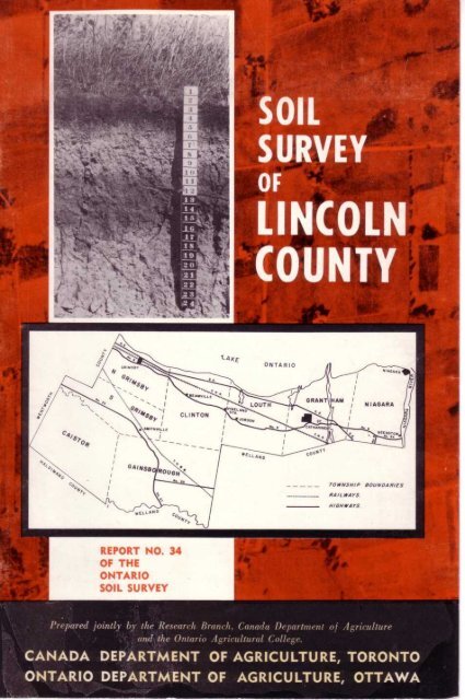
CANADA DEPARTMENT OF AGRICULTURE, TORONTO ONTARIO ...
CANADA DEPARTMENT OF AGRICULTURE, TORONTO ONTARIO ...
CANADA DEPARTMENT OF AGRICULTURE, TORONTO ONTARIO ...

Create successful ePaper yourself
Turn your PDF publications into a flip-book with our unique Google optimized e-Paper software.
REPORT NO . 34<br />
<strong>OF</strong> THE<br />
<strong>ONTARIO</strong><br />
SOIL SURVEY<br />
aw<br />
Prepcred jointly . by the Research Branch, Canada Department of Agriculture<br />
anxl`z~it ,. e Ontario Agricultural College .<br />
<strong>CANADA</strong> <strong>DEPARTMENT</strong> <strong>OF</strong> <strong>AGRICULTURE</strong>, <strong>TORONTO</strong><br />
<strong>ONTARIO</strong> <strong>DEPARTMENT</strong> <strong>OF</strong> <strong>AGRICULTURE</strong>, OTTAWA
THE SOIL SURVEY<br />
or<br />
LINCOLN COUNTY<br />
by<br />
R. E . Wicklund<br />
Soils Research Institute<br />
and<br />
B . C . Matthews<br />
Ontario Agricultural College<br />
Guelph, Ontario<br />
1963<br />
REPORT No .<br />
34 <strong>OF</strong> THE <strong>ONTARIO</strong> SOIL SURVEY<br />
RESEARCH BRANCH, <strong>CANADA</strong> <strong>DEPARTMENT</strong> <strong>OF</strong> <strong>AGRICULTURE</strong><br />
AND THE <strong>ONTARIO</strong> AGRICULTURAL COLLEGE
SOIL SURVEY MAPS AND REPORTS PUBLISHED BY COUNTIES<br />
Norfolk . . . . . . . . . . . . . . . . . . . . . . . . . . . . . . . . . . . . . . . . . . . . . . . . . . . . Map No .<br />
Elgin . . . . . . . . . . . . . . . . . . . . . . . . . . . . . . . . . . . . . . . . . . . . . . . . . . . . . .<br />
~,<br />
Kent . . . . . . . . . . . . . . . . . . . . . . . . . . . . . . . . . . . . . . . . . . . . . . . . . . . . . . . . <br />
Haldimand . . . . . . . . . . . . . . . . . . . . . . . . . . . . . . . . . . . . . . . . . . . . . .<br />
Welland . . . . . . . . . . . . . . . . . . . . . . . . . . . . . . . . . . . . . . . . . . . . . . . . . .<br />
Middlesex . . . . . . . . . . . . . . . . . . . . . . . . . . . . . . . . . . . . . . . . . . . . . .<br />
»<br />
Carlton . . . . . . . . . . . . . . . . . . . . . . . . . . . . . . . . . . . . . . . . . . . . . . . . . . . . Report No . 7<br />
Parts of Northwestern Ontario . . . . . . . . . . . . . . . .<br />
Durham . . . . . . . . . . . . . . . . . . . . . . . . . . . . . . . . . . . . . . . . . . . . . . . . . .<br />
" 8<br />
Prince Edward . . . . . . . . . . . . . . . . . . . . . . . . . . . . . . . . . . . . . . . .<br />
Essex . . . . . . . . . . . . . . . . . . . . . . . . . . . . . . . . . . . . . . . . . . . . . . . . . . . . . .<br />
<br />
<br />
10<br />
11<br />
. Grenville . . . . . . . . . . . . . . . . . . . . . . . . . . . . . . . . . . . . . . . . . . . . . . .<br />
<br />
Huron . . . . . . . . . . . . . . . . . . . . . . . . . . . . . . . . . . . . . . . . . . . . . . . . . . . .<br />
Dundas . . . . . . . . . . . . . . . . . . . . . . . . . . . . . . . . . . . . . . . . . . . . . . . . . . . .<br />
Perth . . . . . . . . . . . . . . . . . . . . . . . . . . . . . . . . . . . . . . . . . . . . . . . . . . . . . .<br />
<br />
Bruce . . . . . . . . . . . . . . . . . . . . . . . . . . . . . . . . . . . . . . . . . . . . . . . . . . . . . .<br />
Grey . . . . . . . . . . . . . . . . . . . . . . . . . . . . . . . . . . . . . . . . . . . . . . . . . . . . . . . .<br />
<br />
Peel . . . . . . . . . . . . . . . . . . . . . . . . . . . . . . . . . . . . . . . . . . . . . . . . . . . . . . . .<br />
>,<br />
York . . . . . . . . . . . . . . . . . . . . . . . . . . . . . . . . . . . . . . . . . . . . . . . . . . . . . . . .<br />
Stormont . . . . . . . . . . . . . . . . . . . . . . . . . . . . . . . . . . . . . . . . . . . . . . . . >,<br />
New Liskeard -Englehart Area . . . . . . . . . . . . "<br />
Lambton . . . . . . . . . . . . . . . . . . . . . . . . . . . . . . . . . . . . . . . . . . . . . . . .<br />
Ontario . . . . . . . . . . . . . . . . . . . . . . . . . . . . . . . . . . . . . . . . . . . . . . . . . . . .<br />
»<br />
Glengarry . . . . . . . . . . . . . . . . . . . . . . . . . . . . . . . . . . . . . . . . . . . . . . . .<br />
Victoria . . . . . . . . . . . . . . . . . . . . . . . . . . . . . . . . . . . . . . . . . . . . . . . . . .<br />
<br />
Manitoulin Island . . . . . . . . . . . . . . . . . . . . . . . . . . . . . . . . . . . . "<br />
Hastings . . . . . . . . . . . . . . . . . . . . . . . . . . . . . . . . . . . . . . . . . . . . . . . . . .<br />
Oxford . . . . . . . . . . . . . . . . . . . . . . . . . . . . . . . . . . . . . . . . . . . . . . . . . . . .<br />
11 "<br />
Simcoe . . . . . . . . . . . . . . . . . . . . . . . . . . . . . . . . . . . . . . . . . . . . . . . . . . . .<br />
Parry Sound . . . . . . . . . . . . . . . . . . . . . . . . . . . . . . . . . . . . . . . . . . . . <br />
Russell & Prescott . . . . . . . . . . . . . . . . . . . . . . . . . . . . . . . . . . ''<br />
Wellington . . . . . . . . . . . . . . . . . . . . . . . . . . . . . . . . . . . . . . . . . . . . . .<br />
Lennox & Addington . . . . . . . . . . . . . . . . . . . . . . . . . . . . . . "<br />
1<br />
2<br />
3<br />
4<br />
5<br />
6<br />
12<br />
13<br />
14<br />
15<br />
16<br />
17<br />
18<br />
19<br />
20<br />
21<br />
22<br />
23<br />
24<br />
25<br />
26<br />
27<br />
28<br />
29<br />
31<br />
33<br />
35<br />
36
ACKNOWLEDGMENT<br />
The authors gratefully acknowledge the assistance of<br />
other officers of the Ontario Soil Survey and several members<br />
of the Department of Soil Science, Ontario Agricultural<br />
College . Thanks are also due to officers of the Horticultural<br />
Experimental Station, Vineland, who provided data on fruit<br />
crop production on the soils of the area .<br />
Particular thanks are due to A. B . Olding who carried<br />
out the initial field mapping and compiled much of the<br />
basic data .<br />
Acknowledgment of assistance in classification of the<br />
soil is gratefully extended to Dr . P . C. Stobbe, Director,<br />
Soil Research Institute, Ottawa .<br />
The accompanying soil map was prepared by the<br />
Cartographic section of the Soils Research Institute, Canada<br />
Department of Agriculture, Ottawa.
TABLE <strong>OF</strong> CONTENTS<br />
. .<br />
.<br />
.<br />
. .<br />
.<br />
. .<br />
.<br />
.<br />
.<br />
Page<br />
Introduction :<br />
General description of area . . . . . . . . . . . . . . . . . . . . . . . . . . . . . . . . . . . . . . . . . . . . . . . . . . . . . . . . . . . . . . . . . . . . . . . . . . . . . . . . 7<br />
Location . . . . . . . . . . . . . . . . . . . . . . . . . . . . . . . . . . . . . . . . . . . . . . . . . . . . . . . . . . . . . . . . . . . . . . . . . . . . . . . . . . . . . . . . . . 6<br />
Geology, bedrock . . . . . . . . . . . . . . . . . . . . . . . . . . . . . . . . . . . . . . . . . . . . . . . . . . . . . . . . . . . . . . . . . . . . . . . . . . . . . . 9<br />
Soil parent materials . . . . . . . . . . . . . . . . . . . . . . . . . . . . . . . . . . . . . . . . . . . . . . . . . . . . . . . . . . . . . . . . . . . . . . . . . 10<br />
Relief and drainage . . . . . . . . . . . . . . . . . . . . . . . . . . . . . . . . . . . . . . . . . . . . . . . . . . . . . . . . . . . . . . . . . . . . . . . . . . . . 11<br />
Climate . . . . . . . . . . . . . . . . . . . . . . . . . . . . . . . . . . . . . . . . . . . . . . . . . . . . . . . . . . . . . . . . . . . . . . . . . . . . . . . . . . . . . . . . . . . . . . 13<br />
Agricultural development . . . . . . . . . . . . . . . . . . . . . . . . . . . . . . . . . . . . . . . . . . . . . . . . . . . . . . . . . . . . . . . . . . 15<br />
Soil development . . . . . . . . . . . . . . . . . . . . . . . . . . . . . . . . . . . . . . . . . . . . . . . . . . . . . . . . . . . . . . . . . . . . . . . . . . . . . . . . . . . . . . . . . . . . . . . 21<br />
Soil Horizons . . . . . . . . . . . . . . . . . . . . . . . . . . . . . . . . . . . . . . . . . . . . . . . . . . . . . . . . . . . . . . . . . . . . . . . . . . . . . . . . . . . . . . . . . . . . . . . . . . . . 23<br />
Classification units - Series, Types . . . . . . . . . . . . . . . . . . . . . . . . . . . . . . . . . . . . . . . . . . . . . . . . . . . . . . . . . . . . . . . . . . 23<br />
Soil Key . . . . . . . . . . . . . . . . . . . . . . . . . . . . . . . . . . . . . . . . . . . . . . . . . . . . . . . . . . . . . . . . . . . . . . . . . . . . . . . . . . . . . . . . . . . . . . . . . . . . . . . . . . . . 24<br />
Oneida Series . . . . . . . . . . . . . . . . . . . . . . . . . . . . . . . . . . . . . . . . . . . . . . . . . . . . . . . . . . . . . . . . . . . . . . . . . . . . . . . . . . . . 25<br />
Chinguacousy Series . . . . . . . . . . . . . . . . . . . . . . . . . . . . . . . . . . . . . . . . . . . . . . . . . . . . . . . . . . . . . . . . . . . . . . . . . . 26<br />
Jeddo Series . . . . . . . . . . . . . . . . . . . . . . . . . . . . . . . . . . . . . . . . . . . . . . . . . . . . . . . . . . . . . . . . . . . . . . . . . . . . . . . . . . . . 27<br />
Smithville Series . . . . . . . . . . . . . . . . . . . . . . . . . . . . . . . . . . . . . . . . . . . . . . . . . . . . . . . . . . . . . . . . . . . . . . . . . . . . . . . 28<br />
Haldimand Series . . . . . . . . . . . . . . . . . . . . . . . . . . . . . . . . . . . . . . . . . . . . . . . . . . . . . . . . . . . . . . . . . . . . . . . . . . . . 30<br />
Lincoln Series . . . . . . . . . . . . . . . . . . . . . . . . . . . . . . . . . . . . . . . . . . . . . . . . . . . . . . . . . . . . . . . . . . . . . . . . . . . . . . . . . . . . 31<br />
Trafalgar Series . . . . . . . . . . . . . . . . . . . . . . . . . . . . . . . . . . . . . . . . . . . . . . . . . . . . . . . . . . . . . . . . . . . . . . . . . . . . . . . . . . 32<br />
Morley Series . . . . . . . . . . . . . . . . . . . . . . . . . . . . . . . . . . . . . . . . . . . . . . . . . . . . . . . . . . . . . . . . . . . . . . . . . . . . . . . . . . . . 33<br />
Grimsby Series . . . . . . . . . . . . . . . . . . . . . . . . . . . . . . . . . . . . . . . . . . . . . . . . . . . . . . . . . . . . . . . . . . . . . . . . . . . . . . . . . . 33<br />
Vineland Series . . . . . . . . . . . . . . . . . . . . . . . . . . . . . . . . . . . . . . . . . . . . . . . . . . . . . . . . . . . . . . . . . . . . . . . . . . . . . . . 34<br />
Winona Series . . . . . . . . . . . . . . . . . . . . . . . . . . . . . . . . . . . . . . . . . . . . . . . . . . . . . . . . . . . . . . . . . . . . . . . . . . . . . . . . . . . . 35<br />
Farmington Series . . . . . . . . . . . . . . . . . . . . . . . . . . . . . . . . . . . . . . . . . . . . . . . . . . . . . . . . . . . . . . . . . . . . . . . . . . . . . . 35<br />
Ravines . . . . . . . . . . . . . . . . . . . . . . . . . . . . . . . . . . . . . . . . . . . . . . . . . . . . . . . . . . . . . . . . . . . . . . . . . . . . . . . . . . . . . . . . . . . . . 36<br />
Soil Rating . . . . . . . . . . . . . . . . . . . . . . . . . . . . . . . . . . . . . . . . . . . . . . . . . . . . . . . . . . . . . . . . . . . . . . . . . . . . . . . . . . . . . . . . . . . . . . . . . . . . . . . 36<br />
Taxonomic classification, profile descriptions and analytical data . . . . . . . . . . . . . . . . . . . . 39<br />
Glossary of terms and horizon descriptions . . . . . . . . . . . . . . . . . . . . . . . . . . . . . . . . . . . . . . . . . . . . . . . . . . . . . 46
9A . 9(r as- BO . 7<br />
5<br />
i<br />
0<br />
w<br />
I<br />
491<br />
rm<br />
OUTLINE MAP<br />
<strong>OF</strong><br />
<strong>ONTARIO</strong><br />
_<br />
9NO.INO LOCATION <strong>OF</strong><br />
LINCOLN --25 0<br />
COUNTY<br />
MILES<br />
90- - BOT 75-<br />
Fig . 1. Outline map of Southern Ontario showing location of Lincoln County.
The Soil Survey<br />
of<br />
Lincoln County<br />
INTRODUCTION<br />
A reconnaissance soil survey of Lincoln County was carried out in the early<br />
years of survey of southern Ontario . In recent years a revision of this early survey<br />
was made and more detailed information added . Many of the soil names that were<br />
originally applied are retained in the present survey, but a few have been dropped<br />
and the soils to which they referred have been correlated with the types which<br />
appear on the soil map .<br />
The report presents data on the geology, the climate, the soil parent material<br />
and drainage, and indicates the influence these factors have had upon the kind of<br />
soil development that has taken place . A description of each soil series is given,<br />
together with a discussion of its use for agricultural purposes . It will be noted<br />
that discussions pertaining to land use and management are very general since it is<br />
difficult to obtain detailed information relating to crop yields and fertilizer practices<br />
that will apply to specific soil types .<br />
A section is included on the rating and suitability of the various soils that<br />
occur in the county for agricultural use . In the absence of crop yield information,<br />
the rating has been made chiefly on the basis of the physical and chemical<br />
characteristics of the soil .<br />
The soil map that accompanies this report shows the location and relative<br />
distribution of the various soils mapped in the County . The soil boundaries were<br />
drawn on aerial photographs, which were then reduced in scale and transferred<br />
to National Topographic base maps . In the course of reduction many mapped<br />
areas, one or two acres in size were omitted, and some soil areas may therefore<br />
appear to be more uniform than they really are . Ravines are a prominent landscape<br />
feature in the fruit farming portion of the County . They have been designated as<br />
ravines whether they are being cultivated or not . Although some of the physical<br />
features of the area can be deduced from the soil map, they are described specifically<br />
in the text of the report .<br />
GENERAL DESCPRIPTION <strong>OF</strong> THE AREA<br />
Location :<br />
Lincoln County is located in what is known geographically as the Niagara<br />
Peninsula . This is one of the most southerly parts of Ontario and lies between<br />
43'00' and 43' 15' north latitude and 79'00' and 79'45' west longtitude . It is<br />
bounded on the north by Lake Ontario, on the east by the Niagara River, on the<br />
south by Welland and Haldimand Counties and on the west by Wentworth County .<br />
This County makes up about one half of the peninsular area that separates the two<br />
large bodies of water namely, Lake Ontario and Lake Erie .<br />
7
22<br />
ii<br />
It<br />
LEGEND<br />
ORDOVICIAN<br />
OUEENSTON FORMATION - red shale .<br />
SILURIAN<br />
ROCHESTER, CLINTON, MEOINA FORMATION,<br />
- grey shales and limestone, and red<br />
limestone .<br />
LOCKPORT FORMATION-grey and brown<br />
dolomite .<br />
GUELPH FORMATION - grey and brown<br />
dolomite .<br />
SALINA FORMATION- shale, dolomite, gypsum .<br />
Figure 2 . Owline map of Lincoln Coujztw shoving bedrock Geology .
The County is roughly rectangular in shape and is approximately 36 miles<br />
long and 14 miles at its widest part . The total area is 332 .5 square miles or<br />
212.800 acrds .<br />
Geology, bedrock :<br />
The bedrock of this portion of the Province has been described in some detail<br />
by the Geological survey of the Canada Department of Mines .* The entire area<br />
is underlain by Palaeozoic sedimentary rocks, the Ordovician and Silurian systems<br />
being the only two represented in Lincoln County . The rock exposures of these<br />
various formations are most prominent along the face of the Niagara escarpment .<br />
which is located approximately along the southern boundary of the Queenston<br />
formation shown in Fig . 2 .<br />
The rock strata consist for the most part of shales and limestones, the latter<br />
being dolomitic in the beds that form the capping of the Niagara escarpment .<br />
View of Niagara fruit belt front Queenston Heights .<br />
These are horizontal lying beds that dip slightly towards the southern part of the<br />
map area .<br />
The Queenston formation that is frequently exposed below the level of the<br />
Niagara escarpment, consists of a characteristically red shale with a high silt content<br />
. Since this formation runs along the base of the Niagara escarpment, the<br />
uppel level of the beds are never very far above the level of Lake Ontario, and its<br />
influence upon the soils of the region is most prominent in this part of the County .<br />
The Niagara escarpment is a more or less vertical rock face exposure that<br />
extends east and west across the northern half of the County . The Rochester,<br />
Clinton and Medina formations that are described* as occurring adjacent to the<br />
slopes and face of the escarpment have probably contributed substantially to the<br />
'`Palaeozoic geology of the Toronto-Hamilton area, Ontario . By J . F . Caley .<br />
Memoir 224 . 1940 . Canada Dept . of Mines and Resources.<br />
*Silurian Stratigraphy and Palaeontology of the Niagara Escarpment in Ontario .<br />
Geological Survey of Canada . Memoir 289 . 1957 .<br />
9
soils of this locality, since the boundaries tend to coincide with soils of a different<br />
nature than those which surround this general area . These rocks are shales, limestones<br />
and sandstones . The most prominent sandstone is the Grimsby member of the<br />
Medina formation, a red bed that is about 12 feet in thickness . Its type locality is<br />
the gorge of forty mile creek at Grimsby . These sandstones are composed of very<br />
fine grained, sub-rounded to round, well sorted quartz grains covered with a thin<br />
coat of hematite, together with a small suite of heavy minerals . No lime occurs<br />
in the typical Grimsby . This sandstone bed may be important in soil as mentioned<br />
later under the heading of Soil Parent Material .<br />
The Lockport, Guelph and Salina dolomite formations overlie the previous<br />
formations and constitute a large part of the escarpment face as well as the surface<br />
bedrock for the remainder of the county . Rock exposures occur only within a mile<br />
or two of the escarpment where stream action has been able to erode its bed down<br />
to the solid rock .<br />
Soil Parent Materials<br />
The Niagara escarpment is a prominent feature and reference is continually<br />
made to that portion of the County that lies below the escarpment contrasted with<br />
the portion that lies above the escarpment . In considering the surface unconsol<br />
idated deposits no such differentiation can be made, because similar kinds of deposits<br />
occur in either location .<br />
Repeated glaciations have covered the bedrock with glacial drift of variable<br />
composition and texture . This area also occurs within a region that has been the<br />
locale of many early glacial lakes .<br />
As a result the clay deposits which are so widely distributed within the County<br />
may have been initially deposited as lake laid sediments . Subsequently, advances<br />
of the glacial ice, mixed and moved the lacustrine deposits incorporating small rock<br />
fragments with the clay . The material is called glaciolacustrine till . These clay till<br />
deposits blanket the entire County area and extend unbroken from the lake shore<br />
to the most southerly part of this County .<br />
A large broad ravine at the foot of the escarpment bench, with flood plain bottom .<br />
10
The flat plain area that parallels the lake shore from the Niagara River and<br />
across the County to the Wentworth County boundary, contains many discrete<br />
bodies of sand that are underlain at various depths by clay till . A fairly continuous<br />
body of sand occurs between Vineland and Niagara-on-the-Lake, lying adjacent<br />
to the lake shore. These sand deposits possess a distinctly reddish color, which is<br />
unique when compared with sands that occur elsewhere in the province, and are<br />
found exclusively near the Niagara escarpment . These are probably deltaic deposits<br />
and may possibly be the result of erosion products derived from the red<br />
sandstones of the Grimsby formation . Several canyon-like ravines penetrate the<br />
escarpment at this point and cut through the various rock strata . The sand grains<br />
appear to be coated with hematite and are thoroughly sorted into a grade of very<br />
fine sand . Similar characteristics are described for the sand grains that compose<br />
the sandstone beds of the Grimsby formation.*<br />
Perhaps the most distinctive surficial deposit in this area is the red silty clay<br />
or silty clay loam material that occurs below the escarpment and forming a continuous<br />
body from the lake shore to the escarpment and extending from Winona in<br />
the west to Vineland in the east . The continuity of this body may not be apparent<br />
over the entire area since it is covered in many places with deposits of sand . This<br />
silty clay material is similar in color and consistency to the underlying Queenston<br />
shale .<br />
An examination of the exposures along the lake shore reveals the presence of<br />
two tills within 15 or 20 feet of the surface . These may both be designated as clay<br />
tills but the upper deposit is more stony and grittier than the lower . In Niagara<br />
township the upper till caries back only half way to the escarpment, but the lower<br />
till is exposed in a continuous block below the Lake Iroquois shoreline . The latter<br />
coincides with the Lincoln soil series mapped in this area . The color, texture and<br />
consistency of this lower till are similar to that of the main body of till that covers<br />
South Grimsby, Caistor and Gainsborough townships . The soil materials in these<br />
separate areas may not be related stratigraphically but they have similar soil<br />
properties . The much larger clay plain that covers Caistor and Gainsborough<br />
Townships frequently bears evidence of lacustrine deposition at the surface . These<br />
stratified deposits are not large nor continuous over the plain,and where they have<br />
been observed have a depth not exceeding 24 inches . In all cases these sediments<br />
have a high content of silt . The till may occasionally consist of contorted layers of<br />
silt and clay in which the original strata can still be discerned . This material has<br />
very few stones but has sufficient gravel-sized pebbles incorporated in the matrix<br />
to indicate moving and mixing by ice .<br />
The upper clay till deposit that is adjacent to the shoreline in Niagara township,<br />
broadens out from St . Catharines to Beamsville to include not only the area below<br />
the escarpment but also the escarpment bench and the long moraine at the top of<br />
the escarpment . This includes the soil series which are designated on the soil map<br />
as Jeddo, Chinguacousy and Oneida .<br />
Relief and Drainage<br />
The major relief features of Lincoln county are most readily described in reference<br />
to the Niagara escarpment . This vertical rock face exposure parallels the<br />
shoreline from east to west across the northern part of the County, and separates<br />
two of the major relief areas namely, the - flat lying plain below the escarpment desig-<br />
*Silurian Stratigraphy and Palaeontology of the Niagara Escarpment in Ontario.<br />
Geol . Survey of Canada . Memoir 289 . 1957 .
Vertical rock face of Niagara, escarpment ivith apple orchard in the foreground .<br />
nated as the Iroquois'' plain, and the clay plain above the escarpment which is<br />
referred to as the Haldimand" plain . The area lying below the escarpment has an<br />
elevation ranging from 250 feet to 325 feet above sea-level, and the area above the<br />
escarpment an elevation of 600 feet to 650 feet above sea-level .<br />
A third major relief feature is the escarpment bench that extends from Beamsville<br />
in the west to St . Davids in the east . The boundaries of the bench are outlined<br />
roughly by the Lake Iroquois shoreline below the escarpment and the remnants<br />
of the escarpment face at the highest elevation . The presence of the bench eliminates<br />
the vertical drop in elevation that is most noticeable from Beamsville west to<br />
the County boundary . The escarpment bench is the portion of the County that is<br />
dissected most thoroughly by ravines, which are cut into the deep till deposits that<br />
form the bench . In the Grimsby Beach-Beamsville area the ravines begin near the<br />
top of the escarpment and terminate abruptly at the Lake Iroquois shoreline . In<br />
the Jordan Harbor-St . Catharines area the ravines are much larger and extend unbroken<br />
from the escarpment down through the valley flats to the Lake Ontario<br />
shore . These ravines have a short headward extension into the escarpment where<br />
they form the present outlets for the various small creeks that traverse the Haldimand<br />
clay plain above the escarpment .<br />
The drainage of the Haldimand clay plain is effected by a series of small parallel<br />
streams flowing eastward across the County . The largest of these is the Twenty<br />
Mile Creek that flows through the central part of the plain, past the town of Smith<br />
ville and empties into Jordan Harbour . This stream has few tributaries and therefore<br />
does not greatly affect the drainage of the surrounding territory . The Welland<br />
river along the southern border of the County also flows eastward and has a great<br />
many short tributary streams entering from the north . The greater part of the plains<br />
area therefore contains few well-developed streams, but in spite of that the surface<br />
drainage is fairly good for a region having such flat topography .<br />
"L . J . Chapman and D. F . Putnam . The Physiography of Southern Ontario .<br />
12
The most extensive poorly drained area in the Haldimand plain is a narrow<br />
belt of land that extends from the Wentworth County boundary east to Tintern and<br />
lies between the Twenty Mile Creek and the moraine that crowns the escarpment .<br />
This is an area with flat relief and is the locale for some of the head waters of the<br />
Thirty and Forty Mile Creeks .<br />
The Iroquois plain below the escarpment slopes gently from the escarpment<br />
to the Lake Ontario shore . The streams that emerge from the escarpment run directly<br />
towards the shore and in many instances are incised rather deeply into the<br />
clay sediments . The soils in this plain are more poorly drained than those of the<br />
Haldimand plain . The installation of artificial drains and large ditches is helping<br />
to alleviate this condition .<br />
Vieuc of Niagara river flotuing through the Iroquois plain before entering<br />
Lake Ontario .<br />
Climate<br />
From a climatic standpoint, the Iroquois plain, or an alternative name riven<br />
to this area - the Niagara Fruit Belt - is one of the most favored regions in Ontario<br />
. This relatively narrow belt has a lake border on the northern side and a high<br />
escarpment border on the southern side . This combination has provided a unique<br />
physical environment which produces a local climatic region . The climate of the<br />
Haldimand clay plain is influenced to a considerable extent, by its proximity to the<br />
Great Lakes . This bordering effect produced by large bodies of water ameliorates<br />
both the cold currents of air that enter the region from the north, and also the<br />
warm currents that sweep in from the south .<br />
The climatic data in tables 1 to 3 indicate the general fluctuations in precipitation<br />
and the incidence of frost that occurs from season to season . The distribution<br />
of the rainfall throughout the year is such that in normal years there is adequate<br />
amount each month to take care of crop requirements . Among the stations listed<br />
in Table 1, these long term records would seem to indicate an increase in precipitation<br />
from the region of St . Catharines to the region of Hamilton . The mean annual<br />
precipitation at Vineland is 29 .9 inches which is midway between these two<br />
1 3
TABLE 1<br />
AVERAGE MONTHLY AND ANNUAL PRECIPITATION<br />
. . . . . .<br />
. . . . . .<br />
. . . . . . .<br />
. . . . . . . .<br />
.<br />
. . . . . .<br />
Jan . Feb . Mar . Apr . May June July Aug. Sept. Oct . Nov . Dec . Yr .<br />
Chatham . . . . . . 2.2 2.1 2.2 2 .3 2.9 2.6 2.8 2.4 2.6 2.4 2 .3 2.2 29 .2<br />
Guelph 2.4 1 .7 1 .8 2.4 2.7 2.8 3 .1 2.9 2.5 2 .4 2.4 2.1 29 .3<br />
Hamilton . . . . . . 2.7 2.4 2.7 2.2 2 .3 2.6 3 .1 2 .3 2.9 2.6 2.6 2.5 30 .9<br />
London . . . . . . . 3.9 3.4 2.8 2.9 2.8 3 .1 3 .2 2.8 2.9 2.9 3.7 3.5 38 .2<br />
Ottawa . . . . . . . . 2.9 2.2 2.8 2.7 2.5 3 .5 3.4 2.6 3 .2 2.9 2.9 2.6 34 .2<br />
St . Catharines . . . 2.3 1.8 2 .1 2.4 2.1 2.5 2.4 2.5 2.6 2.2 2.1 2.0 27 .0<br />
Welland . . . . . . . . 3 .1 2.9 2.7 2.8 2.8 2.7 3 .2 2.4 2.8 2.9 2.6 2.9 33 .9<br />
TABLE 2<br />
FROST<br />
Spring Frost<br />
Fall Frost<br />
Earliest Probability Latest Earliest Probability Latest<br />
last spring 1 in 10 last spring first fall 1 in 10 first fall<br />
frost after frost frost after frost<br />
Chatham . . . . . . . . . . . . . . ..A pr . 11 May 22 May 28 Sept . 22 Sept . 26 Nov. 15<br />
Guelph . . . . . . . . . . . . . . . . . .A pr . 20 May 30 June 22 Sept . 10 Sept . 15 Oct . 20<br />
Hamilton . . . . . . . . . . . . . .Mar . 29 May 22 June 7 Sept . 9 Sept . 27 Nov . 15<br />
London . . . . . . . . . . . . . . . . . .Apr . 17 May 30 June 16 Sept . 9 Sept . 18 Oct. 28<br />
Ottawa . . . . . . . . . . . . . . . . ..Apr . 15 May 23 May 27 Sept . 10 Sept . 16 Oct. 17<br />
St . Catharines . . . . . . ..Apr . 14 May 20 May 27 Sept . 22 Oct. 5 Nov. 11<br />
Welland . . . . . . . . . . . . . . . .Apr . 12 May 22 May 29 Sept . 10 Sept . 29 Nov. 6<br />
TABLE 3<br />
LENGTH <strong>OF</strong> FROST FREE PERIOD<br />
Shortest frost<br />
free period<br />
(days)<br />
90 percent<br />
probability<br />
(days)<br />
Longest frost<br />
free period<br />
(days)<br />
Average frost<br />
free period<br />
(days)<br />
. . . . . .<br />
. . . . . .<br />
. . . . .<br />
. . . . . .<br />
. . . . . .<br />
. . .<br />
. . . . . .<br />
Chatham . . . . . . . . . . 128 183 189 162<br />
Guelph . . . . . . . . . . . . 92 156 162 135<br />
Hamilton . . . . . . . . . 112 202 213 170<br />
London . . . . . . . . . . . . 106 158 166 138<br />
Ottawa . . . . . . . . . . . . 114 165 174 141<br />
St . Catharines . . . . . 135 191 196 169<br />
Welland . . . . . . . . . . ill 176 198 157<br />
14
points . The difference in precipitation between St . Catharines (27 .0 in .) and Welland<br />
(33 .9 in .) indicates the effects of local topographic features in modifying the<br />
general climate of this region .<br />
The probability of frost occurring in the Niagara Fruit Belt is one week<br />
earlier than that at Guelph or London . The occurrence of fall frosts is similarly<br />
delayed in the Niagara region and is not common until around the end of<br />
September . The Niagara Fruit Belt enjoys a month longer frost-free weather than<br />
Guelph or London . The figure quoted for Welland, will be representative for most<br />
of the Haldimand plain area . In this region frost occurs on the average two weeks<br />
later than at St . Catharines or Hamilton and two weeks earlier than Guelph or<br />
London .<br />
Agricultural Development<br />
A review of the agricultural development of this region necessarily involves<br />
some reference to the influx of the United Empire Loyalists that occurred shortly<br />
after the American war of Independence in 1775, and continued well into the turn<br />
of the following century . These early settlers brought with them much of the farm<br />
equipment they had used in their farming practices in the American Colonies . They<br />
may also have brought with them various agricultural plants and seed supplies and<br />
were thus able to begin production of staple food products rather soon after their<br />
arrival .<br />
View of escarpment bench on the left and Iroquois plain on the right .<br />
The highway in the centre follotus the Lake Iroquois shoreline .<br />
The Niagara peninsula was a heavily wooded region and had to be cleared<br />
with the equipment that the settlers possessed . This process was accomplished very<br />
slowly . The initial settlements began at the present sites of Niagara, Queenston<br />
and St . Catharines, and spread rapidly westward in the direction of Hamilton .<br />
The Loyalists, as to origin and language, were a mixed race of people . The<br />
majority of them were English speaking but half of those who came to Niagara<br />
15
3<br />
Outline nnap of Lincoln County showing townskip boundaries and naaiit highways<br />
Figure<br />
.<br />
.
View of Niagara fruit belt with urban development in the background.<br />
used the high or low German and Dutch as spoken by the people of the interior of<br />
New York and Pennsylvania . All were Protestants .<br />
One of the first duties of the Government was the survey of the new district<br />
into counties and townships, and the establishment of lots that consisted of 200<br />
acres each . In 1792 the entire Upper Canada region was divided into 19 counties .<br />
These were all named after counties in England, and the townships after towns and<br />
villages . Lincoln County originally included the Niagara Peninsula extending as far<br />
west as the present county of Norfolk . The townships of Caistor, Clinton, Grantham,<br />
Gainsborough, Grimsby and Louth were all names of towns in Lincolnshire,<br />
England.<br />
In the Ontario Agricultural Commision Report of 1881, it is indicated that<br />
settlement was general in all townships of Lincoln County between 1778 and 1784 .<br />
but that complete settlement of all the land available had not been achieved until<br />
50 or 60 years later .<br />
The forest tree species consisted principally of oak, pine, beech, maple, elm,<br />
black ash and chestnut . Some of the timber was processed into lumber in mills that<br />
were located at the mouths of the streams coming out at the foot of the escarpment .<br />
In general beech and maple were used as fire wood, black ash and chestnut for<br />
fencing, pine and basswood for building, oak and hickory for manufacturing and<br />
elm for staves . Log houses were among the first to be erected but were soon replaced<br />
by brick and stone, so that by the year 1881 it was estimated that 50 percent<br />
of the farm dwellings consisted of brick, stone or first class frame and the remainder<br />
were of log or inferior frame .<br />
The crops grown and the farming methods were similar over the entire County<br />
and its differentiation into strictly fruit growing areas did not develop until the later<br />
part of the century . The principal crops grown were fall wheat, oats and corn with<br />
a little spring wheat and barley. Orchards were well established by the year 1800<br />
and consisted of apples, pears, plums and cherries . Peaches and grapes were not<br />
introduced until many years later.<br />
17
TABLE 4<br />
DISTRIBUTION <strong>OF</strong> CROPS AND NUMBER <strong>OF</strong> LIVESTOCK BY SUB-DIVISIONS (LINCOLN COUNTY)<br />
Sub-divisions Acres All field crops<br />
Acres % (1)<br />
Major Field Crops<br />
Livestock<br />
Wheat Oats Hay Corn ensilage Pasture Milk<br />
Acres %(1) Acres %(1) Acres %(1) Acres %0) Acres % (1) Cattle Cows Pigs Poultry<br />
Caistor 30,283 16,327 54 1,662 5 .5 2,760 9 .1 10,683 35 .2 674 2 .2 5,730 18 .9 3,935 2,029 1,673 64,178<br />
Clinton 24,589 17,089 69 1,349 5 .5 1,388 5 .6 3,959 16 .1 6216 2 .5 2,006 8 .2 2,421 1,236 2,128 113,669<br />
Gainsborough 36,682 20,285 55 2,430 6 .6 3,454 9 .4 12,619 34 .4 990 2 .7 8,812 24 .0 5,621 3,190 1,734 76,129<br />
Grantham 11,702 8,061 69 631 5 .4 248 2 .1 1,352 11 .5 123 1 .0 1,078 9 .2 747 372 268 12,650<br />
Grimsby N . 13,689 8,723 64 679 4 .9 480 3 .5 1,933 14 .1 231 1 .7 838 6 .1 919 395 1,561 53,425<br />
Grimsby S. 17,444 10,425 60 851 4 .9 1 .985 11 .3 5,943 34 .0 636 3 .6 3,563 20 .4 2,820 1,601 825 51,848<br />
Louth 17,113 12,162 71 397 2 .3 508 2 .9 1,836 10 .7 266 1 .5 1,032 6 .0 1,272 511 947 76,137<br />
Niagara 19,179 12,869 67 554 2 .9 180 .9 1,359 7 .1 26 .1 973 5 .1 633 362 546 78,715<br />
Totals - 1 170,681 105,941 8,553 11,003 39 .684 3 .572 24,032 18,368 9,696 1 9,682 1526,751<br />
Data compiled from Census of Canada 1956 . (1) Per cent of township acreage .
On the heavy clay soils, tile drainage was introduced by the early settlers but<br />
was carried on only to a limited extent . Some tile drainage was established in Grimsby,<br />
Grantham, Louth and Niagara but none in Caistor, Clinton and Gainsborough .<br />
Systematic tile drainage has not become established up to the present day . This contrasts<br />
sharply with the early practice in other counties such as Oxford where tile<br />
drainage was common as early as 1881 .<br />
The fertilizers or soil amendments in use at that time were salt, land plaster<br />
and lime, and were used on grain and root crops and on grass and clover . A common<br />
application of salt was 300 lbs . per acre and 200 to 250 lbs . of land plaster<br />
per acre .<br />
The acreages of crops and the numbers of important kinds of livestock in the<br />
County, as compiled from the census of 1956, is shown in the accompanying table.<br />
The acreage of the various field crops grown are expressed as percentages of the<br />
total acreage in each township, in an attempt to relate the incidence of crops to<br />
soils . In all townships, field crops constitute more than 50 percent of the total acreage<br />
. The distribution of hay and pasture reveals that physiographic factors rather<br />
than soils govern the distribution of these crops . About 74 per cent of the hay,<br />
pasture and oats that is grown in the County, is located in the townships of Caistor,<br />
Gainsborough and Grimsby South, on the Haldimand clay plain . This is the dairy<br />
region of Lincoln County and milk cows predominate among the kinds of livestock .<br />
Of the remaining townships, Clinton also has a concentration of dairy cattle<br />
and forage crops . These are located principally in the southern part of the township,<br />
which is taken up by the escarpment bench and has soils that are ideally suited<br />
for a wide variety of field crops . Somewhat similar conditions exist in the southern<br />
parts of Louth and Grantham townships, which are also a continuation of the escarpment<br />
bench .<br />
The pattern of land use and its relation to the pattern of soil types is striking<br />
for this region . In the land maps published by the Geographical Branch of the<br />
Department of Mines, the Niagara map series show a high concentration of fruit<br />
and vegetable crops is occurring on the escarpment bench soils of Clinton Township<br />
and extending south into Gainsborough Township in the vicinity of Campden<br />
and Tintern . This expansion of the fruit industry coincides to a large extent, with<br />
the distribution of the Smithville silt loam type .<br />
TABLE 5<br />
ESTIMATED FRUIT PRODUCTION IN NIAGARA DISTRICT*<br />
AND IN THE PROVINCE<br />
Niagara<br />
Acres<br />
District<br />
Pounds<br />
. . . . . . . . . . . .<br />
. . . . . . . .<br />
. . . . . . .<br />
. . . . . . . . . .<br />
. . . . . . . . . . . .<br />
. . . . . . . . . . . . .<br />
. . . . .<br />
Apples . . . . . . . . . . . . . . . . . . 1,050 7,752,000 24,560 220,43 1,240<br />
Cherries, sour . . . . . . . . . . 2,500 18,200,000 3,901 26,317,500<br />
Cherries, sweet . . . . . . . . . . . 1,600 5,500,000 1,764 6,253,150<br />
Grapes . . . . . . . . . . . . . . 20,500 80,300,000 20,883 81,634,000<br />
Peaches . . . . . . . . . . . . . . . . . . 11,000 103,195,000 13,810 127,175,000<br />
Pears . . . . . . . . . . . . . . . . . . . 4,550 29,337,000 6,463 40,804,350<br />
Plums and Prunes . . . . . . 2,800 14,056,000 3,528 17,010,100<br />
Includes the counties of Lincoln, Welland and Wentworth .<br />
The large vineyards on the escarpment bench and on the Haldimand clay<br />
plain are a normal extension of this enterprise on to the imperfectly drained<br />
clay soils of this region . More and more of the Haldimand soil series is being<br />
19<br />
Acres<br />
Province<br />
Pounds
utilized for this crop . The significance of the fruit industry to this region is very<br />
marked when compared with the total production of fruits within the province .<br />
The major fruit producing area is the Iroquois plain that lies below the<br />
escarpment . In this area the peach crop is grown on the sandy soils . The depth<br />
of sand is critical for maximum yield and where the sand deposits become thin<br />
the soil is less satisfactory for this crop . The other tree fruits can be grown on<br />
clay soils and are distributed over the entire plain with the exception of a<br />
large block of poorly drained clay soils in Niagara Township that are used for<br />
growing grapes .<br />
Ah<br />
Black organic-mineral<br />
horizon .<br />
Cca<br />
Horizon containing<br />
concentration of lime .<br />
Grey Brown Podzolic soil profile .<br />
All soils in Lincoln County with good to fair drainage are classified as Grey<br />
Brown Podzolic. These soils have a dark grey Ah horizon . a light brown or brownish<br />
grey Ae horizon, and a dark brown Bt horizon that is iminedialel y underlain bti"<br />
calcareous parent material.<br />
20
Soil Development<br />
Soil development is the expression that is given to the alterations that have<br />
taken place in soil parent materials . These alterations have been produced by<br />
climatic forces and by vegetation and have operated over several thousands of<br />
years . The effects can be observed in the soil profile or any vertical cut made in<br />
the soil to a depth of 3 or 4 feet . The amount of change is determined by comparing<br />
the surface and subsoil with the unaltered material that usually lies at a<br />
depth of 30 inches . The climate, with its varying temperature and rainfall, together<br />
with vegetation and other living organisms all operate in this process of<br />
change . A warm humid climate is considered to be the most favourable for the<br />
active work of organisms .<br />
Dark Grey Gleysolic soil profile .<br />
The Uark Grey Gleysolic soils are poorly drained. They have a black Ah horizon<br />
and a grey subsoil with vellou, and orange mottling. A horizon of intense mottling<br />
can usually be detected in the subsoil . The parent material is calcareous .<br />
2 1
It would be reasonable to expect that under the relatively mild climate<br />
of Lincoln County, and particularly on the Iroquois plain, that the soils would<br />
be well developed . Such is not the case . On the contrary, soil development is<br />
weakly expressed in most of the soils in this area .<br />
Some singular condition has therefore existed to hinder a more active soil<br />
development . A single term that may be used for this condition is soil climate .<br />
The climate within a soil is generally unlike that above the soil . The daily variations<br />
in soil temperature occurring at the soil surface fade out rapidly with depth .<br />
By far the most important component of the soil that influences its temperature<br />
is moisture content . A much greater amount of heat is required to raise the<br />
temperature of a moist or saturated soil than one which is well drained .<br />
It was pointed out in a previous section that the great majority of the soil<br />
materials in the County are of fine textures being either massive clays or clay<br />
loams . Such materials have poorly developed structure and warm very slowly<br />
in springtime . Furthermore the evaporation of large quantities of water from the<br />
soil surface produces a cooling effect that further delays the warming of the soil .<br />
Before the days of settlement, this region was covered with a dense forest<br />
of hardwoods . Such natural vegetation has a considerable effect on the climate<br />
of the soil . A dense stand of trees slows down wind velocity and because of protection<br />
given by leaves, the rain strikes the ground with less force than on barren<br />
soil . Under such conditions the maximum amount of water soaks into the soil .<br />
The only way for excess water to escape is by percolation or by a downward<br />
movement towards drainage ways such as creeks or rivers where it can be removed<br />
from the soil region . Since most of the County has poorly developed<br />
streams, the escape of surface and soil water takes place slowly throughout<br />
the summer season .<br />
Except for the rolling landscape areas associated with the bench of the<br />
escarpment, and a few local sandy areas, all the soils in the County have developed<br />
under a gleying process, i .e . one of alternating oxidation and reduction .<br />
This condition can usually be detected by the presence o£ mottling in the soil<br />
profile . It is very pronounced in the sandy soils but decreases in intensity in<br />
the finer textured soils, and in the poorly drained clays of the Haldimand plains<br />
it can be detected only in the dry seasons .<br />
The water table fluctuates with the advance of the seasons, and in the summer<br />
months is several feet below the surface. All the soils of the County are<br />
leached to varying depths as determined by the location of the carbonate hori<br />
zon in the soil profile . The sandy soils of the Iroquois plain possess a carbonate<br />
horizon that is nearly always at a depth of 36 inches and it is assumed that<br />
all the calcium carbonate has been leached from the surface and subsoil . Soil<br />
horizons are weakly developed and the zones of differentiation are recognized<br />
principally by color . The most prevalent clay soil on the Iroquois plain is the<br />
Jeddo soil series . This soil is poorly drained and leached only to a depth of 18<br />
inches . The horizons in this soil can be seen only in the dry season and it is<br />
possible then to differentiate two or three different color zones . A little better<br />
development is present in the clay soils of the Haldimand plain where some structural<br />
development of the horizons is also associated with color .<br />
In the formal classification given in the last section of the report, the soils<br />
of the County are classified as being either Dark Grey Gleysolic or Grey Brown<br />
Podzolic . In Lincoln County, the soil series that most nearly approaches the Grey<br />
Brown Podzolic development are the Smithville and Oneida series . The imper-<br />
22
fectly drained associates of these soils namely, the Haldimand and the Chinguacousy<br />
series, also display these Grey Brown Podzolic characteristics but usually<br />
have a less pronounced leached horizon and a textural B horizon that is thin<br />
and dark grey in color .<br />
The Dark Grey Gleysolic development is present in the poorly drained<br />
Lincoln and Jeddo soil series .<br />
Soil Horizons<br />
A vertical cut made in the soil, in which the features that have been produced<br />
by soil development are exposed, is known as the soil profile, and the<br />
various colored or structural horizontal layers that are present, are designated<br />
as soil horizons . The various combinations of horizons that are thus exposed<br />
are frequently referred to as "surface soil" and "subsoil", and unaltered soil as<br />
"parent material" . In soil descriptions these divisions are labelled A horizon, B<br />
horizon and C horizon and are further designated as Ah, Ae, Bt, Bf, C etc . for<br />
more detailed and accurate descriptions where the main soil horizons are subdivided<br />
. These terms are used in the detailed soil descriptions given for each<br />
soil series .<br />
The A horizon is the horizon where maximum leaching takes place and<br />
from which the bases are removed by the downward flow of water . In many<br />
soils the A horizon can be sub-divided into Ah and Ae . The Àh horizon con<br />
tains the largest amounts of organic matter and the Ae is the horizon with the<br />
lightest color, frequently having a bleached appearance . Some of the materials<br />
leached from the Ae accumulate in the B horizon, and in this region of the<br />
province these accumulated compounds may be either organic materials or inorganic<br />
materials such as clay, or both . The result is that the most clayey portion<br />
of the soil is the B horizon . The C horizon is the unweathered or very slightly<br />
weathered material, detected in the profile by its effervescence with dilute hydrochloric<br />
acid .<br />
Poorly drained soils or those in which ground water is present for a large<br />
part of the year, have a condition designated as "gley" . The gleyed horizons are<br />
recognized chiefly by color, being dark grey or grey with concentrations of yellow<br />
and red colors forming a mottled appearance .<br />
It is on the basis of the development of these horizons that the soils of a<br />
region are classified .<br />
Classification Units - Series,<br />
Types<br />
The soil map contains lines that represent the boundaries of different kinds<br />
or bodies of soil . These bodies of soil, so called because they cover not only surface<br />
area but also have a certain thickness or depth, can be visualized as parts<br />
of a jig saw puzzle that fit into one another to form a unified landscape . One<br />
part merges gradually with another so that the boundary line does not represent<br />
an abrupt change between two soil bodies .<br />
Any land area therefore consists of soil bodies that from place to place<br />
tend to repeat in a continuous pattern . An individual soil body is called a "series"<br />
and is given a specific name such as Vineland, Lincoln, etc ., that are place<br />
names of the areas in which these soils occur . A given soil is assumed to be<br />
uniform in characteristics throughout the whole soil body with the exception<br />
of the texture in which case a certain variability is permitted . This variability in<br />
texture cannot be extreme through the soil body but may be more so in the<br />
surface six inches or plow layer depth . The variation in surface texture may be<br />
23
a result of flooding or erosion by which soil material may have been transported<br />
from one place and deposited in another.<br />
A textural class name is then given to the series name and when thus<br />
combined is known as a "soil type" . A series such as Vineland, may consist of<br />
two soil types namely, Vineland sandy loam and Vineland fine sandy loam, where<br />
the difference between them is mainly a difference in texture of the surface soil .<br />
In the soil descriptions that follow, reference will be made chiefly to soil<br />
series rather than soil type since it is the individual characteristics of the soil<br />
body, all taken together that determine the agricultural suitability of a soil . Some<br />
of these characteristics are permanent and cannot be altered, others such as internal<br />
soil drainage and fertility can be altered by management . These latter<br />
characteristics will be discussed in connection with management practices for each<br />
given soil series .<br />
Soil<br />
Key<br />
. . . . . . . . . . . . . . . . . . . . . . . . . . . . .<br />
. . . . . . . . . . . . . . . . . . . . . . .<br />
. . . . . . . . . . . . . . . . . . . . . . . . . . .<br />
. . . . . . . . . . . . . . . . . . . . . . . . . .<br />
A. Soils developed on glaciolacustrine till . Acreage '<br />
1 . Calcareous, grey with red clay parent material .<br />
(a) Moderately well drained .<br />
1 . Oneida Loam (01) . . . . . . . . . . . . . . . . . . . . . . . . . . . . . . . . . . . . . . . . . . . . . . . . . . . . . . . . . 8,900<br />
(b) Imperfectly drained .<br />
1 : Chinguacousy clay loam (Chcl) . . . . . . . . . . . . . . . . . . . . . . . . . . . . . . . . . . . . . . . . . 5,000<br />
(c) Poorly drained .<br />
1 . Jeddo clay loam (Jcl) . . . . . . . . . ., . . . . . . . . . . . . . . . . . . . . . . . . . . . . . . . . . . . . . . . . . . . . 17,800<br />
2. Jeddo stony loam (Jst) . . . . . . . . . . . . . . . . . . . . . . . . . . . . . . . . . . . . . . . . . . . . . . . . . . . . 800<br />
. . . . . . . . . . . . . . . . . . . . . . . . . . .<br />
. . . . . . . . . . . . . . . . . .<br />
. . . . . . . . . . . . . . . . . . . . . .<br />
11 . Calcareous grey clay parent material .<br />
(a) Imperfectly drained .<br />
1 . Haldimand clay loam (Hcl) . . . . . . . . . . . . . . . . . . . . . . . . . . . . . . . . . . . . . . . . . . . . . 98 .400<br />
2 . Haldimand silty clay loam (Hsicl) . . . . . . . . . . . . . . . . . . . . . . . . . . . . . . . . . ., . . . . . . . . . 2,300<br />
3 . Haldimand silt loam (Hsil) . . . . . . . . . . . . . . . . . . . . . . . . . . . . . . . . . . . . . . . . . . . . . . . . . 1,900<br />
(b) Poorly drained .<br />
1 . Lincoln clay (Lic)<br />
III. Calcareous grey clay overlain by silty lacustrine deposits .<br />
(a) Moderately well drained .<br />
1 . Smithville loam (Sl) . . . . . . . . . . . . . . . . . . . . . . . . . . . . . . . . . . . . . . . . . . . . . . . . . . . . . . . . . . . . . . . . . . . . . . . . . . . . . . . . . . . . 5.200<br />
2 . Smithville silt loam (Ssil) . . . . . . . . . . . . . . . . . . . . . . . . . . . . . . . . . . . . . . . . . . . . . . . . . . . . . . . . . . . . . . . . . . . . . . . . . . . . 7,200<br />
3 . Smithville silty clay loam (Ssicl) . . . . . . . . . . . . . . . . . . . . . . . . . . . . . . . . . . . . . . . . . . . . . . . . . . . . . . . . . . . . . . . . 2,100<br />
IV. Calcareous silty clay loam parent material .<br />
(a) Imperfectly drained .<br />
1 . Trafalgar silty clay loam (Tsicl) . . . . . . . . . . . . . . . . . . . . . . . . . . . . . . . . . , . ., . . . . . . . . . . . . . . . . . . . . . . . . ., 3,600<br />
(b) Poorly drained .<br />
1 . Morley silty clay loam (Msicl) . . . . . . . . . . . . . . . . . . . . . . . . . . . . . . . . . . . . . . . . . . . . . . . . . . . . . . . . . . . ., . . . . . 500<br />
. . . . . . . . . . . . . . . . . . . . . .<br />
. . . . . . . . . . . . . . . . . . .<br />
. . . . . . . . . . . . . . . . . . . . . . .<br />
. . . . . . . . . . . . . . . . . . . .<br />
B. Soils developed on sandy deposits .<br />
1. Medium and fine sand parent material .<br />
(a) Well drained .<br />
1 . Grimsby sandy loam (Grsl) . . . . . . . . . . . . . . . . . . . . . . . . . . . . . . . . . . . . . . . . . . . . . . . . . . 1,200<br />
2 . Grimsby fine sandy loam (Grfsl) . . . . . . . . . . . . . . . . . . . . . . . . . . . . . . . . . . . . . . . . . . . 900<br />
(b) Imperfectly drained .<br />
1 . Vineland sandy loam (Vsl) . . . . . . . . . . . . . . . . . . . . . . . . . . . . . . . . . . . . . . . . . . . . . . . . . 2,700<br />
2 . Vineland fine sandy loam (Vfsl) . . . . . . . . . . . . . . . . . . . . . . . . . . . . . . . . . . . . . . . . . . . . 21 .600<br />
24
. . . . . . . . . . . . . . . . . . .<br />
. . . . . . . . . . . . . .<br />
11 . Sand overlying calcareous clay till .<br />
(a) Imperfectly drained .<br />
1 . Winona sandy loam (Wsl) . . . . . . . . . . . . . . . . . . . . . . . . . . . . . . . . . . . . . . . . . . . . . . . . . . . . . . . 400<br />
2 . Winona fine sandy loam (Wfsl) . . . . . . . . . . . . . . . . . . . . . . . . . . . . . . . . . . . . . . . . . . . . . . . . . . . . 1,200<br />
Ravines (R) . . . . . . . . . . . . . . . . . . . . . . . . . . . . . . . . . . . . . . . . . . . . . . . . . . . . . . . . . . . . . . . . . . . . . . . . . . . . . . . . . . . . . . . . . . . . . . . . . . . . . . . . . . . . . . . . . . . . . . . . . . . . . . 6,000<br />
Escarpment (Esc) . . . . . . . . . . . . . . . . . . . . . . . . . . . . . . . . . . . . . . . . . . . . . . . . . . . . . . . . . . . . . . . . . . . . . . . . . . . . . . . . . . . . . . . . . . . . . . . . . . . . . . . . . . . . . . . . . . . . 2,000<br />
Oneida Series<br />
The Oneida soil series derives its name from Oneida township in Haldimand<br />
County, where it was mapped and named in the early surveys that were conducted<br />
in this peninsular area . The soil parent material is a clay textured till<br />
with a variegated color of red, yellow and olive clays, and containing stones<br />
and pebbles of shale and sandstone having the same color variation. This soil<br />
has its greatest distribution in Peel and Halton Counties with lesser occurrence<br />
in Wentworth County . In all cases it is found in proximity to the Niagara<br />
escarpment .<br />
In Lincoln County, the till material from which the Oneida soil is derived,<br />
occupies the relatively smooth Iroquois plain, the escarpment bench and the<br />
rolling land at the brow of the escarpment, the latter being an area that has<br />
been referred to as the Vinemount moraine .* Since it follows the contour of the<br />
escarpment its width is relatively narrow at the Lincoln-Wentworth county boundary<br />
and widens eastward towards Jordan .<br />
The Oneida series is the moderately well drained soil that has developed<br />
on these till materials . It occurs almost exclusively on the escarpment bench and<br />
on the rolling Vinemount moriane above the escarpment . These areas contain<br />
the kind of surface relief that provides good surface water run-off and therefore<br />
good external drainage .<br />
The region that this soil occupies is separable into two rather distinct topographic<br />
areas namely, the Vinemount moraine and the escarpment bench . The<br />
area above the escarpment consists of narrow elongated ridges that run east and<br />
west and are generally surrounded by soils with smoother topography and poorer<br />
drainage . The escarpment bench with its drop in elevation is severely dissected<br />
by small streams and eroded ravines that run in the direction of the slope . The<br />
depth of the till must be considerable since even the most deeply incised ravines<br />
have not cut through to the solid rock .<br />
This soil possesses the normal Grey Brown Podzolic development and is<br />
one of two soil series mapped in the county, in which this development is fully<br />
expressed . The thickest profiles (24 inches) occur above the escarpment where<br />
erosion is the least severe . The cultivated surface horizon has a loam texture with<br />
coarse granular or fine angular blocky structure . The leached horizon extends<br />
to a depth of twelve or fifteen inches and is underlain by a strong brown textural<br />
B horizon 12" thick with a well formed block-like structure .<br />
The Oneida soils, if assessed for agricultural purposes on the basis of their<br />
physical and chemical characteristics would be judged among the best of the<br />
clay soils in Lincoln County . However, because of erosion hazard on sloping<br />
topography, the use of this soil for a variety of crops must of necessity be limited .<br />
Fruit crops and particularly grapes are grown on selected locations on the escarpment<br />
bench as well as on the areas above the escarpment . Clean cultivation is<br />
`°-The Physiography of Southern Ontario . L. J . Chapman and D . F . Putnam .<br />
25
Soil profile of Oneida series . a Grey Brown Podzolic soil teth strong<br />
lexlurcd B horizon .<br />
common in grape culture and signs of surface erosion are prevalent in all vineyard<br />
fields . The effects of erosion are somewhat less severe on the soil areas<br />
above the escarpment since the slopes are shorter and less abrupt than on the<br />
bench sites . The soil produces excellent crops of hay and cereal grains as well<br />
as grain corn . It is likely that high value crops such as fruit will continue to replace<br />
general farm crops even on the Oneida soils .<br />
Chinguacousy Series<br />
The Chinguacousy soils are of minor importance among the agricultural<br />
soils of Lincoln County . They are thz imp°rfectly drained associates of the Oneida<br />
soils, and occur principally above the escarpment, although there are small isolated<br />
blocks adjacent to the Lake Ontario shore .<br />
Where Chinguacousy soils occur in association with the Oneida soils, they<br />
occupy the smooth slopes adjacent to the rolling land . On these areas surface<br />
water runoff and the internal movement of the percolating water is slow. These<br />
soils have therefore a fairly strongly mottled subsoil, an indication that the moisture<br />
content is high for many months of the year . The moisture saturation of<br />
the subsoil probably has advantages as well as disadvantages . In some seasons<br />
26
when rainfall is insufficient for rapidly growing crops, soils such as these with<br />
high moisture reserves are frequently better producing soils than those found in<br />
better drained positions .<br />
The soil material from which these soils are derived is the same as the<br />
Oneida and the variegated colors that are a characteristic feature of the parent<br />
materials are present in most of the subsoil horizons . The surface cultivated hori<br />
zon has a clay loam texture and a granular structure. These soils have a fair<br />
degree of friability and in this respect are superior to the poorly drained soils<br />
such as the Jeddo series that are adjacent to them .<br />
The Chinguacousy soils have the normal Grey Brown Podzolic type of development<br />
but have somewhat shallower profiles than the better drained soils .<br />
The thickness of the profile ranges from 14 to 20 inches and the expression of<br />
the horizons shows best in the late summer when the soil is dry . The leached (Ae)<br />
horizon possesses a light grey color when it is dry but may not be noticeable<br />
when the soil is wet .<br />
These soils are ideal for the production of hay and cereal crops but because<br />
of their location are also being utilized to a considerable extent for the production<br />
of grapes . The value of these soils for grape production has been reported by<br />
the Farm Economics Branch of the Ontario Department of Agriculture*, and<br />
it is shown that they rank highest among the moderately drained soils in the County .<br />
Jeddo Series<br />
The Jeddo soils are the principal clay textured soils in the Niagara peninsula<br />
that are used for the production of fruit crops . They occur almost exclusively<br />
below the escarpment and extend over the Iroquois plain from Beamsville in the<br />
west to the Niagara River in the east .<br />
These soils have developed from parent materials similar to that of the<br />
Oneida and Chinguacousy series ; the most striking feature being the variegated<br />
colours of the soil in which red, yellow and olive clays are mixed together in ap<br />
proximately equal amounts . The derivation of the soil material has come directly<br />
from the varied coloured shale and sandstone rock strata .<br />
These clay textured deposits are continuous over the Iroquois plain but<br />
are covered in various places by deposits of sand .<br />
The Jeddo soil materials have clay textures but in many areas contain<br />
large quantities of shale and sandstone fragments . These stony fragments occur<br />
not only at the surface of the soil but also throughout the soil body, where they<br />
interfere with cultivation and perhaps to some extent retard the development<br />
of plant roots . Such areas have been designated on the soil map as Jeddo<br />
stony loam .<br />
The Jeddo soils are naturally poorly drained and although some tile drainage<br />
has been installed, the major part of the area is dependent on open ditches<br />
to carry away surface water. The soil profile is strongly mottled indicating that<br />
the moisture content of these soils is high for the major part of the year . In<br />
the late summer and fall the soil dries out and large vertical cracks extend down<br />
through the soil to a depth of one and two feet . Occasionally the surface soil<br />
tumbles into the cracks to form dark vertical streaks in the soil .<br />
A variety of fruit crops are grown on the Jeddo soils and include pears,<br />
plums, cherries and grapes . The grape crop occupies the largest acreage and is<br />
'-'Grapes, cost of production report, Farm Economics Branch, Ont . Dept . of Agric .<br />
27
I inevard on Jeddo soils . Plants are pruned during the u-inter or early spring .<br />
maintained under a system of clean cultivation . The cultivated surface soil is<br />
fairly friable if it has not been worked when wet .<br />
There is very little profile development in these soils . In the dry season<br />
of the year, a light bleached and mottled horizon is evident below the cultivated<br />
surface horizon . The bleached appearance disappears with depth and free car<br />
bonates occur at depths ranging from 18 to 24 inches . These soils are classified<br />
as Dark Grey Gleysolic although the mull-like surface horizon may not always<br />
be present . Intense clean cultivation and surface erosion have produced surface<br />
soils with a low organic matter content . A high level of fruit production is maintained<br />
in these soils by the use of commercial fertilizers .<br />
Smithville Series<br />
The large clay plain that covers the major part of Lincoln County and that<br />
lies above the Niagara escarpment, is dominated by two associated soils namely,<br />
the Smithville series and the Haldimand series . The Smithville soils occupy the<br />
slightly rolling morainic areas that parallel the Twenty Mile Creek and its tributaries,<br />
and that portion of the escarpment bench extending from the vicinity of<br />
Jordan east to St . Davids . A small area of Smithville soil occurs also in the south<br />
west portion of the County and forms part of a larger area of similar soils in<br />
the adjacent county .<br />
These are mainly till soils and probably represent a continuation of the<br />
Vinemount moraine that in its western extremity is occupied by the Oneida and<br />
Chinguacousy soil series . This soil material includes considerable amounts of<br />
lacustrine silt sediments and large quantities of siltstone and shales derived from<br />
the escarpment . The silty texture of these soils is due partly to the silty nature<br />
of the rock materials and partly to some modification by water, possibly in a<br />
lake basin . In most areas there are definite silty alluvial deposits overlying the<br />
till but occasionally they tend to occur as isolated remnants rather than a continuous<br />
body of alluvial sediments .<br />
29
foil profile of 5rnithville series . a GreY Brown Podzolic soil . Vertical cracks<br />
produced hr shrinkage extend inlo the clad parent material .<br />
These soils occur on a moraine with rolling topography that extends into<br />
the Haldimand clay plain . Some of the slopes have been produced by erosion<br />
during the development of the bed of the Twenty Mile Creek, but this feature<br />
disappears in the vicinity of Smithville .<br />
The Smithville soils that occur in the southern part of Louth Township,<br />
where it adjoins Welland County, also possesses a rolling topography, but one<br />
that is associated with the slopes and erosion channels of the escarpment bench .<br />
These are moderately well drained soils where the surface texture is clay<br />
loam or silty clay loam . Soils with silt loam surface textures have well drained<br />
profiles since water moves more readily through these relatively coarser textures .<br />
Although the majority of these soils possess a rolling topography, the internal<br />
drainage of the soil slows down in the profile as it approaches the parent material .<br />
These are tough compact clay tills having a high moisture-holding capacity and<br />
under high moisture condition tend to swell and prevent moisture movement .<br />
Nearly all profiles therefore show some mottling in the subsoil horizons, being<br />
more intense in the soils with high clay contents . Three textural separations of<br />
the Smithville soils are shown on the soil map namely, loam, silt loam and silty<br />
clay loam . The silt loam and silty clay loam textures occur where alluvial sediments<br />
have been deposited on the surface . It will be noted in these areas that<br />
29
the silty textures are not always continuous within a cultivated field since surface<br />
erosion may have removed the original 12 inch surface layer and transported<br />
the material to the lower parts of the slope . Crests of the hills may therefore<br />
have clay loam textures with silt loam textures in the depressions .<br />
The agricultural use is comparable to that of the Oneida soil series . The<br />
region lying along the Twenty Mile Creek and extending to St . Catharines is<br />
an excellent general farming area and hay and grain crops constitute the major<br />
crops . Small vineyards are also prevalent and are increasing in size and numbers .<br />
This is probably the most versatile fine textured soil in the County . The Smithville<br />
soils can be worked earlier than many other soils on the Haldimand plains<br />
area . The region between Merritton and St . Davids is somewhat less desirable<br />
because of the high clay content of the soil and its slower internal drainage . In<br />
this region grapes are grown extensively but the major part of the area is in<br />
hay and grain .<br />
Haldimand Series<br />
The Haldimand series was established in the early soil surveys conducted<br />
in the Niagara peninsula, and encompasses the major part of the clay textured<br />
soils in both Lincoln and Haldimand Counties . The soil material is of glacio<br />
lacustrine till origin and is remarkably uniform in texture and composition<br />
throughout the entire region . It is in general a stonefree clay till but it does<br />
contain sufficient numbers of small pebbles to identify it as being of till origin .<br />
The depth of the clay till is reported by well drillers to be 500 feet in the<br />
main body of the plain but thins out towards the escarpment . Observations of<br />
the deep cuts made by ravines shows that the compact nature of the clay material<br />
is maintained with depth .<br />
The topography of this region is almost flat but there are sufficient microundulations<br />
present that it is best described as gently undulating . Steeper slopes<br />
are associated with the development of stream channels but these are not of<br />
sufficient extent to alter the normal soil development nor its agricultural use .<br />
The general drop in elevation from the northern part of the county to its southern<br />
part has apparently not affected the direction of stream development since most<br />
streams tend to run east and west .<br />
The lack of natural surface drainage and the impermeability of the clay<br />
presents a major problem in the management of the Haldimand clay soils . In<br />
the early spring and after heavy rains, water accumulates at the surface and dis<br />
appears very slowly . There are very few depressional areas to which surface runoff<br />
can flow so that internal percolation and evaporation from the surface are<br />
the only sources of removal . This lack of drainage is reflected in the kind of<br />
crops that are grown and in the general agricultural prosperity of the region .<br />
The total effective drainage of the soil has however been sufficiently adequate<br />
to permit some soil development to take place . As a result of the expression<br />
of this development the soils are designated as imperfectly drained .<br />
The Haldimand soils that have not been affected by recent alluvial or lacustrine<br />
sediments, have a clay loam surface . The surface, soil in cultivated areas<br />
is dark grey and fairly friable . In roadside cuts or woodlots this horizon is seldom<br />
more than 2 inches thick . These soils are classified as Grey Brown Podzolic but<br />
possess a surface horizon that is thinner than normal for this Great Group of<br />
soils . The soils are acid in nearly all cases and range in pH from 5 .8 to 6 .2 .<br />
The subsoil is bleached to a depth of 8 inches ; is also fairly friable and is strongly<br />
30
F.lm rommonlti occurs in depressional sites on the Haldiniand plain .<br />
mottled . In the late summer when the soil dries out this horizon becomes almost<br />
white in roadside exposures . The B horizon is about 10 inches thick and has a<br />
brown color that provides a rather strong contrast between the light grey horizon<br />
which occurs above and the olive grey colors of the parent material that lies<br />
directly below . The calcareous parent material occurs at a depth of 18 inches .<br />
Three type separations have been made in this series namely, Haldimand<br />
clay loam . silty clay loam and silt loam . The silty clay loam and silt loam soils<br />
occur in areas having a thin alluvial overburden on the clay till . The depth of<br />
the overburden rarely exceeds 12 inches and is more commonly 6 inches .<br />
The agricultural production on the Haldimand soils is less satisfactory<br />
than that on many other fine textured soils in the Niagara peninsula . The area<br />
produces hay and grain crops and in general supports a dairy type of farming .<br />
The prosperity that is generally associated with this enterprise seems to be<br />
lacking and it may be assumed that soil conditions are primarily responsible .<br />
Examinations of the soil indicate that inadequate drainage is the main feature<br />
inhibiting a higher production on these soils . As long as this factor persists<br />
the Haldimand soils will remain poor but potentially productive agricultural soils .<br />
Lincoln Series<br />
The Lincoln soils are poorly drained and occur both below and above the<br />
escarpment . They occupy level and to some extent depressional topographic<br />
positions and represent the areas where more than normal amounts of surface<br />
water accumulate as runoff from surrounding soils . A large continuous block of<br />
these soils occurs in Lincoln Township . Here they lie adjacent to the escarpment<br />
bench and are separated from the Lake Ontario shoreline by a belt of Jeddo soils .<br />
Above the escarpment, these soils parallel the southern boundary of the<br />
Vinemount moraine . They form a belt 2 1/2 to 3 miles in width and then merge<br />
with the better drained Haldimand clays on the south .
The parent materials from which these soils have developed are similar to<br />
those of the Haldimand series . They have a high clay content and as a consequence<br />
the soils are compact, subject to shrinkage and swelling, and relatively<br />
impermeable to water . The unweathered till below the soil profile has a relatively<br />
uniform grey or olive grey color and contains very few pebbles in the clay matrix .<br />
The Lincoln soils are used for the production of grapes and many vine .<br />
yards are present in the areas lying below the escarpment . A cost of production<br />
study'` made on these soils shows that the Lincoln soils produce lower than<br />
average yields of grapes when compared with other clay soils in this region .<br />
The lack of adequate drainage is probably one of the main deterrents to higher<br />
productivity . At the present time this is accomplished mainly by open ditches .<br />
Prismatic structure produced by shrinkage . in Lincoln clay soils .<br />
Trafalgar Series<br />
The Trafalgar soils can be recognized by their distinctive red color, a<br />
feature that is derived from the Queenston shales that outcrop near the Lake<br />
Ontario shoreline . These soils have developed mainly from the weathered shales<br />
although there are many places where rock material from other sources has<br />
been incorporated in the till .<br />
'Grapes - Cost of production report .<br />
Farm Fconomics Branch . Ontario Dept . of Agriculture .<br />
32
The soils are found only on the Iroquois plain below the escarpment, and<br />
extend with many interruptions from the Wentworth-Lincoln county boundary<br />
eastward to Vineland . Sandy deposits occur in many places between these two<br />
points but it can be assumed that the red clay soils underlie the sandy soils over<br />
this distance<br />
These soils lie within the main fruit growing area but in a locality that<br />
is undergoing considerable urban development. The importance of this soil in<br />
the production of fruit crops is diminishing and within the near future little<br />
if any will remain for agricultural use .<br />
Since these soils are largely residual from shale, the texture and composition<br />
of the weathered soil portion reflects the local variation in the texture of the<br />
shale . These materials contain, in certain areas, high quantities of silt, and in<br />
other locations less silt and higher quantities of clay . The soil texture ranges<br />
therefore from silty clay loam to heavy clay .<br />
Very little profile development can be detected in these soils . Color differences<br />
that normally develop between horizons are probably masked by the<br />
dominant red color of the parent material . In the late summer, a bleached<br />
horizon with weak mottling may be seen below the cultivated surface horizon .<br />
There is no detectable brown B horizon and analyses indicate no clay movement<br />
within the soil body .<br />
The surface horizon is moderately acid . This acidity decreases with depth<br />
and grades into calcareous clay parent material at 18 to 24 inches .<br />
These soils, as a result of their location, are used for the production of<br />
fruit crops . The better managed agricultural areas are producing crops of cherries<br />
and plums in addition to grapes . In North Grimsby Township there are some<br />
abandoned grape and pear orchards that are presently reverting to weeds and<br />
natural bush vegetation . These soils have many limitations in their use for agricultural<br />
crops and are not any more suitable for fruit production than other<br />
fine textured soils that occur in this region .<br />
Morley Series<br />
The Morley soils are the poorly drained soils associated with the Trafalgar<br />
soils . Their distribution in Lincoln county is limited to a few small areas in<br />
North Grimsby township .<br />
Their characteristics are very similar to the Trafalgar soils. They are derived<br />
from the same red clay and possess little or no profile development . They occur<br />
in slightly depressional sites and have therefore had more surface water accumulation<br />
than the Trafalgar soils .<br />
These soils have also been cleared and cultivated and used for hay and<br />
grain crops rather than fruit crops . These areas are not producing any crop<br />
at the present time .<br />
Grimsby Series<br />
The Grimsby Series includes the well drained sandy soils that occur exclusively<br />
on the Iroquois plain, and lie adjacent to the Lake Ontario shore .<br />
They comprise a very small part of the total of the sandy soils in this region<br />
because soil drainage even in these sandy deposits is often imperfect, and a<br />
fairly high water table is present in all of them except in isolated knolls or in<br />
the areas that adjoin long established creek beds . The Grimsby soils occupy these<br />
knoll positions where internal soil drainage is good .<br />
3 3
The soil material is a loose reddish brown sand that shows little color<br />
differentiation throughout the depth of the soil profile . The sand grains are remarkably<br />
uniform in size and soil textures vary only from a medium to fine<br />
sandy loam . Since there is little color differentiation in the profile the development<br />
of the Grey Brown Podzolic characteristics are almost lacking . A slight<br />
darkening is present in the profile that may represent the development of the<br />
B horizon but without any consistent textural change from the horizons above .<br />
The Grimsby soils are used for the production of those tree fruits that<br />
require good drainage and a deep porous rooting zone . Erosion of the cultivated<br />
soil is taking place but any small gullies that form are obliterated by the con<br />
tinuous cultivation . The deleterious effects produced by the loss of surface soil<br />
are not too apparent since the feeding zone of orchard crops are not confined<br />
to the surface horizons . These soils have a low water holding capacity and because<br />
of the loose and open nature the soil moisture moves rapidly down to<br />
lower levels . Sprinkler irrigation is an established practice in many high producing<br />
orchards .<br />
Vineland Series<br />
The Vineland soil series includes the major part of the sandy soils in<br />
Lincoln County . These soils are imperfectly drained and in all cases possess<br />
mottled colored subsoils, the mottling being the result of a high but fluctuating<br />
water-table . The actual fluctuation of the water-table has not been specifically<br />
determined but it may be assumed that a high level is present in some of the<br />
months of early spring . During the latter part of the summer season, a saturated<br />
zone can be reached only at a depth of 4 or 5 feet .<br />
It has been stated previously that clay till sediments underlie all sandy<br />
deposits in this region . The compactness and impermeability of these clays act<br />
as a barrier to water movement in the sandy soil above . The depth of sand<br />
varies from 2 to 8 feet . The variability, in depth of sand, is most prevalent<br />
in the areas where the sand plain merges with the clay plain . The depth of sand<br />
also invariably thins out along the lakeshore . The deep gullies and stream<br />
channels that traverse this area are cut into the clay sediments below the sand .<br />
The characteristics of the soil profile are fairly uniform from place to place<br />
within the entire plains area . Except for the variable depth, there are no special<br />
features that make one sand body preferable to another for crop production .<br />
The largest individual bodies of Vineland soils occur in Lincoln, Grantham and<br />
Louth townships, and any differences in productivity that may exist between<br />
these separate bodies are due to differences in management rather than to differences<br />
in soil characteristics . These soils are highly desirable as building sites<br />
and the large body in Grantham township particularly, is being absorbed for<br />
residential purposes .<br />
The soil has a uniform texture throughout the profile . All soils have a reddish<br />
brown color and since there is little horizon development, there is also<br />
little color chroma differentiation throughout the subsoil horizons . A dark reddish<br />
brown B horizon may be present at depths of 24 inches and occasionally there<br />
is a textural difference in this horizon as compared with the horizons above .<br />
A prominent characteristic of the soil is mottling, a condition that is present<br />
throughout the entire soil profile . The intensity of mottling is most noticeable<br />
in the upper horizons where the reddish brown hue of the soil is lighter than<br />
it is at greater depths . During the growing season the soil may be moist throughout<br />
the subsoil but there are no soils that possess a saturated moisture zone .<br />
34
The alternating oxidation and reduction that has produced the mottled appearance<br />
of the soil could occur only during the months of late fall and early spring.<br />
The effect of these reducing conditions on orchard crops, have been observed<br />
in the most intensely mottled soil areas, giving rise to chlorotic appearances<br />
in the tree vegetation .<br />
The agricultural use of these soils has been adjusted to a large extent to<br />
conform to the variable depth of the sand that overlies clay . These are the soils<br />
that are used for peach production and in general the best orchards are found<br />
on areas having sand profile depths in excess of 30 inches . Adjacent to the<br />
lake shore there are some peach orchards growing on soils with only 24 inches<br />
of sandy materials but they are rare at other locations . In the areas with thinner<br />
soils fruit crops other than peaches predominate .<br />
Winona Series<br />
The Winona Series includes the imperfectly drained sandy soils that have<br />
a sand deposit less than 24 inches in depth overlying clay . They occur in small<br />
isolated areas, and usually where the large bodies of sand merge with the clay plain .<br />
These soils possess a rather marked profile development, and one that is<br />
not present in the deeper sands . The Winona soils have a rather marked leached<br />
surface horizon and a subsoil horizon that has the typical Grey Brown Podzolic<br />
characteristics . The surface horizons are fine sandy loam or medium sandy loams,<br />
while the subsoil is frequently sandy clay loam. The depth of the soils varies<br />
from 12 to 24 inches and the sandy materials are underlain by the grey calcareous<br />
clay . Both surface and subsoil horizons are strongly mottled indicating the presence<br />
of a perched water-table that persists for several months of the year .<br />
These soils are used for the production of fruit crops such as pear, cherry<br />
and occasionally peaches, but are most commonly used for grape culture .<br />
Farmington Series<br />
The Farmington soils are thin or shallow soils on limestone bedrock . These<br />
soils are not extensive in this county and occur only at the brow of the escarp-<br />
Cedar vegetation and weedy pasture fields are common on Farmington series .<br />
35
ment where the limestone bedrock outcrops . The soil parent material is the<br />
same as that which makes up the Oneida series, a clay loam containing variable<br />
amounts of small fragments of shale and limestone . This soil is usually less than<br />
12 inches in depth and has little if any agricultural use .<br />
Ravines<br />
The soil map shows that ravines of various sizes are a rather prominent<br />
landscape feature of the entire escarpment bench and of the Iroquois plain below<br />
the escarpment . Many of these ravines owe their origin to the erosive action of<br />
water that has come down over the edge of the escarpment, while a few may<br />
have originated as an erosion feature on the Iroquois plain itself .<br />
Some of the small ravines are confined to the escarpment bench and terminate<br />
at the Lake Iroquois shoreline, that is, the terrace incline that is presently<br />
occupied by the No . 8 highway. These latter ravines were therefore cut into the<br />
soil material of the escarpment bench before the lake water receded to its present<br />
level .<br />
The largest ravines traverse both the escarpment bench and the Iroquois<br />
plain and carry the spring water run off from the adjacent clay plain above the<br />
escarpment . Many of these ravines are deep and wide with steeply sloping banks.<br />
The depth of the soil material on the escarpment bench is such that only rarely<br />
is the ravine cut to the underlying bedrock . The slopes of the valleys have<br />
therefore become stabilized with vegetation consisting of wooded slopes in the<br />
more rugged portions and grassed slopes in the wider and less steeply sloping<br />
portions . These grassed slopes are presently used as pasture land .<br />
On the Iroquois plain, parts of these ravines are used for fruit crops . Most<br />
frequently the crop is grape, but there are also pear and apple orchard plantations<br />
on the less erodable areas . Clay textured soils occur on the sides of the<br />
ravines and on the undulating portions within the ravine, but silt loam or fine<br />
sandy loam alluvial soils often occur in the bottom of the ravine .<br />
The ravine boundaries as they are outlined on the soil map should not be<br />
interpreted as enclosing exclusively non-agricultural soils, but rather they outline<br />
the limits of the ravine and include within them some arable soil areas that are<br />
too small to delineate .<br />
Soil<br />
Rating<br />
The cropping methods that are presently being applied to the soils in Lincoln<br />
county, have been discussed in the preceding pages . In the table that follows<br />
the soils are listed in order of their suitability for the various crops that are<br />
common to the region . High specialization in fruit crops is practised on the<br />
Iroquois plain in particular . Experience in the use of soils for specific fruits has<br />
shown that some soils are much better than others, not only in the yields they<br />
are capable of producing, but also in their effect on the survival of fruit trees<br />
under continuous production .<br />
A table of rating cannot be devised that will differentiate soils for specific<br />
varieties of fruit crops but an estimate can be made of the general suitability of<br />
a soil for tree fruits versus its suitability for berries or grapes . The most reliable<br />
rating is the one given for general farm crops such as hay, grain and corn,<br />
since the comparison of crop growth and yield of these crops on related soils<br />
can be made over a larger area than is possible for fruit crops .<br />
3 6
The different soil series have been rated on the basis of six categories,<br />
namely, good, good-fair, fair, fair-poor, poor and very poor . This rating is an<br />
estimate of the suitability of the soil based on the characteristics of the soil itself<br />
that are believed to affect production and quality of crops ; the appearance of<br />
the crops growing on the soil, together with information obtained from farmers<br />
and from Experimental Stations .<br />
An important quality of a soil is its moisture condition, or what is more<br />
commonly referred to as drainage . The rating in the table is made for the soils<br />
under present drainage conditions . The installation of artificial drains would con<br />
siderably improve the crop yield of many of the clay soils in this county . The<br />
soils on the escarpment bench have the most desirable moisture relationships<br />
and should probably be rated the best in the county for most crops . However<br />
because of relatively steep topography and the resulting susceptibility to erosion,<br />
these soils cannot be rated as highly as the quality of the soil itself would<br />
suggest, except for those crops which permit easy control of erosion .<br />
The chief limiting factor in the sandy soils is depth, which is very critical<br />
for peaches particularly . Although the level of the water-table is closer to the<br />
surface in these shallow soils for a longer part of the growing season than it<br />
is in the deep sands, it would appear that this higher moisture condition is less<br />
significant than the limitations in the rooting zone .<br />
Many different kinds of soil are used for the production of grapes . In general<br />
clay and clay loam soils seem to be preferred although vineyards are frequently<br />
planted on sandy soils . The present rating for grapes is largely based on a study<br />
of grape production conducted in this region . The increases in yield that are<br />
revealed, as the drainage and structure of a soil is improved, is marked in the<br />
case of grapes .<br />
'Grapes - Cost of production report .<br />
Farm Economics Branch . Ontario Dept . of Agriculture .<br />
37
SOIL RATING FOR PRINCIPAL CROPS<br />
Soil Ratings For<br />
Soil<br />
Name<br />
Winter<br />
Wheat<br />
Tree Fruits<br />
Oats Corn Cult . Hay Pasture Apples, Pears, Plums,<br />
Cher ries-sweet, sour<br />
Peaches<br />
Grapes<br />
Berries<br />
. .<br />
. . . .<br />
. . . .<br />
. . . . .<br />
2hinguacousy clay loam . . G G G-F G G<br />
Grimsby sandy loam . . . . . . . . G G F-P G-F<br />
Grimsby fine sandy loam . . I G G F G-F<br />
Haldimand clay loam . . . . . . F F F-P G-F G-F F VP G-F F-P<br />
Haldimand silty clay loam . . . I F F I F G-F G-F F-G VP G-F F<br />
. . .<br />
. . . .<br />
. . . . . . . . . . . . .<br />
. . . . . . . . . .<br />
. .<br />
. . . . . . . . . . .<br />
. . . . . . . . . .<br />
. . . . . .<br />
. .<br />
Haldimand silt loam . . . . . . . . . . I F F I! F G-F G-F F-G VP G G-F<br />
Jeddo clay loam . . . . . . . . . . . . . . . I P P P F F F VP G-F P<br />
Jeddo loam . . . . . . . . . . . . . . . VP P VP P F P VP P P<br />
Lincoln clay . . . . . . . . . . . . . . . . P I P VP F F P VP F P<br />
Morley silty clay loam . . . . . . . P IP P F F P VP P VP<br />
On e ida loam . . . . . . . . . . . . G G G G G F VP G F<br />
Smithville loam . . . . . . . . . G G G G I G F-G VP G F<br />
Smithville silt loam . . . . . . . . I G I G G G G G P G G-F<br />
Trafalgar silty clay loam . . . P P P F F VP VP F-P P<br />
Vineland sandy loam . . . . . . . . . . . . I I G G F G<br />
. .<br />
. . . . .<br />
. .<br />
Vineland fine sandy loam . . . . I G G F G<br />
Winona sandy loam . . . . . . . .<br />
I-<br />
G-F P P F<br />
Winona fine sandy loam . . . . G P P F
TAXONOMIC CLASSIFICATION, PR<strong>OF</strong>ILE DESCRIPTIONS<br />
AND ANALYTICAL DATA<br />
Parent Material : Calcareous clay till .<br />
Classification :<br />
CHINGUACOUSY SERIES<br />
Order- Podzolic<br />
Great Group - Grey Brown Podzolic<br />
Sub Group - Gleyed Grey Brown Podzolic<br />
Family - Haldimand<br />
Depth<br />
Horizon Inches Description<br />
Ap . 0-6 Clay loam ; dark greyish brown (l0YR 4/2) ; fine subangular<br />
blocky ; friable ; pH 5 .0 .<br />
Aeg . 6-10 Clay loam ; pale brown (l0YR 6/3) ; strongly mottled ; fine<br />
subangular blocky ; friable ; pH 5.8 .<br />
Btg . 10-24 Clay ; dark brown (l0YR 4/3) ; coarse blocky ; firm ; pH 6.5 .<br />
C 24 + Clay ; greyish brown (l0YR 5/2), with dark reddish brown<br />
(2.5YR 3/4) ; coarse blocky ; sticky ; calcareous ; pH 8 .0 .<br />
.<br />
GRIMSBY SERIES<br />
Parent Material: Mildly calcareous, medium and fine sand.<br />
Classification : Order-Podzolic<br />
Great Group- Grey Brown Podzolic<br />
Sub Group - Brunisolic Grey Brown Podzolic<br />
Family - Fox<br />
Depth<br />
Horizon Inches<br />
Description<br />
Ap . 0-5 Fine sandy loam ; dark greyish brown (10YR 4/2) ; loose ;<br />
structureless .<br />
Ae1 5-20 Fine sandy loam ; light yellowish brown (10YR 6/4) ; loose ;<br />
structureless .<br />
Aeg 20-30 Loamy fine sand ; brown (7.5YR 5/4) ; weak, fine subangular<br />
blocky, porous .<br />
Bt . 30-34 Loamy fine sand ; brown (7.5YR 5/4) ; weak, fine subangular<br />
blocky, porous .<br />
C 34 + Fine sandy loam ; brown (7.5YR 4/2) ; weak layering of fine<br />
sands and silt, mildly calcareous .<br />
Horizon j Depth<br />
i Inches<br />
TABLE 6<br />
Analysis of Grimsby fine<br />
Sand<br />
%<br />
Silt<br />
%<br />
sandy loam<br />
Clay<br />
%<br />
pH<br />
Organic<br />
Matter %<br />
Ap . 0-5 60 34 6 7 .4 1.64<br />
Ae l 5-20 66 30<br />
Ae2 20-30 76 24<br />
76-<br />
Bt . 30-34<br />
18<br />
C ~ 34 t 76 1 16<br />
39<br />
4_<br />
.<br />
_<br />
7 .1<br />
_<br />
.31<br />
I 0 7.1 .10<br />
6<br />
6.9<br />
7.1<br />
.22 _<br />
_<br />
.10
HALDIMAND SERIES<br />
Parent Material : Calcareous clay till .<br />
Classification: Order - Podzolic<br />
Great Group - Grey Brown Podzolic<br />
Sub Group - Gleyed Grey Brown Podzolic<br />
Family - Haldimand<br />
Depth<br />
Horizon Inches<br />
Ap . 0-4<br />
Aeg. 4-8<br />
Btg. 8 - 18<br />
Description<br />
Clay loam ; very dark grey (l0YR 3/1) ;<br />
blocky ; moderately friable .<br />
fine subangular<br />
Clay loam ; pale brown (l0YR 6/3) ; fine subangular blocky ;<br />
strongly mottled ; bleaches white when dry .<br />
Clay loam ; brown (l0YR 4/3) ; mottled ; marked color contrast<br />
between horizon above and horizon below ; coarse<br />
blocky .<br />
C 18 -}- Clay ; dark grey (5YR 4/1) ; compact ; hardcalcareous ,<br />
.<br />
TABLE 7<br />
Analysis of Haldimand clay loam<br />
JEDDO SERIES<br />
Parent Material : Calcareous clay till .<br />
Classification : Order - Gleysolic<br />
Great Group - Humic Gleysol<br />
Sub Group - Eluviated Humic Gleysol<br />
Family - Lincoln<br />
Depth<br />
Horizon Inches Description<br />
Ap . 0-7 Clay loam ; very dark greyish brown (l0YR 3/2) ; coarse<br />
granular; friable .<br />
Aegl 7-13 Clay ; yellowish brown (l0YR 5/4) ; very strongly mottled ;<br />
medium subangular blocky ; sticky .<br />
Bmg 13-21 Clay ; brown (l0YR 5/3) ; strongly mottled ; coarse subangular<br />
` blocky, sticky .<br />
C 21 -}- Clay ; olive grey (5YR 4/2), with dark reddish brown<br />
(2.5YR 3/4) ; sticky ; massive ; calcareous .<br />
TABLE 8<br />
Analysis of Jeddo clay loam<br />
40<br />
Organic<br />
Matter<br />
%<br />
Ca CO .<br />
Equivalent<br />
%<br />
.<br />
.<br />
Horizon Depth Sand Silt Clay pH<br />
Inches % % %<br />
Ap . 0-4 48 21 31 6.3 3 .66 0.0<br />
Aeg 4-8 44 27 29 6 . 3 1 .16 0.0<br />
Btg 8-18 44 19 37 6.9 .67 0.0<br />
C 18+18 26 56 7.6 .55 38 .4<br />
I<br />
I<br />
I<br />
Organic<br />
Matter<br />
%<br />
Ca CO Q<br />
Equivalent<br />
%<br />
I<br />
Horizon Depth<br />
Inches<br />
Sand<br />
%<br />
Silt<br />
%<br />
Clay<br />
%<br />
pH<br />
Ap . 0-7 57 - 16 27 7.4 4.00 0.0<br />
Aegl 7-13 29 20 51 6.3 1 .09 0.0<br />
Bmg 13-21 I 25 21 54 6. 8 .87 0.0<br />
C 21 -1- 31 26 43 7.2 .19 11 .6
Parent Material : Calcareous clay till .<br />
Classification :<br />
Horizon<br />
Depth<br />
Inches<br />
Ap . 0-5<br />
Aegl 5-8<br />
Aeg2 8-12<br />
Bmgl 12-16<br />
Bmg2 16-22<br />
C 22+<br />
LINCOLN SERIES<br />
Order - Gleysolic<br />
Great Group - Humic Gleysol<br />
Sub Group-Eluviated Humic Gleysol<br />
Family- Lincoln<br />
Description<br />
Clay ; very dark brown (IOYR 2/2) ; fine subangular blocky ;<br />
friable .<br />
Clay; very dark grey (10YR 3/1) ; fine subangular blocky ;<br />
friable ; high earthworm activity .<br />
Clay ; greyish brown (2.5YR 5/2) ; very strongly mottled;<br />
compact ; sticky .<br />
Clay ; dark greyish brown (2.5YR 4/2) ; strongly mottled but<br />
diffuse ; compact ; sticky .<br />
Clay ; very dark greyish brown (2.5YR 3/2) ; compact ; no<br />
visible structure ; sticky .<br />
Clay ; dark greyish brown (2.5YR 4/2) ; compact; sticky;<br />
calcareous .<br />
TABLE 9<br />
Analysis of Lincoln clay<br />
Organic I Ca C03<br />
Horizon Depth Sand<br />
Silt Clay pH Matter Equivalent<br />
Inches % % %<br />
% %<br />
Ap. 0-5 26 32 42 5.1 14.50 0.0<br />
Aegl 5-8 26 26 48 5.1 8.54 0.0<br />
Aeg2 8-12 20 38 42<br />
_<br />
5.2 2.03 0.0<br />
Bmgl 12-16 14 28 58 5.0 `1.27 1 0.0<br />
Bmg2 16-22 10 20 70 6.5 .91 0.0<br />
- _ _-~<br />
C 22+ 10 18 72 7 .8 .69 19 .1 - _<br />
MORLEY SERIES<br />
Parent Material : Calcareous silty clay loam till .<br />
Classification :<br />
Order - Gleysolic<br />
Great Group- Humic Gleysol<br />
Sub Group- Eluviated Humic Gleysol<br />
Family- Lincoln<br />
Depth<br />
Horizon Inches Description<br />
Ap . 0-7 Clay; very dark greyish brown (1 OYR 3/2) ; coarse granular ;<br />
firm pH 6.0 .<br />
Aeg . 7-20 Clay; dark red (2.5YR 3/6) ; strongly mottled with grey<br />
and orange ; massive; plastic. pH . 6.4 .<br />
C 20 + Silty clay loam ; dark red (2.5YR 3/6) ; compact; sticky ; calcareous<br />
pH. 7.2 .<br />
4 1
j<br />
ONEIDA SERIES<br />
Parent Material : Calcareous clay till .<br />
Classification : Order- Podzolic<br />
Great Group- Grey Brown Podzolic<br />
Sub Group - Brunisolic Grey Brown Podzolic<br />
Family - Brantford<br />
Depth<br />
Horizon Inches Description<br />
Ap . 0-3 Loam ; very dark brown (10YR 2/2) ; fine subangular blocky ;<br />
friable .<br />
Ael 3-6 Loam ; brownish yellow (l0YR 6/6) ; fine subangular blocky ;<br />
friable .<br />
Ae2 6-9 Loam ; light yellowish brown (l0YR 6/4) ; coarse subangular<br />
blocky ; firm .<br />
Btl 9-15 Clay ; light yellowish brown (l0YR 6/4) ; coarse blocky ;<br />
firm .<br />
Bt2 15-27 Clay ; dark brown (IOYR 4/3) ; medium angular blocky ; hard ;<br />
firm .<br />
C 27 -}- Clay ; greyish brown (10YR 5/2), with dark reddish brown<br />
(2.5YR 3/4) ; compact; hard ; calcareous .<br />
TABLE 10<br />
Analysis of Oneida loam<br />
I Organic Ca CO:~<br />
Horizon Depth ' Sand Silt Clay pH Matter Equivalent<br />
Inches % % %<br />
I % %<br />
Ap . 0-3 39 34 27 5.0 22 .50 0.0<br />
Ael 3-6 30 44 26 4.5 2.55 0.0<br />
Ae2 6-9 30 42 28 4.1 1.55 0.0<br />
Btl 9-15 22 32 48 5.2 .87 0.0<br />
Bt2 15-27 20 32 48 6.3 .62 0.0<br />
C 27+ 21 39 40 8.0 .28 12 .20<br />
SMITHVILLE SERIES<br />
Parent Material : Calcareous clay till, overlain by lacustrine silt sediments .<br />
Classification: Order-Podzolic<br />
Great Group - Grey Brown Podzolic<br />
Sub Group - Brunisolic Grey Brown Podzolic<br />
Family - Brantford<br />
Depth<br />
Horizon Inches<br />
Ap . 0-3<br />
Ael 3-8<br />
Ae2 8-12<br />
Btl 12-16<br />
Description<br />
Silt loam; dark grey (l0YR 4/1) ; fine granular ; friable .<br />
Silty clay loam ; very pale brown (IOYR 7/4) ; fine subangular<br />
blocky ; friable.<br />
Loam ; light yellowish brown (l0YR 6/4) ; coarse subangular<br />
blocky ; friable.<br />
Clay loam ; brown (10YR 4/3) ; coarse subangular blocky;<br />
firm .<br />
42
Bt2 16-22 Clay loam ; dark yellowish brown (l0YR 4/4); coarse blocky<br />
well aggregated ; firm .<br />
C 22 -}- Clay ; dark greyish brown (2.5YR 4/2) ; coarse blocky ;<br />
sticky ; calcareous .<br />
TABLE 11<br />
Analysis of Smithville silt loam<br />
Horizon I Depth Sand Silt Clay pH<br />
Inches % % %<br />
Ap . 0-3 24 52 26 6.5 4.75 0 .0<br />
TRAFALGAR SERIES<br />
Parent Material : Calcareous silty clay loam till .<br />
Classification :<br />
Order-Podzolic<br />
Great Group - Grey Brown Podzolic<br />
Sub Group - Gleyed Grey Brown Podzolic<br />
Family - Trafalgar<br />
Description<br />
Organic<br />
Matter<br />
%<br />
Ca CO S<br />
Equivalent<br />
%<br />
I Ael 3-8 20 50 - 30 5.6 .72 0.0<br />
Ae2 8-12 43 29 28 _J<br />
5.8 .49 0.0<br />
Btl I 12-16 32 I--- 32 36 _ 5.8 .48 0.0<br />
Bt2 16-22 ( 35 29-- 36- 6.8 .34 0.0<br />
C 22 -I-~ l4 35 51- 7.6 .42 29 .3<br />
Horizon<br />
Depth<br />
Inches<br />
Ap . 0-7<br />
Aegl 7-1.1<br />
Aeg2 11-17<br />
Btg. 17-24<br />
C 24+<br />
Silty clay loam ; black (10YR 2/1) ; fine subangular blocky ;<br />
friable .<br />
Silty clay; brown (10YR 5/3) ; fine subangular blocky ; hard .<br />
Silty clay ; reddish brown (2 .5YR 4/4) ; coarse blocky ;<br />
strongly mottled ; possesses large vertical cracks .<br />
Silty clay ; reddish brown (2.5YR 4/4) ; coarse blocky ; weak<br />
mottling ; solid red color .<br />
Silty clay loam ; dark reddish brown (2.5YR 3/4) ; coarse<br />
angular blocky ; calcareous .<br />
TABLE 12<br />
Analysis of Trafalgar silty clay loam<br />
Organic Ca COQ<br />
Matter Equivalent<br />
% %<br />
0.0<br />
43
VINELAND SERIES<br />
Parent Material : Calcareous medium and fine sand .<br />
Classification :<br />
Order - Podzolic<br />
Great Group- Grey Brown Podzolic<br />
Sub Group- Gleyed Grey Brown Podzolic<br />
Family - Brady<br />
Horizon<br />
Depth<br />
Inches<br />
Description<br />
Ap . 0-12<br />
Aeg . 12-18<br />
Btg . 18-24<br />
Bg . 24-30<br />
Cl. 30-36<br />
C2 36-42<br />
Fine sandy loam ; dark greyish brown (l0YR 4/2) ; structureless<br />
; loose .<br />
Fine sandy loam ; light yellowish brown (10YR 6/4) ; structureless<br />
; loose ; mottled .<br />
Sandy clay loam ; brown (7.5YR 5/4) ; weak subangular<br />
blocky ; soft ; mottled .<br />
Fine sandy loam ; brown (7 .5YR 5/4) ; weak subangular<br />
blocky ; soft ; mottled .<br />
Fine sandy loam ; brown (7 .5YR 4/2) ; slightly layered silt<br />
and sand ; calcareous .<br />
Fine sandy loam ; brown (7 .5YR 5/4) ; layered silt and sand ;<br />
calcareous .<br />
TABLE 13<br />
Analysis of Vineland fine sandy loam<br />
Horizon Depth Sand<br />
I Silt Clay pH Organic<br />
Inches % % %<br />
Matter %<br />
Ap . 0-12 61 28 11 5 . 7 3 .21<br />
Aeg . 12-18 68 18 14 5.5 .44<br />
Btg. 18-24 61 19 20 5.9 - .20<br />
Bg. 24-30 62 28 10 6.2 .13<br />
C1 30-36 62 31 7 8.0 .08<br />
C2 36-42 74 18 8 8.0 .08
WINONA SERIES<br />
Parent Material : Sand overlying calcareous clay till .<br />
Classification :<br />
Order- Podzolic<br />
Great Group - Grey Brown Podzolic<br />
Sub Group - Gleyed Grey Brown Podzolic<br />
Family - Berrien<br />
Depth<br />
Hori zon Inches Description<br />
Ap . 0-9 Sandy loam ; dark brown (l0YR 3/3) ; loose ; structureless .<br />
Aegl 9-13 Sandy loam ; brown (7 .5YR 5/4) ; slightly mottled; loose ;<br />
structureless .<br />
Aeg2 13- 18 Sandy loam ; reddish brown (5YR 4/4) ; slightly mottled;<br />
weak fine subangular blocky ; firm .<br />
Aeg3 18-22 Sandy loam ; reddish brown (5YR 4/4) ; strongly mottled;<br />
weak fine subangular blocky ; firm .<br />
Aeg4 22-26 Loamy sand ; dark brown (7.5YR 4/4) ; strongly mottled ;<br />
structureless .<br />
Btg . 26-28 Sandy clay loam ; brown (l0YR 5/3) ; strongly mottled ;<br />
medium blocky ; this horizon penetrates the underlying clay .<br />
11 28 + Clay ; dark greyish brown; calcareous .<br />
TABLE 14<br />
Analysis of Winona sandy loam<br />
Horizon Depth<br />
Inches<br />
Sand<br />
%<br />
Silt<br />
%<br />
Ap . 0-9 I 79 12<br />
Clay<br />
%<br />
pH<br />
Organic<br />
Matter %<br />
9 3.8 _<br />
2.75<br />
Aegl 9-13 - 72<br />
19 ^ 9 5.9 .47--<br />
Aeg2 13-18 I 74 16 10 6.2 .24-<br />
Aeg3<br />
I<br />
18-22 79 I1 10 6.6 .10<br />
Aeg4 22-26 88 12 0 6.8 .08<br />
Btg . ---1 26-28 54 20 26 7.1 .16<br />
11 28 + 15 35 50 7 .0
GLOSSARY <strong>OF</strong> TERMS AND HORIZON DESIGNATIONS<br />
Terms<br />
Aggregate (soil)-A single mass or cluster of many soil particles, held in a prism, granule,<br />
cube or other form .<br />
Calcareous material-Material containing free calcium carbonate . It effervesces visibly when<br />
treated with hydrochloric acid .<br />
Consistency (soil)-The degree of mutual attraction of the particles in the whole soil mass,<br />
or their resistance to separation or deformation . Consistency is described by such general<br />
terms as loose or open; slightly, moderately or very compact ; friable; plastic; sticky ;<br />
soft ; firm ; hard and cemented .<br />
Drift-A general term for all rock debris transported and deposited by glaciers . It includes<br />
all glacial deposits whether stratified or unstratified .<br />
Erosion-The wearing away of the land surface by water or wind . It includes sheet, rill and<br />
gully types of soil erosion .<br />
Friable-Soil aggregates that are soft and easily crushed between thumb and forefinger .<br />
Glaciolacustrine till-Till deposits consisting of sand, or silt, or clay or various mixtures of<br />
these particle sizes, derived from lacustrine basins .<br />
Horizon-A soil layer, produced by soil development processes, and appearing more or less<br />
parallel to the surface . Major horizons are designated as A, B and C.<br />
Humus-Well decomposed soil organic matter ; a dark heterogeneous mass consisting of the<br />
residues of plants and animals .<br />
Kame-A hill of sand or gravel deposited marginal to a glacial ice edge by running meltwater .<br />
Lacustrine-Sediments deposited in lakes .<br />
Leaching-The removal of mineral and organic constituents of the soil by percolating water .<br />
Mottled-A color pattern appearing in moderate and poorly drained soils, consisting of<br />
blotches of orange, yellow and grey on the surfaces or within soil aggregates .<br />
Parent Material-Unconsolidated mineral material from which soils develop, referred to the<br />
state of the material before acted upon by soil developmental processes .<br />
Permeability-The quality or state of a soil that permits the movement of water or air to<br />
all parts of the mass .<br />
Percolation-The downward movement of water through soil, especially the downward flow<br />
of water in saturated or nearly saturated soil .<br />
Plant Nutrients-The elements taken in by the plan, essential to its growth and used by it<br />
in the elaboration of its food and tissue . These include nitrogen, phosphorus, potassium,<br />
calcium, magnesium, sulphur, iron, manganese, copper, boron and perhaps others,<br />
obtained from the soil ; and carbon, hydrogen and oxygen obtained chiefly from air<br />
and water.<br />
Relief-The elevations or inequalities of the land surface when considered collectively .<br />
Soil Profile-A vertical section of the soil, that exposes the soil horizons, and extends from<br />
the surface to the unaltered parent material .<br />
t
Soil Separates Mineral particles that are differentiated by size . These are as follows :<br />
. . . . . . .<br />
. . . . . . . . . . . . . . .<br />
. . . . . . . . . . . . . . . . . . .<br />
. . . . . . . . . . . . . . . . . . .<br />
. . . . . . . . . . . . . . . . .<br />
. . . . . . . . . . . . . . . . .<br />
. . . . . . . . . . . . . . . . . .<br />
Diameter in millimeters<br />
Very coarse sand . . . . . . . . . . . . . . . . . . . . . . . . . . . . . . . . . . . . . . . . . . . . . . . . . 2.0 - 1.0<br />
Coarse sand . . . . . . . . . . . . . . . . . . . . . . . . . . . . . . . . . . . . . . . . . . . . . . . . . . . 1 .0 - 0.5<br />
Medium sand . . . . . . . . . . . . . . . . . . . . . . . . . . . . . . . . . . . . . . . . . . . 0.5 - 0.25<br />
Fine sand . . . . . . . . . . . . . . . . . . . . . . . . . . . . . . . . . . . . . . . . . . . . . . . . . 0.25 - 0.10<br />
Very fine sand . . . . . . . . . . . . . . . . . . . . . . . . . . . . . . . . . . . . . . . . . . . 0.10 - 0.05<br />
Silt . . . . . . . . . . . . . . . . . . . . . . . . . . . . . . . . . . . . . . . . . . . . . . . . . . . . . . . . . . . . . . . 0.05 - 0.002<br />
Clay . . . . . . . . . . . . . . . . . . . . . . . . . . . . . . . . . . . . . . . . . . . . . . . . . . . . . . . . . . . . Less than 0.002<br />
v.~..m s.ne<br />
Figure 4 . Chart showing the percentages of clay (less than 0.002 mm),<br />
silt (0.002 - 0.05 mm), and sand (0 .05 - 2 .0 mm) in the main soil textural<br />
classes.
Soil Structure-The aggregation of primary soil particles into compound particles . The following<br />
types are mentioned in this report .<br />
Blocky-Soil particles are about equal in all three dimensions, sharp or angular corners.<br />
Crumb-Small, soft, porous aggregates,<br />
Granular-Small, hard, non-porous aggregates .<br />
Massive-Large cohesive masses, no evidence of arrangement.<br />
Single grained-Term generally applied to non-aggregated sand .<br />
.<br />
Solum-The weathered part of the soil, in which the processes of soil formation take place .<br />
The A, B and C horizons .<br />
Stratified materials-Unconsolidated<br />
layers .<br />
deposits of sand, silt and clay, arranged in strata or<br />
Texture or textural class-Names given to soil material, and refers to the proportions of sand,<br />
silt and clay, on a percentages basis .<br />
Till-The unsorted and non stratified deposits laid down on the earth's surface, by glacial<br />
action<br />
Topography-The general configuration of the land surface, hills and depressions .<br />
Water table-The upper surface of a zone of water saturation in soil .<br />
Weathering-The<br />
minerals .<br />
physical and chemical disintegration and decomposition of rocks and<br />
Horizon Designations<br />
Organic horizons<br />
L. - an organic layer in which plant structures are definable.<br />
F. - an organic layer in which plant structures are definable with difficulty .<br />
H. - an organic layer in which plant structures are undefinable .<br />
Mineral horizons<br />
A - Horizons formed at or near the surface, in the zone of maximum removal of<br />
materials, in suspension or solution, and/or maximum accumulation of organic<br />
matter . It includes :<br />
1 . horizons in which organic matter has accumulated (Ah), or which have been<br />
cultivated (Ap) .<br />
2, horizons that have a light color and from which clay, iron, aluminum, and/or<br />
organic matter, have been eluviated (Ae) .<br />
3 . horizons transitional to the underlying layer (AB) (AC .<br />
B - Horizons characterized by one or more of the following :<br />
1 . An illuvial concentration of clay (Bt), iron (BF), or organic matter (Bh) .<br />
2 . A horizon with a change in color or structure only (Bm) .<br />
3, A horizon transitional to the underlying layer (BC.<br />
C - Horizons relatively little effected by the pedogenetic processes operative in A<br />
and B .<br />
1 . Material of similar lithologic composition to that of the solum (C .<br />
2 . Material of different lithologic composition to that of the solum (11 , C) .<br />
3, Inherited consolidated layer, rock (Cr) .<br />
4, A horizon with secondary carbonate accumulation (Cca) .<br />
Any horizon that contains mottled colors of grey and orange due to reduction of iron<br />
during soil development is shown by adding the suffix (g) to the major horizon symbol or to<br />
any combination of symbols .


