McGraw, Maryann
McGraw, Maryann McGraw, Maryann
identify wetlands resources Wetlands Inventory ‣ An inventory of wetland resources is compiled from aerial photographs, the National Wetland Inventory, Natural Resources Conservation Service soil maps, U.S.G.S. quad maps, and any available local references. Potential wetland sites are then fieldverified. National Wetlands Inventory,USFWS
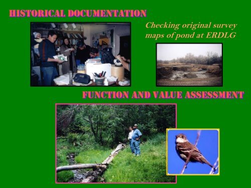
historical documentation Checking original survey maps of pond at ERDLG function and value assessment
- Page 1 and 2: new mexico wetlands and riparian ar
- Page 3 and 4: new mexico ecoregions Griffith and
- Page 5 and 6: new mexico wetlands types playa lak
- Page 7 and 8: elements of a watershed plan waters
- Page 9: elements of a wetlands action plan
- Page 13 and 14: impacts causing decline and disappe
- Page 15 and 16: elements of a wetlands action plan
- Page 17 and 18: planning for wetlands in the galist
- Page 19 and 20: planning in action! planning for we
- Page 21 and 22: estoration measures Headcut control
- Page 23: estoration techniques
- Page 27 and 28: stewart meadows master plan
- Page 29 and 30: El Restauro Wetland/Riparian Restor
- Page 31 and 32: El Restauro Phase 1 Demonstration
- Page 33 and 34: who gets selected to participate?
- Page 35 and 36: incentives for the watershed group
historical documentation<br />
Checking original survey<br />
maps of pond at ERDLG<br />
function and value assessment


