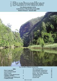
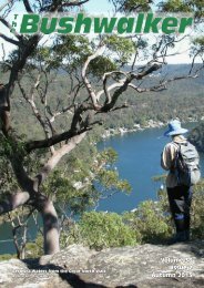
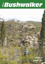
newcastle ramblers bushwalking club newsletter - Confederation of ...
newcastle ramblers bushwalking club newsletter - Confederation of ...
newcastle ramblers bushwalking club newsletter - Confederation of ...

You also want an ePaper? Increase the reach of your titles
YUMPU automatically turns print PDFs into web optimized ePapers that Google loves.
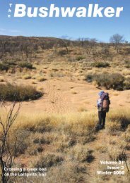
The Ascent <strong>of</strong> Mt Gower:<br />
One section at a time<br />
Recently a party <strong>of</strong> 26 Ramblers had a great holiday on<br />
beautiful Lord Howe Island. One <strong>of</strong> the many attractions <strong>of</strong><br />
this sub-tropical resort is the foreboding Mt Gower. At 875m<br />
above sea level, this is a sizable peak (technically a basalt<br />
remnant <strong>of</strong> a volcanic caldera) and is talked about as arguably<br />
one <strong>of</strong> the best climbs on the east coast. As group sizes<br />
were limited, we had planned for two groups to climb the<br />
mountain, the more experienced ones on Monday and the<br />
others on Wednesday.<br />
Now I don’t have any street cred as a mountain climber and I<br />
had a few misgivings firstly, whether I really wanted to climb<br />
it and secondly, whether I was up to the task. So I did the<br />
sensible thing: I asked around about what was involved and<br />
I prevaricated on coming to a decision.<br />
Hubby thought he was being very helpful, pointing out that<br />
the walk was only 8.5kms, and that while it was indeed 875m<br />
high, we had done many walks that had lots <strong>of</strong> uphills and<br />
down dales, which when added up were close to this, and<br />
that on the return journey it was in fact all downhill ! This all<br />
sounded very logical, but he hadn’t done the walk and did not<br />
really know what was entailed.<br />
Sure, but I was worried about the height thing — I am not the<br />
one in our house who climbs the extension ladder and paints<br />
the bargeboards and guttering!<br />
We went to see the tour lady, who said the guide (her son,<br />
Dean) would talk me through any sections that I was not comfortable<br />
with. So we paid our money and I was committed!<br />
Wednesday morning was overcast, but sunny with only a distant<br />
threat <strong>of</strong> rain. At 6.45am we were whisked <strong>of</strong>f by the Island<br />
shuttle bus to the trail head and met our muscular, very<br />
fit and unassuming guide, Dean. We signed the form taking<br />
full responsibility for our actions and collected our helmets.<br />
The initial stage <strong>of</strong> the walk was easy and at the end <strong>of</strong> the<br />
coastal strip Dean regrouped and told us about the forests<br />
that we’d be passing through. Then on the first steep section<br />
with thick ropes to aid the climb my heart began to race.<br />
At the top, we had a pause and my heart beat slowed — I<br />
was grateful for the stop. Dean gave another talk about the<br />
Island’s geology. I didn’t really listen I just ate a chocolate bar<br />
— I never eat chocolate but I thought ‘if ever I needed this, it<br />
is now’. Helmets on and we entered the breathtaking Lower<br />
Road, a half kilometre long narrow ledge with a clear and<br />
unimpeded 150m drop to the sea, but no worries there was a<br />
safety rope to cling to.<br />
So I kept listening in on briefings. The climb could only be<br />
done with an experienced, paid guide. Walkers were given<br />
safety helmets for one section. At one point there was a narrow<br />
ledge with a sheer drop to the sea but I was assured<br />
that the guide stood at this spot and would talk me through<br />
if I was out <strong>of</strong> my comfort zone. At many places there were<br />
safety ropes and in the steep parts there were climbing ropes<br />
to assist. The track was well defined, although there were no<br />
track markers. There were slippery sections and lots <strong>of</strong> tree<br />
roots, a good chance <strong>of</strong> rain, some exposed areas and the<br />
really steep knife-edge spurs had ropes to assist the climbers.<br />
Golly!<br />
After overnight rain, Monday came and the first group <strong>of</strong><br />
more experienced Ramblers set <strong>of</strong>f about 7am for their trip<br />
up the mountain. They came back much later than expected<br />
well after 6 pm, tired, muddy and exhausted. They variously<br />
said, ‘This was the hardest walk I have ever done’, there<br />
were ‘great views but we had a bit <strong>of</strong> rain and the track was<br />
quite slippery’ and ‘I slipped numerous times and came down<br />
many <strong>of</strong> the slopes on my bottom’ and ‘it was a great experience,<br />
but my knees are stuffed’ and ‘oh, where are my<br />
anti-inflammatory tablets’. The group was late because they<br />
were held up by ‘this 84 year old bloke who fell and needed<br />
assistance to descend and there was a teenage girl who<br />
could not cope with heights’. Another <strong>of</strong>f-putting aspect was<br />
that our dear ‘Marathon Man’, our veritable benchmark for fitness,<br />
was so knackered he skipped dinner and was not seen<br />
until the next day!<br />
Tuesday was fine and the forecast for Wednesday was almost<br />
favourable. The Monday warriors were vertical again,<br />
subdued but all cleaned up. Marathon Man had recovered<br />
and said it was the best walk he’d ever done and he was going<br />
to do it again on Wednesday! A friend who went with the<br />
Monday group felt it was within my capabilities and advised<br />
‘just take it one section at a time’.<br />
PAGE <br />
Another stop —and a muesli bar. Dean told us about the Island’s<br />
flora and fauna, and counselled that the next part was<br />
the toughest section <strong>of</strong> the ascent as we would climb steeply<br />
towards the saddle between Mt Lidgbird and Mt Gower. The<br />
track went through delightful rain forest dominated by Kentia<br />
palms and Banyan trees. Thick poly ropes were installed at<br />
the steeper sections so we were able to use our arm muscles<br />
to boost our leg power. The track led to a rest stop at pretty<br />
Erskine Creek where we were able to refill water bottles and,<br />
you guessed it — more chocolate.<br />
Dean explained that the track now climbed steeply to the<br />
saddle and up to a natural rock formation which had blocked<br />
the access <strong>of</strong> feral goats and pigs to the summit; consequently<br />
the flora <strong>of</strong> the summit was in pristine condition with<br />
many plant species that were endemic to the Island. Soon<br />
we reached a vantage point and could see straight over the<br />
nearby 777m Mt Lidgbird. In the distance were the coral