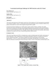
Riverside Badlands Tunnel, Inland Feeder Project - Jacobs Associates
Riverside Badlands Tunnel, Inland Feeder Project - Jacobs Associates
Riverside Badlands Tunnel, Inland Feeder Project - Jacobs Associates

You also want an ePaper? Increase the reach of your titles
YUMPU automatically turns print PDFs into web optimized ePapers that Google loves.
CHALLENGES BETWEEN CONCEPT AND COMPLETION 997<br />
Table 1.<br />
Summary of geologic reaches for tunnel<br />
Reach<br />
1 762<br />
(2,500 ft)<br />
2 823<br />
(2,700 ft)<br />
3 2,164<br />
(7,100 ft)<br />
4 1,372<br />
(4,500 ft)<br />
5 152<br />
(500 ft)<br />
6 2,012<br />
(6,600 ft)<br />
7 335<br />
(1,100 ft)<br />
8 2,988<br />
(9,800 ft)<br />
9 945<br />
(3,100 ft)<br />
10 1,159<br />
(3,800 ft)<br />
Length<br />
(m) Geologic Unit Primary Soil/Rock Types<br />
Alluvium<br />
San Timoteo<br />
Formation<br />
Metamorphic<br />
Rocks<br />
San Timoteo<br />
Formation<br />
Alluvium<br />
San Timoteo<br />
Formation<br />
Alluvium<br />
San Timoteo<br />
Formation<br />
Metamorphic<br />
Rocks<br />
San Timoteo<br />
Formation<br />
Clean, silty, and gravelly<br />
sand<br />
Natural Groundwater<br />
Head Range (m)<br />
0<br />
Sandstone, conglomerate 0 to 24<br />
(0 to 80 ft)<br />
Gneiss 24 to 100<br />
(80 to 330 ft)<br />
Sandstone, conglomerate 18 to 95<br />
(60 to 310 ft)<br />
Clean and silty sand, some<br />
silt and clay beds<br />
Sandstone, conglomerate,<br />
siltstone/claystone<br />
Clean and silty/clayey sand,<br />
some silt and clay beds<br />
Sandstone, siltstone/<br />
claystone, conglomerate<br />
15 to 20<br />
(50 to 65 ft)<br />
15 to 20<br />
(50 to 65 ft)<br />
14 to 20<br />
(45 to 65 ft)<br />
20 to 85<br />
(65 to 280 ft)<br />
Gneiss 46 to 55<br />
(150 to 180 ft)<br />
Sandstone, siltstone/<br />
claystone<br />
0 to 64<br />
(0 to 210 ft)<br />
Table 2.<br />
Feasible tunnel excavation methods<br />
Reaches Geologic Unit Drill-and-Blast Roadheader TBM<br />
Soft Ground<br />
Shield<br />
1,5,7 Alluvium X X<br />
2,4,6,8 San Timoteo Formation X X<br />
3,9 Metamorphic Rocks X X<br />
In addition, it was considered important to develop the Contract Documents in a way<br />
that would promote cost effective tunnel construction while also managing MWD’s risks.<br />
<strong>Tunnel</strong> Excavation Methods. Several excavation methods were determined to<br />
be feasible for the project, depending on the strength and character of the ground<br />
(Table 2). In order to provide flexibility and allow the use of different excavation<br />
methods in the various tunnel reaches, two intermediate shaft sites were made<br />
available, at the contractor’s option. These 36 and 45 m (120 and 150 ft) deep shafts<br />
were located in Live Oak and San Timoteo Canyons, respectively, near the third points<br />
of the tunnel (Figure 1). This gave the contractor the ability to mine the tunnel using up<br />
to four headings (i.e., both portals and the two shafts).<br />
Final <strong>Tunnel</strong> Lining. Due to water quality concerns, it was decided that a<br />
watertight lining was required to prevent groundwater infiltration into the tunnel. The<br />
static hydraulic grade line results in design hydrostatic pressures corresponding to<br />
about 58 to 73 m (190 to 240 ft) of head. In order to encourage competitive bids,<br />
designs for both welded steel pipe and reinforced concrete cylinder pipe were