Understanding Your Risks - Bureau of Homeland Security
Understanding Your Risks - Bureau of Homeland Security
Understanding Your Risks - Bureau of Homeland Security

Create successful ePaper yourself
Turn your PDF publications into a flip-book with our unique Google optimized e-Paper software.
Click to proceed to<br />
Table <strong>of</strong> Contents
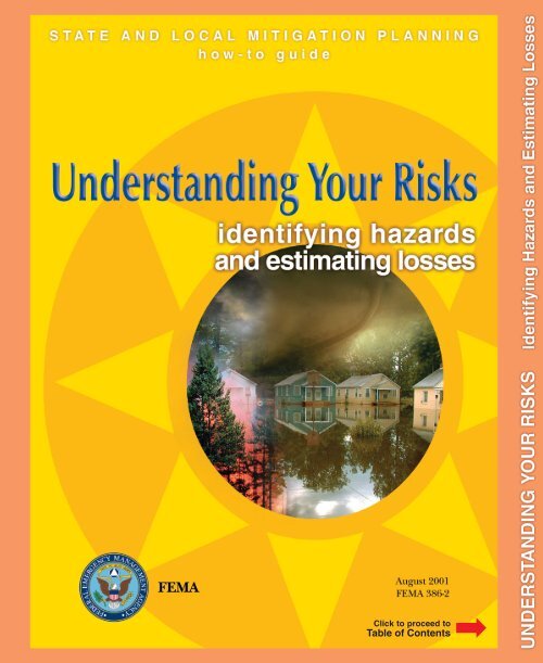
STATE AND LOCAL MITIGATION PLANNING<br />
how-to guide<br />
identifying hazards<br />
and estimating losses
Contents<br />
foreword<br />
i<br />
introduction<br />
iii<br />
STEP ONE identify hazards<br />
worksheet #1<br />
1-1<br />
1-2<br />
1<br />
STEP TWO pr<strong>of</strong>ile hazard events<br />
worksheet #2<br />
flood hazard pr<strong>of</strong>iles<br />
earthquake hazard pr<strong>of</strong>iles<br />
tsunami hazard pr<strong>of</strong>iles<br />
tornado hazard pr<strong>of</strong>iles<br />
coastal storm hazard pr<strong>of</strong>iles<br />
landslide hazard pr<strong>of</strong>iles<br />
wildfire hazard pr<strong>of</strong>iles<br />
2-1<br />
2-2<br />
2-10<br />
2-15<br />
2-18<br />
2-20<br />
2-22<br />
2-27<br />
2-29<br />
2<br />
STATE AND LOCAL MITIGATION PLANNING how-to guide: <strong>Understanding</strong> <strong>Your</strong> <strong>Risks</strong>
STEP THREE inventory assets<br />
worksheet #3a<br />
worksheet #3b<br />
flood hazard asset inventory<br />
earthquake hazard asset inventory<br />
tsunami hazard asset inventory<br />
tornado hazard asset inventory<br />
coastal storm hazard asset inventory<br />
landslide hazard asset inventory<br />
wildfire hazard asset inventory<br />
3-1<br />
3-2<br />
3-3<br />
3-16<br />
3-20<br />
3-23<br />
3-24<br />
3-26<br />
3-29<br />
3-30<br />
3<br />
STEP FOUR estimate losses<br />
worksheet #4<br />
flood hazard loss estimation<br />
earthquake hazard loss estimation<br />
tsunami hazard loss estimation<br />
tornado hazard loss estimation<br />
coastal storm loss estimation<br />
landslide hazard loss estimation<br />
wildfire hazard loss estimation<br />
afterword<br />
appendix a glossary<br />
appendix b library<br />
appendix c worksheets<br />
4-1<br />
4-2<br />
4-12<br />
4-16<br />
4-25<br />
4-27<br />
4-29<br />
4-34<br />
4-36<br />
a-1<br />
b-1<br />
c-1<br />
4<br />
Version 1.0 August 2001
the<br />
natural<br />
hazard<br />
mitigation<br />
planning<br />
process<br />
Natural hazard mitigation planning<br />
is the process <strong>of</strong> figuring out how to<br />
reduce or eliminate the loss <strong>of</strong> life<br />
and property damage resulting from<br />
natural hazards such as floods,<br />
earthquakes, and tornadoes. Four<br />
basic phases are described for the<br />
natural hazard mitigation planning<br />
process as shown in this diagram.<br />
For illustration purposes, this diagram<br />
portrays a process that appears<br />
to proceed in a single direction.<br />
However, the mitigation<br />
planning process is rarely a linear<br />
process. It is not unusual that ideas<br />
developed while assessing risks<br />
should need revision and additional<br />
information while developing the<br />
mitigation plan, or that implementing<br />
the plan may result in new goals<br />
or additional risk assessment.<br />
foreword<br />
STATE AND LOCAL MITIGATION PLANNING how-to guide: <strong>Understanding</strong> <strong>Your</strong> <strong>Risks</strong>
foreword<br />
The Federal Emergency Management Agency (FEMA) has<br />
developed this series <strong>of</strong> mitigation planning "how-to" guides to<br />
assist states, communities, and tribes in enhancing their natural<br />
hazard mitigation planning capabilities.<br />
These guides are designed to provide the type <strong>of</strong> information<br />
states and communities need to initiate and maintain a planning<br />
process that will result in safer communities. These guides are<br />
applicable to states and communities <strong>of</strong> various sizes and varying<br />
ranges <strong>of</strong> financial and technical resources.<br />
This how-to series is not intended to be the last word on any <strong>of</strong> the<br />
subject matter covered; rather, it is meant to be an easy to understand<br />
guide for the field practitioner. In practice, these guides may<br />
be supplemented with more extensive technical data and the use<br />
<strong>of</strong> experts if possible.<br />
The how-to guides cover the following topics:<br />
Getting started with the mitigation planning process<br />
including important considerations for how you can<br />
organize to develop a plan;<br />
Identifying hazards and assessing losses to your community<br />
and state;<br />
Setting mitigation priorities and goals for your community;<br />
Evaluating potential mitigation measures through the<br />
use <strong>of</strong> benefit-cost analysis and other techniques;<br />
Creating a mitigation plan and implementation strategy;<br />
Implementing the mitigation plan including project<br />
funding and revising the plan periodically as changes in<br />
the community occur; and<br />
Incorporating special circumstances in hazard mitigation<br />
planning for historic structures, among other<br />
topics.<br />
mit-i-gate\ 1: to cause to<br />
become less harsh or hostile;<br />
2: to make less severe<br />
or painful<br />
plan-ning\ : the act or process <strong>of</strong> making<br />
or carrying out plans; specif: the establishment<br />
<strong>of</strong> goals, policies and procedures<br />
for a social or economic unit<br />
The Disaster<br />
Mitigation Act <strong>of</strong><br />
2000<br />
The impetus for states and<br />
local governments to undertake natural<br />
hazard mitigation planning was given<br />
a significant boost on October 30, 2000,<br />
when the President signed the Disaster<br />
Mitigation Act <strong>of</strong> 2000 (Public Law<br />
106-390). The law encourages and rewards<br />
local and state pre-disaster planning,<br />
promotes sustainability as a strategy<br />
for disaster resistance, and is<br />
intended to integrate state and local<br />
planning with the aim <strong>of</strong> strengthening<br />
statewide mitigation planning. This new<br />
approach facilitates cooperation between<br />
state and local authorities,<br />
prompting them to work together. This<br />
enhanced planning network enables<br />
local, tribal, and state governments to<br />
articulate accurate and specific needs<br />
for mitigation, resulting in faster allocation<br />
<strong>of</strong> funding and more effective risk<br />
reduction projects.<br />
Version 1.0 August 2001<br />
i
Developing a successful<br />
natural hazard<br />
mitigation plan<br />
for your community depends<br />
on how well you understand<br />
the potential problems you face. This<br />
how-to guide is focused on the second<br />
phase <strong>of</strong> the natural hazard mitigation<br />
planning process and will help you estimate<br />
your losses from selected hazard<br />
events.<br />
Why should you spend the time to read<br />
these guides?<br />
It simply costs too much to address the effects <strong>of</strong><br />
natural disasters only after they happen;<br />
Neither communities nor their residents can be made<br />
whole by state and federal aid after disasters;<br />
You can prevent a surprising amount <strong>of</strong> damage from<br />
these hazards if you take the time to anticipate where<br />
and how these natural phenomena occur; and<br />
The most meaningful steps in avoiding the impacts <strong>of</strong><br />
natural hazards are taken at the state and local levels by<br />
<strong>of</strong>ficials and community members who have a personal<br />
stake in the outcome and/or the ability to follow<br />
through on a sustained program <strong>of</strong> planning and<br />
implementation.<br />
The guides focus on showing how mitigation planning:<br />
Can help your community become more sustainable<br />
and disaster-resistant through selecting the most appropriate<br />
mitigation measures, based on the knowledge<br />
you gain in the hazard identification and loss estimation<br />
process.<br />
Allows you to focus your efforts on the hazard areas that are<br />
most important to you by incorporating the concept <strong>of</strong><br />
determining and setting priorities.<br />
Can save you money by providing a forum for engaging<br />
in partnerships that could provide technical, financial,<br />
and/or staff resources in your effort to reduce the<br />
effects, and hence the costs, <strong>of</strong> natural hazards.<br />
ii<br />
Return to<br />
Table <strong>of</strong> Contents<br />
STATE AND LOCAL MITIGATION PLANNING how-to guide: <strong>Understanding</strong> <strong>Your</strong> <strong>Risks</strong><br />
Click to proceed to<br />
Introduction
introduction<br />
Risk assessment answers the fundamental question that fuels<br />
the natural hazard mitigation planning process: "What would<br />
happen if a natural hazard event occurred in your community or state?"<br />
Risk assessment is the process <strong>of</strong> measuring the potential loss <strong>of</strong><br />
life, personal injury, economic injury, and property damage resulting<br />
from natural hazards by assessing the vulnerability <strong>of</strong> people,<br />
buildings, and infrastructure to natural hazards.<br />
Risk assessment provides the foundation for the rest <strong>of</strong> the mitigation<br />
planning process. The risk assessment process focuses your<br />
attention on areas most in need by evaluating which populations<br />
and facilities are most vulnerable to natural hazards and to what<br />
extent injuries and damages may occur. It tells you:<br />
The hazards to which your state or community is<br />
susceptible;<br />
What these hazards can do to physical, social, and<br />
economic assets;<br />
Which areas are most vulnerable to damage from<br />
these hazards; and<br />
The resulting cost <strong>of</strong> damages or costs avoided<br />
through future mitigation projects.<br />
In addition to benefiting mitigation planning, risk assessment<br />
information also allows emergency management personnel to<br />
establish early response priorities by identifying potential hazards<br />
and vulnerable assets.<br />
The steps in this how-to guide describe some methods you may use<br />
to develop this information. Subsequent guides assist you in determining<br />
priorities for mitigation and in deciding which assets in<br />
your community or state should be protected.<br />
State and Local Risk Assessment<br />
Version 1.0 August 2001<br />
Risk assessment is a shared responsibility between states and local<br />
communities. Both states and communities should assess their risks<br />
from natural hazards as part <strong>of</strong> their respective planning processes.<br />
While local governments focus on the hazards, vulnerabilities, and<br />
risks on a local or regional scale, states should focus on the rehaz-ard\<br />
: a source <strong>of</strong><br />
danger<br />
vul-ner-a-bil-i-ty\ : open to<br />
attack or damage<br />
risk\ : possibility <strong>of</strong> loss or<br />
injury<br />
<strong>Understanding</strong> <strong>Your</strong> <strong>Risks</strong>:<br />
Identifying Hazards & Estimating<br />
Losses is part <strong>of</strong> a series<br />
<strong>of</strong> guides that will help you identify, plan,<br />
and evaluate measures that can reduce<br />
the impacts <strong>of</strong> natural hazards in your<br />
community or state through a comprehensive<br />
and orderly process known as<br />
Natural Hazard Mitigation Planning.<br />
As detailed in the Foreword, the process<br />
consists <strong>of</strong> four basic phases as shown<br />
below. The first phase consists <strong>of</strong> creating<br />
a mitigation planning team (referred<br />
to as the "Planning Team" in these<br />
guides) with representatives from the<br />
public and private sectors, citizen groups,<br />
colleges or universities, as well as nonpr<strong>of</strong>it<br />
agencies.<br />
This guide, <strong>Understanding</strong> <strong>Your</strong> <strong>Risks</strong>,<br />
addresses the second phase <strong>of</strong> the planning<br />
process. Guides dealing with the<br />
third and fourth phases, “Develop a Mitigation<br />
Plan” and “Implement the Plan<br />
and Monitor Progress”, discuss establishing<br />
goals and priorities, selecting mitigation<br />
projects, conducting benefit-cost<br />
analyses, and writing, implementing, and<br />
revisiting the mitigation plan.<br />
iii
gional and statewide implications <strong>of</strong> hazards. The risk assessment<br />
process introduced in this guide encourages the reciprocity <strong>of</strong><br />
information and support between states and local governments -<br />
states provide leadership and support to local communities, and<br />
local communities provide their states with local-level risk analyses.<br />
Through this exchange <strong>of</strong> information, statewide risk assessments<br />
based on detailed, local-level analysis are produced.<br />
States can provide leadership early on by establishing guidelines,<br />
setting expectations, and providing incentives for local risk assessment<br />
and mitigation planning activities. To support and facilitate<br />
the risk assessment process, states should be able to provide communities<br />
with technical assistance, basic hazard data, and access to<br />
a range <strong>of</strong> state agency technical resources. Key decisions must be<br />
made by states to ensure a level <strong>of</strong> consistency in local risk data to<br />
facilitate statewide analysis.<br />
As states gain a greater understanding <strong>of</strong> where the highest risks<br />
are across the state, they will be better prepared to decide where<br />
and how mitigation resources can be most effective. This information<br />
will become part <strong>of</strong> the state's mitigation plan, where mitigation<br />
priorities and criteria for those priorities are articulated.<br />
iv<br />
How do you use this guide?<br />
<strong>Understanding</strong> <strong>Your</strong> <strong>Risks</strong> provides detailed, step-by-step instructions<br />
on the procedures which are part <strong>of</strong> the Assessing <strong>Risks</strong> phase <strong>of</strong><br />
the Natural Hazard Mitigation Planning Process. The recommended<br />
steps in this guide, shown here, are organized into four<br />
simple steps to estimate losses from a single hazard event. More<br />
complex risk assessment processes use complicated statistical<br />
analysis <strong>of</strong> a wide range <strong>of</strong> past hazard events and geological,<br />
climatic and meteorological data to determine probable losses on<br />
an annual basis. The intent <strong>of</strong> this how-to guide is to help you<br />
develop a baseline estimate <strong>of</strong> possible losses throughout your<br />
community or state from one event.<br />
Losses, as used here, are represented as the monetary damage to<br />
structures and contents, interruption <strong>of</strong> services, and displacement<br />
<strong>of</strong> residents and businesses. The use <strong>of</strong> money as a measure <strong>of</strong> loss<br />
serves several purposes:<br />
It conveys the financial cost <strong>of</strong> a disaster to a community.<br />
It is important to note that there are other intangible<br />
losses that occur in a community such as losses <strong>of</strong><br />
historic or cultural integrity or damage to the environment<br />
that are difficult to quantify. Other costs, includ-<br />
STATE AND LOCAL MITIGATION PLANNING how-to guide: <strong>Understanding</strong> <strong>Your</strong> <strong>Risks</strong>
introduction<br />
ing response and recovery costs, are <strong>of</strong>ten unrecoverable<br />
(these costs are not addressed in this guide).<br />
It provides an explicit representation <strong>of</strong> what a community<br />
or state stands to lose in a disaster. This is<br />
useful for elected <strong>of</strong>ficials and other decision makers<br />
who will need to balance the costs <strong>of</strong> mitigation against<br />
the costs <strong>of</strong> damage.<br />
It provides comparable measurements <strong>of</strong> losses across<br />
different hazards or different parts <strong>of</strong> the community. It<br />
assists a community in determining which hazards or<br />
what parts <strong>of</strong> the community to focus on.<br />
It provides a dollar amount to use as part <strong>of</strong> a benefitcost<br />
analysis to be applied later (in subsequent how-to<br />
guides) in determining the cost-effectiveness <strong>of</strong> mitigation<br />
initiatives.<br />
After you have estimated losses using one hazard event, you may<br />
find it necessary to conduct a comprehensive risk assessment by<br />
assessing the full range <strong>of</strong> hazard events. The work you produce<br />
here will serve as a good foundation for this additional effort if the<br />
need arises but will be <strong>of</strong> immediate benefit in helping set priorities<br />
and identifying mitigation projects in the next phase <strong>of</strong> the<br />
planning process – “Develop a Mitigation Plan”.<br />
Multi-Hazard Guidance<br />
Where appropriate, this guide includes specific information to<br />
estimate losses for seven natural hazards, with a unique icon to<br />
identify each:<br />
Floods<br />
Earthquakes<br />
Tsunamis<br />
Tornadoes<br />
Version 1.0 August 2001<br />
Coastal Storms<br />
Landslides<br />
Wildfires<br />
Obviously, there are other hazards that can affect states and<br />
communities. While this guide does not provide specific direction<br />
for all hazards, the basic procedures explained here could<br />
be adapted for any natural hazard with variations that respond to<br />
Comprehensive<br />
Risk Assessment<br />
Later in the planning process<br />
(the third and fourth phases),<br />
you will have enough information to decide<br />
what mitigation actions you will pursue,<br />
and how they may be funded. Potential<br />
mitigation projects that will use<br />
federal funding require an analysis <strong>of</strong><br />
benefits and costs across a broad range<br />
<strong>of</strong> hazard events. If you plan to use federal<br />
funding, it may be necessary to<br />
conduct a comprehensive hazard pr<strong>of</strong>ile<br />
by considering all possible hazard<br />
events. For example, a devastating flood<br />
may occur every thousand years, however<br />
there’s also a chance <strong>of</strong> a minor<br />
level <strong>of</strong> flooding every year, although the<br />
depth will obviously be much less. The<br />
small annual floods may result in far<br />
more damage than one big flood that<br />
may only occur once a century. In a rigorous<br />
risk assessment or benefit-cost<br />
analysis, mathematical calculations are<br />
used to determine the expected damages<br />
from the whole range <strong>of</strong> possible<br />
flood events, or other hazards that could<br />
impact an area. This provides a more<br />
accurate and complete picture <strong>of</strong> risk<br />
(and the benefits <strong>of</strong> avoiding it) than the<br />
“single-point” method. The procedures<br />
for doing an analysis with FEMA benefit-cost<br />
analysis s<strong>of</strong>tware are simple<br />
and are discussed as part <strong>of</strong> the “howto”<br />
guide for the third phase <strong>of</strong> the planning<br />
process, “Develop a Mitigation<br />
Plan”.<br />
v
the peculiar nature <strong>of</strong> each hazard. For a more complete description<br />
<strong>of</strong> the range <strong>of</strong> natural hazards that can affect the<br />
United States, please see Multihazard Identification and Risk<br />
Assessment published by FEMA.<br />
State and Local Guidance<br />
This guide is focused on providing guidance to communities,<br />
tribes, and states. While much <strong>of</strong> the hazard identification and loss<br />
estimation process operates in a similar fashion for each level <strong>of</strong><br />
government, there are critical points where estimating losses for<br />
communities and tribes and states are different due to the differences<br />
in size. Therefore, throughout this document, guidance<br />
focused solely on the role <strong>of</strong> the “States“ is identified as a sidebar<br />
with this icon. Furthermore, guidance focussing on communities<br />
includes tribes as well.<br />
Types <strong>of</strong> Information<br />
In addition to helpful hints and useful information identified by<br />
the “Tips” icon, this guide also provides a number <strong>of</strong> options that<br />
can be used in situations where detailed information is not readily<br />
available.<br />
You should follow the main procedures outlined in this guide to<br />
produce your loss estimation. However, when you are unable to get<br />
desired information, such as the Flood Insurance Rate Map, or<br />
when a procedural shortcut may exist, the alternative method will<br />
be identified by the “Basic” icon.<br />
In addition to the alternative method, advanced information has<br />
also been provided and will be identified by the “Advanced” icon.<br />
This method can be used to refine your loss estimation to improve<br />
your results or when specialists may be needed.<br />
The “HAZUS” icon identifies suggestions for using the risk assessment<br />
tool, HAZUS (Hazards U.S.). In addition to estimating<br />
earthquake losses, HAZUS contains a database <strong>of</strong> economic,<br />
census, building stock, transportation facilities, local geology, and<br />
other information that can be used for a number <strong>of</strong> steps in the<br />
risk assessment process.<br />
Finally, the “Caution” icon will alert you to important information<br />
about the risk assessment process.<br />
vi<br />
STATE AND LOCAL MITIGATION PLANNING how-to guide: <strong>Understanding</strong> <strong>Your</strong> <strong>Risks</strong>
introduction<br />
Glossary<br />
The “Glossary” icon identifies terms and concepts that need<br />
further explanation. These and other common risk assessmentrelated<br />
terms and phrases are defined in the Glossary included in<br />
Appendix A.<br />
Library<br />
In addition, a risk assessment “Library” has been included in<br />
Appendix B. The library has a wealth <strong>of</strong> information, including<br />
Web addresses, reference books, street addresses, and phone<br />
numbers to help you conduct your loss estimation. Each <strong>of</strong> the<br />
Websites and references listed in this how-to guide are included in<br />
the library.<br />
Hazardville<br />
Applications <strong>of</strong> the various steps in the risk assessment process will<br />
be illustrated through a fictional community, the Town <strong>of</strong><br />
Hazardville. Hazardville, located in the State <strong>of</strong> Emergency, is on a<br />
quest to develop a natural hazard mitigation plan, which includes<br />
an estimate <strong>of</strong> potential losses. Hazardville is a small community<br />
with limited resources and multiple hazards. When we left<br />
Hazardville after the first phase <strong>of</strong> the planning process, “Organize<br />
Resources,” the town had just established its mitigation planning<br />
team, the Town <strong>of</strong> Hazardville Organization for Risk Reduction<br />
(THORR). Fictional newspaper accounts featuring the THORR<br />
will illustrate the various steps in the risk assessment process (see<br />
page xi).<br />
During the development<br />
<strong>of</strong> a mitigation<br />
plan, you will need to<br />
gather information and data<br />
from a number <strong>of</strong> sources.<br />
As with any effort <strong>of</strong> this type, it is important<br />
to be aware <strong>of</strong> how different authors<br />
use terms. The easiest way is to<br />
make sure you look for specific definitions<br />
within the source documents to<br />
be sure you understand the intended<br />
meaning.<br />
Please keep in mind<br />
that the World Wide Web is<br />
an ever-changing source <strong>of</strong><br />
information and that web addresses<br />
and the information<br />
they contain will change over<br />
time.<br />
Worksheets<br />
Finally, to help you obtain the information you need at each step<br />
<strong>of</strong> the process, worksheets have been developed to correspond<br />
with the structure <strong>of</strong> this guide. In each step, examples <strong>of</strong> the type<br />
<strong>of</strong> information to be included in these worksheets are shown. All<br />
<strong>of</strong> the worksheets have also been included in Appendix C at the<br />
end <strong>of</strong> this guide. You should photocopy these forms and record<br />
your progress as you undertake this risk assessment process. Alternatively,<br />
you may use the worksheets as templates with which to set<br />
up your own computer spreadsheets, databases, or other applications.<br />
Version 1.0 August 2001<br />
vii
Many Midwestern<br />
communities are located<br />
near the New Madrid<br />
fault, an area with a high<br />
seismic risk; however, most<br />
residents are not aware <strong>of</strong> this risk because<br />
the last significant earthquake<br />
occurred in the early 19th Century. In<br />
addition, many arid regions <strong>of</strong> the country<br />
face significant risk due to flooding,<br />
even though most <strong>of</strong> their watercourses<br />
are dry. When heavy rains occur in<br />
these areas, the storms can be very intense<br />
and cause flash floods on hillsides<br />
(alluvial fans) and in "dry" streambeds.<br />
Even within the<br />
same hazard event,<br />
there can be different types<br />
<strong>of</strong> impacts. Hurricanes can<br />
cause flooding due to torrential<br />
rains across broad coastal and inland<br />
areas. However, along the shoreline,<br />
hurricanes and other coastal<br />
storms can cause an increase in the<br />
mean sea level, called a "storm surge".<br />
As communities<br />
and states work together<br />
to generate statewide<br />
mitigation plans, many<br />
communities may want to<br />
update or revise their risk assessment<br />
to assess risks from several hazard<br />
events encompassing a range <strong>of</strong> intensities<br />
and/or frequencies or to determine<br />
future risks.<br />
Getting Started<br />
This guide will help you answer the following questions:<br />
What kinds <strong>of</strong> natural hazards can affect your state or community?<br />
What may have happened in the past that you should know about?<br />
Quite naturally, many people are only aware <strong>of</strong> the most obvious<br />
risks, usually as a result <strong>of</strong> a disaster that affected their community<br />
or state in the recent past such as a tornado, hurricane, or<br />
flood. In many cases, however, there are hazards most people are<br />
not aware <strong>of</strong> because they haven't affected the community or<br />
state during the lifetimes <strong>of</strong> current residents.<br />
Step 1 <strong>of</strong> this guide – Identify Hazards – helps explain how to determine<br />
which natural hazards can affect you.<br />
How bad can it get?<br />
How "big" is each hazard's potential impact? Will it affect every area the<br />
same or will certain areas get hit harder than others? How <strong>of</strong>ten will each<br />
type <strong>of</strong> hazard impact your community or state?<br />
It's important to know the location and amount <strong>of</strong> land area that<br />
may be affected by certain kinds <strong>of</strong> hazards. For example, there<br />
may be areas that can be affected repetitively by a hazard in one<br />
part <strong>of</strong> the community (such as floodplains adjacent to streams and<br />
rivers) or there may be potential community-wide impacts from<br />
events such as hurricanes or earthquakes. You should also note<br />
that a specific type <strong>of</strong> hazard can have varying effects on a community,<br />
depending on the severity <strong>of</strong> individual hazard events. For<br />
example, differences in the depth <strong>of</strong> floodwaters from discrete<br />
flood events will yield corresponding differences in the amount <strong>of</strong><br />
damages.<br />
Step 2 <strong>of</strong> this guide – Pr<strong>of</strong>ile Hazard Events – will help you determine how<br />
bad a hazard can get.<br />
What will be affected by these hazards?<br />
Are there buildings, roads, and/or other facilities in the community that<br />
will be damaged or destroyed by these hazards? Are there concentrations <strong>of</strong><br />
certain populations in hazard areas that are especially vulnerable, such as<br />
elderly or non-English speaking people?<br />
An inventory will help you identify the assets that can be damaged<br />
or affected by the hazard event. For detailed assessments, the<br />
inventory will also include information on special populations and<br />
viii<br />
STATE AND LOCAL MITIGATION PLANNING how-to guide: <strong>Understanding</strong> <strong>Your</strong> <strong>Risks</strong>
introduction<br />
building characteristics like size, replacement value, content<br />
value, and occupancy. In many cases, community assets may be<br />
vulnerable to more than one type <strong>of</strong> hazard, and you may need<br />
to look at different characteristics <strong>of</strong> the same asset to understand<br />
its vulnerability to each type <strong>of</strong> hazard. For example, if a<br />
building is subject to both floods and earthquakes, you will be<br />
interested in the location and elevation <strong>of</strong> the building so you<br />
can tell how much <strong>of</strong> its structure and contents will be damaged<br />
by flooding. You will also be interested in the construction <strong>of</strong> the<br />
building and its ability to resist physical damage caused by the<br />
anticipated ground movements during an earthquake.<br />
Step 3 <strong>of</strong> this guide – Inventory Assets – will help you determine where<br />
and/or to what extent these hazards will affect the assets <strong>of</strong> your community<br />
or state.<br />
How will these hazards affect you?<br />
What are the varying effects <strong>of</strong> different hazards on community assets? To<br />
what extent will assets be damaged by each hazard? If buildings and other<br />
structures are destroyed or damaged, how much will it cost to replace and/<br />
or repair them? If the contents <strong>of</strong> businesses and homes are also affected,<br />
how much cost would be added? If there are indirect effects, what is the<br />
accumulated cost <strong>of</strong> the losses?<br />
Hazards create direct damages, indirect effects, and secondary<br />
hazards to the community. Direct damages are caused immediately<br />
by the event itself, such as a bridge washing out during a flood.<br />
Indirect effects usually involve interruptions in asset operations<br />
and community functions, also called functional use. For example,<br />
when a bridge is closed due to a flood, traffic is delayed or rerouted,<br />
which then impacts individuals, businesses, and public<br />
services, like fire and police departments that depend on the<br />
bridge for transportation. Secondary hazards are caused by the<br />
initial hazard event, such as when an earthquake causes a tsunami,<br />
landslide, or dam break. While these are disasters in their own<br />
right, their consequent damages should be included in the damage<br />
calculations <strong>of</strong> the initial hazard event. <strong>Your</strong> loss estimations will<br />
include a determination <strong>of</strong> the extent <strong>of</strong> direct damages to property,<br />
indirect effects on functional use, and the damages from<br />
secondary hazards for each <strong>of</strong> the hazards that threaten your<br />
community or state.<br />
It is important to continually provide<br />
citizens with the information gained<br />
throughout the risk assessment process.<br />
This not only educates the community<br />
on their hazards and risks in an<br />
ongoing fashion, but facilitates wider involvement<br />
in the process. Holding public<br />
meetings to present the most recent<br />
findings after each major step in the risk<br />
assessment process allows the new<br />
information to be reviewed and validated.<br />
Making sure that media coverage<br />
<strong>of</strong> the process is regularly<br />
engaged is another<br />
technique for ensuring that<br />
no interested parties are left<br />
out <strong>of</strong> the process.<br />
Step 4 <strong>of</strong> this guide – Estimate Losses – will help you determine how<br />
hazards will affect your community or state.<br />
Version 1.0 August 2001<br />
ix
____<br />
Go to Step 1<br />
After you have read this Introduction and reconvened your Planning<br />
Team, go to Step 1. In Step 1, you will identify all <strong>of</strong> your<br />
potential hazards and determine which hazards are most prevalent<br />
in your community.<br />
____<br />
x<br />
STATE AND LOCAL MITIGATION PLANNING how-to guide: <strong>Understanding</strong> <strong>Your</strong> <strong>Risks</strong>
introduction<br />
The Hazardville Post<br />
Vol. CXI No. 65 Thursday, March 6, 2001<br />
Risky<br />
Business<br />
[Hazardville, EM] The<br />
Hazardville Town Council<br />
unanimously approved the<br />
creation <strong>of</strong> the Town <strong>of</strong><br />
Hazardville Organization for<br />
Risk Reduction (THORR) at<br />
a meeting last night. In anticipation<br />
<strong>of</strong> the move, Mayor<br />
McDonald nominated<br />
THORR members last month.<br />
The THORR members will<br />
work with town staff to identify<br />
natural hazards that could<br />
threaten Hazardville and estimate<br />
their losses from those<br />
hazards. This process is<br />
known as risk assessment. As<br />
reported previously in the<br />
Post, THORR will include a<br />
number <strong>of</strong> prominent community<br />
and business leaders.<br />
Starting next month, the Post<br />
will launch a series <strong>of</strong> articles<br />
covering THORR's work on<br />
the risk assessment process.<br />
Version 1.0 August 2001<br />
Return to<br />
Table <strong>of</strong> Contents<br />
Click to proceed to<br />
Step 1<br />
xi
step
identify<br />
hazards<br />
1<br />
Overview<br />
The first step in doing a risk assessment answers the question:<br />
What kinds <strong>of</strong> natural hazards can affect your planning area?<br />
In this step, you will simply identify all the natural hazards that<br />
might affect your community or state and then narrow your list to<br />
the hazards that are most likely to impact you.<br />
Bear in mind that although a hazard may not have affected you<br />
recently, it doesn't mean it won't in the future. You should look at<br />
the full range <strong>of</strong> potential hazards and assess whether they may<br />
affect the area you're including in your mitigation plan. While this<br />
might sound daunting, there is a relatively small list <strong>of</strong> hazards to<br />
consider.<br />
Remember that all subsequent steps in the Natural Hazard Mitigation<br />
Planning Process are built on the information gathered<br />
during risk assessment. As you proceed, remember to keep records<br />
<strong>of</strong> what you've found and where you’ve found it. <strong>Your</strong> records may<br />
include copies <strong>of</strong> documents or maps, notes on whom you talked<br />
to and when you talked to them, Website references, and so forth.<br />
You'll need these later in the loss estimations and in the rest <strong>of</strong> the<br />
mitigation planning processes. Use Worksheet #1: Identify the<br />
Hazards in Appendix C (see example on page 1-2) to keep track <strong>of</strong><br />
your research, and when you're finished with this step, you'll have<br />
a list <strong>of</strong> hazards that could affect your community or state.<br />
NOAA<br />
St. Louis tornado damage, May 27,<br />
1896.<br />
Remember, for now you<br />
are simply compiling information<br />
about what hazards<br />
affect your state or community,<br />
but later you will be assessing<br />
the risks they pose. It's a good<br />
idea to read through the whole guide<br />
before starting to gather information, so<br />
you can get everything you need from<br />
the various sources and not have to return<br />
later for additional data.<br />
Procedures & Techniques<br />
Task A. List the hazards that may occur.<br />
There is no one source for identifying which hazards may affect<br />
your state or community. However, the following techniques are<br />
methods that have worked for others and should at least provide<br />
you with a good starting point.<br />
1. Research newspapers and other historical records.<br />
These records will <strong>of</strong>ten contain dates, magnitudes <strong>of</strong> the events,<br />
damages, and further evidence <strong>of</strong> past natural disasters in your<br />
Version 1.0 August 2001<br />
1-1
Worksheet #1 Identify the Hazards step<br />
Date: March, 2001<br />
What kinds <strong>of</strong> natural hazards can affect you?<br />
Task A. List the hazards that may occur.<br />
1. Research newspapers and other historical records.<br />
2. Review existing plans and reports.<br />
3. Talk to the experts in your community, state, or<br />
region.<br />
4. Gather information on Internet Websites.<br />
5. Next to the hazard list below, put a check mark in<br />
the Task A boxes beside all hazards that may occur<br />
in your community or state.<br />
Task B. Focus on the most prevalent hazards in your<br />
community or state.<br />
1. Go to hazard Websites.<br />
2. Locate your community or state on the Website map.<br />
3. Determine whether you are in a high-risk area. Get more<br />
localized information if necessary.<br />
4. Next to the hazard list below, put a check mark in the<br />
Task B boxes beside all hazards that pose a significant<br />
threat.<br />
Avalanche<br />
Coastal Erosion<br />
Coastal Storm<br />
Dam Failure<br />
Drought<br />
Earthquake<br />
Expansive Soils<br />
Extreme Heat<br />
Flood<br />
Hailstorm<br />
Hurricane<br />
Land Subsidence<br />
Landslide<br />
Severe Winter Storm<br />
Tornado<br />
Tsunami<br />
Volcano<br />
Wildfire<br />
Windstorm<br />
Other____________<br />
Other____________<br />
Task A<br />
<br />
<br />
<br />
<br />
<br />
<br />
<br />
<br />
<br />
<br />
<br />
Task B<br />
<br />
<br />
<br />
<br />
<br />
<br />
<br />
Other____________<br />
Note: Bolded hazards are addressed in<br />
this How-To Guide.<br />
Use this space to record information you find for each <strong>of</strong> the hazards you will be<br />
researching. Attach additional pages as necessary.<br />
Hazard or Event Description<br />
(type <strong>of</strong> hazard, date <strong>of</strong> event, number <strong>of</strong><br />
injuries, cost and types <strong>of</strong> damage, etc.)<br />
Flood - June 1936. 500-year flood. One<br />
death, some corn & crop losses.<br />
Hurricane Camille - Nov. 1969. One death.<br />
Flooding & wind caused $1.5 million in<br />
damages.<br />
Severe storm caused flooding & landslides -<br />
May 1973. $2 million in damages.<br />
Severe storm & tornadoes - April 1980.<br />
Wind & flash floods caused $1.5 million in<br />
damages.<br />
Wildfires - April 1981.<br />
1,050 acres burned.<br />
Source <strong>of</strong><br />
Information<br />
• Members <strong>of</strong><br />
community<br />
• Newspaper<br />
• Floodplain<br />
manager<br />
• Newspaper<br />
• Internet<br />
research<br />
• Newspaper<br />
• State<br />
geologist<br />
• Newspaper<br />
• Newspaper<br />
• State fire<br />
marshal<br />
Map<br />
Available<br />
for this<br />
Hazard?<br />
Scale <strong>of</strong><br />
Map<br />
FIRM 1 : 6000<br />
FIRM &<br />
storm<br />
surge map<br />
Topographic<br />
&<br />
soils maps<br />
No<br />
Topographic<br />
USDA &<br />
fuel model<br />
maps.<br />
1 : 6000<br />
1 : 6000<br />
1 : 24000<br />
1 : 24000<br />
1-2<br />
STATE AND LOCAL MITIGATION PLANNING how-to guide: <strong>Understanding</strong> <strong>Your</strong> <strong>Risks</strong>
identify hazards<br />
1<br />
community or state. A public library may also have documentation<br />
on these events in the "local history" section. Local historical<br />
societies may also be good sources <strong>of</strong> information.<br />
2. Review existing plans and reports.<br />
The preceding techniques are focused on local sources <strong>of</strong> information<br />
that will likely provide a good start to the process. However, to<br />
ensure you are covering all <strong>of</strong> the possible hazards, you will want to<br />
broaden the contacts you make. There are many types <strong>of</strong> plans and<br />
documents that may have information on natural hazards in your<br />
community or state. Many states will already have mitigation plans,<br />
hazard identification reports, and/or risk assessment reports. State<br />
transportation, environmental, dam, or public works reports or<br />
plans may also contain relevant information. Although these may<br />
not contain a lot <strong>of</strong> details about local hazard conditions, they<br />
<strong>of</strong>fer a good starting point for communities, and using them<br />
improves consistency among communities within the state. Review<br />
the plans for a list <strong>of</strong> hazards that can occur in the state or for a list<br />
<strong>of</strong> disasters that have occurred in the past.<br />
Local comprehensive plans, land use plans, capital improvement<br />
plans, as well as building codes, land development regulations, and<br />
flood ordinances may contain hazard provisions that indicate the<br />
presence <strong>of</strong> local hazards. You should review these to determine<br />
whether a local hazard exists.<br />
3. Talk to the experts in your community, state, or region.<br />
There are many sources <strong>of</strong> hazard information in government,<br />
academia, and the private sector. Many local floodplain managers,<br />
departments <strong>of</strong> public works, engineering, planning and zoning,<br />
and transportation departments maintain information about<br />
natural hazards. Those who would have been involved with past<br />
natural hazard events such as the police and fire departments or<br />
the local emergency management staff are also excellent sources<br />
<strong>of</strong> information on past hazard events. Furthermore, state agencies,<br />
including water or natural resources, geological survey, and emergency<br />
management will have detailed knowledge about the nature<br />
and extent <strong>of</strong> hazards in your state. University departments, including<br />
planning, landscape architecture, geography, and engineering<br />
may already have hazard maps or can help you obtain them. Many<br />
local businesses that provide hazard related services might be<br />
willing to assist you.<br />
<strong>Your</strong> best source <strong>of</strong> hazard information will <strong>of</strong>ten be your state.<br />
The State Hazard Mitigation Officer (SHMO) will know what<br />
hazards affect your state, and is also a good source for suggestions<br />
Version 1.0 August 2001<br />
The information you<br />
discover in the newspapers<br />
and on the Internet will<br />
help you when you talk to<br />
hazard experts in your community.<br />
It will provide you with technical<br />
terms and general factual information<br />
about the various hazards, in addition<br />
to helping you identify the appropriate<br />
experts to contact.<br />
State emergency<br />
management departments<br />
are sometimes<br />
housed in larger agencies<br />
such as state police,<br />
military, or public safety.<br />
1-3
Research past Presidentially<br />
declared disasters, as<br />
well as non-declared severe<br />
events that have occurred in<br />
your state and in other states<br />
within your region. You should inquire<br />
into the types <strong>of</strong> hazards that have occurred<br />
in the adjoining states as well.<br />
Communicate this information to your<br />
communities.<br />
Search database or computerized<br />
archives with the<br />
following list <strong>of</strong> hazards as<br />
keywords. Narrow the search<br />
by using the name <strong>of</strong> your<br />
community, state, or surrounding states<br />
as keywords (the following list not meant<br />
to cover all known natural hazards).<br />
Avalanche<br />
Coastal Erosion<br />
Coastal Storm<br />
Dam Failure<br />
Debris Flow<br />
Drought<br />
Earthquake<br />
Expansive Soils<br />
Extreme Heat<br />
Flood<br />
Hailstorm<br />
Hurricane<br />
Land Subsidence<br />
Landslide<br />
Severe Winter Storm<br />
Tornado<br />
Tsunami<br />
Volcano<br />
Wildfire<br />
Windstorm<br />
about where to go for more detailed information. Bear in mind<br />
that the SHMO may not have specific information about the<br />
hazards that affect a particular community but will probably be<br />
knowledgeable about your area <strong>of</strong> the state and will <strong>of</strong>ten be able<br />
to suggest other people to talk to or additional resources.<br />
4. Gather information on Internet Websites.<br />
The library at the end <strong>of</strong> this guide lists many such sites. These<br />
may be hazard-specific sites that provide general information about<br />
why particular hazard events happen, what the probabilities <strong>of</strong><br />
occurrence are, and how hazards are measured. Other Websites<br />
will have state-specific, or even site-specific information about the<br />
hazards in a particular area and about the characteristics <strong>of</strong> the<br />
hazards, such as the probability, history <strong>of</strong> events, and expected<br />
severity.<br />
Task B. Focus on the most prevalent hazards in your<br />
community or state.<br />
If your preliminary research reveals that your community or state<br />
has been affected by a particular hazard or that experts consider<br />
your area to be threatened by that hazard, you will concentrate<br />
further research on it in later steps.<br />
If your planning area has not experienced a hazard event in recent<br />
memory but one <strong>of</strong> the sources indicates it is a possibility, it may be<br />
worth a little extra effort to confirm that a particular hazard type is<br />
relevant.<br />
1. Go to the indicated Websites for the seven major hazards to<br />
help you determine whether your community or state can be<br />
affected by the hazard.<br />
2. Locate the approximate location <strong>of</strong> your community or state<br />
on the Website map.<br />
3. Examine the map to determine whether you are located in a<br />
high-risk area for that hazard and to determine the chance it<br />
will occur in your planning area. You may need to get more<br />
localized information for some <strong>of</strong> the hazards.<br />
4. You may find that you can delete some hazards from your list<br />
at this time; however, if you are unsure or uncomfortable with<br />
the chance <strong>of</strong> the hazard occurring, it's better to keep all<br />
potential hazards on the list, until you are certain that it is<br />
appropriate to remove it.<br />
1-4<br />
STATE AND LOCAL MITIGATION PLANNING how-to guide: <strong>Understanding</strong> <strong>Your</strong> <strong>Risks</strong>
identify hazards<br />
1<br />
The Hazardville Post<br />
Vol. CXI No. 100 Thursday, April 10, 2001<br />
The Organization for Risk Reduction Seeks Danger<br />
(Part 1 <strong>of</strong> a 4 Part Series on the Risk Assessment Process)<br />
[Hazardville, EM] The Town <strong>of</strong><br />
Hazardville Organization for Risk Reduction<br />
(THORR) is on a mission to find<br />
out about the natural hazards that<br />
threaten Hazardville. The task force, appointed<br />
by Mayor McDonald, will develop<br />
a hazard mitigation strategy to reduce<br />
the town's vulnerability to natural<br />
hazards such as floods, hurricanes, and<br />
earthquakes. While the process <strong>of</strong> researching<br />
the town's potential hazards<br />
is not exactly fraught with danger, "the<br />
task force is using a lot <strong>of</strong> different resources<br />
to discover the past and possibly<br />
future impacts from hazards," said<br />
Joe Norris, the task force lead planner.<br />
THORR began researching past impacts<br />
from hazards simply by talking to<br />
people in the community. "You'd be surprised<br />
just how much information<br />
people know and remember about the<br />
disasters from years ago," said Norris.<br />
"We visited an elderly man who lives<br />
near Raging River who vividly recalled<br />
the Flood <strong>of</strong> 1936. While there was not<br />
much <strong>of</strong> a human toll because the Raging<br />
River area was largely rural, agricultural,<br />
and forested at the time, this<br />
man recalled that the fast-moving waters<br />
were apparently quite deep." Norris<br />
noted that a search <strong>of</strong> local newspaper<br />
archives confirmed the flood, as did a<br />
conversation with the Floodplain Manager.<br />
"She said that the flood was estimated<br />
to be a 500-year event - something<br />
that has only a 0.2% chance <strong>of</strong> happening<br />
annually."<br />
Another resource the task force has<br />
tapped is the State Hazard Mitigation Officer<br />
(SHMO). The SHMO provided<br />
THORR with a copy <strong>of</strong> the state hazard<br />
mitigation plan, which discussed past disasters<br />
that have<br />
occurred in the<br />
State <strong>of</strong> Emergency.<br />
THORR<br />
has found the<br />
document to be<br />
useful in describing<br />
the likelihood<br />
that certain hazard<br />
events will<br />
occur in Emergency.<br />
An even<br />
more valuable resource<br />
provided<br />
by the SHMO has<br />
been contact with<br />
various hazard<br />
experts in state<br />
government.<br />
"They're free!"<br />
laughed Norris,<br />
alluding to a concern<br />
expressed<br />
by the Town<br />
Council that a<br />
risk assessment<br />
may be an expensive<br />
endeavor.<br />
DATE<br />
November<br />
7, 1969*<br />
April<br />
9, 1970<br />
Norris remarked that THORR has<br />
found the State Geologist to be especially<br />
helpful in furnishing information<br />
on earthquakes and landslides. According<br />
to the State Geologist, Hazardville<br />
sits squarely in the middle <strong>of</strong> an earthquake<br />
zone, about 100 miles from the<br />
New Temptfate fault. "I know we've experienced<br />
a few tremors over the years,<br />
even some collapsed chimneys from one<br />
<strong>of</strong> the stronger tremors, but I had no idea<br />
the potential for stronger earthquakes<br />
existed in Hazardville."<br />
TYPE OF INCIDENT<br />
Hurricane Camille<br />
Heavy Rain, Tornadoes, Flooding<br />
M arch 27, 1973 Earthquake Tremors (<strong>of</strong>fshore)<br />
May<br />
29, 1973*<br />
October<br />
2, 1975<br />
April<br />
9, 1977*<br />
March-October,<br />
1977<br />
March<br />
17, 1979*<br />
April<br />
18, 1979*<br />
April<br />
20, 1980*<br />
April<br />
10, 1981*<br />
May<br />
11, 1984<br />
September<br />
7, 1985*<br />
March<br />
21, 1990<br />
January<br />
4, 1991<br />
March<br />
3, 1994*<br />
July<br />
8, 1994*<br />
April<br />
21, 1995<br />
March<br />
20, 1996*<br />
Severe Storms, Landslides, Flooding<br />
Severe Storms, Tornadoes, Flooding<br />
Landslides, Flooding<br />
Drought<br />
Wildfire<br />
Storms, Wind, Flooding<br />
Severe Storms, Tornadoes, Flooding<br />
Wildfire<br />
Earthquake Tremor s<br />
Hurricane Elena<br />
Severe Storms, Tornadoes, Flooding<br />
Severe Storms. Flooding<br />
Severe Winter Storms, Freezing, Flooding<br />
Offshore Earthquake, Tsunami<br />
Severe Storms, Landslides, Flooding<br />
Severe Storms, Landslides, Flooding<br />
A pril 29, 1998* Flooding (Tropical Storm Zoe)<br />
September<br />
15, 1999*<br />
November<br />
10, 1999<br />
Wildfire<br />
Earthquake, Aftershock s<br />
* State or Presidentially declared disaster<br />
Through its research, THORR has<br />
uncovered information on many large<br />
and small hazard events. In fact, on 13<br />
occasions from 1969 to 1999, these<br />
events have met the criteria to be state<br />
or federally declared disasters. The list<br />
<strong>of</strong> events THORR has researched appears<br />
above.<br />
When asked what the next steps are<br />
for THORR, Norris responded,<br />
"THORR will continue to research these<br />
hazards. The more information we have,<br />
the better our risk assessment will be."<br />
Version 1.0 August 2001<br />
1-5
Floods<br />
Floods are the most prevalent<br />
hazard in the United States. This<br />
map illustrates where there have<br />
been past Presidential declarations<br />
for flood events. FEMA has prepared<br />
Flood Insurance Studies<br />
(FIS) for floodprone communities.<br />
These FISs contain information<br />
on local flood history, local<br />
flood problems, and other flood<br />
studies that have been prepared<br />
for the community.<br />
FEMA has also created Flood<br />
Insurance Rate Maps (FIRM) for<br />
more than 19,000 communities in<br />
the country as a part <strong>of</strong> the FIS. In<br />
addition to the 100-year floodplain,<br />
which is the area <strong>of</strong> the<br />
community with a 1% chance <strong>of</strong><br />
flooding in any given year, the<br />
FIRM also illustrates coastal high<br />
hazard areas, the floodway, and<br />
the 500-year floodplain, which is<br />
the area <strong>of</strong> the community with a<br />
0.2% chance <strong>of</strong> flooding in any<br />
given year.<br />
Digital Quality Level 3 flood data<br />
(Q3) are available for 1,200<br />
counties in CD-ROM format from<br />
FEMA. A list <strong>of</strong> counties is available<br />
at http://msc.fema.gov/MSC/<br />
statemap.htm The digital Q3 flood<br />
data are a digital representation <strong>of</strong><br />
certain features on FIRMs and can<br />
also be viewed in HAZUS.<br />
Source: FEMA<br />
Source: http://www.esri.com/hazards/<br />
1 Review your FIRM or Q3 to identify areas prone to flooding. Alternatively, go to<br />
www.esri.com/hazards to conduct a preliminary identification <strong>of</strong> flood hazards using<br />
digital Q3 flood data available online.<br />
2 Go to Step 2 for information on acquiring flood maps and on pr<strong>of</strong>iling your flood hazard.<br />
1-6<br />
STATE AND LOCAL MITIGATION PLANNING how-to guide: <strong>Understanding</strong> <strong>Your</strong> <strong>Risks</strong>
identify hazards<br />
1<br />
Earthquakes<br />
1 Go to the http://<br />
geohazards.cr.usgs.gov/eq/<br />
pubmaps/US.pga.050.map.<br />
gif Website to determine<br />
whether you are located in<br />
an earthquake hazard zone.<br />
2 Find the approximate location<br />
<strong>of</strong> your community or<br />
state on the seismic hazard<br />
map.<br />
Source: http://geohazards.cr.usgs.gov/eq/pubmaps/US.pga.050.map.gif<br />
3 If you are located in an area<br />
with 2%g (peak acceleration)<br />
or less, then you have a<br />
relatively low seismic risk and<br />
can probably avoid conducting<br />
an earthquake risk<br />
assessment at this time.<br />
However, you should confirm<br />
your findings with your state<br />
geologist or emergency<br />
manager.<br />
4 If you are located in an area<br />
with 3% g peak acceleration<br />
or more, then you should<br />
proceed to Step 2 to pr<strong>of</strong>ile<br />
your earthquake hazard.<br />
Version 1.0 August 2001<br />
1-7
Tsunamis<br />
1 Go to the http://www.pmel.<br />
noaa.gov/~bernard/senatec.<br />
html Website. This page will<br />
show population centers on<br />
the West Coast <strong>of</strong> the<br />
United States that are at risk<br />
<strong>of</strong> tsunamis.<br />
2 Find the approximate<br />
location <strong>of</strong> your community<br />
or state on the tsunami map.<br />
3 If you are not located on the<br />
West Coast, a Pacific Island,<br />
or a Caribbean Island*, then<br />
you have a relatively low<br />
tsunami risk and can probably<br />
avoid conducting a<br />
tsunami risk assessment at<br />
this time. However, you<br />
should confirm your findings<br />
with your state geologist or<br />
emergency manager.<br />
Source: http://www.pmel.noaa.gov/~bernard/senatec.html<br />
4 If you are located in communities<br />
along the shoreline,<br />
along coastal estuaries, or<br />
along rivers affected by tides<br />
in Alaska, Washington,<br />
Oregon, California, Hawaii,<br />
or Puerto Rico, then you<br />
should proceed to Step 2 to<br />
pr<strong>of</strong>ile your tsunami hazard.<br />
*NOTE:<br />
Recent findings indicate that tsunamis are also possible along the Atlantic Ocean<br />
coastal areas <strong>of</strong> Virginia and North Carolina. As more information become available,<br />
these areas may also wish to include tsunamis in their risk assessment.<br />
1-8<br />
STATE AND LOCAL MITIGATION PLANNING how-to guide: <strong>Understanding</strong> <strong>Your</strong> <strong>Risks</strong>
identify hazards<br />
1<br />
Tornadoes<br />
1 Go to the http://www.fema.<br />
gov/graphics/library/wmap.gif<br />
Website. This page shows the<br />
wind zones throughout the<br />
United States. These wind<br />
zones are based on historical<br />
information on tornadoes<br />
and hurricanes. The map<br />
below illustrates areas where<br />
Presidential declarations<br />
have been issued for tornadoes<br />
in the past.<br />
2 Locate your community or<br />
state on the US Wind Zone<br />
map.<br />
Source: hhttp://www.fema.gov/graphics/library/wmap.gif<br />
3 If you are not located in<br />
one <strong>of</strong> the four colored<br />
zones or special wind<br />
regions on the map<br />
above, you can probably<br />
avoid conducting a<br />
tornado risk assessment<br />
at this time. However,<br />
you should confirm your<br />
findings with your state<br />
meteorologist or emergency<br />
manager.<br />
Source: FEMA<br />
4 If you are located in one<br />
<strong>of</strong> the four colored zones<br />
or special wind regions<br />
on the map above, then<br />
you should proceed to<br />
Step 2 to pr<strong>of</strong>ile your<br />
tornado hazard.<br />
Version 1.0 August 2001<br />
1-9
Coastal Storms<br />
1 Go to the http://www.aoml.<br />
noaa.gov/hrd/tcfaq/tcfaqG.<br />
html#G12 Website. This page<br />
illustrates the probabilities <strong>of</strong><br />
a named storm for the<br />
Atlantic Seaboard and the<br />
Gulf <strong>of</strong> Mexico. The map<br />
below illustrates where<br />
Presidential declarations<br />
have been issued for past<br />
hurricanes.<br />
2 Locate your community or<br />
state on the coastal storm<br />
probability map.<br />
3 If you are not located in a<br />
coastal storm probability<br />
zone you can probably avoid<br />
conducting a coastal storm<br />
risk assessment at this time.<br />
However, you should confirm<br />
your findings with your state<br />
coastal zone manager or<br />
floodplain manager.<br />
Source: http://www.aoml.noaa.gov/hrd/tcfaq/tcfaqG.html#G12<br />
4 If you are located in a coastal<br />
storm probability zone, then<br />
you should proceed to Step 2<br />
to pr<strong>of</strong>ile your coastal storm<br />
hazard.<br />
Source: FEMA<br />
1-10<br />
STATE AND LOCAL MITIGATION PLANNING how-to guide: <strong>Understanding</strong> <strong>Your</strong> <strong>Risks</strong>
identify hazards<br />
1<br />
Landslides<br />
1 Go to the http://landslides.<br />
usgs.gov/html_files/<br />
landslides/nationalmap/<br />
national.html Website. This<br />
page illustrates large-scale<br />
landslide risk areas.<br />
Source: http://landslides.usgs.gov/html_files/landslides/nationalmap/national.html<br />
2 Locate your community or<br />
state on the landslide hazard<br />
map. The Website listed<br />
above allows you to zoom in<br />
to different regions for a<br />
closer look at the landslide<br />
risk. While this map gives a<br />
broad indication <strong>of</strong> largescale<br />
risk at a national scale,<br />
it is important to know that<br />
landslides should be evaluated<br />
at a local scale. The<br />
map shown above is not<br />
suitable for small-scale,<br />
community-level hazard<br />
identification.<br />
3 You should discuss landslide<br />
potential with your state<br />
geologist, who can be found<br />
at http://www.kgs.ukans.<br />
edu/AASG, and with your<br />
local public works director.<br />
4 If either your state geologist<br />
or local public works director<br />
indicates a landslide risk in<br />
your community or state, you<br />
should proceed to Step 2.<br />
Version 1.0 August 2001<br />
1-11
Wildfires<br />
1 Go to the http://www.fs.fed.<br />
us/land/wfas/fd_class.gif<br />
Website. This page illustrates<br />
the current fire danger<br />
conditions and changes daily<br />
based on current and past<br />
weather, fuel types, and fuel<br />
moisture. The map below<br />
illustrates where Presidential<br />
declarations have been<br />
issued for forest fires in the<br />
past.<br />
2 Locate your community or<br />
state on the fire danger map.<br />
3 If you are located in or near<br />
a low to moderate fire<br />
danger class and not located<br />
Source: http://www.fs.fed.us/land/wfas/fd_class.gif<br />
near forest, grasslands, or<br />
dense wooded areas then you have a relatively low wildfire risk and probably can avoid conducting<br />
a wildfire risk assessment at this time. However, you should confirm your findings with your state<br />
fire marshal, forestry department, natural resources department or park service.<br />
4 If you are located in or near a<br />
dense woodland, forest or<br />
grassland area, or have a high<br />
to extreme fire danger class,<br />
have experienced a prolonged<br />
dry period, or have<br />
experienced past wildfires,<br />
you should proceed to Step 2<br />
to pr<strong>of</strong>ile your wildfire<br />
hazard.<br />
Source: FEMA<br />
1-12<br />
STATE AND LOCAL MITIGATION PLANNING how-to guide: <strong>Understanding</strong> <strong>Your</strong> <strong>Risks</strong>
identify hazards<br />
1<br />
Summary<br />
When you're finished with Step 1, you'll have a list <strong>of</strong> hazards that<br />
could affect your community or state. At this point, it isn't necessary<br />
to know anything specific about the hazards except that they<br />
are likely to occur.<br />
You will also have a list <strong>of</strong> plans, reports, Websites, articles, and<br />
other resources that can help you later in the process as you<br />
determine how these hazards can affect your community.<br />
Through your research, you will begin to foster relationships with<br />
experts in the state and local community. This network will continue<br />
to be <strong>of</strong> use to the Planning Team as you continue to analyze<br />
the effects <strong>of</strong> the hazards, and throughout the planning process.<br />
Keep your research<br />
handy because after your<br />
risk assessment is complete,<br />
you will use this information<br />
to help complete your hazard mitigation<br />
plan as part <strong>of</strong> the third phase in<br />
the Natural Hazard Mitigation Planning<br />
Process.<br />
____<br />
After you have identified all <strong>of</strong> your hazards and determined which<br />
hazards are most prevalent in your community or state<br />
Go to Step 2<br />
to use the information you have gathered to develop hazard<br />
pr<strong>of</strong>iles.<br />
____<br />
Version 1.0 August 2001<br />
Return to<br />
Table <strong>of</strong> Contents<br />
Click to proceed to<br />
Step 2<br />
1-13
step
Overview<br />
With a list <strong>of</strong> potential hazards in hand from Step 1, the<br />
next step is to develop hazard event pr<strong>of</strong>iles, which answers<br />
the question: How bad can it get?<br />
The information gathered in this step will help determine the assets<br />
in the hazard areas you will inventory in Step 3.<br />
Each hazard type has unique characteristics that can impact your<br />
community or state. For example, an earthquake causes ground<br />
shaking that will affect a community much differently than the<br />
wind <strong>of</strong> a tornado. In addition, a given hazard type can produce<br />
different effects depending on its magnitude, duration, or intensity.<br />
For example, no two wildfires will impact a community in the same<br />
way twice because the wildfire is driven by distinct wind and fuel<br />
conditions, which can change very rapidly. Furthermore, the same<br />
hazard events will affect different communities in different ways,<br />
based on geography, development, population distribution, age <strong>of</strong><br />
buildings, etc. A hazard event is a specific occurrence <strong>of</strong> a particular<br />
type <strong>of</strong> hazard.<br />
For these reasons, the information you gather for each <strong>of</strong> your<br />
hazard event pr<strong>of</strong>iles will reflect these different characteristics.<br />
Some hazards, such as floods, coastal storms, wildfires, tsunamis, and<br />
landslides will be pr<strong>of</strong>iled by mapping the geographic extent <strong>of</strong><br />
identifiable hazard events because they occur in predictable areas <strong>of</strong><br />
the community or state. Once the extent <strong>of</strong> these events is mapped<br />
you will be able to determine which portion <strong>of</strong> your community or<br />
state is vulnerable in Step 3 and begin taking inventory <strong>of</strong> the<br />
elements that can be damaged. Other hazards, such as tornadoes<br />
(which can occur anywhere), may be pr<strong>of</strong>iled simply by recording<br />
the maximum potential wind speed. This type <strong>of</strong> information will be<br />
used in Step 4 to evaluate the potential impact to individual structures<br />
or elements in your jurisdiction.<br />
This step is structured to explain the basic procedures and techniques<br />
for pr<strong>of</strong>iling hazard events. It then instructs you on how to<br />
gather specific hazard event pr<strong>of</strong>ile information. Use Worksheet #2:<br />
Pr<strong>of</strong>ile Hazard Events in Appendix C (see example on page 2-2) to<br />
help you record and keep track <strong>of</strong> your results.<br />
Version 1.0 August 2001<br />
pr<strong>of</strong>ile<br />
hazard<br />
events<br />
2<br />
Lee County, Georgia during the 1995<br />
Spring floods.<br />
The glossary in Appendix<br />
A explains the relationship<br />
between a hazard and hazard<br />
event.<br />
2-1
Worksheet #2 Pr<strong>of</strong>ile Hazard Events step<br />
Date: May, 2001<br />
You can use existing maps from:<br />
• Road maps<br />
• USGS topographic maps or Digital Orthophoto<br />
Quarter Quads (DOQQ)<br />
• Topographic and/or planimetric maps from other<br />
agencies<br />
• Aerial topographic and/or planimetric maps<br />
How Bad Can It Get?<br />
Task A. Obtain or create a base map.<br />
OR you can create<br />
a base map using:<br />
•Field surveys<br />
• GIS s<strong>of</strong>tware<br />
• CADD s<strong>of</strong>tware<br />
• Digitized paper<br />
maps<br />
Title <strong>of</strong> Map Scale Date<br />
USGS topographic 1:24,000 1995<br />
Flood<br />
Earthquake<br />
Tsunami<br />
Tornado<br />
Coastal<br />
Storm<br />
Landslide<br />
Wildfire<br />
Other<br />
Task B. Obtain a hazard event pr<strong>of</strong>ile.<br />
Check box when complete and fill in source <strong>of</strong> information.<br />
FEMA Map Service Center<br />
1. Get a copy <strong>of</strong> your FIRM. ______________________________<br />
2. Verify the FIRM is up-to-date and complete. _________________<br />
__________________________________________________<br />
Hazardville Planning Dept. & floodplain manager<br />
1. Go to the http://geohazards.cr.usgs.gov Website.<br />
2. Locate your planning area on the map.<br />
3. Determine your PGA.<br />
1. Get a copy <strong>of</strong> your tsunami inundation zone map. _____________<br />
__________________________________________________<br />
West Coast/Alaska Tsunami Warning Center <strong>of</strong> NOAA<br />
1. Find your design wind speed. ____________________________<br />
__________________________________________________<br />
Hazardville Building Inspector/Building Code<br />
FEMA Map Service Center<br />
1. Get a copy <strong>of</strong> your FIRM. ______________________________<br />
2. Verify that the FIRM is up-to-date and complete.<br />
__________________________________________________<br />
Hazardville Planning Dept. & floodplain manager<br />
3. Determine the annual rate <strong>of</strong> coastal erosion.<br />
__________________________________________________<br />
State Coastal Zone Manager<br />
4. Find your design wind speed.<br />
__________________________________________________<br />
Hazardville Building Inspector/Building Code<br />
University study<br />
1. Map location <strong>of</strong> previous landslides. _______________________<br />
2. Map the topography. __________________________________<br />
USGS topographic maps<br />
3. Map the geology. _____________________________________<br />
U.S Natural Resources Conservation Service soil maps<br />
4. Identify the high-hazard areas on your map. _________________<br />
1. Map the fuel models located within the urban-wildland interface<br />
areas. National _____________________________________________<br />
Fire Danger Rating<br />
2. Map the topography. __________________________________<br />
USGS topographic map<br />
3. Determine your critical fire weather frequency. State _______________ Fire Marshal<br />
4. Determine your fire hazard severity. _______________________<br />
How-To pg. 2-34<br />
1. Map the hazard. ______________________________________<br />
Task C. Record your hazard event pr<strong>of</strong>ile<br />
information. Check box when complete.<br />
1. Transfer the boundaries from your FIRM onto your<br />
base map (floodway, 100-yr flood, 500-yr flood).<br />
2. Transfer the BFEs onto your base map.<br />
1. Record your PGA: _____________________<br />
2. If you have more than one PGA print, download or<br />
order your PGA map.<br />
1. Copy the boundary <strong>of</strong> your tsunami inundation<br />
zone onto your base map.<br />
1. Record your design wind speed: _________<br />
2. If you have more than one design wind speed,<br />
print, download, or copy your design wind speed<br />
zones, copy the boundary <strong>of</strong> your design wind<br />
speed zones on your base map, then record the<br />
design wind speed zones on your base map.<br />
1. Transfer the boundaries <strong>of</strong> your coastal storm<br />
hazard areas onto your base map.<br />
2. Transfer the BFEs onto your base map.<br />
3. Record the erosion rates on your base map:<br />
__________________________<br />
4. Record the design wind speed here and on your<br />
base map: ________________<br />
1. Mark the areas susceptible to landslides onto<br />
your base map.<br />
1. Draw the boundaries <strong>of</strong> your wildfire hazard areas<br />
onto your base map.<br />
1. Record hazard event info on your base map.<br />
2-2<br />
STATE AND LOCAL MITIGATION PLANNING how-to guide: <strong>Understanding</strong> <strong>Your</strong> <strong>Risks</strong>
pr<strong>of</strong>ile hazard events<br />
2<br />
Procedures & Techniques<br />
Task A. Obtain/create a base map.<br />
When you start the hazard event pr<strong>of</strong>iling process, you should<br />
locate or create a base map so that you can show the areas that are<br />
subject to various hazards. A base map should be as complete,<br />
accurate, and current as possible and should be planimetric, which<br />
is a flat representation <strong>of</strong> information in true geographic relationship<br />
(to scale) with measurable horizontal distances. Other than<br />
distinguishable buildings, roads, rivers, coastlines, place names, and<br />
a north arrow, the map should be as uncluttered as possible. Use an<br />
existing map or controlled photograph as a base to avoid the cost <strong>of</strong><br />
producing a new map.<br />
Maps provide common frames <strong>of</strong> reference when describing where<br />
and how hazards can affect you. <strong>Your</strong> base map will be essential in<br />
Step 3 by showing the human and structural assets that should be<br />
inventoried. HAZUS should be considered first as your primary<br />
source <strong>of</strong> hazard data. (See “Tip” on page 2-5 for information on<br />
base maps.)<br />
HAZUS – A Risk<br />
Assessment Tool<br />
Hazards U.S. (HAZUS), is a<br />
standardized, nationally applicable<br />
earthquake loss estimation methodology<br />
that uses PC-based GIS<br />
s<strong>of</strong>tware. HAZUS contains an extensive<br />
inventory <strong>of</strong> data that can help you conduct<br />
your loss estimation in a timely, costefficient<br />
manner.<br />
Although HAZUS was originally designed<br />
to be used to estimate earthquake losses,<br />
it has a wider applicability to be used as a<br />
mapping and inventory collection tool. For<br />
example, you can use the HAZUS default<br />
data to identify the census tracts located<br />
in your community or state as your base<br />
map.<br />
Default data contained in HAZUS<br />
Demographic data (population,<br />
age, ethnicity, and income);<br />
General building stock (square<br />
footage <strong>of</strong> occupancy classes for<br />
each census tract);<br />
<br />
<br />
Medical care facilities;<br />
Emergency response facilities (fire,<br />
police, emergency operation centers);<br />
Version 1.0 August 2001<br />
<br />
<br />
<br />
<br />
<br />
Schools;<br />
Dams;<br />
Hazardous material facilities;<br />
Roads, airports, and other transportation<br />
facilities; and<br />
Electric power, oil, and gas lines and<br />
other utility facilities.<br />
Minimum System Requirements for<br />
HAZUS99<br />
<br />
<br />
<br />
<br />
<br />
<br />
Intel Pentium ® class IMP compatible,<br />
400 MHz or greater is recommended<br />
CD-ROM drive<br />
Hard drive (minimum 1 GB free<br />
space required)<br />
Color printer or plotter<br />
Micros<strong>of</strong>t Windows ® 95 or greater<br />
MapInfo ® 5.5/5.0 s<strong>of</strong>tware or<br />
ArcView ® 3.2/3.1 GIS s<strong>of</strong>tware<br />
Minimum System Requirements for<br />
HAZUS97<br />
<br />
<br />
Intel 486 ® or greater IBM compatible<br />
computer, Pentium® preferred<br />
CD-ROM drive<br />
<br />
<br />
<br />
<br />
Hard drive (minimum 200 MB free<br />
space required)<br />
Color printer or plotter<br />
Micros<strong>of</strong>t Windows ® 3.1 or greater<br />
MapInfo ® 4.1.2 s<strong>of</strong>tware or<br />
ArcView ® 3.0 GIS s<strong>of</strong>tware<br />
HAZUS is available from the FEMA Distribution<br />
Center at http://www.fema.gov/<br />
hazus/<br />
The HAZUS package contains a user<br />
manual to get you started. If your community<br />
does not have someone with the<br />
technical resources or expertise needed<br />
to use HAZUS ask your regional/or state<br />
planning, geology, or transportation department,<br />
or enlist the help <strong>of</strong> your local<br />
college or university geography, planning,<br />
or landscape architecture department to<br />
create the maps for you. You may also<br />
consider partnering with a private business<br />
in your planning area or hiring someone<br />
to assist you.<br />
2-3
Level <strong>of</strong> Risk<br />
If your planning team determines<br />
that the level <strong>of</strong> acceptable<br />
risk is different than the<br />
level identified by the suggested<br />
hazard event in this guide, it may<br />
be necessary to revise your risk assessment<br />
by pr<strong>of</strong>iling a lesser or greater<br />
hazard event. For example, you may<br />
choose to evaluate an area greater than<br />
the 100-year flood elevation established<br />
on the FIRM by assessing the 100-year<br />
flood elevation plus one additional foot (or<br />
other amount).<br />
Practical<br />
Considerations<br />
when Using Maps<br />
Hazard pr<strong>of</strong>ile maps can<br />
range from simple traced maps to elaborate<br />
GIS productions. Both renditions will<br />
illustrate your hazard prone areas and will<br />
assist you in the next step <strong>of</strong> taking inventory<br />
<strong>of</strong> the elements that can be damaged.<br />
Often the individual hazard maps to be<br />
used are at different scales. This may require<br />
an enlargement or reduction to the<br />
scale <strong>of</strong> the base map selected. Use <strong>of</strong><br />
controlled photographic or computer mapping<br />
methods makes this process easy<br />
and accurate.<br />
Copies <strong>of</strong> maps can be made on large<br />
format copying machines used by most<br />
reprographic companies. Maps also can<br />
be pr<strong>of</strong>essionally photographed and<br />
transferred onto your base map.<br />
Task B. Obtain hazard event pr<strong>of</strong>ile information.<br />
In each <strong>of</strong> the seven hazard-specific sections that follow, you will be<br />
given guidance on how to obtain, download, view, or order the<br />
relevant hazard map or other pr<strong>of</strong>ile information. The suggested<br />
choice <strong>of</strong> return frequency for each hazard is based on the most<br />
commonly available information for a particular hazard.<br />
You will purposely consider just one hazard event in each hazard<br />
section that follows to keep the process simple. For example, you<br />
will consider only the 100-year flood event. A more comprehensive<br />
hazard pr<strong>of</strong>ile that considers all possible events, such as floods with<br />
different probabilities, may still be needed at some future date, but<br />
for now, this simplified version will be adequate to help you learn<br />
more about your community's risks and narrow your focus for future<br />
planning efforts.<br />
Task C. Record your hazard event pr<strong>of</strong>ile information.<br />
Use Worksheet #2: Pr<strong>of</strong>ile Hazard Events to record your research for<br />
each hazard pr<strong>of</strong>ile. Keep track <strong>of</strong> where you found various maps,<br />
such as FIRMs, or hazard event data, such as your design wind<br />
speed.<br />
The type <strong>of</strong> hazard will determine whether you will record the<br />
relevant data on the worksheet or copy the boundaries <strong>of</strong> the<br />
hazard event onto your base map.<br />
Summary<br />
When you are finished with this step, you'll either have a map<br />
showing the area impacted by each hazard type or you will have an<br />
important piece <strong>of</strong> data regarding the characteristics <strong>of</strong> hazard<br />
events affecting your planning area. In some cases, such as those<br />
involving floods, you will have both.<br />
The hazard specific sections that follow contain step-by-step instructions<br />
to help you pr<strong>of</strong>ile your hazards. Visit the library at the end <strong>of</strong><br />
this guide for more information on specific hazards, contacts, or<br />
additional resources to help you pr<strong>of</strong>ile your hazards.<br />
____<br />
When you have completed all <strong>of</strong> your hazard pr<strong>of</strong>iles<br />
Go to Step 3<br />
where you will inventory the assets in your planning area that can<br />
be damaged by the hazard events you pr<strong>of</strong>ile.<br />
____<br />
2-4<br />
STATE AND LOCAL MITIGATION PLANNING how-to guide: <strong>Understanding</strong> <strong>Your</strong> <strong>Risks</strong>
pr<strong>of</strong>ile hazard events<br />
2<br />
<br />
<br />
Base Map Options<br />
Different maps have different<br />
advantages and limitations.<br />
Some alternatives (listed in order<br />
<strong>of</strong> increasing price and utility)<br />
include:<br />
Road maps. There are usually detailed<br />
road maps available for areas in and<br />
around urban centers. It is important to<br />
verify the date the map was produced<br />
because it may be outdated and inaccurate.<br />
Also, although the street network<br />
will be depicted, it is unlikely that<br />
buildings will show up on the map.<br />
Therefore, you'll have to convert the<br />
map for use in risk assessment.<br />
USGS Topographic Maps. Maps<br />
showing topographic relief are available<br />
for the entire country at 1:24,000 scale<br />
(see Scale and Coverage below) from<br />
the United States Geological Survey<br />
(USGS). Some structures are indicated<br />
although not in great detail. Most<br />
roads are shown but few are identified.<br />
These maps can be obtained via the<br />
Internet at http://mapping.usgs.gov/<br />
mac/nimamaps/topo.html, or in hard<br />
copy from USGS by calling 1-888-<br />
ASK-USGS. These maps will have to<br />
be converted for use as a base map,<br />
just like the road maps. Like road maps,<br />
it is important to verify the date the mapping<br />
was completed to determine the<br />
relative accuracy <strong>of</strong> the mapped information.<br />
USGS Digital Orthophoto Quarter<br />
Quad (DOQQ)<br />
A DOQQ is a computer generated image<br />
<strong>of</strong> an aerial photograph in which displacements<br />
caused by camera orientation and<br />
terrain have been removed. These products<br />
combine the image characteristics<br />
<strong>of</strong> a photograph with the geometric qualities<br />
<strong>of</strong> a map and can be used in numerous<br />
GIS applications either alone or in<br />
combination with other digital data.<br />
For more information on the USGS digital<br />
orthophoto program and DOQQ products<br />
visit the USGS Web site at http://<br />
mapping.usgs.gov/www/ndop/ or visit the<br />
National Mapping Information Web page<br />
at http://mapping.usgs.gov/index.html<br />
<br />
<br />
<br />
Topographic and/or Planimetric<br />
Maps from other agencies. Local<br />
agencies such as county or regional<br />
planning commissions <strong>of</strong>ten have<br />
maps. If there have been major roadwork<br />
or infrastructure projects within<br />
recent years, public works and transportation<br />
departments may have detailed<br />
maps that cover all or part <strong>of</strong> an<br />
area <strong>of</strong> interest.<br />
Aerial Topographic and/or Planimetric<br />
Maps. Communities can get new<br />
aerial topographic (indicating all built<br />
features as well as contour lines that<br />
represent the physical shape <strong>of</strong> the<br />
land) or planimetric (indicating built<br />
features only) from companies that<br />
specialize in aerial photography and<br />
photogrammetry. These days, this<br />
type <strong>of</strong> map is always produced in<br />
digital as well as reproducible formats.<br />
Topographic maps are usually more<br />
expensive but may be quite useful<br />
for other efforts including follow-up<br />
planning for mitigation projects identified<br />
later in the planning process. At<br />
a minimum, aerial photographs are<br />
useful in basic planning efforts as they<br />
provide a reliable, recognizable representation<br />
<strong>of</strong> the assets <strong>of</strong> the community<br />
at a reasonable cost.<br />
Field Surveys. In unusual circumstances,<br />
it may be practical to have<br />
field surveys done. However, for areas<br />
<strong>of</strong> any significant size, this option<br />
is more expensive than aerial topographic<br />
and planimetric maps and<br />
may not yield significantly better information<br />
for the mitigation planning<br />
efforts.<br />
Scale and Coverage<br />
Scale determines the area covered on<br />
the map. The scale is a proportion used<br />
in determining a dimensional relationship,<br />
which is the ratio <strong>of</strong> the distance between<br />
two points on a map and the actual<br />
distance between the two points on the<br />
earth's surface. For example, the scale<br />
1:500,000 means that one centimeter on<br />
the map equals 500,000 centimeters (or<br />
5,000 meters or 5 kilometers) on the<br />
ground. Small-scale maps show less detail<br />
for a large area. Smaller scales are<br />
more common for regional (1:500,000<br />
through 1:50,000), and community plans<br />
(1:24,000 through 1:12,000).<br />
The scale selected will depend upon the<br />
map's purpose. There are no best scales,<br />
only more appropriate ones to coincide<br />
with planning requirements. Consider the<br />
following scales for example:<br />
World: 1:30,000,000<br />
Continent: 1:5,000,000 to<br />
1:2,000,000<br />
Region: 1:500,000 to 1:50,000<br />
Community or settlement:<br />
1:24,000 to 1:12,000<br />
Building sites: 1:10,000 to 1:2,500<br />
The level <strong>of</strong> detail, the hazards shown, and<br />
the format <strong>of</strong> a risk assessment map can<br />
range widely depending on the scale you<br />
choose. The scale used for a risk assessment<br />
is dependent upon not only the hazard<br />
information to be shown but also upon<br />
the scale <strong>of</strong> the base map. If a choice <strong>of</strong><br />
scales is available, then the following factors<br />
become important in making the selection:<br />
Number <strong>of</strong> hazards to be shown.<br />
Hazard characteristics to be<br />
shown.<br />
Range <strong>of</strong> relative severity <strong>of</strong> hazards<br />
to be shown.<br />
Area to be covered.<br />
Use <strong>of</strong> the map in conjunction with<br />
other planning documents.<br />
Function <strong>of</strong> the map, for example,<br />
whether it is to be an index or detail<br />
map.<br />
You may want to recommend that<br />
communities use a consistent base<br />
map, particularly if your state has already developed<br />
mapping at a suitable scale that can be used locally<br />
and covers the entire state. For example, a statewide<br />
Geographic Information System (GIS) would allow you to easily<br />
incorporate local information into state planning efforts.<br />
As you proceed, keep in mind you will want to incorporate the<br />
results <strong>of</strong> individual communities' risk assessments into your own.<br />
This will give you more details on hazards and risks throughout<br />
Version 1.0 August 2001<br />
the state. You may want to provide guidance to communities on<br />
the level <strong>of</strong> detail and return frequencies to use in local risk assessments<br />
in order to produce a uniformly consistent state risk<br />
assessment. You may also want to fill in the gaps for the areas <strong>of</strong><br />
the state or communities that do not have local risk assessments.<br />
You will also need to decide whether you will conduct the loss<br />
estimation state properties or request that local governments do<br />
this as part <strong>of</strong> community-level planning. Either way, you should<br />
make sure communities are aware how to treat state-owned facilities<br />
in their loss estimation.<br />
2-5
Map Symbols<br />
Mapped hazard areas can show various degrees <strong>of</strong> risk (e.g., seismic risk) or can identify a zone where risk is present<br />
(e.g., a floodplain). Map symbols represent reality by conveying a sense <strong>of</strong> the hazard. Symbols that represent hazard<br />
characteristics are selected for their legibility, clarity, and/or map production characteristics. There are three distinct map<br />
symbols: points, lines, and areas. The maps below depict characteristics <strong>of</strong> Hurricane Georges using points, lines, and areas.<br />
Points can be used to show location <strong>of</strong><br />
fire and police stations, hospitals, and<br />
emergency shelters, as well as points<br />
<strong>of</strong> impact from hurricanes, epicenters<br />
<strong>of</strong> earthquakes or locations <strong>of</strong> specific<br />
flood frequencies.<br />
Lines can be used to separate areas<br />
<strong>of</strong> landslide frequency, to represent<br />
earthquake intensity, or to show tracks<br />
<strong>of</strong> storms, fault rupture, or tsunamis.<br />
Areas can be used to show the extent<br />
<strong>of</strong> certain hazard conditions, such as<br />
flooding as well as erosion and wildfire<br />
zones.<br />
Advanced computer<br />
programs have been developed<br />
for displaying and analyzing<br />
hazard identification<br />
data. Three <strong>of</strong> the most common<br />
computer programs used for hazard<br />
mapping are FEMA's Hazards U.S.<br />
(HAZUS), Geographic Information Systems<br />
(GIS), and Computer Aided Design<br />
& Drafting (CADD).<br />
HAZUS<br />
HAZUS contains an extensive inventory<br />
<strong>of</strong> data that communities can use and<br />
build upon as a loss estimation tool.<br />
HAZUS is currently being expanded into<br />
a multi-hazard methodology with new<br />
models for estimating potential losses from<br />
wind (hurricanes, thunderstorms, tornadoes,<br />
and extra-tropical cyclones) and<br />
flood (riverine and coastal) hazards.<br />
HAZUS is a flexible tool that has potential<br />
for use in risk assessment, response and<br />
recovery, and awareness and preparedness<br />
programs.<br />
GIS<br />
GIS is a computer-based tool for mapping<br />
and analyzing physical elements and<br />
events that occur on earth. GIS is a database<br />
that relates detailed information directly<br />
to a geographical area for mapping<br />
and analysis purposes. S<strong>of</strong>tware for GIS<br />
is available from many distributors.<br />
ArcView ® and MapInfo ® are two <strong>of</strong> the<br />
most commonly used sources <strong>of</strong> GIS s<strong>of</strong>tware.<br />
GIS allows users to overlay different kinds<br />
<strong>of</strong> data to determine relationships among<br />
them. Maps produced with GIS can help<br />
to explain hazard events, predict outcomes,<br />
visualize scenarios, and plan<br />
strategies. Some communities and regional<br />
planning authorities maintain GIS<br />
databases for planning land uses and<br />
managing utilities. GIS can map hazard<br />
areas and present hazard identification<br />
information, allowing the user to compare<br />
these areas with existing land uses. GIS<br />
also allows the user to:<br />
<br />
<br />
<br />
<br />
Import geographic data such as<br />
maps;<br />
Manipulate geographic data and<br />
update community zoning maps;<br />
Store and analyze attributes associated<br />
with geographic data;<br />
Perform queries and analyses to<br />
retrieve data (for example, show all<br />
child care centers within five miles<br />
<strong>of</strong> a fire station); and<br />
Display results as maps or graphs.<br />
CADD<br />
CADD is a computer system that allows<br />
users to perform drawing and design<br />
tasks, enabling quick and accurate electronic<br />
drawings. There are hundreds <strong>of</strong><br />
CADD programs available in the CADD<br />
industry today, furnishing 2D drawings, 3D<br />
drawings, topographic base maps, site<br />
plans, and pr<strong>of</strong>iles/cross sections. Detailed<br />
hazard maps in a variety <strong>of</strong> dimensions<br />
can be made using CADD products<br />
on a computer.<br />
Digitizing<br />
Digitizing maps is the process <strong>of</strong> converting<br />
points, lines and area boundaries<br />
shown on maps into x, y coordinates (e.g.<br />
latitude and longitude, universal transverse<br />
mercator (UTM) or table coordinates). If<br />
your community does not already have<br />
this capability, you should contact local<br />
civil engineering or land surveying companies<br />
to investigate opportunities for contracting<br />
this work.<br />
2-6<br />
STATE AND LOCAL MITIGATION PLANNING how-to guide: <strong>Understanding</strong> <strong>Your</strong> <strong>Risks</strong>
pr<strong>of</strong>ile hazard events<br />
2<br />
Data Availability<br />
If a particular hazard map is not<br />
available for your planning area,<br />
you can create one using a variety<br />
<strong>of</strong> methods depending on the level <strong>of</strong><br />
detail and accuracy required. The following<br />
examples range from simplest to the<br />
most complex.<br />
Historical hazard event. The chosen<br />
event will determine the physical extent<br />
<strong>of</strong> the hazard and the severity. This<br />
method will provide a “snapshot” <strong>of</strong> one<br />
potential event. Later in this step, the hazard-specific<br />
sections that follow <strong>of</strong>fer suggestions<br />
<strong>of</strong> how to gather information for<br />
historic hazard events.<br />
Detailed hazard pr<strong>of</strong>ile. You can create<br />
a detailed hazard pr<strong>of</strong>ile by researching:<br />
<br />
<br />
<br />
how likely it is that hazard will impact<br />
the area (probability);<br />
how severe the hazard will be<br />
(magnitude);<br />
where hazards will affect the community<br />
or state (geographic extent);<br />
and<br />
conditions in the community that<br />
may increase or reduce the effects<br />
<strong>of</strong> hazards.<br />
These elements are closely related, and<br />
are <strong>of</strong>ten combined in expressions linking<br />
probability (or frequency) and magnitude<br />
(or extent). Some examples <strong>of</strong> the<br />
types <strong>of</strong> factors that can exacerbate (increase)<br />
or mitigate (reduce) hazard effects<br />
are:<br />
<br />
<br />
<br />
<br />
<br />
topography (for most hazards)<br />
soil characteristics (earthquakes<br />
and landslides)<br />
soil saturation (floods and landslides)<br />
presence <strong>of</strong> fuel load (wildfires)<br />
presence <strong>of</strong> development in the<br />
hazard area (floods)<br />
existence <strong>of</strong> hazardous materials<br />
facilities in or near hazard zones<br />
(for all hazards)<br />
Some <strong>of</strong> the factors are aspects <strong>of</strong> the<br />
planning area over which people have<br />
some control. For example, while you cannot<br />
control the duration <strong>of</strong> a hurricane, you<br />
can decide not to build on or near steep<br />
slopes. The hazard-specific sections that<br />
follow <strong>of</strong>fer suggestions <strong>of</strong> how to gather<br />
information to conduct a detailed hazard<br />
pr<strong>of</strong>ile, and the library in Appendix B <strong>of</strong>fers<br />
suggestion <strong>of</strong> where to find more information<br />
on specific hazards. These<br />
factors will become important when planning<br />
the mitigation actions to protect your<br />
community or state from natural hazards<br />
in phase three <strong>of</strong> the natural hazard mitigation<br />
planning process.<br />
Engineering study. Hydraulic engineers<br />
calculate flood elevations through stream<br />
gauge data and information on drainage<br />
area, rainfall potential, characteristics <strong>of</strong><br />
the source <strong>of</strong> flooding (usually a river or<br />
stream), and soil saturation. The hazardspecific<br />
sections that follow <strong>of</strong>fer suggestions<br />
<strong>of</strong> various computer modeling<br />
programs, as well as information about<br />
who you should contact for additional help.<br />
Data Limitation<br />
Data about what’s happened in the past<br />
is <strong>of</strong>ten used to estimate what’s likely to<br />
happen in the future. For example,<br />
chances are that “tornado alley” in the midwest,<br />
will experience more tornadoes this<br />
year than other parts <strong>of</strong> the United States.<br />
This assumption is simply based on the<br />
fact that tornadoes have <strong>of</strong>ten impacted<br />
that area in the past. The same is true in a<br />
small town whose main street has flooded<br />
numerous times in the past. However,<br />
there’s a big difference between a particular<br />
street being flooded and an entire state<br />
being impacted by tornadoes. There are a<br />
number <strong>of</strong> site-specific characteristics that<br />
determine flood potential. On the other<br />
hand, a state that has experienced an average<br />
<strong>of</strong> 100 tornadoes each year for the<br />
last 30 years does not mean that a tornado<br />
will hit any particular point in the state<br />
next year.<br />
Version 1.0 August 2001<br />
2-7
The Hazardville Post<br />
Vol. CXI No. 158 Thursday, June 7, 2001<br />
THORR Pr<strong>of</strong>iles Hazardville's Hazards<br />
(Part 2 <strong>of</strong> a 4 Part Series on the Risk Assessment Process)<br />
[Hazardville, EM] In April, the<br />
Hazardville Post reported the ongoing<br />
work <strong>of</strong> the Town <strong>of</strong> Hazardville<br />
Organization for Risk Reduction<br />
(THORR). THORR recently completed<br />
its hazard research and has developed<br />
a series <strong>of</strong> hazard pr<strong>of</strong>iles that<br />
represent the next big step in describing<br />
the problems.<br />
Joe Norris, lead planner <strong>of</strong> the<br />
task force, emphasized, "Our motto,<br />
'A Small Town with Big Problems' is<br />
certainly accurate when it comes to<br />
natural hazards, but our recent efforts<br />
<strong>of</strong> identifying and pr<strong>of</strong>iling the hazards<br />
will help us deal with them effectively<br />
in the future." Norris said<br />
that a host <strong>of</strong> hazards, including floods,<br />
earthquakes, tsunamis, tornadoes, hurricanes,<br />
landslides, and wildfires, pose<br />
potential threats to the Town <strong>of</strong><br />
Hazardville. THORR presented its<br />
hazard pr<strong>of</strong>iles at last night's Board <strong>of</strong><br />
Supervisors meeting.<br />
Mary Tremble, director <strong>of</strong> the<br />
Hazardville Emergency Management<br />
Agency (HEMA) and head <strong>of</strong> the<br />
Earthquake, Tsunami and Landslide<br />
Workgroup, revealed that Hazardville<br />
has a moderate earthquake threat. "After<br />
learning about our seismic potential<br />
from the state geologist, the<br />
Workgroup contacted Emergency<br />
State University's Geology Department<br />
for more information on seismicity.<br />
Using maps produced by the<br />
U.S. Geological Survey, we found that<br />
the entire town is within a seismic<br />
zone that has a 10% chance <strong>of</strong> exceeding<br />
0.3g in 50 years." The %g refers<br />
to the percent <strong>of</strong> acceleration due to<br />
gravity and is used to measure the<br />
Hazardville Tsunami Hazard Pr<strong>of</strong>ile<br />
Raging<br />
River<br />
Tsunami Inundation Areas<br />
strength <strong>of</strong> ground movements.<br />
For Hazardville, that generally<br />
means that an earthquake <strong>of</strong> that<br />
size could cause moderate to severe<br />
damage according to Tremble. For<br />
example, it could cause moderate<br />
damage to structures with un-reinforced<br />
masonry chimneys or severe<br />
damage to poorly constructed<br />
buildings. A large <strong>of</strong>f-shore earthquake<br />
could also cause a tsunami<br />
that could impact up to one-mile inland<br />
<strong>of</strong> the Hazardville coastline<br />
within 15 minutes <strong>of</strong> the quake.<br />
Tremble reported that the biggest<br />
concern for the Workgroup is<br />
the area <strong>of</strong> town that is susceptible<br />
to landslides. Several landslides<br />
have been recorded on the bluffs<br />
following heavy rains. These areas<br />
are susceptible to slides mostly because<br />
<strong>of</strong> ground saturation but also<br />
present a danger when earthquakes<br />
occur because <strong>of</strong> the steep slopes,<br />
Tremble said. Hazardville has three<br />
landslide zones. “The areas <strong>of</strong> past<br />
landslides are shown as high hazard<br />
areas,” Ms. Tremble said. “The<br />
moderate hazard area is north <strong>of</strong><br />
Raging River and includes areas<br />
with steep slopes and unstable<br />
soils.”<br />
Mr. David Waters, head <strong>of</strong> the<br />
Flood and Hurricane Workgroup,<br />
explained Hazardville's flood risk.<br />
Waters, who is also the town's<br />
Floodplain Manager, explained that<br />
Hazardville's Flood Insurance Rate<br />
Map (FIRM) shows the 100-year<br />
floodplain (areas with a 1% chance<br />
<strong>of</strong> flooding each year) in the coastal<br />
region to the south and in the vicin-<br />
(continued on page 2-9)<br />
2-8<br />
STATE AND LOCAL MITIGATION PLANNING how-to guide: <strong>Understanding</strong> <strong>Your</strong> <strong>Risks</strong>
pr<strong>of</strong>ile hazard events<br />
2<br />
(continued from page 2-8)<br />
ity bordering Raging River in the<br />
northern part <strong>of</strong> town. The<br />
coastal region is designated as<br />
AE and VE zones, meaning that<br />
floods will have wave action and<br />
will travel quickly. A map <strong>of</strong> the<br />
town with its flood hazard zones<br />
illustrates that floods pose a<br />
threat to a significant portion <strong>of</strong><br />
the community.<br />
Ms. Wendy Soot, head <strong>of</strong> the<br />
Tornadoes and Wildfires<br />
Workgroup, cautioned that<br />
Hazardville is also susceptible to<br />
tornadoes. "Hazardville is located<br />
in a 200 mph wind zone, which<br />
means we could experience a<br />
severe (F3) tornado. A tornado<br />
<strong>of</strong> this severity could remove<br />
ro<strong>of</strong>s, knock over walls, and even<br />
overturn cars and trains."<br />
Soot, who is also the town's<br />
Fire Marshal, added that Hazardville has<br />
four wildfire zones. "We have an extreme<br />
and high wildfire hazard area on the<br />
northern edge <strong>of</strong> town due to the steep<br />
topography and heavy fuel <strong>of</strong> the forest,"<br />
Ms. Soot said. "The area <strong>of</strong> town south<br />
<strong>of</strong> Raging River is considered a moderate<br />
and high wildfire hazard area, due to<br />
the light fuel and proximity to the forest.<br />
When asked about the pr<strong>of</strong>essional<br />
look <strong>of</strong> the maps, Norris responded that<br />
all mapping was done using the town's<br />
own resources. "In fact," he explained,<br />
"the base was traced from a USGS map<br />
by the Hazardville Planning Office." The<br />
hazard pr<strong>of</strong>iles were compiled from<br />
various sources including soil maps, topography<br />
maps, and storm surge maps.<br />
A map specialist from the transportation<br />
department helped us trace the hazard<br />
pr<strong>of</strong>iles on to our base map. Some <strong>of</strong><br />
the maps had to be reduced or enlarged<br />
on a copy machine to produce the same<br />
scale as the base map.<br />
Norris expects the risk assessment<br />
process to continue to be successful.<br />
He credited the hard work <strong>of</strong> THORR<br />
members and the state and federal government<br />
workers who have assisted<br />
them. "This has been and will continue<br />
to be a truly cooperative effort," he said.<br />
Fuel Model<br />
C 41-60%<br />
slopes<br />
Fuel Model<br />
A&L
Floods<br />
Task B. Obtain flood hazard event pr<strong>of</strong>ile information.<br />
The best source <strong>of</strong> local flood hazard information is the Flood<br />
Insurance Study (FIS) developed under the National Flood Insurance<br />
Program (NFIP) administered by FEMA. An FIS contains a<br />
Flood Insurance Rate Map (FIRM), which is an <strong>of</strong>ficial map <strong>of</strong> a<br />
community that shows areas at risk from flooding from the base<br />
flood (see page 2-12 for more information on floods). Another<br />
element <strong>of</strong> the FIS is a graph, also known as a flood pr<strong>of</strong>ile, which<br />
shows potential flood elevations<br />
plotted along the waterways. This<br />
information will help you delineate<br />
the boundaries <strong>of</strong> the floodplain<br />
in your planning area.<br />
At the very least, you<br />
should research past or historic<br />
flood events. You can<br />
use old watermarks and eyewitness<br />
accounts to delineate<br />
the approximate flood boundaries and<br />
depths <strong>of</strong> flooding on your base map, or<br />
especially if there is not a FIRM or Q3<br />
available for your community. Contact<br />
your state NFIP coordinator for more information<br />
on flooding in your area. In addition,<br />
the USGS, U.S. Army Corps <strong>of</strong><br />
Engineers, or a civil engineer skilled in<br />
hydraulic analysis can help you conduct<br />
a flood study.<br />
1. Get a copy <strong>of</strong> your FIRM.<br />
By using a copy <strong>of</strong> the FIRM, you<br />
will evaluate the 100-year flood (a<br />
flood that has a 1 percent chance<br />
<strong>of</strong> occurring in any one year).<br />
Copies <strong>of</strong> FIRMs can be requested<br />
by calling the FEMA Map<br />
Service Center at<br />
1.800.358.9616, on the Internet<br />
at http://www.fema.gov/maps,<br />
or by contacting a FEMA Regional<br />
Office. Additionally, the<br />
NFIP's Guide to Flood Maps is<br />
Flood Zones<br />
Zone A<br />
The 100-year or base floodplain. There are six types <strong>of</strong> A zones:<br />
Zone<br />
VE<br />
V and<br />
Zone B and<br />
Zone X<br />
(shaded)<br />
Zone C and<br />
Zone X<br />
(unshaded)<br />
The following is the system FEMA uses on the FIRMs to categorize<br />
different floodplain areas.<br />
A The base floodplain mapped by approximate methods,<br />
i.e., BFEs are not determined. This is <strong>of</strong>ten called an<br />
unnumbered A zone or an approximate A zone.<br />
A1-30<br />
These are known as numbered A zones (e.g., A7 or<br />
A14). This is the base floodplain where the FIRM shows<br />
a BFE (old format).<br />
AE<br />
The base floodplain where base flood elevations are<br />
provided. AE zones are now used on new format FIRMs<br />
instead <strong>of</strong> A1-A30 zones.<br />
AO<br />
The base floodplain with sheet flow, ponding, or shallow<br />
flooding. Base flood depths (feet above ground) are<br />
provided.<br />
A H Shallow flooding base floodplain. BFEs are provided.<br />
A99<br />
AR<br />
V<br />
VE<br />
Area to be protected from base flood by levees or<br />
Federal flood protection systems under construction.<br />
BFEs are not determined.<br />
The base floodplain that results from the de-certificatio n<br />
<strong>of</strong> a previously accredited flood protection system that is<br />
in the process <strong>of</strong> being restored to provide a 100-year or<br />
greater level <strong>of</strong> flood protection.<br />
The coastal area subject to a velocity hazard (wave<br />
action) where BFEs are not determined on the FIRM.<br />
The coastal area subject to a velocity hazard (wave<br />
action) where BFEs are provided on the FIRM.<br />
Area <strong>of</strong> moderate flood hazard, usually the area between the<br />
limits <strong>of</strong> the 100-year and 500-year floods. B zones are also used<br />
to designate base floodplains <strong>of</strong> lesser hazards, such as areas<br />
protected by levees from the 100-year flood, or shallow flooding<br />
areas with average depths <strong>of</strong> less than one foot or drainage<br />
areas less than 1 square mile.<br />
Area <strong>of</strong> minimal flood hazard, usually depicted on FIRMs as<br />
exceeding the 500-year flood level. Zone C may have ponding<br />
and local drainage problems that do not warrant a detailed study<br />
or designation as base floodplain. Zone X is the area determined<br />
to be outside the 500-year flood.<br />
Z one D Area <strong>of</strong> undetermined but possible flood hazards.<br />
2-10<br />
STATE AND LOCAL MITIGATION PLANNING how-to guide: <strong>Understanding</strong> <strong>Your</strong> <strong>Risks</strong>
pr<strong>of</strong>ile hazard events<br />
2<br />
available on the web at http://msc.fema.gov/MSC/hardcopy.<br />
htm, and flood risk and map information is available at<br />
http://www.fema.gov/nfip/fmapinfo.htm.<br />
FEMA is currently involved in converting FIRMs to digital format<br />
(DFIRM). The DFIRM product will be designed to allow for the<br />
creation <strong>of</strong> interactive multi-hazard digital maps that can be used<br />
on a personal computer using GIS.<br />
Digital Q3 flood data is available for 1,200 counties in CD-ROM<br />
format. The Q3s are digital representations <strong>of</strong> certain features <strong>of</strong><br />
FIRMs and are intended for use with desktop mapping and GIS<br />
technology. The Q3s are used for hazard mitigation planning,<br />
floodplain management, land-use planning, natural resource and<br />
environmental analysis, and insurance target marketing. They are<br />
designed to provide the general location <strong>of</strong> the Special Flood<br />
Hazard Area (SFHA). The main differences between the Q3s and<br />
the <strong>of</strong>ficial paper FIRMs is that the Q3s do not include the following:<br />
hydrographic features (streams and rivers, lake and<br />
coastal shorelines);<br />
base flood elevations;<br />
cross-section lines;<br />
roads, road names, or address ranges; and<br />
locations, elevations and descriptions <strong>of</strong> benchmarks and<br />
elevation reference marks.<br />
Most flood information<br />
is provided on a community-wide<br />
scale. Rather<br />
than compiling a FIRM for<br />
each community in your<br />
state, you can use Q3s. The Q3 maps<br />
are available on the state-specific supplemental<br />
data CD ROMs for use with<br />
FEMA's GIS-based HAZUS Loss Estimation<br />
s<strong>of</strong>tware program.<br />
You should also be prepared to assist<br />
communities with obtaining flood mapping,<br />
and understanding the information<br />
presented on FIRMs.<br />
The Digital Q3 Flood Data and DFIRMs are also available from the<br />
FEMA Map Service Center, in addition, the Q3 maps are available<br />
on the FEMA HAZUS CD.<br />
If you participate in the NFIP you should have FIRMs locally.<br />
Contact your NFIP coordinator or floodplain manager, usually<br />
located in the planning, building, engineering, or natural resources<br />
department, or your state NFIP coordinator for copies <strong>of</strong> your FIRM<br />
or to help you identify areas that are prone to flooding. <strong>Your</strong> state<br />
NFIP coordinator or state floodplain manager can be found at<br />
http://www.floods.org/stcoor.html.<br />
2. Verify that the FIRM is up-to-date and complete.<br />
No map is perfect and floodplains change due to a number <strong>of</strong><br />
reasons. From time to time, FEMA, communities or individuals may<br />
find it necessary for a FIRM to be updated, corrected, or changed.<br />
FEMA uses two methods to<br />
make flood map changes.<br />
The first is to actually change the map<br />
and publish new copies. The other<br />
method is to issue a letter that describes<br />
the map change. There are two types <strong>of</strong><br />
letters indicating map changes:<br />
LOMR – Letter <strong>of</strong> Map Revision<br />
LOMA – Letter <strong>of</strong> Map Amendment<br />
These letters <strong>of</strong>ficially amend<br />
or revise the effective NFIP<br />
map. Contact your FEMA regional<br />
<strong>of</strong>fice for more information<br />
on map changes.<br />
Review the FIRM to determine whether any <strong>of</strong> the following circumstances<br />
apply to your planning area:<br />
(continued on page 2-14)<br />
Version 1.0 August 2001<br />
2-11
What is a flood?<br />
A flood is a natural event for rivers and streams. Excess<br />
water from snowmelt, rainfall, or storm surge accumulates<br />
and overflows onto the banks and adjacent<br />
floodplains. Floodplains are lowlands, adjacent to rivers,<br />
lakes, and oceans that are subject to recurring floods. Hundreds<br />
<strong>of</strong> floods occur each year, making it one<br />
<strong>of</strong> the most common hazards in all 50 states<br />
and U.S. territories. Floods kill an average <strong>of</strong><br />
150 people a year nationwide. They can occur<br />
at any time <strong>of</strong> the year, in any part <strong>of</strong> the country,<br />
and at any time <strong>of</strong> day or night. Floodplains<br />
in the U.S. are home to over nine million households.<br />
Most injuries and deaths occur when<br />
people are swept away by flood currents, and<br />
most property damage results from inundation<br />
by sediment-filled water.<br />
Several factors determine the severity <strong>of</strong> floods,<br />
including rainfall intensity (or other water<br />
source) and duration. A large amount <strong>of</strong> rainfall<br />
over a short time span can result in flash flood<br />
conditions. A small amount <strong>of</strong> rain can also result<br />
in floods in locations where the soil is saturated<br />
from a previous wet period or if the rain is<br />
concentrated in an area <strong>of</strong> impermeable surfaces<br />
such as large parking lots, paved roadways, or other impervious<br />
developed areas.<br />
Topography and ground cover are also contributing factors for<br />
floods. Water run<strong>of</strong>f is greater in areas with steep slopes and little<br />
or no vegetative ground cover.<br />
Frequency <strong>of</strong> inundation depends on the climate, soil, and channel<br />
slope. In regions where substantial precipitation occurs in a particular<br />
season each year, or in regions where annual flooding is<br />
derived principally from snowmelt, the floodplains may be inundated<br />
nearly every year. In regions without extended periods <strong>of</strong><br />
below-freezing temperatures, floods usually occur in the season<br />
<strong>of</strong> highest precipitation. In areas where flooding is caused by melting<br />
snow, and occasionally compounded by rainfall, the flood season<br />
is spring or early summer.<br />
Fortunately, most <strong>of</strong> the known floodplains in the United States<br />
have been mapped by FEMA, which administers the NFIP. When<br />
a flood study is completed for the NFIP, the information and maps<br />
are assembled into a Flood Insurance Study (FIS). An FIS is a<br />
compilation and presentation <strong>of</strong> flood risk data for specific watercourses,<br />
lakes, and coastal flood hazard areas within a community<br />
and includes causes <strong>of</strong> flooding.<br />
The FIS report and associated maps delineate Special Flood Hazard<br />
Areas (SFHAs), designate flood risk zones, and establish base<br />
flood elevations (BFEs), based on the flood that has a 1% chance<br />
<strong>of</strong> occurring annually, or the 100-year flood. The study may have<br />
three components:<br />
<br />
<br />
<br />
The FIS – Flood Insurance Study text;<br />
The FIRM – Flood Insurance Rate Map; and<br />
A separate Flood Boundary and Floodway Map (FBFM)<br />
that was issued as a component <strong>of</strong> the FIS for each community<br />
studied prior to 1986. No BFE or flood zone names<br />
are shown on the floodway map and people <strong>of</strong>ten confuse<br />
the white floodway with the white area representing<br />
land that is free from flooding. FIS reports published since<br />
1986 have corrected this problem by delineating the floodways<br />
as diagonally hatched areas on the FIRMs.<br />
The 100-year flood designation applies to the area that has a<br />
1 percent chance, on average, <strong>of</strong> flooding in any given year.<br />
However, a 100-year flood could occur two years in a row, or<br />
once every 10 years. The 100-year flood is also referred to as<br />
the base flood. The base flood is the standard that has been<br />
adopted for the NFIP. It is a national standard that represents a<br />
compromise between minor floods and the greatest flood likely<br />
to occur in a given area and provides a useful benchmark.<br />
Base Flood Elevation (BFE), as shown on the FIRM, is the<br />
elevation <strong>of</strong> the water surface resulting from a flood that has a<br />
1% chance <strong>of</strong> occurring in any given year.<br />
The BFE is the height <strong>of</strong> the base flood, usually in feet, in relation<br />
to the National Geodetic Vertical Datum (NGVD) <strong>of</strong> 1929,<br />
the North American Vertical Datum (NAVD) <strong>of</strong> 1988, or other<br />
datum referenced in the FIS report.<br />
Special Flood Hazard Area (SFHA) is the shaded area on a<br />
FIRM that identifies an area that has a 1% chance <strong>of</strong> being flooded<br />
in any given year (100-year floodplain).<br />
FIRMs show different floodplains with different zone designations.<br />
These are primarily for insurance rating purposes, but the<br />
zone differentiation can be very helpful for other floodplain planning<br />
purposes. The more common zones were listed in the table<br />
on page 2-10.<br />
Floodway is the stream channel and that portion <strong>of</strong> the adjacent<br />
floodplain that must remain open to permit passage <strong>of</strong> the<br />
base flood without raising the water surface elevation by more<br />
than one foot.<br />
NGVD – National Geodetic Vertical Datum <strong>of</strong> 1929, the national<br />
datum used by the NFIP. NGVD is based on mean sea<br />
level. It was known formerly as the "Mean Sea Level Datum <strong>of</strong><br />
1929 (MSL)." NAVD 88 = North American Vertical Datum <strong>of</strong><br />
1988 is being phased in.<br />
2-12<br />
STATE AND LOCAL MITIGATION PLANNING how-to guide: <strong>Understanding</strong> <strong>Your</strong> <strong>Risks</strong>
pr<strong>of</strong>ile hazard events<br />
2<br />
It's important to recognize that there<br />
is actually a range <strong>of</strong> floods, other than<br />
just the 100-year flood, that could happen within your<br />
planning area. For example, a house located close to<br />
a flood source might experience some level <strong>of</strong> flooding<br />
every 5 to 10 years. The level or depth <strong>of</strong> flooding is determined<br />
by the probability.<br />
The probability <strong>of</strong> a flood is based on a statistical chance <strong>of</strong> a<br />
particular size flood (expressed as cubic feet per second <strong>of</strong> water<br />
flow) occurring in any given year. The annual flood is usually<br />
considered the single greatest event expected to occur in any<br />
given year. The percent annual chance <strong>of</strong> floods is estimated<br />
based on watershed and climatic characteristics or watershed<br />
models, water surface elevations, and hydraulic models that reflect<br />
topographic characteristics.<br />
The risk created by the 100-year flood would be much greater<br />
than the risk from the annual flood based on the amount <strong>of</strong> damages<br />
each event produces – once. But the annual flood would<br />
occur much more frequently and over time may in fact produce a<br />
much greater risk to the structure than the 100-year flood.<br />
Flood frequencies can be determined by plotting a graph <strong>of</strong> the<br />
size <strong>of</strong> all known floods for an area and determining how <strong>of</strong>ten<br />
floods <strong>of</strong> a particular size may occur. In addition, hydrologic and<br />
hydraulic data gathered from rivers and streams is a valuable<br />
but time-consuming effort to calculate flood frequencies. If at least<br />
20 years worth <strong>of</strong> data are available through stream gauging,<br />
models can be used to determine the statistical frequency <strong>of</strong> given<br />
flood events.<br />
The USGS maintains river gauge records. Historical and current<br />
river gauge information can be observed at its Website at http://<br />
water.usgs.gov. Some local agencies may also have gauge<br />
records.<br />
The process <strong>of</strong> conducting a more rigorous risk assessment to<br />
include all <strong>of</strong> the possible hazard events will be discussed in the<br />
“how-to” for the third phase <strong>of</strong> the Natural Hazard Mitigation Planning<br />
Process, “Develop a Mitigation Plan.”<br />
<br />
<br />
Conditions that may exacerbate or<br />
mitigate the effects <strong>of</strong> floods<br />
The following factors will affect the severity <strong>of</strong> a flood:<br />
Impermeable Surfaces: Excessive amounts <strong>of</strong><br />
paved areas or other surfaces upstream or in the community<br />
can increase the amount and rate <strong>of</strong> water run<strong>of</strong>f. Development<br />
affects the run<strong>of</strong>f <strong>of</strong> stormwater and snowmelt<br />
when buildings and parking lots replace the natural vegetation,<br />
which normally would absorb water. When rain falls<br />
in an undeveloped area, as much as 90 percent <strong>of</strong> it will<br />
infiltrate the ground; in a highly developed area, as much<br />
as 90 percent <strong>of</strong> it will run <strong>of</strong>f.<br />
Steeply sloped watersheds: In hilly and mountainous<br />
areas, a flood may occur minutes after a heavy rain. These<br />
flash floods allow little or no warning time and are characterized<br />
by high velocities.<br />
Constrictions: Re-grading or filling within or on the edge<br />
<strong>of</strong> floodplains obstructs flood flows, backing up floodwaters<br />
onto upstream and adjacent<br />
properties. It also reduces the<br />
floodplain's ability to store excess<br />
water, sending more water downstream<br />
and causing floods to rise<br />
to higher levels. This also increases<br />
floodwater’s velocity<br />
downstream <strong>of</strong> the constriction.<br />
Obstructions: Bridges, culverts<br />
and other obstructions can block<br />
flood flow and trap debris, causing<br />
increased flooding upstream and<br />
increased velocity downstream.<br />
Debris: Debris from the watershed,<br />
such as trees, rocks, and<br />
parts <strong>of</strong> damaged buildings, increases<br />
the hazard posed by moving<br />
water. Moving water will float,<br />
drag or roll objects, which then act<br />
<br />
<br />
<br />
as battering rams that can knock holes in walls and further<br />
exacerbate the effects <strong>of</strong> debris.<br />
Contamination: Few floods have clear floodwater, and<br />
the water will pick up whatever was on the ground within<br />
the floodplain, such as soil, road oil, farm and lawn chemicals,<br />
and animal waste. In addition, if a wastewater treatment<br />
plant was inundated, the floodwaters will likely include<br />
untreated sewage. Contamination is also caused by<br />
the presence <strong>of</strong> hazardous material storage in the floodplain<br />
and in the community, as well as upstream from the<br />
community.<br />
Soil saturation: Rainfall in areas already saturated with<br />
water will increase the run<strong>of</strong>f.<br />
Velocity: Flood velocity is the speed <strong>of</strong> moving water, measured<br />
in feet per second. High velocities (greater than 5<br />
feet per second) can erode stream banks, lift buildings <strong>of</strong>f<br />
their foundations, and scour away soils around bridge supports<br />
and buildings.<br />
<br />
<br />
Version 1.0 August 2001<br />
2-13
If you live in a community that<br />
could be affected if an upstream<br />
dam were overtopped<br />
or breached, contact your state dam<br />
safety <strong>of</strong>ficial identified on the Website <strong>of</strong><br />
the Association <strong>of</strong> State Dam Safety Officials<br />
(ASDSO), at http://crunch.tec.army.mil/<br />
nid/webpages/nid.cfm and click on "State<br />
Links". The state <strong>of</strong>ficial will assist you in determining<br />
whether there are any large dams<br />
that could flood your community if breached<br />
or overtopped. There are thousands <strong>of</strong> significant<br />
and high-hazard potential dams in<br />
the U.S. About 60 percent have Emergency<br />
Action Plans, which delineate the<br />
inundation area if the dam fails or<br />
is overtopped. The inundation areas<br />
are usually much larger than<br />
the 100-year floodplain.<br />
As you map your flood<br />
hazard areas and plan for<br />
mitigation <strong>of</strong> flood hazards, consider<br />
applying for credit for Community<br />
Floodplain Management<br />
Planning under FEMA's Community Rating<br />
System (CRS). If you are not currently enrolled<br />
in CRS, contact your state floodplain<br />
manager.<br />
(continued from page 2-11)<br />
Significant construction has occurred within the<br />
already identified floodplains on your FIRM.<br />
Upstream communities have had significant development<br />
since the FIRM was published.<br />
There has been a flood for which inundation pattern<br />
indicates that the FIRM boundaries are no longer<br />
accurate.<br />
A major flood control project has been completed<br />
within your community, or upstream <strong>of</strong> your<br />
community.<br />
Changes in topography in or adjacent to existing<br />
mapped floodplains.<br />
If the area you're considering is not within the 100-year floodplain,<br />
you may elect to concentrate on other hazards because<br />
your risk is, by definition, relatively small. However, you may still<br />
have flood risks that arise from one or more <strong>of</strong> the following,<br />
which are not shown on the FIRM:<br />
Drainage areas <strong>of</strong> less than one square mile;<br />
Sewer backup;<br />
Drainage system backup;<br />
Dam breaches; and<br />
Stormwater run<strong>of</strong>f problems.<br />
Task C. Record your hazard event pr<strong>of</strong>ile information.<br />
1. Transfer the boundaries from your FIRM onto your base map.<br />
2. Record the base flood elevations onto your base map.<br />
____<br />
Go to the next hazard on your list to<br />
pr<strong>of</strong>ile<br />
or if you are finished with all your hazard pr<strong>of</strong>iles<br />
Go to Step 3<br />
____<br />
2-14<br />
STATE AND LOCAL MITIGATION PLANNING how-to guide: <strong>Understanding</strong> <strong>Your</strong> <strong>Risks</strong>
pr<strong>of</strong>ile hazard events<br />
2<br />
Earthquakes<br />
Task B. Obtain earthquake hazard event pr<strong>of</strong>ile<br />
information.<br />
1. Go to the http://geohazards.cr.usgs.gov Website.<br />
Source: http.geohazards.cr.usgs.gov/eq/pubmaps/US.pga.050.map.gif<br />
The map shows the national Peak Ground Acceleration (PGA)<br />
values for the United States with a 10% chance <strong>of</strong> being exceeded<br />
over 50 years. This is a common earthquake measurement that<br />
shows three things: the geographic area affected (all colored areas<br />
on the map), the probability <strong>of</strong> an earthquake <strong>of</strong> each given level<br />
<strong>of</strong> severity (10% chance in 50 years), and the severity (the PGA is<br />
indicated by color).<br />
2. Locate your planning area on the map.<br />
You can also generate maps based on zip codes or longitude and<br />
latitude by following the directions on the Website.<br />
3. Determine your Peak Ground Acceleration.<br />
Determine the PGA zone(s) in which your planning area is located.<br />
This is done by identifying the color associated with your planning<br />
area and correlating it with the color key located on the map. Large<br />
planning areas may be located in more than one zone.<br />
Peak ground acceleration<br />
(PGA) is a measure <strong>of</strong> the strength <strong>of</strong><br />
ground movements. The PGA measures<br />
the rate in change <strong>of</strong> motion relative to<br />
the established rate <strong>of</strong> acceleration due<br />
to gravity (g) (980 cm/sec/sec). For example,<br />
in an earthquake with an acceleration<br />
<strong>of</strong> the ground surface <strong>of</strong> 244 cm/<br />
sec/sec, the PGA or rate in change <strong>of</strong><br />
motion is 25%g where:<br />
%g = Ground Surface Acceleration<br />
/ Rate <strong>of</strong><br />
Acceleration due to<br />
Gravity;<br />
%g = 244 cm / sec/ sec/ 980<br />
cm / sec / sec; and<br />
%g = 25%<br />
Seismic hazard maps are available<br />
for the whole country, as well as regional<br />
maps <strong>of</strong> Alaska, California, Nevada,<br />
and the Central and Eastern United<br />
States. For California, the USGS and the<br />
California Division <strong>of</strong> Mines and Geology<br />
have earthquake fault zone maps and<br />
seismic hazard zone maps. You can order<br />
these maps by calling<br />
USGS at 1-888-ASK-USGS.<br />
You should also contact your<br />
state geologist for additional<br />
hazard information.<br />
Version 1.0 August 2001<br />
2-15
What is an Earthquake?<br />
Earthquakes are one <strong>of</strong> nature's most damaging hazards. An earthquake<br />
is a sudden motion or trembling that is caused by a release <strong>of</strong> strain<br />
accumulated within or along the edge <strong>of</strong> Earth's tectonic plates. The severity<br />
<strong>of</strong> these effects is dependent on the amount <strong>of</strong> energy released<br />
from the fault or epicenter. The effects <strong>of</strong> an earthquake can be felt far beyond the<br />
site <strong>of</strong> its occurrence. They usually occur without warning and after just a few seconds<br />
can cause massive damage and extensive casualties. Common effects <strong>of</strong><br />
earthquakes are ground motion and shaking, surface fault ruptures, and ground<br />
failure.<br />
Earthquakes are more widespread than is <strong>of</strong>ten realized. The area <strong>of</strong> greatest seismic<br />
activity in the United States is along the Pacific Coast in California and Alaska,<br />
but as many as 40 states can be characterized as having at least moderate earthquake<br />
risk. For example, seismic activity has been recorded in Boston, Massachusetts;<br />
New Madrid, Missouri; and Charleston, South Carolina, places not typically<br />
thought <strong>of</strong> as earthquake zones. Areas prone to earthquakes are relatively easy to<br />
identify in the Western United States based on known geologic formations; however,<br />
predicting exactly when and where earthquakes will occur is very difficult<br />
everywhere.<br />
There are several common measures <strong>of</strong> earthquakes. These include Richter Magnitude,<br />
Modified Mercalli Intensity (MMI), Moment Magnitude and Peak Ground Acceleration<br />
(PGA), among others. For this guide, we're using PGA for measuring<br />
earthquake hazard.<br />
Acceleration: One way to express an earthquake's severity is to compare its acceleration<br />
to the normal acceleration due to gravity. If you're standing on the surface<br />
<strong>of</strong> the earth and drop an object (ignoring wind resistance), it will fall toward the earth<br />
faster and faster, until it reaches terminal velocity. This principle is known as acceleration<br />
and represents the rate at which speed is increasing. The acceleration due<br />
to gravity is <strong>of</strong>ten called "g", a term you may have heard associated with roller<br />
coasters, rockets, or even stock car racing. The acceleration due to gravity at the<br />
earth's surface is 9.8 meters (980 centimeters) per second squared. That means<br />
that every second that something falls toward the surface <strong>of</strong> earth its velocity increases<br />
by 9.8 meters per second. A 100% g earthquake is very severe.<br />
An analogy would be if you floor your car's gas pedal and your groceries get<br />
smashed against the back <strong>of</strong> the trunk. The quicker you press on the gas, the more<br />
eggs are likely to get broken. That's because the quick acceleration caused the<br />
contents <strong>of</strong> your trunk to shift rapidly and violently, not slowly and smoothly. In fact,<br />
the eggs might not have moved at all if you had sped up slowly. The same thing is<br />
true in an earthquake. If ground acceleration is rapid, more things tend to break than<br />
if the shaking is relatively slow, even if the ground moves the same distance.<br />
Earthquake Motion: The variables that characterize earthquakes are ground motion,<br />
surface faulting, ground failure, and seismic activity. Ground motion is the<br />
vibration or shaking <strong>of</strong> the ground during an earthquake. When a fault ruptures,<br />
seismic waves radiate, causing the ground to vibrate. The severity <strong>of</strong> the vibration<br />
increases with the amount <strong>of</strong> energy released and decreases with distance from<br />
the causative fault or epicenter, but s<strong>of</strong>t soils can further amplify ground motions.<br />
Surface faulting is the differential movement <strong>of</strong> two sides <strong>of</strong> a fracture – in other<br />
words, the location where the ground breaks apart. The length, width, and displacement<br />
<strong>of</strong> the ground characterize surface faults.<br />
Liquefaction is the phenomenon that occurs when ground shaking causes loose<br />
soils to lose strength and act like viscous fluid. Liquefaction causes two types <strong>of</strong><br />
ground failure: lateral spread and loss <strong>of</strong> bearing strength. Lateral spreads develop<br />
on gentle slopes and entail the sidelong movement <strong>of</strong> large masses <strong>of</strong> soil as<br />
an underlying layer liquefies. Loss <strong>of</strong> bearing strength results when the soil supporting<br />
structures liquefies. This can cause structures to tip and topple.<br />
Definition sketch for earthquake.<br />
2-16<br />
STATE AND LOCAL MITIGATION PLANNING how-to guide: <strong>Understanding</strong> <strong>Your</strong> <strong>Risks</strong>
pr<strong>of</strong>ile hazard events<br />
2<br />
The HAZUS Loss Estimation Tool<br />
FEMA developed a standardized, nationally applicable<br />
earthquake loss estimation methodology.<br />
This methodology is implemented with PC-based<br />
s<strong>of</strong>tware called HAZUS (Hazards U.S.),which<br />
runs on a Geographic Information System (GIS) platform.<br />
The HAZUS loss estimation methodology is a s<strong>of</strong>tware program<br />
that uses mathematical formulas and information about<br />
building stock, local geology and the location and size <strong>of</strong><br />
potential earthquakes, economic data, and other information<br />
to estimate losses from a potential earthquake. HAZUS<br />
is capable <strong>of</strong> using two separate GIS systems (MapInfo®<br />
or ArcView®) to map and display ground shaking, the pattern<br />
<strong>of</strong> building damage, and demographic information about<br />
a community.<br />
Once the location and size <strong>of</strong> a hypothetical earthquake are<br />
identified, HAZUS will estimate the violence <strong>of</strong> ground shaking,<br />
the number <strong>of</strong> buildings damaged, the number <strong>of</strong> casualties,<br />
the amount <strong>of</strong> damage to transportation systems,<br />
disruption to the electrical and water utilities, the number <strong>of</strong><br />
people displaced from their homes, and the estimated cost<br />
<strong>of</strong> repairing projected damage and other effects.<br />
<br />
<br />
Level 1 – All <strong>of</strong> the information needed to produce a<br />
rough estimate <strong>of</strong> losses from an earthquake is included<br />
in the HAZUS s<strong>of</strong>tware. This is data from national<br />
databases and describes in general terms the<br />
geology <strong>of</strong> the region and the building inventory and<br />
economic structure <strong>of</strong> the community. The default data<br />
that HAZUS includes are used to provide a basic estimate<br />
<strong>of</strong> losses and are useful in mitigation planning.<br />
Level 2 – More accurate estimates <strong>of</strong> losses require<br />
more detailed information about the community. To produce<br />
a Level 2 estimate <strong>of</strong> losses, detailed information<br />
will be required about local geology, an inventory<br />
<strong>of</strong> buildings in the community, and data about utilities<br />
and transportation systems. Assistance from<br />
geotechnical and structural engineers may be necessary<br />
for this analysis, as well as a GIS specialist to<br />
add the detailed information into the HAZUS model.<br />
Level 3 – The most accurate estimate <strong>of</strong> loss will require<br />
detailed engineering and geotechnical input to<br />
customize the methodology to the specific conditions<br />
<strong>of</strong> the community.<br />
While Level 1 HAZUS studies can typically be carried out<br />
by local government emergency services or planning staff,<br />
the assistance <strong>of</strong> structural engineers, geologists and GIS<br />
specialists is generally needed for Level 2 and Level 3 estimates.<br />
Task C. Record your hazard event pr<strong>of</strong>ile<br />
information.<br />
1. Record your PGA value.<br />
If you are located in only one PGA zone, note that<br />
zone on Step 2 Worksheet and go to the bottom <strong>of</strong><br />
this page; otherwise, continue with part 2 <strong>of</strong> this<br />
task.<br />
2. Print, download, or order your PGA map.<br />
If you are located in more than one PGA zone, you<br />
will need a copy <strong>of</strong> your PGA map. Maps can be<br />
printed, downloaded or ordered from the USGS<br />
Website.<br />
Unlike communities, states may have many<br />
different PGA zones. <strong>Your</strong> proximity to faults and soil<br />
and subsurface characteristics all affect the level <strong>of</strong><br />
earthquake hazard. Here it is also important to note<br />
the pattern or gradation <strong>of</strong> seismic characteristics<br />
across the state.<br />
3. Transfer the boundary <strong>of</strong> your PGA zones onto your<br />
base map.<br />
4. Record the PGA value(s) on your worksheet.<br />
____<br />
Go to the next hazard on your<br />
list to pr<strong>of</strong>ile<br />
or if you are finished with all your hazard pr<strong>of</strong>iles,<br />
Go to Step 3<br />
____<br />
Version 1.0 August 2001<br />
2-17
Tsunamis<br />
What is a Tsunami?<br />
A tsunami is a series <strong>of</strong> long waves generated in the ocean by a sudden<br />
displacement <strong>of</strong> a large volume <strong>of</strong> water. Underwater earthquakes, landslides,<br />
volcanic eruptions, meteor impacts, or onshore slope failures can cause this<br />
displacement. Most tsunamis originate in the Pacific "Ring <strong>of</strong> Fire," the area <strong>of</strong> the Pacific<br />
bounded by the eastern coasts <strong>of</strong> Asia and Australia and the western coasts <strong>of</strong> North<br />
America and South America that is the most active seismic feature on earth. Tsunami<br />
waves can travel at speeds averaging 450 to 600 miles per hour. As a tsunami nears the<br />
coastline, its speed diminishes, its wavelength decreases, and its height increases greatly.<br />
Unusual heights have been known to be over 100 feet high. However, waves that are 10<br />
to 20 feet high can be very destructive and cause many deaths and injuries.<br />
After a major earthquake or other tsunami-inducing activity occurs, a tsunami could<br />
reach the shore within a few minutes. From the source <strong>of</strong> the tsunami-generating event,<br />
waves travel outward in all directions in ripples. As these waves approach coastal areas,<br />
the time between successive wave crests varies from 5 to 90 minutes. The first<br />
wave is usually not the largest in the series <strong>of</strong> waves, nor is it the most significant. One<br />
coastal community may experience no damaging waves while another may experience<br />
destructive deadly waves. Some low-lying areas could experience severe inland inundation<br />
<strong>of</strong> water and deposition <strong>of</strong> debris <strong>of</strong> more than 1000 feet inland.<br />
Along the West Coast, the Cascadia Subduction Zone threatens California, Oregon,<br />
and Washington with devastating local tsunamis. Earthquakes <strong>of</strong> Richter scale magnitude<br />
<strong>of</strong> 8 or more have happened in the zone, and there is a 35 percent chance that an<br />
earthquake <strong>of</strong> this magnitude could occur before 2045 (estimated between the years<br />
1995 and 2045). The Alaska and Aleutian Seismic Zone that threatens Alaska has a<br />
predicted occurrence (84 percent probability between 1988 to 2008) <strong>of</strong> an earthquake<br />
with magnitude greater than 7.4 in Alaska. If an earthquake <strong>of</strong> this magnitude occurs,<br />
Alaska's coastlines can be expected to flood within 15 minutes.<br />
What are the Characteristics <strong>of</strong> Tsunamis?<br />
Debris: As the tsunami wave comes ashore, it brings with it debris from the<br />
ocean, including man-made debris like boats, and as it strikes the shore,<br />
creates more on-shore debris. Debris can damage or destroy structures on<br />
land.<br />
Distance from shore: Tsunamis can be both local and distant. Local tsunamis give<br />
residents only a few minutes to seek safety and cause more devastation. Distant tsunamis<br />
originating in places like Chile, Japan, Russia, or Alaska can also cause damage.<br />
High tide: If a tsunami occurs during high tide, the water height will be greater and cause<br />
greater inland inundation, especially along flood control and other channels.<br />
Outflow: Outflow following inundation creates strong currents, which rip at structures<br />
and pound them with debris, and erode beaches and coastal structures.<br />
Water displacement: When a large mass <strong>of</strong> earth on the ocean bottom impulsively<br />
sinks or uplifts, the column <strong>of</strong> water directly above it is displaced, forming the tsunami<br />
wave. The rate <strong>of</strong> displacement, motion <strong>of</strong> the ocean floor at the earthquake epicenter,<br />
the amount <strong>of</strong> displacement <strong>of</strong> the rupture zone, and the depth <strong>of</strong> water above the rupture<br />
zone all contribute to the intensity <strong>of</strong> the tsunami.<br />
Wave runup: Runup is the height that the wave extends up to on steep shorelines,<br />
measured above a reference level (the normal height <strong>of</strong> the sea, corrected to the state <strong>of</strong><br />
the tide at the time <strong>of</strong> wave arrival).<br />
Wave strength: Even small wave heights can cause strong, deadly surges. Waist-high<br />
surges can cause strong currents that float cars, small structures, and other debris.<br />
Task B. Obtain tsunami<br />
hazard event pr<strong>of</strong>ile<br />
information.<br />
Get a copy <strong>of</strong> your tsunami<br />
inundation zone map.<br />
Tsunami inundation zone<br />
maps show low-lying areas that<br />
could be affected by tsunamis.<br />
Communities can obtain statelevel<br />
inundation maps and<br />
other information about<br />
tsunamis from:<br />
West Coast/Alaska<br />
Tsunami Warning<br />
Center <strong>of</strong> NOAA/<br />
NWS by calling<br />
907.745.4212 or by<br />
writing 910 S.<br />
Felton Street,<br />
Palmer AK 99645-<br />
6552.<br />
Pacific Tsunami<br />
Warning Center in<br />
Hawaii at<br />
808.689.8207 or 91-<br />
270 Fort Weaver<br />
Road, Ewa Beach,<br />
HI 96706.<br />
Communities in Oregon can<br />
request maps from the Oregon<br />
Department <strong>of</strong> Geology and<br />
Mineral Industries (DOGAMI)<br />
by calling 503.731.4100 or by<br />
writing 800 NE Oregon Street,<br />
#28, Portland, OR 97232.<br />
Washington and California<br />
communities should contact<br />
their state geologist for<br />
mapping information.<br />
2-18<br />
STATE AND LOCAL MITIGATION PLANNING how-to guide: <strong>Understanding</strong> <strong>Your</strong> <strong>Risks</strong>
pr<strong>of</strong>ile hazard events<br />
2<br />
In addition, information is available<br />
from the following Websites:<br />
U.S. Geological Survey:<br />
www.usgs.gov/themes/<br />
coast.html<br />
University <strong>of</strong> Washington:<br />
www.geophys.washington.<br />
edu<br />
Pacific Marine Environmental<br />
Laboratory:<br />
www.pmel.noaa.gov<br />
Task C. Record your hazard<br />
event pr<strong>of</strong>ile information.<br />
Transfer the boundary <strong>of</strong> your tsunami<br />
hazard area onto your base map.<br />
____<br />
Go to the next<br />
hazard on your list to<br />
pr<strong>of</strong>ile<br />
or if you are finished with all your<br />
hazard pr<strong>of</strong>iles,<br />
Go to Step 3<br />
____<br />
<br />
<br />
Tsunamis<br />
If you cannot find the necesary information to<br />
produce a tsunami pr<strong>of</strong>ile, research past tsunami events in<br />
your area and contact your state coastal zone manager for help identifying<br />
areas that would be susceptible to tsunami inundation. Indicate any<br />
areas threatened by tsunami waves on your base map.<br />
Most tsunami mapping has been done at a statewide level.<br />
If no local-level mapping has been done, you may consider hiring a<br />
consultant to help develop or provide the following information:<br />
<br />
<br />
<br />
<br />
<br />
<br />
Historic tsunami sources;<br />
Potential future local and distant sources;<br />
Potential for ground failures and other geologic effects that could<br />
cause tsunamis;<br />
An estimate <strong>of</strong> the number <strong>of</strong> waves, their heights, arrival times,<br />
and inundation depths and distances;<br />
Calculations <strong>of</strong> water velocities and debris loads; and<br />
Estimates <strong>of</strong> the probabilities <strong>of</strong> occurrence and levels <strong>of</strong> certainty.<br />
Conditions that may exacerbate or mitigate the<br />
effects <strong>of</strong> tsunamis<br />
The following factors will affect the severity <strong>of</strong> a tsunami:<br />
Coastline configuration: Tsunamis impact long, low-lying stretches<br />
<strong>of</strong> linear coastlines, usually extending inland for relatively short distances.<br />
Concave shorelines, bays, sounds, inlets, rivers, streams, <strong>of</strong>fshore canyons,<br />
and flood control channels may create effects that result in greater<br />
damage. Offshore canyons can focus tsunami wave energy, and islands<br />
can filter the energy. The orientation <strong>of</strong> the coastline determines whether the<br />
waves strike head-on or are refracted from other parts <strong>of</strong> the coastline. Tsunami<br />
waves entering flood control channels could reach a mile or more inland,<br />
especially if it enters at high tide.<br />
Coral reefs: Reefs surrounding islands in the western North Pacific and the<br />
South Pacific generally cause waves to break, providing some protection to<br />
the islands.<br />
Earthquake characteristics: Several characteristics <strong>of</strong> the earthquake that<br />
generates the tsunami contribute to the intensity <strong>of</strong> the tsunami, including the<br />
area and shape <strong>of</strong> the rupture zone, and:<br />
<br />
<br />
<br />
Fault movement: Strike-slip movements that occur under the ocean create<br />
little or no tsunami hazard. However, vertical movements along a fault<br />
on the seafloor displace water and create a tsunami hazard.<br />
Magnitude and depth: Earthquakes with greater magnitude cause more<br />
intense tsunamis. Shallow-focus earthquakes also have greater capacity<br />
to cause tsunamis.<br />
Human activity: With increased development, property damage increases,<br />
multiplying the amount <strong>of</strong> debris available to damage or destroy other<br />
structures.<br />
Version 1.0 August 2001<br />
2-19
Tornadoes<br />
What is a Tornado?<br />
A tornado is a violently rotating<br />
column <strong>of</strong> air extending<br />
from a thunderstorm to the<br />
ground. The most violent tornadoes are<br />
capable <strong>of</strong> tremendous destruction with<br />
wind speeds <strong>of</strong> 250 mph or more. Damage<br />
paths can be in excess <strong>of</strong> 1 mile wide<br />
and 50 miles long.<br />
Tornadoes are among the most unpredictable<br />
<strong>of</strong> weather phenomena. While<br />
tornadoes can occur almost anywhere<br />
in the world, they are most prevalent in<br />
the United States. According to the National<br />
Weather Service, about 42 people<br />
are killed because <strong>of</strong> tornadoes each<br />
year. Tornadoes can occur in any state<br />
but are more frequent in the Midwest,<br />
Southeast, and Southwest.<br />
Tornado season runs ordinarily from<br />
March through August; however, tornadoes<br />
can strike at any time <strong>of</strong> the year if<br />
the essential conditions are present.<br />
What Causes a Tornado?<br />
Thunderstorms and hurricanes spawn<br />
tornadoes when cold air overrides a layer<br />
<strong>of</strong> warm air, causing the warm air to rise<br />
rapidly. The winds produced from hurricanes,<br />
earthquake-induced fires, and<br />
wildfires have also been known to produce<br />
tornadoes.<br />
The frequency <strong>of</strong> tornadoes in the nation's<br />
midsection is the result <strong>of</strong> the recurrent<br />
collision <strong>of</strong> moist, warm air moving north<br />
from the Gulf <strong>of</strong> Mexico with colder fronts<br />
moving east from the Rocky Mountains.<br />
States may have more<br />
than one wind speed designation.<br />
You can either represent<br />
all <strong>of</strong> the wind speeds on<br />
your base map or decide to<br />
use the higher wind speed for<br />
the whole state.<br />
Task B. Obtain tornado hazard event pr<strong>of</strong>ile<br />
information.<br />
Find your design wind speed.<br />
Find your planning area on the "Design Wind Speed" map from<br />
FEMA's Taking Shelter from the Storm: Building a Saferoom in <strong>Your</strong><br />
House publication 320. This map is based on design wind speeds set<br />
forth by the American Society <strong>of</strong> Civil Engineers (ASCE).<br />
Source: ASCE 7-98<br />
* Design Wind Speed measuring criteria<br />
are consistent with ASCE 7-98<br />
– 3-second gust<br />
– 33 feet above grade<br />
– Exposure C<br />
(This publication can be viewed at http://www.fema.gov/fima/<br />
tsfs02.shtm or ordered from the FEMA Publication Center.) Look up<br />
the wind zone and indicated speed for your planning area. For<br />
example if you live in Fayetteville, North Carolina, you would find<br />
that you are located in wind zone III, which is associated with<br />
200-mph wind speeds.<br />
Unlike some other hazards, mapping the tornado risk is less important<br />
because it is unlikely that a community has variable tornado<br />
risks within its jurisdiction. In most cases, communities need only<br />
determine that they have a tornado risk (from Step 1) and then<br />
proceed to determine their design wind speed. (See “Tip” on page<br />
2-21.)<br />
2-20<br />
STATE AND LOCAL MITIGATION PLANNING how-to guide: <strong>Understanding</strong> <strong>Your</strong> <strong>Risks</strong>
pr<strong>of</strong>ile hazard events<br />
2<br />
The nature <strong>of</strong> tornadoes is that they strike at random.<br />
While it is known that some areas <strong>of</strong> the country experience<br />
tornadoes more than others, predicting exactly what parts <strong>of</strong> your community<br />
or state have a greater chance <strong>of</strong> being struck by a tornado is<br />
difficult. The NOAA Website http://www.outlook.noaa.gov/tornadoes has<br />
tornado statistics broken out by state. It also identifies tornado events per 1,000<br />
square miles.<br />
In order to determine the likelihood and potential severity <strong>of</strong> tornado events in your<br />
state or community, you should ascertain the number <strong>of</strong> tornadoes that have affected<br />
the area in the past and their intensity. Take note, however, that the past<br />
number and severity <strong>of</strong> events is not necessarily a predictor <strong>of</strong> future occurrences.<br />
To determine the magnitude <strong>of</strong> tornadoes that have affected your community or<br />
state in the past, go to www.tornadoproject.com, click on "All Tornadoes" in the<br />
navigation frame, and then click the link, “Every state in the USA.” The site provides<br />
by state and county a list <strong>of</strong> all tornado occurrences and magnitudes for the years<br />
1950 to 1995. Find your county and collect the recorded tornado history.<br />
Tornadoes are categorized by damage pattern, F0 through F5. The table below<br />
shows the tornado category, expected damages, and corresponding wind speed.<br />
Fujita Tornado Measurement Scale<br />
Category<br />
F0 Gale tornado<br />
(40-72 mph)<br />
Light damage. Some damage to<br />
chimneys; break branches <strong>of</strong>f trees; push<br />
over shallow-rooted trees; damage to sign<br />
boards.<br />
Category<br />
F1 Moderate tornado<br />
(73-112 mph)<br />
Moderate damage. The lower limit is the<br />
beginning <strong>of</strong> hurricane wind speed; peel<br />
surface <strong>of</strong>f ro<strong>of</strong>s; mobile homes pushed<br />
<strong>of</strong>f foundations or overturned; moving<br />
autos pushed <strong>of</strong>f roads.<br />
Category<br />
F2 Significant tornado<br />
(113-157 mph)<br />
Considerable damage. Ro<strong>of</strong>s torn <strong>of</strong>f<br />
frame houses; mobile homes demolished;<br />
boxcars pushed over; large trees snapped<br />
or uprooted; light-object missiles<br />
generated.<br />
Category<br />
F3 Severe tornado<br />
(158-206 mph)<br />
Severe damage. Ro<strong>of</strong>s and some walls<br />
torn <strong>of</strong>f well-constructed houses; trains<br />
overturned; most trees in forest uprooted;<br />
cars lifted <strong>of</strong>f ground and thrown.<br />
Category<br />
F4 Devastating tornado<br />
(207-260 mph)<br />
Devastating damage. Well-constructed<br />
houses leveled; structure with weak<br />
foundation blown <strong>of</strong>f some distance; cars<br />
thrown and large missiles generated.<br />
Category<br />
F5 Incredible tornado<br />
(261-318 mph)<br />
Incredible damage. Strong frame houses<br />
lifted <strong>of</strong>f foundations and carried<br />
considerable distance to disintegrate;<br />
automobile-sized missiles fly through the<br />
air in excess <strong>of</strong> 100 yards; trees<br />
debarked; incredible phenomena will<br />
occur.<br />
The accuracy <strong>of</strong> expected damage at particular wind speeds has never been scientifically<br />
proven.<br />
Task C. Record your hazard<br />
event pr<strong>of</strong>ile information.<br />
1. If you are located in only one<br />
Design Wind Speed zone, note that<br />
zone on Worksheet #2 and go to the<br />
bottom <strong>of</strong> this page, otherwise, continue<br />
with this task.<br />
2. If you are located in more than one<br />
Design Wind Speed zone, you will need<br />
a copy <strong>of</strong> the Design Wind Speed<br />
maps.<br />
3. Transfer the boundary <strong>of</strong> your<br />
Design Wind Speed zones on to your<br />
base map.<br />
4. Record the Design Wind Speed<br />
zones on your base map.<br />
____<br />
Go to the next<br />
hazard on your list to<br />
pr<strong>of</strong>ile<br />
or if you are finished with all your<br />
hazard pr<strong>of</strong>iles<br />
Go to Step 3<br />
____<br />
Version 1.0 August 2001<br />
2-21
Coastal Storms<br />
What is a Coastal Storm?<br />
Coastal storms can cause increases in tidal elevations (called storm<br />
surge), wind speed, and erosion, caused by both extratropical events<br />
and tropical cyclones.<br />
Extratropical events include Nor'easters and severe winter low-pressure systems.<br />
Both West and East coasts can experience these non-tropical storms that<br />
produce gale-force winds and precipitation in the form <strong>of</strong> heavy rain or snow. These<br />
cyclonic storms, commonly called Nor'easters on the East Coast because <strong>of</strong> the<br />
direction <strong>of</strong> the storm winds, can last for several days and can be very large –<br />
1,000-mile wide storms are not uncommon.<br />
A "tropical cyclone" is a generic term for a cyclonic, low-pressure system over<br />
tropical or sub-tropical waters. Tropical cyclones with maximum sustained winds<br />
<strong>of</strong> less than 39 mph are called tropical depressions. A tropical storm is a cyclone<br />
with maximum sustained winds greater than 39 mph and less than 74 mph,<br />
and hurricanes are intense tropical weather systems with maximum sustained<br />
winds <strong>of</strong> 74 mph or higher that develop over the north Atlantic Ocean, northeast<br />
Pacific Ocean, or the south Pacific Ocean east <strong>of</strong> 160E longitude. A special category<br />
<strong>of</strong> tropical cyclone is a typhoon, which is peculiar to the western North<br />
Pacific Basin, frequently affecting areas in the vicinity <strong>of</strong> Guam and the North<br />
Mariana Islands. Typhoons whose maximum sustained winds attain or exceed<br />
150 miles per hour are called super typhoons.<br />
The primary focus <strong>of</strong> this section is on the effects <strong>of</strong> hurricanes although all these<br />
types <strong>of</strong> coastal storms can have similar impacts in terms <strong>of</strong> wind damage, flooding<br />
and coastal erosion.<br />
What is a Hurricane?<br />
A hurricane is a category <strong>of</strong> tropical cyclone characterized by thunderstorms and<br />
defined surface wind circulation. Hurricanes develop over warm waters and are<br />
caused by the atmospheric instability created by the collision <strong>of</strong> warm air with<br />
cooler air.<br />
Hurricane winds blow in a large spiral around a calm center called the eye, which<br />
can be 20-30 miles wide. When a hurricane nears land, it may bring torrential<br />
rains, high winds, storm surges, coastal flooding, inland flooding, and, sometimes,<br />
tornadoes. A single hurricane can last for more than two weeks over water and<br />
can extend outward 400 miles. The hurricane season for the Atlantic Coast and<br />
Gulf <strong>of</strong> Mexico is June 1 to November 30. On average, five hurricanes strike the<br />
United States every year. In a two-year period, an average <strong>of</strong> three significant<br />
(category 3 or higher; see Saffir-Simpson scale on page 2-23) hurricanes will<br />
strike the United States. Duration depends on the forward motion <strong>of</strong> the storm and<br />
the availability <strong>of</strong> a warm water source for energy.<br />
Some hurricanes are characterized primarily by water – a rainy or wet hurricane –<br />
while others are primarily characterized by wind – a windy or dry hurricane. Wet<br />
hurricanes can flood both coastal and inland areas, even as the storm dissipates<br />
in wind strength, while windy hurricanes primarily affect coastal areas with their<br />
high winds and storm surge. You should, therefore, determine the location and the<br />
expected severity <strong>of</strong> flooding, storm surge, and winds from hurricanes and tropical<br />
storms that may affect the community or state by finding expected areas <strong>of</strong><br />
flooding and peak gusts.<br />
Because hurricanes are large, moving storm systems, they can affect entire states<br />
or entire coastlines. Not only will coastal development be affected, but also areas<br />
far inland can suffer direct impacts from hurricanes and tropical storms.<br />
Task B. Obtain coastal storm<br />
hazard event pr<strong>of</strong>ile<br />
information.<br />
The state hurricane program manager,<br />
who usually works for the state<br />
emergency management <strong>of</strong>fice, will<br />
have information on hurricanes,<br />
Nor'easters, storm surge, and coastal<br />
erosion and can provide a history <strong>of</strong><br />
storms that have affected the state.<br />
Another source <strong>of</strong> information or<br />
assistance is the state coastal zone<br />
manager who should have information<br />
on state coastal hazards including<br />
information on habitat and<br />
environmental resources that may<br />
be affected by such hazards.<br />
Inland communities will be most<br />
concerned with the flooding aspect<br />
<strong>of</strong> coastal storms. Torrential rains <strong>of</strong><br />
even Category One hurricanes and<br />
tropical storms have been known to<br />
cause 500-year floods (which have a<br />
0.2% chance <strong>of</strong> occurring each<br />
year) and greater flooding in inland<br />
communities. Coastal communities<br />
will need to determine how severe<br />
the high winds, storm surge and<br />
erosion could be from their storm<br />
surge inundation map.<br />
1. Get a copy <strong>of</strong> your FIRM.<br />
Coastal flooding is shown on the<br />
FIRM. Copies <strong>of</strong> FIRMs can be<br />
requested by calling the FEMA Map<br />
Service Center at 1.800.358.9616, on<br />
the Internet at http://www.fema.<br />
gov/maps, or by contacting a FEMA<br />
Regional Office. Additionally, the<br />
National Flood Insurance Program<br />
2-22<br />
STATE AND LOCAL MITIGATION PLANNING how-to guide: <strong>Understanding</strong> <strong>Your</strong> <strong>Risks</strong>
pr<strong>of</strong>ile hazard events<br />
2<br />
(NFIP) Guide to Flood Maps is available on the web at http://msc.<br />
fema.gov/MSC/hardcopy.htm and Flood Insurance Rate Map<br />
(FIRM) information is available at http://www.fema.gov/fmapinfo.<br />
htm. For more information on FIRMs, see page 2-10 to 2-14.<br />
To request copies <strong>of</strong> your FIRM or to help you identify areas that<br />
are prone to coastal hazards and storm surge, contact your NFIP<br />
coordinator or floodplain manager. They usually work in the planning,<br />
building, engineering, or natural resources department.<br />
Coastal communities or states with a coastline should determine<br />
areas <strong>of</strong> coastal flooding, characterized as V zones and A zones,<br />
oriented approximately parallel to the shoreline.<br />
(continued on page 2-25)<br />
Coastal A zones are not currently<br />
mapped or regulated by FEMA any differently<br />
than inland A zones; however,<br />
flood hazards in coastal A zones, like<br />
those in V zones, can include<br />
the effects <strong>of</strong> waves, velocity<br />
flow, and erosion (although<br />
the magnitude <strong>of</strong> these effects<br />
will be less than those in V<br />
zones.)<br />
Saffir-Simpson Scale<br />
Category<br />
Wind Speed<br />
Storm Surge<br />
(feet above normal<br />
sea level)<br />
Expected Damage<br />
1 74-95<br />
mph<br />
4 -5 ft.<br />
M inimal:<br />
Damage is done primarily to shrubbery and trees,<br />
unanchored mobile homes are damaged, some signs are<br />
damaged, no real damage is done to structures.<br />
2 96-110<br />
mph<br />
6 -8 ft.<br />
Moderate:<br />
Some trees are toppled, some ro<strong>of</strong> coverings are<br />
damaged, major damage is done to mobile homes.<br />
3 111-130<br />
mph<br />
9 -12 ft.<br />
Extensive<br />
: Large trees are toppled, some structural damage is<br />
done to ro<strong>of</strong>s, mobile homes are destroyed, structural damage<br />
is done to small homes and utility buildings.<br />
4 131-155<br />
mph<br />
13-18<br />
ft.<br />
Extreme:<br />
Extensive damage is done to ro<strong>of</strong>s, windows, and<br />
doors; ro<strong>of</strong> systems on small buildings completely fail; some<br />
curtain walls fail.<br />
5 > 155 mph<br />
> 18 ft.<br />
C atastrophic : Ro<strong>of</strong> damage is considerable and widespread ,<br />
window and door damage is severe, there are extensive glass<br />
failures, and entire buildings could fail.<br />
Also, see page 3-26 for additional implications <strong>of</strong> coastal erosion on loss estimation.<br />
Version 1.0 August 2001<br />
2-23
How are<br />
Pacific<br />
Coast States<br />
Different<br />
than Atlantic and<br />
Gulf Coast States?<br />
Eastern and Central Pacific<br />
hurricanes sometimes affect<br />
the West Coast <strong>of</strong> North<br />
America and the Hawaiian Islands.<br />
Easterly winds push<br />
tropical cyclones that form <strong>of</strong>f<br />
the Mexican and Central American<br />
coasts out toward the Central<br />
Pacific. In the Eastern<br />
Pacific, hurricanes or tropical<br />
storms are more likely to bring<br />
heavy rains, flash floods,<br />
mudslides, and high winds to<br />
Mexico's Pacific Coast than<br />
the U.S southern California<br />
coast.<br />
Although the California coast<br />
has not been hit by a hurricane-strength<br />
storm, it has<br />
experienced heavy rain from<br />
tropical storms and depressions<br />
in the past. While many<br />
hurricanes form <strong>of</strong>f the west<br />
coast <strong>of</strong> Mexico, they tend to<br />
move seaward. Rarely, when<br />
a tropical cyclone reaches the<br />
extreme southern California<br />
coast, they tend to be weak<br />
compared to East Coast hurricanes.<br />
Remnant moisture from<br />
dissipated hurricanes or tropical<br />
storms sometimes brings<br />
monsoon-like rains to the<br />
Southwest.<br />
Under tropical cyclone conditions,<br />
the Pacific Coast experiences<br />
storm surges <strong>of</strong> limited<br />
magnitude because <strong>of</strong> the<br />
great ocean depths close to<br />
shore.<br />
What are the Characteristics <strong>of</strong> Coastal Storms?<br />
Storm surge: The most dangerous and damaging feature <strong>of</strong> a coastal storm is<br />
storm surge. Storm surges are large waves <strong>of</strong> ocean water that sweep across<br />
coastlines where a storm makes landfall. The more intense the storm, the greater<br />
the height <strong>of</strong> the water. The higher the storm surge, the greater the damage to the coastline.<br />
Storm surges inundate coastal areas, wash out dunes, cause backwater flooding in rivers,<br />
and can flood streets and buildings in coastal communities. Storm surge areas can be mapped<br />
by the probability <strong>of</strong> storm surge occurrences using Sea, Lake, and Overland Surges from<br />
Hurricanes modeling (SLOSH) (see page 2-26).<br />
Storm tide: If a storm surge occurs at the same time as high tide, the water height will be<br />
even greater. Storm tide is the combination <strong>of</strong> the storm surge and the normal tide. For example,<br />
a 15-foot storm surge along with the normal 2-foot high tide creates a storm tide <strong>of</strong> 17<br />
feet.<br />
Inland Flooding: In recent years, most deaths related to hurricane and tropical storm activity<br />
have been the result <strong>of</strong> inland flooding. As hurricanes move across land bringing torrential<br />
rains and backwater flooding from the ocean, rivers and streams overflow. Hurricanes and<br />
tropical storms have been known to cause floods whose elevations represent greater than a<br />
500-year probability <strong>of</strong> occurring in inland areas.<br />
Water force: During hurricanes and other coastal storms, coastal areas will experience<br />
flooding with velocity or "wave action," defined as areas subject to receiving waves on top <strong>of</strong><br />
the rising water from coastal flooding. The velocity and the force <strong>of</strong> the water make flooding<br />
even more destructive. The velocity and wave action knock over buildings, move debris,<br />
erode dunes, scour the shoreline, and displace and redeposit sand. Areas subject to coastal<br />
flooding with velocity are designated as V or VE zones on FIRMs.<br />
Wind velocity: The higher the wind speed, the greater the damage. Hurricane force winds<br />
can travel hundreds <strong>of</strong> miles inland, creating substantial damage to buildings, vegetation, and<br />
infrastructure.<br />
Coastal erosion: Coastal erosion is the wearing away <strong>of</strong> coastal land. It is commonly used<br />
to describe the horizontal retreat <strong>of</strong> the shoreline along the ocean, or the vertical downcutting<br />
along the shores <strong>of</strong> the Great Lakes. Erosion is considered a function <strong>of</strong> larger processes <strong>of</strong><br />
shoreline change, which includes erosion and accretion. Erosion results when more sediment<br />
is lost along a particular shoreline than is redeposited by the water body. Accretion<br />
results when more sediment is deposited along a particular shoreline than is lost. When these<br />
two processes are balanced, the shoreline is said to be stable.<br />
In assessing the erosion hazard in your community or state, it is important to realize that<br />
there is a temporal, or time aspect associated with the average rate at which a shoreline is<br />
either eroding or accreting. Over a long-term period (years), a shoreline is considered either<br />
eroding, accreting or stable. When you evaluate coastal erosion in your community or state,<br />
you should focus on the long-term erosion situation. However, in the short-term, it is important<br />
to understand that storms can erode a shoreline that is, over the long-term, classified as<br />
accreting, and vice versa.<br />
Erosion is measured as a rate, with respect to either a linear retreat (i.e., feet <strong>of</strong> shoreline<br />
recession per year) or volumetric loss (i.e., cubic yards <strong>of</strong> eroded sediment per linear foot <strong>of</strong><br />
shoreline frontage per year). Erosion rates are not uniform, and vary over time at any single<br />
location. Annual variations are the result <strong>of</strong> seasonal changes in wave action and water<br />
levels.<br />
Erosion is caused by coastal storms and flood events; changes in the geometry <strong>of</strong> tidal inlets,<br />
river outlets, and bay entrances; man-made structures and human activities such as shore<br />
protection structures and dredging; long-term erosion; and local scour around buildings and<br />
other structures.<br />
Further information on coastal erosion can be found in FEMA-55, Coastal Construction Manual,<br />
FEMA's Multihazard Identification and Risk Assessment, Evaluation <strong>of</strong> Erosion Hazards<br />
published by The Heinz Center, and Coastal Erosion Mapping and Management, a special<br />
edition <strong>of</strong> the Journal <strong>of</strong> Coastal Research.<br />
2-24<br />
STATE AND LOCAL MITIGATION PLANNING how-to guide: <strong>Understanding</strong> <strong>Your</strong> <strong>Risks</strong>
pr<strong>of</strong>ile hazard events<br />
2<br />
(continued from page 2-23)<br />
2. Verify that the FIRM is up-to-date and complete.<br />
If there has been a coastal<br />
storm since the date <strong>of</strong> the<br />
FIRM, the coastline and<br />
hazard zones may no longer<br />
be accurate. Coastal storms can<br />
either erode or extend the<br />
coastline, possibly causing the<br />
flood hazard zones to change.<br />
Consult your local floodplain<br />
manager for further advice.<br />
When coastal erosion occurs, shoreline geometry changes,<br />
possibly causing flood hazard zones to change.<br />
3. Determine the annual rate <strong>of</strong><br />
coastal erosion in your coastal<br />
area.<br />
Contact your State Coastal<br />
Zone Management Program to<br />
determine the annual longterm<br />
erosion rate in your area<br />
<strong>of</strong> the state. This program may<br />
be housed in a separate coastal<br />
agency, an environmental<br />
agency, or a water resources<br />
agency. Once you know the<br />
annual rate, multiply this rate<br />
by the number <strong>of</strong> years over<br />
which you are planning. Most<br />
erosion maps consider a 30- or<br />
60-year time frame. You would<br />
then measure the amount <strong>of</strong><br />
erosion that would take place<br />
over the 30- or 60-year timeframe<br />
from the existing shoreline<br />
and mark this on your<br />
basemap.<br />
4. Find your design wind speed.<br />
Contact your state or local building code <strong>of</strong>ficial to determine your<br />
design wind speed.<br />
Task C. Record your hazard event pr<strong>of</strong>ile information.<br />
1. Transfer the boundaries <strong>of</strong> your hurricane hazard areas (flooding<br />
erosion) onto your base map.<br />
2. Record the base flood elevations and wind zones on your base map.<br />
Version 1.0 August 2001<br />
States should be prepared<br />
to assess the severity <strong>of</strong> a<br />
hurricane statewide. Considerations<br />
like sheltering and<br />
evacuation can be especially<br />
problematic because, although these<br />
may occur only along the coast, the repercussions<br />
<strong>of</strong> relocating thousands <strong>of</strong><br />
people inland may be felt across the<br />
state.<br />
2-25
____<br />
Go to the next<br />
hazard on your list to<br />
pr<strong>of</strong>ile<br />
or if you are finished with all your<br />
hazard pr<strong>of</strong>iles<br />
Go to Step 3<br />
____<br />
For more in-depth analysis <strong>of</strong> the hurricane probability and<br />
effects in your area, you should contact your state coastal zone manager<br />
and/or your SHMO. Go to http://www.nhc.noaa.gov/aboutmeow.html<br />
to find information on the inland wind model, which estimates the maximum<br />
sustained surface wind as a storm moves inland. This model can<br />
be used to estimate the maximum inland strength <strong>of</strong> hurricane force winds (or any<br />
wind threshold) for a given initial storm intensity and forward storm motion. You can<br />
find examples <strong>of</strong> the Maximum Envelope <strong>of</strong> Winds (MEOW) based on the strength<br />
and forward motion <strong>of</strong> hurricanes in three tables shown on the Web page, one for<br />
each <strong>of</strong> the regions: Gulf Coast, East Coast, and Northeast Coast.<br />
The National Hurricane Center (NHC), the U.S. Army Corps <strong>of</strong> Engineers (USACE),<br />
the National Oceanographic and Atmospheric Administration (NOAA), the Federal<br />
Emergency Management Agency (FEMA), and your state emergency management<br />
agency have detailed information about the hurricane risk in your community.<br />
These organizations are important when doing detailed analysis <strong>of</strong> hurricane probabilities<br />
through SLOSH modeling and Hurricane Evacuation Studies. SLOSH is a<br />
computerized model run by the NHC to estimate storm surge heights and winds<br />
resulting from historical, hypothetical, or predicted hurricanes by taking into account<br />
pressure, size, forward speed, track, and winds.<br />
The SLOSH boundaries may differ from the base flood boundary on the FIRM. The<br />
SLOSH flood areas are determined by compositing the model surge values from<br />
200-300 hypothetical hurricanes. The point <strong>of</strong> a hurricane's landfall is crucial to<br />
determining which areas will be inundated by the storm surge. Where the hurricane<br />
forecast track is inaccurate, SLOSH model results will be inaccurate. As a result,<br />
the SLOSH model is best used for defining the potential maximum surge for a<br />
location.<br />
To determine whether a hurricane or tropical storm may affect your community or<br />
state, you should find historical evidence <strong>of</strong> hurricane or tropical storm activity. At<br />
http://www.nhc.noaa.gov/pastall.html you will find historical data and maps to locate<br />
past hurricane tracks that may have passed through or near your community<br />
or state. The maps show all Atlantic tropical cyclone tracks and their wind strength<br />
from 1927 to the present.<br />
<br />
<br />
<br />
<br />
<br />
Conditions that may exacerbate or mitigate the<br />
effects <strong>of</strong> coastal storms<br />
The following factors will affect the severity <strong>of</strong> a coastal storm:<br />
Coastal shape: Concave shoreline sections sustain more damage<br />
because the water is driven into a confined area by the advancing storm,<br />
thus increasing storm surge height and storm surge flooding.<br />
Storm center velocity: The slower the storm moves, the greater the damage.<br />
The worst possible situation is a storm that stalls along a coast, through<br />
several high tides.<br />
Nature <strong>of</strong> coast: Rocky coasts are least disturbed. Cliffs along coasts with<br />
sedimentary deposits can retreat by slumping or rock falls, but damage is<br />
most severe on low-lying barrier island shorelines because they are easily<br />
overwashed by storm waves and storm surge.<br />
Previous storm damage: A coast weakened by even a previous minor<br />
storm may be subject to proportionally greater damage in a subsequent storm.<br />
Human activity: With increased development, property damage increases,<br />
multiplying the amount <strong>of</strong> floating debris available to damage or destroy other<br />
structures.<br />
Hardened sand and flood control structures: Structures such as groins,<br />
jetties, or seawalls exacerbate localized scour and erosion and can be undermined,<br />
resulting in collapse (particularly seawalls).<br />
2-26<br />
STATE AND LOCAL MITIGATION PLANNING how-to guide: <strong>Understanding</strong> <strong>Your</strong> <strong>Risks</strong>
pr<strong>of</strong>ile hazard events<br />
2<br />
Landslides<br />
Task B. Obtain landslide hazard event pr<strong>of</strong>ile<br />
information.<br />
The best predictor <strong>of</strong> future landslides is past landslides because<br />
they tend to occur in the same places. Landslides, like other geologic<br />
hazards, are very complex and require someone with geologic<br />
expertise to conduct a geotechnical study. You should start by<br />
talking to your local or state geology, planning, public works or<br />
engineering departments, which should have information on past<br />
landslides. These agencies can provide maps, as well as information<br />
about causes, damage, deaths, injuries, and areas impacted by past<br />
landslides. If current maps are not available, the specialists mentioned<br />
above can help create one for your community.<br />
It is important to consult with a local geologist or other pr<strong>of</strong>essional<br />
familiar with past landslides in order to interpret landslide hazard<br />
information.<br />
1. Identify high-hazard areas on your map.<br />
Identify existing or old landslides:<br />
On or at the base <strong>of</strong> slopes;<br />
In or at the base <strong>of</strong> minor drainage hollows;<br />
At the base or top <strong>of</strong> an old fill slope;<br />
At the base or top <strong>of</strong> a steep cut slope; or<br />
Developed hillsides where leach field septic systems are<br />
used.<br />
2. Map the topography.<br />
Topographic maps can be obtained from the USGS or your state<br />
geologic survey. Specifically, you will need to know where the steep<br />
slopes are. Steeper slopes have a greater probability <strong>of</strong> landslides.<br />
Contact your state geological survey or natural resources department<br />
for more information or help in interpreting topographic<br />
maps.<br />
3. Map the geology.<br />
Underlying geology also plays an important part in the review <strong>of</strong><br />
slope. In addition to slope angle, the presence <strong>of</strong> rock or soil that<br />
weakens when saturated, as well as poorly drained rock or soil are<br />
indicators <strong>of</strong> slope instability as well. Contact a local geologist or<br />
state geological survey for more information or assistance in identifying<br />
the various geological features <strong>of</strong> your community or state.<br />
What is a<br />
Landslide?<br />
Landslides are described as<br />
downward movement <strong>of</strong> a<br />
slope and materials under the force <strong>of</strong><br />
gravity. The term landslide includes a<br />
wide range <strong>of</strong> ground movement, such<br />
as rock falls, deep failure <strong>of</strong> slopes, and<br />
shallow debris flows. Landslides are influenced<br />
by human activity (mining and<br />
construction <strong>of</strong> buildings, railroads, and<br />
highways) and natural factors (geology,<br />
precipitation, and topography). They are<br />
common all over the United States and<br />
its territories.<br />
What Causes a Landslide?<br />
Landslides occur when masses <strong>of</strong> rock,<br />
earth, or debris move down a slope.<br />
Therefore, gravity acting on an overly<br />
steep slope is the primary cause <strong>of</strong> a<br />
landslide. They are activated by storms,<br />
fires, and by human modifications to the<br />
land. New landslides occur as a result <strong>of</strong><br />
rainstorms, earthquakes, volcanic eruptions,<br />
and various human activities.<br />
Measures <strong>of</strong> Landslides<br />
Mudflows (or debris flows) are flows <strong>of</strong><br />
rock, earth, and other debris saturated<br />
with water. They develop when water rapidly<br />
accumulates in the ground, such as<br />
during heavy rainfall or rapid snowmelt,<br />
changing the earth into a flowing river <strong>of</strong><br />
mud or "slurry."<br />
Slurry can flow rapidly down slopes or<br />
through channels and can strike with little<br />
or no warning at avalanche speeds.<br />
Slurry can travel several miles from its<br />
source, growing in size as it picks up<br />
trees, cars, and other materials along the<br />
way.<br />
Other types <strong>of</strong> landslides include: rock<br />
slides, slumps, mudslides, and earthflows.<br />
All <strong>of</strong> these differ in terms <strong>of</strong> content<br />
and flow.<br />
Version 1.0 August 2001<br />
2-27
The three most useful<br />
types <strong>of</strong> landslide<br />
maps are (1) landslide inventories,<br />
(2) landslide susceptibility<br />
maps, and (3)<br />
landslide hazard maps.<br />
Landslide inventories identify areas that<br />
appear to have failed due to landslides,<br />
including debris flows and cut-and-fill failures.<br />
Detailed inventories depict and classify<br />
each landslide and show scarps,<br />
zones <strong>of</strong> depletion and accumulation,<br />
active versus inactive slides, geological<br />
age, rate <strong>of</strong> movement, and other pertinent<br />
data on the depth and type <strong>of</strong> materials<br />
involved in sliding. Overlaying a<br />
geologic map with an inventory map that<br />
shows existing landslides can identify<br />
specific landslide-prone geologic units.<br />
For this reason, a landslide inventory is<br />
essential for preparing a landslide susceptibility<br />
map.<br />
Landslide susceptibility maps depict<br />
areas that have the potential for landslides<br />
by correlating some <strong>of</strong> the principal factors<br />
that contribute to landslides – steep<br />
slopes, geologic units that lose strength<br />
when saturated, and poorly drained rock<br />
or soil – with the past distribution <strong>of</strong> landslides.<br />
These maps indicate the relative<br />
stability <strong>of</strong> slopes; however, they do not<br />
make absolute predictions. More complex<br />
maps may include additional information<br />
such as slope angle, and<br />
drainage.<br />
Landslide hazard maps show the real<br />
extent <strong>of</strong> the threat: where landslides have<br />
occurred in the past, where they are likely<br />
to occur now, and where they could occur<br />
in the future. They contain detailed<br />
information on the types <strong>of</strong> landslides,<br />
extent <strong>of</strong> slope subject to failure, and probable<br />
maximum extent <strong>of</strong> ground movement.<br />
These maps can be used to predict<br />
the relative degree <strong>of</strong> hazard in a landslide<br />
area.<br />
<br />
<br />
<br />
<br />
<br />
<br />
<br />
<br />
<br />
<br />
Conditions that may exacerbate or mitigate the<br />
effects <strong>of</strong> landslides<br />
The following factors will affect the severity <strong>of</strong> a landslide:<br />
<br />
Erosion – Erosion caused by rivers, glaciers, or ocean waves created<br />
by overly steep slopes.<br />
Unstable slopes – Rock and soil slopes are weakened through saturation<br />
by snowmelt or heavy rains.<br />
Earthquakes – The shaking from earthquakes creates stress that makes<br />
weak slopes fail.<br />
Volcanic eruptions – Eruptions produce loose ash deposits and debris<br />
flows.<br />
Vibrations – Machinery, traffic, blasting, and even thunder may cause vibrations<br />
that trigger failure <strong>of</strong> weak slopes.<br />
Increase <strong>of</strong> load – Weight <strong>of</strong> rain/snow, fills, vegetation, stockpiling <strong>of</strong> rock<br />
or ore from waste piles, or from man-made structures may cause weak<br />
slopes to fail.<br />
Hydrologic factors – Rain, high water tables, little or no ground cover,<br />
numerous freeze/thaw cycles may cause weak slopes to fail.<br />
Human activity – These include development activities such as cutting<br />
and filling along roads and removal <strong>of</strong> forest vegetation. Such activities are<br />
capable <strong>of</strong> greatly altering slope form and ground water conditions which<br />
can cause weak slopes to fail.<br />
Removal <strong>of</strong> lateral and underlying support – Erosion, previous slides,<br />
road cuts and quarries can trigger failure <strong>of</strong> weak slopes.<br />
Increase <strong>of</strong> lateral pressures – Hydraulic pressures, tree roots, crystallization,<br />
swelling <strong>of</strong> clay soil may cause weak slopes to fail.<br />
Regional tilting – Geological movements can trigger weak slopes to fail.<br />
Task C. Record your hazard event pr<strong>of</strong>ile information.<br />
Mark the areas susceptible to landslides on your base map.<br />
____<br />
Go to the next hazard on your list to<br />
pr<strong>of</strong>ile<br />
or if you are finished with all your hazard pr<strong>of</strong>iles<br />
Go to Step 3<br />
____<br />
2-28<br />
STATE AND LOCAL MITIGATION PLANNING how-to guide: <strong>Understanding</strong> <strong>Your</strong> <strong>Risks</strong>
pr<strong>of</strong>ile hazard events<br />
2<br />
Wildfires<br />
Task B. Obtain wildfire hazard event pr<strong>of</strong>ile<br />
information.<br />
Wildfire hazard maps won't show the extent or range <strong>of</strong> where a<br />
wildfire will occur because they are dependent on the amount <strong>of</strong><br />
fuel available, weather conditions, and wind speed and direction.<br />
On the other hand, wildfire hazard maps should show geographic<br />
locations <strong>of</strong> where wildfires have taken place in the past and areas<br />
that are prone to wildfires.<br />
Contact your state forest service at http://www.stateforesters.org/<br />
sflist.html or your USFS Region <strong>of</strong>fice at http://www.fs.fed.us/<br />
intro/directory/orgdir.htm for wildfire mapping information.<br />
1. Map the fuel models located within the urban-wildland interface area <strong>of</strong><br />
your community.<br />
Use the fuel model key (page 2-31)excerpted from the National Fire<br />
Danger Rating (NFDR) System, 1978, U.S. Department <strong>of</strong> Agriculture<br />
(USDA) Forest Service, as a guide, to determine the fuel model<br />
classifications within your community or state. It represents all<br />
wildfire fuels from Florida to Alaska and from the East Coast to<br />
California, so they are only general descriptions.<br />
You can also download the USDA fuel model map from the Internet<br />
at: http://www.fs.fed.us/land/wfas/nfdr_map.htm. The USDA map<br />
was designed to assess fire danger across the continental United<br />
States and may not be site specific.<br />
Using the fuel model key, map the various fuel classifications based<br />
on the following categories:<br />
Heavy Fuel is vegetation consisting <strong>of</strong> round wood 3 to 8<br />
inches in diameter. (fuel models G, I, J, K and U on the<br />
fuel model key)<br />
Medium Fuel is vegetation consisting <strong>of</strong> round wood 1/3<br />
to 3 inches in diameter. (fuel models B, D, F, H, O, Q,<br />
and T on the fuel model key)<br />
Light Fuel is vegetation consisting <strong>of</strong> herbaceous plants<br />
and round wood less than ¼ inch in diameter. (fuel<br />
models A, C, E, L, N, P, R and S on the fuel model key)<br />
For more information or assistance contact your local arborist or<br />
state forestry or natural resources department.<br />
Version 1.0 August 2001<br />
What is a Wildfire?<br />
A wildfire is an uncontrolled fire<br />
spreading through vegetative<br />
fuels, exposing and possibly<br />
consuming structures. They <strong>of</strong>ten begin<br />
unnoticed and spread quickly and are usually<br />
signaled by dense smoke that fills the<br />
area for miles around. Naturally occurring<br />
and non-native species <strong>of</strong> grasses, brush,<br />
and trees fuel wildfires.<br />
A wildland fire is a wildfire in an area in<br />
which development is essentially nonexistent,<br />
except for roads, railroads, power<br />
lines and similar facilities. An Urban-Wildland<br />
Interface fire is a wildfire in a geographical<br />
area where structures and other<br />
human development meet or intermingle<br />
with wildland or vegetative fuels.<br />
States with a large amount <strong>of</strong> wooded,<br />
brush and grassy areas, such as California,<br />
Colorado, New Mexico, Montana, Kansas,<br />
Mississippi, Louisiana, Georgia,<br />
Florida, the Carolinas, Tennessee, Massachusetts,<br />
and the national forests <strong>of</strong> the<br />
western United States are at highest risk<br />
<strong>of</strong> wildfires. Additionally, areas anywhere<br />
that have experienced prolonged droughts,<br />
or are excessively dry, are also at risk <strong>of</strong><br />
wildfires.<br />
People start more than four out <strong>of</strong> every<br />
five wildfires, usually as debris burns, arson,<br />
or carelessness. Lightning strikes are<br />
the next leading cause <strong>of</strong> wildfires.<br />
Wildfire behavior is based on three primary<br />
factors:<br />
Fuel<br />
Topography<br />
Weather<br />
The type, and amount <strong>of</strong> fuel, as well as its<br />
burning qualities and level <strong>of</strong> moisture affect<br />
wildfire potential and behavior. The continuity<br />
<strong>of</strong> fuels, expressed in both<br />
horizontal and vertical components is also<br />
a factor, in that it expresses the pattern <strong>of</strong><br />
vegetative growth and open areas.<br />
Topography is important because it affects<br />
the movement <strong>of</strong> air (and thus the fire) over<br />
the ground surface. The slope and shape<br />
<strong>of</strong> terrain can change the rate <strong>of</strong> speed at<br />
which the fire travels.<br />
Weather affects the probability <strong>of</strong> wildfire<br />
and has a significant effect on its behavior.<br />
Temperature, humidity and wind (both<br />
short and long term) affect the severity and<br />
duration <strong>of</strong> wildfires.<br />
2-29
Visit the USFS Website<br />
at http://www.fs.fed.us<br />
/links/maps.shtml/ or the<br />
USGS Website at http://<br />
mcmcweb. er.usgs.gov/<br />
topomaps/ for general information about<br />
topographic maps, finding and ordering<br />
topographic maps, and an explanation <strong>of</strong><br />
topographic map symbols.<br />
Most communities<br />
or regions should have one<br />
critical fire weather frequency<br />
number; however, states may<br />
have more than one zone depending<br />
on climatic and atmospheric conditions.<br />
The state forester should be<br />
prepared to assist communities in determining<br />
their critical fire weather frequency,<br />
as well as the type <strong>of</strong> fuel<br />
models to use, and the fuel loading<br />
levels.<br />
If you cannot find the<br />
necessary information to produce<br />
a wildfire pr<strong>of</strong>ile contact<br />
your fire marshall or state forest<br />
service for help identifying<br />
fire prone areas <strong>of</strong> grasslands or<br />
dense wooded areas. Research past or<br />
historic wildfire events and use eyewitness<br />
accounts to delineate the approximate<br />
wildfire boundaries. Indicate these<br />
areas on your base map as potential wildfire<br />
hazard areas.<br />
2. Map the topography.<br />
In general terms, the steeper the slope <strong>of</strong> the land, the faster a fire<br />
can spread up the slope. Using a topographic map, identify areas <strong>of</strong><br />
your community or state with slopes less than 40%, between 41%<br />
and 60%, and greater than 61%, corresponding to low, moderate<br />
and steep gradients relative to the spread <strong>of</strong> wildfires.<br />
Contact your state geological survey or natural resources department<br />
for more information or help with topographic maps.<br />
3. Determine your critical fire weather frequency.<br />
This is a set <strong>of</strong> weather conditions, usually a combination <strong>of</strong> low<br />
relative humidity and wind, whose effects on fire behavior make<br />
control difficult and threaten firefighter safety. The average number<br />
<strong>of</strong> days per year <strong>of</strong> critical fire weather experienced in your<br />
community or state can be obtained from your local or state fire<br />
marshal, forestry department, or department <strong>of</strong> natural resources.<br />
The National Weather Service or NOAA Websites can help you<br />
determine past weather conditions.<br />
4. Determine your fire hazard severity.<br />
Using the Fire Hazard Severity Table below, determine your fire<br />
hazard severity. You may have more than one classification in your<br />
community or state depending on the degrees <strong>of</strong> the slope and fuel<br />
models. For example, if you experience an average <strong>of</strong> five critical<br />
fire weather days per year, have heavy fuel, and less than 40° slopes,<br />
then you are in a high fire hazard area. If your average number <strong>of</strong><br />
days <strong>of</strong> critical fire weather per year increases above eight, you<br />
would be in an extreme fire hazard area.<br />
Task C. Record your hazard event pr<strong>of</strong>ile information.<br />
Draw the boundaries <strong>of</strong> your wildfire hazard areas onto your base map.<br />
Fire Hazard Severity<br />
Fuel<br />
Classification<br />
Critical Fire Weather Frequency<br />
< 1 Day/Year<br />
2 to 7 Days/Yea r<br />
> 8 Days/Yea r<br />
S lope (%)<br />
S lope (%)<br />
Slope (%)<br />
< 40 41-60<br />
> 61<br />
< 40<br />
41-60<br />
> 61<br />
< 40<br />
41-60<br />
> 61<br />
Light<br />
Fuel M M M M M M M M H<br />
Medium Fuel M M H H H H E E E<br />
Heavy<br />
Fuel H H H H E E E E E<br />
Source: Urban Wildland Interface Code: 2000<br />
M = Moderate hazard<br />
H = High hazard<br />
E = Extreme hazard<br />
2-30<br />
STATE AND LOCAL MITIGATION PLANNING how-to guide: <strong>Understanding</strong> <strong>Your</strong> <strong>Risks</strong>
pr<strong>of</strong>ile hazard events<br />
2<br />
I. Mosses, lichens, and low shrubs predominate ground fuels.<br />
A. An overstory <strong>of</strong> conifers occupies more than one-third <strong>of</strong> the site: MODEL Q.<br />
B. There is no overstory, or it occupies less than one-third <strong>of</strong> the site (tundra): MODEL S.<br />
II. Marsh grasses and/or reeds predominate: MODEL N.<br />
III. Grasses and/or forbs predominate.<br />
A. There is an open overstory <strong>of</strong> conifer and/or hardwood trees: MODEL C.<br />
B. There is no overstory.<br />
1. Woody shrubs occupy more than one-third, but less than two-thirds <strong>of</strong> the site; MODEL T.<br />
2. Woody shrubs occupy less than one-third <strong>of</strong> the site.<br />
a. The grasses and forbs are primarily annuals; MODEL A.<br />
IV.<br />
b. The grasses and forbs are primarily perennials: MODEL L.<br />
Brush, shrubs, tree reproduction or dwarf tree species predominate.<br />
A. Average height <strong>of</strong> woody plants is 6 feet or greater.<br />
1. Woody plants occupy two-thirds or more <strong>of</strong> the site.<br />
a. One-fourth or more <strong>of</strong> the woody foliage is dead.<br />
(1) Mixed California chaparral: MODEL B.<br />
(2) Other types <strong>of</strong> brush: MODEL F.<br />
b. Up to one-fourth <strong>of</strong> the woody foliage is dead; MODEL Q.<br />
c. Little dead foliage: MODEL O.<br />
2. Woody plants occupy less than two-thirds <strong>of</strong> the site: MODEL F.<br />
B. Average height <strong>of</strong> woody plants is less than 6 feet.<br />
1. Woody plants occupy two-thirds or more <strong>of</strong> the site.<br />
a. Western United States; MODEL F.<br />
b. Eastern United States: MODEL O.<br />
2. Woody plants occupy less than two-thirds but more than one-third <strong>of</strong> the site.<br />
a. Western United States; MODEL T.<br />
b. Eastern United States; MODEL D.<br />
3. Woody plants occupy less than one-third <strong>of</strong> the site.<br />
a. The grasses and forbs are primarily annuals: MODEL A.<br />
b. The grasses and forbs are primarily perennials: MODEL L.<br />
V. Trees predominate.<br />
A. Deciduous broadleaf species predominate.<br />
1. The area has been thinned or partially cut, leaving slash as the major fuel component; MODEL K.<br />
2. The area has not been thinned or partially cut.<br />
a. The overstory is dormant; the leaves have fallen: MODEL E.<br />
b. The overstory is in full leaf: MODEL R.<br />
B. Conifer species predominate.<br />
1. Lichens, mosses, and low shrubs dominate as understory fuels: MODEL Q.<br />
2. Grasses and forbs are the primary ground fuels: MODEL C.<br />
3. Woody shrubs and/or reproduction dominate as understory fuels.<br />
a. The understory burns readily.<br />
(1) Western United States: MODEL T.<br />
(2) Eastern United States:<br />
(a) The understory is more than 6 feet tall: MODEL O.<br />
(b) The understory is less than 6 feet tall: MODEL D.<br />
b. The understory seldom burns; MODEL H.<br />
4. Duff and litter, branchwood, and tree boles are the primary ground fuels.<br />
a. The overstory is overmature and decadent; there is a heavy accumulation <strong>of</strong> dead tree debris: MODEL G.<br />
b. The overstory is not decadent; there is only nominal accumulation <strong>of</strong> debris.<br />
(1) The needles are 2 inches or more in length (most pines).<br />
(a) Eastern United States: MODEL P.<br />
(b) Western United States: MODEL U.<br />
(2) The needles are less than 2 inches long: MODEL H.<br />
VI.<br />
Slash is the predominant fuel.<br />
A. The foliage is still attached; there has been little settling.<br />
1. The loading is 25 tons/acre or greater; MODEL I.<br />
2. The loading is less than 25 tons/acre but more than 15 tons/acre: MODEL J.<br />
3. The loading is less than 15 tons/acre: MODEL K.<br />
B. Settling is evident; the foliage is falling <strong>of</strong>f; grasses, forbs, and shrubs are invading the area.<br />
1. The loading is 25 tons/acre or greater: MODEL J.<br />
2. The loading is less than 25 tons/acre: MODEL K.<br />
Fuel<br />
Model Key<br />
Source:<br />
Urban Wildland<br />
Interface Code: 2000<br />
Version 1.0 August 2001<br />
2-31
The Wildland Fire Assessment System (WFAS) was<br />
created to help evaluate risk factors, which vary depending on current<br />
and past weather conditions, fuel types and moisture. Observations are<br />
reported daily during peak wildfire season, from late winter to early spring,<br />
to the Weather Information Management System (WIMS). The information<br />
is processed by the National Fire Danger Rating System (NFDRS), which<br />
creates national maps <strong>of</strong> selected fire weather and fire danger components.<br />
Copies <strong>of</strong> the maps can be viewed on the WFAS Website (the address is located in<br />
Appendix A).<br />
The fire danger map described above indicates low to extreme fire danger values<br />
for the United States based on past and current weather, fuel types, and the presence<br />
<strong>of</strong> live and dead fuel moisture.<br />
In addition to the fire danger maps referenced above, communities and states should<br />
map areas <strong>of</strong> past wildfire damages. This information is available from the local or<br />
state emergency management agency or fire department. Areas with significant<br />
fuel sources located adjacent to developed areas are prime risks for wildfire damage<br />
and should be mapped as well.<br />
Even if your community is not especially close to a source <strong>of</strong> burning, you should<br />
be aware that fires in nearby areas could quickly and easily spread into your community.<br />
Conditions that may exacerbate or mitigate the effects <strong>of</strong> wildfires<br />
The following factors will affect the severity <strong>of</strong> a wildfire:<br />
Climatic Considerations – Areas <strong>of</strong> extreme climate conditions, including<br />
temperature, relative humidity, wind speed and duration <strong>of</strong> high velocity,<br />
precipitation, wind direction, fog and other atmospheric conditions.<br />
<br />
<br />
<br />
<br />
<br />
<br />
<br />
Topographic Considerations – elevation and ranges <strong>of</strong> elevation, location<br />
<strong>of</strong> ridges, drainages and escarpments, percent <strong>of</strong> grade (slope), location <strong>of</strong><br />
roads, bridges and railroads.<br />
Geographic Considerations – Fuel types, concentration in a mosaic and<br />
distribution <strong>of</strong> fuel types, earthquake fault zones, hazardous material routes.<br />
Flammable material on structure exteriors.<br />
Narrow roadways leading to developed areas.<br />
Inadequate hydrants or poorly placed hydrants.<br />
Combustible landscaping or debris near structures.<br />
Development – increased development and human activity in and near the<br />
wildland interface.<br />
2-32<br />
STATE AND LOCAL MITIGATION PLANNING how-to guide: <strong>Understanding</strong> <strong>Your</strong> <strong>Risks</strong>
pr<strong>of</strong>ile hazard events<br />
2<br />
____<br />
Go to the next hazard on your list to<br />
pr<strong>of</strong>ile<br />
or if you are finished with all your hazard pr<strong>of</strong>iles<br />
Go to Step 3<br />
____<br />
Version 1.0 August 2001<br />
Return to<br />
Table <strong>of</strong> Contents<br />
Click to proceed to<br />
Step 3<br />
2-33
step
inventory<br />
assets<br />
3<br />
Overview<br />
The third step in the risk assessment process answers the question:<br />
What assets in the community or state will be affected by<br />
the hazard event?<br />
Now that you know where natural hazard events can affect your<br />
community or state, you will conduct an inventory <strong>of</strong> the vulnerable<br />
assets. The inventory will help you understand what can be affected<br />
by the different hazard events.<br />
You will first develop and map a general inventory <strong>of</strong> assets in your<br />
community or state. Then, using the maps developed previously in<br />
Step 2, you will identify the assets inside your hazard areas. For<br />
example, using your floodplain maps from Step 2, you will identify<br />
all <strong>of</strong> the assets within the 100-year floodplain boundary. However,<br />
some hazards can affect the entire community (such as earthquakes<br />
or tornadoes) and some will only affect limited areas. Thus, the<br />
unique combinations <strong>of</strong> hazards that can affect you will determine<br />
how much inventory collection will be appropriate. An initial<br />
inventory can be done very quickly and easily using the baseline<br />
data contained in HAZUS.<br />
(continued on page 3-4)<br />
<strong>Your</strong> community’s assets may include<br />
hospitals, schools, museums, apartment<br />
buildings, and public infrastructure or utilities<br />
such as bridges or overhead power<br />
lines.<br />
Information regarding<br />
the amount <strong>of</strong> population and<br />
building stock located in the<br />
hazard areas can provide a<br />
powerful initial glimpse into the<br />
nature <strong>of</strong> the community's vulnerability<br />
to natural hazards. This can help secure<br />
political and community support and funding<br />
for mitigation planning and for the<br />
projects to be later identified.<br />
HAZUS contains inventory<br />
information for every<br />
community in the United<br />
States. While HAZUS is currently<br />
used for generating<br />
earthquake loss estimates, it can also<br />
be used to inventory elements exposed<br />
to other hazards. The package includes<br />
GIS maps showing schools, street roadway<br />
maps at the county level, SLOSH<br />
basin maps outlining areas that can be<br />
inundated by hurricane surges, Q3 flood<br />
data maps indicating floodplains at the<br />
county level, and land use/land cover<br />
maps, among others.<br />
HAZUS also allows users to update and<br />
add location-specific data. For more information<br />
on using HAZUS, see the<br />
HAZUS Users Manual or contact your<br />
FEMA regional <strong>of</strong>fice.<br />
A GIS system will also allow your community<br />
to access and use the data available<br />
in HAZUS. For example, if you have<br />
a GIS flood layer, you may be able to<br />
estimate the number <strong>of</strong> people living in<br />
or near flood hazards areas by census<br />
tract or compute the current value <strong>of</strong><br />
property located in the flood hazard area.<br />
In either case, two things are important:<br />
Be consistent. In order to perform any<br />
comparisons in subsequent steps and<br />
phases <strong>of</strong> the mitigation planning, you<br />
should strive to use a consistent method<br />
for evaluating and recording information<br />
about elements <strong>of</strong> your community. This<br />
is especially important if more than one<br />
person will be gathering information. You<br />
want to avoid subjective opinions and<br />
judgments from the process as much as<br />
possible.<br />
Keep good records. The information you<br />
collect at this phase will be <strong>of</strong> value<br />
throughout the remainder <strong>of</strong> the planning<br />
process.<br />
Version 1.0 August 2001<br />
3-1
Worksheet #3a Inventory Assets step<br />
Date: July, 2001<br />
What will be affected by the hazard event?<br />
Task A. Determine the proportion <strong>of</strong> buildings, the value <strong>of</strong> buildings, and the population in your community<br />
or state that are located in hazard areas.<br />
Hazard _______________________________________<br />
Flood<br />
Type <strong>of</strong><br />
Structure<br />
(Occupancy<br />
Class)<br />
Number<br />
# in<br />
Community<br />
or State<br />
<strong>of</strong> Structures<br />
# in<br />
Hazard<br />
Area<br />
% in<br />
Hazard<br />
Area<br />
$ in<br />
Community<br />
or State<br />
Value<br />
<strong>of</strong> Structures<br />
$ in<br />
Hazard<br />
Area<br />
% in<br />
Hazard<br />
Area<br />
# in<br />
Community<br />
or State<br />
Number <strong>of</strong> People<br />
# in<br />
Hazard<br />
Area<br />
% in<br />
Hazard<br />
Area<br />
Residential<br />
61<br />
16<br />
25%<br />
3,927,000<br />
439,000<br />
11%<br />
403<br />
69<br />
7%<br />
Commercial<br />
5<br />
4<br />
80%<br />
6,500,000<br />
4,500,000<br />
69%<br />
570<br />
345<br />
61%<br />
Industrial<br />
0<br />
0<br />
0%<br />
0<br />
0<br />
0<br />
0<br />
0<br />
0<br />
Agricultural<br />
2<br />
1<br />
50%<br />
175,000<br />
90,000<br />
51%<br />
10<br />
5<br />
50%<br />
Religious/<br />
Non-pr<strong>of</strong>it<br />
3<br />
1<br />
33%<br />
3,450,000<br />
1,500,000<br />
43%<br />
351<br />
1<br />
0.2%<br />
Government<br />
7<br />
5<br />
71%<br />
7,055,000<br />
2,555,000<br />
36%<br />
570<br />
170<br />
30%<br />
Education<br />
1<br />
1<br />
100%<br />
500,000<br />
500,000<br />
100%<br />
125<br />
125<br />
100%<br />
Utilities<br />
2<br />
2<br />
100%<br />
2,750,000<br />
2,750,000<br />
100%<br />
15<br />
15<br />
100%<br />
Total<br />
81<br />
30<br />
37%<br />
24,351,000<br />
11,884,000<br />
49%<br />
2,044<br />
730<br />
44%<br />
Task B. Determine whether (and where) you want to collect additional inventory data.<br />
1. Do you know where your greatest damages may occur in your hazard areas?<br />
Y N<br />
_____ <br />
_____<br />
2. Do you know whether your critical facilities will be operational after a hazard event?<br />
3. Is there enough data to determine which assets are subject to the greatest potential<br />
damages?<br />
4. Is there enough data to determine whether significant elements <strong>of</strong> the community<br />
are vulnerable to potential hazards?<br />
5. Is there enough data to determine whether certain areas <strong>of</strong> historic, environmental,<br />
political, or cultural significance are vulnerable to potential hazards?<br />
_____<br />
_____ ?<br />
_____ <br />
_____ <br />
_____ <br />
_____<br />
_____<br />
_____<br />
6. Is there concern about a particular hazard because <strong>of</strong> its severity, repetitiveness,<br />
or likelihood <strong>of</strong> occurrence?<br />
7. Is additional data needed to justify the expenditure <strong>of</strong> community or state funds for<br />
mitigation initiatives?<br />
_____ <br />
_____<br />
_____ <br />
_____<br />
Joe, I think we need to do some<br />
more research.<br />
3-2<br />
STATE AND LOCAL MITIGATION PLANNING how-to guide: <strong>Understanding</strong> <strong>Your</strong> <strong>Risks</strong>
inventory assets<br />
3<br />
Worksheet #3b Inventory Assets step<br />
Date: August, 2001<br />
What will be affected by the hazard event?<br />
Task C. Compile a detailed inventory <strong>of</strong> what can be damaged by a hazard event.<br />
Inventory the assets (critical facilities, businesses, historic, cultural, and natural resource areas, and areas <strong>of</strong><br />
special consideration), that can be damaged by a hazard event.<br />
Hazard _______________________________________<br />
Flood<br />
Name or<br />
Description <strong>of</strong><br />
Asset<br />
Sources <strong>of</strong><br />
Information<br />
Critical<br />
Facility<br />
Vulnerable<br />
Populations<br />
Economic<br />
Assets<br />
Special<br />
Considerations<br />
Historic/Other<br />
Considerations<br />
Size <strong>of</strong><br />
Building<br />
(sq ft)<br />
Replacement<br />
Value<br />
($)<br />
Contents<br />
Value<br />
($)<br />
Function<br />
Use or<br />
Value<br />
($)<br />
Displacement<br />
Cost<br />
($ per day)<br />
Occupancy<br />
or Capacity<br />
(#)<br />
Other<br />
Hazard<br />
Specific<br />
Information<br />
Historic<br />
Lighthouse<br />
Bridge<br />
Sewage Treatment Plant<br />
STP<br />
Outbuilding<br />
STP<br />
Outbuilding<br />
Water Treatment Plant<br />
<br />
Lighthouse<br />
Preservation Society 3,000 $150,000 $1.5M $0.5M $500 1<br />
Public<br />
Works<br />
Public Works<br />
Public Works<br />
Public Works<br />
Public Works<br />
<br />
<br />
<br />
<br />
<br />
250 ft long<br />
$750,000 NA $31,750 $12,000 20<br />
75,000 $2.5M $2.5M $30M $200,000 10<br />
10,000 $1M $1.5M $0.25M $5,000 —<br />
7,500 $75,000 $1.5M $0.5M $1,000 —<br />
3,000 $250,000 $1.25M $1M $2,000 5<br />
Hospital Hospital <br />
45,000 $2.5M $3.75M $0.75M $2,500 100<br />
Police/Fire<br />
Station<br />
Police Dept.<br />
<br />
10,000 $2M $3M $0.35M $2,000 150<br />
Version 1.0 August 2001<br />
3-3
States can use<br />
worksheet #3 to compile the<br />
inventory data from each <strong>of</strong><br />
the local community risk assessments.<br />
U.S. Census <strong>Bureau</strong><br />
TIGER files are available from<br />
http://www.census.gov/geo/<br />
www/tiger.<br />
To estimate the<br />
total replacement<br />
value <strong>of</strong> the buildings in<br />
your community or state,<br />
multiply the average building<br />
replacement value by the number <strong>of</strong><br />
buildings. HAZUS can help you.<br />
(continued from page 3-1)<br />
HAZUS can summarize the number and value <strong>of</strong> structures in your<br />
jurisdiction by the types <strong>of</strong> structure or the occupancy class. For<br />
example, if you wanted to know how many residential or commercial<br />
structures were in your community or state, you would select a<br />
summary by the building occupancy class. If you wanted to know<br />
how many manufactured homes or wood framed buildings were in<br />
your community or state, you would select a summary by the building<br />
structure type.<br />
After assessing the number and value <strong>of</strong> the buildings and the size<br />
<strong>of</strong> the population within the hazard areas, you will decide if you<br />
should end your inventory data collection or continue to gather<br />
additional information to identify the extent to which the assets<br />
would be damaged by the hazard events. If you decide to gather<br />
additional information, you will then collect details on specific types<br />
<strong>of</strong> population, building stock, infrastructure, and lifelines in the<br />
hazard areas in the order <strong>of</strong> their importance to the community.<br />
This information will be necessary to generate the loss estimations<br />
you will make in Step 4.<br />
You will use Worksheet #3: Inventory Assets in Appendix C (see<br />
example on pages 3-2 and 3-3) to keep track <strong>of</strong> the inventory data<br />
you will gather. Photocopy the worksheet for each hazard you are<br />
assessing. If you have many assets to inventory, you may want to use<br />
HAZUS databases or create a computerized spreadsheet to make<br />
your data collection efforts more manageable.<br />
Procedures & Techniques<br />
Task A. Determine the proportion <strong>of</strong> buildings, the<br />
value <strong>of</strong> buildings, and the population in your community<br />
or state that are located in hazard areas.<br />
1. Estimate or count the total number <strong>of</strong> buildings, value <strong>of</strong> buildings, and<br />
number <strong>of</strong> people in your community or state.<br />
Using local resources, Census data, HAZUS, or other GIS capabilities,<br />
you will determine the total number and value <strong>of</strong> buildings and<br />
the population within your jurisdiction.<br />
a. Determine the total<br />
number <strong>of</strong> buildings<br />
inside your community<br />
or state. Identify the<br />
total number <strong>of</strong> buildings<br />
located within your<br />
community or state.<br />
Remember that so far, you have<br />
only been considering one hazard event<br />
for each hazard type. Later in the process,<br />
you may find the need<br />
to assess additional or possibly<br />
all potential hazard<br />
events. This may expand or<br />
decrease your planning area.<br />
3-4<br />
STATE AND LOCAL MITIGATION PLANNING how-to guide: <strong>Understanding</strong> <strong>Your</strong> <strong>Risks</strong>
inventory assets<br />
3<br />
This information can be grouped by occupancy class,<br />
such as residential, commercial, or industrial in HAZUS<br />
or can be gathered from a tax assessment map, aerial<br />
photograph or local planning document.<br />
b. Determine the total estimated value <strong>of</strong> the buildings<br />
inside your community or state. Establish the total<br />
approximate replacement value <strong>of</strong> the buildings located<br />
inside the hazard area. This information is also estimated<br />
by occupancy class in HAZUS or can be gathered from<br />
the tax assessment values <strong>of</strong> individual buildings, or by<br />
developing an estimate for the area as a whole.<br />
c. Determine the number <strong>of</strong> people inside your community<br />
or state. Estimate the current population inside your<br />
jurisdiction. Use HAZUS, current Census data, or local<br />
figures to estimate the current population. You should<br />
note whether or not you have large daytime, nighttime,<br />
or seasonal differences in your population.<br />
2. Estimate the total number <strong>of</strong> buildings, total value <strong>of</strong> buildings, and<br />
number <strong>of</strong> people in each <strong>of</strong> your hazard zones.<br />
You will now use HAZUS, GIS, or printed maps to overlay the<br />
hazard areas developed in Step 2 on top <strong>of</strong> your base map to determine<br />
the number and value <strong>of</strong> the buildings and the population<br />
that is vulnerable to the hazard events.<br />
a. Determine the total number <strong>of</strong> buildings inside the<br />
hazard area. Establish the total number <strong>of</strong> buildings<br />
located inside the hazard area for each hazard type. You<br />
can use HAZUS to group the buildings by occupancy<br />
class or use GIS, a tax assessment map, or aerial photograph<br />
to determine the number <strong>of</strong> buildings in the<br />
hazard area.<br />
b. Determine the total estimated value <strong>of</strong> the buildings<br />
inside the hazard area. Establish the total approximate<br />
replacement value <strong>of</strong> the buildings located inside the<br />
hazard area. You can use HAZUS, GIS, tax assessment<br />
values, or develop an estimate <strong>of</strong> the value <strong>of</strong> the buildings<br />
inside the hazard area as a whole.<br />
c. Determine the number <strong>of</strong> people inside the hazard area.<br />
Estimate the current population inside the hazard area.<br />
Use HAZUS, current Census data, local figures, or an<br />
estimate <strong>of</strong> the population. Once again, you should note<br />
if there is a large daytime, nighttime, or seasonal population<br />
change inside the hazard area.<br />
Version 1.0 August 2001<br />
Estimating future<br />
development will be addressed<br />
in the next phase <strong>of</strong><br />
the Mitigation Planning Process.<br />
The phase “Develop a<br />
Mitigation Plan” will include how-to guidance<br />
on estimating future land use and<br />
population and will account for future<br />
risks. For now, you should note areas<br />
where future development or redevelopment<br />
may occur, to determine whether<br />
those areas are subject to hazards.<br />
<strong>Your</strong> inventory should characterize<br />
a building and its contents, as well<br />
as its functions and the effect <strong>of</strong> the function<br />
on the buildings, its service to the<br />
community or state and its effect on the<br />
economy. You should ask yourself, what<br />
would happen to the community or state<br />
if the building's function were<br />
interrupted?<br />
For example, providing drinking<br />
water is a normal function<br />
<strong>of</strong> local government, usually<br />
undertaken by the public<br />
works department. If your water treatment<br />
plant is located in a hazard area<br />
and can be damaged by a natural hazard<br />
event such as a flood or an earthquake,<br />
then it should be included in your<br />
inventory. In addition to the potential for<br />
physical damage to the plant itself, you<br />
should estimate the cost to businesses<br />
and residents for the period <strong>of</strong> time in<br />
which potable water might not be available.<br />
3-5
An overlay can be produced by hand using a light table or<br />
through the use <strong>of</strong> GIS.<br />
A map showing the<br />
location <strong>of</strong> the<br />
community’s assets<br />
can be produced…<br />
…by overlaying the<br />
base map for the<br />
community…<br />
…with a map<br />
delineating hazard<br />
area boundaries.<br />
Using a light table (or<br />
GIS if available), overlay this<br />
information to see which<br />
structures are located in more<br />
than one hazard zone and<br />
which areas <strong>of</strong> the community or state<br />
are more or less susceptible to different<br />
hazards.<br />
This overlay mapping<br />
technique will<br />
also be helpful in looking at<br />
areas within the community<br />
that are not currently developed<br />
but could be in the future. There is<br />
no better time to avoid potential problems<br />
than before ground is broken for residential,<br />
commercial, or industrial land uses.<br />
By determining if any areas in the community<br />
that could be developed are prone<br />
to specific hazards, actions can be taken<br />
in advance that will serve to limit loss <strong>of</strong><br />
life and property in the event <strong>of</strong> a disaster<br />
event.<br />
States should inventory (or arrange for<br />
communities to perform these assessments as part<br />
<strong>of</strong> their inventories) state facilities (including critical<br />
facilities) and properties lying in hazard areas, including:<br />
<br />
<br />
<br />
Infrastructure such as highways, bridges, waterways, and<br />
utilities;<br />
Air, water, and other transportation terminals or ports;<br />
Lifelines and communication systems, such as phone lines<br />
and antennae, or water and sewage treatment plants; and<br />
Public recreation areas, parks, or forests.<br />
As you complete your inventory, determine how you will incorporate<br />
the results into your statewide risk assessment.<br />
You should begin to see the pattern <strong>of</strong> potential damage across<br />
the state as communities complete their individual inventories.<br />
3. Calculate the proportion <strong>of</strong> assets located in hazard areas.<br />
To determine the proportion <strong>of</strong> structures, building value, or people<br />
in your hazard areas compared to your community or state, divide<br />
the number or value in your hazard area by the<br />
total number or value in your jurisdiction. For<br />
example, if you determined that you have 20<br />
residential structures in your community and 10 <strong>of</strong><br />
those are located in the 100-year floodplain, then<br />
50 percent, or 10 divided by 20, <strong>of</strong> your residential<br />
structures are located in your flood hazard area.<br />
4. Determine the location <strong>of</strong> expected growth in your<br />
community.<br />
By referring to your local comprehensive plan, or<br />
by talking with community <strong>of</strong>ficials, learn where<br />
future growth is expected to take place. Note<br />
whether these areas lie within hazard areas.<br />
3-6<br />
STATE AND LOCAL MITIGATION PLANNING how-to guide: <strong>Understanding</strong> <strong>Your</strong> <strong>Risks</strong>
inventory assets<br />
3<br />
Task B. Determine whether (and where) you want to<br />
collect additional inventory data.<br />
This is a critical juncture in your risk assessment. You may decide to<br />
end your inventory at this point, knowing the total estimated<br />
population, number <strong>of</strong> buildings, and value <strong>of</strong> buildings in the<br />
hazard areas, or you may decide to continue to gather additional<br />
inventory information described in Task C.<br />
Ending your inventory now will only provide you a very broad<br />
picture <strong>of</strong> the potential extent <strong>of</strong> damage likely from a hazard<br />
event. When time, money, or other resources are scarce, a truncated<br />
inventory such as this can be helpful in demonstrating in a very<br />
broad sense what your community stands to lose during a hazard<br />
event. It can be particularly useful to convince decision-makers <strong>of</strong><br />
the need for further study to determine potential losses from<br />
certain hazards. However, these figures will NOT allow you to<br />
specify the structures that are at greatest risk <strong>of</strong> damage, making<br />
objective determination <strong>of</strong> mitigation priorities difficult in the next<br />
phase <strong>of</strong> the planning process.<br />
Collecting additional information will allow you to determine to<br />
what extent your assets can be damaged in a hazard event, giving<br />
you a more accurate estimate <strong>of</strong> the losses (cost <strong>of</strong> damages) to your<br />
community. At this time, loss estimation factors are available for<br />
floods, coastal storms, and earthquakes. In order to benefit from the<br />
use <strong>of</strong> these factors, you will need to gather additional inventory<br />
information.<br />
The decision whether to gather additional information for some or<br />
all <strong>of</strong> your hazard areas is a subjective one. <strong>Your</strong> decision may be<br />
based on your need for detailed hazard- or site-specific information<br />
or the need to determine where to focus your information or the<br />
need to determine where to focus your mitigation efforts as part <strong>of</strong><br />
the next phase <strong>of</strong> the Natural Hazard Mitigation Planning Process.<br />
As you decide how much information to collect, ask yourself these<br />
questions:<br />
1. Is there enough data to determine which assets are<br />
subject to the greatest potential damages?<br />
2. Is there enough data to determine whether significant<br />
elements <strong>of</strong> the community are vulnerable to potential<br />
hazards?<br />
3. Is there enough data to determine whether certain areas<br />
<strong>of</strong> historic, environmental, political, or cultural significance<br />
are vulnerable to potential hazards?<br />
Community<br />
Vulnerability<br />
Assessment Tool<br />
(CVAT) CD-ROM<br />
The CVAT can be used to run a preliminary<br />
vulnerability assessment to help<br />
you determine whether or where you<br />
would like to spend more time or resources<br />
on collecting additional data. The<br />
CVAT provides guidance on conducting<br />
community-wide vulnerability assessments.<br />
It also provides a case study demonstrating<br />
the process for analyzing<br />
physical, social, economic, and environmental<br />
vulnerability to hazards at the local<br />
level. For more information, visit the<br />
NOAA Web site at http://www.csc.<br />
noaa.gov/products.<br />
Version 1.0 August 2001<br />
3-7
4. Is there concern about a particular hazard because <strong>of</strong> its<br />
severity, repetitiveness, or likelihood <strong>of</strong> occurrence?<br />
5. Is additional data needed to justify the expenditure <strong>of</strong><br />
community or state funds for mitigation initiatives?<br />
You may want to gather detailed loss information on all <strong>of</strong> your<br />
potential hazards, one hazard, or a particular area or neighborhood<br />
affected by a hazard. You may also decide to gather detailed loss<br />
information for all your critical and essential facilities, or you may<br />
focus your attention on just the schools or hospitals. Additionally, if<br />
you plan to use the loss information to help you identify and/or<br />
prioritize mitigation projects in the next phase <strong>of</strong> the planning<br />
process, you may find it necessary to gather the additional information<br />
in order to perform a benefit-cost analysis.<br />
____<br />
If you wish to end your inventory collection at this point<br />
Go to Summary (page 3-13)<br />
____<br />
Task C. Compile a detailed inventory <strong>of</strong> what can be<br />
damaged by a hazard event.<br />
You will now begin to develop a more detailed inventory <strong>of</strong> the<br />
types <strong>of</strong> assets that are located in hazard areas, and the characteristics<br />
<strong>of</strong> those assets. Collecting data on these characteristics will help<br />
you determine the losses to these assets from different hazards.<br />
1. Determine the priorities for your inventory collection efforts.<br />
After you have determined for which hazard events you will gather<br />
additional information, you will determine your priorities for<br />
collecting the information. Choices about how much information<br />
you can reasonably gather may be particularly important for large<br />
communities or for areas with a dense concentration <strong>of</strong> assets. In<br />
some cases, the hazard pr<strong>of</strong>iles created in Step 2 will have already<br />
helped focus your efforts by eliminating areas without a significant<br />
hazard threat from your immediate concern.<br />
3-8<br />
STATE AND LOCAL MITIGATION PLANNING how-to guide: <strong>Understanding</strong> <strong>Your</strong> <strong>Risks</strong>
inventory assets<br />
3<br />
<br />
HAZUS separates critical buildings and facilities<br />
into the five categories shown below based on their loss potential. For<br />
the purpose <strong>of</strong> this guide, all <strong>of</strong> the following elements are considered<br />
critical facilities:<br />
Essential Facilities are essential to the health and welfare <strong>of</strong> the whole<br />
population and are especially important following hazard events. The potential<br />
consequences <strong>of</strong> losing them are so great, that they should be carefully<br />
inventoried. Be sure to consider not only their structural integrity and content<br />
value, but also the effects on the interruption <strong>of</strong> their functions because the<br />
vulnerability is based on the service they provide rather than simply their<br />
physical aspects. Essential facilities include hospitals and other medical facilities,<br />
police and fire stations, emergency operations centers and evacuation<br />
shelters, and schools.<br />
Transportation Systems include airways – airports, heliports; highways –<br />
bridges, tunnels, roadbeds, overpasses, transfer centers; railways – trackage,<br />
tunnels, bridges, rail yards, depots; and waterways – canals, locks,<br />
seaports, ferries, harbors, drydocks, piers.<br />
<br />
<br />
<br />
Lifeline Utility Systems such as potable water, wastewater, oil, natural gas,<br />
electric power and communication systems.<br />
High Potential Loss Facilities are facilities that would have a high loss<br />
associated with them, such as nuclear power plants, dams, and military<br />
installations.<br />
Hazardous Material Facilities include facilities housing industrial/hazardous<br />
materials, such as corrosives, explosives, flammable materials, radioactive<br />
materials, and toxins.<br />
Following are some ideas on how to focus your time and money on<br />
the most urgent and important elements within your community or<br />
state.<br />
Identify critical facilities that are important to your<br />
community or state. (See the definitions above).<br />
Identify vulnerable populations such as non-English<br />
speaking people or elderly people who may require<br />
special response assistance or special medical care after a<br />
disaster.<br />
Identify economic elements such as major employers and<br />
financial centers in your jurisdiction that could affect the<br />
local or regional economy if significantly disrupted.<br />
Identify areas with special considerations such as areas <strong>of</strong><br />
high-density residential or commercial development that,<br />
if damaged, could result in high death tolls and injury<br />
rates.<br />
Identify historic, cultural, and natural resource areas<br />
including areas that may be identified and protected<br />
under state or federal law.<br />
Identify other important facilities which help ensure a<br />
full recovery <strong>of</strong> your community or state following a<br />
hazard event. These would include: government func-<br />
Version 1.0 August 2001<br />
3-9
The type <strong>of</strong> hazard<br />
event will influence what<br />
information should be gathered<br />
in the inventory. In Steps<br />
1 and 2 it became apparent<br />
that because there are fundamental differences<br />
in the hazard types, there are<br />
corresponding differences in the type <strong>of</strong><br />
information and data you are collecting.<br />
For example, floodwaters tend to inundate<br />
whatever is within a given area to a<br />
known consistent depth. However, hazard<br />
events such as tornadoes that are<br />
equally likely to occur anywhere in the<br />
community are usually pr<strong>of</strong>iled in terms<br />
<strong>of</strong> the magnitude (e.g., wind speed).<br />
Therefore, for hazard events such as<br />
floods, the information gathered will be<br />
based on the geographic area expected<br />
to be flooded, based on past experience.<br />
For a less predictable hazard such as a<br />
tornado, you will be less concerned with<br />
specific location; instead, you will focus<br />
on the construction characteristics for<br />
buildings throughout the community.<br />
tions, major employers, banks, and certain commercial<br />
establishments, such as grocery stores, hardware stores,<br />
and gas stations.<br />
2. Gather building-specific information about the assets.<br />
You will gather building-specific information regardless <strong>of</strong> the<br />
hazard that you are assessing. The list below discusses the type <strong>of</strong><br />
information needed to calculate potential losses from different<br />
hazards in Step 4. You may want to gather this information for all <strong>of</strong><br />
your hazards in combination with the hazard-specific information<br />
listed in the next step.<br />
a. Determine the size <strong>of</strong> the building. Measured by the<br />
square foot, the size <strong>of</strong> the buildings is used to estimate<br />
both the replacement and function value <strong>of</strong> buildings.<br />
Sources <strong>of</strong> information include the tax assessment,<br />
building, zoning, or planning departments.<br />
b. Determine the replacement value. This is usually expressed<br />
in terms <strong>of</strong> cost per square foot and reflects the<br />
present-day cost <strong>of</strong> labor and materials to construct a<br />
The average replacement<br />
values were adjusted<br />
by the Consumer Price<br />
Index (CPI) to represent 2000<br />
dollar figures.<br />
The CPI is the ratio <strong>of</strong> the value <strong>of</strong> a basket<br />
<strong>of</strong> goods in the current year to the<br />
value <strong>of</strong> that same basket <strong>of</strong> goods in the<br />
previous year. It measures the average<br />
level <strong>of</strong> prices <strong>of</strong> the goods and services<br />
typically consumed by an urban American<br />
family. The http://woodrow.mpls.frb.fed.<br />
Average Building Replacement<br />
Value per Square Foot<br />
Occupancy Class<br />
Total<br />
$/sq. ft.<br />
7<br />
Single<br />
Family Dwelling<br />
7<br />
Mobile<br />
Home<br />
52<br />
Multi-family<br />
Dwelling<br />
98<br />
Temporary<br />
Lodging<br />
102<br />
Institutional<br />
Dormitory<br />
98<br />
Nursing<br />
Home<br />
89<br />
Retail<br />
Trade<br />
67<br />
Wholesale<br />
Trade<br />
53<br />
Personal/Repair<br />
Services 92<br />
us/research/data/us/calc/hist1800.cfm<br />
Pr<strong>of</strong>essional/Tech.<br />
Services 87<br />
Website can be used to adjust historic<br />
Banks<br />
151<br />
dollar figures to current year dollar figures.<br />
Hospital<br />
145<br />
Medical<br />
Office/Clinic<br />
112<br />
Entertainment<br />
& Recreation 131<br />
Theaters<br />
98<br />
Parking<br />
30<br />
Heavy<br />
Industrial<br />
69<br />
Light<br />
Industrial<br />
69<br />
Food/Drugs/Chemicals<br />
69<br />
Metals/Minerals<br />
Processing 69<br />
High<br />
Technology<br />
69<br />
Construction<br />
69<br />
Agriculture<br />
26<br />
Church/Non-Pr<strong>of</strong>it<br />
Offices 113<br />
General<br />
Services<br />
88<br />
Emergency<br />
Response<br />
130<br />
Schools<br />
91<br />
Colleges/Universities<br />
115<br />
Source: HAZUS<br />
3-10<br />
STATE AND LOCAL MITIGATION PLANNING how-to guide: <strong>Understanding</strong> <strong>Your</strong> <strong>Risks</strong>
inventory assets<br />
3<br />
building <strong>of</strong> a particular size, type, and quality. The<br />
replacement value is the current cost <strong>of</strong> returning a<br />
physical asset to its pre-damaged condition.<br />
If you do not already have the replacement values<br />
from HAZUS or a local source use the table to the left<br />
and find the average replacement values per square foot.<br />
These costs are based on national averages for materials<br />
and installation and may need to be adjusted to account<br />
for regional differences. For example, building materials<br />
and supplies cost more in Hawaii than Kansas. Finally,<br />
multiply the cost per square foot by the size (in square<br />
feet) <strong>of</strong> the building you are<br />
assessing.<br />
c. Determine the content value.<br />
If you do not already have<br />
the estimated content values<br />
from HAZUS or a local<br />
source, use the table at right<br />
to estimate the content<br />
value. Find the type <strong>of</strong><br />
building you are assessing<br />
and determine the percent <strong>of</strong><br />
the content replacement<br />
value. Multiply this percent<br />
by the building replacement<br />
value to calculate the content<br />
replacement value. Although<br />
there is not a standard cost<br />
variation table, you should<br />
Contents Value as Percentage <strong>of</strong> Building Replacement Value<br />
O ccupancy Class<br />
Contents Value (%)<br />
Residential (including temporary lodging, dormitory, and<br />
nursing homes)<br />
Commercial (including retail, wholesale, pr<strong>of</strong>essional,<br />
services, financial, entertainment & recreation)<br />
50<br />
100<br />
Commercial<br />
(including hospital<br />
and<br />
medical<br />
o ffice/<br />
c linic)<br />
150<br />
Commercial<br />
Parking<br />
50<br />
Industrial<br />
(including heavy, light, technology)<br />
150<br />
Industrial<br />
Construction<br />
100<br />
Agriculture<br />
100<br />
Religion/Non-Pr<strong>of</strong>it<br />
100<br />
Government<br />
Emergency Response<br />
150<br />
Government<br />
General Services<br />
100<br />
Education<br />
Schools/Libraries<br />
100<br />
Education<br />
Colleges/Universities<br />
150<br />
Source: HAZUS<br />
keep in mind that some contents such as antiques or<br />
collectibles may be worth more than the average values.<br />
Increase your estimated content loss for these types <strong>of</strong><br />
contents as you deem necessary.<br />
d. Determine the function use or value. This represents the<br />
value <strong>of</strong> a building's use or function that would be lost if<br />
it were damaged or closed. A standard way to calculate<br />
the monetary damage from losing public functions is to<br />
use the budget <strong>of</strong> the service as a proxy for its value to<br />
the community. For private functions, the table on page<br />
3-12 shows the average annual sales or production based<br />
on square footage. Using the table, find the type <strong>of</strong><br />
function you are assessing and multiply the index by the<br />
structure size. The damages from "loss <strong>of</strong> function" are<br />
<strong>of</strong>ten much greater than physical damage to a structure.<br />
Version 1.0 August 2001<br />
3-11
Example 1<br />
To find the annual sales from<br />
a 15,000 square foot grocery<br />
store, you would multiply the<br />
structure size by $30 per square foot<br />
(from the table at right).<br />
15,000 x $30<br />
The annual sales would be $450,000.<br />
Example 2<br />
If a public library will be lost for three<br />
months due to damage from a 100-year<br />
flood, you could determine the damages<br />
from the loss <strong>of</strong> function by multiplying<br />
the monthly budget <strong>of</strong> the library (overhead,<br />
rent, staff salaries, etc.) by three<br />
months.<br />
Annual Gross Sales or Production (Dollars per Square Foot)<br />
Commercial<br />
O ccupancy Class<br />
Annual<br />
Sales ( $ / ft<br />
2<br />
)<br />
Retail<br />
Trade<br />
30<br />
Wholesale<br />
Trade<br />
43<br />
Industrial<br />
Heavy<br />
400<br />
Light<br />
127<br />
Food/Drugs/Chemicals<br />
391<br />
Metals/Minerals<br />
Processing<br />
368<br />
High<br />
Technology<br />
245<br />
Construction<br />
431<br />
Agriculture<br />
Agriculture<br />
83<br />
Source: HAZUS<br />
e. Determine the displacement cost. The displacement cost<br />
is the dollar amount it would cost for the function<br />
(business or service) to be relocated to another structure<br />
because <strong>of</strong> a hazard event. These costs include rent for<br />
temporary building space per month, one-time displacement<br />
costs to set up operations in the new space, lost<br />
rent per month from all tenants, and other costs <strong>of</strong><br />
displacement.<br />
f. Determine the occupancy or capacity. Determine how<br />
many people the asset, such as a building or bridge, is<br />
designed to hold or service. Building capacities are<br />
available from local fire departments and/or fire<br />
marshal's <strong>of</strong>fices. Bridge load ratings can be obtained<br />
from the responsible local, state, or federal transportation<br />
departments.<br />
3. Gather hazard-specific information about the assets.<br />
The pages that follow discuss the type <strong>of</strong> information needed to<br />
calculate potential losses from different hazards in Step 4. Because<br />
the characteristics <strong>of</strong> different hazards create the need for different<br />
types <strong>of</strong> data, you should review your unique combination <strong>of</strong> hazards<br />
to determine how you may want to approach data collection.<br />
The following table illustrates how different hazards may require<br />
different data.<br />
3-12<br />
STATE AND LOCAL MITIGATION PLANNING how-to guide: <strong>Understanding</strong> <strong>Your</strong> <strong>Risks</strong>
inventory assets<br />
3<br />
Building Data Requirements By Hazard<br />
Building Characteristics<br />
Summary<br />
Flood<br />
After you have completed Step 3, you will know the quantity <strong>of</strong><br />
buildings, people, and building values that lie in the different<br />
hazard areas and what proportion <strong>of</strong> the community this represents.<br />
If you decided to develop a more detailed inventory <strong>of</strong> what lies in<br />
these hazard areas, you will also know about many <strong>of</strong> the characteristics<br />
<strong>of</strong> the buildings and population. This will enable you to<br />
estimate losses resulting from hazard events and to determine where<br />
to best begin to address mitigation issues and focus your resources.<br />
Above all, you now have a better understanding <strong>of</strong> what is at risk in<br />
your community and an emerging picture <strong>of</strong> what your community<br />
stands to lose after a hazard event.<br />
Step 3 most likely will present the greatest challenge in the loss<br />
estimation process and has the greatest potential to be a resource<br />
drain, but it is actually the most meaningful step. The degree to<br />
which you invest time and resources in the inventory will determine<br />
the quality <strong>of</strong> the loss estimation in Step 4, and ultimately your<br />
ability to prioritize mitigation actions during the next phase <strong>of</strong> the<br />
planning process.<br />
____<br />
If you have completed your inventory<br />
Go to Step 4<br />
to estimate the losses.<br />
____<br />
Earthquake<br />
Tsunami<br />
Tornad<br />
o<br />
Coastal<br />
Storm<br />
Landslide<br />
Wildfire<br />
Building<br />
Type / Type <strong>of</strong> Foundation <br />
Building Code Design Level /<br />
Date <strong>of</strong> Construction<br />
<br />
Ro<strong>of</strong><br />
Material<br />
<br />
Ro<strong>of</strong><br />
Construction<br />
<br />
Vegetation<br />
Topography<br />
<br />
Distance<br />
from the Hazard Zone <br />
<br />
Version 1.0 August 2001<br />
3-13
The Hazardville Post<br />
Vol. CXI No. 256 Thursday, September 13, 2001<br />
Hazardville Risk Assessment Back On Track<br />
(Part 3 <strong>of</strong> a 4 part series on the Risk Assessment Process)<br />
[Hazardville, EM] Town Council members<br />
held a special meeting Monday,<br />
upset that the inventory had not yet been<br />
completed. Joe Norris, the lead planner<br />
<strong>of</strong> the Town <strong>of</strong> Hazardville Organization<br />
for Risk Reduction (THORR), testified<br />
that the task force has been working since<br />
April to collect data on the hazards that<br />
could potentially affect Hazardville and<br />
assess the effects <strong>of</strong> those hazards on<br />
the town. Norris explained that collecting<br />
the initial information on the town<br />
and the hazards went fairly quickly.<br />
Table 1: HAZUS Inventory Totals<br />
Occupancy<br />
Class<br />
TOTAL<br />
ASSETS<br />
Norris said, "The initial inventory<br />
was simplified due to the assistance <strong>of</strong>fered<br />
by the State <strong>of</strong> Emergency Hazard<br />
Mitigation Officer." To get the ball<br />
rolling, the State <strong>of</strong> Emergency Office<br />
<strong>of</strong> Emergency Preparedness (EOEP),<br />
used a loss estimation tool developed<br />
by the Federal Emergency Management<br />
Agency, Hazards U.S. (HAZUS) to provide<br />
an initial inventory <strong>of</strong> critical facilities<br />
and buildings in the community.<br />
This information was added to the base<br />
map and assessed against each <strong>of</strong> the<br />
F lood Earthquake<br />
*<br />
Tsunami<br />
Coastal<br />
Storm<br />
hazard zones. The final tally from the<br />
HAZUS inventory is shown in Table 1.<br />
The slowdown came when the<br />
THORR reviewed the initial numbers and<br />
realized just how much and what was located<br />
in the hazard zones. Norris exclaimed,<br />
"Do you realize that all five<br />
commercial establishments and the only<br />
industrial plant in the Town <strong>of</strong> Hazardville<br />
can be impacted from four different hazards,<br />
and four out <strong>of</strong> the five business<br />
can be impacted by a fifth hazard?" The<br />
school, which substitutes as an emer-<br />
Tornado*<br />
Wildfire<br />
Landslide<br />
Residential<br />
62<br />
16<br />
(25%)<br />
62<br />
3 (4.8%)<br />
18<br />
(29%)<br />
62<br />
19<br />
(30.6%)<br />
2 (3.2%)<br />
Commercial<br />
5 4 (80%)<br />
5 5 (100%)<br />
5 (100%)<br />
5 0 0<br />
Industrial<br />
1 0 1 1 (100%)<br />
1 (100%)<br />
1 0 0<br />
Agricultural<br />
2 1 (50%)<br />
2 0 1 (100%)<br />
2 2 (100%)<br />
2 (100%)<br />
Religion/<br />
Non-Pr<strong>of</strong>it<br />
4 1 (25%)<br />
4 2 (50%)<br />
4 (100%)<br />
4 0 2 (50%)<br />
Government<br />
7 4 (57%)<br />
7 1 (14%)<br />
7 (100%)<br />
7 5 (71%)<br />
1 (14%)<br />
Education<br />
1 1 (100%)<br />
1 1 (100%)<br />
1 (100%)<br />
1 0<br />
Number <strong>of</strong><br />
Buildings<br />
Approximate<br />
Value ($M)<br />
Number <strong>of</strong><br />
People<br />
82<br />
34.357<br />
31<br />
(37.8%)<br />
12.334<br />
(35.8%)<br />
82<br />
34.357<br />
14<br />
(17%)<br />
12.396<br />
(36%)<br />
41<br />
(50%)<br />
21.520<br />
(62.6%)<br />
82<br />
34.357<br />
29<br />
(35%)<br />
6.641<br />
(19%)<br />
6<br />
(7.3%)<br />
3.900<br />
(11%)<br />
413<br />
74<br />
(18%)<br />
413<br />
9 (2.2%)<br />
165<br />
(40%)<br />
413<br />
29<br />
(7%)<br />
19 (4.6%)<br />
* These hazards are random in nature and could affect any portion or the whole town.<br />
Source: State <strong>of</strong> Emergency Office <strong>of</strong> Emergency Preparedness – HAZUS.<br />
(see Risk, page 3-15)<br />
3-14<br />
STATE AND LOCAL MITIGATION PLANNING how-to guide: <strong>Understanding</strong> <strong>Your</strong> <strong>Risks</strong>
inventory assets<br />
3<br />
Hazardville Risk Assessment<br />
Risk (continued from page 3-14)<br />
gency shelter, is vulnerable to five <strong>of</strong><br />
seven hazards. In addition, over $21 million<br />
dollars in assets are vulnerable to<br />
coastal storms alone, including the police/fire<br />
department.<br />
Based on the HAZUS data, THORR<br />
unanimously voted in favor <strong>of</strong> gathering<br />
additional inventory data on all <strong>of</strong> the<br />
town's critical facilities, as well as the<br />
historic lighthouse and buildings that<br />
have been flooded more than twice.<br />
Norris explained, "The THORR realized<br />
that more data was needed in order to<br />
determine where the highest loss could<br />
occur or what should be our top priority<br />
for mitigation; however, inventorying<br />
each <strong>of</strong> the buildings had been more<br />
time consuming than anticipated and<br />
identifying the number <strong>of</strong> buildings in<br />
the various hazard areas quickly overwhelmed<br />
the volunteers."<br />
So, in addition to working with the<br />
EOEP, THORR worked with numerous<br />
volunteer and community groups to complete<br />
the inventory. The local Girl Scout<br />
troop verified the location <strong>of</strong> all the<br />
buildings in the 100-year floodplain, and<br />
the volunteer fire department conducted<br />
a sidewalk survey to inventory the wildfire<br />
hazard area, including the Clearview<br />
Acres Subdivision. Members <strong>of</strong> the<br />
University Geology Club inventoried the<br />
landslide hazard areas, and the department<br />
<strong>of</strong> Public Works received training<br />
in Rapid Visual Screening for seismic<br />
and wind vulnerability and inventoried<br />
all public buildings for earthquakes and<br />
tornadoes.<br />
According to Norris, the final results<br />
<strong>of</strong> the loss estimation should be<br />
available in about two months after they<br />
complete the final step <strong>of</strong> estimating<br />
losses.<br />
Version 1.0 August 2001<br />
3-15
Floods<br />
Task C. Compile a more detailed inventory <strong>of</strong> what can<br />
be damaged by a flood hazard event.<br />
1. Determine priorities for your inventory collection efforts.<br />
Under NFIP guidelines,<br />
repetitive loss structures include<br />
any currently insured building with<br />
two or more flood losses (occurring<br />
more than ten days<br />
apart) greater than $1,000 in<br />
any 10-year period since<br />
1978.<br />
States should provide<br />
communities<br />
with information on<br />
historic floods throughout the<br />
state so communities will<br />
know what type <strong>of</strong> damage has occurred<br />
(even if it didn't occur within that particular<br />
community).<br />
States should ensure that lists <strong>of</strong> repetitive<br />
loss properties are kept up to date<br />
and that communities have the most current<br />
list. States should contact their<br />
FEMA Regional Office for this information.<br />
FEMA also maintains a national list <strong>of</strong><br />
properties that comprise the “Repetitive<br />
Loss Target Group”. These are repetitive<br />
loss properties that have either experienced<br />
four or more losses with the characteristics<br />
above, or have had losses<br />
that cumulatively exceed the property<br />
value <strong>of</strong> the building.<br />
In large communities, you may choose to prioritize your inventory<br />
by selecting the more hazardous floodplains (based on Step 2) first,<br />
by starting with the older buildings, critical facilities, or the assets<br />
that are closest to the flood hazard such as those in the floodway.<br />
For example, buildings that were constructed before local or state<br />
floodplain ordinances went into effect will most likely not be<br />
elevated to or above the expected flood level, and are most susceptible<br />
to flood damage. Buildings whose structures or contents are<br />
most susceptible to flood damage, such as wood frame buildings,<br />
manufactured homes, or buildings with delicate contents or expensive<br />
machinery are also more vulnerable to flood damage. You<br />
should also identify repetitive loss properties as part <strong>of</strong> this activity.<br />
2. Gather building-specific information about the assets.<br />
Gather the building-specific information including size, replacement<br />
value, content value, function use or value, displacement cost,<br />
occupancy or capacity. For more information refer to Task C,<br />
number 2 on page 3-10.<br />
3-16<br />
STATE AND LOCAL MITIGATION PLANNING how-to guide: <strong>Understanding</strong> <strong>Your</strong> <strong>Risks</strong>
inventory assets<br />
3<br />
3. Gather hazard-specific information about the assets.<br />
In addition to the items shown in the table below, the following<br />
information will be used later in Step 4 to determine flood vulnerability:<br />
Lowest floor elevation. Identify the elevation <strong>of</strong> the<br />
lowest floor <strong>of</strong> the lowest enclosed area (including<br />
basement). This information can be obtained from an<br />
elevation certificate (found in the <strong>of</strong>fice <strong>of</strong> the local<br />
NFIP administrator, who also <strong>of</strong>ten serves as the local<br />
building <strong>of</strong>ficial or planner) if the building was constructed<br />
after your floodplain management ordinance<br />
was in force. It may also be available from a recorded<br />
subdivision plat, site survey, or building permit.<br />
A basic approach to<br />
estimating the lowest floor elevation<br />
is to estimate the elevation<br />
for a whole block <strong>of</strong><br />
similarly located buildings.<br />
You may also consider generalizing your<br />
inventory by making an assumption that<br />
buildings constructed after the FIRM was<br />
published are above the base flood elevation<br />
and buildings constructed prior<br />
to the FIRM are below the base flood elevation.<br />
If a lowest floor elevation<br />
has not been<br />
recorded, it can be determined<br />
in a number <strong>of</strong> ways.<br />
The most accurate way is to<br />
hire a pr<strong>of</strong>essional land surveyor to fieldmeasure<br />
the lowest floor elevation from<br />
a local surveying benchmark or other<br />
point <strong>of</strong> known elevation. Other less accurate<br />
methods include measuring (such<br />
as with a hand level) from a nearby<br />
benchmark, a neighbor's property that<br />
has been surveyed, or any other point <strong>of</strong><br />
known elevation. Also, property owners<br />
who have experienced prior flooding may<br />
have marked the water level on the building.<br />
These property owners can check<br />
local records for the elevation <strong>of</strong> the flood<br />
during that storm and estimate the lowest-floor<br />
elevation relative to their highwater<br />
mark.<br />
Version 1.0 August 2001<br />
3-17
Base Flood Elevation. The base flood elevation is the<br />
elevation (referenced to a datum) <strong>of</strong> the flood having a<br />
one percent chance <strong>of</strong> being equaled or exceeded in any<br />
given year. This information can be found on the FIRM<br />
and flood pr<strong>of</strong>ile. The following diagram shows how to<br />
find the BFE at a given point in the floodplain.<br />
To determine the BFE<br />
using the FIRM:<br />
locate a feature(s) on the FIRM,<br />
near the site you are assessing,<br />
that also appears on the FIS Flood<br />
Pr<strong>of</strong>ile, such as a bridge, highway,<br />
or cross-section.<br />
Calculate the distance from the<br />
feature along the stream to the site<br />
you are assessing using the scale<br />
used on the FIRM.<br />
Locate the site you are assessing<br />
on the FIS Flood Pr<strong>of</strong>ile by using<br />
the scale on the FIS to measure the<br />
distance from the feature to the site.<br />
Follow a vertical line up to the water<br />
surface line on the Flood Pr<strong>of</strong>ile.<br />
Follow a horizontal line to the y-axis<br />
to read the elevation.<br />
3-18<br />
STATE AND LOCAL MITIGATION PLANNING how-to guide: <strong>Understanding</strong> <strong>Your</strong> <strong>Risks</strong>
inventory assets<br />
3<br />
Building Data Requirements By Hazard<br />
Building Characteristics<br />
Flood<br />
Earthquake<br />
Tsunami<br />
Tornad<br />
o<br />
Coastal<br />
Storm<br />
Landslide<br />
Wildfire<br />
Building<br />
Type / Type <strong>of</strong> Foundation <br />
Building Code Design Level /<br />
Date <strong>of</strong> Construction<br />
<br />
Ro<strong>of</strong><br />
Material<br />
<br />
Ro<strong>of</strong><br />
Construction<br />
<br />
Vegetation<br />
Topography<br />
<br />
Distance<br />
from the Hazard Zone <br />
____<br />
Go to the next hazard on your list to<br />
inventory<br />
or if you are finished with all your hazard inventories<br />
Go to Step 4<br />
____<br />
<br />
Version 1.0 August 2001<br />
3-19
Earthquakes<br />
Task C. Compile a more detailed inventory <strong>of</strong> what can<br />
be damaged by an earthquake hazard event.<br />
1. Determine priorities for your inventory collection efforts.<br />
Code Seismic<br />
Design Level<br />
States and communities<br />
change their building codes<br />
over time as more is learned<br />
about hazards and construction techniques.<br />
The determination <strong>of</strong> high, moderate,<br />
or low code levels can be<br />
considered subjective. You should talk<br />
with your local and/or state code <strong>of</strong>ficials<br />
to determine this aspect <strong>of</strong> vulnerability.<br />
For example, in areas <strong>of</strong> high seismicity<br />
(e.g., coastal California), buildings <strong>of</strong><br />
newer construction (e.g., post-1973) are<br />
best represented by High-Code damage<br />
functions, while buildings <strong>of</strong> older construction<br />
would be best represented by<br />
Moderate-Code damage functions, if built<br />
after about 1940, or by Pre-Code damage<br />
functions, if built before about 1940<br />
(i.e., before seismic codes existed). Pre-<br />
Code damage functions are appropriate<br />
for modeling older buildings that were not<br />
designed for earthquake load, regardless<br />
<strong>of</strong> where they are located in the United<br />
States.<br />
Determining inventory priorities for earthquakes requires consideration<br />
<strong>of</strong> the potential intensity <strong>of</strong> the earth movements. For example,<br />
some buildings, such as those constructed <strong>of</strong> unreinforced<br />
masonry, perform very poorly in earthquakes. In addition, buildings<br />
constructed prior to seismic building code requirements or under<br />
low seismic building codes will also perform poorly in earthquakes<br />
<strong>of</strong> a given intensity. With this in mind, you might choose to inventory<br />
only those at first, to see what risks are evident before proceeding<br />
with a full inventory. This can be accomplished through a<br />
seismic evaluation <strong>of</strong> your buildings.<br />
This method <strong>of</strong> selecting elements with the most apparent vulnerability<br />
determines whether there is sufficient vulnerability to justify<br />
additional evaluations. For example, if you initially include in your<br />
inventory only those buildings that would do poorly in an earthquake<br />
<strong>of</strong> a known intensity and/or those with high occupancy and<br />
conclude that there is still not much risk, you may wish to assume<br />
that other types <strong>of</strong> buildings or structures will be at even lower risk.<br />
<br />
<br />
<br />
<br />
NEHRP Handbook for the Seismic Evaluation <strong>of</strong><br />
Existing Buildings (FEMA 178) presents a nationally applicable<br />
method for engineers to identify buildings or building components that<br />
present unacceptable risks in an earthquake. Four structural subsystems<br />
in which deficits may exist are identified:<br />
Vertical elements resisting horizontal loads;<br />
Horizontal elements resisting lateral loads;<br />
Foundations; and<br />
Connections between structural elements or subsystems.<br />
Rapid Visual Screening <strong>of</strong> Buildings for Potential Seismic<br />
Hazards: A Handbook (FEMA 154) and Supporting Documentation (FEMA<br />
155) present a method for quickly identifying buildings posing risk <strong>of</strong> death, injury,<br />
or severe curtailment in use following an earthquake. Trained personnel can use<br />
the methodology known as "Rapid Screening Procedure (RSP)" to identify potentially<br />
hazardous buildings. This identification is based on a 15- to 30-minute exterior<br />
inspection, using a data collection form included in the handbook. Twelve basic<br />
structural categories are inspected, leading to a numerical "structural score" based<br />
on visual inspection. Building inspectors are the most likely group to implement an<br />
RSP, although this report is also intended for building <strong>of</strong>ficials, engineers, architects,<br />
building owners, emergency managers, and interested citizens. The supporting<br />
documentation reviews the literature and existing procedures for rapid visual<br />
screening.<br />
3-20<br />
STATE AND LOCAL MITIGATION PLANNING how-to guide: <strong>Understanding</strong> <strong>Your</strong> <strong>Risks</strong>
inventory assets<br />
3<br />
2. Gather building-specific information about the assets.<br />
Gather the building-specific information including size, replacement<br />
value, content value, function use or value, displacement cost,<br />
occupancy or capacity. For more information refer to Task C,<br />
number 2 on page 3-10.<br />
3. Gather information about the assets.<br />
In addition to the information shown in the table below, the<br />
following information will be needed to determine earthquake<br />
vulnerability as part <strong>of</strong> Step 4:<br />
Seismic design building code. One aspect <strong>of</strong> structure<br />
vulnerability is based on building codes. Older buildings<br />
constructed under a low seismic design building code or<br />
without any seismic considerations are more vulnerable<br />
to earthquakes <strong>of</strong> a given intensity than buildings constructed<br />
to a high or moderate seismic design building<br />
code. Determine the level (high, moderate, low, or precode)<br />
<strong>of</strong> seismic design building code that is currently in<br />
effect, when it went into effect, and what levels <strong>of</strong><br />
seismic codes have been in effect in the past. Based on<br />
this information work with your building code department<br />
to determine under which code the buildings in<br />
your inventory were designed. Keep in mind that buildings<br />
built under a code with low seismic design provisions<br />
could have been subsequently retr<strong>of</strong>itted under a more<br />
stringent code.<br />
If you are using<br />
HAZUS to estimate<br />
your earthquake<br />
losses, these calculations<br />
will be completed within the<br />
program.<br />
Using HAZUS to<br />
identify buildings<br />
constructed before the adoption<br />
<strong>of</strong> seismic building codes<br />
can help you quickly identify<br />
buildings that will be vulnerable<br />
to earthquakes.<br />
Intensity is a subjective measure<br />
<strong>of</strong> the strength <strong>of</strong> the shaking<br />
experienced in an earthquake. Intensity<br />
is based on the observed<br />
effects <strong>of</strong> ground shaking on<br />
people, buildings, and natural features. It varies<br />
from place to place within the disturbed<br />
region depending on the location <strong>of</strong> the observer<br />
with respect to the earthquake epicenter.<br />
The "intensity" reported at different points<br />
generally decreases away from the earthquake<br />
epicenter. Local geologic conditions<br />
strongly influence the intensity <strong>of</strong> an earthquake;<br />
commonly, sites on s<strong>of</strong>t ground or alluvium<br />
have intensities 2 to 3 units higher than<br />
sites on bedrock. The Modified Mercalli<br />
Scale represents the local effect or damage<br />
caused by an earthquake.<br />
It is possible to relate the PGA value you identified<br />
in Step 2 to the Mercalli scale. (See table.)<br />
Modified Mercalli Intensity and PGA Equivalents<br />
M MI Acceleration (%g)<br />
(PGA)<br />
Perceived Shaking<br />
I < 0.17<br />
Not<br />
Felt<br />
II<br />
0.17<br />
- 1. 4<br />
Weak<br />
III<br />
0.17<br />
- 1. 4<br />
Weak<br />
IV<br />
1.4<br />
- 3. 9<br />
Light<br />
V 3.9<br />
- 9. 2<br />
Moderate<br />
VI<br />
9.2<br />
- 18<br />
Strong<br />
VII<br />
18<br />
- 34<br />
Very<br />
Strong<br />
VIII<br />
34<br />
- 65<br />
Severe<br />
IX<br />
65<br />
- 124<br />
Violent<br />
X > 124<br />
Extreme<br />
XI<br />
> 124<br />
Extreme<br />
XII<br />
> 124<br />
Extreme<br />
Source: USGS<br />
Potential Damage<br />
None<br />
None<br />
None<br />
None<br />
Very Light<br />
Light<br />
Moderate<br />
Moderate to Heavy<br />
Heavy<br />
Very Heavy<br />
Very Heavy<br />
Very Heavy<br />
Version 1.0 August 2001<br />
3-21
Building Data Requirements By Hazard<br />
Building Characteristics<br />
Flood<br />
Earthquake<br />
Tsunami<br />
Tornad<br />
o<br />
Coastal<br />
Storm<br />
____<br />
Go to the next hazard on your list to<br />
inventory<br />
or, if you are finished with all your hazard inventories<br />
Go to Step 4<br />
____<br />
Landslide<br />
Wildfire<br />
Building<br />
Type / Type <strong>of</strong> Foundation <br />
Building Code Design Level /<br />
Date <strong>of</strong> Construction<br />
<br />
Ro<strong>of</strong><br />
Material<br />
<br />
Ro<strong>of</strong><br />
Construction<br />
<br />
Vegetation<br />
Topography<br />
<br />
Distance<br />
from the Hazard Zone <br />
<br />
3-22<br />
STATE AND LOCAL MITIGATION PLANNING how-to guide: <strong>Understanding</strong> <strong>Your</strong> <strong>Risks</strong>
inventory assets<br />
3<br />
Tsunamis<br />
Task C. Compile a more detailed inventory <strong>of</strong> what can<br />
be damaged by a tsunami hazard event.<br />
1. Determine priorities for your inventory collection efforts.<br />
If your community has a relatively small tsunami area, you may<br />
decide to inventory all <strong>of</strong> the assets inside the hazard boundary on<br />
your base map. If you have a large tsunami area or if numerous<br />
buildings are located inside the hazard boundary, you may decide to<br />
prioritize your inventory by starting with those closest to the shoreline,<br />
and critical facilities.<br />
2. Gather building-specific information about the assets.<br />
Gather the building-specific information including size, replacement<br />
value, content value, function use or value, displacement cost,<br />
occupancy or capacity. For more information refer to Task C,<br />
number 2 on page 3-10.<br />
3. Gather information about the assets.<br />
After you have made a list <strong>of</strong> all the assets located inside the tsunami<br />
hazard area, you will need to gather information shown in the<br />
table below.<br />
Building Data Requirements By Hazard<br />
Building Characteristics<br />
Flood<br />
____<br />
Earthquake<br />
Tsunami<br />
Go to the next hazard on your list to<br />
inventory<br />
or, if you are finished with all your hazard inventories<br />
Tornad<br />
o<br />
Coastal<br />
Storm<br />
Landslide<br />
Wildfire<br />
Building<br />
Type / Type <strong>of</strong> Foundation <br />
Building Code Design Level /<br />
Date <strong>of</strong> Construction<br />
<br />
Ro<strong>of</strong><br />
Material<br />
<br />
Ro<strong>of</strong><br />
Construction<br />
<br />
Vegetation<br />
Topography<br />
<br />
Distance<br />
from the Hazard Zone <br />
<br />
Version 1.0 August 2001<br />
Go to Step 4<br />
____<br />
3-23
Tornadoes<br />
Meteorologists use<br />
the Fujita scale to determine<br />
the intensity <strong>of</strong> tornadoes.<br />
Most tornadoes are in the F0-<br />
F2 class. Building to modern<br />
wind standards provides significant property<br />
protection from these hazard events;<br />
however, a community in the direct path<br />
<strong>of</strong> a violent tornado may experience extensive<br />
damages. Designing buildings to<br />
extreme wind speeds, such as those associated<br />
with an F-3 or greater tornado<br />
is beyond the scope <strong>of</strong> current building<br />
codes.<br />
The Building Performance Assessment<br />
Report for the Oklahoma and Kansas<br />
Tornadoes (FEMA 342) includes a good<br />
description <strong>of</strong> tornadoes and associated<br />
damage.<br />
Communities should build new shelters<br />
or reinforce existing shelters to withstand<br />
the design wind speeds described in<br />
Step 2.<br />
Task C. Compile a more detailed inventory <strong>of</strong> what can<br />
be damaged by a tornado hazard event.<br />
1. Determine priorities for your inventory collection efforts.<br />
Since tornadoes can possibly affect the whole community or state, it<br />
is very important to set some priorities because inventorying everything<br />
could be very labor and time intensive. If necessary, communities<br />
and states should narrow their inventory to assets that are <strong>of</strong><br />
particular importance from a public safety, historical, economic, or<br />
environmental standpoint.<br />
Communities that want to begin by identifying the assets that are<br />
not built to withstand the design wind speed, or assets that typically<br />
get damaged in tornadoes should examine the date <strong>of</strong> construction.<br />
For example, buildings that were constructed before local or state<br />
building codes went into effect, and/or buildings built to codes<br />
whose wind speed standards are below those indicated on the<br />
Design Wind Speed map shown below are more vulnerable to<br />
tornadoes.<br />
* Design Wind Speed measuring criteria<br />
are consistent with ASCE 7-98<br />
– 3-second gust<br />
– 33 feet above grade<br />
– Exposure C<br />
3-24<br />
STATE AND LOCAL MITIGATION PLANNING how-to guide: <strong>Understanding</strong> <strong>Your</strong> <strong>Risks</strong>
inventory assets<br />
3<br />
2. Gather building-specific information about the assets.<br />
Gather the building-specific information including size, replacement<br />
value, content value, function use or value, displacement cost,<br />
occupancy or capacity. For more information refer to Task C,<br />
number 2 on page 3-10.<br />
3. Gather information about the assets.<br />
After you have made a list <strong>of</strong> all the assets you wish to include inside<br />
the tornado hazard area, you will need to gather the information<br />
shown in the table below.<br />
Building Data Requirements By Hazard<br />
Building Characteristics<br />
Flood<br />
Earthquake<br />
Tsunami<br />
Tornad<br />
o<br />
Coastal<br />
Storm<br />
Landslide<br />
Wildfire<br />
Building<br />
Type / Type <strong>of</strong> Foundation <br />
Building Code Design Level /<br />
Date <strong>of</strong> Construction<br />
<br />
Ro<strong>of</strong><br />
Material<br />
<br />
Ro<strong>of</strong><br />
Construction<br />
<br />
Vegetation<br />
Topography<br />
<br />
Distance<br />
from the Hazard Zone <br />
____<br />
Go to the next hazard on your list to<br />
inventory<br />
or if you are finished with all your hazard inventories<br />
Go to Step 4<br />
____<br />
<br />
Version 1.0 August 2001<br />
3-25
Coastal Storms<br />
Task C. Compile a more detailed inventory <strong>of</strong> what can<br />
be damaged by a coastal storm hazard event.<br />
1. Determine priorities for your inventory collection efforts.<br />
In addition to identifying critical facilities, you may further prioritize<br />
your inventory items by starting with buildings and other assets<br />
closest to the coastal storm hazard area or at the lowest elevations<br />
and prone to the highest potential flood and tidal surge levels, wave<br />
velocities, and erosion hazards.<br />
Because hurricane-strength winds would likely affect whole communities<br />
or large portions <strong>of</strong> your state, conducting an inventory <strong>of</strong><br />
every building subject to coastal storm winds would be very time and<br />
labor intensive. Therefore, if necessary, you should identify solely<br />
buildings or areas that may be more prone to wind hazards. The<br />
condition, age, and primary building materials can be indications <strong>of</strong><br />
the building's physical vulnerability to wind and water hazards.<br />
Knowing the wind provisions <strong>of</strong> the building code and the floodplain<br />
management regulations in effect at the time <strong>of</strong> construction<br />
are essential in determining buildings' vulnerability to coastal<br />
storms.<br />
Identify the assets that may be exposed to coastal storm hazards<br />
according to your priority system. For example, buildings or structures<br />
built before local floodplain ordinances went into effect most<br />
likely will not be elevated to or above the expected flood level or<br />
Coastal flooding, high<br />
winds, and <strong>of</strong>ten erosion will<br />
affect the coastal storm hazard<br />
area in your community.<br />
Keep in mind that the flood<br />
zones and boundaries shown on the<br />
FIRM are based on conditions at the time<br />
the study was completed. As shoreline<br />
erosion occurs, the location <strong>of</strong> these<br />
zones and boundaries will change. For<br />
example, the red house, currently in Zone<br />
AE may be located in Zone VE within 30<br />
years and the green house, currently out<br />
<strong>of</strong> the floodplain entirely, may be located<br />
in Zone AE within 30 years.<br />
3-26<br />
STATE AND LOCAL MITIGATION PLANNING how-to guide: <strong>Understanding</strong> <strong>Your</strong> <strong>Risks</strong>
inventory assets<br />
3<br />
may have obstructions or an enclosed space below the elevated<br />
structure making them most susceptible to flood, wind, or storm<br />
surge damage. Also, buildings or structures built on high bluffs<br />
above the oceans or high cliffs such as those along the Great Lakes<br />
are susceptible to erosion <strong>of</strong> the land beneath the foundation.<br />
Once the erosion reaches the foundation, the house will be lost or<br />
damaged sufficiently to become uninhabitable.<br />
2. Gather building-specific information about the assets.<br />
Gather the building-specific information including size, replacement<br />
value, content value, function use or value, displacement cost,<br />
occupancy or capacity. For more information refer to Task C,<br />
number 2 on page 3-10.<br />
3. Gather Information about the assets.<br />
In addition to the items listed in the table on the next page, the<br />
following information will be used in Step 4 to determine vulnerability<br />
to coastal storms:<br />
Lowest floor elevation. For V zones, the relevant elevation<br />
is that <strong>of</strong> the bottom <strong>of</strong> the lowest horizontal<br />
structural member, NOT the top <strong>of</strong> the lowest finished<br />
floor as used in non-coastal flood assessments. This<br />
definition is used for consistency with NFIP minimum<br />
floodplain management requirements.<br />
A basic approach to<br />
estimating the lowest floor elevation<br />
is to estimate the elevation<br />
for a whole block <strong>of</strong><br />
similarly located buildings.<br />
This information can be obtained from an elevation<br />
certificate if the building was built after your<br />
community's floodplain management ordinance was in<br />
force. It also may be available from a recorded subdivision<br />
plat, site survey, or building permit.<br />
Version 1.0 August 2001<br />
3-27
Base Flood Elevation. The base flood elevation is the<br />
elevation (referenced to a datum) <strong>of</strong> the flood having a<br />
one percent chance <strong>of</strong> being equaled or exceeded in any<br />
given year. This information can be found on the FIRM.<br />
Building Data Requirements By Hazard<br />
Building Characteristics<br />
Flood<br />
Earthquake<br />
Tsunami<br />
Tornad<br />
o<br />
Coastal<br />
Storm<br />
Landslide<br />
Wildfire<br />
Building<br />
Type / Type <strong>of</strong> Foundation <br />
Building Code Design Level /<br />
Date <strong>of</strong> Construction<br />
<br />
Ro<strong>of</strong><br />
Material<br />
<br />
Ro<strong>of</strong><br />
Construction<br />
<br />
Vegetation<br />
Topography<br />
<br />
Distance<br />
from the Hazard Zone <br />
____<br />
Go to the next hazard on your list to<br />
inventory<br />
or, if you are finished with all your hazard inventories<br />
Go to Step 4<br />
____<br />
<br />
3-28<br />
STATE AND LOCAL MITIGATION PLANNING how-to guide: <strong>Understanding</strong> <strong>Your</strong> <strong>Risks</strong>
inventory assets<br />
3<br />
Landslides<br />
Task C. Compile a more detailed inventory <strong>of</strong> what can<br />
be damaged by a landslide hazard event.<br />
1. Determine priorities for your inventory collection efforts.<br />
Landslides usually affect infrastructure such as roads and bridges,<br />
but they can also affect individual buildings and businesses. If your<br />
community has a relatively small landslide area, you may decide to<br />
inventory all <strong>of</strong> the assets inside the hazard boundary on your base<br />
map. If you have a large landslide area or if numerous buildings are<br />
located inside the hazard boundary, you may decide to prioritize<br />
your inventory by starting with the critical facilities.<br />
2. Gather building-specific information about the assets.<br />
Gather the building-specific information including size, replacement<br />
value, content value, function use or value, displacement cost,<br />
occupancy or capacity. For more information refer to Task C,<br />
number 2 on page 3-10.<br />
3. Gather information about the assets.<br />
After you have made a list <strong>of</strong> all the assets located inside the landslide<br />
hazard area, gather the data listed in the table below.<br />
Building Data Requirements By Hazard<br />
Building Characteristics<br />
Flood<br />
____<br />
Earthquake<br />
Tsunami<br />
Go to the next hazard on your list to<br />
inventory<br />
or if you are finished with all your hazard inventories<br />
Tornad<br />
o<br />
Coastal<br />
Storm<br />
Building<br />
Type / Type <strong>of</strong> Foundation <br />
Building Code Design Level /<br />
Date <strong>of</strong> Construction<br />
Landslide<br />
Wildfire<br />
<br />
Ro<strong>of</strong><br />
Material<br />
<br />
Ro<strong>of</strong><br />
Construction<br />
<br />
Vegetation<br />
Topography<br />
<br />
Distance<br />
from the Hazard Zone <br />
<br />
Version 1.0 August 2001<br />
Go to Step 4<br />
____<br />
3-29
Wildfires<br />
Building Data Requirements By Hazard<br />
Building Characteristics<br />
Flood<br />
Task C. Compile a more detailed inventory <strong>of</strong> what can<br />
be damaged by a wildfire hazard event.<br />
1. Determine priorities for your inventory collection efforts.<br />
If your wildfire hazard area is relatively small, you may decide to<br />
inventory all <strong>of</strong> the assets within your wildfire hazard boundary on<br />
your base map. If you have a large wildfire hazard area or if you<br />
have many assets within your hazard area, you may decide to<br />
prioritize your inventory by starting with the critical facilities. You<br />
can also prioritize by first inventorying the extreme wildfire hazard<br />
area and then as time and money permit, inventorying the high<br />
and moderate hazard areas.<br />
Information about buildings that were constructed before local or<br />
state fire codes were adopted or upgraded can be gathered from the<br />
building permit or planning <strong>of</strong>fice.<br />
2. Gather building-specific information about the assets.<br />
Gather the building-specific information including size, replacement<br />
value, content value, function use or value, displacement cost,<br />
occupancy or capacity. For more information refer to Task C,<br />
number 2 on page 3-10.<br />
3. Gather Information about the assets.<br />
After you have made a list <strong>of</strong> all the assets located inside the wildfire<br />
hazard area, gather the data listed in the table below.<br />
Earthquake<br />
Tsunami<br />
Tornad<br />
o<br />
Coastal<br />
Storm<br />
Building<br />
Type / Type <strong>of</strong> Foundation <br />
Building Code Design Level /<br />
Date <strong>of</strong> Construction<br />
Landslide<br />
Wildfire<br />
<br />
Ro<strong>of</strong><br />
Material<br />
<br />
Ro<strong>of</strong><br />
Construction<br />
<br />
Vegetation<br />
Topography<br />
<br />
Distance<br />
from the Hazard Zone <br />
<br />
3-30<br />
STATE AND LOCAL MITIGATION PLANNING how-to guide: <strong>Understanding</strong> <strong>Your</strong> <strong>Risks</strong>
inventory assets<br />
3<br />
____<br />
Go to the next hazard on your list to<br />
inventory<br />
or if you are finished with all your hazard inventories<br />
Go to Step 4<br />
____<br />
Version 1.0 August 2001<br />
Return to<br />
Table <strong>of</strong> Contents<br />
Click to proceed to<br />
Step 4<br />
3-31
step
estimate<br />
losses<br />
4<br />
Overview<br />
The fourth step in the loss estimation process answers the question:<br />
How will the community’s assets be affected by the hazard event?<br />
So far, you have determined that one or more hazards may affect<br />
your planning area (Step 1), pr<strong>of</strong>iled the hazard events (Step 2),<br />
and inventoried the assets that can be damaged by the hazard event<br />
(Step 3). In this step, you will bring this information together to<br />
estimate your losses in terms <strong>of</strong> the expected losses from hazard<br />
events to people, buildings, and other important assets. Some<br />
buildings, infrastructure, or functions will be damaged more than<br />
others in the same hazard event because they are more vulnerable—their<br />
location or construction makes them more susceptible<br />
to damage from the hazard event. For example, two bridges <strong>of</strong><br />
similar construction that are exposed to the same flood hazard<br />
event may experience different levels <strong>of</strong> damage. One bridge may<br />
be built to lower construction standards, be older, or have a lower<br />
elevation, thus suffering greater damage than the other bridge.<br />
This elementary school suffered<br />
devastating losses during tropical<br />
storm Alberto in 1994.<br />
The most convenient<br />
way to express<br />
the expected losses<br />
is in terms <strong>of</strong> dollars. This will<br />
provide a relative ranking <strong>of</strong><br />
risk to different elements <strong>of</strong> the planning<br />
area from different hazards. They are extremely<br />
rough estimates that should not<br />
be used for any other purpose.<br />
Remember, a true “risk assessment” takes into account all <strong>of</strong> the<br />
possible hazard events rather than just a single event. For the<br />
purpose <strong>of</strong> this planning guide, the<br />
losses will be calculated from a selected<br />
hazard event.<br />
To complete the loss estimation, you<br />
will first assess the level <strong>of</strong> damage<br />
from a hazard event, both as a percentage<br />
<strong>of</strong> the asset’s structural and<br />
content replacement value and as a<br />
function. To illustrate, your investigation<br />
may find that in a 100-year flood<br />
event, a particular building could<br />
suffer damage at a level equal to 50<br />
percent <strong>of</strong> its total value. Next, you<br />
will calculate the potential loss by<br />
multiplying the value <strong>of</strong> the structure,<br />
contents, or use that you gathered in<br />
If you conducted an abbreviated inventory in Step 3,<br />
you will not assess the level <strong>of</strong> damage for each asset in the inventory (Task<br />
A). Instead, you will determine a level <strong>of</strong> damage from each hazard<br />
for the entire hazard area using historical evidence <strong>of</strong> damage and<br />
data on population growth.<br />
For example, assume that in Step 1, you discovered that a flood in<br />
1955 caused $1,000,000 in damages and affected 1,000 residents<br />
in the floodplain. In the years since the 1955 flood, census data<br />
reveal that the community population has grown 70 percent. By comparing<br />
aerial photographs <strong>of</strong> the same area taken in the 1950’s and in the 1990’s, you<br />
estimate that floodplain development has increased by 50 percent. Therefore,<br />
you conclude that the same flood today would cause $1,500,000 in damage,<br />
or rather, $9,881,423 when adjusted to 2001 dollars. In addition, you estimate<br />
the number <strong>of</strong> affected residents would be about 1,700.<br />
If you discovered in Steps 1 and 2 that you are threatened by a hazard that<br />
has not occurred in recent memory, then you can base your estimate <strong>of</strong> risk<br />
on some general rules <strong>of</strong> thumb identified in the hazard specific sections which<br />
follow.<br />
After you have estimated the amount <strong>of</strong> damage and number <strong>of</strong> affected residents<br />
for your abbreviated inventory, skip to Task B to complete Step 4.<br />
Version 1.0 August 2001<br />
4-1
Worksheet #4 Estimate Losses step<br />
Date: October, 2001<br />
How will these hazards affect you?<br />
Hazard _______________________________________<br />
Flood<br />
Historic Lighthouse<br />
Bridge<br />
Sewage Treatment Plant<br />
STP Outbuilding<br />
STP Outbuilding<br />
Water Treatment Plant<br />
Hospital<br />
Police & Fire Station<br />
1,500,000<br />
750,000<br />
2,500,000<br />
1,000,000<br />
750,000<br />
250,000<br />
2,500,000<br />
2,000,000<br />
18<br />
20<br />
13<br />
13<br />
13<br />
5<br />
5<br />
5<br />
270,000<br />
150,000<br />
325,000<br />
130,000<br />
97,500<br />
12,500<br />
125,000<br />
100,000<br />
50,000<br />
N/A<br />
2,500,000<br />
1,500,000<br />
1,500,000<br />
250,000<br />
3,750,000<br />
3,000,000<br />
27<br />
N/A<br />
19.5<br />
19.5<br />
19.5<br />
7.5<br />
7.5<br />
7.5<br />
13,500<br />
N/A<br />
487,500<br />
292,500<br />
292,500<br />
18,750<br />
281,250<br />
225,000<br />
$1,210,000<br />
$1,611,000<br />
Historic Lighthouse<br />
Bridge<br />
Sewage Treatment Plant<br />
STP Outbuilding<br />
STP Outbuilding<br />
Water Treatment Plant<br />
Hospital<br />
Police & Fire Station<br />
2,191<br />
31,740<br />
82,191<br />
684<br />
684<br />
2,740<br />
2,055<br />
960<br />
7<br />
4<br />
3<br />
2<br />
2<br />
1<br />
0<br />
1<br />
500<br />
12,000<br />
200,000<br />
5,000<br />
1,000<br />
2,000<br />
2,500<br />
2,000<br />
2<br />
4<br />
3<br />
2<br />
2<br />
0<br />
0<br />
0<br />
16,337<br />
174,960<br />
846,573<br />
11,368<br />
3,368<br />
2,740<br />
0<br />
960<br />
299,837<br />
324,960<br />
1,659,073<br />
433,868<br />
393,368<br />
33,990<br />
406,250<br />
325,960<br />
$1,056,306<br />
$3,877,306<br />
4-2<br />
STATE AND LOCAL MITIGATION PLANNING how-to guide: <strong>Understanding</strong> <strong>Your</strong> <strong>Risks</strong>
estimate losses<br />
4<br />
Step 3 by the percent <strong>of</strong> damage expected from the hazard event. It<br />
is important to remember that a comprehensive loss estimation<br />
should include the contents and functions <strong>of</strong> the buildings in<br />
addition to the risk to the structure itself. Also, please note that this<br />
can become more complex as you attempt to account for a wider<br />
range <strong>of</strong> possible effects from one or more hazards. Therefore, you<br />
should use Worksheet #4: Estimate Losses in Appendix C(see<br />
example on page 4-2) to keep track <strong>of</strong> your results. If you used a<br />
computerized spreadsheet or GIS database for your inventory in<br />
Step 3, then you may want to continue to use that same method for<br />
this step.<br />
Procedures & Techniques<br />
Task A. Determine the extent <strong>of</strong> damages.<br />
The hazard-specific sections that follow will help you estimate the<br />
potential losses to your assets from the hazards that can affect you.<br />
You will find that some <strong>of</strong> the hazards have definitive loss estimation<br />
tables while others do not. In the cases where loss estimation tables<br />
are not currently available, you can use the full value <strong>of</strong> the assets<br />
that are in the hazard area, or base your assumptions on your past<br />
experiences with those hazards in your planning area. For example,<br />
if your planning area is susceptible to wildfires and you inventoried<br />
all <strong>of</strong> the assets that can be damaged by a wildfire, then you would<br />
assess the vulnerability by estimating the number <strong>of</strong> assets that<br />
would be destroyed in a wildfire based on past wildfires.<br />
1. Estimate the losses to structures.<br />
Determine how the various hazard events will affect the structures<br />
within your planning area. Use the structure loss estimation tables<br />
to determine the estimated percent <strong>of</strong> damage from the various<br />
hazard events. The estimated damages are expressed as a percentage<br />
<strong>of</strong> structure replacement value. Multiply the structure replacement<br />
value (Step 3) by the expected percent damage (provided in<br />
the hazard-specific sections that follow) to determine the loss to the<br />
structure in a particular hazard event.<br />
A loss estimation table is a<br />
projection <strong>of</strong> likely damage by<br />
magnitude <strong>of</strong> the hazard (expressed<br />
as a percentage <strong>of</strong><br />
replacement cost), based on<br />
observed past damages.<br />
In this how-to guide<br />
floods, earthquakes, and<br />
coastal storms have loss estimation<br />
tables (tornadoes,<br />
landslides, tsunamis, and<br />
wildfires do not). These tables are from<br />
various sources including the Means<br />
Square Foot Cost publication, HAZUS,<br />
and FEMA’s Benefit-Cost Analysis module.<br />
They have been simplified and represent<br />
generalized information. For more<br />
detailed analysis, go to the source listed<br />
for each table.<br />
Loss to structure =<br />
(structure replacement<br />
value) x (percent damage)<br />
For example, if the library’s structure replacement value equals<br />
$100,000 and the expected damage from a 100-year flood is 40<br />
percent <strong>of</strong> the structure, then the loss to this structure from a flood<br />
is $40,000.<br />
2. Estimate the losses to contents.<br />
Determine the expected amount <strong>of</strong> damage to the contents <strong>of</strong> the<br />
structures you inventoried. Multiply the replacement value <strong>of</strong> the<br />
Version 1.0 August 2001<br />
Loss to contents =<br />
(content replacement value)<br />
x (percent damage)<br />
4-3
A basic approach to overcome<br />
limited time or resources is to start by estimating<br />
the losses to all the<br />
structures and then, as resources<br />
allow, calculate the<br />
content loss, and then the<br />
function loss, etc.<br />
Functional downtime<br />
is the average time (in<br />
days) during which a function<br />
(business or service) is unable<br />
to provide its services<br />
due to a hazard event.<br />
Functional downtime<br />
may also be associated<br />
with a bridge, road, or<br />
utility that can be damaged by<br />
a hazard, and each <strong>of</strong> their<br />
several components may have a different<br />
associated vulnerability. Consider a<br />
gas pipeline exposed to a wildfire: the<br />
various parts <strong>of</strong> the gas transmission<br />
system—the piping, the pumps, the monitoring<br />
system, and end-distribution<br />
pieces—will likely react differently under<br />
the same level <strong>of</strong> pressure from the heat<br />
<strong>of</strong> the wildfire and will have different effects<br />
when they fail. If the gas pipeline<br />
fails, the results will probably reach far<br />
beyond physical damages to the pipe –<br />
there could be large-scale business disruption,<br />
people might have to leave their<br />
homes, the leaking gas could lead to additional<br />
fires, and so on. Use your best<br />
judgment and experience to determine<br />
functional downtime for functions with<br />
many components.<br />
Displacement time is<br />
the average time (in days) that<br />
the building’s occupants typically<br />
must operate from a temporary<br />
location while repairs<br />
are made to the original building due to<br />
damages resulting from a hazard event.<br />
contents (Step 3) by the expected percent damage to determine the<br />
losses to the contents from a particular hazard event.<br />
For example, if the library’s content replacement value equals<br />
$225,000 and the expected damage from a 100-year flood is 10<br />
percent <strong>of</strong> the contents, then the losses to these contents from a<br />
flood is $22,500.<br />
3. Estimate the losses to structure use and function.<br />
First, you will determine functional downtime, or the time (in days)<br />
that the function would be disrupted from a hazard event. If a<br />
hazard specific loss estimation table is not available, research past<br />
damage in your area and determine the average number <strong>of</strong> days<br />
various functions were unavailable following a hazard event. Next,<br />
estimate the daily cost <strong>of</strong> the functional downtime. Divide the<br />
average annual budget or sales (Step 3) by 365 to determine the<br />
average daily operating budget or sales. Multiply the average daily<br />
operating budget or sales by the functional downtime to determine<br />
the cost <strong>of</strong> the loss <strong>of</strong> function for the period that the business or<br />
service was unable to operate due to the hazard event.<br />
For example, if an ice cream shop had daily sales <strong>of</strong> $2,500 during<br />
the summertime and was forced to close for two weeks because <strong>of</strong><br />
damages from a hazard event, their function loss would be $35,000<br />
($2,500 x 14 days).<br />
If you are assessing a public facility, such as a library with an annual<br />
budget <strong>of</strong> $600,000 and an average daily budget <strong>of</strong> $1,644<br />
($600,000 / 365), you could estimate the losses by using the annual<br />
budget as a proxy for the value <strong>of</strong> the service to the community. For<br />
example, if the library were closed for seven days due to a flood<br />
event, then the cost for the loss <strong>of</strong> use for seven days would be<br />
$11,508.<br />
Next, you will determine the displacement time, or the time (in<br />
days) that a function may need to operate from a temporary location<br />
due to a hazard event. For example, if the library was closed<br />
for 7 days (functional downtime) and then resumed operations<br />
from an empty trailer for the next 90 days until they could repair<br />
the damages to the existing building, then the displacement time<br />
would be 90 days. Note that not all functions would require displacement<br />
before resuming operation.<br />
Multiply the displacement cost (Step 3) by the displacement time to<br />
determine the cost <strong>of</strong> the displacement from the regular place <strong>of</strong><br />
business due to the hazard event.<br />
4-4<br />
STATE AND LOCAL MITIGATION PLANNING how-to guide: <strong>Understanding</strong> <strong>Your</strong> <strong>Risks</strong>
estimate losses<br />
4<br />
When you are determining losses to other kinds <strong>of</strong> community<br />
functions, such as government services, public works, or business<br />
activity, you use the same procedure. First, determine the cost <strong>of</strong> loss<br />
<strong>of</strong> function to the community based on its “normal” condition<br />
(functional downtime cost). Then assess the cost <strong>of</strong> displacement<br />
because <strong>of</strong> a hazard event (displacement cost). The sum <strong>of</strong> these<br />
two numbers will tell you the losses as a result <strong>of</strong> losing the function<br />
in a particular event.<br />
Losses to functions<br />
= (functional downtime<br />
costs) + (displacement time<br />
costs)<br />
For example, the losses to the library’s structure, use and function<br />
are the total <strong>of</strong> the functional downtime costs ($11,508) plus the<br />
displacement costs ($34,400), or $45,908.<br />
4. Calculating human losses.<br />
There are credible estimates available from HAZUS (for earthquakes)<br />
and other sources estimating the number <strong>of</strong> people that<br />
may be hurt or killed in various types <strong>of</strong> buildings under different<br />
hazard conditions. For the risk assessment it is important to note<br />
that the likelihood <strong>of</strong> people being injured or killed depends upon<br />
factors such as warning time and the characteristics <strong>of</strong> the hazard<br />
itself. However, this guide does not place a dollar value on human<br />
lives; rather, you should note areas that can be improved to help<br />
save lives and reduce injuries in future hazard events.<br />
5. Complete Task A on Worksheet #4.<br />
Task B. Calculate the loss from each hazard event.<br />
1. Calculate the losses to each asset.<br />
To determine which individual assets could sustain the largest<br />
potential losses, add the structure loss, content loss, and function<br />
loss for each asset to determine the total loss. For example, you<br />
expect your town library to be damaged by a 100-year flood and the<br />
structural damage is estimated at $40,000. The content damage to<br />
the books and other equipment is estimated at $22,500, and the loss<br />
from having to close the library for a week and the displacement for<br />
90 days is estimated at $45,908. By adding each loss, the total flood<br />
loss for the library from a 100-year flood would be $108,408.<br />
Loss = structure loss +<br />
content loss + function loss<br />
This information help you begin to form a picture <strong>of</strong> the damages<br />
that could be sustained in a hazard. You now know how individual<br />
hazard events can impact the various assists <strong>of</strong> your community or<br />
state.<br />
Version 1.0 August 2001<br />
4-5
After you have calculated the losses, you may want to<br />
assign a rank or relative priority to the losses to determine your mitigation<br />
priorities. In fact, there have been numerous attempts by academicians,<br />
communities, and states to develop quantitative methods to produce such<br />
rankings, ranging from the very simple to the very complex, particularly<br />
when losses were calculated using different probabilities <strong>of</strong> occurrence.<br />
Experience has shown, however, that most communities do not rely on the relative<br />
ranking <strong>of</strong> losses as the primary determinant <strong>of</strong> priorities in beginning to address<br />
mitigation approaches. While quantitative processes form the basis <strong>of</strong> the risk determinations,<br />
political issues drive the decisions on which mitigation initiatives are<br />
pursued first. In other words, decisions involving mitigation initiatives are usually<br />
(and should be) discussed in the context <strong>of</strong> other ongoing planning processes that<br />
include consideration <strong>of</strong> non-hazard-related community goals as well as those related<br />
to emergency management. This will be discussed further in the next phase <strong>of</strong><br />
the Natural Hazard Mitigation Planning Process.<br />
Coastal hazard areas <strong>of</strong>ten present multiple risks at the same<br />
time. For example, hurricanes may simultaneously create wind, inland<br />
and coastal flooding, and erosion losses. Logically, the presence <strong>of</strong> multiple<br />
risks complicates the analysis process. Sometimes these risks do<br />
not influence each other at all in the same hazard event and losses may<br />
be analyzed separately and simply added up to get a picture <strong>of</strong> the total losses. At<br />
other times risks may exacerbate or nullify each other. There is no single “best”<br />
approach to assessing multiple risks. In general, it’s important first to understand<br />
the losses created by individual hazards, then try to determine the interaction among<br />
them.<br />
It is perfectly legitimate from a statistical standpoint to add losses from different<br />
hazards <strong>of</strong> the same frequency (and from different frequencies if the level <strong>of</strong> damage<br />
is normalized by probability calculations). For example, if a coastal house would<br />
experience $14,000 damage in a 50-year wind event and $4,500 damage in a 50-<br />
year flood, then the house has $18,500 combined 50-year losses.<br />
It’s also true that one hazard can cancel another out at some point. For example,<br />
let’s assume our coastal house would be destroyed by a 100-year wind event and<br />
a 100-year flood would result in three feet <strong>of</strong> water in the same house. In this case,<br />
the effect <strong>of</strong> flooding is negligible at the 100-year frequency since the house is<br />
presumably already destroyed by the wind.<br />
Combinations <strong>of</strong> risk are most <strong>of</strong>ten addressed by adjusting standard damage curves<br />
to indicate the interactivity between or among risks.<br />
2. Calculate the estimated damages for each hazard event.<br />
To find out which hazard event could have the largest economic<br />
losses for your community or state, total the loss from each hazard<br />
event type. For example, if there are three buildings located in the<br />
100-year floodplain with estimated total flood losses <strong>of</strong> $10,000,<br />
$5,000, and $2,500, then your estimated flood loss from the 100-year<br />
flood event is $17,500.<br />
Next, to find out which hazard event would likely impact the<br />
greatest proportion <strong>of</strong> the community or state, calculate the percent<br />
<strong>of</strong> the value <strong>of</strong> the assets susceptible to damage from each hazard.<br />
Divide the total hazard losses, by the total value <strong>of</strong> the assets you<br />
assessed for that hazard (from Step 3). For example, if your flood<br />
4-6<br />
STATE AND LOCAL MITIGATION PLANNING how-to guide: <strong>Understanding</strong> <strong>Your</strong> <strong>Risks</strong>
estimate losses<br />
4<br />
losses are estimated at $17,500 and<br />
the value <strong>of</strong> the three buildings<br />
you assessed is $100,250, then your<br />
flood losses would be approximately<br />
$17,500 divided by $100,250<br />
or 17 percent <strong>of</strong> the value <strong>of</strong> the<br />
assets.<br />
3. Create a composite map.<br />
Prepare a map that shows a composite<br />
<strong>of</strong> the areas <strong>of</strong> highest loss<br />
(from Worksheet #4). You may<br />
want to indicate areas affected by<br />
multiple hazards as your high loss<br />
potential areas and the areas with<br />
one or no hazards as moderate or<br />
low potential loss. Another alternative<br />
is to identify areas with<br />
multiple critical facilities, major<br />
employers, repetitively damaged<br />
structures, and infrastructure as<br />
high potential loss areas.<br />
A composite loss<br />
map can be created by<br />
overlaying results <strong>of</strong> individual<br />
hazard maps to determine<br />
areas with<br />
relatively more assets at<br />
risk than others.<br />
Although this process can<br />
be enhanced by “weighting”<br />
the individual hazard<br />
results, any method that<br />
helps the community visualize<br />
areas with multiple<br />
concerns can be helpful.<br />
This process is best accomplished<br />
with GIS but<br />
manual overlays with light<br />
tables and tracing paper<br />
will suffice.<br />
The state should compile local risk assessments<br />
for a comprehensive summary and analysis <strong>of</strong> potential disaster losses.<br />
This should combine the state’s risk assessment <strong>of</strong> state-owned structures<br />
as well as those from the local risk assessments. The information<br />
provided from the local risk assessments should also be referenced in<br />
the statewide mitigation plan.<br />
For these reasons, you may consider specifying a general format for the information<br />
to be provided from the local communities as well as <strong>of</strong>fering technical assistance<br />
to ensure the quality <strong>of</strong> the data. This might include help or training in<br />
benefit-cost analysis and HAZUS, development expertise in interpreting damage<br />
curves and estimating economic effects <strong>of</strong> lost functions for large-scale damages.<br />
Version 1.0 August 2001<br />
4-7
Summary<br />
After this step you should have a good idea <strong>of</strong> which assets are<br />
subject to the greatest potential damages and which hazard event is<br />
likely to produce the greatest potential losses.<br />
____<br />
After you have estimated the expected losses from each <strong>of</strong> your<br />
hazard events<br />
Go to the afterword<br />
for information pertaining to the next step <strong>of</strong> the Natural Hazard<br />
Mitigation Planning Process.<br />
____<br />
4-8<br />
STATE AND LOCAL MITIGATION PLANNING how-to guide: <strong>Understanding</strong> <strong>Your</strong> <strong>Risks</strong>
estimate losses<br />
4<br />
The Hazardville Post<br />
Vol. CXI No. 319 Thursday, November 15, 2001<br />
Town Council Alarmed by Risk Assessment Results<br />
(Part 4 <strong>of</strong> a 4 part series on the Risk Assessment Process)<br />
[Hazardville, EM] The members <strong>of</strong> the<br />
Town Council were stunned last night<br />
after learning the results <strong>of</strong> the risk assessment.<br />
At the public meeting to discuss<br />
the results, Joe Norris, lead planner<br />
<strong>of</strong> the Town <strong>of</strong> Hazardville Organization<br />
for Risk Reduction (THORR),<br />
reported that Hazardville certainly deserves<br />
its name. Norris said that since<br />
the last board meeting on December 4,<br />
2001, THORR has computed the risk<br />
from seven separate hazards (floods,<br />
earthquakes, tsunamis, tornadoes,<br />
coastal storms, landslides, and wildfires).<br />
"After taking an inventory <strong>of</strong> all <strong>of</strong><br />
the assets in the community that lay<br />
within the hazard zones, the team estimated<br />
the amount <strong>of</strong> damage the assets<br />
would sustain based on the selected<br />
magnitude <strong>of</strong> the hazard events," Norris<br />
explained. "Using information we<br />
gleaned from maps and tax assessment<br />
records, we judged the possible structural<br />
damage, content damage, and consequences<br />
<strong>of</strong> the loss <strong>of</strong> function or<br />
structure use, then calculated the likely<br />
cost <strong>of</strong> this damage to the community."<br />
As the Town Council members questioned<br />
Norris and the THORR<br />
workgroup leaders, each disclosed the<br />
dangers to which the town is subject.<br />
Mr. David Waters, head <strong>of</strong> the Flood<br />
and Coastal Storm Workgroup, testified<br />
to the Council that the town's manufactured<br />
home park has the greatest vulnerability<br />
<strong>of</strong> flood hazards due to the low<br />
elevation <strong>of</strong> the land in that area. "We<br />
estimated that a 100-year storm event<br />
would cause about two feet <strong>of</strong> flooding<br />
inside many <strong>of</strong> the homes in the park,<br />
which would result in about 63 percent<br />
total damage," he reported. A 100-year<br />
flood can also damage the bridge crossing<br />
the Raging River, especially if debris<br />
like timber and large rocks are<br />
swept away by the running water. Waters<br />
stated that the coastal region is vulnerable<br />
to coastal storms, but the inland<br />
areas can be flooded as well. "But the<br />
biggest threat from coastal storms is the<br />
erosion," stressed Waters. We estimated<br />
that with the current rate <strong>of</strong> erosion at<br />
five feet per year, the Hazardville boardwalk<br />
would be consumed by the Relentless<br />
Ocean within 60 years."<br />
According to Ms. Wendy Soot, head<br />
<strong>of</strong> the Tornadoes and Wildfires<br />
Workgroup, erosion and flooding are not<br />
the only threats to the manufactured<br />
home park, the older areas <strong>of</strong> town, and<br />
the boardwalk. She explained that these<br />
areas are the most vulnerable assets to<br />
tornadoes in town, however a tornado<br />
could remove ro<strong>of</strong>s, knock over walls,<br />
and even overturn cars and trains in any<br />
area <strong>of</strong> town. Soot, the town's Fire Marshal,<br />
added that a wildfire could spread<br />
very quickly in the Tinderbox National<br />
Forest and that a number <strong>of</strong> buildings in<br />
that area are vulnerable to wildfires.<br />
Version 1.0 August 2001<br />
4-9
Mary Tremble, director <strong>of</strong> the<br />
Hazardville Emergency Management<br />
Agency (HEMA) and head <strong>of</strong> the<br />
THORR's Earthquake, Tsunami, and<br />
Landslide Workgroup, testified that<br />
Hazardville has a number <strong>of</strong> older<br />
unreinforced masonry buildings that<br />
are extremely vulnerable to earthquakes.<br />
In addition, earthquakes could<br />
disrupt the power and water supply to<br />
town by fracturing the lines or causing<br />
leaks. "Using HAZUS, we determined<br />
that an earthquake with 0.3g<br />
could result in about $4 million in<br />
damages." An <strong>of</strong>fshore earthquake<br />
that produces a tsunami could also<br />
result in major damage to the coastal<br />
areas and moderate damage to the<br />
Town's police and fire department.<br />
"The biggest initial concern for the<br />
Workgroup, which was landslides, turned<br />
out to be a very minor hazard in comparison,"<br />
Tremble said. "A large landslide<br />
could destroy the lighthouse on the<br />
southwest shore <strong>of</strong> town and threaten the<br />
only road out <strong>of</strong> town, but it does not<br />
appear that landslides would cause the<br />
widespread damage once imagined."<br />
When asked what the cost <strong>of</strong> these<br />
potential damages could be to the town,<br />
Norris submitted to the Council a copy<br />
<strong>of</strong> the team's composite loss map and<br />
several hazard maps with a chart describing<br />
the criteria for determining the<br />
levels <strong>of</strong> potential loss to the hazards<br />
(see accompanying figures). The hazard<br />
maps exhibited the structures that<br />
the team considered to be at moderate,<br />
high, and extreme potential for loss to<br />
each hazard. For each structure, the team<br />
determined the vulnerability thresholds<br />
based on the vulnerability <strong>of</strong> structures<br />
to the hazard and the probability <strong>of</strong> each<br />
hazard occurring. "Our results show that<br />
individually, each <strong>of</strong> these hazards shows<br />
a significant risk to the town." The accompanying<br />
chart demonstrated the criteria<br />
by which team determined which<br />
loss category the structures belonged.<br />
"Because <strong>of</strong> the importance to the community<br />
during or after a disaster, a critical<br />
facility that exhibited potential vulnerability<br />
to the hazard we determined<br />
should be in the 'high' or 'extreme' category."<br />
Norris explained that the team then<br />
produced a Composite Loss Map (see<br />
graphic opposite) by relating the potential<br />
losses across hazards. "The team noticed<br />
that much the shoreline faced moderate,<br />
high, and extreme vulnerability to<br />
nearly every hazard. With so many different<br />
hazards presenting a high potential<br />
loss for this area, we decided that<br />
their overall exposure to loss was 'extreme'.<br />
On the other hand, the Middle<br />
Aged Residential Neighborhood has a<br />
moderate vulnerability only to earthquakes;<br />
therefore, we decided that their<br />
composite potential loss was 'moderate'."<br />
Norris cautioned that the loss values<br />
should not be compared across hazards<br />
because each has a different probability<br />
<strong>of</strong> occurrence, "however, the<br />
composite loss map demonstrates which<br />
areas <strong>of</strong> the community have the greatest<br />
potential <strong>of</strong> loss from the greatest<br />
number <strong>of</strong> hazards."<br />
When asked about the next steps for<br />
the town in light <strong>of</strong> the risk assessment,<br />
Norris replied, "Even though completing<br />
the risk assessment was challenging,<br />
it will be the foundation for our hazard<br />
mitigation plan. Now that we know what<br />
is susceptible to the different hazards,<br />
and what those hazards will do to the<br />
buildings, infrastructure, and economy<br />
<strong>of</strong> Hazardville, we can start answering<br />
the question <strong>of</strong> how to deal with it."<br />
4-10<br />
STATE AND LOCAL MITIGATION PLANNING how-to guide: <strong>Understanding</strong> <strong>Your</strong> <strong>Risks</strong>
estimate losses 4<br />
4-11<br />
Version 1.0 August 2001<br />
Significant Portions <strong>of</strong> the<br />
Hazardville Community are<br />
at “High” or “Extreme”<br />
Vulnerability to Hazards<br />
Estimation Criteria<br />
Loss<br />
Hazardville<br />
Hazard Type<br />
Criteria<br />
Moderate<br />
(Yellow)<br />
(Orange)<br />
igh Criteria<br />
H )<br />
(Red<br />
Criteria<br />
Extreme<br />
Floods<br />
less<br />
to<br />
prone<br />
Structures<br />
•<br />
flooding<br />
foot<br />
1<br />
than<br />
feet<br />
4<br />
to<br />
1<br />
to<br />
prone<br />
Structures<br />
•<br />
flooding<br />
floodplain<br />
in<br />
homes<br />
Mobile<br />
•<br />
floodplain<br />
in<br />
facilities<br />
Critical<br />
•<br />
feet<br />
>4<br />
to<br />
prone<br />
or<br />
floodway,<br />
in<br />
Structures<br />
•<br />
second<br />
per<br />
feet<br />
>3<br />
velocities<br />
or<br />
flooding<br />
or<br />
flooding<br />
feet<br />
>2<br />
to<br />
prone<br />
facilities<br />
Critical<br />
•<br />
second<br />
per<br />
feet<br />
>3<br />
velocities<br />
or<br />
flooding<br />
feet<br />
>2<br />
to<br />
prone<br />
homes<br />
Mobile<br />
•<br />
second<br />
per<br />
feet<br />
>3<br />
velocities<br />
structures<br />
loss<br />
flood<br />
Repetitive<br />
•<br />
Earthquakes<br />
structures<br />
Wood-frame<br />
• s<br />
structure<br />
code<br />
Pre-seismic<br />
•<br />
buildings<br />
masonry<br />
Unreinforced<br />
•<br />
liquefaction<br />
to<br />
prone<br />
soils<br />
near<br />
or<br />
on<br />
Structures<br />
•<br />
code<br />
pre-seismic<br />
built<br />
facilities<br />
Critical<br />
•<br />
Tsunamis<br />
coast<br />
the<br />
near<br />
Structures<br />
• t<br />
coas<br />
the<br />
near<br />
facilities<br />
Critical<br />
•<br />
code<br />
pre-flood<br />
or<br />
Pre-seismic<br />
•<br />
coast<br />
the<br />
near<br />
structures<br />
structures<br />
code<br />
pre-flood<br />
or<br />
Pre-seismic<br />
•<br />
shoreline<br />
the<br />
to<br />
adjacent<br />
Tornadoes<br />
structures<br />
code<br />
Pre-wind<br />
• s<br />
building<br />
Historic<br />
•<br />
facilities<br />
Critical<br />
•<br />
homes<br />
Mobile<br />
•<br />
facilities<br />
critical<br />
code<br />
Pre-wind<br />
•<br />
lines<br />
power<br />
Overhead<br />
•<br />
Coastal<br />
Storms<br />
the<br />
near<br />
Structures<br />
•<br />
shoreline<br />
100-<br />
the<br />
in<br />
Structures<br />
•<br />
floodplain<br />
year<br />
code<br />
pre-wind<br />
or<br />
Pre-flood<br />
•<br />
shoreline<br />
the<br />
near<br />
structures<br />
X zones)<br />
A or<br />
(including<br />
shorethe<br />
near<br />
facilities<br />
Critical<br />
•<br />
X zones)<br />
A or<br />
(including<br />
line<br />
seaward<br />
V zones,<br />
coastal<br />
in<br />
located<br />
Structures<br />
•<br />
rates<br />
erosion<br />
high<br />
with<br />
areas<br />
in<br />
or<br />
dunes,<br />
<strong>of</strong><br />
facilities<br />
critical<br />
code<br />
pre-wind<br />
or<br />
Pre-flood<br />
•<br />
Landslides<br />
steep<br />
near<br />
Structures<br />
•<br />
slopes<br />
slopes<br />
steep<br />
near<br />
Structures<br />
•<br />
erosion<br />
to<br />
prone<br />
soils<br />
have<br />
that<br />
slopes<br />
steep<br />
near<br />
Structures<br />
•<br />
liquefaction<br />
to<br />
prone<br />
areas<br />
landslide<br />
previous<br />
near<br />
Structures<br />
•<br />
Wildfires<br />
close<br />
in<br />
Structures<br />
•<br />
with<br />
areas<br />
to<br />
proximity<br />
with<br />
medium fuels<br />
or<br />
light<br />
40%<br />
than<br />
less<br />
slopes<br />
proximity<br />
close<br />
in<br />
Structures<br />
•<br />
medium fuels<br />
with<br />
areas<br />
to<br />
41-60%<br />
slopes<br />
with<br />
with<br />
areas<br />
to<br />
proximity<br />
close<br />
in<br />
facilities<br />
Critical<br />
•<br />
percent+<br />
41<br />
slopes<br />
and<br />
medium fuels<br />
with<br />
areas<br />
to<br />
proximity<br />
close<br />
in<br />
structures<br />
Other<br />
•<br />
percent+<br />
61<br />
slopes<br />
and<br />
medium fuels<br />
with<br />
areas<br />
to<br />
proximity<br />
close<br />
in<br />
structures<br />
Other<br />
•<br />
percent+<br />
41<br />
slopes<br />
and<br />
fuels<br />
heavy
Floods<br />
Flood vulnerability is<br />
the likelihood <strong>of</strong> something to<br />
be damaged in a flood. Generally,<br />
it is measured by how<br />
much something will be damaged<br />
as a percentage <strong>of</strong> its replacement<br />
value. For example, the Federal Insurance<br />
Administration database shows that<br />
a particular kind <strong>of</strong> house will get 35 percent<br />
damage if 4 feet <strong>of</strong> water inundated<br />
it. Another building gets 20 percent damage<br />
at the same flood depth. The building<br />
that gets the 35 percent damage is<br />
more vulnerable to flood damage. Remember<br />
that this is only one <strong>of</strong> the components<br />
<strong>of</strong> risk. Later in this section, you’ll<br />
learn how to use this information to determine<br />
the expected future damages<br />
from one or more floods.<br />
There are two things that determine vulnerability<br />
to a flood. The first is the tendency<br />
<strong>of</strong> physical things to get damaged.<br />
The second is the potential loss <strong>of</strong> function<br />
from losing certain elements <strong>of</strong> a<br />
community because <strong>of</strong> a flood. These are<br />
combined in the discussion at right, although<br />
they must be separately counted.<br />
In this example, the first floor elevation<br />
is 5 feet above mean sea level;<br />
therefore, this structure would experience<br />
approximately 7 feet <strong>of</strong> flooding in<br />
a 100-year flood event.<br />
Floods<br />
Task A. Determine the extent <strong>of</strong> damages from floods.<br />
These loss estimation tables provide only very broad estimates based<br />
on historical trends. To get a better idea <strong>of</strong> the likely damage<br />
associated with a given flood level, you should conduct further<br />
research on the structure by talking with a structural engineer.<br />
1. Calculate losses to structures due to floods.<br />
In assessing physical vulnerability, the most important factor is the<br />
extent to which structures get damaged when they are exposed to<br />
water, high velocity, and debris impact. As compared to some <strong>of</strong> the<br />
other hazards considered in this guide, the effect <strong>of</strong> floods on<br />
building performance is fairly well understood and documented.<br />
The Flood Building Loss Estimation Table at right depicts the<br />
extent <strong>of</strong> damage from various flood depths on different kinds <strong>of</strong><br />
structures. This table is from the FEMA Benefit-Cost Analysis Module<br />
and has been compiled based on flood damage across the<br />
country. This table provides a rule <strong>of</strong> thumb and may need to be<br />
adjusted for extenuating circumstances. There are many sources <strong>of</strong><br />
this kind <strong>of</strong> information, <strong>of</strong>ten called “damage curves.” The library<br />
(Appendix B) provides several references.<br />
Depth <strong>of</strong> Flooding. Using the information you gathered previously,<br />
estimate the base flood depth at the location you are assessing by<br />
subtracting the lowest floor elevation from the base flood elevation.<br />
4-12<br />
STATE AND LOCAL MITIGATION PLANNING how-to guide: <strong>Understanding</strong> <strong>Your</strong> <strong>Risks</strong>
estimate losses<br />
4<br />
Percent Structural Damage.<br />
Using the Flood Building Loss<br />
Estimation Table at right, find<br />
the type <strong>of</strong> structure you’re<br />
assessing, match it with the<br />
estimated flood depth and<br />
determine the percent damage<br />
expected to that particular<br />
building.<br />
For example, a two-story residential<br />
building without a<br />
basement that had 7 feet <strong>of</strong><br />
flooding is estimated to result in<br />
26 percent structural damage.<br />
But a manufactured home with<br />
7 feet <strong>of</strong> flooding would result<br />
in 82 percent structural damage.<br />
2. Calculate losses to contents due<br />
to floods.<br />
The Flood Contents Loss<br />
Estimation Table shown here<br />
provides a simplified indication<br />
<strong>of</strong> the percent damage to<br />
building contents for various<br />
depths <strong>of</strong> flooding.<br />
Percent Contents Damage.<br />
Using the depth <strong>of</strong> flooding<br />
determined above, find the type<br />
<strong>of</strong> building you’re assessing on<br />
the Flood Contents Loss Estimation<br />
Table, match it with the<br />
estimated depth <strong>of</strong> flooding for<br />
that area <strong>of</strong> your community,<br />
and determine the percent<br />
contents damage. For example,<br />
a two-story residential building<br />
without a basement that had 7<br />
feet <strong>of</strong> flooding is estimated to<br />
result in 39 percent contents<br />
damage, whereas a manufac-<br />
Version 1.0 August 2001<br />
Flood Contents Loss Estimation Table<br />
Flood<br />
Depth<br />
(feet)<br />
It is important to note that this table is based on data from a wide range<br />
<strong>of</strong> building uses, including public/nonpr<strong>of</strong>it, commercial, residential, and mixed<br />
buildings. It can also be used to evaluate infrastructure projects.<br />
Flood Building Loss Estimation Table<br />
Flood<br />
Depth<br />
(feet)<br />
One Story<br />
No Basement<br />
(% Building<br />
Damage)<br />
One Story<br />
No Basement<br />
(% Contents<br />
Damage)<br />
Two Story<br />
No Basement<br />
(% Building<br />
damage)<br />
Two Story<br />
No Basement<br />
(% Contents<br />
damage)<br />
One or Two<br />
Story With<br />
Basement<br />
(% Building<br />
damage)<br />
One or Two<br />
Story With<br />
Basement<br />
(% Contents<br />
damage)<br />
Manufactured<br />
Home<br />
(% Contents<br />
damage)<br />
-2<br />
0 0 6 0<br />
-1<br />
0 0 12<br />
0<br />
0 13.<br />
5<br />
7.<br />
5<br />
16.<br />
5<br />
12<br />
1 21<br />
13.<br />
5<br />
22.<br />
5<br />
66<br />
2 33<br />
19.<br />
5<br />
30<br />
90<br />
3 40.<br />
5<br />
27<br />
34.<br />
5<br />
90<br />
4 43.<br />
5<br />
30<br />
42<br />
90<br />
5 45<br />
33<br />
49.<br />
5<br />
90<br />
6 60<br />
36<br />
57<br />
90<br />
7 64.<br />
5<br />
39<br />
66<br />
90<br />
8 66<br />
43.<br />
5<br />
73.<br />
5<br />
90<br />
> 8 67.<br />
5<br />
49.<br />
5<br />
76.<br />
5<br />
90<br />
Source: FEMA Benefit-Cost Analysis Full Data Module 3/10/99<br />
Manufactured<br />
Home<br />
(% Building<br />
damage)<br />
-2<br />
0 0 4 0<br />
-1<br />
0 0 8 0<br />
0 9 5 11<br />
8<br />
1 14<br />
9 15<br />
44<br />
2 22<br />
13<br />
20<br />
63<br />
3 27<br />
18<br />
23<br />
73<br />
4 29<br />
20<br />
28<br />
78<br />
5 30<br />
22<br />
33<br />
80<br />
6 40<br />
24<br />
38<br />
81<br />
7 43<br />
26<br />
44<br />
82<br />
8 44<br />
29<br />
49<br />
82<br />
> 8<br />
45<br />
33<br />
51<br />
82<br />
Source: FEMA Benefit-Cost Analysis Full Data Module 3/10/99<br />
4-13
States should remember<br />
to include the contents<br />
from state owned facilities<br />
that are located in the floodplain,<br />
including vehicles and<br />
equipment.<br />
tured home with 7 feet <strong>of</strong> flooding would result in 90 percent<br />
contents damage.<br />
Since the contents damage chart has been established over many<br />
flood events, the values are for generic contents. If you know that a<br />
particular building would endure an extraordinary amount <strong>of</strong><br />
contents damage due to the particular contents, you should increase<br />
this value. For example, you should increase the amount <strong>of</strong> contents<br />
damage if a residence located in the floodplain contained valuable<br />
antiques or if you know an area is prone to excessively muddy water<br />
or contamination.<br />
3. Calculate losses to building use and function due to floods.<br />
The tables shown below and at right provide a simplified indication<br />
<strong>of</strong> functional downtime and displacement time for buildings due to<br />
various depths <strong>of</strong> flooding.<br />
V Zone Flood Functional Downtime Table<br />
Flood depth<br />
Building without obstruction s<br />
Building with obstruction s<br />
( feet)<br />
( functional downtime in days)<br />
-8<br />
0 0<br />
-7<br />
0 0<br />
-6<br />
0 0<br />
-5<br />
0 0<br />
-4<br />
0 0<br />
-3<br />
0 0<br />
-2<br />
10<br />
20<br />
-1<br />
12<br />
22<br />
0 15<br />
24<br />
1 23<br />
29<br />
2 30<br />
30<br />
3 30<br />
30<br />
4 30<br />
30<br />
5 30<br />
30<br />
6 30<br />
30<br />
7 30<br />
30<br />
8 30<br />
30<br />
> 8<br />
36<br />
30<br />
Source: FEMA Benefit-Cost Analysis Coastal V Zone Module 2/28/99<br />
Functional Downtime. Using the<br />
depth <strong>of</strong> flooding determined<br />
previously, find the type <strong>of</strong> building<br />
you’re assessing on the Flood<br />
Functional Downtime Table,<br />
match it with the estimated depth<br />
<strong>of</strong> flooding for that area <strong>of</strong> your<br />
community, and determine the<br />
functional downtime.<br />
For example, a business in a twostory<br />
building without a basement<br />
that had 7 feet <strong>of</strong> flooding would<br />
be closed for approximately 26<br />
days before business can resume in<br />
another location. By contrast, a<br />
business in a manufactured home<br />
with 7 feet <strong>of</strong> flooding would be<br />
closed for 30 days before resuming<br />
business in another location.<br />
Displacement Time. Using the depth <strong>of</strong> flooding determined above,<br />
find the type <strong>of</strong> building you’re assessing on the Flood Displacement<br />
Time Table, match it with the estimated depth <strong>of</strong> flooding for that<br />
area <strong>of</strong> your community, and determine the displacement time.<br />
For example, a business located in a two-story building without a<br />
basement that had 7 feet <strong>of</strong> flooding would be displaced from its<br />
regular building for approximately 158 days, while a business lo-<br />
4-14<br />
STATE AND LOCAL MITIGATION PLANNING how-to guide: <strong>Understanding</strong> <strong>Your</strong> <strong>Risks</strong>
estimate losses<br />
4<br />
cated in a manufactured home<br />
with 7 feet <strong>of</strong> flooding would be<br />
displaced for 365 days.<br />
4. Consider human losses due to floods.<br />
In the event that an area is subject<br />
to flash flooding where there are<br />
insufficient warning systems, it is<br />
possible that in basements or lower<br />
areas <strong>of</strong> homes, deaths can occur,<br />
especially if flash flooding occurs<br />
overnight. This situation (flash<br />
flooding) can also add to the<br />
contents damage <strong>of</strong> some buildings<br />
if there is not enough time to<br />
move contents to upper floors.<br />
Storm surge, tsunamis,<br />
and flash floods can result in<br />
casualties, but deaths or injuries<br />
from non-flash riverine<br />
floods are relatively uncommon<br />
and are not considered in the guide.<br />
V Zone Flood Displacement Time Table<br />
Flood depth<br />
Building without obstruction s<br />
Building with obstruction s<br />
( feet)<br />
( displacement time in days)<br />
-8<br />
0 0<br />
-7<br />
0 0<br />
-6<br />
0 0<br />
-5<br />
0 0<br />
-4<br />
0 0<br />
-3<br />
0 0<br />
-2<br />
30<br />
110<br />
-1<br />
46<br />
122<br />
0 70<br />
142<br />
1 134<br />
182<br />
2 230<br />
246<br />
3 365<br />
365<br />
4 365<br />
365<br />
5 365<br />
365<br />
6 365<br />
365<br />
7 365<br />
365<br />
8 365<br />
365<br />
> 8<br />
365<br />
365<br />
Source: FEMA Benefit-Cost Analysis Coastal V Zone Module 2/28/99<br />
____<br />
Go to the next hazard on your list to<br />
estimate losses<br />
or if you are finished with all your assessments<br />
Go to the afterword<br />
____<br />
Version 1.0 August 2001<br />
4-15
Earthquakes<br />
Task A. Determine the extent <strong>of</strong> damages from earthquakes.<br />
The quickest and easiest<br />
method <strong>of</strong> calculating risk<br />
from an earthquake is<br />
through the use <strong>of</strong> HAZUS.<br />
You will need to select a scenario<br />
earthquake or to base your analysis<br />
on a historic event; otherwise, all <strong>of</strong><br />
the calculations and mapping will be completed<br />
for you.<br />
There are a number <strong>of</strong> factors that determine a building’s performance<br />
in an earthquake. Mostly these have to do with the structural<br />
system, but things like height, the design <strong>of</strong> the first story, and<br />
building materials are also factors. In assessing the physical vulnerability<br />
<strong>of</strong> structures, the most important factor is how fragile they<br />
are. Fragility is the tendency <strong>of</strong> something to deform or break when<br />
it is subjected to stress. The more fragile something is, the more<br />
vulnerable it is. For example, most communities have some buildings<br />
that are constructed <strong>of</strong> unreinforced masonry. These buildings<br />
are <strong>of</strong>ten made <strong>of</strong> brick or stone and lack steel reinforcing to resist<br />
the effects <strong>of</strong> earthquakes.<br />
When the earth is still, most <strong>of</strong> the forces on the walls <strong>of</strong> a masonry<br />
building are compressive, but in an earthquake, tension is introduced<br />
into structures from side-to-side movements such as swaying.<br />
Brick and stone are good at resisting compression or crushing, but<br />
are poor in resisting the effects <strong>of</strong> tension, which occurs when a<br />
building is being pulled apart. Unreinforced masonry buildings have<br />
little resistance to this kind <strong>of</strong> force, and <strong>of</strong>ten collapse under<br />
relatively light ground shaking.<br />
1. Calculate losses to structures due to earthquakes.<br />
Vulnerability <strong>of</strong> Contents<br />
Building contents are also vulnerable to<br />
damage during an earthquake. Contents<br />
are most <strong>of</strong>ten damaged by falling, so an<br />
assessment will gauge not only if contents<br />
will fall under certain shaking conditions,<br />
but also whether they will break if<br />
they do fall. Remember, a full-blown risk<br />
assessment might include visits to many<br />
unique buildings in community, but for ordinary<br />
buildings such as residences,<br />
the vulnerability <strong>of</strong><br />
contents will be quite similar<br />
from place to place.<br />
The tables on the following pages provide a simplified indication <strong>of</strong><br />
the damages to different kinds <strong>of</strong> buildings at various PGA values.<br />
For each building in your inventory, find the type <strong>of</strong> building you<br />
are assessing on the correct table and match the PGA value with the<br />
seismic design level (discussed in Step 3) to determine the estimated<br />
percent structural damage.<br />
For example, if you are assessing a wood-framed single-family home<br />
constructed to high seismic building codes, in a 0.5 g PGA zone, you<br />
would estimate the structure to sustain 10 percent damage in an<br />
earthquake. However, the same structure built prior to any seismic<br />
building codes would sustain 32 percent structural damage.<br />
2. Calculate the losses to contents due to earthquakes.<br />
Building contents are <strong>of</strong>ten vulnerable to damage during an earthquake.<br />
<strong>Your</strong> risk assessment should estimate the likely value <strong>of</strong><br />
contents within buildings that are similar, such as residences. You<br />
(continued on page 4-23)<br />
4-16<br />
STATE AND LOCAL MITIGATION PLANNING how-to guide: <strong>Understanding</strong> <strong>Your</strong> <strong>Risks</strong>
estimate losses<br />
4<br />
Earthquake Single Family Residence Loss Estimation Tables<br />
PGA<br />
(g)<br />
Wood Frame<br />
Construction<br />
Building Damage Ratio (%)**<br />
Reinforced Masonry<br />
Unreinforced<br />
Masonry<br />
H igh* M oderate*<br />
L ow*<br />
P recode*<br />
H igh*<br />
M oderate*<br />
L ow*<br />
P recode*<br />
L ow*<br />
Precode*<br />
0.55<br />
11.<br />
6 16.<br />
1 30.<br />
6 36.<br />
8 11.<br />
5 27.<br />
7 43.<br />
9 53.<br />
1 45.<br />
0 55. 6<br />
0.50<br />
10.<br />
2 14.<br />
0 26.<br />
0 31.<br />
7 9.<br />
6 22.<br />
8 36.<br />
6 46.<br />
1 38.<br />
5 46. 8<br />
0.45<br />
8.<br />
7 11.<br />
6 21.<br />
1 27.<br />
1 8.<br />
3 19.<br />
7 31.<br />
7 40.<br />
8 34.<br />
0 41. 2<br />
0.40<br />
6.<br />
1 7.<br />
6 13.<br />
1 16.<br />
7 6.<br />
1 12.<br />
1 18.<br />
6 25.<br />
1 22.<br />
8 28. 1<br />
0.35<br />
4.<br />
4 6.<br />
3 10.<br />
1 12.<br />
8 4.<br />
9 8.<br />
8 15.<br />
2 20.<br />
8 18.<br />
9 23. 8<br />
0.30<br />
2.<br />
9 3.<br />
9 7.<br />
2 9.<br />
4 3.<br />
5 6.<br />
1 11.<br />
4 16.<br />
3 15.<br />
4 19. 7<br />
0.25<br />
2.<br />
3 3.<br />
2 4.<br />
6 6.<br />
1 2.<br />
4 3.<br />
9 8.<br />
7 12.<br />
4 10.<br />
2 14. 9<br />
0.20<br />
1.<br />
3 1.<br />
7 2.<br />
8 3.<br />
3 1.<br />
3 2.<br />
5 6.<br />
1 9.<br />
0 6.<br />
5 9. 4<br />
0.15<br />
0.<br />
7 1.<br />
0 1.<br />
3 1.<br />
8 0.<br />
4 1.<br />
5 2.<br />
4 4.<br />
1 3.<br />
0 4. 3<br />
0.10<br />
0.<br />
3 0.<br />
4 0.<br />
6 0.<br />
7 0.<br />
3 0.<br />
5 0.<br />
8 1.<br />
1 1.<br />
3 2. 0<br />
0.07<br />
0.<br />
1 0.<br />
2 0.<br />
3 0.<br />
4 0.<br />
1 0.<br />
2 0.<br />
4 0.<br />
5 0.<br />
6 1. 0<br />
0.05<br />
0.<br />
0 0.<br />
0 0.<br />
1 0.<br />
1 0.<br />
0 0.<br />
1 0.<br />
1 0.<br />
2 0.<br />
2 0. 5<br />
0.03<br />
0.<br />
0 0.<br />
0 0.<br />
0 0.<br />
0 0.<br />
0 0.<br />
0 0.<br />
0 0.<br />
1 0.<br />
1 0. 2<br />
PGA<br />
(g)<br />
Wood Frame<br />
Construction<br />
Loss <strong>of</strong> Function (# <strong>of</strong> Days)<br />
Reinforced Masonry<br />
Unreinforced<br />
Masonry<br />
H igh* M oderate*<br />
L ow*<br />
P recode*<br />
H igh*<br />
M oderate*<br />
L ow*<br />
P recode*<br />
L ow*<br />
Precode*<br />
0.55<br />
40<br />
79<br />
195<br />
283<br />
61<br />
246<br />
430<br />
542<br />
459<br />
549<br />
0.50<br />
31<br />
69<br />
159<br />
241<br />
51<br />
198<br />
365<br />
484<br />
399<br />
500<br />
0.45<br />
23<br />
51<br />
119<br />
201<br />
44<br />
169<br />
318<br />
439<br />
356<br />
457<br />
0.40<br />
14<br />
27<br />
68<br />
111<br />
24<br />
95<br />
184<br />
276<br />
238<br />
326<br />
0.35<br />
9 23<br />
47<br />
80<br />
18<br />
67<br />
153<br />
236<br />
201<br />
281<br />
0.30<br />
4 10<br />
30<br />
55<br />
14<br />
46<br />
117<br />
189<br />
161<br />
239<br />
0.25<br />
3 8 17<br />
34<br />
9 26<br />
91<br />
150<br />
104<br />
185<br />
0.20<br />
2 3 9 15<br />
4 16<br />
58<br />
106<br />
64<br />
114<br />
0.15<br />
1 2 3 8 1 8 24<br />
51<br />
26<br />
49<br />
0.10<br />
0 1 1 3 1 2 7 14<br />
10<br />
27<br />
0.07<br />
0 0 1 1 0 1 2 7 6 12<br />
0.05<br />
0 0 0 1 0 0 1 1 1 7<br />
0.03<br />
0 0 0 0 0 0 0 1 1 1<br />
* High, Moderate, Low and Precode refer to the general seismic design level<br />
**Building Damage Ratio = Repair Cost / Replacement Value<br />
Source: HAZUS<br />
Version 1.0 August 2001<br />
4-17
Earthquake Apartment Building Loss Estimation Tables<br />
PGA<br />
(g)<br />
Wood Frame<br />
Construction<br />
Building Damage Ratio (%)**<br />
Reinforced Masonry<br />
Unreinforced<br />
Masonry<br />
H igh* M oderate*<br />
L ow*<br />
P recode*<br />
H igh*<br />
M oderate*<br />
L ow*<br />
P recode*<br />
L ow*<br />
Precode*<br />
0.55<br />
11.<br />
7 15.<br />
0 25.<br />
5 30.<br />
2 12.<br />
2 24.<br />
5 36.<br />
4 43.<br />
4 37.<br />
9 43. 7<br />
0.50<br />
10.<br />
2 13.<br />
2 22.<br />
2 26.<br />
5 10.<br />
2 20.<br />
4 30.<br />
3 37.<br />
7 32.<br />
6 38. 4<br />
0.45<br />
8.<br />
9 11.<br />
1 18.<br />
6 22.<br />
0 8.<br />
9 17.<br />
8 26.<br />
4 33.<br />
1 28.<br />
8 34. 1<br />
0.40<br />
6.<br />
6 8.<br />
1 12.<br />
5 12.<br />
6 6.<br />
9 11.<br />
4 16.<br />
1 20.<br />
9 19.<br />
8 23. 7<br />
0.35<br />
4.<br />
8 6.<br />
7 9.<br />
7 10.<br />
0 5.<br />
5 8.<br />
6 13.<br />
1 17.<br />
3 16.<br />
4 20. 0<br />
0.30<br />
3.<br />
3 4.<br />
2 7.<br />
3 7.<br />
6 4.<br />
0 6.<br />
0 9.<br />
9 13.<br />
4 13.<br />
5 16. 5<br />
0.25<br />
2.<br />
5 3.<br />
5 4.<br />
9 5.<br />
1 2.<br />
7 4.<br />
0 7.<br />
6 10.<br />
2 9.<br />
1 12. 6<br />
0.20<br />
1.<br />
5 1.<br />
9 3.<br />
0 3.<br />
2 1.<br />
5 2.<br />
6 5.<br />
4 6.<br />
9 5.<br />
5 7. 5<br />
0.15<br />
0.<br />
7 1.<br />
1 1.<br />
5 1.<br />
6 0.<br />
5 1.<br />
6 2.<br />
3 3.<br />
4 2.<br />
9 3. 5<br />
0.10<br />
0.<br />
3 0.<br />
4 0.<br />
5 0.<br />
6 0.<br />
3 0.<br />
5 0.<br />
8 1.<br />
0 1.<br />
2 1. 7<br />
0.07<br />
0.<br />
1 0.<br />
2 0.<br />
3 0.<br />
3 0.<br />
1 0.<br />
2 0.<br />
4 0.<br />
5 0.<br />
6 0. 8<br />
0.05<br />
0.<br />
0 0.<br />
0 0.<br />
1 0.<br />
1 0.<br />
0 0.<br />
1 0.<br />
1 0.<br />
2 0.<br />
2 0. 3<br />
0.03<br />
0.<br />
0 0.<br />
0 0.<br />
0 0.<br />
0 0.<br />
0 0.<br />
0 0.<br />
0 0.<br />
0 0.<br />
1 0. 1<br />
PGA<br />
(g)<br />
Wood Frame<br />
Construction<br />
Loss <strong>of</strong> Function (# <strong>of</strong> Days)<br />
Reinforced Masonry<br />
Unreinforced<br />
Masonry<br />
H igh* M oderate*<br />
L ow*<br />
P recode*<br />
H igh*<br />
M oderate*<br />
L ow*<br />
P recode*<br />
L ow*<br />
Precode*<br />
0.55<br />
45<br />
81<br />
205<br />
314<br />
74<br />
321<br />
505<br />
720<br />
608<br />
730<br />
0.50<br />
35<br />
72<br />
169<br />
272<br />
61<br />
257<br />
426<br />
642<br />
527<br />
663<br />
0.45<br />
25<br />
57<br />
130<br />
218<br />
53<br />
219<br />
369<br />
582<br />
470<br />
606<br />
0.40<br />
14<br />
30<br />
75<br />
125<br />
28<br />
121<br />
215<br />
363<br />
312<br />
405<br />
0.35<br />
10<br />
26<br />
51<br />
92<br />
21<br />
84<br />
177<br />
309<br />
262<br />
351<br />
0.30<br />
4 10<br />
33<br />
63<br />
16<br />
57<br />
135<br />
247<br />
209<br />
298<br />
0.25<br />
3 9 19<br />
39<br />
10<br />
31<br />
104<br />
195<br />
133<br />
230<br />
0.20<br />
2 3 10<br />
16<br />
4 19<br />
72<br />
129<br />
76<br />
147<br />
0.15<br />
1 2 3 9 1 9 28<br />
59<br />
32<br />
65<br />
0.10<br />
0 1 1 3 1 2 8 16<br />
12<br />
32<br />
0.07<br />
0 0 1 1 0 1 2 8 7 13<br />
0.05<br />
0 0 0 1 0 0 1 1 1 7<br />
0.03<br />
0 0 0 0 0 0 0 0 0 1<br />
* High, Moderate, Low and Precode refer to the general seismic design level<br />
**Building Damage Ratio = Repair Cost / Replacement Value<br />
Source: HAZUS<br />
4-18<br />
STATE AND LOCAL MITIGATION PLANNING how-to guide: <strong>Understanding</strong> <strong>Your</strong> <strong>Risks</strong>
estimate losses<br />
4<br />
Earthquake Pr<strong>of</strong>essional Office Building Loss Estimation Tables<br />
PGA<br />
(g)<br />
Building Damage Ratio (%)**<br />
C oncrete Wall Construction<br />
Steel Frame (Braced)<br />
H igh* M oderate*<br />
L ow*<br />
P recode*<br />
H igh*<br />
M oderate*<br />
L ow*<br />
Precode*<br />
0.55<br />
14.<br />
0 23.<br />
7 37.<br />
0 43.<br />
7 14.<br />
5 18.<br />
6 31.<br />
2 38. 3<br />
0.50<br />
12.<br />
0 20.<br />
0 31.<br />
0 39.<br />
1 12.<br />
1 15.<br />
2 25.<br />
0 32. 1<br />
0.45<br />
9.<br />
9 17.<br />
2 27.<br />
2 34.<br />
2 10.<br />
5 13.<br />
3 20.<br />
8 27. 6<br />
0.40<br />
7.<br />
2 11.<br />
4 16.<br />
5 22.<br />
0 7.<br />
9<br />
9.<br />
1 13.<br />
1 17. 5<br />
0.35<br />
5.<br />
4<br />
9.<br />
4 13.<br />
5 18.<br />
4 6.<br />
5<br />
7.<br />
3 10.<br />
0 13. 6<br />
0.30<br />
4.<br />
2<br />
7.<br />
2 10.<br />
0 14.<br />
2 4.<br />
7<br />
5.<br />
4<br />
7.<br />
5 10. 1<br />
0.25<br />
3.<br />
0<br />
4.<br />
7<br />
7.<br />
8 11.<br />
0 3.<br />
7<br />
4.<br />
0<br />
5.<br />
3<br />
7. 4<br />
0.20<br />
2.<br />
0<br />
2.<br />
9<br />
5.<br />
6<br />
8.<br />
1<br />
2.<br />
5<br />
2.<br />
9<br />
3.<br />
7<br />
5. 2<br />
0.15<br />
1.<br />
0<br />
1.<br />
8<br />
3.<br />
2<br />
5.<br />
4<br />
1.<br />
5<br />
1.<br />
7<br />
2.<br />
4<br />
3. 2<br />
0.10<br />
0.<br />
4<br />
0.<br />
6<br />
1.<br />
0<br />
1.<br />
5<br />
0.<br />
5<br />
0.<br />
7<br />
0.<br />
9<br />
1. 3<br />
0.07<br />
0.<br />
2<br />
0.<br />
3<br />
0.<br />
4<br />
0.<br />
6<br />
0.<br />
2<br />
0.<br />
3<br />
0.<br />
4<br />
0. 5<br />
0.05<br />
0.<br />
0<br />
0.<br />
1<br />
0.<br />
2<br />
0.<br />
2<br />
0.<br />
0<br />
0.<br />
1<br />
0.<br />
2<br />
0. 2<br />
0.03<br />
0.<br />
0<br />
0.<br />
0<br />
0.<br />
0<br />
0.<br />
1<br />
0.<br />
0<br />
0.<br />
0<br />
0.<br />
0<br />
0. 0<br />
PGA<br />
(g)<br />
PreCast<br />
Concrete Tilt-up<br />
Loss <strong>of</strong> Function (# <strong>of</strong> Days)<br />
Light Metal Building<br />
H igh* M oderate*<br />
L ow*<br />
P recode*<br />
H igh*<br />
M oderate*<br />
L ow*<br />
Precode*<br />
0.55<br />
14<br />
44<br />
87<br />
110<br />
16<br />
32<br />
73<br />
99<br />
0.50<br />
12<br />
35<br />
73<br />
99<br />
13<br />
26<br />
57<br />
85<br />
0.45<br />
9 30<br />
64<br />
89<br />
10<br />
22<br />
47<br />
74<br />
0.40<br />
5 17<br />
35<br />
55<br />
7 12<br />
25<br />
43<br />
0.35<br />
4 14<br />
29<br />
46<br />
5 9 18<br />
33<br />
0.30<br />
3 10<br />
21<br />
36<br />
3 7 13<br />
25<br />
0.25<br />
2 6 16<br />
28<br />
3 4 8 17<br />
0.20<br />
1 3 11<br />
21<br />
2 3 5 11<br />
0.15<br />
1 2 6 14<br />
1 1 3 7<br />
0.10<br />
0 0 1 3 0 0 1 2<br />
0.07<br />
0 0 0 1 0 0 0 1<br />
0.05<br />
0 0 0 0 0 0 0 0<br />
0.03<br />
0 0 0 0 0 0 0 0<br />
* High, Moderate, Low and Precode refer to the general seismic design level<br />
**Building Damage Ratio = Repair Cost / Replacement Value<br />
Source: HAZUS<br />
Version 1.0 August 2001<br />
4-19
Earthquake<br />
PGA<br />
(g)<br />
Retail Trade Building<br />
Steel<br />
Frame (Braced)<br />
Loss Estimation Table s<br />
Building Damage Ratio (%)**<br />
Reinforced Masonry<br />
Unreinforced<br />
Masonry<br />
H igh* M oderate*<br />
L ow*<br />
P recode*<br />
H igh*<br />
M oderate*<br />
L ow*<br />
P recode*<br />
L ow*<br />
Precode*<br />
0.55<br />
14.<br />
2 19.<br />
0 33.<br />
3 41.<br />
6 11.<br />
9 25.<br />
0 37.<br />
7 45.<br />
4 40.<br />
0 46. 2<br />
0.50<br />
11.<br />
8 15.<br />
5 26.<br />
7 35.<br />
0 10.<br />
0 20.<br />
9 31.<br />
6 39.<br />
9 34.<br />
8 41. 3<br />
0.45<br />
10.<br />
1 13.<br />
5 22.<br />
1 30.<br />
2 8.<br />
8 18.<br />
2 27.<br />
7 35.<br />
4 30.<br />
9 37. 1<br />
0.40<br />
7.<br />
5 9.<br />
1 13.<br />
6 19.<br />
0 6.<br />
7 11.<br />
6 17.<br />
0 22.<br />
8 21.<br />
5 26. 4<br />
0.35<br />
6.<br />
1 7.<br />
2 10.<br />
4 14.<br />
8 5.<br />
3 8.<br />
7 14.<br />
0 19.<br />
1 17.<br />
9 22. 5<br />
0.30<br />
4.<br />
4 5.<br />
4 7.<br />
7 11.<br />
0 3.<br />
9 6.<br />
1 10.<br />
6 15.<br />
0 14.<br />
7 18. 9<br />
0.25<br />
3.<br />
5 3.<br />
9 5.<br />
4 8.<br />
0 2.<br />
6 4.<br />
1 8.<br />
3 11.<br />
7 9.<br />
9 14. 5<br />
0.20<br />
2.<br />
4 2.<br />
8 3.<br />
8 5.<br />
6 1.<br />
5 2.<br />
7 5.<br />
9 8.<br />
3 6.<br />
1 8. 7<br />
0.15<br />
1.<br />
4 1.<br />
6 2.<br />
4 3.<br />
5 0.<br />
5 1.<br />
5 2.<br />
6 4.<br />
2 3.<br />
1 4. 3<br />
0.10<br />
0.<br />
5 0.<br />
6 0.<br />
9 1.<br />
4 0.<br />
3 0.<br />
5 0.<br />
9 1.<br />
2 1.<br />
3 2. 1<br />
0.07<br />
0.<br />
2 0.<br />
3 0.<br />
4 0.<br />
5 0.<br />
1 0.<br />
2 0.<br />
4 0.<br />
6 0.<br />
7 1. 0<br />
0.05<br />
0.<br />
0 0.<br />
1 0.<br />
2 0.<br />
2 0.<br />
0 0.<br />
1 0.<br />
1 0.<br />
2 0.<br />
2 0. 5<br />
0.03<br />
0.<br />
0 0.<br />
0 0.<br />
0 0.<br />
0 0.<br />
0 0.<br />
0 0.<br />
0 0.<br />
1 0.<br />
1 0. 1<br />
PGA<br />
(g)<br />
Steel<br />
Frame (Braced)<br />
Loss <strong>of</strong> Function (# <strong>of</strong> Days)<br />
Reinforced Masonry<br />
Unreinforced<br />
Masonry<br />
H igh* M oderate*<br />
L ow*<br />
P recode*<br />
H igh*<br />
M oderate*<br />
L ow*<br />
P recode*<br />
L ow*<br />
Precode*<br />
0.55<br />
17<br />
34<br />
76<br />
102<br />
12<br />
51<br />
88<br />
110<br />
94<br />
115<br />
0.50<br />
14<br />
28<br />
61<br />
88<br />
10<br />
41<br />
76<br />
99<br />
82<br />
104<br />
0.45<br />
11<br />
23<br />
49<br />
77<br />
9 36<br />
66<br />
90<br />
73<br />
93<br />
0.40<br />
7 13<br />
27<br />
45<br />
5 20<br />
38<br />
57<br />
49<br />
67<br />
0.35<br />
5 10<br />
19<br />
35<br />
4 14<br />
32<br />
49<br />
41<br />
58<br />
0.30<br />
3 8 14<br />
26<br />
3 9 25<br />
39<br />
33<br />
49<br />
0.25<br />
2 4 9 18<br />
2 5 19<br />
31<br />
21<br />
38<br />
0.20<br />
2 3 6 12<br />
1 3 12<br />
22<br />
14<br />
24<br />
0.15<br />
1 1 3 7 0 2 5 10<br />
6 12<br />
0.10<br />
0 0 1 2 0 0 1 3 2 6<br />
0.07<br />
0 0 0 0 0 0 0 1 1 2<br />
0.05<br />
0 0 0 0 0 0 0 0 0 1<br />
0.03<br />
0 0 0 0 0 0 0 0 0 0<br />
* High, Moderate, Low and Precode refer to the general seismic design level<br />
**Building Damage Ratio = Repair Cost / Replacement Value<br />
Source: HAZUS<br />
4-20<br />
STATE AND LOCAL MITIGATION PLANNING how-to guide: <strong>Understanding</strong> <strong>Your</strong> <strong>Risks</strong>
estimate losses<br />
4<br />
Earthquake Wholesale Trade Warehouse Loss Estimation Tables<br />
PGA<br />
(g)<br />
PreCast<br />
Concrete Tilt-up<br />
Building Damage Ratio (%)**<br />
Light Metal Building<br />
H igh* M oderate*<br />
L ow*<br />
P recode*<br />
H igh*<br />
M oderate*<br />
L ow*<br />
Precode*<br />
0.55<br />
15.<br />
9 26.<br />
8 32.<br />
9 35.<br />
8 25.<br />
5 33.<br />
8 50.<br />
3 56. 0<br />
0.50<br />
14.<br />
1 23.<br />
5 29.<br />
6 33.<br />
0 21.<br />
8 29.<br />
1 44.<br />
5 51. 7<br />
0.45<br />
12.<br />
2 21.<br />
1 26.<br />
5 30.<br />
0 18.<br />
2 25.<br />
5 40.<br />
0 47. 7<br />
0.40<br />
9.<br />
4 14.<br />
8 18.<br />
9 22.<br />
1 12.<br />
5 16.<br />
9 26.<br />
3 32. 6<br />
0.35<br />
7.<br />
9 11.<br />
8 16.<br />
2 19.<br />
4 9.<br />
8 14.<br />
2 21.<br />
9 28. 3<br />
0.30<br />
5.<br />
8<br />
8.<br />
5 13.<br />
5 16.<br />
4 7.<br />
4 11.<br />
4 17.<br />
5 23. 3<br />
0.25<br />
4.<br />
2<br />
6.<br />
1 10.<br />
9 13.<br />
7 5.<br />
6<br />
9.<br />
1 13.<br />
6 19. 0<br />
0.20<br />
2.<br />
6<br />
4.<br />
1<br />
8.<br />
3 10.<br />
8 3.<br />
8<br />
5.<br />
4 10.<br />
3 14. 8<br />
0.15<br />
1.<br />
5<br />
2.<br />
2<br />
4.<br />
3<br />
6.<br />
7<br />
2.<br />
1<br />
3.<br />
1<br />
7.<br />
1 10. 4<br />
0.10<br />
0.<br />
6<br />
1.<br />
0<br />
1.<br />
7<br />
2.<br />
4<br />
0.<br />
9<br />
1.<br />
4<br />
2.<br />
7<br />
5. 2<br />
0.07<br />
0.<br />
2<br />
0.<br />
4<br />
0.<br />
5<br />
0.<br />
6<br />
0.<br />
4<br />
0.<br />
7<br />
1.<br />
0<br />
1. 6<br />
0.05<br />
0.<br />
1<br />
0.<br />
1<br />
0.<br />
2<br />
0.<br />
5<br />
0.<br />
1<br />
0.<br />
2<br />
0.<br />
3<br />
0. 6<br />
0.03<br />
0.<br />
0<br />
0.<br />
0<br />
0.<br />
1<br />
0.<br />
1<br />
0.<br />
0<br />
0.<br />
1<br />
0.<br />
1<br />
0. 2<br />
PGA<br />
(g)<br />
PreCast<br />
Concrete Tilt-up<br />
Loss <strong>of</strong> Function (# <strong>of</strong> Days)<br />
Light Metal Building<br />
H igh* M oderate*<br />
L ow*<br />
P recode*<br />
H igh*<br />
M oderate*<br />
L ow*<br />
Precode*<br />
0.55<br />
27<br />
69<br />
102<br />
120<br />
52<br />
78<br />
117<br />
132<br />
0.50<br />
23<br />
60<br />
90<br />
111<br />
44<br />
68<br />
107<br />
125<br />
0.45<br />
20<br />
54<br />
81<br />
103<br />
37<br />
60<br />
97<br />
118<br />
0.40<br />
14<br />
35<br />
53<br />
72<br />
24<br />
40<br />
65<br />
83<br />
0.35<br />
11<br />
26<br />
45<br />
63<br />
18<br />
34<br />
56<br />
75<br />
0.30<br />
8 18<br />
37<br />
54<br />
14<br />
28<br />
45<br />
64<br />
0.25<br />
5 12<br />
30<br />
45<br />
10<br />
22<br />
36<br />
54<br />
0.20<br />
4 8 22<br />
36<br />
6 13<br />
28<br />
43<br />
0.15<br />
2 4 11<br />
21<br />
4 7 20<br />
32<br />
0.10<br />
1 2 4 7 2 3 8 17<br />
0.07<br />
0 1 1 2 1 2 3 6<br />
0.05<br />
0 0 0 1 0 0 1 2<br />
0.03<br />
0 0 0 0 0 0 0 0<br />
* High, Moderate, Low and Precode refer to the general seismic design level<br />
**Building Damage Ratio = Repair Cost / Replacement Value<br />
Source: HAZUS<br />
Version 1.0 August 2001<br />
4-21
Earthquake Light Industrial Facility Loss Estimation Tables<br />
PGA<br />
(g)<br />
Building Damage Ratio (%)**<br />
PreCast Concrete Construction<br />
H igh* M oderate*<br />
L ow*<br />
Precode*<br />
0.55<br />
15.<br />
7<br />
21.<br />
4<br />
24.<br />
0<br />
25. 9<br />
0.50<br />
14.<br />
1<br />
18.<br />
9<br />
21.<br />
6<br />
23. 7<br />
0.45<br />
12.<br />
3<br />
16.<br />
9<br />
18.<br />
9<br />
21. 0<br />
0.40<br />
10.<br />
0<br />
12.<br />
4<br />
14.<br />
4<br />
16. 3<br />
0.35<br />
8.<br />
5<br />
10.<br />
3<br />
12.<br />
4<br />
14. 2<br />
0.30<br />
6.<br />
1<br />
7.<br />
7<br />
10.<br />
1<br />
11. 8<br />
0.25<br />
4.<br />
3<br />
5.<br />
5<br />
8.<br />
0<br />
9. 6<br />
0.20<br />
2.<br />
6<br />
3.<br />
9<br />
6.<br />
0<br />
7. 4<br />
0.15<br />
1.<br />
5<br />
2.<br />
1<br />
3.<br />
3<br />
4. 7<br />
0.10<br />
0.<br />
5<br />
0.<br />
8<br />
1.<br />
4<br />
1. 8<br />
0.07<br />
0.<br />
1<br />
0.<br />
4<br />
0.<br />
4<br />
0. 5<br />
0.05<br />
0.<br />
1<br />
0.<br />
1<br />
0.<br />
2<br />
0. 3<br />
0.03<br />
0.<br />
0<br />
0.<br />
0<br />
0.<br />
1<br />
0. 1<br />
PGA<br />
(g)<br />
Loss <strong>of</strong> Function (# <strong>of</strong> Days)<br />
PreCast Concrete Tilt-up<br />
H igh* M oderate*<br />
L ow*<br />
Precode*<br />
0.55<br />
26<br />
65<br />
99<br />
118<br />
0.50<br />
22<br />
56<br />
87<br />
109<br />
0.45<br />
19<br />
51<br />
78<br />
101<br />
0.40<br />
13<br />
33<br />
51<br />
69<br />
0.35<br />
11<br />
25<br />
43<br />
60<br />
0.30<br />
7 17<br />
35<br />
51<br />
0.25<br />
5 11<br />
28<br />
43<br />
0.20<br />
4 7 21<br />
34<br />
0.15<br />
2 3 10<br />
19<br />
0.10<br />
1 2 4 6<br />
0.07<br />
0 1 1 2<br />
0.05<br />
0 0 0 2<br />
0.03<br />
0 0 0 0<br />
* High, Moderate, Low, and Precode refer to the general seismic design level<br />
**Building Damage Ratio = Repair Cost / Replacement Value<br />
Source: HAZUS<br />
4-22<br />
STATE AND LOCAL MITIGATION PLANNING how-to guide: <strong>Understanding</strong> <strong>Your</strong> <strong>Risks</strong>
estimate losses<br />
4<br />
(continued from page 4-16)<br />
might also want to conduct site visits <strong>of</strong> buildings with unique or<br />
especially valuable community assets.<br />
Contents loss estimation tables are not currently available for<br />
earthquake damage. <strong>Your</strong> estimated contents loss should be based<br />
on the replacement value <strong>of</strong> the contents, the potential <strong>of</strong> the<br />
contents to break or fall and the estimated percent structural<br />
damage. As a rule, the percent contents damage will usually be one<br />
half <strong>of</strong> the percent structural damage.<br />
For example, if you were assessing a residential building with an<br />
estimated 40 percent building damage, you would estimate that the<br />
contents damage would be 20 percent <strong>of</strong> the building’s replacement<br />
value.<br />
Estimating the contents losses due to earthquakes<br />
can be a difficult process and in many cases may be counter<br />
intuitive to non-technical users. For example, buildings designed under<br />
high seismic building codes may actually have a higher proportion <strong>of</strong><br />
content damage than older/weaker buildings, because they are designed<br />
to sway and absorb the motion <strong>of</strong> the ground movements.<br />
Earthquake contents damage ratios are generally around half <strong>of</strong> the building’s damage<br />
ratios. This relative proportion is slightly higher for structures built using higher<br />
seismic design codes and decreases for buildings constructed under low seismic<br />
design codes, although these differences are not major. HAZUS will give you more<br />
accurate estimates <strong>of</strong> potential contents damage from earthquakes.<br />
3. Calculate the losses to building use and function due to earthquakes.<br />
In this step you will assess community or state vulnerability in terms<br />
<strong>of</strong> loss <strong>of</strong> function. In this area, vulnerability is directly related to<br />
how long a function will be interrupted due to an earthquake. You<br />
will estimate how long particular functions in the community will be<br />
interrupted because <strong>of</strong> an earthquake.<br />
Building loss <strong>of</strong> function times (in days) are presented in the tables<br />
on the preceding pages. These times represent estimates <strong>of</strong> the<br />
average time for actual cleanup and repair, or reconstruction. These<br />
estimates should be extended to account for delays in decisionmaking,<br />
financing, inspection etc., as necessary. For each building<br />
in your inventory, find the type <strong>of</strong> structure you are assessing on the<br />
correct table and match the PGA value with the seismic design level<br />
to determine the estimated loss <strong>of</strong> function (in days).<br />
For earthquake hazards,<br />
HAZUS provides users<br />
with estimates <strong>of</strong>:<br />
<br />
<br />
<br />
<br />
Physical damage to buildings<br />
and critical facilities;<br />
Direct and indirect economic<br />
losses;<br />
Repair and replacement<br />
losses; and<br />
Social impacts.<br />
For example, if you were assessing a wood-framed single-family<br />
home constructed to high seismic building codes, subject to 0.5 g<br />
PGA, you would estimate 31 days <strong>of</strong> lost function. However the same<br />
structure built prior to any seismic building codes would sustain 241<br />
days <strong>of</strong> lost function.<br />
Version 1.0 August 2001<br />
4-23
4. Calculate human losses due to earthquakes.<br />
While direct deaths and injuries from an earthquake are unlikely,<br />
they can occur as an indirect result when structures collapse. Evaluate<br />
your current and previous seismic building codes to determine<br />
the number <strong>of</strong> people living in buildings constructed before the<br />
seismic building code was adopted, or in buildings located in densely<br />
populated areas.<br />
____<br />
Go to the next hazard on your list to<br />
estimate losses<br />
or if you are finished with all your assessments<br />
Go to the afterword<br />
____<br />
4-24<br />
STATE AND LOCAL MITIGATION PLANNING how-to guide: <strong>Understanding</strong> <strong>Your</strong> <strong>Risks</strong>
estimate losses<br />
4<br />
Tsunamis<br />
Task A. Determine the extent <strong>of</strong> damage from tsunamis.<br />
In assessing physical vulnerability, the most important factor is the<br />
extent to which structures get damaged when they are exposed to<br />
tsunamis. Structures located in coastal areas with known <strong>of</strong>fshore<br />
faults are at the greatest risk <strong>of</strong> damage from tsunamis.<br />
1. Calculate losses to structures due to tsunamis.<br />
Since there are not any standard loss estimation models and tables<br />
for tsunamis, your estimated structure vulnerability will be based on<br />
the proximity <strong>of</strong> the structure to the shoreline, and/or past occurrences<br />
<strong>of</strong> tsunamis.<br />
If you hired a geologist or other expert to create your community’s<br />
tsunami hazard map, he or she may also be able to estimate the<br />
potential damage for you.<br />
2. Calculate losses to contents due to tsunamis.<br />
The state should focus<br />
on areas where tsunamis<br />
may inundate major<br />
transportation routes, and<br />
state-owned facilities, or impact<br />
facilities that would have statewide<br />
effects, such as airports, ports, and critical<br />
facilities that serve large areas.<br />
As a rule <strong>of</strong> thumb,<br />
use the vulnerability assumptions<br />
and figures that you will<br />
use for the flood component<br />
<strong>of</strong> coastal storms and increase<br />
them if necessary.<br />
Again, there are not any standard loss estimation models and tables<br />
for contents damage from tsunamis. <strong>Your</strong> estimated contents loss<br />
should be based on the structural damage you just determined.<br />
3. Calculate losses to structure use and function due to tsunamis.<br />
Vulnerability is directly related to how long a function will be<br />
interrupted due to a tsunami. Since there are not any standard<br />
displacement time or functional downtime tables for tsunamis, such<br />
as there are for floods, you must estimate how long particular<br />
functions will be interrupted because <strong>of</strong> a tsunami hazard event. Go<br />
to page 4-4, “Estimate the losses to structure use and function” to<br />
find specific advice on how to assess the displacement time and<br />
functional downtime.<br />
4. Calculate human losses due to tsunamis.<br />
In the event that an area is subject to tsunamis, it is possible that<br />
deaths can occur. You may need to rely on statistics from past<br />
tsunamis in your area to determine the vulnerability <strong>of</strong> the population<br />
to tsunamis.<br />
Version 1.0 August 2001<br />
4-25
____<br />
Go to the next hazard on your list to<br />
estimate losses<br />
or if you are finished with all your assessments,<br />
Go to the afterword<br />
____<br />
4-26<br />
STATE AND LOCAL MITIGATION PLANNING how-to guide: <strong>Understanding</strong> <strong>Your</strong> <strong>Risks</strong>
estimate losses<br />
4<br />
Tornadoes<br />
Task A. Determine the extent <strong>of</strong> damage from tornadoes.<br />
In assessing vulnerability, the most important factor is how likely<br />
structures are to fail when they are subjected to wind loads that<br />
exceed their design or to flying debris that penetrates the building.<br />
Structural damages from tornadoes are a function <strong>of</strong> the building’s<br />
location relative to the tornado vortex, which cannot be predicted<br />
or mapped. In general, building damages can range from cosmetic<br />
to complete structural failure, depending on wind speed and location<br />
<strong>of</strong> the building with respect to the tornado path. Only a<br />
qualified architect or structural engineer can do more than the<br />
most rudimentary analysis <strong>of</strong> a building’s capacity to resist the<br />
effects <strong>of</strong> tornadoes.<br />
The state should focus<br />
on state buildings and<br />
facilities that, if damaged or<br />
destroyed by a tornado,<br />
would have statewide effects,<br />
such as critical facilities, transportation<br />
terminals, and state government buildings.<br />
1. Calculate losses to structures due to tornadoes.<br />
Since there are not any standard loss estimation models and tables<br />
for tornadoes, your estimated structure vulnerability will be based<br />
on past occurrences <strong>of</strong> tornadoes and the design wind speed you<br />
determined in Step 2.<br />
2. Calculate losses to contents due to tornadoes.<br />
Again, there are not any standard loss estimation models and tables<br />
for content damage from tornadoes. <strong>Your</strong> estimated content losses<br />
should be based on the amount <strong>of</strong> damage to the structures.<br />
3. Calculate losses to structure use and function due to tornadoes.<br />
Vulnerability is directly related to how long a function will be<br />
interrupted due to a tornado. Since there are not any standard<br />
displacement time or functional downtime tables for tornadoes, you<br />
will estimate how long particular functions will be interrupted<br />
because <strong>of</strong> a tornado hazard event. Go to page 4-4, “Estimate the<br />
losses to structure use and function“ to find specific advice on how<br />
to assess the displacement time and functional downtime.<br />
4. Calculate human losses due to tornadoes.<br />
The safest place for people during a tornado is in a safe-room or<br />
storm shelter designed to specific performance criteria. Communities<br />
should assess the number, location, capacity, and strength <strong>of</strong><br />
shelters throughout the community to ensure they are able to house<br />
residents and withstand the design wind speed. This is primarily the<br />
responsibility <strong>of</strong> the emergency manager.<br />
Version 1.0 August 2001<br />
4-27
____<br />
Go to the next hazard on your list to<br />
estimate losses<br />
or if you are finished with all your assessments,<br />
Go to the afterword<br />
____<br />
4-28<br />
STATE AND LOCAL MITIGATION PLANNING how-to guide: <strong>Understanding</strong> <strong>Your</strong> <strong>Risks</strong>
estimate losses<br />
4<br />
Coastal Storms<br />
Task A. Determine the extent <strong>of</strong> damage from coastal<br />
storms.<br />
There are numerous factors to consider when assessing the vulnerability<br />
<strong>of</strong> buildings in coastal storms. Physical vulnerability refers to<br />
a building’s capacity to withstand:<br />
high-velocity storm surge flooding,<br />
erosion or scour, and<br />
strong winds<br />
For example, the end walls <strong>of</strong> homes with gabled ro<strong>of</strong>s receive<br />
much <strong>of</strong> the force <strong>of</strong> winds, and if trusses are not properly braced,<br />
ro<strong>of</strong>s can fail. However, only a qualified architect or structural<br />
engineer can do more than the most rudimentary analysis <strong>of</strong> a<br />
building’s structural integrity, so for the purposes <strong>of</strong> this loss estimate,<br />
use common sense strategies for determining a building’s<br />
capacity to withstand wind and water.<br />
1. Calculate losses to structures due to coastal storms.<br />
In assessing physical vulnerability,<br />
the most important factor is the<br />
extent to which structures get<br />
damaged when they are exposed<br />
to water, erosion/scour, high<br />
velocity wind, and debris impact.<br />
Flood Damage. The V Zone Flood<br />
Building Loss Estimation Table<br />
shown at right is an example <strong>of</strong><br />
the extent <strong>of</strong> damage from various<br />
flood depths in coastal V zones on<br />
different kinds <strong>of</strong> buildings. This<br />
table is from the FEMA Benefit-<br />
Cost Analysis s<strong>of</strong>tware and has<br />
been compiled based on coastal<br />
damage in the United States. This<br />
table may need to be adjusted for<br />
extenuating circumstances. The V<br />
zone is usually only the first two or<br />
three blocks <strong>of</strong> homes closest to<br />
the flooding source. You will also<br />
need to assess the vulnerability for<br />
structures in coastal A zones as<br />
Version 1.0 August 2001<br />
V Zone Flood Building Loss Estimation Table<br />
Flood depth<br />
(feet)<br />
Building without obstructions<br />
(% building damage)<br />
Building with<br />
obstructions<br />
-8<br />
0 0<br />
-7<br />
0 0<br />
-6<br />
0 0<br />
-5<br />
0 0<br />
-4<br />
0 0<br />
-3<br />
0 0<br />
-2<br />
10<br />
20<br />
-1<br />
12<br />
22<br />
0 15<br />
24<br />
1 23<br />
29<br />
2 35<br />
37<br />
3 50<br />
54<br />
4 58<br />
61<br />
5 63<br />
65<br />
6 67<br />
68<br />
7 70<br />
70<br />
8 72<br />
72<br />
> 8<br />
76<br />
76<br />
Source: FEMA Benefit-Cost Analysis Coastal V Zone Module 2/28/99<br />
4-29
well. Use the tables beginning on<br />
page 4-13 as the basis to assess the<br />
coastal A zones. You may wish to<br />
increase the figures slightly to<br />
account for greater velocities in<br />
coastal A zones than in riverine A<br />
zones.<br />
Estimate depth <strong>of</strong> flooding:<br />
Using the information you<br />
gathered previously, estimate<br />
the flood depth at the location<br />
you are assessing by<br />
subtracting the lowest floor<br />
elevation from the flood<br />
elevation, as shown in the<br />
illustration.<br />
Determine percent structural damage: Using the V Zone<br />
Flood Building Loss Estimation Table, find the type <strong>of</strong><br />
building you’re assessing, match it with the estimated flood<br />
depth, and determine the expected damage to that particular<br />
building. For example, a building 4 feet below the base<br />
flood, without any obstructions under the lowest floor, would<br />
be estimated to have 58 percent structural damage. But a<br />
structure with obstructions below the base flood elevation<br />
would result in 61 percent structural damage.<br />
Erosion Damage. Unfortunately, current standard loss estimation<br />
models and tables for erosion damages are not available. As a result,<br />
you may wish to simplify your consideration <strong>of</strong> structure damage so<br />
that buildings are assumed to be either undamaged or severely<br />
damaged due to erosion. Although slight or moderate damage can<br />
occur due to erosion, the likelihood <strong>of</strong> this level <strong>of</strong> damage is<br />
considered small. <strong>Your</strong> estimated structure loss from erosion should<br />
be based on past experience, the location <strong>of</strong> the structure within<br />
the hazard area, rate <strong>of</strong> erosion, and the structure replacement<br />
value.<br />
Wind Damage. There are currently no standard loss estimation<br />
models or tables for wind damage. You should consult with your<br />
building <strong>of</strong>ficial to help determine the amount <strong>of</strong> damage to be<br />
expected to your community’s assets as a result <strong>of</strong> the design wind<br />
speed you determined in Step 2.<br />
2. Calculate losses to contents due to coastal storms.<br />
Building contents are <strong>of</strong>ten vulnerable to damage by wind and<br />
water during a coastal storm; therefore, your assessment should take<br />
4-30<br />
STATE AND LOCAL MITIGATION PLANNING how-to guide: <strong>Understanding</strong> <strong>Your</strong> <strong>Risks</strong>
estimate losses<br />
4<br />
into account the fact that contents<br />
on lower levels <strong>of</strong> buildings may<br />
receive water damage, while those<br />
on upper floors may receive wind<br />
damage. <strong>Your</strong> risk assessment should<br />
estimate the likely value <strong>of</strong> contents<br />
within buildings that are similar,<br />
such as residences. You also may<br />
want to conduct site visits to buildings<br />
with unique or especially<br />
valuable community assets.<br />
Flood Damage. Using the depth <strong>of</strong><br />
flooding determined previously,<br />
find the type <strong>of</strong> structure you’re<br />
assessing on the V Zone Flood<br />
Contents Loss Estimation Table,<br />
match it with the estimated depth<br />
<strong>of</strong> flooding for that area <strong>of</strong> your<br />
community, and determine the<br />
percent contents damage.<br />
Since the contents damage chart<br />
has been established over many<br />
coastal flood events, the values are<br />
for generic contents. If you know<br />
that a particular structure would<br />
endure an extraordinary amount <strong>of</strong><br />
contents damage, you should<br />
increase this value. You should also<br />
increase the amount <strong>of</strong> contents<br />
damage if a residence located in<br />
the floodplain is known to contain<br />
valuable items or if you know an<br />
area is prone to excessively muddy<br />
water or contamination.<br />
Erosion Damage. Again, there are<br />
no standard loss estimation models<br />
and tables for contents damage<br />
from erosion.<br />
<strong>Your</strong> estimated contents loss should<br />
be based on the structural damage<br />
from erosion, location <strong>of</strong> the<br />
structure within the hazard area,<br />
and rate <strong>of</strong> erosion.<br />
Version 1.0 August 2001<br />
V Zone Flood Contents Loss Estimation Table<br />
Flood depth<br />
(feet)<br />
Building without obstructions<br />
(% contents damage)<br />
Building with<br />
obstructions<br />
-8<br />
0 0<br />
-7<br />
0 0<br />
-6<br />
0 0<br />
-5<br />
0 0<br />
-4<br />
0 0<br />
-3<br />
0 0<br />
-2<br />
0 0<br />
-1<br />
6 11<br />
0 15<br />
24<br />
1 23<br />
29<br />
2 35<br />
37<br />
3 50<br />
54<br />
4 58<br />
61<br />
5 63<br />
65<br />
6 67<br />
68<br />
7 70<br />
70<br />
8 72<br />
72<br />
> 8<br />
76<br />
76<br />
Source: FEMA Benefit-Cost Analysis Coastal V Zone Module 2/28/99<br />
V Zone Flood Functional Downtime Table<br />
Flood depth<br />
Building without obstruction s<br />
Building with obstruction s<br />
( feet)<br />
( functional downtime in days)<br />
-8<br />
0 0<br />
-7<br />
0 0<br />
-6<br />
0 0<br />
-5<br />
0 0<br />
-4<br />
0 0<br />
-3<br />
0 0<br />
-2<br />
10<br />
20<br />
-1<br />
12<br />
22<br />
0 15<br />
24<br />
1 23<br />
29<br />
2 30<br />
30<br />
3 30<br />
30<br />
4 30<br />
30<br />
5 30<br />
30<br />
6 30<br />
30<br />
7 30<br />
30<br />
8 30<br />
30<br />
> 8<br />
36<br />
30<br />
Source: FEMA Benefit-Cost Analysis Coastal V Zone Module 2/28/99<br />
4-31
V Zone Flood Displacement Time Table<br />
Flood depth<br />
Building without obstruction s<br />
Building with obstruction s<br />
( feet)<br />
( displacement time in days)<br />
-8<br />
0 0<br />
-7<br />
0 0<br />
-6<br />
0 0<br />
-5<br />
0 0<br />
-4<br />
0 0<br />
-3<br />
0 0<br />
-2<br />
30<br />
110<br />
-1<br />
46<br />
122<br />
0 70<br />
142<br />
1 134<br />
182<br />
2 230<br />
246<br />
3 365<br />
365<br />
4 365<br />
365<br />
5 365<br />
365<br />
6 365<br />
365<br />
7 365<br />
365<br />
8 365<br />
365<br />
> 8<br />
365<br />
365<br />
Source: FEMA Benefit-Cost Analysis Coastal V Zone Module 2/28/99<br />
States should remember<br />
to include the contents<br />
from state owned facilities<br />
that are located in the coastal<br />
floodplain, including vehicles<br />
and equipment.<br />
Wind Damage. There are currently no standard loss estimation<br />
models and tables for contents damage from coastal storm winds.<br />
You should base your estimates on the structural damage from wind,<br />
and the location <strong>of</strong> the building within the hazard area.<br />
3. Calculate losses to structure use and function due to coastal storms.<br />
In this step you will assess community or state vulnerability in terms<br />
<strong>of</strong> loss <strong>of</strong> function. In this area, vulnerability is directly related to<br />
how long a function will be interrupted due to a coastal storm, so<br />
you will estimate how long particular functions in the community<br />
will be interrupted. Depending on the severity <strong>of</strong> the coastal storm<br />
and the amount <strong>of</strong> damage a building or other structure is likely to<br />
sustain, it is possible the function could be completely eliminated.<br />
The tables on the previous pages provide a simplified indication <strong>of</strong><br />
functional downtime and displacement time for structures due to<br />
various depths <strong>of</strong> flooding.<br />
Functional Downtime: Using the depth <strong>of</strong> flooding determined<br />
earlier, find the type <strong>of</strong> building you’re assessing on the V Zone<br />
Flood Functional Downtime Table, match it with the estimated<br />
depth <strong>of</strong> flooding for that area <strong>of</strong> your community, and determine<br />
the function downtime.<br />
4-32<br />
STATE AND LOCAL MITIGATION PLANNING how-to guide: <strong>Understanding</strong> <strong>Your</strong> <strong>Risks</strong>
estimate losses<br />
4<br />
For example, a building that had 4 feet <strong>of</strong> flooding is estimated to<br />
result in 30 days <strong>of</strong> downtime before business can resume in another<br />
location.<br />
Displacement Time: Using the depth <strong>of</strong> flooding determined earlier,<br />
find the type <strong>of</strong> building you’re assessing on the V Zone Flood<br />
Displacement Time Table, match it with the estimated depth <strong>of</strong><br />
flooding for that area <strong>of</strong> your community, and determine the<br />
displacement time.<br />
For example, a building that had 4 feet <strong>of</strong> flooding is estimated to<br />
result in 365 days <strong>of</strong> displacement time.<br />
4. Calculate human losses due to coastal storms.<br />
Increased development in coastal areas has placed a high number <strong>of</strong><br />
people at risk <strong>of</strong> hurricanes and coastal storms. Fortunately, most<br />
hurricanes and other coastal hazards are predictable and take a<br />
number <strong>of</strong> days to develop, which allows adequate warning time.<br />
However, deaths still can occur, especially when evacuation orders<br />
are ignored.<br />
____<br />
Go to the next hazard on your list to<br />
estimate losses<br />
or if you are finished with all your assessments<br />
Go to the afterword<br />
____<br />
Version 1.0 August 2001<br />
4-33
Landslides<br />
The state should focus<br />
on landslides that will<br />
block major transportation<br />
routes, bury state-owned facilities,<br />
or impact facilities that<br />
would have statewide effects, such as<br />
airports, ports, and critical facilities that<br />
serve large areas.<br />
Task A. Determine the extent <strong>of</strong> damage from landslides.<br />
In assessing physical vulnerability, the most important factor is the<br />
extent to which structures get damaged when they are exposed to<br />
landslides. Structures located close to dangerous topographic features<br />
such as the tops or bases <strong>of</strong> slopes or in valleys are at a greater<br />
risk <strong>of</strong> damage from landslides.<br />
1. Calculate losses to structures due to landslides.<br />
Unfortunately, current standard loss estimation models and tables<br />
only tabulate damages for landslides resulting from earthquakes.<br />
(See the earthquakes resource list in Appendix B or HAZUS for<br />
more information.) <strong>Your</strong> estimated structure loss should therefore<br />
be based on the location <strong>of</strong> the structure within the hazard area<br />
and past occurrences <strong>of</strong> landslides. If you hired a geologist or other<br />
expert to create your community’s landslide hazard map, he or she<br />
may also be able to estimate the potential damage for you. If not,<br />
assessing vulnerability to structures can be simplified so that they are<br />
assumed to be either undamaged or severely damaged due to<br />
landslides. Although slight or moderate damage can occur due to<br />
landslides, the likelihood <strong>of</strong> this level <strong>of</strong> damage is considered small.<br />
You may wish to consult with your building <strong>of</strong>ficial to help estimate<br />
structural damage.<br />
The acceleration required<br />
to initiate slope movement<br />
is a complex function <strong>of</strong><br />
slope geology, steepness,<br />
groundwater conditions, type<br />
<strong>of</strong> landslide, and history <strong>of</strong> previous slope<br />
performance. A generally accepted relationship<br />
or simplified methodology for<br />
estimating slope movements has not<br />
been developed yet.<br />
2. Calculate losses to contents due to landslides.<br />
Again, there are no standard loss estimation models and tables for<br />
content damage from landslides.<br />
<strong>Your</strong> estimated contents loss should be based on the location <strong>of</strong> the<br />
structure and its contents within the hazard area and past occurrences<br />
<strong>of</strong> landslides.<br />
3. Calculate losses to structure use and function due to landslides.<br />
Vulnerability is directly related to how long a function will be<br />
interrupted due to a landslide. Since there are not any standard<br />
displacement time or functional downtime tables for landslides, you<br />
will estimate how long particular functions in the community will be<br />
interrupted because <strong>of</strong> a particular level <strong>of</strong> damage. Go to page 4-4,<br />
“Estimate the losses to structure use and function,” to find specific<br />
advice on how to assess the displacement time and functional<br />
downtime.<br />
4-34<br />
STATE AND LOCAL MITIGATION PLANNING how-to guide: <strong>Understanding</strong> <strong>Your</strong> <strong>Risks</strong>
estimate losses<br />
4<br />
4. Calculate human losses due to landslides.<br />
In the event that an area is subject to earthquakes, rapid snowmelt,<br />
or mudflows, or where there are insufficient warning systems, it is<br />
possible that deaths can occur, especially if roads are damaged. You<br />
may need to rely on statistics from past landslides in your area to<br />
determine the vulnerability <strong>of</strong> the population to landslides.<br />
____<br />
Go to the next hazard on your list to<br />
estimate losses<br />
or if you are finished with all your assessments<br />
Go to the afterword<br />
____<br />
Version 1.0 August 2001<br />
4-35
Wildfires<br />
States should focus<br />
on state buildings and facilities<br />
that, if damaged or destroyed<br />
by wildfires, would<br />
have statewide effects. Contact<br />
your state forester or the U.S. Forest<br />
Service (see Appendix B).<br />
Use the Wildfire Hazard<br />
Rating Form on<br />
page 4-37 to calculate the<br />
hazard to subdivisions within<br />
the community. You may also<br />
wish to use it to evaluate all areas near<br />
the urban wildland interface. Contact your<br />
local fire department or engineer for assistance<br />
with this form.<br />
Task A. Determine the extent <strong>of</strong> damage from wildfires.<br />
In assessing physical vulnerability, the most important factor is the<br />
extent to which structures get damaged when they are exposed to<br />
fire and heat. Structures located near the urban-wildland interface<br />
area are at the greatest risk <strong>of</strong> damage from wildfires.<br />
1. Calculate losses to structures due to wildfires.<br />
Current standard loss estimation tables do not exist for wildfires.<br />
You may wish to contact your local fire department to help estimate<br />
structural vulnerability.<br />
2. Calculate losses to contents due to wildfires.<br />
There are not any standard loss estimation models and tables for<br />
contents damage. Assumptions about damage to contents should be<br />
increased for contents that are sensitive to heat such as electronics,<br />
and contents that would be damaged as a result <strong>of</strong> the fire suppression<br />
efforts (i.e., water damage) such as books or paper files.<br />
3. Calculate losses to structure use and function due to wildfires.<br />
Vulnerability is directly related to how long a function will be<br />
interrupted due to a wildfire. Since there are no standard displacement<br />
time or functional downtime tables for wildfires, you will need<br />
to estimate how long particular functions will be interrupted because<br />
<strong>of</strong> a wildfire hazard event. Go to page 4-4, “Estimate the losses<br />
to structure use and function,” to find specific advice on how to<br />
assess the displacement time and functional downtime.<br />
4. Calculate human losses due to wildfires.<br />
Most wildfire related deaths occur as the result <strong>of</strong> fire suppression<br />
activities. However, if roads are damaged or there is insufficient<br />
warning time, other injuries and deaths can occur. Since there are<br />
no death or injury curves for wildfires, estimate the number <strong>of</strong><br />
injuries or deaths based on past wildfire events.<br />
____<br />
Go to the next hazard on your list to<br />
estimate losses<br />
or if you are finished with all your assessments<br />
Go to the afterword<br />
____<br />
4-36<br />
STATE AND LOCAL MITIGATION PLANNING how-to guide: <strong>Understanding</strong> <strong>Your</strong> <strong>Risks</strong>
estimate losses<br />
4<br />
Wildfire Hazard Rating Form<br />
-Subdivision-<br />
Name <strong>of</strong> Subdivision __________________________________________________ Date __________________<br />
County ________________ Size (Acres) ______________________________ #Lots ______________________<br />
Rating _________________ Comments _________________________________________________________<br />
A. Subdivision Design Points<br />
1. Ingress/Egress<br />
Two or more primary roads ............ 1 __________<br />
One Road ........................................ 3 __________<br />
One-way in, one-way out ................ 5 __________<br />
2. Width <strong>of</strong> Primary Road ......................<br />
20 feet or more ............................... 1 __________<br />
20 feet or less ................................. 3 __________<br />
3. Accessibility ......................................<br />
Road Grade 5% or less .................. 1 __________<br />
Road Grade 5% or more ................. 3 __________<br />
4. Secondary Road Terminus: ...............<br />
Loop roads, cul-de-sacs with<br />
outside turning radius <strong>of</strong> 45 feet<br />
or greater ........................................ 1 __________<br />
Cul-de-sac turnaround radius<br />
is less than 45 feet ......................... 2 __________<br />
Dead-end roads 200 feet or less<br />
in length .......................................... 3 __________<br />
Dead-end roads greater than<br />
200 feet in length ............................ 5 __________<br />
5. Average lot size<br />
10 acres or larger ........................... 1 __________<br />
Larger than 1 acre, but less than<br />
10 acres .......................................... 3 __________<br />
1 acre or less .................................. 5 __________<br />
6. Street signs<br />
Present ........................................... 1 __________<br />
Not present ..................................... 5 __________<br />
B. Vegetation<br />
1. Fuel Types<br />
Light ................................................ 1 __________<br />
Medium ........................................... 5 __________<br />
Heavy ............................................. 10 _________<br />
2. Defensible Space<br />
70% or more <strong>of</strong> site ........................ 1 __________<br />
30% or more, but less than 70% .... 3 __________<br />
Less than 30% <strong>of</strong> site ..................... 5 __________<br />
Source: Urban Wildland Interface Code, 2000<br />
Version 1.0 August 2001<br />
Return to<br />
Table <strong>of</strong> Contents<br />
C. Topography Points<br />
1. Predominant Slope<br />
8% or less....................................... 1 __________<br />
More than 8%, but less than 20%... 4 __________<br />
20% or more, but less than 30% .... 7 __________<br />
30% or more ................................... 10 _________<br />
D. Ro<strong>of</strong>ing Material<br />
Class A Rated................................. 1 __________<br />
Class B Rated................................. 3 __________<br />
Class C Rated ................................ 5 __________<br />
Non-Rated....................................... 10 _________<br />
E. Fire Protection – Water Source<br />
500 GPM Hydrant within 1,000 feet ...... 1 __________<br />
Hydrant farther than 1,000 feet or draft<br />
site ........................................................ 2 __________<br />
Water source within 20 minutes or<br />
less, round trip ...................................... 5 __________<br />
Water source farther than 20 minutes,<br />
and but less than 45 minutes round trip 7 __________<br />
Water source farther than 45 minutes<br />
round trip ............................................... 10 _________<br />
F. Existing Building Construction<br />
Materials<br />
Noncombustible siding/deck ................. 1 __________<br />
Noncombustible siding/combustible<br />
deck ...................................................... 5 __________<br />
Combustible siding and deck ................ 10 _________<br />
G. Utilities<br />
All underground utilities ......................... 1 __________<br />
One underground, one above ground .... 3 __________<br />
All above ground ................................... 5 __________<br />
TOTAL FOR SUBDIVISION ___________<br />
___________________________________________<br />
RATING SCALE:<br />
MODERATE HAZARD 40-59<br />
HIGH HAZARD 60-74<br />
EXTREME HAZARDS 75+<br />
Click to proceed to<br />
Afterword<br />
4-37
afterword
afterword<br />
You have completed your loss estimate.<br />
Now what?<br />
<strong>Your</strong> loss estimate is the foundation upon which you will<br />
develop a state or local mitigation plan. With it, you should be<br />
able to identify what areas <strong>of</strong> your community or state are susceptible<br />
to each hazard, where the highest losses would occur, how<br />
much a hazard may cost were it to occur, and how the lives and<br />
quality <strong>of</strong> life in your community or state might be affected in the<br />
aftermath <strong>of</strong> a disaster. You also now have a factual basis for developing<br />
a mitigation strategy for your community or state. This will be<br />
important data necessary to support future mitigation decisions.<br />
It is therefore important to compile the results <strong>of</strong> your work into a<br />
written report. This report should be presented to citizens and<br />
elected <strong>of</strong>ficials. The State Hazard Mitigation Officer should be<br />
aware <strong>of</strong> the completion <strong>of</strong> your loss estimate because the State<br />
may want to use it as part <strong>of</strong> its statewide risk assessment.<br />
The results <strong>of</strong> your risk assessment will likely draw interest from a<br />
wide range <strong>of</strong> sectors in the community or state. Business owners<br />
and residents will want to know what the results <strong>of</strong> the risk assessment<br />
mean for them and what to do next. You have an opportunity<br />
to use the results <strong>of</strong> the risk assessment as a tool to galvanize the<br />
community and to secure interest and support for the remainder<br />
<strong>of</strong> the hazard mitigation planning process. The risk assessment can<br />
be an effective tool for public education, disaster response and<br />
recovery, and economic development. For example, you can use<br />
the results <strong>of</strong> the risk assessment to:<br />
Promote flood insurance by targeting at-risk properties;<br />
As detailed in the Foreword,<br />
the Natural Hazard Mitigation Planning<br />
process consists <strong>of</strong> four basic phases.<br />
The next how-to in the series, Develop<br />
a Mitigation Plan, will directly build on<br />
the work you have just completed.<br />
Support a public hazard awareness initiative;<br />
Encourage elected <strong>of</strong>ficials to approve and implement a<br />
hazard mitigation plan;<br />
Support economic development decisions by allowing<br />
hazards to be mitigated when new development takes<br />
place; and<br />
Version 1.0 August 2001<br />
afterword
Reduce costs spent on disaster response and recovery<br />
through pre-identification <strong>of</strong> at-risk populations or<br />
areas, and implementation <strong>of</strong> mitigation initiatives.<br />
By gathering information from a variety <strong>of</strong> state and local resources,<br />
you have begun to forge relations within your community<br />
and state that will continue to be nurtured throughout the planning<br />
process.<br />
In the next phase <strong>of</strong> the Natural Hazard Mitigation Planning<br />
Process, Develop a Mitigation Plan, you will find solutions to address<br />
the potential impacts <strong>of</strong> natural hazards in your community or<br />
state by developing a strategy to reduce the effects <strong>of</strong> the hazards.<br />
The mitigation strategy will be based on the risk assessment you<br />
just completed in the second phase <strong>of</strong> the Natural Hazard Mitigation<br />
Planning process and will provide a comprehensive strategy to<br />
address the mitigation priorities within your community or state.<br />
afterword<br />
Return to<br />
Table <strong>of</strong> Contents<br />
STATE AND LOCAL MITIGATION PLANNING how-to guide: <strong>Understanding</strong> <strong>Your</strong> <strong>Risks</strong><br />
Click to proceed to<br />
Appendix A
appendix a<br />
glossary<br />
Acceleration<br />
Asset<br />
Base Flood<br />
Base Flood Elevation (BFE)<br />
Bedrock<br />
Building<br />
Coastal High Hazard Area<br />
Coastal Zones<br />
Community Rating System<br />
(CRS)<br />
Computer-Aided Design And<br />
Drafting (CADD)<br />
Contour<br />
The rate <strong>of</strong> change <strong>of</strong> velocity with respect to time. Acceleration due to gravity<br />
at the earth's surface is 9.8 meters per second squared. That means that every<br />
second that something falls toward the surface <strong>of</strong> earth its velocity increases<br />
by 9.8 meters per second.<br />
Any manmade or natural feature that has value, including, but not limited to<br />
people; buildings; infrastructure like bridges, roads, and sewer and water<br />
systems; lifelines like electricity and communication resources; or environmental,<br />
cultural, or recreational features like parks, dunes, wetlands, or<br />
landmarks.<br />
Flood that has a 1 percent probability <strong>of</strong> being equaled or exceeded in any<br />
given year. Also known as the 100-year flood.<br />
Elevation <strong>of</strong> the base flood in relation to a specified datum, such as the<br />
National Geodetic Vertical Datum <strong>of</strong> 1929. The Base Flood Elevation is used<br />
as the standard for the National Flood Insurance Program.<br />
The solid rock that underlies loose material, such as soil, sand, clay, or gravel.<br />
A structure that is walled and ro<strong>of</strong>ed, principally above ground and permanently<br />
affixed to a site. The term includes a manufactured home on a permanent<br />
foundation on which the wheels and axles carry no weight.<br />
Area, usually along an open coast, bay, or inlet, that is subject to inundation<br />
by storm surge and, in some instances, wave action caused by storms or<br />
seismic sources.<br />
The area along the shore where the ocean meets the land as the surface <strong>of</strong><br />
the land rises above the ocean. This land/water interface includes barrier<br />
islands, estuaries, beaches, coastal wetlands, and land areas having direct<br />
drainage to the ocean.<br />
An NFIP program that provides incentives for NFIP communities to complete<br />
activities that reduce flood hazard risk. When the community completes<br />
specified activities, the insurance premiums <strong>of</strong> policyholders in these communities<br />
are reduced.<br />
A computerized system enabling quick and accurate electronic 2-D and 3-D<br />
drawings, topographic mapping, site plans, and pr<strong>of</strong>ile/cross-section drawings.<br />
A line <strong>of</strong> equal ground elevation on a topographic (contour) map.<br />
Version 1.0 August 2001<br />
a-1
Critical Facility<br />
Debris<br />
Digitize<br />
Displacement Time<br />
Duration<br />
Earthquake<br />
Erosion<br />
Erosion Hazard Area<br />
Essential Facility<br />
Extent<br />
Extratropical Cyclone<br />
Fault<br />
Federal Emergency Management<br />
Agency (FEMA)<br />
a-2<br />
Facilities that are critical to the health and welfare <strong>of</strong> the population<br />
and that are especially important following hazard events. Critical<br />
facilities include, but are not limited to, shelters, police and fire stations,<br />
and hospitals.<br />
The scattered remains <strong>of</strong> assets broken or destroyed in a hazard event.<br />
Debris caused by a wind or water hazard event can cause additional<br />
damage to other assets.<br />
To convert electronically points, lines, and area boundaries shown on<br />
maps into x, y coordinates (e.g., latitude and longitude, universal<br />
transverse mercator (UTM), or table coordinates) for use in computer<br />
applications.<br />
The average time (in days) which the building's occupants typically must<br />
operate from a temporary location while repairs are made to the original<br />
building due to damages resulting from a hazard event.<br />
How long a hazard event lasts.<br />
A sudden motion or trembling that is caused by a release <strong>of</strong> strain<br />
accumulated within or along the edge <strong>of</strong> earth's tectonic plates.<br />
Wearing away <strong>of</strong> the land surface by detachment and movement <strong>of</strong> soil<br />
and rock fragments, during a flood or storm or over a period <strong>of</strong> years,<br />
through the action <strong>of</strong> wind, water, or other geologic processes.<br />
Area anticipated to be lost to shoreline retreat over a given period <strong>of</strong><br />
time. The projected inland extent <strong>of</strong> the area is measured by multiplying<br />
the average annual long-term recession rate by the number <strong>of</strong> years<br />
desired.<br />
Elements that are important to ensure a full recovery <strong>of</strong> a community or<br />
state following a hazard event. These would include: government<br />
functions, major employers, banks, schools, and certain commercial<br />
establishments, such as grocery stores, hardware stores, and gas stations.<br />
The size <strong>of</strong> an area affected by a hazard or hazard event.<br />
Cyclonic storm events like Nor'easters and severe winter low-pressure<br />
systems. Both West and East coasts can experience these non-tropical<br />
storms that produce gale-force winds and precipitation in the form <strong>of</strong><br />
heavy rain or snow. These cyclonic storms, commonly called Nor'easters<br />
on the East Coast because <strong>of</strong> the direction <strong>of</strong> the storm winds, can last<br />
for several days and can be very large – 1,000-mile wide storms are not<br />
uncommon.<br />
A fracture in the continuity <strong>of</strong> a rock formation caused by a shifting or<br />
dislodging <strong>of</strong> the earth's crust, in which adjacent surfaces are differentially<br />
displaced parallel to the plane <strong>of</strong> fracture.<br />
Independent agency created in 1978 to provide a single point <strong>of</strong> accountability<br />
for all Federal activities related to disaster mitigation and<br />
emergency preparedness, response and recovery.<br />
STATE AND LOCAL MITIGATION PLANNING how-to guide: <strong>Understanding</strong> <strong>Your</strong> <strong>Risks</strong>
appendix a – glossary<br />
Fire Potential Index (FPI)<br />
Flash Flood<br />
Flood<br />
Flood Depth<br />
Flood Elevation<br />
Flood Hazard Area<br />
Flood Insurance Rate Map (FIRM)<br />
Flood Insurance Study (FIS)<br />
Floodplain<br />
Frequency<br />
Fujita Scale <strong>of</strong> Tornado Intensity<br />
Functional Downtime<br />
Geographic Area Impacted<br />
Developed by USGS and USFS to assess and map fire hazard potential<br />
over broad areas. Based on such geographic information, national policy<br />
makers and on-the-ground fire managers established priorities for<br />
prevention activities in the defined area to reduce the risk <strong>of</strong> managed<br />
and wildfire ignition and spread. Prediction <strong>of</strong> fire hazard shortens the<br />
time between fire ignition and initial attack by enabling fire managers to<br />
pre-allocate and stage suppression forces to high fire risk areas.<br />
A flood event occurring with little or no warning where water levels rise<br />
at an extremely fast rate.<br />
A general and temporary condition <strong>of</strong> partial or complete inundation <strong>of</strong><br />
normally dry land areas from (1) the overflow <strong>of</strong> inland or tidal waters,<br />
(2) the unusual and rapid accumulation or run<strong>of</strong>f <strong>of</strong> surface waters from<br />
any source, or (3) mudflows or the sudden collapse <strong>of</strong> shoreline land.<br />
Height <strong>of</strong> the flood water surface above the ground surface.<br />
Elevation <strong>of</strong> the water surface above an established datum, e.g. National<br />
Geodetic Vertical Datum <strong>of</strong> 1929, North American Vertical Datum <strong>of</strong><br />
1988, or Mean Sea Level.<br />
The area shown to be inundated by a flood <strong>of</strong> a given magnitude on a<br />
map.<br />
Map <strong>of</strong> a community, prepared by the Federal Emergency Management<br />
Agency, that shows both the special flood hazard areas and the risk<br />
premium zones applicable to the community.<br />
A study that provides an examination, evaluation, and determination <strong>of</strong><br />
flood hazards and, if appropriate, corresponding water surface elevations<br />
in a community or communities.<br />
Any land area, including watercourse, susceptible to partial or complete<br />
inundation by water from any source.<br />
A measure <strong>of</strong> how <strong>of</strong>ten events <strong>of</strong> a particular magnitude are expected to<br />
occur. Frequency describes how <strong>of</strong>ten a hazard <strong>of</strong> a specific magnitude,<br />
duration, and/or extent typically occurs, on average. Statistically, a<br />
hazard with a 100-year recurrence interval is expected to occur once<br />
every 100 years on average, and would have a 1 percent chance – its<br />
probability – <strong>of</strong> happening in any given year. The reliability <strong>of</strong> this<br />
information varies depending on the kind <strong>of</strong> hazard being considered.<br />
Rates tornadoes with numeric values from F0 to F5 based on tornado<br />
windspeed and damage sustained. An F0 indicates minimal damage such<br />
as broken tree limbs or signs, while and F5 indicated severe damage<br />
sustained.<br />
The average time (in days) during which a function (business or service)<br />
is unable to provide its services due to a hazard event.<br />
The physical area in which the effects <strong>of</strong> the hazard are experienced.<br />
Version 1.0 August 2001<br />
a-3
Geographic Information<br />
Systems (GIS)<br />
Ground Motion<br />
Hazard<br />
Hazard Event<br />
Hazard Identification<br />
Hazard Mitigation<br />
Hazard Pr<strong>of</strong>ile<br />
HAZUS (Hazards U.S.)<br />
Hurricane<br />
Hydrology<br />
Infrastructure<br />
Intensity<br />
Landslide<br />
A computer s<strong>of</strong>tware application that relates physical features on the<br />
earth to a database to be used for mapping and analysis.<br />
The vibration or shaking <strong>of</strong> the ground during an earthquake. When a<br />
fault ruptures, seismic waves radiate, causing the ground to vibrate. The<br />
severity <strong>of</strong> the vibration increases with the amount <strong>of</strong> energy released<br />
and decreases with distance from the causative fault or epicenter, but<br />
s<strong>of</strong>t soils can further amplify ground motions<br />
A source <strong>of</strong> potential danger or adverse condition. Hazards in this howto<br />
series will include naturally occurring events such as floods, earthquakes,<br />
tornadoes, tsunami, coastal storms, landslides, and wildfires that<br />
strike populated areas. A natural event is a hazard when it has the<br />
potential to harm people or property.<br />
A specific occurrence <strong>of</strong> a particular type <strong>of</strong> hazard.<br />
The process <strong>of</strong> identifying hazards that threaten an area.<br />
Sustained actions taken to reduce or eliminate long-term risk from<br />
hazards and their effects.<br />
A description <strong>of</strong> the physical characteristics <strong>of</strong> hazards and a determination<br />
<strong>of</strong> various descriptors including magnitude, duration, frequency,<br />
probability, and extent. In most cases, a community can most easily use<br />
these descriptors when they are recorded and displayed as maps.<br />
A GIS-based nationally standardized earthquake loss estimation tool<br />
developed by FEMA.<br />
An intense tropical cyclone, formed in the atmosphere over warm ocean<br />
areas, in which wind speeds reach 74-miles-per-hour or more and blow in<br />
a large spiral around a relatively calm center or "eye." Hurricanes<br />
develop over the north Atlantic Ocean, northeast Pacific Ocean, or the<br />
south Pacific Ocean east <strong>of</strong> 160°E longitude. Hurricane circulation is<br />
counter-clockwise in the Northern Hemisphere and clockwise in the<br />
Southern Hemisphere.<br />
The science <strong>of</strong> dealing with the waters <strong>of</strong> the earth. A flood discharge is<br />
developed by a hydrologic study.<br />
Refers to the public services <strong>of</strong> a community that have a direct impact<br />
on the quality <strong>of</strong> life. Infrastructure includes communication technology<br />
such as phone lines or Internet access, vital services such as public water<br />
supplies and sewer treatment facilities, and includes an area's transportation<br />
system such as airports, heliports; highways, bridges, tunnels,<br />
roadbeds, overpasses, railways, bridges, rail yards, depots; and waterways,<br />
canals, locks, seaports, ferries, harbors, drydocks, piers and regional<br />
dams.<br />
A measure <strong>of</strong> the effects <strong>of</strong> a hazard event at a particular place.<br />
Downward movement <strong>of</strong> a slope and materials under the force <strong>of</strong> gravity.<br />
a-4<br />
STATE AND LOCAL MITIGATION PLANNING how-to guide: <strong>Understanding</strong> <strong>Your</strong> <strong>Risks</strong>
appendix a – glossary<br />
Lateral Spreads<br />
Liquefaction<br />
Loss <strong>of</strong> Bearing Strength<br />
Lowest Floor<br />
Magnitude<br />
Mitigation Plan<br />
National Flood Insurance Program<br />
(NFIP)<br />
National Geodetic Vertical Datum<br />
<strong>of</strong> 1929 (NGVD)<br />
National Weather Service (NWS)<br />
Nor'easter<br />
Outflow<br />
Planimetric<br />
Planning<br />
Probability<br />
Recurrence Interval<br />
Repetitive Loss Property<br />
Develop on gentle slopes and entail the sidelong movement <strong>of</strong> large<br />
masses <strong>of</strong> soil as an underlying layer liquefies in a seismic event.<br />
The phenomenon that occurs when ground shaking causes loose soils to<br />
lose strength and act like viscous fluid. Liquefaction causes two types <strong>of</strong><br />
ground failure: lateral spread and loss <strong>of</strong> bearing strength.<br />
Results when the soil supporting structures liquefies. This can cause<br />
structures to tip and topple.<br />
Under the NFIP, the lowest floor <strong>of</strong> the lowest enclosed area (including<br />
basement) <strong>of</strong> a structure.<br />
A measure <strong>of</strong> the strength <strong>of</strong> a hazard event. The magnitude (also<br />
referred to as severity) <strong>of</strong> a given hazard event is usually determined<br />
using technical measures specific to the hazard.<br />
A systematic evaluation <strong>of</strong> the nature and extent <strong>of</strong> vulnerability to the<br />
effects <strong>of</strong> natural hazards typically present in the state and includes a<br />
description <strong>of</strong> actions to minimize future vulnerability to hazards.<br />
Federal program created by Congress in 1968 that makes flood insurance<br />
available in communities that enact minimum floodplain management<br />
regulations in 44 CFR §60.3.<br />
Datum established in 1929 and used in the NFIP as a basis for measuring<br />
flood, ground, and structural elevations, previously referred to as Sea<br />
Level Datum or Mean Sea Level. The Base Flood Elevations shown on<br />
most <strong>of</strong> the Flood Insurance Rate Maps issued by the Federal Emergency<br />
Management Agency are referenced to NGVD.<br />
Prepares and issues flood, severe weather, and coastal storm warnings<br />
and can provide technical assistance to Federal and state entities in<br />
preparing weather and flood warning plans.<br />
An extra-tropical cyclone producing gale-force winds and precipitation<br />
in the form <strong>of</strong> heavy snow or rain.<br />
Follows water inundation creating strong currents that rip at structures<br />
and pound them with debris, and erode beaches and coastal structures.<br />
Describes maps that indicate only man-made features like buildings.<br />
The act or process <strong>of</strong> making or carrying out plans; the establishment <strong>of</strong><br />
goals, policies and procedures for a social or economic unit.<br />
A statistical measure <strong>of</strong> the likelihood that a hazard event will occur.<br />
The time between hazard events <strong>of</strong> similar size in a given location. It is<br />
based on the probability that the given event will be equaled or exceeded<br />
in any given year.<br />
A property that is currently insured for which two or more National<br />
Flood Insurance Program losses (occurring more than ten days apart) <strong>of</strong><br />
at least $1000 each have been paid within any 10-year period since 1978.<br />
Version 1.0 August 2001<br />
a-5
Replacement Value<br />
Richter Scale<br />
Risk<br />
Riverine<br />
Scale<br />
Scarp<br />
Scour<br />
Seismicity<br />
Special Flood Hazard Area (SFHA)<br />
Stafford Act<br />
State Hazard Mitigation Officer<br />
(SHMO)<br />
Storm Surge<br />
Structure<br />
The cost <strong>of</strong> rebuilding a structure. This is usually expressed in terms <strong>of</strong><br />
cost per square foot, and reflects the present-day cost <strong>of</strong> labor and<br />
materials to construct a building <strong>of</strong> a particular size, type and quality.<br />
A numerical scale <strong>of</strong> earthquake magnitude devised by seismologist C.F.<br />
Richter in 1935.<br />
The estimated impact that a hazard would have on people, services,<br />
facilities, and structures in a community; the likelihood <strong>of</strong> a hazard<br />
event resulting in an adverse condition that causes injury or damage.<br />
Risk is <strong>of</strong>ten expressed in relative terms such as a high, moderate or low<br />
likelihood <strong>of</strong> sustaining damage above a particular threshold due to a<br />
specific type <strong>of</strong> hazard event. It also can be expressed in terms <strong>of</strong> potential<br />
monetary losses associated with the intensity <strong>of</strong> the hazard.<br />
Of or produced by a river.<br />
A proportion used in determining a dimensional relationship; the ratio<br />
<strong>of</strong> the distance between two points on a map and the actual distance<br />
between the two points on the earth's surface.<br />
A steep slope.<br />
Removal <strong>of</strong> soil or fill material by the flow <strong>of</strong> flood waters. The term is<br />
frequently used to describe storm-induced, localized conical erosion<br />
around pilings and other foundation supports where the obstruction <strong>of</strong><br />
flow increases turbulence.<br />
Describes the likelihood <strong>of</strong> an area being subject to earthquakes.<br />
An area within a floodplain having a 1 percent or greater chance <strong>of</strong><br />
flood occurrence in any given year (100-year floodplain); represented<br />
on Flood Insurance Rate Maps by darkly shaded areas with zone designations<br />
that include the letter A or V.<br />
The Robert T. Stafford Disaster Relief and Emergency Assistance Act, PL<br />
100-107 was signed into law November 23, 1988 and amended the<br />
Disaster Relief Act <strong>of</strong> 1974, PL 93-288. The Stafford Act is the statutory<br />
authority for most Federal disaster response activities, especially as they<br />
pertain to FEMA and its programs.<br />
The representative <strong>of</strong> state government who is the primary point <strong>of</strong><br />
contact with FEMA, other state and Federal agencies, and local units <strong>of</strong><br />
government in the planning and implementation <strong>of</strong> pre- and postdisaster<br />
mitigation activities.<br />
Rise in the water surface above normal water level on the open coast due<br />
to the action <strong>of</strong> wind stress and atmospheric pressure on the water<br />
surface.<br />
Something constructed. (See also Building)<br />
a-6<br />
STATE AND LOCAL MITIGATION PLANNING how-to guide: <strong>Understanding</strong> <strong>Your</strong> <strong>Risks</strong>
appendix a – glossary<br />
Substantial Damage<br />
Super Typhoon<br />
Surface Faulting<br />
Tectonic Plate<br />
Topographic<br />
Tornado<br />
Tropical Cyclone<br />
Tropical Depression<br />
Tropical Storm<br />
Tsunami<br />
Typhoon<br />
Vulnerability<br />
Vulnerability Assessment<br />
Damage <strong>of</strong> any origin sustained by a structure in a Special Flood Hazard<br />
Area whereby the cost <strong>of</strong> restoring the structure to its before-damaged<br />
condition would equal or exceed 50 percent <strong>of</strong> the market value <strong>of</strong> the<br />
structure before the damage.<br />
A typhoon with maximum sustained winds <strong>of</strong> 150 mph or more.<br />
The differential movement <strong>of</strong> two sides <strong>of</strong> a fracture – in other words,<br />
the location where the ground breaks apart. The length, width, and<br />
displacement <strong>of</strong> the ground characterize surface faults.<br />
Torsionally rigid, thin segments <strong>of</strong> the earth's lithosphere that may be<br />
assumed to move horizontally and adjoin other plates. It is the friction<br />
between plate boundaries that cause seismic activity.<br />
Characterizes maps that show natural features and indicate the physical<br />
shape <strong>of</strong> the land using contour lines. These maps may also include<br />
manmade features.<br />
A violently rotating column <strong>of</strong> air extending from a thunderstorm to the<br />
ground.<br />
A generic term for a cyclonic, low-pressure system over tropical or subtropical<br />
waters.<br />
A tropical cyclone with maximum sustained winds <strong>of</strong> less than 39 mph.<br />
A tropical cyclone with maximum sustained winds greater than 39 mph<br />
and less than 74 mph.<br />
Great sea wave produced by submarine earth movement or volcanic<br />
eruption.<br />
A special category <strong>of</strong> tropical cyclone peculiar to the western North<br />
Pacific Basin, frequently affecting areas in the vicinity <strong>of</strong> Guam and the<br />
North Mariana Islands. Typhoons whose maximum sustained winds<br />
attain or exceed 150 mph are called super typhoons.<br />
Describes how exposed or susceptible to damage an asset is. Vulnerability<br />
depends on an asset's construction, contents, and the economic value<br />
<strong>of</strong> its functions. Like indirect damages, the vulnerability <strong>of</strong> one element<br />
<strong>of</strong> the community is <strong>of</strong>ten related to the vulnerability <strong>of</strong> another. For<br />
example, many businesses depend on uninterrupted electrical power –<br />
if an electric substation is flooded, it will affect not only the substation<br />
itself, but a number <strong>of</strong> businesses as well. Often, indirect effects can be<br />
much more widespread and damaging than direct ones.<br />
The extent <strong>of</strong> injury and damage that may result from a hazard event <strong>of</strong><br />
a given intensity in a given area. The vulnerability assessment should<br />
address impacts <strong>of</strong> hazard events on the existing and future built environment.<br />
Version 1.0 August 2001<br />
a-7
Water Displacement<br />
Wave Runup<br />
Wildfire<br />
Zone<br />
When a large mass <strong>of</strong> earth on the ocean bottom sinks or uplifts, the<br />
column <strong>of</strong> water directly above it is displaced, forming the tsunami wave.<br />
The rate <strong>of</strong> displacement, motion <strong>of</strong> the ocean floor at the epicenter,<br />
the amount <strong>of</strong> displacement <strong>of</strong> the rupture zone, and the depth <strong>of</strong> water<br />
above the rupture zone all contribute to the intensity <strong>of</strong> the tsunami.<br />
The height that the wave extends up to on steep shorelines, measured<br />
above a reference level (the normal height <strong>of</strong> the sea, corrected to the<br />
state <strong>of</strong> the tide at the time <strong>of</strong> wave arrival).<br />
An uncontrolled fire spreading through vegetative fuels, exposing and<br />
possibly consuming structures.<br />
A geographical area shown on a Flood Insurance Rate Map (FIRM) that<br />
reflects the severity or type <strong>of</strong> flooding in the area.<br />
a-8<br />
Return to<br />
Table <strong>of</strong> Contents<br />
STATE AND LOCAL MITIGATION PLANNING how-to guide: <strong>Understanding</strong> <strong>Your</strong> <strong>Risks</strong><br />
Click to proceed to<br />
Appendix B
General Contact Information<br />
appendix b<br />
library<br />
Federal Emergency Management Agency (FEMA)<br />
http://www.fema.gov<br />
FEMA Headquarters:<br />
500 C Street, SW, Washington, D.C. 20472<br />
Phone: (202) 646-4600<br />
FEMA Publications Warehouse<br />
FEMA Mitigation Planning<br />
American Planning Association<br />
Institute for Business and Home Safety<br />
National Hurricane Center<br />
National Institute <strong>of</strong> Building Sciences (NIBS)<br />
National Institute <strong>of</strong> Standards and Technology (NIST)<br />
National Oceanographic and Atmospheric<br />
Administration (NOAA)<br />
National Weather Service<br />
U.S. Army Corps <strong>of</strong> Engineers Regional Sites and<br />
Districts<br />
United States Geological Survey (USGS) Homepage<br />
1<br />
identify hazards<br />
American Red Cross – local chapters<br />
Disaster Center<br />
Digital Q3 Flood Data<br />
ESRI<br />
Federal Emergency Management Agency<br />
800-480-2520<br />
http://www.fema.gov/fima/planning.htm<br />
http://www.planning.org<br />
http://www.ibhs.org<br />
http://www.nhc.noaa.gov<br />
http://www.nibs.org/<br />
http://www.nist.gov<br />
http://www.noaa.gov<br />
http://www.nws.noaa.gov<br />
http://www.usace.army.mil/<br />
organizations.htm#Divisions<br />
http://www.usgs.gov/ (888-ASK-USGS)<br />
http://www.redcross.org/where/where.html<br />
http://www.disastercenter.com<br />
http://msc.fema.gov/MSC/statemap.htm<br />
http://www.esri.com/hazards<br />
Multi-Hazard Identification and Risk Assessment: A<br />
Cornerstone <strong>of</strong> the National Mitigation Strategy. 1997<br />
Planning for Post-Disaster Recovery and Reconstruction.<br />
FEMA and American Planning Association.<br />
Planning Advisory Service (PAS) Report Number 483/<br />
484. 1998.<br />
Version 1.0 August 2001<br />
b-1
Landslide Risk Areas<br />
National Weather Service (NWS) – Regional Offices<br />
Natural Hazards Center<br />
Natural Hazards Statistics<br />
NOAA, Central Library<br />
NOAA, National Geophysical Data Center<br />
State Emergency Management Agencies<br />
http://landslides.usgs.gov/html_files/<br />
landslides/nationalmap/national.html<br />
http://weather.gov/organization.html<br />
http://www.Colorado.EDU/hazards/sites/<br />
costs.html<br />
http://www.noaa.gov/om/hazstats.shtml<br />
http://www.lib.noaa.gov<br />
http://www.ngdc.noaa.gov/seg/hazard/<br />
resource<br />
http://www.fema.gov/fema/statedr.shtm<br />
http://www.ak-prepared.com/statelinks.htm<br />
State Geologists<br />
State Hazard Mitigation Officers<br />
http://www.kgs.ukans.edu/AASG/AASG.html<br />
http://www.floods.org/shmos.htm<br />
http://www.hazmit.net/<br />
State Historic Preservation Officers<br />
Tsunami Hazard Mitigation<br />
U.S. Geological Survey<br />
http://www.sso.org/ncshpo/shpolist.htm<br />
http://www.pmel.noaa.gov/~bernard/<br />
senatec.html<br />
http://geohazards.cr.usgs.gov/<br />
Wildfire Danger Conditions<br />
Wind Zones<br />
World Wide Weather and Climate Events<br />
http://www.fs.fed.us/land/wfas/fd_class.gif<br />
http://www.fema.gov/graphics/library/wmap.gif<br />
http://www.ncdc.noaa.gov/ol/reports/<br />
weather-events.html#STORM<br />
2<br />
pr<strong>of</strong>ile hazard events<br />
Association <strong>of</strong> State Dam Safety Officials<br />
http://www.damsafety.org<br />
Coastal and lake bathymetry and climate –<br />
NOAA National Data Center<br />
Elevation, hydrology, land use, transportation, etc. –<br />
USGS National Mapping Information<br />
Endangered species, etc. –<br />
U.S. National Biological Information Infrastructure<br />
Federal Lands – <strong>Bureau</strong> <strong>of</strong> Land Management (BLM)<br />
Geospatial Home Page<br />
http://www.ngdc.noaa.gov/mgg/bathymetry<br />
http://mapping.usgs.gov<br />
http://www.nbii.gov<br />
http://www.blm.gov/gis<br />
b-2<br />
STATE AND LOCAL MITIGATION PLANNING how-to guide: <strong>Understanding</strong> <strong>Your</strong> <strong>Risks</strong>
appendix b – library<br />
FEMA Map Service Center<br />
Flood Risk and Map Information<br />
Forestry Service Contacts<br />
State:<br />
Regional:<br />
GIS Data Sources for Forest Areas –<br />
USDA Forest Service (USFS)<br />
HAZUS instruction and technical information<br />
http://www.fema.gov/maps/<br />
http://www.fema.gov/nfip/fmapinfo.htm<br />
http://www.stateforesters.org/sflist.html<br />
http://www.fs.fed.us/intro/directory/orgdir.html<br />
http://www.fs.fed.us<br />
http://www.fema.gov/hazus/<br />
HAZUS99 User's Manual and HAZUS99 Technical<br />
Manual, Vols. 1, 2, & 3. FEMA-366<br />
National parks – National Park Service (NPS)<br />
National Wetlands Inventory –<br />
U.S. Fish and Wildlife Service (USFWS)<br />
NFIP Guide to Flood Maps<br />
NFIP State Coordinators<br />
Seismic hazards –<br />
USGS National Seismic Hazard Mapping Project<br />
Spatial Data Resources by State<br />
U.S. Army Corps <strong>of</strong> Engineers<br />
USDA Wildfire Fuel Model Map<br />
USDA Natural Resource Conservation Service<br />
(NRCS) – National Cartography and Geospatial<br />
Center (NCGC)<br />
USGS Topographic Maps<br />
http://www.nps.gov/gis<br />
http://www.nwi.fws.gov<br />
http://msc.fema.gov/MSC/hardcopy.htm<br />
http://www.floods.org/stcoor.htm<br />
http://geohazards.cr.usgs.gov/eq<br />
http://www.csc.noaa.gov/products/nchaz/htm/<br />
dinfo_6.htm<br />
http://www.usace.army.mil/<br />
http://www.fs.fed.us/land/wfas/nfdr_map.htm<br />
http://www.statlab.iastate.edu/soils/nsdaf<br />
http://mapping.usgs.gov/mac/nimamaps/topo.html<br />
http://mcmcweb.er.usgs.gov/topomaps/<br />
3<br />
inventory assets<br />
<strong>Bureau</strong> <strong>of</strong> Labor Statistics<br />
Census Information<br />
Consumer Price Index<br />
FEMA Publication on Substantial<br />
Damage<br />
http://stats.bls.gov/datahome.htm<br />
http://factfinder.census.gov/servlet/BasicFactsServlet<br />
http://www.census.gov/geo/www/tiger/<br />
http://woodrow.mpls.frb.fed.us/research/data/us/<br />
calc/<br />
Guidance on Estimating Substantial Damage. FEMA-<br />
311<br />
Version 1.0 August 2001<br />
b-3
HAZUS instruction and technical information<br />
http://www.fema.gov/hazus/<br />
Socio-Economic Data Resources<br />
USDA, Natural Resources Conservation Service<br />
4<br />
assess risk<br />
Building construction costs.<br />
Commercial and residential cost per square foot.<br />
Residential cost per square foot.<br />
HAZUS99 User's Manual and HAZUS99<br />
Technical Manual, Vols. 1, 2, & 3. FEMAhttp://www.csc.noaa.gov/products/nchaz/<br />
htm/dinfo_4.htm<br />
http://www.nhq.nrcs.usda.gov/<br />
Building Construction Cost Data, 2001.<br />
Means. 2001.<br />
Repair & Remodeling Cost Data, Commercial,<br />
Residential. Means. 1999.<br />
Residential Cost Data, 2000. Means. Howard<br />
M. Chandler (Editor). 2000.<br />
General Hazard Information<br />
Floods<br />
Association <strong>of</strong> State Dam Safety Officials<br />
http://www.damsafety.org/<br />
Copies <strong>of</strong> FIRMs, FISs, DFIRMs, Digital Q3 Flood<br />
Data, and FHBMs<br />
Flash-Flood Safety Rules<br />
Flood Risk and Map Information<br />
Flood Safety Rules<br />
Floodplain Management Association<br />
General Flood Information<br />
http://www.fema.gov/maps/<br />
FEMA Map Service Center 800.358.9616<br />
http://srh.noaa.gov/oun/severewx/safety.html#flashflood<br />
http://www.fema.gov/nfip/fmapinfo.htm<br />
http://www.nws.noaa.gov/om/brochures/nh-flood.htm<br />
http://www.floodplain.org<br />
http://www.nfpa.org/Education/<br />
TalkingAboutDisaster/FloodFlash/<br />
FloodFlash.asp<br />
Guide to Flood Maps on the web<br />
Latest hydrological information (flooding, droughts, snow<br />
conditions, and water supply)<br />
http://msc.fema.gov/MSC/hardcopy.htm<br />
http://www.nws.noaa.gov/oh/hic/conds.html<br />
b-4<br />
STATE AND LOCAL MITIGATION PLANNING how-to guide: <strong>Understanding</strong> <strong>Your</strong> <strong>Risks</strong>
appendix b – library<br />
Real-time hydrologic data page<br />
Regional River Forecast Centers<br />
State Floodplain Managers<br />
United States Army Corps <strong>of</strong> Engineers (USACE)<br />
USGS Streamflow Data Historical<br />
http://water.usgs.gov/realtime.html<br />
http://www.crh.noaa.gov/ahps/rfc.html<br />
http://www.floods.org/stcoor.htm<br />
http://www.usace.army.mil/inet/functions/cw<br />
http://water.usgs.gov/usa/nwis/sw<br />
Earthquakes<br />
Building Seismic Safety Council<br />
California Division <strong>of</strong> Mines and Geology<br />
Earthquake hazard history, by state<br />
Earthquake maps and information<br />
FEMA HAZUS homepage<br />
FEMA Publications<br />
http://www.bssconline.org<br />
http://www.consrv.ca.gov/dmg/shezp/index.htm<br />
http://wwwneic.cr.usgs.gov/neis/states/states.html<br />
http://www.abag.ca.gov/bayarea/eqmaps/<br />
eqmaps.html<br />
http://www.fema.gov/hazus/<br />
Rapid Visual Screening <strong>of</strong> Buildings for Potential<br />
Seismic Hazards: A Handbook. FEMA-154. Supporting<br />
documentation. FEMA-155.<br />
NEHRP Handbook for the Seismic Evaluation <strong>of</strong><br />
Existing Buildings: A Pre-Standard. FEMA-310.<br />
GIS data available on earthquakes<br />
USGS Earthquake homepage<br />
USGS National and regional custom earthquake risk<br />
maps<br />
http://geohazards.cr.usgs.gov/eq/html/genmap.html<br />
http://quake.wr.usgs.gov/<br />
http://geohazards.cr.usgs.gov/eq<br />
http://eqint.cr.usgs.gov/eq/html/custom.shtml<br />
United States Geological Survey 888-ASK-USGS<br />
Tsunamis<br />
General Tsunami Information<br />
National Tsunami Hazard Mitigation Program<br />
Oregon Department <strong>of</strong> Geology and Mineral Industries<br />
(DOGAMI)<br />
Pacific Marine Environmental Laboratory<br />
http://www.nfpa.org/Education/<br />
TalkingAboutDisaster/Tsunami/<br />
tsunami..asp<br />
http://www.pmel.noaa.gov/tsunami-hazard/<br />
503.731.4100<br />
800 NE Oregon Street, #28<br />
Portland OR 97232<br />
http://www.pmel.noaa.gov<br />
Version 1.0 August 2001<br />
b-5
Pacific Tsunami Warning Center<br />
Tsunami Inundation Mapping<br />
U.S.Geological Survey<br />
University <strong>of</strong> Washington<br />
West Coast/Alaska Tsunami Warning Center <strong>of</strong> NOAA/NWS<br />
808.689.8207<br />
91-270 Fort Weaver Road<br />
Ewa Beach HI 96706<br />
http://newport.pmel.noaa.gov/time/reports/<br />
may2000stat.html<br />
http://www.usgs.gov/themes/coast.html<br />
http://www.geophys.washington.edu<br />
907.745.4212<br />
910 S. Felton Street<br />
Palmer AK 99645-6552<br />
Tornadoes<br />
ASCE Wind Speed Maps<br />
General Tornado Information<br />
http://www.ascepub.infor.com/windload.html<br />
http://www.nfpa.org/Education/<br />
TalkingAboutDisaster/Tornado/<br />
tornado.asp<br />
Tornado Project Online<br />
Tornado Safe Room Program<br />
http://www.tornadoproject.com<br />
http://www.fema.gov/mit/saferoom/<br />
Coastal Storms<br />
500-year and 100-year return peak<br />
gust hurricane wind speeds<br />
ASCE Wind Speed Maps<br />
Coastal zone management programs by state<br />
FAQ: Hurricanes, Typhoons, and Tropical Storms<br />
FEMA Publications<br />
http://www.fema.gov/hazards/hurricanes/hurfacts.shtm<br />
http://www.ascepub.infor.com/windload.html<br />
http://www.ocrm.nos.noaa.gov/czm/<br />
czmsitelist.html<br />
http://www.aoml.noaa.gov/hrd/tcfaq/<br />
tcfaqG.html#G12<br />
Coastal Construction Manual. FEMA-55<br />
Multihazard Identification and Risk Assessment.<br />
http://www.fema.gov/mit/tsd/<br />
ft_mhira.htm<br />
Evaluation <strong>of</strong> Erosion Hazards. The Heinz<br />
Center. http://www.fema.gov/nwz00/<br />
erosion.shtm<br />
b-6<br />
STATE AND LOCAL MITIGATION PLANNING how-to guide: <strong>Understanding</strong> <strong>Your</strong> <strong>Risks</strong>
appendix b – library<br />
General Hurricane Information<br />
Great Lakes Commission<br />
Historical data and maps on past hurricane tracks<br />
Hurricane Safety Rules<br />
Inland Wind Model estimates maximum winds <strong>of</strong><br />
landfalling hurricanes<br />
United States Army Corps <strong>of</strong> Engineers (USACE)<br />
http://www.nfpa.org/Education/<br />
TalkingAboutDisaster/Hurricane/<br />
hurricane.asp<br />
http://www.glc.org<br />
http://www.nhc.noaa.gov/pastall.html<br />
http://www.nws.noaa.gov/om/brochures/nh-hurr.htm<br />
http://www.nhc.noaa.gov/aboutmeow.html<br />
http://www.usace.army.mil/inet/functions/cw<br />
Landslides<br />
American Planning Association –<br />
Landslide Hazards and Planning<br />
General Landslide Information<br />
http://www.planning.org/Landslides<br />
http://www.nfpa.org/Education/<br />
TalkingAboutDisaster/Landslide/<br />
Landslide.asp<br />
How to do landslide hazard analysis<br />
Landslide and Mudflow Fact Sheet<br />
Landslide hazard maps (San Francisco Bay Area)<br />
Landslide overview map <strong>of</strong> US<br />
http://www.itc.nl/ilwis/<br />
http://www.fema.gov/hazards/landslides/landslif.shtm<br />
http://wrgis.wr.usgs.gov/open-file/<strong>of</strong>97-745<br />
http://landslide.usgs.gov/html_files/landslides/<br />
nationalmap/national.html<br />
http://landslides.usgs.gov/html_files/nlic/<br />
maporder.html<br />
Wildfires<br />
Firewise<br />
General Wildfire Information<br />
Local wildfire observations and trend forecasts<br />
for fire weather forecasts zones.<br />
NOAA Fire Event Satellite Photos<br />
http://www.firewise.org<br />
http://www.nfpa.org/Education/<br />
TalkingAboutDisaster/Wildfire/<br />
wildfire.asp<br />
http://www.fs.fed.us/land/wfas/fd_class.gif<br />
http://www.osei.noaa.gov/Events/Fires/<br />
Version 1.0 August 2001<br />
b-7
Resolution Fire Danger Rating Fuel Model Map<br />
U. S. Forest Service, USDA<br />
USGS Topographic Maps<br />
Wildland Fire Assessment System<br />
Wildland Fire Updates<br />
http://www.fs.fed.us/land/wfas/nfdr_map.htm<br />
http://www.fs.fed.us/<br />
http://mcmcweb.er.usgs.gov/topomaps/<br />
http://www.fs.fed.us/land/wfas/<br />
http://www.nifc.gov/fireinfo/nfn.html<br />
Other Hazards<br />
Avalanches<br />
Dam Safety<br />
Dam Safety Program – FEMA<br />
Drought – USDA<br />
Drought – USGS<br />
Extreme Heat Fact Sheet<br />
General Heat Wave Information<br />
http://www.avalanche.org<br />
http://www.usbr.gov/laws/damguide.html<br />
http://www.fema.gov/fima/damsafe/<br />
http://www.drought.unl.edu/dm/index.html<br />
http://www.usgs.gov<br />
http://www.fema.gov/hazards/extremeheat/heatf.shtm<br />
http://www.nfpa.org/Education/<br />
TalkingAboutDisaster/HeatWave/<br />
HeatWave.asp<br />
General Severe Thunderstorm Information<br />
http://www.nfpa.org/Education/<br />
TalkingAboutDisaster/Thunderstorm/<br />
Thunderstorm.asp<br />
General Volcano Information<br />
http://www.nfpa.org/Education/<br />
TalkingAboutDisaster/Volcano/<br />
volcano.asp<br />
General Winter Storm Information<br />
http://www.nfpa.org/Education/<br />
TalkingAboutDisaster/Winter/<br />
Winter.asp<br />
National Severe Weather Laboratory estimates the likelihood<br />
<strong>of</strong> severe thunderstorm hazards in the United States.<br />
Smithsonian Institution Global Volcanism Program<br />
Snow and Ice – National Snow and Ice Data Center, University<br />
<strong>of</strong> Colorado<br />
Volcano Hazard Maps<br />
http://www.nssl.noaa.gov/hazard<br />
http://www.volcano.si.edu/<br />
http://www-nsidc.colorado.edu<br />
http://volcanoes.usgs.gov<br />
b-8<br />
STATE AND LOCAL MITIGATION PLANNING how-to guide: <strong>Understanding</strong> <strong>Your</strong> <strong>Risks</strong>
appendix b – library<br />
Miscellaneous Risk Assessment Information<br />
Alabama Coastal Hazard Assessment<br />
Association <strong>of</strong> Dam Safety Officials<br />
Multi-hazard map production with GIS emphasis<br />
National Institute <strong>of</strong> Standards and Technology<br />
National Science Foundation<br />
Natural Hazards Research and Applications<br />
Information Center, University <strong>of</strong> Colorado<br />
New Hanover County, NC Hazard Identification/Risk<br />
Assessment<br />
USDA, Natural Resources Conservation Service<br />
Vulnerability Assessment Techniques and Applications<br />
http://www.csc.noaa.gov/products/alabama/<br />
startup.htm<br />
http://crunch.tec.army.mil/nid/webpages/nid.cfm<br />
http://www.esri.com/hazards<br />
http://www.nist.gov<br />
http://www.nsf.gov<br />
http://www.colorado.edu/hazards<br />
http://www.csc.noaa.gov/products/nchaz/htm/<br />
case1.htm<br />
http://www.nrcs.usda.gov/<br />
http://www.csc.noaa.gov/vata/<br />
State Resources:<br />
Coastal Zone Management<br />
Emergency Management<br />
Environmental Protection<br />
Health<br />
Labor<br />
Natural Resources Management<br />
Planning<br />
Transportation<br />
Non-Governmental Resources:<br />
American Red Cross<br />
Salvation Army<br />
GaResourcestric Companies<br />
Local Resources:<br />
Emergency Management<br />
Environmental Management<br />
Fire Department<br />
Floodplain Management<br />
Historical Society<br />
Planning<br />
Public Works Department<br />
Version 1.0 August 2001<br />
Return to<br />
Table <strong>of</strong> Contents<br />
Click to proceed to<br />
Appendix C<br />
b-9
appendix c<br />
worksheets<br />
Worksheet #1<br />
Worksheet #2<br />
Identify the Hazards<br />
Pr<strong>of</strong>ile Hazard Events<br />
Worksheet #3a Inventory Assets (Tasks A and B)<br />
Worksheet #3b Inventory Assets (Task C)<br />
Worksheet #4<br />
Estimate Losses<br />
Version 1.0 August 2001<br />
c-1
Worksheet #1 Identify the Hazards step<br />
Date:<br />
What kinds <strong>of</strong> natural hazards can affect you?<br />
Task A. List the hazards that may occur.<br />
1. Research newspapers and other historical records.<br />
2. Review existing plans and reports.<br />
3. Talk to the experts in your community, state, or region.<br />
4. Gather information on Internet Websites.<br />
5. Next to the hazard list below, put a check mark in the<br />
Task A boxes beside all hazards that may occur in your<br />
community or state.<br />
Task B. Focus on the most prevalent hazards in your<br />
community or state.<br />
1. Go to hazard Websites.<br />
2. Locate your community or state on the Website map.<br />
3. Determine whether you are in a high-risk area. Get more<br />
localized information if necessary.<br />
4. Next to the hazard list below, put a check mark in the Task B<br />
boxes beside all hazards that pose a significant threat.<br />
Avalanche<br />
Coastal Erosion<br />
Coastal Storm<br />
Dam Failure<br />
Drought<br />
Earthquake<br />
Expansive Soils<br />
Extreme Heat<br />
Flood<br />
Hailstorm<br />
Hurricane<br />
Land Subsidence<br />
Landslide<br />
Severe Winter Storm<br />
Tornado<br />
Tsunami<br />
Volcano<br />
Wildfire<br />
Windstorm<br />
Other____________<br />
Other____________<br />
Task<br />
A<br />
Task<br />
B<br />
Other____________<br />
Note: Bolded hazards are addressed in<br />
this How-To Guide.<br />
Use this space to record information you find for each <strong>of</strong> the hazards you will be<br />
researching. Attach additional pages as necessary.<br />
Hazard or Event Description<br />
(type <strong>of</strong> hazard, date <strong>of</strong> event,<br />
number <strong>of</strong> injuries, cost and<br />
types <strong>of</strong> damage, etc.)<br />
Source <strong>of</strong><br />
Information<br />
Map<br />
Available<br />
for this<br />
Hazard?<br />
Scale <strong>of</strong><br />
Map
Worksheet #2 Pr<strong>of</strong>ile Hazard Events step<br />
Date:<br />
You can use existing maps from:<br />
• Road maps<br />
• USGS topographic maps or Digital Orthophoto<br />
Quarter Quads (DOQQ)<br />
• Topographic and/or planimetric maps from other<br />
agencies<br />
• Aerial topographic and/or planimetric maps<br />
How Bad Can It Get?<br />
Task A. Obtain or create a base map.<br />
OR you can create<br />
a base map using:<br />
•Field surveys<br />
• GIS s<strong>of</strong>tware<br />
• CADD s<strong>of</strong>tware<br />
• Digitized paper<br />
maps<br />
Title <strong>of</strong> Map Scale Date<br />
Flood<br />
Tsunami<br />
Tornado<br />
Coastal<br />
Storm<br />
Earthquake<br />
Landslide<br />
Wildfire<br />
Other<br />
1. Get a copy <strong>of</strong> your FIRM. ______________________________<br />
2. Verify the FIRM is up-to-date and complete. ________________<br />
__________________________________________________<br />
1. Go to the http://geohazards.cr.usgs.gov Website.<br />
2. Locate your planning area on the map.<br />
3. Determine your PGA.<br />
1. Get a copy <strong>of</strong> your tsunami inundation zone map. ____________<br />
__________________________________________________<br />
1. Find your design wind speed. ___________________________<br />
__________________________________________________<br />
1. Get a copy <strong>of</strong> your FIRM. ______________________________<br />
2. Verify that the FIRM is up-to-date and complete.<br />
__________________________________________________<br />
3. Determine the annual rate <strong>of</strong> coastal erosion.<br />
__________________________________________________<br />
4. Find your design wind speed.<br />
__________________________________________________<br />
1. Map location <strong>of</strong> previous landslides. ______________________<br />
2. Map the topography. __________________________________<br />
3. Map the geology. ____________________________________<br />
4. Identify the high-hazard areas on your map. ________________<br />
1. Map the fuel models located within the urban-wildland interface<br />
areas. _____________________________________________<br />
2. Map the topography. __________________________________<br />
3. Determine your critical fire weather frequency. ______________<br />
4. Determine your fire hazard severity. ______________________<br />
1. Map the hazard. _____________________________________<br />
1. Transfer the boundaries from your FIRM onto your<br />
base map (floodway, 100-yr flood, 500-yr flood).<br />
2. Transfer the BFEs onto your base map.<br />
1. Record your PGA: _____________________<br />
2. If you have more than one PGA print, download<br />
or order your PGA map.<br />
1. Copy the boundary <strong>of</strong> your tsunami inundation<br />
zone onto your base map.<br />
1. Record your design wind speed: _________<br />
2. If you have more than one design wind speed,<br />
print, download, or copy your design wind speed<br />
zones, copy the boundary <strong>of</strong> your design wind<br />
speed zones on your base map, then record the<br />
design wind speed zones on your base map.<br />
1. Transfer the boundaries <strong>of</strong> your coastal storm<br />
hazard areas onto your base map.<br />
2. Transfer the BFEs onto your base map.<br />
3. Record the erosion rates on your base map:<br />
__________________________<br />
4. Record the design wind speed here and on your<br />
base map: ________________<br />
1. Mark the areas susceptible to landslides onto<br />
your base map.<br />
1. Draw the boundaries <strong>of</strong> your wildfire hazard<br />
areas onto your base map.<br />
1. Record hazard event info on your base map.
Worksheet #3a Inventory Assets step<br />
Date:<br />
What will be affected by the hazard event?<br />
Task A. Determine the proportion <strong>of</strong> buildings, the value <strong>of</strong> buildings, and the population in your community<br />
or state that are located in hazard areas.<br />
Hazard _______________________________________<br />
Type <strong>of</strong><br />
Structure<br />
(Occupancy<br />
Class)<br />
Number<br />
# in<br />
Community<br />
or State<br />
<strong>of</strong> Structures<br />
# in<br />
Hazard<br />
Area<br />
% in<br />
Hazard<br />
Area<br />
$ in<br />
Community<br />
or State<br />
Value<br />
<strong>of</strong> Structures<br />
$ in<br />
Hazard<br />
Area<br />
% in<br />
Hazard<br />
Area<br />
# in<br />
Community<br />
or State<br />
Number <strong>of</strong> People<br />
# in<br />
Hazard<br />
Area<br />
% in<br />
Hazard<br />
Area<br />
Residential<br />
Commercial<br />
Industrial<br />
Agricultural<br />
Religious/<br />
Non-pr<strong>of</strong>it<br />
Government<br />
Education<br />
Utilities<br />
Total<br />
Task B. Determine whether (and where) you want to collect additional inventory data.<br />
1. Do you know where your greatest damages may occur in your hazard areas?<br />
Y N<br />
_____ _____<br />
2. Do you know whether your critical facilities will be operational after a hazard event?<br />
3. Is there enough data to determine which assets are subject to the greatest potential<br />
damages?<br />
4. Is there enough data to determine whether significant elements <strong>of</strong> the community<br />
are vulnerable to potential hazards?<br />
5. Is there enough data to determine whether certain areas <strong>of</strong> historic, environmental,<br />
political, or cultural significance are vulnerable to potential hazards?<br />
6. Is there concern about a particular hazard because <strong>of</strong> its severity, repetitiveness, or<br />
likelihood <strong>of</strong> occurrence?<br />
7. Is additional data needed to justify the expenditure <strong>of</strong> community or state funds for<br />
mitigation initiatives?<br />
_____<br />
_____<br />
_____<br />
_____<br />
_____<br />
_____<br />
_____<br />
_____<br />
_____<br />
_____<br />
_____<br />
_____<br />
page 1 <strong>of</strong> 2
Worksheet #3b Inventory Assets step<br />
Date:<br />
What will be affected by the hazard event?<br />
Task C. Compile a detailed inventory <strong>of</strong> what can be damaged by a hazard event.<br />
Inventory the assets (critical facilities, businesses, historic, cultural, and natural resource areas, and areas <strong>of</strong> special<br />
consideration), that can be damaged by a hazard event.<br />
Hazard _______________________________________<br />
Name or<br />
Description <strong>of</strong><br />
Asset<br />
Sources <strong>of</strong><br />
Information<br />
Critical<br />
Facility<br />
Vulnerable<br />
Populations<br />
Economic<br />
Assets<br />
Special<br />
Considerations<br />
Historic/Other<br />
Considerations<br />
Size <strong>of</strong><br />
Building<br />
(sq ft)<br />
Replacement<br />
Value<br />
($)<br />
Contents<br />
Value<br />
($)<br />
Function<br />
Use or<br />
Value<br />
($)<br />
Displacement<br />
Cost<br />
($ per day)<br />
Occupancy<br />
or Capacity<br />
(#)<br />
Other<br />
Hazard<br />
Specific<br />
Information<br />
<br />
page 2 <strong>of</strong> 2
Worksheet #4 Estimate Losses step<br />
Date:<br />
How will these hazards affect you?<br />
Hazard _______________________________________<br />
Return to<br />
Table <strong>of</strong> Contents<br />
Click to proceed to<br />
Back Cover
Return to<br />
Table <strong>of</strong> Contents