Remote Sensing and GIS application in Precision ... - Swaziland
Remote Sensing and GIS application in Precision ... - Swaziland
Remote Sensing and GIS application in Precision ... - Swaziland

You also want an ePaper? Increase the reach of your titles
YUMPU automatically turns print PDFs into web optimized ePapers that Google loves.
Copyright NB Spatial Solutions 2007 All rights reserved<br />
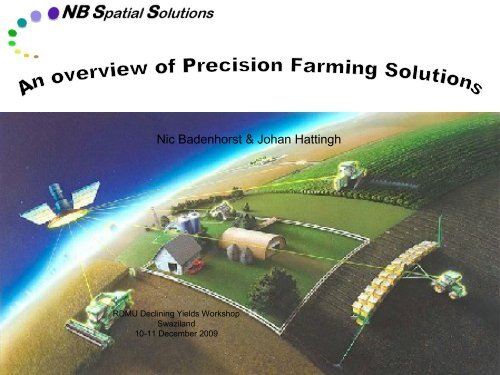
Nic Badenhorst & Johan Hatt<strong>in</strong>gh<br />
RDMU Decl<strong>in</strong><strong>in</strong>g Yields Workshop<br />
Swazil<strong>and</strong><br />
10-11 December 2009
<strong>Precision</strong> Agriculture<br />
Copyright NB Spatial Solutions 2007 All rights reserved<br />
PA Components<br />
OPTIONS<br />
DECISIONS<br />
GPS<br />
Agric. Management<br />
Enabl<strong>in</strong>g Technologies<br />
KEY<br />
UNCERTAIN-<br />
TIES<br />
RULES<br />
OF THE<br />
GAME<br />
Farm / field<br />
VRT<br />
Auto Pilot<br />
Action<br />
Management<br />
response<br />
PA<br />
Data captur<strong>in</strong>g<br />
Manipulation<br />
& Interpretation<br />
Sensor<br />
<strong>Remote</strong> sens<strong>in</strong>g<br />
Yield monitor<br />
Ground-based sensor<br />
Decision<br />
process<br />
Data<br />
management<br />
Database<br />
DSS<br />
Expert System<br />
Crop model<br />
Performance<br />
evaluation<br />
<strong>GIS</strong><br />
Data<br />
warehouse
<strong>Precision</strong> Farm<strong>in</strong>g cycle<br />
Copyright NB Spatial Solutions 2007 All rights reserved<br />
DGPS map<br />
Variable plant<br />
density<br />
Correction<br />
Potential Maps<br />
Spatial data<br />
process<strong>in</strong>g<br />
Crop model<br />
Analyses<br />
Soil chemical<br />
survey<br />
Data process<strong>in</strong>g<br />
Nutrient status<br />
maps<br />
All <strong>in</strong>formation:<br />
In digital format<br />
GPS georeferenced<br />
Prescription<br />
Maps<br />
Correction<br />
Variable fertilizer<br />
<strong>application</strong><br />
Satellite imagery<br />
Crop monitor<strong>in</strong>g<br />
Damage assessment<br />
Yield forecast<br />
Climate<br />
Soil physical<br />
factors<br />
DGPS map<br />
Yield Map<br />
Evaluation<br />
Yield Monitor<strong>in</strong>g
Copyright NB Spatial Solutions 2007 All rights reserved<br />
Differential GPS mapp<strong>in</strong>g (basemap)<br />
• Field boundaries<br />
• Sub-meter accuracy<br />
- geographic position<br />
- accurate area per field<br />
• Digital format<br />
• Attributes<br />
- Owner<br />
- Farmname<br />
- Field nr<br />
- Area <strong>in</strong> Ha
Field Sampl<strong>in</strong>g<br />
(Grid po<strong>in</strong>ts)<br />
Copyright NB Spatial Solutions 2007 All rights reserved<br />
• Physical properties<br />
• Chemistry<br />
Macro-elements (pH, P, K, Ca, Mg, Na,<br />
%Acid saturation)<br />
<br />
<br />
Total Carbon, Nitrogen & Sulphur (CNS)<br />
Micro-elements (Mn, Zn, B, Cu, Fe, Al)
Soil Survey<strong>in</strong>g<br />
(Soil Physical Properties)<br />
Copyright NB Spatial Solutions 2007 All rights reserved<br />
Physical Root Depth<br />
Clay %<br />
Profile Available Water
Copyright NB Spatial Solutions 2007 All rights reserved<br />
Poor season<br />
Yield potential maps<br />
(Modell<strong>in</strong>g)<br />
Normal season<br />
Good season
Soil Chemical Analyses<br />
(Nutrient Status Maps)<br />
Copyright NB Spatial Solutions 2007 All rights reserved<br />
Magnesium Calcium Phosphate
Copyright NB Spatial Solutions 2007 All rights reserved<br />
Ca correction<br />
Agronomic Service<br />
(Prescription Maps)<br />
P correction<br />
High potential area<br />
treatment<br />
24% of field<br />
treated (38.4 Ha)<br />
25% of field treated<br />
(41.1 Ha)<br />
46% of field treated<br />
(73.6 Ha)
Monitor crop development<br />
(Time-series of satellite images)<br />
Copyright NB Spatial Solutions 2007 All rights reserved<br />
(2002 Season)<br />
(2004 Season)
Evaluation of results<br />
(Spatial Comparison)<br />
Copyright NB Spatial Solutions 2007 All rights reserved<br />
Satellite image<br />
(21 Feb 2004)<br />
Simulated Yield<br />
Potential map<br />
Actual Yield Monitor<br />
map (May 2004)
Copyright NB Spatial Solutions 2007 All rights reserved<br />
Feb 2002<br />
Monitor change<br />
(before <strong>and</strong> after treatment)<br />
2.8 t/Ha<br />
NDVI difference map<br />
120<br />
Seasonal curves<br />
Seasonal growth curves<br />
100<br />
80<br />
NDVI<br />
60<br />
Feb 2004<br />
5.3 t/Ha<br />
40<br />
20<br />
0<br />
1 2 3 4 5<br />
Time<br />
2002 2004
Technology solutions<br />
(Multi-layer analyses)<br />
Copyright NB Spatial Solutions 2007 All rights reserved
Technological solutions<br />
(Which parameter(s) affect my yield most?)<br />
Copyright NB Spatial Solutions 2007 All rights reserved
Technological solutions<br />
(What is right norm for my field / farm?)<br />
Copyright NB Spatial Solutions 2007 All rights reserved
Crop modell<strong>in</strong>g<br />
Copyright NB Spatial Solutions 2007 All rights reserved<br />
Maize<br />
Yield goal<br />
N requirement<br />
8 t/Ha<br />
P requirement<br />
K requirement
Data Management<br />
Copyright NB Spatial Solutions 2007 All rights reserved<br />
<br />
Data management:<br />
– Unique data management <strong>and</strong><br />
<strong>in</strong>tegration service<br />
– Yield map <strong>in</strong>terpretation<br />
– Value-addition<br />
<br />
Yield mapp<strong>in</strong>g:<br />
– Harvest<strong>in</strong>g <strong>and</strong> yield<br />
mapp<strong>in</strong>g specialists
Copyright NB Spatial Solutions 2007 All rights reserved<br />
Nic Badenhorst<br />
RDMU Decl<strong>in</strong><strong>in</strong>g Yields Workshop<br />
Swazil<strong>and</strong><br />
10-11 December 2009
Why is satellite imagery important for agriculture?<br />
Copyright NB Spatial Solutions 2007 All rights reserved<br />
• Wide range of satellites cover vast areas virtually anywhere on earth’s surface (different scales)<br />
• Imagery can be acquired at regular <strong>in</strong>tervals through programm<strong>in</strong>g<br />
• Rapid process<strong>in</strong>g of imagery provides near-realtime <strong>in</strong>formation<br />
• Multi-spectral <strong>in</strong>formation yields useful value-added products to:<br />
- Show <strong>in</strong>-field variability<br />
- Detect stress factors<br />
- Monitor crop development<br />
- Establish historical reference database for benchmarks <strong>and</strong> comparisons<br />
- Evaluate management actions<br />
- Provide early yield estimates<br />
• This <strong>in</strong>formation assist growers to make better <strong>in</strong>formed decisions<br />
• Integration of satellite imagery with other digital technologies = powerful precision farm<strong>in</strong>g tool<br />
to make better <strong>in</strong>formed decisions
B<strong>and</strong> 1: Blue B<strong>and</strong> 2: Red B<strong>and</strong> 3: Near Infrared<br />
Copyright NB Spatial Solutions 2007 All rights reserved<br />
Colour composite image
Copyright NB Spatial Solutions 2007 All rights reserved<br />
Natural-colour composite<br />
SPOT image<br />
Big Bend, Swazil<strong>and</strong>
Copyright NB Spatial Solutions 2007 All rights reserved<br />
False-colour composite (NIR)<br />
SPOT image<br />
Big Bend, Swazil<strong>and</strong>
Copyright NB Spatial Solutions 2007 All rights reserved<br />
SPOT-derived<br />
Vegetation Index image<br />
Big Bend, Swazil<strong>and</strong>
Time-series analyses of fields<br />
Copyright NB Spatial Solutions 2007 All rights reserved<br />
19 Jan 30 Jan 06 Mar 07 Apr<br />
Max NDVI image<br />
Max Date image
Time-series analyses of zones<br />
(with<strong>in</strong>-field variation)<br />
Growth curves for field zones<br />
250<br />
200<br />
150<br />
NDVI<br />
poor<br />
good<br />
weeds<br />
100<br />
50<br />
0<br />
19-Jan 30-Jan 06-Mar 07-Apr<br />
Date<br />
Copyright NB Spatial Solutions 2007 All rights reserved
Integration with other <strong>GIS</strong> layers<br />
Copyright NB Spatial Solutions 2007 All rights reserved
Phenological growth curves for N30 variety<br />
Growth curves for N30<br />
250<br />
200<br />
150<br />
NDVI<br />
32<br />
42<br />
43<br />
41<br />
100<br />
50<br />
0<br />
19-Jan 30-Jan 06-Mar 07-Apr<br />
Time<br />
Copyright NB Spatial Solutions 2007 All rights reserved
Phenological growth curves for N22 variety<br />
Growth curves for N22 fields<br />
220<br />
200<br />
180<br />
NDVI<br />
160<br />
22<br />
28<br />
60B<br />
63<br />
140<br />
120<br />
100<br />
19-Jan 30-Jan 06-Mar 07-Apr<br />
Time<br />
Copyright NB Spatial Solutions 2007 All rights reserved
Comparison of sensors: Resolution<br />
SPOT4: 20m SPOT5: 10m SPOT5: 2.5m<br />
RapidEye: 5m<br />
Aerial: 1m<br />
Copyright NB NB Spatial Spatial Solutions 2007 2007 All All rights rights reserved
Some practical examples of image <strong>application</strong>s<br />
Copyright NB Spatial Solutions 2007 All rights reserved
Correction of dra<strong>in</strong>age problem<br />
Copyright NB Spatial Solutions 2007 All rights reserved<br />
11/02/2008<br />
14/10/2008<br />
12/02/2009
Correction of N deficiency<br />
Copyright NB Spatial Solutions 2007 All rights reserved<br />
Before N correction<br />
After N correction
Detect<strong>in</strong>g herbicide damage<br />
Copyright NB Spatial Solutions 2007 All rights reserved
Rectify<strong>in</strong>g pivot fertilizer <strong>application</strong> problems<br />
Copyright NB Spatial Solutions 2007 All rights reserved<br />
09/09/2008 25/10/2008<br />
Fertilizer problem<br />
Problem rectified
Identify<strong>in</strong>g irrigation nozzle problems<br />
Copyright NB Spatial Solutions 2007 All rights reserved<br />
Nozzle<br />
problems<br />
Problem rectified
Identify<strong>in</strong>g irrigation pressure problems<br />
Copyright NB Spatial Solutions 2007 All rights reserved<br />
Pressure problems
Identify<strong>in</strong>g chemical imbalances<br />
Copyright NB Spatial Solutions 2007 All rights reserved<br />
High levels of Mg <strong>and</strong> Na
Detect<strong>in</strong>g chemical problems<br />
Copyright NB Spatial Solutions 2007 All rights reserved
Correction of chemical imbalances<br />
Copyright NB Spatial Solutions 2007 All rights reserved<br />
Image shows chemical<br />
imbalances that<br />
corresponds with<br />
chemical maps.<br />
Image shows significant<br />
improvement follow<strong>in</strong>g<br />
corrective action.<br />
13 Feb 2001 (Before correction)<br />
20 Feb 2002 (After correction)
Show<strong>in</strong>g sal<strong>in</strong>ity problems<br />
Na:K Ratio<br />
Copyright NB Spatial Solutions 2007 All rights reserved
Satellite images, Yield- & Economy maps<br />
Copyright NB Spatial Solutions 2007 All rights reserved<br />
Loss (< R0)<br />
Profit (> R2000/ha)
Damage assessment<br />
Copyright NB Spatial Solutions 2007 All rights reserved<br />
Maize<br />
Water logg<strong>in</strong>g<br />
Weeds
Damage assessment<br />
Copyright NB Spatial Solutions 2007 All rights reserved<br />
W<strong>in</strong>d damage<br />
Hail damage<br />
Normal<br />
development<br />
Part of drybean field<br />
damaged by hail<br />
W<strong>in</strong>d damage
Damage assessment<br />
Flood damage<br />
Pests & Diseases<br />
23 Feb 2002<br />
Flooded areas on fields<br />
Virus <strong>in</strong>festation<br />
90% damage<br />
75%<br />
damage<br />
Copyright NB Spatial Solutions 2007 All rights reserved<br />
15 Mar 2002
Copyright NB Spatial Solutions 2007 All rights reserved<br />
Herbicide damage<br />
Damage assessment<br />
Faulty implements<br />
Estimated yield loss due to poorly calibrated<br />
planter – R2 Million<br />
Poor-calibrated planter<br />
The image series clearly show that the lower part of<br />
the field is subjected to stress (damage).<br />
Well-calibrated<br />
planter<br />
The growth curve of the damaged vs. healthy<br />
part of the field show the negative effect of the<br />
damage on crop development.
Irrigation plann<strong>in</strong>g<br />
Copyright NB Spatial Solutions 2007 All rights reserved<br />
BEFORE:<br />
No soil <strong>in</strong>fo available<br />
AFTER:<br />
With detail soil <strong>in</strong>fo on h<strong>and</strong><br />
~ 3 Ha poor soil<br />
<strong>in</strong>cluded <strong>in</strong> 1 st<br />
proposal<br />
2 smaller pivots<br />
avoid poor soils<br />
<strong>and</strong> cover more<br />
good soils<br />
LEGEND<br />
Irrigable soils<br />
Marg<strong>in</strong>al soils<br />
Poor soils<br />
Good soils not<br />
<strong>in</strong>cluded
Thank you for your attention!<br />
Copyright NB Spatial Solutions 2007 All rights reserved