A History of Geothermal Energy Research and Development in the ...
A History of Geothermal Energy Research and Development in the ...
A History of Geothermal Energy Research and Development in the ...

Create successful ePaper yourself
Turn your PDF publications into a flip-book with our unique Google optimized e-Paper software.
GEOTHERMAL TECHNOLOGIES PROGRAM<br />
Exploration<br />
1976 – 2006<br />
A <strong>History</strong> <strong>of</strong> <strong>Geo<strong>the</strong>rmal</strong> <strong>Energy</strong><br />
<strong>Research</strong> <strong>and</strong> <strong>Development</strong><br />
<strong>in</strong> <strong>the</strong> United States
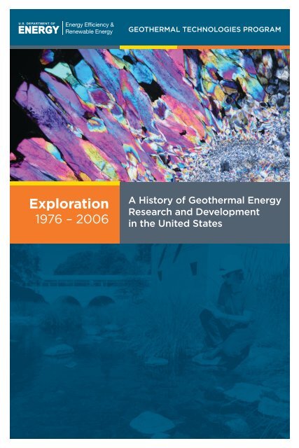
Cover Photo Credit<br />
Photomicrograph <strong>of</strong> quartz sampled from a depth <strong>of</strong> 948 feet <strong>in</strong> Lake City Observation Hole-1,<br />
Lake City geo<strong>the</strong>rmal system, California. The image was taken under crossed nicols. The vibrant<br />
birefr<strong>in</strong>gence colors are due to <strong>the</strong> section be<strong>in</strong>g extra thick. The field <strong>of</strong> view is 0.07 <strong>in</strong>ches across.<br />
(Courtesy: Joseph N. Moore)
EXPLORATION<br />
This history <strong>of</strong> <strong>the</strong> U.S. Department <strong>of</strong> <strong>Energy</strong>’s <strong>Geo<strong>the</strong>rmal</strong> Program<br />
is dedicated to <strong>the</strong> many government employees at Headquarters <strong>and</strong> at<br />
<strong>of</strong>fices <strong>in</strong> <strong>the</strong> field who worked diligently for <strong>the</strong> program’s success. Those<br />
men <strong>and</strong> women are too numerous to mention <strong>in</strong>dividually, given <strong>the</strong><br />
history’s 30-year time span. But <strong>the</strong>y deserve recognition none<strong>the</strong>less for<br />
<strong>the</strong>ir pr<strong>of</strong>essionalism <strong>and</strong> exceptional drive to make geo<strong>the</strong>rmal technology<br />
a viable option <strong>in</strong> solv<strong>in</strong>g <strong>the</strong> Nation’s energy problems. Special recognition<br />
is given here to those persons who assumed <strong>the</strong> leadership role for <strong>the</strong><br />
program <strong>and</strong> all <strong>the</strong> duties <strong>and</strong> responsibilities perta<strong>in</strong><strong>in</strong>g <strong>the</strong>reto:<br />
• Eric Willis, 1976-77<br />
• James Bresee, 1977-78<br />
• Bennie Di Bona, 1979-80<br />
• John Salisbury, 1980-81<br />
• John “Ted” Mock, 1982-94<br />
• Allan Jelacic, 1995-1999<br />
• Peter Goldman, 1999-2003<br />
• Lel<strong>and</strong> “Roy” M<strong>in</strong>k, 2003-06<br />
These leaders, along with <strong>the</strong>ir able staffs, are commended for a job<br />
well done. The future <strong>of</strong> geo<strong>the</strong>rmal energy <strong>in</strong> <strong>the</strong> United States is<br />
brighter today than ever before thanks to <strong>the</strong>ir tireless efforts.<br />
A <strong>History</strong> <strong>of</strong> <strong>Geo<strong>the</strong>rmal</strong> <strong>Energy</strong> <strong>Research</strong> <strong>and</strong> <strong>Development</strong> <strong>in</strong> <strong>the</strong> United States | Exploration i
EXPLORATION<br />
ii<br />
A <strong>History</strong> <strong>of</strong> <strong>Geo<strong>the</strong>rmal</strong> <strong>Energy</strong> <strong>Research</strong> <strong>and</strong> <strong>Development</strong> <strong>in</strong> <strong>the</strong> United States | Exploration
EXPLORATION<br />
Table <strong>of</strong> Contents<br />
Preface. . . . . . . . . . . . . . . . . . . . . . . . . . . . . . . . . . . . . . . . . . . . . . . . . . . . . . . . . . . . . . . . . . . . . . . . . . . . . . . . . . . . . . . . . vii<br />
Acknowledgements.. . . . . . . . . . . . . . . . . . . . . . . . . . . . . . . . . . . . . . . . . . . . . . . . . . . . . . . . . . . . . . . . . . . . . . . . . . . . . ix<br />
Introduction. . . . . . . . . . . . . . . . . . . . . . . . . . . . . . . . . . . . . . . . . . . . . . . . . . . . . . . . . . . . . . . . . . . . . . . . . . . . . . . . . . . . . . 1<br />
Accomplishments <strong>and</strong> Impacts. . . . . . . . . . . . . . . . . . . . . . . . . . . . . . . . . . . . . . . . . . . . . . . . . . . . . . . . . . . . . . . . . . 5<br />
Major <strong>Research</strong> Projects. . . . . . . . . . . . . . . . . . . . . . . . . . . . . . . . . . . . . . . . . . . . . . . . . . . . . . . . . . . . . . . . . . . . . . . . . 11<br />
1.0 Early Studies.. . . . . . . . . . . . . . . . . . . . . . . . . . . . . . . . . . . . . . . . . . . . . . . . . . . . . . . . . . . . . . . . . . . . . . . . . . . . . . 13<br />
2.0 Industry Cooperative Exploration <strong>and</strong> Drill<strong>in</strong>g.. . . . . . . . . . . . . . . . . . . . . . . . . . . . . . . . . . . . . . . . . . . 15<br />
2.1 The Industry-Coupled Case Studies Program. . . . . . . . . . . . . . . . . . . . . . . . . . . . . . . . . . . 15<br />
2.2 Case Studies <strong>of</strong> Low- to Moderate-Temperature<br />
Hydro<strong>the</strong>rmal <strong>Energy</strong> Developmen. . . . . . . . . . . . . . . . . . . . . . . . . . . . . . . . . . . . . . . . . . . . . 25<br />
2.3 The Cascades I <strong>and</strong> II Cost-Shared Programs.. . . . . . . . . . . . . . . . . . . . . . . . . . . . . . . . . . . 25<br />
2.4 The GRED I, II <strong>and</strong> III Cost-Shared Programs .. . . . . . . . . . . . . . . . . . . . . . . . . . . . . . . . . . . 27<br />
3.0 State Cooperative Programs. . . . . . . . . . . . . . . . . . . . . . . . . . . . . . . . . . . . . . . . . . . . . . . . . . . . . . . . . . . . . . 31<br />
3.1 State-Coupled Program.. . . . . . . . . . . . . . . . . . . . . . . . . . . . . . . . . . . . . . . . . . . . . . . . . . . . . . . . 31<br />
3.2 State-Cooperative Reservoir Analysis Program. . . . . . . . . . . . . . . . . . . . . . . . . . . . . . . . . 32<br />
3.3 Low-Temperature Resource Program. . . . . . . . . . . . . . . . . . . . . . . . . . . . . . . . . . . . . . . . . . . 32<br />
4.0 Selected Hydro<strong>the</strong>rmal System Studies.. . . . . . . . . . . . . . . . . . . . . . . . . . . . . . . . . . . . . . . . . . . . . . . . . . 35<br />
4.1 Ascension Isl<strong>and</strong>, South Atlantic Ocean.. . . . . . . . . . . . . . . . . . . . . . . . . . . . . . . . . . . . . . . . 35<br />
4.2 Coso Hot Spr<strong>in</strong>gs, California.. . . . . . . . . . . . . . . . . . . . . . . . . . . . . . . . . . . . . . . . . . . . . . . . . . . . 37<br />
4.3 The Geysers Cor<strong>in</strong>g Project: The Geysers, California.. . . . . . . . . . . . . . . . . . . . . . . . . . . . 38<br />
4.4 Dixie Valley, Nevada . . . . . . . . . . . . . . . . . . . . . . . . . . . . . . . . . . . . . . . . . . . . . . . . . . . . . . . . . . . 40<br />
4.5 The Salton Sea Scientific Drill<strong>in</strong>g Program, California .. . . . . . . . . . . . . . . . . . . . . . . . . . 45<br />
5.0 Geological Technique <strong>Development</strong>. . . . . . . . . . . . . . . . . . . . . . . . . . . . . . . . . . . . . . . . . . . . . . . . . . . . . 49<br />
5.1 The Evolution <strong>of</strong> <strong>the</strong> Salton Sea <strong>Geo<strong>the</strong>rmal</strong> Field, California.. . . . . . . . . . . . . . . . . . . 49<br />
5.2 Structural Controls on <strong>Geo<strong>the</strong>rmal</strong> Systems.. . . . . . . . . . . . . . . . . . . . . . . . . . . . . . . . . . . . 51<br />
5.3 Applied Terrestrial Remote Sens<strong>in</strong>g Technology. . . . . . . . . . . . . . . . . . . . . . . . . . . . . . . . 52<br />
5.4 A Conceptual Model <strong>of</strong> Volcano-Hosted<br />
Vapor-Dom<strong>in</strong>ated <strong>Geo<strong>the</strong>rmal</strong> Systems . . . . . . . . . . . . . . . . . . . . . . . . . . . . . . . . . . . . . . . . 56<br />
5.5 Significance <strong>of</strong> Hydro<strong>the</strong>rmal Alteration Assemblages.. . . . . . . . . . . . . . . . . . . . . . . . . 58<br />
5.6 Duration <strong>and</strong> Age <strong>of</strong> Hydro<strong>the</strong>rmal Activity . . . . . . . . . . . . . . . . . . . . . . . . . . . . . . . . . . . . 61<br />
6.0 Geochemical Technique Analysis. . . . . . . . . . . . . . . . . . . . . . . . . . . . . . . . . . . . . . . . . . . . . . . . . . . . . . . . . 63<br />
6.1 Trace-Element Analyses <strong>of</strong> Soils <strong>and</strong> Rocks. . . . . . . . . . . . . . . . . . . . . . . . . . . . . . . . . . . . . 63<br />
6.2 Soil-Gas <strong>and</strong> Gas-Flux Measurements.. . . . . . . . . . . . . . . . . . . . . . . . . . . . . . . . . . . . . . . . . . 63<br />
6.3 Geochemical Analyses <strong>of</strong> <strong>Geo<strong>the</strong>rmal</strong> Fluids .. . . . . . . . . . . . . . . . . . . . . . . . . . . . . . . . . . 64<br />
6.4 Fluid Inclusion Studies. . . . . . . . . . . . . . . . . . . . . . . . . . . . . . . . . . . . . . . . . . . . . . . . . . . . . . . . . . 65<br />
7.0 Geophysical Technique <strong>Development</strong>.. . . . . . . . . . . . . . . . . . . . . . . . . . . . . . . . . . . . . . . . . . . . . . . . . . . 69<br />
7.1 Seismic Methods . . . . . . . . . . . . . . . . . . . . . . . . . . . . . . . . . . . . . . . . . . . . . . . . . . . . . . . . . . . . . . . 69<br />
7.2 Aeromagnetic Methods .. . . . . . . . . . . . . . . . . . . . . . . . . . . . . . . . . . . . . . . . . . . . . . . . . . . . . . . . 72<br />
7.3 Gravity Methods. . . . . . . . . . . . . . . . . . . . . . . . . . . . . . . . . . . . . . . . . . . . . . . . . . . . . . . . . . . . . . . . 73<br />
A <strong>History</strong> <strong>of</strong> <strong>Geo<strong>the</strong>rmal</strong> <strong>Energy</strong> <strong>Research</strong> <strong>and</strong> <strong>Development</strong> <strong>in</strong> <strong>the</strong> United States | Exploration iii
EXPLORATION<br />
7.4 Thermal Methods. . . . . . . . . . . . . . . . . . . . . . . . . . . . . . . . . . . . . . . . . . . . . . . . . . . . . . . . . . . . . . . 74<br />
7.5 Geophysical Well Log Interpretation <strong>and</strong> High-Temperature Tool <strong>Development</strong>.. . 76<br />
7.6 Electrical Methods. . . . . . . . . . . . . . . . . . . . . . . . . . . . . . . . . . . . . . . . . . . . . . . . . . . . . . . . . . . . . . 77<br />
7.7 Borehole Geophysics Studies .. . . . . . . . . . . . . . . . . . . . . . . . . . . . . . . . . . . . . . . . . . . . . . . . . . 81<br />
7.8 Measurement <strong>of</strong> Active Deformation . . . . . . . . . . . . . . . . . . . . . . . . . . . . . . . . . . . . . . . . . . . 83<br />
7.9 Relat<strong>in</strong>g Geophysical Results to Properties <strong>of</strong> Interest. . . . . . . . . . . . . . . . . . . . . . . . . . 85<br />
7.10 Coupled Reservoir Simulation <strong>and</strong> Geophysical Surveys. . . . . . . . . . . . . . . . . . . . . . . . 86<br />
8.0 Exploration Strategies.. . . . . . . . . . . . . . . . . . . . . . . . . . . . . . . . . . . . . . . . . . . . . . . . . . . . . . . . . . . . . . . . . . . . 87<br />
9.0 National <strong>and</strong> Regional Resource Assessments.. . . . . . . . . . . . . . . . . . . . . . . . . . . . . . . . . . . . . . . . . . . 89<br />
10.0 Magma <strong>Energy</strong> Studies.. . . . . . . . . . . . . . . . . . . . . . . . . . . . . . . . . . . . . . . . . . . . . . . . . . . . . . . . . . . . . . . . . . 91<br />
10.1 Magma <strong>Energy</strong> <strong>Research</strong> Program (1975 – 1982) .. . . . . . . . . . . . . . . . . . . . . . . . . . . . . . . 91<br />
10.2 Magma <strong>Energy</strong> Extraction Program (1984 – 1990) .. . . . . . . . . . . . . . . . . . . . . . . . . . . . . 92<br />
10.3 Exploratory Well. . . . . . . . . . . . . . . . . . . . . . . . . . . . . . . . . . . . . . . . . . . . . . . . . . . . . . . . . . . . . . . . 94<br />
Conclusion.. . . . . . . . . . . . . . . . . . . . . . . . . . . . . . . . . . . . . . . . . . . . . . . . . . . . . . . . . . . . . . . . . . . . . . . . . . . . . . . . . . . . . 95<br />
Appendix A: Budget history <strong>of</strong> <strong>the</strong> federal geo<strong>the</strong>rmal research program, 1976 – 2006.. . . . . . . . 97<br />
Abbreviations & Acronyms.. . . . . . . . . . . . . . . . . . . . . . . . . . . . . . . . . . . . . . . . . . . . . . . . . . . . . . . . . . . . . . . . . . . . 103<br />
References Organized by Major <strong>Research</strong> Project Area .. . . . . . . . . . . . . . . . . . . . . . . . . . . . . . . . . . . . . . . 107<br />
Numbered References . . . . . . . . . . . . . . . . . . . . . . . . . . . . . . . . . . . . . . . . . . . . . . . . . . . . . . . . . . . . . . . . . . . . . . . . . 131<br />
List <strong>of</strong> Figures<br />
Figure 1. Locations <strong>of</strong> selected geo<strong>the</strong>rmal systems <strong>in</strong> <strong>the</strong> western United States.. . . . . . . . . 18<br />
Figure 2. Photograph <strong>of</strong> <strong>the</strong> Cove Fort-Sulphurdale geo<strong>the</strong>rmal power plant, Utah.. . . . . . . . 20<br />
Figure 3. Geologic map <strong>of</strong> <strong>the</strong> Cove Fort-Sulphurdale geo<strong>the</strong>rmal area.. . . . . . . . . . . . . . . . . . . . 21<br />
Figure 4. Schematic conceptual model <strong>of</strong> <strong>the</strong> Cove Fort-Sulphurdale geo<strong>the</strong>rmal area.. . . . 22<br />
Figure 5. The Blundell geo<strong>the</strong>rmal power plant at Roosevelt Hot Spr<strong>in</strong>gs, Utah. . . . . . . . . . . . 24<br />
Figure 6. <strong>Geo<strong>the</strong>rmal</strong> Resource Exploration <strong>and</strong> Def<strong>in</strong>ition Program (GRED)<br />
I project locations.. . . . . . . . . . . . . . . . . . . . . . . . . . . . . . . . . . . . . . . . . . . . . . . . . . . . . . . . . . . . . . . . 29<br />
Figure 7. <strong>Geo<strong>the</strong>rmal</strong> Resource Exploration <strong>and</strong> Def<strong>in</strong>ition Program (GRED)<br />
II project locations. . . . . . . . . . . . . . . . . . . . . . . . . . . . . . . . . . . . . . . . . . . . . . . . . . . . . . . . . . . . . . . . 29<br />
Figure 8. <strong>Geo<strong>the</strong>rmal</strong> Resource Exploration <strong>and</strong> Def<strong>in</strong>ition Program (GRED)<br />
III project locations.. . . . . . . . . . . . . . . . . . . . . . . . . . . . . . . . . . . . . . . . . . . . . . . . . . . . . . . . . . . . . . . 30<br />
Figure 9. Block diagrams <strong>of</strong> The Geysers geo<strong>the</strong>rmal field show<strong>in</strong>g <strong>the</strong> top <strong>of</strong><br />
<strong>the</strong> steam reservoir (top) <strong>and</strong> <strong>the</strong> top <strong>of</strong> <strong>the</strong> plutonic complex (felsite). . . . . . . . . . . 38<br />
Figure 10. Geologic sett<strong>in</strong>g <strong>of</strong> <strong>the</strong> Dixie Valley geo<strong>the</strong>rmal system.. . . . . . . . . . . . . . . . . . . . . . . . . . 41<br />
Figure 11. Idealized structural model <strong>of</strong> <strong>the</strong> Dixie Valley geo<strong>the</strong>rmal field, Nevada.. . . . . . . . . . 42<br />
Figure 12. Magnetotelluric section across <strong>the</strong> Dixie Valley geo<strong>the</strong>rmal field.. . . . . . . . . . . . . . . . . 43<br />
Figure 13. Location <strong>of</strong> <strong>the</strong> State 2-14 well, Salton Sea <strong>Geo<strong>the</strong>rmal</strong> Field.. . . . . . . . . . . . . . . . . . . . . 46<br />
Figure 14. ASTER <strong>and</strong> fused imagery, Silver Peak range, Nevada. . . . . . . . . . . . . . . . . . . . . . . . . . . . 55<br />
iv<br />
A <strong>History</strong> <strong>of</strong> <strong>Geo<strong>the</strong>rmal</strong> <strong>Energy</strong> <strong>Research</strong> <strong>and</strong> <strong>Development</strong> <strong>in</strong> <strong>the</strong> United States | Exploration
EXPLORATION<br />
Figure 15. Conceptual model <strong>of</strong> <strong>the</strong> Karaha-Telaga Bodas geo<strong>the</strong>rmal system, Indonesia.. . . 57<br />
Figure 16. Photomicrograph from <strong>the</strong> Bulalo geo<strong>the</strong>rmal field, Philipp<strong>in</strong>es, show<strong>in</strong>g<br />
chalcedony (cha) overpr<strong>in</strong>ted by epidote (ep) <strong>and</strong> <strong>the</strong>n anhydrite (anhy). . . . . . . . 59<br />
Figure 17. Progressive formation <strong>of</strong> silica polymorphs result<strong>in</strong>g from<br />
catastrophic reservoir boil<strong>in</strong>g. . . . . . . . . . . . . . . . . . . . . . . . . . . . . . . . . . . . . . . . . . . . . . . . . . . . 60<br />
Figure 18. Map <strong>of</strong> 3He/4He ratios for Western geo<strong>the</strong>rmal areas, expressed<br />
as Ro/Ra (<strong>the</strong> air-corrected sample ratio normalized to <strong>the</strong> ratio <strong>in</strong> air). .. . . . . . . . 65<br />
Figure 19. Examples <strong>of</strong> fluid <strong>in</strong>clusions from Karaha-Telaga Bodas, Indonesia. .. . . . . . . . . . . . . 66<br />
Figure 20. Fluid <strong>in</strong>clusion temperatures <strong>and</strong> sal<strong>in</strong>ities from Matalibong-25,<br />
Tiwi, Philipp<strong>in</strong>es. Comparison <strong>of</strong> <strong>the</strong> homogenization <strong>and</strong> measured<br />
temperatures documents heat<strong>in</strong>g s<strong>in</strong>ce <strong>the</strong> <strong>in</strong>clusions were trapped.. . . . . . . . . . . . . 67<br />
Figure 21. The Coso magnetotelluric survey . . . . . . . . . . . . . . . . . . . . . . . . . . . . . . . . . . . . . . . . . . . . . . . 80<br />
Figure 22. The Geo-BILT logg<strong>in</strong>g tool be<strong>in</strong>g deployed <strong>in</strong> an oil field.. . . . . . . . . . . . . . . . . . . . . . . . . 82<br />
Figure 23. Annualized InSAR surface vertical displacements at Steamboat geo<strong>the</strong>rmal<br />
field, Nevada, compared to <strong>in</strong>itial Fahrenheit iso<strong>the</strong>rms at +4,000 feet (msl). . . . . 84<br />
Figure 24. Schematic <strong>of</strong> energy extraction from magma.. . . . . . . . . . . . . . . . . . . . . . . . . . . . . . . . . . . . 93<br />
List <strong>of</strong> Tables<br />
Table 1.<br />
Table 2.<br />
Table 3.<br />
Table 4.<br />
Table 5.<br />
Major advances result<strong>in</strong>g from <strong>the</strong> Department <strong>of</strong> <strong>Energy</strong>’s geo<strong>the</strong>rmal<br />
exploration research <strong>and</strong> development program, 1976 – 2006. . . . . . . . . . . . . . . . . . . . . 5<br />
Publically-Available Data Ga<strong>the</strong>red Under <strong>the</strong> Industry-Coupled<br />
Case Studies Program. . . . . . . . . . . . . . . . . . . . . . . . . . . . . . . . . . . . . . . . . . . . . . . . . . . . . . . . . . . . 17<br />
Data available from <strong>the</strong> <strong>Energy</strong> & Geoscience Institute result<strong>in</strong>g<br />
from <strong>the</strong> Cascade I <strong>and</strong> II Cost-Shared Programs. . . . . . . . . . . . . . . . . . . . . . . . . . . . . . . . . 27<br />
<strong>Geo<strong>the</strong>rmal</strong> Resource Exploration <strong>and</strong> Def<strong>in</strong>ition Program (GRED)<br />
I, II, <strong>and</strong> III awardees <strong>and</strong> locations. . . . . . . . . . . . . . . . . . . . . . . . . . . . . . . . . . . . . . . . . . . . . . . . 28<br />
Number <strong>of</strong> Known <strong>Geo<strong>the</strong>rmal</strong> Occurrences <strong>in</strong> 1995 Compared with<br />
<strong>the</strong> Number <strong>of</strong> Previously Known Occurrences, Given by State. . . . . . . . . . . . . . . . . . . 33<br />
A <strong>History</strong> <strong>of</strong> <strong>Geo<strong>the</strong>rmal</strong> <strong>Energy</strong> <strong>Research</strong> <strong>and</strong> <strong>Development</strong> <strong>in</strong> <strong>the</strong> United States | Exploration v
EXPLORATION<br />
vi<br />
A <strong>History</strong> <strong>of</strong> <strong>Geo<strong>the</strong>rmal</strong> <strong>Energy</strong> <strong>Research</strong> <strong>and</strong> <strong>Development</strong> <strong>in</strong> <strong>the</strong> United States | Exploration
EXPLORATION<br />
Preface<br />
In <strong>the</strong> 1970s, <strong>the</strong> publicly available <strong>in</strong>formation about geo<strong>the</strong>rmal systems was<br />
woefully <strong>in</strong>adequate. The underst<strong>and</strong><strong>in</strong>g <strong>of</strong> geo<strong>the</strong>rmal resources <strong>and</strong> <strong>the</strong> means for<br />
<strong>the</strong>ir optimum development was primitive. Much <strong>of</strong> <strong>the</strong> extant <strong>in</strong>formation was<br />
held <strong>in</strong> private company files. Lack <strong>of</strong> <strong>in</strong>formation meant only a few companies<br />
<strong>in</strong>vested <strong>in</strong> exploration <strong>and</strong> resource development. Utilities did not underst<strong>and</strong> <strong>the</strong><br />
geo<strong>the</strong>rmal resource, especially <strong>the</strong> risks <strong>and</strong> costs <strong>of</strong> development, <strong>and</strong> <strong>the</strong>y were<br />
<strong>the</strong>refore reluctant to sign long-term geo<strong>the</strong>rmal power purchase agreements. For<br />
<strong>the</strong> same reasons, f<strong>in</strong>ancial <strong>in</strong>stitutions were wary <strong>of</strong> fund<strong>in</strong>g geo<strong>the</strong>rmal energy<br />
projects. <strong>Development</strong> <strong>of</strong> <strong>the</strong> large resource base <strong>in</strong> <strong>the</strong> United States, apart from<br />
The Geysers <strong>in</strong> California, was essentially stagnant. This was <strong>the</strong> environment<br />
<strong>in</strong> which <strong>the</strong> U.S. Government’s geo<strong>the</strong>rmal research <strong>and</strong> development (R&D)<br />
program began.<br />
The <strong>in</strong>tent <strong>of</strong> <strong>the</strong> geo<strong>the</strong>rmal program was to underst<strong>and</strong> geo<strong>the</strong>rmal resources,<br />
improve geo<strong>the</strong>rmal science <strong>and</strong> eng<strong>in</strong>eer<strong>in</strong>g technology, <strong>and</strong> ensure that<br />
<strong>in</strong>formation was publicly available to geo<strong>the</strong>rmal stakeholders, such as developers,<br />
utilities, f<strong>in</strong>ancial <strong>in</strong>stitutions, regulators, <strong>and</strong> o<strong>the</strong>rs necessary to spur development<br />
<strong>of</strong> a vital, progressive geo<strong>the</strong>rmal <strong>in</strong>dustry. As this report will demonstrate, <strong>the</strong><br />
<strong>in</strong>tent was achieved, to <strong>the</strong> benefit not only <strong>of</strong> geo<strong>the</strong>rmal energy development <strong>in</strong><br />
<strong>the</strong> United States but also around <strong>the</strong> world.<br />
This report is one <strong>of</strong> a series issued by <strong>the</strong> U.S. Department <strong>of</strong> <strong>Energy</strong> (<strong>the</strong><br />
Department) to document <strong>the</strong> many <strong>and</strong> varied accomplishments stemm<strong>in</strong>g from<br />
<strong>the</strong> Government’s sponsorship <strong>of</strong> geo<strong>the</strong>rmal research s<strong>in</strong>ce 1976. The reports<br />
represent a history <strong>of</strong> <strong>the</strong> major research programs <strong>and</strong> projects that have had<br />
a last<strong>in</strong>g impact on <strong>the</strong> use <strong>of</strong> geo<strong>the</strong>rmal energy <strong>in</strong> <strong>the</strong> United States or which<br />
promise to have an impact. We have not attempted to write <strong>the</strong> def<strong>in</strong>itive history<br />
<strong>of</strong> <strong>the</strong> <strong>Geo<strong>the</strong>rmal</strong> Program <strong>and</strong> <strong>the</strong> $1.3 billion that were expended through<br />
2006 on geo<strong>the</strong>rmal research. Ra<strong>the</strong>r, we have brought toge<strong>the</strong>r <strong>the</strong> collective<br />
memories <strong>of</strong> those who participated <strong>in</strong> <strong>the</strong> program to highlight advances which<br />
<strong>the</strong> participants deem worthy <strong>of</strong> special recognition.<br />
In particular, this report exam<strong>in</strong>es <strong>the</strong> work done <strong>in</strong> one key area <strong>of</strong> geo<strong>the</strong>rmal<br />
technology development: Exploration. Companion reports cover work <strong>in</strong> o<strong>the</strong>r<br />
areas, <strong>in</strong>clud<strong>in</strong>g <strong>Energy</strong> Conversion, Drill<strong>in</strong>g, <strong>and</strong> Reservoir Eng<strong>in</strong>eer<strong>in</strong>g. The<br />
history focuses on <strong>the</strong> period 1976-2006, when <strong>the</strong> Department <strong>of</strong> <strong>Energy</strong><br />
was <strong>the</strong> lead agency for geo<strong>the</strong>rmal technology research as m<strong>and</strong>ated by <strong>the</strong><br />
<strong>Geo<strong>the</strong>rmal</strong> <strong>Research</strong>, <strong>Development</strong> <strong>and</strong> Demonstration Act <strong>of</strong> 1974. The<br />
A <strong>History</strong> <strong>of</strong> <strong>Geo<strong>the</strong>rmal</strong> <strong>Energy</strong> <strong>Research</strong> <strong>and</strong> <strong>Development</strong> <strong>in</strong> <strong>the</strong> United States | Exploration vii
EXPLORATION<br />
earlier, groundbreak<strong>in</strong>g work by precursor agencies, such as <strong>the</strong> National Science<br />
Foundation, Atomic <strong>Energy</strong> Commission, United States Geological Survey, <strong>and</strong> <strong>the</strong><br />
<strong>Energy</strong> <strong>Research</strong> <strong>and</strong> <strong>Development</strong> Adm<strong>in</strong>istration, is cited as appropriate but is by<br />
no means complete.<br />
Those wish<strong>in</strong>g to learn more about certa<strong>in</strong> topics discussed here<strong>in</strong> should consult<br />
<strong>the</strong> references listed <strong>in</strong> <strong>the</strong> report. These sources give <strong>the</strong> reader access to a much<br />
larger body <strong>of</strong> literature that covers <strong>the</strong> topics <strong>in</strong> greater detail. Ano<strong>the</strong>r useful source<br />
<strong>of</strong> <strong>in</strong>formation about <strong>the</strong> Department’s geo<strong>the</strong>rmal research can be found <strong>in</strong> <strong>the</strong><br />
<strong>Geo<strong>the</strong>rmal</strong> Technologies Legacy Collection (www.osti.gov/geo<strong>the</strong>rmal/)<br />
ma<strong>in</strong>ta<strong>in</strong>ed by <strong>the</strong> Office <strong>of</strong> Science <strong>and</strong> Technology Information.<br />
The budget history <strong>of</strong> <strong>the</strong> federal geo<strong>the</strong>rmal research program dur<strong>in</strong>g <strong>the</strong> 30-year<br />
period documented here is <strong>in</strong>cluded as Appendix A. That portion <strong>of</strong> <strong>the</strong> budget<br />
devoted to exploration is highlighted <strong>and</strong> amounts to about $190 million <strong>in</strong> actual<br />
dollars. Fund<strong>in</strong>g for work <strong>in</strong> exploration ended <strong>in</strong> fiscal year 2006 with a decision<br />
by <strong>the</strong> Department to refocus limited fund<strong>in</strong>g resources on higher priority needs<br />
with<strong>in</strong> <strong>the</strong> Office <strong>of</strong> <strong>Energy</strong> Efficiency <strong>and</strong> Renewable <strong>Energy</strong>. That decision did<br />
not preclude future work <strong>in</strong> this area, as <strong>the</strong> needs for geo<strong>the</strong>rmal technology<br />
development are assessed. This report summarizes <strong>the</strong> products <strong>and</strong> benefits <strong>of</strong><br />
that earlier research <strong>in</strong>vestment.<br />
viii<br />
A <strong>History</strong> <strong>of</strong> <strong>Geo<strong>the</strong>rmal</strong> <strong>Energy</strong> <strong>Research</strong> <strong>and</strong> <strong>Development</strong> <strong>in</strong> <strong>the</strong> United States | Exploration
EXPLORATION<br />
Acknowledgements<br />
While <strong>the</strong> many contributors to U.S. Department <strong>of</strong> <strong>Energy</strong>-supported<br />
geo<strong>the</strong>rmal exploration research <strong>and</strong> development over <strong>the</strong> years are too<br />
numerous to acknowledge by name, we wish to mention those who participated<br />
<strong>in</strong> writ<strong>in</strong>g this report. The primary authors were Joseph N. Moore, Howard<br />
P. Ross (retired), <strong>and</strong> Phillip Michael Wright (retired) all <strong>of</strong> <strong>the</strong> <strong>Energy</strong> &<br />
Geoscience Institute, University <strong>of</strong> Utah. Contribut<strong>in</strong>g authors <strong>in</strong>cluded<br />
Clayton R. Nichols (retired), U.S. Department <strong>of</strong> <strong>Energy</strong>; Paul Kasameyer<br />
(retired), Lawrence Livermore National Laboratory; <strong>and</strong> Joel Renner (retired),<br />
Idaho National Laboratory. Elizabeth C. Battocletti served as <strong>the</strong> report’s<br />
technical editor. These persons deserve credit for assembl<strong>in</strong>g a history <strong>of</strong><br />
impressive accomplishment that will cont<strong>in</strong>ue to reap benefits for many<br />
years to come. To <strong>the</strong> <strong>in</strong>dividuals whose efforts are not specifically identified<br />
<strong>in</strong> this report, <strong>the</strong> Department <strong>and</strong> authors <strong>of</strong>fer <strong>the</strong>ir s<strong>in</strong>cere gratitude.<br />
A <strong>History</strong> <strong>of</strong> <strong>Geo<strong>the</strong>rmal</strong> <strong>Energy</strong> <strong>Research</strong> <strong>and</strong> <strong>Development</strong> <strong>in</strong> <strong>the</strong> United States | Exploration ix
EXPLORATION<br />
x<br />
A <strong>History</strong> <strong>of</strong> <strong>Geo<strong>the</strong>rmal</strong> <strong>Energy</strong> <strong>Research</strong> <strong>and</strong> <strong>Development</strong> <strong>in</strong> <strong>the</strong> United States | Exploration
EXPLORATION<br />
Introduction<br />
This report summarizes significant research projects performed by <strong>the</strong> U.S.<br />
Department <strong>of</strong> <strong>Energy</strong> (DOE) 1 over 30 years to overcome challenges <strong>in</strong><br />
exploration <strong>and</strong> to make generation <strong>of</strong> electricity from geo<strong>the</strong>rmal resources<br />
more cost-competitive. At <strong>the</strong> onset <strong>of</strong> DOE’s efforts <strong>in</strong> <strong>the</strong> 1970s, several<br />
national laboratories, universities, <strong>and</strong> private contractors conducted exploration<br />
research. Beg<strong>in</strong>n<strong>in</strong>g <strong>in</strong> <strong>the</strong> late 1970s, this research was undertaken largely by<br />
<strong>the</strong> Lawrence Berkeley National Laboratory (LBNL), <strong>the</strong> Lawrence Livermore<br />
National Laboratory (LLNL), <strong>and</strong> <strong>the</strong> Earth Science Laboratory <strong>of</strong> <strong>the</strong> University<br />
<strong>of</strong> Utah <strong>Research</strong> Institute (ESL/UURI). In addition, <strong>the</strong> Idaho National<br />
Laboratory (INL), Los Alamos National Laboratory (LANL), Oak Ridge<br />
National Laboratory (ORNL), <strong>and</strong> S<strong>and</strong>ia National Laboratories (S<strong>and</strong>ia) also<br />
performed exploration research. Throughout <strong>the</strong> years, many o<strong>the</strong>r groups,<br />
<strong>in</strong>clud<strong>in</strong>g <strong>the</strong> Great Bas<strong>in</strong> Center for <strong>Geo<strong>the</strong>rmal</strong> <strong>Energy</strong> at <strong>the</strong> University <strong>of</strong><br />
Nevada, Reno, geo<strong>the</strong>rmal developers <strong>and</strong> consult<strong>in</strong>g groups, <strong>the</strong> U.S. Geological<br />
Survey (USGS), <strong>and</strong> state geological surveys contributed to <strong>the</strong> program.<br />
Beg<strong>in</strong>n<strong>in</strong>g <strong>in</strong> <strong>the</strong> early 1970s, DOE supported research to develop solid scientific<br />
underp<strong>in</strong>n<strong>in</strong>gs <strong>and</strong> new technology to locate <strong>and</strong> characterize geo<strong>the</strong>rmal<br />
resources. This research has greatly advanced <strong>the</strong> state <strong>of</strong> geo<strong>the</strong>rmal science<br />
<strong>and</strong> technology, benefitt<strong>in</strong>g <strong>the</strong> development <strong>of</strong> this clean, plentiful, renewable<br />
energy resource <strong>in</strong> <strong>the</strong> United States <strong>and</strong> around <strong>the</strong> world. At <strong>the</strong> end <strong>of</strong> 2007,<br />
<strong>the</strong> <strong>in</strong>stalled electric generat<strong>in</strong>g capacity from geo<strong>the</strong>rmal energy worldwide was<br />
9,728 megawatts-electric (MWe). 2 In <strong>the</strong> United States alone, <strong>the</strong> <strong>in</strong>stalled electric<br />
generat<strong>in</strong>g capacity at <strong>the</strong> end <strong>of</strong> 2008 was 2,960 MWe, 3 nearly a six-fold <strong>in</strong>crease<br />
<strong>in</strong> generat<strong>in</strong>g capacity s<strong>in</strong>ce <strong>the</strong> DOE <strong>Geo<strong>the</strong>rmal</strong> Program began. An additional<br />
29,000 megawatts-<strong>the</strong>rmal (MWt) from geo<strong>the</strong>rmal resources worldwide is<br />
used for bath<strong>in</strong>g, space heat<strong>in</strong>g <strong>and</strong> cool<strong>in</strong>g, agriculture, aquaculture, <strong>in</strong>dustrial<br />
processes, <strong>and</strong> geo<strong>the</strong>rmal heat pumps. 4 Despite this level <strong>of</strong> development,<br />
however, <strong>the</strong> worldwide geo<strong>the</strong>rmal resource base is vastly underutilized today.<br />
DOE’s goal <strong>in</strong> geo<strong>the</strong>rmal energy research has been to decrease <strong>the</strong> costs <strong>and</strong><br />
risks <strong>of</strong> economically utiliz<strong>in</strong>g geo<strong>the</strong>rmal resources primarily for electrical<br />
power generation. A l<strong>in</strong>chp<strong>in</strong> <strong>of</strong> DOE’s approach to realiz<strong>in</strong>g <strong>the</strong>ir goals<br />
has been strong work<strong>in</strong>g relationships with <strong>the</strong> private sector. Program<br />
priorities have been driven by <strong>the</strong> technical barriers to economically viable<br />
geo<strong>the</strong>rmal development as identified by <strong>the</strong> <strong>in</strong>dustry, as well as <strong>the</strong> results <strong>of</strong><br />
economic sensitivity model<strong>in</strong>g to identify those elements <strong>in</strong> <strong>the</strong> geo<strong>the</strong>rmal<br />
development process with <strong>the</strong> greatest potential for lower<strong>in</strong>g costs <strong>and</strong> risks.<br />
A <strong>History</strong> <strong>of</strong> <strong>Geo<strong>the</strong>rmal</strong> <strong>Energy</strong> <strong>Research</strong> <strong>and</strong> <strong>Development</strong> <strong>in</strong> <strong>the</strong> United States | Exploration 1
EXPLORATION<br />
Initially, <strong>the</strong> <strong>in</strong>dustry identified lower<strong>in</strong>g well-field costs <strong>and</strong> improv<strong>in</strong>g drill<strong>in</strong>g<br />
technology as two high priority areas for research. DOE’s geo<strong>the</strong>rmal drill<strong>in</strong>g<br />
research <strong>and</strong> development (R&D) program is covered <strong>in</strong> a companion report.<br />
DOE supported R&D <strong>in</strong> exploration whose purpose was to more quickly locate<br />
resources <strong>in</strong> <strong>the</strong> subsurface <strong>and</strong> to more reliably site exploration <strong>and</strong> reservoir<br />
confirmation boreholes, production wells, <strong>and</strong> <strong>in</strong>jection wells. The strong<br />
cooperative work<strong>in</strong>g relationship with <strong>the</strong> private sector has fostered efficient<br />
technology transfer, result<strong>in</strong>g <strong>in</strong> rapid implementation <strong>of</strong> research advances.<br />
Early <strong>in</strong> DOE’s program, <strong>the</strong> public <strong>in</strong>formation base for high-temperature<br />
geo<strong>the</strong>rmal areas was woefully <strong>in</strong>adequate. Lack <strong>of</strong> <strong>in</strong>formation <strong>in</strong>hibited new<br />
resource companies from <strong>in</strong>vest<strong>in</strong>g <strong>in</strong> exploration <strong>and</strong> resource development,<br />
<strong>and</strong> prevented utilities from underst<strong>and</strong><strong>in</strong>g <strong>the</strong> geo<strong>the</strong>rmal resource <strong>and</strong> <strong>the</strong><br />
risks <strong>and</strong> costs <strong>of</strong> its development. Utilities were <strong>the</strong>refore reluctant to sign<br />
geo<strong>the</strong>rmal power purchase agreements. Due to this lack <strong>of</strong> <strong>in</strong>formation, lend<strong>in</strong>g<br />
<strong>in</strong>stitutions were also wary <strong>of</strong> fund<strong>in</strong>g geo<strong>the</strong>rmal energy projects. This was <strong>the</strong><br />
environment <strong>in</strong> which DOE’s <strong>in</strong>itial geo<strong>the</strong>rmal R&D began <strong>in</strong> <strong>the</strong> late 1970s.<br />
In 1977, DOE <strong>in</strong>itiated <strong>the</strong> Industry-Coupled Drill<strong>in</strong>g Case Studies<br />
Program, discussed more fully <strong>in</strong> Section 2.1. The objectives <strong>of</strong> this<br />
program were to: 1) accelerate exploration <strong>of</strong> new high-temperature<br />
areas by furnish<strong>in</strong>g a cost-share for <strong>the</strong> drill<strong>in</strong>g <strong>of</strong> reservoir-confirmation<br />
boreholes, <strong>and</strong> 2) obta<strong>in</strong> data held as confidential <strong>in</strong> company files for<br />
public release. In exchange for <strong>the</strong> cost-share, <strong>the</strong> company proposed a data<br />
package which DOE could use <strong>in</strong> its research <strong>and</strong> release <strong>in</strong> open file.<br />
The Industry-Coupled Drill<strong>in</strong>g Case Studies Program was an outst<strong>and</strong><strong>in</strong>g<br />
success <strong>in</strong> meet<strong>in</strong>g its objectives. Of <strong>the</strong> 14 areas explored under <strong>the</strong> program,<br />
eight were subsequently developed by <strong>the</strong> private sector, produc<strong>in</strong>g 137 MWe <strong>of</strong><br />
baseload power today. The eight areas are Roosevelt Hot Spr<strong>in</strong>gs <strong>and</strong> Cove Fort-<br />
Sulphurdale <strong>in</strong> Utah, <strong>and</strong> Beowawe, San Emidio, Soda Lake, Stillwater, Dixie<br />
Valley, <strong>and</strong> Desert Peak <strong>in</strong> Nevada. In each <strong>of</strong> <strong>the</strong>se areas, geological, geochemical,<br />
<strong>and</strong> geophysical surveys were carried out by DOE researchers to supplement<br />
<strong>the</strong> company data packages, <strong>and</strong> detailed case studies were published. The large<br />
amount <strong>of</strong> data result<strong>in</strong>g from <strong>the</strong> program, as well as o<strong>the</strong>r similar programs,<br />
helped utilities <strong>and</strong> <strong>the</strong> f<strong>in</strong>ancial sector better underst<strong>and</strong> high-temperature<br />
systems <strong>and</strong> feel more comfortable <strong>in</strong> deal<strong>in</strong>g with geo<strong>the</strong>rmal developers.<br />
While <strong>the</strong> majority <strong>of</strong> this report focuses on high-temperature geo<strong>the</strong>rmal<br />
resources, part <strong>of</strong> DOE’s exploration program was directed toward low- to<br />
moderate-temperature resources. DOE supported exploration <strong>and</strong> resource<br />
def<strong>in</strong>ition for systems suitable for direct use through <strong>the</strong> State-Coupled<br />
<strong>Geo<strong>the</strong>rmal</strong> Mapp<strong>in</strong>g Program, described <strong>in</strong> Section 3.1. As a result <strong>of</strong> this<br />
program, <strong>the</strong> <strong>in</strong>ventory <strong>of</strong> known geo<strong>the</strong>rmal occurrences <strong>in</strong> many states<br />
2 A <strong>History</strong> <strong>of</strong> <strong>Geo<strong>the</strong>rmal</strong> <strong>Energy</strong> <strong>Research</strong> <strong>and</strong> <strong>Development</strong> <strong>in</strong> <strong>the</strong> United States | Exploration
EXPLORATION<br />
was vastly exp<strong>and</strong>ed, result<strong>in</strong>g <strong>in</strong> a more comprehensive view <strong>of</strong> <strong>the</strong> total<br />
geo<strong>the</strong>rmal resource base <strong>in</strong> <strong>the</strong> United States. The State-Coupled program<br />
also built state-level expertise <strong>in</strong> geo<strong>the</strong>rmal energy <strong>and</strong> its potential uses.<br />
DOE exploration activities focused primarily on <strong>the</strong> western United States.<br />
However, <strong>in</strong> <strong>the</strong> late 1970s, DOE supported limited exploration <strong>of</strong> <strong>the</strong> eastern<br />
U.S., specifically verification <strong>of</strong> a geologic model developed by scientists at Virg<strong>in</strong>ia<br />
Polytechnic Institute <strong>and</strong> State University (VPI). In parts <strong>of</strong> <strong>the</strong> Atlantic coastal<br />
pla<strong>in</strong>, granitic <strong>in</strong>trusions conta<strong>in</strong><strong>in</strong>g naturally occurr<strong>in</strong>g radioactive uranium,<br />
thorium, <strong>and</strong> potassium are known from surface outcrops. Decay <strong>of</strong> <strong>the</strong> radioactive<br />
elements <strong>in</strong> <strong>the</strong>se granites produces heat. VPI researchers postulated that buried<br />
granites hav<strong>in</strong>g similar characteristics also existed, covered by <strong>the</strong>rmally <strong>in</strong>sulat<strong>in</strong>g<br />
sedimentary rocks such as shales. If <strong>the</strong> radioactive m<strong>in</strong>eral content <strong>of</strong> <strong>the</strong>se granite<br />
plutons were high enough <strong>and</strong> <strong>the</strong> <strong>the</strong>rmal blanket good enough, temperatures<br />
<strong>in</strong> <strong>the</strong> granites might exceed 150°C (302°F), sufficient to generate power.<br />
DOE funded drill<strong>in</strong>g <strong>of</strong> 50 wells, each about 300 meters (1,000 feet) deep, to<br />
determ<strong>in</strong>e geology, measure <strong>the</strong>rmal gradients with depth, <strong>and</strong> calculate heat flow <strong>in</strong><br />
<strong>the</strong> Atlantic Coastal Pla<strong>in</strong> from New Jersey to sou<strong>the</strong>rn Georgia. In 1979, a largediameter,<br />
1,220-meter deep well (4,000 feet) was drilled near Crisfield, Maryl<strong>and</strong><br />
to test a heat-flow anomaly detected by <strong>the</strong> VPI program. The test well encountered<br />
an aquifer with a temperature <strong>of</strong> 56°C (133°F) at total depth (TD). Although<br />
this well failed to f<strong>in</strong>d a commercial resource, <strong>the</strong> VPI model is still considered<br />
valid from a geologic viewpo<strong>in</strong>t. Exploration to f<strong>in</strong>d o<strong>the</strong>r buried granites <strong>in</strong><br />
<strong>the</strong> eastern U. S., followed by drill test<strong>in</strong>g may be warranted <strong>in</strong> <strong>the</strong> future.<br />
Throughout much <strong>of</strong> <strong>the</strong> 1980s, DOE did not identify geo<strong>the</strong>rmal exploration<br />
research as a separate program per se; exploration elements were <strong>in</strong>cluded<br />
under <strong>the</strong> reservoir eng<strong>in</strong>eer<strong>in</strong>g program. The reason<strong>in</strong>g was that similar or<br />
identical techniques could be useful both for exploration <strong>and</strong> to del<strong>in</strong>eate<br />
<strong>and</strong> characterize geo<strong>the</strong>rmal reservoirs. As a result, DOE funded cont<strong>in</strong>uous<br />
research <strong>in</strong> geological, geochemical, <strong>and</strong> geophysical techniques <strong>in</strong> geo<strong>the</strong>rmal<br />
areas even though that fund<strong>in</strong>g came from various geo<strong>the</strong>rmal programs.<br />
Beg<strong>in</strong>n<strong>in</strong>g <strong>in</strong> 1985, DOE <strong>and</strong> <strong>the</strong> U.S. geo<strong>the</strong>rmal <strong>in</strong>dustry undertook costshared<br />
drill<strong>in</strong>g <strong>of</strong> five deep exploration core holes <strong>in</strong> <strong>the</strong> High Cascades prov<strong>in</strong>ce<br />
<strong>in</strong> Oregon. The presence <strong>of</strong> active volcanism <strong>and</strong> <strong>the</strong> high measured temperature<br />
gradients with depth <strong>in</strong> exist<strong>in</strong>g wells argued strongly that <strong>the</strong> area has potential<br />
for large, high-temperature hydro<strong>the</strong>rmal convection systems. The <strong>the</strong>ory, still<br />
widely held, was that downward migration <strong>of</strong> cold meteoric water <strong>in</strong> <strong>the</strong> Cascades<br />
Mounta<strong>in</strong>s suppressed surface <strong>the</strong>rmal manifestations, conceal<strong>in</strong>g hydro<strong>the</strong>rmal<br />
systems. Many occurrences <strong>of</strong> <strong>the</strong>rmal spr<strong>in</strong>gs on <strong>the</strong> marg<strong>in</strong>s <strong>of</strong> <strong>the</strong> Cascades were<br />
thought to be lateral outflow from <strong>the</strong>se hydro<strong>the</strong>rmal systems. The objectives<br />
A <strong>History</strong> <strong>of</strong> <strong>Geo<strong>the</strong>rmal</strong> <strong>Energy</strong> <strong>Research</strong> <strong>and</strong> <strong>Development</strong> <strong>in</strong> <strong>the</strong> United States | Exploration 3
EXPLORATION<br />
<strong>of</strong> DOE’s program were to: 1) accelerate exploration <strong>of</strong> <strong>the</strong> region by costshar<strong>in</strong>g<br />
exploration drill<strong>in</strong>g with <strong>the</strong> private sector; 2) obta<strong>in</strong> samples <strong>and</strong> data<br />
to characterize <strong>the</strong> deep hydro<strong>the</strong>rmal environment; <strong>and</strong> 3) develop analytical<br />
<strong>and</strong> <strong>in</strong>terpretive tools to help <strong>in</strong>dustry locate <strong>and</strong> evaluate geo<strong>the</strong>rmal reservoirs<br />
<strong>in</strong> young volcanic regions <strong>in</strong> general. The program is described <strong>in</strong> Section 2.3.<br />
From <strong>the</strong> beg<strong>in</strong>n<strong>in</strong>g <strong>of</strong> DOE’s geo<strong>the</strong>rmal exploration program, <strong>in</strong>dustrycoupled<br />
exploratory drill<strong>in</strong>g <strong>and</strong> field verification <strong>of</strong> new technology were high<br />
priorities. More recently, <strong>the</strong> DOE-sponsored <strong>Geo<strong>the</strong>rmal</strong> Resources Exploration<br />
<strong>and</strong> Def<strong>in</strong>ition (GRED) program helped to identify <strong>and</strong> verify <strong>the</strong> performance<br />
<strong>of</strong> new resources. DOE made a total <strong>of</strong> 26 contract awards under <strong>the</strong> GRED<br />
program. A total <strong>of</strong> 14 slim holes were drilled, lead<strong>in</strong>g to numerous productionsized<br />
wells be<strong>in</strong>g drilled; several <strong>of</strong> <strong>the</strong> projects have power purchase agreements<br />
associated with <strong>the</strong>m. GRED I, II, <strong>and</strong> III programs are covered <strong>in</strong> Section 2.4<br />
DOE’s exploration research program also supported cooperative work with<br />
geo<strong>the</strong>rmal developers from o<strong>the</strong>r countries where <strong>the</strong> benefits <strong>of</strong> do<strong>in</strong>g so were<br />
clear. In many, but not all cases, <strong>the</strong> developer <strong>in</strong>volved was a U.S. company.<br />
One requirement for such support was that geo<strong>the</strong>rmal data <strong>and</strong> subsurface<br />
samples would be released for use <strong>and</strong> publication by DOE researchers. This<br />
research on foreign geo<strong>the</strong>rmal systems enabled <strong>the</strong> program to develop a much<br />
broader range <strong>of</strong> <strong>in</strong>formation on <strong>the</strong> nature <strong>and</strong> occurrence <strong>of</strong> geo<strong>the</strong>rmal<br />
energy than would have been possible from <strong>the</strong> study only <strong>of</strong> U. S. occurrences.<br />
The results <strong>of</strong> this work are presented <strong>in</strong> several sections <strong>of</strong> this report.<br />
As a result <strong>of</strong> DOE’s long history <strong>of</strong> cooperative work with <strong>the</strong> private sector,<br />
thous<strong>and</strong>s <strong>of</strong> technical papers have been published <strong>in</strong> a wide variety <strong>of</strong> journals.<br />
<strong>Geo<strong>the</strong>rmal</strong> reports were issued by most <strong>of</strong> <strong>the</strong> DOE national laboratories,<br />
universities, state agencies, <strong>and</strong> geo<strong>the</strong>rmal companies. Drill cutt<strong>in</strong>gs <strong>and</strong><br />
core samples obta<strong>in</strong>ed dur<strong>in</strong>g <strong>the</strong> research were stored at <strong>the</strong> <strong>Geo<strong>the</strong>rmal</strong><br />
Sample Library at <strong>the</strong> <strong>Energy</strong> <strong>and</strong> Geoscience Institute (EGI) at <strong>the</strong> University<br />
<strong>of</strong> Utah — currently <strong>the</strong> largest exist<strong>in</strong>g repository <strong>of</strong> geo<strong>the</strong>rmal samples,<br />
conta<strong>in</strong><strong>in</strong>g more than 1.3 million meters (4.3 million feet) <strong>of</strong> core <strong>and</strong> cutt<strong>in</strong>gs.<br />
The collection conta<strong>in</strong>s samples from every high-temperature geo<strong>the</strong>rmal<br />
system <strong>in</strong> <strong>the</strong> western United States, as well as important systems <strong>in</strong> Canada,<br />
Mexico, Guatemala, Indonesia, <strong>and</strong> <strong>the</strong> Philipp<strong>in</strong>es. The EGI <strong>Geo<strong>the</strong>rmal</strong><br />
Sample Library has been <strong>and</strong> rema<strong>in</strong>s an important resource for researchers.<br />
4 A <strong>History</strong> <strong>of</strong> <strong>Geo<strong>the</strong>rmal</strong> <strong>Energy</strong> <strong>Research</strong> <strong>and</strong> <strong>Development</strong> <strong>in</strong> <strong>the</strong> United States | Exploration
EXPLORATION<br />
Accomplishments<br />
<strong>and</strong> Impacts<br />
Table 1 summarizes <strong>the</strong> major advances result<strong>in</strong>g from DOE R&D <strong>in</strong> geo<strong>the</strong>rmal<br />
exploration from 1976 through 2006. They are not ranked <strong>in</strong> any particular<br />
order <strong>of</strong> importance or priority. Each has made a contribution to fulfill<strong>in</strong>g<br />
<strong>the</strong> federal geo<strong>the</strong>rmal exploration R&D program’s goals <strong>and</strong> objectives.<br />
Table 1. Major advances result<strong>in</strong>g from <strong>the</strong> Department <strong>of</strong> <strong>Energy</strong>’s geo<strong>the</strong>rmal<br />
exploration research <strong>and</strong> development program, 1976 – 2006<br />
Technical Area Accomplishment Significance Industry Measure<br />
Industry<br />
Cooperative<br />
Exploration<br />
<strong>and</strong> Drill<strong>in</strong>g<br />
The <strong>in</strong>dustry was<br />
encouraged to<br />
move ahead with<br />
drill-test<strong>in</strong>g <strong>of</strong><br />
high-temperature<br />
geo<strong>the</strong>rmal areas by<br />
DOE’s cost-share for<br />
drill<strong>in</strong>g confirmation<br />
wells.<br />
A very large amount<br />
<strong>of</strong> new data was generated,<br />
<strong>in</strong>terpreted,<br />
<strong>and</strong> released to <strong>the</strong><br />
public. Numerous<br />
geological, geochemical,<br />
<strong>and</strong> geophysical<br />
methods were<br />
tested, adapted, <strong>and</strong><br />
improved specifically<br />
for <strong>the</strong> geo<strong>the</strong>rmal<br />
environment.<br />
Industry’s exploration<br />
was accelerated, <strong>and</strong> <strong>the</strong><br />
new public knowledge<br />
enabled both <strong>the</strong><br />
utility <strong>in</strong>dustry <strong>and</strong> <strong>the</strong><br />
f<strong>in</strong>ancial sector to feel<br />
more comfortable <strong>in</strong><br />
participat<strong>in</strong>g <strong>in</strong> projects<br />
for geo<strong>the</strong>rmal power<br />
generation.<br />
New exploration<br />
technology developed<br />
under this program<br />
has allowed <strong>the</strong> private<br />
sector to explore<br />
for, locate, confirm,<br />
characterize <strong>and</strong><br />
drill <strong>in</strong>to subsurface<br />
resources much more<br />
cost effectively than<br />
was possible before.<br />
Industry was able to<br />
br<strong>in</strong>g onl<strong>in</strong>e 8 <strong>of</strong> <strong>the</strong><br />
14 geo<strong>the</strong>rmal power<br />
plants studied <strong>in</strong> <strong>the</strong><br />
Industry-Coupled<br />
Case Studies<br />
Program, <strong>the</strong> <strong>in</strong>itial<br />
program under this<br />
umbrella.<br />
As <strong>the</strong> program<br />
cont<strong>in</strong>ued with <strong>the</strong><br />
GRED program, an<br />
additional 6 sites<br />
have been explored<br />
<strong>and</strong> new power<br />
plants are be<strong>in</strong>g<br />
considered at several<br />
<strong>of</strong> <strong>the</strong>se sites.<br />
Samples <strong>of</strong> drill cutt<strong>in</strong>gs<br />
<strong>and</strong> cores from<br />
geo<strong>the</strong>rmal systems<br />
have been preserved<br />
at EGI, <strong>and</strong> this collection<br />
has been used by<br />
researchers from <strong>the</strong><br />
public <strong>and</strong> private U.S.<br />
sectors <strong>and</strong> by foreign<br />
researchers.<br />
A <strong>History</strong> <strong>of</strong> <strong>Geo<strong>the</strong>rmal</strong> <strong>Energy</strong> <strong>Research</strong> <strong>and</strong> <strong>Development</strong> <strong>in</strong> <strong>the</strong> United States | Exploration 5
EXPLORATION<br />
Technical Area Accomplishment Significance Industry Measure<br />
State<br />
Cooperative<br />
Programs<br />
A comprehensive<br />
<strong>in</strong>ventory <strong>of</strong><br />
geo<strong>the</strong>rmal resources<br />
was prepared <strong>and</strong><br />
published <strong>in</strong> <strong>the</strong> form<br />
<strong>of</strong> maps <strong>and</strong> reports<br />
for 26 states. This<br />
work exp<strong>and</strong>ed <strong>the</strong><br />
number <strong>and</strong> extent<br />
<strong>of</strong> known geo<strong>the</strong>rmal<br />
resource areas.<br />
<strong>Geo<strong>the</strong>rmal</strong> expertise<br />
was developed <strong>in</strong><br />
each <strong>of</strong> <strong>the</strong> <strong>in</strong>volved<br />
states for provision<br />
<strong>of</strong> assistance to<br />
potential developers<br />
<strong>of</strong> resources <strong>of</strong> all<br />
temperatures.<br />
The data <strong>and</strong> maps<br />
result<strong>in</strong>g from this<br />
program have spurred<br />
development <strong>of</strong><br />
low- <strong>and</strong> moderatetemperature<br />
applications<br />
throughout <strong>the</strong> West.<br />
The maps produced<br />
by this program<br />
are used today for<br />
l<strong>and</strong>-use plann<strong>in</strong>g by<br />
federal, state, <strong>and</strong> local<br />
governments.<br />
The state geo<strong>the</strong>rmal<br />
maps provide<br />
one base used by<br />
<strong>the</strong> <strong>in</strong>dustry to<br />
plan geo<strong>the</strong>rmal<br />
exploration, <strong>and</strong><br />
to del<strong>in</strong>eate areas<br />
hav<strong>in</strong>g geo<strong>the</strong>rmal<br />
potential.<br />
Direct use <strong>of</strong><br />
geo<strong>the</strong>rmal<br />
resources has been<br />
accelerated <strong>in</strong> <strong>the</strong><br />
entire western <strong>and</strong><br />
several central<br />
states s<strong>in</strong>ce <strong>the</strong><br />
<strong>in</strong>ception <strong>of</strong> <strong>the</strong><br />
State Cooperative<br />
programs.<br />
Selected<br />
Hydro<strong>the</strong>rmal<br />
System Studies<br />
<strong>Geo<strong>the</strong>rmal</strong> environments<br />
studied<br />
<strong>in</strong>cluded volcanic<br />
ocean isl<strong>and</strong>s, <strong>the</strong><br />
Bas<strong>in</strong> <strong>and</strong> Range, <strong>the</strong><br />
Salton trough, <strong>and</strong> <strong>the</strong><br />
environment host<strong>in</strong>g<br />
The Geysers field,<br />
among o<strong>the</strong>rs.<br />
DOE researchers<br />
performed exploration<br />
surveys <strong>and</strong> compiled<br />
databases allow<strong>in</strong>g<br />
detailed subsurface<br />
reservoir models to<br />
be constructed for<br />
several geological<br />
environments. In<br />
conjunction with<br />
comprehensive<br />
system studies,<br />
various geological,<br />
geochemical<br />
<strong>and</strong> geophysical<br />
techniques were<br />
tested <strong>and</strong> improved.<br />
These studies<br />
serve as a basis for<br />
underst<strong>and</strong><strong>in</strong>g <strong>the</strong><br />
character <strong>of</strong> geo<strong>the</strong>rmal<br />
systems <strong>in</strong> diverse<br />
geologic regimes.<br />
They also provide <strong>the</strong><br />
necessary database<br />
for evaluat<strong>in</strong>g <strong>and</strong><br />
improv<strong>in</strong>g exploration<br />
techniques for specific<br />
environments.<br />
The studies have<br />
been used by<br />
<strong>in</strong>dustry to help<br />
guide development<br />
<strong>and</strong> management<br />
<strong>of</strong> such geo<strong>the</strong>rmal<br />
fields as The Geysers,<br />
Salton Sea, Dixie<br />
Valley <strong>and</strong> o<strong>the</strong>rs.<br />
6 A <strong>History</strong> <strong>of</strong> <strong>Geo<strong>the</strong>rmal</strong> <strong>Energy</strong> <strong>Research</strong> <strong>and</strong> <strong>Development</strong> <strong>in</strong> <strong>the</strong> United States | Exploration
EXPLORATION<br />
Technical Area Accomplishment Significance Industry Measure<br />
Geological<br />
Technique<br />
<strong>Development</strong><br />
<strong>Research</strong>ers performed<br />
detailed<br />
geologic mapp<strong>in</strong>g <strong>in</strong><br />
<strong>the</strong> Bas<strong>in</strong> <strong>and</strong> Range<br />
prov<strong>in</strong>ce <strong>and</strong> demonstrated<br />
<strong>the</strong>ir utility to<br />
form<strong>in</strong>g subsurface<br />
exploration models.<br />
Studies documented<br />
<strong>the</strong> importance <strong>of</strong><br />
mapp<strong>in</strong>g <strong>the</strong> distribution<br />
<strong>of</strong> hydro<strong>the</strong>rmal<br />
alteration <strong>in</strong> 3 dimensions<br />
on underst<strong>and</strong><strong>in</strong>g<br />
<strong>the</strong> permeability<br />
distribution <strong>and</strong> fluid<br />
flow, <strong>and</strong> on its effect<br />
on geophysical<br />
measurements.<br />
Underst<strong>and</strong><strong>in</strong>g <strong>the</strong><br />
evolution <strong>and</strong> flow<br />
paths <strong>in</strong> geo<strong>the</strong>rmal<br />
systems is important<br />
for guid<strong>in</strong>g exploration<br />
<strong>and</strong> <strong>the</strong> successful<br />
management <strong>of</strong><br />
developed fields.<br />
Remote sens<strong>in</strong>g<br />
techniques allow<br />
rapid regional <strong>and</strong> site<br />
specific collection,<br />
<strong>and</strong> <strong>in</strong>terpretation <strong>of</strong><br />
geologic <strong>in</strong>formation.<br />
Industry has used<br />
<strong>the</strong>se models<br />
for successful<br />
exploration <strong>in</strong><br />
volcanic-hosted<br />
systems.<br />
Industry utilizes<br />
remote sens<strong>in</strong>g<br />
techniques <strong>in</strong><br />
ongo<strong>in</strong>g exploration<br />
projects.<br />
Conceptual models<br />
<strong>of</strong> volcanic-hosted<br />
geo<strong>the</strong>rmal systems<br />
were developed.<br />
Geochemical<br />
Technique<br />
Analysis<br />
<strong>Research</strong>ers developed<br />
<strong>the</strong> application <strong>of</strong><br />
fluid-<strong>in</strong>clusion analyses<br />
to underst<strong>and</strong><strong>in</strong>g<br />
<strong>the</strong> evolution <strong>of</strong><br />
hydro<strong>the</strong>rmal systems,<br />
<strong>and</strong> demonstrated <strong>the</strong><br />
use <strong>of</strong> <strong>the</strong>se techniques<br />
<strong>in</strong> form<strong>in</strong>g better<br />
system models.<br />
Trace element<br />
distributions <strong>and</strong><br />
soil gas fluxes over<br />
geo<strong>the</strong>rmal systems<br />
have been measured.<br />
Analyses <strong>of</strong> helium<br />
isotope distribution <strong>in</strong><br />
<strong>the</strong> Bas<strong>in</strong> <strong>and</strong> Range<br />
have been published.<br />
Fluid <strong>in</strong>clusions are<br />
one <strong>of</strong> <strong>the</strong> few tools<br />
available to <strong>in</strong>terpret<br />
<strong>the</strong> <strong>the</strong>rmal <strong>and</strong> fluid<br />
chemistry history <strong>of</strong><br />
geo<strong>the</strong>rmal systems.<br />
The data document a<br />
relationship between<br />
surface chemistry <strong>and</strong><br />
active faults <strong>and</strong> <strong>in</strong>dicate<br />
where hydro<strong>the</strong>rmal<br />
convection is<br />
a possibility.<br />
Helium isotopes<br />
suggest that some<br />
geo<strong>the</strong>rmal systems<br />
<strong>in</strong> <strong>the</strong> Bas<strong>in</strong> <strong>and</strong><br />
Range may have fluid<br />
circulation from depths<br />
as great at <strong>the</strong> mantle.<br />
Industry now uses<br />
fluid <strong>in</strong>clusion studies<br />
to determ<strong>in</strong>e <strong>the</strong><br />
evolution <strong>of</strong> geo<strong>the</strong>rmal<br />
systems.<br />
Industry rout<strong>in</strong>ely<br />
uses soil surveys as<br />
an exploration tool.<br />
Helium isotope<br />
studies can be used<br />
to locate deeply penetrat<strong>in</strong>g<br />
fault zones.<br />
Additional benefits<br />
are likely <strong>in</strong> <strong>the</strong> future<br />
from <strong>the</strong>se data.<br />
A <strong>History</strong> <strong>of</strong> <strong>Geo<strong>the</strong>rmal</strong> <strong>Energy</strong> <strong>Research</strong> <strong>and</strong> <strong>Development</strong> <strong>in</strong> <strong>the</strong> United States | Exploration 7
EXPLORATION<br />
Technical Area Accomplishment Significance Industry Measure<br />
Geophysical<br />
Technique<br />
<strong>Development</strong><br />
DOE researchers performed<br />
geophysical<br />
surveys <strong>in</strong> more than<br />
50 geo<strong>the</strong>rmal areas<br />
for <strong>the</strong> purpose <strong>of</strong><br />
test<strong>in</strong>g <strong>and</strong> improv<strong>in</strong>g<br />
techniques.<br />
Computer-based<br />
model<strong>in</strong>g programs<br />
were developed<br />
for high-priority<br />
methods to quantify<br />
<strong>in</strong>terpretation <strong>of</strong><br />
geophysical data<br />
<strong>and</strong> better develop<br />
geological <strong>and</strong><br />
geochemical models<br />
<strong>of</strong> <strong>the</strong> subsurface.<br />
Improvements <strong>in</strong><br />
geophysical techniques<br />
result<strong>in</strong>g from DOEfunded<br />
research<br />
have vastly extended<br />
<strong>the</strong> capabilities<br />
<strong>of</strong> geophysical<br />
techniques to del<strong>in</strong>eate<br />
<strong>and</strong> characterize<br />
geo<strong>the</strong>rmal systems<br />
<strong>and</strong> have improved <strong>the</strong><br />
cost-effectiveness <strong>of</strong><br />
<strong>the</strong>se techniques.<br />
Industry rout<strong>in</strong>ely<br />
utilizes <strong>the</strong> improved<br />
geophysical tools<br />
<strong>and</strong> <strong>in</strong>terpretation<br />
methods for<br />
exploration.<br />
Magnetotelluric<br />
surveys have become<br />
<strong>the</strong> electrical method<br />
<strong>of</strong> choice for <strong>the</strong><br />
exploration <strong>of</strong><br />
high temperature<br />
geo<strong>the</strong>rmal systems.<br />
Their application to<br />
lower temperature<br />
systems is be<strong>in</strong>g<br />
tested.<br />
Techniques<br />
developed <strong>and</strong> tested<br />
for geo<strong>the</strong>rmal<br />
application <strong>in</strong>clude<br />
seismic, aeromagnetic<br />
<strong>and</strong> magnetic, gravity,<br />
<strong>the</strong>rmal, electrical,<br />
borehole geophysics,<br />
well-logg<strong>in</strong>g, radar,<br />
<strong>and</strong> global position<strong>in</strong>g<br />
systems (GPS).<br />
Exploration<br />
Strategies<br />
Strategies for<br />
exploration were<br />
developed <strong>and</strong><br />
published, primarily<br />
for <strong>the</strong> Bas<strong>in</strong> <strong>and</strong><br />
Range prov<strong>in</strong>ce.<br />
Such exploration<br />
strategies are<br />
important especially<br />
for newcomers to<br />
geo<strong>the</strong>rmal exploration<br />
to create exploration<br />
programs, hav<strong>in</strong>g <strong>the</strong><br />
highest benefit to cost<br />
ratio.<br />
Industry has utilized<br />
many <strong>of</strong> <strong>the</strong> methods<br />
<strong>and</strong> strategies to<br />
f<strong>in</strong>d new geo<strong>the</strong>rmal<br />
resources.<br />
8 A <strong>History</strong> <strong>of</strong> <strong>Geo<strong>the</strong>rmal</strong> <strong>Energy</strong> <strong>Research</strong> <strong>and</strong> <strong>Development</strong> <strong>in</strong> <strong>the</strong> United States | Exploration
EXPLORATION<br />
Technical Area Accomplishment Significance Industry Measure<br />
National <strong>and</strong><br />
Regional<br />
Resource<br />
Assessments<br />
DOE co-funded USGS These resource<br />
assessments <strong>of</strong> <strong>the</strong><br />
geo<strong>the</strong>rmal potential<br />
<strong>of</strong> <strong>the</strong> United States <strong>in</strong><br />
1975, 1978, <strong>and</strong> 1982. 5<br />
assessments provide<br />
<strong>in</strong>dustry <strong>and</strong> <strong>the</strong><br />
government with<br />
def<strong>in</strong>itive <strong>in</strong>formation<br />
on <strong>the</strong> amount<br />
<strong>of</strong> both identified<br />
<strong>and</strong> undiscovered<br />
geo<strong>the</strong>rmal energy<br />
<strong>in</strong> <strong>the</strong> United States.<br />
The assessments have<br />
<strong>in</strong>cluded both hightemperature<br />
resources<br />
>150°C (>302°F) <strong>and</strong><br />
lower-temperature<br />
resources
EXPLORATION<br />
10 A <strong>History</strong> <strong>of</strong> <strong>Geo<strong>the</strong>rmal</strong> <strong>Energy</strong> <strong>Research</strong> <strong>and</strong> <strong>Development</strong> <strong>in</strong> <strong>the</strong> United States | Exploration
EXPLORATION<br />
Major <strong>Research</strong> Projects<br />
While this document briefly discusses research done <strong>in</strong> <strong>the</strong> 1970s, primary<br />
emphasis has been placed on work done beg<strong>in</strong>n<strong>in</strong>g <strong>in</strong> <strong>the</strong> 1980s, <strong>in</strong> 10 specific<br />
areas perta<strong>in</strong><strong>in</strong>g to geo<strong>the</strong>rmal exploration:<br />
1. Early Studies.<br />
2. Industry Cooperative Exploration <strong>and</strong> Drill<strong>in</strong>g.<br />
3. State Cooperative Programs.<br />
4. Selected Hydro<strong>the</strong>rmal System Studies.<br />
5. Geological Technique <strong>Development</strong>.<br />
6. Geochemical Technique Analysis.<br />
7. Geophysical Technique <strong>Development</strong>.<br />
8. Exploration Strategies.<br />
9. National <strong>and</strong> Regional Resource Assessments.<br />
10. Magma <strong>Energy</strong> Studies.<br />
In general, <strong>the</strong> research summarized <strong>in</strong> each <strong>of</strong> <strong>the</strong>se areas is cited <strong>in</strong><br />
chronological order.<br />
A <strong>History</strong> <strong>of</strong> <strong>Geo<strong>the</strong>rmal</strong> <strong>Energy</strong> <strong>Research</strong> <strong>and</strong> <strong>Development</strong> <strong>in</strong> <strong>the</strong> United States | Exploration 11
EXPLORATION<br />
12 A <strong>History</strong> <strong>of</strong> <strong>Geo<strong>the</strong>rmal</strong> <strong>Energy</strong> <strong>Research</strong> <strong>and</strong> <strong>Development</strong> <strong>in</strong> <strong>the</strong> United States | Exploration
EARLY STUDIES / 1<br />
1.0<br />
Early Studies<br />
Spurred by <strong>the</strong> energy crisis <strong>of</strong> <strong>the</strong> 1970s, <strong>the</strong> DOE exploration technology research<br />
program evolved from consolidat<strong>in</strong>g <strong>in</strong>dividual geo<strong>the</strong>rmal <strong>in</strong>itiatives be<strong>in</strong>g<br />
conducted by several federal agencies. The Department <strong>of</strong> Interior—through <strong>the</strong><br />
U.S. Geological Survey, <strong>the</strong> Bureau <strong>of</strong> M<strong>in</strong>es, <strong>and</strong> <strong>the</strong> Bureau <strong>of</strong> Reclamation—<br />
conducted geo<strong>the</strong>rmal research prior to <strong>the</strong> passage <strong>of</strong> <strong>the</strong> <strong>Geo<strong>the</strong>rmal</strong> Steam Act<br />
<strong>of</strong> 1970. With passage <strong>of</strong> <strong>the</strong> Steam Act, along with <strong>in</strong>creased <strong>in</strong>terest by a nascent<br />
U.S. geo<strong>the</strong>rmal <strong>in</strong>dustry, <strong>the</strong> Atomic <strong>Energy</strong> Commission (AEC), a precursor to<br />
DOE, advanced research <strong>in</strong>to geo<strong>the</strong>rmal technologies <strong>and</strong> established geo<strong>the</strong>rmal<br />
resource utilization programs at Los Alamos National Laboratory (LANL),<br />
Lawrence Berkeley National Laboratory (LBNL), Lawrence Livermore National<br />
Laboratory (LLNL), <strong>and</strong> Idaho National Eng<strong>in</strong>eer<strong>in</strong>g Laboratory (now INL). 6<br />
In 1972, Aerojet Nuclear Corporation, <strong>the</strong> operat<strong>in</strong>g contractor for AEC at <strong>the</strong><br />
National Reactor Test Station (NRTS) near Idaho Falls, Idaho, began explor<strong>in</strong>g<br />
<strong>the</strong> potential for geo<strong>the</strong>rmal energy demonstration projects. Recogniz<strong>in</strong>g that<br />
successful geo<strong>the</strong>rmal site selection <strong>and</strong> reservoir characterization depended<br />
on expertise <strong>in</strong> exploration technology that AEC contractors lacked, Aerojet<br />
partnered with <strong>the</strong> USGS <strong>and</strong> Boise State University (<strong>the</strong>n Boise State College)<br />
to provide technical assistance for exploration technology <strong>and</strong> resource<br />
def<strong>in</strong>ition research to support its demonstration project aspirations.<br />
Some <strong>of</strong> <strong>the</strong> AEC’s early work dealt with a concept to artificially create geo<strong>the</strong>rmal<br />
reservoirs by fractur<strong>in</strong>g underground rock at depths <strong>of</strong> thous<strong>and</strong>s <strong>of</strong> feet us<strong>in</strong>g<br />
nuclear devices. The concept orig<strong>in</strong>ated <strong>in</strong> <strong>the</strong> Plowshare Project, a federal effort<br />
to demonstrate peacetime uses <strong>of</strong> nuclear explosives, <strong>and</strong> <strong>in</strong>volved m<strong>in</strong><strong>in</strong>g both<br />
<strong>the</strong> natural heat <strong>of</strong> <strong>the</strong> Earth <strong>and</strong> <strong>the</strong> residual heat from <strong>the</strong> nuclear explosion<br />
us<strong>in</strong>g fluids <strong>in</strong>jected for heat recovery. The <strong>the</strong>ory that nuclear explosions would<br />
create extensively fractured volumes <strong>of</strong> rock was shown to be false. Instead, <strong>the</strong><br />
nuclear explosions created a cavity <strong>in</strong> <strong>the</strong> location <strong>of</strong> <strong>the</strong> explosive <strong>and</strong> greatly<br />
compressed <strong>the</strong> rocks outside <strong>the</strong> cavity with significantly reduced permeability<br />
<strong>and</strong> porosity. Little fractur<strong>in</strong>g occurred outside <strong>the</strong> zone <strong>of</strong> compression.<br />
With <strong>the</strong> creation <strong>of</strong> <strong>the</strong> <strong>Energy</strong> <strong>Research</strong> <strong>and</strong> <strong>Development</strong> Adm<strong>in</strong>istration<br />
(ERDA) <strong>in</strong> 1975, <strong>the</strong> Plowshare program was term<strong>in</strong>ated before any possible<br />
geo<strong>the</strong>rmal application could be demonstrated. O<strong>the</strong>r aspects <strong>of</strong> AEC’s<br />
geo<strong>the</strong>rmal programs, however, were dramatically exp<strong>and</strong>ed, <strong>and</strong> are described<br />
<strong>in</strong> <strong>the</strong> companion report on DOE’s reservoir eng<strong>in</strong>eer<strong>in</strong>g R&D program.<br />
<strong>Geo<strong>the</strong>rmal</strong> programs at <strong>the</strong> National Science Foundation (NSF), <strong>the</strong> Bureau <strong>of</strong><br />
M<strong>in</strong>es, <strong>and</strong> <strong>the</strong> Bureau <strong>of</strong> Reclamation were consolidated <strong>in</strong>to <strong>the</strong> AEC to form<br />
A <strong>History</strong> <strong>of</strong> <strong>Geo<strong>the</strong>rmal</strong> <strong>Energy</strong> <strong>Research</strong> <strong>and</strong> <strong>Development</strong> <strong>in</strong> <strong>the</strong> United States | Exploration 13
EXPLORATION<br />
<strong>the</strong> ERDA <strong>Geo<strong>the</strong>rmal</strong> Program. In 1975, ERDA <strong>and</strong> <strong>the</strong> USGS, recogniz<strong>in</strong>g<br />
<strong>the</strong> value <strong>of</strong> close collaboration between <strong>the</strong> two agencies <strong>in</strong> geo<strong>the</strong>rmal research,<br />
agreed to work toge<strong>the</strong>r to use ERDA pilot demonstration projects as case<br />
studies <strong>in</strong> exploration technology. The Raft River Pilot Project resulted from this<br />
agreement, becom<strong>in</strong>g a showcase for <strong>the</strong> development <strong>and</strong> application <strong>of</strong> USGS<br />
exploration expertise. Cooperative projects <strong>in</strong>itiated at Raft River <strong>and</strong> Boise,<br />
Idaho <strong>in</strong>volved significant exploration technology development <strong>and</strong> applications,<br />
<strong>and</strong> were later <strong>in</strong>corporated <strong>in</strong>to ERDA. The geo<strong>the</strong>rmal program grew fur<strong>the</strong>r<br />
<strong>in</strong> 1977 with <strong>the</strong> establishment <strong>of</strong> <strong>the</strong> U.S. Department <strong>of</strong> <strong>Energy</strong> (DOE), at<br />
which time federal geo<strong>the</strong>rmal research was transferred from ERDA to DOE.<br />
In response to <strong>the</strong> federal government’s national goal <strong>of</strong> develop<strong>in</strong>g alternate<br />
energy sources <strong>in</strong> <strong>the</strong> early 1970s, Lawrence Berkeley National Laboratory<br />
(LBNL) conducted a brief (1975–1979) assessment <strong>of</strong> sites <strong>in</strong> nor<strong>the</strong>rn Nevada<br />
for a proposed geo<strong>the</strong>rmal electrical generation demonstration plant. <strong>Research</strong>ers<br />
thought that demonstrat<strong>in</strong>g <strong>the</strong> viability <strong>of</strong> geo<strong>the</strong>rmal power generation would<br />
encourage <strong>the</strong> private sector to move forward on its own. LBNL’s program<br />
<strong>in</strong>cluded efforts to develop <strong>and</strong> improve exist<strong>in</strong>g geophysical exploration methods,<br />
i.e., electrical, electromagnetic, <strong>and</strong> seismic techniques. Test<strong>in</strong>g <strong>and</strong> verification<br />
<strong>of</strong> <strong>the</strong> results were conducted at various o<strong>the</strong>r geo<strong>the</strong>rmal sites as part <strong>of</strong> this<br />
resource assessment, <strong>in</strong>clud<strong>in</strong>g <strong>in</strong> Mount Hood <strong>and</strong> Klamath Falls, Oregon.<br />
LBNL also conducted geophysical studies at Cerro Prieto <strong>in</strong> Baja California,<br />
Mexico <strong>in</strong> an <strong>in</strong>tegrated geophysical program under a jo<strong>in</strong>t U.S.-Mexico<br />
agreement. The geophysical work helped def<strong>in</strong>e reservoir boundaries, determ<strong>in</strong>e<br />
reservoir rock parameters, <strong>and</strong> launch seismic <strong>and</strong> subsidence monitor<strong>in</strong>g <strong>of</strong> <strong>the</strong><br />
Cerro Prieto field. At <strong>the</strong> same time, LLNL undertook geologic <strong>in</strong>vestigation<br />
<strong>of</strong> <strong>the</strong> Salton Sea field <strong>in</strong> sou<strong>the</strong>rn California as part <strong>of</strong> a program to assist<br />
<strong>in</strong> develop<strong>in</strong>g energy conversion systems for <strong>the</strong> hyper-sal<strong>in</strong>e fluids.<br />
Dur<strong>in</strong>g <strong>the</strong> 1970s, <strong>the</strong> geo<strong>the</strong>rmal <strong>in</strong>dustry was largely dom<strong>in</strong>ated by petroleum<br />
companies who were us<strong>in</strong>g exploration tools <strong>and</strong> techniques modified from <strong>the</strong><br />
petroleum <strong>and</strong> m<strong>in</strong><strong>in</strong>g <strong>in</strong>dustries. Unocal had exploration success <strong>in</strong> locat<strong>in</strong>g<br />
geo<strong>the</strong>rmal prospects with drill<strong>in</strong>g <strong>of</strong> temperature gradient holes as deep as<br />
500 meters (1,600 feet). O<strong>the</strong>r exploration companies also used this technique,<br />
<strong>and</strong> thous<strong>and</strong>s <strong>of</strong> holes were drilled <strong>in</strong> <strong>the</strong> western United States. Companies<br />
were look<strong>in</strong>g for large geo<strong>the</strong>rmal reservoirs capable <strong>of</strong> 250 MWe or more<br />
<strong>of</strong> electrical generation at depths <strong>of</strong> less than 2,000 meters (6,000 feet).<br />
14 A <strong>History</strong> <strong>of</strong> <strong>Geo<strong>the</strong>rmal</strong> <strong>Energy</strong> <strong>Research</strong> <strong>and</strong> <strong>Development</strong> <strong>in</strong> <strong>the</strong> United States | Exploration
INDUSTRY COOPERATIVE EXPLORATION AND DRILLING / 2<br />
2.0<br />
Industry Cooperative<br />
Exploration <strong>and</strong> Drill<strong>in</strong>g<br />
One <strong>of</strong> <strong>the</strong> prime objectives <strong>of</strong> <strong>the</strong> DOE geo<strong>the</strong>rmal exploration research program<br />
was to help lower <strong>the</strong> costs <strong>of</strong> geo<strong>the</strong>rmal exploration <strong>and</strong> production drill<strong>in</strong>g. In<br />
close cooperation with <strong>the</strong> private sector, programs were undertaken to 1) improve<br />
drill<strong>in</strong>g technology; 2) more effectively select drill sites to decrease <strong>the</strong> <strong>in</strong>cidence <strong>of</strong><br />
unproductive or o<strong>the</strong>rwise failed wells; <strong>and</strong> 3) share <strong>the</strong> cost <strong>of</strong> drill<strong>in</strong>g, especially<br />
for reservoir confirmation wells, <strong>and</strong> thus decrease up-front expenditures. <strong>Research</strong><br />
to improve drill<strong>in</strong>g technology is covered <strong>in</strong> <strong>the</strong> companion report on Drill<strong>in</strong>g.<br />
Programs to address <strong>the</strong> second <strong>and</strong> third objectives are described <strong>in</strong> this report.<br />
2.1 The Industry-Coupled Case Studies Program<br />
Prior to <strong>the</strong> Industry-Coupled Case Studies Program, <strong>in</strong>formation <strong>in</strong> <strong>the</strong> public<br />
doma<strong>in</strong> about high-temperature geo<strong>the</strong>rmal systems was limited <strong>in</strong> two ways.<br />
First, on a regional scale, <strong>the</strong> locations <strong>of</strong> resources outside <strong>of</strong> The Geysers field<br />
<strong>in</strong> California were little known. Second, on a site-specific scale, data on <strong>the</strong><br />
lateral extent, depth, temperature, <strong>and</strong> productivity <strong>of</strong> <strong>in</strong>dividual resources were<br />
largely kept private by companies. Given <strong>the</strong> competitive nature <strong>of</strong> geo<strong>the</strong>rmal<br />
development, this situation was entirely underst<strong>and</strong>able. At <strong>the</strong> same time,<br />
however, a lack <strong>of</strong> public data caused problems for utilities with which <strong>the</strong><br />
developers were try<strong>in</strong>g to negotiate power purchase agreements s<strong>in</strong>ce <strong>the</strong> utilities<br />
had no objective way to judge <strong>the</strong> viability <strong>of</strong> specific geo<strong>the</strong>rmal systems as<br />
reliable energy sources. In addition, <strong>the</strong> f<strong>in</strong>ancial sector was reluctant to make<br />
loans for resources with which <strong>the</strong>y had little <strong>in</strong>formation or experience.<br />
DOE <strong>in</strong>itiated <strong>the</strong> Industry-Coupled Case Studies Program <strong>in</strong> 1978 to help<br />
private <strong>in</strong>dustry accelerate <strong>the</strong> pace <strong>of</strong> develop<strong>in</strong>g high-temperature geo<strong>the</strong>rmal<br />
resources. The program was designed to <strong>of</strong>fset high <strong>in</strong>itial development costs by<br />
reduc<strong>in</strong>g <strong>the</strong> f<strong>in</strong>ancial risks <strong>in</strong>herent <strong>in</strong> exploration <strong>and</strong> reservoir confirmation<br />
through cost-shared drill<strong>in</strong>g with <strong>in</strong>dustry partners. An important additional<br />
feature <strong>of</strong> <strong>the</strong> program was <strong>the</strong> study <strong>and</strong> publication <strong>of</strong> data from hightemperature<br />
hydro<strong>the</strong>rmal convection systems. In order to participate, companies<br />
had to propose a data package perta<strong>in</strong><strong>in</strong>g to <strong>the</strong> area be<strong>in</strong>g drilled that could<br />
be released publicly. Prior to <strong>the</strong> Industry-Coupled program, much <strong>of</strong> <strong>the</strong><br />
A <strong>History</strong> <strong>of</strong> <strong>Geo<strong>the</strong>rmal</strong> <strong>Energy</strong> <strong>Research</strong> <strong>and</strong> <strong>Development</strong> <strong>in</strong> <strong>the</strong> United States | Exploration 15
EXPLORATION<br />
data on high-temperature hydro<strong>the</strong>rmal systems was proprietary <strong>and</strong> held <strong>in</strong><br />
private company files. The program shared drill<strong>in</strong>g costs for new holes <strong>and</strong><br />
purchased data from specific prospects or wells that had already been drilled.<br />
Under <strong>the</strong> Industry-Coupled program, DOE researchers studied specific areas<br />
<strong>and</strong> topics <strong>in</strong>-depth to aid exploration <strong>and</strong> development, assess <strong>and</strong> improve<br />
exist<strong>in</strong>g exploration technology, <strong>and</strong> <strong>in</strong>crease general knowledge <strong>of</strong> geo<strong>the</strong>rmal<br />
reservoirs. The University <strong>of</strong> Utah <strong>Research</strong> Institute (UURI, now <strong>the</strong> <strong>Energy</strong> <strong>and</strong><br />
Geoscience Institute [EGI]) at <strong>the</strong> University <strong>of</strong> Utah provided scientific expertise<br />
to <strong>the</strong> program. This group comprised scientists with m<strong>in</strong>eral-<strong>in</strong>dustry experience<br />
who applied <strong>the</strong>ir knowledge to <strong>the</strong> closely related geo<strong>the</strong>rmal environment.<br />
O<strong>the</strong>r universities <strong>and</strong> <strong>the</strong> national laboratories participated as well. All technical<br />
data obta<strong>in</strong>ed under <strong>the</strong> program were provided to DOE for publication. In<br />
addition, a substantial amount <strong>of</strong> previously exist<strong>in</strong>g data, generally emphasiz<strong>in</strong>g<br />
early-stage exploration <strong>in</strong> <strong>the</strong> areas <strong>in</strong> question, were acquired <strong>and</strong> published.<br />
<strong>Geo<strong>the</strong>rmal</strong> <strong>in</strong>vestigations were conducted at 14 sites <strong>in</strong> Utah <strong>and</strong> Nevada.<br />
Exploratory wells <strong>and</strong> <strong>the</strong>rmal gradient holes were drilled; new <strong>and</strong> exist<strong>in</strong>g<br />
geological, geochemical, <strong>and</strong> geophysical data acquired <strong>and</strong> compiled.<br />
Interpretation techniques were developed <strong>and</strong> honed on this large data set. The<br />
<strong>in</strong>formation was quickly published as open-file reports <strong>and</strong> later <strong>in</strong> peer-reviewed<br />
literature. As a result, more than 50 topical reports were generated, more than<br />
12 exploration techniques evaluated, 15 deep exploration wells drilled, <strong>and</strong> 25<br />
drill<strong>in</strong>g histories written. All <strong>of</strong> <strong>the</strong> data generated dur<strong>in</strong>g <strong>the</strong> program, <strong>in</strong>clud<strong>in</strong>g<br />
company exploration data packages <strong>and</strong> core <strong>and</strong> cutt<strong>in</strong>g samples from costshared<br />
<strong>and</strong> o<strong>the</strong>r wells, were released to <strong>the</strong> public. They are preserved <strong>and</strong> still<br />
available at EGI. A summary <strong>of</strong> <strong>the</strong> data placed <strong>in</strong> <strong>the</strong> public doma<strong>in</strong> as a result<br />
<strong>of</strong> <strong>the</strong> Industry-Coupled Case Studies Program is presented <strong>in</strong> Table 2. A detailed<br />
<strong>in</strong>ventory <strong>of</strong> <strong>the</strong>se data, as well <strong>the</strong> data itself, may be obta<strong>in</strong>ed by contact<strong>in</strong>g EGI. 7<br />
*Key For Companies In Table 2:<br />
AO = Am<strong>in</strong>oil USA Inc. AM = AMAX Exploration C = Chevron Resources Co.<br />
EP = Earth Power Production G = Getty Oil Co P = Phillips Petroleum Co.<br />
SR = Southl<strong>and</strong> Royalty Co. U = Union Oil Co.<br />
^ Companies active at Roosevelt Hot Spr<strong>in</strong>gs:<br />
Getty Oil Co., Philips Petroleum Co., Thermal Power Co., AMAX Exploration<br />
16 A <strong>History</strong> <strong>of</strong> <strong>Geo<strong>the</strong>rmal</strong> <strong>Energy</strong> <strong>Research</strong> <strong>and</strong> <strong>Development</strong> <strong>in</strong> <strong>the</strong> United States | Exploration
INDUSTRY COOPERATIVE EXPLORATION AND DRILLING / 2<br />
Table 2. Publically-Available Data Ga<strong>the</strong>red Under <strong>the</strong> Industry-Coupled Case Studies Program<br />
E = exist<strong>in</strong>g data;<br />
X = generated from<br />
program;<br />
R = UURI case-study<br />
<strong>in</strong>vestigation<br />
Baltazor<br />
Tuscarora<br />
McCoy<br />
Leach H.S.<br />
Colorado<br />
Beowawe<br />
Beowawe<br />
San Emidio<br />
Soda Lake<br />
Stillwater<br />
Dixie Valley<br />
Desert Peak<br />
Humboldt House<br />
Cove Fort – Sulphurdale (UT)<br />
Roosevelt H.S (UT)<br />
Company* EP AM AM AO G G C C C U SR P P U ^<br />
Gravity ER X X E E X E E E E E<br />
Ground Magnetic<br />
Survey<br />
E X E<br />
Aeromagnetic Survey E X X E E E E<br />
Electrical Resistivity<br />
Magnetotelluric<br />
Survey<br />
Audiomagnetotelluric<br />
Survey<br />
R<br />
RX X X E E E E E E E<br />
Self Potential R X X E E<br />
Seismic Emission<br />
Monitor<strong>in</strong>g<br />
Micro-Earthquake<br />
Surveys<br />
Seismic Reflection<br />
Survey (weight drop)<br />
Seismic Reflection<br />
Survey (COP 12 or<br />
24 fold)<br />
E X X E<br />
E<br />
E E E X<br />
E E E<br />
X X X E E X<br />
Geology ER R R E R R R ER R R EX E ER ER RX<br />
Geochemistry E R E R R R E ER R<br />
Shallow Temperature<br />
Measurement<br />
Shallow Thermal<br />
Gradient<br />
Measurements<br />
Deep Thermal<br />
Gradient<br />
Measurements<br />
E EX EX X EX X E E E E E EX<br />
X X X X X X EX EX E E<br />
Exploration Well X X X X X X E E E E X X X EX EX<br />
Flow Test X X X X X X X X X X X X X<br />
X<br />
A <strong>History</strong> <strong>of</strong> <strong>Geo<strong>the</strong>rmal</strong> <strong>Energy</strong> <strong>Research</strong> <strong>and</strong> <strong>Development</strong> <strong>in</strong> <strong>the</strong> United States | Exploration 17
EXPLORATION<br />
Of <strong>the</strong> 14 areas studied under <strong>the</strong> program, seven currently produce electrical<br />
power. The seven are Roosevelt Hot Spr<strong>in</strong>gs <strong>in</strong> Utah, <strong>and</strong> Beowawe, San Emidio,<br />
Soda Lake, Stillwater, Dixie Valley, <strong>and</strong> Desert Peak <strong>in</strong> Nevada. Cove Fort-<br />
Sulphurdale <strong>in</strong> Utah produced electricity between 1985 <strong>and</strong> 2003 <strong>and</strong> may be<br />
brought back onl<strong>in</strong>e <strong>in</strong> <strong>the</strong> future. Today, 137 MWe <strong>of</strong> <strong>in</strong>stalled capacity exist<br />
at <strong>the</strong>se 14 areas. DOE’s Industry-Coupled program helped <strong>the</strong> geo<strong>the</strong>rmal<br />
<strong>in</strong>dustry move forward at a time when only very limited development activity<br />
was tak<strong>in</strong>g place, <strong>and</strong> contributed enormously to <strong>the</strong> amount <strong>of</strong> scientific<br />
data available <strong>in</strong> <strong>the</strong> public doma<strong>in</strong>. Figure 1 shows <strong>the</strong> locations <strong>of</strong> selected<br />
geo<strong>the</strong>rmal systems <strong>in</strong> <strong>the</strong> Western United States (modified from 8 ).<br />
Figure 1. Locations <strong>of</strong> selected geo<strong>the</strong>rmal systems <strong>in</strong> <strong>the</strong> western United States<br />
18 A <strong>History</strong> <strong>of</strong> <strong>Geo<strong>the</strong>rmal</strong> <strong>Energy</strong> <strong>Research</strong> <strong>and</strong> <strong>Development</strong> <strong>in</strong> <strong>the</strong> United States | Exploration
INDUSTRY COOPERATIVE EXPLORATION AND DRILLING / 2<br />
Two case studies from <strong>the</strong> Industry-Coupled Case Studies Program are briefly<br />
summarized below: Cove Fort-Sulphurdale <strong>and</strong> Roosevelt Hot Spr<strong>in</strong>gs, both<br />
located <strong>in</strong> Utah.<br />
CASE STUDY<br />
2.1.1 Cove Fort–Sulphurdale, Utah<br />
The Cove Fort-Sulphurdale geo<strong>the</strong>rmal system lies with<strong>in</strong> a large <strong>the</strong>rmal anomaly<br />
<strong>in</strong> <strong>the</strong> Tushar Mounta<strong>in</strong>s <strong>and</strong> adjacent alluvial pediment on <strong>the</strong> eastern edge <strong>of</strong><br />
<strong>the</strong> Bas<strong>in</strong> <strong>and</strong> Range Prov<strong>in</strong>ce <strong>in</strong> south-central Utah. The field differs <strong>in</strong> several<br />
respects from its sister hydro<strong>the</strong>rmal system at nearby Roosevelt Hot Spr<strong>in</strong>gs.<br />
Cove Fort is cooler, with maximum measured temperatures <strong>of</strong> 178°C (352°F);<br />
<strong>and</strong> conta<strong>in</strong>s a small, natural producible steam cap, a rare occurrence. In addition,<br />
young gravitational glide blocks (l<strong>and</strong>slide deposits) form an effective cap rock over<br />
<strong>the</strong> eastern part <strong>of</strong> <strong>the</strong> system—a feature not recognized until UURI geologists<br />
performed detailed geologic mapp<strong>in</strong>g under <strong>the</strong> Industry-Coupled Case Studies<br />
Program. Surface manifestations <strong>in</strong>clude numerous sulfur deposits, acid-altered<br />
ground <strong>and</strong> gas seeps—features typical <strong>of</strong> vapor-dom<strong>in</strong>ated geo<strong>the</strong>rmal resources.<br />
Between 1975 <strong>and</strong> 1979, Union (Unocal) <strong>Geo<strong>the</strong>rmal</strong> Division undertook<br />
exploration studies, drill<strong>in</strong>g 53 <strong>the</strong>rmal gradient boreholes <strong>and</strong> four deep<br />
exploration wells, <strong>the</strong> deepest to 2,358 meters (7,736 feet), <strong>in</strong> <strong>and</strong> around<br />
<strong>the</strong> surface features. Unocal proposed to release all data <strong>in</strong> exchange for DOE<br />
cost-shar<strong>in</strong>g exploration expenses, <strong>and</strong> a contract agreement was subsequently<br />
reached between DOE <strong>and</strong> Unocal (non-Unocal data were not <strong>in</strong>cluded <strong>in</strong> <strong>the</strong><br />
agreement). O<strong>the</strong>r companies hold<strong>in</strong>g leases surround<strong>in</strong>g Unocal’s property<br />
also conducted geologic <strong>and</strong> <strong>the</strong>rmal gradient surveys. All told, more than 200<br />
<strong>the</strong>rmal gradient holes were drilled <strong>in</strong> an area <strong>of</strong> 260 square kilometers (km 2 ),<br />
document<strong>in</strong>g a shallow <strong>the</strong>rmal anomaly over an area <strong>of</strong> more than 181 km 2 . 9-11<br />
The Cove Fort–Sulphurdale project resulted <strong>in</strong> an extensive data base that<br />
<strong>in</strong>cluded detailed geologic mapp<strong>in</strong>g, geologic logg<strong>in</strong>g <strong>and</strong> geochemical analyses<br />
<strong>of</strong> drill cutt<strong>in</strong>gs, <strong>in</strong>terpretation <strong>of</strong> well logs, electrical-resistivity surveys, regional<br />
gravity <strong>and</strong> magnetic surveys, <strong>and</strong> micro-earthquake monitor<strong>in</strong>g. The data<br />
<strong>and</strong> studies yielded a comprehensive picture <strong>of</strong> <strong>the</strong> geo<strong>the</strong>rmal system that was<br />
quite different from <strong>the</strong> model <strong>in</strong>itially used by Unocal to guide exploration.<br />
Figure 2 is a photograph <strong>of</strong> <strong>the</strong> Cove Fort-Sulphurdale geo<strong>the</strong>rmal power plant.<br />
The facility had an <strong>in</strong>stalled capacity <strong>of</strong> approximately 11 MWe. The <strong>in</strong>set<br />
shows <strong>the</strong> locations <strong>of</strong> <strong>the</strong> major topographic features. The edge <strong>of</strong> <strong>the</strong> Cove<br />
Fort volcano can be seen on <strong>the</strong> skyl<strong>in</strong>e at <strong>the</strong> left edge <strong>of</strong> <strong>the</strong> larger image.<br />
A <strong>History</strong> <strong>of</strong> <strong>Geo<strong>the</strong>rmal</strong> <strong>Energy</strong> <strong>Research</strong> <strong>and</strong> <strong>Development</strong> <strong>in</strong> <strong>the</strong> United States | Exploration 19
EXPLORATION<br />
Figure 2. Photograph <strong>of</strong> <strong>the</strong> Cove Fort-Sulphurdale geo<strong>the</strong>rmal power plant, Utah<br />
Geologic studies at Cove Fort-Sulphurdale discovered large-scale gravitational<br />
glide blocks, soled (bounded below) by low-angle faults, <strong>and</strong> composed<br />
<strong>of</strong> volcanic rocks that formed a cap rock over <strong>the</strong> geo<strong>the</strong>rmal system.<br />
Figure 3 is a geologic map <strong>of</strong> <strong>the</strong> Cove Fort-Sulphurdale geo<strong>the</strong>rmal<br />
area, <strong>and</strong> Figure 4 is a schematic conceptual model <strong>of</strong> <strong>the</strong> area. 7<br />
Over much <strong>of</strong> <strong>the</strong> system, <strong>the</strong> exposed geology was not a good <strong>in</strong>dicator <strong>of</strong><br />
what lies vertically below. The steam cap, fed by a deeper liquid-dom<strong>in</strong>ated<br />
resource, occurred <strong>in</strong> fractured s<strong>and</strong>stone above <strong>the</strong> water table. Areas <strong>of</strong><br />
surface leakage were characterized by anomalously high <strong>the</strong>rmal gradients,<br />
pronounced soil-mercury anomalies, <strong>in</strong>tense acid leach<strong>in</strong>g <strong>and</strong> deposits <strong>of</strong><br />
native sulfur. Extrapolation <strong>of</strong> <strong>the</strong> measured shallow <strong>the</strong>rmal gradients to <strong>the</strong><br />
depth <strong>of</strong> <strong>the</strong> water table suggested that temperatures may be high enough to<br />
cause boil<strong>in</strong>g under atmospheric conditions, but <strong>the</strong> gradients provided no<br />
<strong>in</strong>formation on <strong>the</strong> true reservoir temperature. Such large-scale gravitational<br />
glide blocks <strong>in</strong> geo<strong>the</strong>rmal fields, <strong>and</strong> <strong>the</strong>ir <strong>in</strong>fluence on shallow temperature<br />
measurements, had not previously been documented, although <strong>the</strong>y were well<br />
known to m<strong>in</strong><strong>in</strong>g companies explor<strong>in</strong>g <strong>the</strong> Bas<strong>in</strong> <strong>and</strong> Range prov<strong>in</strong>ce.<br />
20 A <strong>History</strong> <strong>of</strong> <strong>Geo<strong>the</strong>rmal</strong> <strong>Energy</strong> <strong>Research</strong> <strong>and</strong> <strong>Development</strong> <strong>in</strong> <strong>the</strong> United States | Exploration
INDUSTRY COOPERATIVE EXPLORATION AND DRILLING / 2<br />
Figure 3. Geologic map <strong>of</strong> <strong>the</strong> Cove Fort-Sulphurdale geo<strong>the</strong>rmal area<br />
A <strong>History</strong> <strong>of</strong> <strong>Geo<strong>the</strong>rmal</strong> <strong>Energy</strong> <strong>Research</strong> <strong>and</strong> <strong>Development</strong> <strong>in</strong> <strong>the</strong> United States | Exploration 21
EXPLORATION<br />
Figure 4. Schematic conceptual model <strong>of</strong> <strong>the</strong> Cove Fort-Sulphurdale geo<strong>the</strong>rmal area<br />
In <strong>the</strong> studies cited above, <strong>the</strong> distribution <strong>of</strong> <strong>the</strong>rmal fluids <strong>and</strong> hydro<strong>the</strong>rmally<br />
altered rocks at depths to 600 meters (2,000 feet) was most clearly shown by<br />
<strong>in</strong>terpretation <strong>of</strong> electrical-resistivity survey data, not presented here. Resistivities<br />
<strong>of</strong> 4 to 5 ohm-meters occur over an area <strong>of</strong> more than 5 km 2 centered on <strong>the</strong><br />
Sulphurdale sulfur pit, an area <strong>of</strong> <strong>in</strong>tense acid leach<strong>in</strong>g. Narrow zones <strong>of</strong> low<br />
resistivity to <strong>the</strong> north <strong>and</strong> south appear to mark fault zones. Deep, through-go<strong>in</strong>g<br />
structural zones below <strong>and</strong> disconnected from <strong>the</strong> glide blocks are most clearly<br />
reflected <strong>in</strong> <strong>the</strong> magnetic <strong>and</strong> gravity data. The value <strong>of</strong> micro-earthquake data<br />
was uncerta<strong>in</strong>. Most <strong>of</strong> <strong>the</strong> micro-earthquake activity occurred <strong>in</strong> swarms with<br />
focal depths <strong>of</strong> less than 5 kilometers (3 miles) <strong>in</strong> an area to <strong>the</strong> north <strong>of</strong> <strong>the</strong> ma<strong>in</strong><br />
<strong>the</strong>rmal features.<br />
The Industry-Coupled data <strong>and</strong> support<strong>in</strong>g studies provided <strong>the</strong> basis for<br />
exploration <strong>and</strong> development <strong>of</strong> <strong>the</strong> Cover Fort-Sulphurdale field after Unocal<br />
concluded <strong>in</strong> 1980 that <strong>the</strong> field was not suitable for large-scale electric-power<br />
production. Mo<strong>the</strong>r Earth Industries, Inc. (MEI) acquired <strong>the</strong> property,<br />
<strong>in</strong>itiat<strong>in</strong>g a new round <strong>of</strong> drill<strong>in</strong>g <strong>and</strong> exploration <strong>in</strong> 1983, 10 based on <strong>the</strong> data<br />
from <strong>the</strong> Industry-Coupled program. The first well encountered a dry-steam<br />
resource hav<strong>in</strong>g a pressure <strong>of</strong> 690 Kpa <strong>and</strong> a temperature <strong>of</strong> 177°C (351°F).<br />
However, <strong>the</strong> well blew out <strong>and</strong> had to be capped. O<strong>the</strong>r wells were subsequently<br />
22 A <strong>History</strong> <strong>of</strong> <strong>Geo<strong>the</strong>rmal</strong> <strong>Energy</strong> <strong>Research</strong> <strong>and</strong> <strong>Development</strong> <strong>in</strong> <strong>the</strong> United States | Exploration
INDUSTRY COOPERATIVE EXPLORATION AND DRILLING / 2<br />
drilled, <strong>and</strong> a power plant was eventually <strong>in</strong>stalled that operated on dry steam<br />
from <strong>the</strong> resource. By 1991, however, decl<strong>in</strong><strong>in</strong>g pressures dictated <strong>the</strong> need<br />
for supplemental steam sources. A well was drilled <strong>in</strong>to Paleozoic limestone<br />
beneath <strong>the</strong> steam cap <strong>and</strong> encountered a potentially large liquid-dom<strong>in</strong>ated<br />
resource at a temperature <strong>of</strong> 157°C (315°F)—<strong>the</strong> source <strong>of</strong> <strong>the</strong> steam.<br />
Recurrent Resources purchased <strong>the</strong> Cove Fort-Sulphurdale field <strong>and</strong> plant<br />
<strong>in</strong> 2003 <strong>and</strong> subsequently decommissioned <strong>the</strong> plant. Enel North America,<br />
Inc. (ENA), 12 <strong>the</strong> subsequent owner, used data obta<strong>in</strong>ed under <strong>the</strong> Industry-<br />
Coupled Program <strong>in</strong> its development program to br<strong>in</strong>g <strong>the</strong> field back to<br />
active production <strong>and</strong> electrical-power generation. Although exploration<br />
results have not been released, it is understood that <strong>the</strong> drill<strong>in</strong>g was successful<br />
<strong>and</strong> that <strong>the</strong> results are consistent with previously developed models <strong>of</strong> <strong>the</strong><br />
field. Resumption <strong>of</strong> power generation from this field is anticipated.<br />
CASE STUDY<br />
2.1.2 Roosevelt Hot Spr<strong>in</strong>gs, Utah<br />
Roosevelt Hot Spr<strong>in</strong>gs is <strong>the</strong> most extensively developed <strong>and</strong> hottest geo<strong>the</strong>rmal<br />
resource <strong>in</strong> <strong>the</strong> eastern Bas<strong>in</strong> <strong>and</strong> Range prov<strong>in</strong>ce. The system is located near <strong>the</strong><br />
town <strong>of</strong> Milford <strong>in</strong> west-central Utah, near <strong>the</strong> border between <strong>the</strong> Bas<strong>in</strong> <strong>and</strong><br />
Range prov<strong>in</strong>ce <strong>and</strong> <strong>the</strong> Colorado Plateau prov<strong>in</strong>ce. The reservoir is developed<br />
<strong>in</strong> Tertiary granitic <strong>and</strong> Precambrian metamorphic basement rocks heated by<br />
young <strong>in</strong>trusions. The field produces 36 MWe from a comb<strong>in</strong>ation <strong>of</strong> flash <strong>and</strong><br />
b<strong>in</strong>ary plants. Figure 5 is a photograph <strong>of</strong> <strong>the</strong> Blundell geo<strong>the</strong>rmal power plant at<br />
Roosevelt Hot Spr<strong>in</strong>gs. Drill<strong>in</strong>g for an additional 36 MWe was proposed but not<br />
yet undertaken. Temperatures as high as 268°C (514°F) have been encountered. 13-14<br />
Beg<strong>in</strong>n<strong>in</strong>g <strong>in</strong> <strong>the</strong> early 1970s, Roosevelt Hot Spr<strong>in</strong>gs was <strong>the</strong> focus <strong>of</strong> numerous<br />
<strong>in</strong>vestigations by exploration companies, ma<strong>in</strong>ly Phillips Petroleum, Thermal<br />
Power, Getty Oil, <strong>and</strong> AMAX Exploration. Between 1977 <strong>and</strong> 1979, an<br />
extensive suite <strong>of</strong> geoscientific data from <strong>the</strong> area was made public under<br />
DOE’s Industry-Coupled Case Studies Program. A wide range <strong>of</strong> geological,<br />
geochemical, <strong>and</strong> geophysical <strong>in</strong>vestigations was undertaken <strong>in</strong> support <strong>of</strong> <strong>the</strong><br />
program pr<strong>in</strong>cipally by <strong>the</strong> University <strong>of</strong> Utah Department <strong>of</strong> Geology <strong>and</strong><br />
Geophysics <strong>and</strong> UURI. Field <strong>and</strong> laboratory surveys were conducted <strong>in</strong>clud<strong>in</strong>g<br />
detailed geologic mapp<strong>in</strong>g, 15 new electrical resistivity surveys, 16 reflection<br />
seismic pr<strong>of</strong>il<strong>in</strong>g, 14 a comprehensive evaluation <strong>of</strong> <strong>the</strong> reservoir fluid chemistry<br />
<strong>and</strong> its relationship to <strong>the</strong> hydro<strong>the</strong>rmal alteration <strong>of</strong> <strong>the</strong> reservoir rocks <strong>and</strong><br />
regional groundwater regime, 17 <strong>and</strong> trace element analyses <strong>of</strong> <strong>the</strong> altered rocks<br />
<strong>and</strong> soils. 18 The conclusion was reached that <strong>of</strong> all <strong>the</strong> electrical survey methods<br />
tested, dipole-dipole resistivity survey<strong>in</strong>g, <strong>in</strong> comb<strong>in</strong>ation with geologic data,<br />
provided <strong>the</strong> best representation <strong>of</strong> <strong>the</strong> resistivity structure for a given cost. 14<br />
A <strong>History</strong> <strong>of</strong> <strong>Geo<strong>the</strong>rmal</strong> <strong>Energy</strong> <strong>Research</strong> <strong>and</strong> <strong>Development</strong> <strong>in</strong> <strong>the</strong> United States | Exploration 23
EXPLORATION<br />
The Roosevelt Hot Spr<strong>in</strong>gs case study outl<strong>in</strong>ed a basic exploration strategy that<br />
could be applied <strong>in</strong> o<strong>the</strong>r Bas<strong>in</strong> <strong>and</strong> Range areas. The study also made apparent <strong>the</strong><br />
need for research to develop better technologies <strong>in</strong> four key areas: 1) detect<strong>in</strong>g <strong>and</strong><br />
del<strong>in</strong>eat<strong>in</strong>g fault systems <strong>in</strong> which <strong>the</strong>rmal fluids circulate; 2) evaluat<strong>in</strong>g <strong>the</strong> size,<br />
productivity, <strong>and</strong> feasible longevity <strong>of</strong> fracture-dom<strong>in</strong>ated geo<strong>the</strong>rmal reservoirs;<br />
3) identify<strong>in</strong>g <strong>the</strong> fluid-rock <strong>in</strong>teractions <strong>and</strong> <strong>the</strong>ir effect on hydro<strong>the</strong>rmal<br />
system evolution <strong>and</strong> fluid circulation; <strong>and</strong> 4) identify<strong>in</strong>g <strong>the</strong> source <strong>of</strong> heat.<br />
While significant progress <strong>and</strong> technological advances have been made <strong>in</strong> each<br />
<strong>of</strong> <strong>the</strong>se four areas as a result <strong>of</strong> DOE’s geo<strong>the</strong>rmal exploration program, more<br />
rema<strong>in</strong>s to be done before rout<strong>in</strong>e answers to <strong>the</strong>se questions can be given. 9/13<br />
Figure 5. The Blundell geo<strong>the</strong>rmal power plant at Roosevelt Hot Spr<strong>in</strong>gs, Utah<br />
(Photo: R. Blackett)<br />
24 A <strong>History</strong> <strong>of</strong> <strong>Geo<strong>the</strong>rmal</strong> <strong>Energy</strong> <strong>Research</strong> <strong>and</strong> <strong>Development</strong> <strong>in</strong> <strong>the</strong> United States | Exploration
INDUSTRY COOPERATIVE EXPLORATION AND DRILLING / 2<br />
2.2 Case Studies <strong>of</strong> Low- to Moderate-Temperature<br />
Hydro<strong>the</strong>rmal <strong>Energy</strong> <strong>Development</strong><br />
To stimulate <strong>the</strong> development <strong>of</strong> direct use geo<strong>the</strong>rmal projects, DOE issued<br />
Program Opportunity Notices (PONs) <strong>in</strong> 1977 <strong>and</strong> 1978 for contracts <strong>in</strong> costshared<br />
exploration <strong>and</strong> drill<strong>in</strong>g <strong>of</strong> low- to moderate-temperature geo<strong>the</strong>rmal<br />
systems. DOE selected 22 applicants on a competitive basis to participate <strong>in</strong><br />
cost-shared projects. While <strong>the</strong> program was primarily directed toward evaluat<strong>in</strong>g<br />
<strong>the</strong> quality <strong>of</strong> <strong>the</strong> geo<strong>the</strong>rmal resources based on hydrologic <strong>and</strong> well-test<br />
data, a variety <strong>of</strong> geological, geophysical, <strong>and</strong> geochemical <strong>in</strong>vestigations was<br />
conducted to support <strong>the</strong>se efforts. Case studies were published on resources at<br />
St. Mary’s, South Dakota; White Sulphur Spr<strong>in</strong>gs, Montana; Pagosa Spr<strong>in</strong>gs,<br />
Colorado; Utah Roses <strong>and</strong> City <strong>of</strong> Monroe, Utah; <strong>and</strong> Susanville, California. 19<br />
At White Sulphur Spr<strong>in</strong>gs, Montana, soil temperatures at a depth <strong>of</strong> 0.6-meters<br />
(1.9 feet) were measured, <strong>and</strong> resistivity <strong>and</strong> reflection-seismic surveys conducted.<br />
At Pagosa Spr<strong>in</strong>gs, Colorado, dipole-dipole <strong>and</strong> dipole-bipole electrical-resistivity<br />
surveys were run. 20 Low resistivities <strong>of</strong> 30 to 50 ohm-meters were mapped<br />
along North 30° East zones that parallel mapped faults near <strong>the</strong> hot spr<strong>in</strong>gs.<br />
Vibroseis <strong>and</strong> mercury soil surveys did not yield any additional <strong>in</strong>formation on<br />
<strong>the</strong> resource. At Monroe, Utah, magnetic, gravity, <strong>and</strong> dipole-dipole resistivity<br />
surveys were run, <strong>and</strong> 11 <strong>the</strong>rmal gradient holes were drilled to depths up to<br />
100 meters (300 feet). 21-22 The surveys provided <strong>in</strong>formation on <strong>the</strong> Sevier<br />
Fault thought to control <strong>the</strong> hot spr<strong>in</strong>g system. Gradient wells encountered a<br />
maximum temperature <strong>of</strong> 63°C (145°F), <strong>and</strong> production wells were subsequently<br />
drilled. The geo<strong>the</strong>rmal district heat<strong>in</strong>g system envisaged, however, was not<br />
constructed although <strong>the</strong> Monroe resource rema<strong>in</strong>s potentially viable.<br />
The Utah Roses, Utah project resulted <strong>in</strong> drill<strong>in</strong>g wells at <strong>the</strong> extreme south end<br />
<strong>of</strong> <strong>the</strong> Salt Lake valley, near Utah State Prison, where a resource had previously<br />
been found <strong>and</strong> was be<strong>in</strong>g used to heat several prison build<strong>in</strong>gs. Wells drilled<br />
to depths <strong>of</strong> up to 300 meters (1,000 feet) produced geo<strong>the</strong>rmal water with a<br />
temperature <strong>of</strong> 88°C (190°F). Four projects are currently operat<strong>in</strong>g at <strong>the</strong> site.<br />
Bluffdale Flowers (formally Utah Roses) utilizes <strong>the</strong> resource to heat 250,000<br />
sq ft <strong>of</strong> greenhouses for cut roses. At Utah State Prison, geo<strong>the</strong>rmal water heats<br />
332,000 sq ft <strong>of</strong> build<strong>in</strong>g space. Two aquaculture operations, Hi-Tech Fisheries<br />
<strong>and</strong> Steve Davis Aquaculture, use discharge water to raise tropical fish. 23<br />
2.3 The Cascades I <strong>and</strong> II Cost-Shared Programs<br />
Despite a lack <strong>of</strong> surface <strong>the</strong>rmal manifestations, <strong>the</strong> Cascades volcanic prov<strong>in</strong>ce,<br />
extend<strong>in</strong>g roughly north-south through west-central Oregon <strong>and</strong> Wash<strong>in</strong>gton,<br />
has long been considered to have significant geo<strong>the</strong>rmal potential due to its<br />
similarities to o<strong>the</strong>r geo<strong>the</strong>rmal prov<strong>in</strong>ces occurr<strong>in</strong>g along <strong>the</strong> Pacific Rim. The<br />
A <strong>History</strong> <strong>of</strong> <strong>Geo<strong>the</strong>rmal</strong> <strong>Energy</strong> <strong>Research</strong> <strong>and</strong> <strong>Development</strong> <strong>in</strong> <strong>the</strong> United States | Exploration 25
EXPLORATION<br />
absence <strong>of</strong> hydro<strong>the</strong>rmal manifestations was generally thought to reflect mask<strong>in</strong>g by<br />
downward <strong>and</strong> laterally flow<strong>in</strong>g, cold meteoric water (<strong>the</strong> so-called “ra<strong>in</strong> curta<strong>in</strong>”).<br />
Many <strong>the</strong>rmal spr<strong>in</strong>gs issue along <strong>the</strong> contacts <strong>of</strong> Cascades volcanic rocks with<br />
<strong>the</strong> underly<strong>in</strong>g strata, <strong>in</strong>dicat<strong>in</strong>g that deep <strong>the</strong>rmal waters <strong>in</strong> <strong>the</strong> Cascades may be<br />
diverted laterally. A significant question was <strong>the</strong> nature <strong>of</strong> <strong>the</strong> underly<strong>in</strong>g rocks,<br />
namely whe<strong>the</strong>r <strong>the</strong>ir permeability was destroyed by alteration or whe<strong>the</strong>r <strong>the</strong>y were<br />
embrittled <strong>in</strong> places by higher temperatures, <strong>and</strong> <strong>the</strong>refore may susta<strong>in</strong> fractures to<br />
form a plumb<strong>in</strong>g system for hydro<strong>the</strong>rmal circulation. A fur<strong>the</strong>r significant question<br />
was <strong>the</strong> thickness <strong>of</strong> <strong>the</strong> ra<strong>in</strong> curta<strong>in</strong> (i.e., how deep exploration holes would<br />
have to be to reach below <strong>the</strong> <strong>in</strong>fluence <strong>of</strong> downward mov<strong>in</strong>g meteoric water).<br />
DOE’s Cascades I <strong>and</strong> II Cost-Shared Programs were designed to help answer<br />
<strong>the</strong>se questions <strong>and</strong> to encourage <strong>the</strong> private sector to explore <strong>the</strong> Cascades. The<br />
effort <strong>in</strong>cluded acquir<strong>in</strong>g core <strong>and</strong> cutt<strong>in</strong>gs samples <strong>and</strong> lithologic, hydro<strong>the</strong>rmal,<br />
geophysical <strong>and</strong> hydrologic data with<strong>in</strong> <strong>and</strong> below <strong>the</strong> shallow groundwater regime;<br />
<strong>in</strong>terpret<strong>in</strong>g <strong>the</strong> data; <strong>and</strong> plac<strong>in</strong>g all data, drill samples, <strong>and</strong> technical reports<br />
<strong>in</strong> <strong>the</strong> public doma<strong>in</strong>. UURI provided <strong>the</strong> technical <strong>in</strong>terface between <strong>the</strong> DOE<br />
<strong>Geo<strong>the</strong>rmal</strong> Program <strong>and</strong> <strong>the</strong> private sector <strong>and</strong> performed much <strong>of</strong> <strong>the</strong> research,<br />
although o<strong>the</strong>r research groups, <strong>in</strong>clud<strong>in</strong>g Sou<strong>the</strong>rn Methodist University <strong>and</strong><br />
<strong>the</strong> Oregon Department <strong>of</strong> Geology <strong>and</strong> M<strong>in</strong>eral Industries, were also <strong>in</strong>volved.<br />
In Oregon, deep core holes to depths <strong>of</strong> 400 to 1,500 meters (1,300 to 4,900<br />
feet) were drilled on <strong>the</strong> nor<strong>the</strong>rn <strong>and</strong> sou<strong>the</strong>rn flanks <strong>of</strong> <strong>the</strong> Newberry<br />
Caldera (N-1, N-3), on <strong>the</strong> north slope <strong>of</strong> Mount Jefferson near Breitenbush<br />
Hot Spr<strong>in</strong>gs (CTGH-1), <strong>and</strong> near Santiam Pass <strong>in</strong> <strong>the</strong> Deschutes National<br />
Forest (SP 77-24). In addition, a well was drilled to a depth <strong>of</strong> 400 meters<br />
(1,300 feet) on <strong>the</strong> east side <strong>of</strong> Crater Lake National Park (CL-1).<br />
<strong>Research</strong> was undertaken to describe <strong>the</strong> drill<strong>in</strong>g histories <strong>and</strong> <strong>the</strong> data made<br />
available from CTGH-1, N-1 <strong>and</strong> N-3; 24 provide an analysis <strong>of</strong> <strong>the</strong> <strong>the</strong>rmal data<br />
obta<strong>in</strong>ed from CL-1 <strong>and</strong> o<strong>the</strong>r nearby wells; 25 discuss <strong>the</strong> drill<strong>in</strong>g history <strong>of</strong><br />
SP 77-24; 26 <strong>and</strong> describe <strong>the</strong> <strong>the</strong>rmal results 27 <strong>and</strong> <strong>the</strong> petrology, stratigraphy,<br />
<strong>and</strong> rock ages. 28<br />
Significantly, all <strong>of</strong> <strong>the</strong> wells yielded high-temperature gradients below <strong>the</strong> ra<strong>in</strong><br />
curta<strong>in</strong>, exceed<strong>in</strong>g 65°C (149°F) per kilometer, <strong>and</strong> <strong>the</strong> thickness <strong>of</strong> <strong>the</strong> iso<strong>the</strong>rmal<br />
layer with<strong>in</strong> <strong>the</strong> ra<strong>in</strong> curta<strong>in</strong>, due to downward-mov<strong>in</strong>g ground water, ranged from<br />
a few meters to 500 to 700 meters (1,600 to 2,300 feet). The higher figure probably<br />
establishes a m<strong>in</strong>imum limit that planners can use for exploration drill<strong>in</strong>g <strong>in</strong> this<br />
volcanic prov<strong>in</strong>ce. Subsequent drill<strong>in</strong>g <strong>of</strong> a production-size well at Newberry caldera<br />
by California <strong>Energy</strong> Company, Inc. (Cal<strong>Energy</strong>) found very high temperatures<br />
but no productivity <strong>in</strong> lower Cascade rocks, apparently due to limited permeability.<br />
Davenport Power, LLC drilled two additional deep wells that were reported to have<br />
found high temperature but little productivity, <strong>in</strong>dicat<strong>in</strong>g low permeability at depth.<br />
26 A <strong>History</strong> <strong>of</strong> <strong>Geo<strong>the</strong>rmal</strong> <strong>Energy</strong> <strong>Research</strong> <strong>and</strong> <strong>Development</strong> <strong>in</strong> <strong>the</strong> United States | Exploration
INDUSTRY COOPERATIVE EXPLORATION AND DRILLING / 2<br />
The Cascade Cost-Shared Programs provided very useful <strong>in</strong>formation for fur<strong>the</strong>r<br />
exploration <strong>of</strong> <strong>the</strong> Cascades prov<strong>in</strong>ce. While none <strong>of</strong> <strong>the</strong> holes discovered a<br />
producible resource, <strong>the</strong>re is little doubt that extensive heat sources underlie <strong>the</strong><br />
Cascades, as proven by <strong>the</strong> active volcanism. Future exploration work <strong>in</strong> this region<br />
may eventually result <strong>in</strong> development <strong>of</strong> geo<strong>the</strong>rmal power generation as well as<br />
direct uses. Table 3 summarizes data available from EGI from <strong>the</strong> Cascade I <strong>and</strong> II<br />
Cost-Shared Programs. 21<br />
Table 3. Data available from <strong>the</strong> <strong>Energy</strong> & Geoscience Institute result<strong>in</strong>g<br />
from <strong>the</strong> Cascade I <strong>and</strong> II Cost-Shared Programs<br />
Operator<br />
CTGH-1 N-1 N-3 SP 77-24 CL-1<br />
Thermal<br />
Power Co.<br />
GEO<br />
Operator<br />
Corp.<br />
GEO<br />
Operator<br />
Corp.<br />
DOGAMI*<br />
Oxbow<br />
California<br />
<strong>Energy</strong><br />
Depth (meters) 1,465 1,226 1,220 928 405<br />
Completion history X X<br />
Lithologic log X X X X<br />
Geophysical logs X X X<br />
Temperature log X X X X X<br />
Secondary m<strong>in</strong>eralogy X X X<br />
Max. temperature, °C (°F) 96 (205) 74 (165) 57 (135) 25 (77) 107 (225)<br />
Avg. gradient (°C/Km) 82 84 53 116 at bottom 250<br />
*Oregon Dept. <strong>of</strong> Geology <strong>and</strong> M<strong>in</strong>eral Industries<br />
2.4 The GRED I, II <strong>and</strong> III Cost-Shared Programs<br />
The DOE-supported <strong>Geo<strong>the</strong>rmal</strong> Resource Exploration <strong>and</strong> Def<strong>in</strong>ition (GRED)<br />
Program ran from 2000 to 2007. DOE selected seven projects for GRED I,<br />
<strong>the</strong> first round <strong>of</strong> fund<strong>in</strong>g. Of <strong>the</strong> seven, about 100 MWe <strong>of</strong> resources were<br />
postulated to exist <strong>in</strong> <strong>the</strong> four projects that completed drill<strong>in</strong>g. At Blue Mounta<strong>in</strong>,<br />
Nevada (supported under GRED I <strong>and</strong> II) <strong>the</strong> construction <strong>of</strong> a 49.5-MWe<br />
plant was scheduled for completion by <strong>the</strong> end <strong>of</strong> 2009. The Steamboat Spr<strong>in</strong>gs,<br />
Nevada geo<strong>the</strong>rmal field was enlarged due to work done under two GRED<br />
projects. Exploration cont<strong>in</strong>ued at <strong>the</strong> Cove Fort-Sulphurdale, Utah geo<strong>the</strong>rmal<br />
prospect. <strong>Development</strong> <strong>of</strong> GRED projects at Glass Mounta<strong>in</strong> <strong>in</strong> California was<br />
delayed due to environmental issues. Of <strong>the</strong> eight GRED II projects, a power<br />
plant was built at Raft River, Idaho, <strong>and</strong> <strong>the</strong> Bureau <strong>of</strong> L<strong>and</strong> Management<br />
leased additional l<strong>and</strong> to developers at <strong>the</strong> Truckhaven, California project.<br />
A <strong>History</strong> <strong>of</strong> <strong>Geo<strong>the</strong>rmal</strong> <strong>Energy</strong> <strong>Research</strong> <strong>and</strong> <strong>Development</strong> <strong>in</strong> <strong>the</strong> United States | Exploration 27
EXPLORATION<br />
Additional <strong>in</strong>formation on <strong>the</strong> GRED projects is provided <strong>in</strong> Table 4 which lists <strong>the</strong><br />
awardees <strong>and</strong> locations under GRED I, II, <strong>and</strong> III. Figures 6, 7, <strong>and</strong> 8 are maps <strong>of</strong><br />
<strong>the</strong> GRED I, II, <strong>and</strong> III project sites. Reports for many <strong>of</strong> <strong>the</strong> projects can be found<br />
on <strong>the</strong> DOE Office <strong>of</strong> Scientific <strong>and</strong> Technical Information (OSTI) website. 29<br />
Table 4. <strong>Geo<strong>the</strong>rmal</strong> Resource Exploration <strong>and</strong> Def<strong>in</strong>ition Program (GRED)<br />
I, II, <strong>and</strong> III awardees <strong>and</strong> locations<br />
GRED I Location State<br />
Presco <strong>Energy</strong>, LLC Rye Patch Nevada<br />
Noramex Corp. Blue Mounta<strong>in</strong> Nevada<br />
Utah Municipal Power Agency Cove Fort / Sulphurdale Utah<br />
Calp<strong>in</strong>e Siskiyou <strong>Geo<strong>the</strong>rmal</strong><br />
Partners, LP<br />
Fourmile Hill<br />
California<br />
SB Geo, Inc. Steamboat Spr<strong>in</strong>gs Nevada<br />
Coso Operat<strong>in</strong>g Company, LLC U-Boat Nevada<br />
Lightn<strong>in</strong>g Dock <strong>Geo<strong>the</strong>rmal</strong>, Inc. Lightn<strong>in</strong>g Dock New Mexico<br />
GRED II Location State<br />
U.S. <strong>Geo<strong>the</strong>rmal</strong>, Inc. Raft River Idaho<br />
Noramex Corp. Blue Mounta<strong>in</strong> Nevada<br />
Calp<strong>in</strong>e Corporation Glass Mounta<strong>in</strong> California<br />
Lake City <strong>Geo<strong>the</strong>rmal</strong>, LLC Lake City California<br />
AmeriCulture Animas Valley New Mexico<br />
Advanced Thermal Systems Fly Ranch Nevada<br />
Layman <strong>Energy</strong> Associates Truckhaven California<br />
Nor<strong>the</strong>rn Arizona University San Francisco Mounta<strong>in</strong> Arizona<br />
GRED III Location State<br />
Ormat Nevada, Inc. Grass Valley Nevada<br />
Earth Power Resources Hot Sulfur Spr<strong>in</strong>gs Nevada<br />
Esmeralda <strong>Energy</strong> Co. Emigrant Nevada<br />
Noramex Corp. Pumpernickel Valley Nevada<br />
AMP Resources Cove Fort – Sulphurdale Utah<br />
New Mexico Tech Socorro Mounta<strong>in</strong> New Mexico<br />
Fort Bidwell Indian Community Fort Bidwell California<br />
Western <strong>Geo<strong>the</strong>rmal</strong> Partners Reese River Nevada<br />
NGP Power Corp. Upper Hot Creek Ranch Nevada<br />
Arizona Public Service Clifton Arizona<br />
Chena Hot Spr<strong>in</strong>gs Resort, LLC Chena Hot Spr<strong>in</strong>gs Alaska<br />
28 A <strong>History</strong> <strong>of</strong> <strong>Geo<strong>the</strong>rmal</strong> <strong>Energy</strong> <strong>Research</strong> <strong>and</strong> <strong>Development</strong> <strong>in</strong> <strong>the</strong> United States | Exploration
INDUSTRY COOPERATIVE EXPLORATION AND DRILLING / 2<br />
Fourmile Hill<br />
Blue Mounta<strong>in</strong><br />
Rye Patch<br />
Rye Patch<br />
Cove Fort/Sulphurdale<br />
Steamboat<br />
Lighten<strong>in</strong>g Dock<br />
Figure 6. <strong>Geo<strong>the</strong>rmal</strong> Resource Exploration <strong>and</strong> Def<strong>in</strong>ition Program (GRED) I<br />
project locations<br />
Glass Mounta<strong>in</strong><br />
Lake City<br />
Raft River<br />
Fly Ranch<br />
Blue Mounta<strong>in</strong><br />
San Francisco Mt.<br />
Truckhaven<br />
Animas Valley<br />
Figure 7. <strong>Geo<strong>the</strong>rmal</strong> Resource Exploration <strong>and</strong> Def<strong>in</strong>ition Program (GRED) II<br />
project locations<br />
A <strong>History</strong> <strong>of</strong> <strong>Geo<strong>the</strong>rmal</strong> <strong>Energy</strong> <strong>Research</strong> <strong>and</strong> <strong>Development</strong> <strong>in</strong> <strong>the</strong> United States | Exploration 29
EXPLORATION<br />
Fort Bidwell<br />
Indian Reservation<br />
Hot Sulfur Spr<strong>in</strong>gs<br />
Pumpernickel Valley<br />
Upper Hot Creek Ranch<br />
Reese River<br />
Grass Valley<br />
Em<strong>in</strong>grant<br />
Cove Fort/Sulphurdale<br />
Clifton<br />
Socorro Mounta<strong>in</strong><br />
Chena Hot Spr<strong>in</strong>gs<br />
Figure 8. <strong>Geo<strong>the</strong>rmal</strong> Resource Exploration <strong>and</strong> Def<strong>in</strong>ition Program (GRED) III<br />
project locations<br />
30 A <strong>History</strong> <strong>of</strong> <strong>Geo<strong>the</strong>rmal</strong> <strong>Energy</strong> <strong>Research</strong> <strong>and</strong> <strong>Development</strong> <strong>in</strong> <strong>the</strong> United States | Exploration
STATE COOPERATIVE PROGRAMS / 3<br />
3.0<br />
State Cooperative Programs<br />
3.1 State-Coupled Program<br />
In 1977, DOE founded <strong>the</strong> State-Coupled Program to provide support to state<br />
agencies, national laboratories, <strong>and</strong> university earth-science groups <strong>in</strong> 26 states with<br />
known geo<strong>the</strong>rmal potential. The objectives <strong>of</strong> <strong>the</strong> State-Coupled Program were:<br />
1) to fund <strong>the</strong> compilation <strong>and</strong> verification <strong>of</strong> exist<strong>in</strong>g geo<strong>the</strong>rmal <strong>in</strong>formation<br />
<strong>and</strong> collect new data on geo<strong>the</strong>rmal resource locations, depths, temperatures, <strong>and</strong><br />
heat flow; <strong>and</strong> 2) to foster <strong>the</strong> development <strong>of</strong> state-level expertise <strong>in</strong> agencies <strong>and</strong><br />
universities that could <strong>in</strong> turn provide technical assistance to potential developers.<br />
The State-Coupled Program’s ultimate goal was to promote private-sector<br />
development <strong>of</strong> geo<strong>the</strong>rmal resources by mak<strong>in</strong>g <strong>in</strong>formation <strong>and</strong> technical<br />
resources widely available <strong>in</strong> <strong>the</strong> states.<br />
Gruy Federal (GRUY-Arl<strong>in</strong>gton, VA) coord<strong>in</strong>ated <strong>the</strong> activities <strong>of</strong> eight eastern <strong>and</strong><br />
sou<strong>the</strong>astern states. LANL coord<strong>in</strong>ated <strong>the</strong> Arizona <strong>and</strong> New Mexico state programs.<br />
The rema<strong>in</strong><strong>in</strong>g 16 western state programs were coord<strong>in</strong>ated <strong>and</strong> supported by <strong>the</strong><br />
geo<strong>the</strong>rmal group at UURI. In addition, UURI provided technical <strong>and</strong> contract<br />
support services to all state resource teams, hosted annual technical <strong>and</strong> coord<strong>in</strong>ation<br />
meet<strong>in</strong>gs, <strong>and</strong> provided geophysical, geochemical, <strong>and</strong> geologic services. UURI also<br />
facilitated cooperation between <strong>the</strong> states, <strong>the</strong> USGS, <strong>and</strong> <strong>the</strong> National Oceanic <strong>and</strong><br />
Atmospheric Adm<strong>in</strong>istration (NOAA).<br />
Data compiled under this program was submitted to <strong>the</strong> USGS for <strong>in</strong>clusion <strong>in</strong> <strong>the</strong><br />
national geo<strong>the</strong>rmal resource database (GEOTHERM) <strong>and</strong> used <strong>in</strong> a new assessment<br />
<strong>of</strong> <strong>the</strong> low-temperature geo<strong>the</strong>rmal resource base. 30 In addition, each state prepared<br />
<strong>in</strong>formation that was converted by NOAA <strong>in</strong>to state geo<strong>the</strong>rmal resource maps.<br />
NOAA’s map-mak<strong>in</strong>g facilities were deemed to be state-<strong>of</strong>-<strong>the</strong>-art <strong>and</strong> <strong>the</strong> staff<br />
highly skilled. The State-Coupled Program produced a series <strong>of</strong> high-resolution,<br />
high-quality geo<strong>the</strong>rmal resource maps <strong>and</strong> more than 80 technical reports. 31 The<br />
maps have s<strong>in</strong>ce been used by federal, state, <strong>and</strong> local government agencies <strong>in</strong> l<strong>and</strong>use<br />
plann<strong>in</strong>g as well as by private companies <strong>and</strong> <strong>in</strong>dividuals <strong>in</strong>terested <strong>in</strong> geo<strong>the</strong>rmal<br />
energy use. Many <strong>of</strong> <strong>the</strong> participat<strong>in</strong>g states still ma<strong>in</strong>ta<strong>in</strong> local geo<strong>the</strong>rmal expertise,<br />
which is used by potential developers.<br />
A <strong>History</strong> <strong>of</strong> <strong>Geo<strong>the</strong>rmal</strong> <strong>Energy</strong> <strong>Research</strong> <strong>and</strong> <strong>Development</strong> <strong>in</strong> <strong>the</strong> United States | Exploration 31
EXPLORATION<br />
3.2 State-Cooperative Reservoir Analysis Program<br />
When <strong>the</strong> State-Coupled Program formally ended with <strong>the</strong> publication <strong>of</strong> state<br />
resource maps <strong>in</strong> 1983, DOE cont<strong>in</strong>ued to support state teams <strong>in</strong> those states<br />
judged to have <strong>the</strong> most promis<strong>in</strong>g resource potential <strong>and</strong> high-priority projects.<br />
New temperature <strong>and</strong> heat-flow data were obta<strong>in</strong>ed for <strong>the</strong> Cascades <strong>and</strong> North<br />
<strong>and</strong> South Dakota, <strong>and</strong> detailed reservoir studies were made public. A geo<strong>the</strong>rmal<br />
resource map for <strong>the</strong> state <strong>of</strong> South Dakota was compiled, complet<strong>in</strong>g <strong>the</strong> resource<br />
map base for <strong>the</strong> western United States. 32 The State-Cooperative Reservoir Analysis<br />
Program was cont<strong>in</strong>ued at decreas<strong>in</strong>g levels <strong>of</strong> support through <strong>the</strong> 1980s <strong>and</strong> f<strong>in</strong>ally<br />
ended <strong>in</strong> 1990. 33<br />
3.3 Low-Temperature Resource Program<br />
Aware that a great deal <strong>of</strong> new data on geo<strong>the</strong>rmal resources had been developed,<br />
<strong>and</strong> that low- <strong>and</strong> moderate-temperature resources were still greatly underutilized,<br />
UURI, <strong>the</strong> Idaho Water Resources <strong>Research</strong> Institute (IWRRI), <strong>and</strong><br />
<strong>the</strong> Oregon Institute <strong>of</strong> Technology’s Geo-Heat Center (OIT-GHC) proposed<br />
a new low-temperature program <strong>in</strong> 1990-1991. Fund<strong>in</strong>g limitations restricted<br />
<strong>the</strong> program to <strong>the</strong> 10 states deemed to have <strong>the</strong> greatest potential to <strong>in</strong>crease<br />
<strong>the</strong>ir total geo<strong>the</strong>rmal resource base <strong>and</strong> br<strong>in</strong>g new direct-use projects onl<strong>in</strong>e:<br />
Arizona, California, Colorado, Idaho, Montana, Nevada, New Mexico, Oregon,<br />
Utah, <strong>and</strong> Wash<strong>in</strong>gton. The program engaged previously established state teams,<br />
lead<strong>in</strong>g to <strong>the</strong> fur<strong>the</strong>r development <strong>of</strong> <strong>in</strong>-state expertise. UURI coord<strong>in</strong>ated<br />
<strong>and</strong> managed <strong>the</strong> activities <strong>of</strong> <strong>the</strong> state teams. OIT-GHC provided a critical<br />
component with <strong>the</strong>ir state-level direct-use <strong>in</strong>ventory, which <strong>the</strong>y used to<br />
correlate identified geo<strong>the</strong>rmal resources with <strong>the</strong> nearest potential market.<br />
Under <strong>the</strong> Low-Temperature Resource Program, a database <strong>of</strong> more than<br />
9,278 <strong>the</strong>rmal spr<strong>in</strong>gs <strong>and</strong> wells rang<strong>in</strong>g from 20°C to 150°C (68°F to 302°F)<br />
was compiled. The number <strong>of</strong> resources identified <strong>in</strong> <strong>the</strong> new assessment was<br />
85 percent greater than previous compilations. The program emphasized<br />
geo<strong>the</strong>rmal resources located near potential users. In California, for example, 56<br />
communities were identified as be<strong>in</strong>g located with<strong>in</strong> 8 kilometers (5 miles) <strong>of</strong><br />
a known geo<strong>the</strong>rmal resource with a temperature <strong>of</strong> at least 50°C (122°F). 34<br />
The database <strong>in</strong>cluded <strong>the</strong> locations <strong>of</strong> <strong>the</strong>rmal features, descriptive data,<br />
physical <strong>and</strong> chemical parameters, <strong>and</strong> references for data sources. Computergenerated<br />
maps were created for each state. Direct-heat use <strong>of</strong> geo<strong>the</strong>rmal fluids<br />
was documented at more than 350 sites, <strong>in</strong>clud<strong>in</strong>g commercial <strong>and</strong> municipal<br />
build<strong>in</strong>gs, greenhouse <strong>and</strong> aquaculture <strong>in</strong>dustries, <strong>and</strong> major space-heat<strong>in</strong>g districts<br />
<strong>in</strong> California, Colorado, Idaho, Oregon, Nevada, <strong>and</strong> Utah. 35 More than 50 highpriority<br />
resource study areas were identified, along with high potential for nearterm<br />
direct heat utilization at 150 new sites. The state teams recommended more<br />
32 A <strong>History</strong> <strong>of</strong> <strong>Geo<strong>the</strong>rmal</strong> <strong>Energy</strong> <strong>Research</strong> <strong>and</strong> <strong>Development</strong> <strong>in</strong> <strong>the</strong> United States | Exploration
STATE COOPERATIVE PROGRAMS / 3<br />
comprehensive resource <strong>and</strong> prelim<strong>in</strong>ary eng<strong>in</strong>eer<strong>in</strong>g studies for over 50 sites to<br />
advance near-term utilization. Digital database reports on this work are available<br />
from OIT-GHC <strong>and</strong> also as open file reports for each state team listed <strong>in</strong> Table 5. 32<br />
The <strong>in</strong>crease <strong>in</strong> known occurrences is due primarily to <strong>the</strong> 1992–1994 program.<br />
Table 5. Number <strong>of</strong> Known <strong>Geo<strong>the</strong>rmal</strong> Occurrences <strong>in</strong> 1995 Compared with<br />
<strong>the</strong> Number <strong>of</strong> Previously Known Occurrences, Given by State<br />
State<br />
PGA*<br />
AZ<br />
1982<br />
CA<br />
1980<br />
CO<br />
1980<br />
ID<br />
1980<br />
MT<br />
1981<br />
NV<br />
1983<br />
NM<br />
1980<br />
OR<br />
1982<br />
UT<br />
1980<br />
WA<br />
1981<br />
Thermal Wells/<br />
Spr<strong>in</strong>gs<br />
1995<br />
PGA<br />
1,003<br />
501<br />
979<br />
635<br />
157<br />
125<br />
912<br />
899<br />
267<br />
68<br />
455<br />
796<br />
265<br />
312<br />
2,193<br />
998<br />
964<br />
315<br />
975<br />
368<br />
Moderate Temp.<br />
Wells/Spr<strong>in</strong>gs<br />
(100°C
EXPLORATION<br />
34 A <strong>History</strong> <strong>of</strong> <strong>Geo<strong>the</strong>rmal</strong> <strong>Energy</strong> <strong>Research</strong> <strong>and</strong> <strong>Development</strong> <strong>in</strong> <strong>the</strong> United States | Exploration
DRILLING FLUIDS AND WELLBORE INTEGRITY / 4<br />
4.0<br />
Selected Hydro<strong>the</strong>rmal<br />
System Studies<br />
Throughout DOE’s exploration program, opportunities to exam<strong>in</strong>e specific<br />
geological environments occasionally arose. <strong>Research</strong> on <strong>the</strong>se specific<br />
hydro<strong>the</strong>rmal environments aided <strong>the</strong> underst<strong>and</strong><strong>in</strong>g <strong>of</strong> geo<strong>the</strong>rmal systems<br />
as a whole. Such studies were usually conducted by <strong>in</strong>terdiscipl<strong>in</strong>ary research<br />
teams, <strong>and</strong> <strong>the</strong>y resulted <strong>in</strong> a great deal <strong>of</strong> new <strong>in</strong>formation. Geological,<br />
geochemical, <strong>and</strong> geophysical <strong>in</strong>vestigations were undertaken, contribut<strong>in</strong>g not<br />
only to underst<strong>and</strong><strong>in</strong>g <strong>the</strong> <strong>in</strong>dividual systems but also test<strong>in</strong>g <strong>the</strong> techniques<br />
<strong>the</strong>mselves. The follow<strong>in</strong>g section highlights five topical studies conducted<br />
to evaluate five high-temperature geo<strong>the</strong>rmal systems <strong>and</strong> environments:<br />
1. Ascension Isl<strong>and</strong>, a mid-oceanic volcanic geo<strong>the</strong>rmal system;<br />
2. Coso Hot Spr<strong>in</strong>gs, California, a cont<strong>in</strong>ental silicic volcanic system;<br />
3. The Geysers, California, a plutonically driven vapor-dom<strong>in</strong>ated<br />
geo<strong>the</strong>rmal system; 36<br />
4. Dixie Valley, Nevada, a fault-controlled deep circulation system; <strong>and</strong><br />
5. The Salton Sea, California, an active rift-valley system geo<strong>the</strong>rmal field.<br />
At two <strong>of</strong> <strong>the</strong>se sites—Salton Sea <strong>and</strong> The Geysers—a large portion <strong>of</strong> <strong>the</strong> research<br />
focussed on data from wells drilled for scientific purposes. Salton Sea geo<strong>the</strong>rmal<br />
well State 2-14 was <strong>the</strong> first major well drilled <strong>in</strong> a geo<strong>the</strong>rmal field under <strong>the</strong><br />
U.S. Cont<strong>in</strong>ental Scientific Drill<strong>in</strong>g Program. Results from those drill<strong>in</strong>g<br />
projects are discussed <strong>in</strong> this section. Additional work at <strong>the</strong>se fields can be<br />
found throughout this report.<br />
4.1 Ascension Isl<strong>and</strong>, South Atlantic Ocean<br />
Strategically located <strong>in</strong> <strong>the</strong> South Atlantic Ocean near <strong>the</strong> mid-Atlantic Ridge<br />
with a volcanic orig<strong>in</strong>, British-ruled Ascension Isl<strong>and</strong> is used primarily for military<br />
purposes. A U.S. airfield on <strong>the</strong> isl<strong>and</strong> is used by both <strong>the</strong> Royal <strong>and</strong> U.S. Air<br />
Forces; missiles are tracked from <strong>the</strong> isl<strong>and</strong>. Ascension Isl<strong>and</strong> is also a British<br />
Broadcast<strong>in</strong>g Corporation relay station.<br />
A <strong>History</strong> <strong>of</strong> <strong>Geo<strong>the</strong>rmal</strong> <strong>Energy</strong> <strong>Research</strong> <strong>and</strong> <strong>Development</strong> <strong>in</strong> <strong>the</strong> United States | Exploration 35
EXPLORATION<br />
In <strong>the</strong> early 1980s, <strong>the</strong> U.S. Air Force (USAF) asked that DOE undertake<br />
exploration <strong>of</strong> Ascension Isl<strong>and</strong> to determ<strong>in</strong>e whe<strong>the</strong>r geo<strong>the</strong>rmal energy could<br />
generate some or all <strong>of</strong> its electrical-power requirements. The USAF was generat<strong>in</strong>g<br />
power by burn<strong>in</strong>g jet fuel <strong>in</strong> diesel generators. DOE provided supplementary<br />
support for research on <strong>the</strong> volcanic isl<strong>and</strong>. The exploration project <strong>in</strong>cluded<br />
geologic mapp<strong>in</strong>g, geophysical <strong>and</strong> geochemical surveys, develop<strong>in</strong>g an exploration<br />
model, <strong>and</strong> drill<strong>in</strong>g <strong>the</strong>rmal-gradient <strong>and</strong> test wells. 37<br />
Geologic mapp<strong>in</strong>g documented <strong>the</strong> presence <strong>of</strong> young felsic volcanic rocks,<br />
<strong>in</strong>dicat<strong>in</strong>g <strong>the</strong> possibility <strong>of</strong> a shallow magmatic heat source. 38 Due to <strong>the</strong><br />
presence <strong>of</strong> young volcanic cover, aeromagnetic <strong>and</strong> electrical-resistivity surveys<br />
were conducted to locate buried faults that might be conduits for hydro<strong>the</strong>rmal<br />
convection. The aeromagnetic survey identified east- <strong>and</strong> northwest-trend<strong>in</strong>g<br />
magnetic sources <strong>in</strong>terpreted as mafic dikes emplaced along structures that fed<br />
<strong>the</strong> volcanic centers peripheral to <strong>the</strong> central core <strong>of</strong> <strong>the</strong> isl<strong>and</strong>. 39 Nor<strong>the</strong>ast-,<br />
northwest-, <strong>and</strong> north-trend<strong>in</strong>g magnetic signatures <strong>and</strong> low electrical resistivities<br />
(5-10 ohm-meters) were observed <strong>in</strong> <strong>the</strong> weakly magnetic central part <strong>of</strong> <strong>the</strong><br />
isl<strong>and</strong>. 40 These geophysical signatures were <strong>in</strong>terpreted to reflect <strong>the</strong> presence <strong>of</strong><br />
altered rocks <strong>and</strong> possibly geo<strong>the</strong>rmal fluids at depth.<br />
Seven core holes were drilled to depths <strong>of</strong> about 500 meters (1,600 feet) to obta<strong>in</strong><br />
subsurface samples, measure temperature gradient <strong>and</strong> heat flow, <strong>and</strong> site a deep<br />
exploration test well. Test well Ascension #1 was drilled at production diameter to<br />
a depth <strong>of</strong> 3,126 meters (10,256 feet). 38/41 The well encountered a temperature <strong>of</strong><br />
247°C (477°F) <strong>in</strong> propylitically altered rocks at total depth (TD). A subsequent<br />
flow test showed that flow rates were sub-commercial <strong>and</strong> production could not be<br />
susta<strong>in</strong>ed. Temperature, pressure, gamma-ray, sonic, <strong>and</strong> dipmeter logs were run<br />
<strong>in</strong> <strong>the</strong> well. The well encountered acidic fluids at TD, <strong>in</strong>dicated by high hydrogen<br />
sulfide (H 2<br />
S), carbon dioxide (CO 2<br />
), hydrogen-2 (H 2<br />
), <strong>and</strong> methane (CH 4<br />
)<br />
<strong>in</strong> <strong>the</strong> return l<strong>in</strong>e. As a result, <strong>the</strong> bit <strong>and</strong> bottom-hole assembly were severely<br />
corroded. The well was plugged back for a sidetrack but was lost <strong>in</strong> <strong>the</strong> sidetrack<strong>in</strong>g<br />
effort. The exploration program was term<strong>in</strong>ated at that po<strong>in</strong>t by <strong>the</strong> USAF.<br />
Many reports documented <strong>the</strong> exploration <strong>of</strong> <strong>the</strong> <strong>in</strong>terest<strong>in</strong>g environment on<br />
Ascension Isl<strong>and</strong>. The core <strong>and</strong> cutt<strong>in</strong>gs as well as orig<strong>in</strong>al data are housed at EGI.<br />
The exploration project discovered <strong>and</strong> documented <strong>the</strong> existence <strong>of</strong> temperatures<br />
high enough for power generation. There rema<strong>in</strong>s <strong>the</strong> possibility that a permeable<br />
part <strong>of</strong> <strong>the</strong> heat source could be found by fur<strong>the</strong>r exploration. The area would<br />
also seem to be a potential c<strong>and</strong>idate for Enhanced <strong>Geo<strong>the</strong>rmal</strong> System (EGS)<br />
development. Fur<strong>the</strong>r exploration may be warranted if <strong>and</strong> when development<br />
<strong>of</strong> a local energy source for baseload power generation becomes a higher priority.<br />
36 A <strong>History</strong> <strong>of</strong> <strong>Geo<strong>the</strong>rmal</strong> <strong>Energy</strong> <strong>Research</strong> <strong>and</strong> <strong>Development</strong> <strong>in</strong> <strong>the</strong> United States | Exploration
DRILLING FLUIDS AND WELLBORE INTEGRITY / 4<br />
4.2 Coso Hot Spr<strong>in</strong>gs, California<br />
Situated with<strong>in</strong> <strong>the</strong> Ch<strong>in</strong>a Lake Naval Air Weapons Station <strong>in</strong> <strong>the</strong> Mojave Desert<br />
<strong>of</strong> California, Coso Hot Spr<strong>in</strong>gs is <strong>in</strong> <strong>the</strong> largest <strong>and</strong> hottest known geo<strong>the</strong>rmal<br />
system <strong>in</strong> <strong>the</strong> Bas<strong>in</strong> <strong>and</strong> Range prov<strong>in</strong>ce (see Figure 21). Four geo<strong>the</strong>rmal power<br />
plants at Coso produce about 200 MWe. Production has decl<strong>in</strong>ed because<br />
<strong>the</strong> high production rates are dry<strong>in</strong>g out <strong>the</strong> reservoir. A shallow groundwater<br />
<strong>in</strong>jection system to recharge <strong>the</strong> reservoir became operational <strong>in</strong> 2009.<br />
Geologically, Coso Hot Spr<strong>in</strong>gs shares a number <strong>of</strong> similarities with Roosevelt Hot<br />
Spr<strong>in</strong>gs <strong>in</strong> Utah. Consequently, <strong>in</strong>vestigat<strong>in</strong>g <strong>the</strong> Coso field was a complementary<br />
test case for this class <strong>of</strong> system. Fluid circulation <strong>in</strong> both <strong>the</strong> Coso <strong>and</strong> Roosevelt<br />
fields is driven by young, shallow magma chambers that have given rise to rhyolite<br />
domes with<strong>in</strong> <strong>the</strong> last half million years (my). Both reservoirs are developed<br />
<strong>in</strong> granitic rocks where fluid flow is structurally controlled by networks <strong>of</strong><br />
<strong>in</strong>terconnected fractures. Present-day surface expressions are limited to fumarolic<br />
activity. Hot spr<strong>in</strong>g deposits are present but <strong>the</strong> spr<strong>in</strong>gs are no longer active,<br />
although <strong>the</strong>y were <strong>in</strong> <strong>the</strong> historic past.<br />
DOE-supported exploration research at Coso Hot Spr<strong>in</strong>gs was conducted <strong>in</strong> <strong>the</strong> late<br />
1970s <strong>and</strong> early 1980s—before <strong>the</strong> field was developed for power generation—<strong>and</strong><br />
from 2005 to 2007 when <strong>the</strong> field was selected for EGS technology R&D. Work<br />
related to <strong>the</strong> Coso EGS project is summarized <strong>in</strong> <strong>the</strong> Reservoir Eng<strong>in</strong>eer<strong>in</strong>g report,<br />
a companion volume to this report. In <strong>the</strong> late 1970s, development <strong>of</strong> <strong>the</strong> Coso Hot<br />
Spr<strong>in</strong>gs geo<strong>the</strong>rmal resource was just beg<strong>in</strong>n<strong>in</strong>g. Few wells had been drilled. These<br />
early results can be compared with what is now known about <strong>the</strong> Coso system.<br />
DOE-supported <strong>in</strong>vestigators 42 syn<strong>the</strong>sized <strong>the</strong> results <strong>of</strong> <strong>the</strong> early geological<br />
<strong>and</strong> geophysical <strong>in</strong>vestigations. They exam<strong>in</strong>ed <strong>the</strong> results <strong>of</strong> geological studies, 43<br />
<strong>the</strong>rmal-gradient mapp<strong>in</strong>g, 44-45 dipole-dipole resistivity, 46 <strong>and</strong> aeromagnetic 47<br />
<strong>and</strong> seismic surveys. 44/48 <strong>Research</strong>ers found an overall correlation between <strong>the</strong><br />
distribution <strong>of</strong> such geo<strong>the</strong>rmal manifestations as hot spr<strong>in</strong>g deposits, fumaroles<br />
<strong>and</strong> acid-altered ground, calcite- <strong>and</strong> opal-filled ve<strong>in</strong>lets, with 1) heat-flow values<br />
> 42 milliwatts per square meter (mW/m 2 ); 2) near-surface electrical resistivities<br />
< 30 ohm-meters; 3) ground temperatures at 2 meters (6 feet) > 26°C (79°F); <strong>and</strong><br />
4) a magnetic low <strong>of</strong> amplitude 800 gammas. The geophysical anomalies were<br />
<strong>in</strong>terpreted to express a large, high-temperature geo<strong>the</strong>rmal resource extend<strong>in</strong>g<br />
southward from <strong>the</strong> area <strong>of</strong> active <strong>the</strong>rmal features where a few wells had been<br />
drilled. Investigators noted, however, that <strong>the</strong> heat-flow anomaly extended<br />
north <strong>of</strong> both o<strong>the</strong>r geophysical anomalies as well as <strong>the</strong> nor<strong>the</strong>rn boundary<br />
<strong>of</strong> active <strong>the</strong>rmal features. Thus, <strong>the</strong> heat-flow data might reflect northward<br />
movement <strong>of</strong> <strong>the</strong>rmal fluids at shallow depth. The significance <strong>of</strong> <strong>the</strong> geophysical<br />
anomalies has s<strong>in</strong>ce been verified with temperature <strong>and</strong> production data from<br />
more than 125 wells, some drilled to depths <strong>of</strong> near 4 kilometers (2.5 miles).<br />
A <strong>History</strong> <strong>of</strong> <strong>Geo<strong>the</strong>rmal</strong> <strong>Energy</strong> <strong>Research</strong> <strong>and</strong> <strong>Development</strong> <strong>in</strong> <strong>the</strong> United States | Exploration 37
EXPLORATION<br />
4.3 The Geysers Cor<strong>in</strong>g Project: The Geysers, California<br />
The Geysers <strong>in</strong> California is one <strong>of</strong> <strong>the</strong> largest produc<strong>in</strong>g geo<strong>the</strong>rmal systems <strong>in</strong> <strong>the</strong><br />
world, <strong>and</strong> one <strong>of</strong> <strong>the</strong> few that is vapor-dom<strong>in</strong>ated. The reservoir occurs primarily <strong>in</strong><br />
a thick succession <strong>of</strong> Franciscan (Mesozoic) metagraywacke that underlies a chaotic<br />
suite <strong>of</strong> serpent<strong>in</strong>ite, argillite, chert, <strong>and</strong> greenstone. 49 Formation <strong>of</strong> <strong>the</strong> modern<br />
geo<strong>the</strong>rmal system began with <strong>the</strong> emplacement <strong>of</strong> The Geysers felsite, a granitic<br />
<strong>in</strong>trusion that underlies <strong>the</strong> field, at 1.2 to 1.1 million years ago. 50 Figure 9 shows<br />
two block diagrams <strong>of</strong> The Geysers geo<strong>the</strong>rmal field. The top diagram illustrates <strong>the</strong><br />
top <strong>of</strong> <strong>the</strong> steam reservoir; <strong>the</strong> bottom, <strong>the</strong> top <strong>of</strong> <strong>the</strong> plutonic complex (felsite). 51<br />
Figure 9. Block diagrams <strong>of</strong> The Geysers geo<strong>the</strong>rmal field show<strong>in</strong>g <strong>the</strong> top<br />
<strong>of</strong> <strong>the</strong> steam reservoir (top) <strong>and</strong> <strong>the</strong> top <strong>of</strong> <strong>the</strong> plutonic complex (felsite)<br />
38 A <strong>History</strong> <strong>of</strong> <strong>Geo<strong>the</strong>rmal</strong> <strong>Energy</strong> <strong>Research</strong> <strong>and</strong> <strong>Development</strong> <strong>in</strong> <strong>the</strong> United States | Exploration
DRILLING FLUIDS AND WELLBORE INTEGRITY / 4<br />
When The Geysers Cor<strong>in</strong>g Project began <strong>in</strong> 1998, production across <strong>the</strong> field<br />
had decl<strong>in</strong>ed from a high <strong>of</strong> nearly 2,000 MWe <strong>in</strong> 1987 to about 1,000 MWe by<br />
1995. Stabiliz<strong>in</strong>g production by <strong>in</strong>creas<strong>in</strong>g <strong>and</strong> optimiz<strong>in</strong>g <strong>in</strong>jection was critical.<br />
The Geysers Cor<strong>in</strong>g Project <strong>the</strong>refore had three ma<strong>in</strong> objectives: 1) to collect<br />
cont<strong>in</strong>uous core from <strong>the</strong> steam reservoir for scientific study; 2) to develop a better<br />
underst<strong>and</strong><strong>in</strong>g <strong>of</strong> <strong>the</strong> reservoir’s porosity, permeability, fluid flow, <strong>and</strong> storage; <strong>and</strong><br />
3) to ref<strong>in</strong>e exist<strong>in</strong>g models <strong>of</strong> <strong>the</strong> field’s evolution. These goals provided valuable<br />
data <strong>and</strong> <strong>and</strong> models needed for <strong>the</strong> design <strong>and</strong> <strong>in</strong>terpretation <strong>of</strong> exploration<br />
surveys <strong>in</strong> vapor-dom<strong>in</strong>ated systems.<br />
Well SB-15-D was drilled <strong>in</strong> <strong>the</strong> Sulphur Bank area, <strong>in</strong> <strong>the</strong> west-central part <strong>of</strong><br />
<strong>the</strong> field, near <strong>the</strong> nor<strong>the</strong>rn extent <strong>of</strong> <strong>the</strong> felsite. It was completed as a sidetrack<br />
to an exist<strong>in</strong>g Unocal production well <strong>and</strong> cored to a TD <strong>of</strong> 488 meters (1,601<br />
feet) below <strong>the</strong> sidetrack. Despite drill<strong>in</strong>g difficulties, 237 meters (777 feet) <strong>of</strong><br />
cont<strong>in</strong>uous core were collected that penetrated <strong>the</strong> transition zone between <strong>the</strong><br />
uppermost steam reservoir <strong>and</strong> <strong>the</strong> overly<strong>in</strong>g low-permeability cap rock. The well<br />
was drilled dom<strong>in</strong>antly with<strong>in</strong> Franciscan metagraywacke. Intrusive rocks were<br />
not encountered.<br />
The Geysers Cor<strong>in</strong>g Project achieved all <strong>of</strong> its key objectives. The core from<br />
SB-15-D tripled <strong>the</strong> amount <strong>of</strong> core collected <strong>in</strong> <strong>the</strong> previous 35 years <strong>of</strong><br />
operation from <strong>the</strong> entire field. 52 Hydrologic <strong>and</strong> reservoir properties were<br />
measured, <strong>in</strong>clud<strong>in</strong>g:<br />
• Capillary-pressure curves <strong>and</strong> gas permeabilities, 53<br />
• The effects <strong>of</strong> capillarity on <strong>the</strong> electrical resistivity <strong>of</strong> <strong>the</strong> rocks, 54<br />
• Water adsorption at high temperatures, 55 <strong>and</strong><br />
• Indigenous water saturation. 54<br />
The Geysers field was described <strong>in</strong> a series <strong>of</strong> papers published by <strong>the</strong> <strong>Geo<strong>the</strong>rmal</strong><br />
Resources Council as Special Report 17. 56 Additional details <strong>of</strong> <strong>the</strong> geologic<br />
sett<strong>in</strong>g <strong>and</strong> hydro<strong>the</strong>rmal history <strong>of</strong> <strong>the</strong> system were presented <strong>in</strong> a fur<strong>the</strong>r<br />
series <strong>of</strong> papers. 57-60<br />
<strong>Research</strong>ers 61 comb<strong>in</strong>ed m<strong>in</strong>eralogic <strong>and</strong> fluid-<strong>in</strong>clusion data from SB-15-D with<br />
observations from o<strong>the</strong>r wells to characterize <strong>the</strong> changes that occurred dur<strong>in</strong>g<br />
<strong>the</strong> transition from liquid- to vapor-dom<strong>in</strong>ated conditions. They concluded<br />
that <strong>the</strong> geo<strong>the</strong>rmal system was liquid-dom<strong>in</strong>ated from its <strong>in</strong>ception at 1.2 Ma<br />
until approximately 0.3 Ma, when <strong>the</strong> modern vapor-dom<strong>in</strong>ated regime formed.<br />
O<strong>the</strong>rs 62 documented <strong>the</strong> clay m<strong>in</strong>eralogy <strong>of</strong> <strong>the</strong> core samples. The clay samples<br />
yielded potassium-argon (K-Ar) dates <strong>of</strong> 105.5 Ma to 1.5 Ma, with most fall<strong>in</strong>g<br />
<strong>in</strong> <strong>the</strong> range <strong>of</strong> 35.4 Ma to 19.4 Ma. Thus, <strong>the</strong>se ages record a long history <strong>of</strong><br />
<strong>the</strong>rmal activity.<br />
A <strong>History</strong> <strong>of</strong> <strong>Geo<strong>the</strong>rmal</strong> <strong>Energy</strong> <strong>Research</strong> <strong>and</strong> <strong>Development</strong> <strong>in</strong> <strong>the</strong> United States | Exploration 39
EXPLORATION<br />
The <strong>the</strong>rmal evolution <strong>of</strong> <strong>the</strong> system was numerically simulated. 51 The simulations<br />
were constra<strong>in</strong>ed by a 0.57 Ma 40 Ar/ 39 Ar age <strong>of</strong> adularia from <strong>the</strong> core, 59 vitr<strong>in</strong>itereflectance<br />
<strong>and</strong> fluid-<strong>in</strong>clusion temperatures, 59/61 <strong>the</strong> geometry <strong>of</strong> <strong>the</strong> felsite, 57-58<br />
<strong>and</strong> a felsite emplacement age <strong>of</strong> 1.2 Ma to 1.1 Ma. 50 Models <strong>in</strong>dicate that a felsite<br />
<strong>in</strong>truded at 1.2 Ma to 1.1 Ma would have cooled below <strong>the</strong> modern reservoir<br />
temperatures encountered <strong>in</strong> SB-15-D by 0.5 Ma. Thus, subsequent heat<strong>in</strong>g events<br />
must have occurred. O<strong>the</strong>rs 63 modeled heat, fluid- <strong>and</strong> oxygen-isotope transport<br />
<strong>in</strong> <strong>the</strong> system, support<strong>in</strong>g conclusions 51 that isotopic alteration reflected multiple<br />
episodes <strong>of</strong> heat<strong>in</strong>g with a recent <strong>the</strong>rmal pulse. Fur<strong>the</strong>rmore, <strong>the</strong> models suggested<br />
that <strong>the</strong> strong oxygen isotopic <strong>in</strong>terchange between water <strong>and</strong> rock along <strong>the</strong> flank<br />
<strong>of</strong> <strong>the</strong> felsite reflects <strong>the</strong> <strong>in</strong>flux <strong>of</strong> fluid from distal portions <strong>of</strong> <strong>the</strong> system, whereas<br />
weak alteration <strong>in</strong> <strong>the</strong> discharge zones above <strong>the</strong> felsite is limited by <strong>the</strong> presence <strong>of</strong><br />
an unbroken caprock.<br />
The results <strong>of</strong> this project added significantly to exist<strong>in</strong>g <strong>in</strong>formation about The<br />
Geysers field. It enabled new physical property data to be obta<strong>in</strong>ed which will be<br />
<strong>of</strong> cont<strong>in</strong>u<strong>in</strong>g use for future field development, especially <strong>in</strong> reservoir eng<strong>in</strong>eer<strong>in</strong>g<br />
work. Based on project results <strong>and</strong> previously exist<strong>in</strong>g data, new models <strong>of</strong> <strong>the</strong><br />
<strong>the</strong>rmal evolution <strong>of</strong> <strong>the</strong> field were developed that contribute to a much better<br />
underst<strong>and</strong><strong>in</strong>g <strong>of</strong> this important geo<strong>the</strong>rmal resource.<br />
4.4 Dixie Valley, Nevada<br />
Located <strong>in</strong> central Nevada, east <strong>of</strong> <strong>the</strong> Stillwater Range, <strong>the</strong> Dixie Valley geo<strong>the</strong>rmal<br />
system is <strong>the</strong> hottest deep-circulation system known <strong>in</strong> <strong>the</strong> Bas<strong>in</strong> <strong>and</strong> Range, <strong>and</strong><br />
it is arguably <strong>the</strong> most <strong>in</strong>tensely studied. Figure 10 is an illustration <strong>of</strong> <strong>the</strong> geologic<br />
sett<strong>in</strong>g <strong>of</strong> <strong>the</strong> Dixie Valley geo<strong>the</strong>rmal system. 66-67 With an <strong>in</strong>stalled capacity <strong>of</strong><br />
63 MWe, <strong>the</strong> field has been <strong>in</strong> cont<strong>in</strong>uous production for nearly 20 years.<br />
In many respects, <strong>the</strong> Dixie Valley geo<strong>the</strong>rmal system typifies o<strong>the</strong>r fault-controlled<br />
Bas<strong>in</strong> <strong>and</strong> Range geo<strong>the</strong>rmal fields that are driven by deep circulation <strong>of</strong> ground<br />
waters. At Dixie Valley, fluid movement is controlled by <strong>the</strong> Stillwater fault zone that<br />
bounds <strong>the</strong> east side <strong>of</strong> <strong>the</strong> Stillwater Range. The reservoir is developed <strong>in</strong> Mesozoic<br />
rocks exposed <strong>in</strong> <strong>the</strong> adjacent range, specifically <strong>in</strong> Jurassic sedimentary <strong>and</strong> igneous<br />
rocks that <strong>in</strong>clude quartz arenite <strong>and</strong> metamorphosed ophiolitic rocks. 64-65<br />
Reservoir fluids are low-sal<strong>in</strong>ity waters with temperatures <strong>of</strong> 241°C (466°F), 66<br />
temperatures near <strong>the</strong> upper end <strong>of</strong> most Bas<strong>in</strong> <strong>and</strong> Range geo<strong>the</strong>rmal systems.<br />
Production depths ranged from 2.4 to 2.7 kilometers (1.5 to 1.7 miles). However,<br />
unexpected temperatures as high as 285°C (545°F) were found at a depth <strong>of</strong><br />
three kilometers (1.86 miles) <strong>in</strong> a well five kilometers (3.1 miles) south <strong>of</strong> <strong>the</strong><br />
produc<strong>in</strong>g area at Dixie Valley along <strong>the</strong> same fault zone. 67 These high temperatures<br />
demonstrated significant gaps <strong>in</strong> underst<strong>and</strong><strong>in</strong>g <strong>the</strong> Dixie Valley geo<strong>the</strong>rmal system.<br />
40 A <strong>History</strong> <strong>of</strong> <strong>Geo<strong>the</strong>rmal</strong> <strong>Energy</strong> <strong>Research</strong> <strong>and</strong> <strong>Development</strong> <strong>in</strong> <strong>the</strong> United States | Exploration
DRILLING FLUIDS AND WELLBORE INTEGRITY / 4<br />
Investigations <strong>of</strong> Dixie Valley were undertaken to: 1) better characterize Bas<strong>in</strong> <strong>and</strong><br />
Range fault-bounded geo<strong>the</strong>rmal systems, 2) develop a better underst<strong>and</strong><strong>in</strong>g <strong>of</strong><br />
why some parts <strong>of</strong> faults are permeable <strong>and</strong> o<strong>the</strong>rs are not, <strong>and</strong> 3) determ<strong>in</strong>e which<br />
exploration techniques are best suited to locat<strong>in</strong>g <strong>and</strong> characteriz<strong>in</strong>g deep, faultcontrolled<br />
systems.<br />
Figure 10. Geologic sett<strong>in</strong>g <strong>of</strong> <strong>the</strong> Dixie Valley geo<strong>the</strong>rmal system.<br />
The geology <strong>of</strong> <strong>the</strong> Stillwater Range (SR) has been generalized to show <strong>the</strong> major rock types <strong>and</strong><br />
structures. Abbreviations <strong>of</strong> rock units from youngest to oldest; Qal = Quaternary alluvium; Tvu = Tertiary<br />
volcanic rocks; Kgr = Cretaceous granite; Jh = Jurassic Humbolt igneous complex; Jbq = Jurassic Boyer<br />
Ranch Formation (quartzite); Trs = Triassic Sedimentary rocks. Normal faults are shown by <strong>the</strong> solid black<br />
or hachured l<strong>in</strong>es; thrust faults are denoted by solid half circles or teeth. O<strong>the</strong>r abbreviations: DC = Dixie<br />
Comstock m<strong>in</strong>e; DV = Dixie Valley; DVF = Dixie Valley fault zone; FT = Fencemaker Thrust.<br />
A <strong>History</strong> <strong>of</strong> <strong>Geo<strong>the</strong>rmal</strong> <strong>Energy</strong> <strong>Research</strong> <strong>and</strong> <strong>Development</strong> <strong>in</strong> <strong>the</strong> United States | Exploration 41
EXPLORATION<br />
Recent <strong>in</strong>vestigations <strong>of</strong> Dixie Valley clarified <strong>the</strong> structural <strong>and</strong> <strong>the</strong>rmal sett<strong>in</strong>g<br />
<strong>of</strong> <strong>the</strong> geo<strong>the</strong>rmal system to a much greater extent than previously known.<br />
<strong>Research</strong>ers considered <strong>the</strong> portion <strong>of</strong> <strong>the</strong> Stillwater fault zone extend<strong>in</strong>g from<br />
<strong>the</strong> production area to Dixie Hot Spr<strong>in</strong>gs, a distance <strong>of</strong> about 30 kilometers<br />
(18.6 miles) to represent a s<strong>in</strong>gle geo<strong>the</strong>rmal system. Hot spr<strong>in</strong>gs to <strong>the</strong> north<br />
were thought to represent separate, <strong>in</strong>dependent geo<strong>the</strong>rmal systems. <strong>Research</strong>ers<br />
concluded that 1) <strong>the</strong> Dixie Valley fault zone is one to two kilometers (0.6 to 1.2<br />
miles) wide with multiple str<strong>and</strong>s, 2) production is from bl<strong>in</strong>d valley segments<br />
<strong>of</strong> <strong>the</strong> fault zone, <strong>and</strong> 3) <strong>the</strong> water <strong>and</strong> heat are not magmatic <strong>in</strong> orig<strong>in</strong>. 67 Figure<br />
11 shows an idealized structural model <strong>of</strong> <strong>the</strong> Dixie Valley geo<strong>the</strong>rmal field. 68<br />
The presence <strong>of</strong> multiple permeable fault str<strong>and</strong>s greatly <strong>in</strong>creases <strong>the</strong> potential<br />
number <strong>of</strong> drill targets <strong>and</strong> reservoir size, compared to a s<strong>in</strong>gle-fault model.<br />
Figure 11. Idealized structural model <strong>of</strong> <strong>the</strong> Dixie Valley geo<strong>the</strong>rmal field, Nevada<br />
42 A <strong>History</strong> <strong>of</strong> <strong>Geo<strong>the</strong>rmal</strong> <strong>Energy</strong> <strong>Research</strong> <strong>and</strong> <strong>Development</strong> <strong>in</strong> <strong>the</strong> United States | Exploration
DRILLING FLUIDS AND WELLBORE INTEGRITY / 4<br />
Numerical simulation <strong>of</strong> <strong>the</strong>rmal data 69-70 led to <strong>the</strong> conclusion that <strong>the</strong>rmal flow<br />
has been active for <strong>the</strong> last 50,000 to 500,000 years, <strong>and</strong> must persist to depths <strong>of</strong><br />
at least six kilometers (3.7 miles) to generate <strong>the</strong> observed temperature <strong>and</strong> heat<br />
flow values. The faults were thought to dip primarily at high angles, although<br />
low-angle faults that bound gravitational glide blocks may be present. 71 These<br />
low-angle faults, however, could not expla<strong>in</strong> <strong>the</strong> <strong>the</strong>rmal structure <strong>of</strong> <strong>the</strong> system. 67<br />
Gravity, aeromagnetic, magnetotelluric, <strong>and</strong> reflection-seismic surveys have<br />
been run over <strong>the</strong> Dixie Valley system. Of <strong>the</strong>se, gravity <strong>and</strong> magnetic data<br />
were <strong>the</strong> most useful <strong>and</strong> cost effective <strong>in</strong> def<strong>in</strong><strong>in</strong>g <strong>the</strong> reservoir’s structural<br />
sett<strong>in</strong>g <strong>and</strong> fault locations. 67 The utility <strong>of</strong> <strong>the</strong> gravity data was due to <strong>the</strong> large<br />
displacement between <strong>the</strong> range <strong>and</strong> <strong>the</strong> low-density valley fill. Gravity studies<br />
may be less useful, however, <strong>in</strong> o<strong>the</strong>r places where displacements are less or<br />
density contrasts are lower. Aeromagnetic data, when compared to surface maps,<br />
showed that faults with a strong surface expression are marked by a strong<br />
aeromagnetic signal, but not all aeromagnetic anomalies appear to signify faults.<br />
Magnetotelluric measurements across <strong>the</strong> geo<strong>the</strong>rmal field <strong>and</strong> through<br />
Cottonwood Canyon were <strong>in</strong>tegrated with regional-transect magnetotelluric<br />
data. 72-76 Inversion <strong>of</strong> <strong>the</strong> data revealed a deep, subvertical conductor <strong>in</strong>tersect<strong>in</strong>g<br />
<strong>the</strong> base <strong>of</strong> Dixie Valley from <strong>the</strong> middle crust (see Figure 12 75 ). Reflection<br />
seismic surveys, while account<strong>in</strong>g for <strong>the</strong> greatest percentage <strong>of</strong> <strong>the</strong> overall<br />
geophysical survey costs, were less useful than o<strong>the</strong>r methods because <strong>the</strong><br />
data were two-dimensional while <strong>the</strong> velocity sett<strong>in</strong>g is three-dimensional.<br />
Figure 12. Magnetotelluric section across <strong>the</strong> Dixie Valley geo<strong>the</strong>rmal field.<br />
(Abbreviations: BO = Boliva M<strong>in</strong>e; CC = Cottonwood Canyon; SP = Shoshone Po<strong>in</strong>t).<br />
A <strong>History</strong> <strong>of</strong> <strong>Geo<strong>the</strong>rmal</strong> <strong>Energy</strong> <strong>Research</strong> <strong>and</strong> <strong>Development</strong> <strong>in</strong> <strong>the</strong> United States | Exploration 43
EXPLORATION<br />
Surface geology, alteration, <strong>and</strong> hydrologic features were mapped us<strong>in</strong>g aerial<br />
photographs (black <strong>and</strong> white <strong>and</strong> color <strong>in</strong>frared images), hyperspectral data<br />
(HyVista’s HyMap hyperspectral imagery), 77 <strong>and</strong> Airborne Visible-Infrared<br />
Imag<strong>in</strong>g Spectrometer data (AVIRIS). 78 Analysis <strong>of</strong> <strong>the</strong> AVIRIS data showed that<br />
some <strong>of</strong> <strong>the</strong> buried piedmont faults are marked by concentrations <strong>of</strong> calcium<br />
carbonate <strong>and</strong> kaol<strong>in</strong>ite. Interferometric syn<strong>the</strong>tic aperture radar (InSAR)<br />
images 79 were used to map subsidence <strong>in</strong> <strong>the</strong> geo<strong>the</strong>rmal field <strong>and</strong> def<strong>in</strong>e a<br />
west-northwest trend<strong>in</strong>g l<strong>in</strong>eament that may have structural significance.<br />
Radiometric dat<strong>in</strong>g (carbon-14 [ 14 C], uranium-thorium [U-Th], <strong>and</strong><br />
protact<strong>in</strong>ium-231) <strong>of</strong> spr<strong>in</strong>g deposits recorded a long period <strong>of</strong> episodic<br />
activity <strong>and</strong> fluid flow. 80-83 This research demonstrated that hot-spr<strong>in</strong>g<br />
activity <strong>in</strong> <strong>the</strong> area extended over at least 100,000 years (100 kiloannum<br />
[ka]). The oldest deposits were travert<strong>in</strong>e, <strong>the</strong> youngest s<strong>in</strong>ters deposited at<br />
approximately 2 to 2.5 ka, a few kilometers north <strong>of</strong> <strong>the</strong> produc<strong>in</strong>g field.<br />
Episodes <strong>of</strong> spr<strong>in</strong>g activity were documented at approximately 3.6-7, 4, 5,<br />
11, 39, 54, <strong>and</strong> 100 ka, although ve<strong>in</strong>s as old as 182 ka occurred adjacent to<br />
<strong>the</strong> oldest deposits. A U-Th disequilibrium age <strong>of</strong> 287 ± 16 ka was reported<br />
for a silicified zone on <strong>the</strong> Dixie Valley fault system at The Mirrors. 67<br />
Geochemical <strong>in</strong>vestigations <strong>in</strong>cluded chemical analyses <strong>of</strong> <strong>the</strong> spr<strong>in</strong>g, fumarole,<br />
<strong>and</strong> well samples, <strong>and</strong> identification <strong>of</strong> <strong>the</strong> hydro<strong>the</strong>rmal alteration m<strong>in</strong>erals <strong>in</strong><br />
<strong>the</strong> well cutt<strong>in</strong>gs. Stable-isotope analyses <strong>in</strong>dicated that <strong>the</strong> <strong>the</strong>rmal waters are<br />
Pleistocene <strong>in</strong> age. 84 <strong>Research</strong>ers documented elevated helium-3 to helium-4<br />
( 3 He/ 4 He) ratios <strong>of</strong> 0.70-0.76 <strong>in</strong> reservoir fluids. 85 While <strong>the</strong> ratios were higher<br />
than expected for a purely crustal source (0.2 Ra), <strong>the</strong>y were much lower than<br />
those found <strong>in</strong> geo<strong>the</strong>rmal systems driven by mid- to upper-level crustal magma<br />
chambers on <strong>the</strong> marg<strong>in</strong>s <strong>of</strong> <strong>the</strong> Bas<strong>in</strong> <strong>and</strong> Range (e.g., 3 He/ 4 He ratios <strong>of</strong> 2-6 Ra at<br />
Steamboat Spr<strong>in</strong>gs, Long Valley, Coso Hot Spr<strong>in</strong>gs, <strong>and</strong> Roosevelt Hot Spr<strong>in</strong>gs).<br />
Investigators concluded that that <strong>the</strong> helium must be derived from deep with<strong>in</strong><br />
<strong>the</strong> crust <strong>and</strong> <strong>the</strong> crust-mantle boundary. 85 Both helium ratios <strong>and</strong> hydro<strong>the</strong>rmal<br />
fluid temperatures were <strong>the</strong> highest <strong>of</strong> <strong>the</strong> known Bas<strong>in</strong> <strong>and</strong> Range fault-controlled<br />
systems. The high permeabilities implied by <strong>the</strong>se data are consistent with <strong>the</strong><br />
deep through-go<strong>in</strong>g fault zone imaged <strong>in</strong> <strong>the</strong> magnetotelluric (MT) data.<br />
Borehole imag<strong>in</strong>g <strong>and</strong> hydraulic fractur<strong>in</strong>g experiments were also undertaken,<br />
with <strong>the</strong> conclusion that production occurs where fractures were optimally<br />
oriented with a strike <strong>of</strong> N 45°E <strong>and</strong> a dip <strong>of</strong> 60°SE, <strong>and</strong> critically stressed<br />
<strong>in</strong> <strong>the</strong> present stress field. 86-87 Maximum horizontal stress varies along <strong>the</strong><br />
fault zone <strong>and</strong> is greater to <strong>the</strong> south <strong>in</strong> <strong>the</strong> vic<strong>in</strong>ity <strong>of</strong> two unproductive<br />
wells. 87 Consequently, <strong>the</strong> range-front fault appears to be severely misaligned<br />
with respect to <strong>the</strong> present stress field <strong>in</strong> <strong>the</strong> sou<strong>the</strong>rnmost well, result<strong>in</strong>g <strong>in</strong><br />
a fault that is frictionally stable <strong>and</strong> <strong>in</strong> which fluid flow is suppressed.<br />
44 A <strong>History</strong> <strong>of</strong> <strong>Geo<strong>the</strong>rmal</strong> <strong>Energy</strong> <strong>Research</strong> <strong>and</strong> <strong>Development</strong> <strong>in</strong> <strong>the</strong> United States | Exploration
DRILLING FLUIDS AND WELLBORE INTEGRITY / 4<br />
4.5 The Salton Sea Scientific Drill<strong>in</strong>g Program, California<br />
The Salton Sea geo<strong>the</strong>rmal field <strong>in</strong> sou<strong>the</strong>rn California is a hot, magmatically<br />
driven hypersal<strong>in</strong>e geo<strong>the</strong>rmal system formed <strong>in</strong> deltaic sediments deposited by<br />
<strong>the</strong> Colorado River <strong>in</strong> <strong>the</strong> Salton Trough, an actively subsid<strong>in</strong>g rift bas<strong>in</strong>. Several<br />
o<strong>the</strong>r hydro<strong>the</strong>rmal systems are known <strong>in</strong> <strong>the</strong> Salton Trough prov<strong>in</strong>ce. There is<br />
significant potential for fur<strong>the</strong>r development, both at <strong>the</strong> Salton Sea field itself<br />
<strong>and</strong> at o<strong>the</strong>r locations. The Salton Sea Scientific Drill<strong>in</strong>g Program (SSSDP) was<br />
designed to <strong>in</strong>vestigate <strong>the</strong> roots <strong>of</strong> this important geo<strong>the</strong>rmal system <strong>and</strong> form<br />
a better underst<strong>and</strong><strong>in</strong>g <strong>of</strong> hydro<strong>the</strong>rmal reservoirs with<strong>in</strong> <strong>the</strong> Salton Trough.<br />
It was a jo<strong>in</strong>t effort conducted under <strong>the</strong> Interagency Accord on Cont<strong>in</strong>ental<br />
Scientific Drill<strong>in</strong>g, a cooperative agreement between DOE, <strong>the</strong> USGS, <strong>and</strong> <strong>the</strong><br />
NSF. Forty-one science <strong>and</strong> technology projects were funded under <strong>the</strong> SSSDP. 88<br />
The focal po<strong>in</strong>t <strong>of</strong> <strong>the</strong> SSSDP was drill<strong>in</strong>g a well, State 2-14, for scientific<br />
study just east <strong>of</strong> <strong>the</strong> ma<strong>in</strong> <strong>the</strong>rmal anomaly at <strong>the</strong> Salton Sea geo<strong>the</strong>rmal field,<br />
to a depth <strong>of</strong> 3,220 meters (10,564 feet). Figure 13 shows <strong>the</strong> location <strong>of</strong> <strong>the</strong><br />
State 2-14 well, o<strong>the</strong>r well locations <strong>and</strong> <strong>the</strong> area <strong>of</strong> a shallow <strong>the</strong>rmal-gradient<br />
anomaly. 89 Drill<strong>in</strong>g began <strong>in</strong> October 1985; <strong>the</strong> well was completed <strong>in</strong> 160 days.<br />
State 2-14 achieved its <strong>in</strong>itial scientific goal <strong>of</strong> <strong>in</strong>vestigat<strong>in</strong>g <strong>the</strong> subsurface <strong>the</strong>rmal,<br />
chemical, <strong>and</strong> m<strong>in</strong>eralogical environments <strong>of</strong> <strong>the</strong> geo<strong>the</strong>rmal site. 90 Due to fund<strong>in</strong>g<br />
limitations <strong>and</strong> location, however, <strong>the</strong> well did not reach <strong>the</strong> deep roots <strong>of</strong> <strong>the</strong><br />
system. Never<strong>the</strong>less, it encountered temperatures <strong>of</strong> 355°C ± 10°C (671°F ± 18°F).<br />
Measured flow rates <strong>of</strong> 350 tons/hour demonstrated <strong>the</strong> commercial potential <strong>of</strong> <strong>the</strong><br />
deep resource. A total <strong>of</strong> 224 meters (735 feet) <strong>of</strong> core was obta<strong>in</strong>ed. Br<strong>in</strong>e samples<br />
with sal<strong>in</strong>ities <strong>of</strong> 25 weight percent total dissolved solids (TDS) were collected;<br />
temperature <strong>and</strong> downhole geophysical measurements were made. The extent <strong>of</strong> this<br />
effort was limited by severe borehole conditions below 1,800 meters (5,900 feet).<br />
State 2-14 encountered two mafic <strong>in</strong>trusions cut by ve<strong>in</strong>s <strong>of</strong> epidote, sulfides,<br />
quartz, <strong>and</strong> act<strong>in</strong>olite.<br />
The Salton Sea geo<strong>the</strong>rmal field is an example <strong>of</strong> a sulfide-bear<strong>in</strong>g m<strong>in</strong>eral deposit<br />
<strong>in</strong> <strong>the</strong> process <strong>of</strong> formation. <strong>Research</strong> f<strong>in</strong>d<strong>in</strong>gs are <strong>of</strong> <strong>in</strong>terest to <strong>the</strong> m<strong>in</strong>erals<br />
exploration sector, as well as <strong>the</strong> geo<strong>the</strong>rmal exploration sector. A key f<strong>in</strong>d<strong>in</strong>g<br />
with implications for commercial resource development was that, despite <strong>the</strong><br />
decrease <strong>in</strong> porosity <strong>and</strong> <strong>in</strong>crease <strong>in</strong> rock <strong>in</strong>duration with depth, permeabilitycontroll<strong>in</strong>g<br />
fractures <strong>in</strong>crease with depth. 91-92 Temperatures are high enough <strong>in</strong><br />
<strong>the</strong> deltaic sediments to embrittle <strong>the</strong> rocks <strong>and</strong> enable <strong>the</strong>m to susta<strong>in</strong> fractures.<br />
Flow-rate tests were completed through multiple flow zones at depths <strong>of</strong> 1,860<br />
to 3,220 meters (6,120 to 10,560 feet), <strong>in</strong>dicat<strong>in</strong>g high fluid-production rates.<br />
Results suggest productive resource potential at both shallow <strong>and</strong> deep levels. 93-94<br />
Drill core from <strong>the</strong> State 2-14 well demonstrated <strong>the</strong> presence <strong>of</strong> higher-grade<br />
metamorphism (low amphibolite facies) at temperatures <strong>and</strong> pressures lower than<br />
expected for that metamorphic grade. 95-97 The core samples obta<strong>in</strong>ed supported:<br />
A <strong>History</strong> <strong>of</strong> <strong>Geo<strong>the</strong>rmal</strong> <strong>Energy</strong> <strong>Research</strong> <strong>and</strong> <strong>Development</strong> <strong>in</strong> <strong>the</strong> United States | Exploration 45
EXPLORATION<br />
1) pioneer<strong>in</strong>g research studies <strong>of</strong> petrophysical properties ; 97-99 2) analyses <strong>of</strong><br />
sedimentary <strong>and</strong> evaporitic facies; 100-103 3) determ<strong>in</strong>ation <strong>of</strong> <strong>the</strong> source <strong>of</strong> salts <strong>in</strong> <strong>the</strong><br />
br<strong>in</strong>es; 101 4) evaluation <strong>of</strong> structural relationships; 100/92 5) identification <strong>of</strong> igneous<strong>in</strong>trusive<br />
units; 104 6) resolution <strong>of</strong> m<strong>in</strong>eral-paragenesis <strong>and</strong> ve<strong>in</strong>-deposition sequences<br />
related to ore-body emplacement; 102/105-107 <strong>and</strong> 7) identification <strong>of</strong> sulfur sources. 100-101<br />
Evidence suggested that <strong>the</strong> system has cooled <strong>in</strong> <strong>the</strong> vic<strong>in</strong>ity <strong>of</strong> State 2-14, possibly<br />
<strong>in</strong>dicat<strong>in</strong>g that <strong>the</strong>re is an older system <strong>in</strong> <strong>the</strong> same area or east <strong>of</strong> <strong>the</strong> present system.<br />
Figure 13. Location <strong>of</strong> <strong>the</strong> State 2-14 well, Salton Sea <strong>Geo<strong>the</strong>rmal</strong> Field<br />
46 A <strong>History</strong> <strong>of</strong> <strong>Geo<strong>the</strong>rmal</strong> <strong>Energy</strong> <strong>Research</strong> <strong>and</strong> <strong>Development</strong> <strong>in</strong> <strong>the</strong> United States | Exploration
DRILLING FLUIDS AND WELLBORE INTEGRITY / 4<br />
Earlier work based on studies <strong>of</strong> drill<strong>in</strong>g chips recovered from geo<strong>the</strong>rmal wells<br />
<strong>in</strong> <strong>the</strong> SSGS identified progressive metamorphism up to greenschist facies, 107-108<br />
imply<strong>in</strong>g metamorphism under low-temperature conditions. Laboratory<br />
petrophysical measurements <strong>of</strong> porosity, density, <strong>and</strong> primary-wave (P-wave)<br />
seismic velocity correlated well with downhole well-logg<strong>in</strong>g values. 98-99 Vertical<br />
seismic pr<strong>of</strong>il<strong>in</strong>g showed strong reflectance <strong>and</strong> scatter<strong>in</strong>g effects that agreed<br />
with fracture zones encountered by <strong>the</strong> borehole. 92 Innovative measurements<br />
with a high-temperature borehole gravimeter determ<strong>in</strong>ed that high densities<br />
seen <strong>in</strong> <strong>the</strong> borehole extend a few kilometers from <strong>the</strong> borehole. 109<br />
As a part <strong>of</strong> <strong>the</strong> drill<strong>in</strong>g program, gravity <strong>and</strong> magnetic data were comb<strong>in</strong>ed with<br />
conductive heat-flow data to 1) ref<strong>in</strong>e <strong>the</strong> boundaries <strong>of</strong> <strong>the</strong> local, <strong>in</strong>tense <strong>the</strong>rmal<br />
anomalies responsible for <strong>the</strong> rate <strong>of</strong> heat flux for <strong>the</strong> entire Salton Trough, 90/110<br />
<strong>and</strong> 2) confirm earlier work that <strong>in</strong>ferred that <strong>the</strong> SSGS is about 10,000 years old. 95<br />
Fur<strong>the</strong>r research work on <strong>the</strong> Salton Sea system is described <strong>in</strong> Section 5.1.<br />
A <strong>History</strong> <strong>of</strong> <strong>Geo<strong>the</strong>rmal</strong> <strong>Energy</strong> <strong>Research</strong> <strong>and</strong> <strong>Development</strong> <strong>in</strong> <strong>the</strong> United States | Exploration 47
EXPLORATION<br />
48 A <strong>History</strong> <strong>of</strong> <strong>Geo<strong>the</strong>rmal</strong> <strong>Energy</strong> <strong>Research</strong> <strong>and</strong> <strong>Development</strong> <strong>in</strong> <strong>the</strong> United States | Exploration
GEOLOGICAL TECHNIQUE DEVELOPMENT / 5<br />
5.0<br />
Geological Technique<br />
<strong>Development</strong><br />
Without a good underst<strong>and</strong><strong>in</strong>g <strong>of</strong> <strong>the</strong> geology <strong>of</strong> a prospect area, exploration is<br />
merely guesswork. Three-dimensional geological models are <strong>the</strong> foundation <strong>of</strong><br />
geo<strong>the</strong>rmal exploration <strong>and</strong> <strong>the</strong> <strong>in</strong>terpretation <strong>of</strong> geochemical <strong>and</strong> geophysical<br />
signatures <strong>of</strong> geo<strong>the</strong>rmal systems. These models are formed from detailed<br />
geologic mapp<strong>in</strong>g supplemented with geochemical <strong>and</strong> geophysical data<br />
collection, both surface <strong>and</strong> subsurface. Because most geo<strong>the</strong>rmal fields are <strong>the</strong><br />
result <strong>of</strong> active hydrological, <strong>the</strong>rmal <strong>and</strong> mechanical processes, <strong>the</strong> geological<br />
models <strong>of</strong>ten <strong>in</strong>clude <strong>the</strong>oretical or numerical calculations <strong>of</strong> <strong>the</strong>se phenomena.<br />
Initial models are tested, supplemented, <strong>and</strong> ref<strong>in</strong>ed by fur<strong>the</strong>r field work.<br />
The process cont<strong>in</strong>ues until a hopefully reliable model is achieved. Detailed<br />
surface <strong>and</strong> subsurface mapp<strong>in</strong>g, structural analysis <strong>of</strong> faults, <strong>in</strong>terpretation <strong>of</strong><br />
satellite images, analysis <strong>and</strong> evaluation <strong>of</strong> m<strong>in</strong>eral distributions, age-dat<strong>in</strong>g <strong>of</strong><br />
geo<strong>the</strong>rmal manifestations, <strong>and</strong> many o<strong>the</strong>r techniques have been applied at<br />
numerous sites <strong>and</strong> wells under <strong>the</strong> DOE geo<strong>the</strong>rmal exploration technology<br />
development research program. The major accomplishments <strong>of</strong> <strong>the</strong>se geological<br />
techniques along with <strong>the</strong>ir significance <strong>in</strong> reduc<strong>in</strong>g <strong>the</strong> cost <strong>and</strong> risk <strong>of</strong><br />
geo<strong>the</strong>rmal exploration <strong>and</strong> resource development are highlighted below.<br />
5.1 The Evolution <strong>of</strong> <strong>the</strong> Salton Sea<br />
<strong>Geo<strong>the</strong>rmal</strong> Field, California<br />
The Salton Sea geo<strong>the</strong>rmal system is one <strong>of</strong> <strong>the</strong> largest geo<strong>the</strong>rmal systems <strong>in</strong> <strong>the</strong><br />
world. Estimates <strong>of</strong> its electric generat<strong>in</strong>g potential exceed 2,000 MWe. 111 Because<br />
<strong>of</strong> <strong>the</strong> importance <strong>of</strong> this resource, DOE supported exploration <strong>and</strong> characterization<br />
studies <strong>of</strong> this field for over 30 years. In <strong>the</strong> 1970’s, public doma<strong>in</strong> electrical <strong>and</strong><br />
<strong>the</strong>rmal logs, cutt<strong>in</strong>gs, <strong>and</strong> available geophysical data were analyzed to provide a<br />
description <strong>of</strong> <strong>the</strong> upper kilometer <strong>of</strong> SSGS. This study quantified <strong>the</strong> thicknesses<br />
<strong>of</strong> impermeable caprock, unaltered reservoir, <strong>and</strong> altered reservoir throughout<br />
<strong>the</strong> accessible portion <strong>of</strong> <strong>the</strong> system. Wellbore temperatures were comb<strong>in</strong>ed with<br />
<strong>the</strong>rmal conductivity estimates from electric logs to estimate <strong>the</strong> variations <strong>of</strong><br />
vertical conductive heat with depth across <strong>the</strong> drilled portion <strong>of</strong> <strong>the</strong> system. A broad<br />
area <strong>of</strong> nearly constant heatflow is underla<strong>in</strong> by a higher temperature zone with low<br />
vertical gradients, presumably caused by hydro<strong>the</strong>rmal circulation.<br />
A <strong>History</strong> <strong>of</strong> <strong>Geo<strong>the</strong>rmal</strong> <strong>Energy</strong> <strong>Research</strong> <strong>and</strong> <strong>Development</strong> <strong>in</strong> <strong>the</strong> United States | Exploration 49
EXPLORATION<br />
A generalized model <strong>of</strong> this hydro<strong>the</strong>rmal circulation was developed. The flow was<br />
assumed to be driven by <strong>the</strong> heat from recent <strong>in</strong>trusions (<strong>and</strong> small extrusions)<br />
evidenced by a somewhat circular magnetic anomaly. The temperature at <strong>the</strong><br />
top <strong>of</strong> <strong>the</strong> convective zone was l<strong>in</strong>early correlated with <strong>the</strong> size <strong>of</strong> <strong>the</strong> surface<br />
magnetic anomaly at each well. If <strong>the</strong> magnetic anomaly size is viewed as a proxy<br />
for proximity to <strong>the</strong> driv<strong>in</strong>g force, this result suggests <strong>the</strong> fluid flow is primarily<br />
horizontal away from <strong>the</strong> <strong>in</strong>trusions. A simple k<strong>in</strong>ematic model <strong>of</strong> horizontal flow<br />
was compared to <strong>the</strong> <strong>the</strong>rmal data from <strong>the</strong> cap rock, <strong>and</strong> <strong>the</strong> duration <strong>of</strong> this pulse<br />
<strong>of</strong> horizontal flow was estimated. That duration is controlled by <strong>the</strong> expanse <strong>of</strong> area<br />
with nearly constant heat flow, <strong>and</strong> <strong>the</strong> abrupt transition to normal heatflow at its<br />
boundary. The range <strong>of</strong> possible ages for <strong>the</strong> system was found to be between 3,000<br />
<strong>and</strong> 20,000 years. 119-120<br />
After <strong>the</strong> Salton Sea Scientific Drill<strong>in</strong>g Program, DOE supported a series <strong>of</strong><br />
studies 112-117 that provided a detailed analysis <strong>of</strong> <strong>the</strong> geology <strong>and</strong> history <strong>of</strong> <strong>the</strong><br />
geo<strong>the</strong>rmal system, exp<strong>and</strong><strong>in</strong>g on earlier <strong>in</strong>vestigations. 118-119 <strong>Research</strong>ers 120-121 based<br />
<strong>the</strong>ir models on <strong>the</strong> lithologic logg<strong>in</strong>g <strong>of</strong> more than 3,000 <strong>in</strong>dividual samples from<br />
12 wells; an evaluation <strong>of</strong> geophysical logs, <strong>the</strong>rmal conditions, regional <strong>and</strong> local<br />
seismicity, reservoir-fluid chemistry, <strong>and</strong> <strong>the</strong> distribution <strong>of</strong> hydro<strong>the</strong>rmal m<strong>in</strong>erals;<br />
<strong>and</strong> studies previously cited <strong>in</strong> Section 4.5. The follow<strong>in</strong>g is an abbreviated<br />
summary <strong>of</strong> DOE-supported exploration R&D <strong>and</strong> results at <strong>the</strong> Salton Sea.<br />
Thick <strong>in</strong>tervals up to 400 meters (1,300 feet) <strong>of</strong> buried extrusive rhyolite were<br />
found <strong>in</strong> wells <strong>in</strong> <strong>the</strong> central part <strong>of</strong> <strong>the</strong> Salton Sea field where temperatures at<br />
depth are also highest. The thicknesses <strong>of</strong> <strong>the</strong>se concealed felsic volcanics <strong>and</strong><br />
<strong>the</strong> lack <strong>of</strong> correspond<strong>in</strong>g <strong>in</strong>termediate-composition igneous rocks imply coeval<br />
granitic magmas that orig<strong>in</strong>ated by crustal melt<strong>in</strong>g ra<strong>the</strong>r than by differentiation<br />
<strong>of</strong> gabbroic magma. Results <strong>of</strong> numerical model<strong>in</strong>g suggested that active magmahydro<strong>the</strong>rmal<br />
processes disperse energy from an <strong>in</strong>trusive complex approximately<br />
20 km 2 <strong>in</strong> areal extent. 116 Individual plutons with<strong>in</strong> this complex were estimated<br />
to be a few kilometers <strong>in</strong> diameter, at least 2 kilometers (1.2 miles) thick, with<br />
tops <strong>in</strong> <strong>the</strong> depth range <strong>of</strong> 5 to 6 kilometers (3.1 to 3.7 miles). The ages <strong>of</strong> <strong>the</strong><br />
plutons, based on numerical models (10 to 50 ka) 116 <strong>and</strong> U-Th dat<strong>in</strong>g <strong>of</strong> zircons<br />
(30 ± 13 to 9 ± 7 ka) 117 suggested that <strong>the</strong> modern system is no older than a few<br />
tens <strong>of</strong> thous<strong>and</strong>s <strong>of</strong> years. Analysis <strong>of</strong> <strong>the</strong> temperature pr<strong>of</strong>iles <strong>in</strong> wells <strong>in</strong>dicated<br />
that portions <strong>of</strong> <strong>the</strong> current Salton Sea hydro<strong>the</strong>rmal system are still <strong>the</strong>rmally<br />
prograd<strong>in</strong>g, whereas o<strong>the</strong>r parts <strong>of</strong> <strong>the</strong> system have reached <strong>the</strong>rmal maturity.<br />
The wealth <strong>of</strong> scientific data <strong>and</strong> result<strong>in</strong>g field models developed through DOEsupported<br />
research will enable field developers to make <strong>the</strong> best decisions <strong>in</strong> fur<strong>the</strong>r<br />
field expansion, <strong>and</strong> also be useful <strong>in</strong> <strong>the</strong> development <strong>of</strong> o<strong>the</strong>r <strong>the</strong>rmal systems <strong>in</strong><br />
<strong>the</strong> Salton trough.<br />
50 A <strong>History</strong> <strong>of</strong> <strong>Geo<strong>the</strong>rmal</strong> <strong>Energy</strong> <strong>Research</strong> <strong>and</strong> <strong>Development</strong> <strong>in</strong> <strong>the</strong> United States | Exploration
GEOLOGICAL TECHNIQUE DEVELOPMENT / 5<br />
5.2 Structural Controls on <strong>Geo<strong>the</strong>rmal</strong> Systems<br />
Fluid flow with<strong>in</strong> geo<strong>the</strong>rmal systems is <strong>of</strong>ten controlled by faults <strong>and</strong> fractures.<br />
DOE-funded <strong>in</strong>vestigations <strong>of</strong> <strong>the</strong> structural controls <strong>of</strong> geo<strong>the</strong>rmal systems focused<br />
primarily on determ<strong>in</strong><strong>in</strong>g fault distributions us<strong>in</strong>g a variety <strong>of</strong> field geological <strong>and</strong><br />
geophysical techniques, <strong>in</strong>clud<strong>in</strong>g geologic mapp<strong>in</strong>g, remote sens<strong>in</strong>g, satellite imagery,<br />
<strong>the</strong>rmal <strong>in</strong>frared images, <strong>and</strong> aerial photographs. Studies were documented at<br />
Roosevelt Hot Spr<strong>in</strong>gs, 122 Cove Fort-Sulphurdale, 123 Dixie Valley, 124 Steamboat Hot<br />
Spr<strong>in</strong>gs, 125 <strong>and</strong> Desert Peak-Brady. 126<br />
The develop<strong>in</strong>g field <strong>of</strong> geomechanics has not yet been applied to any significant<br />
extent <strong>in</strong> geo<strong>the</strong>rmal research, <strong>and</strong> is a fertile field for <strong>in</strong>vestigation. This is especially<br />
true for development <strong>of</strong> EGS, <strong>in</strong> which <strong>the</strong> geomechanics <strong>of</strong> <strong>the</strong> area play a vital role<br />
<strong>in</strong> system development. To date, few geomechanical <strong>in</strong>vestigations <strong>of</strong> geo<strong>the</strong>rmal fault<br />
systems have been conducted due to limited availability <strong>of</strong> data. To help remedy this<br />
situation, researchers evaluated <strong>the</strong> k<strong>in</strong>ematics <strong>of</strong> faults at <strong>the</strong> Karaha-Telaga Bodas<br />
field <strong>in</strong> Indonesia by analyz<strong>in</strong>g image logs <strong>and</strong> determ<strong>in</strong><strong>in</strong>g <strong>the</strong> relative directions <strong>of</strong><br />
movement on fault planes <strong>in</strong> cont<strong>in</strong>uous core samples. 127-130<br />
In 2000, KarahaBodas Co. Ltd gave EGI data <strong>and</strong> subsurface rock samples from<br />
<strong>the</strong> Karaha-Telaga Bodas geo<strong>the</strong>rmal system for research work. Subsequent analyses<br />
<strong>of</strong> structural <strong>and</strong> petrologic data showed that <strong>the</strong> base <strong>of</strong> <strong>the</strong> permeability cap is<br />
controlled by: 1) <strong>the</strong> distribution <strong>of</strong> <strong>in</strong>itially low-permeability lithologies above <strong>the</strong><br />
reservoir; 2) <strong>the</strong> extent <strong>of</strong> pervasive clay alteration that had significantly reduced<br />
primary rock permeabilities; 3) <strong>the</strong> distribution <strong>of</strong> secondary m<strong>in</strong>erals deposited<br />
by descend<strong>in</strong>g waters; <strong>and</strong> 4) locally, a downward change from a strike-slip to an<br />
extensional stress regime, attributed to <strong>the</strong> <strong>in</strong>creased thickness <strong>of</strong> <strong>the</strong> overburden.<br />
Productive fractures display <strong>the</strong> greatest tendency to slip <strong>and</strong> dilate under <strong>the</strong> presentday<br />
stress conditions. The effective base <strong>of</strong> <strong>the</strong> reservoir is controlled ei<strong>the</strong>r by <strong>the</strong><br />
boundary between brittle <strong>and</strong> ductile deformational regimes or by <strong>the</strong> closure <strong>and</strong><br />
collapse <strong>of</strong> fractures with<strong>in</strong> volcanic rocks located above <strong>the</strong> brittle/ductile transition.<br />
Geomechanical analyses were also performed on wells <strong>in</strong> <strong>the</strong> Coso geo<strong>the</strong>rmal<br />
system. The results <strong>of</strong> this work are summarized <strong>in</strong> <strong>the</strong> companion volume to this<br />
report on Reservoir Eng<strong>in</strong>eer<strong>in</strong>g <strong>and</strong> <strong>in</strong> several o<strong>the</strong>r reports. 131-132 Apparently,<br />
geomechanical studies can be quite important <strong>in</strong> underst<strong>and</strong><strong>in</strong>g fluid flow <strong>in</strong><br />
specific geo<strong>the</strong>rmal systems.<br />
A <strong>History</strong> <strong>of</strong> <strong>Geo<strong>the</strong>rmal</strong> <strong>Energy</strong> <strong>Research</strong> <strong>and</strong> <strong>Development</strong> <strong>in</strong> <strong>the</strong> United States | Exploration 51
EXPLORATION<br />
5.3 Applied Terrestrial Remote Sens<strong>in</strong>g Technology<br />
EGI, <strong>the</strong> Great Bas<strong>in</strong> Center for <strong>Geo<strong>the</strong>rmal</strong> <strong>Energy</strong> at <strong>the</strong> University <strong>of</strong> Nevada,<br />
Reno (GBC), <strong>and</strong> LLNL, among o<strong>the</strong>rs performed DOE-sponsored remote sens<strong>in</strong>g<br />
studies to support geo<strong>the</strong>rmal exploration <strong>and</strong> <strong>the</strong> geologic characterization <strong>of</strong><br />
geo<strong>the</strong>rmal systems. Studies covered topics rang<strong>in</strong>g from geologic mapp<strong>in</strong>g to <strong>the</strong><br />
<strong>in</strong>direct identification <strong>of</strong> bl<strong>in</strong>d hydro<strong>the</strong>rmal systems, <strong>and</strong> are grouped <strong>in</strong> four<br />
general categories: 1) geo<strong>the</strong>rmal exploration model development, 2) exploration<br />
for bl<strong>in</strong>d systems, 3) geologic characterization <strong>of</strong> geo<strong>the</strong>rmal areas, <strong>and</strong> 4) <strong>the</strong>rmalanomaly<br />
mapp<strong>in</strong>g.<br />
5.3.1 <strong>Geo<strong>the</strong>rmal</strong> Exploration Model <strong>Development</strong><br />
DOE-supported scientists developed a knowledge-based digital geo<strong>the</strong>rmal<br />
exploration model that covers most <strong>of</strong> <strong>the</strong> Great Bas<strong>in</strong>. The model used analysis<br />
<strong>of</strong> several spatially correlative data sets based on a geographic <strong>in</strong>formation system<br />
(GIS). 131 Input data <strong>in</strong>cluded hydro<strong>the</strong>rmal alteration maps <strong>and</strong> l<strong>in</strong>eament-fault<br />
maps derived from L<strong>and</strong>Sat Thematic Mapper data 132 , gravity data, aeromagnetic<br />
data, geochemical data, locations <strong>of</strong> m<strong>in</strong><strong>in</strong>g districts, locations <strong>of</strong> young igneous<br />
lithologic units, heat-flow data, known geo<strong>the</strong>rmal occurrences, <strong>and</strong> topography.<br />
Data were weighted <strong>and</strong> quantified us<strong>in</strong>g a GIS <strong>in</strong>to a f<strong>in</strong>al geo<strong>the</strong>rmal potential<br />
map. The results <strong>in</strong>dicated that known geo<strong>the</strong>rmal systems could be located with<br />
such a system. However, anomalies generated from such analyses always require<br />
field-verification. Use <strong>of</strong> such a technique could <strong>in</strong> pr<strong>in</strong>ciple, speed explorationarea<br />
selection <strong>and</strong> reduce costs. Such techniques can be generally applied to benefit<br />
geo<strong>the</strong>rmal exploration programs <strong>in</strong> any geologic environment.<br />
5.3.2 Exploration for Bl<strong>in</strong>d Systems<br />
Apply<strong>in</strong>g remote sens<strong>in</strong>g to locate bl<strong>in</strong>d geo<strong>the</strong>rmal systems—those with no evident<br />
physical surface manifestations—focused on: 1) identify<strong>in</strong>g vegetation affected<br />
by upwardly migrat<strong>in</strong>g geo<strong>the</strong>rmal gasses (e.g., H 2<br />
S <strong>and</strong> CO 2<br />
) which are vented<br />
at <strong>the</strong> Earth’s surface via fault <strong>and</strong> fracture systems; 2) geochemical anomalies<br />
<strong>in</strong> soil produced from geo<strong>the</strong>rmal systems; 3) detection <strong>and</strong> characterization<br />
<strong>of</strong> hydro<strong>the</strong>rmal-alteration m<strong>in</strong>eralogy; <strong>and</strong> 4) detection <strong>and</strong> mapp<strong>in</strong>g surface<br />
evaporite m<strong>in</strong>erals that may be related to hydro<strong>the</strong>rmal convection.<br />
Vegetation was analyzed us<strong>in</strong>g hyperspectral imag<strong>in</strong>g—imag<strong>in</strong>g which uses<br />
hundreds to thous<strong>and</strong>s <strong>of</strong> spectral b<strong>and</strong>s—at: 1) several Nevada geo<strong>the</strong>rmal sites<br />
where greasewood is <strong>the</strong> predom<strong>in</strong>ant vegetation, <strong>in</strong>clud<strong>in</strong>g Kyle Hot Spr<strong>in</strong>gs,<br />
Gabbs Valley, <strong>and</strong> Dixie Valley, Nevada; 2) Cove Fort-Sulphurdale, Utah, where big<br />
sagebrush is <strong>the</strong> dom<strong>in</strong>ant vegetation type, 131/133-137 <strong>and</strong> 3) at Long Valley Caldera. 138<br />
Significant vegetal-spectral differences were found near <strong>and</strong> over Kyle Hot Spr<strong>in</strong>gs<br />
<strong>and</strong> over faults <strong>in</strong> Dixie Valley near <strong>the</strong> current Terra-Gen Power production<br />
area. Additionally, a vegetation anomaly was detected <strong>in</strong> Dixie Valley us<strong>in</strong>g data<br />
52 A <strong>History</strong> <strong>of</strong> <strong>Geo<strong>the</strong>rmal</strong> <strong>Energy</strong> <strong>Research</strong> <strong>and</strong> <strong>Development</strong> <strong>in</strong> <strong>the</strong> United States | Exploration
GEOLOGICAL TECHNIQUE DEVELOPMENT / 5<br />
from <strong>the</strong> French AVIRIS airborne hyperspectral system. The anomaly showed<br />
few visual surface effects at first, but eventually became a complete die-<strong>of</strong>f <strong>of</strong><br />
surface vegetation. The event was related to a reservoir pressure-drop that led<br />
to production-<strong>in</strong>duced boil<strong>in</strong>g, with vent<strong>in</strong>g <strong>of</strong> steam <strong>and</strong> gases <strong>in</strong> <strong>the</strong> kill<br />
area. Vegetal-spectral anomalies were also identified over a bl<strong>in</strong>d hydro<strong>the</strong>rmal<br />
convection system, located serendipitously by m<strong>in</strong>eral exploration drill<strong>in</strong>g, <strong>in</strong><br />
Gabbs Valley. 131<br />
For <strong>in</strong>terpretation <strong>of</strong> Cove Fort-Sulphurdale data, new s<strong>of</strong>tware was developed<br />
to automate spectral-parameter calculations for <strong>the</strong> position <strong>of</strong> <strong>the</strong> visible green<br />
maximum, <strong>the</strong> po<strong>in</strong>t-<strong>of</strong>-<strong>in</strong>flection <strong>of</strong> <strong>the</strong> spectral red-edge, <strong>and</strong> a ratio parameter <strong>of</strong><br />
<strong>the</strong> spectral red-edge. 137 Anomalies were statistically determ<strong>in</strong>ed us<strong>in</strong>g <strong>the</strong> st<strong>and</strong>arddeviation<br />
method from <strong>the</strong> spectral parameters. The classified results were <strong>the</strong>n<br />
mapped <strong>in</strong> a GIS, along with faults from geologic maps <strong>and</strong> geophysical surveys,<br />
to determ<strong>in</strong>e if spatial correlations existed. <strong>Research</strong>ers discovered that a significant<br />
cluster<strong>in</strong>g <strong>of</strong> spectral anomalies <strong>in</strong> sagebrush occurred along strike co<strong>in</strong>cident with<br />
<strong>the</strong> range-front fault system. Smaller anomalies were also associated with o<strong>the</strong>r<br />
faults <strong>and</strong> an obvious H 2<br />
S gas seep. The anomalies were thought to be related to soil<br />
changes, such as acidification, related to gas seepage. In some small areas, flora was<br />
affected directly by degass<strong>in</strong>g.<br />
Long Valley has a large area <strong>of</strong> tree kills due to CO 2<br />
leakage. Ground-based<br />
measurements with a h<strong>and</strong>-held hyperspectral imager showed that <strong>the</strong> method was<br />
able to detect stress caused by hydro<strong>the</strong>rmal emanations before <strong>the</strong> effects were<br />
visible. However, to detect <strong>the</strong>se effects from <strong>the</strong> air requires f<strong>in</strong>e-enough resolution<br />
that <strong>the</strong> vegetation is homogeneous <strong>in</strong> a s<strong>in</strong>gle pixel. A HyMap survey was flown<br />
with <strong>the</strong> desired resolution, <strong>and</strong> <strong>the</strong> plant stress was mapped. The kill area <strong>in</strong>ferred<br />
from <strong>the</strong> airborne survey matched published descriptions <strong>of</strong> <strong>the</strong> kill area. The<br />
airborne survey also identified o<strong>the</strong>r areas <strong>of</strong> pre-morbid plant stress that may po<strong>in</strong>t<br />
to flow paths out <strong>of</strong> <strong>the</strong> system. 139<br />
<strong>Research</strong> suggested that field vegetal-spectral surveys could be useful, cost-effective<br />
tools <strong>in</strong> local exploration efforts <strong>and</strong> that airborne hyperspectral data would no<br />
doubt be useful <strong>in</strong> exploration over larger areas with moderate to dense vegetation<br />
cover. However, vegetal-spectral analysis for discovery <strong>of</strong> bl<strong>in</strong>d systems is a first-pass,<br />
reconnaissance exploration method, <strong>and</strong> field check<strong>in</strong>g is needed to corroborate <strong>the</strong><br />
results. This be<strong>in</strong>g stated, <strong>the</strong> technique can help f<strong>in</strong>d targets <strong>of</strong> <strong>in</strong>terest that may be<br />
missed o<strong>the</strong>rwise. It also has <strong>the</strong> potential to reveal unknown faults.<br />
Soil geochemistry is <strong>of</strong>ten found to be affected by underly<strong>in</strong>g geo<strong>the</strong>rmal systems.<br />
Buried fossil s<strong>in</strong>ters, fumaroles, <strong>and</strong> hydro<strong>the</strong>rmally altered material <strong>in</strong> faults <strong>and</strong><br />
fractures can produce localized geochemical halo effects <strong>in</strong> soils. Hyperspectral<br />
AVIRIS data cover<strong>in</strong>g Dixie Valley over <strong>and</strong> near <strong>the</strong> production field were tested<br />
to determ<strong>in</strong>e if any such halos existed. 140-141 Evaluation <strong>of</strong> <strong>the</strong>se data revealed both<br />
calcite <strong>and</strong> kaol<strong>in</strong>ite anomalies that correlated with <strong>the</strong> buried piedmont fault<br />
A <strong>History</strong> <strong>of</strong> <strong>Geo<strong>the</strong>rmal</strong> <strong>Energy</strong> <strong>Research</strong> <strong>and</strong> <strong>Development</strong> <strong>in</strong> <strong>the</strong> United States | Exploration 53
EXPLORATION<br />
believed to be associated with production. The fault also acted as a conduit <strong>in</strong> <strong>the</strong><br />
development <strong>of</strong> new fumaroles dur<strong>in</strong>g a period <strong>of</strong> decreas<strong>in</strong>g reservoir pressure<br />
<strong>and</strong> boil<strong>in</strong>g, <strong>in</strong>dicat<strong>in</strong>g that <strong>the</strong> fault was permeable <strong>and</strong> <strong>in</strong> communication with<br />
<strong>the</strong> hydro<strong>the</strong>rmal convection system. This suggested that <strong>the</strong> anomalies were likely<br />
related to older fumarole-related m<strong>in</strong>eralization or buried hot-spr<strong>in</strong>g deposits along<br />
<strong>the</strong> fault. Hyperspectral data could be used <strong>in</strong> regional surveys to p<strong>in</strong>po<strong>in</strong>t similar<br />
anomalies that may lead to <strong>the</strong> discovery <strong>of</strong> new bl<strong>in</strong>d geo<strong>the</strong>rmal systems.<br />
Hyperspectral data were also used for hydro<strong>the</strong>rmal-alteration m<strong>in</strong>eral mapp<strong>in</strong>g,<br />
ano<strong>the</strong>r potential technique for discovery <strong>of</strong> bl<strong>in</strong>d geo<strong>the</strong>rmal systems. Successful<br />
efforts were made <strong>in</strong> Dixie Valley us<strong>in</strong>g hyperspectral imag<strong>in</strong>g data 142-145 <strong>and</strong> at <strong>the</strong><br />
Pyramid Lake Piute Reservation. 146 Identification <strong>and</strong> mapp<strong>in</strong>g <strong>of</strong> hydro<strong>the</strong>rmal<br />
alteration m<strong>in</strong>erals formed by fossil systems may show temperature-controlled<br />
m<strong>in</strong>eral zon<strong>in</strong>g, <strong>in</strong>dicat<strong>in</strong>g where structures have been permeable <strong>in</strong> <strong>the</strong> past.<br />
Hydro<strong>the</strong>rmal alteration can identify areas where fur<strong>the</strong>r work is warranted <strong>in</strong> <strong>the</strong><br />
search for bl<strong>in</strong>d systems. However, field verification must determ<strong>in</strong>e whe<strong>the</strong>r <strong>the</strong><br />
alteration <strong>and</strong> m<strong>in</strong>eralogy are recent enough to <strong>in</strong>dicate current hydro<strong>the</strong>rmal activity.<br />
Hyperspectral data were also used to identify evaporite m<strong>in</strong>erals that may be<br />
associated with geo<strong>the</strong>rmal systems. 147-149 It rema<strong>in</strong>s to be determ<strong>in</strong>ed by field<br />
studies, however, whe<strong>the</strong>r alkali m<strong>in</strong>erals identified us<strong>in</strong>g hyperspectral imagery<br />
are unique <strong>in</strong>dicators <strong>of</strong> geo<strong>the</strong>rmal activity or if <strong>the</strong>y have o<strong>the</strong>r orig<strong>in</strong>s.<br />
5.3.3 Geologic Characterization <strong>of</strong> <strong>Geo<strong>the</strong>rmal</strong> Areas<br />
DOE supported <strong>the</strong> test<strong>in</strong>g <strong>of</strong> multispectral, hyperspectral, panchromatic, <strong>and</strong><br />
light detection <strong>and</strong> rang<strong>in</strong>g (LIDAR) techniques to characterize <strong>the</strong> geology <strong>of</strong><br />
geo<strong>the</strong>rmal areas. L<strong>and</strong>Sat Thematic Mapper multispectral data were used for<br />
structural characterization <strong>in</strong> a study that led to a new conceptual model for <strong>the</strong><br />
structural evolution <strong>of</strong> The Geysers geo<strong>the</strong>rmal system <strong>in</strong> California. 150<br />
Investigators used Advanced Spaceborne Thermal Emission <strong>and</strong> Reflection<br />
Radiometer (ASTER) multispectral imagery with 15-meters to 30-meters (49-<br />
feet to 100-feet) spatial resolution, fused with digital panchromatic orthophotos<br />
(DOQs) at 1-meter (3-feet) spatial resolution, for geologic mapp<strong>in</strong>g. 151-152 Due to<br />
<strong>the</strong> residual spectral qualities <strong>in</strong> <strong>the</strong> fused imagery, <strong>the</strong> resultant image was found<br />
to be superior to traditional color aerial photography as a geologic mapp<strong>in</strong>g base.<br />
The imagery better facilitated <strong>the</strong> discrim<strong>in</strong>ation <strong>of</strong> lithology <strong>in</strong> areas with low or<br />
moderate vegetation cover <strong>and</strong> also aided <strong>in</strong> structural mapp<strong>in</strong>g. The imagery was<br />
particularly useful when draped over 10-meter (33-feet) resolution digital elevation<br />
models to create a three-dimensional scene. A good deal <strong>of</strong> mapp<strong>in</strong>g can be done<br />
prior to field work, thus shorten<strong>in</strong>g <strong>the</strong> time <strong>and</strong> cost <strong>of</strong> field geologic mapp<strong>in</strong>g.<br />
However, field work is still necessary to validate <strong>the</strong> results <strong>in</strong>terpreted from <strong>the</strong><br />
imagery <strong>and</strong> to help answer questions generated from <strong>the</strong> <strong>in</strong>itial mapp<strong>in</strong>g effort.<br />
54 A <strong>History</strong> <strong>of</strong> <strong>Geo<strong>the</strong>rmal</strong> <strong>Energy</strong> <strong>Research</strong> <strong>and</strong> <strong>Development</strong> <strong>in</strong> <strong>the</strong> United States | Exploration
GEOLOGICAL TECHNIQUE DEVELOPMENT / 5<br />
Figure 14 shows an example <strong>of</strong> ASTER <strong>and</strong> fused imagery at <strong>the</strong> Silver Peak Range<br />
<strong>in</strong> Nevada. The top image is ASTER multispectral 15-meters (49 feet) spatial<br />
resolution data. The bottom image shows fused 1-meter imagery overla<strong>in</strong> on <strong>the</strong><br />
orig<strong>in</strong>al ASTER image (pixilated) for comparison. The 1-meter data corresponds<br />
spatially with <strong>the</strong> small white box <strong>in</strong> <strong>the</strong> top image. The white box encompasses an<br />
area near <strong>the</strong> mouth <strong>of</strong> Emigrant Canyon <strong>in</strong> <strong>the</strong> nor<strong>the</strong>rn Silver Peak Range.<br />
DOE researchers also used<br />
high spatial-resolution data for<br />
geologic characterization. 153<br />
This research was applied to<br />
develop advanced remote<br />
sens<strong>in</strong>g methods that could<br />
screen large spatial regions <strong>and</strong><br />
p<strong>in</strong>po<strong>in</strong>t promis<strong>in</strong>g locations<br />
for traditional geo<strong>the</strong>rmal<br />
exploration <strong>and</strong> exist<strong>in</strong>g field<br />
expansion. Several l<strong>in</strong>es <strong>of</strong><br />
<strong>in</strong>vestigation were followed,<br />
<strong>in</strong>clud<strong>in</strong>g: 1) evaluat<strong>in</strong>g <strong>the</strong><br />
utility <strong>of</strong> high-resolution<br />
QuickBird satellite imagery<br />
<strong>and</strong> compar<strong>in</strong>g its results to<br />
airborne hyperspectral imagery<br />
results for subtle fault system<br />
mapp<strong>in</strong>g; <strong>and</strong>, 2) evaluat<strong>in</strong>g<br />
<strong>the</strong> use <strong>of</strong> LIDAR highresolution<br />
digital elevation<br />
models (DEMs) to locate subtle<br />
fault systems.<br />
Figure 14. ASTER <strong>and</strong> fused imagery,<br />
Silver Peak range, Nevada<br />
Satellite data are useful for<br />
mapp<strong>in</strong>g important structures,<br />
such as cross-cutt<strong>in</strong>g fault<br />
systems <strong>and</strong> rotated block-fault<br />
systems, <strong>and</strong> provid<strong>in</strong>g an<br />
overview <strong>of</strong> <strong>the</strong> geomorphology<br />
<strong>of</strong> <strong>the</strong> exploration region. By<br />
target<strong>in</strong>g traditional geo<strong>the</strong>rmal<br />
exploration through terrestrial<br />
remote sens<strong>in</strong>g, costs may be<br />
lowered <strong>and</strong> <strong>the</strong> probability<br />
<strong>in</strong>creased <strong>in</strong> f<strong>in</strong>d<strong>in</strong>g new<br />
geo<strong>the</strong>rmal power resources.<br />
A <strong>History</strong> <strong>of</strong> <strong>Geo<strong>the</strong>rmal</strong> <strong>Energy</strong> <strong>Research</strong> <strong>and</strong> <strong>Development</strong> <strong>in</strong> <strong>the</strong> United States | Exploration 55
EXPLORATION<br />
5.3.4 Thermal Anomaly Mapp<strong>in</strong>g<br />
DOE supported research <strong>in</strong>to airborne detection <strong>of</strong> <strong>the</strong>rmal anomalies as early as<br />
<strong>the</strong> 1970s. Airborne detection would allow more extensive <strong>and</strong> rapid surveys than<br />
<strong>the</strong> st<strong>and</strong>ard approach <strong>of</strong> measur<strong>in</strong>g heat-flow <strong>in</strong> boreholes. In one experiment,<br />
pre-dawn aerial dual-b<strong>and</strong> <strong>in</strong>frared surveys <strong>of</strong> parts <strong>of</strong> Long Valley were corrected<br />
us<strong>in</strong>g scattered surface measurements to obta<strong>in</strong> a detailed map <strong>of</strong> true l<strong>and</strong> surface<br />
temperature. This approach identified <strong>the</strong> same anomalous area as had been<br />
previously identified by st<strong>and</strong>ard heat flow measurements. 45/154<br />
In <strong>the</strong> 1990s, remotely-sensed <strong>the</strong>rmal-<strong>in</strong>frared (TIR) imagery was tested <strong>in</strong> Dixie<br />
Valley, Nevada, to determ<strong>in</strong>e its utility <strong>in</strong> geo<strong>the</strong>rmal exploration <strong>and</strong> system<br />
characterization. 155-156 Data were used to: 1) map heret<strong>of</strong>ore unknown <strong>the</strong>rmal<br />
anomalies associated with <strong>the</strong> hydro<strong>the</strong>rmal convection system, 2) calculate heat<br />
flow, <strong>and</strong> 3) develop a hydrologic model for <strong>the</strong> shallow <strong>the</strong>rmal regime.<br />
With DOE support, researchers exam<strong>in</strong>ed <strong>the</strong> use <strong>of</strong> relatively high spatial-resolution<br />
(approximately 10 meters [30-feet]) airborne <strong>the</strong>rmal <strong>in</strong>frared multispectral scanner<br />
<strong>and</strong> relatively low spatial-resolution (90 meters [290 feet]) ASTER TIR data for<br />
mapp<strong>in</strong>g <strong>the</strong>rmal anomalies at Steamboat Spr<strong>in</strong>gs, Nevada. They determ<strong>in</strong>ed<br />
that <strong>the</strong> <strong>in</strong>tegration <strong>of</strong> calculated <strong>the</strong>rmal <strong>in</strong>ertia <strong>and</strong> slope corrections enhanced<br />
<strong>the</strong>rmal anomalies by an order <strong>of</strong> magnitude. 157 ASTER TIR data were also used <strong>in</strong><br />
a similar study at Railroad Valley, Nevada. 158 Use <strong>of</strong> a <strong>the</strong>rmal-<strong>in</strong>ertial image, which<br />
is compared to a nighttime k<strong>in</strong>etic-temperature image derived from <strong>the</strong> ASTER TIR<br />
imagery, was found to be crucial <strong>in</strong> identify<strong>in</strong>g anomalies. The method facilitated<br />
mapp<strong>in</strong>g <strong>the</strong>rmal anomalies, corroborat<strong>in</strong>g earlier work. 157<br />
Thermal-anomaly mapp<strong>in</strong>g us<strong>in</strong>g ASTER data can be applied over relatively large<br />
areas cost-effectively, potentially mak<strong>in</strong>g it a good first-pass exploration method.<br />
However, it must be noted that o<strong>the</strong>r natural phenomena, such as vegetationdensity<br />
anomalies associated with shallow ground water, can cause phantom<br />
<strong>the</strong>rmal anomalies. Therefore, as <strong>in</strong> all remote-sens<strong>in</strong>g based mapp<strong>in</strong>g efforts,<br />
field work is required to substantiate <strong>the</strong> results <strong>of</strong> analysis.<br />
5.4 A Conceptual Model <strong>of</strong> Volcano-Hosted<br />
Vapor-Dom<strong>in</strong>ated <strong>Geo<strong>the</strong>rmal</strong> Systems<br />
Vapor-dom<strong>in</strong>ated geo<strong>the</strong>rmal systems are highly prized due to <strong>the</strong>ir high energy<br />
value per unit <strong>of</strong> fluid produced at <strong>the</strong> surface <strong>and</strong> simpler power plant requirements.<br />
In-depth <strong>in</strong>vestigation <strong>of</strong> volcano-hosted geo<strong>the</strong>rmal systems 159-164 resulted <strong>in</strong><br />
significant new <strong>in</strong>sights <strong>in</strong>to <strong>the</strong> time-temperature-composition histories <strong>of</strong> volcanohosted<br />
geo<strong>the</strong>rmal systems. DOE-funded studies concluded that volcanic-hosted,<br />
vapor-dom<strong>in</strong>ated geo<strong>the</strong>rmal systems evolved from liquid-dom<strong>in</strong>ated resources <strong>and</strong><br />
consequently displayed <strong>the</strong> same hydro<strong>the</strong>rmal features. Thus, methods used to<br />
explore for liquid-dom<strong>in</strong>ated reservoirs, such as magnetotelluric <strong>and</strong> o<strong>the</strong>r electrical<br />
geophysical surveys, can also be used for vapor-dom<strong>in</strong>ated regimes.<br />
56 A <strong>History</strong> <strong>of</strong> <strong>Geo<strong>the</strong>rmal</strong> <strong>Energy</strong> <strong>Research</strong> <strong>and</strong> <strong>Development</strong> <strong>in</strong> <strong>the</strong> United States | Exploration
GEOLOGICAL TECHNIQUE DEVELOPMENT / 5<br />
DOE researchers developed a five-stage conceptual model to describe <strong>the</strong> formation<br />
<strong>of</strong> vapor-dom<strong>in</strong>ated conditions based on <strong>the</strong>se studies. 162/164 Stage 1 <strong>in</strong>volves <strong>the</strong><br />
formation <strong>of</strong> an over-pressured, liquid-dom<strong>in</strong>ated geo<strong>the</strong>rmal system soon after<br />
magmatic <strong>in</strong>trusion. In Stages 2 <strong>and</strong> 3, pressures progressively decrease, <strong>and</strong> a curta<strong>in</strong><br />
<strong>of</strong> steam-heated water develops surround<strong>in</strong>g a magmatic vapor-dom<strong>in</strong>ated chimney<br />
at 350°C (662°F) <strong>and</strong> 14 ± 2 MPa. The relatively low pressure near <strong>the</strong> base <strong>of</strong><br />
<strong>the</strong> chimney causes liquid <strong>in</strong>flow adjacent to <strong>the</strong> <strong>in</strong>trusion <strong>and</strong> <strong>the</strong> development<br />
<strong>of</strong> a secondary marg<strong>in</strong>al vapor-dom<strong>in</strong>ated zone. In Stage 4, <strong>the</strong> magmatic vapor<br />
discharged from <strong>the</strong> <strong>in</strong>trusion becomes small, vapor pressure decl<strong>in</strong>es; <strong>the</strong> secondary<br />
vapor-dom<strong>in</strong>ated zone exp<strong>and</strong>s above <strong>the</strong> <strong>in</strong>trusion. In Stage 5, <strong>the</strong> vapor-dom<strong>in</strong>ated<br />
zone floods because heat from <strong>the</strong> <strong>in</strong>trusion is <strong>in</strong>sufficient to boil all liquid <strong>in</strong>flow. A<br />
more common, liquid-dom<strong>in</strong>ated volcanic-hosted system <strong>the</strong>n develops.<br />
As part <strong>of</strong> this <strong>in</strong>vestigation, more than 3,900 meters (12,800 feet) <strong>of</strong> cont<strong>in</strong>uous core<br />
<strong>and</strong> 14,800 meters (48,600 feet) <strong>of</strong> cutt<strong>in</strong>gs, along with temperature, pressure <strong>and</strong><br />
lithologic logs, geochemical analyses <strong>in</strong>clud<strong>in</strong>g major <strong>and</strong> m<strong>in</strong>or components, stable<br />
isotope compositions, 3 He/ 4 He ratios, <strong>and</strong> gravity <strong>and</strong> magnetotelluric data were<br />
graciously provided to DOE researchers by <strong>the</strong> KarahaBodas Co. Ltd <strong>in</strong> Indonesia.<br />
As a result <strong>of</strong> <strong>the</strong> donation <strong>of</strong> this mounta<strong>in</strong> <strong>of</strong> data, Karaha-Telaga Bodas is <strong>the</strong> best<br />
documented <strong>and</strong> drilled volcanic-hosted system for which data are currently available<br />
<strong>in</strong> <strong>the</strong> public doma<strong>in</strong>. Rock samples from Karaha-Telaga Bodas are stored at <strong>the</strong> EGI<br />
<strong>Geo<strong>the</strong>rmal</strong> Sample Library <strong>and</strong> are available for research purposes. Figure 15 shows a<br />
conceptual model <strong>of</strong> <strong>the</strong> Karaha-Telaga Bodas geo<strong>the</strong>rmal system <strong>in</strong> Indonesia. 164<br />
Figure 15. Conceptual model <strong>of</strong> <strong>the</strong> Karaha-Telaga Bodas geo<strong>the</strong>rmal system, Indonesia<br />
A <strong>History</strong> <strong>of</strong> <strong>Geo<strong>the</strong>rmal</strong> <strong>Energy</strong> <strong>Research</strong> <strong>and</strong> <strong>Development</strong> <strong>in</strong> <strong>the</strong> United States | Exploration 57
EXPLORATION<br />
5.5 Significance <strong>of</strong> Hydro<strong>the</strong>rmal<br />
Alteration Assemblages<br />
The distribution <strong>and</strong> characteristics <strong>of</strong> hydro<strong>the</strong>rmal m<strong>in</strong>erals with<strong>in</strong> a geo<strong>the</strong>rmal<br />
system have a major effect on <strong>the</strong> porosity <strong>and</strong> permeability distributions<br />
<strong>and</strong> structural behavior <strong>of</strong> hydro<strong>the</strong>rmal systems. Because clay m<strong>in</strong>erals are<br />
electrically conductive, <strong>the</strong> geophysical signatures <strong>of</strong> geo<strong>the</strong>rmal systems are<br />
also dependent to a large degree on <strong>the</strong> distribution <strong>of</strong> hydro<strong>the</strong>rmal m<strong>in</strong>erals.<br />
<strong>Research</strong>ers concluded that five factors <strong>in</strong>fluence m<strong>in</strong>eral deposition: temperature,<br />
pressure, rock type, permeability, <strong>and</strong> fluid composition. 165 The relative ages <strong>of</strong><br />
<strong>the</strong> secondary m<strong>in</strong>erals provides an additional dimension to underst<strong>and</strong><strong>in</strong>g <strong>the</strong><br />
evolution <strong>of</strong> geo<strong>the</strong>rmal activity.<br />
<strong>Research</strong>ers supported by <strong>the</strong> DOE <strong>Geo<strong>the</strong>rmal</strong> Program found that <strong>the</strong> modern<br />
high-temperature <strong>the</strong>rmal regime at Coso was superimposed on an earlier lowertemperature<br />
geo<strong>the</strong>rmal system with well-def<strong>in</strong>ed caprock <strong>and</strong> reservoir sections,<br />
<strong>and</strong> that <strong>the</strong> present production was from <strong>the</strong> older reservoir section. 166 This older<br />
caprock is as much as 2,500 meters (8,200 feet) thick <strong>in</strong> <strong>the</strong> eastern part <strong>of</strong> <strong>the</strong><br />
field. The modern system may have formed very recently (see Section 5.6).<br />
Detailed paragenetic <strong>in</strong>vestigations <strong>of</strong> <strong>the</strong> volcanic system at Karaha-Telaga Bodas<br />
led to <strong>the</strong> recognition <strong>of</strong> four dist<strong>in</strong>ct assemblages. The earliest assemblages<br />
reflected peak <strong>the</strong>rmal conditions <strong>in</strong> liquid-dom<strong>in</strong>ated geo<strong>the</strong>rmal systems. With<br />
<strong>in</strong>creas<strong>in</strong>g distance from <strong>the</strong> heat source, <strong>the</strong> diagnostic m<strong>in</strong>erals were tourmal<strong>in</strong>e,<br />
biotite, act<strong>in</strong>olite, epidote, illite, <strong>in</strong>terlayered illite-smectite, <strong>and</strong> smectite. Epidote,<br />
characteristic <strong>of</strong> propylitically altered rocks (temperatures > 240-260°C [464-<br />
500°F]) typically marked <strong>the</strong> top <strong>of</strong> <strong>the</strong> reservoir zone. Chalcedony, followed<br />
rapidly by quartz, was found to have <strong>the</strong> high-temperature assemblages (>250°C<br />
[482°F]) <strong>of</strong> several volcanic systems. Figure 16 is a photomicrograph from <strong>the</strong><br />
Bulalo geo<strong>the</strong>rmal field, Philipp<strong>in</strong>es, show<strong>in</strong>g chalcedony (cha) overpr<strong>in</strong>ted<br />
by epidote (ep) <strong>and</strong> <strong>the</strong>n anhydrite (anhy). 161 Figure 17 shows <strong>the</strong> progressive<br />
formation <strong>of</strong> silica polymorphs result<strong>in</strong>g from catastrophic reservoir boil<strong>in</strong>g. 164<br />
Chalcedony typically occurs only at temperatures less than approximately 180°C<br />
(356°F). Its appearance at high temperatures is <strong>in</strong>terpreted to represent catastrophic<br />
decompression <strong>and</strong> boil<strong>in</strong>g <strong>of</strong> <strong>the</strong> reservoir fluids caused by flank failure <strong>of</strong> <strong>the</strong><br />
volcano or by fault<strong>in</strong>g. 161 Such an event can trigger <strong>the</strong> formation <strong>of</strong> vapordom<strong>in</strong>ated<br />
regimes <strong>in</strong> systems with low to moderate permeabilities.<br />
58 A <strong>History</strong> <strong>of</strong> <strong>Geo<strong>the</strong>rmal</strong> <strong>Energy</strong> <strong>Research</strong> <strong>and</strong> <strong>Development</strong> <strong>in</strong> <strong>the</strong> United States | Exploration
GEOLOGICAL TECHNIQUE DEVELOPMENT / 5<br />
ep <br />
cha <br />
anhy <br />
Figure 16. Photomicrograph from <strong>the</strong> Bulalo geo<strong>the</strong>rmal field, Philipp<strong>in</strong>es,<br />
show<strong>in</strong>g chalcedony (cha) overpr<strong>in</strong>ted by epidote (ep) <strong>and</strong> <strong>the</strong>n anhydrite (anhy)<br />
The third assemblage recorded <strong>the</strong> <strong>in</strong>flux <strong>of</strong> CO 2<br />
- <strong>and</strong> sulfate (SO 4<br />
)-rich steamheated<br />
waters as temperatures <strong>and</strong> pressures decl<strong>in</strong>ed. These fluids deposited<br />
anhydrite <strong>and</strong> calcite at shallow to moderate depths <strong>in</strong> <strong>the</strong> fractures, limit<strong>in</strong>g fur<strong>the</strong>r<br />
recharge through marg<strong>in</strong>al fractures. Wairakite was deposited where steam-heated<br />
waters mixed with <strong>in</strong> situ reservoir fluids <strong>in</strong> <strong>the</strong> deeper parts <strong>of</strong> <strong>the</strong> system. In<br />
regions <strong>of</strong> low permeability that dry out completely <strong>in</strong> response to production or<br />
through <strong>the</strong> formation <strong>of</strong> vapor-dom<strong>in</strong>ated regimes, <strong>the</strong> f<strong>in</strong>al assemblage would be<br />
represented by precipitates <strong>of</strong> sodium chloride (NaCl), potassium chloride (KCl),<br />
<strong>and</strong> iron chlorides (FeCl x<br />
) on rock surfaces <strong>and</strong> <strong>the</strong> discharge <strong>of</strong> hydrogen chloride<br />
(HCl)-bear<strong>in</strong>g steam.<br />
A <strong>History</strong> <strong>of</strong> <strong>Geo<strong>the</strong>rmal</strong> <strong>Energy</strong> <strong>Research</strong> <strong>and</strong> <strong>Development</strong> <strong>in</strong> <strong>the</strong> United States | Exploration 59
EXPLORATION<br />
Figure 17. Progressive formation <strong>of</strong> silica polymorphs result<strong>in</strong>g<br />
from catastrophic reservoir boil<strong>in</strong>g.<br />
Photomicrographs (A-D) <strong>and</strong> scann<strong>in</strong>g electron microscope (SEM) images (E, F) are from Karaha-Telaga<br />
Bodas. A) At <strong>the</strong> lowest temperatures, <strong>the</strong> silica was deposited as alternat<strong>in</strong>g layers <strong>of</strong> amorphous<br />
silica (amor) <strong>and</strong> chalcedony (chal). B) Chalcedony is <strong>the</strong> only silica polymorph present at <strong>in</strong>termediate<br />
temperatures (250°C chalcedony is overpr<strong>in</strong>ted by quartz<br />
(qtz). Traces <strong>of</strong> epidote (ep), act<strong>in</strong>olite (act), <strong>and</strong> pyrite (py) are present. E-F) SEM images <strong>of</strong> quartz after<br />
chalcedony. Calcite (cal) was deposited after quartz <strong>in</strong> E.<br />
60 A <strong>History</strong> <strong>of</strong> <strong>Geo<strong>the</strong>rmal</strong> <strong>Energy</strong> <strong>Research</strong> <strong>and</strong> <strong>Development</strong> <strong>in</strong> <strong>the</strong> United States | Exploration
GEOLOGICAL TECHNIQUE DEVELOPMENT / 5<br />
5.6 Duration <strong>and</strong> Age <strong>of</strong> Hydro<strong>the</strong>rmal Activity<br />
The presence <strong>of</strong> young volcanic rocks (< 1 my <strong>in</strong> age) was found to be among <strong>the</strong><br />
best diagnostic criteria for locat<strong>in</strong>g potential geo<strong>the</strong>rmal resources. From this,<br />
researchers <strong>in</strong>ferred that geo<strong>the</strong>rmal activity typically spanned long time periods. 167<br />
More recent studies, however, suggested that geo<strong>the</strong>rmal activity was frequently<br />
episodic <strong>and</strong> that <strong>in</strong>dividual pulses could be relatively short-lived.<br />
S<strong>in</strong>ter deposits at Roosevelt Hot Spr<strong>in</strong>gs <strong>and</strong> Steamboat Hot Spr<strong>in</strong>gs were<br />
dated. 168-169 Carbon-14 ages <strong>of</strong> organic material encapsulated <strong>in</strong> <strong>the</strong> deposits were<br />
much younger than volcanic rocks at <strong>the</strong> same locations. Dates obta<strong>in</strong>ed on <strong>the</strong><br />
basal portions <strong>of</strong> two s<strong>in</strong>ters at <strong>the</strong> Opal Mound at Roosevelt Hot Spr<strong>in</strong>gs yielded<br />
ages <strong>of</strong> 1,630 ± 90 <strong>and</strong> 1,920 ± 160 y BP. Dat<strong>in</strong>g <strong>of</strong> a 15-meters (49-feet) thick<br />
sequence <strong>of</strong> s<strong>in</strong>ter deposits at Steamboat Hot Spr<strong>in</strong>gs suggested that activity<br />
began at approximately 11,493 ± 70 y BP. An important observation was that<br />
<strong>the</strong> transformation <strong>of</strong> amorphous silica to quartz may have occurred very rapidly,<br />
with<strong>in</strong> a few thous<strong>and</strong> years, <strong>and</strong> that this transformation could not be used to<br />
estimate <strong>the</strong> age <strong>of</strong> hot spr<strong>in</strong>g activity.<br />
O<strong>the</strong>r studies constra<strong>in</strong>ed <strong>the</strong> ages <strong>of</strong> geo<strong>the</strong>rmal activity <strong>in</strong> two volcanic systems—<br />
Tiwi, Philipp<strong>in</strong>es <strong>and</strong> Karaha-Telaga Bodas, Indonesia. 163/170 Argon 40/39<br />
( 40 Ar/ 39 Ar) spectrum dat<strong>in</strong>g <strong>of</strong> ve<strong>in</strong> adularia from Tiwi, when comb<strong>in</strong>ed with fluid<strong>in</strong>clusion<br />
temperatures, documented a complex <strong>the</strong>rmal history that began with<br />
adularia deposition between approximately 314 <strong>and</strong> 279 ka. 170 Between 279 <strong>and</strong><br />
200 ka, temperatures <strong>of</strong> at least 300°C were reached <strong>in</strong>termittently <strong>in</strong> response to a<br />
short-term (e.g. 20,000 y) <strong>the</strong>rmal pulse(s) or were ma<strong>in</strong>ta<strong>in</strong>ed by slow cool<strong>in</strong>g. A<br />
long period <strong>of</strong> quiescence last<strong>in</strong>g from 200 to 50 ka followed. The present system is<br />
no older than 10 to 50 ka. It is significant that fracture zones, which are permeable<br />
dur<strong>in</strong>g <strong>the</strong> early phase <strong>of</strong> geo<strong>the</strong>rmal activity, also control fluid flow today.<br />
14<br />
C ages <strong>of</strong> altered lake beds <strong>in</strong> <strong>the</strong> volcanic-hosted system at Karaha-Telaga Bodas<br />
also documented recent <strong>the</strong>rmal activity. In this case, hydro<strong>the</strong>rmal <strong>and</strong> magmatic<br />
activity was found to be no older than approximately 5,910 ± 76 y. 163 Similarly, recent<br />
heat<strong>in</strong>g events were suggested by prelim<strong>in</strong>ary 40 Ar/ 39 Ar spectrum dat<strong>in</strong>g <strong>of</strong> rocks from<br />
Coso, <strong>in</strong>dicat<strong>in</strong>g that <strong>the</strong> present temperatures may not have persisted for more than<br />
10 ka. 171 In ano<strong>the</strong>r <strong>in</strong>stance, young <strong>the</strong>rmal pulses at <strong>the</strong> Salton Sea were implied<br />
by zircons with uranium-thorium (U-Th) ages between 30 ± 13 <strong>and</strong> 9 ± 7 ka. 172<br />
DOE scientists used geochemistry <strong>in</strong> <strong>the</strong> exploration stages <strong>of</strong> a geo<strong>the</strong>rmal<br />
program to estimate reservoir temperatures, locate permeable fault zones, trace fluid<br />
sources, <strong>and</strong> evaluate past fluid temperatures <strong>and</strong> sal<strong>in</strong>ities. Toward <strong>the</strong>se goals, <strong>the</strong><br />
trace-element, stable-isotope <strong>and</strong> noble-gas compositions <strong>of</strong> soils, rocks <strong>and</strong> fluids<br />
were analyzed. Changes <strong>in</strong> <strong>the</strong> <strong>the</strong>rmal <strong>and</strong> geochemical conditions with<strong>in</strong> reservoirs<br />
were monitored by <strong>in</strong>tegrat<strong>in</strong>g m<strong>in</strong>eral distributions with micro<strong>the</strong>rmometric<br />
measurements on <strong>the</strong> fluid <strong>in</strong>clusions trapped with<strong>in</strong> <strong>the</strong>se m<strong>in</strong>erals.<br />
A <strong>History</strong> <strong>of</strong> <strong>Geo<strong>the</strong>rmal</strong> <strong>Energy</strong> <strong>Research</strong> <strong>and</strong> <strong>Development</strong> <strong>in</strong> <strong>the</strong> United States | Exploration 61
EXPLORATION<br />
Although <strong>the</strong> development <strong>of</strong> chemical geo<strong>the</strong>rmometers was historically<br />
done by <strong>the</strong> USGS <strong>and</strong> research groups <strong>in</strong> New Zeal<strong>and</strong> <strong>and</strong> Icel<strong>and</strong>, DOE<br />
provided funds for collect<strong>in</strong>g <strong>and</strong> analyz<strong>in</strong>g water <strong>and</strong> gas samples. The USGS,<br />
OIT-GHC, GBC, Utah Geological Survey, <strong>and</strong> o<strong>the</strong>rs ma<strong>in</strong>ta<strong>in</strong> databases<br />
<strong>of</strong> geochemical analyses. These databases are updated as new <strong>in</strong>formation<br />
becomes available. Geo<strong>the</strong>rmometer temperatures, measured temperatures,<br />
<strong>and</strong> o<strong>the</strong>r well data can be accessed electronically through <strong>the</strong>se databases.<br />
62 A <strong>History</strong> <strong>of</strong> <strong>Geo<strong>the</strong>rmal</strong> <strong>Energy</strong> <strong>Research</strong> <strong>and</strong> <strong>Development</strong> <strong>in</strong> <strong>the</strong> United States | Exploration
GEOCHEMICAL TECHNIQUE ANALYSIS / 6<br />
6.0<br />
Geochemical<br />
Technique Analysis<br />
6.1 Trace-Element Analyses <strong>of</strong> Soils <strong>and</strong> Rocks<br />
The application <strong>of</strong> trace-element distributions to geo<strong>the</strong>rmal exploration was based<br />
on <strong>the</strong> success <strong>of</strong> m<strong>in</strong>eral exploration programs that had documented <strong>the</strong> presence<br />
<strong>of</strong> multi-element haloes around ore deposits. The technique was ref<strong>in</strong>ed <strong>and</strong> fur<strong>the</strong>r<br />
adapted for geo<strong>the</strong>rmal use by analyz<strong>in</strong>g soils <strong>and</strong> cutt<strong>in</strong>gs samples from Beowawe<br />
<strong>and</strong> Colado <strong>in</strong> Nevada, Cove Fort-Sulphurdale <strong>and</strong> Roosevelt Hot Spr<strong>in</strong>gs <strong>in</strong><br />
Utah, The Geysers <strong>in</strong> California, <strong>and</strong> Meager Mounta<strong>in</strong> <strong>in</strong> British Columbia. 173-178<br />
These studies showed that <strong>the</strong> distribution <strong>of</strong> mercury (Hg) <strong>in</strong> soil samples could<br />
be used to map <strong>the</strong> locations <strong>of</strong> permeable structures connected to a geo<strong>the</strong>rmal<br />
reservoir. O<strong>the</strong>r elements such as arsenic (As), antimony (Sb), <strong>and</strong> beryllium<br />
(Be) were locally enriched, but <strong>the</strong>ir distributions were <strong>in</strong>consistent. At depth,<br />
anomalous concentrations <strong>of</strong> Hg were found <strong>in</strong> wells where temperatures were<br />
below 200°C (392°F) but at higher temperatures, Hg was not fixed <strong>in</strong> <strong>the</strong> rocks. 176<br />
<strong>Research</strong>ers reported that alkali m<strong>in</strong>erals such as borates were associated with hidden<br />
geo<strong>the</strong>rmal systems <strong>in</strong> <strong>the</strong> Bas<strong>in</strong> <strong>and</strong> Range. 179 While imagery like ASTER data<br />
could be a potentially useful exploration tool, m<strong>in</strong>eralogy may also be related to<br />
<strong>the</strong> evaporation <strong>of</strong> Pleistocene playa waters with sources distant from <strong>the</strong> evaporate<br />
m<strong>in</strong>erals. Field work is necessary to confirm any remotely sensed anomalies.<br />
6.2 Soil-Gas <strong>and</strong> Gas-Flux Measurements<br />
<strong>Research</strong>ers employed analyses <strong>of</strong> soil-gases <strong>and</strong> measurements <strong>of</strong> gas-fluxes at<br />
several geo<strong>the</strong>rmal sites. Analyz<strong>in</strong>g radon gas at Roosevelt Hot Spr<strong>in</strong>gs located<br />
mapped faults that communicated with <strong>the</strong> reservoir. 180 Scientists conducted a<br />
detailed mercury soil-gas survey at Desert Peak <strong>and</strong> analyzed a broad range <strong>of</strong> soil<br />
gases at Steamboat Spr<strong>in</strong>gs <strong>and</strong> Brady’s Hot Spr<strong>in</strong>gs. 181 The Desert Peak study<br />
fur<strong>the</strong>r demonstrated <strong>the</strong> utility <strong>of</strong> mercury surveys <strong>in</strong> trac<strong>in</strong>g concealed permeable<br />
structures. Carbon dioxide (CO 2<br />
), water (H 2<br />
O), sulfur gases, boron (B), <strong>and</strong> radon<br />
(Rn) were also measured at <strong>the</strong> two o<strong>the</strong>r sites dur<strong>in</strong>g <strong>the</strong> study.<br />
A <strong>History</strong> <strong>of</strong> <strong>Geo<strong>the</strong>rmal</strong> <strong>Energy</strong> <strong>Research</strong> <strong>and</strong> <strong>Development</strong> <strong>in</strong> <strong>the</strong> United States | Exploration 63
EXPLORATION<br />
Gas-fluxes were measured at Dixie Valley, 182-183 Roosevelt Hot Spr<strong>in</strong>gs, <strong>and</strong> Cove<br />
Fort-Sulphurdale. 184 At Dixie Valley, high CO 2<br />
fluxes were measured <strong>in</strong> an area <strong>of</strong><br />
recent plant kill <strong>and</strong> along recently formed ground fractures at <strong>the</strong> base <strong>of</strong> <strong>the</strong> kill<br />
zone. The high flux was related to reservoir pressure decl<strong>in</strong>es that <strong>in</strong>duced boil<strong>in</strong>g <strong>of</strong><br />
an outflow plume. In <strong>the</strong> latter two studies, fluxes <strong>of</strong> CO 2<br />
, CH 4<br />
, <strong>and</strong> nitrous oxide<br />
(N 2<br />
O) were measured. Although geo<strong>the</strong>rmally derived CO 2<br />
was detected <strong>in</strong> soil gas<br />
<strong>and</strong> soil-gas fluxes, <strong>in</strong>terpretation <strong>of</strong> <strong>the</strong> data was complicated by soil respiration<br />
<strong>and</strong> biological processes, especially dur<strong>in</strong>g <strong>the</strong> summer months.<br />
6.3 Geochemical Analyses <strong>of</strong> <strong>Geo<strong>the</strong>rmal</strong> Fluids<br />
Geochemical analyses, particularly <strong>of</strong> helium isotopes, are significant potential tools<br />
<strong>in</strong> exploration for high-quality geo<strong>the</strong>rmal resources, beyond <strong>the</strong>ir application as<br />
geo<strong>the</strong>rmometers. The 3 He/ 4 He ratios <strong>of</strong> geo<strong>the</strong>rmal fluids from fault-bounded<br />
Bas<strong>in</strong> <strong>and</strong> Range geo<strong>the</strong>rmal systems were measured to determ<strong>in</strong>e if a deep mantle<br />
signature was present (see Figure 18). 185-187 <strong>Research</strong>ers documented elevated<br />
3<br />
He/ 4 He ratios <strong>in</strong> three areas:<br />
1. On <strong>the</strong> western marg<strong>in</strong> <strong>of</strong> <strong>the</strong> Bas<strong>in</strong> <strong>and</strong> Range where recent magmatic<br />
activity occurred along <strong>the</strong> Cascade volcanic cha<strong>in</strong> <strong>and</strong> Walker Lane<br />
shear zone;<br />
2. In <strong>the</strong> northwestern Bas<strong>in</strong> <strong>and</strong> Range, Snake River Pla<strong>in</strong>, <strong>and</strong> Idaho<br />
Batholith where <strong>the</strong>re was no evidence <strong>of</strong> young volcanic activity; <strong>and</strong><br />
3. At isolated sites with<strong>in</strong> <strong>the</strong> <strong>in</strong>terior <strong>of</strong> <strong>the</strong> Bas<strong>in</strong> <strong>and</strong> Range that lacked<br />
young volcanic rocks, <strong>in</strong>clud<strong>in</strong>g Dixie Valley, Black Rock Desert,<br />
Diamond Valley, <strong>and</strong> Monte Neva.<br />
These elevated 3 He/ 4 He ratios were believed to be evidence <strong>of</strong> deep<br />
permeability <strong>and</strong> possibly deeper, higher-temperature fluid reservoirs. The<br />
results could be used to identify extensional faults with deep permeability<br />
that would be most suitable for future exploration projects.<br />
DOE supported studies to measure <strong>the</strong> isotopic compositions <strong>of</strong> Dixie Valley<br />
waters, <strong>in</strong>clud<strong>in</strong>g deuterium (D), oxygen-18 ( 18 O), carbon-14 ( 14 C), <strong>and</strong><br />
<strong>the</strong> ratios strontium-87/strontium-86 ( 87 Sr/ 86 Sr), <strong>and</strong> carbon-13/carbon-12<br />
( 13 C/ 12 C), to help determ<strong>in</strong>e fluid-source regions <strong>and</strong> circulation paths. 188<br />
<strong>Research</strong>ers concluded that <strong>the</strong> <strong>the</strong>rmal waters evolved from dilute valley<br />
waters, perhaps <strong>in</strong> a Pleistocene lake, 11,000 to 20,000 years ago. There was<br />
little lateral flow <strong>in</strong>to <strong>the</strong> production zone; <strong>in</strong>stead, most <strong>of</strong> <strong>the</strong> flow occurred<br />
upward with<strong>in</strong> <strong>the</strong> Dixie Valley fault zone, which hosted <strong>the</strong> production zone.<br />
64 A <strong>History</strong> <strong>of</strong> <strong>Geo<strong>the</strong>rmal</strong> <strong>Energy</strong> <strong>Research</strong> <strong>and</strong> <strong>Development</strong> <strong>in</strong> <strong>the</strong> United States | Exploration
GEOCHEMICAL TECHNIQUE ANALYSIS / 6<br />
Figure 18. Map <strong>of</strong> 3 He/ 4 He ratios for Western geo<strong>the</strong>rmal areas, expressed<br />
as Ro/Ra (<strong>the</strong> air-corrected sample ratio normalized to <strong>the</strong> ratio <strong>in</strong> air).<br />
Symbol shapes identify <strong>the</strong> type <strong>of</strong> <strong>the</strong>rmal area. Tectonic zones are outl<strong>in</strong>ed: red, nor<strong>the</strong>rn Bas<strong>in</strong> <strong>and</strong><br />
Range (B&R); yellow, <strong>the</strong> Walker Lane transtensional zone (WL) <strong>and</strong> <strong>the</strong> central Nevada seismic belt<br />
(CNSB); green, <strong>the</strong> Sierra Nevada batholith (SN); <strong>and</strong> light blue, <strong>the</strong> Cascades volcanic zone; TZ = transition<br />
zone between <strong>the</strong> Cascades, WL <strong>and</strong> B&R.<br />
Ano<strong>the</strong>r study analyzed concentrations <strong>of</strong> rare-earth elements <strong>in</strong> waters to assess<br />
<strong>the</strong>ir application as an exploration tool. 189 However, sampl<strong>in</strong>g <strong>and</strong> analysis <strong>of</strong><br />
rare-earth elements from <strong>the</strong>rmal systems were difficult <strong>and</strong> <strong>the</strong> results <strong>of</strong> <strong>the</strong><br />
study were <strong>in</strong>conclusive.<br />
<strong>Research</strong>ers analyzed <strong>the</strong> distribution <strong>of</strong> 14 chemical constituents <strong>in</strong> ground<br />
waters from <strong>the</strong> Great Bas<strong>in</strong> to determ<strong>in</strong>e if <strong>the</strong>ir distributions could be useful <strong>in</strong><br />
geo<strong>the</strong>rmal exploration. 190 While most <strong>of</strong> <strong>the</strong> constituents displayed some degree <strong>of</strong><br />
correlation with geo<strong>the</strong>rmal activity, fluor<strong>in</strong>e, boron, arsenic, <strong>and</strong> silica were found<br />
to have <strong>the</strong> highest spatial correlation with high-temperature geo<strong>the</strong>rmal systems.<br />
6.4 Fluid Inclusion Studies<br />
Fluid <strong>in</strong>clusions are micrometer-sized cavities trapped <strong>in</strong> many m<strong>in</strong>eral species<br />
at <strong>the</strong> time <strong>of</strong> m<strong>in</strong>eral formation. They conta<strong>in</strong> samples <strong>of</strong> <strong>the</strong> liquids <strong>and</strong> vapors<br />
present with<strong>in</strong> a geo<strong>the</strong>rmal system at different times dur<strong>in</strong>g its evolution. Figure<br />
19 shows examples <strong>of</strong> fluid <strong>in</strong>clusions from Karaha-Telaga Bodas, Indonesia.<br />
A <strong>History</strong> <strong>of</strong> <strong>Geo<strong>the</strong>rmal</strong> <strong>Energy</strong> <strong>Research</strong> <strong>and</strong> <strong>Development</strong> <strong>in</strong> <strong>the</strong> United States | Exploration 65
EXPLORATION<br />
Inclusions generally conta<strong>in</strong> a liquid phase <strong>and</strong> a gas phase, <strong>the</strong> latter seen as a<br />
bubble under <strong>the</strong> microscope. The temperature <strong>of</strong> <strong>the</strong> <strong>in</strong>clusion’s formation is<br />
considered <strong>the</strong> temperature at which heat<strong>in</strong>g causes <strong>the</strong> fluid to homogenize<br />
(i.e. <strong>the</strong> bubble to disappear). By freez<strong>in</strong>g <strong>the</strong> fluid <strong>in</strong> <strong>the</strong> <strong>in</strong>clusion, a measure<br />
<strong>of</strong> freez<strong>in</strong>g-po<strong>in</strong>t depression can be obta<strong>in</strong>ed <strong>and</strong> related to <strong>the</strong> sal<strong>in</strong>ity <strong>of</strong> <strong>the</strong><br />
conta<strong>in</strong>ed fluid. Temperatures <strong>and</strong> sal<strong>in</strong>ities, calculated as equivalent weight<br />
percent NaCl, can be <strong>in</strong>terpreted <strong>in</strong> terms <strong>of</strong> boil<strong>in</strong>g, cool<strong>in</strong>g, <strong>and</strong> mix<strong>in</strong>g <strong>in</strong> much<br />
<strong>the</strong> same way as chemical analyses <strong>of</strong> well <strong>and</strong> spr<strong>in</strong>g waters are evaluated. 191<br />
<strong>Research</strong>ers used fluid-<strong>in</strong>clusion data to characterize <strong>the</strong> <strong>the</strong>rmal <strong>and</strong> geochemical<br />
structures <strong>of</strong> geo<strong>the</strong>rmal systems. 192-193 Measurements on fluid <strong>in</strong>clusions from<br />
more than 15 wells at Coso Hot Spr<strong>in</strong>gs demonstrated that hydro<strong>the</strong>rmal fluids<br />
on <strong>the</strong> western side <strong>of</strong> <strong>the</strong> field moved upward <strong>and</strong> northward from an upflow<br />
zone <strong>in</strong> <strong>the</strong> south. Present-day flow <strong>and</strong> geochemical patterns are similar to<br />
those def<strong>in</strong>ed by <strong>the</strong> fluid-<strong>in</strong>clusion data; fluid-<strong>in</strong>clusion sal<strong>in</strong>ities <strong>in</strong>dicated<br />
<strong>the</strong> presence <strong>of</strong> low-sal<strong>in</strong>ity groundwater not present <strong>in</strong> <strong>the</strong> field today.<br />
Figure 19. Examples <strong>of</strong> fluid <strong>in</strong>clusions from Karaha-Telaga Bodas, Indonesia.<br />
(A) Homogenization temperatures <strong>and</strong> sal<strong>in</strong>ities <strong>of</strong> fluid-<strong>in</strong>clusion populations <strong>in</strong> a s<strong>in</strong>gle crystal <strong>of</strong> quartz. (B)<br />
Primary vapor-rich <strong>in</strong>clusions. (C) Secondary planes <strong>of</strong> all liquid- <strong>and</strong> all vapor-rich fluid <strong>in</strong>clusions. (D-E) A liquid-rich<br />
fluid <strong>in</strong>clusion conta<strong>in</strong><strong>in</strong>g a daughter crystal <strong>of</strong> fluorite at room temperature (D) <strong>and</strong> after heat<strong>in</strong>g <strong>and</strong> cool<strong>in</strong>g (E).<br />
66 A <strong>History</strong> <strong>of</strong> <strong>Geo<strong>the</strong>rmal</strong> <strong>Energy</strong> <strong>Research</strong> <strong>and</strong> <strong>Development</strong> <strong>in</strong> <strong>the</strong> United States | Exploration
GEOCHEMICAL TECHNIQUE ANALYSIS / 6<br />
At The Geysers <strong>and</strong> Karaha-Telaga Bodas, fluid-<strong>in</strong>clusion temperatures <strong>and</strong> sal<strong>in</strong>ities<br />
provided a unique <strong>and</strong> o<strong>the</strong>rwise <strong>in</strong>visible record <strong>of</strong> <strong>the</strong> transition from liquidto<br />
vapor-dom<strong>in</strong>ated conditions. 163-164/194 At Tiwi <strong>in</strong> <strong>the</strong> Philipp<strong>in</strong>es, compar<strong>in</strong>g<br />
measured <strong>and</strong> present-day temperatures provides <strong>in</strong>sight <strong>in</strong>to short time-scale<br />
variations <strong>and</strong> <strong>in</strong>dicates that <strong>the</strong> system is hotter now than it was <strong>in</strong> <strong>the</strong> recent past<br />
(see Figure 19). 164/170<br />
Gaseous species trapped <strong>in</strong> <strong>the</strong> <strong>in</strong>clusions can be determ<strong>in</strong>ed by quadrupole<br />
mass spectrometry. 195 Under <strong>the</strong> DOE-sponsored exploration R&D program,<br />
analytical techniques were ref<strong>in</strong>ed <strong>and</strong> new <strong>in</strong>terpretational methods were<br />
developed to use such <strong>in</strong>formation. Scientists used gas ratios as tracers to<br />
dist<strong>in</strong>guish fluids derived from meteoric, magmatic, <strong>and</strong> connate sources. 196-198<br />
Fluid <strong>in</strong>clusions that trapped boil<strong>in</strong>g fluids were shown to be enriched <strong>in</strong> gases<br />
with low solubilities <strong>in</strong>clud<strong>in</strong>g methane (CH 4<br />
), hydrogen (H 2<br />
), argon (Ar),<br />
nitrogen (N 2<br />
), <strong>and</strong> helium (He). 170/198 Fluid <strong>in</strong>clusions showed that differences<br />
<strong>in</strong> <strong>the</strong> gas ratios <strong>of</strong> various fluid-<strong>in</strong>clusion populations reflected <strong>the</strong> degree <strong>of</strong><br />
boil<strong>in</strong>g <strong>and</strong> whe<strong>the</strong>r boil<strong>in</strong>g occurred under open- or closed-system conditions.<br />
Figure 20 shows <strong>the</strong> fluid <strong>in</strong>clusion temperatures <strong>and</strong> sal<strong>in</strong>ities from<br />
Matalibong-25, Tiwi, Philipp<strong>in</strong>es, compar<strong>in</strong>g <strong>the</strong> homogenization <strong>and</strong> measured<br />
temperatures documents heat<strong>in</strong>g s<strong>in</strong>ce <strong>the</strong> <strong>in</strong>clusions were trapped. 170<br />
Figure 20. Fluid <strong>in</strong>clusion temperatures <strong>and</strong> sal<strong>in</strong>ities from Matalibong-25,<br />
Tiwi, Philipp<strong>in</strong>es. Comparison <strong>of</strong> <strong>the</strong> homogenization <strong>and</strong> measured temperatures<br />
documents heat<strong>in</strong>g s<strong>in</strong>ce <strong>the</strong> <strong>in</strong>clusions were trapped.<br />
A <strong>History</strong> <strong>of</strong> <strong>Geo<strong>the</strong>rmal</strong> <strong>Energy</strong> <strong>Research</strong> <strong>and</strong> <strong>Development</strong> <strong>in</strong> <strong>the</strong> United States | Exploration 67
EXPLORATION<br />
68 A <strong>History</strong> <strong>of</strong> <strong>Geo<strong>the</strong>rmal</strong> <strong>Energy</strong> <strong>Research</strong> <strong>and</strong> <strong>Development</strong> <strong>in</strong> <strong>the</strong> United States | Exploration
GEOPHYSICAL TECHNIQUE DEVELOPMENT / 7<br />
7.0<br />
Geophysical Technique<br />
<strong>Development</strong><br />
A large <strong>and</strong> varied array <strong>of</strong> geophysical methods is used <strong>in</strong> m<strong>in</strong>eral <strong>and</strong><br />
petroleum exploration <strong>and</strong> by earth science researchers. It was important to<br />
test many <strong>of</strong> <strong>the</strong>se methods <strong>in</strong> <strong>the</strong> geo<strong>the</strong>rmal environment to determ<strong>in</strong>e<br />
which methods were useful, how <strong>the</strong>y should be applied, <strong>and</strong> how <strong>the</strong>y can<br />
be adapted <strong>and</strong> improved. This section documents some <strong>of</strong> <strong>the</strong>se efforts.<br />
7.1 Seismic Methods<br />
S<strong>in</strong>ce <strong>the</strong> days <strong>of</strong> <strong>the</strong> AEC, <strong>the</strong> geo<strong>the</strong>rmal exploration program sponsored<br />
research on seismic methods related to exploration <strong>and</strong> reservoir monitor<strong>in</strong>g,<br />
with research cont<strong>in</strong>u<strong>in</strong>g to <strong>the</strong> present. The role <strong>of</strong> seismic methods <strong>in</strong><br />
geo<strong>the</strong>rmal reservoir def<strong>in</strong>ition has been under <strong>in</strong>vestigation for many years<br />
as a part <strong>of</strong> <strong>the</strong> LBNL geo<strong>the</strong>rmal exploration technology program; a great<br />
deal has been accomplished. In <strong>the</strong> early 1970s, a primary research goal was<br />
to evaluate <strong>the</strong> several seismic techniques <strong>in</strong> general use for application to<br />
geo<strong>the</strong>rmal exploration. Exploration seismology is composed <strong>of</strong> several methods.<br />
Microearthquake <strong>and</strong> ground-noise surveys are most relevant to geo<strong>the</strong>rmal<br />
exploration. Active seismic pr<strong>of</strong>il<strong>in</strong>g was also studied, with some success.<br />
7.1.1 Active Seismic Studies<br />
Reflection <strong>and</strong>, less commonly, refraction seismic survey<strong>in</strong>g us<strong>in</strong>g explosive or<br />
pneumatically driven energy sources (active seismic surveys) are <strong>the</strong> ma<strong>in</strong>stay <strong>of</strong><br />
petroleum exploration, <strong>and</strong> have been very highly developed over many years for<br />
use <strong>in</strong> petroleum geologic environments. When accurately conducted <strong>in</strong> <strong>the</strong> right<br />
environments, <strong>the</strong> <strong>in</strong>terpretation <strong>of</strong> seismic surveys can form a highly detailed <strong>and</strong><br />
reliable picture <strong>of</strong> <strong>the</strong> subsurface structure, with resolution unatta<strong>in</strong>able by most<br />
o<strong>the</strong>r geophysical methods. Such a picture would be highly desirable <strong>in</strong> geo<strong>the</strong>rmal<br />
exploration to guide drill<strong>in</strong>g. However, <strong>the</strong> geo<strong>the</strong>rmal environment differs radically<br />
from <strong>the</strong> petroleum environment (e.g., see discussion <strong>of</strong> seismic survey<strong>in</strong>g <strong>in</strong><br />
difficult, hard-rock environments 199 ).<br />
In most petroleum bas<strong>in</strong>s <strong>the</strong> strata are flat or gently dipp<strong>in</strong>g <strong>and</strong> seismic velocity<br />
generally <strong>in</strong>creases with depth. In <strong>the</strong> geo<strong>the</strong>rmal environment, structures such<br />
as rock contacts <strong>and</strong> faults are <strong>of</strong>ten steeply dipp<strong>in</strong>g, <strong>and</strong> <strong>the</strong> seismic velocities<br />
A <strong>History</strong> <strong>of</strong> <strong>Geo<strong>the</strong>rmal</strong> <strong>Energy</strong> <strong>Research</strong> <strong>and</strong> <strong>Development</strong> <strong>in</strong> <strong>the</strong> United States | Exploration 69
EXPLORATION<br />
<strong>of</strong> <strong>the</strong> various units may not be orderly. These characteristics result <strong>in</strong> a highly<br />
complex data set that is <strong>of</strong>ten very difficult or ambiguous to <strong>in</strong>terpret. Due to <strong>the</strong><br />
high cost <strong>of</strong> active seismic surveys <strong>and</strong> geo<strong>the</strong>rmal systems’ complexity, researchers<br />
<strong>and</strong> <strong>in</strong>dustry have conducted little research <strong>and</strong> test<strong>in</strong>g <strong>of</strong> active seismic methods<br />
<strong>in</strong> geo<strong>the</strong>rmal environments. In most geo<strong>the</strong>rmal environments, <strong>the</strong> challenge <strong>of</strong><br />
us<strong>in</strong>g seismic methods has been to separate <strong>the</strong> “background” natural complexity<br />
<strong>and</strong> heterogeneity <strong>of</strong> <strong>the</strong> host rock from <strong>the</strong> fracture/fault heterogeneity controll<strong>in</strong>g<br />
<strong>the</strong> fluid flow. Ideally, <strong>the</strong> objective is not only to f<strong>in</strong>d fractures, but those specific<br />
fractures which control fluid flow.<br />
Early <strong>in</strong> <strong>the</strong> DOE <strong>Geo<strong>the</strong>rmal</strong> Program, LLNL conducted a large-scale seismic<br />
refraction survey <strong>of</strong> <strong>the</strong> Salton Sea geo<strong>the</strong>rmal field, performed by <strong>the</strong> University<br />
<strong>of</strong> California at Riverside. 200 LBNL performed seismic studies <strong>of</strong> <strong>the</strong> Cerro<br />
Prieto, Mexico field as part <strong>of</strong> a reservoir def<strong>in</strong>ition <strong>and</strong> evaluation study. This<br />
work is summarized <strong>in</strong> <strong>the</strong> companion DOE report on Reservoir Eng<strong>in</strong>eer<strong>in</strong>g.<br />
DOE funded an attempt to <strong>in</strong>terpret old seismic data obta<strong>in</strong>ed from <strong>the</strong> Dixie<br />
Valley geo<strong>the</strong>rmal field utiliz<strong>in</strong>g modern data analysis. 201 Several active seismic<br />
studies were undertaken by <strong>in</strong>dustry. Although <strong>the</strong> method could help to solve<br />
specific, well-posed problems, broad use <strong>of</strong> <strong>the</strong> method was not justified. Not until<br />
a project at Rye Patch, Nevada was selected as part <strong>of</strong> an exploration solicitation<br />
<strong>in</strong> 1997 did DOE fund a new active seismic reflection study, conducted at Rye<br />
Patch, Nevada.<br />
In 1998, a 3-D surface seismic survey was conducted over <strong>the</strong> Rye Patch geo<strong>the</strong>rmal<br />
reservoir to determ<strong>in</strong>e if modern seismic techniques could be successfully applied<br />
<strong>in</strong> geo<strong>the</strong>rmal environments. The <strong>in</strong>tent was to map <strong>the</strong> structural features that<br />
controlled geo<strong>the</strong>rmal production <strong>in</strong> <strong>the</strong> reservoir. The results suggested <strong>the</strong><br />
presence <strong>of</strong> at least one dom<strong>in</strong>ant fault responsible for <strong>the</strong> migration <strong>of</strong> fluids <strong>in</strong><br />
<strong>the</strong> reservoir. 202-203 In addition to surface receivers, a three-component seismometer<br />
was deployed <strong>in</strong> a borehole at a depth <strong>of</strong> 1,200 meters (3,900 feet) with<strong>in</strong> <strong>the</strong><br />
basement below <strong>the</strong> reservoir, <strong>and</strong> recorded <strong>the</strong> waves generated by all surface<br />
sources. 204-205 Gravity, magnetic, <strong>and</strong> self potential data were also collected over<br />
<strong>the</strong> Rye Patch area. Gravity data revealed a Bouguer residual anomaly <strong>in</strong>dicat<strong>in</strong>g a<br />
broad region <strong>of</strong> constant values bounded by steep negative gravity gradients to <strong>the</strong><br />
northwest <strong>and</strong> sou<strong>the</strong>ast. The results supported <strong>the</strong> <strong>in</strong>terpretation <strong>of</strong> higher density<br />
or excess mass <strong>in</strong> <strong>the</strong> central region around <strong>the</strong> wells, surrounded by less dense<br />
material (e.g., an elevated high density basement may represent a fitt<strong>in</strong>g model). 206<br />
DOE has also supported active seismic tomography experiments where portable<br />
seismometers record signals from widely spaced explosives. In <strong>the</strong> late 1980s, DOE<br />
cooperated with <strong>the</strong> USGS to generate seismic velocity <strong>and</strong> attenuation images <strong>of</strong><br />
Medic<strong>in</strong>e Lake Volcano <strong>and</strong> Newberry Crater. These images def<strong>in</strong>ed possible twophase<br />
or steam drill<strong>in</strong>g targets. 207-208<br />
70 A <strong>History</strong> <strong>of</strong> <strong>Geo<strong>the</strong>rmal</strong> <strong>Energy</strong> <strong>Research</strong> <strong>and</strong> <strong>Development</strong> <strong>in</strong> <strong>the</strong> United States | Exploration
GEOPHYSICAL TECHNIQUE DEVELOPMENT / 7<br />
In <strong>the</strong> early 2000s, researchers began develop<strong>in</strong>g a seismic-velocity model <strong>of</strong><br />
<strong>the</strong> Great Bas<strong>in</strong>. 209 The model consisted <strong>of</strong> simplified, rule-based representations<br />
<strong>of</strong> some <strong>of</strong> <strong>the</strong> region’s crust to 50 kilometers (31 miles) depth, with more<br />
detailed characterization <strong>of</strong> geo<strong>the</strong>rmal areas <strong>and</strong> sedimentary bas<strong>in</strong>s. One<br />
goal <strong>of</strong> <strong>the</strong> project was to determ<strong>in</strong>e if parameters such as crustal thickness<br />
could serve as regional <strong>in</strong>dicators <strong>of</strong> geo<strong>the</strong>rmal potential. Conclusions<br />
one way or <strong>the</strong> o<strong>the</strong>r <strong>in</strong> this regard were not established by this project.<br />
7.1.2 Passive Seismic Studies<br />
Due to <strong>the</strong>ir lower cost <strong>and</strong> <strong>the</strong> postulated association <strong>of</strong> seismicity with<br />
hydro<strong>the</strong>rmal-convection systems, <strong>the</strong> DOE geo<strong>the</strong>rmal exploration program<br />
placed greater emphasis on passive seismic techniques. Early <strong>in</strong> DOE’s program,<br />
researchers hypo<strong>the</strong>sized that hydro<strong>the</strong>rmal convection might produce detectable<br />
cont<strong>in</strong>uous seismic noise, provid<strong>in</strong>g an <strong>in</strong>expensive means to locate fluid<br />
up-flow zones. 210<br />
The method, however, did not live up to its promise <strong>and</strong> has been replaced by<br />
microseismic monitor<strong>in</strong>g <strong>in</strong> which advanced electronics <strong>and</strong> comput<strong>in</strong>g provide<br />
direction <strong>and</strong> magnitude for <strong>the</strong> seismic sources. Natural seismicity reflects<br />
<strong>the</strong> physical processes occur<strong>in</strong>g with<strong>in</strong> an unexploited area. DOE supported<br />
microseismic monitor<strong>in</strong>g at a large number <strong>of</strong> unexploited sites, <strong>in</strong>clud<strong>in</strong>g<br />
some <strong>in</strong> Utah, Nevada, Nicaragua, Kenya, <strong>and</strong> o<strong>the</strong>rs. 211-214 Although not all<br />
geo<strong>the</strong>rmal systems have microseimicity, it is sometimes helpful <strong>in</strong> explor<strong>in</strong>g<br />
for systems that are closely coupled to <strong>in</strong>trusions or localized extension.<br />
Passive record<strong>in</strong>gs <strong>of</strong> earthquake signals can be used to learn much more than<br />
<strong>the</strong> locations <strong>of</strong> earthquakes; <strong>the</strong>y can also be used to learn about <strong>the</strong> mechanical<br />
properties <strong>of</strong> <strong>the</strong> earth between <strong>the</strong> earthquakes <strong>and</strong> <strong>the</strong> seismographs. Passive<br />
seimic tomography is less expensive than active-source seismic tomography,<br />
particularly if <strong>the</strong> record<strong>in</strong>gs are required for o<strong>the</strong>r reasons, such as environmental<br />
monitor<strong>in</strong>g. Passive imag<strong>in</strong>g has <strong>the</strong> advantage that <strong>the</strong> sources can occur<br />
below <strong>the</strong> area <strong>of</strong> <strong>in</strong>terest. However, <strong>the</strong> location <strong>and</strong> time <strong>of</strong> <strong>the</strong> sources<br />
cannot be controlled, so <strong>the</strong> quality <strong>of</strong> <strong>the</strong> results is not predictable.<br />
Scientists from LBNL conducted a seismic monitor<strong>in</strong>g program over many years at<br />
The Geysers field. Although this data collection effort was driven by environmental<br />
regulations, it provided significant opportunities to test <strong>and</strong> validate exploration<br />
methods. Microseismicity associated with production <strong>and</strong>, more importantly,<br />
<strong>in</strong>jection <strong>of</strong> fluids was used by LBNL to <strong>in</strong>terpret <strong>in</strong>jection pathways <strong>in</strong> The<br />
Geysers. 207-208/219 The same data were used by o<strong>the</strong>r groups to image <strong>the</strong> geological<br />
structure, saturation conditions <strong>and</strong> fracture orientations at that field. 207-208<br />
Groups from University <strong>of</strong> North Carol<strong>in</strong>a <strong>and</strong> Duke University used <strong>the</strong><br />
three-dimensional propagation <strong>of</strong> shear waves to <strong>in</strong>fer <strong>the</strong> orientation <strong>of</strong><br />
fractures throughout <strong>the</strong> Geysers <strong>Geo<strong>the</strong>rmal</strong> Field. 215-217 LLNL augmented<br />
A <strong>History</strong> <strong>of</strong> <strong>Geo<strong>the</strong>rmal</strong> <strong>Energy</strong> <strong>Research</strong> <strong>and</strong> <strong>Development</strong> <strong>in</strong> <strong>the</strong> United States | Exploration 71
EXPLORATION<br />
this dataset <strong>and</strong> used it to cont<strong>in</strong>ue <strong>the</strong> imag<strong>in</strong>g work described <strong>in</strong> <strong>the</strong> Section<br />
7.1.1 on Active Seismic Studies. Three-dimensional images <strong>of</strong> compressional<br />
wave velocity <strong>and</strong> attenuation throughout <strong>the</strong> entire geo<strong>the</strong>rmal field were<br />
generated. 218 The <strong>in</strong>terpretation <strong>of</strong> <strong>the</strong>se images is descibed <strong>in</strong> Section 7.1.1.<br />
Techniques tested with The Geysers seismic data have been applied <strong>and</strong> developed<br />
fur<strong>the</strong>r at o<strong>the</strong>r fields. At <strong>the</strong> Coso geo<strong>the</strong>rmal field, <strong>the</strong> crack geometries modeled<br />
with shear-wave splitt<strong>in</strong>g were <strong>in</strong> good to excellent agreement with drill-core<br />
data, tracer tests, locally mapped fractures, <strong>and</strong> <strong>the</strong> regional tectonic sett<strong>in</strong>gs at<br />
both sites. 215-224 At <strong>the</strong> Coso geo<strong>the</strong>rmal field, <strong>the</strong> crack geometries modeled with<br />
shear-wave splitt<strong>in</strong>g were <strong>in</strong> good to excellent agreement with drill-core data, tracer<br />
tests, locally mapped fractures, <strong>and</strong> <strong>the</strong> regional tectonic sett<strong>in</strong>gs at both sites.<br />
7.2 Aeromagnetic Methods<br />
The aeromagnetic method is a well-developed exploration technique long used by<br />
<strong>the</strong> petroleum <strong>and</strong> m<strong>in</strong><strong>in</strong>g <strong>in</strong>dustries for both regional <strong>and</strong> prospect-scale costeffective<br />
exploration. 221 The technique can be used for structural <strong>and</strong> lithologic<br />
mapp<strong>in</strong>g, bas<strong>in</strong>-fill thickness determ<strong>in</strong>ation, extension <strong>of</strong> geologic mapp<strong>in</strong>g<br />
under younger alluvial or volcanic cover, <strong>and</strong> direct detection <strong>of</strong> concentrations <strong>of</strong><br />
magnetic m<strong>in</strong>erals <strong>and</strong> ore bodies. Magnetic surveys, ei<strong>the</strong>r ground or airborne,<br />
have been conducted at many geo<strong>the</strong>rmal areas, <strong>of</strong>ten with <strong>the</strong> <strong>in</strong>tent <strong>of</strong> mapp<strong>in</strong>g<br />
decreases <strong>in</strong> rock magnetization caused by hydro<strong>the</strong>rmal alteration <strong>of</strong> magnetite<br />
to pyrite. 222 <strong>Research</strong>ers discussed <strong>the</strong> determ<strong>in</strong>ation <strong>of</strong> Curie-iso<strong>the</strong>rm depths<br />
from regional aeromagnetic data, not<strong>in</strong>g some <strong>of</strong> <strong>the</strong> method’s limitations, 223-224<br />
<strong>and</strong> that this technique has not proven to be useful <strong>in</strong> geo<strong>the</strong>rmal exploration.<br />
Regional aeromagnetic survey data are available for many areas <strong>in</strong> <strong>the</strong> western<br />
United States. Commonly obta<strong>in</strong>ed at high elevations <strong>and</strong> wide flight-l<strong>in</strong>e spac<strong>in</strong>gs,<br />
however, <strong>the</strong> data may not be suitable for <strong>in</strong>terpret<strong>in</strong>g geologic features important<br />
to geo<strong>the</strong>rmal exploration at <strong>the</strong> prospect level. DOE, <strong>of</strong>ten <strong>in</strong> conjunction<br />
with <strong>the</strong> USGS, funded several low-level, detailed aeromagnetic surveys over<br />
geo<strong>the</strong>rmal areas <strong>of</strong> <strong>in</strong>terest to <strong>in</strong>dustry. One example is <strong>the</strong> aeromagnetic<br />
survey<strong>in</strong>g <strong>of</strong> <strong>the</strong> Raft River area dur<strong>in</strong>g <strong>the</strong> <strong>in</strong>itial exploration <strong>of</strong> <strong>the</strong> field. 225<br />
The locations <strong>of</strong> faults, fracture zones, <strong>in</strong>trusive rock, silicic domes, <strong>and</strong> major<br />
alteration areas were noted on detailed aeromagnetic surveys flown at Coso<br />
Hot Spr<strong>in</strong>gs, California; 226 at Baltazor, Tuscarora, McCoy, Beowawe, <strong>and</strong> Dixie<br />
Valley, Nevada; <strong>and</strong> at Cove Fort-Sulphurdale <strong>and</strong> Roosevelt Hot Spr<strong>in</strong>gs, Utah.<br />
Much <strong>of</strong> this data came from Industry-Coupled Program data packages or were<br />
developed under <strong>the</strong> program. 227 Studies described <strong>the</strong> relation <strong>of</strong> <strong>in</strong>terpreted<br />
aeromagnetic features closely related to <strong>the</strong> Opal Mound fault <strong>and</strong> <strong>the</strong> production<br />
zone at Roosevelt Hot Spr<strong>in</strong>gs, Utah 228 as well as probable structural controls<br />
<strong>in</strong>terpreted from aeromagnetic data at Cove Fort-Sulphurdale, Utah. 228 DOE<br />
also funded <strong>in</strong>terpretative efforts <strong>and</strong> computer-program development to assist<br />
72 A <strong>History</strong> <strong>of</strong> <strong>Geo<strong>the</strong>rmal</strong> <strong>Energy</strong> <strong>Research</strong> <strong>and</strong> <strong>Development</strong> <strong>in</strong> <strong>the</strong> United States | Exploration
GEOPHYSICAL TECHNIQUE DEVELOPMENT / 7<br />
<strong>the</strong> geo<strong>the</strong>rmal community <strong>in</strong> more quantitative <strong>in</strong>terpretations, such as complex<br />
three-dimensional model<strong>in</strong>g. 229 Such models are required due to <strong>the</strong> complex<br />
geological structure, <strong>the</strong> magnetic nature <strong>of</strong> igneous rocks, <strong>and</strong> <strong>the</strong> <strong>in</strong>fluence<br />
<strong>of</strong> hydro<strong>the</strong>rmal alteration on <strong>the</strong> distribution <strong>of</strong> magnetite <strong>in</strong> <strong>the</strong> geo<strong>the</strong>rmal<br />
environment. Partly due to this project, such three-dimensional magnetic model<strong>in</strong>g<br />
is now undertaken rout<strong>in</strong>ely, <strong>and</strong> s<strong>of</strong>tware for such model<strong>in</strong>g is widely available.<br />
DOE funded <strong>the</strong> modification <strong>and</strong> upgrad<strong>in</strong>g <strong>of</strong> a compact, transportable<br />
“button-on” aeromagnetic survey system, donated to UURI by Kennecott<br />
Exploration, Inc. UURI used this equipment to complete regional <strong>and</strong> detailed<br />
magnetic surveys from fixed-w<strong>in</strong>g <strong>and</strong> helicopter aircraft at Los Azufres,<br />
Mexico. 230 The equipment was also used at Ascension Isl<strong>and</strong> <strong>in</strong> <strong>the</strong> South Atlantic<br />
Ocean, where a detailed aeromagnetic survey was completed <strong>in</strong> support <strong>of</strong><br />
<strong>the</strong> geo<strong>the</strong>rmal exploration program, us<strong>in</strong>g helicopter tra<strong>in</strong><strong>in</strong>g missions <strong>of</strong> <strong>the</strong><br />
British Royal Navy helicopter group. 231 In <strong>the</strong>se cases, mobilization <strong>of</strong> contract<br />
survey aircraft for research purposes would have been far too expensive to allow<br />
collection <strong>of</strong> aeromagnetic data.<br />
More recently, high-resolution aeromagnetic surveys flown over <strong>the</strong> Albuquerque<br />
bas<strong>in</strong> <strong>of</strong> <strong>the</strong> Rio Gr<strong>and</strong>e rift, New Mexico, have demonstrated that aeromagnetic<br />
methods can successfully map concealed <strong>and</strong> poorly exposed faults <strong>in</strong> a bas<strong>in</strong><br />
environment. 232 To better underst<strong>and</strong> <strong>the</strong> fault patterns near <strong>the</strong> Dixie Valley<br />
geo<strong>the</strong>rmal resource area, DOE contracted <strong>the</strong> USGS to acquire <strong>and</strong> process a highresolution,<br />
helicopter-borne magnetic survey. The high-resolution aeromagnetic<br />
data showed many subtle, generally nor<strong>the</strong>ast-strik<strong>in</strong>g, l<strong>in</strong>ear to s<strong>in</strong>uous features<br />
that are superposed on large-amplitude anomalies produced by magnetic bedrock<br />
consist<strong>in</strong>g <strong>of</strong> gabbroic-complex <strong>and</strong> volcanic rocks. 233-234 Thus, <strong>the</strong>se anomalies<br />
can be used to extend faults beyond <strong>the</strong>ir mapped surface exposure or to <strong>in</strong>fer<br />
previously unknown faults where <strong>the</strong>y are covered by th<strong>in</strong> surface deposits.<br />
7.3 Gravity Methods<br />
The gravity method is ano<strong>the</strong>r established geophysical technique with a history<br />
<strong>of</strong> development by <strong>the</strong> petroleum <strong>and</strong> m<strong>in</strong><strong>in</strong>g <strong>in</strong>dustries. 221 In pr<strong>in</strong>ciple, density<br />
contrasts among rock units permit <strong>the</strong> method to map <strong>in</strong>trusive rocks, fault<strong>in</strong>g,<br />
deep valley fill, <strong>and</strong> geologic structures <strong>in</strong> general. In <strong>the</strong> Bas<strong>in</strong> <strong>and</strong> Range prov<strong>in</strong>ce<br />
<strong>and</strong> similar geologic sett<strong>in</strong>gs, <strong>the</strong> gravity method was a relatively <strong>in</strong>expensive way to<br />
determ<strong>in</strong>e <strong>the</strong> thickness <strong>of</strong> alluvium overly<strong>in</strong>g bedrock on <strong>the</strong> pediments, <strong>and</strong> <strong>the</strong><br />
location <strong>of</strong> covered structures. Studies discussed positive gravity anomalies related<br />
to <strong>the</strong> densification <strong>of</strong> porous sediments as a result <strong>of</strong> geo<strong>the</strong>rmal activity. 235-237<br />
Regional-scale gravity data are <strong>of</strong>ten available from state survey projects, university<br />
<strong>the</strong>ses, or USGS bas<strong>in</strong> mapp<strong>in</strong>g activities. Gravity surveys were used <strong>in</strong> early work<br />
by LBNL <strong>in</strong> <strong>the</strong> Imperial Valley <strong>in</strong> sou<strong>the</strong>rn California 238 <strong>and</strong> <strong>in</strong> Nevada. 238<br />
A <strong>History</strong> <strong>of</strong> <strong>Geo<strong>the</strong>rmal</strong> <strong>Energy</strong> <strong>Research</strong> <strong>and</strong> <strong>Development</strong> <strong>in</strong> <strong>the</strong> United States | Exploration 73
EXPLORATION<br />
Regional gravity data available for Bas<strong>in</strong> <strong>and</strong> Range geo<strong>the</strong>rmal areas <strong>of</strong>ten<br />
suggested buried structures, but <strong>the</strong> data were typically too widely spaced, without<br />
adequate topographic corrections, to be suitable for detailed <strong>in</strong>terpretation at<br />
<strong>the</strong> prospect level. DOE supported a number <strong>of</strong> detailed studies <strong>in</strong> Industry-<br />
Coupled Program study areas. These surveys were run us<strong>in</strong>g a greater station<br />
density <strong>and</strong> more precise location <strong>and</strong> elevation control than is usual <strong>in</strong> regional<br />
work. Full topographic corrections were made, yield<strong>in</strong>g a good data set. 239<br />
UURI developed <strong>in</strong>teractive computer model<strong>in</strong>g programs for 2½-dimensional <strong>and</strong><br />
three-dimensional geometries, <strong>and</strong> made <strong>the</strong>se available to <strong>the</strong> geo<strong>the</strong>rmal <strong>in</strong>dustry<br />
<strong>and</strong> geophysical contractors work<strong>in</strong>g with <strong>the</strong> <strong>in</strong>dustry. 240-241 These programs were<br />
also used to enhance <strong>the</strong> geologic <strong>in</strong>terpretation for a number <strong>of</strong> geo<strong>the</strong>rmal areas,<br />
<strong>in</strong>clud<strong>in</strong>g San Emidio 242 <strong>and</strong> <strong>the</strong> Baltazor Known <strong>Geo<strong>the</strong>rmal</strong> Resource Area<br />
(KGRA) <strong>in</strong> Nevada. 243<br />
A quantitative <strong>in</strong>terpretation <strong>of</strong> detailed gravity data at Roosevelt Hot Spr<strong>in</strong>gs,<br />
Utah noted <strong>the</strong> absence <strong>of</strong> a large displacement <strong>in</strong> <strong>the</strong> bedrock surface along<br />
any s<strong>in</strong>gle normal fault, but ra<strong>the</strong>r a gradual dip to <strong>the</strong> west, <strong>and</strong> possibly<br />
several m<strong>in</strong>or faults near <strong>the</strong> Opal Mound fault <strong>and</strong> outcropp<strong>in</strong>g range front. 228<br />
In contrast, a detailed gravity survey <strong>of</strong> <strong>the</strong> Cove Fort-Sulphurdale area, 240<br />
enhanced by three-dimensional model<strong>in</strong>g 244 def<strong>in</strong>ed <strong>the</strong> north end <strong>of</strong> <strong>the</strong> Beaver-<br />
Cove Fort graben, with 1 to 2 kilometers <strong>of</strong> low-density volcanic <strong>and</strong> alluvial<br />
fill, <strong>and</strong> a north-trend<strong>in</strong>g range-front fault with perhaps several kilometers <strong>of</strong><br />
displacement, along <strong>the</strong> marg<strong>in</strong> <strong>of</strong> <strong>the</strong> Colorado Plateau. Similar structural<br />
<strong>in</strong>terpretations could be cited for o<strong>the</strong>r Bas<strong>in</strong> <strong>and</strong> Range <strong>and</strong> Imperial Valley<br />
geo<strong>the</strong>rmal areas. Gravity surveys, <strong>in</strong> particular, were used to great advantage<br />
<strong>in</strong> help<strong>in</strong>g to <strong>in</strong>terpret <strong>the</strong> subsurface geology at Dixie Valley, Nevada. 68<br />
7.4 Thermal Methods<br />
Several <strong>the</strong>rmal methods respond directly to high rock <strong>and</strong> fluid temperature—<strong>the</strong><br />
most direct <strong>in</strong>dication <strong>of</strong> a geo<strong>the</strong>rmal resource. While temperature gradient <strong>and</strong> heat<br />
flow are most commonly used, shallow-temperature surveys, snow-melt photography,<br />
<strong>and</strong> <strong>the</strong>rmal-<strong>in</strong>frared imagery have also been used. (See Section 5.3.4 for a discussion<br />
<strong>of</strong> <strong>the</strong> aerial <strong>in</strong>fra-red work funded by DOE.) Temperature gradient holes also<br />
provide useful geological, hydrological, <strong>and</strong> occasionally geochemical <strong>in</strong>formation.<br />
USGS researchers 245-247 provided much <strong>of</strong> <strong>the</strong> early database for <strong>the</strong> western United<br />
States; o<strong>the</strong>r work 248 related heat flow to lithospheric thickness. Francis Birch, <strong>the</strong><br />
“gr<strong>and</strong> old man” <strong>of</strong> cont<strong>in</strong>ental heat flow studies, po<strong>in</strong>ted out <strong>the</strong> need for terra<strong>in</strong><br />
corrections to heat-flow data 249 <strong>and</strong> devised a method <strong>of</strong> mak<strong>in</strong>g <strong>the</strong>m. O<strong>the</strong>r early<br />
researchers discussed <strong>the</strong> effect <strong>of</strong> terra<strong>in</strong> on heat flow, 250 <strong>the</strong> <strong>the</strong>rmal effects <strong>of</strong><br />
regional groundwater flow, 251 <strong>and</strong> reported heat-flow studies on selected geo<strong>the</strong>rmal<br />
resource areas. 252-253<br />
74 A <strong>History</strong> <strong>of</strong> <strong>Geo<strong>the</strong>rmal</strong> <strong>Energy</strong> <strong>Research</strong> <strong>and</strong> <strong>Development</strong> <strong>in</strong> <strong>the</strong> United States | Exploration
GEOPHYSICAL TECHNIQUE DEVELOPMENT / 7<br />
A large amount <strong>of</strong> temperature-gradient <strong>and</strong> heat-flow data was made available<br />
through <strong>the</strong> Industry-Coupled Program <strong>and</strong> has been <strong>in</strong>corporated <strong>in</strong>to <strong>the</strong><br />
national database. Through <strong>the</strong> State Cooperative Program, DOE drill<strong>in</strong>g projects<br />
added many new data po<strong>in</strong>ts to temperature gradient/heat flow databases. The<br />
results <strong>of</strong> several projects <strong>in</strong> <strong>the</strong> Cascades have been reported, 254-255 as well as <strong>the</strong>rmal<br />
results for drill<strong>in</strong>g programs <strong>in</strong> Nebraska, North Dakota, <strong>and</strong> South Dakota. 256-258<br />
The USGS, <strong>the</strong> geo<strong>the</strong>rmal <strong>in</strong>dustry, <strong>and</strong> DOE have supported a number <strong>of</strong> studies<br />
<strong>and</strong> data acquisition efforts to obta<strong>in</strong> exploration-quality, near-surface temperature<br />
<strong>in</strong>formation at reduced costs <strong>and</strong> drill<strong>in</strong>g time. <strong>Research</strong> reports described <strong>the</strong><br />
early use <strong>of</strong> 1-meter (3.3-feet) depth observations <strong>in</strong> Nevada 259 <strong>and</strong> temperature<br />
surveys at 2-meter (6.6-feet) depths. 260-261 O<strong>the</strong>r work describes 3-meter (9.8-feet)<br />
deep temperature measurements that agree well with <strong>the</strong>rmal anomalies outl<strong>in</strong>ed<br />
by deeper holes at McCoy <strong>and</strong> Dixie Valley, Nevada although seasonal temperature<br />
variations must be considered. 262 Multiple studies found that properly corrected<br />
shallow-temperature data <strong>of</strong>ten provided an exploration-quality outl<strong>in</strong>e <strong>of</strong> a<br />
resource area, substantially reduc<strong>in</strong>g <strong>the</strong> number <strong>of</strong> deeper temperature-gradient<br />
holes required to evaluate <strong>the</strong> resource prior to drill<strong>in</strong>g exploration wells.<br />
In addition to work<strong>in</strong>g with <strong>the</strong> USGS, DOE funded heat-flow <strong>and</strong> temperaturegradient<br />
studies by Sou<strong>the</strong>rn Methodist University (SMU) <strong>and</strong> <strong>the</strong> Nevada Bureau<br />
<strong>of</strong> M<strong>in</strong>es. The SMU geo<strong>the</strong>rmal program collected temperature data from exist<strong>in</strong>g<br />
wells as <strong>the</strong> opportunity arose <strong>and</strong> temperature <strong>and</strong> heat-flow data from <strong>in</strong>dustry<br />
exploration programs. 263 In addition, SMU collected subsurface geologic data <strong>in</strong><br />
order to project <strong>the</strong>rmal gradients to basement. These data were used extensively<br />
<strong>in</strong> prepar<strong>in</strong>g <strong>the</strong> estimates <strong>of</strong> heat available <strong>in</strong> a recent Massachusetts Institute <strong>of</strong><br />
Technology (MIT) study. 264 SMU researchers also edited a heat flow map <strong>of</strong> North<br />
America. 265 The Nevada Bureau <strong>of</strong> M<strong>in</strong>es <strong>and</strong> Geology collected <strong>and</strong> cataloged all<br />
temperature data publicly available <strong>in</strong> Nevada. 266 These data are <strong>in</strong>cluded <strong>in</strong> <strong>the</strong><br />
SMU geo<strong>the</strong>rmal database. Heat-flow studies were also performed <strong>in</strong> <strong>the</strong><br />
Cascades by SMU. 25<br />
The USGS collaborated with DOE to digitize <strong>the</strong>rmal data from exploration<br />
projects <strong>in</strong> <strong>the</strong> Bas<strong>in</strong> <strong>and</strong> Range. 267 The Great Bas<strong>in</strong> <strong>of</strong> <strong>the</strong> southwestern United<br />
States was <strong>the</strong> focus <strong>of</strong> concerted exploration <strong>and</strong> leas<strong>in</strong>g activity by <strong>the</strong> geo<strong>the</strong>rmal<br />
power <strong>in</strong>dustry beg<strong>in</strong>n<strong>in</strong>g <strong>in</strong> <strong>the</strong> 1970s. Comb<strong>in</strong>ed, Chevron <strong>Geo<strong>the</strong>rmal</strong> <strong>and</strong><br />
Phillips Petroleum Company evaluated more than 75 geo<strong>the</strong>rmal prospects with a<br />
potential for accessible temperatures <strong>of</strong> 150°C (302°F) or greater. O<strong>the</strong>r companies<br />
assessed more than 25 o<strong>the</strong>r sites, br<strong>in</strong>g<strong>in</strong>g <strong>the</strong> total number <strong>of</strong> potentially hightemperature<br />
sites evaluated by <strong>in</strong>dustry to more than 100. Dur<strong>in</strong>g <strong>the</strong> summer <strong>of</strong><br />
1998, USGS personnel <strong>in</strong>ventoried <strong>the</strong> Cal<strong>Energy</strong> hold<strong>in</strong>gs, <strong>and</strong> INL collected<br />
subsurface temperature data from several hundred holes. The USGS subsequently<br />
digitized <strong>the</strong> data, mak<strong>in</strong>g <strong>the</strong>m available through <strong>the</strong> USGS publication website. 268<br />
A <strong>History</strong> <strong>of</strong> <strong>Geo<strong>the</strong>rmal</strong> <strong>Energy</strong> <strong>Research</strong> <strong>and</strong> <strong>Development</strong> <strong>in</strong> <strong>the</strong> United States | Exploration 75
EXPLORATION<br />
In <strong>the</strong> late 1970s, DOE sponsored exploration <strong>in</strong> <strong>the</strong> eastern United States through<br />
a grant to Virg<strong>in</strong>ia Polytechnic Institute <strong>and</strong> State University (VPI). An exploration<br />
model for possible high-temperature geo<strong>the</strong>rmal occurrences was proposed based<br />
on <strong>the</strong> known occurrences <strong>in</strong> <strong>the</strong> East <strong>of</strong> granitic plutons hav<strong>in</strong>g above average<br />
<strong>in</strong>ternal heat generation due to radioactive decay <strong>of</strong> naturally occurr<strong>in</strong>g uranium,<br />
thorium, <strong>and</strong> potassium. 269-270 On <strong>the</strong> Atlantic coastal pla<strong>in</strong>, rocks hav<strong>in</strong>g low<br />
<strong>the</strong>rmal conductivity, such as shales, have been deposited on top <strong>of</strong> <strong>the</strong>se eroded<br />
granitic plutons, form<strong>in</strong>g a <strong>the</strong>rmal blanket. VPI postulated that temperatures <strong>in</strong><br />
granite buried beneath shales might be sufficient for electrical power generation<br />
from resources at reasonable drill<strong>in</strong>g depth. Through DOE contracts between<br />
1976 <strong>and</strong> 1982, VPI analyzed available geological, gravity <strong>and</strong> aeromagnetic data<br />
to help <strong>in</strong>fer <strong>the</strong> presence <strong>of</strong> buried granites, <strong>and</strong> collected additional data where<br />
needed. Anomalies were tested through gradient-hole drill<strong>in</strong>g <strong>of</strong> sites hav<strong>in</strong>g<br />
anomalously low gravity—an <strong>in</strong>dication <strong>of</strong> an underly<strong>in</strong>g granitic body. 271<br />
Fifty wells, each about 300 meters (1,000 feet) deep, were drilled to measure<br />
<strong>the</strong>rmal gradients <strong>and</strong> to calculate heat flow <strong>in</strong> <strong>the</strong> Atlantic Coastal Pla<strong>in</strong> from New<br />
Jersey to sou<strong>the</strong>rn Georgia. In this way, <strong>the</strong> VPI program identified several <strong>the</strong>rmal<br />
anomalies thought to be associated with buried granitic plutons. The program<br />
culm<strong>in</strong>ated with <strong>the</strong> drill<strong>in</strong>g <strong>of</strong> a test hole about 1,200 meters (4,000 feet) deep,<br />
near Crisfield, Maryl<strong>and</strong>. The temperature at depth was somewhat lower than<br />
hoped, however, <strong>and</strong> <strong>the</strong> low measured fluid flow rate was not sufficient for power<br />
generation at commercial levels. The exploration model, however, rema<strong>in</strong>s valid.<br />
DOE also supported a heat-flow survey <strong>of</strong> <strong>the</strong> portion <strong>of</strong> <strong>the</strong> Salton Sea <strong>Geo<strong>the</strong>rmal</strong><br />
Field that is submerged. The results are discussed <strong>in</strong> relation to <strong>the</strong> Salton Sea<br />
Scientific Drill<strong>in</strong>g Project <strong>in</strong> Section 4.5.<br />
7.5 Geophysical Well Log Interpretation <strong>and</strong><br />
High-Temperature Tool <strong>Development</strong><br />
The cost <strong>of</strong> geo<strong>the</strong>rmal exploration <strong>and</strong> production wells is typically high. Thus,<br />
it is crucial to extract as much geologic <strong>in</strong>formation as possible from every well,<br />
whe<strong>the</strong>r production quality or not. The technology for <strong>in</strong>terpret<strong>in</strong>g geophysical<br />
well-log data <strong>in</strong> sedimentary petroleum environments is well-developed.<br />
Extrapolat<strong>in</strong>g <strong>the</strong> technology to geo<strong>the</strong>rmal environments has lagged. Lost<br />
circulation, poor cutt<strong>in</strong>gs return, <strong>and</strong> unfamiliar rock <strong>and</strong> alteration-m<strong>in</strong>eral types<br />
were common obstacles to a good underst<strong>and</strong><strong>in</strong>g <strong>of</strong> geo<strong>the</strong>rmal wells. As a result,<br />
DOE has long recognized <strong>the</strong> value <strong>of</strong> improv<strong>in</strong>g well-log <strong>in</strong>terpretation, start<strong>in</strong>g<br />
as early as 1979. 272 DOE supported an effort at UURI to develop algorithms<br />
for <strong>in</strong>tegrated well-log <strong>in</strong>terpretation, cross-plot analysis <strong>of</strong> rock <strong>and</strong> m<strong>in</strong>eral<br />
identification, <strong>and</strong> accurate depth measurement for fractures <strong>and</strong> production zones.<br />
76 A <strong>History</strong> <strong>of</strong> <strong>Geo<strong>the</strong>rmal</strong> <strong>Energy</strong> <strong>Research</strong> <strong>and</strong> <strong>Development</strong> <strong>in</strong> <strong>the</strong> United States | Exploration
GEOPHYSICAL TECHNIQUE DEVELOPMENT / 7<br />
Interpretative efforts by geologists <strong>and</strong> experienced well-log analysts enhanced<br />
<strong>the</strong> <strong>in</strong>terpretation <strong>of</strong> well logs from many geo<strong>the</strong>rmal wells completed under<br />
<strong>the</strong> Industry-Coupled Program, result<strong>in</strong>g <strong>in</strong> better identification <strong>and</strong> location <strong>of</strong><br />
fractures, production zones, <strong>and</strong> host rock type. Some novel cross-plot techniques<br />
provided new <strong>in</strong>sights <strong>in</strong>to <strong>the</strong> presence <strong>of</strong> <strong>and</strong> earlier identification <strong>of</strong> hydrous<br />
m<strong>in</strong>erals. 273 Algorithms developed dur<strong>in</strong>g <strong>the</strong> program were released to <strong>the</strong> public<br />
doma<strong>in</strong> with support provided for <strong>the</strong>ir use.<br />
<strong>Geo<strong>the</strong>rmal</strong> exploration benefited greatly from <strong>the</strong> development <strong>of</strong> hightemperature<br />
logg<strong>in</strong>g tools with more robust electronics <strong>and</strong> cables. Much <strong>of</strong> this<br />
work was done at S<strong>and</strong>ia National Laboratories, <strong>and</strong> is described <strong>in</strong> depth <strong>in</strong> <strong>the</strong><br />
companion report on <strong>the</strong> DOE R&D drill<strong>in</strong>g program. In short, <strong>the</strong> development<br />
<strong>of</strong> “memory tools” with solid-state electronic memory <strong>and</strong> with temperature<br />
shield<strong>in</strong>g (Dewar hous<strong>in</strong>gs) allowed <strong>the</strong> logg<strong>in</strong>g <strong>of</strong> very high temperature<br />
(above 300°C [572°F]) geo<strong>the</strong>rmal exploration wells without <strong>the</strong> constra<strong>in</strong>t <strong>of</strong><br />
temperature-limited electronic cables to <strong>the</strong> surface. Many <strong>of</strong> <strong>the</strong> high-temperature<br />
logg<strong>in</strong>g tools carry <strong>the</strong> pressure-temperature-sp<strong>in</strong>ner comb<strong>in</strong>ation <strong>of</strong> sensors to<br />
provide <strong>the</strong> basic <strong>in</strong>formation <strong>of</strong> velocity <strong>and</strong> direction <strong>of</strong> flow<strong>in</strong>g geo<strong>the</strong>rmal fluid<br />
<strong>in</strong> a well. The experimental high-temperature acoustic televiewer developed with<br />
DOE fund<strong>in</strong>g <strong>and</strong> operated by <strong>the</strong> USGS acquires <strong>in</strong>formation on stress directions<br />
<strong>in</strong> a geo<strong>the</strong>rmal reservoir from <strong>the</strong> imag<strong>in</strong>g <strong>of</strong> fractures on <strong>the</strong> sides <strong>of</strong> a well.<br />
7.6 Electrical Methods<br />
Electrical methods comprise a highly varied collection <strong>of</strong> techniques, all <strong>of</strong> which<br />
basically seek to determ<strong>in</strong>e <strong>the</strong> electrical properties <strong>of</strong> <strong>the</strong> subsurface <strong>in</strong> three<br />
dimensions, <strong>and</strong> sometimes, with time. Resistivity <strong>and</strong> its <strong>in</strong>verse, conductivity<br />
(how well <strong>the</strong> earth conducts electricity) are perhaps <strong>the</strong> most important <strong>of</strong> <strong>the</strong>se<br />
electrical properties. Electrical resistivity anomalies are arguably <strong>the</strong> most diagnostic<br />
geophysical property <strong>of</strong> hydro<strong>the</strong>rmal systems. 274 The dom<strong>in</strong>ant reservoir properties<br />
that determ<strong>in</strong>e electrical conductivity are: <strong>the</strong> presence <strong>and</strong> type <strong>of</strong> hydro<strong>the</strong>rmal<br />
alteration, particularly low-resistivity clay m<strong>in</strong>erals (i.e., smectite, <strong>in</strong>ter-layered illitesmectite,<br />
<strong>and</strong> chlorite-smectite); <strong>the</strong> temperature <strong>and</strong> sal<strong>in</strong>ity <strong>of</strong> <strong>the</strong> <strong>the</strong>rmal fluids;<br />
<strong>the</strong> degree <strong>of</strong> liquid saturation; <strong>the</strong> state <strong>of</strong> <strong>the</strong> reservoir fluid (steam or liquid); <strong>and</strong><br />
<strong>the</strong> porosity <strong>and</strong> hydraulic permeability <strong>of</strong> <strong>the</strong> rock. All <strong>the</strong>se reservoir properties are<br />
<strong>of</strong> direct <strong>in</strong>terest <strong>in</strong> geo<strong>the</strong>rmal exploration <strong>and</strong> reservoir test<strong>in</strong>g. Rocks conta<strong>in</strong><strong>in</strong>g<br />
low-resistivity alteration m<strong>in</strong>erals, <strong>in</strong>clud<strong>in</strong>g clays <strong>and</strong> zeolites, <strong>and</strong> <strong>the</strong>rmal fluids<br />
with <strong>in</strong>creased sal<strong>in</strong>ities typically exhibit much lower electrical resistivity (higher<br />
conductivity) than <strong>the</strong> surround<strong>in</strong>g host rock. The 3D distribution <strong>of</strong> resistivity<br />
<strong>in</strong> <strong>the</strong> subsurface <strong>of</strong>ten can be <strong>in</strong>terpreted <strong>in</strong> terms <strong>of</strong> <strong>the</strong>se m<strong>in</strong>eral <strong>and</strong> fluid<br />
properties, help<strong>in</strong>g to form a picture to guide exploration <strong>and</strong> production drill<strong>in</strong>g.<br />
A <strong>History</strong> <strong>of</strong> <strong>Geo<strong>the</strong>rmal</strong> <strong>Energy</strong> <strong>Research</strong> <strong>and</strong> <strong>Development</strong> <strong>in</strong> <strong>the</strong> United States | Exploration 77
EXPLORATION<br />
Electrical methods as typically used for geo<strong>the</strong>rmal exploration were previously<br />
developed <strong>and</strong> applied by <strong>the</strong> m<strong>in</strong><strong>in</strong>g <strong>in</strong>dustry. 275 Techniques for measur<strong>in</strong>g <strong>the</strong><br />
electrical properties <strong>of</strong> <strong>the</strong> earth <strong>in</strong>clude:<br />
1. Galvanic resistivity, <strong>in</strong> which electrodes are emplaced at <strong>the</strong> surface or <strong>in</strong><br />
boreholes <strong>and</strong> used to <strong>in</strong>ject current at various frequencies <strong>in</strong> certa<strong>in</strong> locations,<br />
<strong>and</strong> to measure result<strong>in</strong>g voltages at o<strong>the</strong>r po<strong>in</strong>ts.<br />
2. Induced polarization (IP) methods, which measure <strong>the</strong> buildup <strong>and</strong> decay<br />
<strong>of</strong> chemical membrane potentials <strong>in</strong> response to an <strong>in</strong>jected current. IP effects<br />
<strong>of</strong>ten result from metallic m<strong>in</strong>erals or from clay <strong>and</strong> zeolites m<strong>in</strong>erals <strong>in</strong> <strong>the</strong><br />
subsurface.<br />
3. Self-potential methods, which measure naturally occurr<strong>in</strong>g ~DC voltages<br />
hav<strong>in</strong>g various causes, <strong>in</strong>clud<strong>in</strong>g subsurface fluid flow <strong>and</strong> oxidation <strong>of</strong> sulfide<br />
ore m<strong>in</strong>erals, among o<strong>the</strong>rs.<br />
4. Electromagnetic (EM) methods, <strong>in</strong> which an alternat<strong>in</strong>g current is used to<br />
<strong>in</strong>duce an electromagnetic response from <strong>the</strong> earth <strong>and</strong> from which resistivity<br />
structure can be <strong>in</strong>terpreted.<br />
5. Magnetotelluric (MT) methods, which measure naturally occurr<strong>in</strong>g electrical<br />
<strong>and</strong> associated magnetic fields that range <strong>in</strong> frequency from roughly 0.001 Hz<br />
to > 10,000 Hz. Methods us<strong>in</strong>g <strong>the</strong> higher parts <strong>of</strong> this frequency range are<br />
referred to as audiomagnetotelluric (AMT) methods.<br />
S<strong>in</strong>ce <strong>the</strong> late 1970s, <strong>the</strong> DOE geo<strong>the</strong>rmal exploration research program has funded<br />
studies <strong>of</strong> almost all <strong>of</strong> <strong>the</strong> electrical methods. Consequently, <strong>the</strong>se methods are<br />
rout<strong>in</strong>ely used <strong>in</strong> most geo<strong>the</strong>rmal exploration programs by <strong>in</strong>dustry. The sections<br />
immediately below give a sampl<strong>in</strong>g <strong>of</strong> <strong>the</strong> work done <strong>in</strong> <strong>the</strong> program area.<br />
7.6.1 Galvanic Resistivity<br />
Early geo<strong>the</strong>rmal characterization <strong>and</strong> exploration studies by <strong>the</strong> USGS verified <strong>the</strong><br />
potential worth <strong>of</strong> electrical resistivity techniques <strong>in</strong> geo<strong>the</strong>rmal exploration. 276-277<br />
DOE <strong>and</strong> its predecessor agencies, AEC <strong>and</strong> ERDA, funded resistivity studies<br />
<strong>of</strong> geo<strong>the</strong>rmal sites <strong>in</strong> <strong>the</strong> nor<strong>the</strong>rn Great Bas<strong>in</strong> related to complementary DOE<br />
geo<strong>the</strong>rmal R&D activities. These studies strongly <strong>in</strong>dicated a need for us<strong>in</strong>g<br />
optimum electrode arrays <strong>and</strong> quantitative <strong>in</strong>terpretation techniques.<br />
Initial studies by UURI <strong>in</strong>cluded evaluat<strong>in</strong>g various electrical resistivity arrays<br />
<strong>and</strong> new ground surveys at various sites, <strong>in</strong>clud<strong>in</strong>g Roosevelt Hot Spr<strong>in</strong>gs. 278-283 A<br />
state-<strong>of</strong>-<strong>the</strong>-art, f<strong>in</strong>ite-element numerical model<strong>in</strong>g program, IP2D, was developed<br />
for <strong>the</strong> <strong>in</strong>terpretation <strong>of</strong> dipole-dipole resistivity surveys <strong>in</strong> support <strong>of</strong> <strong>the</strong> Industry-<br />
Coupled Case Studies Program. 284 The IP2D model<strong>in</strong>g program was published<br />
<strong>and</strong> technical support made available. Detailed <strong>in</strong>terpretations were completed<br />
for resistivity surveys at several areas <strong>and</strong> <strong>the</strong> results distributed to <strong>the</strong> geo<strong>the</strong>rmal<br />
78 A <strong>History</strong> <strong>of</strong> <strong>Geo<strong>the</strong>rmal</strong> <strong>Energy</strong> <strong>Research</strong> <strong>and</strong> <strong>Development</strong> <strong>in</strong> <strong>the</strong> United States | Exploration
GEOPHYSICAL TECHNIQUE DEVELOPMENT / 7<br />
<strong>in</strong>dustry. In addition, quantitative <strong>in</strong>terpretation algorithms were developed for<br />
<strong>the</strong> Schlumberger vertical sound<strong>in</strong>g (VES) array <strong>and</strong> for topographic effects on<br />
resistivity survey data. 285<br />
7.6.2 Electromagnetic <strong>and</strong> Magnetotelluric Methods<br />
Electromagnetic (EM) <strong>and</strong> magnetotelluric (MT) methods are typically used<br />
to map resistivities at depths greater than 500 meters (1,600 feet). Several<br />
limitations <strong>of</strong> <strong>the</strong> methods were identified: high noise levels for natural field<br />
signals, high cost per MT station which discouraged <strong>the</strong> close station spac<strong>in</strong>g<br />
needed for detailed surveys, <strong>and</strong> <strong>in</strong>adequate <strong>in</strong>terpretation algorithms for<br />
complex subsurface geometries. 286-288 Recogniz<strong>in</strong>g <strong>the</strong>se problems, DOE<br />
supported <strong>the</strong> development <strong>of</strong> improved survey techniques, <strong>in</strong>clud<strong>in</strong>g controlledsource<br />
methods, remote-reference MT observations for noise reduction, new<br />
<strong>in</strong>terpretation algorithms that take advantage <strong>of</strong> ever-grow<strong>in</strong>g comput<strong>in</strong>g power,<br />
<strong>and</strong> a number <strong>of</strong> detailed demonstration surveys <strong>in</strong> support <strong>of</strong> geo<strong>the</strong>rmal<br />
prospects <strong>of</strong> <strong>in</strong>terest to <strong>in</strong>dustry. Much <strong>of</strong> this work was conducted by <strong>the</strong> USGS,<br />
LBNL, <strong>and</strong> <strong>the</strong> University <strong>of</strong> Utah. The success <strong>of</strong> <strong>the</strong>se efforts is reflected<br />
<strong>in</strong> <strong>the</strong> <strong>in</strong>creased acceptance <strong>and</strong> use <strong>of</strong> <strong>the</strong> methods <strong>and</strong> <strong>the</strong> dissem<strong>in</strong>ation<br />
<strong>of</strong> results through numerous reports <strong>and</strong> major journal publications. 72-77<br />
7.6.3 Imag<strong>in</strong>g Multi-Dimensional Electrical Resistivity<br />
MT surveys are currently <strong>the</strong> method <strong>of</strong> choice for many exploration programs.<br />
Recent advances <strong>in</strong> data collection, resolution <strong>and</strong> <strong>in</strong>terpretation, <strong>in</strong>clud<strong>in</strong>g <strong>the</strong><br />
development <strong>of</strong> new algorithms that allow 3-D model<strong>in</strong>g <strong>of</strong> <strong>the</strong> data, have greatly<br />
improved <strong>the</strong> utility <strong>of</strong> <strong>the</strong> method. Investigations <strong>of</strong> <strong>the</strong> Coso geo<strong>the</strong>rmal field<br />
illustrate <strong>the</strong> current “state-<strong>of</strong>-<strong>the</strong>-art.”<br />
In early 2002, EGI acquired a dense MT pr<strong>of</strong>ile plus 101 five-channel MT<br />
sound<strong>in</strong>gs <strong>of</strong> approximately 500 meters (1,600 feet) average spac<strong>in</strong>g. Figure 21<br />
shows <strong>the</strong> Coso MT survey. The upper left image shows <strong>the</strong> location <strong>of</strong> <strong>the</strong> MT<br />
survey with respect to <strong>the</strong> geology <strong>of</strong> <strong>the</strong> Coso field. The remote reference sites are<br />
shown on <strong>the</strong> lower left; <strong>the</strong> results <strong>of</strong> <strong>the</strong> model<strong>in</strong>g on <strong>the</strong> right. 289<br />
In-field electromagnetic noise due to production <strong>of</strong> fluids <strong>and</strong> power generation<br />
from <strong>the</strong> Coso field comb<strong>in</strong>ed with non plane-wave effects associated with <strong>the</strong><br />
Bonneville Power Adm<strong>in</strong>istration DC Intertie power l<strong>in</strong>e a few miles to <strong>the</strong> west<br />
necessitated novel, remote-reference MT process<strong>in</strong>g techniques. The Parkfield,<br />
California MT observatory time-series data recorded 260 kilometers (161 miles)<br />
west <strong>of</strong> Coso were employed to reference <strong>the</strong> MT responses <strong>of</strong> <strong>the</strong> first field<br />
survey. The second survey utilized a reference established by Quantec Geoscience<br />
Inc. near Socorro New Mexico; 965 kilometers (599 miles) to <strong>the</strong> east with <strong>the</strong><br />
time series l<strong>in</strong>ked through high-speed <strong>in</strong>ternet file transfer protocol (ftp).<br />
A <strong>History</strong> <strong>of</strong> <strong>Geo<strong>the</strong>rmal</strong> <strong>Energy</strong> <strong>Research</strong> <strong>and</strong> <strong>Development</strong> <strong>in</strong> <strong>the</strong> United States | Exploration 79
EXPLORATION<br />
Two-dimensional <strong>in</strong>version <strong>of</strong> <strong>the</strong> dense array pr<strong>of</strong>ile across <strong>the</strong> East Flank <strong>of</strong><br />
<strong>the</strong> Coso field revealed a steeply west-dipp<strong>in</strong>g conductor under <strong>the</strong> west-central<br />
portion <strong>of</strong> <strong>the</strong> survey area. Subsequent 3-D f<strong>in</strong>ite-difference <strong>in</strong>version by LBNL<br />
confirmed north-south cont<strong>in</strong>uity <strong>of</strong> <strong>the</strong> steep conductor under most <strong>of</strong> <strong>the</strong> East<br />
Flank, but not extend<strong>in</strong>g north <strong>of</strong> Coso Hot Spr<strong>in</strong>gs. In cooperation with Kyushu<br />
University <strong>of</strong> Japan, EGI carried out 3-D f<strong>in</strong>ite difference <strong>in</strong>versions on a personal<br />
computer (PC) <strong>and</strong> replicated <strong>the</strong> ma<strong>in</strong> features <strong>of</strong> <strong>the</strong> steep conductor, us<strong>in</strong>g a<br />
half-space start<strong>in</strong>g model. This low resistivity zone could represent <strong>the</strong> presence<br />
<strong>of</strong> high-sal<strong>in</strong>ity magmatic fluids, high-sal<strong>in</strong>ity residual fluids from boil<strong>in</strong>g, or,<br />
less likely, cryptic acid sulphate alteration fluids, <strong>in</strong> a steep fracture network. 289<br />
Figure 21. The Coso magnetotelluric survey<br />
The upper left image shows <strong>the</strong> location <strong>of</strong> <strong>the</strong> magnetotelluric survey with respect to <strong>the</strong> geology <strong>of</strong> <strong>the</strong><br />
Coso field. The remote reference sites are shown on <strong>the</strong> lower left; <strong>the</strong> results <strong>of</strong> <strong>the</strong> model<strong>in</strong>g are on <strong>the</strong> right.<br />
80 A <strong>History</strong> <strong>of</strong> <strong>Geo<strong>the</strong>rmal</strong> <strong>Energy</strong> <strong>Research</strong> <strong>and</strong> <strong>Development</strong> <strong>in</strong> <strong>the</strong> United States | Exploration
GEOPHYSICAL TECHNIQUE DEVELOPMENT / 7<br />
7.6.4 Self-Potential Methods<br />
The Self-Potential (SP) geophysical method is an established geophysical technique<br />
that measures naturally occurr<strong>in</strong>g voltage differences at <strong>the</strong> surface <strong>of</strong> <strong>the</strong> earth.<br />
SP has been used <strong>in</strong>creas<strong>in</strong>gly for eng<strong>in</strong>eer<strong>in</strong>g, hydrologic, environmental, <strong>and</strong><br />
geo<strong>the</strong>rmal applications s<strong>in</strong>ce <strong>the</strong> early 1970s. <strong>Research</strong>ers completed several<br />
surveys over geo<strong>the</strong>rmal areas <strong>in</strong> <strong>the</strong> western United States, publish<strong>in</strong>g a l<strong>and</strong>mark<br />
paper describ<strong>in</strong>g <strong>the</strong> geo<strong>the</strong>rmal expressions <strong>and</strong> physical property basis for<br />
<strong>the</strong>se anomalies. 290 Under DOE fund<strong>in</strong>g, <strong>the</strong> physical basis for <strong>the</strong> geo<strong>the</strong>rmal<br />
SP anomalies was extended. 291 An algorithm for <strong>the</strong> quantitative numerical<br />
model<strong>in</strong>g <strong>of</strong> SP data was developed <strong>and</strong> forms <strong>the</strong> basis for many programs used<br />
by geophysical contractors <strong>and</strong> <strong>in</strong>dustry today. The results <strong>of</strong> a survey at Roosevelt<br />
Hot Spr<strong>in</strong>gs, which supported <strong>the</strong> Industry-Coupled Program database for <strong>the</strong> area,<br />
were reported. 292<br />
The frequent association <strong>of</strong> SP anomalies with geo<strong>the</strong>rmal occurrences, simplicity<br />
<strong>of</strong> data acquisition, low cost, <strong>and</strong> low environmental impact <strong>of</strong> survey work<br />
<strong>in</strong>dicated <strong>the</strong> method was appropriate for low- <strong>and</strong> moderate-temperature<br />
geo<strong>the</strong>rmal exploration. Efforts were made by <strong>the</strong> University <strong>of</strong> Utah to fur<strong>the</strong>r<br />
develop <strong>the</strong> technique, reduce survey costs <strong>and</strong> noise levels, <strong>and</strong> improve <strong>the</strong> SP<br />
data quality for typical surveys. At Newcastle, Utah, scientists mapped a welldef<strong>in</strong>ed<br />
negative 108-millivolt (mV) anomaly that corresponded closely with<br />
<strong>the</strong> heat-flow distribution <strong>and</strong> was <strong>in</strong>terpreted as be<strong>in</strong>g due to upflow <strong>of</strong> <strong>the</strong>rmal<br />
fluids—lend<strong>in</strong>g confidence <strong>in</strong> <strong>the</strong> prospect <strong>and</strong> contribut<strong>in</strong>g to fur<strong>the</strong>r development<br />
<strong>of</strong> <strong>the</strong> geo<strong>the</strong>rmal system. 293 Subsequent surveys were conducted <strong>in</strong> support <strong>of</strong> State<br />
Cooperative <strong>and</strong> Low-Temperature program teams <strong>in</strong> Utah <strong>and</strong> New Mexico, <strong>and</strong><br />
<strong>in</strong> cooperation with <strong>in</strong>dustry at Cove Fort-Sulphurdale <strong>and</strong> Newcastle <strong>in</strong> Utah, <strong>and</strong><br />
at Blue Mounta<strong>in</strong> <strong>and</strong> Carson Lake <strong>in</strong> Nevada. The SP method cont<strong>in</strong>ues to be<br />
used for geo<strong>the</strong>rmal exploration.<br />
7.7 Borehole Geophysics Studies<br />
Borehole-to-borehole <strong>and</strong> borehole-to-surface resistivity methods were recognized at<br />
an early stage <strong>of</strong> geo<strong>the</strong>rmal exploration research as a potential means <strong>of</strong> improv<strong>in</strong>g<br />
fracture identification <strong>and</strong> del<strong>in</strong>eation. Several new algorithms us<strong>in</strong>g f<strong>in</strong>ite elements<br />
<strong>and</strong> <strong>in</strong>tegral equations were developed to model various electrode arrays <strong>and</strong><br />
reservoir geometries, primarily at UURI. 294-295<br />
An important project <strong>in</strong> DOE’s borehole geophysical research program was <strong>the</strong><br />
development by Electromagnetic Instruments Inc. (EMI) <strong>of</strong> a high-temperature<br />
(>250°C [482°F]) borehole EM tool for geo<strong>the</strong>rmal exploration. The new device,<br />
termed <strong>Geo<strong>the</strong>rmal</strong> Borehole Induction Logg<strong>in</strong>g Tool (Geo-BILT), provided<br />
high-quality 3-D EM data <strong>in</strong> a s<strong>in</strong>gle-borehole environment. With Geo-BILT,<br />
EMI collected data at a Chevron oil field <strong>in</strong> sou<strong>the</strong>rn California dur<strong>in</strong>g a CO 2<br />
pilot<br />
A <strong>History</strong> <strong>of</strong> <strong>Geo<strong>the</strong>rmal</strong> <strong>Energy</strong> <strong>Research</strong> <strong>and</strong> <strong>Development</strong> <strong>in</strong> <strong>the</strong> United States | Exploration 81
EXPLORATION<br />
<strong>in</strong>jection project. EMI was purchased by Schlumberger <strong>and</strong> has been used <strong>in</strong> steamflood,<br />
oil operations. Geo-BILT, however, has not yet been used <strong>in</strong> geo<strong>the</strong>rmal<br />
applications o<strong>the</strong>r than at Dixie Valley, Nevada dur<strong>in</strong>g tool development. Figure<br />
22 is a photograph <strong>of</strong> <strong>the</strong> Geo-BILT logg<strong>in</strong>g tool be<strong>in</strong>g deployed <strong>in</strong> an oil field.<br />
Figure 22. The Geo-BILT logg<strong>in</strong>g tool be<strong>in</strong>g deployed <strong>in</strong> an oil field<br />
DOE also supported <strong>the</strong> development <strong>of</strong> an <strong>in</strong>novative way to characterize<br />
fractures at a great distance from a borehole. It is well known that <strong>the</strong> level <strong>of</strong><br />
fluid <strong>in</strong> wells fluctuates <strong>in</strong> response to earth stra<strong>in</strong> due to barometric loads <strong>and</strong> to<br />
tidal forces. The tidal forces are directional <strong>and</strong> <strong>the</strong> orientation <strong>of</strong> <strong>the</strong> maximum<br />
compression varies with time. Fractured rock is more compliant than unfractured<br />
rock, <strong>and</strong> it is most compliant when <strong>the</strong> compression is perpendicular to a planar<br />
fracture. Fluid pressure fluctuations can be measured <strong>in</strong>expensively <strong>in</strong> wells.<br />
LLNL developed an algorithm to determ<strong>in</strong>e fracture orientation from <strong>the</strong>se<br />
observations, 296 <strong>and</strong> subsequent development <strong>and</strong> commercialization was done by<br />
Terrra Tek <strong>Research</strong>. Because this method is sensitive to <strong>the</strong> fracture orientation<br />
far from <strong>the</strong> well, it supplements near-wellbore <strong>in</strong>formation from televiewer logs.<br />
82 A <strong>History</strong> <strong>of</strong> <strong>Geo<strong>the</strong>rmal</strong> <strong>Energy</strong> <strong>Research</strong> <strong>and</strong> <strong>Development</strong> <strong>in</strong> <strong>the</strong> United States | Exploration
GEOPHYSICAL TECHNIQUE DEVELOPMENT / 7<br />
7.8 Measurement <strong>of</strong> Active Deformation<br />
Geologists have long known that recent <strong>and</strong> ongo<strong>in</strong>g tectonic activity appears<br />
to be associated with geo<strong>the</strong>rmal systems. 297 <strong>Geo<strong>the</strong>rmal</strong> geoscientists have<br />
postulated that geo<strong>the</strong>rmal systems need to be situated <strong>in</strong> active structural<br />
regimes <strong>in</strong> order for permeability to be ma<strong>in</strong>ta<strong>in</strong>ed through fractur<strong>in</strong>g, <strong>and</strong><br />
for <strong>the</strong> system to be cont<strong>in</strong>uously active over long periods <strong>of</strong> time. It is not<br />
known, however, whe<strong>the</strong>r such tectonic activity is a necessary condition for<br />
a geo<strong>the</strong>rmal reservoir. 298 Interferometric syn<strong>the</strong>tic aperture radar (InSAR)<br />
<strong>and</strong> GPS studies were <strong>in</strong>itiated to determ<strong>in</strong>e whe<strong>the</strong>r crustal movement<br />
could be measured <strong>in</strong> <strong>and</strong> around exist<strong>in</strong>g geo<strong>the</strong>rmal systems <strong>and</strong>, if so,<br />
whe<strong>the</strong>r that movement <strong>in</strong>dicated <strong>the</strong> presence <strong>of</strong> <strong>the</strong> geo<strong>the</strong>rmal system.<br />
LBNL <strong>and</strong> LLNL jo<strong>in</strong>tly <strong>in</strong>vestigated InSAR’s use <strong>in</strong> geo<strong>the</strong>rmal<br />
exploration. Initial studies focused on <strong>the</strong> Dixie Valley geo<strong>the</strong>rmal field 79<br />
as part <strong>of</strong> ongo<strong>in</strong>g <strong>in</strong>vestigations <strong>in</strong>to that geo<strong>the</strong>rmal system as an<br />
analogue <strong>of</strong> o<strong>the</strong>r Bas<strong>in</strong> <strong>and</strong> Range geo<strong>the</strong>rmal systems. Studies found<br />
that <strong>the</strong> method could be used to monitor elevation changes with<strong>in</strong> an<br />
operat<strong>in</strong>g geo<strong>the</strong>rmal reservoir. The Dixie Valley studies correlated well<br />
with geologic <strong>in</strong>terpretations based on detailed surface mapp<strong>in</strong>g. InSAR<br />
may be useful <strong>in</strong> <strong>in</strong>terpret<strong>in</strong>g <strong>the</strong> geology beneath an operat<strong>in</strong>g field <strong>and</strong> <strong>in</strong><br />
reservoir monitor<strong>in</strong>g. The LBNL/LLNL studies were discont<strong>in</strong>ued without<br />
conclusively determ<strong>in</strong><strong>in</strong>g <strong>the</strong> utility <strong>of</strong> InSAR as an exploration tool.<br />
More recently, similar studies were conducted at <strong>the</strong> Steamboat geo<strong>the</strong>rmal<br />
field with similar results. 299 Figure 23 shows annualized InSAR surface vertical<br />
displacements at <strong>the</strong> Steamboat geo<strong>the</strong>rmal field <strong>in</strong> Nevada, compared to <strong>in</strong>itial<br />
Fahrenheit iso<strong>the</strong>rms from June 23, 2004 through November 30, 2005. 277<br />
A custom-designed global position<strong>in</strong>g observation system that measures<br />
stra<strong>in</strong> accumulation with < 1 mm/yr accuracy was used to measure relative<br />
movement <strong>of</strong> surface rocks <strong>in</strong> <strong>the</strong> Great Bas<strong>in</strong> to determ<strong>in</strong>e whe<strong>the</strong>r<br />
areas <strong>of</strong> ongo<strong>in</strong>g movement <strong>in</strong>dicated active geo<strong>the</strong>rmal systems. 300 The<br />
method may provide regional data <strong>of</strong> <strong>in</strong>terest to geo<strong>the</strong>rmal exploration,<br />
but a very closely spaced set <strong>of</strong> receivers would be necessary <strong>in</strong> order to<br />
provide sufficient data for locat<strong>in</strong>g exploration boreholes. In addition,<br />
detailed studies may be valuable <strong>in</strong> determ<strong>in</strong><strong>in</strong>g reservoir properties<br />
dur<strong>in</strong>g exploitation, as well as useful when sit<strong>in</strong>g <strong>and</strong> develop<strong>in</strong>g EGS.<br />
A <strong>History</strong> <strong>of</strong> <strong>Geo<strong>the</strong>rmal</strong> <strong>Energy</strong> <strong>Research</strong> <strong>and</strong> <strong>Development</strong> <strong>in</strong> <strong>the</strong> United States | Exploration 83
EXPLORATION<br />
Figure 23. Annualized InSAR surface vertical displacements at Steamboat<br />
geo<strong>the</strong>rmal field, Nevada, compared to <strong>in</strong>itial Fahrenheit iso<strong>the</strong>rms (magenta<br />
heavy dashed contours) at +4,000 feet (msl).<br />
The ground surface elevation is approximately 4,700 to 5,200 feet (msl). ENVISAT InSAR vertical<br />
downward displacement (solid color) contoured at 1 mm per year change (th<strong>in</strong> black contours) from<br />
June 23, 2004 through November 30, 2005.<br />
84 A <strong>History</strong> <strong>of</strong> <strong>Geo<strong>the</strong>rmal</strong> <strong>Energy</strong> <strong>Research</strong> <strong>and</strong> <strong>Development</strong> <strong>in</strong> <strong>the</strong> United States | Exploration
GEOPHYSICAL TECHNIQUE DEVELOPMENT / 7<br />
7.9 Relat<strong>in</strong>g Geophysical Results<br />
to Properties <strong>of</strong> Interest<br />
The geophysical techniques discussed above allow us to <strong>in</strong>fer physical<br />
characteristics, such as rock density, seismic velocity, or electrical resistivity. The<br />
goal <strong>of</strong> an exploration survey is to identify economically useful attributes <strong>in</strong> <strong>the</strong><br />
ground, such as permeability, saturation, <strong>the</strong>rmal <strong>and</strong> chemical state, or cap rock<br />
structures. Consequently, an additional step is required to get from <strong>the</strong> results <strong>of</strong><br />
<strong>the</strong> exploration survey to <strong>the</strong> identification <strong>of</strong> <strong>the</strong> useful drill<strong>in</strong>g targets. DOE<br />
has supported research <strong>in</strong> three approaches to this part <strong>of</strong> <strong>the</strong> problem: 1) <strong>the</strong><br />
development <strong>of</strong> geological <strong>and</strong> geo<strong>the</strong>rmal system models, discussed <strong>in</strong> Sections 4<br />
<strong>and</strong> 5 <strong>of</strong> this report, 2) <strong>the</strong> coupl<strong>in</strong>g <strong>of</strong> reservoir models to geophysical exploration,<br />
discussed <strong>in</strong> a subsequent part <strong>of</strong> Section 7, <strong>and</strong> 3) laboratory, field, <strong>and</strong> <strong>the</strong>oretical<br />
studies relat<strong>in</strong>g <strong>the</strong> measured physical properties to <strong>the</strong> desired attributes. The third<br />
area is discussed here.<br />
The petroleum <strong>in</strong>dustry has performed extensive laboratory, field, <strong>and</strong> <strong>the</strong>oretical<br />
studies <strong>of</strong> <strong>the</strong> relationship <strong>of</strong> measurable physical properties <strong>of</strong> rocks to reservoir<br />
properties. These rules have been applied to <strong>in</strong>terpret geophysical data from<br />
geo<strong>the</strong>rmal areas. For example, at Medic<strong>in</strong>e Lake Volcano, an active seismic survey<br />
produced images <strong>of</strong> seismic velocity <strong>and</strong> attenuation. Laboratory studies <strong>of</strong> Berea<br />
S<strong>and</strong>stone dur<strong>in</strong>g boil<strong>in</strong>g were used with those images to identify a potential<br />
boil<strong>in</strong>g zone. 207-208<br />
DOE supported research <strong>in</strong> <strong>the</strong> physical properties <strong>of</strong> materials from geo<strong>the</strong>rmal<br />
fields, because geo<strong>the</strong>rmal fields, unlike oil <strong>and</strong> gas fields, <strong>of</strong>ten are found<br />
<strong>in</strong> crystall<strong>in</strong>e or highly altered rocks. Inferences drawn from measurements<br />
on sedimentary rocks may be mislead<strong>in</strong>g. This fact was quantified through<br />
measurements on core obta<strong>in</strong>ed from The Geysers, show<strong>in</strong>g that <strong>in</strong>creas<strong>in</strong>g <strong>the</strong><br />
saturation <strong>in</strong> <strong>the</strong>se highly altered rocks changes <strong>the</strong> bulk <strong>and</strong> shear modulus much<br />
more than is seen for sedimentary rocks. 301-302<br />
This behavior is related to <strong>the</strong> structure <strong>of</strong> microcracks <strong>in</strong> <strong>the</strong> sample. The results<br />
were comb<strong>in</strong>ed with <strong>the</strong>oretical models <strong>of</strong> <strong>the</strong> behavior <strong>of</strong> fractured solids with<br />
pressure <strong>in</strong> order to develop expected pr<strong>of</strong>iles <strong>of</strong> velocity <strong>and</strong> attenuation at The<br />
Geysers. Seismic tomography identified areas where <strong>the</strong> pressure <strong>and</strong> saturation<br />
effects caused deviations from this pr<strong>of</strong>ile. The result<strong>in</strong>g anomalies correlate very<br />
well with <strong>the</strong> contours <strong>of</strong> pressure drawdown due to production. 218<br />
Electrical resistivity <strong>and</strong> ultrasonic velocity images <strong>and</strong> permeability measurements<br />
were made on core from <strong>the</strong> Salton Sea Scientific Drill<strong>in</strong>g Project. These<br />
measurements were used to relate velocity <strong>and</strong> electrical anisotropy to permeability<br />
caused by micro cracks. 98 Additional measurements on core from The Geysers<br />
SB-15-D hole <strong>and</strong> from <strong>the</strong> Awibengkok <strong>Geo<strong>the</strong>rmal</strong> field identified large changes<br />
<strong>in</strong> electrical resistivity as fractured rocks undergo <strong>the</strong> boil<strong>in</strong>g process. 303-304<br />
A <strong>History</strong> <strong>of</strong> <strong>Geo<strong>the</strong>rmal</strong> <strong>Energy</strong> <strong>Research</strong> <strong>and</strong> <strong>Development</strong> <strong>in</strong> <strong>the</strong> United States | Exploration 85
EXPLORATION<br />
7.10 Coupled Reservoir Simulation<br />
<strong>and</strong> Geophysical Surveys<br />
DOE supported research to assess <strong>the</strong> feasibility <strong>of</strong> f<strong>in</strong>d<strong>in</strong>g “hidden” or “bl<strong>in</strong>d”<br />
geo<strong>the</strong>rmal reservoirs us<strong>in</strong>g a comb<strong>in</strong>ation <strong>of</strong> exist<strong>in</strong>g electrical exploration<br />
methods <strong>and</strong> reservoir simulations to predict fluid flow with<strong>in</strong> a geo<strong>the</strong>rmal<br />
system <strong>and</strong> <strong>the</strong> result<strong>in</strong>g geophysical signal generated by that flow. 305-306 Beowawe<br />
<strong>and</strong> Dixie Valley were used as test cases. The study 1) <strong>the</strong>oretically <strong>in</strong>vestigated<br />
<strong>the</strong> feasibility <strong>of</strong> f<strong>in</strong>d<strong>in</strong>g “hidden” geo<strong>the</strong>rmal reservoirs <strong>in</strong> <strong>the</strong> Bas<strong>in</strong> <strong>and</strong> Range<br />
us<strong>in</strong>g electrical surveys, 2) identified operat<strong>in</strong>g geo<strong>the</strong>rmal fields <strong>in</strong> <strong>the</strong> Bas<strong>in</strong><br />
<strong>and</strong> Range for which both electrical exploration surveys <strong>and</strong> adequate reservoir<br />
<strong>in</strong>formation are available, <strong>and</strong> 3) exam<strong>in</strong>ed <strong>the</strong> correlation between <strong>the</strong> subsurface<br />
geo<strong>the</strong>rmal reservoir <strong>and</strong> <strong>the</strong> surface electrical surveys us<strong>in</strong>g detailed numerical<br />
model<strong>in</strong>g. The studies established <strong>the</strong> potential utility <strong>of</strong> coupl<strong>in</strong>g reservoir<br />
simulation <strong>and</strong> electrical surveys.<br />
DOE also supported <strong>the</strong> development <strong>of</strong> a statistical approach to <strong>in</strong>tegrate <strong>the</strong><br />
different model constra<strong>in</strong>ts provided by disparate geophysical, geological, <strong>and</strong><br />
geochemical data <strong>in</strong> a rigorous <strong>and</strong> consistent manner by formal jo<strong>in</strong>t <strong>in</strong>version.<br />
<strong>Research</strong>ers identified how this approach could be applied at Dixie Valley <strong>and</strong> <strong>the</strong><br />
Salton Sea <strong>Geo<strong>the</strong>rmal</strong> Field. 307<br />
86 A <strong>History</strong> <strong>of</strong> <strong>Geo<strong>the</strong>rmal</strong> <strong>Energy</strong> <strong>Research</strong> <strong>and</strong> <strong>Development</strong> <strong>in</strong> <strong>the</strong> United States | Exploration
EXPLORATION STRATEGIES / 8<br />
8.0<br />
Exploration Strategies<br />
From its earliest days, DOE recognized <strong>the</strong> importance <strong>of</strong> hav<strong>in</strong>g <strong>and</strong> follow<strong>in</strong>g<br />
a strategy to m<strong>in</strong>imize cost <strong>and</strong> maximize success <strong>in</strong> explor<strong>in</strong>g for <strong>and</strong> evaluat<strong>in</strong>g<br />
geo<strong>the</strong>rmal resources. It was important to determ<strong>in</strong>e which <strong>of</strong> <strong>the</strong> techniques used<br />
for geo<strong>the</strong>rmal exploration did not identify a geo<strong>the</strong>rmal system. DOE funded<br />
several geo<strong>the</strong>rmal companies to discuss both failed <strong>and</strong> successful techniques.<br />
<strong>Geo<strong>the</strong>rmal</strong> exploration strategies were developed along l<strong>in</strong>es similar to those<br />
used <strong>in</strong> explor<strong>in</strong>g for metallic m<strong>in</strong>erals, which proved very helpful to <strong>the</strong> nascent<br />
geo<strong>the</strong>rmal <strong>in</strong>dustry. The results were presented <strong>in</strong> a series <strong>of</strong> sem<strong>in</strong>al papers<br />
on geo<strong>the</strong>rmal exploration. These papers <strong>in</strong>cluded case studies <strong>of</strong> <strong>in</strong>dividual<br />
geo<strong>the</strong>rmal systems, exploration strategies, <strong>the</strong> application <strong>and</strong> limitations <strong>of</strong><br />
<strong>in</strong>dividual techniques, <strong>and</strong> conceptual models <strong>of</strong> geo<strong>the</strong>rmal systems. 13/199/227/308-312<br />
A <strong>History</strong> <strong>of</strong> <strong>Geo<strong>the</strong>rmal</strong> <strong>Energy</strong> <strong>Research</strong> <strong>and</strong> <strong>Development</strong> <strong>in</strong> <strong>the</strong> United States | Exploration 87
EXPLORATION<br />
88 A <strong>History</strong> <strong>of</strong> <strong>Geo<strong>the</strong>rmal</strong> <strong>Energy</strong> <strong>Research</strong> <strong>and</strong> <strong>Development</strong> <strong>in</strong> <strong>the</strong> United States | Exploration
NATIONAL AND REGIONAL RESOURCE ASSESSMENTS / 9<br />
9.0<br />
National <strong>and</strong> Regional<br />
Resource Assessments<br />
In <strong>the</strong> development <strong>of</strong> any natural resource, <strong>the</strong> critical first step is <strong>the</strong> quantitative<br />
determ<strong>in</strong>ation <strong>of</strong> <strong>the</strong> location <strong>and</strong> extent <strong>of</strong> <strong>the</strong> resource base, especially <strong>the</strong> portion<br />
<strong>of</strong> <strong>the</strong> resource base that can potentially be developed. The <strong>Geo<strong>the</strong>rmal</strong> Steam<br />
Act <strong>of</strong> 1970 gave <strong>the</strong> USGS <strong>the</strong> responsibility for assess<strong>in</strong>g <strong>the</strong> geo<strong>the</strong>rmal energy<br />
resource base. DOE <strong>and</strong> its predecessor, ERDA, traditionally provided f<strong>in</strong>ancial<br />
support to <strong>the</strong> USGS for such assessments. The l<strong>and</strong>mark first assessment was<br />
published <strong>in</strong> 1975 313 <strong>and</strong> updated a few years later. 314 DOE also supported an<br />
assessment <strong>of</strong> low-temperature geo<strong>the</strong>rmal resources. 315 These publications rema<strong>in</strong><br />
<strong>the</strong> st<strong>and</strong>ard references for geo<strong>the</strong>rmal potential <strong>in</strong> <strong>the</strong> United States, <strong>and</strong> <strong>the</strong>y have<br />
been widely used by <strong>the</strong> private sector. Over 30 years later, <strong>the</strong> <strong>in</strong>itial results from a<br />
new assessment <strong>of</strong> U.S. geo<strong>the</strong>rmal resources by <strong>the</strong> USGS partially supported by<br />
DOE were released <strong>in</strong> late 2008. 316-317<br />
A <strong>History</strong> <strong>of</strong> <strong>Geo<strong>the</strong>rmal</strong> <strong>Energy</strong> <strong>Research</strong> <strong>and</strong> <strong>Development</strong> <strong>in</strong> <strong>the</strong> United States | Exploration 89
EXPLORATION<br />
90 A <strong>History</strong> <strong>of</strong> <strong>Geo<strong>the</strong>rmal</strong> <strong>Energy</strong> <strong>Research</strong> <strong>and</strong> <strong>Development</strong> <strong>in</strong> <strong>the</strong> United States | Exploration
MAGMA ENERGY STUDIES / 10<br />
10.0<br />
Magma <strong>Energy</strong> Studies<br />
The possibility <strong>of</strong> extract<strong>in</strong>g energy directly from crustal molten rock or magma<br />
was considered <strong>in</strong> <strong>the</strong> early 1970s. Beg<strong>in</strong>n<strong>in</strong>g <strong>in</strong> 1975, <strong>the</strong> DOE Office <strong>of</strong><br />
Basic <strong>Energy</strong> Sciences (OBES) funded <strong>the</strong> Magma <strong>Energy</strong> <strong>Research</strong> Program.<br />
A major impetus for <strong>the</strong> program was <strong>the</strong> potential size <strong>of</strong> <strong>the</strong> magma resource.<br />
In 1979, <strong>the</strong> USGS estimated that <strong>the</strong> total <strong>the</strong>rmal energy <strong>in</strong> molten or<br />
partially molten rock with<strong>in</strong> 10 kilometers (6.2 miles) <strong>of</strong> <strong>the</strong> Earth’s surface was<br />
between 50,000 <strong>and</strong> 500,000 quads (1 quad = 1 quadrillion British <strong>the</strong>rmal<br />
units [btu]). 318 In comparison, annual energy consumption <strong>in</strong> <strong>the</strong> United States<br />
from all energy sources is approximately 100 quads. Although quantify<strong>in</strong>g<br />
<strong>the</strong> size <strong>and</strong> energy content <strong>of</strong> a specific magma body is problematic, us<strong>in</strong>g<br />
st<strong>and</strong>ard plant performance parameters, <strong>the</strong> calculated energy content <strong>of</strong> 2 cubic<br />
kilometers <strong>of</strong> magma would supply a 1,000 MWe power plant for 30 years.<br />
DOE’s studies <strong>of</strong> magma energy were divided <strong>in</strong>to two phases: 1) <strong>the</strong> “scientific”<br />
phase (1975-1982) <strong>and</strong> 2) <strong>the</strong> “eng<strong>in</strong>eer<strong>in</strong>g” phase (1984-1990). The DOE<br />
OBES funded <strong>the</strong> scientific phase; <strong>the</strong> DOE <strong>Geo<strong>the</strong>rmal</strong> Program funded <strong>the</strong><br />
eng<strong>in</strong>eer<strong>in</strong>g phase under <strong>the</strong> name “Magma <strong>Energy</strong> Extraction Program.”<br />
10.1 Magma <strong>Energy</strong> <strong>Research</strong> Program (1975 – 1982)<br />
The scientific phase addressed whe<strong>the</strong>r any fundamental physical barrier to<br />
<strong>the</strong> magma energy concept existed. Approximately five years <strong>of</strong> analysis <strong>and</strong><br />
experiments culm<strong>in</strong>ated with drill<strong>in</strong>g <strong>in</strong>to <strong>the</strong> rema<strong>in</strong><strong>in</strong>g melt (at a temperature<br />
exceed<strong>in</strong>g 1,000°C [1,832°F]) <strong>in</strong> Kilauea Iki Lava Lake, Hawaii, <strong>and</strong> perform<strong>in</strong>g<br />
energy extraction experiments <strong>in</strong> <strong>the</strong> still-molten lava. The drill<strong>in</strong>g used nearconventional<br />
cor<strong>in</strong>g equipment, operat<strong>in</strong>g under <strong>the</strong> pr<strong>in</strong>ciple that enough<br />
water could be circulated <strong>in</strong>to <strong>the</strong> hole to temporarily freeze <strong>the</strong> molten lava <strong>in</strong>to<br />
enough solidity to be drilled. More than 100 meters (300 feet) <strong>of</strong> lava core were<br />
retrieved, <strong>and</strong> <strong>the</strong> bits <strong>and</strong> core rods were essentially undamaged. After <strong>the</strong> hole was<br />
completed, water was <strong>in</strong>jected <strong>in</strong>to it <strong>and</strong> calorimetric experiments measured <strong>the</strong><br />
energy content from <strong>the</strong> steam emitted. These scientific activities were extensively<br />
documented <strong>in</strong> a number <strong>of</strong> comprehensive summary reports. 319-322 The scientific<br />
phase concluded that <strong>the</strong> magma energy extraction concept was viable. At this<br />
po<strong>in</strong>t, <strong>the</strong> program was transferred from OBES to <strong>the</strong> <strong>Geo<strong>the</strong>rmal</strong> Division.<br />
A <strong>History</strong> <strong>of</strong> <strong>Geo<strong>the</strong>rmal</strong> <strong>Energy</strong> <strong>Research</strong> <strong>and</strong> <strong>Development</strong> <strong>in</strong> <strong>the</strong> United States | Exploration 91
EXPLORATION<br />
10.2 Magma <strong>Energy</strong> Extraction Program (1984 – 1990)<br />
The eng<strong>in</strong>eer<strong>in</strong>g phase was aimed at ascerta<strong>in</strong><strong>in</strong>g <strong>the</strong> economic viability <strong>of</strong> a<br />
magma energy project, consider<strong>in</strong>g four specific aspects <strong>of</strong> <strong>the</strong> project’s feasibility:<br />
1. Geophysics: Could magma bodies at drillable depth be reliably located?<br />
2. Drill<strong>in</strong>g: Could <strong>the</strong> technology be developed for drill<strong>in</strong>g to significant depth<br />
at extremely high temperature?<br />
3. <strong>Energy</strong> Extraction: Could fluid be circulated <strong>and</strong> heat brought to <strong>the</strong> surface<br />
<strong>in</strong> sufficient quantity <strong>and</strong> for an adequate length <strong>of</strong> time?<br />
4. Geochemistry: Did materials exist that could withst<strong>and</strong> <strong>the</strong> extremely high<br />
temperatures <strong>and</strong> corrosive chemicals expected to be characteristic <strong>of</strong> most<br />
magma bodies?<br />
10.2.1 Geophysics<br />
Several geophysical techniques can be used to explore for magma bodies, but <strong>the</strong>ir<br />
results are <strong>of</strong>ten ambiguous. For example, consider Long Valley Caldera, one <strong>of</strong><br />
<strong>the</strong> most heavily <strong>in</strong>strumented, observed, <strong>and</strong> <strong>in</strong>vestigated locations <strong>in</strong> <strong>the</strong> world.<br />
One type <strong>of</strong> seismic <strong>in</strong>vestigation—shear-wave shadow<strong>in</strong>g (i.e., <strong>the</strong> notion that<br />
a liquid or semi-liquid magma body could transmit pressure waves but not shear<br />
waves)—<strong>in</strong>ferred that a magma body lay beneath <strong>the</strong> caldera at potentially drillable<br />
depth, (i.e., 5 to 6 kilometers [3.1 to 3.7 miles]) beneath <strong>the</strong> valley floor. O<strong>the</strong>r<br />
seismic <strong>in</strong>vestigations us<strong>in</strong>g active refraction, primary-wave (P-wave) tomography,<br />
<strong>and</strong> teleseismic reflection, gave a general structure <strong>of</strong> <strong>the</strong> caldera, imply<strong>in</strong>g a major<br />
anomaly at approximately 6 kilometers (3.7 miles) under <strong>the</strong> resurgent dome.<br />
Horizontal stra<strong>in</strong> measurements showed spread<strong>in</strong>g across <strong>the</strong> Long Valley dome 30<br />
to 50 times higher than that <strong>of</strong> <strong>the</strong> San Andreas Fault system. Gravity surveys showed<br />
that <strong>the</strong> dome’s center rose more than half a meter (1.6 feet) between 1975 <strong>and</strong> 1987.<br />
Both <strong>of</strong> <strong>the</strong>se measurements were believed to be <strong>the</strong> result <strong>of</strong> magma <strong>in</strong>flation <strong>of</strong> a<br />
chamber beneath <strong>the</strong> center <strong>of</strong> <strong>the</strong> resurgent dome. The volume <strong>of</strong> <strong>the</strong> chamber was<br />
variously estimated from a few tens <strong>of</strong> cubic kilometers to as much as 1,000 km 3 .<br />
10.2.2 Drill<strong>in</strong>g<br />
Drill<strong>in</strong>g <strong>in</strong>to molten rock at temperatures exceed<strong>in</strong>g 1,000°C (1,832°F) has<br />
consequences unlike conventional geo<strong>the</strong>rmal drill<strong>in</strong>g. Many materials, <strong>and</strong> especially<br />
drill<strong>in</strong>g fluids, will fail relatively quickly under <strong>the</strong>se conditions. Pore fluids <strong>in</strong> <strong>the</strong><br />
formation are expected to be highly corrosive, which is also exacerbated by <strong>the</strong><br />
temperature. A major reason for <strong>the</strong> success at Kilauea Iki was that <strong>the</strong> hole was<br />
relatively shallow <strong>and</strong> <strong>the</strong> molten lava could be “frozen” readily by cold water pumped<br />
from <strong>the</strong> surface (this also was <strong>of</strong> great benefit <strong>in</strong> protect<strong>in</strong>g <strong>the</strong> bits <strong>and</strong> core rods.)<br />
In a well deep enough to reach most known magma bodies, however, <strong>the</strong> fluid will<br />
92 A <strong>History</strong> <strong>of</strong> <strong>Geo<strong>the</strong>rmal</strong> <strong>Energy</strong> <strong>Research</strong> <strong>and</strong> <strong>Development</strong> <strong>in</strong> <strong>the</strong> United States | Exploration
MAGMA ENERGY STUDIES / 10<br />
travel for a long distance <strong>in</strong> a hot wellbore, mak<strong>in</strong>g drill<strong>in</strong>g much more difficult.<br />
Many <strong>of</strong> <strong>the</strong> predicted problems could be mitigated or elim<strong>in</strong>ated by us<strong>in</strong>g <strong>in</strong>sulated<br />
drill pipe; much <strong>of</strong> <strong>the</strong> planned technology development centered on this concept.<br />
10.2.3 <strong>Energy</strong> Extraction<br />
<strong>Energy</strong> extraction, as shown <strong>in</strong> Figure 24, relies on ma<strong>in</strong>ta<strong>in</strong><strong>in</strong>g a pen<strong>in</strong>sula<br />
(or column) <strong>of</strong> solidified rock protrud<strong>in</strong>g <strong>in</strong>to a magma chamber, with liquid<br />
magma convectively circulat<strong>in</strong>g around <strong>the</strong> column’s exterior. Immediately after<br />
drill<strong>in</strong>g, <strong>the</strong> radius <strong>of</strong> this column will grow until it reaches an equilibrium<br />
value determ<strong>in</strong>ed by <strong>the</strong> rate <strong>of</strong> heat extraction from <strong>the</strong> well. Because rock is<br />
a poor <strong>the</strong>rmal conductor, any useful rate <strong>of</strong> heat extraction requires a large<br />
fractured zone to expose <strong>the</strong> heat-transfer fluid to a sufficient area <strong>of</strong> heated rock.<br />
However, <strong>the</strong>re must still be a solid (although plastic) boundary to conta<strong>in</strong> <strong>the</strong><br />
process. The scenario raised questions about whe<strong>the</strong>r <strong>the</strong> physical model was<br />
realistic, <strong>and</strong> how energy production from a given well could be optimized.<br />
S<strong>and</strong>ia National Laboratories (SNL) conducted several experiments us<strong>in</strong>g a<br />
terpene phenolic res<strong>in</strong> that s<strong>of</strong>tened at about 125°C (257°F). When a cooled<br />
central probe was <strong>in</strong>serted <strong>in</strong>to res<strong>in</strong> heated to 160°C (320°F), simulat<strong>in</strong>g<br />
drill<strong>in</strong>g <strong>in</strong>to a magma body, it formed a highly fractured zone around <strong>the</strong> probe,<br />
conta<strong>in</strong>ed by a plastic boundary, just as predicted for <strong>the</strong> actual magma drill<strong>in</strong>g<br />
case. In <strong>the</strong> scientific phase <strong>of</strong> <strong>the</strong> program, SNL built a rock-melt<strong>in</strong>g furnace<br />
<strong>and</strong> test chamber to measure convective heat-transfer coefficients for molten<br />
rock. The work showed an extreme variation <strong>in</strong> viscosity with temperature.<br />
In <strong>the</strong> eng<strong>in</strong>eer<strong>in</strong>g phase, SNL performed a convection experiment us<strong>in</strong>g corn syrup<br />
as a magma simulant, deriv<strong>in</strong>g a viscosity correction factor that could be used with<br />
st<strong>and</strong>ard heat-transfer<br />
models for analysis <strong>of</strong><br />
<strong>the</strong> energy extraction. 323<br />
SNL modeled fluid<br />
temperature variation<br />
with flow rate <strong>and</strong><br />
comb<strong>in</strong>ed that with<br />
an assumed Rank<strong>in</strong>ecycle<br />
power plant to<br />
provide guidel<strong>in</strong>es<br />
for optimum plant<br />
production. <strong>Research</strong>ers<br />
aga<strong>in</strong> concluded that<br />
energy extraction from<br />
magma was feasible.<br />
Figure 24. Schematic <strong>of</strong> energy extraction from magma<br />
A <strong>History</strong> <strong>of</strong> <strong>Geo<strong>the</strong>rmal</strong> <strong>Energy</strong> <strong>Research</strong> <strong>and</strong> <strong>Development</strong> <strong>in</strong> <strong>the</strong> United States | Exploration 93
EXPLORATION<br />
10.2.4 Materials<br />
Corrosion-resistant materials for a downhole heat exchanger <strong>and</strong>, to a lesser<br />
degree, drill<strong>in</strong>g equipment, are crucial for magma energy extraction. Material<br />
selection was complicated by <strong>the</strong> wide variation <strong>in</strong> magma compositions expected<br />
at different locations. Magma <strong>in</strong> <strong>the</strong> Long Valley Caldera, for example, is thought<br />
to be rhyolitic <strong>and</strong> <strong>the</strong>refore much different from <strong>the</strong> basaltic magma found <strong>in</strong><br />
Hawaii—particularly with regard to <strong>the</strong> volatiles dissolved <strong>in</strong> <strong>the</strong> magma at high<br />
pressure. Rhyolitic magmas are more oxidiz<strong>in</strong>g than basaltic magmas. Oxidation is<br />
<strong>the</strong> pr<strong>in</strong>cipal corrosion mechanism at very high temperatures for many materials.<br />
SNL tested a number <strong>of</strong> alloys <strong>in</strong> a re-constituted rhyolitic magma at 850°C (1,562°F)<br />
<strong>and</strong> 150 Mega Pascal (MPa) pressure. Scientists found that conventional carbon<br />
steels had an unacceptably high corrosion rate under <strong>the</strong>se conditions. Several<br />
high-chromium (Cr) alloys <strong>and</strong> super-alloys were identified that gave excellent<br />
performance. Knowledge <strong>of</strong> <strong>the</strong> specific geochemistry <strong>of</strong> a potential magma energy site<br />
is critical to a successful design <strong>of</strong> heat exchangers <strong>and</strong> selection <strong>of</strong> drill<strong>in</strong>g equipment.<br />
10.3 Exploratory Well<br />
After extensively evaluat<strong>in</strong>g c<strong>and</strong>idate sites, 324 SNL selected Long Valley Caldera <strong>in</strong><br />
California for an exploratory well, primarily to test <strong>the</strong> hypo<strong>the</strong>sis that a magma body<br />
existed at drillable depth (6,100 to 7,600 meters [20,000 to 25,000 feet]) beneath <strong>the</strong><br />
caldera. The International Cont<strong>in</strong>ental Scientific Drill<strong>in</strong>g Program (ICDP), with funds<br />
from <strong>the</strong> California <strong>Energy</strong> Commission, DOE, <strong>and</strong> USGS, supported <strong>the</strong> project.<br />
The well would be drilled <strong>in</strong> four phases, end<strong>in</strong>g at 6,100 meters (20,000 feet)<br />
or a bottom-hole temperature <strong>of</strong> 500°C (932°F), whichever came first. Phase 1<br />
was drilled <strong>in</strong> 1989, reach<strong>in</strong>g <strong>the</strong> planned depth <strong>of</strong> just below 760 meters (2,500<br />
feet). Chang<strong>in</strong>g research priorities led DOE to close out <strong>the</strong> Magma <strong>Energy</strong><br />
Program <strong>in</strong> 1990. Additional deep drill<strong>in</strong>g at Long Valley Caldera <strong>in</strong> 1991 <strong>and</strong><br />
1998 reached a f<strong>in</strong>al depth <strong>of</strong> 3,000 meters (9,800 feet). Fur<strong>the</strong>r discussion<br />
<strong>of</strong> Phase III drill<strong>in</strong>g can be found <strong>in</strong> <strong>the</strong> companion drill<strong>in</strong>g history report.<br />
While a great deal <strong>of</strong> useful scientific <strong>in</strong>formation was derived from <strong>the</strong> later<br />
drill<strong>in</strong>g at Long Valley, <strong>the</strong> borehole temperature rema<strong>in</strong>ed disappo<strong>in</strong>t<strong>in</strong>gly cool<br />
at approximately 100°C (212°F) at f<strong>in</strong>al depth. The conclusion was that a magma<br />
body, if any, beneath <strong>the</strong> resurgent dome is much deeper <strong>and</strong> smaller than orig<strong>in</strong>ally<br />
hypo<strong>the</strong>sized. Although <strong>the</strong>re is no doubt that a substantial heat source exists<br />
somewhere beneath <strong>the</strong> caldera—a commercial geo<strong>the</strong>rmal power plant near <strong>the</strong><br />
bas<strong>in</strong>’s edge draws 200°C (392°F) br<strong>in</strong>e from a depth <strong>of</strong> less than 300 meters<br />
(1,000 feet)—<strong>the</strong> structure <strong>of</strong> <strong>the</strong> central feature is not yet well understood.<br />
A concise but comprehensive description <strong>of</strong> <strong>the</strong> Magma <strong>Energy</strong> Program is available<br />
from <strong>the</strong> <strong>Geo<strong>the</strong>rmal</strong> Resources Council. 325-327 Ultimately, <strong>the</strong> <strong>in</strong>ability <strong>of</strong> exploration<br />
methods to locate an accessible magma body led to <strong>the</strong> demise <strong>of</strong> this program.<br />
94 A <strong>History</strong> <strong>of</strong> <strong>Geo<strong>the</strong>rmal</strong> <strong>Energy</strong> <strong>Research</strong> <strong>and</strong> <strong>Development</strong> <strong>in</strong> <strong>the</strong> United States | Exploration
EXPLORATION<br />
Conclusion<br />
At <strong>the</strong> beg<strong>in</strong>n<strong>in</strong>g <strong>of</strong> DOE’s geo<strong>the</strong>rmal R&D program, <strong>the</strong> U.S. geo<strong>the</strong>rmal <strong>in</strong>dustry<br />
was small <strong>and</strong> struggl<strong>in</strong>g to ga<strong>in</strong> acceptance from utilities <strong>and</strong> f<strong>in</strong>ancial <strong>in</strong>stitutions,<br />
which had only a rudimentary underst<strong>and</strong><strong>in</strong>g <strong>of</strong> <strong>the</strong> costs <strong>and</strong> risks associated with<br />
geo<strong>the</strong>rmal energy projects. There was little solid data <strong>in</strong> <strong>the</strong> public doma<strong>in</strong> on which<br />
reliable analyses <strong>of</strong> geo<strong>the</strong>rmal reservoirs as viable energy resources could be based.<br />
Reluctance to support geo<strong>the</strong>rmal projects f<strong>in</strong>ancially was caus<strong>in</strong>g stagnation <strong>in</strong><br />
<strong>the</strong> nascent geo<strong>the</strong>rmal <strong>in</strong>dustry. In addition, <strong>the</strong>re was only limited underst<strong>and</strong><strong>in</strong>g<br />
<strong>of</strong> <strong>the</strong> nature <strong>of</strong> geo<strong>the</strong>rmal systems <strong>and</strong> <strong>of</strong> how <strong>the</strong>y could be ga<strong>in</strong>fully used.<br />
The DOE-funded research on exploration described <strong>in</strong> this report—along with<br />
<strong>the</strong> work described <strong>in</strong> companion reports on Drill<strong>in</strong>g, <strong>Energy</strong> Conversion, <strong>and</strong><br />
Reservoir Eng<strong>in</strong>eer<strong>in</strong>g—had an immediate <strong>and</strong> pr<strong>of</strong>oundly positive effect by<br />
stimulat<strong>in</strong>g development <strong>of</strong> <strong>the</strong> modern geo<strong>the</strong>rmal <strong>in</strong>dustry. This achievement<br />
was realized through performance <strong>of</strong> collaborative projects <strong>in</strong> which DOE-funded<br />
scientists <strong>and</strong> eng<strong>in</strong>eers from <strong>the</strong> national laboratories, academic <strong>in</strong>stitutions, <strong>and</strong><br />
<strong>the</strong> private sector worked with colleagues <strong>in</strong> companies, o<strong>the</strong>r government agencies,<br />
<strong>and</strong> <strong>in</strong>stitutions <strong>in</strong> o<strong>the</strong>r countries to address <strong>the</strong> full range <strong>of</strong> problems <strong>in</strong>hibit<strong>in</strong>g<br />
economic geo<strong>the</strong>rmal development. <strong>Research</strong> priorities were cont<strong>in</strong>ually assessed<br />
<strong>and</strong> updated <strong>in</strong> close collaboration with <strong>in</strong>dustry to ensure that project results<br />
would be <strong>of</strong> practical use. The success <strong>of</strong> DOE’s program can be seen <strong>in</strong> today’s vital<br />
<strong>and</strong> progressive geo<strong>the</strong>rmal <strong>in</strong>dustry.<br />
Over three decades, from 1976 to 2006, <strong>the</strong> Department’s supported a wide<br />
range <strong>of</strong> R&D to overcome challenges <strong>in</strong> exploration with <strong>the</strong> goal <strong>of</strong> mak<strong>in</strong>g<br />
geo<strong>the</strong>rmal electricity more cost-competitive. Over three decades, DOE’s support <strong>of</strong><br />
exploration R&D focused on areas such as <strong>in</strong>dustry <strong>and</strong> state cooperative programs,<br />
geological <strong>and</strong> geophysical technique development, geochemical technique analysis,<br />
exploration strategies <strong>and</strong> national <strong>and</strong> regional resource assessments. This work<br />
contributed to a decrease <strong>in</strong> <strong>the</strong> cost <strong>of</strong> geo<strong>the</strong>rmally generated electricity, <strong>and</strong> many<br />
<strong>of</strong> <strong>the</strong> government-supported technologies were adopted <strong>and</strong> commercialized by <strong>the</strong><br />
U.S. geo<strong>the</strong>rmal <strong>in</strong>dustry.<br />
The Department cont<strong>in</strong>ues to support research <strong>and</strong> development activities <strong>and</strong><br />
<strong>in</strong>dustry partnerships to encourage <strong>and</strong> help <strong>the</strong> U.S. geo<strong>the</strong>rmal community to<br />
meet <strong>the</strong>se challenges, build<strong>in</strong>g on <strong>the</strong> technical research base <strong>of</strong> <strong>the</strong> past 30 years.<br />
This technical base provides <strong>the</strong> <strong>in</strong>formation <strong>and</strong> underst<strong>and</strong><strong>in</strong>g necessary to create<br />
more efficient, reliable, <strong>and</strong> economic technologies, enabl<strong>in</strong>g <strong>the</strong> U.S. geo<strong>the</strong>rmal<br />
<strong>in</strong>dustry to compete for baseload electricity generation. Hopefully, this summary<br />
<strong>of</strong> prior work <strong>in</strong> exploration R&D will allow future geo<strong>the</strong>rmal developers <strong>and</strong><br />
researchers to translate past efforts <strong>in</strong>to future accomplishments.<br />
A <strong>History</strong> <strong>of</strong> <strong>Geo<strong>the</strong>rmal</strong> <strong>Energy</strong> <strong>Research</strong> <strong>and</strong> <strong>Development</strong> <strong>in</strong> <strong>the</strong> United States | Exploration 95
EXPLORATION<br />
96 A <strong>History</strong> <strong>of</strong> <strong>Geo<strong>the</strong>rmal</strong> <strong>Energy</strong> <strong>Research</strong> <strong>and</strong> <strong>Development</strong> <strong>in</strong> <strong>the</strong> United States | Exploration
EXPLORATION<br />
Appendix A:<br />
Budget history <strong>of</strong> <strong>the</strong> federal<br />
geo<strong>the</strong>rmal research program,<br />
1976 – 2006<br />
Notes on Budget Table<br />
The follow<strong>in</strong>g discussion is provided to clarify <strong>the</strong> mean<strong>in</strong>g <strong>and</strong> <strong>in</strong>tent beh<strong>in</strong>d <strong>the</strong> estimates<br />
given <strong>in</strong> <strong>the</strong> <strong>Geo<strong>the</strong>rmal</strong> Program budget table (Fiscal Years 1976 – 2006). Despite <strong>the</strong> precision<br />
<strong>of</strong> <strong>the</strong> table, <strong>the</strong> reader is cautioned not to accept <strong>the</strong> amounts quoted <strong>in</strong> any s<strong>in</strong>gle fiscal year<br />
as a fully accurate representation <strong>of</strong> <strong>the</strong> funds spent on a given technical area. The reasons for<br />
this caution will become apparent from <strong>the</strong> notes. However, over <strong>the</strong> entire period covered by<br />
this history, <strong>the</strong> totals are considered reasonably accurate.<br />
1. The fund<strong>in</strong>g history covers FY 1976 through FY 2006 <strong>in</strong>clusive. FY 1976 <strong>in</strong>cludes fund<strong>in</strong>g<br />
for <strong>the</strong> “transition quarter” <strong>in</strong> which <strong>the</strong> Federal fiscal year was advanced three months<br />
from June 30 to September 30. All funds are <strong>in</strong> current year dollars <strong>in</strong> thous<strong>and</strong>s; no<br />
adjustments were made to cover <strong>the</strong> time value <strong>of</strong> money.<br />
2. The Program budgets were divided among <strong>the</strong> four major technical research topics<br />
compris<strong>in</strong>g <strong>the</strong> focus <strong>of</strong> <strong>the</strong> history: Exploration, Drill<strong>in</strong>g, Reservoir Eng<strong>in</strong>eer<strong>in</strong>g, <strong>and</strong><br />
<strong>Energy</strong> Conversion. For convenience, subsets <strong>of</strong> Reservoir Eng<strong>in</strong>eer<strong>in</strong>g---Geopressured-<br />
<strong>Geo<strong>the</strong>rmal</strong>, Hot Dry Rock <strong>and</strong> Enhanced <strong>Geo<strong>the</strong>rmal</strong> Systems—are listed separately to<br />
identify funds spent on those topics versus Hydro<strong>the</strong>rmal Reservoir Eng<strong>in</strong>eer<strong>in</strong>g. The<br />
technical areas covered by <strong>the</strong>se research topics are summarized <strong>in</strong> <strong>the</strong> Table <strong>of</strong> Contents<br />
<strong>of</strong> each history.<br />
3. Additional l<strong>in</strong>e items are <strong>in</strong>cluded for completeness. They lie outside <strong>the</strong> four research<br />
areas as def<strong>in</strong>ed, but <strong>the</strong>y appear <strong>in</strong> <strong>the</strong> Program budget for extended periods. Those l<strong>in</strong>e<br />
items are mentioned briefly here:<br />
• Capital Equipment – Tools <strong>and</strong> equipment needed to carry out research, typically<br />
at <strong>the</strong> national laboratories, are identified as capital equipment. Over time, this l<strong>in</strong>e<br />
was ei<strong>the</strong>r reported <strong>in</strong>dependently with<strong>in</strong> each program area (e.g., equipment for<br />
Geopressured Resources) or <strong>in</strong>cluded as an aggregate total for <strong>the</strong> entire program.<br />
The aggregate total is used <strong>in</strong> this budget table. In some <strong>in</strong>stances this may lead to<br />
discrepancies <strong>in</strong> budget amounts between what is listed here <strong>and</strong> amounts given<br />
by o<strong>the</strong>r sources. The differences are m<strong>in</strong>or, s<strong>in</strong>ce capital equipment was typically<br />
a small percentage <strong>of</strong> <strong>the</strong> total budget for any l<strong>in</strong>e item.<br />
• Program Direction – This l<strong>in</strong>e covers <strong>the</strong> personnel expenses <strong>of</strong> DOE staff used to<br />
plan, implement, <strong>and</strong> manage <strong>the</strong> <strong>Geo<strong>the</strong>rmal</strong> Program. After FY 1995, Program<br />
Direction was aggregated at <strong>the</strong> level <strong>of</strong> <strong>the</strong> Office <strong>of</strong> <strong>Energy</strong> Efficiency <strong>and</strong><br />
Renewable <strong>Energy</strong>, elim<strong>in</strong>at<strong>in</strong>g this l<strong>in</strong>e from <strong>the</strong> Program budget.<br />
A <strong>History</strong> <strong>of</strong> <strong>Geo<strong>the</strong>rmal</strong> <strong>Energy</strong> <strong>Research</strong> <strong>and</strong> <strong>Development</strong> <strong>in</strong> <strong>the</strong> United States | Exploration 97
EXPLORATION<br />
• Baca Demonstration Plant – This major project was planned as <strong>the</strong> first<br />
commercial-scale (50 MWe) liquid-dom<strong>in</strong>ated hydro<strong>the</strong>rmal power plant <strong>in</strong> <strong>the</strong><br />
U.S. The project was located at <strong>the</strong> Valles Caldera, New Mexico, as a government<strong>in</strong>dustry<br />
partnership. The <strong>in</strong>dustry partners were Unocal <strong>Geo<strong>the</strong>rmal</strong> <strong>and</strong> Public<br />
Service <strong>of</strong> New Mexico. The project was canceled <strong>in</strong> 1983 after attempts to f<strong>in</strong>d<br />
adequate hydro<strong>the</strong>rmal resources to support <strong>the</strong> 50 MWe plant were unsuccessful.<br />
• Environmental Control – Dur<strong>in</strong>g <strong>the</strong> formative years <strong>of</strong> <strong>the</strong> Program, research was<br />
sponsored on a number <strong>of</strong> environmental topics that could have a detrimental<br />
impact on geo<strong>the</strong>rmal development. Topics studied to vary<strong>in</strong>g degrees <strong>in</strong>cluded:<br />
hydrogen sulfide emissions, o<strong>the</strong>r non-condensible gas emissions, liquid effluents,<br />
l<strong>and</strong> use, noise, <strong>in</strong>duced seismicity, <strong>and</strong> subsidence. Environmental monitor<strong>in</strong>g<br />
networks were established, notably at The Geysers, Imperial Valley, <strong>and</strong> <strong>the</strong> Gulf<br />
Coast, to collect data on subsidence <strong>and</strong> seismicity. <strong>Research</strong> was performed on<br />
environmental mitigation technology, especially hydrogen sulfide abatement.<br />
• <strong>Geo<strong>the</strong>rmal</strong> Heat Pumps – While use <strong>of</strong> heat pumps had been a m<strong>in</strong>or secondary<br />
topic for much <strong>of</strong> <strong>the</strong> Program’s history, <strong>the</strong> topic became a major program<br />
element for a five-year period (FY 1995 – FY1999) when a large education <strong>and</strong><br />
outreach effort was conducted to acqua<strong>in</strong>t <strong>the</strong> public with <strong>the</strong> environmental<br />
<strong>and</strong> efficiency benefits <strong>of</strong> this technology. <strong>Research</strong> on heat pump technology<br />
was limited but did <strong>in</strong>clude advancements <strong>in</strong> impervious grouts <strong>and</strong> improved<br />
performance models.<br />
• GeoPower<strong>in</strong>g <strong>the</strong> West – This was an education, outreach, <strong>and</strong> technical support<br />
effort, launched <strong>in</strong> 2000 <strong>and</strong> patterned after <strong>the</strong> successful W<strong>in</strong>d Power<strong>in</strong>g<br />
America <strong>in</strong>itiative.<br />
• O<strong>the</strong>r – A potpourri <strong>of</strong> activities not covered elsewhere are <strong>in</strong>cluded here, such as<br />
policy, plann<strong>in</strong>g, <strong>and</strong> analysis done by <strong>the</strong> Program <strong>and</strong> short-lived projects such<br />
as non-electric (direct use) demonstrations. These activities are not covered <strong>in</strong><br />
this history.<br />
4. The source <strong>of</strong> <strong>the</strong> budget amounts reported here is <strong>the</strong> annual DOE budget request<br />
to Congress, <strong>of</strong>ten referred to as <strong>the</strong> President’s Request or <strong>the</strong> Congressional Budget<br />
Request (CBR). In most cases, <strong>the</strong> amounts shown are “Actual” funds budgeted for a<br />
given l<strong>in</strong>e item as stated <strong>in</strong> <strong>the</strong> CBR. The “Actual” funds are not necessarily <strong>the</strong> amounts<br />
appropriated by Congress for that fiscal year—differences can arise due to reductions,<br />
rescissions, or o<strong>the</strong>r adjustments to <strong>the</strong> budget subsequent to <strong>in</strong>itial appropriations.<br />
5. The CBR is submitted early <strong>in</strong> <strong>the</strong> calendar year, shortly after <strong>the</strong> President’s State <strong>of</strong> <strong>the</strong><br />
Union message, <strong>in</strong> order to give Congress <strong>the</strong> time needed to prepare appropriations bills<br />
before <strong>the</strong> start <strong>of</strong> <strong>the</strong> new fiscal year on October 1. Due to this schedul<strong>in</strong>g <strong>of</strong> <strong>the</strong> CBR,<br />
“Actual” expenditures are reported with a two-year lag. For example, if we wished to<br />
know <strong>the</strong> actual amounts budgeted <strong>in</strong> FY 1989, <strong>the</strong>y would be found <strong>in</strong> <strong>the</strong> FY 1991 CBR.<br />
FY 1989 would have ended on September 30, 1989, four months before <strong>the</strong> submission<br />
<strong>of</strong> <strong>the</strong> FY 1991 CBR to Congress. Sufficient time would have elapsed to allow a f<strong>in</strong>al<br />
account<strong>in</strong>g <strong>of</strong> FY 1989 expenditures, <strong>in</strong> most cases to <strong>the</strong> nearest dollar. This expla<strong>in</strong>s why<br />
98 A <strong>History</strong> <strong>of</strong> <strong>Geo<strong>the</strong>rmal</strong> <strong>Energy</strong> <strong>Research</strong> <strong>and</strong> <strong>Development</strong> <strong>in</strong> <strong>the</strong> United States | Exploration
EXPLORATION<br />
<strong>the</strong> funds are typically reported to 4-5 significant figures, rounded to thous<strong>and</strong>s. Note<br />
that <strong>in</strong> this example <strong>the</strong> FY 1990 CBR would not be a source <strong>of</strong> complete <strong>in</strong>formation<br />
about FY 1989 expenditures because <strong>the</strong> FY 1990 CBR would have been submitted <strong>in</strong><br />
early 1989, before <strong>the</strong> end <strong>of</strong> FY 1989. Therefore, <strong>the</strong> “Actual” funds reported <strong>in</strong> <strong>the</strong> CBR<br />
are considered <strong>the</strong> best source <strong>of</strong> expenditures for <strong>the</strong> fiscal year <strong>in</strong> question.<br />
6. A major problem <strong>in</strong> us<strong>in</strong>g “Actual” CBR amounts stems from <strong>the</strong> fact that nei<strong>the</strong>r <strong>the</strong><br />
Program nor <strong>the</strong> CBR were constant over <strong>the</strong> course <strong>of</strong> time. The Program’s organization<br />
changed on a number <strong>of</strong> occasions dur<strong>in</strong>g its 30-year history, <strong>and</strong> <strong>the</strong> format <strong>and</strong> content<br />
<strong>of</strong> <strong>the</strong> CBR changed as well. Probably <strong>the</strong> greatest impact on recreat<strong>in</strong>g <strong>the</strong> budgets<br />
for <strong>the</strong> topical research areas was <strong>the</strong> fact that <strong>in</strong> many cases <strong>the</strong> amounts spent on<br />
exploration, drill<strong>in</strong>g, reservoir eng<strong>in</strong>eer<strong>in</strong>g, <strong>and</strong> energy conversion were aggregated under<br />
some generic title. For example, dur<strong>in</strong>g <strong>the</strong> 1980s <strong>the</strong> major categories <strong>of</strong> <strong>Geo<strong>the</strong>rmal</strong><br />
Program fund<strong>in</strong>g were: Hydro<strong>the</strong>rmal Industrialization, Geopressured Resources, <strong>and</strong><br />
<strong>Geo<strong>the</strong>rmal</strong> Technology <strong>Development</strong>. Hydro<strong>the</strong>rmal Industrialization <strong>in</strong>cluded subtopics<br />
such as field demonstrations, test facilities, state resource assessments, <strong>and</strong><br />
<strong>in</strong>dustry-coupled drill<strong>in</strong>g. Technology <strong>Development</strong> covered many diverse research subtopics<br />
such as hot dry rock, advanced drill<strong>in</strong>g, geochemical eng<strong>in</strong>eer<strong>in</strong>g <strong>and</strong> materials,<br />
energy conversion, <strong>and</strong> geoscience. In some cases, <strong>the</strong> expenditures for <strong>the</strong>se topical<br />
areas (e.g., hot dry rock) were reported, <strong>and</strong> <strong>the</strong> budgeted amounts could be properly<br />
allocated. However, <strong>the</strong> CBR did not always report “Actual” expenditures to that level <strong>of</strong><br />
detail, <strong>and</strong> <strong>the</strong> amounts had to be <strong>in</strong>ferred from <strong>the</strong> “Request” amount given <strong>in</strong> <strong>the</strong> CBR<br />
for <strong>the</strong> fiscal year <strong>in</strong> question. These amounts could become problematic when CBR<br />
formats changed or major programmatic reorganizations were <strong>in</strong>stituted between <strong>the</strong><br />
year <strong>of</strong> <strong>the</strong> “Request” <strong>and</strong> <strong>the</strong> “Actual” report<strong>in</strong>g year.<br />
7. Ano<strong>the</strong>r complicat<strong>in</strong>g factor was <strong>the</strong> merg<strong>in</strong>g <strong>of</strong> technical areas under a generic topical<br />
area. For example, <strong>the</strong> l<strong>in</strong>e item, “Geoscience Technology,” subsumed <strong>the</strong> research<br />
topics <strong>of</strong> exploration <strong>and</strong> reservoir eng<strong>in</strong>eer<strong>in</strong>g. The amount <strong>of</strong> budget devoted to each<br />
element was usually not specified <strong>in</strong> <strong>the</strong> CBR. The problem is particularly vex<strong>in</strong>g for<br />
budgets dat<strong>in</strong>g from FY 1999 when budget l<strong>in</strong>e items such as “University <strong>Research</strong>”,<br />
“Core <strong>Research</strong>”, “Technology Deployment”, <strong>and</strong> “Systems <strong>Development</strong>” came <strong>in</strong>to<br />
use. Fortunately, Program budget records apart from <strong>the</strong> CBR for this period are fairly<br />
complete, allow<strong>in</strong>g assignment <strong>of</strong> fund<strong>in</strong>g to <strong>the</strong> appropriate research areas.<br />
8. Despite <strong>the</strong> aforementioned caveats, many <strong>of</strong> <strong>the</strong> budget estimates are judged to be<br />
accurate. Geopressured-<strong>Geo<strong>the</strong>rmal</strong> was a unique l<strong>in</strong>e item <strong>in</strong> <strong>the</strong> budget that could<br />
be easily tracked from year to year <strong>in</strong> <strong>the</strong> CBR. Fund<strong>in</strong>g for Hot Dry Rock was reported<br />
separately for <strong>the</strong> life <strong>of</strong> that program. The same can be said for Capital Equipment,<br />
Program Direction, Baca Plant, <strong>and</strong> <strong>Geo<strong>the</strong>rmal</strong> Heat Pumps. Of <strong>the</strong> four research topical<br />
areas, Drill<strong>in</strong>g Technology had <strong>the</strong> best record <strong>of</strong> budget representation over time,<br />
followed by <strong>Energy</strong> Conversion. Due to <strong>the</strong>ir technological similarities, Exploration <strong>and</strong><br />
Reservoir Eng<strong>in</strong>eer<strong>in</strong>g could be difficult to dist<strong>in</strong>guish. As stated above, <strong>the</strong> fund<strong>in</strong>g for<br />
<strong>the</strong> topical areas <strong>in</strong> any given year may reflect some uncerta<strong>in</strong>ty, but <strong>the</strong> aggregate totals<br />
over 30 years do provide a good estimate <strong>of</strong> relative fund<strong>in</strong>g levels.<br />
A <strong>History</strong> <strong>of</strong> <strong>Geo<strong>the</strong>rmal</strong> <strong>Energy</strong> <strong>Research</strong> <strong>and</strong> <strong>Development</strong> <strong>in</strong> <strong>the</strong> United States | Exploration 99
EXPLORATION<br />
<strong>Geo<strong>the</strong>rmal</strong><br />
Program<br />
Annual Budget<br />
($000)<br />
Exploration<br />
Drill<strong>in</strong>g<br />
Reservoir Eng<strong>in</strong>eer<strong>in</strong>g<br />
Hot Dry Rock<br />
1976 $6,280 $4,206 $5,274 $1,182 $21,209<br />
1977 $9,000 $3,500 $5,280 $6,620 $22,350<br />
1978 $17,600 $2,870 $5,400 $17,100 $40,630<br />
1979 $31,270 $9,000 $8,500 $15,000 $26,600 $33,169<br />
1980 $15,506 $8,800 $5,100 $14,000 $35,700 $30,294<br />
1981 $25,224 $12,545 $6,547 $13,500 $35,600 $24,920<br />
1982 $3,450 $3,036 $2,650 $9,700 $16,686 $28,858<br />
1983 $2,360 $1,710 $400 $7,500 $8,400 $29,641<br />
1984 $2,713 $2,640 $10,172 $7,540 $5,000 $1,105<br />
1985 $3,215 $3,585 $5,623 $7,444 $5,226 $2,280<br />
1986 $4,094 $2,415 $5,497 $7,631 $4,426 $1,250<br />
1987 $0 $1,350 $5,595 $8,000 $3,940 $1,065<br />
1988 $455 $1,775 $5,355 $5,770 $4,955 $1,580<br />
1989 $0 $2,250 $4,085 $3,500 $5,930 $1,935<br />
1990 $0 $2,140 $3,761 $3,290 $5,523 $1,601<br />
1991 $6,925 $2,435 $5,543 $3,627 $5,884 $2,155<br />
1992 $1,300 $2,700 $7,100 $3,600 $4,916 $5,300<br />
1993 $2,080 $5,635 $5,517 $3,600 $4,520<br />
1994 $2,597 $3,400 $6,466 $1,300 $6,403<br />
1995 $5,977 $6,267 $4,620 $4,000 $5,090<br />
1996 $8,700 $5,899 $0 $1,900 $5,200<br />
1997 $9,818 $5,030 $0 $400 $5,900<br />
1998 $5,600 $6,900 $4,387 $5,119<br />
1999 $4,084 $4,934 $6,782 $4,150<br />
2000 $1,475 $5,500 $7,025 $3,049 $3,405<br />
2001 $2,700 $5,500 $5,600 $1,700 $4,745<br />
2002 $3,000 $5,084 $5,336 $1,580 $4,111<br />
2003 $4,163 $5,717 $5,915 $8,111<br />
2004 $3,000 $6,000 $6,680 $5,226<br />
2005 $3,534 $4,060 $6,788 $5,180<br />
2006 $3,734 $4,128 $5,928 $3,592<br />
Total $189,854 $141,011 $121,661 $137,256 $31,640 $193,688 $320,094<br />
EGS<br />
Geopressured-<br />
<strong>Geo<strong>the</strong>rmal</strong><br />
<strong>Energy</strong> Conversion<br />
100 A <strong>History</strong> <strong>of</strong> <strong>Geo<strong>the</strong>rmal</strong> <strong>Energy</strong> <strong>Research</strong> <strong>and</strong> <strong>Development</strong> <strong>in</strong> <strong>the</strong> United States | Exploration
EXPLORATION<br />
Capital Equipment<br />
Baca<br />
Program Direction<br />
Environmental<br />
Control<br />
<strong>Geo<strong>the</strong>rmal</strong><br />
Heat Pumps<br />
Geopower<strong>in</strong>g<br />
<strong>the</strong> West<br />
O<strong>the</strong>r<br />
$704 $1,301 $2,958 $43,114<br />
$1,500 $2,500 $2,300 $53,050<br />
$2,500 $12,000 $3,600 $4,500 $106,200<br />
$3,000 $663 $7,450 $516 $10,500 $145,668<br />
$3,200 $1,100 $20,500 $1,300 $12,200 $147,700<br />
$1,310 $2,376 $12,050 $2,600 $19,959 $156,631<br />
$860 $1,600 $2,124 $500 $69,464<br />
$250 $1,250 $5,963 $57,474<br />
$0 $1,000 $100 $30,270<br />
$400 $1,025 $900 $29,698<br />
$481 $701 $26,495<br />
$0 $780 $20,730<br />
$0 $835 $20,725<br />
$795 $826 $19,321<br />
$426 $782 $17,523<br />
$401 $889 $2,479 $30,338<br />
$821 $1,000 $200 $26,937<br />
$900 $1,000 $23,252<br />
$873 $970 $1,000 $23,009<br />
$886 $1,000 $967 $5,000 $4,000 $37,807<br />
$5,300 $2,400 $29,399<br />
$6,482 $2,000 $29,630<br />
$6,400 $288 $28,694<br />
$6,420 $1,780 $28,150<br />
$2,882 $23,336<br />
$1,600 $4,778 $26,623<br />
$3,200 $4,724 $27,035<br />
$3,521 $963 $28,390<br />
$2,738 $981 $24,625<br />
$3,128 $2,666 $25,356<br />
$2,658 $2,722 $22,762<br />
$19,307 $17,797 $54,124 $14,284 $29,802 $16,845 $92,043 $1,379,406<br />
TOTAL<br />
A <strong>History</strong> <strong>of</strong> <strong>Geo<strong>the</strong>rmal</strong> <strong>Energy</strong> <strong>Research</strong> <strong>and</strong> <strong>Development</strong> <strong>in</strong> <strong>the</strong> United States | Exploration 101
EXPLORATION<br />
102 A <strong>History</strong> <strong>of</strong> <strong>Geo<strong>the</strong>rmal</strong> <strong>Energy</strong> <strong>Research</strong> <strong>and</strong> <strong>Development</strong> <strong>in</strong> <strong>the</strong> United States | Exploration
EXPLORATION<br />
Abbreviations & Acronyms<br />
14<br />
C Carbon-14<br />
18<br />
O Oxygen-18<br />
2-D Two-dimensional<br />
3-D, 3D Three-dimensional<br />
3<br />
He Helium-3<br />
40<br />
Ar/ 39 Ar Argon 40/39<br />
4<br />
He Helium-4<br />
DEM<br />
DOE<br />
DOE/DGE<br />
DOQ<br />
E<br />
EGI<br />
Digital elevation model<br />
United States Department <strong>of</strong> <strong>Energy</strong><br />
Division <strong>of</strong> <strong>Geo<strong>the</strong>rmal</strong> <strong>Energy</strong> <strong>of</strong> <strong>the</strong><br />
United States Department <strong>of</strong> <strong>Energy</strong><br />
Digital panchromatic orthophoto<br />
East<br />
University <strong>of</strong> Utah <strong>Energy</strong> <strong>and</strong><br />
Geoscience Institute<br />
act<br />
AEC<br />
ASTER<br />
Act<strong>in</strong>olite<br />
Atomic <strong>Energy</strong> Commission<br />
Advanced Spaceborne Thermal<br />
Emission <strong>and</strong> Reflection Radiometer<br />
EGI<br />
EGS<br />
<strong>Energy</strong> & Geoscience Institute,<br />
University <strong>of</strong> Utah (formerly <strong>the</strong><br />
Earth Science Laboratory, University<br />
<strong>of</strong> Utah <strong>Research</strong> Institute)<br />
Enhanced <strong>Geo<strong>the</strong>rmal</strong> System<br />
AVIRIS<br />
B&R<br />
BHA<br />
BHT<br />
BHTV<br />
BNL<br />
Airborne Visible-Infrared<br />
Imag<strong>in</strong>g Spectrometer<br />
Bas<strong>in</strong> <strong>and</strong> Range<br />
Bottom-hole assembly<br />
Bottom-hole temperature<br />
Borehole televiewer<br />
Brookhaven National Laboratory<br />
EM<br />
EMI<br />
ENA<br />
EOS<br />
ep<br />
ERDA<br />
Electromagnetic<br />
Electromagnetic Instruments, Inc.<br />
Enel North America, Inc.<br />
Equation-<strong>of</strong>-state<br />
Epidote<br />
<strong>Energy</strong> <strong>Research</strong> <strong>and</strong><br />
<strong>Development</strong> Adm<strong>in</strong>istration<br />
BPA<br />
BTC<br />
Bonneville Power Authority<br />
Breakthrough curve<br />
ESL/UURI<br />
Earth Science Laboratory,<br />
University <strong>of</strong> Utah <strong>Research</strong> Institute<br />
(now <strong>the</strong> <strong>Energy</strong> & Geoscience Institute)<br />
btu<br />
British <strong>the</strong>rmal unit<br />
Fe<br />
Iron<br />
C<br />
Precipitation/dissolution<br />
FeCl x<br />
Iron chlorides<br />
CECI<br />
CFE<br />
CH 4<br />
CMOS<br />
CNSB<br />
CO 2<br />
DC<br />
California <strong>Energy</strong> Company, Inc.<br />
(now Cal<strong>Energy</strong>)<br />
Comisión Federal de Electricidad<br />
(Mexico)<br />
Methane<br />
Complementary metal<br />
oxide semiconductor<br />
Central Nevada seismic belt<br />
Carbon dioxide<br />
Direct current<br />
Fe-Si<br />
ftp<br />
GBC<br />
GDO<br />
GE<br />
GEA<br />
Geo-BILT<br />
Iron-silicon<br />
File transfer protocol<br />
Great Bas<strong>in</strong> Center for <strong>Geo<strong>the</strong>rmal</strong><br />
<strong>Energy</strong>, University <strong>of</strong> Nevada, Reno<br />
<strong>Geo<strong>the</strong>rmal</strong> Drill<strong>in</strong>g Organization<br />
General Electric, General Electric<br />
<strong>Research</strong> Lab<br />
<strong>Geo<strong>the</strong>rmal</strong> <strong>Energy</strong> Association<br />
<strong>Geo<strong>the</strong>rmal</strong> Borehole Induction<br />
Logg<strong>in</strong>g Tool<br />
A <strong>History</strong> <strong>of</strong> <strong>Geo<strong>the</strong>rmal</strong> <strong>Energy</strong> <strong>Research</strong> <strong>and</strong> <strong>Development</strong> <strong>in</strong> <strong>the</strong> United States | Exploration 103
EXPLORATION<br />
GEOTHERM National <strong>Geo<strong>the</strong>rmal</strong> Database<br />
LIDAR<br />
Light detection <strong>and</strong> rang<strong>in</strong>g<br />
GIS<br />
GPS<br />
GRED<br />
Geographic <strong>in</strong>formation system<br />
Global Position<strong>in</strong>g System<br />
<strong>Geo<strong>the</strong>rmal</strong> Resource<br />
Exploration <strong>and</strong> Def<strong>in</strong>ition<br />
LLNL<br />
m<br />
M<br />
Lawrence Livermore<br />
National Laboratory<br />
Meter<br />
Mechanical<br />
GTP<br />
<strong>Geo<strong>the</strong>rmal</strong> Technologies Program<br />
Ma<br />
Megayear<br />
H<br />
Hydrologic<br />
MEI<br />
Mo<strong>the</strong>r Earth Industries, Inc.<br />
H 2<br />
H 2<br />
H 2<br />
O<br />
H 2<br />
S<br />
HCl<br />
He<br />
Hg<br />
HTRI<br />
HWR<br />
ICDP<br />
Hydrogen-2<br />
Hydrogen<br />
Water<br />
Hydrogen sulfide<br />
Hydrogen chloride, hydrochloric acid<br />
Helium<br />
Mercury<br />
Heat Transfer <strong>Research</strong>, Inc.<br />
Hot wet rock<br />
International Cont<strong>in</strong>ental [Scientific]<br />
Drill<strong>in</strong>g Program<br />
MIT<br />
mm<br />
MPa<br />
mV<br />
MW<br />
mW<br />
mW/m 2<br />
MWe<br />
MWt<br />
my<br />
Massachusetts Institute<br />
<strong>of</strong> Technology<br />
Millimeter<br />
Mega Pascal<br />
Millivolt<br />
Megawatt<br />
Milliwatt<br />
Milliwatt per square meter<br />
Megawatt-electric<br />
Megawatt-<strong>the</strong>rmal<br />
Million years<br />
ID<br />
Interior diameter<br />
N<br />
North<br />
INL<br />
InSAR<br />
Idaho National Laboratory<br />
(formerly called INEL <strong>and</strong> INEEL)<br />
Interferometric syn<strong>the</strong>tic<br />
aperture radar<br />
N 2<br />
N 2<br />
O<br />
NaCl<br />
Nitrogen<br />
Nitrous oxide<br />
Sodium chloride<br />
IP<br />
IWRRI<br />
Induced polarization<br />
Idaho Water Resources<br />
<strong>Research</strong> Institute<br />
NOAA<br />
NRTS<br />
National Oceanic <strong>and</strong><br />
Atmospheric Adm<strong>in</strong>istration<br />
National Reactor Test Station<br />
ka<br />
Kiloannum or one thous<strong>and</strong> years<br />
NSF<br />
National Science Foundation<br />
K-Ar<br />
KCl<br />
KGRA<br />
km 2<br />
LANL<br />
LBNL<br />
Potassium-argon<br />
Potassium chloride<br />
Known <strong>Geo<strong>the</strong>rmal</strong> Resource Area<br />
Square kilometer<br />
Los Alamos National Laboratory<br />
Lawrence Berkeley<br />
National Laboratory<br />
OIT-GHC<br />
OSTI<br />
Pb<br />
PC<br />
PON<br />
Oregon Institute <strong>of</strong> Technology,<br />
Geo-Heat Center<br />
Office <strong>of</strong> Scientific <strong>and</strong> Technical<br />
Information, United States<br />
Department <strong>of</strong> <strong>Energy</strong><br />
Lead<br />
Personal computer<br />
Program Opportunity Notice<br />
P-wave<br />
Primary-wave<br />
104 A <strong>History</strong> <strong>of</strong> <strong>Geo<strong>the</strong>rmal</strong> <strong>Energy</strong> <strong>Research</strong> <strong>and</strong> <strong>Development</strong> <strong>in</strong> <strong>the</strong> United States | Exploration
EXPLORATION<br />
py<br />
Pyrite<br />
T<br />
Temperature<br />
R&D<br />
<strong>Research</strong> <strong>and</strong> <strong>Development</strong><br />
T<br />
Thermal<br />
Ra<br />
Radium<br />
TD<br />
Total depth<br />
Rn<br />
Radon<br />
TDS<br />
Total dissolved solids<br />
ROP<br />
Rate <strong>of</strong> penetration<br />
Th<br />
Thorium<br />
RPS<br />
Renewable Portfolio St<strong>and</strong>ard<br />
TIR<br />
Thermal <strong>in</strong>frared<br />
Sb<br />
Antimony<br />
U<br />
Uranium<br />
SEGEP<br />
Sou<strong>the</strong>ast Geysers Effluent Pipel<strong>in</strong>e<br />
USAF<br />
United States Air Force<br />
SEM<br />
Scann<strong>in</strong>g electron microscope<br />
USGS<br />
United States Geological Survey<br />
SMU<br />
Sou<strong>the</strong>rn Methodist University<br />
U-Th<br />
Uranium-thorium<br />
SN<br />
SNL<br />
Sierra Nevada<br />
S<strong>and</strong>ia National Laboratories<br />
UURI<br />
University <strong>of</strong> Utah <strong>Research</strong><br />
Institute (now <strong>the</strong> <strong>Energy</strong> <strong>and</strong><br />
Geoscience Institute)<br />
SO 4<br />
Sulfate<br />
V<br />
Volt<br />
SP<br />
Self-potential<br />
VES<br />
Vertical sound<strong>in</strong>g<br />
SPME<br />
SPR<br />
SRC<br />
SSGS<br />
SSSDP<br />
Solid-phase micro-extraction<br />
Strategic Petroleum Reserve<br />
Super Radiator Coil<br />
Salton Sea <strong>Geo<strong>the</strong>rmal</strong> System<br />
Salton Sea Scientific Drill<strong>in</strong>g Program<br />
VPI<br />
w-hr/lb<br />
WL<br />
Zn<br />
Virg<strong>in</strong>ia Polytechnic Institute <strong>and</strong><br />
State University (Virg<strong>in</strong>ia Tech)<br />
watt-hours per pound<br />
Walker Lane<br />
Z<strong>in</strong>c<br />
A <strong>History</strong> <strong>of</strong> <strong>Geo<strong>the</strong>rmal</strong> <strong>Energy</strong> <strong>Research</strong> <strong>and</strong> <strong>Development</strong> <strong>in</strong> <strong>the</strong> United States | Exploration 105
EXPLORATION<br />
106 A <strong>History</strong> <strong>of</strong> <strong>Geo<strong>the</strong>rmal</strong> <strong>Energy</strong> <strong>Research</strong> <strong>and</strong> <strong>Development</strong> <strong>in</strong> <strong>the</strong> United States | Exploration
EXPLORATION<br />
References Organized by<br />
Major <strong>Research</strong> Project Area<br />
Literature developed from DOE’s <strong>Geo<strong>the</strong>rmal</strong> Exploration <strong>Research</strong> program is very extensive,<br />
go<strong>in</strong>g well beyond <strong>the</strong> references cited here<strong>in</strong>. A complete list<strong>in</strong>g is beyond <strong>the</strong> scope <strong>of</strong> this<br />
report, <strong>and</strong> has not been attempted. Instead, selected additional references organized by major<br />
research area are listed below.<br />
Industry Cooperative Exploration <strong>and</strong> Drill<strong>in</strong>g<br />
Allred, J., 2004, Crystal hot spr<strong>in</strong>gs – Salt Lake County: Utah <strong>Geo<strong>the</strong>rmal</strong> Resources & Utilization: Geo-Heat<br />
Center Quarterly Bullet<strong>in</strong>, v. 24, no. 4, p. 26-31.<br />
Blackwell, D.D, 1992, Thermal results <strong>of</strong> <strong>the</strong> Santiam Pass 77-24 drill hole: <strong>in</strong> Hill, B.E., editor, Geology <strong>and</strong><br />
geo<strong>the</strong>rmal resources <strong>of</strong> <strong>the</strong> Santiam Pass area <strong>of</strong> <strong>the</strong> Oregon Cascade Range, Deschutes, Jefferson <strong>and</strong><br />
L<strong>in</strong>n Counties, Oregon: Oregon Department <strong>of</strong> Geology <strong>and</strong> M<strong>in</strong>eral Industries Open-file Report O-92-3,<br />
p. 37-52.<br />
Blackwell, D.D. <strong>and</strong> Steele, J.L., 1987, <strong>Geo<strong>the</strong>rmal</strong> data from deep holes <strong>in</strong> <strong>the</strong> Oregon Cascade Range:<br />
<strong>Geo<strong>the</strong>rmal</strong> Resources Council Transactions, v. 11, p. 317-322.<br />
Capuano, R.M. <strong>and</strong> Cole, D., 1982, Fluid m<strong>in</strong>eral equilibria <strong>in</strong> high temperature geo<strong>the</strong>rmal systems, <strong>the</strong><br />
Roosevelt Hot Spr<strong>in</strong>gs geo<strong>the</strong>rmal system, Utah: Geochimica Cosmochimica Acta, v. 46, p. 1353-1364.<br />
Christensen, O.D., Capuano, R.M., <strong>and</strong> Moore, J.N., 1983, Trace-element distribution <strong>in</strong> an active<br />
hydro<strong>the</strong>rmal system, Roosevelt Hot Spr<strong>in</strong>gs <strong>the</strong>rmal area, Utah: Journal <strong>of</strong> Volcanology <strong>and</strong> <strong>Geo<strong>the</strong>rmal</strong><br />
<strong>Research</strong>, v. 16, p. 99-129.<br />
Frangos, W. <strong>and</strong> Ward, S.H., 1980, Bipole-dipole survey at Roosevelt Hot Spr<strong>in</strong>gs, KGRA, Beaver County,<br />
Utah: University <strong>of</strong> Utah <strong>Research</strong> Institute, Earth Science Laboratory Report DOE/ID/12079-15, p. 41.<br />
Geo-Heat Center, 2004, The Cove Fort - Sulphurdale, Utah geo<strong>the</strong>rmal field: Geo-Heat Center Quarterly<br />
Bullet<strong>in</strong>, v. 25, no. 4, p. 21-25.<br />
Halliday, M. <strong>and</strong> Cook, K.L., 1978, Gravity <strong>and</strong> ground magnetic surveys <strong>in</strong> <strong>the</strong> Monroe <strong>and</strong> Joseph KGRAs<br />
<strong>and</strong> surround<strong>in</strong>g regions, south-central Utah: University <strong>of</strong> Utah Department <strong>of</strong> Geology <strong>and</strong> Geophysics<br />
Report EY-76-S-07-1601, p. 182.<br />
Hill, B.E., 1992, Stratigraphy <strong>and</strong> petrology <strong>of</strong> <strong>the</strong> Santiam Pass 77-24 drill core, Cascade Range, Oregon: <strong>in</strong><br />
Hill, B.E., editor, Geology <strong>and</strong> geo<strong>the</strong>rmal resources <strong>of</strong> <strong>the</strong> Santiam Pass area <strong>of</strong> <strong>the</strong> Oregon Cascade Range,<br />
Deschutes, Jefferson <strong>and</strong> L<strong>in</strong>n Counties, Oregon: Oregon Department <strong>of</strong> Geology <strong>and</strong> M<strong>in</strong>eral Industries<br />
Open-file Report O-92-3, p. 19-35.<br />
Hill, B.E., <strong>and</strong> Benoit, D., 1992, Drill<strong>in</strong>g history <strong>of</strong> <strong>the</strong> Santiam Pass 77-24 well, Cascade Range, Oregon: <strong>in</strong><br />
Hill, B.E., editor, Geology <strong>and</strong> geo<strong>the</strong>rmal resources <strong>of</strong> <strong>the</strong> Santiam Pass area <strong>of</strong> <strong>the</strong> Oregon Cascade Range,<br />
Deschutes, Jefferson <strong>and</strong> L<strong>in</strong>n Counties, Oregon: Oregon Department <strong>of</strong> Geology <strong>and</strong> M<strong>in</strong>eral Industries<br />
Open-file Report O-92-3, p. 1-3.<br />
Huttrer, G.W., 1992, <strong>Geo<strong>the</strong>rmal</strong> exploration at Cove Fort - Sulphurdale, Utah: <strong>Geo<strong>the</strong>rmal</strong> Resources Council<br />
Transactions, v. 16, p. 89-95.<br />
Keller, G.V., 1977, Geophysical surveys at Pagosa Spr<strong>in</strong>gs <strong>and</strong> Glenwood Spr<strong>in</strong>gs: Department <strong>of</strong> Geophysics,<br />
Colorado School <strong>of</strong> M<strong>in</strong>es.<br />
A <strong>History</strong> <strong>of</strong> <strong>Geo<strong>the</strong>rmal</strong> <strong>Energy</strong> <strong>Research</strong> <strong>and</strong> <strong>Development</strong> <strong>in</strong> <strong>the</strong> United States | Exploration 107
EXPLORATION<br />
Lemieux, M.M., Wright, P.M., <strong>and</strong> Moore, J.N., 1988, <strong>Research</strong> cor<strong>in</strong>g <strong>in</strong> <strong>the</strong> Cascades: A status report:<br />
<strong>Geo<strong>the</strong>rmal</strong> Resources Council Transactions, v. 12, p. 41-48.<br />
Mase, C.S., Chapman, D.S., <strong>and</strong> Ward, S.H., 1978, Geophysical study <strong>of</strong> <strong>the</strong> Monroe-Red Hill geo<strong>the</strong>rmal<br />
System: University <strong>of</strong> Utah Department <strong>of</strong> Geology <strong>and</strong> Geophysics Report DOE/DGE contract 78-C-07-<br />
1701, p. 89 .<br />
Ross, H.P., Nielson, D.L., <strong>and</strong> Moore, J.N., 1982, Roosevelt Hot Spr<strong>in</strong>gs geo<strong>the</strong>rmal system, Utah - Case study:<br />
The American Association <strong>of</strong> Petroleum Geologists Bullet<strong>in</strong>, v. 66, p. 879-902.<br />
Ross, H.R. <strong>and</strong> Moore, J.N., 1985, Geophysical <strong>in</strong>vestigations <strong>of</strong> <strong>the</strong> Cove Fort-Sulphurdale geo<strong>the</strong>rmal<br />
system, Utah: Geophysics, v. 50, p. 1732 1745.<br />
Sibbett, B.S., <strong>and</strong> Nielson, D.L., 1980, Geology <strong>of</strong> <strong>the</strong> central M<strong>in</strong>eral Mounta<strong>in</strong>s, Beaver Co., Utah: University<br />
<strong>of</strong> Utah <strong>Research</strong> Institute, Earth Science Laboratory Report DOE/ET/28392-40, p. 40.<br />
U.S. DOE, 1981, Case studies <strong>of</strong> low- to moderate-temperature hydro<strong>the</strong>rmal energy development: Report<br />
IDO-10098, p. 126.<br />
Ward, S.H., Parry, W.T., Nash, W.P., Sill, W.R., Cook, K.L., Smith, R.B., Chapman, D.S., Brown, F.H., Whelan,<br />
J.A., <strong>and</strong> Bowman, J.R., 1978, A summary <strong>of</strong> <strong>the</strong> geology, geochemistry, <strong>and</strong> geophysics <strong>of</strong> <strong>the</strong> Roosevelt<br />
Hot Spr<strong>in</strong>gs <strong>the</strong>rmal area, Utah: Geophysics, v. 43, no. 7, p. 1515-1542.<br />
Wisian, K., Blackwell, D., <strong>and</strong> Richards, M., 1999, Heat flow <strong>in</strong> <strong>the</strong> western United States <strong>and</strong> extensional<br />
geo<strong>the</strong>rmal systems: Stanford, California, Stanford University, Proceed<strong>in</strong>gs, 24th Workshop on <strong>Geo<strong>the</strong>rmal</strong><br />
Reservoir Eng<strong>in</strong>eer<strong>in</strong>g.<br />
State Cooperative Programs<br />
Alaska Division <strong>of</strong> Geological <strong>and</strong> Geophysical Surveys, 1983, Alaska Department <strong>of</strong> Natural Resources:<br />
Color map (scale 1:2,500,000), NOAA, <strong>and</strong> DOE/DGE.<br />
Barnett, B., 1986, The 1985 geo<strong>the</strong>rmal gradient drill<strong>in</strong>g project for <strong>the</strong> State <strong>of</strong> Wash<strong>in</strong>gton: Wash<strong>in</strong>gton<br />
Division <strong>of</strong> Natural Resources Open file Report No. 86-2, p. 34.<br />
Barnett, D.B., <strong>and</strong> Korosec, M.A., 1989, Results <strong>of</strong> <strong>the</strong> 1988 geo<strong>the</strong>rmal gradient test drill<strong>in</strong>g project for <strong>the</strong><br />
State <strong>of</strong> Wash<strong>in</strong>gton: Wash<strong>in</strong>gton Division <strong>of</strong> Geology <strong>and</strong> Earth Resources, open- file Report 89-2, p. 36.<br />
Black, G., 1994, Digital data <strong>and</strong> selected text from low-temperature geo<strong>the</strong>rmal database for Oregon:<br />
Department <strong>of</strong> Geology <strong>and</strong> M<strong>in</strong>eral Industries, Open-file O-94-9, p. 165.<br />
Blackett, R.E., 1994, Low-temperature geo<strong>the</strong>rmal water <strong>in</strong> Utah - A compilation <strong>of</strong> data for <strong>the</strong>rmal wells<br />
<strong>and</strong> spr<strong>in</strong>gs through 1993: Utah Geological Survey Open-file Report 311.<br />
Blackett, R.E., <strong>and</strong> Ross, H.P., 1994, Recent exploration <strong>and</strong> development <strong>of</strong> geo<strong>the</strong>rmal energy resources <strong>in</strong><br />
<strong>the</strong> Escalante Desert region, Southwestern Utah: Bullet<strong>in</strong> <strong>Geo<strong>the</strong>rmal</strong> Resources Council, v. 23, no. 1, p. 3-20.<br />
Blackett, R.E., <strong>and</strong> Ross, H.P., 1997, Effect <strong>of</strong> geo<strong>the</strong>rmal draw-down on susta<strong>in</strong>able development, Newcastle<br />
geo<strong>the</strong>rmal area, Iron County, Utah: Utah Geological Survey Circular, No. 97, p. 31.<br />
Blackett, R.E., Shubat, M.E., Chapman, D.S., Forster, C.B., <strong>and</strong> Schl<strong>in</strong>ger, C.M., 1989, An assessment <strong>of</strong><br />
geo<strong>the</strong>rmal resources at Newcastle, Utah: <strong>Geo<strong>the</strong>rmal</strong> Resources Council Transactions, v.13, p. 117-123.<br />
Blackwell, D.D., Black, G.L., <strong>and</strong> Priest, G.R., 1986, <strong>Geo<strong>the</strong>rmal</strong>-gradient data for Oregon (1982-1984): Oregon<br />
Division <strong>of</strong> Geology <strong>and</strong> M<strong>in</strong>eral Industries Open file Report 0-86-2, p. 107.<br />
Blackwell, D.D., Steele, J.L., <strong>and</strong> Carter, L., 1988, U.S. <strong>Geo<strong>the</strong>rmal</strong> database <strong>and</strong> Oregon Cascade <strong>the</strong>rmal<br />
studies: Sou<strong>the</strong>rn Methodist University F<strong>in</strong>al Technical Report to DOE/DGE, also <strong>Geo<strong>the</strong>rmal</strong> Resources<br />
Council Transactions, v. 11.<br />
Buchanan, P.K., 1989, Recharge <strong>of</strong> geo<strong>the</strong>rmal fluids <strong>in</strong> <strong>the</strong> Great Bas<strong>in</strong>: <strong>Geo<strong>the</strong>rmal</strong> Resources Council<br />
Transactions, v.13, p.117-123.<br />
108 A <strong>History</strong> <strong>of</strong> <strong>Geo<strong>the</strong>rmal</strong> <strong>Energy</strong> <strong>Research</strong> <strong>and</strong> <strong>Development</strong> <strong>in</strong> <strong>the</strong> United States | Exploration
EXPLORATION<br />
Budd<strong>in</strong>g, K.E. <strong>and</strong> Summer, S.N., 1986, Low-temperature geo<strong>the</strong>rmal assessment <strong>of</strong> <strong>the</strong> Santa Clara <strong>and</strong><br />
Virg<strong>in</strong> River Valleys, Wash<strong>in</strong>gton County, Utah: UGMS Special Studies 67, p. 34.<br />
Cappa, J.A., 1995, 1992-1993 Low-temperature geo<strong>the</strong>rmal assessment program, Colorado: Colorado<br />
Geological Survey Open-file Report 95-1, p. 34.<br />
Colorado Geological Survey, 1980, <strong>Geo<strong>the</strong>rmal</strong> Resources <strong>of</strong> Colorado (1:500,000 color map): Colorado<br />
Geological Survey Map Series #14, NOAA, <strong>and</strong> DOE/DGE.<br />
Costa<strong>in</strong>, J.K., Glover, L., III, <strong>and</strong> S<strong>in</strong>ha, A.K., 1980, Low-temperature geo<strong>the</strong>rmal resources <strong>in</strong> <strong>the</strong> Eastern<br />
United States: EOS, v.61, p. 1-13.<br />
Dansart, W.J., Kauffman, J.D., <strong>and</strong> M<strong>in</strong>k, L.L., 1994, Overview <strong>of</strong> geo<strong>the</strong>rmal <strong>in</strong>vestigations <strong>in</strong> Idaho, 1980 to<br />
1993: Idaho Water Resources <strong>Research</strong> Institute, University <strong>of</strong> Idaho, Moscow, Idaho, p. 79.<br />
Earth Science Laboratory, University <strong>of</strong> Utah <strong>Research</strong> Institute, 1980, State-Coupled Program: <strong>in</strong> Program<br />
review for Division <strong>of</strong> <strong>Geo<strong>the</strong>rmal</strong> energy, U.S. Department <strong>of</strong> <strong>Energy</strong>, 3-4 June 1980, DOE/Idaho Falls<br />
Operations Office, Idaho Falls, Idaho.<br />
Emilsson, G.R., 1988, A controlled-source audiomagnetotelluric <strong>in</strong>vestigation <strong>of</strong> <strong>the</strong> Ennis Hot Spr<strong>in</strong>gs<br />
geo<strong>the</strong>rmal area, Ennis, Montana: Montana Tech <strong>of</strong> <strong>the</strong> University <strong>of</strong> Montana.<br />
Foley, D., <strong>and</strong> Ruscetta, C.A., 1981, State-Coupled Team Status Report: ESL/UURI report, DOE Contract No.<br />
DE-AC07-80ID12079, p. 34.<br />
Galloway, M.J., 1980, Hydrogeologic <strong>and</strong> geo<strong>the</strong>rmal <strong>in</strong>vestigation <strong>of</strong> Pagosa Spr<strong>in</strong>gs, Colorado: Colorado<br />
Geological Survey, DOE/ET/28365-5.<br />
Garside, L.J., 1994, Nevada low-temperature geo<strong>the</strong>rmal resource assessment – 1994, Reno, Nevada:<br />
Nevada Bureau <strong>of</strong> M<strong>in</strong>es <strong>and</strong> Geology, Mackay School <strong>of</strong> M<strong>in</strong>es, p. 84.<br />
Gosnold, W.D., Jr., <strong>and</strong> Eversoll, S.A., 1982, <strong>Geo<strong>the</strong>rmal</strong> Resources <strong>of</strong> Nebraska, (1:500,000 color map):<br />
University <strong>of</strong> Nebraska, NOAA, <strong>and</strong> DOE/DGE.<br />
Gosnold, W.D., 1987, <strong>Geo<strong>the</strong>rmal</strong> resource assessment - South Dakota; North Dakota M<strong>in</strong><strong>in</strong>g <strong>and</strong> M<strong>in</strong>eral<br />
Resources <strong>Research</strong> Inst (NDMMRRI) Bullet<strong>in</strong>. No. 87-07-MMRRI-01, p. 37, (<strong>in</strong>cludes 1:1,00,000 scale<br />
geo<strong>the</strong>rmal resource map).<br />
Gosnold, W.D., 1987, <strong>Geo<strong>the</strong>rmal</strong> resource assessment <strong>of</strong> South Dakota: <strong>Geo<strong>the</strong>rmal</strong> Resources Council<br />
Transactions, v.11, p. 355-360.<br />
Gosnold, W.D., 1988, Analysis <strong>of</strong> heat flow <strong>and</strong> groundwater flow <strong>in</strong> <strong>the</strong> South Dakota geo<strong>the</strong>rmal anomaly:<br />
<strong>Geo<strong>the</strong>rmal</strong> Resources Council Transactions, v. 12, p. 221-227.<br />
Gosnold, W.D., 1990, Heat flow <strong>in</strong> <strong>the</strong> Great Pla<strong>in</strong>s <strong>of</strong> <strong>the</strong> United States: Journal <strong>of</strong> Geophysical <strong>Research</strong>, v.<br />
95, p. 353-374.<br />
Heasler, H.P., 1987, <strong>Geo<strong>the</strong>rmal</strong> model<strong>in</strong>g <strong>of</strong> Jackson Hole, Teton County, Wyom<strong>in</strong>g: University <strong>of</strong> Wyom<strong>in</strong>g<br />
Department <strong>of</strong> Geology <strong>and</strong> Geophysics F<strong>in</strong>al Report to DOE, p. 35.<br />
Heasler, H.P. et al., 1983, <strong>Geo<strong>the</strong>rmal</strong> Resources <strong>of</strong> Wyom<strong>in</strong>g, (1:500,000 color map): Dept. <strong>of</strong> Geology <strong>and</strong><br />
Geophysics, University <strong>of</strong> Wyom<strong>in</strong>g, NOAA, <strong>and</strong> DOE/DGE.<br />
Higg<strong>in</strong>s, C.T., <strong>and</strong> Mart<strong>in</strong>, R.C., 1980, <strong>Geo<strong>the</strong>rmal</strong> resources map <strong>of</strong> California: California Div. <strong>of</strong> M<strong>in</strong>es <strong>and</strong><br />
Geology, Geologic Data Map Series, Map No. 4, (scale 1:750,000), NOAA, <strong>and</strong> DOE/DGE.<br />
Idaho Department <strong>of</strong> Water Resources, 1980, <strong>Geo<strong>the</strong>rmal</strong> Resources <strong>of</strong> Idaho, (1:500,000 color map): IDWR<br />
Information Bullet<strong>in</strong> no. 30, Plate 1.<br />
Korosec, M.A., Kaler, K., Schuster, J.E., Bloomquist, R.G., <strong>and</strong> Simpson, 1980, <strong>Geo<strong>the</strong>rmal</strong> resource map <strong>of</strong><br />
Wash<strong>in</strong>gton State: WDGER Geologic Map #17, (scale 1:500,000).<br />
Korosec, M.A., 1989, New K-Ar age dates, geochemistry, <strong>and</strong> stratigraphic data for <strong>the</strong> Indian Heaven<br />
Quaternary volcanic field, South Cascade Range, Wash<strong>in</strong>gton: Wash<strong>in</strong>gton Division <strong>of</strong> Geology <strong>and</strong> Earth<br />
Resources Open file Report 89-2, p. 36.<br />
A <strong>History</strong> <strong>of</strong> <strong>Geo<strong>the</strong>rmal</strong> <strong>Energy</strong> <strong>Research</strong> <strong>and</strong> <strong>Development</strong> <strong>in</strong> <strong>the</strong> United States | Exploration 109
EXPLORATION<br />
Lewis, R.E., <strong>and</strong> Young, H.W., 1989, The hydro<strong>the</strong>rmal system <strong>in</strong> central Tw<strong>in</strong> Falls County, Idaho: USGS<br />
Water Resources Investigations Report 88-4152, p. 445.<br />
Lienau, P.J., Ross, H.P., <strong>and</strong> Wright, P.M., 1995, A new U. S. low-temperature resource assessment program:<br />
Florence, Italy, Proceed<strong>in</strong>gs World <strong>Geo<strong>the</strong>rmal</strong> Congress, 1995, v. 1, p. 645-648.<br />
Lienau, P.J., Ross, H.P., <strong>and</strong> Wright, P.M., 1995, Low-temperature resource assessment: <strong>Geo<strong>the</strong>rmal</strong><br />
Resources Council Transactions, v. 19, p. 63-68.<br />
Liss, S.A., Motyka, R.J., <strong>and</strong> Nye, C.J., 1987, Alaska geo<strong>the</strong>rmal bibliography: Alaska DGGS F<strong>in</strong>al Report to<br />
DOE, p. 258.<br />
Metesh, J., 1994, <strong>Geo<strong>the</strong>rmal</strong> resources <strong>of</strong> Montana: Montana Bureau <strong>of</strong> M<strong>in</strong>es <strong>and</strong> Geology, Butte, MT, p. 47.<br />
Mitchell, J.C., Johnson, L.L., <strong>and</strong> Anderson, J.E., 1980, Potential for direct heat application <strong>of</strong> geo<strong>the</strong>rmal<br />
resources: Idaho Water Information Bullet<strong>in</strong>, no. 30, Part 9, p. 396.<br />
Murphy, P.J., 1980, <strong>Geo<strong>the</strong>rmal</strong> Resources <strong>of</strong> Utah (1:500,000 color map): Utah Geological <strong>and</strong> M<strong>in</strong>eral<br />
Survey, NOAA <strong>and</strong> DOE.<br />
Peterson, N., Brown, D.E., <strong>and</strong> McLean, G.D., 1980, Generalized geology <strong>of</strong> <strong>the</strong> Alvord Valley, Oregon:<br />
Oregon Department <strong>of</strong> Geology <strong>and</strong> M<strong>in</strong>eral Industries Open file Report O-80-10.<br />
Priest, G.R., Woller, N.M., Blackwell, D.D., <strong>and</strong> Gannett, M.W., 1987, <strong>Geo<strong>the</strong>rmal</strong> exploration <strong>in</strong> Oregon, 1986:<br />
Oregon Geology, v.49, no. 6, p. 67-73.<br />
Rafferty, K., 1995, A spreadsheet for geo<strong>the</strong>rmal energy cost evaluation: Geo-Heat Center Quarterly<br />
Bullet<strong>in</strong>, v. 16, no. 2, Klamath Falls, OR, p. 11-14.<br />
Reed, M.J., editor, 1983, Assessment <strong>of</strong> low-temperature geo<strong>the</strong>rmal resources <strong>of</strong> <strong>the</strong> United States—1982:<br />
USGS Circular 892.<br />
Renner, J.L. <strong>and</strong> Vaught, T.L., 1979, <strong>Geo<strong>the</strong>rmal</strong> resources <strong>of</strong> <strong>the</strong> eastern United States: U.S. Department <strong>of</strong><br />
<strong>Energy</strong> Report DOE/ET/28373-T2, 59 p.<br />
Ross, H.P., Blackett, R.E., Forster, C.B., <strong>and</strong> Snelgrove, S., 1994, A model for susta<strong>in</strong>able development – <strong>the</strong><br />
Newcastle, Utah geo<strong>the</strong>rmal resource: <strong>Geo<strong>the</strong>rmal</strong> Resources Council, Transactions, v.18, p. 631-640; also<br />
Utah Geological Association Publication, no. 22, p. 69-79.<br />
Ross, H.P., Blackett, R.E., <strong>and</strong> Witcher, J.C., 1995, The self-potential method - Cost-effective exploration for<br />
moderate-temperature geo<strong>the</strong>rmal resources: Florence, Italy, Proceed<strong>in</strong>gs World <strong>Geo<strong>the</strong>rmal</strong> Congress,<br />
1995, v.2, p. 875-879.<br />
Ross, H.P., Taylor, K.J., <strong>and</strong> Reed, M.A., 1991, <strong>Research</strong> results from <strong>the</strong> DOE/DGE State Cooperative<br />
Program, 1988-1991: <strong>Geo<strong>the</strong>rmal</strong> Resources Council Transactions, v.15, p. 199-204.<br />
Schuster, J.E., <strong>and</strong> Bloomquist, R.G., 1994, Low-temperature geo<strong>the</strong>rmal resources <strong>of</strong> Wash<strong>in</strong>gton:<br />
Wash<strong>in</strong>gton Division <strong>of</strong> Geology <strong>and</strong> Earth Resources, Open-file Report 94-11, p. 53.<br />
Smith, D.L., 1987, Heat flow <strong>in</strong> Arkansas: University <strong>of</strong> Florida Department <strong>of</strong> Geology F<strong>in</strong>al Report. to<br />
University <strong>of</strong> Utah <strong>Research</strong> Institute, Earth Science Laboratory; 37 p.<br />
Sonderegger, J.L., <strong>and</strong> Bergant<strong>in</strong>o, R.N., 1981, <strong>Geo<strong>the</strong>rmal</strong> Resources <strong>of</strong> Montana (1:1,000,000 color map<br />
plus 10 p. text): Montana Bureau <strong>of</strong> M<strong>in</strong>es <strong>and</strong> Geology, NOAA <strong>and</strong> DOE/DGE.<br />
Swanberg, C.A., 1980, <strong>Geo<strong>the</strong>rmal</strong> Resources <strong>of</strong> New Mexico, (1:500,000 color map): New Mexico <strong>Energy</strong><br />
Inst., New Mexico State University, NOAA, <strong>and</strong> DOE/DGE.<br />
Taylor, K.J., Reed, M., <strong>and</strong> Ross, H., 1990, Hydro<strong>the</strong>rmal energy – an important part <strong>of</strong> America’s energy<br />
strategy: Proc., DOE <strong>Geo<strong>the</strong>rmal</strong> Program Review VIII, San Francisco, CA, April 17-20.<br />
Thomas, D., 1992, Silica control <strong>and</strong> recovery <strong>in</strong> Hawaiian geo<strong>the</strong>rmal fluids: Hawaii Dept. <strong>of</strong> Bus<strong>in</strong>ess,<br />
Economic <strong>Development</strong> <strong>and</strong> Tourism, Report to DOE/DGE.<br />
Thomas, D.M., <strong>and</strong> o<strong>the</strong>rs, 1983, <strong>Geo<strong>the</strong>rmal</strong> Resources <strong>of</strong> Hawaii (1:500,000 color map): Hawaii Institute <strong>of</strong><br />
Geophysics, University <strong>of</strong> Hawaii, NOAA, <strong>and</strong> DOE/DGE.<br />
110 A <strong>History</strong> <strong>of</strong> <strong>Geo<strong>the</strong>rmal</strong> <strong>Energy</strong> <strong>Research</strong> <strong>and</strong> <strong>Development</strong> <strong>in</strong> <strong>the</strong> United States | Exploration
EXPLORATION<br />
Trexler, D., Flynn, T., Koenig, B.A., 1983, <strong>Geo<strong>the</strong>rmal</strong> Resources <strong>of</strong> Nevada (1:500,000 color map): Division <strong>of</strong><br />
Earth Science, University <strong>of</strong> Nevada, Reno , NOAA, <strong>and</strong> DOE/DGE.<br />
Turner, D.L., <strong>and</strong> Wescott, E.M., 1986, <strong>Geo<strong>the</strong>rmal</strong> energy resource <strong>in</strong>vestigations at Mt. Spurr, Alaska:<br />
University <strong>of</strong> Alaska Geophysical Institute Report, UAGR-308, p.78.<br />
U.S. Department <strong>of</strong> <strong>Energy</strong>, Interagency <strong>Geo<strong>the</strong>rmal</strong> Coord<strong>in</strong>at<strong>in</strong>g Council, 1979, <strong>Geo<strong>the</strong>rmal</strong> <strong>Energy</strong>,<br />
<strong>Research</strong>, <strong>Development</strong> & Demonstration Program, March.<br />
University <strong>of</strong> Utah <strong>Research</strong> Institute, Earth Science Laboratory, 1982, Presentation for <strong>Geo<strong>the</strong>rmal</strong> Status<br />
Review Meet<strong>in</strong>g, 25 October, <strong>in</strong> <strong>Geo<strong>the</strong>rmal</strong> Progress Monitor, Special Supplement, Proceed<strong>in</strong>g <strong>of</strong> <strong>the</strong><br />
<strong>Geo<strong>the</strong>rmal</strong> Program Review, p. L3-L30.<br />
Wescott, E.M., Turner, D.L., Nye, C.J., Motyka, R.J., <strong>and</strong> Moore, P., 1988, Exploration for geo<strong>the</strong>rmal energy<br />
resources at Mt. Spurr, Alaska: <strong>Geo<strong>the</strong>rmal</strong> Resource Council Transactions, v.12, p. 203-210.<br />
Witcher, J., 1995, A geo<strong>the</strong>rmal resource database, Arizona: Southwest Technology <strong>Development</strong> Inst., New<br />
Mexico State University, Report to DOE/DGE, p. 32 plus appendices.<br />
Witcher, J. 1995, A geo<strong>the</strong>rmal resource database, New Mexico: Southwest Technology <strong>Development</strong> Inst.,<br />
New Mexico State University, Report to DOE/DGE, p. 32 plus appendices.<br />
Witcher, J.C., 1989, <strong>Geo<strong>the</strong>rmal</strong> resources <strong>of</strong> southwestern New Mexico <strong>and</strong> sou<strong>the</strong>astern Arizona: New<br />
Mexico Geological Society Guidebook, 39th field Conference, SW New Mexico, p. 191-198.<br />
Woodruff, C.M., Jr., 1979, <strong>Geo<strong>the</strong>rmal</strong> ground water <strong>in</strong> central Texas – A potential energy resource: Texas<br />
Bus<strong>in</strong>ess Review, v. 53, no. 5, p. 153-157.<br />
Woodruff, C.M., Jr., Dwyer, L.C., <strong>and</strong> Geyer, C., 1982, <strong>Geo<strong>the</strong>rmal</strong> resources <strong>of</strong> Texas, (1:1,000,000 color map):<br />
Bureau <strong>of</strong> Economic Geology, University <strong>of</strong> Texas Aust<strong>in</strong>, NOAA, DOE/DGE.<br />
Youngs, L.G., 1994, California low-temperature geo<strong>the</strong>rmal resources update - 1993: California Division <strong>of</strong><br />
M<strong>in</strong>es <strong>and</strong> Geology, p. 1989.<br />
Selected Hydro<strong>the</strong>rmal System Studies<br />
Adduci, A.J., Klick, D.W., <strong>and</strong> Wallace, R.H., Jr., 1986, Management <strong>of</strong> <strong>the</strong> Salton Sea Scientific Drill<strong>in</strong>g<br />
Program: <strong>Geo<strong>the</strong>rmal</strong> Resources Council Transactions, v. 10, p. 445-448.<br />
Barton, C.A, Hickman, S., Mor<strong>in</strong>, R., Zoback, M.D., <strong>and</strong> Benoit, D., 1998, Reservoir scale fracture permeability<br />
<strong>in</strong> <strong>the</strong> Dixie Valley, Nevada geo<strong>the</strong>rmal field, Stanford, California: Stanford University, Proceed<strong>in</strong>gs, 23rd<br />
Workshop on <strong>Geo<strong>the</strong>rmal</strong> Reservoir Eng<strong>in</strong>eer<strong>in</strong>g.<br />
Benoit, D., 1992, A case history <strong>of</strong> <strong>in</strong>jection through 1991 at Dixie Valley Nevada, geo<strong>the</strong>rmal system:<br />
<strong>Geo<strong>the</strong>rmal</strong> Resources Council Transactions, v. 16, p. 611-620.<br />
Blackwell, D.D., Smith, R.P., <strong>and</strong> Richards, M.C., 2007, Exploration <strong>and</strong> <strong>Development</strong> at Dixie Valley, Nevada<br />
- Summary <strong>of</strong> DOE studies: Stanford, California, Stanford University, Proceed<strong>in</strong>gs 32nd Workshop on<br />
<strong>Geo<strong>the</strong>rmal</strong> Reservoir Eng<strong>in</strong>eer<strong>in</strong>g.<br />
Blackwell, D.D., Wisian, K.W., Benoit, D., <strong>and</strong> Gollan, B., 1999, Structure <strong>of</strong> <strong>the</strong> Dixie Valley geo<strong>the</strong>rmal<br />
system, a “typical” Bas<strong>in</strong> <strong>and</strong> Range geo<strong>the</strong>rmal system, from <strong>the</strong>rmal <strong>and</strong> gravity data: <strong>Geo<strong>the</strong>rmal</strong><br />
Resources Council Transactions, v. 23, p. 525-531.<br />
Brikowski, T.H., 2001, Deep fluid circulation <strong>and</strong> isotopic alteration <strong>in</strong> The Geysers geo<strong>the</strong>rmal system -<br />
pr<strong>of</strong>ile models: Geo<strong>the</strong>rmics, v. 30, p. 333-347.<br />
Caruso, L.J., Bird, D.K., Cho, M., <strong>and</strong> Liou, J.G., 1988, Epidote-bear<strong>in</strong>g ve<strong>in</strong>s <strong>in</strong> <strong>the</strong> State 2-14 drill hole - Implications<br />
for hydro<strong>the</strong>rmal fluid composition: Journal <strong>of</strong> Geophysical <strong>Research</strong>, v. 93, no. B11, p. 13,123-13,134.<br />
Charles, R.W., Janecky, D.R., G<strong>of</strong>f, F., <strong>and</strong> McKibben, M.A., 1988, Chemographic <strong>and</strong> <strong>the</strong>rmodynamic analysis<br />
<strong>of</strong> <strong>the</strong> paragenesis <strong>of</strong> <strong>the</strong> major phases <strong>in</strong> <strong>the</strong> vic<strong>in</strong>ity <strong>of</strong> <strong>the</strong> 6120-foot (1966 m) flow zone, California State<br />
well 2-14: Journal <strong>of</strong> Geophysical <strong>Research</strong>, v. 93, no. B11, p. 13,145-13,158.<br />
A <strong>History</strong> <strong>of</strong> <strong>Geo<strong>the</strong>rmal</strong> <strong>Energy</strong> <strong>Research</strong> <strong>and</strong> <strong>Development</strong> <strong>in</strong> <strong>the</strong> United States | Exploration 111
EXPLORATION<br />
Cho, M., Lion, J.G., <strong>and</strong> Bird, D.K., 1988, Prograde phase relations <strong>in</strong> <strong>the</strong> State 2-14 well metas<strong>and</strong>stones,<br />
Salton Sea <strong>Geo<strong>the</strong>rmal</strong> Field, California: Journal <strong>of</strong> Geophysical <strong>Research</strong>, v. 93, no. B11, p. 13,081-13,103.<br />
Combs, J. <strong>and</strong> Rotste<strong>in</strong>, Y., 1976, Microearthquake studies at <strong>the</strong> Coso geo<strong>the</strong>rmal area, Ch<strong>in</strong>a Lake,<br />
California: Proc. 2nd U.N. Symposium on <strong>the</strong> <strong>Development</strong> <strong>and</strong> Use <strong>of</strong> <strong>Geo<strong>the</strong>rmal</strong> Resources, San<br />
Francisco, v. 2, p. 909-916.<br />
Daley, T.M., McEvilly, T.V., <strong>and</strong> Majer, E.L., 1988, Analysis <strong>of</strong> P- <strong>and</strong> S-wave vertical seismic pr<strong>of</strong>ile data from<br />
<strong>the</strong> Salton Sea Scientific Drill<strong>in</strong>g Project: Journal <strong>of</strong> Geophysical <strong>Research</strong>, v. 93, no. B11, p. 13,025-13,036.<br />
Dalrymple, G.B., Grove, M., Lovera, O.M., Harrison, T.M., Hulen, J.B., <strong>and</strong> Lanphere, 1999, Age <strong>and</strong> <strong>the</strong>rmal<br />
history <strong>of</strong> <strong>the</strong> Geysers plutonic complex (felsite unit), Geysers geo<strong>the</strong>rmal field, California: a 40/Ar/39Ar<br />
<strong>and</strong> U - Pb study: Earth <strong>and</strong> Planetary Science Letters, v. 173, p. 285-298.<br />
Dixon, E.T., Murrell, M., G<strong>of</strong>f, F., <strong>and</strong> Goldste<strong>in</strong>, S., 2003, Uranium-series geochronology <strong>of</strong> hydro<strong>the</strong>rmal<br />
deposits, Dixie Valley, Nevada: EOS, Transactions <strong>of</strong> <strong>the</strong> American Geophysical Union, v. 84, no. 46,<br />
F1613-1614.<br />
Donnelly-Nolen, J.M, Burns, M.G., G<strong>of</strong>f, F.E., Peters, E.K., <strong>and</strong> Thompson, J.M, 1993, The Geysers – Clear Lake<br />
area, California – <strong>the</strong>rmal waters, m<strong>in</strong>eralization, volcanism, <strong>and</strong> geo<strong>the</strong>rmal potential: Economic Geology,<br />
v. 88, p. 301-316.<br />
Elders, W.A. <strong>and</strong> Sass, J.H., 1988, The Salton Sea Scientific Drill<strong>in</strong>g Project - Its scientific significance: Journal<br />
<strong>of</strong> Geophysical <strong>Research</strong>, v. 93, no. B11, p. 12,953-12,968.<br />
Fox, R.C., 1978, Dipole-dipole resistivity survey <strong>of</strong> a portion <strong>of</strong> <strong>the</strong> Coso Hot Spr<strong>in</strong>gs KGRA, Inyo County,<br />
California: University <strong>of</strong> Utah <strong>Research</strong> Institute, Earth Science Laboratory Report ID0/77.5.6.<br />
Fox, R.C., 1978, Low altitude aeromagnetic survey <strong>of</strong> a portion <strong>of</strong> <strong>the</strong> Coso Hot Spr<strong>in</strong>gs KGRA, Inyo County,<br />
California: University <strong>of</strong> Utah <strong>Research</strong> Institute, Earth Science Laboratory Report ID0/77.5.7.<br />
Foxall, B., <strong>and</strong> Vasco, D., 2003, Inversion <strong>of</strong> syn<strong>the</strong>tic aperture radar <strong>in</strong>terferograms for sources <strong>of</strong><br />
production-related subsidence at <strong>the</strong> Dixie Valley geo<strong>the</strong>rmal field: Stanford, California, Stanford University,<br />
Proceed<strong>in</strong>gs 28th Workshop on <strong>Geo<strong>the</strong>rmal</strong> Reservoir Eng<strong>in</strong>eer<strong>in</strong>g, p. 81-187.<br />
G<strong>of</strong>f, F., Bergfeld, D., Janik, C.J., Counce, D., <strong>and</strong> Murrell, M., 2002, Geochemical data on waters, gases,<br />
scales, <strong>and</strong> rocks from <strong>the</strong> Dixie Valley region, Nevada: Los Alamos National Laboratory, Report LA-13972-<br />
MS, p. 71.<br />
Gruszkiewicz, M.S., Horita, J., Simonson, J.M., Mesmer, R.E., <strong>and</strong> Hulen, J.B., 2001, Water adsorption at high<br />
temperature on core samples from The Geysers geo<strong>the</strong>rmal field, California, USA: Geo<strong>the</strong>rmics, v. 30, p.<br />
269-302.<br />
Harper, C.A., <strong>and</strong> Rabb, D.T., 1986, The Salton Sea Scientific Drill<strong>in</strong>g Project - Drill<strong>in</strong>g summary: <strong>Geo<strong>the</strong>rmal</strong><br />
Resources Council Transactions, v. 10, p. 455-459.<br />
Herzig, C.T., <strong>and</strong> Elders, W.A., 1988, Nature <strong>and</strong> significance <strong>of</strong> igneous rocks cored <strong>in</strong> <strong>the</strong> State 2-14 research<br />
borehole, Salton Sea Scientific Drill<strong>in</strong>g Project, California: Journal <strong>of</strong> Geophysical <strong>Research</strong>, v. 93, no. B11, p.<br />
13,069-13,080.<br />
Herzig, C.T., Mehegan, J.M., <strong>and</strong> Stelt<strong>in</strong>g, C.E., 1988, Lithostratigraphy <strong>of</strong> <strong>the</strong> state 2-14 borehole: Salton Sea<br />
Scientific Drill<strong>in</strong>g Project: Journal <strong>of</strong> Geophysical <strong>Research</strong>, v. 93, no. B11, p. 12,969-12,980.<br />
Hickman, S., Zoback, M., <strong>and</strong> Benoit, D., 1998, Tectonic controls on reservoir permeability <strong>in</strong> <strong>the</strong> Dixie<br />
Valley Nevada geo<strong>the</strong>rmal field, Stanford, California: Stanford University, Proceed<strong>in</strong>gs 23rd Workshop on<br />
<strong>Geo<strong>the</strong>rmal</strong> Reservoir Eng<strong>in</strong>eer<strong>in</strong>g.<br />
Hulen, J.B., 1978, Geology <strong>and</strong> alteration <strong>of</strong> <strong>the</strong> Coso geo<strong>the</strong>rmal area, Inyo County, California: University <strong>of</strong><br />
Utah <strong>Research</strong> Institute, Earth Science Laboratory Report DOE/ID/28392-4, p. 28.<br />
Hulen, J.B., 2001, Preface to The Geysers Cor<strong>in</strong>g Project <strong>and</strong> The Geysers/Clear Lake Igneous-<strong>Geo<strong>the</strong>rmal</strong><br />
Regime: Geo<strong>the</strong>rmics, v. 30, p. 167-168.<br />
Hulen, J.B., Heizler, M.T., Stimac, J.A., Moore, J.N., <strong>and</strong> Quick, J.C., 1997, New constra<strong>in</strong>ts on <strong>the</strong> tim<strong>in</strong>g<br />
<strong>of</strong> magmatism, volcanism <strong>and</strong> <strong>the</strong> onset <strong>of</strong> vapor-dom<strong>in</strong>ated conditions at The Geysers steam field,<br />
California, Stanford, California: Stanford University, Proceed<strong>in</strong>gs 22nd Workshop on <strong>Geo<strong>the</strong>rmal</strong> Reservoir<br />
Eng<strong>in</strong>eer<strong>in</strong>g, p. 75-82.<br />
112 A <strong>History</strong> <strong>of</strong> <strong>Geo<strong>the</strong>rmal</strong> <strong>Energy</strong> <strong>Research</strong> <strong>and</strong> <strong>Development</strong> <strong>in</strong> <strong>the</strong> United States | Exploration
EXPLORATION<br />
Hulen, J.B., Kaspereit, D., Norton, D.L., Osborn, W., <strong>and</strong> Pulka, F.S., 2002, Ref<strong>in</strong>ed conceptual model<strong>in</strong>g<br />
<strong>and</strong> a new resource estimate for <strong>the</strong> Salton Sea geo<strong>the</strong>rmal field, Imperial Valley, California: <strong>Geo<strong>the</strong>rmal</strong><br />
Resources Council Transactions, v. 26, p. 29-36.<br />
Hulen, J.B. <strong>and</strong> Nielson, D.L., 1996, The Geysers felsite: <strong>Geo<strong>the</strong>rmal</strong> Resources Council Transactions, v. 20, p.<br />
295-306.<br />
Hulen J.B., <strong>and</strong> Walters, M.A., 1993, The Geysers felsite <strong>and</strong> associated geo<strong>the</strong>rmal systems, alteration,<br />
m<strong>in</strong>eralization <strong>and</strong> hydrocarbon occurrences: <strong>in</strong> Rytuba, J.J., editor, Active geo<strong>the</strong>rmal systems <strong>and</strong> goldmercury<br />
deposits <strong>in</strong> <strong>the</strong> Sonoma-Clear Lake volcanic fields, California: Society <strong>of</strong> Economic Geologists<br />
Guidebook Series, v. 16, p. 141-152.<br />
Johnson, S.D. <strong>and</strong> Hulen, J.B., 2002, Subsurface stratigraphy, structure, <strong>and</strong> alteration <strong>in</strong> <strong>the</strong> Senator<br />
<strong>the</strong>rmal area, Nor<strong>the</strong>rn Dixie Valley geo<strong>the</strong>rmal field, NV – Initial results from <strong>in</strong>jection well 38-32, <strong>and</strong> a<br />
new structural scenario for <strong>the</strong> Stillwater escarpment: <strong>Geo<strong>the</strong>rmal</strong> Resources Council Transactions, v. 26, p.<br />
533-542.<br />
Kennedy, B.M., <strong>and</strong> Van Soest, M.C., 2006, A helium isotope perspective on <strong>the</strong> Dixie Valley, Nevada,<br />
hydro<strong>the</strong>rmal system: Geo<strong>the</strong>rmics, v. 35, p. 26-43.<br />
Kennedy-Bowdo<strong>in</strong>, T., Mart<strong>in</strong>i, B.A., Silver, E.A., <strong>and</strong> Pickles, W.L., 2003, Hydro<strong>the</strong>rmal alteration m<strong>in</strong>eral<br />
mapp<strong>in</strong>g us<strong>in</strong>g hyperspectral imagery <strong>in</strong> Dixie Valley, Nevada: <strong>Geo<strong>the</strong>rmal</strong> Resources Council Transactions,<br />
v. 27, p. 649-651.<br />
LeSchack, L.A., Lewis, J.E., <strong>and</strong> Chang, D.C., 1977, Rapid reconnaissance <strong>of</strong> geo<strong>the</strong>rmal prospects us<strong>in</strong>g<br />
shallow temperature surveys: LeSchack Associates Ltd. Technical Report to Department <strong>of</strong> <strong>Energy</strong>.<br />
L<strong>in</strong>, W., <strong>and</strong> Daily, W., 1988, Laboratory-determ<strong>in</strong>ed transport properties <strong>of</strong> core from <strong>the</strong> Salton Sea<br />
Scientific Drill<strong>in</strong>g Project: Journal <strong>of</strong> Geophysical <strong>Research</strong>, v. 93, no. B11, p. 13,047-13,056.<br />
Lutz, S.J., Caskey, S.J., <strong>and</strong> Johnson, S.D., 2003, Geyserite, faulted s<strong>in</strong>ter terraces, <strong>and</strong> o<strong>the</strong>r fossil hot-spr<strong>in</strong>g<br />
deposits, nor<strong>the</strong>rn Dixie Valley fault system, Nevada: <strong>in</strong> Nevada Petroleum Society, Oil, Gas <strong>and</strong> <strong>Geo<strong>the</strong>rmal</strong><br />
Occurrences <strong>in</strong> Northwestern Nevada (Reno, NV), p.11.<br />
Lutz, S.J., Caskey, S.J., Mildenhall, D., Brown, P.R.L., <strong>and</strong> Rogers, K.A., 2002, Dat<strong>in</strong>g s<strong>in</strong>ter deposits <strong>in</strong><br />
nor<strong>the</strong>rn Dixie Valley, Nevada – The paleoseismic record <strong>and</strong> implications for <strong>the</strong> Dixie Valley geo<strong>the</strong>rmal<br />
system: Stanford, California, Stanford University, Proceed<strong>in</strong>gs 27th Workshop on <strong>Geo<strong>the</strong>rmal</strong> Reservoir<br />
Eng<strong>in</strong>eer<strong>in</strong>g.<br />
Lutz, S., Moore, J., <strong>and</strong> Benoit, D., 1997, Geologic framework <strong>of</strong> Jurassic reservoir rocks <strong>in</strong> <strong>the</strong> Dixie Valley<br />
geo<strong>the</strong>rmal field, Nevada: Implications from hydro<strong>the</strong>rmal alteration <strong>and</strong> stratigraphy: Stanford, California,<br />
Stanford University, Proceed<strong>in</strong>gs 22nd Workshop on <strong>Geo<strong>the</strong>rmal</strong> Reservoir Eng<strong>in</strong>eer<strong>in</strong>g, p. 131-139.<br />
McKenna, J.R., <strong>and</strong> Blackwell, D.D., 2004, Numerical model<strong>in</strong>g <strong>of</strong> transient Bas<strong>in</strong> <strong>and</strong> Range extensional<br />
geo<strong>the</strong>rmal systems: Geo<strong>the</strong>rmics, v. 33, p. 457-476.<br />
McKibben, M., <strong>and</strong> Elders, W.A., 1985, Fe-Zn-Cu-Pb m<strong>in</strong>eralization <strong>in</strong> <strong>the</strong> Salton Sea geo<strong>the</strong>rmal system,<br />
Imperial Valley, California: Economic Geology, v. 80, p. 539-559.<br />
McKibben, M.A., Eldridge, C.S., <strong>and</strong> Williams, A.E., 1988, Sulfur <strong>and</strong> base metal transport - The Salton Sea<br />
<strong>Geo<strong>the</strong>rmal</strong> System: <strong>Geo<strong>the</strong>rmal</strong> Resources Council Transactions, v. 12, p. 121-125.<br />
McKibben, M.A., Williams, A.E., Elders, W.A., <strong>and</strong> Eldridge, C.S., 1987, Sal<strong>in</strong>e br<strong>in</strong>es <strong>and</strong> metallogenesis <strong>in</strong> a<br />
modern sediment-filled rift: <strong>the</strong> Salton Sea geo<strong>the</strong>rmal system, California, U.S.A.: Applied Geochemistry, v.<br />
2, p. 563-578.<br />
McKibben, M.A., Williams, A.E., <strong>and</strong> Okubo, S., 1988b, Metamorphosed Plio-Pleistocene evaporates <strong>and</strong><br />
<strong>the</strong> orig<strong>in</strong>s <strong>of</strong> hypersal<strong>in</strong>e br<strong>in</strong>es <strong>in</strong> <strong>the</strong> Salton Sea geo<strong>the</strong>rmal system, California: fluid <strong>in</strong>clusion evidence:<br />
Geochimica et Cosmochimica Acta, v. 52, p. 1047-1056<br />
Michels, D.E., 1986, SSSDP fluid compositions at first flow <strong>of</strong> State 2-14: <strong>Geo<strong>the</strong>rmal</strong> Resources Council<br />
Transactions, v. 10, p. 461-466.<br />
Moore, J.N., Adams, M.C., <strong>and</strong> Anderson, A.J., 2000, The fluid-<strong>in</strong>clusion <strong>and</strong> m<strong>in</strong>eralogic record <strong>of</strong> <strong>the</strong><br />
transition from liquid- to vapor-dom<strong>in</strong>ated conditions at The Geysers geo<strong>the</strong>rmal system, California:<br />
Economic Geology, v. 95, p. 1719-1735.<br />
A <strong>History</strong> <strong>of</strong> <strong>Geo<strong>the</strong>rmal</strong> <strong>Energy</strong> <strong>Research</strong> <strong>and</strong> <strong>Development</strong> <strong>in</strong> <strong>the</strong> United States | Exploration 113
EXPLORATION<br />
Moore, J.N., <strong>and</strong> Gunderson, R.P., 1995, Fluid-<strong>in</strong>clusion <strong>and</strong> isotopic systematics <strong>of</strong> an evolv<strong>in</strong>g magmatichydro<strong>the</strong>rmal<br />
system: Geochimica et Cosmochimica Acta, v. 59, p. 3887-3907.<br />
Muffler, L.J.P., <strong>and</strong> White, D.E., 1969, Active metamorphism <strong>of</strong> Upper Cenozoic sediments <strong>in</strong> <strong>the</strong> Salton Sea<br />
geo<strong>the</strong>rmal field <strong>and</strong> <strong>the</strong> Salton Trough, sou<strong>the</strong>astern California: Geological Society <strong>of</strong> America Bullet<strong>in</strong>., v.<br />
80, p. 157-182.<br />
Nash, G.D. <strong>and</strong> Johnson, G.W., 2004, Hyperspectral detection <strong>of</strong> geo<strong>the</strong>rmal system-related soil m<strong>in</strong>eralogy<br />
anomalies <strong>in</strong> Dixie Valley, Nevada - a tool for exploration: Geo<strong>the</strong>rmics, v. 33, p. 695-711.<br />
Newmark, R.L., Kasameyer, P.W., <strong>and</strong> Younker, L.W., 1988, Shallow drill<strong>in</strong>g <strong>in</strong> <strong>the</strong> Salton Sea region - The<br />
<strong>the</strong>rmal anomaly: Journal <strong>of</strong> Geophysical <strong>Research</strong>, v. 93, no. B11, p. 13,005-13,024.<br />
Nielson, D.L., 1996, Introduction to geo<strong>the</strong>rmal exploration on Ascension Isl<strong>and</strong>, South Atlantic Ocean:<br />
Geo<strong>the</strong>rmics, v. 25, p. 419-425.<br />
Nielson, D.L., Adams, M.C., Sibbett, B.S., <strong>and</strong> Wright, P.M., 1996, Shallow <strong>the</strong>rmal structure <strong>and</strong> hydrology <strong>of</strong><br />
Ascension Isl<strong>and</strong>, South Atlantic Ocean: Geo<strong>the</strong>rmics, v. 25, p. 521-541.<br />
Nielson, D. L, <strong>and</strong> Sibbett, B.S., 1996, Geology <strong>of</strong> Ascension Isl<strong>and</strong>, South Atlantic Ocean: Geo<strong>the</strong>rmics, v. 25,<br />
p. 427-448.<br />
Nielson, D.L. <strong>and</strong> Stiger, S.G., 1996, Drill<strong>in</strong>g <strong>and</strong> evaluation <strong>of</strong> Ascension #1, a geo<strong>the</strong>rmal exploration well on<br />
Ascension Isl<strong>and</strong>, South Atlantic Ocean: Geo<strong>the</strong>rmics, v. 25, p. 543-560.<br />
Nimz, G., Janik, C., G<strong>of</strong>f, F., Dunlap, C., Huebner, M., Counce, D., <strong>and</strong> Johnson, S., 1999, Regional hydrology<br />
<strong>of</strong> <strong>the</strong> Dixie Valley geo<strong>the</strong>rmal field, Nevada: prelim<strong>in</strong>ary <strong>in</strong>terpretations <strong>of</strong> chemical <strong>and</strong> isotopic data:<br />
<strong>Geo<strong>the</strong>rmal</strong> Resources Council Transactions, v. 23, p. 333-338.<br />
Norton, D.L., <strong>and</strong> Hulen, J.B., 2001, Prelim<strong>in</strong>ary numerical analysis <strong>of</strong> <strong>the</strong> magma-hydro<strong>the</strong>rmal history <strong>of</strong><br />
The Geysers geo<strong>the</strong>rmal system, California, USA: Geo<strong>the</strong>rmics, v. 30, p. 211-234.<br />
Paillet, F.L. <strong>and</strong> Mor<strong>in</strong>, R.H., 1988, Analysis <strong>of</strong> geophysical well logs obta<strong>in</strong>ed <strong>in</strong> <strong>the</strong> State 2-14 borehole,<br />
Salton Sea <strong>Geo<strong>the</strong>rmal</strong> Area, California: Journal <strong>of</strong> Geophysical <strong>Research</strong>, v. 93, no. B11, p. 12,981-12,994.<br />
Pers<strong>of</strong>f, P., <strong>and</strong> Hulen, J.B., 2001, Hydrologic characterization <strong>of</strong> reservoir metagraywacke from shallow <strong>and</strong><br />
deep levels <strong>of</strong> The Geysers vapor-dom<strong>in</strong>ated geo<strong>the</strong>rmal system, California, USA: Geo<strong>the</strong>rmics, v. 30, p.<br />
211-234.<br />
Roberts, J.J., Duba, A.G., Bonner, B. P, <strong>and</strong> Kasameyer, P.W., 2001, The effect <strong>of</strong> capillarity on electrical<br />
resistivity dur<strong>in</strong>g boil<strong>in</strong>g <strong>in</strong> metashale from scientific corehole SB-15-D, The Geysers, California, USA:<br />
Geo<strong>the</strong>rmics, v. 30, p. 235-254.<br />
Ross, H.P., Green, D.J., <strong>and</strong> Mackelprang, C.E., 1996, Electrical resistivity surveys, Ascension Isl<strong>and</strong>, South<br />
Atlantic Ocean: Geo<strong>the</strong>rmics, v. 25, p. 489-506.<br />
Ross, H.P. , Nielson, D.L., <strong>and</strong> Green, D.J., 1996, Aeromagnetic survey <strong>and</strong> <strong>in</strong>terpretation, Ascension Isl<strong>and</strong>,<br />
South Atlantic Ocean: Geo<strong>the</strong>rmics, v. 25, p. 471-488.<br />
Sass, J.H., Priest, S.S., Duda, L.E., Cason, C.C., Hendricks, J.D., <strong>and</strong> Rob<strong>in</strong>son, L.C., 1988, Thermal regime <strong>of</strong><br />
<strong>the</strong> State 2-14 Well, Salton Sea Scientific Drill<strong>in</strong>g Project: Journal <strong>of</strong> Geophysical <strong>Research</strong>, v. 93, no. B11, p.<br />
12,995-13,004.<br />
Shearer, C.K., Papike, J.J., Simon, S.B., Davis, B.L., <strong>and</strong> Laul, J.C., 1988, M<strong>in</strong>eral reactions <strong>in</strong> altered sediment<br />
from <strong>the</strong> California State 2-14 well: variations <strong>in</strong> <strong>the</strong> modal m<strong>in</strong>eralogy, m<strong>in</strong>eral chemistry, <strong>and</strong> bulk<br />
composition <strong>of</strong> <strong>the</strong> Salton Sea Scientific Drill<strong>in</strong>g Project core: Journal <strong>of</strong> Geophysical <strong>Research</strong>, v. 93, no. B11,<br />
p. 13,104-13,122.<br />
Stone, C., editor, 1992, Monograph on The Geysers <strong>Geo<strong>the</strong>rmal</strong> Field: Special Report no. 17, <strong>Geo<strong>the</strong>rmal</strong><br />
Resources Council, p.327.<br />
Tarif, P.A., Wilkens, R.H., Cheng, C.H., <strong>and</strong> Paillet, F.L., 1988, Laboratory studies <strong>of</strong> <strong>the</strong> acoustic properties<br />
<strong>of</strong> samples from Salton Sea Scientific Drill<strong>in</strong>g Project <strong>and</strong> <strong>the</strong>ir relation to microstructure <strong>and</strong> field<br />
measurements: Journal <strong>of</strong> Geophysical <strong>Research</strong>, v. 93, no. B11, p. 13,057-13,068.<br />
114 A <strong>History</strong> <strong>of</strong> <strong>Geo<strong>the</strong>rmal</strong> <strong>Energy</strong> <strong>Research</strong> <strong>and</strong> <strong>Development</strong> <strong>in</strong> <strong>the</strong> United States | Exploration
EXPLORATION<br />
Waibel, A.F., 1987, An overview <strong>of</strong> <strong>the</strong> geology <strong>and</strong> secondary m<strong>in</strong>eralogy <strong>of</strong> <strong>the</strong> high temperature<br />
geo<strong>the</strong>rmal system <strong>in</strong> Dixie Valley, Nevada: <strong>Geo<strong>the</strong>rmal</strong> Resources Council Bullet<strong>in</strong>, September/October,<br />
p. 5-11.<br />
Walter, A. <strong>and</strong> Weaver, C.S., 1980, Seismicity <strong>of</strong> <strong>the</strong> Coso Range, California: Journal <strong>of</strong> Geophysical <strong>Research</strong>,<br />
85, 2441-2458.<br />
Wannamaker, P.E., 2003, Initial results <strong>of</strong> magnetotelluric array survey<strong>in</strong>g at <strong>the</strong> Dixie Valley geo<strong>the</strong>rmal<br />
area, with implications for structural controls <strong>and</strong> hydro<strong>the</strong>rmal alteration: <strong>Geo<strong>the</strong>rmal</strong> Resources Council<br />
Transactions, 27, p. 37-42.<br />
Wannamaker, P.E., Hasterok, D.P., <strong>and</strong> Doerner, W.M., 2006, Cryptic fault<strong>in</strong>g <strong>and</strong> multi-scale geo<strong>the</strong>rmal<br />
fluid connections <strong>in</strong> <strong>the</strong> Dixie Valley-Central Nevada Seismic Belt area; implications from MT resistivity<br />
survey<strong>in</strong>g, Stanford, California: Stanford University, Proceed<strong>in</strong>gs 31st Workshop on <strong>Geo<strong>the</strong>rmal</strong> Reservoir<br />
Eng<strong>in</strong>eer<strong>in</strong>g.<br />
Wannamaker, P.E., Hasterok, D.P., <strong>and</strong>. Doerner, W.M., 2006, Possible magmatic <strong>in</strong>put to <strong>the</strong> Dixie Valley<br />
geo<strong>the</strong>rmal field, <strong>and</strong> implications for district-scale resource exploration, <strong>in</strong>ferred from magnetotelluric<br />
(MT) resistivity survey<strong>in</strong>g: <strong>Geo<strong>the</strong>rmal</strong> Resources Council Transactions, v. 30, p. 471-475.<br />
Wannamaker, P.E., Hasterok, D.P., <strong>and</strong> Doerner, W.M., 2007, Integrated dense array <strong>and</strong> transect MT<br />
survey<strong>in</strong>g at Dixie Valley geo<strong>the</strong>rmal area, Nevada; structural controls, hydro<strong>the</strong>rmal alteration <strong>and</strong> deep<br />
fluid sources: Proc. 32nd Workshop on <strong>Geo<strong>the</strong>rmal</strong> Reservoir Eng<strong>in</strong>eer<strong>in</strong>g, Stanford University, p. 6.<br />
Wannamaker, P.E., Hasterok, D.P., Johnston, J.M., Stodt, J.A., Hall, D.B., Sodergren, T.L., Peller<strong>in</strong>, L., Maris, V.,<br />
Doerner, W.M., <strong>and</strong> Unsworth, M.J., 2008, Lithospheric dismemberment <strong>and</strong> magmatic processes <strong>of</strong> <strong>the</strong><br />
Great Bas<strong>in</strong>-Colorado Plateau transition, Utah, implied from magnetotellurics: Geochemistry, Geophysics,<br />
Geosystems, v. 9, Q05019, doi:10.1029/2007GC001886.<br />
Wisian, K.W. <strong>and</strong> Blackwell, D.D., 2004, Numerical Model<strong>in</strong>g <strong>of</strong> Bas<strong>in</strong> <strong>and</strong> Range <strong>Geo<strong>the</strong>rmal</strong> Systems:<br />
Geo<strong>the</strong>rmics v. 33, p. 713-741.<br />
WoldeGabriel, G., G<strong>of</strong>f, F., <strong>and</strong> Aronson, J., 2001, M<strong>in</strong>eralogy <strong>and</strong> K-Ar geochronology <strong>of</strong> mixed-layered illite/<br />
smectite from The Geysers cor<strong>in</strong>g project, California, USA: Geo<strong>the</strong>rmics, v. 30, p. 193-210.<br />
Wright, P.M., Ward, S.H., Ross, H.P., <strong>and</strong> West, R.C., 1985, State-<strong>of</strong>-<strong>the</strong>-art geophysical exploration for<br />
geo<strong>the</strong>rmal resources: Geophysics, v. 50, p. 2666-2699.<br />
Geological Technique <strong>Development</strong><br />
Allis, R.G., 1999, Present-day hydro<strong>the</strong>rmal conditions <strong>in</strong> <strong>the</strong> vic<strong>in</strong>ity <strong>of</strong> Awi 1-2, Awibengkok geo<strong>the</strong>rmal<br />
field, Indonesia: <strong>Geo<strong>the</strong>rmal</strong> Resources Council Transactions, v. 23, p. 3-8.<br />
Allis, R.G., Johnson, S.D., Nash, G.D., <strong>and</strong> Benoit, R., 1999, A model for <strong>the</strong> shallow <strong>the</strong>rmal regime at Dixie<br />
Valley <strong>Geo<strong>the</strong>rmal</strong> Field: <strong>Geo<strong>the</strong>rmal</strong> Resources Council Transactions, v. 23, p. 493-498.<br />
Allis, R., Moore, J., McCulloch, J., Petty, S., <strong>and</strong> DeRocher, T., 2000, Karaha-Telaga Bodas, Indonesia -<br />
a partially vapor-dom<strong>in</strong>ated geo<strong>the</strong>rmal system: <strong>Geo<strong>the</strong>rmal</strong> Resources Council Transactions, v. 24,<br />
p. 217-222.<br />
Allis, R.G., Nash, G.D., Johnson, S.D., 1999, Mapp<strong>in</strong>g changes <strong>in</strong> surface <strong>the</strong>rmal activity at Dixie Valley<br />
<strong>Geo<strong>the</strong>rmal</strong> Field, Nevada: <strong>Geo<strong>the</strong>rmal</strong> Resources Council Transactions, v. 23, p. 499-504.<br />
Browne, P.R.L., 1978, Hydro<strong>the</strong>rmal alteration <strong>in</strong> active geo<strong>the</strong>rmal fields: Annual reviews <strong>in</strong> Earth <strong>and</strong><br />
Planetary Sciences, v. 6, p. 229-250.<br />
Calv<strong>in</strong>, W., Coolbaugh, M., <strong>and</strong> Vaughan, R., 2002, <strong>Geo<strong>the</strong>rmal</strong> site characterization us<strong>in</strong>g multi- <strong>and</strong><br />
hyperspectral imagery: <strong>Geo<strong>the</strong>rmal</strong> Resources Council Transactions, September 2002, Reno Nevada.<br />
Coolbaugh, M.F., Sladek, C., Kratt, C., Shevenell, L., <strong>and</strong> Faulds, J., 2006, Surface <strong>in</strong>dicators <strong>of</strong> geo<strong>the</strong>rmal<br />
activity at Salt Wells, Nevada, USA, <strong>in</strong>clud<strong>in</strong>g warm ground, borate deposits, <strong>and</strong> siliceous alteration:<br />
<strong>Geo<strong>the</strong>rmal</strong> Resources Council Transactions, v.30, p. 399-405.<br />
A <strong>History</strong> <strong>of</strong> <strong>Geo<strong>the</strong>rmal</strong> <strong>Energy</strong> <strong>Research</strong> <strong>and</strong> <strong>Development</strong> <strong>in</strong> <strong>the</strong> United States | Exploration 115
EXPLORATION<br />
Dudley-Murphy , E.A., <strong>and</strong> Nash, G.D., 2003, Us<strong>in</strong>g <strong>the</strong>rmal <strong>in</strong>frared (TIR) data to identify geo<strong>the</strong>rmal<br />
anomalies: <strong>Geo<strong>the</strong>rmal</strong> Resources Council Transactions, v. 27, p. 645-647.<br />
Faulds, J.E., Coolbaugh, M.F., Vice, G.S., <strong>and</strong> Edwards, M.L., 2006, Characteriz<strong>in</strong>g structural controls <strong>of</strong><br />
geo<strong>the</strong>rmal fields <strong>in</strong> <strong>the</strong> northwestern Great Bas<strong>in</strong> - a progress report: <strong>Geo<strong>the</strong>rmal</strong> Resources Council<br />
Transactions, v. 30, p. 69-76.<br />
Helgeson, H.C., 1968, Geologic <strong>and</strong> <strong>the</strong>rmodynamic characteristics <strong>of</strong> <strong>the</strong> Salton Sea geo<strong>the</strong>rmal system:<br />
American Journal <strong>of</strong> Science, v. 266, p. 129-166.<br />
Hulen, J.B., Kaspereit, D., Norton, D.L., Osborn, W., <strong>and</strong> Pulka, F.S., 2002, Ref<strong>in</strong>ed conceptual model<strong>in</strong>g<br />
<strong>and</strong> a new resource estimate for <strong>the</strong> Salton Sea geo<strong>the</strong>rmal field, Imperial Valley, California: <strong>Geo<strong>the</strong>rmal</strong><br />
Resources Council, Transactions, v. 26, p. 29-36.<br />
Hulen, J.B. <strong>and</strong> Lutz, S.J., 1999, Alteration m<strong>in</strong>eralogy <strong>and</strong> zon<strong>in</strong>g <strong>in</strong> corehole AWI 1-2, Awibengkok<br />
geo<strong>the</strong>rmal system, West Java, Indonesia: <strong>Geo<strong>the</strong>rmal</strong> Resources Council Transactions, v. 23, p. 19-23.<br />
Hulen, J.B. <strong>and</strong> Lutz, S.J., 2000, Evolution <strong>of</strong> <strong>the</strong> uppermost Awibengkok (Indonesia) geo<strong>the</strong>rmal system<br />
- evidence from illite/smectite geo<strong>the</strong>rmometry <strong>and</strong> natural hydraulic fractures: <strong>Geo<strong>the</strong>rmal</strong> Resources<br />
Council Transactions, v. 24, p. 239-245.<br />
Hulen, J.B., Nash, G.D., Deymonaz, J., <strong>and</strong> Schriener, A., 2005, Hot prospect – DOE enables <strong>the</strong> Emigrant<br />
geo<strong>the</strong>rmal exploration <strong>and</strong> slimhole drill<strong>in</strong>g project <strong>in</strong> Fish Lake Valley, Nevada: <strong>Geo<strong>the</strong>rmal</strong> Resources<br />
Council Bullet<strong>in</strong>, v. 34 (July-August), p. 175-183.<br />
Hulen, J.B., Nash, G.D., <strong>and</strong> Deymonaz, J., 2005, Geology <strong>of</strong> <strong>the</strong> Emigrant geo<strong>the</strong>rmal prospect, Esmeralda<br />
County, Nevada: <strong>Geo<strong>the</strong>rmal</strong> Resources Council Transactions, v. 29, p. 369-380.<br />
Hulen, J.B., Norton, D.L., Moore, J.N., <strong>and</strong> Kaspereit, D., 2004, Epi<strong>the</strong>rmal ve<strong>in</strong>-hosted <strong>and</strong> stratabound<br />
Pb-Zn m<strong>in</strong>eralization <strong>in</strong> an active hydro<strong>the</strong>rmal system-<strong>the</strong> sou<strong>the</strong>rn Salton Sea geo<strong>the</strong>rmal field, California:<br />
<strong>Geo<strong>the</strong>rmal</strong> Resources Council Transactions, v. 28, p. 415-424.<br />
Hulen, J.B., Norton, D.L., Moore, J.N., Osborn, W., van de Putte, T., <strong>and</strong> Kaspereit, D., 2003, The role <strong>of</strong><br />
sudden dilational fractur<strong>in</strong>g <strong>in</strong> evolution <strong>and</strong> m<strong>in</strong>eralization <strong>of</strong> <strong>the</strong> southwestern Salton Sea geo<strong>the</strong>rmal<br />
system, California: Stanford, California, Stanford University, Proceed<strong>in</strong>gs 28th Workshop on <strong>Geo<strong>the</strong>rmal</strong><br />
Reservoir Eng<strong>in</strong>eer<strong>in</strong>g.<br />
Hulen, J.B., Norton, D., Kaspereit, D., Murray, L., van de Putte, T., <strong>and</strong> Wright, M., 2003, Geology <strong>and</strong> a<br />
work<strong>in</strong>g conceptual model <strong>of</strong> <strong>the</strong> Obsidian Butte (Unit 6) sector <strong>of</strong> <strong>the</strong> Salton Sea geo<strong>the</strong>rmal field,<br />
California: <strong>Geo<strong>the</strong>rmal</strong> Resources Council Transactions, v. 25, p. 345-362.<br />
Hulen, J.B., <strong>and</strong> Pulka, F.S., 2001, Newly-discovered, ancient extrusive rhyolite <strong>in</strong> <strong>the</strong> Salton Sea geo<strong>the</strong>rmal<br />
field, Imperial Valley, California—Implications for reservoir characterization <strong>and</strong> duration <strong>of</strong> volcanism <strong>in</strong><br />
<strong>the</strong> Salton Trough: Stanford, California, Stanford University, Proceed<strong>in</strong>gs 26th Workshop on <strong>Geo<strong>the</strong>rmal</strong><br />
Reservoir Eng<strong>in</strong>eer<strong>in</strong>g.<br />
Johnson, G.W. <strong>and</strong> Nash, G.D., 1998, Unmix<strong>in</strong>g <strong>of</strong> AVIRIS hyperspectral data from Dixie Valley, Nevada:<br />
Stanford, California, Stanford University, Proceed<strong>in</strong>gs 23rd Workshop on <strong>Geo<strong>the</strong>rmal</strong> Reservoir Eng<strong>in</strong>eer<strong>in</strong>g.<br />
Johnson, S.D., <strong>and</strong> Hulen, J.B., 2002, Subsurface stratigraphy, structure, <strong>and</strong> alteration <strong>in</strong> <strong>the</strong> Senator<br />
<strong>the</strong>rmal area, nor<strong>the</strong>rn Dixie Valley geo<strong>the</strong>rmal field, Nevada: <strong>in</strong>itial results from <strong>in</strong>jection well 38-28, <strong>and</strong> a<br />
new structural scenario for <strong>the</strong> Stillwater Escarpment: <strong>Geo<strong>the</strong>rmal</strong> Resources Council Transactions, v. 26<br />
p. 533-542.<br />
Johnson, S.D., <strong>and</strong> Hulen, J.B., 2005, Geologic observations bear<strong>in</strong>g on low-angle fractures <strong>and</strong> gravity-slide<br />
blocks <strong>in</strong> <strong>the</strong> Steamboat Hills <strong>and</strong> Steamboat geo<strong>the</strong>rmal system, Washoe County, Nevada: <strong>Geo<strong>the</strong>rmal</strong><br />
Resources Council Transactions, v. 29, p. 381-389.<br />
Kasameyer, P.W., Younker, L.M., <strong>and</strong> Hanson, J.M., 1984, <strong>Development</strong> <strong>and</strong> application <strong>of</strong> a hydro<strong>the</strong>rmal<br />
model for <strong>the</strong> Salton Sea geo<strong>the</strong>rmal field, California: Geological Society <strong>of</strong> America Bullet<strong>in</strong>, v. 95,<br />
p. 1242-1252.<br />
Kennedy-Bowdo<strong>in</strong>, T., Mart<strong>in</strong>i, B.A., Silver, E.A., <strong>and</strong> Pickles, W.L., 2003, Hydro<strong>the</strong>rmal alteration m<strong>in</strong>eral<br />
mapp<strong>in</strong>g us<strong>in</strong>g hyperspectral imagery <strong>in</strong> Dixie Valley, Nevada: <strong>Geo<strong>the</strong>rmal</strong> Resources Council Transactions,<br />
v. 27, p. 649-651.<br />
116 A <strong>History</strong> <strong>of</strong> <strong>Geo<strong>the</strong>rmal</strong> <strong>Energy</strong> <strong>Research</strong> <strong>and</strong> <strong>Development</strong> <strong>in</strong> <strong>the</strong> United States | Exploration
EXPLORATION<br />
Kennedy-Bowdo<strong>in</strong>, T., Silver, E.A., Mart<strong>in</strong>i, B.A., <strong>and</strong> Pickles, W.A., 2004, <strong>Geo<strong>the</strong>rmal</strong> prospect<strong>in</strong>g us<strong>in</strong>g<br />
hyperspectral imag<strong>in</strong>g <strong>and</strong> field observations, Dixie Meadows, NV: <strong>Geo<strong>the</strong>rmal</strong> Resources Council<br />
Transactions, v. 28, p. 19-22.<br />
Kovac, K.M., 2005, Geologic framework <strong>and</strong> paragenesis <strong>of</strong> <strong>the</strong> East Flank, Coso <strong>Geo<strong>the</strong>rmal</strong> field,<br />
California: M.S. <strong>the</strong>sis, University <strong>of</strong> Utah, p. 167.<br />
Kratt, C., Calv<strong>in</strong>, W., <strong>and</strong> Coolbaugh, M., 2005, Hyperspectral m<strong>in</strong>eral mapp<strong>in</strong>g for geo<strong>the</strong>rmal exploration<br />
on <strong>the</strong> Pyramid Lake Paiute Reservation, Nevada: <strong>Geo<strong>the</strong>rmal</strong> Resources Council Transactions, v. 29,<br />
p. 273-275.<br />
Kurilovitch, L., Norman, D., Heizler, M., Moore, J., <strong>and</strong> McCulloch, J., 2003, 40Ar/39Ar <strong>the</strong>rmal history <strong>of</strong> <strong>the</strong><br />
Coso geo<strong>the</strong>rmal field, Stanford, California: Stanford University, Proceed<strong>in</strong>gs 28th Workshop on <strong>Geo<strong>the</strong>rmal</strong><br />
Reservoir Eng<strong>in</strong>eer<strong>in</strong>g.<br />
Lynne, B.Y., Campbell, K.A., James, B.J., Browne, P.R.L., <strong>and</strong> Moore, J.N., 2007, Track<strong>in</strong>g crystall<strong>in</strong>ity <strong>in</strong><br />
siliceous hot-spr<strong>in</strong>g deposits: American Journal <strong>of</strong> Science, v. 307, p. 612-641.<br />
Lynne, B.Y., Campbell, K.A., Moore, J.N., <strong>and</strong> Browne, P.R.L., 2005, Rapid diagenesis <strong>of</strong> siliceous s<strong>in</strong>ter<br />
(opal-A to quartz) over 1,900 years at Opal Mound, Roosevelt Hot Spr<strong>in</strong>gs, Utah, USA: Journal <strong>of</strong><br />
Sedimentary Geology, v. 179, p. 249-278.<br />
Mart<strong>in</strong>i, B.A., Silver, E.A., Pickles, W.A., <strong>and</strong> Cocks, P.A., 2003, Hyperspectral m<strong>in</strong>eral mapp<strong>in</strong>g <strong>in</strong> support<br />
<strong>of</strong> geo<strong>the</strong>rmal exploration-Examples from Long Valley Caldera, CA <strong>and</strong> Dixie Valley, NV, USA: <strong>Geo<strong>the</strong>rmal</strong><br />
Resources Council Transactions, v. 27, p. 657-662.<br />
Moore, J.N., <strong>and</strong> Adams, M.C., 1988, Evolution <strong>of</strong> <strong>the</strong> <strong>the</strong>rmal cap <strong>in</strong> two wells from <strong>the</strong> Salton Sea<br />
geo<strong>the</strong>rmal system, California: Geo<strong>the</strong>rmics, v. 17, p. 695-710.<br />
Moore, J.N., Allis, R., Renner, J.L., Mildenhall, D., <strong>and</strong> McCulloch, J., 2002, Petrologic evidence for boil<strong>in</strong>g<br />
to dryness <strong>in</strong> <strong>the</strong> Karaha-Telaga Bodas geo<strong>the</strong>rmal system, Indonesia: 27th Workshop on <strong>Geo<strong>the</strong>rmal</strong><br />
Reservoir Eng<strong>in</strong>eer<strong>in</strong>g, Stanford University, p. 223-232.<br />
Nash, G.D., 1995, Correlations between spectral geobotanical anomalies <strong>and</strong> a geo<strong>the</strong>rmal system - a<br />
prelim<strong>in</strong>ary report: <strong>Geo<strong>the</strong>rmal</strong> Resources Council Transactions, v. 19, p. 207-213.<br />
Nash, G.D., 1997, Prelim<strong>in</strong>ary results from two spectral-geobotanical surveys over geo<strong>the</strong>rmal areas: Cove<br />
Fort-Sulphurdale, Utah <strong>and</strong> Dixie Valley, Nevada: <strong>Geo<strong>the</strong>rmal</strong> Resources Council Transactions, v. 21,<br />
p. 203-209.<br />
Nash, G.D., <strong>and</strong> Hern<strong>and</strong>ez, M.W., 2001, Cost-effective vegetation anomaly mapp<strong>in</strong>g for geo<strong>the</strong>rmal<br />
exploration: Stanford, California, Stanford University, Proceed<strong>in</strong>gs 26th Workshop on <strong>Geo<strong>the</strong>rmal</strong> Reservoir<br />
Eng<strong>in</strong>eer<strong>in</strong>g, p. 270-277.<br />
Nash, G.D. <strong>and</strong> Johnson, G.W., 2002, Soil m<strong>in</strong>eralogy anomaly detection <strong>in</strong> Dixie Valley, Nevada us<strong>in</strong>g<br />
hyperspectral data: Stanford, California, Stanford University, Proceed<strong>in</strong>gs 27th Workshop on <strong>Geo<strong>the</strong>rmal</strong><br />
Reservoir Eng<strong>in</strong>eer<strong>in</strong>g, p. 249-256.<br />
Nash, G.D. <strong>and</strong> Johnson, G.W., 2004, Hyperspectral detection <strong>of</strong> geo<strong>the</strong>rmal system related soil m<strong>in</strong>eralogy<br />
anomalies <strong>in</strong> Dixie Valley, Nevada: A tool for exploration: Geo<strong>the</strong>rmics, v. 33, p. 695-711.<br />
Nash G.D., Kesler, C., <strong>and</strong> Adams, M.C., 2002, Geographic <strong>in</strong>formation systems - Tools for geo<strong>the</strong>rmal<br />
exploration, tracer data analysis, <strong>and</strong> enhanced data distribution, visualization <strong>and</strong> management:<br />
<strong>Geo<strong>the</strong>rmal</strong> Resources Council Transactions, v. 26, p.135-139.<br />
Nash, G.D., Moore, J.N., <strong>and</strong> Sperry, T., 2003, Vegetal-spectral anomaly detection at <strong>the</strong> Cove Fort-<br />
Sulphurdale <strong>the</strong>rmal anomaly, Utah, USA - Implications for use <strong>in</strong> geo<strong>the</strong>rmal exploration: Geo<strong>the</strong>rmics, v.<br />
32, p. 109-130.<br />
Nash, G.D. <strong>and</strong> Wright, P.M., 1994, The use <strong>of</strong> simple GIS techniques to create improved hydro<strong>the</strong>rmal<br />
alteration maps from TM data, Steamboat Spr<strong>in</strong>gs <strong>and</strong> Virg<strong>in</strong>ia City Quadrangles, Nevada, USA: San Antonio,<br />
Texas, ERIM Proceed<strong>in</strong>gs <strong>of</strong> <strong>the</strong> Tenth Thematic Conference on Geologic Remote Sens<strong>in</strong>g, p. 132-141.<br />
Nash, G.D. <strong>and</strong> Wright, P.M., 1996, Remote sens<strong>in</strong>g <strong>and</strong> geographic <strong>in</strong>formation systems (GIS) - tools for<br />
geo<strong>the</strong>rmal exploration <strong>in</strong> <strong>the</strong> Great Bas<strong>in</strong>, USA: S<strong>and</strong>ia National Laboratories, F<strong>in</strong>al Report, Contract<br />
AB-6807, p. 74.<br />
A <strong>History</strong> <strong>of</strong> <strong>Geo<strong>the</strong>rmal</strong> <strong>Energy</strong> <strong>Research</strong> <strong>and</strong> <strong>Development</strong> <strong>in</strong> <strong>the</strong> United States | Exploration 117
EXPLORATION<br />
Nemčok, M., McCulloch, J., <strong>and</strong> Moore, J., 2001, Stress control <strong>of</strong> a fractured reservoir - analysis <strong>of</strong> electrical<br />
images <strong>and</strong> core from <strong>the</strong> Karaha-Telaga Bodas geo<strong>the</strong>rmal system, Indonesia: <strong>Geo<strong>the</strong>rmal</strong> Resources<br />
Council Transactions, v. 25, p. 417-421.<br />
Nemčok, M., McCulloch, J., Nash, G., <strong>and</strong> Moore, J., 2001, Fault k<strong>in</strong>ematics <strong>in</strong> <strong>the</strong> Karaha-Telaga Bodas,<br />
Indonesia geo<strong>the</strong>rmal field: an <strong>in</strong>terpretation tool for remote sens<strong>in</strong>g data: <strong>Geo<strong>the</strong>rmal</strong> Resources Council<br />
Transactions, v. 25, p. 411-415.<br />
Nemčok, M, McCulloch, J., Nash, G., <strong>and</strong> Moore, J., 2001, Fault k<strong>in</strong>ematics <strong>in</strong> <strong>the</strong> Karaha-Telaga Bodas,<br />
Indonesia, <strong>Geo<strong>the</strong>rmal</strong> Field - An <strong>in</strong>terpretation tool for remote sens<strong>in</strong>g data: <strong>Geo<strong>the</strong>rmal</strong> Resources<br />
Council Transactions, v. 25, p. 411-415.<br />
Nemčok, M., Moore, J.N., Allis, R., <strong>and</strong> McCulloch, J., 2004, Fracture development with<strong>in</strong> a stratovolcano:<br />
<strong>the</strong> Karaha-Telaga Bodas geo<strong>the</strong>rmal field, Java volcanic arc: <strong>in</strong> Engelder, T. <strong>and</strong> Cosgrove, J. editors, The<br />
<strong>in</strong>itiation, propagation, <strong>and</strong> arrest <strong>of</strong> jo<strong>in</strong>ts <strong>and</strong> o<strong>the</strong>r fractures: Geological Society <strong>of</strong> London, Special<br />
Publication 231, p. 223-242.<br />
Nemčok, M., Moore, J., Christensen, C., Allis, R., Powell, T., Murray, B., <strong>and</strong> Nash, G., 2006, Controls on <strong>the</strong><br />
Karaha - Telaga Bodas geo<strong>the</strong>rmal reservoir, Indonesia: Geo<strong>the</strong>rmics, v. 36, p. 9-46.<br />
Nielson, D.L., 1978, Radon emanometry as a geo<strong>the</strong>rmal exploration technique: <strong>the</strong>ory <strong>and</strong> an example from<br />
Roosevelt Hot Spr<strong>in</strong>gs KGRA, Utah: University <strong>of</strong> Utah <strong>Research</strong>, Institute, Earth Science Laboratory Report<br />
14, p. 31.<br />
Nielson, D.L. <strong>and</strong> Nash, G.D., 1997, Structural fabric <strong>of</strong> The Geysers: <strong>Geo<strong>the</strong>rmal</strong> Resources Council<br />
Transactions, v. 21, p. 643-649.<br />
Norton, D.L. <strong>and</strong> Hulen, J.B., 2006, Magma-hydro<strong>the</strong>rmal activity <strong>in</strong> <strong>the</strong> Salton Sea geo<strong>the</strong>rmal field,<br />
Imperial County, California: <strong>Geo<strong>the</strong>rmal</strong> Resources Council Transactions, v. 30, p. 991-998.<br />
Pal, D. <strong>and</strong> Nash, G.D., 2003, M<strong>in</strong>eralogic <strong>in</strong>terpretation <strong>of</strong> HyMap hyperspectral data, Dixie Valley, Nevada,<br />
USA - Initial results: <strong>Geo<strong>the</strong>rmal</strong> Resources Council Transactions, v. 27, p. 669-672.<br />
Pickles, W.L., Nash, G.D., Calv<strong>in</strong>, W. M., Mart<strong>in</strong>i, B.A., Cocks, P.A., Kennedy-Bowdo<strong>in</strong>, T., MacKnight, R.B.,<br />
Silver, E.A., Potts, D.C., Foxall, W., Kasameyer, P.W., <strong>and</strong> Waibel, A.F., 2003, Geobotanical remote sens<strong>in</strong>g<br />
applied to target<strong>in</strong>g new geo<strong>the</strong>rmal resource locations <strong>in</strong> <strong>the</strong> U.S. Bas<strong>in</strong> <strong>and</strong> Range with a focus on Dixie<br />
Meadows, Nevada: <strong>Geo<strong>the</strong>rmal</strong> Resources Council Transactions, v. 27, p. 673-675.<br />
Rose, P., Sheridan, J., McCulloch, J., Moore, J., Kovac, K., Spielman, P., Weidler, R., <strong>and</strong> Hickman, S., 2004,<br />
The Coso EGS project-Recent developments: <strong>Geo<strong>the</strong>rmal</strong> Resources Council Transactions, v. 28, p. 227-231.<br />
Rose, P., Sheridan, J., McCulloch, J., Moore, J., Kovac, K., Weidler, R., <strong>and</strong> Hickman, S., 2005, The Coso EGS<br />
project-recent developments: <strong>Geo<strong>the</strong>rmal</strong> Resources Council Transactions, v. 29, p. 125-130.<br />
Ross, H.R. <strong>and</strong> Moore, J.N., 1985, Geophysical <strong>in</strong>vestigations <strong>of</strong> <strong>the</strong> Cove Fort Sulphurdale geo<strong>the</strong>rmal<br />
system, Utah: Geophysics, v. 50, p. 1732-1745.<br />
Schmitt, A.K., Hulen, J.B., <strong>and</strong> Vazquez, J., 2006, Ages <strong>of</strong> rhyolitic magmatism <strong>in</strong> <strong>the</strong> Salton Sea geo<strong>the</strong>rmal<br />
field determ<strong>in</strong>ed by ion-microprobe dat<strong>in</strong>g <strong>of</strong> zircon: <strong>Geo<strong>the</strong>rmal</strong> Resources Council Transactions, v. 30,<br />
p. 999-1003.<br />
Sibbett, B.S. <strong>and</strong> Nielson, D.L., 1980, Geology <strong>of</strong> <strong>the</strong> central M<strong>in</strong>eral Mounta<strong>in</strong>s, Beaver Co., Utah: University<br />
<strong>of</strong> Utah <strong>Research</strong> Institute, Earth Science Laboratory Report, DOE/ET/28392-40, p. 40.<br />
Smith, R.L., <strong>and</strong> Shaw, H.R., 1979, Igneous related geo<strong>the</strong>rmal systems <strong>in</strong> Muffler, L.P.J., editor, Assessment<br />
<strong>of</strong> geo<strong>the</strong>rmal resources <strong>of</strong> <strong>the</strong> United States-1978, U.S.: Geological Survey Circular 790, p. 12-17.<br />
Stimac, J., Moore, J. <strong>and</strong> Latayan, J., 2006, Hydro<strong>the</strong>rmal alteration <strong>and</strong> evolution <strong>of</strong> <strong>the</strong> Bulalo geo<strong>the</strong>rmal<br />
field, Philipp<strong>in</strong>es: <strong>Geo<strong>the</strong>rmal</strong> Resources Council Transactions, v. 30, p. 959-964.<br />
Younker, L.W., Kasameyer, P.K., <strong>and</strong> Tewhey, J.D., 1982, Geological, geophysical, <strong>and</strong> <strong>the</strong>rmal characteristics<br />
<strong>of</strong> <strong>the</strong> Salton Sea geo<strong>the</strong>rmal field, California: Journal <strong>of</strong> Volcanology <strong>and</strong> <strong>Geo<strong>the</strong>rmal</strong> <strong>Research</strong>, v. 12,<br />
p. 221-258<br />
118 A <strong>History</strong> <strong>of</strong> <strong>Geo<strong>the</strong>rmal</strong> <strong>Energy</strong> <strong>Research</strong> <strong>and</strong> <strong>Development</strong> <strong>in</strong> <strong>the</strong> United States | Exploration
EXPLORATION<br />
Geochemical Technique Analysis<br />
Adams, M.C., <strong>and</strong> Moore, J.N., 1987, Hydro<strong>the</strong>rmal alteration <strong>and</strong> fluid geochemistry <strong>of</strong> <strong>the</strong> Meager Mounta<strong>in</strong><br />
geo<strong>the</strong>rmal system, British Columbia: American Journal <strong>of</strong> Science, v. 287, p. 720-755.<br />
Adams, M.C., Moore, J.N., Bjornstad, S., <strong>and</strong> Norman, D.I., 2000, Geologic history <strong>of</strong> <strong>the</strong> Coso geo<strong>the</strong>rmal<br />
system: <strong>Geo<strong>the</strong>rmal</strong> Resources Council Transactions, v. 24, p. 205-209.<br />
Bamford, R.W., 1978, Geochemistry <strong>of</strong> solid materials from two U.S. geo<strong>the</strong>rmal systems <strong>and</strong> its application<br />
to exploration: University <strong>of</strong> Utah <strong>Research</strong> Institute, Earth Science Laboratory Report IDO/77.3.2, p. 196.<br />
Bamford, R.W., Christensen, O.D., <strong>and</strong> Capuano, R.M., 1980, Multielement geochemistry <strong>of</strong> solid materials <strong>in</strong><br />
geo<strong>the</strong>rmal systems <strong>and</strong> its application, Part I - The hot water system at <strong>the</strong> Roosevelt Hot Spr<strong>in</strong>gs KGRA:<br />
University <strong>of</strong> Utah <strong>Research</strong> Institute, Earth Science Laboratory Report DOE/ET/27002-7, p. 168.<br />
Bergfeld, D., G<strong>of</strong>f, F., Janik, C.J., 2001, Elevated carbon dioxide flux at <strong>the</strong> Dixie Valley geo<strong>the</strong>rmal field,<br />
Nevada: relations between surface phenomena <strong>and</strong> <strong>the</strong> geo<strong>the</strong>rmal reservoir: Chemical Geology, v. 177,<br />
p. 43-66.<br />
Bergfeld, D., G<strong>of</strong>f, F., Janik, C.J., Johnson, S.D., 1998, CO2 flux measurements across portions <strong>of</strong> <strong>the</strong> Dixie<br />
Valley geo<strong>the</strong>rmal system, Nevada: <strong>Geo<strong>the</strong>rmal</strong> Resources Council Transactions, v. 22, p. 107-111.<br />
Christensen, O.D., 1980, Geochemistry <strong>of</strong> <strong>the</strong> Colado geo<strong>the</strong>rmal area, Persh<strong>in</strong>g County, Nevada: University<br />
<strong>of</strong> Utah <strong>Research</strong> Institute, Earth Science Laboratory Report 39, p. 31.<br />
Christensen, O.D., Capuano, R.M., <strong>and</strong> Moore, J.N., 1983, Trace element distributions <strong>in</strong> an active<br />
hydro<strong>the</strong>rmal system, Roosevelt Hot Spr<strong>in</strong>gs <strong>the</strong>rmal area, Utah: Journal <strong>of</strong> Volcanology <strong>and</strong> <strong>Geo<strong>the</strong>rmal</strong><br />
<strong>Research</strong>, v. 16, p. 99-129.<br />
Cole, D.R. <strong>and</strong> Rav<strong>in</strong>sky, L.I., 1984, Hydro<strong>the</strong>rmal alteration zon<strong>in</strong>g <strong>in</strong> <strong>the</strong> Beowawe geo<strong>the</strong>rmal system,<br />
Eureka <strong>and</strong> L<strong>and</strong>er Counties, Nevada: Economic Geology, v. 79, p. 759-787.<br />
Coolbaugh, M.F., Kratt, C., Sladek, C., Zehner, R.E., <strong>and</strong> Shevenell, L., 2006, Quaternary borate deposits<br />
as a geo<strong>the</strong>rmal exploration tool <strong>in</strong> <strong>the</strong> Great Bas<strong>in</strong>: <strong>Geo<strong>the</strong>rmal</strong> Resources Council Transactions, v. 30,<br />
p. 393-398.<br />
Hedenquist, J.W., Reyes, A.G., Simmons, S.F., <strong>and</strong> Taguchi, S.,1992, The <strong>the</strong>rmal <strong>and</strong> geochemical structure <strong>of</strong><br />
geo<strong>the</strong>rmal <strong>and</strong> epi<strong>the</strong>rmal systems-a framework for <strong>in</strong>terpret<strong>in</strong>g fluid <strong>in</strong>clusion data: European Journal <strong>of</strong><br />
M<strong>in</strong>eralogy, v. 4, p. 989-1015.<br />
Kennedy, B.M. <strong>and</strong> van Soest, M.C., 2005, Regional <strong>and</strong> local trends <strong>in</strong> helium isotopes, Bas<strong>in</strong> <strong>and</strong> Range<br />
Prov<strong>in</strong>ce, western North America - Evidence for deep permeable pathways: <strong>Geo<strong>the</strong>rmal</strong> Resources Council<br />
Transactions, v. 29, p. 263-267.<br />
Kennedy, B.M., <strong>and</strong> van Soest, M.C., 2006, A systematic regional trend <strong>in</strong> helium isotopes across <strong>the</strong><br />
nor<strong>the</strong>rn Bas<strong>in</strong> <strong>and</strong> Range Prov<strong>in</strong>ce, western North America: <strong>Geo<strong>the</strong>rmal</strong> Resources Council Transactions,<br />
v. 30, p. 429-433.<br />
Kennedy, B.M. <strong>and</strong> van Soest, M.C., 2007, Flow <strong>of</strong> mantle fluids through <strong>the</strong> ductile lower crust - Helium<br />
isotope trends: Science, v. 318, p. 1433-1436.<br />
Klusman, R.W., Moore, J.N., <strong>and</strong> LeRoy, M. P., 2000, Potential for surface gas flux measurements <strong>in</strong><br />
exploration <strong>and</strong> surface evaluation <strong>of</strong> geo<strong>the</strong>rmal resources: Geo<strong>the</strong>rmics, v. 29, p. 637-670.<br />
Kratt, C., Coolbaugh, M., <strong>and</strong> Calv<strong>in</strong>, W., 2006, Remote detection <strong>of</strong> Quaternary borate deposits with ASTER<br />
satellite imagery as a geo<strong>the</strong>rmal exploration tool: <strong>Geo<strong>the</strong>rmal</strong> Resources Council Transactions, v. 30,<br />
p. 435-439.<br />
Lechler, P.J., <strong>and</strong> Coolbaugh, M., 2007, Gaseous emissions from Steamboat Spr<strong>in</strong>gs, Brady’s Hot Spr<strong>in</strong>gs,<br />
<strong>and</strong> Desert Peak geo<strong>the</strong>rmal systems, Nevada: <strong>Geo<strong>the</strong>rmal</strong> Resources Council Transactions, v. 31, p. 359-361.<br />
Moore, J. N, Allis, R. G., Nemčok, M., Powell, T. S., Bruton, C. J., Wannamaker, P. E., Raharjo, I. B., <strong>and</strong> Norman,<br />
D. I., 2007, The evolution <strong>of</strong> volcano-hosted geo<strong>the</strong>rmal systems based on deep wells from Karaha – Telaga<br />
Bodas, Indonesia: American Journal <strong>of</strong> Science, <strong>in</strong> press.<br />
A <strong>History</strong> <strong>of</strong> <strong>Geo<strong>the</strong>rmal</strong> <strong>Energy</strong> <strong>Research</strong> <strong>and</strong> <strong>Development</strong> <strong>in</strong> <strong>the</strong> United States | Exploration 119
EXPLORATION<br />
Moore, J. N, Allis, R.G., Nemčok, M., Powell, T.S., Bruton, C.J., Wannamaker, P.E., Raharjo, I.B., <strong>and</strong> Norman,<br />
D.I., 2008, The evolution <strong>of</strong> volcano-hosted geo<strong>the</strong>rmal systems based on deep wells from Karaha – Telaga<br />
Bodas, Indonesia: American Journal <strong>of</strong> Science, 308, p. 1-48.<br />
Moore, J.N., Adams, M.C., <strong>and</strong> Anderson, A.J., 2000, The fluid-<strong>in</strong>clusion <strong>and</strong> m<strong>in</strong>eralogic record <strong>of</strong> <strong>the</strong><br />
transition from liquid- to vapor-dom<strong>in</strong>ated conditions <strong>in</strong> The Geysers geo<strong>the</strong>rmal system, California:<br />
Economic Geology, v. 95, p. 1719-1737.<br />
Moore, J.N., Adams, M.C., Bishop-Gollan, B., Copp, J.F., <strong>and</strong> Hirtz, P., 1990, Geochemical structure <strong>of</strong> <strong>the</strong><br />
Coso geo<strong>the</strong>rmal system, California: <strong>in</strong> Moore, J.L. <strong>and</strong> Ersk<strong>in</strong>e, M., editors, Guidebook, Coso Field Trip:<br />
American Association <strong>of</strong> Petroleum Geologists Guidebook, Coso Field Trip, <strong>Energy</strong> <strong>and</strong> M<strong>in</strong>erals Division #1,<br />
p. 25-39.<br />
Moore, J.N., Christenson, B., Browne, P.R.L., <strong>and</strong> Lutz, S.J., 2004, The m<strong>in</strong>eralogic consequences <strong>and</strong><br />
behavior <strong>of</strong> descend<strong>in</strong>g acid-sulfate waters - an example from <strong>the</strong> Karaha - Telaga Bodas geo<strong>the</strong>rmal<br />
system, Indonesia: Canadian M<strong>in</strong>eralogist, v. 42, p. 1483-1499.<br />
Moore, J.N., Norman, D.I., <strong>and</strong> Kennedy, B.M., 2001, Fluid-<strong>in</strong>clusion gas compositions from an active<br />
magmatic-hydro<strong>the</strong>rmal system - A case study <strong>of</strong> The Geysers geo<strong>the</strong>rmal field, USA: Chemical Geology,<br />
v. 173, p. 3-30.<br />
Moore, J.N., Powell, T.S., Heizler, M.T., <strong>and</strong> Norman, D.I., 2000, M<strong>in</strong>eralization <strong>and</strong> hydro<strong>the</strong>rmal history <strong>of</strong> <strong>the</strong><br />
Tiwi geo<strong>the</strong>rmal system, Philipp<strong>in</strong>es: Economic Geology, v. 95, p. 1001-1023.<br />
Nimz, G., Janik, C., G<strong>of</strong>f, F., Dunlap, C. Huebner, M., Counce, D., <strong>and</strong> Johnson, S., 1999, Regional hydrology<br />
<strong>of</strong> <strong>the</strong> Dixie Valley geo<strong>the</strong>rmal field, Nevada - Prelim<strong>in</strong>ary <strong>in</strong>terpretations <strong>of</strong> chemical <strong>and</strong> isotopic data:<br />
Lawrence Livermore National Laboratory Publication, UCRL-JC-135417, p. 9.<br />
Norman, D.I. <strong>and</strong> Moore, J.N., 1999, Methane <strong>and</strong> excess N2 <strong>and</strong> Ar <strong>in</strong> geo<strong>the</strong>rmal fluid <strong>in</strong>clusions: Stanford,<br />
California, Stanford University, Proceed<strong>in</strong>gs 24th Workshop on <strong>Geo<strong>the</strong>rmal</strong> Reservoir Eng<strong>in</strong>eer<strong>in</strong>g,<br />
p. 196-202.<br />
Norman, D.I. <strong>and</strong> Sawk<strong>in</strong>s, F.J., 1985, Analysis <strong>of</strong> gases <strong>in</strong> fluid <strong>in</strong>clusions by mass spectrometer: Chemical<br />
Geology, v. 61, p. 110-121.<br />
Norman, D.I., Blamey, N., <strong>and</strong> Moore, J.N., 2002, Interpret<strong>in</strong>g geo<strong>the</strong>rmal processes <strong>and</strong> fluid sources<br />
from fluid-<strong>in</strong>clusion organic compounds <strong>and</strong> CO2/N2 ratios: Stanford, California, Stanford University,<br />
Proceed<strong>in</strong>gs 27th Workshop on <strong>Geo<strong>the</strong>rmal</strong> Reservoir Eng<strong>in</strong>eer<strong>in</strong>g, p. 266-274.<br />
Norman, D.I., Moore, J.N., <strong>and</strong> Musgrave, J., 1996, Gaseous species <strong>in</strong> fluid <strong>in</strong>clusions - a tracer <strong>of</strong> fluids<br />
<strong>and</strong> <strong>in</strong>dicator <strong>of</strong> fluid processes: Stanford, California, Stanford University, Proceed<strong>in</strong>gs 21st Workshop on<br />
<strong>Geo<strong>the</strong>rmal</strong> Reservoir Eng<strong>in</strong>eer<strong>in</strong>g, p. 233-240.<br />
Reed, M.J., 2007, An <strong>in</strong>vestigation <strong>of</strong> <strong>the</strong> Dixie Valley geo<strong>the</strong>rmal field, Nevada, us<strong>in</strong>g temporal moment<br />
analysis <strong>of</strong> tracer tests: Stanford, California, Stanford University, 32nd Workshop on <strong>Geo<strong>the</strong>rmal</strong><br />
Reservoir Eng<strong>in</strong>eer<strong>in</strong>g.<br />
Shevenell, L., Coolbaugh, M., Faulds, J., Oppl<strong>in</strong>ger, G., Calv<strong>in</strong>, W., Louie, J., Blewitt, G., Kratt, C., Arehart, G.,<br />
Sladek, C., Lechler, P., <strong>and</strong> Garside, L., 2004, Accomplishments at <strong>the</strong> Great Bas<strong>in</strong> Center for <strong>Geo<strong>the</strong>rmal</strong><br />
<strong>Energy</strong>: <strong>Geo<strong>the</strong>rmal</strong> Resources Council Transactions, v. 28, p. 47-51.<br />
Wood, S.A., 2002, Behavior <strong>of</strong> rare earth elements <strong>in</strong> geo<strong>the</strong>rmal systems: a new exploration/exploitation<br />
tool: U.S. Department <strong>of</strong> <strong>Energy</strong> Report, DOE/ID13575, p. 94.<br />
Zehner, R.E., Coolbaugh, M., <strong>and</strong> Shevenell, L., 2006, Regional groundwater geochemical trends <strong>in</strong> <strong>the</strong> Great<br />
Bas<strong>in</strong>: Implications for geo<strong>the</strong>rmal exploration: <strong>Geo<strong>the</strong>rmal</strong> Resources Council Transactions, v. 30, p. 117-124.<br />
Geophysical Technique <strong>Development</strong><br />
Atwood, J.W., Killpack, T.J., <strong>and</strong> Glenn, W.E., 1980, Computer system for digitiz<strong>in</strong>g, analyz<strong>in</strong>g, <strong>and</strong> plott<strong>in</strong>g<br />
well log data (A user’s guide to Wellog, Rev.1): University <strong>of</strong> Utah <strong>Research</strong> Institute, Earth Science<br />
Laboratory Report, DOE/ID/12079-1, p. 70.<br />
120 A <strong>History</strong> <strong>of</strong> <strong>Geo<strong>the</strong>rmal</strong> <strong>Energy</strong> <strong>Research</strong> <strong>and</strong> <strong>Development</strong> <strong>in</strong> <strong>the</strong> United States | Exploration
EXPLORATION<br />
Beall, J.J., Stark, M.A., Smith, J.L., <strong>and</strong> Kirpatrick, A., 1999, Microearthquakes <strong>in</strong> <strong>the</strong> Sou<strong>the</strong>ast Geysers before<br />
<strong>and</strong> after SEGEP <strong>in</strong>jection: <strong>Geo<strong>the</strong>rmal</strong> Resources Council Transactions, v. 23, p. 253-257.<br />
Beasley, C.W., Tripp, A.C., LaBrecque, D.J., Stodt, J.A., Ward, S.H., <strong>and</strong> Wright, P.M., 1990, Application <strong>of</strong><br />
<strong>the</strong> cross-borehole direct current resistivity technique for EOR process monitor<strong>in</strong>g—a feasibility study:<br />
Geoexploration, v. 28, p. 313-328.<br />
Beasley, C.W. <strong>and</strong> Ward, S.H., 1986, Three-dimensional mise-a-la-masse model<strong>in</strong>g applied to mapp<strong>in</strong>g<br />
fracture zones: Geophysics, v. 51, p. 98-113.<br />
Beyer, J.H., 1977, Telluric <strong>and</strong> DC resistivity techniques applied to <strong>the</strong> geophysical <strong>in</strong>vestigation <strong>of</strong> Bas<strong>in</strong><br />
<strong>and</strong> Range geo<strong>the</strong>rmal systems: University <strong>of</strong> California, Lawrence Berkeley Laboratory Report LBL-6325,<br />
p. 475.<br />
Bhattacharyya, B.K. <strong>and</strong> Leu, L.K., 1975, Analysis <strong>of</strong> magnetic anomalies over Yellowstone National Park<br />
- mapp<strong>in</strong>g <strong>of</strong> Curie-po<strong>in</strong>t iso<strong>the</strong>rmal surface for geo<strong>the</strong>rmal reconnaissance: Journal <strong>of</strong> Geophysical<br />
<strong>Research</strong>, v. 80, p. 4461-4465.<br />
Biehler, S., 1971, Gravity studies <strong>in</strong> <strong>the</strong> Imperial Valley <strong>in</strong> Cooperative geological-geophysical <strong>in</strong>vestigations<br />
<strong>of</strong> geo<strong>the</strong>rmal resources <strong>in</strong> <strong>the</strong> Imperial Valley area <strong>of</strong> California: University <strong>of</strong> California, Riverside<br />
Education <strong>Research</strong> Service, 29-41.<br />
Birch, F., 1950, Flow <strong>of</strong> heat <strong>in</strong> <strong>the</strong> Front Range, Colorado: Geological Society <strong>of</strong> America Bullet<strong>in</strong>, v. 61,<br />
p. 567-630.<br />
Black, G.L., 1983, Interpretations <strong>of</strong> <strong>the</strong> Central Oregon Cascades heat flow anomaly: <strong>Geo<strong>the</strong>rmal</strong> Resources<br />
Council Transactions, v. 7, p.117-121.<br />
Blackwell, D.D. <strong>and</strong> Richards, M.C., eds., 2004, <strong>Geo<strong>the</strong>rmal</strong> Map <strong>of</strong> North America, 2004: American<br />
Association <strong>of</strong> Petroleum Geologists product code # 423, 1:6,500,000, 1 sheet.<br />
Blackwell, D.D. <strong>and</strong> Steele, J.L., 1983, A summary <strong>of</strong> heat flow <strong>in</strong> <strong>the</strong> Cascade Range: <strong>Geo<strong>the</strong>rmal</strong> Resources<br />
Council Transactions, v. 7, p. 233-236.<br />
Blackwell, D.D. <strong>and</strong> Steele, J.L., 1987, <strong>Geo<strong>the</strong>rmal</strong> data from deep holes <strong>in</strong> <strong>the</strong> Oregon Cascade Range:<br />
<strong>Geo<strong>the</strong>rmal</strong> Resources Council Transactions, v. 11, p. 317-322.<br />
Blackwell, D.D., Steele, J.L., <strong>and</strong> Brott, C.A., 1980, The terra<strong>in</strong> effect on terrestrial heat flow: Journal <strong>of</strong><br />
Geophysical <strong>Research</strong>, v. 85, p. 4757-4772.<br />
Blewitt, G., Coolbaugh, M.F., Holt, W., Kreemer, C., Davis, J.L., <strong>and</strong> Bennett, R.A., 2002, Target<strong>in</strong>g <strong>of</strong> potential<br />
geo<strong>the</strong>rmal resources <strong>in</strong> <strong>the</strong> Great Bas<strong>in</strong> from regional relationships between geodetic stra<strong>in</strong> <strong>and</strong> geological<br />
structures: <strong>Geo<strong>the</strong>rmal</strong> Resources Council Transactions, v. 26, p. 523-525.<br />
Blewitt, G., Coolbaugh, M., Sawatzky, D., Holt, W., Davis, J., <strong>and</strong> Bennett, R., 2003, Target<strong>in</strong>g <strong>of</strong> potential<br />
geo<strong>the</strong>rmal resources <strong>in</strong> <strong>the</strong> Great Bas<strong>in</strong> from regional to bas<strong>in</strong> scale relationships between geodetic stra<strong>in</strong><br />
<strong>and</strong> geological structures: <strong>Geo<strong>the</strong>rmal</strong> Resources Council Transactions, v. 27, p. 3-7.<br />
Boschetto, N.B. <strong>and</strong> Hohmann, G.W., 1991, Controlled-source audi<strong>of</strong>requency magnetotelluric responses <strong>of</strong><br />
three-dimensional bodies: Geophysics, v. 56, p. 255-264.<br />
Brott, C.A., Blackwell, D.D., <strong>and</strong> Morgan, P., 1981, Cont<strong>in</strong>uation <strong>of</strong> heat flow data - A method to construct<br />
iso<strong>the</strong>rms <strong>in</strong> geo<strong>the</strong>rmal areas: Geophysics, v. 46, p. 1732-1744.<br />
Chapman, D.S. <strong>and</strong> Pollack, H.N., 1977, Regional geo<strong>the</strong>rms <strong>and</strong> lithospheric thickness: Geology, v. 5,<br />
p. 265-268.<br />
Combs, J., 1980, Heat flow <strong>in</strong> <strong>the</strong> Coso geo<strong>the</strong>rmal area, Inyo County, California: Journal <strong>of</strong> Geophysical<br />
<strong>Research</strong>, v. 85, p. 2411-2424.<br />
Cook, K.L., Serpa, L.F., <strong>and</strong> Pe, W., 1980, Detailed gravity <strong>and</strong> aeromagnetic surveys <strong>of</strong> <strong>the</strong> Cove Fort-<br />
Sulphurdale KGRA <strong>and</strong> vic<strong>in</strong>ity, Millard <strong>and</strong> Beaver Counties, Utah: University <strong>of</strong> Utah Department <strong>of</strong><br />
Geology <strong>and</strong> Geophysics Report DOE/ET/28392-30, p. 88.<br />
Corw<strong>in</strong>, R.F. <strong>and</strong> Hoover, D.B., 1979, The self-potential method <strong>in</strong> geo<strong>the</strong>rmal exploration: Geophysics,<br />
v. 44, p. 226-245.<br />
A <strong>History</strong> <strong>of</strong> <strong>Geo<strong>the</strong>rmal</strong> <strong>Energy</strong> <strong>Research</strong> <strong>and</strong> <strong>Development</strong> <strong>in</strong> <strong>the</strong> United States | Exploration 121
EXPLORATION<br />
Costa<strong>in</strong>, J.K., 2000, F<strong>in</strong>al Technical Report, Regional analysis <strong>and</strong> characterization <strong>of</strong> fractured aquifers <strong>in</strong><br />
<strong>the</strong> Virg<strong>in</strong>ia Blue Ridge <strong>and</strong> Piedmont prov<strong>in</strong>ces: Virg<strong>in</strong>ia Polytechnic Institute <strong>and</strong> State University to <strong>the</strong><br />
U.S. Department <strong>of</strong> <strong>Energy</strong> under Agreement Number DE-FG07-96ID13454. Report is available at http://<br />
rglsun1.geol.vt.edu/geo<strong>the</strong>rmal.html.<br />
Costa<strong>in</strong>, J.K., Glover, III, L., <strong>and</strong> S<strong>in</strong>ha, A.K., 1980, Low-temperature geo<strong>the</strong>rmal resources <strong>in</strong> <strong>the</strong> eastern<br />
United States: EOS, v. 61, January 1, 1980, p. 1-4.<br />
Couch, R.W., Pitts, G.S., Gemperle, M., Braman, D.E., <strong>and</strong> Veen, C.A., 1982, Gravity anomalies <strong>in</strong> <strong>the</strong> Cascade<br />
Range <strong>in</strong> Oregon - Structural <strong>and</strong> <strong>the</strong>rmal implications: Oregon Department <strong>of</strong> Geology <strong>and</strong> M<strong>in</strong>eral<br />
Industries Open-file Report O-82-9.<br />
DeLugao, P.P., <strong>and</strong> P.E. Wannamaker, 1996, Calculat<strong>in</strong>g <strong>the</strong> two-dimensional magnetotelluric Jacobian <strong>in</strong><br />
f<strong>in</strong>ite elements us<strong>in</strong>g reciprocity: Geophysical Journal International, v. 127, p. 806-810.<br />
Edquist, R.K., 1981, Geophysical <strong>in</strong>vestigations <strong>of</strong> <strong>the</strong> Baltazor Hot Spr<strong>in</strong>gs Known <strong>Geo<strong>the</strong>rmal</strong> Resource<br />
Area <strong>and</strong> <strong>the</strong> Pa<strong>in</strong>ted Hills <strong>the</strong>rmal area, Humboldt County, Nevada: University <strong>of</strong> Utah <strong>Research</strong> Institute,<br />
Earth Science Laboratory Report, DOE/ID/12079-29.<br />
Elkibbi, M. <strong>and</strong> Rial, J.A., 2003, Shear-wave splitt<strong>in</strong>g - An efficient tool to detect 3D fracture patterns at The<br />
Geysers, California: Stanford, California, Stanford University, Proceed<strong>in</strong>gs 28th Workshop on <strong>Geo<strong>the</strong>rmal</strong><br />
Eng<strong>in</strong>eer<strong>in</strong>g, p. 143-149.<br />
Elkibbi, M. <strong>and</strong> Rial, J.A., 2005, The Geysers geo<strong>the</strong>rmal field - results from shear-wave splitt<strong>in</strong>g analysis <strong>in</strong> a<br />
fractured reservoir: Geophysics Journal International, v. 162, p. 1024-1035.<br />
Elkibbi, M., Yang, M., <strong>and</strong> Rial, J.A., 2005, Crack <strong>in</strong>duced anisotropy models <strong>in</strong> The Geysers geo<strong>the</strong>rmal field:<br />
Geophysics Journal International, v. 162, p. 1036-1048.<br />
Feighner, M.A., Daley, T.M., <strong>and</strong> Majer, E.L., 1998, Results <strong>of</strong> vertical seismic pr<strong>of</strong>il<strong>in</strong>g at well 46-28, Rye Patch<br />
geo<strong>the</strong>rmal field, Persh<strong>in</strong>g County, Nevada: Lawrence Berkeley National Laboratory Report, LBNL-41800.<br />
Feighner, M., Gritto, R., Daley, T.M., Keers, H., Majer, E.L., 1999, Three-dimensional seismic imag<strong>in</strong>g <strong>of</strong> <strong>the</strong> Rye<br />
Patch geo<strong>the</strong>rmal reservoir: Lawrence Berkeley National Laboratory, Report LBNL-44119.<br />
Fox, R.C., 1978, Dipole-dipole resistivity surveys <strong>of</strong> a portion <strong>of</strong> <strong>the</strong> Coso Hot Spr<strong>in</strong>gs KGRA, Inyo County,<br />
California: University <strong>of</strong> Utah <strong>Research</strong> Institute, Earth Science Laboratory Report IDO, 77.5.6, p. 21.<br />
Fox, R.C., 1978, Low-altitude aeromagnetic survey <strong>of</strong> a portion <strong>of</strong> <strong>the</strong> Coso Hot Spr<strong>in</strong>gs KGRA, Inyo County,<br />
California: University <strong>of</strong> Utah <strong>Research</strong> Institute, Earth Science Laboratory Report IDO/77.5.7, p. 19.<br />
Fox, R.C., Hohmann, G.W., Killpack, T.J., <strong>and</strong> Rijo, L., 1980, Topographic effects <strong>in</strong> resistivity <strong>and</strong> <strong>in</strong>duced<br />
polarization surveys: Geophysics, v.45, p. 75-93.<br />
Foxall, B., <strong>and</strong> Vasco, D., 2003, Inversion <strong>of</strong> syn<strong>the</strong>tic aperture radar <strong>in</strong>terferograms for sources <strong>of</strong><br />
production-related subsidence at <strong>the</strong> Dixie Valley geo<strong>the</strong>rmal field: Stanford, California, Stanford University,<br />
Proceed<strong>in</strong>gs 28th Workshop on <strong>Geo<strong>the</strong>rmal</strong> Reservoir Eng<strong>in</strong>eer<strong>in</strong>g.<br />
Frangos, W. <strong>and</strong> Ward, S.H., 1980, Bipole-dipole survey at Roosevelt Hot Spr<strong>in</strong>gs <strong>the</strong>rmal area, Beaver<br />
County, Utah: University <strong>of</strong> Utah <strong>Research</strong> Institute, Earth Science Laboratory Report DOE/ID/12079-15,<br />
p. 41.<br />
Gamble, T.D., Goubau, W.M., Goldste<strong>in</strong>, N.E., <strong>and</strong> Clarke, J., 1980, Referenced magnetotellurics at Cerro<br />
Prieto: Geo<strong>the</strong>rmics, v.9, p. 49-63.<br />
Garg, S.K. Pritchett, J.W., <strong>and</strong> Combs, J., 2006, Characterization <strong>of</strong> geo<strong>the</strong>rmal reservoir conditions us<strong>in</strong>g<br />
electrical surveys - Some prelim<strong>in</strong>ary results: <strong>Geo<strong>the</strong>rmal</strong> Resources Council Transactions, v. 30, p. 417-424.<br />
Garg, S.K., Pritchett, J.W., Wannamaker, P.M., <strong>and</strong> Combs, J., 2007, Us<strong>in</strong>g electrical survey techniques to<br />
characterize geo<strong>the</strong>rmal reservoir conditions - Beowawe geo<strong>the</strong>rmal field: SAIC Report, p. 84.<br />
Garside, L.J., 1997, Nevada geo<strong>the</strong>rmal gradient-hole database: Report for <strong>the</strong> Idaho National Eng<strong>in</strong>eer<strong>in</strong>g<br />
Laboratory, p. 35 <strong>and</strong> CD-ROM with database conta<strong>in</strong><strong>in</strong>g over 2,600 records.<br />
122 A <strong>History</strong> <strong>of</strong> <strong>Geo<strong>the</strong>rmal</strong> <strong>Energy</strong> <strong>Research</strong> <strong>and</strong> <strong>Development</strong> <strong>in</strong> <strong>the</strong> United States | Exploration
EXPLORATION<br />
Glenn, W.E. <strong>and</strong> Hulen, J.B., 1979, A study <strong>of</strong> well logs from Roosevelt Hot Spr<strong>in</strong>gs KGRA, Utah: <strong>in</strong> Soc. Pr<strong>of</strong>.<br />
Well Log Analysts., 20th Ann. Logg<strong>in</strong>g Symposium Transactions, paper 11.<br />
Glenn, W.E. <strong>and</strong> Ross, H.P., 1982, A study <strong>of</strong> well logs from Cove Fort-Sulphurdale KGRA, Utah: University<br />
<strong>of</strong> Utah <strong>Research</strong> Institute, Earth Science Laboratory Report DOE/ID/12079-62, p. 70.<br />
Glenn, W.E., Ross, H.P., <strong>and</strong> Atwood, J.W., 1982, Review <strong>of</strong> well logg<strong>in</strong>g <strong>in</strong> <strong>the</strong> Bas<strong>in</strong> <strong>and</strong> Range Known<br />
<strong>Geo<strong>the</strong>rmal</strong> Resource Areas: Jour. Petroleum Tech., May, p. 1104-1118.<br />
Goldste<strong>in</strong>, N.E. <strong>and</strong> Carle, S., 1986, Faults <strong>and</strong> gravity anomalies over <strong>the</strong> East Mesa hydro<strong>the</strong>rmalgeo<strong>the</strong>rmal<br />
system: <strong>Geo<strong>the</strong>rmal</strong> Resources Council Transactions, v. 10, p. 223-228.<br />
Goldste<strong>in</strong>, N.E., Mozley, E., <strong>and</strong> Wilt, M., 1982, Interpretation <strong>of</strong> shallow electrical features from<br />
electromagnetic <strong>and</strong> magnetotelluric surveys at Mount Hood, Oregon: Journal <strong>of</strong> Geophysical <strong>Research</strong>,<br />
v. 87, p. 2815-2828.<br />
Goldste<strong>in</strong>, N.E. <strong>and</strong> Paulsson, B., 1976, Interpretation <strong>of</strong> gravity surveys <strong>in</strong> Grass <strong>and</strong> Buena Vista Valleys,<br />
Nevada: Geo<strong>the</strong>rmics, v. 7, p. 29-50.<br />
Gosnold, W.D., 1982, <strong>Geo<strong>the</strong>rmal</strong> resource maps <strong>and</strong> bottom-hole temperature surveys: <strong>Geo<strong>the</strong>rmal</strong><br />
Resources Council Transactions, v. 6, p. 23-26.<br />
Gosnold, W.D., 1984, <strong>Geo<strong>the</strong>rmal</strong> resources <strong>in</strong> <strong>the</strong> Williston Bas<strong>in</strong>, North Dakota: <strong>Geo<strong>the</strong>rmal</strong> Resources<br />
Council Transactions, v. 8, p. 251-256.<br />
Gosnold, W.D., 1987, <strong>Geo<strong>the</strong>rmal</strong> resource assessment <strong>in</strong> South Dakota: <strong>Geo<strong>the</strong>rmal</strong> Resources Council<br />
Transactions, v. 11, p. 355-360.<br />
Grannell, R.B., 1980, The use <strong>of</strong> surface gravity methods <strong>in</strong> monitor<strong>in</strong>g subsurface reservoir changes, with<br />
case studies at Cerro Prieto, Mexico, <strong>and</strong> Heber, California: <strong>Geo<strong>the</strong>rmal</strong>, Resources Council Transactions,<br />
v. 4, p. 49-52.<br />
Grauch, V.J.S., 2002, High-resolution aeromagnetic survey to image shallow faults, Dixie Valley geo<strong>the</strong>rmal<br />
field, Nevada: U.S. Geological Survey Open-file Report 02-384, p. 13.<br />
Gritto, R., Daley, T.M., Majer, E.L., 2000, Seismic mapp<strong>in</strong>g <strong>of</strong> <strong>the</strong> subsurface structure at <strong>the</strong> Rye Patch<br />
geo<strong>the</strong>rmal reservoir: Lawrence Berkeley National Laboratory Report, LBNL–47032.<br />
Gritto, R., Daley, T.M., <strong>and</strong> Majer, E.L., 2003, Estimat<strong>in</strong>g subsurface topography from surface-to-borehole<br />
seismic studies at <strong>the</strong> Rye Patch geo<strong>the</strong>rmal reservoir, Nevada, USA: Geo<strong>the</strong>rmics, v. 32, p. 275-295.<br />
Heimgartner, M., Louie, J.N., Scott, J.B., Thelen, W., Lopez, C.T., <strong>and</strong> Coolbaugh, M., 2006, The crustal<br />
thickness <strong>of</strong> <strong>the</strong> Great Bas<strong>in</strong> - Us<strong>in</strong>g seismic refraction to assess regional geo<strong>the</strong>rmal potential: <strong>Geo<strong>the</strong>rmal</strong><br />
Resources Council Transactions, v. 30, p. 83-86.<br />
Hohmann, G.W. <strong>and</strong> Ward, S.H., 1981, Electrical methods <strong>in</strong> m<strong>in</strong><strong>in</strong>g geophysics: Economic Geology, 75 th<br />
Anniversary Volume, p. 806-828.<br />
Honjas , W., Pullammanappillil, S.K., Lettis, W.R., Plank, G.L., Louie, J.N., <strong>and</strong> Schweichert, R., 1997, Predict<strong>in</strong>g<br />
shallow earth structure with<strong>in</strong> <strong>the</strong> Dixie Valley <strong>Geo<strong>the</strong>rmal</strong> Field, Dixie Valley, Nevada, us<strong>in</strong>g a non-l<strong>in</strong>ear<br />
velocity optimization scheme: Stanford, California, Stanford University, Proceed<strong>in</strong>gs 22nd Workshop on<br />
<strong>Geo<strong>the</strong>rmal</strong> Reservoir Eng<strong>in</strong>eer<strong>in</strong>g, p. 153-160.<br />
Hoover, D.B., Long, C. L., <strong>and</strong> Senterfit, R.M., 1978, Some results from audiomagnetotelluric <strong>in</strong>vestigations <strong>in</strong><br />
geo<strong>the</strong>rmal areas: Geophysics, v.43, p.1501-1514.<br />
Isherwood, W. F., 1976, Complete Bouguer gravity map <strong>of</strong> The Geysers area, California: U.S. Geological<br />
Survey Open-file Report 76-357.<br />
Isherwood, W. F., <strong>and</strong> Mabey, D.R., 1978, Evaluation <strong>of</strong> Baltazor known geo<strong>the</strong>rmal resource area, Nevada:<br />
Geo<strong>the</strong>rmics, v.7, p. 221-229.<br />
Jackson, D.B., O’Donnell, J.E., <strong>and</strong> Gregory, D.I., 1977, Schlumberger sound<strong>in</strong>gs, audio-magnetotelluric<br />
sound<strong>in</strong>gs <strong>and</strong> telluric mapp<strong>in</strong>g <strong>in</strong> <strong>and</strong> around <strong>the</strong> Coso Range, California: U.S. Geological Survey Open-file<br />
Report., 77-120, p. 50.<br />
A <strong>History</strong> <strong>of</strong> <strong>Geo<strong>the</strong>rmal</strong> <strong>Energy</strong> <strong>Research</strong> <strong>and</strong> <strong>Development</strong> <strong>in</strong> <strong>the</strong> United States | Exploration 123
EXPLORATION<br />
Kasameyer, P.W., Younker, L.W., <strong>and</strong> Hanson, J.M., 1984, <strong>Development</strong> <strong>and</strong> application <strong>of</strong> a hydro<strong>the</strong>rmal<br />
model for <strong>the</strong> Salton Sea geo<strong>the</strong>rmal field, California: Geological Society <strong>of</strong> American Bullet<strong>in</strong>, v. 95,<br />
p. 1242-1252.<br />
Keys, W.S. <strong>and</strong> Sullivan, J.K., 1979, Role <strong>of</strong> borehole geophysics <strong>in</strong> def<strong>in</strong><strong>in</strong>g <strong>the</strong> physical characteristics <strong>of</strong> <strong>the</strong><br />
Raft River geo<strong>the</strong>rmal reservoir, Idaho: Geophysics, v. 44, p. 1116-1141.<br />
Killpack, T.J. <strong>and</strong> Hohmann, G.W., 1979, Interactive dipole-dipole resistivity <strong>and</strong> IP model<strong>in</strong>g <strong>of</strong> arbitrary twodimensional<br />
structures (IP2D user’s guide <strong>and</strong> documentation): University <strong>of</strong> Utah <strong>Research</strong> Institute, Earth<br />
Science Laboratory Report 15, p. 120.<br />
Kreemer, C., Blewitt, G., <strong>and</strong> Hammond, W.C., 2006, Us<strong>in</strong>g geodesy to explore correlations between crustal<br />
deformation characteristics <strong>and</strong> geo<strong>the</strong>rmal resources: <strong>Geo<strong>the</strong>rmal</strong> Resources Council Transactions, v. 30,<br />
p. 441-446.<br />
Kreemer, C., J. Ha<strong>in</strong>es, J., Holt, W.E., Blewitt, G., <strong>and</strong> Lavallée, D., 2000, On <strong>the</strong> determ<strong>in</strong>ation <strong>of</strong> a global<br />
stra<strong>in</strong> rate model: Earth, Planets <strong>and</strong> Space, v. 52, p. 765-770.<br />
Lachenbruch, A.H., 1978, Heat flow <strong>in</strong> <strong>the</strong> Bas<strong>in</strong> <strong>and</strong> Range Prov<strong>in</strong>ce <strong>and</strong> <strong>the</strong>rmal effects <strong>of</strong> tectonic<br />
extension: Pure <strong>and</strong> Applied Geophysics, v. 117, p. 34-50.<br />
Lange, L.L., Pilk<strong>in</strong>gton, H.D., <strong>and</strong> Deymonaz, J., 1982, Comparative studies <strong>of</strong> geo<strong>the</strong>rmal surveys <strong>in</strong> 3-meter<br />
<strong>and</strong> temperature-gradient holes: <strong>Geo<strong>the</strong>rmal</strong> Resources Council Transactions, v. 6, p. 133-140.<br />
Lee, K.H., Kim, H. J., <strong>and</strong> Wilt, M., 2002, Efficient imag<strong>in</strong>g <strong>of</strong> s<strong>in</strong>gle-hole electromagnetic data: <strong>Geo<strong>the</strong>rmal</strong><br />
Resources Council Transactions, v. 26, p. 399-404.<br />
LeShack, L.A. <strong>and</strong> Lewis, J.E., 1983, <strong>Geo<strong>the</strong>rmal</strong> prospect<strong>in</strong>g with shallow-temperature surveys: Geophysics,<br />
v. 48, p. 975-996.<br />
LeShack, L.A., Lewis, J.E., <strong>and</strong> Chang, D.C., 1977, Rapid reconnaissance <strong>of</strong> geo<strong>the</strong>rmal prospects us<strong>in</strong>g<br />
shallow-temperature surveys: LeShack Associates Ltd. Technical Report to <strong>the</strong> Department <strong>of</strong> <strong>Energy</strong>,<br />
Contract EG-77-C-01-4-21.<br />
Mabey, D.R., Hoover, D.B., O’Donnell, J.E., <strong>and</strong> Wilson, C.W., 1978, Reconnaissance geophysical studies <strong>of</strong><br />
<strong>the</strong> geo<strong>the</strong>rmal system <strong>in</strong> sou<strong>the</strong>rn Raft River Valley, Idaho: Geophysics, 43, 1470-1484.<br />
Mackelprang, C.E., 1980, Interpretation <strong>of</strong> a dipole-dipole electrical resistivity survey, Colado geo<strong>the</strong>rmal<br />
area, Persh<strong>in</strong>g County, Nevada: University <strong>of</strong> Utah <strong>Research</strong> Institute, Earth Science Laboratory Report<br />
DOE/ID/12097-11, p. 25.<br />
Mackelprang, C.E., Moore, J.N., <strong>and</strong> Ross, H.P., 1980, A summary <strong>of</strong> <strong>the</strong> geology <strong>and</strong> geophysics <strong>of</strong> <strong>the</strong><br />
San Emido KGRA, Washoe County, Nevada: <strong>Geo<strong>the</strong>rmal</strong> Resources Council Transactions, v. 4, p. 221-224.<br />
Majer, E.L., 1999, Review <strong>of</strong> microearthquake monitor<strong>in</strong>g at The Geysers geo<strong>the</strong>rmal field: EOS, American<br />
Geophysical Union, v. 80, p. 1179.<br />
Majer, E.L., 2001, 3-D seismic methods for geo<strong>the</strong>rmal reservoir exploration <strong>and</strong> assessment – summary:<br />
Lawrence Berkeley National Laboratory Report, LBNL-49881.<br />
Majer, E.L., Baria, R., Stark, M., Oates, S., Bommer, J.J., Smith, B., <strong>and</strong> Asanuma, H., 2007, Induced seismicity<br />
associated with enhanced geo<strong>the</strong>rmal systems: Geo<strong>the</strong>rmics, v. 36, p. 185-222.<br />
Majer, E.L., <strong>and</strong> Peterson, J.E., 2007, The impact <strong>of</strong> <strong>in</strong>jection on seismicity at The Geysers California<br />
geo<strong>the</strong>rmal field: International Journal <strong>of</strong> Rock Mechanics <strong>and</strong> M<strong>in</strong><strong>in</strong>g Sciences, v. 44, p. 1079-1090.<br />
Maris, V., Wannamaker, P., <strong>and</strong> Sasaki, Y., 2007, Three-dimensional <strong>in</strong>version <strong>of</strong> magnetotelluric data over<br />
<strong>the</strong> Coso geo<strong>the</strong>rmal field, us<strong>in</strong>g a PC: <strong>Geo<strong>the</strong>rmal</strong> Resources Council Transactions, v. 31, p. 187-191.<br />
Maris, V., Wannamaker, P., <strong>and</strong> Sasaki, Y., 2007, Three-dimensional <strong>in</strong>version <strong>of</strong> MT data over <strong>the</strong> Coso<br />
geo<strong>the</strong>rmal field, us<strong>in</strong>g a PC: Freiberg, Germany, Proceed<strong>in</strong>gs IVth Quadrennial Symposium on Three-<br />
Dimensional Electromagnetics, p. 4.<br />
124 A <strong>History</strong> <strong>of</strong> <strong>Geo<strong>the</strong>rmal</strong> <strong>Energy</strong> <strong>Research</strong> <strong>and</strong> <strong>Development</strong> <strong>in</strong> <strong>the</strong> United States | Exploration
EXPLORATION<br />
Mauer, J., <strong>and</strong> Atwood, J.W., 1980, GM3D - Interactive three-dimensional gravity <strong>and</strong> magnetic model<strong>in</strong>g<br />
program (GM3D. Rev1 User’s Guide): University <strong>of</strong> Utah <strong>Research</strong> Institute, Earth Science Laboratory<br />
Report, DOE/ID12079, p. 26.<br />
Morrison, H.F., Goldste<strong>in</strong>, N.E., Hoversten, M., Oppliger, G., <strong>and</strong> Riveros, C., 1978, Description, field test,<br />
<strong>and</strong> data analysis <strong>of</strong> a controlled-source EM system (EM-60): University <strong>of</strong> California, Lawrence Berkeley<br />
Laboratory, Report LBL-7088, p. 146.<br />
Moskowitz, B. <strong>and</strong> Norton, D., 1977, A prelim<strong>in</strong>ary analysis <strong>of</strong> <strong>in</strong>tr<strong>in</strong>sic fluid <strong>and</strong> rock resistivity <strong>in</strong> active<br />
hydro<strong>the</strong>rmal systems: Journal <strong>of</strong> Geophysical <strong>Research</strong>, v. 82, p. 5787-5795.<br />
Newman, G.A. <strong>and</strong> Alumbaugh, D.L., 2002, Three dimensional <strong>in</strong>duction logg<strong>in</strong>g problems,<br />
Part I - An <strong>in</strong>tegral equation solution <strong>and</strong> model comparison: Geophysics, v. 67, 413-426.<br />
Newman, G.A. <strong>and</strong> Alumbaugh, D.L., 2002, Three dimensional <strong>in</strong>duction logg<strong>in</strong>g problems,<br />
Part 2 - A f<strong>in</strong>ite difference solution: Geophysics; v. 67, p. 484-491.<br />
Newman, G.A., Hohmann, G.W., <strong>and</strong> Anderson, W.L., 1986, Transient electromagnetic response <strong>of</strong> a<br />
three-dimensional body <strong>in</strong> layered earths: Geophysics, v. 51, p. 786-797.<br />
Newman, G.A., Hoversten, M., <strong>and</strong> Gasperikova, E., 2005, 3D magnetotelluric <strong>in</strong>vestigation <strong>of</strong> <strong>the</strong> Coso<br />
<strong>Geo<strong>the</strong>rmal</strong> Field: <strong>Geo<strong>the</strong>rmal</strong> Resources Council Transactions, v. 29, p. 493-496.<br />
Newman, G.A., Hoversten, M., Gasperikova, E., <strong>and</strong> Wannamaker, P., 2005, 3D magnetotelluric<br />
characterization <strong>of</strong> <strong>the</strong> Coso geo<strong>the</strong>rmal field: Stanford, California, Stanford University, Proceed<strong>in</strong>gs 30 th<br />
Workshop on <strong>Geo<strong>the</strong>rmal</strong> Reservoir Eng<strong>in</strong>eer<strong>in</strong>g.<br />
Newman, G.A., Hoversten, M., Wannamaker, P., <strong>and</strong> Gasperikova, E., 2007, 3D magnetotelluric<br />
characterization <strong>of</strong> <strong>the</strong> Coso geo<strong>the</strong>rmal field: Geo<strong>the</strong>rmics, <strong>in</strong> review.<br />
Newman, G.A., Wannamaker, P.E., <strong>and</strong> Hohmann, G.W., 1985, On <strong>the</strong> detectability <strong>of</strong> crustal magma<br />
chambers us<strong>in</strong>g <strong>the</strong> magnetotelluric method: Geophysics, v. 50, p. 1136-1143.<br />
Nutter, C., 1980, GRAV2D - An <strong>in</strong>teractive 2½ dimensional gravity model<strong>in</strong>g program (User’s guide <strong>and</strong><br />
documentation for Rev.1): University <strong>of</strong> Utah <strong>Research</strong> Institute, Earth Science Laboratory Report, DOE/<br />
ID/12079-13, p. 87.<br />
Nutter, C., 1981, MAG2D - An <strong>in</strong>teractive 2½-dimensional magnetic model<strong>in</strong>g program (User’s guide <strong>and</strong><br />
documentation for Ref.1): University <strong>of</strong> Utah <strong>Research</strong> Institute, Earth Science Laboratory Report DOE/<br />
ID/12079-32, p. 79.<br />
Olmstead, F.H., 1977, Use <strong>of</strong> temperature surveys at a depth <strong>of</strong> 1 meter <strong>in</strong> geo<strong>the</strong>rmal exploration <strong>in</strong> Nevada:<br />
U.S. Geological Survey Pr<strong>of</strong>essional Paper, 1044-B, p. 25.<br />
Oppl<strong>in</strong>ger, G., Coolbaugh, M., <strong>and</strong> Shevenell, L., 2006, Improved visualization <strong>of</strong> satellite radar InSAR<br />
observed structural controls at produc<strong>in</strong>g geo<strong>the</strong>rmal fields us<strong>in</strong>g modeled horizontal surface<br />
displacements: <strong>Geo<strong>the</strong>rmal</strong> Resources Council Transactions, v. 30, p. 927-930.<br />
Paterson, N. R. <strong>and</strong> Reeves, C. V., 1985, Gravity <strong>and</strong> magnetic surveys - <strong>the</strong> state-<strong>of</strong>-<strong>the</strong>-art <strong>in</strong> 1985:<br />
Geophysics, v.50, p. 2558-2594.<br />
Peller<strong>in</strong>, L. <strong>and</strong> Hohmann, G.W., 1990, Transient electromagnetic <strong>in</strong>version: A remedy for magnetotelluric<br />
static shifts: Geophysics, v. 55, p. 1242-1250.<br />
Petrick, W.R., Jr., Sill, W.R., <strong>and</strong> Ward, S.H., 1981, Three-dimensional resistivity <strong>in</strong>version us<strong>in</strong>g alpha centers:<br />
Geophysics, v. 46, p. 1148-1163.<br />
Pridmore, D., Hohmann, G.W., Ward, S.H., <strong>and</strong> Sill, W.R., 1981, An <strong>in</strong>vestigation <strong>of</strong> f<strong>in</strong>ite-element model<strong>in</strong>g<br />
for electrical <strong>and</strong> electromagnetic model<strong>in</strong>g data <strong>in</strong> three dimensions: Geophysics, v. 46, p. 1009-1024.<br />
Rial, J.A., Elkibbi, M., <strong>and</strong> Yang, M., 2005, Shear wave splitt<strong>in</strong>g as a tool for <strong>the</strong> characterization <strong>of</strong><br />
geo<strong>the</strong>rmal fractured reservoirs-lessons learned: Geo<strong>the</strong>rmics, v. 34, p. 365-385.<br />
Rijo, L., 1977, Model<strong>in</strong>g <strong>of</strong> electric <strong>and</strong> electromagnetic data: Ph.D. <strong>the</strong>sis, University <strong>of</strong> Utah.<br />
Ross, H.P., Benoit, R., <strong>and</strong> Desormier, W.L., 1996, Geophysical characterization <strong>of</strong> <strong>the</strong> Carson Lake, Nevada<br />
geo<strong>the</strong>rmal resource: <strong>Geo<strong>the</strong>rmal</strong> Resource Council Transactions, v. 20, p. 393-400.<br />
A <strong>History</strong> <strong>of</strong> <strong>Geo<strong>the</strong>rmal</strong> <strong>Energy</strong> <strong>Research</strong> <strong>and</strong> <strong>Development</strong> <strong>in</strong> <strong>the</strong> United States | Exploration 125
EXPLORATION<br />
Ross, H.P., Blackett, R.E., <strong>and</strong> Shubat, M.A., 1991, Explor<strong>in</strong>g for concealed hydro<strong>the</strong>rmal resources us<strong>in</strong>g <strong>the</strong><br />
self-potential method, Escalante Desert, Utah: <strong>Geo<strong>the</strong>rmal</strong> Resources Council Transactions, v. 15, p. 279-287.<br />
Ross, H.P., Blackett, R.E., <strong>and</strong> Shubat, M.A., 1991, Woods Ranch <strong>the</strong>rmal anomaly, Iron County, Utah-selfpotential<br />
survey <strong>and</strong> fluid chemistry: Utah Geological Survey Miscellaneous Publications 91-4, p. 21.<br />
Ross, H.P., Blackett, R.E., <strong>and</strong> Sperry, T.L., 1997, Self-potential <strong>and</strong> electrical resistivity studies <strong>of</strong> <strong>the</strong> Cove<br />
Fort-Sulphurdale geo<strong>the</strong>rmal system, Utah: <strong>Geo<strong>the</strong>rmal</strong> Resources Council Transactions, v. 21, p. 255-261.<br />
Ross, H.P., Blackett, R.E., <strong>and</strong> Witcher, J.C., 1995, The self-potential method - Cost-effective exploration for<br />
moderate-temperature geo<strong>the</strong>rmal resources: Florence, Italy, Proceed<strong>in</strong>gs World <strong>Geo<strong>the</strong>rmal</strong> Congress,<br />
1995, v. 2, p. 875-879.<br />
Ross, H.P., Blackett, R.E., Shubat, M.A., <strong>and</strong> Gloyn, R.W., 1993, Self-potential <strong>and</strong> fluid-chemistry studies <strong>of</strong><br />
<strong>the</strong> Meadow-Hatton <strong>and</strong> Abraham Hot spr<strong>in</strong>gs, Utah: <strong>Geo<strong>the</strong>rmal</strong> Resources Council Transactions, v. 17,<br />
p. 167-174.<br />
Ross, H.P., Blackett, R.E., Shubat, M.A., <strong>and</strong> Mackelprang, C.E., 1990, Del<strong>in</strong>eation <strong>of</strong> fluid upflow <strong>and</strong> outflow<br />
plumes with electrical resistivity <strong>and</strong> self-potential data, Newcastle geo<strong>the</strong>rmal area, Utah: <strong>Geo<strong>the</strong>rmal</strong><br />
Resources Council Transactions, v. 14, p. 1531-1536.<br />
Ross, H.P., Langton, D.L., Fairbank, B.D., <strong>and</strong> Mackelprang, C.E., 1999, Electrical resistivity <strong>and</strong> self-potential<br />
surveys, Blue Mounta<strong>in</strong> <strong>Geo<strong>the</strong>rmal</strong> area, Nevada: <strong>Geo<strong>the</strong>rmal</strong> Resources Council Transactions, v. 23, p.<br />
519-523.<br />
Ross, H.P. <strong>and</strong> Moore, J.N., 1985, Geophysical <strong>in</strong>vestigations <strong>of</strong> <strong>the</strong> Cove Fort-Sulphurdale geo<strong>the</strong>rmal<br />
system, Utah: Geophysics, v. 50, p. 1732-1745.<br />
Ross, H.P., Nielson, D.L., <strong>and</strong> Green, D.J., 1984, Aeromagnetic map <strong>of</strong> Ascension Isl<strong>and</strong>, South Atlantic<br />
Ocean: University <strong>of</strong> Utah <strong>Research</strong> Institute, Earth Science Laboratory Report to DOE/DGE.<br />
Ross, H.P., Nielson, D.L., <strong>and</strong> Moore, J.N., 1982, Roosevelt Hot Spr<strong>in</strong>gs geo<strong>the</strong>rmal system, Utah –Case study:<br />
Bullet<strong>in</strong> American Association <strong>of</strong> Petroleum Geologists, v. 66, p. 879-902.<br />
Ross, H.P. <strong>and</strong> Ward, S.H., 1985, Borehole electrical geophysical methods - a review <strong>of</strong> <strong>the</strong> state-<strong>of</strong> <strong>the</strong>-art:<br />
University <strong>of</strong> Utah <strong>Research</strong> Institute, Earth Science Laboratory Report DOE/SAN/12196-2, p. 61.<br />
Ross, H.P. <strong>and</strong> Witcher, J.C., 1992, Self-potential expression <strong>of</strong> hydro<strong>the</strong>rmal resources <strong>in</strong> <strong>the</strong> sou<strong>the</strong>rn Rio<br />
Gr<strong>and</strong>e Rift, New Mexico: <strong>Geo<strong>the</strong>rmal</strong> Resources Council Transactions, v. 16, p. 247-253.<br />
Ross, H.P., <strong>and</strong> Witcher, J.C., 1998, Self-potential surveys <strong>of</strong> three geo<strong>the</strong>rmal resource areas <strong>in</strong> <strong>the</strong> sou<strong>the</strong>rn<br />
Rio Gr<strong>and</strong>e Rift, New Mexico: New Mexico Geological Society Forty-n<strong>in</strong>th Field Conference Guidebook, p.<br />
93-100.<br />
Ross, H.P., Wright, P.M., A. Razo M., Geraldo H. Garcia E., J. Francisco Arellano G., J. Jesus Arrendo F., <strong>and</strong><br />
J. Luis Guerrero G., 1989, Aeromagnetic studies, Los Azufres geo<strong>the</strong>rmal area, Michoacan: San Diego,<br />
California, DOE-CFE Proceed<strong>in</strong>gs <strong>of</strong> <strong>the</strong> Symposium <strong>in</strong> <strong>the</strong> Field <strong>of</strong> <strong>Geo<strong>the</strong>rmal</strong> <strong>Energy</strong>, p. 55-61.<br />
S<strong>and</strong>berg, S.K., <strong>and</strong> Hohmann, G.W., 1982, Controlled-source audiomagnetotellurics <strong>in</strong> geo<strong>the</strong>rmal<br />
exploration: Geophysics, v. 47, p. 100-116.<br />
Sass, J.H., Blackwell, D.D., Chapman, D.S., Costa<strong>in</strong>, J.K., Decker, E.R., Lawver, L.A., <strong>and</strong> Swanberg, C.A., 1981,<br />
Heat flow from <strong>the</strong> crust <strong>of</strong> <strong>the</strong> United States: <strong>in</strong> Tourlovkian, Y. S., Judd, W.R., Roy, R.F., editors, Physical<br />
Properties <strong>of</strong> Rocks <strong>and</strong> M<strong>in</strong>erals, McGraw- Hill Book Co., p. 503-548.<br />
Sass, J.H., Diment, W.H., Lachenbruch, A.H., Marshall, B.V., Munroe, R.J., Moses, T.H. Jr., Urban, T.C., 1976, A<br />
new heat-flow contour map <strong>of</strong> <strong>the</strong> conterm<strong>in</strong>ous United Sates: U.S. Geological Survey Open-file Report OF<br />
76-0756, p. 24.<br />
Sass, J.H., Lachenbruch, A.H., Munroe, R.J., Greene, G.W., <strong>and</strong> Moses, T.H. Jr., 1971, Heat flow <strong>in</strong> <strong>the</strong> western<br />
United States: Journal <strong>of</strong> Geophysical <strong>Research</strong>, v. 76, p. 6376-6413.<br />
Sass, J.H., Priest, S.S., Blanton, A.J., Sackett, P.C., Welch, S.L., <strong>and</strong> Walters, M.A., 1999, <strong>Geo<strong>the</strong>rmal</strong> <strong>in</strong>dustry<br />
temperature pr<strong>of</strong>iles from <strong>the</strong> Great Bas<strong>in</strong>: USGS Open-file Report 99-425.<br />
126 A <strong>History</strong> <strong>of</strong> <strong>Geo<strong>the</strong>rmal</strong> <strong>Energy</strong> <strong>Research</strong> <strong>and</strong> <strong>Development</strong> <strong>in</strong> <strong>the</strong> United States | Exploration
EXPLORATION<br />
Shuey, R.T., Schell<strong>in</strong>ger, D.K., <strong>and</strong> Tripp, A.C., 1977, Curie depth determ<strong>in</strong>ation from aeromagnetic data:<br />
Geophysics Journal Royal Astronomical Society, v. 50, p. 75-101.<br />
Sill, W.R., 1983, Resistivity measurements before <strong>and</strong> after <strong>in</strong>jection test 5 at Raft River KGRA, Idaho:<br />
University <strong>of</strong> Utah <strong>Research</strong> Institute, Earth Science Laboratory Report DOE/ID/12079-104.<br />
Sill, W.R., 1983, Self-potential model<strong>in</strong>g from primary flows: Geophysics, v. 48, p. 76-86.<br />
Sill, W.R. <strong>and</strong> Johng, D.S., 1979, Self-potential survey, Roosevelt Hot Spr<strong>in</strong>gs, Utah: University <strong>of</strong> Utah,<br />
Department <strong>of</strong> Geology <strong>and</strong> Geophysics Report IDO/78-1701.a.2.3, p. 29.<br />
Sill, W.R. <strong>and</strong> Ward, S.H., 1978, Electrical energiz<strong>in</strong>g <strong>of</strong> well cas<strong>in</strong>gs: University <strong>of</strong> Utah, Department <strong>of</strong><br />
Geology <strong>and</strong> Geophysics, Report 77-8, Contract EY-76-S-07-1601, DOE/ID/12079-90.<br />
Smith, C., 1980, Interpretation <strong>of</strong> electrical resistivity <strong>and</strong> shallow seismic reflection pr<strong>of</strong>iles, Whirlw<strong>in</strong>d<br />
Valley <strong>and</strong> Horse Heaven Areas, Beowawe KGRA, Nevada: University <strong>of</strong> Utah <strong>Research</strong> Institute, Earth<br />
Science Laboratory Report DOE/ET/28392-35, p. 43.<br />
Smith, C., 1980, Del<strong>in</strong>eation <strong>of</strong> an electrical resistivity anomaly, Malpais Area, Beowawe KGRA, Eureka<br />
County, Nevada: University <strong>of</strong> Utah <strong>Research</strong> Institute, Earth Science Laboratory Report DOE/ID/12079-10,<br />
p. 25.<br />
Smith, C., 1983, Thermal hydrology <strong>and</strong> heat flow <strong>of</strong> Beowawe geo<strong>the</strong>rmal area, Nevada: Geophysics,<br />
v. 48, p. 681-626.<br />
Smith, L. <strong>and</strong> Chapman, D.S., 1983, On <strong>the</strong> <strong>the</strong>rmal effects <strong>of</strong> groundwater flow, 1, Regional scale systems:<br />
Journal <strong>of</strong> Geophysical <strong>Research</strong>, v. 88, p. 593-608.<br />
Smith, R.P., Grauch, V.J.S., <strong>and</strong> Blackwell, D.D., 2002, Prelim<strong>in</strong>ary results <strong>of</strong> a high-resolution aeromagnetic<br />
survey to identify buried faults at Dixie Valley, Nevada: <strong>Geo<strong>the</strong>rmal</strong> Resources Council Transactions, v. 26,<br />
p. 543-546.<br />
Stanley, W.D., 1982, Magnetotelluric sound<strong>in</strong>gs on <strong>the</strong> Idaho National Eng<strong>in</strong>eer<strong>in</strong>g Laboratory facility, Idaho:<br />
Journal <strong>of</strong> Geophysical <strong>Research</strong>, v. 87, p. 2683-2691.<br />
Stanley, W.D., Jackson, D.B., <strong>and</strong> Zohdy, A.A.R., 1976, Deep electrical <strong>in</strong>vestigation <strong>in</strong> <strong>the</strong> Long Valley<br />
geo<strong>the</strong>rmal area, California: Journal <strong>of</strong> Geophysical <strong>Research</strong>, v. 81, p. 810-820.<br />
Stodt, J.A., Hohmann, G.W., <strong>and</strong> T<strong>in</strong>g, S.C., 1981, The telluric-magnetotelluric method <strong>in</strong> two- <strong>and</strong> threedimensional<br />
environments: Geophysics, v.46, p.1137-1147.<br />
Tang, C., Rial, J.A., <strong>and</strong> Lees, J., 2006, Shear-wave splitt<strong>in</strong>g: A diagnostic tool to monitor fluid pressure <strong>in</strong><br />
geo<strong>the</strong>rmal systems: Stanford, California, Stanford University, Proceed<strong>in</strong>gs 31st Workshop on <strong>Geo<strong>the</strong>rmal</strong><br />
Reservoir Eng<strong>in</strong>eer<strong>in</strong>g, p. 508-511.<br />
Tang, C., Rial, J.A., <strong>and</strong> Lees, J.M., 2008, Seismic imag<strong>in</strong>g <strong>of</strong> <strong>the</strong> geo<strong>the</strong>rmal field at Krafla, Icel<strong>and</strong> us<strong>in</strong>g<br />
shear-wave splitt<strong>in</strong>g: Journal <strong>of</strong> Volcanology <strong>and</strong> <strong>Geo<strong>the</strong>rmal</strong> <strong>Research</strong>, v. 176, p. 315-324.<br />
Teplow, B., 1999, Integrated geophysical exploration program at <strong>the</strong> Rye Patch geo<strong>the</strong>rmal field, Persh<strong>in</strong>g<br />
County, Nevada: U.S. Department <strong>of</strong> <strong>Energy</strong> Report DOE/ID/3508, p. 45.<br />
Tester, J.W., Anderson, B.J., Batchelor, A.S., Blackwell, D.D., DiPippo, Ronald, Drake, E.M., Garnish, John,<br />
Livesay, Bill, Moore, M.M., Nichols, K., Petty, S., Toksöz, M.N., <strong>and</strong> Veatch, R.W., 2007, The future <strong>of</strong><br />
geo<strong>the</strong>rmal energy: Impact <strong>of</strong> enhanced geo<strong>the</strong>rmal systems (EGS) on <strong>the</strong> United States <strong>in</strong> <strong>the</strong> 21 st century:<br />
Idaho National Laboratory External Report INL/EXT-06-11746.<br />
T<strong>in</strong>g, S.C. <strong>and</strong> Hohmann, G.W., 1981, Integral equation model<strong>in</strong>g <strong>of</strong> three-dimensional magnetotelluric<br />
response: Geophysics, v. 46, p. 186-197.<br />
Tripp, A.C., Hohmann, G.W., <strong>and</strong> Swift, C.M., Jr., 1984, Two-dimensional resistivity <strong>in</strong>version: Geophysics,<br />
v. 49, p. 1708-1717.<br />
Tripp, A.C., Ross, H.P., <strong>and</strong> Cherkaeva, E., 1998, Three-dimensional model<strong>in</strong>g <strong>of</strong> SP data: Stanford, California,<br />
Stanford University, Proceed<strong>in</strong>gs 23rd Workshop on <strong>Geo<strong>the</strong>rmal</strong> Reservoir Eng<strong>in</strong>eer<strong>in</strong>g.<br />
A <strong>History</strong> <strong>of</strong> <strong>Geo<strong>the</strong>rmal</strong> <strong>Energy</strong> <strong>Research</strong> <strong>and</strong> <strong>Development</strong> <strong>in</strong> <strong>the</strong> United States | Exploration 127
EXPLORATION<br />
Tripp, A.C., Ross, H.P., Moore, J.N., <strong>and</strong> Cherkaeva, E., 1999, SP <strong>in</strong>terpretation for forced convection along a<br />
vertical fracture zone: Stanford, California, Stanford University, Proceed<strong>in</strong>gs 24th Workshop on <strong>Geo<strong>the</strong>rmal</strong><br />
Reservoir Eng<strong>in</strong>eer<strong>in</strong>g.<br />
Tseng, H.W., Lee, K.H., <strong>and</strong> Becker, A., 2003, 3D <strong>in</strong>terpretation <strong>of</strong> electromagnetic data us<strong>in</strong>g a modified<br />
extended Born approximation: Geophysics, v. 68, p. 127-137.<br />
U.S. Geological Survey & Pearson, <strong>and</strong> deRidder <strong>and</strong> Johnson, Inc., 2002, A helicopter-borne magnetic<br />
survey over Dixie Valley geo<strong>the</strong>rmal field, Nevada: A web site for distribution <strong>of</strong> data: U.S. Geological<br />
Survey Open-file-Report 2002-374.<br />
Vasco, D.W., 2005, Us<strong>in</strong>g geodetic data to underst<strong>and</strong> hydro<strong>the</strong>rmal fluid flow: Stanford, California,<br />
Stanford University, Proceed<strong>in</strong>gs 30th Workshop on <strong>Geo<strong>the</strong>rmal</strong> Reservoir Eng<strong>in</strong>eer<strong>in</strong>g.<br />
Vlahovic, G., Elkibbi, M., <strong>and</strong> Rial, J.A., 2002, Temporal variations <strong>of</strong> fracture directions <strong>and</strong> fracture densities<br />
<strong>in</strong> <strong>the</strong> Coso geo<strong>the</strong>rmal field from analyses <strong>of</strong> shear-wave splitt<strong>in</strong>g: Stanford, California, Stanford University,<br />
Proceed<strong>in</strong>gs 27th Workshop on <strong>Geo<strong>the</strong>rmal</strong> Reservoir Eng<strong>in</strong>eer<strong>in</strong>g, p. 415-421.<br />
Vlahovic, G., Elkibbi, M., <strong>and</strong> Rial, J.A., 2003, Shear-wave splitt<strong>in</strong>g <strong>and</strong> reservoir-crack characterization - The<br />
Coso geo<strong>the</strong>rmal field: Journal <strong>of</strong> Volcanology <strong>and</strong> <strong>Geo<strong>the</strong>rmal</strong> <strong>Research</strong>, v. 120, p. 123-140.<br />
Wannamaker, P.E., 1983, Resistivity structure <strong>of</strong> <strong>the</strong> nor<strong>the</strong>rn Bas<strong>in</strong> <strong>and</strong> Range: <strong>in</strong> Eaton, G. P., editor.,<br />
The Role <strong>of</strong> Heat <strong>in</strong> <strong>the</strong> <strong>Development</strong> <strong>of</strong> <strong>Energy</strong> <strong>and</strong> M<strong>in</strong>eral Resources <strong>in</strong> <strong>the</strong> Nor<strong>the</strong>rn Bas<strong>in</strong> <strong>and</strong> Range<br />
Prov<strong>in</strong>ce, <strong>Geo<strong>the</strong>rmal</strong> Resources Council, Special Report No.13, p. 345-362.<br />
Wannamaker, P.E., 1991, Advances <strong>in</strong> three-dimensional magnetotelluric model<strong>in</strong>g us<strong>in</strong>g <strong>in</strong>tegral equations:<br />
Geophysics, v. 56, p. 1716-1728.<br />
Wannamaker, P.E., 1999, Affordable magnetotellurics - <strong>in</strong>terpretation <strong>in</strong> natural environments: <strong>in</strong> Oristaglio,<br />
M. <strong>and</strong> B. Spies, editors, Three-dimensional electromagnetics, Geophysical. <strong>Development</strong>s Series, no. 7,<br />
Society <strong>of</strong> Exploration Geophysicists, Tulsa, Oklahoma, p. 349-374.<br />
Wannamaker, P.E. <strong>and</strong> Y. Sasaki, 2003, Three-dimensional electromagnetic <strong>in</strong>version comb<strong>in</strong><strong>in</strong>g a f<strong>in</strong>ite<br />
difference forward solver with <strong>in</strong>tegral equation jacobians: <strong>in</strong> Macnae, J., <strong>and</strong> Liu, G., editors, Proceed<strong>in</strong>gs<br />
IIIrd Quadrennial Symposium on Three-Dimensional Electromagnetics, Adelaide , Australia, Australian<br />
Society <strong>of</strong> Exploration Geophysicists, p. 5.<br />
Wannamaker, P.E., Hohmann, G.W., <strong>and</strong> San Filipo, W.A., 1984, Electromagnetic model<strong>in</strong>g <strong>of</strong> threedimensional<br />
bodies <strong>in</strong> layered earths us<strong>in</strong>g <strong>in</strong>tegral equations: Geophysics, v. 49, p. 60-74.<br />
Wannamaker, P.E., Hohmann, G.W., <strong>and</strong> Ward, S.H., 1984, Magnetotelluric responses <strong>of</strong> three-dimensional<br />
bodies <strong>in</strong> layered earths: Geophysics, v. 49, p. 1517-1533.<br />
Wannamaker, P.E., Raharjo, I., Moore, J.N., <strong>and</strong> Allis, R., 2004, Magnetotelluric resistivity section <strong>and</strong> physical<br />
implications through <strong>the</strong> Telaga Bodas magmatic geo<strong>the</strong>rmal system, Indonesia: <strong>Geo<strong>the</strong>rmal</strong> Resources<br />
Council Transactions, v. 28, p. 369-371.<br />
Wannamaker, P.E., Rose, P.E., Doerner, W.M., Berard, B.C., McCulloch, J., <strong>and</strong> Nurse, K., 2004, Magnetotelluric<br />
survey<strong>in</strong>g <strong>and</strong> monitor<strong>in</strong>g at <strong>the</strong> Coso geo<strong>the</strong>rmal area, California, <strong>in</strong> support <strong>of</strong> <strong>the</strong> Enhanced <strong>Geo<strong>the</strong>rmal</strong><br />
Systems concept - survey parameters <strong>and</strong> <strong>in</strong>itial results: Stanford, California, Stanford University,<br />
Proceed<strong>in</strong>gs 29th Workshop on <strong>Geo<strong>the</strong>rmal</strong> Reservoir Eng<strong>in</strong>eer<strong>in</strong>g.<br />
Wannamaker, P.E., Sill, W.R., <strong>and</strong> Ward, S.H., 1978, Magnetotelluric observations at <strong>the</strong> Roosevelt Hot<br />
Spr<strong>in</strong>gs KGRA <strong>and</strong> M<strong>in</strong>eral Mounta<strong>in</strong>s, Utah: <strong>Geo<strong>the</strong>rmal</strong> Resources Council Transactions, v. 2, p. 697-700.<br />
Wannamaker, P.E., Ward, S.H., Hohmann, G.W., <strong>and</strong> Sill, W.R., 1980, Magnetotelluric models <strong>of</strong> <strong>the</strong> Roosevelt<br />
Hot Spr<strong>in</strong>gs <strong>the</strong>rmal area: University <strong>of</strong> Utah <strong>Research</strong> Institute, Earth Science Laboratory Report , DOE/<br />
ET/27002-8, p. 213.<br />
Ward, S.H., <strong>and</strong> Sill, W.R., 1982, Resistivity, <strong>in</strong>duced polarization, <strong>and</strong> self-potential methods <strong>in</strong> geo<strong>the</strong>rmal<br />
exploration: University <strong>of</strong> Utah <strong>Research</strong> Institute, Earth Science Laboratory Report DOE/ID/12079-90,<br />
p. 100.<br />
Ward, S.H., <strong>and</strong> Wannamaker, P.E., 1983, The MT/AMT electromagnetic method <strong>in</strong> geo<strong>the</strong>rmal exploration:<br />
U.N. University <strong>Geo<strong>the</strong>rmal</strong> Tra<strong>in</strong><strong>in</strong>g Programme, Icel<strong>and</strong>, Report 1983-5.<br />
128 A <strong>History</strong> <strong>of</strong> <strong>Geo<strong>the</strong>rmal</strong> <strong>Energy</strong> <strong>Research</strong> <strong>and</strong> <strong>Development</strong> <strong>in</strong> <strong>the</strong> United States | Exploration
EXPLORATION<br />
Wilt, M.J., <strong>and</strong> Goldste<strong>in</strong>, N.E., 1981, Resistivity monitor<strong>in</strong>g at Cerro Prieto: Geo<strong>the</strong>rmics, v. 10, p. 183-193.<br />
Wilt, M., Goldste<strong>in</strong>, N.E., Stark, M, Haught, J.R., <strong>and</strong> Morrison, H.F., 1981, Experience with <strong>the</strong> EM-60<br />
electromagnetic system for geo<strong>the</strong>rmal exploration <strong>in</strong> Nevada: Geophysics, v. 48, p. 1090-1101.<br />
Wright, P.M., 1981, Seismic methods <strong>in</strong> m<strong>in</strong>eral exploration: <strong>in</strong> Sk<strong>in</strong>ner, B.J., editor, Seventy-Fifth Anniversary<br />
Volume, Economic Geology, p. 863-870.<br />
Yang, M., 2003, Inversion <strong>of</strong> Shear-wave Splitt<strong>in</strong>g Data <strong>in</strong> <strong>Geo<strong>the</strong>rmal</strong> Reservoirs: MSc. Thesis, University <strong>of</strong><br />
North Carol<strong>in</strong>a at Chapel Hill.<br />
Yang. F.W. <strong>and</strong> Ward, S.H., 1985, S<strong>in</strong>gle- <strong>and</strong> cross-borehole resistivity anomalies <strong>of</strong> th<strong>in</strong> ellipsoids <strong>and</strong><br />
spheroids: Geophysics, v. 50, p. 637-655.<br />
Yang, M., Elkibbi, M., <strong>and</strong> Rial, J.A., 2003, Model<strong>in</strong>g <strong>of</strong> 3D crack attributes <strong>and</strong> crack densities <strong>in</strong> geo<strong>the</strong>rmal<br />
reservoirs: Stanford, California, Stanford University, Proceed<strong>in</strong>gs 28th Workshop on <strong>Geo<strong>the</strong>rmal</strong> Reservoir<br />
Eng<strong>in</strong>eer<strong>in</strong>g, <strong>Geo<strong>the</strong>rmal</strong> Reservoir Eng<strong>in</strong>eer<strong>in</strong>g, p. 321-327.<br />
Zohdy, A.A.R., Anderson, I.A., <strong>and</strong> Muffler, L.J.P., 1973, Resistivity, self-potential, <strong>and</strong> <strong>in</strong>duced polarization<br />
surveys <strong>of</strong> a vapor-dom<strong>in</strong>ated geo<strong>the</strong>rmal system: Geophysics, v. 38, p. 1130-1144.<br />
Exploration Strategies<br />
Goldste<strong>in</strong>, N.S., 1986, Subregional <strong>and</strong> detailed exploration for geo<strong>the</strong>rmal-hydro<strong>the</strong>rmal resources:<br />
Lawrence Berkeley Laboratory Technical Report, LBL-18224, p. 122.<br />
Goldste<strong>in</strong>, N.S., 1986, Perspectives <strong>and</strong> trends - Future <strong>of</strong> geo<strong>the</strong>rmal exploration technology: Lawrence<br />
Berkeley Laboratory, Technical Report LBL-22487, p. 28.<br />
Goldste<strong>in</strong>, N. S., 1988, Subregional <strong>and</strong> detailed exploration for geo<strong>the</strong>rmal-hydro<strong>the</strong>rmal resources:<br />
<strong>Geo<strong>the</strong>rmal</strong> Science <strong>and</strong> Technology, v. 1, p. 303-431.<br />
Ward, S.H., 1977, <strong>Geo<strong>the</strong>rmal</strong> Exploration Architecture: Univ. <strong>of</strong> Utah, Technical Report 77-2, ERDA Contract<br />
EY-76-SO7-1601.<br />
Ward, S.H. 1983, Geophysical studies <strong>of</strong> active geo<strong>the</strong>rmal systems <strong>in</strong> <strong>the</strong> Bas<strong>in</strong> <strong>and</strong> Range: <strong>Geo<strong>the</strong>rmal</strong><br />
Resource Council Special Report No. 13, p. 121-157.<br />
Ward, S.H., Ross, H.P., <strong>and</strong> Neilson, D.L., 1981, Exploration strategy for high-temperature systems <strong>in</strong> <strong>the</strong><br />
Bas<strong>in</strong> <strong>and</strong> Range: American Association <strong>of</strong> Petroleum Geologists, v. 65, no. 1, p. 86-102.<br />
Wright, P.M., Neilson, D.L., Ross, H.P., Moore, J.N., Adams, M.C., <strong>and</strong> Ward, S.H., 1989, Regional exploration<br />
for convective hydro<strong>the</strong>rmal resources: <strong>Geo<strong>the</strong>rmal</strong> Science <strong>and</strong> Technology, v. 2, no. 2, p. 69-123.<br />
Wright, P.M., Ward, S.H., Ross, H.P., <strong>and</strong> West, R.C., 1985, State <strong>of</strong> <strong>the</strong> art geophysical exploration for<br />
geo<strong>the</strong>rmal resources: Geophysics, v. 50, no. 12, p. 2666-2699.<br />
National <strong>and</strong> Regional Resource Assessments<br />
Muffler, L.J.P., editor, 1979, Assessment <strong>of</strong> <strong>the</strong> <strong>Geo<strong>the</strong>rmal</strong> Resources <strong>of</strong> <strong>the</strong> United States – 1978: U.S.<br />
Geological Survey Circular 790, p. 163.<br />
Reed, M.J., editor, 1983, Assessment <strong>of</strong> Low-Temperature <strong>Geo<strong>the</strong>rmal</strong> Resources <strong>of</strong> <strong>the</strong> United States – 1982:<br />
U.S. Geological Survey Circular 892, p. 73.<br />
Williams, C.F., 2002, <strong>Geo<strong>the</strong>rmal</strong> systems <strong>in</strong> <strong>the</strong> Great Bas<strong>in</strong> <strong>and</strong> U.S. Geological Survey plans for a regional<br />
resource assessment: <strong>Geo<strong>the</strong>rmal</strong> Resources Council Transactions, v. 26, p. 547-550.<br />
Williams, C.F., 2004, <strong>Development</strong> <strong>of</strong> revised techniques for assess<strong>in</strong>g geo<strong>the</strong>rmal resources: Stanford,<br />
California, Stanford University, Proceed<strong>in</strong>gs 29th Workshop on <strong>Geo<strong>the</strong>rmal</strong> Reservoir Eng<strong>in</strong>eer<strong>in</strong>g.<br />
Williams, C.F., 2005, Evaluat<strong>in</strong>g heat flow as a tool for assess<strong>in</strong>g geo<strong>the</strong>rmal resources: Stanford, California,<br />
Stanford University, Proceed<strong>in</strong>gs 30th Workshop on <strong>Geo<strong>the</strong>rmal</strong> Reservoir Eng<strong>in</strong>eer<strong>in</strong>g.<br />
A <strong>History</strong> <strong>of</strong> <strong>Geo<strong>the</strong>rmal</strong> <strong>Energy</strong> <strong>Research</strong> <strong>and</strong> <strong>Development</strong> <strong>in</strong> <strong>the</strong> United States | Exploration 129
EXPLORATION<br />
Williams, C.F., 2007, Updated methods for estimat<strong>in</strong>g recovery factors for geo<strong>the</strong>rmal resources: Stanford,<br />
California, Stanford University, 32nd Workshop on <strong>Geo<strong>the</strong>rmal</strong> Reservoir Eng<strong>in</strong>eer<strong>in</strong>g.<br />
Williams, C.F. <strong>and</strong> Reed, M.J., 2005, Outst<strong>and</strong><strong>in</strong>g issues for new geo<strong>the</strong>rmal resource assessments:<br />
<strong>Geo<strong>the</strong>rmal</strong> Resources Council Transactions, v. 29, p. 315-320.<br />
Williams, C.F. <strong>and</strong> Sass, J.H., 2006, Heat flow <strong>in</strong> Railroad Valley, Nevada <strong>and</strong> implications for geo<strong>the</strong>rmal<br />
resources <strong>in</strong> <strong>the</strong> south-central Great Bas<strong>in</strong>: <strong>Geo<strong>the</strong>rmal</strong> Resources Council Transactions, v. 30, p. 111-116.<br />
Williams, C.F., Galanis, S.P., Jr., Grubb, F.V., <strong>and</strong> Sass, J.H., 2006, Heat flow <strong>and</strong> geo<strong>the</strong>rmal resources <strong>of</strong><br />
<strong>the</strong> Alaskan <strong>in</strong>terior: Geological Society <strong>of</strong> America, Cordilleran Section, Meet<strong>in</strong>g abstract 10-1.<br />
Williams, C.F., Grubb, F. V., <strong>and</strong> Galanis, S.P., Jr., 2004, <strong>Geo<strong>the</strong>rmal</strong> resources <strong>of</strong> California sedimentary<br />
bas<strong>in</strong>s: <strong>Geo<strong>the</strong>rmal</strong> Resources Council Transactions, v. 28, p. 379-384.<br />
Williams, C.F., Reed, M.J., <strong>and</strong> Mar<strong>in</strong>er, R.H., 2008, A review <strong>of</strong> methods applied by <strong>the</strong> U.S. Geological<br />
Survey <strong>in</strong> <strong>the</strong> assessment <strong>of</strong> identified geo<strong>the</strong>rmal resources: U.S. Geological Survey Open-file Report<br />
2008-1296, p. 27.<br />
Williams, C.F., Reed, M.J., Mar<strong>in</strong>er, R.H., DeAngelo, J., <strong>and</strong> Galanis, S.P., Jr., 2008, Assessment <strong>of</strong> moderate<strong>and</strong><br />
high-temperature geo<strong>the</strong>rmal resources <strong>of</strong> <strong>the</strong> United States: U.S. Geological Survey Fact Sheet<br />
2008-3082, p. 4.<br />
Additional Sources <strong>of</strong> Information<br />
<strong>Energy</strong> & Geoscience Institute (EGI) at <strong>the</strong> University <strong>of</strong> Utah.<br />
https://www.egi.utah.edu<br />
Geo-Heat Center <strong>of</strong> <strong>the</strong> Oregon Institute <strong>of</strong> Technology (OIT).<br />
http://geoheat.oit.edu<br />
<strong>Geo<strong>the</strong>rmal</strong> <strong>Energy</strong> Association (GEA).<br />
http://www.geo-energy.org<br />
<strong>Geo<strong>the</strong>rmal</strong> Resources Council (GRC).<br />
http://www.geo<strong>the</strong>rmal.org/databases.html<br />
Great Bas<strong>in</strong> Center for <strong>Geo<strong>the</strong>rmal</strong> <strong>Energy</strong> at <strong>the</strong> University <strong>of</strong> Nevada-Reno (GBC).<br />
http://www.unr.edu/geo<strong>the</strong>rmal/center<strong>in</strong>fo.html<br />
Idaho National Laboratory (INL).<br />
http://geo<strong>the</strong>rmal.<strong>in</strong>l.gov/publications.shtml<br />
Office <strong>of</strong> Scientific <strong>and</strong> Technical Information (OSTI), U.S. Department <strong>of</strong> <strong>Energy</strong>.<br />
http://www.osti.gov/geo<strong>the</strong>rmal/<strong>in</strong>dex.jsp<br />
Sou<strong>the</strong>rn Methodist University (SMU).<br />
https://smu.edu/geo<strong>the</strong>rmal/<br />
Stanford University.<br />
http://pangea.stanford.edu/ERE/research/geoth/publications/<strong>in</strong>dex.html<br />
http://pangea.stanford.edu/ERE/db/IGAst<strong>and</strong>ard/search.htm<br />
130 A <strong>History</strong> <strong>of</strong> <strong>Geo<strong>the</strong>rmal</strong> <strong>Energy</strong> <strong>Research</strong> <strong>and</strong> <strong>Development</strong> <strong>in</strong> <strong>the</strong> United States | Exploration
EXPLORATION<br />
Numbered References<br />
1. The U.S. Department <strong>of</strong> <strong>Energy</strong> <strong>Geo<strong>the</strong>rmal</strong> Technologies Program has had many names over <strong>the</strong><br />
years. For simplicity’s sake, it will be referred to as “DOE” or <strong>the</strong> “Program” <strong>in</strong> this historical survey<br />
<strong>of</strong> geo<strong>the</strong>rmal research <strong>and</strong> development.<br />
2. R. Bert<strong>in</strong>i. “World <strong>Geo<strong>the</strong>rmal</strong> Generation <strong>in</strong> 2007,” Geo-Heat Center Quarterly Bullet<strong>in</strong> (Geo-Heat<br />
Center, Oregon Institute <strong>of</strong> Technology), v. 28, no. 3 (September 2007).<br />
3. <strong>Geo<strong>the</strong>rmal</strong> <strong>Energy</strong> Association. http://www.geo-energy.org<br />
4. J.W. Lund. “2008, Direct Heat Utilization <strong>of</strong> <strong>Geo<strong>the</strong>rmal</strong> Resources,” Proceed<strong>in</strong>gs <strong>of</strong> Renewable<br />
<strong>Energy</strong> 2008 (Busan, Korea, 2008).<br />
5. In addition, <strong>the</strong> U.S. Department <strong>of</strong> <strong>Energy</strong> also co-funded a U.S. Geological Survey assessment <strong>of</strong> <strong>the</strong><br />
geo<strong>the</strong>rmal potential <strong>of</strong> <strong>the</strong> United States <strong>in</strong> 2008, after <strong>the</strong> period covered by this report.<br />
6. L.B. Werner. “<strong>Geo<strong>the</strong>rmal</strong> <strong>Research</strong> And <strong>Development</strong> Program Of The U. S. Atomic <strong>Energy</strong><br />
Commission,” Proceed<strong>in</strong>gs Conference On <strong>Research</strong> For The <strong>Development</strong> Of <strong>Geo<strong>the</strong>rmal</strong> <strong>Energy</strong><br />
Resources, Wash<strong>in</strong>gton, D.C., U.S. Atomic <strong>Energy</strong> Commission, National Science Foundation Report<br />
NSF/RA/N-74-159-3), 23-25 September (1974).<br />
7. <strong>Energy</strong> & Geoscience Institute at <strong>the</strong> University <strong>of</strong> Utah. http://www.egi.utah.edu<br />
8. K.W. Wisian, D.D. Blackwell, <strong>and</strong> M. Richards. “Heat flow <strong>in</strong> <strong>the</strong> western U.S. <strong>and</strong> extensional<br />
geo<strong>the</strong>rmal systems,” Proceed<strong>in</strong>gs 24th Workshop <strong>in</strong> <strong>Geo<strong>the</strong>rmal</strong> Reservoir Eng<strong>in</strong>eer<strong>in</strong>g, Stanford<br />
University, Stanford, California, 25-27 January (1999).<br />
9. H.P. Ross <strong>and</strong> J.N. Moore. “Geophysical <strong>in</strong>vestigations <strong>of</strong> <strong>the</strong> Cove Fort - Sulphurdale geo<strong>the</strong>rmal<br />
system, Utah,” Geophysics, v. 50, p. 1732-1745 (1985).<br />
10. G.W. Huttrer.“<strong>Geo<strong>the</strong>rmal</strong> exploration at Cove Fort - Sulphurdale, Utah,” <strong>Geo<strong>the</strong>rmal</strong> Resources<br />
Council Transactions, v. 16, p. 89-95 (1992).<br />
11. “The Cove Fort-Sulphurdale, Utah, geo<strong>the</strong>rmal field,” Geo-Heat Center Quarterly Bullet<strong>in</strong>, p. 21-25<br />
(2004).<br />
12. Enel North America, Inc. is a subsidiary <strong>of</strong> Enel S.p.A <strong>of</strong> Italy.<br />
13. S.H. Ward et al. “A summary <strong>of</strong> <strong>the</strong> geology, geochemistry, <strong>and</strong> geophysics <strong>of</strong> <strong>the</strong> Roosevelt Hot<br />
Spr<strong>in</strong>gs <strong>the</strong>rmal area, Utah,” Geophysics, v. 43, no. 7, p. 1515-1542 (1978).<br />
14. H.P. Ross, D.L. Nielson, <strong>and</strong> J.N. Moore. “Roosevelt Hot Spr<strong>in</strong>gs geo<strong>the</strong>rmal system, Utah - Case<br />
study,” The American Association <strong>of</strong> Petroleum Geologists Bullet<strong>in</strong>, v. 66, p. 879-902 (1982).<br />
15. B.S. Sibbett <strong>and</strong> D.L. Nielson. “Geology <strong>of</strong> <strong>the</strong> central M<strong>in</strong>eral Mounta<strong>in</strong>s, Beaver Co., Utah,” University<br />
<strong>of</strong> Utah <strong>Research</strong> Institute, Earth Science Laboratory Report DOE/ET/28392-40, p. 40. (1980).<br />
16. W. Frangos <strong>and</strong> S.H. Ward. “Bipole-dipole survey at Roosevelt Hot Spr<strong>in</strong>gs, KGRA, Beaver County,<br />
Utah,” University <strong>of</strong> Utah <strong>Research</strong> Institute, Earth Science Laboratory Report DOE/ID/12079-15, p. 41<br />
(1980).<br />
17. R.M. Capuano <strong>and</strong> D. Cole. “Fluid m<strong>in</strong>eral equilibria <strong>in</strong> high temperature geo<strong>the</strong>rmal systems; <strong>the</strong><br />
Roosevelt Hot Spr<strong>in</strong>gs geo<strong>the</strong>rmal system, Utah,” Geochimica Cosmochimica Acta, v. 46, p. 1353-64<br />
(1982).<br />
18. O.D. Christensen, R.M. Capuano, <strong>and</strong> J.N. Moore. “Trace-element distribution <strong>in</strong> an active hydro<strong>the</strong>rmal<br />
system, Roosevelt Hot Spr<strong>in</strong>gs <strong>the</strong>rmal area, Utah,” Journal <strong>of</strong> Volcanology <strong>and</strong> <strong>Geo<strong>the</strong>rmal</strong> <strong>Research</strong>,<br />
v. 16, p. 99-129 (1983).<br />
19. U.S. Department <strong>of</strong> <strong>Energy</strong>. “Case studies <strong>of</strong> low- to moderate-temperature hydro<strong>the</strong>rmal energy<br />
development,” Report IDO-10098, p. 126 (1981).<br />
20. G.V. Keller. “Geophysical surveys at Pagosa Spr<strong>in</strong>gs <strong>and</strong> Glenwood Spr<strong>in</strong>gs,” Department <strong>of</strong><br />
Geophysics, Colorado School <strong>of</strong> M<strong>in</strong>es (1977).<br />
A <strong>History</strong> <strong>of</strong> <strong>Geo<strong>the</strong>rmal</strong> <strong>Energy</strong> <strong>Research</strong> <strong>and</strong> <strong>Development</strong> <strong>in</strong> <strong>the</strong> United States | Exploration 131
EXPLORATION<br />
21. C.S. Mase, D.S. Chapman, <strong>and</strong> S.H. Ward. “Geophysical study <strong>of</strong> <strong>the</strong> Monroe-Red Hill geo<strong>the</strong>rmal<br />
System,” University <strong>of</strong> Utah Department <strong>of</strong> Geology <strong>and</strong> Geophysics Report DOE/DGE contract 78-C-<br />
07-1701, p. 89 (1978).<br />
22. M. Halliday <strong>and</strong> K.L. Cook. “Gravity <strong>and</strong> ground magnetic surveys <strong>in</strong> <strong>the</strong> Monroe <strong>and</strong> Joseph KGRAs<br />
<strong>and</strong> surround<strong>in</strong>g regions, south-central Utah,” University <strong>of</strong> Utah Department <strong>of</strong> Geology <strong>and</strong><br />
Geophysics Report EY-76-S-07-1601, p. 182 (1978).<br />
23. J. Allred. “Crystal hot spr<strong>in</strong>gs – Salt Lake County: Utah <strong>Geo<strong>the</strong>rmal</strong> Resources & Utilization,” Geo-Heat<br />
Center Quarterly Bullet<strong>in</strong>, v. 24, no. 4, p. 26-31 (2004).<br />
24. M.M. Lemieux, P.M. Wright, <strong>and</strong> J.N. Moore. “<strong>Research</strong> cor<strong>in</strong>g <strong>in</strong> <strong>the</strong> Cascades: A status report,”<br />
<strong>Geo<strong>the</strong>rmal</strong> Resources Council Transactions, v. 12, p. 41-48 (1988).<br />
25. D.D. Blackwell <strong>and</strong> J.L. Steele. “<strong>Geo<strong>the</strong>rmal</strong> data from deep holes <strong>in</strong> <strong>the</strong> Oregon Cascade Range,”<br />
<strong>Geo<strong>the</strong>rmal</strong> Resources Council Transactions, v. 11, p. 317-322 (1987).<br />
26. B.E. Hill <strong>and</strong> D. Benoit. “Drill<strong>in</strong>g history <strong>of</strong> <strong>the</strong> Santiam Pass 77-24 well, Cascade Range, Oregon,” <strong>in</strong><br />
Hill, B. E., editor, Geology <strong>and</strong> geo<strong>the</strong>rmal resources <strong>of</strong> <strong>the</strong> Santiam Pass area <strong>of</strong> <strong>the</strong> Oregon Cascade<br />
Range, Deschutes, Jefferson <strong>and</strong> L<strong>in</strong>n Counties, Oregon: Oregon Department <strong>of</strong> Geology <strong>and</strong> M<strong>in</strong>eral<br />
Industries Open-file Report O-92-3, p. 1-3 (1992).<br />
27. D.D. Blackwell. “Thermal results <strong>of</strong> <strong>the</strong> Santiam Pass 77-24 drill hole” <strong>in</strong> Hill, B. E., editor, Geology <strong>and</strong><br />
geo<strong>the</strong>rmal resources <strong>of</strong> <strong>the</strong> Santiam Pass area <strong>of</strong> <strong>the</strong> Oregon Cascade Range, Deschutes, Jefferson<br />
<strong>and</strong> L<strong>in</strong>n Counties, Oregon : Oregon Department <strong>of</strong> Geology <strong>and</strong> M<strong>in</strong>eral Industries Open-file Report<br />
O-92-3, p. 37-52 (1992).<br />
28. B.E. Hill. “Stratigraphy <strong>and</strong> petrology <strong>of</strong> <strong>the</strong> Santiam Pass 77-24 drill core, Cascade Range, Oregon,” <strong>in</strong><br />
Hill, B. E., editor, Geology <strong>and</strong> geo<strong>the</strong>rmal resources <strong>of</strong> <strong>the</strong> Santiam Pass area <strong>of</strong> <strong>the</strong> Oregon Cascade<br />
Range, Deschutes, Jefferson <strong>and</strong> L<strong>in</strong>n Counties, Oregon: Oregon Department <strong>of</strong> Geology <strong>and</strong> M<strong>in</strong>eral<br />
Industries Open-file Report O-92-3, p. 19-35 (1992).<br />
29. U.S. Department <strong>of</strong> <strong>Energy</strong> Office <strong>of</strong> Scientific <strong>and</strong> Technical Information, http://www.osti.gov/.<br />
30. U.S. Geological Survey. “Assessment <strong>of</strong> Low-Temperature <strong>Geo<strong>the</strong>rmal</strong> Resources <strong>of</strong> <strong>the</strong> United<br />
States,” M.J. Reed, editor, Circular 892 (1983).<br />
31. D. Foley <strong>and</strong> C.A. Ruscetta. “State Coupled Team Status Report,” ESL/UURI report, DOE Contract No.<br />
DE-AC07-80ID12079, p. 34 (1981).<br />
32. W.D. Gosnold. “<strong>Geo<strong>the</strong>rmal</strong> resource assessment <strong>of</strong> South Dakota,” <strong>Geo<strong>the</strong>rmal</strong> Resources Council<br />
Transactions, v. 11, p. 355-360 (1987).<br />
33. K.J. Taylor, M. Reed, <strong>and</strong> H. Ross. “Hydro<strong>the</strong>rmal energy – an important part <strong>of</strong> America’s energy<br />
strategy,” Proceed<strong>in</strong>gs, U.S. Department <strong>of</strong> <strong>Energy</strong> <strong>Geo<strong>the</strong>rmal</strong> Program Review VIII, San Francisco,<br />
CA, 17-20 April (1990).<br />
34. L.G. Youngs. “California low-temperature geo<strong>the</strong>rmal resources update – 1993,” California Division <strong>of</strong><br />
M<strong>in</strong>es <strong>and</strong> Geology, p. 1989 (1994).<br />
35. P.J. Lienau, H.P. Ross, <strong>and</strong> P.M. Wright. “Low-temperature resource assessment,” <strong>Geo<strong>the</strong>rmal</strong><br />
Resources Council Transactions, v. 19, p. 63-68 (1995).<br />
36. A pluton is a large-size <strong>in</strong>trusion <strong>of</strong> molten magma <strong>in</strong>to <strong>the</strong> earth’s crust from below. In <strong>the</strong> case <strong>of</strong><br />
many geo<strong>the</strong>rmal systems, such an <strong>in</strong>trusion is <strong>the</strong> heat source.<br />
37. D.L. Nielson. “Introduction to geo<strong>the</strong>rmal exploration on Ascension Isl<strong>and</strong>, South Atlantic Ocean,”<br />
Geo<strong>the</strong>rmics, v. 25, p. 419-425 (1996).<br />
38. D.L. Nielson <strong>and</strong> B.S. Sibbett. “Geology <strong>of</strong> Ascension Isl<strong>and</strong>, South Atlantic Ocean,” Geo<strong>the</strong>rmics,<br />
v. 25, p. 427-448 (1996).<br />
39. H.P. Ross, D.L. Nielson, <strong>and</strong> D.J. Green. “Aeromagnetic survey <strong>and</strong> <strong>in</strong>terpretation, Ascension Isl<strong>and</strong>,<br />
South Atlantic Ocean,” Geo<strong>the</strong>rmics, v. 25, p. 471-488 (1996).<br />
40. H.P. Ross, D.J. Green, <strong>and</strong> C.E. Mackelprang. “Electrical resistivity surveys, Ascension Isl<strong>and</strong>, South<br />
Atlantic Ocean,” Geo<strong>the</strong>rmics, v. 25, p. 489-506 (1996).<br />
41. D.L. Nielson <strong>and</strong> S.G. Stiger. “Drill<strong>in</strong>g <strong>and</strong> evaluation <strong>of</strong> Ascension #1, a geo<strong>the</strong>rmal exploration well<br />
on Ascension Isl<strong>and</strong>, South Atlantic Ocean,” Geo<strong>the</strong>rmics, v. 25, p. 543-560 (1996).<br />
132 A <strong>History</strong> <strong>of</strong> <strong>Geo<strong>the</strong>rmal</strong> <strong>Energy</strong> <strong>Research</strong> <strong>and</strong> <strong>Development</strong> <strong>in</strong> <strong>the</strong> United States | Exploration
EXPLORATION<br />
42. P.M. Wright et al. “State-<strong>of</strong>-<strong>the</strong>-art geophysical exploration for geo<strong>the</strong>rmal resources,” Geophysics,<br />
v. 50, p. 2666-2699 (1985).<br />
43. J.B. Hulen. “Geology <strong>and</strong> alteration <strong>of</strong> <strong>the</strong> Coso geo<strong>the</strong>rmal area, Inyo County, California,” University<br />
<strong>of</strong> Utah <strong>Research</strong> Institute, Earth Science Laboratory Report DOE/ID/28392-4, p. 28 (1978).<br />
44. J. Combs <strong>and</strong> Y. Rotste<strong>in</strong>. “Microearthquake studies at <strong>the</strong> Coso geo<strong>the</strong>rmal area, Ch<strong>in</strong>a Lake,<br />
California,” Proceed<strong>in</strong>gs, Second United Nations Symposium on <strong>the</strong> <strong>Development</strong> <strong>and</strong> Use <strong>of</strong><br />
<strong>Geo<strong>the</strong>rmal</strong> Resources, San Francisco, v. 2, p. 909-916 (1976).<br />
45. L.A. LeSchack, J.E. Lewis, <strong>and</strong> D.C. Chang. “Rapid reconnaissance <strong>of</strong> geo<strong>the</strong>rmal prospects us<strong>in</strong>g<br />
shallow temperature surveys,” LeSchack Associates Ltd. Technical Report to Department <strong>of</strong> <strong>Energy</strong><br />
(1977).<br />
46. R.C. Fox. “Dipole-dipole resistivity survey <strong>of</strong> a portion <strong>of</strong> <strong>the</strong> Coso Hot Spr<strong>in</strong>gs KGRA, Inyo County,<br />
California,” University <strong>of</strong> Utah <strong>Research</strong> Institute, Earth Science Laboratory Report ID0/77.5.6 (1978).<br />
47. R.C. Fox. “Low altitude aeromagnetic survey <strong>of</strong> a portion <strong>of</strong> <strong>the</strong> Coso Hot Spr<strong>in</strong>gs KGRA, Inyo County,<br />
California,” University <strong>of</strong> Utah <strong>Research</strong> Institute, Earth Science Laboratory Report ID0/77.5.7 (1978).<br />
48. A. Walter <strong>and</strong> C.S. Weaver. “Seismicity <strong>of</strong> <strong>the</strong> Coso Range, California,” Journal <strong>of</strong> Geophysical<br />
<strong>Research</strong>, 85, 2441-2458 (1980).<br />
49. J.M. Donnelly-Nolen et al. “The Geysers – Clear Lake area, California – <strong>the</strong>rmal waters, m<strong>in</strong>eralization,<br />
volcanism, <strong>and</strong> geo<strong>the</strong>rmal potential,” Economic Geology, v. 88, p. 301-316 (1993).<br />
50. G.B. Dalrymple et al. “Age <strong>and</strong> <strong>the</strong>rmal history <strong>of</strong> <strong>the</strong> Geysers plutonic complex (felsite unit), Geysers<br />
geo<strong>the</strong>rmal field, California: a 40Ar/39Ar <strong>and</strong> U - Pb study,” Earth <strong>and</strong> Planetary Science Letters,<br />
v. 173, p. 285-298 (1999).<br />
51. D.L. Norton <strong>and</strong> J.B. Hulen. “Prelim<strong>in</strong>ary numerical analysis <strong>of</strong> <strong>the</strong> magma-hydro<strong>the</strong>rmal history <strong>of</strong><br />
The Geysers geo<strong>the</strong>rmal system, California, USA,” Geo<strong>the</strong>rmics, v. 30, p. 211-234 (2001).<br />
52. J.B. Hulen. “Preface to The Geysers Cor<strong>in</strong>g Project <strong>and</strong> The Geysers/Clear Lake Igneous-<strong>Geo<strong>the</strong>rmal</strong><br />
Regime,” Geo<strong>the</strong>rmics, v. 30, p. 167-168 (2001).<br />
53. P. Pers<strong>of</strong>f <strong>and</strong> J.B. Hulen. “Hydrologic characterization <strong>of</strong> reservoir metagraywacke from shallow <strong>and</strong><br />
deep levels <strong>of</strong> The Geysers vapor-dom<strong>in</strong>ated geo<strong>the</strong>rmal system, California, USA,” Geo<strong>the</strong>rmics, v. 30,<br />
p. 211-234 (2001).<br />
54. J.J. Roberts et al. “The effect <strong>of</strong> capillarity on electrical resistivity dur<strong>in</strong>g boil<strong>in</strong>g <strong>in</strong> metashale from<br />
scientific corehole SB-15-D, The Geysers, California, USA,” Geo<strong>the</strong>rmics, v. 30, p. 235-254 (2001).<br />
55. M.S. Gruszkiewicz, et al. “Water adsorption at high temperature on core samples from The Geysers<br />
geo<strong>the</strong>rmal field, California, USA,” Geo<strong>the</strong>rmics, v. 30, p. 269-302 (2001).<br />
56. C. Stone, editor. “Monograph on The Geysers <strong>Geo<strong>the</strong>rmal</strong> Field,” Special Report no. 17, <strong>Geo<strong>the</strong>rmal</strong><br />
Resources Council, p. 327 (1992).<br />
57. J.B. Hulen <strong>and</strong> M.A. Walters. “The Geysers felsite <strong>and</strong> associated geo<strong>the</strong>rmal systems: alteration,<br />
m<strong>in</strong>eralization <strong>and</strong> hydrocarbon occurrences,” <strong>in</strong> Rytuba, J.J., editor, Active geo<strong>the</strong>rmal systems <strong>and</strong><br />
gold-mercury deposits <strong>in</strong> <strong>the</strong> Sonoma-Clear Lake volcanic fields, California: Society <strong>of</strong> Economic<br />
Geologists Guidebook Series, v. 16, p. 141-152 (1993).<br />
58. J.B. Hulen <strong>and</strong> D.L. Nielson. “The Geysers felsite,” <strong>Geo<strong>the</strong>rmal</strong> Resources Council Transactions, v. 20,<br />
p. 295-306 (1996).<br />
59. J.B. Hulen et al. “New constra<strong>in</strong>ts on <strong>the</strong> tim<strong>in</strong>g <strong>of</strong> magmatism, volcanism <strong>and</strong> <strong>the</strong> onset <strong>of</strong> vapordom<strong>in</strong>ated<br />
conditions at The Geysers steam field, California,” Stanford, California, Stanford University,<br />
Proceed<strong>in</strong>gs 22nd Workshop on <strong>Geo<strong>the</strong>rmal</strong> Reservoir Eng<strong>in</strong>eer<strong>in</strong>g, p. 75-82 (1997).<br />
60. J.N. Moore <strong>and</strong> R.P. Gunderson. “Fluid-<strong>in</strong>clusion <strong>and</strong> isotopic systematics <strong>of</strong> an evolv<strong>in</strong>g magmatichydro<strong>the</strong>rmal<br />
system,” Geochimica et Cosmochimica Acta, v. 59, p. 3887-3907 (1995).<br />
61. J.N. Moore, M.C. Adams, <strong>and</strong> A.J. Anderson. “The fluid-<strong>in</strong>clusion <strong>and</strong> m<strong>in</strong>eralogic record <strong>of</strong> <strong>the</strong><br />
transition from liquid- to vapor-dom<strong>in</strong>ated conditions at The Geysers geo<strong>the</strong>rmal system, California,”<br />
Economic Geology, v. 95, p. 1719-1735 (2000).<br />
62. G. WoldeGabriel, F. G<strong>of</strong>f, <strong>and</strong> J. Aronson. “M<strong>in</strong>eralogy <strong>and</strong> K-Ar geochronology <strong>of</strong> mixed-layered illite/<br />
smectite from The Geysers cor<strong>in</strong>g project, California, USA,” Geo<strong>the</strong>rmics, v. 30, p. 193-210 (2001).<br />
A <strong>History</strong> <strong>of</strong> <strong>Geo<strong>the</strong>rmal</strong> <strong>Energy</strong> <strong>Research</strong> <strong>and</strong> <strong>Development</strong> <strong>in</strong> <strong>the</strong> United States | Exploration 133
EXPLORATION<br />
63. T.H. Brikowski. “Deep fluid circulation <strong>and</strong> isotopic alteration <strong>in</strong> The Geysers geo<strong>the</strong>rmal system -<br />
pr<strong>of</strong>ile models,” Geo<strong>the</strong>rmics, v. 30, p. 333-347 (2001).<br />
64. A.F. Waibel. “An overview <strong>of</strong> <strong>the</strong> geology <strong>and</strong> secondary m<strong>in</strong>eralogy <strong>of</strong> <strong>the</strong> high temperature<br />
geo<strong>the</strong>rmal system <strong>in</strong> Dixie Valley, Nevada,” <strong>Geo<strong>the</strong>rmal</strong> Resources Council Bullet<strong>in</strong>, September/<br />
October, p. 5-11 (1987).<br />
65. S. Lutz, J. Moore, <strong>and</strong> D. Benoit. “Geologic framework <strong>of</strong> Jurassic reservoir rocks <strong>in</strong> <strong>the</strong> Dixie Valley<br />
geo<strong>the</strong>rmal field, Nevada: Implications from hydro<strong>the</strong>rmal alteration <strong>and</strong> stratigraphy,” Stanford,<br />
California, Stanford University, Proceed<strong>in</strong>gs 22nd Workshop on <strong>Geo<strong>the</strong>rmal</strong> Reservoir Eng<strong>in</strong>eer<strong>in</strong>g,<br />
p. 131-139 (1997).<br />
66. D. Benoit. “A case history <strong>of</strong> <strong>in</strong>jection through 1991 at Dixie Valley Nevada, geo<strong>the</strong>rmal system,”<br />
<strong>Geo<strong>the</strong>rmal</strong> Resources Council Transactions, v. 16, p. 611-620 (1992).<br />
67. D.D. Blackwell, R.P. Smith, <strong>and</strong> M.C. Richards. “Exploration <strong>and</strong> <strong>Development</strong> at Dixie Valley, Nevada -<br />
Summary <strong>of</strong> DOE studies,” Stanford, California, Stanford University, Proceed<strong>in</strong>gs, 32nd Workshop on<br />
<strong>Geo<strong>the</strong>rmal</strong> Reservoir Eng<strong>in</strong>eer<strong>in</strong>g (2007).<br />
68. D.D. Blackwell et al. “Structure <strong>of</strong> <strong>the</strong> Dixie Valley geo<strong>the</strong>rmal system, a “typical” Bas<strong>in</strong> <strong>and</strong> Range<br />
geo<strong>the</strong>rmal system, from <strong>the</strong>rmal <strong>and</strong> gravity data,” <strong>Geo<strong>the</strong>rmal</strong> Resources Council Transactions, v.<br />
23, p. 525-531 (1999).<br />
69. K.W. Wisian <strong>and</strong> D.D. Blackwell. “Numerical model<strong>in</strong>g <strong>of</strong> Bas<strong>in</strong> <strong>and</strong> Range geo<strong>the</strong>rmal systems,”<br />
Geo<strong>the</strong>rmics, v. 33, p. 713-741 (2004).<br />
70. J.R. McKenna <strong>and</strong> D.D. Blackwell. “Numerical model<strong>in</strong>g <strong>of</strong> transient Bas<strong>in</strong> <strong>and</strong> Range extensional<br />
geo<strong>the</strong>rmal systems,” Geo<strong>the</strong>rmics, v. 33, p. 457-476 (2004).<br />
71. S.D. Johnson <strong>and</strong> J.B. Hulen. “Subsurface stratigraphy, structure, <strong>and</strong> alteration <strong>in</strong> <strong>the</strong> Senator <strong>the</strong>rmal<br />
area, Nor<strong>the</strong>rn Dixie Valley geo<strong>the</strong>rmal field, Nevada – Initial results from <strong>in</strong>jection well 38-32, <strong>and</strong> a<br />
new structural scenario for <strong>the</strong> Stillwater escarpment,” <strong>Geo<strong>the</strong>rmal</strong> Resources Council Transactions,<br />
v. 26, p. 533-542 (2002).<br />
72. P.E. Wannamaker. “Initial results <strong>of</strong> magnetotelluric array survey<strong>in</strong>g at <strong>the</strong> Dixie Valley geo<strong>the</strong>rmal<br />
area, with implications for structural controls <strong>and</strong> hydro<strong>the</strong>rmal alteration,” <strong>Geo<strong>the</strong>rmal</strong> Resources<br />
Council Transactions, v. 27, p. 37-42 (2003).<br />
73. P.E. Wannamaker, D.P. Hasterok, <strong>and</strong> W.M. Doerner. “Cryptic fault<strong>in</strong>g <strong>and</strong> multi-scale geo<strong>the</strong>rmal fluid<br />
connections <strong>in</strong> <strong>the</strong> Dixie Valley-Central Nevada Seismic Belt area; implications from MT resistivity<br />
survey<strong>in</strong>g,” Stanford, California, Stanford University, Proceed<strong>in</strong>gs, 31st Workshop on <strong>Geo<strong>the</strong>rmal</strong><br />
Reservoir Eng<strong>in</strong>eer<strong>in</strong>g (2006).<br />
74. P.E. Wannamaker, D.P. Hasterok, <strong>and</strong>. W.M. Doerner. “Possible magmatic <strong>in</strong>put to <strong>the</strong> Dixie<br />
Valley geo<strong>the</strong>rmal field, <strong>and</strong> implications for district-scale resource exploration, <strong>in</strong>ferred from<br />
magnetotelluric (MT) resistivity survey<strong>in</strong>g,” <strong>Geo<strong>the</strong>rmal</strong> Resources Council Transactions, v. 30,<br />
p. 471-475 (2006).<br />
75. P.E. Wannamaker, D.P. Hasterok, <strong>and</strong> W.M. Doerner. “Integrated dense array <strong>and</strong> transect MT<br />
survey<strong>in</strong>g at Dixie Valley geo<strong>the</strong>rmal area, Nevada; structural controls, hydro<strong>the</strong>rmal alteration <strong>and</strong><br />
deep fluid sources,” Proceed<strong>in</strong>gs, 32nd Workshop on <strong>Geo<strong>the</strong>rmal</strong> Reservoir Eng<strong>in</strong>eer<strong>in</strong>g, Stanford<br />
University, p. 6 (2007).<br />
76. P.E. Wannamaker et al. “Lithospheric dismemberment <strong>and</strong> magmatic processes <strong>of</strong> <strong>the</strong> Great<br />
Bas<strong>in</strong>-Colorado Plateau transition, Utah, implied from magnetotellurics,” Geochemistry, Geophysics,<br />
Geosystems, v. 9, Q05019, doi:10.1029/2007GC001886 (2008).<br />
77. T. Kennedy-Bowdo<strong>in</strong> et al. “Hydro<strong>the</strong>rmal alteration m<strong>in</strong>eral mapp<strong>in</strong>g us<strong>in</strong>g hyperspectral imagery<br />
<strong>in</strong> Dixie Valley, Nevada,” <strong>Geo<strong>the</strong>rmal</strong> Resources Council Transactions, v. 27, p. 649-651 (2003).<br />
78. G.D. Nash <strong>and</strong> G.W. Johnson. “Hyperspectral detection <strong>of</strong> geo<strong>the</strong>rmal system-related soil m<strong>in</strong>eralogy<br />
anomalies <strong>in</strong> Dixie Valley, Nevada - a tool for exploration,” Geo<strong>the</strong>rmics, v. 33, p. 695-711 (2004).<br />
79. B. Foxall <strong>and</strong> D. Vasco. “Inversion <strong>of</strong> syn<strong>the</strong>tic aperature radar <strong>in</strong>terferograms for sources <strong>of</strong><br />
production-related subsidence at <strong>the</strong> Dixie Valley geo<strong>the</strong>rmal field,” Stanford, California, Stanford<br />
University, Proceed<strong>in</strong>gs, 28th Workshop on <strong>Geo<strong>the</strong>rmal</strong> Reservoir Eng<strong>in</strong>eer<strong>in</strong>g, p. 81-187 (2003).<br />
80. F. G<strong>of</strong>f et al. “Geochemical data on waters, gases, scales, <strong>and</strong> rocks from <strong>the</strong> Dixie Valley region,<br />
Nevada,” Los Alamos National Laboratory, Report LA-13972-MS, p. 71 (2002).<br />
134 A <strong>History</strong> <strong>of</strong> <strong>Geo<strong>the</strong>rmal</strong> <strong>Energy</strong> <strong>Research</strong> <strong>and</strong> <strong>Development</strong> <strong>in</strong> <strong>the</strong> United States | Exploration
EXPLORATION<br />
81. E.T. Dixon et al. “Uranium-series geochronology <strong>of</strong> hydro<strong>the</strong>rmal deposits, Dixie Valley, Nevada,” EOS,<br />
Transactions <strong>of</strong> <strong>the</strong> American Geophysical Union, v. 84, no. 46, F1613-1614 (2003).<br />
82. S.J. Lutz et al. “Dat<strong>in</strong>g s<strong>in</strong>ter deposits <strong>in</strong> nor<strong>the</strong>rn Dixie Valley, Nevada – The paleoseismic record<br />
<strong>and</strong> implications for <strong>the</strong> Dixie Valley geo<strong>the</strong>rmal system,” Stanford, California, Stanford University,<br />
Proceed<strong>in</strong>gs, 27th Workshop on <strong>Geo<strong>the</strong>rmal</strong> Reservoir Eng<strong>in</strong>eer<strong>in</strong>g (2002).<br />
83. S.J. Lutz, S.J. Caskey, <strong>and</strong> S.D. Johnson. “Geyserite, faulted s<strong>in</strong>ter terraces, <strong>and</strong> o<strong>the</strong>r fossil hot-spr<strong>in</strong>g<br />
deposits, nor<strong>the</strong>rn Dixie Valley fault system, Nevada,” <strong>in</strong> Nevada Petroleum Society, Oil, Gas <strong>and</strong><br />
<strong>Geo<strong>the</strong>rmal</strong> Occurrences <strong>in</strong> Northwestern Nevada (Reno, NV), p. 11 (2003).<br />
84. G. Nimz et al. “Regional hydrology <strong>of</strong> <strong>the</strong> Dixie Valley geo<strong>the</strong>rmal field, Nevada: prelim<strong>in</strong>ary<br />
<strong>in</strong>terpretations <strong>of</strong> chemical <strong>and</strong> isotopic data,” <strong>Geo<strong>the</strong>rmal</strong> Resources Council Transactions, v. 23,<br />
p. 333-338 (1999).<br />
85. B.M. Kennedy <strong>and</strong> M.C. Van Soest. “A helium isotope perspective on <strong>the</strong> Dixie Valley, Nevada,<br />
hydro<strong>the</strong>rmal system,” Geo<strong>the</strong>rmics, v. 35, p. 26-43 (2006).<br />
86. C.A. Barton et al. “Reservoir scale fracture permeability <strong>in</strong> <strong>the</strong> Dixie Valley, Nevada geo<strong>the</strong>rmal field,”<br />
Stanford, California, Stanford University, Proceed<strong>in</strong>gs, 23rd Workshop on <strong>Geo<strong>the</strong>rmal</strong> Reservoir<br />
Eng<strong>in</strong>eer<strong>in</strong>g, p. 299-306 (1998).<br />
87. S. Hickman, M. Zoback, <strong>and</strong> D. Benoit. “Tectonic controls on reservoir permeability <strong>in</strong> <strong>the</strong> Dixie Valley<br />
Nevada geo<strong>the</strong>rmal field,” Stanford, California, Stanford University, Proceed<strong>in</strong>gs, 23rd Workshop on<br />
<strong>Geo<strong>the</strong>rmal</strong> Reservoir Eng<strong>in</strong>eer<strong>in</strong>g (1998).<br />
88. A.J. Adduci, D.W. Klick, <strong>and</strong> R.H. Wallace Jr. “Management <strong>of</strong> <strong>the</strong> Salton Sea Scientific Drill<strong>in</strong>g<br />
Program,” <strong>Geo<strong>the</strong>rmal</strong> Resources Council Transactions, v. 10, p. 445-448 (1986).<br />
89. J.B. Hulen et al., “Ref<strong>in</strong>ed conceptual model<strong>in</strong>g <strong>and</strong> a new resource estimate for <strong>the</strong> Salton Sea<br />
geo<strong>the</strong>rmal field, Imperial Valley, California,” <strong>Geo<strong>the</strong>rmal</strong> Resources Council Transactions, v. 26,<br />
p. 29-36 (2002).<br />
90. W.A. Elders <strong>and</strong> J.H. Sass. “The Salton Sea Scientific Drill<strong>in</strong>g Project - Its scientific significance,”<br />
Journal <strong>of</strong> Geophysical <strong>Research</strong>, v. 93, no. B11, p. 12,953-12,968 (1988).<br />
91. F.L. Paillet <strong>and</strong> R.H. Mor<strong>in</strong>. “Analysis <strong>of</strong> geophysical well logs obta<strong>in</strong>ed <strong>in</strong> <strong>the</strong> State 2-14 borehole,<br />
Salton Sea <strong>Geo<strong>the</strong>rmal</strong> Area, California,” Journal <strong>of</strong> Geophysical <strong>Research</strong>, v. 93, no. B11,<br />
p. 12,981-12,994 (1988).<br />
92. T.M. Daley, T.V. McEvilly, <strong>and</strong> E.L. Majer. “Analysis <strong>of</strong> P- <strong>and</strong> S-wave vertical seismic pr<strong>of</strong>ile data from<br />
<strong>the</strong> Salton Sea Scientific Drill<strong>in</strong>g Project,” Journal <strong>of</strong> Geophysical <strong>Research</strong>, v. 93, no. B11,<br />
p. 13,025-13,036 (1988).<br />
93. C.A. Harper <strong>and</strong> D.T. Rabb. “The Salton Sea Scientific Drill<strong>in</strong>g Project - Drill<strong>in</strong>g summary,” <strong>Geo<strong>the</strong>rmal</strong><br />
Resources Council Transactions, v. 10, p. 455-459 (1986).<br />
94. D.E. Michels. “SSSDP fluid compositions at first flow <strong>of</strong> State 2-14,” <strong>Geo<strong>the</strong>rmal</strong> Resources Council<br />
Transactions, v. 10, p. 461-466 (1986).<br />
95. J.H. Sass et al. “Thermal regime <strong>of</strong> <strong>the</strong> State 2-14 Well, Salton Sea Scientific Drill<strong>in</strong>g Project,” Journal<br />
<strong>of</strong> Geophysical <strong>Research</strong>, v. 93, no. B11, p. 12,995-13,004 (1988).<br />
96. C.K. Shearer et al. “M<strong>in</strong>eral reactions <strong>in</strong> altered sediment from <strong>the</strong> California State 2-14 well: variations<br />
<strong>in</strong> <strong>the</strong> modal m<strong>in</strong>eralogy, m<strong>in</strong>eral chemistry, <strong>and</strong> bulk composition <strong>of</strong> <strong>the</strong> Salton Sea Scientific Drill<strong>in</strong>g<br />
Project core,” Journal <strong>of</strong> Geophysical <strong>Research</strong>, v. 93, no. B11, p. 13,104-13,122 (1988).<br />
97. M. Cho, J.G. Lion, <strong>and</strong> D.K. Bird. “Prograde phase relations <strong>in</strong> <strong>the</strong> State 2-14 well metas<strong>and</strong>stones,<br />
Salton Sea <strong>Geo<strong>the</strong>rmal</strong> Field, California,” Journal <strong>of</strong> Geophysical <strong>Research</strong>, v. 93, no. B11,<br />
p. 13,081-13,103 (1988).<br />
98. W. L<strong>in</strong> <strong>and</strong> W. Daily. “Laboratory-determ<strong>in</strong>ed transport properties <strong>of</strong> core from <strong>the</strong> Salton Sea<br />
Scientific Drill<strong>in</strong>g Project,” Journal <strong>of</strong> Geophysical <strong>Research</strong>, v. 93, no. B11, p. 13,047-13,056 (1988).<br />
99. P.A. Tarif et al. “Laboratory studies <strong>of</strong> <strong>the</strong> acoustic properties <strong>of</strong> samples from Salton Sea Scientific<br />
Drill<strong>in</strong>g Project <strong>and</strong> <strong>the</strong>ir relation to microstructure <strong>and</strong> field measurements,” Journal <strong>of</strong> Geophysical<br />
<strong>Research</strong>, v. 93, no. B11, p. 13,057-13,068 (1988).<br />
100. C.T. Herzig, J.M. Mehegan, <strong>and</strong> C.E. Stelt<strong>in</strong>g. “Lithostratigraphy <strong>of</strong> <strong>the</strong> state 2-14 borehole: Salton Sea<br />
Scientific Drill<strong>in</strong>g Project,” Journal <strong>of</strong> Geophysical <strong>Research</strong>, v. 93, no. B11, p. 12,969-12,980 (1988).<br />
A <strong>History</strong> <strong>of</strong> <strong>Geo<strong>the</strong>rmal</strong> <strong>Energy</strong> <strong>Research</strong> <strong>and</strong> <strong>Development</strong> <strong>in</strong> <strong>the</strong> United States | Exploration 135
EXPLORATION<br />
101. M.A. McKibben, C.S. Eldridge, <strong>and</strong> A.E. Williams. “Sulfur <strong>and</strong> base metal transport - The Salton Sea<br />
<strong>Geo<strong>the</strong>rmal</strong> System,” <strong>Geo<strong>the</strong>rmal</strong> Resources Council Transactions, v. 12, p. 121-125 (1988).<br />
102. M.A. McKibben, A.E. Williams, <strong>and</strong> S. Okubo. “Metamorphosed Plio-Pleistocene evaporates <strong>and</strong><br />
<strong>the</strong> orig<strong>in</strong>s <strong>of</strong> hypersal<strong>in</strong>e br<strong>in</strong>es <strong>in</strong> <strong>the</strong> Salton Sea geo<strong>the</strong>rmal system, California: fluid <strong>in</strong>clusion<br />
evidence,” Geochimica et Cosmochimica Acta, v. 52, p. 1047-1056 (1988).<br />
103. M.A. McKibben et al. “Sal<strong>in</strong>e br<strong>in</strong>es <strong>and</strong> metallogenesis <strong>in</strong> a modern sediment-filled rift: <strong>the</strong> Salton<br />
Sea geo<strong>the</strong>rmal system, California, USA,” Applied Geochemistry, v. 2, p. 563-578 (1987).<br />
104. C.T. Herzig <strong>and</strong> W.A. Elders. “Nature <strong>and</strong> significance <strong>of</strong> igneous rocks cored <strong>in</strong> <strong>the</strong> State 2-14 research<br />
borehole, Salton Sea Scientific Drill<strong>in</strong>g Project, California,” Journal <strong>of</strong> Geophysical <strong>Research</strong>, v. 93,<br />
no. B11, p. 13,069-13,080 (1988).<br />
105. R.W. Charles et al. “Chemographic <strong>and</strong> <strong>the</strong>rmodynamic analysis <strong>of</strong> <strong>the</strong> paragenesis <strong>of</strong> <strong>the</strong> major<br />
phases <strong>in</strong> <strong>the</strong> vic<strong>in</strong>ity <strong>of</strong> <strong>the</strong> 6120-foot (1966 m) flow zone, California State well 2-14,” Journal <strong>of</strong><br />
Geophysical <strong>Research</strong>, v. 93, no. B11, p. 13,145-13,158 (1988).<br />
106. L.J. Caruso et al. “Epidote-bear<strong>in</strong>g ve<strong>in</strong>s <strong>in</strong> <strong>the</strong> State 2-14 drill hole - Implications for hydro<strong>the</strong>rmal<br />
fluid composition,” Journal <strong>of</strong> Geophysical <strong>Research</strong>, v. 93, no. B11, p. 13,123-13,134 (1988).<br />
107. M. McKibben <strong>and</strong> W.A. Elders. “Fe-Zn-Cu-Pb m<strong>in</strong>eralization <strong>in</strong> <strong>the</strong> Salton Sea geo<strong>the</strong>rmal system,<br />
Imperial Valley, California,” Economic Geology, v. 80, p. 539-559 (1985).<br />
108. L.J.P. Muffler <strong>and</strong> D.E. White. “Active metamorphism <strong>of</strong> Upper Cenozoic sediments <strong>in</strong> <strong>the</strong> Salton Sea<br />
geo<strong>the</strong>rmal field <strong>and</strong> <strong>the</strong> Salton Trough, sou<strong>the</strong>astern California,” Geological Society <strong>of</strong> America<br />
Bullet<strong>in</strong>., v. 80, p. 157-182 (1969).<br />
109. P. Kasameyer <strong>and</strong> J. Hearst. “Borehole Gravity Measurements <strong>in</strong> <strong>the</strong> Salton Sea Scientific Drill<strong>in</strong>g<br />
Project Well State 2–14,” Journal <strong>of</strong> Geophysical <strong>Research</strong>, v. 93, no. B11, p. 13,037 (1988).<br />
110. R.L. Newmark, P.W. Kasameyer, <strong>and</strong> L.W. Younker. “Shallow drill<strong>in</strong>g <strong>in</strong> <strong>the</strong> Salton Sea region - The<br />
<strong>the</strong>rmal anomaly,” Journal <strong>of</strong> Geophysical <strong>Research</strong>, v. 93, no. B11, p. 13,005-13,024 (1988).<br />
111. J.B. Hulen et al. “Ref<strong>in</strong>ed conceptual model<strong>in</strong>g <strong>and</strong> a new resource estimate for <strong>the</strong> Salton Sea<br />
geo<strong>the</strong>rmal field, Imperial Valley, California,” <strong>Geo<strong>the</strong>rmal</strong> Resources Council, Transactions, v. 26,<br />
p. 29-36 (2002).<br />
112. J.B. Hulen <strong>and</strong> F.S. Pulka. “Newly-discovered, ancient extrusive rhyolite <strong>in</strong> <strong>the</strong> Salton Sea geo<strong>the</strong>rmal<br />
field, Imperial Valley, California—Implications for reservoir characterization <strong>and</strong> duration <strong>of</strong> volcanism<br />
<strong>in</strong> <strong>the</strong> Salton Trough,” Stanford, California, Stanford University, Proceed<strong>in</strong>gs, 26th Workshop on<br />
<strong>Geo<strong>the</strong>rmal</strong> Reservoir Eng<strong>in</strong>eer<strong>in</strong>g (2001).<br />
113. J.B. Hulen et al. “The role <strong>of</strong> sudden dilational fractur<strong>in</strong>g <strong>in</strong> evolution <strong>and</strong> m<strong>in</strong>eralization <strong>of</strong> <strong>the</strong><br />
southwestern Salton Sea geo<strong>the</strong>rmal system, California,” Stanford, California, Stanford University,<br />
Proceed<strong>in</strong>gs, 28th Workshop on <strong>Geo<strong>the</strong>rmal</strong> Reservoir Eng<strong>in</strong>eer<strong>in</strong>g (2003).<br />
114. J.B. Hulen et al. “Geology <strong>and</strong> a work<strong>in</strong>g conceptual model <strong>of</strong> <strong>the</strong> Obsidian Butte (Unit 6) sector <strong>of</strong><br />
<strong>the</strong> Salton Sea geo<strong>the</strong>rmal field, California,” <strong>Geo<strong>the</strong>rmal</strong> Resources Council Transactions, v. 25,<br />
p.345-362 (2003).<br />
115. J.B. Hulen et al. “Epi<strong>the</strong>rmal ve<strong>in</strong>-hosted <strong>and</strong> stratabound Pb-Zn m<strong>in</strong>eralization <strong>in</strong> an active<br />
hydro<strong>the</strong>rmal system-<strong>the</strong> sou<strong>the</strong>rn Salton Sea geo<strong>the</strong>rmal field, California,” <strong>Geo<strong>the</strong>rmal</strong> Resources<br />
Council Transactions, v. 28, p. 415-424 (2004).<br />
116. D.L. Norton <strong>and</strong> J.B. Hulen. “Magma-hydro<strong>the</strong>rmal activity <strong>in</strong> <strong>the</strong> Salton Sea geo<strong>the</strong>rmal field, Imperial<br />
County, California,” <strong>Geo<strong>the</strong>rmal</strong> Resources Council Transactions, v. 30, p. 991-998 (2006).<br />
117. A.K. Schmitt, J.B. Hulen, <strong>and</strong> J. Vazquez. “Ages <strong>of</strong> rhyolitic magmatism <strong>in</strong> <strong>the</strong> Salton Sea geo<strong>the</strong>rmal<br />
field determ<strong>in</strong>ed by ion-microprobe dat<strong>in</strong>g <strong>of</strong> zircon,” <strong>Geo<strong>the</strong>rmal</strong> Resources Council Transactions,<br />
v. 30, p. 999-1003 (2006).<br />
118. H.C. Helgeson. “Geologic <strong>and</strong> <strong>the</strong>rmodynamic characteristics <strong>of</strong> <strong>the</strong> Salton Sea geo<strong>the</strong>rmal system,”<br />
American Journal <strong>of</strong> Science, v. 266, p. 129-166 (1968).<br />
119. L.W. Younker, P.K. Kasameyer, <strong>and</strong> J.D. Tewhey. “Geological, geophysical, <strong>and</strong> <strong>the</strong>rmal characteristics<br />
<strong>of</strong> <strong>the</strong> Salton Sea geo<strong>the</strong>rmal field, California,” Journal <strong>of</strong> Volcanology <strong>and</strong> <strong>Geo<strong>the</strong>rmal</strong> <strong>Research</strong>,<br />
v. 12, p. 221-258 (1982).<br />
136 A <strong>History</strong> <strong>of</strong> <strong>Geo<strong>the</strong>rmal</strong> <strong>Energy</strong> <strong>Research</strong> <strong>and</strong> <strong>Development</strong> <strong>in</strong> <strong>the</strong> United States | Exploration
EXPLORATION<br />
120. P.W. Kasameyer, L.M. Younker, <strong>and</strong> J.M. Hanson. “<strong>Development</strong> <strong>and</strong> application <strong>of</strong> a hydro<strong>the</strong>rmal<br />
model for <strong>the</strong> Salton Sea geo<strong>the</strong>rmal field, California,” Geological Society <strong>of</strong> America Bullet<strong>in</strong>, v. 95,<br />
p. 1242-1252 (1984).<br />
121. J.N. Moore <strong>and</strong> M.C. Adams. “Evolution <strong>of</strong> <strong>the</strong> <strong>the</strong>rmal cap <strong>in</strong> two wells from <strong>the</strong> Salton Sea<br />
geo<strong>the</strong>rmal system, California,” Geo<strong>the</strong>rmics, v. 17, p. 695-710 (1988).<br />
122. B.S. Sibbett <strong>and</strong> D.L. Nielson. “Geology <strong>of</strong> <strong>the</strong> central M<strong>in</strong>eral Mounta<strong>in</strong>s, Beaver Co., Utah,” University<br />
<strong>of</strong> Utah <strong>Research</strong> Institute, Earth Science Laboratory Report, DOE/ET/28392-40, p. 40 (1980).<br />
123. H.R. Ross <strong>and</strong> J.N. Moore. “Geophysical <strong>in</strong>vestigations <strong>of</strong> <strong>the</strong> Cove Fort Sulphurdale geo<strong>the</strong>rmal<br />
system, Utah,” Geophysics, v. 50, p. 1732-1745 (1985).<br />
124. S.D. Johnson <strong>and</strong> J.B. Hulen. “Subsurface stratigraphy, structure, <strong>and</strong> alteration <strong>in</strong> <strong>the</strong> Senator <strong>the</strong>rmal<br />
area, nor<strong>the</strong>rn Dixie Valley geo<strong>the</strong>rmal field, Nevada: <strong>in</strong>itial results from <strong>in</strong>jection well 38-28, <strong>and</strong> a<br />
new structural scenario for <strong>the</strong> Stillwater Escarpment,” <strong>Geo<strong>the</strong>rmal</strong> Resources Council Transactions,<br />
v. 26, p. 533-542 (2002).<br />
125. S.D. Johnson <strong>and</strong> J.B. Hulen. “Geologic observations bear<strong>in</strong>g on low-angle fractures <strong>and</strong> gravityslide<br />
blocks <strong>in</strong> <strong>the</strong> Steamboat Hills <strong>and</strong> Steamboat geo<strong>the</strong>rmal system, Washoe County, Nevada,”<br />
<strong>Geo<strong>the</strong>rmal</strong> Resources Council Transactions, v. 29, p. 381-389 (2005).<br />
126. J.E. Faulds et al. “Characteriz<strong>in</strong>g structural controls <strong>of</strong> geo<strong>the</strong>rmal fields <strong>in</strong> <strong>the</strong> northwestern Great<br />
Bas<strong>in</strong> - a progress report,” <strong>Geo<strong>the</strong>rmal</strong> Resources Council Transactions, v. 30, p. 69-76 (2006).<br />
127. M. Nemčok, J. McCulloch, <strong>and</strong> J. Moore. “Stress control <strong>of</strong> a fractured reservoir - analysis <strong>of</strong> electrical<br />
images <strong>and</strong> core from <strong>the</strong> Karaha-Telaga Bodas geo<strong>the</strong>rmal system, Indonesia,” <strong>Geo<strong>the</strong>rmal</strong><br />
Resources Council Transactions, v. 25, p. 417-421 (2001).<br />
128. M. Nemčok et al. “Fault k<strong>in</strong>ematics <strong>in</strong> <strong>the</strong> Karaha-Telaga Bodas, Indonesia geo<strong>the</strong>rmal field: an<br />
<strong>in</strong>terpretation tool for remote sens<strong>in</strong>g data,” <strong>Geo<strong>the</strong>rmal</strong> Resources Council Transactions, v. 25,<br />
p. 411-415 (2001).<br />
129. M. Nemčok et al. “Fracture development with<strong>in</strong> a stratovolcano: <strong>the</strong> Karaha-Telaga Bodas geo<strong>the</strong>rmal<br />
field, Java volcanic arc,” <strong>in</strong> Engelder, T. <strong>and</strong> Cosgrove, J. editors, The <strong>in</strong>itiation, propagation, <strong>and</strong><br />
arrest <strong>of</strong> jo<strong>in</strong>ts <strong>and</strong> o<strong>the</strong>r fractures: Geological Society <strong>of</strong> London, Special Publication 231, p. 223-242<br />
(2004).<br />
130. M. Nemčok et al. “Controls on <strong>the</strong> Karaha - Telaga Bodas geo<strong>the</strong>rmal reservoir, Indonesia,<br />
Geo<strong>the</strong>rmics, v. 36, p. 9-46 (2006).<br />
131. G.D. Nash <strong>and</strong> P.M. Wright. “Remote sens<strong>in</strong>g <strong>and</strong> geographic <strong>in</strong>formation systems (GIS) - tools for<br />
geo<strong>the</strong>rmal exploration <strong>in</strong> <strong>the</strong> Great Bas<strong>in</strong>, U. S. A.,” S<strong>and</strong>ia National Laboratories, F<strong>in</strong>al Report,<br />
Contract AB-6807, p. 74 (1996).<br />
132. The L<strong>and</strong>sat Thematic Mapper is a sensor carried onboard L<strong>and</strong>sats 4 <strong>and</strong> 5. It has acquired images<br />
<strong>of</strong> <strong>the</strong> Earth nearly cont<strong>in</strong>uously from July 1982 to <strong>the</strong> present, with a 16-day repeat cycle. U.S.<br />
Geological Survey. .<br />
133. G.D. Nash. “Correlations between spectral geobotanical anomalies <strong>and</strong> a geo<strong>the</strong>rmal system - a<br />
prelim<strong>in</strong>ary report,” <strong>Geo<strong>the</strong>rmal</strong> Resources Council Transactions, v. 19, p. 207-213 (1995).<br />
134. G.D. Nash <strong>and</strong> P.M. Wright. “The use <strong>of</strong> simple GIS techniques to create improved hydro<strong>the</strong>rmal<br />
alteration maps from TM data, Steamboat Spr<strong>in</strong>gs <strong>and</strong> Virg<strong>in</strong>ia City Quadrangles, Nevada, USA,” San<br />
Antonio, Texas, ERIM Proceed<strong>in</strong>gs <strong>of</strong> <strong>the</strong> Tenth Thematic Conference on Geologic Remote Sens<strong>in</strong>g,<br />
p. 132-141 (1994).<br />
135. G.D. Nash. “Prelim<strong>in</strong>ary results from two spectral-geobotanical surveys over geo<strong>the</strong>rmal areas: Cove<br />
Fort-Sulphurdale, Utah <strong>and</strong> Dixie Valley, Nevada,” <strong>Geo<strong>the</strong>rmal</strong> Resources Council Transactions, v. 21,<br />
p. 203-209 (1997).<br />
136. G.D. Nash <strong>and</strong> M.W. Hern<strong>and</strong>ez. “Cost-effective vegetation anomaly mapp<strong>in</strong>g for geo<strong>the</strong>rmal<br />
exploration,” Stanford, California, Stanford University, Proceed<strong>in</strong>gs, 26th Workshop on <strong>Geo<strong>the</strong>rmal</strong><br />
Reservoir Eng<strong>in</strong>eer<strong>in</strong>g, p. 270-277 (2001).<br />
137. G.D. Nash, J.N. Moore, <strong>and</strong> T. Sperry. “Vegetal-spectral anomaly detection at <strong>the</strong> Cove Fort-<br />
Sulphurdale <strong>the</strong>rmal anomaly, Utah, USA - Implications for use <strong>in</strong> geo<strong>the</strong>rmal exploration,”<br />
Geo<strong>the</strong>rmics, v. 32, p. 109-130 (2003).<br />
A <strong>History</strong> <strong>of</strong> <strong>Geo<strong>the</strong>rmal</strong> <strong>Energy</strong> <strong>Research</strong> <strong>and</strong> <strong>Development</strong> <strong>in</strong> <strong>the</strong> United States | Exploration 137
EXPLORATION<br />
138. B.A. Mart<strong>in</strong>i et al. “Hyperspectral m<strong>in</strong>eral mapp<strong>in</strong>g <strong>in</strong> support <strong>of</strong> geo<strong>the</strong>rmal exploration-Examples<br />
from Long Valley Caldera, CA <strong>and</strong> Dixie Valley, NV, USA,” <strong>Geo<strong>the</strong>rmal</strong> Resources Council Transactions,<br />
v. 27, p. 657-662 (2003).<br />
139. W.L. Pickles et al. “Geobotanical Remote Sens<strong>in</strong>g for <strong>Geo<strong>the</strong>rmal</strong> Exploration,” <strong>Geo<strong>the</strong>rmal</strong><br />
Resources Council Annual Meet<strong>in</strong>g, San Diego, California, 26-29 August (2001).<br />
140. G.D. Nash <strong>and</strong> G.W. Johnson. “Soil m<strong>in</strong>eralogy anomaly detection <strong>in</strong> Dixie Valley, Nevada us<strong>in</strong>g<br />
hyperspectral data,” Stanford, California, Stanford University, Proceed<strong>in</strong>gs, 27th Workshop on<br />
<strong>Geo<strong>the</strong>rmal</strong> Reservoir Eng<strong>in</strong>eer<strong>in</strong>g, p. 249-256 (2002).<br />
141. G.D. Nash <strong>and</strong> G.W. Johnson. “Hyperspectral detection <strong>of</strong> geo<strong>the</strong>rmal system-related soil m<strong>in</strong>eralogy<br />
anomalies <strong>in</strong> Dixie Valley, Nevada: A tool for exploration,” Geo<strong>the</strong>rmics, v. 33, p. 695-711 (2004).<br />
142. T. Kennedy-Bowdo<strong>in</strong> et al. “Hydro<strong>the</strong>rmal alteration m<strong>in</strong>eral mapp<strong>in</strong>g us<strong>in</strong>g hyperspectral imagery <strong>in</strong><br />
Dixie Valley, Nevada,” <strong>Geo<strong>the</strong>rmal</strong> Resources Council Transactions, v. 27, p. 649-651 (2003).<br />
143. B.A. Mart<strong>in</strong>i et al. “Hyperspectral m<strong>in</strong>eral mapp<strong>in</strong>g <strong>in</strong> support <strong>of</strong> geo<strong>the</strong>rmal exploration; Examples<br />
from Long Valley Caldera, CA <strong>and</strong> Dixie Valley, NV, USA,” <strong>Geo<strong>the</strong>rmal</strong> Resources Council Transactions,<br />
v. 27, p. 657-662 (2003).<br />
144. T. Kennedy-Bowdo<strong>in</strong> et al. “<strong>Geo<strong>the</strong>rmal</strong> prospect<strong>in</strong>g us<strong>in</strong>g hyperspectral imag<strong>in</strong>g <strong>and</strong> field<br />
observations, Dixie Meadows, NV,” <strong>Geo<strong>the</strong>rmal</strong> Resources Council Transactions, v. 28, p. 19-22 (2004).<br />
145. D. Pal <strong>and</strong> G.D. Nash. “M<strong>in</strong>eralogic <strong>in</strong>terpretation <strong>of</strong> HyMap hyperspectral data, Dixie Valley, Nevada,<br />
USA - Initial results,” <strong>Geo<strong>the</strong>rmal</strong> Resources Council Transactions, v. 27, p. 669-672 (2003).<br />
146. C. Kratt, W. Calv<strong>in</strong>, <strong>and</strong> M. Coolbaugh. “Hyperspectral m<strong>in</strong>eral mapp<strong>in</strong>g for geo<strong>the</strong>rmal exploration on<br />
<strong>the</strong> Pyramid Lake Paiute Reservation, Nevada,” <strong>Geo<strong>the</strong>rmal</strong> Resources Council Transactions, v. 29,<br />
p. 273-275 (2005).<br />
147. M.F. Coolbaugh et al. “Quaternary borate deposits as a geo<strong>the</strong>rmal exploration tool <strong>in</strong> <strong>the</strong> Great<br />
Bas<strong>in</strong>,” <strong>Geo<strong>the</strong>rmal</strong> Resources Council Transactions, v. 30, p. 393-398 (2006).<br />
148. M.F. Coolbaugh et al. “Surface <strong>in</strong>dicators <strong>of</strong> geo<strong>the</strong>rmal activity at Salt Wells, Nevada, USA, <strong>in</strong>clud<strong>in</strong>g<br />
warm ground, borate deposits, <strong>and</strong> siliceous alteration,” <strong>Geo<strong>the</strong>rmal</strong> Resources Council Transactions,<br />
v. 30, p. 399-405 (2006).<br />
149. C. Kratt, M. Coolbaugh, <strong>and</strong> W. Calv<strong>in</strong>. “Remote detection <strong>of</strong> Quaternary borate deposits with ASTER<br />
satellite imagery as a geo<strong>the</strong>rmal exploration tool,” <strong>Geo<strong>the</strong>rmal</strong> Resources Council Transactions, v. 30,<br />
p. 435-439 (2006).<br />
150. D.L. Nielson <strong>and</strong> G.D. Nash. “Structural fabric <strong>of</strong> The Geysers,” <strong>Geo<strong>the</strong>rmal</strong> Resources Council<br />
Transactions, v. 21, p. 643-649 (1997).<br />
151. J.B. Hulen et al. “Hot prospect – DOE enables <strong>the</strong> Emigrant geo<strong>the</strong>rmal exploration <strong>and</strong> slimhole<br />
drill<strong>in</strong>g project <strong>in</strong> Fish Lake Valley, Nevada,” <strong>Geo<strong>the</strong>rmal</strong> Resources Council Bullet<strong>in</strong>, v. 34 (July-<br />
August), p. 175-183 (2005).<br />
152. J.B. Hulen, G.D. Nash, <strong>and</strong> J. Deymonaz. “Geology <strong>of</strong> <strong>the</strong> Emigrant geo<strong>the</strong>rmal prospect, Esmeralda<br />
County, Nevada,” <strong>Geo<strong>the</strong>rmal</strong> Resources Council Transactions, v. 29, p. 369-380 (2005).<br />
153. W.L. Pickles et al. “Geobotanical remote sens<strong>in</strong>g applied to target<strong>in</strong>g new geo<strong>the</strong>rmal resource<br />
locations <strong>in</strong> <strong>the</strong> U. S. Bas<strong>in</strong> <strong>and</strong> Range with a focus on Dixie Meadows, NV,” <strong>Geo<strong>the</strong>rmal</strong> Resources<br />
Council Transactions, v. 27, p. 673-675 (2003).<br />
154. L.A. LeSchack <strong>and</strong> N.K. Del Gr<strong>and</strong>e. “A Dual-Wavelength Thermal Infrared Scanner As A Potential<br />
Airborne Geophysical Exploration Tool,” Geophysics 41, 1318 (1976).<br />
155. R.G. Allis et al. “A model for <strong>the</strong> shallow <strong>the</strong>rmal regime at Dixie Valley <strong>Geo<strong>the</strong>rmal</strong> Field,”<br />
<strong>Geo<strong>the</strong>rmal</strong> Resources Council Transactions, v. 23, p. 493-498 (1999).<br />
156. R.G. Allis, G.D. Nash, <strong>and</strong> S.D. Johnson. “Mapp<strong>in</strong>g changes <strong>in</strong> surface <strong>the</strong>rmal activity at Dixie Valley<br />
<strong>Geo<strong>the</strong>rmal</strong> Field, Nevada,” <strong>Geo<strong>the</strong>rmal</strong> Resources Council Transactions, v. 23, p. 499-504 (1999).<br />
157. W. Calv<strong>in</strong>, M. Coolbaugh, <strong>and</strong> R. Vaughan. “<strong>Geo<strong>the</strong>rmal</strong> site characterization us<strong>in</strong>g multi- <strong>and</strong> hyperspectral<br />
imagery,” <strong>Geo<strong>the</strong>rmal</strong> Resources Council Transactions, September 2002, Reno, Nevada (2002).<br />
158. E.A. Dudley-Murphy <strong>and</strong> G.D. Nash. “Us<strong>in</strong>g <strong>the</strong>rmal <strong>in</strong>frared (TIR) data to identify geo<strong>the</strong>rmal<br />
anomalies,” <strong>Geo<strong>the</strong>rmal</strong> Resources Council Transactions, v. 27, p. 645-647 (2003).<br />
138 A <strong>History</strong> <strong>of</strong> <strong>Geo<strong>the</strong>rmal</strong> <strong>Energy</strong> <strong>Research</strong> <strong>and</strong> <strong>Development</strong> <strong>in</strong> <strong>the</strong> United States | Exploration
EXPLORATION<br />
159. J.B. Hulen <strong>and</strong> S.J. Lutz. “Alteration m<strong>in</strong>eralogy <strong>and</strong> zon<strong>in</strong>g <strong>in</strong> corehole AWI 1-2, Awibengkok<br />
geo<strong>the</strong>rmal system, west Java, Indonesia,” <strong>Geo<strong>the</strong>rmal</strong> Resources Council Transactions, v. 23,<br />
p. 19-23 (1999).<br />
160. J.B. Hulen <strong>and</strong> S.J. Lutz. “Evolution <strong>of</strong> <strong>the</strong> uppermost Awibengkok (Indonesia) geo<strong>the</strong>rmal system<br />
evidence from illite/smectite geo<strong>the</strong>rmometry <strong>and</strong> natural hydraulic fractures,” <strong>Geo<strong>the</strong>rmal</strong><br />
Resources Council Transactions, v. 24, p. 239-245 (2000).<br />
161. J. Stimac, J. Moore, <strong>and</strong> J. Latayan. “Hydro<strong>the</strong>rmal alteration <strong>and</strong> evolution <strong>of</strong> <strong>the</strong> Bulalo geo<strong>the</strong>rmal<br />
field, Philipp<strong>in</strong>es,” <strong>Geo<strong>the</strong>rmal</strong> Resources Council Transactions, v. 30, p. 959-964 (2006).<br />
162. R. Allis et al. “Karaha-Telaga Bodas, Indonesia, a partially vapor-dom<strong>in</strong>ated geo<strong>the</strong>rmal system,”<br />
<strong>Geo<strong>the</strong>rmal</strong> Resources Council Transactions, v. 24, p. 217-222 (2000).<br />
163. J.N. Moore et al. “The m<strong>in</strong>eralogic consequences <strong>and</strong> behavior <strong>of</strong> descend<strong>in</strong>g acid-sulfate waters an<br />
example from <strong>the</strong> Karaha – Telaga Bodas geo<strong>the</strong>rmal system, Indonesia,” Canadian M<strong>in</strong>eralogist v. 42,<br />
p. 1483-1499 (2004).<br />
164. J.N. Moore et al. “The evolution <strong>of</strong> volcano-hosted geo<strong>the</strong>rmal systems based on deep wells from<br />
Kahara – Telaga Bodas, Indonesia,” American Journal <strong>of</strong> Science, v. 308, p. 1-48 (2008)<br />
165. P.R.L. Browne. “Hydro<strong>the</strong>rmal alteration <strong>in</strong> active geo<strong>the</strong>rmal fields,” Annual reviews <strong>in</strong> Earth <strong>and</strong><br />
Planetary Sciences v. 6, p. 229-50 (1978).<br />
166. . K.M. Kovac. “Geologic framework <strong>and</strong> paragenesis <strong>of</strong> <strong>the</strong> East Flank, Coso <strong>Geo<strong>the</strong>rmal</strong> field,<br />
California,” M.S. Thesis, University <strong>of</strong> Utah, p. 167 (2005).<br />
167. R.L. Smith <strong>and</strong> H.R. Shaw. “Igneous related geo<strong>the</strong>rmal systems <strong>in</strong> Muffler L.P.J. ed.,” Assessment <strong>of</strong><br />
geo<strong>the</strong>rmal <strong>of</strong> resources <strong>of</strong> <strong>the</strong> United States: U.S. Geological Survey Circular 790, p. 12-17 (1978).<br />
168. B.Y. Lynne et al. “Rapid diagenesis <strong>of</strong> siliceous s<strong>in</strong>ter (opal-A to quartz) over 1,900 years at Opal<br />
Mound, Roosevelt Hot Spr<strong>in</strong>gs, Utah, U.S.A.,” Journal <strong>of</strong> Sedimentary Geology, v. 179, p. 249-278<br />
(2005).<br />
169. B.Y. Lynne et al. “Track<strong>in</strong>g crystall<strong>in</strong>ity <strong>in</strong> siliceous hot-spr<strong>in</strong>g deposits,” American Journal <strong>of</strong> Science,<br />
v. 307, p. 612-641 (2007).<br />
170. J.N. Moore et al. “M<strong>in</strong>eralization <strong>and</strong> hydro<strong>the</strong>rmal history <strong>of</strong> <strong>the</strong> Tiwi geo<strong>the</strong>rmal system,<br />
Philipp<strong>in</strong>es,” Economic Geology, v. 95, p. 1001-1023, (2000).<br />
171. L. Kurilovitch et al. “40Ar/39Ar <strong>the</strong>rmal history <strong>of</strong> <strong>the</strong> Coso geo<strong>the</strong>rmal field,” 28th Workshop on<br />
<strong>Geo<strong>the</strong>rmal</strong> Reservoir Eng<strong>in</strong>eer<strong>in</strong>g, Stanford University (2003).<br />
172. A.X. Schmitt, J.B. Hulen, <strong>and</strong> J. Vazquez. “Ages <strong>of</strong> rhyolitic magmatism <strong>in</strong> <strong>the</strong> Salton Sea <strong>Geo<strong>the</strong>rmal</strong><br />
field determ<strong>in</strong>ed by ion microprobe dat<strong>in</strong>g <strong>of</strong> zircon,” <strong>Geo<strong>the</strong>rmal</strong> Resources Council Transactions,<br />
v. 30, p. 999-1003 (2006).<br />
173. R.W. Bamford. “Geochemistry <strong>of</strong> solid materials from two U.S. geo<strong>the</strong>rmal systems <strong>and</strong> its application to<br />
exploration,” University <strong>of</strong> Utah <strong>Research</strong> Institute, Earth Science Laboratory, Report 6, p. 196 (1978).<br />
174. R.W. Bamford, O.D. Christensen, <strong>and</strong> R.M. Capuano. “Multielement geochemistry <strong>of</strong> solid materials <strong>in</strong><br />
geo<strong>the</strong>rmal systems <strong>and</strong> its application, Part I: The hot water system at <strong>the</strong> Roosevelt Hot Spr<strong>in</strong>gs<br />
KGRA,” University <strong>of</strong> Utah <strong>Research</strong> Institute, Earth Science Laboratory, Report 30, p. 168. (1980).<br />
175. O.D. Christensen. “Geochemistry <strong>of</strong> <strong>the</strong> Colado geo<strong>the</strong>rmal area, Persh<strong>in</strong>g County, Nevada,” University<br />
<strong>of</strong> Utah <strong>Research</strong>, Institute, Earth Science Laboratory, Report 39, p. 31 (1980).<br />
176. O.D. Christensen, R.M. Capuano, <strong>and</strong> J.N. Moore. “Trace element distributions <strong>in</strong> an active<br />
hydro<strong>the</strong>rmal system, Roosevelt Hot Spr<strong>in</strong>gs <strong>the</strong>rmal area, Utah,” Journal <strong>of</strong> Volcanology <strong>and</strong><br />
<strong>Geo<strong>the</strong>rmal</strong> <strong>Research</strong>, v. 16, p. 99-129 (1983).<br />
177. D.R. Cole <strong>and</strong> L.I. Rav<strong>in</strong>sky. “Hydro<strong>the</strong>rmal alteration zon<strong>in</strong>g <strong>in</strong> <strong>the</strong> Beowawe geo<strong>the</strong>rmal system,<br />
Eureka <strong>and</strong> L<strong>and</strong>er Counties, Nevada,” Economic Geology, v. 79, p. 759-787 (1984).<br />
178. M.C. Adams <strong>and</strong> J.N. Moore. “Hydro<strong>the</strong>rmal alteration <strong>and</strong> fluid geochemistry <strong>of</strong> <strong>the</strong> Meager Mounta<strong>in</strong><br />
geo<strong>the</strong>rmal system, British Columbia,” American Journal <strong>of</strong> Science, v. 287, p. 720-755 (1987).<br />
179. C. Kratt, M. Coolbaugh, <strong>and</strong> W. Calv<strong>in</strong>. “Remote detection <strong>of</strong> Quaternary borate deposits with ASTER<br />
satellite imagery as a geo<strong>the</strong>rmal exploration tool,” <strong>Geo<strong>the</strong>rmal</strong> Resources Council Transactions, v. 30,<br />
p. 435-439 (2006).<br />
A <strong>History</strong> <strong>of</strong> <strong>Geo<strong>the</strong>rmal</strong> <strong>Energy</strong> <strong>Research</strong> <strong>and</strong> <strong>Development</strong> <strong>in</strong> <strong>the</strong> United States | Exploration 139
EXPLORATION<br />
180. D.L. Neilson. “Radon emanometry as a geo<strong>the</strong>rmal exploration technique: <strong>the</strong>ory <strong>and</strong> an example<br />
from Roosevelt Hot Spr<strong>in</strong>gs KGRA, Utah,” University <strong>of</strong> Utah <strong>Research</strong>, Institute, Earth Science<br />
Laboratory, Report 14, p. 31 (1978).<br />
181. P.J. Lechler <strong>and</strong> M. Coolbaugh. “Gaseous emissions from Steamboat Spr<strong>in</strong>gs, Brady’s Hot Spr<strong>in</strong>gs,<br />
<strong>and</strong> Desert Peak geo<strong>the</strong>rmal systems, Nevada,” <strong>Geo<strong>the</strong>rmal</strong> Resources Council Transactions v. 31,<br />
p. 359-361 (2007).<br />
182. D. Bergfeld et al. “CO2 flux measurements across portions <strong>of</strong> <strong>the</strong> Dixie Valley geo<strong>the</strong>rmal system,<br />
Nevada,” <strong>Geo<strong>the</strong>rmal</strong> Resources Council Transactions, v. 22, p. 107-111 (1998).<br />
183. D. Bergfeld, F. G<strong>of</strong>f, <strong>and</strong> C.J. Janik. “Elevated carbon dioxide flux at <strong>the</strong> Dixie Valley geo<strong>the</strong>rmal field,<br />
Nevada: relations between surface phenomena <strong>and</strong> <strong>the</strong> geo<strong>the</strong>rmal reservoir,” Chemical Geology,<br />
v. 177, p. 43-66 (2001).<br />
184. R.W. Klusman, J.N. Moore, <strong>and</strong> M.P. LeRoy. “Potential for surface gas flux measurements <strong>in</strong> exploration<br />
<strong>and</strong> surface evaluation <strong>of</strong> geo<strong>the</strong>rmal resources,” Geo<strong>the</strong>rmics, v. 29, p. 637-670 (2000).<br />
185. B.M. Kennedy <strong>and</strong> M.C. van Soest. “Regional <strong>and</strong> local trends <strong>in</strong> helium isotopes, Bas<strong>in</strong> <strong>and</strong> Range<br />
Prov<strong>in</strong>ce, western North America: Evidence for deep permeable pathways,” <strong>Geo<strong>the</strong>rmal</strong> Resources<br />
Council Transactions, v. 29, p. 263-267 (2005).<br />
186. B.M. Kennedy <strong>and</strong> M.C. van Soest. “A systematic regional trend <strong>in</strong> helium isotopes across <strong>the</strong> nor<strong>the</strong>rn<br />
Bas<strong>in</strong> <strong>and</strong> Range Prov<strong>in</strong>ce, western North America,” <strong>Geo<strong>the</strong>rmal</strong> Resources Council Transactions,<br />
v. 30, p. 429-433 (2006).<br />
187. B.M. Kennedy <strong>and</strong> M.C. van Soest. “Flow <strong>of</strong> mantle fluids through <strong>the</strong> ductile lower crust: Helium<br />
isotopes trends,” Science, v. 318, p. 1433-1436 (2007).<br />
188. G. Nimz et al. “Regional hydrology <strong>of</strong> <strong>the</strong> Dixie Valley geo<strong>the</strong>rmal field, Nevada: Prelim<strong>in</strong>ary<br />
<strong>in</strong>terpretations <strong>of</strong> chemical <strong>and</strong> isotopic data,” Lawrence Livermore National Laboratory Publication<br />
UCRL-JC-135417, p. 9 (1999).<br />
189. S.A. Wood. “Behavior <strong>of</strong> rare earth elements <strong>in</strong> geo<strong>the</strong>rmal systems: a new exploration/exploitation<br />
tool,” U.S. Department <strong>of</strong> <strong>Energy</strong> Report, DOE/ID13575, p. 94 (2002).<br />
190. R.E. Zehner, M. Coolbaugh, <strong>and</strong> L. Shevenell. “Regional groundwater geochemical trends <strong>in</strong> <strong>the</strong> Great<br />
Bas<strong>in</strong>: Implications for geo<strong>the</strong>rmal exploration,” <strong>Geo<strong>the</strong>rmal</strong> Resources Council Transactions, v. 30,<br />
p. 117-124 (2006)<br />
191. J.W. Hedenquist et al. “The <strong>the</strong>rmal <strong>and</strong> geochemical structure <strong>of</strong> geo<strong>the</strong>rmal <strong>and</strong> epi<strong>the</strong>rmal<br />
systems: a framework for <strong>in</strong>terpret<strong>in</strong>g fluid <strong>in</strong>clusion data,” European Journal <strong>of</strong> M<strong>in</strong>eralogy, v. 4,<br />
p. 989-1015 (1992).<br />
192. J.N. Moore et al. “Geochemical structure <strong>of</strong> <strong>the</strong> Coso geo<strong>the</strong>rmal system, California,” American<br />
Association <strong>of</strong> Petroleum Geologist Guidebook, Coso Field Trip, AAPG EMD #1, J. N. Moore, <strong>and</strong><br />
M. Ersk<strong>in</strong>e, eds., p. 25-39 (1990).<br />
193. M.C. Adams et al. “Geologic history <strong>of</strong> <strong>the</strong> Coso geo<strong>the</strong>rmal system,” <strong>Geo<strong>the</strong>rmal</strong> Resources Council<br />
Transactions, v. 24 p. 205-209 (2000).<br />
194. J.N. Moore, M.C. Adams, <strong>and</strong> A.J. Anderson. “The fluid-<strong>in</strong>clusion <strong>and</strong> m<strong>in</strong>eralogic record <strong>of</strong> <strong>the</strong><br />
transition from liquid- to vapor-dom<strong>in</strong>ated conditions <strong>in</strong> <strong>the</strong> Geysers geo<strong>the</strong>rmal system, California,”<br />
Economic Geology, v. 95, p. 1719-1737 (2000).<br />
195. D.I. Norman <strong>and</strong> F.J. Sawk<strong>in</strong>s. “Analysis <strong>of</strong> gases <strong>in</strong> fluid <strong>in</strong>clusions by mass spectrometer,” Chemical<br />
Geology, v. 61, p. 110-121 (1985).<br />
196. D.I. Norman, J.N. Moore, <strong>and</strong> J. Musgrave. “Gaseous species <strong>in</strong> fluid <strong>in</strong>clusions: a tracer <strong>of</strong> fluids<br />
<strong>and</strong> <strong>in</strong>dicator <strong>of</strong> fluid processes,” Proceed<strong>in</strong>gs, Twenty-first Workshop on <strong>Geo<strong>the</strong>rmal</strong> Reservoir<br />
Eng<strong>in</strong>eer<strong>in</strong>g, Stanford University, p. 233-240 (1996).<br />
197. D.I. Norman, N. Blamey, <strong>and</strong> J.N. Moore. “Interpret<strong>in</strong>g geo<strong>the</strong>rmal processes <strong>and</strong> fluid sources from<br />
fluid <strong>in</strong>clusions: organic compounds <strong>and</strong> CO2/N2 ratios,” Proceed<strong>in</strong>gs, Twenty-seventh Workshop on<br />
<strong>Geo<strong>the</strong>rmal</strong> Reservoir Eng<strong>in</strong>eer<strong>in</strong>g, Stanford University, p. 266-274 (2002).<br />
198. J.N. Moore, D.I. Norman, <strong>and</strong> B.M. Kennedy. “Fluid-<strong>in</strong>clusion gas compositions from an active<br />
magmatic-hydro<strong>the</strong>rmal system,” A case study <strong>of</strong> <strong>the</strong> Geysers geo<strong>the</strong>rmal field, U.S.A., Chemical<br />
Geology, v. 173, p. 3-30 (2001).<br />
140 A <strong>History</strong> <strong>of</strong> <strong>Geo<strong>the</strong>rmal</strong> <strong>Energy</strong> <strong>Research</strong> <strong>and</strong> <strong>Development</strong> <strong>in</strong> <strong>the</strong> United States | Exploration
EXPLORATION<br />
199. P.M. Wright. “Seismic methods <strong>in</strong> m<strong>in</strong>eral exploration,” <strong>in</strong> Seventy-Fifty Anniversary Volume,<br />
Economic Geology, Society <strong>of</strong> Economic Geologists, p. 863-870 (1981).<br />
200. P.W. Kasameyer, L.W. Younker, <strong>and</strong> J.M. Hanson. “<strong>Development</strong> <strong>and</strong> application <strong>of</strong> a hydro<strong>the</strong>rmal<br />
model for <strong>the</strong> Salton Sea geo<strong>the</strong>rmal field, California,” Geological Society <strong>of</strong> <strong>the</strong> American Bullet<strong>in</strong>,<br />
v. 95, p. 1242-1252 (1984).<br />
201. W. Honjas et al. “Predict<strong>in</strong>g shallow earth structure with<strong>in</strong> <strong>the</strong> Dixie Valley <strong>Geo<strong>the</strong>rmal</strong> Field, Dixie<br />
Valley, Nevada, us<strong>in</strong>g a non-l<strong>in</strong>ear velocity optimization scheme,” Proceed<strong>in</strong>gs, Twenty-Second<br />
Workshop on <strong>Geo<strong>the</strong>rmal</strong> Reservoir Eng<strong>in</strong>eer<strong>in</strong>g, Stanford University, SGP-TR-155, p. 153-160 (1997).<br />
202. M.A. Feighner, T.M. Daley, <strong>and</strong> E.L. Majer. “Results <strong>of</strong> vertical seismic pr<strong>of</strong>il<strong>in</strong>g at Well 46-28, Rye Patch<br />
geo<strong>the</strong>rmal field, Persh<strong>in</strong>g County, Nevada,” Lawrence Berkeley National Laboratory Report, LBNL-<br />
41800 (1998).<br />
203. M. Freighner et al. “Three-dimensional seismic imag<strong>in</strong>g <strong>of</strong> <strong>the</strong> Rye Patch geo<strong>the</strong>rmal reservoir,”<br />
Lawrence Berkeley National Laboratory, Report LBNL-44119 (1999).<br />
204. R. Gritto, T.M. Daley, <strong>and</strong> E.L. Majer. “Seismic mapp<strong>in</strong>g <strong>of</strong> <strong>the</strong> subsurface structure at <strong>the</strong> Rye Patch<br />
<strong>Geo<strong>the</strong>rmal</strong> reservoir,” Lawrence Berkeley National Laboratory Report, LBNL-47032 (2000).<br />
205. R. Gritto, T.M. Daley, <strong>and</strong> E.L. Majer. “Estimat<strong>in</strong>g subsurface topography from surface-to-borehole<br />
seismic studies at <strong>the</strong> Rye Patch geo<strong>the</strong>rmal reservoir, Nevada, U.S.A.” Geo<strong>the</strong>rmics, v. 32, no. 3,<br />
p. 275-295 (2003).<br />
206. B. Teplow. “Integrated geophysical exploration program at <strong>the</strong> Rye Patch geo<strong>the</strong>rmal field, Persh<strong>in</strong>g<br />
County, Nevada,” U. S. Department <strong>of</strong> <strong>Energy</strong>, DOE/ID/3508, p. 45 (1999).<br />
207. J.J. Zucca <strong>and</strong> J.R. Evans. “Active high-resolution seismic tomography <strong>of</strong> compressional wave<br />
velocity <strong>and</strong> attenuation structure at Medic<strong>in</strong>e Lake volcano, nor<strong>the</strong>rn California Cascade range,”<br />
J. Geophys. Res. (1992).<br />
208. J.J. Zucca <strong>and</strong> J.R. Evans. “Active High-Resolution Compressional Wave Attenuation Tomography at<br />
Newberry Volcano, Central Cascade Range,” J. Geophys. Res., 97(B7), 11,047–11,055 (1992).<br />
209. M. Heimgarter et al. “The crustal thickness <strong>of</strong> <strong>the</strong> Great Bas<strong>in</strong> Us<strong>in</strong>g seismic refraction to assess<br />
regional geo<strong>the</strong>rmal potential,” <strong>Geo<strong>the</strong>rmal</strong> Resources Council Transactions, v. 30, p. 83-86 (2006).<br />
210. A.L.C. Liaw. “Microseisms <strong>in</strong> geo<strong>the</strong>rmal exploration-studies <strong>in</strong> Grass Valley, Nevada: California<br />
University,” Lawrence Berkeley Laboratory Report LBL-7002 (1977).<br />
211. G. Z<strong>and</strong>t et al. “Seismic basel<strong>in</strong>e <strong>and</strong> <strong>in</strong>duction studies: Roosevelt Hot Spr<strong>in</strong>gs, Utah <strong>and</strong> Raft River,<br />
Idaho,” F<strong>in</strong>al Technical Report Utah University, Salt Lake City. Earth Science Laboratory, DOE/<br />
ID/01821-TI (1982).<br />
212. E.L. Majer. “Seismological <strong>in</strong>vestigations <strong>in</strong> geo<strong>the</strong>rmal regions,” May 01, Ph.D Thesis, Report Number<br />
LBL-7054 (1978).<br />
213. L. Hutch<strong>in</strong>gs, P. Kasamayer, <strong>and</strong> A.T. Smith. “Microseismicity survey <strong>of</strong> <strong>the</strong> El Hoyo-Monte Galan<br />
geo<strong>the</strong>rmal region <strong>in</strong> Nicaragua,” LLNL report UCRL-ID-133825 (1999).<br />
214. W. McCausl<strong>and</strong> et al. “Descrim<strong>in</strong>ation between site effect <strong>and</strong> source processes for Mt. Longonot,<br />
Kenya,” American Geophysical Union Fall meet<strong>in</strong>g, San Francisco, California, December (2000).<br />
215. J.A. Rial, M. Yang, <strong>and</strong> M. Elkibbi. “Crack <strong>in</strong>duced anisotropy models <strong>in</strong> The Geysers geo<strong>the</strong>rmal field,”<br />
Geophysics Journal International, v. 162, p. 1036-1048 (2005)<br />
216. J.A. Rial, M. Elkibbi, <strong>and</strong> M. Yang. “Shear wave splitt<strong>in</strong>g as a tool for <strong>the</strong> characterization <strong>of</strong><br />
geo<strong>the</strong>rmal fractured reservoirs-lessons learned: Geo<strong>the</strong>rmics, v. 34, p. 365-385 (2005).<br />
217. P.E. Mal<strong>in</strong> <strong>and</strong> E. Shalev. “Shear-Wave Splitt<strong>in</strong>g Crack Density Maps for The Geysers <strong>and</strong> Mammoth,”<br />
Proceed<strong>in</strong>gs, Twenty-Fourth Workshop on <strong>Geo<strong>the</strong>rmal</strong> Reservoir Eng<strong>in</strong>eer<strong>in</strong>g, Stanford University,<br />
Stanford, California, 25-27 January (1999).<br />
218. P. Berge et al. “Rock Physics Interpretation <strong>of</strong> P-wave Q <strong>and</strong> Velocity Structure, Geology, Fluids <strong>and</strong><br />
Fractures at <strong>the</strong> Sou<strong>the</strong>ast Portion <strong>of</strong> The Geysers <strong>Geo<strong>the</strong>rmal</strong> Reservoir,” <strong>Geo<strong>the</strong>rmal</strong> Resources<br />
Council Transactions, 14, Annual Meet<strong>in</strong>g, San Diego, California (2001).<br />
219. J.J. Zucca et al. “Microearthquake monitor<strong>in</strong>g <strong>and</strong> seismic imag<strong>in</strong>g at The Geysers,” Report Number:<br />
UCRL-JC-117285, CONF-9404102, Conference: 12, <strong>Geo<strong>the</strong>rmal</strong> program review, San Francisco,<br />
California, 25-28 April (1994).<br />
A <strong>History</strong> <strong>of</strong> <strong>Geo<strong>the</strong>rmal</strong> <strong>Energy</strong> <strong>Research</strong> <strong>and</strong> <strong>Development</strong> <strong>in</strong> <strong>the</strong> United States | Exploration 141
EXPLORATION<br />
220. K. Boyle et al. “Double Difference Earthquake Locations at <strong>the</strong> Salton Sea <strong>Geo<strong>the</strong>rmal</strong> Reservoir,”<br />
<strong>Geo<strong>the</strong>rmal</strong> Resources Council, September (2007).<br />
221. N.R. Paterson <strong>and</strong> C.V. Reeves. “Gravity <strong>and</strong> magnetic surveys: <strong>the</strong> state-<strong>of</strong>-<strong>the</strong>-art <strong>in</strong> 1985,”<br />
Geophysics, v. 50, p. 2558-2594 (1985).<br />
222. F.E. Studt. “Geophysical prospect<strong>in</strong>g <strong>in</strong> New Zeal<strong>and</strong>’s hydro<strong>the</strong>rmal fields,” Proceed<strong>in</strong>gs United<br />
Nations Conference on New Sources <strong>of</strong> <strong>Energy</strong>, v. 2, p. 380 (1964).<br />
223. B.K. Bhattacharyya <strong>and</strong> L.K. Leu. “Analysis <strong>of</strong> magnetic anomalies over Yellowstone National Park:<br />
mapp<strong>in</strong>g <strong>of</strong> Curie po<strong>in</strong>t iso<strong>the</strong>rmal surface for geo<strong>the</strong>rmal reconnaissance,” J. Geophys. Res., 80,<br />
4461-4465 (1975).<br />
224. R.T. Shuey, D.K. Schell<strong>in</strong>ger, <strong>and</strong> A.C. Tripp. “Curie depth determ<strong>in</strong>ation from aeromagnetic data,”<br />
Geophysics J. Royal Astronomical Society, v. 50, p. 75-101 (1977).<br />
225. D.R. Mabey et al. “Reconnaissance geophysical studies <strong>of</strong> <strong>the</strong> geo<strong>the</strong>rmal system <strong>in</strong> <strong>the</strong> sou<strong>the</strong>rn<br />
Raft River Valley, Idaho,” Geophysics, 43, p. 1470-1484 (1978).<br />
226. R.C. Fox. “Low-altitude aeromagnetic survey <strong>of</strong> a portion <strong>of</strong> <strong>the</strong> Coso Hot Spr<strong>in</strong>gs KGRA, Inyo<br />
County, California,” University <strong>of</strong> Utah Res. Inst., Earth Science Lab. Rep. IDO/77.5.7 (1978).<br />
227. P.M. Wright et al. “State <strong>of</strong> <strong>the</strong> art geophysical exploration for geo<strong>the</strong>rmal resources,” Geophysics,<br />
v. 50, no. 12, p. 2666-2699 (1985).<br />
228. H.P. Ross, D.L. Nielson, <strong>and</strong> J.N. Moore. “Roosevelt Hot Spr<strong>in</strong>gs geo<strong>the</strong>rmal system, Utah – Case<br />
study,” Bullet<strong>in</strong>. Am. Assn. Petr. Geol., v. 66, p. 879-902 (1982).<br />
229. C. Nutter. “MAG2D: An <strong>in</strong>teractive 2½-dimensional magnetic model<strong>in</strong>g program (User’s guide <strong>and</strong><br />
documentation for Ref. 1),” Univ. <strong>of</strong> Utah Res. Inst. Earth Science Lab. Rep. ESL-56, DOE/ID/1207-32,<br />
p. 79 (1981).<br />
230. H.P. Ross, et al. “Aeromagnetic studies, Los Azufres geo<strong>the</strong>rmal area, Michoacan,” <strong>in</strong> DOE-CFE<br />
Proceed<strong>in</strong>gs <strong>of</strong> <strong>the</strong> Symposium <strong>in</strong> <strong>the</strong> Field <strong>of</strong> <strong>Geo<strong>the</strong>rmal</strong> <strong>Energy</strong>, San Diego, California, 55-61, p. 8<br />
(1989).<br />
231. H.P. Ross, D.L. Nielson, <strong>and</strong> D.J. Green. “Aeromagnetic map <strong>of</strong> Ascension Isl<strong>and</strong>, South Atlantic<br />
Ocean,” University <strong>of</strong> Utah Res. Inst. Earth Science Lab. Report to DOE/DGE (1984).<br />
232. V.J.S. Grauch. “High-resolution aeromagnetic survey to image shallow faults, Dixie Valley geo<strong>the</strong>rmal<br />
field, Nevada,” U.S. Geological Survey Open-File Report 02-384, p. 13 (2002).<br />
233. U.S. Geological Survey & Pearson, <strong>and</strong> deRidder <strong>and</strong> Johnson, Inc.. “A helicopter-borne magnetic<br />
survey over Dixie Valley geo<strong>the</strong>rmal field, Nevada: A web site for distribution <strong>of</strong> data,” U.S. Geological<br />
Survey Open-File-Report 02-0374 (2002).<br />
234. R.P. Smith, V.J.S. Grauch, <strong>and</strong> D.D. Blackwell. “Prelim<strong>in</strong>ary results <strong>of</strong> a high-resolution aeromagnetic<br />
survey to identify buried faults at Dixie Valley, Nevada,” <strong>Geo<strong>the</strong>rmal</strong> Resources Council Transactions,<br />
v. 26, p. 543-546 (2002).<br />
235. W.F. Isherwood <strong>and</strong> D.R. Mabey, Evaluation <strong>of</strong> Baltazor known geo<strong>the</strong>rmal resource area, Nevada,”<br />
Geo<strong>the</strong>rmics, v. 7 p. 221-229 (1978).<br />
236. S. Biehler. “Gravity studies <strong>in</strong> <strong>the</strong> Imperial Valley,” <strong>in</strong> Cooperative geological-geophysical<br />
<strong>in</strong>vestigations <strong>of</strong> geo<strong>the</strong>rmal resources <strong>in</strong> <strong>the</strong> Imperial Valley area <strong>of</strong> California Univ. California,<br />
Riverside Education Res. Service, 29-41 (1971).<br />
237. N.E. Goldste<strong>in</strong> <strong>and</strong> S. Carle. “Faults <strong>and</strong> gravity anomalies over <strong>the</strong> East Mesa hydro<strong>the</strong>rmalgeo<strong>the</strong>rmal<br />
system,” <strong>Geo<strong>the</strong>rmal</strong> Resources Council Transactions, v. 10, p. 223-228 (1986).<br />
238. N.E. Goldste<strong>in</strong> <strong>and</strong> B. Paulsson. “Interpretation <strong>of</strong> gravity surveys <strong>in</strong> Grass <strong>and</strong> Buena Vista Valleys,<br />
Nevada,” Geo<strong>the</strong>rmics, v. 7, p. 29-50 (1976).<br />
239. K.L. Cook, L.F. Serpa, <strong>and</strong> W. Pe. “Detailed gravity <strong>and</strong> aeromagnetic surveys <strong>of</strong> <strong>the</strong> Cove Fort-<br />
Sulphurdale KGRA <strong>and</strong> vic<strong>in</strong>ity, Millard <strong>and</strong> Beaver Counties, Utah,” University <strong>of</strong> Utah Dept. Geol. <strong>and</strong><br />
Geophys. Rep., DOE/ET/28392-30 (1980).<br />
240. C. Nutter. “GRAV2D: An <strong>in</strong>teractive 2-dimensional gravity model<strong>in</strong>g program (User’s guide <strong>and</strong><br />
documentation for Rev.1),” University <strong>of</strong> Utah <strong>Research</strong> Institute, Earth Science Laboratory Report,<br />
DOE/ID/12079-13, p. 87.<br />
142 A <strong>History</strong> <strong>of</strong> <strong>Geo<strong>the</strong>rmal</strong> <strong>Energy</strong> <strong>Research</strong> <strong>and</strong> <strong>Development</strong> <strong>in</strong> <strong>the</strong> United States | Exploration
EXPLORATION<br />
241. J. Mauer <strong>and</strong> J.W. Atwood. “GM3D: Interactive three-dimensional gravity <strong>and</strong> magnetic model<strong>in</strong>g<br />
program (GM3D. Rev 1 User’s Guide)” University <strong>of</strong> Utah <strong>Research</strong> Institute, Earth Science Laboratory<br />
Report, DOE/ID/12079, p. 26 (1980).<br />
242. C.E. Mackelprang, J.N. Moore, <strong>and</strong> H.P. Ross. “A summary <strong>of</strong> <strong>the</strong> geology <strong>and</strong> geophysics <strong>of</strong> <strong>the</strong> San<br />
Emido KGRA, Washoe County, Nevada,” <strong>Geo<strong>the</strong>rmal</strong> Resources Council Transactions, v. 4, p. 221-224<br />
(1980).<br />
243. R.K. Edquist. “Geophysical <strong>in</strong>vestigations <strong>of</strong> <strong>the</strong> Baltazor Hot Spr<strong>in</strong>gs Known <strong>Geo<strong>the</strong>rmal</strong> Resource<br />
Area <strong>and</strong> <strong>the</strong> pa<strong>in</strong>ted Hills <strong>the</strong>rmal area, Humboldt County, Nevada,” University <strong>of</strong> Utah <strong>Research</strong><br />
Institute, Earth Science Laboratory Report DOE/ID/12079-29 (1981).<br />
244. H.P. Ross <strong>and</strong> J.N. Moore. “Geophysical <strong>in</strong>vestigations <strong>of</strong> <strong>the</strong> Cove Fort-Sulphurdale geo<strong>the</strong>rmal<br />
system, Utah,” Geophysics, v. 50, p. 1732-1745 (1985).<br />
245. J.H. Sass et al. “Heat flow <strong>in</strong> <strong>the</strong> western United States,” Journal <strong>of</strong> Geophysical <strong>Research</strong>, v. 76,<br />
p. 6376-6413 (1971).<br />
246. J.H. Sass et al. “A new heat-flow contour map <strong>of</strong> <strong>the</strong> conterm<strong>in</strong>ous United Sates,” U. S. Geological<br />
Survey Open-file Report OF 76-0756, 24 p. (1976).<br />
247. A.H. Lachenbruch. “Heat flow <strong>in</strong> <strong>the</strong> Bas<strong>in</strong> <strong>and</strong> Range Prov<strong>in</strong>ce <strong>and</strong> <strong>the</strong>rmal effects <strong>of</strong> tectonic<br />
extension,” Pure <strong>and</strong> Applied Geophysics, v. 117, p. 34-50 (1978).<br />
248. D.S. Chapman <strong>and</strong> H.N. Pollack. “Regional geo<strong>the</strong>rms <strong>and</strong> lithosphere thickness” Geology, 5,<br />
p. 265-268 (1977).<br />
249. F. Birch. “Flow <strong>of</strong> heat <strong>in</strong> <strong>the</strong> Front Range, Colorado” Geological Society <strong>of</strong> America Bullet<strong>in</strong>, v. 61,<br />
p. 567-630 (1950).<br />
250. D.D. Blackwell, J.L. Steele, <strong>and</strong> C.A. Brott. “The terra<strong>in</strong> effect on terrestrial heat flow,” Journal <strong>of</strong><br />
Geophysical <strong>Research</strong>, v. 85, p. 4757-4772 (1980).<br />
251. L. Smith <strong>and</strong> D.S. Chapman. “On <strong>the</strong> <strong>the</strong>rmal effects <strong>of</strong> groundwater flow, 1: Regional scale systems,”<br />
Journal <strong>of</strong> Geophysical <strong>Research</strong>, v. 88, p. 593-608 (1983).<br />
252. J. Combs. “Heat flow <strong>in</strong> <strong>the</strong> Coso geo<strong>the</strong>rmal area, Inyo County, California,” Journal <strong>of</strong> Geophysical<br />
<strong>Research</strong>, v. 85, p. 2411-2424 (1980).<br />
253. C. Smith. “Thermal hydrology <strong>and</strong> heat flow <strong>of</strong> Beowawe geo<strong>the</strong>rmal area, Nevada” Geophysics, 48,<br />
p. 681-626 (1983).<br />
254. D.D. Blackwell <strong>and</strong> J.L. Steele. “A summary <strong>of</strong> heat flow <strong>in</strong> <strong>the</strong> Cascade Range,” <strong>Geo<strong>the</strong>rmal</strong> Resources<br />
Council Transactions, v. 7, p. 233-236 (1983).<br />
255. D.D. Blackwell <strong>and</strong> J.L. Steele. “<strong>Geo<strong>the</strong>rmal</strong> data from deep holes <strong>in</strong> <strong>the</strong> Oregon Cascade Range,”<br />
<strong>Geo<strong>the</strong>rmal</strong> Resources Council Transactions, v. 11, p. 317-322, (1987).<br />
256. W.D. Gosnold. “<strong>Geo<strong>the</strong>rmal</strong> resource maps <strong>and</strong> bottom-hole temperature surveys,” <strong>Geo<strong>the</strong>rmal</strong><br />
Resources Council Transactions, v. 6, p. 23-26, (1982).<br />
257. W.D. Gosnold. “<strong>Geo<strong>the</strong>rmal</strong> resources <strong>in</strong> <strong>the</strong> Williston Bas<strong>in</strong>, North Dakota,” <strong>Geo<strong>the</strong>rmal</strong> Resources<br />
Council Transactions, v. 8, p. 251-256 (1984).<br />
258. W.D. Gosnold. “<strong>Geo<strong>the</strong>rmal</strong> resource assessment <strong>in</strong> <strong>the</strong> South Dakota,” <strong>Geo<strong>the</strong>rmal</strong> Resources Council<br />
Transactions, v. 11, p. 355-360, (1987).<br />
259. F.H. Olmstead. “Use <strong>of</strong> temperature surveys at a depth <strong>of</strong> 1 meter <strong>in</strong> geo<strong>the</strong>rmal exploration <strong>in</strong><br />
Nevada,” U.S. Geological Survey Pr<strong>of</strong>essional Paper, 1044-B (1977).<br />
260. L.A. LeShack, J.E. Lewis, <strong>and</strong> D.C. Chang. “Rapid reconnaissance <strong>of</strong> geo<strong>the</strong>rmal prospects us<strong>in</strong>g<br />
shallow temperature surveys,” LeShack Associates Ltd. Technical Report to <strong>the</strong> Dept <strong>of</strong> <strong>Energy</strong>,<br />
Contract EG-77-C-01-4-21, (1977).<br />
261. L.A. LeShack <strong>and</strong> J.E. Lewis. “<strong>Geo<strong>the</strong>rmal</strong> prospect<strong>in</strong>g with shallow-temperature surveys,”<br />
Geophysics, v. 48, p. 975-996 (1983).<br />
262. L.L. Lange, H.D. Pilk<strong>in</strong>gton, <strong>and</strong> J. Deymonaz. “Comparative studies <strong>of</strong> geo<strong>the</strong>rmal surveys <strong>in</strong> 3-meter<br />
<strong>and</strong> temperature-gradient holes,” <strong>Geo<strong>the</strong>rmal</strong> Resources Council Transactions, v. 6, p. 133-140, (1982).<br />
263. Sou<strong>the</strong>rn Methodist University’s data are available at http://www.smu.edu/geo<strong>the</strong>rmal.<br />
A <strong>History</strong> <strong>of</strong> <strong>Geo<strong>the</strong>rmal</strong> <strong>Energy</strong> <strong>Research</strong> <strong>and</strong> <strong>Development</strong> <strong>in</strong> <strong>the</strong> United States | Exploration 143
EXPLORATION<br />
264. J.W. Tester et al. “The future <strong>of</strong> geo<strong>the</strong>rmal energy: Impact <strong>of</strong> enhanced geo<strong>the</strong>rmal systems (EGS)<br />
on <strong>the</strong> United States <strong>in</strong> <strong>the</strong> 21st century,” Idaho National Laboratory External Report INL/EXT-06-<br />
11746 (2007).<br />
265. D.D. Blackwell <strong>and</strong> M.C. Richards, editors. “<strong>Geo<strong>the</strong>rmal</strong> Map <strong>of</strong> North America 2004,” American<br />
Association <strong>of</strong> Petroleum Geologists product code # 423, 1:6,500,000, 1 sheet. (2004).<br />
266. L.J. Garside. “Nevada geo<strong>the</strong>rmal gradient-hole database,” Report for <strong>the</strong> Idaho National Eng<strong>in</strong>eer<strong>in</strong>g<br />
Laboratory, Lockheed Idaho Technologies Company, p. 35 <strong>and</strong> CD-ROM with database conta<strong>in</strong><strong>in</strong>g<br />
over 2,600 records (1997).<br />
267. J.H. Sass et al. “<strong>Geo<strong>the</strong>rmal</strong> <strong>in</strong>dustry temperature pr<strong>of</strong>iles from <strong>the</strong> Great Bas<strong>in</strong>,” USGS Open-file<br />
Report 99-425. Available on-l<strong>in</strong>e (1999).<br />
268. USGS Publications Warehouse. Web. .<br />
269. J.K. Costa<strong>in</strong>, L. Glover III, <strong>and</strong> A.K. S<strong>in</strong>ha. “Low-temperature geo<strong>the</strong>rmal resources <strong>in</strong> <strong>the</strong> eastern<br />
United States,” EOS, v. 61, January 1, 1980, p. 1-4 (1980).<br />
270. J.K. Costa<strong>in</strong>. “F<strong>in</strong>al Technical Report, Regional analysis <strong>and</strong> characterization <strong>of</strong> fractured aquifers <strong>in</strong><br />
<strong>the</strong> Virg<strong>in</strong>ia Blue Ridge <strong>and</strong> Piedmont prov<strong>in</strong>ces,” Virg<strong>in</strong>ia Polytechnic Institute <strong>and</strong> State University<br />
to U.S. Department <strong>of</strong> <strong>Energy</strong> under Agreement Number DE-FG07-96ID13454. Report is available at<br />
(2000).<br />
271. Virg<strong>in</strong>ia Tech <strong>Geo<strong>the</strong>rmal</strong> Data WWW Home Page, http://rglsun1.geol.vt.edu/geo<strong>the</strong>rmal.html.<br />
272. S.K. Sanyal, L.E. Wells, <strong>and</strong> R.E. Bickham. LA-7693-MS Informal Report, <strong>Geo<strong>the</strong>rmal</strong> Well Log<br />
Interpretation Midterm Report.<br />
273. W.E. Glenn, H.P. Ross, <strong>and</strong> J.W. Atwood. “Review <strong>of</strong> well logg<strong>in</strong>g <strong>in</strong> <strong>the</strong> Bas<strong>in</strong> <strong>and</strong> Range Known<br />
<strong>Geo<strong>the</strong>rmal</strong> Resource Areas,” paper SPE 9496, 55th annual meet<strong>in</strong>g, SPE/AIME, Dallas, p.16 (1980).<br />
274. B. Moskowitz <strong>and</strong> D. Norton. “A prelim<strong>in</strong>ary analysis <strong>of</strong> <strong>in</strong>tr<strong>in</strong>sic fluid <strong>and</strong> rock resistivity <strong>in</strong> active<br />
hydro<strong>the</strong>rmal systems,” Journal <strong>of</strong> Geophysical <strong>Research</strong>, v. 82, p. 5787-5795 (1977).<br />
275. G.W. Hohmann <strong>and</strong> S.H. Ward. “Electrical methods <strong>in</strong> m<strong>in</strong><strong>in</strong>g geophysics,” Econ. Geol., 75th<br />
Anniversary Volume, p. 806-828 (1981).<br />
276. A.A.R. Zohdy, I.A. Anderson, <strong>and</strong> L.J.P. Muffler. “Resistivity, self-potential, <strong>and</strong> <strong>in</strong>duced polarization<br />
surveys <strong>of</strong> a vapor-dom<strong>in</strong>ated geo<strong>the</strong>rmal system,” Geophysics, v. 38, p. 1130-1144 (1973).<br />
277. W.D. Stanley, D.B. Jackson, <strong>and</strong> A.A.R. Zohdy. “Deep electrical <strong>in</strong>vestigation <strong>in</strong> <strong>the</strong> Long Valley<br />
geo<strong>the</strong>rmal area, California,” Journal <strong>of</strong> Geophysical <strong>Research</strong>, v. 81, p. 810-820 (1976).<br />
278. W. Frangos <strong>and</strong> S.H. Ward. “Bipole-dipole survey at Roosevelt Hot Spr<strong>in</strong>gs <strong>the</strong>rmal area, Beaver<br />
County, Utah,” University <strong>of</strong> Utah <strong>Research</strong> Institute, Earth Science Laboratory Report DOE/ID/12079-<br />
15 (1980).<br />
279. H.P. Ross, D.L. Nielson, <strong>and</strong> J.N. Moore. “Roosevelt Hot Spr<strong>in</strong>gs geo<strong>the</strong>rmal system, Utah-Case Study,”<br />
Bullet<strong>in</strong> <strong>of</strong> <strong>the</strong> American Association <strong>of</strong> Petroleum Geologist, v. 66, p. 879-902 (1982).<br />
280. H.P. Ross <strong>and</strong> J.N. Moore. “Geophysical <strong>in</strong>vestigations <strong>of</strong> <strong>the</strong> Cove Fort-Sulphurdale geo<strong>the</strong>rmal<br />
system, Utah,” Geophysics, v. 50 (1985).<br />
281. C. Smith. “Interpretation <strong>of</strong> electrical resistivity <strong>and</strong> shallow seismic reflection pr<strong>of</strong>iles, Whirlw<strong>in</strong>d<br />
Valley <strong>and</strong> Horse Heaven Areas, Beowawe KGRA, Nevada,” University <strong>of</strong> Utah <strong>Research</strong> Institute,<br />
Earth Science Laboratory Report DOE/ET/28392-35, p. 43 (1980).<br />
282. C. Smith. “Del<strong>in</strong>eation <strong>of</strong> an electrical resistivity anomaly, Malpais Area, Beowawe KGRA, Eureka<br />
County, Nevada,” University <strong>of</strong> Utah <strong>Research</strong> Institute, Earth Science Laboratory Report DOE/<br />
ID/12079-10, p. 25 (1980).<br />
283. C.E. Mackelprang. “Resistivity model catalogue for buried electrodes <strong>in</strong> geo<strong>the</strong>rmal environments,”<br />
University <strong>of</strong> Utah <strong>Research</strong> Institute, Earth Science Laboratory (1984).<br />
284. T.J. Killpack <strong>and</strong> G.W. Hohmann. “Interactive dipole-dipole resistivity <strong>and</strong> IP model<strong>in</strong>g <strong>of</strong> arbitrary<br />
two-dimensional structures (IP2D user’s guide <strong>and</strong> documentation),” University <strong>of</strong> Utah <strong>Research</strong><br />
Institute, Earth Science Laboratory Report 15, p. 120 (1979).<br />
285. R.C. Fox et al. “Topographic effects <strong>in</strong> resistivity <strong>and</strong> <strong>in</strong>duced polarization surveys,” Geophysics, v. 45,<br />
p. 75-93, (1980).<br />
144 A <strong>History</strong> <strong>of</strong> <strong>Geo<strong>the</strong>rmal</strong> <strong>Energy</strong> <strong>Research</strong> <strong>and</strong> <strong>Development</strong> <strong>in</strong> <strong>the</strong> United States | Exploration
EXPLORATION<br />
286. J.H. Beyer. “Telluric <strong>and</strong> D.C. resistivity techniques applied to <strong>the</strong> geophysical <strong>in</strong>vestigation <strong>of</strong> Bas<strong>in</strong><br />
<strong>and</strong> Range geo<strong>the</strong>rmal systems,” University <strong>of</strong> California, Lawrence Berkeley Laboratory Report LBL-<br />
6325 (1977).<br />
287. D.B. Jackson, J.E. O’Donnell, <strong>and</strong> D.I. Gregory. “Schlumberger sound<strong>in</strong>gs, audio-magnetotelluric<br />
sound<strong>in</strong>gs <strong>and</strong> telluric mapp<strong>in</strong>g <strong>in</strong> <strong>and</strong> around <strong>the</strong> Coso Range, California,” U.S. Geological Survey<br />
Open-file Report, p. 77-120 (1977).<br />
288. D.B. Hoover, C.L. Long, <strong>and</strong> R.M. Senterfit. “Some results from audiomagnetotelluric <strong>in</strong>vestigations <strong>in</strong><br />
geo<strong>the</strong>rmal areas,” Geophysics, v. 4, p. 1501-1514 (1978).<br />
289. V. Maris, P.Wannamaker, <strong>and</strong> Y. Sasaki, Three-Dimensional Inversion <strong>of</strong> Magnetotelluric Data Over<br />
<strong>the</strong> Coso <strong>Geo<strong>the</strong>rmal</strong> Field, Us<strong>in</strong>g a PC, <strong>Geo<strong>the</strong>rmal</strong> Resources Council Transactions, v. 31, p. 187-191<br />
(2007).<br />
290. R.F. Corw<strong>in</strong> <strong>and</strong> D.B. Hoover. “The self-potential method <strong>in</strong> geo<strong>the</strong>rmal exploration,” Geophysics, v.<br />
44, p. 226-245 (1979)<br />
291. W.R. Sill. “Self-potential model<strong>in</strong>g from primary flows,” Geophysics, v. 48, p. 76-86, (1983).<br />
292. W.R. Sill <strong>and</strong> D.S. Johng “Self-potential survey, Roosevelt Hot Spr<strong>in</strong>gs, Utah,” University <strong>of</strong> Utah,<br />
Department <strong>of</strong> Geology <strong>and</strong> Geophysics Report IDO/78-1701.a.2.3, p. 29 (1979).<br />
293. H.P. Ross et al. “Del<strong>in</strong>eation <strong>of</strong> fluid upflow <strong>and</strong> outflow plumes with electrical resistivity <strong>and</strong> selfpotential<br />
data, Newcastle geo<strong>the</strong>rmal area, Utah,” <strong>Geo<strong>the</strong>rmal</strong> Resources Council Transactions, v. 14,<br />
p. 1531-1536 (1990).<br />
294. F.W. Yang <strong>and</strong> S.H. Ward. “S<strong>in</strong>gle- <strong>and</strong> cross-borehole resistivity anomalies <strong>of</strong> th<strong>in</strong> ellipsoids <strong>and</strong><br />
spheroids,” Geophysics, v. 50, p. 637-655 (1985).<br />
295. C.W. Beasley <strong>and</strong> S.H. Ward. “Theoretical borehole-to-borehole <strong>and</strong> borehole-to-surface resistivity<br />
anomalies <strong>of</strong> geo<strong>the</strong>rmal fracture zones,” Geophysics, v. 51 (1986).<br />
296. J.M. Hanson. “Evaluation <strong>of</strong> subsurface fracture geometry us<strong>in</strong>g fluid pressure response to solid earth<br />
tidal stra<strong>in</strong>,” Lawrence Livermore National Lobratory Report UCID-201656, September (1984).<br />
297. C. Kreemer, G. Blewitt, <strong>and</strong> W.C. Hammond. “Us<strong>in</strong>g geodesy to explore correlations between crustal<br />
deformation characteristics <strong>and</strong> geo<strong>the</strong>rmal resources,” <strong>Geo<strong>the</strong>rmal</strong> Resources Council Transactions,<br />
v. 30, p. 441-446 (2006).<br />
298. C. Kreemer, G. Blewitt, <strong>and</strong> W.C. Hammond. “Us<strong>in</strong>g geodesy to explore correlations between crustal<br />
deformation characteristics <strong>and</strong> geo<strong>the</strong>rmal resources,” <strong>Geo<strong>the</strong>rmal</strong> Resources Council Transactions,<br />
v. 30, p. 441-446 (2006).<br />
299. G. Oppl<strong>in</strong>ger, M. Coolbaugh, <strong>and</strong> L. Shevenell. “Improved visualization <strong>of</strong> satellite radar InSAR<br />
observed structural controls at produc<strong>in</strong>g geo<strong>the</strong>rmal fields us<strong>in</strong>g modeled horizontal surface<br />
displacements,” <strong>Geo<strong>the</strong>rmal</strong> Resources Council Transactions, v. 30, p. 927-930 (2006).<br />
300. G. Blewitt, W.C. Hammond, <strong>and</strong> C. Kreemer. “Relat<strong>in</strong>g geo<strong>the</strong>rmal resources to Great Bas<strong>in</strong> tectonics<br />
us<strong>in</strong>g GPS,” <strong>Geo<strong>the</strong>rmal</strong> Resources Council Transactions, v. 29, p. 331-335 (2005).<br />
301. G.N. Boitnott. “Core Analysis for <strong>the</strong> <strong>Development</strong> <strong>and</strong> Constra<strong>in</strong>t <strong>of</strong> Physical Models <strong>of</strong> <strong>Geo<strong>the</strong>rmal</strong><br />
Reservoirs,” New Engl<strong>and</strong> <strong>Research</strong>, Inc. Report DOE/ID/13761 (2003).<br />
302. G.N. Boitnott <strong>and</strong> P.J. Boyd. “Permeability, electrical impedance, <strong>and</strong> acoustic velocities on reservoir<br />
rocks from <strong>the</strong> Geysers geo<strong>the</strong>rmal field,” Proceed<strong>in</strong>gs, Twenty-First Workshop on <strong>Geo<strong>the</strong>rmal</strong><br />
Reservoir Eng<strong>in</strong>eer<strong>in</strong>g, Stanford University, Stanford, California, 22-24 January (1996).<br />
303. A Duba, J. Roberts, <strong>and</strong> B. Bonner. “Electrical Properties Of <strong>Geo<strong>the</strong>rmal</strong> Reservoir Rocks As<br />
Indicators Of Porosity Distribution,” Proceed<strong>in</strong>gs, 22nd Workshop on <strong>Geo<strong>the</strong>rmal</strong> Reservoir<br />
Eng<strong>in</strong>eer<strong>in</strong>g, Stanford University, Stanford, California, 27-29 January (1997).<br />
304. B. Bonner, A. Duba, <strong>and</strong> J. Roberts. “Electrical resistivity measurements <strong>of</strong> br<strong>in</strong>e saturated porous<br />
media near reservoir conditions: Awibengkok prelim<strong>in</strong>ary results,” Proceed<strong>in</strong>gs: <strong>Geo<strong>the</strong>rmal</strong><br />
Resources Council, 1999 Annual Meet<strong>in</strong>g, Reno, Nevada, 17-20 October (1999).<br />
305. S.K. Garg, J.W. Pritchett, <strong>and</strong> J. Combs. “Characterization <strong>of</strong> geo<strong>the</strong>rmal reservoir conditions us<strong>in</strong>g<br />
electrical surveys: Some prelim<strong>in</strong>ary results,” <strong>Geo<strong>the</strong>rmal</strong> Resources Council Transactions, v. 30,<br />
p. 417-424, (2006).<br />
A <strong>History</strong> <strong>of</strong> <strong>Geo<strong>the</strong>rmal</strong> <strong>Energy</strong> <strong>Research</strong> <strong>and</strong> <strong>Development</strong> <strong>in</strong> <strong>the</strong> United States | Exploration 145
EXPLORATION<br />
306. S.K. Garg et al. “Us<strong>in</strong>g electrical survey techniques to characterize geo<strong>the</strong>rmal reservoir conditions,”<br />
Beowawe geo<strong>the</strong>rmal field, SAIC Report, p. 84 (2007).<br />
307. W. Foxall et al. “Initial Report on <strong>the</strong> <strong>Development</strong> <strong>of</strong> a Monte Carlo-Markov Cha<strong>in</strong> Jo<strong>in</strong>t Inversion<br />
Approach for <strong>Geo<strong>the</strong>rmal</strong> Exploration,” Lawrence Livermore National Laboratory Report UCRL-<br />
TR-230755, 7 May (2007).<br />
308. N.E. Goldste<strong>in</strong>. “Nor<strong>the</strong>rn Nevada geo<strong>the</strong>rmal exploration strategy analysis,” University <strong>of</strong> California,<br />
Lawrence Berkeley National Laboratory, Report LBL-7012, 55 p. (1977).<br />
309. N.E. Goldste<strong>in</strong>, R.A. Norris, <strong>and</strong> M.J. Wilt. “Assessment <strong>of</strong> surface geophysical methods <strong>in</strong> geo<strong>the</strong>rmal<br />
exploration <strong>and</strong> recommendations for future research,” University <strong>of</strong> California, Lawrence Berkeley<br />
National Laboratory, Report LBL-6815 (1978).<br />
310. S.H. Ward, H.P. Ross, <strong>and</strong> D.L. Nielson. “Exploration strategy for high temperature hydro<strong>the</strong>rmal<br />
systems <strong>in</strong> Bas<strong>in</strong> <strong>and</strong> Range Prov<strong>in</strong>ce,” The American Association <strong>of</strong> Petroleum Geologists Bullet<strong>in</strong>,<br />
v. 65, p. 86-102 (1981).<br />
311. <strong>Geo<strong>the</strong>rmal</strong> Resources Council Special Report no. 13. “The Role <strong>of</strong> Heat <strong>in</strong> <strong>the</strong> <strong>Development</strong> <strong>of</strong> <strong>Energy</strong><br />
<strong>and</strong> M<strong>in</strong>eral Resources <strong>in</strong> <strong>the</strong> Nor<strong>the</strong>rn Bas<strong>in</strong> <strong>and</strong> Range Prov<strong>in</strong>ce,” p. 384 (1983).<br />
312. P.M. Wright et al. “Regional exploration for convective-hydro<strong>the</strong>rmal resources,” <strong>Geo<strong>the</strong>rmal</strong> Science<br />
<strong>and</strong> Technology, v. 2, p. 69-124 (1989).<br />
313. D.E. White <strong>and</strong> D.L. Williams, eds.. “Assessment <strong>of</strong> <strong>Geo<strong>the</strong>rmal</strong> Resources <strong>of</strong> <strong>the</strong> United States – 1975,”<br />
U. S. Geological Survey Circular 726, p. 155 (1975).<br />
314. L.J.P. Muffler, editor. “Assessment <strong>of</strong> <strong>the</strong> <strong>Geo<strong>the</strong>rmal</strong> Resources <strong>of</strong> <strong>the</strong> United States – 1978,”<br />
U.S. Geological Survey Circular 790, p. 163 (1979).<br />
315. M.J. Reed, editor. “Assessment <strong>of</strong> Low-Temperature <strong>Geo<strong>the</strong>rmal</strong> Resources <strong>of</strong> <strong>the</strong> United States –<br />
1982,” U.S. Geological Survey Circular 892, p. 733 (1983).<br />
316. C.F. Williams et al. “Assessment <strong>of</strong> moderate- <strong>and</strong> high-temperature geo<strong>the</strong>rmal resources <strong>of</strong> <strong>the</strong><br />
United States,” U.S. Geological Survey Fact Sheet 2008-3082, p. 4 (2008).<br />
317. C.F. Williams, M.J. Reed, <strong>and</strong> R.H. Mar<strong>in</strong>er. “A review <strong>of</strong> methods applied by <strong>the</strong> U.S. Geological Survey<br />
<strong>in</strong> <strong>the</strong> assessment <strong>of</strong> identified geo<strong>the</strong>rmal resources,” U.S. Geological Survey Open-file Report 2008-<br />
1296, p. 27 (2008).<br />
318. L.J.P. Muffler, editor. “Assessment <strong>of</strong> <strong>Geo<strong>the</strong>rmal</strong> Resources <strong>of</strong> <strong>the</strong> United States – 1978,” Geological<br />
Survey Circular 790 (1979).<br />
319. J. L. Colp <strong>and</strong> H. M. Stoller. “The utilization <strong>of</strong> magma energy: A project summary,” S<strong>and</strong>ia Report<br />
SAND78-0190, S<strong>and</strong>ia National Laboratories (September 1979).<br />
320. J. L. Colp. “Fiscal Year 1980 Annual Progress Report – Magma <strong>Energy</strong> <strong>Research</strong> Project,” S<strong>and</strong>ia<br />
Report SAND81-0100, S<strong>and</strong>ia National Laboratories (April 1982).<br />
321. J. L. Colp. “Magma energy research project: F<strong>in</strong>al report,” S<strong>and</strong>ia Report SAND82-2377, S<strong>and</strong>ia<br />
National Laboratories (October 1982).<br />
322. H. C. Hardee Jr. “Magma <strong>Energy</strong>,” S<strong>and</strong>ia Report SAND83-1842J, S<strong>and</strong>ia National Laboratories<br />
(August 1983).<br />
323. T.Y. Chu <strong>and</strong> C.E. Hickox. “Thermal convection with large viscosity variation <strong>in</strong> an enclosure with<br />
localized heat<strong>in</strong>g,” American Society <strong>of</strong> Mechanical Eng<strong>in</strong>eers W<strong>in</strong>ter Annual Meet<strong>in</strong>g, 1998, Chicago<br />
Ill<strong>in</strong>ois (1989).<br />
324. C.C. Carson. “Selection <strong>of</strong> promis<strong>in</strong>g sites for magma energy experiments,” S<strong>and</strong>ia Report SAND84-<br />
2171, S<strong>and</strong>ia National Laboratories (January 1985).<br />
325. J.T. F<strong>in</strong>ger <strong>and</strong> J.C. Eichelberger. “The Magma energy exploratory well,” <strong>Geo<strong>the</strong>rmal</strong> Resources<br />
Council Bullet<strong>in</strong>, v. 19, no. 2, p. 36-41 (February 1990).<br />
326. T.Y. Chu et al. “The Magma <strong>Energy</strong> Program,” <strong>Geo<strong>the</strong>rmal</strong> Resources Council Bullet<strong>in</strong>, v. 19, no. 2,<br />
p. 42-52 (February 1990).<br />
327. J.C. Eichelberger <strong>and</strong> J.C. Dunn. “Magma energy: What is <strong>the</strong> potential?” <strong>Geo<strong>the</strong>rmal</strong> Resources<br />
Council BULLETIN, vol. 19, no. 2, p. 53-56, (February 1990).<br />
146 A <strong>History</strong> <strong>of</strong> <strong>Geo<strong>the</strong>rmal</strong> <strong>Energy</strong> <strong>Research</strong> <strong>and</strong> <strong>Development</strong> <strong>in</strong> <strong>the</strong> United States | Exploration
EERE Information Center<br />
1-877-EERE-INFO (1-877-337-3463)<br />
www.eere.energy.gov/<strong>in</strong>formationcenter<br />
September 2010<br />
For <strong>in</strong>formation on <strong>the</strong><br />
<strong>Geo<strong>the</strong>rmal</strong> Technologies Program<br />
visit geo<strong>the</strong>rmal.energy.gov