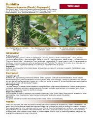
RATopic1_95 - Geosystems Research Institute - Mississippi State ...
RATopic1_95 - Geosystems Research Institute - Mississippi State ...
RATopic1_95 - Geosystems Research Institute - Mississippi State ...

You also want an ePaper? Increase the reach of your titles
YUMPU automatically turns print PDFs into web optimized ePapers that Google loves.
A supporting effort of the IPAMS project is training of lay volunteers to identify species in our list of forty invasive<br />
weeds of the Mid-South, and to provide them the resources to report results of their surveys via a centralized web-based<br />
database. This will provide location data to federal and state natural resource agencies for rapid action, as well as generating<br />
data to develop predictive models to further refine searches, surveys, and rapid response efforts to control invasive<br />
weeds in the Mid-South.<br />
Extension and Outreach<br />
We have developed a<br />
training manual and a field<br />
identification guide, and<br />
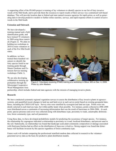
have trained 70 volunteers<br />
in 2009 using these materials<br />
(Figure 2). We plan on<br />
holding ten workshops in<br />
2010 to train volunteers in<br />
each of the five Mid-South<br />
states.<br />
In addition, we have<br />
trained three hundred volunteers<br />
to identify the<br />
forty species listed in our<br />
training guide through<br />
Master Gardener and Extension<br />
Service training<br />
workshops (Table 1).<br />
We are also developing<br />
collaborative training opportunities<br />
through the Figure 2. Volunteers receiving IPAMS training at a workshop in Biloxi, MS on Dec. 4, 2009.<br />
<strong>Mississippi</strong> Cooperative<br />
Photo by John Madsen.<br />
Weed Management Area<br />
partnership, which includes federal and state agencies with the mission of managing invasive plants.<br />
<strong>Research</strong><br />
We have conducted systematic regional vegetation surveys to assess the distribution of key invasive plants in agroecosystems,<br />
and quantified recent changes in land use and land cover at each survey point based on existing geospatial databases,<br />
including the USGS GAP layer. Survey sites were stratified by ecoregion and land use type. Points were randomly<br />
selected in each land use type, but within public lands when possible. For instance, points collected in 2006-2008<br />
were distributed across a continuum of increasing deforestation that was the result of hurricanes in 2004-2006. At each<br />
point, species presence and cover was collected along with disturbance type, proximity to roads, catastrophic deforestation,<br />
forest community type, and soil parameters.<br />
Using these data, we have developed probabilistic models for predicting the occurrence of target species. For instance,<br />
the relationship for cogongrass indicated a relationship to proximity to a road, localized disturbance, and percent sand in<br />
the soil. Statistically, no relationship was found that landscape scale plant community composition or damage associated<br />
with Hurricane Katrina had an effect on the distribution of Imperata cylindrica. Strong support was found that disturbance<br />
will facilitate invasion by this species regardless of forest community type.<br />
Future work will include comparing the professional stratified-random data collected in research to the volunteergenerated<br />
survey data as the basis for predictive plant distribution models.<br />
2009 USGS Annual Report 28 <strong>Mississippi</strong> <strong>State</strong> University’s <strong>Geosystems</strong> <strong>Research</strong> <strong>Institute</strong>