RATopic1_95 - Geosystems Research Institute - Mississippi State ...
RATopic1_95 - Geosystems Research Institute - Mississippi State ...
RATopic1_95 - Geosystems Research Institute - Mississippi State ...

Create successful ePaper yourself
Turn your PDF publications into a flip-book with our unique Google optimized e-Paper software.
Task 2.1. National Early Detection and Rapid Response Toolbox Development<br />
PI: John Madsen<br />
Co-PI: Victor Maddox<br />
Cooperator: Elizabeth Sellers, NBII, Randy Westbrooks, USGS NWRC, and Annie Simpson, USGS National Headquarters<br />
(NBII), Pam Fuller, USGS Caribbean Science Center, and Les Mehrhoff, University of Connecticut (IPANE)<br />
The Use of Early Detection and Rapid Response Protocol for the Control of<br />
Water lettuce (Pistia stratiotes L.) in Powe Pond, Starkville, MS<br />
Ryan M. Wersal and John D. Madsen<br />
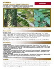
Water lettuce is a free-floating aquatic plant that is not native to the United<br />
<strong>State</strong>s. The floating growth habit and rapid reproduction allows water lettuce to<br />
cover large expanses of water in short periods of time. Dense infestations reduce<br />
access and use of waterways, navigation, hydroelectric generation, and<br />
recreation. Ecologically, dense infestations of water lettuce can cause reductions<br />
in dissolved oxygen which may lead to fish mortality; these infestations<br />
can also shade native submersed aquatic plants reducing the spatial heterogeneity<br />
and habitat for aquatic invertebrates.<br />
Figure 1. Aerial imagery of Powe Pond<br />
in August 2007 indicating no water lettuce<br />
present.<br />
On August 12, 2008, water lettuce was identified growing in a small area of a<br />
1.75 acre impoundment located in the Thad Cochran <strong>Research</strong>, Technology, and<br />
Economic Development Park, Starkville, MS. The water lettuce has escaped<br />
the pond via a water control structure to a creek that transects the <strong>Research</strong> Park<br />
for several miles The creek empties into Sand Creek (North East of the pond)<br />
which ultimately empties into the Tennessee Tombigbee Waterway 20 miles to<br />
the east. Therefore, the objectives of this study were to 1) eradicate the water<br />
lettuce population in the pond, and 2) survey and eradicate any plants that have<br />
escaped into the outflow creek using aquatic labeled herbicides.<br />
Methods<br />
Figure 2. Aerial imagery of Powe Pond<br />
in June 2008 shows small scattered<br />
patches along the northern shoreline.<br />
Figure 3. Aerial imagery of Powe Pond<br />
in August 2008 shows a substantial<br />
increase in water lettuce coverage.<br />
Figure 4. Aerial imagery of Powe Pond<br />
in Sept. 2008 showing complete water<br />
surface coverage by water lettuce.<br />
2009 USGS Annual Report 15 <strong>Mississippi</strong> <strong>State</strong> University’s <strong>Geosystems</strong> <strong>Research</strong> <strong>Institute</strong>