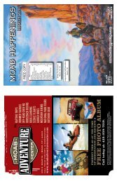
Moab Happenings ⢠August 2010
Moab Happenings ⢠August 2010
Moab Happenings ⢠August 2010

You also want an ePaper? Increase the reach of your titles
YUMPU automatically turns print PDFs into web optimized ePapers that Google loves.
2B • <strong>Moab</strong> <strong>Happenings</strong> • <strong>August</strong> <strong>2010</strong><br />
HIKING HAPPENINGS<br />
The Mountain View Trail – A View From The Other Side<br />
The La Sal Mountains were formed over twenty-five<br />
to thirty million years ago. At that time intrusive molten<br />
magma cooled into igneous rock and the overlying, less<br />
resistant sandstone eroded away, resulting in the formation<br />
of fourteen peaks over 12,000 feet. Covering an area in both<br />
San Juan and Grand Counties that is 25 miles long (northsouth)<br />
by 15 miles wide (east-west), the La Sals are the<br />
second highest mountain range in Utah. Those of us lucky<br />
enough to live here are blessed to<br />
have these high altitude crown<br />
jewels in our backyard. Divided<br />
into three distinct groups - north,<br />
middle and south - this massive<br />
landmark with its distinctive profile<br />
dominates the horizon from both<br />
western Colorado and southeastern<br />
Utah, and whenever I’m on the<br />
road it’s my beacon signaling me<br />
that I am getting close to home.<br />
We are very fortunate that the<br />
majority of this mountain range,<br />
this land of many uses for water,<br />
timber, grazing, minerals and recreation,<br />
is not privately owned. Instead, under the<br />
protection of the Manti La Sal National<br />
Forest, which was established in 1907,<br />
it remains open to the public where<br />
everyone has access to this delightful<br />
mountain wonderland. With a huge gain<br />
in elevation, residents and visitors alike<br />
seek this alpine refuge - especially in<br />
the summer to escape the baking desert<br />
heat, but also in the winter to crosscountry<br />
ski and snowshoe.<br />
Warner Lake, at 9400 feet with<br />
its idyllic mountain scenery, which<br />
is dominated by Haystack<br />
Mountain, is an ideal place to<br />
pass a lazy afternoon. Close to<br />
the lake there’s a picnic area<br />
and a campground ($10.00<br />
a night) with twenty sites,<br />
while the group camping area<br />
accommodates fifty people.<br />
The water in the campground,<br />
however, is not safe for<br />
drinking.<br />
It takes less than an hour<br />
to drive the estimated 35<br />
miles to Warner Lake. To get<br />
there from <strong>Moab</strong>, go south on<br />
Highway 191 approximately<br />
7.5 miles and turn left at the<br />
sign for the Ken’s Lake-La Sal Loop Road.<br />
Continue half a mile to the stop sign at the<br />
tee and turn right on to the Spanish Valley<br />
Drive-La Sal Loop Road. Go past the turn<br />
offs for Pack Creek Ranch, Geyser Pass<br />
Road and Oowah Lake. The next major<br />
road on your right after Oowah<br />
Lake will have a sign for Warner<br />
Lake. This five-mile graveled<br />
road is suitable for any vehicle,<br />
but it is only open during the<br />
summer-early fall season. By<br />
late September-early October,<br />
depending on the weather, the<br />
possibility exists that the road will<br />
be closed for the winter.<br />
Warner Lake is the hub for<br />
a lot of trails; some are heavily<br />
used. I decide to take the less<br />
traveled Miners Basin Trail, which<br />
provides access to the Mountain View Trail. The signed<br />
trail begins at the information kiosk. Not far up the trail<br />
another sign has the following information: Miners Basin-<br />
Warner Trail #040, three miles to Miners Basin, Mountain<br />
View Trail #185 - .07 miles.<br />
This foot trail starts in the richness of dark blue lupines<br />
that flanks me on both sides. After two very easy open-andclose<br />
gates I take a right on to a dirt road and immediately<br />
look for the next sign with an arrow pointing for another<br />
right turn. Soon I’m following a wide switchback through<br />
the aspens to the trail register. Then the thick branches<br />
of Engelmann spruce and sub-alpine fir umbrella me in<br />
rippled shade where the mountain chickadees “dee-deedee”<br />
their trademark calls while red-breasted nuthatches<br />
“yank-yank-yank” a tinny trumpeted song that mingles<br />
with the enchanting fluted chorus of the hermit thrush.<br />
www.moabhappenings.com<br />
by Marcy Hafner<br />
This steady uphill trail with its lovely bouquet of blue<br />
columbines, red columbines and bluebells clings next to the<br />
stream as it wanders past the sloping jumble of loose rock<br />
called scree. I easily tiptoe across the only stream crossing<br />
and when the firs and spruce give way to an aspen lined<br />
meadow, I am at a signed junction - right for the Mountain<br />
View Trail, left for the Miners Basin Trail. I go right to<br />
walk about a mile to the end of the trail.<br />
Layered with pine needles,<br />
shredded bark and mangled cones,<br />
this path is cushy underneath<br />
my feet as I listen to the voices<br />
of a western tanager, juncos,<br />
pine siskins and a ruby-crowned<br />
kinglet. Well marked with rock<br />
cairns and notched trees this trail<br />
starts out along a small endearing<br />
stream that once again reminds me<br />
there’s nothing more soothing than<br />
the rhythmic beat of moving water.<br />
At one spot I pause to admire a<br />
miniature waterfall that drops into<br />
a small pool.<br />
Since this trail is on the shady,<br />
mossy north side of the mountain it<br />
collects excessive amounts of snow.<br />
With an above average snowfall this<br />
winter, sections of it stayed buried until<br />
the very end of June. In these deep<br />
woods of spruce and fir a plentitude of<br />
fallen trees adds to the dank mysterious<br />
mood. The flowers bloom late in the<br />
summer season, but sometimes in an<br />
open meadow where the sun breaks<br />
through there’s a big splash of color–<br />
the soft blue of the Jacob’s ladder with<br />
leaves patterned in the shape<br />
of a ladder along with the<br />
bright yellow of the golden<br />
pea and the nodding charm of<br />
the bluebell.<br />
At one of those meadows<br />
it takes a few seconds for it<br />
to register what is moving<br />
behind that mule deer doe -<br />
her wobbly-legged, heavily<br />
spotted twins are no bigger<br />
than a medium-sized dog!<br />
She watches intently for any<br />
sign of danger so that she and<br />
her adorable fawns can safely<br />
wander off into the tall, thick<br />
green grass that completely<br />
hides the little ones.<br />
As the trail climbs up from the<br />
stream towards the ridge I hear the<br />
jackhammer pounding of woodpeckers. I<br />
scan the dead trees and find two “threetoed<br />
woodpeckers” - a male sporting a<br />
yellow cap accompanied by a<br />
drabber looking female. Most<br />
woodpeckers have four toes - this<br />
rarely seen species has only three,<br />
which compromises the ability to<br />
climb but instead helps deliver a<br />
stronger forceful blow.<br />
The trail tops out at a meadow<br />
edged with aspens filled with<br />
parsley, yarrow, golden pea and<br />
larkspur. It ends shortly thereafter<br />
on a rock field of scree where a<br />
huge stone monument marks this<br />
astounding site of backside views<br />
of Mount Tukuhnikivatz, Tuk No, Mount Peale, pre-Laurel<br />
ridge with the weather station, Laurel Peak, Haystack<br />
Mountain, Mount Mellenthin, Tomasaki Peak and Manns<br />
Peak. On the western slope I look down on the steep cliffs<br />
of Mill Creek Canyon, Bald Mesa and the winding Loop<br />
Road. Down on the valley floor, the faint image of <strong>Moab</strong><br />
appears, and beyond that are canyonlands stretching clear<br />
to the Henry Mountains on the far distant horizon.<br />
According to the map, this route is called Don’s Trail,<br />
but recent signage has renamed it Mountain View. The<br />
name fits the description well for it delivers the unusual<br />
views, the other side views, off the beaten path views. Until<br />
recently, I didn’t even know it existed. What a wonderful<br />
discovery to see these familiar mountains from an entirely<br />
different perspective.