Understanding Sprawl - David Suzuki Foundation
Understanding Sprawl - David Suzuki Foundation
Understanding Sprawl - David Suzuki Foundation

Create successful ePaper yourself
Turn your PDF publications into a flip-book with our unique Google optimized e-Paper software.
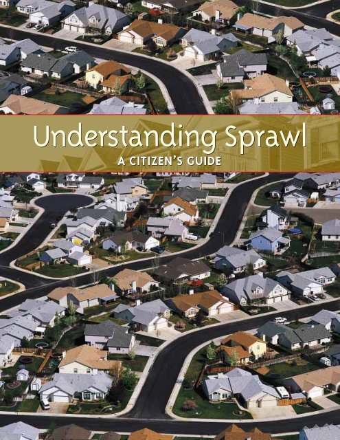
<strong>Understanding</strong> <strong>Sprawl</strong><br />
A CITIZEN’S GUIDE
<strong>Understanding</strong> <strong>Sprawl</strong><br />
A CITIZEN’S GUIDE
ISBN 0-9689731-5-9<br />
Copyright © 2003<br />
Authors<br />
<strong>Understanding</strong> <strong>Sprawl</strong> was written and researched by <strong>David</strong> Gurin.<br />
Driven to Action: Stopping <strong>Sprawl</strong> in Your Community was produced by Shelly Petrie, <strong>David</strong> Gurin,<br />
Dermot Foley and Morag Carter<br />
Acknowledgement<br />
Thanks to Paul Lingl, Sarah Marchildon, Lee Nichol and the Toronto Environmental Alliance<br />
for valuable support and assistance. Thanks to Cheeying Ho, Ray Tomalty and Mark Winfield<br />
for suggestions and critiques in the early stages of this project.<br />
This project was made possible through generous financial contributions<br />
from numerous individuals and the following foundations:<br />
The Vancouver <strong>Foundation</strong><br />
The Chawkers <strong>Foundation</strong><br />
The Stephen R. Bronfman <strong>Foundation</strong><br />
The Bullitt <strong>Foundation</strong><br />
Published by<br />
The <strong>David</strong> <strong>Suzuki</strong> <strong>Foundation</strong><br />
2211 West 4th Avenue, Suite 219<br />
Vancouver, BC, Canada v6k 4s2<br />
Tel: (604) 732-4228<br />
Fax: (604) 732-0752<br />
www.davidsuzuki.org<br />
solutions@davidsuzuki.org<br />
Working through science and education<br />
to protect the balance of nature and our quality<br />
of life, now and for future generations.<br />
Photographs by Richard Homme (pages 2 and 10), www.pedbikeimages.org/Dan Burden (page 9),<br />
Lou Wise (page 11), Al Harvey (pages 18 and 19); others by Corbis, Eyewire, Getty Images<br />
and Photodisc<br />
Design by Alaris Design<br />
Printed by Western Printers & Lithographers<br />
Cover printed on Reincarnation Matte 100% recycled/50% post-consumer waste, process chlorine free;<br />
Insides printed on Eco-offset 100% recycled post-consumer fibre, process chlorine free
Contents<br />
Introduction 1<br />
From Compact City to <strong>Sprawl</strong>ing Suburb 3<br />
1 Cities and suburbs 3<br />
2 Urbanization and sprawl 4<br />
3 How transportation determines the way we use land 5<br />
4 Is sprawl the consumer’s choice? 7<br />
The Costs of <strong>Sprawl</strong> 9<br />
1 Low-density means high cost 9<br />
2 Household costs of sprawl 10<br />
3 Consuming precious land 11<br />
4 Public health 12<br />
5 Climate change 15<br />
6 Energy 16<br />
7 Water 16<br />
8 Wildlife 17<br />
9 Aesthetics and quality of life 17<br />
Conclusion 19<br />
Other resources 20<br />
Notes 21
iv<br />
Key Recommendations<br />
Citizen participation in decisions concerning your community is key to stopping<br />
sprawl. The best place to start is by establishing a set of community goals.<br />
This will help catalyze citizens.<br />
The following set of goals and recommendations can form a part of every<br />
community plan:<br />
•Protect the environment by preserving parks, ravines, natural areas<br />
and watercourses<br />
•Intensify town centres by enhancing economic activity and promoting<br />
mixed use development<br />
•Reinvest along empty corridors and brownfields and redevelop strip mall<br />
type roads<br />
•Promote regional planning<br />
•Promote alternative transportation<br />
•Increase housing and jobs<br />
•Protect the downtown<br />
•Protect existing compact residential neighbourhoods<br />
•Protect agricultural and rural areas by establishing a legislated urban<br />
growth boundary<br />
In addition, each and every citizen can do their part to reduce their personal<br />
ecological footprint by taking the <strong>David</strong> <strong>Suzuki</strong> Nature Challenge. <strong>Sprawl</strong> is not<br />
inevitable.
1<br />
Introduction<br />
U<br />
<strong>Understanding</strong> <strong>Sprawl</strong> is a guide for decision-makers and citizens who want to create a<br />
healthy, affordable and sustainable urban future. It is not an architectural blueprint<br />
but an exploration of the forces that shape cities and what people can do about them.<br />
It probes the history of city and suburban development, which is critical for understanding<br />
current urban patterns. It reviews the nature of the city and outlines the social and economic<br />
costs incurred by recent development.<br />
Canadians have good reason to become designers of our own urban future. According to<br />
the 2001 census, close to 80 per cent live in an urban area, defined as a place with a population<br />
of 10,000 or more. In fact, most of Canada’s population growth in recent years has<br />
focused on just four regions: British Columbia’s Lower Mainland and southern Vancouver<br />
Island; the Edmonton-Calgary corridor; Toronto’s Golden Horseshoe region along Lake<br />
Ontario and up to Lake Simcoe; and the Greater Montreal area. While there was virtually no<br />
growth (+0.5 per cent) in the rest of the country between 1996 and 2001, the population of<br />
these four regions (where 51 per cent of Canadians now live) grew 7.6 per cent. 1 The rate at<br />
which land was urbanized in these regions was even greater, sometimes double or more the<br />
population growth rate. This difference between the growth rates of people and of the land<br />
they occupy defines urban sprawl. As cities spread into vast low-density urban areas, sprawl<br />
evolves into a drain on ecological, social and economic capital.<br />
Although sprawl is not a new problem, addressing it is even more critical now as a means<br />
of meeting our commitments under the Kyoto Protocol on climate change. <strong>Sprawl</strong>ing<br />
communities are a major contributor to climate change and air pollution, in part because<br />
they require so much automotive transportation, which is heavily dependent on energy<br />
consumption from fossil fuels, the biggest source of greenhouse gases. In addition to burning<br />
gasoline, sprawling communities have to pump water in and waste out over long distances,<br />
deliver natural gas and electricity over long distribution networks, and provide solid waste,<br />
recycling pick-up and other services over a much wider area. Each of these services uses more<br />
energy and therefore produces more greenhouse gases than providing similar services to<br />
denser communities.<br />
Many parts of Canada, particularly urban areas, are currently impacted by air pollution<br />
from automobiles. Climate change will make these impacts worse. This is because ambient<br />
air temperature is one of the key factors in the formation of secondary air pollution such as<br />
ground level ozone and particulates, key components of smog. Building more sustainable<br />
cities will help address both these problems by contributing to our Kyoto emission reduction<br />
commitments and by reducing immediate local air pollution.<br />
<strong>Sprawl</strong>ing communities<br />
are a major contributor<br />
to climate change and<br />
air pollution.
2 <strong>Understanding</strong> <strong>Sprawl</strong>: A Citizen’s Guide<br />
Not only does sprawl<br />
contribute to climate<br />
change, it consumes<br />
large quantities of land.<br />
Not only does sprawl contribute to climate change, it consumes large quantities of land,<br />
segregates houses from shops and workplaces, depends on private cars, and has little regard<br />
for the natural environment. For many Canadians born in the last half of the 20th century<br />
and raised in suburbs, sprawl may appear normal and inevitable. But in reality, it is a result<br />
of deliberate decisions about how land is used and about the kind of transportation systems<br />
the government supports. By examining the history of current urban development patterns<br />
and their hidden costs, citizens will have the tools to compel wiser use of land and more<br />
efficient transportation policies.<br />
Most Canadians do not personally build the houses, streets, schools, parks or water lines<br />
that make cities possible. However, an informed citizenry can set the rules for building<br />
sustainable cities and help make the plans that determine how we get to work, school and<br />
shopping; how much time we spend in cars, trains or on foot; where the open spaces are;<br />
and the quality of the air we breathe. Many people feel uneasy about the way our cities are<br />
developing, but as citizens of a democracy, we should not feel helpless. Population growth<br />
and greater wealth do not have to be based on an environment of parking lots, traffic and<br />
pollution. Instead we need to create 21st century cities that are liveable, prosperous and in<br />
harmony with nature.
3<br />
From compact city to sprawling suburb<br />
1. Cities and suburbs<br />
Cities have stood out from the surrounding countryside as places of intense human settlement<br />
since ancient times. Density defines the city, as does industry – work for people to do –<br />
and markets where people spend their earnings. Historically the spaces in most cities where<br />
people lived, worked, shopped, went to school and entertained themselves formed a patchwork<br />
quilt. Downtown may have held a preponderance of office jobs but other workplaces<br />
were scattered through the city, and shopping streets threaded the city’s residential neighbourhoods.<br />
Cities were densely populated and diverse. Ironically, while undergoing enormous<br />
growth in recent years, North American cities have become less dense and less diverse<br />
in their physical layout.<br />
Canadian cities have changed dramatically in the past half-century. The obvious change is<br />
enlargement: taller buildings, wider highways, expanding boundaries. The more profound<br />
change is in the urban fabric: people live further apart from their neighbours; houses, shops<br />
and workplaces once co-mingled are now segregated; trips once made on foot or by bus or<br />
streetcar are now made by private car. Garage doors rather than front porches dominate<br />
many streets; the shopping mall has replaced downtown; airports rather than railway stations<br />
are the travel hubs.<br />
However, the history of suburbs was not always the history of sprawl. In the first half of<br />
the 20th century, suburbs grew along the tracks of railways and streetcars. This pattern of<br />
growth produced some dignified suburbs that had clearly defined centres at the stations,<br />
surrounded by shops. Suburban residential neighbourhoods were less dense than the central<br />
cities but much more dense than current sprawl. Some suburbs that grew around railway<br />
stations, such as Oakville, outside Toronto, still maintain their suburban status, and good rail<br />
service still connects them to the central city. As cities grew, most of the “streetcar suburbs,”<br />
were absorbed. Mimico, New Toronto, West Hill, and The Beach are Toronto neighbourhoods<br />
that were originally streetcar suburbs. Outremont, Mount Royal, Dorval and Lachine<br />
in Montreal have similar histories.<br />
Few people today know about “interurbans”, though before World War II they were an<br />
important mode of travel in North America. Interurbans were streetcars that started on city<br />
streets but then ran out to the countryside on their own tracks. They often travelled at faster<br />
speeds than automobiles attain on freeways or expressways today. Interurbans provided fast<br />
service from Toronto to Guelph and Lake Simcoe, and from Montreal to Granby, in the<br />
Eastern Townships, as well to Deux-Montagnes, a service still operating. In Vancouver,<br />
interurbans followed the same route as the SkyTrain to New Westminster. They also went to<br />
Interurbans were<br />
streetcars that started on<br />
city streets but then ran out<br />
to the countryside on their<br />
own tracks.
4 <strong>Understanding</strong> <strong>Sprawl</strong>: A Citizen’s Guide<br />
People who live in<br />
sprawling cities and<br />
suburbs today often<br />
express uneasiness<br />
about the immediate<br />
environment and<br />
frustration with getting<br />
from place to place.<br />
Steveston, Langley and Chilliwack. In that era, families were able to choose suburban<br />
living without the sprawl since rails rather than highways were the dominant mode of<br />
transportation.<br />
People who live in sprawling cities and suburbs today often express uneasiness about the<br />
immediate environment and frustration with getting from place to place. Sometimes they<br />
can be immobilized in traffic jams, or find themselves moving slowly and uncomfortably<br />
on public transit. They may also feel threatened by cars while walking or riding bicycles.<br />
However, most people don’t make the connection between the style of the built environment<br />
and their transportation problems.<br />
On the other hand, people are aware that cars and trucks, generally the main forms of<br />
transportation, cause congestion and are major contributors to air pollution, noise, and<br />
accidents. Many are also aware that big cities have expanded in ways that make alternatives<br />
difficult to provide. This presents a dilemma. People feel impatient with the situation because<br />
of personal inconvenience and business inefficiency, but are uncertain about what to do.<br />
Current policies do not seem to be working. There is an atmosphere of crisis, with media<br />
attention shifting from day to day – from congested highways to bad driving behaviour to<br />
the challenge of financing public transit. But more than any of these individual problems is<br />
at stake: the prosperity of cities depends on the smooth movement of people and goods, and<br />
that is getting more difficult due to sprawling development. The crisis in urban transportation<br />
must be resolved because the economies of cities, and in many ways the economy of<br />
Canada, depend on a solution. However, the solution involves not just transportation, but<br />
also the whole approach to building cities.<br />
No city in the world has ever completely solved its transportation and land use problems,<br />
but many cities have striven toward environmentally benign planning. Curitiba, a Brazilian<br />
city, provides one model on how to integrate sustainable transport with business and community<br />
development. Its plan integrates traffic management, transportation, and land-use<br />
planning, with main roads modified to give public transport the highest priority. Singapore<br />
has also placed serious limitations on the purchase and use of cars while developing new<br />
neighbourhoods around subway stations. The number of private cars in central London has<br />
been reduced by 20 per cent through “congestion pricing,” which charges a fee for cars to<br />
enter the central city. Money collected from these fees will be used to improve public transport.<br />
Cities like Curitiba, Singapore and London are efficient and productive, and attract<br />
investment. Cities that allow congestion to worsen are more likely to decline economically.<br />
It is important that Canada as a whole and Canadian cities individually adopt policies that<br />
will promote sustainable city and regional planning. Sound city planning invites economic<br />
development.<br />
2. Urbanization and sprawl<br />
Probably the single greatest source of wealth creation in history has been the conversion of<br />
rural land into urban land – urbanization. This process occurred at a slower rate in earlier<br />
periods, and the shape of the city that resulted was dense. Nowadays urbanization is more<br />
rapid and much less dense.<br />
Pre-war Toronto neighbourhoods (with very few mid-rise or high-rise buildings) have<br />
densities of 28 to 36 housing units per hectare; post-war developments close to the city tend<br />
to have 10 to 15: development in rural areas of the Greater Toronto Area is at about 2 to 7
From compact city to sprawling suburb 5<br />
units per hectare. The densities of pre-war neighbourhoods are “in the range of two to three<br />
times the level of recent fringe development.” 2 This range of comparative densities is also<br />
found in other Canadian cities and their suburbs.<br />
By contrast, medium density developments can have a range of 30 to 90 units per hectare.<br />
Central city high-densities can be much higher. For example, in the West End of downtown<br />
Vancouver, a very desirable neighbourhood, there are over 133 units per hectare.<br />
Many of the houses in the old city neighbourhoods have front and back yards. Some<br />
houses are attached, some semi-attached and some are rows. There are generally just a small<br />
number of high-rise apartment buildings scattered among them. Families live comfortably in<br />
these neighbourhoods and the houses are valued highly on the real estate market. Why, then,<br />
are new suburban neighbourhoods built at much lower densities?<br />
A number of factors contribute to the prevalence of sprawling low-density suburbs. The<br />
growing number of personal automobiles provides a perceived convenient means of transportation<br />
to city centres and other workplaces. The willingness of governments to subsidize<br />
infrastructure for automobiles and for water, sewage, and electric and gas utilities also biases<br />
development choices towards low density. Another factor is the enormous private profit in<br />
building and servicing sprawling development. The profit is not only in the escalating price<br />
of land as demand for it increases but also in the marketing of automobiles.<br />
Canada is building new houses at a rapid rate: housing starts are expected to exceed<br />
205,000 in 2003. 3 In recent years the planning rules in some suburbs closer to big cities have<br />
required new houses to be built closer to one another, but not as close as in cities. In the<br />
more rural suburbs on the metropolitan fringes, densities remain quite low. As housing<br />
density decreases, more land is consumed and infrastructure per unit is more expensive –<br />
sewer and water pipes, roads, and electric and gas services have to be longer and spread over<br />
greater areas. Providing public transit services becomes extremely expensive and is therefore<br />
less frequent. As a result, suburbanites are compelled to live with distances and expenses that<br />
are both unnecessary and avoidable.<br />
A COMPARISON OF<br />
NEIGHBOURHOOD DENSITY<br />
(units/hectare)<br />
Toronto, rural outskirts<br />
2 to 7<br />
Toronto, built post WWII<br />
10 to 15<br />
Toronto, built pre-WWII<br />
28 to 36<br />
Montreal, Plateau Mont-Royal<br />
75<br />
Vancouver, West End<br />
over 133<br />
3. How transportation determines the way we use land<br />
There is little awareness today about the history of urban development in North America.<br />
Most city dwellers once walked to main streets to shop. Children walked to schools, libraries,<br />
and playing fields. Workers took streetcars to factories and offices. In the 1930s, electric<br />
streetcar companies perfected superb streetcars. They accelerated more quickly than buses<br />
and rode quietly and without fumes on smooth welded track. These cars were spacious and<br />
comfortable with wide double doors close to the ground, allowing passengers to get on and<br />
off quickly.<br />
With streetcars in cities, interurbans reaching out into the countryside, and railroads<br />
between cities, there was a great deal of mobility available at reasonable cost. However,<br />
automobile and gasoline companies saw all this as an obstacle. They worried that average<br />
people in cities would not desert the streetcars in order to buy automobiles. To remedy this<br />
perceived marketing problem in the United States, these corporations set about purchasing<br />
the streetcar systems that dominated American cities and converting the lines from streetcars<br />
to buses, which the automobile companies manufactured. 4 They were able to do this with the<br />
help of local public officials, who thought the streetcars old fashioned but saw buses as new<br />
and streamlined. However, the larger objective for these companies was not the sale of
6 <strong>Understanding</strong> <strong>Sprawl</strong>: A Citizen’s Guide<br />
It was not until the late<br />
1960s and early 1970s that<br />
large numbers of citizens<br />
and members of municipal<br />
councils recognized that<br />
automobiles were not only<br />
dominating transportation<br />
but also dominating cities<br />
themselves.<br />
buses but rather clearing the centres of the streets of tracks and big lumbering electric<br />
vehicles that got in the way of private cars. Cars had to stop behind stopped streetcars – as<br />
they still do in Toronto – to allow passengers safe boarding and disembarking, while buses<br />
pulled deferentially to the curb. In Canada, most of the streetcar lines were in public ownership<br />
and not for sale to private companies, but there was still pressure to remove tracks and<br />
bring in buses, which happened in most cities<br />
Most people believe that the urban centres emptied and walking and streetcar riding<br />
became less popular because car ownership increased. But that is only one facet of the story.<br />
New transportation technology, in the form of the automobile did not change the city by<br />
itself – government policy was the major catalyst.<br />
After World War II, transportation planning in North America focused primarily on<br />
accommodating the ever-increasing number of cars pouring onto country roads and city<br />
streets. Since the narrow streets of old cities and towns did not have enough room for cars to<br />
circulate or park, traffic engineers were assigned the task of finding ways to move and store<br />
the flood of new vehicles. In response, they recommended that city councils enact techniques<br />
and policies for expanding the car-carrying capacity of local streets. Examples include:<br />
enlarging the roadway portion of streets at the expense of sidewalks, creating one-way pairs<br />
of streets, introducing regulations that add travel lanes by prohibiting parking during peak<br />
hours or all day, and building municipal parking facilities. Large and small cities in Canada<br />
used these measures to help move automobile traffic.<br />
To speed traffic between cities and towns, in the 1950s, traffic engineers recommended<br />
limited-access highways, such as Ontario’s 401. There were also plans for new highways and<br />
enlarged arterial roadways within cities and beyond them to connect to the growing suburban<br />
areas. Most of these new residential suburbs were planned almost entirely without public<br />
transportation. There were often no sidewalks, and curvilinear streets ending in cul-de-sacs<br />
replaced the grid pattern of the old cities. Retail shops that used to flourish along sidewalks<br />
on downtown streets moved to roadside commercial strips and shopping centres. Office<br />
parks were planned that were accessible only by car and there were no rail freight connections<br />
in some of the new industrial parks. As a result, transportation planning became mostly<br />
a matter of providing additional road capacity. Canada’s transportation system became, in<br />
large measure, an automotive system, rather than a balanced system that integrates the use of<br />
cars, buses, streetcars, and railroads, with allowance for safe walking and bicycle riding.<br />
Ironically, despite wider roads, the automotive system often results in longer trips, as people<br />
live and work in more widely dispersed homes and workplaces.<br />
Municipal councils that employed traffic and highway engineers did not seem to be aware<br />
of the consequences of suburban growth entirely dependent on motor vehicles. It was not<br />
until the late 1960s and early 1970s that large numbers of citizens and members of municipal<br />
councils recognized that automobiles were not only dominating transportation but also<br />
dominating cities themselves. In the 1950s, Metropolitan Toronto planned a network of<br />
expressways crisscrossing the city. Luckily, only a small part of the network was built because<br />
an organized citizenry successfully opposed the Spadina Expressway, a major link. Instead,<br />
the subway and streetcar networks were expanded, and in the 1970s Toronto became internationally<br />
recognized for transportation improvement. Vancouver had a similar struggle and<br />
neighbourhood organizing in the 1960s and 70s kept freeways out of downtown Vancouver.<br />
In the U.S., organized citizens also opposed highways, but only after a massive highway<br />
building boom. Starting in the 1950s, the U.S. federal government paid cities 90 per cent of
From compact city to sprawling suburb 7<br />
the cost of building expressways into city centres, which often meant using prime urban land<br />
for multi-lane highways and interchanges. The U.S. federal government also paid 90 per cent<br />
of the cost of buying urban land deemed “slum,” hence there was an enormous incentive to<br />
depopulate entire communities. New neighbourhoods were supposed to rise on this land,<br />
but instead much of it remained vacant lots. These open-handed federal programs had the<br />
effect of clearing population and business out of large swaths of American city centres. In<br />
Canada, there was also a wave of so-called slum clearance and urban highway building, but<br />
the subsidy available was small by comparison. For a long while this had a healthy result: the<br />
centres of Canadian cities held strong. They did not assume the “donut” shape – empty in the<br />
centre – of their American counterparts. But lately the donut has been forming in urban<br />
areas like Saskatoon and Regina and “sprawl is eating away at Charlottetown’s northern<br />
fringe.” 5,6 And in all of Canada local and provincial governments are building roads, sewers<br />
and water lines needed for low-density urban expansion. As a result, sprawl is now almost as<br />
common in Canada as in the U.S.<br />
Simply put, urban transportation ought to be the means of getting around cities, but<br />
instead it has come to be more like an end unto itself: it dominates much of the landscape of<br />
the world’s cities, mostly in the form of accumulated private automobiles. Most of these are,<br />
at most times, standing still, on the street or in parking lots, and that takes up a lot of space<br />
and destroys urban charm and beauty. By contrast, a two-track subway has the capacity of<br />
a twelve-lane highway and does not require parking space. Streetcars and buses are also far<br />
more efficient than cars in their use of land. Automotive transportation takes up about five<br />
times the land we would need for equivalent public transportation. 7<br />
A two-track subway<br />
has the capacity of a<br />
twelve-lane highway<br />
and does not require<br />
parking space.<br />
4. Is sprawl the consumer’s choice?<br />
Some members of the development industry maintain that the form of postwar suburban<br />
expansion is a simple matter of consumer preference. They argue that, given the choice,<br />
families would buy detached homes with garages in the front, and as much space as possible<br />
between houses. They also maintain that malls and “big box” retail outlets are clearly more<br />
popular places to shop than “main street” stores. But when architects and urban designers<br />
test the truth of these assertions, they come up with surprising results. When people are<br />
shown slides of traditional pre-war grid-patterned urban neighbourhoods – sidewalks<br />
lined with front porches, fairly close spacing between houses, active shopping streets –<br />
they generally prefer that layout to the typical postwar suburban cul-de-sac arrangement. 8<br />
It is this experiment in consumer preference, and distaste for sprawl, that emboldened some<br />
architects and planners to argue for the commercial possibilities of “neo-traditional”<br />
urbanism, a return to the pre-war style of building. This movement soon came to be called<br />
New Urbanism, and developments that embody some of its principles are being built in<br />
both Canada and the U.S.<br />
Of course, the traditional style of urbanism never stopped being available in many older<br />
and more central quarters of Canadian cities. However, since the price of a house is more<br />
expensive in these neighbourhoods, young families seeking cheaper housing tend to look for<br />
houses further away from the centre. They are also attracted to the heavily promoted suburban<br />
lifestyle, which offers newer houses and a promise (though not necessarily a reality) of<br />
greater quiet, cleanliness and safety. This preference for suburb over traditional neighbourhood<br />
reflects something more complicated than genuine “consumer preference” because
8 <strong>Understanding</strong> <strong>Sprawl</strong>: A Citizen’s Guide<br />
the suburban house price is artificially lower as a result of significant government subsidies.<br />
Provincial and local funds (including some raised by “development charges” levied on<br />
builders and passed on to homebuyers) pay for the infrastructure of roads, water and sewage<br />
lines and new schools. If these costs and the costs of environmental impacts were included,<br />
then suburban housing loses some of its price advantage over traditional neighbourhoods.<br />
In essence, sprawl stems more from hidden subsidy and sophisticated marketing campaigns<br />
than from the virtues of raising families outside the city.<br />
5. Why change the current pattern?<br />
Steering cities away<br />
from sprawl will go a long<br />
way toward reducing<br />
greenhouse gas emissions<br />
in Canada.<br />
Sustainable development, according to the United Nations World Commission on Environment<br />
and Development, “meets the needs of the present without compromising the ability<br />
of future generations to meet their own needs.” Suburban sprawl is not sustainable. It neither<br />
conserves resources, nor creates efficient infrastructure, nor protects nature. It relies on<br />
transportation that consumes fossil fuel at wasteful rates, diminishes scarce agricultural land<br />
and assaults natural habitat on a massive scale. Unchecked suburban encroachment on the<br />
land will leave an unsustainable environment to future generations. In Canada, this is<br />
especially true around the bigger cities.<br />
A detailed study of the Toronto area’s future gives an example of what will happen in the<br />
country’s largest urban agglomeration with continued low-density single-use development<br />
served largely by private automobiles. 9 The study extrapolates current trends to 2031 to<br />
forecast urbanization of an additional 1070 square kilometres of land (almost double the<br />
area of the current City of Toronto), requiring massive expenditures for water, sewer and<br />
road investment. Despite the road investment, the hours of delay for drivers each weekday<br />
will increase from about 300,000 to 1.2 million. Average commuting time by car will increase<br />
by about 25 per cent. Emissions of greenhouse gases will increase by about 42 per cent from<br />
2000 to 2031. The Toronto study called its report the “business as usual” scenario. If there’s<br />
no change in the way cities and suburbs are planned and the future is simply businessasusual,<br />
the consequence will be an urban Canada that is out of touch with the natural<br />
environment, unhealthy for its inhabitants, and a serious contributor to the process of<br />
global climate change.<br />
By ratifying the Kyoto Protocol on climate change in 2002, Canada committed to reducing<br />
greenhouse gas emissions. Road transportation is one of the biggest sources of these<br />
emissions, producing 134 million tonnes in 2001. Since sprawling communities are decentralized,<br />
people often have no option but to use an automobile. Steering cities away from<br />
sprawl will go a long way towards reducing greenhouse gas emissions in Canada. To address<br />
climate change over the long term, changes in the pattern of urban development are necessary.<br />
With sensible planning they are achievable.
9<br />
The costs of sprawl<br />
1. Low-density means high cost<br />
Suburban jurisdictions sometimes compete for development. Local councils believe that new<br />
development will pay for itself through development charges (levied for specifically needed<br />
new facilities) and an increased property assessment base. Growth in the assessment base<br />
seems to open the possibility of lower tax rates, but apparently tax rates are not lower in<br />
faster growing municipalities. 10 And even if a locality derives more tax income from a highly<br />
assessed commercial development, that development may be constructed on land that ought<br />
to be preserved for another use or as open space. Competition for development between<br />
suburban jurisdictions often distorts regional plans for the distribution of land uses.<br />
Another problem with this race for development is that neither the development charges<br />
nor the property taxes actually pay for all the new infrastructure costs. As a result, Canada<br />
will have to fill an enormous infrastructure gap of inadequate sewer and water works and<br />
insufficient public transit, among other needs. That will cost billions of dollars to close.<br />
According to the Federation of Canadian Municipalities, municipalities currently require<br />
up to $60 billion to address infrastructure needs. 11<br />
Despite evidence to the contrary, local councils tend to believe all growth pays for itself.<br />
In reality, the cost of a new school or the extension of sewer or water mains may only partly<br />
be paid by new residents; the rest will fall on those who were there before the new development.<br />
For example, all electric and gas utility customers usually end up paying for the<br />
extension of services to a new development thereby subsidizing the new customers.<br />
The prevailing urban development pattern around the towns and cities of Canada is<br />
supported by very costly investments in infrastructure. Canada Mortgage and Housing<br />
Corporation (CMHC) closely examined the prevailing pattern and found that building<br />
according to alternative standards could reduce costs. The CMHC study compared conventional<br />
suburban development with a mixed use, more compact development in accordance<br />
with the principles of New Urbanism. 12 The conventional pattern featured a curvilinear<br />
street pattern, relatively low residential densities, separation of land uses and dependence on<br />
private cars. Standards required wide local rights-of-way and generous single-family lot<br />
frontages, depths, front yard and rear yard setbacks. Compared with conventional development,<br />
the New Urbanism plan is more compact. It contains 71 per cent more dwelling units,<br />
due to smaller lot frontages, depths and setbacks, and the inclusion of more apartments. It<br />
has a finer mix of land uses, with twice as much commercial use land and 20 per cent more<br />
public open space. It has narrower rights-of-way and pavement widths, and a grid street<br />
Compared with<br />
conventional development,<br />
the New Urbanism plan<br />
is more compact.
10 <strong>Understanding</strong> <strong>Sprawl</strong>: A Citizen’s Guide<br />
$700 million to $1 billion<br />
per year could be saved<br />
by more efficient patterns<br />
of development.<br />
system. Within a five minute walk residents can get to a central green space surrounded by<br />
a mix of commercial and office buildings.<br />
The CMHC study found that using such alternative standards lowers public and private<br />
capital costs of infrastructure by 16 per cent, or approximately $5,300 (1995 dollars) per unit.<br />
Infrastructure replacement, and operating and maintenance costs are cheaper by almost<br />
9 per cent or almost $11,000 per unit over a 75-year period. In a community of 7,000 dwellings,<br />
CMHC estimated a life-cycle savings of $77 million or over $1 million annually. At the<br />
recent rate of about 200,000 housing starts a year in Canada, alternative standards would<br />
allow combined infrastructure, replacement, operating, and maintenance savings of about<br />
$1.1 billion annually.<br />
It is obviously more expensive to lay sewer, water and gas pipes, and build roads and<br />
electric grids over longer distances than shorter ones. It is also more expensive to provide<br />
police, fire, sanitation, snow removal and transit services to large low-density areas. The<br />
cost of providing services increases with distance and decreases with density. A 1995 study<br />
concluded that more compact and efficient urbanization in the Greater Toronto Area would<br />
save (in 1995 dollars) about $10 billion to $16 billion in infrastructure costs and about<br />
$2.5 billion to $4 billion in operating and maintenance costs over 25 years. If external costs<br />
(for emissions, health care, traffic policing, etc.) are considered as well as capital and maintenance,<br />
then approximately $700 million to $1 billion per year could be saved by a more<br />
efficient pattern of development. 13<br />
These infrastructure costs are among the external or “hidden” costs (or “externalities”)<br />
assumed by society as a whole and not paid by individuals. Other externalities include<br />
illnesses resulting from air pollution, time lost in congestion, traffic accidents, noise, and<br />
the economic consequences of global climate change.<br />
2. Household costs of sprawl<br />
Suburban homebuyers often focus on the cost of a house, which is cheaper when built on<br />
land further from the city centre. They usually pay only slight attention to the maintenance<br />
costs of the infrastructure their new community will need, though these costs may eventually<br />
show up as increased property taxes. They may also fail to consider fully the additional<br />
transportation costs of living in a setting where all trips require a car, though these transportation<br />
costs can begin to add up quickly.<br />
In 2002, average vehicle ownership cost in Canada was $6262.43 for the year, or about<br />
$17.16 per day. In addition, operating costs were 12.25 cents per kilometre. 14 City-dwelling<br />
Canadians who don’t own cars spend considerably less for transportation by relying on<br />
subways, streetcars, buses or the occasional taxi or car rental. In sprawling suburbs families<br />
are compelled to spend a large and growing proportion of their incomes on transportation.<br />
Residing in the suburbs requires one or more automobiles per household. For example in<br />
Houston, 22 per cent of average household expenditure is for transportation, considerably<br />
more than the 16 per cent spent for shelter. 15 This is a weighty burden on families, especially<br />
those with lower incomes, yet it is commonplace in many car-dependent American jurisdictions.<br />
Residents of Canadian urban areas generally are still paying more for housing than<br />
transportation, but the need to maintain a private car has become an expensive item in<br />
family budgets. In Canada as a whole in 2001, shelter cost 19 per cent of family expenditure
The costs of sprawl 11<br />
and transportation 13 per cent. 16 Households in lower-density settlements spend more<br />
on transportation; households with good access to public transportation spend less.<br />
It is noteworthy that, in Canada, buying, maintaining and fuelling individual vehicles<br />
cost more than food consumption, which accounts for only 11 per cent of family spending.<br />
Moreover, the transportation percentage of expenditures rose from the 1996 to the<br />
2001 census.<br />
Money isn’t the only transportation expense. Time spent driving is also a cost. In<br />
Canada’s larger urban areas a half hour journey to work is typical. 17 Many more hours are<br />
spent on other trips. A person who drives just an average of an hour every day spends the<br />
equivalent of nine working weeks a year in the car. Even when highways are widened and<br />
improved, the commute to work remains constant because bigger highways allow faster<br />
speeds, which allow further sprawl, with people driving longer distances. Canadians spend<br />
more time in their cars than Europeans do but less time than Americans. 18<br />
As previously noted, early stages of suburban development focussed on central cities,<br />
and as a result commuting into them was possible either on transit lines or on existing roads<br />
leading to the city centre. Congestion on these roads and the high cost of parking downtown<br />
was a further incentive to use transit.<br />
3. Consuming precious land<br />
Land is a finite commodity. Often this is well understood, but Canadians’ mental map of a<br />
nearly limitless Canada makes it hard to be conscious of the limited supply of land actually<br />
being sought for urban development. Typically, this land surrounds existing cities and,<br />
unfortunately, it is usually the land most suitable for growing food. Open land also preserves<br />
native flora and fauna, absorbs rain, and discharges it to aquifers, which store it until needed.<br />
It is also the land most accessible to city people who want to renew their connection to<br />
nature.<br />
Yet builders are subdividing the land around cities at a rapid rate. Winnipeg’s urban<br />
footprint almost quadrupled between 1971 and 1991, yet its population only doubled.<br />
Calgary already takes up as much land as New York City with only a tenth of its population.<br />
In the thirty years before the last census, the Vancouver urban area population grew almost<br />
70 per cent, with four-fifths of that growth occurring outside the core cities of Vancouver,<br />
Burnaby, and New Westminster. From 1979 to 1996, over 7,000 hectares of land were<br />
converted to urban uses in the region, an increase of over 21 per cent in urban land in<br />
only 17 years. 19<br />
In recent years 25,000 to 30,000 new housing units have been built annually in the<br />
Greater Toronto Area (GTA), most of them in the once rural fringes, around places like<br />
Brampton, Vaughan, Markham and Aurora, and even further, in Barrie. 20 About two million<br />
people, twice as many as 1961, live in the regions outside the city itself. This expansion<br />
converted farms and forests into low-density subdivisions. Another million are expected<br />
by 2021, which will mean further urbanization of the land.<br />
Farmers in the areas around Canadian cities are under tremendous pressure. New home<br />
developments escalate the value of farmland and make selling it economically irresistible<br />
even to those who want very much to continue farming. And property tax pressure caused by<br />
surrounding developments can make it uneconomical to continue farming. While there are<br />
Builders are subdividing<br />
the land around cities at<br />
a rapid rate.
12 <strong>Understanding</strong> <strong>Sprawl</strong>: A Citizen’s Guide<br />
The destruction of best<br />
agricultural land reduces<br />
open space and eliminates<br />
an important link between<br />
city-dwellers and the<br />
hinterland.<br />
numerous planning rules for cities there are far fewer for the countryside, which is often seen<br />
as “undeveloped” land waiting for “higher and better land use.” 21 This tendency is mitigated<br />
in British Columbia by the province’s Land Commission, which sets boundaries all over the<br />
province for zones – the Agricultural Land Reserve (ALR) – where agriculture has first<br />
priority. 22 But even the ALR is under threat from development, especially since the provincial<br />
government has devolved authority to local commissioners who can allow non-farm uses<br />
or delegate authority to other parties.<br />
In Ontario, about two thirds of the GTA is rural; of this, about 42 per cent is classified as<br />
farmland. More than 60,000 hectares were lost to urbanization between 1976 and 1996 and<br />
an equal amount could be lost over the next 20 to 30 years if these trends continue. This is an<br />
area roughly equivalent to the City of Toronto. Only 5 per cent of the Canadian landmass is<br />
classified as prime agricultural land, yet in the GTA “virtually all of<br />
the urban expansion that has taken place in the last decades has been on prime agricultural<br />
land…. A significant portion is included in the even more limited 0.5 per cent of the<br />
Canadian landmass that qualifies as Class 1 land under the Canada Land Inventory.” 23<br />
This destruction of the best agricultural land does not only affect farmers. It reduces<br />
open space and eliminates an important link between city-dwellers and the hinterland. It also<br />
reduces the availability of fresh local fruits and vegetables. Agriculture can also be a healthy<br />
sector of regional economies. For example, even today within the GTA more than 4,000<br />
farms remain. They are responsible for 7.5 per cent of agricultural production in Ontario.<br />
They produce more agricultural dollar value ($585 million in 1996) than the provinces of<br />
Nova Scotia and New Brunswick. GTA farmers are more productive per acre than their<br />
counterparts elsewhere in the province are. This “is a result of good land, higher value-added<br />
and good market access.” 24<br />
When open land is converted to subdivisions, pavement creates one of the most evident<br />
and dramatic changes. It has major impacts on hydrology, recreation, tourism, culture and<br />
the environment in general. The Victoria Transportation Policy Institute analyzed these<br />
impacts and converted them into monetary values. They found that the annualized external<br />
per hectare cost of paving wetlands was $30,000; urban greenspace, $24,000; second growth<br />
forest, $18,000; farmland, $12,000. 25 These figures are in addition to costs that result from<br />
induced development and increased highway traffic.<br />
4. Public health<br />
The relationship between sprawling development and air pollution is straightforward.<br />
Millions of vehicles are needed to make suburban life possible and, since they burn billions<br />
of litres of gasoline each year, these vehicles emit millions of tonnes of pollution, including<br />
carbon monoxide, nitrogen oxides, sulphur oxides, particulate matter and unburned hydrocarbons.<br />
These pollutants are classified as air contaminants since they have an immediate<br />
impact on the environment. Each type of pollution has detrimental impacts on human<br />
health and the environment.<br />
Nitrogen oxides (NO x ) are a source of acid rain and, on hot days, react with unburned<br />
hydrocarbons to form ground level ozone, a key component of smog. Due to climate change,<br />
it is anticipated that the number of days when ozone can be produced will increase. Ozone<br />
damages lungs, reduces breathing function and sensitizes airways to irritants and allergens. 26
The costs of sprawl 13<br />
Groups that are sensitive to ozone include children and adults who are active outdoors, and<br />
people with respiratory disease such as asthma. In some Canadian cities more than one child<br />
in 10 under the age of five suffers from asthma, an illness that until 30 years ago was considered<br />
rare. Over half of the NO x emissions in Canada are from automobiles, with an additional<br />
15 per cent from petroleum refining and natural gas processing and 10 per cent from<br />
electric utilities.<br />
Carbon monoxide (CO) is a toxic air pollutant that contributes to congestive heart<br />
failure. It is also one of the components of urban smog that contributes to the formation of<br />
ground level ozone. 27 Approximately 40 per cent of the CO emissions in Canada are from<br />
transportation sources.<br />
Fine particulate matter is linked to increases in premature mortality, emergency room<br />
visits, hospital admissions for respiratory disease, and asthma attacks. 28 The government of<br />
Canada recently began the process of declaring particulate matter a toxic substance under<br />
the Canadian Environmental Protection Act. Particulate matter can be emitted directly from<br />
fossil fuel combustion, but it can also be produced as a secondary pollutant when nitrogen<br />
oxides, sulphur oxides or unburned hydrocarbons undergo chemical reactions in the atmosphere.<br />
The major sources of particulate matter are unpaved roads, construction, agricultural<br />
and forestry operations.<br />
Unburned hydrocarbons, also known as volatile organic compounds (VOCs) are a key<br />
ingredient in smog and contribute to the formation of ozone. They can also include toxic<br />
compounds such as benzene, a known carcinogen. As temperatures increase due to climate<br />
change, the amount of VOCs in the atmosphere will climb due to increased evaporation.<br />
Transportation and upstream oil and gas production account for 40 per cent of Canada’s<br />
VOC emissions.<br />
Sulphur dioxide is a hazardous air pollutant that has been linked to increases in mortality,<br />
shortness of breath and impaired lung function. It is a major cause of acid rain, which is<br />
responsible for significant damage to lakes and forests in eastern Canada. According to<br />
Environment Canada sulphur dioxide can react with water to form fine sulphate particles<br />
which can lodge deep in the lungs causing inflammation and tissue damage. 29 In Canada<br />
approximately 5 per cent of sulphur emissions come from automobiles, while 20 per cent<br />
comes from electric utilities, and 25 per cent is emitted during petroleum refining, tar sands<br />
production and natural gas processing.<br />
As noted, air pollution is a serious health problem. Federal studies show that up to<br />
16,000 premature deaths per year can be attributed to air pollution, and the Ontario Medical<br />
Association says air pollution costs Ontario citizens more than $1 billion a year in hospital<br />
admissions, emergency room visits and absenteeism. 30 Toronto Public Health Department<br />
figures show that air pollution causes hundreds of premature deaths a year and numerous<br />
health-related problems. 31 A landmark study covering 25 million people in 15 different cities<br />
within 10 countries of eastern and western Europe also found that even when pollution<br />
levels were well within regulatory limits, they still impacted on mortality and morbidity. 32<br />
Decreases in car use result in decreases in air pollution, which lessens the incidence of<br />
respiratory diseases. Results of a study by the Centers for Disease Control and Prevention<br />
during the 1996 Olympic Games in Atlanta, at which time vehicular traffic was kept at<br />
artificially low levels by city authorities, showed that the peak daily ozone concentrations<br />
decreased 27.9 percent and the number of asthma emergency medical events dropped<br />
41.6 percent.<br />
Federal studies show<br />
that up to 16,000 premature<br />
deaths per year can be<br />
attributed to air pollution.
14 <strong>Understanding</strong> <strong>Sprawl</strong>: A Citizen’s Guide<br />
<strong>Sprawl</strong>ing suburbs<br />
encourage the growth of<br />
“upstream” emissions in<br />
the oil and gas sector.<br />
Since sprawling suburbs are highly inefficient energy users they encourage the growth of<br />
“upstream” emissions in the oil and gas sector and in the utility sector. In addition to the<br />
regulated pollutants, greenhouse gas emissions, which are examined in more detail in the<br />
following section, are also increasing due to the heavy reliance on automobiles and the<br />
inefficient use of energy.<br />
By influencing transportation choices, the patterns of land development in a region affect<br />
air quality. As noted, sprawling development necessitates private automobiles for personal<br />
travel. Since jobs and housing are usually far from each other and mass transit is not as<br />
feasible in low density suburbs, the automobile becomes indispensable. As sprawl grows, the<br />
number and usage of automobiles grows. A public health specialist in Atlanta, one of North<br />
America’s most sprawled urban areas, succinctly links sprawl and respiratory health: “<strong>Sprawl</strong><br />
is associated with high levels of driving, driving contributes to air pollution, and air pollution<br />
causes morbidity and mortality. In heavily automobile-dependent cities, air pollution<br />
can rise to hazardous levels, and driving can account for a majority of the emissions.” 33<br />
Automobile safety is another health issue. Research indicates that residents of more<br />
sprawling communities have a greater risk of dying in an automobile collision than residents<br />
of more dense communities. For example, Toronto and Montreal have lower rates than the<br />
suburbs that surround them. The higher death rate in more sprawling areas is related to<br />
more driving, and to more driving on high-speed arterials and highways, as opposed to<br />
driving on smaller city streets where speeds are lower. In addition, suburban crosswalks are<br />
further apart and may cross more lanes of traffic. Speed is a major factor in the deadliness<br />
of automobile crashes. Lack of pedestrian-friendly features in a community becomes a factor<br />
leading to injury and even death. Fourteen percent of Canadians killed in motor vehicle<br />
collisions in 2001 were pedestrians or bicycle riders. 34<br />
In Canada, we have become familiar with environmental assessments, which seek to<br />
determine in advance the effects of a particular project – a new road, a dam, an airport.<br />
Among the impacts such assessments examine are possible injuries or deaths. If the impacts<br />
are revealed as too costly, the project can be cancelled or altered. How would our transportation<br />
system hold up under the scrutiny of an environmental assessment? Would the 2778<br />
deaths and more than 221,000 injuries, annually attributed by Transport Canada to motor<br />
vehicle collisions, be an acceptable price to pay? An environmental assessment reveals both<br />
benefit and cost. The benefit of a car is that for individuals it fulfils the longing for freedom<br />
of movement – immediately, privately, and comfortably. The cost includes death and injury<br />
from collisions above the rate suffered from war or disease, and certainly beyond anything<br />
that would be acceptable from a new technology.<br />
Another health problem, recently related by epidemiologists to sprawl, is obesity. The<br />
epidemic of obesity is a serious public health issue. The epidemic has not been caused<br />
solely by excessive television watching or lack of playing fields. One of the main causes is<br />
that physical activity has been engineered out of neighbourhoods and communities. They<br />
have been designed so that it is not possible to accomplish most trips on foot.<br />
Being overweight is a well-established risk factor for heart disease, hypertension, stroke<br />
and some cancers. Overweight people die prematurely at as much as 2.5 times the rate of<br />
others. A sedentary lifestyle is a well-established risk factor for cardio-vascular disease,<br />
stroke, and all-cause mortality. “Walking 10 blocks per day or more is associated with a<br />
33 per cent lower risk of cardio-vascular disease.” 35 Lawrence Frank, a University of British
The costs of sprawl 15<br />
Columbia professor who tracked the weight, height, and home location of 12,000 people<br />
in the Atlanta area, found that “people who live in the suburbs tend to drive everywhere and<br />
do not get exercise by walking… Fewer men and women were overweight or obese in dense<br />
neighbourhoods – defined as eight dwelling units per acre – than in places with one home<br />
per acre.” 36<br />
Studies by the U.S. Centers for Disease Control and Prevention also found that people<br />
who live in sprawling suburbs weigh more than people who live in denser cities. “How you<br />
build things influences health in a much more pervasive way than I think most health<br />
professionals realize,” concluded Richard J. Jackson, an environmental epidemiologist who<br />
37, 38<br />
studied the effects of sprawl at the U.S. Centers for Disease Control and Prevention.<br />
More than a century ago, when congested slum conditions were prevalent, public health<br />
specialists were concerned with urban design and advocated dwellings that are more spacious<br />
with better plumbing, and more parks and playgrounds. Today a different problem of urban<br />
design – the structure of the suburb – is contributing to critical public and environmental<br />
health issues.<br />
5. Climate change<br />
A natural layer of heat-trapping gases, including water vapour, carbon dioxide and methane<br />
surrounds the earth and produces a natural greenhouse effect. These gases keep the earth<br />
warm enough to support life.<br />
Every day large amounts of gasoline, oil, coal and natural gas are burned to produce<br />
power for automobiles and businesses and to provide electricity. But burning these fossil<br />
fuels also produces harmful greenhouse gas (GHG) emissions. The concentration of these<br />
gases is increasing dramatically. The gases collect in the atmosphere and act like a blanket<br />
to prevent the earth’s excess heat from escaping. As the blanket thickens, the earth’s average<br />
temperature increases. The result is climate change.<br />
Atmospheric concentrations of carbon dioxide – the most common greenhouse gas –<br />
are now 372 parts per million (ppm), 33 percent higher than before the industrial revolution.<br />
Scientists can say with certainty that today’s carbon dioxide levels are at a level that has not<br />
been exceeded in 420,000 years and in all likelihood at a level unseen in 20 million years. 39<br />
Recently published peer reviewed analysis indicates that the years from 1980 onwards<br />
constitute the warmest period of the last 2,000 years. 40 Scientists estimate that the build<br />
up of greenhouse gases in the atmosphere is likely to raise global temperatures by 1.4° to<br />
5.8° (Celsius) by 2100. The impacts of this warming – a rise in sea level, droughts, floods,<br />
changes in local ecosystems – have been forecast in numerous scientific studies. These<br />
impacts may be especially dramatic in northern countries like Canada where there has<br />
already been permafrost thaw, accelerated coastal erosion, and increasing severity of storms<br />
and droughts in regions of the country.<br />
The Kyoto Protocol, an international agreement to combat climate change, calls for<br />
industrialized nations to cut greenhouse gas emissions. Canada ratified the Protocol in 2002<br />
and has a commitment to reduce emissions to 6 per cent below 1990 levels by the year 2012 –<br />
that’s 25 per cent below today’s levels. Canada’s emissions are currently 18.5 per cent over the<br />
1990 base level. Redirecting urban expansion away from the current sprawling pattern may<br />
be one of the most important measures Canada can take to reduce emissions.<br />
The impacts of climate<br />
change may be especially<br />
dramatic in northern<br />
countries like Canada.
16 <strong>Understanding</strong> <strong>Sprawl</strong>: A Citizen’s Guide<br />
If no action is taken, emissions from transportation will continue to increase at an even<br />
greater rate than those from other sources. On a per capita basis, Canada ranks second in the<br />
world in transportation CO 2 emissions, after the U.S. About 70 per cent of GHG emissions<br />
from transportation are from cars and trucks; two-thirds of these are generated within urban<br />
areas. 41<br />
The more cities are extended outward, the more greenhouse gas emissions grow. It is<br />
possible for auto manufacturers to produce cars that consume less fuel. It is also possible to<br />
reduce the carbon content of fuel. While these are beneficial measures, they can easily be<br />
overwhelmed by increases in the number of vehicles and the distances travelled. The current<br />
mode of planning cities guarantees that people will need more vehicles and travel further in<br />
them. It has long been an axiom in city planning that transportation and land use are closely<br />
linked and determine the character of cities. It now appears that transportation and land use<br />
affects the climate itself.<br />
6. Energy<br />
<strong>Sprawl</strong>ing development<br />
requires cheap energy and<br />
an unlimited atmospheric<br />
repository for greenhouse<br />
gas emissions.<br />
As conventional sources<br />
ofpetroleum are exhausted<br />
other supplies will be<br />
brought into production.<br />
If all costs are taken into account, including those of building roads or tracks and equipment,<br />
then automobile use consumes between three and ten times more resources than public<br />
transit. 42 <strong>Sprawl</strong> depends on an abundant supply of energy. However, many geologists<br />
predict that oil production is nearing its peak. In addition, as conventional sources of<br />
petroleum are exhausted, other supplies will be brought into production. These new supplies<br />
include tar sands, an extremely energy intensive industry which produces 125 kilograms<br />
of greenhouse emissions for each barrel of oil produced.<br />
<strong>Sprawl</strong>ing development requires cheap energy and an unlimited atmospheric repository<br />
for greenhouse gas emissions. In 1974 and 1979 serious shortages of gasoline made life very<br />
difficult in the suburbs. Motorists waited in long lines to get gas. While suburban dwellers<br />
suffered from the shortage, downtown dwellers were relatively unaffected. Sales in downtown<br />
department stores went up; suburban malls lost business. By now, due in part to cheap<br />
petroleum, the downtown stores in many cities are gone and the malls and giant retail outlets<br />
surrounded by enormous parking lots flourish instead.<br />
If those who predict that world oil production can no longer keep up with growing<br />
demand are right, then the suburban automobile dependent life cannot be maintained.<br />
The house bought in the suburbs because it was so much cheaper than buying in the city<br />
will rapidly become much more expensive. One analyst goes so far as to predict, “Suburbs as<br />
we know them are doomed by the coming energy crunch.” 43 The suburbs that are expanding<br />
into greenfields may be economically obsolete in a few decades.<br />
There is also talk of hydrogen-powered cars and other technological advances. However,<br />
if hydrogen production is dependent on cheap fossil fuels, and if hydrogen-powered cars<br />
perpetuate the single passenger vehicle, then many of the problems of the gasoline powered<br />
engine and suburban sprawl will continue.<br />
7. Water<br />
<strong>Sprawl</strong> affects not only land but also water. As forest cover is cleared for suburban development<br />
both the quantity and quality of drinking water decline. Less rainfall is absorbed and<br />
returned to recharge groundwater aquifers. With less recharge, communities that depend on<br />
groundwater may face shortages as asphalt and concrete replace the wetlands and forests that
The costs of sprawl 17<br />
absorbed and filtered water. Parking lots, roadways, driveways, roofs, lawns and sewer lines<br />
prevent rainwater from seeping into the ground. Parking lots create about 16 times more rain<br />
runoff than meadows, according to U.S. research. 44 Rainwater is treated as a waste product<br />
and runs off pavement and roofs and into storm sewer pipes that empty into rivers and<br />
streams or treatment plants, adding to an already overburdened sewage treatment system.<br />
The runoff, which picks up road residues along the way, pollutes the watercourses it enters<br />
and contributes substantially to the need for more expensive treatment systems.<br />
Water pollution occurs in two ways: the most well known is “point source,” where, for<br />
example, a factory or a sewage outflow discharges directly into a river, stream, lake or reservoir.<br />
In such cases, a pollution permit and monitoring and compliance regime can be implemented.<br />
A more difficult problem is “non-point source” pollution where storm sewers gather<br />
oil, grease and toxic chemicals from roadways and parking lots then deposit them in rivers<br />
and lakes or the ocean. This is one of the most difficult pollution problems since no single<br />
individual is responsible. The environmental and health problems associated with such toxic<br />
water pollution are borne by all of society and the ecosystems on which we depend. These are<br />
more of the hidden costs of sprawl.<br />
8. Wildlife<br />
The expansion of suburbs into woodlands and wetlands deprives wildlife of their habitat.<br />
Each time development displaces forests, fills wetland or paves over prairies and grasslands,<br />
it deprives some species of their homes. Some of these species are rare or endangered; others,<br />
though more abundant, may still suffer decline in numbers, which reduces genetic diversity.<br />
Much of the original woodland that covered Canada has been logged. Today the primary<br />
threat to those woodlands and wetlands that remain near Canada’s cities is urban sprawl.<br />
The Federation of Ontario Naturalists warns, “Woodlands, wetlands and other natural<br />
areas are critical to human and environmental well-being. They provide oxygen, reduce<br />
global warming, filter pollutants out of air and water, and enrich Ontario’s biodiversity by<br />
providing specialized habitats for plants and animals ... Roads, power lines, subdivisions and<br />
pipelines often cut through natural areas, thereby fragmenting wildlife habitat and altering<br />
wildlife movement patterns... Some forest fragments are too small to maintain viable breeding<br />
populations of certain wildlife species, especially bird species that require forest interior<br />
habitats (i.e. nowhere near the forest edge). Ecological changes resulting from fragmentation<br />
include introduction of invasive exotic (non-native) species … .Creating small, isolated<br />
forest patches can also interfere with pollination, seed dispersal, wildlife migration and<br />
breeding. Ultimately, these changes can result in the local loss of species.” 45<br />
There is a tendency to see the protection of species as a national or international problem<br />
but it is also a local problem since protecting rich and varied local flora protects wilderness<br />
in general.<br />
Some forest fragments<br />
are too small to maintain<br />
viable breeding<br />
populations of certain<br />
wildlife species.<br />
9. Aesthetics and quality of life<br />
<strong>Sprawl</strong>, dependent on automotive culture, tends to destroy urban and rural charm by replacing<br />
the unique qualities of places with the universal sameness characterized by roadside<br />
franchises. There is an absence of what architects call a “sense of place” in many new suburbs.<br />
What passes for centres – the shopping malls – are islands in a sea of parked cars. Providing<br />
storage spaces for cars at the origin and destination of every trip has become a major
18 <strong>Understanding</strong> <strong>Sprawl</strong>: A Citizen’s Guide<br />
In newer subdivisions<br />
isolation often<br />
replaces the<br />
conviviality and<br />
chance sidewalk<br />
meetings of<br />
older urban<br />
neighbourhoods.<br />
requirement for architects and urban designers. But although individual automobiles<br />
may be smartly designed, no one has yet managed to create a beautiful parking lot.<br />
In addition to the aesthetic loss in suburban life is the social loss. In newer subdivisions<br />
isolation often replaces the conviviality and chance sidewalk meetings of older urban neighbourhoods.<br />
Isolation is designed into the land use pattern and the transportation arrangements.<br />
There are no casual passers-by on cul-de-sac streets and fewer opportunities for<br />
casual interactions between people. Sociologists have remarked upon this since the beginning<br />
of large-scale suburbanization and it is still true. Auto-dominated suburbs are the antithesis<br />
of cities, which have historically been meeting places, full of opportunity for socializing.<br />
A recent study showed that people living in walkable neighbourhoods were more likely to<br />
know their neighbours, participate politically, trust others, and be socially engaged. 46<br />
The architectural theorist Christopher Alexander writes, “It is quite possible that the<br />
collective cohesion people need to form a viable society just cannot develop when the<br />
vehicles which people use force them to be 10 times farther apart, on the average, than they<br />
have to be. This states the possible social cost of cars in its strongest form. It may be that cars<br />
cause the breakdown of society, simply because of their geometry.” 47<br />
Without reliable public transportation the young cannot travel independently. They are<br />
dependent on parents to chauffeur them to friends, playing fields and shopping malls. Not<br />
long ago in most cities children could make these trips on foot or bicycle or, when a little<br />
older, by themselves on a bus. However, destinations became further apart as the city swelled<br />
to accommodate automobiles. Roads became inhospitable to walkers or bicycle riders, and<br />
buses less frequent. Not just the young, but also the elderly, who believed themselves more<br />
mobile than any generation in history, can find themselves too old to drive. As a result, older<br />
people often find themselves immobilized and isolated in suburbs where driving is necessary<br />
to procure the necessities of life. As a result there has been a trend in some cities, like<br />
Vancouver, for older people to relocate back to the denser downtown areas where walking<br />
and transit combine to give greater accessibility.<br />
It is a paradox of the automobile age that despite huge increases in the number of vehicles<br />
it is harder than ever for large segments of the population to travel. Those who cannot drive<br />
– the poor, the old, the young – are left behind. Loss of a job can also mean loss of ability to<br />
make payments on a car, and poverty can be hard to climb out of without a car, because it is<br />
hard to get to jobs when there is little or no public transportation. A big difference for the<br />
poor is that a ride on transit costs just a fare but car ownership demands a significant investment.<br />
Some car owners end up meeting the costs of purchase, insurance and gas by doing<br />
without other needs.<br />
It is not just dependence on the auto that limits social interaction in suburbia; it is also<br />
the practice of building communities solely of similarly-priced homes. A neighbourhood of<br />
$400,000 houses typically does not provide less-expensive alternatives for “empty-nesters”<br />
to occupy when they downsize their residences. An expanding family may also be forced to<br />
move away from the neighbourhood (and schools) where they first set down roots. So there<br />
is great turnover in the population of the subdivision. This need not happen in a city<br />
neighbourhood where there is typically a variety of different housing forms and styles and<br />
therefore one can stay in the same neighbourhood for a lifetime. Contrary to the suburban<br />
pattern, the new Toronto Official Plan has as a goal of “providing a diversity of housing<br />
options.” The idea is that as people age or otherwise change circumstances in life they can<br />
find accommodations within their community. This creates a more stable community,<br />
making citizens more loyal to it and concerned with its condition.
19<br />
Conclusion<br />
S<br />
Suburban sprawl is changing Canada dramatically. It consumes the farms, forests,<br />
wetlands and prairies around cities. It requires roads, water and sewer lines that are<br />
longer and more costly than those needed for more compact urban settlement.<br />
<strong>Sprawl</strong>ing development is difficult to serve with public transportation. It depends on cars<br />
and trucks to move people and goods, which results in more vehicles emitting pollutants<br />
into the atmosphere. These pollutants cause respiratory and other illnesses that are painful<br />
to individuals, costly to the health system and can lead to premature death.<br />
Ultimately, the highest cost of all may be the role of sprawl in inducing climate change.<br />
Transportation is the source of about a quarter of greenhouse gas (GHG) emissions. <strong>Sprawl</strong>,<br />
because it requires so much automotive transportation, is heavily dependent on energy<br />
consumption from the fossil fuels that produce GHGs.<br />
<strong>Sprawl</strong> appears to be the product of numerous individual decisions to buy houses and<br />
locate businesses at low densities outside cities. But this consumer preference is heavily<br />
influenced by public construction of the infrastructure that makes ultra-low density<br />
locations possible. The government subsidizes sprawl directly by paying for the facilities<br />
that allow developers to build and, indirectly, by absorbing the costs of air pollution, climate<br />
change, and damage to water and wildlife resources. Individual households also pay, as<br />
sprawl requires householders to have multiple automobiles, that in turn demand increasing<br />
proportions of family budgets. Automobiles are necessary to reach virtually all destinations<br />
and this arrangement tends to isolate people, while the destinations themselves, which are<br />
more attentive to parking than architecture, don’t contribute to aesthetic satisfaction.<br />
For the four out of five Canadians who live in urban areas the countryside is disappearing<br />
from view. This is a startling development for a nation with a relatively small population<br />
living in the second largest land mass on earth. But sprawl does not have to be Canada’s<br />
urban future. It is possible to set boundaries around urban development, and within these<br />
boundaries to build communities that integrate homes, work, shopping, schools and all the<br />
amenities of modern urban life. This will happen only through the concerted efforts of<br />
citizens to convince governments to change the planning rules and to make the necessary<br />
investments, especially in public transportation. Citizens who understand the history of<br />
urban development and who use the toolkit for action can help eliminate the chaos and<br />
expense of sprawl and advocate instead for strong cities surrounded by fertile countryside.<br />
Citizens who understand<br />
the history of urban<br />
development can advocate<br />
instead for strong cities<br />
surrounded by fertile<br />
countryside.
20 <strong>Understanding</strong> <strong>Sprawl</strong>: A Citizen’s Guide<br />
Other resources<br />
A variety of organizations are engaged in urban development issues throughout Canada and<br />
the United States. Many are easily accessible through the Internet. The following are some<br />
of the groups that can provide valuable guidance and knowledge to enhance your campaign:<br />
www.smartgrowthcanada.com<br />
www.smartgrowth.bc.ca<br />
www.kyotoandsprawl.ca<br />
www.ontarionature.org/enviroandcons/issues/sprawl.html<br />
www.sustainablecommunities.org<br />
To help reduce your personal impact on the environment visit the <strong>David</strong> <strong>Suzuki</strong><br />
<strong>Foundation</strong> website: www.davidsuzuki.org and take the Nature Challenge.<br />
Recommended publications:<br />
The Smartgrowth BC toolkit provides a detailed look at many of the complex technical<br />
issues involved in building “smarter” communities. It includes excellent information on<br />
smart growth, smart growth tools, citizen involvement and references to other sources<br />
of information. It’s at www.smartgrowth.bc.ca<br />
Smart Growth in Ontario: a Provincial Progress Report on Smart Growth and Urban <strong>Sprawl</strong>,<br />
by Mark Winfield of the Pembina Institute.<br />
Available at http://www.pembina.org/publications_item.asp?id=149<br />
The Smart Growth Guide to Local Government Law and Advocacy, by Linda Nowlan,<br />
Chris Rolfe and Kathy Grant, Available from West Coast Environmental Law at www.wcel.org<br />
<strong>Sprawl</strong> Hurts Us All by Kimberley E. Neill, Stephen Bonser and Janet Pelley, is a guide<br />
to the costs of sprawl published by the Sierra Club of Eastern Canada. It’s available at<br />
www.sierraclub.ca
21<br />
Notes<br />
1<br />
Statistics Canada. 2001 Census of Population. According to the 2001 census, 79.4 per cent of Canadians<br />
live in an urban area. This is up from 78.5 per cent in 1996.<br />
2<br />
Pamela Blais. Inching Toward Sustainability: The Evolving Urban Structure of the GTA. Neptis Fondation,<br />
March, 2000. pp. 12-13.<br />
3<br />
Canada Housing and Mortgage Corporation. Housing Outlook, 2003.<br />
4<br />
Bradford Snell. American Ground Transportation: A Proposal for Restructuring the Automobile, Truck,<br />
Bus and Rail Industries. Hearings before the U.S. Senate Subcommittee on Antitrust and Monopoly.<br />
US Government Printing Office, Washington, 1974.<br />
5<br />
Statistics Canada. 2001 Census of Population.<br />
6<br />
The New York Times. “On Prince Edward Island.” August 24, 2003. Significantly, this is noted in the<br />
newspaper’s travel section as a detriment to tourism, the province’s second largest industry.<br />
7<br />
Christopher A. Kennedy. A Comparison of the Sustainability of Public and Private Transportation Systems:<br />
Study of the Greater Toronto Area, November 2000.<br />
8<br />
Conversation with Elizabeth Plater-Zyberk, new urbanist architect.<br />
9<br />
IBI Group and Dillon Consulting Ltd. Toronto-Related Futures Study, Interim Report: Implications of<br />
Business-as-Usual Development, August 2002.<br />
10<br />
Sierra Club. <strong>Sprawl</strong> Hurts Us All, A guide to the costs of sprawl development and how to create livable<br />
communities in Ontario, 2003.<br />
11<br />
“FCM President Launches Grassroots Push for Municipal New Deal” News Release Federation of<br />
Canadian Municipalities, Ottawa, Sept. 17, 2003<br />
12<br />
Canada Mortgage and Housing Corporation. Infrastructure Costs Associated with Conventional and<br />
Alternative Development Pattern. Research Highlights, Socio-Economic Series, Issue 26. Capital infrastructure<br />
costs decline from $34,564 to $29,263. Some of the more dramatic capital cost savings are for<br />
sanitary sewer and stormwater management, reduced by 37 per cent, and water distribution by 28 per<br />
cent. Infrastructure replacement, and operating and maintenance costs decline from a life-cycle cost<br />
of $125,209 to $114,233.<br />
13<br />
Pamela Blais. The Economics of Urban Form. Greater Toronto Area Task Force, 1995. Table 8, p. 42.<br />
14<br />
Canadian Automobile Association. Driving Costs, 2002 edition.<br />
15<br />
Surface Transportation Policy Project and the Center for Neighborhood Technology. Driven to Spend.<br />
November 2000.<br />
16<br />
Statistics Canada. Average household expenditures, 2001 Census of Population.<br />
17<br />
Jeffrey Kenworth and Felix Laube. Travel Demand Management: The Potential for Enhancing Urban Rail<br />
Opportunities and Reducing Automobile Dependence in Cities. Institute for Science and Technology Policy,<br />
Murdoch University, Australia, 1999.<br />
18<br />
Peter Newman and Jeffrey Kenworthy. Sustainability and Cities, Overcoming Automobile Dependence.<br />
Island Press, Washington, 1999. Table 3.9: average car kmh in U.S., 51.1; Canada, 39.8; Europe, 35.9.<br />
19<br />
Ray Tomalty. Growth Management in the Vancouver Region. Department of Environment and Resource<br />
Studies. University of Waterloo. March 2002<br />
20<br />
Pamela Blais. Inching Toward Sustainability, op.cit.<br />
21<br />
Rural GTA Working Group for the Greater Toronto Coordinating Committee. Vision for the Countryside.<br />
June 1999<br />
22<br />
http://www.alc.gov.bc.ca/publications/Alr_history.htm<br />
23<br />
Pamela Blais. The Economics of Urban Form, op.cit.<br />
24<br />
Walton & Hunter Planning Associates, Betsy J. Donald, J. Ross Raymond & Associates for GTA Federations<br />
of Agriculture. GTA Agricultural Impact Study, November 1999<br />
25<br />
Todd Litman. Evaluating Transportation Land Use Impacts, Victoria Policy Institute, 1997<br />
26<br />
John Last, K. Trouton, and D. Pengelly. “Taking Our Breath Away.” <strong>David</strong> <strong>Suzuki</strong> <strong>Foundation</strong>, Oct, 1998,<br />
p 21<br />
27<br />
ibid, p 25-26<br />
28<br />
ibid, p24
22 <strong>Understanding</strong> <strong>Sprawl</strong>: A Citizen’s Guide<br />
29<br />
http://www.ec.gc.ca/acidrain/acidair.html<br />
30<br />
Submission of the Government of Canada to U.S. EPA. Proposal on Transboundary Air Pollution.<br />
March 16, 1998 p 7<br />
31<br />
Toronto Health Public Health Department, 2000<br />
32<br />
K. Katsouyanni, et al. Short Term Effects of Air Pollution on Health: A European Approach Using<br />
Epidemiological Time Series Data The APHEA Protocol, Journal of Epidemiology and Community Health,<br />
50 (1996): ppS12-S18<br />
33<br />
Howard Frumkin, M.D. Urban <strong>Sprawl</strong> and Public Health. Public Health Reports, Volume 117, May-June<br />
2002<br />
34<br />
Transport Canada. Canadian Motor Vehicle Traffic Collision Statistics 2000<br />
35<br />
Howard Frumkin. op. cit.<br />
36<br />
Boston Globe. “Suburban <strong>Sprawl</strong> Blamed for US Obesity.” June 20, 2003.<br />
37<br />
New York Times. “Suburban <strong>Sprawl</strong> Adds Health Concerns, Studies Say” August 31, 2003<br />
38<br />
The American Journal of Public Health. September 1 2003, Volume 93, Issue 9, contains a number of<br />
articles on the relationship of the built environment to public health. Dr. Jackson edited the edition.<br />
39<br />
Intergovernmental Panel on Climate Change. Climate Change 2001: The Scientific Basis, Cambidge<br />
University Press, 2001, p.7<br />
40<br />
M. Mann, P.D. Jones. Global Surface Temperatures Over the Past Two Millennia, Geophysical Research<br />
Letters, Vol 30, No. 15, 2003<br />
41<br />
Government of Canada. Climate Change Plan for Canada,2002.<br />
42<br />
Christopher A. Kennedy. op.cit. These calculations are made in terms of the comparative energy needs<br />
to transport one person one kilometre (megajoules per person-kilometre) by different modes.<br />
43<br />
The Globe and Mail. Richard Gilbert. “Will the last one out …” May 22, 2003.<br />
44<br />
American Rivers, Natural Resources Defense Council, Smart Growth America. How <strong>Sprawl</strong> Aggravates<br />
Drought. August 2002. www.epa.gov/region8/water<br />
45<br />
Linda Pim and Joel Ornoy. A Smart Future for Ontario. How to Protect Nature and Curb Urban <strong>Sprawl</strong><br />
in Your Community. Federation of Ontario Naturalists. 2003.<br />
46<br />
Kevin M. Leyden, PhD. “Social Capital and the Built Environment: The Importance of Walkable<br />
Neighborhoods.” American Journal of Public Health September 2003, Vol 93, No. 9<br />
47<br />
Christopher Alexander, et al. A Pattern Language, Oxford University Press, 1977
Countering sprawling urban development is crucial to tackling climate<br />
change. Because sprawl supports and heavily depends on automobile<br />
use, it is a major contributor to climate change and air pollution. <strong>Sprawl</strong>ing<br />
communities also use excessive amounts of energy for water and sewer<br />
services, distribute natural gas and electricity over long distances, and<br />
require municipal services like waste and recycling pick-up over large areas.<br />
This causes even more air pollution, further deteriorating human and<br />
ecosystem health. However, since sprawl has multiple causes and no single<br />
solution it appears to be uncontrollable and inevitable. This is not the case.<br />
An informed and active public<br />
can help to stop sprawl<br />
and create sustainable communities.<br />
The <strong>David</strong> <strong>Suzuki</strong> <strong>Foundation</strong> has created Driven to Action, a toolkit<br />
for community organizers and activists. The toolkit is designed to teach and<br />
empower communities and help Canadians tackle the growing problem<br />
of suburban sprawl, new big-box retail and supermall developments and<br />
proposals for new highways and expressways. This is necessary to protect<br />
the fabulous natural wealth of our countryside – the farmland, wetlands,<br />
forests, prairies and marshes.<br />
<strong>Understanding</strong> <strong>Sprawl</strong> provides an overview of the history of urban<br />
development in Canada and explores its true costs. By understanding<br />
current development patterns, and how to organize effectively, communities<br />
can begin to create a healthy, affordable and sustainable urban future.<br />
Working through science and education<br />
to protect the balance of nature and our quality<br />
of life, now and for future generations.<br />
2211 West 4th Avenue, Suite 219<br />
Vancouver, BC, Canada v6k 4s2<br />
Tel: (604) 732-4228<br />
Fax: (604) 732-0752<br />
www.davidsuzuki.org<br />
solutions@davidsuzuki.org<br />
Photographs: Corbis (suburb); www.pedbikeimages.org/Dan Burden (gables)<br />
Design by Alaris Design Printed by Western Printers & Lithographers