gis based hostel management system for punjab ... - Paas.com.pk
gis based hostel management system for punjab ... - Paas.com.pk
gis based hostel management system for punjab ... - Paas.com.pk

Create successful ePaper yourself
Turn your PDF publications into a flip-book with our unique Google optimized e-Paper software.
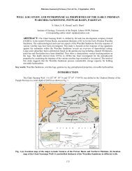
Pakistan Journal of Science (Vol. 65 No. 1 March, 2013)<br />
For six of these layers, an attribute table was attached <strong>for</strong><br />
each. In the case of the building layer, first, second and<br />
third storey layers were linked with attribute table.<br />
The kind of data required could be grouped into<br />
two types – the spatial data and the attribute data. The<br />
spatial data include the spatial distribution of the various<br />
Hostels, path ways, trees, Lawns etc within the <strong>hostel</strong>.<br />
The attribute data on the other hand consists of specific<br />
attributes of each object, relevant to the efficient<br />
<strong>management</strong> of the <strong>hostel</strong> students. For instance, the<br />
attributes of each <strong>hostel</strong> building would include number<br />
of rooms, name of student living occupier, program,<br />
session and department of occupier.<br />
Creation of Geodatabase:<br />
Figure: 2 Entity Relation diagram<br />
Figure 2 show the tables of the Geodatabase and their<br />
relationship with one another.<br />
Following seven tables are created in geodatabase.<br />
o Building Food prints (Geometry)<br />
o First floor (Geometry)<br />
o Second floor (Geometry)<br />
o Third floor (Geometry)<br />
o Path ways (Geometry)<br />
o<br />
o<br />
Trees (Geometry)<br />
Student table<br />
First six tables are geometry in<strong>for</strong>mation as well<br />
as tabular in<strong>for</strong>mation. After creation the tables all the<br />
layers are digitized. ArcMap 10 is used to digitize the all<br />
layers. Adding the satellite and scanned image of<br />
university first six layers were digitized and then attribute<br />
regarding the features were interred in the layers. Student<br />
table is non spatial table unlike other table ,it holds the<br />
in<strong>for</strong>mation of the student i.e. name , father name, class,<br />
session, re<strong>gis</strong>tration ID, department ,subject and so on.<br />
First, second and third spatial layers are showing<br />
the first, second, third storey respectively of the building<br />
of <strong>hostel</strong>. Each storey has a space id which is unique in<br />
each floor. This space id is used to relate with the student<br />
table, in this way all floors of all <strong>hostel</strong> included in this<br />
application are linked with the student table.<br />
153