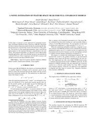
The high altitude wildlife areas of western Arunachal Pradesh
The high altitude wildlife areas of western Arunachal Pradesh
The high altitude wildlife areas of western Arunachal Pradesh

You also want an ePaper? Increase the reach of your titles
YUMPU automatically turns print PDFs into web optimized ePapers that Google loves.
Chapter 3<br />
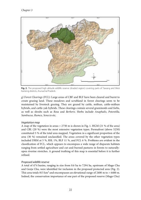
Fig. 2. <strong>The</strong> proposed <strong>high</strong> <strong>altitude</strong> <strong>wildlife</strong> reserve (shaded region) covering parts <strong>of</strong> Tawang and West<br />
Kameng districts, <strong>Arunachal</strong> <strong>Pradesh</strong>.<br />
g) Forest Clearings (FCL): Large <strong>areas</strong> <strong>of</strong> CBF and BLF have been cleared and burnt to<br />
create grazing land. <strong>The</strong>se meadows and scrubland in forest clearings seem to be<br />
maintained by livestock grazing. <strong>The</strong>y are grazed by cattle, mithun, cattle-mithun<br />
hybrids, and cattle-yak hybrids. <strong>The</strong>se clearings contain several graminoids and forbs,<br />
as well as shrubs such as Rosa and Berberis. Herbs include Anaphalis, Potentilla,<br />
Sambucus, Rumex, Senecio etc.<br />
Vegetation map<br />
A map <strong>of</strong> the vegetation in <strong>areas</strong> > 2750 m is shown in Fig. 1. HGM (21 % <strong>of</strong> the area)<br />
and CBL (20 %) were the most extensive vegetation types. Permafrost (above 5250)<br />
constituted 5 % <strong>of</strong> the total area mapped. Vegetation in a significant proportion <strong>of</strong> the<br />
area (30 %) remained unclassified. <strong>The</strong> <strong>areas</strong> covered by the other vegetation types<br />
included DRM at 5 %, RSL 1%, BLF 11 %, and FCL 6 %. Problems are evident in the<br />
classification <strong>of</strong> FCL, which appears to encompass a wide range <strong>of</strong> disparate habitats<br />
ranging from settled agriculture and cut-and-burned pastures in forests to naturallyopen<br />
riverine stretches. A ground truthing <strong>of</strong> this map is essential before it is further<br />
refined.<br />
Proposed <strong>wildlife</strong> reserve<br />
A total <strong>of</strong> 474 basins, ranging in size from 0.6 ha to 7294 ha, upstream <strong>of</strong> Mago Chu<br />
and Gorja Chu, were identified for inclusion in the proposed protected area (Fig. 2).<br />
This area totals 815 km² and encompasses an elevational range <strong>of</strong> 2400 m to > 6400 m.<br />
Indeed, the conservation importance <strong>of</strong> one part <strong>of</strong> the proposed reserve (Mago Chu)<br />
22