Table 2 - Department of Land Resources
Table 2 - Department of Land Resources
Table 2 - Department of Land Resources
Create successful ePaper yourself
Turn your PDF publications into a flip-book with our unique Google optimized e-Paper software.
LRISD, NIC(Hqrs)<br />
2.4.3 Existing System:<br />
2.4.4 Survey and Settlement <strong>Department</strong><br />
<strong>Land</strong> revenue registers are available in all the States. This database has the soil data as<br />
collected by the patwari in local terms. The electronic form <strong>of</strong> the same data is also<br />
available in the database and is collected under the computerization <strong>of</strong> land records<br />
project.<br />
2.4.5 Disadvantages:<br />
1.The soil data as available in the land records database is collected by using<br />
conventional approaches. The data is collected by the Patwari and he is not a soil expert.<br />
2. There is a clear cut gap between the data collected by the Patwari and the data<br />
collected by different agencies in a scientific way.<br />
3. The data as collected by the patwari is in more <strong>of</strong> land use and land revenue sense then<br />
the soil composition and physical characteristics.<br />
4. There is no scientific correlation between the soil nomenclature as followed by the<br />
patwari and the soil code made by the various national level agencies.<br />
Soil type is captured in the <strong>Land</strong> Records Database in the states <strong>of</strong> Andaman and<br />
Nicobar, Himachal Pradesh, Haryana, Rajasthan, Madhya Pradesh, Chattisgarh,<br />
Karnataka, Sikkim and Puducherry. There are about 998 different soil types in states like<br />
Rajasthan wherein they could be accommodated as sub-category in nine major categories<br />
<strong>of</strong> soil types in that State. Hence, after a detailed study <strong>of</strong> the soil codes in practice in the<br />
states, it was found that the digital code for storing soil type was five digits as 00000. The<br />
extreme left two digits would indicate the major category <strong>of</strong> soil such as Black Cotton,<br />
Alluvial, Wasteland, Hilly, Rocky, Sandy, Loamy, Silt, Clay, Red, Stony, Mixed, Garden<br />
and Others. The remaining three digits would indicate the soil sub-category. The digital<br />
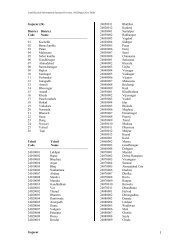
codes for soil types in <strong>Land</strong> Records is given in <strong>Table</strong> 2.4.1-Codes for Soil types in <strong>Land</strong><br />
Records.<br />
<strong>Table</strong> 2.4.1- Codes for Soil types in <strong>Land</strong> Records<br />
Soil Code Soil Name<br />
01000 Chaahi/Kaali (Black Cotton/Black)<br />
01001 Chaahi Nahari<br />
01002 Chaahi Mustar<br />
01003 Chaahi Baraani<br />
01004 Chaahi Aabi<br />
01005 Chaahi Safeda<br />
01006 Kaali I<br />
01007 Kaali II<br />
01008 Kaali A<br />
01009 Kaali B<br />
01010 Kaali C<br />
01011 Kaali D<br />
02000 Nahari (Alluvial)<br />
NIC,DIT,MCIT,GOI 30


