MBARARA MUNICIPALITY - Shack/Slum Dwellers International
MBARARA MUNICIPALITY - Shack/Slum Dwellers International MBARARA MUNICIPALITY - Shack/Slum Dwellers International
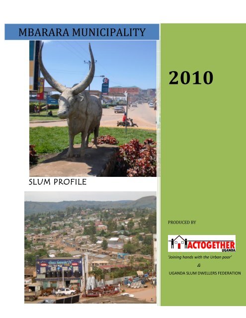
MBARARA MUNICIPALITY 2010 SLUM PROFILE PRODUCED BY ‘Joining hands with the Urban poor’ & UGANDA SLUM DWELLERS FEDERATION
- Page 2 and 3: FORE WORD ACTogether Uganda, Uganda
- Page 4 and 5: ACKNOWLEDGEMENT This research inven
- Page 6 and 7: OBJECTIVES In the process of develo
- Page 8 and 9: LOCATION Mbarara city is located in
- Page 10 and 11: MBARARA CITY: SETTLEMENT PROFILES K
- Page 12 and 13: ECONOMIC ACTIVITIES Majority of res
- Page 14 and 15: The settlement has got Anti- malari
- Page 16 and 17: KISWAHILI SETTLEMENT LOCATION Kiswa
- Page 18 and 19: SOCIAL SERVICES The area has got 2
- Page 20 and 21: The settlement uses pit latrines fo
- Page 22 and 23: BASIC SERVICES (UTILITIES) ZThe set
- Page 24 and 25: BIAFRA (KAJOGO) SETTLEMENT LOCATION
- Page 26 and 27: KIYANJA SETTLEMENT LOCATION This se
- Page 28 and 29: BUTABIKA SETTLEMENT LOCATION This s
- Page 30 and 31: TANKHILL SETTLEMENT LOCATION This s
- Page 32 and 33: KIREHE SETTLEMENT LOCATION This set
- Page 34 and 35: KIHANGIRE SETTLEMENT LOCATION This
- Page 36 and 37: APPENDIX 1: INVENTORY DATA COLLECTI
- Page 38 and 39: ii. Identification of NGOs and desc
<strong>MBARARA</strong> <strong>MUNICIPALITY</strong><br />
2010<br />
SLUM PROFILE<br />
PRODUCED BY<br />
‘Joining hands with the Urban poor’<br />
&<br />
UGANDA SLUM DWELLERS FEDERATION
FORE WORD<br />
ACTogether Uganda, Uganda <strong>Slum</strong> <strong>Dwellers</strong> Federation in partnership with<br />
Mbarara Municipal council and Ministry of Lands Housing and Urban<br />
Development with support from SDI and Cities Alliance, found it necessary that<br />
they collect this information so that the challenges of the urban poor living in<br />
these slum settlements can be bought to the fore-front in planning and<br />
development of Mbarara Municipality.<br />
Our purpose of putting together these profiles is to provide an inner<br />
understanding and most uncomfortable truth about the status of the urban<br />
slum settlements in Mbarara. The report comprises of a list of slum settlements<br />
in Mbarara Municipality and carries the most standardized detail of the informal<br />
settlements as provided by slum dwellers them selves.<br />
It‟s paramount to note that the variables were not derived from professionals,<br />
academicians or technical people but rather the slum dwellers themselves who<br />
most understand the slum conditions simply because it‟s where they live and<br />
spend their time.<br />
We also found it very necessary to collect the past and present histories of each<br />
slum because with experience gained from working in slums, the history of each<br />
area has a significant role to play in its upgrading and development.<br />
Mbarara Municipal council has put in place necessary legal and regulatory<br />
mechanisms to safe guard the rights of people living in slum settlements and<br />
ensure that harmony, cohesion and inclusive development is given a priority.<br />
There fore it recognizes the presence, potentials and partnerships of people<br />
living in slums. Mbarara Municipal council authorities is fully committed to put<br />
inclusive urban development and use the slum profile Inventory as a planning<br />
basis for the better development of Mbarara into a city .<br />
Tumwine Wilson<br />
Mayor Mbarara Municipal Council<br />
2 <strong>MBARARA</strong> | SETTLEMENT PROFILES
EXECUTIVE SUMMARY<br />
Profiling of Mbarara Municipality was done as part of a Cities Alliance supported project for<br />
transforming settlements of the urban poor in partnership with Uganda <strong>Slum</strong> <strong>Dwellers</strong><br />
Federation, ACTogether-Uganda and the Municipality of Mbarara. The exercise was mainly<br />
geared towards identifying the informal settlements within the city and finding out details<br />
about these areas on issues of land, housing, population, basic and social services, economic<br />
activities, governance, community priorities and the historical background of the settlement.<br />
The profiling exercise revealed that Mbarara has got a total of 11 informal settlements with a<br />
population of over 80,000 people living within these areas. The settlements occupy about<br />
3400 acres of land and the majority of the settlers are tenants paying rent ranging between<br />
Ushs 10,000 and 80,000 per month. 90% of the people within the settlements in Mbarara<br />
are low income earners earning an average daily income of 3000 - 5000 shillings.<br />
The sole purpose of carrying out a city profile was to unveil valuable information about those<br />
areas that are often over looked by authorities and yet harbor the people who are part and<br />
partial of the urban fabric. The information gathered during this exercise will therefore go a<br />
long way in influencing the planning for social service delivery and the development of a city<br />
development strategy of Mbarara Municipal council. The exercise is also meant to mobilize<br />
and encourage community participation in developmental activities especially through the<br />
identification of their most urgent needs through community priorities.<br />
Important to note is the fact that the information gathered was collected by communities<br />
through community leaders and elders identified by the community themselves as being<br />
more knowledgeable about their areas.<br />
3 <strong>MBARARA</strong> | SETTLEMENT PROFILES
ACKNOWLEDGEMENT<br />
This research inventory exercise in Mbarara would not have been possible without the support<br />
of the various individuals whose dedication and commitment influenced the success of the<br />
exercise. These include: the members of the National slum dwellers federation of Uganda<br />
supported by ACTogether- Uganda staff members.<br />
Special thanks also go to Mbarara Municipal Council (Mayor Mr. Tumwine Wilson, Town<br />
clerk, Deputy Town clerk Mr. Mushabe Stratus, Physical planner Mrs. Kiconco Miriam, LC<br />
chairpersons and councilors) which supported the activity from the start to the end and were<br />
always willing to provide information and assistance wherever the need arose.<br />
4 <strong>MBARARA</strong> | SETTLEMENT PROFILES
TABLE OF CONTENTS<br />
FORE WORD ........................................................................................................................................... 2<br />
EXECUTIVE SUMMARY ........................................................................................................................... 3<br />
ACKNOWLEDGEMENT ......................................................................................................................... 4<br />
TABLE OF CONTENTS ............................................................................................................................ 5<br />
OBJECTIVES ............................................................................................................................................. 6<br />
METHODOLOGY ..................................................................................................................................... 7<br />
LOCATION .............................................................................................................................................. 8<br />
SETTLEMENTS IN <strong>MBARARA</strong> ............................................................................................................... 9<br />
<strong>MBARARA</strong> CITY: settlement profiles ................................................................................................... 10<br />
KASHANYARAZE SETTLEMENT .................................................................................................... 10<br />
KISENYI SETTLEMENT ...................................................................................................................... 13<br />
KISWAHILI SETTLEMENT ................................................................................................................ 16<br />
AKACHWAMPARE SETTLEMENT .................................................................................................. 19<br />
KIZUNGU SETTLEMENT .................................................................................................................. 21<br />
BIAFRA (KAJOGO) SETTLEMENT .................................................................................................. 24<br />
KIYANJA SETTLEMENT ................................................................................................................... 26<br />
BUTABIKA SETTLEMENT ................................................................................................................. 28<br />
TANKHILL SETTLEMENT ................................................................................................................. 30<br />
KIREHE SETTLEMENT ...................................................................................................................... 32<br />
KIHANGIRE SETTLEMENT .............................................................................................................. 34<br />
APPENDIX 1: INVENTORY DATA COLLECTION TOOL .................................................................. 36<br />
5 <strong>MBARARA</strong> | SETTLEMENT PROFILES
OBJECTIVES<br />
In the process of developing towns to create inclusive cities, bridging the gap<br />
between the urban poor and the developed communities is an important aspect<br />
of the process. The profiling exercise therefore intends;<br />
1. To enable the slum dwellers and the Municipality to gather baseline<br />
information such as, Housing, population, infrastructure, basic service<br />
provision, livelihoods and governance that can be used for planning and<br />
guidance in the delivery of social services in all the informal settlements<br />
within Mbarara municipal council<br />
2. To strengthen the working relationship between the urban poor<br />
communities and Mbarara municipality as they share information that can<br />
be used for the upgrading of informal settlements<br />
3. To enhance the capacities of the slum dwellers involved in the research to<br />
collect and appreciate the use of self generated information in addressing<br />
the development needs of the their settlements<br />
6 <strong>MBARARA</strong> | SETTLEMENT PROFILES
METHODOLOGY<br />
The profiling exercise involved<br />
active participation of community<br />
leaders, the municipality and the<br />
local people. A series of meetings<br />
with the municipality officials and<br />
the division leaders were held to<br />
obtain secondary data about the<br />
informal settlements and the<br />
entire municipality.<br />
The profiling team then met with<br />
the LCs and councillors to identify<br />
the local teams to work with the<br />
slum dwellers federation during<br />
the exercise.<br />
First meeting with the councilors, LCs and municipal council at<br />
Mbarara municipal offices<br />
Training of the local teams is done to ensure that the information gathered during the<br />
profiling exercise is accurate and can be used as a basis for planning.<br />
Opinion leaders in focused group discussion<br />
Field surveys were carried out by the<br />
profiling team supported by<br />
ACTogether staff. During the field<br />
surveys, interviews and focussed group<br />
discussions were carried out.<br />
The collected data was analysed and<br />
returned to the community for<br />
verification. Verification was done by<br />
the relevant authorities in the<br />
municipality as well as making further<br />
investigations on the ground by the<br />
profiling team in charge of verification.<br />
The endorsed slum profiles by both communities and Municipality are regarded as a basis for<br />
the collaboration between organised slum dweller communities and the municipality in<br />
development.<br />
7 <strong>MBARARA</strong> | SETTLEMENT PROFILES
LOCATION<br />
Mbarara city is located in south western<br />
Uganda, 270 kilometers southwest of<br />
Kampala, the capital city of Uganda along<br />
Kabale road near Lake Mburo National park.<br />
The city is the main municipality of Mbarara<br />
district and it is the largest urban center in<br />
western Uganda.<br />
According to the 2002 census reports,<br />
Mbarara municipality had a total population<br />
of 69,363 people which had increased to<br />
97,500 people by 2008.<br />
The profiling exercise in Mbarara city<br />
therefore revealed that majority of the people<br />
living within the city is living within<br />
unplanned<br />
areas.<br />
8 <strong>MBARARA</strong> | SETTLEMENT PROFILES
SETTLEMENTS IN <strong>MBARARA</strong><br />
A total of 12 settlements were identified in Mbarara municipality in three divisions. These include,<br />
Akachwampare, Kihangire, Tankhill, Kirehe, Kiswahili, Kizungu, Kisenyi, Kiyanja, Kashanyalazi,<br />
Biafura-Kiyanja and Kajogo.<br />
DIVISION<br />
SETTLEMENTS<br />
Akachwampare<br />
NYAMITANGA<br />
Kihangire<br />
Tank hill<br />
Kirehe<br />
Kiswahili<br />
KAKOBA<br />
Kizungu<br />
Kisenyi<br />
Kiyanja<br />
KAMUKUZI<br />
Kashanyarazi<br />
Butabika<br />
Biafura-Kiyanja<br />
Kajogo<br />
9 <strong>MBARARA</strong> | SETTLEMENT PROFILES
<strong>MBARARA</strong> CITY: SETTLEMENT PROFILES<br />
KASHANYARAZE SETTLEMENT<br />
LOCATION<br />
This settlement is located in Kamukuzi division.<br />
BRIEF HISTORY<br />
The settlement got its name from the power plant which was established in the<br />
area in 1950. The word “kashanyalaze” in Runyankole means Electricity.<br />
LAND AND TENURE SYSTEM<br />
The settlement covers a total area of 12.1 acres of land. This land is owned by<br />
individuals some of whom reside within the settlement.<br />
POPULATION<br />
The total population of the settlement is approximately 3200 people with 650<br />
households. The adult to children ratio is on average 1:4 per household.<br />
HOUSING INFORMATION<br />
The total number of structures was found to be 350 including both houses and<br />
toilet structures. The average room size for the houses is 8ft by 8ft. the rent<br />
structures within the settlement range between 25000 to 80000 shillings a<br />
month.<br />
BASIC SERVICES (UTILITIES)<br />
Kashanyalaze settlement obtains water from both taps and River Rwizi. The<br />
settlement has a total of 20 taps and these are privately owned. At the taps, a 20ltr<br />
jerry can of water costs 150shs.<br />
The people in this area use pit latrines which are privately owned. The area has a<br />
total of 150 pit latrines<br />
10 <strong>MBARARA</strong> | SETTLEMENT PROFILES
The settlement faces a few threats of flooding mainly caused by its location in a<br />
valley. The drainage channel running within the settlement is poorly built and<br />
lacks proper maintenance.<br />
The garbage collected within the settlement is dumped in a garbage container<br />
provided and maintained by Mbarara municipal council.<br />
The settlement has access to electricity although not all individuals within the<br />
settlement have got electricity.<br />
The settlement has one internal road which connects to the main road.<br />
(University road)<br />
SOCIAL SERVICES<br />
The area has got 2 churches; University bible Baptist church and University catholic<br />
church,1 nursery school and a University; Mbarara University of Science and<br />
Technology.<br />
11 <strong>MBARARA</strong> | SETTLEMENT PROFILES
ECONOMIC ACTIVITIES<br />
Majority of residents within the settlement are casual laborers who are earning a<br />
minimum wage of 1500 shillings per day.<br />
FIGURE 1: SELLING FRESH VEGETABLES, ONE OF THE ECONOMIC ACTIVITIES IN THE SETTLEMENT<br />
GOVERNANCE AND COMMUNITY PARTICIPATION IN DEVELOPMENT<br />
The settlement is governed by the LC system with an LC1 within the<br />
settlement. The community participation in development is limited due to lack of<br />
awareness.<br />
12 <strong>MBARARA</strong> | SETTLEMENT PROFILES
KISENYI SETTLEMENT<br />
LOCATION<br />
BRIEF HISTORY<br />
This settlement is located in Kakoba division and it consists of kakoba central cells.<br />
The first settlers came in the 1980s. The area at the time was bushy and was a<br />
harbor for robbers due to its location with in the city.<br />
Kampala named the area<br />
Kisenyi after the Kisenyi in<br />
Kampala which was also<br />
known as a place of<br />
robbers.<br />
LAND AND TENURE SYSTEM<br />
POPULATION<br />
Kisenyi settlement covers a<br />
total of 366.8 acres of land<br />
and this land is owned by<br />
individuals.<br />
The total population of this<br />
13 <strong>MBARARA</strong> | SETTLEMENT PROFILES<br />
Business men from<br />
area is estimated to be 4000 people in whom there are about 500 households.<br />
HOUSING INFORMATION<br />
The total number of structures is estimated to be 4900 structures with the average<br />
room size ranging from 10ft*12ft .The average housing capacity is 6 people per<br />
household. Most of these houses are owned by landlords who charge about<br />
35,000-40,000 shillings every month as rent. Each house has five households on<br />
average.<br />
BASIC SERVICES (UTILITIES)<br />
FIGURE 2: THIS SCHOOL PROVIDES EDUCATION SERVICES TO<br />
OVER 50% OF THE CHILDREN IN KISENYI<br />
Kisenyi settlement obtains its water from taps, spring wells and stand pipes. The<br />
settlement has 1500 taps and stand points where a 10ltr jerry can goes for 100shs.
The settlement has got Anti- malaria channels which were provided and are<br />
maintained by the municipality. The other drainages are natural drainage channels<br />
created by running water.<br />
The settlement has got a total of approximately 7000 toilets reason being each<br />
house has a toilet attached to it. The area has got 1 sewer line which is maintained<br />
by National water and sewerage cooperation. This sewer system is however not<br />
enough for the entire settlement.<br />
The people within the settlement use electricity, paraffin and candles for lighting,<br />
fire wood and charcoal for cooking.<br />
The settlement has a number of internal roads and external roads. The external roads<br />
include Ruhara, Rwizilane, Katanywa, Kalikone, Kabateraine and Tibayunga roads. The<br />
internal roads are Bulembe mainlink, Kwakwihikire, Sulayiti Musoke, Buchunku road and<br />
Ndahendekire road.<br />
SOCIAL SERVICES<br />
The settlement has 12 drug shops, 5 clinics and 1 health center (Kakoba division<br />
health center). The prevalent medical needs are Malaria, HIV/AIDS, cough and flu.<br />
The area has got a number of<br />
schools ranging from nursery<br />
schools to secondary schools. In<br />
total the settlement has 10<br />
nursery schools, 8 primary<br />
schools and 2 secondary<br />
schools.<br />
The picture on the left is an<br />
example of a service that was<br />
provided without the<br />
community‟s participation. The<br />
community in this area –<br />
Kakoba central needed garbage<br />
skips because their biggest<br />
FIGURE 3: A TYPICAL TOILET FOUND IN THE SETTLEMENT<br />
problem is solid waste management not human waste disposal. As a result the<br />
14 <strong>MBARARA</strong> | SETTLEMENT PROFILES
government invested a great deal in providing the sanitation unit that is not being<br />
utilized.<br />
COMMUNITY PRIORITIES<br />
The community pointed out the need to improve on hygiene and sanitation by Keeping<br />
the anti malaria channel clean. Support orphans, vulnerable groups. Provide mosquito<br />
nets. Control the sell of „drugs‟ in the area and unplanned pregnancy.<br />
ECONOMIC ACTIVITIES<br />
Majority of the settlers within the settlement are business men, bodaboda cyclists<br />
and traders. The majority earn an average income of 3000 shillings per day.<br />
FIGURE 4: WOMEN MAKING CANDLES FOR SALE AS A SOURCE OF INCOME<br />
GOVERNANCE AND COMMUNITY PARTICIPATION IN DEVELOPMENT<br />
The residents have a local council system as well as a council of elders who<br />
decide on some issues. The community is aware of the 25% Local government<br />
Development funds which they say has been used in road maintenance.<br />
15 <strong>MBARARA</strong> | SETTLEMENT PROFILES
KISWAHILI SETTLEMENT<br />
LOCATION<br />
Kiswahili<br />
settlement<br />
is located in<br />
Kakoba<br />
division.<br />
BRIEF HISTORY<br />
The<br />
settlement<br />
started in the<br />
1920s.The<br />
first settlers<br />
were Swahili<br />
speaking<br />
people from<br />
Kenya, Tanzania<br />
and Banubi. This place came to be known as Kiswahili because the first settlers were Swahili<br />
speakers.<br />
LAND AND TENURE SYSTEM<br />
Kiswahili settlement covers 20 acres of land all of which is owned by individual<br />
land lords.<br />
POPULATION<br />
The total population of Kiswahili settlement is estimated to be 2700 people<br />
including men, women and children. The ratio of adult to children is 1:3 per<br />
household.<br />
16 <strong>MBARARA</strong> | SETTLEMENT PROFILES
HOUSING INFORMATION<br />
The area has about 300 households and a total of 450 housing structures. The<br />
average room size is 10ft by 10ft and the structures are mixed semi permanent and<br />
permanent. Majority of the settlers in this area are tenants and on average they<br />
pay 40,000-60,000 shillings per month.<br />
BASIC SERVICES (UTILITIES)<br />
Kiswahili settlement obtains its water from mainly stand pipes although the<br />
settlement also has<br />
a spring well. There<br />
are about 120<br />
standpipes owned<br />
by individuals<br />
within the<br />
settlement. A<br />
10liter jerry can of<br />
water costs 100shs.<br />
The water at the<br />
spring well is free of<br />
charge.<br />
The settlement has<br />
got drainage<br />
channels which are<br />
maintained by the local council 1 of the village. The drainages are however used as<br />
dumping grounds by some members of the settlement. this makes maintenance<br />
rather difficult for the LC1.<br />
People within the settlement use pit latrines for human waste disposal. There are<br />
approximately 400 toilets in the settlement and there is no sewer line within this<br />
area.<br />
The settlement has access to electricity although alternative forms of energy such<br />
as Kerosine ang charcoal are used for lighting and cooking.<br />
17 <strong>MBARARA</strong> | SETTLEMENT PROFILES
SOCIAL SERVICES<br />
The area has got 2 internal roads and 3 external roads. The internal roads include<br />
Butajura road and high street. The external roads include Ndahendekire, Kifaransa<br />
and Bulemba roads.<br />
The area has a number of social spaces which include playing fields, parks, schools<br />
and health centers.<br />
The area has 1 playing field (prisons play ground), 1 park( independence park) and<br />
3churches; Kiswahili full gospel church, All saints church and Pentecostal church<br />
near the prison.<br />
There are 3 schools within the settlement. 2 nursery schools and 1 primary school<br />
(Municipal school)<br />
The settlement has 4 drug shops and the prevalent medical needs are Malaria, High<br />
blod pressure and HIV/AIDS.<br />
ECONOMIC ACTIVITIES<br />
Majority of people within the settlement are self employed business men and<br />
women most of whom own retail shops and small businesses. The average income<br />
is 5000 shillings per day.<br />
GOVERNANCE AND COMMUNITY PARTICIPATION IN DEVELOPMENT<br />
The leadership structure in Kiswahili is the Local council system of governance.<br />
The community is aware of the 25% local government development fund which<br />
they say has been utilized in the development of roads.<br />
18 <strong>MBARARA</strong> | SETTLEMENT PROFILES
AKACHWAMPARE SETTLEMENT<br />
LOCATION<br />
BRIEF HISTORY<br />
The settlement is located in Nyamitanga division.<br />
The settlement started in 1970.The first settlers came from Buganda and they had<br />
come to work for the church (Nyamitanga Cathedral).<br />
LAND AND TENURE SYSTEM<br />
Akachwampare land size is 5.74 acres and is owned by individuals.<br />
POPULATION<br />
The total population of Akachwampare settlement is approximately 300 people<br />
and the ratio of Adult to children is 2:3.<br />
HOUSING INFORMATION<br />
The area has about 55 housing structures; the average room size is 8ft by 8ft. the<br />
houses are made of<br />
wattle, mud and bricks.<br />
The average rent ranges<br />
from 20,000 to<br />
30,000shs per month.<br />
BASIC SERVICES (UTILITIES)<br />
The area obtains water<br />
from stand pipes, taps<br />
and River rwizi. The<br />
water at the taps is<br />
charged at 100shs per<br />
10ltr jerry can.<br />
FIGURE 5: A TYPICAL TOILET FOUND IN THIS SETTLEMENT<br />
19 <strong>MBARARA</strong> | SETTLEMENT PROFILES
The settlement uses pit latrines for human waste disposal and the area has about 15<br />
toilets all of which are owned by individuals. Gabbage is dumped in banana<br />
plantations.<br />
The area has no drainage channels.<br />
The area mainly uses electricity and paraffin for lighting and charcoal for cooking.<br />
The settlement has got 1 internal road Nsikye kyera road which provides access<br />
within the area.<br />
SOCIAL SERVICES<br />
The area does not have schools and recreation spaces. However, it has 1 church and<br />
1 clinic which are privately owned.<br />
COMMUNITY PRIORITIES<br />
The community acknowledged that the place is not clean and that there is need<br />
for sensitization on health, hygiene and sanitation issues.<br />
ECONOMIC ACTIVITIES<br />
The main sources of employment within the settlement are Shops, bars, pool and<br />
pork joints where on average one earns about 2000shs per day.<br />
GOVERNANCE AND COMMUNITY PARTICIPATION<br />
The area‟s leadership is composed of the local council system and a town agent.<br />
The community has not participated in any development activities and is not<br />
aware of any development funds.<br />
20 <strong>MBARARA</strong> | SETTLEMENT PROFILES
KIZUNGU SETTLEMENT<br />
LOCATION<br />
This settlement is located in Kakoba division and it consists of Kabateraine, Agip,<br />
Central and market cells.<br />
BRIEF HISTORY<br />
The settlement started in 1986 when people begun settling within this area. Before<br />
this the area did not have zones/cells but after the NRM government the RC<br />
system was introduced and the municipality divided the area into zones. The zones<br />
include Kabateraine, Agip, Central and Market zones.<br />
LAND AND TENURE SYSTEM<br />
Land in Kizungu settlement is owned by individuals and it covers about 84 acres of<br />
land.<br />
POPULATION<br />
The settlement has a total population of 10,700 people. The ratio of adults to<br />
children is approximately 1:5 per household.<br />
HOUSING INFORMATION<br />
The area has about 1040 housing units with the total number of households at<br />
4800.<br />
The average room size ranges between 8ft by 10ft and 3ft by 3ft being the smallest<br />
room. Majority of the settlers are tenants and the pay an average rent of 30,000<br />
shillings per month.<br />
21 <strong>MBARARA</strong> | SETTLEMENT PROFILES
BASIC SERVICES (UTILITIES)<br />
ZThe settlement gets water from taps and stand pipes. A 10ltr jerry can is charged<br />
at 100shs per month. The water points are owned by individuals within the<br />
settlement.<br />
The settlement has 1<br />
drainage channel which is<br />
not well maintained and is<br />
at times used as a dumping<br />
site.<br />
FIGURE 6: POORLY MAINTAINED DRAINAGE CHANNELS<br />
The settlement is not<br />
connected to a sewer<br />
system however people<br />
within this area mainly use<br />
pit latrines.<br />
The settlement has got<br />
electricity although there are alternative sources of energy such as charcoal and<br />
firewood which are used for cooking.<br />
The area has got a number of external roads these include; Kabateraine,<br />
Tibamanya,<br />
Buchuku,<br />
Kakwicuire,<br />
Ndahendekire<br />
and Bosco roads.<br />
The roads within<br />
the area include<br />
Kizungu road,<br />
High street and<br />
Akakinyambogo<br />
road.<br />
SOCIAL SERVICES<br />
The settlement has got 3 churches and a mosque as the places of worship.<br />
22 <strong>MBARARA</strong> | SETTLEMENT PROFILES
The area has got 5 schools: parents nursery and primary school, calvary nursery and<br />
primary school, Mbarara central nursery and primary school, Mbarara modern<br />
school and Little stars nursery school.<br />
The area has 9 clinics, 1 drug shop and 1 health center II. The prevalent medical<br />
needs within the area are malaria and HIV/AIDS.<br />
COMMUNITY PRIORITIES<br />
The community in Kizungu identified the need for sewer lines within the area as<br />
well as public toilets which can be accessed by the community.<br />
ECONOMIC ACTIVITIES<br />
Majority of residents within the settlement are self employed business men and<br />
women working in Mbarara town. Their average income ranges between 5000<br />
and 20000shs per day.<br />
GOVERNANCE AND COMMUNITY PARICIPATION<br />
Local representation of the area is through the Local council. 6the residents are<br />
aware of the 25%Local Government Development Funds that are given by the<br />
municipality but they are not aware of what the funds are meant for or what they<br />
have done for their communities.<br />
23 <strong>MBARARA</strong> | SETTLEMENT PROFILES
BIAFRA (KAJOGO) SETTLEMENT<br />
LOCATION<br />
This settlement is located in Kamukuzi Division.<br />
BRIEF HISTORY<br />
The settlement started in 1967 and the first settler was a man from Tanzania called<br />
Suleiman. The residents of the place used to be drunkards who often fought a lot.<br />
Their fighting was likened to that in the Nigeria-Biafra war hence the name Biafra.<br />
LAND AND TENURE SYSTEM<br />
The settlement lies on 139 acres of land. This land is owned by individuals.<br />
POPULATION<br />
The population within the settlement is estimated to be 1500 people at a ratio of 1<br />
adult: 4 children.<br />
HOUSING INFORMATION<br />
The area has approximately 950 housing structure mostly semi permanent and<br />
permanent. The average room size is 10ft by 12ft and on average each house has<br />
3rooms. Majority are tenants who pay a monthly rent of 50,000 shillings.<br />
BASIC SERVICES (UTILITIES)<br />
The area has got stand pipes where a 10ltr jerry can goes for 100 shillings.<br />
The area has got drainage channels that are maintained by the municipality<br />
council.<br />
The area has got a total of 951 pit latrines of which only 1 is a public toilet<br />
constructed by the municipality council.<br />
The settlement has got access to electricity.<br />
24 <strong>MBARARA</strong> | SETTLEMENT PROFILES
The settlement has both internal and external roads. They identified Rwizi lane,<br />
Ntare road, Kiswahili close as the external road and 3 internal roads whose names<br />
were not identified.<br />
SOCIAL SERVICES<br />
The area has only 1 education facility which is a nursery school.<br />
Other social spaces within the area include 2 churches and 1 mosque.<br />
The settlement does not have any health services.<br />
COMMUNITY PRIORITIES<br />
The community pointed out the need for sanitation sensitization within the area<br />
due to the poor sanitation conditions.<br />
The area also has no sewer lines and therefore the community expressed the need<br />
for sewer lines in their community.<br />
ECONOMIC ACTIVITIES<br />
The<br />
majority of the residents within the settlement are traders and self employed<br />
business men and women.<br />
25 <strong>MBARARA</strong> | SETTLEMENT PROFILES
KIYANJA SETTLEMENT<br />
LOCATION<br />
This settlement is located in Kamukuzi Division.<br />
BRIEF HISTORY<br />
The first settlers in this area came in 1965. The first settler was a lady called Gladys<br />
Twongyeirwe and She come from Bushenyi district. But Before Gladys came , the<br />
ommugabe was the first to own land because he had a butchery and a latrine with<br />
in. In 1969, the then Ankole District administration offered plots to who ever<br />
wanted to develop the area. The place remained vacant.<br />
LAND AND TENURE SYSTEM<br />
The land in Kiyanja area is approximately 15 acres and it is owned by individuals.<br />
POPULATION<br />
The total population of this area is estimated to be about 2000 with a ratio of 1<br />
adult to 5 children.<br />
HOUSING INFORMATION<br />
The area has got 500 housing structures and 1500 household. The average room<br />
size is 10ft by 10ft and the houses are built with bricks, cement and iron sheets<br />
materials. The average rent is 30000 shillings per month.<br />
26 <strong>MBARARA</strong> | SETTLEMENT PROFILES
BASIC SERVICES (UTILITIES)<br />
The settlement lacks drainage channels, and water taps.<br />
FIGURE 7: ONE OF THE FEW TOILETS IN THE SETTLEMENT<br />
The toilets within the area are few and are owned by some individuals. These toilets<br />
are not open to public use.<br />
COMMUNITY PRIORITIES<br />
The community expressed the urgent need of an improved drainage system because the water<br />
levels a high and the area has become water logged. This is even affecting the toilets within<br />
the area because they have had to close some and yet they are few.<br />
27 <strong>MBARARA</strong> | SETTLEMENT PROFILES
BUTABIKA SETTLEMENT<br />
LOCATION<br />
This settlement is located in Kamukuzi Division.<br />
BRIEF HISTORY<br />
Butabika settlement started in 1940. The people who used to live there were<br />
drunkards and kept fighting hence the name-Butabika<br />
LAND AND TENURE SYSTEM<br />
The settlement is approximately 2 acres of land and the land is owned by<br />
individuals.<br />
POPULATION<br />
The total population of this settlement is estimated to be 300 people with an<br />
Adult to children ratio of 2:5.<br />
HOUSING INFORMATION<br />
The area has got 80 housing structures and 70 households. The average room size<br />
is 6ft by 10ft. the houses are temporary and semi permanent, constructed using<br />
bricks, mud and wattle. Average rent between 15000-30000 shillings per month.<br />
BASIC SERVICES (UTILITIES)<br />
The settlement has got 3 water stand points which are owned by a few individuals.<br />
The water at the stand points is sold at 100 shillings per jerry can.<br />
The settlement has got no drainage channels.<br />
The settlement has access to electricity<br />
The area has access to roads. It has a total 5 external roads but no internal roads.<br />
SOCIAL SERVICES<br />
The settlement has no social services such as schools, open spaces and places of<br />
worship.<br />
28 <strong>MBARARA</strong> | SETTLEMENT PROFILES
However, the settlement has 1 drug shop where medication treatment costs<br />
10000-20000 shillings.<br />
COMMUNITY PRIORITIES<br />
The community<br />
identified the need for<br />
a drainage and sewer<br />
system which does not<br />
exist currently.<br />
The area also has poor<br />
roads and poor<br />
sanitation which were<br />
also mentioned as<br />
development priorities<br />
by the people within<br />
this community.<br />
ECONOMIC ACTIVITIES<br />
FIGURE 8: AN EXAMPLE OF THE DRAINAGE CHANNELS IN THE<br />
REGION<br />
The majority of people within the settlement are casual laborers and motorcyclists<br />
(Bodaboda cyclists) who earn an average daily income of 1000-2000 shillings.<br />
GOVERNANCE AND COMMUNITY PARTICIPATION IN DEVELOPMENT<br />
The settlement has got the local council system of governance where there is an<br />
LC1 representing the area. The community is not aware of any development<br />
initiatives and therefore has not participated in such activities.<br />
29 <strong>MBARARA</strong> | SETTLEMENT PROFILES
TANKHILL SETTLEMENT<br />
LOCATION<br />
This settlement is located in Nyamitanga Division and it consists of Rwizi market,<br />
BRIEF HISTORY<br />
Kateera and Ruti wards.<br />
The settlement started between 1922 and 1970. The name tank hill came from a<br />
big tank of water which was put here in 1979<br />
LAND AND TENURE SYSTEM<br />
POPULATION<br />
The land in this settlement is approximately 1003 acres of land. This land is owned<br />
by individuals.<br />
The total population within this area is estimated to be 3000 people. The adult to<br />
children ratio is 2: 3.<br />
HOUSING INFORMATION<br />
The area has got 900 housing structures with 670 households. The average room<br />
size is 8ft by 10ft and the houses are generally permanent structures constructed<br />
using bricks, iron sheets and cement. The average rent is 20000 to 30000<br />
shillings per month.<br />
BASIC SERVICES (UTILITIES)<br />
The main sources of water<br />
within this settlement are<br />
taps, spring wells and River<br />
Rwizi. At the taps, a jerry can<br />
of water is charged 50shs<br />
and 100shs in some areas. In<br />
total, the area has about 79<br />
stand points.<br />
The area has no built up<br />
drainage channels. However<br />
it has 3 natural drainages<br />
which are maintained by the<br />
community them selves.<br />
The settlement has 140 FIGURE 9: A POORLY MAINTAINED DRAINAGE CHANNELS<br />
30 <strong>MBARARA</strong> | SETTLEMENT PROFILES
toilets, all of which are owned individually.<br />
The settlement uses Electricity, firewood, kerosene as the forms of energy for<br />
lighting and cooking<br />
The settlement has access using both internal and external roads. The internal road<br />
is Kabale-Ruti road and the external roads are Katego, Byanyima, Kibaku and<br />
Ntengye roads.<br />
SOCIAL SERVICES<br />
The settlement has got a number of social spaces. These include places of worship:<br />
5 churches and 2 mosques and 2 playing fields.<br />
The area also has access to medical services from a number of health facilities. The<br />
area has 2 health centers owned by the government, 4 drug shops and 1 clinic<br />
owned by individuals. The prevalent medical needs are malaria, HIV/AIDs, cough<br />
and flu.<br />
COMMUNITY PRIORITIES<br />
The community pointed out the need for better roads and improvement of anti<br />
malaria channels<br />
ECONOMIC ACTIVITIES<br />
The majority of settlers within this area are business men and casual labourers.<br />
Brick-laying is also one of the economic activities in Tank hill. The average daily<br />
income is between 1000 to 3000 shillings per day.<br />
GOVERNANCE AND COMMUNITY PARTICIPATION IN DEVELOPMENT<br />
The area has a number of leaders such as the LC's, Youth, elders, Persons With<br />
Disabilities representative and women councils. the community is not aware of any<br />
development funds available to them.<br />
31 <strong>MBARARA</strong> | SETTLEMENT PROFILES
KIREHE SETTLEMENT<br />
LOCATION<br />
This settlement is located in Nyamitanga Division.<br />
BRIEF HISTORY<br />
The settlement started in 1970. The first settler was John Ntengye who originated<br />
from Kabale. The settler found a big tree called Orurehe and thus the place came<br />
to be known as Kirehe.<br />
LAND AND TENURE SYSTEM<br />
The land in Kirehe area is approximately 400 acres and it is owned by individuals.<br />
POPULATION<br />
The total population of this area is estimated to be about 1500 people with a ratio<br />
of 1 adult to 2 children.<br />
HOUSING INFORMATION<br />
The area has got 60 housing structures and 300 households. The average room<br />
size is 10ft by 15ft and the houses are built with bricks, cement and iron sheets<br />
materials. The average rent is 20000 shillings per month.<br />
BASIC SERVICES (UTILITIES)<br />
The settlement has 4 stand points which provide water to the entire area. A jerry<br />
can of water is sold at 100shs.<br />
The settlement lacks drainage channels.<br />
There are 120 toilets within the area. Only 1 of these is a public toilet owned by<br />
the municipality.<br />
The forms of energy used within the settlement include electricity, kerosene,<br />
charcoal and firewood.<br />
The settlement has 1 external road: Kabale road.<br />
32 <strong>MBARARA</strong> | SETTLEMENT PROFILES
SOCIAL SERVICES<br />
The area has no schools but it has health services. The area has 1 clinic and Ruti<br />
rehabilitation center.<br />
COMMUNITY PRIORITIES<br />
The community identified the need for road maintenance.<br />
ECONOMIC ACTIVITIES<br />
The biggest economic activity in this area is brick making. The income levels are<br />
1000 to 10000 shillings per day.<br />
FIGURE 10: BRICK-LAYING, ONE OF THE ECONOMIC ACTIVITIES CARRIED BY RESIDENTS OF THIS<br />
SETTLEMENT<br />
GOVERNANCE AND COMMUNITY PARTICIPATION IN DEVELOPMENT<br />
The area has got an LC1 representative who is responsible for the community in<br />
this area.<br />
33 <strong>MBARARA</strong> | SETTLEMENT PROFILES
KIHANGIRE SETTLEMENT<br />
LOCATION<br />
This settlement is located in Nyamitanga Division.<br />
BRIEF HISTORY<br />
The settlement is said to have started in 1971.<br />
Origin of the name: Two people came from different places, Matayo Gwateza<br />
from Koki and Rwankuiinzirawo from Rwampala Rugando. Matayo was a preacher<br />
while Rwankuinzire was a farmer. They taught people how to live and develop<br />
themselves and the place prospered but when they died, the place became poor<br />
again. That is how the place came to be called Kihangire.<br />
LAND AND TENURE SYSTEM<br />
The land in Kihangire area is approximately 640 acres and it is owned by<br />
individuals.<br />
POPULATION<br />
The total population of this area is estimated to be about 1600 people with a ratio<br />
of 2 adults to 5 children per household.<br />
HOUSING INFORMATION<br />
The area has got 250 housing structures and 2000 households. The average room<br />
size is 10ft by 10ft and the houses are built with Mud, trees, sand mixed with<br />
cement bricks. The average rent is 20000 shillings per month.<br />
BASIC SERVICES (UTILITIES)<br />
The settlement has it sources of water from, River Rwizi, boreholes, taps. Water at<br />
the stand points is sold at 100shs per jerry can.<br />
The settlement uses pit latrines for human waste disposal and in total the toilets<br />
are 350. The toilets are individually owned and there is no price attached to their<br />
usage.<br />
34 <strong>MBARARA</strong> | SETTLEMENT PROFILES
The settlement uses Electricity, solar system and paraffin for lighting and Charcoal<br />
is for cooking.<br />
The settlement has external access from Kyoga road and internal access from<br />
Kitebero road.<br />
SOCIAL SERVICES<br />
The settlement has got educational spaces, places of worship as well as recreational<br />
spaces. The area has got 1 church and 1 mosque as the places of worship and 2<br />
playing fields for recreation.<br />
The area has got 3 educational facilities that include 2 primary schools and 1<br />
secondary school.<br />
COMMUNITY PRIORITIES<br />
According to the information gathered, the area does not have any health facility<br />
and drainage channels. This if true should be immediately considered as the<br />
priorities for this community.<br />
ECONOMIC ACTIVITIES<br />
The major economic activities in Kihangire area include Brick making, toilet<br />
digging and pancake baking. The average income is 30,000 shillings per month.<br />
GOVERNANCE AND COMMUNITY PARTICIPATION IN DEVELOPMENT<br />
The area is geoverned by the LC system of governance where by the people in<br />
Kihangire have an LC1 who is the lowest authority in government. The<br />
community is aware of the 25%LGDP funds although they are not aware of the<br />
purpose<br />
35 <strong>MBARARA</strong> | SETTLEMENT PROFILES
APPENDIX 1: INVENTORY DATA COLLECTION TOOL<br />
CITY<br />
1<br />
LOCATION<br />
a.<br />
Administrative Zone<br />
b.<br />
Name of slum/ settlement<br />
2.<br />
LAND<br />
a.<br />
Total area/Size of land<br />
b.<br />
Land Owners<br />
c.<br />
Threat of eviction and from whom?<br />
3.<br />
POPULATION DETAILS<br />
a.<br />
Total population (estimates)<br />
b.<br />
Number of households/families<br />
c.<br />
Adult to children ratio<br />
4.<br />
HOUSING<br />
a.<br />
Total No. of structures<br />
b.<br />
Total No. of rooms<br />
c.<br />
Building materials<br />
d.<br />
Structure/room size<br />
e.<br />
Rent structures (average rent rate)<br />
5.<br />
SERVICES<br />
a.<br />
Water<br />
i. Source of water<br />
ii. No. of stand points<br />
iii. Price<br />
iv. Ownership of water points<br />
b.<br />
Toilets and sewer<br />
i. Description of sewer system and<br />
its maintenance<br />
ii. No. of toilets<br />
iii. Ownership of toilets<br />
iv. Price of usage<br />
c.<br />
Drainage<br />
i. Type of drains and maintenance<br />
ii. Threat of flooding<br />
36 <strong>MBARARA</strong> | SETTLEMENT PROFILES
d. Energy<br />
i. Forms of energy<br />
ii. Availability of electricity<br />
iii. Existence of informal<br />
connections<br />
e. Communication<br />
i. Major mode of transmitting<br />
information<br />
ii. Nearest telephone facility<br />
f. Road Access<br />
i. Internal roads<br />
ii. External road<br />
g. Waste disposal<br />
Description of systems of waste<br />
disposal<br />
h. Social spaces<br />
i. community centre<br />
ii. Church/ Mosque<br />
iii. Playing field<br />
iv. Other (specify)<br />
6. EDUCATION<br />
i. Nursery school<br />
ii. Primary school<br />
iii. Secondary school<br />
7. HEALTH CARE<br />
i. Health services in the area<br />
ii. Ownership<br />
iii. Cost<br />
iv. Prevalent medical needs<br />
8. ECONOMIC ACTIVITIES<br />
i. Main sources of employment<br />
ii. Income levels<br />
9. GOVERNANCE<br />
a. Leadership structures<br />
b. Funds available to the community<br />
and purpose<br />
10. DEVELOPMENT INTERVENTIONS<br />
i. Identification of CBO<br />
37 <strong>MBARARA</strong> | SETTLEMENT PROFILES
ii. Identification of NGOs and<br />
description of their interventions<br />
iii. Experiences of Community<br />
Development Funds or other local<br />
government funds<br />
11. COMMUNITY PRIORITIES<br />
12. HISTORY OF THE SETTLEMENT<br />
When was the settlement started?<br />
Who was the first settler and where<br />
did the first settlers originate from?<br />
What were the reasons for<br />
settlement‟s name?<br />
Any other important details about<br />
the settlement.<br />
More about the settlement:<br />
………………………………………………………………………………………………………………<br />
………………………………………………………………………………………………………………<br />
………………………………………………………………………………………………………………<br />
………………………………………………………………………………………………………………<br />
………………………………………………………………………………………………………………<br />
………………………………………………………………………………………………………………<br />
………………………………………………………………………………………………………………<br />
………………………………………………………………………………………………………………<br />
The profiling tool collected information mainly about Land, households, basic services, social<br />
services, community priorities, economic activities and the historical background the<br />
settlement.<br />
38 <strong>MBARARA</strong> | SETTLEMENT PROFILES
NOTES<br />
39 <strong>MBARARA</strong> | SETTLEMENT PROFILES


