You also want an ePaper? Increase the reach of your titles
YUMPU automatically turns print PDFs into web optimized ePapers that Google loves.
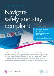
...because safety matters<br />
<strong>Admiralty</strong> Vector<br />
Chart Service
What is an ENC?<br />
Electronic Navigational Charts (ENCs)<br />
are digital vector charts produced<br />
to the International Hydrographic<br />
Organization’s (IHO’s) standards<br />
(S57 Version 3.1 and ENC Product<br />
Specification). International Maritime<br />
Organization (IMO) SOLAS Regulations<br />
allow the use of ECDIS to meet carriage<br />
requirements for charts if ENCs are<br />
loaded and a suitable backup is provided.<br />
An ENC is by definition produced by,<br />
or on the authority of a government,<br />
authorised hydrographic office or other<br />
relevant government institution. ENCs<br />
have the following attributes:<br />
• They are compiled and coded<br />
according to the standards of<br />
the International Hydrographic<br />
Organization<br />
•<br />
They are referred to World Geodetic<br />
System 1984 Datum (WGS84)<br />
• They are regularly updated<br />
with official update information<br />
distributed digitally<br />
•<br />
The ECDIS display distinguishes<br />
between ENCs and unofficial data<br />
through the continuous display of<br />
a warning stating that the mariner<br />
should navigate by means of an up<br />
to date official paper chart. Also,<br />
the boundary between ENC and<br />
unofficial data is displayed with a<br />
hatched line.<br />
The mariner can further distinguish<br />
the status of a particular ENC by<br />
interrogating the display to obtain<br />
information such as the producing<br />
agency code, edition and<br />
update numbers.<br />
Hydrographic offices do not take<br />
any responsibility for the accuracy<br />
or reliability of privately produced,<br />
unofficial charts.<br />
AVCS depends on the ENCs provided by hydrographic offices worldwide. The<br />
UKHO wishes to acknowledge the ongoing cooperation and professional<br />
expertise of these international partners who work tirelessly to make the<br />
oceans of the world a safer place.<br />
...because safety matters
The Future of<br />
Navigation<br />
The <strong>Admiralty</strong> Vector Chart Service<br />
(AVCS) brings together Electronic<br />
Navigational Charts (ENCs) from<br />
national hydrographic offices around<br />
the world and new ENC coverage<br />
produced by UKHO on behalf of<br />
Foreign Governments to provide<br />
comprehensive, official, worldwide<br />
coverage.<br />
AVCS contains more directly relevant<br />
ENC data than is currently available in<br />
any other service.<br />
Compliant<br />
The <strong>Admiralty</strong> Vector Chart Service only<br />
contains ENC data that meets SOLAS<br />
Carriage Requirements for use within<br />
Electronic Chart Display and Information<br />
Systems (ECDIS).<br />
No other electronic chart service offers<br />
this level of assurance.<br />
Fast and Efficient Chart<br />
Maintenance<br />
The <strong>Admiralty</strong> Vector Chart Service is<br />
fully supported by an update service.<br />
All electronic charts are up to date at<br />
the time of purchase and comprehensive<br />
updates are issued every week at<br />
no extra cost. Updates include all<br />
Notices to Mariners, New Editions and<br />
Replacement Charts as well as any<br />
new, relevant ENCs, all within the basic<br />
subscription price. Updates are available<br />
remotely online or via the Weekly<br />
Update CD.<br />
Quality<br />
UKHO is proud of its reputation for<br />
the safety and quality of its <strong>Admiralty</strong><br />
products and the same standards will<br />
be applied to all ENC content included<br />
within the AVCS service. All cells as a<br />
minimum have passed validation checks<br />
to ensure that they will load and display<br />
correctly on ECDIS equipment. In<br />
addition UKHO has instituted a<br />
programme of assessment by its<br />
professional cartographers where the<br />
content of the ENC is compared to the<br />
equivalent <strong>Admiralty</strong> paper chart. Any<br />
navigationally significant differences<br />
identified are then investigated and<br />
resolved with the producing nation.<br />
Where UKHO believes additional<br />
information should be made available<br />
to the mariner, it will be displayed<br />
through the medium of a value added<br />
layer, exclusive to the AVCS service.<br />
Although these extra layers will not be<br />
available at launch, they will become<br />
available in the near future.<br />
...because safety matters
Case Study<br />
MV CMA CGM Rose<br />
CMA CGM Rose is a 210m 2,824 TEU<br />
container vessel commissioned in 2005,<br />
and fitted with Furuno ECDIS. She has<br />
been using AVCS for primary navigation<br />
since early February 2008, operating<br />
the ‘epic tour’ from ports in India to<br />
Northern Europe under time charter to<br />
CMA CGM from her owners Reederei<br />
Thomas Schulte.<br />
Her Master, Capt. Constantin Zaharia has<br />
many years experience at sea and as a<br />
college lecturer. He commented, "[with<br />
AVCS] you always have the vessel’s<br />
position against everything around<br />
including the targets which is very, very<br />
important when you need to make a<br />
decision quickly in congested areas… I<br />
can tell you that I fully trust the system."<br />
...because safety matters
Updating<br />
Remote Updating<br />
The <strong>Admiralty</strong> Vector Chart Service<br />
includes remote updating software<br />
free of charge. The software (<strong>Admiralty</strong><br />
Updating Service or AUS) can be used to<br />
obtain immediate updates to your ENC<br />
data, either directly over the Internet<br />
or by email anywhere in the world at<br />
anytime. The service also allows the<br />
mariner to actively manage their data<br />
holdings enabling the download of<br />
voyage-specific updates, minimising<br />
transmission costs for vessels at sea.<br />
An information log is automatically<br />
maintained for the Officer of the<br />
Watch to ensure continuity during crew<br />
changes. All updates are hosted on a<br />
secure server and are encrypted and<br />
digitally signed to ensure that they are<br />
authentic and uncorrupted when you<br />
receive them.<br />
Weekly CD Updates<br />
Updates to AVCS are also supplied<br />
weekly on CD as standard. This CD<br />
contains updates to all charts in the<br />
service, ensuring that every AVCS<br />
customer has a complete and up to<br />
date set of data on board, with the<br />
option to easily access additional data if<br />
required. The remote updating software<br />
includes functionality that enables<br />
data from the Weekly Update CD to<br />
be synchronised with that delivered<br />
remotely to ensure complete flexibility<br />
and reduced cost.<br />
Digital Catalogue<br />
The <strong>Admiralty</strong> Digital Catalogue is<br />
included free of charge within AVCS.<br />
It includes the latest information on all<br />
<strong>Admiralty</strong> products and services, from<br />
paper charts to AVCS, and assists with<br />
Passage Planning and access to product<br />
limits and product information by<br />
route, area and individual selection. The<br />
Catalogue also allows the creation of a<br />
product order for onward transmission<br />
to your <strong>Admiralty</strong> Distributor.<br />
The <strong>Admiralty</strong> Digital Catalogue can<br />
be easily updated either online or from<br />
the Weekly AVCS Update CD enabling<br />
access to the latest information on<br />
<strong>Admiralty</strong> Charts, Products and Services.<br />
Temporary &<br />
Preliminary (T&P) NMs<br />
The <strong>Admiralty</strong> Digital Catalogue<br />
also provides easy access to all T&P<br />
NMs issued by the UKHO, including a<br />
geographical search of NMs.<br />
This ensures that users of AVCS have<br />
the most up to date T&P information<br />
published for <strong>Admiralty</strong> chart users,<br />
regardless of where in the world they<br />
are operating.<br />
...because safety matters
Complete Flexibility<br />
Licensing Options<br />
The <strong>Admiralty</strong> Vector Chart Service<br />
offers the maximum flexibility to allow<br />
users to match their ENC data holdings<br />
to their operational patterns.<br />
AVCS allows users to select any<br />
combination of ENC Units and Folios for<br />
any available licence period. Wherever<br />
ENC producers allow, both Units and<br />
Folios are available for licence periods of<br />
3, 6, 9 and 12 months.<br />
Individual Charts<br />
All ENCs in AVCS can be selected on<br />
a chart-by-chart basis as ENC Units.<br />
These Units are the smallest unit of<br />
sale allowed by the ENC producers and<br />
usually contain ENC data approximately<br />
equivalent to a paper chart.<br />
Folios<br />
Any relevant, additional new ENC data that<br />
becomes available will be included in the<br />
appropriate AVCS Folio at no additional<br />
cost for the Licence period, delivering<br />
reassurance that the Mariner has access to<br />
all the latest information available with no<br />
change to budget.<br />
Easy Access to Extra<br />
ENCs<br />
Every <strong>Admiralty</strong> Vector Chart Service<br />
customer is automatically provided with<br />
a complete set of Base discs containing<br />
every ENC available within the Service.<br />
Access to ENCs is provided by special<br />
‘unlock’ (permit) keys, available from<br />
your <strong>Admiralty</strong> Distributor. This allows<br />
your vessel to carry complete coverage<br />
whilst only paying for the ENCs initially<br />
required. Chart holdings can be upgraded<br />
quickly and easily at any point during the<br />
licence period.<br />
AVCS also offers a series of managed<br />
Folios, each of which contains all the<br />
ENCs required for its defined purpose<br />
(e.g. transiting an area).<br />
...because safety matters
Case Study<br />
MT Supremity<br />
MT Supremity is a James Fisher Everards<br />
oil product tanker commissioned in<br />
late 2007 and fitted with dual SAM<br />
Electronics ECDIS systems. She has<br />
been using AVCS since January 2008,<br />
operating in Northern Europe (primarily<br />
UK and Irish waters).<br />
Captain E.W. Lyons, Fleet Operations<br />
Director of James Fisher (Shipping<br />
Services) Limited said, "As with all other<br />
innovative solutions provided by UKHO,<br />
we have been impressed with the system<br />
and the benefits that can be derived<br />
from its use."<br />
...because safety matters
Folios<br />
The <strong>Admiralty</strong> Vector Chart Service<br />
is also available in a series of Folios<br />
designed to make ordering, maintenance<br />
and flexible licensing as easy and simple<br />
as possible, whilst minimising the<br />
purchase of redundant data. Folios also<br />
allow the UKHO to automatically add<br />
new ENCs to holdings as soon as they<br />
become available, providing certainty<br />
that you always have the latest available<br />
data within the service at your chosen<br />
level of coverage.<br />
A folio is a geographic collection of<br />
ENCs at specific scales or usage bands,<br />
designed to meet specific operational<br />
requirements, from safely transiting<br />
an area to approaching and entering a<br />
destination port.<br />
Folios can be supported by Individual<br />
ENCs where required.<br />
There are three types of AVCS Folio:-<br />
Transit, Regional and Port.<br />
AVCS Transit Folios<br />
...because safety matters
Transit Folios<br />
Transit Folios are designed to provide<br />
all the coverage needed for a vessel to<br />
pass safely through a region when not<br />
engaging in local trade.<br />
The folios are schemed to provide<br />
coverage along the major trade routes<br />
without the need to purchase data for<br />
less frequently visited areas. Transit Folios<br />
contain predominantly Overview and<br />
General ENC coverage, with Coastal<br />
coverage where appropriate at selected<br />
choke points, capes, straits and convex<br />
coasts.<br />
Transit Folios save operators the<br />
expense of purchasing detailed coverage<br />
for regions that they are just passing<br />
through, whilst including more coverage<br />
to negotiate the choke points such as<br />
the Suez Canal and Malacca Straits.<br />
MEDSO<br />
Example of a typical Transit Folio<br />
...because safety matters
Regional Folios<br />
Regional Folios cover a much smaller<br />
geographical area than Transit Folios<br />
and include all Coastal and some<br />
Approach ENCs, where coastal<br />
coverage is not available.<br />
Regional Folios are designed for local<br />
and coastal trade, where more detailed<br />
coverage of complex coastal waters<br />
is required.<br />
They do not include Port Approaches<br />
or Entry.<br />
For an up to date list of available Folios<br />
please contact your <strong>Admiralty</strong> Distributor<br />
or visit www.ukho.gov.uk<br />
AVCS Regional Folios<br />
...because safety matters
RFM05<br />
Example of a typical Regional Folio<br />
...because safety matters
Port Folios<br />
Port Folios contain detailed coverage<br />
of the world’s top ports and include all<br />
ENCs necessary to enter a port safely and<br />
with complete confidence. They comprise<br />
Approach (Band 4), Harbour (Band 5) and<br />
Berthing (Band 6) cells grouped together<br />
into a single sales unit.<br />
Some Port Folios in complex areas<br />
provide coverage for more than one port.<br />
The number of Port Folios within the<br />
<strong>Admiralty</strong> Vector Chart Service is<br />
continuously growing. For a full list<br />
contact your <strong>Admiralty</strong> Distributor or visit<br />
the UKHO website at www.ukho.gov.uk.<br />
Example of an AVCS Port Folio<br />
...because safety matters
Example of an AVCS Port Folio in a complex area<br />
Exceptions<br />
Norway and some other Scandinavian<br />
countries do not provide Coastal<br />
(Band 3) coverage. Therefore, Regional<br />
Folios in these areas include Approach<br />
(Band 4) coverage which is consequently<br />
not included in the Port Folios within<br />
those regions.<br />
The St Lawrence Seaway has little<br />
Coastal (Band 3) coverage available.<br />
Therefore the Regional Folio covering<br />
this area is comprised of all Coastal and<br />
Approach (Bands 4 and 5) available.<br />
Both the Suez Canal/Red Sea/Gulf<br />
of Aden and Malacca Straits areas are<br />
narrow challenging waterways. Thus,<br />
the Transit Folios for these areas include<br />
all Overview, General and Coastal<br />
(Bands 1, 2 and 3) coverage available.<br />
Consequently, there are no separate<br />
Regional Folios for these areas.<br />
...because safety matters
Support<br />
The <strong>Admiralty</strong> Vector Chart Service is<br />
backed by UKHO Helpdesk support and<br />
a 24 hour emergency permit generation<br />
helpline, providing complete confidence<br />
and peace of mind.<br />
Free of charge trial<br />
To find out if you qualify for a free of<br />
charge three month trial, please contact<br />
your <strong>Admiralty</strong> Distributor or visit<br />
www.ukho.gov.uk.<br />
The Future of<br />
Navigation<br />
AVCS represents the first step in the<br />
future of digital navigational information.<br />
Over the next three years, the Service<br />
will grow to include additional digital<br />
data sets based on <strong>Admiralty</strong> Nautical<br />
Publications and relevant software tools<br />
to support the complex decision-making<br />
process required of the modern mariner.<br />
Further Information<br />
To discover how AVCS can revolutionise<br />
your Fleet operation, please contact<br />
your <strong>Admiralty</strong> Distributor or visit the<br />
UKHO website at www.ukho.gov.uk<br />
Alternatively, contact the UKHO<br />
Helpdesk:<br />
Tel: +44 (0) 1823 723366<br />
Fax: +44 (0) 1823 330561<br />
Email: helpdesk@ukho.gov.uk<br />
...because safety matters
The United Kingdom Hydrographic Office,<br />
<strong>Admiralty</strong> Way, Taunton, Somerset, TA1 2DN, UK<br />
Tel:+44 (0)1823 723366 Fax:+44 (0)1823 330561<br />
Web:www.ukho.gov.uk