Port of Weipa Environmental Management Plan (EMP) - North ...
Port of Weipa Environmental Management Plan (EMP) - North ...
Port of Weipa Environmental Management Plan (EMP) - North ...

You also want an ePaper? Increase the reach of your titles
YUMPU automatically turns print PDFs into web optimized ePapers that Google loves.
<strong>Port</strong> <strong>of</strong> <strong>Weipa</strong> <strong>Environmental</strong> <strong>Management</strong> <strong>Plan</strong> i<br />
Final July 2009
Contents<br />
1 INTRODUCTION ....................................................................................................................................... 1<br />
1.1 <strong>North</strong> Queensland Bulk <strong>Port</strong>s Corporation .......................................................................................... 1<br />
1.2 <strong>Port</strong> <strong>of</strong> <strong>Weipa</strong> ........................................................................................................................................... 1<br />
2 PORT ENVIRONMENTAL MANAGEMENT ............................................................................................. 5<br />
2.1 Introduction .............................................................................................................................................. 5<br />
2.2 Document Use and Review .................................................................................................................... 5<br />
3 KEY LEGISLATION .................................................................................................................................. 6<br />
3.1 State Legislation ...................................................................................................................................... 6<br />
3.2 State <strong>Plan</strong>ning Policies ........................................................................................................................... 7<br />
3.3 Commonwealth Legislation .................................................................................................................... 7<br />
4 PORT ENVIRONMENT ............................................................................................................................. 8<br />
4.1 Climate and Coastal Conditions ............................................................................................................ 8<br />
4.2 Areas <strong>of</strong> National <strong>Environmental</strong> Significance .................................................................................... 9<br />
4.3 Cultural Heritage ..................................................................................................................................... 9<br />
4.4 Marine Environment .............................................................................................................................. 10<br />
4.5 Fisheries ................................................................................................................................................. 15<br />
4.6 Coastal Environment ............................................................................................................................ 16<br />
4.7 Current Water and Sediment Quality .................................................................................................. 18<br />
4.8 <strong>Port</strong> Buffer Areas ................................................................................................................................... 18<br />
4.9 Flora, Fauna & Natural Amenity ........................................................................................................... 18<br />
5 ENVIRONMENTAL MANGAGEMENT MEASURES ............................................................................. 20<br />
5.1 General <strong>Environmental</strong> <strong>Management</strong> .................................................................................................. 20<br />
5.2 Emergency Response ........................................................................................................................... 20<br />
5.3 Water Quality ......................................................................................................................................... 22<br />
5.4 Air Quality .............................................................................................................................................. 26<br />
<strong>Port</strong> <strong>of</strong> <strong>Weipa</strong> <strong>Environmental</strong> <strong>Management</strong> <strong>Plan</strong> ii<br />
Final July 2009
5.5 Noise ....................................................................................................................................................... 26<br />
5.6 Hazardous or Flammable Goods ......................................................................................................... 26<br />
5.7 Acid Sulfate Soils .................................................................................................................................. 27<br />
5.8 Impacts to Flora, Fauna and Natural Amenity .................................................................................... 27<br />
5.9 Land Pest <strong>Management</strong> ........................................................................................................................ 27<br />
5.10 Dredging ................................................................................................................................................. 27<br />
GLOSSARY OF TERMS ................................................................................................................................. 30<br />
REFERENCES ................................................................................................................................................ 31<br />
APPENDICES ................................................................................................................................................. 33<br />
APPENDIX 1 WEIPA LAND PEST MANAGEMENT PLAN .......................................... 33<br />
<strong>Port</strong> <strong>of</strong> <strong>Weipa</strong> <strong>Environmental</strong> <strong>Management</strong> <strong>Plan</strong> iii<br />
Final July 2009
1 INTRODUCTION<br />
1.1 <strong>North</strong> Queensland Bulk <strong>Port</strong>s Corporation<br />
<strong>North</strong> Queensland Bulk <strong>Port</strong>s Corporation (NQBP) manages four trading ports and one community port<br />
throughout the State <strong>of</strong> Queensland, including the <strong>Port</strong> <strong>of</strong> <strong>Weipa</strong>.<br />
As a Government Owned Corporation (GOC), NQBP operates according to commercial principles, raises its<br />
own revenue and makes dividend payments to the Queensland Government. NQBP, however has a<br />
number <strong>of</strong> statutory responsibilities inferred on it as a port authority for the ports that it manages (refer<br />
Section 3.1).<br />
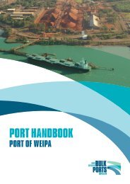
1.2 <strong>Port</strong> <strong>of</strong> <strong>Weipa</strong><br />
The <strong>Port</strong> <strong>of</strong> <strong>Weipa</strong> is located on the northwest <strong>of</strong> Cape York Peninsula, on the eastern side <strong>of</strong> the Gulf <strong>of</strong><br />
Carpentaria, approximately 700 km northwest <strong>of</strong> Cairns (refer Figure 1 to 3). The <strong>Port</strong> <strong>of</strong> <strong>Weipa</strong>’s main<br />
export is bauxite (aluminium ore) from the Rio Tinto Alcan (RTA) mine leases. The <strong>Port</strong> <strong>of</strong> <strong>Weipa</strong> achieved<br />
a record throughput <strong>of</strong> 22,005,405 tonnes <strong>of</strong> bauxite, 73,453 tonnes <strong>of</strong> fuel and 32,640 tonnes <strong>of</strong> general<br />
cargo in 2007/08 financial year (PCQ 2008).<br />
RTA operates the onshore bauxite handling, processing and stockpiling facilities and conveyors running to<br />
Lorim Point Wharf for ship loading. General purpose fuel wharves, pilot and tug services are also located at<br />
Lorim Point, Evans Landing and Humbug wharves. The port limits are illustrated in Figure 2 and extend<br />
approximately 30 km from the port facilities. The majority <strong>of</strong> strategic port land is leased to RTA, however<br />
NQBP owns certain land parcels as described in the <strong>Port</strong> <strong>of</strong> <strong>Weipa</strong> Land Use Strategy<br />
(http://www.NQBP.com.au).<br />
Other port facilities include general purpose and fuel wharves and tugs operated by <strong>Weipa</strong> Tug Services Pty<br />
Ltd. Maritime Safety Queensland (MSQ) provides pilotage services. NQBP provides a key service in the<br />
port by maintaining a shipping channel through a regular maintenance dredging program.<br />
NQBP has sought to identify environmentally sensitive areas and management strategies that will allow the<br />
port to develop its full potential in an environmentally responsible manner. <strong>Port</strong> users are also responsible<br />
for a standard <strong>of</strong> environmental performance within the port that at least meets, or exceeds, the standards<br />
laid out in this <strong>EMP</strong>.<br />
<strong>Port</strong> <strong>of</strong> <strong>Weipa</strong> <strong>Environmental</strong> <strong>Management</strong> <strong>Plan</strong> 1<br />
Final July 2009
Figure 1 – Locality <strong>Plan</strong><br />
<strong>Port</strong> <strong>of</strong> <strong>Weipa</strong> <strong>Environmental</strong> <strong>Management</strong> <strong>Plan</strong> 2<br />
Final July 2009
Figure 2 - <strong>Port</strong> Limits for the <strong>Port</strong> <strong>of</strong> <strong>Weipa</strong><br />
<strong>Port</strong> <strong>of</strong> <strong>Weipa</strong> <strong>Environmental</strong> <strong>Management</strong> <strong>Plan</strong> 3<br />
Final July 2009
Figure 3 – Aerial Image <strong>of</strong> the <strong>Port</strong> <strong>of</strong> <strong>Weipa</strong><br />
<strong>Port</strong> <strong>of</strong> <strong>Weipa</strong> <strong>Environmental</strong> <strong>Management</strong> <strong>Plan</strong> 4<br />
Final July 2009
2 PORT ENVIRONMENTAL MANAGEMENT<br />
2.1 Introduction<br />
NQBP strives to manage its ports in a proactive manner to minimise and reduce any adverse impacts to<br />
the environment from port operations or new developments. NQBP has a structured environmental<br />
program that involves environmental assessment, auditing, monitoring, protection and management. It<br />
strives for continual improvement in the control <strong>of</strong> the port and port user activities to maintain a healthy and<br />
ecologically sustainable port environment.<br />
This <strong>Environmental</strong> <strong>Management</strong> <strong>Plan</strong> is complementary to, and consistent with, NQBP's Environment<br />
Policy. This Policy is documented on NQBP's web site (http://www.NQBP.com.au). The Environment<br />
Policy, procedures and practices <strong>of</strong> NQBP are documented in its <strong>Environmental</strong> <strong>Management</strong> System<br />
(EMS), which has been certified as compliant with the international standard AS/NZS ISO 14001:2004.<br />
Under NQBP's EMS, any new projects undertaken on NQBP land require a project-specific Environment<br />
<strong>Management</strong> <strong>Plan</strong> (<strong>EMP</strong>) to be developed by the proponent and then approved by NQBP prior to<br />
commencement <strong>of</strong> the project. This plan must address the potential environmental issues and risks from the<br />
project and the actions needed to minimise impacts. NQBP can supply a standard checklist <strong>of</strong> potential<br />
issues and will work with a project proponent to determine the environmental issues that need to be<br />
addressed. Larger projects will normally require the preparation <strong>of</strong> an <strong>Environmental</strong> Impact Statement<br />
(EIS).<br />
2.2 Document Use and Review<br />
The primary objective <strong>of</strong> this <strong>Port</strong> <strong>EMP</strong> is to provide a reference document for current and potential users <strong>of</strong><br />
the <strong>Port</strong> <strong>of</strong> <strong>Weipa</strong>. It is a port specific plan and was developed by NQBP to provide an overview <strong>of</strong><br />
environmental issues within the <strong>Port</strong> <strong>of</strong> <strong>Weipa</strong>. It outlines the current environmental management practices<br />
and controls required by NQBP to protect and enhance the port environment.<br />
The <strong>Plan</strong> complements NQBP’s <strong>Port</strong> <strong>of</strong> <strong>Weipa</strong> Strategic <strong>Plan</strong> to ensure that any development within NQBP<br />
limits is sustainable. This plan applies to all marine and terrestrial environments within port limits and<br />
managed by NQBP.<br />
This <strong>Plan</strong> is only intended to provide guidance for NQBP's land at <strong>Weipa</strong> and waters within port limits. It does<br />
not intend to interfere with other landholder's rights on neighbouring land or to impose any controls on how<br />
RTA (Rio Tinto Aluminium) or other port users might manage mining leases at <strong>Weipa</strong>. This <strong>Plan</strong> is also<br />
intended to provide a reference document for current and potential users <strong>of</strong> the port, government agencies<br />
and the local communities. Although this <strong>Plan</strong> is not a statutory document and is not required by legislation, its<br />
content mirrors the principles laid out in the Queensland <strong>Environmental</strong> Protection Act 1994.<br />
As part <strong>of</strong> NQBP’s community consultation, comments were sought from key stakeholders and the general<br />
community <strong>of</strong> <strong>Weipa</strong> in relation to this <strong>Plan</strong>. This plan will be reviewed and updated as needed to ensure that<br />
it reflects any significant changes that may occur within the <strong>Port</strong>. It will be completely reviewed every six (6)<br />
years as a minimum.<br />
<strong>Port</strong> <strong>of</strong> <strong>Weipa</strong> <strong>Environmental</strong> <strong>Management</strong> <strong>Plan</strong> 5<br />
Final July 2009
3 KEY LEGISLATION<br />
3.1 State Legislation<br />
NQBP has responsibilities conferred on it by State legislation (Government Owned Corporations Act 1993<br />
and Transport Infrastructure Act 1994) for the safe and efficient management <strong>of</strong> the ports under its<br />
jurisdiction, their infrastructure and for the management <strong>of</strong> pollution from shipping activities. This legislation<br />
requires and enables NQBP to operate as a commercial entity with responsibility for the environment within<br />
its management limits.<br />
NQBP's jurisdiction at the <strong>Port</strong> <strong>of</strong> <strong>Weipa</strong> applies only to land owned or leased by NQBP, as documented in<br />
NQBP’s Strategic <strong>Plan</strong> for <strong>Weipa</strong> and all waters within designated port limits, as defined under the Transport<br />
Infrastructure Act (refer Figure 2).<br />
<strong>Port</strong> activities carried out by port users and NQBP must comply with all relevant legislation. The key State<br />
legislation for protection <strong>of</strong> the environment in Queensland is the Environment Protection Act 1994 (EP Act),<br />
which is administered by the Queensland Department <strong>of</strong> Environment and Resource <strong>Management</strong> (DERM,<br />
formerly EPA).<br />
Significant new developments within the <strong>Port</strong> limits may require approval under the Integrated <strong>Plan</strong>ning Act<br />
1997 (IPA). For projects proposed on Strategic <strong>Port</strong> Land 1 , NQBP would be the Assessment Manager under<br />
the Act. Works within State waters, including dredging or reclamations, constitute ‘tidal works’ under the<br />
Coastal Protection and <strong>Management</strong> Act 1995 and would also require approval under IPA.<br />
<strong>Port</strong> users are required to obtain or hold all the relevant environmental approvals, permits or licences from<br />
the DERM for their day-to-day activities, which might include environmentally relevant activities such as bulk<br />
material handling, fuel or chemical storage, sewage treatment, aquaculture or boat repair and maintenance<br />
as defined by the <strong>Environmental</strong> Protection Regulation 1998.<br />
Under the Fisheries Act 1994, marine and tidal wetland plant species, which include seagrasses,<br />
mangroves, salt-marsh and other tidal plants, may not be removed, damaged or trimmed without a permit<br />
from the Queensland Department <strong>of</strong> Employment, Economic Development and Innovation (DEEDI) (formerly<br />
the Department <strong>of</strong> Primary Industries and Fisheries). Permits are assessed by DEEDI but approved under<br />
the IDAS framework. The Act also prohibits work in a declared fish habitat area (FHA) without approval. No<br />
declared FHA’s exist within port limits at this time. A FHA is proposed by DEEDI within the <strong>Weipa</strong> port limits,<br />
which currently extends for approximately 85,000 hectares from Jantz Point in the north to Pera Head in the<br />
south and includes the tidal lands and waters to the Pine, Mission, Embley and Hey Rivers.<br />
The Queensland Vegetation <strong>Management</strong> Act 1999 (VMA Act) affects the clearing <strong>of</strong> vegetation on freehold<br />
land, including strategic port land and a complex system <strong>of</strong> <strong>of</strong>fsets and permits are used if clearing is<br />
required. The VMA is administered by the Department <strong>of</strong> Environment and Resource <strong>Management</strong> (DERM,<br />
formerly the Department <strong>of</strong> Natural Resources and Water).<br />
1<br />
Strategic <strong>Port</strong> Land is land owned by NQBP that has been designated as land required for port purposes and approved as such by the<br />
Minister for Transport. Strategic <strong>Port</strong> Land is listed in the Land Use Strategy for <strong>Weipa</strong>.<br />
<strong>Port</strong> <strong>of</strong> <strong>Weipa</strong> <strong>Environmental</strong> <strong>Management</strong> <strong>Plan</strong> 6<br />
Final July 2009
The Land Protection (Pest and Stock Route <strong>Management</strong>) Act 2002 provides measures to manage pests<br />
and address the impacts they have on the environment. The Act requires landholders to take all reasonable<br />
steps to keep their land free <strong>of</strong> pests, which have been declared under the Act as having incurred (or the<br />
potential to incur) significant social, environmental or economic impacts. NQBP, through the <strong>Port</strong><br />
Supervisor, has taken initiatives to address these requirements together with developing a <strong>Port</strong> <strong>of</strong> <strong>Weipa</strong><br />
Pest <strong>Management</strong> <strong>Plan</strong> (Appendix 2).<br />
Queensland’s principal legislation for preservation <strong>of</strong> cultural heritage is the Aboriginal Cultural Heritage Act<br />
2003 and the Torres Strait Islander Cultural Act 2003. The Acts are similar in their terms and primarily<br />
service for the recognition and protection <strong>of</strong> Indigenous heritage in Queensland.<br />
3.2 State <strong>Plan</strong>ning Policies<br />
In considering assessable developments on Strategic <strong>Port</strong> Land under the Integrated <strong>Plan</strong>ning Act 1997,<br />
NQBP will have regard to the following plans in its decision-making as Assessment Manager:<br />
The State Coastal Protection and <strong>Management</strong> <strong>Plan</strong> is a statutory instrument under the Coastal<br />
Protection and <strong>Management</strong> Act 1995 and has the effect <strong>of</strong> State <strong>Plan</strong>ning Policy under the Integrated<br />
<strong>Plan</strong>ning Act.<br />
<br />
The State <strong>Plan</strong>ning Policy SPP 2/02, <strong>Plan</strong>ning and Managing Development Involving Acid Sulphate Soils<br />
came into effect in late 2002. This policy applies to all land, soil and sediment at or below 5 metres<br />
Australian Height Datum. Further information is provided in Section 5.6 on acid sulphate soils.<br />
3.3 Commonwealth Legislation<br />
Projects that may have an impact on issues <strong>of</strong> National <strong>Environmental</strong> Significance could require<br />
assessment and approval under the Environment Protection and Biodiversity Conservation Act 1999<br />
administered by the Department <strong>of</strong> Environment, Water, Heritage and the Arts (DEWHA). Triggers <strong>of</strong> the Act<br />
include impacts on World Heritage areas, Ramsar wetlands <strong>of</strong> international significance; nationally<br />
threatened species and communities listed by the Commonwealth, migratory species protected under<br />
international agreements, nuclear actions, or Commonwealth marine environment. Such projects will need<br />
to be referred to DEWHA by the project proponent to determine if Commonwealth approval is required.<br />
The disposal <strong>of</strong> dredged material at sea in Australian waters is covered by the Environment Protection (Sea<br />
Dumping) Act 1981. Under this Act, disposal <strong>of</strong> spoil material requires an approval from DEWHA. Any such<br />
approvals are only provided after environmental impact assessments are undertaken.<br />
The Aboriginal and Torres Strait Islander Heritage Protection Act 1984 provides for the protection <strong>of</strong><br />
significant Aboriginal areas and objects declared under the Act.<br />
<strong>Port</strong> <strong>of</strong> <strong>Weipa</strong> <strong>Environmental</strong> <strong>Management</strong> <strong>Plan</strong> 7<br />
Final July 2009
4 PORT ENVIRONMENT<br />
4.1 Climate and Coastal Conditions<br />
<strong>Weipa</strong> has a tropical monsoonal climate with distinct wet and dry seasons. The wet season occurs between<br />
October and April and tropical cyclones regularly cross the Gulf <strong>of</strong> Carpentaria during this period. Average<br />
annual rainfall in <strong>Weipa</strong> is ~1884 mm, 95 % <strong>of</strong> which is received during the wet season (Larcombe and<br />
Taylor 1997; URS 2002). Temperatures range between 13°C and 35 °C in winter and 18°C and 38 °C in<br />
summer. South-easterly winds dominate in the dry season and lighter, northerly and westerly winds are<br />
predominant in the wet season. The monsoonal climate gives hot, wet summers and mild, dry winters.<br />
Cyclones in the area result in strong to gale force winds and high wave action (refer Figure 4). Records<br />
indicate that tropical cyclones generally occur once every 2 years, based on Bureau <strong>of</strong> Meteorology data.<br />
The township <strong>of</strong> <strong>Weipa</strong> itself has not experienced a major cyclone since 1992. Tropical Cyclone "Mark"<br />
crossed the coast near <strong>Weipa</strong> on 10th January 1992, with consequential widespread minor damage, with<br />
falling trees being largely responsible for damage to houses and power lines. Wave action caused extensive<br />
damage at a <strong>Port</strong> loading facility (BOM 2009). Although the township <strong>of</strong> <strong>Weipa</strong> has not been hit by a<br />
cyclone for many years, several cyclones have hit the coast close to <strong>Weipa</strong>, including Cyclone Ingrid in<br />
March 2005 and Cyclone Monica in April 2006.<br />
Tides in Albatross Bay vary from semi-diurnal (2 tides per day) neap tides, to diurnal (1 tide per day) spring<br />
tides. Wave heights in exposed port waters can exceed 1.5 metres.<br />
While river gradients are considered shallow, similar to other river systems in Gulf <strong>of</strong> Carpentaria, the<br />
Embley, Mission, Hey and Pine Norman Rivers (which discharge into Albatross Bay) move large amounts <strong>of</strong><br />
suspended material into the Gulf during the wet season. As a result, Albatross Bay experiences high levels<br />
<strong>of</strong> turbidity seasonally and with wind and swell. During the wet season, freshwater from adjoining rivers<br />
transport turbid, brackish water into Albatross Bay with plumes also flowing into the Bay during ebb tides.<br />
Figure 4 Embley River<br />
<strong>Port</strong> <strong>of</strong> <strong>Weipa</strong> <strong>Environmental</strong> <strong>Management</strong> <strong>Plan</strong> 8<br />
Final July 2009
4.2 Areas <strong>of</strong> National <strong>Environmental</strong> Significance<br />
Coastal areas surrounding <strong>Weipa</strong> include seagrass beds, mangrove communities, s<strong>of</strong>t bottom habitats,<br />
fisheries resources, inter-tidal sand/mud flats and rocky reefs. These habitats are extremely productive and<br />
support a high diversity <strong>of</strong> animals and plants including some species which are valuable to commercial<br />
fisheries and some which have high conservation value.<br />
There are no listed World Heritage Areas, Conservation reserves or Fish Habitat Areas (FHA) within or near<br />
the port area. DEEDI are investigating a FHA within the limits <strong>of</strong> the <strong>Port</strong> <strong>of</strong> <strong>Weipa</strong>, however this has not<br />
been finalised.<br />
There are no threatened ecological communities in the area recorded on the EPBC Act database however,<br />
there are a large number <strong>of</strong> recorded threatened and migratory species in the region including, Flatback<br />
Turtle (Notator depressus), Hawksbill Turtle (Eretmochelys imbricata), Olive Ridley Turtle (Lepidochelys<br />
olivacea), Loggerhead Turtle (Caretta caretta) and Green Turtle (Chelonia mydas).<br />
Other species <strong>of</strong> ecological significance within the region include Dugong (Dugong dugon), Salt-water<br />
crocodile (Crocodylus porosus), Ribbon-root Orchid (Taeniophyllum muelleri) and Little Whimbrel (Numenius<br />
minutus).<br />
4.3 Cultural Heritage<br />
4.3.1 Indigenous Heritage<br />
A large number <strong>of</strong> clans have historically occupied the land in the vicinity <strong>of</strong> Albatross Bay, many <strong>of</strong> which<br />
now live within a number <strong>of</strong> Indigenous communities along the western coast <strong>of</strong> the Cape. The cultural<br />
heritage value <strong>of</strong> the areas around Albatross Bay and the <strong>Port</strong> are defined by both significant sites and<br />
places and by the presence <strong>of</strong> natural resources that are culturally significant. Large areas surrounding<br />
<strong>Weipa</strong> have Native Title and several more claims are being pursued on areas including NQBP land (GHD<br />
2005).<br />
Traditional Owners carry out commercial fishing for prawns in Albatross Bay, which contributes to the<br />
economy <strong>of</strong> a number <strong>of</strong> local communities. They also hunt for turtle and dugong within the Bay. Cultural<br />
heritage impacts have been investigated through a consultative process with Traditional Owners (GHD<br />
2005).<br />
The area around Chwahn sandbank has been identified by Traditional Owners as an area <strong>of</strong> significance<br />
due to the location <strong>of</strong> two story sites:<br />
Thungganh story is located in the area around the Chwahn (Jackson) sandbank.<br />
A’Ang story is located at the base <strong>of</strong> the existing Channel.<br />
There are no known significant sites <strong>of</strong> cultural heritage on NQBP holdings, however recent cultural survey<br />
work in a nearby mine by RTA involving Traditional Owners from the communities <strong>of</strong> Aurukun, Mapoon, New<br />
Mapoon and Bamaga, recorded 260 archaeological sites in total. These consisted <strong>of</strong> historical sites (early<br />
mining camps), stone artefact scatters, shell middens and culturally modified trees (trees from which<br />
Aboriginal people have removed wood, bark or cut holes into to access native bee honey). Culturally<br />
modified trees are generally the most common site type.<br />
The Cape York Peninsula is culturally important to Indigenous and non-Indigenous Australians based on<br />
both present and historic associations for residents and those who live outside the region. More than 60%<br />
<strong>of</strong> the population belong to Aboriginal and Torres groups, with the Indigenous peoples maintaining a high<br />
level <strong>of</strong> cultural distinctiveness. Aboriginal and Torres Strait Islanders have control over 15% <strong>of</strong> the<br />
Peninsula via deed <strong>of</strong> grant communities (DOGIT).<br />
<strong>Port</strong> <strong>of</strong> <strong>Weipa</strong> <strong>Environmental</strong> <strong>Management</strong> <strong>Plan</strong> 9<br />
Final July 2009
4.3.2 European History and Development<br />
A number <strong>of</strong> exploration parties studied the <strong>Weipa</strong> area from 1845 to 1862. Cape York Peninsula covers<br />
approximately 137,200 km² and comprises only 0.1% <strong>of</strong> the Australian population, with a population <strong>of</strong> about<br />
18,000 people (this number includes Thursday Island and Horn Island). The population is mainly<br />
concentrated in the towns <strong>of</strong> Cooktown and <strong>Weipa</strong>, Thursday Island and the northern Indigenous<br />
communities.<br />
The Town <strong>of</strong> <strong>Weipa</strong> is a mining town developed by Rio Tinto Aluminium (RTA) in the late 1950s to service<br />
the development <strong>of</strong> the bauxite mining operations. Although the town is geographically within the local<br />
government area <strong>of</strong> Cook Shire, the Town <strong>of</strong> <strong>Weipa</strong> formally remains under RTA management, with the<br />
<strong>Weipa</strong> Town Office performing administrative functions and representing residents. The town is mostly held<br />
under a mining lease in favour <strong>of</strong> RTA. Bauxite mining and the associated washing and screening facilities<br />
dominate the surrounding region. The Cape York Peninsula is also strategically important in relation to<br />
Australia's national defence and there are several military installations in the area.<br />
4.3.3 Protection <strong>of</strong> Cultural Heritage Values<br />
The Aboriginal Cultural Heritage Act 2003 (Qld) serves to recognise and protect indigenous heritage in<br />
Queensland. A feature <strong>of</strong> the Act is the cultural heritage duty <strong>of</strong> care. This provides that “A person who<br />
carries out an activity must take all reasonable and practicable measures to ensure the activity does not<br />
harm Aboriginal cultural heritage". All activities on NQBP land must comply with this requirement.<br />
For day-to-day activities, vehicles should where possible, avoid traversing undeveloped areas and keep to<br />
the designated roads/tracks. For any significant new developments affecting the land, a full survey <strong>of</strong> the<br />
area being affected by Traditional Owner representatives is recommended.<br />
4.4 Marine Environment<br />
4.4.1 Marine & Estuarine Fauna<br />
Numerous marine species <strong>of</strong> high conservation value occur in and around the <strong>Port</strong> <strong>of</strong> <strong>Weipa</strong> including<br />
marine turtles, dugong, crocodiles and approximately 25 species <strong>of</strong> seabirds, waders and wetland species.<br />
Marine turtle species present within the <strong>Weipa</strong> area include Flatback (Notator depressus), Hawksbill<br />
(Eretmochelys imbricata), Olive Ridley (Lepidochelys olivacea), Loggerhead (Caretta caretta) and Green<br />
(Chelonia mydas) (PCQ 1995; Limpus pers. comm.). All <strong>of</strong> these species are listed under the EPBC Act<br />
(refer Table 1). The listing for Olive Ridley and Flatback turtles indicates that breeding is likely to occur<br />
within the area. It would appear from a review <strong>of</strong> published information and advice from Col Limpus<br />
(Queensland Parks and Wildlife Service), that there is no period throughout the year during which turtles are<br />
absent from Albatross Bay. The main activities with the potential to impact turtle populations in the Gulf <strong>of</strong><br />
Carpentaria include fisheries by-catch, harvesting <strong>of</strong> individuals and eggs by Traditional Owners and<br />
predation <strong>of</strong> eggs by feral animals such as pigs (EA 2003; Doherty 2004).<br />
<strong>Port</strong> <strong>of</strong> <strong>Weipa</strong> <strong>Environmental</strong> <strong>Management</strong> <strong>Plan</strong> 10<br />
Final July 2009
Table 1 Conservation status <strong>of</strong> marine turtles in <strong>Weipa</strong><br />
Species EPBC Act 1999 Nature Conservation (Wildlife)<br />
Regulation 1994<br />
Green Vulnerable Vulnerable<br />
Loggerhead Endangered Endangered<br />
Flatback Vulnerable Vulnerable<br />
Hawksbill Vulnerable Vulnerable<br />
Olive Ridley Endangered Endangered<br />
There is limited information about cetaceans in the Eastern Gulf. Dolphins have been sighted and it is likely<br />
that inshore species such as Irrawaddy River dolphins, Indo-Pacific Humpback dolphins and Bottlenose<br />
dolphins inhabit coastal and estuarine areas, including port waters around <strong>Weipa</strong>. There is no indication<br />
that the region has any special significance for dolphins or whales (GHD 2005).<br />
Dugongs have been observed in aerial surveys <strong>of</strong> the <strong>Weipa</strong> region and their feeding trails have been noted<br />
throughout local seagrass beds. Dugong can grow to about three metres long and weigh up to 400 kg.<br />
They are a protected species under the EPBC Act, but are subject to Indigenous hunting.<br />
Saltwater crocodiles (Crocodylus porous) have been extensively reported in the <strong>Weipa</strong> area. They are listed<br />
as vulnerable species in the Nature Conservation Regulation (Wildlife) 1994.<br />
All the above marine mammals and reptiles have high conservation status and all, except bottlenose<br />
dolphins, have been prescribed in the schedules <strong>of</strong> the Queensland Nature Conservation Regulation<br />
(Wildlife) 1994 as either 'endangered' or 'vulnerable'.<br />
4.4.2 Coral Reefs and Rocky Foreshore Habitats<br />
Albatross Bay is one <strong>of</strong> the main areas in the Gulf that supports small areas <strong>of</strong> fringing coral reefs (Roel<strong>of</strong>s<br />
2004a). Albatross Bay is a large shallow bay, varying in depth from 0–20 m with numerous rocky headlands<br />
and outcrops (refer Figure 5). These hard areas provide substrate for sponges, sea cucumbers, hydroids,<br />
s<strong>of</strong>t corals, gastropods and also provide prey and habitat for reef fishes (PCQ 1995). Rocky reefs are<br />
generally located in shallow areas (0 – 6metres), with reef patches present <strong>of</strong>f Duifken Point, Mangrove<br />
Point and Kerr Point (PCQ 1995). Some reef areas are also present in deeper waters <strong>of</strong>fshore at<br />
Westminster Reef, Three Mile Shoals west <strong>of</strong> Pera Head and in Jackson Channel (PCQ 1995).<br />
An underwater video survey <strong>of</strong> the rocky reef located in Jackson Channel, was undertaken in 2000 to<br />
provide an indication <strong>of</strong> its structure and composition. The survey indicated that the reef is comprised <strong>of</strong><br />
boulders, cobbles and stones with some fine sediments also evident (URS et al. 2001). The reef is located<br />
in an area that is regularly scoured by ebbing tides and by turbid freshwater river discharges from the<br />
Embley and Hey Rivers, particularly during the wet season. Biota observed were typical <strong>of</strong> tropical reef<br />
habitats including filter/suspension feeders, s<strong>of</strong>t corals, plating and branching forms <strong>of</strong> hard corals, hydroids,<br />
sponges, colonial and solitary ascidians and sea anemones (URS et al. 2001).<br />
<strong>Port</strong> <strong>of</strong> <strong>Weipa</strong> <strong>Environmental</strong> <strong>Management</strong> <strong>Plan</strong> 11<br />
Final July 2009
Figure 5 Rocky Foreshore on the Embley River With Bauxite Boulders<br />
4.4.3 Benthic Communities<br />
Numerous distinctive benthic communities are found within the estuary and Albatross Bay. These benthic<br />
communities form an important food source for numerous species <strong>of</strong> commercially important fish and prawns<br />
in the port area.<br />
To quantify the potential impacts <strong>of</strong> spoil disposal on benthic communities, surveys <strong>of</strong> benthic fauna at the<br />
Albatross Bay spoil ground and surrounding areas were undertaken in 1996, 1998 and 2000, 2002/3 and<br />
2005. These surveys formed part <strong>of</strong> compliance monitoring undertaken to maintain the long-term ocean<br />
disposal permit issued by the DEWHA for maintenance dredging at the <strong>Port</strong> (under the Sea Dumping Act<br />
permit system).<br />
Surveys <strong>of</strong> benthic fauna have indicated that s<strong>of</strong>t bottom habitats in Albatross Bay and its associated<br />
estuaries provide habitat for a diverse assemblage <strong>of</strong> species, particularly invertebrates including polychaete<br />
worms, bivalves, brittle stars and crustaceans (GHD 2005). Figure 6 illustrates typical substrate from a grab<br />
sample taken with the <strong>Port</strong> <strong>of</strong> <strong>Weipa</strong>.<br />
Statistical analysis indicates that the community structure is highly variable across the entire study area<br />
(WBM 2003). For instance, the composition <strong>of</strong> the benthic community at the control sites differed more over<br />
time than between the shallow and deep controls (URS 2001). Previous surveys have also identified that<br />
the percentage <strong>of</strong> fine sediments (silts and clays) explains up to 37% <strong>of</strong> the observed variation in the<br />
abundance <strong>of</strong> benthic in-fauna in different locations.<br />
<strong>Port</strong> <strong>of</strong> <strong>Weipa</strong> <strong>Environmental</strong> <strong>Management</strong> <strong>Plan</strong> 12<br />
Final July 2009
Figure 6 Typical substrate observed in grab samples from Chwahn (Jackson) Bank<br />
4.4.4 Seagrasses<br />
Seagrasses are benthic communities dominated by plants and recognised scientifically for their contributions<br />
to coastal productivity. Seagrass meadows form an important component <strong>of</strong> coastal ecosystems and<br />
perform important functions, such as nutrient trapping and recycling and provide food and shelter for many<br />
marine organisms (Roel<strong>of</strong>s et al. 2003). Seagrass communities and their management is an important<br />
aspect <strong>of</strong> the <strong>Environmental</strong> <strong>Management</strong> <strong>Plan</strong> for the <strong>Port</strong> <strong>of</strong> <strong>Weipa</strong>.<br />
The extensive intertidal sand and mud flats and shallow subtidal areas within Albatross Bay and its<br />
associated rivers support significant seagrass and macro-algal communities. Sensitive areas within <strong>Weipa</strong>,<br />
including seagrass and mangrove areas are illustrated in Figure 7. Seagrass meadows within the <strong>Port</strong> limits<br />
are largely restricted to shallow sand and mud banks at depths <strong>of</strong> less than 4 metres below mean sea level<br />
(Roel<strong>of</strong>s et al. 2003). Several <strong>of</strong> these meadows are located adjacent to port infrastructure and dredged<br />
channels within the Embley River. Six seagrass species have been recorded at the <strong>Port</strong> <strong>of</strong> <strong>Weipa</strong>. DEEDI<br />
conduct annual seagrass surveys in the <strong>Port</strong> <strong>of</strong> <strong>Weipa</strong> which form part <strong>of</strong> the long term seagrass monitoring<br />
programme. The most recent study undertaken in 2009 revealed the seagrass is in good condition<br />
(Rasheed pers.com).<br />
Figure 7 Seagrass meadows in <strong>Port</strong> <strong>of</strong> <strong>Weipa</strong><br />
<strong>Port</strong> <strong>of</strong> <strong>Weipa</strong> <strong>Environmental</strong> <strong>Management</strong> <strong>Plan</strong> 13<br />
Final July 2009
Figure 8 Sensitive marine areas at <strong>Weipa</strong><br />
<strong>Port</strong> <strong>of</strong> <strong>Weipa</strong> <strong>Environmental</strong> <strong>Management</strong> <strong>Plan</strong> 14<br />
Final July 2009
4.5 Fisheries<br />
The Gulf <strong>of</strong> Carpentaria is an important fish habitat area and is unique as it is one <strong>of</strong> the only shallow,<br />
tropical embayment’s in the world that is relatively undisturbed (Hart 2002). Traditional, recreational and<br />
commercial fishing occurs within the tidal creeks, estuaries and open waters <strong>of</strong> Albatross Bay. Offshore line<br />
and net fishing and trawling also occur outside Albatross Bay within the Gulf <strong>of</strong> Carpentaria. There are no<br />
significant aquaculture operations in the area. The following sections summarise the characteristics and<br />
significance <strong>of</strong> these fisheries and describe the marine faunal communities that are harvested by these<br />
industries.<br />
4.5.1 Offshore Commercial Fisheries<br />
The <strong>of</strong>fshore commercial net fishery (<strong>North</strong>ern Shark Fishery) targets tropical sharks, grey mackerel<br />
(Scomberomorus semifasciatus) and Spanish mackerel (Scomberomorus commerson) in waters more than<br />
200 km <strong>of</strong>fshore from <strong>Weipa</strong> (PCQ 1995). The Gulf <strong>of</strong> Carpentaria commercial line fishery also has an<br />
<strong>of</strong>fshore component, targeting Spanish mackerel using troll lines (Roel<strong>of</strong>s 2004a). The <strong>of</strong>fshore fishery<br />
operates up to 25 nm from the coast and is managed by the Queensland Fisheries Joint Authority, as part <strong>of</strong><br />
their role managing fish stocks in Queensland, <strong>North</strong>ern Territory and Commonwealth waters (Roel<strong>of</strong>s<br />
2004b).<br />
<strong>Weipa</strong> is located within the <strong>North</strong>ern Prawn Fishery (NPF), which is managed by the Australian Fisheries<br />
<strong>Management</strong> Authority (AFMA) (Perdrau 2003). The NPF extends along approximately 6,000 km <strong>of</strong><br />
coastline in northern Australia from the Cape York Peninsula in Queensland, to Cape Londonderry in<br />
Western Australia, covering around 771,000km² <strong>of</strong> the Australian Fishing Zone (Perdrau 2003). The NPF<br />
has an annual production value <strong>of</strong> between $100 – $170 million dollars, making it one <strong>of</strong> Australia’s most<br />
valuable trawl fisheries (AFMA 2002). The NPF is a multi-species fishery that targets banana, tiger and<br />
endeavour prawns (Hart 2002; Perdrau 2003). Five species <strong>of</strong> prawn form part <strong>of</strong> the commercial fishing<br />
catch at <strong>Weipa</strong>:<br />
white banana prawn (Penaeus merguiensis);<br />
grooved tiger prawn (Penaeus semisulcatus);<br />
blue endeavour prawn (Metapenaeus endeavour);<br />
western king prawn (Penaeus latisulcatus); and<br />
brown tiger prawn (Penaeus esculentus)<br />
(URS 2002).<br />
Trawling for prawns occurs in the outer part <strong>of</strong> Albatross Bay and to the north and south <strong>of</strong> <strong>Weipa</strong> (URS,<br />
2002). A CRC Reef Research Centre report identified approximately 16 commercial fishers operating out <strong>of</strong><br />
<strong>Weipa</strong> and two small towns located to the south (Fenton and Marshall 2001). No trawlers reported using<br />
<strong>Weipa</strong> as a homeport, with most operators travelling to the area and remaining at sea for the entire season<br />
(AFMA 2002).<br />
4.5.2 Inshore Commercial Fisheries<br />
The inshore commercial fisheries <strong>of</strong> the <strong>Weipa</strong> region are managed by DEEDI. In contrast to the trawl<br />
fishery, <strong>Weipa</strong> is a homeport for commercial operators undertaking netting, crabbing and line fishing in<br />
Albatross Bay and surrounds. These fisheries form part <strong>of</strong> the wider Gulf <strong>of</strong> Carpentaria fishery extending<br />
from Cape York Peninsula to the <strong>North</strong>ern Territory. The inshore net fishery operates up to 7 nautical miles<br />
<strong>of</strong>f the coast and the inshore line fishery operates up to 3 nautical miles <strong>of</strong>f the coast (Roel<strong>of</strong>s 2004a;<br />
2004b). The rivers flowing into Albatross Bay have been closed to commercial trawling and net fishing since<br />
1977 (WCCG 2000).<br />
The inshore fishery is closed from 1 November to 1 February, during the barramundi breeding season.<br />
Spawning tends to occur in the early wet season prior to substantial rainfall, with males migrating<br />
downstream to mate with females resident in lower estuaries and tidal flats outside river mouths. Mud crabs<br />
(Scylla sp.) are taken using baited crab pots located in the mangrove systems. Mud crab spawning occurs<br />
<strong>of</strong>fshore, with megalopae larval stages migrating back into the estuary systems, where they moult into the<br />
juvenile crab and reside in the mangrove and seagrass communities.<br />
<strong>Port</strong> <strong>of</strong> <strong>Weipa</strong> <strong>Environmental</strong> <strong>Management</strong> <strong>Plan</strong> 15<br />
Final July 2009
4.5.3 Recreational and Charter Boat Fisheries<br />
Target species for recreational and charter boat fishing include barramundi, King and Blue Threadfin,<br />
Fingermark Bream, Black-spot Tusk-fish, cods and Stripey (PCQ 1995). Fishing effort tends to be<br />
concentrated <strong>of</strong>f rocky points and reef patches, while mud crabbing occurs in the mangrove systems.<br />
Recreational fishing may be shore based or vessel based (refer Figure 9) A 2001 CRC Reef Research<br />
Centre report identified approximately eight recreational fishing charters operating out <strong>of</strong> <strong>Weipa</strong> (Fenton and<br />
Marshall 2001). There is little quantitative data available on the recreational fisheries in the Gulf, however,<br />
90% <strong>of</strong> tourists in the area listed fishing as a main reason for visiting the area. A recreational fishing survey<br />
was conducted in 2001, whereby 0.8% <strong>of</strong> the State’s 596,800 recreational saltwater fishers indicated that<br />
they mainly fished in the <strong>Weipa</strong> region in the 12 months prior to the survey (Roel<strong>of</strong>s 2004b).<br />
Figure 9 Recreational vessel in the Embley River<br />
4.5.4 Traditional Fishing<br />
Indigenous communities engage in subsistence fishing in the <strong>Weipa</strong> area, concentrating on line fishing for<br />
Barramundi, Threadfin Salmon, Queen-fish, sharks and mud crabbing in mangrove systems (PCQ 1995).<br />
Indigenous communities are granted access to fish through the Fisheries Act 1994 and the Native Title Act<br />
1993. Subsistence fishing is important for Indigenous peoples in terms <strong>of</strong> cultural practice, providing food<br />
and maintaining kinship linkages (Roel<strong>of</strong>s 2004b).<br />
4.6 Coastal Environment<br />
4.6.1 Inter-Tidal Habitats<br />
Albatross Bay consists <strong>of</strong> a large turbid, shallow estuary fed by numerous rivers, varying in depth from 0–20<br />
m. The Pine River in the north, and the Mission and Embley rivers to the east, are the main rivers<br />
discharging into the Bay. The Hey River flows into the Embley River from the south before it also discharges<br />
into the Bay. Fairly broad inter-tidal sand flats extend for up to 2 km from the beach line to shallow sub-tidal<br />
areas <strong>of</strong> Albatross Bay, particularly on both sides <strong>of</strong> the mouth <strong>of</strong> the Embley, Mission and Pine Rivers.<br />
<strong>Port</strong> <strong>of</strong> <strong>Weipa</strong> <strong>Environmental</strong> <strong>Management</strong> <strong>Plan</strong> 16<br />
Final July 2009
In the more sheltered tidal areas, especially along the banks <strong>of</strong> Albatross Bay, Pine River, Mission River and<br />
Hey River, are extensive mangrove wetlands with adjacent mud flats. Juvenile prawns are abundant over<br />
the riverbanks during ebb flows. Gastropods, molluscs and crabs may be present on the upper banks<br />
adjacent to mangroves, while mudskippers and other species <strong>of</strong> gobies inhabit lower sections. Tidal<br />
currents can reach 4.5 knots on the ebb tide in the area <strong>of</strong> the <strong>Port</strong> (Lorim Point) and roiling <strong>of</strong> the water is<br />
common. Populations <strong>of</strong> invertebrates including crabs and molluscs live on the surface sediments <strong>of</strong> this<br />
area.<br />
4.6.2 Soil and Terrain<br />
Most soils in <strong>Weipa</strong> are distinctively reddish-brown. This is because they contain high concentrations <strong>of</strong><br />
bauxite. Some soils are alluvial in origin, particularly around low lying and wetland areas and may contain a<br />
high organic content. Acid sulphate soils have not been identified in the port area although the presence <strong>of</strong><br />
large areas <strong>of</strong> low lying land and mangrove wetlands suggests that they may be present.<br />
4.6.3 Coastal Vegetation<br />
Extensive mangrove communities fringe the estuary and tidal creeks <strong>of</strong> Albatross Bay. Mangrove and tidal<br />
wetlands, situated at the confluence <strong>of</strong> flows from the land and sea, are highly productive systems and<br />
contribute many services including water filtration, sediment stabilisation, coastal protection and wildlife<br />
habitat, as well as contributing organic matter as a primary food source for many species. Mangroves occur<br />
along the banks <strong>of</strong> the many rivers and streams that flow into Albatross Bay for many kilometres upstream to<br />
near freshwater reaches (refer Figure 8). They also form a fringe <strong>of</strong> coastal vegetation on accreting<br />
shorelines immediately behind the lower sand-flats to the north and to the west <strong>of</strong> the mouth <strong>of</strong> the Embley<br />
River within the <strong>Weipa</strong> port limits.<br />
The mangrove communities in the <strong>Weipa</strong> area are species rich, containing approximately 29 <strong>of</strong> the 37<br />
mangrove species found in Queensland. The Embley River, in which the <strong>Port</strong> <strong>of</strong> <strong>Weipa</strong> is located, supports<br />
approximately 80 km² <strong>of</strong> mangroves. Previous studies have identified five mangrove communities within<br />
Albatross Bay and its associated rivers (PCQ 1995). Three zones have been used to classify these<br />
communities:<br />
mid-tidal Rhizophora zone (inundated in every tidal cycle);<br />
high tidal Brugiera zone (inundated at high tide); and<br />
supra-tidal Ceriops zone (only inundated at highest tides).<br />
Mangroves within the <strong>Weipa</strong> area provide important habitat for a variety <strong>of</strong> animals including mud crabs,<br />
prawns, fish, birds and saltwater crocodiles. Research carried out by CSIRO indicates that the steep muddy<br />
slopes <strong>of</strong> mangrove lined creeks and riverbanks are the only nursery habitat utilised by juvenile white<br />
banana prawns (Penaeus merguiensis), which is an important commercially trawled species in this area.<br />
The mangrove communities provide habitat for various marine fauna including mud crabs, prawns,<br />
barramundi, salmon, birds and saltwater crocodiles. Habitats located landward <strong>of</strong> the mangrove forests<br />
include:<br />
Sand flats which support shrub-lands and usually edge bare saltpans;<br />
<br />
<br />
A freshwater zone which supports both mangroves and freshwater swamp vegetation; and<br />
Alluvial mud flats landward <strong>of</strong> the mangrove areas. These areas commonly contain paperbarks, sedges<br />
and salt tolerant grasses and other species.<br />
Mangroves are protected under the Fisheries Act 1994 administered by the DEEDI. Under Section 8 <strong>of</strong> the<br />
Act, a “marine plant” includes tidal plant usually growing on or adjacent to tidal land, whether living, dead,<br />
standing or fallen or a plant prescribed under a regulation. It applies to land within the limits <strong>of</strong> State waters.<br />
In line with this and as part <strong>of</strong> NQBP environmental management strategy in the <strong>Port</strong>, the removal or<br />
damage <strong>of</strong> marine plants, in particular mangroves, seagrass or other tidal plants is prohibited, unless<br />
undertaken under a Marine <strong>Plan</strong>ts Permit issued by DEEDI.<br />
<strong>Weipa</strong> falls under the DERM’s Western Bioregion, whereby coastal vegetation <strong>of</strong> <strong>Weipa</strong> is listed as ‘remnant<br />
not <strong>of</strong> concern’ and to a lesser extent ‘dominant’ and ‘sub-dominant’. Communities <strong>of</strong> Melaleuca saligna and<br />
Lophostemon suaveolens woodland on drainage swamps are common in areas <strong>of</strong> <strong>Weipa</strong>.<br />
<strong>Port</strong> <strong>of</strong> <strong>Weipa</strong> <strong>Environmental</strong> <strong>Management</strong> <strong>Plan</strong> 17<br />
Final July 2009
4.7 Current Water and Sediment Quality<br />
The riverine and coastal environment surrounding the <strong>Port</strong> and Town <strong>of</strong> <strong>Weipa</strong> has experienced minimal<br />
water quality impacts since it was developed in the 1950s. This is due to the relatively undeveloped<br />
catchment area, the export <strong>of</strong> an inert product (bauxite) and a low population. The main potential sources <strong>of</strong><br />
impact to water quality are from contaminants in stormwater run-<strong>of</strong>f or outfalls from the main land uses in the<br />
<strong>Weipa</strong> region including:<br />
bauxite mining on RTA mining leases;<br />
mine site rehabilitation activities by RTA;<br />
port activities at the <strong>Port</strong> <strong>of</strong> <strong>Weipa</strong>;<br />
urban land uses in <strong>Weipa</strong> township;<br />
military activities at RAAF Base Scherger;<br />
cattle grazing;<br />
tourist activities relating to four wheel driving, fishing and camping; and<br />
Indigenous practices.<br />
Marine sediments close to the port consist primarily <strong>of</strong> eroded bauxite and organic matter with fines, with<br />
little heavy mineral content. Sediments in the port do not contain any significant levels <strong>of</strong> pollutants.<br />
The historic use <strong>of</strong> tributyl-tin (TBT) as an anti-foulant on vessels may have introduced small quantities <strong>of</strong><br />
TBT into the berth areas, as paint or other detritus flakes from the hulls <strong>of</strong> berthing vessels. Any works in<br />
the port involving the removal <strong>of</strong> marine sediment will continue to include a sediment contaminant<br />
investigation to ensure that the material is suitable for relocation in the proposed receiving environment.<br />
Albatross Bay experiences naturally high levels <strong>of</strong> turbidity, which vary according to season and with wind<br />
and swell. During the wet season, plumes <strong>of</strong> freshwater from the surrounding rivers transport turbid,<br />
brackish water into Albatross Bay, with plumes also flowing into the Bay during ebb tides.<br />
4.8 <strong>Port</strong> Buffer Areas<br />
Due to the lack <strong>of</strong> land available there is no capacity to establish significant buffer areas to adjoining lots.<br />
4.9 Flora, Fauna & Natural Amenity<br />
Western Cape York Peninsula is an area rich in ecological and cultural heritage. The mangrove wetland and<br />
coastal areas around <strong>Weipa</strong> provide visitors and locals with important recreational activities. Mining<br />
operations principally to the north <strong>of</strong> <strong>Weipa</strong> have altered the landscape, however, the coastal and riverine<br />
environments have a high ecological value.<br />
Development <strong>of</strong> the township <strong>of</strong> <strong>Weipa</strong> has resulted in the removal <strong>of</strong> some areas <strong>of</strong> the original vegetation,<br />
including mangroves, from the banks <strong>of</strong> the estuary. In the event that further coastal land is being<br />
considered for port expansion by NQBP, appropriate environmental impact assessments <strong>of</strong> any proposed<br />
development, including alternatives, will be conducted. In conducting any impact assessments, NQBP will<br />
consult with all relevant stakeholders and statutory authorities.<br />
Although the presence <strong>of</strong> wharves and infrastructure needed to process bauxite ores and <strong>of</strong>fload petroleum<br />
products and general cargo from vessels impacts on the natural amenity <strong>of</strong> the area these activities,<br />
preservation <strong>of</strong> the natural amenity <strong>of</strong> the area is an important component <strong>of</strong> the <strong>EMP</strong> for the <strong>Port</strong> <strong>of</strong> <strong>Weipa</strong>.<br />
One <strong>of</strong> the most significant impacts on the natural amenity <strong>of</strong> the area is debris that is regularly washed or<br />
deposited on to the foreshore. Some <strong>of</strong> the debris comes from material that has been placed deliberately to<br />
stabilise the river bank. The continuing removal <strong>of</strong> rubbish and debris is an essential step in the program to<br />
improve the amenity <strong>of</strong> the area. NQBP’s <strong>Port</strong> Supervisor continually removes rubbish from operational<br />
areas <strong>of</strong> the port adjacent to NQBP land. NQBP also assists community groups to undertake regular cleanups<br />
<strong>of</strong> garbage in other areas <strong>of</strong> the port (i.e. Clean Up Australia Day) and continually seeks to participate in<br />
local revegetation programmes.<br />
<strong>Port</strong> <strong>of</strong> <strong>Weipa</strong> <strong>Environmental</strong> <strong>Management</strong> <strong>Plan</strong> 18<br />
Final July 2009
Figure 10 Revegetation area on Embley River<br />
4.9.1 Sea Birds<br />
The tidal wetland areas <strong>of</strong> the estuary support shorebirds including migratory species <strong>of</strong> high conservation<br />
significance. Of the 100 bird species recorded in the <strong>Weipa</strong> area, approximately 25% are sea birds, waders<br />
and wetland species (PCQ 1995). Those species listed in International conventions are protected under<br />
Commonwealth legislation.<br />
<strong>Port</strong> <strong>of</strong> <strong>Weipa</strong> <strong>Environmental</strong> <strong>Management</strong> <strong>Plan</strong> 19<br />
Final July 2009
5 ENVIRONMENTAL MANGAGEMENT MEASURES<br />
5.1 General <strong>Environmental</strong> <strong>Management</strong><br />
DERM oversees environmental regulation <strong>of</strong> port users and their activities. This regulation includes licensing<br />
activities in the port and any monitoring <strong>of</strong> compliance with licence conditions. Applications and approvals<br />
are generally undertaken through the IDAS process <strong>of</strong> the Integrated <strong>Plan</strong>ning Act 1997.<br />
NQBP has an <strong>Environmental</strong> <strong>Management</strong> System externally certified to the international standard<br />
AS/NZS/ISO 14001:2004. This system provides specific policy to fulfil NQBP's environmental goals. As<br />
detailed in its Environment Policy, NQBP strives for ecologically sustainable operations and development <strong>of</strong><br />
its ports, which is consistent with Queensland Transport’s “<strong>Environmental</strong> Policy for Queensland <strong>Port</strong>s”. This<br />
may result in NQBP setting higher environmental standards on operations or new developments than<br />
required by environmental legislation or licences. This is achieved through a detailed environmental<br />
assessment <strong>of</strong> all proposed projects on port land or in waters within port limits and auditing <strong>of</strong> both NQBP<br />
and port user activities in those areas.<br />
As outlined in Section 2.1, NQBP will require a detailed <strong>Environmental</strong> <strong>Management</strong> <strong>Plan</strong> to be prepared by<br />
a project proponent as part <strong>of</strong> the approval process for any new development. This <strong>Plan</strong> would be developed<br />
in consultation with NQBP. Larger projects will require preparation <strong>of</strong> a formal <strong>Environmental</strong> Impact<br />
Statement (EIS), in accordance with Chapter 3 <strong>of</strong> the <strong>Environmental</strong> Protection Act 1994 and Chapter 2 <strong>of</strong><br />
the <strong>Environmental</strong> Protection Regulation 2008.<br />
5.2 Emergency Response<br />
NQBP has statutory responsibilities and powers under the Transport Infrastructure Act 1994 to maintain the<br />
safety and security <strong>of</strong> the port. This Act authorises the port authority to control movement <strong>of</strong> vessels in the<br />
port, to inspect ships, or to move ships moored or goods left against the authority’s direction.<br />
NQBP has developed an Emergency Response <strong>Plan</strong> for the <strong>Port</strong> <strong>of</strong> <strong>Weipa</strong>. The <strong>Plan</strong> covers situations such<br />
as cyclones, marine incidents, bomb threats, fire, explosion or fatalities. Copies <strong>of</strong> the Response <strong>Plan</strong> are<br />
held at NQBP’s <strong>Weipa</strong> <strong>of</strong>fice near Evans Landing Point, by the Regional Harbour Master and by a number <strong>of</strong><br />
port users and other key agency contacts, including Maritime Safety <strong>of</strong> Queensland.<br />
Where a non-marine incident is caused through the activities <strong>of</strong> a port user on port land, the initial response<br />
is the responsibility <strong>of</strong> the port user, with notification required to NQBP. If the incident has the potential to<br />
escalate beyond the boundaries <strong>of</strong> the port user’s responsibility, NQBP maintains the right to initiate external<br />
resources and response agencies to assist in reducing the impact <strong>of</strong> the incident on other port users.<br />
5.2.1 Cyclone Procedures<br />
Maritime Safety Queensland is the agency responsible for the safety <strong>of</strong> shipping in Queensland. The<br />
Regional Harbour Master in Cairns establishes and publishes the cyclone procedures for the port<br />
(www.msq.qld.gov.au) that will be used by all port users.<br />
While a summary <strong>of</strong> the key actions to be taken during the approach <strong>of</strong> a cyclone are provided below, the<br />
latest MSQ cyclone procedures should always be referred to.<br />
<strong>Port</strong> <strong>of</strong> <strong>Weipa</strong> <strong>Environmental</strong> <strong>Management</strong> <strong>Plan</strong> 20<br />
Final July 2009
Alert phases in the port provide a guide for action as a cyclone or severe heavy weather approaches an<br />
area. The alert will be announced by the Regional Harbour Master over VHF Channel 16. Once a vessel is<br />
moored in its cyclone mooring position, they should contact the Regional Harbour Master to advise where<br />
they are moored and how many people will be remaining onboard. If no one is remaining onboard, a contact<br />
number is to be left.<br />
The detailed cyclone procedures are provided in the NQBP Emergency Response <strong>Plan</strong> and are consistent<br />
with Queensland Transport’s Maritime Cyclone Contingency <strong>Plan</strong> for <strong>Weipa</strong>. Table 2 provides a summary <strong>of</strong><br />
key actions during the approach <strong>of</strong> a cyclone. Alert phases in the port provide a guide for action as a<br />
cyclone or severe heavy weather approaches an area. The alert will be announced by the Regional Harbour<br />
Master over VHF Channel 16.<br />
Table 2 – Cyclone Alert Schedule<br />
Alert Phase Storm/Cyclone Position Action by <strong>Port</strong> Users<br />
Yellow Alert<br />
A cyclone exists and destructive<br />
winds are within 20 hours from<br />
NQBP will liaise with port users to<br />
advise <strong>of</strong> Yellow Alert.<br />
port.<br />
Emergency Services are placed on alert<br />
Ship’s Masters are advised to prepare<br />
to sail on short notice.<br />
Loading is to be stopped. Ship’s load is<br />
to be brought to satisfactory handling<br />
trim if time and draft permit.<br />
Small craft are to move to cyclone<br />
mooring areas.<br />
All dinghies on or near <strong>Port</strong> beaches or<br />
boat ramps should be hauled away or<br />
tied down above High Water mark.<br />
NQBP will monitor & plot cyclone<br />
movement and liaise with Harbour<br />
Master.<br />
Blue Alert<br />
Destructive winds are less than 16 Sail all ships where possible.<br />
(Cyclone Warning) hours from <strong>Port</strong><br />
Where a ship can’t sail, linesmen are to<br />
be arranged. Master is to take standard<br />
cyclone precautions.<br />
NQBP will liaise with port users & QT<br />
on final arrangements.<br />
For small vessels at cyclone moorings,<br />
final preparations and tying <strong>of</strong>f are to be<br />
completed.<br />
Non-essential personnel should be<br />
evacuated.<br />
Red Alert<br />
Destructive winds are less than 6 The <strong>Port</strong> is closed.<br />
(Cyclone Impact) hours from <strong>Port</strong><br />
The <strong>Port</strong> area should be completely<br />
evacuated and all vessels secured in<br />
their positions <strong>of</strong> shelter.<br />
Vessels are not to leave their cyclone<br />
moorings until the <strong>of</strong>ficial ALL CLEAR<br />
has been given by the Regional<br />
Harbour Master.<br />
5.2.2 <strong>Management</strong> <strong>of</strong> Oil Spills<br />
Oil spills in port waters could result from a variety <strong>of</strong> sources including groundings, collisions and sinking <strong>of</strong><br />
vessels, illegal discharges from vessels, accidents when transferring waste oil to storage facilities onshore<br />
and accidents when refuelling vessels.<br />
<strong>Port</strong> <strong>of</strong> <strong>Weipa</strong> <strong>Environmental</strong> <strong>Management</strong> <strong>Plan</strong> 21<br />
Final July 2009
A number <strong>of</strong> measures are currently in place at <strong>Weipa</strong> to minimise the risk <strong>of</strong> spills. These relate primarily to<br />
the safety <strong>of</strong> navigation, including the provision <strong>of</strong> navigation aids and pilotage services by MSQ. Pilotage<br />
services for the arrival and departure <strong>of</strong> ships from the port reduce the risk <strong>of</strong> human error. The oil spill<br />
response plan for the port has been prepared by MSQ and is documented in the Queensland Coastal<br />
Contingency Action <strong>Plan</strong> (QCCAP). This <strong>Plan</strong> is complemented the National <strong>Plan</strong> to Combat the Pollution <strong>of</strong><br />
the Sea by Oil and other Noxious and Hazardous Substances (National <strong>Plan</strong>) for large spills.<br />
As the port authority, NQBP provides the first strike response to a local oil spill, providing a local resource for<br />
the initial response to a spill. For a larger spill, this provides time for MSQ to transport personnel and<br />
equipment to <strong>Weipa</strong> from other centres. NQBP owns sufficient oil spill equipment for that first strike<br />
response (see Table 3) and is supported by other local companies, principally RTA, who supply trained oil<br />
spill response personnel in the response team.<br />
Table 3 - Oil Spill Response Equipment Held in the <strong>Port</strong> <strong>of</strong> <strong>Weipa</strong><br />
Equipment Type<br />
Structureflex GP Boom<br />
Land Sea Boom Kit<br />
Weir Skimmer Kit 1<br />
Flexi-Dam 2<br />
Anchor Kit 1<br />
Quantity<br />
300 m<br />
100 m<br />
Sorbent Boom<br />
Sorbent Pads<br />
Sorbent Mops<br />
120m<br />
500<br />
150<br />
5.2.3 <strong>Management</strong> and Enforcement<br />
NQBP has a trained <strong>Port</strong> Supervisor located in the <strong>Port</strong>. The <strong>Port</strong> Supervisor is an authorised <strong>of</strong>ficer under<br />
the Transport Infrastructure (<strong>Port</strong>s) Regulation 1994. The <strong>Port</strong> Supervisor may issue directives to vessels to<br />
ensure the safety or efficient operation <strong>of</strong> the port, or to enforce port regulations or the requirements <strong>of</strong><br />
Transport Operations (Marine Pollution) Act 1995 with regard to discharges from vessels.<br />
The Supervisor will locally coordinate an initial response to an oil spill in the port and may board vessels for<br />
sampling purposes during an investigation <strong>of</strong> a spill. Penalties for contravention <strong>of</strong> a port notice or legal<br />
direction <strong>of</strong> the <strong>Port</strong> Supervisor can be applied.<br />
5.3 Water Quality<br />
5.3.1 Stormwater <strong>Management</strong><br />
NQBP has only a few land holdings in the port from Evans Landing to Lorim Point. Stormwater management<br />
in <strong>Weipa</strong> is under the control <strong>of</strong> the local council. Stormwater discharge points are located at a number <strong>of</strong><br />
points along the township foreshore at <strong>Port</strong> <strong>of</strong> <strong>Weipa</strong>.<br />
NQBP require lined drains and gross pollutant traps in stormwater systems <strong>of</strong> any future major developments<br />
<strong>of</strong> NQBP port land.<br />
<strong>Port</strong> <strong>of</strong> <strong>Weipa</strong> <strong>Environmental</strong> <strong>Management</strong> <strong>Plan</strong> 22<br />
Final July 2009
5.3.2 <strong>Management</strong> <strong>of</strong> Discharges from Shore-based Industries<br />
RTA loads bauxite ores from its <strong>Weipa</strong> port facility at Lorim Point. Although the ores are inert and pose little<br />
risk to the environment, measures are in place to minimise spills from the loading operation. The conveyor<br />
is enclosed to minimise losses due to wind or rain. RTA uses an incident management system that<br />
categorises incidents such as ore spillages and ensures actions are in place to prevent incidents from<br />
occurring in the future.<br />
5.3.3 Vessel Cleaning and Slipway Operation<br />
There are no slipways currently operating in the port, although a private slipway operated in the past. The<br />
Australian & New Zealand Conservation Council (ANZECC) has developed a code <strong>of</strong> practice for the<br />
operation <strong>of</strong> slipways (ANZECC 1997) and for the use <strong>of</strong> antifouling products in Australia. These codes<br />
recommend that all antifouling paints be treated as contaminated wastes. Scrapings and debris from vessel<br />
cleaning should be collected for disposal and stored in sealed containers until removed by licensed waste<br />
disposal contractors. No removal <strong>of</strong> antifouling products should be undertaken while the vessel is in the<br />
water, on beaches, or below the high tide limit.<br />
Although there is no hull cleaning in <strong>Weipa</strong>, there is still potential for contaminants, including tri-butyl tin<br />
(TBT), to be present in marine sediments at the port. TBT is used as an antifouling and biocide in the hull<br />
paint on large vessels (over 25 metres) to prevent the growth <strong>of</strong> marine organisms on the hull. Even in very<br />
low concentrations, TBT is highly toxic to shellfish such as mussels and oysters. TBT can enter the marine<br />
environment through paint flaking from the hulls <strong>of</strong> vessels or from leaching direct into the water column.<br />
Internationally, less toxic alternatives to TBT are being sought and an international phase-out <strong>of</strong> the use <strong>of</strong><br />
TBT is currently being implemented by the International Maritime Organisation (IMO). Hull or propeller<br />
cleaning is not allowed in port waters to prevent the possible release <strong>of</strong> contaminants or introduced marine<br />
pests.<br />
DERM would issue an approval for mining activities and as the administering authority with assessment<br />
delegation, DERM would issue a Development Approval for environmentally relevant activities and coastal<br />
activities.<br />
5.3.4 <strong>Management</strong> <strong>of</strong> Marine Waste and Contaminants<br />
There are no discharges <strong>of</strong> waste material from overseas vessels visiting Lorim Point, as there are no<br />
quarantine waste facilities available in the port due to its remote location and limited road access.<br />
Quarantine material cannot be received at <strong>Weipa</strong>.<br />
Waste (bilges/sewage) from the <strong>Weipa</strong> resident tugs is discharged to a road tanker at Humbug Wharf. RTA<br />
uses an internal environmental waste management control procedure for such operations.<br />
The adoption <strong>of</strong> Annex IV <strong>of</strong> the International Convention for the Prevention <strong>of</strong> Pollution from Ships by<br />
Australia should help minimise the impacts <strong>of</strong> ship sewage discharge in Australian waters. This Annex<br />
regulates the discharge <strong>of</strong> sewage from ships and effectively prevents the discharge <strong>of</strong> untreated sewage<br />
within the port limits because <strong>of</strong> the constraints it places on the minimum distance from land that a ship must<br />
be for untreated discharges. As these regulations apply only to vessels with a carrying capacity <strong>of</strong> 15 or<br />
more persons, the impacts <strong>of</strong> sewage discharge into port waters will, therefore, be limited to that from small<br />
vessels in the area.<br />
A variety <strong>of</strong> vessels including ships involved in international trade, barges carrying general cargo and/or<br />
petroleum products, naval and customs vessels, fishing boats and cruising yachts utilise areas within the<br />
port limits at <strong>Weipa</strong>. Discharges from these vessels include small amounts <strong>of</strong> sewage and oily bilge water.<br />
Impacts are, however, likely to be low given the high volume and apparently low retention time <strong>of</strong> water in<br />
the port.<br />
<strong>Port</strong> <strong>of</strong> <strong>Weipa</strong> <strong>Environmental</strong> <strong>Management</strong> <strong>Plan</strong> 23<br />
Final July 2009
Under the Transport Operations (Marine Pollution) Act 1995 and its associated regulations, it is illegal to<br />
discharge sewage in certain waters, including boat harbours, canals, marinas, State Marine Parks and those<br />
coastal areas deemed ‘smooth waters’ under the Transport Operations (Marine Safety) Regulation 1995.<br />
The area <strong>of</strong>fshore from <strong>Weipa</strong> is not defined as either smooth waters or as a "nil discharge area". In the<br />
permitted discharge area, sewage must pass through a macerator that reduces solids wastes to at least a<br />
fine slurry.<br />
5.3.5 <strong>Management</strong> <strong>of</strong> Ballast Water Discharges<br />
Nearly 300 species <strong>of</strong> exotic marine organisms already known to have been introduced into Australia (mainly<br />
in southern States), the introduction <strong>of</strong> foreign marine organisms through ships' ballast and hull-fouling is a<br />
major concern for Australia.<br />
As part <strong>of</strong> the port environmental monitoring for invasive marine species, NQBP has carried out a marine<br />
baseline survey and survey for exotic organisms <strong>of</strong> the port in 1999. No invasive species that could be<br />
considered “pests” in the local waters were identified, although at least two introduced species were found.<br />
This detailed monitoring is being supplemented by inspection every three months <strong>of</strong> “larval monitoring<br />
devices” installed in the port that are used to detect the presence <strong>of</strong> any pest species in the port since 1998.<br />
Monitoring <strong>of</strong> targeted marine pests was undertaken in 2006 and no non-Indigenous species were detected.<br />
Ballast water controls commenced in Australia in July 2001 which prohibits the discharge <strong>of</strong> any ballast<br />
water deemed to be a high risk in Australian waters. Ballast water discharges from ships coming from<br />
overseas are regulated by the Australian Quarantine and Inspection Service (AQIS) as part <strong>of</strong> their border<br />
control responsibilities.<br />
Given the high ecological and commercial value <strong>of</strong> the area, it is important that no exotic marine pests are<br />
imported through ballast water or by other means. The entire port area is considered to be an<br />
environmentally sensitive area and there are no areas in or close to the <strong>Port</strong> that are suitable for the<br />
discharge <strong>of</strong> moderate or higher risk ballast water.<br />
If a ship has moderate risk ballast water and has not exchanged ballast water adequately mid-ocean, NQBP<br />
does not allow it to be discharged within or close to the <strong>Port</strong> <strong>of</strong> <strong>Weipa</strong>. However, as AQIS is the agency<br />
responsible for ballast water management, they will decide if any ballast water can be discharged within<br />
Australian waters and where the discharge is permitted.<br />
If a ship wishes to discharge sediment from ballast storage tanks, sediment should only be deposited in a<br />
designated place approved by AQIS on arrival. Due to the sensitive marine environment in <strong>Weipa</strong>, there are<br />
no suitable areas for discharge <strong>of</strong> sediment within the <strong>Weipa</strong> port limits.<br />
Ships travelling from other Australian ports are requested to carry out the discharge <strong>of</strong> ballast waters as far<br />
as practical outside port waters to help prevent the secondary transposition <strong>of</strong> exotic marine species.<br />
<strong>Port</strong> Facilities for Ballast Water<br />
The technology to effectively treat ballast water is not yet commercially proven or readily available and the<br />
port does not currently have any holding or treating facilities for ballast water.<br />
Normal Location <strong>of</strong> Ballast Water Discharges<br />
Ships should discharge ballast water as far <strong>of</strong>fshore as possible, leaving the minimum amount <strong>of</strong> ballast<br />
water for discharge in the port consistent with safety. The main discharges <strong>of</strong> ballast water in the port will<br />
typically occur at the wharves, as well as in the shipping channel on the way to these berths.<br />
Ballast Water Uptake Locations<br />
Most <strong>of</strong> the port area should be generally suitable for ballast water uptake, although the water tends to have<br />
a high sediment load near the coast.<br />
<strong>Port</strong> <strong>of</strong> <strong>Weipa</strong> <strong>Environmental</strong> <strong>Management</strong> <strong>Plan</strong> 24<br />
Final July 2009
5.3.6 Invasive Marine Species<br />
The introduction <strong>of</strong> foreign marine organisms through ships’ ballast and hull fouling is a major concern for<br />
Australia. In southern waters <strong>of</strong> Australia, populations <strong>of</strong> some species, such as the north Pacific starfish<br />
(Asterias amurensis) in Tasmania, have increased rapidly to the extent that they now pose a serious threat to<br />
some native species and to valuable commercial fisheries and aquaculture operations. Invasive marine<br />
species are widely regarded as an increasing global environmental problem, largely as a result <strong>of</strong> the<br />
increasing shipping trade between nations.<br />
Invasive marine species can have a significant impact on our marine industries and environment if<br />
conditions are right for its population to increase dramatically. The impacts <strong>of</strong> invasive species outbreak can<br />
lead to issues such as human health, fisheries and aquaculture, shipping and ports, tourism and ecosystem<br />
health.<br />
The modes <strong>of</strong> entry <strong>of</strong> marine pests into Australian ports can be via a variety <strong>of</strong> human and natural means<br />
including: ballast water, bio-fouling (attached to vessels’ hulls, ropes, anchors and other equipment),<br />
aquaculture operations, marine debris, and ocean current movements. While there are no certain or cost<br />
effective methods to prevent invasive species from entering Australian ports, early detection though<br />
monitoring devices is helpful to prevent the spread <strong>of</strong> an alien species.<br />
The discovery <strong>of</strong> the Asian green mussel (AGM), one <strong>of</strong> the highest ranked species on the CSIRO invasive<br />
marine species risk assessment, on a vessel that had been in the <strong>Port</strong> <strong>of</strong> <strong>Weipa</strong> in 2006 underlined the<br />
importance <strong>of</strong> invasive marine species in NQBP <strong>Port</strong>s (refer Figure 11). The AGM has been reported in<br />
DEEDI to establish whether the species was present in the <strong>Port</strong> <strong>of</strong> <strong>Weipa</strong>. No AGM were found following the<br />
event.<br />
Figure 11 - Asian Green Mussels<br />
A study undertaken in 1999 (Hoedt 2001) surveyed the <strong>Port</strong> <strong>of</strong> <strong>Weipa</strong> for endemic biota and introduced<br />
species. The study revealed no Australian Ballast Water <strong>Management</strong> Advisory Committee (ABWMAC)<br />
designated pest species have been detected at the <strong>Port</strong> <strong>of</strong> <strong>Weipa</strong>.<br />
The Department <strong>of</strong> Agriculture, Fisheries and Forestry (DAFF) implemented a control system for preventing<br />
pest incursions, such as the Asian Green Mussel and to manage those already present in Australia called the<br />
National System for the Prevention and <strong>Management</strong> <strong>of</strong> Marine Pest Incursions. AQIS is part <strong>of</strong> the DAFF<br />
who actively manage quarantine at Australia’s borders, to minimise the risk <strong>of</strong> exotic pests entering the<br />
country.<br />
<strong>Port</strong> <strong>of</strong> <strong>Weipa</strong> <strong>Environmental</strong> <strong>Management</strong> <strong>Plan</strong> 25<br />
Final July 2009
5.4 Air Quality<br />
Air quality has not been an issue in <strong>Weipa</strong> due to the low population and nature <strong>of</strong> the industrial activity.<br />
There is no environmental air quality monitoring programme in the port, as it is not considered necessary or<br />
a concern. The primary industrial discharges to air in the port are from the stockpiling and loading activities<br />
at the RTA. RTA has an environmental approval for mining activities including stockpiling and loading <strong>of</strong><br />
mineral ore. A dust suppression system is used on the ship loader.<br />
All conveyor systems in the plant are all enclosed and dust laden air that may arise at transfer points and<br />
within the storage shed are collected and fed through dust scrubbers. The main discharge point is the main<br />
stack, which disperses hot exhaust gases produced from the drying <strong>of</strong> the concentrate.<br />
5.5 Noise<br />
Noise quality has not been an issue in <strong>Weipa</strong> due to the low population and nature <strong>of</strong> the industrial activity.<br />
There is no environmental noise monitoring programme at <strong>Port</strong> <strong>of</strong> <strong>Weipa</strong>, as it is not considered necessary<br />
or a concern. As a result, few background noise data are available. There are noise sensitive receptors<br />
within the vicinity <strong>of</strong> the Town <strong>of</strong> <strong>Weipa</strong>.<br />
The diesel power generators near Lorim Point site have acoustic enclosures to reduce noise.<br />
5.6 Hazardous or Flammable Goods<br />
In Queensland, the principal legislation dealing with the handling <strong>of</strong> dangerous cargoes in port areas is the<br />
Transport Operations (Marine Safety) Act 1994 and the Transport Operations (Marine Safety) Regulation<br />
1995. All handling <strong>of</strong> dangerous goods within <strong>Weipa</strong> port limits are expected to comply with the Australian<br />
Standard ASTM 3846 “Storage, Handling and Transport <strong>of</strong> Dangerous Goods in <strong>Port</strong> Areas”, which provides<br />
recommendations for the minimum acceptable handling requirements.<br />
There is currently a fuel terminal to store significant volumes <strong>of</strong> flammable or combustible fuels at Evans<br />
Landing (diesel and petrol) in the <strong>Port</strong> <strong>of</strong> <strong>Weipa</strong>. These facilities are on leased land near the wharf<br />
facilities, so are not under the control <strong>of</strong> NQBP (refer Figure 12).<br />
Before any new imports <strong>of</strong> dangerous goods through the port are approved, a risk assessment must be<br />
carried out. The requirements for such cargoes are detailed in the Transport Operations (Marine Safety) Act,<br />
the Transport Operations (Marine Safety) Regulation and the <strong>Port</strong> <strong>of</strong> <strong>Weipa</strong> <strong>Port</strong> Charges and <strong>Port</strong> Rules.<br />
Figure 12 Fuel storage tanks near Evans Landing with bunds and security fence<br />
<strong>Port</strong> <strong>of</strong> <strong>Weipa</strong> <strong>Environmental</strong> <strong>Management</strong> <strong>Plan</strong> 26<br />
Final July 2009
5.7 Acid Sulfate Soils<br />
In areas <strong>of</strong> port land at low elevation, there may be a risk <strong>of</strong> acid sulphate soils being present in low-lying<br />
areas (typically at elevations < 5 m LAT). Acid sulfate soils contain pyrites or iron sulphide. While they<br />
remain undisturbed, they do not have any detrimental impacts. However, if the soils are exposed to air, the<br />
iron sulphide will be oxidised to form sulphuric acid. Any water run<strong>of</strong>f from the exposed acid sulfate soils will<br />
reduce the pH <strong>of</strong> the receiving waters and release iron and aluminium from the soil into the water body.<br />
Acid sulfate soils have not been identified to-date in the port area. However, if any significant soil<br />
disturbance is required for a project on port land, NQBP will require assessment for the presence <strong>of</strong> acid<br />
sulphate soils in accordance with the State <strong>Plan</strong>ning Policy SPP2/02. If acid sulfate soils are present, a<br />
management plan for the acid sulfate soils will need to be developed prior to commencement <strong>of</strong> works.<br />
5.8 Impacts to Flora, Fauna and Natural Amenity<br />
<strong>Weipa</strong> has been heavily developed, largely by the mining industry. Flora and fauna have been directly<br />
disturbed through vegetation removal and operation <strong>of</strong> mining related infrastructure. However, infrastructure<br />
has been operational for a considerable amount <strong>of</strong> time and it can be expected that local fauna have<br />
relocated or habituated to the operations <strong>of</strong> the mining industry.<br />
Any new development on port land is assessed by NQBP as part <strong>of</strong> the port development process.<br />
Applications require assessment <strong>of</strong> the development on the natural environment including the impact on<br />
nearby sensitive receptors (for example, residential areas), which is generally completed through an<br />
<strong>Environmental</strong> <strong>Management</strong> <strong>Plan</strong>.<br />
5.9 Land Pest <strong>Management</strong><br />
Under the Land Protection (Pest and Stock Route <strong>Management</strong>) Act 2002, landowners are required to take<br />
all reasonable steps to keep their land free <strong>of</strong> all Class 1 and Class 2 pests. The presence <strong>of</strong> plant and<br />
animal pests can have the following impacts:<br />
- Displacement <strong>of</strong> native vegetation communities due to weed establishment;<br />
- Reduced aesthetic value <strong>of</strong> areas surrounding established weed stands;<br />
- Reduced amenity value <strong>of</strong> the area due to thorns/burrs;<br />
- Increased mortality <strong>of</strong> native animals due to the toxicity <strong>of</strong> some noxious species;<br />
- Likely displacement/predation <strong>of</strong> native animals and damage to native vegetation communities due to<br />
feral pig habits, as well as waterway degradation due to rooting up <strong>of</strong> the ground; and<br />
- Increased predation <strong>of</strong> turtle eggs by foxes and feral pigs.<br />
The majority <strong>of</strong> strategic port land is leased to RTA, however NQBP owns certain land parcels in <strong>Weipa</strong>,<br />
which are considered to have minimal pest plant species. NQBP’s <strong>Port</strong> Supervisor regularly controls weeds<br />
on land owned and operated by NQBP. Further information about land pest management is located in<br />
Appendix 2.<br />
Previously, NQBP funded a feral pig culling program in the <strong>Weipa</strong> region. This initiative has since being<br />
incorporated into a larger pest eradiation program which is funded by the Commonwealth Government.<br />
5.10 Dredging<br />
NQBP undertake dredging works in the <strong>Port</strong> <strong>of</strong> <strong>Weipa</strong> to maintain the safe and navigable depths for port<br />
users. Dredging in <strong>Weipa</strong> has occurred for more than 30 years. There are two types <strong>of</strong> dredging that occur<br />
within <strong>Weipa</strong>:<br />
<br />
<br />
Capital dredging to enlarge or deepen the existing channel and port areas or to create new ones.<br />
Maintenance dredging to ensure that channels, berths or construction works are maintained at their<br />
designed dimensions.<br />
<strong>Port</strong> <strong>of</strong> <strong>Weipa</strong> <strong>Environmental</strong> <strong>Management</strong> <strong>Plan</strong> 27<br />
Final July 2009
NQBP typically undertake maintenance dredging annually, during the dry season.<br />
The spoil ground in Albatross Bay lies within Commonwealth waters, whereby a Sea Dumping Permit is<br />
acquired from the DEWHA. NQBP submit a dredging environmental management plan which requires<br />
approval from DEWHA before dredging is permitted.<br />
5.10.1 <strong>Management</strong> <strong>of</strong> Dredging<br />
Maintenance dredging <strong>of</strong> the south channel, inner harbour and berth pockets is normally carried out<br />
annually. The south channel is the main entrance channel to the port and extends west-southwest from the<br />
river mouth into Albatross Bay. Capital dredging was last undertaken in 2006, to widen the existing channel.<br />
All sea dumping activities are carried out under a Sea Dumping Permit issued by DEWHA, in accordance<br />
with the <strong>Environmental</strong> Protection (Sea Dumping) Act 1981. NQBP are currently in the process <strong>of</strong> seeking a<br />
long term permit to undertake maintenance dredging annually.<br />
To manage any potential impacts from ongoing dredging activities, a <strong>Weipa</strong> Technical, Advisory and<br />
Consultative Committee (TACC) has been established to provide advice to NQBP. Membership <strong>of</strong> the<br />
TACC includes representatives from DERM, DEWHA, DEEDI, Maritime Safety Queensland, AQIS, RTA and<br />
CSIRO, as well as representatives from a number <strong>of</strong> local <strong>Weipa</strong> organisations.<br />
5.10.2 Potential Dredging Impacts and Mitigation Measures<br />
Although the abundance <strong>of</strong> benthic fauna at the spoil ground would temporarily decrease post dredging, the<br />
area affected by material relocation is a relatively small area in the context <strong>of</strong> the total area <strong>of</strong> habitat<br />
available within the Bay and the spoil ground is already used annually for disposal <strong>of</strong> maintenance dredged<br />
material. Therefore, any impacts on migrating juvenile prawns are not considered significant (GHD 2005).<br />
The nature <strong>of</strong> the benthic habitat at the spoil ground will change during and after dredging. Previous<br />
sampling has indicated that the spoil grounds ability to support a benthic fauna community will not alter,<br />
although the community composition may initially not be the same.<br />
Marine turtles and marine mammals are mobile and can generally avoid impacted areas for the duration <strong>of</strong><br />
dredging activities. A turtle excluding device is fitted to the dredge head and other management measures<br />
are implemented in order to reduce the possibility <strong>of</strong> capture or injury to marine turtles.<br />
The remobilisation <strong>of</strong> sediments into the water column during dredging temporarily reduces light penetration<br />
to flora and fauna in the plume path. Results <strong>of</strong> model simulations indicate that increases in turbidity caused<br />
by dredging and spoil disposal are localised and short-term, with plumes dispersing within hours <strong>of</strong> dredging<br />
and spoil disposal. Also, the peak concentrations in turbidity predicted at the points <strong>of</strong> dredging and spoil<br />
disposal are in the order <strong>of</strong> those recorded during wind and wave induced remobilisation that occurs<br />
naturally within Albatross Bay during storm events. The marine flora and fauna <strong>of</strong> the area are likely to be<br />
adapted to substantial increases in turbidity caused by extreme weather events, therefore the transient<br />
impacts <strong>of</strong> dredging and spoil disposal are predicted to be minimal (GHD 2005).<br />
5.10.3 Monitoring Outcomes<br />
Aerial surveillance and turbidity measurements during the dredging campaigns suggested that there were no<br />
significant adverse impacts from dredging on key marine resources in the area such as the seagrass<br />
meadows. This conclusion has further been confirmed by the long-term monitoring <strong>of</strong> the seagrass<br />
meadows.<br />
In addition, research carried out on behalf <strong>of</strong> NQBP by the <strong>North</strong>ern Fisheries Research Centre (DEEDI) on<br />
the responses <strong>of</strong> seagrass to light attenuation, have shown that the local seagrasses are tolerant <strong>of</strong> low light<br />
conditions (90% attenuation) for relatively long periods (several months). These studies have provided a<br />
much better understanding <strong>of</strong> physiological responses by seagrasses to such stresses.<br />
<strong>Port</strong> <strong>of</strong> <strong>Weipa</strong> <strong>Environmental</strong> <strong>Management</strong> <strong>Plan</strong> 28<br />
Final July 2009
5.10.4 Support <strong>of</strong> Research and Local <strong>Environmental</strong> Initiatives<br />
NQBP supports and undertakes relevant research studies that will improve protection <strong>of</strong> the environment.<br />
NQBP supports a number <strong>of</strong> local environmental initiatives, including:<br />
Community clean-ups <strong>of</strong> the <strong>Weipa</strong> area.<br />
Feral species eradiation measures.<br />
Turtle research.<br />
<strong>Port</strong> <strong>of</strong> <strong>Weipa</strong> <strong>Environmental</strong> <strong>Management</strong> <strong>Plan</strong> 29<br />
Final July 2009
GLOSSARY OF TERMS<br />
ANZECC Australia and New Zealand Environment and Conservation Council<br />
AQIS<br />
Australian Quarantine and Inspection Service<br />
CSIRO<br />
Commonwealth Scientific Investigation and Research Organisation<br />
DEEDI<br />
Department <strong>of</strong> Employment, Economic Development and Innovation<br />
DEWHA Department <strong>of</strong> Environment, Water, Heritage and the Arts<br />
DERM<br />
Department <strong>of</strong> Environment and Resource <strong>Management</strong><br />
EIS<br />
<strong>Environmental</strong> Impact Statement<br />
<strong>EMP</strong><br />
<strong>Environmental</strong> <strong>Management</strong> <strong>Plan</strong><br />
EMS<br />
<strong>Environmental</strong> <strong>Management</strong> System<br />
EP Act <strong>Environmental</strong> Protection Act 1994<br />
FHA Fish Habitat Area, as declared under the Fisheries Regulation 1995<br />
IDAS<br />
Integrated Development Assessment System, as established under the Queensland Integrated<br />
<strong>Plan</strong>ning Act 1997<br />
IPA Integrated <strong>Plan</strong>ning Act 1997<br />
MSQ<br />
Maritime Safety Queensland<br />
NAGD<br />
National Assessment Guidelines for Dredging, as administered by the Commonwealth under the<br />
Environment Protection (Sea Dumping) Act 1981<br />
NQBP<br />
<strong>North</strong> Queensland Bulk <strong>Port</strong>s Corporation (previously <strong>Port</strong>s Corporation <strong>of</strong> Queensland Limited)<br />
QPWS<br />
Queensland Parks and Wildlife Service<br />
RTA<br />
Rio Tinto Aluminiun<br />
TACC<br />
Technical Advisory and Consultative Committee<br />
TBT<br />
Tributyl-tin<br />
TIA Transport Infrastructure Act 1994<br />
VMA Vegetation <strong>Management</strong> Act 1999<br />
<strong>Port</strong> <strong>of</strong> <strong>Weipa</strong> <strong>Environmental</strong> <strong>Management</strong> <strong>Plan</strong> 30<br />
Final July 2009
REFERENCES<br />
Australian and New Zealand Environment and Conservation Council (ANZECC). (1997) Code <strong>of</strong> Practice for<br />
Antifouling and In-water Hull Cleaning and Maintenance.<br />
Australian Fisheries <strong>Management</strong> Authority (AFMA). (2002) <strong>North</strong>ern Prawn Fishery – Draft Assessment<br />
Report, AFMA:Canberra.<br />
Bureau <strong>of</strong> Meteorology (BoM). (2009) www.bom.gov.au/weather/qld/weipa/climate.shtml.<br />
Doherty, J. (2004). Progress Report on Research Project: Ecological Impact Assessment <strong>of</strong> Feral Pig<br />
Predation on Marine Turtle Nest Sites on the West Coast <strong>of</strong> Cape York Peninsular. Unpublished report to<br />
<strong>Port</strong>s Corporation <strong>of</strong> Queensland.<br />
Environment Australia (EA). (2003) Recovery <strong>Plan</strong> for Marine Turtles in Australia, Environment Australia:<br />
Canberra.<br />
Fenton, D.M. and Marshall, N.A. (2001) A Guide to the Fishers <strong>of</strong> Queensland – Part A: TRC – Analysis and<br />
social pr<strong>of</strong>iles <strong>of</strong> Queensland’s Commercial Fishing Industry. CRC Reef Research Centre, Technical Report<br />
No.36. CRC Reef Research Centre:Townsville.<br />
GHD Pty Ltd. (2005) <strong>Port</strong> <strong>of</strong> <strong>Weipa</strong> Capital Dredging Volume 1 Draft <strong>Environmental</strong> Impact Statement,<br />
GHD:Brisbane.<br />
Hart, A. (2002) Fisheries Monitoring Programs in the Southern Gulf <strong>of</strong> Carpentaria – A Review, Australian<br />
Centre for Tropical Freshwater Research:Townsville.<br />
Hoedt, F.E., Choat, J.H., Cruz, J.J., Neil, K.M and Collins, J. (2001) Survey <strong>of</strong> the <strong>Port</strong> <strong>of</strong> <strong>Weipa</strong>: <strong>Port</strong> Marine<br />
Baseline Surveys and Surveys for Introduced Marine Pests, CRC Reef Research Centre and School <strong>of</strong><br />
Marine Biology and Aquaculture James Cook University:Townsville.<br />
Larcombe, P & Taylor, J. 1997 <strong>Port</strong> <strong>of</strong> <strong>Weipa</strong> – Water and Sediment Quality Monitoring Baseline Surveys.<br />
Eco<strong>Port</strong>s Monograph Series No. 8,. <strong>Port</strong>s Corporation <strong>of</strong> Queensland:Brisbane.<br />
Limpus C. J. (2004) Queensland National Parks and Wildlife Service, pers. comm. 1 March 2004.<br />
Perdrau M. (2003) <strong>North</strong>ern Prawn Fishery Data Summary. Statistics for the First Half <strong>of</strong> the 2003 Season,<br />
Australian Fisheries <strong>Management</strong> Authority (AFMA):Canberra.<br />
<strong>Port</strong>s Corporation <strong>of</strong> Queensland (PCQ). (2008) Annual Report 2007/08 <strong>Port</strong>s Corporation <strong>of</strong> Queensland,<br />
PCQ:Brisbane.<br />
<strong>Port</strong>s Corporation <strong>of</strong> Queensland (PCQ). (1995) <strong>Port</strong> <strong>of</strong> <strong>Weipa</strong> Strategic <strong>Plan</strong>, <strong>Port</strong>s Corporation <strong>of</strong><br />
Queensland:Brisbane.<br />
Rasheed, M.A. Personal Communication (via email) 13 May 2009.<br />
Roel<strong>of</strong>s A.J. (2004a) Ecological Assessment <strong>of</strong> the Gulf <strong>of</strong> Carpentaria Line Fishery – A report to the<br />
Australian Government Department <strong>of</strong> the Environment and Heritage on the sustainable management <strong>of</strong> a<br />
multi-species tropical line fishery. DPIF:Cairns.<br />
Roel<strong>of</strong>s A.J. (2004b) Ecological Assessment <strong>of</strong> the Gulf <strong>of</strong> Carpentaria Inshore Finfish Fishery – A report to<br />
the Australian Government Department <strong>of</strong> the Environment and Heritage on the sustainable management <strong>of</strong><br />
a multi-species tropical gillnet fishery. DPIF:Cairns.<br />
Roel<strong>of</strong>s A.J., Rasheed M.A. and Thomas R. (2003) <strong>Port</strong> <strong>of</strong> <strong>Weipa</strong> Seagrass Monitoring, 2000 – 2002.<br />
Eco<strong>Port</strong>s Monograph Series No. 22,. <strong>Port</strong>s Corporation <strong>of</strong> Queensland:Brisbane.<br />
URS. (2002) <strong>Port</strong> <strong>of</strong> <strong>Weipa</strong>, Strategy for Integrated Monitoring <strong>of</strong> <strong>Port</strong> Waters, URS:Brisbane.<br />
URS, LeProvost Dames and Moore and WBM. (2001) <strong>Port</strong> <strong>of</strong> <strong>Weipa</strong>, Long Term Dredge Material<br />
<strong>Management</strong> <strong>Plan</strong>, Report on Phase Three (Stage 2) Monitoring Program, URS:Brisbane.<br />
<strong>Port</strong> <strong>of</strong> <strong>Weipa</strong> <strong>Environmental</strong> <strong>Management</strong> <strong>Plan</strong> 31<br />
Final July 2009
WBM Oceanics Australia. (2003) <strong>Weipa</strong> Benthic Fauna Data Review. WBM:Brisbane.<br />
<strong>Weipa</strong> Catchment Coordinating Group (WCCG). (2000) Integrated Catchment <strong>Management</strong> Strategy for<br />
Albatross Bay, <strong>Weipa</strong>, WCCG & PCQ:<strong>Weipa</strong>.<br />
<strong>Port</strong> <strong>of</strong> <strong>Weipa</strong> <strong>Environmental</strong> <strong>Management</strong> <strong>Plan</strong> 32<br />
Final July 2009
APPENDICES<br />
APPENDIX 1 WEIPA LAND PEST MANAGEMENT PLAN<br />
INTRODUCTION<br />
Description <strong>of</strong> <strong>Port</strong> Land<br />
The <strong>North</strong> Queensland Bulk <strong>Port</strong>s Corporation manages the <strong>Port</strong> <strong>of</strong> <strong>Weipa</strong>, located in Queensland on the<br />
northwest coast <strong>of</strong> Cape York Peninsula, on the eastern side <strong>of</strong> the Gulf <strong>of</strong> Carpentaria, approximately 700<br />
km northwest <strong>of</strong> Cairns (Figure 1).<br />
The main use <strong>of</strong> the <strong>Port</strong> is for the export <strong>of</strong> bauxite from the surrounding mine area, a facility operated by<br />
Rio Tinto Aluminium. A large percentage <strong>of</strong> NQBP’s land at <strong>Weipa</strong> is occupied for industrial land uses and<br />
much <strong>of</strong> the land has been mined or developed. Red bauxite soils and rocky out-crops are features <strong>of</strong> the<br />
<strong>Weipa</strong> area. Most previously mined areas have been rehabilitated with native vegetation and in some cases<br />
previously exotic tree species. In some areas, brackish/freshwater lakes dominate with Melaleuca wetland.<br />
Other patches <strong>of</strong> vegetation are medium high fairly open canopy sclerophyll forests. The river and estuarine<br />
system is well dominated with undisturbed mangrove forest and diverse species. Further detail on the<br />
vegetation communities present in the <strong>Port</strong> has been documented in the <strong>Port</strong> <strong>of</strong> <strong>Weipa</strong> Vegetation<br />
Masterplan (NRA 1997).<br />
This pest management plan (PMP) focuses on controlling the establishment and spread <strong>of</strong> fauna and flora<br />
pest species that devalue NQBP land and pose an ecological risk to surrounding sensitive environments<br />
within the <strong>Port</strong>.<br />
Legislation<br />
The Land Protection (Pest and Stock Route <strong>Management</strong>) Act 2002 and the Land Protection (Pest and<br />
Stock Route <strong>Management</strong>) Regulation 2003 came into effect in Queensland in July 2003. They provide<br />
legislative measures to manage pests and address their impacts within the State. Under this framework,<br />
pest species are declared in three classes, each indicating the level <strong>of</strong> establishment and consequential<br />
social, environmental and economic impacts <strong>of</strong> their presence. Under the Act, landowners (not managers or<br />
occupiers) are obliged to take all reasonable steps to keep their land free <strong>of</strong> all Class 1 and Class 2 pests.<br />
Thus, it is the responsibility <strong>of</strong> NQBP to assess which, if any, Class 1 and 2 pests are present on their land<br />
at <strong>Weipa</strong> and then take reasonable steps to eradicate them.<br />
Animal Species<br />
The main animal pest identified on NQBP land at <strong>Port</strong> <strong>of</strong> <strong>Weipa</strong> is the ship or brown rat, Rattus rattus. In<br />
areas surrounding the town <strong>of</strong> <strong>Weipa</strong>, the feral pig is also considered a pest. The main impacts from these<br />
species include:<br />
- Likely displacement/predation <strong>of</strong> native animals and damage to native vegetation communities due<br />
to feral pig habits, as well as waterway degradation due to rooting up <strong>of</strong> the ground; and<br />
- Increased predation <strong>of</strong> turtle eggs by feral pigs.<br />
Rats are trapped on and around the NQBP main <strong>of</strong>fice at Evans Landing on a regular basis. Also, there is<br />
an active management programme in which feral pigs are caught in baited wire traps and disposed <strong>of</strong><br />
humanely. Larger culling <strong>of</strong> pigs has been undertaken by both the local volunteers to protect turtle nesting<br />
sites, as well as highly organised helicopter based culling by the National Heritage Trust.<br />
<strong>Plan</strong>t species<br />
<strong>Port</strong> <strong>of</strong> <strong>Weipa</strong> <strong>Environmental</strong> <strong>Management</strong> <strong>Plan</strong> 33<br />
Final July 2009
There are many introduced plant species on <strong>Port</strong> land, many <strong>of</strong> them planted as ornamentals and some<br />
have now become established in the area. A plan to improve awareness and management <strong>of</strong> NQBP land<br />
holdings to include other species at <strong>Weipa</strong> is being considered. The following impacts have been identified<br />
because <strong>of</strong> the presence <strong>of</strong> invasive pest species:<br />
- Displacement <strong>of</strong> native vegetation communities due to weed establishment;<br />
- Reduced aesthetic value <strong>of</strong> areas surrounding established weed stands;<br />
- Reduced amenity value <strong>of</strong> the area due to thorns/burrs; and<br />
- Increased mortality <strong>of</strong> native animals due to the toxicity <strong>of</strong> some noxious species.<br />
<strong>North</strong>ern Australia Quarantine Strategy Weeds Target List<br />
The <strong>North</strong>ern Australia Quarantine Strategy (NAQS) identified a number <strong>of</strong> pest plant species that could<br />
enter Australia from Southeast Asia through its northern border. These species have been highlighted as<br />
serious threats to Australia’s productivity, export markets and the environment. Whilst the <strong>Port</strong> is located<br />
outside that area targeted by the NAQS and the risk <strong>of</strong> any <strong>of</strong> these species entering through the <strong>Port</strong> are<br />
minimal, increased awareness <strong>of</strong> these species will improve the chances <strong>of</strong> early detection and control in the<br />
event that they became established. Two weeds in particular have been identified as problems on RTA<br />
<strong>Weipa</strong>'s mine lease: Gamba Grass (Andropogun gayanus) and Leucaena (Leucaena leucocephala). Two<br />
wetland/moist area invasive species, Para grass and Salvinnia, have also been targeted,.<br />
In recent years, the main <strong>Weipa</strong> mine areas have faced a Gamba Grass invasion. This West African grass<br />
was introduced to Cape York from the <strong>North</strong>ern Territory as a wet season pasture for cattle. While useful for<br />
this purpose, it has been damaging to native vegetation. In the Western Cape, Gamba Grass can grow up to<br />
three metres high. The grass spreads easily as the seeds are carried by wind. However, the main concern is<br />
that it tends to burn late in the dry season and at a temperature considerably hotter than native grasses. The<br />
heat from burning Gamba Grass kills native vegetation, particularly young plants and saplings. Not only<br />
does this prevent the recruitment <strong>of</strong> young trees, it may also destroy areas <strong>of</strong> young revegetation that we<br />
plant after the mining process. A herbicide spraying campaign by RTA began in 2003 to eradicate Gamba<br />
Grass from the East <strong>Weipa</strong> mine and in the short term, to control it at Andoom mine. This programme is<br />
considered to have been successful.<br />
Local herbicide spraying contractors have also successfully destroyed wild Leucaena groves in and around<br />
the <strong>Weipa</strong> township. Leucaena is cattle fodder and native to South America. The shrub is a problem<br />
because it can exclude the growth <strong>of</strong> native plants and take over areas <strong>of</strong> land. In contrast to Gamba Grass,<br />
which is promoted by fire, the spread and establishment <strong>of</strong> Leucaena is less <strong>of</strong> a problem in fire prone<br />
areas. This is because Leucaena seedlings and small shrubs are destroyed by fire. For this reason,<br />
Leucaena appears not to have infested undisturbed dry woodland vegetation in <strong>Weipa</strong>, the dominant<br />
vegetation type <strong>of</strong> the region. Like the Gamba Grass programme, the aim is to eradicate isolated<br />
infestations <strong>of</strong> Leucaena, particularly from roadsides, and control large infestations. The RTA spraying<br />
programme is planned to continue over coming years.<br />
<strong>Port</strong> <strong>of</strong> <strong>Weipa</strong> <strong>Environmental</strong> <strong>Management</strong> <strong>Plan</strong> 34<br />
Final July 2009
Figure 1 - Siamese Cassia - Introduced Weed Species in <strong>Weipa</strong> (near Lot 16)<br />
(not considered a major pest).<br />
Figure 2 - Mahogany Tree - an Exotic Species from South Asia (Lot 16)<br />
Objectives:<br />
The further development <strong>of</strong> the pest management plan for <strong>Port</strong> <strong>of</strong> <strong>Weipa</strong> will include the following goals and<br />
objectives:<br />
1. Eradicate isolated outbreaks <strong>of</strong> pests and contain or reduce the extent <strong>of</strong> existing pests on port land.<br />
2. Remove habitats that are conducive only to the establishment and development <strong>of</strong> pest animal<br />
populations.<br />
3. Establish a formal monitoring program that identifies the early establishment <strong>of</strong> pests, including<br />
marine species.<br />
4. Implement a pest management program that maximises the value <strong>of</strong> NQBP land at <strong>Port</strong> <strong>of</strong> <strong>Weipa</strong>,<br />
including cooperative action with port lessees.<br />
5. Ensure NQBP’s compliance with legislation relating to pest management.<br />
<strong>Port</strong> <strong>of</strong> <strong>Weipa</strong> <strong>Environmental</strong> <strong>Management</strong> <strong>Plan</strong> 35<br />
Final July 2009
Strategies:<br />
This section details actions to be taken in support <strong>of</strong> each <strong>of</strong> the above objectives.<br />
Objective<br />
Eradicate isolated outbreaks <strong>of</strong> pests and contain or reduce the extent <strong>of</strong> existing pests on <strong>Port</strong> land.<br />
Strategic actions Success indicators Responsibility<br />
Implement control strategies to manage pest<br />
populations, specifically targeting Class 2 pests.<br />
Upon identification <strong>of</strong> a Class 2 pest outbreak,<br />
take immediate and effective action to:<br />
limit further spreading; and<br />
eradicate the outbreak.<br />
NQBP <strong>Environmental</strong> Staff should be consulted,<br />
so that they may coordinate advice from<br />
relevant government agencies relating to the<br />
control <strong>of</strong> the outbreak.<br />
Contain larger infestations and manage with a<br />
long term aim to reduce the population size.<br />
Minimal pest species on<br />
port land.<br />
Outbreaks controlled and<br />
eradicated.<br />
Growth <strong>of</strong> large<br />
infestations arrested.<br />
Reduction in density<br />
and/or area.<br />
NQBP <strong>Port</strong><br />
Superintendent<br />
NQBP <strong>Port</strong><br />
Superintendent<br />
NQBP <strong>Port</strong><br />
Superintendent<br />
Objective<br />
Remove habitats that are conducive only to the establishment and development <strong>of</strong> pest animal<br />
populations.<br />
Strategic actions Success indicators Responsibility<br />
Identify habitats where pest species may be<br />
breeding e.g. long grass/weeds, log piles.<br />
Development <strong>of</strong> a regular<br />
inspection program<br />
NQBP <strong>Port</strong><br />
Superintendent<br />
Manage identified habitats to reduce their value<br />
to pest species e.g. keep long grass mowed,<br />
clean up or remove log piles.<br />
This must be done in an environmentally<br />
sensitive manner, such that there is minimal<br />
impact on any native species in the area.<br />
Reduction in suitable<br />
habitat for pest species.<br />
NQBP <strong>Port</strong><br />
Superintendent<br />
Objective<br />
Establish an informal monitoring program that identifies the early establishment <strong>of</strong> pest species and<br />
takes immediate and effective actions to intervene.<br />
Strategic actions Success indicators Responsibility<br />
<strong>Port</strong> <strong>of</strong> <strong>Weipa</strong> <strong>Environmental</strong> <strong>Management</strong> <strong>Plan</strong> 36<br />
Final July 2009
Provide NQBP staff with materials such as field<br />
identification guides, fact sheets and the local<br />
government PMP, which highlight pest species<br />
potentially encountered in the area.<br />
Promote general awareness <strong>of</strong> pest species to<br />
increase the potential for early detection during<br />
day-to-day tasks as staff move around the <strong>Port</strong>.<br />
For areas less frequented by NQBP staff,<br />
encourage occasional observations to check the<br />
status <strong>of</strong> pest species in these areas.<br />
Staff are able to recognise<br />
and identify pest species,<br />
so that they may proceed<br />
with efficient and effective<br />
action.<br />
Pest species are<br />
recognised as they<br />
establish, prior to a<br />
substantial increase in their<br />
distribution.<br />
Pest species are detected<br />
in less frequented areas <strong>of</strong><br />
the <strong>Port</strong>.<br />
<strong>Environmental</strong> Staff<br />
<strong>Environmental</strong> Staff<br />
NQBP <strong>Port</strong><br />
Superintendent<br />
Objective<br />
Implement a pest management program that maximizes the value <strong>of</strong> NQBP land at <strong>Weipa</strong>, including<br />
cooperative action with <strong>Port</strong> lessees.<br />
Strategic actions Success indicators Responsibility<br />
Assign responsibilities for strategic actions<br />
contained in this PMP.<br />
Liaise with <strong>Port</strong> lessees to ensure early<br />
detection <strong>of</strong> pest species.<br />
Undertake cooperative action with <strong>Port</strong> lessees<br />
to effectively manage pest species.<br />
Strategic actions are<br />
effectively implemented.<br />
Early detection <strong>of</strong> pest<br />
species in leased areas.<br />
Reduction in density and/or<br />
area <strong>of</strong> pest infestations in<br />
leased areas.<br />
<strong>Environmental</strong> Staff<br />
<strong>Environmental</strong> Staff<br />
NQBP <strong>Port</strong><br />
Superintendent<br />
Objective<br />
Ensure NQBP’s compliance with legislation relating to pest management<br />
Strategic actions Success indicators Responsibility<br />
Provide NQBP staff with a list <strong>of</strong> declared<br />
species under the Land Protection (Pest and<br />
Stock Route <strong>Management</strong>) Regulation 2003.<br />
Undertake an informal survey <strong>of</strong> the <strong>Port</strong> to<br />
assess the distribution <strong>of</strong> Class 1 and 2 pests, if<br />
any.<br />
Take reasonable steps to control any declared<br />
pests, in accordance with Objectives 1 – 4.<br />
Priority should be placed on containing the<br />
spread <strong>of</strong> declared pests.<br />
NQBP staff are familiar<br />
with the three levels <strong>of</strong><br />
declared pests in<br />
Queensland.<br />
Any existing pests are<br />
identified and their<br />
distribution assessed.<br />
The spread <strong>of</strong> declared<br />
pests is contained.<br />
The density and area <strong>of</strong><br />
infestation is reduced.<br />
Declared pests are<br />
eradicated.<br />
<strong>Environmental</strong> Staff<br />
NQBP <strong>Port</strong><br />
Superintendent<br />
NQBP <strong>Port</strong><br />
Superintendent<br />
<strong>Port</strong> <strong>of</strong> <strong>Weipa</strong> <strong>Environmental</strong> <strong>Management</strong> <strong>Plan</strong> 37<br />
Final July 2009
Implementation<br />
The success <strong>of</strong> any PMP relies on its effective implementation at the <strong>Port</strong>. It will, however, also rely on<br />
access to quality information and tools, which allow <strong>Port</strong> staff to effectively manage and control pest species.<br />
Non-government organisations and government agencies (primarily DERM) publish substantial information<br />
that provides proponents <strong>of</strong> pest management with methods <strong>of</strong> effective control. <strong>Environmental</strong> staff will<br />
supply the port staff with new and comprehensive information on the target species as it becomes available.<br />
The following attachment is an example summary <strong>of</strong> Class 2 pests and their control measures. This is part<br />
<strong>of</strong> the continuing development <strong>of</strong> a PMP for <strong>Weipa</strong>.<br />
References<br />
Natural Resource Assessments (NRA) 1997, <strong>Port</strong> <strong>of</strong> <strong>Weipa</strong> Vegetation Masterplan, NRA, Brisbane.<br />
<strong>Port</strong>s Corporation <strong>of</strong> Queensland (PCQ) (1995) <strong>Port</strong> <strong>of</strong> <strong>Weipa</strong> Strategic <strong>Plan</strong>. <strong>Port</strong>s Corporation <strong>of</strong><br />
Queensland, Brisbane.<br />
Weeds <strong>of</strong> the Wet/Dry Tropics <strong>of</strong> Australia Bush Care National Heritage Trust 2002.<br />
<strong>Port</strong> <strong>of</strong> <strong>Weipa</strong> <strong>Environmental</strong> <strong>Management</strong> <strong>Plan</strong> 38<br />
Final July 2009
Table 1 - Summary <strong>of</strong> control measures for actual and potential port pest species<br />
PEST<br />
DESCRIPTION<br />
MANAGEMENT AND<br />
CONTROL<br />
C<strong>of</strong>fee Bush Leucaena (Leucaena<br />
leucocephala).<br />
Source Weeds <strong>of</strong> the Wet/Dry Tropics <strong>of</strong><br />
Australia Bush Care National Heritage<br />
Trust 2002<br />
Gamba Grass (Andropogun gayanus)<br />
Source Weeds <strong>of</strong> the Wet/Dry Tropics <strong>of</strong><br />
Australia Bush Care National Heritage<br />
Trust 2002<br />
This small tree is a native <strong>of</strong> Central<br />
and South America. It is a<br />
branching, woody tree about 6 m<br />
tall. Leaves are twice divided and<br />
feather-like. Flowers are cream<br />
coloured. It produces large<br />
quantities <strong>of</strong> fruits in pods. It flowers<br />
and fruits all year long.<br />
This invasive species is a problem<br />
in disturbed areas. It is a native <strong>of</strong><br />
tropical Africa. This is an erect<br />
tussock forming perennial grass to<br />
4 m tall. It has hairy stems and leaf<br />
blades and can spread rapidly and<br />
cause bush fires.<br />
Physical: Hand pulling, grubbing<br />
and slashing is effective but<br />
labour intensive.<br />
Chemical: Herbicides sprayed<br />
from tractors are the general<br />
method <strong>of</strong> control in <strong>Weipa</strong>. The<br />
spraying programme will<br />
continue over coming years.<br />
Foliar spray can be applied<br />
using biodegradable herbicides<br />
registered for control <strong>of</strong><br />
Leucaena. It should be applied<br />
onto the new growth before fruit<br />
sets. Can be mixed with a<br />
wetting agent such as<br />
Fluroxypyr/Starane 200 at the<br />
rate <strong>of</strong> 525 ml to 100 L, plus<br />
wetting agent. This method is<br />
especially effective in areas that<br />
are difficult to reach with<br />
machinery.<br />
A herbicide spraying campaign<br />
began in 2003 in <strong>Weipa</strong> to<br />
eradicate Gamba Grass from the<br />
East <strong>Weipa</strong> mine and in the short<br />
term, to control it at Andoom<br />
mine. This programme is<br />
reported to have been very<br />
successful.<br />
Para grass (Brachiaria mutica)<br />
Source Weeds <strong>of</strong> the Wet/Dry Tropics <strong>of</strong><br />
Australia Bush Care National Heritage<br />
Trust 2002<br />
A vigorous perennial grass that<br />
grows to 2 m tall. It grows rapidly<br />
in wet or seasonally flooded areas,<br />
particularly in disturbed sites. It is a<br />
native <strong>of</strong> South America or Africa<br />
and is now a pan-tropical weed.<br />
Chemical: Foliar spray can be<br />
applied using biodegradable<br />
herbicides registered for control<br />
<strong>of</strong> Gamba. Because <strong>of</strong> the large<br />
areas <strong>of</strong> infestation, mechanical<br />
spraying is the best approach.<br />
The selected chemical can be<br />
mixed with a wetting agent such<br />
as Fluroxypyr/Starane 200 at the<br />
rate <strong>of</strong> 525 ml to 100 L, plus<br />
wetting agent.<br />
A herbicide spraying campaign<br />
has been undertaken by RTA in<br />
<strong>Weipa</strong> to eradicate Para Grass<br />
opportunistically when it has<br />
been discovered.<br />
These efforts are reported to<br />
have been successful in limiting<br />
its spread.<br />
Chemical: Foliar spray can be<br />
applied using biodegradable<br />
herbicides such as glyphosate,<br />
registered for control <strong>of</strong> Para<br />
grass. It can be used around<br />
water courses. It should be<br />
mixed with a wetting agent such<br />
as Fluroxypyr/Starane 200 at the<br />
rate <strong>of</strong> 525 ml to 100 L. plus<br />
wetting agent.<br />
<strong>Port</strong> <strong>of</strong> <strong>Weipa</strong> <strong>Environmental</strong> <strong>Management</strong> <strong>Plan</strong> 39<br />
Final July 2009
PEST<br />
Salvinia (Salvinia molesta)<br />
Source Weeds <strong>of</strong> the Wet/Dry Tropics <strong>of</strong><br />
Australia Bush Care National Heritage<br />
Trust 2002.<br />
DESCRIPTION<br />
A free floating, rapid growing<br />
aquatic fern located in slow moving<br />
streams and dams. A native <strong>of</strong><br />
South America, it is now a major<br />
pest <strong>of</strong> coastal waterways in<br />
Queensland.<br />
MANAGEMENT AND<br />
CONTROL<br />
There have been some<br />
eradication efforts by RTA in<br />
<strong>Weipa</strong>, mainly using registered<br />
sprays for control <strong>of</strong> this species.<br />
Black or House Rat (Rattus rattus)<br />
The black rat is a major pest<br />
species in all ports located in the<br />
tropics. They are destructive and<br />
carry numerous diseases to<br />
humans.<br />
There are several methods <strong>of</strong><br />
controlling rats, including poison,<br />
trapping and exclusion. In<br />
addition to trapping, NQBP tries<br />
to minimize conditions that are<br />
likely to attract rats.<br />
Feral Pigs (Sus scr<strong>of</strong>a).<br />
Source: DERM Fact Sheet PA8.<br />
Feral pigs are the major pest animal<br />
in the wet tropics <strong>of</strong> <strong>North</strong><br />
Queensland.<br />
There are four basic control<br />
methods: trapping, hunting,<br />
fencing and poisoning. Hunting<br />
is the most common method <strong>of</strong><br />
pig control in the wet tropics.<br />
Trapping is becoming more<br />
widely accepted and in general,<br />
is use in the <strong>Weipa</strong> area.<br />
Although not considered a pest<br />
on NQBP land in <strong>Weipa</strong>, poison<br />
baiting should not used on<br />
NQBP land due to the<br />
inadvertent harm it may cause to<br />
native animals.<br />
<strong>Port</strong> <strong>of</strong> <strong>Weipa</strong> <strong>Environmental</strong> <strong>Management</strong> <strong>Plan</strong> 40<br />
Final July 2009