BMP Monitoring Sites - Urban Drainage and Flood Control District
BMP Monitoring Sites - Urban Drainage and Flood Control District
BMP Monitoring Sites - Urban Drainage and Flood Control District

Create successful ePaper yourself
Turn your PDF publications into a flip-book with our unique Google optimized e-Paper software.
UDFCD <strong>BMP</strong> MONITORING SITES<br />
Orchard Pond EDB<br />
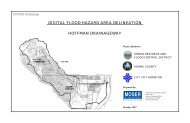
Test Site Location<br />
The Orchard Pond extended detention basin is located in the northeast corner of<br />
the Grant Ranch residential development in Denver. Specifically, the basin lies<br />
between South Harlan Way <strong>and</strong> West Prentice Circle, east of South Jay Circle.<br />
Map this Location<br />
The watershed area tributary to Orchard Pond is approximately 16.9 acres. The<br />
watershed contains single-family residential homes, paved roads <strong>and</strong> open<br />
space, with a total site imperviousness of 50%.<br />
Legend<br />
Impervious area<br />
Pervious area<br />
Surface runoff<br />
Orchard detention pond<br />
Inlet