BMP Monitoring Sites - Urban Drainage and Flood Control District
BMP Monitoring Sites - Urban Drainage and Flood Control District
BMP Monitoring Sites - Urban Drainage and Flood Control District

Create successful ePaper yourself
Turn your PDF publications into a flip-book with our unique Google optimized e-Paper software.
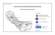
UDFCD <strong>BMP</strong> MONITORING SITES<br />
Porous Asphalt Pavement<br />
gravel, #3 gravel <strong>and</strong> C-33 s<strong>and</strong>. In a trench beneath the s<strong>and</strong>, a perforated pipe<br />
collects the filtered water <strong>and</strong> conveys it to a catch basin. There is an orifice<br />
plate at the end of the pipe where a pressure transducer measures the flow into<br />
the catch basin from the porous asphalt pavement. There is<br />
also a weir plate at the outlet of the catch basin with a<br />
levelogger that measures the flow leaving the catch basin.<br />
The difference between the flow passing the orifice plate <strong>and</strong><br />
the flow passing the weir plate is equal to the runoff that<br />
bypassed the porous asphalt pavement <strong>and</strong> entered the catch<br />
basin through the grate.<br />
The sampling equipment is stored in a metal box in the isl<strong>and</strong><br />
adjacent to the porous asphalt pavement. A rain gage on a post<br />
near the storage box measures rainfall <strong>and</strong> signals the ISCO<br />
sampler inside the box to begin sampling after 0.1 inches of rain<br />
falls. The sampler then draws a sample of water from the porous<br />
asphalt pavement runoff after a designated flow has passed, <strong>and</strong><br />
then every 15 minutes until 12 hours after the storm has ended.<br />
There is also a control watershed located a few hundred feet northeast of the<br />
porous asphalt pavement watershed. The control watershed consists primarily of<br />
traditional asphalt pavement <strong>and</strong> is used to compare results of treated runoff to<br />
untreated, direct runoff. Stormwater runoff from the control watershed is collected<br />
in a grated catch basin located in the northeast corner of the parking lot. The<br />
water leaves the catch basin by passing through a weir<br />
plate where a pressure transducer measures the flow.<br />
The sampling equipment is stored in a metal box<br />
adjacent to the parking lot in a manner similar to the<br />
porous asphalt pavement sampling configuration.