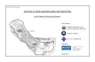
Broomfield - Urban Drainage and Flood Control District
Broomfield - Urban Drainage and Flood Control District
Broomfield - Urban Drainage and Flood Control District

Create successful ePaper yourself
Turn your PDF publications into a flip-book with our unique Google optimized e-Paper software.
ID NO<br />
PROJECT NAME CONCEPT DESIGN CNSTRCTN ELIGIBLE<br />
STATIONING<br />
TRIBUTARY OK? DATE OK? DATE OK? DATE YES DATE SEC TS R DS US<br />
STATION<br />
REFERENCE<br />
COMMENTS<br />
LAST<br />
UPDATE<br />
2429<br />
West 6th Avenue <strong>Drainage</strong>way Impro 4/21/1999 4/21/1999 6/21/2000 6/21/2000 34-1S-69W 194+00 204+00 <strong>Broomfield</strong> OSP Channel improvements on north side of<br />
6th Ave between Alter & Burbank Streets.<br />
6/21/2000<br />
GAY RESERVOIR DRAINAGEW<br />
205<br />
Columbine Meadows 2/20/1985 4/5/1985 32-1S-68W 0+00 65+00 <strong>Broomfield</strong> Area FHAD Partial chan. proposed;design<br />
unacceptable;piecemeal submits from<br />
EMK rejected; written response pending<br />
package submittal through <strong>Broomfield</strong>..<br />
6/11/1986<br />
1262<br />
1264<br />
1263<br />
2678<br />
2677<br />
1455<br />
608<br />
609<br />
2504<br />
1388<br />
1427<br />
Northwest Quadrant West Lake Basin 8/5/1992 30-1S-68W 60+25 82+50 <strong>Broomfield</strong> Area FHAD PUD only.<br />
Northwest Quadrant Gay Reservoir Basin 8/5/1992 30-1S-68W 84+00 98+00 <strong>Broomfield</strong> Area FHAD PUD only.<br />
Northwest Quadrant Gay Reservoir Basin 8/5/1992 30-1S-68W 113+00 126+00 <strong>Broomfield</strong> Area FHAD PUD only.<br />
Saratoga Gay Reservoir North 2/20/2001 30-1S-68W 15+00 20+00 <strong>Broomfield</strong> OSP (1985) 9/6/00: PUD & Prelim. Plat. As Dry<br />
Creek Village. 2/20/01: final plat.<br />
Saratoga West Lake<br />
2/20/2001 30-1S-68W 61+00 83+00 <strong>Broomfield</strong> OSP (1985) 9/6/00: PUD & Prelim. Plat. As Dry<br />
Creek Village. 2/20/01: final plat.<br />
Shepherd of Love Fellowship West Lake Basin Nor 3/17/1994 29-1S-68W 20+00 25+00 <strong>Broomfield</strong> OSP See also West Lake.<br />
Trails at West Lake West Lake Basin 9/12/1986 2/4/1988 1/26/1990 6/8/2000 29-1S-68W 40+00 60+50 <strong>Broomfield</strong> Area FHAD See also 609.<br />
Trails at West Lake West Lake Basin Nor 9/12/1986 1/26/1990 1/26/1990 6/8/2000 29-1S-68W 0+00 25+00 <strong>Broomfield</strong> Area FHAD MEP does not include onsite detention<br />
pond north of 128th Avenue. See also<br />
608.<br />
Willow Park North 4/5/2000 30-1S-68W 84+00 99+00 <strong>Broomfield</strong> FHAD 10/12/99: Preliminary plat & PUD.<br />
4/5/2000: Revised prelim plat & PUD.<br />
Willow Run Filing No. 1 9/17/1993 7/22/2013 32-1S-68W 29+00 36+50 <strong>Broomfield</strong> Area MP after-the-fact review. Based on the plans<br />
<strong>and</strong> some corrections to protruding storm<br />
sewer, project is eligible. Walk through<br />
on 9/10/12.<br />
Willow Run Filing No. 2 &3 1/24/1994 7/22/2013 32-1S-68W 16+00 29+00 <strong>Broomfield</strong> Area MP after-the-fact review. Based on the plans<br />
<strong>and</strong> some corrections to protruding storm<br />
sewer, project is eligible. Walk through<br />
on 9/10/12.<br />
8/5/1992<br />
8/5/1992<br />
8/5/1992<br />
2/20/2001<br />
2/20/2001<br />
3/18/1994<br />
6/8/2000<br />
6/8/2000<br />
4/5/2000<br />
7/22/2013<br />
7/22/2013<br />
McKAY LAKE DRAINAGEWAY<br />
3363 Green Family Farm Estates 9/6/2005 17-1S-68W 131+00 150+50 McKay Lake/Quail Cr 9/6/05: Plat ignores OSP.<br />
OSP<br />
9/6/2005<br />
2