Broomfield - Urban Drainage and Flood Control District
Broomfield - Urban Drainage and Flood Control District
Broomfield - Urban Drainage and Flood Control District
Create successful ePaper yourself
Turn your PDF publications into a flip-book with our unique Google optimized e-Paper software.
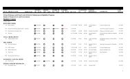
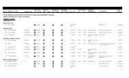
ID NO<br />
PROJECT NAME CONCEPT DESIGN CNSTRCTN ELIGIBLE<br />
STATIONING<br />
TRIBUTARY OK? DATE OK? DATE OK? DATE YES DATE SEC TS R DS US<br />
STATION<br />
REFERENCE<br />
COMMENTS<br />
LAST<br />
UPDATE<br />
<strong>Urban</strong> <strong>Drainage</strong> <strong>and</strong> <strong>Flood</strong> <strong>Control</strong> <strong>District</strong> Maintenance Eligibility Program<br />
Status of Projects by Local Government<br />
<strong>Broomfield</strong><br />
17-Dec-2013<br />
AIRPORT CREEK<br />
3542<br />
120th Avenue Connection<br />
North Branch<br />
12/23/2009 5/10/2011 5/25/2011 7/22/2013 2,3-2S-69W<br />
Big Dry Creek OSP Detention pond, one outfall from pond<br />
7/22/2013<br />
2533<br />
2704<br />
2705<br />
2733<br />
2047<br />
<strong>Broomfield</strong> Corporate Center 9/6/2000 8/20/2001 11/19/2009 11/19/2009 2-2S-69W 74+00 82+00 Big Dry Creek OSP 1/7/2000: PUD & prelim. plat. 9/6/00:<br />
Prelim. Design. 2/1/01; const plans.<br />
6/25/01; const plans. Outfalls <strong>and</strong> drop<br />
structures.<br />
<strong>Broomfield</strong> <strong>Urban</strong> Transit Village 10/12/2000 7/23/2003 2,3-2S-69W 109+00 142+00 Big Dry Creek OSP 10/12/00: Prelim plat.xxx. 7/23/03;<br />
Regional detention plans & rpt.<br />
<strong>Broomfield</strong> <strong>Urban</strong> Transit Village North Branch<br />
10/12/2000 7/23/2003 2,3-2S-69W 0+00 14+00 Big Dry Creek OSP 10/12/00: Prelim plat. 7/23/03; Regional<br />
detention plans.<br />
Interpark 1/3/2001 2-2S-69W 82+00 91+00 Big Dry & Tribs OSP 1/3/01: final plat. OK except for strange<br />
ROW.<br />
Jeffco Business Center 10/31/2000 3/7/2001 6/15/2001 3-2S-69W 145+00 158+00 Big Dry Creek OSP 8/16/96: Discussed possible<br />
detention/open space use w/ Jeffco Open<br />
Space. 7/20/00: Previously Jensen Indus.<br />
Park, See letter this date. 9/13/00; const<br />
plans 2/6/01; hydrology is ok, plan<br />
comments<br />
11/19/2009<br />
8/22/2003<br />
8/22/2003<br />
1/2/2001<br />
6/26/2001<br />
CITY PARK DRAINAGEWAY<br />
3541<br />
120th Avenue connection<br />
12/23/2009 34,35-1S-69W<br />
drainage improvements<br />
2/15/2010<br />
1241<br />
750<br />
A & B Subdivision Outfall connection 5/14/1992<br />
31-1S-68W 19+00 33+00 <strong>Broomfield</strong> Area FHAD<br />
<strong>Broomfield</strong> Professional Park 4/2/1980 4/2/1980 34-1S-69W 190+00 211+00 <strong>Broomfield</strong> Area MP Apparently has been built. Design was<br />
pretty bad.<br />
5/27/1992<br />
10/9/1987<br />
751<br />
<strong>Broomfield</strong> Professional Park<br />
Community Ditch O<br />
4/2/1980 4/2/1980<br />
34-1S-69W<br />
10/9/1987<br />
2041<br />
3691<br />
<strong>Broomfield</strong> Town Centre 7/13/1999 7/13/1999 36-1S-69W 68+50 80+00 <strong>Broomfield</strong> Area FHAD After-the-fact review.<br />
US 36 OS-A3 8/27/2013 11/27/2013 Detention pond<br />
7/13/1999<br />
11/27/2013<br />
1
ID NO<br />
PROJECT NAME CONCEPT DESIGN CNSTRCTN ELIGIBLE<br />
STATIONING<br />
TRIBUTARY OK? DATE OK? DATE OK? DATE YES DATE SEC TS R DS US<br />
STATION<br />
REFERENCE<br />
COMMENTS<br />
LAST<br />
UPDATE<br />
2429<br />
West 6th Avenue <strong>Drainage</strong>way Impro 4/21/1999 4/21/1999 6/21/2000 6/21/2000 34-1S-69W 194+00 204+00 <strong>Broomfield</strong> OSP Channel improvements on north side of<br />
6th Ave between Alter & Burbank Streets.<br />
6/21/2000<br />
GAY RESERVOIR DRAINAGEW<br />
205<br />
Columbine Meadows 2/20/1985 4/5/1985 32-1S-68W 0+00 65+00 <strong>Broomfield</strong> Area FHAD Partial chan. proposed;design<br />
unacceptable;piecemeal submits from<br />
EMK rejected; written response pending<br />
package submittal through <strong>Broomfield</strong>..<br />
6/11/1986<br />
1262<br />
1264<br />
1263<br />
2678<br />
2677<br />
1455<br />
608<br />
609<br />
2504<br />
1388<br />
1427<br />
Northwest Quadrant West Lake Basin 8/5/1992 30-1S-68W 60+25 82+50 <strong>Broomfield</strong> Area FHAD PUD only.<br />
Northwest Quadrant Gay Reservoir Basin 8/5/1992 30-1S-68W 84+00 98+00 <strong>Broomfield</strong> Area FHAD PUD only.<br />
Northwest Quadrant Gay Reservoir Basin 8/5/1992 30-1S-68W 113+00 126+00 <strong>Broomfield</strong> Area FHAD PUD only.<br />
Saratoga Gay Reservoir North 2/20/2001 30-1S-68W 15+00 20+00 <strong>Broomfield</strong> OSP (1985) 9/6/00: PUD & Prelim. Plat. As Dry<br />
Creek Village. 2/20/01: final plat.<br />
Saratoga West Lake<br />
2/20/2001 30-1S-68W 61+00 83+00 <strong>Broomfield</strong> OSP (1985) 9/6/00: PUD & Prelim. Plat. As Dry<br />
Creek Village. 2/20/01: final plat.<br />
Shepherd of Love Fellowship West Lake Basin Nor 3/17/1994 29-1S-68W 20+00 25+00 <strong>Broomfield</strong> OSP See also West Lake.<br />
Trails at West Lake West Lake Basin 9/12/1986 2/4/1988 1/26/1990 6/8/2000 29-1S-68W 40+00 60+50 <strong>Broomfield</strong> Area FHAD See also 609.<br />
Trails at West Lake West Lake Basin Nor 9/12/1986 1/26/1990 1/26/1990 6/8/2000 29-1S-68W 0+00 25+00 <strong>Broomfield</strong> Area FHAD MEP does not include onsite detention<br />
pond north of 128th Avenue. See also<br />
608.<br />
Willow Park North 4/5/2000 30-1S-68W 84+00 99+00 <strong>Broomfield</strong> FHAD 10/12/99: Preliminary plat & PUD.<br />
4/5/2000: Revised prelim plat & PUD.<br />
Willow Run Filing No. 1 9/17/1993 7/22/2013 32-1S-68W 29+00 36+50 <strong>Broomfield</strong> Area MP after-the-fact review. Based on the plans<br />
<strong>and</strong> some corrections to protruding storm<br />
sewer, project is eligible. Walk through<br />
on 9/10/12.<br />
Willow Run Filing No. 2 &3 1/24/1994 7/22/2013 32-1S-68W 16+00 29+00 <strong>Broomfield</strong> Area MP after-the-fact review. Based on the plans<br />
<strong>and</strong> some corrections to protruding storm<br />
sewer, project is eligible. Walk through<br />
on 9/10/12.<br />
8/5/1992<br />
8/5/1992<br />
8/5/1992<br />
2/20/2001<br />
2/20/2001<br />
3/18/1994<br />
6/8/2000<br />
6/8/2000<br />
4/5/2000<br />
7/22/2013<br />
7/22/2013<br />
McKAY LAKE DRAINAGEWAY<br />
3363 Green Family Farm Estates 9/6/2005 17-1S-68W 131+00 150+50 McKay Lake/Quail Cr 9/6/05: Plat ignores OSP.<br />
OSP<br />
9/6/2005<br />
2
ID NO<br />
PROJECT NAME CONCEPT DESIGN CNSTRCTN ELIGIBLE<br />
STATIONING<br />
TRIBUTARY OK? DATE OK? DATE OK? DATE YES DATE SEC TS R DS US<br />
STATION<br />
REFERENCE<br />
COMMENTS<br />
LAST<br />
UPDATE<br />
2929<br />
McKay L<strong>and</strong>ing Filing 4<br />
8/20/2003 8/20/2003 6/30/2008 6/30/2008 20-1S-68W<br />
WQ Pond D outfall to McKay Lake in<br />
Westminster, see 3152. 7/23/03; plans &<br />
rpt.<br />
6/30/2008<br />
NISSEN RESERVOIR DRAINAG<br />
1240<br />
A & B Subdivision 5/14/1992<br />
31-1S-68W 55+00 59+00 <strong>Broomfield</strong> Area FHAD<br />
5/27/1992<br />
2320<br />
Br<strong>and</strong>ywine Park Detention Pond Reh<br />
Br<strong>and</strong>ywine<br />
9/22/1998 1/19/1999 6/11/2001 9/4/2001 31-1S-68W<br />
Remedial project to correct saturated<br />
bottom condition.<br />
9/4/2001<br />
743<br />
<strong>Broomfield</strong> Country Club #3 9/14/1982 9/14/1982 25-1S-69W 141+00 156+00 <strong>Broomfield</strong> Outfall Reach includes a pond subsequently built<br />
System Plan<br />
by UDFCD. Rest of reach is in golf<br />
course.<br />
10/7/1987<br />
742<br />
<strong>Broomfield</strong> Country Club #3<br />
Spillway<br />
5/7/1982 5/7/1982<br />
25-1S-69W<br />
10/7/1987<br />
20<br />
Country Vista 1/3/1995<br />
31-1S-68W 56+00 84+00 Basin 3207 MP<br />
1/4/1995<br />
745<br />
Highl<strong>and</strong> Park South #2<br />
unnamed<br />
8/13/1981 8/13/1981<br />
36-1S-69W<br />
10/7/1987<br />
744<br />
657<br />
1565<br />
3679<br />
749<br />
1245<br />
Highl<strong>and</strong> Park South #2 8/13/1981 8/13/1981<br />
36-1S-69W 85+50 98+50 <strong>Broomfield</strong> Area FHAD<br />
Koustas Property 9/18/1987<br />
31-1S-68W 56+00 85+50 <strong>Broomfield</strong> Area FHAD<br />
Miramonte Park Outlot B 1/3/1995 2/10/1995 1/9/1996 6/8/2000 26-1S-69W 163+00 174+00 Basin 3207 MP<br />
Norwest Filing No. 1 4/30/2013 4/30/2013 31,,0-1S-68W;<br />
0,0,0--<br />
30+00 38+00 OSP 2006<br />
We have agreed with <strong>Broomfield</strong> <strong>and</strong><br />
developer that this proposal will not be<br />
eligible. It does preserve the ability to<br />
implement the OSP at a later date.<br />
Ridgeview Heights 7/24/1980 7/24/1980<br />
26-1S-69W 195+00 200+00 <strong>Broomfield</strong> Area FHAD<br />
Willow Park 5/26/1992<br />
31-1S-68W 83+50 86+00 <strong>Broomfield</strong> Area FHAD<br />
10/7/1987<br />
9/22/1987<br />
6/8/2000<br />
5/2/2013<br />
10/9/1987<br />
5/27/1992<br />
PONY ESTATES DRAINAGE<br />
2061<br />
144th & Sheridan<br />
Several<br />
6/20/1996<br />
12,13-1S-<br />
69W; 18-1S-<br />
68W<br />
7/5/1996<br />
PREBLE CREEK<br />
2745<br />
MXD 10/6/2008 3,4,8-1S-68W 176+00 305+85 North Area Tribs. FHAD 2/2/01: PUD <strong>and</strong> Prelim Plat. 10/7/08:<br />
PUD, formerly call Preble Creek.<br />
10/7/2008<br />
3
ID NO<br />
PROJECT NAME CONCEPT DESIGN CNSTRCTN ELIGIBLE<br />
STATIONING<br />
TRIBUTARY OK? DATE OK? DATE OK? DATE YES DATE SEC TS R DS US<br />
STATION<br />
REFERENCE<br />
COMMENTS<br />
LAST<br />
UPDATE<br />
QUAIL CREEK<br />
2339<br />
Aspen Creek Filing No. 3 7/12/2000 12/2/2004 12/2/2004 7/21/2009 24-1S-69W 0+00 8+50 Quail Creek FHAD Roadway crossing at Sheridan<br />
Boulevard. After the fact plan approval.<br />
7/21/2009<br />
2595<br />
2594<br />
2596<br />
2657<br />
2751<br />
Aspen Creek Filing No. 5 Unnamed<br />
5/4/2000 24-1S-69W 0+00 8+50 Quail Cr. FHAD 5/4/00: Final plat.<br />
Aspen Creek Filing No. 5 D<br />
5/15/2002 5/15/2002 24-1S-69W 0+00 18+00 Quail Cr. FHAD 5/4/00: Final plat. Excludes 5+00<br />
to14+50. 5/15/02; short reach of Trib D,<br />
riprap rundown.<br />
Aspen Creek Filing No. 5 5/4/2000 24-1S-69W 258+00 273+00 Quail Cr. FHAD 5/4/00: Final plat.<br />
Aspen Creek Filing No. 6 8/10/2000 24-1S-69W 267+00 274+00 Quail Cr. FHAD 8/10/00: Creek in a pipe.<br />
Aspen Creek Filing No. 7 2/27/2001 19-1S-68W 235+00 244+00 Quail Creek FHAD 2/27/01: Final plan.<br />
5/9/2000<br />
5/16/2002<br />
5/9/2000<br />
8/9/2000<br />
2/27/2001<br />
2790<br />
Aspen Creek Phase 2 Regional Draina<br />
4/30/2001 9/6/2001 12/2/2004 7/21/2009 24-1S-69W<br />
Regional Pond A in Country Estates is<br />
credited for hydrology only, <strong>and</strong> Pond B .<br />
1/17/01; const plans & rpt. 4/30/01;<br />
const plans & rpt.<br />
7/21/2009<br />
2337<br />
2338<br />
2618<br />
2617<br />
2683<br />
2343<br />
Aspen Creek Phase I Regional Draina 3/14/2000 9/13/2001 12/2/2004 7/21/2009 24-1S-69W 244+00 274+00 Quail Creek FHAD See also 2338 & 2339 regional pond, two<br />
outfalls & channel work. 7/12/00; const<br />
plans.<br />
Aspen Creek Phase I Regional Draina D<br />
3/14/2000 9/13/2001 12/2/2004 7/21/2009 24-1S-69W 0+00 18+50 Quail Creek FHAD See also 2337 & 2339. Excludes Sta.<br />
5+00 to14+50<br />
Broadl<strong>and</strong>s 6/19/2000 19-1S-69W 0+00 45+00 Quail Creek FHAD<br />
1986<br />
The Booadl<strong>and</strong>s Golf Course was<br />
constructed in this area with no attempt to<br />
seek maint. Elig. The golf course should<br />
not receive any <strong>District</strong> maintenance<br />
assistance.<br />
Broadl<strong>and</strong>s C<br />
6/19/2000 19-1S-69W 0+00 45+00 Quail Creek FHAD<br />
1986<br />
The Booadl<strong>and</strong>s Golf Course was<br />
constructed in this area with no attempt to<br />
seek maint. Elig. The golf course should<br />
not receive any <strong>District</strong> maintenance<br />
assistance.<br />
Broadl<strong>and</strong>s Filing No. 12 9/12/2000 9/12/2000 9/12/2000 9/12/2000 20-1S-68W 162+00 170+00 <strong>Broomfield</strong> Area OSP 9/12/00: Channel already built. No<br />
maint. Elig. Submittal.<br />
Broadl<strong>and</strong>s West Filing No. 1 10/7/1998<br />
19-1S-68W 212+50 230+00 Quail Creek FHAD<br />
7/21/2009<br />
7/21/2009<br />
6/19/2000<br />
6/19/2000<br />
9/12/2000<br />
10/7/1998<br />
2671<br />
Country Estates Reg. Det. Pond<br />
8/24/2000 24-1S-69W<br />
8/24/00: design study.<br />
8/24/2000<br />
4
ID NO<br />
PROJECT NAME CONCEPT DESIGN CNSTRCTN ELIGIBLE<br />
STATIONING<br />
TRIBUTARY OK? DATE OK? DATE OK? DATE YES DATE SEC TS R DS US<br />
STATION<br />
REFERENCE<br />
COMMENTS<br />
LAST<br />
UPDATE<br />
2788<br />
2409<br />
1265<br />
Lambertson 6/12/2002 21-1S-68W 96+00 122+00 Quail Creek FHAD 4/25/01: PUD. 6/12/02: PUD <strong>and</strong> prelim<br />
plat.<br />
McKay L<strong>and</strong>ing 2/22/1999 2/14/2003 20-1S-68W 133+50 156+50 Quail Creek FHAD 2/22/99: PUD <strong>and</strong> Prelim. Plat. 9/20/01;<br />
plans only, need rpt <strong>and</strong> Quail Ck outfall<br />
information.<br />
Northwest Quadrant 8/5/1992 19-1S-68W 214+50 230+00 <strong>Broomfield</strong> Area FHAD PUD only.<br />
6/12/2002<br />
2/14/2003<br />
8/5/1992<br />
2531<br />
Quail Crossing Filing No. 3<br />
12/28/1999 12/28/1999 28-1S-68W<br />
Open floodplain w/one storm sewer<br />
outfall.<br />
12/28/1999<br />
2078<br />
2081<br />
2080<br />
2079<br />
The Broadl<strong>and</strong>s 7/8/1997 19,20-1S-68W 156+50 213+00 <strong>Broomfield</strong> OSP 8/30/96: Leaving channel in open space.<br />
7/8/97: Channelizing thru golf course.<br />
The Broadl<strong>and</strong>s Outfall Connection 6/8/1999 20-1S-68W 35+50 47+00 <strong>Broomfield</strong> OSP 7/8/97: Ignored in drainage plan. 6/8/99:<br />
Still ignored.<br />
The Broadl<strong>and</strong>s C<br />
7/8/1997 4/3/2003 20-1S-68W 0+00 43+00 <strong>Broomfield</strong> OSP 7/8/03: Channel in golf course. 4/3/03:<br />
Golf course built. Not eligible.<br />
The Broadl<strong>and</strong>s B<br />
7/8/1997 4/3/2003 20-1S-68W 0+00 42+00 <strong>Broomfield</strong> OSP 7/8/97: Channel in golf course. 4/3/03:<br />
Golf course built. Not eligible.<br />
7/8/1997<br />
6/8/1999<br />
4/3/2003<br />
4/3/2003<br />
ROCK CREEK<br />
2780 <strong>Broomfield</strong> Business Center I<br />
4/13/2001 21-1S-69W 40+00 65+00 Louisville/Boulder Co. 4/13/01: PUD & Prelim. Plat.<br />
OSP (1982)<br />
4/13/2001<br />
1005<br />
Tipperary<br />
Basin C<br />
4/4/1989<br />
27-1S-69W<br />
4/24/1989<br />
2955<br />
US 36/South 96th Street Phase 1<br />
2/27/2002 2/27/2002 29-1S-69W<br />
Rock Creek Waterway Improvements at<br />
Flatirons Mall, Bid Package 5A. Afterthe-fact<br />
review.<br />
3/25/2002<br />
2459<br />
US 36/South 96th Street Sub-district<br />
Autrey Basin<br />
7/13/1999 28,29,32-1S-<br />
See also 2458<br />
69W<br />
7/13/1999<br />
2458<br />
US 36/South 96th Street Sub-district<br />
7/13/1999 28,29-1S-69W<br />
See also 2459<br />
7/13/1999<br />
TRI-COUNTY AIRPORT DRAIN<br />
2746<br />
Preble Creek<br />
2/2/2001 6,7,8-1S-68W<br />
2/2/01: PUD <strong>and</strong> Prelim Plat.<br />
2/2/2001<br />
967<br />
Schneider<br />
8/30/1988 6-1S-68W<br />
Annexation & rezone. Insufficient info<br />
provided<br />
8/31/1988<br />
5
ID NO<br />
PROJECT NAME CONCEPT DESIGN CNSTRCTN ELIGIBLE<br />
STATIONING<br />
TRIBUTARY OK? DATE OK? DATE OK? DATE YES DATE SEC TS R DS US<br />
STATION<br />
REFERENCE<br />
COMMENTS<br />
LAST<br />
UPDATE<br />
WALNUT CREEK<br />
2667<br />
Great Western Park 5/6/2002 9/18/2002 8-2S-69W 249+00 286+00 Big Dry (Adco) OSP 8/22/00: PUD & Prelim. Plat. 10/11/00:<br />
Final plat <strong>and</strong> add add. area. 5/6/02;<br />
const plans & rpt for stream stbilization.<br />
9/18/02; plans & rpt.<br />
9/20/2002<br />
2668<br />
Great Western Park North Branch<br />
5/6/2002 9/18/2002 8-2S-69W 41+50 72+00 Big Dry (Adco) OSP 8/22/00: PUD & Prelim. Plat. 10/11/00:<br />
Final plat <strong>and</strong> add add. area. 5/6/02;<br />
const plans & rpt for stream stab.<br />
9/18/02; plans & rpt.<br />
9/20/2002<br />
2763<br />
McData Corporate Campus, Phase I<br />
7/30/2001 7/30/2001 8-2S-69W<br />
See also 2667, Great Western Park.<br />
8/22/00: PUD & Prelim. Plat. 10/11/00:<br />
Final plat <strong>and</strong> add area. 3/19/01; const<br />
plans, no design for creek area. 6/18/01;<br />
one outfall<br />
7/30/2001<br />
899<br />
898<br />
Legend<br />
1/1/95<br />
1/1/95<br />
1/1/95<br />
1/1/95<br />
TenEyck/Walnut Creek Associates North Branch<br />
12/29/1987<br />
8-2S-69W 41+00 72+00 Big Dry Creek OSP<br />
TenEyck/Walnut Creek Associates 12/29/1987 8-2S-69W 249+00 300+00 Big Dry Creek OSP Great Western Reservoir adequate<br />
assurances involved.<br />
Concept, design or construction approved as of the given date.<br />
Concept, design or construction reviewed but not approved as of the given date.<br />
Concept, design, construction or final eligibility not yet considered.<br />
Project not eligible for <strong>District</strong> maintenance assistance as of the given date.<br />
Project eligible for <strong>District</strong> maintenance assistance as of the given date.<br />
12/31/1987<br />
12/31/1987<br />
6
ID NO<br />
PROJECT NAME CONCEPT DESIGN CNSTRCTN ELIGIBLE<br />
STATIONING<br />
TRIBUTARY OK? DATE OK? DATE OK? DATE YES DATE SEC TS R DS US<br />
STATION<br />
REFERENCE<br />
COMMENTS<br />
LAST<br />
UPDATE<br />
7


