Broomfield - Urban Drainage and Flood Control District
Broomfield - Urban Drainage and Flood Control District
Broomfield - Urban Drainage and Flood Control District
You also want an ePaper? Increase the reach of your titles
YUMPU automatically turns print PDFs into web optimized ePapers that Google loves.
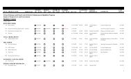
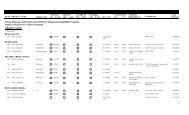
ID NO<br />
PROJECT NAME CONCEPT DESIGN CNSTRCTN ELIGIBLE<br />
STATIONING<br />
TRIBUTARY OK? DATE OK? DATE OK? DATE YES DATE SEC TS R DS US<br />
STATION<br />
REFERENCE<br />
COMMENTS<br />
LAST<br />
UPDATE<br />
<strong>Urban</strong> <strong>Drainage</strong> <strong>and</strong> <strong>Flood</strong> <strong>Control</strong> <strong>District</strong> Maintenance Eligibility Program<br />
Status of Projects by Local Government<br />
<strong>Broomfield</strong><br />
17-Dec-2013<br />
AIRPORT CREEK<br />
3542<br />
120th Avenue Connection<br />
North Branch<br />
12/23/2009 5/10/2011 5/25/2011 7/22/2013 2,3-2S-69W<br />
Big Dry Creek OSP Detention pond, one outfall from pond<br />
7/22/2013<br />
2533<br />
2704<br />
2705<br />
2733<br />
2047<br />
<strong>Broomfield</strong> Corporate Center 9/6/2000 8/20/2001 11/19/2009 11/19/2009 2-2S-69W 74+00 82+00 Big Dry Creek OSP 1/7/2000: PUD & prelim. plat. 9/6/00:<br />
Prelim. Design. 2/1/01; const plans.<br />
6/25/01; const plans. Outfalls <strong>and</strong> drop<br />
structures.<br />
<strong>Broomfield</strong> <strong>Urban</strong> Transit Village 10/12/2000 7/23/2003 2,3-2S-69W 109+00 142+00 Big Dry Creek OSP 10/12/00: Prelim plat.xxx. 7/23/03;<br />
Regional detention plans & rpt.<br />
<strong>Broomfield</strong> <strong>Urban</strong> Transit Village North Branch<br />
10/12/2000 7/23/2003 2,3-2S-69W 0+00 14+00 Big Dry Creek OSP 10/12/00: Prelim plat. 7/23/03; Regional<br />
detention plans.<br />
Interpark 1/3/2001 2-2S-69W 82+00 91+00 Big Dry & Tribs OSP 1/3/01: final plat. OK except for strange<br />
ROW.<br />
Jeffco Business Center 10/31/2000 3/7/2001 6/15/2001 3-2S-69W 145+00 158+00 Big Dry Creek OSP 8/16/96: Discussed possible<br />
detention/open space use w/ Jeffco Open<br />
Space. 7/20/00: Previously Jensen Indus.<br />
Park, See letter this date. 9/13/00; const<br />
plans 2/6/01; hydrology is ok, plan<br />
comments<br />
11/19/2009<br />
8/22/2003<br />
8/22/2003<br />
1/2/2001<br />
6/26/2001<br />
CITY PARK DRAINAGEWAY<br />
3541<br />
120th Avenue connection<br />
12/23/2009 34,35-1S-69W<br />
drainage improvements<br />
2/15/2010<br />
1241<br />
750<br />
A & B Subdivision Outfall connection 5/14/1992<br />
31-1S-68W 19+00 33+00 <strong>Broomfield</strong> Area FHAD<br />
<strong>Broomfield</strong> Professional Park 4/2/1980 4/2/1980 34-1S-69W 190+00 211+00 <strong>Broomfield</strong> Area MP Apparently has been built. Design was<br />
pretty bad.<br />
5/27/1992<br />
10/9/1987<br />
751<br />
<strong>Broomfield</strong> Professional Park<br />
Community Ditch O<br />
4/2/1980 4/2/1980<br />
34-1S-69W<br />
10/9/1987<br />
2041<br />
3691<br />
<strong>Broomfield</strong> Town Centre 7/13/1999 7/13/1999 36-1S-69W 68+50 80+00 <strong>Broomfield</strong> Area FHAD After-the-fact review.<br />
US 36 OS-A3 8/27/2013 11/27/2013 Detention pond<br />
7/13/1999<br />
11/27/2013<br />
1
ID NO<br />
PROJECT NAME CONCEPT DESIGN CNSTRCTN ELIGIBLE<br />
STATIONING<br />
TRIBUTARY OK? DATE OK? DATE OK? DATE YES DATE SEC TS R DS US<br />
STATION<br />
REFERENCE<br />
COMMENTS<br />
LAST<br />
UPDATE<br />
2429<br />
West 6th Avenue <strong>Drainage</strong>way Impro 4/21/1999 4/21/1999 6/21/2000 6/21/2000 34-1S-69W 194+00 204+00 <strong>Broomfield</strong> OSP Channel improvements on north side of<br />
6th Ave between Alter & Burbank Streets.<br />
6/21/2000<br />
GAY RESERVOIR DRAINAGEW<br />
205<br />
Columbine Meadows 2/20/1985 4/5/1985 32-1S-68W 0+00 65+00 <strong>Broomfield</strong> Area FHAD Partial chan. proposed;design<br />
unacceptable;piecemeal submits from<br />
EMK rejected; written response pending<br />
package submittal through <strong>Broomfield</strong>..<br />
6/11/1986<br />
1262<br />
1264<br />
1263<br />
2678<br />
2677<br />
1455<br />
608<br />
609<br />
2504<br />
1388<br />
1427<br />
Northwest Quadrant West Lake Basin 8/5/1992 30-1S-68W 60+25 82+50 <strong>Broomfield</strong> Area FHAD PUD only.<br />
Northwest Quadrant Gay Reservoir Basin 8/5/1992 30-1S-68W 84+00 98+00 <strong>Broomfield</strong> Area FHAD PUD only.<br />
Northwest Quadrant Gay Reservoir Basin 8/5/1992 30-1S-68W 113+00 126+00 <strong>Broomfield</strong> Area FHAD PUD only.<br />
Saratoga Gay Reservoir North 2/20/2001 30-1S-68W 15+00 20+00 <strong>Broomfield</strong> OSP (1985) 9/6/00: PUD & Prelim. Plat. As Dry<br />
Creek Village. 2/20/01: final plat.<br />
Saratoga West Lake<br />
2/20/2001 30-1S-68W 61+00 83+00 <strong>Broomfield</strong> OSP (1985) 9/6/00: PUD & Prelim. Plat. As Dry<br />
Creek Village. 2/20/01: final plat.<br />
Shepherd of Love Fellowship West Lake Basin Nor 3/17/1994 29-1S-68W 20+00 25+00 <strong>Broomfield</strong> OSP See also West Lake.<br />
Trails at West Lake West Lake Basin 9/12/1986 2/4/1988 1/26/1990 6/8/2000 29-1S-68W 40+00 60+50 <strong>Broomfield</strong> Area FHAD See also 609.<br />
Trails at West Lake West Lake Basin Nor 9/12/1986 1/26/1990 1/26/1990 6/8/2000 29-1S-68W 0+00 25+00 <strong>Broomfield</strong> Area FHAD MEP does not include onsite detention<br />
pond north of 128th Avenue. See also<br />
608.<br />
Willow Park North 4/5/2000 30-1S-68W 84+00 99+00 <strong>Broomfield</strong> FHAD 10/12/99: Preliminary plat & PUD.<br />
4/5/2000: Revised prelim plat & PUD.<br />
Willow Run Filing No. 1 9/17/1993 7/22/2013 32-1S-68W 29+00 36+50 <strong>Broomfield</strong> Area MP after-the-fact review. Based on the plans<br />
<strong>and</strong> some corrections to protruding storm<br />
sewer, project is eligible. Walk through<br />
on 9/10/12.<br />
Willow Run Filing No. 2 &3 1/24/1994 7/22/2013 32-1S-68W 16+00 29+00 <strong>Broomfield</strong> Area MP after-the-fact review. Based on the plans<br />
<strong>and</strong> some corrections to protruding storm<br />
sewer, project is eligible. Walk through<br />
on 9/10/12.<br />
8/5/1992<br />
8/5/1992<br />
8/5/1992<br />
2/20/2001<br />
2/20/2001<br />
3/18/1994<br />
6/8/2000<br />
6/8/2000<br />
4/5/2000<br />
7/22/2013<br />
7/22/2013<br />
McKAY LAKE DRAINAGEWAY<br />
3363 Green Family Farm Estates 9/6/2005 17-1S-68W 131+00 150+50 McKay Lake/Quail Cr 9/6/05: Plat ignores OSP.<br />
OSP<br />
9/6/2005<br />
2
ID NO<br />
PROJECT NAME CONCEPT DESIGN CNSTRCTN ELIGIBLE<br />
STATIONING<br />
TRIBUTARY OK? DATE OK? DATE OK? DATE YES DATE SEC TS R DS US<br />
STATION<br />
REFERENCE<br />
COMMENTS<br />
LAST<br />
UPDATE<br />
2929<br />
McKay L<strong>and</strong>ing Filing 4<br />
8/20/2003 8/20/2003 6/30/2008 6/30/2008 20-1S-68W<br />
WQ Pond D outfall to McKay Lake in<br />
Westminster, see 3152. 7/23/03; plans &<br />
rpt.<br />
6/30/2008<br />
NISSEN RESERVOIR DRAINAG<br />
1240<br />
A & B Subdivision 5/14/1992<br />
31-1S-68W 55+00 59+00 <strong>Broomfield</strong> Area FHAD<br />
5/27/1992<br />
2320<br />
Br<strong>and</strong>ywine Park Detention Pond Reh<br />
Br<strong>and</strong>ywine<br />
9/22/1998 1/19/1999 6/11/2001 9/4/2001 31-1S-68W<br />
Remedial project to correct saturated<br />
bottom condition.<br />
9/4/2001<br />
743<br />
<strong>Broomfield</strong> Country Club #3 9/14/1982 9/14/1982 25-1S-69W 141+00 156+00 <strong>Broomfield</strong> Outfall Reach includes a pond subsequently built<br />
System Plan<br />
by UDFCD. Rest of reach is in golf<br />
course.<br />
10/7/1987<br />
742<br />
<strong>Broomfield</strong> Country Club #3<br />
Spillway<br />
5/7/1982 5/7/1982<br />
25-1S-69W<br />
10/7/1987<br />
20<br />
Country Vista 1/3/1995<br />
31-1S-68W 56+00 84+00 Basin 3207 MP<br />
1/4/1995<br />
745<br />
Highl<strong>and</strong> Park South #2<br />
unnamed<br />
8/13/1981 8/13/1981<br />
36-1S-69W<br />
10/7/1987<br />
744<br />
657<br />
1565<br />
3679<br />
749<br />
1245<br />
Highl<strong>and</strong> Park South #2 8/13/1981 8/13/1981<br />
36-1S-69W 85+50 98+50 <strong>Broomfield</strong> Area FHAD<br />
Koustas Property 9/18/1987<br />
31-1S-68W 56+00 85+50 <strong>Broomfield</strong> Area FHAD<br />
Miramonte Park Outlot B 1/3/1995 2/10/1995 1/9/1996 6/8/2000 26-1S-69W 163+00 174+00 Basin 3207 MP<br />
Norwest Filing No. 1 4/30/2013 4/30/2013 31,,0-1S-68W;<br />
0,0,0--<br />
30+00 38+00 OSP 2006<br />
We have agreed with <strong>Broomfield</strong> <strong>and</strong><br />
developer that this proposal will not be<br />
eligible. It does preserve the ability to<br />
implement the OSP at a later date.<br />
Ridgeview Heights 7/24/1980 7/24/1980<br />
26-1S-69W 195+00 200+00 <strong>Broomfield</strong> Area FHAD<br />
Willow Park 5/26/1992<br />
31-1S-68W 83+50 86+00 <strong>Broomfield</strong> Area FHAD<br />
10/7/1987<br />
9/22/1987<br />
6/8/2000<br />
5/2/2013<br />
10/9/1987<br />
5/27/1992<br />
PONY ESTATES DRAINAGE<br />
2061<br />
144th & Sheridan<br />
Several<br />
6/20/1996<br />
12,13-1S-<br />
69W; 18-1S-<br />
68W<br />
7/5/1996<br />
PREBLE CREEK<br />
2745<br />
MXD 10/6/2008 3,4,8-1S-68W 176+00 305+85 North Area Tribs. FHAD 2/2/01: PUD <strong>and</strong> Prelim Plat. 10/7/08:<br />
PUD, formerly call Preble Creek.<br />
10/7/2008<br />
3
ID NO<br />
PROJECT NAME CONCEPT DESIGN CNSTRCTN ELIGIBLE<br />
STATIONING<br />
TRIBUTARY OK? DATE OK? DATE OK? DATE YES DATE SEC TS R DS US<br />
STATION<br />
REFERENCE<br />
COMMENTS<br />
LAST<br />
UPDATE<br />
QUAIL CREEK<br />
2339<br />
Aspen Creek Filing No. 3 7/12/2000 12/2/2004 12/2/2004 7/21/2009 24-1S-69W 0+00 8+50 Quail Creek FHAD Roadway crossing at Sheridan<br />
Boulevard. After the fact plan approval.<br />
7/21/2009<br />
2595<br />
2594<br />
2596<br />
2657<br />
2751<br />
Aspen Creek Filing No. 5 Unnamed<br />
5/4/2000 24-1S-69W 0+00 8+50 Quail Cr. FHAD 5/4/00: Final plat.<br />
Aspen Creek Filing No. 5 D<br />
5/15/2002 5/15/2002 24-1S-69W 0+00 18+00 Quail Cr. FHAD 5/4/00: Final plat. Excludes 5+00<br />
to14+50. 5/15/02; short reach of Trib D,<br />
riprap rundown.<br />
Aspen Creek Filing No. 5 5/4/2000 24-1S-69W 258+00 273+00 Quail Cr. FHAD 5/4/00: Final plat.<br />
Aspen Creek Filing No. 6 8/10/2000 24-1S-69W 267+00 274+00 Quail Cr. FHAD 8/10/00: Creek in a pipe.<br />
Aspen Creek Filing No. 7 2/27/2001 19-1S-68W 235+00 244+00 Quail Creek FHAD 2/27/01: Final plan.<br />
5/9/2000<br />
5/16/2002<br />
5/9/2000<br />
8/9/2000<br />
2/27/2001<br />
2790<br />
Aspen Creek Phase 2 Regional Draina<br />
4/30/2001 9/6/2001 12/2/2004 7/21/2009 24-1S-69W<br />
Regional Pond A in Country Estates is<br />
credited for hydrology only, <strong>and</strong> Pond B .<br />
1/17/01; const plans & rpt. 4/30/01;<br />
const plans & rpt.<br />
7/21/2009<br />
2337<br />
2338<br />
2618<br />
2617<br />
2683<br />
2343<br />
Aspen Creek Phase I Regional Draina 3/14/2000 9/13/2001 12/2/2004 7/21/2009 24-1S-69W 244+00 274+00 Quail Creek FHAD See also 2338 & 2339 regional pond, two<br />
outfalls & channel work. 7/12/00; const<br />
plans.<br />
Aspen Creek Phase I Regional Draina D<br />
3/14/2000 9/13/2001 12/2/2004 7/21/2009 24-1S-69W 0+00 18+50 Quail Creek FHAD See also 2337 & 2339. Excludes Sta.<br />
5+00 to14+50<br />
Broadl<strong>and</strong>s 6/19/2000 19-1S-69W 0+00 45+00 Quail Creek FHAD<br />
1986<br />
The Booadl<strong>and</strong>s Golf Course was<br />
constructed in this area with no attempt to<br />
seek maint. Elig. The golf course should<br />
not receive any <strong>District</strong> maintenance<br />
assistance.<br />
Broadl<strong>and</strong>s C<br />
6/19/2000 19-1S-69W 0+00 45+00 Quail Creek FHAD<br />
1986<br />
The Booadl<strong>and</strong>s Golf Course was<br />
constructed in this area with no attempt to<br />
seek maint. Elig. The golf course should<br />
not receive any <strong>District</strong> maintenance<br />
assistance.<br />
Broadl<strong>and</strong>s Filing No. 12 9/12/2000 9/12/2000 9/12/2000 9/12/2000 20-1S-68W 162+00 170+00 <strong>Broomfield</strong> Area OSP 9/12/00: Channel already built. No<br />
maint. Elig. Submittal.<br />
Broadl<strong>and</strong>s West Filing No. 1 10/7/1998<br />
19-1S-68W 212+50 230+00 Quail Creek FHAD<br />
7/21/2009<br />
7/21/2009<br />
6/19/2000<br />
6/19/2000<br />
9/12/2000<br />
10/7/1998<br />
2671<br />
Country Estates Reg. Det. Pond<br />
8/24/2000 24-1S-69W<br />
8/24/00: design study.<br />
8/24/2000<br />
4
ID NO<br />
PROJECT NAME CONCEPT DESIGN CNSTRCTN ELIGIBLE<br />
STATIONING<br />
TRIBUTARY OK? DATE OK? DATE OK? DATE YES DATE SEC TS R DS US<br />
STATION<br />
REFERENCE<br />
COMMENTS<br />
LAST<br />
UPDATE<br />
2788<br />
2409<br />
1265<br />
Lambertson 6/12/2002 21-1S-68W 96+00 122+00 Quail Creek FHAD 4/25/01: PUD. 6/12/02: PUD <strong>and</strong> prelim<br />
plat.<br />
McKay L<strong>and</strong>ing 2/22/1999 2/14/2003 20-1S-68W 133+50 156+50 Quail Creek FHAD 2/22/99: PUD <strong>and</strong> Prelim. Plat. 9/20/01;<br />
plans only, need rpt <strong>and</strong> Quail Ck outfall<br />
information.<br />
Northwest Quadrant 8/5/1992 19-1S-68W 214+50 230+00 <strong>Broomfield</strong> Area FHAD PUD only.<br />
6/12/2002<br />
2/14/2003<br />
8/5/1992<br />
2531<br />
Quail Crossing Filing No. 3<br />
12/28/1999 12/28/1999 28-1S-68W<br />
Open floodplain w/one storm sewer<br />
outfall.<br />
12/28/1999<br />
2078<br />
2081<br />
2080<br />
2079<br />
The Broadl<strong>and</strong>s 7/8/1997 19,20-1S-68W 156+50 213+00 <strong>Broomfield</strong> OSP 8/30/96: Leaving channel in open space.<br />
7/8/97: Channelizing thru golf course.<br />
The Broadl<strong>and</strong>s Outfall Connection 6/8/1999 20-1S-68W 35+50 47+00 <strong>Broomfield</strong> OSP 7/8/97: Ignored in drainage plan. 6/8/99:<br />
Still ignored.<br />
The Broadl<strong>and</strong>s C<br />
7/8/1997 4/3/2003 20-1S-68W 0+00 43+00 <strong>Broomfield</strong> OSP 7/8/03: Channel in golf course. 4/3/03:<br />
Golf course built. Not eligible.<br />
The Broadl<strong>and</strong>s B<br />
7/8/1997 4/3/2003 20-1S-68W 0+00 42+00 <strong>Broomfield</strong> OSP 7/8/97: Channel in golf course. 4/3/03:<br />
Golf course built. Not eligible.<br />
7/8/1997<br />
6/8/1999<br />
4/3/2003<br />
4/3/2003<br />
ROCK CREEK<br />
2780 <strong>Broomfield</strong> Business Center I<br />
4/13/2001 21-1S-69W 40+00 65+00 Louisville/Boulder Co. 4/13/01: PUD & Prelim. Plat.<br />
OSP (1982)<br />
4/13/2001<br />
1005<br />
Tipperary<br />
Basin C<br />
4/4/1989<br />
27-1S-69W<br />
4/24/1989<br />
2955<br />
US 36/South 96th Street Phase 1<br />
2/27/2002 2/27/2002 29-1S-69W<br />
Rock Creek Waterway Improvements at<br />
Flatirons Mall, Bid Package 5A. Afterthe-fact<br />
review.<br />
3/25/2002<br />
2459<br />
US 36/South 96th Street Sub-district<br />
Autrey Basin<br />
7/13/1999 28,29,32-1S-<br />
See also 2458<br />
69W<br />
7/13/1999<br />
2458<br />
US 36/South 96th Street Sub-district<br />
7/13/1999 28,29-1S-69W<br />
See also 2459<br />
7/13/1999<br />
TRI-COUNTY AIRPORT DRAIN<br />
2746<br />
Preble Creek<br />
2/2/2001 6,7,8-1S-68W<br />
2/2/01: PUD <strong>and</strong> Prelim Plat.<br />
2/2/2001<br />
967<br />
Schneider<br />
8/30/1988 6-1S-68W<br />
Annexation & rezone. Insufficient info<br />
provided<br />
8/31/1988<br />
5
ID NO<br />
PROJECT NAME CONCEPT DESIGN CNSTRCTN ELIGIBLE<br />
STATIONING<br />
TRIBUTARY OK? DATE OK? DATE OK? DATE YES DATE SEC TS R DS US<br />
STATION<br />
REFERENCE<br />
COMMENTS<br />
LAST<br />
UPDATE<br />
WALNUT CREEK<br />
2667<br />
Great Western Park 5/6/2002 9/18/2002 8-2S-69W 249+00 286+00 Big Dry (Adco) OSP 8/22/00: PUD & Prelim. Plat. 10/11/00:<br />
Final plat <strong>and</strong> add add. area. 5/6/02;<br />
const plans & rpt for stream stbilization.<br />
9/18/02; plans & rpt.<br />
9/20/2002<br />
2668<br />
Great Western Park North Branch<br />
5/6/2002 9/18/2002 8-2S-69W 41+50 72+00 Big Dry (Adco) OSP 8/22/00: PUD & Prelim. Plat. 10/11/00:<br />
Final plat <strong>and</strong> add add. area. 5/6/02;<br />
const plans & rpt for stream stab.<br />
9/18/02; plans & rpt.<br />
9/20/2002<br />
2763<br />
McData Corporate Campus, Phase I<br />
7/30/2001 7/30/2001 8-2S-69W<br />
See also 2667, Great Western Park.<br />
8/22/00: PUD & Prelim. Plat. 10/11/00:<br />
Final plat <strong>and</strong> add area. 3/19/01; const<br />
plans, no design for creek area. 6/18/01;<br />
one outfall<br />
7/30/2001<br />
899<br />
898<br />
Legend<br />
1/1/95<br />
1/1/95<br />
1/1/95<br />
1/1/95<br />
TenEyck/Walnut Creek Associates North Branch<br />
12/29/1987<br />
8-2S-69W 41+00 72+00 Big Dry Creek OSP<br />
TenEyck/Walnut Creek Associates 12/29/1987 8-2S-69W 249+00 300+00 Big Dry Creek OSP Great Western Reservoir adequate<br />
assurances involved.<br />
Concept, design or construction approved as of the given date.<br />
Concept, design or construction reviewed but not approved as of the given date.<br />
Concept, design, construction or final eligibility not yet considered.<br />
Project not eligible for <strong>District</strong> maintenance assistance as of the given date.<br />
Project eligible for <strong>District</strong> maintenance assistance as of the given date.<br />
12/31/1987<br />
12/31/1987<br />
6
ID NO<br />
PROJECT NAME CONCEPT DESIGN CNSTRCTN ELIGIBLE<br />
STATIONING<br />
TRIBUTARY OK? DATE OK? DATE OK? DATE YES DATE SEC TS R DS US<br />
STATION<br />
REFERENCE<br />
COMMENTS<br />
LAST<br />
UPDATE<br />
7


