CHAPTER 13 - Iskandar Malaysia
CHAPTER 13 - Iskandar Malaysia
CHAPTER 13 - Iskandar Malaysia

Create successful ePaper yourself
Turn your PDF publications into a flip-book with our unique Google optimized e-Paper software.
Section B Planning and Implementation<br />
Part 3 Physical Planning Initiatives<br />
<strong>CHAPTER</strong> <strong>13</strong><br />
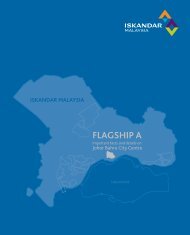
Johor Bahru City Centre
Johor Bahru City Centre<br />
chapter<br />
<strong>13</strong><br />
<strong>13</strong>.1 Introduction<br />
Figure <strong>13</strong>.1: Location Map of Johor Bahru CBD in Context of SEC<br />
Johor Bahru, capital city of the State of Johor, has its area defined<br />
within the Inner Ring Road – 1124.97 acres of land extending from<br />
the inner ring road to Jalan Abu Bakar - Jalan Tun Dr Ismail. Its dense<br />
development and clearly by defined streets, made up of a hierarchy<br />
of major and minor roads, that leads to the Johor Bahru waterfront<br />
is accessorised with high commercial and government institutional<br />
activities. The capital city has a strong iconic building, Sultan Ibrahim<br />
Building on Bukit Timbalan that currently houses the State Administration.<br />
Skyscrapers clustered within the city centre houses banks, regional<br />
PEKAN<br />
NENAS<br />
KULAI<br />
SENAI<br />
NUSAJAYA<br />
KEMPAS<br />
ULU<br />
TIRAM<br />
JB CITY CENTRE<br />
PASIR<br />
GUDANG<br />
offices and large corporations; especially those along Jalan Tun Abdul<br />
Razak, Jalan Wong Ah Fook and Jalan Trus. The low scale development,<br />
dominated by traditional shop houses and retail outlets of high<br />
KUKUP<br />
pedestrian activity, are found in the southern part along Jalan Meldrum,<br />
Jalan Segget and Jalan Ibrahim.<br />
Source: SJER CDP 2025<br />
The Johor Bahru city is growing northwards and now a high pattern of<br />
linear development can be seen along the northern part of Jalan Tun<br />
Abdul Razak towards Skudai and Senai.<br />
While there has been some recent signs of revival in the retail sector,<br />
there is a need to create a shopping street or ‘golden mile’ of shopping<br />
haven in Johor Bahru. This is necessary in order to revitalise the once<br />
renowned strength of the city in retail and trading.<br />
A. Existing Use and Activities<br />
The Johor Bahru city centre has currently a blend of activities. As the<br />
capital city, a large part of the city centre is devoted to the state<br />
administration departments. This is reflected in the 34.9% use of land<br />
in the city as institutional and government reserves, the single largest<br />
category in the city. Land use by other sectors such as residential<br />
and commercial are relatively lower especially when compared to<br />
the amount of infrastructure available in the city centre. Hence, the<br />
composition of infrastructure with respect to the activities carried out<br />
needs to be more balanced in order for Johor Bahru to enhance its<br />
position as the main city centre for SJER.<br />
<strong>13</strong> - 1
SECTION B<br />
PLANNING AND IMPLEMENTATION<br />
Table <strong>13</strong>.1: Existing Land Use<br />
No Land Use Activities Acreage (ac) %<br />
1 Housing 144.48 12.84<br />
2 Commercial and Retail 75.56 6.72<br />
3 Institutional and<br />
Government Reserves<br />
392.80 34.92<br />
4 Mixed Development 102.45 9.11<br />
5 Promenade 28.00 2.49<br />
6 Roads and Rail 179.03 15.91<br />
7 Free Access Zone 68.42 6.08<br />
8 Open Space and Undeveloped Land 105.20 9.35<br />
9 Infrastructure and Utilities 29.03 2.58<br />
TOTAL 1124.97 100.00<br />
Source: SJER CDP 2025<br />
Figure <strong>13</strong>.2: Johor Bahru City Centre and Land Use Activities<br />
Bukit<br />
Cagar<br />
Abu Bakar Mosque<br />
Grand Palace<br />
Bukit<br />
Timbalan<br />
Source: SJER CDP 2025<br />
<strong>13</strong> - 2
JOHOR BAHRU CITY CENTRE <strong>CHAPTER</strong> <strong>13</strong> | PART 3<br />
B. Residential Development<br />
Figure <strong>13</strong>.3: Existing Malay urban villages in City Centre<br />
Johor Bahru city centre is experiencing an increase in residential<br />
communities where old government housing lands, on Bukit Saujana<br />
and Jalan Yahya Awal, have been transformed to make way for higher<br />
density housing. Concurrently, this has increased the city’s population;<br />
an important factor of the city’s livelihood. As at 2005, it was estimated<br />
that over 18,800 people spread over <strong>13</strong>9.32 acres of residential land<br />
lived in the city centre. This increases the density of the city centre area<br />
to a gross density of 15 people per acre – but still low compared to<br />
other cities that assume the role of being a capital city.<br />
Kg. Wadi Hana<br />
Kg. Ngee Heng<br />
Kg. Mahmoddiah<br />
Kg. Kubur<br />
Kg. Gertak Merah<br />
C. Urban Villages<br />
Johor Bahru city centre has several urban villages, Kg. Mahmoddiah, Kg.<br />
Kubur, Kg. Wadi Hana and traces of Kg. Ngee Heng and Kg. Ah Siang,<br />
within its defined boundary and this makes up the broader population<br />
base of the city. These urban villages, which are mainly Malay villages,<br />
accounts for up to 55.97 hectares of land and is estimated to have a<br />
population of 5,597 people.<br />
Source: SJER CDP 2025<br />
Table <strong>13</strong>.2: Urban Villages in Johor Bahru City<br />
Name of Urban Villages Acreage (hectares)<br />
Kampung Mahmoddiah 11.35<br />
Kampung Ngee Heng 1.17<br />
Kampung Gertak Merah 10.77<br />
Kampung Kubur 7.41<br />
Kampung Masjid 3.85<br />
Kampung Wadi Hana 21.42<br />
TOTAL 55.97<br />
Kg. Mahmoddiah<br />
Kg. Wadi Hana<br />
Source: SJER CDP 2025<br />
The development of the city encroaches into the boundaries of<br />
these urban villages especially areas along the inner ring road. Such<br />
encroachment leads to development pressure on these villages, which<br />
were once prime residential areas of Johor Bahru. Significant effort is<br />
therefore required to better the quality of life in these urban villages. In<br />
the long term, these villages should be sensitively redeveloped to create<br />
better planned neighbourhoods with amenities and utilities.<br />
Kg. Ngee Heng<br />
<strong>13</strong> - 3
SECTION B<br />
PLANNING AND IMPLEMENTATION<br />
2006-2025<br />
D. Heritage in Johor Bahru City Centre<br />
The city of Johor Bahru has a rich history that dates as early as the 16th<br />
century. The urbanisation of Johor began in 1855 when its ruler, of the<br />
Temenggong Lineage, marked the beginning of Modern Johor. This was<br />
followed later by the 21st Sultan of Johor – Sultan Abu Bakar (1862-1895)<br />
who laid the foundation for developing Johor into a modern state. This<br />
has transformed Johor Bahru from a fishing village into a thriving city.<br />
Today the city reflects its rich history through buildings like the Sultan<br />
Ibrahim Building, the Sultan Abu Bakar Mosque, and the Grand Palace<br />
or Istana Besar Johor. The Istana Besar boasts a distinct Anglo-Malay<br />
architecture and houses the museum where priceless treasures of<br />
the Royal Collection are showcased. In addition the Johor Bahru<br />
Railway Station and Maktab Sultan Abu Bakar (English College) are<br />
also significant landmarks. These buildings have become an important<br />
part of Johor Bahru’s urban fabric and are heritage landmarks of the<br />
city. These buildings are significant not only from Johor but also from a<br />
national standpoint as many historical events of national importance<br />
has occured here. Thus, it is important that these buildings be retained<br />
and classified as the heritage of the city.<br />
Figure <strong>13</strong>.4: Heritage Shophouse Buildings in Johor Bahru City<br />
Bukit Timbalan<br />
Shophouses in Johor Bahru<br />
The shop houses along Jalan Tun Abdul Razak, Jalan Selat Tebrau,<br />
Jalan Ibrahim, Jalan Trus and Jalan Wong Ah Fook are where traders<br />
from Arab, India and China used to come to trade spices and tobacco<br />
and there are more than 246 shophouses with great heritage value that<br />
can be found here – mostly built in the 1920’s.<br />
E. Recent Development<br />
The latest addition of development in the city centre is the Johor<br />
International Convention Centre (JICC), also known as Persada Johor.<br />
It is located on a 2.43 hectare site next to the Puteri Pacific Hotel. The<br />
convention centre has a built-up area of 24,022 sq.m. (258,579 sq.ft.).<br />
It will be the leading multi-purpose facility in Johor where various trade<br />
shows and conventions will be held. The convention centre has a<br />
maximum capacity of up to 3500 delegates.<br />
Other future development in Johor Bahru, of a sizeable scale, will be the<br />
Integrated Southern Gateway (Gerbang Selatan Bersepadu) complex.<br />
It comprises mainly of the Customs Office; immigration and quarantine<br />
complex (almost 230,000 sq.m), and the Immigration checkpoint and<br />
the Johor Bahru Sentral; a transportation hub that will integrate trains<br />
and buses and in the future light rail system for the city.<br />
Source: SJER CDP 2025<br />
<strong>13</strong> - 4
JOHOR BAHRU CITY CENTRE <strong>CHAPTER</strong> <strong>13</strong> | PART 3<br />
F. Government Reserves/Special Use<br />
Most of the land in the city centre cannot be developed especially<br />
those classified under special land uses like the Grand Palace (Istana<br />
Besar), the Abu Bakar Mosque and the Bukit Timbalan. There are also<br />
many lands owned by government institutions that houses established<br />
schools and government quarters. These government reserve lands<br />
possess prime property value and the limitations to develop these lands<br />
have led to other solutions in overcoming the challenge in making the<br />
Activities in Johor<br />
Bahru City<br />
Traditional<br />
Shophouses – In the<br />
vicinity of Jalan Trus,<br />
Jalan Dhoby, Jalan<br />
Meldrum.<br />
Potential Use and Supply for<br />
New Land<br />
To be preserved and<br />
conserved; especially the<br />
traditional shop houses<br />
that are already identified<br />
as heritage buildings.<br />
In-fill development are<br />
encouraged, however<br />
design controls need to be<br />
enforced.<br />
Land Acreage<br />
(hectares)<br />
na<br />
city alive and vibrant. These special land usages can be integrated with<br />
the new development because non-economic and non-heritage value<br />
land can still be put to better use under the CDP.<br />
G. Land Supply in Johor Bahru City Centre<br />
Government Land/<br />
Use<br />
Government<br />
quarters, former<br />
prison and vacant<br />
lands.<br />
It has the potential to be<br />
redevelop as current use is<br />
uneconomical in context of<br />
city centre status of Johor<br />
Bahru<br />
4.48<br />
With exisitng developments and the large portions designated for<br />
special use, Johor Bahru has limited land supply. The following areas<br />
listed below have been identified as potential areas for development or<br />
redevelopment<br />
Coastal Waterfront<br />
Roads and pockets<br />
of commercial<br />
development<br />
It has potential to be<br />
developed for public usage;<br />
parks, plazas and low rise<br />
commercial can create a<br />
new waterfront for Johor<br />
Bahru City<br />
149.<strong>13</strong><br />
Table <strong>13</strong>.3: Potential Land Supply for Development in Johor Bahru<br />
Activities in Johor<br />
Bahru City<br />
Special Uses<br />
Bukit Serene Palace,<br />
Royal Cemetery,<br />
Sultan Abu Bakar<br />
Mosque.<br />
CIQ – Areas<br />
committed<br />
for integrated<br />
development.<br />
Potential Use and Supply for<br />
New Land<br />
To be preserved as<br />
landmarks and statement<br />
of history and culture to the<br />
city.<br />
To become a major catalyst<br />
for the eastern part of Johor<br />
Bahru City.<br />
Land Acreage<br />
(hectares)<br />
68.16<br />
31.69<br />
Established housing<br />
and commercial<br />
development<br />
Residential, offices,<br />
shopping complex<br />
and hotels etc.<br />
<strong>13</strong>.2 Goal<br />
To be enhanced with<br />
streetscape beautification<br />
programmes and<br />
incorporated into the whole<br />
city planning.<br />
GOAL:<br />
JB 1: Regenerate Johor Bahru into a vibrant economic centre while<br />
preserving its cultural and heritage values.<br />
na<br />
Bukit Timbalan –<br />
State administration<br />
that will be moved<br />
to Nusajaya.<br />
It has the potential to be<br />
developed as the Centre<br />
for Arts and Culture of Johor<br />
as well as a Museum. Bukit<br />
Timbalan’s extensive area<br />
can then be opened up as<br />
part of the city’s greenery.<br />
11.20<br />
The key development strategy for the SEC is to regenerate Johor Bahru<br />
into a vibrant economic centre while preserving its cultural and heritage<br />
values. Existing cities like Johor Bahru has much to offer as its heritage<br />
and cultural values are important urban elements that give soul and<br />
character to the city.<br />
Thus, the development of SJER and the economic revitalisation of SEC<br />
must not neglect Johor Bahru as an important urban centre that has<br />
existed since the 20th Sultan; Temenggong Tun Daeng Ibrahim officially<br />
declared Johor Bahru as the Johor state capital that we know today.<br />
<strong>13</strong> - 5
SECTION B<br />
PLANNING AND IMPLEMENTATION<br />
Regenerating Johor Bahru city needs a comprehensive plan that<br />
will include action plans such as urban redevelopment and urban<br />
beautification.<br />
Various areas will be identified for enhancement and proposals for<br />
renovation and reinvestment will benefit the city from the economic<br />
and social aspects. An important aspect of urban regeneration is the<br />
need to be sensitive to preserve and even enhance the sense of local<br />
Though Johor Bahru is not as old as some cities and towns in <strong>Malaysia</strong>,<br />
community that has been built over many generations.<br />
regeneration is part of the evolution stage of town planning and it can<br />
play a major role in enhancing the urban landscape of Johor Bahru<br />
that has, over the years, been neglected due to urbanisation. Such<br />
programme will also make inner city living more viable as more parks<br />
and amenities can be made available.<br />
Figure <strong>13</strong>.5: Proposed Land Use Activities for Johor Bahru City Centre<br />
Bukit<br />
Cagar<br />
Abu Bakar Mosque<br />
Conservation & Heritage Zone<br />
Heritage Park Zone 1<br />
New Emerging Communities<br />
Areas Potential for Redevelopment<br />
Royal Heritage Cemetery Zone<br />
Existing & In-fill Development Zone<br />
Integrated New Development<br />
New Coastal Development<br />
Boundary<br />
Grand Palace<br />
Bukit<br />
Timbalan<br />
Source: SJER CDP 2025<br />
<strong>13</strong> - 6
JOHOR BAHRU CITY CENTRE <strong>CHAPTER</strong> <strong>13</strong> | PART 3<br />
<strong>13</strong>.3 Objectives<br />
Objective 1- Create a distinct Central Business District (CBD)<br />
Johor Bahru lacks the focal point that most world-class cities have. This<br />
undefined core area is one of the key elements that is currently missing<br />
in the city centre. This focal point would help to further reemphasise its<br />
importance as a major business centre. By creating an urban core in the<br />
city centre, it could further enhance real estate values in the vicinity to<br />
create opportunities for new development areas that is lacking in the<br />
city centre.<br />
Objective 6 - Reinforce the unique local character and heritage features<br />
Heritage references should be incorporated into the designs used<br />
for in-fill developments that are within conservation areas. The new<br />
developments at certain designated zones should complement the<br />
local character of the area.<br />
Objective 7 - Preserve and enhance natural environment<br />
Every effort to be made to enhance and preserve the natural<br />
environment and access to it in respect of rivers, mangrove areas, forest<br />
reserves in the city.<br />
Objective 2 - Encourage diversity in terms of land use, activities and<br />
built form<br />
This requires an enhancement of existing uses complemented by the<br />
introduction of new ones within the city. Diversity should encourage<br />
retail, commercial, office, residential, entertainment, cultural and both<br />
active and passive recreational uses in the city centre.<br />
Objective 3 - Encourage Brownfield Development<br />
Due to limited land supply in the central area, brownfield and in-fill<br />
development are to be encouraged. Uneconomical use of prime lands<br />
must be avoided. Instead, developments that create new land banks<br />
for real estate development should be explored to enhance the city’s<br />
needs for quality living environment and sustainable developments.<br />
Objective 4 - Encourage living in the city<br />
In order to sustain the city centre, people must be encouraged to<br />
live in the city. This will allow the city to grow and ensure a sustainable<br />
economy for the city. As a city that wants to attract international<br />
businesses, 24-hour activities are important. Currently, the percentage<br />
of people living in the city is low and mostly made up of those staying in<br />
the government quarters and the Malay urban villages. Even so, these<br />
are currently low density and low quality homes.<br />
Objective 5 - Foster physical continuity and connectivity<br />
Johor Bahru city centre needs physical continuity spaces to allow the<br />
freedom of movement as this is in line with prioritising the pedestrians.<br />
Furthermore, there is a need to upgrade the public transportation<br />
system.<br />
Objective 8 - Promote a vibrant cultural atmosphere<br />
Arts, entertainment and other cultural activities are vital elements of<br />
the city centre and these activities should be encouraged since it also<br />
promotes economic development, tourism, international prestige and<br />
improves the quality of life.<br />
Objective 9 - Preserve important view corridors<br />
Within the city centre, there are significant views and vistas, including<br />
the Straits of Tebrau, Bukit Timbalan, the Grand Palace – Istana Besar<br />
and the Sultan Abu Bakar Mosque. This needs to be preserved.<br />
Objective 10 - Promote public art<br />
Public art reflects the identity of a city and it is the voice of the local<br />
communities and helps to strengthen relationships between diverse<br />
groups. As the southern gateway of the country, Johor Bahru will be<br />
able to showcase the country’s arts heritage to visitors. Public art will be<br />
displayed in allotted areas around the city.<br />
Objective 11 - Promote approriate street activity<br />
Create public activities along the streets, including sidewalks, seating<br />
areas and dedicated areas for vendors. New development that<br />
accommodates intense street level activity should be encouraged.<br />
Efforts made in Jalan Meldrum and Jalan Wong Ah Fook should be<br />
continued throughout the inner part of Johor Bahru city that is still within<br />
a 300 – 400m radius; accessible to pedestrians.<br />
<strong>13</strong> - 7
SECTION B<br />
PLANNING AND IMPLEMENTATION<br />
Figure <strong>13</strong>.6: Walking radius within the City Centre<br />
380m<br />
Jalan Tun Abdul Razak, Jalan Wong Ah Fook and Jalan Bukit Timbalan<br />
area is currently the focal point of the city; it is where the hive of activity<br />
is. The area is the site of important buildings such as the office of the<br />
Johor Bahru City Council, Kota Raya shopping mall, the Ansar building,<br />
the Puteri Pacific Hotel (an urban development project built over what<br />
used to be Kampung Pahang) and Sultan Ibrahim Building at Bukit<br />
Timbalan, itself an iconic symbol of Johor Bahru. A new convention<br />
centre, Persada Johor will add value to the city centre. This area is<br />
almost fully built-up though there are small pockets of land, which will<br />
need quality in-fill development.<br />
Source: SJER CDP 2025<br />
Objective 12 – Enhance the Waterfront areas of Johor Bahru City<br />
A special feature of Johor Bahru City is the waterfront area that faces<br />
Singapore. Opportunities should be taken to enhance the waterfront<br />
area with priorities are focused on having public parks and plazas.<br />
<strong>13</strong>.4 New Business District for Johor Bahru City<br />
KEY DIRECTION:<br />
JB 2: Create a New Business District for Johor Bahru that will enhance<br />
the physical, economic and social environment of the city centre.<br />
Therefore, there is a need to look at areas beyond this current focal<br />
point area; where quality urban spaces can be created and new<br />
opportunities for inner city developments can take place. The area<br />
outlined by Jalan Abdul Rahman Andak – Jalan Ayer Molek, where the<br />
former prison and the government quarters are, have great potential<br />
to become part of the urban core for Johor Bahru city centre. When<br />
combined with the existing core area, Jalan Bukit Timbalan, a new CBD<br />
for Johor Bahru city centre can be created.<br />
Figure <strong>13</strong>.7: The City Centre and Proposed New Business District<br />
Johor Bahru City<br />
Centre<br />
1124.97 ac<br />
Johor Bahru New<br />
CBD<br />
392.40 ac<br />
Johor Bahru needs a strong sense of place that is attractive, appealing<br />
and marketable. People interpret places in relation to their existing<br />
surroundings. If new buildings and spaces are to inspire confidence in<br />
investors and local communities, they should be designed to reinforce<br />
local identity, both cultural and physical, conserve the best features<br />
and respond to local patterns of circulation and use. This is particularly<br />
important for brownfield sites where such development represents an<br />
opportunity to reclaim an area often perceived as degraded and not<br />
cost-effective.<br />
Source: SJER CDP 2025<br />
<strong>13</strong> - 8
JOHOR BAHRU CITY CENTRE <strong>CHAPTER</strong> <strong>13</strong> | PART 3<br />
The Development Approach<br />
In creating a new business district for Johor Bahru, the approach is to<br />
create a new and bigger core area for the city. The new business district<br />
will create a new business address for the city that must be of a sizeable<br />
size of land development.<br />
Functions of the Three Precincts<br />
The three identified precincts have three distinct functions that will<br />
enhance the role of the CBD.<br />
Table <strong>13</strong>.4: Functions of Three Main Precincts in CBD<br />
Thus, the proposed new CBD for Johor Bahru will encompass a total<br />
area of 392.40 acres of land or 35.2% of Johor Bahru city centre.<br />
Planning Precincts<br />
The proposed CBD covers an area of 436.58 acres of land and three<br />
main precincts have been defined for the proposed CBD that will<br />
require comprehensive planning and development. The planning<br />
precincts identified are:<br />
Precinct<br />
The Johor Bahru City Waterfront<br />
Precinct<br />
- A Land Reclamation and Urban<br />
Beautification Programme<br />
Function of Area<br />
• Public Space and<br />
Recreation<br />
• Retail and Tourist Shopping<br />
• Dining and Entertainment<br />
• Festival Market – Local<br />
Crafts<br />
• The Johor Bahru City Waterfront Precinct;<br />
• The Heritage Precinct; and<br />
• The Business and Central Park Precinct.<br />
Figure <strong>13</strong>.8: Development approach of the proposed CBD<br />
The Heritage Precinct<br />
- A Conservation Programme<br />
• Arts & Culture<br />
• Administration<br />
• Small Professional Offices<br />
• Tourism – Hotels and Tourist<br />
Operators<br />
• Retail<br />
Source: SJER CDP 2025<br />
The Business and Central Park<br />
Precinct<br />
- A Redevelopment Programme<br />
Source: SJER CDP 2025<br />
• Financial and Business<br />
Centres<br />
• Central Park and Open<br />
Spaces<br />
• Mixed and Integrated<br />
Development<br />
• Residential – Apartments<br />
and Service Apartments<br />
• Corporate Offices<br />
• Big Box Retail Centres<br />
(Malls)<br />
• Tourism – 5 star Hotels<br />
• Convention<br />
<strong>13</strong> - 9
SECTION B<br />
PLANNING AND IMPLEMENTATION<br />
<strong>13</strong>.5 The Master Plan of Johor Bahru the Proposed CBD<br />
Figure <strong>13</strong>.10: Illustrative Master Plan for Johor Bahru CBD<br />
The master plan for the CBD is intended to regenerate the older and<br />
uneconomical land into prime properties; but most importantly, it will<br />
create the much needed public spaces and public amenities in the city<br />
to meet the needs of its increasing young population.<br />
A. Creating Parks and Public Realms<br />
More than 35.51 acres of land will be dedicated to parks and public<br />
realms. These spaces do not only enhance the built environment of the<br />
area but also provides the ‘breathing’ space a city needs. A Central<br />
Park of 18.5 acres of land will be created in the Business and Central<br />
Park Precinct as a main feature of the urban redevelopment program.<br />
The Central Park takes the design of a linear park so as to enhance<br />
properties surrounding it and to allow easy public access from various<br />
points of the CBD.<br />
B. Network of Greens and Pedestrian<br />
The Central Park will be part of a network of parks in the city centre. A<br />
network of pedestrian linkage provides connectivity to the overall CBD<br />
area that links residential areas to offices and shopping areas. The park<br />
system will include the Bukit Timbalan Park, which will be opened to the<br />
public once the state administration moves to Nusajaya, and eventually<br />
terminates at the park in the Johor Bahru Waterfront precinct.<br />
Figure <strong>13</strong>.9: Green and Pedestrian Network<br />
Pedestrian Network<br />
Green Network<br />
Source: SJER CDP 2025<br />
<strong>13</strong> - 10<br />
Source: SJER CDP 2025
JOHOR BAHRU CITY CENTRE <strong>CHAPTER</strong> <strong>13</strong> | PART 3<br />
Figure <strong>13</strong>.11: Illustrative Master Plan for Johor Bahru Central Park<br />
AMPHITHEATRE<br />
GARDEN<br />
C. A New Business Address and Economic Opportunities<br />
The redevelopment of Johor Bahru CBD is to provide a new premium<br />
address in Johor Bahru. New land banks are created around the Central<br />
Park and this will be offered as prime business offices and retail spaces.<br />
These new space provides opportunities for new economic initiatives to<br />
be sited here. Creative industry initiatives can be one of the major uses<br />
of activities here. This will also lead to demand for inner city living and<br />
retail spaces that the Johor Bahru Business and Central Park precinct<br />
needs.<br />
CENTRAL PLAZA<br />
Seventeen parcels of land can be partitioned over the 93.22 acres of<br />
space. These potential sites ranges from 1.5 to 10 acres plot of land and<br />
its prospective use and its guiding plot ratios are indicated below. This<br />
illustrates the potential of development available within the new CBD area.<br />
Table <strong>13</strong>.5: Potential Land made available in New CBD<br />
Source: SJER CDP 2025<br />
RIVER<br />
Plot Acreage (ac) Potential and Prefered<br />
Use<br />
1 5.39 MIXED USE<br />
2 11.14 MIXED USE<br />
3 7.71 MIXED USE<br />
4 3.39 COMMERCIAL<br />
5 10.54 MIXED USE<br />
6 3.32 COMMERCIAL<br />
7 3.07 COMMERCIAL<br />
8 8.06 RESIDENTIAL<br />
9 6.60 COMMERCIAL<br />
10 3.42 RESIDENTIAL<br />
11 1.67 COMMERCIAL<br />
12 4.56 COMMERCIAL<br />
<strong>13</strong> 5.27 RESIDENTIAL<br />
14 5.30 MIXED USE<br />
15 5.88 RESIDENTIAL<br />
16 2.29 COMMERCIAL<br />
17 2.<strong>13</strong> COMMERCIAL<br />
18 3.48 COMMERCIAL<br />
TOTAL 93.22<br />
Source: SJER CDP 2025<br />
Note : Based on Table <strong>13</strong>.5, it is estimated that the total built up area of 18<br />
million sq. ft of commercial floor space can be made available to new business<br />
opportunities and investors.<br />
<strong>13</strong> - 11
SECTION B<br />
PLANNING AND IMPLEMENTATION<br />
Figure <strong>13</strong>.12: Plan Indicating New Plots Potentially Developed in the CBD<br />
Figure <strong>13</strong>.<strong>13</strong>: City Structure<br />
Source: SJER CDP 2025<br />
D. Enhancing the City Structure<br />
The existing landmark, Bukit Timbalan, will remain as the main landmark<br />
that can be perceived from the 3 precincts and a secondary landmark<br />
will be introduced to enhance its orientation within the CBD.<br />
Gateways are also introduced to welcome visitors and prospective<br />
investors to the CBD. Several of these gateway points have been<br />
identified and are mainly built along all major entrances into the area.<br />
These gateways are just elements of the landscape or buildings that<br />
reflect the element of entering an important area.<br />
The axis line that runs through the new proposed CBD area helps to<br />
organise the public spaces and it terminates at the Johor Bahru City<br />
Waterfront Precinct.<br />
Source: SJER CDP 2025<br />
To enhance the urban fabric, existing roads within the city will be<br />
connected to the surrounding area via existing main roads of Jalan<br />
Tun Abdul Razak - Jalan Wong Ah Fook, and Jalan Trus - Jalan Ayer<br />
Molek. Jalan Trus and Jalan Ayer Molek will be enhanced with new<br />
streetscapes. Connectivity to the surrounding areas will be emphasised<br />
to ensure permeability into the city centre.<br />
<strong>13</strong> - 12
JOHOR BAHRU CITY CENTRE <strong>CHAPTER</strong> <strong>13</strong> | PART 3<br />
E. New Land Use Structure<br />
The three main zones will feature different functions and features<br />
to create a vibrant CBD for Johor Bahru. It will ensure that new<br />
developments will blend well with the existing heritage fabric of the city<br />
– landmarks and icons that relate to the history of the city. The following<br />
table indicates the new land use structure and what the plan provides:<br />
Table <strong>13</strong>.6: Land Use Structure of CBD<br />
Land Use Structure of CBD<br />
Land Area (acres)<br />
New Land Parcels 42.37<br />
Government Buildings 44.39<br />
Central Park 5.10<br />
Pocket Parks, Open Space and Plazas 17.86<br />
Public Amenities<br />
• Schools<br />
26.94<br />
6.52<br />
• Places of Worship<br />
Other Existing Development Preserved 146.62<br />
Plot Acreage (Hec) Plot Ratio Max Height<br />
4 3.39 6 20<br />
5 10.54 3 20<br />
6 3.32 6 20<br />
7 3.07 6 20<br />
8 8.06 4 20<br />
9 6.60 4 20<br />
10 3.42 6 20<br />
11 1.67 2 4<br />
12 4.56 4 16<br />
<strong>13</strong> 5.27 4 16<br />
14 5.30 4 16<br />
15 5.88 4 16<br />
16 2.29 6 14<br />
17 2.<strong>13</strong> 6 14<br />
18 3.48 5 14<br />
Source: SJER CDP 2025<br />
Others – roads etc 102.60<br />
Total land Acreage 392.40<br />
Source: SJER CDP 2025<br />
Figure <strong>13</strong>.14: Building Height<br />
Control<br />
Figure <strong>13</strong>.15: Side Parking/Park<br />
ing Areas<br />
F. Development Control<br />
The controlling factors for the new CBD will be the floor area<br />
requirement. In general, the ratio of the Central Planning Area gross plot<br />
is 1: 5.0. However, when translated into detailed plots, the result is a plot<br />
ratio ranging from a minimum 2.0 to a maximum 6.0.<br />
Table <strong>13</strong>.7: The Control Factors<br />
Plot Acreage (Hec) Plot Ratio Max Height<br />
1 5.39 6 26<br />
2 11.14 4 26<br />
3 7.71 5 26<br />
>20 Storey<br />
Side Parking / Surface Parking<br />
20-16 Storey<br />
Basement Parking<br />
SECTION B<br />
PLANNING AND IMPLEMENTATION<br />
Figure <strong>13</strong>.16: The Business and Central Park District Illustrative Master Plan<br />
MIXED DEVELOPMENT<br />
MIXED DEVELOPMENT<br />
PARK<br />
CENTRAL PARK<br />
COMMERCIAL<br />
EXISTING TNB<br />
BUILDING<br />
MIXED DEVELOPMENT<br />
RESIDENTIAL<br />
(CONDOMINIUM)<br />
COMMERCIAL<br />
EXISTING SCHOOL<br />
EXISTING SHOP<br />
RESIDENTIAL<br />
(CONDOMINIUM)<br />
RESIDENTIAL<br />
(CONDOMINIUM)<br />
MIXED DEVELOPMENT<br />
EXISTING<br />
CHURCH<br />
COMMERCIAL<br />
Source: SJER CDP 2025<br />
<strong>13</strong> - 14
JOHOR BAHRU CITY CENTRE <strong>CHAPTER</strong> <strong>13</strong> | PART 3<br />
<strong>13</strong>.6 The Johor Bahru Waterfront Precinct<br />
Figure <strong>13</strong>.18: Extend the Waterfront into the City’s Activities<br />
The Johor Bahru Waterfront Precinct is important to Johor Bahru. It<br />
creates a new image that would connect the current development<br />
of the Conservation and Heritage Precinct to the waterfront areas.<br />
However, the new Selat Tebrau road to a certain extent has separated<br />
the city’s activities from the waterfront.<br />
The approach now is to bring the whole CBD into one contiguous level<br />
of activity by integrating Conservation and Heritage Precinct with the<br />
Johor Bahru Waterfront Precinct. In doing so, connectivity between<br />
these two precincts is transform into a seamless development flow.<br />
Figure <strong>13</strong>.17: Extend the streets and commercial activity of the City<br />
Centre to the Waterfront<br />
Source: SJER CDP 2025<br />
Figure <strong>13</strong>.19: Overcome the barrier of Selat Tebrau main thoroughfare<br />
and highway<br />
Source: SJER CDP 2025<br />
Source: SJER CDP 2025<br />
<strong>13</strong> - 15
SECTION B<br />
PLANNING AND IMPLEMENTATION<br />
The opportunity to create a waterfront land bank is now possible. This<br />
will lead to a new sizeable public waterfront space. Reclamation works<br />
has to be undertaken and it will involve 38.23 acres of land to create this<br />
new Johor Bahru Waterfront.<br />
Figure <strong>13</strong>.20: Extend the Pedestrian Connectivity to New Developments<br />
Another important contributing factor of this development onto the city<br />
is the restoration of abandoned shopping malls that have been badly<br />
affected by poor accessibility to the main commercial centre of the city.<br />
Figure <strong>13</strong>.21: Visual Analysis towards Waterfront Development<br />
Source: SJER CDP 2025<br />
Source: SJER CDP 2025<br />
Connectivity will be addressed in order to have Heritage Precinct<br />
connected to the new Waterfront Precinct. Link ways in the form<br />
of pedestrian overhead bridges will connect the buildings on the<br />
waterfront. Underpass link ways should also be created at two points of<br />
the land to have as many connections as possible thus making the area<br />
more accessible to pedestrians.<br />
Figure <strong>13</strong>.22: The Waterfront Development Land Use Zoning<br />
4.50 ac<br />
1.33 ac<br />
16.77 ac<br />
10.82 ac<br />
2.16 ac<br />
The new waterfront development must have a sense of space so as<br />
not to create an obstruction to the waterfront. Building blocks must not<br />
be too long in order to ensure enough visual impact including through<br />
corridors.<br />
Source: SJER CDP 2025<br />
1.67 ac<br />
Commercial<br />
Waterfront Development<br />
Parks<br />
Measuring 750m X 50m, the new waterfront will be a new focal point<br />
for a public space in front of Selat Tebrau. It will have acres of public<br />
open space where passive and active recreational facilities will be<br />
provided. The commercial activities proposed here will be of low-rise<br />
development – buildings can only be up to three storeys high or not<br />
more than 12 meters. This is to ensure that certain icons of the city are<br />
not visually affected by the new development.<br />
<strong>13</strong> - 16<br />
Table <strong>13</strong>.8: The Propose Use and Activities<br />
Land Use and Activities<br />
Land Acreage<br />
Waterfront commercial<br />
17.48 acres<br />
Johor Bahru Waterfront Park 19.40 acres<br />
Roads and Infrastructure<br />
1.35 acres<br />
Total<br />
38.23 acres<br />
Source: SJER CDP 2025
JOHOR BAHRU CITY CENTRE <strong>CHAPTER</strong> <strong>13</strong> | PART 3<br />
Figure <strong>13</strong>.23: The Concept Master Plan<br />
KEY DIRECTIONS:<br />
H1: Designate the Heritage Precinct of Johor Bahru CBD as a<br />
Preservation and Conservation area.<br />
H2: Preservation and conservation of existing buildings and sites<br />
need to be continuously enforced.<br />
H3: Effort should be made to protect the feature of the heritage<br />
zone and the enhancement of the streetscape and new<br />
buildings within the vicinity of the conservation buildings and<br />
areas.<br />
buildings and its built environment of areas within the vicinity of these<br />
zones is very much lacking. Developments within the vicinity need to<br />
be controlled to ensure new buildings are complementary in scale and<br />
character and do not deteriorate the overall character of the area.<br />
Source: SJER CDP 2025<br />
Preservation and conservation of a building, however, is insufficient<br />
to create a unique city. Therefore there is a need to retain history,<br />
architectural style and ambiance of the entire area to bring back the<br />
city’s livelihood.<br />
<strong>13</strong>.7 The Conservation and Heritage Precinct<br />
The main objective of this development is to establish a high quality<br />
urban design and built form within the area. In doing so, it is hoped<br />
that the rejuvenation and beautification of this area will contribute<br />
significantly to the already unique and dynamic atmosphere.<br />
The approach is to reinforce the unique character established here. Past<br />
developments within the area have acknowledged the historical and<br />
cultural significance of this precinct. As future developments must also<br />
provide for long-term enhancement of the area, it is important that its<br />
unique character is reinstated.<br />
Preservation and conservation are an integral part of a city’s growth<br />
as it is a vital link to past development. Colonisation has influenced the<br />
building design and introduced a new architectural language and<br />
building technology to Johor Bahru in that era. The architecture can still<br />
be seen in some parts of the city and it is historically and architecturally<br />
unique. Badan Warisan <strong>Malaysia</strong> has identified several buildings for<br />
conservation and preservation. However, the development control over<br />
This area needs to encourage intense street level activity for the public<br />
at locations such as sidewalks, seating areas, vendors, public arts etc.<br />
The area should be able to instil a vibrant cultural atmosphere where<br />
arts, entertainment, and other cultural activities add richness and<br />
vitality to daily lives. Such activities are encouraged because they<br />
promote economic development, tourism, international prestige and an<br />
improved quality of life for Johor Bahru.<br />
Creating spaces for public art as part of public areas can also enhance<br />
the urban environment of the area. Public art reflects the identity of a<br />
city and gives voice to community and builds relationships between<br />
diverse groups. Public art within the plan area can create a civic<br />
splendour that expresses its history, identity and culture.<br />
It is important that meaningful heritage references are incorporated into<br />
in-fill developments. Equally important is to avoid elements of historical<br />
imagery, ‘Fake Old’ or kitsch within projects; where a proposed building<br />
mimics a heritage building.<br />
<strong>13</strong> - 17
SECTION B<br />
PLANNING AND IMPLEMENTATION<br />
Figure <strong>13</strong>.24: Approach to Development<br />
Figure <strong>13</strong>.25: Early Shophouse Designs<br />
Early Shop House<br />
Neo-Classical<br />
Eclectic Style<br />
Colonial<br />
Style<br />
Source: Pemeliharaan Warisan Rupa Bandar, Badan Warisan<br />
B. Protecting the Setting of Heritage Area<br />
Conservation & Preservation<br />
Segget Revitalization<br />
Street Improvement<br />
Connectivity<br />
Pocket Park<br />
Refurbishment / Maintain<br />
Buildings<br />
Source: SJER CDP 2025<br />
A. Preserve and Conserve Heritage Buildings<br />
The aim of preservation is to safeguard monuments or landmarks of the<br />
past. However, conservation is applied to buildings within conservation<br />
zone or a series of buildings within a block. Based on the inventory by<br />
Badan Warisan <strong>Malaysia</strong>, there are several pre-war buildings in the city<br />
centre. Most of the heritage buildings were designed with different<br />
architectural styles found such as the Early Shop Houses, the Neo-<br />
Classical, Eclectic styles and Colonial styles. Attention should also be<br />
given to protect the surviving buildings and efforts must be made to<br />
create suitable setting for the buildings. New inventories of buildings<br />
and sites of heritage values should continuously be done to ensure its<br />
protection and conservation.<br />
Several ways can be implemented to protect the heritage setting such<br />
as reviving activities, compatibility of in-fill buildings, and recreation of<br />
heritage.<br />
The new buildings shall respond to the heritage buildings by means<br />
of scale and form where its height, properties and rhythm must be<br />
synchronised with its surroundings. New buildings adjacent to the<br />
heritage zones should generally be similar and if necessary lowered to<br />
blend well with the heritage features.<br />
Negative impacts of new developments within or on the neighbouring<br />
heritage zones shall be minimised, for example larger massing of the<br />
new development should be located furthest from the heritage feature<br />
with smaller elements located closest.<br />
If possible, scale, proportions, colour, materials and architectural<br />
design of the new development, especially at lower levels, should be<br />
compatible with the neighbouring heritage zone.<br />
<strong>13</strong> - 18
JOHOR BAHRU CITY CENTRE <strong>CHAPTER</strong> <strong>13</strong> | PART 3<br />
Figure <strong>13</strong>.26: The massing for new building shall follow the proportions<br />
and the scale of the existing heritage building<br />
Source: Pemeliharaan Warisan Rupa Bandar, Badan Warisan<br />
New developments can also consider creating a sense of history<br />
through new architectural forms and materials with respect to the<br />
heritage buildings to provide interest and contrast with the general<br />
urban area.<br />
Figure <strong>13</strong>.27: Example of Conservation of Old Shophouses<br />
<strong>13</strong>.8 Revitalisation of Sungai Segget<br />
A. Significance of Sungai Segget<br />
In the 1800s when Singapore was part of the Malay States, the Johor<br />
ruler then, Temenggong Ibrahim, adopted the Kangchu System<br />
introduced by Sir Stamford Raffles in Singapore. Thus, cultivation of<br />
pepper and gambir became widespread as Chinese immigrants settled<br />
in Johor Bahru. Boats or sampans were the main mode of transport for<br />
traders who plied the rivers to trading posts in Johor. Running parallel<br />
to Jalan Wong Ah Fook, Sungai Segget was a major waterway that<br />
leads to Johor Bahru’s main thoroughfare. For decades the river was<br />
infamous for the pungent stink of rotting refuse as it was also a dumping<br />
ground for waste matter from the people living along its banks. The<br />
repulsive smell, most acute at low tide, would permeate the whole<br />
neighbourhood. When the tide was high, water flooded the upper<br />
reaches of Sungai Segget as its river mouth opened into the Straits of<br />
Johor. To regulate water levels at high tide and to control traffic, a seagate<br />
was thus constructed at the river mouth. Interestingly thereafter,<br />
the river was referred to as “sea-gate” but through the years, the locals<br />
probably mispronounced the word, turning it into what we now know as<br />
Segget. In recent years, the Government has undertaken cleaning and<br />
beautifying projects in several stages, which include massive dredging,<br />
widening and reinforcement of this waterway.<br />
B. Reviving Sungai Segget<br />
In reviving Sungai Segget, some key objectives identified are:<br />
KEY DIRECTION:<br />
CLEAN AND ENHANCE SUNGAI SEGGET AS A RIVER PARK<br />
SYSTEM By:<br />
• Opening up Segget River and execute beautification<br />
programme.<br />
• Execute river catchment management in terms of planning<br />
and development controls for the various land use and<br />
activities.<br />
• Better environmental management of stormwater/runoff to<br />
prevent and manage pollutants from entering the river system.<br />
Source: Pemeliharaan Warisan Rupa Bandar, Badan Warisan<br />
<strong>13</strong> - 19
SECTION B<br />
PLANNING AND IMPLEMENTATION<br />
Figure <strong>13</strong>.28: Location of Sungai Segget<br />
River Catchment<br />
Description<br />
Water Quality<br />
Class IV, DOE (2003)<br />
Contributing Factors to pollution<br />
Partially treated sewage from domestic and<br />
commercial premises.<br />
Source: Regional Environmental Assessment Study, SJER, UKM, 2006<br />
D. Planning Controls<br />
Sungai<br />
Segget<br />
• Phase out incompatible development such as industries and<br />
sewerage plants along the river corridor and impose stringent<br />
requirements for development along river corridor.<br />
• Formulate specific guidelines for development along the river<br />
corridor and catchment area.<br />
Source: SJER CDP 2025<br />
C. Managing Sungai Segget<br />
Healthy river catchment will create healthy water environment. Poor<br />
catchment will have direct impact on the water quality. Sungai Segget<br />
water quality is directly related to land use and activities taking place<br />
within its catchment area. Based on this, the proposed approach is to<br />
focus on the land uses and activities taking place within its catchments.<br />
It is crucial that polluting activities and land use be identified and<br />
prioritised so that specific management and control measures can be<br />
formulated and implemented according to the magnitude of pollution;<br />
risks to the receiving rivers and beneficial use of the rivers.<br />
Table <strong>13</strong>.9: Sungai Segget Catchment Description<br />
• Relocating of street hawkers into food centres with water supply<br />
and sewered wash areas.<br />
• Upgrade and enhance the facilities for hawkers and gradually<br />
reduce the number of hawkers that occupy the road shoulders,<br />
side or back lanes; by establishing proper hawker centres.<br />
• Provide incentives for developments that utilise river as its main<br />
feature. In doing so, people or businesses along the rivers can<br />
take ownership of the rivers within their frontage and help in<br />
monitoring the quality of the river.<br />
E. Beautify Sungai Segget<br />
River Catchment<br />
Sungai Segget<br />
Description<br />
Catchment area is about 3.6 sq.km.(360<br />
hectares)only.<br />
Smallest river draining into Selat Johor.<br />
Total length – 4km.<br />
Originates from Kebun Teh and Taman Century<br />
areas.<br />
Discharge into Selat Johor i.e. 200m from<br />
Causeway.<br />
Tidal gate at river outlet regulates the flow of river.<br />
A beautification program should be undertaken for Sungai Segget and<br />
turn it into the new ‘life line’ for the city. Not only will the beautification<br />
effort overcome various environmental issues but it will also be a gift<br />
that can be given back to Johor Bahru.<br />
As the river is already lined, beautifying Sungai Segget can be done at<br />
two levels, at the water level as well as at the upper level. Shop houses<br />
facing the river can take advantage by adopting the frontages of the<br />
river and help maintain the cleanliness of the river.<br />
<strong>13</strong> - 20
JOHOR BAHRU CITY CENTRE <strong>CHAPTER</strong> <strong>13</strong> | PART 3<br />
Figure <strong>13</strong>.29: Illustrative Master Plan of Beautification of Sg. Segget<br />
<strong>13</strong>.9 Proposed Free Access Zone in Johor Bahru City<br />
As described in Chapter 9, proposed Free Access Zone (FAZ) will be<br />
planned on the eastern part of the Causeway. The 72.57 acres of land<br />
will allow free access for visitors from Singapore where a direct linkage<br />
to the FAZ will be constructed.<br />
Subject to approval by the SJA and the other authorities, the proposed<br />
FAZ will attract international visitation and will promote and enhance<br />
SJER as an international zone. Here, mixed use activities are allowed<br />
where offices, retail spaces, hotels and entertainment outlets will be<br />
developed as its core activities.<br />
The FAZ area will also be enhanced with a 20 acre promenade and<br />
open space which links the area to the whole water front of the western<br />
part of the Causeway of Johor Bahru city via pedestrian access.<br />
Figure <strong>13</strong>.30: Location of FAZ in Johor Bahru City Centre<br />
LANDUSE<br />
ACREAGE<br />
MIXED USE 46.32<br />
OPEN SPACE 20.60<br />
INFRASTRUCTURE 5.65<br />
TOTAL 72.57<br />
CITY<br />
SQUARE<br />
ABU BAKAR<br />
MOSQUE<br />
BUKIT<br />
TIMBALAN<br />
PROPOSED<br />
FREE ACCESS ZONE<br />
Source: SJER CDP 2025<br />
4.5m<br />
Shop houses<br />
Jalan Wong Ah Fook<br />
3m<br />
Source: SJER CDP 2025<br />
3m<br />
Sungai Segget<br />
<strong>13</strong> - 21
SECTION B<br />
PLANNING AND IMPLEMENTATION<br />
Figure <strong>13</strong>.31: Proposed Land Use Zoning of FAZ in Johor Bahru City<br />
Centre<br />
Figure <strong>13</strong>.32: Illustration Master Plan of FAZ in Johor Bahru City<br />
Centre<br />
MIXED USE<br />
9.68 ac<br />
MIXED USE<br />
11.17 ac<br />
MIXED USE<br />
12.40 ac<br />
MIXED USE<br />
<strong>13</strong>.07 ac<br />
OPEN SPACE<br />
20.60 ac<br />
Source: SJER CDP 2025<br />
Source: SJER CDP 2025<br />
<strong>13</strong> - 22