CHAPTER 3 - Iskandar Malaysia
CHAPTER 3 - Iskandar Malaysia
CHAPTER 3 - Iskandar Malaysia

Create successful ePaper yourself
Turn your PDF publications into a flip-book with our unique Google optimized e-Paper software.
Section A Framework for<br />
Comprehensive Development<br />
Part 2 Development Strategies<br />
<strong>CHAPTER</strong> 3<br />
Physical Development Strategies
Physical Development Strategies<br />
chapter chapter<br />
3<br />
3.1 Introduction<br />
Figure 3.1 : SJER in the Johor context<br />
This chapter outlines the framework and strategies with regard to<br />
physical and spatial planning. In particular it covers the planning area<br />
of SJER, a brief review of current land use and development patterns<br />
and proceeds to outline ten specific physical development strategies<br />
including a proposed Special Economic Corridor and five Flagship<br />
Zones. This chapter is also related to the specific Physical Planning<br />
Initiatives covered in Part 3 of Section B, chapters 9 to 13 covering the<br />
Physical Development Plan, South Johor Urbanisation, Natural and<br />
Green Environment, the Coastal Zone and the Johor Bahru City Centre<br />
respectively.<br />
Perlis<br />
T H A I L A N D<br />
From a physical planning perspective, the South Johor Economic Region<br />
(SJER) is defined as a geographic area in the southern part of Johor that<br />
will benefit from the economic opportunities that will be promoted within<br />
the region. This would include spatial allocation of resources (such as<br />
human, man-made or natural resources), which will enhance (directly<br />
or indirectly) the social, environmental and economic growth of the<br />
area. The SJER will be planned and developed as Southern Peninsular<br />
<strong>Malaysia</strong>’s most developed region. This will be in line with the national<br />
aspiration to promote balanced regional development for national<br />
unity and to create an efficient, equitable and sustainable national<br />
spatial framework.<br />
Langkawi<br />
PULAU<br />
PINANG<br />
North<br />
0km 25 50<br />
KEDAH<br />
Straits of Melaka<br />
100km<br />
PERAK<br />
SELANGOR<br />
Source : SJER CDP 2025<br />
KELANTAN<br />
NEGERI<br />
SEMBILAN<br />
MELAKA<br />
PAHANG<br />
South China Sea<br />
TRENGGANU<br />
JOHOR<br />
SINGAPORE<br />
3.2 Planning Area<br />
The CDP has been prepared for the SJER area that covers 221,634.1<br />
hectares (2,216.3 sq. km) of land area within the southern most part of<br />
Johor.<br />
SJER covers the entire district of Johor Bahru (including the islands within<br />
the district), Mukim Jeram Batu, Mukim Sungai Karang, Mukim Serkat<br />
and Pulau Kukup in Mukim Ayer Masin, all within the district of Pontian.<br />
3 - 1
SECTION A<br />
FRAMEWORK FOR COMPREHENSIVE DEVELOPMENT<br />
The Planning Area is located in the most developed region of the south<br />
of Peninsular <strong>Malaysia</strong> or also known as the Johor Bahru Conurbation,<br />
a regional growth conurbation identified in the National Physical Plan,<br />
2005. The state capital Johor Bahru, is the nucleus for this southern<br />
growth conurbation. Built in 1855 by the late Sultan Abu Bakar, the city<br />
is the southern gateway to Peninsular <strong>Malaysia</strong>. Sultan Abu Bakar was<br />
descended from Temenggong Abdul Rahman, the local chief who<br />
signed the initial treaty with the British when they sought permission<br />
to lease Singapore island in 1819. Much of the prosperity Johor<br />
enjoys today can be traced directly to Sultan Abu Bakar’s success in<br />
persuading British and Chinese entrepreneurs to invest in agricultural<br />
estates in the area. Sultan Abu Bakar took a great interest in planning<br />
and laying out his royal city of Johor Bahru and today, Johor Bahru is<br />
the second largest city in the country after Kuala Lumpur. On 1 January<br />
1994, Johor Bahru was officially granted city status.<br />
Figure 3.2 : Five Local Planning Authorities<br />
PONTIAN<br />
KOTA TINGGI<br />
South Johor is situated on the Straits of Johor (also known as the Straits<br />
of Tebrau), which separates <strong>Malaysia</strong> and Singapore. Johor Bahru<br />
city occupies extensive coastal land consisting of ecologically rich<br />
swamplands and important river systems such as Sungai Johor, Sungai<br />
Pulai and Sungai Tebrau. The South Johor area is also an important<br />
industrial, logistical and commercial centre. Its major industries include<br />
electronics, resource and petrochemical refinery and ship building.<br />
3.3 Planning Jurisdiction<br />
The Planning Area falls under the jurisdiction of five local planning<br />
authorities, namely:<br />
■ Majlis Bandaraya Johor Bahru (Johor Bahru City Council)<br />
■ Majlis Perbandaran Johor Bahru Tengah (Johor Bahru Tengah<br />
Municipal Council)<br />
■ Pihak Berkuasa Tempatan Pasir Gudang (Pasir Gudang Local<br />
Authority)<br />
Source : SJER CDP 2025<br />
MAJLIS DAERAH KULAI<br />
MAJLIS PERBANDARAN<br />
JOHOR BAHRU TENGAH<br />
MAJLIS DAERAH PONTIAN<br />
MAJLIS BANDARAYA JOHOR BAHRU<br />
PIHAK BERKUASA TEMPATAN PASIR GUDANG<br />
3.4 Urbanisation and Current Employment Centres<br />
Johor Bahru urbanisation rate is 69.1%, which is higher than the average<br />
national urbanisation rate of 65.4% (National Physical Plan, 2005). This<br />
urbanisation rate can be related to the economic development of the<br />
SJER as the area of concentration for investment and employment.<br />
This is reflected by SJER’s estimated GDP of USD20 billion, which is<br />
60% of Johor’s GDP. SJER is also where 70% of Johor’s manufacturing<br />
establishments (4,266 establishments) are located.<br />
Johor Bahru City, Pasir Gudang, Tanjung Langsat as well the Senai-Kulai<br />
areas are the main centres of employment, especially for services and<br />
manufacturing activities.<br />
■ Majlis Perbandaran Kulai (Kulai Municipal Council)<br />
■ Majlis Daerah Pontian (Pontian District Council)<br />
3 - 2
PHYSICAL DEVELOPMENT STRATEGIES <strong>CHAPTER</strong> 3 | PART 1<br />
Table 3.1: Current Major Economic Centres and Land Use Activities<br />
Employment Centre Economic Activity Activities<br />
Johor Bahru City Services Plastics, Electrical and<br />
Electronics (E&E), Food<br />
processing<br />
Manufacturing Commerce, Finance,<br />
Meeting/Incentives<br />
/Conference/<br />
Exhibition (MICE),<br />
Retail trade, Hospitality &<br />
Entertainment,<br />
Arts & Culture<br />
Pasir Gudang Manufacturing E&E, Chemical, Oleo-<br />
Chemical, Chemical-<br />
Biofuels, Engineeringbased<br />
industries, Food<br />
Products<br />
Services<br />
Port-related services<br />
Tanjung Langsat Manufacturing Chemical, Oleo-<br />
Chemical, Plastics,<br />
Research &<br />
Development,<br />
Engineering-based<br />
industries<br />
Senai-Kulai Manufacturing E&E, High-value Food<br />
processing and Agrobased<br />
processing,<br />
Biotech, Aviation-related<br />
downstream industries,<br />
Engineering-based<br />
industries<br />
represents 84.65% of the total SJER landbank or 173,512.57 hectares of<br />
land.<br />
Agricultural land constitutes the current main use in SJER covering an<br />
area of 119,302.06 hectares or 58.2%. Vacant land/shrubs account<br />
for the second largest land area of 17,381.85 hectares or 8.48%. As for<br />
developed land use, it covers an area of 31,461.63 hectares (15.35%) of<br />
which residential usage covers 9,724.85 hectares (4.74%), followed by<br />
institution/community facilities at 3,626.56 hectares (1.77%) and industrial<br />
usage with an area of 4,046.79 hectares (1.97%). Commercial usage<br />
covers only 1,213.23 hectares (0.59%) of the total SJER land area.<br />
One of the key issues in the development of SJER is balancing growth<br />
and in development with the protection of nature and the environment.<br />
The encroachment into such areas needs to be controlled and<br />
managed in a more sustainable manner especially for developments<br />
within the water catchments areas.<br />
Development must capitalise upon the existing infrastructure available<br />
within SJER, for example the second link highways and infrastructure<br />
available within its corridor. Prioritisation of development must also<br />
be undertaken and the opening of new frontiers must be limited<br />
to Urbanisation Promotion Areas to protect agriculture land that is<br />
categorised as Urbanisation Control Areas.<br />
Services<br />
Airport-related services,<br />
Education<br />
Source: Economics and Social Aspect Report, SJER 2006<br />
3.5 Current Development Distribution and Existing Land<br />
Uses<br />
The development distribution in SJER currently is imbalanced with<br />
development focused in main urban centres and along major roads<br />
and highways. Developments are also focussed in areas with major<br />
industrial activities and these are mainly in the Pasir Gudang, Plentong<br />
and Mount Austin areas. The developed areas within SJER are only<br />
15.35% of the total area or 31,461.63 hectares of land. The developed<br />
areas comprise of residential, commercial, industrial, institution/<br />
community facilities, infrastructure and utilities. The undeveloped area<br />
3 - 3
SECTION A<br />
FRAMEWORK FOR COMPREHENSIVE DEVELOPMENT<br />
Figure 3.3 : Urbanisation - Promotion and Control Areas<br />
Table 3.2 : Existing Land Use in SJER<br />
BUKIT HANTU<br />
FR<br />
SEDENAK<br />
GUNUNG<br />
PULAI FR<br />
SEDENAK<br />
FR<br />
PEKAN<br />
NENAS<br />
RAMSAR<br />
KULAI<br />
SENAI<br />
SKUDAI<br />
KANGKAR<br />
PULAI<br />
NUSAJAYA<br />
TG. PELEPAS<br />
PLENTONG<br />
JOHOR<br />
BAHRU<br />
MASAI<br />
PASIR<br />
GUDANG<br />
TG. LANGSAT<br />
Land Use<br />
DEVELOPMENT AREA<br />
Hectares %<br />
Residential<br />
Villages 2,952.92 1.44<br />
Planned Housing Area 6,771.93 3.30<br />
Subtotal 9,724.85 4.74<br />
Commercial 1,213.23 0.59<br />
Subtotal 1,213.23 0.59<br />
Industrial 4,046.79 1.97<br />
Subtotal 4,046.79 1.97<br />
Institution/Public Amenities<br />
Public Amenities 78.18 0.04<br />
Government Use 266.83 0.13<br />
URBANIZ<br />
AGRICULT<br />
MANGROV<br />
FOREST<br />
DAM<br />
RIVER<br />
Religious Reserve 157.10 0.08<br />
Education Reserve 2,251.30 1.10<br />
URBANISATION CONTROL AREA<br />
URBANISATION PROMOTION AREA<br />
Security & Emergency Facilities 147.48 0.07<br />
AGRICULTURE PROTECTION ZONE<br />
MANGROVE<br />
FOREST<br />
DAM<br />
RIVER<br />
INFILL DEVELOPMENT<br />
SECONDARY PROMOTION AREA<br />
PRIMARY PROMOTION ZONE<br />
Health Facilities 354.91 0.17<br />
Cemeteries 370.76 0.18<br />
Subtotal 3,626.56 1.77<br />
Special Use<br />
Airport 249.33 0.12<br />
Source : SJER CDP 2025<br />
Army Camp 215.98 0.11<br />
Palace 389.46 0.19<br />
Port 971.80 0.47<br />
Subtotal 1,826.57 0.89<br />
Infrastructure & Utility 1,294.03 0.63<br />
Subtotal 1,294.03 0.63<br />
Road/Transport<br />
Highway/Road/Rail Reserves 9,385.29 4.58<br />
Parking 344.31 0.17<br />
Subtotal 9,729.60 4.75<br />
TOTAL 31,461.63 15.35<br />
NON DEVELOPMENT AREA<br />
Agriculture 119,302.09 58.20<br />
Forest 6.926.63 3.38<br />
Mangrove 13,449.49 6.56<br />
Open Space/Recreation 4,051.30 1.98<br />
Pond/River/Drain 12,401.21 6.05<br />
Vacant Land 17,381.85 8.48<br />
Total 173,512.57 84.65<br />
GRAND TOTAL AREA 204,974.20 100.00<br />
Sea 16,659.90<br />
GRAND TOTAL IN SJER AREA 221,634.10<br />
Source : Johor Bahru District Draft Local Plan, Pontian District Draft Local Plan<br />
3 - 4
PHYSICAL DEVELOPMENT STRATEGIES <strong>CHAPTER</strong> 3 | PART 1<br />
Figure 3.4: Existing Land Use Distribution Plan<br />
Villages<br />
Planned House<br />
Commercial<br />
Industry<br />
Community Hall<br />
Government Use<br />
Religious Reserve<br />
Education Reserve<br />
Security & Emergency Facilities<br />
Health Facilities<br />
Cemeteries<br />
Airport<br />
Army Camp<br />
Palace<br />
Port<br />
Infrastructure & Utility<br />
Highway/Road/Rail Reserved<br />
Parking<br />
Sea<br />
Port<br />
Infrastructure & Utility<br />
Mangrove Forest<br />
RAMSAR Zone<br />
River/Pond<br />
Agriculture<br />
Source : Johor Bahru District Draft Local Plan, Pontian District Draft Local Plan<br />
3 - 5
SECTION A<br />
FRAMEWORK FOR COMPREHENSIVE DEVELOPMENT<br />
3.6 Designing the Physical Development Plan<br />
From a physical planning standpoint, the CDP is a developmental road<br />
map for the next 20 years that is aimed at guiding decision makers, city<br />
planners, designers and builders in making decisions consistent with<br />
the overall plan. The CDP provides a strategic framework of visions,<br />
principles, development strategies, goals and key directions for a region<br />
that is liveable for its people, in which they can carry out daily activities<br />
with pleasure, pride, and harmony.<br />
A physical development interpretation of the SJER vision of a ‘strong,<br />
sustainable conurbation of international standing’ is read as a<br />
commitment ‘To create a sustainable conurbation which has taken<br />
into consideration the needs of all its stakeholders and subsequently<br />
enhance the quality of its community’s life without compromising the<br />
ecology of the environment. It also commits to creating a liveable and<br />
attractive environment for residents, businesses and visitors.’<br />
3.7 Core Physical Development Design Principles<br />
natural resources that provides the foundation of high living<br />
standards. Clean water, clean air and protected natural resources<br />
must be its abiding goals.<br />
• Culture and Diversity - SJER should build on the strong cultural<br />
environment, taking into considerations the diverse arts,<br />
humanities and culture of its communities.<br />
• Partnership - SJER must be developed with clear collaborative<br />
effort and partnership between local government, nongovernment<br />
organisations, private sector and the community.<br />
With this clearly defined purpose, SJER’s primary vision and thrusts<br />
towards providing a better living standard for its population can be<br />
achieved. The CDP will balance these needs against the economic<br />
growth, environmental quality, social and community development that<br />
will develop SJER into a world-class conurbation.<br />
Figure 3.5: Sustainable Development Integrating Three Main<br />
Elements<br />
Liveability and Sustainability is the core essence of the framework and<br />
thrust of the plan. A number of principles have been defined for SJER,<br />
and they are:<br />
• Equity – SJER is committed in providing equal opportunity to all<br />
its local population and stakeholders to share in its liveability<br />
from such aspects as the economic growth, adequate housing,<br />
environmental protection, efficient mobility, public safety, public<br />
health and recreation.<br />
• Quality of Life – SJER’s definition of the Quality of Life for the<br />
community is that the community must be economically healthy<br />
and has a broad mix of employment opportunities.<br />
• Safety and Comfort – SJER must emphasise on a quality built<br />
environment where developments are build to human scale<br />
and are of high aesthetic standards to increase the standard of<br />
living. This means that in the design of its built environment such<br />
as buildings, streets, parks and neighbourhoods, priorities must be<br />
given to safety, comfort and quality of life.<br />
• Protect and Manage Natural Environment - SJER must manage<br />
its natural environment and be highly sensitive in protecting the<br />
Source: SJER CDP 2025<br />
Economic<br />
Development<br />
Community & Social<br />
Development<br />
Environmental<br />
Protection<br />
The CDP is also prepared in the anticipation of changes, to ensure<br />
manageable growth, thus providing a sustainable pattern of<br />
development and positive quality of life for SJER residents.<br />
3.8 SJER Physical Development Strategies<br />
The CDP will be guided by physical development strategies to ensure<br />
outcomes that reflects the vision and core principles outlined. These<br />
Physical Development Strategies (PDS) will be based on the potential<br />
of the area as well as the challenges faced by SJER in becoming a<br />
3 - 6
PHYSICAL DEVELOPMENT STRATEGIES <strong>CHAPTER</strong> 3 | PART 1<br />
world class sustainable conurbation. These strategies will ensure that the<br />
required flexibility, to cater to the growing needs of the community, is<br />
not neglected.<br />
There are ten key PDS identified and these strategies will complement<br />
the Strategic Economic Thrusts (SET), identified in Chapter 4, the<br />
Strategic Social Development Thrusts (SSDT) in Chapter 5 and the<br />
Regional Environmental Assessment prepared for the area.<br />
PDS 1 – Ensure a balanced development within the SJER by reaffirming<br />
distribution and enhancing efficiency through focused development in<br />
certain corridors and nodes<br />
This strategy focuses on creating balanced growth within SJER which<br />
includes redistributing development along established corridors<br />
and capitalise development in areas with established development<br />
infrastructure.<br />
The development corridor of Nusajaya-Johor Bahru-Pasir Gudang will<br />
be fully targeted. The corridor houses two established ports, Tanjung<br />
Pelepas and Pasir Gudang, as well as a new state administrative centre,<br />
Nusajaya, and the established commercial and retail centre, Johor<br />
Bahru.<br />
Furthermore, the two main links to Singapore, the Causeway and the<br />
Second Link, provides great advantages to this corridor. This is further<br />
enhanced by the extension of the Senai Airport runway, in line with the<br />
upgrading of Senai Airport, which is to become part of the integrated<br />
logistic hub for the southern region.<br />
PDS 2 – Protect and conserve natural, historic and open space resources<br />
to improve the quality of life<br />
This development strategy is critical to SJER as the need to establish a<br />
green network or system of open space is vital to its habitat protection<br />
and bio-diversity which, in the long term, not only enhances the quality<br />
of life but also the sustainability of SJER.<br />
This development strategy will ensure that the natural forest reserve,<br />
mangrove, animal sanctuary and water catchment areas are<br />
protected and gazetted. In addition, given the relative abundance of<br />
land resource, this strategy will also serve to accentuate SJER’s natural<br />
endowment as a source of competitive advantage.<br />
Figure 3.7: PDS 2 – Protect and Conserve<br />
Figure 3.6: PDS 1 – Balanced Development within SJER<br />
Source: SJER CDP 2025<br />
Source: SJER CDP 2025<br />
3 - 7
SECTION A<br />
FRAMEWORK FOR COMPREHENSIVE DEVELOPMENT<br />
PDS 3 – Focus development in areas where existing and adequate<br />
infrastructure exists, build further enabling infrastructure<br />
Development should initially focus in areas where ready resources and<br />
infrastructure are available and adequate. Thus, it is important to review<br />
the planned growth areas in terms of the infrastructure and services<br />
that exist such as roads, sewers, power and water. Concurrently, this<br />
would cultivate the growth management strategy that will affect the<br />
development phasing and coordination of infrastructure investments.<br />
This development strategy will strengthen existing and emerging<br />
economic clusters identified in Chapter 4 of this plan and subsequently<br />
enhance the efficiency and productivity as well as the supply and<br />
knowledge chains.<br />
Concurrently development will also look into building new enabling<br />
infrastructure, including key catalyst infrastructure development such as<br />
the Coastal Highway that has been identified under the Ninth <strong>Malaysia</strong><br />
Plan.<br />
Figure 3.8: PDS 3 – Focus on Existing Urban Areas<br />
PDS 4 – Promote in-fill and redevelopment in existing communities,<br />
including brownfield sites<br />
Establishing a targeted growth area will assist the cause of protecting<br />
undeveloped land resources and thus identifies existing areas for<br />
redevelopment. Managing these resources efficiently and establishing<br />
a sustainable future land use plan means that the development within<br />
existing urban areas must be encouraged and promoted especially<br />
within urban areas such as Johor Bahru. Incentives are proposed for<br />
brownfield development involving redevelopment of existing properties,<br />
restoration of old buildings and in-fill development of vacant sites with<br />
good potential for development.<br />
PDS 5 – Enhance accessibility by improving Regional and East-West<br />
linkages as well as provide alternative modes of public transportation<br />
This strategy is important to create sustainable economic growth in<br />
the southern region. The regional linkage between the Kuala Lumpur<br />
conurbation and Johor Bahru conurbation and eventually Singapore<br />
will enhance mobility within the regions and spur economic growth for<br />
the area.<br />
Linkages between the east and west of the development corridor are<br />
also important with alternative modes of public transportation such as<br />
rail, road and water based linkages is enhanced to provide greater<br />
access.<br />
Figure 3.9: PDS 5 – Enhance Regional and Local Access<br />
Source: SJER CDP 2025<br />
SINGAPORE<br />
<br />
<br />
3 - 8<br />
Source: SJER CDP 2025
PHYSICAL DEVELOPMENT STRATEGIES <strong>CHAPTER</strong> 3 | PART 1<br />
PDS 6 - Promote key economic initiatives that will become focal points<br />
for growth within the region<br />
The need to create new development catalysts within the region is<br />
critical. Such development catalysts should focus on new economic<br />
initiatives as well as enhancing existing initiatives.<br />
New economic initiatives can spur the corridor into a quantum leap<br />
thus benefiting the region. Creative industry initiatives as well as an MSC<br />
Cyber city are among the new initiatives that could provide growth<br />
catalyst for the area, while an education and healthcare hub and the<br />
new state administrative centre in Nusajaya will further spur growth.<br />
Figure 3.10: PDS 6 – Key Economic Initiatives as Focal Points for Growth<br />
PDS 8 – Manage Regional Growth Especially in the Periphery Areas of<br />
SJER<br />
SJER shall manage the growth of its periphery areas as well as ensuring<br />
plans for areas outside SJER complements developments within SJER.<br />
Agriculture areas will set the urban limits for SJER. Further developments<br />
within existing urban area will make it more compact and subsequently<br />
enhances established areas. Concentrating compact settlements in<br />
the periphery areas will assist in striving to achieve sustainability while<br />
protecting the agriculture-promoted areas, a primary product of the<br />
periphery areas, and valued environmental areas. Accessibility to these<br />
areas is important to the mobility of people and transportation of goods<br />
and also for future expansions of urban communities.<br />
PDS 9 – Plan for innovative and sustainable infrastructure and utilities<br />
SENAI-SKUDAI<br />
LOGISTICS HUB<br />
SJER shall demonstrate the use of innovative and sustainable<br />
infrastructure and utilities in its area especially as pressures on energy<br />
and resource utilisation increases with the anticipated increase in<br />
economic activity. The need to reduce, reuse and recycle is among the<br />
key fundamentals to managing demand for infrastructure and utilities.<br />
<br />
<br />
<br />
<br />
<br />
SINGAPORE<br />
PASIR GUDANG<br />
OLEOCHEMICAL<br />
INDUSTRY<br />
SJER encourages efficient use of energy and alternative energy that<br />
leads to substantial savings over the life-time of the development. It<br />
shall also encourage integrated water management as part of an<br />
integrated cycle.<br />
Source: SJER CDP 2025<br />
PDS 7 – Plan and develop SJER as one integrated global node consisting<br />
of Johor, Singapore and Indonesia<br />
Developing SJER as one integrated global node with Singapore and<br />
Indonesia, in particular with the islands of Batam and Bintan, is important<br />
in strengthening SJER’s international linkages as well as attaining a<br />
critical mass for the region. With this global node having a population of<br />
more than 8 million today and a projected population of more than 10<br />
million in 2025, SJER should position itself to support this growth.<br />
PDS 10 – Promote Planned Communities that will produce quality<br />
neighbourhoods<br />
A key aspiration for SJER is to develop model neighbourhoods and<br />
planned communities that will produce high quality neighbourhoods<br />
with high liveability factors. In this regard, elements and features in<br />
design, build quality and use of materials that promote safety and<br />
security, social integration and community development will be<br />
consciously pursued.<br />
3 - 9
SECTION A<br />
FRAMEWORK FOR COMPREHENSIVE DEVELOPMENT<br />
Figure 3.11: PDS 10- Planned Community Module<br />
■ Optimise Spatial Distribution of Economic Activities – To enhance<br />
efficiency and regional balance by focusing development on the<br />
SEC and the northern node, which is the Senai-Kulai area (in the<br />
vicinity of the Senai Airport).<br />
■ Strengthen International Linkages – To create dynamism and<br />
value-added in the economy of SJER within the regional<br />
agglomeration Singapore-Johor-Riau (SIJORI). International<br />
linkages will enhance market access thus benefiting SJER in terms<br />
of technology and innovations.<br />
■ Build on Existing Strength in Respect of Resource Endowment and<br />
Lever on Singapore’s Strength.<br />
■ Adopt the Cluster Approach – To be adopted where industries<br />
of interrelated activities are geographically clustered together.<br />
Such clusters need to be encouraged and to include downstream<br />
activities, producers of complementary products, specialised<br />
infrastructure providers, institutions providing specialised training<br />
and technical support etc.<br />
■ Provide the Right Types of Incentives and Support.<br />
Source: SJER CDP 2025<br />
3.9 SJER Strategic Economic Thrusts (SET)<br />
The physical development strategies identified above is in line with<br />
achieving the SETs that have been identified to accelerate the growth<br />
of SJER during the planning period of the CDP. This includes:<br />
■ Strenghten Existing Main Economic Drivers and Diversification – To<br />
further strengthen the current main economic drivers; the drivers<br />
are electrical and electronics, petrochemical and oleo-chemical,<br />
pond and agro processing, logistics and related services. The four<br />
additional drivers and pillars to economic growth are all servicebased,<br />
such as health and educational services, financial services,<br />
and creative industries.<br />
These SETs are important influencing factors in the physical development<br />
of SJER and will be translated into spatial strategies to accelerate<br />
development within the SJER area. New potential economic centres<br />
are to be identified while strong existing clusters will be enhanced and<br />
strengthened by encouraging value-added activities to be developed<br />
within these areas. Infrastructure development will be identified to<br />
cater for and link the expanded areas while new technological<br />
requirements are explored to cater for the new industries. The growth of<br />
SJER will be economically driven and thus generating employment and<br />
opportunities for new job creation.<br />
■ Strengthen Supporting Industries (mainly SMI) and Basic<br />
Foundation – To ensure that the main industries are able to<br />
develop without undue constraints.<br />
3 - 10
PHYSICAL DEVELOPMENT STRATEGIES <strong>CHAPTER</strong> 3 | PART 1<br />
Figure 3.12: Economics Spatial Distribution by Major Growth<br />
Centres<br />
Area<br />
Economic Activities<br />
Pasir Gudang Area<br />
Tanjung Langsat Area<br />
E&E, Chemicals, Oleo Chemical, Food,<br />
Engineering, Other Industries, Port &<br />
Logistics, Warehousing<br />
Petrochemical, Other Chemical, Oleo<br />
Chemical, Bio-Diesel, R&D, Engineering<br />
Source: SJER CDP 2025<br />
3.10 The Physical Development Planning Concept<br />
Source: SJER CDP 2025<br />
Table 3.3 : Spatial Distribution of Economic Activities<br />
In line with the desired vision, the Physical Plan of the CDP will adopt an<br />
optimum land use development-planning concept that will translate<br />
the ten development strategies from PDS 1 to PDS 10. These strategies<br />
promote sustainability and economic growth that will balance between<br />
environmental conservation and protection as well as meeting the<br />
needs and demand for social development.<br />
Area<br />
Johor Bahru Area<br />
Nusajaya Area<br />
Port of Tanjung Pelepas<br />
Area<br />
Senai Area<br />
Economic Activities<br />
Plastic, E&E, Food Products, Financial<br />
Services, Commerce & Retail, Arts &<br />
Culture, Hospitality, Urban tourism<br />
MSC-Based, R&D, Creative & Multimedia,<br />
Industry, Software Development,<br />
Engineering & Emerging Technology, Biotechnology,<br />
Medicine & Health, Multimedia<br />
& Technical Education<br />
E&E, Petrochemical, Hi-tech<br />
Manufacturing, R&D, Food Products,<br />
Logistic Centre, Port Services, Warehousing,<br />
Entreport Trade, Regional HQs, Regional<br />
Procurement Centres<br />
E&E ,Food Products (High Value), Agro-<br />
Products, Other Industries Engineering<br />
Warehousing, Logistic, Airport Services<br />
The Physical Plan is then further developed by taking cognisance of<br />
the opportunities accorded and constraints of the SJER planning area.<br />
For example, natural elements such as forest, rivers, and mangrove<br />
and hill areas have been incorporated into the plan to become an<br />
important feature of the overall development. The land use planning<br />
concept is illustrated in the plan shown in Figure 3.15 which translates<br />
the aforementioned development strategies.<br />
3 - 11
SECTION A<br />
FRAMEWORK FOR COMPREHENSIVE DEVELOPMENT<br />
Figure 3.13: Development Planning Concept<br />
3.11 SJER Flagship Zones<br />
Five Flagship Zones are proposed as key focal points for developments<br />
in the SJER. Four of the focal points will be located in the Nusajaya-<br />
Johor Bahru-Pasir Gudang corridor also known as the Special Economic<br />
Corridor (SEC)<br />
The flagship zones listed below are envisaged to both strengthen further<br />
existing economic clusters as well as to diversify and develop targeted<br />
growth factors identified under SET 1:<br />
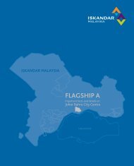
Flagship Zone A – Johor Bahru City Centre<br />
Flagship Zone B – Nusajaya<br />
Flagship Zone C – Western Gate Development<br />
Flagship Zone D – Eastern Gate Development<br />
Flagship Zone E – Senai-Skudai<br />
3 - 12
PHYSICAL DEVELOPMENT STRATEGIES <strong>CHAPTER</strong> 3 | PART 1<br />
Figure 3.14: Flagship Zones in SJER<br />
Flagship Zone<br />
Key Functions and Activities<br />
Flagship Zone<br />
Key Functions and Activities<br />
A – Johor Bahru<br />
Service and business district<br />
D – Eastern Gate<br />
Pasir Gudang Port and industrial zone<br />
Free Access Zone<br />
Development<br />
Tanjung Langsat Technopolis<br />
B – Nusajaya<br />
Johor State Administrative Centre<br />
Kim-Kim Regional Park<br />
New financial and business district<br />
E – Senai-Skudai<br />
Senai International Airport<br />
MSC Cyber city and Nusajaya Cyber<br />
Integrated logistic hub<br />
park<br />
Skudai Knowledge Centre<br />
Education hub<br />
Senai Multimodal Terminal Hub<br />
C – Western Gate<br />
Port of Tanjung Pelepas (PTP)<br />
Development<br />
RAMSAR SItes<br />
2 nd Link Free Access Zone<br />
Source: SJER CDP 2025<br />
3 - 13
SECTION A<br />
FRAMEWORK FOR COMPREHENSIVE DEVELOPMENT<br />
3.12 The Special Economic Corridor (SEC)<br />
It is targeted that developments within SJER will initially focus on the<br />
medium term in the Nusajaya-Johor Bahru-Pasir Gudang corridor. The<br />
corridor is an established area of development with two major ports,<br />
Port of Tanjung Pelepas and Pasir Gudang, and a third oleo-chemical<br />
port at Tanjung Langsat. The area also has two major links to Singapore,<br />
the Causeway and the Second Link in Nusajaya.<br />
With many of the economic drivers already present, the Nusajaya-Johor<br />
Bahru-Pasir Gudang corridor will be the main and premier zone for<br />
development and investment. The existing growth nodes will spearhead<br />
regional growth and will be enhanced to entice and attract both<br />
local and foreign investors. New initiatives that will also attract other<br />
economic drivers to this region such as ICT, multimedia and research,<br />
health, education, financial services and creative industry will also be<br />
centred in this zone.<br />
Many of the new catalyst developments are expected to be in the<br />
relatively new and greenfield area of Nusajaya. Located next to Port<br />
of Tanjung Pelepas and in the vicinity of the Second Link, Nusajaya also<br />
houses the new state administrative centre and has been identified<br />
as an area to house several targeted new growth sectors including in<br />
education, healthcare and tourism, among others.<br />
The SEC is envisaged to house most of the leading-edge developments<br />
in SJER including proposed Free Access Zones that will have a relatively<br />
large international component.<br />
Existing industrial clusters are found mainly within the existing growth<br />
nodes of this corridor. The main economic activities found here are<br />
manufacturing, electrical and electronics, chemicals and chemical<br />
products, food products and the service industry (mainly logistics and<br />
tourism).<br />
Figure 3.15: The Special Economic Corridor<br />
JB CITY<br />
CENTER<br />
NUSAJAYA<br />
ADMINISTRATIVE CENTRE<br />
MSC CYBER CITY<br />
JOHOR BAHRU CITY CENTRE<br />
CENTRAL BUSINESS DISTRICT<br />
PASIR GUDANG<br />
OLEOCHEMICAL INDUSTRY<br />
NUSAJAYA<br />
JOHOR BAHRU<br />
CITY CENTRE<br />
PASIR<br />
GUDANG<br />
Source: SJER CDP 2025<br />
3 - 14